Integrated remote and in situ analysis of a playa lake groundwater system in northern Chile. Katherine H. Markovich The University of Texas at Austin
|
|
|
- Holly Wilkins
- 5 years ago
- Views:
Transcription

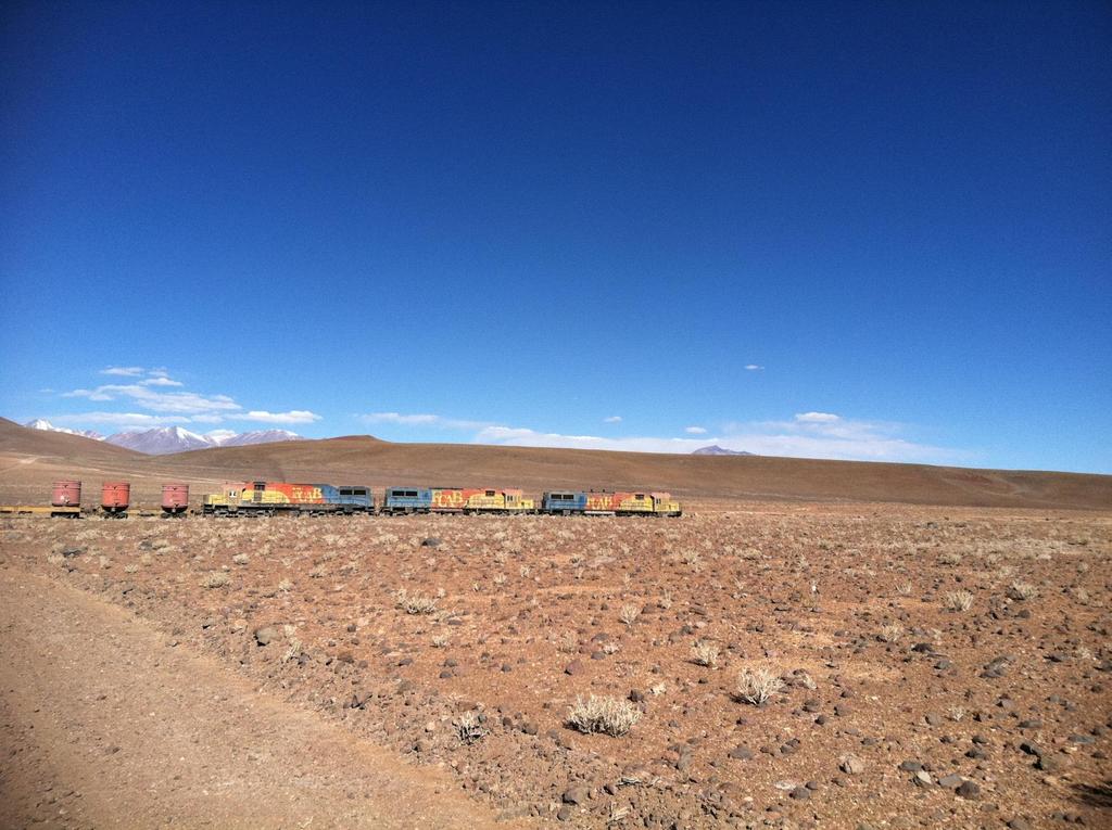
1 Integrated remote and in situ analysis of a playa lake groundwater system in northern Chile Katherine H. Markovich The University of Texas at Austin Hydrogeology of Arid Environments March 15 th, 2012
 o")

2 o Precipitation: 78.8 mm/yr (88% occurring during summer) o Evapotranspiration: 1630 mm/yr o Mean Temperature: 5.8 C o Elevation: 3700 masl o Salar Size: o Ascotán: 243 km 2 o Carcote: 108 km 2


3 Why do we care? Image courtesy of Wikimedia Commons
4 Keller and Soto, 1998
5 What has been the extent of the climatic and anthropogenic influence on this groundwater system over time? 1) Characterize regional and local behavior using remote sensing. 2) Relate the spatiotemporal variation to climate and/or anthropogenic forcings. 3) Supplement with in situ and hydrochemistry data. 4) Assess implications for future water resource management.
6 Salar Water Budget ΔV= (P+I GW +I SW ) (ET+O GW +O SW ) ET >> P Simple water budget for salars: ΔV= (I GW ) (ET+O GW ) V=change in volume P=precipitation (rain/snow) I SW =surface water inputs I GW =groundwater inputs ET=evapotranspiration O SW =surface water outputs O SW =groundwater outputs Remote sensing gives us ΔA, which can be related to the groundwater system!

 Hydrochemistry o ph o Conductivity (µs/cm) o Temperature ( C) o Water depth (m)")
7 Satellite Data o 14 scenes during o o o Landsat 4-5 TM and 7 ETM+ from the USGS Archive. Supervised Classification in ERDAS Imagine 2011 Monthly precipitation data during (Lat: S, Lon: W) Hydrochemistry o ph o Conductivity (µs/cm) o Temperature ( C) o Water depth (m) o Cl/Br (mg/l) -(Risacher et al., 2003) o NASA Tropical Rainfall Measuring Mission (TRMM) archive.
8 Cumulative Precipitation (mm) Significance of Climate Total Water Extent (km 2 ) Red= La Niña Purple= El Niño Precip Area Houston (2006) study linked precipitation in the region to ENSO cycles Link between increased GW contributions to the salars, precipitation, and La Niña

9 Caldera Water Extent (km 2 ) Caldera Water Extent (km 2 ) Regional application: Pastos Grandes as a recharge zone for Ascotán? y = x R² = y = x R² = August, August, Salar Water Extent (km 2 ) Salar Water Extent (km 2 )

10 Salar Water Extent (km 2 ) 12 Current groundwater abstraction is located in the southern portion of Ascotan. Has this affected springs to the north? y = x R² = Total North Ascotan South Ascotan Carcote Carcote CAR-1 North Ascotán V2 V7 Legend Field Sites Salars V10 South Ascotán Kilometers V11
11 Integrate remote sensing observations with hydrochemistry analysis. o Water temperature, conductivity, and ph gave no clear indication of regional versus local flow o Cl/Br ratios provide the best indication for spatial relationships o Possible inverse Ghyben-Herzberg flow in the north, causing the recycling of brines
12 Conclusions 1) Remote sensing allowed for antecedent analysis and large scale observation of regional recharge behavior. 2) Total surface water extent has fluctuated with a clear response to pumping initiation, but also appears to be dominated by precipitation. 3) Integration of hydrochemistry data, namely Cl/Br ratios, provided evidence for disconnect between north and south Ascotán
 Build systems dynamics models. 2) Compare across multiple salar sites in Chile 3) Incorporate into cyberinfrastructure to support cross-disciplinary and longitudinal studies.")
13 Future water resource management to take into account: o Ocean circulation cycles o Climate change o New mine projects o Cost-benefit analysis of water importation Next steps: 1) Build systems dynamics models. 2) Compare across multiple salar sites in Chile 3) Incorporate into cyberinfrastructure to support cross-disciplinary and longitudinal studies.


, Boris (SCM El Abra), and")
 for data University of Texas")
14 Thank you for listening! Thanks to: Suzanne Pierce, Kelley Crews, Wendy Robertson, Reed Malin, Sandra Guzman, and Jack Sharp for help on the field work and the project François Risacher (U. Strasbourg), Martin Reich (CEGA, U. Chile), Boris (SCM El Abra), and Eugenio Figueroa (U. Chile) for data University of Texas Co-op and Jackson School of Geosciences for funding
15 Questions?
16 References Casteñeda, C., Herrero, J., and Casterad, M.A., Landsat monitoring of playa-lakes in the Spanish Monegros desert. Journal of Arid Environments, v. 63, pp Hartley, A., May, G., Chong, G., Turner, P., Kape, S.J., and Jolley, E.J., Development of a continental forearc: A Cenozoic example from the Central Andes, northern Chile. Geology, v. 28, pp Houston, J., Variability of precipitation in the Atacama desert: It s causes and hydrological impact. International Journal of Climatology, v. 26, pp Keller, B. and Soto, D., Hydrogeologic influences on the preservation of Orestias ascotanensis (Teleostei: Cyprinodontidae) in Salar de Ascotán, northern Chile. Revista Chilena de Historia Natural, v. 71, pp Risacher, F., Alonso, H., and Salazar, C., The origin of brines and salts in Chilean salars: a hydrochemical review. Earth-Science Reviews, v. 63, pp Rodriguez-Rodriguez, M., Benavente, J., Cruz-San Julian, J.J., & Moral Martos, F., 2006: Estimation of ground-water exchange with semi-arid playa lakes (Antequera region, southern Spain --Journal of Arid Environments. 66: Xu, H., Modification of normalised difference water index (NDWI) to enhance open water features in remotely sensed imagery. International Journal of Remote Sensing, v. 27 (14), pp Zhou, Y., 2009: A critical review of the groundwater budget myth, safe yield, and sustainability --Journal of Hydrology, v. 370, pp
A Comparison of the Salar de Atacama and Clayton Valley Lithium Ore Deposits: Groundwater Mining in the some of the Driest Places on Earth
 A Comparison of the Salar de Atacama and Clayton Valley Lithium Ore Deposits: Groundwater Mining in the some of the Driest Places on Earth Melissa Jennings Geologist & Environmental Engineer This presentation
Community resources management implications of HKH hydrological response to climate variability
 Community resources management implications of HKH hydrological response to climate variability -- presented by N. Forsythe on behalf of: H.J. Fowler, C.G. Kilsby, S. Blenkinsop, G.M. O Donnell (Newcastle
Friday, November 10, 2017
 Friday, November 10, 2017 Andes and Midlatitude Countries Objective: Summarize the main physical features and regions of the Southern Cone. Identify and locate the urban centers and understand the pattern
Water resource situation of the Republic of Djibouti
 Water resource situation of the Republic of Djibouti Omar ASSOWE DABAR Integrating Groundwater Management within River Basins 15-17 January 2019 Nairobi, Kenya Regional Training Workshop on Introduction
MAURI PELTO, Nichols College, Dudley, MA
 MAURI PELTO, Nichols College, Dudley, MA 01571(mspelto@nichols.edu) Advice I am looking for Better schemes for utilizing atmospheric circulation indices to provide a better forecast for glacier mass balance?
Using of space technologies for glacierand snow- related hazards studies
 United Nations / Germany international conference on International Cooperation Towards Low-Emission and Resilient Societies Using of space technologies for glacierand snow- related hazards studies Bonn,
A high resolution glacier model with debris effects in Bhutan Himalaya. Orie SASAKI Kanae Laboratory 2018/02/08 (Thu)
") A high resolution glacier model with debris effects in Bhutan Himalaya Orie SASAKI Kanae Laboratory 2018/02/08 (Thu) Research flow Multiple climate data at high elevations Precipitation, air temperature
A high resolution glacier model with debris effects in Bhutan Himalaya Orie SASAKI Kanae Laboratory 2018/02/08 (Thu) Research flow Multiple climate data at high elevations Precipitation, air temperature
Andean uplift and Atacama hyper-aridification: A climate modeling perspective + some new ideas to test
 Andean uplift and Atacama hyper-aridification: A climate modeling perspective + some new ideas to test 0 S 30 S René Garreaud 1, Alejandra Molina 1, Marcelo Farias 2 (1) Departamento de Geofísica (2) Departamento
THE TWENTY SECOND SOUTHERN AFRICA REGIONAL CLIMATE OUTLOOK FORUM MID-SEASON REVIEW AND UPDATE
 STATEMENT FROM THE TWENTY SECOND SOUTHERN AFRICA REGIONAL CLIMATE OUTLOOK FORUM (SARCOF-22) MID-SEASON REVIEW AND UPDATE, CRESTA MAUN HOTEL, MAUN, BOTSWANA, 13 14 DECEMBER 2018. SUMMARY The bulk of the
Actual Climatic Conditions in ERB. Online Resource 1 corresponding to:
 Actual Climatic Conditions in ERB. Online Resource 1 corresponding to: Article Title: Climatic Trends and Impact of Climate Change on Agriculture in an Arid Andean Valley. Journal Name: CLIMATIC CHANGE
VOLUME CHANGES OF THE GLACIERS IN SCANDINAVIA AND ICELAND IN THE 21st CENTURY
 VOLUME CHANGES OF THE GLACIERS IN SCANDINAVIA AND ICELAND IN THE 21st CENTURY Valentina Radić 1,3 and Regine Hock 2,3 1 Depart. of Earth & Ocean Sciences, University of British Columbia, Vancouver, Canada
MONITORING OF LAKE NASSER USING REMOTE SENSING AND GIS TECHNIQUES
 MONITORING OF LAKE NASSER USING REMOTE SENSING AND GIS TECHNIQUES M. M. Mostafa a and H. K. Soussa b a Information Technology Institute, GIS department - mostafam@mcit.gov.eg b Ain Shams University, Faculty
Integration Of Reflectance To Study Glacier Surface Using Landsat 7 ETM+: A Case Study Of The Petermann Glacier In Greenland
 Integration Of Reflectance To Study Glacier Surface Using Landsat 7 ETM+: A Case Study Of The Petermann Glacier In Greenland Félix O. Rivera Santiago Department Of Geology, University Of Puerto Rico, Mayaguez
STATEMENT FROM THE NINTH SOUTHERN AFRICA REGIONAL CLIMATE OUTLOOK FORUM (SARCOF-9) HELD IN HARARE, ZIMBABWE FROM 7 8 SEPTEMBER 2005.
 HELD IN HARARE, ZIMBABWE FROM 7 8 SEPTEMBER 2005.") STATEMENT FROM THE NINTH SOUTHERN AFRICA REGIONAL CLIMATE OUTLOOK FORUM (SARCOF-9) HELD IN HARARE, ZIMBABWE FROM 7 8 SEPTEMBER 2005. 1.0 SUMMARY During the period October to December 2005, northern DRC
STATEMENT FROM THE NINTH SOUTHERN AFRICA REGIONAL CLIMATE OUTLOOK FORUM (SARCOF-9) HELD IN HARARE, ZIMBABWE FROM 7 8 SEPTEMBER 2005. 1.0 SUMMARY During the period October to December 2005, northern DRC
Observation of cryosphere
 Observation of cryosphere By Sagar Ratna Bajracharya (email: sagar.bajracharya@icimod.org) Samjwal Ratna Bajracharya Arun Bhakta Shrestha International Centre for Integrated Mountain Development Kathmandu,
Latin America. Physical Geography
 Latin America Physical Geography Regions Latin America can be divided into separate regions based on physical geography or cultural geography. Regions If we look at physical geography Latin America has
THE TWENTY FIRST ANNUAL SOUTHERN AFRICA REGIONAL CLIMATE OUTLOOK FORUM MID-SEASON REVIEW AND UPDATE
 STATEMENT FROM THE TWENTY FIRST ANNUAL SOUTHERN AFRICA REGIONAL CLIMATE OUTLOOK FORUM (SARCOF-21) MID-SEASON REVIEW AND UPDATE, SADC HEADQUARTERS, GABORONE, BOTSWANA, 5 8 DECEMBER 2017. SUMMARY The bulk
Coverage of Mangrove Ecosystem along Three Coastal Zones of Puerto Rico using IKONOS Sensor
 Coverage of Mangrove Ecosystem along Three Coastal Zones of Puerto Rico using IKONOS Sensor Jennifer Toledo Rivera Geology Department, University of Puerto Rico, Mayagüez Campus P.O. Box 9017 Mayagüez,
Glacial lakes as sentinels of climate change in Central Himalaya, Nepal
 Glacial lakes as sentinels of climate change in Central Himalaya, Nepal Sudeep Thakuri 1,2,3, Franco Salerno 1,3, Claudio Smiraglia 2,3, Carlo D Agata 2,3, Gaetano Viviano 1,3, Emanuela C. Manfredi 1,3,
Hydrological Data HYDROLOGICAL MODELS
 HYDROLOGICAL MODELS There is no doubt that the driving force in a wetland is the water, and the dynamics of water is what characterizes each particular wetland ecosystem. Hence, its was of outmost importance
Impacts of climate change on the hydrological processes in the Mekong River. Hui Lu & Wei Wang Tsinghua University
 1 Impacts of climate change on the hydrological processes in the Mekong River Hui Lu & Wei Wang Tsinghua University Outline Backgrounds Method and data Model calibration Temperature and rainfall trends
Retreating Glaciers of the Himalayas: A Case Study of Gangotri Glacier Using Satellite Images
 Retreating Glaciers of the Himalayas: A Case Study of Gangotri Glacier Using 1990-2009 Satellite Images Jennifer Ding Texas Academy of Mathematics and Science (TAMS) Mentor: Dr. Pinliang Dong Department
THE DISEQUILBRIUM OF NORTH CASCADE, WASHINGTON GLACIERS
 THE DISEQUILBRIUM OF NORTH CASCADE, WASHINGTON GLACIERS CIRMOUNT 2006, Mount Hood, OR Mauri S. Pelto, North Cascade Glacier Climate Project, Nichols College Dudley, MA 01571 peltoms@nichols.edu NORTH CASCADE
Southern Africa Growing Season : Heading for a Record Drought?
 Southern Africa Growing Season 2015-2016: Heading for a Record Drought? HIGHLIGHTS The current growing season (October 2015 April 2016) in Southern Africa is developing under the peak phase of El Nino
Hydrological study for the operation of Aposelemis reservoir Extended abstract
 Hydrological study for the operation of Aposelemis Extended abstract Scope and contents of the study The scope of the study was the analytic and systematic approach of the Aposelemis operation, based on
Laboratoire Mixte Internacionale GREATICE Glaciers and Water Resources in the Tropical Andes, Climatic and Environmental Indicators
 Laboratoire Mixte Internacionale GREATICE Glaciers and Water Resources in the Tropical Andes, Climatic and Environmental Indicators Phase I 2011-2014 (Results) Phase II 2016-2020 (Perspectives) Álvaro
The dynamic response of Kolohai Glacier to climate change
 Article The dynamic response of Kolohai Glacier to climate change Asifa Rashid 1, M. R. G. Sayyed 2, Fayaz. A. Bhat 3 1 Department of Geology, Savitribai Phule Pune University, Pune 411007, India 2 Department
Origin and Extraction of Andean Salars
 Think Simulation! Adventures in Electrolytes Origin and Extraction of Andean Salars Lithium and Boron Recovery from Salt brines and Salt flats in Chile and Bolivia http://tunari.tripod.com/landscapes.html
EVALUATION OF DIFFERENT METHODS FOR GLACIER MAPPING USING LANDSAT TM
 EVALUATION OF DIFFERENT METHODS FOR GLACIER MAPPING USING LANDSAT TM Frank Paul Department of Geography, University of Zurich, Switzerland Winterthurer Strasse 190, 8057 Zürich E-mail: fpaul@geo.unizh.ch,
Latin America. Physical Geography
 + Latin America Physical Geography + I. Landforms A. Caribbean & Central America 1. Mexico is dominated by two mountain chains, collectively called the Sierra Madre. A high plateau is situated in between.
Watershed: Natural Scene for Integrated Water Resource Management in the jurisdiction of Corantioquia Antioquia, Colombia. SA
 Watershed: Natural Scene for Integrated Water Resource Management in the jurisdiction of Corantioquia Antioquia, Colombia. SA EURO-RIOC 2010 Luis Alfonso Escobar Trujillo RELOC - Colombia Corantioquia
FLOW AND CLIMATIC VARIABILITY ON A SOUTHAMERICAN MID-LATITUDE BASIN: RÍO ACONCAGUA, CENTRAL CHILE (33ºS)
") Boletín de Flow la Asociación and climatic de variability Geógrafos on a Españoles Southamerican N.º 58 mid-latitude - 2012, págs. basin: 481-485 río Aconcagua, Central Chile (33ºS) I.S.S.N.: 0212-9426
Boletín de Flow la Asociación and climatic de variability Geógrafos on a Españoles Southamerican N.º 58 mid-latitude - 2012, págs. basin: 481-485 río Aconcagua, Central Chile (33ºS) I.S.S.N.: 0212-9426
Snow, Glacier and GLOF
 Snow, Glacier and GLOF & Report on Demonstration River Basin Activities Upper Indus Basin The 5th International Coordination Group (ICG) Meeting GEOSS Asian Water Cycle Initiative (AWCI) Tokyo, Japan,
Warming planet, melting glaciers
 Warming planet, melting glaciers Arun B Shrestha abshrestha@icimod.org International Centre for Integrated Mountain Development Kathmandu, Nepal Asia-Pacific Youth forum on Climate Actions and Mountain
MANAGING FRESHWATER INFLOWS TO ESTUARIES
 MANAGING FRESHWATER INFLOWS TO ESTUARIES Yuna River Hydrologic Characterization A. Warner Warner, A. (2005). Yuna River Hydrologic Characterization. University Park, Pennsylvania: The Nature Conservancy.
Original scientific paper UDC: 911.2:551.58(497.11) DOI: /IJGI S ANALYSIS OF ANNUAL SUMS OF PRECIPITATION IN SERBIA
 DOI: /IJGI S ANALYSIS OF ANNUAL SUMS OF PRECIPITATION IN SERBIA") Available online at www.gi.sanu.ac.rs Original scientific paper UDC: 911.2:551.58(497.11) DOI: 10.2298/IJGI1202001S ANALYSIS OF ANNUAL SUMS OF PRECIPITATION IN SERBIA Gorica Stanojević* 1 *Geographical
Available online at www.gi.sanu.ac.rs Original scientific paper UDC: 911.2:551.58(497.11) DOI: 10.2298/IJGI1202001S ANALYSIS OF ANNUAL SUMS OF PRECIPITATION IN SERBIA Gorica Stanojević* 1 *Geographical
Chapter 7 Snow and ice
 Chapter 7 Snow and ice Throughout the solar system there are different types of large ice bodies, not only water ice but also ice made up of ammonia, carbon dioxide and other substances that are gases
Dynamic response of glaciers of the Tibetan Plateau to climate change
 Christoph Schneider 1/23 Christoph Schneider Yao, Tandong Manfred Buchroithner Tobias Bolch Kang, Shichang Dieter Scherer Yang, Wei Fabien Maussion Eva Huintjes Tobias Sauter Anwesha Bhattacharya Tino
Hydrological processes on large flatlands: case study in the northwest region of Buenos Aires Province (Argentina)
") Remote Sensing and Hydrology 2000 (Proceedings of a symposium held at Santa Fe, New Mexico, USA, April 2000). IAHS Publ. no. 267, 2001. 531 Hydrological processes on large flatlands: case study in the
Remote Sensing and Hydrology 2000 (Proceedings of a symposium held at Santa Fe, New Mexico, USA, April 2000). IAHS Publ. no. 267, 2001. 531 Hydrological processes on large flatlands: case study in the
The Lesser Antilles. Dominican Republic), and Puerto Rico
, and Puerto Rico") The Caribbean Islands are archipelagoes or groups of islands. The major archipelagoes are: The Greater Antilles - Cuba, Jamaica, Hispaniola (Composed of Haiti and the Dominican Republic), and Puerto Rico
The Caribbean Islands are archipelagoes or groups of islands. The major archipelagoes are: The Greater Antilles - Cuba, Jamaica, Hispaniola (Composed of Haiti and the Dominican Republic), and Puerto Rico
If there is magic on this planet, it is contained in water.
 If there is magic on this planet, it is contained in water. Loren Eiseley ~ American philosopher and nature writer ~ b.1907 d.1977 Above: A swimmer rests in the X Keken Cenote underground pool in the town
THE NORTH ATLANTIC OSCILLATION (NAO) AND THE WATER TEMPERATURE OF THE SAVA RIVER IN SERBIA
 AND THE WATER TEMPERATURE OF THE SAVA RIVER IN SERBIA") www.ebscohost.com www.gi.sanu.ac.rs, www.doiserbia.nb.rs, J. Geogr. Inst. Cvijic. 67(2) (135 144) Original scientific paper UDC:911.2:551.482(497.11) DOI: https://doi.org/10.2298/ijgi1702135m THE NORTH
www.ebscohost.com www.gi.sanu.ac.rs, www.doiserbia.nb.rs, J. Geogr. Inst. Cvijic. 67(2) (135 144) Original scientific paper UDC:911.2:551.482(497.11) DOI: https://doi.org/10.2298/ijgi1702135m THE NORTH
Platform and Products
 International Partnership Space Programme Earth Observation for the Preservation of Ecological Bacalar Corridor Platform and Products Terri Freemantle, Raffaella Guida, Paula Marti, Pasquale Iervolino
EO-based services to support humanitarian operations: monitoring population and natural resources in refugee/idp camps
 How satellites can help to save lives Vienna, Austria 23 February 2016 EO-based services to support humanitarian operations: monitoring population and natural resources in refugee/idp camps Petra FÜREDER
Seasonal Variability of the Groundwater Regime for Several Aquifers in Bulgaria Tatiana Orehova 1
 Seasonal Variability of the Groundwater Regime for Several Aquifers in Bulgaria Tatiana Orehova 1 The purpose of the paper is to analyse the seasonal variability of the groundwater regime for several aquifers
MARINA BOLADO PENAGOS A METHODOLOGY TO ASSESS THE ROLE OF THE RIVER DISCHARGES TO THE GULF OF CADIZ ON THE NUTRIENT SUPPLY TO THE ALBORAN SEA
 MARINA BOLADO PENAGOS A METHODOLOGY TO ASSESS THE ROLE OF THE RIVER DISCHARGES TO THE GULF OF CADIZ ON THE NUTRIENT SUPPLY TO THE ALBORAN SEA INTRODUCTION General MEGAN Project Case Study Guadalquivir
Managing water supply resources in karstic environment (temperate climate)
") UNESCO WORKSHOP Integrated Urban Water Management in TC Temperate Climates Belgrade 15-16 May 2006 Managing water supply resources in karstic environment (temperate climate) E. Rozos, D. Koutsoyiannis
UNESCO WORKSHOP Integrated Urban Water Management in TC Temperate Climates Belgrade 15-16 May 2006 Managing water supply resources in karstic environment (temperate climate) E. Rozos, D. Koutsoyiannis
Summertime Precipitation Variability and Atmospheric Circulation over the South American Altiplano: Effects of Lake Titicaca and Salar de Uyuni
 Summertime Precipitation Variability and Atmospheric Circulation over the South American Altiplano: Effects of Lake Titicaca and Salar de Uyuni Maura Hahnenberger Oklahoma Weather Center Research Experiences
Monitoring of Mountain Glacial Variations in Northern Pakistan, from 1992 to 2008 using Landsat and ALOS Data. R. Jilani, M.Haq, A.
 Monitoring of Mountain Glacial Variations in Northern Pakistan, from 1992 to 2008 using Landsat and ALOS Data R. Jilani, M.Haq, A. Naseer Pakistan Space & Upper Atmosphere Research Commission (SUPARCO)
2012. Proceedings of the 11 European Geoparks Conference. AGA Associação Geoparque Arouca, Arouca, 5-6.
 References to this volume It is suggested that either the following alternatives should be used for future bibliographic references to the whole or part this volume: th Sá, A.A., Rocha, D., Paz, A. & Correia,
EO technologies for flood mapping and hydrological modelling in Namibia
 Satellite Earth Observation & Disaster Risks EO technologies for flood mapping and hydrological modelling in Namibia Guido Van Langenhove, Hydrological Services Namibia Hydrological trends in Namibia:
SPATIO TEMPORAL CHANGE OF SELECTED GLACIERS ALONG KARAKORAM HIGHWAY FROM USING REMOTE SENSING AND GIS TECHNIQUES
 SPATIO TEMPORAL CHANGE OF SELECTED GLACIERS ALONG KARAKORAM HIGHWAY FROM 1994-217 USING REMOTE SENSING AND GIS TECHNIQUES Yasmeen Anwar 1, Javed Iqbal 2 1 National University of Sciences and Technology
Procedia Earth and Planetary Science 13 ( 2015 ) th Applied Isotope Geochemistry Conference, AIG-11 BRGM
 th Applied Isotope Geochemistry Conference, AIG-11 BRGM") Available online at www.sciencedirect.com ScienceDirect Procedia Earth and Planetary Science 13 ( 2015 ) 256 260 11th Applied Isotope Geochemistry Conference, AIG-11 BRGM Investigating the Origin and Interaction
Available online at www.sciencedirect.com ScienceDirect Procedia Earth and Planetary Science 13 ( 2015 ) 256 260 11th Applied Isotope Geochemistry Conference, AIG-11 BRGM Investigating the Origin and Interaction
ICPAC. IGAD Climate Prediction and Applications Centre Monthly Bulletin, February 2017
 IGAD CLIMATE PREDICTION AND APPLICATIONS CENTRE ICPAC Bulletin Issue March 2017 Issue Number: ICPAC/02/299 IGAD Climate Prediction and Applications Centre Monthly Bulletin, February 2017 For referencing
4 *Contours generalized for estimating average watershed precipitation; adopted from larger map by Geomatrix, 1999.
 Selected USGS Stream Gaging Stations San Lorenzo River watershed A. Pescadero Ck B. San Lorenzo R. Waterman Switch C. Boulder Ck D. Zayante Ck E. Bean Ck F. San Vicente Ck G. San Lorenzo R. at Big Trees
WHEN IS THE RIGHT TIME TO FLY? THE CASE OF SOUTHEAST ASIAN LOW- COST AIRLINES
 WHEN IS THE RIGHT TIME TO FLY? THE CASE OF SOUTHEAST ASIAN LOW- COST AIRLINES Chun Meng Tang, Abhishek Bhati, Tjong Budisantoso, Derrick Lee James Cook University Australia, Singapore Campus ABSTRACT This
CRYOSPHERE ACTIVITIES IN SOUTH AMERICA. Bolivia. Summary
 WORLD METEOROLOGICAL ORGANIZATION GLOBAL CRYOSPHERE WATCH (GCW) CryoNet South America Workshop First Session Santiago de Chile, Chile 27-29 October 2014 GCW-CNSA-1 / Doc. 3.1.2 Date: 20 October 2014 AGENDA
Hydrology Input for West Souris River IWMP
 Hydrology Input for West Souris River IWMP Prepared by: Mark Lee Manitoba Water Stewardship 1 1 1 Overall view of: drainage area watershed characteristics gauging stations meteorological stations Runoff
Mapping the Snout. Subjects. Skills. Materials
 Subjects Mapping the Snout science math physical education Skills measuring cooperative action inferring map reading data interpretation questioning Materials - rulers - Mapping the Snout outline map and
Water in the Amazon. By Heather and Georgie
 Water in the Amazon By Heather and Georgie The Amazon is the world s largest tropical rainforest. The Amazon is so big that the U.K and Ireland would fit into it 17 times. The Amazon River It s length
Fifty-Year Record of Glacier Change Reveals Shifting Climate in the Pacific Northwest and Alaska, USA
 Fact Sheet 2009 3046 >> Pubs Warehouse > FS 2009 3046 USGS Home Contact USGS Search USGS Fifty-Year Record of Glacier Change Reveals Shifting Climate in the Pacific Northwest and Alaska, USA Fifty years
THE TWENTY FIRST ANNUAL SOUTHERN AFRICA REGIONAL CLIMATE OUTLOOK FORUM
 STATEMENT FROM THE TWENTY FIRST ANNUAL SOUTHERN AFRICAN REGIONAL CLIMATE OUTLOOK FORUM (SARCOF-21), MASA CONFERENCE CENTRE, GABORONE, BOTSWANA, 23 25 AUGUST 2017. SUMMARY The bulk of Southern African Development
Water Quality Monitoring and Validation from NOAA operational satellite sensor (VIIRS) Data Products in Coral Reef Environments
 Data Products in Coral Reef Environments") Water Quality Monitoring and Validation from NOAA operational satellite sensor (VIIRS) Data Products in Coral Reef Environments William J Hernandez, Ph.D 1, 4 Post-Doctoral Researcher Roy A. Armstrong
Water Quality Monitoring and Validation from NOAA operational satellite sensor (VIIRS) Data Products in Coral Reef Environments William J Hernandez, Ph.D 1, 4 Post-Doctoral Researcher Roy A. Armstrong
Time Series Evapotranspiration Mapping Using Landsat-TM and MODIS Data
 United States Department of Agriculture Time Series Evapotranspiration Mapping Using Landsat-TM and MODIS Data Agricultural Research Service SOIL & WATER MANGEMENT RESEARCH George Paul Prasanna Gowda Xiangming
TAKING LEAVE COMPETITION
 TAKING LEAVE COMPETITION WHO?!! Social Reality A Vision to new Future Love To Be Together HOW?!! We will design our new City Social Reality I hope to be a doctor in my new City in the Western Desert Social
Occurrence of Dry and Wet Periods in Altitudinal Vegetation Stages of West Carpathians in Slovakia: Time-Series Analysis
 Occurrence of Dry and Wet Periods in Altitudinal Vegetation Stages of West Carpathians in Slovakia: Time-Series Analysis 1951-2005 J. Hrvoľ,, J. J Škvarenina,, J. J Tomlain, J. Škvareninová,, P. Nejedlík
3.0 OVERVIEW OF HUECO BOLSON
 3.0 OVERVIEW OF HUECO BOLSON The Hueco Bolson covers about 2,500 square miles, or 1.6 million acres in New Mexico, Texas, and Chihuahua (Figure 3-1). In Texas, the Hueco overlies portions of El Paso and
How stable or variable is the climate of Amazonia?
 How stable or variable is the climate of Amazonia? Frank Mayle Mitch Power Bronwen Whitney University of Edinburgh Mark Bush Florida Institute of Technology Paul Baker, Sheri Fritz etc etc etc Glacial-interglacial
Indian Ocean Small Island States: Indicators of Dangerous Anthropogenic Influences of Climate Change?
 Indian Ocean Small Island States: Indicators of Dangerous Anthropogenic Influences of Climate Change? Prepared for: AGU Fall Meeting San Francisco CA December 5, 2005 Prepared by: Bill Mills Chih-Fang
Blocking Sea Intrusion in Brackish Karstic Springs
 European Water 1/2: 17-23, 3. 3 E.W. Publications Blocking Sea Intrusion in Brackish Karstic Springs The Case of Almiros Spring at Heraklion Crete, Greece A. Maramathas, Z. Maroulis, D. Marinos-Kouris
International Bank for Reconstruction and Development International Development Association
 International Bank for Reconstruction and Development International Development Association PROGRESS REPORT TO THE BOARD OF EXECUTIVE DIRECTORS ON THE IMPLEMENTATION OF THE MANAGEMENT ACTIONS IN RESPONSE
Environmental Impact Assessment in Chile, its application in the case of glaciers. Carlos Salazar Hydro21 Consultores Ltda.
 Environmental Impact Assessment in Chile, its application in the case of glaciers Carlos Salazar Hydro21 Consultores Ltda. carlos.salazar@hydro21.cl Introduction Changes in the environmental law in Chile
Optical Seeing and Infrared Atmospheric Transparency in the Upper Atacama Desert
 **Astronomical Site Evaluation in the Visible and Radio Range** ASP Conference Series, Vol. **VOLUME**, **2001** **Jean Vernin et al.** Optical Seeing and Infrared Atmospheric Transparency in the Upper
Glacier dammed lakes impacting different Alaskan drainages after 30 years of warming temperatures
 Glacier dammed lakes impacting different Alaskan drainages after 3 years of warming temperatures Dave Wolfe A remote sensing thesis project from Alaska Pacific University, Anchorage, Alaska Globe image
DETECTION OF WATER LEAKS IN FOUM EL-GHERZA DAM (ALGERIA)
") Ninth International Water Technology Conference, IWTC9 2005, Sharm El-Sheikh, Egypt 581 DETECTION OF WATER LEAKS IN FOUM EL-GHERZA DAM (ALGERIA) N. Hocini and A.S. Moulla Applied Hydrology and Sedimentology
Ninth International Water Technology Conference, IWTC9 2005, Sharm El-Sheikh, Egypt 581 DETECTION OF WATER LEAKS IN FOUM EL-GHERZA DAM (ALGERIA) N. Hocini and A.S. Moulla Applied Hydrology and Sedimentology
STATEMENT FROM THE EIGHTEENTH SOUTHERN AFRICA REGIONAL CLIMATE OUTLOOK FORUM (SARCOF-18), WINDHOEK, NAMIBIA, AUGUST 2014.
, WINDHOEK, NAMIBIA, AUGUST 2014.") STATEMENT FROM THE EIGHTEENTH SOUTHERN AFRICA REGIONAL CLIMATE OUTLOOK FORUM (SARCOF-18), WINDHOEK, NAMIBIA, 27 29 AUGUST 2014. SUMMARY Southern African Development Community (SADC) is likely to receive
STATEMENT FROM THE EIGHTEENTH SOUTHERN AFRICA REGIONAL CLIMATE OUTLOOK FORUM (SARCOF-18), WINDHOEK, NAMIBIA, 27 29 AUGUST 2014. SUMMARY Southern African Development Community (SADC) is likely to receive
GRANDE News Letter Volume1, No.4, March 2013
 GRANDE News Letter Volume1, No.4, March 2013 New technologies for the study of tropical glaciers Prof. Edson RAMIREZ Institute of Hydraulics and Hydrology, Universidad Mayor de San Andres, Bolivia Techniques
An RHP for the Andes-Amazon System
 An RHP for the Andes-Amazon System Germán Poveda Universidad Nacional de Colombia, Medellín, Colombia A proposal for GEWEX June 11, 2016 Acknowledgements: These slides have been updated from an abridged
Brine Lithium Properties Chile For Sale/Option
 Brine Lithium Properties Chile For Sale/Option 3 Brine Lithium Properties 10,800 Ha (25,686 acres) on 3 Salars 2 Salar de Atacama The highest grade lithium salar in the world Salar de Atacama is the world's
Using the Sentinels to map the state and changes of Norwegian glaciers
 /Copernicus Sentinel / Using the Sentinels to map the state and changes of Norwegian glaciers Liss Marie Andreassen, Solveig H. Winsvold, Andreas Kääb, Alexandra Messerli, Geir Moholdt, Suruchi Engelhardt,
Forecasting effects of weather extremes: El Nino s influence maize yields in Mexico
 Forecasting effects of weather extremes: El Nino s influence maize yields in Mexico Gideon Kruseman, Kai Sonder, Victor Manuel Hernández Rodríguez, Sergio Pérez Elizalde, Juan Burgueño Ferreira International
Videosonde Observation in the Tropics
 Videosonde Observation in the Tropics The Third International SOWER Meeting Lake Shikotsu July 18-2, 26 Kyukamura Shikotsuko, Lake Shikotsu, Japan Kenji Suzuki Yamaguchi University, Japan 1 Table of Contents
Partial Report. Project Leader: Nicolás Lagos. Executive Summary
 Partial Report Understanding the relationship between the Andean cat and its habitat in the high Andes plateau: Implications for its long term conservation Project Leader: Nicolás Lagos Executive Summary
GEOGRAPHY OF GLACIERS 2
 GEOGRAPHY OF GLACIERS 2 Roger Braithwaite School of Environment and Development 1.069 Arthur Lewis Building University of Manchester, UK Tel: UK+161 275 3653 r.braithwaite@man.ac.uk 09/08/2012 Geography
Intermediate report. Letter of agreement FAO - GCB/RAB/013/ITA
 Treated waste water for sustainable production of valuable biomass, soil and water quality improvement and combating desertification in Algeria and Tunisia Letter of agreement FAO - GCB/RAB/013/ITA Intermediate
The 2nd Glacier Inventory of China
 The 2nd Glacier Inventory of China LIU Shiyin Guo Wanqin, Xu Junli, Shangguan Donghui, Wei Junfeng, Wu Lizong, Yu Pengchun, Li Jing, Liu Qiao State Key Laboratory of Cryospheric Sciences, Cold and Arid
A funny sounding lake. South American Landforms, Climate, and Vegetation
 A funny sounding lake South American Landforms, Climate, and Vegetation 3 4 Essential Question: How have physical features and climate affected the population distribution of Latin America? 5 I. Landforms
C. Area of operation: Columbia River and Columbia River Estuary between mouth of estuary and Portland, Oregon.
 R/V Barnes Cruise Plan July 2008 Cruise dates: July 7 24 Captain: Ray McQuin Lead scientist: Joseph Needoba (needobaj@stccmop.org) Funding source: NSF PI Antonio Baptista Organization: NSF Center for Coastal
The Role of Glaciers in the Hydrologic Regime of the Nepal Himalaya. Donald Alford Richard Armstrong NSIDC Adina Racoviteanu NSIDC
 The Role of Glaciers in the Hydrologic Regime of the Nepal Himalaya Donald Alford Richard Armstrong NSIDC Adina Racoviteanu NSIDC Outline of the talk Study area and data bases Area altitude distributed
Coral reefs facing to global and regional environmental changes
 Coral reefs facing to global and regional environmental changes Hiroya Yamano (National Institute for Environmental Studies) Importance of coral reefs Photo: H. Kan Photo: H. Kayanne Biodiversity Fisheries
Prairie Drought: Precedents and Prospects
 Prairie Drought: Precedents and Prospects Dave Sauchyn Prairie Adaptation Research Collaborative, University of Regina Managing Climate and Weather Risks for Peace River District Agriculture, Grande Prairie,
THE TWENTIETH ANNUAL SOUTHERN AFRICA REGIONAL CLIMATE OUTLOOK FORUM
 STATEMENT FROM THE TWENTIENT ANNUAL SOUTHERN AFRICA REGIONAL CLIMATE OUTLOOK FORUM (SARCOF-20), HARARE INTERNATIONAL CONFERENCE CENTRE, HARARE, ZIMBABWE, 24 26 AUGUST 2016. SUMMARY The bulk of Southern
ANALYZING IMPACT FACTORS OF AIRPORT TAXIING DELAY BASED ON ADS-B DATA
 ANALYZING IMPACT FACTORS OF AIRPORT TAXIING DELAY BASED ON ADS-B DATA J. Li a, X. Wang a,*, Y. Xu b, Q. Li a, C. He a, Y. Li a a College of Geoscience and Surveying Engineering, China University of Mining
Statistical Evaluation of BMP Effectiveness in Reducing Fecal Coliform Impairment in Mermentau River Basin
 Statistical Evaluation of BMP Effectiveness in Reducing Fecal Coliform Impairment in Mermentau River Basin Z.-Q. Deng 1 and H. Chowdhary 2 1 Assistant Professor, Department of Civil and Environmental Engineering,
Eastern Snow Conference: 2017 Student Award Recipient
 Eastern Snow Conference: 2017 Student Award Recipient Presentation title: Tracking changes in iceberg calving events and characteristics from Trinity and Wykeham Glaciers, SE Ellesmere, Canada Authors:
Rainfall Appendix. Summary Statistics of Rainfall Data for Sites in the West-Central Florida. A Simple Conceptualized Rainfall/Discharge Relationship
 Rainfall Appendix Summary Statistics of Rainfall Data for Sites in the West-Central Florida A Simple Conceptualized Rainfall/Discharge Relationship Stream or river flows are, of course, integrally associated
Pantanal Tri-National GIS and Remote Sensing Pilot Project Case Study for Bolivia, Brazil, and Paraguay
 Six Ramsar remote sensing case studies were developed in 2002 as part of the NASA Socioeconomic Data and Application Center's (SEDAC) Ramsar Wetlands Data Gateway, developed in support of the Ramsar Convention
Settlement Patterns West of Ma ax Na, Belize
 SETTLEMENT PATTERNS WEST OF MA AX NA, BELIZE 1 Settlement Patterns West of Ma ax Na, Belize Minda J. Hernke Faculty Sponsor: Kathryn Reese-Taylor, Department of Sociology/Archaeology ABSTRACT The focus
The Problem.. SuDS: Controlling the Flow. LANDF RM Technical delivery of SuDS 15/10/2013. Bridget Woods Ballard HR Wallingford 1.
 SuDS: Controlling the Flow 15th October 2013 Bridget Woods Ballard The Problem.. Page 2 Bridget Woods Ballard HR Wallingford 1 15th October 2013 Landform Event Page 3 HR Wallingford 2013 The Aim of SuDS.
CYPRUS Country Report
 CONFERENCE OF THE WATER DIRECTORS OF THE EURO-MEDITERRANEAN AND SOUTHEASTERN EUROPEAN COUNTRIES CYPRUS Country Report by Christodoulos Artemis Director Water Development Department Athens, 6 & 7 November