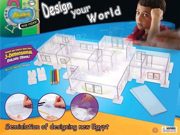
TAKING LEAVE COMPETITION
|
|
|
- Jacob Brown
- 5 years ago
- Views:
Transcription

1 TAKING LEAVE COMPETITION


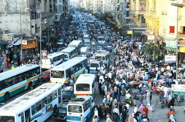
2 WHO?!! Social Reality A Vision to new Future Love To Be Together


3 HOW?!! We will design our new City Social Reality I hope to be a doctor in my new City in the Western Desert
4


5 Social Reality Changing Cultures through research Centers & Labs accommodated by Egyptian Universities

6 Social Reality HOW?!! Community Participation


7 Social Reality HOW?!! Community Participation Analyzing Residents needs & Cultures using parametric equation in shaping and forming their Communities Ahmed Enab Ebrahim Imam Mokhtar Akl Mohammed Elsayed ( Evolo 2012 Competition )


8 Social Reality HOW?!! Linking to Home and Land وطني هو المكان الذي تحفظ فيه كرامتي و يكون فيها معاشي My Home is the place where I save my dignity and find my pension


9

10 Taking leave isn't a Social choice Reality

11 Human Social Spirit Reality Quality of Design Productivity "Development without self-help is an impossibility. But people whose surroundings are ugly and barren are apt to be unproductive and dispirited. This is not the idle speculation of a do-gooder. The human spirit is our most precious resource. Its ecology is our greatest challenge" (Hassan Fathy)


12 Time & Spatial Dimensions Time & Spatial Dimensions

13

 Annual")

:Atlas of the climatological")
14 1. CLIMATIC FACTORS PLUS RENEWABLE ENERGY RESOURCES Annual mean of daily maximum temperature (C ) Annual mean of daily minimum temperature (C ) Annual mean of daily relative humidity (%) Annual mean of sunshine duration (Hrs.) EGSMA, NARSS, UNDP, and UNESCO (Dec., 2004):Atlas of the climatological maps of Sinai.
")

 Annual mean numbers of days with")

15 Annual mean numbers of hours with wind speed exceeding 20 Knts (10m/s) (Hours) Roses of annual mean of wind speed Annual mean of daily atmospheric pressure at m. s. l. (hpa) Annual mean numbers of days with rainfall > 5 mm EGSMA, NARSS, UNDP, and UNESCO (Dec., 2004):Atlas of the climatological maps of Sinai.
: Groundwater potentiality mapping in the Sinai Peninsula, Egypt, using remote sensing and GIS- watershed-based modeling.")
16 2. WATER RESOURCES Rainfall potentiality classes Net ground water potentiality classes Elewa H., and Qaddah A., (2011): Groundwater potentiality mapping in the Sinai Peninsula, Egypt, using remote sensing and GIS- watershed-based modeling. Hydrogeology Journal, 19:


17 Depth to groundwater Groundwater total dissolved solids (TDS) classes Groundwater potentiality map of Sinai Elewa H., and Qaddah A., (2011): Groundwater potentiality mapping in the Sinai Peninsula, Egypt, using remote sensing and GIS- watershed-based modeling. Hydrogeology Journal, 19:

 Ayoun Mosa springs (Web")
: Application of geospatial and")


18 Digging of groundwater well in Sahl El Qaa (By Shawky, M. 2012) Groundwater well in Sahl El Qaa (By Shawky, M. 2012) Hamam Pharaon (Web Site) Ayoun Mosa springs (Web Site) Ayoun Mosa springs (By Shawky, M. 2012) (Team Member, Shawky, M. (2012): Application of geospatial and remote sensing techniques in groundwater exploration and assessment of natural hazards in southwestern Sinai, Egypt. PhD. Thesis In press, Geology Department, Faculty of Science, Mansoura University, Egypt.
 Shereif, Y.")


: Application of geospatial and remote")

19 3. AGRICULTURAL SUTABILITY Soil classification of El Qaa plain (Shereif, 2008) Shereif, Y. (2008): Flash floods and their effects on the development In el-qaá plain area in south sinai, egypt, a study in applied geomorphology using gis and Remote sensing. PhD Thesis, am Fachbereich Chemie, Pharmazie, Geowissenschaften der Johannes Gutenberg- Universität Mainz, p Different agricultural sites from Sahl El Qaa plain (Shawky, 2012) (Team Member, Shawky, M. (2012): Application of geospatial and remote sensing techniques in groundwater exploration and assessment of natural hazards in southwestern Sinai, Egypt. PhD. Thesis In press, Geology Department, Faculty of Science, Mansoura University, Egypt.

 Harbors")
 Abandoned")
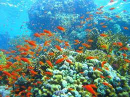
 Coral")

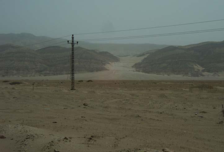
20 4. GULF OF SUEZ COAST (HARBORS, RECREATION, DESALINIZATION, AND FISHERIES) Harbors along Gulf of Suez (Web Site) Abandoned touristic village along Gulf of Suez (Shawky, 2012) Coral reefs along Gulf of Suez (Shawky, 2012)

 Geologic")

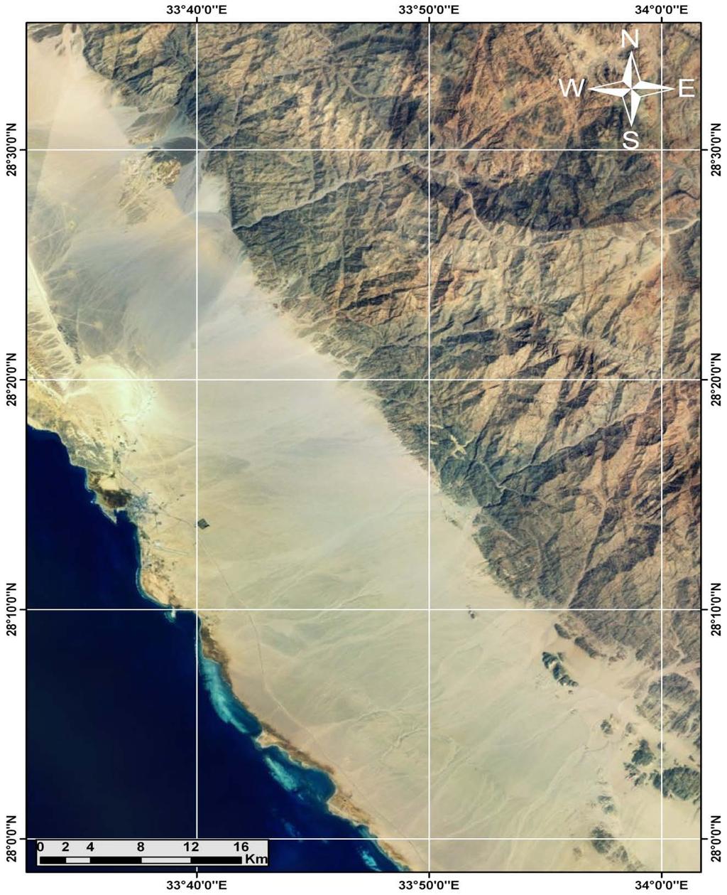
21 5. TOPOGRAPHIC ANALYSES Topographic Map (EGSMA) Geologic Map (EGSMA) Realistic image (Shawky, 2012)
 (Team Member, Shawky, M.")


22 DEM (Shawky, 2012) Slope Map (Shawky, 2012) Aspect Map (Shawky, 2012) (Team Member, Shawky, M. (2012): Application of geospatial and remote sensing techniques in groundwater exploration and assessment of natural hazards in southwestern Sinai, Egypt. PhD. Thesis In press, Geology Department, Faculty of Science, Mansoura University, Egypt.


23 6. MINERAL DEPOSITS South Sinai map for metallic and non-metallic deposits, Metalogenic map, EGSMA, 1998) South Sinai map for building materials and ornamental stone, Metalogenic mal, EGSMA, 1998)


,")
24 7. PRESENT INFRASTRUCTURE Onshore Petropel company along site along Gulf of Suez (Taken by Shawky, 2012) Gulf of Suez oil fields (Source: Gulf of Suez Oil Fields (A comprehensive Overview), EGPC, 1996 )


.")


25 Tiran island at the entrance of Gulf of Aqaba (Team Member, Shawky, 2009). The suggested site for construction of the land bridge between Egypt and Kingdom of Saudi Arabia


26 8. HUMAN RESOURCES, LOCAL BEDOUIN Local Bedouins tribes in Southern Sinai (SEAM program (2003): SOUTH SINAI E NVIRONMENTAL AND DEVELOPMENT PROFILE, Ministry of State for Environmental Affairs, Egyptian Environmental Agency, south Sinai governorate.


27 9. TOURISTIC AND ARCHEOLOGICAL SITES Source, Web Site

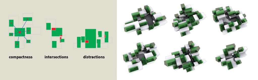
28 Planning Concept

29 Planning Concept


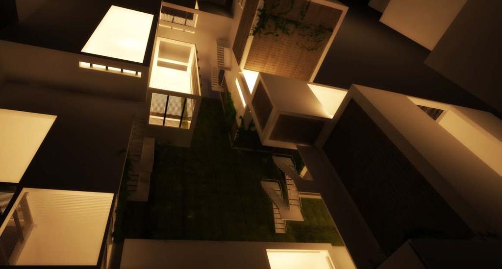
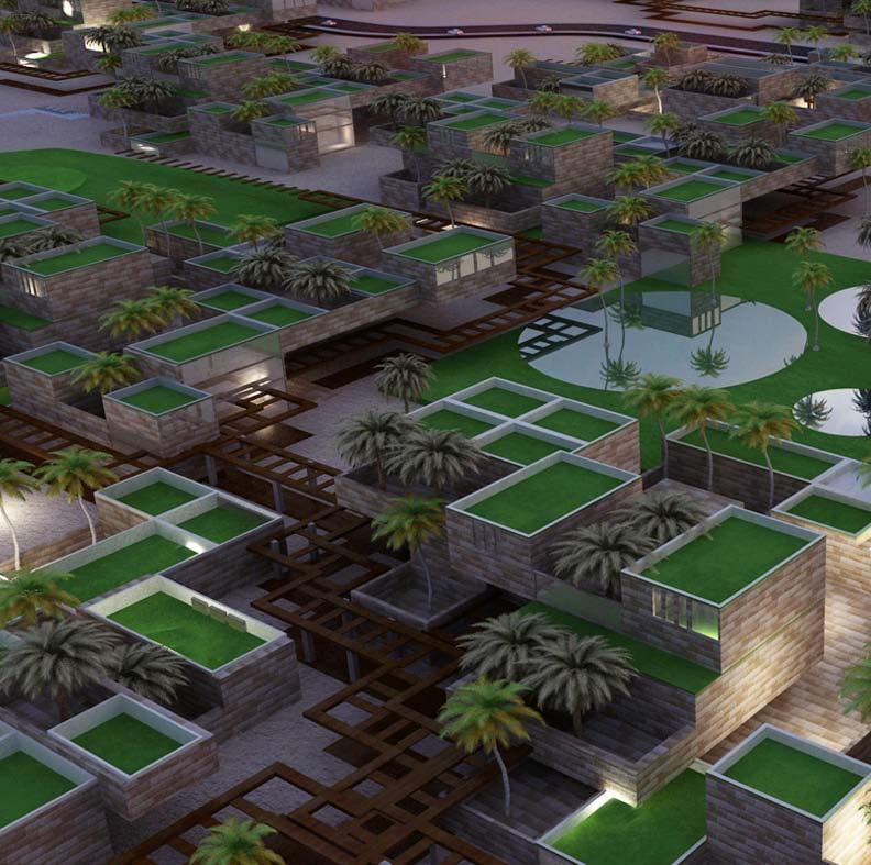
30 Design your home
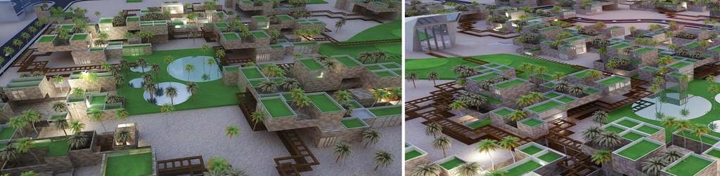
31 Shaping Residential Clusters
32 Suggested Time Plan The Implementation of project starts in 2019 after 6 years of preparation and studies allowing the future generation to build them dream. In spite of 2030 is target year in the proposal, The city in non-finite let other extension able to added. The project located in the following stages; Pre-stage( ); studies, awareness programs, site visiting and upgrading infrastructure. 1st stage( ); Implementation of faculties, Religious & Therapeutic Tourism, Reclamation and developing existing industry. 2nd stage( ); completing Implementation of faculties, eco-tourism, more Reclamation lands and agricultural industry. 3rd stage( ); Implementation of research centers, tourist villages, reclamation with animal production and mining industry. 4th stage( ); Implementation of advanced centers, tourist villages, reclamation with animal production and engineering industry.
33
Chapter 16 ~ Eastern Mediterranean
 Chapter 16 ~ Eastern Mediterranean Physical Geography of the Eastern Mediterranean Landforms This area is known as the Levant and includes Syria, Jordan, Lebanon, Israel, and the Palestinian territories.
Chapter 16 ~ Eastern Mediterranean
 Chapter 16 ~ Eastern Mediterranean Physical Geography of the Eastern Mediterranean Landforms This area is known as the Levant and includes Syria, Jordan, Lebanon, Israel, and the Palestinian territories.
Unit 9 The Middle East SG 1 - Physical Geography, Population & Demographics
 Unit 9 The Middle East SG 1 - Physical Geography, Population & Demographics I. Physical Geography A. The Middle East includes southwestern Asia and North Africa. 1. The name is Eurocentric. Middle East
CURRICULUM VITAE.
 CURRICULUM VITAE Name: Elsayed Mohammed Abu El Ella Position: Professor of Hydrogeology (Water Resources Management) Specialization: Hydrogeology, PhD Address: Geology Department,Faculty of Science Assiut
GASCO Abr Seina Onshore Gas Pipeline
 4.0 Existing Environment 4.1 INTRODUCTION The route of Abr Seina pipeline 32, 111 km, starts from El Tina Shark (long. 31 o 1 27.7 lat. 32 o 20 47.4 ) to El Arish, northern Sinai. A general survey was
STUDY OF ALAQI SECONDARY CHANNEL IN LAKE NASSER
 ABSTRACT STUDY OF ALAQI SECONDARY CHANNEL IN LAKE NASSER GamalSallam 1, Mohamed Ihab 2, and Waleed Emary 3 Associate Professor, National Water Research Center, Email: gasallam@yahoo.com Civil Engineer,
As we entered the harbor here is what we saw. The large white ship was the Oriana and lots of small boats were visible.
 4/2/07 Day 77 Sharm el Sheikh, Egypt - Monday, 2 April, 2007: We arrived in the harbor of Sharm el Sheikh, Egypt about 7am with clear sky and cool, comfortable temperature. The name Sharm el Sheikh is
Ancient Egypt. Life Along the Nile River
 Ancient Egypt Life Along the Nile River 2018 Geography How Does Geography affect the way that people live? Geography- Where in the World? You are Here Streetsboro, Ohio United States of America Geography-
Curriculum Vitae (C.V.) Ahmed Abdel-Halim Ahmed Mohamed
 Ahmed Abdel-Halim Ahmed Mohamed") Permanent Address Department of Geology, Faculty of Science, Assiut University, Assiut 71516, Egypt Tel: 0020 88 2 41 21 89 Fax: 0020 88 2 342 708 Cell: 0020 10 83 90 135 ahmed41982@yahoo.com Personal
Permanent Address Department of Geology, Faculty of Science, Assiut University, Assiut 71516, Egypt Tel: 0020 88 2 41 21 89 Fax: 0020 88 2 342 708 Cell: 0020 10 83 90 135 ahmed41982@yahoo.com Personal
SUTTER COUNTY. General Plan Update Technical Background Report
 SUTTER COUNTY General Plan Update Technical Background Report February 2008 SUTTER COUNTY GENERAL PLAN UPDATE TECHNICAL BACKGROUND REPORT PREPARED FOR: SUTTER COUNTY PREPARED BY: PBS&J IN PARTNERSHIP
UNIT 5 PHYSICAL GEOGRAPHY SG 1 - PART I
 UNIT 5 PHYSICAL GEOGRAPHY SG 1 - PART I Africa is HUGE! I. LANDFORMS A. Plateaus - an area of relatively level high ground. 1. Africa s interior is dominated by series of plateaus and elevated basins such
Water quality management in the Lake Baikal region of Russia
 Lomonosov Moscow State University Faculty of Geography Department of Environmental Management Water quality management in the Lake Baikal region of Russia Dr., Prof. Sergey Kirillov Dr., Prof. Mikhail
Sand dune distribution and related impacts on agricultural resources of Sinai Peninsula, Egypt, using integrated remote sensing-gis techniques
 Global Advanced Research Journal of Agricultural Science (ISSN: 2315-5094) Vol. 5(1) pp. 042-050, January, 2016 Issue. Available online http://garj.org/garjas/home Copyright 2016 Global Advanced Research
Seismic Microzonation in Hurghada City (EGYPT)
") Available online at www.sciencedirect.com Procedia Engineering 14 (2011) 2856 2863 The Twelfth East Asia-Pacific Conference on Structural Engineering and Construction Seismic Microzonation in Hurghada
Available online at www.sciencedirect.com Procedia Engineering 14 (2011) 2856 2863 The Twelfth East Asia-Pacific Conference on Structural Engineering and Construction Seismic Microzonation in Hurghada
MONITORING OF LAKE NASSER USING REMOTE SENSING AND GIS TECHNIQUES
 MONITORING OF LAKE NASSER USING REMOTE SENSING AND GIS TECHNIQUES M. M. Mostafa a and H. K. Soussa b a Information Technology Institute, GIS department - mostafam@mcit.gov.eg b Ain Shams University, Faculty
WATER DESALINATION PROJECT IDENTIFICATION IN SINAI, EGYPT
 WATER DESALINATION PROJECT IDENTIFICATION IN SINAI, EGYPT By Magdy Abou Rayan*, Berge Djebedjian* and Ibrahim Khaled** * Faculty of Engineering, Mansoura University, El-Mansoura 35516, Egypt E-mail: mrayan@usa.com,
The Rufford Foundation Final Report
 The Rufford Foundation Final Report Congratulations on the completion of your project that was supported by The Rufford Foundation. We ask all grant recipients to complete a Final Report Form that helps
Chapter 17. North Africa, Southwest Asia and Central Asia
 Chapter 17 North Africa, Southwest Asia and Central Asia Chapter Objectives Describe the major landforms and natural resources of North Africa, Southwest Asia, and Central Asia. Discuss the climate and
Land Figures & Spatial Data Infrastructure in KOSOVO
 Land Figures & Spatial Data Infrastructure in KOSOVO Idriz SHALA idriz.shala@gmail.com GIS -expert Afrim SHARKU afrim.sharku@gmail.com Land Management - Expert Kick-off meeting of the Regional Expert Advisory
Deir al Qilt Locality Profile
 Deir al Qilt Locality Profile Prepared by The Applied Research Institute Jerusalem Funded by Spanish Cooperation 2012 Acknowledgments ARIJ hereby expresses its deep gratitude to the Spanish agency for
Name of the Competition. The objective of the Competition
 Name of the Competition Target Group The objective of the Competition The Description International Competition: Luxor Civilization The participants of this competition are from age group under 35 years
C.V. Cairo, Egypt. EXPERTISE:
 C.V. Dr. Bahgat M. Abdel-Maksoud Professor of Agricultural Extension, Department of Rural Sociology & Agric. Extension, Faculty of Agriculture, University of Assiut, Egypt. Tel.: Mob: (012) 24943302 -
Brief Description of Northern the West Bank, Palestine Prepared by: Dr. Ahmed Ghodieh Department of Geography An-Najah National University Nablus,
 Brief Description of Northern the West Bank, Palestine Prepared by: Dr. Ahmed Ghodieh Department of Geography An-Najah National University Nablus, Palestine Brief Description of Northern the West Bank
Viva Reef Sharm El Sheikh, Egypt
 Viva Reef Sharm El Sheikh, Egypt Key features of Viva Reef Studios, 1 bedroom and 2 bedroom apartments available. Two year build and payment plan interest free Air conditioning connections included. Completion
Order of the Minister of Environment #39, August 22, 2011 Tbilisi
 Registration Code 360050000.22.023.016080 Order of the Minister of Environment #39, August 22, 2011 Tbilisi On preparatory stages and procedure of the methodology for Elaborating structure, content and
NAME: Sayed Omar Mohamed Hassan Elkhateeb DATE OF BIRTH 9/ 12/ 1957 PLACE OF Qena, Egypt BIRTH SEX:
 Personal information NAME: Sayed Omar Mohamed Hassan Elkhateeb DATE OF BIRTH 9/ 12/ 1957 PLACE OF Qena, Egypt BIRTH SEX: male SOCIAL STATE Married NATIONALTY: TELEPHONE PROFESSION Egyptian HOME: +2096-5330738
Ministry of Electricity & Renewable Energy New & Renewable Energy Authority (NREA) Egypt's Renewable Energy Activities and Strategy
 Egypt's Renewable Energy Activities and Strategy") Ministry of Electricity & Renewable Energy New & Renewable Energy Authority (NREA) Egypt's Renewable Energy Activities and Strategy ORGANIZATION CHART OF MINISTRY OF ELECTRICITY & RENEWABLE ENERGY Egyptian
Ministry of Electricity & Renewable Energy New & Renewable Energy Authority (NREA) Egypt's Renewable Energy Activities and Strategy ORGANIZATION CHART OF MINISTRY OF ELECTRICITY & RENEWABLE ENERGY Egyptian
LOCATION, CLIMATE, AND NATURAL RESOURCES OF MEXICO
 SS6G3 The student will explain the impact of location, climate, distribution of natural resources, and population distribution on Latin America and the Caribbean. a. Compare how the location, climate,
PPP Projects. Ministry of Finance. PPP Central Unit
 PPP Projects Ministry of Finance PPP Central Unit Tendered Projects (2013) 1- Abu Rawash wastewater plant Upgrading level of treatment from primary to secondary treatment for Abu Rawash Wastewater plant
Coverage of Mangrove Ecosystem along Three Coastal Zones of Puerto Rico using IKONOS Sensor
 Coverage of Mangrove Ecosystem along Three Coastal Zones of Puerto Rico using IKONOS Sensor Jennifer Toledo Rivera Geology Department, University of Puerto Rico, Mayagüez Campus P.O. Box 9017 Mayagüez,
Key Geographic Features
 DUE 12/6/18 Name: Lesson One: Egypt Geography 6.15 On a historical map locate the Mediterranean and Red Seas, the Nile River and Delta, and the areas of ancient Nubia and Egypt. Identify the locations
DAAD November 2009 Ismailia - Egypt. This is a must attend conference!
 DAAD Impacts of Climate Change on Natural Resources 10-11 November 2009 Ismailia - Egypt Climate change is the greatest environmental challenge facing the world today. Already, we have seen a change in
Presenter : Dodin/Jean-Paul, Jeremie
 Presenter : Dodin/Jean-Paul, Jeremie Seychelles National Meteorological Services Seychelles International Airport Ministry of Environment & Energy Environment Department P.O Box 1145 Victoria Mahe Tel:
Natural and man-made flooding hazards at the torrents in the town of Thessaloniki
 Risk Analysis VII PI-373 Natural and man-made flooding hazards at the torrents in the town of Thessaloniki S. Stefanidis, F. Tziaftani & C. Chatzicristaki Institute of Mountainous Water Management and
The View Sharm El Sheikh, Egypt
 The View Sharm El Sheikh, Egypt Key features of The View Studios, one bedroom, two bedroom and three bedroom apartments available. Building (28) : 2,5 years payment plan (Delivery after 18 months) Phase
Prices from 250,000 EGP
 Sinai Golf Heights Nabq Sharm El Sheikh Egypt Once completed this resort will be the premier golfing destination in the Sinai Peninsula offering an abundance of facilities, excellent year round climate
Mohamed M. Abou El Enein
 Mohamed M. Abou El Enein Birth Date September 05, 1951 Place Cairo, Egypt Office Add. 36 Ahmed Abdel Aziz St. Mohandessin, Giza-Egypt Alma mater Faculty of Commerce University of Helwan Occupation Founder
Intermediate report. Letter of agreement FAO - GCB/RAB/013/ITA
 Treated waste water for sustainable production of valuable biomass, soil and water quality improvement and combating desertification in Algeria and Tunisia Letter of agreement FAO - GCB/RAB/013/ITA Intermediate
Africa State of the Environment An Overview. Mohamed Tawfic Ahmed Suez Canal University, Ismailia, Egypt
 Africa State of the Environment An Overview Mohamed Tawfic Ahmed Suez Canal University, Ismailia, Egypt motawfic@tedata.net.eg Africa Day Symposium United Nations University, Tokyo, Japan May, 2010 My
Price Start From EGP. No Commission From buyers. Sinai Golf Heights
 Price Start From 250.000 EGP No Commission From buyers Sinai Golf Heights Sinai Golf Heights contents Sharm El Sheikh & Nabq Bay Sinai Golf Heights location Sinai Golf Heights project description Location
North Africa and Southwest Asia. Economic Geography
 North Africa and Southwest Asia Economic Geography Natural Resources Oil is the major resource in this region. Many countries in this region are members of OPEC (Organization of Petroleum Exporting Countries).
Regional Action on Climate Change and Future Earth (RACC FE) Experts Meeting August 2016 * Thursday, 25 August :00 9:30 Registration
 Experts Meeting August 2016 * Thursday, 25 August :00 9:30 Registration") Regional Action on Climate Change and Future Earth (RACC FE) Experts Meeting 25 26 August 2016 * Thursday, 25 August 2016 8:00 9:30 Registration 9:30 11:00 Opening Session: Bibliotheca Alexandrina Conference
Regional Action on Climate Change and Future Earth (RACC FE) Experts Meeting 25 26 August 2016 * Thursday, 25 August 2016 8:00 9:30 Registration 9:30 11:00 Opening Session: Bibliotheca Alexandrina Conference
DOWNLOAD OR READ : CORAL REEFS OF THE WORLD VOLUME 2 INDIAN OCEAN RED SEA AND GULF PDF EBOOK EPUB MOBI
 DOWNLOAD OR READ : CORAL REEFS OF THE WORLD VOLUME 2 INDIAN OCEAN RED SEA AND GULF PDF EBOOK EPUB MOBI Page 1 Page 2 coral reefs of the world volume 2 indian ocean red sea and gulf coral reefs of the pdf
Water resource situation of the Republic of Djibouti
 Water resource situation of the Republic of Djibouti Omar ASSOWE DABAR Integrating Groundwater Management within River Basins 15-17 January 2019 Nairobi, Kenya Regional Training Workshop on Introduction
Action Plan Celebration of International Year of Biodiversity (IYB) 2010 in Egypt
 2010 in Egypt") Action Plan Celebration of International Year of Biodiversity (IYB) 2010 in Egypt The Aim of the Action Plan: Raise awareness among major stakeholders of the important role of biodiversity in livelihoods
Action Plan Celebration of International Year of Biodiversity (IYB) 2010 in Egypt The Aim of the Action Plan: Raise awareness among major stakeholders of the important role of biodiversity in livelihoods
THE DEVELOPMENT OF LUXOR OPEN AIR MUSUEM AND ITS SOCIAL IMPACTS AN ASSESSMENT USING GEOGRAPHIC INFORMATION SYSTEMS. Thesis submitted for the degree of
 THE DEVELOPMENT OF LUXOR OPEN AIR MUSUEM AND ITS SOCIAL IMPACTS AN ASSESSMENT USING GEOGRAPHIC INFORMATION SYSTEMS Thesis submitted for the degree of Doctor of Philosophy at the University of Leicester
Using of space technologies for glacierand snow- related hazards studies
 United Nations / Germany international conference on International Cooperation Towards Low-Emission and Resilient Societies Using of space technologies for glacierand snow- related hazards studies Bonn,
Snow, Glacier and GLOF
 Snow, Glacier and GLOF & Report on Demonstration River Basin Activities Upper Indus Basin The 5th International Coordination Group (ICG) Meeting GEOSS Asian Water Cycle Initiative (AWCI) Tokyo, Japan,
U.S. Activities in Puerto Rico, U.S. Virgin Islands and the Wider Caribbean. NOAA and the US Coral Reef Task Force
 U.S. Activities in Puerto Rico, U.S. Virgin Islands and the Wider Caribbean NOAA and the US Coral Reef Task Force U.S. Coral Reef Task Force Co-Chairs: National Oceanic and Atmospheric Administration (NOAA)
HOTEL ACQUISITION OPPORTUNITY IN AGADIR
 HOTEL ACQUISITION OPPORTUNITY IN AGADIR Some facts about Morocco Morocco is today Africa s destination # 1 World Class Brands Top Tourism Investors Transforming Morocco Into a world class luxury destination
1. Name: Dr Ravindra K Pande. 2. Designation: Professor of Geography. 5. Research field: Geomorphology, Disaster Management, RS & GIS
 ACADEMIC PROFILE 1. Name: Dr Ravindra K Pande 2. Designation: Professor of Geography 3. Experience: About 38 years 4. Qualification: PhD 5. Research field: Geomorphology, Disaster Management, RS & GIS
Distribution of Mangroves along the Red Sea Coast of the Arabian Peninsula: Part 2. The Southern Coast of Western Saudi Arabia
 Distribution of Mangroves along the Red Sea Coast of the Arabian Peninsula: Part 2. The Southern Coast of Western Saudi Arabia M. Asif Khan, Arun Kumar*and Abdul Muqtadir Center for Petroleum and Minerals,
INTRODUCTION Background: Definitions Wetlands in Egypt Threats to Wetlands Wetland Services
 INTRODUCTION Background: Definitions Wetlands in Egypt Threats to Wetlands Wetland Services NATIONAL STRATEGY Mission: Goal Guiding Principles Objectives and Bases of Action Actions to Achieve Objectives
An Approach to Sustainable Tourism Development in Coastal Area-Egypt
 P Egypt P An Approach to Sustainable Tourism Development in Coastal Area-Egypt Prof. Dr. Magda Metwally Head of Architecture& Housing Department, Housing and Building Research Center E-mail:magda_met@hotmail.com
Vision for Development of Georgia's High Mountainous Regions adapted to the Climate and Landscape Changes
 Vision for Development of Georgia's High Mountainous Regions adapted to the Climate and Landscape Changes George Gotsiridze 3rd EURO-ASIAN MOUNTAIN RESORTS CONFERENCE 4-7 April, 2017, Tbilisi, Georgia
Patterns in Juvenile Red Snapper Distribution and Association with the Shrimp Fishery: a Step Toward Marine Spatial Planning
 Patterns in Juvenile Red Snapper Distribution and Association with the Shrimp Fishery: a Step Toward Marine Spatial Planning Paula Moreno, Ph.D. USM, Gulf Coast Research Laboratory Department of Coastal
YOUR RESORT EXPERIENCE BECOMES YOUR HOME
 2 YOUR RESORT EXPERIENCE BECOMES YOUR HOME 4 6 YOUR RESORT EXPERIENCE BECOMES YOUR HOME Imagine a place where the Pyramids are your backyard, where the Egyptian museum, the Fairmont and intercontinental
Center for Sustainable Tourism. Division of Research and Graduate Studies East Carolina University
 Center for Sustainable Tourism Division of Research and Graduate Studies East Carolina University What seems to be driving sustainable actions in tourism? Rising energy costs Increasing regulatory pressures
Economic study of Agricultural investment in the centers of North Sinai Governorate
 Middle East Journal of Agriculture Research ISSN 2077-4605 Volume : 06 Issue : 03 July-Sept. 2017 Pages:849-867 Economic study of Agricultural investment in the centers of North Sinai Governorate ABSTRACT
Appendix A Geographic and Geologic Terms Connected With Egypt
 Appendix A Geographic and Geologic Terms Connected With Egypt Egypt Official name is the Arab Republic of Egypt. Total area is 1,002,450 km 2, which makes Egypt the 29th largest country in the world. Only
Curriculum Vitae QUALIFICATIONS
 Personal Data: - Curriculum Vitae Name: Ali Mohamed Ali Hamdan. Date of birth: 15 /3 / 1971. Sex: Male. Marital Status: Married. Nationality: Egyptian. Religion: Moslem. Home Address: Al-Aqqad, Term Address:
ARMENIA. EXCURSION 2019 August 25 September 14
 ARMENIA EXCURSION 2019 August 25 September 14 CACSEE EXCURSIONS is designed to provide you with in-depth insight into a country or region in Central Asia and the Caucasus. Our cross-disciplinary educational
Total Discovery Wells
 Drilling Operations Wells Data in-depth (28-21) This section aims at analyzing the count of wells drilled during the fiscal years of and. These in- depth comparisons are divided into four main divisions:
ReefFix. May, For the Organization of American States (OAS) and the Inter-American Biodiversity Information Network (IABIN)
 and the Inter-American Biodiversity Information Network (IABIN)") Fondation pour la Protection de la Biodiversité Marine FoProBiM B.P. 642 www.foprobim.org (mail) 6011 Henning St. Port-au-Prince, Haiti Bethesda, MD 20817 ReefFix Rapid Assessment of the Economic Value
Fondation pour la Protection de la Biodiversité Marine FoProBiM B.P. 642 www.foprobim.org (mail) 6011 Henning St. Port-au-Prince, Haiti Bethesda, MD 20817 ReefFix Rapid Assessment of the Economic Value
Egypt is located in northeastern Africa and southwestern Asia. It covers 385,229 square
 Egypt Location Egypt is located in northeastern Africa and southwestern Asia. It covers 385,229 square miles. Egypt lies on the coordinates 27 N, 30 E. Libya lies on Egypt s west border, Sudan on its south,
Anthropology Abroad Summer 2011
 Anthropology Abroad Summer 2011 Israel: Then and Now Plus! Anthropology and Archaeology In Israel and Serbia To find out more visit depthome.brooklyn.cuny.edu/anthro/jadar The Program Three modules in
See yourself. in hurghada
 Our World in egypt Worldwide Destinations is a marketing and development company creating quality properties in spectacular international locations. Worldwide Destinations is proud to introduce Our world
CROATIAN APPROACH TO THE SUSTAINABLE DEVELOPMENT OF THE NAUTICAL PORTS ON ADRIATIC ISLANDS
 CROATIAN APPROACH TO THE SUSTAINABLE DEVELOPMENT OF THE NAUTICAL PORTS ON ADRIATIC ISLANDS Srećko Favro, Ph.D. MIIMS Sworn court expert for maritime traffic Hydrographic Institute of the Republic of Croatia
After Umrah Program. A Destination for Muslims
 After Umrah Program A Destination for Muslims After Umrah Program A Destination for Muslims 3 What is After Umrah Program? These are tourist trips designed for the people who arrive into the Kingdom as
Standard Tours -Egypt
 INDEX: Our Company 3 Our Mission....4 Services 5 Groups / Business Travel....5 MICE...5 Flights & Ticketing...6 Airport Meet & Assist..7 Car rental & transportations...7 Hotels..8 FIT Travel...8 Chartering..8
Australian Geography. Standards:
 Australian Geography Standards: SS6G12 The student will be able to locate selected features of Australia. a. Locate on a world and regional political-physical map: the Great Barrier Reef, Coral Sea, Ayers
CURRICULUM VITAE. Associate Professor, Tourist Guidance Department, Faculty of Tourism & Hotels, Minia University, Egypt.
 CURRICULUM VITAE PERSONAL INFORMATION Name: Samar Mostafa Kamal Current Nationality: Egyptian Date of birth:15/1/1972 Marital Status: Married Address: 30 Adly Yakan Street, Minia, Egypt Mobile no (002)01222189892
Jabal Al Taweel (Pesagot)
") Jabal Al Taweel (Pesagot) Population: 1,464 inhabitants compromising 375 Families Year Founded: 1981 Distant from Jerusalem: 20 Km Location: branch road out of road 60 near Mochmas gas station Height:
Jabal Al Taweel (Pesagot) Population: 1,464 inhabitants compromising 375 Families Year Founded: 1981 Distant from Jerusalem: 20 Km Location: branch road out of road 60 near Mochmas gas station Height:
Curriculum Vitae Mohamed Saber Mohamed Sayed, Ph.D. Assistant Professor of Hydrology
 Curriculum Vitae Mohamed Saber Mohamed Sayed, Ph.D. Assistant Professor of Hydrology URL: http://mohamedsaber.webs.com/ Personal Data Nationality: Egyptian Date and place of birth: 25 December, 1975, Fayoum,
Annual bulletin 2014
 Annual bulletin 2014 1 --------------------------Temperature----------------------- January 2014 In January 2014 it was warmer than normal nearly over the complete region with exception of the northern
Content. Suez Canal Project North Coast Development Project Golden Triangle Project
 Content Political situation Economic Situation Dynamic Economy Foreign Direct Investment in Egypt Company Establishment Doing Business in Egypt The Way Forward Mega Projects Suez Canal Project North Coast
Curriculum Vitae. Personal Information: Academic Qualifications: Academic Position:
 Personal Information: Name: Khaleid Fouad Abd El-Wakeil Gender: Male Date & place of birth: June, 8, 1975, Assiut, Egypt Nationality: Egyptian Marital status: Married Address: Zoology Department, Faculty
Little Limestone Lake Provincial Park. Draft Management Plan
 Little Limestone Lake Provincial Park Draft Management Plan Little Limestone Lake Provincial Park Draft Management Plan Table of Contents 1. Introduction... 3 2. Background... 3 3. Planning context...
Farm-level Irrigation Modernization Project - FIMP
 Farm-level Irrigation Modernization Project - FIMP Improved Agriculture Water Use Workshop Mediterranean Agronomic Institute CIHEAM 28 to 31 Aug 2017 Presentation Outline Background of Water Resources
The Suez Canal Crisis. By: Nikki, Michael, Taylor, Kylee, Danica, and Michaela.
 The Suez Canal Crisis By: Nikki, Michael, Taylor, Kylee, Danica, and Michaela. Timeline 1953: Nasser introduces blockades/restricts Israeli commerce July 26th: Nasser announces nationalization of the Canal
The Pitcairn Islands The world s largest fully protected marine reserve
 A fact sheet from March 2015 The Pitcairn Islands The world s largest fully protected marine reserve Overview In March 2015, the United Kingdom declared the world s largest fully protected marine reserve
ICRI Monaco January 2010
 Economic Valuation of Coral Reefs in the Caribbean ICRI Monaco January 2010 Lauretta Burke World Resources Institute (WRI) Beautiful Valuable Valuable Valuable Valuable Valuable Photos: Krishna Desai Valuable
Ancient Water Supply System in Tall Tanis, Archaeological Area Northeastern Nile Delta Region, Port Said, Egypt
 Ancient Water Supply System in Tall Tanis, Archaeological Area Northeastern Nile Delta Region, Port Said, Egypt Elsayed Abbas Zaghloul Abstract During the geological history, the Nile developed his valley
Public Works Research Institute
 Public Works Research Institute INTERNATIONAL WORKSHOP ON WATER HAZARD AND RISK MANAGEMENT SOME EXPERIENCES OF FLOOD MANAGEMENT IN ARGENTINA VÍCTOR POCHAT National Director for Water Policies,Coordination
Just how big is Africa?
 The United States China India The United Kingdom Portugal Spain France Belgium Germany The Netherlands Switzerland Italy Eastern Europe Japan 11.7 million sq. miles Just how big is Africa? Chapter 18 Section
DOWNLOAD OR READ : TOURISM BIODIVERSITY AND SUSTAINABLE DEVELOPMENT 6 VOLS SET PDF EBOOK EPUB MOBI
 DOWNLOAD OR READ : TOURISM BIODIVERSITY AND SUSTAINABLE DEVELOPMENT 6 VOLS SET PDF EBOOK EPUB MOBI Page 1 Page 2 tourism biodiversity and sustainable development 6 vols set tourism biodiversity and sustainable
Spotlight on Egypt Bobbie Kalman Crabtree Publishing Company
 Spotlight on Egypt Company www.crabtreebooks.com Created by Dedicated by Emese Felvégi For my family Editor-in-Chief Writing team Emese Felvégi Editor Kathy Middleton Proofreader Crystal Sikkens Fact editor
Adrère Amellal, Egypt
 Adrère Amellal, Egypt Adrère Amellal, an eco-lodge, lies 17 kilometres from Siwa City, at the foot of the White Mountain that overlooks the large Salt Lake of Siwa. The walls of the eco-lodge were built
ADDRESSING ENVIRONMENTAL AND CLIMATE CHANGE CHALLENGES FACED BY CARIBBEAN SIDS THROUGH A SUSTAINABLE DEVELOPMENT LENS
 ADDRESSING ENVIRONMENTAL AND CLIMATE CHANGE CHALLENGES FACED BY CARIBBEAN SIDS THROUGH A SUSTAINABLE DEVELOPMENT LENS Marlene Attzs, PhD Deputy Coordinator, Sustainable Economic Development Unit (SEDU)
STUDY GUIDE. The Land. Chapter 17, Section 1. There are frequent earthquakes in the region. Petroleum is a major export in the region.
 For use with textbook pages 421 426. The Land Terms to Know alluvial soil A rich soil made up of sand and mud deposited by flowing water (page 423) wadi A streambed that remains dry until a heavy rain
Saudi Aramco Biodiversity Protection Areas
 Copyright 2016, Saudi Aramco. All rights reserved. Saudi Aramco Biodiversity Protection Areas 11/17/2014 Outline 1: Background to Saudi Aramco biodiversity protection areas 2: Case Study 1: Shaybah Dune
INDONESIA TOURISM INVESTMENT INVITATION
 INDONESIA TOURISM INVESTMENT INVITATION An Invitation to Invest in Tourism Development in Wakatobi Regency, Southeast Sulawesi Province, Republic of Indonesia Welcome to the Republic of Indonesia The Land
Tourism potential in Bangladesh. 26 th of march 2008
 Tourism potential in Bangladesh 26 th of march 2008 Majbritt Thomsen Education In Bangladesh Finding relevant work Danish Embassy B2B DANIDA, production sector Tourism potential report This lecture Share
As both one of the few substantially preserved pharaonic Egyptian. expulsion, the site of Deir el-ballas is of great archaeological and historic
 The 2017 Season at Deir el-ballas Peter Lacovara As both one of the few substantially preserved pharaonic Egyptian settlements as well as the forward capital for the Theban kings during the Hyksos expulsion,
CONCEPTUALIZATION OF THE HOTEL BUSINESS AND A CONCEPT HOTEL PROJECT DEVELOPMENT IN THE AREA OF THE CAUCASIAN MINERAL WATERS
 CONCEPTUALIZATION OF THE HOTEL BUSINESS AND A CONCEPT HOTEL PROJECT DEVELOPMENT IN THE AREA OF THE CAUCASIAN MINERAL WATERS (based on the example of «Classic Hotel», Pyatigorsk) The report of the final
Welcome Land Use Element... LU-1
 Welcome Land Use Element... LU-1 Land Use Plan... LU-3 Residential Land Uses... LU-12 Commercial Land Uses... LU-14 Mixed Use... LU-16 Industrial Land Uses... LU-18 Automobile-Related Land Uses... LU-19
INTERNATIONAL CIVIL AVIATION ORGANIZATION MIDDLE EAST OFFICE
 INTERNATIONAL CIVIL AVIATION ORGANIZATION MIDDLE EAST OFFICE NCLB-AERODROME CERTIFICATION WORKSHOP/ TRAINING (Cairo, Egypt, 1-5 October 2017) SUMMARY OF DISCUSSIONS I. GENERAL 1.1 Place and Duration 1.1.1
TOWARDS SUSTAINABLE MANAGEMENT OF MARINE AND COASTAL HABITATS ASIA- PACIFIC DAY FOR THE OCEAN
 TOWARDS SUSTAINABLE MANAGEMENT OF MARINE AND COASTAL HABITATS WANNAKIAT THUBTHIMSANG PHUKET MARINE BIOLOGICAL CENTER, DMCR, THAILAND ASIA- PACIFIC DAY FOR THE OCEAN 20 NOVEMBER 2018, CONFERENCE ROOM 4,
Cau River. Map of River. Table of Basic Data. Vietnam 5
 Cau River Map of River Table of Basic Data Name: Cau River Location: Thai Nguyen, Province, Viet Nam Area: 6,030 km 2 Origin: Mt. Phia Deng 1,527 m Outlet: Pha Lai Note: * Indicates missing data in some
Appointments: CURRICULUM VITAE
 CURRICULUM VITAE Name : Shaban Ramadan Mohamed Harb, Ph.D. Address : Physics Department, faculty of science, South Valley University, 83523 Qena, Egypt E.mail : S.Harb@web.de S_R_M_H_10@yahoo.com Qena-