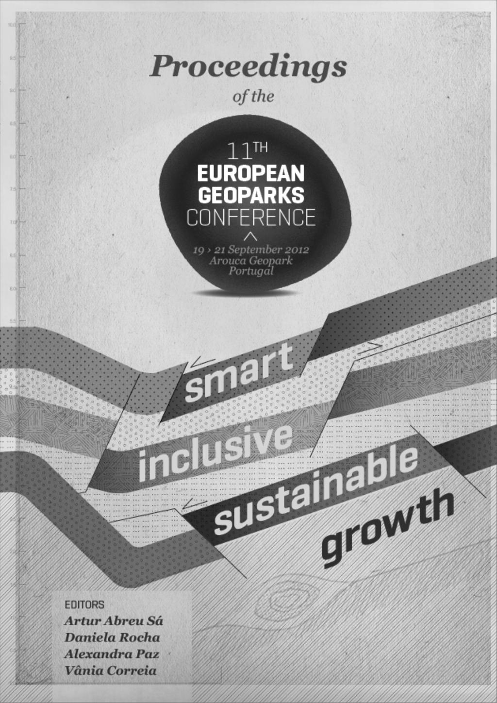
2012. Proceedings of the 11 European Geoparks Conference. AGA Associação Geoparque Arouca, Arouca, 5-6.
|
|
|
- Drusilla Carter
- 6 years ago
- Views:
Transcription
1
2 References to this volume It is suggested that either the following alternatives should be used for future bibliographic references to the whole or part this volume: th Sá, A.A., Rocha, D., Paz, A. & Correia, V. (eds.) Proceedings of the 11 European Geoparks Conference. AGA Associação Geoparque Arouca, Arouca, 319 pp. Zouros, N Measuring progress in European Geoparks: a contribution for a smart, sustainable and inclusive growth of Europe. In: Sá, A.A., Rocha, D., Paz, A. & Correia, V. (eds.) th Proceedings of the 11 European Geoparks Conference. AGA Associação Geoparque Arouca, Arouca, 5-6. All papers in this publication were presented during the 11th European Geoparks Conference All abstracts were submitted to peer review by two referees. Refereeing has been extended by editors to typographical errors or to graphic quality as far as this was possible. AGA Associação Geoparque Arouca Rua Alfredo Vaz Pinto Arouca Portugal Phone/Fax geral@geoparquearouca.com ISBN Legal Deposit Impressão:

3 Geoparks 11th European Geoparks Conference 2012 Arouca Geopark, Portugal, September 2012 Organized on behalf of the European Geoparks Network by the Arouca Geopark and the Municipality of Arouca Under the auspices of
4 ! CAJÓN DEL MAIPO GEOPARK PROJECT: PRELIMINARY STUDY J. Benado 1*, M. Schilling 2 & J. Brilha 3 1 Earth Sciences Centre, University of Minho, Portugal 2 Servicio Nacional de Geología y Minería, Santiago, Chile 3 Earth Sciences Centre, University of Minho and Geology Centre of the University of Porto, Portugal *josebw@gmail.com K eywords: Geopark, Chile, Cajón del Maipo The Cajón del Maipo is a well-known tourism destination located in Central Andes, 50 km from Santiago, the capital city of Chile (fig.1). This area is visited by national and foreign tourists and is part of the San José de Maipo county, which has an area of 4995 km 2 and about 13,500 inhabitants, contrasting with the nearly 6.5 million people living in the Metropolitan Region of Santiago. San José de Maipo is a semi-rural county with an unemployment rate of 9.7% (2009 data). With 11.1% of its population living below the poverty line, San José de Maipo is economically depressed compared to the neighbouring counties. The major economic activities of this area are mining, electrical energy production, livestock and agriculture. However, the Strategic Plan of the Province considers San José de Maipo a county with high potential for ecotourism, nature and environment and establishes tourism as the most promising development activity. This county borders Argentina to the east with the boundary corresponding to the modern volcanic arc that includes active volcanoes such us Tupungatito, Marmolejo and San José. In this mountainous landscape there are peaks with altitudes ranging from 800 m (La Obra) to 6,570 m (Tupungato Volcano), and nine peaks rising over 5,000 m. The Cajón del Maipo is the name given to this valley, which has been formed by the action of the Maipo River. With a hydrographical basin with an area of about 5,000 km 2, the Maipo River is the main source of water for the capital. The rocks of this region record about 200 million years of geological history and a wide geodiversity including marine Jurassic rocks, volcanic and plutonic rocks of the Cenozoic, folds and faults that show intense tectonic activity, volcanoes, hot springs, glaciers, mineral deposits, and Holocene sedimentary deposits of fluvial, glacial, volcanic, and gravitational origin. Extensive research and investigation has been carried out on the geology of this area, especially since 1957, when the development of geology in Chile begins with the creation of the School of Geology at the Chile University and the Institute of Geological Research. populous urban centre, is characterized by winter rains, temperatures that can range from 0-30ºC depending on the season, and a dry season that lasts between 7-8 months. Above 3,000 m there is a mountain climate with precipitation in the form of rain and snow. Ecosystems in the area are known as "Forest and Andean Mediterranean scrub" and "High Andean Steppe". Both are characteristic of the high mountains of the Andes in central Chile, and are now seriously threatened, so there are great efforts made for their conservation. The public-private initiative of these conservation efforts covering 76% (3,779 km 2 ) of San José de Maipo county and aiming to conserve, restore and protect ecosystems. This territory was declared a hunting-forbidden area. There are two protected areas in the county. The first one is the "National Monument El Morado", a park under public administration with an area of about 30 km 2 located in altitudes of around 5,000 m. The main attractions are its high peaks, the San Francisco Glacier and its moraines, the San Francisco Lagoon, and its proximity to the Morales hot springs. It has a great diversity of flora and fauna, much of it native and some endangered species. The second management with an area of about 36 km 2. It is known for its steep gorges and waterfalls, where thick and intensely folded Miocene volcanic successions can be observed. This area is also a shelter for flora and fauna. 41

5 ! Additionally, the county of San José de Maipo boasts great cultural and archaeological interest. To mention a few, we highlight two areas already included in the Tentative List for World Heritage of UNESCO. The first one is the "Qhapaq Nan" or "Main Andean Road", an international initiative of Argentina, Bolivia, Chile, Colombia, Ecuador and Peru, which aims to preserve one of the most representative works of Incan culture: the road network. Part of this road network can be seen in San José de Maipo county, which ends at the "Santuario de Altura del cerro El ceremonial and religious site, located at 5,200 m height. The aim of this study is to estimate the potential of Cajón del Maipo for an eventual creation of a geopark. As a first step, an inventory of the geological heritage of the county will be made as University of Minho, Portugal. Besides the outstanding geology of the "Cajón del Maipo Geopark Project", the following conditions and attributes may justify its creation: i) There are more than 6 million people as potential visitors within a radius of 50 km; ii) The county has already a tradition of ecotourism, with common activities like skiing, climbing, rafting, mountain biking, fishing, camping, hot springs and outdoor walks; iii) There are important conservation initiatives in the territory, especially dedicated to its biological component; iv) The National Tourism Service of Chile (SERNATUR) declared in 2001 San José de Maipo county as a "National Zone of Tourism Interest". This classification commits the government to promote the sustainable tourism development in the area, the stimulation of productive activities related to tourism, the protection of natural and cultural resources, among others; v) Despite being a country influenced by its geological features (mineral deposits, volcanic and seismic activity, tsunamis, etc.), the level of Earth Sciences education in Chile is quite low. Thus, the establishment of a geopark near the capital, where about 40% of the population lives, could involve the community in educational activities related to the geosciences and encourage a more harmonious cohabitation with the environment. Figure 1. Location of San José del Maipo county (central Chile). 42
UNITED NATIONS EDUCATIONAL, SCIENTIFIC AND CULTURAL ORGANIZATION CONVENTION CONCERNING THE PROTECTION OF THE WORLD CULTURAL AND NATURAL HERITAGE
 World Heritage Distribution limited 27 COM WHC-03/27.COM/INF.13 Paris, 23 June 2003 Original : English/French UNITED NATIONS EDUCATIONAL, SCIENTIFIC AND CULTURAL ORGANIZATION CONVENTION CONCERNING THE
Order of the Minister of Environment #39, August 22, 2011 Tbilisi
 Registration Code 360050000.22.023.016080 Order of the Minister of Environment #39, August 22, 2011 Tbilisi On preparatory stages and procedure of the methodology for Elaborating structure, content and
Water quality management in the Lake Baikal region of Russia
 Lomonosov Moscow State University Faculty of Geography Department of Environmental Management Water quality management in the Lake Baikal region of Russia Dr., Prof. Sergey Kirillov Dr., Prof. Mikhail
Environmental Impact Assessment in Chile, its application in the case of glaciers. Carlos Salazar Hydro21 Consultores Ltda.
 Environmental Impact Assessment in Chile, its application in the case of glaciers Carlos Salazar Hydro21 Consultores Ltda. carlos.salazar@hydro21.cl Introduction Changes in the environmental law in Chile
Friday, November 10, 2017
 Friday, November 10, 2017 Andes and Midlatitude Countries Objective: Summarize the main physical features and regions of the Southern Cone. Identify and locate the urban centers and understand the pattern
Last eruption was in 1909.
 Teide National Park Where is it?: El Teide is a giant volcano, that occupies the island of Tenerife, whose coasts are bathed by the Atlantic Ocean. It is in the Canary Islands, off the northwest coast
ENVIRONMENTAL PROFILE:
 Pyrenees Study Area for LEDDRA LOCATION: The Pyrenees study area is located in the Spanish Central Pyrenees (42º 36 N, 0º 00 E), in the Sobrarbe area (Huesca province, Aragón region). It includes the municipalities
Andean Mountain Initiative. World Mountain Forum 2018 Bishkek, October 23th, 2018
 Andean Mountain Initiative World Mountain Forum 2018 Bishkek, October 23th, 2018 The Andes range mountains The Andes are approximately 7,000 km long and are the world s longest terrestrial mountain range,
The Geological Pacific Northwest. Wednesday February 6, 2012 Pacific Northwest History Mr. Rice
 The Geological Pacific Northwest Wednesday February 6, 2012 Pacific Northwest History Mr. Rice 1 Free Response #2 Please do not simply list the items for this response. Full sentences!!! Minimum of 3-5
*Latin America spans 7,000 miles, from Mexico to Tierra Del Fuego. *3 Regions: Central America, South America, and the Caribbean.
 Physical Geography Latin America spans 7,000 miles, from Mexico to Tierra Del Fuego *3 Regions: Central America, South America, and the Caribbean. *Intro clip: http://www.youtube.com/watch?v=cffp6rza3
South America. pg. 520 (5 th) pg. 523 (6 th )
 pg. 523 (6 th )") South America pg. 520 (5 th) pg. 523 (6 th ) Venezuela Rich in Oil Lake Maracaibo Called Little Venice pg. 572 (5 th) pg. 574 (6 th ) Caracas 8 miles Inland 3000 pg. 572 (5 th) pg. 574 (6 th ) Caracas
South America pg. 520 (5 th) pg. 523 (6 th ) Venezuela Rich in Oil Lake Maracaibo Called Little Venice pg. 572 (5 th) pg. 574 (6 th ) Caracas 8 miles Inland 3000 pg. 572 (5 th) pg. 574 (6 th ) Caracas
A funny sounding lake. South American Landforms, Climate, and Vegetation
 A funny sounding lake South American Landforms, Climate, and Vegetation 3 4 Essential Question: How have physical features and climate affected the population distribution of Latin America? 5 I. Landforms
Community-based Adaptation, Experiences in Bolivia
 Community-based Adaptation, Experiences in Bolivia Clea Paz, Conservation International-Bolivia Stephan Halloy, The Nature Conservancy Ninón Ríos and James Aparicio, Naturaleza y Comunidad-PNCC Oscar Saavedra,,
CHAPTER 12. South America. Section 1: Natural Environments Section 2: History and Culture Section 3: South America Today. HOLT World Geography
 CHAPTER 12 South America Section 1: Natural Environments Section 2: History and Culture Section 3: South America 1 Section 1 Natural Environments Objectives: What are the major landforms and rivers of
Name: Hour: Day: The Land and Its Regions (pg ) Define, in your own words, escarpment. Define, in your own words, sertão
 Define, in your own words, escarpment. Define, in your own words, sertão") Name: Hour: Day: World Geography Guided Reading Notes Chap 12 & 13 --- ANSWER IN COMPLETE SENTENCES!!!! READ EACH QUESTION CAREFULLY & ANSWER COMPLETELY!!!! Objectives: Upon completion of reading you should
Name: Hour: Day: World Geography Guided Reading Notes Chap 12 & 13 --- ANSWER IN COMPLETE SENTENCES!!!! READ EACH QUESTION CAREFULLY & ANSWER COMPLETELY!!!! Objectives: Upon completion of reading you should
GEOGRAPHY AND HISTORY
 GEOGRAPHY AND HISTORY YEAR 1, PART 1 www.vicensvives.es Contents 01 Our planet Earth 02 The representation of the Earth: maps 03 The Earth s relief 04 Rivers and seas 05 Weather and climate 06 Climates
FINAL STAG E : 5 T H G R A D E
 NAME COURSE SURNAME CENTRE YOUR TEACHER S NAME FINAL STAG E : 5 T H G R A D E 1. Read Danny s diary and complete his timetable. Remember there are extra words! EXTINCT / WATERFALL / VALLEY / PATH / WOOD
Geographic Qualities of South America
 Geographic Qualities of South America 1. South America is the fourth largest continent in area. It is located in the Western Hemisphere, lying southwest of North America. Most of South America lies in
KARUKINKA A DECADE OF CONSERVATION
 KARUKINKA A DECADE OF CONSERVATION Karukinka is a place like no other on Earth. At the southern tip of Patagonia in Chile lies a vast haven for biodiversity with verdant cathedral forests, lush wetlands,
Carbon Neutralization
 Carbon Neutral Carbon Neutralization September/2008 The Instituto H&H Fauser (H & H Fauser Institute) is a non-governmental organization that has for purpose the promotion of the sustainable development,
Grande Traversée, Chile
 Grande Traversée, Chile Day 1 Itinerary On your arrival to the Bariloche International Airport, a driver will take you to your downtown hotel. Tonight you stay at the Milan Hotel in Bariloche, (Beschtedt
State of Conservation of the Heritage Site. City of Potosí (Plurinational State of Bolivia) (ID Nº 420) (ii), (iv) y (vi)) EXECUTIVE SUMMARY
 (ID Nº 420) (ii), (iv) y (vi)) EXECUTIVE SUMMARY") State of Conservation of the Heritage Site City of Potosí (Plurinational State of Bolivia) (ID Nº 420) (ii), (iv) y (vi)) EXECUTIVE SUMMARY 1. State party's response to the decision 39 of the World Heritage
State of Conservation of the Heritage Site City of Potosí (Plurinational State of Bolivia) (ID Nº 420) (ii), (iv) y (vi)) EXECUTIVE SUMMARY 1. State party's response to the decision 39 of the World Heritage
ECUADOR ADVENTURES ANDES AND AMAZON MULTISPORT 6 DAYS TRIP HIGHLIGHTS:
 ECUADOR ADVENTURES Effort: Moderate. Easy. Activities: Mountain Biking, Whitewater Rafting, Hiking, Horseback Riding, Wildlife Seeking. Accommodations: Quality hotels, historic haciendas, and eco lodges
Essential Questions. 1. How have historical figures and events affected South America today?
 South America Essential Questions 1. How have historical figures and events affected South America today? 2. How has location affected the development of countries in South America? 3. How has the role
BOLIVIA S GLACIER: A VANISHING FUTURE
 UN IN ACTION Release Date: December 2009 Programme No. 1215 Length: 5 18 Languages: English, French, Spanish, Russian BOLIVIA S GLACIER: A VANISHING FUTURE VIDEO SNOWY PEAKS OF GLACIERS AUDIO For thousands
SUPPORT TO WATER RESOURCES MANAGEMENT IN THE DRINA RIVER BASIN DRAFT ROOF REPORT INTRODUCTION AND GENERAL APPROACH
 SUPPORT TO WATER RESOURCES MANAGEMENT IN THE DRINA RIVER BASIN DRAFT ROOF REPORT INTRODUCTION AND GENERAL APPROACH Nadja Zeleznik, REC Public Concultation Beograd, Serbia, 4 July 2017 1 1. Introduction
Forms of Natural Protection in Greece
 Forms of Natural Protection in Greece 105 th Primary School of Thessaloniki NATIONAL PARKS AND PROTECTED AREAS The irregular and constantly increasing human intervention in nature and the relentless exploitation
Chapter 21: EAST AFRICA
 Chapter 21: EAST AFRICA Physical Geography of East Africa Landforms East Africa is a diverse landscape of different plains, volcanic mountains, and plateaus cut by a large valley and marked by many rivers
TOWARDS SUSTAINABLE MANAGEMENT OF MARINE AND COASTAL HABITATS ASIA- PACIFIC DAY FOR THE OCEAN
 TOWARDS SUSTAINABLE MANAGEMENT OF MARINE AND COASTAL HABITATS WANNAKIAT THUBTHIMSANG PHUKET MARINE BIOLOGICAL CENTER, DMCR, THAILAND ASIA- PACIFIC DAY FOR THE OCEAN 20 NOVEMBER 2018, CONFERENCE ROOM 4,
RECREATION POTENTIAL ASSESMENT AS ASSUMPTION FOR TOURISM REGIONALIZATION OF SLOVAKIA TERRITORY
 RECREATION POTENTIAL ASSESMENT AS ASSUMPTION FOR TOURISM REGIONALIZATION OF SLOVAKIA TERRITORY Jan SUPUKA - Roberta ŠTĚPÁNKOVÁ Slovak Agriculture University in Nitra, The Slovak Republic International
Report for the 40th Session of the World Heritage Committee Istanbul (Turkey), 10 to 20 July 2016
, 10 to 20 July 2016") Report for the 40th Session of the World Heritage Committee Istanbul (Turkey), 10 to 20 July 2016 Date of the Report: Rio de Janeiro, April 29, 2016. Name of the Centre: Regional Heritage Management Training
Report for the 40th Session of the World Heritage Committee Istanbul (Turkey), 10 to 20 July 2016 Date of the Report: Rio de Janeiro, April 29, 2016. Name of the Centre: Regional Heritage Management Training
Alpine Glacial Features along the Chimney Pond Trail, Baxter State Park, Maine
 Maine Geologic Facts and Localities September, 2009 Alpine Glacial Features along the Chimney Pond Trail, Baxter State Park, Maine 45 54 57.98 N, 68 54 41.48 W Text by Robert A. Johnston, Department of
Brief History of Argentina
 Argentina Brief History of Argentina Argentina has been inhabited since the Paleolithic period. For most of it s pre columbian history Argentina was sparsely populated by many diverse cultures such as
EU Sky Route. Summary report on the positioning of the island of Tenerife. star tourism INTRODUCTION
 Summary report on the positioning of the island of Tenerife EU Sky Route INTRODUCTION The following report contains a summary of the positioning of the island of Tenerife in relation to the product. The
Colombia - The Coffee Region Road Cycling Tour (2017) Guided 11 days/10 nights
 Guided 11 days/10 nights") Colombia - The Coffee Region Road Cycling Tour (2017) Guided 11 days/10 nights The Coffee Region is an amazing region to cycle, and if you are looking for an easier cycling trip, this is the one for you;
Colombia - The Coffee Region Road Cycling Tour (2017) Guided 11 days/10 nights The Coffee Region is an amazing region to cycle, and if you are looking for an easier cycling trip, this is the one for you;
Intermediate report. Letter of agreement FAO - GCB/RAB/013/ITA
 Treated waste water for sustainable production of valuable biomass, soil and water quality improvement and combating desertification in Algeria and Tunisia Letter of agreement FAO - GCB/RAB/013/ITA Intermediate
Our winter collection for 2018 is inspired by two major destinations: the Andean countries and Japan.
 Our winter collection for 2018 is inspired by two major destinations: the Andean countries and Japan. Unlike previous years we leave the cities for the majesty of lakes and mountains, discovering new harmonies,
Nature Conservation Agency (NCA) Salacgrīva 05/07/2018
 Salacgrīva 05/07/2018") Nature Conservation Agency (NCA) Salacgrīva 05/07/2018 Nature Conservation Agency ensures implementation of unified nature protection policy in Latvia Specially protected nature areas in Latvia Specially
Nature Conservation Agency (NCA) Salacgrīva 05/07/2018 Nature Conservation Agency ensures implementation of unified nature protection policy in Latvia Specially protected nature areas in Latvia Specially
INTRODUCTION ITINERARY ARGENTINA - VIVA: ROUTE 40 & CARRETERA AUSTRAL TRIP CODE LATSSART DEPARTURE
 INTRODUCTION This tour is a great option for people wanting to visit these remote and unspoilt regions of Chile and Argentina. Due to the strength and durability of our vehicles we are able to visit these
SESSSION 26. Dr. Raquel Gil Montero Universidad Nacional de Tucumán and CONICET, Argentina
 SESSSION 26 International Economic History Congress, Helsinki 2006; Session 26: Families, Kinship and Forms of Land Ownership in Mountain Societies (16th-20th Centuries) Dr. Raquel Gil Montero Universidad
ANNEX IV-3 EUROPEAN COMMISSION HUMANITARIAN AID OFFICE (ECHO) MONTHLY REPORT 1. SUMMARY / MAIN HIGHLIGHTS. Monthly report number 2011/7
 MONTHLY REPORT 1. SUMMARY / MAIN HIGHLIGHTS. Monthly report number 2011/7") ANNEX IV-3 EUROPEAN COMMISSION HUMANITARIAN AID OFFICE (ECHO) Monthly report number 2011/7 Month July 2011 Country South America (except Colombia for HA) Date of submission 02/08/11 Author ECHO Quito MONTHLY
ANNEX IV-3 EUROPEAN COMMISSION HUMANITARIAN AID OFFICE (ECHO) Monthly report number 2011/7 Month July 2011 Country South America (except Colombia for HA) Date of submission 02/08/11 Author ECHO Quito MONTHLY
Protected Areas in the Arabian Peninsula
 Protected Areas in the Arabian Peninsula Khaldoun Al Omari Abstract. Protected areas help conserve key elements of biodiversity, play a significant role in social and economic development, and embody many
Submission of REPUBLICA ORIENTAL DEL URUGUAY. to the COMMISSION ON THE LIMITS OF THE CONTINENTAL SHELF
 Submission of REPUBLICA ORIENTAL DEL URUGUAY to the COMMISSION ON THE LIMITS OF THE CONTINENTAL SHELF pursuant to provisions of article 76, paragraph 8, of the United Nations Convention on the Law of the
SECTION ONE. Scotland s National Parks and National Nature Reserves Ten Things You Might Not Know
 SECTION ONE Scotland s National Parks and National Nature Reserves Ten Things You Might Not Know 5 Ten Things You Might Not Know... 1. SCOTLAND S NATIONAL PARKS AND NATIONAL NATURE RESERVES ARE BEAUTIFUL,
World Geography Ch. 7.2 Climate Regions of Latin America
 World Geography Ch. 7.2 Climate Regions of Latin America BR: D10 When you think of Latin America, what types of climates do you think are down there? Write down which of the following you believe are there:
LAST TIME (Happy 300 th Birthday Ben Franklin!)
") LAST TIME (Happy 300 th Birthday Ben Franklin!) Latin American Diversity: Introduction Physical Geography of Mexico, Caribbean, and Central America: 1. Mexican drylands 2. Mesoamerican Highlands 3. Coastal
LAST TIME (Happy 300 th Birthday Ben Franklin!) Latin American Diversity: Introduction Physical Geography of Mexico, Caribbean, and Central America: 1. Mexican drylands 2. Mesoamerican Highlands 3. Coastal
Lake Ohrid. our shared responsibilities and benefits. Protecting
 Towards strengthened governance of the shared transboundary natural and cultural heritage of the Lake Ohrid region Protecting Lake Ohrid region our shared responsibilities and benefits This publication
State of Conservation Report Sagarmatha National Park, Nepal
 State of Conservation Report Sagarmatha National Park, Nepal Report submitted to UNESCO Headquarters Paris, France Report prepared and submitted by Department of National Parks and Wildlife Conservation
LA PAZ AND ATACAMA DESERT TOUR The Bolivia to Chile Tour ITINERARY
 LA PAZ AND ATACAMA DESERT TOUR The Bolivia to Chile Tour 8 DAYS / 7 NIGHTS Stark contrasts: From the Bolivian Capital to the wonders of the Atacama Desert! Astounding contrasts as you journey from La Paz
Assessing and Protecting the World s Heritage. Assessing and Protecting the World s Heritage
 Assessing and Protecting the World s Heritage NEFA BACKGROUND PAPER Assessing and Protecting the World s Heritage Prepared by: Dailan Pugh, 2014 With the NSW opposition parties threatening to open up the
South American Countries. Capital Location Population Terrain Climate
 South American Countries Capital Location Population Terrain Climate Andes Mountains Four large areas that make up the Central Plains: Llanos, the Selva, the Gran Chaco, and the Pampas Brazilian Highlands
Regional Atlas: Introduction to Latin America
 Chapter 9, Section World Geography Chapter 9 Regional Atlas: Introduction to Latin America Copyright 2003 by Pearson Education, Inc., publishing as Prentice Hall, Upper Saddle River, NJ. All rights reserved.
Galapagos & Mainland
 Galapagos & Mainland GALAPAGOS & MAINLAND: DAY BY DAY ITINERARY Guide 1 Arrival to Quito, overnight Quito - Our driver will meet you at the airport and transfer you to your hotel. Free time to relax and
Geoscape Toronto The Oak Ridges Moraine Activity 2 - Page 1 of 10 Information Bulletin
 About 13,000 years ago as the Laurentide Ice Sheet melted, glacial meltwater accumulated between the ice sheet and the Niagara Escarpment. This formed a lake basin into which gravel and sand were deposited.
BIODIVERSITY NEW ECONOMIC VARIABLE
 2016 BUSINESS AND BIODIVERSITY FORUM SECTION H: TOURISM DECEMBER 3, 2016 PERU One of the 17 megadiverse countries in the world (UNESCO 1998). 84 of 104 life zones according to the Holdridge System. 55
Month June 2011 South America (except Colombia for HA) Date of submission 01/07/11 MONTHLY REPORT
 Date of submission 01/07/11 MONTHLY REPORT") ANNEX IV-3 EUROPEAN COMMISSION HUMANITARIAN AID OFFICE (ECHO) Monthly report number 2011/6 Month June 2011 Country South America (except Colombia for HA) Date of submission 01/07/11 Author ECHO Quito MONTHLY
ANNEX IV-3 EUROPEAN COMMISSION HUMANITARIAN AID OFFICE (ECHO) Monthly report number 2011/6 Month June 2011 Country South America (except Colombia for HA) Date of submission 01/07/11 Author ECHO Quito MONTHLY
ATACAMA DESSERT 4 DAYS / 3 NIGHTS
 ** CALAMA SAN PEDRO DE ATACAMA DAY 01 TRANSFER CALAMA AIRPORT/ HOTEL Meet & Greet at the airport and transfer to the hotel in San Pedro de Atacama. DAY 02 HALF DAY EXCURSION TO THE MOON VALLEY AND TO THE
The Lesser Antilles. Dominican Republic), and Puerto Rico
, and Puerto Rico") The Caribbean Islands are archipelagoes or groups of islands. The major archipelagoes are: The Greater Antilles - Cuba, Jamaica, Hispaniola (Composed of Haiti and the Dominican Republic), and Puerto Rico
The Caribbean Islands are archipelagoes or groups of islands. The major archipelagoes are: The Greater Antilles - Cuba, Jamaica, Hispaniola (Composed of Haiti and the Dominican Republic), and Puerto Rico
CHAPTER IV OVERVIEW. Indonesia. The capital is Dompu. Dompu Regency has an area of 2, km².
 CHAPTER IV OVERVIEW A. General Description of the Research Sites Dompu Regency, is a district in West Nusa Tenggara Province, Indonesia. The capital is Dompu. Dompu Regency has an area of 2,321.55 km².
IMPACTS OF PUYEHUE CORDON CAULLE VOLCANIC COMPLEX RECENT ERUPTION IN NAHUEL HUAPI NATIONAL PARK (PATAGONIA ARGENTINA)
") IMPACTS OF PUYEHUE CORDON CAULLE VOLCANIC COMPLEX RECENT ERUPTION IN NAHUEL HUAPI NATIONAL PARK (PATAGONIA ARGENTINA) Maria de la Paloma Martínez Fernández1,3 ndez1,3 & Elizabeth Ivonne Rovere2,3 1 Lantel,
IMPACTS OF PUYEHUE CORDON CAULLE VOLCANIC COMPLEX RECENT ERUPTION IN NAHUEL HUAPI NATIONAL PARK (PATAGONIA ARGENTINA) Maria de la Paloma Martínez Fernández1,3 ndez1,3 & Elizabeth Ivonne Rovere2,3 1 Lantel,
Impacts of glacier retreats in The Andes 1914 Our times
 Impacts of glacier retreats in The Andes 1914 Our times Source; Cobos, 2002 Dr. Andrés Rivera Centro de Estudios Científicos, CECS, Chile www.glaciologia.cl Present status of glaciers in the Andes: Snow
THE ANDEAN AREA....How does the rich countries development affect some poor and 1. distant countries
 THE ANDEAN AREA...How does the rich countries development affect some poor and 1 distant countries 1. Geographical situation of the Andean area South America view 2 Andes mountain range Amazonian basin
Some questions? Background (cont) Background
 Background") Balancing Ecotourism and Livestock Production Implications for Livelihoods and the Environment in Limpopo Province, South Africa Cheryl McCrindle and Petronella Chaminuka Sponsored by grants from AHEAD
Balancing Ecotourism and Livestock Production Implications for Livelihoods and the Environment in Limpopo Province, South Africa Cheryl McCrindle and Petronella Chaminuka Sponsored by grants from AHEAD
Chapter 16 ~ Eastern Mediterranean
 Chapter 16 ~ Eastern Mediterranean Physical Geography of the Eastern Mediterranean Landforms This area is known as the Levant and includes Syria, Jordan, Lebanon, Israel, and the Palestinian territories.
SYLLABUS : INCA ARCHITECTURE HRS. OF THEORY: 1 HRS. OF PRACTICE: 4 I. SUMMARY II. COMPETENCIES.
 SYLLABUS AREA : ARCHITECTURE COURSE : INCA ARCHITECTURE PREREQUISITE : CREDITS NO PREREQUISITE : (US Credits) HRS. OF THEORY: 1 HRS. OF PRACTICE: 4 I. SUMMARY The course is intended to introduce students
The Pilcomayo River Basin Argentina
 The Pilcomayo River Basin Argentina Yangareko ( Janis Alcorn, Alejo Zarzycki, Alonzo Zarzycki, Luis Maria de la Cruz) Governance and Ecosystems Management for the CONservation of BIOdiversity www.gemconbio.eu
Objective. Students will familiarize themselves with the physical features and climates of Latin America.
 Journal Write KWL What do you KNOW about Latin America? What do you WANT TO KNOW about Latin America? What did you LEARN today that you didn t know before? Latin America Objective Students will familiarize
Federal Outdoor Recreation Trends Effects on Economic Opportunities
 United States Department of Agriculture Federal Outdoor Recreation Trends Effects on Economic Opportunities The Forest Service National Center for Natural Resources Economic Research is assisting the Federal
Nakina Moraine Provincial Park. Interim Management Statement. Ontario. Ministry of Natural Resources
 Nakina Moraine Provincial Park Interim Management Statement Ontario Ministry of Natural Resources 1999, Queen's Printer for Ontario Printed in Ontario, Canada Additional copies of this publication can
Copahue - Caviahue Hiking Map, Argentina. 1:75,000. By Pixmap
 Copahue - Caviahue Hiking Map, Argentina. 1:75,000. By Pixmap If searching for the ebook by Pixmap Copahue - Caviahue Hiking Map, Argentina. 1:75,000. in pdf format, then you have come on to right website.
Ecuador Andes and Amazon Multisport Adventure Tour 2019 Guided 6 days/5 nights
 Ecuador Andes and Amazon Multisport Adventure Tour 2019 Guided 6 days/5 nights Experience the natural wonders and culture of the Andes Mountains and Amazon Jungles of Ecuador. This active multisport journey
FUNDO VODUDAHUE CHILE
 FUNDO VODUDAHUE CHILE Take a course in good water and air; and in the eternal youth of Nature you may renew your own. Go quietly, alone; no harm will befall you. John Muir PROPERTY DETAILS Location Palena
Latin America. Chapter 9 Physical Geography
 Latin America Chapter 9 Physical Geography Latin American Regions Middle America includes Mexico and the Central American countries The Caribbean Islands South America Mexico Landforms Sierra Madre Oriental
HIGHLIGHTS: TOUR INCLUDES:
 1-877-725-6674 A dazzling mix of colonial charm, natural beauty and indigenous cultures, Chile is a land of truly staggering diversity. Conquered by the Spanish in the mid 16th century, its influence stretches
Welcome Land Use Element... LU-1
 Welcome Land Use Element... LU-1 Land Use Plan... LU-3 Residential Land Uses... LU-12 Commercial Land Uses... LU-14 Mixed Use... LU-16 Industrial Land Uses... LU-18 Automobile-Related Land Uses... LU-19
Biosphere reserves: a tool for the management of coastal zones and islands in the Latin American Pacific
 Biosphere reserves: a tool for the management of coastal zones and islands in the Latin American Pacific MIGUEL CLÜSENER-GODT Director (a.i.), Division of Ecological and Earth Sciences Secretary (a.i.),
ARTWEI ARTWEI ARTWEI
 Protection / Management Plans for Natura 2000 areas and Maritime Spatial Plan for internal sea waters - including the Szczecin Lagoon Szczecin, 7th May 2011 Andrzej Zych Inspectorate of Coast Protection
Dipl. Ing. Ansonia Lillo Tor Dean University of Santo Tomás - Arica Chile
 Dipl. Ing. Ansonia Lillo Tor Dean University of Santo Tomás - Arica Chile In Chile, the environmental matters have been faced up intensely during the past years. Despite this, just in the last year it
SANTIAGO DE COMPOSTELA SPAIN
 SANTIAGO DE COMPOSTELA SPAIN KEY FEATURES OF THE CITY Demographic Facts nearly 100.000 inhabitants city area of 220 km2 Heritage Registered heritage: Santiago de Compostela (Old Town) Inscription: World
Institute for Emerging Sustainability Leaders Climate Change Workshop in Peru
 Institute for Emerging Sustainability Leaders Climate Change Workshop in Peru July 6-17, 2015 The Amazon Center for Environmental Education and Research (ACEER) invites applications for its Institute for
COUNTRY CASE STUDIES: OVERVIEW
 APPENDIX C: COUNTRY CASE STUDIES: OVERVIEW The countries selected as cases for this evaluation include some of the Bank Group s oldest (Brazil and India) and largest clients in terms of both territory
ATACAMA DESERT AND SANTIAGO TOUR Santiago & Atacama Tour
 ATACAMA DESERT AND SANTIAGO TOUR Santiago & Atacama Tour 8 DAYS / 7 NIGHTS This Santiago and Atacama Tour is a tour of contrasts. Santiago de Chile has a mild climate, with views of the Pacific Ocean to
SAJAMA (6549M) BOLIVIA S HIGHEST
 BOLIVIA S HIGHEST") SAJAMA (6549M) Classic Volcano climb BOLIVIA S HIGHEST West of La Paz near the border with Chile, there is a desert plain out of which rises the snow-capped cone volcano Sajama, found in Parque Nacional
SAJAMA (6549M) Classic Volcano climb BOLIVIA S HIGHEST West of La Paz near the border with Chile, there is a desert plain out of which rises the snow-capped cone volcano Sajama, found in Parque Nacional
Latin America. Physical Geography
 Latin America Physical Geography Regions Latin America can be divided into separate regions based on physical geography or cultural geography. Regions If we look at physical geography Latin America has
Welcome. Sustainable Eco-Tourism in the face of Climate Change. Presented by Jatan Marma
 Welcome Sustainable Eco-Tourism in the face of Climate Change Presented by Jatan Marma Definition Sustainable Development: is a process to meet the needs of the present without compromising the ability
FIRST CIRCULAR. Understanding volcanoes and society: the key for risk mitigation
 FIRST CIRCULAR Understanding volcanoes and society: the key for risk mitigation November 20-25, 2016 1 9 CITIES ON VOLCANOES Puerto Varas - Chile MAIN TOPIC The Cities and Volcanoes Commission of IAVCEI
BULUSAN VOLCANO NATURAL PARK (BVNP) AS LOCAL CONSERVATION AREA
 AS LOCAL CONSERVATION AREA") Presidential Proclamation No. 8ll dated June 07, 1935 Proclaimed as Bulusan Volcano National Park. Presidential Proclamation No. 421 dated November 27, 2000 Proclaimed as Bulusan Volcano Natural Park ALBAY
Presidential Proclamation No. 8ll dated June 07, 1935 Proclaimed as Bulusan Volcano National Park. Presidential Proclamation No. 421 dated November 27, 2000 Proclaimed as Bulusan Volcano Natural Park ALBAY
DOWNLOAD OR READ : TOURISM BIODIVERSITY AND SUSTAINABLE DEVELOPMENT 6 VOLS SET PDF EBOOK EPUB MOBI
 DOWNLOAD OR READ : TOURISM BIODIVERSITY AND SUSTAINABLE DEVELOPMENT 6 VOLS SET PDF EBOOK EPUB MOBI Page 1 Page 2 tourism biodiversity and sustainable development 6 vols set tourism biodiversity and sustainable
Partial Report. Project Leader: Nicolás Lagos. Executive Summary
 Partial Report Understanding the relationship between the Andean cat and its habitat in the high Andes plateau: Implications for its long term conservation Project Leader: Nicolás Lagos Executive Summary
Garapuà beach. Eco-Tourism Project. Morro de San Paolo - Bahía Nord Est del Brasile
 Garapuà beach Eco-Tourism Project Morro de San Paolo - Bahía Nord Est del Brasile INDEX 1) MORRO SAO PAOLO - Introduction 2) TAMACA - Location 3) TAMACA Phases of the project of urban development 4) TAMACA
Latin America. Physical Geography
 + Latin America Physical Geography + I. Landforms A. Caribbean & Central America 1. Mexico is dominated by two mountain chains, collectively called the Sierra Madre. A high plateau is situated in between.
Route 40 & Carretera Austral Bariloche to El Chalten 7 Days
 Route 40 & Carretera Austral Bariloche to El Chalten 7 Days TOUR DOSSIER Off the Beaten Track in Argentina & Chile This tour is a great option for people wanting to visit these remote and unspoilt regions
PATAGONIAN RAINFOREST CROSSING6 DAYS
 PATAGONIAN RAINFOREST CROSSING6 DAYS Northern Patagonian Temperate Rainforest Pirehueico lake crossing, Chile-Argentina Adventure Snow Center, outdoor sports and activities Conservation proyects and local
Chapter 16 ~ Eastern Mediterranean
 Chapter 16 ~ Eastern Mediterranean Physical Geography of the Eastern Mediterranean Landforms This area is known as the Levant and includes Syria, Jordan, Lebanon, Israel, and the Palestinian territories.
EarthCaching FUNdamentals
 EarthCaching FUNdamentals by Wes Skinner (NorthWes) Anchorage, Wasilla, Central Kenai Peninsula, Valdez and Homer 15 April 2010 EarthCache Outline: EarthCaches vs Other Cache Types EarthCache Master Program
SANTIAGO TO BUENOS AIRES TOUR & THE ANDES
 SANTIAGO TO BUENOS AIRES TOUR & THE ANDES Cruise the Andean Lakes from Chile to Argentina on your way to Buenos Aires 10 DAYS / 9 NIGHTS Experience the Andes mountains, the Lake District and Buenos Aires
Discover the taste of Patagonia
 Discover the taste of Patagonia CHILE Santiago CHILEAN PATAGONIA 3 Chile offers a privileged climate and beautiful landscapes Chile is a long and thin strip of land located in the Southwest of South America.
Chapter 10 Study Guide SOUTH AMERICA
 Chapter 10 Study Guide SOUTH AMERICA When Spain and Portugal competed for trading lands in the New World, who came up with the line of demarcation to settle the dispute? The Caribbean Countries: Who was
LATIN AMERICA / CARIBBEAN COIBA NATIONAL PARK PANAMA
 LATIN AMERICA / CARIBBEAN COIBA NATIONAL PARK PANAMA WORLD HERITAGE NOMINATION IUCN TECHNICAL EVALUATION COIBA NATIONAL PARK (PANAMA) ID Nº 1138 Bis Background note: Coiba National Park was nominated for
MEETING OF THE ECLAC AD HOC COMMITTEE ON POPULATION AND DEVELOPMENT. Quito, Ecuador, 4-6 July 2012 GENERAL INFORMATION
 MEETING OF THE ECLAC AD HOC COMMITTEE ON POPULATION AND DEVELOPMENT Quito, Ecuador, 4-6 July 2012 GENERAL INFORMATION 1 INTRODUCTION The meeting of the ECLAC Ad Hoc Committee on Population and Development