Glacier dammed lakes impacting different Alaskan drainages after 30 years of warming temperatures
|
|
|
- Julie Griffith
- 5 years ago
- Views:
Transcription


1 Glacier dammed lakes impacting different Alaskan drainages after 3 years of warming temperatures Dave Wolfe A remote sensing thesis project from Alaska Pacific University, Anchorage, Alaska


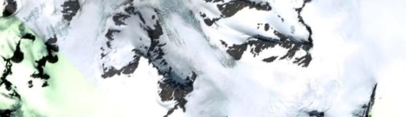
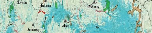
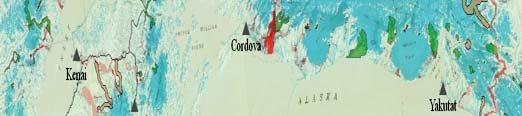
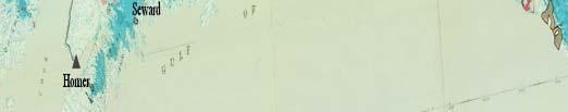
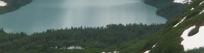
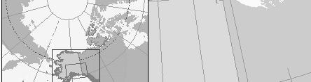
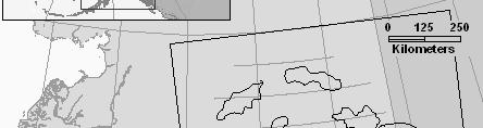
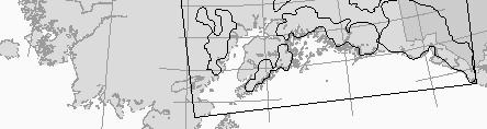
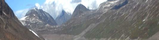
2 Globe image Go Glacier dammed lakes of Alaska Study Area ogleearth Study Area Baseline data report: Post and Mayo, 1971 What was studied and why o What are glacier dammed lakes & why should we care Basic results o Changes in lakes o Changes in drainages o Patterns in the changes? Map Sheet 2 USGS 1971


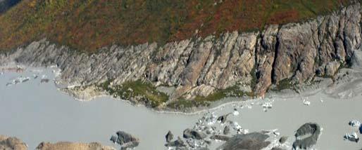
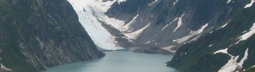
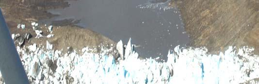
3 Glacier dammed lakes of Alaska Definitions Glacier Dammed Lakes are: ice marginal, and dammed by active glacier ice Imagery data: Lakes: YakutatC1 3 & C1 N1 Status: Persistent since 1971 and New Dam: Battle Glacier Region: St. Elias Mountains GDL Slide modified from USGS Image 25 DigitalGlobe (Cat. ID B), from Google Earth


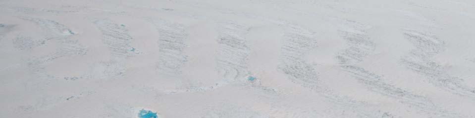
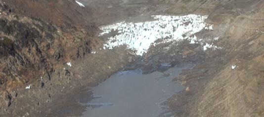
4 Glacier dammed lakes dynamic changing phenomena Lake level fluctuations: 4 views of 1 lake over 3 years ASTER satellite image 23: Filling 25: Full Spring 26: Drained ASTER satellite image Image 25 DigitalGlobe, from Google Earth Glacier dammed lakes are special hydrologic natural hazards because: drainage rate can increase exponentially, and they refill after draining Lake: TalkeetnaD2-13 Status: New since 1971 Dam: Tokositna Glacier Region: NW Alaska Range (WARN) Imagery: Google Earth and ASTER ASTER sa atellite image Fall 26: Refilling
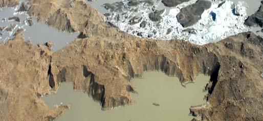
5 Digital Globe 7/25, from Google Earth Lake full summer 25


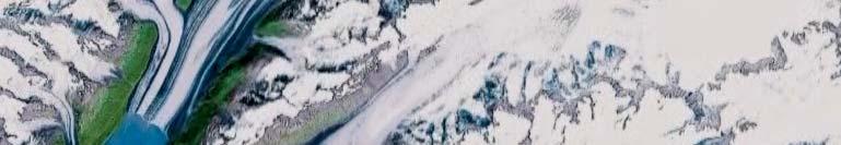
6 km st and 2nd Order glaciers Harvard Glacier 4 th Order glacier


")

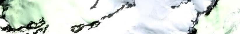
7 Glacier dammed lakes of Alaska Symbology of change Historic Map 1. Lake in 1971 Current Lake Status Lake is Absent 2. No Lake in New Lake since 2 Scale: 1:98, N Post and Mayo (1971) map Sheet 2 ASTER satellite image acquired 18 September 26


8 Glacier dammed lakes of Alaska Changing Over Time Focus areas in following slides
 Channel")

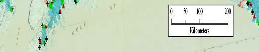
9 Glacier dammed lakes of Alaska Why Should We Care? Lake releases can flush glacier stored waters, increasing flood volume/duration (subglacial, supraglacial, englacial) Channel scour measure to 3 m in Alaska Sediment or ice flows contribute to damages Sheep Cr. bridge, Richardson Hwy., before & after a glacier dammed lake flood (The bridge is in the same location in both photos!) September 1945 flood, DOT photo Images from Post and Mayo (1971) The flood deposited debris over 7m deep at the bridge from upstream scour.


10 Glacier dammed lakes of Alaska Why Should We Care: Wortmans Trans Alaska oil Pipeline, descending Thompson Pass 1971 USGS map New glacier dammed lake ASTER satellite image ASTER satellite image Sheep creek hazard lakes are absent since 2; new lake hazard could impact the Trans Alaska Pipeline by scour


11 Skilak Glacier lake Late fall or winter release every 1-3 years Januaryy 1969 and 27 releases each had very small hydrograph signals each broke up river ice ice jams caused extensive flood damage 95 km to ice jam 3 km 1 km2 lake 3 km below.7 km2 glacier dammed lake -- new roads Historic Recent


")

 12")


12 Glacier dammed lakes of Alaska Why should we care: Tazlina Example a) 1 km to Oil Pipeline Oil Pipeline and b) 12 km to Oil Pipeline highway bridges c) 156 km 2 moderating lake c b 27 winter release ice jam damage a
13 N kes Glacier dammed lakes of Alaska Results: change in numbers Numbers of Historic and Current glacier-dammed lakes. 275 Lake basins reviewed: 7 + Lake damming glaciers: 2+ Historically: 183 Currently: Curr rently unfi illed basin ns: Absent lakes: 263 from 17 glaciers; 54 no longer dam any lakes Number of Lak 1 Persistent lakes: New lakes: 141 beside 71 glaciers; 31 newly lake damming Absent Persistent New Historic N = 538 Current N = 416 X axis: Lake status: > 2 compared to 1971


14 Glacier dammed lakes of Alaska Changing Drainages


15 Glacier dammed lakes of Alaska Environmental Influences on lake / glacier change Combined global land, air, and sea surface temperatures , relative to mean. Inset: Alaska temperatures Time period between inventories 2 Data from 19 first-order weather stations. rkshops/23/ /salmontools/ edu/wor e.pdf tp:// turns/aksalmonfuture Time period between inventories - 2 htt re (Global data source: U.K. Meteorological Office Climate Change and its impacts: A global perspective.)


16 Glacier dammed lakes of Alaska: Examples of ablation by downwasting Red lines: digitized perimeters of glacier extent from 1971 map; dashed lines highlight recent glacer ice perimeters

 Number of Basins e 15 A P N H=37 R=45 WARS mber")

17 Num Num Num Num N N Graphs: Proportional Change in Glacier Dammed Lake Status Types by analysis region WARN EAKR Number of Basins 3 Number of Basins b A P N H=68 R=32 c A P N H=46 R=27 TALK f b c d g h e i WRST Number of Basins d 15 A P H= 8 N R=8 a a. Total Change in Mean Annual Temperature (Celsius) Number of Basins e 15 A P N H=37 R=45 WARS mber of Basins 6 KENI CHUG STEL mber of Basins mber of Basins mber of Basins f 15 A P N H=63 R=33 g 15 A P N H=69 R=6 h 15 A P N H=13 R=11 i 15 A P N H=125 R=11
18 Glacier Dammed Lakes of Alaska changes in icedam aspects Glacier Aspects origin termi ini WNW West WSW WNW West WSW NW SW NW SW NNW SSW NNW SSW North South North NNE SSE NNE NE SE NE ENE East ESE ENE East South SSE SE ESE Ice dam aspect determination example N Ice dam faces North Ice dam faces ESE Persistent & New ice dams strongly favor colder (N, NE, E) aspects Aspects of Absent Ice dams Aspects of Persistent Ice dams Aspects of New Ice dams NNW NW WNW West North NNE NE ENE East NW WNW West NNW North NNE NE ENE East NNW NW WNW West North NNE NE ENE East WSW ESE WSW ESE WSW ESE SW SSW South SSE SE Historic Lakes SW SSW South SSE SE Current Lakes SW SSW South SE SSE
19 Glacier dammed lakes of Alaska significant (p=.5) change over 3 years Compared to absent lakes, new lakes were: > 3 m higher in elevation; > 2 m closer to the mean glacier altitude; 2 % farther up-glacier 12 km farther from the damming glacier terminus Percentage of lake absence due to: downwasting of damming glacier: 7% ; terminus retreat of damming glacier : 3%. Glaciers damming new lakes averaged: 11% longer than those damming absent lakes a full order higher (more complex) at terminus
20 Glacier dammed lakes of Alaska Summary The hazard from these lakes continues form of the hazard may change as different drainages are affected as lakes release from farther up glacier flushing as lakes release when winter river ice is present These data are a messenger of change with implications for infrastructure and development that t may be useful in modeling further lake change across the cryosphere Himalayas, Swiss Alps, etc
 from Late Maximum to")

21 Glacier dammed lakes of Alaska Acknowledgements This research was assisted by grants from :Alaska Pacific University :Alaska Section, AWRA and NASA IPY research collaboration, Dr. Jeff Kargel, PI, U of Arizona, Tucson (Satellite, Airborne, and Ground-based Assessment of Cryosphere Changes in the Copper River/Chitina Basins and Adjoining Ranges (Alaska) from Late Maximum to Now, NASA International Polar Year: ROSES 26); and by data from NASA (LPDAAC); US Forest Service; GeoGratis Canada; UA Fairbanks GeoData Center, Alaska Weather Research Center, and Geophysical Institute; US National Park Service; and State of Alaska DEC Additional thanks to: Austin Post, USGS, retired; APU faculty: Jason Geck and Dr.s M. Loso, R. Dial, L. Cornick LPDAAC (Land Processes Distributed Active Archive Center staff)


22 1951 Imagery data: Lake: BeringGlacD6-1 Iceberg Lake Status: Persistent since 1971 First complete drainage in over 1,5 years: 1999 Dam: Tana Glacier tributary Region: Chugach Mountains Photo: Kirk Stone, 1951; Kargel and Wolfe, 28 28
23

24 Supra-glacial Lakes Lakes not considered in this or the previous study include those that are: supraglacial subglacial ProglacialP l i l All tend to be on the lower glaciers reaches. Sub-glacial Lakes Pro-glacial Lakes


25 Glacier dammed lakes of Alaska: Example of lake loss by retreating terminus Historic Lake 1971 Melbern Glacier and GDL (Post and Mayo 1971). Black areas: solid = lake in 1971; dashed black line = predicted future lake. Current Status: absent 26 AS STER satellite ima age acquired 23 February Icedam (failing at final jokulhlaup) LandSat7 ETM, path 6 row 19 acquired 13 Aug 21 Image Google Earth


26 Sheep creek hazard lakes are absent since 2; new lake hazard could impact the Trans Alaska Pipeline corridor by scour Flood scour measured to 8 feet in depth. The pipeline is buried at 1 feet. New lake above narrow canyon New lake descending to Lowe River, across from Sheep Creek USGS map Sheep Cr. bridge, Richardson Hwy GDL flood, DOT photo Trans Alaska oil Pipeline, descending Thompson Pass ASTER satellite image
27 Origin aspect, newly damming glaciers Glacier aspect at lake Terminus aspect, newly damming glaciers WNW NNW NW North 1 5 NNE NE ENE WNW NNW NW North 1 5 NNE NE ENE WNW NNW NW North 1 5 NNE NE ENE West East West East West East WSW SW SSW South SE SSE ESE WSW SW SSW South SE SSE ESE WSW SW SSW South SE SSE ESE Origin aspect, former dammimg glaciers Glacier aspect at former lake Terminus aspect, former damming glaciers WNW NNW NW North NNE NE ENE WNW NNW NW North NNE NE ENE NNW NW WNW North 15 NNE 1 NE 5 ENE West East West East West East WSW ESE WSW ESE WSW ESE SW SSW South SE SSE SW SSW South SE SSE SW SSW South SE SSE


28 Ice dam aspects, former damming glaciers Ice dam aspects, newly damming glaciers North 15 NW NNW 1 WNW 5 West WSW SW SSW NNE NE ENE East ESE SE SSE South NW NNW WNW West WSW SW SSW North 1 5 NNE NE ENE East ESE SE SSE South


29 Arctic Ocean Arctic Ocean c f b d h e i a g


30 Glacier dammed lakes of Alaska Study Area Globe image GoogleEarth Presentation Outline: o What was studied and why o What are glacier dammed lakes & why should we care about them o Basic results o Changes in lakes o Changes in drainages o Patterns in the changes?
31 Glacier Aspects Aspects of damming glacier origin NW NNW North NNE NE WNW West 1 5 ENE East Expected Ice dam Aspects WSW SW SSW South SSE SE ESE Aspects of damming glacier termini WNW West NW NNW North NNE NE 1 ENE 5 East NNW NW WNW West WSW SW SSW North NNE 3 NE South SSE SE ENE East ESE WSW ESE SW SE SSW South SSE


.")
32 Glacier dammed lakes (GDLs) of Alaska recurring natural hazards Before e and after a Glacier Lake Outburst Flood Bridge is in same place in both photos (Kuentzel 197). Sheep Creek, Alaska
33 Questions?


34 Imagery data: Lake: BeringGlacD6-1 Iceberg Lake Status: Persistent since 1971 Dam: Tana Glacier tributary Region: Chugach Mountains Photo: Kirk Stone, 1951; Chris Larsen
The Potentially Dangerous Glacial Lakes
 Chapter 11 The Potentially Dangerous Glacial Lakes On the basis of actively retreating glaciers and other criteria, the potentially dangerous glacial lakes were identified using the spatial and attribute
Snow, Glacier and GLOF
 Snow, Glacier and GLOF & Report on Demonstration River Basin Activities Upper Indus Basin The 5th International Coordination Group (ICG) Meeting GEOSS Asian Water Cycle Initiative (AWCI) Tokyo, Japan,
Observation of cryosphere
 Observation of cryosphere By Sagar Ratna Bajracharya (email: sagar.bajracharya@icimod.org) Samjwal Ratna Bajracharya Arun Bhakta Shrestha International Centre for Integrated Mountain Development Kathmandu,
Glaciology. Water. Glacier. Moraine. Types of glacier-dammed lakes. Mechanics of jökulhlaup
 A Jökulhlaup Jökulhlaup. Catastrophic events where large amounts of water are suddenly discharged. Jökulhlaup s are a sudden and rapid draining of a glacier dammed lake or of water impounded within a glacier.
Climate Change Impact on Water Resources of Pakistan
 Pakistan Water and Power Development Authority (WAPDA) Climate Change Impact on Water Resources of Pakistan Glacier Monitoring & Research Centre Muhammad Arshad Pervez Project Director (GMRC) Outline of
Eastern Snow Conference: 2017 Student Award Recipient
 Eastern Snow Conference: 2017 Student Award Recipient Presentation title: Tracking changes in iceberg calving events and characteristics from Trinity and Wykeham Glaciers, SE Ellesmere, Canada Authors:
Hydrology Input for West Souris River IWMP
 Hydrology Input for West Souris River IWMP Prepared by: Mark Lee Manitoba Water Stewardship 1 1 1 Overall view of: drainage area watershed characteristics gauging stations meteorological stations Runoff
GEOSPATIAL ANALYSIS OF GLACIAL HAZARDS PRONE AREAS OF SHIGAR AND SHAYOK BASINS OF PAKISTAN. By Syed Naseem Abbas Gilany
 GEOSPATIAL ANALYSIS OF GLACIAL HAZARDS PRONE AREAS OF SHIGAR AND SHAYOK BASINS OF PAKISTAN By Syed Naseem Abbas Gilany PRESENTATION OUTLINE Introduction Problem Statement / Rationale Objectives Material
Glacial lakes as sentinels of climate change in Central Himalaya, Nepal
 Glacial lakes as sentinels of climate change in Central Himalaya, Nepal Sudeep Thakuri 1,2,3, Franco Salerno 1,3, Claudio Smiraglia 2,3, Carlo D Agata 2,3, Gaetano Viviano 1,3, Emanuela C. Manfredi 1,3,
Flash-Flooding Event from September 2016
 Flash-Flooding Event from 21-22 September 2016 Event Overview On the evening of September 20 th, a warm front was stretched west to east across the Midwest originating from a developing low pressure system
The SHARE contribution to the knowledge of the HKKH glaciers, the largest ice masses of our planet outside the polar regions
 The SHARE contribution to the knowledge of the HKKH glaciers, the largest ice masses of our planet outside the polar regions Claudio Smiraglia 1 with the collaboration of Guglielmina Diolaiuti 1 Christoph
ENSC454 Snow and Ice: Glaciers April Roger Wheate (NRES)
") ENSC454 Snow and Ice: Glaciers April 1 2015 Roger Wheate (NRES) Roger.Wheate@unbc.ca Sólheimajökull, Iceland The main purpose of snow: it makes glaciers April 1 other uses of snow April 1 uses of glaciers:
ENSC454 Snow and Ice: Glaciers April 1 2015 Roger Wheate (NRES) Roger.Wheate@unbc.ca Sólheimajökull, Iceland The main purpose of snow: it makes glaciers April 1 other uses of snow April 1 uses of glaciers:
The Role of Glaciers in the Hydrologic Regime of the Nepal Himalaya. Donald Alford Richard Armstrong NSIDC Adina Racoviteanu NSIDC
 The Role of Glaciers in the Hydrologic Regime of the Nepal Himalaya Donald Alford Richard Armstrong NSIDC Adina Racoviteanu NSIDC Outline of the talk Study area and data bases Area altitude distributed
Tidewater Glaciers: McCarthy 2018 Notes
 Tidewater Glaciers: McCarthy 2018 Notes Martin Truffer, University of Alaska Fairbanks June 1, 2018 What makes water terminating glaciers special? In a normal glacier surface mass balance is always close
Fifty-Year Record of Glacier Change Reveals Shifting Climate in the Pacific Northwest and Alaska, USA
 Fact Sheet 2009 3046 >> Pubs Warehouse > FS 2009 3046 USGS Home Contact USGS Search USGS Fifty-Year Record of Glacier Change Reveals Shifting Climate in the Pacific Northwest and Alaska, USA Fifty years
Physical Science in Kenai Fjords
 12 Physical Science in Kenai Fjords Harding Icefield s Clues to Climate Change by Virginia Valentine, Keith Echelmeyer, Susan Campbell, Sandra Zirnheld Visitors to Kenai Fjords National Park can watch
Chapter 7 Snow and ice
 Chapter 7 Snow and ice Throughout the solar system there are different types of large ice bodies, not only water ice but also ice made up of ammonia, carbon dioxide and other substances that are gases
GLACIATION. The Last Ice Age (see Chapter 12) and. Pleistocene Ice Cap. Glacial Dynamics 10/2/2012. Laurentide Ice Sheet over NYS
 and. Pleistocene Ice Cap. Glacial Dynamics 10/2/2012. Laurentide Ice Sheet over NYS") GLACIATION and New York State Prof. Anthony Grande The Last Ice Age (see Chapter 1) The Pleistocene Epoch began 1.6 mya. During this time, climates grew colder. There were numerous ice ages starting 100,000000
GLACIATION and New York State Prof. Anthony Grande The Last Ice Age (see Chapter 1) The Pleistocene Epoch began 1.6 mya. During this time, climates grew colder. There were numerous ice ages starting 100,000000
SYNOPSIS WEATHER AND SNOWPACK
 Peak 6996 Avalanche Fatality Incident Report Glacier National Park, MT Date of Avalanche: 31 March 2010 Date of Investigation: 2 April 2010 Investigation Team: Erich Peitzsch (USGS), Ted Steiner (Chugach
Retreating Glaciers of the Himalayas: A Case Study of Gangotri Glacier Using Satellite Images
 Retreating Glaciers of the Himalayas: A Case Study of Gangotri Glacier Using 1990-2009 Satellite Images Jennifer Ding Texas Academy of Mathematics and Science (TAMS) Mentor: Dr. Pinliang Dong Department
glacial drift: all deposits associated with glaciation; covers 8% of Earth s surface above sealevel, and 25% of North America
 Glacial depositional features glacial drift: all deposits associated with glaciation; covers 8% of Earth s surface above sealevel, and 25% of North America i) nonstratified drift till: transported & deposited
Using LiDAR to study alpine watersheds. Chris Hopkinson, Mike Demuth, Laura Chasmer, Scott Munro, Masaki Hayashi, Karen Miller, Derek Peddle
 Using LiDAR to study alpine watersheds Chris Hopkinson, Mike Demuth, Laura Chasmer, Scott Munro, Masaki Hayashi, Karen Miller, Derek Peddle Light Detection And Ranging r t LASER pulse emitted and reflection
Impact of Climate Change in the Hindu Kush-Himalayan Region
 Impact of Climate Change in the Hindu Kush-Himalayan Region Basanta Shrestha (bshrestha@icimod.org), Division Head MENRIS, ICIMOD Focus on Glacial Lake Outburst Floods (GLOFs) Sentinel Asia JPTM Step 2
Warming planet, melting glaciers
 Warming planet, melting glaciers Arun B Shrestha abshrestha@icimod.org International Centre for Integrated Mountain Development Kathmandu, Nepal Asia-Pacific Youth forum on Climate Actions and Mountain
GLOFs from moraine-dammed lakes: their causes and mechanisms V. Vilímek, A. Emmer
 GLOFs from moraine-dammed lakes: their causes and mechanisms V. Vilímek, A. Emmer Department of Physical Geography and Geoecology, Faculty of Science, Charles University, Prague, Czech Republic vilimek@natur.cuni.cz
Glaciers, Glacial Lakes and GLOF
 Glaciers, Glacial Lakes and GLOF N Samjwal Ratna Bajracharya International Centre for Integrated Mountain Development Kathmandu, Nepal Inventory of Glaciers, Glacial Lakes and GLOF in the Himalaya Afghanistan
CURRICULUM VITAE Full scholarship for Master in Science program in School of Sustainability, Arizona State University.
 CURRICULUM VITAE Sonam Futi Sherpa E-mail: sonam.sherpa@asu.edu Contact number: +1 4807992246 Temporary Address: 2516 S Jentilly Lane, Tempe, AZ 85282. Permanent Address: Khumjung-1, Solukhumbu Nepal.
READING QUESTIONS: Glaciers GEOL /WI 60 pts. a. Alpine Ice from larger ice masses flowing through a valley to the ocean
 READING QUESTIONS: Glaciers GEOL 131 18/WI 60 pts NAME DUE: Tuesday, March 13 Glaciers: A Part of Two Basic Cycles (p. 192-195) 1. Match each type of glacier to its description: (2 pts) a. Alpine Ice from
Integration Of Reflectance To Study Glacier Surface Using Landsat 7 ETM+: A Case Study Of The Petermann Glacier In Greenland
 Integration Of Reflectance To Study Glacier Surface Using Landsat 7 ETM+: A Case Study Of The Petermann Glacier In Greenland Félix O. Rivera Santiago Department Of Geology, University Of Puerto Rico, Mayaguez
Mendenhall Glacier Facts And other Local Glaciers (updated 3/13/14)
") University of Alaska Southeast School of Arts & Sciences A distinctive learning community Juneau Ketchikan Sitka Mendenhall Glacier Facts And other Local Glaciers (updated 3/13/14) This document can be
University of Alaska Southeast School of Arts & Sciences A distinctive learning community Juneau Ketchikan Sitka Mendenhall Glacier Facts And other Local Glaciers (updated 3/13/14) This document can be
Dynamic Planet C Test
 Northern Regional: January 19 th, 2019 Dynamic Planet C Test Name(s): Team Name: School Name: Team Number: Rank: Score: Dynamic Planet B/C Glaciers (87 total points) Multiple choice/fill in the blank (23
*Note: This data is preliminary and subject to change*
 *Note: This data is preliminary and subject to change* This product is an objective analysis of NWS Cooperative Observer Program (COOP) and Community Collaborative Rain, Hail and Snow Network (CoCoRaHS)
POLAR I.C.E. (Interactive Climate Education)
") POLAR I.C.E. (Interactive Climate Education) 1 WHAT IS HAPPENING TO ANTARCTICA S PINE ISLAND GLACIER? Teacher Supporting Information Use your understanding of glacier science to figure out what is happening
POLAR I.C.E. (Interactive Climate Education) 1 WHAT IS HAPPENING TO ANTARCTICA S PINE ISLAND GLACIER? Teacher Supporting Information Use your understanding of glacier science to figure out what is happening
Alaskan landscape evolution and glacier change in response to changing climate
 Alaskan landscape evolution and glacier change in response to changing climate Following the publication of two pictures comparing the length of the Muir Glacier in Alaska, USA in the June 2005 issue of
EVALUATION OF DIFFERENT METHODS FOR GLACIER MAPPING USING LANDSAT TM
 EVALUATION OF DIFFERENT METHODS FOR GLACIER MAPPING USING LANDSAT TM Frank Paul Department of Geography, University of Zurich, Switzerland Winterthurer Strasse 190, 8057 Zürich E-mail: fpaul@geo.unizh.ch,
Climate Change Impacts on Glacial Lakes and Glacierized Basins in Nepal and Implications for Water Resources
 Climate Change Impacts on Glacial Lakes and Glacierized Basins in Nepal and Implications for Water Resources Suresh R. Chalise 1, Madan Lall Shrestha 2, Om Ratna Bajracharya 2 & Arun Bhakta Shrestha 2
Adaptation opportunities (and challenges) with glacier melting and Glacier Lake Outburst Floods (GLOFs) in the HKH region
 with glacier melting and Glacier Lake Outburst Floods (GLOFs) in the HKH region") Adaptation opportunities (and challenges) with glacier melting and Glacier Lake Outburst Floods (GLOFs) in the HKH region Jeffrey S. Kargel Department of Hydrology & Water Resources University of Arizona
Adaptation opportunities (and challenges) with glacier melting and Glacier Lake Outburst Floods (GLOFs) in the HKH region Jeffrey S. Kargel Department of Hydrology & Water Resources University of Arizona
Recent Changes in Glacier Tongues in the Langtang Khola Basin, Nepal, Determined by Terrestrial Photogrammetry
 Snow and Glacier Hydrology (Proceedings of the Kathmandu Symposium, November 1992). IAHSPubl. no. 218,1993. 95 Recent Changes in Glacier Tongues in the Langtang Khola Basin, Nepal, Determined by Terrestrial
Lidar Imagery Reveals Maine's Land Surface in Unprecedented Detail
 Maine Geologic Facts and Localities December, 2011 Lidar Imagery Reveals Maine's Land Surface in Unprecedented Detail Text by Woodrow Thompson, Department of Agriculture, Conservation & Forestry 1 Introduction
LAB P - GLACIAL PROCESSES AND LANDSCAPES
 Introduction LAB P - GLACIAL PROCESSES AND LANDSCAPES Ice has been a significant force in modifying the surface of the earth at numerous times throughout Earth s history. Though more important during the
2. (1pt) From an aircraft, how can you tell the difference between a snowfield and a snow-covered glacier?
 From an aircraft, how can you tell the difference between a snowfield and a snow-covered glacier?") 1 GLACIERS 1. (2pts) Define a glacier: 2. (1pt) From an aircraft, how can you tell the difference between a snowfield and a snow-covered glacier? 3. (2pts) What is the relative size of Antarctica, Greenland,
1 GLACIERS 1. (2pts) Define a glacier: 2. (1pt) From an aircraft, how can you tell the difference between a snowfield and a snow-covered glacier? 3. (2pts) What is the relative size of Antarctica, Greenland,
Recrystallization of snow to form LARGE. called FIRN: like packed snowballs. the weight of overlying firn and snow.
 Chapter 11 Glaciers BFRB P. 103-104, 104, 108, 117-120120 Process of Glacier Formation Snow does NOT melt in summer Recrystallization of snow to form LARGE crystals of ice (rough and granular) called
READING QUESTIONS: Chapter 7, Glaciers GEOL 131 Fall pts. a. Alpine Ice from larger ice masses flowing through a valley to the ocean
 READING QUESTIONS: Chapter 7, Glaciers GEOL 131 Fall 2018 63 pts NAME DUE: Tuesday, October 23 Glaciers: A Part of Two Basic Cycles (p. 192-195) 1. Match each type of glacier to its description: (2 pts)
Distribution and interannual variability of supraglacial lakes on debris-covered glaciers in the Khan Tengri-Tumor Mountains, Central Asia
 Environmental Research Letters LETTER OPEN ACCESS Distribution and interannual variability of supraglacial lakes on debris-covered glaciers in the Khan Tengri-Tumor Mountains, Central Asia To cite this
Shaping of North America. Physical Geography II of the United States and Canada. The Last Ice Age. The Ice Age. Pleistocene Polar Ice Cap 2/14/2013
 Physical Geography II of the United States and Canada Prof. Anthony Grande AFG 2012 Shaping of North America The chief shaper of the landscape of North America is and has been running water. Glaciation
A high resolution glacier model with debris effects in Bhutan Himalaya. Orie SASAKI Kanae Laboratory 2018/02/08 (Thu)
") A high resolution glacier model with debris effects in Bhutan Himalaya Orie SASAKI Kanae Laboratory 2018/02/08 (Thu) Research flow Multiple climate data at high elevations Precipitation, air temperature
A high resolution glacier model with debris effects in Bhutan Himalaya Orie SASAKI Kanae Laboratory 2018/02/08 (Thu) Research flow Multiple climate data at high elevations Precipitation, air temperature
Twin Lakes Avalanche Incident 1/31/2016
 Twin Lakes Avalanche Incident 1/31/2016 Location: Place State Published by: Dave Bingaman (PAC), George Halcom (PAC), and Kent May (PAC) Twin Lakes, Salmon River Mountains Idaho Date 01/31/2016 Time Summary
The dynamic response of Kolohai Glacier to climate change
 Article The dynamic response of Kolohai Glacier to climate change Asifa Rashid 1, M. R. G. Sayyed 2, Fayaz. A. Bhat 3 1 Department of Geology, Savitribai Phule Pune University, Pune 411007, India 2 Department
INTERAGENCY AGREEMENT BETWEEN NATIONAL PARK SERVICE and NASA/Goddard Space Flight Center Cryospheric Sciences Branch, Code 614.1
 1 INTERAGENCY AGREEMENT BETWEEN NATIONAL PARK SERVICE and NASA/Goddard Space Flight Center Cryospheric Sciences Branch, Code 614.1 Project Title: Change Analysis of Glacier Ice Extent and Coverage for
Key Purpose & Need Issues
 Key Purpose & Need Issues Efficiently meet demand through the 2025 planning horizon 864,000+ annual operations 180-200 operations during peak daytime hours Balance peak hour arrival/departure capability
APPENDIX E GLACIERS AND POLAR ICE CAPS
 APPENDIX E GLACIERS AND POLAR ICE CAPS GLACIERS The dictionary defines a glacier as a large mass of ice and snow that forms in areas where the rate of snowfall constantly exceeds the rate at which the
International Osoyoos Lake Board of Control Annual Report to the International Joint Commission
 International Osoyoos Lake Board of Control 2010 Annual Report to the International Joint Commission TABLE OF CONTENTS ACTIVITIES OF THE BOARD... 1 HYDROLOGIC CONDITIONS IN 2010... 2 Drought Criteria...
Status and Trends of Alaska National Park Glaciers: What Do They Tell Us About Climate Change?
 18 Alaska Park Science, Volume 12, Issue 2 Status and Trends of Alaska National Park Glaciers: What Do They Tell Us About Climate Change? Michael G. Loso, Anthony Arendt, Chris Larsen, Nate Murphy, and
The Portland State University study of shrinking Mt. Adams glaciers a good example of bad science.
 The Portland State University study of shrinking Mt. Adams glaciers a good example of bad science. Don J. Easterbrook, Dept. of Geology, Western Washington University, Bellingham, WA The recent Portland
NORTH CASCADE SLACIER CLIMATE PROJECT Director: Dr. Mauri S. Pelto Department of Environmental Science Nichols College, Dudley MA 01571
 NORTH CASCADE SLACIER CLIMATE PROJECT Director: Dr. Mauri S. Pelto Department of Environmental Science Nichols College, Dudley MA 01571 INTRODUCTION The North Cascade Glacier-Climate Project was founded
Antarctic glaciers' melt is happening more rapidly than was first believed
 Antarctic glaciers' melt is happening more rapidly than was first believed By Los Angeles Times, adapted by Newsela staff on 05.20.14 Word Count 908 This undated handout photo provided by NASA shows the
Antarctic glaciers' melt is happening more rapidly than was first believed
 Antarctic glaciers' melt is happening more rapidly than was first believed By Los Angeles Times, adapted by Newsela staff on 05.20.14 Word Count 908 This undated handout photo provided by NASA shows the
1.4 Understand how moving ice acts as an agent of erosion and deposition. (Chap. 2)
") 1.4 Understand how moving ice acts as an agent of erosion and deposition. (Chap. 2) There are two types of glaciation. Alpine Glaciation Continental Glaciation Distinguish between the terms alpine glaciation
1.4 Understand how moving ice acts as an agent of erosion and deposition. (Chap. 2) There are two types of glaciation. Alpine Glaciation Continental Glaciation Distinguish between the terms alpine glaciation
Rapid ASTER Imaging Facilitates Timely Assessment of Glacier Hazards and Disasters
 Eos,Vol. 84, No. 1,1 April 00 VOLUME 84 NUMBER 1 1 APRIL 00 PAGES 117-14 EOS.TRANSACTIONS, AMERICAN GEOPHYSICAL UNION Rapid ASTER Imaging Facilitates Timely Assessment of Glacier Hazards and Disasters
Glacier change in the American West. The Mazama legacy of f glacier measurements
 Glacier change in the American West 1946 The Mazama legacy of f glacier measurements The relevance of Glaciers Hazards: Debris Flows Outburst Floods Vatnajokull, 1996 White River Glacier, Mt. Hood The
Using of space technologies for glacierand snow- related hazards studies
 United Nations / Germany international conference on International Cooperation Towards Low-Emission and Resilient Societies Using of space technologies for glacierand snow- related hazards studies Bonn,
Platform and Products
 International Partnership Space Programme Earth Observation for the Preservation of Ecological Bacalar Corridor Platform and Products Terri Freemantle, Raffaella Guida, Paula Marti, Pasquale Iervolino
Name Team Number. 1. The famous question: What percent of Earth's surface is covered by glaciers? A) 5% D) neve
 5% D) neve") Part I: Multiple Choice (30pts) Directions: Please choose the best answer for each question. There is only one correct answer for each question unless otherwise stated. There are 30 questions. Each one
Part I: Multiple Choice (30pts) Directions: Please choose the best answer for each question. There is only one correct answer for each question unless otherwise stated. There are 30 questions. Each one
Rising ELA and Expanding Proglacial Lakes Lead to Initiation of Rapid Retreat of Brady Glacier, Alaska
 69 th EASTERN SNOW CONFERENCE Frost Valley YMCA, Claryville, New York, USA 2012 Rising ELA and Expanding Proglacial Lakes Lead to Initiation of Rapid Retreat of Brady Glacier, Alaska M. PELTO, 1 D. CAPPS,
The 2nd Glacier Inventory of China
 The 2nd Glacier Inventory of China LIU Shiyin Guo Wanqin, Xu Junli, Shangguan Donghui, Wei Junfeng, Wu Lizong, Yu Pengchun, Li Jing, Liu Qiao State Key Laboratory of Cryospheric Sciences, Cold and Arid
Iceberg prediction model to reduce navigation hazards: Columbia Glacier, Alaska
 Iceberg prediction model to reduce navigation hazards: Columbia Glacier, Alaska W. Tangborn Iceberg Monitoring Project, Seattle, Washington A. Post Iceberg Monitoring Project, Vashon Island, Washington
Caution, glacier terminus ahead: jökulhlaups, surges and large calving events
 Michele Citterio GEUS Glaciology and Climate Dept. Caution, glacier terminus ahead: jökulhlaups, surges and large calving events Geological Survey of Denmark and Greenland photo: John Sylvester ice as
Integrated remote and in situ analysis of a playa lake groundwater system in northern Chile. Katherine H. Markovich The University of Texas at Austin
 Integrated remote and in situ analysis of a playa lake groundwater system in northern Chile Katherine H. Markovich The University of Texas at Austin Hydrogeology of Arid Environments March 15 th, 2012
Observations of glacier dynamics with PALSAR DATA
 Observations of glacier dynamics with PALSAR DATA Tazio Strozzi, Urs Wegmüller and Charles Werner Gamma Remote Sensing, Gümligen, Switzerland Rhodes, Greece, 3 to 7 November 2008 Outline ESA GLOBGLACIER
Glaciers. Glacier Dynamics. Glacier Dynamics. Glaciers and Glaciation. Types of Glaciers. Chapter 15
 Chapter 15 Glaciers and Glaciation Glaciers A glacier is a large, permanent (nonseasonal) mass of ice that is formed on land and moves under the force of gravity. Glaciers may form anywhere that snow accumulation
Why Focus on the Polar Regions for impacts from Sea Level Rise? Margie Turrin Lamont-Doherty Earth Observatory of Columbia University
 Why Focus on the Polar Regions for impacts from Sea Level Rise? Margie Turrin Lamont-Doherty Earth Observatory of Columbia University Sea Level has to do with water storage 20,000 yrs ago at the end of
ENVIRONMENTAL HAZARDS OF AVALANCHES: PRELIMINARY RESEARCH IN GLACIER NATIONAL PARK
 ENVIRONMENTAL HAZARDS OF AVALANCHES: PRELIMINARY RESEARCH IN GLACIER NATIONAL PARK Site Focus: Balu Pass, Glacier National Park, B.C. Avalanche path near Balu Pass. (Photo Courtesy of: www.leelau.net/2007/rogerspass/day1/1)
Glaciers. Clicker Question. Glaciers and Glaciation. How familiar are you with glaciers? West Greenland. Types of Glaciers.
 Chapter 21 Glaciers A glacier is a large, permanent (nonseasonal) mass of ice that is formed on land and moves under the force of gravity. Glaciers may form anywhere that snow accumulation exceeds seasonal
Geomorphology. Glacial Flow and Reconstruction
 Geomorphology Glacial Flow and Reconstruction We will use simple mathematical models to understand ice dynamics, recreate a profile of the Laurentide ice sheet, and determine the climate change of the
Regional Glacier Mass Balance Variation in the North Cascades
 1 STUDY PLAN NATURAL RESOURCE PROTECTION PROGRAM Regional Glacier Mass Balance Variation in the North Cascades PRINCIPLE INVESTIGATORS JON L. RIEDEL NORTH CASCADES NATIONAL PARK ANDREW FOUNTAIN AND BOB
South East Wales Hang Gliding and Paragliding Club Ltd
 Section Release/Amendment Summary Rev Date All Initial issue 1 07/12/2016 Created By: Reviewed By: Approved By: Steve Millson Safety Officer Chris Jones Avon Committee Management Representative: Page 1
Glaciers and Glacial Lakes under Changing Climate in Pakistan
 Pakistan Journal of Meteorology Vol. 8, Issue 15 Glaciers and Glacial Lakes under Changing Climate in Pakistan Rasul, G. 1, Q. Z. Chaudhry 2, A. Mahmood 2, K. W. Hyder 2,3, Qin Dahe 3 Abstract The Himalayas,
ESS Glaciers and Global Change
 ESS 203 - Glaciers and Global Change Friday January 5, 2018 Outline for today Please turn in writing assignment and questionnaires. (Folders going around) Questions about class outline and objectives?
SPATIO TEMPORAL CHANGE OF SELECTED GLACIERS ALONG KARAKORAM HIGHWAY FROM USING REMOTE SENSING AND GIS TECHNIQUES
 SPATIO TEMPORAL CHANGE OF SELECTED GLACIERS ALONG KARAKORAM HIGHWAY FROM 1994-217 USING REMOTE SENSING AND GIS TECHNIQUES Yasmeen Anwar 1, Javed Iqbal 2 1 National University of Sciences and Technology
Impacts of climate change and water induced disasters in high altitude on hydropower development in Nepal. Rijan Bhakta Kayastha, D. Sc.
 Impacts of climate change and water induced disasters in high altitude on hydropower development in Nepal Rijan Bhakta Kayastha, D. Sc. Associate Professor and Coordinator Himalayan Cryosphere, Climate
GLOBAL WARMING: THE BERING GLACIER RETREAT AND SEA LEVEL RISE
 GLOBAL WARMING: THE BERING GLACIER RETREAT AND SEA LEVEL RISE Lyles, Lionel D. Ph.D., Stubblefield, Michael, Ph.D., Hines, Revathi, Ph.D., Namwamba, Fulbert, Ph.D., and Shams, Alaa, GIS Analyst ABSTRACT
glacier Little Ice Age continental glacier valley glacier ice cap glaciation firn glacial ice plastic flow basal slip Chapter 14
 Little Ice Age glacier valley glacier continental glacier ice cap glaciation firn glacial ice plastic flow basal slip glacial budget zone of accumulation zone of wastage glacial surge abrasion glacial
c. 1 inch = 0.6 miles e. 1:100,000 f. 1:250,000 f. 1 inch = 4.0 miles
 High School Advance Geology Map Test 2014 Name Use the information on each map to provide the best answer to the questions. Fill in the bubble of the best answer on your answer sheet. Answer questions
47I THE LAS ANIMAS GLACIER.
 THE LAS ANIMAS GLACIER. ONE of the largest of the extinct glaciers of the Rocky Mountains was that which occupied the valley of the Las Animas river. This stream originates in the San Juan mountains in
Glaciers and Glaciation Earth - Chapter 18 Stan Hatfield Southwestern Illinois College
 Glaciers and Glaciation Earth - Chapter 18 Stan Hatfield Southwestern Illinois College Glaciers Glaciers are parts of two basic cycles: 1. Hydrologic cycle 2. Rock cycle A glacier is a thick mass of ice
Chapter 16 Glaciers and Glaciations
 Chapter 16 Glaciers and Glaciations Name: Page 419-454 (2nd Ed.) ; Page 406-439 (1st Ed.) Part A: Anticipation Guide: Please read through these statements before reading and mark them as true or false.
TEACHER PAGE Trial Version
 TEACHER PAGE Trial Version * After completion of the lesson, please take a moment to fill out the feedback form on our web site (https://www.cresis.ku.edu/education/k-12/online-data-portal)* Lesson Title:
Mount Rainier National Park November 2006 Flood Damage
 On November 6 and 7, 2006, Mount Rainier National Park received 18 inches of rain in 36 hours. This presentation summarizes the extensive flood damage that occurred throughout the park. Updated November
Glaciers. Chapter 17
 Glaciers Chapter 17 Vocabulary 1. Glacier 2. Snowfield 3. Firn 4. Alpine glacier 5. Continental glacier 6. Basal slip 7. Internal plastic flow 8. Crevasses 9. Glacial grooves 10. Ice shelves 11. Icebergs
New measurements techniques
 2 nd Asia CryoNetWorkshop New measurements techniques Xiao Cunde (SKLCS/CAS and CAMS/CMA) Feb.5, 2016, Salekhard, Russia Outline Definition of New Some relative newly-used techniques in China -- Eddy covariance
Himalayan Glaciers Climate Change, Water Resources, and Water Security. Henry Vaux, Committee Chair December 10, 2012
 Himalayan Glaciers Climate Change, Water Resources, and Water Security Henry Vaux, Committee Chair December 10, 2012 Study Context Glacial meltwater is commonly thought h to significantly ifi contribute
Monitoring of Mountain Glacial Variations in Northern Pakistan, from 1992 to 2008 using Landsat and ALOS Data. R. Jilani, M.Haq, A.
 Monitoring of Mountain Glacial Variations in Northern Pakistan, from 1992 to 2008 using Landsat and ALOS Data R. Jilani, M.Haq, A. Naseer Pakistan Space & Upper Atmosphere Research Commission (SUPARCO)
Glaciers. Reading Practice
 Reading Practice A Glaciers Besides the earth s oceans, glacier ice is the largest source of water on earth. A glacier is a massive stream or sheet of ice that moves underneath itself under the influence
Mapping the Snout. Subjects. Skills. Materials
 Subjects Mapping the Snout science math physical education Skills measuring cooperative action inferring map reading data interpretation questioning Materials - rulers - Mapping the Snout outline map and
RESEARCH AT HUASCARAN NATIONAL PARK
 FINAL REPORT RESEARCH AT HUASCARAN NATIONAL PARK June 30 July 22, 2012 Prepared By: Daene McKinney, Rachel Chisolm, Marcelo Somos-Valenzuela University of Texas at Austin Alton Byers, Katalyn Voss The
PHYSICAL GEOGRAPHY GEOGRAPHY EARTH SYSTEMS COASTAL SYSTEMS FLUVIAL SYSTEMS
 PHYSICAL GEOGRAPHY EARTH SYSTEMS FLUVIAL SYSTEMS COASTAL SYSTEMS PHYSICAL GEOGRAPHY CORRIES / CIRQUES A Corrie or Cirque is the armchair shaped hollow that was the birthplace of a glacier. It has steep,
Comparison Pictures of Receding Glaciers
 Comparison Pictures of Receding Glaciers In the photo above, the west shoreline of Muir Inlet in Alaska's Glacier Bay National Park & Preserve is shown as it appeared in 1895. Notice the lack of vegetation
Climate Change and State of Himalayan Glaciers: Issues, Challenges and Facts
 Climate Change and State of Himalayan Glaciers: Issues, Challenges and Facts D.P. Dobhal dpdobhal@wihg.res.in Wadia Institute of Himalayan Geology Dehra Dun Major Issues Are the Himalayan glaciers receding
Changing Landscapes: Glaciated Landscapes. What are glaciers?
 Changing Landscapes: Glaciated Landscapes What are glaciers? What you need to know Types of ice mass at a range of scales including cirque glaciers, valley glaciers, highland ice field, piedmont glaciers,
MAURI PELTO, Nichols College, Dudley, MA
 MAURI PELTO, Nichols College, Dudley, MA 01571(mspelto@nichols.edu) Advice I am looking for Better schemes for utilizing atmospheric circulation indices to provide a better forecast for glacier mass balance?