Waukegan & Calumet Rivers. All Hands Meeting
|
|
|
- Paulina Waters
- 5 years ago
- Views:
Transcription
1 Waukegan & Calumet Rivers 516(e) Update All Hands Meeting David F. Bucaro, P.E. Chief, Economic Formulation & Analysis Section, Planning Branch May 18 th, 2011 Kensington Court Ann Arbor, MI 1
2 2


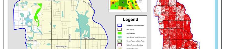
3 Waukegan River Watershed Map
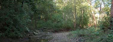
4 Waukegan River Watershed Characteristics ti 12 mi 2 drainage basin Mouth just south of Waukegan Harbor AOC Heavily urbanized (only 13% open) Highly industrialized watershed Armoring on 46% of the channel 19% of river channel is enclosed 48 stormwater basins in the watershed Currently on Illinois 303(d) list for impaired waterways partial support to aquatic life 4


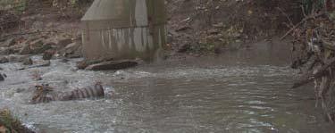

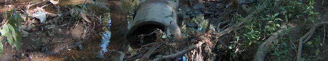
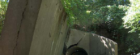
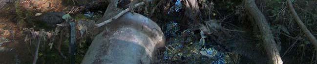
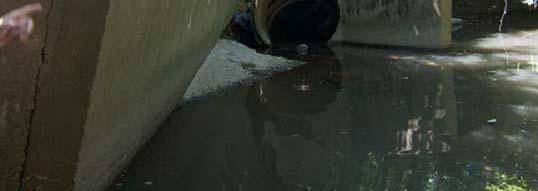
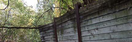
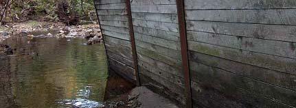
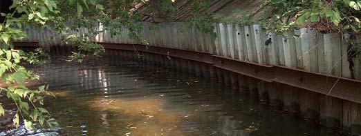
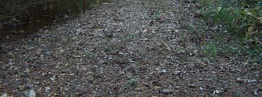
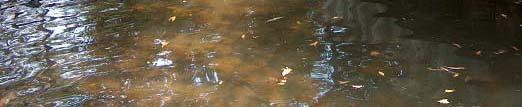
5 Waukegan River Current Conditions & Problems Bank Erosion Discharge Points Failed Hydraulic Structures Failing Bank Protection Sedimentation 5
6 Waukegan River 516(e) Overall Project Schedule Fall 08 Winter 08 through Spring 11 Summer & beyond Buy-in on model recommendations Establish a plan to fill data gaps by others Finalize scoping report / publish on web Develop SWMM model Using in-house / acquired staff Periodic meetings with stakeholders Develop user manual / training documents Training / Tech Transfer Workshops Hands on use of models User feedback Possible Further Development/Refinement 6
7 Waukegan River 516(e) Hydrologic Model SWMM v5.0 Current version developed by USEPA & CDM Widely used in urban areas including Chicago area Integrated capabilities for routing flow through sewer systems & open channels Runoff and infiltration can be calculated using a wide variety of methods Water quality capabilities BMP removal efficiency can be tied to a particular land use (includes LID practices) Snow accumulation and melting Improved capabilities available through proprietary interfaces (i.e. PCSWMM and XPSWMM) 7
8 Data Sources PCSWMM/SWMM 5.0 Model Model Assembly City of Waukegan Sewer maps Culvert dimensions New Survey Completed Summer 2010 Filled in data gaps Channel cross sections Sewer and hydraulic structure dimensions and elevations Other Data LIDAR Slope, Flow path CMAP Land Use, Imperviousness Lake County SMC Event Mean Concentrations Soils Infiltration parameters NOAA Lake Michigan gage record 8
9 Climatology PCSWMM/SWMM 5.0 Model Model Characteristics ti 3 Precipitation gages (and 1 computed gage) employed Temperature and wind speed taken from FAA airport gage Computed evaporation rates Sewershed Boundaries Original boundaries taken from Waukegan River Watershed Plan (Dec 2007) Further subdivided and adjusted based on sewer maps and new survey 252 subcatchments in the watershed Average subcatchment is 27 acres 9
10 PCSWMM/SWMM 5.0 Model Model Characteristics ti Sewershed Characteristics Infiltration based on Green-Ampt methodology Imperviousness calculated using CMAP land use data Slope and Flow length based on DEM Conduits and Nodes North, South, and Main branch of Waukegan River included Cross sections of channel taken from recent surveys Sewer locations, dimensions, and elevations taken from City of Waukegan database and recent survey Most conduits greater than 15 inches included in the model Water Quality Event Mean Concentrations by landuse from Lake Co. SMC Model currently includes TSS 10
11 PCSWMM/SWMM 5.0 Model Model Calibration Flow Gages 4 gages maintained by Lake County Health Department during 2008 and 2009 June-October 2008 period of record used for calibration April-July 2009 period of record used for model verification Water Quality Event based monitoring for 6 storms at 2 gages Calibration Adjusted travel length and imperviousness Added baseflow and RDII 11
12 12
13 13
14 14
15 Waukegan River 516(e) Next Steps Training and User Documentation Summary newsletter-style handout Detailed model development report Hands-on Technology Transfer (June 2011) SWMM Model Detailed watershed model report User feedback Further Model Refinement (as needed) Based on user feedback Available funding 15
16
Introduction. The System. Model Limitations, Assumptions, and Parameters. Optional Services Tech Memo
 Optional Services Tech Memo Introduction This technical memo evaluates the impact of a tide gate to be installed at the confluence of the Left Bank Tributary of Thalia Creek and Lake Windsor. Specifically,
Agenda Report. Spruce Street Outlet Drainage Improvements Tower Road Relief Sewer
 Agenda Report Subject: Prepared By: Spruce Street Outlet Drainage Improvements Tower Road Relief Sewer Steven M. Saunders, Director of Public Works/Village Engineer Date: August 12, 2012 On March 8, 2012
Statistical Evaluation of BMP Effectiveness in Reducing Fecal Coliform Impairment in Mermentau River Basin
 Statistical Evaluation of BMP Effectiveness in Reducing Fecal Coliform Impairment in Mermentau River Basin Z.-Q. Deng 1 and H. Chowdhary 2 1 Assistant Professor, Department of Civil and Environmental Engineering,
Welcome KROSNO CREEK DIVERSION PROJECT CLASS ENVIRONMENTAL ASSESSMENT
 Welcome KROSNO CREEK DIVERSION PROJECT PUBLIC INFORMATION CENTRE # 1 Tonight s Presentation Study Overview Background Existing Conditions Alternative Solutions Preliminary Preferred Solution Next Steps
The Problem.. SuDS: Controlling the Flow. LANDF RM Technical delivery of SuDS 15/10/2013. Bridget Woods Ballard HR Wallingford 1.
 SuDS: Controlling the Flow 15th October 2013 Bridget Woods Ballard The Problem.. Page 2 Bridget Woods Ballard HR Wallingford 1 15th October 2013 Landform Event Page 3 HR Wallingford 2013 The Aim of SuDS.
Enhancing hydrological data management and exchange procedures
 Enhancing hydrological data management and exchange procedures The Sava River Hydraulic Model Dr Mark R Jourdan, PE Research Hydraulic Engineer U.S. Army Engineer Research and Development Center Vicksburg,
City of Peoria Clean Water Efforts. Governor s s Conference on the Management of the Illinois River October 4, 2007
 City of Peoria Clean Water Efforts Governor s s Conference on the Management of the Illinois River October 4, 2007 1 What do you call dinner and a movie with an unemployed guy? An unfunded man-date! 2
Hydraulic Report. Trail 5 Snowmobile Trail Over Mulligan Creek. Prepared By: COLEMAN ENGINEERING COMPANY Karisa V. Falls, P.E.
 Prepared for: Prepared by: Marquette County Road Commission Coleman Engineering Company Marquette, Michigan Iron Mountain, MI December 2011 Hydraulic Report Trail 5 Snowmobile Trail Over Mulligan Creek
Chapter 4.0 Alternatives Analysis
 Chapter 4.0 Alternatives Analysis Chapter 1 accumulated the baseline of existing airport data, Chapter 2 presented the outlook for the future in terms of operational activity, Chapter 3 defined the facilities
ASSESSMENT OF FECAL COLIFORM IN LITTLE RABBIT CREEK AND LITTLE SURVIVAL CREEK
 ASSESSMENT OF FECAL COLIFORM IN LITTLE RABBIT CREEK AND LITTLE SURVIVAL CREEK FINAL REPORT Prepared for: Alaska Department of Environmental Conservation 555 Cordova Street Anchorage, Alaska 99501 Prepared
Managing water supply resources in karstic environment (temperate climate)
") UNESCO WORKSHOP Integrated Urban Water Management in TC Temperate Climates Belgrade 15-16 May 2006 Managing water supply resources in karstic environment (temperate climate) E. Rozos, D. Koutsoyiannis
UNESCO WORKSHOP Integrated Urban Water Management in TC Temperate Climates Belgrade 15-16 May 2006 Managing water supply resources in karstic environment (temperate climate) E. Rozos, D. Koutsoyiannis
Hydrology Input for West Souris River IWMP
 Hydrology Input for West Souris River IWMP Prepared by: Mark Lee Manitoba Water Stewardship 1 1 1 Overall view of: drainage area watershed characteristics gauging stations meteorological stations Runoff
Jasna Plavsic. WATER-FOOD-ENERGY-ECOSYSTEMS NEXUS ASSESSMENT IN THE SAVA RIVER BASIN Zagreb, 6 March 2014
 WATER-FOOD-ENERGY-ECOSYSTEMS NEXUS ASSESSMENT IN Zagreb, 6 March 214 Water and Climate Adaptation Plan (WATCAP) for the Sava River Basin: Climate Change Predictions for the Sava River Basin Jasna Plavsic
Ditch flows slowly to the north
 Ditch flows slowly to the north Photo 1. Wetland DE: Looking west across Wetland DE from upslope. Ponded water, mucky mineral soils, and patches of emergent vegetation observed. Wetland DE appears to be
DIDYMO SURVEY, LOWER FRYINGPAN RIVER, BASALT, COLORADO 2015
 DIDYMO SURVEY, LOWER FRYINGPAN RIVER, BASALT, COLORADO 2015 Second Annual Report PREPARED FOR: ROARING FORK CONSERVANCY PREPARED BY: COLORADO MOUNTAIN COLLEGE NATURAL RESOURCE MANAGEMENT PROGRAM TIMBERLINE
An Introduction. The Saginaw River/Bay Area of Concern
 Saginaw River & Bay Area of Concern: Looking Forward Continued Partnerships in the Restoration of Saginaw Bay Michelle Selzer Lake Huron Coordinator & Interim AOC Coordinator Saginaw Bay Watershed Conference
Colombia (South America) Water use and drainage in Colombia. Case Study: The Stormwater Challenge in Barranquilla. Humberto Avila.
 Water use and drainage in Colombia. Case Study: The Stormwater Challenge in Barranquilla. Humberto Avila.") Colombia (South America) Water use and drainage in Colombia Location: Case Study: The Stormwater Challenge in Barranquilla Source: Wikipedia The University of Alabama February 25, 2008 Population: 45 million
Colombia (South America) Water use and drainage in Colombia Location: Case Study: The Stormwater Challenge in Barranquilla Source: Wikipedia The University of Alabama February 25, 2008 Population: 45 million
Watershed Runoff Analysis
 CREATING SOLUTIONS FOR A CHANGING WORLD Watershed Runoff Analysis April 18, 2017 John Melack, UCSB Ed Beighley & Dongmei Feng, Northeastern University Study Workflow Civil and Environmental Engineering
Permittees under Sector S are primarily engaged in the following types of activities:
 S. Air Transportation 1. Authorized Stormwater Discharges The requirements in Sector S apply to stormwater discharges associated with industrial activity from air transportation facilities as identified
Water, Sewer and Stormwater General Facilities & Connection Charges
 City of Snoqualmie Water, Sewer and Stormwater General Facilities & Connection Charges City Council Meeting March 9, 2015 Presented by: Sergey Tarasov, Project Manager Presentation Overview New customer
Paul Sturm Roberto Viqueira Ríos
 Paul Sturm Roberto Viqueira Ríos In this talk Brief Background on Land Based Sources Historical Perspective Guánica watershed characteristics/ issues High priority restoration projects Other key issues
The Role of Glaciers in the Hydrologic Regime of the Nepal Himalaya. Donald Alford Richard Armstrong NSIDC Adina Racoviteanu NSIDC
 The Role of Glaciers in the Hydrologic Regime of the Nepal Himalaya Donald Alford Richard Armstrong NSIDC Adina Racoviteanu NSIDC Outline of the talk Study area and data bases Area altitude distributed
National and Regional Activities, Needs and Expectations
 National and Regional Activities, Needs and Expectations The perspective from the International Sava River Basin Commission International collaboration in the forecasting of river flows within the Sava
4. Hydrology of the Olentangy River Watershed
 4. Hydrology of the Olentangy River Watershed The Hydrologic Cycle Water on Planet Earth is dynamic constantly being recycled from the land to the atmosphere to the ocean. Rivers and streams are just a
Appendix A Appendix A (Project Specifications) Auk Auk / Black Diamond (Trail 44) Reroute
 Auk Auk / Black Diamond (Trail 44) Reroute") Appendix A (Project Specifications) Auk Auk / Black Diamond (Trail 44) Reroute I. Proposed Action: This project proposes to reroute approximately 1,800 feet of a 50 inch wide trail, off of private property
Appendix A (Project Specifications) Auk Auk / Black Diamond (Trail 44) Reroute I. Proposed Action: This project proposes to reroute approximately 1,800 feet of a 50 inch wide trail, off of private property
CITY OF LYNDEN STORMWATER MANAGEMENT PROGRAM REPORT MARCH 1, 2016
 CITY OF LYNDEN STORMWATER MANAGEMENT PROGRAM 2015 WATER QUALITY MONITORING REPORT CITY OF LYNDEN 300 4 TH STREET LYNDEN, WASHINGTON 98264 PHONE (360) 354-3446 MARCH 1, 2016 This document serves as an attachment
II. THE BOULDER CREEK DRAINAGE BASIN
 II. THE BOULDER CREEK DRAINAGE BASIN This section provides an overview of the watersheds and flood hazards associated with Boulder Creek and South Boulder Creek including descriptions of the drainage basins,
Fecal and Total Coliform TMDL for Sparkman Branch (WBID 1561)
") FINAL FLORIDA DEPARTMENT OF ENVIRONMENTAL PROTECTION Division of Water Resource Management, Bureau of Watershed Management Southwest DISTRICT Tampa Bay BASIN TMDL Report Fecal and Total Coliform TMDL for
FINAL FLORIDA DEPARTMENT OF ENVIRONMENTAL PROTECTION Division of Water Resource Management, Bureau of Watershed Management Southwest DISTRICT Tampa Bay BASIN TMDL Report Fecal and Total Coliform TMDL for
Hydrological study for the operation of Aposelemis reservoir Extended abstract
 Hydrological study for the operation of Aposelemis Extended abstract Scope and contents of the study The scope of the study was the analytic and systematic approach of the Aposelemis operation, based on
GEAUGA COUNTY BOARD OF COMMISSIONERS TRACY JEMISON MARY SAMIDE WILLIAM YOUNG 470 Center Street, Bldg. 4 Chardon, OH
 GEAUGA COUNTY BOARD OF COMMISSIONERS TRACY JEMISON MARY SAMIDE WILLIAM YOUNG 470 Center Street, Bldg. 4 Chardon, OH 44024 440-279-1660 DRAINAGE ENGINEER ROBERT L. PHILLIPS, P.E., P.S. 470 Center Street,
INSURED - INFORMATION SYSTEM FOR AN INTEGRATED AND SUSTAINABLE USE OF WATER RESOURCES OF DRINI-DRIM RIVER
 BALWOIS 2004 Ohrid, Macedonia, 25-29 May2004 INSURED - INFORMATION SYSTEM FOR AN INTEGRATED AND SUSTAINABLE USE OF WATER RESOURCES OF DRINI-DRIM RIVER Agim Selenica\ Miriam Boqdanl', Marc Morell 2, Josif
Treats 2,271,000 gallons of greywater from the water park using the constructed lagoon and wetland, saving $8,539 in sewer charges annually.
 Carmel, IN Methodology for Landscape Performance Benefits Prepared by: Research Fellow: M. Elen Deming, Professor, University of Illinois Research Assistant: Paul Littleton, MLA Candidate, University of
RIO VISTA MUNICIPAL AIRPORT
 DRAINAGE TECHNICAL MEMORANDUM RIO VISTA MUNICIPAL AIRPORT RIO VISTA, CALIFORNIA Prepared for: City of Rio Vista 1 Main Street Rio Vista, CA 94571 (707) 374-5337 Prepared by: August 2012 Copyright 2012
Trail Assessment Report
 Trail Assessment Report Trail Options for the Bear Creek Canyon located in Pikes Peak Ranger District, Pike National Forest and on Colorado Springs Utility Lands Due to the presence of a unique species
ACTION PLAN FOR THE PERIOD concerning the STRATEGY ON IMPLEMENTATION OF THE FRAMEWORK AGREEMENT ON THE SAVA RIVER BASIN
 Doc. 1S-26-O-11-5/1-2 ACTION PLAN FOR THE PERIOD 2011-2015 concerning the STRATEGY ON IMPLEMENTATION OF THE FRAMEWORK AGREEMENT ON THE SAVA RIVER BASIN April 2011 Table of Contents INTRODUCTION... 5 1.
Lake County Municipal League 201 Innovation Awards Nomination
 Lake County Municipal League 201 Innovation Awards Nomination You may enter the information directly on this form. Please remember to save your work before sending. Nominee information Name: Title: Municipality:
Fecal Coliform TMDL for Strawberry Creek (WBID 2239)
") FLORIDA DEPARTMENT OF ENVIRONMENTAL PROTECTION Division of Environmental Assessment and Restoration, Bureau of Watershed Restoration NORTHEAST DISTRICT LOWER ST. JOHNS BASIN Final TMDL Report Fecal Coliform
FLORIDA DEPARTMENT OF ENVIRONMENTAL PROTECTION Division of Environmental Assessment and Restoration, Bureau of Watershed Restoration NORTHEAST DISTRICT LOWER ST. JOHNS BASIN Final TMDL Report Fecal Coliform
International Sava River Basin Commission
 International Sava River Basin Commission Pilot project on climate change: Building the link between the Flood Risk Management planning and climate change assessment in the Sava River Basin climate change
Common Ground Drainage Channel Diversion. Design Report
 Common Ground Drainage Channel Diversion Design Report Resource Management International Inc Consulting Engineers May 2017 COMMON GROUND DRAINAGE CHANNEL DIVERSION PREPARED FOR: QUILL LAKES WATERSHED NO.
Assessment of Pathogen Strategies
 Assessment of Pathogen Strategies Bacteria levels in receiving waters are a primary concern for federal, state, and local agencies. The primary sources of bacteria are generally attributed to combined
HYDRAULIC DESIGN OF THE TOURISTIC BERTHING IN ASWAN CITY
 HYDRAULIC DESIGN OF THE TOURISTIC BERTHING IN ASWAN CITY Dr. Hossam El-Sersawy Researcher, Nile Research Institute (NRI), National Water Research Center (NWRC), Egypt E-mail: h_sersawy@hotmail.com Dr.
Mr. Michael Malone CPS Energy 145 Navarro Street San Antonio, Texas Project No
 January 15, 2016 Mr. Michael Malone 145 Navarro Street San Antonio, Texas 78205 Project No. 0328985 Environmental Resources Management CityCentre Four 840 West Sam Houston Pkwy N. Suite 600 Houston, Texas
Water Resources Update after NCGA Long Session
 Water Resources Update after NCGA Long Session North Carolina Beach Inlet & Waterway Association Annual Conference November 16, 2015 Division of Water Resources Overview New Name / Reorganization Jordan
Composite CN Value Based on Hydrologic Soil Group and Estimated Future Land Cover
 Composite CN Value Based on Hydrologic Soil Group and Estimated Future Land Cover Village of Milan, Mirabal Park /5/016 DEVELOPED LAND AREAS** Basin Basin HSG "B" HSG "C" HSG "D" Basin Basin Area Area
GRANDE News Letter Volume1, No.3, December 2012
 GRANDE News Letter Volume1, No.3, December 2012 Building a water management system in La Paz, Bolivia Climate change is a phenomenon that affects the entire world, but its impact on people differs depending
Snow/Ice melt and Glacial Lake Outburst Flood in Himalayan region
 Snow/Ice melt and Glacial Lake Outburst Flood in Himalayan region Dr. SANJAY K JAIN NATIONAL INSTITUTE OF HYDROLOGY ROORKEE Modelling and management flood risk in mountain areas 17-19 Feb., 2015 at Sacramento,
Via Only. In reply refer to/attn: Place ID:794813:ERyan
 California Regional Water Quality Control Board, San Diego Region May 5, 2016 Via Email Only Mr. Richard Boon, Chief Orange County Stormwater Program OC Public Works 2301 N. Glassell Street Orange, CA
Shrubs and alpine meadows represent the only vegetation cover.
 Saldur river General description The study area is the upper Saldur basin (Eastern Italian Alps), whose elevations range from 2150 m a.s.l. (location of the main monitoring site, LSG) and 3738 m a.s.l.
Note that the steepest 8 direction pour point model slope in direction 64 is: 10.0
 GIS in Water Resources Exercise #3 Solution Part 1. 1.1 Hand Calculations (i) The standard ESRI surface slope function Grid size 10 m Diagonal distance= 14.142 m 47.5 48 47.7 50.6 48.3 dz/dx= -0.125 45.1
The north half of Section 18, Township 37 North, Range 6 East, Second Principal Meridian, Jefferson Township, Elkhart County, Indiana; also,
 The north half of Section 18, Township 37 North, Range 6 East, Second Principal Meridian, Jefferson Township, Elkhart County, Indiana; also, The east half of Sections 21, 28, and 33, Township 37 North,
Public Works Research Institute
 Public Works Research Institute INTERNATIONAL WORKSHOP ON WATER HAZARD AND RISK MANAGEMENT SOME EXPERIENCES OF FLOOD MANAGEMENT IN ARGENTINA VÍCTOR POCHAT National Director for Water Policies,Coordination
Platform and Products
 International Partnership Space Programme Earth Observation for the Preservation of Ecological Bacalar Corridor Platform and Products Terri Freemantle, Raffaella Guida, Paula Marti, Pasquale Iervolino
International Osoyoos Lake Board of Control Annual Report to the International Joint Commission
 International Osoyoos Lake Board of Control 2010 Annual Report to the International Joint Commission TABLE OF CONTENTS ACTIVITIES OF THE BOARD... 1 HYDROLOGIC CONDITIONS IN 2010... 2 Drought Criteria...
NEW WEB TOOL FOR UNDERSTANDING BIOLUMINESCENT BAYS
 NEW WEB TOOL FOR UNDERSTANDING BIOLUMINESCENT BAYS Fernando Gilbes Santaella* and William Hernandez GERS Lab-Department of Geology University of Puerto Rico at Mayaguez *fgilbes@uprm.edu RESEARCH COMPONENT
Glacial lakes as sentinels of climate change in Central Himalaya, Nepal
 Glacial lakes as sentinels of climate change in Central Himalaya, Nepal Sudeep Thakuri 1,2,3, Franco Salerno 1,3, Claudio Smiraglia 2,3, Carlo D Agata 2,3, Gaetano Viviano 1,3, Emanuela C. Manfredi 1,3,
Competence Requirements for eronautical eteorological ersonnel
 WMO-CGMS Virtual Laboratory For Education and Training in Satellite Meteorology Competence Requirements for eronautical eteorological ersonnel 2013 and beyond Overview Part One Background and Terminology
VI. ALTERNATIVES TO THE MASTER PLAN C. RENOVATED EAST BUILDING ALTERNATIVE
 VI. ALTERNATIVES TO THE MASTER PLAN C. RENOVATED EAST BUILDING ALTERNATIVE INTRODUCTION The Renovated East Building Alternative would include the continued use of the renovated West Building and the renovation
Bear Creek Habitat Improvement Project
 06/10/10 Bear Creek Habitat Improvement Project El Paso County, Colorado Pike National Forest and Colorado Springs Utilities Owned Land Report prepared by: Eric Billmeyer Executive Director Rocky Mountain
Peter Axelson. Beneficial Designs, Inc. Minden, NV
 Peter Axelson Beneficial Designs, Inc. Minden, NV Arroya Sit Ski Mono Ski Dynamic Seating Spring Assist Cross Country Ski Hand Bike Adaptive Canoe Seating Available from Chosen Valley Canoe Accessories
Final Drainage Letter Pikes Peak Community College Downtown Parking Lot Colorado Springs, Colorado
 Final Drainage Letter Pikes Peak Community College Downtown Parking Lot Colorado Springs, Colorado Prepared for: Pikes Peak Community College 5775 South Academy Boulevard Colorado Springs, CO 80906-5422
SF1363 / HF 1061: Legacy Funding; Conference Agreement
 - Conference 1 Art 1 - Outdoor Heritage Fund 2 3 Prairies 4 WMA, SNA, & Prairie Bank Easement Acq. Phase III 5 Accelerated Prairie Restoration - Phase III 6 MN Buffers for Wildlife & Water 7 Northern Tallgrass
Long term morphological analysis and simulations
 Long term morphological analysis and simulations Dr.-Ing. Markus Promny Bundesanstalt für Gewässerkunde / Federal Institute of Hydrology GESINUS 2010 - Liège - 29./30.07.2010 page 1 1D-models of German
Finn Creek Park. Management Direction Statement Amendment
 Finn Creek Park Management Direction Statement Amendment November 2013 Management Direction Statement Amendment Approved by: Jeff Leahy Regional Director, Thompson Cariboo BC Parks November 12, 2013 Date
Application for Permit to Develop in a Floodplain Area
 Application for Permit to Develop in a Floodplain Area The undersigned hereby makes application for a permit to develop in a designated floodplain area. The work to be performed is described below and
Geography. Onondaga Creek Fact Sheet. Ontario Lake Plain. Finger Lakes. Appalachian Plateau. Figure 1. Regional Context. Introduction.
 Geography Introduction Creek Fact Sheet Creek is part of the Seneca-Oswego-Oneida River basin. Two main branches of Creek, one in Tully Valley and one in /Cedarvale, join near the Nation border. Watershed
Figure 1 shows the evaluation area around Tailings Basin Cells 2E/1E. Two areas were evaluated for potential wetland impacts including:
 Barr Engineering Company 4700 West 77th Street Minneapolis, MN 55435-4803 Phone: 952-832-2600 Fax: 952-832-2601 www.barr.com An EEO Employer Minneapolis, MN Hibbing, MN Duluth, MN Ann Arbor, MI Jefferson
Cleveland Harbor Dredged Material Management
 Cleveland Harbor Dredged Material Management Requirements, Capacity Issues, and Placement Alternatives Brent R. Leslie, CPA Chief Financial Officer Cleveland-Cuyahoga County Port Authority Brent.Leslie@portofcleveland.com
GILBERT & WEST TOWN INTERCOUNTY DRAIN Windsor Township, Eaton County and City of Lansing, Delhi Township, Ingham County, Michigan
 GILBERT & WEST TOWN INTERCOUNTY DRAIN Windsor Township, Eaton County and City of Lansing, Delhi Township, Ingham County, Michigan PRELIMINARY ENGINEERING REPORT Abigail Eaton, Chair Intercounty Drains
Dallas/Fort Worth International Airport Winter Weather Season Kick-Off Meeting
 Dallas/Fort Worth International Airport Winter Weather Season Kick-Off Meeting 10.27.16 Dallas/Fort Worth International Airport Winter Weather Season Kick-Off Meeting Agenda Welcome / Introductions DFW
APPENDIX D: SUSTAINABLE TRAIL DESIGN. APPENDICES Town of Chili Parks and Recreation Master Plan Update
 APPENDIX D: SUSTAINABLE TRAIL DESIGN APPENDICES Town of Chili Parks and Recreation Master Plan Update Sustainable Trail Construction Sustainable trails are defined by the US Forest Service as trails having
NC Dredge Studies. Sterling Baker, P.E. NCDOT James Gregson NCDEQ April 5, 2018
 NC Dredge Studies Study of the Use and Efficiency of the Dredge Manteo Study of Acquisition of Dedicated Dredging Capacity Study of Dredging Services Cost-Benefit Analysis Sterling Baker, P.E. NCDOT James
International Osoyoos Lake Board of Control Annual Report to the International Joint Commission
 International Osoyoos Lake Board of Control 2015 Annual Report to the International Joint Commission Cover: Northern extent of Osoyoos Lake, where the Okanagan River enters the lake, 2015. View is to the
MARINA BOLADO PENAGOS A METHODOLOGY TO ASSESS THE ROLE OF THE RIVER DISCHARGES TO THE GULF OF CADIZ ON THE NUTRIENT SUPPLY TO THE ALBORAN SEA
 MARINA BOLADO PENAGOS A METHODOLOGY TO ASSESS THE ROLE OF THE RIVER DISCHARGES TO THE GULF OF CADIZ ON THE NUTRIENT SUPPLY TO THE ALBORAN SEA INTRODUCTION General MEGAN Project Case Study Guadalquivir
ES Aircraft Deicing Document Identification Number Date: March 15, ) Activity Description:
 Activity Description:") ES-301-1.06 Aircraft Deicing Document Identification Number ES-301-1.06 Date: March 15, 2018 Document Owner: Keith Pass 1) Activity Description: Aircraft deicing is the application of aircraft deicing
ES-301-1.06 Aircraft Deicing Document Identification Number ES-301-1.06 Date: March 15, 2018 Document Owner: Keith Pass 1) Activity Description: Aircraft deicing is the application of aircraft deicing
Lake Chelan Operations
 Lake Chelan Operations IPMA Executive Seminar September 17, 2013 Presented by: Janet Jaspers Chelan County PUD Lake Chelan Hydroelectric Project Today s Discussion Chelan PUD Overview Interesting Facts
Geoscape Toronto The Oak Ridges Moraine Activity 2 - Page 1 of 10 Information Bulletin
 About 13,000 years ago as the Laurentide Ice Sheet melted, glacial meltwater accumulated between the ice sheet and the Niagara Escarpment. This formed a lake basin into which gravel and sand were deposited.
2015 City of Tuscaloosa Floodplain Management Plan Tuscaloosa, Alabama
 2015 City of Tuscaloosa Floodplain Management Plan Tuscaloosa, Alabama Prepared under the direction of the City of Tuscaloosa Floodplain Management Planning Committee With the support of the City of Tuscaloosa
Version Isolated & Non-Waters Only 1 of 3
 APPROVED JURISDICTIONAL DETERMINATION FORM U.S. Army Corps of Engineers SECTION I: BACKGROUND INFORMATION A. REPORT COMPLETION DATE FOR APPROVED JURISDICTIONAL DETERMINATION (JD): July 6, 2010. B. DISTRICT
COOPERATIVE LAKES MONITORING PROGRAM TRAINING FOR. Score the Shore
 COOPERATIVE LAKES MONITORING PROGRAM TRAINING FOR Score the Shore Paul Steen Huron River Watershed Council psteen@hrwc.org 734-769-5123 x601 Jo Latimore Michigan State University 517-432-1491 latimor1@msu.edu
Fecal Coliform TMDL for Saint Joes Creek, WBID 1668A
 FLORIDA DEPARTMENT OF ENVIRONMENTAL PROTECTION Division of Water Resource Management, Bureau of Watershed Management SOUTHWEST DISTRICT SPRINGS COAST BASIN ANCLOTE RIVER/COASTAL PINELLAS COUNTY PLANNING
FLORIDA DEPARTMENT OF ENVIRONMENTAL PROTECTION. Division of Environmental Assessment and Restoration, Bureau of Watershed Restoration
 FLORIDA DEPARTMENT OF ENVIRONMENTAL PROTECTION Division of Environmental Assessment and Restoration, Bureau of Watershed Restoration NORTHWEST DISTRICT PENSACOLA BAY BASIN FINAL TMDL Report Fecal Coliform
Developing an Aircraft Weight Database for AEDT
 17-02-01 Recommended Allocation: $250,000 ACRP Staff Comments This problem statement was also submitted last year. TRB AV030 supported the research; however, it was not recommended by the review panel,
Fecal Coliform Bacteria Monitoring for the Sleepy Creek Watershed Incremental 319 Project Final Report
 Fecal Coliform Bacteria Monitoring for the Sleepy Creek Watershed Incremental 319 Project Final Report Prepared for: West Virginia Conservation Agency Prepared by: Cacapon Institute Back Creek Road PO
The Evolution of DFW Airport s Deicing Program Balancing Risks with Results MAY 20, 2015
 Dallas/Fort Worth International Airport The Evolution of DFW Airport s Deicing Program Balancing Risks with Results MAY 20, 2015 DFW: Connecting The World The cities of Dallas and Fort Worth overcame politics
"Transboundary coordination according to the FD Directive in the shared river basins of Greece
 Workshop on Transboundary Issues Budapest March 31st April 1st "Transboundary coordination according to the FD Directive in the shared river basins of Greece Katerina Triantafyllou, ECOS Consulting S.A.
Rainfall Appendix. Summary Statistics of Rainfall Data for Sites in the West-Central Florida. A Simple Conceptualized Rainfall/Discharge Relationship
 Rainfall Appendix Summary Statistics of Rainfall Data for Sites in the West-Central Florida A Simple Conceptualized Rainfall/Discharge Relationship Stream or river flows are, of course, integrally associated
Sandbag Barrier. Suitable Applications Sandbag barriers may be suitable: As a linear sediment control measure:
 Categories EC Erosion Control SE Sediment Control TC Tracking Control WE Wind Erosion Control Non-Stormwater NS Management Control Waste Management and WM Materials Pollution Control Legend: Primary Category
Runway Length Analysis Prescott Municipal Airport
 APPENDIX 2 Runway Length Analysis Prescott Municipal Airport May 11, 2009 Version 2 (draft) Table of Contents Introduction... 1-1 Section 1 Purpose & Need... 1-2 Section 2 Design Standards...1-3 Section
Decision Notice and Finding of No Significant Impact
 Decision Notice and Finding of No Significant Impact Steamboat Ski Area Summer Trails Project USDA Forest Service Medicine Bow-Routt National Forests Hahns Peak/Bears Ears Ranger District Routt County,
HYDROLOGY OF GLACIAL LAKES, FORT SISSETON AREA
 PROC. S.D. ACAD. SCI., VOL. 77 (1998) 59 HYDROLOGY OF GLACIAL LAKES, FORT SISSETON AREA Perry H. Rahn Department of Geology & Geological Engineering South Dakota School of Mines and Technology Rapid City,
SECTION 3 GENERAL DESCRIPTION OF THE RIVER BASIN
 SECTION 3 GENERAL DESCRIPTION OF THE RIVER BASIN SECTION 3 GENERAL DESCRIPTION OF THE RIVER BASIN River basin description. A general description of the river basin or subbasin, as appropriate, in which
A GIS Assessment of Erosion Vulnerability for Unofficial Trails in the Columbia River Gorge
 A GIS Assessment of Erosion Vulnerability for Unofficial Trails in the Columbia River Gorge Sachi Arakawa Geog 593 Digital Terrain Analysis Fall 2017 Abstract The city of North Bonneville, located along
Project Management, Environmental Assessment, Stormwater Management. Hydrologic Modelling. Natural Heritage. Fluvial Geomorphology
 Welcome PUBLIC INFORMATION CENTRE # 1 KROSNO CREEK DIVERSION PROJECT February 19, 2014 6:30 p.m. to 8:30 p.m. Please sign in on the sheet provided. Then feel free to walk around and view the displays.
Guánica Bay Watershed Initiative
 Guánica Bay Watershed Initiative Prepared by Center for Watershed Protection For NOAA and PRDNER NOAA circulated plan to all agencies USDA/ NRCS entered As commitment to Coral Reef Task Force How did
Thirteenth International Water Technology Conference, IWTC , Hurghada, Egypt 1249
 Thirteenth International Water Technology Conference, IWTC 13 2009, Hurghada, Egypt 1249 EVALUATION OF LOCAL SCOUR AROUND BRIDGE PIERS (RIVER NILE BRIDGES AS CASE STUDY) Sherine Ismail Assoc. Prof., Survey
RNP AR APCH Approvals: An Operator s Perspective
 RNP AR APCH Approvals: An Operator s Perspective Presented to: ICAO Introduction to Performance Based Navigation Seminar The statements contained herein are based on good faith assumptions and provided
Great Lakes Waterways Conference
 Great Lakes Waterways Conference David Wright U.S. Army Corps of Engineers Chief of Operations Detroit District US Army Corps of Engineers Agenda FY14 Maintenance Dredging Key FY14 Needs/Projects Duluth-Superior
Carbon Offsetting and Reduction Scheme for International Aviation (CORSIA):
:") Carbon Offsetting and Reduction Scheme for International Aviation (CORSIA): Introduction & Expectations on the Submission of Emissions Monitoring Plan Presented to: By: Date: NBAA S Business Aviation Convention
Carbon Offsetting and Reduction Scheme for International Aviation (CORSIA): Introduction & Expectations on the Submission of Emissions Monitoring Plan Presented to: By: Date: NBAA S Business Aviation Convention
A high resolution glacier model with debris effects in Bhutan Himalaya. Orie SASAKI Kanae Laboratory 2018/02/08 (Thu)
") A high resolution glacier model with debris effects in Bhutan Himalaya Orie SASAKI Kanae Laboratory 2018/02/08 (Thu) Research flow Multiple climate data at high elevations Precipitation, air temperature
A high resolution glacier model with debris effects in Bhutan Himalaya Orie SASAKI Kanae Laboratory 2018/02/08 (Thu) Research flow Multiple climate data at high elevations Precipitation, air temperature
Initial OPW Designation APSR AFRR IRR Co-ordinates Easting: Northing: River / Catchment / Sub-catchment Type of Flooding / Flood Risk
 Location: Shannon International Airport, Co. Clare Unique ID: 275484 (from PFRA database) Initial OPW Designation APSR AFRR IRR Co-ordinates Easting: 137674 Northing: 161045 River / Catchment / Sub-catchment