Peter Axelson. Beneficial Designs, Inc. Minden, NV
|
|
|
- Barnaby Cox
- 5 years ago
- Views:
Transcription

1

2 Peter Axelson Beneficial Designs, Inc. Minden, NV

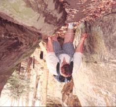
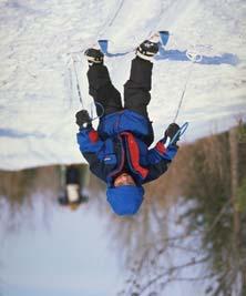
3 Arroya Sit Ski
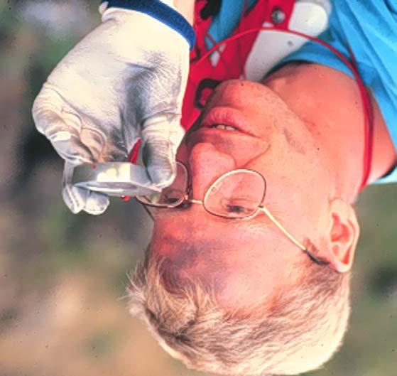
4 Mono Ski

5 Dynamic Seating Spring Assist

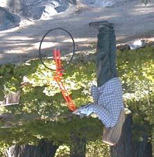
6 Cross Country Ski
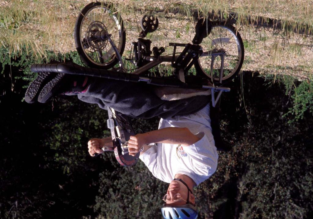
7 Hand Bike


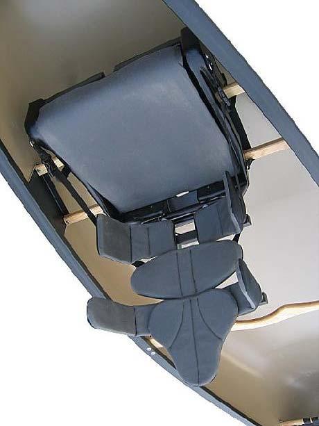
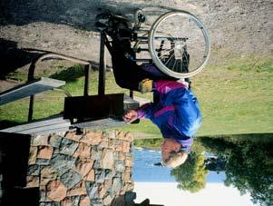
8 Adaptive Canoe Seating Available from Chosen Valley Canoe Accessories

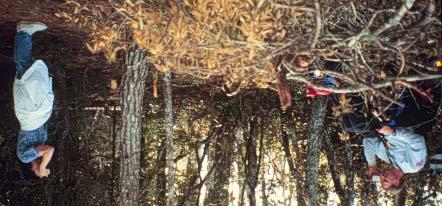
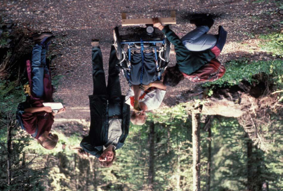
9 Denise Axelson of Beneficial Designs and Mike Passo of Wilderness Inquiry practice and discuss the refinement of measurement protocols before testing begins with the full subject study on the canoe seat development project.

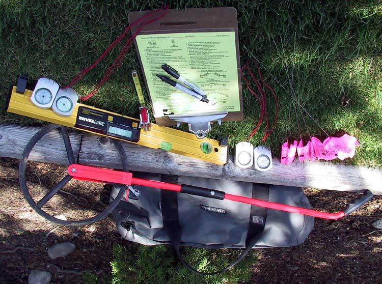
10 Kathy Mispagel of Beneficial Designs and Mike Passo practice the measurement of maximum lateral stability on the dry land canoe simulator. The angle is measured with a smart level and the tipping is accurately controlled by a vertical extension to the canoe.


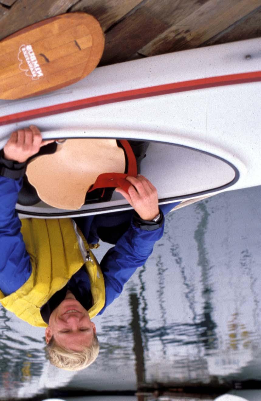
11 Test subjects are coached during the water portion of the evaluation in which the subject finally gets dumped on the count of three to verify safe egress from the canoe. At least one water safety expert is always on hand for this part of the evaluation.

12 The adjustment of the canoe seating system to adapt to many different makes and models of canoes and to as many different body sizes and shapes is the great benefit of the Universal Canoe Seating system under development by Beneficial Designs.
13


14 Lack of Knowledge All users and land managers need accurate trail data Objective trail information is very limited, but it enables informed decisions about trail use and conservation Subjective information is not related to individual abilities
 Assessment must provide objective")
15 Moderate or Easy mean different things People have different abilities (young children, older adults, people with disabilities, unfit and inexperienced individuals) Assessment must provide objective information
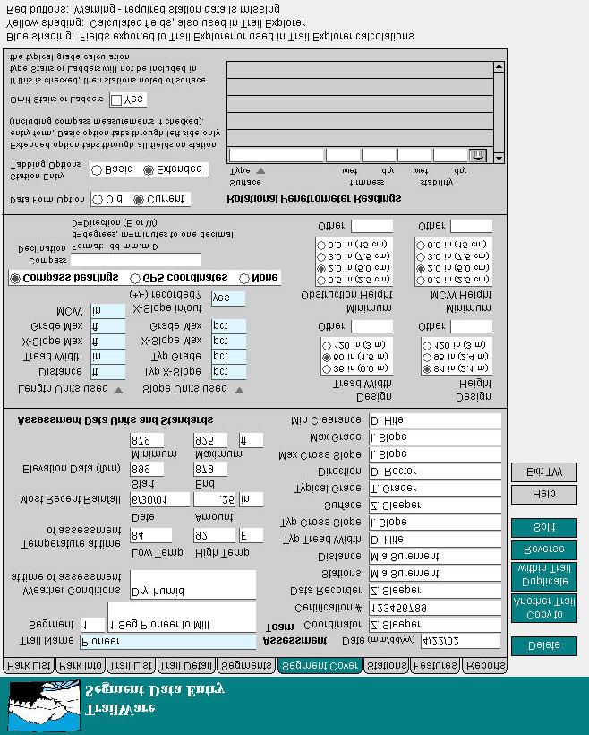
16 Universal Trail Assessment Process - UTAP Access Information Construction and Maintenance Mapping and Interpretation Environmental Protection and Management Compliance with Design Standards
17

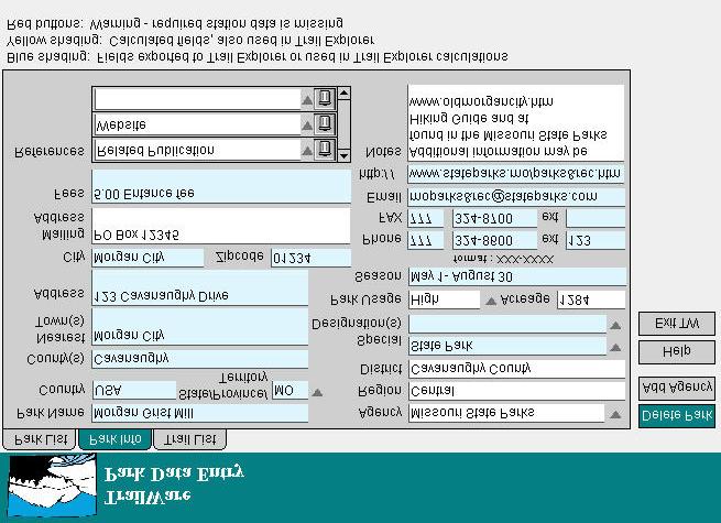
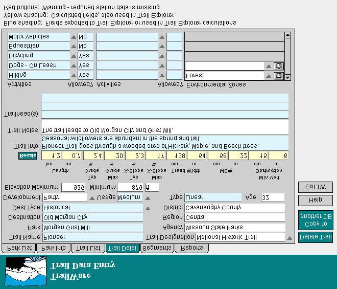
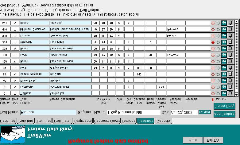
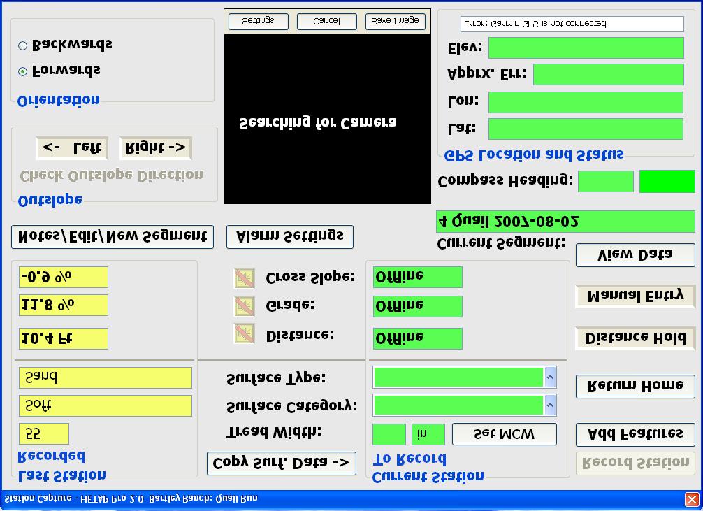
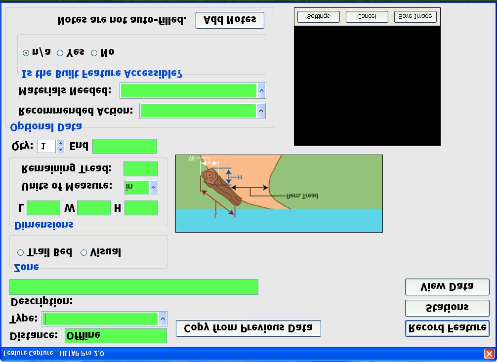
18 Key UTAP Information Length Grade Width Surface Cross slope Features & Facilities
19 UTAP Assessment Team

20 Trail Access Information (TAI) Benefits All Users know the trail conditions they will encounter Safety and satisfaction are increased Land managers can monitor environmental impacts Maintenance and management needs are documented
21 UTAP Implementation Status Over 800 people trained to lead UTAP assessments Over 50 trainers to teach UTAP workshops State and agency-wide implementation is growing (AZ, MN, IN, NY, CA) UTAP assessments available from consultants
22 Development Partners Bureau of Land Management (DOI) Bureau of Reclamation (DOI) National Park Service (DOI) US Army Corps of Engineers US Fish & Wildlife Service (DOI) US Forest Service (USDA)
23 Development Partners American Trails California State Parks Minnesota Department of Natural Resources National Center on Accessibility Wilderness Inquiry
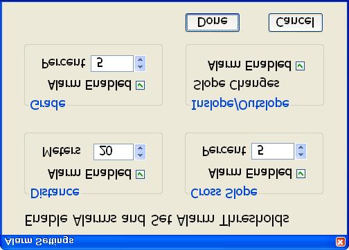
24 Rotational Penetrometer Objective surface measurement device Draft Standard for measure of firmness and stability under development Available from Beneficial Designs
25 Research Funded by the Access Board Built 10 trails with different surface types for human subject testing Tested 4 user groups using trails Measured energy expentiture Established preliminary firmness and stability requirements for trail surfaces
26 TrailWare Computerized data management and analyses Summarize trail information for users Summarize trail information for land managers Export data to Web site and other software
27
28
29
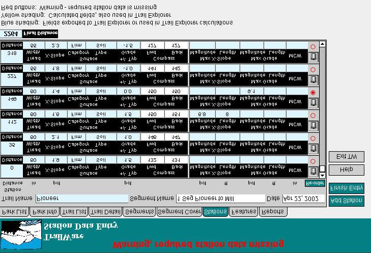
30
31
32
33
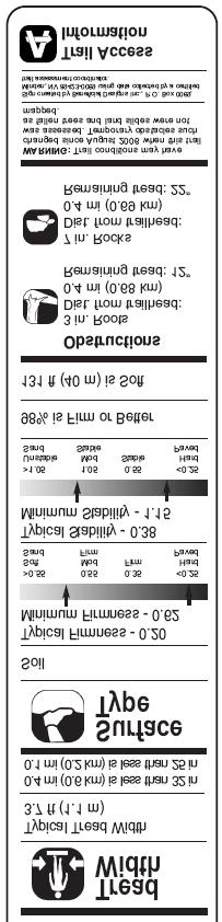
34 TrailWare Reports English or Metric units Data summaries: Grade, Cross Slope and Width Surface Category and Type Tread and Vertical Obstructions Trail Access Information

35 Station or Feature Log Report
36 Summary Tables for Typicals

37 Extreme Summary Tables
38 TrailWare Calculations Typical and extreme values for Grade, Cross Slope and Width Surface Category and Type Tread and Vertical Obstructions
39 TAI Summary

40 Disseminating Information to Users is Critical Informed choice User responsibility Safety Satisfaction Accessible formats
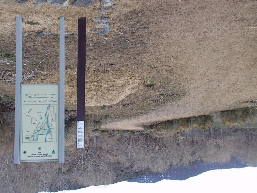
41 On-Trail Information
42 Trail Access Information Sheet
43

44 Computer Kiosk or Internet Site

45
46
47
48
49 What else could we do to improve trail access? Develop standards for trail design Obtain funding for UTAP assessments Automate UTAP so one person can complete all measurements Design a trail barrier that prevents vehicle access but can be used by people with mobility devices
50 ADA Compliance Proposed guidelines available at Recreation trails Outdoor recreation access routes Picnic and campground facilities Beach access
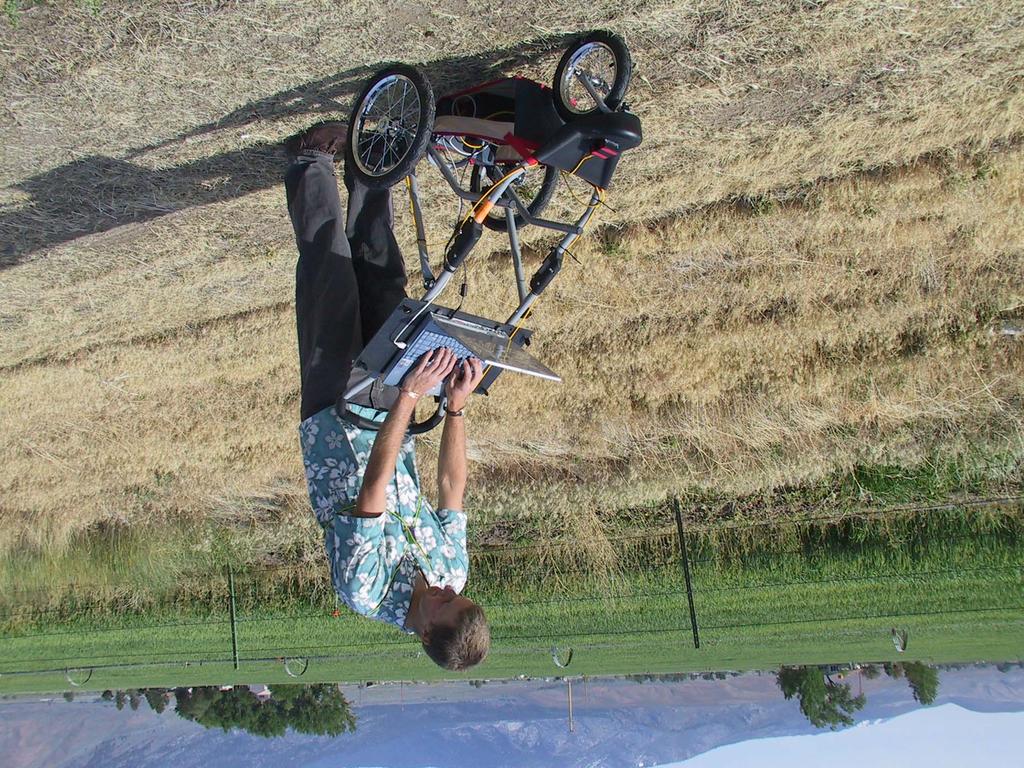
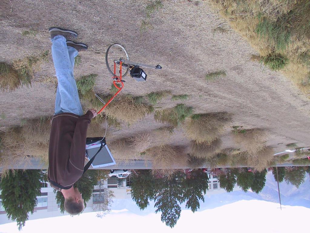
51 Research Funded by the National Center on Accessibility Built test trails and surfaces with different grade and cross slopes Conducted human subject testing Measured difficulty ratings in comparison to existing standards Made reccomendations
52 ADA Recreation Trail Grade up to 30% of length > 8.33% 5% for any distance 8.33% for 200 feet 10% for 30 feet 12.5% for 10 feet 14% for 5 feet in drains if cross slope < 5%
53 ADA Outdoor Access Route Grade up to 30% of length > 8.33% 5% for any distance 8.33% for 50 feet 10% for 30 feet Cross Slope 3.3% 5% to ensure drainage

54 Develop standards for trail design Designing Sidewalks and Trails for Access Part I and Part II Access Board Negotiated Rulemaking Committee Feedback on US Forest Service guidelines

55 Recreation Trail Program (RTP) National Funding Priorities Goal to enhance trail access RTP is state aid for trail development, maintenance and signage Funding for motorized and non-motorized trails


56 Nevada Recreation Trails (NV NRT) The NV NRT project has been ongoing since The NV NRT goal is to make Trail Access Information (TAI) widely available for a variety of trails in Northern NV. During 2006, priority trails were determined for Douglas, Washoe, Carson City, and Sparks Counties.
57
")
58 Perform UTAP Clearly record the exact location of segments Name segments descriptively (i.e. Rock Park to Glendale Park)

59 High Efficiency Trail Assessment Process Automate UTAP so one person can complete all measurements at a speed of at least 1 mph
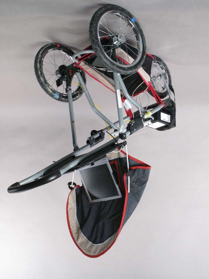
60
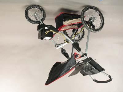
61
62
63
64
65
66
67
68
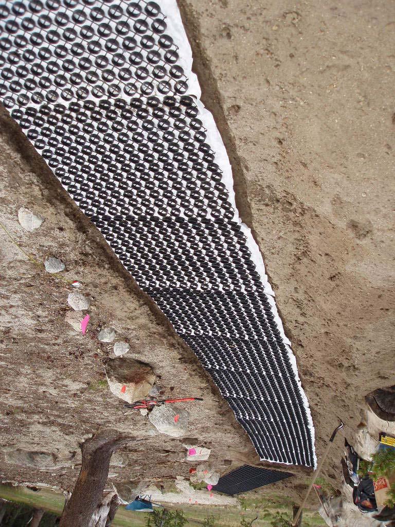
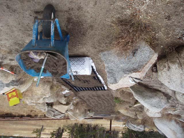
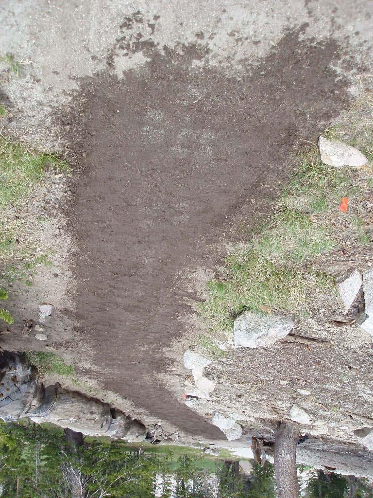
69
70

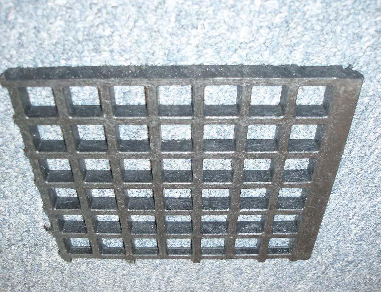
71 Accessible Trail Gate Barrier Enable all permitted users, including those using mobility devices Prevent trail access by motorized vehicles
72 Project Goals Develop a trail gate that: Allows all non-motorized users and hikers using personal mobility devices (PMDs) Prevents motorized trail vehicle (MTV) access, Is consistent with the spirit of accessibility legislation
73 Pedastrain Trail Users: Hikers Manual Wheelchair Users Power Wheelchair Users Scooter Users Rollater Users Human Transporter Users
74 Document performance characteristics of motorized trail vehicles (MTVs) and personal mobility devices (PMDs).
75
76

77
78 Install trail tread surface materials on new and existing trail segments Rock causeways in wet areas Minimize vegetation trampling Reduce erosion runoff into stream Channel users on to a designated pathway Keep users safe and dry
79 Provide a stable and level trail tread surface material Simple, interlocking installment Durable and long lasting ADA compliant material Blend in nicely with natural environment Additional tread material in next phase
80 GeoRunner

81 Molded Mini-Grid

82 Safety Deck II
83
84
85
86

87 Rotational Penetrometer Objective surface measurement device Draft Standard for measure of firmness and stability under development Available from Beneficial Designs

88 Analyze the UTAP Information Enter the data into TrailWare Second person verifies data entry Print all reports and completed forms Create a summary of key trail issues

89 Meet with Agency Representatives Collate the assessment information in an agency report Provide a map of the trail segment layout Review all data gathered Discuss actions and timelines for key trail issues Identify final signage locations
90
91
92
93 Install information signs Demonstrative signs explaining project improvements & needed user cooperation Objective information about trail conditions
94
95
96
97 Beneficial Designs, Inc. Minden, Nevada voice fax Working toward universal access through research, design & education
Tools and Technology for Accessible Trails
 Tools and Technology for Accessible Trails Peter Axelson Jeremy Vlcan Beneficial Designs, Inc. Minden, Nevada What makes a trail accessible? Providing trail access information Preventing access barriers
Who is Beneficial Designs?
 Who is Beneficial Designs? Beneficial Designs works towards universal access through research, design, and education. We believe all individuals should have access to the physical, intellectual, and spiritual
DATE: 23 March, 2011 TO: Communities FROM: BlazeSports America. RE: Accessible Trails Checklist 1
 M E M O R A N D U M DATE: 23 March, 2011 TO: Communities FROM: BlazeSports America RE: Accessible Trails Checklist 1 The purpose of the Accessible Trails Checklist (below) is to help the community review
Understanding user expectations And planning for long term sustainability 1
 Understanding user expectations And planning for long term sustainability 1 What is a natural surface trail? It can be as simple has a mineral soil, mulched or graveled pathway, or as developed as elevated
DRAFT FINAL ACCESSIBILITY GUIDELINES FOR OUTDOOR DEVELOPED AREAS
 Date: October 19, 2009 DRAFT FINAL ACCESSIBILITY GUIDELINES FOR OUTDOOR DEVELOPED AREAS Introduction Background Whom Guidelines Apply To How to Submit Comments Contact for Further Information General Issues:
ROAD AND TRAIL PROJECT APPROVAL
 ROAD AND TRAIL PROJECT APPROVAL www.marincountyparks.org Marin County Parks, 3501 Civic Center Dr, Suite 260, San Rafael, CA 94903 DATE: July 12, 2017 PRESERVE: Gary Giacomini Open Space Preserve PROJECT:
Mt. Hood National Forest
 United States Department of Agriculture Forest Service Mt. Hood National Forest Zigzag Ranger District 70220 E. Highway 26 Zigzag, OR 97049 503-622-3191 Fax: 503-622-5622 File Code: 1950-1 Date: June 29,
Tracy Ridge Shared Use Trails and Plan Amendment Project
 Tracy Ridge Shared Use Trails and Plan Amendment Project Scoping Document Forest Service Allegheny National Forest Bradford Ranger District McKean, County, Pennsylvania In accordance with Federal civil
Outdoor Developed Areas
 The United States Access Board is an independent federal agency that promotes equality for people with disabilities through leadership in accessible design and the development of accessibility guidelines
What s covered. What s not covered. Options for those not covered. ABA Coverage
 The United States Access Board is an independent federal agency that promotes equality for people with disabilities through leadership in accessible design and the development of accessibility guidelines
Proposed Architectural Barriers Act Accessibility Guidelines for Outdoor Developed Areas
 Proposed Architectural Barriers Act Accessibility Guidelines for Outdoor Developed Areas Outdoor Developed Areas Homepage Guidelines and Standards Published in the Federal Register on June 20, 2007. PDF
CHAPTER III: TRAIL DESIGN STANDARDS, SPECIFICATIONS & PERMITS
 CHAPTER III Trail Design Standards, Specifications & Permits This chapter discusses trail standards, preferred surface types for different activities, permits, and other requirements one must consider
American Conservation Experience
 ACE Project Report For Tonto National Forest, Arizona Trail Association and Arizona State Parks Title of Project: 4 Peaks Trail Maintenance Award Contract Number: ASP NM11021 Project Partner: Paul Burghard
Project Planning, Compliance, and Funding
 Project Planning, Compliance, and Funding The plans above offer high level guidance to ensure that the A.T. is managed effectively as a whole unit in a decentralized management structure. Cooperative management
RE: Access Fund Comments on Yosemite National Park Wilderness Stewardship Plan, Preliminary Ideas and Concepts
 September 30, 2016 Superintendent Yosemite National Park Attn: Wilderness Stewardship Plan P.O. Box 577 Yosemite, CA 95389 RE: Access Fund Comments on Yosemite National Park Wilderness Stewardship Plan,
APPENDIX D: SUSTAINABLE TRAIL DESIGN. APPENDICES Town of Chili Parks and Recreation Master Plan Update
 APPENDIX D: SUSTAINABLE TRAIL DESIGN APPENDICES Town of Chili Parks and Recreation Master Plan Update Sustainable Trail Construction Sustainable trails are defined by the US Forest Service as trails having
MUNICIPALITY OF ANCHORAGE
 MUNICIPALITY OF ANCHORAGE ANCHORAGE PARKS & RECREATION Memorandum PRC 08-56 DATE: 5 August 2008 TO: FROM: SUBJECT: Parks & Recreation Commission Holly Spoth-Torres, Park Planner PRC 08-56 Far North Bicentennial
Computer Simulation for Evaluating Visitor Conflicts
 Computer Simulation for Evaluating Visitor Conflicts Why use Simulation? To acquire a comprehensive and dynamic understanding of visitor behavior and their interactions across the landscape (space and
The Baker/Carver Regional Trail is intended to
 Section V Design Guidance The Baker/Carver Regional Trail is intended to safely accommodate 183,000 annual visits, an array of non-motorized uses, a variety of skill levels, and persons with special needs.
Welcome to the future of Terwillegar Park a Unique Natural Park
 Welcome to the future of Terwillegar Park a Unique Natural Park 1 Introduction The Terwillegar Park Concept Plan study will develop an overall concept plan, management objectives and development guidelines
Procedure for the Use of Power-Driven Mobility Devices on Mass Audubon Sanctuaries 1 September 17, 2012
 Procedure for the Use of Power-Driven Mobility Devices on Mass Audubon Sanctuaries 1 September 17, 2012 Background As part of Mass Audubon s mission to preserve the nature of Massachusetts for people and
COASTAL CONSERVANCY. Staff Recommendation September 22, 2011 BAY AREA RIDGE TRAIL: HOOD MOUNTAIN TO HIGHWAY 12
 COASTAL CONSERVANCY Staff Recommendation September 22, 2011 BAY AREA RIDGE TRAIL: HOOD MOUNTAIN TO HIGHWAY 12 File No. 11-039-001 Project Manager: Betsy Wilson RECOMMENDED ACTION: Authorization to disburse
Port Gamble Shoreline Area Conceptual Trail Proposal
 The North Kitsap Trails Association is pleased to be a partner to the Kitsap Forest and Bay Project and assist Kitsap County, Forterra, Olympic Property Group, Great Peninsula Conservancy and the Port
Trail Assessment Report
 Trail Assessment Report Trail Options for the Bear Creek Canyon located in Pikes Peak Ranger District, Pike National Forest and on Colorado Springs Utility Lands Due to the presence of a unique species
Stagecoach State Trail Master Plan
 Stagecoach State Trail Master Plan Minnesota Minnesota Department Department of of Natural Natural Resources Resources Parks and and Trails Trails Division Division Parks March March 2012 2012 The Minnesota
O REGON TRAILS SUMMIT. Oregon Trails Summit. Rogue River National Forest
 O REGON TRAILS SUMMIT Oregon Trails Summit 2014 Rogue River National Forest OREGON TRAILS 2015: A VISION FOR THE FUTURE The 2015-2024 Oregon Statewide Trails Plan Why do a trails plan? 2005-2014 Oregon
Preferred Recreation Recommendations Stemilt-Squilchuck Recreation Plan March 2018
 Preferred Recreation Recommendations Stemilt-Squilchuck Recreation Plan March 2018 Below are the recommended recreation ideas and strategies that package together the various recreation concepts compiled
Non-motorized Trail Plan & Proposal. August 8, 2014
 Town of Star Valley Ranch, Wyoming and the Star Valley Ranch Association in partnership with the USDA Forest Service, Bridger-Teton National Forest, Greys River Ranger District Non-motorized Trail Plan
USDA TRAILS STRATEGY PROGRAM
 USDA TRAILS STRATEGY PROGRAM WRPI Program: English Peak Survey Jorge D. Briceño Southwestern Community College Internship Time Period: June 6, 2016 August 8, 2016 Advisor: Sam Commarto Recreation Officer
Appendix 3. Greenway Design Standards. The Whitemarsh Township Greenway Plan
 Appendix 3 Greenway Design Standards This chapter discusses two design standards for the greenway types discussed above. First, trail design standards are presented together with trailhead facilities and
DECISION MEMO. Rawhide Trail #7073 Maintenance and Reconstruction
 Page 1 of 6 Background DECISION MEMO USDA Forest Service Jefferson Ranger District Jefferson County, Montana Rawhide Trail #7073 is located in the Elkhorn Mountain Range approximately 10 miles east of
TRAIL DATABASE SCHEMA (8/26/2014)
") Trail Data Model for LINES Source Data Source Agency dataagency Agency or entity that created the dataset where the original line was sourced from. Source Date of Last Data Used to Update sourcedate Publication
Trail Data Model for LINES Source Data Source Agency dataagency Agency or entity that created the dataset where the original line was sourced from. Source Date of Last Data Used to Update sourcedate Publication
Appendix A Appendix A (Project Specifications) Auk Auk / Black Diamond (Trail 44) Reroute
 Auk Auk / Black Diamond (Trail 44) Reroute") Appendix A (Project Specifications) Auk Auk / Black Diamond (Trail 44) Reroute I. Proposed Action: This project proposes to reroute approximately 1,800 feet of a 50 inch wide trail, off of private property
Appendix A (Project Specifications) Auk Auk / Black Diamond (Trail 44) Reroute I. Proposed Action: This project proposes to reroute approximately 1,800 feet of a 50 inch wide trail, off of private property
Federal Outdoor Recreation Trends Effects on Economic Opportunities
 United States Department of Agriculture Federal Outdoor Recreation Trends Effects on Economic Opportunities The Forest Service National Center for Natural Resources Economic Research is assisting the Federal
Williamson Rock/Pacific Crest National Scenic Trail (PCT) Project EIS. Notice of intent to prepare an Environmental Impact Statement.
 Project EIS. Notice of intent to prepare an Environmental Impact Statement.") [3411-15-P] DEPARTMENT OF AGRICULTURE Forest Service Angeles National Forest; Los Angeles County, CA Williamson Rock/Pacific Crest National Scenic Trail (PCT) Project EIS AGENCY: ACTION: Forest Service,
[3411-15-P] DEPARTMENT OF AGRICULTURE Forest Service Angeles National Forest; Los Angeles County, CA Williamson Rock/Pacific Crest National Scenic Trail (PCT) Project EIS AGENCY: ACTION: Forest Service,
Best practice projects for disabled people
 Best practice projects for disabled people Eszter Buchert - Marcell Váradi 27.05.2014 Neuburg Basic THERE ARE PEOPLE WITH DISABILITIES WHO WANT TO VISIT PROTECTED AREAS What we need: Willing to help Solidarity
Fossil Creek Wild & Scenic River Comprehensive River Management Plan Forest Service Proposed Action - details March 28, 2011
 Fossil Creek Wild & Scenic River Comprehensive River Management Plan Forest Service Proposed Action - details March 28, 2011 Primary Goals of the Proposed Action 1. Maintain or enhance ORVs primarily by
SAULT COLLEGE SAULT STE. MARIE, ONTARIO COURSE OUTLINE
 SAULT COLLEGE SAULT STE. MARIE, ONTARIO COURSE OUTLINE COURSE TITLE: Trail Construction and Facility Maintenance CODE NO. : NRT 260 SEMESTER: 3 PROGRAM: AUTHOR: Adventure Recreation and Parks Brian Anstess
BACKCOUNTRY TRAIL FLOOD REHABILITATION PROGRAM
 BACKCOUNTRY TRAIL FLOOD REHABILITATION PROGRAM Backcountry Trail Flood Rehabilitation A June 2013 Flood Recovery Program Summary In June 2013, parts of Southern Alberta were devastated from significant
White Mountain National Forest. Pond of Safety Accessible Trail & Shoreline Access Project. Scoping Report. Township of Randolph Coos County, NH
 White Mountain National Forest United States Department of Agriculture Forest Service Eastern Region Pond of Safety Accessible Trail & Shoreline Access Project Township of Randolph Coos County, NH Scoping
RUSHMORE CONNECTOR TRAIL PROPOSAL
 PURPOSE AND NEED Background The U.S. Forest Service, Black Hills National Forest (Forest Service) has received a special use permit application from the State of South Dakota Department of Game, Fish and
Greater Minnesota Regional Parks and Trails Commission Designation Application
 Greater Minnesota Regional Parks and Trails Commission Designation Application General Section Designation Application #: 15-059D Date Submitted: 06/16/2015 Park or Trail Name: Mesabi Trail District #:
Agenda: SASP SAC Meeting 3
 Agenda: SASP SAC Meeting 3 Date: 04/12/18 Public Involvement Plan Update Defining the System Recommended Classifications Discussion Break Review current system Outreach what we heard Proposed changes Classification
Appalachian Trail Sustainability Research Study
 Appalachian Trail Sustainability Research Study Appalachian National Scenic Trail 2,175 mile footpath from Maine to Georgia Crosses 14 states, 6 NPS units, and 8 National Forests, Managed by the NPS A.T.
Exemplar for Internal Achievement Standard Geography Level 1. Conduct geographic research, with direction
 Exemplar for internal assessment resource Geography for Achievement Standard 91011 Exemplar for Internal Achievement Standard Geography Level 1 This exemplar supports assessment against: Achievement Standard
Brampton, Ontario REQ. no.: PLANNING, DESIGN & DEVELOPMENT COMMITTEE
 ftorontoand REGION rv~ Conservation for The Living City May 22,2009 2I22V,5L CFN 42397 CLERK S DEPT. Mr. Peter Fay City Clerk, City of Brampton MAY 2 7 2008 2 Wellington Street West Brampton, Ontario REQ.
Proposal to Redevelop Lower Kananaskis River-Barrier Lake. Bow Valley Provincial Park. Frequently Asked Questions
 Proposal to Redevelop Lower Kananaskis River-Barrier Lake Bow Valley Provincial Park Frequently Asked Questions What is being proposed? What are the details of the proposal? Where is the project area located?
AGENDA GUEMES ISLAND FERRY OPERATIONS PUBLIC FORUM
 AGENDA GUEMES ISLAND FERRY OPERATIONS PUBLIC FORUM Wednesday, August 17, 211 6: p.m. Guemes Island Community Hall ~ 7549 Guemes Island Road Thank you for attending the second Annual Public Forum in 211.
Rogue River Access and Management Plan Draft Alternatives
 Rogue River Access and Management Plan Draft Alternatives The Rogue River Access and Management Plan was initiated in December, 2011 and is being led by Jackson County Parks (JCP) and Oregon Department
Glacier National Park: Going-to-the-Sun Road Rehabilitation
 National Rural ITS Conference August 14, 2006 Gary Danczyk, P.E. Glacier National Park Glacier National Park: Going-to-the-Sun Road Rehabilitation Using ITS to stretch resources, manage congestion and
Appendix B Ultimate Airport Capacity and Delay Simulation Modeling Analysis
 Appendix B ULTIMATE AIRPORT CAPACITY & DELAY SIMULATION MODELING ANALYSIS B TABLE OF CONTENTS EXHIBITS TABLES B.1 Introduction... 1 B.2 Simulation Modeling Assumption and Methodology... 4 B.2.1 Runway
Table 3-7: Recreation opportunity spectrum class range by prescription. Recreation Opportunity Spectrum (ROS) Classes
 Classes") Appendix F Table -7: Recreation opportunity spectrum class range by prescription. Recreation Opportunity Spectrum (ROS) Classes Prescription Primitive Primitive II Roaded Modified Rural Urban 111 - Primitive
Appendix F Table -7: Recreation opportunity spectrum class range by prescription. Recreation Opportunity Spectrum (ROS) Classes Prescription Primitive Primitive II Roaded Modified Rural Urban 111 - Primitive
Design Considerations For Accessible Parks & Trails
 Design Considerations For Accessible Parks & Trails Measuring Up: Campbell River 2008 Dave Calver Consulting City of Campbell River Legacies Now: Measuring Up Design Guidelines Design Considerations for
Kelly Motorized Trails Project Proposed Action
 Kelly Motorized Trails Project Proposed Action November 28, 2011 The Flagstaff Ranger District of the Coconino National Forest is seeking public input on the proposed Kelly Motorized Trails Project (formerly
9/8/2016. Transition Planning. One Agency s Ongoing Experience
 Transition Planning One Agency s Ongoing Experience 1 Background per the Fairfax County Park Authority The Fairfax County Park Authority owns approximately 23,000 acres and maintains 425 park facilities
Proposed Action. Payette National Forest Over-Snow Grooming in Valley, Adams and Idaho Counties. United States Department of Agriculture
 United States Department of Agriculture Forest Service January 2012 Proposed Action Payette National Forest Over-Snow Grooming in Valley, Adams and Idaho Counties Payette National Forest Valley, Adams
Kit Carson-Challenger Ridge Trail Project
 Kit Carson-Challenger Ridge Trail Project Project Accomplishments Report-USFS December 15, 2015 Photo courtesy of Justin Peterson 815 South 25 th Street, Suite 101 Colorado Springs, CO 80904 Dedicated
Header i
 Header i 048285014.10 Header Sub Title Body Text here. Body text here. Body text here. Section 1... 1 Executive Summary... 1 Opportunities and Constraints... 3 Overall Opportunities and Constraints Map
Competence Requirements for eronautical eteorological ersonnel
 WMO-CGMS Virtual Laboratory For Education and Training in Satellite Meteorology Competence Requirements for eronautical eteorological ersonnel 2013 and beyond Overview Part One Background and Terminology
FLORIDA DEPARTMENT OF ENVIRONMENTAL PROTECTION DIVISION OF RECREATION AND PARKS RECREATIONAL CARRYING CAPACITY GUIDELINES
 FLORIDA DEPARTMENT OF ENVIRONMENTAL PROTECTION DIVISION OF RECREATION AND PARKS RECREATIONAL CARRYING CAPACITY GUIDELINES THE SELECTION AND CAPACITY DETERMINATION OF USE SITES Introduction The Division
EXECUTIVE SUMMARY PROGRAM DEVELOPMENT REPORT PURPOSE EXISTING SETTING EXPANDING PARKLAND
 EXECUTIVE SUMMARY PROGRAM DEVELOPMENT REPORT PURPOSE As the culmination of the first phase of the master planning process, this Program Development Report creates the framework to develop the Calero County
Becker County Trail Routing Feasibility Study
 2016 Becker County Trail Routing Feasibility Study CONNECTING DETROIT MOUNTAIN AND MOUNTAIN VIEW RECREATIONAL AREA TO THE HEARTLAND TRAIL BECKER COUNTY ULTEIG ENGINEERS Contents Acknowledgements...2 INTRODUCTION...3
Decision Memo Broken Wheel Ranch Equestrian Outfitter Special-Use Permit Proposed Action
 Decision Memo Broken Wheel Ranch Equestrian Outfitter Special-Use Permit USDA Forest Service Mississippi Bluffs Ranger District, Shawnee National Forest Jackson and Union Counties, Illinois Proposed Action
AGENCY: Office of the Secretary (OST), Department of Transportation (DOT).
, Department of Transportation (DOT).") This document is scheduled to be published in the Federal Register on 04/27/2012 and available online at http://federalregister.gov/a/2012-10179, and on FDsys.gov Billing Code 4910-HY DEPARTMENT OF TRANSPORTATION
This document is scheduled to be published in the Federal Register on 04/27/2012 and available online at http://federalregister.gov/a/2012-10179, and on FDsys.gov Billing Code 4910-HY DEPARTMENT OF TRANSPORTATION
Decision Memo Ice Age Trail Improvement (CRAC 37)
") Decision Memo Ice Age Trail Improvement (CRAC 37) U.S. Forest Service Chequamegon-Nicolet National Forest, Medford-Park Falls Ranger District Taylor County, Wisconsin T32N, R2W, Town of Grover, Section
Decision Memo Ice Age Trail Improvement (CRAC 37) U.S. Forest Service Chequamegon-Nicolet National Forest, Medford-Park Falls Ranger District Taylor County, Wisconsin T32N, R2W, Town of Grover, Section
Wallowa Falls Hydroelectric Project FERC Project No. P-308 Proposed Study Plans - Recreation August 2011
 Wallowa Falls Hydroelectric Project FERC Project No. P-308 August 2011 Prepared by: PacifiCorp Energy Hydro Resources 825 NE Multnomah, Suite 1500 Portland, OR 97232 For Public Review Wallowa Falls Hydroelectric
New ADA Accessibility Standards for the Attractions Industry
 New ADA Accessibility Standards for the Attractions Industry 1 New ADA Accessibility Standards for the Attractions Industry 2 INTERNATIONAL ASSOCIATION OF AMUSEMENT PARKS AND ATTRACTIONS WEBINAR DISCLAIMER
CHAPTER 3 ALTERNATIVES CONSIDERED
 CHAPTER 3 ALTERNATIVES CONSIDERED 3.0 ALTERNATIVES The 2010 Stevensville Airport Master Plan contained five (5) airside development options designed to meet projected demands. Each of the options from
ICAO Young Aviation Professionals Programme
 ICAO Young Aviation Professionals Programme In partnership with and The International Civil Aviation Organization (ICAO), in partnership with the International Air Transport Association (IATA) and Airports
If we make accessibility an up-front consideration that guides our planning & design efforts.
 Cindy Burkhour, MA, CTRS, CPRP AccessRecreationGroup@juno.com 616-560-2378 Accessibility invites more trail users & their $$ to your community! If we make accessibility an up-front consideration that guides
Photopoint Monitoring in the Adirondack Alpine Zone
 Photopoint Monitoring in the Adirondack Alpine Zone Julia Goren (PI) and Seth Jones Adirondack High Peaks Summit Steward Program Adirondack Mountain Club summit@adk.org PO Box 867, Lake Placid, NY 12946
City of Durango 5.8 FUNDING TRAILS DEVELOPMENT
 5.8 FUNDING TRAILS DEVELOPMENT The City has been successful in establishing dedicated local funding sources as well as applying for grants to develop the City s trail system, having received nearly $2.4
Committee. Presentation Outline
 CW-33-15 11/9/2015 Community and Corporate Services Committee November 10, 2015 1 Presentation Outline Background Vision and Objectives Study Process and Timeline Public and Stakeholder Engagement Organization
Longmont to Boulder Regional Trail Jay Road Connection DRAFT FINAL REPORT
 Longmont to Boulder Regional Trail Jay Road Connection DRAFT FINAL REPORT December 2018 Project Summary Boulder County, Colorado, in partnership with the City of Boulder, is evaluating options for multi-use
Bradley Brook Relocation Project. Scoping Notice. Saco Ranger District. United States Department of Agriculture Forest Service
 Bradley Brook Relocation Project United States Department of Agriculture Forest Service Scoping Notice White Mountain National Forest February 2011 For Information Contact: Jenny Burnett White Mountain
Permeable RECREATIONAL TRAILS
 SMART EARTH SOLUTIONS Permeable RECREATIONAL TRAILS GEOWEB GEOPAVE GEOTERRA Innovative Solutions for Designing & Building Trails. Trail Surface Stabilization The key to planning and building trails into
USDA Trails Strategy WRI: ENGLISH PEAK SURVEY. Theodore Mendoza San Diego State University June 6 th 2016 August 18 th Advisor: Sam Commarto
 WRI: ENGLISH PEAK SURVEY Theodore Mendoza San Diego State University June 6 th 2016 August 18 th 2016 Advisor: Sam Commarto Klamath National Forest Submitted: March 21, 2017 Table of Contents Acknowledgements
Runway Length Analysis Prescott Municipal Airport
 APPENDIX 2 Runway Length Analysis Prescott Municipal Airport May 11, 2009 Version 2 (draft) Table of Contents Introduction... 1-1 Section 1 Purpose & Need... 1-2 Section 2 Design Standards...1-3 Section
Picnic Units A picnic unit is a part of a picnic area
 Grab Bars Grab bars are usually provided in buildings to provide stability and allow a person to use his or her arms to assist in movement over short distances. The most common location for grab bars is
INTRODUCTION. Mailing address: Burke County Community Development Attn: Tim Johnson P. O. Box 219 Morganton, NC
 REQUEST FOR QUALIFICATIONS: PROFESSIONAL, EXPERIENCED TRAIL BUILDERS FOR THE CONSTRUCTION OF THE FONTA FLORA STATE TRAIL LAKE JAMES SECTION BURKE COUNTY COMMUNITY DEVELOPMENT INTRODUCTION Burke County
FEASIBILITY CRITERIA
 This chapter describes the methodology and criteria used to evaluate the feasibility of developing trails throughout the study areas. Land availability, habitat sensitivity, roadway crossings and on-street
Emily to Blind Lake Trail PROPOSED TRAIL DEVELOPMENT APPLICATION SUMMARY
 Emily to Blind Lake Trail PROPOSED TRAIL DEVELOPMENT APPLICATION SUMMARY Township 137 Range 26 (Fairfield Township) sections 2 & 3 Township 138 Range 26 (City of Emily) sections 27, 34, 35, & 36 Township
National Forests and Grasslands in Texas
 United States Department of Agriculture Forest Service National Forests and Grasslands in Texas Sam Houston NF 394 FM 1375 West New Waverly, Texas 77358 Phone 936-344-6205 Dear Friends, File Code: 1950
NCAP Application Section E: Continuous Camp Improvement Plan
 Council name: (One per camp) Camp property name: Camp name: (If camp occurs off council property, use off property for camp property name.) Camp type: Cub Scout resident Boy Scout resident Venturing resident
National Recreation Trail Application for Designation
 National Recreation Trail Application for Designation Introduction Thank you for your interest in the National Recreation Trail (NRT) program. Completed NRT application packages must be submitted by December
With the first portion of this process complete, we anticipate the general timeline for the remainder of the process to be:
 THE CITY OF FIRE RESCUE E D M O N T O N FIRE RESCUE SERVICES 10351 96 Street Edmonton, Alberta T5H 2H5 April 19, 2013 Dear Rossdale residents: As many of you know, Fire Rescue Services is currently in
HIGHWAY 17 WILDLIFE and REGIONAL TRAIL CROSSINGS
 HIGHWAY 17 WILDLIFE and REGIONAL TRAIL CROSSINGS Agenda and Meeting Format 7:00-7:15 Welcome 7:15-8:00 Presentation 8:00-8:30 Open House 8:30 Recap 9:00 Conclusion 2 Meeting Goals: Introduce the project
Logo Department Name Agency Organization Organization Address Information 5700 North Sabino Canyon Road
 Logo Department Name Agency Organization Organization Address Information United States Forest Coronado National Forest 5700 North Sabino Canyon Road Department of Service Santa Catalina Ranger District
Blue River Trail Master Plan JSA to Town Hall June 2004
 Blue River Trail Master Plan JSA to Town Hall June 2004 Prepared for: Silverthorne Town Council Silverthorne SPORT Committee Department of Recreation and Culture Silverthorne Public Works Silverthorne
UNIT TITLE: CONSTRUCT AND TICKET DOMESTIC AIRFARES
 UNIT TITLE: CONSTRUCT AND TICKET DOMESTIC AIRFARES NOMINAL HOURS: UNIT NUMBER: UNIT DESCRIPTOR: This unit deals with skills and knowledge required to construct itineraries, cost airfares and issue documentation
Lesson 1: Rolling and moving with Science
 Question: How is science related to roller coasters? Interpret and apply Newton's three laws of motion. Describe phase transitions in terms of kinetic molecular theory Lesson 1: Rolling and moving with
Appendix C. Tenderfoot Mountain Trail System. Road and Trail Rehabilitation Plan
 Appendix C Tenderfoot Mountain Trail System Road and Trail Rehabilitation Plan All rehabilitation work would be under the direction of the District Fisheries Biologist, the Forest Hydrologist, and/or the
Pillar Park. Management Plan
 Pillar Park Management Plan January 2014 Pillar Park Management Plan Approved by: Jeff Leahy Regional Director Thompson Cariboo Region BC Parks January 9, 2014 Date Brian Bawtinheimer Executive Director
Citrus Heights Creek Corridor Trail Project Trail Advisory Group Field Trip #2 September 11, :00 11:00 am Trellis Hall, Citrus Heights
 September 11, 2013 9:00 11:00 am Trellis Hall, Citrus Heights Project Overview The City of Citrus Heights is studying the feasibility of establishing a multi use trail system within the City s 26 miles
PURPOSE AND NEED. Introduction
 Public Scoping: Allocation of Recreation Capacity for Commercial Outfitter Guide Services on North Kruzof Island Trails (Kruzof Island Outfitter Guide) PURPOSE AND NEED Introduction The U.S. Department
SOUTH AFRICA PBN NEAR TERM IMPLEMENTATION PLAN PROJECT
 PRE-PLANNING PHASE Nomination of the State Focal Point of Contact Appointment of the South Africa PBN Project Manager and Team Define the goals and objectives of Project Define the Terms of Reference for
MORGAN CREEK GREENWAY Final Report APPENDICES
 APPENDICES MORGAN CREEK GREENWAY Appendix A Photos of Existing Conditions in Trail Corridor Photos of existing conditions Main trail corridor - February 2009 Photos of existing conditions south bank Morgan
SITKA SEA WALK CRESCENT HARBOR TENNIS COURTS TO SITKA NATIONAL HISTORICAL PARK
 SITKA SEA WALK CRESCENT HARBOR TENNIS COURTS TO SITKA NATIONAL HISTORICAL PARK October 10, 2011 Crescent Harbor tennis courts to Sitka National Historical Park Workshop Agenda 1.5 hours Project Introduction
National Recreation Trail Update Form
 National Recreation Trail Update Form Introduction Thank you for taking the time to complete this form. Your assistance will help ensure that the National Recreation Trail (NRT) database is complete and
Decision Memo for Desolation Trail: Mill D to Desolation Lake Trail Relocation
 for Salt Lake County, Utah Uinta-Wasatch-Cache National Forest Salt Lake Ranger District 1. Background The present location of the Desolation Trail (#1159) between Mill D and Desolation Lake follows old