Project Management, Environmental Assessment, Stormwater Management. Hydrologic Modelling. Natural Heritage. Fluvial Geomorphology
|
|
|
- Vernon Parker
- 6 years ago
- Views:
Transcription
 is to introduce you to this project, inform you of our progress to date, and obtain your comments on the project.")
1 Welcome PUBLIC INFORMATION CENTRE # 1 KROSNO CREEK DIVERSION PROJECT February 19, :30 p.m. to 8:30 p.m. Please sign in on the sheet provided. Then feel free to walk around and view the displays. The purpose of this Public Information Centre (PIC) is to introduce you to this project, inform you of our progress to date, and obtain your comments on the project. The major elements presented today are: Study Overview Existing Conditions Alternative Solutions Preliminary Preferred Solution Next Steps The Study Team is interested in receiving any comments that you may have about the Study. Mr. Tom Dole, P.Eng. Water Resources Engineer City of Pickering One The Esplanade Pickering, ON L1V 6K7 Tel: (905) Ext: tdole@pickering.ca Mr. Steve Hollingworth, M.A.Sc., P.Eng. Consultant Project Manager TMIG The Municipal Infrastructure Group Ltd Dufferin Street, Suite 200 Vaughan, ON L4K 0C5 Tel: (905) Ext shollingworth@tmig.ca If you have any questions, our representatives will be pleased to discuss the project with you. Should you have any questions, comments, require further information or wish to be added to the study mailing list, please contact either Steve or Tom. Study Team: Project Management, Environmental Assessment, Stormwater Management Hydrologic Modelling Natural Heritage Fluvial Geomorphology Utility Coordination Archeology TMIG The Municipal Infrastructure Group Ltd 8800 Dufferin Street, Suite 200 Vaughan ON CA L4K 0C5 t f Computational Hydraulics International 147 Wyndham St. N., Suite 202 Guelph ON CA N1H 4E9 t f Savanta Inc 37 Bellevue Terrace St. Catharines ON CA L2S 1P4 t f GHD 6705 Millcreek Dr., Unit 1 Mississauga ON CA L5N 5M4 t f T2 Utility Engineers 1615 Dundas St. E. 4 th Floor Lang Tower Whitby ON CA L1N 2L1 t Archeoworks Yonge St. Unit 1029 Newmarket ON CA L3X 1X4 t f


2 Study Overview The study area covers the entire Krosno Creek Watershed and a portion of the Pine Creek watershed. Both systems eventually empty into Frenchman s Bay Krosno Creek was replaced by storm sewer systems through development in the watershed north of Highway 401, and is confined to a narrow concrete channel for a considerable distance south of Highway 401 In its current form, Krosno Creek cannot convey all of the flow from severe storms. Many properties have been impacted by flooding in the past, particularly during a severe storm in August There continue to be risks for flooding and erosion along Krosno Creek The 2009 Frenchman s Bay Stormwater Management Master Plan (FBSWMMP) recommended a diversion of flow to Pine Creek to reduce the risk of flooding along Krosno Creek were impacted from flooding The Krosno Creek Diversion Project was initiated by the City of Pickering to examine the causes of flooding in more detail, and to determine the most appropriate means of reducing the risk of flooding from Krosno Creek. 2

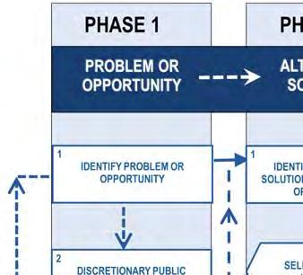
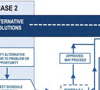
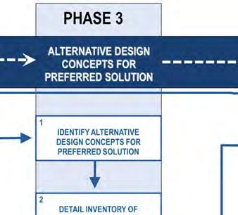
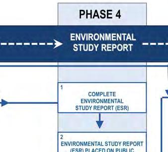
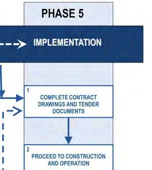
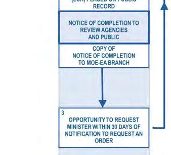
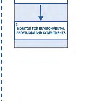
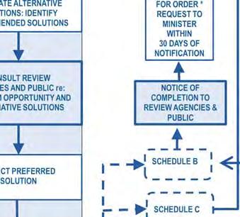
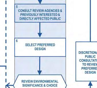


3 EA Process Municipal Class Environmental Assessment The City of Pickering retained The Municipal Infrastructure Group Ltd. to complete this Study in accordance with the Municipal Class Environmental Assessment process. The Study is being conducted as a Schedule C Project, encompassing Phases 1 through Phase 4 as outlined in the Municipal Engineers Association Municipal Class Environmental Assessment document (October 2000, as amended in 2007 and 2011). We are here 3


4 Existing Natural Features Fish habitat and vegetation cover are generally poor along Krosno Creek west of Sandy Beach Road The perched culvert outlet at Alyssum Street may be a barrier to fish Several protected Species at Risk can potentially be found in the Hydro Marsh, near the outlet to Frenchman s Bay A number of warmwater fish species can be found in the lower reaches of Krosno Creek 4


.")
5 Existing Level of Service: Flooding New computer models were created, calibrated and used to predict the flow and depth and extent of flooding along Krosno Creek for a range of severe storm events. This area is the subject of a more detailed flood study prepared for the proposed development of the Downtown South lands The existing small culverts under Highway 401 and the railway and the considerable flood storage available on the south parking lot at the Pickering Town Centre significantly reduce the peak flow rates in the downstream open sections of Krosno Creek. Storm Event Buildings Impacted Estimated Flood Damages* 2 4 $130, $493, $1,685, $1,685, $1,866, $1,932,700 NOTE: The extent of flooding shown above is distinct from the Toronto and Region Conservation Authority s (TRCA) Regulatory Flood Plain. The TRCA Regulatory Flood Plain adheres to MNR Guidelines which stipulate a number of conservative assumptions regarding the effect of existing structures that can reduce flow rates in the system (SWM ponds, restrictive culverts, etc.). For more information on the TRCA s Regulatory Flood Plain, contact Chris Jones at (416) ext or cjones@trca.on.ca Average Annual Estimated Damages $390,931 *Damages Estimated as 10% of the MPAC assessed value of all properties where buildings are partially or entirely within the flood plain 5

6 Alternative Solutions Channel Improvements Description The existing undersized culverts under Highway 401 and the railway tracks restrict flow, significantly reducing peak flow rates in Krosno Creek downstream of the railway. If these culverts were replaced with much larger structures in the future, peak flow rates in Krosno Creek could increase. This alternative involves the construction of a naturalized channel corridor that could contain the peak flow in Krosno Creek if the restrictions caused by the existing Highway 401 and railway culverts were eliminated The channel would have a top width of at least 26 m. Construction of the channel would require expropriation and demolition of all of the residential properties on one side of the existing concrete lined channel Existing culverts at road crossings would need to be replaced with large bridges Benefits Flood risk would be eliminated, even if the Highway 401 and/or railway culverts were enlarged in the future A wide, naturalized channel corridor would significantly improve aquatic and terrestrial habitat Trails and other public amenities could be incorporated into the reconstructed valley corridor Costs Property acquisition Channel construction and landscaping Large bridges at Bayly Street, Morden Lane, Reytan Boulevard and Alyssum Street TOTAL COST: $24.4 Million Drawbacks Large social impact associated with the expropriation and demolition of up to 46 homes required for the channel corridor Very large and challenging construction program, many utilities (gas, communications, hydro, etc) would need to be relocated for bridges Very high capital cost Average Annual Flood Damages Existing: $390,000 Future: $ 0 6


7 Alternative Solutions Enhanced SWM Controls Pickering City Centre Description Planning is underway for significant redevelopment and intensification in the Pickering City Centre area The planned redevelopment presents an opportunity to incorporate modern, effective stormwater management controls on public and private property Recommended stormwater management criteria (from a separate study supporting the City Centre Plan) include: Enhanced Water Quality Control (80% TSS Removal) Retention of the first 5 mm of rainfall on-site Control post-development peak flow rates to predevelopment levels Sites assumed to be up to a maximum of 50% impervious for calculating pre-development flow rate The full build-out of the Pickering City Centre, with the recommended stormwater management criteria, was simulated in the computer model created for Krosno Creek Benefits Improvements to the health of Krosno Creek, as modern stormwater management practices will also improve water quality and reduce erosion Limited costs to the City, as the majority of the stormwater controls will be implemented in private developments Drawbacks The predicted reductions in flow rates and flooding will not be realized until full build-out of the City Centre Plan, which may a considerable amount of time There will only be a small reduction in flows and flooding for very large storm events Costs Most of the costs will be borne by private developers Limited costs to the City to incorporate Low Impact Development practices into road reconstruction and other public infrastructure projects, where feasible TOTAL COST: Negligible Average Annual Flood Damages Existing: $390,000 Future: $240,000 7


8 Alternative Solutions Culvert Improvements Description The existing culverts along Krosno Creek are bottlenecks in the system and contribute significantly to the current flooding problems The existing culverts at Morden Lane, Reytan Boulevard and Alyssum Street are corrugated steel pipe-arch structures, each approximately 3 m wide and 2 m high These three culverts could potentially be replaced with twin 3 m wide concrete box culverts Alyssum Street Culvert Benefits The existing culverts can be replaced relatively quickly and easily The existing culverts are reaching the end of their service life and will require replacement in the near future regardless The culvert replacements will reduce flooding and flood damages for even the most severe storm events Drawbacks Water quality and erosion in Krosno Creek will not be improved Costs Replacing the culverts at Morden Lane, Reytan Boulevard and Alyssum Street with twin 3 m wide x 1.8 m high concrete box culverts Average Annual Flood Damages Existing: $390,000 Future: $ 46,000 TOTAL COST: $1.4 Million 8


 would need to be relocated Potential impacts to flooding and erosion in Pine Creek Very high capital cost Costs Diversion Sewer (Twin 2.")
9 Alternative Solutions Diversion to Pine Creek Description The diversion of flows from Krosno Creek to Pine Creek was recommended in the Frenchman s Bay Stormwater Management Master Plan When combined with culvert improvements at Morden Lane, Reytan Boulevard and Alyssum Street, no buildings would be impacted from flooding from Krosno Creek for even the most severe storm events A number of additional improvements would be needed to mitigate the potential flooding impacts on Pine Creek Pickering Parkway Pine Creek Benefits Flood risk from Krosno Creek would be eliminated, even if the Highway 401 or railway culverts are enlarged in the future Reduced erosion in Krosno Creek and reduced pollutant loadings to the Hydro Marsh at the outlet of Krosno Creek Drawbacks Very large and challenging construction program, many utilities (gas, communications, hydro, etc.) would need to be relocated Potential impacts to flooding and erosion in Pine Creek Very high capital cost Costs Diversion Sewer (Twin 2.4 m diameter pipes) from Krosno Creek to Pine Creek, tunnelled under Liverpool Road and the Highway 401 Ramp Replacement of the Pine Creek culverts under Highway 401 and Radom Street and the Krosno Creek culverts at Morden Lane, Reytan Boulevard and Alyssum Street TOTAL COST: $30.4 Million Average Annual Flood Damages Existing: $390,000 Future: $ 0 9


10 Alternative Solutions Krosno Blvd Relief Sewer Description The existing culverts along Krosno Creek at Morden Lane, Reytan Boulevard and Alyssum Street are bottlenecks in the system and contribute significantly to the current flooding problems The relief sewer on Krosno Boulevard would divert a portion of the flow in Krosno Creek away from these culverts and return the flow to Krosno Creek downstream of Alyssum Street A 3 m wide x 1.5 m high concrete box sewer could be installed along Morden Lane, Krosno Boulevard and Alyssum Street Krosno Boulevard at Morden Lane Benefits Significant reductions in flooding and flood damages, particularly for the small to moderate storms considered Costs 3 m wide x 1.5 m high concrete box sewer from Morden Lane to downstream of Alyssum Street Drawbacks Potential conflicts with numerous connections from houses to the watermains and sanitary sewers adjacent the relief sewer Limited reductions in flooding and flood damages for the most severe storm events considered Water quality and erosion in Krosno Creek will not be improved Average Annual Flood Damages Existing: $390,000 Future: $ 32,000 TOTAL COST: $5.8 Million 10


11 Alternative Solutions Flood Proofing Flood Proofing Rather than reducing flow rates or flood levels in Krosno Creek, this alternative involves retrofitting flood prone buildings to prevent water from entering the building Flood proofing measures could include re-grading or berming to prevent water from reaching buildings, or installing water-tight doors and windows on buildings likely to be exposed to flood water. Buildings Currently at Risk of Flooding Benefits Flood proofing can prevent flood damages from future severe storm events Costs Approximately $10,000 per flood prone property, on average TOTAL COST: $660,000 to protect all 66 flood prone buildings Drawbacks Difficulties in ensuring all flood prone buildings are appropriately flood proofed Challenges to ensure the flood proofing is maintained and remains effective following future home renovations No reductions in flooding, no improvements in water quality and erosion in Krosno Creek Average Annual Flood Damages Existing: $390,000 Future: $ 0 11


12 Alternative Do Nothing Natural Environment Social/Cultural Environment Technical Environment Overall Impacts Benefits Impacts Benefits Challenges Performance Cumulative Impact Cumulative Benefit No impacts, as no works are proposed Continued erosion and impaired water quality in Krosno Creek No impacts, as no works are proposed No benefits, as no works are proposed No challenges, as no works are proposed No reduction in the frequency and severity of flooding NOT RECOMMENDED Does not reduce flooding, other alternatives exist with acceptable impacts Creek Improvements to Convey the Regulatory Flow Impacts to existing channel Replacement of the concrete Approximately 45 homes will Creation of new, natural and riparian vegetation during lined channel with a natural need to be purchased/ public open space, could construction channel and wide, vegetated expropriated and demolished incorporate a trail system in valley corridor to create channel corridor reconstructed valley corridor Will be challenging to secure property for channel, significant construction effort to create channel, construct bridges and relocate utilities Flooding will be contained in corridor, no flood damages even if 401/CNR culverts enlarged NOT RECOMMENDED Significant costs to implement, challenges to secure property and significant impacts to owners of 45 homes to be purchased and demolished for construction of the channel Enhanced SWM Negligible impacts, as works will be located in existing developed sites and road right-of-ways Potential improvements in water quality and erosion in Krosno Creek Negligible additional impacts anticipated during redevelopment and infrastructure replacement Promotion of low-impact and sustainable development practices Will be incorporated into new developments, but will take a long time for widespread implementation Small reduction in the severity of flooding downstream of Bayly Street for large storm events RECOMMENDED Not recommended as a stand-alone solution to address flooding, but recommended to enhance water quality and erosion in Krosno Creek Culvert Improvements Limited, temporary impacts to Krosno Creek during construction Fish passage enhanced through replacement of perched culvert at Alyssum Street Short term impacts during construction No benefits anticipated Standard construction Significant reduction in the practices, will need to bypass frequency and severity of flow around the work areas flooding, will be considered in Regulation mapping RECOMMENDED Cost effective solution, few environmental impacts, will be recognized by the TRCA in future flood plain mapping updates Complete Diversion to Pine Creek with Krosno Creek Culvert Improvements Impacts to open space north of Highway 401 for storage creation, increased erosion in Pine Creek, limited, temporary impacts to Krosno Creek during construction Potential improvements in water quality and erosion in Krosno Creek Short term impacts during construction, potential impacts to archaeological resources 1 Could incorporate a public trail system in the Pine Creek valley Requires tunnelling under Liverpool Road, significant challenges to mitigate impacts on flooding in Pine Creek (i.e. Highway 401 Culvert replacement) No flood damages in Krosno Creek, even if 401/CNR culverts enlarged NOT RECOMMENDED Significant costs and potential impacts to Pine Creek Krosno Boulevard Relief Sewer Limited impacts to Krosno Creek at the inlet and outlet locations Continued erosion and impaired water quality in Krosno Creek Short term impacts during construction, easements may be required for inlet, outlet No benefits anticipated Potential conflicts with sanitary service connections, susceptible to freezing Significant reduction in the frequency and severity of flooding NOT RECOMMENDED Significant reduction in flooding with few environmental impacts, but not as cost effective as Culvert Improvements Flood Proofing No impacts, as all works will be within existing residential lots Continued erosion and impaired water quality in Krosno Creek Requires homeowners to install and maintain flood proof doors and windows No benefits anticipated Significant challenges to implement and maintain flood proofing retrofits to private homes Flood damages should be prevented, but flood levels in Krosno Creek will not be reduced NOT RECOMMENDED Frequency and severity of flooding is not reduced, difficulties in implementing and ensuring long term effectiveness of flood proofing measures Least Impact / Greatest Benefit Greatest Impact / Least Benefit 1 A Stage 2 Archaeological Assessment would be needed to confirm the presence or absence of archaeological resources in the area east of Pine Creek 12 Evaluation of Alternatives Financial Environment No direct costs Average annual flood damages: $390 Thousand The Do Nothing option is always investigated in the Environmental Assessment Process, in the event that all other alternatives result in unacceptable impacts In this case, doing nothing would mean allowing flooding to continue, and acknowledging and accepting the risk and the potential damages to flood prone buildings and infrastructure during future severe storms. $24.4 Million Average annual flood damages: $0 Minimal additional direct costs to the City for infrastructure renewal projects Average annual flood damages: $240 Thousand Recommended for future development to further reduce flood risk $1.4 Million Average annual flood damages: $46 Thousand Preliminary Preferred Alternative $30.4 Million Average annual flood damages: $0 $5.8 Million Average annual flood damages: : $32 Thousand $660 Thousand Average annual flood damages: $0


13 Preliminary Preferred Alternative Culvert Improvements Replace the existing corrugated steel pipe-arch culverts at Morden Lane, Reytan Boulevard and Alyssum Street with twin 3 m wide x 1.8 m high concrete box culverts The combined effect of the preliminary preferred alternative is a reduction in average estimated flood damages from $390,000 per year to $46,000 per year, to be achieved with a capital cost of approximately $1.4 Million The planned re-development in the Pickering City Centre area, with the recommended stormwater management controls, will further reduce flooding in Krosno Creek Up to 8 homes will remain at risk of flooding in a 100 year storm after the culvert replacements are constructed. The feasibility of site specific solutions for these homes, such as flood proofing, will be explored during subsequent phases of this study This area is the subject of a more detailed flood study prepared for the proposed development of the Downtown South lands NOTE: The extent of flooding shown above is distinct from the Toronto and Region Conservation Authority s (TRCA) Regulatory Flood Plain. The TRCA Regulatory Flood Plain adheres to MNR Guidelines which stipulate a number of conservative assumptions regarding the effect of existing structures that can reduce flow rates in the system (SWM ponds, restrictive culverts, etc.). For more information on the TRCA s Regulatory Flood Plain, contact Chris Jones at (416) ext or cjones@trca.on.ca 13


14 Next Steps November 2012 TMIG retained to undertake the Krosno Creek Diversion Project Class Environmental Assessment February 2013 Notice of Study Commencement published in the Pickering News Advertiser and mailed to residents and businesses in study area February 2014 Public Information Centre # 1 Present Study Overview, Existing Conditions, Alternative Solutions and Preliminary Preferred Solution Spring 2014 Public Information Centre # 2 Present Preliminary Designs for Culvert Replacements and other study updates Summer 2014 Final Study Posted for 30 Day Public Review Period Fall 2014 Detailed Design Funding to be considered in Capital Budget for 2015 Construction 14


 into the")


 683-7575 to report")


15 Things You Can Do to Prevent Flooding Clear the gutters and catchbasins on the street near your house Don t blow yard waste (leaves, grass clippings) into the street or creeks Alert City Staff to debris (garbage, tree branches, ice) that may be blocking the flow in culverts and channels Call (905) to report debris or obstructions Keep Debris out of the Creeks Ensure that your downspouts discharge onto your lawn (at least 1.2 m away from basement walls), and consider installing a rain barrel 15
Welcome KROSNO CREEK DIVERSION PROJECT CLASS ENVIRONMENTAL ASSESSMENT
 Welcome KROSNO CREEK DIVERSION PROJECT PUBLIC INFORMATION CENTRE # 1 Tonight s Presentation Study Overview Background Existing Conditions Alternative Solutions Preliminary Preferred Solution Next Steps
EAST DON TRAIL ENVIRONMENTAL ASSESSMENT. Community Liaison Committee Meeting #3 July 15, :30 to 8:30 pm Flemingdon Park Library
 EAST DON TRAIL ENVIRONMENTAL ASSESSMENT Community Liaison Committee Meeting #3 July 15, 2013 6:30 to 8:30 pm Flemingdon Park Library Agenda 1. Welcome 2. Housekeeping and Updates a) Housekeeping b) CLC
Agenda Report. Spruce Street Outlet Drainage Improvements Tower Road Relief Sewer
 Agenda Report Subject: Prepared By: Spruce Street Outlet Drainage Improvements Tower Road Relief Sewer Steven M. Saunders, Director of Public Works/Village Engineer Date: August 12, 2012 On March 8, 2012
Presentation Overview
 DON NARROWS Historical and Existing Conditions March 29, 2008 Presentation Overview 1. Project Location and Background 2. Historical Context How did the Don Narrows Come to Be? 3. The Today 4. Next Steps
Update Report - Etobicoke Creek and South Mimico Creek Trails
 REPORT FOR ACTION Update Report - Etobicoke Creek and South Mimico Creek Trails Date: October 23, 2017 To: Etobicoke York Community Council From: General Manager, Parks Forestry and Recreation Wards: Ward
1 PROJECT STATUS UPDATE 2 ND CONCESSION FROM BRISTOL ROAD TO DOANE ROAD TOWNS OF EAST GWILLIMBURY AND NEWMARKET
 Report No. 3 of the Regional Council Meeting of March 28, 2013 1 PROJECT STATUS UPDATE 2 ND CONCESSION FROM BRISTOL ROAD TO DOANE ROAD TOWNS OF EAST GWILLIMBURY AND NEWMARKET The recommends: 1. Receipt
Rule Governing the Designation and Establishment of All-Terrain Vehicle Use Trails on State Land
 Rule Governing the Designation and Establishment of All-Terrain Vehicle Use Trails on State Land 1.0 Authority 1.1 This rule is promulgated pursuant to 23 V.S.A. 3506. Section 3506 (b)(4) states that an
2016 Regional Transportation Alternatives Program (TAP) Grant Application
 Grant Application") 2016 Regional Transportation Alternatives Program (TAP) Grant Application PROJECT TITLE: Yelm-Tenino Trail Extension Feasibility Study TRPC use only GENERAL PROJECT INFORMATION Agency or Organization City
2016 Regional Transportation Alternatives Program (TAP) Grant Application PROJECT TITLE: Yelm-Tenino Trail Extension Feasibility Study TRPC use only GENERAL PROJECT INFORMATION Agency or Organization City
2 ROADS CAPITAL CONSTRUCTION PROGRAM UPDATE
 Report No. 8 of the Transportation Services Committee Regional Council Meeting of October 20, 2011 2 ROADS CAPITAL CONSTRUCTION PROGRAM UPDATE The Transportation Services Committee recommends: 1. Receipt
Stage 2 ION: Light Rail Transit (LRT) from Kitchener to Cambridge
 from Kitchener to Cambridge") Stage 2 ION: Light Rail Transit (LRT) from Kitchener to Cambridge Public Consultation Centre (PCC) No. 3 Please Sign-in Cambridge City Hall November 21, 2017 2:00 to 8:00pm Preston Memorial Auditorium
Stage 2 ION: Light Rail Transit (LRT) from Kitchener to Cambridge Public Consultation Centre (PCC) No. 3 Please Sign-in Cambridge City Hall November 21, 2017 2:00 to 8:00pm Preston Memorial Auditorium
12, 14 and 16 York Street - Amendments to Section 16 Agreement and Road Closure Authorization
 REPORT FOR ACTION 12, 14 and 16 York Street - Amendments to Section 16 Agreement and Road Closure Authorization Date: April 27, 2018 To: Toronto and East York Community Council From: Senior Strategic Director,
City of Madison, Buckeye Road Monona Drive to Stoughton Road County AB Dane County Public Involvement Meeting
 City of Madison, Buckeye Road Monona Drive to Stoughton Road County AB Dane County Public Involvement Meeting Wednesday, May 31, 2017 6:30 to 8 P.M. Frank Allis Elementary School 4201 Buckeye Road Madison,
Introduction. The System. Model Limitations, Assumptions, and Parameters. Optional Services Tech Memo
 Optional Services Tech Memo Introduction This technical memo evaluates the impact of a tide gate to be installed at the confluence of the Left Bank Tributary of Thalia Creek and Lake Windsor. Specifically,
Daisy Dean Trail 628/619 ATV Trail Construction
 Background and Purpose and Need The Daisy Dean ATV Trail Construction Project is located in the Little Belt Mountains, Musselshell Ranger District, Lewis and Clark National Forest approximately 32 miles
Dufferin Jog Elimination Project
 Project Project Status Update November 14 2007 Project History Planning Alternatives Criteria Measured Project Benefits Structural Configurations Considered Structural Design Considerations The Preferred
Appendix A Appendix A (Project Specifications) Auk Auk / Black Diamond (Trail 44) Reroute
 Auk Auk / Black Diamond (Trail 44) Reroute") Appendix A (Project Specifications) Auk Auk / Black Diamond (Trail 44) Reroute I. Proposed Action: This project proposes to reroute approximately 1,800 feet of a 50 inch wide trail, off of private property
Appendix A (Project Specifications) Auk Auk / Black Diamond (Trail 44) Reroute I. Proposed Action: This project proposes to reroute approximately 1,800 feet of a 50 inch wide trail, off of private property
Parkland County Municipal Development Plan Amendment Acheson Industrial Area Structure Plan
 Parkland County Municipal Development Plan Amendment Acheson Industrial Area Structure Plan New Plan Acheson Industrial Area Structure Plan Amendment Parkland County Municipal Development Plan Board Reference
Finn Creek Park. Management Direction Statement Amendment
 Finn Creek Park Management Direction Statement Amendment November 2013 Management Direction Statement Amendment Approved by: Jeff Leahy Regional Director, Thompson Cariboo BC Parks November 12, 2013 Date
DRAFT. Dorabelle Campground Rehabilitation
 DRAFT Dorabelle Campground Rehabilitation September 2012 1.1 REGIONAL SETTING AND PROJECT LOCATION The Dorabelle Campground is located on the western shore of Shaver Lake in Fresno County, California (Section
Bloor Street West Rezoning Application for a Temporary Use By-law Final Report
 STAFF REPORT ACTION REQUIRED 3741 3751 Bloor Street West Rezoning Application for a Temporary Use By-law Final Report Date: June 12, 2007 To: From: Wards: Reference Number: Etobicoke York Community Council
APPENDIX F List of Commitments
 APPENDIX F List of Commitments s Table F.1 Standard Mitigation Measures Mitigation Measure MnDOT Specification Number Status Update Description Status Update Utilities Provide early notice to utility operators
Union Station Rail Corridor East Enhancements Project
 Union Station Rail Corridor East Enhancements Project Transit Project Assessment Process Public Meeting #1 Presentation Wednesday June 28, 2017 GRIDLOCK COSTS OUR ECONONY REGIONAL TRANSFORMATION GO EXPANSION
Business Item No XXX. Proposed Action That the Metropolitan Council approve the Coon Creek Regional Trail Master Plan.
 Business Item No. 2015-XXX Metropolitan Parks and Open Space Commission Meeting date: July 7, 2015 For the Community Development Committee meeting of July 20, 2015 For the Metropolitan Council meeting
EXECUTIVE SUMMARY FALL Introduction. Findings
 EXECUTIVE SUMMARY FALL 2004 Introduction Trails are one of the most popular and highly desirable recreational resources in communities of all sizes throughout the country. In addition to providing a safe
SUMMER VILLAGE OF SILVER SANDS. Municipal Development Plan
 SUMMER VILLAGE OF SILVER SANDS Municipal Development Plan Bylaw 253-2014 Adopted August 22, 2014 Summer Village of Silver Sands Municipal Development Plan Bylaw No. 253-2014 Page 2 1 INTRODUCTION 1.1 SETTING
8 CROSS-BOUNDARY AGREEMENT WITH BRAMPTON TRANSIT
 8 CROSS-BOUNDARY AGREEMENT WITH BRAMPTON TRANSIT The Transportation Services Committee recommends the adoption of the recommendations contained in the following report dated May 27, 2010, from the Commissioner
Northeast Stoney Trail In Calgary, Alberta
 aci Acoustical Consultants Inc. 5031 210 Street Edmonton, Alberta, Canada T6M 0A8 Phone: (780) 414-6373, Fax: (780) 414-6376 www.aciacoustical.com Environmental Noise Computer Modelling For Northeast Stoney
MORGAN CREEK GREENWAY Final Report APPENDICES
 APPENDICES MORGAN CREEK GREENWAY Appendix A Photos of Existing Conditions in Trail Corridor Photos of existing conditions Main trail corridor - February 2009 Photos of existing conditions south bank Morgan
Oak Ridges Moraine: Southern Ontario's Sponge
 Oak Ridges Moraine: Southern Ontario's Sponge Lesson Overview Students will examine the location and the importance of the Oak Ridges Moraine and investigate ongoing conflicts concerning its development.
Flood History. Floodplain Descriptions
 Flood History The worst flooding in the area took place in 1966, 1969, 1971, 1995 and 1998. The storms in 1966 and 1969 caused considerable damage throughout the area due to flooding, erosion and debris
Concord Road Interchange. Standard hours of work
 Artist impression of the Concord Road interchange, Concord - concept only WestConnex s M4 East will extend the M4 Motorway with two new 5.5 kilometre tunnels from Homebush to Haberfield, providing a bypass
Work in 2015 and Annual Mobility- Management Plan
 Work in 2015 and Annual Mobility- Management Plan KPH-Turcot July 14, 2015 2 Presentation Outline Division into sectors Work in 2015 without disruptions West sector Center sector East sector South sector
VI. ALTERNATIVES TO THE MASTER PLAN C. RENOVATED EAST BUILDING ALTERNATIVE
 VI. ALTERNATIVES TO THE MASTER PLAN C. RENOVATED EAST BUILDING ALTERNATIVE INTRODUCTION The Renovated East Building Alternative would include the continued use of the renovated West Building and the renovation
Mt. Hood National Forest
 United States Department of Agriculture Forest Service Mt. Hood National Forest Zigzag Ranger District 70220 E. Highway 26 Zigzag, OR 97049 503-622-3191 Fax: 503-622-5622 File Code: 1950-1 Date: June 29,
White Mountain National Forest. Campton Day Use Area Development Project. Scoping Report. Prepared by the Pemigewasset Ranger District May 2013
 White Mountain National Forest Campton Day Use Area Development Project United States Department of Agriculture Forest Service Eastern Region Towns of Thornton and Campton, Grafton County, NH Scoping Report
GILBERT & WEST TOWN INTERCOUNTY DRAIN Windsor Township, Eaton County and City of Lansing, Delhi Township, Ingham County, Michigan
 GILBERT & WEST TOWN INTERCOUNTY DRAIN Windsor Township, Eaton County and City of Lansing, Delhi Township, Ingham County, Michigan PRELIMINARY ENGINEERING REPORT Abigail Eaton, Chair Intercounty Drains
Establishing a National Urban Park in the Rouge Valley
 STAFF REPORT ACTION REQUIRED Establishing a National Urban Park in the Rouge Valley Date: March 29, 2012 To: From: Wards: Reference Number: Executive Committee Deputy City Manager, Cluster B All p:\2012\cluster
Policy PL Date Issued February 10, 2014
 Subject RENEWABLE ENERGY ON CROWN LAND Compiled by Renewable Energy Program, Biodiversity Branch Replaces Policy Directives Waterpower Site Release Crown Land Onshore Windpower Development - Crown Land
Markham Multi-use Pathway (MUP) (16 th Avenue to Bob Hunter Memorial Park) Development Services Committee. January 27, Schollen & Company Inc.
 (16 th Avenue to Bob Hunter Memorial Park) Development Services Committee. January 27, Schollen & Company Inc.") Markham Multi-use Pathway (MUP) (16 th Avenue to Bob Hunter Memorial Park) January 27, 2015 Development Services Committee Mark Schollen Schollen & Company Inc. Purpose of Presentation Update Council on
Markham Multi-use Pathway (MUP) (16 th Avenue to Bob Hunter Memorial Park) January 27, 2015 Development Services Committee Mark Schollen Schollen & Company Inc. Purpose of Presentation Update Council on
ETOBICOKE CREEK NORTH TRAIL PROJECT. May 18, 2017 at Michael Power High School 105 Eringate Drive, Etobicoke ON M9C 3Z7
 ETOBICOKE CREEK NORTH TRAIL PROJECT May 18, 2017 at Michael Power High School 105 Eringate Drive, Etobicoke ON M9C 3Z7 1 Purpose of Open House The purpose of today s open house is to present the design
Committee Report. Community Development Committee For the Metropolitan Council meeting of August 12, Business Item No.
 Committee Report Business Item No. 2015-168 Community Development Committee For the Metropolitan Council meeting of August 12, 2015 Subject: Coon Creek Regional Trail Master Plan, Anoka County Proposed
5.1 Traffic and Transportation
 5.1 When it opens in 2009, the Bellevue Nickel Improvement Project will increase the number of vehicles able to travel through the study area, improve travel speeds, and improve safety by reducing the
Fairfax County Parkway Widening Fairfax County
 Get Involved VDOT representatives will review and evaluate information received as a result of this meeting. Please fill out the comment sheet provided in this brochure if you have any comments or questions.
Lake Manitoba Lake St. Martin
 Lake Manitoba Lake St. Martin Outlet Channels Public Information Session June 29, 2017 July 13, 2017 Background & History 2011 Spring Flood Event High flows recorded on most streams and rivers in the Assiniboine
2018 SPRING MELT: FLOOD PREPAREDNESS
 018 SPRING MELT: FLOOD PREPAREDNESS A Regional District of East Kootenay Preparedness Guide Here in the East Kootenay the spring melt is underway. This seasonal preparedness bulletin will help provide
ONONDAGA CREEKWALK PHASE II. Public Information Meeting Series 1
 ONONDAGA CREEKWALK PHASE II Public Information Meeting Series 1 Andrew Maxwell Director, Syracuse-Onondaga County Planning Agency Owen Kerney Assistant Director for City Planning Russell Houck, PE City
Bradley Brook Relocation Project. Scoping Notice. Saco Ranger District. United States Department of Agriculture Forest Service
 Bradley Brook Relocation Project United States Department of Agriculture Forest Service Scoping Notice White Mountain National Forest February 2011 For Information Contact: Jenny Burnett White Mountain
4 VIVA PHASE 2 YONGE STREET - Y2, AND HIGHWAY 7 - H3 CORRIDORS PRELIMINARY ENGINEERING UPDATE
 4 VIVA PHASE 2 YONGE STREET - Y2, AND HIGHWAY 7 - H3 CORRIDORS PRELIMINARY ENGINEERING UPDATE The Rapid Transit Public/Private Partnership Steering Committee recommends the following: 1. The presentation
Brevard County Utility Services Department
 Brevard County Utility Services Department April 3, 2018 Jim Helmer, Department Director Brian Sorensen, W/WW Manager 1 Utility Services Department 9 TREATMENT PLANTS 6 WASTEWATER, 3 WATER 163 EMPLOYEES
State Project Reconstruction I-84
 State Project 151-273 Reconstruction I-84 Waterbury, Connecticut FROM WASHINGTON STREET TO PIERPONT ROAD I-84 Constructors J.V. Robert Turner Area Engineer Ken Fargnoli District Engineer John Dunham Assistant
Energy from Waste and Recycling Facility Trident Park, Cardiff. Planning History. January 2010 SLR Ref: B
 Energy from Waste and Recycling Facility Trident Park, Cardiff Planning History January 2010 Ref: 402-0036-0306B Viridor Ltd. i 402/0036/00306B CONTENTS 1.0 INTRODUCTION... 1 2.0 GENERAL HISTORY... 3
Blue River Trail Master Plan JSA to Town Hall June 2004
 Blue River Trail Master Plan JSA to Town Hall June 2004 Prepared for: Silverthorne Town Council Silverthorne SPORT Committee Department of Recreation and Culture Silverthorne Public Works Silverthorne
Union Station Queens Quay Transit Link Study
 Welcome Union Station in 1899. Image: City of Toronto Archives Union Station today. Image: Camil Rosiak Activity along Queens Quay. Image: Waterfront Toronto For more information or to comment, visit toronto.ca/waterfronttransit
Chapter 4.0 Alternatives Analysis
 Chapter 4.0 Alternatives Analysis Chapter 1 accumulated the baseline of existing airport data, Chapter 2 presented the outlook for the future in terms of operational activity, Chapter 3 defined the facilities
LYNDHURST NEW URBAN DEVELOPMENT AREA STRUCTURE PLAN. Lyndhurst New Urban Development Area Structure Plan OUTCOMES AND PERFORMANCE STANDARDS
 APPENDIX 15.1-3 LYNDHURST NEW URBAN DEVELOPMENT AREA STRUCTURE PLAN Purpose of the Structure Plan Lyndhurst New Urban Development Area Structure Plan OUTCOMES AND PERFORMANCE STANDARDS LSP-P1 The District
A. CONCLUSIONS OF THE FGEIS
 Chapter 11: Traffic and Parking A. CONCLUSIONS OF THE FGEIS The FGEIS found that the Approved Plan will generate a substantial volume of vehicular and pedestrian activity, including an estimated 1,300
MEETING OF THE METROPOLITAN PARKS AND OPEN SPACE COMMISSION Tuesday, April 4, 2017
 Minutes of the MEETING OF THE METROPOLITAN PARKS AND OPEN SPACE COMMISSION Tuesday, April 4, 2017 Committee Members Present: Tony Yarusso, Rick Theisen, Robert Moeller, Todd Kemery, Sarah Hietpas, Margie
Section II. Planning & Public Process Planning for the Baker/Carver Regional Trail began in 2010 as a City of Minnetrista initiative.
 Section II Planning & Public Process Planning for the began in 2010 as a City of initiative. city staff began discussions with the Park District on the possibility of a north/south regional trail connection
ES Aircraft Deicing Document Identification Number Date: March 15, ) Activity Description:
 Activity Description:") ES-301-1.06 Aircraft Deicing Document Identification Number ES-301-1.06 Date: March 15, 2018 Document Owner: Keith Pass 1) Activity Description: Aircraft deicing is the application of aircraft deicing
ES-301-1.06 Aircraft Deicing Document Identification Number ES-301-1.06 Date: March 15, 2018 Document Owner: Keith Pass 1) Activity Description: Aircraft deicing is the application of aircraft deicing
1 SUBWAY EXTENSION TO VAUGHAN CORPORATE CENTRE - OPERATING AGREEMENT UPDATE
 1 Report No. 1 of the Chief Administrative Officer Regional Council Meeting of June 21, 2007 THE REGIONAL MUNICIPALITY OF YORK REPORT NO. 1 OF THE REGIONAL CHIEF ADMINISTRATIVE OFFICER For Consideration
Section 106 Update Memo #1 Attachment D. Traffic Diversion & APE Expansion Methodology & Maps
 Section 106 Update Memo #1 Attachment D Traffic Diversion & APE Expansion Methodology & Maps I-65/I-70 North Split Interchange Reconstruction Project (Des. Nos. 1592385 & 1600808) Traffic Diversion and
Bear Creek Habitat Improvement Project
 06/10/10 Bear Creek Habitat Improvement Project El Paso County, Colorado Pike National Forest and Colorado Springs Utilities Owned Land Report prepared by: Eric Billmeyer Executive Director Rocky Mountain
9 CONSTRUCTION OF BATHURST STREET FROM GREEN LANE WEST TO SOUTH OF HIGHWAY 11, TOWN OF EAST GWILLIMBURY AND TOWNSHIP OF KING
 Clause No. 9 in Report No. 9 of Committee of the Whole was adopted, without amendment, by the Council of The Regional Municipality of York at its meeting held on May 15, 2014. 9 CONSTRUCTION OF BATHURST
BACKCOUNTRY TRAIL FLOOD REHABILITATION PROGRAM
 BACKCOUNTRY TRAIL FLOOD REHABILITATION PROGRAM Backcountry Trail Flood Rehabilitation A June 2013 Flood Recovery Program Summary In June 2013, parts of Southern Alberta were devastated from significant
Public Notice ISSUED: December 10, 2018 EXPIRES: January 9, 2019
 APPLICANT: REFER TO: St. Louis and Lake Counties Regional Rail Authority 2018-01942-ARC Public Notice ISSUED: December 10, 2018 EXPIRES: January 9, 2019 SECTION:404 - Clean Water Act 1. APPLICATION FOR
PORTISHEAD BRANCH LINE PRELIMINARY ENVIRONMENTAL INFORMATION REPORT VOLUME 4 APPENDIX Water Receptors
 PORTISHEAD BRANCH LINE PRELIMINARY ENVIRONMENTAL INFORMATION REPORT APPENDIX 17. 3 Water Receptors Contents Section Page 1 Water Receptors... 1-1 1.1 Surface Water Features/Receptors in the Study Area
Common Ground Drainage Channel Diversion. Design Report
 Common Ground Drainage Channel Diversion Design Report Resource Management International Inc Consulting Engineers May 2017 COMMON GROUND DRAINAGE CHANNEL DIVERSION PREPARED FOR: QUILL LAKES WATERSHED NO.
Chapter 14 Route Window C12 Mile End Park and Eleanor Street shafts. Transport for London
 Chapter 14 Route Window C12 Mile End Park and Eleanor Street shafts MILE END PARK AND ELEANOR STREET SHAFTS 14 Route Window C12 Mile End Park and Eleanor Street shafts Introduction 14.1 Crossrail s twin
TORONTO TRANSIT COMMISSION REPORT NO.
 Revised: March/13 TORONTO TRANSIT COMMISSION REPORT NO. MEETING DATE: November 18, 2013 SUBJECT: ISLINGTON STATION TEMPORARY BUS TERMINAL ACTION ITEM RECOMMENDATIONS It is recommended that the Board: 1.
Interoffice Memorandum
 Supplemental Information Agenda Item No. 5.1 May 1, 2014 Interoffice Memorandum May 1, 2014... Date Honorable Planning Commission... To Rick Carter, PE... From Agenda Item 5.1-2014-2019 Capital Improvement
Construction Staging Adelaide Street West
 REPORT FOR ACTION Construction Staging Adelaide Street West Date: October 6, 2016 To: Toronto and East York Community Council From: Acting Director, Transportation Services, Toronto and East York District
Frequently Asked Questions on the Route 29 Solutions Improvements Projects
 Frequently Asked Questions on the Route 29 Solutions Improvements Projects Background What are the Route 29 Solutions improvement projects? These projects include the Route 29/250 Interchange ( Best Buy
With the first portion of this process complete, we anticipate the general timeline for the remainder of the process to be:
 THE CITY OF FIRE RESCUE E D M O N T O N FIRE RESCUE SERVICES 10351 96 Street Edmonton, Alberta T5H 2H5 April 19, 2013 Dear Rossdale residents: As many of you know, Fire Rescue Services is currently in
26 APPLICATION FOR APPROVAL TO EXPROPRIATE WIDENING AND RECONSTRUCTION OF ST. JOHN'S SIDEROAD PROJECT 97100, TOWN OF AURORA
 Clause No. 26 in Report No. 12 of the was adopted, without amendment, by the Council of The Regional Municipality of York at its meeting held on June 26, 2014. 26 APPLICATION FOR APPROVAL TO EXPROPRIATE
DENISON STREET EXTENSION. Transportation Committee. January 14, Feasibility Study
 DENISON STREET EXTENSION Feasibility Study January 14, 2014 Transportation Committee Markham Transportation Strategic Plan (MTSP) analysis completed in 2012 reviewed transportation requirements to accommodate
FAA RECORD OF DECISION. Appendix D FINAL EIS ADDENDUM DOCUMENTS
 FORT LAUDERDALE-HOLLYWOOD INTERNATIONAL AIRPORT FAA RECORD OF DECISION Appendix D FINAL EIS ADDENDUM DOCUMENTS This appendix contains information that has been identified as having been inadvertently omitted
November 11, 2009 BY . Planning and Growth Management Department 110 Laurier Avenue West, 4 th Floor Ottawa, Ontario K1P 1J1. Dear Mr.
 November 11, 2009 Planning and Growth Management Department 110 Laurier Avenue West, 4 th Floor Ottawa, Ontario K1P 1J1 BY E-MAIL Attention: Mr. Don Herweyer Dear Mr. Herweyer: Reference: Abbott-Fernbank
CORNWALL WATERFRONT PLAN 2007
 CANAL LANDS CANAL LANDS Page 58 Introduction This chapter details areas of possible development or redevelopment, and lands to be protected from any form of development in the Canal Lands area. As outlined
White Mountain National Forest Saco Ranger District
 United States Department of Agriculture Forest Service White Mountain National Forest 33 Kancamagus Highway Conway, NH 03818 Comm: (603) 447-5448 TTY: (603) 447-3121 File Code: 1950 Date: February 26,
2433 Dufferin Street Zoning By-law Amendment Application - Preliminary Report
 STAFF REPORT ACTION REQUIRED 2433 Dufferin Street Zoning By-law Amendment Application - Preliminary Report Date: July 22, 2014 To: From: Wards: Reference Number: North York Community Council Director,
Réseau électrique métropolitain (REM)
") Réseau électrique métropolitain (REM) Technical briefing Update on the route and environmental impacts August 24, 2016 0 cdpqinfra.com A PROJECT WITH IMPACT Largest public transit project in the past 50
Réseau électrique métropolitain (REM) Technical briefing Update on the route and environmental impacts August 24, 2016 0 cdpqinfra.com A PROJECT WITH IMPACT Largest public transit project in the past 50
Committee. Presentation Outline
 CW-33-15 11/9/2015 Community and Corporate Services Committee November 10, 2015 1 Presentation Outline Background Vision and Objectives Study Process and Timeline Public and Stakeholder Engagement Organization
USDA Forest Service Deschutes National Forest DECISION MEMO. Round Lake Christian Camp Master Plan for Reconstruction and New Facilities
 USDA Forest Service Deschutes National Forest DECISION MEMO Round Lake Christian Camp Master Plan for Reconstruction and New Facilities Jefferson County, Oregon T. 13 S., R. 8 E., Section 16, W.M. Background:
LESLIE BARNS & CONNECTION TRACK. Construction Liaison Group Meeting #6 January 30, 2014
 LESLIE BARNS & CONNECTION TRACK Construction Liaison Group Meeting #6 January 30, 2014 Construction Liaison Group Jan 30 2014 1 OVERVIEW HAPPY BELATED NEW YEAR Works to Date Underground Utilities Bell
Public Meeting Information Report Development Approval and Planning Policy Department
 Public Meeting: February 16, 2016 at 7:00 pm in Council Chambers, Town Hall Applicant: Gagnon & Law Urban Planners Ltd. on behalf of Flato Palgrave Mansions Inc. File No.: 21T-90034C & RZ 88-07 The Purpose
2175 Lake Shore Boulevard West Official Plan and Zoning Amendment, and Removal of the Holding Provision Applications Final Report
 STAFF REPORT ACTION REQUIRED 2175 Lake Shore Boulevard West Official Plan and Zoning Amendment, and Removal of the Holding Provision Applications Final Report Date: May 22, 2009 To: From: Wards: Reference
SECTION 106 ACTIVITIES ANNUAL REPORT
 SECTION 106 ACTIVITIES ANNUAL REPORT FOR THE YEAR ENDING DECEMBER 31, 2011 Metropolitan Washington Airports Authority 1593 Spring Hill Road, Suite 300 Vienna, Virginia 22182 JANUARY 2012 Introduction The
Final Drainage Letter Pikes Peak Community College Downtown Parking Lot Colorado Springs, Colorado
 Final Drainage Letter Pikes Peak Community College Downtown Parking Lot Colorado Springs, Colorado Prepared for: Pikes Peak Community College 5775 South Academy Boulevard Colorado Springs, CO 80906-5422
White Mountain National Forest Saco Ranger District
 United States Department of Agriculture Forest Service White Mountain National Forest Saco Ranger District 33 Kancamagus Highway Conway, NH 03818 Comm: (603) 447-5448 TTY: (603) 447-3121 File Code: 1950
Decision Memo for Desolation Trail: Mill D to Desolation Lake Trail Relocation
 for Salt Lake County, Utah Uinta-Wasatch-Cache National Forest Salt Lake Ranger District 1. Background The present location of the Desolation Trail (#1159) between Mill D and Desolation Lake follows old
Coronado National Forest Santa Catalina Ranger District
 United States Department of Agriculture Forest Service Coronado National Forest Santa Catalina Ranger District File Code: 1950 Date: October 14, 2015 Dear Interested Party: The Santa Catalina Ranger District
During Construction. Full Resident and Non-Resident Services. Contract Administration and Construction Supervision of Groundside and Airside Projects
 Page 1 of 5 May 21, 2007 HOME PROFILE SECTORS & SERVICES CAREERS SEMINARS & PAPERS LINK airport development Description of Service transportatio services link Airport Developm Pre-Construction Area Development
Header i
 Header i 048285014.10 Header Sub Title Body Text here. Body text here. Body text here. Section 1... 1 Executive Summary... 1 Opportunities and Constraints... 3 Overall Opportunities and Constraints Map
Airport Master Plan Update June 15, 2017
 Airport Master Plan Update June 15, 2017 www.harveyfield.com The Master Plan is a 20-year plan to understand the needs of current and future users of the Airport. This is important to ensure that safe
Airport Master Plan Update June 15, 2017
 Airport Master Plan Update June 15, 2017 www.harveyfield.com The Master Plan is a 20-year plan to understand the needs of current and future users of the Airport. This is important to ensure that safe
4 YORK REGION TRANSIT DON MILLS SUBWAY STATION ACCESS AGREEMENT
 4 YORK REGION TRANSIT DON MILLS SUBWAY STATION ACCESS AGREEMENT The Transit Committee recommends the adoption of the recommendations contained in the following report, September 20, 2007, from the General
Committee Report. Community Development Committee For the Metropolitan Council meeting of April 13, Business Item No.
 Committee Report Business Item No. 2016-48 Community Development Committee For the Metropolitan Council meeting of April 13, 2016 Subject: Harriet Island-South St. Paul Regional Trail Master Plan, Saint
SWAN CREEK VILLAGE HOMEOWNERS ASSOCIATION. P.O. Box Bountiful, UT
 RV PARK REQUIREMENTS SWAN CREEK VILLAGE HOMEOWNERS ASSOCIATION P.O. Box 1188 Bountiful, UT 84011-118 The following RV Park requirements were voted on and approved by the Swan Creek Village HOA Board of
Hydro-Electric Schemes Compliance Report June June 2013
 File Reference: 4.00212 Significance of Decision: Receives Only - No Decisions Report To: Operations, Monitoring and Regulation Committee Meeting Date: 20 June 2013 Report From: Nick Zaman, Pollution Prevention
Re: Item 7- PR13.{)35 - Region of York Municipal Parbtership Grant Application and Approval of Two Grade-Separated Underpasses
35 - Region of York Municipal Parbtership Grant Application and Approval of Two Grade-Separated Underpasses") Office of the Clerk John D. Leach Director of Customer and Legislative Servicesffown Clerk 905-727-3123 ext. 4771 jleach@aurora.ca Town of Aurora 100 John West Way, Box 1000 Aurora, ON L4G 6J1 August 14,
Office of the Clerk John D. Leach Director of Customer and Legislative Servicesffown Clerk 905-727-3123 ext. 4771 jleach@aurora.ca Town of Aurora 100 John West Way, Box 1000 Aurora, ON L4G 6J1 August 14,