We're not spying on you; it's more interesting watching grass grow-
|
|
|
- Clarence Neal
- 6 years ago
- Views:
Transcription


1 We're not spying on you; it's more interesting watching grass grow- Using Unmanned Aircraft Systems in Rangeland Monitoring Connie Maxwell USDA Agricultural Research Service Jornada Experimental Range 6/24/10 CWS

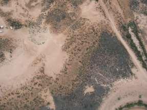
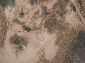
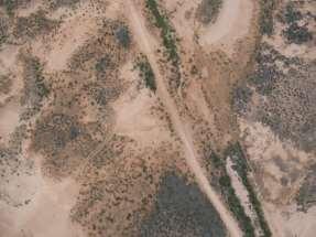
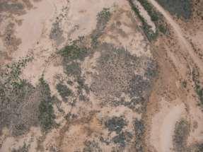
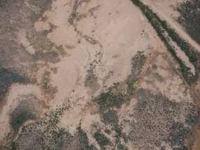
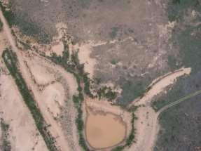
2 On this journey we will see. The Jornada Unmanned aircraft FAA UAS flight requirements Flights on the Jornada how we do what we do Data applications Possibilities 10/17/2006 Ace Tank Dikes


3 USDA Agricultural Research Service Jornada Experimental Range Las Cruces, NM Established /20/10 SCAN


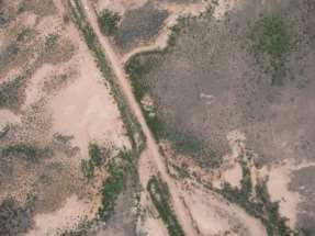
4 The Jornada Experimental Range is located in southern New Mexico 780 km 2 Jornada Experimental Range 10/16/2006 JORNEX Grassland


5 ARS Project Plan Management Technologies for Conservation of Western Rangelands The goal of the Jornada is to develop ecologically based knowledge systems and technologies for management, conservation, monitoring, and assessment of western rangelands. 10/7/2010 SCAN

6 How does the UAS program fit into this? Developing both knowledge systems and technologies. Using the MLB Co. Bat 3 and Bat 4 UAS to acquire high resolution aerial imagery for analyses and interpretation. 8/12/10 SCAN

7 What is a UAS? UAS Unmanned Aircraft System Components: Aircraft Ground station Computer PGS RC transmitter(s) Antennas Communication GPS Video Video recorder R/C SCM 2.4 GHz Flight Planning Real-time Data Wired PCM 2.4 GHz Patch Antenna 900 MHz MLB Ground Station Computer With PCC flight software GPS Real-time Video Omni Antenna 900 MHz Piccolo Ground Station Satellite Tracking Video Antenna 2.4 GHz 6/24/10 CWS


8 What is a UAV or UA? UAV Unmanned Aerial Vehicle Unmanned Aircraft A component of the Unmanned Aircraft System 10/16/06 JORNEX Playa


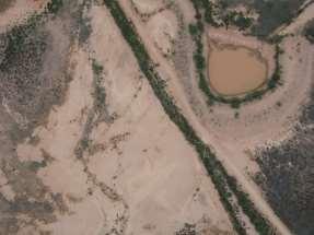
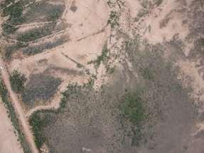
9 What is an RPA or ROA? RPA Remotely Piloted Aircraft ROA Remotely Operated Aircraft Military terminology for UAV 10/17/06 Bajada


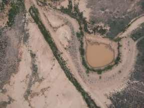
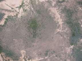
10 What is a Drone? Common designation for UAS, UAV, UA, RPA, ROA; originally an unpiloted aerial target. 10/16/06 JORNEX Tarbush

11 FAA Requirements for UAS Flights in the National Airspace System (NAS): Crew Flights under 400 Above Ground Level FAA Private Pilot Knowledge test 2 year FAA Class 2 medical commercial, 1 year Flights above 400 AGL FAA Private Pilot Knowledge test FAA Class 2 medical FAA Private Pilot certification - current 6/24/10 CWS

12 FAA Requirements for UAS Flights in the National Airspace System (NAS), continued: Certificate of Authorization Only public agencies may receive a COA. A COA is for a specific location, aircraft, and time. Public agencies are government agencies, or academic institutions that receive government funding. Three to six months for approval. Recipient is responsible for all FAA notifications and reports. 8/20/10 SCAN

13 8/20/10 TFT Another FAA Requirement for UAS flights in the NAS: UAS Registration A new requirement for unmanned aircraft flown under a COA. Submit documentation to the FAA to receive an aircraft N-number (tail number).

14 Requirements for UAS Flights on the Jornada: National Airspace System A Certificate of Authorization (COA) The COA covering the Jornada belongs to NMSU Physical Science Laboratory UAS Flight Test Center and covers all of southern NM. PSL FTC participation is required for all Jornada flights. They are responsible for all FAA interactions. They supply a Mission Commander, data collector, and observers, if necessary. 8/28/13 JAS
15 More requirements for UAS Flights on the Jornada: National Airspace System Qualified Jornada crew: Pilot in Command (licensed pilot) External Pilot radio control of aircraft Internal Pilot computer flight control Visual Observer incoming aircraft alert Additional crew: Ground support aircraft setup and checks Payload specialist ground station setup, preflight and post-flight checks EP comms communication between EP and IP 9/10/10 TW

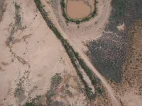
16 Requirements for UAS Flights on the Jornada, continued: White Sands Missile Range Restricted Airspace Memorandum of Understanding no $$$$ Data Request Letter detailed information about UAS Frequency Request Authorization unlicensed communication frequencies, 900 MHz and 2.4 GHz Clearance two weeks before flight request airspace scheduling. Receive clearance code prior to flight. Day of flight at scheduled time call for green range. 10/17/06 Yarbrough Dam

17 Restricted Airspace White Sands Missile Range JER / WSMR buffer Jornada Experimental Range Restricted Airspace National Airspace System White Sands Missile Range Restricted Airspace Las Cruces


18 More Jornada flight requirements: Good Weather clear sky, light breeze within two hours of solar noon Crew qualified pilots and observers Clearance NAS or WSMR Restricted Airspace 8/12/10 SCAN

19 What do we fly? MLB Bat m wingspan 10 kg with payload 5 hr flight time $50,000 in 2006 MLB Bat 4 4 m wingspan 38 kg with payload 5 hr flight time $170,000 in 2013 Flights 200+ Hours just under 200 Images 130,000+ Mosaics from images 200+


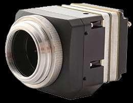
20 MLB Bat 3 catapult launched 6-band multispectral camera mounted in nose Canon SD900 mounted in wing 6/3/10

21 MLB Bat 4 manual rolling take off, runway required 6-band multispectral camera mounted in payload bay Canon EOS 5D Mark II mounted in payload bay


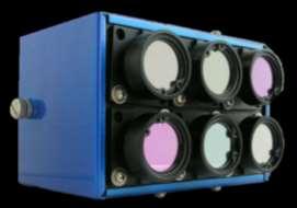


22 Sensors Tetracam mini-mca 6-band multi-spectral Bat 3, Bat 4 Canon EOS 5D Mark II 21 mp Bat 4 Video Bat 3, Bat 4 Canon SD mp Bat 3 10/16/2006 JORNEX Tarbush


23 Potential Sensors Thermal infrared Color Infrared converting SLR with internal filter change LIDAR - Light Detection and Ranging Stereo camera 5/26/10 SCAN

24 Mobile ground control unit.

25 Mobile ground control unit - ground station.

26 FAA approved transport flightplan Sense and avoid requirement


27 What do we do? 40% side lap Acquire imagery for mosaics. 75% forward lap 8/12/10 SCAN

28 Outlined area covered by previous slide. Mosaic finished product from previous imagery.


29 Data Applications Watching grass grow Invasive species detection and monitoring Monitoring soil disturbance and erosion Extraction of fine-detail digital surface models Phenology Comparing data collection techniques 9/10/10 TW


30 August 2011 Late-monsoon May 2011 Pre-monsoon Red Green Blue Watching grass grow. Color Infrared Normalized Difference Vegetation Index Aerial imagery collected by the Jornada Experimental Range UAS team and prepared by Craig Winters and Amy Slaughter.


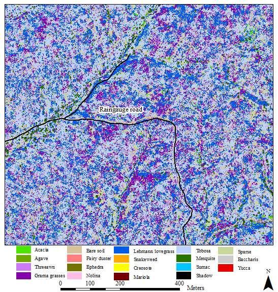
31 JER Vegetation and Soil Classification Map Invasive Species Detection and Monitoring Object Based Image Analysis 11/3/11 P9E Aerial imagery collected by the Jornada Experimental Range UAS team and prepared by Amy Slaughter.


32 11/3/11 P9E Zoomed-in View

33 10/19/11 WGEW WGEW Classification Map


34 10/19/11 WGEW Zoomed-in View
 Up to 2605 images/flight SD900 image size at 213 AGL 213")

35 Monitoring soil disturbance and erosion Study area: 800 ha (three sections) Up to 2605 images/flight SD900 image size at 213 AGL 213 x 160 m Imagery acquired 4/7/2009 MLB Bat 3 Pre-disturbance imagery Canon SD mp camera 213 m AGL 7 9 cm resolution 4/7/09 TRAC

36 10 meters Imaged six 50m x 50m test plots m flying height (500 ft) 2.7 cm resolution ~20 images used to reconstruct Digital Elevation Models for each plot Images acquisition was very haphazard due to wind Aerial imagery collected by the Jornada Experimental Range UAS team and prepared by Jeff Gillan.

37 Surface Point Cloud using Agisoft PhotoScan 1 meter
 0.4 0.3 0.2 0.1 0-0.")
 0.3 0.2 0.1 0-0.1 0 2 4 6 8 TRANSECT DISTANCE (M) 0.3 0.2 0.1 0-0.1 0 2 4 6 8 TRANSECT DISTANCE (M) Erosion Bridge Aerial DEM Erosion Bridge Aerial DEM Erosion Bridge Aerial DEM")
38 RELATIVE ELEVATION (M) RELATIVE ELEVATION (M) RELATIVE ELEVATION (M) RELATIVE ELEVATION (M) RELATIVE ELEVATION (M) 1 2 v. 3 Erosion Bridge 5 4 Plot 216-Erosion Bridge 1 Plot 216-Erosion Bridge TRANSECT DISTANCE (M) TRANSECT DISTANCE (M) Erosion Bridge Aerial DEM Erosion Bridge Aerial DEM Plot 216-Erosion Bridge 3 Plot 216-Erosion Bridge 4 Plot 216-Erosion Bridge TRANSECT DISTANCE (M) TRANSECT DISTANCE (M) TRANSECT DISTANCE (M) Erosion Bridge Aerial DEM Erosion Bridge Aerial DEM Erosion Bridge Aerial DEM


39 9/11/14 PAS9 Remote Sensing and Phenology


40 Reynolds Creek Experimental Watershed, Idaho National Airspace System COA required Runway built for UAS flight Bat 3 with Canon SD900 camera at 213 m AGL When there are more than eight plots imagery analysis is more cost effective. Data collection technique comparison UAS imagery and ground data Correlation values for bare ground, total veg, grass and forb, and shrubs were.9827, , and (pretty good!) September 2008
")

41 Walnut Gulch Experimental Watershed, AZ National Airspace System COA required Used local road as runway Bat 3 with Tetracam 6-band MCA (Multi-Camera Array) and Canon SD900 at 213 m AGL 6-band multispectral Multispectral RGB Methods for identifying and monitoring invasive species UAS imagery and ground data October 2011

42 Oliktok Point, Alaska Sandia National Labs, Atmospheric Radiation Monitoring (ARM) Climate Research Facility North Slope of Alaska on Arctic Ocean Established runway Restricted airspace no COA required Bat 3 with Canon SD900 camera at 213m AGL Testing small UAS under Arctic conditions for atmospheric monitoring October 2012
 at 213 m AGL Compare ground measures of plant biomass to estimates derived from imagery.")
43 Central Plains Experimental Range, CO National Airspace System COA required Runway to be built for UAS flight Bat 3 with Canon SD900 and Tetracam 6-band MCA (Multi-Camera Array) at 213 m AGL Compare ground measures of plant biomass to estimates derived from imagery. Slated for August 2015

44 What do you do if you re not a public agency? Commercial Exemptions issued by FAA Fourteen issued within the last few months for: Film and video production Aerial surveying Construction-site monitoring Oil-rig inspections Real estate photography Precision agriculture Much easier to obtain for remote, unpopulated areas. 9/14/06 JAS

45 Myths Myth #1: The FAA doesn't control airspace below 400 feet Fact The FAA is responsible for the safety of U.S. airspace from the ground up. Myth #2: Commercial UAS flights are OK if I'm over private property and stay below 400 feet. Fact Commercial operations are only authorized on a case-by-case basis. Requires - a certified aircraft a licensed pilot operating approval You may not fly a UAS for commercial purposes by claiming that you re operating according to the Model Aircraft guidelines (below 400 feet, 3 miles from an airport, away from populated areas). 2/28/14 TRAC
 users can obtain an experimental airworthiness certificate to conduct research and development, training and flight demonstrations.")
46 More Myths Myth #3: Commercial UAS operations are a gray area in FAA regulations. Fact There are no shades of gray in FAA regulations. Anyone who wants to fly an aircraft manned or unmanned in U.S. airspace needs some level of FAA approval. Private sector (civil) users can obtain an experimental airworthiness certificate to conduct research and development, training and flight demonstrations. Flying model aircraft solely for hobby or recreational reasons does not require FAA approval. Hobbyists are advised to operate according to the Model Aircraft guidelines. Read more myths at: 6/3/10 GRN


47 So, you really want to fly some sort of UA sensefly ebee $12,000 DJI Phantom $759 - $1359 Wish List: Inexpensive Simple to operate Reliable Durable Portable Long-lasting battery Payload Zephyr 2 UAV $17,995 10/16/06 JORNEX TRAN


48 What we ve seen. The beautiful Jornada Unmanned aircraft FAA requirements How we conduct flights on the Jornada How the imagery is used in data applications Possibilities 7/31/12 TRAC

49 Acknowledgements: Jornada Bat Flight Crew NMSU PSL UAS FTC Craig Winters Amy Slaughter Dawn Browning Jeff Gillan Andrea Laliberte Thank You!! 8/26/10 GIBPE
Unmanned Aircraft Systems (UAS) at the Jornada Experimental Range
 at the Jornada Experimental Range") Unmanned Aircraft Systems (UAS) at the Jornada Experimental Range Al Rango and the Jornada UAS Flight Team: Connie Maxwell, Amy Slaughter, Andrea Laliberte, Chris Pierce, Dave Thatcher, Jim Lenz, and Craig
Unmanned Aircraft Systems (UAS) at the Jornada Experimental Range Al Rango and the Jornada UAS Flight Team: Connie Maxwell, Amy Slaughter, Andrea Laliberte, Chris Pierce, Dave Thatcher, Jim Lenz, and Craig
What is a UAS (Drone)
") UAS KCSI Aerial Patrol KCSI is Based in Bakersfield CA Established in 1993 Operates in 15 States KCSI has over 20 fulltime pilots Currently fly: Over 40,000 miles of pipeline a month 700 hours of production
UAS KCSI Aerial Patrol KCSI is Based in Bakersfield CA Established in 1993 Operates in 15 States KCSI has over 20 fulltime pilots Currently fly: Over 40,000 miles of pipeline a month 700 hours of production
Drone Technology: What Works for Industry & Landowners. Michael J. Buschermohle Interim Assistant Dean UT Extension
 Drone Technology: What Works for Industry & Landowners Michael J. Buschermohle Interim Assistant Dean UT Extension So You Want to Fly FAA Regulations UAS Platforms Cameras Applications in Forestry Current
Unmanned Aerial Vehicles for Environmental Applications
 Unmanned Aerial Vehicles for Environmental Applications John Rankin, President, J.R. Canadian Mapping Ltd. 10 th Annual Professional Biology Conference April 23 rd, 2015 UAVs Our System Suitable Sites
5 Day Operator Course. 1.0 AIRSPACE CLASSROOM ONLINE EXECUTIVE VO Terms X X Classification
 5 Day Operator Course 2 Day Executive Training 2 Day VO Training 0.1 INTRODUCTION CLASSROOM ONLINE EECUTIVE VO About Avion Solutions Purpose of the course Learning objectives Course outline and schedule
UAV/Drone Uses and Laws
 UAV/Drone Uses and Laws Robert Moorhead Director of Geosystems Research and Northern Gulf Institutes Professor of Electrical & Computer Engineering Unmanned Aerial Systems (UASs) 3 components to the system:
Program. - Flight Operations (VRI) Motivation. The Aircraft / Sensors. Unmanned Aircraft Systems 8/1/17
 Motivation. The Aircraft / Sensors. Unmanned Aircraft Systems 8/1/17") Program Unmanned Aircraft in Agriculture: Flight Operations and FAA Certification Process * 1) Background. Wayne Woldt, Ph.D., P.E. Department of Biological Systems Engineering School of Natural Resources
Program Unmanned Aircraft in Agriculture: Flight Operations and FAA Certification Process * 1) Background. Wayne Woldt, Ph.D., P.E. Department of Biological Systems Engineering School of Natural Resources
The Legal Environment for Commercial Unmanned Aircraft
 The Legal Environment for Commercial Unmanned Aircraft Overview The Legal Environment Who can fly them? A history of FAA policy to the present Asking for permission 2 Today s Legal Framework 3 Today s
Unmanned Aircraft Systems (UAS) 101
 101") Unmanned Aircraft Systems (UAS) 101 Presented to: The American Association of State Highway and Transportation Officials Presented by: Dave May, FAA UAS Integration Office Date: What is a UAS? A UAS is
Unmanned Aircraft Systems (UAS) 101 Presented to: The American Association of State Highway and Transportation Officials Presented by: Dave May, FAA UAS Integration Office Date: What is a UAS? A UAS is
Unmanned Aircraft Systems (UAS) 101
 101") Unmanned Aircraft Systems (UAS) 101 Presented to: National Tribal Transportation Conference Presented by: Robert Winn, Aviation Safety Inspector, Unmanned Aircraft Systems Office Date: Overview Unmanned
Unmanned Aircraft Systems (UAS) 101 Presented to: National Tribal Transportation Conference Presented by: Robert Winn, Aviation Safety Inspector, Unmanned Aircraft Systems Office Date: Overview Unmanned
2018 ENGINEERING EXPO Jon Thies NUAIR Director of Consulting
 2018 ENGINEERING EXPO Jon Thies NUAIR Director of Consulting Agenda Operating Under Current FAA Regulations suas Program Development Considerations suas Use Case Examples Quiz Regulations Small Unmanned
small Unmanned Aircraft Systems Arlington Police Department June 28, 2011
 suas small Unmanned Aircraft Systems Arlington Police Department June 28, 2011 1. Overview of APD suas program to date 2. Discuss the C.O.A. (FAA certificate of authorization to fly) and restrictions
Systems (UAS) Unmanned Aircraft. Presented to: GWBAA Safety Stand Down Day. Presented by: John Meehan. Date: 17 May AUS-430 Safety & Operations
 Unmanned Aircraft. Presented to: GWBAA Safety Stand Down Day. Presented by: John Meehan. Date: 17 May AUS-430 Safety & Operations") Unmanned Aircraft Systems (UAS) Presented to: GWBAA Safety Stand Down Day Presented by: John Meehan AUS-430 Safety & Operations UAS Integration Office Date: What is a UAS? Unmanned aircraft system (UAS)
Unmanned Aircraft Systems (UAS) Presented to: GWBAA Safety Stand Down Day Presented by: John Meehan AUS-430 Safety & Operations UAS Integration Office Date: What is a UAS? Unmanned aircraft system (UAS)
Using UAS Technology for Invasive Plant Management
 Using UAS Technology for Invasive Plant Management Adam Benjamin, P.S.M. UF/IFAS Fort Lauderdale R.E.C. May 8, 2018 2018 Aquatic Weed Control Short Course Coral Springs, FL Using UAS Technology for Invasive
LAUNCHING YOUR UNMANNED AIRCRAFT PROGRAM
 LAUNCHING YOUR UNMANNED AIRCRAFT PROGRAM THE DARTDRONES TEAM UNMANNED AIRCRAFT APPLICATIONS AERIAL INSPECTIONS AERIAL INSPECTIONS Safer and faster alternative to visual inspection by an individual Damage
Using UAVs for Aerial Mapping, Surveying and Photography
 Using UAVs for Aerial Mapping, Surveying and Photography Prepared for: Central Florida GIS Workshop 18 September 2013 Kevin Shortelle System Dynamics International, Inc kevinshortelle@bellsouth.net Presentation
Unmanned Aircraft Systems (UAS) 101
 101") Unmanned Aircraft Systems (UAS) 101 Presented to: ACC Airports Technical Workshop Presented by: David Russell, Program Analyst, UAS Integration Office, Date: August 10, 2016 Overview Unmanned Aircraft
Unmanned Aircraft Systems (UAS) 101 Presented to: ACC Airports Technical Workshop Presented by: David Russell, Program Analyst, UAS Integration Office, Date: August 10, 2016 Overview Unmanned Aircraft
Unmanned Aircraft Systems (UAS) 101
 101") Unmanned Aircraft Systems (UAS) 101 Presented to: AUVSI Cascade Chapter Future Robotics Forum Presented by: Michael Dement-Myers, (FAA), NextGen Branch Date: October 20, 2016 Overview Unmanned Aircraft
Unmanned Aircraft Systems (UAS) 101 Presented to: AUVSI Cascade Chapter Future Robotics Forum Presented by: Michael Dement-Myers, (FAA), NextGen Branch Date: October 20, 2016 Overview Unmanned Aircraft
Unmanned Aerial Systems for Agriculture
 Unmanned Aerial Systems for Agriculture by Bob Schultheis Natural Resource Engineering Specialist for Greene County Soils & Crops Conference Springfield, MO March 18, 2014 Special thanks to Bill Wiebold,
Outline Why CCSU PinnaclX and Eversource
 CBIA 2018 Safety & Health Conference Wednesday, May 23, 2018 The Red Lion Hotel Cromwell 100 Berlin Road, Cromwell, CT Drones & Safety: A Brave New World Alfred A. Gates, Ph.D. CFI Helicopter, UAS Remote
Unmanned Aircraft System (UAS): regulatory framework and challenges. NAM/CAR/SAM Civil - Military Cooperation Havana, Cuba, April 2015
: regulatory framework and challenges. NAM/CAR/SAM Civil - Military Cooperation Havana, Cuba, April 2015") Unmanned Aircraft System (UAS): regulatory framework and challenges NAM/CAR/SAM Civil - Military Cooperation Havana, Cuba, 13 17 April 2015 Overview Background Objective UAV? Assumptions Challenges Regulatory
Unmanned Aircraft System (UAS): regulatory framework and challenges NAM/CAR/SAM Civil - Military Cooperation Havana, Cuba, 13 17 April 2015 Overview Background Objective UAV? Assumptions Challenges Regulatory
In-field and Remote Sensing for Precision Agriculture. John Nowatzki Extension Ag Machine Systems Specialist North Dakota State University
 In-field and Remote Sensing for Precision Agriculture John Nowatzki Extension Ag Machine Systems Specialist North Dakota State University UAS in Precision Agriculture In-field Sensors Selecting UAS Equipment
OWEA Woolpert UAS Operations
 OWEA 2016 Woolpert UAS Operations UAS Rules and Regulations How Woolpert is Handling This The Exemption In December 2014 Woolpert received approval from the FAA regarding an exemption seeking relief from
Impact of flight regulations on effective use of unmanned aircraft systems for natural resources applications
 Impact of flight regulations on effective use of unmanned aircraft systems for natural resources applications Albert Rango Andrea S. Laliberte Journal of Applied Remote Sensing, Vol. 4, 043539 (13 July
fll,' The University of Georgia O tfo:c o f rh.: Vu:.: Pre,id.:nt for Research
 November 30, 2015 fll,' - - - ----- I M.$------- The University of Georgia ------------------9 O tfo:c o f rh.: Vu:.: Pre,id.:nt for Research U.S. Department of Transportation Docket Management System
Unmanned Aerial Vehicles or How I learned to stop worrying and love drones!
 Unmanned Aerial Vehicles or How I learned to stop worrying and love drones! Dr. Charles O Neill Aerospace Engineer, UA Professor, Pilot charles-oneill.com or aero.ua.edu Brief History of Drones German
Unmanned Aircraft Systems (UAS)
") Unmanned Aircraft Systems (UAS) Update Presented to: Airports Council International Presented by: Danielle J. Rinsler, AICP Date: Who is Operating UAS in the National Airspace System (NAS)?* Public (Governmental)
Unmanned Aircraft Systems (UAS) Update Presented to: Airports Council International Presented by: Danielle J. Rinsler, AICP Date: Who is Operating UAS in the National Airspace System (NAS)?* Public (Governmental)
How to Use Drones in Stormwater Management January 17, :30 a.m. 11:30 a.m. (Eastern)
") Webinar Training Series How to Use Drones in Stormwater Management January 17, 2019 10:30 a.m. 11:30 a.m. (Eastern) www.seswa.org Today s Presenters Robert Gecy Application Programmer Beaufort County,
Webinar Training Series How to Use Drones in Stormwater Management January 17, 2019 10:30 a.m. 11:30 a.m. (Eastern) www.seswa.org Today s Presenters Robert Gecy Application Programmer Beaufort County,
 Presented by: Lt. Michael J. Magda Team Leader, Firefighter, EMT -P, Hazardous Material Specialist, Private Pilot, Airframe & Power plant Mechanic Western Wayne County HMRT, Livonia Fire & Rescue And
LOW DOWN ON THE HIGH UP: USING DRONES FOR LAND CONSERVATION
 LOW DOWN ON THE HIGH UP: USING DRONES FOR LAND CONSERVATION TEXAS LAND CONSERVATION CONFERENCE MARCH 3, 2017 STEPHEN RAMIREZ STEWARDSHIP DIRECTOR TEXAS LAND CONSERVANCY RAY RENNER, RPLS, PMP MANAGER OF
Municipal Drone Operations Ben Roper City of College Station
 Municipal Drone Operations Ben Roper City of College Station Unmanned Aerial System (UAS) aka Drone You are establishing an aviation unit for your entity What could possible go wrong? https://youtu.be/aolm1aqkews
Development and Testing of an Unmanned Aircraft Safety Beacon for Aerial Application Safety
 Development and Testing of an Unmanned Aircraft Safety Beacon for Aerial Application Safety Wayne Woldt, Ph.D., P.E., and Jacob Smith Biological Systems Engineering and School of Natural Resources University
Getting off the Ground: Implementing a Drone Program
 Getting off the Ground: Implementing a Drone Program November 2017 Steve Goldman, GISP GIS Manager / UAS Coordinator California Department of Fish and Wildlife http://www.wildlife.ca.gov Drones (UAS) What
Unmanned Aircraft Systems in Disaster Management and National Preparedness
 Unmanned Aircraft Systems in Disaster Management and National Preparedness at the Hawaii Land Surveyors Association Matt Kobayashi Ted Ralston National Disaster Preparedness Training Center Honolulu Why
Use of Drones (Unmanned Aerial Systems) for Agriculture
 for Agriculture") Photo credit: www.redorbit.com Photo credit: www.redorbit.com Use of Drones (Unmanned Aerial Systems) for Agriculture by Bob Schultheis Natural Resource Engineering Specialist for Ozarks Mini Maker Faire
Photo credit: www.redorbit.com Photo credit: www.redorbit.com Use of Drones (Unmanned Aerial Systems) for Agriculture by Bob Schultheis Natural Resource Engineering Specialist for Ozarks Mini Maker Faire
UAV Program. What does it take to have a UAV Program Current Requirements Lemhi County UAV program
 UAV Program UAV Program What does it take to have a UAV Program Current Requirements Lemhi County UAV program What does it take to have a UAV program? Some Very Important Questions to Ask Before What type
UAS to GIS Utilizing a low-cost Unmanned Aerial System (UAS) for Coastal Erosion Monitoring
 for Coastal Erosion Monitoring") UAS to GIS Utilizing a low-cost Unmanned Aerial System (UAS) for Coastal Erosion Monitoring Agenda Scope of today s presentation Demonstration Objectives Wrightsville Beach Test Area Masonboro Inlet Jetties
UAS to GIS Utilizing a low-cost Unmanned Aerial System (UAS) for Coastal Erosion Monitoring Agenda Scope of today s presentation Demonstration Objectives Wrightsville Beach Test Area Masonboro Inlet Jetties
DRONING FOR INFORMATION
 DRONING FOR INFORMATION Opportunity of Drones for Surveying and Mapping Practices By: Adam Smith, CP Matt Aguirre, PLS Overview Introduction Background Problem and Opportunity Issues and Mitigations Implementation
Civil Remotely Piloted Aircraft System (RPAS) Regulations in Australia
 Regulations in Australia") Civil Remotely Piloted Aircraft System (RPAS) Regulations in Australia Cees Bil School of Engineering RMIT University Melbourne AUSTRALIA bil@rmit.edu.au ICAS Workshop: Intelligent and Autonomous Technologies
Civil Remotely Piloted Aircraft System (RPAS) Regulations in Australia Cees Bil School of Engineering RMIT University Melbourne AUSTRALIA bil@rmit.edu.au ICAS Workshop: Intelligent and Autonomous Technologies
Mapping with Unmanned Airborne Systems (UAS)
") Mapping with Unmanned Airborne Systems (UAS) February 13, 2014 Engineering Architecture Design-Build Surveying GeoSpatial Solutions Today s Agenda Introductions / Objectives Current UAS Regulations (FAA)
Mapping with Unmanned Airborne Systems (UAS) February 13, 2014 Engineering Architecture Design-Build Surveying GeoSpatial Solutions Today s Agenda Introductions / Objectives Current UAS Regulations (FAA)
2017 PLSO Fall Seminar. UAV s Flying to Finished Product
 2017 PLSO Fall Seminar UAV s Flying to Finished Product Scott D. Kraner, P.E. Subject Matter Expert Civil Infrastructure Session Outline UAV Overview and Applications How to obtain a remote pilot certificate?
Lone Star UAS Center. of Excellence and Innovation
 Lone Star UAS Center LSUASC Introduction of Excellence and Innovation Bringing UAS to America s Skies NASAO 85 th Annual Convention and Tradeshow UAS Emerging Technologies & Utilizations September 13,
Adventures in UAS: Experiences of a UAS Operator. Paul Beckwith, PE, CCM, LEED AP bd+c Navigator CS, LLC, President. Presented by:
 Adventures in UAS: Experiences of a UAS Operator Presented by: Paul Beckwith, PE, CCM, LEED AP bd+c Navigator CS, LLC, President Paul Beckwith, PE, CCM, LEED AP bd+c BA in Architectural Engineering from
Western Service Area Unmanned Aircraft Systems (UAS) Update. Federal Aviation Administration. Defense Symposium
 Update. Federal Aviation Administration. Defense Symposium") Western Service Area Unmanned Aircraft Systems (UAS) Update Presented to: Presented by: Northwest Aerospace & Defense Symposium Matt Gammon, Tactical Operations Team, FAA Western Service Center Date: May
Western Service Area Unmanned Aircraft Systems (UAS) Update Presented to: Presented by: Northwest Aerospace & Defense Symposium Matt Gammon, Tactical Operations Team, FAA Western Service Center Date: May
Municipal Drone Operations Ben Roper City of College Station
 Municipal Drone Operations Ben Roper City of College Station Unmanned Aerial System (UAS) aka Drone You are establishing an aviation unit for your entity What could possible go wrong? What is Needed Register
Hidalgo County Drone Program. Standard Operating Procedure (SOP) Template. February 23, 2017
 Template. February 23, 2017") Hidalgo County Drone Program Standard Operating Procedure (SOP) Template The following is a detailed (but intended as a comprehensive) framework of topics to be covered in a Standard Operating Procedure
Hidalgo County Drone Program Standard Operating Procedure (SOP) Template The following is a detailed (but intended as a comprehensive) framework of topics to be covered in a Standard Operating Procedure
National Regulatory Profile
 National Regulatory Profile Finland NOTE : In this form the following terms are used Drone = Remotely Piloted Aircraft (RPA) = Unmanned Aircraft (UA) = See definition below Drone Pilot = Remote Pilot (RP)
UNMANNED AIRCRAFT SYSTEMS (UAS) IN UTILITIES
 IN UTILITIES") UNMANNED AIRCRAFT SYSTEMS (UAS) IN UTILITIES Presented by: Dan Carbone Avion Unmanned Why Drones? Why Drones? Cost Effective Entire cost of a UAS program can be recouped in first-year man-hour savings
UNMANNED AIRCRAFT SYSTEMS (UAS) IN UTILITIES Presented by: Dan Carbone Avion Unmanned Why Drones? Why Drones? Cost Effective Entire cost of a UAS program can be recouped in first-year man-hour savings
NASA s Automatic Dependent Surveillance Broadcast: ADS-B Sense-and-Avoid System
 NASA s Automatic Dependent Surveillance Broadcast: ADS-B Sense-and-Avoid System October 30, 2014 Ricardo Arteaga NASA Armstrong Flight Research Center is a world class leader in cutting-edge Systems Engineer
small Unmanned Aerial Systems (suas)
") 2018 WSC Annual Safety Conference small Unmanned Aerial Systems (suas) Presenter Introduction Chris Seider, CSP, PHR, CHST, ARM Senior Safety and Risk Management Specialist Foth & Van Dyke, LLC Chris.Seider@Foth.com
2018 WSC Annual Safety Conference small Unmanned Aerial Systems (suas) Presenter Introduction Chris Seider, CSP, PHR, CHST, ARM Senior Safety and Risk Management Specialist Foth & Van Dyke, LLC Chris.Seider@Foth.com
Australian Association for Unmanned Systems
 Australian Association for Unmanned Systems Industry Guidance on the Amended CASR 1998 Part 101 Version: 1.1 27 th May 2016 Background and Scope On the 30 th of March 2016 the Civil Aviation Safety Authority
UNMANNED AERIAL SYSTEM USE
 UNMANNED AERIAL SYSTEM USE Unmanned aircraft systems (UASs) come in a variety of shapes and sizes and serve diverse purposes. Also known as drones, unmanned vehicle systems (UVSs) and unmanned aerial vehicles
Community College Risk Management Consortium July 21 22, 2016 Understanding the Evolving Landscape of Drone Regulations and Risk Management
 Community College Risk Management Consortium July 21 22, 2016 Understanding the Evolving Landscape of Drone Regulations and Risk Management The ABCs of UAVs July 2016 UAV Talking Points Drones are changing
Unmanned Aircraft Systems
 Unmanned Aircraft Systems Airport Operations Update Presented to: Wisconsin Airport Managers By: Kevin Morris, Date: April 25, 2017 Overview A Few Reminders UAS Registration Myths vs Facts FAA Recognized
Unique Challenges of Unmanned Air Systems (UASs) Test and Evaluation
 Test and Evaluation") Unclassified 2008 Annual NDIA International Symposium Unclassified Unique Challenges of Unmanned Air Systems (UASs) Test and Evaluation Presented By: RDML David Dunaway Assistant Commander, Test and Evaluation,
Unclassified 2008 Annual NDIA International Symposium Unclassified Unique Challenges of Unmanned Air Systems (UASs) Test and Evaluation Presented By: RDML David Dunaway Assistant Commander, Test and Evaluation,
WEBINAR: A BIRD S-EYE VIEW
 WEBINAR: A BIRD S-EYE VIEW DRONES IN AGRIBUSINESS JUNE 21, 2016 Hosted by Nexsen Pruet Presented by Ernie Pearson (Nexsen Pruet); Patrick Lohman (PrecisionHawk); and Kyle Snyder (NGAT/NCSU) FOUNDED IN
FUTURE DRIVEN BY TECHNOLOGY UNMANNED AERIAL SYSTEMS HOSTED BY CHAD E. COLBY FEBRUARY 18 TH How far we have come
 FUTURE DRIVEN BY TECHNOLOGY UNMANNED AERIAL SYSTEMS HOSTED BY CHAD E. COLBY FEBRUARY 18 TH 2015 How far we have come Growers are demanding MORE from every acre, this along with advances in Precision Technology
Taney County Livestock and Forage Conference Forsyth, MO 2/8/2018
 Photo credit: www.redorbit.com Photo credit: www.redorbit.com Unmanned Aerial Systems (Drones) for Ozarks Agriculture by Bob Schultheis Natural Resource Engineering Specialist for Taney County Livestock
Unmanned Aerial Systems (Drones) for Ozarks Agriculture
 for Ozarks Agriculture") Unmanned Aerial Systems (Drones) for Ozarks Agriculture by Bob Schultheis Natural Resource Engineering Specialist for Taney County Livestock and Forage Conference Forsyth, MO February 8, 2018 1 Farming
Unmanned Aerial Systems (Drones) for Ozarks Agriculture by Bob Schultheis Natural Resource Engineering Specialist for Taney County Livestock and Forage Conference Forsyth, MO February 8, 2018 1 Farming
Commit to Safety: Professional Pilots Always Use a Checklist INITIAL EQUIPMENT SETUP
 Commit to Safety: Professional Pilots Always Use a Checklist INITIAL EQUIPMENT SETUP READ THE MANUAL Familiarize yourself with all aspects of your suas before you even consider going out for your first
Unmanned Aircraft Systems (UAS)
") Unmanned Aircraft Systems (UAS) Use & Regulation Presented to: GUIRR Nat l Academy of Sciences Presented by: Robert A. Pappas Special Rules Coordinator UAS Integration Office Date: Who & How UAS are Operating
Unmanned Aircraft Systems (UAS) Use & Regulation Presented to: GUIRR Nat l Academy of Sciences Presented by: Robert A. Pappas Special Rules Coordinator UAS Integration Office Date: Who & How UAS are Operating
Remote Controlled Aircraft Permit Instructions
 The use of remote controlled aircraft is regulated within State Parks by WAC 352-32-130 (5) which allows for the flying of remote controlled aircraft with written permission of the Director, or designee.
Unmanned Aerial Systems for Ozarks Agriculture
 Unmanned Aerial Systems for Ozarks Agriculture UAS, UAV, drone Next High Tech Tool for Agriculture and Beyond by Bob Schultheis Natural Resource Engineering Specialist Photo credit: http://modernfarmer.com/2014/01/precision
Unmanned Aerial Systems for Ozarks Agriculture
 Unmanned Aerial Systems for Ozarks Agriculture by Bob Schultheis Natural Resource Engineering Specialist for Webster County Cattle Producers Inc. Marshfield, MO February 11, 2016 1 UAS, UAV, drone Next
Using Geospatial Data in the Oil & Gas Industry. Dr. Stacey D. Lyle, RPLS
 Using Geospatial Data in the Oil & Gas Industry Dr. Stacey D. Lyle, RPLS Outcomes A Geospatial Data Science Center is an advanced database of information organized and accessible using multiple software
Platform and Products
 International Partnership Space Programme Earth Observation for the Preservation of Ecological Bacalar Corridor Platform and Products Terri Freemantle, Raffaella Guida, Paula Marti, Pasquale Iervolino
Unmanned Aircraft Systems (UAS) 101
 101") Unmanned Aircraft Systems (UAS) 101 Presented to: Presented by: Contract Management Conference Bryan Budds / Mike Soper, MDOT Date: March 5, 2019 Overview Unmanned Aircraft Systems What & Why FAA Authority
Unmanned Aircraft Systems (UAS) 101 Presented to: Presented by: Contract Management Conference Bryan Budds / Mike Soper, MDOT Date: March 5, 2019 Overview Unmanned Aircraft Systems What & Why FAA Authority
UAS in Canada Stewart Baillie Chairman Unmanned Systems Canada Sept 2015
 UAS in Canada - 2015 Stewart Baillie Chairman Unmanned Systems Canada Sept 2015 My Focus Today.. Report on the growth of the UAS sector in Canada as a whole Provide background on UAS regulation in Canada
Drone Pilot Course. Lesson 1 Study Guide- Regulations. Questions take from ASA Remote Pilot Test Prep Guide
 Lesson 1 Study Guide- Regulations 1. You are operating a 1280g (2.8lb) quadcopter for your own enjoyment. What FAA regulation is this suas operation subject to? a. 14 CFR 107 b. 14 CFR 101 2. You have
Unmanned. FAA Guidelines and Regulations for the Model Aircraft Pilot. Federal Aviation Administration Aircraft Systems (UAS) Date:
 Date:") Unmanned Aircraft Systems (UAS) FAA Guidelines and Regulations for the Model Aircraft Pilot Presented by: FAA Safety Team AFS-850 Date: Important Information Exits Restrooms Emergency Evacuation Breaks
Unmanned Aircraft Systems (UAS) FAA Guidelines and Regulations for the Model Aircraft Pilot Presented by: FAA Safety Team AFS-850 Date: Important Information Exits Restrooms Emergency Evacuation Breaks
Sam Houston State University UAS Use Checklist
 Sam Houston State University UAS Use Checklist The FAA Part 107 of the Code of Federal Regulations and the Sam Houston State University President s Office Policy PRE-27 determine the minimum requirements
UAS Unmanned Aircra: Systems in Forest Management
 UAS Unmanned Aircra: Systems in Forest Management UAS What are they? Unmanned Aircra: Systems (UAS) fill niche built upon military UAV technologies Most common plahorms Fixed Wing Rotorcra: Primary uses
Unmanned Aircraft Operations in the National Airspace System. AGENCY: Federal Aviation Administration (FAA), DOT.
, DOT.") [4910-13] DEPARTMENT OF TRANSPORTATION Federal Aviation Administration 14 CFR Part 91 Docket No. FAA-2006-25714 Unmanned Aircraft Operations in the National Airspace System AGENCY: Federal Aviation Administration
[4910-13] DEPARTMENT OF TRANSPORTATION Federal Aviation Administration 14 CFR Part 91 Docket No. FAA-2006-25714 Unmanned Aircraft Operations in the National Airspace System AGENCY: Federal Aviation Administration
Menlo Park Fire District Training Division. Unmanned Aerial System Pilot
 Menlo Park Fire District Training Division TASK BOOK FOR THE POSITION OF Unmanned Aerial System Pilot Date Issued TASK BOOK ASSIGNED TO: Individuals name, assignment DATE TASK BOOK INITIATED The material
UNMANNED AIRCRAFT SYSTEMS (UAS) FOR PUBLIC POWER OPERATIONS AN OVERVIEW ON HOW DRONES ARE IMPACTING THE ENERGY INDUSTRY
 FOR PUBLIC POWER OPERATIONS AN OVERVIEW ON HOW DRONES ARE IMPACTING THE ENERGY INDUSTRY") UNMANNED AIRCRAFT SYSTEMS (UAS) FOR PUBLIC POWER OPERATIONS AN OVERVIEW ON HOW DRONES ARE IMPACTING THE ENERGY INDUSTRY ABOUT CHRISTOPHER TODD Founder and president of Airborne Response, Miamibased UAS
UNMANNED AIRCRAFT SYSTEMS (UAS) FOR PUBLIC POWER OPERATIONS AN OVERVIEW ON HOW DRONES ARE IMPACTING THE ENERGY INDUSTRY ABOUT CHRISTOPHER TODD Founder and president of Airborne Response, Miamibased UAS
Unmanned Aircraft Systems (UAS): A Paradigm Shift in Aviation
: A Paradigm Shift in Aviation") Unmanned Aircraft Systems (UAS): A Paradigm Shift in Aviation Tom Haritos, Ed.S. Department of Aeronautical Science Embry-Riddle Aeronautical University Florida Airports Council (FAC) 2015 1 The trouble
Unmanned Aircraft Systems (UAS): A Paradigm Shift in Aviation Tom Haritos, Ed.S. Department of Aeronautical Science Embry-Riddle Aeronautical University Florida Airports Council (FAC) 2015 1 The trouble
A Drone s Eye View on Public Works Applications
 A Drone s Eye View on Public Works Applications APWA Construction Inspection Conference Parker, CO Jason Caldwell, VP of Business Development and Sales 2013, The Sanborn Map Company, Inc. Agenda Sanborn
Operations in the Golden Triangle
 Operations in the Golden Triangle Operations in the Golden Triangle Operations in the Golden Triangle The Rules For Hobbyist What is a hobbyist? The Rules For Hobbyist Community-based safety guidelines
UAS Overview IDOT s UAS Program
 Unmanned Aircraft Systems (UAS) UAS Overview IDOT s UAS Program Linda Schumm Bureau Chief Aviation Safety Linda.Schumm@Illinois.gov October 18, 2017 Bill Viste Project Coordinator William.Viste@Illinois.gov
Coeur d Alene Tribe GIS Unmanned Aerial System (UAS) Program JAMES TWOTEETH BERNE JACKSON GIOVAN ALCALA SABINE KRIER
 Program JAMES TWOTEETH BERNE JACKSON GIOVAN ALCALA SABINE KRIER") Coeur d Alene Tribe GIS Unmanned Aerial System (UAS) Program JAMES TWOTEETH BERNE JACKSON GIOVAN ALCALA SABINE KRIER What is an Unmanned Aerial System (UAS)? Small, unmanned aircraft under 50 lbs. remotely
Coeur d Alene Tribe GIS Unmanned Aerial System (UAS) Program JAMES TWOTEETH BERNE JACKSON GIOVAN ALCALA SABINE KRIER What is an Unmanned Aerial System (UAS)? Small, unmanned aircraft under 50 lbs. remotely
FAA Unmanned Aircraft Systems (UAS)
") FAA Unmanned Aircraft Systems (UAS) Overview: Proposed Small UAS Rule Presented To: Small Business Aviation Safety Roundtable Presented By: Mark Bury, Assistant Chief Counsel, Regulations Division of the
FAA Unmanned Aircraft Systems (UAS) Overview: Proposed Small UAS Rule Presented To: Small Business Aviation Safety Roundtable Presented By: Mark Bury, Assistant Chief Counsel, Regulations Division of the
Hazard Identification Questionnaire
 Hazard Identification Questionnaire OVERVIEW This questionnaire is designed to help identify potential risks and help identify areas of risk exposure. It is not an exhaustive list. This questionnaire is
State of the UAS Industry for Insurance and Construction
 State of the UAS Industry for Insurance and Construction A Drone by any Other Name There are many terms for drones in use today The industry is trying to shy away from drone verbiage since it has military
Public Aircraft Operations (Governmental Entities)
") Public Aircraft Operations (Governmental Entities) Scott Gardner Acting Manager, Emerging Technologies Integration Directorate, Mission Support Services, FAA Air Traffic Organization Workshop 9: Public
Public Aircraft Operations (Governmental Entities) Scott Gardner Acting Manager, Emerging Technologies Integration Directorate, Mission Support Services, FAA Air Traffic Organization Workshop 9: Public
Re: Exemption Petition under Section 333 of the FAA Modernization & Reform Act, and Title 14 Part 11 of the Code of Federal Regulations (CFR)
") January 21, 2015 U.S. Department of Transportation Docket Management System 1200 New Jersey Ave., SE Washington, DC 20590 Re: Exemption Petition under Section 333 of the FAA Modernization & Reform Act,
January 21, 2015 U.S. Department of Transportation Docket Management System 1200 New Jersey Ave., SE Washington, DC 20590 Re: Exemption Petition under Section 333 of the FAA Modernization & Reform Act,
NEW JERSEY COUNTIES EXCESS JOINT INSURANCE FUND 9 Campus Drive, Suite 216 Parsippany, NJ Telephone (201) BULLETIN NJCE 19-04
 BULLETIN NJCE 19-04") Date: January 1, 2019 NEW JERSEY COUNTIES EXCESS JOINT INSURANCE FUND 9 Campus Drive, Suite 216 Parsippany, NJ 07054 Telephone (201) 881-7632 BULLETIN NJCE 19-04 To: From: Re: Fund Commissioners of NJCE
Date: January 1, 2019 NEW JERSEY COUNTIES EXCESS JOINT INSURANCE FUND 9 Campus Drive, Suite 216 Parsippany, NJ 07054 Telephone (201) 881-7632 BULLETIN NJCE 19-04 To: From: Re: Fund Commissioners of NJCE
Cal UAS Portal. Eileen Shibley UAS Lead, Inyokern Airport
 Cal UAS Portal Eileen Shibley UAS Lead, Inyokern Airport eshibley@me.com 760-382-1049 Commercial Airline Traffic IYK *NASA Ames Image *NASA Ames Image R-2508 Complex Drone, UAV, UAS, RPV, RPA, Air Robot?
EXAMPLE FLIGHT PLAN. Project Information UBC PRODUCTIONS APEX^ZERO. Prepared for: Paul Hodges Vice President, SFG Productions
 UBC PRODUCTIONS APEX^ZERO FLIGHT PLAN EXAMPLE Project Information Prepared for: Paul Hodges Vice President, SFG Productions Prepared by: Roger Apolinar & Eric Carpenter Remote Pilots in Command, APEX^ZERO
RISING PERFORMANCE. Civil aviation is an outlier. It s BY ERIK DAHLBERG
 RISING PERFORMANCE Compact mobile mapping systems can be installed on small passenger cars. Civil aviation is an outlier. It s among the few industries where tight government regulations are widely accepted
Managing small RPAS/UAV operations in developing countries- a Bangladesh Experience. Presented by Bangladesh
 Managing small RPAS/UAV operations in developing countries- a Bangladesh Experience Presented by Bangladesh Managing small RPAS/UAV operations a) Background b) Some Definitions c) Challenges to some article
CAR PART VIII SUBPART 10 OPERATION OF UNMANNED AERIAL SYSTEMS WITHIN THE UNITED ARAB EMIRATES
 CAR PART VIII SUBPART 10 OPERATION OF UNMANNED AERIAL SYSTEMS WITHIN THE UNITED ARAB EMIRATES Issue no: Initial Page 1 of 21 Issue date: April 2015 FOREWORD 1- This is the initial issue of this regulation.
Light UAS for forestry applications an Operational experience
 Light UAS for forestry applications an Operational experience European High Level Unmanned Aircraft Systems (UAS) Conferencen Lars Björk Swedish Forest Agency 1 Swedish Forest Agency Swedish Forest Agency
Getting Your Drone Off the Ground: An Insider's Look at the New FAA Regs
 Getting Your Drone Off the Ground: An Insider's Look at the New FAA Regs Asking Questions Anti-Trust Policy Before we begin our meeting, please keep in mind that numerous state and Federal laws absolutely
Net of Innovation. July 2015 Dave Finger, Mark Foster
 Net of Innovation July 2015 Dave Finger, Mark Foster Table of Contents The Challenges and Solutions to Safe Outdoor Testing... 2 Types of Testing a Netted Enclosure Enables... 4 Flight Plan Testing...
High Precision Mapping From Long Endurance UAS. Gabe Ladd 4/10/14
 High Precision Mapping From Long Endurance UAS Gabe Ladd 4/10/14 Outline Test Missions Flown UAS Used For This Project Direct Mapping System Payload Data produced April 10, 2014 2014 American Aerospace
MODEL AERONAUTICAL ASSOCIATION OF AUSTRALIA
 MODEL AERONAUTICAL ASSOCIATION OF AUSTRALIA GENERAL RULES AND GUIDELINES FOR THE OPERATION OF MODEL AIRCRAFT MOP014 APPROVED: MAAA PRESIDENT Date: 31/10/2017 Paragraph 2.0 Definitions Brief description
DEFINITIONS DEFINITIONS 2/11/2017 REQUIREMENTS AND LIMITATIONS OF DRONE USE IN FORENSIC ACCIDENT RECONSTRUCTION
 REQUIREMENTS AND LIMITATIONS OF DRONE USE IN FORENSIC ACCIDENT RECONSTRUCTION ROGER BURGMEIER BURGMEIER CONSULTING INC. DEFINITIONS Aircraft: device that is used, or intended to be used, for flight. Drone:
AUGUST 2017 GNSS REVIEW. Survey Economics Chances of success. Mobile Mapping Airport scanning. Stag s Leap Winery Pre-construction plan
 AUGUST 2017 GNSS REVIEW Survey Economics Chances of success Stag s Leap Winery Pre-construction plan Mobile Mapping Airport scanning RISING PERFORMANCE» ERIK DAHLBERG Civil aviation is an outlier. It s
TABLE OF CONTENTS 1.0 INTRODUCTION...
 Advisory Circular Subject: General Safety Practices Model Aircraft and Unmanned Air Vehicle Systems Issuing Office: Civil Aviation, Standards Document No.: AC 600-02 File Classification No.: Z 5000-31
The Freedom of Flight
 The Freedom of Flight Authors: Nicco Bugarin, Keith Kaplan and Wilhelm Cashen Date: May 20 2014 Safe Flight System The Commercialization of UAVS Safe Flight TM System is a Trademark of the Tesla Foundation