Mapping with Unmanned Airborne Systems (UAS)
|
|
|
- Kerry Lynch
- 6 years ago
- Views:
Transcription


")


1 Mapping with Unmanned Airborne Systems (UAS) February 13, 2014 Engineering Architecture Design-Build Surveying GeoSpatial Solutions
2 Today s Agenda Introductions / Objectives Current UAS Regulations (FAA) UAS Components & Types UAS Navigation Sensor Payloads UAS Software Inspection / Surveillance vs. Mapping UAS Outdoor Mapping Deliverables UAS Indoor Mapping Industry Forecast / Future Trends PREXXXX 2
3 Today s Objective Provide an objective and practical review of current unmanned airborne mapping capabilities PREXXXX 3
 High Performance Facilities Energy Life")
4 Corporate Overview Corporate headquarters: Greenwood Village, Colorado Founded in 1955; employee-owned $110M annual revenue (FY13) > 480 employees at 15 domestic + 4 international offices Market Focus Energy National Security Life Sciences Sustainable Infrastructure Market Sector Teams Infrastructure (Geospatial, Survey, Water & Civil Engineering) High Performance Facilities Energy Life Sciences Nuclear Services & Technology PREXXXX 4

5 Presenter Bio Bill Emison Senior Account Manager (Commercial Accounts) for the Geospatial Solutions (GSS) team Also provide support as Corporate Communications Specialist for Sustainable Infrastructure team; MARS Product Manager Geospatial professional since 1993 with experience in solutions consulting; software & service sales; technical marketing and communications Employed by Merrick s GSS team since January PREXXXX 5

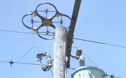
6 UAS Drones PREXXXX 6

7 Jackass ALERT!!! FAA warns public against shooting guns at drones "Shooting at an unmanned aircraft could result in criminal or civil liability, just as would firing at a manned airplane." PREXXXX 7
 have been awarded to Virginia, Texas, Alaska, New York, North Dakota and Nevada; will conduct critical research into the certification")
8 Current US (FAA) UAS Regulations Currently, a Certificate of Authorization (COA) is required to operate an unmanned aerial vehicle (UAV) in US national airspace Only federal, state, or local agencies are considered for COA awards FAA test sites (proving grounds) have been awarded to Virginia, Texas, Alaska, New York, North Dakota and Nevada; will conduct critical research into the certification and operational requirements necessary to safely integrate UAS into the national airspace over the next several years Remote Control (RC) hobbyists can operate remotely controlled vehicles for recreational uses only: Not allowed for commercial business use of any kind cannot fly to make money! RC vehicle cannot exceed 400 feet above ground level (AGL) RC vehicle cannot interfere with any type of air traffic - must be flown away from airports and air traffic FAA Modernization and Reform Act of 2012 (H.R. 658) Signed into law on February 14, 2012 by President Obama This bill orders the FAA to figure out how to integrate commercial UAV usage into the U.S. National Airspace System (NAS) Also under the bill, the FAA is required to provide military, commercial, and privately-owned drones with expanded access to U.S. airspace by Sep. 30, 2015 That means permitting unmanned drones controlled by remote operators on the ground--also called unmanned airborne systems (UAS) or unmanned aerial vehicles (UAVs)--to fly in the same airspace as airlines, cargo planes, business jets and private aircraft. More information can be found at PREXXXX 8

 Sensor")
9 UAS Components Aircraft Navigation System Unmanned Airborne Systems (UAS) Sensor Software PREXXXX 9


10 UAS Types Fixed wing Efficient for area/site mapping Typically flies racetrack or mowing the yard patterns Best for persistent surveillance (orbital loitering) Rotary helicopter or multicopter (ex. quad / hexa / octo copters) Best for slow, stabilized collection Efficient for corridor mapping Others blimps, kites, gliders PREXXXX 10

11 UAS Aircraft Comparisons PREXXXX 11


12 Hawkeye RQ-84Z PREXXXX 12


 Pre-defined flight plan (auto pilot)")

13 UAS Navigation Remotely controlled Third person view requires constant line-of-sight not acceptable, too much risk First person view requires video transmission soda straw view, still high risk for collision with obstruction (tree branch, power line, etc.) Pre-defined flight plan (auto pilot) Accurate digital surface models required Fully autonomous - detect, sense, and avoid (DSA) obstacles for collision avoidance PREXXXX 13


14 UAS Sensor Payloads Video Imagery Thermal Magnetometer Purpose driven remote sensing tools Radioactive measurement Gas detection Acoustic detection Signal detection LiDAR PREXXXX 14


15 USACE Buckeye LiDAR UAS continued PREXXXX 15

16 UAS Software Surveillance / Inspection Real-time video or image downlink Flight controls Primary flight display Camera controls Object tracking Video stabilization Waypoint navigation Video or image post processing Mapping Flight planning Flight management Data download / coverage check APM and AT Surface model extraction Orthorectification Mosaicing Analysis PREXXXX 16


17 Surveillance / Inspection vs. Mapping Emphasis Duration Stabilization for zoom Some transmit real-time video/imagery, others store for review later More emphasis on image/video gathering, less on geographic placement of data Typically used in situations that are dull, distant, or dangerous Sensor types Imagery Video Products Non-georeferenced digital imagery Non-georeferenced digital video Possibly structure from motion (SFM) PREXXXX 17


18 Surveillance / Inspection Examples PREXXXX 18
 Small Format,")
 Multi-Spectral Imagery (MSI) Thermal Infrared (TIR) Hyperspectral")
 Planimetric Map Products Change Detection Volumetrics 3D Modeling")
19 UAS Outdoor Mapping Filling the gap between traditional topo surveying and the medium and high altitude photogrammetry Sensor types Electro Optical (EO / RGB) Small Format, Non-metric, Digital Cameras Medium Format, Metric, Digital Cameras Other Sensor Types Color Infrared (CIR) Multi-Spectral Imagery (MSI) Thermal Infrared (TIR) Hyperspectral Imaging (HSI) Oblique Imagery Video Products Orthophoto Mosaics (Ortho) Digital Surface Model (DSM) Planimetric Map Products Change Detection Volumetrics 3D Modeling PREXXXX 19

20 UAS Outdoor Mapping Deliverables PREXXXX 20

21 UAS Indoor Mapping Autonomous Navigation Simultaneous Localization and Mapping (SLAM) Real-time Sensor Processing Required Detect, Avoid, Collect Minimize Occlusions Products 3D Models 360 Panoramas Point Clouds CAD Files PREXXXX 21
;")

22 Industry Forecasts Chris Anderson, Wired.com, June 2012: All told, there are probably around 1,000 new personal drones that take to the sky every month (3D Robotics, a company I cofounded, is shipping more than 100 ArduPilot Megas a week); that figure rivals the drone sales of the world s top aerospace companies (in units, of course, not dollars). And the personal drone industry is growing much faster. Teal Group market study World Unmanned Aerial Vehicle Systems 2011 PREXXXX 22 UAV spending is on pace to double during the next decade from current worldwide expenditures of $5.9 billion annually to $11.3 billion, totaling just more than $94 billion. The study suggests the United States will account for 77 percent of the research and development spending on UAV technology during the next decade and about 69 percent of the procurement. The UAV electro-optical/infrared sensors (EO/IRS) system market has entered a period of continuing steady growth. Teal Group estimates that U.S. spending alone on such systems will grow from $813 million in fiscal year 2011 to nearly $1.7 billion in fiscal year 2020.
23 Future Trends Consumers Lower cost Easier use more automation Integration into consumer products (like Google Earth) Professionals Larger (MP) and better (metric) cameras More variety of sensors LiDAR Hyperspectral Sensor fusion Automated and real time data processing Persistent surveillance Solar powered stratospheric platforms data relay various monitoring tasks Technology Fleets of multiple UAS via flocking and networking technologies Improvements in autonomous controls Detect, Sense, and Avoid (DSA) for collision avoidance 3D modeling for navigation Range imaging LiDAR Standardization of control system and common use between different kinds of UAV Improved stabilization Better fuel cells enabling longer flight times Miniaturization - micro UAS Automated in-flight decision making and actionable use What LiDAR was to terrain mapping 10+ years ago, unmanned aerial systems will be to aerial surveillance, inspection, and mapping in 5-10 years PREXXXX 23
24 Contact Information Merrick & Company: Unmanned Airborne Services: Bill Emison, Senior Account Manager Tel: (303) PREXXXX 24
LAUNCHING YOUR UNMANNED AIRCRAFT PROGRAM
 LAUNCHING YOUR UNMANNED AIRCRAFT PROGRAM THE DARTDRONES TEAM UNMANNED AIRCRAFT APPLICATIONS AERIAL INSPECTIONS AERIAL INSPECTIONS Safer and faster alternative to visual inspection by an individual Damage
What is a UAS (Drone)
") UAS KCSI Aerial Patrol KCSI is Based in Bakersfield CA Established in 1993 Operates in 15 States KCSI has over 20 fulltime pilots Currently fly: Over 40,000 miles of pipeline a month 700 hours of production
UAS KCSI Aerial Patrol KCSI is Based in Bakersfield CA Established in 1993 Operates in 15 States KCSI has over 20 fulltime pilots Currently fly: Over 40,000 miles of pipeline a month 700 hours of production
small Unmanned Aircraft Systems Arlington Police Department June 28, 2011
 suas small Unmanned Aircraft Systems Arlington Police Department June 28, 2011 1. Overview of APD suas program to date 2. Discuss the C.O.A. (FAA certificate of authorization to fly) and restrictions
Unmanned Aerial Vehicles for Environmental Applications
 Unmanned Aerial Vehicles for Environmental Applications John Rankin, President, J.R. Canadian Mapping Ltd. 10 th Annual Professional Biology Conference April 23 rd, 2015 UAVs Our System Suitable Sites
Space Based ADS-B. ICAO SAT meeting - June 2016 AIREON LLC PROPRIETARY INFORMATION
 Space Based ADS-B ICAO SAT meeting - June 2016 1 Options to Detect an Aircraft Position Position Accuracy / Update Interval Voice Position Reporting ADS-C Position Reporting Radar Surveillance / MLAT Space
Using UAS Technology for Invasive Plant Management
 Using UAS Technology for Invasive Plant Management Adam Benjamin, P.S.M. UF/IFAS Fort Lauderdale R.E.C. May 8, 2018 2018 Aquatic Weed Control Short Course Coral Springs, FL Using UAS Technology for Invasive
How to Use Drones in Stormwater Management January 17, :30 a.m. 11:30 a.m. (Eastern)
") Webinar Training Series How to Use Drones in Stormwater Management January 17, 2019 10:30 a.m. 11:30 a.m. (Eastern) www.seswa.org Today s Presenters Robert Gecy Application Programmer Beaufort County,
Webinar Training Series How to Use Drones in Stormwater Management January 17, 2019 10:30 a.m. 11:30 a.m. (Eastern) www.seswa.org Today s Presenters Robert Gecy Application Programmer Beaufort County,
DRONING FOR INFORMATION
 DRONING FOR INFORMATION Opportunity of Drones for Surveying and Mapping Practices By: Adam Smith, CP Matt Aguirre, PLS Overview Introduction Background Problem and Opportunity Issues and Mitigations Implementation
A Drone s Eye View on Public Works Applications
 A Drone s Eye View on Public Works Applications APWA Construction Inspection Conference Parker, CO Jason Caldwell, VP of Business Development and Sales 2013, The Sanborn Map Company, Inc. Agenda Sanborn
Net of Innovation. July 2015 Dave Finger, Mark Foster
 Net of Innovation July 2015 Dave Finger, Mark Foster Table of Contents The Challenges and Solutions to Safe Outdoor Testing... 2 Types of Testing a Netted Enclosure Enables... 4 Flight Plan Testing...
UAV systems for cultural heritage HERICT ERASMUS IP Technical lecture 2
 UAV systems for cultural heritage HERICT ERASMUS IP Technical lecture 2 Dr. Dimitrios Skarlatos Lecturer Cyprus university of Technology Photogrammetric Vision Lab Dept. of Civil Eng. & Geomatics Dipl.
The role of Unmanned Aircraft System (AUS) in search and rescue (SAR) operations
 in search and rescue (SAR) operations") The role of Unmanned Aircraft System (AUS) in search and rescue (SAR) operations Captain: Abdelkhalik Kamaleldin Soliman Selmy College of Maritime Transport & Technology Arab Academy for Science, Technology
The role of Unmanned Aircraft System (AUS) in search and rescue (SAR) operations Captain: Abdelkhalik Kamaleldin Soliman Selmy College of Maritime Transport & Technology Arab Academy for Science, Technology
2018 ENGINEERING EXPO Jon Thies NUAIR Director of Consulting
 2018 ENGINEERING EXPO Jon Thies NUAIR Director of Consulting Agenda Operating Under Current FAA Regulations suas Program Development Considerations suas Use Case Examples Quiz Regulations Small Unmanned
UAS to GIS Utilizing a low-cost Unmanned Aerial System (UAS) for Coastal Erosion Monitoring
 for Coastal Erosion Monitoring") UAS to GIS Utilizing a low-cost Unmanned Aerial System (UAS) for Coastal Erosion Monitoring Agenda Scope of today s presentation Demonstration Objectives Wrightsville Beach Test Area Masonboro Inlet Jetties
UAS to GIS Utilizing a low-cost Unmanned Aerial System (UAS) for Coastal Erosion Monitoring Agenda Scope of today s presentation Demonstration Objectives Wrightsville Beach Test Area Masonboro Inlet Jetties
Commit to Safety: Professional Pilots Always Use a Checklist INITIAL EQUIPMENT SETUP
 Commit to Safety: Professional Pilots Always Use a Checklist INITIAL EQUIPMENT SETUP READ THE MANUAL Familiarize yourself with all aspects of your suas before you even consider going out for your first
UNMANNED AIRCRAFT SYSTEMS (UAS) IN UTILITIES
 IN UTILITIES") UNMANNED AIRCRAFT SYSTEMS (UAS) IN UTILITIES Presented by: Dan Carbone Avion Unmanned Why Drones? Why Drones? Cost Effective Entire cost of a UAS program can be recouped in first-year man-hour savings
UNMANNED AIRCRAFT SYSTEMS (UAS) IN UTILITIES Presented by: Dan Carbone Avion Unmanned Why Drones? Why Drones? Cost Effective Entire cost of a UAS program can be recouped in first-year man-hour savings
GEOMATIC ASSESSMENT Membership Directory & Buyers Guide 97th Annual Conference Recap WINTER 2017/18
 WINTER 2017/18 GEOMATIC NC AWWA-WEA 3725 National Drive, Suite 217 Raleigh, NC 27612 ADDRESS SERVICE REQUESTED 2018 Membership Directory & Buyers Guide 97th Annual Conference Recap The official publication
Adventures in UAS: Experiences of a UAS Operator. Paul Beckwith, PE, CCM, LEED AP bd+c Navigator CS, LLC, President. Presented by:
 Adventures in UAS: Experiences of a UAS Operator Presented by: Paul Beckwith, PE, CCM, LEED AP bd+c Navigator CS, LLC, President Paul Beckwith, PE, CCM, LEED AP bd+c BA in Architectural Engineering from
2017 PLSO Fall Seminar. UAV s Flying to Finished Product
 2017 PLSO Fall Seminar UAV s Flying to Finished Product Scott D. Kraner, P.E. Subject Matter Expert Civil Infrastructure Session Outline UAV Overview and Applications How to obtain a remote pilot certificate?
Outline Why CCSU PinnaclX and Eversource
 CBIA 2018 Safety & Health Conference Wednesday, May 23, 2018 The Red Lion Hotel Cromwell 100 Berlin Road, Cromwell, CT Drones & Safety: A Brave New World Alfred A. Gates, Ph.D. CFI Helicopter, UAS Remote
FUTURE DRIVEN BY TECHNOLOGY UNMANNED AERIAL SYSTEMS HOSTED BY CHAD E. COLBY FEBRUARY 18 TH How far we have come
 FUTURE DRIVEN BY TECHNOLOGY UNMANNED AERIAL SYSTEMS HOSTED BY CHAD E. COLBY FEBRUARY 18 TH 2015 How far we have come Growers are demanding MORE from every acre, this along with advances in Precision Technology
Drone Technology: What Works for Industry & Landowners. Michael J. Buschermohle Interim Assistant Dean UT Extension
 Drone Technology: What Works for Industry & Landowners Michael J. Buschermohle Interim Assistant Dean UT Extension So You Want to Fly FAA Regulations UAS Platforms Cameras Applications in Forestry Current
OWEA Woolpert UAS Operations
 OWEA 2016 Woolpert UAS Operations UAS Rules and Regulations How Woolpert is Handling This The Exemption In December 2014 Woolpert received approval from the FAA regarding an exemption seeking relief from
Managing small RPAS/UAV operations in developing countries- a Bangladesh Experience. Presented by Bangladesh
 Managing small RPAS/UAV operations in developing countries- a Bangladesh Experience Presented by Bangladesh Managing small RPAS/UAV operations a) Background b) Some Definitions c) Challenges to some article
Civil Remotely Piloted Aircraft System (RPAS) Regulations in Australia
 Regulations in Australia") Civil Remotely Piloted Aircraft System (RPAS) Regulations in Australia Cees Bil School of Engineering RMIT University Melbourne AUSTRALIA bil@rmit.edu.au ICAS Workshop: Intelligent and Autonomous Technologies
Civil Remotely Piloted Aircraft System (RPAS) Regulations in Australia Cees Bil School of Engineering RMIT University Melbourne AUSTRALIA bil@rmit.edu.au ICAS Workshop: Intelligent and Autonomous Technologies
UAS Overview IDOT s UAS Program
 Unmanned Aircraft Systems (UAS) UAS Overview IDOT s UAS Program Linda Schumm Bureau Chief Aviation Safety Linda.Schumm@Illinois.gov October 18, 2017 Bill Viste Project Coordinator William.Viste@Illinois.gov
UNMANNED AIRCRAFT SYSTEMS (UAS) FOR PUBLIC POWER OPERATIONS AN OVERVIEW ON HOW DRONES ARE IMPACTING THE ENERGY INDUSTRY
 FOR PUBLIC POWER OPERATIONS AN OVERVIEW ON HOW DRONES ARE IMPACTING THE ENERGY INDUSTRY") UNMANNED AIRCRAFT SYSTEMS (UAS) FOR PUBLIC POWER OPERATIONS AN OVERVIEW ON HOW DRONES ARE IMPACTING THE ENERGY INDUSTRY ABOUT CHRISTOPHER TODD Founder and president of Airborne Response, Miamibased UAS
UNMANNED AIRCRAFT SYSTEMS (UAS) FOR PUBLIC POWER OPERATIONS AN OVERVIEW ON HOW DRONES ARE IMPACTING THE ENERGY INDUSTRY ABOUT CHRISTOPHER TODD Founder and president of Airborne Response, Miamibased UAS
In-field and Remote Sensing for Precision Agriculture. John Nowatzki Extension Ag Machine Systems Specialist North Dakota State University
 In-field and Remote Sensing for Precision Agriculture John Nowatzki Extension Ag Machine Systems Specialist North Dakota State University UAS in Precision Agriculture In-field Sensors Selecting UAS Equipment
Testimony. of the. National Association of Mutual Insurance Companies. to the. United States House of Representatives
 Testimony of the National Association of Mutual Insurance Companies to the United States House of Representatives Committee on Small Business, Subcommittee on Investigations, Oversight and Regulations
Integrated Applications Programme (IAP) & Space for UAS UAS for Applications
 & Space for UAS UAS for Applications") ESA s Integrated Applications Programme (IAP) & Space for UAS UAS for Applications M. Vaissiere ESA Director of Telecommunications and Integrated Applications Programme European High Level UAS Conference
ESA s Integrated Applications Programme (IAP) & Space for UAS UAS for Applications M. Vaissiere ESA Director of Telecommunications and Integrated Applications Programme European High Level UAS Conference
Unmanned Aircraft Systems (UAS): A Paradigm Shift in Aviation
: A Paradigm Shift in Aviation") Unmanned Aircraft Systems (UAS): A Paradigm Shift in Aviation Tom Haritos, Ed.S. Department of Aeronautical Science Embry-Riddle Aeronautical University Florida Airports Council (FAC) 2015 1 The trouble
Unmanned Aircraft Systems (UAS): A Paradigm Shift in Aviation Tom Haritos, Ed.S. Department of Aeronautical Science Embry-Riddle Aeronautical University Florida Airports Council (FAC) 2015 1 The trouble
U.S. Forest Service Explores Use of UAS In Fire Management Jennifer Jones Public Affairs Specialist Washington Office, Fire and Aviation Management
 U.S. Forest Service Explores Use of UAS In Fire Management Jennifer Jones Public Affairs Specialist Washington Office, Fire and Aviation Management On August 27, 2013, an unusual resource order was placed
Unmanned Aircraft Systems in Disaster Management and National Preparedness
 Unmanned Aircraft Systems in Disaster Management and National Preparedness at the Hawaii Land Surveyors Association Matt Kobayashi Ted Ralston National Disaster Preparedness Training Center Honolulu Why
Commercial UAS & the Impact of State Regulations Southern Legislative Conference July 20, 2015
 Commercial UAS & the Impact of State Regulations Southern Legislative Conference July 20, 2015 * Meet Ben 01 Currently the CEO of AgriSource Data; he was formerly the COO of VSG- Unmanned & has held leadership
UAV/Drone Uses and Laws
 UAV/Drone Uses and Laws Robert Moorhead Director of Geosystems Research and Northern Gulf Institutes Professor of Electrical & Computer Engineering Unmanned Aerial Systems (UASs) 3 components to the system:
ESA-EDA: Paving the Way for New UAS Capabilities in Europe
 ESA-EDA: Paving the Way for New UAS Capabilities in Europe Dr. Stefan Gustafsson, ESA Jens Fehler, EDA Noordwijk, 11 th 12 th May 2010 Integrated Application Promotion Earth Observation Telecommunication
Aeros 40D Sky Dragon. TYPE CERTIFIED BY: United States Federal Aviation Administration Civil Aviation Authorities: Europe and Asia
 Aeros 40D Sky Dragon The Aeros 40D Sky Dragon Airship The United States Federal Aviation Administration (FAA) Type Certified Aeros 40D Sky Dragon is the most advanced non rigid airship, incorporating innovative
Unmanned Aircraft Systems Integration
 Unmanned Aircraft Systems Integration Advancing Autonomous Capabilities in the Artificial Intelligence/Cyber Domain Presented to: The Patuxent Partnership Presented by: Art Hinaman, Manager, Technical
Lone Star UAS Center. of Excellence and Innovation
 Lone Star UAS Center LSUASC Introduction of Excellence and Innovation Bringing UAS to America s Skies NASAO 85 th Annual Convention and Tradeshow UAS Emerging Technologies & Utilizations September 13,
High Precision Mapping From Long Endurance UAS. Gabe Ladd 4/10/14
 High Precision Mapping From Long Endurance UAS Gabe Ladd 4/10/14 Outline Test Missions Flown UAS Used For This Project Direct Mapping System Payload Data produced April 10, 2014 2014 American Aerospace
Airworthiness considerations for UAVs
 A general overview about the approach to a UAV System under current regulations for operation, airspace and certification Presentation by : STN ATLAS ELEKTRONIK Klaus Wohlers, LMP Airborne Systems Type
UAS Implementation at Duke Energy
 UAS Implementation at Duke Energy Cross-Functional Team Approach Aviation Corporate Communications Emerging Technology External Counsel Insurance/Risk Internal Counsel Supply Chain Various BU Stakeholders/SME
Enabling Civilian Low-Altitude Airspace and Unmanned Aerial System (UAS) Operations. Unmanned Aerial System Traffic Management (UTM)
 Operations. Unmanned Aerial System Traffic Management (UTM)") Enabling Civilian Low-Altitude Airspace and Unmanned Aerial System (UAS) Operations By Unmanned Aerial System Traffic Management (UTM) Parimal Kopardekar, Ph.D. UTM Principal Investigator and Manager,
Enabling Civilian Low-Altitude Airspace and Unmanned Aerial System (UAS) Operations By Unmanned Aerial System Traffic Management (UTM) Parimal Kopardekar, Ph.D. UTM Principal Investigator and Manager,
RISING PERFORMANCE. Civil aviation is an outlier. It s BY ERIK DAHLBERG
 RISING PERFORMANCE Compact mobile mapping systems can be installed on small passenger cars. Civil aviation is an outlier. It s among the few industries where tight government regulations are widely accepted
 Presented by: Lt. Michael J. Magda Team Leader, Firefighter, EMT -P, Hazardous Material Specialist, Private Pilot, Airframe & Power plant Mechanic Western Wayne County HMRT, Livonia Fire & Rescue And
Definitions. U-SAFE : UAS Secure Autonomous Flight Environment. UTM: UAS Traffic Management
 Definitions U-SAFE : UAS Secure Autonomous Flight Environment UTM: UAS Traffic Management NUSTAR: National UAS Standardized Test and Rating 2 U-SAFE Award Dec 11, 2015 Signature Initiative in Central New
NASA s Automatic Dependent Surveillance Broadcast: ADS-B Sense-and-Avoid System
 NASA s Automatic Dependent Surveillance Broadcast: ADS-B Sense-and-Avoid System October 30, 2014 Ricardo Arteaga NASA Armstrong Flight Research Center is a world class leader in cutting-edge Systems Engineer
FLIGHT PATH FOR THE FUTURE OF MOBILITY
 FLIGHT PATH FOR THE FUTURE OF MOBILITY Building the flight path for the future of mobility takes more than imagination. Success relies on the proven ability to transform vision into reality for the betterment
COMMUNICATIONS PANEL. WG-I 20 Meeting
 International Civil Aviation Organization CP/WG-I20/WP-04 29/02/2016 WORKING PAPER COMMUNICATIONS PANEL WG-I 20 Meeting Montreal, Canada 29 Feb 4 Mar, 2016 Agenda Item xx: Title: IP Environment for UAS
DRONES + AIRPORTS: BUZZ AROUND HARTSFIELD-JACKSON
 DRONES + AIRPORTS: BUZZ AROUND HARTSFIELD-JACKSON ACI-NA Legal Affairs Spring Conference Elizabeth Wharton, Senior Asst. City Attorney elizabeth.wharton@atl.com ATL Activities UAS Part 107 Operations contractors,
Safe UAS Integration Challenges Views and Concerns from the Airline Cockpit
 Safe UAS Integration Challenges Views and Concerns from the Airline Cockpit Presentation by the Air Line Pilots Association, International AGENDA Introduction/Bio UAS/RPAS Background/Discussion ALPA s
Unmanned Aerial Systems for Agriculture
 Unmanned Aerial Systems for Agriculture by Bob Schultheis Natural Resource Engineering Specialist for Greene County Soils & Crops Conference Springfield, MO March 18, 2014 Special thanks to Bill Wiebold,
AGAZINE DECEMBER 2015/JANUARY 2016
 M IDWEST FLYER AGAZINE DECEMBER 2015/JANUARY 2016 Published For & By The Midwest Aviation Community Since 1978 midwestflyer.com Unmanned Aircraft Systems Technology Creating New Perspectives That Will
Unmanned Aircraft Systems (UAS) Integration Research
 Integration Research") Unmanned Aircraft Systems (UAS) Integration Research Presented to: Presented by: UAS Midwest Kerin Olson UAS Integration Research Strategy Lead FAA UAS Integration Office Date: FAA UAS Integration Office
Unmanned Aircraft Systems (UAS) Integration Research Presented to: Presented by: UAS Midwest Kerin Olson UAS Integration Research Strategy Lead FAA UAS Integration Office Date: FAA UAS Integration Office
Program. - Flight Operations (VRI) Motivation. The Aircraft / Sensors. Unmanned Aircraft Systems 8/1/17
 Motivation. The Aircraft / Sensors. Unmanned Aircraft Systems 8/1/17") Program Unmanned Aircraft in Agriculture: Flight Operations and FAA Certification Process * 1) Background. Wayne Woldt, Ph.D., P.E. Department of Biological Systems Engineering School of Natural Resources
Program Unmanned Aircraft in Agriculture: Flight Operations and FAA Certification Process * 1) Background. Wayne Woldt, Ph.D., P.E. Department of Biological Systems Engineering School of Natural Resources
MetroAir Virtual Airlines
 MetroAir Virtual Airlines NAVIGATION BASICS V 1.0 NOT FOR REAL WORLD AVIATION GETTING STARTED 2 P a g e Having a good understanding of navigation is critical when you fly online the VATSIM network. ATC
State of the UAS Industry for Insurance and Construction
 State of the UAS Industry for Insurance and Construction A Drone by any Other Name There are many terms for drones in use today The industry is trying to shy away from drone verbiage since it has military
FAA s Modernization Plans
 FAA s Modernization Plans Ron Stroup Chief System Engineer for Airborne and Ground System Integration Phone: 202 385-7186 Email: ronald.l.stroup@faa.gov Agenda Introduction My background Overview of the
Unmanned Aircraft Systems (UAS) 101
 101") Unmanned Aircraft Systems (UAS) 101 Presented to: National Tribal Transportation Conference Presented by: Robert Winn, Aviation Safety Inspector, Unmanned Aircraft Systems Office Date: Overview Unmanned
Unmanned Aircraft Systems (UAS) 101 Presented to: National Tribal Transportation Conference Presented by: Robert Winn, Aviation Safety Inspector, Unmanned Aircraft Systems Office Date: Overview Unmanned
Potential Uses and Considerations Regarding the Use of UAS Technology in Assessment. January 2015 Frank Giuffrida
 Potential Uses and Considerations Regarding the Use of UAS Technology in Assessment January 2015 Frank Giuffrida Table of Contents Current climate surrounding UAS use... 2 Assessing the value of properties
Using UAVs for Aerial Mapping, Surveying and Photography
 Using UAVs for Aerial Mapping, Surveying and Photography Prepared for: Central Florida GIS Workshop 18 September 2013 Kevin Shortelle System Dynamics International, Inc kevinshortelle@bellsouth.net Presentation
Industria, Innovazione e Ricerca: Le nuove frontiere del volo a pilotaggio remoto
 Industria, Innovazione e Ricerca: Le nuove frontiere del volo a pilotaggio remoto Aniello Cozzolino Head of Research & Technology Development, Piaggio Aerospace University of Naples Federico II, June,
Development and Testing of an Unmanned Aircraft Safety Beacon for Aerial Application Safety
 Development and Testing of an Unmanned Aircraft Safety Beacon for Aerial Application Safety Wayne Woldt, Ph.D., P.E., and Jacob Smith Biological Systems Engineering and School of Natural Resources University
AUGUST 2017 GNSS REVIEW. Survey Economics Chances of success. Mobile Mapping Airport scanning. Stag s Leap Winery Pre-construction plan
 AUGUST 2017 GNSS REVIEW Survey Economics Chances of success Stag s Leap Winery Pre-construction plan Mobile Mapping Airport scanning RISING PERFORMANCE» ERIK DAHLBERG Civil aviation is an outlier. It s
National Regulatory Profile
 National Regulatory Profile Finland NOTE : In this form the following terms are used Drone = Remotely Piloted Aircraft (RPA) = Unmanned Aircraft (UA) = See definition below Drone Pilot = Remote Pilot (RP)
The Freedom of Flight
 The Freedom of Flight Authors: Nicco Bugarin, Keith Kaplan and Wilhelm Cashen Date: May 20 2014 Safe Flight System The Commercialization of UAVS Safe Flight TM System is a Trademark of the Tesla Foundation
Unmanned Aircraft Systems (UAS) 101
 101") Unmanned Aircraft Systems (UAS) 101 Presented to: Presented by: Contract Management Conference Bryan Budds / Mike Soper, MDOT Date: March 5, 2019 Overview Unmanned Aircraft Systems What & Why FAA Authority
Unmanned Aircraft Systems (UAS) 101 Presented to: Presented by: Contract Management Conference Bryan Budds / Mike Soper, MDOT Date: March 5, 2019 Overview Unmanned Aircraft Systems What & Why FAA Authority
Enabling Civilian Low-Altitude Airspace and Unmanned Aerial System (UAS) Operations. Unmanned Aerial System Traffic Management (UTM)
 Operations. Unmanned Aerial System Traffic Management (UTM)") Enabling Civilian Low-Altitude Airspace and Unmanned Aerial System (UAS) Operations By Unmanned Aerial System Traffic Management (UTM) Parimal Kopardekar, Ph.D. UTM Principal Investigator and Manager,
Enabling Civilian Low-Altitude Airspace and Unmanned Aerial System (UAS) Operations By Unmanned Aerial System Traffic Management (UTM) Parimal Kopardekar, Ph.D. UTM Principal Investigator and Manager,
Use of Drones (Unmanned Aerial Systems) for Agriculture
 for Agriculture") Photo credit: www.redorbit.com Photo credit: www.redorbit.com Use of Drones (Unmanned Aerial Systems) for Agriculture by Bob Schultheis Natural Resource Engineering Specialist for Ozarks Mini Maker Faire
Photo credit: www.redorbit.com Photo credit: www.redorbit.com Use of Drones (Unmanned Aerial Systems) for Agriculture by Bob Schultheis Natural Resource Engineering Specialist for Ozarks Mini Maker Faire
Design of Sensor Standards for RQ-7B Shadow under Loss-Link
 Design of Sensor Standards for RQ-7B Shadow under Loss-Link Francisco Choi Zach Moore Sam Ogdoc Jon Pearson Sponsor: Andrew Lacher, CAASD 1 Agenda Context Analysis Stakeholder Analysis Problem & Need Statement
Community College Risk Management Consortium July 21 22, 2016 Understanding the Evolving Landscape of Drone Regulations and Risk Management
 Community College Risk Management Consortium July 21 22, 2016 Understanding the Evolving Landscape of Drone Regulations and Risk Management The ABCs of UAVs July 2016 UAV Talking Points Drones are changing
LOW DOWN ON THE HIGH UP: USING DRONES FOR LAND CONSERVATION
 LOW DOWN ON THE HIGH UP: USING DRONES FOR LAND CONSERVATION TEXAS LAND CONSERVATION CONFERENCE MARCH 3, 2017 STEPHEN RAMIREZ STEWARDSHIP DIRECTOR TEXAS LAND CONSERVANCY RAY RENNER, RPLS, PMP MANAGER OF
We're not spying on you; it's more interesting watching grass grow-
 We're not spying on you; it's more interesting watching grass grow- Using Unmanned Aircraft Systems in Rangeland Monitoring Connie Maxwell USDA Agricultural Research Service Jornada Experimental Range
NEVADA FAA UAS TEST SITE QUARTERLY REPORT
 NEVADA FAA UAS TEST SITE QUARTERLY REPORT December 30, 2016 4 th Quarter, CY16 Submitted in accordance with Other Transactional Agreement DTFACT-14A-00003 Prepared by: Nevada Institute for Autonomous Systems
Using Geospatial Data in the Oil & Gas Industry. Dr. Stacey D. Lyle, RPLS
 Using Geospatial Data in the Oil & Gas Industry Dr. Stacey D. Lyle, RPLS Outcomes A Geospatial Data Science Center is an advanced database of information organized and accessible using multiple software
Unmanned Aircraft Systems (UAS) 101
 101") Unmanned Aircraft Systems (UAS) 101 Presented to: AUVSI Cascade Chapter Future Robotics Forum Presented by: Michael Dement-Myers, (FAA), NextGen Branch Date: October 20, 2016 Overview Unmanned Aircraft
Unmanned Aircraft Systems (UAS) 101 Presented to: AUVSI Cascade Chapter Future Robotics Forum Presented by: Michael Dement-Myers, (FAA), NextGen Branch Date: October 20, 2016 Overview Unmanned Aircraft
UAS Unmanned Aircra: Systems in Forest Management
 UAS Unmanned Aircra: Systems in Forest Management UAS What are they? Unmanned Aircra: Systems (UAS) fill niche built upon military UAV technologies Most common plahorms Fixed Wing Rotorcra: Primary uses
Unmanned Systems Certification
 Committee on Assessing the Risks of Unmanned Aircraft Systems (UAS) Integration Unmanned Systems Certification Wes Ryan, UAS Certification Policy Lead, Aircraft Certification FAA Small Airplane Directorate
Unmanned Aerial Vehicles or How I learned to stop worrying and love drones!
 Unmanned Aerial Vehicles or How I learned to stop worrying and love drones! Dr. Charles O Neill Aerospace Engineer, UA Professor, Pilot charles-oneill.com or aero.ua.edu Brief History of Drones German
OFWIM and DRONES How to stay out of trouble
 OFWIM and DRONES How to stay out of trouble AMA, FAA, and FARs FAA 2012 Reform and Modernization Act 2014 Interpretive Rule AMA 550 AMA 560 AC91-57 FAR 91.119 d1 NPRM Section 333 United States v. Causby328
5 Day Operator Course. 1.0 AIRSPACE CLASSROOM ONLINE EXECUTIVE VO Terms X X Classification
 5 Day Operator Course 2 Day Executive Training 2 Day VO Training 0.1 INTRODUCTION CLASSROOM ONLINE EECUTIVE VO About Avion Solutions Purpose of the course Learning objectives Course outline and schedule
An Overview of UAS Technology, Current Research, and Perspective on Use
 An Overview of UAS Technology, Current Research, and Perspective on Use Eric N. Johnson Lockheed Martin Associate Professor of Avionics Integration Daniel Guggenheim School of Aerospace Engineering Georgia
PHOENIX AIR UNMANNED, LLC
 PHOENIX AIR UNMANNED, LLC A COMMITMENT TO EXCELLENCE IN UNMANNED AVIATION Based north of Atlanta in Cartersville, Georgia, Phoenix Air Unmanned, LLC (PAU) is a sister company of the internationally recognized
Communications and Information Technology Alert
 Communications and Information Technology Alert Communications and Information Technology Alert: Drones and Urban Air Mobility in the President s Budget April 9, 2019 President Trump recently released
Drones, Robots and Public Safety
 Drones, Robots and Public Safety IWCE Thursday, March 30, 2017 11:30 am - 12:45 pm Room: S230 Session Number: TH12 The member organizations of the National Public Safety Telecommunications Council are
UAS Integration Activities
 UAS Integration Activities Presented to: Presented by: Ian Ross Senior Representative/Attaché Date: Meeting the Challenge Industry Volume & Pace Personal Nature of UAS Shared Commitment to Safety The Path
UAV Program. What does it take to have a UAV Program Current Requirements Lemhi County UAV program
 UAV Program UAV Program What does it take to have a UAV Program Current Requirements Lemhi County UAV program What does it take to have a UAV program? Some Very Important Questions to Ask Before What type
Presented by: President and CEO Association for Unmanned Vehicle Systems International.
 Unmanned Aircraft Systems: An Industry Perspective Unmanned Aircraft Systems Action Summit 5: Emerging Trends in UAS Looking to the Future 2 June 2011 Alerus Center, Grand Forks, North Dakota Presented
DEFINITIONS DEFINITIONS 2/11/2017 REQUIREMENTS AND LIMITATIONS OF DRONE USE IN FORENSIC ACCIDENT RECONSTRUCTION
 REQUIREMENTS AND LIMITATIONS OF DRONE USE IN FORENSIC ACCIDENT RECONSTRUCTION ROGER BURGMEIER BURGMEIER CONSULTING INC. DEFINITIONS Aircraft: device that is used, or intended to be used, for flight. Drone:
International Civil Aviation Organization. Satellite spectrum to support the safe operation of Unmanned Aircraft Systems
 International Civil Aviation Organization Satellite spectrum to support the safe operation of Unmanned Aircraft Systems Loftur Jónasson, Air Navigation Bureau, ICAO 23 May 2012 Convention on International
Federal Aviation Administration Flight Plan Presented at the Canadian Aviation Safety Seminar April 20, 2004
 Federal Aviation Administration Flight Plan 2004-2008 Presented at the Canadian Aviation Safety Seminar April 20, 2004 Challenges Reducing an Already Low Commercial Accident Rate Building an Air Traffic
WEBINAR: A BIRD S-EYE VIEW
 WEBINAR: A BIRD S-EYE VIEW DRONES IN AGRIBUSINESS JUNE 21, 2016 Hosted by Nexsen Pruet Presented by Ernie Pearson (Nexsen Pruet); Patrick Lohman (PrecisionHawk); and Kyle Snyder (NGAT/NCSU) FOUNDED IN
UNMANNED AIRCRAFT PROVISIONS IN FAA REAUTHORIZATION BILL
 UNMANNED AIRCRAFT PROVISIONS IN FAA REAUTHORIZATION BILL Section 341 Comprehensive Plan -Codifies in title 49 the requirement in the 2012 FAA reauthorization Act that a comprehensive plan to safely accelerate
Systems (UAS) Unmanned Aircraft. Presented to: GWBAA Safety Stand Down Day. Presented by: John Meehan. Date: 17 May AUS-430 Safety & Operations
 Unmanned Aircraft. Presented to: GWBAA Safety Stand Down Day. Presented by: John Meehan. Date: 17 May AUS-430 Safety & Operations") Unmanned Aircraft Systems (UAS) Presented to: GWBAA Safety Stand Down Day Presented by: John Meehan AUS-430 Safety & Operations UAS Integration Office Date: What is a UAS? Unmanned aircraft system (UAS)
Unmanned Aircraft Systems (UAS) Presented to: GWBAA Safety Stand Down Day Presented by: John Meehan AUS-430 Safety & Operations UAS Integration Office Date: What is a UAS? Unmanned aircraft system (UAS)
Innovations in Aviation Flow Management REDUCING CONGESTION AND INCREASING CAPACITY
 Innovations in Aviation Flow Management REDUCING CONGESTION AND INCREASING CAPACITY Introduction With passenger volumes rising steadily, the global aviation system is facing a challenge: How to accommodate
400 SITA members. 35+ AIR TRANSPORT CIOs EASY AIR TRAVEL EVERY STEP OF THE WAY > 2800 CUSTOMERS WORLDWIDE REPRESENTING AIR TRANSPORT BY SECTOR
 EASY AIR TRAVEL EVERY STEP OF THE WAY 100% INDUSTRY-OWNED AND DRIVEN Owned by hundreds of air transport industry members. Driven by over 35 air transport industry CIOs and senior IT professionals, who
Surveillance and Broadcast Services
 Surveillance and Broadcast Services Benefits Analysis Overview August 2007 Final Investment Decision Baseline January 3, 2012 Program Status: Investment Decisions September 9, 2005 initial investment decision:
Airports and UAS: Integrating UAS into Airport Infrastructure and Planning
 ACRP Problem Statement 17-03-09 Recommended Allocation: $500,000 Airports and UAS: Integrating UAS into Airport Infrastructure and Planning ACRP Staff Comments This is one of four UAS-themed problem statements
Unmanned Aircraft Systems (UAS) 101
 101") Unmanned Aircraft Systems (UAS) 101 Presented to: The American Association of State Highway and Transportation Officials Presented by: Dave May, FAA UAS Integration Office Date: What is a UAS? A UAS is
Unmanned Aircraft Systems (UAS) 101 Presented to: The American Association of State Highway and Transportation Officials Presented by: Dave May, FAA UAS Integration Office Date: What is a UAS? A UAS is
Unmanned Aircraft Systems (UAS)
") Unmanned Aircraft Systems (UAS) Update Presented to: Airports Council International Presented by: Danielle J. Rinsler, AICP Date: Who is Operating UAS in the National Airspace System (NAS)?* Public (Governmental)
Unmanned Aircraft Systems (UAS) Update Presented to: Airports Council International Presented by: Danielle J. Rinsler, AICP Date: Who is Operating UAS in the National Airspace System (NAS)?* Public (Governmental)