CHAPTER 18 PHYSICAL GEOGRAPY OF AFRICA: THE PLATEAU CONTINENT
|
|
|
- Martin Watson
- 5 years ago
- Views:
Transcription
1 UNIT 6 AFRICA
2 CHAPTER 18 PHYSICAL GEOGRAPY OF AFRICA: THE PLATEAU CONTINENT

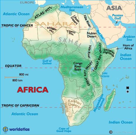
3 18.1 LANDFORMS AND RESOURCES The Plateau Continent Much of continent: Narrow lowlands near coasts Basins Depressions that span 625 mi in width and measure up to 5,000 ft deep.
4 Rivers Nile: Congo River 2,900 miles long = continent s longest network of waterways Waterfalls and: Niger River delta


5 The Nile Delta in Northern Egypt is where the Nile River drains in to the Mediterranean Sea. It is around 100 miles in length and spreads out over 149 miles of coastline Around 40 million people: Nile River The Aswan High Dam was built in 1970 to:
6 Congo River The Congo River (also called the Zaire River) system is a highway that provides: Most of the River is located in the Democratic Republic of the Congo The basin that feeds the Congo River system has an area of :

7 Niger River The Niger is the major river in west Africa The Niger delta region in Nigeria is home to:

8 Niger River Delta This near-vertical photograph shows the fan-shaped Niger River Delta, the largest delta in Africa, which covers square miles In central Mali, the Niger forms a vast inland delta, a maze of channels and shallow lakes. nfo.pl?photo=sts61c-42-72

9 Rift Valleys Long thin valleys: Lakes Formed at: Lake Tanganyika Lake Victoria

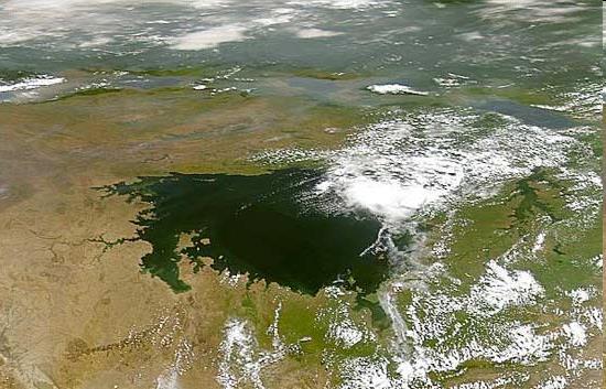
10 Lake Victoria


11 Mountains Mainly: Mount Kenya Mount Kilimanjaro Great Escarpment
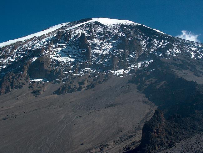
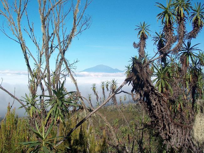
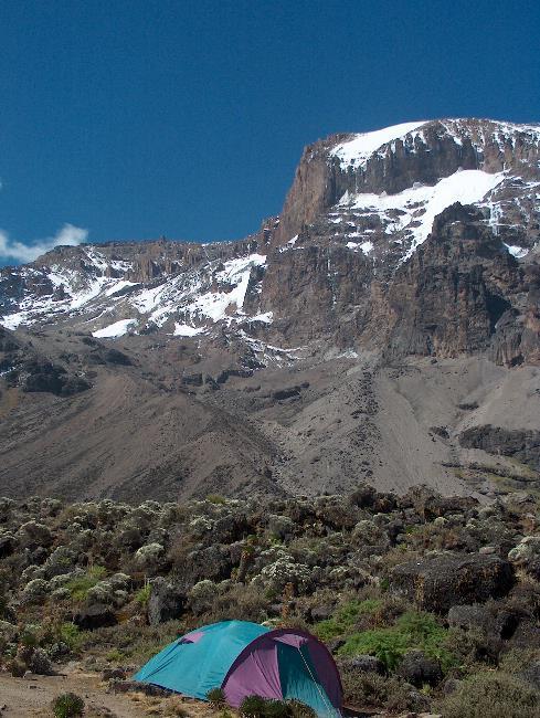
12 Mount Kilimanjaro


13 Mineral Resources Among world s: Ores and minerals acct. for over: Wealth from sale of minerals: Most countries lack infrastructure to:

14 Oil Nigeria, Libya, Algeria, and Angola = Africa s largest producers Money from foreign countries buying rights to drill has been used for both good and bad Ex: Can be used to: The oil industry has also caused:

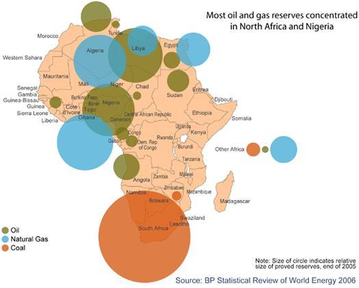
15 Oil in Africa


16 Other Resources Coffee : Sugar, palm oil, cocoa Lumber Ethiopia = Africa s leading exporter Deforestation as a result of logging

17 Farming Agriculture: 2/3 earn a living from farming Farm products account for :

18 Farming in Africa

19 18.2 CLIMATE AND VEGETATION


20 Deserts Sahara Extreme temperatures Sand, mountains, rocks, plains Treacherous travel conditions; camel = relied on for transport Kalahari and Namib Aquifers and Oasis Support life in desert

21 Deserts of Africa

22 The Tropics 90% of continent lies within: Nearly year-round: Night =

23 Precipitation Varies : Rainforest of Central Africa gets: Most of continent has: Areas closest to equator have: West coast of Africa gets lots of rain also Areas near deserts get very little rain

24 Moderate Areas Mediterranean Climates on: Moderate:


25 Tropical Grassland Covers: Dry climate, hard soil Tall grass Good grazing land Serengeti Plain


26 Rain Forest Equator, near Congo River Basin Many species of plants and animals Most animals live: Hot humid climate Over:


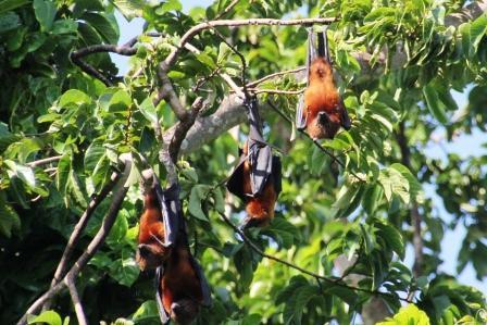
27 Rain Forest Animals


28 18.3 HUMAN ENVIRONMENT INTERACTION The Sahel The Sahel stretches across Africa from the Atlantic Ocean to the Red Sea. The Sahel separates the: The area today is home to over a dozen independent countries. raphic.com/video/player?titleid=


29 The Desertification of the Sahel Climate in the Sahel region has changed over thousands of years: Farmers clearing land to : Drilling for water increases salt levels in the soil Many of those who do not farm: The low grasses and plants provide forage, or food for grazing animals. Overgrazing and deforestation has lead to:


30 Other areas affected by desertification Forests of Khartoum, Sudan Rain forest around Lake Chad Slowing desertification:


31 Oil in Nigeria Experienced oil boom in 1970s Member of OPEC leading oil : Rentier state Hope for future 2 consecutive civilian elected governments for 1 st time in 2007 Environmental Damage polluting_nigeria/html/7.stm


32 The Aswan High Dam 1970 designed to control flooding on the Nile to give farmers regular supply of water for irrigation Increased: Relocation of people and artifacts Increased: Lake Nasser Loss of freshwater
33 CHAPTER 19 HUMAN GEOGRAPHY OF AFRICA: FROM HUMAN BEGINNINGS TO NEW NATIONS

34 19.1 EAST AFRICA Geography/History Eritrea (North), Seychelles (East), Tanzania (South), Burundi (West) = boundaries cradle of humanity Early center of: Arab, Persian, and Indian traders East Africa became a cultural crossroads

35 Colonialism Berlin Conference By1914, Africa was almost entirely controlled by European colonial powers Disregarded: This was the result of the so-called: These European colonial powers ruled most of Africa until the 1960s By the 1970s, most of East Africa had gained independence


36 Ethiopia Maintained: Emperor Menelik II played on European rivalries Ethiopians defeated Italians in the First Italo Ethiopian War in 1896 A provisional treaty of peace was concluded at Addis Ababa on October 26, 1896, which acknowledged the independence of Ethiopia.


37 Conflict Europeans had not prepared new countries for independence Legacy of colonialism:

38 In Rwanda, 80 percent of the population is Hutu, while most of the remainder is Tutsi In 1959, three years before independence from Belgium, the majority ethnic group, the Hutus, overthrew the ruling Tutsi king Over the next several years, thousands of Tutsis were killed, and some 150,000 driven into exile in neighboring countries Genocide in Rwanda

39 The children of these exiles later formed a rebel group, the Rwandan Patriotic Front (RPF), and began a civil war in The war, along with several political and economic upheavals, exacerbated ethnic tensions, culminating in April 1994 in a stateorchestrated genocide More than 800,000 Tutsis and moderate Hutus were massacred by Hutu militias (~3/4 of the Tutsi population), and ~2million were left homeless as the international community stood by.


40 A common tool found in most Rwanda households, the machete, was used to hack hundreds of thousands of innocent civilians to death during the genocide. This stark picture conveys the extent of the killing. Many of the skulls are smashed, clearly bearing signs of the blows inflicted by the killers' clubs.


41 Economy Farming East Africa : Cash crops bring revenue, but: Increased urbanization due to:


42 Economy Tourism Wildlife parks in Kenya, Uganda, and Tanzania Generate millions in needed income, but:

43 Culture in Kenya In the early 1890s, the British took over lands held by the: In the 1950s, the Kikuyu briefly went to war against the British settlers in the: The British crushed all resistance, but realized they could: Kenya gained independence in:


44 Distance Running in Kenya Since the 1960s, Kenya has made a name for itself as the home to the world s most talented and decorated distance runners. Since the 1980s, in almost any distance race of 800 meters or longer, 70 or 80 percent of its winners have been from Kenya Both genetic and cultural differences have been cited to explain their success.

45 Health Care AIDS pandemic: Malaria Other diseases

46 19.2 NORTH AFRICA History/Geography Ancient Egypt gift of the Nile Dynasties, pharaohs, pyramids Advances in mathematics and medicine Islam:

47 Economy Transition from agriculture to: Today oil = major export for Libya, Tunisia, Algeria Has brought: Many North Africans have emigrated to:
48 Culture Souks = common features in medinas Music Reflection of political and social culture Has been used as political protest first against colonial rulers, currently against Islamic fundamentalists (recently esp. by women) as sample lyrics indicate Allah Wakbar (God is great) (by) Matoub Lounes Arabic is God's language Knowledge is in it It is unlike any other [language] For it you could jump into an abyss Go ahead, take a leap! (59) "Ouaili" (by) Baaziz I am speaking of these executioners These servants, these ministers All are bastards They blurred all the paths They have blood, oh mother! on their lists Now that they are old They retire in Paris... (3)


49 Women & Family Patriarchal family structure Increased: Professional opportunities: Pictured: Egyptian women in an anti- Muslim Brotherhood protest in Cairo. The Brotherhood condemned the UN's declaration for women's rights.

50 Political Turmoil in Egypt In January 2011, Egyptians stage nationwide demonstrations against the authoritarian rule of President Hosni Mubarak, forcing him to resign from power in less than a month In the post-mubarak elections, the Muslim Brotherhood takes control of the government culminating in the election of Mohammed Morsi Morsi s unilateral declaration of more powers for himself in late 2012 triggers protests against his regime, ultimately resulting in his ouster by the military in July The military has since cracked down on the Brotherhood, and is backing the newly installed government.


51 19.2 WEST AFRICA History/Geography Goree Island and impact of the slave trade Gold and salt trade routes across the Sahara gave rise to the empires of Ghana, Mali, and Songhai from Pre-colonial:


52 Economy Countries economies dependent on: pl/hi/picture_gallery/07/africa_sie rra_leone_slum/html/1.stm Ghana s economy has been relatively stable Minerals, increasingly oil and agricultural products Free/fair elections since 1992 Sierra Leone s has been weak ent/article/119-economic-data/ the-worlds-richest-and-poorestcountries.html#axzz2zfwwvq9q


53 Culture Asasia or kente cloth Music Blends traditional African music with American forms of jazz, blues, and reggae Use French and English lyrics to attract international audience King Sunny of Nigeria


54 19.4 CENTRAL AFRICA History/Geography Bantu & Bantu migrations Slave trade Portuguese and Sao Tome Traded for: Trade:


55 Languages of Africa
")


56 Colonialism King Leopold II of Belgium Congo Free State (Belgian Congo) Rubber, palm oil, ivory & other resources French = other major colonizers in C. Africa Centralized: Most countries independent by 1960s, problems continue today

57 Post Colonial Struggles Economy - Loss of resources Disruption of political system Lack of infrastructure Overdependence on raw materials exports ss.com/markets/201 2/09/14/10-poorestcountries-in-world/


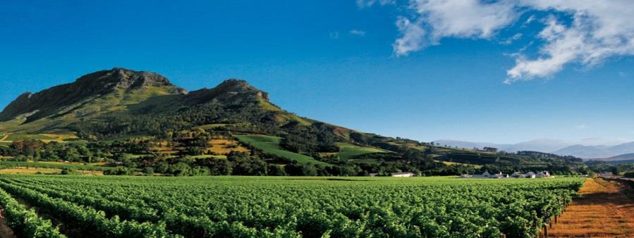
 Joseph Kabila elected")
58 Democratic Republic of the Congo Problems for DRC Rich in natural resources: gold, copper, diamonds Hot spot in Cold War Mobutu Sese Seko Nationalized business Corruption Economic and social decline Laurent Kabila (assasinated) Joseph Kabila elected 2006 & 2011

59 Post Colonial Successes/Failures Culture/Society Education challenges Low attendance Shortages of teachers and secondary schools Language differences Education improvements New universities ex: Omar Bongo in Gabon Vocational and agricultural training Health care issues increasingly addressed h/ngos_org.htm THE GENDER GAP IN EDUCATION IS DIMINISHING WITH INCREASED ENROLMENT Primary and secondary net enrolment ratios (NER) of boys and girls (1990 and 2005)
 British defeat:")
60 19.5 SOUTHERN AFRICA History/Geography Bantu-speaking majority Great Zimbabwe, Mutapa Empire: Portuguese arrive in 1500s, followed by others (Dutch, British) British defeat: Boer War

61 The Zulu originated in the Congo Basin area and in the 16th century the Zulu migrated southward During the reign of King Shaka ( ), the Zulu became the mightiest military force in southern Africa. British encroachment onto Zulu lands grew under Shaka s successors In 1879 war erupted, and Although the Zulu initially experienced some success, the British army eventually prevailed. The Zulu


62 Colonialism The Dutch and British ruled together after the Boer War (1910). The Union of South Africa was formed in 1910 from four British colonies In 1948, the white government which came to power: It dictated strict racial separation of black and white communities In May of 1961 a republic was declared


63 Apartheid To control black South Africans, the government created: Under the homelands plan, blacks 75 percent of the population were: Every African was assigned to a homeland. Africans were to stay in their homelands unless a pass was issued:
 Nelson Mandela Much of the world")


64 Backlash against apartheid African National Congress (ANC) Nelson Mandela Much of the world refused to let apartheid and the homelands plan continue without protest. In 1986, the United States and Europe, South Africa s largest trading partners, placed: F.W. de Klerk election 1996 new constitution

65 Continuing Challenges Today South Africa is a republic The first : Undoing the inequalities in place under apartheid has been a continuing challenge for the government Jacob Zuma is the current president (elected in 2009)


66 Economy South Africa s Two Economies Upper-middle income Modern cities Industrial complexes Mechanized farms & ranches Lower income:
67 Botswana Economy Botswana Long-term economic growth since 1966 Mineral based wealth World: Income gap Unequal land distribution Small farmers seeing land bought up by ranchers Overdependence on food imports


68 AIDS Sub-Saharan Africa is currently the area where AIDS is taking the largest toll. Some countries now have around 25% of the working adult population who are HIV-positive South Africa has the second-highest number of HIV/Aids patients in the world.

69 AIDS and Life Expectancy

70 AIDS around the world 1. South Africa 5,600, Nigeria 3,300, India 2,400, Kenya 1,500, Mozambique 1,400, Tanzania 1,400, Uganda 1,200, United States 1,200, Zimbabwe 1,200, Russia 980,000
71 Age of AIDS PBS Frontline -The Age of AIDS Part II Chapter 1: Political Indifference e/aids/view/9.html?as=1 Part II Chapter 3: The Struggle to Get the Drugs aids/view/11bis2.html?as=1
Just how big is Africa?
 The United States China India The United Kingdom Portugal Spain France Belgium Germany The Netherlands Switzerland Italy Eastern Europe Japan 11.7 million sq. miles Just how big is Africa? Chapter 18 Section
Unit 6 vocabulary. Serengeti Plain
 basin Nile River rift valley Mount Kilimanjaro escarpment Sahara aquifer oasis Serengeti Plain canopy Niger delta Sahel the world s longest river, flowing more than 4,000 miles through Uganda and Sudan
Physical characteristics and biomes:
 Physical characteristics and biomes: Sahel region, bordering Sahara Characteristics Area suffers from lack of rainfall, over grazing, which causes loss of vegetation and loss of inhabitable areas causing
Introduction to Africa
 Introduction to Africa Did you know? Africa has more countries than any other continent. The Sahara is a desert that is the size of the U.S. It s the world's largest desert. Most of the world s gold and
SS7G1 The student will locate selected features of Africa.
 Standards SS7G1 The student will locate selected features of Africa. a. Locate on a world and regional political-physical map: the Sahara, Sahel, savanna, tropical rain forest, Congo River, Niger River,
Sub - Saharan Africa
 Sub - Saharan Africa 4/14/2015 Countries with Relative Importance GDP South Africa Gabon Botswana Land Size Sudan Chad Mozambique Madagascar Democratic Republic of the Congo (formerly Zaire) Population
How to play. The center aisle divides our class into 2 teams. Team members are NOT allowed to help their teammate when they are asked a question.
 Floaters & Sinkers How to play The center aisle divides our class into 2 teams. Each person will be responsible for answering a question for every round played. Team members are NOT allowed to help their
Chapter 20. The Physical Geography of Africa South of the Sahara
 Chapter 20 The Physical Geography of Africa South of the Sahara Chapter Objectives Identify the major landforms, water systems, and natural resources of Africa south of the Sahara. Describe the relationship
BRITANNICA STUDENT ENCYCLOPEDIA. Africa is the world s second largest continent. More than 50 countries make up
 JOBNAME: No Job Name PAGE: 33 SESS: 682 OUTPUT: Thu Aug 31 10:43:41 2006 38 Africa BRITANNICA STUDENT ENCYCLOPEDIA Africa Africa is the world s second largest continent. More than 50 countries make up
STUDY GUIDE. The Land. Chapter 20, Section 1. The Land of Africa South of the Sahara. Landforms Water Systems Natural Resources.
 For use with textbook pages 499 504. The Land Terms to Know escarpment A steep, often jagged slope or cliff (page 500) cataract A towering waterfall (page 500) rift valley A large crack in the earth s
7/27/2010. Regions of Subsaharan Africa. SUBSAHARAN AFRICA II (Chapter 6, pages ) Southern Africa. South Africa: Peaceful Change from Apartheid
 Southern Africa. South Africa: Peaceful Change from Apartheid") SUBSAHARAN AFRICA II (Chapter 6, pages 209-227) Regions of Subsaharan Africa Southern Africa 10 countries, 6 of them landlocked Congo Basin marks northern limit Plateau country Rich in natural resources
SUBSAHARAN AFRICA II (Chapter 6, pages 209-227) Regions of Subsaharan Africa Southern Africa 10 countries, 6 of them landlocked Congo Basin marks northern limit Plateau country Rich in natural resources
Using the exhibit, choose the letter of the best answer. (4 points each)
") Name: Date: Using the exhibit, choose the letter of the best answer. (4 points each) 1. Which of the following is the northernmost city located on the Nile River? A. Khartoum B. Cairo C. Omburman D. Alexandria
Name: Date: Using the exhibit, choose the letter of the best answer. (4 points each) 1. Which of the following is the northernmost city located on the Nile River? A. Khartoum B. Cairo C. Omburman D. Alexandria
AFRICAN PHYSICAL GEOGRAPHY
 AFRICAN PHYSICAL GEOGRAPHY Here are some factoids about Africa: world s second largest continent (11,700,000 miles). Home to 52 countries, 1,000 languages, 800 million people. 10% of the world s population
UNIT 5 PHYSICAL GEOGRAPHY SG 1 - PART I
 UNIT 5 PHYSICAL GEOGRAPHY SG 1 - PART I Africa is HUGE! I. LANDFORMS A. Plateaus - an area of relatively level high ground. 1. Africa s interior is dominated by series of plateaus and elevated basins such
One Commodity Map. 7. What is a commodity? 8. Explain what a one-commodity country is.
 7. What is a commodity? 8. Explain what a one-commodity country is. 9. What must African countries do in order to become more stable economically? One Commodity Map Countries which OIL is the lone commodity
Chapter 13 and 14 Geography Study Guide
 Chapter 13 and 14 Geography Study Guide Multiple Choice Identify the letter of the choice that best completes the statement or answers the question. 1. Which West African country has the largest population
pg. 446 (5 th) pg. 456 (6 th )
 pg. 456 (6 th )") pg. 446 (5 th) pg. 456 (6 th ) African Landscape Plateau Highest in: Ethiopian Highlands Drakensberg Mtns. Lesotho & So. Africa pg. 452 (5 th) pg. 459 (6 th ) Ethiopian Highlands Canyons carved by water
pg. 446 (5 th) pg. 456 (6 th ) African Landscape Plateau Highest in: Ethiopian Highlands Drakensberg Mtns. Lesotho & So. Africa pg. 452 (5 th) pg. 459 (6 th ) Ethiopian Highlands Canyons carved by water
Chapter 19 Guided Notes Answer Key. Human Geography of Africa: From Human Beginnings to New Nations
 Name Date Period Chapter 19 Guided Notes Answer Key Human Geography of Africa: From Human Beginnings to New Nations Africa is the Cradle of Humanity and has been home to numerous empires. But today, its
North Africa. Chapter 25. Chapter 25, Section
 Chapter 25, Section World Geography Chapter 25 North Africa Copyright 2003 by Pearson Education, Inc., publishing as Prentice Hall, Upper Saddle River, NJ. All rights reserved. Chapter 25, Section World
Africa. Display Transparency 6 on the overhead. Explain to students that Africa is the
 3S 4S 1S 2S 3N 4N Banjul Bissau SIERRA LEONE 5N MADEIRA IS. CANARY IS. (SPAIN) (disputed) Dakar Freetown (PORTUGAL) GAMBIA Bamako Conakry Monrovia Rabat BURKINA FASO 1W Accra Lomé ~ Niamey BENIN Algiers
Sub-Saharan Africa I10- Southern Africa
 GEOGRAPHY Realms, Regions, and Concepts Sub-Saharan Africa I10- Southern Africa THE REGIONS OF SUBSAHARAN AFRICA 1 Southern Africa 10 states 2 East Africa 7 states 3 Equatorial Africa 9 states 4 West Africa
Chapter 21: EAST AFRICA
 Chapter 21: EAST AFRICA Physical Geography of East Africa Landforms East Africa is a diverse landscape of different plains, volcanic mountains, and plateaus cut by a large valley and marked by many rivers
Chapters 14 and 15 Geography Study Guide
 Chapters 14 and 15 Geography Study Guide Multiple Choice Identify the letter of the choice that best completes the statement or answers the question. 1. Gorillas live within dense rain forests of. a. Rwanda
Chapter 24: Southern Africa. Unit 6
 Chapter 24: Southern Africa Unit 6 Section 1: Physical Geography Landforms Region is made up of 14 countries: 1. Angola 2. Zambia 3. Malawi 4. Mozambique 5. Namibia 6. Botswana 7. Zimbabwe 8. South Africa
Africa s. Presentation, Graphic Organizers, & Activities
 Africa s Presentation, Graphic Organizers, & Activities STANDARDS: SS7G1 Locate selected features of Africa. a. Locate on a world and regional political-physical map: Sahara, Sahel, savanna, tropical rain
2009 Carole Marsh/Gallopade International
 Live Work Play Learn LIVE LEARN WORK TM PLAY 2009 Carole Marsh/Gallopade International Permission is hereby granted to the individual purchaser or classroom teacher to reproduce materials in this book
Brain Wrinkles. Africa: The impact of location, climate, & physical characteristics on where people live, the type of work they do, & how they travel
 Africa: The impact of location, climate, & physical characteristics on where people live, the type of work they do, & how they travel STANDARDS: SS7G3 The student will explain the impact of location, climate,
Millennium Development Goal 1: eradicate extreme poverty and hunger. International poverty line a Share of population below PPP $1.
 3.1 Millennium Development Goal 1: eradicate extreme poverty and hunger International poverty line a Share of population below PPP $1.25 a day Poverty gap ratio at PPP $1.25 a day Share of population below
Chapter 24: Southern Africa. Unit 6
 Chapter 24: Southern Africa Unit 6 Section 1: Physical Geography Landforms Region is made up of 14 countries: 1. 2. Zambia 3. 4. Mozambique 5. 6. Botswana 7. 8. South Africa 9. 10. Swaziland 11. 12. Madagascar
Central Africa Climate?
 Sub-Saharan Africa: All the lands below the Sahara List 4 common traits of countries in Sub-Saharan Africa 4. Define Tribalism and explain how it has affects the region. Chapter 20 Study Guide Define animism
The political economy of resource discoveries. Prof. Michael L. Ross UCLA Department of Political Science September 21, 2011
 The political economy of resource discoveries Prof. Michael L. Ross UCLA Department of Political Science September 21, 2011 Overview 1. Oil and mineral production is spreading to more low-income countries;
Countries of the World QTR 3
 As of December 2017 Countries of the World QTR 3 Website: Countries of the World. com https://www.countries-ofthe-world.com/countries-of-north-america.html Website: CIA.gov https://www.cia.gov/index.html
Module 1 Educator s Guide: Representative Discussion Points Investigation 3
 Module 1 Educator s Guide: Representative Discussion Points Investigation 3 Ethiopia and Eritrea Our combined population is 59,578,171 people. We have just emerged from a long period of civil war and famine.
All of this week s homework is intended to help you get to know more about the country of Sudan, where Kek is from in Home of the Brave.
 Name: Week 7 Homework All of this week s homework is intended to help you get to know more about the country of Sudan, where Kek is from in Home of the Brave. On the map above, do the following things:
Regional outlook Sub-Saharan Africa 24/11/2015. Share commodities in good exports. Share commodities in goods imports
 Table 1: Economic structure indicators Number of Inhabitants (m.) Size of the economy (in USD bn.) Size of the economy (% of world GDP) Share commodities in good exports Share commodities in goods imports
The Second Japan-Africa Business Forum TICAD and Business: Feedback from the Yokohama Action Plan to the Nairobi Declaration July 25, 2017
 The Second Japan-Africa Business Forum TICAD and Business: Feedback from the Yokohama Action Plan to the Nairobi Declaration July 25, 207 Takeshi Osuga Ambassador, Assistant Minister, Director-General
Population (million) % of Africa
 % of Africa") FAO. Irrigation in in figures: AQUASTAT Survey 2005 TABLE 1 al distribution of cultivable and cultivated areas Cultivable areas Cultivated areas in 2002 In cultivable areas (ha) (ha) (%) Northern 65 320
FAO. Irrigation in in figures: AQUASTAT Survey 2005 TABLE 1 al distribution of cultivable and cultivated areas Cultivable areas Cultivated areas in 2002 In cultivable areas (ha) (ha) (%) Northern 65 320
Energy Poverty in Africa
 African Energy Commission (AFREC) Paper on Energy Poverty in Africa By Dr. Gilbert NZOBADILA Consultant Energy Policy- AFREC 1 1- Introduction: African background : The African Energy Commission (AFREC)
CHAPTER 12. South America. Section 1: Natural Environments Section 2: History and Culture Section 3: South America Today. HOLT World Geography
 CHAPTER 12 South America Section 1: Natural Environments Section 2: History and Culture Section 3: South America 1 Section 1 Natural Environments Objectives: What are the major landforms and rivers of
UNIT 5 AFRICA PHYSICAL GEOGRAPHY SG 1 - PART II
 UNIT 5 AFRICA PHYSICAL GEOGRAPHY SG 1 - PART II III. CLIMATE & VEGETATION A. The four main climate zones are tropical wet, tropical wet/dry (split into monsoon & savanna), semiarid, and arid. Other climate
TABLE OF CONTENTS COUNTRY FOCUS: BENIN
 Africa Statistics Flash Selected Socio-Economic Indicators on Africa March 218 TABLE OF CONTENTS COUNTRY FOCUS: BENIN ------------------------------------------------------------------------------------------------
1 What is the African Economic Outlook Project? 2 African Economic Performance: Multifaceted Growth. 3 Africa and Globalization
 African Economic Outlook 2007 Measuring the Pulse of Africa Nicolas Pinaud, OECD Development Centre 经合组织 发展中心 Standard Chartered & the OECD Development Centre AFRICA AND CHINA: ECONOMIC AND BUSINESS PERSPECTIVES
Geography (cont) Sorghum, rice, millet, rice, wheat and corn grown on savannahs. Not just one big plain though mountainous and swampy areas too
 Sorghum, rice, millet, rice, wheat and corn grown on savannahs. Not just one big plain though mountainous and swampy areas too") Geography & Society in Africa: 500 BCE-900 CE Geography Around 5000 miles wide and long Various climates, jungles, snow-capped mountains, deserts and rain-soaked areas. 40% desert - largely uninhabitable
Geography & Society in Africa: 500 BCE-900 CE Geography Around 5000 miles wide and long Various climates, jungles, snow-capped mountains, deserts and rain-soaked areas. 40% desert - largely uninhabitable
North Africa. countries to Europe. Oil is most important industry. Mining and metal work are important, too.
 North Africa CHAPTER SUMMARY North Africa Egypt It has large areas of desert. The Nile supports fertile farmland. Nomadic Bedouins herd livestock. The Suez Canal is a strategic waterway. Most people are
Table of CONTENTS. COUNTRY FOCUS: United Republic of Tanzania
 Africa Statistics Flash Selected Socio-Economic Indicators on Africa December 216 Table of CONTENTS COUNTRY FOCUS: United Republic of Tanzania ------------------------------------------------------------
As Western and Central African nations gained independence, they struggled with varying degrees of success with military rulers and civil wars.
 Unit 4 Western and Central Africa As Western and Central African nations gained independence, they struggled with varying degrees of success with military rulers and civil wars. Cameroon's soccer team
THE GEOGRAPHY OF THE NILE. Section 1
 THE GEOGRAPHY OF THE NILE Section 1 The Nile River is the world s longest river. It flows north from its sources in East Africa to the Mediterranean Sea for more than 4,000 miles. THE COURSE OF THE NILE
TABLE OF CONTENTS COUNTRY FOCUS: ALGERIA
 Africa Statistics Flash Selected Socio-Economic Indicators on Africa May 218 TABLE OF CONTENTS COUNTRY FOCUS: ALGERIA ---------------------------------------------------------------------------------------------
Grade 5 Geography Term 1
 1 Grade 5 Geography Term 1 Contents Section 1: World map and compass directions... 2 The position of the equator and the North and South Poles on a globe... 2 The seven continents of the world... 3 The
N. AFRICA & S.W. ASIA. Chapter #8, Section #3
 N. AFRICA & S.W. ASIA Chapter #8, Section #3 N. AFRICA & TRANSITION ZONE The Arab-Berber Alliance, called the Moors, invaded Spain in 711 AD. The Islamic influence thrived in Iberia and would have continued
Ensuring water and sanitation for all Where are we?
 Ensuring water and sanitation for all Where are we? CABRI Peer Review Workshop (Anglophone) on WASH, June 2018 Cape Town Dr Nana Boateng, CABRI Goal 6: Ensure availability and sustainable management of
SUB-SAHARAN AFRICA (2): POPULATION AND SETTLEMENT GEOGRAPHY
: POPULATION AND SETTLEMENT GEOGRAPHY") SUB-SAHARAN AFRICA (2): POPULATION AND SETTLEMENT GEOGRAPHY 1. Introduction 2. Demographics: population growth and AIDS 3. Rural settlement patterns 4. Urban structures 5. Globalization and Africa: the
SUB-SAHARAN AFRICA (2): POPULATION AND SETTLEMENT GEOGRAPHY 1. Introduction 2. Demographics: population growth and AIDS 3. Rural settlement patterns 4. Urban structures 5. Globalization and Africa: the
Rivers. Highlights of some of the World s Most Famous Rivers!
 Rivers Highlights of some of the World s Most Famous Rivers! Directions This Power Point presentation contains information about some of the most famous rivers in the world! Students should use this presentation
Ten Day Climate Watch Bulletin N 27 Dekad 21 st to 30 th September, 2014
 African Centre of Meteorological Application for Development Centre Africain pour les Applications de la Météorologie au Développement Ten Day Climate Watch Bulletin N 27 Dekad 21 st to 30 th September,
Fostering healthcare Investments through PPPs. George Uduku Health Systems November 2017
 Fostering healthcare Investments through PPPs George Uduku November 2017 Healthcare Industry : Infrastructure 1/2 There is a wide gap in healthcare infrastructure and a major shortage of healthcare workers
African Centre of Meteorological Applications for Development Centre Africain pour les Applications de la Météorologie au Développement
 African Centre of Meteorological Applications for Development Centre Africain pour les Applications de la Météorologie au Développement Ten Days Climate Diagnostics Bulletin N 03 Dekad 3, 21 st to 31 st
Table of CONTENTS. COUNTRY FOCUS: Equatorial Guinea
 Africa Statistics Flash Selected Socio-Economic Indicators on Africa August 217 Table of CONTENTS COUNTRY FOCUS: Equatorial Guinea ---------------------------------------------------------------------------
Ancient Egypt: an Overview
 Ancient Egypt: an Overview Timeline Old Kingdom Middle Kingdom 2650 BC 2134 BC 2125 BC 1550 BC New Kingdom 1550 BC 1295 BC http://www.thebanmappingproject.com/resources/timeline.html 1 Three Kingdoms of
Structure. Introduction
 1 Introduction Structure Demographic Dynamics in Africa Determinants of the Demographic Transition Human Development Payoffs Jobs Payoffs Economic Growth in Africa Policies to Speed up the Demographic
AFRICA EASTERN AFRICA COMORO ISLANDS 1978-PRESENT. BURUNDI 1962-PRESENT Prior to 1962 see Rwanda
 EASTERN BURUNDI 1962-PRESENT Prior to 1962 see Rwanda COMORO ISLANDS 1978-PRESENT FRENCH TERRITORY 1950-1978 For period 1912-1950 see Madagascar and Comoro Islands Precedent Countries- Continued ANJOUAN
Opportunities and Risks in Africa
 Opportunities and Risks in Africa Africa is not a country Note: Graphic layout for visualization only (some countries are cut and rotated) Source: Creative Commons. Africa at a glance 212 Total GDP: $2.1
The A Z of African Countries Notebooking Pages with Backline Maps. Preface
 Preface This book has been created as the basis for unit studies on any (or all) African countries. Whilst each country has available a separate and comprehensive Unit Study, some educators prefer to start
THE MOST AND LEAST CHILD-FRIENDLY GOVERNMENTS IN AFRICA
 The Most and Least Child-friendly Governments in Africa 5 THE MOST AND LEAST CHILD-FRIENDLY GOVERNMENTS IN AFRICA We must put the best interests of children at the heart of all political and business decision-making,
CLIMATE DIAGNOSTIC BULLETIN FOR AFRICA
 CLIMATE DIAGNOSTIC BULLETIN FOR AFRICA N 02 FEBRUARY, 2019 OCEAN-ATMOSPHERE MONITORING & PREDICTION 1 SUMMARY FEBRUARY 2019 The precipitation for the month of February, 2019 was above to well above average
African Centre of Meteorological Applications for Development Centre Africain pour les Applications de la Météorologie au Développement
 African Centre of Meteorological Applications for Development Centre Africain pour les Applications de la Météorologie au Développement Ten Day Climate Watch Bulletin N 34 Dekad 1 st to 10 th December,
AGRICULTURE THE BIG PICTURE
 AGRICULTURE THE BIG PICTURE AEASA 2015 (30 Sept 2015), Parys North West NAMC and Tralac Collaboration By: B Nyhodo, E Williams and R Sandrey Presentation outline Introduction Africa Africa share of world
Table of CONTENTS. COUNTRY FOCUS: Tunisia
 Africa Statistics Flash Selected Socio-Economic Indicators on Africa October 217 Table of CONTENTS COUNTRY FOCUS: Tunisia ----------------------------------------------------------------------------------------------
Southern Africa. Countries, Geography, & Climate
 Countries, Geography, & Climate The Southern African region consists of the following countries: Angola Zambia Malawi Mozambique Zimbabwe Botswana Namibia Swaziland Lesotho South Africa Comoros Madagascar
A Snapshot of Sanitation and Open Defecation in Africa 2010 Update
 A Snapshot of Sanitation and Open Defecation in 10 Update A regional perspective based on data from the WHO/UNICEF Joint Monitoring Programme for Water Supply and Sanitation UNICEF/NYHQ10-1999/Asselin
Africa the potential for growth
 Africa the potential for growth Ian Taylor President & CEO, Vitol March 2015 The oil price a long term view 2010 to date - $94 2000s - $49.6 1980s - $25.8 1990s - $18.3 1970s $10.5 1 Q1-14 Q2-14 Q3-14
 10 to 24 year olds as proportion of total population in this Population aged group of countries, Region 10 to 24 years per cent Least developed countries 274,842,000 32.2 Less developed regions 1,595,761,000
Chapter 17. North Africa, Southwest Asia and Central Asia
 Chapter 17 North Africa, Southwest Asia and Central Asia Chapter Objectives Describe the major landforms and natural resources of North Africa, Southwest Asia, and Central Asia. Discuss the climate and
Cambridge International Examinations Cambridge International Advanced Subsidiary and Advanced Level
 Cambridge International Examinations Cambridge International Advanced Subsidiary and Advanced Level *5153973671-I* TRAVEL AND TOURISM 9395/11 Paper 1 Core May/June 2016 INSERT 2 hours 30 minutes READ THESE
Germany s bilateral development cooperation with Sub-Saharan Africa: An Agenda for Reform
 Germany s bilateral development cooperation with Sub-Saharan Africa: An Agenda for Reform Limited share of development cooperation in the context of donors ODA net payments (incl. debt r elief ) f or SSA
Table A.LPG1 : TOTAL LPG CONSUMPTION (Best available Estimates)
") Table A.LPG1 : TOTAL LPG CONSUMPTION (Best available Estimates) 1000 MT 1 Burkina Faso 0.509 0.587 0.615 0.606 0.435 0.429 0.691 1.057 1.385 1.698 2.156 2.432 2.888 2 Cape Verde 4.058 4.268 4.988 5.259
Table A.LPG1 : TOTAL LPG CONSUMPTION (Best available Estimates) 1000 MT 1 Burkina Faso 0.509 0.587 0.615 0.606 0.435 0.429 0.691 1.057 1.385 1.698 2.156 2.432 2.888 2 Cape Verde 4.058 4.268 4.988 5.259
African Centre of Meteorological Applications for Development Centre Africain pour les Applications de la Météorologie au Développement
 African Centre of Meteorological Applications for Development Centre Africain pour les Applications de la Météorologie au Développement Ten Day Climate Watch Bulletin N 15 Dekad 21 st to 31 st May, 2015
Africa: Physical geography
 Africa: Physical geography By National Geographic Society, adapted by Newsela staff on 09.15.17 Word Count 1,279 Level 1040L African elephants roam the savannas, which cover almost half of the African
THE AFRICAN DEVELOPMENT BANK GROUP. At the centre of Africa s transformation
 THE AFRICAN DEVELOPMENT BANK GROUP At the centre of Africa s transformation African Development Bank Group At the centre of Africa s transformation The African Development Bank Group is a multilateral
African Centre of Meteorological Applications for Development Centre Africain pour les Applications de la Météorologie au Développement
 African Centre of Meteorological Applications for Development Centre Africain pour les Applications de la Météorologie au Développement Ten Day Climate Watch Bulletin N 26 Dekad 11 th to 20 th September,
JABALI AFRICAN ACROBATS TEACHER'S NOTES
 JABALI AFRICAN ACROBATS TEACHER'S NOTES Brought to you by Class Act Performing Artists & Speakers; 800-808-0917 JABALI ACROBATS This incredible Kenyan troupe combines Chinese and African traditions of
1. CLIMATIC AND ENVIRONMENTAL CONDITIONS OVER AFRICA. 1.1 Inter-Tropical Discontinuity (ITD)
") African Centre of Meteorological Application for Development Centre Africain pour les Applications de la Météorologie au Développement DECEMBER 2011 HIGHLIGHT: Cholera, Yellow fever, Avian Influenza, typhoid
African Centre of Meteorological Application for Development Centre Africain pour les Applications de la Météorologie au Développement DECEMBER 2011 HIGHLIGHT: Cholera, Yellow fever, Avian Influenza, typhoid
Entrepreneurial Universities and Private Higher Education Institutions
 Entrepreneurial Universities and Private Higher Education Institutions Professor Moses Oketch University College London, Institute of Education m.oketch@ucl.ac.uk Presentation at International Seminar
Latin America. Chapter 9 Physical Geography
 Latin America Chapter 9 Physical Geography Latin American Regions Middle America includes Mexico and the Central American countries The Caribbean Islands South America Mexico Landforms Sierra Madre Oriental
Gambia vs Ethiopia Gambia Ethiopia. Wednesday, March 21, 12
 Gambia vs Ethiopia Gambia Ethiopia Climate Change Gambia s normal climate is subtropical. Slightly dry and rainy. But recently there has been climate change and the country s capital is said to be completely
Chapter 7 Geography and the Early Settlement of Egypt, Kush, and Canaan
 Chapter 7 Geography and the Early Settlement of Egypt, Kush, and Canaan How did geography affect early settlement in Egypt, Kush, and Canaan? Section 7.1 - Introduction RF/NASA//Corbis This satellite photograph
Country Targeting Strategy 2011/12
 Country Targeting Strategy 2011/12 Country Intelligence Democratic Republic of Congo September 2011 The data and analysis in this report are meant for information only, and do not constitute the views
Namibia, formally The Republic of Namibia, is located in the southwestern region
 Namibia Location Namibia, formally The Republic of Namibia, is located in the southwestern region of the continent of Africa. Its western boarder is Atlantic coastline. Namibia borders The Republic of
Framework for Progressive Destination Competitiveness
 Sub-Saharan Africa Framework for Progressive Destination Competitiveness SSA Countries by Tourism Development Level and World Bank Income Ranking Tourism development level Pre-emerging Low income Central
Unit 1: Physical Geography Notes
 - How has the physical world impacted settlement patterns? o Major factors in the decision-making process of o Before the boom controlling the physical environment was not possible on a large scale - Physical
A: Pre-reading Vocabulary
 - 1 - In this text you are going to read about Egypt and the Egyptian people. There are some words in this text that you won t see very often when you are reading but are important for this text. These
January. Martyrs of Independence in Democratic Republic of Congo Martyrs of the Colonial Repression Day in Angola
 January in Sudan New Year s Day 2 3 4 5 6 7 Anniversary of the 966 Coup d Etat in Burkina Faso Martyrs of Independence in Democratic Republic of Congo Martyrs of the Colonial Repression Day in Angola Orthodox
Southern Africa outpaces North Africa in governance performance
 Monday 5 th October 2009 Southern Africa outpaces North Africa in governance performance 2009 Ibrahim Index of African Governance shows that half of Africa s ten best performing countries are in Southern
Africa. Grades 2-5. Barbara Gillespie-Washington. Author
 Illustrators Cheri Macoubrie Wilson Wendy Chang Mary E. Connors Editor Barbara Wally Africa Grades 2-5 Editorial Project Manager Karen J. Goldfluss, M.S. Ed. Editor-in-Chief: Sharon Coan, M.S. Ed. Creative
CASM (Africa) and the African Mining Partnership. Jon Hobbs - CASM (Global) Chairman Linus Adie - CASM (Africa) Chairman
 and the African Mining Partnership. Jon Hobbs - CASM (Global) Chairman Linus Adie - CASM (Africa) Chairman") CASM (Africa) and the African Mining Partnership AMP - Ministerial Meeting 12 August 2005, Africa Hall, ECA, Addis Ababa Jon Hobbs - CASM (Global) Chairman Linus Adie - CASM (Africa) Chairman Artisanal
CASM (Africa) and the African Mining Partnership AMP - Ministerial Meeting 12 August 2005, Africa Hall, ECA, Addis Ababa Jon Hobbs - CASM (Global) Chairman Linus Adie - CASM (Africa) Chairman Artisanal
Lesson 1: The Lifeline of the Nile
 Lesson 1 Summary Lesson 1: The Lifeline of the Nile Use with pages 78 81. Vocabulary delta a triangular-shaped area of soil at the mouth of a river silt a mixture of soil and small rocks papyrus a plant
THE PROTECTION OF GEOGRAPHICAL INDICATIONS (GIs) IN AFRICA
 IN AFRICA") THE PROTECTION OF GEOGRAPHICAL INDICATIONS (GIs) IN AFRICA INFORMATION SEMINAR ON THE IMPLEMENTATION OF THE EU-ESA INTERIM EPA INTERCONTINENTAL HOTEL, BALACLAVA, MAURITIUS, 14 TO 15 MARCH 2012 Introduction
THE PROTECTION OF GEOGRAPHICAL INDICATIONS (GIs) IN AFRICA INFORMATION SEMINAR ON THE IMPLEMENTATION OF THE EU-ESA INTERIM EPA INTERCONTINENTAL HOTEL, BALACLAVA, MAURITIUS, 14 TO 15 MARCH 2012 Introduction
THE AFRICAN DEVELOPMENT BANK GROUP. At the centre of Africa s transformation
 THE AFRICAN DEVELOPMENT BANK GROUP At the centre of Africa s transformation African Development Bank Group The African Development Bank Group is a multilateral development finance institution. It was established
APC TV White Spaces and Africa. Russell Southwood, CEO, Balancing Act
 APC TV White Spaces and Africa Russell Southwood, CEO, Balancing Act www.balancingact-africa.com @BalancingActAfr Overall Impact of the Transition Better use of frequencies currently used for analogue.
Egypt is located in northeastern Africa and southwestern Asia. It covers 385,229 square
 Egypt Location Egypt is located in northeastern Africa and southwestern Asia. It covers 385,229 square miles. Egypt lies on the coordinates 27 N, 30 E. Libya lies on Egypt s west border, Sudan on its south,
COUNTRY CASE STUDIES: OVERVIEW
 APPENDIX C: COUNTRY CASE STUDIES: OVERVIEW The countries selected as cases for this evaluation include some of the Bank Group s oldest (Brazil and India) and largest clients in terms of both territory