SS7G1 The student will locate selected features of Africa.
|
|
|
- Donna Atkinson
- 5 years ago
- Views:
Transcription


1
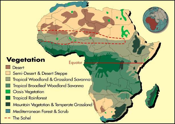
2 Standards SS7G1 The student will locate selected features of Africa. a. Locate on a world and regional political-physical map: the Sahara, Sahel, savanna, tropical rain forest, Congo River, Niger River, Nile River, Lake Tanganyika, Lake Victoria, Atlas Mountains, and Kalahari Desert. b. Locate on a world and regional political-physical map the countries of Democratic Republic of the Congo (Zaire), Egypt, Kenya, Nigeria, South Africa, Sudan, and South Sudan.

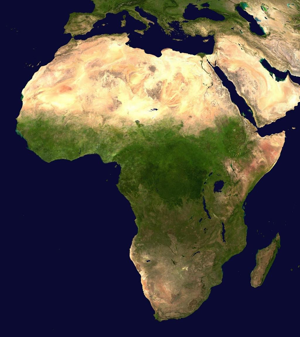
3 Africa is the world s second largest continent (11,700,000 miles). It is home to 52 countries, 1,000 different languages, and 800 million people. 10% of the world s population lives in Africa. The one thing that all African nations have in common is their reliance on the land s physical characteristics, which affect where people live, work, & trade. Africa can be divided into many different regions: The Sahara, the Sahel, the savannahs, the tropical rain forests, the Ethiopian Highlands, and Southern Africa.
4
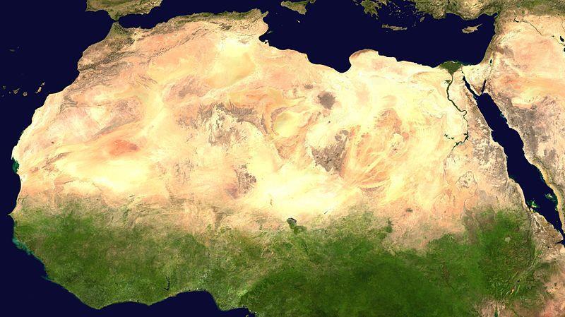
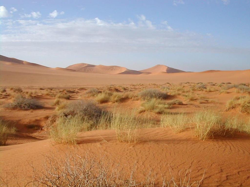
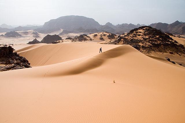
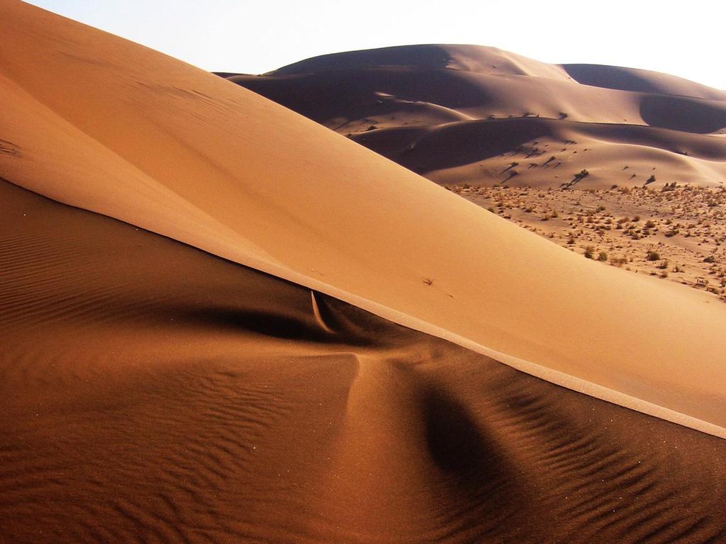
5 The Sahara is the world s largest desert (3,500,000 miles). It runs across the width of northern Africa. It covers 1/3 rd of the continent. It divides the continent into two distinct regions North Africa and sub- Saharan Africa. The Sahara is covered with sand dunes, rocky hills, and stretches of gravel that continue for miles and miles. Very few people live in the desert because it is considered one of the harshest places to live in the world. The people who do live here are called nomads. They move from place to place, usually traveling by camel, looking for food & water.
6
7
8
9
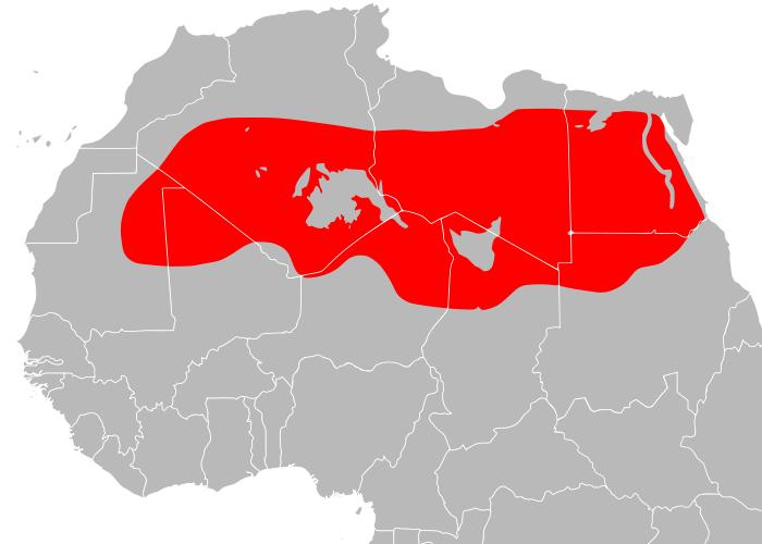
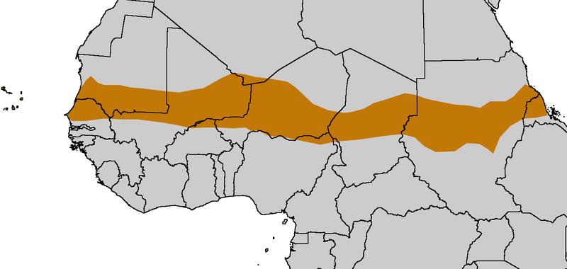
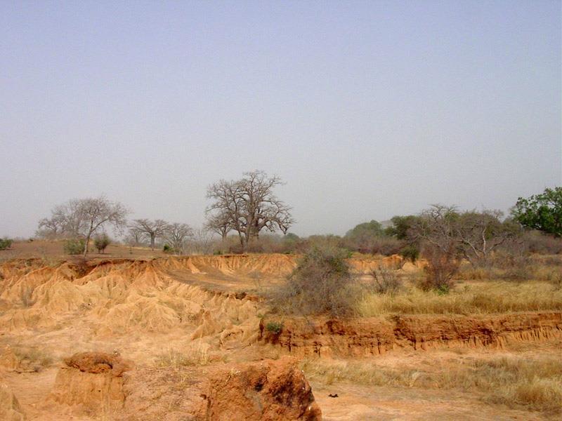
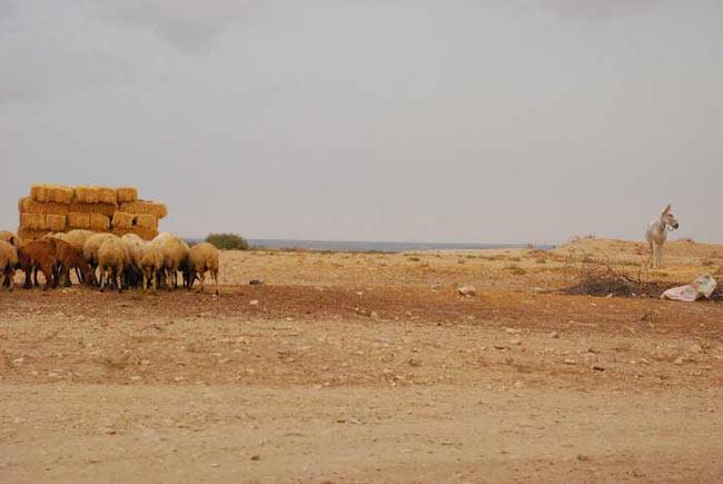
10 The Sahel is a strip of dry grassland that is located south of the Sahara. The word Sahel means border or margin. It is the region between the desert to the north and the grasslands and rainforest to the south. It is a dry, semi-arid region that is slowly turning into desert. It gets more rainfall than the desert, but still receives very little, ranging from 6-20 inches. People have tried to live here but generations of overgrazing and desertification have caused soil erosion. Vegetation is sparse here grasses are shrubs are unevenly distributed. The Sahel is relatively flat with few mountains and hills.
11
12
13

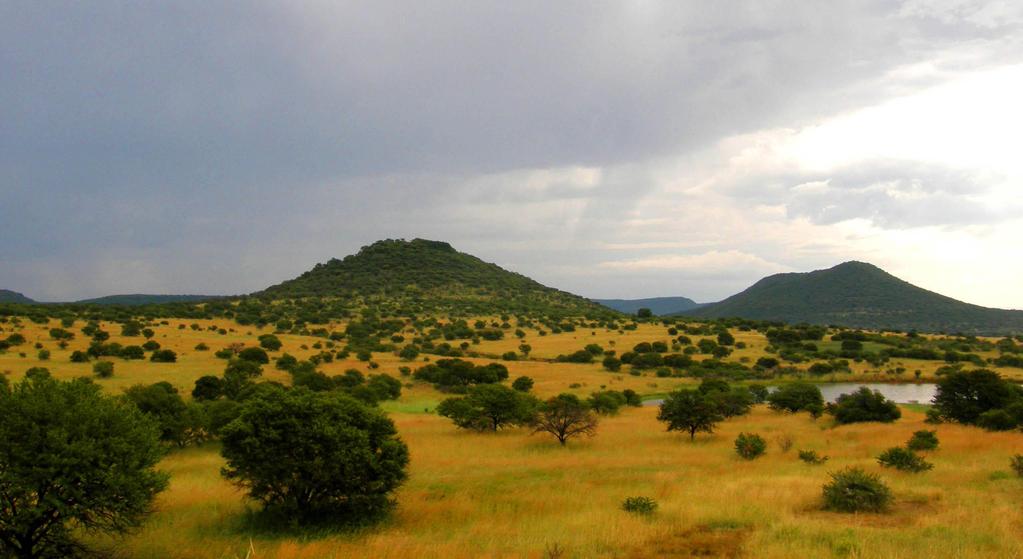
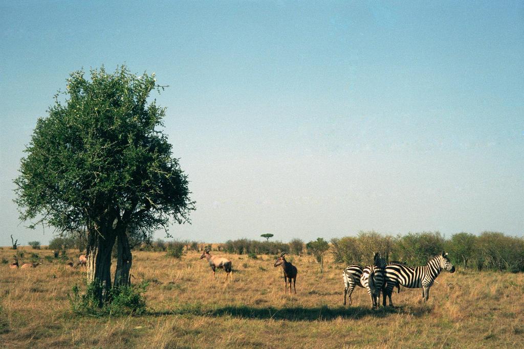
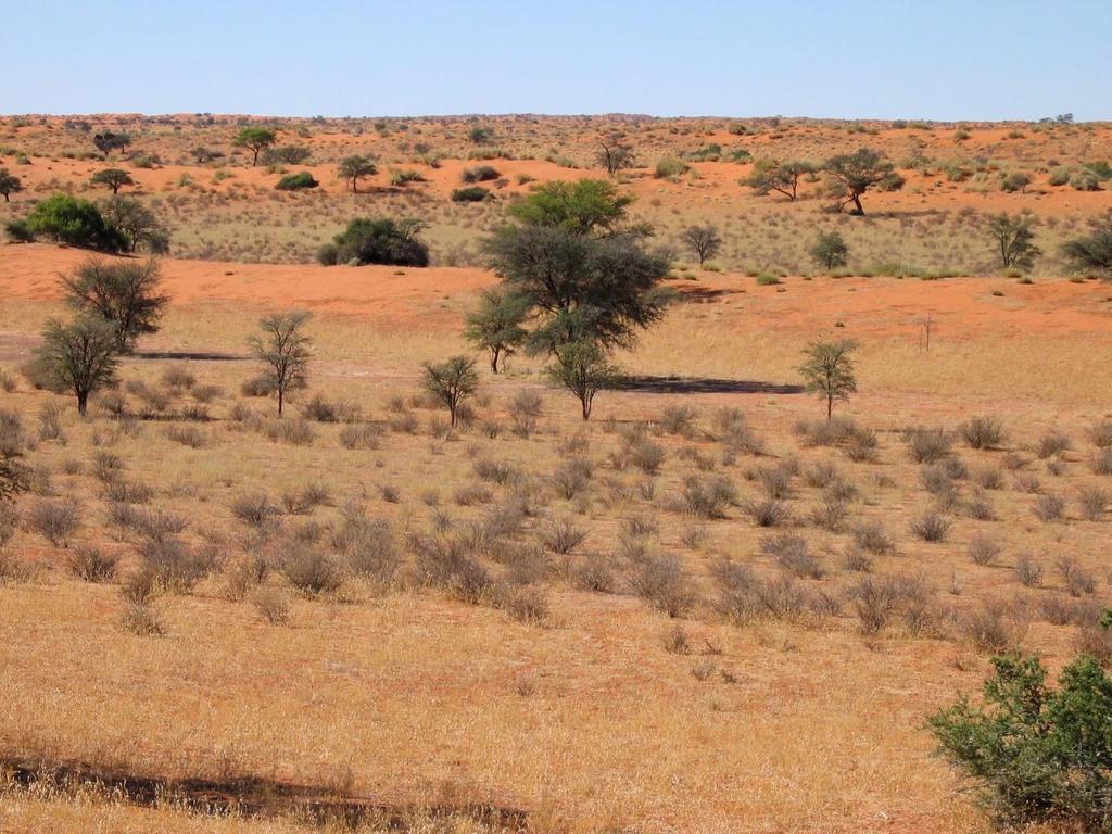
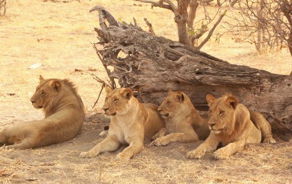
14 The African savannas are hot, dry grasslands that are located near the Equator and cover almost half of Africa. They actually cover the regions just north and south of the rainforests that lie along the equator. The African savanna is the largest in the world. There is a large variety of wildlife here, including lions, zebras, & elephants. Farming is good here, but only if there is good rainfall. Grasses and grains like wheat, oats, and sorghum grown in the region. The area receives enough rain to support drought resistant undergrowth, but not enough to support forest-type vegetation. Grasses are tall and thick, while trees are short and scattered.
15
16
17
18


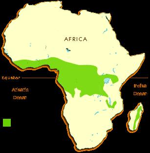
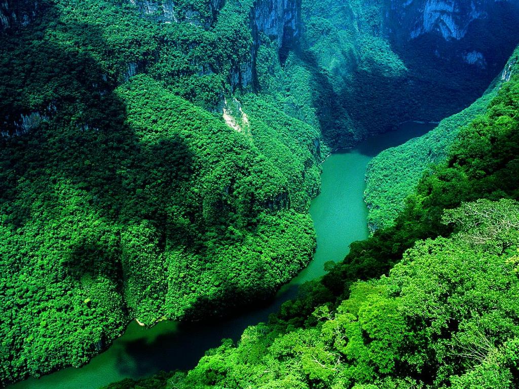
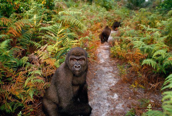
19 Africa s tropical rain forest is located along the central coast of Africa, near the Equator. It lies in the Congo River Basin. The rain forest covers 1/5 th of the land surface of Africa and touches 37 countries. The rain forest has a hot, humid climate. The annual rainfall is over 17 feet. There is a large variety of animals found in this region. Trees are so thick and tall that sunlight never reaches the forest floor! The trees grow hundreds of feet tall. It s the second largest rain forest in the world; the Amazon rain forest in Brazil is the largest. Unfortunately, this rain forest has shrunk due to deforestation.
20

21
22
23

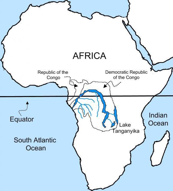
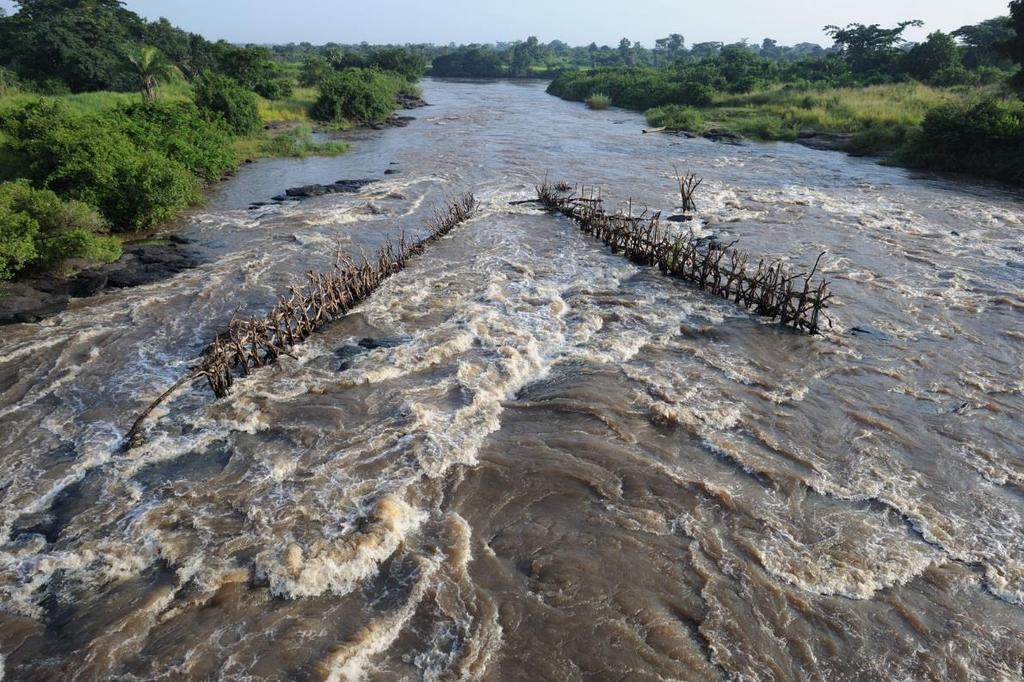
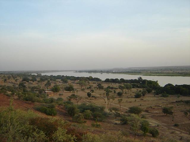
24 The Congo River is located in western central Africa. It begins in central Africa, near Lake Tanganyika, and flows west through the tropical rain forest. The Congo River is the second largest river in Africa. It s over 3,000 miles long.
25
26
27

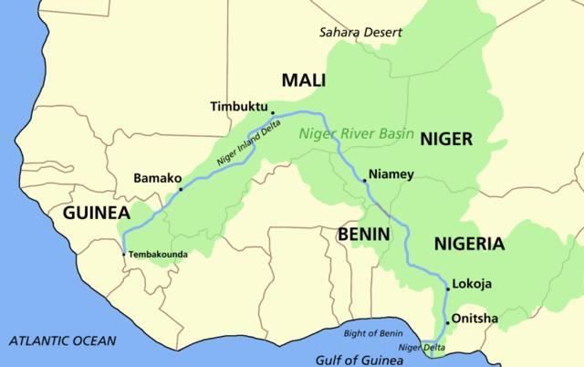
28 The Niger River is located in western Africa. It flows through Guinea, Mali, Niger, Benin, & Nigeria. The Niger River is the third largest river in Africa. It runs over 2,600 miles. The mouth of the Niger River flows through a large delta, often referred to as the Oil Delta because of the petroleum industry that s centered here.
29
30

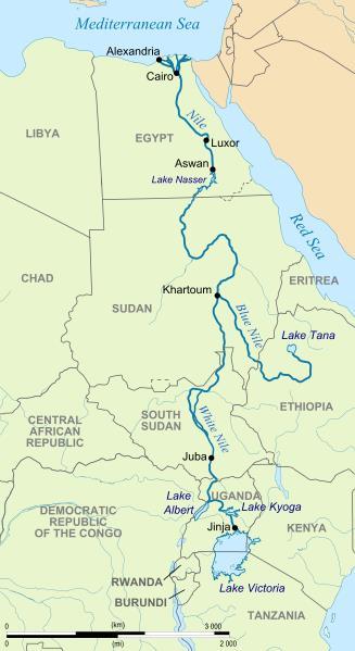
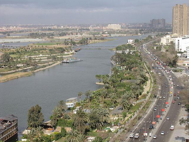
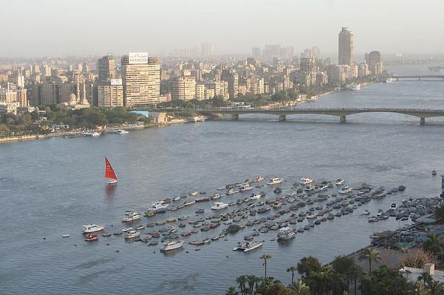
31 The Nile River is located in eastern Africa. It starts in East Burundi and flows northward and empties into the Mediterranean Sea. The Nile is the world s longest river at 4,150 miles. It provides water for Sudan and Egypt. It s an important waterway for transporting people and goods. The Nile also provides a source of irrigation for agriculture.
32
33
34
35
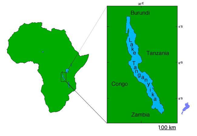
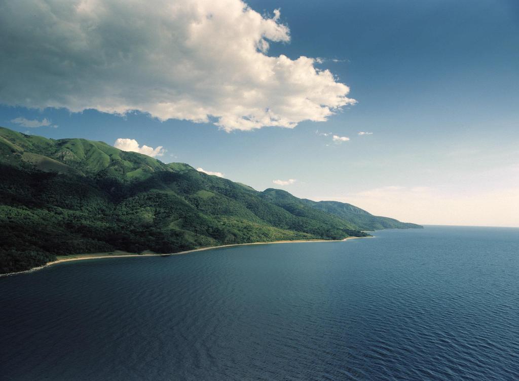
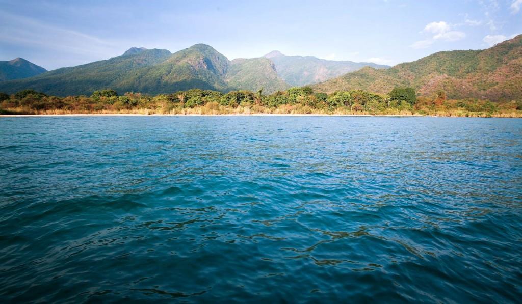
36 Lake Tanganyika is located in central Africa. It s divided between Burundi, Congo, Tanzania, and Zambia. Lake Tanganyika is the deepest lake in Africa and one of the deepest in the world. It s also one of the largest freshwater lakes in the world.
37
38
39

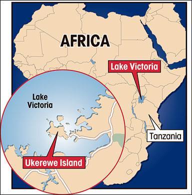
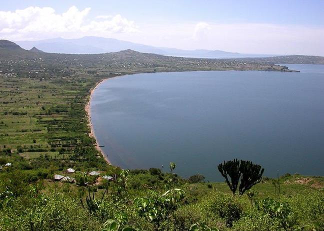
40 Lake Victoria is the largest lake in Africa and the second largest freshwater lake in the world (Lake Superior is the largest). It is located in central Africa and extends into three countries: Tanzania, Uganda, and Kenya. White Nile begins here. Lake Victoria is vital in supporting the millions of people that live nearby. It provides a living for many fishermen and attracts millions of tourists each year.
41
42
43
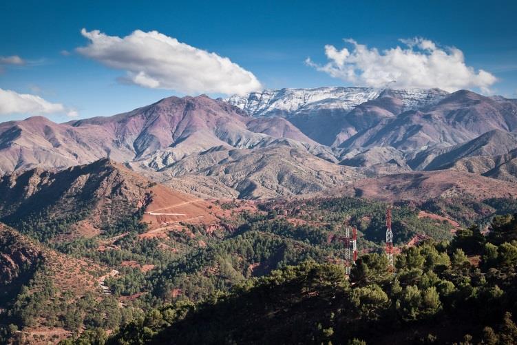
44 The Atlas Mountains are a mountain range in north Africa. The mountains extend from Morocco to Tunisia, between the Mediterranean Sea and the Sahara desert. They separate the coastal regions from the Sahara Desert.
45
46
47
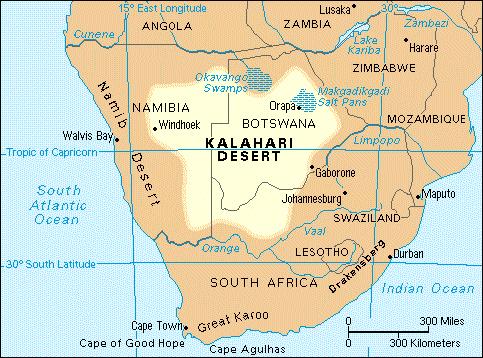
48 The Kalahari Desert is located in southwestern Africa. It covers parts of Botswana, Namibia, and South Africa. The region is surrounded by semi-arid areas that are slowly becoming more dry. It is not a true desert because it receives 3-10 inches of rain per year. Because of the precipitation and underground water supplies, grass, shrubs, and wild animals manage to live in the Kalahari desert.
49
50
51
52
Africa s. Presentation, Graphic Organizers, & Activities
 Africa s Presentation, Graphic Organizers, & Activities STANDARDS: SS7G1 Locate selected features of Africa. a. Locate on a world and regional political-physical map: Sahara, Sahel, savanna, tropical rain
Brain Wrinkles. Africa: The impact of location, climate, & physical characteristics on where people live, the type of work they do, & how they travel
 Africa: The impact of location, climate, & physical characteristics on where people live, the type of work they do, & how they travel STANDARDS: SS7G3 The student will explain the impact of location, climate,
AFRICAN PHYSICAL GEOGRAPHY
 AFRICAN PHYSICAL GEOGRAPHY Here are some factoids about Africa: world s second largest continent (11,700,000 miles). Home to 52 countries, 1,000 languages, 800 million people. 10% of the world s population
How to play. The center aisle divides our class into 2 teams. Team members are NOT allowed to help their teammate when they are asked a question.
 Floaters & Sinkers How to play The center aisle divides our class into 2 teams. Each person will be responsible for answering a question for every round played. Team members are NOT allowed to help their
Introduction to Africa
 Introduction to Africa Did you know? Africa has more countries than any other continent. The Sahara is a desert that is the size of the U.S. It s the world's largest desert. Most of the world s gold and
Chapter 20. The Physical Geography of Africa South of the Sahara
 Chapter 20 The Physical Geography of Africa South of the Sahara Chapter Objectives Identify the major landforms, water systems, and natural resources of Africa south of the Sahara. Describe the relationship
STUDY GUIDE. The Land. Chapter 20, Section 1. The Land of Africa South of the Sahara. Landforms Water Systems Natural Resources.
 For use with textbook pages 499 504. The Land Terms to Know escarpment A steep, often jagged slope or cliff (page 500) cataract A towering waterfall (page 500) rift valley A large crack in the earth s
Africa: Physical geography
 Africa: Physical geography By National Geographic Society, adapted by Newsela staff on 09.15.17 Word Count 1,279 Level 1040L African elephants roam the savannas, which cover almost half of the African
Sub - Saharan Africa
 Sub - Saharan Africa 4/14/2015 Countries with Relative Importance GDP South Africa Gabon Botswana Land Size Sudan Chad Mozambique Madagascar Democratic Republic of the Congo (formerly Zaire) Population
Just how big is Africa?
 The United States China India The United Kingdom Portugal Spain France Belgium Germany The Netherlands Switzerland Italy Eastern Europe Japan 11.7 million sq. miles Just how big is Africa? Chapter 18 Section
UNIT 5 AFRICA PHYSICAL GEOGRAPHY SG 1 - PART II
 UNIT 5 AFRICA PHYSICAL GEOGRAPHY SG 1 - PART II III. CLIMATE & VEGETATION A. The four main climate zones are tropical wet, tropical wet/dry (split into monsoon & savanna), semiarid, and arid. Other climate
Physical characteristics and biomes:
 Physical characteristics and biomes: Sahel region, bordering Sahara Characteristics Area suffers from lack of rainfall, over grazing, which causes loss of vegetation and loss of inhabitable areas causing
UNIT 5 PHYSICAL GEOGRAPHY SG 1 - PART I
 UNIT 5 PHYSICAL GEOGRAPHY SG 1 - PART I Africa is HUGE! I. LANDFORMS A. Plateaus - an area of relatively level high ground. 1. Africa s interior is dominated by series of plateaus and elevated basins such
2009 Carole Marsh/Gallopade International
 Live Work Play Learn LIVE LEARN WORK TM PLAY 2009 Carole Marsh/Gallopade International Permission is hereby granted to the individual purchaser or classroom teacher to reproduce materials in this book
AFRICA'S PHYSICAL FEATURES
 AFRICA'S PHYSICAL FEATURES Looking high and low in Africa This continent's physical features are impressive. From towering, rocky peaks and sleeping volcanoes, like Mount Kilimanjaro, to some of the world
Unit 1: Physical Geography Notes
 - How has the physical world impacted settlement patterns? o Major factors in the decision-making process of o Before the boom controlling the physical environment was not possible on a large scale - Physical
One Commodity Map. 7. What is a commodity? 8. Explain what a one-commodity country is.
 7. What is a commodity? 8. Explain what a one-commodity country is. 9. What must African countries do in order to become more stable economically? One Commodity Map Countries which OIL is the lone commodity
Connecting Africa. physical Geography
 Connecting Africa physical Geography Africa, the second-largest continent, is bounded by the Mediterranean Sea, the Red Sea, the Indian Ocean, and the Atlantic Ocean. It is divided in half almost equally
Geography (cont) Sorghum, rice, millet, rice, wheat and corn grown on savannahs. Not just one big plain though mountainous and swampy areas too
 Sorghum, rice, millet, rice, wheat and corn grown on savannahs. Not just one big plain though mountainous and swampy areas too") Geography & Society in Africa: 500 BCE-900 CE Geography Around 5000 miles wide and long Various climates, jungles, snow-capped mountains, deserts and rain-soaked areas. 40% desert - largely uninhabitable
Geography & Society in Africa: 500 BCE-900 CE Geography Around 5000 miles wide and long Various climates, jungles, snow-capped mountains, deserts and rain-soaked areas. 40% desert - largely uninhabitable
pg. 446 (5 th) pg. 456 (6 th )
 pg. 456 (6 th )") pg. 446 (5 th) pg. 456 (6 th ) African Landscape Plateau Highest in: Ethiopian Highlands Drakensberg Mtns. Lesotho & So. Africa pg. 452 (5 th) pg. 459 (6 th ) Ethiopian Highlands Canyons carved by water
pg. 446 (5 th) pg. 456 (6 th ) African Landscape Plateau Highest in: Ethiopian Highlands Drakensberg Mtns. Lesotho & So. Africa pg. 452 (5 th) pg. 459 (6 th ) Ethiopian Highlands Canyons carved by water
BRITANNICA STUDENT ENCYCLOPEDIA. Africa is the world s second largest continent. More than 50 countries make up
 JOBNAME: No Job Name PAGE: 33 SESS: 682 OUTPUT: Thu Aug 31 10:43:41 2006 38 Africa BRITANNICA STUDENT ENCYCLOPEDIA Africa Africa is the world s second largest continent. More than 50 countries make up
Grade 5 Geography Term 1
 1 Grade 5 Geography Term 1 Contents Section 1: World map and compass directions... 2 The position of the equator and the North and South Poles on a globe... 2 The seven continents of the world... 3 The
Chapter 13 and 14 Geography Study Guide
 Chapter 13 and 14 Geography Study Guide Multiple Choice Identify the letter of the choice that best completes the statement or answers the question. 1. Which West African country has the largest population
PHYSICAL GEOGRAPHY. Unit 1
 PHYSICAL GEOGRAPHY Unit 1 HOW HAS THE PHYSICAL WORLD IMPACTED SETTLEMENT PATTERNS? Major factor in the decision-making process of settlers Before the technological boom controlling the physical environment
Population (million) % of Africa
 % of Africa") FAO. Irrigation in in figures: AQUASTAT Survey 2005 TABLE 1 al distribution of cultivable and cultivated areas Cultivable areas Cultivated areas in 2002 In cultivable areas (ha) (ha) (%) Northern 65 320
FAO. Irrigation in in figures: AQUASTAT Survey 2005 TABLE 1 al distribution of cultivable and cultivated areas Cultivable areas Cultivated areas in 2002 In cultivable areas (ha) (ha) (%) Northern 65 320
1. CLIMATIC AND ENVIRONMENTAL CONDITIONS OVER AFRICA. 1.1 Inter-Tropical Discontinuity (ITD)
") African Centre of Meteorological Application for Development Centre Africain pour les Applications de la Météorologie au Développement DECEMBER 2011 HIGHLIGHT: Cholera, Yellow fever, Avian Influenza, typhoid
African Centre of Meteorological Application for Development Centre Africain pour les Applications de la Météorologie au Développement DECEMBER 2011 HIGHLIGHT: Cholera, Yellow fever, Avian Influenza, typhoid
Unit 6 vocabulary. Serengeti Plain
 basin Nile River rift valley Mount Kilimanjaro escarpment Sahara aquifer oasis Serengeti Plain canopy Niger delta Sahel the world s longest river, flowing more than 4,000 miles through Uganda and Sudan
CLIMATE DIAGNOSTIC BULLETIN FOR AFRICA
 CLIMATE DIAGNOSTIC BULLETIN FOR AFRICA N 02 FEBRUARY, 2019 OCEAN-ATMOSPHERE MONITORING & PREDICTION 1 SUMMARY FEBRUARY 2019 The precipitation for the month of February, 2019 was above to well above average
African Centre of Meteorological Applications for Development Centre Africain pour les Applications de la Météorologie au Développement
 African Centre of Meteorological Applications for Development Centre Africain pour les Applications de la Météorologie au Développement Ten Days Climate Diagnostics Bulletin N 03 Dekad 3, 21 st to 31 st
Countries of the World QTR 3
 As of December 2017 Countries of the World QTR 3 Website: Countries of the World. com https://www.countries-ofthe-world.com/countries-of-north-america.html Website: CIA.gov https://www.cia.gov/index.html
All of this week s homework is intended to help you get to know more about the country of Sudan, where Kek is from in Home of the Brave.
 Name: Week 7 Homework All of this week s homework is intended to help you get to know more about the country of Sudan, where Kek is from in Home of the Brave. On the map above, do the following things:
STUDY GUIDE. The Land. Chapter 17, Section 1. There are frequent earthquakes in the region. Petroleum is a major export in the region.
 For use with textbook pages 421 426. The Land Terms to Know alluvial soil A rich soil made up of sand and mud deposited by flowing water (page 423) wadi A streambed that remains dry until a heavy rain
Africa. Grades 2-5. Barbara Gillespie-Washington. Author
 Illustrators Cheri Macoubrie Wilson Wendy Chang Mary E. Connors Editor Barbara Wally Africa Grades 2-5 Editorial Project Manager Karen J. Goldfluss, M.S. Ed. Editor-in-Chief: Sharon Coan, M.S. Ed. Creative
Ten Day Climate Watch Bulletin N 27 Dekad 21 st to 30 th September, 2014
 African Centre of Meteorological Application for Development Centre Africain pour les Applications de la Météorologie au Développement Ten Day Climate Watch Bulletin N 27 Dekad 21 st to 30 th September,
African Centre of Meteorological Applications for Development Centre Africain pour les Applications de la Météorologie au Développement
 African Centre of Meteorological Applications for Development Centre Africain pour les Applications de la Météorologie au Développement Ten Day Climate Watch Bulletin N 26 Dekad 11 th to 20 th September,
African Centre of Meteorological Applications for Development Centre Africain pour les Applications de la Météorologie au Développement
 African Centre of Meteorological Applications for Development Centre Africain pour les Applications de la Météorologie au Développement Ten Day Climate Watch Bulletin N 15 Dekad 21 st to 31 st May, 2015
African Centre of Meteorological Applications for Development Centre Africain pour les Applications de la Météorologie au Développement
 African Centre of Meteorological Applications for Development Centre Africain pour les Applications de la Météorologie au Développement Ten Day Climate Watch Bulletin N 34 Dekad 1 st to 10 th December,
Lesson 1: Geography of Africa
 Lesson 1: Geography of Africa 7. 4. 1 Study the Niger River and the relationship of Vegetation zones of forest, savannah, and desert trade in gold, salt, food, and slaves; and the growth of the Ghana and
Notes for the Teacher / Guide. Africa / Uganda
 Notes for the Teacher / Guide Africa / Uganda The aim of the project is to introduce the children of the UK to the landscape of another country and to appreciate similarities and differences. Uganda is
Rivers. Highlights of some of the World s Most Famous Rivers!
 Rivers Highlights of some of the World s Most Famous Rivers! Directions This Power Point presentation contains information about some of the most famous rivers in the world! Students should use this presentation
M2 Africa Some Basic Facts (Part I) Africa (Year 7)
 Africa (Year 7)") M2 Africa Some Basic Facts (Part I) Africa (Year 7) Take a look in your atlas and find the names of the oceans and seas (numbers 1-8 on the map below) that surround Africa. Write their names in the grid
M2 Africa Some Basic Facts (Part I) Africa (Year 7) Take a look in your atlas and find the names of the oceans and seas (numbers 1-8 on the map below) that surround Africa. Write their names in the grid
A Snapshot of Sanitation and Open Defecation in Africa 2010 Update
 A Snapshot of Sanitation and Open Defecation in 10 Update A regional perspective based on data from the WHO/UNICEF Joint Monitoring Programme for Water Supply and Sanitation UNICEF/NYHQ10-1999/Asselin
Table A.LPG1 : TOTAL LPG CONSUMPTION (Best available Estimates)
") Table A.LPG1 : TOTAL LPG CONSUMPTION (Best available Estimates) 1000 MT 1 Burkina Faso 0.509 0.587 0.615 0.606 0.435 0.429 0.691 1.057 1.385 1.698 2.156 2.432 2.888 2 Cape Verde 4.058 4.268 4.988 5.259
Table A.LPG1 : TOTAL LPG CONSUMPTION (Best available Estimates) 1000 MT 1 Burkina Faso 0.509 0.587 0.615 0.606 0.435 0.429 0.691 1.057 1.385 1.698 2.156 2.432 2.888 2 Cape Verde 4.058 4.268 4.988 5.259
JABALI AFRICAN ACROBATS TEACHER'S NOTES
 JABALI AFRICAN ACROBATS TEACHER'S NOTES Brought to you by Class Act Performing Artists & Speakers; 800-808-0917 JABALI ACROBATS This incredible Kenyan troupe combines Chinese and African traditions of
Africa. Display Transparency 6 on the overhead. Explain to students that Africa is the
 3S 4S 1S 2S 3N 4N Banjul Bissau SIERRA LEONE 5N MADEIRA IS. CANARY IS. (SPAIN) (disputed) Dakar Freetown (PORTUGAL) GAMBIA Bamako Conakry Monrovia Rabat BURKINA FASO 1W Accra Lomé ~ Niamey BENIN Algiers
GEOGRAPHY AND HISTORY
 GEOGRAPHY AND HISTORY YEAR 1, PART 1 www.vicensvives.es Contents 01 Our planet Earth 02 The representation of the Earth: maps 03 The Earth s relief 04 Rivers and seas 05 Weather and climate 06 Climates
RED CEDAR MODEL UNITED NATIONS. Table of Contents. Letter from the Chair Question of Water Security in Africa: Lake Chat...
 Table of Contents Letter from the Chair... 3 Question of Water Security in Africa: Lake Chat... 4 Introduction to Water Security in Africa... 4 History of Water Security in Africa... 5 Current Issues...
Southern Africa. Countries, Geography, & Climate
 Countries, Geography, & Climate The Southern African region consists of the following countries: Angola Zambia Malawi Mozambique Zimbabwe Botswana Namibia Swaziland Lesotho South Africa Comoros Madagascar
GeoQuest Study for the next Quiz Day:
 GeoQuest Study for the next Quiz Day: February 27 th Angola Botswana Burundi Level 2 February Southern Africa Level 1 Republic of the Congo Democratic Republic of the Congo Equatorial Guinea Level 3 Madagascar
Energy Poverty in Africa
 African Energy Commission (AFREC) Paper on Energy Poverty in Africa By Dr. Gilbert NZOBADILA Consultant Energy Policy- AFREC 1 1- Introduction: African background : The African Energy Commission (AFREC)
7/27/2010. Regions of Subsaharan Africa. SUBSAHARAN AFRICA II (Chapter 6, pages ) Southern Africa. South Africa: Peaceful Change from Apartheid
 Southern Africa. South Africa: Peaceful Change from Apartheid") SUBSAHARAN AFRICA II (Chapter 6, pages 209-227) Regions of Subsaharan Africa Southern Africa 10 countries, 6 of them landlocked Congo Basin marks northern limit Plateau country Rich in natural resources
SUBSAHARAN AFRICA II (Chapter 6, pages 209-227) Regions of Subsaharan Africa Southern Africa 10 countries, 6 of them landlocked Congo Basin marks northern limit Plateau country Rich in natural resources
EASTERN AFROMONTANE 1,043,191 km 2
 Egypt Saudi Arabia Oman EASTERN AFROMONTANE 1,043,191 km 2 Sudan Asmara Eritrea Yemen Djibouti Addis Ababa South Sudan Ethiopia BIODIVERSITY TARGET 2020 TARGET: 17% protected Democratic Republic of the
Chapter 17. North Africa, Southwest Asia and Central Asia
 Chapter 17 North Africa, Southwest Asia and Central Asia Chapter Objectives Describe the major landforms and natural resources of North Africa, Southwest Asia, and Central Asia. Discuss the climate and
The political economy of resource discoveries. Prof. Michael L. Ross UCLA Department of Political Science September 21, 2011
 The political economy of resource discoveries Prof. Michael L. Ross UCLA Department of Political Science September 21, 2011 Overview 1. Oil and mineral production is spreading to more low-income countries;
Chapter 21: EAST AFRICA
 Chapter 21: EAST AFRICA Physical Geography of East Africa Landforms East Africa is a diverse landscape of different plains, volcanic mountains, and plateaus cut by a large valley and marked by many rivers
Central Africa Climate?
 Sub-Saharan Africa: All the lands below the Sahara List 4 common traits of countries in Sub-Saharan Africa 4. Define Tribalism and explain how it has affects the region. Chapter 20 Study Guide Define animism
What is new on the T4A GPS Maps Traveller s Africa 16.10
 What is new on the T4A GPS Maps Traveller s Africa 16.10 T4A GPS Maps 16.10 comes preloaded on a micro SD card with standard adapter, ready for Plug & Navigate. This SD card can be used on most map capable
Regional outlook Sub-Saharan Africa 24/11/2015. Share commodities in good exports. Share commodities in goods imports
 Table 1: Economic structure indicators Number of Inhabitants (m.) Size of the economy (in USD bn.) Size of the economy (% of world GDP) Share commodities in good exports Share commodities in goods imports
Chapters 14 and 15 Geography Study Guide
 Chapters 14 and 15 Geography Study Guide Multiple Choice Identify the letter of the choice that best completes the statement or answers the question. 1. Gorillas live within dense rain forests of. a. Rwanda
Africa. Physical. Map. Unit. Thanks for Your Purchase! Annabelle ate apples in the purple poppies Thomas Teaching Tools
 Africa Physical Map Unit Thanks for Your Purchase! I hope you and your students enjoy this product. If you have any questions, you may contact me at ThomasTeachingTools@gmail.com. Terms of Use This teaching
Prelim Bits
 Prelim Bits 19-03-2018 HAMMER Spacecraft NASA has drawn up plans to build a huge nuclear spacecraft that is capable of shunting or blowing up dangerous space rocks and safeguarding life on Earth. The spacecraft
Latin America. Introduction
 Latin America Introduction What are the 5 Themes of Geography? Draw lines to connect the theme to the definition: Location How humans and the environment impact each other Physical and human characteristics
TABLE OF CONTENTS COUNTRY FOCUS: ALGERIA
 Africa Statistics Flash Selected Socio-Economic Indicators on Africa May 218 TABLE OF CONTENTS COUNTRY FOCUS: ALGERIA ---------------------------------------------------------------------------------------------
REPRODUCIBLE MATERIALS
 REPRODUCIBLE MATERIALS Tongass Rainforest by Flickr user Swanksalot In the Deser/Feeling Like Walking by Flickr user Horizon Lonely Island by Flickr user gari.baldi Bombed Hospital by Flickr user The Rocketeer
Framework for Progressive Destination Competitiveness
 Sub-Saharan Africa Framework for Progressive Destination Competitiveness SSA Countries by Tourism Development Level and World Bank Income Ranking Tourism development level Pre-emerging Low income Central
The A Z of African Countries Notebooking Pages with Backline Maps. Preface
 Preface This book has been created as the basis for unit studies on any (or all) African countries. Whilst each country has available a separate and comprehensive Unit Study, some educators prefer to start
CHAPTER 12. South America. Section 1: Natural Environments Section 2: History and Culture Section 3: South America Today. HOLT World Geography
 CHAPTER 12 South America Section 1: Natural Environments Section 2: History and Culture Section 3: South America 1 Section 1 Natural Environments Objectives: What are the major landforms and rivers of
Chapter 7 Geography and the Early Settlement of Egypt, Kush, and Canaan
 Chapter 7 Geography and the Early Settlement of Egypt, Kush, and Canaan How did geography affect early settlement in Egypt, Kush, and Canaan? Section 7.1 - Introduction RF/NASA//Corbis This satellite photograph
AGRICULTURE THE BIG PICTURE
 AGRICULTURE THE BIG PICTURE AEASA 2015 (30 Sept 2015), Parys North West NAMC and Tralac Collaboration By: B Nyhodo, E Williams and R Sandrey Presentation outline Introduction Africa Africa share of world
Table of CONTENTS. COUNTRY FOCUS: United Republic of Tanzania
 Africa Statistics Flash Selected Socio-Economic Indicators on Africa December 216 Table of CONTENTS COUNTRY FOCUS: United Republic of Tanzania ------------------------------------------------------------
The Galileo Galilei Institute for Theoretical Physics (GGI) plans to organize and host small-size advanced workshops in theoretical particle physics
 plans to organize and host small-size advanced workshops in theoretical particle physics") The Galileo Galilei Institute for Theoretical Physics (GGI) plans to organize and host small-size advanced workshops in theoretical particle physics in its broadest sense. Each workshop will be devoted
The Galileo Galilei Institute for Theoretical Physics (GGI) plans to organize and host small-size advanced workshops in theoretical particle physics in its broadest sense. Each workshop will be devoted
CASM (Africa) and the African Mining Partnership. Jon Hobbs - CASM (Global) Chairman Linus Adie - CASM (Africa) Chairman
 and the African Mining Partnership. Jon Hobbs - CASM (Global) Chairman Linus Adie - CASM (Africa) Chairman") CASM (Africa) and the African Mining Partnership AMP - Ministerial Meeting 12 August 2005, Africa Hall, ECA, Addis Ababa Jon Hobbs - CASM (Global) Chairman Linus Adie - CASM (Africa) Chairman Artisanal
CASM (Africa) and the African Mining Partnership AMP - Ministerial Meeting 12 August 2005, Africa Hall, ECA, Addis Ababa Jon Hobbs - CASM (Global) Chairman Linus Adie - CASM (Africa) Chairman Artisanal
Latin America. Physical Geography
 Latin America Physical Geography Regions Latin America can be divided into separate regions based on physical geography or cultural geography. Regions If we look at physical geography Latin America has
Africa the potential for growth
 Africa the potential for growth Ian Taylor President & CEO, Vitol March 2015 The oil price a long term view 2010 to date - $94 2000s - $49.6 1980s - $25.8 1990s - $18.3 1970s $10.5 1 Q1-14 Q2-14 Q3-14
2.1 What is the climate like?
 José Medeiros This fact sheet allows you to see how varied the countryside is across Brazil. 2.1 What is the climate like? Most of Brazil is in the Southern Hemisphere, where the seasons are the opposite
Southern Africa outpaces North Africa in governance performance
 Monday 5 th October 2009 Southern Africa outpaces North Africa in governance performance 2009 Ibrahim Index of African Governance shows that half of Africa s ten best performing countries are in Southern
Appendix A Geographic and Geologic Terms Connected With Egypt
 Appendix A Geographic and Geologic Terms Connected With Egypt Egypt Official name is the Arab Republic of Egypt. Total area is 1,002,450 km 2, which makes Egypt the 29th largest country in the world. Only
Namibia, formally The Republic of Namibia, is located in the southwestern region
 Namibia Location Namibia, formally The Republic of Namibia, is located in the southwestern region of the continent of Africa. Its western boarder is Atlantic coastline. Namibia borders The Republic of
Ancient Egypt: an Overview
 Ancient Egypt: an Overview Timeline Old Kingdom Middle Kingdom 2650 BC 2134 BC 2125 BC 1550 BC New Kingdom 1550 BC 1295 BC http://www.thebanmappingproject.com/resources/timeline.html 1 Three Kingdoms of
The Second Japan-Africa Business Forum TICAD and Business: Feedback from the Yokohama Action Plan to the Nairobi Declaration July 25, 2017
 The Second Japan-Africa Business Forum TICAD and Business: Feedback from the Yokohama Action Plan to the Nairobi Declaration July 25, 207 Takeshi Osuga Ambassador, Assistant Minister, Director-General
Chapter 7. Geography and the Early Settlement of Egypt, Kush, and Canaan
 Chapter 7 Geography and the Early Settlement of Egypt, Kush, and Canaan Chapter 7 Geography and the Early Settlement of Egypt, Kush, and Canaan How did geography affect early in Egypt Kush, and Canaan?
Germany s bilateral development cooperation with Sub-Saharan Africa: An Agenda for Reform
 Germany s bilateral development cooperation with Sub-Saharan Africa: An Agenda for Reform Limited share of development cooperation in the context of donors ODA net payments (incl. debt r elief ) f or SSA
LIFE IN THE DESERTS. Desert is a dry place having GEOGRAPHY. Chapter
 Chapter 9 LIFE IN THE DESERTS Unit-1 : OUR ENVIRONMENT GEOGRAPHY 72 Desert is a dry place having very little rainfall resulting in scarce vegetation. It has extreme temperatures high or low. Depending
TABLE OF CONTENTS COUNTRY FOCUS: BENIN
 Africa Statistics Flash Selected Socio-Economic Indicators on Africa March 218 TABLE OF CONTENTS COUNTRY FOCUS: BENIN ------------------------------------------------------------------------------------------------
Table of CONTENTS. COUNTRY FOCUS: Tunisia
 Africa Statistics Flash Selected Socio-Economic Indicators on Africa October 217 Table of CONTENTS COUNTRY FOCUS: Tunisia ----------------------------------------------------------------------------------------------
Module 1 Educator s Guide: Representative Discussion Points Investigation 3
 Module 1 Educator s Guide: Representative Discussion Points Investigation 3 Ethiopia and Eritrea Our combined population is 59,578,171 people. We have just emerged from a long period of civil war and famine.
Cambridge International Examinations Cambridge International Advanced Subsidiary and Advanced Level
 Cambridge International Examinations Cambridge International Advanced Subsidiary and Advanced Level *5153973671-I* TRAVEL AND TOURISM 9395/11 Paper 1 Core May/June 2016 INSERT 2 hours 30 minutes READ THESE
Fostering healthcare Investments through PPPs. George Uduku Health Systems November 2017
 Fostering healthcare Investments through PPPs George Uduku November 2017 Healthcare Industry : Infrastructure 1/2 There is a wide gap in healthcare infrastructure and a major shortage of healthcare workers
Table of CONTENTS. COUNTRY FOCUS: Equatorial Guinea
 Africa Statistics Flash Selected Socio-Economic Indicators on Africa August 217 Table of CONTENTS COUNTRY FOCUS: Equatorial Guinea ---------------------------------------------------------------------------
Region 1 Piney Woods
 Region 1 Piney Woods Piney Woods 1. This ecoregion is found in East Texas. 2. Climate: average annual rainfall of 36 to 50 inches is fairly uniformly distributed throughout the year, and humidity and temperatures
What is new on the T4A GPS Maps Traveller s Africa 17.10
 What is new on the T4A GPS Maps Traveller s Africa 17.10 T4A GPS Maps 17.10 comes preloaded on a micro SD card with standard adapter, ready for Plug & Navigate. This SD card can be used on most map capable
Trade Blocs, Development Hotspots and Changing Trade Patterns. Breakbulk Africa, 18 th February 2015
 Trade Blocs, Development Hotspots and Changing Trade Patterns Breakbulk Africa, 18 th February 2015 Background Multiplicity of Trade Blocs in ever convergent economic spaces; Need for harmonisation of
AFRICA EASTERN AFRICA COMORO ISLANDS 1978-PRESENT. BURUNDI 1962-PRESENT Prior to 1962 see Rwanda
 EASTERN BURUNDI 1962-PRESENT Prior to 1962 see Rwanda COMORO ISLANDS 1978-PRESENT FRENCH TERRITORY 1950-1978 For period 1912-1950 see Madagascar and Comoro Islands Precedent Countries- Continued ANJOUAN
AFSEC Workshop Johannesburg 27 March 2017
 Evah Oduor IEC-AFRC Director AFSEC Workshop Johannesburg 27 March 2017 INTERNATIONAL ELECTROTECHNICAL COMMISSION About the IEC Africa Quality Infrastructure IEC-AFRC Mission Recommendations Conclusion
STUDY GUIDE. The Land. Physical Features of Latin America. Chapter 8, Section 1. Terms to Know DRAWING FROM EXPERIENCE ORGANIZING YOUR THOUGHTS
 For use with textbook pages 193 198. The Land Terms to Know cordillera A mountain range that runs parallel to another mountain range (page 194) altiplano A high plain (page 194) escarpment A steep cliff
Latin America. Chapter 9 Physical Geography
 Latin America Chapter 9 Physical Geography Latin American Regions Middle America includes Mexico and the Central American countries The Caribbean Islands South America Mexico Landforms Sierra Madre Oriental
Federal Ministry of Transportation. Nigeria Business Investor Forum Briefing on Aviation Sector Reform and Investment Opportunities
 Federal Ministry of Transportation Nigeria Business Investor Forum Briefing on Aviation Sector Reform and Investment Opportunities By Senator Hadi Abubakar Sirika Honourable Minister of State Aviation
Ancient Egypt and the Near East
 *O*»f ' i ft Ancient Egypt and the Near East Chapter 7 Chapter 8 Chapter 9 Geography and the Early Settlement of Egypt, Kush, and Canaan The Ancient Egyptian P h a r a o h s Daily Life in Ancient Egypt
Regional Atlas: Introduction to Latin America
 Chapter 9, Section World Geography Chapter 9 Regional Atlas: Introduction to Latin America Copyright 2003 by Pearson Education, Inc., publishing as Prentice Hall, Upper Saddle River, NJ. All rights reserved.
1 What is the African Economic Outlook Project? 2 African Economic Performance: Multifaceted Growth. 3 Africa and Globalization
 African Economic Outlook 2007 Measuring the Pulse of Africa Nicolas Pinaud, OECD Development Centre 经合组织 发展中心 Standard Chartered & the OECD Development Centre AFRICA AND CHINA: ECONOMIC AND BUSINESS PERSPECTIVES