We are pleased to present Kingery Farm 144 ± Acres Worthington Township, Nobles County
|
|
|
- Ezra Lewis
- 5 years ago
- Views:
Transcription
1 We are pleased to present Kingery Farm 144 ± Acres Worthington Township, Nobles County SUBJECT PROPERTY This property to be sold by Sealed Bid Auction Owner: John Kingery, Ann Schlomann and Paula Seep Date & Time: Tuesday, August 21, 1 p.m. Location: Holiday Inn Express & Suites Worthington, 1250 Ryan s Rd, Worthington, MN Note: See Sealed Bid Information page in the back of this brochure for more details. Only registered bidders may attend. Must be registered prior to auction date. Listing Agent: Darrell Hylen, ALC Office: LAND (5263) Toll Free: LAND (5263) Direct: Auctioneer # Darrell.Hylen@WingertRealty.com

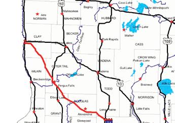
2 State Highway Map Minneapolis SUBJECT PROPERTY Mankato

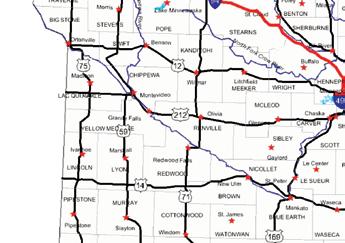
3 Nobles County Minnesota SUBJECT PROPERTY

4 Worthington Township Nobles County SUBJECT PROPERTY


5 FSA Aerial View
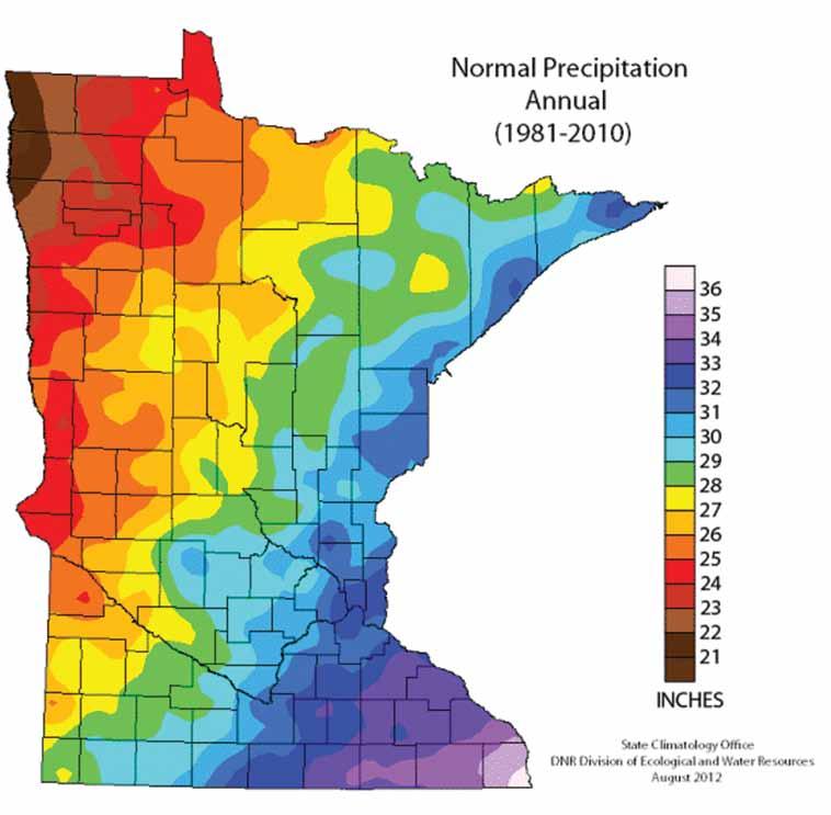
6 Property Information DESCRIPTION: 144 ± Acres. NE¼ except 3 tracts. Section 8, T102N-R40W (not to be used on legal documents) (Worthington Township, Nobles County, Minnesota) TAX PID #: BUILDINGS: None REAL ESTATE TAXES: 2018 Ag Non Hmstd taxes = $6,466 Special Assessments = $0 FSA INFORMATION: Total acres = 144 ± acres FSA Tillable acres = ± acres Corn base acres = ± acres Corn PLC Yield = 153 ± bushels Soybean base acres = ± acres Soybean PLC Yield = 39 ± bushels Farm Program Info - Enrolled into Agricultural Risk Coverage (ARC) County SOIL DESCRIPTION: Webster, Nicollet, Clarion, Storden, Omsrud, Terril, Canisteo, Pilot Grove, Delft. See Soils Map. CPI: Crop Productivity Index = 93.6 TOPOGRAPHY: DRAINAGE: Level to rolling Private drainage ditch and private tile. See Tile Maps. NRCS CLASSIFICATIONS ON TILLABLE ACRES: Tract contains a wetland or farmed wetland NHEL - Non-Highly Erodible Land WINGERT REALTY & LAND SERVICES, INC. stipulates that they are representing the seller exclusively in this transaction. The information gathered for this brochure in its entirety is from sources deemed reliable, but cannot be guaranteed by Seller, Wingert Realty & Land Services, Inc., or its staff. Package is subject to prior sale, price change, correction or withdrawal. The buyer must make their own independent investigation of the property. The buyer is purchasing the property as is.
7 Tile Map This tile map is an approximation. Wingert Realty & Land Services, Inc. does not guarantee tile maps, footage, tile condition, location, size, grade or depth.
8 Tile Map This tile map is an approximation. Wingert Realty & Land Services, Inc. does not guarantee tile maps, footage, tile condition, location, size, grade or depth. Tile Intake
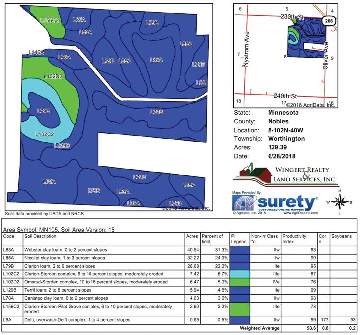
9 Soils Map


10 Property Photos North end of farm looking southwest. East side of farm looking southwest. East side of farm looking west. Photos taken 7/2018.


11 Property Photos East side of farm looking west. Drainage ditch going through farm. Southeast corner of farm looking northwest.
12 Soil Descriptions WEBSTER SERIES - Soil # L83A The Webster series consists of very deep, poorly drained, moderately permeable soils formed in glacial till or local alluvium derived from till on uplands. Slope ranges from 0 to 3 percent. Mean annual air temperature is about 48 degrees F, and mean annual precipitation is about 30 inches. TYPICAL PEDON: Webster silty clay loam on a concave slope of about 1 percent gradient in a cultivated field. GEOGRAPHIC SETTING: Webster soils are on relatively undissected till plains of Wisconsin age. Slopes are nearly plane to slightly concave and range in gradient from 0 to 3 percent. Webster soils formed in loamy glacial till of mixed mineralogy and from local alluvium from such till. Mean annual air temperature is about 45 to 49 degrees F, and mean annual precipitation is about 28 to 32 inches. Frost free days range from 120 to 180. Elevation above sea level ranges from 700 to 1400 feet. GEOGRAPHICALLY ASSOCIATED SOILS: These are the competing Canisteo soils and the Clarion, Glencoe, Harps, Nicollet, Okoboji, and Wacousta soils. Canisteo soils are on similar landscape positions. Clarion and Nicollet soils are the most common associates and form a drainage sequence with Webster soils. Clarion and Nicollet soils lack gleyed B horizons and are on slightly higher elevations. Glencoe soils have mollic epipedons over 24 inches thick. Harps soils are highly calcareous and are on rims of depressions. Okoboji soils have thicker A horizons and typically contain less sand in the sola. Wacousta soils have thinner A horizons and clear or abrupt boundary to the B horizon. Okoboji, Glencoe and Wacousta soils are in depressions. DRAINAGE AND PERMEABILITY: Webster soils are poorly drained, and most areas are artificially drained with tile and open ditches. Runoff is slow. Permeability is moderate. The seasonal high water table is a depths of 0 to 1 foot from November to July in most years where undrained. TYPICAL PEDON: Clarion loam on a convex upland slope of 4 percent gradient - in a cultivated field. GEOGRAPHIC SETTING: Clarion soils typically are on convex slopes in the relatively undissected, gently undulating to rolling Late Wisconsin till plain. The topography is hilly in some places. Slopes commonly are short and irregular with gradients typically from 2 to 5 percent but range from 1 to 9 percent. The soils formed in calcareous glacial till of the Des Moines Lobe advance. Mean annual air temperature is 45 to 50 degrees F. Mean annual precipitation is 27 to 32 inches. Annual frost free days range from 120 to 180 days. Elevation above sea level ranges from 700 to 1400 feet. GEOGRAPHICALLY ASSOCIATED SOILS: These are the Nicollet, Omsrud, Storden, and Webster series. Nicollet and Webster soils, which form a drainage sequence with Clarion soils, are the most common associates in undulating to gently rolling landscapes. Omsrud and Storden soils are often associated in rolling or hilly landscapes and are on the steeper or more strongly convex slopes. Storden soils do not have a cambic horizon free of carbonates and Omsrud soils do not have saturation in the lower part of the profile. DRAINAGE AND PERMEABILITY: Well drained. Surface runoff is medium. Permeability is moderate. The seasonal high water table is at depths of 4 to 6 feet during November to July in most years. STORDEN SERIES - Soil # L102C2 Complex, L102D2 Complex, L156C2 Complex The Storden series consists of very deep, well drained soils that formed in calcareous loamy glacial till on glacial moraines. These soils have moderate permeability. Slopes range from 4 to 70 percent. Mean annual precipitation is about 26 inches. Mean annual air temperature is about 48 degrees F. TYPICAL PEDON: Storden loam with an 8 percent convex slope on a ground moraine in a cultivated field. NICOLLET SERIES - Soil # L85A The Nicollet series consists of very deep, moderately well and somewhat poorly drained soils that formed in calcareous loamy glacial till on till plains and glacial moraines. These soils have moderate permeability. Their slopes range from 0 to 5 percent. Mean annual precipitation is about 28 inches. Mean annual temperature is about 48 degrees F. TYPICAL PEDON: Nicollet clay loam on a 2 percent plane slope in a cultivated field. GEOGRAPHIC SETTING: Nicollet soils have slightly convex or plane slopes. They are on till plains, ground moraines, and terminal moraines. Their slopes range from 0 to 5 percent. They formed in friable, calcareous loam and clay loam glacial till of Late Wisconsinan age. The climate is humid continental with warm summers and cold winters. Mean annual temperature ranges from 45 to 55 degrees F. Mean annual precipitation ranges from 26 to 32 inches. GEOGRAPHICALLY ASSOCIATED SOILS: These are the Canisteo, Clarion, Glencoe, Okoboji, Storden, Swanlake, and Webster soils which are members of a hydrosequence with Nicollet soils. The well drained Clarion, Storden and Swanlake soils are generally on the more convex slopes and higher in the landscape. Poorly drained Canisteo and Webster soils are on broad nearly level areas. Very poorly drained Glencoe and Okoboji soils are in depressions and swales. DRAINAGE AND PERMEABILITY: Moderately well and somewhat poorly drained. Permeability is moderate. Runoff is slow. CLARION SERIES - Soil # L79B, L102C2 Complex, L156C2 Complex The Clarion series consists of very deep, well drained, moderately permeable soils formed in glacial till on uplands. Slopes range from 1 to 9 percent. Mean annual air temperature is about 47 degrees F. Mean annual precipitation is about 29 inches. GEOGRAPHIC SETTING: These soils have convex slopes with gradients of 4 to 70 percent. They are on glacial moraines. They formed in calcareous loamy Des Moines Lobe glacial till of Late Wisconsinan Age. Mean annual air temperature ranges from 45 to 50 degrees F. Mean annual precipitation ranges from 25 to 32 inches. Frost free days ranges from 124 to 165. Elevation ranges from 700 to 1600 feet. GEOGRAPHICALLY ASSOCIATED SOILS: These are the Swanlake, Clarion, Omsrud, Nicollet, Delft and Webster soils. The well drained Swanlake soils have a mollic epipedon. The well drained Clarion and Omsrud soils have a mollic epipedon and are not calcareous in the upper part. Delft and Webster soils are poorly drained and on footslopes and swales. Nicollet soils are on lower summits or sideslope positions and are somewhat poorly drained. DRAINAGE AND PERMEABILITY: Well drained. Surface runoff is moderately slow to very high. Permeability is moderate. OMSRUD SERIES - Soil # L102D2 Complex The Omsrud series consists of very deep, well drained soils formed in calcareous, loamy glacial till on ground moraines. Permeability is moderate. Slopes range from 5 to 40 percent. Mean annual air temperature is about 46 degrees F. Mean annual precipitation is about 28 inches. TYPICAL PEDON: Omsrud loam with a slope of 13 percent in a cultivated field. GEOGRAPHIC SETTING: Omsrud soils have convex or linear slopes on ground moraines. Slopes gradients range from 5 to 40 percent. These soils formed in calcareous loamy glacial till of late Wisconsin age. Mean annual air temperature is 45 to 50 degrees F. Mean annual precipitation is 25 to 30 inches. Frost free days range from 125 to 165. Elevation ranges from 700 to GEOGRAPHICALLY ASSOCIATED SOILS: These are the Canisteo,
13 Clarion, Crippin, Nicollet, Okoboji, Storden, Swanlake and Webster soils. The poorly drained Canisteo and somewhat poorly drained Crippin soils are calcareous and are lower on the landscape. The well drained Clarion soils are on nearly level summits, sideslopes or convex rises. The somewhat poorly drained Nicollet and poorly drained Webster soils are lower on the landscape. The very poorly drained Okoboji soils are in closed depressions. The well drained Storden and Swanlake soils are on higher lying convex knolls and shoulder slopes. DRAINAGE AND PERMEABILITY: Well drained. Surface runoff is moderately high to high. Permeability is moderate. TERRIL SERIES - Soil # L129B The Terril series consists of very deep, moderately well drained, moderately permeable soils formed in loamy local colluvium/alluvium on foot slopes, alluvial fans, and stream terraces of till plains. Slope ranges from 0 to 25 percent. Mean annual air temperature is about 49 degrees F., and mean annual precipitation is about 30 inches. TYPICAL PEDON: Terril loam on a foot slope of about 4 percent in a cropped field. GEOGRAPHIC SETTING: Terril soils are on nearly plane to slightly concave foot slopes, toeslopes, alluvial fans and swales, typically elongate in shape. Slope gradients are mostly between 1 and 9 percent, but some are as much as 25 percent. The soils formed in loamy local colluvium/alluvium derived from glacial till of mixed mineralogy. Mean annual air temperature ranges from 45 to 52 degrees F., and mean annual precipitation is 23 to 34 inches. Annual frost free days are 145 to 180 days. Elevation ranges from 1050 to 1450 feet above mean sea level. GEOGRAPHICALLY ASSOCIATED SOILS: Associated soils on till plain upland areas are commonly the Clarion, Kenyon, Lester, Ostrander, Storden and Ves series. The Colo and Delft soils are the common associate on lower slopes. Others are the Biscay, Cylinder, Lawler, Marshan, Wadena, and Zook soils. Biscay, Cylinder, Lawler, Marshan, and Wadena soils have coarse textures in the lower part of the series control section. Colo, Delft and Zook soils are poorly drained. DRAINAGE AND PERMEABILITY: Moderately well drained. Surface runoff is medium. Permeability is moderate. Soil saturation is recognized at depths of 3.5 to 6 feet during March to June in most years in the moderately wet phase. CANISTEO SERIES - Soil # L78A The Canisteo series consists of very deep, poorly and very poorly drained soils that formed in calcareous loamy glacial till or in a mantle of loamy or silty sediments and underlying calcareous loamy glacial till. These soils are on glacial moraines. They have moderate permeability. Slopes range from 0 to 2 percent. Mean annual precipitation is about 28 inches. Mean air annual temperature is about 48 degrees F. TYPICAL PEDON: Canisteo clay loam with a nearly level slightly convex slope on a ground moraine in a cultivated field. Soil Descriptions drained Glencoe and Okoboji soils are in depressions. Poorly drained Harps soils have a calcic horizon. Somewhat poorly drained Nicollet soils have slightly concave to slightly convex slopes and are on higher lying terrain. Poorly drained Webster soils are on adjacent nearly level slopes. DRAINAGE AND PERMEABILITY: Poorly drained and very poorly drained; runoff is slow or ponded; permeability is moderate. The seasonal high water table on the poorly drained phase is at depths of.5 to 1.5 feet from November to July in most years. The very poorly drained phase is at depths of +1 to.5 feet from November to July in most years. PILOT GROVE SERIES - Soil # L156C2 The Pilot Grove series consists of very deep, somewhat excessively drained soils that formed in 40 to 60 inches of loamy and sandy outwash sediments over loamy glacial till or loamy stratified sediment. They are on moraines, till plains or kames. They have moderately rapid permeability in the upper part, rapid or very rapid permeability in sandy subsoil and moderate permeability in the underlying material. Slope ranges from 3 to 40 percent. Mean annual precipitation is about 28 inches. Mean annual air temperature is about 50 degrees F. TYPICAL PEDON: Pilot Grove sandy loam, with a convex 7 percent slope, on a glacial moraine, in a cultivated field. GEOGRAPHIC SETTING: Pilot Grove soils have convex slopes ranging from 3 to 40 percent. They formed in 40 to 60 inches of loamy and sandy outwash sediments over loamy glacial till. They are on moraines, till plains or kames. Mean annual air temperature is about 45 to 55 degrees F. Mean annual precipitation is about 25 to 32 inches. Frost free period ranges from 124 to 190 days. Elevation ranges from 700 to 1,600 feet above sea level. GEOGRAPHICALLY ASSOCIATED SOILS: These are the Estherville, Hawick and Zenor soils and many other soils formed entirely in glacial till. DRAINAGE AND PERMEABILITY: Pilot Grove soils are somewhat excessively drained. Runoff is very low to medium. Permeability is moderately rapid in the upper part, rapid or very rapid permeability in sandy subsoil and moderate permeability in the underlying glacial till. DELFT SERIES - Soil # L5A The Delft series consists of very deep, poorly drained soils that formed in loamy alluvium from glacial drift and underlying loamy glacial till on till plains and moraines. These soils have moderate permeability. Their slopes range from 1 to 3 percent. Mean annual temperature is about 48 degrees F. Mean annual precipitation is about 26 inches. TYPICAL PEDON: Delft clay loam on a concave south-facing slope of 2 percent on a ground moraine in a cultivated field at an elevation of 1,510 feet. GEOGRAPHIC SETTING: Delft soils are on lower foot slopes and toe slopes below head and side slopes of glacial moraines and till plains. Slopes are plane or concave with 1 to 3 percent gradients. These soils formed in loamy alluvium derived from glacial drift. These sediments are Late Wisconsinan age. Mean annual temperature ranges from 46 to 50 degrees F. Mean annual precipitation ranges from 24 to 27 inches. GEOGRAPHIC SETTING: The Canisteo soils have concave to slightly convex slopes with gradient of 0 to 2 percent in shallow swales, flats and on rims of depressions. They formed in loamy glacial till or in a thin, silty mantle and loamy glacial till. Mean annual air temperature ranges from 45 to 52 degrees F. Mean annual precipitation ranges from 26 to 33 inches. Annual frost free days range from 120 to 180. Elevation above sea level ranges from 700 to 1400 feet. GEOGRAPHICALLY ASSOCIATED SOILS: These are the Clarion, Glencoe, Harps, Nicollet, Okoboji and Webster soils. These soils are members of a hydrosequence with Canisteo soils. Well drained Clarion soils have convex slopes and are on higher lying and more sloping terrain. Very poorly GEOGRAPHICALLY ASSOCIATED SOILS: These are the Clarion, Glencoe, Nicollet, Swanlake, and Webster series which are members of a drainage sequence with the Delft series. Clarion and Swanlake soils are well drained and are on steeper slopes. Nicollet soils are somewhat poorly and moderately well drained and are higher lying. Glencoe soils are very poorly drained and are in depressions. Webster soils are poorly drained and have mollic epipedons less than 24 inches thick. DRAINAGE AND PERMEABILITY: Poorly drained. Runoff is slow. Permeability is moderate.
14
15
16 Thank You for the opportunity to present this property to you. We hope you found the information complete and the property of interest. However, if this property doesn t meet your needs, please let us know. We will do our best to find one which satisfies your requirements. Also, if you feel you have no interest in this property, please pass this package along to a friend or associate who might have an interest.
17 Additional Notes
18 SEALED BID AUCTION INSTRUCTIONS Sealed Bid Location and Time: Holiday Inn Express & Suites Worthington, 1250 Ryan s Rd, Worthington, MN Tuesday, August 21, 1 p.m. Sealed Bid Instructions: 1. Only registered bidders may attend. Must be registered prior to auction date. All potential bidders shall deliver or mail a sealed bid, postmarked by Wednesday, August 15, 2018 to: Wingert Realty & Land Services, Inc., Attn: Darrell Hylen 1160 Victory Drive So., Suite 6, Mankato, MN If you are unable to get postmarked bid in on time, call our office for other arrangements. 2. All bids must be accompanied by a $5,000 check for earnest money made out to Wingert Realty Trust Account. 3. The written bid shall state the total price for total deeded acres. 4. All persons submitting a written bid will be allowed to raise their bid after all bids have been opened. 5. The premises described herein will be sold in as is, where is condition 6. Seller shall pay the real estate taxes and special assessments due and payable in 2018, and receive 2018 income. 7. Purchaser shall pay the real estate taxes and special assessments due and payable in 2019 and beyond. 8. The successful bidder or bidders will enter into a Purchase Agreement and shall pay as earnest money 10% of the successful bid on the day of auction. 9. A 2% Buyer Premium will be added to the final bid price to arrive at the final contract price. 10. The entire balance of the purchase price, without interest, will be due and payable on Friday, September 21, 2018 at which time marketable title shall be conveyed. Possession takes place after 2018 crop has been removed. 11. All checks will be returned to unsuccessful bidder. 12. The Sellers reserve the right to reject any and all bids and to waive any irregularities in the bidding. 13. Announcements made the day of the auction take precedence over written material. For additional information, contact: Wingert Realty & Land Services, Inc. Darrell Hylen, ALC, Auctioneer # (800) 730-LAND (5263), LAND (5263) or Direct
 for earnest money made out to Wingert Realty Trust Account.")

19 REGISTRATION / BIDDING FORM Bid Submitting Instructions: Write in your total price for total deeded acres for each parcel you would like to bid on Write in your name, address, telephone number and address All bids must be accompanied by a $5,000 check (this check covers any and all parcels you wish to bid on) for earnest money made out to Wingert Realty Trust Account. Only registered bidders may attend. Must be registered prior to auction date. All potential buyers shall deliver or mail a sealed bid, postmarked by Wednesday, August 15, 2018 to: Wingert Realty & Land Services, Inc., Attn: Darrell Hylen 1160 Victory Drive So., Suite 6, Mankato, MN If you are unable to get postmarked bid in on time, call our office for other arrangements. Refer to the Kingery Farm brochure for further details concerning bidding procedures. Also available to print online: SUBJECT PROPERTY ACRES TOTAL BID AMOUNT (Nearest $1,000) 144 ± $ NAME: ADDRESS: CITY / STATE / ZIP: CELL PHONE: ( ) /RESIDENTIAL ( ) ADDRESS:
 Broker Direct Line: 507-381-9790 Charles@WingertRealty.")
20 WINGERT REALTY & LAND SERVICES, INC. Serving Minnesota and Northern Iowa Mankato Office: Toll Free LAND (5263) Local LAND (5263) CHARLES WINGERT, ALC PAST NATIONAL PRESIDENT OF REALTORS LAND INSTITUTE (2013) Broker Direct Line: DARRELL HYLEN, ALC Real Estate Sales & Lease Negotiation Direct Line: Auctioneer # Auctioneer # DAVID HANSON Real Estate Sales Direct Line: David@WingertRealty.com Auctioneer # Redwood Falls Office: RICHARD HAUGE, ALC & ARA Real Estate Sales & Appraisals Direct Line: Rick@WingertRealty.com Auctioneer # ALL ARE LICENSED MN REALTORS THE LAND REPORT, the magazine of the American Landowner, has named Wingert Realty & Land Services, Inc. America s Best Brokerages and Top Auction Houses in the U.S.A.! 7/24
We are pleased to present Stattelman Trust - Todd County ± Acres Bertha Township, Todd County
 We are pleased to present Stattelman Trust - Todd County 86.90 ± Acres Bertha Township, Todd County SUBJECT PROPERTY This property to be sold by Sealed Bid Auction Owner: Stattelman Trust; Thomas Stattelman,
We are pleased to present Peter & Arlyss Dirkx Farm 120 ± Acres Sterling Township, Blue Earth County
 We are pleased to present Peter & Arlyss Dirkx Farm 120 ± Acres Sterling Township, Blue Earth County PARCEL 1 PARCEL 2 PARCEL 3 = PARCELS 1+2 This property to be sold by Sealed Bid Auction Owner: Arlyss
We are pleased to present Delores Reuter Estate ± Acres Decoria Township, Blue Earth County
 We are pleased to present Delores Reuter Estate 78.48 ± Acres Decoria Township, Blue Earth County This property to be sold by Sealed Bid Auction Owner: Delores Reuter Estate Owner s Attorney: Richard Kakeldey,
We are pleased to present Cummiskey Farm 80 ± Acres Farmland & Hunting/Rec. Kilkenny Township, Le Sueur County
 We are pleased to present Cummiskey Farm 80 ± Acres Farmland & Hunting/Rec. Kilkenny Township, Le Sueur County SUBJECT PROPERTY View drone video at www.wingertrealty.com This property to be sold by Sealed
Purchase Price: $110,000
 We are pleased to present Laumann Property 40 ± Acres Hunting & Recreation Beauford Township, Blue Earth County Subject Property Access Easement Owners: Laumann Family Location: Two one half mile east
We are pleased to present Roland Hammer Children s Trust 80 ± Acres Hantho Township, Lac Qui Parle County
 We are pleased to present Roland Hammer Children s Trust 80 ± Acres Hantho Township, Lac Qui Parle County This property to be sold by Sealed Bid Auction Owner: Roland Hammer Children s Trust - Joe Hammer,
Introduction. Implementation of the Village of Capac Master Plan
 Implementation of the Village of Capac Master Plan Introduction The key to a well-planned community is the actual day-to-day use of planning documents, like this Master Plan. Because this plan is to be
HIGH QUALITY FARMLAND PORTFOLIO MONROE COUNTY, ILLINOIS 670 ACRES M/L
 HIGH QUALITY FARMLAND PORTFOLIO MONROE COUNTY, ILLINOIS 670 ACRES M/L HIGH QUALITY FARMLAND PORTFOLIO Monroe County, Illinois 670 Acres M/L Mississippi River St. LOUIS, MISSOURI Monroe CouNTy, Illinois
What Is An Ecoregion?
 Ecoregions of Texas What Is An Ecoregion? Ecoregion a major ecosystem with distinctive geography, characteristic plants and animals, and ecosystems that receives uniform solar radiation and moisture Sometimes
Arrowhead Ranch. Located in the Big Range Country of Central Wyoming.
 Arrowhead Ranch Located in the Big Range Country of Central Wyoming. 58 E. Benteen Street Buffalo, WY 82834 Ph 307-684-9556 Toll Free 888-684-9557 Fax 307-684-8565 Location The ranch is approximately:
2.0 Physical Characteristics
 _ 2.0 Physical Characteristics 2.1 Existing Land Use for the Project The site is comprised of approximately 114 acres bounded by Highway 101 to the north, the existing town of Los Alamos to the east, State
Region 1 Piney Woods
 Region 1 Piney Woods Piney Woods 1. This ecoregion is found in East Texas. 2. Climate: average annual rainfall of 36 to 50 inches is fairly uniformly distributed throughout the year, and humidity and temperatures
KNIGHTS LANDING RIVER RANCH WOODLAND, CA - YOLO COUNTY
 PROPERTY HIGHLIGHTS ±77.2 Gross Acres Contains Excellent Sandy and Silty Clay Loam Soils Established Surface Water Rights in Sacramento River Developed River Diversion and Distribution System Three Phase
Glacial Origins and Features of Long Island
 Glacial Origins and Features of Long Island Interior Coastal Plain Continental Shelf Long Island s Geology 0 Ma Phanerozoic 540 Ma Proterozoic 2500 Ma Archean 3800 Ma Hadean 4600 Ma C M P Geologic Time
Cooper Jack Marina TURKS & CAICOS ISLANDS PREMIERE AUCTION MAY 21 AT 5PM ET ULTRA LUXURY THE CARIBBEAN BASIN MULTI-COUNTRY/MULTI-PROPERTY AUCTION
 THE CARIBBEAN BASIN ULTRA LUXURY MULTI-COUNTRY/MULTI-PROPERTY AUCTION PRESENTED BY PREMIERE ESTATES AUCTION COMPANY Cooper Jack Marina TURKS & CAICOS ISLANDS PREMIERE AUCTION MAY 21 AT 5PM ET THE OPPORTUNITY
(Short Listing) DUPUYER ACREAGE, ROCKY MOUNTAN FRONT
 DUPUYER ACREAGE, ROCKY MOUNTAN FRONT") (Short Listing) DUPUYER ACREAGE, ROCKY MOUNTAN FRONT This unique property is located 8½ miles northwest of Dupuyer, Montana and approximately thirty 30 miles northwest of Choteau, Montana. Great Falls
(Short Listing) DUPUYER ACREAGE, ROCKY MOUNTAN FRONT This unique property is located 8½ miles northwest of Dupuyer, Montana and approximately thirty 30 miles northwest of Choteau, Montana. Great Falls
HIGH COUNTRY L-BAR RANCH
 HIGH COUNTRY L-BAR RANCH Sandoval and mckinley counties N e w m e x i c o Jim Haworth, Ranch Team Lead Broker ~ 505-235-5236 3613 NMSR 528 NW, Ste. H, Albuquerque, NM 87114 505-792-3713 www.wwrealty.com
Geoscape Toronto The Oak Ridges Moraine Activity 2 - Page 1 of 10 Information Bulletin
 About 13,000 years ago as the Laurentide Ice Sheet melted, glacial meltwater accumulated between the ice sheet and the Niagara Escarpment. This formed a lake basin into which gravel and sand were deposited.
Gifts of the Glaciers
 Gifts of the Glaciers Gifts of the Glaciers Moving ice of glacier was responsible for water, landforms, and soil characteristics and patterns of today Sculpturing of bedrock materials Glacial Landforms
Cabo Rojo BOQUERON BAY, PUERTO RICO AUCTION JUNE 18 AT 5PM ET
 THE CARIBBEAN BASIN ULTRA LUXURY MULTI-COUNTRY/MULTI-PROPERTY AUCTION PRESENTED BY PREMIERE ESTATES AUCTION COMPANY Cabo Rojo BOQUERON BAY, PUERTO RICO AUCTION JUNE 18 AT 5PM ET THE OPPORTUNITY 340-ACRE
glacier Little Ice Age continental glacier valley glacier ice cap glaciation firn glacial ice plastic flow basal slip Chapter 14
 Little Ice Age glacier valley glacier continental glacier ice cap glaciation firn glacial ice plastic flow basal slip glacial budget zone of accumulation zone of wastage glacial surge abrasion glacial
BRANDON PLANTATION Auction
 BRANDON PLANTATION Auction historical virginia landmark plantation // 23500 brandon road // spring grove, VA in conjunction with richard buckingham OF RE/MAX COMMONWEALTH WEDNESDAY, JUNE 26 at noon In
Cabo Rojo BOQUERON BAY, PUERTO RICO AUCTION MAY 14 AT 5PM ET
 THE CARIBBEAN BASIN ULTRA LUXURY MULTI-COUNTRY/MULTI-PROPERTY AUCTION PRESENTED BY PREMIERE ESTATES AUCTION COMPANY Cabo Rojo BOQUERON BAY, PUERTO RICO AUCTION MAY 14 AT 5PM ET BOQUERON BAY SITE THE CONCEPTUAL
Glaciers Earth 9th Edition Chapter 18 Mass wasting: summary in haiku form Glaciers Glaciers Glaciers Glaciers Formation of glacial ice
 1 2 3 4 5 6 7 8 9 10 11 12 13 14 15 Earth 9 th Edition Chapter 18 Mass wasting: summary in haiku form Ten thousand years thence big glaciers began to melt - called "global warming." are parts of two basic
Level IV Ecoregions of the Northeast Glacial Lakes Watershed Project Area
 Level IV Ecoregions of the Northeast Glacial Lakes Watershed Project Area Ecoregions are areas having similar ecosystems and environmental resources including geology, physiography, vegetation, climate,
3.0 OVERVIEW OF HUECO BOLSON
 3.0 OVERVIEW OF HUECO BOLSON The Hueco Bolson covers about 2,500 square miles, or 1.6 million acres in New Mexico, Texas, and Chihuahua (Figure 3-1). In Texas, the Hueco overlies portions of El Paso and
PHYSICAL GEOGRAPHY GEOGRAPHY EARTH SYSTEMS COASTAL SYSTEMS FLUVIAL SYSTEMS
 PHYSICAL GEOGRAPHY EARTH SYSTEMS FLUVIAL SYSTEMS COASTAL SYSTEMS PHYSICAL GEOGRAPHY CORRIES / CIRQUES A Corrie or Cirque is the armchair shaped hollow that was the birthplace of a glacier. It has steep,
traverse from the outwash plain terminal moraine and recessional (Sag Harbor, Greenport and Southold
 1 27 DEGLACIATION OF EASTERN LONG ISLAND: THE TERMINAL MORAINE. RECESSIONAL MORAINES. OUTWASH PLAINS. PROGLACIAL LAKES AND MELTWATER CHANNELS LES SIRKIN. EARTH SCIENCE. ADELPHI UNIVERSITY. GARDEN CITY.
B HALL RANCH FISHTAIL, MONTANA
 Brochure Courtesy of: B HALL RANCH FISHTAIL, MONTANA w w w. m c c a s l i n l a n d. c o m Page 1 LOCATION The Hall Ranch is ideally located in the foothills of the Beartooth Mountains, approximately 5
GLACIER STUDIES OF THE McCALL GLACIER, ALASKA
 GLACIER STUDIES OF THE McCALL GLACIER, ALASKA T John E. Sater* HE McCall Glacier is a long thin body of ice shaped roughly like a crescent. Its overall length is approximately 8 km. and its average width
Brinker Creek Ranch. Colorado - Routt County - Yampa
 Located at the base of the Flattops Range in the Steamboat/Vail corridor, Brinker Creek Ranch consists of 1,451 acres ideally suited for high country grazing and native grass hay production. Traditionally
Nansanga Profile. Population and Land Use.
 Nansanga Profile Population and Land Use. Settlements in Nansanga are linearly aggregated in plateau area along the Serenje Mapepala road, with densely populated Mukomansala, Mapepala, Shindaila, and Nabowa
SALYER LAND COMPANY. Kings and Tulare Counties, California. 1,849.47± Assessed Acres. Exclusively Presented by: Pearson Realty
 Kings and Tulare Counties, California 1,849.47± Assessed Acres F & J Blocks Chandler Ranch Dairy Avenue Ranch Exclusively Presented by: Pearson Realty Offices Serving The Central Valley FRESNO VISALIA
BAsin. - Ranch - Offered at $11,500,000.
 BAsin Greenfield, California Offered at $11,500,000 www.clarkcompany.com 1031 Pine Street Paso Robles, California 93446 Phone: (805) 238-7110 Fax: (805) 238-1324 info@clarkcompany.com BAsin Description
Tracy Ranch 403+/- Acres Comanche County, Texas $965,185 ($2,395/acre)
") Office: (214) 361-9191 Tracy Ranch 403+/- Acres Comanche County, Texas $965,185 ($2,395/acre) LOCATION: The ranch is located in the northwestern portion of Comanche County near the Eastland County line,
Office: (214) 361-9191 Tracy Ranch 403+/- Acres Comanche County, Texas $965,185 ($2,395/acre) LOCATION: The ranch is located in the northwestern portion of Comanche County near the Eastland County line,
Ranch. Creek. Cow. Mountain
 Cow Creek Mountain Ranch Situated along the southwestern hills of the Laramie Mountains and the Medicine Bow-Routt National Forest in northeastern Albany County, Wyoming. 58 E. Benteen Street Buffalo,
A. Location. Darby Creek Watershed Inventory Final Draft (3/21/2005) 1
 1") I. WATERSHED SETTING The Darby Creek Watershed encompasses about 355,000 acres (555 square miles) and is located just west of the City of Columbus. From its headwaters in Logan County to its confluence
I. WATERSHED SETTING The Darby Creek Watershed encompasses about 355,000 acres (555 square miles) and is located just west of the City of Columbus. From its headwaters in Logan County to its confluence
Court Ordered Sale ASKING PRICE 2,950,000. DISTRICT LOT 4501 WESTSIDE ROAD 279 ACRES, LAKE OKANAGAN WATERFRONT Central Okanagan Regional District
 Court Ordered Sale DISTRICT LOT 4501 WESTSIDE ROAD 279 ACRES, LAKE OKANAGAN WATERFRONT Central Okanagan Regional District ASKING PRICE 2,950,000 For more information please contact: Brian Tattrie Vice
The Needle View Ranch
 The Needle View Ranch Hot Springs County, Wyoming Presented by: 58 E. Benteen Street Buffalo, Wyoming 307-684-9556 or 888-684-9557 SUBJECT The Needle View Ranch is located approximately 14.5 miles northwest
Ditch flows slowly to the north
 Ditch flows slowly to the north Photo 1. Wetland DE: Looking west across Wetland DE from upslope. Ponded water, mucky mineral soils, and patches of emergent vegetation observed. Wetland DE appears to be
Roduner Ranch FOR SALE. 5,878± Acres Potential Development Land. Merced County, California. Offices Serving The Central Valley
 FOR SALE 5,878± Acres Potential Development Land Merced County, California Offices Serving The Central Valley F R E S N O V I S A L I A B A K E R S F I E L D 7480 N. Palm Ave, Ste 101 3447 S. Demaree Street
Skyland Ranch. At a Glance: Property Features
 Property Features Ideally positioned in an ox box of the mighty Apalachicola River, Skyland Ranch s 2 ½ miles of river frontage form the foundation of this distinctive property. Coveted by recreational
HYDROLOGY OF GLACIAL LAKES, FORT SISSETON AREA
 PROC. S.D. ACAD. SCI., VOL. 77 (1998) 59 HYDROLOGY OF GLACIAL LAKES, FORT SISSETON AREA Perry H. Rahn Department of Geology & Geological Engineering South Dakota School of Mines and Technology Rapid City,
520± Acre. Las Aldeas Farm. Imperial Valley, CA. agribusiness solutions team. Curtis Buono CA Lic.
 520± Acre Las Aldeas Farm Imperial Valley, CA agribusiness solutions team Curtis Buono 858.558.5629 curtis.buono@cushwake.com CA Lic. #1894905 Matt Davis 858.334.4026 matt.davis@cushwake.com CA Lic. #1758818
Glaciers and Glaciation Earth - Chapter 18 Stan Hatfield Southwestern Illinois College
 Glaciers and Glaciation Earth - Chapter 18 Stan Hatfield Southwestern Illinois College Glaciers Glaciers are parts of two basic cycles: 1. Hydrologic cycle 2. Rock cycle A glacier is a thick mass of ice
Figure 1 shows the evaluation area around Tailings Basin Cells 2E/1E. Two areas were evaluated for potential wetland impacts including:
 Barr Engineering Company 4700 West 77th Street Minneapolis, MN 55435-4803 Phone: 952-832-2600 Fax: 952-832-2601 www.barr.com An EEO Employer Minneapolis, MN Hibbing, MN Duluth, MN Ann Arbor, MI Jefferson
BUCK POINT RANCH. Aspen Associates Realty
 BUCK POINT RANCH Aspen Associates Realty www.aspenassociatesrealty.com 970.544.5800 WELCOME TO Buck Point Ranch is a 960± acre property located in one of the last pristine valleys in close proximity to
The Physical Geography of Long Island
 The Physical Geography of Long Island A Bit About Long Island Length 118 miles Brooklyn to Montauk Geo202 Spring 2012 Width 23 miles at it s widest Area 1,400 square miles Formation of Long Island River
Howard County Land and Home
 Howard County Land and Home A wonderful Howard County property featuring crop land, pasture land, and a nice home. Property Highlights List Price $830,000 $715,000 Location 2087 Merrick Road, Palmer, Nebraska
Specification for Grip blocking using Peat Dams
 Technical Guidance Note 1 Specification for Grip blocking using Peat Dams 1. Introduction Moorland drains (grips) have been dug across much of the Yorkshire upland peatlands. Many of these grips have become
FOR SALE. Log Home on 2.27+/- Acres Custer County, South Dakota Offered at $647,000.
 FOR SALE Highlight Features: 5,134 square foot, four bedroom, three and a half bath Cypress Log Home City water and sewer Easy access to endless recreational opportunities Only five minutes to Custer State
Preliminary Site Evaluation
 Preliminary Site Evaluation 100 Acre Site, US 72 Piperton, Tennessee Power Distributor: Chickasaw Electric Cooperative August 2010 SITE DATA SHEET PIPERTON US 72 SITE (100 ACRES): LOCATION & GENERAL DESCRIPTION
FOR SALE. 2 Okanagan Self-Storage Facilities. Okanagan Valley, British Columbia. Two storage facilities offered separately or as a package:
 2 Okanagan Self-Storage Facilities Okanagan Valley, British Columbia FOR SALE Penticton, BC Vernon, BC Asking Price: $630,000 Two storage facilities offered separately or as a package: Vernon Mini-Storage,
FOR SALE OR LEASE. St. Croix Meadows Redevelopment LOTS FOR SALE. Hudson, WI
 St. Croix Meadows Redevelopment EXIT RAMP EXISTING OVERPASS VACATE R.O.W. CARMICHAEL RD ON RAMP HIGH-TECH/FLEX SPACE MEDICAL OFFICE - 20K SF EACH RETAIL / ENTERTAINMENT 24-46K SF FULL ACCESS CORPORATE
124 Blarney Drive Columbia, South Carolina
 For Sale ±2.99 AC Commercial Land Two N otch Rd. Exit 7 Site 24 Blarney Drive Columbia, South Carolina Exclusively Offered By: Tom Milliken O: + 803 744 9837 C: + 803 33 6999 E: tmilliken@naiavant.com
Berg Ridge BERG RIDGE 1
 Berg Ridge BERG RIDGE 1 Berg Ridge: $13,650,000 ($75,000 / ERU) Jordanelle Basin Wasatch County, Utah LOCATION: North Central Utah in the Jordanelle Basin of Wasatch County a 45-minute drive from downtown
2015 Brain Wrinkles. SS8G1b
 SS8G1b Georgia is a geographically diverse state that is divided into five regions. The first three regions (Appalachian Plateau, Valley and Ridge, and Blue Ridge) are in the mountains and foothills of
Morgan Estates. Lassen County, CA. Proudly Offered By
 Morgan Estates Lassen County, CA Proudly Offered By 707 Merchant Street, Suite 100, Vacaville, Ca 95688 (707) 455-4444 Office (707) 455-0455 Fax info@caoutdoorproperties.com Introduction Looking North
Weston County, Wyoming
 The Sweet 200-Acre Property Weston County, Wyoming A unique opportunity to own a little piece of the old West, where one can experience unparalleled scenery, adventure and history walk in the footsteps
$10,793,250 AVENUE 18 1/ ± acres. E xclus iv ely Pr esen t e d by : MADERA COUNTY ALMONDS. ( $25,000 per acre )
") AVENUE 18 1/2 E xclus iv ely Pr esen t e d by : M a d e r a C o u n t y, C A $10,793,250 ( $25,000 per acre ) CA BRE# 00020875 www.pearsonrealty.com AV ENU E 1 8 1/2 Lo c at i on The subject property is
AVENUE 18 1/2 E xclus iv ely Pr esen t e d by : M a d e r a C o u n t y, C A $10,793,250 ( $25,000 per acre ) CA BRE# 00020875 www.pearsonrealty.com AV ENU E 1 8 1/2 Lo c at i on The subject property is
Acres Monterey County, California OPEN GROUND IN SALINAS VALLEY VEGETABLE AND STRAWBERRY PROPERTY
 324 +- Acres Monterey County, California OPEN GROUND IN SALINAS VALLEY VEGETABLE AND STRAWBERRY PROPERTY EXCLUSIVELY PRESENTED BY: Morris Garcia License 00834407 (559) 994-7453 Cell Sarah Donaldson License
Appendix B-1 Gila National Forest TMP Roads
 Appendix B-1 Gila National Forest TMP Roads This page intentionally left blank. Gila NF TMP Alternative G Roads Identified for AIP Access Common Name (USFS/EPE) Underlying Ownership Miles 107 USFS 0.16
SECTION 3 GENERAL DESCRIPTION OF THE RIVER BASIN
 SECTION 3 GENERAL DESCRIPTION OF THE RIVER BASIN SECTION 3 GENERAL DESCRIPTION OF THE RIVER BASIN River basin description. A general description of the river basin or subbasin, as appropriate, in which
Glacial Geomorphology Exercise
 James Madison University Field Course in western Ireland Glacial Geomorphology Exercise 3-day road log (abbreviated) Striations Large kame terrace Cirque with moraines Kame delta Striations Eskers Raised
Hydrology of Yemen. Dr. Abdulla Noaman
 Hydrology of Yemen Dr. Abdulla Noaman INTRODUCTION Location and General Topography Yemen is located on the south of the Arabian Peninsula, between latitude 12 and 20 north and longitude 41 and 54east,
GLACIATION. The Last Ice Age (see Chapter 12) and. Pleistocene Ice Cap. Glacial Dynamics 10/2/2012. Laurentide Ice Sheet over NYS
 and. Pleistocene Ice Cap. Glacial Dynamics 10/2/2012. Laurentide Ice Sheet over NYS") GLACIATION and New York State Prof. Anthony Grande The Last Ice Age (see Chapter 1) The Pleistocene Epoch began 1.6 mya. During this time, climates grew colder. There were numerous ice ages starting 100,000000
GLACIATION and New York State Prof. Anthony Grande The Last Ice Age (see Chapter 1) The Pleistocene Epoch began 1.6 mya. During this time, climates grew colder. There were numerous ice ages starting 100,000000
glacial drift: all deposits associated with glaciation; covers 8% of Earth s surface above sealevel, and 25% of North America
 Glacial depositional features glacial drift: all deposits associated with glaciation; covers 8% of Earth s surface above sealevel, and 25% of North America i) nonstratified drift till: transported & deposited
Glaciers. Valley or Alpine glaciers. Ice sheets. Piedmont - foot of the mountain glaciers. Form in mountainous areas Move downslope in valleys
 Glaciers & Ice Ages Glaciers Valley or Alpine glaciers Form in mountainous areas Move downslope in valleys Ice sheets Move outward from center Continental glaciers - large scale, ice age type. Presently
Nolo Farms II. Madera County, CA ± Acres. Bonita & Johnson Ranches
 Madera County, CA We believe the information contained herein to be correct. It is obtained from sources which we regard as reliable, but we assume no liability for errors or omissions. Policy on cooperation:
MSK HIGHWAY 80 & DEAN FOREST RD PRICING: $649,000. Commercial Parcel. Chuck Mitchell (912)
") PARCEL SIZE: ±6.620 acres. HIGHWAY 80 & DEAN FOREST RD Commercial Parcel ZONING: C-2-A Garden City, GA. The purpose of the C-2-A district is to create and protect areas in which heavy commercial and certain
PARCEL SIZE: ±6.620 acres. HIGHWAY 80 & DEAN FOREST RD Commercial Parcel ZONING: C-2-A Garden City, GA. The purpose of the C-2-A district is to create and protect areas in which heavy commercial and certain
BROCHURE. APPLE HILL WOODS 118 +/- Acres Camino, California. Presented by Jim Copeland
 BROCHURE APPLE HILL WOODS 118 +/- Acres Camino, California Presented by Jim Copeland 1 The Property This 118 acre is a rare gem in the Sierra Nevada foothills. Covered with lush forestland and scattered
READING QUESTIONS: Glaciers GEOL /WI 60 pts. a. Alpine Ice from larger ice masses flowing through a valley to the ocean
 READING QUESTIONS: Glaciers GEOL 131 18/WI 60 pts NAME DUE: Tuesday, March 13 Glaciers: A Part of Two Basic Cycles (p. 192-195) 1. Match each type of glacier to its description: (2 pts) a. Alpine Ice from
Blanco Creek Ranch Acres, Uvalde County, Texas
 Blanco Creek Ranch 1208.30 Acres, Uvalde County, Texas James King, Agent Office 432 426.2024 Cell 432 386.2821 James@KingLandWater.com Blanco Creek Ranch 1208.30 acres Uvalde County, Texas James King,
155 acres on Tyaughton Lake 900 feet of Pristine Waterfront Private & Secluded Property
 155 acres on Tyaughton Lake 900 feet of Pristine Waterfront Private & Secluded Property 946 Tyaughton Lake Road Gold Bridge BC V0K1P0 900 ft of waterfront with 155 acres of south facing easy access. This
Famosa Cawelo Ground Bakersfield, California
 Kern County, CA Famosa North Ranch & Famosa South Ranch Exclusively Presented By: CALIFORNIA S LARGEST AG BROKERAGE FIRM CA BRE #00020875 Property Overview DESCRIPTION 393.00± acres located in a desirable
THE OHIO JOURNAL OF SCIENCE
 THE OHIO JOURNAL OF SCIENCE VOL. XXXVII JANUARY, 1937 No. 1 ILLINOIAN DRIFT REGION OF NORTHEAST CENTRAL OHIO GEORGE W. WHITE, University of New Hampshire INTRODUCTION The purpose of this paper is to discuss
Crete Study Site Description
 Crete Study Site Description 1. Location Crete (the largest island of Greece) is located in the south part of Greece covering an area of 8.335 km 2 or 6.3% of the Greek territory, including the surrounding
READING QUESTIONS: Chapter 7, Glaciers GEOL 131 Fall pts. a. Alpine Ice from larger ice masses flowing through a valley to the ocean
 READING QUESTIONS: Chapter 7, Glaciers GEOL 131 Fall 2018 63 pts NAME DUE: Tuesday, October 23 Glaciers: A Part of Two Basic Cycles (p. 192-195) 1. Match each type of glacier to its description: (2 pts)
Geomorphology. Glacial Flow and Reconstruction
 Geomorphology Glacial Flow and Reconstruction We will use simple mathematical models to understand ice dynamics, recreate a profile of the Laurentide ice sheet, and determine the climate change of the
THE ALBERTA GAZETTE, SEPTEMBER
 VILLAGE OF CEREAL Order No. 16915 IN THE MATTER OF THE "Municipal Government Act": File No. 241(A)3 AND IN THE MATTER OF an application by the Council of the Village of Cereal, in the Province of Alberta,
Non-motorized Trail Plan & Proposal. August 8, 2014
 Town of Star Valley Ranch, Wyoming and the Star Valley Ranch Association in partnership with the USDA Forest Service, Bridger-Teton National Forest, Greys River Ranger District Non-motorized Trail Plan
ENVIRONMENT Environmental Service PRKLND REION, Red Deer F1 F F1 L1 F1 L1 M1 F4 F1 F2 F1 F2 L3 L1 F2 L1 L1 Map 2 Dillberry Lake Provincial Park Projec
 ENVIRONMENT Environmental Service PRKLND REION, Red Deer 67 66 68 69 65 64a,b 63 82 70 77 71 78 72 73 74 76 75 40a 40b 41 42 46 60 61 59 58 83 90 89 39 43 38 44 37 45 47 79 80 81 49 50 51 52 48 53 54 55
SS8G1 The student will describe Georgia with regard to physical features and location.
 SS8G1ab Standards SS8G1 The student will describe Georgia with regard to physical features and location. a. Locate Georgia in relation to the region, nation, continent, and hemispheres. b. Describe the
GILBERT & WEST TOWN INTERCOUNTY DRAIN Windsor Township, Eaton County and City of Lansing, Delhi Township, Ingham County, Michigan
 GILBERT & WEST TOWN INTERCOUNTY DRAIN Windsor Township, Eaton County and City of Lansing, Delhi Township, Ingham County, Michigan PRELIMINARY ENGINEERING REPORT Abigail Eaton, Chair Intercounty Drains
Buffalo Springs Ranch
 Buffalo Springs Ranch Acton, Montana For additional details, contact: SCOTT R. GROSSKOPF Broker / Owner Member Landmark of Billings 1925 Grand Avenue, Ste. 144, Billings, MT 59102 Office: (406) 248-3101
5 Acres of Commercial Land - Los Banos, CA
 5 Acres of Commercial Land - Los Banos, CA Hwy 152 Major Credit All or Part $2,300,000 Subject Property Renz & Renz George L. Renz, CCIM george@renzrenz.com 408.846.1031 Summary of Salients 5 Acres of
Long Island Subglacial Drainage Patterns Reveal the Direction of Glacial Flow
 Long Island Subglacial Drainage Patterns Reveal the Direction of Glacial Flow Waldemar Pacholik Introduction: The debate regarding the chronology of the development of Long Island s (LI s) topography is
c. 1 inch = 0.6 miles e. 1:100,000 f. 1:250,000 f. 1 inch = 4.0 miles
 High School Advance Geology Map Test 2014 Name Use the information on each map to provide the best answer to the questions. Fill in the bubble of the best answer on your answer sheet. Answer questions
CENTER PIVOT TRACK MANAGEMENT OPTIONS
 Proceedings of the 28th Annual Central Plains Irrigation Conference, Kearney, Nebraska, February 23-24, 2016 Available from CPIA, 760 N. Thompson, Colby, Kansas CENTER PIVOT TRACK MANAGEMENT OPTIONS Steven
2015 Brain Wrinkles. SS8G1b
 SS8G1b Standards SS8G1 The student will describe Georgia with regard to physical features and location. b. Describe the five geographic regions of Georgia; include the Blue Ridge Mountains, Valley and
12: MELTWATER LANDFORM IDENTIFICATION
 Glacial Geology 12. Meltwater Landform Identification 12: MELTWATER LANDFORM IDENTIFICATION 60 Points Objective: learn how to identify meltwater landforms and their characteristics in photos and on topographic
FOR SALE $659, Unit Medical/Office. Building Two story medical / office building on ±2.118 Acres in Boiling Springs, NC.
 4-Unit Medical/Office Bank Owned Building Two story medical / office building on ±2.118 Acres in Boiling Springs, NC BANK-OWNED & PRICED TO SELL $659,000 SEE INSIDE FOR MORE INFORMATION! 327 West College
2.1 Physical and Biological Description Matabitchuan River Watershed
 2.1 Physical and Biological Description Watershed 2.1.1 Physical Description The system watershed has a total area of about 933 km 2 and is a tributary system to Lake Temiskaming and the Ottawa River Drainage
1 Glacial Erosion and
 www.ck12.org Chapter 1. Glacial Erosion and Deposition CHAPTER 1 Glacial Erosion and Deposition Lesson Objectives Discuss the different erosional features formed by alpine glaciers. Describe the processes
CRAZY HORSE TRAIL GUIDE
 CRAZY HORSE TRAIL GUIDE Abridged Version: July 2016 This is a short form of our interpretive trail guide for the Crazy Horse Trail. The full version of the guide has a more detailed description of the
Mountain Valley Pipeline, LLC Mountain Valley Pipeline Project Docket No. CP
 16. Prior to construction, Mountain Valley shall file with the Secretary, for review and approval by the Director of OEP, a segment-specific construction and operation access plan for the area between
MIDDLE SCHOOL CURRICULUM TR AILING ICE AGE M YST ERI E S SEARCHING GLACIAL FEATURES
 MIDDLE SCHOOL CURRICULUM TR AILING ICE AGE M YST ERI E S SEARCHING GLACIAL FEATURES CONTENTS I. Enduring Knowledge... 3 II. Teacher Background... 3 III. Before Viewing the Video... 5 IV. Viewing Guide...
NM or AZ Cell Fax at:
 For Sale Exclusively Offered By Azure Enterprises, Inc. P.O. Box 880 Las Vegas, New Mexico 87701 505.454.6000 NM or 480-535-4800 AZ Cell 505-429-0039 Fax 480-295-7997 Email at: lwbrow@gmail.com Forward
DRAFT GENERAL IMPLEMENTATION PLAN AND SPECIFIC IMPLEMENTATION PLAN MIDDLETON MUNICIPAL AIRPORT MOREY FIELD. Revised 12/12/03
 DRAFT GENERAL IMPLEMENTATION PLAN AND SPECIFIC IMPLEMENTATION PLAN MIDDLETON MUNICIPAL AIRPORT MOREY FIELD Revised 12/12/03 As recommended for approval by the Plan Commission General Project Description
GOODRICH CREEK RANCH & RETREAT
 GOODRICH CREEK RANCH & RETREAT A Livestock Grazing Ranch & Hunting Retreat With 1+ miles of beautiful Goodrich Creek, Cambridge, Idaho EXECUTIVE SUMMARY The Goodrich Creek Ranch & Retreat is a very secluded