MIDDLE SCHOOL CURRICULUM TR AILING ICE AGE M YST ERI E S SEARCHING GLACIAL FEATURES
|
|
|
- Bernard Stanley
- 5 years ago
- Views:
Transcription

1 MIDDLE SCHOOL CURRICULUM TR AILING ICE AGE M YST ERI E S SEARCHING GLACIAL FEATURES
2 CONTENTS I. Enduring Knowledge... 3 II. Teacher Background... 3 III. Before Viewing the Video... 5 IV. Viewing Guide... 5 V. Discussion Guide... 5 VI. Evaluation... 6 Curriculum Standards... i, ii, iii Note: This topical must be accompanied with the Overview for complete understanding. 2
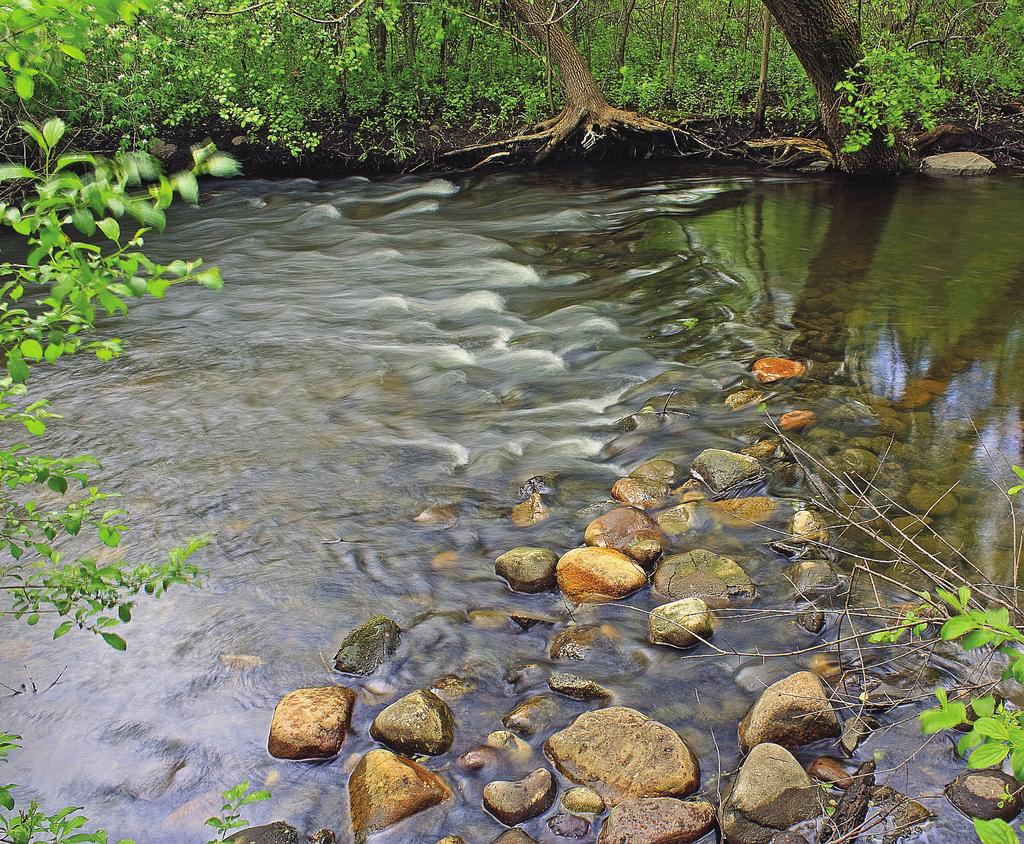
3 Overview: During the past 2.5 million years, numerous continental glaciers advanced and retreated across much of the upper Midwest, with the last melting about 10,000 years ago. All this glacial activity shaped and deposited both the topography and soil types that we see today. Geologists can determine much about the geomorphology of a glaciated landscape by the prominent features that were formed during glaciation. Wisconsin presents a variety of relatively striking glacial features that can be identified by using field studies and various combinations of online maps. Knowing how to identify glacial features from maps helps students better understand how glacial activity helped shape the region s landscape. I. Enduring Knowledge: Students will learn to appreciate the natural world through viewing glacial features. They will learn how to use the computer to find different sources and maps to gather information about glaciers. Learning Targets: 1. Students should learn basic information about glacial land features. 2. Students should learn to use websites to gather a variety of information about glaciers and glacial features. They will be able to put together a more complete picture. 3. Students will learn about drumlins, eskers, kames, and kettle moraines using this method. II. Teacher Background: A glacier forms when the amount of accumulating snow is greater than the amount that melts. This accumulation remains year round and compresses the lower layers into ice. The extreme weight of the glacier deforms the lower layers of ice similar to putty, and this characteristic, along with the pull of gravity, causes the ice to move through mountain valleys or across plains. It can change speed and at times retreat, altering the land beneath by a combination of forces. As a glacier moves, it carves away land by erosion and also sculpts and deposits new landforms. Erosion creates u-shaped valleys, fjords, and horns. Sculpting and deposition can form moraines, kettles, drumlins, and eskers. These depositional features are formed with glacial drift a material that is made up of sand, gravel, rocks, and boulders created and transported by the forces of the moving ice. Glacial melt water is a key ingredient in the creation of depositional features, and can also create rivers and lakes. 3
4 Wisconsin s geology is greatly affected by glaciations that occurred during four distinct periods. These glaciations have impacted not only the soil but also many landforms around the state. These glacial landforms can be seen in Wisconsin as far north as Eau Claire and south in Kettle Moraine Park, west of Milwaukee. There are many jobs associated with glaciers, not only geologists, map makers, and hydrologists, but also park rangers who service the many areas where glacial landforms exist. Milwaukee hiking enthusiast and lawyer Ray Zillmer provided the vision for the Ice Age Trail in the 1950 s by advocating for the protection of glacial landscapes in Wisconsin. Zillmer and countless other leaders helped develop the Ice Age Trail across Wisconsin. Students will follow instructions and use computers to work with online resources to locate a glacial area. They will then look at a topographical view with contour lines and finally, will use grey relief to see the details of glacial features. Online Resources: Free QUADS plug in Additional Online Resources: More info on drumlins Vocabulary: 1. aerial image: a view or photo from an aerial perspective 2. topography: the contours of physical features of a region 3. contour lines: lines on a map connecting points that are all at the same elevation 4. Google Earth: online map program that shows either an atlas view or satellite view 5. Quads plug in: online program that allows view of topographical map as a layer of Google Earth OR allows view of topography as a layer of Google Earth 6. grey relief: uses shading on a map to show elevation and land features 7. drumlin: long, teardrop-shaped glacial formation that runs parallel to the glacier s flow. It is unclear whether it forms from dragging sediment or from melt water movement. 8. moraine: a ridge-like landform consisting of glacial debris that is created along the edges of a glacier 9. kettle: a depression formed when glacial ice breaks off and is buried. Over time the ice melts, creating a small depression. 4
5 10. esker: long ridge of gravel deposited in a tunnel under the glacier by its melt waters 11. kame: a steep-sided mound of loose, poorly sorted sand and gravel that forms in a depression on top of the glacier and is later deposited as the ice melts 12. dell: small valley 13. foot: the bottom edge of the glacier the edge that creates the terminal moraine 14. geomorphology: the study of the physical features of the surface of the earth and how they formed or change 15. terminal moraine: a moraine deposited at the point of furthest advance of a glacier forming a ridge III. Before Viewing this Video: Ask students to list all the ways they get information on a subject. Discuss and list on board. Ask them specifically, how do you find information online? Describe an Ice Age Trail experience? What can we learn from the trail? What did you gain by going for a walk on the trail? Ask students to share anything they know about glaciers. IV. Viewing Guide: Write down all the websites needed to do the activity (see pg.4). V. Discussion Guide: In previous times, a geologist who wanted to view glacial features was limited to a map for location and a topographical map to show elevations. (Show a topographical map with contour lines, if possible.) But now anyone can use online sites to view features in a very simple and more accurate way. In a computer lab: Go over the steps and instructions from the video to view the Lebanon, WI drumlins. Demonstrate if needed: Geology of Wisconsin website (lists places and features) Google Earth aerial (download. Zoom in on glacial area be sure to pick early morning or before sunset) Topographic map Grey relief 5
6 Now students follow the same steps to explore moraines and kettle lakes at Kettle Moraine State Forest on their own. Review esker, kame, kettle moraine, moraine Have students practice locating glacial features at various sections along the Ice Age Trail Reflection: Why is the Trail important in helping protect glacial features? How can the Trail help us understand the benefit of these features and help educate others? VI. Evaluation: 1. Students must be able to demonstrate the ability to research and understand a glacial site on the Ice Age Trail using the four maps and online tools listed above, and be able to explain one of the four glacial features listed. 2. Rubric would include: a. Ability to smoothly use all sites listed (use without assistance) b. Ability to describe the feature from the maps (written from observations and using the terminology listed in the vocabulary) c. Ability to explain how a glacier created the given feature (written from information on sites) Suggestions for extended learning: 1. Go online and gather photos of land features created by glaciers. Develop a slide show to show to the class. Name and describe each feature. 2. Draw a diagram of a glacier feature, such as a drumlin, labeling the parts. 3. Take a field study to a glacier park or the Ice Age Trail and look at the various features. 4. Use the above online tools to demonstrate another geographical area of interest, like sedimentary rock layers in the Grand Canyon or volcanic structures in Yellowstone. 5. Write a letter to a political representative expressing the importance of preserving the glacial features in Wisconsin. 6. Spend a day volunteering for the Ice Age Trail Alliance. 6
7 STUDENT PROFICIENCY STANDARDS SEARCHING GLACIAL FEATURES The following Wisconsin Student Proficiency Standards can be met by teaching Searching Glacial Features: SCIENCE 1. Connections: How evidence explains phenomena 2. Inquiry: Understanding how questions direct research 3. Earth Science: Earth history & structure of Earth 4. Physical Science: Motion & Forces 5. Science Application: Interdependence of science & technology SOCIAL STUDIES A. Geography: Students in Wisconsin will learn about geography through the study of the relationships among people, places, and environments. 8 th grade: A.8.1; A.8.6 i
8 NATIONAL COMMON CORE STANDARDS SEARCHING GLACIAL FEATURES Language Arts Reading Informational Text Key Ideas and Details 8.Rit.3 Craft and Structure 8.Rit.4 Integration of Knowledge and Ideas 8.Rit.7, 8.Rit.9 Writing Production and Distribution of Writing 8.W.6 Research to Build and Present Knowledge 8.W.7, 8.W.8 Speaking and Listening Comprehension and Collaboration 8.Sl.1, 8.Sl.2 Presentation of Knowledge and Ideas 8.Sl.4, 8.Sl.5, 8.Sl.6 Language Conventions of Standard English 8.L.1 Knowledge of Language 8.L.3 Vocabulary Acquisition and Use 8.L.4, 8.L.5 ii
9 WISCONSIN TEACHER STANDARDS SEARCHING GLACIAL FEATURES Wisconsin Teacher Standards which can be met with this curriculum Standard 1: Subject matter This curriculum provides information not readily available in other forms. A teacher using this material will be well-informed about the subject matter. Standard 2: Broad range of ability This curriculum provides instruction that supports their intellectual, social, and personal development. Standard 3: Adapt instruction This curriculum provides suggestions for learners with a variety of intelligences and levels of ability. Standard 4: Instructional strategies This curriculum includes the use of technology to gain information and suggestions for using research in extending learning. Standard 5: Individual and group motivation Both prior knowledge and carefully designed group projects promote motivation for students to learn. Standard 6: Verbal and nonverbal communications Instructional media and technology that promote active learning are key parts of this curriculum. Standard 7: Organizes and plans systematic instruction This curriculum is organized to support teacher knowledge, to draw on and motivate students to engage in active learning, and promotes active inquiry, collaboration, and supportive interaction in the classroom. Standard 8: Formal and informal assessments Suggestions for a variety of assessments, both formal and informal, are offered in the curriculum. iii
MIDDLE SCHOOL CURRICULUM TR AILING ICE AGE M YST ERI E S ICE AGE TREKKING
 MIDDLE SCHOOL CURRICULUM TR AILING ICE AGE M YST ERI E S ICE AGE TREKKING CONTENTS I. Enduring Knowledge... 3 II. Teacher Background... 3 III. Before Viewing this Video... 5 IV. Viewing Guide... 5 V. Discussion
1 Glacial Erosion and
 www.ck12.org Chapter 1. Glacial Erosion and Deposition CHAPTER 1 Glacial Erosion and Deposition Lesson Objectives Discuss the different erosional features formed by alpine glaciers. Describe the processes
Teacher s Guide For. Glaciers
 Teacher s Guide For Glaciers For grade 7 - College Program produced by Centre Communications, Inc. for Ambrose Video Publishing, Inc. Executive Producer William V. Ambrose Teacher's Guide by Mark Reeder
READING QUESTIONS: Glaciers GEOL /WI 60 pts. a. Alpine Ice from larger ice masses flowing through a valley to the ocean
 READING QUESTIONS: Glaciers GEOL 131 18/WI 60 pts NAME DUE: Tuesday, March 13 Glaciers: A Part of Two Basic Cycles (p. 192-195) 1. Match each type of glacier to its description: (2 pts) a. Alpine Ice from
Please make sure that all teachers and chaperones attending the field study are aware of the following information:
 Dear Teacher, Thank you for signing up for The Ice Age at the Lost Valley Visitor Center in Glacial Park. The visitor center is located in the middle of Glacial Park. Follow the signs from the Harts Road
READING QUESTIONS: Chapter 7, Glaciers GEOL 131 Fall pts. a. Alpine Ice from larger ice masses flowing through a valley to the ocean
 READING QUESTIONS: Chapter 7, Glaciers GEOL 131 Fall 2018 63 pts NAME DUE: Tuesday, October 23 Glaciers: A Part of Two Basic Cycles (p. 192-195) 1. Match each type of glacier to its description: (2 pts)
glacier Little Ice Age continental glacier valley glacier ice cap glaciation firn glacial ice plastic flow basal slip Chapter 14
 Little Ice Age glacier valley glacier continental glacier ice cap glaciation firn glacial ice plastic flow basal slip glacial budget zone of accumulation zone of wastage glacial surge abrasion glacial
The Physical Geography of Long Island
 The Physical Geography of Long Island A Bit About Long Island Length 118 miles Brooklyn to Montauk Geo202 Spring 2012 Width 23 miles at it s widest Area 1,400 square miles Formation of Long Island River
LAB P - GLACIAL PROCESSES AND LANDSCAPES
 Introduction LAB P - GLACIAL PROCESSES AND LANDSCAPES Ice has been a significant force in modifying the surface of the earth at numerous times throughout Earth s history. Though more important during the
Recrystallization of snow to form LARGE. called FIRN: like packed snowballs. the weight of overlying firn and snow.
 Chapter 11 Glaciers BFRB P. 103-104, 104, 108, 117-120120 Process of Glacier Formation Snow does NOT melt in summer Recrystallization of snow to form LARGE crystals of ice (rough and granular) called
Lesson. Glaciers Carve the Land A QUICK LOOK. Overview. Big Idea. Process Skills Key Notes
 EARTH S CHANGING SURFACE CLUSTER 2 HOW THE EARTH S SURFACE CHANGES Lesson 62 Glaciers Carve the Land A QUICK LOOK Big Idea Moving water, ice, and wind break down rock, transport materials, and build up
12: MELTWATER LANDFORM IDENTIFICATION
 Glacial Geology 12. Meltwater Landform Identification 12: MELTWATER LANDFORM IDENTIFICATION 60 Points Objective: learn how to identify meltwater landforms and their characteristics in photos and on topographic
GLACIATION. The Last Ice Age (see Chapter 12) and. Pleistocene Ice Cap. Glacial Dynamics 10/2/2012. Laurentide Ice Sheet over NYS
 and. Pleistocene Ice Cap. Glacial Dynamics 10/2/2012. Laurentide Ice Sheet over NYS") GLACIATION and New York State Prof. Anthony Grande The Last Ice Age (see Chapter 1) The Pleistocene Epoch began 1.6 mya. During this time, climates grew colder. There were numerous ice ages starting 100,000000
GLACIATION and New York State Prof. Anthony Grande The Last Ice Age (see Chapter 1) The Pleistocene Epoch began 1.6 mya. During this time, climates grew colder. There were numerous ice ages starting 100,000000
Glaciers. Chapter 17
 Glaciers Chapter 17 Vocabulary 1. Glacier 2. Snowfield 3. Firn 4. Alpine glacier 5. Continental glacier 6. Basal slip 7. Internal plastic flow 8. Crevasses 9. Glacial grooves 10. Ice shelves 11. Icebergs
Great Science Adventures
 Great Science Adventures Lesson 18 How do glaciers affect the land? Lithosphere Concepts: There are two kinds of glaciers: valley glaciers which form in high mountain valleys, and continental glaciers
Glacial Origins and Features of Long Island
 Glacial Origins and Features of Long Island Interior Coastal Plain Continental Shelf Long Island s Geology 0 Ma Phanerozoic 540 Ma Proterozoic 2500 Ma Archean 3800 Ma Hadean 4600 Ma C M P Geologic Time
Glaciers Earth 9th Edition Chapter 18 Mass wasting: summary in haiku form Glaciers Glaciers Glaciers Glaciers Formation of glacial ice
 1 2 3 4 5 6 7 8 9 10 11 12 13 14 15 Earth 9 th Edition Chapter 18 Mass wasting: summary in haiku form Ten thousand years thence big glaciers began to melt - called "global warming." are parts of two basic
PHYSICAL GEOGRAPHY GEOGRAPHY EARTH SYSTEMS COASTAL SYSTEMS FLUVIAL SYSTEMS
 PHYSICAL GEOGRAPHY EARTH SYSTEMS FLUVIAL SYSTEMS COASTAL SYSTEMS PHYSICAL GEOGRAPHY CORRIES / CIRQUES A Corrie or Cirque is the armchair shaped hollow that was the birthplace of a glacier. It has steep,
Gifts of the Glaciers
 Gifts of the Glaciers Gifts of the Glaciers Moving ice of glacier was responsible for water, landforms, and soil characteristics and patterns of today Sculpturing of bedrock materials Glacial Landforms
glacial drift: all deposits associated with glaciation; covers 8% of Earth s surface above sealevel, and 25% of North America
 Glacial depositional features glacial drift: all deposits associated with glaciation; covers 8% of Earth s surface above sealevel, and 25% of North America i) nonstratified drift till: transported & deposited
Glaciers and Glaciation Earth - Chapter 18 Stan Hatfield Southwestern Illinois College
 Glaciers and Glaciation Earth - Chapter 18 Stan Hatfield Southwestern Illinois College Glaciers Glaciers are parts of two basic cycles: 1. Hydrologic cycle 2. Rock cycle A glacier is a thick mass of ice
Glaciers. Glacier Dynamics. Glacier Dynamics. Glaciers and Glaciation. Types of Glaciers. Chapter 15
 Chapter 15 Glaciers and Glaciation Glaciers A glacier is a large, permanent (nonseasonal) mass of ice that is formed on land and moves under the force of gravity. Glaciers may form anywhere that snow accumulation
1.4 Understand how moving ice acts as an agent of erosion and deposition. (Chap. 2)
") 1.4 Understand how moving ice acts as an agent of erosion and deposition. (Chap. 2) There are two types of glaciation. Alpine Glaciation Continental Glaciation Distinguish between the terms alpine glaciation
1.4 Understand how moving ice acts as an agent of erosion and deposition. (Chap. 2) There are two types of glaciation. Alpine Glaciation Continental Glaciation Distinguish between the terms alpine glaciation
Shaping of North America. Physical Geography II of the United States and Canada. The Last Ice Age. The Ice Age. Pleistocene Polar Ice Cap 2/14/2013
 Physical Geography II of the United States and Canada Prof. Anthony Grande AFG 2012 Shaping of North America The chief shaper of the landscape of North America is and has been running water. Glaciation
ENVI2030L - ALPINE AND CONTINENTAL GLACIATION
 NAME ENVI2030L - ALPINE AND CONTINENTAL GLACIATION I. Introduction Glaciers are slowly moving ice sheets. They are very effective erosional agents and can drastically modify the landscapes over which they
Oak Ridges Moraine: Southern Ontario's Sponge
 Oak Ridges Moraine: Southern Ontario's Sponge Lesson Overview Students will examine the location and the importance of the Oak Ridges Moraine and investigate ongoing conflicts concerning its development.
Dynamic Planet Practice Test Written by Samuel Bressler
 Dynamic Planet Practice Test 2013 Written by Samuel Bressler Part 1: Multiple Choice 1. Which of the following is NOT related to alpine glaciation? a) Serac b) Kame c) Col d) Paternoster Lake 2. The common
Chapter 16 Glaciers and Glaciations
 Chapter 16 Glaciers and Glaciations Name: Page 419-454 (2nd Ed.) ; Page 406-439 (1st Ed.) Part A: Anticipation Guide: Please read through these statements before reading and mark them as true or false.
Glaciers. Glacier Dynamics. Glaciers and Glaciation. East Greenland. Types of Glaciers. Chapter 16
 Chapter 16 Glaciers A glacier is a large, permanent (nonseasonal) mass of ice that is formed on land and moves under the force of gravity. Glaciers may form anywhere that snow accumulation exceeds seasonal
Dynamic Planet: Glaciers
 Team Name+Number Teammate 1 name Teammate 2 name Dynamic Planet: Glaciers (by Shad160) The following test is 80 questions long, split up into four different sections. The first 20 questions are worth 40
2. (1pt) From an aircraft, how can you tell the difference between a snowfield and a snow-covered glacier?
 From an aircraft, how can you tell the difference between a snowfield and a snow-covered glacier?") 1 GLACIERS 1. (2pts) Define a glacier: 2. (1pt) From an aircraft, how can you tell the difference between a snowfield and a snow-covered glacier? 3. (2pts) What is the relative size of Antarctica, Greenland,
1 GLACIERS 1. (2pts) Define a glacier: 2. (1pt) From an aircraft, how can you tell the difference between a snowfield and a snow-covered glacier? 3. (2pts) What is the relative size of Antarctica, Greenland,
NYS Invitational Science Olympiad April 2005 DYNAMIC PLANET: GLACIERS
 NYS Invitational Science Olympiad April 2005 School Team # DYNAMIC PLANET: GLACIERS 1. What type of glacier is shown in the photo? 2. a. What is the name of the feature labeled A? b. How did feature A
Glaciers. Reading Practice
 Reading Practice A Glaciers Besides the earth s oceans, glacier ice is the largest source of water on earth. A glacier is a massive stream or sheet of ice that moves underneath itself under the influence
Did It. naturalists. Young. Moving and melting ice shaped many of Minnesota s land features. 30 Minnesota Conservation Volunteer
 Young naturalists by Mary Hoff Photography by Gary Alan Nelson T he Glacier Did It Moving and melting ice shaped many of Minnesota s land features. Shut your eyes. Imagine that it s a sunny summer day
Red Tarn, Lake District They are all features of glacial erosion
 Ribbon Lake Lake Windermere, Lake District Arete Striding Edge, Lake District 1 2 3 Pyramidal Peak Corrie & Tarn 4 Matterhorn, Switzerland Red Tarn, Lake District They are all features of glacial erosion
Glacial Geomorphology Exercise
 James Madison University Field Course in western Ireland Glacial Geomorphology Exercise 3-day road log (abbreviated) Striations Large kame terrace Cirque with moraines Kame delta Striations Eskers Raised
Glaciers. Clicker Question. Glaciers and Glaciation. How familiar are you with glaciers? West Greenland. Types of Glaciers.
 Chapter 21 Glaciers A glacier is a large, permanent (nonseasonal) mass of ice that is formed on land and moves under the force of gravity. Glaciers may form anywhere that snow accumulation exceeds seasonal
Alpine Glacial Features along the Chimney Pond Trail, Baxter State Park, Maine
 Maine Geologic Facts and Localities September, 2009 Alpine Glacial Features along the Chimney Pond Trail, Baxter State Park, Maine 45 54 57.98 N, 68 54 41.48 W Text by Robert A. Johnston, Department of
I. Types of Glaciers 11/22/2011. I. Types of Glaciers. Glaciers and Glaciation. Chapter 11 Temp. B. Types of glaciers
 Why should I care about glaciers? Look closely at this graph to understand why we should care? and Glaciation Chapter 11 Temp I. Types of A. Glacier a thick mass of ice that originates on land from the
Chapter 14. Glaciers and Glaciation
 Chapter 14 Glaciers and Glaciation Introduction Pleistocene Glaciations: A series of "ice ages" and warmer intervals that occurred 2.6 million to 10,000 years ago. The Little Ice Age was a time of colder
GC 225 Lecture Exam #2
 GC 225 Lecture Exam #2 Direction- path along which something is moving. 3 Types; - COMPASS DIRECTIONAL NAME (32 in total) - BEARING (four 0 o - 90 o ) - AZIMUTHS (0 o - 360 o ) Compass (32 named points)
INVESTIGATING THE GRANDE ECORE & RED RIVER: A HANDS- ON INQUIRY
 INVESTIGATING THE GRANDE ECORE & RED RIVER: A HANDS- ON INQUIRY Paul Nagel, PhD Coordinator, Louisiana Geography Education Alliance Jacqueline L. Mason, Ed.D Assistant Professor, Science Education Northwestern
The Northeast: America's Gateway to the World
 The Northeast: America's Gateway to the World Living in the Shadow of the Ice a lesson on the impact of glaciation on Northeast landscapes INTRODUCTION: The region we call the Northeast has a very long
Landscapes in the UK: Glaciation 1. Extent of ice cover across the UK during the last ice age.
 Landscapes in the UK: Glaciation 1. Extent of ice cover across the UK during the last ice age. Key idea: Ice was a powerful force in shaping the landscape of the UK. In the past the climate has got colder
Mearns Castle High School. Geography Department. Glaciated Landscapes
 Mearns Castle High School Geography Department Glaciated Landscapes Lesson One: Location of Glaciated Uplands in the British Isles The Ice Age in Britain began about 1,000,000 years ago and lasted until
Geologic Trips, Sierra Nevada
 ISBN 0-9661316-5-7 GeoPress Excerpt from Geologic Trips, Sierra Nevada by Ted Konigsmark All rights reserved. No part of this book may be reproduced without written permission, except for critical articles
Lidar Imagery Reveals Maine's Land Surface in Unprecedented Detail
 Maine Geologic Facts and Localities December, 2011 Lidar Imagery Reveals Maine's Land Surface in Unprecedented Detail Text by Woodrow Thompson, Department of Agriculture, Conservation & Forestry 1 Introduction
Glaciers. Valley or Alpine glaciers. Ice sheets. Piedmont - foot of the mountain glaciers. Form in mountainous areas Move downslope in valleys
 Glaciers & Ice Ages Glaciers Valley or Alpine glaciers Form in mountainous areas Move downslope in valleys Ice sheets Move outward from center Continental glaciers - large scale, ice age type. Presently
Rationale or Purpose: This lesson will demonstrate several properties of water and bring awareness of what global warming may do to the sea level.
 Title: Glaciers and Icebergs Grade Level: 5th Objectives: Students will be able to: Identify the differences and similarities between a glacier and an iceberg; Recall the density of water and ice; Observe
A trip to Steindalen. - geology and landscape on the way to the glacier. Geoffrey D. Corner
 A TRIP TO STEINDALEN Excursion guide Please take this with you on your trip, but don t leave it behind as litter. A trip to Steindalen - geology and landscape on the way to the glacier A part of Geologiskolen,
Glaciers and Glaciation
 Chapter 18 Lecture Earth: An Introduction to Physical Geology Eleventh Edition Glaciers and Glaciation Tarbuck and Lutgens Glaciers: A Part of Two Basic Cycles A glacier is a thick mass of ice that forms,
Landscapes in the UK: Glaciation 1. Extent of ice cover across the UK during the last ice age.
 Landscapes in the UK: Glaciation 1. Extent of ice cover across the UK during the last ice age. Key idea: Ice was a powerful force in shaping the landscape of the UK. As the climate has changed in the past,
INTERPRETING TOPOGRAPHIC MAPS (MODIFIED FOR ADEED)
") INTERPRETING TOPOGRAPHIC MAPS (MODIFIED FOR ADEED) Science Concept: Topographic maps give information about the forces that shape the features of Earth. Objectives: The student will: identify land features
INTERPRETING TOPOGRAPHIC MAPS (MODIFIED FOR ADEED) Science Concept: Topographic maps give information about the forces that shape the features of Earth. Objectives: The student will: identify land features
THE DEPARTMENT OF HIGHER EDUCATION UNIVERSITY OF COMPUTER STUDIES FIFTH YEAR
 THE DEPARTMENT OF HIGHER EDUCATION UNIVERSITY OF COMPUTER STUDIES FIFTH YEAR (B.C.Sc./B.C.Tech.) RE- EXAMINATION SEPTEMBER 2018 Answer all questions. ENGLISH Time allowed: 3 hours QUESTION I Glaciers A
Geomorphology. Glacial Flow and Reconstruction
 Geomorphology Glacial Flow and Reconstruction We will use simple mathematical models to understand ice dynamics, recreate a profile of the Laurentide ice sheet, and determine the climate change of the
Lesson 5: Ice in Action
 Everest Education Expedition Curriculum Lesson 5: Ice in Action Created by Montana State University Extended University and Montana NSF EPSCoR http://www.montana.edu/everest Lesson Overview: Explore glaciers
Identification and Classification of Kettle Chains Using 2 meter Digital Elevation Model of Long Island! -Sean Tvelia-!
 Identification and Classification of Kettle Chains Using 2 meter Digital Elevation Model of Long Island -Sean Tvelia- Recently released 2.0 meter Digital Elevation Models (DEMs) of the central and eastern
47I THE LAS ANIMAS GLACIER.
 THE LAS ANIMAS GLACIER. ONE of the largest of the extinct glaciers of the Rocky Mountains was that which occupied the valley of the Las Animas river. This stream originates in the San Juan mountains in
c. 1 inch = 0.6 miles e. 1:100,000 f. 1:250,000 f. 1 inch = 4.0 miles
 High School Advance Geology Map Test 2014 Name Use the information on each map to provide the best answer to the questions. Fill in the bubble of the best answer on your answer sheet. Answer questions
How Glaciers Change the World By ReadWorks
 How Glaciers Change the World How Glaciers Change the World By ReadWorks Glaciers are large masses of ice that can be found in either the oceans or on land. These large bodies of frozen water have big
Name Team Number. 1. The famous question: What percent of Earth's surface is covered by glaciers? A) 5% D) neve
 5% D) neve") Part I: Multiple Choice (30pts) Directions: Please choose the best answer for each question. There is only one correct answer for each question unless otherwise stated. There are 30 questions. Each one
Part I: Multiple Choice (30pts) Directions: Please choose the best answer for each question. There is only one correct answer for each question unless otherwise stated. There are 30 questions. Each one
Chapter 17. Glacial & Periglacial Landscapes
 Chapter 17 Glacial & Periglacial Landscapes Cryosphere Cryosphere - the portions of Earth's surface where water is in solid form, including sea ice, lake ice, river ice, snow cover, glaciers, ice caps,
STANDARDS MAP Basic Programs 1 and 2 English Language Arts Content Standards Grade Five
 : Pearson Program Title: Pearson California and Pearson California Components: : Teacher s Edition (TE), Student Edition (SE), Practice Book (PB); : Teacher s Edition (TE), Student Edition (SE), Transparencies
Pterosaur Glider Experiment
 Your web browser (Safari 7) is out of date. For more security, comfort and Activityengage the best experience on this site: Update your browser Ignore Pterosaur Glider Experiment How might having a head
Dynamic Planet C Test
 Northern Regional: January 19 th, 2019 Dynamic Planet C Test Name(s): Team Name: School Name: Team Number: Rank: Score: Dynamic Planet B/C Glaciers (87 total points) Multiple choice/fill in the blank (23
Making glacial connections
 Student task A 1. Cut and arrange the cards below to make four sets of four connections: Four connections Matterhorn drumlin lateral U-shaped valley outwash plain truncated spur Lauterbrunnen ground medial
GEOMORPHOLOGY EXAM #3
 Formation of Glaciers GEOMORPHOLOGY EXAM #3 - Transformation of snow into glacial ice - Density; SNOW = 0.07 0.18 g/cc FIRN(Neve) = 0.4 0.8 g/cc (Pellets) GLACIAL ICE = 0.8 0.9 g/cc - Firn / Ice Boundary
AGAP Antarctic Research Project Visualizing Data Learning About Antarctica From RADAR Data? Student Version
 AGAP Antarctic Research Project Visualizing Data Learning About Antarctica From RADAR Data? Student Version Name Date Image of Subglacial Lake network courtesy of NSF Ice Sheet: A large glacier that covers
Mapping the Snout. Subjects. Skills. Materials
 Subjects Mapping the Snout science math physical education Skills measuring cooperative action inferring map reading data interpretation questioning Materials - rulers - Mapping the Snout outline map and
Andra Beames Sawgrass Springs Middle School West Sample Road Coral Springs, FL
 Andra Beames Sawgrass Springs Middle School 12500 West Sample Road Coral Springs, FL 33065 754.322.4500 andra.beames@browardschools.com Let s Take A Hike For information concerning IMPACT II opportunities
Kindergarten Science Unit C: Earth Science Chapter 5: Our Land, Air, and Water Lesson 1: What makes up the Earth?
 Insert Photo or Graphic for Unit or Lesson Theme Kindergarten Science Unit C: Earth Science Chapter 5: Our Land, Air, and Water Lesson 1: What makes up the Earth? Insert Photo/Graphic Earth Insert Photo/Graphic
Geography 120, Instructor: Chaddock In Class 13: Glaciers and Icecaps Name: Fill in the correct terms for these descriptions: Ablation zone: n zne:
 Geography 120, Instructor: Chaddock In Class 13: Glaciers and Icecaps Name: Fill in the correct terms for these descriptions: Ablation zone: The area of a glacier where mass is lost through melting or
Mighty Glaciers. Mighty Glaciers. Visit for thousands of books and materials.
 Mighty Glaciers A Reading A Z Level M Leveled Reader Word Count: 684 LEVELED READER M Mighty Glaciers Written by Ned Jensen Visit www.readinga-z.com for thousands of books and materials. www.readinga-z.com
E arth s climate strongly influences
 Section 7.1 7.1 Glaciers 1 FOCUS Section Objectives 7.1 Describe the different types of glaciers and where each type is found. 7.2 Explain how glaciers move and describe the different types of glacial
Doral Academy of Northern Nevada. Arts Integration Education
 Doral Academy of Northern Nevada Arts Integration Education Doral Academy of Northern Nevada: Board Members Danielle Cherry Board Chair Steve Porter Board Vice Chair Phil Zive Board Treasurer Pat Hickey
KS3 KIDZANIA POST-VISIT LEARNING RESOURCES KIDZANIA POST-VISIT LESSON PLAN
 KS3 KIDZANIA POST-VISIT LEARNING RESOURCES KIDZANIA POST-VISIT LESSON PLAN KS3 KIDZANIA POST-VISIT LESSON PLAN ThIs lesson should be completed in the classroom after you visit KidZania. LEARNING OBJECTIVES
Study Questions. to The Glacier Did It. naturalists. Young
 Young naturalists Study Questions to The Glacier Did It Study and learn facts and ideas based on this Young Naturalists nonfiction story in Minnesota Conservation Volunteer, November December 2017, www.mndnr.gov/mcvmagazine.
Glaciers Earth Chapter 18 Chapter 18 Glaciers & Glaciation Glaciers: A Part of Two Basic Cycles Glaciers: A Part of Two Basic Cycles Valley Glacier
 1 2 3 4 5 6 7 8 9 10 11 12 Glaciers Earth Chapter 18 Chapter 18 Glaciers & Glaciation A glacier is a thick mass of ice that forms, over hundreds and thousands of years, by the accumulation, compaction,
Physical Geography: Learning and teaching in a discipline so dynamic that textbooks can t keep up!
 MATTERS Physical Geography: Learning and teaching in a discipline so dynamic that textbooks can t keep up! PETER G. KNIGHT ABSTRACT: Physical geography is a dynamic discipline. This makes geography exciting,
Mackinnon Esker Ecological Reserve Draft - Management Plan
 Mackinnon Esker Ecological Reserve Draft - Management Plan May 2011 Photo Credit: This document replaces the direction provided in the Carp Lake Provincial Park and Protected Area and Mackinnon Esker Ecological
306 Ice Age Trail Guidebook : 200,000 compilation scale. February 3, Marsh. Glenbeulah. Greenbush. Sheboygan. Parnell. Segment.
 G MANITOWOC Existing Ice Age Trail, subject to change as it evolves toward completion FOND DU LAC Other Trail Unofficial Connecting Route (unmarked) County Boundary ublic or IATA Land Miles 0 1 2 3 4 Marsh
What would you say was the extend of the ice cover? 100%? 50%? A third? 2/3?
 This map shows the maximum extent of ice cover during the last ice age, 20,000 years ago. What would you say was the extend of the ice cover? 100%? 50%? A third? 2/3? KEY IDEAS & QUESTIONS What is a glacier?
Q: What is a period of time whereby the average global temperature has decreased? Q: What is a glacier?
 Q: What is a glacier? A: A large sheet of ice which lasts all year round. Q: What is a period of time whereby the average global temperature has decreased? A: A glacial. Q: What is an interglacial? Q:
ESS Glaciers and Global Change
 ESS 203 - Glaciers and Global Change Friday January 5, 2018 Outline for today Please turn in writing assignment and questionnaires. (Folders going around) Questions about class outline and objectives?
The Potentially Dangerous Glacial Lakes
 Chapter 11 The Potentially Dangerous Glacial Lakes On the basis of actively retreating glaciers and other criteria, the potentially dangerous glacial lakes were identified using the spatial and attribute
Please DO NOT start here without completing the other four stations...
 Please DO NOT start here without completing the other four stations... Exit Station: Pioneers & The Oregon Trail Once pioneers...began immigrating [on the Oregon Trail], it was almost inevitable that the
Exemplar for Internal Achievement Standard Geography Level 1. Conduct geographic research, with direction
 Exemplar for internal assessment resource Geography for Achievement Standard 91011 Exemplar for Internal Achievement Standard Geography Level 1 This exemplar supports assessment against: Achievement Standard
Glaciers and Periglaciers
 Glaciers and Periglaciers Chapter 9, page 132 Glaciation!1836 Louis Agassiz theorized that parts of Europe and North America were covered by huge ice sheets.!known as the Pleistocene Ice Ages Why do we
Zip Line Classroom Activity
 Zip Line Classroom Activity The Classroom Activity introduces students to the context of a performance task, so they are not disadvantaged in demonstrating the skills the task intends to assess. Contextual
NEW OBSERVATIONS ON THE GLACIAL GEOMORPHOLOGY OF LONG ISLAND FROM A DIGITAL ELEVATION MODEL (DEM) Bennington, J Bret,
 Bennington, J Bret,") 1 NEW OBSERVATIONS ON THE GLACIAL GEOMORPHOLOGY OF LONG ISLAND FROM A DIGITAL ELEVATION MODEL (DEM) Abstract Bennington, J Bret, geojbb@hofstra.edu Department of Geology 114 Hofstra University, Hempstead,
1 NEW OBSERVATIONS ON THE GLACIAL GEOMORPHOLOGY OF LONG ISLAND FROM A DIGITAL ELEVATION MODEL (DEM) Abstract Bennington, J Bret, geojbb@hofstra.edu Department of Geology 114 Hofstra University, Hempstead,
Exam Review. Part 3- Deserts, Glaciers, and maps
 Exam Review Part 3- Deserts, Glaciers, and maps What causes a desert? Lots of sand Vegetation holds the arms Star Dunes- Star dunes form only in places where wind blows from varied directions over the
Milwaukee River (Washington County) Segment. Kewaskum. Æÿ B. Æÿ D Southern. Kewaskum. Segment.
 Segment. Kewaskum. Æÿ B. Æÿ D Southern. Kewaskum. Segment.") Ice Age Trail Washington County Washington County FOND DU LAC WASHINGTON Æ% 28 Æÿ H Milwaukee River (Washington County) Æÿ B Æÿ S State Forest Northern Kettle Moraine Æÿ H Æ% 28 Ice Age Trail Alliance
Ice Age Trail Washington County Washington County FOND DU LAC WASHINGTON Æ% 28 Æÿ H Milwaukee River (Washington County) Æÿ B Æÿ S State Forest Northern Kettle Moraine Æÿ H Æ% 28 Ice Age Trail Alliance
Ancient Greece. Written by: Marci Haines. Sample file. Rainbow Horizons Publishing Inc. ISBN-13:
 Ancient Greece Written by: Marci Haines Rainbow Horizons Publishing Inc. Tel: 1-800-663-3609 Fax: 1-800-663-3608 Email: service@rainbowhorizons.com www.rainbowhorizons.com ISBN-13: 978-1-55319-085-1 Copyright
THE INFLUENCE OF DEBRIS ON THE FLOW OF GLACIERS.
 THE INFLUENCE OF DEBRIS ON THE FLOW OF GLACIERS. THE behavior of ice under various conditions is frequently illustrated by experiments with pitch or other similar viscous fluids or plastic solids. If sand
Geoscape Toronto The Oak Ridges Moraine Activity 2 - Page 1 of 10 Information Bulletin
 About 13,000 years ago as the Laurentide Ice Sheet melted, glacial meltwater accumulated between the ice sheet and the Niagara Escarpment. This formed a lake basin into which gravel and sand were deposited.
Tuesday 19 May 2015 Afternoon
 Oxford Cambridge and RSA F Tuesday 19 May 2015 Afternoon GCSE GEOGRAPHY A A731/01 Contemporary Themes in Geography (Foundation Tier) *2789690473* Candidates answer on the Question Paper. OCR supplied materials:
Aboriginal and Torres Strait Islander education ACARA syllabuses and new opportunities
 Aboriginal and Torres Strait Islander education ACARA syllabuses and new opportunities Shirley Gilbert University of Western Sydney Hawkesbury Discovery Centre UWS Hawkesbury campus 13 th November 2014
Exam Review. Part 3- Deserts, Glaciers, and maps
 Exam Review Part 3- Deserts, Glaciers, and maps What causes a desert? Lots of sand Vegetation holds the arms Star Dunes- Star dunes form only in places where wind blows from varied directions over the
Descent into the Ice PROGRAM OVERVIEW
 PROGRAM OVERVIEW NOVA follows glaciologists into the underworld of Mont Blanc, where they search for internal lakes. The program: revisits the 1892 disaster in which a hidden lake burst forth from a glacier
Topo Map Explorer. Adapted from: An original Creek Connections activity. Creek Connections, Box E, Allegheny College, Meadville, Pennsylvania, 16335
 Topo Map Explorer Adapted from: An original Creek Connections activity. Creek Connections, Box E, Allegheny College, Meadville, Pennsylvania, 16335 Review of major topographic map concepts Grade Level: