Kiribati I INTRODUCTION
|
|
|
- Agatha Walters
- 5 years ago
- Views:
Transcription

1 Kiribati Page 1 Kiribati I INTRODUCTION Kiribati, independent republic within the Commonwealth of Nations, located in the central Pacific Ocean, about 4,000 km (about 2,500 mi) southwest of Hawaii. It is part of the division of the Pacific islands that is known as Micronesia. Kiribati consists of 33 coral islands divided among three island groups: the Gilbert Islands, the Phoenix Islands, and the Line Islands. All of the islands are atolls (ring-shaped islands with central lagoons) except for the island of Banaba in the Gilbert Islands. Of the 33 islands of Kiribati, 21 are inhabited. Most of the population is concentrated in the Gilbert Islands. Only one of the Phoenix Islands and three of the Line Islands are permanently inhabited. The capital of Kiribati is Tarawa, an atoll in the Gilbert Islands. Bairiki, an islet of Tarawa, serves as an administrative center. Microsoft Corporation. All Rights Reserved./(p) 1992 Microsoft Corporation. All rights reserved. Kiribati Flag and Anthem Between 1892 and 1900 the British government made the Gilbert Islands a British protectorate. In 1916 the islands gave up their nominal sovereignty and became part of the Gilbert and Ellice Islands colony. The Phoenix and Line islands eventually joined the colony, and the Ellice Islands (now Tuvalu) seceded. In 1979 the colony became the independent republic of Kiribati. II LAND AND RESOURCES
2 Kiribati Page 2 Microsoft Corporation. All Rights Reserved. Detailed Map of Kiribati Kiribati has a total land area of 811 sq km (313 sq mi). The islands extend about 3,900 km (about 2,400 mi) from east to west. From north to south they extend about 2,100 km (about 1,300 mi), straddling the equator. Kiritimati (also called Christmas Island), one of the Line Islands, occupies 609 sq km (235 sq mi) and has the largest land area of any atoll in the world. Kiribati s exclusive economic zone (area of the ocean in which it controls fishing and other rights) covers more than 3 million sq km (more than 1 million sq mi). Kiribati s sandy infertile soils limit vegetation. Primary plant species include coconut palm, screw pine (Pandanus), and arrowroot. Rain collected in catchment systems is the primary source of fresh water. Marine life thrives in the waters surrounding Kiribati. The islands are home to numerous varieties of insects. Other animal life consists primarily of species introduced by humans. Kiribati has a warm, humid climate, with average temperatures in the upper 20 sc (lower 80 sf). Annual rainfall, most of which falls between October and March, varies from about 3,050 mm (about 120 in) in the northern islands to one-third that amount or less in the southern islands. The southern islands experience frequent droughts. Kiribati lies outside of cyclone zones, and violent storms are infrequent.
3 Kiribati Page 3 With the exception of Banaba, a raised coral island with a maximum elevation of 81 m (266 ft), the islands of Kiribati are low-lying atolls that seldom rise more than 4 m (13 ft) above sea level. These atolls would be especially susceptible to flooding or even submersion if the ocean level were to rise. For this reason, Kiribati and other South Pacific nations have expressed concern about global warming, which could cause sea levels to rise. Kiribati is almost entirely surrounded by coral reefs, an important tourism and fishing resource. Marine fishing has increased significantly since 1980, however, and the reefs have been damaged by the fishing industry. Access to safe water and sanitation is good in urban areas, where about one-third of the population resides. Drought is a persistent problem. III THE PEOPLE OF KIRIBATI The population of Kiribati was estimated at 94,149 in 2001, giving the country a population density of 116 persons per sq km (301 per sq mi). The overwhelming majority of the people are of Micronesian descent and are known as I-Kiribati. There are also very small minorities of Polynesians and non- Pacific Islanders. English is the official language of Kiribati, and many I-Kiribati speak it in addition to their native language, Gilbertese, an Austronesian language. Christianity predominates in Kiribati: about half of the population is Roman Catholic, and about 40 percent is Protestant. There are also small groups of Seventh-day Adventists, Baha is, and Mormons. About one-third of Kiribati s people live on Tarawa, especially in and around the administrative center of Bairiki. Others live in small rural villages scattered among the outer islands. Through resettlement programs designed to alleviate overcrowding on Tarawa, about 1,500 people were moved to the Teraina and Tabuaeran atolls in the Line Islands between 1988 and Another program of resettlement to the Phoenix Islands was initiated in Most of the former residents of Banaba were relocated to Rabi Island (part of Fiji) in the late 1940s due to environmental degradation resulting from phosphate mining on Banaba. Banabans living on Rabi are citizens of Fiji (an island nation officially named Fiji Islands), but they retain land rights on Banaba and they have a representative in the Kiribati legislature.

4 Kiribati Page 4 Caroline Penn/Corbis Housing in Kiribati Many people in Kiribati live in houses made from wood, bamboo, palm fronds, and other materials that can be found on the islands. Education in Kiribati is free and compulsory between the ages of 6 and 15. The government operates primary and secondary schools, and churches run some secondary schools as well. Since 1973 Tarawa has had an extension of the University of the South Pacific. Other institutions of higher learning include the Tarawa Technical Institute, which offers technical and vocational courses; a maritime training school, which prepares students for careers at sea; and a teacher training college. Most I-Kiribati live in extended families, especially in rural areas outside of Tarawa. People in these communities are involved primarily in subsistence activities and live in traditional houses made of local materials, such as wood and coconut leaves. In contrast, life in South Tarawa shows more Western influences. There, people tend to live in smaller kin groups, and modern forms of housing have become more common. The diet of urban dwellers is increasingly dependent upon imported foods. Most islanders wear casual, Western-style clothing. Men typically wear shorts and T-shirts, while women often wear loose dresses. Social life in Kiribati is centered largely around the church. Popular recreational activities include martial arts, soccer, volleyball, and canoe racing. IV ECONOMY The economy of Kiribati is based mainly on subsistence activities. The gross domestic product (GDP) was $48 million in 1999, or $550 per person. In 1986 the United Nations classified Kiribati as one of the world s least developed countries.
5 Kiribati Page 5 The majority of Kiribati s workforce is engaged in subsistence agriculture and fishing. In addition to the prevalent coconut and other palm products, agricultural crops include bananas, breadfruit, papayas, taro, and some citrus fruits. Because the northern Gilbert Islands receive more rainfall, they support the greatest variety of crops. Pigs and chickens are also raised in Kiribati, primarily for local consumption. Fish and other seafood are abundant in the waters surrounding the islands. In the early 1990s about one-third of Kiribati s workforce was employed as wage earners. The government is the largest employer, and most jobs are on Tarawa. Other workers are employed on overseas ships or work in the phosphate industry on nearby Nauru. Remittances from these overseas workers are vital to Kiribati s economy. The government also collects substantial revenues from the sale of licenses to foreign fishing vessels. During the period when Kiribati was controlled by the British government ( ), phosphate mining on Banaba was the primary source of revenue for the islands. Deposits were quickly depleted, however, and mining operations ceased in Kiribati has maintained a trust fund established with revenues from phosphate mining, which is used to help offset government expenditures. However, with the loss of the phosphate industry, Kiribati has remained heavily dependent on economic aid, mainly from Japan, the European Union (EU), and Australia. Kiribati s only major exports are copra (dried coconut meat), cultivated seaweed, and fish. The United States, Australia, and New Zealand are the leading purchasers of the country s exports. Despite the cultivation of crops for local consumption, Kiribati is heavily dependent upon imported foods. Other imports include machinery and equipment, manufactured goods, and imported fossil fuels, which supply most of the country s energy. Australia, the Fiji Islands, Japan, New Zealand, and the United States are the chief suppliers of imports. The value of imports to Kiribati far outweighs the value of its exports. The country s official currency is the Australian dollar (1.55 Australian dollars equal U.S.$1; 1999). Kiribati s international airport is on Tarawa. Air Tungaru, which is Kiribati s national airline, and Air Nauru, the airline of the Marshall Islands, connect Kiribati with Fiji, the Marshall Islands, and Hawaii. All of the Gilbert Islands have airstrips for small planes, as do many of the inhabited atolls. Kiribati s main port is located at Betio, an islet of Tarawa. Banaba and Kiritimati also have significant ports. The Pacific Forum Line provides international shipping services, while Kiribati Shipping Corporation services the outer islands. Paved roads and bridges connect the main islets of Tarawa. Outside of Tarawa, many of the larger islands have unpaved roads. People travel between islands by canoes and other boats. The government of Kiribati runs an AM radio station. It also publishes a weekly newspaper, Te Uekera, which is written in Gilbertese; top news stories are also printed in English. V GOVERNMENT The government of Kiribati is modeled on the British parliamentary system. The president, called the Beretitenti, is both chief of state and head of government. All Kiribati citizens age 18 and older are eligible to vote. Voters elect the president from a choice of three or four candidates, who are nominated by the legislature from among its members. The president, who may serve as many as three consecutive four-year terms, appoints the vice president and a cabinet of up to eight members from the legislature.

6 Kiribati Page 6 Kiribati has a 41-member unicameral (single-chamber) legislature called the Maneaba ni Maungatabu (House of Assembly). Thirty-nine of its members are chosen by popular vote and serve for four-year terms. The attorney general and a representative nominated to represent Banaban people living on the island of Rabi in Fiji are also members of the legislature. The judicial system of Kiribati is modeled after the British legal system and consists of a high court, a court of appeal, and lower-level magistrate courts. The president appoints the chief justice of the high court with the advice of the cabinet. The chief justice then advises the president in appointing the other justices. Permanently inhabited atolls have local governing councils, which are particularly important due to the remoteness of some of the islands from the country s capital. Council members are elected to threeyear terms. The government provides all basic social services for Kiribati residents, including health care. Hospital and medical services are concentrated on Tarawa. Small dispensaries and clinics serve the other inhabited islands. Although Kiribati has many political groups, they lack the formal organization, platforms, and structure of organized political parties. Instead, they tend to function more as interest groups, concerned with a single or limited set of specific issues. Kiribati participates in many regional organizations, including the South Pacific Forum, which deals with foreign affairs and international trade, and the South Pacific Commission, which provides technical assistance to the islands. Kiribati is a member of the United Nations. VI HISTORY
7 Kiribati Page 7 Katsumi Kasahara/AP/Wide World Photos Dawn of 2000, Kiribati Dancers on Millennium Island, Kiribati, raise their arms to welcome the first sunrise of the year Kiribati, a Pacific island nation, moved the International Date Line in 1995 to position the uninhabited Caroline Island (renamed Millennium Island in 1997) as the first to see the new year. Archaeological evidence indicates that the islands now known as the Gilbert Islands were settled by Austronesian-speaking people long before the 1st century AD. Groups from Fiji and Tonga arrived about the 13th century and intermarried with the islands inhabitants to form the Micronesian people known as the I-Kiribati. In 1606 Spanish explorer Pedro Fernandez de Quiros sighted Butaritari, an atoll in the present-day Gilbert Islands. In 1788 British naval captains John Marshall and Thomas Gilbert, for whom the Gilbert Islands were later named, came upon several of the other islands while sailing from Australia to China. Between the 1820s and 1860s American and British whalers hunted sperm whales in the surrounding waters, and some deserted their ships to settle on the islands. These early residents began dealing coconut oil and then copra with European, Australian, and American trading ships. American Protestant missionary Hiram Bingham arrived in 1857 and began spreading Christianity through the northern Gilbert Islands with the help of Hawaiian pastors. In 1870 the London Missionary Society placed Samoan pastors on several of the southern Gilbert Islands. Roman Catholic missionaries arrived in Over the following decades, Catholicism became the dominant religion of the northern Gilbert Islands, while some of the southern Gilberts remained Protestant. In 1892 British captain E. H. M. Davis declared 16 of the Gilbert Islands and 9 of the Polynesianinhabited Ellice Islands (now Tuvalu) to the south a British protectorate. After phosphate was discovered on Ocean Island (now Banaba) in 1900, the British placed this island under the protectorate s jurisdiction as well. In 1916 Britain formally annexed the area as the Gilbert and Ellice Islands Colony (GEIC). In the years that followed, several of the present-day Line Islands were added to the colony. Britain added the present-day Phoenix Islands to the GEIC in In 1939 the British agreed that Kanton and Enderbury two Phoenix Islands strategically important to the United States would be administered jointly by the United States and Britain. Japan occupied the Gilbert Islands in 1942, during World War II ( ). Most European residents evacuated the islands, and the colonial administration established temporary headquarters in Sydney, Australia, which it later moved to Fongafale (now in Tuvalu). In one of the major battles of the war in the Pacific, U.S. military forces invaded Tarawa and drove the Japanese off most of the islands in The Europeans returned, and colonial officials set up a new headquarters on Tarawa. The Japanese continued to hold Banaba until During their occupation, they deported most of Banaba s residents to Tarawa, the island of Nauru, the Millennium Islands, and the Marshall Islands. The Japanese massacred nearly all remaining Banabans before surrendering the island. After the war, the British resettled deported Banabans on the Fijian island of Rabi. Movements towards self-government in the GEIC began in 1963, when island residents gained a political voice through a local council created to advise the colonial government. In 1967 an elected
8 Kiribati Page 8 house of representatives replaced this council, and in 1974 the House of Assembly was created. Because the Polynesian people of the Ellice Islands wanted to maintain cultural distinctiveness from the Micronesians of the Gilbert Islands, the Ellice Islands separated from the GEIC in 1975 and formed the nation of Tuvalu. In 1977 the colony achieved complete self-government, and in 1979 it declared formal independence under a new constitution. The new nation became a member of the Commonwealth of Nations and adopted the name Kiribati, a rendering of the word Gilberts in the Gilbertese language. In September 1979 Kiribati signed a treaty of friendship with the United States in which the United States gave up its claims to Kanton and Enderbury islands; the two islands were formally ceded to Kiribati in In 1981 the Banabans won compensation from the British government for revenues from phosphate mining over the previous 50 years. In 1992 Kiribati s legislature approved a proposal to seek compensation from Japan for damage caused during World War II. Contributed By: Robert C. Kiste Microsoft Encarta Encyclopedia Microsoft Corporation. All rights reserved.

9

10
11
12 Detailed Map of Kiribati Page 1 Microsoft Corporation. All Rights Reserved. Detailed Map of Kiribati Microsoft Encarta Encyclopedia Microsoft Corporation. All rights reserved.
13 Detailed Map of Kiribati Page 1 Microsoft Corporation. All Rights Reserved. Detailed Map of Kiribati Microsoft Encarta Encyclopedia Microsoft Corporation. All rights reserved.
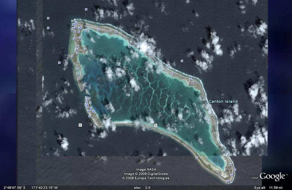
14 limate information for Kiribati - Climate Zone of 2 1/9/ :31 PM climate ZONE.com United States Alaska Great Plains Hawaii Mid-Atlantic Midwest Northeast Rocky Mountains South Southwest West World Map Continents Africa Asia Australia Europe Middle East North America Oceania South America Countries A-Z ABCDEF G H I J K L M N P R S T U V W Y Z World / Oceania / Kiribati Kiribati Average temperature, rainfall and snowfall information is available for the following climate stations in Kiribati TARAWA CANTON ISLAND FANNING ISLAND Official name: Capital: Area: Climate: Location: Geographic coordinates: Republic of Kiribati Tarawa total: 811 sq km note: includes three island groups - Gilbert Islands, Line Islands, Phoenix Islands water: 0 sq km land: 811 sq km tropical; marine, hot and humid, moderated by trade winds Oceania, group of 33 coral atolls in the Pacific Ocean, straddling the equator; the capital Tarawa is about one-half of the way from Hawaii to Australia; note - on 1 January 1995, Kiribati proclaimed that all of its territory lies in the same time zone as its Gilbert Islands group (GMT +12) even though the Phoenix Islands and the Line Islands under its jurisdiction lie on the other side of the International Date Line 1 25 N, E Kiribati Flight Deals Super cheap tickets - lowest fares! Search all major sites in one place Kiribati Know Before You Go. Read Reviews from Real Travelers. Kiribati Great deals on everything Kiribati themed. Yahoo.com Tropical Islands Experience the Great Barrier Reef. Stay in an island resort. Weather Books Hurricane Books Meteorology Books Tornado Books Weather Books Weather Instruments Hygrometers Outdoor Thermometers Rain Gauges Weather Stations Comparative Area: Land boundaries: Coastline: Terrain: Elevation extremes: four times the size of Washington, DC 0 km 1,143 km mostly low-lying coral atolls surrounded by extensive reefs lowest point: Pacific Ocean 0 m highest point: unnamed location on Banaba 81 m

15 Climate information for Kiribati - Climate Zone 2 of 2 1/9/ :31 PM Map of Kiribati Portions of this site are based on the CIA World Fact Book, a public-domain work All original material copyright 2004 climate-zone.com. All Rights Reserved. Privacy Policy Contact Us
16 GeoHive 1 of 1 1/9/ :45 PM General info Entity: Kiribati Capital: Tarawa Population ( ): 110,356 (CIA) Area: 811 sq.km. Country code: KI Region: Micronesia Kiribati Administrative units administrative units capital area (sq.km.) population census population 2005 census Gilbert Islands Bairiki Islet ,158 83,683 Abaiang Tuarabu 18 5,794 5,502 Abemama Kariatebike 27 3,142 3,404 Aranuka Takaeang ,158 Arorae Roreti 9 1,225 1,256 Banaba Anteeren Beru Taubukinberu 18 2,732 2,169 Butaritari Butaritari 13 3,464 3,280 Kuria Tabontebike ,082 Maiana Tebangetua 17 2,048 1,908 Makin Makin 8 1,691 2,385 Marakei Rawannawi 14 2,544 2,741 Nikunau Rungata 19 1,733 1,912 Nonouti Teuabu 20 3,176 3,179 Onotoa Buariki 16 1,668 1,644 Tabiteuea North Utiroa 26 3,365 3,600 Tabiteuea South Buariki 12 1,217 1,298 Tamama Bakaka Tarawa North Abaokoro 15 4,477 5,678 Tarawa South Bairiki 16 36,717 40,311 Line & Phoenic Islands 525 6,336 8,850 Kanton Kanton Kiritimati (Christmas) London 3,431 5,115 Tabuaeran (Fanning) Paelau 1,757 2,539 Teraina (Washington) Washington 1,087 1,155 total ,494 92,533 source: Kiribati Statistics. note: 2005 census numbers are provisional results. note: Line Islands are 496 sq.km.; Phoenix Islands are 29 sq.km. note: Phoenix Islands: Birnie, Enderbury, Kanton, McKean, Manra, Nikumaroro, Orona, Rawaki. CSS XHTML 1.1 GeoHive,
Guam I INTRODUCTION II LAND AND ECONOMY Microsoft Corporation. All rights reserved.
 Page 1 I INTRODUCTION, island in the western North Pacific Ocean, unincorporated territory of the United States, largest and southernmost of the Mariana Islands. It is 48 km (30 mi) long and a maximum
Northern Mariana Islands, Commonwealth
 Northern Mariana Islands, Commonwealth of the Page 1 Northern Mariana Islands, Commonwealth of the Northern Mariana Islands, Commonwealth of the, island group, commonwealth of the United States, in the
Oceania. Australia, New Zealand, and the Pacific Islands. Physical Geography. Where is Australia located?
 Oceania Australia, New Zealand, and the Pacific Islands Physical Geography Australia New Zealand Oceania Where is Australia located? Australia & Oceania are a group of islands located between Asia, Antarctica,
Table Description of number change for national ITU-T E.164 numbering plan for country code 686: Kiribati. Usage of E.164. number. Operator.
 (country code +686) Communication of 27.VI.2017: The Communications Commission of (CCK), Betio, Tarawa, announces updates to the National Numbering Plan of. Communicated time and date of change Table Description
Banaba (Ocean Island)
") Banaba (Ocean Island) Overview: Banaba (also known as Ocean Island), is an island in the Pacific Ocean which is part of the Kiribati islands. Along with Nauru and Makatea, it is one of the important elevated
Banaba (Ocean Island) Overview: Banaba (also known as Ocean Island), is an island in the Pacific Ocean which is part of the Kiribati islands. Along with Nauru and Makatea, it is one of the important elevated
Where to stay & what to do. Kiribati
 Where to stay & what to do Kiribati geography people The Republic of Kiribati, located in the Central Pacific, comprises 33 low lying coral atolls stretching over an area 3220km from east to west, along
Nicaragua versus Costa Rica?
 Nicaragua versus Costa Rica? Overview: Today I want to look at Nicaragua versus Costa Rica from both a destination for retiree s standpoint and for potential investment interest. First I'll provide some
COUNTRY DATA: Haiti : Information from the CIA World Factbook INTRODUCTION
 COUNTRY DATA: Haiti : Information from the CIA World Factbook INTRODUCTION The native Taino Amerindians - who inhabited the island of Hispaniola when it was discovered by COLUMBUS in 1492 - were virtually
:: United States Pacific Island Wildlife Refuges Introduction :: United States Pacific Island Wildlife Refuges Background: Baker Island:
 The World Factbook Australia-Oceania :: United States Pacific Island Wildlife Refuges (territories of the US) Introduction :: United States Pacific Island Wildlife Refuges Background: All of the following
COUNTRY DATA: BRAZIL: Information from the CIA World Factbook INTRODUCTION
 COUNTRY DATA: BRAZIL: Information from the CIA World Factbook INTRODUCTION Following more than three centuries under Portuguese rule, Brazil gained its independence in 1822, maintaining a monarchical system
COUNTRY DATA: Costa Rica : Information from the CIA World Factbook! INTRODUCTION GEOGRAPHY
 ! COUNTRY DATA: Costa Rica : Information from the CIA World Factbook! INTRODUCTION GEOGRAPHY Location Area Central America, bordering both the Caribbean Sea and the North Pacific Ocean, between Nicaragua
Marshall Islands, Republic of the Marshall Islands
 Marshall Islands, Republic of the Marshall Islands Location The Marshall Islands are located in the North Pacific Ocean approximately half way from Hawaii to Australia. The coordinates are between 4 and
Chapter Objectives. Describe the dominant landforms and natural resources of Southeast Asia. Discuss Southeast Asia s climate and vegetation.
 Chapter Objectives Describe the dominant landforms and natural resources of Southeast Asia. Discuss Southeast Asia s climate and vegetation. The Land Section 1 Objectives Describe how tectonic plates and
Mauritius Official name Population Form of governmen Total area Urban-rural population Head of state Life expectancy Head of government
 Mauritius Official name :Republic of Mauritius Form of government: Republic with one legislative house (National Assembly [691]) Head of state: President Ameenah Gurib-Fakim Head of government :Prime Minister:
INTRODUCTION GEOGRAPHY
 COUNTRY DATA: Cyprus : Information from the CIA World INTRODUCTION A former British colony, Cyprus became independent in 1960 following years of resistance to British rule. Tensions between the Greek Cypriot
COUNTRY DATA: Cuba : Information from the CIA World Factbook
 COUNTRY DATA: Cuba : Information from the CIA World Factbook INTRODUCTION The native Amerindian population of Cuba began to decline after the European discovery of the island by Christopher COLUMBUS in
3. British Solomon Islands Protectorate,
 3. British Solomon Islands Protectorate, 1893 1978 During the eighteenth and nineteenth centuries, European colonial powers began to partition the Pacific Islands into settler colonies, Crown colonies
Namibia, formally The Republic of Namibia, is located in the southwestern region
 Namibia Location Namibia, formally The Republic of Namibia, is located in the southwestern region of the continent of Africa. Its western boarder is Atlantic coastline. Namibia borders The Republic of
Australian Geography. Standards:
 Australian Geography Standards: SS6G12 The student will be able to locate selected features of Australia. a. Locate on a world and regional political-physical map: the Great Barrier Reef, Coral Sea, Ayers
Human Geography of Canada
 Human Geography of Canada History and Government of Canada Like the United States, people migrated across Beringia into Canada, these people were the ancestors of the Inuit (Eskimos) 16 th and 17 th centuries,
Tonga (country) I INTRODUCTION
 I INTRODUCTION") Tonga (country) Page 1 Tonga (country) I INTRODUCTION Tonga (country), independent island nation in the southern Pacific Ocean, located approximately 650 km (approximately 400 mi) southeast of Fiji and
Tonga (country) Page 1 Tonga (country) I INTRODUCTION Tonga (country), independent island nation in the southern Pacific Ocean, located approximately 650 km (approximately 400 mi) southeast of Fiji and
LOCATION, CLIMATE, AND NATURAL RESOURCES OF MEXICO
 SS6G3 The student will explain the impact of location, climate, distribution of natural resources, and population distribution on Latin America and the Caribbean. a. Compare how the location, climate,
Mission Atlas Project. South Georgia and South Sandwich Islands. Country Name: South Georgia and the South Sandwich Islands
 Mission Atlas Project South Georgia and South Sandwich Islands Country Name: South Georgia and the South Sandwich Islands Country Founded in: June 1982 Population: 0, the small military garrison on South
UNIT 3 Extra Review for Chapters 9-11
 UNIT 3 Extra Review for Chapters 9-11 Mexico Central America Caribbean Islands Middle America is Central America, Mexico, and the Islands of the Caribbean Central America is a region within Middle America.
Latin America and The Caribbean. A Closer Look.
 Latin America and The Caribbean A Closer Look. Mexico Capital: Mexico City The Location of Mexico Mexico is the second-largest country by size and population in Latin America.but the Largest Spanish -
Mediterranean Europe
 Chapter 17, Section World Geography Chapter 17 Mediterranean Europe Copyright 2003 by Pearson Education, Inc., publishing as Prentice Hall, Upper Saddle River, NJ. All rights reserved. Chapter 17, Section
Warm-up. A. Exports only manufactured goods B. Should import fewer products C. Needs to import more products D. Does not import or export
 Warm-up As with any small country, Cuba has fewer natural resources than countries such as Brazil. This affects their trade in that Cuba A. Exports only manufactured goods B. Should import fewer products
Geographic Qualities of South America
 Geographic Qualities of South America 1. South America is the fourth largest continent in area. It is located in the Western Hemisphere, lying southwest of North America. Most of South America lies in
Southern Africa. Countries, Geography, & Climate
 Countries, Geography, & Climate The Southern African region consists of the following countries: Angola Zambia Malawi Mozambique Zimbabwe Botswana Namibia Swaziland Lesotho South Africa Comoros Madagascar
This section of the Plan provides a general overview of the Smoky Mountain Region. It consists of the following four subsections:
 SECTION 3 COMMUNITY PROFILE This section of the Plan provides a general overview of the Smoky Mountain Region. It consists of the following four subsections: 3.1 Geography and the Environment 3.2 Population
AT A GLANCE ANDAMAN AND NICOBAR ISLANDS AND TROPICAL ISLAND NATIONS
 Geographical Information CHAPTER 19 AT A GLANCE ANDAMAN AND NICOBAR ISLANDS AND TROPICAL ISLAND NATIONS Name of island Ocean where located Longitude Latitude No. of islands Andaman and Nicobar Bay of Bengal
Physical Geography of Europe. Chapters 13-18
 Physical Geography of Europe Chapters 13-18 The British Isles Archipelago made of 6000+ small islands Temperate climate Largest body of fresh water is Loch Ness Mostly rolling hills and large flat lands
CHAPTER 12. South America. Section 1: Natural Environments Section 2: History and Culture Section 3: South America Today. HOLT World Geography
 CHAPTER 12 South America Section 1: Natural Environments Section 2: History and Culture Section 3: South America 1 Section 1 Natural Environments Objectives: What are the major landforms and rivers of
ISRAEL- COUNTRY FACTS
 ISRAEL- COUNTRY FACTS ISRAEL-NEIGHBOURING COUNTRIES AND POLITICAL MAP Area: 22,072 sq. km Land area: 21,643 sq. km. Fast Facts Area of lakes: 429 sq. km. (Sea of Galilee 164 sq. km., the Dead Sea - 265
AFTA s 2017 Foreign Policy White Paper Submission
 AFTA s 2017 Foreign Policy White Paper Submission Page 1 of 10 About AFTA Ltd (AFTA) was founded in 1957 to: establish professional standards for travel agents; stimulate and promote travel; bring together
Read and Respond: Australia
 Read and Respond: Australia Directions: Highlight the answers to the following questions and write them out in complete sentences on your own sheet of paper. GEOGRAPHY OF AUSTRALIA The best way to visualize
North Africa. Chapter 25. Chapter 25, Section
 Chapter 25, Section World Geography Chapter 25 North Africa Copyright 2003 by Pearson Education, Inc., publishing as Prentice Hall, Upper Saddle River, NJ. All rights reserved. Chapter 25, Section World
Chapter 21: EAST AFRICA
 Chapter 21: EAST AFRICA Physical Geography of East Africa Landforms East Africa is a diverse landscape of different plains, volcanic mountains, and plateaus cut by a large valley and marked by many rivers
The 4 ARRRRR s. Presented by Phil Hahn
 The 4 ARRRRR s B E L I Z E Presented by Phil Hahn The 4R s of Belize Rivers Reefs Ruins Rainforests The 4R s of Belize RIVERS Rare flora and fauna live in healthy populations within the abundant riverine
Terms to Know. artesian well coral atoll krill lagoon
 Chapter Objectives Describe the diverse landforms and natural resources of Australia, Oceania, and Antarctica. Discuss the wide range of climates and vegetation throughout the region. The Land Section
Economy 3. This region s economy was based on agriculture. 4. This region produced items such as textiles, iron, and ships in great quantities. For th
 Geography 1. This region has a climate of warm summers and snowy cold winters. 2. This region has a climate that is generally warm and sunny, with long, hot, humid summers, and mild winters, and heavy
Tourism potential in Bangladesh. 26 th of march 2008
 Tourism potential in Bangladesh 26 th of march 2008 Majbritt Thomsen Education In Bangladesh Finding relevant work Danish Embassy B2B DANIDA, production sector Tourism potential report This lecture Share
Physical characteristics and biomes:
 Physical characteristics and biomes: Sahel region, bordering Sahara Characteristics Area suffers from lack of rainfall, over grazing, which causes loss of vegetation and loss of inhabitable areas causing
NAURU BUREAU OF STATISTICS
 GOVERNMENT OF NAURU NAURU BUREAU OF STATISTICS PROVISIONAL VISITOR ARRIVALS 3RD QUARTER (JANUARY MARCH 2016) 1. TOTAL VISITOR ARRIVALS Provisional numbers show that visitor arrivals for 3 rd Quarter March
Land area 1.73 million km 2 Queensland population (as at 31 December 2017) Brisbane population* (preliminary estimate as at 30 June 2017)
 Brisbane population* (preliminary estimate as at 30 June 2017)") Queensland - 11 Queensland OVERVIEW Queensland is nearly five times the size of Japan, seven times the size of Great Britain, and two and a half times the size of Texas. Queensland is Australia s second
Queensland - 11 Queensland OVERVIEW Queensland is nearly five times the size of Japan, seven times the size of Great Britain, and two and a half times the size of Texas. Queensland is Australia s second
Geography of CA and CI
 Geography of CA and CI Caribbean Islands Central America -Central America (CA) is an isthmus connecting North America to South America. It consists of 7 countries. -The Pacific side of CA is covered by
Summary Article: Mexico from Philip's Encyclopedia
 Topic Page: Mexico Summary Article: Mexico from Philip's Encyclopedia The United Mexican States is the world's largest Spanish-speaking country. It is largely mountainous. The Sierra Madre Occidental begins
Brain Wrinkles. Location, Climate, & Natural Resources of. Where People Live & How They Trade
 Location, Climate, & Natural Resources of Where People Live & How They Trade It s south of the US, east of the Pacific Ocean, and west of the Gulf of Mexico & Caribbean Sea. It s great that it s located
Latin America 11/4/2013. Latin America Today. 580 million people 9% of the world s population Diverse backgrounds:
 Latin America Chapter 10 Human Geography Latin America Today 580 million people 9% of the world s population Diverse backgrounds: Native Americans Europeans Africans Asians 1 Population 393 million live
Land area 1.73 million km 2 Queensland population (December 2015) Brisbane population* (June 2015)
 Brisbane population* (June 2015)") Queensland - 18 Queensland OVERVIEW Queensland is nearly five times the size of Japan, seven times the size of Great Britain, and two and a half times the size of Texas. Queensland is Australia s second
Queensland - 18 Queensland OVERVIEW Queensland is nearly five times the size of Japan, seven times the size of Great Britain, and two and a half times the size of Texas. Queensland is Australia s second
Down Under. Leggi e ascolta.
 Leggi e ascolta. Down Under Australia and New Zealand are neighbours in the South Pacific. Their nickname is Down Under. They are two countries famous for sun, sea and sheep. Australia History Aborigines
THE STORY OF MALDIVES. DR MARIYAM SHAKEELA Minister Of Environment and Energy Republic Of Maldives
 THE STORY OF MALDIVES DR MARIYAM SHAKEELA Minister Of Environment and Energy Republic Of Maldives Significance of ecotourism & coral reefs on regional economy Coral reefs are among the most diverse and
STANDARDS: Brain Wrinkles
 STANDARDS: SS6G3 The student will explain the impact of location, climate, distribution of natural resources, and population distribution on Latin America and the Caribbean. a. Compare how the location,
A Country Study of... australia. Sample file. by:
 A Country Study of... australia by: australia FAST FACTS & FIGURES Area Capital Climate Currency Government Language Population m ple Time Zone file Religion Sa OTHER INTERESTING INFORMATION 2011 NotebookingPages.com
Distinguished guests, parliamentary colleagues, ladies and gentlemen.
 Developing the Territory Keynote 16/06/14 Developing the Top End from the last frontier to the next frontier. Chief Minister Distinguished guests, parliamentary colleagues, ladies and gentlemen. The frontier
Chapter 17. North Africa, Southwest Asia and Central Asia
 Chapter 17 North Africa, Southwest Asia and Central Asia Chapter Objectives Describe the major landforms and natural resources of North Africa, Southwest Asia, and Central Asia. Discuss the climate and
Kenya's national Flag
 Kenya Tyler Beck Kenya's national Flag Ethnicity There are many ethnic groups that are a part of Kenya. Kenya has a great European community and a lot of tourists and employees for mission and aid groups,
The Land Photo Source: The Atlas of Canada, The Red River, Manatoba, Canada land/physio_red_ri
 The Land The United States and Canada An Overview of the Region The United States and Canada are the two largest countries in North America. The Rio Grande is part of the southwest border of the United
Healing Initiative Leadership Linkage (HILL) Student Magazine: Youth Excellence & Leader: What is catching the attention of your youth?
 Student Magazine: Youth Excellence & Leader: What is catching the attention of your youth?") Healing Initiative Leadership Linkage (HILL) Student Magazine: Country Name Monthly update: Current News Host Editor Country Editor: Insert picture Type the matter. According to illegal Bayrak television,
Healing Initiative Leadership Linkage (HILL) Student Magazine: Country Name Monthly update: Current News Host Editor Country Editor: Insert picture Type the matter. According to illegal Bayrak television,
Brief Description of Northern the West Bank, Palestine Prepared by: Dr. Ahmed Ghodieh Department of Geography An-Najah National University Nablus,
 Brief Description of Northern the West Bank, Palestine Prepared by: Dr. Ahmed Ghodieh Department of Geography An-Najah National University Nablus, Palestine Brief Description of Northern the West Bank
Brain Wrinkles. Africa: The impact of location, climate, & physical characteristics on where people live, the type of work they do, & how they travel
 Africa: The impact of location, climate, & physical characteristics on where people live, the type of work they do, & how they travel STANDARDS: SS7G3 The student will explain the impact of location, climate,
CANADA CARIBBEAN DISASTER RISK MANAGEMENT FUND. Island Snapshot. Trinidad and Tobago
 Island Snapshot Trinidad and Tobago About the CCDRMF The Canada Caribbean Disaster Risk Management Fund (CCDRMF) is one component of Global Affairs Canada s 1 (GAC) larger regional Caribbean Disaster Risk
Land area 1.73 million km 2 Queensland population (as at December 2016) Brisbane population* (preliminary estimate as at 30 June 2016)
 Brisbane population* (preliminary estimate as at 30 June 2016)") Queensland - 11 Queensland OVERVIEW Queensland is nearly five times the size of Japan, seven times the size of Great Britain, and two and a half times the size of Texas. Queensland is Australia s second
Queensland - 11 Queensland OVERVIEW Queensland is nearly five times the size of Japan, seven times the size of Great Britain, and two and a half times the size of Texas. Queensland is Australia s second
LATIN AMERICA. Mexico Central America Caribbean Islands South America
 LATIN AMERICA Mexico Central America Caribbean Islands South America HISTORY First Settlers Hunters/gatherers from Asia crossed land bridge connecting Asia and Alaska Learned to farm over time Maize (corn)
Norfolk Island tourism industry
 Norfolk Island tourism industry Significance of tourism The tourism industry is Norfolk Island s main export and is a major driver of the Island s economy. Using expected distribution and value of tourist
Montserrat. Country Presentation
 Montserrat Country Presentation Country Background Regional Institution Arrangements Country Sector Characteristics Strengths and weaknesses Opportunities Policy Implication Discovered by Christopher Columbus
Chapter 20. The Physical Geography of Africa South of the Sahara
 Chapter 20 The Physical Geography of Africa South of the Sahara Chapter Objectives Identify the major landforms, water systems, and natural resources of Africa south of the Sahara. Describe the relationship
4th Grade Social Studies 2nd Nine Weeks Test
 4th Grade Social Studies 2nd Nine Weeks Test Multiple Choice Identify the choice that best completes the statement or answers the question. 1 Which is the largest city in the United States? A Philadelphia,
Republic of Botswana. Eva Karasch Lisa Nass
 Republic of Botswana Eva Karasch Lisa Nass Universität Duisburg -Essen Campus Essen WS 2010/11 Modul VI -LN English in Africa Prof. Dr. Raymond Hickey Table of Contents 1. Geography and Demography 2. Politics
6th Grade Third Nine Weeks Benchmark Assessment
 6th Grade Third Nine Weeks Benchmark Assessment Multiple Choice Identify the choice that best completes the statement or answers the question. Key Concepts 1 Latin America is located in the A Northern
Austrade in the Pacific Delivering Value For You. A Deeper Ocean of Opportunity. TROPLINKS CAIRNS AUGUST 2010
 Austrade in the Pacific Delivering Value For You. A Deeper Ocean of Opportunity. TROPLINKS CAIRNS 23-24 AUGUST 2010 The Pacific advantage Tourism: Pacific Islands are the ultimate destination for tourists
2014/15 Pre-Budget Submission Accommodation Association of Australia
 2014/15 Pre-Budget Submission Accommodation Association of Australia Accommodation Association of Australia Principal Contact Mr Richard Munro Chief Executive Officer Phone: +61 2 8666 9015 EXECUTIVE SUMMARY
Mexico. Chapter 10. Chapter 10, Section
 Chapter 10, Section World Geography Chapter 10 Mexico Copyright 2003 by Pearson Education, Inc., publishing as Prentice Hall, Upper Saddle River, NJ. All rights reserved. Chapter 10, Section World Geography
Essential Questions. 1. How have historical figures and events affected South America today?
 South America Essential Questions 1. How have historical figures and events affected South America today? 2. How has location affected the development of countries in South America? 3. How has the role
Mäori Economy in the Waikato Region Summary
 Mäori Economy in the Waikato Region Summary 1 KEY OBSERVATIONS OF THE WAIKATO MÄORI ECONOMY Mäori make a significant contribution to the economy in the Waikato region. This executive summary highlights
Session 1: Tourism Development and Conservation of Island Resources KEY ISSUES FOR SIDS AND ALL ISLAND DESTINATIONS.
 Session 1: Tourism Development and Conservation of Island Resources KEY ISSUES FOR SIDS AND ALL ISLAND DESTINATIONS Richard Denman A presentation in 2 parts Tourism and Small Island Developing States:
TRENDS AND PROSPECTS FOR THE CAIRNS / TROPICAL NORTH QUEENSLAND ECONOMY PRESENTATION TO PROFESSIONAL ACCOUNTANTS CAIRNS
 TRENDS AND PROSPECTS FOR THE CAIRNS / TROPICAL NORTH QUEENSLAND ECONOMY PRESENTATION TO PROFESSIONAL ACCOUNTANTS CAIRNS WS (Bill) Cummings Ref: J3015 26th August 2016 AUSTRALIAN DOLLAR (SEPT) Year USD
SOUTH PACIFIC FORUM Apia, Western Samoa April, 1973 COMMUNIQUÉ
 SOUTH PACIFIC FORUM Apia, Western Samoa 17-18 April, 1973 COMMUNIQUÉ The Fourth South Pacific Forum was opened by the Prime Minister of Western Samoa on 17 April 1973. He welcomed to Apia the President
COUNTRY CASE STUDIES: OVERVIEW
 APPENDIX C: COUNTRY CASE STUDIES: OVERVIEW The countries selected as cases for this evaluation include some of the Bank Group s oldest (Brazil and India) and largest clients in terms of both territory
Catalans By: Ryan Conley
 Catalans By: Ryan Conley Population Right now there are about 7.2 million people living in Catalans. 70% of the people there are living in Barcelona. Its imperial force is usually spread across the Mediterranean.
THE USA. The capital of USA is Washington D.C., in the District of Columbia.
 THE USA The United States of America is the richest and one of the biggest countries in the world. It has a population of about 295 million people. It is divided into 50 states; two of them, Alaska and
29 TH JANUARY 1 ST FEBRUARY 2002 SYDNEY, AUSTRALIA
 29 TH JANUARY 1 ST FEBRUARY 2002 SYDNEY, AUSTRALIA Pacific 2002 -The Ideal Forum PACIFIC 2002 WILL BE THE LEADING INDUSTRY AND PROFESSIONAL MARITIME FORUM. IT WILL PROVIDE EXHIBITORS, PARTICIPANTS AND
Geography. Greece s Physical Geography is: Peninsula (water on three sides) The Peloponnesus. Mountainous Terrain (see Map dark green)
 The Peloponnesus. Mountainous Terrain (see Map dark green)") Grapes Greece Geography Greece s Physical Geography is: Peninsula (water on three sides) The Peloponnesus Mountainous Terrain (see Map dark green) Extends into the Aegean Sea Includes over 2,000 Islands
Grapes Greece Geography Greece s Physical Geography is: Peninsula (water on three sides) The Peloponnesus Mountainous Terrain (see Map dark green) Extends into the Aegean Sea Includes over 2,000 Islands
Just how big is Africa?
 The United States China India The United Kingdom Portugal Spain France Belgium Germany The Netherlands Switzerland Italy Eastern Europe Japan 11.7 million sq. miles Just how big is Africa? Chapter 18 Section
Regional Universities Network. Introduction. Regional Universities Network. Economic Impact of the Universities in the Regional Universities Network
 Regional Universities Network Economic Impact of the Universities in the Regional Universities Network Introduction The Regional Universities Network (RUN) is a network of six universities with headquarters
South Aegan Region (Greece)
") South Aegan Region (Greece) South Aegan Region 1. Introduction The South Aegean Region is situated in the south-eastern border of Greece and constitutes at the same time, along with Cyprus, the south-eastern
South Aegan Region (Greece) South Aegan Region 1. Introduction The South Aegean Region is situated in the south-eastern border of Greece and constitutes at the same time, along with Cyprus, the south-eastern
The Maltese Islands: Geography
 The Maltese Islands: Geography The Maltese Archipelago comprises a group of small low islands aligned in a NW-SE direction. At their extreme points the Maltese Islands fall within the following points:
The Wonderful Land of Zambia
 The Wonderful Land of Zambia Jessica Geography Have you ever wondered about Zambia's geography? If so, I'm here to tell you! Their climate is very tropical being between 50-80 every day. But it is also
!!!!!!!!!!Mali s Geographic Makeup
 DANU Strategic Forecasting Group May 27th 2016!!!!!!!!!!Mali s Geographic Makeup By Liliana Pirlea Location: Mali is a landlocked country located in West Africa. Mali is the 8th largest country in Africa
UNIT 5 AFRICA PHYSICAL GEOGRAPHY SG 1 - PART II
 UNIT 5 AFRICA PHYSICAL GEOGRAPHY SG 1 - PART II III. CLIMATE & VEGETATION A. The four main climate zones are tropical wet, tropical wet/dry (split into monsoon & savanna), semiarid, and arid. Other climate
A journey through the history of the Sapphire Coast Part 1 Introduction
 HISTORY IN THE SHADOW OF THE MOUNTAINS A journey through the history of the Sapphire Coast Part 1 Introduction Introduction Overview of settlement in Australia The dispersal of people to other lands is
Italy. Country Profile. April 2012
 Italy Country Profile April 2012 BACKGROUND The territory of Italy covers some 301,338 km 2 (116,347 sq mi) and is influenced by a temperate seasonal climate. With 60.6 million inhabitants, it is the fifth
Fiji s Tourism Satellite Accounts
 Asia-Pacific Economic Statistics Week Bangkok 2 4 May 2016 Fiji s Tourism Satellite Accounts Mr. Bimlesh Krishna Divisional Manager Economic Statistics Fiji s Tourism Satellite Introduction The Tourism
III. TRADE IN COMMERCIAL SERVICES BY CATEGORY
 .. TRADE IN COMMERCIAL SERVICES BY CATEGORY Transportation services China records impressive growth of world transportation services reached $750 billion in 2007, an increase of 19 per cent, following
JUNE 2017 AUCKLAND ECONOMIC INSIGHTS SERIES ENGAGING GLOBALLY AUCKLAND S TRADING LINKAGES. aucklandnz.com/business nzier.org.nz
 AUCKLAND ECONOMIC INSIGHTS SERIES ENGAGING GLOBALLY AUCKLAND S TRADING LINKAGES aucklandnz.com/business nzier.org.nz JUNE 2017 4 AUCKLAND ECONOMIC INSIGHTS SERIES 1 2 3 4 Advanced Industries Auckland s
Australia. Geography
 Australia Geography Label the Map!!! New South Wales New South Wales Location: State on the east coast of Australia. Australian Capital Territory - Sydney! (5th largest, 1st most populous) Climate Types:
Japan is basically a mountainous volcanic Island Chain located in the western Pacific Ocean
 I N T R O D U C T I O N T O J A PA N Japan is basically a mountainous volcanic Island Chain located in the western Pacific Ocean The country has four main Islands HOKKAIDO HONSHU SHIKOKU KYUSHU And then
The Rise of Rome. After about 800 BC other people also began settling in Italy The two most notable were the and the
 The Rise of Rome The Land and People of Italy Italy is a peninsula extending about miles from north to south and only about 120 miles wide. The mountains form a ridge from north to south down the middle
Finding the Next Generation of Marine Pilots
 9 th Asia Pacific Heads of Maritime Safety Authorities Forum Vina Del Mar, Chile, 18-21 April 2006 Finding the Next Generation of Marine Pilots Mick Kinley General Manager Maritime Operations Australian
Location, Climate, & Natural Resources. Where People Live & How They Trade
 Location, Climate, & Natural Resources Where People Live & How They Trade Standards SS6G13 The student will explain the impact of location, climate, distribution of natural resources, and population distribution