Geography of CA and CI
|
|
|
- Britton Pope
- 6 years ago
- Views:
Transcription


1 Geography of CA and CI Caribbean Islands Central America

2 -Central America (CA) is an isthmus connecting North America to South America. It consists of 7 countries.


3 -The Pacific side of CA is covered by volcanic mountains.


4 -The largest lake in CA is Lake Nicaragua.
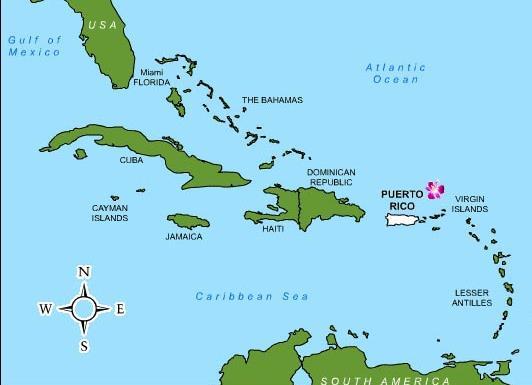
5 -The Caribbean Islands (CI) is an archipelago in the Caribbean Sea made up of hundreds of islands. Three groups: Bahamas, Greater Antilles, and Lesser Antilles
 are called the Greater")
6 -The four largest islands (Cuba, Hispaniola, Jamaica, and Puerto Rico) are called the Greater Antilles.

7 -Most of the rest of hundreds of islands make up the Lesser Antilles.


8 -The Bahamas include 700 islands.

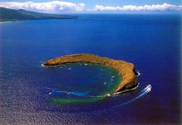
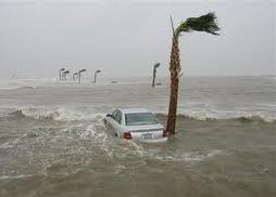
9 -Many of the islands are the tops of underwater mountains and volcanoes.
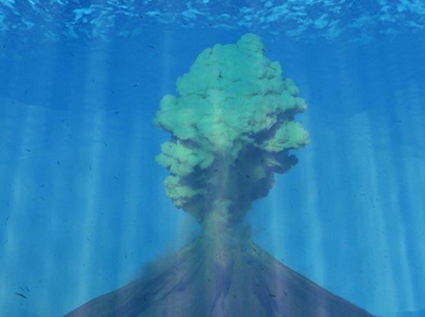
10
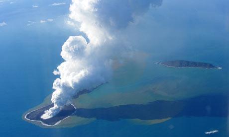
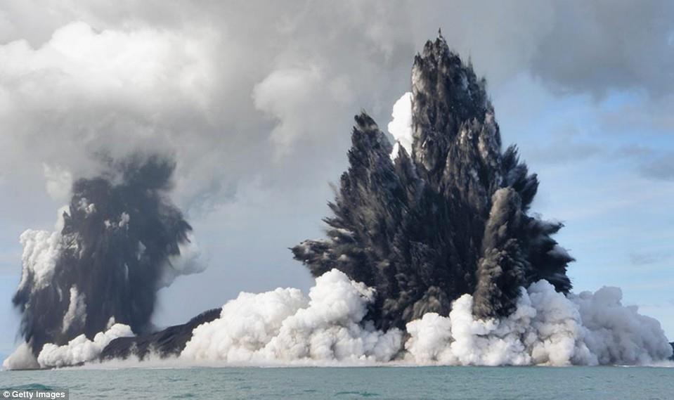
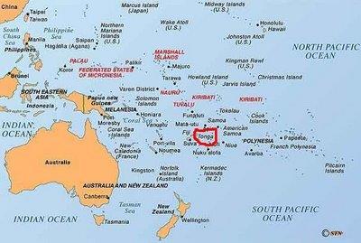
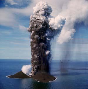
11 Underwater volcano creates new island off Tonga
12
13


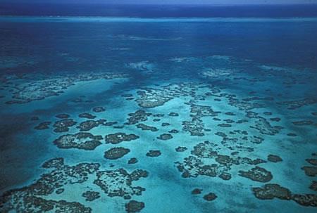
14 -Other islands are made up of coral reefs.
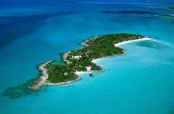
15 Bahamas


16 -CA and the CI are located within the Tropics and therefore have warm, sunny weather year round.


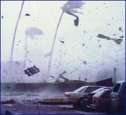
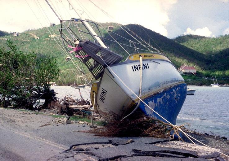
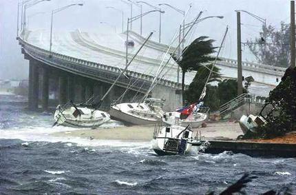
17 -Winters months are dry, and summers bring daily rain. Hurricanes are very common in this area in the summer months.
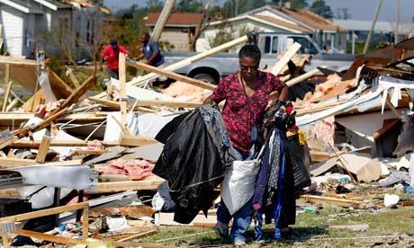
18


19 -The region s best resource is its land and climate, attracting many tourists and their money.

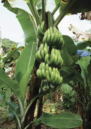
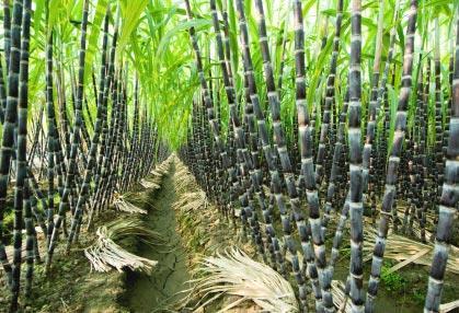
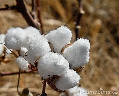
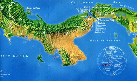
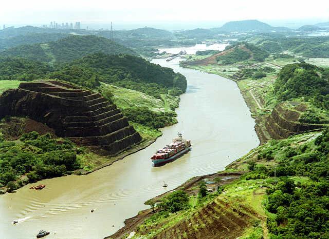
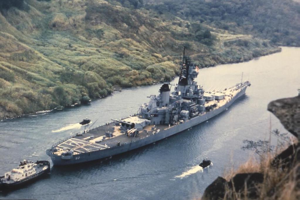
20 -Coffee, bananas, sugarcane, and cotton grow well here.


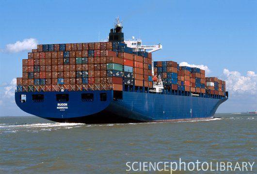
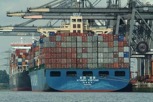
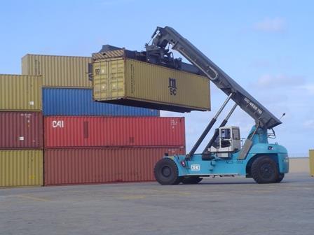
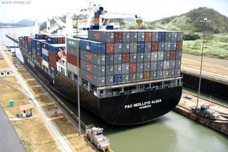
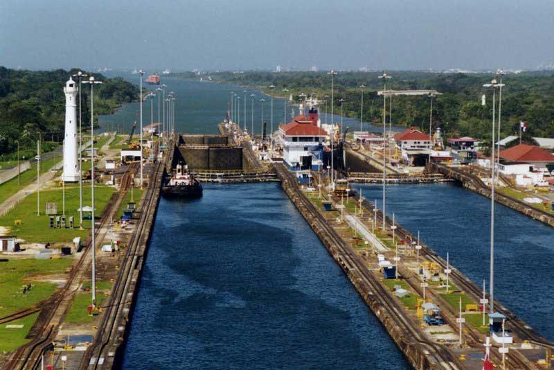
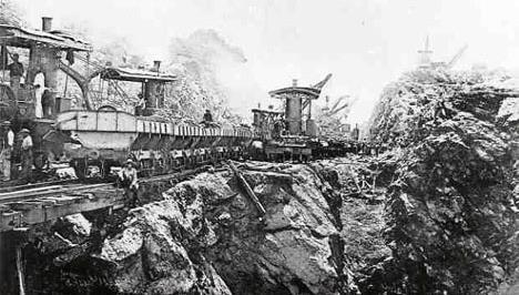
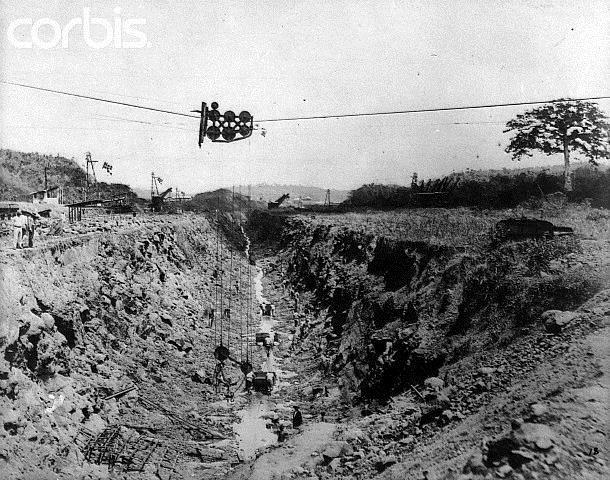
21 -There are NOT many mineral resources here.
22 History of Central America -Culture still influenced by the ancient Maya civilizations. -Spain claimed most of the land in the 1500 s.

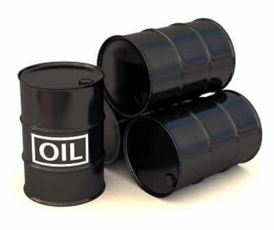
23 -The Spanish made large plantations to grow tobacco and sugarcane with slave labor from the native people and enslaved Africans.


24 -The Spanish colonies of CA declared independence from Spain in 1821.
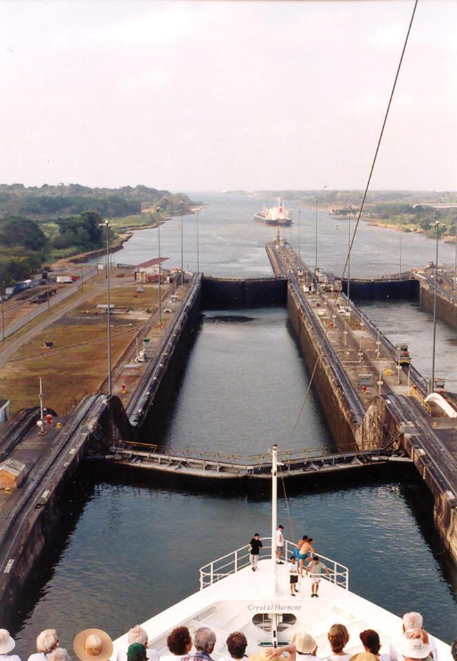
25 -Over the last hundred years there have been many deadly struggles by CA countries to free themselves from foreign control of their land and businesses (the USA being one of those foreign countries).


26 -Language (Spanish), religion (Roman Catholic), and festivals still influenced by its colonial history.


.")
27 -Most people are Mestizo (mixed European and native American ancestry).
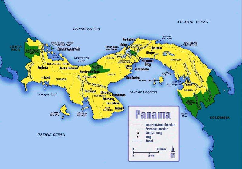
28 Panama


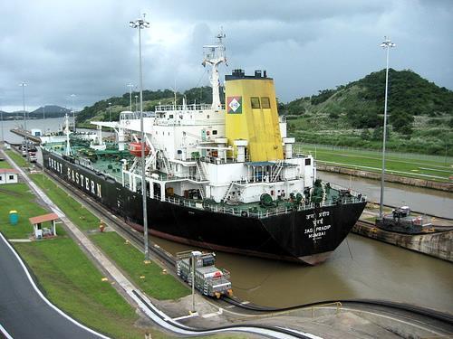
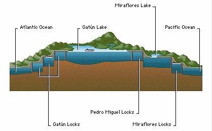
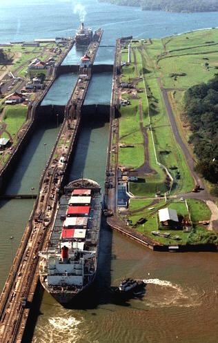
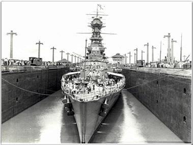
29 -The Panama Canal was started by the French and finished by the USA.

30 -The canal saves almost 8,000 miles when going from the pacific to the Atlantic.


31 Saves time, saves money, saves oil, and saves lives (less treacherous than going around the tip of SA).
32


33 -The canal is 50 miles long through Panama and can cost about $34,000 for a freighter to go through.

34
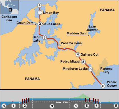
35
36
37
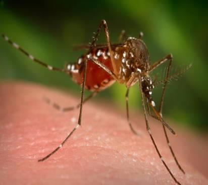
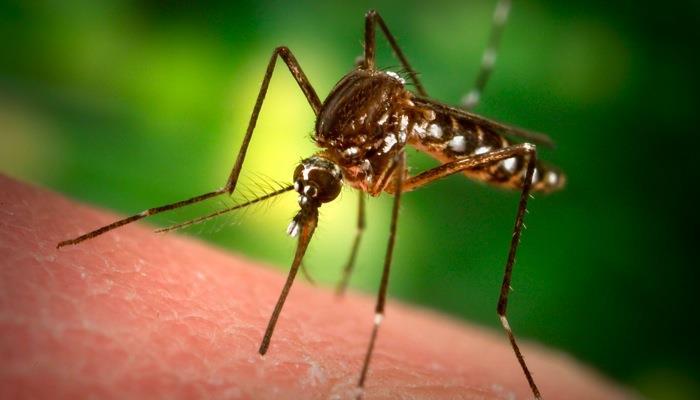
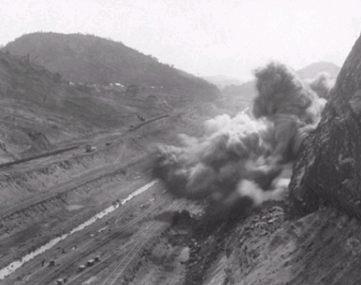
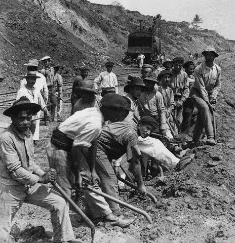
38 -Tankers are raised and lowered through a series of LOCKS (a section of waterway where boats are raised and lowered by adjusting the water levels).
39
40
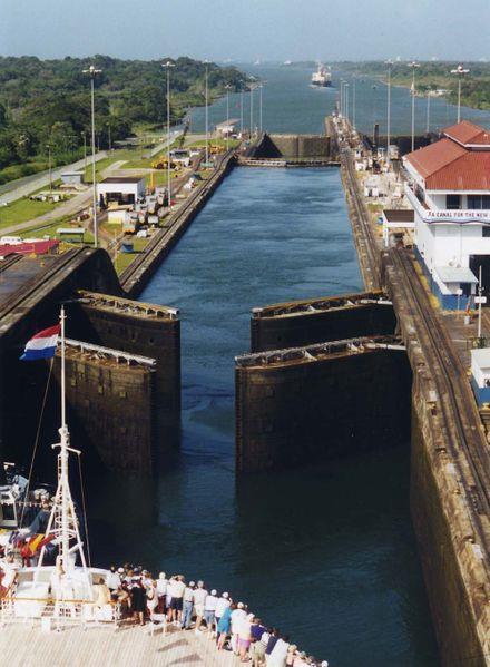
41
42
43
44 Good history 1:21 How it works 4:55 Animation 1:07 Time lapse thru canal 1:56


45 Lowest toll paid: 36 cents Richard Halliburton swam through the canal in 1928

46 Highest toll paid: $249,165 The Maersk Dellys 2006
47 -The French struggled to build the canal because of mud slides and mosquitoes that caused malaria and yellow fever. 25,000 workers died.
48
49


50 -The US took over in The US helped Panama gain independence from Colombia and then built the canal.

51 -The US killed the mosquitoes, used modern equipment, and built the canal in 8 years.
52
53
54
55

56 -The US owned the canal and the canal zone around it until 1999 when the canal was handed back over to Panama.

57 -The canal brings in lots of money and is important militarily in times of war.
58
59
60


61 History of the Caribbean Islands


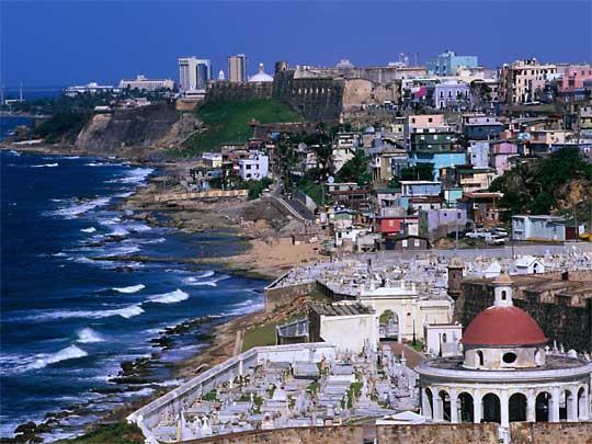
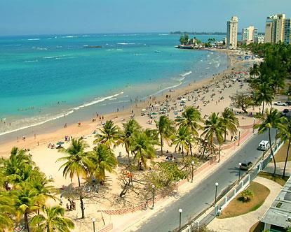
62 -Christopher Columbus never made it to what is now the USA. He actually discovered the Caribbean Islands.


63 -Chris named this the West Indies and the people Indians because he was lost. He thought he had found India.
64 -The English, French, and Dutch took many of the smaller islands and brought African slaves to work the land as colonies because most of the natives had died of diseases.
65 -Spain took Cuba, Puerto Rico, and half of Hispaniola.


66 -Toussaint-L Ouverture was an African slave born in Haiti. He led a slave revolt to gain independence from France for Haiti in 1804.


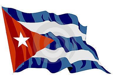
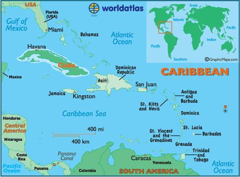
67 -The USA took Cuba from Spain but eventually won its independence from us.

68 -Many islands in the Caribbean are still not independent today.
69 -The languages spoken today are dialects (a regional variety of a language) of English, French, and Spanish.

70 -Religion is a blend of Catholic and African religions.

71 Puerto Rico

72 -Was a Spanish colony, now is a Commonwealth of the USA (self-governing territory associated with another country).
73 -Puerto Ricans are US citizens, but cannot vote in our elections. They have a non-voting representative in the US congress. They can vote only if they move to the USA.

74 -Puerto Rico has debated and voted down becoming a state of the USA.


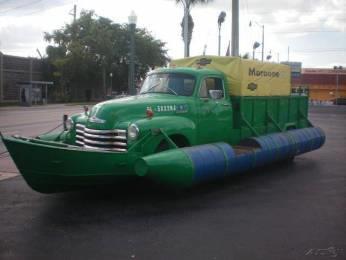
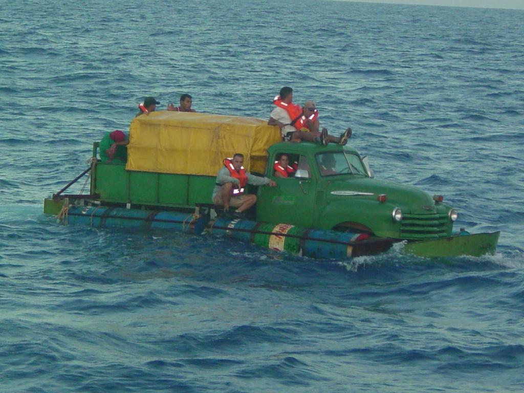
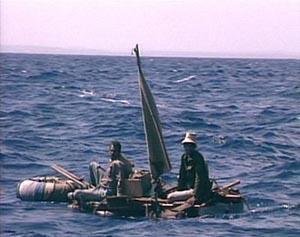
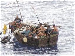
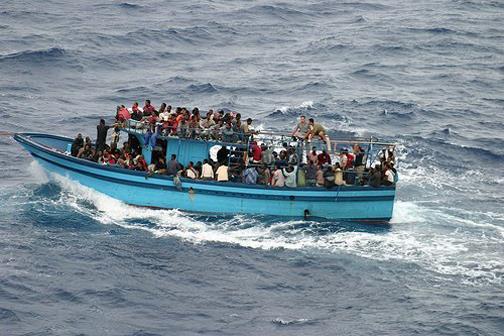
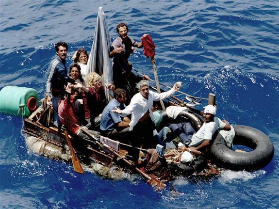
75 -Puerto Rico is the richest of the Caribbean Islands, but would be the poorest state in the USA if it joined. USA about 12%
76 Cuba

77 -Largest and most populous of the Caribbean Islands.
.")
78 -Located just 92 miles from the USA (Florida).


79 -Fidel Castro brought communism to Cuba in 1959 and has ruled as a dictator ever since.


80 Recently his brother, Raul Castro, took over because Fidel is sick.

81 -Communist governments take over and run everything in a country. They also take over the newspapers, radios, and TV stations. Very few freedoms allowed.


82 -The USA owned a lot of businesses in Cuba when the Communists took over.

83 -The US government has banned trade and travel in Cuba by Americans.
 to the")
84 -Many people have fled Cuba as refugees (someone who flees a country for political or economic reasons) to the USA.

85 Many times we have to send them back. Miami, Florida is very Cuban because of all the refugees.
86
With a partner, discuss what you already know about Cuba. Include the government, economy, freedoms, etc.
 With a partner, discuss what you already know about Cuba. Include the government, economy, freedoms, etc. In this lesson, we are going to examine a specific event that has had a lasting affect on the country
6th Grade Third Nine Weeks Benchmark Assessment
 6th Grade Third Nine Weeks Benchmark Assessment Multiple Choice Identify the choice that best completes the statement or answers the question. Key Concepts 1 Latin America is located in the A Northern
Unit 5: Latin America Today
 Unit 5: Latin America Today In this unit, you will turn your attention to Latin America. You will study the geography of some Latin American countries. You will learn about their history, politics, revolutions,
Central America and the Caribbean. The Link Between North and South America
 Central America and the Caribbean The Link Between North and South America Today, the combined population of Central American countries is over 40 million larger than all of Canada. Combined, the 7 nations
Central America and the Caribbean. The Link Between North and South America
 Central America and the Caribbean The Link Between North and South America Today, the combined population of Central American countries is over 40 million larger than all of Canada. Combined, the 7 nations
Warm-up. A. Exports only manufactured goods B. Should import fewer products C. Needs to import more products D. Does not import or export
 Warm-up As with any small country, Cuba has fewer natural resources than countries such as Brazil. This affects their trade in that Cuba A. Exports only manufactured goods B. Should import fewer products
11/16/15. Today s! Topic: " Latin America Independence Movement
 Classes begin at: 1st Block 8:35am 2 nd Block 10:05am Georgia Cyber Academy s mission is to provide an exemplary individualized and engaging educational experience for all students. Learning Target: I
UNIT 3 Extra Review for Chapters 9-11
 UNIT 3 Extra Review for Chapters 9-11 Mexico Central America Caribbean Islands Middle America is Central America, Mexico, and the Islands of the Caribbean Central America is a region within Middle America.
Latin America 11/4/2013. Latin America Today. 580 million people 9% of the world s population Diverse backgrounds:
 Latin America Chapter 10 Human Geography Latin America Today 580 million people 9% of the world s population Diverse backgrounds: Native Americans Europeans Africans Asians 1 Population 393 million live
Latin America. Physical Geography
 Latin America Physical Geography Regions Latin America can be divided into separate regions based on physical geography or cultural geography. Regions If we look at physical geography Latin America has
Comprehension Questions:
 Unit 3: Central & South america Comprehension Questions: 1. What is the driest desert on earth? Atacama Desert 2. What two water routes were discovered in the 1500s to get around the tip of South America?
Unit 5/Chapter 8 ticket Central America and the Caribbean
 Unit 5/Chapter 8 ticket Central America and the Caribbean Important Vocabulary Latifundia inifundia ISTHMUS : a strip of land two large strips of land ARCHIPELAGO : a or of islands BIODIVERSITY : an as
6th Grade Western Hemisphere Geography
 6th Grade Western Hemisphere Geography Multiple Choice Identify the choice that best completes the statement or answers the question. 1 Latin America is located in the A Northern Hemisphere. C Western
Mrs. Reifsnyder World Geography. Unit 8: Latin America Study Guide SOLs Addressed: WG. 1c, 2b, 3c, 4, 10b/c
 Mrs. Reifsnyder World Geography Unit 8: Latin America Study Guide SOLs Addressed: WG. 1c, 2b, 3c, 4, 10b/c Essential Questions: - In what ways do physical, economic, and cultural characteristics influence
COUNTRY DATA: Haiti : Information from the CIA World Factbook INTRODUCTION
 COUNTRY DATA: Haiti : Information from the CIA World Factbook INTRODUCTION The native Taino Amerindians - who inhabited the island of Hispaniola when it was discovered by COLUMBUS in 1492 - were virtually
THINGS TO REMEMBER CARIBBEAN STUDIES
 PREMIER CURRICULUM SERIES Based on the Sunshine State Standards for Secondary Education, established by the State of Florida, Department of Education THINGS TO REMEMBER CARIBBEAN STUDIES Copyright 2009
WORLD GEOGRAPHY. Hector Rodriguez
 Mr. Chavira 9th Period WORLD GEOGRAPHY Hector Rodriguez P a g e 1 Table of Contents Latin America Page 2 o Maps Economic Map Page 3 Political Map Page 4 Population Map Page 5 Physical Page 6 o Notes Physical
COUNTRY DATA: Cuba : Information from the CIA World Factbook
 COUNTRY DATA: Cuba : Information from the CIA World Factbook INTRODUCTION The native Amerindian population of Cuba began to decline after the European discovery of the island by Christopher COLUMBUS in
LATIN AMERICA. Mexico Central America Caribbean Islands South America
 LATIN AMERICA Mexico Central America Caribbean Islands South America HISTORY First Settlers Hunters/gatherers from Asia crossed land bridge connecting Asia and Alaska Learned to farm over time Maize (corn)
FROM COLONY TO INDPENDENT NATION
 FROM COLONY TO INDPENDENT NATION Quiz: Wednesday! Aztecs, Incas, Cuban Revolution, Zapatista Movement, Independence Movements! HW: finish notes and complete Multi-Level Review Tomorrow: We begin Government
Many ecotourists visit the various natural habitats in Central America. Why do you think ecotourism has become so popular?
 Chapter 9 Middle America and Spanish Speaking South America pg. 252 287 9 1 Central America pg. 255 259 Connecting to Your World What is one country in Central America that promotes ecotourism? Many ecotourists
Content Statement: Explain how Enlightenment ideals influenced the French Revolution and Latin American wars for independence.
 Reforms, Revolutions, and Chapter War 9.3 Section 3 Independence in Latin America Content Statement: Explain how Enlightenment ideals influenced the French Revolution and Latin American wars for independence.
1st Period Mr. Chavira WORLD GEOGRAPHY. Hector Rodriguez
 1st Period Mr. Chavira WORLD GEOGRAPHY Hector Rodriguez P a g e 1 Table of Contents Latin America Page 2 o Maps Economic Map Page 3 Political Map Page 4 Population Map Page 5 Physical Page 6 o Notes Physical
Chapter 7 Mexico, Central America, & the Caribbean
 Chapter 7 Mexico, Central America, & the Caribbean Chapter 7, Lesson 1 Physical Geography of Mexico, Central America, & the Caribbean Physical Characteristics of Mexico and Central America An isthmus narrow
CHAPTER 4, SECTION 3 LATIN AMERICA PANAMA
 CHAPTER 4, SECTION 3 LATIN AMERICA PANAMA ESSENTIAL QUESTION How do people and the environment impact each other? KEY TERMS Panama Canal-shipping canal across the Isthmus of Panama, linking the Atlantic
The Lesser Antilles. Dominican Republic), and Puerto Rico
, and Puerto Rico") The Caribbean Islands are archipelagoes or groups of islands. The major archipelagoes are: The Greater Antilles - Cuba, Jamaica, Hispaniola (Composed of Haiti and the Dominican Republic), and Puerto Rico
The Caribbean Islands are archipelagoes or groups of islands. The major archipelagoes are: The Greater Antilles - Cuba, Jamaica, Hispaniola (Composed of Haiti and the Dominican Republic), and Puerto Rico
The Aztecs and the Mayans were advanced in mathematics (in fact their calendar was more accurate than the European one at the time ) Mexico has a
 Mexico has a") México Notes on Mexico Two of the most influential cultures in Mexico were the Aztecs and Mayans. The capital of Mexico before Christopher Columbus arrived in America was Tenochtitlán. It was the capital
México Notes on Mexico Two of the most influential cultures in Mexico were the Aztecs and Mayans. The capital of Mexico before Christopher Columbus arrived in America was Tenochtitlán. It was the capital
The Age of European Expansion
 The Age of European Expansion 1580-1760 Spanish and Portuguese America 1581-1640 1. The Viceroyalty of New Spain was first established in 1535 by King Charles I 1 2. The 15 Captaincies of Brazil were first
Part 1: Physical Geography
 Part 1: Physical Geography Highlands Lowlands Wide range in elevation creates diverse climate zones in the region A mountain chain stretches along the western edge of the American continents for more
6th Grade Western Hemisphere Geography
 6th Grade Western Hemisphere Geography Multiple Choice Identify the choice that best completes the statement or answers the question. 1 Latin America is located in the A Northern Hemisphere. C Western
Theodore Roosevelt As President, Teddy believed in fair play and was suspicious of big business, particularly trusts or monopolies.
 STAAR Review 5 Theodore Roosevelt 1901 1909 As President, Teddy believed in fair play and was suspicious of big business, particularly trusts or monopolies. Roosevelt felt there were some good trusts and
The Spanish-American War
 Warm-Up 1. List three reasons why the United States desired to become an Imperial Power. 2. What are the costs of Imperialism? 3. How did we convince Japan to trade with us in the 1850s? 4. What is the
Review Game. Latin America History. Inca and Aztec*Columbian Exchange*Atlantic Slave Trade*Triangular Trade Cuban Revolution*Zapatistas
 Inca and Aztec*Columbian Exchange*Atlantic Slave Trade*Triangular Trade Cuban Revolution*Zapatistas Latin America History Review Game Grade 6 Social Studies Department East Cobb Middle School 2016 Which
Commands for North America Countries
 Commands for North America Countries Four levels of commands Level 1 Pin the countries Level 2 Use directional skills with the North America countries control Level 3 Use the Countries control, the North
Nicaragua versus Costa Rica?
 Nicaragua versus Costa Rica? Overview: Today I want to look at Nicaragua versus Costa Rica from both a destination for retiree s standpoint and for potential investment interest. First I'll provide some
4th Grade Social Studies 2nd Nine Weeks Test
 4th Grade Social Studies 2nd Nine Weeks Test Multiple Choice Identify the choice that best completes the statement or answers the question. 1 Which is the largest city in the United States? A Philadelphia,
Wars of Independence in the Caribbean and Latin America
 Wars of Independence in the Caribbean and Latin America Colonial Latin America: Politics and Economy -Spain and Portugal: kings rule as absolute monarchs -In Spanish colonies in the New World, the Viceroy
Mauritius Official name Population Form of governmen Total area Urban-rural population Head of state Life expectancy Head of government
 Mauritius Official name :Republic of Mauritius Form of government: Republic with one legislative house (National Assembly [691]) Head of state: President Ameenah Gurib-Fakim Head of government :Prime Minister:
Haitian/Haitian American Curriculum Third Grade Social Studies Lesson Plan The Pirates of the Caribbean
 Haitian/Haitian American Curriculum Third Grade Social Studies Lesson Plan The Pirates of the Caribbean Content/Theme: The Caribbean Grade: Third Grade Primary Benchmark SS.3.G.2.1 Label the countries
The Cuban Revolution
 The Cuban Revolution Background Info Cuba gained its independence from Spain in 1898. In the 1900s, Cuba s wealth was controlled by American companies. The main businesses in Cuba were sugar and mining
The Cuban Revolution and Guerrilla Movement in Mexico
 Warm up 1) Who lead Mexico to independence? 2) What as Simon Bolivar's nick name? What countries did Bolivar lead to independence? 3) I was an ex-slave who lead Haiti to independence, Who am I? 4) Which
Chapter 5 Middle America
 Chapter 5 Middle America Identifying the Boundaries Middle America, the geographic realm between the United States and the continent of South America, consists of three main regions: the Caribbean, Mexico,
Fulgencio Batista was the president of Cuba form 1933 to 1944, and after overthrowing the government, becomes the dictator of Cuba from 1952 to 1959.
 The Where is Cuba? Fulgencio Batista was the president of Cuba form 1933 to 1944, and after overthrowing the government, becomes the dictator of Cuba from 1952 to 1959. Batista was a corrupt and repressive
The Spanish-American War
 The Spanish-American War 1898 Spain and Cuba Cuba, an island only 90 miles from the coast of Florida, was one of the last of Spain s colonial possessions in Latin America. Cubans were heavily taxed and
Latin America s Physical Geography. EQ: What are characteristics of Latin America s physical features?
 Latin America s Physical Geography EQ: What are characteristics of Latin America s physical features? Your Task: We are going to participate in a Museum Walk! You will travel around the room with a partner
2018 Spring Semester Final : STUDY GUIDE
 Name: Hr: 2018 Spring Semester Final : STUDY GUIDE My final is on:, May My final will have questions and will be COLONIZATION OF NORTH & SOUTH AMERICA - Match the regions with the European countries that
Call Numbers for Ibero-American and Latin American Studies based on the Library of Congress Classification Outline A General
 Call Numbers for Ibero-American and Latin American Studies based on the Library of Congress Classification Outline A General AM23-34 Museums AP62-65 Periodicals - Spanish (Latin America) and Portuguese
H I S T O R Y O F T H E I S L A N D A N D I T S R E L A T I O N S H I P W I T H T H E U. S.
 PUERTO RICO H I S T O R Y O F T H E I S L A N D A N D I T S R E L A T I O N S H I P W I T H T H E U. S. ON THE MAP ON YOUR HANDOUT, CIRCLE THE ISL AND OF PUERTO RICO. THEN, DRAW A LINE FROM THE SOUTHERN
Chapter 10. America Claims An Empire
 Chapter 10 America Claims An Empire Chapter 10 Vocabulary 1. Queen Liliuokalani 2. Imperialism* 3. Alfred T. Mahan 4. William Seward 5. Pearl Harbor* 6. Sanford B. Dole 7. Jose Marti 8. Valeriano Weyler
Brain Wrinkles. Location, Climate, & Natural Resources of. Where People Live & How They Trade
 Location, Climate, & Natural Resources of Where People Live & How They Trade It s south of the US, east of the Pacific Ocean, and west of the Gulf of Mexico & Caribbean Sea. It s great that it s located
Essential Questions. 1. How have historical figures and events affected South America today?
 South America Essential Questions 1. How have historical figures and events affected South America today? 2. How has location affected the development of countries in South America? 3. How has the role
Cuba gained its independence from Spain in 1898.
 The Where is Cuba? Cuba gained its independence from Spain in 1898. In the 1900s, Cuba s wealth was controlled by American companies. The main businesses in Cuba were sugar and mining companies. The leader
LESSON 2: NORTH AMERICA FROM TUNDRA TO TROPICS
 LESSON 2: NORTH AMERICA FROM TUNDRA TO TROPICS INTRODUCTION Catholic collective commonwealth cordillera dominion fragmented state isthmus plural state postindustrial Protestant semiautonomous North America
There are two countries in the Iberian Peninsula: Spain and Portugal. The name of the peninsula comes from the first inhabitants, the Iberians.
 Spain There are two countries in the Iberian Peninsula: Spain and Portugal. The name of the peninsula comes from the first inhabitants, the Iberians. After them, the peninsula was invaded by the Celts,
STANDARDS: Brain Wrinkles
 STANDARDS: SS6G3 The student will explain the impact of location, climate, distribution of natural resources, and population distribution on Latin America and the Caribbean. a. Compare how the location,
Honduras Official name: Population Total area Form of government Urban-rural population: Life expectancy: Head of state and government
 Honduras Official name: República de Honduras Form of government: Multiparty republic with one legislative house (National Congress - 128) Head of state and government: President Juan Orlando Hernández
The Cuban Revolution and Guerrilla Movement in Mexico
 The Cuban Revolution and Guerrilla Movement in Mexico SS6H3: The student will analyze important 20 th century issues in Latin America and the Caribbean. a. Explain the impact of the Cuban Revolution b.
A. Library s Collection Development Objectives B. Curricular Program Description C. New and Expanding Areas of Interest D. Areas of Specialization
 HISTORY COLLECTION GUIDELINES CLASS IFICATION F I. Purpose and Program Description A. Library s Collection Development Objectives The primary purpose of the collection is to support teaching and research
4/29/14. Video: Haiti s Indigenous People. Haiti this place just can t seem to get a. https://www.youtube.com/watch? v=pmh53kxkj14 29 minutes
 Video: Haiti s Indigenous People Haiti this place just can t seem to get a break v=pmh53kxkj14 29 minutes Flag of Haiti Where is Haiti? I m the map Pre-Columbus Est. 500,000 Arawaks on the island Generally
Latin America and The Caribbean. A Closer Look.
 Latin America and The Caribbean A Closer Look. Mexico Capital: Mexico City The Location of Mexico Mexico is the second-largest country by size and population in Latin America.but the Largest Spanish -
CHAPTER 12. South America. Section 1: Natural Environments Section 2: History and Culture Section 3: South America Today. HOLT World Geography
 CHAPTER 12 South America Section 1: Natural Environments Section 2: History and Culture Section 3: South America 1 Section 1 Natural Environments Objectives: What are the major landforms and rivers of
Latin American Vocabulary. Review
 Latin American Vocabulary Review Andean geographic term for countries located along the Andes mountain range of South America Arable suitable for farming BRICS Political science term used for the world
LOCATION, LOCATION, LOCATION! Mexico, Venezuela, Cuba, and Brazil
 LOCATION, LOCATION, LOCATION! Mexico, Venezuela, Cuba, and Brazil GPS and E.Q. GPS: SS6G3 The student will explain the impact of location, climate, distribution of natural resources, and population distribution
CHRONOLOGY. of Colonialism in South America
 CHRONOLOGY of Colonialism in South America 1492 Columbus Sails for Spain Detail from: America Sive Novus Orbis, by Theodore de Bry, 1596 Image from: De Insulis nuper in mari Indico repertis, by Christopher
The Panama Canal. The World s Most Important Shortcut. By:Michelle Leba Washington Technology Magnet Middle School
 The Panama Canal The World s Most Important Shortcut By:Michelle Leba Washington Technology Magnet Middle School Image Courtesy of: http://www.boyds.org/images/canal_aerial.jpg Where is Panama? The U.S.
LATIN AMERICAN INDEPENDENCE MOVEMENTS : An Age of Revolutions
 LATIN AMERICAN INDEPENDENCE MOVEMENTS 1750-1914: An Age of Revolutions BACKGROUND Indigenous peoples and civilizations Maya, Aztec, Inca European Colonization, 1500s Spain, Portugal, France American Revolution,
SS6H3 The student will analyze important 20th century issues in Latin America and the Caribbean.
 Standards SS6H3 The student will analyze important 20th century issues in Latin America and the Caribbean. a. Explain the impact of the Cuban Revolution. Where is Cuba? Cuba gained its independence from
3. Which word is a synonym
 Name: Date: WEEK 33 1 Read the text and then answer the questions. You know where North America is, and you might also know where South America is. But there is an important place between them that you
MGH Institute of Health Professions March 15, 2010
 Katie Seamon, Nixon Cornay, Sigrid Bergenstein, Leila Hepp, and special guest Marie Germaine Cornay MGH Institute of Health Professions March 15, 2010 Haiti was the first black republic in the world, established
student. They should complete the
 Standards SS6H3 The student will analyze important 20th century issues in Latin America and the Caribbean. a. Explain the impact of the Cuban Revolution. Teachers Print off the following page for each
Latin American Revolutions of the early 1800s
 Latin American Revolutions of the early 1800s I. Background The Spanish/Portuguese Colonial System A. The Roles of Colonies fulfillment of mercantilism for Spain and Portugal 1. Plantation Agriculture
Geographic Qualities of South America
 Geographic Qualities of South America 1. South America is the fourth largest continent in area. It is located in the Western Hemisphere, lying southwest of North America. Most of South America lies in
To make sure it still had influence in the area, the US invaded, launching the Spanish-American War in /22/2008
 Global Issues 621 September 2008 Population: 11 Million Capital City: Havana Head of State: Raul Castro (as of February 2008) Proximity to Florida: 90 Miles (less than the distance from Souris to Tignish)
The Northern Tropics
 The Northern Tropics The Guianas Countries Guyana, Suriname, French Guyana Culture reflects colonial history Official Languages Guyana English Suriname Dutch French Guyana - French Religions Suriname and
LEQ: What treaty divided Spanish territory in the new world from Portuguese territory?
 LEQ: What treaty divided Spanish territory in the new world from Portuguese territory? This map shows the voyages of Pedro Cabral in 1500, including when he was blown off course and landed in what is now
COUNTRY DATA: Costa Rica : Information from the CIA World Factbook! INTRODUCTION GEOGRAPHY
 ! COUNTRY DATA: Costa Rica : Information from the CIA World Factbook! INTRODUCTION GEOGRAPHY Location Area Central America, bordering both the Caribbean Sea and the North Pacific Ocean, between Nicaragua
Cartagena, Colombia August 2013 Dav Ernan Kowlessar
 Cartagena, Colombia August 2013 Dav Ernan Kowlessar Context of this presentation CAIC Overview Reality of the Caribbean Landscape Input from the Caribbean Private Sector on developing a Roadmap Management
Location J A M A I C A. By: Nicole Kelly 2/13/2013
 J A M A I C A By: Nicole Kelly Location It is settled in the Caribbean Sea and is 390 miles east of Central America s mainland, 150 kilometers south of Cuba, and 160 kilometers west of Haiti and Dominican
ENGLISH COLONIES CHAPTER 3
 ENGLISH COLONIES CHAPTER 3 NEW ENGLAND COLONIES Colonies MA PLYMOUTH, MA BAY, NH, CT, RI Climate/Geography bitterly cold winters and mild summers; SHORT GROWING SEASONS! Land was flat close to the coastline
Chapter 10 Section 1. Mexico
 Chapter 10 Section 1 Mexico Spanish Conquest 1519 Hernando Cortés arrives; marched to the Aztec city, Tenochtitlan Mexico City Native way of life destroyed; 1521 the Aztecs are conquered Mexico becomes
COSTA RICA GENERAL INFORMATION
 COSTA RICA GENERAL INFORMATION Costa Rica is a small country located in Central America with an area of 51,100 km2, just larger than El Salvador and Belize, but from many points of view, is a major destination
Chapter 24: Southern Africa. Unit 6
 Chapter 24: Southern Africa Unit 6 Section 1: Physical Geography Landforms Region is made up of 14 countries: 1. 2. Zambia 3. 4. Mozambique 5. 6. Botswana 7. 8. South Africa 9. 10. Swaziland 11. 12. Madagascar
Chapt. 11. Section 1. Central America and the Carribean
 Chapt. 11. Section 1 Central America and the Carribean Central America The small region of Central America curves between the giant land masses of North America and South America. Central America is an
Spain (Model presentation) Srta. Martinez
 Srta. Martinez") Spain (Model presentation) Srta. Martinez Spain-Geography facts The capital is Madrid. Spain is located in Europe. Spain is a peninsula and surrounded by 3 bodies of water. It boarders the Atlantic Ocean,
Spain (Model presentation) Srta. Martinez Spain-Geography facts The capital is Madrid. Spain is located in Europe. Spain is a peninsula and surrounded by 3 bodies of water. It boarders the Atlantic Ocean,
Latin America. Chapter 9 Physical Geography
 Latin America Chapter 9 Physical Geography Latin American Regions Middle America includes Mexico and the Central American countries The Caribbean Islands South America Mexico Landforms Sierra Madre Oriental
Island Hopping in the Caribbean The Best Caribbean Islands for Island Hopping
 Island Hopping in the Caribbean The Best Caribbean Islands for Island Hopping Welcome to our article on the Ultimate guide to island hopping in the Caribbean. More and more tourists are discovering that
Exploring South America Learning Lapbook with Study Guide
 A J T L Grades 1-4 Exploring South America Learning Lapbook with Study Guide A Journey Through Learning www.ajourneythroughlearning.com Copyright 2013 A Journey Through Learning 1 Authors-Paula Winget
Chapter 10. Transoceanic Exploration (750 to 1500 CE)
") Chapter 10 Transoceanic Exploration (750 to 1500 CE) Muslim Domination of the Afro-Eurasian Region: 750 CE 1258 CE During the Abbasid Dynasty, Muslim rulers controlled most international trade routes in
Chapter 10 Transoceanic Exploration (750 to 1500 CE) Muslim Domination of the Afro-Eurasian Region: 750 CE 1258 CE During the Abbasid Dynasty, Muslim rulers controlled most international trade routes in
In 1492 Columbus sailed the ocean blue. January 12, columbus SMART.notebook. Journey to the Americas. Nov 30 10:52 AM.
 Journey to the Americas Christopher Columbus Admiral Of The Ocean Sea (1451 5/20/1506) Nov 30 10:52 AM In 1492 Columbus sailed the ocean blue Christopher Columbus was an Italian mapmaker, explorer and
Paper for the Consideration by CBSC18. MACHC report
 CBSC16-05.1I 16 th MEETING OF THE IHO CAPACITY BUILDING SUB-COMMITTEE IHO-CBSC16 Goa, India, 30 May - 1 June 2018 Submitted by: Executive Summary: Paper for the Consideration by CBSC18 MACHC report MACHC
U.S., Cuba to begin working toward neighborly relationship
 U.S., Cuba to begin working toward neighborly relationship Deyoung, Karen. Washington Post via Newsela. (Ed. Newsela version 950). U.S., Cuba to begin working toward neighborly relationship 17 Apr. 15.
Unit 11 Lesson 9 Great Voyages of Discovery
 Unit 11 Lesson 9 Great Voyages of Discovery Generalization: Contact can lead to conflict and cultural diffusion Big Idea -- The Age of Discovery would not have been possible without the emergence of Spain
Regional Atlas: Introduction to Latin America
 Chapter 9, Section World Geography Chapter 9 Regional Atlas: Introduction to Latin America Copyright 2003 by Pearson Education, Inc., publishing as Prentice Hall, Upper Saddle River, NJ. All rights reserved.
2/13/2013. Jessica Gallant Mr. Coffin
 Jessica Gallant Mr. Coffin 1 19 00 N, 72 25 W With a total area of 27, 750 square kilometers, Haiti is surrounded by the Atlantic Ocean and the Caribbean Sea. The capital is Porte-au- Prince, located in
26th of July Revolution. Unit 3: Revolution
 26th of July Revolution Unit 3: Revolution Central Question What were the motivations behind the 26th of July Revolution? What is the historical context that set the stage for this to occur? What were
CHAPTER Latin America. Regional Atlas Study Guide. 2 Chapter A. As You Read. B. Reviewing Vocabulary
 CHAPTER 28 9 Many Th ew inventions new Regional Atlas Study Guide Latin America Directions: As you work through the Regional Atlas, complete the chart below by writing two details about each Latin American
UNIDAD 1: CENTROAMÉRICA EN TIERRAS MAYAS. Español Santillana 2 ~ Español II ~ Sra. Hubbard
 UNIDAD 1: CENTROAMÉRICA EN TIERRAS MAYAS Español Santillana 2 ~ Español II ~ Sra. Hubbard Belice Guatemala El Salvador Honduras Belmopán Ciudad de Guatemala San Salvador Tegucigalpa beliceño(a) guatemalteco
LATIN AMERICA. Mexico, Central America and South America
 LATIN AMERICA Mexico, Central America and South America Physical Geography: Plate tectonics pushing together formed what major mountain range?? Andes Mountains Natural disasters the area is prone to:
Countries of the World
 As of September 2017 Countries of the World Website: Countries of the World. com https://www.countries-ofthe-world.com/countries-of-north-america.html Website: CIA.gov https://www.cia.gov/index.html Tales
Objective. Students will familiarize themselves with the physical features and climates of Latin America.
 Journal Write KWL What do you KNOW about Latin America? What do you WANT TO KNOW about Latin America? What did you LEARN today that you didn t know before? Latin America Objective Students will familiarize