NATIONAL REGISTER OF HISTORIC PLACES REGISTRATION FORM
|
|
|
- Theodora Edwina Morton
- 5 years ago
- Views:
Transcription
1 NPS Form OMB No (Rev ) United States Department of the Interior National Park Service NATIONAL REGISTER OF HISTORIC PLACES REGISTRATION FORM 1. Name of Property historic name Compton-Johnson House other names/site number Wayne Post Office 2. Location street & number 8825 Highway 43 not for publication N/A city or town Dixon's Mills vicinity N/A state Alabama code AL county Marengo County code 091 zip code State/Federal Agency Certification As the designated authority under the National Historic Preservation Act of 1986, as amended, I hereby certify that this nomination request for determination of eligibility meets the documentation standards for registering properties in the National Register of Historic Places and meets the procedural and professional requirements set forth in 36 CFR Part 60. In my opinion, the property meets does not meet the National Register Criteria. I recommend that this property be considered significant nationally statewide locally. ( See continuation sheet for additional comments.) Signature of certifying official/title Date Alabama Historical Commission (State Historic Preservation Office) State or Federal agency and bureau In my opinion, the property meets does not meet the National Register criteria. ( See continuation sheet for additional comments.) Signature of commenting or other official Date State or Federal agency and bureau 4. National Park Service Certification I, hereby certify that this property is: entered in the National Register. See continuation sheet. determined eligible for the National Register. See continuation sheet. determined not eligible for the National Register. removed from the National Register. other (explain): Signature of Keeper Date of Action
2 USDI/NPS Registration Form Property Name: Compton-Johnson House County and State: Marengo Coutny, AL Page 2 5. Classification Ownership of Property (Check as many boxes as apply) private public-local public-state public-federal Category of Property (Check only one box) building(s) district site structure object Number of Resources within Property Contributing Noncontributing 1 buildings 1 sites 2 structures objects 4 Total Name of related multiple property listing (Enter "N/A" if property is not part of a multiple property listing.) N/A Number of contributing resources previously listed in the National Register: N/A 6. Function or Use Historic Functions (Enter categories from instructions) Cat: Domestic Sub: Single Dwelling Government Post Office Commerce/Trade Specialty Store Current Functions (Enter categories from instructions) Cat: Domestic Sub: Single Dwelling 7. Description Architectural Classification (Enter categories from instructions) No Style Late 19 th & Early 20 th Century American Movements: Bungalow/Craftsman Other: Dogtrot Materials (Enter categories from instructions) foundation: brick roof: metal walls: wood, synthetics other: Narrative Description (Describe the historic and current condition of the property on one or more continuation sheets.)
3 USDI/NPS Registration Form Property Name: Compton-Johnson House County and State: Marengo County, AL Page 3 8. Statement of Significance Applicable National Register Criteria (Mark "x" in one or more boxes for the criteria qualifying the property for National Register listing) A Property is associated with events that have made a significant contribution to the broad patterns of our history. B Property is associated with the lives of persons significant in our past. C Property embodies the distinctive characteristics of a type, period, or method of construction or represents the work of a master, or possesses high artistic values, or represents a significant and distinguishable entity whose components lack individual distinction. D Property has yielded, or is likely to yield information important in prehistory or history. Criteria Considerations (Mark "X" in all the boxes that apply.) A owned by a religious institution or used for religious purposes. B removed from its original location. C a birthplace or a grave. D a cemetery. E a reconstructed building, object, or structure. F a commemorative property. G less than 50 years of age or achieved significance within the past 50 years. Areas of Significance (Enter categories from instructions) Architecture Community Planning/Development Post Office Period of Significance c. 1870, c , c _ Significant Dates c.1870, c.1960 Significant Person (Complete if Criterion B is marked above) Cultural Affiliation Architect/Builder Narrative Statement of Significance (Explain the significance of the property on one or more continuation sheets.) 9. Major Bibliographical References (Cite the books, articles, and other sources used in preparing this form on one or more continuation sheets.) Previous documentation on file (NPS): preliminary determination of individual listing (36 CFR 67) has been requested. previously listed in the National Register previously determined eligible by the National Register designated a National Historic Landmark recorded by Historic American Buildings Survey # recorded by Historic American Engineering Record # Primary Location of Additional Data: State Historic Preservation Office Other State agency Federal agency Local government University Other Name of repository: Alabama Department of Archives and History
4 USDI/NPS Registration Form Property Name: Compton-Johnson House County and State: Marengo County, AL Page Geographical Data Acreage of Property 1 UTM References (Place additional UTM references on a continuation sheet) Zone Easting Northing Zone Easting Northing Verbal Boundary Description (Describe the boundaries of the property on a continuation sheet.) Boundary Justification (Explain why the boundaries were selected on a continuation sheet.) 11. Form Prepared By name/titlejaime Destefano, Principal Architectural Historian organizationenvironmental Corporation of America date11/15/2010 street & number1375 Union Hill Industrial Court telephone x.108 city or townalpharetta statega zip code Additional Documentation Submit the following items with the completed form: Continuation Sheets Maps A USGS map (7.5 or 15 minute series) indicating the property's location. A sketch map for historic districts and properties having large acreage or numerous resources. Photographs Representative black and white photographs of the property. Additional items (Check with the SHPO or FPO for any additional items) Property Owner (Complete this item at the request of the SHPO or FPO.) name Susie Drinkark et. al street & number 202 Pine Grove Drive telephone city or townlinden stateal zip code 36748
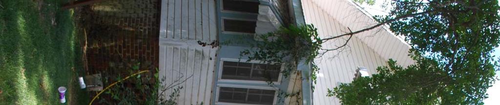
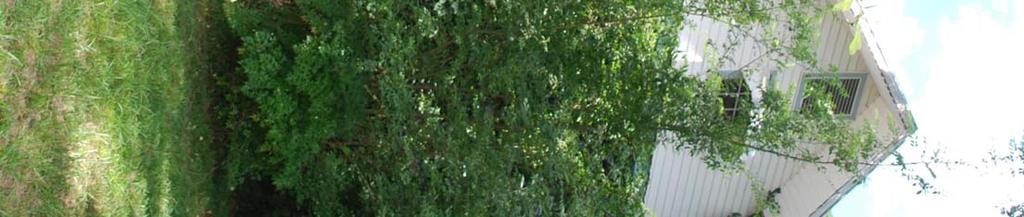
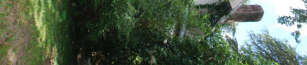
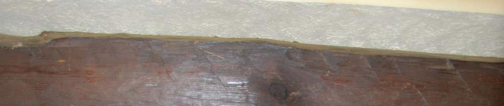
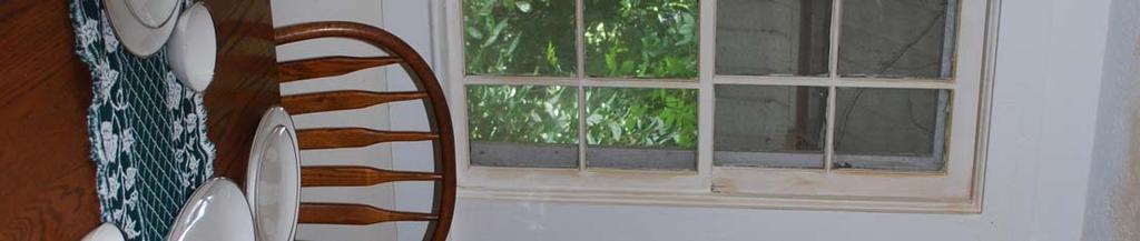
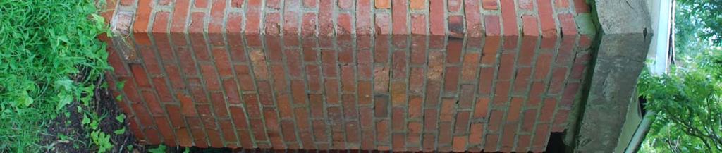
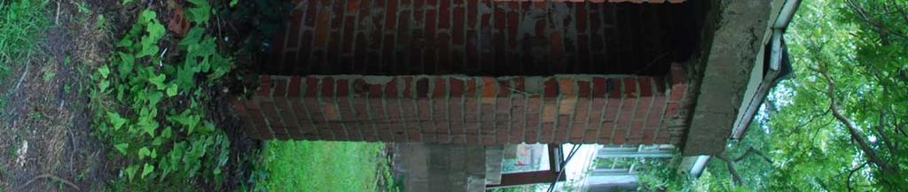
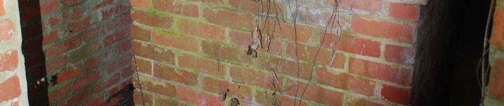
5 Compton-Johnson House Name of Property Marengo County, Alabama County and State United States Department of the Interior National Park Service National Register of Historic Places Continuation Sheet Section number 7 Page 1 7. NARRATIVE DESCRIPTION The Compton-Johnson House, constructed c.1870, is a 1-1/2-story frame dwelling with a spraddle roof. The house is situated approximately 2 miles north of the town of Dixon s Mills in Marengo County, Alabama in the unincorporated town of Wayne. The house faces southeast, rests on a brick-pier, with in-fill brick foundation, and is five bays wide and five bays deep. The historic property (the main house and associated outbuildings) is situated within a larger parent tract consisting of approximately 470 acres (tax parcel no ). The home site is located at the intersection of US Highway 43 and Big Buck Road (historically referred to as Sweetwater Road). The house faces south-southeast and is setback approximately 100 feet from the historic intersection of Sweetwater Road (Big Buck Road) and Old State Highway 13. The site also retains a contributing greenhouse, well house, and the ruins of a frame general store. Located in rural Marengo County, the area surrounding the house is presently typified by timberland interspersed with agricultural fields, scattered modern residential development, and the historic community of Dixon s Mills located approximately two miles south of the site. A grassed yard surrounds the house with a brick walk leading in a straight path from the yard to the front porch. Oak trees, magnolias, and rose bushes are found on the home site. Historic paths, drives, and flowerbeds are visible on the home site as well as a brick retaining wall. In addition, Big Buck Road contributes to the overall setting of the house and survives as an unpaved, rural road. The Compton-Johnson House was initially constructed c.1870 by George W. Compton and his wife, Pierce King Lewis Compton around the time of their marriage. The original house was a simple dogtrot with central hall and one room on either side. During the late-19 th to early-20 th century, the small cabin underwent a series of expansions, nearly tripling the size of the original structure. The first period, likely occurring during the late-19 th century, included the addition of a central hall and multiple rooms to the rear of the house. During this period, the original gable roof was replaced with the existing larger gable above the dogtrot and first series of additions. Early-20 th century additions included a sleeping porch, bathroom, and small bedroom along the western façade and a sleeping porch and screened porch along the rear of the earlier additions. These additions were constructed under the principal roof. Despite the large-scale additions to the house, the original dogtrot structure was not significantly altered. A second series of alterations and modifications occurred during the 1980s. These included replacement vinyl siding on the exterior, replacement front porch, enclosure of rear porch, and minor alterations to the interior floor plan. Despite these modern alterations, the form of the original dogtrot structure and the historic additions have remained relatively unaltered and continues to retain a large degree of historic fabric and significance. The Compton-Johnson house is rectangular in plan with historic additions extending along the west and north facades. The weatherboard house is covered with vinyl siding, and the gable roof features pressed, tin-plate shingles, boxed overhanging eaves, and a centered, gabled dormer. The house features three brick chimneys: two interior chimneys and one exterior chimney located at the gable end on the northwest façade. The exterior chimney is associated with the original construction of the dogtrot house. At the time of construction, an identical chimney was
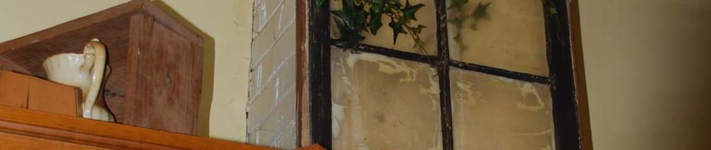
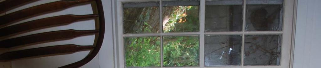
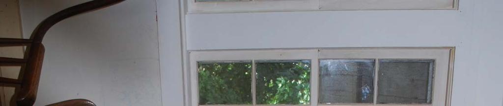
6 Compton-Johnson House Name of Property Marengo County, Alabama County and State United States Department of the Interior National Park Service National Register of Historic Places Continuation Sheet Section number 7 Page 2 located at the opposite gable end; however, it has since been removed. The foundation of this chimney survives. The primary windows of the house (those associated with the original dogtrot construction) are 6 over 6, double hung sash. These windows are unique in that the upper sash is larger than the lower. Other window configurations include 4:4 double hung sash, 2:2 horizontal sash, and 1:1 horizontal sash. Metal awnings hang above the windows. The principal southeastern façade is divided into 5 bays (W, W, D, W, W) with a centered entrance door. This façade is the original dogtrot structure. A Carolina porch, with its deck recessed beneath the extended roofline of the house, extends the full width of the house. The porch features modest square wood posts and balustrade. These posts replaced former battered square columns on brick piers most likely associated with the expansion period. Simple wood steps leading to the porch replaced former brick entry stairs flanked by a brick pier with flat concrete cap on either side. During the expansion period of the house, the western end of the porch was enclosed and operated as the Wayne Post Office. No evidence of the former post office survives following its removal during the 1980s. According to the property owner, Mrs. Drinkard, the porch floorboards were narrower and painted green prior to the removal of the Post Office. It is probable that the entire porch was replaced at the time the Post Office was removed. The entry door of the house is multi-paneled and features sidelights on either side. The door is a 1980s replacement for a historic entry door that featured vertical glass panes. According to Mrs. Drinkard, the original sidelights were frosted. The western elevation shows the contrast in the series of historic additions to the original structure. The original brick chimney and window associated with the dogtrot construction are located at the southwest corner. The end gable contains a small rectangular 6-paned window with aluminum awning and a rectangular attic vent. The windows of the early-20th century additions along the west side are 4:4 ribbon windows. The eastern elevation also features a 6-paned window and rectangular vent in the gable. The first two bays are associated with the dogtrot-era construction. The two bays to the right are associated with the late-19 th century additions. One of these bays contains a modern, paired window replacement. The northernmost bay, situated under a shed roof, is associated with the early-20 th century additions. The windows in this bay are paired, modern replacements likely installed when the rear porch was enclosed during the 1980s renovations. The rear, north elevation shows two interior brick chimneys associated with the late-19 th century additions. A ¾-width enclosed porch located at the northeast end features 2:2 vertical sash ribbon windows. Concrete steps lead to a single rear entry door leading to the porch enclosure. An enclosed sleeping porch occupies the remaining ¼ of the rear façade. This room is associated with the early-20 th century additions and features 6:6, double-hung sash ribbon windows. Extending to the west from the sleeping porch is another addition under a shed roof and features 4:4 ribbon windows.
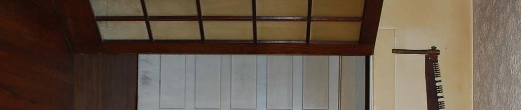
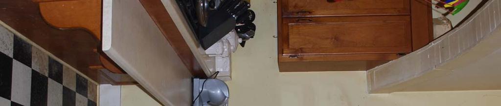
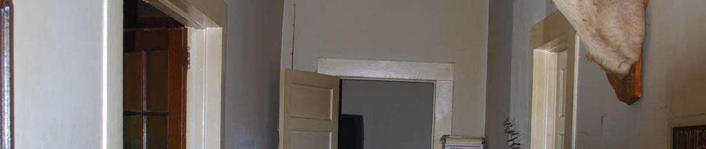
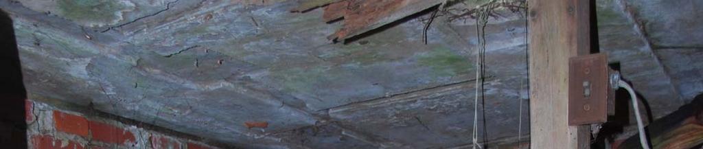
7 Compton-Johnson House Name of Property Marengo County, Alabama County and State United States Department of the Interior National Park Service National Register of Historic Places Continuation Sheet Section number 7 Page 3 In plan, the front portion of the house (to the rear of the porch) conforms to a traditional arrangement of two rooms on either side of a central hall. However, the rear portion of the house departs from this regular arrangement for a more complex plan, thus reflecting the growth of the structure during the late-19 th century and early-20 th century expansion periods. Detail throughout the house is very modest with little embellishment. Doorframes, window trim, and baseboards are very simple. Doors are typically of a four-panel design. Flooring is typically wood planking of a consistent width. The original dogtrot structure remains the core of the house. During the 1980s alterations, the door and majority of wall separating the front left parlor and the central hall were removed. However, a large beam of the original dogtrot remains exposed as a reminder of the early form of the original house. Also during the 1980s alterations, a window was removed and replaced with a door leading to a sleeping porch addition. According to Mrs. Drinkard, this door was an early-20 th century door located elsewhere in the house. The door features a large stained-glass window. Another significant alteration to the dogtrot structure during the 1980s renovations is the removal of the brick chimney at the east end. At the north end of the front entry hall, double doors open to reveal the late-19 th century additions. The 12-foot ceilings of the original dogtrot structure make way to the 14-foot ceilings of the late-19 th century additions. A long hallway runs perpendicular to the central hall of the dogtrot core. This hallway once ran the length of the house; however, was shortened at both ends in the 1980 alterations when the western bedroom was expanded. The kitchen area was separated from the hallway with an arched entry. In addition to the long, full-width hallway, other late-19 th century rooms and additions under the principal roof include two bedrooms, a bathroom, and kitchen. The bathroom window is frosted, 2:2 double hung sash. The two windows in the middle bedroom are also 2:2 double-hung sash. The westernmost bedroom features paired 4:4 windows. Windows in both bedrooms and bathroom open to the early-20 th century rear additions. A sleeping porch addition and small bedroom were also added during the early-20 th century along the west end of the house under a separate shed roof. A doorway leads from the kitchen to the early-20 th century rear, porch addition. Initially screened, the 1980s alterations included enclosure of the porch. Another doorway leads from the west end of the rear porch to a second, enclosed sleeping porch associated with the early-20 th century additions. The Compton-Johnson House is in generally good condition and the building retains the majority of its overall architectural integrity. Despite large-scale additions, both periods of expansions took place during the period of significance. These additions did not alter the form or historic fabric of the original dogtrot structure. Although the alterations and renovations occurring during the 1980s jeopardized the historic integrity of the house, both the exterior and interior retain its historic plan and the majority of its materials and finishes. In all, the overall historic integrity of the house survives. In addition, the house as it survives today portrays the evolution of the house since its c.1870 construction. Beginning as a small, modest house during the early years of settlement, expanding to accommodate a growing family, and later renovations to meet the needs of modern conveniences, the Compton-Johnson House is an good example of rural vernacular architecture in Alabama.
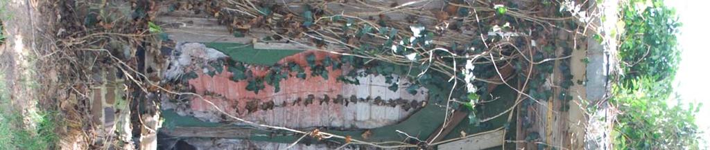
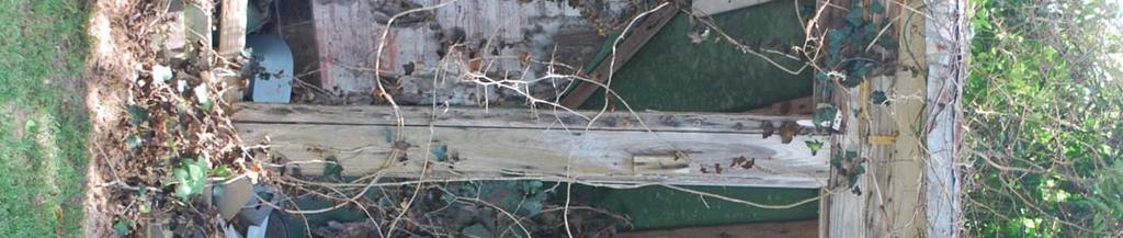
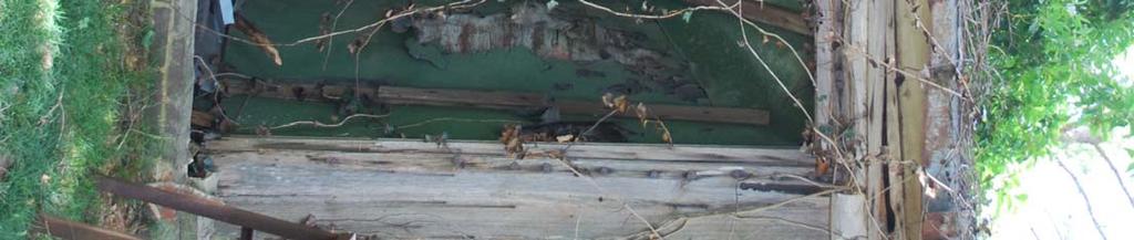
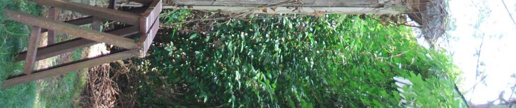
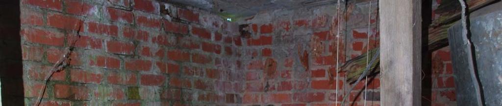
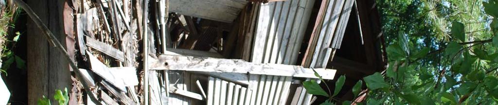
8 Compton-Johnson House Name of Property Marengo County, Alabama County and State United States Department of the Interior National Park Service National Register of Historic Places Continuation Sheet Section number 7-8 Page 4 Outbuildings and Structures Associated with the Compton-Johnson Family: All are considered contributing to the overall character and setting of the Main House. 1. Greenhouse (ca.1900) The small, brick greenhouse was reportedly constructed for Emma C. Johnson when she was a small child. The brick greenhouse is almost triangular in shape with a steeply pitched shed roof. Long since removed, the front of the structure featured glass windows allowing light and air to circulate in the greenhouse. 2. Well house (c c. 1920) The hand-drawn well was likely created simultaneously with that of the original house c The brick well house was likely an early-20 th century addition. The well house is a square, brick structure with flat, concrete slab roof. An opening on the north elevation leads to the well. Sites: (considered non-contributing) 3. General Store (c. 1930) Emma and T.G. Johnson following their marriage in 1928 constructed the balloon frame general store. The general store operated through the 1950s. It has remained vacant ever since and recently collapsed. The family has not cleared the site and the frame structure continues to sit in its collapsed state. The general store appears to have been clad in weatherboard siding and featured a gabled roof with metal roofing. A c.1940 photograph provided by Mrs. Drinkard was taken in the interior of the general store. The historic photograph suggests the presence of transomed, casement windows in the rear of the general store. 8. SIGNIFICANCE Statement of Significance The Compton-Johnson House is significant under National Register criteria A and C for its local historical significance. Under criterion A, the house is significant as the site of the historic Wayne Post Office, which serviced the small, unincorporated community c Constructed c.1870, the Compton-Johnson House has local significance under criterion C as a good example of vernacular residential architecture in rural Marengo County. Beginning as a simple dogtrot structure (c.1870) and undergoing two significant periods of expansions during the late-19 th century and early-20 th century (c ), the Compton-Johnson House reflects the incremental growth pattern universal to vernacular residences during this period.
9 Compton-Johnson House Name of Property Marengo County, Alabama County and State United States Department of the Interior National Park Service National Register of Historic Places Continuation Sheet Section number 7-8 Page 5 General History The early settlement history of the property on which the Compton-Johnson House lies dates back to an original 40- acre land grant that was deeded to Sterling Hill in The land patent was issued for the NE ¼ of the NE ¼ of Section 9, Township 13N, Range 3E. This 40-acre parcel of land is situated just north of the land on which the Compton-Johnson house lies. Sterling Hill, born in Georgia in 1792 likely came to Marengo County during the 1850s. Tharin s Directory of 1861 indicates that Sterling Hill resided near Shiloh and worked as a planter. Shiloh, located approximately 3 miles northeast of the Compton-Johnson House, was one of the earliest communities in the area. It is possible that Sterling Hill was operating a small plantation in the parcel of land that he was granted in 1853, as well as the immediately surrounding area. An official land patent for the SE ¼ of the NE ¼, the land on which the Compton- Johnson House is situated, was not officially issued until 1897 to Sterling Hill. However, based on the date of construction of the house interview with Mrs. Susie Drinkard, this parcel was occupied by George W. Compton ( ) by this time. In addition, Sterling Hill died in 1877 and was laid to rest in the Shiloh Baptist Church Cemetery (his grave marker survives). According to land patent records, the Compton family began settling within Marengo County during the 1830s within the vicinity of the communities of Demopolis and Jefferson. Tharin s 1861 Directory shows three Compton s residing in the county: David Sr., David Jr., and Robert J Compton. All were identified as planters during George W. Compton was not included in the directory; however, he was only 11 years old at that time (Dunning Family Cemetery grave marker). G.W. Compton married Pierce King Lewis ( ) in It is likely they acquired the property following their marriage in hopes of starting a family and farm of their own. According to Mrs. Drinkard, the dogtrot structure was constructed at this time as well. Despite the conflicting research and information acquired concerning the approximate date G.W. Compton first settled the property and constructed the dogtrot house, it is reasonable to assume he began to settle the land c.1870 upon his marriage to P.K. Lewis. Emma Compton ( ), daughter of Pierce King Lewis and G.W. Compton was born in 1894 at the Compton- Johnson House. She resided at her place of birth for the majority of her life. According to Mrs. Drinkard, granddaughter of Emma, the brick greenhouse was built during Emma s childhood and Emma spent much of her time in the greenhouse and family gardens. Following the death of G.W. Compton in 1904, the property, including the main house, was placed in the ownership of his wife, P.K. Lewis. The Compton family homestead is situated in the former, unincorporated community of Wayne located near the intersection of the historic alignment of the old State Route 13 between the towns of Miller and Dixon s Mills and at the intersection of the current Big Buck Road (formerly the Old Sweetwater Road). The earliest map found identifying the small community dates to 1895 (Little, J.B). The same map also indicates that Wayne had a post office operating by this time. Based on the interview with Mrs. Susie Drinkard, it is likely that the Wayne Post Office s first and final site of operation was the porch of the Compton-Johnson House. According to Mrs. Drinkard, the Post Office remained in operation until the 1960s when it merged with the Dixon s Mills Office. The Compton-Johnson House is therefore significant at the local level for its use as the Wayne Post Office for nearly 75 years (c ).
10 Compton-Johnson House Name of Property Marengo County, Alabama County and State United States Department of the Interior National Park Service National Register of Historic Places Continuation Sheet Section number 7-8 Page 6 Another significant development to the Compton homesite during the early-20 th century is the beginnings of a secondgeneration, family general store. On January 8, 1928, Emma Compton married Thomas G. Johnson. Upon her mother s death in 1932, Emma and T.G. purchased all of the shares of the estate left by P.K. Lewis (Deed Book 3N Page 437, 1933). Emma and her husband, T.G. Johnson resided in the main house until their deaths. During their occupancy, they built and operated a small, frame general store located on their land. The general store continued to operate and serve the surrounding community of Wayne and nearby Dixon s Mills until the 1950s. Emma and T.G. had one child, Barbara ( ). Barbara Johnson Baugh was granted the property upon her mother s death in Barbara Baugh, a widow, later granted the estate, including numerous tracts of land containing 3,700 acres, to her four children John P. Baugh, Aaron B. Baugh Jr., Susie Baugh Drinkard, and Thomas J. Baugh (Deed Book 10B, Page 777). The descendants of G.W. Compton and P.K. Lewis have retained ownership of the family estate since the 1870s. The Compton-Johnson house and homesite continue to reflect the history and development of the family property for nearly a century and a half. Architecture (Significance) The Compton-Johnson House, constructed c.1870, is a good example of rural, vernacular residential architecture in Marengo County, Alabama. The house demonstrates the universal growth patterns of vernacular houses throughout the late-19 th century and early-20 th century. Not only does the house retain the original, two-room dogtrot structure constructed by G.W. Compton in the early 1870s, it also reflects two periods of historic expansions completed by G.W. Compton and his descendants. The first period, likely occurring during the late-19 th century, included the addition of a central hall and multiple rooms to the rear of the house. During this period, the original gable roof was replaced with the existing larger gable above the dogtrot and first series of additions. The second expansion period occurred during the early-20 th century and included the addition of a sleeping porch, bathroom, and small bedroom along the western façade as well as a sleeping porch and screened porch along the rear of the earlier additions. These additions were constructed under the principal roof. Despite the large-scale additions to the house, the original dogtrot structure was not significantly altered. These historic expansions demonstrate the common evolution of vernacular architecture from simple, modest forms, to a larger, more complex home during the late-19 th century and early-20 th century (c ). A series of modern alterations and modifications occurred during the 1980s. These included replacement vinyl siding on the exterior, a replacement front porch, the enclosure of the rear porch, and minor alterations to the interior floor plan. The most significant of the interior alterations is the partial removal of the original dogtrot wall and entryway leading from the central hall to the western parlor. Although three-quarters of the wall was removed during the 1980s alterations, the property owner left the original wood beam exposed and intact. Despite these modern alterations, the form of the original dogtrot structure and the historic expansions has remained relatively unaltered and continue to retain a large degree of architectural integrity.
11 Compton-Johnson House Name of Property Marengo County, Alabama County and State United States Department of the Interior National Park Service National Register of Historic Places Continuation Sheet
12 Compton-Johnson House Name of Property Marengo County, Alabama County and State United States Department of the Interior National Park Service National Register of Historic Places Continuation Sheet Section number 9 Page 7 9. BIBLIOGRAPHY Dixon's Mills Aerial Photography, 1950, 1955, University of Alabama, Marengo County, Air Photo Archive. Drinkard, Susie. Interviewed by Jaime Destefano. May Gandrud, Pauline Jones. Alabama Records, Vol. 39, Marengo County. Columbus, MS: Gandrud, Pauline Jones. Alabama Records, Vol 215, Marengo County. Columbus, MS: General Land Office Records. Land Patents. Bureau of Land Management. The Heritage of Marengo County, Alabama. Clanton, Alabama: Heritage Publishing Consultants, Inc., Jones, Joel Desaker. Marengo Families. Summaries of early Marengo County Families. Kirven, Garland. Map of Marengo County, Alabama Department of Archives And History. LaTourrette, John. An Accurate Map of the State of Alabama and West Florida, Sheet 17, Available at the Alabama Department of Archives and History. Little, J.B. Map of Marengo County, State of Alabama, Alabama Department of Archives and History. Map of Marengo County, State of Alabama, Alabama Department of Archives and History. Marengo County Probate Records. Wills, deeds, plats, and newspaper records. Marengo County Courthouse, Linden, Alabama. Marengo County Tax Assessor's files. Tax maps. Marengo County Court House, Linden, Alabama. Public Information Files. Alabama State Archives, Montgomery, AL. Marengo County, Dixon's Mills.
13 Compton-Johnson House Name of Property Marengo County, Alabama County and State United States Department of the Interior National Park Service National Register of Historic Places Continuation Sheet Section number 10 Page 8 State Highway Department. State Road and Highway Maps of Alabama. 1928, 1934, 1938, 1939, 1941, 1950, 1970, 1980, Alabama Department of Archives and History. Tharin's Marengo County Directory for 1860, Originally published by Farrow and Dennett, Mobile, Alabama. Reproduced by The Marengo County Historical Society, Demopolis, Alabama, Geographical Data Verbal Boundary Description (describe the boundaries of the property) The nominated property includes an approximate one-acre area as shown on the accompanying site plan: beginning at the reference point located at latitude north, longitude west at the southwest corner of the boundary near the ruins of the former frame general store; then proceed northeast across to Big Buck Road; then proceed in a northwesterly direction approximately 180 feet to the northwest corner of the boundary; then proceed eastward approximately 150 feet then southward approximately 150 feet crossing the existing dirt drive; then proceed in a generally southwesterly direction, crossing Big Buck Road approximately 120 feet; then proceed to the point of beginning. Boundary Justification (explain why the boundaries were selected) The boundary includes sufficient land to include the Compton-Johnson House, associated outbuildings and general store as well as the associated landscape and yard.
14 Compton-Johnson House Name of Property Marengo County, Alabama County and State United States Department of the Interior National Park Service National Register of Historic Places Continuation Sheet Section number NA Page 9 Additional Documentation Photographs 1. Northerly View of Front Façade File name: AL_MA48-35_Compton-Johnson House_07-10_jld-01.tif 2. Northeasterly View of Southeast Oblique File Name: AL_MA48-35_Compton-Johnson House_07-10_jld-02.tif 3. Southeasterly View of Northwest Oblique File name: AL_MA48-35_Compton-Johnson House_07-10_jld-03.tif 4. Southeasterly View of Rear Facade File Name: AL_MA48-35_Compton-Johnson House_07-10_jld-04.tif 5. Westerly View of Easterm Facade File Name: AL_MA48-35_Compton-Johnson House_07-10_jld-05.tif Interior Photographs 6. Interior View of Front Entry Door and Central Hall File Name: AL_MA48-35_Compton-Johnson House_07-10_jld-06.tif 7. Interior View of Central Hall File Name: AL_MA48-35_Compton-Johnson House_07-10_jld-07.tif 8. Interior View of Left Room of Original Dogtrot Structure and Original Wooden Beam File Name: AL_MA48-35_Compton-Johnson House_07-10_jld-08.tif 9. Interior View of Brick Chimney Within Kitchen Area File Name: AL_MA48-35_Compton-Johnson House_07-10_jld-09.tif 10. Interior View of Former Sleeping Porch and Current Dining Room File Name: AL_MA48-35_Compton-Johnson House_07-10_jld-10.tif 11. Interior View of Kitchen Area File Name: AL_MA48-35_Compton-Johnson House_07-10_jld-11.tif
15 Compton-Johnson House Name of Property Marengo County, Alabama County and State United States Department of the Interior National Park Service National Register of Historic Places Continuation Sheet Section number NA Page Interior View of Late-19 th Century Addition - Hallway File Name: AL_MA48-35_Compton-Johnson House_07-10_jld-12.tif 13. Interior View of Late-19 th Century Addition - Hallway File Name: AL_MA48-35_Compton-Johnson House_07-10_jld-13.tif Outbuildings and Contextual Photographs 14. Northerly View of Brick Greenhouse File Name: AL_MA48-35_Compton-Johnson House_07-10_jld-14.tif 15. Northwesterly View of Brick Greenhouse File Name: AL_MA48-35_Compton-Johnson House_07-10_jld-15.tif 16. Northeasterly View of Brick Greenhouse File Name: AL_MA48-35_Compton-Johnson House_07-10_jld-16.tif 17. Southwesterly View of Brick Wellhouse File Name: AL_MA48-35_Compton-Johnson House_07-10_jld-17.tif 18. Interior View of Brick Wellhouse and Well File Name: AL_MA48-35_Compton-Johnson House_07-10_jld-18.tif 19. Northeasterly View of Compton-Johnson Property and Landscape File Name: AL_MA48-35_Compton-Johnson House_07-10_jld-19.tif 20. Northwesterly View Along the Old Big Buck Road File Name: AL_MA48-35_Compton-Johnson House_07-10_jld-20.tif 21. Northwesterly View of Ruins of Former Frame General Store File Name: AL_MA48-35_Compton-Johnson House_07-10_jld-21.tif 22. Southwesterly View of Historic Brick Retaining Wall File Name: AL_MA48-35_Compton-Johnson House_07-10_jld-22.tif
16 Feet N W
17
18

19


20


21


22


23


24


25


26


27


28


29


30


31


32


33


34


35


36


37


38


39


40


41
 Page 1 Original Update HISTORICAL STRUCTURE FORM FLORIDA MASTER SITE FILE Consult Guide To Historical Structure Forms for detailed instructions Site # 8OR9844 Recorder # 26 Recorder Date 2/20/08 Site Name
street & number: COUNTY ROUTE 3, HC-88, BOX 17 not for publication: N/A city/town: WHEELER vicinity: X state: WV county: WEBSTER code: 101 zip code:
 NPS Forn 10-900 OMB No. 10024-0018 (Oct. 1990) United States Department of the Interior National Park Service NATIONAL REGISTIR OF HISTORIC PLACES REGISTRATICN FCRX =========================================================---------=======
ate: AR County: Pulaski Code: AR Zip Code: Noncontributing buildings sites structures objects Total
 Mims-Ereedlove-Priest-Weatherton House Name of Property Little Rock, AR County and State ~- -,s Form 10-900 'V. 8-86) OMB No. 1024-0018 United States Department of the Interior National Park Service NATIONAL
808 Cherry Avenue
 808 Cherry Avenue 104-0213-0059 Primary Resource Information: Single Dwelling, Stories 2.00, Style: Other, ca 1900 July 2006: This 2-story, 3-bay frame I-house features a central-front gable, a brick pier
301 7½ Street SW
 301 7½ Street SW 104-0213-0072 Primary Resource Information: Single Dwelling, Stories 2.00, Style: Other, ca 1890 July 2006: This late-19th-century, 3-bay, 2-story, hip-roofed frame I-house features projecting
; * --.-.,., rj ; United States Department of the Interior \ ' '"] I National Park Service
![; * --.-.,., rj ; United States Department of the Interior \ ' '] I National Park Service](/thumbs/88/117765392.jpg "; * --.-.,., rj ; United States Department of the Interior \ ' '] I National Park Service") NPS Form 10-900 OMB No. 1024-0018 (Rev. 10-90) : / i' -_ :. - : ; ; * --.-.,., rj ; United States Department of the Interior \ ' '"] I National Park Service NATIONAL REGISTER OF HISTORIC PLACES REGISTRATION
NPS Form 10-900 OMB No. 1024-0018 (Rev. 10-90) : / i' -_ :. - : ; ; * --.-.,., rj ; United States Department of the Interior \ ' '"] I National Park Service NATIONAL REGISTER OF HISTORIC PLACES REGISTRATION
Architectural Inventory Form
 OAHP1403 Rev. 9/98 COLORADO CULTURAL RESOURCE SURVEY Architectural Inventory Form Official eligibility determination (OAHP use only) Date Initials Determined Eligible- NR Determined Not Eligible- NR Determined
AH pp. I Ti. Nov 7 I) I I y
 I I y") ..------------------------------------------ ------------ - - -- - NPS Form 10-900 (Rev. 8-86) United States Department of the Interior ~a tional Park Service NATIONAL REGISTER OF HISTORIC PLACES REGISTRATION
..------------------------------------------ ------------ - - -- - NPS Form 10-900 (Rev. 8-86) United States Department of the Interior ~a tional Park Service NATIONAL REGISTER OF HISTORIC PLACES REGISTRATION
Maryland Historical Trust Inventory No. PG: 86A-026 Maryland Inventory of Historic Properties Form
 Inventory No. PG: 86A-026 Maryland Inventory of 1. Name of Property (indicate preferred name) historic other 2. Location street and number 12811 Croom Road not for publication city, town Naylor vicinity
National Register of Historic Places Registration Form
 NPS Form 10-900 OMB No. 10024-0018 (Oct. 1990) United States Department of the Interior National Park Service National Register of Historic Places Registration Form 1. Name of Property historic name Hickory
United States Department of the Interior National Park Service NATIONAL REGISTER OF HISTORIC PLACES REGISTRATION FORM. Wilmoth, Bernard E.
 NPS Form 10-900 OMB No. 10024-0018 (Oct. 1990) United States Department of the Interior National Park Service NATIONAL REGISTER OF HISTORIC PLACES REGISTRATION FORM 1. Name of Property historic name: other
National Register of Historic Places Registration Form
 NPS Form 10-900 OMB No. 1024-0018 (Rev. 10-90) United States Department of the Interior National Park Service National Register of Historic Places Registration Form 1. Name of Property historic name Newcomer
THE BARNACLE 3485 MAIN HIGHWAY
 THE BARNACLE 3485 MAIN HIGHWAY Designation Report City of Miami REPORT OF THE CITY OF MIAMI PLANNING AND ZONING DEPARTMENT TO THE HISTORIC AND ENVIRONMENTAL PRESERVATION BOARD ON THE POTENTIAL DESIGNATION
National Register of Historic Places Registration Form
 National Park Service National Register of Historic Places Registration Form This form is for use in nominating or requesting determinations for individual properties and districts. See instructions in
National Register of Historic Places Registration Form
 NPS Form 10-900 OMB No. 10024-0018 (Oct. 1990) Registration Form This form is for use in nominating or requesting determinations for individual properties and districts. See instructions in How to Complete
NPS Form OMB No (Oct. 1990)
") NPS Form 10-900 OMB No. 10024-0018 (Oct. 1990) United States Department of the Interior National Park Service NATIONAL REGISTER OF HISTORIC PLACES REGISTRATION FORM 1. Name of Property historic name:_lost
NPS Form 10-900 OMB No. 10024-0018 (Oct. 1990) United States Department of the Interior National Park Service NATIONAL REGISTER OF HISTORIC PLACES REGISTRATION FORM 1. Name of Property historic name:_lost
National Register of Historic Places Registration Form
 NPS Form 10-900 OMB No. 10024-0018 (Oct. 1990) Registration Form This form is for use in nominating or requesting determinations for individual properties and districts. See instructions in How to Complete
National Register of Historic Places Registration Form
 National Park Service National Register of Historic Places Registration Form This form is for use in nominating or requesting determinations for individual properties and districts. See instructions in
National Register of Historic Places Registration Form
 NPS Form 10-900 OMB No. 10024-0018 (Oct. 1990) United States Department of the Interior National Park Service National Register of Historic Places Registration Form 1. Name of Property historic name other
National Register of Historic Places Registration Form
 NPS Form 10-900 OMB No. 1024-0018 (Rev. 10-90) United States Department of the Interior National Park Service National Register of Historic Places Registration Form 1. Name of Property historic name Evans,
National Register of Historic Places Registration Form
 NPS Form 10-900 OMB No. 1024-0018 (Rev. 10-90) United States Department of the Interior National Park Service National Register of Historic Places Registration Form 1. Name of Property historic name Strode-Morrison-Tabler
Appendix D Reevaluation of Structures on Bock House Property
 Appendix D Reevaluation of Structures on Bock House Property Page 1 Original Update HISTORICAL STRUCTURE FORM FLORIDA MASTER SITE FILE Consult Guide To Historical Structure Forms for detailed instructions
United States Department of the Interior National Park Service NATIONAL REGISTER OF HISTORIC PLACES REGISTRATION FORM
 NPS Form 10-900 (Oct. 1990) OMB No. 10024-0018 United States Department of the Interior National Park Service NATIONAL REGISTER OF HISTORIC PLACES REGISTRATION FORM 1. DR JOHN C. IRONS RESIDENCE hlstoric
AHPP. LISTED ========================================================================
 NPS Form 10-900 (Rev. 8-86) Jnited States Department of the Interior ational Park Service OMB No. 1024-0018 LISTED NATIONAL REGISTER OF HISTORIC PLACES REGISTRATION FORM AHPP. 1. Historic Name: Bush-Dubisson
United States Department of the Interior National Park Service. Boundary Expansion Listed in National Register January 11, 2017
 NPS Form 10900-a (Rev. 8/2002) OMB No. 10240018 United States Department of the Interior National Park Service Boundary Expansion Listed in National Register January 11, 2017 National Register of Historic
NE¼ of NE¼ of NE¼ of NE¼ of section Roof configuration (enter one): Gabled Roof / Front Gabled Roof
: Gabled Roof / Front Gabled Roof") OAHP1403 Rev. 9/98 COLORADO CULTURAL RESOURCE SURVEY Official Eligibility Determination (OAHP use only) Date Initials Determined Eligible - National Register Architectural Inventory Form Determined Not
OAHP1403 Rev. 9/98 COLORADO CULTURAL RESOURCE SURVEY Official Eligibility Determination (OAHP use only) Date Initials Determined Eligible - National Register Architectural Inventory Form Determined Not
Address 347 Whitney Street. East elevation, camera facing southwest.
 FORM B BUILDING Assessor s Number USGS Quad Area(s) Form Number MASSACHUSETTS HISTORICAL COMMISSION MASSACHUSETTS ARCHIVES BUILDING 220 MORRISSEY BOULEVARD BOSTON, MASSACHUSETTS 02125 Town Northborough
National Register of Historic Places Registration Form
 NPS Form 10-900 OMB No. 1024-0018 (Expires 5/31/2012) United States Department of the Interior National Register Listed National Park Service May 1, 2012 National Register of Historic Places Registration
Town: Sharon Place (neighborhood or village): Sharon. ame of Area: Present Use: Date (month / year): July 2008
: Sharon. ame of Area: Present Use: Date (month / year): July 2008") FORM A - AREA MASSACHUSETTS HISTORICAL COMMISSION MASSACHUSETTS ARCHIVES BUILDING 220 MORRISSEY BOULEVARD BOSTON, MASSACHUSETTS 02125 Photograph Assessor s Sheets USGS Quad Area Letter Form Numbers in
FORM A - AREA MASSACHUSETTS HISTORICAL COMMISSION MASSACHUSETTS ARCHIVES BUILDING 220 MORRISSEY BOULEVARD BOSTON, MASSACHUSETTS 02125 Photograph Assessor s Sheets USGS Quad Area Letter Form Numbers in
National Register of Historic Places Registration Form
 NPS Form 10-900 OMB No. 10024-0018 (Oct. 1990) Registration Form This form is for use in nominating or requesting determinations for individual properties and districts. See instructions in How to Complete
Commonwealth of Massachusetts Massachusetts Historical Commission 220 Morrissey Boulevard, Boston, Massachusetts
 Inventory No: Historic Name: Common Name: Address: HRV.165 Blood, Joseph House Farnsworth, Jonathan - Beaman, Jonathan House 74 Poor Farm Rd City/Town: Village/Neighborhood: Local No: 9-17 Year Constructed:
1 Gildersleeve Wood (DHR # )
") GILDERSLEEVE WOOD 1 Gildersleeve Wood (DHR # 104-5092-0012) STREET ADDRESS: 1 Gildersleeve Wood MAP & PARCEL: 11-20 PRESENT ZONING: R-1U ORIGINAL OWNER: Lindsay Family ORIGINAL USE: PRESENT USE: PRESENT
GILDERSLEEVE WOOD 1 Gildersleeve Wood (DHR # 104-5092-0012) STREET ADDRESS: 1 Gildersleeve Wood MAP & PARCEL: 11-20 PRESENT ZONING: R-1U ORIGINAL OWNER: Lindsay Family ORIGINAL USE: PRESENT USE: PRESENT
NPS Form OMB No Exp Status occupied X unoccupied work in progress Accessible yes: restricted yes: unrestricted _5Lno
 NPS Form 10-900 OMB No. 1024-0018 Exp. 10-31-84 United States Department of the Interior National Park Service National Register of Historic Places Inventory Nomination Form See instructions in How to
NATIONAL REGISTER OF HISTORIC PLACES REGISTRATION FORM
 (Rev. 10-90) NPS Form 10-900 OMB No. 1024-0018 NATIONAL REGISTER OF HISTORIC PLACES REGISTRATION FORM This form is for use in nominating or requesting determinations for individual properties and districts.
National Register of Historic Places Registration Form
 NPS Form 10-900 OMB No. 10024-0018 (Oct. 1990) Registration Form This form is for use in nominating or requesting determinations for individual properties and districts. See instructions in How to Complete
Architectural Inventory Form
 COLORADO CULTURAL RESOURCE SURVEY Page 1 of 3 Official Eligibility Determination (OAHP use only) Rev. 9/98 OAHP1403 Date Initials Determined Eligible National Register Determined Not Eligible National
Maryland Historical Trust Inventory No Maryland Inventory of Historic Properties Form
 Inventory No. 15 28 Maryland Inventory of 1. of Property (indicate preferred name) historic Luther Moore Farm other 2. Location street and number 7201 Damascus Road not for publication city, town Gaithersburg
United States Department of the Interior National Park Service NATIONAL REGISTER OF HISTORIC PLACES REGISTRATION FORM
 NPS Form 10-900 (Oct. 1990) OMB NO. 10024-0018 United States Department of the Interior National Park Service NATIONAL REGISTER OF HISTORIC PLACES REGISTRATION FORM As the designated authority under the
DESIGNATION REPORT KENNEDY-BAKER-WALKER-SHERRILL HOUSE (1849) 9320 KINGSTON PIKE (CLT ) KNOXVILLE, TENNESSEE July 12, 2007
 9320 KINGSTON PIKE (CLT ) KNOXVILLE, TENNESSEE July 12, 2007") DESIGNATION REPORT KENNEDY-BAKER-WALKER-SHERRILL HOUSE (1849) 9320 KINGSTON PIKE (CLT 132-027) KNOXVILLE, TENNESSEE July 12, 2007 Description The Kennedy-Baker-Walker-Sherrill House is located on the south
DESIGNATION REPORT KENNEDY-BAKER-WALKER-SHERRILL HOUSE (1849) 9320 KINGSTON PIKE (CLT 132-027) KNOXVILLE, TENNESSEE July 12, 2007 Description The Kennedy-Baker-Walker-Sherrill House is located on the south
ADDENDUM. Chain of Title. Block C, Lot 8-9. Adrian I. Velthuis and Floyd T. Grant to Lottie Thompson
 Chain of Title Block C, Lot 8-9 NLP 5175:842 October 18, 1979 NLP 4979:58 October 5, 1977 NLP 4763:448 May 11, 1977 Adrian I. Velthuis and Floyd T. Grant to Lottie Thompson Gentlemens II Properties, Inc.,
county Lonoke code 085 zip code
 ~~~~~~~~~~~ AR NPS Form I 0-900 (Oct. 1990) United States Department of the Interior National Park Service National Register of Historic Places egistration Form w-l.3-1 / OMB No. 10024-0018 This form is
Maryland Historical Trust Inventory No. PG: 86A-003 Maryland Inventory of Historic Properties Form
 Inventory No. PG: 86A-003 Maryland Inventory of 1. Name of Property (indicate preferred name) historic other 2. Location street and number 12005 Duley Station Road not for publication city, town Upper
Current Functions (Enter categories from instructions) Materials (Enter categories from instructions)
 Materials (Enter categories from instructions)") Site Inventory Form State Inventory No. 92-00542 New Supplemental State Historical Society of Iowa Part of a district with known boundaries (enter inventory no.) 92-00349 (November 2005) Relationship:
Site Inventory Form State Inventory No. 92-00542 New Supplemental State Historical Society of Iowa Part of a district with known boundaries (enter inventory no.) 92-00349 (November 2005) Relationship:
D not for publication D vicinity
 NPS Fonn I 0-900 (Oct. 1990) OMB No. 10024-0018 United States Department of the Interior National Park Service National Register of Historic Places Registration Form This fom1 is for use in nominating
STATE OF IOWA. Historical and Architectural Survey for 2008 Flood Projects in Vinton, Benton County
 STATE OF IOWA CHESTER J. CULVER GOVERNOR PATTY JUDGE LT. GOVERNOR DEPARTMENT OF PUBLIC DEFENSE IOWA HOMELAND SECURITY AND EMERGENCY MANAGEMENT DIVISION DAVID L. MILLER, ADMINISTRATOR Historical and Architectural
1 buildings sites structures objects 1 0 TOTAL
 Name of Property County and State 4. National Park Service Certification --------- I, hereby certify that this property is: Signature of Keeper Date of Action entered in the National Register See continuation
Maryland Historical Trust Inventory No. PG: 75A-007 Maryland Inventory of Historic Properties Form
 Inventory No. PG: 75A-007 Maryland Inventory of 1. Name of Property (indicate preferred name) historic other 2. Location street and number 3101 Ritchie Road not for publication city, town Forestville vicinity
Appendix E Historic Property Inventory Forms
 Appendix E Historic Property Inventory Forms TECHNICAL MEMORANDUM Sound Transit Federal Way Link Extension WISAARD Survey Entries PREPARED FOR: COPY TO: PREPARED BY: Sound Transit Alisa Swank/ CH2M MaryNell
United States Department of the Interior National Park Service NATIONAL REGISTER OF HISTORIC PLACES REGISTRATION FORM
 NPS Form 10-900 (Rev. 8-86) OMB No. 1024-0018 United States Department of the Interior National Park Service NATIONAL REGISTER OF HISTORIC PLACES REGISTRATION FORM other name/site number: "Maple Shadows:"
AHPP. ======================================================================== 3. Classi fication
 NPS Form 10-900 (Rev. 8-86) OMB No. 1024-0018 inited States Department of the Interior ational Park Service NATIONAL REGISTER OF HISTORIC PLACES REGISTRATION FORM I r' '- AHPP 1. Historic Name: Thornton
April 28, Reuben McKnight Historic Preservation Officer 747 Market Street, Suite 1036 Tacoma, WA Dear Mr. McKnight:
 April 28, 2016 Reuben McKnight Historic Preservation Officer 747 Market Street, Suite 1036 Tacoma, WA 98402 Dear Mr. McKnight: I am delighted to inform you that the Buckley s Addition Historic District
in 7.x M (Oct. 1990) United States Department of the Interior National Park Service 1. NAME OF PROPERTY
 United States Department of the Interior National Park Service 1. NAME OF PROPERTY") (Oct. 1990) United States Department of the Interior National Park Service NATIONAL REGISTER OF HISTORIC PLACES REGISTRATION FORM 1. NAME OF PROPERTY HISTORIC NAME: Jacala Restaurant OTHER NAME/SITE NUMBER:
(Oct. 1990) United States Department of the Interior National Park Service NATIONAL REGISTER OF HISTORIC PLACES REGISTRATION FORM 1. NAME OF PROPERTY HISTORIC NAME: Jacala Restaurant OTHER NAME/SITE NUMBER:
Architectural Inventory Form
 COLORADO CULTURAL RESOURCE SURVEY Page 1 of 3 Official Eligibility Determination (OAHP use only) Rev. 9/98 OAHP1403 Date Initials Determined Eligible National Register Determined Not Eligible National
HISTORIC SITE FORM HISTORIC SITES INVENTORY
 HISTORIC SITE FORM HISTORIC SITES INVENTORY 1 IDENTIFICATION Name of Property: House at 569 Park Avenue PARK CITY MUNICIPAL CORPORATION (10-08) Address: 569 Park Avenue City, County: Park City, Summit
NATIONAL REGISTER OF RIGTORfC PLACES REGISTRATION FORM
 NPS Form 10-900 (Rev. 8-86) Pnited States Department of the Interior National Park Service NATIONAL REGISTER OF RIGTORfC PLACES REGISTRATION FORM 3. Warm of Property +-----------------------------------------------------------------------
National Register of Historic Places Registration Form
 NPS Form 10-900 OMB No. 1024-0018 (Rev. 10-90) United States Department of the Interior National Park Service National Register of Historic Places Registration Form 1. Name of Property historic name Elmwood-on-the-Opequon
Town. Place (neighborhood or village) Address. Source. Style/Form. Foundation. Wall/Trim. Roof. Condition. Acreage. Setting
 Address. Source. Style/Form. Foundation. Wall/Trim. Roof. Condition. Acreage. Setting") FORM B BUILDING MASSACHUSETTS HISTORICAL COMMISSION Photograph Assessor s Number USGS Quad Area(s) Form Number 077005 Cotuit E 22 Town Barnstable Place (neighborhood or village) Address 3600 Falmouth Road/Route
FORM B BUILDING MASSACHUSETTS HISTORICAL COMMISSION Photograph Assessor s Number USGS Quad Area(s) Form Number 077005 Cotuit E 22 Town Barnstable Place (neighborhood or village) Address 3600 Falmouth Road/Route
NPS Form OMB No (Rev ) U. S. Department of the Interior Name of Property: Hungry Mother State Park Historic District
 U. S. Department of the Interior Name of Property: Hungry Mother State Park Historic District") NPS Form 10-900 OMB No. 1024-4018 (Rev. 10-90) U. S. Department of the Interior Name of Property: Location: 5. Classification Ownership of Property (Check as many boxes as apply) Category of Property (Check
NPS Form 10-900 OMB No. 1024-4018 (Rev. 10-90) U. S. Department of the Interior Name of Property: Location: 5. Classification Ownership of Property (Check as many boxes as apply) Category of Property (Check
MAGIC CITY PARK NE 2 ND AVENUE
 MAGIC CITY PARK 6001 6005 NE 2 ND AVENUE Designation Report City of Miami REPORT OF THE CITY OF MIAMI PRESERVATION OFFICER TO THE HISTORIC AND ENVIRONMENTAL PRESERVATION BOARD ON THE POTENTIAL DESIGNATION
Change dormers and main entry on the river side of the house. Site: 43 Riverbank Road, Block 10 Lot 3
 City of Burlington Historic Preservation Commission Meeting Minutes: December 2, 2015 The City of Burlington Historic Preservation Commission held its regular monthly meeting on Wednesday, December 2,
I Signature of commenting official Date I. / Title State or Federal agencylbureau or Tribal Government 1
 National Park Service National Register of Historic Places Registration Form LISTED ON: VLR 09/20/2012 NRHP 11/20/2012 This form is for use in nominating or requesting determinations for individual properties
Maryland Historical Trust Inventory No. PG: Maryland Inventory of Historic Properties Form
 Inventory No. PG: 62-012 Maryland Inventory of 1. Name of Property (indicate preferred name) historic other 2. Location street and number 11205 Old Baltimore Pike not for publication city, town Beltsville
National Register of Historic Places Registration Form
 NPS Form 10-900 (Oct. 1990) OMB No. 10024-0018 United States Department of the Interior 'fonal Park Service National Register of Historic Places Registration Form This form is for use in nominating or
National Register of Historic Places Registration Form
 NPS Form 10-900 OMB No. 1024-0018 (Expires 5/31/2012) United States Department of the Interior National Register Listed National Park Service May 1, 2012 National Register of Historic Places Registration
First Floor Plan. Second Floor Plan
 The Flint Homestead was built by 1709 for Ephraim Flint (1641 1723) and his wife Jane Bulkeley. They did not have any children. In 1723 he willed his mansion house to his nephew, John Flint, and to John
500 Preston Place. Garages PRESENT USE: Garages PRESENT OWNER: Preston Court Limited Partnership ADDRESS:
 PRESTON PLACE 500 Preston Place STREET 500 Preston Place MAP & PARCEL: 5-116 Garages Garages PRESENT OWNER: Preston Court Limited Partnership 413 7 th Street NE Charlottesville, Va. 22902 DATE/ PERIOD:
Name of related multiple property listing: Historic and Architectural Resources in Abilene, Texas
 NPS Form 10-900 (Rev. 8-86) United States Department of the Interior National Park Service NATIONAL REGISTER OF HISTORIC PLACES REGISTRATION FORM 1. NAME OF PROPERTY Historic name: Magee, J.D., House Other
FLAGLER WORKER S HOUSE FORT DALLAS PARK S.E. 4 STREET
 FLAGLER WORKER S HOUSE FORT DALLAS PARK 60-64 S.E. 4 STREET Designation Report City of Miami REPORT OF THE CITY OF MIAMI PLANNING DEPARTMENT TO THE HERITAGE CONSERVATION BOARD ON THE POTENTIAL DESIGNATION
NATIONAL REGISTER OF HISTORIC PLACES REGISTRATION FORM
 (Rev. 10-90) NPS Form 10-900 OMB No. 1024-0018 NATIONAL REGISTER OF HISTORIC PLACES REGISTRATION FORM This form is for use in nominating or requesting determinations for individual properties and districts.
Maryland Historical Trust Inventory No. 15/6 Maryland Inventory of Historic Properties Form
 Inventory No. 15/6 Maryland Inventory of 1. Name of Property (indicate preferred name) historic Becraft Farm other 2. Location street and number 28500 Ridge Road not for publication city, town Mount Airy
MINNESOTA HISTORIC.PROPERTIES INVENTORY FORM. Yes_ No X Restricted
 HISTORIC NAME: CURRENT NAME: LEGAL DESC.: MINNESOTA HISTORIC.PROPERTIES INVENTORY FORM Hartley Sugar Camp W % of Gov't. Lot 3 and T55, R24, Sec. 9 COUNTY: Itasca CITY/TWP.: Trout Lake Twp. ADDRESS: of
June 23, The Clayton Historic District is bounded by Mulberry Street, West Barnes Street, Mill Street, South Lombard Street and Blanche Street.
 June 23, 2010 This is the Clayton Historic District nomination to the National Register of Historic Places prepared by National Register Consultant Nancy Van Dolsen of Wilson, NC. The presentation was
Proposed East Sanford Historic District DRAFT
 Proposed East Sanford Historic District DRAFT Inventory List The following inventory list provides basic information for all properties in the East Sanford Historic District. Included are each property
Langley Register of Historic Places Nomination Form
 FOR OFFICE USE ONLY Langley Register of Historic Places Nomination Form Received Type all entries 1. Name of Property Historic: Jacob Anthes Bunkhouse/Cookhouse And/or common: South Whidbey Historical
National Register of Historic Places Inventory Nomination Form
 NPS Form 10-900-a Exp. 10-31-84 Continuation sheet 4 5 item number 7 Page 45 NAME: Knight Estate LOCATION: 486 East Avenue,,--v..u^-^ OWNER: State of Rhode Island Department of Education Board of Regents
National Register of Historic Places Registration Form
 NPS Form 10-900 OMB No. 10024-0018 (Oct. 1990) United States Department of the Interior National Register of Historic Places Registration Form 1. historic name South Charles Town Historic District other
N/A not for publication city or town : Hillsboro - X vicinity state: West Virginia code: WV countv: Pocahontas code: 075 zip code: 24946
 United States Department of the Interior National Park Service historic name : other nameslsite number : NIA. -.- 2. Location street & number : HC 64. Box 147loff County Road 3 1 on Kyle Beard Road N/A
IMPORTANT NOTICE. Architectural Inventory Form COLORADO CULTURAL RESOURCE SURVEY I. IDENTIFICATION. 305 Eldorado Avenue 5BL.10471
 IMPORTANT NOTICE OAHP1403 Rev. 9/98 COLORADO CULTURAL RESOURCE SURVEY Architectural Inventory Form Page 1 This survey form represents an UNOFFICIAL COPY and is provided for informational purposes only.
Total 1 Total. Current Functions (Enter categories from instructions) Materials (Enter categories from instructions)
 Materials (Enter categories from instructions)") Site Inventory Form State Inventory No. 29-00962 New Supplemental State Historical Society of Iowa Part of a district with known boundaries (enter inventory no.) 29-03685 (November 2005) Relationship:
Site Inventory Form State Inventory No. 29-00962 New Supplemental State Historical Society of Iowa Part of a district with known boundaries (enter inventory no.) 29-03685 (November 2005) Relationship:
Register of Historic Kansas Places Registration Form
 Kansas State Historical Society Register of Historic Kansas Places Registration Form This form is for use in nominating individual properties and districts. The format is similar to the National Register
not for publication: N/A city/town: St. Albans vicinity: N/A state: WV county : Kanawha code: 039 zip code:25177
 #PS F o 10-900 ~ OMB NO. 10024-0018 (OC~. 1990) United States Department of the Interior National Park Service LSATIOHAL REGISTER OF HISTORIC PLACES REGISTRATION FORM 1. Name of Property ST. ALBANS CHESAPEAKE
National Register of Historic Places Registration Form
 NPS Form 10-900 (Rev. 01/2009) OMB No. 1024-0018 United States Department of the Interior National Park Service National Register of Historic Places Registration Form This form is for use in nominating
STREET STATEMENT OF SIGNIFICANCE MARCH 2017
 1195 12 TH STREET STATEMENT OF SIGNIFICANCE MARCH 2017 HISTORIC CONTEXT The Rush House is located in the historic Ambleside neighbourhood of West Vancouver. Due to its position along the Burrard Inlet,
ATTACHMENT C ARLINGTON COUNTY REGISTER OF HISTORIC PLACES HISTORIC DISTRICT DESIGNATION FORM
 1. NAME OF PROPERTY ARLINGTON COUNTY REGISTER OF HISTORIC PLACES HISTORIC DISTRICT DESIGNATION FORM Historic Name: Other names: Reevesland Torreyson Farm 2. LOCATION OF PROPERTY Street and Number: 400
CITY OF MURFREESBORO HISTORIC ZONING COMMISSION. Regular Meeting June 19, :30 PM, Council Chambers, City Hall
 CITY OF MURFREESBORO HISTORIC ZONING COMMISSION Regular Meeting June 19, 2018 3:30 PM, Council Chambers, City Hall I. Call to Order and determination of a quorum II. Approve Minutes of the Regular Meeting
City of Burlington Historic Preservation Commission Meeting Minutes: September 4, 2013
 City of Burlington Historic Preservation Commission Meeting Minutes: September 4, 2013 The City of Burlington Historic Preservation Commission held its regular monthly meeting on Wednesday, September 4,
THE CORPORATION OF THE TOWN OF NIAGARA-ON-THE-LAKE. BY-LAW NO (214 Four Mile Creek Road)
") THE CORPORATION OF THE TOWN OF NIAGARA-ON-THE-LAKE BY-LAW NO. 4807-15 (214 Four Mile Creek Road) A BY-LAW TO DESIGNATE THE PROPERTY KNOWN MUNICIPALLY AS WOODBOURNE, 214 FOUR MILE CREEK ROAD, IN THE TOWN
THE CORPORATION OF THE TOWN OF NIAGARA-ON-THE-LAKE BY-LAW NO. 4807-15 (214 Four Mile Creek Road) A BY-LAW TO DESIGNATE THE PROPERTY KNOWN MUNICIPALLY AS WOODBOURNE, 214 FOUR MILE CREEK ROAD, IN THE TOWN
 ~. ',. ( NPS Form 10-900 (Rev. 8-86) NR I ;s+eca Cf/ S /q~ OMB No. 1024-0018 United States Department of the Interior National Park Service NATIONAL REGISTER OF HISTORIC PLACES REGISTRATION FORM ------------------------------------------------------------------------
HENNIGAN PLACE. This photograph is circa November Name, address, and telephone number of the present owner and occupant of the property:
 HENNIGAN PLACE This report was written on November 7, 1979 This photograph is circa November 2006. 1. Name and location of the property: The property known as the Hennigan Place is located at 3503 Tilley
National Register of Historic Places Continuation Sheet
 Section number N/A Page 1 Proposed Amendment to Wichita, Sedgwick County, Kansas The owner of the building at 141 S. Rock Island Avenue requests amendment to the boundaries of the East Douglas Historic
city or town Muscatine vicinity, county Muscatine Legal Description: (If Rural) Township Name Township No. Range No. Section Quarter of Quarter
 Township Name Township No. Range No. Section Quarter of Quarter") Site Inventory Form State Inventory No. 70-00233 New Supplemental State Historical Society of Iowa Part of a district with known boundaries (enter inventory no.) (December 1, 1999) Relationship: Contributing
Site Inventory Form State Inventory No. 70-00233 New Supplemental State Historical Society of Iowa Part of a district with known boundaries (enter inventory no.) (December 1, 1999) Relationship: Contributing
National Register off Historic Places Inventory Nomination Form
 MPS Fonn 10-900-a (3^ United States Department of the Interior National Park Service National Register off Historic Places Inventory Nomination Form For NPS use only received date entered OMB No 1M4-0018
COLORADO HISTORICAL SOCIETY COLORADO STATE REGISTER OF HISTORIC PROPERTIES NOMINATION FORM
 COLORADO HISTORICAL SOCIETY COLORADO STATE REGISTER OF HISTORIC PROPERTIES NOMINATION FORM OAHP1414 (Rev. 8/2003) SECTION I Name of Property Historic Name Other Names HUBBARD RANCH / TEN SLEEP RANCH /
Abandoned or Vacant; Agricultural; Camp; Other Residential Agriculture; Archaeology, Historic; Architecture; Politics Government; Social History
 Inventory No: Historic Name: HRV.G Civilian Conservation Camp Common Name: Address: City/Town: Village/Neighborhood: Local No: 13-7.01 Year Constructed: Architect(s): Architectural Style(s): Use(s): Significance:
National Register off Historic Places Inventory Nomination Form
 NPS Fomi ia-900-a OMB Ho. 1024-0018 Exp. 10-31-S4 United States Department of the Interior National Park Service National Register off Historic Places Inventory Nomination Form For HPS UM only received
National Register of Historic Places Registration Form
 NPS Form 10-900 OMB No. 10024-0018 (Oct. 1990) United States Department of the Interior National Park Service National Register of Historic Places Registration Form 1. Name of Property historic name other
National Register of Historic Places Registration Form
 NPS Form 10-900 OMB No. 10024-0018 (Oct. 1990) Registration Form This form is for use in nominating or requesting determinations for individual properties and districts. See instructions in How to Complete
United States Department of the Interior National Park Service NATIONAL REGISTER OF HISTORIC PLACES REGISTRATION FORM
 NPS Form 10-900 (Oct. 1990) OMB NO. 10024-0018 United States Department of the Interior National Park Service NATIONAL REGISTER OF HISTORIC PLACES REGISTRATION FORM 1. historic name: WEIMER, JAMES HOUSE
State Level Historic Documentation Report. John Blue Bridge Hampshire County
 State Level Historic Documentation Report State Project No. S314-28-22.27 Federal Project No. BR-0028(058)D John Blue Bridge Hampshire County Prepared by: Randy Epperly, Historian Department of Transportation
National Register of Historic Places Registration Form
 NPS Form 10-900 National Park Service OMB No. 1024-0018 National Register of Historic Places Registration Form This fo rm is for use in nominating or requesting determinations fo r individual properties