county Lonoke code 085 zip code
|
|
|
- Robert Thompson
- 5 years ago
- Views:
Transcription


1 ~~~~~~~~~~~ AR NPS Form I (Oct. 1990) United States Department of the Interior National Park Service National Register of Historic Places egistration Form w-l.3-1 / OMB No This form is for use in nominating or requesting determinations for individual properties and districts. See instructions in How to Complete the National Register of Historic Places Registration Form (National Register Bulletin 16A). Complete each item by marking "x" in the appropriate box or by entering the information requested. If an item does not apply to the property being documented, enter "N/ A" for "not applicable." For functions, architectural classification, materials, and areas of significance, enter only categories and subcategories from the instructions. Place additional entries and narrative items on continuation sheets (NPS Form I 0-900a). Use a typewriter, word processor, or computer, to complete all items. 1. Name of Property historic name Keo Commercial Historic District other names/site number 2. Location street & number city or town state AR Keo Main Street, AR Highway 232, Fleming Street code county Lonoke code 085 zip code D not for publication D vicinity State/Federal Agency Certification As the designated authority under the National Historic Preservation Act, as amended, I hereby certify that this [81 nomination 0 request for determination of eligibility meets the documentation standards for registering properties in the National Register of Historic Places and meets the procedural and professional requirements set for in 36 CFR Part 60. In my opinion, the property [81 meets 0 do1 not meet the National Register criteria. I recommend that this property be considered significant 0 nationall 0 tate ide,_ ally. (See continuation she dditional co ents.) ~'"2- I f State or Federal agency and bureau In my opinion, the property 0 meets 0 does not meet the National Register criteria. (0 See Continuation sheet for additional comments.) Signature of certifying official!fitle Date State or Federal agency and bureau 4. National Park Service Certification I hereby certify that the property is: 0 entered in the National Register. 0 See continuation sheet 0 determined eligible for the National Register. 0 See continuation sheet 0 determined not eligible for the National Register. 0 removed from the National Register. 0 other, (explain:) Signature of the Keeper Date of Action


2 Keo Commercial Historic District Name of Property 8. Statement of Significance.\pplicaMe National Register Criteria Mark "x" in one or more boxes for the criteria qualifying the property r National Register listing.) Lonoke County, AR County and State Levels of Significance (local, state, national) Local [8l A Property is associated with events that have made a significant contribution to the broad patterns of our history. D B Property is associated with the lives of persons significant in our past. [8l C Property embodies the distinctive characteristics of a type, period, or method of construction or represents the work of a master, or possesses high artistic values, or represents a significant and distinguishable entity whose components lack individual distinction. D D Property has yielded, or is likely to yield, information important in prehistory or history. Areas of Significance ARCHITECTURE COMMERCE Period of Significance (Enter categories from instructions) Criteria Considerations (Mark "x" in all the boxes that apply.) Property is: D A owned by a religious institution or used for religious purposes. B removed from its original location. D C birthplace or grave of a historical figure D D a cemetery. Significant Dates 1913, 1926 Significant Person (Complete if Criterion Bis marked) Cultural Affiliation (Complete if Criterion Dis marked) D E a reconstructed building, object, or structure. D F a commemorative property D G less than 50 years of age or achieved significance within the past 50 years. ArchitecUBuilder Narrative Statement of Significance (Explain the significance of the property on one or more continuation sheets.) 9. Major Bibliographical References Bibliography (Cite the books, articles, and other sources used in preparing this form on one or more continuation sheets.) Previous documentation on file (NPS): D preliminary determination of individual listing (36 CFR 67) has been requested previously listed in the National Register Previously determined eligible by the National Register D designated a National Historic Landmark D recorded by Historic American Buildings Survey # D recorded by Historic American Engineering Primary location of additional data: [8l State Historic Preservation Office D Other State Agency D Federal Agency D Local Government D University D Other Name of repository:

 This boundary includes all of the property historically associated with this resource that retains its integrity. 11.")
3 ~~~~~~~~~~~~~~~~~~~~~~~~~~~~~~~~~~~~~~~~~~~~~~~ Keo Commercial Historic District Name of Property Lonoke County, AR County and State 10. Geographical Data Acreage of Property Approximately 19 UTM References (Place additional UTM references on a continuation sheet.) 3 Zone Easting Northing Zone Easting Northing 2 4 Verbal Boundary Description l:8j See continuation sheet Boundary Justification (Explain why the boundaries were selected on a continuation sheet.) This boundary includes all of the property historically associated with this resource that retains its integrity. 11. Form Prepared By name/title Holly Hope/ Special Projects Historian organization Arkansas Historic Preservation Program date 04/22/11 street & number 1500 Tower Building, 323 Center Street telephone city or town Little Rock state AR zip code Additional Documentation Submit the following items with the completed foim : Continuation Sheets Maps A USGS map (7.5 or 15 minute series) indicating the property's location Photographs A Sketch map for historic districts and properties having large acreage or numerous resources. Representative black and white photographs of the property. Additional items (Check with the SHPO or FPO for any additional items.) Property Owner (Complete this item at the request of SHPO or FPO.) name NIA street & number telephone city or town state zip code Paperwork Reduction Act Statement: This information is being collected for applications to the National Register of Historic Places to nominate properties for listing or determine eligibility for listing, to list properties, and to amend existing listing. Response to this request is required to obtain a benefit in accordance with the National Historic Preservation Act, as amended (16 U.S.C. 470 et seq.) Estimated Burden Statement: Public reporting burden for this form is estimated to average 18.1 hours per response including time for reviewing instructions, gathering and maintaining data, and completing and reviewing the form. Direct comments regarding this burden estimate or any aspect of this form to the Chief, Administrative Services Division, National Park Service, P. 0. Box 37127, Washington, DC ; and the Office of Management and Budget, Paperwork Reductions Projects ( ), Washington, DC

4 NPS Form a 5/31 /2012) (Rev. 01 /2009) OMB No (Expires United States Department of the Interior National Park Service National Register of Historic Places Continuation Sheet Name of Property Keo Commercial Historic District County and State Lonoke, AR Name of Multiple Property Listing (I f applicable} Section number: 7 page: SUMMARY The town of Keo is located on U.S. Highway 165, twenty-three miles south of North Little Rock and five miles north of England. The Keo Commercial Historic District is situated to the west of U.S. Highway 165. It consists of three blocks of the west side of Main Street and is bounded on the north by Arkansas Highway 232 and on the south by Fleming Street. The west boundary is the alley behind the commercial buildings and the east boundary is the east side of Main Street. The Morris Cotton Gin Complex is situated at the north side of Highway 232 and the Cobb Cotton Gin Complex is located on the south and north sides of Fleming Street. The district contains thirty-five buildings, structures and objects, four vacant lots and one park. Three of the vacant lots have been empty for over eighty years while one lot has only been vacant since Twenty-nine of the resources are considered contributing while seven are considered noncontributing because of construction dates outside of the period of significance and alterations that impact the architectural integrity of the buildings. The period of significance for the Keo Commercial Historic District is The commercial buildings are represented by Standard 20th Century architecture and Plain-Traditional industrial-agricultural styles. Cobb Cotton Gin Complex Cobb Cotton Gin The 1946 Cobb Cotton Gin is the centerpiece of the ginning complex that anchors the southern end of the Keo Downtown Historic District. The largest of the twenty-two structures and buildings in the complex, it is a gable-roofed bu ilding

5 NPS Form a 5/31 /2012) (Rev. 01/2009) OMB No (Expires United States Department of the Interior National Park Service National Register of Historic Places Continuation Sheet Name of Property Keo Commercial Historic District County and State Lonoke, AR Name of Multiple Property Listing (If applicable) Section number: 7 page: 2 sheathed in corrugated transite asbestos siding on a full concrete foundation. The Cobb Cotton Gin is contributing to the Keo Commercial Historic District. The front, west fac;ade of the gin is fenestrated from north to south with a singleleaf met al door featuring a one-over-one light. Adjacent to the door are two metal windows with a configuration of four-over-two lights. The bottom sash is a hoppertype, while the top sash is an awning-type. Double-leaf sliding doors with one-over-one lights open into the ginning floor next to two windows, a single-leaf door with one-overone light and a row of three windows at the southwest corner. All openings are shaded by a fu ll cantilevered corrugated asbestos awning supported by metal trusses and two metal posts at the area of the double doors. The suck pipe for drawing cotton out of trucks is housed in a gable-roofed dormer over the double doors. The loft area above the awn ing is fenestrated by five four-light hopper windows that open to the interior by pulling on a chain on the gin floor. The south elevation features sliding double doors with two-over-two lights at the southwest corner and a single window at the southeast. Two windows fenestrate the loft area. The eastern elevation from south to north is fenestrated by four windows. A shed-roofed projection extends approximately five feet and is accessed by a single-leaf paneled metal door. A second shed-roofed addition sheathed in vertical metal siding projects approximately twenty feet. A single window is adjacent to a third shed-roofed projection original to the cotton gin. A single-leaf metal door opens into the projection, which is open at the upper level and houses a large pipe leading from the interior ginning floor. A single-story shed-roofed addition extends from the original wall next to

6 NPS Form a 5/31 /2012) (Rev. 01 /2009) OMB No (Expires United States Department of the Interior National Park Service National Register of Historic Places Continuation Sheet Name of Property Keo Commercial Historic District County and State Lonoke, AR Name of Multiple Property Listing (If applicable) Section number: 7 page: 3 a double-leaf door at the northeast corner. A wooden gangplank leads from the double doors at the northeast to the Cobb Cotton Bale House. Two windows ventilate the loft at the southeast corner. A series of pipes and chimney stacks run from the gin at the southeast end to seed warehouses and a trash house to the east. The north elevation features a single window adjacent to sliding double-leaf metal doors with one-over-one lights. A full shed-roof metal awning shades the area used as a cotton dock on the north side. The loft is ventilated by two windows on this elevation. Cobb Cotton Seed House 1 A contributing cotton seed house constructed circa 1900 extends south from the Cobb Cotton Bale House and is situated east of the Cobb Cotton Gin. Cobb Cotton Seed Cobb Cotton Seed House 1 is sheathed in board-and-batten and has a corrugated metal roof. The building has a foundation of concrete "bell" piers. A thin, shed-roofed dormer housing a pipe extends from the roof in the center of the building. Th is dormer marks the break between the Cobb Cotton Seed House 1 and Cobb Cotton Seed House 2_ The western fa~ade of Cobb Cotton Seed House 1 from north to south features a shed extension with a single-leaf board-and-batten door opening onto a small wooden dock reached by wooden steps. An adjacent open shed extension covers exterior equipment. The wall beneath is not fenestrated.


7 NPS Form a 5/31/2012) (Rev. 01/2009) OMB No (Expires United States Department of the Interior National Park Service National Register of Historic Places Continuation Sheet Name of Property Keo Commercial Historic District County and State Lonoke, AR Name of Multiple Property Listing (If applicable) Section number: 7 page: 4 The eastern elevation from south to north is fenestrated with four board-andbatten casement openings. The northern end of Cobb Cotton Seed House 1 abuts the Cobb Cotton Bale House and the southern end abuts Cobb Cotton Seed House 2. Cobb Cotton Seed House 2 The western elevation of the contributing Cobb Cotton Seed House 2, built circa 1900, feat ures a full metal awning supported by wooden brackets, which covers three openings enclosed with wooden casement sashes. The southern elevation is not fenestrated. The eastern elevation from south to north is fe nestrated with four board-and-batten casement openings. At the point where the building abuts the Cobb Cotton Seed House 1, a single-leaf door reached by three wooden steps opens into a small recessed space. Cobb Cotton Bale House The contributing Cobb Cotton Bale House was built circa 1900 and is linked to the double doors at the northeast corner of the cotton gin by a wooden gangplank. The gable-roofed structure is sheathed in corrugated metal sheets with a corrugated metal roof and is supported by a foundation of wooden piers. A small metal dormer with gable roof extends from the northern end of the building. The front, western elevation features three sliding metal doors. The center door opens onto a small wooden loading dock connected to the gangplank. The northern elevation features no windows or doors. There is a small shed roof covering some exterior equipment at the foundation level.

8 NPS Form a 5/31/2012) (Rev. 01 /2009) OMB No (Expires United States Department of the Interior National Park Service National Register of Historic Places Continuation Sheet Name of Property Keo Commerci al Historic District County and State Lonoke, AR Name of Multiple Property Listing (If applicable) Section number: 7 page: 5 The eastern elevation mirrors the west, featuring three sliding metal doors. The south end of the Cobb Cotton Bale House abuts the adjacent Cobb Cotton Seed House 1. Cobb Truck Dump Pit The Cobb Truck Dump Pit located to the northeast of the gin was built in circa 1954 and was used in conjunction with the soybean elevator. The contributing pit is a square shed-roofed structure used to house soybean trucks while the bed was filled with soybean products from a pipe in the roof running from the elevator. The structure is sheathed in corrugated metal siding and features a full, pouredconcrete foundation. Concrete ramps lead to large double-leaf metal doors on the north and south. The east and west elevations are not fenestrated. Cobb Soybean Elevator The circa 1954 five-tank structure is located to the east of the Cobb Truck Dump Pit. The tanks are constructed of corrugated steel and attached to the dump pit by pipes. The Cobb Soybean Elevator is considered contributing. Cobb Trash House The Cobb Trash House is southeast of the Cobb Cotton Gin and is connected to Cobb Cotton Seed House 2 by a single pipe, which pulled material to a funnel on top of the metal gable-roofed structure raised on metal poles. This space allowed trucks to drive beneath and load cotton trash into the truck bed for transport. The Cobb Trash House is non-contributing because it was constructed in Cobb Cotton Cleaner Building The contributing Cobb Cotton Cleaner Building is located south of the Cobb Cotton Gin and was constructed circa The gabled building covered in board-and-

9 NPS Form a 5/31 /2012) (Rev. 01 /2009) OMB No (Expires United States Department of the Interior National Park Service National Register of Historic Places Continuation Sheet Name of Property Keo Commercial Historic District County and State Lonoke, AR Name of Multiple Property Listing (If applicable) Section number: 7 page: 6 batten siding features a standing-seam metal roof and a foundation of concrete-block piers. The front, north fa~ade is fenestrated from east to west with two board-andbatten casement openings, a centered sliding double door of board-and-batten and two casem ent openings at the northwest corner. The west elevation features a centered sliding double door. The fenestration on the south elevation mirrors that on the north. An open shed extension with a solid board-and-batten wall on the south shelters the two window openings at the southeast corner of this elevation. The east elevation features no fenestration. Cobb Quonset Hut The Cobb Quonset Hut is located west of the Cobb Cotton Cleaner Building. The hut is sheathed in corrugated metal sheets and features a poured-concrete foundation. This circa 1950s building situated south of the gin across Fleming Street is considered contributing. The front, north elevation from east to west is fenestrated with two six-light steel hopper windows. A double-leaf metal sliding door protrudes slightly from the center of this elevation. Two windows light the northwest. Four single-light hopper windows open into the crawlspace beneath the hut. The west elevation of the Quonset is fenestrated by a single-leaf metal door and flanked by two windows. Four crawlspace windows are located in the foundation. A section of a wooden trough protrudes from the building over the door. The south elevation features five windows and four crawlspace windows.

10 NPS Form a 5/31/2012) (Rev. 01 /2009) OMB No (Expires United States Department of the Interior National Park Service National Register of Historic Places Continuation Sheet Name of Property Keo Commercial Historic District r County and State Lonoke, AR Name of Multiple Property Listing (If applicable} Section number: 7 page: 7 The east elevation has a centered, sliding double-door of metal flanked by two windows. The hut is attached to the Cobb Cotton Cleaner Building by a wooden trough that moved seed between the two structures. Four crawlspace windows open into the foundation. Cobb Storage Building Cobb Storage Building was constructed in the early 1900s and is considered contributing to the district. The building is located north of the Cobb Quonset Hut and south of the Gin and Fleming Street. The rectangular building with a standing-seam metal roof is placed on a foundation of concrete-block piers. It is covered in weatherboard. The front; north fac;ade features a wooden double-door. A wood slat gate is placed on the northwest corner of an open shed extension. The west elevation is sheltered by a full shed overhang supported by two wood posts. The northwest corner of the overhang is enclosed with a wood slat fence. Three casement openings of wood are located beneath the overhang. The south elevation is not fenestrated. The east elevation from south to north is fenestrated by a single entrance with no door, and two wooden casement openings. Cobb Cotton Seed House 3 The circa early 1900s Cobb Cotton Seed House 3 is contributing. It fronts on Fleming Street and is located directly north of the Cobb Storage Building. The building has a metal gabled roof and is sheathed in a combination of corrugated metal sheets and vertical board. A metal smokestack is situated on the north end of the roof. The foundation consists of concrete "bell" piers.
 Section number: 7 page: 8 The front, northern elevation features a")
11 NPS Form a 5/31/2012) (Rev. 01/2009) OMB No (Expires United States Department of the Interior National Park Service National Register of Historic Places Continuation Sheet. Name of Property Keo Commercial Historic District County and State Lonoke, AR Name of Multiple Property Listing (If applicable) Section number: 7 page: 8 The front, northern elevation features a centered single-leaf metal door. A pipe leads from Cobb Cotton Seed House 3 to the Cobb Cotton Gin across Fleming Street. The west elevation is sheathed in vertical wood siding and is fenestrated from north to south with five wooden casement openings and a single-leaf wooden door with crossbuck bracing at the southwest corner. Five openings with screened coverings provide ventilation in the upper portion of the building. A wraparound dropped shed overhang extends across this elevation and is supported by four wooden posts. The overhang extends to the south side of the building and shelters a centered double-leaf wooden door. The overhang is supported by three wooden posts. The pediment of the building is covered in metal sheets while below the overhang the wall is covered in vertical board. The east elevation is covered by the shed overhang supported by five wooden posts. It is fenestrated from south to north by a single wooden casement opening, a single-leaf wooden door with crossbuck bracing and four openings. Six screened openings ventilate the upper area. The wall is sheathed in vertical wood siding. Cobb Fire Hose House The contributing Cobb Fire Hose House, built in the circa 1900s, is situated just to the north of Cobb Cotton Seed House 3 and south of the Cobb Cotton Gin. The Cobb Fire Hose House is a small gable-roofed structure containing a wooden spool for a fire hose. It is sheathed in weatherboard and has a standing seam metal roof. The north elevation features a small single-leaf wooden door. elevations are fenestrated. No other

12 NPS Form a 5/31/201 2) (Rev. 01/2009) OMB No (Expires United States Department of the Interior National Park Service National Register of Historic Places Continuation Sheet Name of Property Keo Commercial Historic District County and State Lonoke, AR Nam e of Multiple Property Listing {I f applicable} Section number: 7 page: 9 Cobb Water Tank The Cobb Water Tank is located southwest of the Cobb Cotton Gin_ Constructed circa 1920s, this structure is contributing. The structure consists of a cylindrical metal tank atop a steel lattice support with central pipe. Cobb Cotton Pen The contributing circa 1940 Cobb Cotton Pen is north of the water tank and south of Fleming Street. The Cobb Cotton Pen is a small, square structure of weatherboard with a gabled metal roof. A single-leaf wooden door opens into the north elevation. A wooden hopper opening is located above the door. There is no other fenestration on the structure. Cobb Commissary The Cobb Commissary is located to the west of the Cobb Cotton Pen and fronts on Fleming Street. The circa 1900 building on a foundation of concrete bell piers is sheathed in board-and-batten siding and has a corrugated-metal gable roof. A chimney chase on the hip of the roof is built of buff brick. The Cobb Commissary is considered contributing to this district. The north, front elevation has a full, corrugated metal shed porch supported by two wood posts. The wooden porch floor is accessed by three concrete steps on the east end. From east to west, fenestration consists of a four-over-four double-hung window, a single-leaf paneled door and a second window. A shed extension on the northwest corner of the building is not covered by the porch and is accessed by a sliding board-and-batten double-leaf door.

13 NPS Form a 5/3 1/2012) (Rev. 01/2009) OMB No (Expires United States Department of the Interior National Park Service National Register of Historic Places Continuation Sheet Name of Property Keo Commercial Historic District County and State Lonoke, AR Name of Multiple Property Listing (If applicable) Section number: 7 page: 10 The western elevation of the shed extension is not fenestrated. The rear, south elevation features a shed roofed porch supported by two wooden posts. Fenestration under the porch consists of a paneled door flanked by two windows. The eastern elevation is fenestrated by a single window. Cobb Cotton Gin Laborer House The Cobb Cotton Gin Laborer House, built circa 1959, is located to the south of Fleming Street and west of the Cobb Cotton Gin. The house is a small Craftsman building with a standing-seam metal gable roof on a foundation of concrete bell piers. It is covered in ashlar masonry asphalt roll siding. The Cobb Cotton Gin Laborer House is considered contributing because it is an example of laborer housing that employees of the Cobb's cotton gin would have inhabited. There are few such houses remaining in the area that have not been altered, and many were destroyed in the 1960s and 1970s. The front, south elevation features a three-quarter shed-roofed porch supported by three turned spindle supports. Fenestration consists of a centered front door flanked by two-over-two aluminum double-hung windows. The east elevation is fenestrated by two windows. The rear, north elevation is lit by a single window at the northwest corner. A gabled addition, probably an enclosed porch, extends approximately fifteen feet. A single door opens into the addition. The western elevation is fenestrated north to south by a small aluminum sliding window and two double-hung windows. Cobb Chemical House The Cobb Chemical House is located west of the Cobb Cotton Gin on the northwest corner of Fleming and Main streets. The building was moved to this location in 1964

14 NPS Form a 5/31/2012} (Rev. 01/2009) OMB No (Expires United States Department of the Interior National Park Service National Register of Historic Places Continuation Sheet Name of Property Keo Commercial Historic District County and State Lonoke, AR Name of Multiple Property Listing (If applicable) Section number: 7 page: 11 for use as a chemical storage building. Since it was not originally associated with the Cobb Cotton Gin, the Chemical House is considered non-contributing. It is a rectangular structure with corrugated metal siding and a standing-seam metal gable roof on cylindrical concrete piers. The front, eastern elevation of the Cobb Chemical House is fenestrated south to north by a narrow four-light hopper window, a single-leaf paneled door and a six-overone double-hung window. The door is reached by four wooden steps and it is sheltered by a small metal awning. The north and west elevations feature no fenestration. The south elevation contains a centered sliding metal door and a window at the southeast corner. Cobb Scale House The contributing Cobb Scale House was built in 1946 and is located on the west side of Main Street, directly west of the Cobb Cotton Gin. The contributing Cobb Scale House is sheathed in wood grain, wavy-butt asbestos shingles. The front, east fa~ade of the Cobb Scale House is fenestrated from south to north with three pairs of six-over-six double-hung windows. The wall steps back approximately eight feet on the northeast corner of the building and is lit by a single window. The north elevation is fenestrated with a single door covered by an aluminum awning on the northeast corner and a single window. The northwest corner of this elevation is constructed of brick as this is where the safe is located inside the building. The north wall steps south a few feet at the northwest and is fenestrated by a single window.


15 NPS Form a 5/31/2012) (Rev. 01/2009) OMB No (Expi res United States Department of the Interior National Park Service National Register of Historic Places Continuation Sheet Name of Property Keo Commercial Historic District County and State Lonoke, AR Name of Multiple Property Listing (If applicable) Section number: 7 page: 12 The northwest corner of the west elevation is constructed of brick. Fenestration north to south consists of a window, a single-leaf door, a three-window bay for viewing the trucks on the scale, a single-leaf door and a window at the southwest corner. The south elevation is fenestrated from west to east by a single-leaf door and two windows. All openings on this side are shaded by aluminum awnings. Cobb Cotton Truck Scale The 1946 Cobb Cotton Truck Scale is located directly west of the Cobb Scale House. This contributing structure consists of a wooden pad covered by a flat metal roof supported by five metal poles on the east and west. The Cobb Cotton Truck Scale is considered contributing as it is the original structure that was built to accommodate wagons and teams of horses. Cobb Sample Shop House The circa 1950 Cobb Sample Shop House is north of the Cobb Scale House and west of t he Cobb Cotton Gin. The small square building with flat roof and monitor light is constructed of cinder block and is considered contributing. The front, eastern fac;ade is accessed by a single-leaf door with one light. The door is sheltered by an aluminum awning. There is no other fenestration on the building. Cobb Shop Building The circa 1920 Cobb Shop Building is sheathed in board-and-batten siding. The contributing building is rectangular with a standing-seam metal gabled roof. The Cobb Shop Building is located north of the Cobb Sample Shop House and west of the Cobb Cotton Gin across Main Street.

16 NPS Form a 5/31 /2012) (Rev. 01 /2009) OMB No (Expires United States Department of the Interior National Park Service National Register of Historic Places Continuation Sheet Name of Property Keo Commercial Historic District County and State Lonoke, AR Name of Multiple Property Listing (If applicable) Section number: 7 page: 13 The front, east elevation is accessed by large wooden double-leaf doors. The south elevation is fenestrated east to west by a pair of six-over-six double-hung windows, three four-over-four windows and wooden double-leaf doors at the southwest corner. The west elevation is accessed by a large centered single-leaf door flanked by two four-over-four windows. The north elevation is fenestrated west to east by three four-over-four windows and a pair of six-over-six windows at the northeast corner. This elevation is sheathed in corrugated metal sheets. Cobb Tool Shed The circa 1920 Cobb Tool Shed is located at the northeast corner of the Cobb Shop Build ing. The small square structure has a shed roof and is considered contributing. It is sheathed in board-and-batten siding. The front, southern elevation has a single board-and-batten door. There is no other fenestration. Main Street Buildings Garnett Store The building at 382 Main Street is considered non-contributing due to recent alterations to the front fa~ade. This rectangular commercial building with gable roof behind a false stepped pediment is constructed of cinder block and was built in It anchors the south end of the strip of commercial buildings.

17 NPS Form a 5/31/2012) (Rev. 01 /2009) OMB No (Expires United States Department of the Interior National Park Service National Register of Historic Places Continuation Sheet Name of Property Keo Commercial Historic District County and State Lonoke, AR Name of Multiple Property Listing (If applicable) Section number: 7 page: 14 The front, east fa~ade is sheathed in a veneer of board-and-batten siding placed on the building in A full porch with metal shed roof supported by three square posts shades, from south to north, a double-leaf door, a stationary, one-light window and a second single-leaf paneled door. The north elevation has no fenestration. The rear, west elevation features a centered single-leaf door flanked by two short stationary one-light windows. The south elevation has a boarded-over door opening on the southwest corner. Bank of Keo/H.A. Coleman The Bank of Keo and H.A. Coleman Building at Main Street is north of the Garnett Store. This two-bay Standard 20th Century Commercial building is rectangular and is sheathed in brick and stucco. It features a flat roof of built-up tar. The building, constructed in 1926, is considered contributing. The front, east fa~ade has a full shed porch supported by six metal poles beneath the square pediment. The pediment displays the names of the historic businesses painted in white on a black square. The Bank of Keo occupied the southern bay and H.A. Coleman the northern bay. Fenestration from south to north on the Bank of Keo consists of a pair of one-light stationary windows, a one-light double-leaf door and a second pair of windows.

18 NPS Form a 5/31/2012) (Rev. 01/2009) OMB No (Expires United States Department of the Interior National Park Service National Register of Historic Places Continuation Sheet Name of Property Keo Commercial Historic District County and State Lonoke, AR Name of Multiple Property Listing (If applicable) Section number: 7 page: 15 The H.A. Coleman bay from south to north is fenestrated with a one-light stationary window. The entrance is recessed in a stepped bay. Three windows in the bay face alternatively north, east and north. A double-leaf, one-light door is centered in the entrance. The north side of the entry bay is lit by windows facing south, east and south again. A single stationary window lights the northeast corner of the bay under the front porch. The north elevation features no fenestration. The rear, west elevation is fenestrated north to south by a six-over-six double-hung window, a double-leaf onelight door, a one-light stationary window, a four-over-four double-hung window, a single-leaf door and a one-over-one window. The south elevation is sheathed in stucco and has no fenestration. S.C. Cobb Building The S.C. Cobb Building at 326 Main Street was constructed in circa The rectangular brick Standard 20th-Century Commercial building with flat roof is considered contributing. The front, east elevation has the historic name, "S.C. Cobb," painted in white letters on the square pediment. Four small concrete squares flank the area of the building's name, two on the north and two on the south. A transom consisting of nine frosted glass openings is located above a full, flat-roofed porch supported by four wooden posts. From south to north fenestration under the porch consists of a pair of stationary onelight windows, a beveled entry bay with a northern-facing window, a double-leaf onelight door, a southern-facing window and a pair of windows facing east.

19 NPS Form a 5/31 /2012) (Rev. 01 /2009) OMB No (Expires United States Department of the Interior National Park Service National Register of Historic Places Continuation Sheet Name of Property Keo Commercial Historic District County and State Lonoke, AR Name of Multiple Property Listing (If applicable) Section number: 7 page: 16 The northern elevation features no fenestration. The rear, western elevation from north to south is fenestrated by a window and a double-leaf wooden door. There is a small shed-roofed cinder block extension on the southwest corner. The southern elevation is not fenestrated. Gazebo Park The former site of a grocery store and filling station, the Gazebo Park was installed after the building was torn down in circa The recent conversion makes the Keo Gazebo Park at the northwest corner of Main and Williams non-contributing. The park features a wooden gazebo. A plaque honoring Keo resident R.L. Ashcraft is embedded in the sidewalk leading to the gazebo from Main Street. Cobb Building The Cobb Building at 290 Main Street, is an irregular brick Standard 20th_ Century Commercial building. The building reflects its 1926 construction and is considered contributing. The front, eastern fa~ade is covered with a full, flat-roofed porch supported by ten wood posts. The southern bay displays a concrete date/name stone at the pediment reading "19COBB26." Two decorative attic vents flank the date/name stone. Transom windows are still extant under a covering of wood. Beneath the porch overhang this bay is fenestrated south to north with a one-light stationary window, a beveled recessed entry featuring stationary windows flanking a single-leaf, one-light door and a second stationary window.

20 NPS Form a 5/31/2012) (Rev. 01 /2009) OMS No (Expires United States Department of the Interior National Park Service National Register of Historic Places Continuation Sheet Name of Property Keo Commercial Historic District County and State Lonoke, AR Name of Multiple Property Listing (If applicable) Section number: 7 page: 17 The south elevation is fenestrated west to east by a four-over-four double-hung window, a one-light single-leaf door with transom, a second window, a single-leaf paneled door with transom, a boarded-up window, a single-leaf door with transom and two one-over-one, vinyl, double-hung windows flanking a third door with transom. Two entries adjacent to this door have been in-filled. The rear, west elevation is fenestrated by two boarded-over windows. This elevation extends west from the rear wall of the neighboring building creating an ell. The north wall of the extension is fenestrated by a single four-over-four window. Morris Building, Main Street The south bay of the two-bay building containing Antiques Gallery and Reflections at Main Street, features a concrete date/name stone reading "1926 MORRIS," and two decorative attic vents above the boarded-up transom windows. The entry to this bay is recessed and is flanked by one-light stationary windows. The front door is a one-light single-leaf entry. The northern bay has only two attic vents above the boarded-up transom windows. The display windows and recessed front door are boarded over. A full, flat overhang extends the length of the two front bays. The north elevation is stuccoed and features no fenestration. A mural advertising Barq's Root Beer is painted on the northeast corner of this elevation. The name E.D. Wilson is painted above it. A depiction of Leake's Liniment is also painted on this wall. The murals are late-20th century works. A circa 1960s brick extension on the northwest corner of the rear, west elevation has a gabled roof. The extension is fenestrated from east to west by a single-leaf door in a recessed entry and a sliding window. The west elevation of the extension is not fenestrated. The south wall of the brick addition behind the building is fenestrated with two sliding windows. The west wall of the original elevation features a wooden double-leaf door.

21 NPS Form a 5/31/2012) (Rev. 01/2009) OMB No (Expires United States Department of the Interior National Park Service National Register of Historic Places Continuation Sheet Name of Property Keo Commercial Historic District County and State Lonoke, AR Name of Multiple Property Listing (If applicable) Section number: 7 page: 18 Vacant Lot This lot located between Keo City Hall and the Morris Building is considered noncontributing. It was the location of the Keo Post Office until 1963, when it was torn down. Keo City Hall Keo City Hall at 226 Main Street was constructed in The building is not yet 50 years old so it is not considered contributing to the Keo Commercial Historic District. The City Hall is sheathed in vertical steel panels with a steel gable roof on a poured concrete foundation. The front, eastern elevation of the City Hall from south to north features a rollup garage door, and a metal single-leaf door under a flat-roofed metal porch supported by two metal posts. A brick veneer extends approximately four feet from the foundation of this elevation. The north elevation is accessed by a single-leaf metal door. The rear, western elevation features two roll-up metal garage doors. The southern elevation has no fenestration. Keo Post Office The Keo Post Office at 202 Main Street was constructed in 1996 and is not considered contributing because of its recent construction date. The building is rectangular with a flat roof and is sheathed in vertical vinyl siding. The Post Office is located at the southwest corner of Main and Arkansas Highway 232.

22 NPS Form a 5/31 /2012) (Rev. 01/2009) OMB No (Expires United States Department of the Interior National Park Service National Register of Historic Places Continuation Sheet Name of Property Keo Commercial Historic District County and State Lonoke, AR Name of Multiple Property Listing (If applicable) Section number: 7 page: 19 The front, eastern fa~atle of the Post Office from south to north, is fenestrated by a thin, stationary, one-light window. At the northeast corner of the building a singleleaf glass door is flanked by two pairs of stationary windows. A box overhang supported by two metal posts shades the southeast corner of the building and a second overhang shades the door at the northeast corner. The north and south elevations have no fenestration. The rear, west elevation features a single, one-light, stationary window. Morris Cotton Gin Complex Morris Cotton Gin The contributing Morris Cotton Gin at 18 AR Highway 232 was built in circa The gable-roofed gin is sheathed in corrugated metal with a metal roof. The Morris Cotton Gin is located at the northwest corner of AR 232 and U.S.165. The front, south elevation of the gin is the location of the former cotton dock and is fenestrated west to east by a six-light steel hopper window and a double-leaf, one-light door. The glass entry doors are covered by a pair of metal sliding doors. A large full metal awning is cantilevered over a concrete pad. The loft area of this elevation is fen est rated by two four-light steel hopper windows. The east elevation is shaded by a full cantilevered awning. Fenestration from south to north consists of two windows, a sliding double-leaf metal door and four windows. The loft features a gable-roof dormer for the suck pipe. Two four-light windows open into the loft level on the south of the dormer and four windows open to

23 NPS Form a 5/31 /2012) (Rev. 01 /2009) OMB No (Expires United States Department of the Interior National Park Service National Register of Historic Places Continuation Sheet Name of Property Keo Commercial Historic District County and State Lonoke, AR Name of Multiple Property Listing (If applicable) Section number: 7 page: 20 the north of the dormer. A second gabled dormer rises from the roof north of the first dormer. The rear, north elevation displays one double-leaf metal door at the northeast corner. The loft is fenestrated by two four-light windows. The west elevation is fenestrated north to south by a window, a sliding door and two windows at the southwest corner. The loft is ventilated by four windows. Morris Seed House 1 The Morris Seed House 1 is located northwest of the Morris Cotton Gin. The rectangular building covered in corrugated metal with gabled metal roof was built circa 1940 and is a contributing resource to the district. The south fa<;ade of the Morris Seed House 1 is covered by a full shed-roofed overhang supported by eight wooden posts. The building is fenestrated west to east by an opening with no glass, a single-leaf metal door and three six-light steel hopper windows. The east elevation is covered by a full shed overhang supported by three wooden posts. A gable-roofed dormer for housing equipment projects from the pediment onto the overhang. A single-leaf metal door is centered in this elevation beneath the covering. The north elevation features a centered gabled extension. A one-over-one double-hung window opens into the northwest corner of the building and a second oneover-one window opens into the upper level.

24 NPS Form a 5/31/2012) (Rev. 01 /2009) OMS No (Expires United States Department of the Interior National Park Service National Register of Historic Places Continuation Sheet Name of Property Keo Commercial Historic District County and State Lonoke, AR Name of Multiple Property Listing (If applicable) Section number: 7 page: 21 The west elevation is covered by a full shed overhang. The northwest corner is enclosed. Two openings with no windows are located in the gabled pediment. Morris Seed House 2 The Morris Seed House 2 is located to the west of the Morris Cotton Gin. The building is a rectangular board-and-batten structure with a metal gable roof on a foundation of concrete bell piers. The building was constructed circa 1940 and is considered contributing. The south elevation features one large board-and-batten door. The east elevation is fenestrated with six board-and-batten casement openings. The north elevation has no fenestration. The west elevation is fenestrated north to south by a single-leaf door and five casement openings. Morris Scale House The contributing circa 1940 Morris Scale House is situated to the east of the Morris Cotton Gin on U.S The scale house is sheathed in wood grain wavy-butt asbestos shingles. It has a gabled roof and rectangular plan. The front, western fa<;ade of the house is fenestrated north to south by two paneled single-leaf doors, a six-over-six double-hung window, a third single-leaf door and a window at the southwest corner. The south elevation is not fenestrated. The east elevation is fenestrated south to north by a composite one-light picture window flanked by two four-over-four doublehung windows, a bay for viewing the trucks on the scale lit by three one-light stationary windows and a single-leaf paneled door. The north elevation is lit by a single window.

25 NPS Form a 5/31 /2012) (Rev. 01 /2009) OMB No (Expires United States Department of the Interior National Park Service National Register of Historic Places Continuation Sheet Name of Property Keo Com mercial Historic District County and State Lonoke, AR Name of Multiple Property Listing (If applicable) Section number: 7 page: 22 Jessie W. Cobb Office Building The circa 1900 Jessie Cobb Office Building was moved to the southeast corner of Main and Highway 232 in circa 1991 from the Jessie W. Cobb House two blocks southwest of its current location. The move does not impact the building's integrity because it is still located in Keo and is in the vicinity of Main Street as it was previously. This building is considered contributing. The Jessie Cobb Office Building is a small square structure covered in board-andbatten siding with a metal gabled roof on concrete bell piers. The front, eastern fa~ade is shaded by a full, shed porch supported by three square posts. It is fenestrated from south to north by a single-leaf one-light door and a four-over-four double-hung window. The north side is not fenestrated. The west elevation is accessed by a single-leaf paneled door. The south elevation features a single centered window. INTEGRITY ~~ Out of the total thirty-1'5 resources in the Keo Commercial Historic District twenty-nine are considered contributing. Those resources retain the majority of their original materials and entry configurations. There is great integrity of setting as farming was the historic use of the land and the primary occupation of the inhabitants of Keo. The district is surrounded by an agricultural environment as it was at the turn of the century. That aspect of the town's history is still evident in the cotton gin complexes


26 NPS Form a 5/31/2012) (Rev. 01/2009) OMB No (Expires United States Department of the Interior National Park Service National Register of Historic Places Continuation Sheet Name of Property Keo Commercial Historic District County and State Lonoke, AR Name of Multiple Property Listing (If applicable) Section number: 7 page: 23 anchoring the south and north boundaries of the district. Cotton and the railroad gave rise to the attendant commercial culture of Keo. The row of brick commercial buildings lining the west side of the district are largely unaltered. Only one store has been changed significantly on the front fac;:ade. Minor changes to the other buildings are limited to boarded-over transom windows and possible replacement of multi-paned stationary windows with single-light stationary windows, but the number and size of the openings are original. There are four vacant lots in the boundaries of the district but three have been empty for over fifty years so they do not impact the number of resources.

27 NPS Form a 5/31 /2012) (Rev. 01/2009) OMB No (Expires United States Department of the Interior National Park Service National Register of Historic Places Continuation Sheet Name of Property Keo Commercial Historic District County and State Lonoke, AR Name of Multiple Property Listing (If applicable) Section number: 8 page: SUMMARY The Keo Commercial Historic District is being nominated to the National Register of Historic Places with local significance under Criterion A for its association with the agricultural-commercial development of the town from , and Criterion C for its collection of Standard 20th Century Commercial buildings and early-to-mid-century Plain-Traditional agricultural-industrial structures. An overhead view of Keo and the surrounding area reveals a grid of agricultural fields for miles. Oxbow lakes snake through the landscape and pecan trees form cathedral arches in orderly rows. After the installation of the Altheimer-to-Argenta branch of the St. Louis, Arkansas and Texas Railway in the late 1800s, Keo grew around the line. It provided vital links for the community and its agricultural goods. The farm families of the area were served by a small commercial core that offered a variety of services. With the development of the highway system the importance of the railroad as a link for travelers lessened. Changes in the agricultural character and culture of the area contributed to loss of population and commerce began to die out in Keo by the 1960s. Despite this, the town retained its agricultural-in.dustrial complexes and several commercial structures within its historic environment of farm land. A small renaissance of commerce has made Keo a popular stop for tourists and antique shoppers because the community still conveys the feel of an early-to-mid-20th century farming town, and as such tells the story of the Arkansas Delta. ELABORATION The area of Keo has been known by three historic names until it eventually morphed into one when the railroad began to exert its pull on commerce. The first recorded location of the future Keo was Cobb Settlement, also known as Cobbs, which was approximately one mile north of U.S.165 on Arkansas Highway 15. Nothing is left of that settlement and the area is now farm fields and two late 20th- century houses. The

28 NPS Fc>rm a 5/31/2012) (Rev. 01/2009) OMS No (Expires United States Department of the Interior National Park Service National Register of Historic Places Continuation Sheet Name of Property Keo Commercial Historic District County and State Lonoke, AR Name of Multiple Property Listing (If applicable) Section number: 8 page: 2 community was also referred to as Lafayette Township. Before the railroad was laid through the area the Dunham family occupied forty acres on the south end of the Keo Commercial Historic District. This was known as Dunham Station. As with the neighboring communities of England and Lonoke, the railroad became the nexus of residential and commercial life. Keo was established when the Altheimer-Argenta branch of the St. Louis, Arkansas and Texas Railway was laid to the west of current U.S. 165 between 1887 and The rail line name was changed to the St. Louis Southwestern Railway (Cotton Belt route) when Jay Gould purchased it in In 1884 the Southwestern Improvement Association offered land and town lots along the line. It was touted as a safe investment free from "blizzards, cyclones, droughts, floods or malaria, no intense heats or bitter cold spells." Although the area was able to avoid blizzards most of the items on the list of climatic scenarios did eventually come to fruition. It was true though, that the railroad brought business to "farmers, fruit men, mechanics, lumbermen, stock men, and merchants." The rumors of rail line construction in Lonoke County prompted Arkansan J.W. Brodie to purchase property in Dunham Station. The impact the railroad could have on a town must have been clear to Brodie as it was reported that the year the neighboring community of England was reached by rail a township committee under John C. England began to lay out lots for development. In 1888 the Lonoke Democrat stated that the town possessed "a depot, a cottonseed house, livery, stable, barber shop, two general stores and other buildings." This was an explosion of development compared to one year earlier. The population of England was recorded in 1889 as twenty but by 1900 it was Van Zbinden, "St. Louis Southwestern Railway," The Encyclopedia of Arkansas History and Culture, accessed January 12, Catherine Henderson, "England (Lonoke Co.)," The Encyclopedia of Arkansas History and Culture, accessed January 12, 2011; The Lonoke Democrat, (November 15, 1888), 6, col. i; Arkansas State Gaze teer and Business Directory, , Vol. I, (St. Louis, MO: R.L. Polk, 18 84), 58.

29 NPS Form a 5/31/2012) {Rev. 01/2009) OMB No {Expires United States Department of the Interior National Park Service National Register of Historic Places Continuation Sheet Name of Property Keo Commercia l Historic District County an d State Lonoke, AR Name of Multiple Property Listing (if applicable) Section number: 8 page: 3 Lafayette Cobb was recorded as the first postmaster for the Cobbs Post Office in Cobb settled in the county in 1873 so it is likely that the settlement would have been named for him at that time. The area was also known as Lafayette Township, another possible attribution to the early settler. The community of Cobbs (recorded in 1884 as the possessive Cobb's) was a busy agricultural center with six cotton gins. Lafayette Cobb was the justice of the peace and owner of the general store. In 1889 there were eight cotton gins and a school and the population had grown from 45 to 53. As the rail line stretched north toward Argenta (North Little Rock), Dunham Station celebrated the arrival of the train by re-naming the community Keo after Miss Keo Dooley. The girl's father was Judge P.C. Dooley, who owned the farmland the new railroad traversed. Another story was that she was the first female who debarked when the train reached Dunham Station, which is a possible, and likely orchestrated, scenario. By 1892 Keo appears in the Arkansas Gazeteer and Business Directory along with Cobbs. A post office was established in Keo by 1889 and both areas had experienced serious growth as 100 people then resided at Cobbs and 200 at Keo. Cobbs was still leading in the number of cotton gins though, with five gins compared to Keo' s one. Lafayette Cobb had branched out and opened a second general store in Keo and the town had begun to reflect a more diverse commercial character than Cobbs. Keo featured seven general stores, two blacksmiths, a saw mill and shingle factory, two cotton gins, a restaurant, hotel, a real estate office, drug store, butchers, doctors and a feed stable. The last available volume of the Business Directory in recorded a population drop to 75 for Cobbs while Keo's had risen to 250. The Cobbs

30 NPS Form a 5/31/2012) (Rev. 01/2009) OMS No (Expires United States Department of the Interior National Park Service National Register of Historic Places Continuation Sheet Name of Property Keo Commercial Historic District County and State Lonoke, AR Name of Multiple Property Listing {If applicable) Section number: 8 page: 4 Post Office was closed in 1916 but even though the area is not commonly known by that name anymore, the original location of the community is still noted on mapping website Google Earth. The distance can be measured at approximately a mile north, though the Business Directory of 1888 and 1892 put the mileage to Keo from Cobbs at alternatively 4 or 5 % miles. It is not clear why there would be such disparity. Keo was incorporated in The forty-one-mile Altheimer to Argenta railroad line was the catalyst for commercial growth in Keo because it allowed the farmers who raised cotton, corn and oats in Lonoke County {part of Prairie and Pulaski counties until 1873) to get their goods to market in Little Rock. That commercial growth was fueled entirely by agriculture, primarily cotton. The first recorded cotton gin in Keo was owned by residents Morris and Brodie. In 1898 Moren and Adams were recorded in the Business Directory as being co-owners of a gin. By 1906 Morris and Moren became partners in a gin, which stood in the vicinity of the Cobb Cotton Gin Complex. James David Cobb and Samuel C. Cobb had established a cotton gin in This, too, was on the south end of Main. The draw of the railroad was obvious in its effect on Cobbs as business and residents funneled south to the rails. From this movement a diversified economy appeared to serve the agricultural community. The hotel at Keo accommodated travelers on the railroad, residents needing temporary homes and drummers making the rounds of the towns on the line. It 3 David Y. Thomas, Arkansas and Its People: A History, , Vol. II, (New York, NY: The American Historical Society, 1930), 737; Arkansas State Gazeteer and Business Directory, , Vol. II, (Atlanta, GA: R.L. Polk, 1888), ; Arkansas State Gazeteer and Business Directory, , Vol. V, (Memphis, TN: R.L. Polk, 1912), 134, ; Gloria Foisey, "The History of Keo," Information provided by Mary Cardwell, Keo, AR, 1; Russell Baker, From Memdag to Norsk: A Historical Directory of Arkansas Post Offices, , (Hot Springs, AR: Arkansas Geneaological Society, 1988),47, 121.

31 NPS Form a 5/31/201?) (Rev. 01/2009) OMB No (Expires United States Department of the Interior National Park Service National Register of Historic Places Continuation Sheet Name of Property Keo Commercial Historic District County and State Lonoke, AR Name of Multiple Property Listing (If applicable) Section number: 8 page: 5 was first listed in the Business Directory in 1892 and was owned by J.Z. Donahue, but in 1913 the hotel was administered by Mrs. E.V. Bryant and was advertised as "the best the market affords." Bryant had been in Keo for eight years and served food to the customers in "large dishes." It was reported that the hotel was usually filled to capacity. The west side of Main Street was lined with commercial buildings of frame but no strctures other than the depot building were recorded on the east side of the road. A shingle factory was constructed in 1894 and subsequently moved to England in By 1913 Samuel Cobb had started his own shingle factory and sawmill along with his general store and cotton gin. The shingle factory provided jobs for his gin laborers, who were out of work during the off-season for cotton. The Keo Depot was located north of the Cobb Cotton Gin. Arkansas Architectural Resource form photographs on file at the Arkansas Historic Preservation Program exhibit Eastlake/Stick-style architecture. In the Cotton Belt began to introduce some improvements. The St. Louis Southwestern Railway (Cotton Belt Route) Depot in Coy, Lonoke County, (NR listed 01/22/2004) was remodeled by the Railway and is very similar to the Keo Depot. If the depot in Keo was not constructed in that style it is probable that it took on the appearance after the turn of the century under the improvement program. In the 1950s the depot was moved approximately a half block south on Main Street. The depot was still in place in 1976 but residents report that it was moved before 1991 north to the town of Scott where it was destroyed by fire. This has not been confirmed and the 1976 photos show fire damage on the west side of the depot. 4 4 Arkansas Gazeteer and Business Directory, , Vol JV, (Detroit, St. Louis, Memphis: R.L. Polk's, 1898), 281; Bodie Cobb, Keo, AR, interview with author, January 04, 2011; Arkansas Gaze teer and Business Directory, , Vol. V, (Detroit, St. Louis, Memphis: R.L. Polk, 1906), 353; Shirley McGraw, Carol Bevis, Lonoke County Arkansas: A Pictorial History, (Virginia Beach, VA: Donning Company, 1998), 63; Ralph Wilcox, "St. Louis Southwestern Railway (Cotton Belt Route) Depot," National Register of Historic Places Registration Form, Section 8, pg. 2, 2003; "Hotel Keo," England


32 NPS Form a 5/31/2012) (Rev. 01/2009) OMB No (Expires United States Department of the Interior National Park Service National Register of Historic Places Continuation Sheet Name of Property Keo Commercial Historic District County and State Lonoke, AR Name of Multiple Property Listing (If applicable) Section number: 8 page: 6 Fire was often the reason Main Streets in Arkansas underwent multiple transformations. A 1904 photograph of Keo's Main Street reveals a row of frame structures. By December 21, 1913, it was reported that a large part of the buildings in that row had been destroyed by an early morning fire. The town marshal saw the flames coming from C.M. Flynn's general store but the volunteer fire brigade was unable to stop the destruction. Keo lost two stores, a restaurant/store, five storerooms and other small buildings. Being in an important location next to the railroad, Keo was able to rebuild. By 1926 the town suffered another fire that began in the post office. This was thought to be the work of an arsonist and again the town sustained extensive damage. The brick buildings seen on Main Street today were built to replace those that were destroyed. The Hotel Keo, which was situated near the current site of the Keo City Hall and the Post Office, survived the 1913 fire only to fall victim to the 1926 blaze. The Baptist church next door to the hotel was also destroyed, necessitating a move to the school until the 1940s when a new church was constructed. 5 In the spring of 1927, the Arkansas and Mississippi rivers overflowed their banks as early snowmelt in Canada and record rains in Arkansas destroyed levees. The floodwaters inundated crops and homes in thirty-six counties, killing over 100 people. Keo was spared catastrophic damage because it was located in a dry pocket extending south from Scott toward Tucker. The water did rise to the west of town, lapped at the commercial area, and embraced it on all sides. The school grounds where refugees were being housed a few short blocks west of Main Street were almost entirely covered by Courier, November 07, 1913, information provided by Sheryl Miller, Lonoke Prairie County Library, Lonoke, AR. 5 "Early Morning Blaze Consumes Eight Buildings," The Lonoke Weekly Democrat, (December 25, 1913); Joann Oliver, Keo, AR, interview with author, January 04, 2011 and January 18, 2011.

33 NPS Form a 5/31/2012) (Rev. 01/2009) OMB No (Expires United States Department of the Interior National Park Service National Register of Historic Places Continuation Sheet Name of Property Keo Commercial Historic District County and State Lonoke, AR Name of Multiple Property Listing (if applicable) Section number: 8 page: 7 water that took two months to subside. The state suffered throt:jgh the reconstruction of silt-covered farmland and the loss of livestock and homes into the fall of 1927 but Keo was relatively untouched by the devastation. Through the flood and the recovery the town's commercial area remained a vibrant center for farmers and their families. Agnes Coffman Nixon, a former Keo resident, recalled that in the late 1920s the two seemingly massive cotton gins dominated life during harvesting season. The sounds and the activity emanating from the complexes were exciting and it brought business and neighbors into town to have a haircut, pick up mail, get an ice cream cone at the drugstore, or eat at Mr. George's Cafe. By that time the town had established its own bank. Up to 1913 the documented banking centers for Keo were in Lonoke, England or Little Rock. Keo came to be known as the fifth most important town in Lonoke County and was the headquarters for an extensive area of cotton plantations. Workers were brought into town from Little Rock and adjacent areas by truck to pick cotton but there were many tenant homes in the area for those who lived on the plantations. Nixon described Saturdays at noon downtown as a "milling human throng, who traversed the two main blocks back and forth-back and forth... " 6 Dean Morris of Keo also remembered the numbers of people who came downtown on Saturdays in the late 1940s and into General stores like the W.L. Baird Mercantile and the W. French Store (located in the Morris Building) as well as the cotton gins continued in operation and the downtown still provided entertainment and 6 Nancy Hendricks, "Flood of 1927," Th e Encyclopedia of Arkansas History & Culture, accessed January 18, 2011 ; Pete Daniel, Deep 'n As It Come: The 1927 Mississippi River Flood, (New York, NY: Oxford University Press, 1977), 85 ; Agnes Coffman Nixon, Beginning with Martha: One Family's History, , (Little Rock, AR: August House, 1986), 47-48, 60; Arkansas Gazeteer, 1892, 1906, 1912, 274,353, 312; "Lonoke County Arkansas," Carlisle Independent, ND, 13.

34 NPS Form a 5/31/2012) (Rev. 01/2009) OMS No (Expires United States Department of the Interior National Park Service National Register of Historic Places Continuation Sheet Name of Property Keo Commercial Historic District County and State Lonoke, AR Name of M ultiple Property Listing (If applicable) Section number: 8 page: 8 goods for the residents. The Bank of Keo was once the site of Dr. Dejalma Leake' s Drug Store. Bishop Kavanaugh Leake, the grandfather of Keo mayor Nancy Tardy, operated the drug store when it was moved north into the Cobb Building. There, he produced Leake' s Liniment in the 1940s. The formula was sold across Arkansas and Louisiana by four traveling salesmen and was bottled and labeled by the mayor as a child. Horses, dogs and people alike were said to benefit from the elixir. The Cobb Cotton Gin, established around the turn of the century by James David Cobb and Samuel Cobb, continued in business into the 21st century. In circa 1940, William Morris and Walter Magness constructed a new cotton gin on the northwest corner of U.S. 165 and AR Highway 232. This gin remained in business until circa The Cobb Cotton Gin is still a fixture in Keo even though no cotton is ginned in the facility. The complex consisting of twenty-two buildings and structures retains several resources that date from the turn of the century, the 1920s and the 1950s. Two of the original four seed houses were destroyed in the 1970s when a gas truck ran off the road, catching them on fire, but the bulk of the resources associated with the original gin remain. The turn of the century wooden gin was torn down in 1946 and a new building was constructed with corrugated asbestos siding and roofing to make it fireproof and keep it cool. In 1938 the U.S. Department of Agriculture recommended that lot layouts for cotton gins be configured around entrances and exits to highways and railroads. The Cobb Cotton Gin exhibits this typical layout, with the seed houses and cotton bale 7 Dean Morris, Keo, AR, interview with author, December 14, 2010; Bodie Cobb, Keo, AR, interview with author, January 04, 2011; Mayor Nancy Tardy, Keo, AR, interview with author, January 24,

35 NPS Form a 5/31/2012) (Rev. 01/2009) OMS No (Expires United States Department of the Interior National Park Service National Register of Historic Places Continuation Sheet Name of Property Keo Commercial Historic District County and State Lonoke, AR Name of Multiple Property Listing (If applicable) Section number: 8 page: 9 houses immediately adjacent to the railroad for loading train cars and connections between the cotton gin and seed houses with overhead conveyors. U.S. Highway 165 is just to the east of the railroad tracks and Fleming and Main streets provide access to the complex. Other features on the gin found in USDA Farmers' Bulletin 1802 can be observed on the Cobb facility. A full-length cantilevered truck shed on the west side of the gin features no posts, which prevents potential damage to the building from large trucks. A cotton dock on the north end of the gin is also covered by a cantilevered overhang with adjacent bale ramp. The ginning equipment has been modernized but a one-and-one-half stories plan was probably utilized to accommodate original two-story driers and elevated platforms. The separation of the seed houses and cotton storage houses from the gin was suggested by fire underwriters with an average distance of fifty feet between the structures, which can be seen at the Cobb complex. Cotton houses at the Cobb gin also followed the bulletin's recommendations and were rectangular wooden structures with wooden floors to prevent moisture retention. Seed storage structures at the gin have battered side walls and end walls for the settling of the seed, which was also standard architecture for such buildings. 8 Th is busy gin cleaned and separated Delfos cotton from its early years up to the 1960s. After that, the type of cotton ginned was DP&L and Stoneville up to The Cobbs sold the cotton gin to Yarbrough Brothers in 1954 and they retained ownership through Bodie Cobb, great-grandson of James David Cobb and grandson of Samuel C. Cobb, came to work at the gin in 1966 after serving in the military. Samuel 8 Charles Bennett, Modernizing Cotton Gins: Farmers' Bulletin No. 1802, (Washington, D.C.: U.S. Department of Agriculture, 1938), 3, 6.

36 NPS Form a 5/ 31/2012) (Rev. 01/ 2009) OM B No (Expires United States Department of the Interior National Park Service National Register of Historic Places Continuation Sheet Name of Property Keo Commercial Historic District County and State Lonoke, AR Name of Multiple Property Listing (If applicable) Sect ion number: 8 page: 10 Cobb retained ownership of the office and the facility continued to be known as Cobb Cotton Gin despite the new owner. In the mid-1950s the Yarbroughs branched out to. soybean storage and sales and a dump pit and silos were constructed to the north of the gin. In 1961 Ken Cole moved from Mena to Keo and was employed keeping books in the office and selling farm chemicals. Cole and Bodie Cobb became partners in the gin by The slow output of the gin eventually brought an end to operations in By that time modern gins could produce 100 bales an hour while Cobb's gin produced twenty an hour. Bodie Cobb still administers farmland in Keo so he and Cole utilize the office today, but the gin and related outbuildings are used mainly for storage and selling pecans. 9 The Morris Cotton Gin on the north end of Main Street was constructed circa Today the complex consists of four buildings. Two seed houses remain on the old railroad bed but Dean Morris stated that there were others, which were torn down at an unknown date. The USGS quad map for Keo exhibits a third building's footprint to the north of the cotton gin, but nothing remains of a foundation today. The Cobb gin sold seed, which Morris did not, so Cobb had more associated outbuildings. The Morris gin displays the one-and-one-half story plan of the Cobb gin but it is sheathed in corrugated steel. The complex, like the Cobb complex is located at the intersection of two major roads and abuts the railroad tracks. Morris closed for business in circa 1970 and the buildings were vacant until circa 1998, when Old Gin Antiques moved in. 10 In 1929 Arkansas was affected by nationally decreasing cotton prices exacerbated by overproduction and low domestic and foreign consumption. The creation of the Agricultural Adjustment Administration in 1933 introduced the plow-up 9 Ken Cole, Keo, AR, interview with author, August 11, Morris, December 14, 2010.

37 NPS Form a 5/31/2012) (Rev. 01/2009) OMB No (Expires United States Department of the Interior National Park Service National Register of Historic Places Continuation Sheet Name of Property Keo Commercial Historic District County and State Lonoke, AR Name of Multiple Property Listing (if applicable) Section number: 8 page: 11 campaign, designed to reduce the numbers of acreage in cotton by 30 percent from 1931 production figures. Arkansas farmers pledged 26.1 percent of their total acreage for destruction so that farm prices could be raised. This improved the situation for many planters but tenants and sharecroppers did not fare as well. Some did not receive their fair share of government checks for the plow-up or they didn't receive anything at all. Many were evicted from the farms altogether. Such conditions forced people to move from Lonoke County to new areas. Other factors in conjunction with the plow-up began to further reduce population numbers in cotton areas like Keo. When the Depression pressed down, farm families uprooted to find jobs. World War II opened up opportunities to young men who had traditionally been farmers or cotton laborers. After they received training in the military they were able to put their new skills to work in other states. Increasing mechanization replaced mules and the need for tenants and sharecroppers. By 1950 Arkansas farmers possessed 60,000 tractors, the beginning of a sea change in farm operations. The school in Keo closed because the displaced workers took their children with them and the original 1900s one-room school building and 1939 Works Progress Administration gymnasium were destroyed in the 1950s. Most of the original tenant and laborer houses have been torn down, but one example from the late 1950s remains on the southwest side of the district across from the Cobb Commissary, which provided supplies to the Cobb's workers. A small building also related to the Cobb family's agricultural holdings was moved to the northeast end of the district in The building is considered contributing to the district as it was only moved two blocks east of its original location and it was an integral element of the commercial-agricultural life of Keo. The building was constructed as housing for a man that came to Keo to care for the Cobb's son Harvey, who was ill with cancer. After Harvey passed away Jessie W. Cobb used the

38 NPS Form a 5/31/2012) (Rev. 01/2009) OMB No (Expires United States Department of the Interior National Park Service National Register of Historic Places Continuation Sheet Name of Property Keo Commercial Historic District County and State Lon oke, AR Name of Multiple Property Listing (If applicable) Section number: 8 page: 12 structure as an office and pay center for his farm laborers_ Later, Cobb became justice of the peace and utilized it as a courthouse from Through the 1960s and 1970s a few businesses remained in downtown Keo but the streets were no longer filled with crowds. Businesses known to have been operating up to the 1980s besides the Cobb Cotton Gin, were S.C. Cobb Grocery, a fertilizer mixing plant and a Masonic lodge. In the late 1980s the Cotton Belt route through Keo was pulled up but by that time most industries had converted to trucking for transport of goods. The post office remained but was moved to several locations over the years, eventually anchoring the northwest end of the district in The Masonic lodge, which replaced the hotel, was torn down in 1989 and the City Hall was built on the lot. Despite the fires and the years that buildings stood unoccupied there are only five vacant lots in Keo; one lot on the northwest corner of Fordyce and Main was home to the second C.M. Flynn Corner Store, which was destroyed by fire in The lot has been empty since the fire. A lot south of the H.A. Coleman Building on Main has been empty for over sixty years as has the lot on the north of the Bank of Keo. The fourth vacant lot south of City Hall was the location of the post office from the 1940s to 1963 and it has been empty since that time. A vacant lot east of Main Street was the site of the Lanehart Chemical Company. The 1990 Gazebo Park was built on the lot of the former Sentell's Grocery Store and Filling Station. The building had been used as a 11 Keith J. Volanto, "The AAA Cotton Plow-up Campaign in Arkansas," Arkansas Historical Quarterly, Vol. 59, (Winter 2000), 388, 392, 399; Holly Hope, "Get Down the Shovel and the Hoe! Cotton and Rice Farm History and Architecture in the Arkansas Delta, 1900, 1955," multiple property context, Arkansas Historic Preservation Program, 2004, Section E, pg. 32; Joann Oliver, Keo, AR, interview with author, January 04, 2011.

39 NPS Form a 5/31/2012) (Rev. 01/2009) OMB No (Expires United States Department of the Interior National Park Service National Register of Historic Places Continuation Sheet Name of Property Keo Commercial Historic District County and State Lonoke, AR Name of Multiple Property Listing (If applicable) Section number: 8 page : 13 residence that became known as a drug house so the city h;id it torn down for construction of the park. 12 Tourism in the area picked up beginning in the 1980s with the construction of the visitor center at Toltec Mounds State Park between Sc~ and Keo. In 1985 Arkansas State Parks rehabbed a 1912 general store building for the Plantation Agriculture Museum in Scott. Just down the road from the museum Cotham's restaurant opened in Installed in an early 20th century general store with a view of an oxbow lake, the restaurant became a favored eating spot for the state's politicians, (including then Governor Bill Clinton) and travelers from across the country. In 1992 Charlotte Bowls of Keo opened Charlotte's Eats and Sweets in the Cobb Building on Main Street. Despite the skepticism of friends and neighbors about the location and the state of the building, Charlotte's has remained popular and well-known to tourists. Both restaurants, the museums, and Morris Antiques in Keo brought an increase in visitors but the permanent population by 2007 remained at 281. STATEMENT OF SIGNIFICANCE The Keo Commercial Historic District is being nominated to the National Register with local significance under Criterion A as an example of the agricultural and commercial growth of the town from and under Criterion C for its collection of Standard 20th-century Commercial and early-to-mid-century Plain-Traditional agricultural-industrial architecture. The rich soil and tradition of farming can be seen in Keo today and it still evokes the character of the small agricultural town that Agnes Coffman Nixon, Bodie Cobb, NPS Form a 5/31/2012) (Rev. 01/2009) OMB No (Expires 12 Mayor Nancy Tardy, Keo, AR, interview with author, January 12, 2011; Wesley Cole, Keo, AR, interview with author, January 20, 2011.
 Section number: 8 page: 14 Dean Morris, Ken Cole, Charlotte Bowls, and Mayor Nancy Tardy knew.")

40 United States Department of the Interior National Park Service National Register of Historic Places Continuation Sheet Name of Property Keo Commercial Historic District County and State Lonoke, AR Name of Multiple Property Listing (If applicable) Section number: 8 page: 14 Dean Morris, Ken Cole, Charlotte Bowls, and Mayor Nancy Tardy knew. The historic commercial and agricultural-industrial character of Keo remains intact because of minimal modern architectural intrusions. Although the railroad is gone, the rise of its path cuts through downtown heading to Altheimer. A small residential area on County Road 848, east of U.S. 165 and the downtown, features three historic homes belonging to the Cobb family. Bodie Cobb and other family members instrumental in the commercial and agricultural development of the town continue to live and work in Keo, as do members of the Morris family. Their presence contributes to the history of the town and maintains the connection of their families to its rich past embodied in the Keo Commercial Historic District.
 15 590833 3829532 2 15 590694 3829529 Zone Easting Northing Zone Easting Northing 3 15 590747 3829447 4 15 590642 3829443 5 15 590822 3829204 6 15 590784 3829184 Zone Easting Northing Zone Easting")
41 UTM References (Place additional UTM references on a continuation sheet.) Zone Easting Northing Zone Easting Northing Zone Easting Northing Zone Easting Northing Zone Easting Northing Zone Easting orthing Zone Easting Northing Zone Easting Northing Zone Easting Northing Zone Easting orthing

42 NPS Form a 5/31 /2012) (Rev. 01/2003 ) OMB No (Expires United States Department of the Interior National Park Service National Register of Historic Places Continuation Sheet Name of Property Keo Commercial Historic District County and State Lonoke, AR Name of Multiple Property Listing (If applicable) Section number: 9 page: BIBLIOGRAPHY Arkansas State Gazeteer and Business Directory, , Vol. I St. Louis, MO: R.L. Polk, 1884., , Vol. II. Atlanta, GA: R.L. Polk, 1888., , Vol JV Detroit-St. Louis-Memphis: R.L. Polk, 1898., , Vol. V. Detroit-St. Louis-Memphis: R.L. Polk, 1906., , Vol. V Memphis, TN: R.L. Polk, Baker, Russell. From Memdag to Norsk: A Historical Directory of Arkansas Post Offices, Hot Springs, AR: Arkansas Geneaological Society, Bennett, Charles. Modernizing Cotton Gins: Farmers ' Bulletin No Washington, D.C.: U.S. Department of Agriculture, Carlisle Independent. "Lonoke County Arkansas." ND. On file at the Arkansas History Commission, Little Rock, AR. Cobb, Bodie. Keo, AR. Interview with author. January 04, Cole, Ken. Keo, AR. Interview with author. August 11, Cole, Wesley. Keo, AR. Interview with author. January 20, Daniel, Pete. Deep 'n As It Come: The Mississippi River Flood. New York, NY: Oxford University Press, England Courier. "Hotel Keo." (November 07, 1913). Information provided by Sheryl Miller, Lonoke Prairie County Library, Lonoke, AR.

43 NPS Form a 5/31/2012) (Rev. 01/2009) OMB No (Expires United States Department of the Interior National Park Service National Register of Historic Places Continuation Sheet Name of Property Keo Commercial Historic District County and State Lonoke, AR Name of Multiple Property Listing (If applicable) Section number: 9 page: 2 Foisey, Gloria. "A History of Keo." Information provided by Mary Cardwell. Keo, AR. Henderson, Catherine. "England (Lonoke Co.)." The Encyclopedia of Arkansas History and Culture. &entryid=927. Accessed January 12, Hendrix, Nancy. "Flood of 1927." The Encyclopedia of Arkansas History & Culture, 1 &entryld=2202. Accessed January 18, Hope, Holly. "Get Down the Shovel and the Hoe! Cotton and Rice Farm History and Architecture in the Arkansas Delta, 1900, 1955." Multiple property context. Arkansas Historic Preservation Program, Lonoke Democrat, The. (November 16, 1888). Lonoke Weekly Democrat, The. "Early Morning Blaze Consumes Eight Buildings."(December 25, 1913). McGraw, Shirley and Bevis, Carol. Lonoke County Arkansas: A Pictorial History. Virginia Beach, VA: Donning Company, Morris, Dean. Keo, AR. Interview with author. December 14, Nixon, Agnes. Coffman. Beginning with Martha: One Family's History, Little Rock, AR: August House, Oliver, Joann. Keo, AR. Interview with author. January 04, 2011 and January 18, Tardy, Nancy. Mayor, Keo, AR. Interview with author. January 12, 2011 and January 24, 2011.

. Wilcox, Ralph. \"St.")
44 NPS Form a 5/31 /2012) (Rev. 01 /2009) OMB No (Expires United States Department of the Interior National Park Service National Register of Historic Places Continuation Sheet Name of Property Keo Commercial Historic District County and State Lonoke, AR Name of Multiple Property Listing (If applicable) Section number: 9 page: 3 Thomas, David Y. Arkansas and Its People: A History, , Vol. II. New York, NY: The American Historical Society, Volanto, Keith. "The AAA Cotton Plow-up Campaign in Arkansas." Arkansas Historical Quarterly, 59, (Winter 2000). Wilcox, Ralph. "St. Louis Southwestern Railway (Cotton Belt Route) Depot." National Register of Historic Places Registration Form. Zbinden, Van. "St. Louis Southwestern Railway." The Encyclopedia of Arkansas History and Culture. encyclopediaofarkansas.net/ encyclopedia/ entrydetail.aspx? search= l &entryid=5l04.. Accessed January 12, 2011.


45 cd. ~3 f.l x ~ t;js ' I I i~ U:s lf.ts
 L 0, Lot-toke.. Co Af... s~ 15/.srioi33/ 3~'rrs. :Ji.. 236.. ~ t... - ~~~~~~\"\"\"':..:.~: 3 ;;;. 5 ------- \"\"\"'..~.~1 0 =tt~~=-irn~ ~~--=-T;--~-=eiil Sfs1M~/ ~ s1q I 227 ''\"_,,.")

46 KEO QUADRANGLE ARKANSAS 7.5 MINUTE SERIES (TOPOGRAPHIC) I I EVEE I I I I 233 Fi sh FarrP I\ \ \ ~o FEET! k oco'"~'r~c - : C..,.a I "'~ ( ~l -~----'J'l.c---4--'--1-'-,-- ::_._~cj..lj., $to Ric:: J,:, t ) L 0, Lot-toke.. Co Af... s~ 15/.srioi33/ 3~'rrs. :Ji ~ t... - ~~~~~~"""':..:.~: 3 ;;; """'..~.~1 0 =tt~~=-irn~ ~~--=-T;--~-=eiil Sfs1M~/ ~ s1q I 227 ''"_,,...,efbi41/ a'b.ll"jifj :j -+-7"-f-m-tm ,{----"~~-----'~-"--='== ~~~~~"---i-----A!mll'd/~il/ ~,., ++~ 3$.: S(!:rCt:J.:J/ 3'& IS(oKJJ?Af otyj 1 a4 fij 59otoY I ~i2ei 1o1 f-=---==-< L ~ I 'W II ~"--~I ~Ye,,~/ oair1 l!pu... ~,.,,... "' 1 S10i.1~1 ~'6 2"1~1a Q(5'10~/ 'b'221 l7.. ~ 'S/ cno?a2/ J6tq 32' 1 IS"f.sz10~21/ 3i2er!C.>~ I /setd11z(o?.il ~ - S' I01g4f ~4~3 ' IS/~016S'('!Gli~ S y (J1 <r/5~~/?it. :411-t:;(,( 0..!C 'll (/) 0..Q..Q 0 s 35' 3827 T 1 S T2 S ~ l.(j =-=-=""'~------J-ttt--=IJ--t i!'-~-~+--+r:=-"'IH----+l---+--~ "ltt
47
48 \\\ \ \ \ \ \.. \
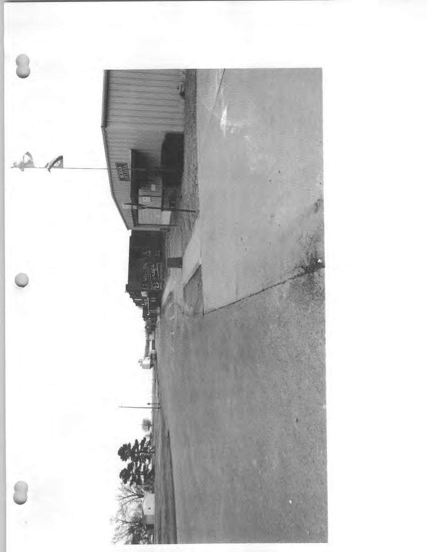
49
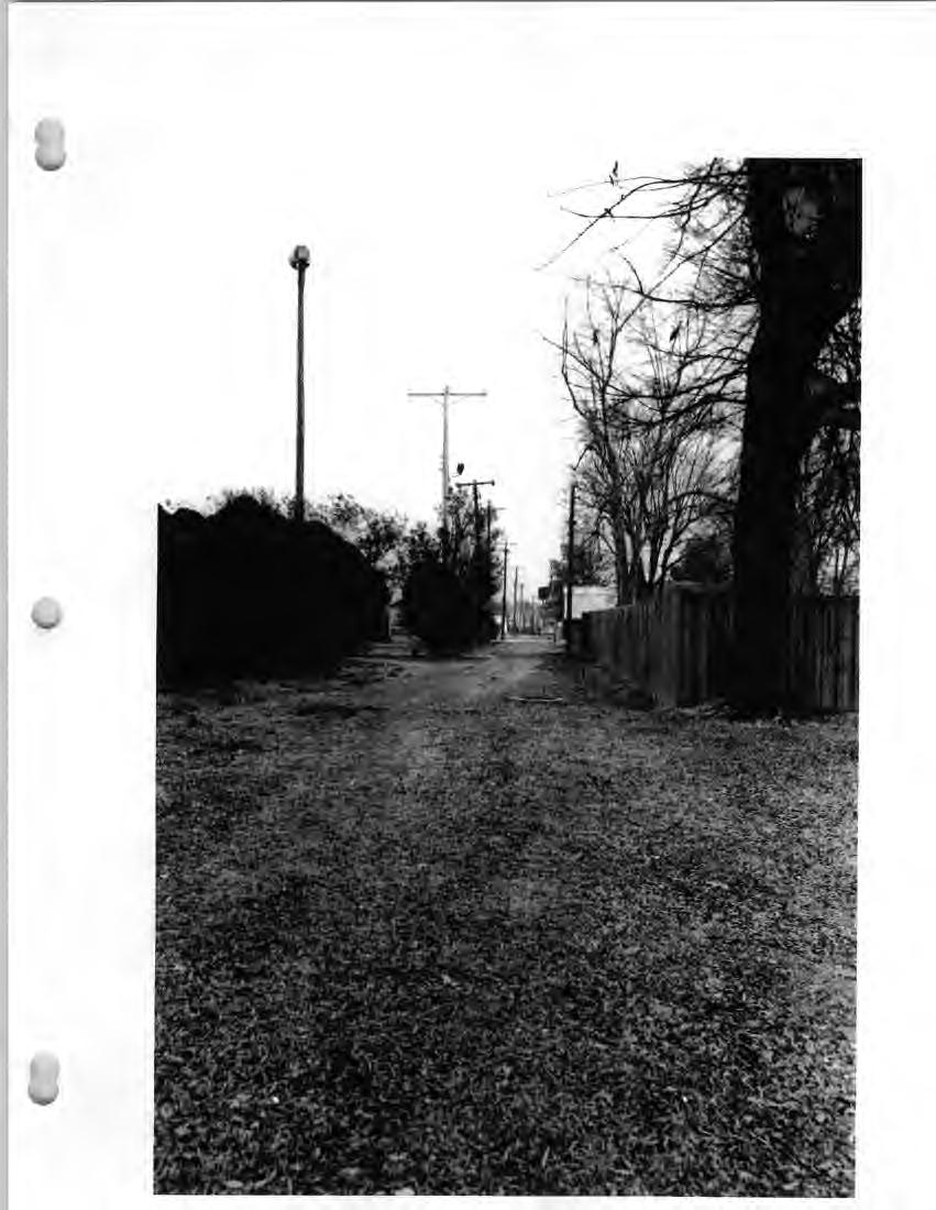

50
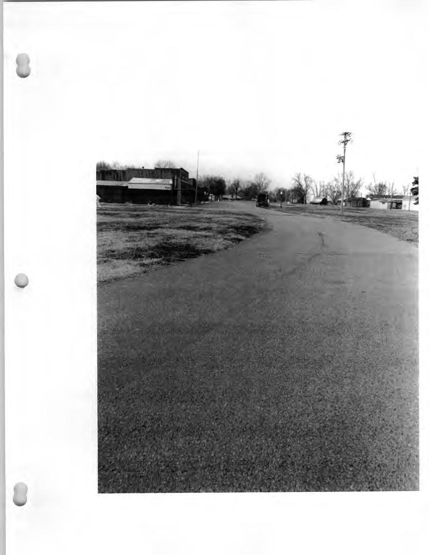

51

52
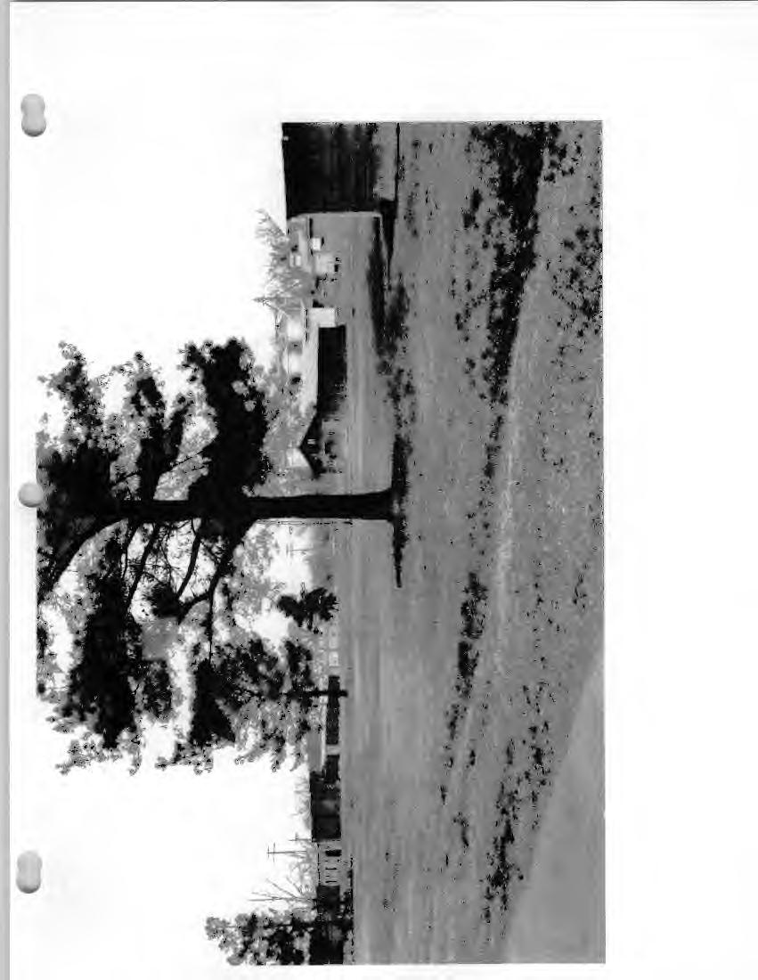
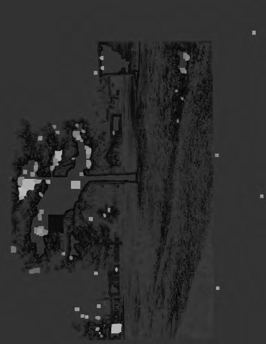

53
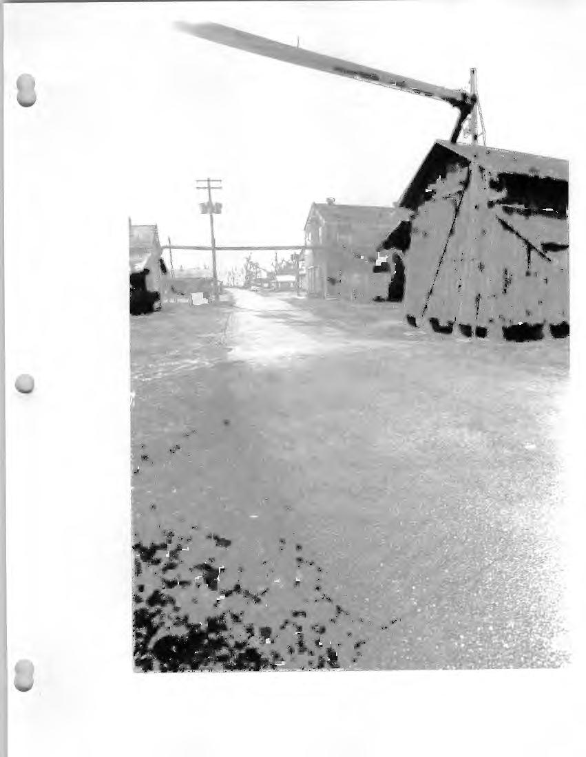
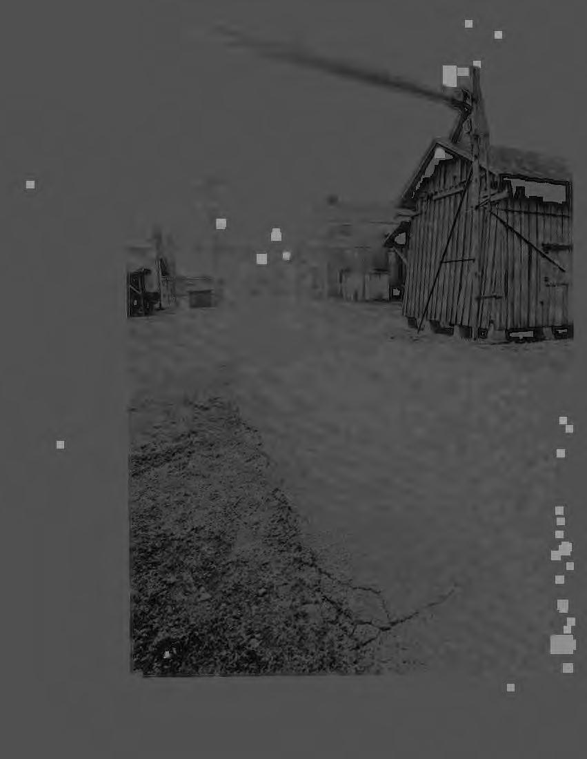
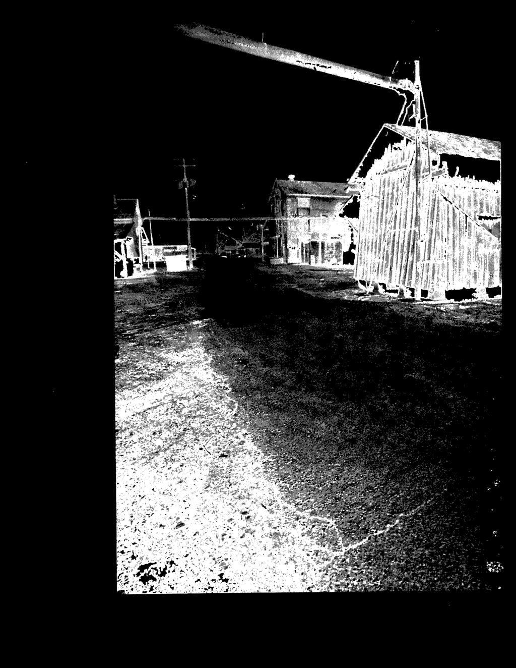
54
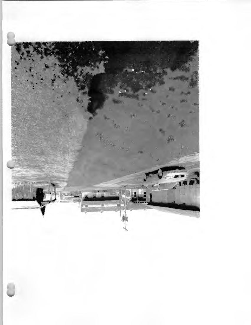

55
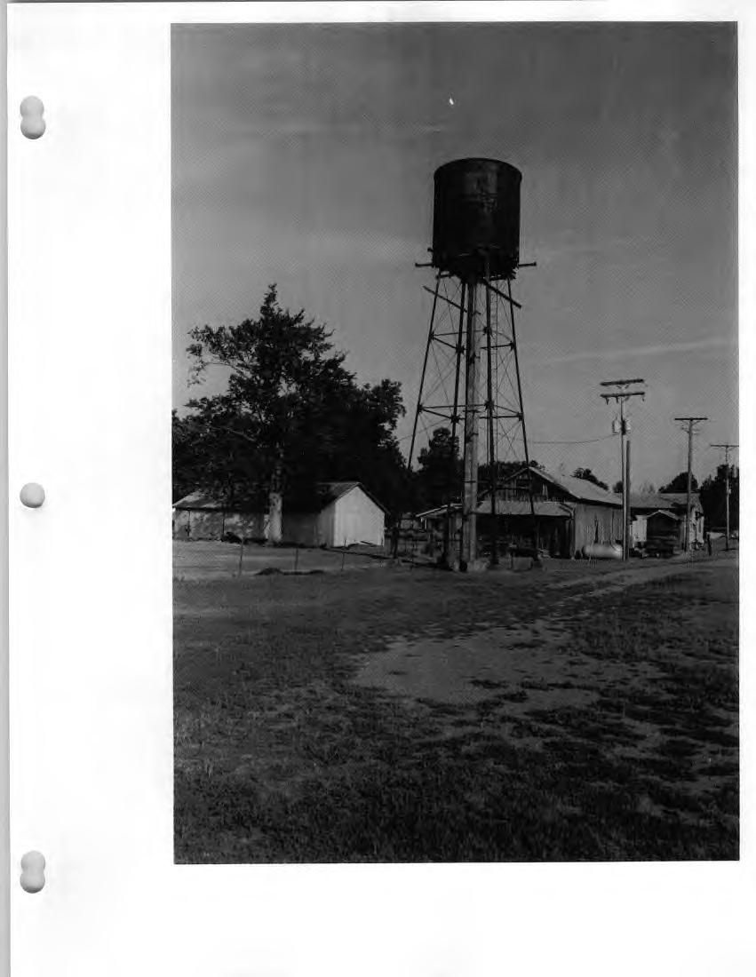
56
57


58
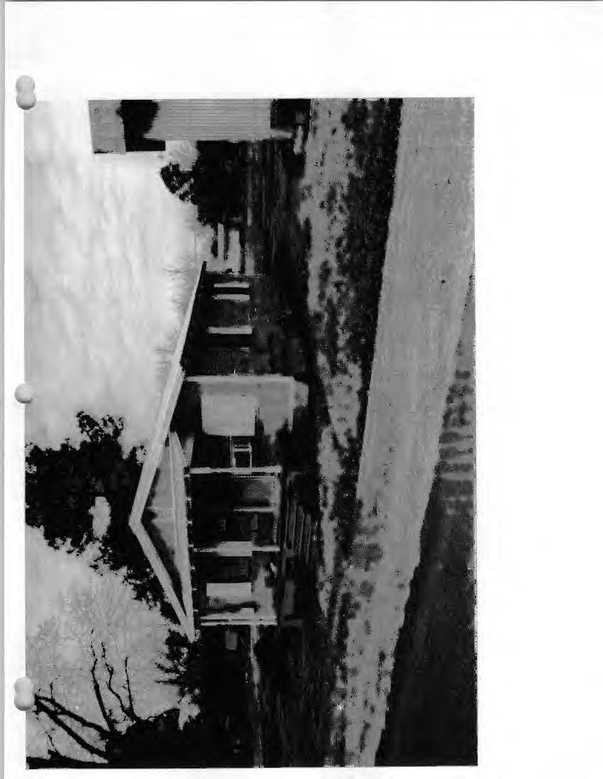
59
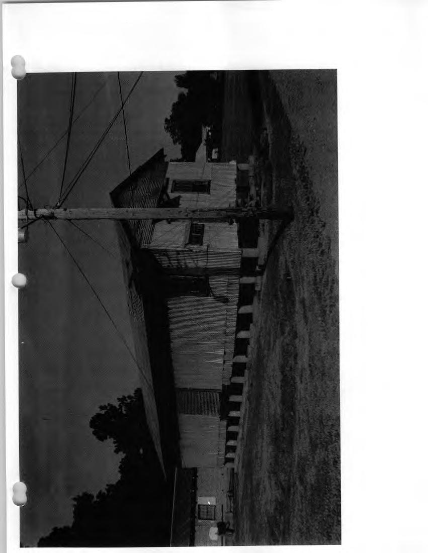
60
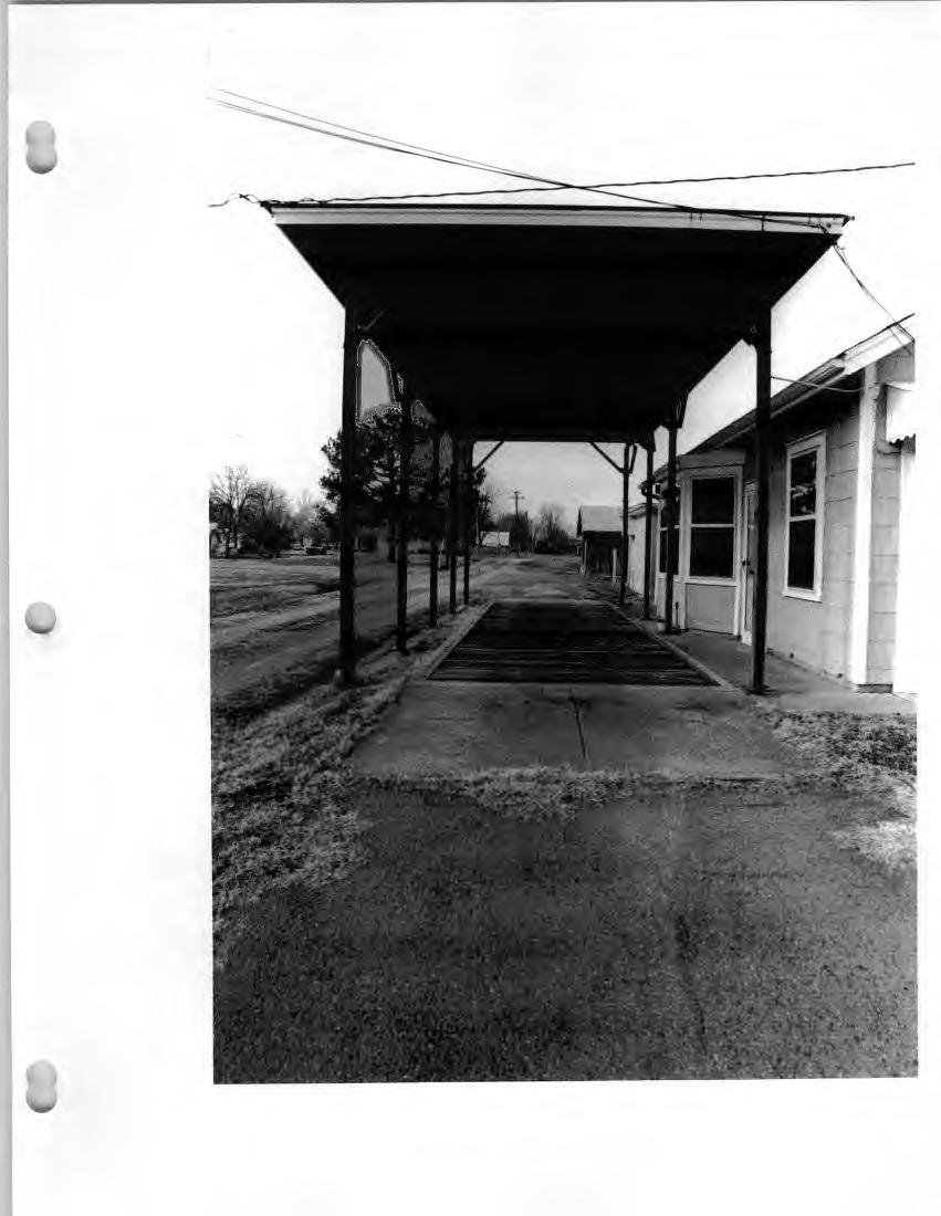
61
62

63
64
65
66
67

68
69
70
71
72
73
74
75

76
77

78
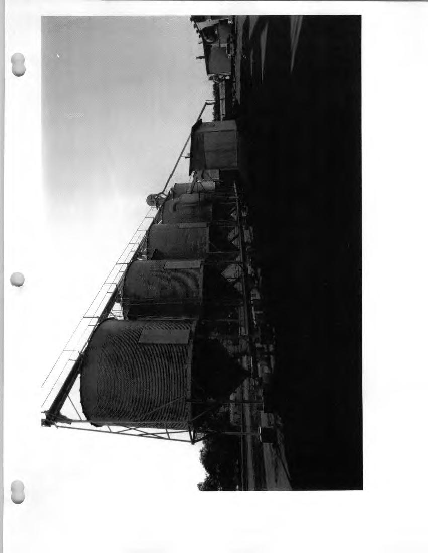

79
80
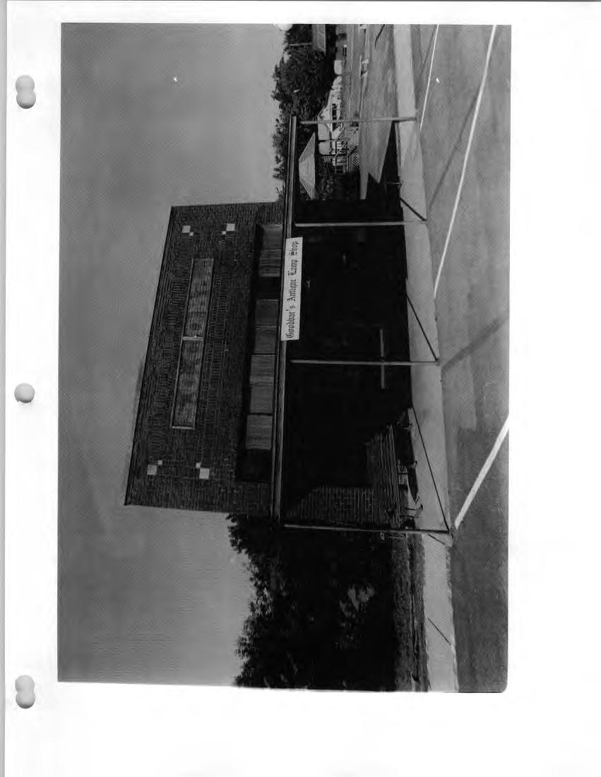


81

82

83
84

85 I I f I I I I I
86
87
88

89
90

91
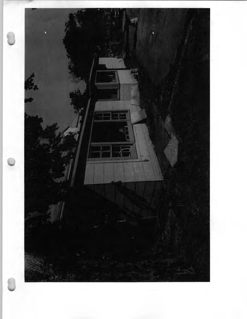

92
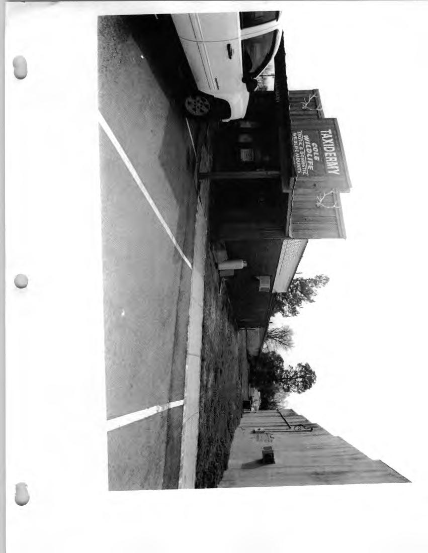
93
 r ------------ 8~ 236.. ~').")
 I I I I I I 0 -le: <\) Cl) 0.0.0 0 \"' ' 35'. 3627 : 5 / 3626 ;t;..:::::,...,::.")
94 KEO QUADRANGLE ARKANSAS 7.5 MINUTE SERIES (TOPOGRAPHIC) sso s91 92,00' ' '-"'=~..==-:' ~------B-E_VIS~C-OR_N_ER~7-M_l L:.<40 37' 30" I Farm I I I I ' I Weli FEET -~ ) r ~ ~')... -,r ) 1 0 I --i---t::::--:::o-6~--+~~=i-:,f-~ !..~~~-1--~~~:j\fµ~--,..,l4)w~ll--,.~-- J,~T1S 230 I T2S ) I I I I I I 0 -le: <\) Cl) "' ' 35' : 5 / 3626 ;t;..:::::,...,::._i---1-'
street & number: COUNTY ROUTE 3, HC-88, BOX 17 not for publication: N/A city/town: WHEELER vicinity: X state: WV county: WEBSTER code: 101 zip code:
 NPS Forn 10-900 OMB No. 10024-0018 (Oct. 1990) United States Department of the Interior National Park Service NATIONAL REGISTIR OF HISTORIC PLACES REGISTRATICN FCRX =========================================================---------=======
301 7½ Street SW
 301 7½ Street SW 104-0213-0072 Primary Resource Information: Single Dwelling, Stories 2.00, Style: Other, ca 1890 July 2006: This late-19th-century, 3-bay, 2-story, hip-roofed frame I-house features projecting
ate: AR County: Pulaski Code: AR Zip Code: Noncontributing buildings sites structures objects Total
 Mims-Ereedlove-Priest-Weatherton House Name of Property Little Rock, AR County and State ~- -,s Form 10-900 'V. 8-86) OMB No. 1024-0018 United States Department of the Interior National Park Service NATIONAL
; * --.-.,., rj ; United States Department of the Interior \ ' '"] I National Park Service
![; * --.-.,., rj ; United States Department of the Interior \ ' '] I National Park Service](/thumbs/88/117765392.jpg "; * --.-.,., rj ; United States Department of the Interior \ ' '] I National Park Service") NPS Form 10-900 OMB No. 1024-0018 (Rev. 10-90) : / i' -_ :. - : ; ; * --.-.,., rj ; United States Department of the Interior \ ' '"] I National Park Service NATIONAL REGISTER OF HISTORIC PLACES REGISTRATION
NPS Form 10-900 OMB No. 1024-0018 (Rev. 10-90) : / i' -_ :. - : ; ; * --.-.,., rj ; United States Department of the Interior \ ' '"] I National Park Service NATIONAL REGISTER OF HISTORIC PLACES REGISTRATION
808 Cherry Avenue
 808 Cherry Avenue 104-0213-0059 Primary Resource Information: Single Dwelling, Stories 2.00, Style: Other, ca 1900 July 2006: This 2-story, 3-bay frame I-house features a central-front gable, a brick pier
National Register of Historic Places Registration Form
 NPS Form 10-900 OMB No. 10024-0018 (Oct. 1990) Registration Form This form is for use in nominating or requesting determinations for individual properties and districts. See instructions in How to Complete
AH pp. I Ti. Nov 7 I) I I y
 I I y") ..------------------------------------------ ------------ - - -- - NPS Form 10-900 (Rev. 8-86) United States Department of the Interior ~a tional Park Service NATIONAL REGISTER OF HISTORIC PLACES REGISTRATION
..------------------------------------------ ------------ - - -- - NPS Form 10-900 (Rev. 8-86) United States Department of the Interior ~a tional Park Service NATIONAL REGISTER OF HISTORIC PLACES REGISTRATION
National Register of Historic Places Registration Form
 NPS Form 10-900 OMB No. 10024-0018 (Oct. 1990) United States Department of the Interior National Park Service National Register of Historic Places Registration Form 1. Name of Property historic name Hickory
NATIONAL REGISTER OF HISTORIC PLACES REGISTRATION FORM
 (Rev. 10-90) NPS Form 10-900 OMB No. 1024-0018 NATIONAL REGISTER OF HISTORIC PLACES REGISTRATION FORM This form is for use in nominating or requesting determinations for individual properties and districts.
D not for publication D vicinity
 NPS Fonn I 0-900 (Oct. 1990) OMB No. 10024-0018 United States Department of the Interior National Park Service National Register of Historic Places Registration Form This fom1 is for use in nominating
National Register of Historic Places Registration Form
 National Park Service National Register of Historic Places Registration Form This form is for use in nominating or requesting determinations for individual properties and districts. See instructions in
National Register of Historic Places Registration Form
 NPS Form 10-900 OMB No. 1024-0018 (Expires 5/31/2012) United States Department of the Interior National Register Listed National Park Service May 1, 2012 National Register of Historic Places Registration
National Register of Historic Places Registration Form
 NPS Form 10-900 OMB No. 10024-0018 (Oct. 1990) United States Department of the Interior National Park Service National Register of Historic Places Registration Form 1. Name of Property historic name other
National Register of Historic Places Registration Form
 NPS Form 10-900 OMB No. 10024-0018 (Oct. 1990) Registration Form This form is for use in nominating or requesting determinations for individual properties and districts. See instructions in How to Complete
National Register of Historic Places Registration Form
 National Park Service National Register of Historic Places Registration Form This form is for use in nominating or requesting determinations for individual properties and districts. See instructions in
United States Department of the Interior National Park Service NATIONAL REGISTER OF HISTORIC PLACES REGISTRATION FORM. Wilmoth, Bernard E.
 NPS Form 10-900 OMB No. 10024-0018 (Oct. 1990) United States Department of the Interior National Park Service NATIONAL REGISTER OF HISTORIC PLACES REGISTRATION FORM 1. Name of Property historic name: other
NPS Form OMB No (Oct. 1990)
") NPS Form 10-900 OMB No. 10024-0018 (Oct. 1990) United States Department of the Interior National Park Service NATIONAL REGISTER OF HISTORIC PLACES REGISTRATION FORM 1. Name of Property historic name:_lost
NPS Form 10-900 OMB No. 10024-0018 (Oct. 1990) United States Department of the Interior National Park Service NATIONAL REGISTER OF HISTORIC PLACES REGISTRATION FORM 1. Name of Property historic name:_lost
Maryland Historical Trust Inventory No. PG: 86A-026 Maryland Inventory of Historic Properties Form
 Inventory No. PG: 86A-026 Maryland Inventory of 1. Name of Property (indicate preferred name) historic other 2. Location street and number 12811 Croom Road not for publication city, town Naylor vicinity
 Page 1 Original Update HISTORICAL STRUCTURE FORM FLORIDA MASTER SITE FILE Consult Guide To Historical Structure Forms for detailed instructions Site # 8OR9844 Recorder # 26 Recorder Date 2/20/08 Site Name
Proposed East Sanford Historic District DRAFT
 Proposed East Sanford Historic District DRAFT Inventory List The following inventory list provides basic information for all properties in the East Sanford Historic District. Included are each property
ADDENDUM. Chain of Title. Block C, Lot 8-9. Adrian I. Velthuis and Floyd T. Grant to Lottie Thompson
 Chain of Title Block C, Lot 8-9 NLP 5175:842 October 18, 1979 NLP 4979:58 October 5, 1977 NLP 4763:448 May 11, 1977 Adrian I. Velthuis and Floyd T. Grant to Lottie Thompson Gentlemens II Properties, Inc.,
Architectural Inventory Form
 OAHP1403 Rev. 9/98 COLORADO CULTURAL RESOURCE SURVEY Architectural Inventory Form Official eligibility determination (OAHP use only) Date Initials Determined Eligible- NR Determined Not Eligible- NR Determined
National Register of Historic Places Registration Form
 NPS Form 10-900 OMB No. 1024-0018 (Rev. 10-90) United States Department of the Interior National Park Service National Register of Historic Places Registration Form 1. Name of Property historic name Newcomer
United States Department of the Interior National Park Service NATIONAL REGISTER OF HISTORIC PLACES REGISTRATION FORM
 NPS Form 10-900 (Oct. 1990) OMB No. 10024-0018 United States Department of the Interior National Park Service NATIONAL REGISTER OF HISTORIC PLACES REGISTRATION FORM 1. DR JOHN C. IRONS RESIDENCE hlstoric
National Register of Historic Places Registration Form
 NPS Form 10-900 OMB No. 10024-0018 (Oct. 1990) Registration Form This form is for use in nominating or requesting determinations for individual properties and districts. See instructions in How to Complete
United States Department of the Interior National Park Service NATIONAL REGISTER OF HISTORIC PLACES REGISTRATION FORM
 NPS Form 10-900 (Oct. 1990) OMB NO. 10024-0018 United States Department of the Interior National Park Service NATIONAL REGISTER OF HISTORIC PLACES REGISTRATION FORM As the designated authority under the
Appendix E Historic Property Inventory Forms
 Appendix E Historic Property Inventory Forms TECHNICAL MEMORANDUM Sound Transit Federal Way Link Extension WISAARD Survey Entries PREPARED FOR: COPY TO: PREPARED BY: Sound Transit Alisa Swank/ CH2M MaryNell
NATIONAL REGISTER OF HISTORIC PLACES REGISTRATION FORM
 (Rev. 10-90) NPS Form 10-900 OMB No. 1024-0018 NATIONAL REGISTER OF HISTORIC PLACES REGISTRATION FORM This form is for use in nominating or requesting determinations for individual properties and districts.
National Register of Historic Places Registration Form
 NPS Form 10-900 National Park Service OMB No. 1024-0018 National Register of Historic Places Registration Form This fo rm is for use in nominating or requesting determinations fo r individual properties
April 28, Reuben McKnight Historic Preservation Officer 747 Market Street, Suite 1036 Tacoma, WA Dear Mr. McKnight:
 April 28, 2016 Reuben McKnight Historic Preservation Officer 747 Market Street, Suite 1036 Tacoma, WA 98402 Dear Mr. McKnight: I am delighted to inform you that the Buckley s Addition Historic District
not for publication: N/A city/town: St. Albans vicinity: N/A state: WV county : Kanawha code: 039 zip code:25177
 #PS F o 10-900 ~ OMB NO. 10024-0018 (OC~. 1990) United States Department of the Interior National Park Service LSATIOHAL REGISTER OF HISTORIC PLACES REGISTRATION FORM 1. Name of Property ST. ALBANS CHESAPEAKE
National Register of Historic Places Registration Form
 NPS Form 10-900 OMB No. 10024-0018 (Oct. 1990) Registration Form This form is for use in nominating or requesting determinations for individual properties and districts. See instructions in How to Complete
National Register of Historic Places Registration Form
 NPS Form 10-900 OMB No. 1024-0018 (Expires 5/31/2012) United States Department of the Interior National Register Listed National Park Service May 1, 2012 National Register of Historic Places Registration
 ~. ',. ( NPS Form 10-900 (Rev. 8-86) NR I ;s+eca Cf/ S /q~ OMB No. 1024-0018 United States Department of the Interior National Park Service NATIONAL REGISTER OF HISTORIC PLACES REGISTRATION FORM ------------------------------------------------------------------------
National Register of Historic Places Registration Form
 NPS Form 10-900 (Oct. 1990) OMB No. 10024-0018 United States Department of the Interior 'fonal Park Service National Register of Historic Places Registration Form This form is for use in nominating or
Total 1 Total. Current Functions (Enter categories from instructions) Materials (Enter categories from instructions)
 Materials (Enter categories from instructions)") Site Inventory Form State Inventory No. 29-00962 New Supplemental State Historical Society of Iowa Part of a district with known boundaries (enter inventory no.) 29-03685 (November 2005) Relationship:
Site Inventory Form State Inventory No. 29-00962 New Supplemental State Historical Society of Iowa Part of a district with known boundaries (enter inventory no.) 29-03685 (November 2005) Relationship:
Appendix D Reevaluation of Structures on Bock House Property
 Appendix D Reevaluation of Structures on Bock House Property Page 1 Original Update HISTORICAL STRUCTURE FORM FLORIDA MASTER SITE FILE Consult Guide To Historical Structure Forms for detailed instructions
AHPP. LISTED ========================================================================
 NPS Form 10-900 (Rev. 8-86) Jnited States Department of the Interior ational Park Service OMB No. 1024-0018 LISTED NATIONAL REGISTER OF HISTORIC PLACES REGISTRATION FORM AHPP. 1. Historic Name: Bush-Dubisson
I Signature of commenting official Date I. / Title State or Federal agencylbureau or Tribal Government 1
 National Park Service National Register of Historic Places Registration Form LISTED ON: VLR 09/20/2012 NRHP 11/20/2012 This form is for use in nominating or requesting determinations for individual properties
AHPP. ======================================================================== 3. Classi fication
 NPS Form 10-900 (Rev. 8-86) OMB No. 1024-0018 inited States Department of the Interior ational Park Service NATIONAL REGISTER OF HISTORIC PLACES REGISTRATION FORM I r' '- AHPP 1. Historic Name: Thornton
NPS Form OMB No (Rev ) U. S. Department of the Interior Name of Property: Hungry Mother State Park Historic District
 U. S. Department of the Interior Name of Property: Hungry Mother State Park Historic District") NPS Form 10-900 OMB No. 1024-4018 (Rev. 10-90) U. S. Department of the Interior Name of Property: Location: 5. Classification Ownership of Property (Check as many boxes as apply) Category of Property (Check
NPS Form 10-900 OMB No. 1024-4018 (Rev. 10-90) U. S. Department of the Interior Name of Property: Location: 5. Classification Ownership of Property (Check as many boxes as apply) Category of Property (Check
National Register of Historic Places Registration Form
 NPS Form 10-900 (Rev. 01/2009) OMB No. 1024-0018 United States Department of the Interior National Park Service National Register of Historic Places Registration Form This form is for use in nominating
June 23, The Clayton Historic District is bounded by Mulberry Street, West Barnes Street, Mill Street, South Lombard Street and Blanche Street.
 June 23, 2010 This is the Clayton Historic District nomination to the National Register of Historic Places prepared by National Register Consultant Nancy Van Dolsen of Wilson, NC. The presentation was
Commonwealth of Massachusetts Massachusetts Historical Commission 220 Morrissey Boulevard, Boston, Massachusetts
 Inventory No: Historic Name: Common Name: Address: HRV.165 Blood, Joseph House Farnsworth, Jonathan - Beaman, Jonathan House 74 Poor Farm Rd City/Town: Village/Neighborhood: Local No: 9-17 Year Constructed:
THE BARNACLE 3485 MAIN HIGHWAY
 THE BARNACLE 3485 MAIN HIGHWAY Designation Report City of Miami REPORT OF THE CITY OF MIAMI PLANNING AND ZONING DEPARTMENT TO THE HISTORIC AND ENVIRONMENTAL PRESERVATION BOARD ON THE POTENTIAL DESIGNATION
Maryland Historical Trust Inventory No. PG: 75A-007 Maryland Inventory of Historic Properties Form
 Inventory No. PG: 75A-007 Maryland Inventory of 1. Name of Property (indicate preferred name) historic other 2. Location street and number 3101 Ritchie Road not for publication city, town Forestville vicinity
National Register of Historic Places Registration Form
 NPS Form 10-900 OMB No. 10024-0018 (Oct. 1990) United States Department of the Interior National Register of Historic Places Registration Form 1. historic name South Charles Town Historic District other
NE¼ of NE¼ of NE¼ of NE¼ of section Roof configuration (enter one): Gabled Roof / Front Gabled Roof
: Gabled Roof / Front Gabled Roof") OAHP1403 Rev. 9/98 COLORADO CULTURAL RESOURCE SURVEY Official Eligibility Determination (OAHP use only) Date Initials Determined Eligible - National Register Architectural Inventory Form Determined Not
OAHP1403 Rev. 9/98 COLORADO CULTURAL RESOURCE SURVEY Official Eligibility Determination (OAHP use only) Date Initials Determined Eligible - National Register Architectural Inventory Form Determined Not
National Register of Historic Places Continuation Sheet
 Section number N/A Page 1 Proposed Amendment to Wichita, Sedgwick County, Kansas The owner of the building at 141 S. Rock Island Avenue requests amendment to the boundaries of the East Douglas Historic
Town: Sharon Place (neighborhood or village): Sharon. ame of Area: Present Use: Date (month / year): July 2008
: Sharon. ame of Area: Present Use: Date (month / year): July 2008") FORM A - AREA MASSACHUSETTS HISTORICAL COMMISSION MASSACHUSETTS ARCHIVES BUILDING 220 MORRISSEY BOULEVARD BOSTON, MASSACHUSETTS 02125 Photograph Assessor s Sheets USGS Quad Area Letter Form Numbers in
FORM A - AREA MASSACHUSETTS HISTORICAL COMMISSION MASSACHUSETTS ARCHIVES BUILDING 220 MORRISSEY BOULEVARD BOSTON, MASSACHUSETTS 02125 Photograph Assessor s Sheets USGS Quad Area Letter Form Numbers in
on al Register of Historic Places istration Form
 l>l ls F.JJnn 0-900 (Oct. 1990) OMl3 No. 10024-0018 Un ited Sta.tes Department of the nterior National Park Service on al Register of Historic Places istration Form This form is for use in nominating or
Current Functions (Enter categories from instructions) Materials (Enter categories from instructions)
 Materials (Enter categories from instructions)") Site Inventory Form State Inventory No. 92-00542 New Supplemental State Historical Society of Iowa Part of a district with known boundaries (enter inventory no.) 92-00349 (November 2005) Relationship:
Site Inventory Form State Inventory No. 92-00542 New Supplemental State Historical Society of Iowa Part of a district with known boundaries (enter inventory no.) 92-00349 (November 2005) Relationship:
NATIONAL REGISTER OF HISTORIC PLACES REGISTRATION FORM
 NPS Form 10-900 OMB No. 1024-0018 (Rev. 10-90) United States Department of the Interior National Park Service NATIONAL REGISTER OF HISTORIC PLACES REGISTRATION FORM 1. Name of Property historic name Compton-Johnson
Historic Inventory Report
 Location Field Site No. 3394-134 DAHP No. Historic Name: Common Name: Cabinetrends Property Address: 24619 Pacific Hwy S, Kent, WA 98032 Comments: Tax No./Parcel No. 3601800165 Plat/Block/Lot Acreage.24
National Register of Historic Places Multiple Property Documentation Form
 NPS Form 10-900-b OMB No. 1024-0018 Revised Aug. 2002 Expires 12-31-2005 Multiple Property Documentation Form This form is for use in documenting multiple property groups relating to one or several contexts.
United States Department of the Interior National Park Service NATIONAL REGISTER OF HISTORIC PLACES REGISTRATION FORM
 NPS Form 10-900 (Oct. 1990) OMB NO. 10024-0018 United States Department of the Interior National Park Service NATIONAL REGISTER OF HISTORIC PLACES REGISTRATION FORM 1. historic name: WEIMER, JAMES HOUSE
Architectural Inventory Form
 COLORADO CULTURAL RESOURCE SURVEY Page 1 of 3 Official Eligibility Determination (OAHP use only) Rev. 9/98 OAHP1403 Date Initials Determined Eligible National Register Determined Not Eligible National
1 Gildersleeve Wood (DHR # )
") GILDERSLEEVE WOOD 1 Gildersleeve Wood (DHR # 104-5092-0012) STREET ADDRESS: 1 Gildersleeve Wood MAP & PARCEL: 11-20 PRESENT ZONING: R-1U ORIGINAL OWNER: Lindsay Family ORIGINAL USE: PRESENT USE: PRESENT
GILDERSLEEVE WOOD 1 Gildersleeve Wood (DHR # 104-5092-0012) STREET ADDRESS: 1 Gildersleeve Wood MAP & PARCEL: 11-20 PRESENT ZONING: R-1U ORIGINAL OWNER: Lindsay Family ORIGINAL USE: PRESENT USE: PRESENT
National Register of Historic Places Registration Form
 NPS Form 10-900 OMB No. 1024-0018 (Rev. 10-90) United States Department of the Interior National Park Service National Register of Historic Places Registration Form 1. Name of Property historic name Evans,
in 7.x M (Oct. 1990) United States Department of the Interior National Park Service 1. NAME OF PROPERTY
 United States Department of the Interior National Park Service 1. NAME OF PROPERTY") (Oct. 1990) United States Department of the Interior National Park Service NATIONAL REGISTER OF HISTORIC PLACES REGISTRATION FORM 1. NAME OF PROPERTY HISTORIC NAME: Jacala Restaurant OTHER NAME/SITE NUMBER:
(Oct. 1990) United States Department of the Interior National Park Service NATIONAL REGISTER OF HISTORIC PLACES REGISTRATION FORM 1. NAME OF PROPERTY HISTORIC NAME: Jacala Restaurant OTHER NAME/SITE NUMBER:
D not for publication D vicinity
 ~~~~~~~~~~~ county NPS Form 10-900 (Oct. 1990) OMB No. JUUL'l Uvio National Park Service ""lational Register of Historic Places egistration Form This form is for use in nominating or requesting determinations
National Register of Historic Places Registration Form
 NPS Form 10-900 (Oct. 1990) OMB NO. 10024-0018 Registration Form This form is for use in nominating or requesting determinations for individual properties and districts. See instructions in How to Complete
Change dormers and main entry on the river side of the house. Site: 43 Riverbank Road, Block 10 Lot 3
 City of Burlington Historic Preservation Commission Meeting Minutes: December 2, 2015 The City of Burlington Historic Preservation Commission held its regular monthly meeting on Wednesday, December 2,
Architectural Inventory Form
 COLORADO CULTURAL RESOURCE SURVEY Page 1 of 3 Official Eligibility Determination (OAHP use only) Rev. 9/98 OAHP1403 Date Initials Determined Eligible National Register Determined Not Eligible National
United States Department of the Interior National Park Service NATIONAL REGISTER OF HISTORIC PLACES REGISTRATION FORM
 NPS Form 10-900 (Rev. 8-86) OMB No. 1024-0018 United States Department of the Interior National Park Service NATIONAL REGISTER OF HISTORIC PLACES REGISTRATION FORM other name/site number: "Maple Shadows:"
Maryland Historical Trust Inventory No. PG: 86A-003 Maryland Inventory of Historic Properties Form
 Inventory No. PG: 86A-003 Maryland Inventory of 1. Name of Property (indicate preferred name) historic other 2. Location street and number 12005 Duley Station Road not for publication city, town Upper
NATIONAL REGISTER OF RIGTORfC PLACES REGISTRATION FORM
 NPS Form 10-900 (Rev. 8-86) Pnited States Department of the Interior National Park Service NATIONAL REGISTER OF RIGTORfC PLACES REGISTRATION FORM 3. Warm of Property +-----------------------------------------------------------------------
STATE OF IOWA. Historical and Architectural Survey for 2008 Flood Projects in Vinton, Benton County
 STATE OF IOWA CHESTER J. CULVER GOVERNOR PATTY JUDGE LT. GOVERNOR DEPARTMENT OF PUBLIC DEFENSE IOWA HOMELAND SECURITY AND EMERGENCY MANAGEMENT DIVISION DAVID L. MILLER, ADMINISTRATOR Historical and Architectural
D not for publication
 NPS Form 10-900 (Oct. 1990) OMB No. 10024-0018 United States Department of the Interior National Park Service Tational Register of Historic Places egistration Form This form is for use in nominating or
Name of related multiple property listing: Historic and Architectural Resources in Abilene, Texas
 NPS Form 10-900 (Rev. 8-86) United States Department of the Interior National Park Service NATIONAL REGISTER OF HISTORIC PLACES REGISTRATION FORM 1. NAME OF PROPERTY Historic name: Magee, J.D., House Other
National Register of Historic Places Registration Form
 NPS Form 10-900 OMB No. 1024-0018 (Rev. 10-90) United States Department of the Interior National Park Service National Register of Historic Places Registration Form 1. Name of Property historic name Strode-Morrison-Tabler
1 buildings sites structures objects 1 0 TOTAL
 Name of Property County and State 4. National Park Service Certification --------- I, hereby certify that this property is: Signature of Keeper Date of Action entered in the National Register See continuation
National Register of Historic Places Registration Form
 NPS Form 10-900 OMB No. 10024-0018 (Oct. 1990) Registration Form This form is for use in nominating or requesting determinations for individual properties and districts. See instructions in How to Complete
SURVEY OF PUBLIC HOUSES WESTON TURVILLE
 BUCKINGHAMSHIRE ARCHAEOLOGICAL SOCIETY HISTORIC BUILDINGS GROUP SURVEY OF PUBLIC HOUSES IN THE PARISH OF WESTON TURVILLE BUCKINGHAMSHIRE A record of extant buildings that are currently or were formerly
Address 347 Whitney Street. East elevation, camera facing southwest.
 FORM B BUILDING Assessor s Number USGS Quad Area(s) Form Number MASSACHUSETTS HISTORICAL COMMISSION MASSACHUSETTS ARCHIVES BUILDING 220 MORRISSEY BOULEVARD BOSTON, MASSACHUSETTS 02125 Town Northborough
Maryland Historical Trust Inventory No. PG: Maryland Inventory of Historic Properties Form
 Inventory No. PG: 62-012 Maryland Inventory of 1. Name of Property (indicate preferred name) historic other 2. Location street and number 11205 Old Baltimore Pike not for publication city, town Beltsville
City of Burlington Historic Preservation Commission Meeting Minutes: September 4, 2013
 City of Burlington Historic Preservation Commission Meeting Minutes: September 4, 2013 The City of Burlington Historic Preservation Commission held its regular monthly meeting on Wednesday, September 4,
National Register of Historic Places Registration Form
 NPS Form 10-900 OMB No. 10024-0018 (Oct. 1990) Registration Form This form is for use in nominating or requesting determinations for individual properties and districts. See instructions in How to Complete
NP S Form (Rev. 8-86)
") Hampton Watenvorks Fame of Property Calhoun Cowtv. Arkansas NP S Form 1 0-900 (Rev. 8-86) United States Department of the nterior National Park Senlice NATONAL E'WGSTER OF HSTORC PLACES REGSTRATON FORM
Hampton Watenvorks Fame of Property Calhoun Cowtv. Arkansas NP S Form 1 0-900 (Rev. 8-86) United States Department of the nterior National Park Senlice NATONAL E'WGSTER OF HSTORC PLACES REGSTRATON FORM
United States Department of the Interior National Park Service. Boundary Expansion Listed in National Register January 11, 2017
 NPS Form 10900-a (Rev. 8/2002) OMB No. 10240018 United States Department of the Interior National Park Service Boundary Expansion Listed in National Register January 11, 2017 National Register of Historic
Register of Historic Kansas Places Registration Form
 Kansas State Historical Society Register of Historic Kansas Places Registration Form This form is for use in nominating individual properties and districts. The format is similar to the National Register
_1 0_ Total. Number of contributing resources previously listed in the National Register: 0
 20S' NPS Form 10-900 (Rev. 8-86) United States Department of the Interior National Park Service NATIONAL REGISTER OF HISTORIC PLACES REGISTRATION FORM OMB No. 1024-0018 P p r.f? R FLS 19 1992 NATIONAL
FLAGLER WORKER S HOUSE FORT DALLAS PARK S.E. 4 STREET
 FLAGLER WORKER S HOUSE FORT DALLAS PARK 60-64 S.E. 4 STREET Designation Report City of Miami REPORT OF THE CITY OF MIAMI PLANNING DEPARTMENT TO THE HERITAGE CONSERVATION BOARD ON THE POTENTIAL DESIGNATION
city or town Muscatine vicinity, county Muscatine Legal Description: (If Rural) Township Name Township No. Range No. Section Quarter of Quarter
 Township Name Township No. Range No. Section Quarter of Quarter") Site Inventory Form State Inventory No. 70-00233 New Supplemental State Historical Society of Iowa Part of a district with known boundaries (enter inventory no.) (December 1, 1999) Relationship: Contributing
Site Inventory Form State Inventory No. 70-00233 New Supplemental State Historical Society of Iowa Part of a district with known boundaries (enter inventory no.) (December 1, 1999) Relationship: Contributing
DESIGNATION REPORT KENNEDY-BAKER-WALKER-SHERRILL HOUSE (1849) 9320 KINGSTON PIKE (CLT ) KNOXVILLE, TENNESSEE July 12, 2007
 9320 KINGSTON PIKE (CLT ) KNOXVILLE, TENNESSEE July 12, 2007") DESIGNATION REPORT KENNEDY-BAKER-WALKER-SHERRILL HOUSE (1849) 9320 KINGSTON PIKE (CLT 132-027) KNOXVILLE, TENNESSEE July 12, 2007 Description The Kennedy-Baker-Walker-Sherrill House is located on the south
DESIGNATION REPORT KENNEDY-BAKER-WALKER-SHERRILL HOUSE (1849) 9320 KINGSTON PIKE (CLT 132-027) KNOXVILLE, TENNESSEE July 12, 2007 Description The Kennedy-Baker-Walker-Sherrill House is located on the south
MINNESOTA HISTORIC.PROPERTIES INVENTORY FORM. Yes_ No X Restricted
 HISTORIC NAME: CURRENT NAME: LEGAL DESC.: MINNESOTA HISTORIC.PROPERTIES INVENTORY FORM Hartley Sugar Camp W % of Gov't. Lot 3 and T55, R24, Sec. 9 COUNTY: Itasca CITY/TWP.: Trout Lake Twp. ADDRESS: of
Houses on the east side of River Street, camera facing northeast. Date (month/year) March 2009
 March 2009") FORM A - AREA MASSACHUSETTS HISTORICAL COMMISSION MASSACHUSETTS ARCHIVES BUILDING 220 MORRISSEY BOULEVARD BOSTON, MASSACHUSETTS 02125 Assessor s Sheets USGS Quad Area Letter Form Numbers in Area Shrewsbury
FORM A - AREA MASSACHUSETTS HISTORICAL COMMISSION MASSACHUSETTS ARCHIVES BUILDING 220 MORRISSEY BOULEVARD BOSTON, MASSACHUSETTS 02125 Assessor s Sheets USGS Quad Area Letter Form Numbers in Area Shrewsbury
AHPP NR LISTED MAR ========================================================================
 NPS -Ferm- -10-- -90-0 ---- - - (Rev. 8-86).. Jnited States Department of the Interior Rational Park Service NATIONAL REGISTER OF HISTORIC PLACES REGISTRATION FORM NR LISTED MAR 08 1997 AHPP 1. Historic
IMPORTANT NOTICE. Architectural Inventory Form COLORADO CULTURAL RESOURCE SURVEY I. IDENTIFICATION. 305 Eldorado Avenue 5BL.10471
 IMPORTANT NOTICE OAHP1403 Rev. 9/98 COLORADO CULTURAL RESOURCE SURVEY Architectural Inventory Form Page 1 This survey form represents an UNOFFICIAL COPY and is provided for informational purposes only.
United States Department of the Interior National Park Service NATIONAL REGISTER OF HISTORIC PLACES REGISTRATION FORM
 NPS Form 10-900 OMB No. 10024-0018 (Oct. 1990) United States Department of the Interior National Park Service NATIONAL REGISTER OF HISTORIC PLACES REGISTRATION FORM 1. Name of Property historic name: other
NPS Form OMB No Exp Status occupied X unoccupied work in progress Accessible yes: restricted yes: unrestricted _5Lno
 NPS Form 10-900 OMB No. 1024-0018 Exp. 10-31-84 United States Department of the Interior National Park Service National Register of Historic Places Inventory Nomination Form See instructions in How to
CITY OF MURFREESBORO HISTORIC ZONING COMMISSION. Regular Meeting June 19, :30 PM, Council Chambers, City Hall
 CITY OF MURFREESBORO HISTORIC ZONING COMMISSION Regular Meeting June 19, 2018 3:30 PM, Council Chambers, City Hall I. Call to Order and determination of a quorum II. Approve Minutes of the Regular Meeting
National Register of Historic Places Continuation Sheet
 NFS Form 10-900-a OMB Approval No. 1024-0018 (8-86) United States Department of the Interior National Register of Historic Places Continuation Sheet Section number Page SUPPLEMENTARY LISTING RECORD NRIS
Signature of certifying official/title. New York State Office of Parks, Recreation & Historic Preservation State or Federal agency and bureau
 NPS Form 10-900 OMB No. 10024-0018 (Oct. 1990) Registration Form This form is for use in nominating or requesting determinations for individual properties and districts. See instructions in How to Complete
National Register off Historic Places Inventory Nomination Form
 NPS Fomi ia-900-a OMB Ho. 1024-0018 Exp. 10-31-S4 United States Department of the Interior National Park Service National Register off Historic Places Inventory Nomination Form For HPS UM only received
National Register of Historic Places Registration Form
 PS Form 10-900 OMB No. 10024-0018 (Oct. 1990) United States Department of the Interior National Park Service Registration Form This form is for use in nominating or requesting determinations for individual
NATIONAL REGISTER OF HISTORIC PLACES REGISTRATION FORM
 NPS Form 10-900 OMB No. 1024-0018 (Rev. 10-90 NATIONAL REGISTER OF HISTORIC PLACES REGISTRATION FORM This form is for use in nominating or requesting determinations for individual properties and districts.
NPS Form OMB No (Rev. Aug. 2002) (Expires )
 (Expires )") Beaconsfield Supply Store,1 NATIONAL REGISTER FORMS TEMPLATE January 2006 NPS Form 10-900 OMB No. 1024-0018 (Rev. Aug. 2002) (Expires 1-31-2009) REGISTRATION FORM 1. Name of Property historic name Beaconsfield
Beaconsfield Supply Store,1 NATIONAL REGISTER FORMS TEMPLATE January 2006 NPS Form 10-900 OMB No. 1024-0018 (Rev. Aug. 2002) (Expires 1-31-2009) REGISTRATION FORM 1. Name of Property historic name Beaconsfield
National Register of Historic Places Registration Form
 NPS Form 10-900 OMB No. 10024-0018 (Oct. 1990) United States Department of the Interior National Park Service National Register of Historic Places Registration Form 1. Name of Property historic name other
National Register of Historic Places Registration Form
 NPS Form 10-900 OMB No. 1024-0018 (Rev. 10-90) United States Department of the Interior National Park Service National Register of Historic Places Registration Form 1. Name of Property historic name Elmwood-on-the-Opequon