Appendix E Historic Property Inventory Forms
|
|
|
- Daniel Short
- 6 years ago
- Views:
Transcription
1 Appendix E Historic Property Inventory Forms
2
3 TECHNICAL MEMORANDUM Sound Transit Federal Way Link Extension WISAARD Survey Entries PREPARED FOR: COPY TO: PREPARED BY: Sound Transit Alisa Swank/ CH2M MaryNell Nolan-Wheatley/ CH2M DATE: January 26, 2016 PROJECT NUMBER: DAHP Project: APPROVED BY: Lori Price/ CH2M Surveyed Properties Address (Field Site) 2947 S 252nd Street, Kent (#1710) 2819 S 299th Place, Federal Way (#4945) Built Date Type NRHP Eligibility * 1957 Single Family House Ranch Not Eligible 1963 Single Family House Split Level Not Eligible * Pending DAHP Concurrence Field Site #1710 Resource Address: 2947 S 252nd Street, Kent, WA Built Date: 1957 Historic Use: Domestic Single Family House Form/Type: Single Dwelling Ranch Property appears to meet the criteria for the National Register of Historic Places: No Property is located in a potential historic district (National and/or local): No Property potentially contributes to a historic district (National and/or local): No Significance Narrative Construction of the original Highway 1 in the state of Washington commenced in By October 1923, 700 miles of a two-lane highway had been completed connecting Vancouver, British Columbia, to the Oregon-California border. Just after the highway was completed in 1924, however, plans were begun to reroute and improve the conditions of the highway. The project involved creating a new, wider, four-lane route further west that would connect Seattle and Tacoma, Washington, more directly (Kramak, 2010). The new roadway was completed in 1928 and acquired the title of Highway 1, while the original eastern route was renamed Highway 5 (Caster, 2007). The new Highway 1 became known as the 1
4 SOUND TRANSIT FEDERAL WAY LINK EXTENSION WISAARD SURVEY ENTRIES Pacific Highway. Over the years, various parts of Highway 1 acquired alternative names, including the portion known as Pacific Highway S, which starts near Federal Way, Washington, and continues north, through Kent, Des Moines, and SeaTac, Washington (Kramak, 2010). In 1926, Pacific Highway (HWY 1) was included as a numbered U.S. Highway (US 99) (U.S. Route 99, ). The following decades witnessed the rapid growth of businesses along the highway and the formation of a new auto-oriented roadside culture characterized by a proliferation of motels, restaurants, and rest stops (Des Moines Historical Society, 2007). Increased automobile ownership changed people s perceptions about distance and allowed populations to sprawl around urban centers, increasing the number of residents in suburban towns and cities, including SeaTac, Des Moines, Kent, and Federal Way (Boyles, 2010). Kent started as an agricultural community before evolving into an industrial center. Early settlers in the area enjoyed prime farming due to rich deposits of alluvium in the valley that had made the soil especially fertile. Kent experienced a period of financial success in the second half of the nineteenth century, and on May 28, 1890, Kent incorporated as a city. Still primarily an agricultural community, Kent suffered from a lack of manual laborers after World War II (Stein, 2001). In 1962, the completion of the Howard A. Hanson Dam stopped flooding in the area, which attracted developers and manufacturing companies to relocate to Kent, accelerating the decline of farming. Three years later, Boeing established the Boeing Aerospace Center there. Over the next few decades, warehouses, industrial plants, and eventually technology firms came to dominate the local economy (Stein, 2001). This change in industry attracted new residents to Kent during the 1950s through the 1970s, and it was during these decades that much of the existing built environment was constructed. The property at 2947 S 252nd Street in Kent, Washington, which is a single-family residential property built in 1957, is not eligible for listing in the NRHP. The property is not eligible for the NRHP under Criterion A, which applies to buildings that are associated with events that have made a significant contribution to the broad patterns of history, as no significant events are associated with this property. To be eligible for the NRHP under Criterion B, a property must be directly associated with a person considered significant within a historic context whose specific contribution to history has been both identified and documented. No such person who meets that definition is linked to this building. The property is not eligible for the NRHP under Criterion C as it is an unremarkable residential building from the mid-twentieth century and does not embody the distinctive characteristics of a type, period, or method of construction; it is not the work of a master and does not possess high artistic value. Therefore, the property is not eligible for listing in the NRHP because it does not meet any of the eligibility criteria. In addition the building is altered including the replacement of the original siding, windows, and doors, and the conversion of the original garage into interior living space. As a result, the property has lost integrity of materials and design. The building retains integrity of workmanship, feeling, setting, location, and association. Physical Description 2947 S 252nd Street is a one-story, wood frame, minimal traditional style, single family residential property with a rectangular plan, constructed in The building, which sits on a poured concrete foundation, has a moderately pitched, composite shingle cross gable roof. The exterior walls are clad in wide, asbestos shingles that replaced the original vertical siding on the front (north) elevation and original horizontal siding on the side (west and east) elevations. Some of the original vertical wood siding remains on the exterior wall surrounding the front door. A wide, open front gable extends from the front (north) elevation, crossing the primary side gable roof, and shades the replacement, paneled front door (just west of center) and two adjacent, original, two-light horizontal sliding windows. The original windows are covered by transparent plastic sheets. The northwest corner of the front gable is supported by a thin wood post and an open framework wood hand railing that defines the west side of a nearly ground-level concrete porch. West of the front gable there is a large, replacement, two-light 2

5 SOUND TRANSIT FEDERAL WAY LINK EXTENSION WISAARD SURVEY ENTRIES horizontal sliding window. Originally, a garage was located under the east end of the primary side gabled roof. At an unknown date, the garage was converted to interior living space and the garage door was replaced with a paneled pedestrian door. According to Google Earth Street View images there was only one pedestrian door on the east end of the front elevation in By 2016, however, when the property was surveyed, a second paneled pedestrian door had been added to the former garage. The property, which is situated on a corner parcel, contains a short paved driveway and a side yard enclosed by a tall wood fence. Photo S 252nd Street Front (north) elevation Bibliography Boyles, E The Suburb. Selected Cultural and Historical Geographies of the Greater Seattle Area. Accessed January 22, Caster, D Historical Society of Federal Way Timeline. Accessed January 22, Des Moines Historical Society Time Line Page. Accessed January 22, King County King County Department of Assessments. Available at: Accessed January 22, Kramak, J.E., ed Establishing the Pacific Highway South. Selected Cultural and Historical Geographies of the Greater Seattle Area. Available at: Accessed January 22, Stein, A.J Kent. HistoryLink: The Free Online Encyclopedia of Washington State History. Accessed January 22, U.S. Route 99 The Pacific Highway.. Waymarking: A Groundspeak Website. Available at: Accessed January 22,
6 SOUND TRANSIT FEDERAL WAY LINK EXTENSION WISAARD SURVEY ENTRIES Field Site #4945 Resource Address: 2819 S 299 th Place, Federal Way, WA Built Date: 1963 Historic Use: Domestic Single Family House Form/Type: Single Dwelling Split Level Property appears to meet the criteria for the National Register of Historic Places: No Property is located in a potential historic district (National and/or local): No Property potentially contributes to a historic district (National and/or local): No Significance Narrative Construction of the original Highway 1 in the state of Washington commenced in By October 1923, 700 miles of a two-lane highway had been completed connecting Vancouver, British Columbia, to the Oregon-California border. Just after the highway was completed in 1924, however, plans were begun to reroute and improve the conditions of the highway. The project involved creating a new, wider, four-lane route further west that would connect Seattle and Tacoma, Washington, more directly (Kramak, 2010). The new roadway was completed in 1928 and acquired the title of Highway 1, while the original eastern route was renamed Highway 5 (Caster, 2007). The new Highway 1 became known as the Pacific Highway. Over the years, various parts of Highway 1 acquired alternative names, including the portion known as Pacific Highway S, which starts near Federal Way, Washington, and continues north, through Kent, Des Moines, and SeaTac, Washington (Kramak, 2010). In 1926, Pacific Highway (HWY 1) was included as a numbered U.S. Highway (US 99) (U.S. Route 99, ). The following decades witnessed the rapid growth of businesses along the highway and the formation of a new auto-oriented roadside culture characterized by a proliferation of motels, restaurants, and rest stops (Des Moines Historical Society, 2007). Increased automobile ownership changed people s perceptions about distance and allowed populations to sprawl around urban centers, increasing the number of residents in suburban towns and cities, including SeaTac, Des Moines, Kent, and Federal Way (Boyles, 2010). Federal Way was originally settled as a rural logging community in the late 1800s. In 1928, when the Pacific Highway (HWY 1/US 99) between Tacoma and Seattle opened, it linked Federal Way to the larger neighboring communities, spurring economic and residential development. The name "Federal Way" came from an eponymous school built in 1929 on Pacific Highway S (Caster, 2007). During the 1950s, Federal Way witnessed substantial growth, transforming from a small lumber town into a metropolitan area. Auto-oriented businesses emerged and thrived along the Pacific Highway. Community growth was bolstered by Boeing and Weyerhaeuser industries in the 1960s. In 1968, Weyerhaeuser purchased 430 acres of land for its corporate headquarters, which opened in April 1971 (Caster, 2007). Federal Way was incorporated as a city in The property at 2819 S 299th Place in Federal Way, Washington, which is a single-family residential property built in 1963, is not eligible for listing in the NRHP. The property is not eligible for the NRHP under Criterion A, which applies to buildings that are associated with events that have made a significant contribution to the broad patterns of history, as no significant events are associated with this property. To be eligible for the NRHP under Criterion B, a property must be directly associated with a person considered significant within a historic context whose specific contribution to history has been both identified and documented. No such person who meets that definition is linked to this building. The property is not eligible for the NRHP under Criterion C as it is an unremarkable residential building from the mid-twentieth century and does not embody the distinctive characteristics of a type, period, or method of construction; it is not the work of a master and does not possess high artistic value. 4

7 SOUND TRANSIT FEDERAL WAY LINK EXTENSION WISAARD SURVEY ENTRIES Therefore, the property is not eligible for listing in the NRHP because it does not meet any of the eligibility criteria. In addition the building is altered including the replacement of the original windows and doors and the addition of an enclosed porch on the rear elevation. As a result, the property has lost integrity of materials and workmanship. The building retains integrity of design, feeling, setting, location, and association. Photo S 299 Place Front (north) elevation Physical Description 2819 S 299th Place is a 1,760-square foot, wood frame, split-level, single-family residential property with an irregular plan constructed in The building, which sits on a poured concrete foundation, has a composite shingle, cross gable roof with deep open eaves. A brick chimney projects from the center of the roof. The exterior walls of the residence are clad in a mix of wide asbestos shingles and vertical composite siding. Due to a change in grade of the land, the west side of the building, which is clad in the horizontal asbestos siding and contains the main entrance, appears to be one story, while the east side of the building, which is clad in vertical composite siding and contains the basement garage, contains two stories. The visible windows and doors are replacements. Additionally, decorative, non-operational shutters frame the windows on the front (north) elevation. The paneled front door is located on the west side of the front elevation and is flanked to the east by a large, singe-light picture window and to the west by a smaller two-light horizontal sliding window. The main entrance is shaded by the primary side gabled roof s deep eave overhang. The east end of the residence (which contains two floors) projects out beyond the front elevation and is covered by a front gable roof that crosses the primary side gable roof. Two vehicle bays with replacement metal retractable doors are located on the ground floor of the east projection, at the end of a paved driveway. Above the garage doors, a two-light horizontal sliding window is centered under the peak of the front gable. The side (west) elevation contains a small two-light horizontal sliding window and the exterior wall under the side gable peak is clad in vertical composite siding. According to the King County assessor s website, an enclosed porch, which does not appear to be original, extends from the rear (south) elevation. The property contains a front yard that slopes down towards S 299th Place. Bibliography Boyles, E The Suburb. Selected Cultural and Historical Geographies of the Greater Seattle Area. Accessed January 22,
8 SOUND TRANSIT FEDERAL WAY LINK EXTENSION WISAARD SURVEY ENTRIES Caster, D Historical Society of Federal Way Timeline. Accessed January 22, Des Moines Historical Society Time Line Page. Accessed January 22, King County King County Department of Assessments. Available at: Accessed January 22, Kramak, J.E., ed Establishing the Pacific Highway South. Selected Cultural and Historical Geographies of the Greater Seattle Area. Available at: Accessed January 22, U.S. Route 99 The Pacific Highway.. Waymarking: A Groundspeak Website. Available at: Accessed January 22,
9 Historic Property Inventory Forms
10
11 Location Field Site No DAHP No. Historic Name: Common Name: 1472 S 302nd St Property Address: 1472 S 302nd St, Federal Way, WA Comments: Tax No./Parcel No Plat/Block/Lot Block 1/ Lot 1 Acreage.28 Supplemental Map(s) Township/Range/EW Section 1/4 Sec 1/4 1/4 Sec T21R04E 05 County King Quadrangle POVERTY BAY Coordinate Reference Easting: Northing: Projection: Washington State Plane South Datum: HARN (feet) Identification Survey Name: Sound Transit Federal Way Date Recorded: 12/11/ Field Recorder: MaryNell Nolan-Wheatley Owner's Name: AULT BILLY HERBERT Owner Address: 1472 S 302nd St City: Federal Way State: WA Zip: Classification: Building Resource Status: Survey/Inventory Comments: Within a District? No Contributing? No National Register: Local District: National Register District/Thematic Nomination Name: Eligibility Status: Not Determined - SHPO Determination Date: 1/1/0001 Determination Comments: Monday, July 21, 2014 Page 1 of 5
12 Description Historic Use: Domestic - Single Family House Current Use: Domestic - Single Family House Plan: L-Shape Stories: 1 Structural System: Platform Frame Changes to Plan: Intact Changes to Original Cladding: Extensive Changes to Other: Other (specify): Style: Foundation: Cladding: Form/Type: Roof Type: Changes to Interior: Unknown Changes to Windows: Extensive Roof Material: Ranch Veneer Gable - Cross Gable Asphalt / Composition - Shingle Concrete - Poured Single Family - Cross Gable Narrative Study Unit Architecture/Landscape Architecture Date of Construction: 1954 Built Date Other Builder: Engineer: Architect: Property appears to meet criteria for the National Register of Historic Places:No Property is located in a potential historic district (National and/or local): No Property potentially contributes to a historic district (National and/or local): No Monday, July 21, 2014 Page 2 of 5
13 Statement of Significance: Construction of the original Highway 1 in the state of Washington commenced in By October 1923, 700 miles of a two-lane highway had been completed connecting Vancouver, British Columbia, to the Oregon-California border. Just after the highway was completed in 1924, however, plans were begun to reroute and improve the conditions of the highway. The project involved creating a new, wider, four-lane route further west that would connect Seattle and Tacoma, Washington, more directly (Kramak, 2010). The new roadway was completed in 1928 and acquired the title of Highway 1, while the original eastern route was renamed Highway 5 (Caster, 2007). The new Highway 1 became known as the Pacific Highway. Over the years, various parts of Highway 1 acquired alternative names, including the portion known as Pacific Highway S, which starts near Federal Way, Washington, and continues north, through Kent, Des Moines, and SeaTac, Washington (Kramak, 2010). In 1926, Pacific Highway (HWY 1) was included as a numbered U.S. Highway (US 99) (U.S. Route 99, ). The following decades witnessed the rapid growth of businesses along the highway and the formation of a new auto-oriented roadside culture characterized by a proliferation of motels, restaurants, and rest stops (Des Moines Historical Society, 2007). Increased automobile ownership changed people s perceptions about distance and allowed populations to sprawl around urban centers, increasing the number of residents in suburban towns and cities, including SeaTac, Des Moines, Kent, and Federal Way (Boyles, 2010). Federal Way was originally settled as a rural logging community in the late 1800s. In 1928, when the Pacific Highway (HWY 1/US 99) between Tacoma and Seattle opened, it linked Federal Way to the larger neighboring communities, spurring economic and residential development. The name Federal Way came from an eponymous school built in 1929 on Pacific Highway S (Caster, 2007). During the 1950s, Federal Way witnessed substantial growth, transforming from a small lumber town into a metropolitan area. Auto -oriented businesses emerged and thrived along the Pacific Highway. Community growth was bolstered by Boeing and Weyerhaeuser industries in the 1960s. In 1968, Weyerhaeuser purchased 430 acres of land for its corporate headquarters, which opened in April 1971 (Caster, 2007). Federal Way was incorporated as a city in The property at 1472 South 302nd Street in Federal Way, Washington, which is a residential property built in 1954, is not eligible for listing in the NRHP. The property is not eligible for the NRHP under Criterion A, which applies to buildings that are associated with events that have made a significant contribution to the broad patterns of history, as no significant events are associated with this property. To be eligible for the NRHP under Criterion B, a property must be directly associated with a person considered significant within a historic context whose specific contribution to history has been both identified and documented. No such person who meets that definition is linked to this building. The property is not eligible for the NRHP under Criterion C as it is a typical residential building from the mid-twentieth century and does not embody the distinctive characteristics of a type, period, or method of construction; it is not the work of a master and does not possess high artistic value. The property is not eligible for the NRHP under Criterion D for information potential because the materials and construction methods of the building do not convey important information that could contribute to understanding history or prehistory. Therefore, the property is not eligible for listing in the NRHP because it does not meet any of the eligibility criteria. In addition the building has undergone several alterations including the replacement of original windows, doors, and siding. As a result, the property has lost integrity of materials. The building retains integrity of design, workmanship, location, setting, feeling and association. Monday, July 21, 2014 Page 3 of 5
14 Description of Physical Appearance: Major Bibliographic References: 1472 South 302nd Street is a one-story ranch style, wood frame, residential property with an L-shaped floor plan and an interior slope brick chimney. Constructed in 1954 on a concrete slab foundation, the house is clad in non-original horizontal composite siding. The residence has a cross gabled roof covered in composite shingles with a shallow eave and rake. All of the windows are contemporary replacements. The front gabled section of the house, which crosses the primary side gable, projects from the west end of the front (south) elevation creating the bottom of the L shape. The south and west elevations of the front gabled projection each contain two replacement, two-light horizontal sliding windows. A replacement front door is located on the east elevation of the projection, in the corner where the front gabled section meets the side gabled section. South of the front door is a small, one-over-one replacement sash window and a large two-light horizontal sliding window. The center of the side gabled section s south elevation is slightly recessed and is shaded by the eave overhang of the primary roof. There is a two-light horizontal sliding window and a one-over-one sash window on the recessed section of the north elevation. An interior garage is located east of the recessed section and is covered by the primary side gabled roof. A vehicle bay with a retractable metal door is positioned on the east end of the front elevation, at the end of a paved driveway. The property has front and back yards. Boyles, E The Suburb. Selected Cultural and Historical Geographies of the Greater Seattle Area. Available at: bellevue-and-redmond/the-suburb. Accessed March 18,. Caster, D Historical Society of Federal Way Timeline. Available at: Accessed March 15,. Des Moines Historical Society Time Line Page. Available at: Accessed March 13,. King County.. King County Department of Assessments. Available at: Accessed October 20,. Kramak, J.E., ed Establishing the Pacific Highway South. Selected Cultural and Historical Geographies of the Greater Seattle Area. Available at: Accessed March 14,. U.S. Route 99 The Pacific Highway.. Waymarking: A Groundspeak Website. Available at: Accessed March 19,. Monday, July 21, 2014 Page 4 of 5


15 Photos Southeast corner South elevation Southwest corner Monday, July 21, 2014 Page 5 of 5
16 Location Field Site No DAHP No. Historic Name: Common Name: 1464 S 302nd St Property Address: 1464 S 302nd St, Federal Way, WA Comments: Tax No./Parcel No Plat/Block/Lot Block 1/ Lot 2 Acreage.28 Supplemental Map(s) Township/Range/EW Section 1/4 Sec 1/4 1/4 Sec T21R04E 05 County King Quadrangle POVERTY BAY Coordinate Reference Easting: Northing: Projection: Washington State Plane South Datum: HARN (feet) Identification Survey Name: Sound Transit Federal Way Date Recorded: 12/11/ Field Recorder: MaryNell Nolan-Wheatley Owner's Name: POLLINGER EDGAR T+PAMELA L Owner Address: 1464 S 302ND ST City: Federal Way State: WA Zip: Classification: Building Resource Status: Survey/Inventory Comments: Within a District? No Contributing? No National Register: Local District: National Register District/Thematic Nomination Name: Eligibility Status: Not Determined - SHPO Determination Date: 1/1/0001 Determination Comments: Monday, July 21, 2014 Page 1 of 5
17 Description Historic Use: Domestic - Single Family House Current Use: Domestic - Single Family House Plan: L-Shape Stories: 1 Structural System: Platform Frame Changes to Plan: Slight Changes to Original Cladding: Extensive Changes to Other: Other (specify): Style: Foundation: Cladding: Form/Type: Roof Type: Changes to Interior: Unknown Changes to Windows: Moderate Roof Material: Ranch Veneer Gable - Cross Gable Asphalt / Composition - Shingle Concrete - Poured Single Family - Cross Gable Narrative Study Unit Architecture/Landscape Architecture Date of Construction: 1954 Built Date Other Builder: Engineer: Architect: Property appears to meet criteria for the National Register of Historic Places:No Property is located in a potential historic district (National and/or local): No Property potentially contributes to a historic district (National and/or local): No Monday, July 21, 2014 Page 2 of 5
18 Statement of Significance: Construction of the original Highway 1 in the state of Washington commenced in By October 1923, 700 miles of a two-lane highway had been completed connecting Vancouver, British Columbia, to the Oregon-California border. Just after the highway was completed in 1924, however, plans were begun to reroute and improve the conditions of the highway. The project involved creating a new, wider, four-lane route further west that would connect Seattle and Tacoma, Washington, more directly (Kramak, 2010). The new roadway was completed in 1928 and acquired the title of Highway 1, while the original eastern route was renamed Highway 5 (Caster, 2007). The new Highway 1 became known as the Pacific Highway. Over the years, various parts of Highway 1 acquired alternative names, including the portion known as Pacific Highway S, which starts near Federal Way, Washington, and continues north, through Kent, Des Moines, and SeaTac, Washington (Kramak, 2010). In 1926, Pacific Highway (HWY 1) was included as a numbered U.S. Highway (US 99) (U.S. Route 99, ). The following decades witnessed the rapid growth of businesses along the highway and the formation of a new auto-oriented roadside culture characterized by a proliferation of motels, restaurants, and rest stops (Des Moines Historical Society, 2007). Increased automobile ownership changed people s perceptions about distance and allowed populations to sprawl around urban centers, increasing the number of residents in suburban towns and cities, including SeaTac, Des Moines, Kent, and Federal Way (Boyles, 2010). Federal Way was originally settled as a rural logging community in the late 1800s. In 1928, when the Pacific Highway (HWY 1/US 99) between Tacoma and Seattle opened, it linked Federal Way to the larger neighboring communities, spurring economic and residential development. The name Federal Way came from an eponymous school built in 1929 on Pacific Highway S (Caster, 2007). During the 1950s, Federal Way witnessed substantial growth, transforming from a small lumber town into a metropolitan area. Auto -oriented businesses emerged and thrived along the Pacific Highway. Community growth was bolstered by Boeing and Weyerhaeuser industries in the 1960s. In 1968, Weyerhaeuser purchased 430 acres of land for its corporate headquarters, which opened in April 1971 (Caster, 2007). Federal Way was incorporated as a city in The property at 1464 South 302nd Street in Federal Way, Washington, which is a residential property built in 1954, is not eligible for listing in the NRHP. The property is not eligible for the NRHP under Criterion A, which applies to buildings that are associated with events that have made a significant contribution to the broad patterns of history, as no significant events are associated with this property. To be eligible for the NRHP under Criterion B, a property must be directly associated with a person considered significant within a historic context whose specific contribution to history has been both identified and documented. No such person who meets that definition is linked to this building. The property is not eligible for the NRHP under Criterion C as it is a typical residential building from the mid-twentieth century and does not embody the distinctive characteristics of a type, period, or method of construction; it is not the work of a master and does not possess high artistic value. The property is not eligible for the NRHP under Criterion D for information potential because the materials and construction methods of the building do not convey important information that could contribute to understanding history or prehistory. Therefore, the property is not eligible for listing in the NRHP because it does not meet any of the eligibility criteria. In addition the building has undergone several alterations including a large rear deck addition and the replacement of some original windows and doors. As a result, the property has lost integrity of materials and design. The building retains integrity of workmanship, location, setting, feeling and association. Monday, July 21, 2014 Page 3 of 5
19 Description of Physical Appearance: Major Bibliographic References: 1464 South 302nd Street is a one-story ranch style, wood frame, residential property with an L-shaped floor plan and an interior slope brick chimney. Constructed in 1954 on a concrete slab foundation, the house is clad in non-original horizontal composite siding. The residence has a cross gabled roof covered in composite shingles with a shallow eave and rake. Most of the windows are contemporary replacements. The front gabled section of the house, which crosses the primary side gable, projects from the east end of the front (south) elevation creating the bottom of the L shape. The south and east elevations of the front gabled projection each contain two replacement, two-light horizontal sliding windows. A replacement front door is located on the west elevation of the projection, in the corner where the front gabled section meets the side gabled section. South of the front door is a small, two-light window with an operable top pane and a two-light horizontal sliding window. The center of the side gabled section s south elevation is slightly recessed and is shaded by the eave overhang of the primary roof. There are two, two-light windows, each with either an operable awning or hopper pane, on the recessed section of the north elevation. An interior garage is located west of the recessed section and is covered by the primary side gabled roof. A vehicle bay with a retractable metal door is positioned on the east end of the front elevation, at the end of a paved driveway. A wood deck addition with an attached shed roof is attached to the rear (north) elevation and is barely visible from the public right-of-way. The property has a front and back yard. Boyles, E The Suburb. Selected Cultural and Historical Geographies of the Greater Seattle Area. Available at: bellevue-and-redmond/the-suburb. Accessed March 18,. Caster, D Historical Society of Federal Way Timeline. Available at: Accessed March 15,. Des Moines Historical Society Time Line Page. Available at: Accessed March 13,. King County.. King County Department of Assessments. Available at: Accessed October 20,. Kramak, J.E., ed Establishing the Pacific Highway South. Selected Cultural and Historical Geographies of the Greater Seattle Area. Available at: Accessed March 14,. U.S. Route 99 The Pacific Highway.. Waymarking: A Groundspeak Website. Available at: Accessed March 19,. Monday, July 21, 2014 Page 4 of 5


20 Photos Southwest corner South elevation Southeast corner Monday, July 21, 2014 Page 5 of 5
21 Location Field Site No DAHP No. Historic Name: Common Name: 1471 S 302nd St Property Address: 1471 S 302nd St, Federal Way, WA Comments: Tax No./Parcel No Plat/Block/Lot Block 2/ Lot 1 Acreage.21 Supplemental Map(s) Township/Range/EW Section 1/4 Sec 1/4 1/4 Sec T21R04E 05 County King Quadrangle POVERTY BAY Coordinate Reference Easting: Northing: Projection: Washington State Plane South Datum: HARN (feet) Identification Survey Name: Sound Transit Federal Way Date Recorded: 12/11/ Field Recorder: MaryNell Nolan-Wheatley Owner's Name: CHURCHILL SIGRID Owner Address: nd St City: Federal Way State: WA Zip: Classification: Building Resource Status: Survey/Inventory Comments: Within a District? No Contributing? No National Register: Local District: National Register District/Thematic Nomination Name: Eligibility Status: Not Determined - SHPO Determination Date: 1/1/0001 Determination Comments: Monday, July 21, 2014 Page 1 of 5
22 Description Historic Use: Domestic - Single Family House Current Use: Domestic - Single Family House Plan: L-Shape Stories: 1 Structural System: Platform Frame Changes to Plan: Moderate Changes to Original Cladding: Intact Changes to Other: Other (specify): Style: Foundation: Cladding: Form/Type: Roof Type: Changes to Interior: Unknown Changes to Windows: Intact Roof Material: Ranch Wood - Board-and-Batten Gable - Cross Gable Asphalt / Composition - Shingle Concrete - Poured Single Family - Cross Gable Narrative Study Unit Architecture/Landscape Architecture Date of Construction: 1954 Built Date Other Builder: Engineer: Architect: Property appears to meet criteria for the National Register of Historic Places:No Property is located in a potential historic district (National and/or local): No Property potentially contributes to a historic district (National and/or local): No Monday, July 21, 2014 Page 2 of 5
23 Statement of Significance: Construction of the original Highway 1 in the state of Washington commenced in By October 1923, 700 miles of a two-lane highway had been completed connecting Vancouver, British Columbia, to the Oregon-California border. Just after the highway was completed in 1924, however, plans were begun to reroute and improve the conditions of the highway. The project involved creating a new, wider, four-lane route further west that would connect Seattle and Tacoma, Washington, more directly (Kramak, 2010). The new roadway was completed in 1928 and acquired the title of Highway 1, while the original eastern route was renamed Highway 5 (Caster, 2007). The new Highway 1 became known as the Pacific Highway. Over the years, various parts of Highway 1 acquired alternative names, including the portion known as Pacific Highway S, which starts near Federal Way, Washington, and continues north, through Kent, Des Moines, and SeaTac, Washington (Kramak, 2010). In 1926, Pacific Highway (HWY 1) was included as a numbered U.S. Highway (US 99) (U.S. Route 99, ). The following decades witnessed the rapid growth of businesses along the highway and the formation of a new auto-oriented roadside culture characterized by a proliferation of motels, restaurants, and rest stops (Des Moines Historical Society, 2007). Increased automobile ownership changed people s perceptions about distance and allowed populations to sprawl around urban centers, increasing the number of residents in suburban towns and cities, including SeaTac, Des Moines, Kent, and Federal Way (Boyles, 2010). Federal Way was originally settled as a rural logging community in the late 1800s. In 1928, when the Pacific Highway (HWY 1/US 99) between Tacoma and Seattle opened, it linked Federal Way to the larger neighboring communities, spurring economic and residential development. The name Federal Way came from an eponymous school built in 1929 on Pacific Highway S (Caster, 2007). During the 1950s, Federal Way witnessed substantial growth, transforming from a small lumber town into a metropolitan area. Auto -oriented businesses emerged and thrived along the Pacific Highway. Community growth was bolstered by Boeing and Weyerhaeuser industries in the 1960s. In 1968, Weyerhaeuser purchased 430 acres of land for its corporate headquarters, which opened in April 1971 (Caster, 2007). Federal Way was incorporated as a city in The property at 1471 South 302nd Street in Federal Way, Washington, which is a residential property built in 1954, is not eligible for listing in the NRHP. The property is not eligible for the NRHP under Criterion A, which applies to buildings that are associated with events that have made a significant contribution to the broad patterns of history, as no significant events are associated with this property. To be eligible for the NRHP under Criterion B, a property must be directly associated with a person considered significant within a historic context whose specific contribution to history has been both identified and documented. No such person who meets that definition is linked to this building. The property is not eligible for the NRHP under Criterion C as it is a typical residential building from the mid-twentieth century and does not embody the distinctive characteristics of a type, period, or method of construction; it is not the work of a master and does not possess high artistic value. The property is not eligible for the NRHP under Criterion D for information potential because the materials and construction methods of the building do not convey important information that could contribute to understanding history or prehistory. Therefore, the property is not eligible for listing in the NRHP because it does not meet any of the eligibility criteria. In addition the building has undergone several alterations including a second interior garage addition. As a result, the property has lost integrity of design. The building retains integrity of materials, workmanship, location, setting, feeling and association. Monday, July 21, 2014 Page 3 of 5
24 Description of Physical Appearance: Major Bibliographic References: 1471 South 302nd Street is a one-story ranch style residential property built in 1954 with an L-shaped floor plan and an interior slope brick chimney. The wood frame house is clad in the original wood board and batten siding. Constructed on a concrete slab foundation, the residence has a cross gabled roof covered in composite shingles with a shallow eave and rake. All of the visible windows appear to be original. The front gabled section of the house, which crosses the primary side gable, projects from the west end of the front (north) elevation, creating the bottom of the L shape. The north and west elevations of the front gabled projection each contains two, two-light windows with a large fixed pane and a smaller casement pane. A replacement front door is located on the east elevation of the projection in the corner where the front gabled section meets the side gabled section. North of the front door on the east elevation are several windows that are obscured by large bushes. The center of the side gabled section s front (north) elevation is slightly recessed and is shaded by the eave overhang of the primary roof. Two, two-light windows with one fixed light and one awning light are located on the front elevation of the recessed section. East of the recessed section are two vehicle bays with retractable metal doors that access interior garages. The second interior garage, contained within the east end of the house, is a later addition. A wide paved driveway leads to the two garage doors. There are no windows or doors on the east elevation. Aerial images of the property indicate that a large overhang has been added to the rear (south) elevation, possible covering a patio area. A small shed roof accessory building is located behind the east end of the property and is connected to the main house by a small canopy covered in composite shingles. The property includes a front and back yard. Boyles, E The Suburb. Selected Cultural and Historical Geographies of the Greater Seattle Area. Available at: bellevue-and-redmond/the-suburb. Accessed March 18,. Caster, D Historical Society of Federal Way Timeline. Available at: Accessed March 15,. Des Moines Historical Society Time Line Page. Available at: Accessed March 13,. King County.. King County Department of Assessments. Available at: Accessed October 20,. Kramak, J.E., ed Establishing the Pacific Highway South. Selected Cultural and Historical Geographies of the Greater Seattle Area. Available at: Accessed March 14,. U.S. Route 99 The Pacific Highway.. Waymarking: A Groundspeak Website. Available at: Accessed March 19,. Monday, July 21, 2014 Page 4 of 5


25 Photos North elevation Northwest corner Northeast corner, second interior garage addition Monday, July 21, 2014 Page 5 of 5
26 Location Field Site No DAHP No. Historic Name: Common Name: 1463 S 302nd St Property Address: 1463 S 302nd St, Federal Way, WA Comments: Tax No./Parcel No Plat/Block/Lot Block 2/ Lot 2 Acreage.24 Supplemental Map(s) Township/Range/EW Section 1/4 Sec 1/4 1/4 Sec T21R04E 05 County King Quadrangle POVERTY BAY Coordinate Reference Easting: Northing: Projection: Washington State Plane South Datum: HARN (feet) Identification Survey Name: Sound Transit Federal Way Date Recorded: 12/11/ Field Recorder: MaryNell Nolan-Wheatley Owner's Name: VAN THINH HUU Owner Address: 1463 S 302nd St City: Federal Way State: WA Zip: Classification: Building Resource Status: Survey/Inventory Comments: Within a District? No Contributing? No National Register: Local District: National Register District/Thematic Nomination Name: Eligibility Status: Not Determined - SHPO Determination Date: 1/1/0001 Determination Comments: Monday, July 21, 2014 Page 1 of 5
27 Description Historic Use: Domestic - Single Family House Current Use: Domestic - Single Family House Plan: L-Shape Stories: 1 Structural System: Platform Frame Changes to Plan: Moderate Changes to Original Cladding: Intact Changes to Other: Other (specify): Style: Foundation: Cladding: Form/Type: Roof Type: Changes to Interior: Unknown Changes to Windows: Extensive Roof Material: Ranch Wood - Board-and-Batten Gable - Cross Gable Asphalt / Composition - Wood - Clapboard Shingle Concrete - Poured Single Family - Cross Gable Narrative Study Unit Architecture/Landscape Architecture Date of Construction: 1954 Built Date Other Builder: Engineer: Architect: Property appears to meet criteria for the National Register of Historic Places:No Property is located in a potential historic district (National and/or local): No Property potentially contributes to a historic district (National and/or local): No Monday, July 21, 2014 Page 2 of 5
28 Statement of Significance: Construction of the original Highway 1 in the state of Washington commenced in By October 1923, 700 miles of a two-lane highway had been completed connecting Vancouver, British Columbia, to the Oregon-California border. Just after the highway was completed in 1924, however, plans were begun to reroute and improve the conditions of the highway. The project involved creating a new, wider, four-lane route further west that would connect Seattle and Tacoma, Washington, more directly (Kramak, 2010). The new roadway was completed in 1928 and acquired the title of Highway 1, while the original eastern route was renamed Highway 5 (Caster, 2007). The new Highway 1 became known as the Pacific Highway. Over the years, various parts of Highway 1 acquired alternative names, including the portion known as Pacific Highway S, which starts near Federal Way, Washington, and continues north, through Kent, Des Moines, and SeaTac, Washington (Kramak, 2010). In 1926, Pacific Highway (HWY 1) was included as a numbered U.S. Highway (US 99) (U.S. Route 99, ). The following decades witnessed the rapid growth of businesses along the highway and the formation of a new auto-oriented roadside culture characterized by a proliferation of motels, restaurants, and rest stops (Des Moines Historical Society, 2007). Increased automobile ownership changed people s perceptions about distance and allowed populations to sprawl around urban centers, increasing the number of residents in suburban towns and cities, including SeaTac, Des Moines, Kent, and Federal Way (Boyles, 2010). Federal Way was originally settled as a rural logging community in the late 1800s. In 1928, when the Pacific Highway (HWY 1/US 99) between Tacoma and Seattle opened, it linked Federal Way to the larger neighboring communities, spurring economic and residential development. The name Federal Way came from an eponymous school built in 1929 on Pacific Highway S (Caster, 2007). During the 1950s, Federal Way witnessed substantial growth, transforming from a small lumber town into a metropolitan area. Auto -oriented businesses emerged and thrived along the Pacific Highway. Community growth was bolstered by Boeing and Weyerhaeuser industries in the 1960s. In 1968, Weyerhaeuser purchased 430 acres of land for its corporate headquarters, which opened in April 1971 (Caster, 2007). Federal Way was incorporated as a city in The property at 1463 South 302nd Street in Federal Way, Washington, which is a residential property built in 1954, is not eligible for listing in the NRHP. The property is not eligible for the NRHP under Criterion A, which applies to buildings that are associated with events that have made a significant contribution to the broad patterns of history, as no significant events are associated with this property. To be eligible for the NRHP under Criterion B, a property must be directly associated with a person considered significant within a historic context whose specific contribution to history has been both identified and documented. No such person who meets that definition is linked to this building. The property is not eligible for the NRHP under Criterion C as it is a typical residential building from the mid-twentieth century and does not embody the distinctive characteristics of a type, period, or method of construction; it is not the work of a master and does not possess high artistic value. The property is not eligible for the NRHP under Criterion D for information potential because the materials and construction methods of the building do not convey important information that could contribute to understanding history or prehistory. Therefore, the property is not eligible for listing in the NRHP because it does not meet any of the eligibility criteria. In addition the building has undergone several alterations including two large rear additions and the replacement of all original windows and doors. As a result, the property has lost integrity of materials and design. The building retains integrity of workmanship, location, setting, feeling and association. Monday, July 21, 2014 Page 3 of 5
29 Description of Physical Appearance: Major Bibliographic References: 1463 South 302nd Street is a one-story ranch style, wood frame, residential property with an L-shaped floor plan and an interior slope brick chimney. Constructed in 1954, the lower half of the exterior walls are clad in wide horizontal wood siding while the upper half is clad in vertical wood board and batten siding. Sitting on a concrete slab foundation, the residence has a cross gabled roof covered in composite shingles with a shallow eave and rake. A small vinyl, vertical awning runs along the edge of the eave and wraps around the house s primary elevations. All of the windows are replacements. The front gabled section of the house, which crosses the primary side gable, projects from the east end of the front (north) elevation creating the bottom of the L shape. The north and east elevations of the front gabled projection each contain two, nine-by-nine light horizontal sliding windows. A replacement front door is located on the west elevation of the projection, in the corner where the front gabled section meets the side gabled section. North of the front door is a small, two-light horizontal sliding window and a nine-by-nine light horizontal sliding window. The center of the side gabled section s north elevation is slightly recessed and is shaded by the eave overhang of the primary roof. There are two, two-light horizontal sliding windows on the recessed section of the north elevation. An interior garage is located west of the recessed section and is covered by the primary side gabled roof. A vehicle bay with a retractable metal door with three small rectangular windows is positioned on the east end of the front façade, at the end of a small paved driveway. A front gabled addition with a composite shingle roof projects from the west end of the rear (south) elevation and contains one window on its west elevation. Aerial images indicate that another shed roof addition projects from the center of the rear elevation, although this section of the house is not visible from the public right-of-way. The property contains a sizeable front and back yard with some landscaping. Boyles, E The Suburb. Selected Cultural and Historical Geographies of the Greater Seattle Area. Available at: bellevue-and-redmond/the-suburb. Accessed March 18,. Caster, D Historical Society of Federal Way Timeline. Available at: Accessed March 15,. Des Moines Historical Society Time Line Page. Available at: Accessed March 13,. King County.. King County Department of Assessments. Available at: Accessed October 20,. Kramak, J.E., ed Establishing the Pacific Highway South. Selected Cultural and Historical Geographies of the Greater Seattle Area. Available at: Accessed March 14,. U.S. Route 99 The Pacific Highway.. Waymarking: A Groundspeak Website. Available at: Accessed March 19,. Monday, July 21, 2014 Page 4 of 5


30 Photos Northeast corner North elevation Northwest corner Monday, July 21, 2014 Page 5 of 5
31 Location Field Site No DAHP No. Historic Name: Common Name: 1464 S 303rd St Property Address: 1464 S 303rd St, Federal Way, WA Comments: Tax No./Parcel No Plat/Block/Lot Block 2/ Lot 25 Acreage.24 Supplemental Map(s) Township/Range/EW Section 1/4 Sec 1/4 1/4 Sec T21R04E 05 County King Quadrangle POVERTY BAY Coordinate Reference Easting: Northing: Projection: Washington State Plane South Datum: HARN (feet) Identification Survey Name: Sound Transit Federal Way Date Recorded: 12/11/ Field Recorder: MaryNell Nolan-Wheatley Owner's Name: WEATHERBEE W RICHARD Owner Address: 1464 S 303RD ST City: Federal Way State: WA Zip: Classification: Building Resource Status: Survey/Inventory Comments: Within a District? No Contributing? No National Register: Local District: National Register District/Thematic Nomination Name: Eligibility Status: Not Determined - SHPO Determination Date: 1/1/0001 Determination Comments: Monday, July 21, 2014 Page 1 of 5
32 Description Historic Use: Domestic - Single Family House Current Use: Domestic - Single Family House Plan: Rectangle Stories: 1 Structural System: Platform Frame Changes to Plan: Intact Changes to Original Cladding: Intact Changes to Other: Other (specify): Style: Foundation: Cladding: Form/Type: Roof Type: Changes to Interior: Unknown Changes to Windows: Intact Roof Material: Ranch Wood - Clapboard Gable - Side Gable Asphalt / Composition - Rolled Concrete - Poured Single Family - Side Gable Narrative Study Unit Architecture/Landscape Architecture Date of Construction: 1954 Built Date Other Builder: Engineer: Architect: Property appears to meet criteria for the National Register of Historic Places:No Property is located in a potential historic district (National and/or local): No Property potentially contributes to a historic district (National and/or local): No Monday, July 21, 2014 Page 2 of 5
33 Statement of Significance: Construction of the original Highway 1 in the state of Washington commenced in By October 1923, 700 miles of a two-lane highway had been completed connecting Vancouver, British Columbia, to the Oregon-California border. Just after the highway was completed in 1924, however, plans were begun to reroute and improve the conditions of the highway. The project involved creating a new, wider, four-lane route further west that would connect Seattle and Tacoma, Washington, more directly (Kramak, 2010). The new roadway was completed in 1928 and acquired the title of Highway 1, while the original eastern route was renamed Highway 5 (Caster, 2007). The new Highway 1 became known as the Pacific Highway. Over the years, various parts of Highway 1 acquired alternative names, including the portion known as Pacific Highway S, which starts near Federal Way, Washington, and continues north, through Kent, Des Moines, and SeaTac, Washington (Kramak, 2010). In 1926, Pacific Highway (HWY 1) was included as a numbered U.S. Highway (US 99) (U.S. Route 99, ). The following decades witnessed the rapid growth of businesses along the highway and the formation of a new auto-oriented roadside culture characterized by a proliferation of motels, restaurants, and rest stops (Des Moines Historical Society, 2007). Increased automobile ownership changed people s perceptions about distance and allowed populations to sprawl around urban centers, increasing the number of residents in suburban towns and cities, including SeaTac, Des Moines, Kent, and Federal Way (Boyles, 2010). Federal Way was originally settled as a rural logging community in the late 1800s. In 1928, when the Pacific Highway (HWY 1/US 99) between Tacoma and Seattle opened, it linked Federal Way to the larger neighboring communities, spurring economic and residential development. The name Federal Way came from an eponymous school built in 1929 on Pacific Highway S (Caster, 2007). During the 1950s, Federal Way witnessed substantial growth, transforming from a small lumber town into a metropolitan area. Auto -oriented businesses emerged and thrived along the Pacific Highway. Community growth was bolstered by Boeing and Weyerhaeuser industries in the 1960s. In 1968, Weyerhaeuser purchased 430 acres of land for its corporate headquarters, which opened in April 1971 (Caster, 2007). Federal Way was incorporated as a city in The property at 1464 South 303rd Street in Federal Way, Washington, which is a residential property built in 1954, is not eligible for listing in the NRHP. The property is not eligible for the NRHP under Criterion A, which applies to buildings that are associated with events that have made a significant contribution to the broad patterns of history, as no significant events are associated with this property. To be eligible for the NRHP under Criterion B, a property must be directly associated with a person considered significant within a historic context whose specific contribution to history has been both identified and documented. No such person who meets that definition is linked to this building. The property is not eligible for the NRHP under Criterion C as it is a typical residential building from the mid-twentieth century and does not embody the distinctive characteristics of a type, period, or method of construction; it is not the work of a master and does not possess high artistic value. The property is not eligible for the NRHP under Criterion D for information potential because the materials and construction methods of the building do not convey important information that could contribute to understanding history or prehistory. Therefore, the property is not eligible for listing in the NRHP because it does not meet any of the eligibility criteria. In addition the building has undergone several alterations including the replacement of original roofing and doors. As a result, the property has lost some integrity of materials. The building retains integrity of design, workmanship, location, setting, feeling and association. Monday, July 21, 2014 Page 3 of 5
34 Description of Physical Appearance: Major Bibliographic References: 1464 South 303rd Street is a one-story ranch style residential building from 1954 with a rectangular plan and an interior slope brick chimney. The wood frame house is clad in wood clapboard and most of the windows appear to be original. Constructed on a concrete slab foundation, the residence has a side gabled roof covered in non-original rolled roofing material with a shallow eave and rake. A replacement front door protected by a contemporary metal and glass storm door is located just west of center on the front (south) elevation. From the front door to the east end of the front elevation is slightly recessed, and contains (moving from west to east) a three-light window with two fixed lights and one casement light, a two-light window with a fixed light placed over an awning window, and small two-light window with a fixed light placed below an awning window. An interior garage is located in the east end of the house, under the primary side gabled roof. The vehicle bay with a retractable door is located on the east end of the front elevation. This recessed section of the front elevation is shaded by the eave overhang of the primary roof. The west end of the front elevation protrudes out, making the elevation nearly flush with the edge of the eave. The north elevation of this section and the west elevation both contain two, narrow, three-light windows with two fixed lights and one casement. Aerial images of the property indicate that a small gabled overhang extends from the rear (north) elevation and shades a patio area. This area of the house is not visible from the public right-of-way. The property includes a grassy front and back yard. Boyles, E The Suburb. Selected Cultural and Historical Geographies of the Greater Seattle Area. Available at: bellevue-and-redmond/the-suburb. Accessed March 18,. Caster, D Historical Society of Federal Way Timeline. Available at: Accessed March 15,. Des Moines Historical Society Time Line Page. Available at: Accessed March 13,. King County.. King County Department of Assessments. Available at: Accessed October 20,. Kramak, J.E., ed Establishing the Pacific Highway South. Selected Cultural and Historical Geographies of the Greater Seattle Area. Available at: Accessed March 14,. U.S. Route 99 The Pacific Highway.. Waymarking: A Groundspeak Website. Available at: Accessed March 19,. Monday, July 21, 2014 Page 4 of 5


35 Photos Southwest corner South elevation Southeast corner Monday, July 21, 2014 Page 5 of 5
36 Location Field Site No DAHP No. Historic Name: Common Name: 1472 S 303rd St Property Address: 1472 S 303rd St, Federal Way, WA Comments: Tax No./Parcel No Plat/Block/Lot Block 2/ Lot 26 Acreage.24 Supplemental Map(s) Township/Range/EW Section 1/4 Sec 1/4 1/4 Sec T21R04E 05 County King Quadrangle POVERTY BAY Coordinate Reference Easting: Northing: Projection: Washington State Plane South Datum: HARN (feet) Identification Survey Name: Sound Transit Federal Way Date Recorded: 12/11/ Field Recorder: MaryNell Nolan-Wheatley Owner's Name: GILLIS KELLY L+LEAH M Owner Address: 1472 S 303RD ST City: Federal Way State: WA Zip: Classification: Building Resource Status: Survey/Inventory Comments: Within a District? No Contributing? No National Register: Local District: National Register District/Thematic Nomination Name: Eligibility Status: Not Determined - SHPO Determination Date: 1/1/0001 Determination Comments: Monday, July 21, 2014 Page 1 of 5
37 Description Historic Use: Domestic - Single Family House Current Use: Domestic - Single Family House Plan: L-Shape Stories: 1 Structural System: Platform Frame Changes to Plan: Intact Changes to Original Cladding: Intact Changes to Other: Moderate Changes to Interior: Moderate Changes to Windows: Extensive Other (specify): Interior garage was converted into interior living space, likely c Style: Foundation: Cladding: Form/Type: Roof Type: Roof Material: Ranch Wood - Clapboard Gable - Cross Gable Asphalt / Composition - Shingle Concrete - Poured Single Family Narrative Study Unit Architecture/Landscape Architecture Date of Construction: 1954 Built Date 1960 Addition Other Builder: Engineer: Architect: Property appears to meet criteria for the National Register of Historic Places:No Property is located in a potential historic district (National and/or local): No Property potentially contributes to a historic district (National and/or local): No Monday, July 21, 2014 Page 2 of 5
38 Statement of Significance: Construction of the original Highway 1 in the state of Washington commenced in By October 1923, 700 miles of a two-lane highway had been completed connecting Vancouver, British Columbia, to the Oregon-California border. Just after the highway was completed in 1924, however, plans were begun to reroute and improve the conditions of the highway. The project involved creating a new, wider, four-lane route further west that would connect Seattle and Tacoma, Washington, more directly (Kramak, 2010). The new roadway was completed in 1928 and acquired the title of Highway 1, while the original eastern route was renamed Highway 5 (Caster, 2007). The new Highway 1 became known as the Pacific Highway. Over the years, various parts of Highway 1 acquired alternative names, including the portion known as Pacific Highway S, which starts near Federal Way, Washington, and continues north, through Kent, Des Moines, and SeaTac, Washington (Kramak, 2010). In 1926, Pacific Highway (HWY 1) was included as a numbered U.S. Highway (US 99) (U.S. Route 99, ). The following decades witnessed the rapid growth of businesses along the highway and the formation of a new auto-oriented roadside culture characterized by a proliferation of motels, restaurants, and rest stops (Des Moines Historical Society, 2007). Increased automobile ownership changed people s perceptions about distance and allowed populations to sprawl around urban centers, increasing the number of residents in suburban towns and cities, including SeaTac, Des Moines, Kent, and Federal Way (Boyles, 2010). Federal Way was originally settled as a rural logging community in the late 1800s. In 1928, when the Pacific Highway (HWY 1/US 99) between Tacoma and Seattle opened, it linked Federal Way to the larger neighboring communities, spurring economic and residential development. The name Federal Way came from an eponymous school built in 1929 on Pacific Highway S (Caster, 2007). During the 1950s, Federal Way witnessed substantial growth, transforming from a small lumber town into a metropolitan area. Auto -oriented businesses emerged and thrived along the Pacific Highway. Community growth was bolstered by Boeing and Weyerhaeuser industries in the 1960s. In 1968, Weyerhaeuser purchased 430 acres of land for its corporate headquarters, which opened in April 1971 (Caster, 2007). Federal Way was incorporated as a city in The property at 1472 South 303rd Street in Federal Way, Washington, which is a residential property built in 1954, is not eligible for listing in the NRHP. The property is not eligible for the NRHP under Criterion A, which applies to buildings that are associated with events that have made a significant contribution to the broad patterns of history, as no significant events are associated with this property. To be eligible for the NRHP under Criterion B, a property must be directly associated with a person considered significant within a historic context whose specific contribution to history has been both identified and documented. No such person who meets that definition is linked to this building. The property is not eligible for the NRHP under Criterion C as it is a typical residential building from the mid-twentieth century and does not embody the distinctive characteristics of a type, period, or method of construction; it is not the work of a master and does not possess high artistic value. The property is not eligible for the NRHP under Criterion D for information potential because the materials and construction methods of the building do not convey important information that could contribute to understanding history or prehistory. Therefore, the property is not eligible for listing in the NRHP because it does not meet any of the eligibility criteria. In addition the building has undergone several alterations including the replacement of original windows and the conversion of the original interior garage into living space. As a result, the property has lost some integrity of materials and design. The building retains integrity of workmanship, location, setting, feeling and association. Monday, July 21, 2014 Page 3 of 5
39 Description of Physical Appearance: Major Bibliographic References: 1472 South 303rd Street is a one-story ranch style residential property built in 1954 with an L-shaped floor plan and an interior slope brick chimney. The wood frame house is clad in the original horizontal wood siding. Constructed on a concrete slab foundation, the residence has a cross gabled roof covered in composite shingles with a shallow eave and rake. All of the windows are replacements. The front gabled section of the house, which crosses the primary side gable, projects from the west end of the front (south) elevation, creating the bottom of the L shape. The west and north elevations of the front gabled projection each contains two, two-light horizontal sliding windows. A replacement front door is located on the east elevation of the projection, in the corner where the front gabled section meets the side gabled section. South of the front door is a one-over-one sash window and a two-light horizontal sliding window. The center of the side gabled section s front (south) elevation is slightly recessed and is shaded by the eave overhang of the primary roof. Two, two-light windows with one fixed light and one awning light are located on the front of the recessed section. An ornate metal fence has been added to enclose this recessed section. Originally, the east end of the house contained an interior garage. At some point (circa 1960), the interior garage was converted into living space and the retractable metal door on the east end of the south elevation was replaced with a two-light horizontal sliding window. The east elevation contains one, two-light horizontal sliding window. In 1960, a detached garage with a side gabled roof covered in corrugated metal was constructed in the rear of the property. Clad in horizontal wood siding, the front (south) elevation of the garage is shaded by an extended eave overhang supported by three simple wood posts and contains a single pedestrian door. Two vehicle bays with retractable metal doors are located on the east elevation. The rear of the property, including the garage and a backyard, is surrounded by a wood fence. The original driveway on the south side of the property remains paved and is currently used for parking. Boyles, E The Suburb. Selected Cultural and Historical Geographies of the Greater Seattle Area. Available at: bellevue-and-redmond/the-suburb. Accessed March 18,. Caster, D Historical Society of Federal Way Timeline. Available at: Accessed March 15,. Des Moines Historical Society Time Line Page. Available at: Accessed March 13,. King County.. King County Department of Assessments. Available at: Accessed October 20,. Kramak, J.E., ed Establishing the Pacific Highway South. Selected Cultural and Historical Geographies of the Greater Seattle Area. Available at: Accessed March 14,. U.S. Route 99 The Pacific Highway.. Waymarking: A Groundspeak Website. Available at: Accessed March 19,. Monday, July 21, 2014 Page 4 of 5


40 Photos Southwest corner South elevation Southeast corner East elevation, with detached 1960 garage addition Monday, July 21, 2014 Page 5 of 5
41 Location Field Site No DAHP No. Historic Name: Common Name: 1471 S 303rd St Property Address: 1471 S 303rd St, Federal Way, WA Comments: Tax No./Parcel No Plat/Block/Lot Acreage.24 Supplemental Map(s) Township/Range/EW Section 1/4 Sec 1/4 1/4 Sec T21R04E 04 County King Quadrangle POVERTY BAY Coordinate Reference Easting: Northing: Projection: Washington State Plane South Datum: HARN (feet) Identification Survey Name: Sound Transit Federal Way Date Recorded: 12/11/ Field Recorder: MaryNell Nolan-Wheatley Owner's Name: WIEGAND JEFFREY D+TAMI JO Owner Address: 1471 S 303RD ST City: Federal Way State: WA Zip: Classification: Building Resource Status: Survey/Inventory Comments: Within a District? No Contributing? No National Register: Local District: National Register District/Thematic Nomination Name: Eligibility Status: Not Determined - SHPO Determination Date: 1/1/0001 Determination Comments: Monday, July 21, 2014 Page 1 of 5
42 Description Historic Use: Domestic - Single Family House Current Use: Domestic - Single Family House Plan: L-Shape Stories: 1 Structural System: Platform Frame Changes to Plan: Intact Changes to Original Cladding: Intact Changes to Other: Other (specify): Style: Foundation: Cladding: Form/Type: Roof Type: Changes to Interior: Unknown Changes to Windows: Extensive Roof Material: Ranch Wood - Board-and-Batten Gable - Cross Gable Asphalt / Composition - Wood - Clapboard Shingle Concrete - Poured Single Family - Cross Gable Narrative Study Unit Architecture/Landscape Architecture Date of Construction: 1954 Built Date Other Builder: Engineer: Architect: Property appears to meet criteria for the National Register of Historic Places:No Property is located in a potential historic district (National and/or local): No Property potentially contributes to a historic district (National and/or local): No Monday, July 21, 2014 Page 2 of 5
43 Statement of Significance: Construction of the original Highway 1 in the state of Washington commenced in By October 1923, 700 miles of a two-lane highway had been completed connecting Vancouver, British Columbia, to the Oregon-California border. Just after the highway was completed in 1924, however, plans were begun to reroute and improve the conditions of the highway. The project involved creating a new, wider, four-lane route further west that would connect Seattle and Tacoma, Washington, more directly (Kramak, 2010). The new roadway was completed in 1928 and acquired the title of Highway 1, while the original eastern route was renamed Highway 5 (Caster, 2007). The new Highway 1 became known as the Pacific Highway. Over the years, various parts of Highway 1 acquired alternative names, including the portion known as Pacific Highway S, which starts near Federal Way, Washington, and continues north, through Kent, Des Moines, and SeaTac, Washington (Kramak, 2010). In 1926, Pacific Highway (HWY 1) was included as a numbered U.S. Highway (US 99) (U.S. Route 99, ). The following decades witnessed the rapid growth of businesses along the highway and the formation of a new auto-oriented roadside culture characterized by a proliferation of motels, restaurants, and rest stops (Des Moines Historical Society, 2007). Increased automobile ownership changed people s perceptions about distance and allowed populations to sprawl around urban centers, increasing the number of residents in suburban towns and cities, including SeaTac, Des Moines, Kent, and Federal Way (Boyles, 2010). Federal Way was originally settled as a rural logging community in the late 1800s. In 1928, when the Pacific Highway (HWY 1/US 99) between Tacoma and Seattle opened, it linked Federal Way to the larger neighboring communities, spurring economic and residential development. The name Federal Way came from an eponymous school built in 1929 on Pacific Highway S (Caster, 2007). During the 1950s, Federal Way witnessed substantial growth, transforming from a small lumber town into a metropolitan area. Auto -oriented businesses emerged and thrived along the Pacific Highway. Community growth was bolstered by Boeing and Weyerhaeuser industries in the 1960s. In 1968, Weyerhaeuser purchased 430 acres of land for its corporate headquarters, which opened in April 1971 (Caster, 2007). Federal Way was incorporated as a city in The property at 1471 South 303rd Street in Federal Way, Washington, which is a residential property built in 1954, is not eligible for listing in the NRHP. The property is not eligible for the NRHP under Criterion A, which applies to buildings that are associated with events that have made a significant contribution to the broad patterns of history, as no significant events are associated with this property. To be eligible for the NRHP under Criterion B, a property must be directly associated with a person considered significant within a historic context whose specific contribution to history has been both identified and documented. No such person who meets that definition is linked to this building. The property is not eligible for the NRHP under Criterion C as it is a typical residential building from the mid-twentieth century and does not embody the distinctive characteristics of a type, period, or method of construction; it is not the work of a master and does not possess high artistic value. The property is not eligible for the NRHP under Criterion D for information potential because the materials and construction methods of the building do not convey important information that could contribute to understanding history or prehistory. Therefore, the property is not eligible for listing in the NRHP because it does not meet any of the eligibility criteria. In addition the building has undergone several alterations including the replacement of all original windows. As a result, the property has lost some integrity of materials. The building retains integrity of design, workmanship, location, setting, feeling and association. Monday, July 21, 2014 Page 3 of 5
44 Description of Physical Appearance: Major Bibliographic References: 1471 South 303rd Street is a one-story ranch style, wood frame, residential property with an L-shaped floor plan and an interior slope brick chimney. Constructed in 1954, the lower half of the exterior walls are clad in wide horizontal wood siding while the upper half is clad in vertical wood board and batten siding. Sitting on a concrete slab foundation, the residence has a cross gabled roof covered in composite shingles with a shallow eave and rake. All of the windows are replacements. The front gabled section of the house, which crosses the primary side gable, projects from the west end of the front (north) elevation, creating the bottom of the L shape. The north and west elevations of the front gabled projection each contain two, narrow, two-light horizontal sliding windows with decorative, non-operable shutters. A replacement paneled wood front door is located on the east elevation of the projection, in the corner where the front gabled section meets the side gabled section. North of the front door is a small, two-light horizontal sliding window. The center of the side gabled section s north elevation is slightly recessed and is shaded by the eave overhang of the primary roof. One simple wood post supports the edge of the eave overhang. There are two, two-light horizontal sliding windows on the recessed section of the north elevation, one of which has decorative, non-operable shutters. An interior garage is located east of the recessed section and is covered by the primary side gabled roof. A vehicle bay with a retractable wood door is positioned on the east end of the front façade, at the end of a small paved driveway. The property contains a sizeable front and back yard. Boyles, E The Suburb. Selected Cultural and Historical Geographies of the Greater Seattle Area. Available at: bellevue-and-redmond/the-suburb. Accessed March 18,. Caster, D Historical Society of Federal Way Timeline. Available at: Accessed March 15,. Des Moines Historical Society Time Line Page. Available at: Accessed March 13,. King County.. King County Department of Assessments. Available at: Accessed October 20,. Kramak, J.E., ed Establishing the Pacific Highway South. Selected Cultural and Historical Geographies of the Greater Seattle Area. Available at: Accessed March 14,. U.S. Route 99 The Pacific Highway.. Waymarking: A Groundspeak Website. Available at: Accessed March 19,. Monday, July 21, 2014 Page 4 of 5


45 Photos Northeast corner North elevation Northwest corner Monday, July 21, 2014 Page 5 of 5
46 Location Field Site No DAHP No. Historic Name: Common Name: Pacific Hwy S Property Address: Pacific Hwy S, Federal Way, WA Comments: Tax No./Parcel No Plat/Block/Lot Acreage.40 Supplemental Map(s) Township/Range/EW Section 1/4 Sec 1/4 1/4 Sec T21R04E 04 County King Quadrangle POVERTY BAY Coordinate Reference Easting: Northing: Projection: Washington State Plane South Datum: HARN (feet) Identification Survey Name: Sound Transit Federal Way (2) Date Recorded: 02/24/2014 Field Recorder: MaryNell Nolan-Wheatley Owner's Name: SAWYER TOM ENTERPRISES INC Owner Address: 3022 MAGNOLIA LN City: Gig Harbor State: WA Zip: Classification: Building Resource Status: Survey/Inventory Comments: Within a District? No Contributing? No National Register: Local District: National Register District/Thematic Nomination Name: Eligibility Status: Not Determined - SHPO Determination Date: 1/1/0001 Determination Comments: Thursday, July 24, 2014 Page 1 of 7
47 Description Historic Use: Commerce/Trade - Business Current Use: Commerce/Trade - Business Plan: Rectangle Stories: 1 Structural System: Platform Frame Changes to Plan: Slight Changes to Interior: Unknown Changes to Original Cladding: Intact Changes to Windows: Moderate Changes to Other: Other (specify): Style: Cladding: Roof Type: Roof Material: Other - Utilitarian Wood - Board-and-Batten Gable - Front Gable Asphalt / Composition - Commercial Rolled Foundation: Form/Type: Concrete - Poured Utilitarian Commercial Narrative Study Unit Architecture/Landscape Architecture Date of Construction: 1965 Built Date 1976 Addition 1980 Addition Other Builder: Engineer: Architect: Property appears to meet criteria for the National Register of Historic Places:No Property is located in a potential historic district (National and/or local): No Property potentially contributes to a historic district (National and/or local): No Thursday, July 24, 2014 Page 2 of 7
48 Statement of Significance: Construction of the original Highway 1 in the state of Washington commenced in By October 1923, 700 miles of a two-lane highway had been completed connecting Vancouver, British Columbia, to the Oregon-California border. Just after the highway was completed in 1924, however, plans were begun to reroute and improve the conditions of the highway. The project involved creating a new, wider, four-lane route further west that would connect Seattle and Tacoma, Washington, more directly (Kramak, 2010). The new roadway was completed in 1928 and acquired the title of Highway 1, while the original eastern route was renamed Highway 5 (Caster, 2007). The new Highway 1 became known as the Pacific Highway. Over the years, various parts of Highway 1 acquired alternative names, including the portion known as Pacific Highway S, which starts near Federal Way, Washington, and continues north, through Kent, Des Moines, and SeaTac, Washington (Kramak, 2010). In 1926, Pacific Highway (HWY 1) was included as a numbered U.S. Highway (US 99) (U.S. Route 99, ). The following decades witnessed the rapid growth of businesses along the highway and the formation of a new auto-oriented roadside culture characterized by a proliferation of motels, restaurants, and rest stops (Des Moines Historical Society, 2007). Increased automobile ownership changed people s perceptions about distance and allowed populations to sprawl around urban centers, increasing the number of residents in suburban towns and cities, including SeaTac, Des Moines, Kent, and Federal Way (Boyles, 2010). Federal Way was originally settled as a rural logging community in the late 1800s. In 1928, when the Pacific Highway (HWY 1/US 99) between Tacoma and Seattle opened, it linked Federal Way to the larger neighboring communities, spurring economic and residential development. The name Federal Way came from an eponymous school built in 1929 on Pacific Highway S (Caster, 2007). During the 1950s, Federal Way witnessed substantial growth, transforming from a small lumber town into a metropolitan area. Auto -oriented businesses emerged and thrived along the Pacific Highway. Community growth was bolstered by Boeing and Weyerhaeuser industries in the 1960s. In 1968, Weyerhaeuser purchased 430 acres of land for its corporate headquarters, which opened in April 1971 (Caster, 2007). Federal Way was incorporated as a city in The property at Pacific Highway South in Federal Way, Washington, which is a commercial property with three buildings constructed in 1965, 1976, and 1980, is not eligible for listing in the NRHP. The property is not eligible for the NRHP under Criterion A, which applies to buildings that are associated with events that have made a significant contribution to the broad patterns of history, as no significant events are associated with this property. To be eligible for the NRHP under Criterion B, a property must be directly associated with a person considered significant within a historic context whose specific contribution to history has been both identified and documented. No such person who meets that definition is linked to these buildings. The property is not eligible for the NRHP under Criterion C as it contains typical mid-twentieth century commercial retail buildings and does not embody the distinctive characteristics of a type, period, or method of construction; it is not the work of a master and does not possess high artistic value. The property is not eligible for the NRHP under Criterion D for information potential because the materials and construction methods of the buildings do not convey important information that could contribute to understanding history or prehistory. Therefore, the property is not eligible for listing in the NRHP because it does not meet any of the eligibility criteria. The 1965 building has been altered including the replacement of original doors and windows. In addition, the construction of the 1976 and 1980 buildings have changed the setting of the original building. As a result, the property has lost integrity of materials and setting. The building retains integrity of design, workmanship, location, feeling and association. Thursday, July 24, 2014 Page 3 of 7
49 Description of Physical Appearance: Pacific Highway South contains a long, narrow parcel that connects Pacific Highway South to the parallel 18th Avenue South. The property contains three buildings: a one-story commercial storage building constructed in 1965 and two, one-story commercial retail buildings constructed in 1976 and 1980 respectively. All three buildings are wood frame construction set on concrete slab foundations. The 1965 building faces 18th Avenue South, while the two more contemporary buildings, which have matching designs, face Pacific Highway South. The original 1965 building, which is currently occupied by Granite Kitchens Fabrication & Installation, has a rectangular plan and a low-pitch, front gabled roof with a moderately deep eave and rake covered in rolled roofing material. The storage building is clad in board and batten wood siding. A glazed pedestrian door is located on the front (east) elevation and has an adjacent, tall, narrow, fixed single-light window that has been replaced with a plastic sheet to the south. North of the main door is a vehicle bay with a retractable garage door that does not appear original. The sign for the business is affixed to the exterior wall just under the peak of the front gable on the front façade. The south elevation contains a centered, two-light horizontal sliding window and a pedestrian door. A shed roof overhang is attached to the (rear) west elevation of the building and is supported by simple wood posts. There are no windows or doors on the north elevation. The building, which is in poor condition, is surrounded by gravel. A chain link fence separates the 1965 building on the east side of the property from the 1976 and 1980 buildings on the west side of the property. Both newer buildings are clad in textured stucco and have flat built up roofs with green corrugated metal awnings that wrap around the primary elevations. The windows and doors on both buildings contains tinted glass and are bordered by thick wood frames. The sides of each frame extend vertically, from the ground to the top of the exterior walls, individually outlining each bay. A paved parking lot is located south of the two buildings. Signs and advertisements for the retail stores that occupy the two buildings have been attached to the metal awning. The 1976 building, which is located closer to Pacific Highway South, has a rectangular plan. Three pedestrian entrances to three different retail stores are located on the front (south) elevation. Each entrance includes a glazed pedestrian door with an adjacent, nearly square window opening that contains a fixed, single-light window placed over two, small, narrow, horizontally oriented awning windows. A fixed, single-light window is located on the west end of the front façade. The west elevation contains a glazed pedestrian door and a fixed, single-light window. Located just east of the 1976 rectangular plan building, the 1980 building has an L-shaped plan and contains three business entrances. The L shape building wraps around the northeast corner of the parking lot. The south elevation of the west end of the L contains two, glazed pedestrian doors with adjacent, window openings. The west window opening contains a fixed, single-light window placed over two small, horizontally oriented, awning windows. The east window opening contains a fixed, single-light window placed over a smaller, fixed, single-light window. The west elevation of the south wing of the L contains a glazed pedestrian door and two window openings with fixed, single-light windows over two, smaller awning windows. Thursday, July 24, 2014 Page 4 of 7
50 Major Bibliographic References: Boyles, E The Suburb. Selected Cultural and Historical Geographies of the Greater Seattle Area. Available at: bellevue-and-redmond/the-suburb. Accessed March 18,. Caster, D Historical Society of Federal Way Timeline. Available at: Accessed March 15,. Des Moines Historical Society Time Line Page. Available at: Accessed March 13,. King County.. King County Department of Assessments. Available at: Accessed October 20,. Kramak, J.E., ed Establishing the Pacific Highway South. Selected Cultural and Historical Geographies of the Greater Seattle Area. Available at: Accessed March 14,. U.S. Route 99 The Pacific Highway.. Waymarking: A Groundspeak Website. Available at: Accessed March 19,. Thursday, July 24, 2014 Page 5 of 7


51 Photos Southeast corner, 1965 building Northeast corner, 1965 building Southwest corner, 1976 and 1980 buildings Southwest corner, 1976 building Thursday, July 24, 2014 Page 6 of 7


52 Southeast corner, 1976 building Southwest corner, 1980 building Thursday, July 24, 2014 Page 7 of 7
53 Location Field Site No DAHP No. Historic Name: Common Name: Awards By Wilson Property Address: Pacific Hwy S, Federal Way, WA Comments: Tax No./Parcel No Plat/Block/Lot Acreage.60 Supplemental Map(s) Township/Range/EW Section 1/4 Sec 1/4 1/4 Sec T21R04E 04 County King Quadrangle POVERTY BAY Coordinate Reference Easting: Northing: Projection: Washington State Plane South Datum: HARN (feet) Identification Survey Name: Sound Transit Federal Way Date Recorded: 12/02/ Field Recorder: MaryNell Nolan-Wheatley Owner's Name: PASCO 31 ASSOCIATES LLC Owner Address: PO BOX City: SEATTLE State: WA Zip: Classification: Building Resource Status: Survey/Inventory Comments: Within a District? No Contributing? No National Register: Local District: National Register District/Thematic Nomination Name: Eligibility Status: Not Determined - SHPO Determination Date: 1/1/0001 Determination Comments: Monday, July 21, 2014 Page 1 of 5
54 Description Historic Use: Commerce/Trade - Business Current Use: Commerce/Trade - Business Plan: Rectangle Stories: 1 Structural System: Concrete - Block Changes to Plan: Intact Changes to Original Cladding: Intact Changes to Other: Other (specify): Style: Foundation: Cladding: Form/Type: Roof Type: Changes to Interior: Unknown Changes to Windows: Extensive Roof Material: Commercial Wood - Plywood Flat with Eaves Asphalt / Composition - Concrete - Block Built Up Concrete - Poured Commercial - Strip Commercial Narrative Study Unit Architecture/Landscape Architecture Date of Construction: 1963 Built Date Other Builder: Engineer: Architect: Property appears to meet criteria for the National Register of Historic Places:No Property is located in a potential historic district (National and/or local): No Property potentially contributes to a historic district (National and/or local): No Monday, July 21, 2014 Page 2 of 5
55 Statement of Significance: Construction of the original Highway 1 in the state of Washington commenced in By October 1923, 700 miles of a two-lane highway had been completed connecting Vancouver, British Columbia, to the Oregon-California border. Just after the highway was completed in 1924, however, plans were begun to reroute and improve the conditions of the highway. The project involved creating a new, wider, four-lane route further west that would connect Seattle and Tacoma, Washington, more directly (Kramak, 2010). The new roadway was completed in 1928 and acquired the title of Highway 1, while the original eastern route was renamed Highway 5 (Caster, 2007). The new Highway 1 became known as the Pacific Highway. Over the years, various parts of Highway 1 acquired alternative names, including the portion known as Pacific Highway S, which starts near Federal Way, Washington, and continues north, through Kent, Des Moines, and SeaTac, Washington (Kramak, 2010). In 1926, Pacific Highway (HWY 1) was included as a numbered U.S. Highway (US 99) (U.S. Route 99, ). The following decades witnessed the rapid growth of businesses along the highway and the formation of a new auto-oriented roadside culture characterized by a proliferation of motels, restaurants, and rest stops (Des Moines Historical Society, 2007). Increased automobile ownership changed people s perceptions about distance and allowed populations to sprawl around urban centers, increasing the number of residents in suburban towns and cities, including SeaTac, Des Moines, Kent, and Federal Way (Boyles, 2010). Federal Way was originally settled as a rural logging community in the late 1800s. In 1928, when the Pacific Highway (HWY 1/US 99) between Tacoma and Seattle opened, it linked Federal Way to the larger neighboring communities, spurring economic and residential development. The name Federal Way came from an eponymous school built in 1929 on Pacific Highway S (Caster, 2007). During the 1950s, Federal Way witnessed substantial growth, transforming from a small lumber town into a metropolitan area. Auto -oriented businesses emerged and thrived along the Pacific Highway. Community growth was bolstered by Boeing and Weyerhaeuser industries in the 1960s. In 1968, Weyerhaeuser purchased 430 acres of land for its corporate headquarters, which opened in April 1971 (Caster, 2007). Federal Way was incorporated as a city in The property at Pacific Highway South in Federal Way, Washington, which is a commercial building constructed in 1963, is not eligible for listing in the NRHP. The property is not eligible for the NRHP under Criterion A, which applies to buildings that are associated with events that have made a significant contribution to the broad patterns of history, as no significant events are associated with this property. To be eligible for the NRHP under Criterion B, a property must be directly associated with a person considered significant within a historic context whose specific contribution to history has been both identified and documented. No such person who meets that definition is linked to this building. The property is not eligible for the NRHP under Criterion C as it is a typical mid-twentieth century retail building and does not embody the distinctive characteristics of a type, period, or method of construction; it is not the work of a master and does not possess high artistic value. The property is not eligible for the NRHP under Criterion D for information potential because the materials and construction methods of the building do not convey important information that could contribute to understanding history or prehistory. Therefore, the property is not eligible for listing in the NRHP because it does not meet any of the eligibility criteria. In addition the building has been altered, including the replacement of original doors and windows. As a result, the building has lost integrity of materials but retains integrity of design, workmanship, setting, location, feeling and association. Monday, July 21, 2014 Page 3 of 5
56 Description of Physical Appearance: Major Bibliographic References: Pacific Highway South is a one-story, concrete block commercial building constructed in 1963 that is currently occupied by several retail businesses including Awards By Wilson. The rectangular plan building sits on a poured concrete foundation and has a flat roof with a deep eave overhang. A vertical awning clad in plywood boards wraps around the building s front and side elevations. Several advertisements for the retail shops have been affixed to the outside of the awning. Due to the fact that the building is constructed on land that changes grade, the building appears one story from the front but contains a basement level that is accessible from the rear (west) elevation. The front (east) elevation is clad partially in plywood boards while the exterior walls of the side elevations are painted concrete block. Large, fixed, single-light, commercial glass windows define the front elevation. A full width wood deck with a thin open framework metal handrail runs along the front elevation and is clad in painted wood slats. Four flights of three stairs each are located along the deck and lead up directly to each storefront. A metal and glass replacement door surrounded by fixed, single-light windows is located on the north end of the front elevation. South of this door are four large, fixed, single-light windows followed by double metal and glass replacement doors surrounded by fixed, single-light windows. South of the double door are two store fronts that each contain a single, replacement metal and glass door adjacent to three large fixed, single-light windows. A large bay that was likely originally used as a vehicle bay is located on the south end of the front façade and contains a large fixed, wood door with 12-lights. The deck in front of the vehicle bay is currently being extended. The north elevation does not contain any window or door openings while the south elevation appears to contain at least two window openings that are barely visible from the public right-of-way. A large paved parking lot is located in front of the building, on the east elevation. Boyles, E The Suburb. Selected Cultural and Historical Geographies of the Greater Seattle Area. Available at: bellevue-and-redmond/the-suburb. Accessed March 18,. Caster, D Historical Society of Federal Way Timeline. Available at: Accessed March 15,. Des Moines Historical Society Time Line Page. Available at: Accessed March 13,. King County.. King County Department of Assessments. Available at: Accessed October 20,. Kramak, J.E., ed Establishing the Pacific Highway South. Selected Cultural and Historical Geographies of the Greater Seattle Area. Available at: Accessed March 14,. U.S. Route 99 The Pacific Highway.. Waymarking: A Groundspeak Website. Available at: Accessed March 19,. Monday, July 21, 2014 Page 4 of 5


57 Photos Northeast corner East elevation Southeast corner Monday, July 21, 2014 Page 5 of 5
58 Location Field Site No DAHP No. Historic Name: Common Name: Military Rd S Property Address: Military Rd S, Federal Way, WA Comments: Tax No./Parcel No Plat/Block/Lot Acreage.64 Supplemental Map(s) Township/Range/EW Section 1/4 Sec 1/4 1/4 Sec T21R04E 04 County King Quadrangle POVERTY BAY Coordinate Reference Easting: Northing: Projection: Washington State Plane South Datum: HARN (feet) Identification Survey Name: Sound Transit Federal Way Date Recorded: 02/13/2014 Field Recorder: MaryNell Nolan-Wheatley Owner's Name: IBRAHIM MUHAJIR W Owner Address: MILITARY RD S City: Federal Way State: WA Zip: Classification: Building Resource Status: Survey/Inventory Comments: Within a District? No Contributing? No National Register: Local District: National Register District/Thematic Nomination Name: Eligibility Status: Not Determined - SHPO Determination Date: 1/1/0001 Determination Comments: Friday, July 25, 2014 Page 1 of 5
59 Description Historic Use: Domestic - Single Family House Current Use: Domestic - Single Family House Plan: L-Shape Stories: 1 Structural System: Platform Frame Changes to Plan: Slight Changes to Original Cladding: Extensive Changes to Other: Moderate Changes to Interior: Unknown Changes to Windows: Extensive Other (specify): Original two-car interior garage was converted to interior living space. Style: Foundation: Cladding: Form/Type: Roof Type: Roof Material: Ranch Veneer Hip - Cross Hipped Asphalt / Composition - Shingle Concrete - Poured Single Family Narrative Study Unit Architecture/Landscape Architecture Date of Construction: 1959 Built Date 2011 Remodel Other Builder: Engineer: Architect: Property appears to meet criteria for the National Register of Historic Places:No Property is located in a potential historic district (National and/or local): No Property potentially contributes to a historic district (National and/or local): No Friday, July 25, 2014 Page 2 of 5
60 Statement of Significance: Construction of the original Highway 1 in the state of Washington commenced in By October 1923, 700 miles of a two-lane highway had been completed connecting Vancouver, British Columbia, to the Oregon-California border. Just after the highway was completed in 1924, however, plans were begun to reroute and improve the conditions of the highway. The project involved creating a new, wider, four-lane route further west that would connect Seattle and Tacoma, Washington, more directly (Kramak, 2010). The new roadway was completed in 1928 and acquired the title of Highway 1, while the original eastern route was renamed Highway 5 (Caster, 2007). The new Highway 1 became known as the Pacific Highway. Over the years, various parts of Highway 1 acquired alternative names, including the portion known as Pacific Highway S, which starts near Federal Way, Washington, and continues north, through Kent, Des Moines, and SeaTac, Washington (Kramak, 2010). In 1926, Pacific Highway (HWY 1) was included as a numbered U.S. Highway (US 99) (U.S. Route 99, ). The following decades witnessed the rapid growth of businesses along the highway and the formation of a new auto-oriented roadside culture characterized by a proliferation of motels, restaurants, and rest stops (Des Moines Historical Society, 2007). Increased automobile ownership changed people s perceptions about distance and allowed populations to sprawl around urban centers, increasing the number of residents in suburban towns and cities, including SeaTac, Des Moines, Kent, and Federal Way (Boyles, 2010). Federal Way was originally settled as a rural logging community in the late 1800s. In 1928, when the Pacific Highway (HWY 1/US 99) between Tacoma and Seattle opened, it linked Federal Way to the larger neighboring communities, spurring economic and residential development. The name Federal Way came from an eponymous school built in 1929 on Pacific Highway S (Caster, 2007). During the 1950s, Federal Way witnessed substantial growth, transforming from a small lumber town into a metropolitan area. Auto -oriented businesses emerged and thrived along the Pacific Highway. Community growth was bolstered by Boeing and Weyerhaeuser industries in the 1960s. In 1968, Weyerhaeuser purchased 430 acres of land for its corporate headquarters, which opened in April 1971 (Caster, 2007). Federal Way was incorporated as a city in The property at Military Road South in Federal Way, Washington, which is a residential property built in 1959, is not eligible for listing in the NRHP. The property is not eligible for the NRHP under Criterion A, which applies to buildings that are associated with events that have made a significant contribution to the broad patterns of history, as no significant events are associated with this property. To be eligible for the NRHP under Criterion B, a property must be directly associated with a person considered significant within a historic context whose specific contribution to history has been both identified and documented. No such person who meets that definition is linked to this building. The property is not eligible for the NRHP under Criterion C as it is a typical residential building from the midtwentieth century and does not embody the distinctive characteristics of a type, period, or method of construction; it is not the work of a master and does not possess high artistic value. The property is not eligible for the NRHP under Criterion D for information potential because the materials and construction methods of the building do not convey important information that could contribute to understanding history or prehistory. Therefore, the property is not eligible for listing in the NRHP because it does not meet any of the eligibility criteria. In addition the building has been altered including the replacement of original windows, doors, and siding. A fire that occurred circa 2010 required that other parts of the house were also replaced, including parts of the roof and exterior walls. During this time, the two-car interior garage was converted to interior living space. As a result, the property has lost integrity of materials, design, and workmanship. The building retains integrity of location, setting, feeling and association. Friday, July 25, 2014 Page 3 of 5
61 Description of Physical Appearance: Major Bibliographic References: Military Road South is a one-story, wood frame, ranch style residential property with an L-shaped floor plan constructed in The house, which sits on a poured concrete foundation, has a cross hipped roof covered in composite shingles with moderately deep boxed eaves and an interior slope brick chimney. Clad in non-original horizontal composite siding, all of the visible windows and doors are contemporary replacements. Due to a change in grade of the land, the house includes a basement level that is not visible from the street, but is accessible from the rear (east) elevation. The paneled front door is located in a slightly recessed entryway on the front (west) elevation, just south of center. The entrance is flanked on the north by a three-light horizontal sliding window and on the south by a two-light horizontal sliding window. The north end of the house originally contained a two-car garage with two vehicle bays with retractable metal doors on the north side of the front façade. After part of the house burned during a fire circa 2010, the interior garage, which was covered by the primary roof, was converted into interior living space and the vehicle bays where covered with horizontal composite siding to match the rest of the house. The north elevation contains a three-light horizontal sliding window. A small new addition that extends east from the north end of the east elevation appeared under construction when the house was surveyed in. The bottom of the L shape projects out from the south end of the east elevation. The south elevation of this wing contains two large, three-light horizontal sliding windows, one small, three-light horizontal sliding window, and one small, two-light horizontal sliding window. The property includes a large yard on the south side and a paved driveway that leads to the former location of the garage. A tall wood fence surrounds the property. Boyles, E The Suburb. Selected Cultural and Historical Geographies of the Greater Seattle Area. Available at: bellevue-and-redmond/the-suburb. Accessed March 18,. Caster, D Historical Society of Federal Way Timeline. Available at: Accessed March 15,. Des Moines Historical Society Time Line Page. Available at: Accessed March 13,. King County.. King County Department of Assessments. Available at: Accessed October 20,. Kramak, J.E., ed Establishing the Pacific Highway South. Selected Cultural and Historical Geographies of the Greater Seattle Area. Available at: Accessed March 14,. U.S. Route 99 The Pacific Highway.. Waymarking: A Groundspeak Website. Available at: Accessed March 19,. Friday, July 25, 2014 Page 4 of 5


62 Photos Northwest corner Southwest corner West elevation Friday, July 25, 2014 Page 5 of 5
63 Location Field Site No DAHP No. Historic Name: Common Name: Crestwood Animal Hospital Property Address: Pacific Hwy S, Federal Way, WA Comments: Tax No./Parcel No Plat/Block/Lot Acreage.28 Supplemental Map(s) Township/Range/EW Section 1/4 Sec 1/4 1/4 Sec T21R04E 04 County King Quadrangle POVERTY BAY Coordinate Reference Easting: Northing: Projection: Washington State Plane South Datum: HARN (feet) Identification Survey Name: Sound Transit Federal Way Date Recorded: 12/13/ Field Recorder: MaryNell Nolan-Wheatley Owner's Name: BALDWIN WILLIAM G Owner Address: TH AVE S City: AUBURN State: WA Zip: Classification: Building Resource Status: Survey/Inventory Comments: Within a District? No Contributing? No National Register: Local District: National Register District/Thematic Nomination Name: Eligibility Status: Not Determined - SHPO Determination Date: 1/1/0001 Determination Comments: Thursday, July 24, 2014 Page 1 of 5
64 Description Historic Use: Commerce/Trade - Business Current Use: Health Care - Clinic Plan: L-Shape Stories: 1 Structural System: Platform Frame Changes to Plan: Slight Changes to Interior: Unknown Changes to Original Cladding: Moderate Changes to Windows: Extensive Changes to Other: Other (specify): Style: Cladding: Roof Type: Roof Material: Ranch Veneer Hip - Cross Hipped Asphalt / Composition - Wood - T 1-11 Gable - Front Gable Shingle Wood - Vertical Foundation: Form/Type: Concrete - Poured Commercial Narrative Study Unit Architecture/Landscape Architecture Date of Construction: 1966 Built Date Other Builder: Engineer: Architect: Property appears to meet criteria for the National Register of Historic Places:No Property is located in a potential historic district (National and/or local): No Property potentially contributes to a historic district (National and/or local): No Thursday, July 24, 2014 Page 2 of 5
65 Statement of Significance: Construction of the original Highway 1 in the state of Washington commenced in By October 1923, 700 miles of a two-lane highway had been completed connecting Vancouver, British Columbia, to the Oregon-California border. Just after the highway was completed in 1924, however, plans were begun to reroute and improve the conditions of the highway. The project involved creating a new, wider, four-lane route further west that would connect Seattle and Tacoma, Washington, more directly (Kramak, 2010). The new roadway was completed in 1928 and acquired the title of Highway 1, while the original eastern route was renamed Highway 5 (Caster, 2007). The new Highway 1 became known as the Pacific Highway. Over the years, various parts of Highway 1 acquired alternative names, including the portion known as Pacific Highway S, which starts near Federal Way, Washington, and continues north, through Kent, Des Moines, and SeaTac, Washington (Kramak, 2010). In 1926, Pacific Highway (HWY 1) was included as a numbered U.S. Highway (US 99) (U.S. Route 99, ). The following decades witnessed the rapid growth of businesses along the highway and the formation of a new auto-oriented roadside culture characterized by a proliferation of motels, restaurants, and rest stops (Des Moines Historical Society, 2007). Increased automobile ownership changed people s perceptions about distance and allowed populations to sprawl around urban centers, increasing the number of residents in suburban towns and cities, including SeaTac, Des Moines, Kent, and Federal Way (Boyles, 2010). Federal Way was originally settled as a rural logging community in the late 1800s. In 1928, when the Pacific Highway (HWY 1/US 99) between Tacoma and Seattle opened, it linked Federal Way to the larger neighboring communities, spurring economic and residential development. The name Federal Way came from an eponymous school built in 1929 on Pacific Highway S (Caster, 2007). During the 1950s, Federal Way witnessed substantial growth, transforming from a small lumber town into a metropolitan area. Auto -oriented businesses emerged and thrived along the Pacific Highway. Community growth was bolstered by Boeing and Weyerhaeuser industries in the 1960s. In 1968, Weyerhaeuser purchased 430 acres of land for its corporate headquarters, which opened in April 1971 (Caster, 2007). Federal Way was incorporated as a city in The property at Pacific Highway South in Federal Way, Washington, which is a commercial building constructed in 1966, is not eligible for listing in the NRHP. The property is not eligible for the NRHP under Criterion A, which applies to buildings that are associated with events that have made a significant contribution to the broad patterns of history, as no significant events are associated with this property. To be eligible for the NRHP under Criterion B, a property must be directly associated with a person considered significant within a historic context whose specific contribution to history has been both identified and documented. No such person who meets that definition is linked to this building. The property is not eligible for the NRHP under Criterion C as it is a typical mid-twentieth century commercial building and does not embody the distinctive characteristics of a type, period, or method of construction; it is not the work of a master and does not possess high artistic value. The property is not eligible for the NRHP under Criterion D for information potential because the materials and construction methods of the building do not convey important information that could contribute to understanding history or prehistory. Therefore, the property is not eligible for listing in the NRHP because it does not meet any of the eligibility criteria. In addition the building is heavily altered, including a large second story addition and the replacement of original doors and windows. As a result, the building has lost integrity of materials and design. The building retains integrity of workmanship, setting, location, feeling and association. Thursday, July 24, 2014 Page 3 of 5
66 Description of Physical Appearance: Major Bibliographic References: Pacific Highway South is a one-story, wood frame commercial building constructed in 1966 and currently occupied by the Crestwood Animal Hospital. The L-shaped building, which is clad in non-original vertical wood siding and some concrete block veneer, is constructed on a poured concrete foundation and has a cross hipped roof covered in composite shingles. The roof has boxed eaves and exposed wood rafter tails. The north end of the building has a large, front gabled second story addition. The south end of the front (west) façade projects out slightly. The main door to the hospital is located on the north elevation of the projection and is shaded by the shorter, hipped roof, the northwest corner of which is supported by a simple wood post. The west elevation of the projection contains two, large, fixed, single-light replacement commercial windows. North of the front entrance, still on the main façade, is a narrow, fixed, single-light window that reaches from the ground to just under the eaves and is covered by a metal security grate. The north end of the front façade is clad in concrete block veneer. The west end of the south elevation of the building is also clad in concrete block veneer while the rest of the elevation is clad in vertical wood siding. Two long narrow windows covered by a security grate are located in the center of the south elevation. The north elevation is clad in concrete block veneer and contains no windows or doors. The large, second floor addition on the north side of the building, which is clad in vertical T 1-11 siding, crosses the primary hipped roof and contains no visible windows. A decorative octagonal shape is cut into the west elevation of the addition, just under the front gable end. An attached shed roof overhang projects from the ground floor of the rear (east) elevation. The property contains a paved parking lot along the south elevation and a chain link fence along the north elevation. Boyles, E The Suburb. Selected Cultural and Historical Geographies of the Greater Seattle Area. Available at: bellevue-and-redmond/the-suburb. Accessed March 18,. Caster, D Historical Society of Federal Way Timeline. Available at: Accessed March 15,. Des Moines Historical Society Time Line Page. Available at: Accessed March 13,. King County.. King County Department of Assessments. Available at: Accessed October 20,. Kramak, J.E., ed Establishing the Pacific Highway South. Selected Cultural and Historical Geographies of the Greater Seattle Area. Available at: Accessed March 14,. U.S. Route 99 The Pacific Highway.. Waymarking: A Groundspeak Website. Available at: Accessed March 19,. Thursday, July 24, 2014 Page 4 of 5


67 Photos Southwest corner West elevation South elevation North elevation Thursday, July 24, 2014 Page 5 of 5
68 Location Field Site No DAHP No. Historic Name: Common Name: Guys and Gals Hair Design & Zou Wellness Center Property Address: Pacific Hwy S, Federal Way, WA Comments: Tax No./Parcel No Plat/Block/Lot Acreage.49 Supplemental Map(s) Township/Range/EW Section 1/4 Sec 1/4 1/4 Sec T21R04E 04 County King Quadrangle POVERTY BAY Coordinate Reference Easting: Northing: Projection: Washington State Plane South Datum: HARN (feet) Identification Survey Name: Sound Transit Federal Way Date Recorded: 12/02/ Field Recorder: MaryNell Nolan-Wheatley Owner's Name: NGUYEN RAN LY THI Owner Address: PACIFIC HWY S STE A City: FEDERAL WAY State: WA Zip: Classification: Building Resource Status: Survey/Inventory Comments: Within a District? No Contributing? No National Register: Local District: National Register District/Thematic Nomination Name: Eligibility Status: Not Determined - SHPO Determination Date: 1/1/0001 Determination Comments: Monday, July 21, 2014 Page 1 of 5
69 Description Historic Use: Commerce/Trade - Business Current Use: Commerce/Trade - Business Plan: Rectangle Stories: 1 Structural System: Platform Frame Changes to Plan: Extensive Changes to Original Cladding: Extensive Changes to Other: Extensive Other (specify): Original roof has been replaced with a new style. Style: Foundation: Cladding: Form/Type: Roof Type: Changes to Interior: Unknown Changes to Windows: Extensive Roof Material: Vernacular Veneer - Stucco Gable - Cross Gable Asphalt / Composition - Veneer Shingle Concrete - Poured Veneer - Brick Commercial Narrative Study Unit Architecture/Landscape Architecture Date of Construction: 1929 Built Date Other Builder: Engineer: Architect: Property appears to meet criteria for the National Register of Historic Places:No Property is located in a potential historic district (National and/or local): No Property potentially contributes to a historic district (National and/or local): No Monday, July 21, 2014 Page 2 of 5
70 Statement of Significance: Construction of the original Highway 1 in the state of Washington commenced in By October 1923, 700 miles of a two-lane highway had been completed connecting Vancouver, British Columbia, to the Oregon-California border. Just after the highway was completed in 1924, however, plans were begun to reroute and improve the conditions of the highway. The project involved creating a new, wider, four-lane route further west that would connect Seattle and Tacoma, Washington, more directly (Kramak, 2010). The new roadway was completed in 1928 and acquired the title of Highway 1, while the original eastern route was renamed Highway 5 (Caster, 2007). The new Highway 1 became known as the Pacific Highway. Over the years, various parts of Highway 1 acquired alternative names, including the portion known as Pacific Highway S, which starts near Federal Way, Washington, and continues north, through Kent, Des Moines, and SeaTac, Washington (Kramak, 2010). In 1926, Pacific Highway (HWY 1) was included as a numbered U.S. Highway (US 99) (U.S. Route 99, ). The following decades witnessed the rapid growth of businesses along the highway and the formation of a new auto-oriented roadside culture characterized by a proliferation of motels, restaurants, and rest stops (Des Moines Historical Society, 2007). Increased automobile ownership changed people s perceptions about distance and allowed populations to sprawl around urban centers, increasing the number of residents in suburban towns and cities, including SeaTac, Des Moines, Kent, and Federal Way (Boyles, 2010). Federal Way was originally settled as a rural logging community in the late 1800s. In 1928, when the Pacific Highway (HWY 1/US 99) between Tacoma and Seattle opened, it linked Federal Way to the larger neighboring communities, spurring economic and residential development. The name Federal Way came from an eponymous school built in 1929 on Pacific Highway S (Caster, 2007). During the 1950s, Federal Way witnessed substantial growth, transforming from a small lumber town into a metropolitan area. Auto -oriented businesses emerged and thrived along the Pacific Highway. Community growth was bolstered by Boeing and Weyerhaeuser industries in the 1960s. In 1968, Weyerhaeuser purchased 430 acres of land for its corporate headquarters, which opened in April 1971 (Caster, 2007). Federal Way was incorporated as a city in The property at Pacific Highway South in Federal Way, Washington, which contains a commercial building constructed in 1929, is not eligible for listing in the NRHP. The property is not eligible for the NRHP under Criterion A, which applies to buildings that are associated with events that have made a significant contribution to the broad patterns of history, as no significant events are associated with this property. To be eligible for the NRHP under Criterion B, a property must be directly associated with a person considered significant within a historic context whose specific contribution to history has been both identified and documented. No such person who meets that definition is linked to this building. The property is not eligible for the NRHP under Criterion C as it is a typical yet heavily altered mid-twentieth century commercial building and does not embody the distinctive characteristics of a type, period, or method of construction; it is not the work of a master and does not possess high artistic value. The property is not eligible for the NRHP under Criterion D for information potential because the materials and construction methods of the building do not convey important information that could contribute to understanding history or prehistory. Therefore, the property is not eligible for listing in the NRHP because it does not meet any of the eligibility criteria. In addition the building is heavily altered including the replacement of the roof, all the original windows and doors, and much of the original siding. As a result, the building has lost integrity of materials, design and workmanship. The building retains integrity of setting, location, feeling and association. Monday, July 21, 2014 Page 3 of 5
71 Description of Physical Appearance: Major Bibliographic References: Pacific Highway South is a one-story, wood frame commercial building constructed in 1929 that is currently occupied by various retail businesses, including Guys and Gals Hair Design and Zou Wellness Center. It is likely that the original building was a significantly smaller rectangular plan building with a gabled roof, but has had several additions and alterations. The essentially rectangular plan building has a cross gabled roof covered in composite shingles and sits on a poured concrete foundation. Due to the change in grade of the land, the unfinished basement is not visible from the front (east) elevation, but is accessible through the rear (west) elevation. The front elevation, which is clad in non-original stucco, is defined by two front gabled sections that cross a primary side gabled roof with a double pitch on the east side. The front gables cover the north and south ends of the front elevation that project beyond the central façade. The lower fourth of the exterior walls under the front gables are clad in brick veneer. A metal and glass replacement pedestrian door is located in the center of the recessed main entry and is shaded by the second pitch of the primary side gabled roof. The overhang is supported by two, square brick columns. A cross gable dormer protrudes from the roof above this central door and has been covered by a sign for the Farmers Insurance Group. The main door is flanked on either side by two, oneover-one replacement sash windows. The east elevation under the north front gable contains two replacement one-over-one sash windows while the east elevation under the south front gable contains four replacement windows of the same style. The north and south elevations are both clad in non-original horizontal composite siding. A plain pedestrian door is located on the north elevation and opens onto a wood porch with a ramp leading down to the rear of the property and the basement level. On either side of the pedestrian door is a one-over-one replacement sash window. The far west end of the north elevation contains a large, fixed, single-light window. A small louvered attic vent is located under the side gable. The south elevation contains two, one-over-one sash windows. Several skylights are visible on the roof. The property is surrounded by pavement used for parking. Boyles, E The Suburb. Selected Cultural and Historical Geographies of the Greater Seattle Area. Available at: bellevue-and-redmond/the-suburb. Accessed March 18,. Caster, D Historical Society of Federal Way Timeline. Available at: Accessed March 15,. Des Moines Historical Society Time Line Page. Available at: Accessed March 13,. King County.. King County Department of Assessments. Available at: Accessed October 20,. Kramak, J.E., ed Establishing the Pacific Highway South. Selected Cultural and Historical Geographies of the Greater Seattle Area. Available at: Accessed March 14,. U.S. Route 99 The Pacific Highway.. Waymarking: A Groundspeak Website. Available at: Accessed March 19,. Monday, July 21, 2014 Page 4 of 5


72 Photos Northeast corner Southeast corner East elevation, view to the northwest Monday, July 21, 2014 Page 5 of 5
73 Location Field Site No DAHP No. Historic Name: Common Name: Verrazano's Italian Restaurant Property Address: Pacific Hwy S, Federal Way, WA Comments: Tax No./Parcel No Plat/Block/Lot Acreage.86 Supplemental Map(s) Township/Range/EW Section 1/4 Sec 1/4 1/4 Sec T21R04E 04 County King Quadrangle POVERTY BAY Coordinate Reference Easting: Northing: Projection: Washington State Plane South Datum: HARN (feet) Identification Survey Name: Sound Transit Federal Way Date Recorded: 12/02/ Field Recorder: MaryNell Nolan-Wheatley Owner's Name: NAPPO GIUSEPPE Owner Address: PACIFIC HWY S City: Federal Way State: WA Zip: Classification: Building Resource Status: Survey/Inventory Comments: Within a District? No Contributing? No National Register: Local District: National Register District/Thematic Nomination Name: Eligibility Status: Not Determined - SHPO Determination Date: 1/1/0001 Determination Comments: Monday, July 21, 2014 Page 1 of 5
74 Description Historic Use: Unknown Current Use: Commerce/Trade - Restaurant Plan: Irregular Stories: 1 Structural System: Platform Frame Changes to Plan: Extensive Changes to Original Cladding: Extensive Changes to Other: Other (specify): Style: Vernacular Foundation: Concrete - Poured Cladding: Shingle Veneer Form/Type: Commercial Roof Type: Changes to Interior: Unknown Changes to Windows: Extensive Gable - Cross Gable Flat with Parapet Roof Material: Metal - Corrugated Asphalt / Composition - Built Up Narrative Study Unit Architecture/Landscape Architecture Date of Construction: 1928 Built Date Other Builder: Engineer: Architect: Property appears to meet criteria for the National Register of Historic Places:No Property is located in a potential historic district (National and/or local): No Property potentially contributes to a historic district (National and/or local): No Monday, July 21, 2014 Page 2 of 5
75 Statement of Significance: Construction of the original Highway 1 in the state of Washington commenced in By October 1923, 700 miles of a two-lane highway had been completed connecting Vancouver, British Columbia, to the Oregon-California border. Just after the highway was completed in 1924, however, plans were begun to reroute and improve the conditions of the highway. The project involved creating a new, wider, four-lane route further west that would connect Seattle and Tacoma, Washington, more directly (Kramak, 2010). The new roadway was completed in 1928 and acquired the title of Highway 1, while the original eastern route was renamed Highway 5 (Caster, 2007). The new Highway 1 became known as the Pacific Highway. Over the years, various parts of Highway 1 acquired alternative names, including the portion known as Pacific Highway S, which starts near Federal Way, Washington, and continues north, through Kent, Des Moines, and SeaTac, Washington (Kramak, 2010). In 1926, Pacific Highway (HWY 1) was included as a numbered U.S. Highway (US 99) (U.S. Route 99, ). The following decades witnessed the rapid growth of businesses along the highway and the formation of a new auto-oriented roadside culture characterized by a proliferation of motels, restaurants, and rest stops (Des Moines Historical Society, 2007). Increased automobile ownership changed people s perceptions about distance and allowed populations to sprawl around urban centers, increasing the number of residents in suburban towns and cities, including SeaTac, Des Moines, Kent, and Federal Way (Boyles, 2010). Federal Way was originally settled as a rural logging community in the late 1800s. In 1928, when the Pacific Highway (HWY 1/US 99) between Tacoma and Seattle opened, it linked Federal Way to the larger neighboring communities, spurring economic and residential development. The name Federal Way came from an eponymous school built in 1929 on Pacific Highway S (Caster, 2007). During the 1950s, Federal Way witnessed substantial growth, transforming from a small lumber town into a metropolitan area. Auto -oriented businesses emerged and thrived along the Pacific Highway. Community growth was bolstered by Boeing and Weyerhaeuser industries in the 1960s. In 1968, Weyerhaeuser purchased 430 acres of land for its corporate headquarters, which opened in April 1971 (Caster, 2007). Federal Way was incorporated as a city in The property at Pacific Highway South in Federal Way, Washington, which contains a commercial restaurant building constructed in 1928, is not eligible for listing in the NRHP. The property is not eligible for the NRHP under Criterion A, which applies to buildings that are associated with events that have made a significant contribution to the broad patterns of history, as no significant events are associated with this property. To be eligible for the NRHP under Criterion B, a property must be directly associated with a person considered significant within a historic context whose specific contribution to history has been both identified and documented. No such person who meets that definition is linked to this building. The property is not eligible for the NRHP under Criterion C as it is a typical and heavily altered early-twentieth century commercial building and does not embody the distinctive characteristics of a type, period, or method of construction; it is not the work of a master and does not possess high artistic value. The property is not eligible for the NRHP under Criterion D for information potential because the materials and construction methods of the building do not convey important information that could contribute to understanding history or prehistory. Therefore, the property is not eligible for listing in the NRHP because it does not meet any of the eligibility criteria. In addition the building is heavily altered with several large additions and the replacement of the original windows, doors, siding, and roof. As a result, the building has lost integrity of materials, design, and workmanship. The building retains integrity of setting, location, feeling and association. Monday, July 21, 2014 Page 3 of 5
76 Description of Physical Appearance: Major Bibliographic References: Pacific Highway South is a one-story, wood frame commercial building constructed in 1928 and currently occupied by Verrazano s Italian Restaurant. The irregular plan building has a poured concrete foundation and sits on steeply sloping land. Due to the change in grade, the large finished basement level is not visible from the front (east) elevation, but is accessible through the rear (west) elevation. The building consists of several sections including the small front original L-shaped building with a cross gabled roof and multiple large rear additions with flat roofs that extend from the west elevation. All of the doors and windows are contemporary replacements and the building is primarily clad in non-original composite siding. The original section of the building, which has been heavily altered, has a replacement moderately pitched cross gable roof clad in red corrugated metal. Double metal doors with large, fixed, single-light windows are located in the center of the front elevation and are shaded by the primary front gable roof, supported in the front by four large, non-original square columns. Fixed, 18-light windows flank the main doors on either side. This main entrance section, covered by the front gabled roof, projects out from the rest of the building and is clad in wood shingles, some of which may be original. The gable end is clad in non-original horizontal composite siding and contains a small, circular attic vent. The north and south elevations of the front gabled section each contain a fixed, 30-light window. Extending from the north elevation of this front gabled entrance is a gable-on-hip roof that crosses the primary front gable roof and contains a small attic vent in the north gable end. Three fixed, multiple-light windows are located on the east elevation of the north extension and are each covered by a traditional canvas awning. The north elevation of the north extension contains a plain pedestrian door accessible via a small wood porch with a open framework wood handrail. A small, flat roof bay addition extends from the north elevation of the north section, and contains eight, narrow, fixed, two-over-five light windows that wraps around the primary elevations of the bay. A large, irregularly shaped addition with a flat, built-up roof extends from the rear of the building. The north elevation of this addition contains a large, six-over-five light window. A second, large full width deck addition with at least two levels supported by tall wood piers extends from the west elevation of the rear addition. A smaller, flat roof addition with a rectangular plan extends from the south elevation and contains three, two-light horizontal sliding windows. The basement level of this smaller south addition also contains a plain pedestrian door. Several large, wood, ladder staircases lead up to the rear deck area from the side parking areas. Boyles, E The Suburb. Selected Cultural and Historical Geographies of the Greater Seattle Area. Available at: bellevue-and-redmond/the-suburb. Accessed March 18,. Caster, D Historical Society of Federal Way Timeline. Available at: Accessed March 15,. Des Moines Historical Society Time Line Page. Available at: Accessed March 13,. King County.. King County Department of Assessments. Available at: Accessed October 20,. Kramak, J.E., ed Establishing the Pacific Highway South. Selected Cultural and Historical Geographies of the Greater Seattle Area. Available at: Accessed March 14,. U.S. Route 99 The Pacific Highway.. Waymarking: A Groundspeak Website. Available at: Accessed March 19,. Monday, July 21, 2014 Page 4 of 5


77 Photos Southeast corner Northeast corner East elevation Monday, July 21, 2014 Page 5 of 5
78 Location Field Site No DAHP No. Historic Name: Common Name: Jim's Auto Refinishing & Collision Center Inc. Property Address: Pacific Hwy S, Federal Way, WA Comments: Tax No./Parcel No Plat/Block/Lot Acreage.32 Supplemental Map(s) Township/Range/EW Section 1/4 Sec 1/4 1/4 Sec T21R04E 04 County King Quadrangle POVERTY BAY Coordinate Reference Easting: Northing: Projection: Washington State Plane South Datum: HARN (feet) Identification Survey Name: Sound Transit Federal Way Date Recorded: 12/13/ Field Recorder: MaryNell Nolan-Wheatley Owner's Name: VERZANI ROBERT J Owner Address: PACIFIC HWY S City: FEDERAL WAY State: WA Zip: Classification: Building Resource Status: Survey/Inventory Comments: Within a District? No Contributing? No National Register: Local District: National Register District/Thematic Nomination Name: Eligibility Status: Not Determined - SHPO Determination Date: 1/1/0001 Determination Comments: Friday, July 25, 2014 Page 1 of 5
79 Description Historic Use: Commerce/Trade - Business Current Use: Commerce/Trade - Business Plan: L-Shape Stories: 1 Structural System: Concrete - Block Changes to Plan: Slight Changes to Interior: Unknown Changes to Original Cladding: Intact Changes to Windows: Extensive Changes to Other: Other (specify): Style: Cladding: Roof Type: Roof Material: Other - Utilitarian Veneer - Brick Flat with Eaves Asphalt / Composition - Commercial Wood - Plywood Built Up Foundation: Form/Type: Concrete - Poured Utilitarian Commercial Narrative Study Unit Architecture/Landscape Architecture Date of Construction: 1955 Built Date Other Builder: Engineer: Architect: Property appears to meet criteria for the National Register of Historic Places:No Property is located in a potential historic district (National and/or local): No Property potentially contributes to a historic district (National and/or local): No Friday, July 25, 2014 Page 2 of 5
80 Statement of Significance: Construction of the original Highway 1 in the state of Washington commenced in By October 1923, 700 miles of a two-lane highway had been completed connecting Vancouver, British Columbia, to the Oregon-California border. Just after the highway was completed in 1924, however, plans were begun to reroute and improve the conditions of the highway. The project involved creating a new, wider, four-lane route further west that would connect Seattle and Tacoma, Washington, more directly (Kramak, 2010). The new roadway was completed in 1928 and acquired the title of Highway 1, while the original eastern route was renamed Highway 5 (Caster, 2007). The new Highway 1 became known as the Pacific Highway. Over the years, various parts of Highway 1 acquired alternative names, including the portion known as Pacific Highway S, which starts near Federal Way, Washington, and continues north, through Kent, Des Moines, and SeaTac, Washington (Kramak, 2010). In 1926, Pacific Highway (HWY 1) was included as a numbered U.S. Highway (US 99) (U.S. Route 99, ). The following decades witnessed the rapid growth of businesses along the highway and the formation of a new auto-oriented roadside culture characterized by a proliferation of motels, restaurants, and rest stops (Des Moines Historical Society, 2007). Increased automobile ownership changed people s perceptions about distance and allowed populations to sprawl around urban centers, increasing the number of residents in suburban towns and cities, including SeaTac, Des Moines, Kent, and Federal Way (Boyles, 2010). Federal Way was originally settled as a rural logging community in the late 1800s. In 1928, when the Pacific Highway (HWY 1/US 99) between Tacoma and Seattle opened, it linked Federal Way to the larger neighboring communities, spurring economic and residential development. The name Federal Way came from an eponymous school built in 1929 on Pacific Highway S (Caster, 2007). During the 1950s, Federal Way witnessed substantial growth, transforming from a small lumber town into a metropolitan area. Auto -oriented businesses emerged and thrived along the Pacific Highway. Community growth was bolstered by Boeing and Weyerhaeuser industries in the 1960s. In 1968, Weyerhaeuser purchased 430 acres of land for its corporate headquarters, which opened in April 1971 (Caster, 2007). Federal Way was incorporated as a city in The property at Pacific Highway South in Federal Way, Washington, which is a commercial property constructed in 1955, is not eligible for listing in the NRHP. The property is not eligible for the NRHP under Criterion A, which applies to buildings that are associated with events that have made a significant contribution to the broad patterns of history, as no significant events are associated with this property. To be eligible for the NRHP under Criterion B, a property must be directly associated with a person considered significant within a historic context whose specific contribution to history has been both identified and documented. No such person who meets that definition is linked to this building. The property is not eligible for the NRHP under Criterion C as it is a typical mid-twentieth century commercial building and does not embody the distinctive characteristics of a type, period, or method of construction; it is not the work of a master and does not possess high artistic value. The property is not eligible for the NRHP under Criterion D for information potential because the materials and construction methods of the building do not convey important information that could contribute to understanding history or prehistory. Therefore, the property is not eligible for listing in the NRHP because it does not meet any of the eligibility criteria. In addition the building is altered, including the replacement of original doors and windows. As a result, the building has lost integrity of materials. The building retains integrity of design, workmanship, setting, location, feeling and association. Friday, July 25, 2014 Page 3 of 5
81 Description of Physical Appearance: Major Bibliographic References: Pacific Highway South contains a one-story, concrete block, commercial auto shop building that was constructed in 1955 and is currently occupied by Jim s Auto Refinishing and Collision Center Inc. Constructed on a concrete slab foundation, the L-shaped building is clad in brick veneer and has a flat, built-up roof with moderately deep eave overhang. The south end of the front (west) elevation projects out from the rest of the facade and forms the bottom of the L-shaped plan. This south section contains the main office. The long, top section of the L contains the service garage. All of the visible windows and doors appear to be contemporary replacements. A replacement metal door with a fixed, single-light window is located in the middle of the west elevation of the projection and is reached by three concrete steps. A large sign for the business is affixed to the exterior wall above the front door. North of the front door, three fixed, single-light windows wrap around the projection s northwest corner. Another row of windows is located south of the main entrance and contains one, fixed, single-light window and two, twolight windows that do not appear operable. The west elevation of the service garage section is defined by four large vehicle bays with retractable metal doors. The top half of the retractable doors contain six, fixed, single-light windows. Non-original shed roof overhangs supported by simple wood posts extend from both the north and south elevations of the building. Under the overhang, the north elevation is clad in painted plywood boards. A large paved parking area is located in front of the building, on the west side of the property. Boyles, E The Suburb. Selected Cultural and Historical Geographies of the Greater Seattle Area. Available at: bellevue-and-redmond/the-suburb. Accessed March 18,. Caster, D Historical Society of Federal Way Timeline. Available at: Accessed March 15,. Des Moines Historical Society Time Line Page. Available at: Accessed March 13,. King County.. King County Department of Assessments. Available at: Accessed October 20,. Kramak, J.E., ed Establishing the Pacific Highway South. Selected Cultural and Historical Geographies of the Greater Seattle Area. Available at: Accessed March 14,. U.S. Route 99 The Pacific Highway.. Waymarking: A Groundspeak Website. Available at: Accessed March 19,. Friday, July 25, 2014 Page 4 of 5


82 Photos Southwest corner West elevation Southeast corner Friday, July 25, 2014 Page 5 of 5
83 Location Field Site No DAHP No. Historic Name: Common Name: Thomas Kinkaid Gallery Property Address: Pacific Hwy S, Federal Way, WA Comments: Tax No./Parcel No Plat/Block/Lot Acreage.26 Supplemental Map(s) Township/Range/EW Section 1/4 Sec 1/4 1/4 Sec T21R04E 04 County King Quadrangle POVERTY BAY Coordinate Reference Easting: Northing: Projection: Washington State Plane South Datum: HARN (feet) Identification Survey Name: Sound Transit Federal Way Date Recorded: 12/02/ Field Recorder: MaryNell Nolan-Wheatley Owner's Name: KELLER DAVID E+LANA J Owner Address: PACIFIC HWY S City: FEDERAL WAY State: WA Zip: Classification: Building Resource Status: Survey/Inventory Comments: Within a District? No Contributing? No National Register: Local District: National Register District/Thematic Nomination Name: Eligibility Status: Not Determined - SHPO Determination Date: 1/1/0001 Determination Comments: Monday, July 21, 2014 Page 1 of 5
84 Description Historic Use: Commerce/Trade - Business Current Use: Commerce/Trade - Business Plan: Rectangle Stories: 1 Structural System: Platform Frame Changes to Plan: Slight Changes to Original Cladding: Extensive Changes to Other: Other (specify): Style: Foundation: Cladding: Form/Type: Roof Type: Changes to Interior: Unknown Changes to Windows: Extensive Roof Material: Other - Eclectic/Mixed Wood - Plywood Flat with Parapet Asphalt / Composition - Veneer - Permastone Built Up Concrete - Poured Commercial Narrative Study Unit Architecture/Landscape Architecture Date of Construction: 1955 Built Date Addition Other Builder: Engineer: Architect: Property appears to meet criteria for the National Register of Historic Places:No Property is located in a potential historic district (National and/or local): No Property potentially contributes to a historic district (National and/or local): No Monday, July 21, 2014 Page 2 of 5
85 Statement of Significance: Construction of the original Highway 1 in the state of Washington commenced in By October 1923, 700 miles of a two-lane highway had been completed connecting Vancouver, British Columbia, to the Oregon-California border. Just after the highway was completed in 1924, however, plans were begun to reroute and improve the conditions of the highway. The project involved creating a new, wider, four-lane route further west that would connect Seattle and Tacoma, Washington, more directly (Kramak, 2010). The new roadway was completed in 1928 and acquired the title of Highway 1, while the original eastern route was renamed Highway 5 (Caster, 2007). The new Highway 1 became known as the Pacific Highway. Over the years, various parts of Highway 1 acquired alternative names, including the portion known as Pacific Highway S, which starts near Federal Way, Washington, and continues north, through Kent, Des Moines, and SeaTac, Washington (Kramak, 2010). In 1926, Pacific Highway (HWY 1) was included as a numbered U.S. Highway (US 99) (U.S. Route 99, ). The following decades witnessed the rapid growth of businesses along the highway and the formation of a new auto-oriented roadside culture characterized by a proliferation of motels, restaurants, and rest stops (Des Moines Historical Society, 2007). Increased automobile ownership changed people s perceptions about distance and allowed populations to sprawl around urban centers, increasing the number of residents in suburban towns and cities, including SeaTac, Des Moines, Kent, and Federal Way (Boyles, 2010). Federal Way was originally settled as a rural logging community in the late 1800s. In 1928, when the Pacific Highway (HWY 1/US 99) between Tacoma and Seattle opened, it linked Federal Way to the larger neighboring communities, spurring economic and residential development. The name Federal Way came from an eponymous school built in 1929 on Pacific Highway S (Caster, 2007). During the 1950s, Federal Way witnessed substantial growth, transforming from a small lumber town into a metropolitan area. Auto -oriented businesses emerged and thrived along the Pacific Highway. Community growth was bolstered by Boeing and Weyerhaeuser industries in the 1960s. In 1968, Weyerhaeuser purchased 430 acres of land for its corporate headquarters, which opened in April 1971 (Caster, 2007). Federal Way was incorporated as a city in The property at Pacific Highway South in Federal Way, Washington, which contains a commercial building constructed in 1955, is not eligible for listing in the NRHP. The property is not eligible for the NRHP under Criterion A, which applies to buildings that are associated with events that have made a significant contribution to the broad patterns of history, as no significant events are associated with this property. To be eligible for the NRHP under Criterion B, a property must be directly associated with a person considered significant within a historic context whose specific contribution to history has been both identified and documented. No such person who meets that definition is linked to this building. The property is not eligible for the NRHP under Criterion C as it is a typical mid-twentieth century commercial building and does not embody the distinctive characteristics of a type, period, or method of construction; it is not the work of a master and does not possess high artistic value. The property is not eligible for the NRHP under Criterion D for information potential because the materials and construction methods of the building do not convey important information that could contribute to understanding history or prehistory. Therefore, the property is not eligible for listing in the NRHP because it does not meet any of the eligibility criteria. In addition the building has undergone several alterations including a small addition and the replacement of the original windows and doors. As a result, the building has lost integrity of materials. The building retains integrity of design, workmanship, setting, location, feeling and association. Monday, July 21, 2014 Page 3 of 5
86 Description of Physical Appearance: Major Bibliographic References: Pacific Highway South is a one-story, wood frame commercial building constructed in 1955 that is currently occupied by the Thomas Kinkaid home décor gallery. The rectangular plan building, which is clad in painted plywood boards, sits on a poured concrete foundation. Due to the change in grade of the land, the finished basement is not visible from the front (east) elevation, but is accessible through the rear (west) elevation. The flat, built-up roof is obscured by a castellated parapet that wraps around the building s elevations. Replacement double doors with ten-lights on each are located in a recessed entranceway on the front elevation, which is clad in faux stone veneer. Four concrete steps lead to the entry with a simple metal handrail. Two narrow, fixed, single-light replacement windows are positioned on either side of the recessed entrance, above which a large banner reading Thomas Kinkaid has been secured to the exterior wall. Plants line the entryway and the front elevation. Along the north elevation, where the ground steeply declines, a raised wood deck with an open framework wood handrail leads from the front parking lot to a paneled replacement side pedestrian door on the north elevation. Two, two-light horizontal sliding replacement windows are also located on the north elevation, east of the pedestrian door. A two-story square tower with a basement level and castellated parapet wraps around the northwest corner of the building and is roughly a half story taller than the main building. The east elevation of the tower contains a narrow, one-over-one sash window on the first floor and a pedestrian door on the basement level. The north elevation of the tower contains a large fixed, single-light window on the first floor and a narrow, fixed, single-light window on the second floor. The ground floor of the main building s south elevation contains four replacement windows: two narrow, fixed, single-light windows, one one-over-one sash window, and one two-light horizontal sliding window. A small awning clad in composite shingles runs along the south elevation, above the ceiling height of the basement level, shading several window and pedestrian door openings. A shed roof addition with a basement level extends from the rear of the building and contains a large fixed, single-light window on its south elevation. The King County Assessor s website indicates that in a 550 square foot deck, which is likely attached to the building s west elevation, was removed and replaced. A paved parking lot is located in the front of the property. The rear of the property contains grass and some landscaping. Boyles, E The Suburb. Selected Cultural and Historical Geographies of the Greater Seattle Area. Available at: bellevue-and-redmond/the-suburb. Accessed March 18,. Caster, D Historical Society of Federal Way Timeline. Available at: Accessed March 15,. Des Moines Historical Society Time Line Page. Available at: Accessed March 13,. King County.. King County Department of Assessments. Available at: Accessed October 20,. Kramak, J.E., ed Establishing the Pacific Highway South. Selected Cultural and Historical Geographies of the Greater Seattle Area. Available at: Accessed March 14,. U.S. Route 99 The Pacific Highway.. Waymarking: A Groundspeak Website. Available at: Accessed March 19,. Monday, July 21, 2014 Page 4 of 5


87 Photos Northeast corner Southeast corner East elevation Monday, July 21, 2014 Page 5 of 5
88 Location Field Site No DAHP No. Historic Name: Common Name: Military Rd S Property Address: Military Rd S, Federal Way, WA Comments: Tax No./Parcel No Plat/Block/Lot Acreage.14 Supplemental Map(s) Township/Range/EW Section 1/4 Sec 1/4 1/4 Sec T21R04E 04 County King Quadrangle POVERTY BAY Coordinate Reference Easting: Northing: Projection: Washington State Plane South Datum: HARN (feet) Identification Survey Name: Sound Transit Federal Way Date Recorded: 02/13/2014 Field Recorder: MaryNell Nolan-Wheatley Owner's Name: ISADORE BEATRICE Owner Address: MILITARY RD S PMB 299 City: Federal Way State: WA Zip: Classification: Building Resource Status: Survey/Inventory Comments: Within a District? No Contributing? No National Register: Local District: National Register District/Thematic Nomination Name: Eligibility Status: Not Determined - SHPO Determination Date: 1/1/0001 Determination Comments: Friday, July 25, 2014 Page 1 of 5
89 Description Historic Use: Domestic - Single Family House Current Use: Domestic - Single Family House Plan: Rectangle Stories: 1 Structural System: Platform Frame Changes to Plan: Extensive Changes to Original Cladding: Extensive Changes to Other: Extensive Other (specify): Main entrance relocated circa Style: Foundation: Cladding: Form/Type: Roof Type: Changes to Interior: Unknown Changes to Windows: Extensive Roof Material: Vernacular Veneer Gable - Front Gable Asphalt / Composition - Shingle Concrete - Poured Single Family Narrative Study Unit Architecture/Landscape Architecture Date of Construction: 1947 Built Date 1954 Addition 1972 Addition Other Builder: Engineer: Architect: Property appears to meet criteria for the National Register of Historic Places:No Property is located in a potential historic district (National and/or local): No Property potentially contributes to a historic district (National and/or local): No Friday, July 25, 2014 Page 2 of 5
90 Statement of Significance: Construction of the original Highway 1 in the state of Washington commenced in By October 1923, 700 miles of a two-lane highway had been completed connecting Vancouver, British Columbia, to the Oregon-California border. Just after the highway was completed in 1924, however, plans were begun to reroute and improve the conditions of the highway. The project involved creating a new, wider, four-lane route further west that would connect Seattle and Tacoma, Washington, more directly (Kramak, 2010). The new roadway was completed in 1928 and acquired the title of Highway 1, while the original eastern route was renamed Highway 5 (Caster, 2007). The new Highway 1 became known as the Pacific Highway. Over the years, various parts of Highway 1 acquired alternative names, including the portion known as Pacific Highway S, which starts near Federal Way, Washington, and continues north, through Kent, Des Moines, and SeaTac, Washington (Kramak, 2010). In 1926, Pacific Highway (HWY 1) was included as a numbered U.S. Highway (US 99) (U.S. Route 99, ). The following decades witnessed the rapid growth of businesses along the highway and the formation of a new auto-oriented roadside culture characterized by a proliferation of motels, restaurants, and rest stops (Des Moines Historical Society, 2007). Increased automobile ownership changed people s perceptions about distance and allowed populations to sprawl around urban centers, increasing the number of residents in suburban towns and cities, including SeaTac, Des Moines, Kent, and Federal Way (Boyles, 2010). Federal Way was originally settled as a rural logging community in the late 1800s. In 1928, when the Pacific Highway (HWY 1/US 99) between Tacoma and Seattle opened, it linked Federal Way to the larger neighboring communities, spurring economic and residential development. The name Federal Way came from an eponymous school built in 1929 on Pacific Highway S (Caster, 2007). During the 1950s, Federal Way witnessed substantial growth, transforming from a small lumber town into a metropolitan area. Auto -oriented businesses emerged and thrived along the Pacific Highway. Community growth was bolstered by Boeing and Weyerhaeuser industries in the 1960s. In 1968, Weyerhaeuser purchased 430 acres of land for its corporate headquarters, which opened in April 1971 (Caster, 2007). Federal Way was incorporated as a city in The property at Military Road South in Federal Way, Washington, which is a residential property built in 1947, is not eligible for listing in the NRHP. The property is not eligible for the NRHP under Criterion A, which applies to buildings that are associated with events that have made a significant contribution to the broad patterns of history, as no significant events are associated with this property. To be eligible for the NRHP under Criterion B, a property must be directly associated with a person considered significant within a historic context whose specific contribution to history has been both identified and documented. No such person who meets that definition is linked to this building. The property is not eligible for the NRHP under Criterion C as it is a typical residential building from the midtwentieth century and does not embody the distinctive characteristics of a type, period, or method of construction; it is not the work of a master and does not possess high artistic value. The property is not eligible for the NRHP under Criterion D for information potential because the materials and construction methods of the building do not convey important information that could contribute to understanding history or prehistory. Therefore, the property is not eligible for listing in the NRHP because it does not meet any of the eligibility criteria. In addition the building is heavily altered including the replacement of original windows, doors, and siding, several additions, and the relocation of the front entrance. As a result, the property has lost integrity of materials, design, feeling, and workmanship. The building retains integrity of location, setting, and association. Friday, July 25, 2014 Page 3 of 5
91 Description of Physical Appearance: Major Bibliographic References: Military Road South is a one-story, wood frame, residential property with an essentially rectangular floor plan constructed in Originally, the property was a small, rectangular plan building clad in horizontal wood siding with a side gabled roof. A number of alterations occurred in the three decades after the building s construction, including a rear addition circa 1954 and the relocation of the front door from the west elevation to the north elevation circa At an unknown date, a carport was also added to the south elevation. All of the windows and doors are contemporary replacements. Currently, the house sits on a concrete slab foundation and has a front gabled roof that is covered in composite shingles. The house is clad in a combination of non-original vertical wood siding and non-original horizontal wood siding. Both types of siding are using on the west elevation, with the vertical siding on the upper third of the exterior wall and the horizontal siding covering the lower two-thirds of the exterior wall. The replacement front door and the associated screen door are located on the west end of the north elevation and are covered by a small front gable overhang. The overhang is supported by two plain, wood posts that rest on a raised wood porch. The porch is accessed by two small steps. The east side of the porch is clad in wide horizontal wood siding. The west elevation contains two, fixed, 16-light windows with decorative non-operable shutters. Small flower boxes are located below the replacement windows. Originally, the front door was located between these windows. The east side of the pitched roof extends to cover a rectangular plan addition constructed circa The north elevation of the rear addition contains a small, one-over-one sash window and a small, two-light horizontal sliding window. A flat, corrugated metal roof carport supported by simple wood posts extends from the west end of the south elevation and covers the end of a paved driveway. A small, two-light horizontal sliding window and a small, fixed, single-light window are located east of the carport, on the south elevation. A deck addition wraps around the southeast corner of the house and is covered by a corrugated metal, shed roof overhang. This deck is barely visible from the public right-of-way. The west side of the property is mostly paved with some grass along the edges of the property line. The entire lot is surrounded by either a chain link fence or tall wood fence. Boyles, E The Suburb. Selected Cultural and Historical Geographies of the Greater Seattle Area. Available at: bellevue-and-redmond/the-suburb. Accessed March 18,. Caster, D Historical Society of Federal Way Timeline. Available at: Accessed March 15,. Des Moines Historical Society Time Line Page. Available at: Accessed March 13,. King County.. King County Department of Assessments. Available at: Accessed October 20,. Kramak, J.E., ed Establishing the Pacific Highway South. Selected Cultural and Historical Geographies of the Greater Seattle Area. Available at: Accessed March 14,. U.S. Route 99 The Pacific Highway.. Waymarking: A Groundspeak Website. Available at: Accessed March 19,. Friday, July 25, 2014 Page 4 of 5


92 Photos West elevation Northwest corner North elevation Friday, July 25, 2014 Page 5 of 5
93 Location Field Site No DAHP No. Historic Name: Common Name: Steele Lake Highline Grange Property Address: 2902 S 298th St, Federal Way, WA Comments: Tax No./Parcel No Plat/Block/Lot Acreage 1.85 Supplemental Map(s) Township/Range/EW Section 1/4 Sec 1/4 1/4 Sec T21R04E 04 County King Quadrangle POVERTY BAY Coordinate Reference Easting: Northing: Projection: Washington State Plane South Datum: HARN (feet) Identification Survey Name: Sound Transit Federal Way Date Recorded: 02/12/2014 Field Recorder: MaryNell Nolan-Wheatley Owner's Name: STEEL LAKE GRANGE 805 Owner Address: PO BOX 4584 City: Federal Way State: WA Zip: Classification: Building Resource Status: Survey/Inventory Comments: Within a District? No Contributing? No National Register: Local District: National Register District/Thematic Nomination Name: Eligibility Status: Not Determined - SHPO Determination Date: 1/1/0001 Determination Comments: Friday, July 25, 2014 Page 1 of 5
94 Description Historic Use: Social - Clubhouse Current Use: Social - Clubhouse Plan: Rectangle Stories: 1 Structural System: Steel Changes to Plan: Intact Changes to Original Cladding: Intact Changes to Other: Other (specify): Style: Foundation: Cladding: Form/Type: Roof Type: Changes to Interior: Unknown Changes to Windows: Not Applicable Roof Material: Other - Utilitarian Metal - Corrugated Gable - Side Gable Asphalt / Composition - Rolled Concrete - Poured Utilitarian Narrative Study Unit Architecture/Landscape Architecture Date of Construction: 1970 Built Date Other Builder: Engineer: Architect: Property appears to meet criteria for the National Register of Historic Places:No Property is located in a potential historic district (National and/or local): No Property potentially contributes to a historic district (National and/or local): No Friday, July 25, 2014 Page 2 of 5
95 Statement of Significance: Construction of the original Highway 1 in the state of Washington commenced in By October 1923, 700 miles of a two-lane highway had been completed connecting Vancouver, British Columbia, to the Oregon-California border. Just after the highway was completed in 1924, however, plans were begun to reroute and improve the conditions of the highway. The project involved creating a new, wider, four-lane route further west that would connect Seattle and Tacoma, Washington, more directly (Kramak, 2010). The new roadway was completed in 1928 and acquired the title of Highway 1, while the original eastern route was renamed Highway 5 (Caster, 2007). The new Highway 1 became known as the Pacific Highway. Over the years, various parts of Highway 1 acquired alternative names, including the portion known as Pacific Highway S, which starts near Federal Way, Washington, and continues north, through Kent, Des Moines, and SeaTac, Washington (Kramak, 2010). In 1926, Pacific Highway (HWY 1) was included as a numbered U.S. Highway (US 99) (U.S. Route 99, ). The following decades witnessed the rapid growth of businesses along the highway and the formation of a new auto-oriented roadside culture characterized by a proliferation of motels, restaurants, and rest stops (Des Moines Historical Society, 2007). Increased automobile ownership changed people s perceptions about distance and allowed populations to sprawl around urban centers, increasing the number of residents in suburban towns and cities, including SeaTac, Des Moines, Kent, and Federal Way (Boyles, 2010). Federal Way was originally settled as a rural logging community in the late 1800s. In 1928, when the Pacific Highway (HWY 1/US 99) between Tacoma and Seattle opened, it linked Federal Way to the larger neighboring communities, spurring economic and residential development. The name Federal Way came from an eponymous school built in 1929 on Pacific Highway S (Caster, 2007). During the 1950s, Federal Way witnessed substantial growth, transforming from a small lumber town into a metropolitan area. Auto -oriented businesses emerged and thrived along the Pacific Highway. Community growth was bolstered by Boeing and Weyerhaeuser industries in the 1960s. In 1968, Weyerhaeuser purchased 430 acres of land for its corporate headquarters, which opened in April 1971 (Caster, 2007). Federal Way was incorporated as a city in The property at 2902 South 298th Street in Federal Way, Washington, which is an event hall and clubhouse built in 1970, is not eligible for listing in the NRHP. The property is not eligible for the NRHP under Criterion A, which applies to buildings that are associated with events that have made a significant contribution to the broad patterns of history, as no significant events are associated with this property. To be eligible for the NRHP under Criterion B, a property must be directly associated with a person considered significant within a historic context whose specific contribution to history has been both identified and documented. No such person who meets that definition is linked to this building. The property is not eligible for the NRHP under Criterion C as it is a prefabricated steel, utilitarian building and does not embody the distinctive characteristics of a type, period, or method of construction; it is not the work of a master and does not possess high artistic value. The property is not eligible for the NRHP under Criterion D for information potential because the materials and construction methods of the building do not convey important information that could contribute to understanding history or prehistory. Therefore, the property is not eligible for listing in the NRHP because it does not meet any of the eligibility criteria. The building appears largely intact and retains integrity of materials, design, workmanship, location, setting, feeling and association. Friday, July 25, 2014 Page 3 of 5
96 Description of Physical Appearance: Major Bibliographic References: 2902 South 298th Street is a one-story, prefabricated steel event hall and clubhouse referred to as the Steele Lake Highline Grange. Constructed in 1970, the building has a rectangular plan and sits on a concrete slab foundation. With a low-pitch, side gabled roof covered in rolled roofing material, the exterior walls of the building are clad in corrugated metal. There are no visible windows on the building, but a large, rectangular louvered vent is located under the peak of the south elevation s side gable. A sign with meeting hours for the event space is attached to the south elevation, under the louvered vent. The roof extends into a deep eave overhang on the front (east) elevation and is supported by a row of tapered steel support beams. The north end of the east facade projects out slightly from the rest of the elevation and is covered by the primary roof. A long, shed roof overhang covered in rolled roofing material is attached halfway up the height of the steel support beams and runs along the south half of the front façade. A small brick wall connects to the end of the attached overhang and likely designates the location of the building s main entrance, although a pedestrian door is not visible from the public right-of-way. Another attached shed roof overhang covers the entrance area and extends beyond the brick wall. The entrance overhang has a slightly higher roof height than the long, attached overhang on the south end of the building but a lower roof height than the primary side gabled roof. A concrete sidewalk runs along the length of the building, under the series of overhangs. A 528-square foot accessory mobile home building is located in the northeast corner of the property. The trailer has a slightly barrel vaulted roof and is clad in corrugated metal. Double sliding glass doors are located on the trailer s south elevation along with two, small, two-light horizontal sliding windows, a fixed, single-light window, and a plain pedestrian door. A wood deck that is covered by a large shed roof overhang is also attached to the south elevation. The Steele Lake Highline Grange and the associated trailer building are both located at the end of a long gravel driveway, in the rear of a large property. Boyles, E The Suburb. Selected Cultural and Historical Geographies of the Greater Seattle Area. Available at: bellevue-and-redmond/the-suburb. Accessed March 18,. Caster, D Historical Society of Federal Way Timeline. Available at: Accessed March 15,. Des Moines Historical Society Time Line Page. Available at: Accessed March 13,. King County.. King County Department of Assessments. Available at: Accessed October 20,. Kramak, J.E., ed Establishing the Pacific Highway South. Selected Cultural and Historical Geographies of the Greater Seattle Area. Available at: Accessed March 14,. U.S. Route 99 The Pacific Highway.. Waymarking: A Groundspeak Website. Available at: Accessed March 19,. Friday, July 25, 2014 Page 4 of 5


97 Photos Southeast corner, trailer building visible South elevation Friday, July 25, 2014 Page 5 of 5
98 Location Field Site No DAHP No. Historic Name: Common Name: Military Rd S Property Address: Military Rd S, Federal Way, WA Comments: Tax No./Parcel No Plat/Block/Lot Acreage.43 Supplemental Map(s) Township/Range/EW Section 1/4 Sec 1/4 1/4 Sec T21R04E 04 County King Quadrangle POVERTY BAY Coordinate Reference Easting: Northing: Projection: Washington State Plane South Datum: HARN (feet) Identification Survey Name: Sound Transit Federal Way Date Recorded: 02/13/2014 Field Recorder: MaryNell Nolan-Wheatley Owner's Name: CAMPOS ALFREDO K+LUCIA ZAMO Owner Address: MILITARY RD S City: Federal Way State: WA Zip: Classification: Building Resource Status: Survey/Inventory Comments: Within a District? No Contributing? No National Register: Local District: National Register District/Thematic Nomination Name: Eligibility Status: Not Determined - SHPO Determination Date: 1/1/0001 Determination Comments: Friday, July 25, 2014 Page 1 of 5
99 Description Historic Use: Domestic - Single Family House Current Use: Domestic - Single Family House Plan: Irregular Stories: 1 Structural System: Platform Frame Changes to Plan: Extensive Changes to Original Cladding: Intact Changes to Other: Other (specify): Style: Foundation: Cladding: Form/Type: Roof Type: Changes to Interior: Unknown Changes to Windows: Moderate Roof Material: Ranch Wood Gable - Cross Gable Asphalt / Composition - Wood - Vertical Shingle Concrete - Poured Shingle - Concrete/Asbestos Veneer - Brick Single Family - Gable Front and Wing Narrative Study Unit Architecture/Landscape Architecture Date of Construction: 1954 Built Date 1999 Addition Other Builder: Engineer: Architect: Property appears to meet criteria for the National Register of Historic Places:No Property is located in a potential historic district (National and/or local): No Property potentially contributes to a historic district (National and/or local): No Friday, July 25, 2014 Page 2 of 5
100 Statement of Significance: Construction of the original Highway 1 in the state of Washington commenced in By October 1923, 700 miles of a two-lane highway had been completed connecting Vancouver, British Columbia, to the Oregon-California border. Just after the highway was completed in 1924, however, plans were begun to reroute and improve the conditions of the highway. The project involved creating a new, wider, four-lane route further west that would connect Seattle and Tacoma, Washington, more directly (Kramak, 2010). The new roadway was completed in 1928 and acquired the title of Highway 1, while the original eastern route was renamed Highway 5 (Caster, 2007). The new Highway 1 became known as the Pacific Highway. Over the years, various parts of Highway 1 acquired alternative names, including the portion known as Pacific Highway S, which starts near Federal Way, Washington, and continues north, through Kent, Des Moines, and SeaTac, Washington (Kramak, 2010). In 1926, Pacific Highway (HWY 1) was included as a numbered U.S. Highway (US 99) (U.S. Route 99, ). The following decades witnessed the rapid growth of businesses along the highway and the formation of a new auto-oriented roadside culture characterized by a proliferation of motels, restaurants, and rest stops (Des Moines Historical Society, 2007). Increased automobile ownership changed people s perceptions about distance and allowed populations to sprawl around urban centers, increasing the number of residents in suburban towns and cities, including SeaTac, Des Moines, Kent, and Federal Way (Boyles, 2010). Federal Way was originally settled as a rural logging community in the late 1800s. In 1928, when the Pacific Highway (HWY 1/US 99) between Tacoma and Seattle opened, it linked Federal Way to the larger neighboring communities, spurring economic and residential development. The name Federal Way came from an eponymous school built in 1929 on Pacific Highway S (Caster, 2007). During the 1950s, Federal Way witnessed substantial growth, transforming from a small lumber town into a metropolitan area. Auto -oriented businesses emerged and thrived along the Pacific Highway. Community growth was bolstered by Boeing and Weyerhaeuser industries in the 1960s. In 1968, Weyerhaeuser purchased 430 acres of land for its corporate headquarters, which opened in April 1971 (Caster, 2007). Federal Way was incorporated as a city in The property at Military Road South in Federal Way, Washington, which is a residential property built in 1954, is not eligible for listing in the NRHP. The property is not eligible for the NRHP under Criterion A, which applies to buildings that are associated with events that have made a significant contribution to the broad patterns of history, as no significant events are associated with this property. To be eligible for the NRHP under Criterion B, a property must be directly associated with a person considered significant within a historic context whose specific contribution to history has been both identified and documented. No such person who meets that definition is linked to this building. The property is not eligible for the NRHP under Criterion C as it is a typical residential building from the midtwentieth century and does not embody the distinctive characteristics of a type, period, or method of construction; it is not the work of a master and does not possess high artistic value. The property is not eligible for the NRHP under Criterion D for information potential because the materials and construction methods of the building do not convey important information that could contribute to understanding history or prehistory. Therefore, the property is not eligible for listing in the NRHP because it does not meet any of the eligibility criteria. In addition the building is altered including the replacement of some original windows and doors and several large additions. As a result, the property has lost integrity of materials and design. The building retains integrity of feeling, workmanship, location, setting, and association. Friday, July 25, 2014 Page 3 of 5
101 Description of Physical Appearance: Major Bibliographic References: Military Road South is a one-story, wood frame, ranch style residential property with an irregular floor plan constructed in The house, which sits on a concrete slab foundation, has a cross gabled roof covered in rolled composite shingles with shallow open eaves, flush rakes, and an interior ridge brick chimney. The upper third of the exterior walls are clad in vertical wood siding while the lower two-thirds are clad in asbestos shingle siding. The gable ends are all clad in horizontal wood siding. The plain, replacement front door is located north of the center on the front (west) elevation. The north end of the front façade projects out from the rest of the front elevation and is clad in brick veneer. A replacement window, covered by a transparent plastic sheet is located on the west elevation of the protrusion. The brick veneer projection and the front door are both covered by a front gabled roof that intersects the primary side gabled roof. The southwest corner of the gable creates an overhang that shades the front door and the small concrete porch. The porch is accessed by two concrete steps. South of the front door is a fixed, single-light window. Originally, the house ended after this window and had an exterior gable wall brick chimney. At an unknown date, a two-car garage was added to the south elevation, enclosing the chimney into the middle of the house. An additional side gabled roof was extended over the new garage. Currently, the south end of the front façade contains two vehicle bays with retractable doors. A small window opening is located on the south elevation of the interior garage. Three, one-over-one replacement metal sash windows are located on the north elevation. A large, rectangular plan addition extends from the center of the rear (east) elevation and is covered by a front gabled roof that intersects the primary side gabled roof. This east addition is not visible from the public right-of-way, but aerial images indicate that a deck addition may be attached to the south elevation of the east addition. In 1999, miscellaneous improvements were made to the property including the construction of a 384-square foot detached shop in the northeast side of the property. The accessory building appears to have the same siding as the main house. A temporary, corrugated metal carport is currently positioned directly in front of the north end of the front façade and a greenhouse structure is visible on the north end of the property. Grass and a chain link fence surround the main house and its accessory buildings. Boyles, E The Suburb. Selected Cultural and Historical Geographies of the Greater Seattle Area. Available at: bellevue-and-redmond/the-suburb. Accessed March 18,. Caster, D Historical Society of Federal Way Timeline. Available at: Accessed March 15,. Des Moines Historical Society Time Line Page. Available at: Accessed March 13,. King County.. King County Department of Assessments. Available at: Accessed October 20,. Kramak, J.E., ed Establishing the Pacific Highway South. Selected Cultural and Historical Geographies of the Greater Seattle Area. Available at: Accessed March 14,. U.S. Route 99 The Pacific Highway.. Waymarking: A Groundspeak Website. Available at: Accessed March 19,. Friday, July 25, 2014 Page 4 of 5


102 Photos Southwest corner West elevation West elevation Northwest corner Friday, July 25, 2014 Page 5 of 5
103 Location Field Site No DAHP No. Historic Name: Common Name: Pacific Hwy S Property Address: Pacific Hwy S, Federal Way, WA Comments: Tax No./Parcel No Plat/Block/Lot Acreage.70 Supplemental Map(s) Township/Range/EW Section 1/4 Sec 1/4 1/4 Sec T21R04E 04 County King Quadrangle POVERTY BAY Coordinate Reference Easting: Northing: Projection: Washington State Plane South Datum: HARN (feet) Identification Survey Name: Sound Transit Federal Way Date Recorded: 01/02/2014 Field Recorder: MaryNell Nolan-Wheatley Owner's Name: PARK SANG D+YOUNG S Owner Address: 5912 NAHANE WEST NE City: TACOMA State: WA Zip: Classification: Building Resource Status: Survey/Inventory Comments: Within a District? No Contributing? No National Register: Local District: National Register District/Thematic Nomination Name: Eligibility Status: Not Determined - SHPO Determination Date: 1/1/0001 Determination Comments: Friday, July 25, 2014 Page 1 of 5
104 Description Historic Use: Commerce/Trade - Business Current Use: Commerce/Trade - Business Plan: Rectangle Stories: 1 Structural System: Concrete - Block Changes to Plan: Extensive Changes to Original Cladding: Intact Changes to Other: Other (specify): Style: Foundation: Cladding: Form/Type: Roof Type: Changes to Interior: Unknown Changes to Windows: Extensive Roof Material: Commercial Veneer - Stucco Flat with Parapet Asphalt / Composition - Built Up Concrete - Poured Commercial Narrative Study Unit Architecture/Landscape Architecture Date of Construction: 1949 Built Date Other Builder: Engineer: Architect: Property appears to meet criteria for the National Register of Historic Places:No Property is located in a potential historic district (National and/or local): No Property potentially contributes to a historic district (National and/or local): No Friday, July 25, 2014 Page 2 of 5
105 Statement of Significance: Construction of the original Highway 1 in the state of Washington commenced in By October 1923, 700 miles of a two-lane highway had been completed connecting Vancouver, British Columbia, to the Oregon-California border. Just after the highway was completed in 1924, however, plans were begun to reroute and improve the conditions of the highway. The project involved creating a new, wider, four-lane route further west that would connect Seattle and Tacoma, Washington, more directly (Kramak, 2010). The new roadway was completed in 1928 and acquired the title of Highway 1, while the original eastern route was renamed Highway 5 (Caster, 2007). The new Highway 1 became known as the Pacific Highway. Over the years, various parts of Highway 1 acquired alternative names, including the portion known as Pacific Highway S, which starts near Federal Way, Washington, and continues north, through Kent, Des Moines, and SeaTac, Washington (Kramak, 2010). In 1926, Pacific Highway (HWY 1) was included as a numbered U.S. Highway (US 99) (U.S. Route 99, ). The following decades witnessed the rapid growth of businesses along the highway and the formation of a new auto-oriented roadside culture characterized by a proliferation of motels, restaurants, and rest stops (Des Moines Historical Society, 2007). Increased automobile ownership changed people s perceptions about distance and allowed populations to sprawl around urban centers, increasing the number of residents in suburban towns and cities, including SeaTac, Des Moines, Kent, and Federal Way (Boyles, 2010). Federal Way was originally settled as a rural logging community in the late 1800s. In 1928, when the Pacific Highway (HWY 1/US 99) between Tacoma and Seattle opened, it linked Federal Way to the larger neighboring communities, spurring economic and residential development. The name Federal Way came from an eponymous school built in 1929 on Pacific Highway S (Caster, 2007). During the 1950s, Federal Way witnessed substantial growth, transforming from a small lumber town into a metropolitan area. Auto -oriented businesses emerged and thrived along the Pacific Highway. Community growth was bolstered by Boeing and Weyerhaeuser industries in the 1960s. In 1968, Weyerhaeuser purchased 430 acres of land for its corporate headquarters, which opened in April 1971 (Caster, 2007). Federal Way was incorporated as a city in The property at Pacific Highway South in Federal Way, Washington, which is a commercial property constructed in 1949, is not eligible for listing in the NRHP. The property is not eligible for the NRHP under Criterion A, which applies to buildings that are associated with events that have made a significant contribution to the broad patterns of history, as no significant events are associated with this property. To be eligible for the NRHP under Criterion B, a property must be directly associated with a person considered significant within a historic context whose specific contribution to history has been both identified and documented. No such person who meets that definition is linked to this building. The property is not eligible for the NRHP under Criterion C as it is a typical mid-twentieth century commercial building and does not embody the distinctive characteristics of a type, period, or method of construction; it is not the work of a master and does not possess high artistic value. The property is not eligible for the NRHP under Criterion D for information potential because the materials and construction methods of the building do not convey important information that could contribute to understanding history or prehistory. Therefore, the property is not eligible for listing in the NRHP because it does not meet any of the eligibility criteria. In addition the building is heavily altered, including a large addition and the replacement of original doors and windows. As a result, the building has lost integrity of materials and design. The building retains integrity of workmanship, setting, location, feeling and association. Friday, July 25, 2014 Page 3 of 5
106 Description of Physical Appearance: Major Bibliographic References: Pacific Highway South contains a one-story, concrete block, commercial building that was constructed in 1949 and is currently occupied by several businesses and offices. Constructed on a poured concrete foundation, the essentially rectangular plan building is clad in pebbled stucco and has a flat, built -up roof with a short, rectangular parapet. An awning clad in corrugated metal wraps around the building s primary elevations. All of the visible windows and doors are contemporary replacements. Although the building appears to be one story from the west elevation, it contains a basement level that is accessible from the rear (east) elevation due to a change in grade of the land. A metal and glass door surrounded by fixed, single-light windows is located on the west end of the south elevation and is slightly recessed from rest of the elevation. A small arcade area wraps around the southwest corner of the building and is covered by the primary roof and metal awning. Two arched openings are located on the south elevation and one is located on the west elevation. This small southwest corner of the building is likely the original section that was expanded with two large additions: one on the north elevation and one on the east elevation. The east end of the south elevation contains the entrance to the large east addition, composed of double metal and glass doors surrounded by fixed, single-light windows. Two small, two-light horizontal sliding windows are located east of the double door entrance. The west elevation, which faces Pacific Highway South, contains six, two-light horizontal sliding windows and one window opening on the far north side that has been covered by an advertisement. The west end of the north elevation contains a pedestrian door protected by a metal security door. A large window opening that has also been covered by a metal and glass security window is located east of the pedestrian door. The east end of the north elevation projects outwards from the rest of the elevation and contains a paneled wood door with a fixed, single-light window. A wood ramp with an open framework handrail leads to the door and is partially covered by a corrugated metal shed roof overhang. This entrance is flanked on either side by a two-light horizontal sliding window. The east elevation, which contains the basement level, is defined on the first floor by two large, three-light horizontal sliding windows with thin metal frames and a smaller two-light horizontal sliding window. On the basement level there are three plain pedestrian doors, four large, three-light horizontal sliding windows, and five fixed, single-light windows. A small landscaped area runs along the south elevation and a large paved parking area wraps around the east and north elevations of the building Boyles, E The Suburb. Selected Cultural and Historical Geographies of the Greater Seattle Area. Available at: bellevue-and-redmond/the-suburb. Accessed March 18,. Caster, D Historical Society of Federal Way Timeline. Available at: Accessed March 15,. Des Moines Historical Society Time Line Page. Available at: Accessed March 13,. King County.. King County Department of Assessments. Available at: Accessed October 20,. Kramak, J.E., ed Establishing the Pacific Highway South. Selected Cultural and Historical Geographies of the Greater Seattle Area. Available at: Accessed March 14,. U.S. Route 99 The Pacific Highway.. Waymarking: A Groundspeak Website. Available at: Accessed March 19,. Friday, July 25, 2014 Page 4 of 5


107 Photos South elevation 2014 Southeast corner 2014 West elevation 2014 North elevation 2014 Friday, July 25, 2014 Page 5 of 5
108 Location Field Site No DAHP No. Historic Name: Common Name: th Ave S Property Address: th Ave S, Federal Way, WA Comments: Tax No./Parcel No Plat/Block/Lot Acreage.66 Supplemental Map(s) Township/Range/EW Section 1/4 Sec 1/4 1/4 Sec T21R04E 04 County King Quadrangle POVERTY BAY Coordinate Reference Easting: Northing: Projection: Washington State Plane South Datum: HARN (feet) Identification Survey Name: Sound Transit Federal Way (2) Date Recorded: 03/17/2014 Field Recorder: MaryNell Nolan-Wheatley Owner's Name: LIEN LAURIE A Owner Address: PACIFIC HWY S City: Federal Way State: WA Zip: Classification: Building Resource Status: Survey/Inventory Comments: Within a District? No Contributing? No National Register: Local District: National Register District/Thematic Nomination Name: Eligibility Status: Not Determined - SHPO Determination Date: 1/1/0001 Determination Comments: Thursday, July 24, 2014 Page 1 of 5
109 Description Historic Use: Domestic - Single Family House Current Use: Domestic - Single Family House Plan: L-Shape Stories: 1 Structural System: Platform Frame Changes to Plan: Intact Changes to Original Cladding: Slight Changes to Other: Moderate Changes to Interior: Unknown Changes to Windows: Extensive Other (specify): Original attached garage was converted into interior living space. Style: Foundation: Cladding: Form/Type: Roof Type: Roof Material: Ranch Veneer Hip - Cross Hipped Asphalt / Composition - Veneer - Brick Shingle Concrete - Poured Single Family Narrative Study Unit Architecture/Landscape Architecture Date of Construction: 1960 Built Date 2002 Remodel Other Builder: Engineer: Architect: Property appears to meet criteria for the National Register of Historic Places:No Property is located in a potential historic district (National and/or local): No Property potentially contributes to a historic district (National and/or local): No Thursday, July 24, 2014 Page 2 of 5
110 Statement of Significance: Construction of the original Highway 1 in the state of Washington commenced in By October 1923, 700 miles of a two-lane highway had been completed connecting Vancouver, British Columbia, to the Oregon-California border. Just after the highway was completed in 1924, however, plans were begun to reroute and improve the conditions of the highway. The project involved creating a new, wider, four-lane route further west that would connect Seattle and Tacoma, Washington, more directly (Kramak, 2010). The new roadway was completed in 1928 and acquired the title of Highway 1, while the original eastern route was renamed Highway 5 (Caster, 2007). The new Highway 1 became known as the Pacific Highway. Over the years, various parts of Highway 1 acquired alternative names, including the portion known as Pacific Highway S, which starts near Federal Way, Washington, and continues north, through Kent, Des Moines, and SeaTac, Washington (Kramak, 2010). In 1926, Pacific Highway (HWY 1) was included as a numbered U.S. Highway (US 99) (U.S. Route 99, ). The following decades witnessed the rapid growth of businesses along the highway and the formation of a new auto-oriented roadside culture characterized by a proliferation of motels, restaurants, and rest stops (Des Moines Historical Society, 2007). Increased automobile ownership changed people s perceptions about distance and allowed populations to sprawl around urban centers, increasing the number of residents in suburban towns and cities, including SeaTac, Des Moines, Kent, and Federal Way (Boyles, 2010). Federal Way was originally settled as a rural logging community in the late 1800s. In 1928, when the Pacific Highway (HWY 1/US 99) between Tacoma and Seattle opened, it linked Federal Way to the larger neighboring communities, spurring economic and residential development. The name Federal Way came from an eponymous school built in 1929 on Pacific Highway S (Caster, 2007). During the 1950s, Federal Way witnessed substantial growth, transforming from a small lumber town into a metropolitan area. Auto -oriented businesses emerged and thrived along the Pacific Highway. Community growth was bolstered by Boeing and Weyerhaeuser industries in the 1960s. In 1968, Weyerhaeuser purchased 430 acres of land for its corporate headquarters, which opened in April 1971 (Caster, 2007). Federal Way was incorporated as a city in The property at th Avenue South in Federal Way, Washington, which is a residential property built in 1960, is not eligible for listing in the NRHP. The property is not eligible for the NRHP under Criterion A, which applies to buildings that are associated with events that have made a significant contribution to the broad patterns of history, as no significant events are associated with this property. To be eligible for the NRHP under Criterion B, a property must be directly associated with a person considered significant within a historic context whose specific contribution to history has been both identified and documented. No such person who meets that definition is linked to this building. The property is not eligible for the NRHP under Criterion C as it is a typical residential building from the midtwentieth century and does not embody the distinctive characteristics of a type, period, or method of construction; it is not the work of a master and does not possess high artistic value. The property is not eligible for the NRHP under Criterion D for information potential because the materials and construction methods of the building do not convey important information that could contribute to understanding history or prehistory. Therefore, the property is not eligible for listing in the NRHP because it does not meet any of the eligibility criteria. In addition the building is altered including the replacement of original windows and doors and the conversion of the original attached garage into interior living space. As a result, the property has lost integrity of materials and design. The building retains integrity of workmanship, feeling, setting, location, and association. Thursday, July 24, 2014 Page 3 of 5
111 Description of Physical Appearance: Major Bibliographic References: th Avenue South is a one-story, wood frame, ranch style, residential building with an L-shaped plan constructed in The building, which sits on a concrete slab foundation, has a cross hipped roof with moderately deep boxed eaves covered in composite shingles. A large, interior slope brick chimney protrudes from the south side of the roof and all of the visible windows are contemporary replacements. The residence s exterior walls are primarily clad in brick veneer. A plain, replacement front door is located north of center on the front (west) elevation and has an adjacent, square, fixed, single-light window. A three-light horizontal sliding window is located on the north end of the façade. The south end of the front elevation projects out slightly and is covered by a hipped roof that crosses the primary, higher height hipped roof. Originally, this projection contained an attached garage. Circa 2002, the attached garage was converted into a rec room for the single family residence and the original vehicle bay with a retractable door on the west elevation was replaced with a plain pedestrian door and a large, two-light horizontal sliding window. The pedestrian door and the adjacent window are surrounded by non-original horizontal siding. Also in 2002, the building s interior walls were repaired and rebuilt. The residence, which is primarily surrounded by grass and trees, is located off of the main road at the end of a long, circular paved driveway. Boyles, E The Suburb. Selected Cultural and Historical Geographies of the Greater Seattle Area. Available at: bellevue-and-redmond/the-suburb. Accessed March 18,. Caster, D Historical Society of Federal Way Timeline. Available at: Accessed March 15,. Des Moines Historical Society Time Line Page. Available at: Accessed March 13,. King County.. King County Department of Assessments. Available at: Accessed October 20,. Kramak, J.E., ed Establishing the Pacific Highway South. Selected Cultural and Historical Geographies of the Greater Seattle Area. Available at: Accessed March 14,. U.S. Route 99 The Pacific Highway.. Waymarking: A Groundspeak Website. Available at: Accessed March 19,. Thursday, July 24, 2014 Page 4 of 5

112 Photos West elevation 2014 Thursday, July 24, 2014 Page 5 of 5
113 Location Field Site No DAHP No. Historic Name: Common Name: Military Rd S Property Address: Military Rd S, Federal Way, WA Comments: Tax No./Parcel No Plat/Block/Lot Acreage.37 Supplemental Map(s) Township/Range/EW Section 1/4 Sec 1/4 1/4 Sec T21R04E 04 County King Quadrangle POVERTY BAY Coordinate Reference Easting: Northing: Projection: Washington State Plane South Datum: HARN (feet) Identification Survey Name: Sound Transit Federal Way Date Recorded: 02/13/2014 Field Recorder: MaryNell Nolan-Wheatley Owner's Name: OROZCO HECTOR D Owner Address: MILITARY RD S City: Federal Way State: WA Zip: Classification: Building Resource Status: Survey/Inventory Comments: Within a District? No Contributing? No National Register: Local District: National Register District/Thematic Nomination Name: Eligibility Status: Not Determined - SHPO Determination Date: 1/1/0001 Determination Comments: Friday, July 25, 2014 Page 1 of 5
114 Description Historic Use: Domestic - Single Family House Current Use: Domestic - Secondary Structure Plan: Rectangle Stories: 1 Structural System: Platform Frame Changes to Plan: Slight Changes to Original Cladding: Intact Changes to Other: Other (specify): Style: Foundation: Cladding: Form/Type: Roof Type: Changes to Interior: Unknown Changes to Windows: Extensive Roof Material: Ranch Wood Hip Asphalt / Composition - Wood - Vertical Shingle Concrete - Poured Single Family Narrative Study Unit Architecture/Landscape Architecture Date of Construction: 1961 Built Date 1990 Addition Other Builder: Engineer: Architect: Property appears to meet criteria for the National Register of Historic Places:No Property is located in a potential historic district (National and/or local): No Property potentially contributes to a historic district (National and/or local): No Friday, July 25, 2014 Page 2 of 5
115 Statement of Significance: Construction of the original Highway 1 in the state of Washington commenced in By October 1923, 700 miles of a two-lane highway had been completed connecting Vancouver, British Columbia, to the Oregon-California border. Just after the highway was completed in 1924, however, plans were begun to reroute and improve the conditions of the highway. The project involved creating a new, wider, four-lane route further west that would connect Seattle and Tacoma, Washington, more directly (Kramak, 2010). The new roadway was completed in 1928 and acquired the title of Highway 1, while the original eastern route was renamed Highway 5 (Caster, 2007). The new Highway 1 became known as the Pacific Highway. Over the years, various parts of Highway 1 acquired alternative names, including the portion known as Pacific Highway S, which starts near Federal Way, Washington, and continues north, through Kent, Des Moines, and SeaTac, Washington (Kramak, 2010). In 1926, Pacific Highway (HWY 1) was included as a numbered U.S. Highway (US 99) (U.S. Route 99, ). The following decades witnessed the rapid growth of businesses along the highway and the formation of a new auto-oriented roadside culture characterized by a proliferation of motels, restaurants, and rest stops (Des Moines Historical Society, 2007). Increased automobile ownership changed people s perceptions about distance and allowed populations to sprawl around urban centers, increasing the number of residents in suburban towns and cities, including SeaTac, Des Moines, Kent, and Federal Way (Boyles, 2010). Federal Way was originally settled as a rural logging community in the late 1800s. In 1928, when the Pacific Highway (HWY 1/US 99) between Tacoma and Seattle opened, it linked Federal Way to the larger neighboring communities, spurring economic and residential development. The name Federal Way came from an eponymous school built in 1929 on Pacific Highway S (Caster, 2007). During the 1950s, Federal Way witnessed substantial growth, transforming from a small lumber town into a metropolitan area. Auto -oriented businesses emerged and thrived along the Pacific Highway. Community growth was bolstered by Boeing and Weyerhaeuser industries in the 1960s. In 1968, Weyerhaeuser purchased 430 acres of land for its corporate headquarters, which opened in April 1971 (Caster, 2007). Federal Way was incorporated as a city in The property at Military Road South in Federal Way, Washington, which is a residential property built in 1961, is not eligible for listing in the NRHP. The property is not eligible for the NRHP under Criterion A, which applies to buildings that are associated with events that have made a significant contribution to the broad patterns of history, as no significant events are associated with this property. To be eligible for the NRHP under Criterion B, a property must be directly associated with a person considered significant within a historic context whose specific contribution to history has been both identified and documented. No such person who meets that definition is linked to this building. The property is not eligible for the NRHP under Criterion C as it is a typical residential building from the midtwentieth century and does not embody the distinctive characteristics of a type, period, or method of construction; it is not the work of a master and does not possess high artistic value. The property is not eligible for the NRHP under Criterion D for information potential because the materials and construction methods of the building do not convey important information that could contribute to understanding history or prehistory. Therefore, the property is not eligible for listing in the NRHP because it does not meet any of the eligibility criteria. In addition the building is altered including the replacement of original windows and doors and some small additions. Several small accessory buildings have also been added to the property. As a result, the property has lost integrity of materials and design. The building retains integrity of feeling, workmanship, location, setting, and association. Friday, July 25, 2014 Page 3 of 5
116 Description of Physical Appearance: Major Bibliographic References: Military Road South is a one-story, wood frame, ranch style residential property with a rectangular floor plan constructed in The house, which sits on a concrete slab foundation, has a hipped roof covered in composite shingles with moderately deep boxed eaves and an interior slope brick chimney. All of the visible windows and doors are contemporary replacements. The upper third of the exterior walls are clad in vertical wood siding while the lower two-thirds are clad in horizontal wood siding. The main entrance, which is slightly recessed, is located in the center of the front (west) elevation and is covered by a hipped roof overhang that extends from the primary roof. Two side walls have been added to support the north and south sides of the overhang. The upper third of the added side walls are composed of wood lattice, while the lower two-thirds of the walls are clad in horizontal wood siding. The roof above the entrance was under construction at the time of the survey (). A two-light horizontal sliding window is located north of the main entrance while a larger, two-light horizontal sliding light is located to the south. There is no fenestration on the north elevation. A large, three-light horizontal sliding window is located on the south elevation. A detached, 200-square foot carport with a steeply pitched shed roof is located southwest of the main house. Constructed in 1990, the carport is wood frame with a corrugated metal roof. The west elevation of the carport, which supports the lower end of the angled roof, is clad in horizontal composite siding. Several other small accessory buildings are located on the property including a temporary carport and several small sheds. The shed are located in the rear of the property, however, and are not visible from the public right-of-way. Most of the property is covered in grass with the exception of the gravel driveway that leads to the 1990 carport. A tall wood fence with a mechanized chain link gate for vehicle entrance separates the lot from the adjacent Military Road South. Boyles, E The Suburb. Selected Cultural and Historical Geographies of the Greater Seattle Area. Available at: bellevue-and-redmond/the-suburb. Accessed March 18,. Caster, D Historical Society of Federal Way Timeline. Available at: Accessed March 15,. Des Moines Historical Society Time Line Page. Available at: Accessed March 13,. King County.. King County Department of Assessments. Available at: Accessed October 20,. Kramak, J.E., ed Establishing the Pacific Highway South. Selected Cultural and Historical Geographies of the Greater Seattle Area. Available at: Accessed March 14,. U.S. Route 99 The Pacific Highway.. Waymarking: A Groundspeak Website. Available at: Accessed March 19,. Friday, July 25, 2014 Page 4 of 5


117 Photos Northwest corner Southwest corner Friday, July 25, 2014 Page 5 of 5
118 Location Field Site No DAHP No. Historic Name: Common Name: Payless Auto Mart Property Address: Pacific Hwy S, Federal Way, WA Comments: Tax No./Parcel No Plat/Block/Lot Acreage.54 Supplemental Map(s) Township/Range/EW Section 1/4 Sec 1/4 1/4 Sec T21R04E 04 County King Quadrangle POVERTY BAY Coordinate Reference Easting: Northing: Projection: Washington State Plane South Datum: HARN (feet) Identification Survey Name: Sound Transit Federal Way Date Recorded: 12/02/ Field Recorder: MaryNell Nolan-Wheatley Owner's Name: NIKLEXI LLC Owner Address: 627 E FRANCIS AVE City: SPOKANE State: WA Zip: Classification: Building Resource Status: Survey/Inventory Comments: Within a District? No Contributing? No National Register: Local District: National Register District/Thematic Nomination Name: Eligibility Status: Not Determined - SHPO Determination Date: 1/1/0001 Determination Comments: Monday, July 21, 2014 Page 1 of 5
119 Description Historic Use: Commerce/Trade - Business Current Use: Commerce/Trade - Business Plan: Rectangle Stories: 1 Structural System: Steel Changes to Plan: Slight Changes to Interior: Unknown Changes to Original Cladding: Intact Changes to Windows: Moderate Changes to Other: Other (specify): Style: Cladding: Roof Type: Roof Material: Other - Industrial Metal - Corrugated Gable - Side Gable Metal - Corrugated Commercial Foundation: Form/Type: Concrete - Poured Industrial Commercial Narrative Study Unit Architecture/Landscape Architecture Date of Construction: 1970 Built Date Other Builder: Engineer: Architect: Property appears to meet criteria for the National Register of Historic Places:No Property is located in a potential historic district (National and/or local): No Property potentially contributes to a historic district (National and/or local): No Monday, July 21, 2014 Page 2 of 5
120 Statement of Significance: Construction of the original Highway 1 in the state of Washington commenced in By October 1923, 700 miles of a two-lane highway had been completed connecting Vancouver, British Columbia, to the Oregon-California border. Just after the highway was completed in 1924, however, plans were begun to reroute and improve the conditions of the highway. The project involved creating a new, wider, four-lane route further west that would connect Seattle and Tacoma, Washington, more directly (Kramak, 2010). The new roadway was completed in 1928 and acquired the title of Highway 1, while the original eastern route was renamed Highway 5 (Caster, 2007). The new Highway 1 became known as the Pacific Highway. Over the years, various parts of Highway 1 acquired alternative names, including the portion known as Pacific Highway S, which starts near Federal Way, Washington, and continues north, through Kent, Des Moines, and SeaTac, Washington (Kramak, 2010). In 1926, Pacific Highway (HWY 1) was included as a numbered U.S. Highway (US 99) (U.S. Route 99, ). The following decades witnessed the rapid growth of businesses along the highway and the formation of a new auto-oriented roadside culture characterized by a proliferation of motels, restaurants, and rest stops (Des Moines Historical Society, 2007). Increased automobile ownership changed people s perceptions about distance and allowed populations to sprawl around urban centers, increasing the number of residents in suburban towns and cities, including SeaTac, Des Moines, Kent, and Federal Way (Boyles, 2010). Federal Way was originally settled as a rural logging community in the late 1800s. In 1928, when the Pacific Highway (HWY 1/US 99) between Tacoma and Seattle opened, it linked Federal Way to the larger neighboring communities, spurring economic and residential development. The name Federal Way came from an eponymous school built in 1929 on Pacific Highway S (Caster, 2007). During the 1950s, Federal Way witnessed substantial growth, transforming from a small lumber town into a metropolitan area. Auto -oriented businesses emerged and thrived along the Pacific Highway. Community growth was bolstered by Boeing and Weyerhaeuser industries in the 1960s. In 1968, Weyerhaeuser purchased 430 acres of land for its corporate headquarters, which opened in April 1971 (Caster, 2007). Federal Way was incorporated as a city in The property at Pacific Highway South in Federal Way, Washington, which contains a light industrial building constructed in 1970, is not eligible for listing in the NRHP. The property is not eligible for the NRHP under Criterion A, which applies to buildings that are associated with events that have made a significant contribution to the broad patterns of history, as no significant events are associated with this property. To be eligible for the NRHP under Criterion B, a property must be directly associated with a person considered significant within a historic context whose specific contribution to history has been both identified and documented. No such person who meets that definition is linked to this building. The property is not eligible for the NRHP under Criterion C as it is a typical mid-twentieth century light industrial building and does not embody the distinctive characteristics of a type, period, or method of construction; it is not the work of a master and does not possess high artistic value. The property is not eligible for the NRHP under Criterion D for information potential because the materials and construction methods of the building do not convey important information that could contribute to understanding history or prehistory. Therefore, the property is not eligible for listing in the NRHP because it does not meet any of the eligibility criteria. In addition the building has undergone several alterations including an addition and the replacement of original doors. As a result, the building has lost some integrity of materials and design. The building retains integrity of workmanship, setting, location, feeling and association. Monday, July 21, 2014 Page 3 of 5
121 Description of Physical Appearance: Major Bibliographic References: Pacific Highway South is a one-story, prefabricated steel, light industrial building constructed in 1970 that is currently occupied by Payless Auto Mart. The building, constructed on a concrete slab foundation, is composed of two rectangular plan sections: a front commercial section and a larger rear service building. Both sections are primarily clad in corrugated metal and have low-pitched side gabled roofs covered in corrugated metal. The front (north) elevation of the commercial (east) section of the building is shaded by the deep eave overhang of the primary roof with exposed wood rafter tails. The edges of the eaves are supported by simple wood posts. A deep open rake shades the side (east) elevation. Double replacement metal and glass doors are located in the center of the front elevation and are flanked on either side by three, large, commercial style, fixed, single-light windows. A concrete sidewalk runs along the front elevation. The exterior walls of the east elevation are composed of a row of five large, fixed, single-light windows placed below five irregularly shaped quadrilateral windows that together form a triangular shape that mirrors the triangular shape of the side gable. There are no window or door openings on the rear (south) elevation. The large service building, which has a higher roof height, extends from the west elevation of the commercial building and has flush eaves. Four large vehicle bays with retractable metal doors define the front (north) elevation. A two-light horizontal sliding window is positioned high on the east end of the north elevation s exterior wall. A small, shed roof addition with a significantly lower roof height extends from the west elevation of the service building. The front (north) elevation of the addition contains one vehicle bay with a retractable metal door. A very large paved parking area surrounded by a chain link fence is located north of the property. Boyles, E The Suburb. Selected Cultural and Historical Geographies of the Greater Seattle Area. Available at: bellevue-and-redmond/the-suburb. Accessed March 18,. Caster, D Historical Society of Federal Way Timeline. Available at: Accessed March 15,. Des Moines Historical Society Time Line Page. Available at: Accessed March 13,. King County.. King County Department of Assessments. Available at: Accessed October 20,. Kramak, J.E., ed Establishing the Pacific Highway South. Selected Cultural and Historical Geographies of the Greater Seattle Area. Available at: Accessed March 14,. U.S. Route 99 The Pacific Highway.. Waymarking: A Groundspeak Website. Available at: Accessed March 19,. Monday, July 21, 2014 Page 4 of 5


122 Photos Northeast corner Southeast corner North elevation Monday, July 21, 2014 Page 5 of 5
123 Location Field Site No DAHP No. Historic Name: Common Name: Military Rd S Property Address: Military Rd S, Federal Way, WA Comments: Tax No./Parcel No Plat/Block/Lot Acreage.36 Supplemental Map(s) Township/Range/EW Section 1/4 Sec 1/4 1/4 Sec T21R04E 04 County King Quadrangle POVERTY BAY Coordinate Reference Easting: Northing: Projection: Washington State Plane South Datum: HARN (feet) Identification Survey Name: Sound Transit Federal Way Date Recorded: 02/13/2014 Field Recorder: MaryNell Nolan-Wheatley Owner's Name: CLARK JOSEPH M Owner Address: MILITARY RD S City: Federal Way State: WA Zip: Classification: Building Resource Status: Survey/Inventory Comments: Within a District? No Contributing? No National Register: Local District: National Register District/Thematic Nomination Name: Eligibility Status: Not Determined - SHPO Determination Date: 1/1/0001 Determination Comments: Friday, July 25, 2014 Page 1 of 5
124 Description Historic Use: Domestic - Multiple Family House Current Use: Domestic - Multiple Family House Plan: Rectangle Stories: 2 Structural System: Platform Frame Changes to Plan: Intact Changes to Original Cladding: Intact Changes to Other: Other (specify): Style: Foundation: Cladding: Form/Type: Roof Type: Changes to Interior: Unknown Changes to Windows: Intact Roof Material: Vernacular Veneer - Brick Butterfly Unknown Concrete - Poured Wood - Vertical Multi-Family - Duplex Narrative Study Unit Architecture/Landscape Architecture Date of Construction: 1963 Built Date Other Builder: Engineer: Architect: Property appears to meet criteria for the National Register of Historic Places:No Property is located in a potential historic district (National and/or local): No Property potentially contributes to a historic district (National and/or local): No Friday, July 25, 2014 Page 2 of 5
125 Statement of Significance: Construction of the original Highway 1 in the state of Washington commenced in By October 1923, 700 miles of a two-lane highway had been completed connecting Vancouver, British Columbia, to the Oregon-California border. Just after the highway was completed in 1924, however, plans were begun to reroute and improve the conditions of the highway. The project involved creating a new, wider, four-lane route further west that would connect Seattle and Tacoma, Washington, more directly (Kramak, 2010). The new roadway was completed in 1928 and acquired the title of Highway 1, while the original eastern route was renamed Highway 5 (Caster, 2007). The new Highway 1 became known as the Pacific Highway. Over the years, various parts of Highway 1 acquired alternative names, including the portion known as Pacific Highway S, which starts near Federal Way, Washington, and continues north, through Kent, Des Moines, and SeaTac, Washington (Kramak, 2010). In 1926, Pacific Highway (HWY 1) was included as a numbered U.S. Highway (US 99) (U.S. Route 99, ). The following decades witnessed the rapid growth of businesses along the highway and the formation of a new auto-oriented roadside culture characterized by a proliferation of motels, restaurants, and rest stops (Des Moines Historical Society, 2007). Increased automobile ownership changed people s perceptions about distance and allowed populations to sprawl around urban centers, increasing the number of residents in suburban towns and cities, including SeaTac, Des Moines, Kent, and Federal Way (Boyles, 2010). Federal Way was originally settled as a rural logging community in the late 1800s. In 1928, when the Pacific Highway (HWY 1/US 99) between Tacoma and Seattle opened, it linked Federal Way to the larger neighboring communities, spurring economic and residential development. The name Federal Way came from an eponymous school built in 1929 on Pacific Highway S (Caster, 2007). During the 1950s, Federal Way witnessed substantial growth, transforming from a small lumber town into a metropolitan area. Auto -oriented businesses emerged and thrived along the Pacific Highway. Community growth was bolstered by Boeing and Weyerhaeuser industries in the 1960s. In 1968, Weyerhaeuser purchased 430 acres of land for its corporate headquarters, which opened in April 1971 (Caster, 2007). Federal Way was incorporated as a city in The property at Military Road South in Federal Way, Washington, which is a residential duplex built in 1963, is not eligible for listing in the NRHP. The property is not eligible for the NRHP under Criterion A, which applies to buildings that are associated with events that have made a significant contribution to the broad patterns of history, as no significant events are associated with this property. To be eligible for the NRHP under Criterion B, a property must be directly associated with a person considered significant within a historic context whose specific contribution to history has been both identified and documented. No such person who meets that definition is linked to this building. The property is not eligible for the NRHP under Criterion C as it is a typical residential building from the mid-twentieth century and does not embody the distinctive characteristics of a type, period, or method of construction; it is not the work of a master and does not possess high artistic value. The property is not eligible for the NRHP under Criterion D for information potential because the materials and construction methods of the building do not convey important information that could contribute to understanding history or prehistory. Therefore, the property is not eligible for listing in the NRHP because it does not meet any of the eligibility criteria. The property appears largely intact. As a result, the property retains integrity of materials, design, workmanship, location, setting, feeling and association. Friday, July 25, 2014 Page 3 of 5
126 Description of Physical Appearance: Major Bibliographic References: Military Road South is a two-story, wood frame, residential duplex with a rectangular floor plan constructed in Defined by a low-pitch butterfly roof with a moderately deep eave and exposed wood rafter tails, the building appears to have all original siding, windows, and doors. The second floor exterior walls are clad in vertical wood siding, while the ground floor exterior walls are clad in brick veneer. Built on a poured concrete foundation, the building is on a lower grade than the adjacent street (Military Road South). For this reason, the front yard in front of the building is higher than the level of the ground floor entrance and the interior two-car garage located in the north end of the building is accessed by a driveway that slopes down from the main street. A straight flight of concrete steps with an open framework metal handrail connects the front yard with a small concrete porch and plain front door that is situated in the center of the second floor on the front (west) elevation. Due to the change in grade, this second floor entrance appears to serve as the main entrance to the building. A metal and glass storm door protects the front door. A row of four, two-light horizontal sliding windows are located north of the front door. Three windows in the same style are located south of the front door, but are more spread out across the elevation. Several window openings are apparent on the second floor level of the south elevation, though the style of the windows is not visible from the public right-of-way. There is no fenestration on the north elevation s second floor. The main entrance to the ground floor of the building is also located in the middle of the front façade, underneath the primary concrete front stairs. The ground floor entrance is recessed and shaded by the porch above. North of the front door on the ground level are four, two-light horizontal sliding windows, while south of the front door are two windows in the same style. The windows on the first and second floors line up vertically, creating a distinct pattern of bays across the façade. This pattern is emphasized by vertical wood slats that extend on the façade from the ground to the exposed wood rafter tails, bordering the outer edges of the first and second floor windows. The ground floor on the north elevation contains two vehicle bays with retractable garage doors. The center of each garage door has a decorative diamond pattern that is original. A paved driveway leads from Military Road South to the north side of the property, which is a paved area used as a turn around and parking area. Boyles, E The Suburb. Selected Cultural and Historical Geographies of the Greater Seattle Area. Available at: bellevue-and-redmond/the-suburb. Accessed March 18,. Caster, D Historical Society of Federal Way Timeline. Available at: Accessed March 15,. Des Moines Historical Society Time Line Page. Available at: Accessed March 13,. King County.. King County Department of Assessments. Available at: Accessed October 20,. Kramak, J.E., ed Establishing the Pacific Highway South. Selected Cultural and Historical Geographies of the Greater Seattle Area. Available at: Accessed March 14,. U.S. Route 99 The Pacific Highway.. Waymarking: A Groundspeak Website. Available at: Accessed March 19,. Friday, July 25, 2014 Page 4 of 5


127 Photos Northwest corner Southwest corner West elevation West elevation, closer Friday, July 25, 2014 Page 5 of 5
128 Location Field Site No DAHP No. Historic Name: Common Name: Church of Christ Federal Way Property Address: Military Rd S, Federal Way, WA Comments: Tax No./Parcel No Plat/Block/Lot Acreage 1.50 Supplemental Map(s) Township/Range/EW Section 1/4 Sec 1/4 1/4 Sec T21R04E 04 County King Quadrangle POVERTY BAY Coordinate Reference Easting: Northing: Projection: Washington State Plane South Datum: HARN (feet) Identification Survey Name: Sound Transit Federal Way Date Recorded: 02/13/2014 Field Recorder: MaryNell Nolan-Wheatley Owner's Name: FEDERAL WAY CH OF CHRIST Owner Address: MILITARY RD S City: Federal Way State: WA Zip: Classification: Building Resource Status: Survey/Inventory Comments: Within a District? No Contributing? No National Register: Local District: National Register District/Thematic Nomination Name: Eligibility Status: Not Determined - SHPO Determination Date: 1/1/0001 Determination Comments: Friday, July 25, 2014 Page 1 of 6
129 Description Historic Use: Religion - Religious Facility Current Use: Religion - Religious Facility Plan: L-Shape Stories: 1 Structural System: Platform Frame Changes to Plan: Intact Changes to Interior: Unknown Changes to Original Cladding: Intact Changes to Windows: Slight Changes to Other: Other (specify): Style: Cladding: Roof Type: Roof Material: Other Wood Gambrel Asphalt / Composition - Gable Rolled Foundation: Form/Type: Concrete - Poured Church Narrative Study Unit Architecture/Landscape Architecture Date of Construction: 1965 Built Date 2009 Addition Other Builder: Engineer: Architect: Property appears to meet criteria for the National Register of Historic Places:No Property is located in a potential historic district (National and/or local): No Property potentially contributes to a historic district (National and/or local): No Friday, July 25, 2014 Page 2 of 6
130 Statement of Significance: Construction of the original Highway 1 in the state of Washington commenced in By October 1923, 700 miles of a two-lane highway had been completed connecting Vancouver, British Columbia, to the Oregon-California border. Just after the highway was completed in 1924, however, plans were begun to reroute and improve the conditions of the highway. The project involved creating a new, wider, four-lane route further west that would connect Seattle and Tacoma, Washington, more directly (Kramak, 2010). The new roadway was completed in 1928 and acquired the title of Highway 1, while the original eastern route was renamed Highway 5 (Caster, 2007). The new Highway 1 became known as the Pacific Highway. Over the years, various parts of Highway 1 acquired alternative names, including the portion known as Pacific Highway S, which starts near Federal Way, Washington, and continues north, through Kent, Des Moines, and SeaTac, Washington (Kramak, 2010). In 1926, Pacific Highway (HWY 1) was included as a numbered U.S. Highway (US 99) (U.S. Route 99, ). The following decades witnessed the rapid growth of businesses along the highway and the formation of a new auto-oriented roadside culture characterized by a proliferation of motels, restaurants, and rest stops (Des Moines Historical Society, 2007). Increased automobile ownership changed people s perceptions about distance and allowed populations to sprawl around urban centers, increasing the number of residents in suburban towns and cities, including SeaTac, Des Moines, Kent, and Federal Way (Boyles, 2010). Federal Way was originally settled as a rural logging community in the late 1800s. In 1928, when the Pacific Highway (HWY 1/US 99) between Tacoma and Seattle opened, it linked Federal Way to the larger neighboring communities, spurring economic and residential development. The name Federal Way came from an eponymous school built in 1929 on Pacific Highway S (Caster, 2007). During the 1950s, Federal Way witnessed substantial growth, transforming from a small lumber town into a metropolitan area. Auto -oriented businesses emerged and thrived along the Pacific Highway. Community growth was bolstered by Boeing and Weyerhaeuser industries in the 1960s. In 1968, Weyerhaeuser purchased 430 acres of land for its corporate headquarters, which opened in April 1971 (Caster, 2007). Federal Way was incorporated as a city in The property at Military Road South in Federal Way, Washington, which is a church built in 1965, is not eligible for listing in the NRHP. The property is not eligible for the NRHP under Criterion A, which applies to buildings that are associated with events that have made a significant contribution to the broad patterns of history, as no significant events are associated with this property. To be eligible for the NRHP under Criterion B, a property must be directly associated with a person considered significant within a historic context whose specific contribution to history has been both identified and documented. No such person who meets that definition is linked to this building. The property is not eligible for the NRHP under Criterion C as it is a typical residential building from the mid-twentieth century and does not embody the distinctive characteristics of a type, period, or method of construction; it is not the work of a master and does not possess high artistic value. The property is not eligible for the NRHP under Criterion D for information potential because the materials and construction methods of the building do not convey important information that could contribute to understanding history or prehistory. Therefore, the property is not eligible for listing in the NRHP because it does not meet any of the eligibility criteria. The building is largely intact and retains integrity of materials, design, workmanship, feeling, location, and association. The addition of a large shed on the north side of the property, however, has blocked views of one of the building s main elevations affecting its integrity of setting. Friday, July 25, 2014 Page 3 of 6
131 Description of Physical Appearance: Military Road South is composed of a large, one-story, wood frame, L-shaped church and a small, one-story, wood frame, rectangular plan shed. Constructed in 1965 and 2009 respectively on poured concrete foundations, the buildings are occupied by the Church of Christ Federal Way. The main church building is formed by two, long rectangular plan buildings that form an L shape. A large paved parking lot is located in the inset of the L shape. The west wing of the L, which is situated on the south side of the property, is double height and is topped by a gambrel roof with a deep, open rake, covered in rolled composite shingles. The exterior walls of the west wing are clad in horizontal wood siding. The second pitch of the gambrel roof, which is essentially an extension of the exterior walls, are also clad in horizontal wood siding. The north wing extends from the east end of the west wing s north elevation. Covered by a steeply pitched, composite shingle, gabled roof, the exterior walls are clad in vertical wood siding. Constructed on sloped ground, the building contains a finished, raised basement level that is not visible from the front (west) side of the property but is accessible via the rear (east) elevation. The north elevation of the west wing contains a single pedestrian door accessed by two concrete steps with an open framework metal handrail. The door is located on the west end of the north elevation. An attached, flat roof overhang that is supported by three simple wood posts covers a concrete sidewalk that runs along the north elevation of the west wing. The overhang attaches to the south end of the north wing s west elevation, where double wood doors are located at the top of two concrete steps with open framework metal handrails. This entrance, which is located in the corner where the two wings meet and form an L, is flanked by fixed, single-light, rectangular, vertically oriented windows. The west elevation of the north wing contains four pairs of narrow, vertically oriented, fixed windows placed over smaller, narrow, vertically oriented windows. Some of these windows have been covered by an opaque material from the inside. The west elevation of the west wing also contains four single windows in the same style. Under the peak of the gambrel roof on the west wing s west elevation, the horizontal wood siding is angled to mimic the pitch of the roof. This angled siding extends from the peak of the roof to the ground level, creating a vertical panel of angled siding that adds dimension to the exterior wall. An attached, dropped, flat roof extends from the south elevation of the west wing to mirror the overhang along the north elevation. The flat roof on the south elevation, however, is not an overhang, but instead an enclosed, full width unit that is clad in horizontal wood siding. A pedestrian door is located on the west end of the south elevation and is covered by an extended flat roof overhang supported by two simple wood posts. The posts rest on a small wood porch that is accessed by a flight of wood steps. Double paneled wood doors with metal kick guards are located on the north elevation of the north wing and are flanked on either side by pairs of narrow, vertically oriented windows in the same style as those on the west elevations. The entrance is shaded by an open, deep rake and two, fixed, single-light rectangular windows are located just below the peak of the front gable. This elevation, however, is blocked by a detached shed that was constructed in The rectangular plan shed has a steeply pitched gabled roof and is clad in vertical composite siding. No windows or doors are visible on the shed from the public right-of-way. Most of the property is paved and used for parking, with the exception of the southwest side of the property which is covered with grass and contains a small, gabled roof shed with an unknown construction date. Friday, July 25, 2014 Page 4 of 6
132 Major Bibliographic References: Boyles, E The Suburb. Selected Cultural and Historical Geographies of the Greater Seattle Area. Available at: bellevue-and-redmond/the-suburb. Accessed March 18,. Caster, D Historical Society of Federal Way Timeline. Available at: Accessed March 15,. Des Moines Historical Society Time Line Page. Available at: Accessed March 13,. King County.. King County Department of Assessments. Available at: Accessed October 20,. Kramak, J.E., ed Establishing the Pacific Highway South. Selected Cultural and Historical Geographies of the Greater Seattle Area. Available at: Accessed March 14,. U.S. Route 99 The Pacific Highway.. Waymarking: A Groundspeak Website. Available at: Accessed March 19,. Friday, July 25, 2014 Page 5 of 6


133 Photos Northwest corner Southwest corner West elevation, west wing Northwest corner (north wing), west elevation (2009 shed) Friday, July 25, 2014 Page 6 of 6
134 Location Field Site No DAHP No. Historic Name: Common Name: Military Rd S Property Address: Military Rd S, Federal Way, WA Comments: Tax No./Parcel No Plat/Block/Lot Acreage.27 Supplemental Map(s) Township/Range/EW Section 1/4 Sec 1/4 1/4 Sec T21R04E 04 County King Quadrangle POVERTY BAY Coordinate Reference Easting: Northing: Projection: Washington State Plane South Datum: HARN (feet) Identification Survey Name: Sound Transit Federal Way Date Recorded: 02/13/2014 Field Recorder: MaryNell Nolan-Wheatley Owner's Name: JOHNSTON JOHN D Owner Address: MILITARY RD S City: Federal Way State: WA Zip: Classification: Building Resource Status: Survey/Inventory Comments: Within a District? No Contributing? No National Register: Local District: National Register District/Thematic Nomination Name: Eligibility Status: Not Determined - SHPO Determination Date: 1/1/0001 Determination Comments: Friday, July 25, 2014 Page 1 of 5
135 Description Historic Use: Domestic - Single Family House Current Use: Domestic - Single Family House Plan: Rectangle Stories: 1 Structural System: Platform Frame Changes to Plan: Intact Changes to Original Cladding: Intact Changes to Other: Slight Changes to Interior: Unknown Changes to Windows: Moderate Other (specify): Some original window openings have been made smaller or covered with cladding. Style: Foundation: Cladding: Form/Type: Roof Type: Roof Material: Ranch Veneer Gable - Gable-on-Hip Asphalt / Composition - Shingle - Shingle Concrete/Asbestos Concrete - Poured Single Family Narrative Study Unit Architecture/Landscape Architecture Date of Construction: 1955 Built Date Other Builder: Engineer: Architect: Property appears to meet criteria for the National Register of Historic Places:No Property is located in a potential historic district (National and/or local): No Property potentially contributes to a historic district (National and/or local): No Friday, July 25, 2014 Page 2 of 5
136 Statement of Significance: Construction of the original Highway 1 in the state of Washington commenced in By October 1923, 700 miles of a two-lane highway had been completed connecting Vancouver, British Columbia, to the Oregon-California border. Just after the highway was completed in 1924, however, plans were begun to reroute and improve the conditions of the highway. The project involved creating a new, wider, four-lane route further west that would connect Seattle and Tacoma, Washington, more directly (Kramak, 2010). The new roadway was completed in 1928 and acquired the title of Highway 1, while the original eastern route was renamed Highway 5 (Caster, 2007). The new Highway 1 became known as the Pacific Highway. Over the years, various parts of Highway 1 acquired alternative names, including the portion known as Pacific Highway S, which starts near Federal Way, Washington, and continues north, through Kent, Des Moines, and SeaTac, Washington (Kramak, 2010). In 1926, Pacific Highway (HWY 1) was included as a numbered U.S. Highway (US 99) (U.S. Route 99, ). The following decades witnessed the rapid growth of businesses along the highway and the formation of a new auto-oriented roadside culture characterized by a proliferation of motels, restaurants, and rest stops (Des Moines Historical Society, 2007). Increased automobile ownership changed people s perceptions about distance and allowed populations to sprawl around urban centers, increasing the number of residents in suburban towns and cities, including SeaTac, Des Moines, Kent, and Federal Way (Boyles, 2010). Federal Way was originally settled as a rural logging community in the late 1800s. In 1928, when the Pacific Highway (HWY 1/US 99) between Tacoma and Seattle opened, it linked Federal Way to the larger neighboring communities, spurring economic and residential development. The name Federal Way came from an eponymous school built in 1929 on Pacific Highway S (Caster, 2007). During the 1950s, Federal Way witnessed substantial growth, transforming from a small lumber town into a metropolitan area. Auto -oriented businesses emerged and thrived along the Pacific Highway. Community growth was bolstered by Boeing and Weyerhaeuser industries in the 1960s. In 1968, Weyerhaeuser purchased 430 acres of land for its corporate headquarters, which opened in April 1971 (Caster, 2007). Federal Way was incorporated as a city in The property at Military Road South in Federal Way, Washington, which is a residential property built in 1955, is not eligible for listing in the NRHP. The property is not eligible for the NRHP under Criterion A, which applies to buildings that are associated with events that have made a significant contribution to the broad patterns of history, as no significant events are associated with this property. To be eligible for the NRHP under Criterion B, a property must be directly associated with a person considered significant within a historic context whose specific contribution to history has been both identified and documented. No such person who meets that definition is linked to this building. The property is not eligible for the NRHP under Criterion C as it is a typical residential building from the midtwentieth century and does not embody the distinctive characteristics of a type, period, or method of construction; it is not the work of a master and does not possess high artistic value. The property is not eligible for the NRHP under Criterion D for information potential because the materials and construction methods of the building do not convey important information that could contribute to understanding history or prehistory. Therefore, the property is not eligible for listing in the NRHP because it does not meet any of the eligibility criteria. In addition the building is altered including the replacement of original windows and changes to the attached carport. As a result, the property has lost integrity of materials and design. The building retains integrity of feeling, workmanship, location, setting, and association. Friday, July 25, 2014 Page 3 of 5
137 Description of Physical Appearance: Major Bibliographic References: Military Road South is a one-story, wood frame, ranch style residential property with a rectangular floor plan constructed in The house, which sits on a concrete slab foundation, has a gable-on-hip roof covered in composite shingles with moderately deep boxed eaves and an interior slope brick chimney. The upper half of the exterior walls on the front (west) elevation are clad in vertical composite siding while the lower half is clad in asbestos shingle siding. The south elevation and part of the north elevation are clad in asbestos shingle siding. Protected by a metal and glass storm door, the plain wood front door is located just south of center of the front façade. A small concrete porch with one step is located in front of the entrance. A narrow, two-light horizontal sliding replacement window is located south of the front door. The former window in this location was larger and its original outline is still visible. A row of three, fixed, single-light windows is located north of the front door. Originally, a row of three smaller windows that were likely hopper style, were located below the larger windows. This lower row of fenestration, however, has been covered with asbestos shingles. Both sets of window openings on the front façade are shaded by retractable awnings. The north end of the house contains an original carport that is covered by the primary roof. Originally, the north edge of the carport was supported by two simple posts. A simple wood lattice, however, has been added to form a partial north wall. The paved driveway leads to the carport from Military Road South. There are no windows or doors on the south elevation. Most of the property is surrounded by grass. A large vegetable garden is located on the north side of the property and several shed buildings are visible in the rear (east) side of the property. Boyles, E The Suburb. Selected Cultural and Historical Geographies of the Greater Seattle Area. Available at: bellevue-and-redmond/the-suburb. Accessed March 18,. Caster, D Historical Society of Federal Way Timeline. Available at: Accessed March 15,. Des Moines Historical Society Time Line Page. Available at: Accessed March 13,. King County.. King County Department of Assessments. Available at: Accessed October 20,. Kramak, J.E., ed Establishing the Pacific Highway South. Selected Cultural and Historical Geographies of the Greater Seattle Area. Available at: Accessed March 14,. U.S. Route 99 The Pacific Highway.. Waymarking: A Groundspeak Website. Available at: Accessed March 19,. Friday, July 25, 2014 Page 4 of 5


138 Photos Northwest corner Southwest corner West elevation North elevation Friday, July 25, 2014 Page 5 of 5
139 Location Field Site No DAHP No. Historic Name: Common Name: Pacific Hwy S Property Address: Pacific Hwy S, Federal Way, WA Comments: Tax No./Parcel No Plat/Block/Lot Acreage.17 Supplemental Map(s) Township/Range/EW Section 1/4 Sec 1/4 1/4 Sec T21R04E 04 County King Quadrangle POVERTY BAY Coordinate Reference Easting: Northing: Projection: Washington State Plane South Datum: HARN (feet) Identification Survey Name: Sound Transit Federal Way Date Recorded: 12/13/ Field Recorder: MaryNell Nolan-Wheatley Owner's Name: FEDERAL WAY CITY OF Owner Address: PO BOX 9718 City: FEDERAL WAY State: WA Zip: Classification: Building Resource Status: Survey/Inventory Comments: Within a District? No Contributing? No National Register: Local District: National Register District/Thematic Nomination Name: Eligibility Status: Not Determined - SHPO Determination Date: 1/1/0001 Determination Comments: Friday, July 25, 2014 Page 1 of 5
140 Description Historic Use: Domestic - Single Family House Current Use: Vacant/Not in Use Plan: Irregular Stories: 1.5 Structural System: Platform Frame Changes to Plan: Extensive Changes to Original Cladding: Intact Changes to Other: Other (specify): Style: Vernacular Commercial Foundation: Concrete - Poured Cladding: Wood - Clapboard Metal Form/Type: Single Family Commercial Roof Type: Changes to Interior: Unknown Changes to Windows: Extensive Gable - Cross Gable Flat with Parapet Roof Material: Asphalt / Composition - Shingle Asphalt / Composition - Built Up Narrative Study Unit Architecture/Landscape Architecture Date of Construction: 1946 Built Date Other Builder: Engineer: Architect: Property appears to meet criteria for the National Register of Historic Places:No Property is located in a potential historic district (National and/or local): No Property potentially contributes to a historic district (National and/or local): No Friday, July 25, 2014 Page 2 of 5
141 Statement of Significance: Construction of the original Highway 1 in the state of Washington commenced in By October 1923, 700 miles of a two-lane highway had been completed connecting Vancouver, British Columbia, to the Oregon-California border. Just after the highway was completed in 1924, however, plans were begun to reroute and improve the conditions of the highway. The project involved creating a new, wider, four-lane route further west that would connect Seattle and Tacoma, Washington, more directly (Kramak, 2010). The new roadway was completed in 1928 and acquired the title of Highway 1, while the original eastern route was renamed Highway 5 (Caster, 2007). The new Highway 1 became known as the Pacific Highway. Over the years, various parts of Highway 1 acquired alternative names, including the portion known as Pacific Highway S, which starts near Federal Way, Washington, and continues north, through Kent, Des Moines, and SeaTac, Washington (Kramak, 2010). In 1926, Pacific Highway (HWY 1) was included as a numbered U.S. Highway (US 99) (U.S. Route 99, ). The following decades witnessed the rapid growth of businesses along the highway and the formation of a new auto-oriented roadside culture characterized by a proliferation of motels, restaurants, and rest stops (Des Moines Historical Society, 2007). Increased automobile ownership changed people s perceptions about distance and allowed populations to sprawl around urban centers, increasing the number of residents in suburban towns and cities, including SeaTac, Des Moines, Kent, and Federal Way (Boyles, 2010). Federal Way was originally settled as a rural logging community in the late 1800s. In 1928, when the Pacific Highway (HWY 1/US 99) between Tacoma and Seattle opened, it linked Federal Way to the larger neighboring communities, spurring economic and residential development. The name Federal Way came from an eponymous school built in 1929 on Pacific Highway S (Caster, 2007). During the 1950s, Federal Way witnessed substantial growth, transforming from a small lumber town into a metropolitan area. Auto -oriented businesses emerged and thrived along the Pacific Highway. Community growth was bolstered by Boeing and Weyerhaeuser industries in the 1960s. In 1968, Weyerhaeuser purchased 430 acres of land for its corporate headquarters, which opened in April 1971 (Caster, 2007). Federal Way was incorporated as a city in The property at Pacific Highway South in Federal Way, Washington, which is a commercial property constructed in 1946, is not eligible for listing in the NRHP. The property is not eligible for the NRHP under Criterion A, which applies to buildings that are associated with events that have made a significant contribution to the broad patterns of history, as no significant events are associated with this property. To be eligible for the NRHP under Criterion B, a property must be directly associated with a person considered significant within a historic context whose specific contribution to history has been both identified and documented. No such person who meets that definition is linked to this building. The property is not eligible for the NRHP under Criterion C as it is a typical early to mid-twentieth century commercial building and does not embody the distinctive characteristics of a type, period, or method of construction; it is not the work of a master and does not possess high artistic value. The property is not eligible for the NRHP under Criterion D for information potential because the materials and construction methods of the building do not convey important information that could contribute to understanding history or prehistory. Therefore, the property is not eligible for listing in the NRHP because it does not meet any of the eligibility criteria. In addition the building is heavily altered, including several additions and the replacement of original doors and windows. As a result, the building has lost integrity of materials and design. The building retains integrity of workmanship, setting, location, feeling and association. Friday, July 25, 2014 Page 3 of 5
142 Description of Physical Appearance: Major Bibliographic References: Pacific Highway South contains a one-and-a-half story wood frame building that was likely originally a residential property constructed in Attached to the south elevation of the original building is a one-story, wood frame commercial building addition with a rectangular plan. Constructed on a concrete slab foundation, the property has most recently been used as a commercial beauty salon, although it currently appears vacant. The original residence has a cross gabled roof covered in composite shingles and is clad in horizontal wood clapboard. A small front gabled entrance projects from the center of the front (west) façade and contains a front door that is covered with a large plywood board. Concrete steps with an open framework wood handrail lead to the main entrance. The north elevation of the projection contains a tall, narrow window opening that is filled with glass blocks. The window opening north of the entrance has also been covered with plywood while the large window opening south of the entrance, which contains a fixed, single-light replacement window, is covered in a metal security grate. Large, non-original front gabled dormers without side walls project from the west and east elevations, crossing the primary side gabled roof. The west elevation of the west dormer contains a two-light horizontal sliding window. A large exterior gable wall brick chimney is located on the north elevation. A one-over-one sash window covered in a security grate is located west of the chimney and a replacement metal pedestrian door is located to the east. A one-over-one sash window is also located just below the peak of the side gable and is partially covered by a plywood board. A large, commercial, rectangular plan building extends from the south elevation of the residence and is clad in corrugated metal. Defined by a flat roof, the building has a rectangular parapet that extends above the roofline on the front (west) elevation. An attached shed overhang clad in wood slats, projects from the front façade and is supported by simple wood posts with knee braces. The overhang appears to shade three pedestrian door openings covered by pieces of plywood, that are separated by two rows of four large, fixed, single-light windows placed over a row of small, fixed, single-light windows. There are no visible windows on the south elevation. A rectangular plan, gabled roof accessory building that dates to circa 1946 is located in the southeast corner of the property. The accessory building, which is clad in horizontal wood siding, is barely visible from the public right-of-way due to a tall chain link fence that wraps around the southwest corner of the property. The ground on which the building sits is slightly raised and is surrounded by a low, concrete block wall. Boyles, E The Suburb. Selected Cultural and Historical Geographies of the Greater Seattle Area. Available at: bellevue-and-redmond/the-suburb. Accessed March 18,. Caster, D Historical Society of Federal Way Timeline. Available at: Accessed March 15,. Des Moines Historical Society Time Line Page. Available at: Accessed March 13,. King County.. King County Department of Assessments. Available at: Accessed October 20,. Kramak, J.E., ed Establishing the Pacific Highway South. Selected Cultural and Historical Geographies of the Greater Seattle Area. Available at: Accessed March 14,. U.S. Route 99 The Pacific Highway.. Waymarking: A Groundspeak Website. Available at: Accessed March 19,. Friday, July 25, 2014 Page 4 of 5


143 Photos Northwest corner West elevation Southwest corner Southwest corner, with rear accessory building Friday, July 25, 2014 Page 5 of 5
144 Location Field Site No DAHP No. Historic Name: Common Name: First Baptist Church Property Address: th Ave S, Federal Way, WA Comments: Tax No./Parcel No Plat/Block/Lot Acreage 2.62 Supplemental Map(s) Township/Range/EW Section 1/4 Sec 1/4 1/4 Sec T21R04E 05 County King Quadrangle POVERTY BAY Coordinate Reference Easting: Northing: Projection: Washington State Plane South Datum: HARN (feet) Identification Survey Name: Sound Transit Federal Way Date Recorded: 12/11/ Field Recorder: MaryNell Nolan-Wheatley Owner's Name: FEDERAL WAY BAPTIST CHURCH Owner Address: PO BOX 3494 City: Federal Way State: WA Zip: Classification: Building Resource Status: Survey/Inventory Comments: Within a District? No Contributing? No National Register: Local District: National Register District/Thematic Nomination Name: Eligibility Status: Not Determined - SHPO Determination Date: 1/1/0001 Determination Comments: Monday, July 21, 2014 Page 1 of 5
145 Description Historic Use: Unknown Current Use: Religion - Religious Facility Plan: Rectangle Stories: 1 Structural System: Concrete - Block Changes to Plan: Moderate Changes to Original Cladding: Intact Changes to Other: Other (specify): Style: Foundation: Cladding: Form/Type: Roof Type: Changes to Interior: Unknown Changes to Windows: Moderate Roof Material: Modern Veneer - Brick Gable - Side Gable Asphalt / Composition - Veneer Shingle Concrete - Poured Church Narrative Study Unit Architecture/Landscape Architecture Date of Construction: 1953 Built Date 1958 Addition 1966 Addition Other Builder: Engineer: Architect: Property appears to meet criteria for the National Register of Historic Places:No Property is located in a potential historic district (National and/or local): No Property potentially contributes to a historic district (National and/or local): No Monday, July 21, 2014 Page 2 of 5
146 Statement of Significance: Construction of the original Highway 1 in the state of Washington commenced in By October 1923, 700 miles of a two-lane highway had been completed connecting Vancouver, British Columbia, to the Oregon-California border. Just after the highway was completed in 1924, however, plans were begun to reroute and improve the conditions of the highway. The project involved creating a new, wider, four-lane route further west that would connect Seattle and Tacoma, Washington, more directly (Kramak, 2010). The new roadway was completed in 1928 and acquired the title of Highway 1, while the original eastern route was renamed Highway 5 (Caster, 2007). The new Highway 1 became known as the Pacific Highway. Over the years, various parts of Highway 1 acquired alternative names, including the portion known as Pacific Highway S, which starts near Federal Way, Washington, and continues north, through Kent, Des Moines, and SeaTac, Washington (Kramak, 2010). In 1926, Pacific Highway (HWY 1) was included as a numbered U.S. Highway (US 99) (U.S. Route 99, ). The following decades witnessed the rapid growth of businesses along the highway and the formation of a new auto-oriented roadside culture characterized by a proliferation of motels, restaurants, and rest stops (Des Moines Historical Society, 2007). Increased automobile ownership changed people s perceptions about distance and allowed populations to sprawl around urban centers, increasing the number of residents in suburban towns and cities, including SeaTac, Des Moines, Kent, and Federal Way (Boyles, 2010). Federal Way was originally settled as a rural logging community in the late 1800s. In 1928, when the Pacific Highway (HWY 1/US 99) between Tacoma and Seattle opened, it linked Federal Way to the larger neighboring communities, spurring economic and residential development. The name Federal Way came from an eponymous school built in 1929 on Pacific Highway S (Caster, 2007). During the 1950s, Federal Way witnessed substantial growth, transforming from a small lumber town into a metropolitan area. Auto -oriented businesses emerged and thrived along the Pacific Highway. Community growth was bolstered by Boeing and Weyerhaeuser industries in the 1960s. In 1968, Weyerhaeuser purchased 430 acres of land for its corporate headquarters, which opened in April 1971 (Caster, 2007). Federal Way was incorporated as a city in The property at th Avenue South in Federal Way, Washington, which is a religious facility with three buildings constructed in 1953, 1958, and 1966, is not eligible for listing in the NRHP. The property is not eligible for the NRHP under Criterion A, which applies to buildings that are associated with events that have made a significant contribution to the broad patterns of history, as no significant events are associated with this property. To be eligible for the NRHP under Criterion B, a property must be directly associated with a person considered significant within a historic context whose specific contribution to history has been both identified and documented. No such person who meets that definition is linked to these buildings. The property is not eligible for the NRHP under Criterion C as it is a typical, unadorned modern religious facility from the mid-twentieth century and does not embody the distinctive characteristics of a type, period, or method of construction; it is not the work of a master and does not possess high artistic value. The property is not eligible for the NRHP under Criterion D for information potential because the materials and construction methods of the buildings do not convey important information that could contribute to understanding history or prehistory. Therefore, the property is not eligible for listing in the NRHP because it does not meet any of the eligibility criteria. In addition the property has undergone several alterations including the replacement of some windows and doors. As a result, the property has lost integrity of materials. The buildings retain integrity of design, workmanship, location, setting, feeling and association. Monday, July 21, 2014 Page 3 of 5
147 Description of Physical Appearance: Major Bibliographic References: th Avenue South contains three, rectangular plan, one-story, masonry buildings constructed in 1953, 1958, and The property is occupied by the First Baptist Church. Constructed on poured concrete foundations, the three buildings are all clad in brick veneer and have side gabled roofs covered in composite shingles. With the 1953 and 1958 buildings positioned adjacent to one another on the north side of the property and the 1966 building positioned perpendicular to those two buildings on the west side of the property, the three buildings form an L shape and overlook a large paved parking lot. Five replacement two-light horizontal sliding windows are located on the front (south) elevation of the 1953 building on the northeast corner of the property, which currently contains several classrooms. The windows are positioned high on the exterior wall, just under the shallow eaves. A small awning clad in corrugated metal runs along the west end of the south elevation and is supported by five simple metal posts. Under the row of two-light windows is a metal pedestrian replacement door. Replacement double metal pedestrian doors are located further east on the front elevation. Beyond the east end of the awning is a large window opening with replacement plywood instead of glass. The 1958 building, which is currently used for classrooms and offices, is located directly west of the 1953 building and is barely visible from the public right-of-way. Although slightly smaller, the 1958 building appears very similar to the 1953 classroom building with some variation in window styles; one-over-one sash windows are used instead of two-light horizontal sliding windows. Perpendicular to the two 1950s buildings is the 1966 building which is currently used as a church. Due to the fact that the church is constructed on a lower grade level than the surface, a flight of concrete steps lead down to the basement level from the parking lot. A balcony runs along the front (east) elevation s first floor and is shaded by a small corrugated metal overhang that rests on simple metal posts. The balcony shades the east elevation of the basement level. A short concrete bridge with an open framework metal handrail connects the parking lot to the first floor. At least six tall bays are visible on the first floor of the church, each of which contains stained glass windows with multiple rectangular lights placed over rectangular panels of pebbled veneer. Double metal doors are located on the north end of the first floor. The east elevation of the basement level contains several bays with fixed, single-light windows placed beneath smaller awning windows. A single metal pedestrian door is also located on the basement level. Decorative panels of pebbled veneer are positioned above the windows and doors on the basement level. Several concrete screens have been erected in front of the church s front façade, shielding the north end of the front elevation, the center of the basement level, and wrapping around the southeast corner of the building. It appears that flights of stairs leading between the basement and the first floor may be concealed behind the screens. The area around the church is landscaped, though most of the site is surrounded by pavement and some grass. Boyles, E The Suburb. Selected Cultural and Historical Geographies of the Greater Seattle Area. Available at: bellevue-and-redmond/the-suburb. Accessed March 18,. Caster, D Historical Society of Federal Way Timeline. Available at: Accessed March 15,. Des Moines Historical Society Time Line Page. Available at: Accessed March 13,. King County.. King County Department of Assessments. Available at: Accessed October 20,. Kramak, J.E., ed Establishing the Pacific Highway South. Selected Cultural and Historical Geographies of the Greater Seattle Area. Available at: Accessed March 14,. U.S. Route 99 The Pacific Highway.. Waymarking: A Groundspeak Website. Available at: Accessed March 19,. Monday, July 21, 2014 Page 4 of 5


148 Photos View to the northwest, entire property South elevation, 1953 and 1958 buildings East elevation, 1966 church East elevation, 1966 church, detail Monday, July 21, 2014 Page 5 of 5
149 Location Field Site No DAHP No. Historic Name: Common Name: th Ave S Property Address: th Ave S, Federal Way, WA Comments: Tax No./Parcel No Plat/Block/Lot Acreage 2.14 Supplemental Map(s) Township/Range/EW Section 1/4 Sec 1/4 1/4 Sec T21R04E 05 County King Quadrangle POVERTY BAY Coordinate Reference Easting: Northing: Projection: Washington State Plane South Datum: HARN (feet) Identification Survey Name: Sound Transit Federal Way Date Recorded: 12/11/ Field Recorder: MaryNell Nolan-Wheatley Owner's Name: LITOWITZ DAVID Owner Address: PO BOX City: Federal Way State: WA Zip: Classification: Building Resource Status: Survey/Inventory Comments: Within a District? No Contributing? No National Register: Local District: National Register District/Thematic Nomination Name: Eligibility Status: Not Determined - SHPO Determination Date: 1/1/0001 Determination Comments: Monday, July 21, 2014 Page 1 of 5
150 Description Historic Use: Domestic - Single Family House Current Use: Domestic - Single Family House Plan: L-Shape Stories: 1 Structural System: Platform Frame Changes to Plan: Moderate Changes to Original Cladding: Intact Changes to Other: Moderate Other (specify): Main entrance was likely relocated. Style: Foundation: Cladding: Form/Type: Roof Type: Changes to Interior: Unknown Changes to Windows: Moderate Roof Material: Ranch Veneer - Brick Hip - Cross Hipped Clay Tile Concrete - Poured Single Family - Cross Gable Narrative Study Unit Architecture/Landscape Architecture Date of Construction: 1953 Built Date 1966 Addition Other Builder: Engineer: Architect: Property appears to meet criteria for the National Register of Historic Places:No Property is located in a potential historic district (National and/or local): No Property potentially contributes to a historic district (National and/or local): No Monday, July 21, 2014 Page 2 of 5
151 Statement of Significance: Construction of the original Highway 1 in the state of Washington commenced in By October 1923, 700 miles of a two-lane highway had been completed connecting Vancouver, British Columbia, to the Oregon-California border. Just after the highway was completed in 1924, however, plans were begun to reroute and improve the conditions of the highway. The project involved creating a new, wider, four-lane route further west that would connect Seattle and Tacoma, Washington, more directly (Kramak, 2010). The new roadway was completed in 1928 and acquired the title of Highway 1, while the original eastern route was renamed Highway 5 (Caster, 2007). The new Highway 1 became known as the Pacific Highway. Over the years, various parts of Highway 1 acquired alternative names, including the portion known as Pacific Highway S, which starts near Federal Way, Washington, and continues north, through Kent, Des Moines, and SeaTac, Washington (Kramak, 2010). In 1926, Pacific Highway (HWY 1) was included as a numbered U.S. Highway (US 99) (U.S. Route 99, ). The following decades witnessed the rapid growth of businesses along the highway and the formation of a new auto-oriented roadside culture characterized by a proliferation of motels, restaurants, and rest stops (Des Moines Historical Society, 2007). Increased automobile ownership changed people s perceptions about distance and allowed populations to sprawl around urban centers, increasing the number of residents in suburban towns and cities, including SeaTac, Des Moines, Kent, and Federal Way (Boyles, 2010). Federal Way was originally settled as a rural logging community in the late 1800s. In 1928, when the Pacific Highway (HWY 1/US 99) between Tacoma and Seattle opened, it linked Federal Way to the larger neighboring communities, spurring economic and residential development. The name Federal Way came from an eponymous school built in 1929 on Pacific Highway S (Caster, 2007). During the 1950s, Federal Way witnessed substantial growth, transforming from a small lumber town into a metropolitan area. Auto -oriented businesses emerged and thrived along the Pacific Highway. Community growth was bolstered by Boeing and Weyerhaeuser industries in the 1960s. In 1968, Weyerhaeuser purchased 430 acres of land for its corporate headquarters, which opened in April 1971 (Caster, 2007). Federal Way was incorporated as a city in The property at th Avenue South in Federal Way, Washington, which is a residential property built in 1953, is not eligible for listing in the NRHP. The property is not eligible for the NRHP under Criterion A, which applies to buildings that are associated with events that have made a significant contribution to the broad patterns of history, as no significant events are associated with this property. To be eligible for the NRHP under Criterion B, a property must be directly associated with a person considered significant within a historic context whose specific contribution to history has been both identified and documented. No such person who meets that definition is linked to this building. The property is not eligible for the NRHP under Criterion C as it is a typical residential building from the midtwentieth century and does not embody the distinctive characteristics of a type, period, or method of construction; it is not the work of a master and does not possess high artistic value. The property is not eligible for the NRHP under Criterion D for information potential because the materials and construction methods of the building do not convey important information that could contribute to understanding history or prehistory. Therefore, the property is not eligible for listing in the NRHP because it does not meet any of the eligibility criteria. In addition the building has undergone several alterations including a garage addition and the replacement of original roofing and some original windows and doors. It is also likely that the main entrance of the house was relocated during a renovation. As a result, the property has lost integrity of materials and design. The building retains integrity of workmanship, location, setting, feeling and association. Monday, July 21, 2014 Page 3 of 5
152 Description of Physical Appearance: Major Bibliographic References: th Avenue South is a one-story ranch style, wood frame, residential property with an L-shaped floor plan. Constructed in 1953 on a concrete slab foundation, the house is clad in brick veneer. An interior slope brick chimney protrudes from the rear (north) elevation and an exterior eave wall brick chimney is visible on the west elevation. The residence has a cross hipped roof covered in non-original clay barrel tiles with a shallow eave and rake. Most of the visible windows are contemporary replacements, although heavy vegetation surrounding the house obscures from view the building s details from the public right-of-way. The west end of the house, which is covered by a hipped roof that crosses the primary hipped roof, projects from the front (south) elevation and creates the bottom of the L shape. The south and west elevations of the front gabled projection each appear to contain two, three-light horizontal sliding windows that may be original to the house. East of the projection, the front elevation contains a three-light horizontal sliding window and a small one-over-one sash window. A paneled replacement front door is located east of the window opening on the south elevation and is not the original location of the main entrance. Originally, the house ended at this point and a flat roofed carport extended from the east elevation. In 1966, a 620 square foot detached garage was added to the east elevation of the carport and a long, hipped roof was added to cover (moving from west to east) the main living section of the house, the carport, and the garage. A vehicle bay with a retractable metal door was placed on the east elevation of the garage. Currently, the carport serves as a covered driveway, connecting the south and north sides of the property. The rear elevation of the house contains three replacement pedestrian doors, one, three-light horizontal sliding window, and several large, fixed, singlelight replacement windows, two of which wrap around the northwest corner of the building. The property is surrounded by grass and includes a long paved driveway that leads to the garage entrance on the east elevation. A wood fence and large trees surround the property lot. Boyles, E The Suburb. Selected Cultural and Historical Geographies of the Greater Seattle Area. Available at: bellevue-and-redmond/the-suburb. Accessed March 18,. Caster, D Historical Society of Federal Way Timeline. Available at: Accessed March 15,. Des Moines Historical Society Time Line Page. Available at: Accessed March 13,. King County.. King County Department of Assessments. Available at: Accessed October 20,. Kramak, J.E., ed Establishing the Pacific Highway South. Selected Cultural and Historical Geographies of the Greater Seattle Area. Available at: Accessed March 14,. U.S. Route 99 The Pacific Highway.. Waymarking: A Groundspeak Website. Available at: Accessed March 19,. Monday, July 21, 2014 Page 4 of 5


153 Photos Southwest corner Northeast corner Monday, July 21, 2014 Page 5 of 5
154 Location Field Site No DAHP No. Historic Name: Common Name: Marine Hills Cleaners Property Address: 1520 S Dash Point Rd, Federal Way, WA Comments: Tax No./Parcel No Plat/Block/Lot Acreage.30 Supplemental Map(s) Township/Range/EW Section 1/4 Sec 1/4 1/4 Sec T21R04E 05 County King Quadrangle POVERTY BAY Coordinate Reference Easting: Northing: Projection: Washington State Plane South Datum: HARN (feet) Identification Survey Name: Sound Transit Federal Way Date Recorded: 12/02/ Field Recorder: MaryNell Nolan-Wheatley Owner's Name: OH'S PROPERTIES LLC Owner Address: 2936 S 381ST WAY City: AUBURN State: WA Zip: Classification: Building Resource Status: Survey/Inventory Comments: Within a District? No Contributing? No National Register: Local District: National Register District/Thematic Nomination Name: Eligibility Status: Not Determined - SHPO Determination Date: 1/1/0001 Determination Comments: Monday, July 21, 2014 Page 1 of 5
155 Description Historic Use: Commerce/Trade - Business Current Use: Commerce/Trade - Business Plan: Rectangle Stories: 1 Structural System: Concrete - Block Changes to Plan: Intact Changes to Interior: Unknown Changes to Original Cladding: Intact Changes to Windows: Extensive Changes to Other: Moderate Other (specify): Original roof has likely been replaced. Style: Cladding: Roof Type: Roof Material: Modern - Contemporary Veneer - Permastone Gable - Side Gable Metal - Standing Seam Commercial Veneer - Stucco Foundation: Form/Type: Concrete - Poured Commercial Narrative Study Unit Architecture/Landscape Architecture Date of Construction: 1966 Built Date Other Builder: Engineer: Architect: Property appears to meet criteria for the National Register of Historic Places:No Property is located in a potential historic district (National and/or local): No Property potentially contributes to a historic district (National and/or local): No Monday, July 21, 2014 Page 2 of 5
156 Statement of Significance: Construction of the original Highway 1 in the state of Washington commenced in By October 1923, 700 miles of a two-lane highway had been completed connecting Vancouver, British Columbia, to the Oregon-California border. Just after the highway was completed in 1924, however, plans were begun to reroute and improve the conditions of the highway. The project involved creating a new, wider, four-lane route further west that would connect Seattle and Tacoma, Washington, more directly (Kramak, 2010). The new roadway was completed in 1928 and acquired the title of Highway 1, while the original eastern route was renamed Highway 5 (Caster, 2007). The new Highway 1 became known as the Pacific Highway. Over the years, various parts of Highway 1 acquired alternative names, including the portion known as Pacific Highway S, which starts near Federal Way, Washington, and continues north, through Kent, Des Moines, and SeaTac, Washington (Kramak, 2010). In 1926, Pacific Highway (HWY 1) was included as a numbered U.S. Highway (US 99) (U.S. Route 99, ). The following decades witnessed the rapid growth of businesses along the highway and the formation of a new auto-oriented roadside culture characterized by a proliferation of motels, restaurants, and rest stops (Des Moines Historical Society, 2007). Increased automobile ownership changed people s perceptions about distance and allowed populations to sprawl around urban centers, increasing the number of residents in suburban towns and cities, including SeaTac, Des Moines, Kent, and Federal Way (Boyles, 2010). Federal Way was originally settled as a rural logging community in the late 1800s. In 1928, when the Pacific Highway (HWY 1/US 99) between Tacoma and Seattle opened, it linked Federal Way to the larger neighboring communities, spurring economic and residential development. The name Federal Way came from an eponymous school built in 1929 on Pacific Highway S (Caster, 2007). During the 1950s, Federal Way witnessed substantial growth, transforming from a small lumber town into a metropolitan area. Auto -oriented businesses emerged and thrived along the Pacific Highway. Community growth was bolstered by Boeing and Weyerhaeuser industries in the 1960s. In 1968, Weyerhaeuser purchased 430 acres of land for its corporate headquarters, which opened in April 1971 (Caster, 2007). Federal Way was incorporated as a city in The property at 1520 South Dash Point Road in Federal Way, Washington, which contains a commercial building constructed in 1966, is not eligible for listing in the NRHP. The property is not eligible for the NRHP under Criterion A, which applies to buildings that are associated with events that have made a significant contribution to the broad patterns of history, as no significant events are associated with this property. To be eligible for the NRHP under Criterion B, a property must be directly associated with a person considered significant within a historic context whose specific contribution to history has been both identified and documented. No such person who meets that definition is linked to this building. The property is not eligible for the NRHP under Criterion C as it is a typical mid-twentieth century commercial building and does not embody the distinctive characteristics of a type, period, or method of construction; it is not the work of a master and does not possess high artistic value. The property is not eligible for the NRHP under Criterion D for information potential because the materials and construction methods of the building do not convey important information that could contribute to understanding history or prehistory. Therefore, the property is not eligible for listing in the NRHP because it does not meet any of the eligibility criteria. In addition the building is altered, including the replacement of the roof and original windows and doors. As a result, the building has lost some integrity of materials. The building retains integrity of design, workmanship, setting, location, feeling and association. Monday, July 21, 2014 Page 3 of 5
157 Description of Physical Appearance: Major Bibliographic References: 1520 South Dash Point Road is a one-story, concrete block commercial building constructed in 1966 that is currently occupied by various businesses, including Marine Hills Cleaners, Oh Family Chiropractic Center, and Olympic Learning Center. The rectangular plan building has a non-original side gabled roof covered in a standing seam metal roof. Exposed wood rafter tails are visible under the deep eave overhang on the front (west) elevation and under the moderate eave over the rear (east) elevation. A deep open rake extends over the south elevation. The windows are large, fixed, single-light replacement commercial style windows. Due to the change in grade of the land, a basement level used as an office is not visible from the front elevation, but is accessible through the side (north) and rear elevations. The building, which is primarily clad in faux stone veneer, has two metal and glass door entries on the front elevation that are surrounded by large commercial style windows that extend from the ground to the junction of the wall with the eave. The extensive windows in this concentrated section create the effect of a building with a glass southwest corner. Double metal and glass doors with a large fixed, single-light transom and surrounded by fixed, single-light windows are located on the south end of the front elevation. Large, fixed windows are located on either side of the double doors, wrapping around the southwest corner of the building and extending onto the south elevation. The commercial windows on the south elevation are entirely covered in advertisements. A single, replacement metal and glass pedestrian door is located in the center of the front elevation and is also surrounded by fixed, single-light windows, three of which are located to the north of the door. The north end of the west elevation and the east end of the south elevation are clad in faux stone veneer. A plain pedestrian door is located on the south end of the east elevation. The north end of the east elevation is clad in pebbled stucco. At the line of demarcation where the cladding changes, stairs lead down to a basement level entrance. This basement entrance is protected by a traditional style awning clad in standing seam metal. A raised concrete sidewalk wraps around the buildings primary elevations and a large paved parking area surrounds the building. Boyles, E The Suburb. Selected Cultural and Historical Geographies of the Greater Seattle Area. Available at: bellevue-and-redmond/the-suburb. Accessed March 18,. Caster, D Historical Society of Federal Way Timeline. Available at: Accessed March 15,. Des Moines Historical Society Time Line Page. Available at: Accessed March 13,. King County.. King County Department of Assessments. Available at: Accessed October 20,. Kramak, J.E., ed Establishing the Pacific Highway South. Selected Cultural and Historical Geographies of the Greater Seattle Area. Available at: Accessed March 14,. U.S. Route 99 The Pacific Highway.. Waymarking: A Groundspeak Website. Available at: Accessed March 19,. Monday, July 21, 2014 Page 4 of 5


158 Photos West elevation Southeast corner East elevation, view to the northwest Monday, July 21, 2014 Page 5 of 5
159 Location Field Site No DAHP No. Historic Name: Common Name: Redondo Way S Property Address: Redondo Way S, Federal Way, WA Comments: Tax No./Parcel No Plat/Block/Lot Acreage 2.15 Supplemental Map(s) Township/Range/EW Section 1/4 Sec 1/4 1/4 Sec T21R04E 05 County King Quadrangle POVERTY BAY Coordinate Reference Easting: Northing: Projection: Washington State Plane South Datum: HARN (feet) Identification Survey Name: Sound Transit Federal Way Date Recorded: 12/02/ Field Recorder: MaryNell Nolan-Wheatley Owner's Name: GRAFF T C+CONSTANCE V Owner Address: PO BOX 840 City: GILBERT State: AZ Zip: Classification: Building Resource Status: Survey/Inventory Comments: Within a District? No Contributing? No National Register: Local District: National Register District/Thematic Nomination Name: Eligibility Status: Not Determined - SHPO Determination Date: 1/1/0001 Determination Comments: Monday, July 21, 2014 Page 1 of 5
160 Description Historic Use: Domestic - Single Family House Current Use: Domestic - Single Family House Plan: Irregular Stories: 1.5 Structural System: Platform Frame Changes to Plan: Extensive Changes to Original Cladding: Extensive Changes to Other: Extensive Other (specify): Front entrance has been moved twice. Style: Foundation: Cladding: Form/Type: Roof Type: Changes to Interior: Unknown Changes to Windows: Extensive Roof Material: Vernacular Wood Gable - Side Gable Asphalt / Composition - Shingle Concrete - Poured Single Family Narrative Study Unit Architecture/Landscape Architecture Date of Construction: 1939 Built Date 1949 Addition 1982 Remodel Other Builder: Engineer: Architect: Property appears to meet criteria for the National Register of Historic Places:No Property is located in a potential historic district (National and/or local): No Property potentially contributes to a historic district (National and/or local): No Monday, July 21, 2014 Page 2 of 5
161 Statement of Significance: Construction of the original Highway 1 in the state of Washington commenced in By October 1923, 700 miles of a two-lane highway had been completed connecting Vancouver, British Columbia, to the Oregon-California border. Just after the highway was completed in 1924, however, plans were begun to reroute and improve the conditions of the highway. The project involved creating a new, wider, four-lane route further west that would connect Seattle and Tacoma, Washington, more directly (Kramak, 2010). The new roadway was completed in 1928 and acquired the title of Highway 1, while the original eastern route was renamed Highway 5 (Caster, 2007). The new Highway 1 became known as the Pacific Highway. Over the years, various parts of Highway 1 acquired alternative names, including the portion known as Pacific Highway S, which starts near Federal Way, Washington, and continues north, through Kent, Des Moines, and SeaTac, Washington (Kramak, 2010). In 1926, Pacific Highway (HWY 1) was included as a numbered U.S. Highway (US 99) (U.S. Route 99, ). The following decades witnessed the rapid growth of businesses along the highway and the formation of a new auto-oriented roadside culture characterized by a proliferation of motels, restaurants, and rest stops (Des Moines Historical Society, 2007). Increased automobile ownership changed people s perceptions about distance and allowed populations to sprawl around urban centers, increasing the number of residents in suburban towns and cities, including SeaTac, Des Moines, Kent, and Federal Way (Boyles, 2010). Federal Way was originally settled as a rural logging community in the late 1800s. In 1928, when the Pacific Highway (HWY 1/US 99) between Tacoma and Seattle opened, it linked Federal Way to the larger neighboring communities, spurring economic and residential development. The name Federal Way came from an eponymous school built in 1929 on Pacific Highway S (Caster, 2007). During the 1950s, Federal Way witnessed substantial growth, transforming from a small lumber town into a metropolitan area. Auto -oriented businesses emerged and thrived along the Pacific Highway. Community growth was bolstered by Boeing and Weyerhaeuser industries in the 1960s. In 1968, Weyerhaeuser purchased 430 acres of land for its corporate headquarters, which opened in April 1971 (Caster, 2007). Federal Way was incorporated as a city in The property at Redondo Way South in Federal Way, Washington, which contains a residential building constructed in 1939, is not eligible for listing in the NRHP. The property is not eligible for the NRHP under Criterion A, which applies to buildings that are associated with events that have made a significant contribution to the broad patterns of history, as no significant events are associated with this property. To be eligible for the NRHP under Criterion B, a property must be directly associated with a person considered significant within a historic context whose specific contribution to history has been both identified and documented. No such person who meets that definition is linked to this building. The property is not eligible for the NRHP under Criterion C as it is a typical early to mid-twentieth century residence and does not embody the distinctive characteristics of a type, period, or method of construction; it is not the work of a master and does not possess high artistic value. The property is not eligible for the NRHP under Criterion D for information potential because the materials and construction methods of the building do not convey important information that could contribute to understanding history or prehistory. Therefore, the property is not eligible for listing in the NRHP because it does not meet any of the eligibility criteria. In addition the building is heavily altered with several large additions and the likely replacement of original windows and doors. As a result, the building has lost integrity of materials and design. The building retains integrity of workmanship, setting, location, feeling and association. Monday, July 21, 2014 Page 3 of 5
162 Description of Physical Appearance: Major Bibliographic References: Redondo Way South is a one-and-a-half-story, wood frame residential building constructed in Clad in non-original horizontal wood siding, the irregular plan building sits on a poured concrete foundation and has a roof covered in composite shingles. Due to the fact that it is set off of the main road at the end of a long, gated driveway, the house is barely visible from the public right-of-way. As a result, the house is too far away to distinguish exactly which, if any, windows are original. The small, original oneand-a-half story building with a side gabled roof is currently the south (front) section of the house. Originally, a wood door and small wood porch covered by a small gable overhang with simple wood posts was located on the east end of the front (south) elevation. The front door was flanked on either side by several multi-light sash windows. Two gabled wall dormers with sash windows defined the top story of the front elevation. A small, one-story section with a front gabled roof projected from the rear (north) elevation. A photo on the King County Assessor s website indicates that the house had a basement level. Before 1949, a small, one-story shed roof addition that is still extant was added to the front elevation, covering the original entrance and porch. The front door was moved to the west end of the south elevation of this small addition, next to a large window opening with several lights. Also around 1949, a large side gabled addition was constructed which wrapped around the northeast corner of the original building. In 1982, the house was renovated and several large additions were constructed. One large addition extends from the west elevation and adds another gabled wall dormer to the front elevation. Two more one-story additions were also constructed; one wraps around the northeast corner of the 1949 northeast corner addition and one extends from the rear elevation. The rear addition has a number of large, fixed, single-light windows and a basement level. The front entrance was once again relocated, this time to the south elevation of the one-story east addition. A large raised deck addition with an open framework wood handrail wraps around the first floor of the rear addition. During the 1982 renovation, a detached 770 square foot garage with a gabled roof and a 340 square foot carport were also constructed. The detached garage is located southwest of the main building. The house is surrounded by heavy vegetation. An ornate automated metal gate attached to two large pillars clad in stone veneer is located at the end of the long driveway. Boyles, E The Suburb. Selected Cultural and Historical Geographies of the Greater Seattle Area. Available at: bellevue-and-redmond/the-suburb. Accessed March 18,. Caster, D Historical Society of Federal Way Timeline. Available at: Accessed March 15,. Des Moines Historical Society Time Line Page. Available at: Accessed March 13,. King County.. King County Department of Assessments. Available at: Accessed October 20,. Kramak, J.E., ed Establishing the Pacific Highway South. Selected Cultural and Historical Geographies of the Greater Seattle Area. Available at: Accessed March 14,. U.S. Route 99 The Pacific Highway.. Waymarking: A Groundspeak Website. Available at: Accessed March 19,. Monday, July 21, 2014 Page 4 of 5


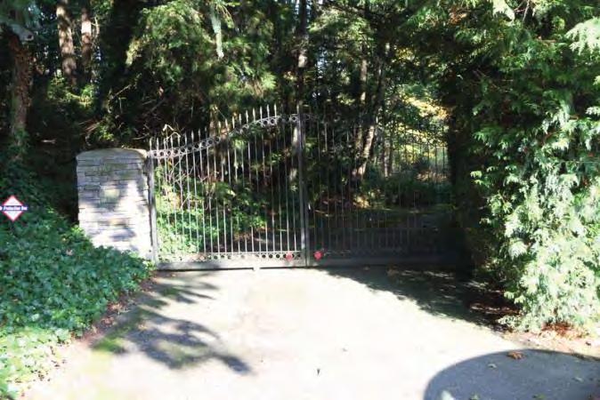
163 Photos Front gate Courtesy of King County Assessor's website. Northwest corner Courtesy of King County Assessor's website. Northeast corner South elevation Monday, July 21, 2014 Page 5 of 5
164 Location Field Site No DAHP No. Historic Name: Common Name: US Bank Property Address: 1436 S 312th, Federal Way, WA Comments: Tax No./Parcel No Plat/Block/Lot Acreage.89 Supplemental Map(s) Township/Range/EW Section 1/4 Sec 1/4 1/4 Sec T21R04E 08 County King Quadrangle POVERTY BAY Coordinate Reference Easting: Northing: Projection: Washington State Plane South Datum: HARN (feet) Identification Survey Name: Sound Transit Federal Way - Highline Water District Date Recorded: 10/21/2014 Field Recorder: MaryNell Nolan-Wheatley Owner's Name: US BANK CORPORATE PROPS Owner Address: 2800 E LAKE ST LAKE0012 City: MINNEAPOLIS State: MN Zip: Classification: Building Resource Status: Survey/Inventory Comments: Within a District? No Contributing? No National Register: Local District: National Register District/Thematic Nomination Name: Eligibility Status: Not Determined - SHPO Determination Date: 1/1/0001 Determination Comments: Tuesday, October 21, 2014 Page 1 of 6
165 Description Historic Use: Commerce/Trade - Financial Institution Current Use: Commerce/Trade - Financial Institution Plan: Rectangle Stories: 2 Structural System: Steel Changes to Plan: Intact Changes to Interior: Unknown Changes to Original Cladding: Slight Changes to Windows: Intact Changes to Other: Moderate Other (specify): Original brick veneer has been painted. Style: Cladding: Roof Type: Roof Material: Modern Veneer - Brick Flat with Parapet Asphalt / Composition - Commercial Veneer - Stucco Built Up Foundation: Form/Type: Concrete - Poured Commercial Narrative Study Unit Architecture/Landscape Architecture Date of Construction: 1960 Built Date Other Builder: Engineer: Architect: Property appears to meet criteria for the National Register of Historic Places:No Property is located in a potential historic district (National and/or local): No Property potentially contributes to a historic district (National and/or local): No Statement of Significance: Construction of the original Highway 1 in the state of Washington commenced in By October 1923, 700 miles of a two-lane highway had been completed connecting Vancouver, British Columbia, to the Oregon-California border. Just after the highway was completed in 1924, however, plans were begun to reroute and improve the conditions of the highway. The project involved creating a new, wider, four-lane route further west that would connect Seattle and Tacoma, Washington, more directly (Kramak, 2010). The new roadway was completed in 1928 and acquired the title of Highway 1, while the original eastern route was renamed Highway 5 (Caster, 2007). The new Highway 1 became known as the Pacific Highway. Over the years, various parts of Highway 1 acquired alternative names, including the portion known as Pacific Highway S, which starts near Federal Way, Washington, and continues north, through Kent, Des Moines, and SeaTac, Washington (Kramak, 2010). In 1926, Pacific Highway (HWY 1) was included as a numbered U.S. Highway (US 99) (U.S. Route 99, ). The following decades witnessed the rapid growth of businesses along the highway and the formation of a new auto-oriented roadside culture characterized by a proliferation of motels, restaurants, and rest stops (Des Moines Historical Society, 2007). Increased automobile ownership changed people s perceptions about distance and allowed populations to sprawl around urban centers, increasing the number of residents in suburban towns and cities, including SeaTac, Des Moines, Kent, and Federal Way (Boyles, 2010). Tuesday, October 21, 2014 Page 2 of 6
166 Federal Way was originally settled as a rural logging community in the late 1800s. In 1928, when the Pacific Highway (HWY 1/US 99) between Tacoma and Seattle opened, it linked Federal Way to the larger neighboring communities, spurring economic and residential development. The name Federal Way came from an eponymous school built in 1929 on Pacific Highway S (Caster, 2007). During the 1950s, Federal Way witnessed substantial growth, transforming from a small lumber town into a metropolitan area. Auto -oriented businesses emerged and thrived along the Pacific Highway. Community growth was bolstered by Boeing and Weyerhaeuser industries in the 1960s. In 1968, Weyerhaeuser purchased 430 acres of land for its corporate headquarters, which opened in April 1971 (Caster, 2007). Federal Way was incorporated as a city in The property at 1436 South 312th Street in Federal Way, Washington, which is a commercial property (US Bank) constructed in 1960, is not eligible for listing in the NRHP. The property is not eligible for the NRHP under Criterion A, which applies to buildings that are associated with events that have made a significant contribution to the broad patterns of history, as no significant events are associated with this property. To be eligible for the NRHP under Criterion B, a property must be directly associated with a person considered significant within a historic context whose specific contribution to history has been both identified and documented. No such person who meets that definition is linked to these buildings. In order to be eligible under Criterion C, a building must illustrate, through its distinctive characteristics, the pattern of features associated with a particular class of resources, the individuality or variation of features that occurs within the class, the evolution of that class, or the transition between classes of resources. While the building employs certain materials and design elements that were commonly used in the 1950s and 1960s, the building is an unremarkable bank building that is not a significant example of mid-century architectural design. The defining characteristics of the building include the glass curtain wall on the building s front (south) elevation, the flat roof, and the brick veneer walls that include decorative honeycomb brickwork on the west elevation. Other features of the building, such as the drive thrubanking overhang, are purely utilitarian and do not enhance the design. Overall, the building is a simple bank building with few defining characteristics. Significantly, the original brick veneer meant to give the building a strong horizontal emphasis has been painted, which detracts from the building s defining characteristics. In order to be eligible for its design, a building must contain a sufficient number of particular characteristics that recur in individual types, periods, or methods of construction to be considered a significant example. The US Bank building contains a minimal number of distinctive characteristics that when combined, do not illustrate significant examples of design or construction techniques. It is not enough for a building to contain typical elements of architectural styles from the 1960s; in order to meet the NRHP criteria, the building must also be an important example within its historic context. When considered within the context of Federal Way and the surrounding area, the building is not a significant example of building practices in a particular time in history. When compared to other similar buildings from the 1960s, US Bank does not more fully express aesthetic ideals or design concepts. The US Bank building is a modest, unremarkable example of a mid-century commercial building. Therefore, the property is not eligible for the NRHP under Criterion C as it is a typical mid-twentieth century building and does not embody the distinctive characteristics of a type, period, or method of construction; it is not the work of a master and does not possess high artistic value. The property is not eligible for the NRHP under Criterion D for information potential because the materials and construction methods of the buildings do not convey important information that could contribute to understanding history or prehistory. Therefore, the property is not eligible for listing in the NRHP because it does not meet any of the eligibility criteria. The building has undergone alterations including the painting of the original brick veneer and small additions such as the glass enclosure for the ATM machine on the front elevation. As a result, the property has lost some integrity of materials and design. The building retains integrity of workmanship, feeling, setting, location, and association. Tuesday, October 21, 2014 Page 3 of 6
167 Description of Physical Appearance: Major Bibliographic References: 1436 South 312th Street contains a two-story commercial steel frame building that was constructed in 1960 and is occupied by US Bank. The 6,030-square foot building has a flat, built-up roof with a low parapet. Clad primarily in painted brick veneer, the bank sits on a poured concrete foundation and has an essentially rectangular plan with a drive-thru banking canopy that extends from the rear (north) elevation. Some utilities equipment is located on the east side of the roof and is surrounded by a tall wood fence. A small vestibule with a flat roof projects from just west of center on the front (south) elevation and contains double metal and glass doors surrounded by fixed, single-light sidelights and a fixed, single-light transom. The east and west elevations of the vestibule each contain a large, fixed, single-light window. The flat roof over the vestibule extends into a flat overhang supported by two, plain metal posts. The front façade is defined by a glass curtain wall, composed of two rows of large, fixed, single-light windows. The ground floor windows each have a small, narrow, horizontally oriented, operable awning window at the bottom and the top. The bottom row of windows flank the vestibule and main entrance (five window openings on the west side, seven on the east side) while the upper row of fourteen windows are darkly tinted and line the upper half of the exterior wall. The far west window opening on the lower row of windows has been replaced by an ATM machine. The glass in several of the other windows has also been replaced. A small steel and glass shelter with a shed roof is attached to the façade and covers the ATM machine. The glass curtain wall on the façade is not centered; the windows extend all the way to the west end of the façade, while the east end is clad in a section of narrow brick veneer. Secured to the west elevation is a large sign for US Bank and a metal deposit chute is located in the center of the same elevation. The north end of the west elevation is clad in a decorative, honeycomb brickwork pattern. The east elevation contains a plain metal pedestrian door and the bank s large plastic signage. The center of the rear elevation, which is clad in smooth stucco, projects out slightly from the rest of the elevation. The first floor of the projection contains three fixed, single-light windows placed over a small awning window. West of the three windows are two more, fixed, single-light windows, the tops of which slant away from the building. A metal pedestrian door with a single-light transom is located to the east of the row of three windows. A large, flat roof canopy extends from the rear elevation s center section. The canopy is supported by four, simple metal posts and covers three drive-thru banking lanes. An ATM machine and a deposit chute are located on concrete islands under the canopy. Above the roof of the canopy the rear elevation contains three fixed, single-light windows. A tall, fixed, single-light, vertically oriented window is located above the first floor pedestrian door. The east end of the north elevation contains three large, fixed, single-light windows that each have a small awning window in the bottom. The building is surrounded by pavement used for parking. Boyles, E The Suburb. Selected Cultural and Historical Geographies of the Greater Seattle Area. Available at: bellevue-and-redmond/the-suburb. Accessed March 18,. Caster, D Historical Society of Federal Way Timeline. Available at: Accessed March 15,. Des Moines Historical Society Time Line Page. Available at: Accessed March 13,. King County.. King County Department of Assessments. Available at: Accessed July Kramak, J.E., ed Establishing the Pacific Highway South. Selected Cultural and Historical Geographies of the Greater Seattle Area. Available at: Accessed March 14,. U.S. Route 99 The Pacific Highway.. Waymarking: A Groundspeak Website. Available at: Accessed March 19,. Tuesday, October 21, 2014 Page 4 of 6


168 Photos Southwest corner ATM enclosure addition is visible near center of photo Southeast corner Northeast corner Northwest corner Tuesday, October 21, 2014 Page 5 of 6


169 Single section of honeycomb brick is visible at left side of wall. West elevation South elevation Tuesday, October 21, 2014 Page 6 of 6
170 Location Field Site No DAHP No. Historic Name: Common Name: Pacific Hwy S Property Address: Pacific Hwy S, Federal Way, WA Comments: Tax No./Parcel No Plat/Block/Lot Acreage.70 Supplemental Map(s) Township/Range/EW Section 1/4 Sec 1/4 1/4 Sec T21R04E 08 County King Quadrangle POVERTY BAY Coordinate Reference Easting: Northing: Projection: Washington State Plane South Datum: HARN (feet) Identification Survey Name: Sound Transit Federal Way Date Recorded: 01/02/2014 Field Recorder: MaryNell Nolan-Wheatley Owner's Name: RST ENTERPRISES INC Owner Address: 1851 CENTRAL PL S #225 City: KENT State: WA Zip: Classification: Building Resource Status: Survey/Inventory Comments: Within a District? No Contributing? No National Register: Local District: National Register District/Thematic Nomination Name: Eligibility Status: Not Determined - SHPO Determination Date: 1/1/0001 Determination Comments: Friday, July 25, 2014 Page 1 of 5
171 Description Historic Use: Commerce/Trade - Business Current Use: Commerce/Trade - Business Plan: Rectangle Stories: 1 Structural System: Concrete - Block Changes to Plan: Slight Changes to Original Cladding: Extensive Changes to Other: Extensive Other (specify): Building was recently remodeled, though date is unknown. Style: Commercial - Highway Strip Foundation: Concrete - Poured Cladding: Veneer - Stucco Form/Type: Commercial - Strip Commercial Roof Type: Changes to Interior: Unknown Changes to Windows: Extensive Roof Material: Flat with Parapet Asphalt / Composition - Built Up Narrative Study Unit Architecture/Landscape Architecture Date of Construction: 1970 Built Date 1980 Addition Other Builder: Engineer: Architect: Property appears to meet criteria for the National Register of Historic Places:No Property is located in a potential historic district (National and/or local): No Property potentially contributes to a historic district (National and/or local): No Friday, July 25, 2014 Page 2 of 5
172 Statement of Significance: Construction of the original Highway 1 in the state of Washington commenced in By October 1923, 700 miles of a two-lane highway had been completed connecting Vancouver, British Columbia, to the Oregon-California border. Just after the highway was completed in 1924, however, plans were begun to reroute and improve the conditions of the highway. The project involved creating a new, wider, four-lane route further west that would connect Seattle and Tacoma, Washington, more directly (Kramak, 2010). The new roadway was completed in 1928 and acquired the title of Highway 1, while the original eastern route was renamed Highway 5 (Caster, 2007). The new Highway 1 became known as the Pacific Highway. Over the years, various parts of Highway 1 acquired alternative names, including the portion known as Pacific Highway S, which starts near Federal Way, Washington, and continues north, through Kent, Des Moines, and SeaTac, Washington (Kramak, 2010). In 1926, Pacific Highway (HWY 1) was included as a numbered U.S. Highway (US 99) (U.S. Route 99, ). The following decades witnessed the rapid growth of businesses along the highway and the formation of a new auto-oriented roadside culture characterized by a proliferation of motels, restaurants, and rest stops (Des Moines Historical Society, 2007). Increased automobile ownership changed people s perceptions about distance and allowed populations to sprawl around urban centers, increasing the number of residents in suburban towns and cities, including SeaTac, Des Moines, Kent, and Federal Way (Boyles, 2010). Federal Way was originally settled as a rural logging community in the late 1800s. In 1928, when the Pacific Highway (HWY 1/US 99) between Tacoma and Seattle opened, it linked Federal Way to the larger neighboring communities, spurring economic and residential development. The name Federal Way came from an eponymous school built in 1929 on Pacific Highway S (Caster, 2007). During the 1950s, Federal Way witnessed substantial growth, transforming from a small lumber town into a metropolitan area. Auto -oriented businesses emerged and thrived along the Pacific Highway. Community growth was bolstered by Boeing and Weyerhaeuser industries in the 1960s. In 1968, Weyerhaeuser purchased 430 acres of land for its corporate headquarters, which opened in April 1971 (Caster, 2007). Federal Way was incorporated as a city in The property at Pacific Highway South in Federal Way, Washington, which is a commercial property constructed in 1970, is not eligible for listing in the NRHP. The property is not eligible for the NRHP under Criterion A, which applies to buildings that are associated with events that have made a significant contribution to the broad patterns of history, as no significant events are associated with this property. To be eligible for the NRHP under Criterion B, a property must be directly associated with a person considered significant within a historic context whose specific contribution to history has been both identified and documented. No such person who meets that definition is linked to this building. The property is not eligible for the NRHP under Criterion C as it is a typical mid to late-twentieth century commercial building and does not embody the distinctive characteristics of a type, period, or method of construction; it is not the work of a master and does not possess high artistic value. The property is not eligible for the NRHP under Criterion D for information potential because the materials and construction methods of the building do not convey important information that could contribute to understanding history or prehistory. Therefore, the property is not eligible for listing in the NRHP because it does not meet any of the eligibility criteria. In addition the building is heavily altered, including the replacement of original doors, windows, and siding. As a result, the building has lost integrity of materials, design, and workmanship. The building retains integrity of setting, location, feeling and association. Friday, July 25, 2014 Page 3 of 5
173 Description of Physical Appearance: Major Bibliographic References: Pacific Highway South contains a concrete block, commercial building that was constructed in 1970 and is currently occupied by several retail businesses. Although the building appears to be one story from the front (east) elevation, a full, finished basement is accessible from the rear (west) elevation due to the change in grade of the land. Constructed on a poured concrete foundation, the essentially rectangular plan building has been recently renovated including the replacement of all original windows, doors, and siding. Currently, the building is clad in stucco, has all fixed windows with highly reflective glass, and has a flat roof that rises to a low parapet on the visible elevations. The front of the building contains five storefronts which are shaded by an attached, flat overhang supported by pairs of cables. Seven support posts clad in brick veneer protrude from the front façade, creating a visual separation between the storefronts. Each storefront contains a metal and glass pedestrian door. Between the doors there are six, large, single-light commercial style windows. Three rectangular pediments rise above the parapet along the front façade. The pediment at the far north end of the east elevation is the tallest, and projects out from the main elevation, rising from the edge of a wide, flat overhang that wraps around the building s northeast corner. Large rectangular concrete posts support the pediment. Another large rectangular pediment rises from the edge of the overhang on the east end of the north elevation, and is also supported by rectangular concrete posts. The north elevation contains a fixed, single-light window and two, fixed, two-light windows. The building is surrounded by pavement used for parking. A paved driveway slopes down and wraps around the building s north elevation, leading to a rear parking lot. According to King County Assessor s website a small, 550-square foot equipment shop constructed in 1980 is located in the rear of the property. Boyles, E The Suburb. Selected Cultural and Historical Geographies of the Greater Seattle Area. Available at: bellevue-and-redmond/the-suburb. Accessed March 18,. Caster, D Historical Society of Federal Way Timeline. Available at: Accessed March 15,. Des Moines Historical Society Time Line Page. Available at: Accessed March 13,. King County.. King County Department of Assessments. Available at: Accessed October 20,. Kramak, J.E., ed Establishing the Pacific Highway South. Selected Cultural and Historical Geographies of the Greater Seattle Area. Available at: Accessed March 14,. U.S. Route 99 The Pacific Highway.. Waymarking: A Groundspeak Website. Available at: Accessed March 19,. Friday, July 25, 2014 Page 4 of 5


174 Photos Northeast corner East elevation Southeast corner Friday, July 25, 2014 Page 5 of 5
175 Location Field Site No DAHP No. Historic Name: Common Name: Drew Beaty Family & Cosmetic Dentistry Property Address: Pacific Hwy S, Federal Way, WA Comments: Tax No./Parcel No Plat/Block/Lot Acreage.42 Supplemental Map(s) Township/Range/EW Section 1/4 Sec 1/4 1/4 Sec T21R04E 08 County King Quadrangle POVERTY BAY Coordinate Reference Easting: Northing: Projection: Washington State Plane South Datum: HARN (feet) Identification Survey Name: Sound Transit Federal Way Date Recorded: 01/02/2014 Field Recorder: MaryNell Nolan-Wheatley Owner's Name: DANDK PROPERTIES LLC Owner Address: PACIFIC HWY S City: FEDERAL WAY State: WA Zip: Classification: Building Resource Status: Survey/Inventory Comments: Within a District? No Contributing? No National Register: Local District: National Register District/Thematic Nomination Name: Eligibility Status: Not Determined - SHPO Determination Date: 1/1/0001 Determination Comments: Friday, July 25, 2014 Page 1 of 5
176 Description Historic Use: Commerce/Trade - Business Current Use: Health Care - Clinic Plan: Rectangle Stories: 1 Structural System: Concrete - Block Changes to Plan: Intact Changes to Original Cladding: Extensive Changes to Other: Other (specify): Style: Foundation: Cladding: Form/Type: Roof Type: Changes to Interior: Unknown Changes to Windows: Moderate Roof Material: Commercial Veneer - Vinyl Siding Flat with Parapet Asphalt / Composition - Veneer - Brick Built Up Concrete - Poured Commercial Narrative Study Unit Architecture/Landscape Architecture Date of Construction: 1954 Built Date Other Builder: Engineer: Architect: Property appears to meet criteria for the National Register of Historic Places:No Property is located in a potential historic district (National and/or local): No Property potentially contributes to a historic district (National and/or local): No Friday, July 25, 2014 Page 2 of 5
177 Statement of Significance: Construction of the original Highway 1 in the state of Washington commenced in By October 1923, 700 miles of a two-lane highway had been completed connecting Vancouver, British Columbia, to the Oregon-California border. Just after the highway was completed in 1924, however, plans were begun to reroute and improve the conditions of the highway. The project involved creating a new, wider, four-lane route further west that would connect Seattle and Tacoma, Washington, more directly (Kramak, 2010). The new roadway was completed in 1928 and acquired the title of Highway 1, while the original eastern route was renamed Highway 5 (Caster, 2007). The new Highway 1 became known as the Pacific Highway. Over the years, various parts of Highway 1 acquired alternative names, including the portion known as Pacific Highway S, which starts near Federal Way, Washington, and continues north, through Kent, Des Moines, and SeaTac, Washington (Kramak, 2010). In 1926, Pacific Highway (HWY 1) was included as a numbered U.S. Highway (US 99) (U.S. Route 99, ). The following decades witnessed the rapid growth of businesses along the highway and the formation of a new auto-oriented roadside culture characterized by a proliferation of motels, restaurants, and rest stops (Des Moines Historical Society, 2007). Increased automobile ownership changed people s perceptions about distance and allowed populations to sprawl around urban centers, increasing the number of residents in suburban towns and cities, including SeaTac, Des Moines, Kent, and Federal Way (Boyles, 2010). Federal Way was originally settled as a rural logging community in the late 1800s. In 1928, when the Pacific Highway (HWY 1/US 99) between Tacoma and Seattle opened, it linked Federal Way to the larger neighboring communities, spurring economic and residential development. The name Federal Way came from an eponymous school built in 1929 on Pacific Highway S (Caster, 2007). During the 1950s, Federal Way witnessed substantial growth, transforming from a small lumber town into a metropolitan area. Auto -oriented businesses emerged and thrived along the Pacific Highway. Community growth was bolstered by Boeing and Weyerhaeuser industries in the 1960s. In 1968, Weyerhaeuser purchased 430 acres of land for its corporate headquarters, which opened in April 1971 (Caster, 2007). Federal Way was incorporated as a city in The property at Pacific Highway South in Federal Way, Washington, which is a commercial property constructed in 1954, is not eligible for listing in the NRHP. The property is not eligible for the NRHP under Criterion A, which applies to buildings that are associated with events that have made a significant contribution to the broad patterns of history, as no significant events are associated with this property. To be eligible for the NRHP under Criterion B, a property must be directly associated with a person considered significant within a historic context whose specific contribution to history has been both identified and documented. No such person who meets that definition is linked to this building. The property is not eligible for the NRHP under Criterion C as it is a typical mid-twentieth century commercial building and does not embody the distinctive characteristics of a type, period, or method of construction; it is not the work of a master and does not possess high artistic value. The property is not eligible for the NRHP under Criterion D for information potential because the materials and construction methods of the building do not convey important information that could contribute to understanding history or prehistory. Therefore, the property is not eligible for listing in the NRHP because it does not meet any of the eligibility criteria. In addition the building is heavily altered, including the replacement of original doors, some windows, and siding. As a result, the building has lost integrity of materials, design, and workmanship. The building retains integrity of setting, location, feeling and association. Friday, July 25, 2014 Page 3 of 5
178 Description of Physical Appearance: Major Bibliographic References: Pacific Highway South contains a one-story, concrete block, commercial building that was constructed in 1954 and is currently occupied by Drew Beaty Family and Cosmetic Dentistry. Constructed on a concrete slab foundation, the rectangular plan building is primarily clad in non-original horizontal vinyl siding. The building has a flat, built-up roof with a low parapet and a vertical awning clad in vertical vinyl siding wraps around the primary elevation. The main entrance to the building is located in the northeast corner of the building and is recessed from the north and east elevations. A convex, vinyl awning wraps around the northeast corner of the building and shades just the recessed entrance area, which is covered by the primary flat roof. Two, thin metal posts support the roof at this corner. A metal and glass pedestrian door with a fixed, single-light transom is located on the east elevation of the recessed northeast corner and serves as the main entrance. Four tall, narrow, fixed, single-light windows wrap around the northeast corner of the entrance. The recessed corner entrance area and the front (east) elevation are clad in painted brick veneer and contain three window openings, each of which contains a fixed, single-light window placed adjacent to a smaller casement window. Each window is shaded by a traditional, convex, vinyl awning that matches the awning over the main entrance. The north elevation contains six, small, fixed, replacement single-light windows and three larger, fixed, single-light replacement windows. The south elevation contains seven, small, replacement two-light horizontal sliding windows and two, small, replacement, one-over-one sash windows. A wood deck addition with an open framework wood handrail extends from the west elevation and leads to two, replacement, paneled, pedestrian doors. The area in front of the building is landscaped, with flower beds and a concrete walkway. The area on the north and west sides of the building are paved and used for parking. Boyles, E The Suburb. Selected Cultural and Historical Geographies of the Greater Seattle Area. Available at: bellevue-and-redmond/the-suburb. Accessed March 18,. Caster, D Historical Society of Federal Way Timeline. Available at: Accessed March 15,. Des Moines Historical Society Time Line Page. Available at: Accessed March 13,. King County.. King County Department of Assessments. Available at: Accessed October 20,. Kramak, J.E., ed Establishing the Pacific Highway South. Selected Cultural and Historical Geographies of the Greater Seattle Area. Available at: Accessed March 14,. U.S. Route 99 The Pacific Highway.. Waymarking: A Groundspeak Website. Available at: Accessed March 19,. Friday, July 25, 2014 Page 4 of 5


179 Photos Northeast corner Southeast corner Southwest corner Friday, July 25, 2014 Page 5 of 5
180 Location Field Site No DAHP No. Historic Name: Common Name: th Ave S Property Address: th Ave S, Federal Way, WA Comments: Tax No./Parcel No Plat/Block/Lot Acreage 2.15 Supplemental Map(s) Township/Range/EW Section 1/4 Sec 1/4 1/4 Sec T21R04E 09 County King Quadrangle POVERTY BAY Coordinate Reference Easting: Northing: Projection: Washington State Plane South Datum: HARN (feet) Identification Survey Name: Sound Transit Federal Way Date Recorded: 02/17/2014 Field Recorder: MaryNell Nolan-Wheatley Owner's Name: JACOBS STEVEN Owner Address: TH AVE S City: FEDERAL WAY State: WA Zip: Classification: Building Resource Status: Survey/Inventory Comments: Within a District? No Contributing? No National Register: Local District: National Register District/Thematic Nomination Name: Eligibility Status: Not Determined - SHPO Determination Date: 1/1/0001 Determination Comments: Friday, July 25, 2014 Page 1 of 5
181 Description Historic Use: Domestic - Single Family House Current Use: Domestic - Single Family House Plan: Rectangle Stories: 1 Structural System: Platform Frame Changes to Plan: Intact Changes to Original Cladding: Intact Changes to Other: Slight Other (specify): Shape of roof has been altered. Style: Vernacular Foundation: Concrete - Poured Cladding: Shingle - Concrete/Asbestos Wood - Vertical Form/Type: Single Family Roof Type: Changes to Interior: Unknown Changes to Windows: Extensive Roof Material: Hip Asphalt / Composition - Gable - Side Gable Shingle Narrative Study Unit Architecture/Landscape Architecture Date of Construction: 1963 Built Date Other Builder: Engineer: Architect: Property appears to meet criteria for the National Register of Historic Places:No Property is located in a potential historic district (National and/or local): No Property potentially contributes to a historic district (National and/or local): No Friday, July 25, 2014 Page 2 of 5
182 Statement of Significance: Construction of the original Highway 1 in the state of Washington commenced in By October 1923, 700 miles of a two-lane highway had been completed connecting Vancouver, British Columbia, to the Oregon-California border. Just after the highway was completed in 1924, however, plans were begun to reroute and improve the conditions of the highway. The project involved creating a new, wider, four-lane route further west that would connect Seattle and Tacoma, Washington, more directly (Kramak, 2010). The new roadway was completed in 1928 and acquired the title of Highway 1, while the original eastern route was renamed Highway 5 (Caster, 2007). The new Highway 1 became known as the Pacific Highway. Over the years, various parts of Highway 1 acquired alternative names, including the portion known as Pacific Highway S, which starts near Federal Way, Washington, and continues north, through Kent, Des Moines, and SeaTac, Washington (Kramak, 2010). In 1926, Pacific Highway (HWY 1) was included as a numbered U.S. Highway (US 99) (U.S. Route 99, ). The following decades witnessed the rapid growth of businesses along the highway and the formation of a new auto-oriented roadside culture characterized by a proliferation of motels, restaurants, and rest stops (Des Moines Historical Society, 2007). Increased automobile ownership changed people s perceptions about distance and allowed populations to sprawl around urban centers, increasing the number of residents in suburban towns and cities, including SeaTac, Des Moines, Kent, and Federal Way (Boyles, 2010). Federal Way was originally settled as a rural logging community in the late 1800s. In 1928, when the Pacific Highway (HWY 1/US 99) between Tacoma and Seattle opened, it linked Federal Way to the larger neighboring communities, spurring economic and residential development. The name Federal Way came from an eponymous school built in 1929 on Pacific Highway S (Caster, 2007). During the 1950s, Federal Way witnessed substantial growth, transforming from a small lumber town into a metropolitan area. Auto -oriented businesses emerged and thrived along the Pacific Highway. Community growth was bolstered by Boeing and Weyerhaeuser industries in the 1960s. In 1968, Weyerhaeuser purchased 430 acres of land for its corporate headquarters, which opened in April 1971 (Caster, 2007). Federal Way was incorporated as a city in The property at th Avenue South in Federal Way, Washington, which is a residential property built in 1963, is not eligible for listing in the NRHP. The property is not eligible for the NRHP under Criterion A, which applies to buildings that are associated with events that have made a significant contribution to the broad patterns of history, as no significant events are associated with this property. To be eligible for the NRHP under Criterion B, a property must be directly associated with a person considered significant within a historic context whose specific contribution to history has been both identified and documented. No such person who meets that definition is linked to this building. The property is not eligible for the NRHP under Criterion C as it is a typical residential building from the midtwentieth century and does not embody the distinctive characteristics of a type, period, or method of construction; it is not the work of a master and does not possess high artistic value. The property is not eligible for the NRHP under Criterion D for information potential because the materials and construction methods of the building do not convey important information that could contribute to understanding history or prehistory. Therefore, the property is not eligible for listing in the NRHP because it does not meet any of the eligibility criteria. In addition the building is altered including the replacement of the original windows, front door, and roof. As a result, the property has lost integrity of materials and design but retains integrity of setting, workmanship, feeling, location and association. Friday, July 25, 2014 Page 3 of 5
183 Description of Physical Appearance: Major Bibliographic References: th Avenue South is a one-story, wood frame, vernacular style residential property with a rectangular floor plan constructed in The building, which sits on a concrete slab foundation, has a composite shingle roof that is hipped on the north side and gabled on the south side. The roof has moderately deep open eaves and a deep open rake over the south elevation. According to historic photos on the King County Assessor s website, this in the not the original roof shape for the house; originally, the house appears to be topped by an asymmetrical hipped roof. The lower half of the exterior walls are clad in asbestos shingle siding while the upper half are clad in vertical wood siding. A paneled replacement front door is located on the south end of the front (west) elevation and is accessed by two concrete steps with a low, wood, open framework handrail. The front door is shaded by an integrated shed roof overhang. A single wood post supports the southwest corner of the overhang. A large, fixed, single-light window is located in the center of the front façade, just north of the main entrance. A rectangular bay slightly protrudes from the north end of the front elevation and contains a large, 12-by-12 light horizontal sliding replacement window. Two, two-light horizontal sliding windows are located on the north elevation. There is no fenestration on the south elevation under the side gable. Two accessory shed buildings are located in the rear of the property. Both are clad in horizontal wood siding and appear to have gabled roofs and replacement windows and doors. The property includes a front yard and a long gravel driveway that leads to the south side of the main house. Several large trees surround the main house and its accessory buildings. Boyles, E The Suburb. Selected Cultural and Historical Geographies of the Greater Seattle Area. Available at: bellevue-and-redmond/the-suburb. Accessed March 18,. Caster, D Historical Society of Federal Way Timeline. Available at: Accessed March 15,. Des Moines Historical Society Time Line Page. Available at: Accessed March 13,. King County.. King County Department of Assessments. Available at: Accessed October 20,. Kramak, J.E., ed Establishing the Pacific Highway South. Selected Cultural and Historical Geographies of the Greater Seattle Area. Available at: Accessed March 14,. U.S. Route 99 The Pacific Highway.. Waymarking: A Groundspeak Website. Available at: Accessed March 19,. Friday, July 25, 2014 Page 4 of 5


184 Photos West elevation Northwest corner South elevation View to the northeast, accessory buildings Friday, July 25, 2014 Page 5 of 5
185 Location Field Site No DAHP No. Historic Name: Common Name: Steel Lake Maintenance Facility Property Address: th Ave S, Federal Way, WA Comments: Tax No./Parcel No Plat/Block/Lot Acreage Supplemental Map(s) Township/Range/EW Section 1/4 Sec 1/4 1/4 Sec T21R04E 09 County King Quadrangle POVERTY BAY Coordinate Reference Easting: Northing: Projection: Washington State Plane South Datum: HARN (feet) Identification Survey Name: Sound Transit Federal Way Date Recorded: 02/13/2014 Field Recorder: MaryNell Nolan-Wheatley Owner's Name: FEDERAL WAY CITY OF Owner Address: PO BOX 9718 City: Federal Way State: WA Zip: Classification: Building Resource Status: Survey/Inventory Comments: Within a District? No Contributing? No National Register: Local District: National Register District/Thematic Nomination Name: Eligibility Status: Not Determined - SHPO Determination Date: 1/1/0001 Determination Comments: Friday, July 25, 2014 Page 1 of 6
186 Description Historic Use: Government - Fire Station Current Use: Government - Public Works Plan: Irregular Stories: 1 Structural System: Concrete - Block Changes to Plan: Slight Changes to Interior: Unknown Changes to Original Cladding: Intact Changes to Windows: Slight Changes to Other: Other (specify): Style: Cladding: Roof Type: Roof Material: Modern - Contemporary Wood - Vertical Gable - Side Gable Asphalt / Composition - Concrete - Block Gable - Front Gable Rolled Foundation: Form/Type: Concrete - Poured Other Narrative Study Unit Architecture/Landscape Architecture Date of Construction: 1959 Built Date Other Builder: Engineer: Architect: Property appears to meet criteria for the National Register of Historic Places:No Property is located in a potential historic district (National and/or local): No Property potentially contributes to a historic district (National and/or local): No Friday, July 25, 2014 Page 2 of 6
187 Statement of Significance: Construction of the original Highway 1 in the state of Washington commenced in By October 1923, 700 miles of a two-lane highway had been completed connecting Vancouver, British Columbia, to the Oregon-California border. Just after the highway was completed in 1924, however, plans were begun to reroute and improve the conditions of the highway. The project involved creating a new, wider, four-lane route further west that would connect Seattle and Tacoma, Washington, more directly (Kramak, 2010). The new roadway was completed in 1928 and acquired the title of Highway 1, while the original eastern route was renamed Highway 5 (Caster, 2007). The new Highway 1 became known as the Pacific Highway. Over the years, various parts of Highway 1 acquired alternative names, including the portion known as Pacific Highway S, which starts near Federal Way, Washington, and continues north, through Kent, Des Moines, and SeaTac, Washington (Kramak, 2010). In 1926, Pacific Highway (HWY 1) was included as a numbered U.S. Highway (US 99) (U.S. Route 99, ). The following decades witnessed the rapid growth of businesses along the highway and the formation of a new auto-oriented roadside culture characterized by a proliferation of motels, restaurants, and rest stops (Des Moines Historical Society, 2007). Increased automobile ownership changed people s perceptions about distance and allowed populations to sprawl around urban centers, increasing the number of residents in suburban towns and cities, including SeaTac, Des Moines, Kent, and Federal Way (Boyles, 2010). Federal Way was originally settled as a rural logging community in the late 1800s. In 1928, when the Pacific Highway (HWY 1/US 99) between Tacoma and Seattle opened, it linked Federal Way to the larger neighboring communities, spurring economic and residential development. The name Federal Way came from an eponymous school built in 1929 on Pacific Highway S (Caster, 2007). During the 1950s, Federal Way witnessed substantial growth, transforming from a small lumber town into a metropolitan area. Auto -oriented businesses emerged and thrived along the Pacific Highway. Community growth was bolstered by Boeing and Weyerhaeuser industries in the 1960s. In 1968, Weyerhaeuser purchased 430 acres of land for its corporate headquarters, which opened in April 1971 (Caster, 2007). Federal Way was incorporated as a city in The property at th Avenue South in Federal Way, Washington, which is the Steel Lake Maintenance Facility for Steel Lake Park built in 1959, is not eligible for listing in the NRHP. The property is not eligible for the NRHP under Criterion A, which applies to buildings that are associated with events that have made a significant contribution to the broad patterns of history, as no significant events are associated with this property. To be eligible for the NRHP under Criterion B, a property must be directly associated with a person considered significant within a historic context whose specific contribution to history has been both identified and documented. No such person who meets that definition is linked to this building. The property is not eligible for the NRHP under Criterion C as it is a typical fire station from the mid-twentieth century that has been converted into a maintenance facility and does not embody the distinctive characteristics of a type, period, or method of construction; it is not the work of a master and does not possess high artistic value. The property is not eligible for the NRHP under Criterion D for information potential because the materials and construction methods of the building do not convey important information that could contribute to understanding history or prehistory. Therefore, the property is not eligible for listing in the NRHP because it does not meet any of the eligibility criteria. In addition to a changed use, the building is altered including the replacement of the original doors and some windows and numerous large storage facilities in the rear of the property. As a result, the property has lost integrity of materials, setting, association and feeling. The building retains integrity of design, workmanship, and location. Friday, July 25, 2014 Page 3 of 6
188 Description of Physical Appearance: Major Bibliographic References: th Avenue South is a one-story, concrete block, former fire station that has been converted into the Steel Lake Maintenance Facility. Constructed in 1959 on a concrete slab foundation, the building has an irregular plan composed of three sections: two adjacent, low-pitched side gabled sections with differing roof heights, and a more moderately pitched, front gabled garage section. All three roofs are covered in rolled roofing material and extend into deep eave overhangs with exposed wood rafter tails. The building is primarily clad in vertical wood siding although parts of the exterior walls are painted concrete block. The front gabled garage section, which is nearly a double height building presumably to accommodate large vehicles such as fire trucks, is located on the south end of the building. The front (west) elevation of the garage contains two large vehicle bays with non-matching retractable doors. The north door appears to be original while the south door is likely a replacement. A long, narrow, rectangular plan, attached shed is located along the south elevation of the garage and connects with the base of a very large exterior eave wall chimney, clad in corrugated metal that protrudes from the east end of the south elevation. The top of the chimney has a small gabled cover. Aerial images indicate that a front gable overhang extends from the rear (east) elevation of the garage, although this addition is not visible from the public right-of-way. The central long, rectangular plan, side gabled section of the buildings projects from the center of the garage s north elevation. A pedestrian door with a fixed, single-light window is located just north of center on the central section s front (west) elevation. North and south of the pedestrian door are single window openings, although the style of the windows is not apparent due to heavy vegetation that is planted along the front façade. Attached to the north end of the central side gabled section is another, rectangular plan, side gabled section that has a slightly taller roof height. The west end of this section s south elevation contains a replacement pedestrian door that contains a fixed, single-light window and an adjacent fixed, single-light replacement window. The exterior walls of this section are mostly painted concrete blocks. There are no windows on the west elevation of the north section. The north elevation under the side gable, however, is nearly entirely composed of two levels of windows. Each level contains a row of 20, narrow, vertically oriented windows. Every third window in each row contains a small awning window in the bottom. The top row of windows extend all the way to where the exterior wall meets the eave, creating the illusion of a glass wall. Two temporary, metal frame, open structures with barrel vaulted roofs covered in vinyl are located in the rear of the property and are used to store large trucks. Nearly the entire property is paved with the exception of the small area in front of the building that is landscaped. Boyles, E The Suburb. Selected Cultural and Historical Geographies of the Greater Seattle Area. Available at: bellevue-and-redmond/the-suburb. Accessed March 18,. Caster, D Historical Society of Federal Way Timeline. Available at: Accessed March 15,. Des Moines Historical Society Time Line Page. Available at: Accessed March 13,. King County.. King County Department of Assessments. Available at: Accessed October 20,. Kramak, J.E., ed Establishing the Pacific Highway South. Selected Cultural and Historical Geographies of the Greater Seattle Area. Available at: Accessed March 14,. U.S. Route 99 The Pacific Highway.. Waymarking: A Groundspeak Website. Available at: Accessed March 19,. Friday, July 25, 2014 Page 4 of 6


189 Photos Southwest corner View to the southeast Northwest corner West elevation Friday, July 25, 2014 Page 5 of 6

190 West elevation, further north Friday, July 25, 2014 Page 6 of 6
191 Location Field Site No DAHP No. Historic Name: Common Name: th Ave S Property Address: th Ave S, Federal Way, WA Comments: Tax No./Parcel No Plat/Block/Lot Acreage 1.01 Supplemental Map(s) Township/Range/EW Section 1/4 Sec 1/4 1/4 Sec T21R04E 09 County King Quadrangle POVERTY BAY Coordinate Reference Easting: Northing: Projection: Washington State Plane South Datum: HARN (feet) Identification Survey Name: Sound Transit Federal Way Date Recorded: 02/17/2014 Field Recorder: MaryNell Nolan-Wheatley Owner's Name: WOOLEY RANDALL S Owner Address: TH AVE S City: Federal Way State: WA Zip: Classification: Building Resource Status: Survey/Inventory Comments: Within a District? No Contributing? No National Register: Local District: National Register District/Thematic Nomination Name: Eligibility Status: Not Determined - SHPO Determination Date: 1/1/0001 Determination Comments: Friday, July 25, 2014 Page 1 of 5
192 Description Historic Use: Domestic - Single Family House Current Use: Domestic - Single Family House Plan: Rectangle Stories: 1 Structural System: Log Changes to Plan: Intact Changes to Original Cladding: Intact Changes to Other: Other (specify): Style: Foundation: Cladding: Form/Type: Roof Type: Changes to Interior: Unknown Changes to Windows: Extensive Roof Material: Vernacular Log Gable - Side Gable Asphalt / Composition - Shingle Concrete - Block Single Family - Side Gable Narrative Study Unit Architecture/Landscape Architecture Date of Construction: 1943 Built Date 1955 Addition Other Builder: Engineer: Architect: Property appears to meet criteria for the National Register of Historic Places:No Property is located in a potential historic district (National and/or local): No Property potentially contributes to a historic district (National and/or local): No Friday, July 25, 2014 Page 2 of 5
193 Statement of Significance: Construction of the original Highway 1 in the state of Washington commenced in By October 1923, 700 miles of a two-lane highway had been completed connecting Vancouver, British Columbia, to the Oregon-California border. Just after the highway was completed in 1924, however, plans were begun to reroute and improve the conditions of the highway. The project involved creating a new, wider, four-lane route further west that would connect Seattle and Tacoma, Washington, more directly (Kramak, 2010). The new roadway was completed in 1928 and acquired the title of Highway 1, while the original eastern route was renamed Highway 5 (Caster, 2007). The new Highway 1 became known as the Pacific Highway. Over the years, various parts of Highway 1 acquired alternative names, including the portion known as Pacific Highway S, which starts near Federal Way, Washington, and continues north, through Kent, Des Moines, and SeaTac, Washington (Kramak, 2010). In 1926, Pacific Highway (HWY 1) was included as a numbered U.S. Highway (US 99) (U.S. Route 99, ). The following decades witnessed the rapid growth of businesses along the highway and the formation of a new auto-oriented roadside culture characterized by a proliferation of motels, restaurants, and rest stops (Des Moines Historical Society, 2007). Increased automobile ownership changed people s perceptions about distance and allowed populations to sprawl around urban centers, increasing the number of residents in suburban towns and cities, including SeaTac, Des Moines, Kent, and Federal Way (Boyles, 2010). Federal Way was originally settled as a rural logging community in the late 1800s. In 1928, when the Pacific Highway (HWY 1/US 99) between Tacoma and Seattle opened, it linked Federal Way to the larger neighboring communities, spurring economic and residential development. The name Federal Way came from an eponymous school built in 1929 on Pacific Highway S (Caster, 2007). During the 1950s, Federal Way witnessed substantial growth, transforming from a small lumber town into a metropolitan area. Auto -oriented businesses emerged and thrived along the Pacific Highway. Community growth was bolstered by Boeing and Weyerhaeuser industries in the 1960s. In 1968, Weyerhaeuser purchased 430 acres of land for its corporate headquarters, which opened in April 1971 (Caster, 2007). Federal Way was incorporated as a city in The property at th Avenue South in Federal Way, Washington, which is a residential property built in 1943, is not eligible for listing in the NRHP. The property is not eligible for the NRHP under Criterion A, which applies to buildings that are associated with events that have made a significant contribution to the broad patterns of history, as no significant events are associated with this property. To be eligible for the NRHP under Criterion B, a property must be directly associated with a person considered significant within a historic context whose specific contribution to history has been both identified and documented. No such person who meets that definition is linked to this building. The property is not eligible for the NRHP under Criterion C as it is a typical residential building from the early to mid-twentieth century. Although the building was constructed in a vernacular log construction, its current appearance, with historically insensitive replacement doors and windows, cannot convey any significance under Criterion C. For these reasons, the building does not embody the distinctive characteristics of a type, period, or method of construction; it is not the work of a master and does not possess high artistic value. The property is not eligible for the NRHP under Criterion D for information potential because the materials and construction methods of the building do not convey important information that could contribute to understanding history or prehistory. Therefore, the property is not eligible for listing in the NRHP because it does not meet any of the eligibility criteria. In addition the building has been raised to add a lookout basement and altered to replace the original windows and doors. The area around the property has also been significantly built up since the time of its construction in the 1940s. As a result, the property has lost integrity of materials, design, and setting. It retains integrity of workmanship, feeling, location and association. Friday, July 25, 2014 Page 3 of 5
194 Description of Physical Appearance: th Avenue South contains two buildings: a one-story, log construction, vernacular style residential building with a rectangular floor plan constructed in 1943 and a rectangular plan, wood frame, detached garage constructed in The main residence, which sits on a concrete block foundation with a lookout basement, has a side gabled, composite shingle roof with a large, brick, exterior gable wall chimney. The roof has a moderately deep open eave and rake, and the gable ends are clad in wood shake shingles. The dwelling maintains its original footprint and log exterior walls, however, due to the age of the building, vertical exterior steel supports have been added as reinforcements. All of the windows are contemporary replacements. The replacement front door contains a large, fixed, single-light rectangular window and is located in the center of the front (west) elevation. Five steps lead from the front yard to the main entrance. A four-over-four replacement metal sash window is located north of the front door on the elevation while an eight-over-eight replacement metal sash window is located to the south. Both windows on the front façade have decorative, non-operable shutters. Two, two-light horizontal sliding windows are located on the basement level on either side of the main entrance. The house, which originally sat on a concrete slab foundation, was raised circa 1955, at which time the lookout basement was added. The south elevation contains a small, two-light horizontal sliding replacement window that is located just east of the large exterior chimney. The fenestration on the north elevation is not visible from the public right-of-way. The 600-square foot detached garage is located just south of the main residence and sits on a concrete slab foundation. Clad in horizontal wood siding, the building has a side gabled roof covered in composite shingles. The building does not appear to be used as a garage any more, since the original vehicle bay on the north end of the front (west) elevation has been removed and replaced with cladding. The gabled ends are clad in vertical wood siding and several birdhouses have been attached just under the peak of the side gable. A plain metal pedestrian door is located just south of center on the front elevation. The residence and the associated former garage are set back on the property at the end of a long gravel driveway. Most of the property is covered in grass. Major Bibliographic References: Boyles, E The Suburb. Selected Cultural and Historical Geographies of the Greater Seattle Area. Available at: bellevue-and-redmond/the-suburb. Accessed March 18,. Caster, D Historical Society of Federal Way Timeline. Available at: Accessed March 15,. Des Moines Historical Society Time Line Page. Available at: Accessed March 13,. King County.. King County Department of Assessments. Available at: Accessed October 20,. Kramak, J.E., ed Establishing the Pacific Highway South. Selected Cultural and Historical Geographies of the Greater Seattle Area. Available at: Accessed March 14,. U.S. Route 99 The Pacific Highway.. Waymarking: A Groundspeak Website. Available at: Accessed March 19,. Friday, July 25, 2014 Page 4 of 5


195 Photos West elevation Southwest corner West elevation Northwest corner, detached garage Friday, July 25, 2014 Page 5 of 5
196 Location Field Site No DAHP No. Historic Name: Common Name: th Ave S Property Address: th Ave S, Federal Way, WA Comments: Tax No./Parcel No Plat/Block/Lot Acreage 2.26 Supplemental Map(s) Township/Range/EW Section 1/4 Sec 1/4 1/4 Sec T21R04E 09 County King Quadrangle POVERTY BAY Coordinate Reference Easting: Northing: Projection: Washington State Plane South Datum: HARN (feet) Identification Survey Name: Sound Transit Federal Way Date Recorded: 02/17/2014 Field Recorder: MaryNell Nolan-Wheatley Owner's Name: WOIDA ALLAN Owner Address: TH AVE S City: Federal Way State: WA Zip: Classification: Building Resource Status: Survey/Inventory Comments: Within a District? No Contributing? No National Register: Local District: National Register District/Thematic Nomination Name: Eligibility Status: Not Determined - SHPO Determination Date: 1/1/0001 Determination Comments: Friday, July 25, 2014 Page 1 of 6
197 Description Historic Use: Domestic - Single Family House Current Use: Domestic - Single Family House Plan: Irregular Stories: 1 Structural System: Platform Frame Changes to Plan: Extensive Changes to Interior: Unknown Changes to Original Cladding: Extensive Changes to Windows: Extensive Changes to Other: Extensive Other (specify): Front entrance moved. Original front facade is nearly completely covered by additions. Style: Cladding: Roof Type: Roof Material: Ranch Wood Gable - Side Gable Asphalt / Composition - Wood - Vertical Gable - Gable-on-Hip Shingle Foundation: Form/Type: Concrete - Poured Single Family Narrative Study Unit Architecture/Landscape Architecture Date of Construction: 1944 Built Date 1956 Addition 1960 Addition 1968 Addition Other Builder: Engineer: Architect: Property appears to meet criteria for the National Register of Historic Places:No Property is located in a potential historic district (National and/or local): No Property potentially contributes to a historic district (National and/or local): No Friday, July 25, 2014 Page 2 of 6
198 Statement of Significance: Construction of the original Highway 1 in the state of Washington commenced in By October 1923, 700 miles of a two-lane highway had been completed connecting Vancouver, British Columbia, to the Oregon-California border. Just after the highway was completed in 1924, however, plans were begun to reroute and improve the conditions of the highway. The project involved creating a new, wider, four-lane route further west that would connect Seattle and Tacoma, Washington, more directly (Kramak, 2010). The new roadway was completed in 1928 and acquired the title of Highway 1, while the original eastern route was renamed Highway 5 (Caster, 2007). The new Highway 1 became known as the Pacific Highway. Over the years, various parts of Highway 1 acquired alternative names, including the portion known as Pacific Highway S, which starts near Federal Way, Washington, and continues north, through Kent, Des Moines, and SeaTac, Washington (Kramak, 2010). In 1926, Pacific Highway (HWY 1) was included as a numbered U.S. Highway (US 99) (U.S. Route 99, ). The following decades witnessed the rapid growth of businesses along the highway and the formation of a new auto-oriented roadside culture characterized by a proliferation of motels, restaurants, and rest stops (Des Moines Historical Society, 2007). Increased automobile ownership changed people s perceptions about distance and allowed populations to sprawl around urban centers, increasing the number of residents in suburban towns and cities, including SeaTac, Des Moines, Kent, and Federal Way (Boyles, 2010). Federal Way was originally settled as a rural logging community in the late 1800s. In 1928, when the Pacific Highway (HWY 1/US 99) between Tacoma and Seattle opened, it linked Federal Way to the larger neighboring communities, spurring economic and residential development. The name Federal Way came from an eponymous school built in 1929 on Pacific Highway S (Caster, 2007). During the 1950s, Federal Way witnessed substantial growth, transforming from a small lumber town into a metropolitan area. Auto -oriented businesses emerged and thrived along the Pacific Highway. Community growth was bolstered by Boeing and Weyerhaeuser industries in the 1960s. In 1968, Weyerhaeuser purchased 430 acres of land for its corporate headquarters, which opened in April 1971 (Caster, 2007). Federal Way was incorporated as a city in The property at th Avenue South in Federal Way, Washington, which is a residential property built in 1944, is not eligible for listing in the NRHP. The property is not eligible for the NRHP under Criterion A, which applies to buildings that are associated with events that have made a significant contribution to the broad patterns of history, as no significant events are associated with this property. To be eligible for the NRHP under Criterion B, a property must be directly associated with a person considered significant within a historic context whose specific contribution to history has been both identified and documented. No such person who meets that definition is linked to this building. The property is not eligible for the NRHP under Criterion C as it is a typical residential building from the early to mid-twentieth century and does not embody the distinctive characteristics of a type, period, or method of construction; it is not the work of a master and does not possess high artistic value. The property is not eligible for the NRHP under Criterion D for information potential because the materials and construction methods of the building do not convey important information that could contribute to understanding history or prehistory. Therefore, the property is not eligible for listing in the NRHP because it does not meet any of the eligibility criteria. In addition the building is heavily altered including the replacement of original windows, doors, and siding, and several large additions. The area around the house has also significantly changed since its original construction in As a result, the property has lost integrity of materials, design, workmanship, setting, and feeling. The building retains integrity of location and association. Friday, July 25, 2014 Page 3 of 6
199 Description of Physical Appearance: th Avenue South is a one-story, wood frame, residential property with an irregular plan constructed in The north side of the residence contains a basement level garage. The building, which sits on a poured concrete foundation, has been heavily altered over the last seven decades. Originally, the residence was a very small, rectangular plan building with three front bays and a side gabled roof. A front (west) addition was completed circa 1956, during which time all of the original siding was replaced and many of the original window openings were altered. A basement level garage was added on the lower grade land on the north side of the property circa A first floor living area with a gable-on-hip roof was later constructed on top of the basement level garage circa Later, at an unknown date, a wood porch was added, to the north addition s west elevation. Another, smaller, rectangular plan addition was also construction on the south elevation of the original residence at an unknown date. Currently, the building is clad in sections of non-original vertical wood siding mixed with sections of non-original horizontal wood siding. There are no visible remaining original windows or doors. Composite shingles cover the roof, which has various sections of differing styles. Double contemporary glazed doors are located north of center on the front (west) elevation. This appears to be the main entrance and is included in the circa 1968 section of the house. Two flights of concrete and wood stairs with open framework wood handrails lead up to the main entrance and to the large, wood porch that runs nearly the full width of the front elevation. A deep eave overhang shades this porch (and the other elevations) and is supported by a series of simple wood posts. North of the front doors is a large, two-light horizontal sliding window. South of the main entrance, the west elevation projects out slightly. This projection marks the only section of the original house s front elevation that is still visible from the public right-of-way. The row of three, fixed, single-light windows contained in this section were part of the circa 1956 renovation. South of this row of windows is the location of the original front entrance, which now contains a paneled replacement front door. The south end of the main façade projects out even further than the façade of the original residence, and contains another row of three, fixed, single-light windows on the west elevation, and one window in the same style on the north and south elevation. This projecting section, which is covered by a hipped roof, was constructed circa Another fixed, singlelight window is located on the south elevation, under the original gabled end of the side gable roof. A small, rectangular plan addition with an unknown construction date extends from the east end of the south elevation and is covered by a smaller, side gabled roof. A row of three, six-light windows are located on the west elevation of this addition. Small louvered attic vents are located beneath all the peaks of the side gables. A flat roof overhang appears to project from the rear (east) elevation of the small south addition, although it is not clearly visible from the public right-of-way. The north elevation contains two, large, two-light horizontal sliding windows. A one-car carport is located under the front porch, on the basement level. A very wide vehicle bay is located on the west end of the north elevation and contains a retractable two-car garage door. The east end of the north elevation contains a two-light horizontal sliding window. The entire north end of the property is paved and used as a turnaround area for cars in front of the garage. The property also includes a landscaped area in the front of the house and a grassy backyard. Friday, July 25, 2014 Page 4 of 6
200 Major Bibliographic References: Boyles, E The Suburb. Selected Cultural and Historical Geographies of the Greater Seattle Area. Available at: bellevue-and-redmond/the-suburb. Accessed March 18,. Caster, D Historical Society of Federal Way Timeline. Available at: Accessed March 15,. Des Moines Historical Society Time Line Page. Available at: Accessed March 13,. King County.. King County Department of Assessments. Available at: Accessed October 20,. Kramak, J.E., ed Establishing the Pacific Highway South. Selected Cultural and Historical Geographies of the Greater Seattle Area. Available at: Accessed March 14,. U.S. Route 99 The Pacific Highway.. Waymarking: A Groundspeak Website. Available at: Accessed March 19,. Friday, July 25, 2014 Page 5 of 6


201 Photos Southwest corner West elevation Northwest corner North elevation Friday, July 25, 2014 Page 6 of 6
202 Location Field Site No DAHP No. Historic Name: Common Name: Pat's Plumbing Inc Property Address: Military Rd S, Federal Way, WA Comments: Tax No./Parcel No Plat/Block/Lot Acreage 1.03 Supplemental Map(s) Township/Range/EW Section 1/4 Sec 1/4 1/4 Sec T21R04E 09 County King Quadrangle POVERTY BAY Coordinate Reference Easting: Northing: Projection: Washington State Plane South Datum: HARN (feet) Identification Survey Name: Sound Transit Federal Way Date Recorded: 02/12/2014 Field Recorder: MaryNell Nolan-Wheatley Owner's Name: PETERSON LINDA J Owner Address: MILITARY RD S City: Federal Way State: WA Zip: Classification: Building Resource Status: Survey/Inventory Comments: Within a District? No Contributing? No National Register: Local District: National Register District/Thematic Nomination Name: Eligibility Status: Not Determined - SHPO Determination Date: 1/1/0001 Determination Comments: Friday, July 25, 2014 Page 1 of 5
203 Description Historic Use: Commerce/Trade - Business Current Use: Commerce/Trade - Business Plan: Rectangle Stories: 1 Structural System: Platform Frame Changes to Plan: Intact Changes to Interior: Unknown Changes to Original Cladding: Intact Changes to Windows: Moderate Changes to Other: Other (specify): Style: Cladding: Roof Type: Roof Material: Other - Utilitarian Veneer - Stucco Gable - Side Gable Asphalt / Composition - Commercial Rolled Foundation: Form/Type: Concrete - Poured Utilitarian Commercial Narrative Study Unit Architecture/Landscape Architecture Date of Construction: 1966 Built Date Other Builder: Engineer: Architect: Property appears to meet criteria for the National Register of Historic Places:No Property is located in a potential historic district (National and/or local): No Property potentially contributes to a historic district (National and/or local): No Friday, July 25, 2014 Page 2 of 5
204 Statement of Significance: Construction of the original Highway 1 in the state of Washington commenced in By October 1923, 700 miles of a two-lane highway had been completed connecting Vancouver, British Columbia, to the Oregon-California border. Just after the highway was completed in 1924, however, plans were begun to reroute and improve the conditions of the highway. The project involved creating a new, wider, four-lane route further west that would connect Seattle and Tacoma, Washington, more directly (Kramak, 2010). The new roadway was completed in 1928 and acquired the title of Highway 1, while the original eastern route was renamed Highway 5 (Caster, 2007). The new Highway 1 became known as the Pacific Highway. Over the years, various parts of Highway 1 acquired alternative names, including the portion known as Pacific Highway S, which starts near Federal Way, Washington, and continues north, through Kent, Des Moines, and SeaTac, Washington (Kramak, 2010). In 1926, Pacific Highway (HWY 1) was included as a numbered U.S. Highway (US 99) (U.S. Route 99, ). The following decades witnessed the rapid growth of businesses along the highway and the formation of a new auto-oriented roadside culture characterized by a proliferation of motels, restaurants, and rest stops (Des Moines Historical Society, 2007). Increased automobile ownership changed people s perceptions about distance and allowed populations to sprawl around urban centers, increasing the number of residents in suburban towns and cities, including SeaTac, Des Moines, Kent, and Federal Way (Boyles, 2010). Federal Way was originally settled as a rural logging community in the late 1800s. In 1928, when the Pacific Highway (HWY 1/US 99) between Tacoma and Seattle opened, it linked Federal Way to the larger neighboring communities, spurring economic and residential development. The name Federal Way came from an eponymous school built in 1929 on Pacific Highway S (Caster, 2007). During the 1950s, Federal Way witnessed substantial growth, transforming from a small lumber town into a metropolitan area. Auto -oriented businesses emerged and thrived along the Pacific Highway. Community growth was bolstered by Boeing and Weyerhaeuser industries in the 1960s. In 1968, Weyerhaeuser purchased 430 acres of land for its corporate headquarters, which opened in April 1971 (Caster, 2007). Federal Way was incorporated as a city in The property at Military Road South in Federal Way, Washington, which is a commercial property built in 1966, is not eligible for listing in the NRHP. The property is not eligible for the NRHP under Criterion A, which applies to buildings that are associated with events that have made a significant contribution to the broad patterns of history, as no significant events are associated with this property. To be eligible for the NRHP under Criterion B, a property must be directly associated with a person considered significant within a historic context whose specific contribution to history has been both identified and documented. No such person who meets that definition is linked to these buildings. The property is not eligible for the NRHP under Criterion C as it is a typical mid-twentieth century utilitarian commercial property and does not embody the distinctive characteristics of a type, period, or method of construction; it is not the work of a master and does not possess high artistic value. The property is not eligible for the NRHP under Criterion D for information potential because the materials and construction methods of the building do not convey important information that could contribute to understanding history or prehistory. Therefore, the property is not eligible for listing in the NRHP because it does not meet any of the eligibility criteria. In addition the two buildings on the property have been altered including the replacement of original doors and some windows and several rear additions. As a result, the property has lost integrity of materials and design. The buildings retain integrity of workmanship, feeling, location, setting and association. Friday, July 25, 2014 Page 3 of 5
205 Description of Physical Appearance: Major Bibliographic References: Military Road South is composed of two, wood frame buildings, both of which are occupied by Pat s Plumbing, Inc., and were built in Only one building is visible from the public right-of-way. The second building, which is composed of an office and storage warehouse, is located in the rear of the property, at the end of a long driveway. The front property, which serves as the company s main office, is an essentially rectangular plan building clad in stucco that is one-and-a-half units deep and sits on a concrete slab foundation. A large, low-pitch, side gabled roof tops the building and extends into a deep eave overhang that shades the front (east) elevation. An extended, secondary shed roof projects from the rear (west) elevation and covers the half-unit rear section of the building. A plain, replacement metal door with a metal kick guard and an adjacent two-over-twelve light sidelight is located on the south end of the front façade. Directly in front of the main door are two concrete steps that lead to a small concrete porch with a metal, open framework handrail. A row of eight, fixed, single-light windows stretches down the length of the front façade. The north elevation, which is shaded by a deep, open rake, contains a nonoriginal greenhouse bay window unit. Just under the peak of the side gable on the north elevation are three fixed, single-light windows that form a triangle. The south elevation has a flush rake and contains two, fixed, single-light replacement windows. Aerial images of the rear building indicate that it has an irregular plan due to a large warehouse addition. An attached overhang extends from the south elevation and appears to be used for loading and unloading trucks. A large paved, parking lot is located on the south side of the property and is accessed through a motorized, chain link fence, just off of Military Road South. Several trailer buildings are also located on the property. Boyles, E The Suburb. Selected Cultural and Historical Geographies of the Greater Seattle Area. Available at: bellevue-and-redmond/the-suburb. Accessed March 18,. Caster, D Historical Society of Federal Way Timeline. Available at: Accessed March 15,. Des Moines Historical Society Time Line Page. Available at: Accessed March 13,. King County.. King County Department of Assessments. Available at: Accessed October 20,. Kramak, J.E., ed Establishing the Pacific Highway South. Selected Cultural and Historical Geographies of the Greater Seattle Area. Available at: Accessed March 14,. U.S. Route 99 The Pacific Highway.. Waymarking: A Groundspeak Website. Available at: Accessed March 19,. Friday, July 25, 2014 Page 4 of 5


206 Photos Southeast corner Northeast corner Friday, July 25, 2014 Page 5 of 5
207 Location Field Site No DAHP No. Historic Name: Common Name: Sterling Dental Care Property Address: Pacific Hwy S, Federal Way, WA Comments: Tax No./Parcel No Plat/Block/Lot Acreage.60 Supplemental Map(s) Township/Range/EW Section 1/4 Sec 1/4 1/4 Sec T21R04E 09 County King Quadrangle POVERTY BAY Coordinate Reference Easting: Northing: Projection: Washington State Plane South Datum: HARN (feet) Identification Survey Name: Sound Transit Federal Way Date Recorded: 12/18/ Field Recorder: MaryNell Nolan-Wheatley Owner's Name: FEDERAL WAY PROFESSIONAL BLDG LLC Owner Address: PACIFIC HWY SO #A City: FEDERAL WAY State: WA Zip: Classification: Building Resource Status: Survey/Inventory Comments: Within a District? No Contributing? No National Register: Local District: National Register District/Thematic Nomination Name: Eligibility Status: Not Determined - SHPO Determination Date: 1/1/0001 Determination Comments: Friday, July 25, 2014 Page 1 of 5
208 Description Historic Use: Commerce/Trade - Business Current Use: Commerce/Trade - Business Plan: Rectangle Stories: 1 Structural System: Platform Frame Changes to Plan: Intact Changes to Original Cladding: Slight Changes to Other: Other (specify): Style: Foundation: Cladding: Form/Type: Roof Type: Changes to Interior: Moderate Changes to Windows: Moderate Roof Material: Commercial Veneer - Permastone Flat with Eaves Asphalt / Composition - Wood - Vertical Built Up Concrete - Poured Commercial - Strip Commercial Narrative Study Unit Architecture/Landscape Architecture Date of Construction: 1965 Built Date 2012 Remodel Other Builder: Engineer: Architect: Property appears to meet criteria for the National Register of Historic Places:No Property is located in a potential historic district (National and/or local): No Property potentially contributes to a historic district (National and/or local): No Friday, July 25, 2014 Page 2 of 5
209 Statement of Significance: Construction of the original Highway 1 in the state of Washington commenced in By October 1923, 700 miles of a two-lane highway had been completed connecting Vancouver, British Columbia, to the Oregon-California border. Just after the highway was completed in 1924, however, plans were begun to reroute and improve the conditions of the highway. The project involved creating a new, wider, four-lane route further west that would connect Seattle and Tacoma, Washington, more directly (Kramak, 2010). The new roadway was completed in 1928 and acquired the title of Highway 1, while the original eastern route was renamed Highway 5 (Caster, 2007). The new Highway 1 became known as the Pacific Highway. Over the years, various parts of Highway 1 acquired alternative names, including the portion known as Pacific Highway S, which starts near Federal Way, Washington, and continues north, through Kent, Des Moines, and SeaTac, Washington (Kramak, 2010). In 1926, Pacific Highway (HWY 1) was included as a numbered U.S. Highway (US 99) (U.S. Route 99, ). The following decades witnessed the rapid growth of businesses along the highway and the formation of a new auto-oriented roadside culture characterized by a proliferation of motels, restaurants, and rest stops (Des Moines Historical Society, 2007). Increased automobile ownership changed people s perceptions about distance and allowed populations to sprawl around urban centers, increasing the number of residents in suburban towns and cities, including SeaTac, Des Moines, Kent, and Federal Way (Boyles, 2010). Federal Way was originally settled as a rural logging community in the late 1800s. In 1928, when the Pacific Highway (HWY 1/US 99) between Tacoma and Seattle opened, it linked Federal Way to the larger neighboring communities, spurring economic and residential development. The name Federal Way came from an eponymous school built in 1929 on Pacific Highway S (Caster, 2007). During the 1950s, Federal Way witnessed substantial growth, transforming from a small lumber town into a metropolitan area. Auto -oriented businesses emerged and thrived along the Pacific Highway. Community growth was bolstered by Boeing and Weyerhaeuser industries in the 1960s. In 1968, Weyerhaeuser purchased 430 acres of land for its corporate headquarters, which opened in April 1971 (Caster, 2007). Federal Way was incorporated as a city in The property at Pacific Highway South in Federal Way, Washington, which is a commercial property constructed in 1965, is not eligible for listing in the NRHP. The property is not eligible for the NRHP under Criterion A, which applies to buildings that are associated with events that have made a significant contribution to the broad patterns of history, as no significant events are associated with this property. To be eligible for the NRHP under Criterion B, a property must be directly associated with a person considered significant within a historic context whose specific contribution to history has been both identified and documented. No such person who meets that definition is linked to this building. The property is not eligible for the NRHP under Criterion C as it is a typical mid-twentieth century commercial office building and does not embody the distinctive characteristics of a type, period, or method of construction; it is not the work of a master and does not possess high artistic value. The property is not eligible for the NRHP under Criterion D for information potential because the materials and construction methods of the building do not convey important information that could contribute to understanding history or prehistory. Therefore, the property is not eligible for listing in the NRHP because it does not meet any of the eligibility criteria. In addition the building is altered, including the replacement of original windows. As a result, the building has lost some integrity of materials. The building retains integrity of design, workmanship, setting, location, feeling and association. Friday, July 25, 2014 Page 3 of 5
210 Description of Physical Appearance: Major Bibliographic References: Pacific Highway South contains a one-story, wood frame, commercial office building that was constructed in 1965 and is currently occupied by several offices, including Sterling Dental Care and Seo Chiropractic Clinic. Constructed on a poured concrete foundation, the rectangular plan building is clad in a combination of vertical wood siding and permastone veneer. The building has a flat, built-up roof with a deep eave overhang and exposed wood rafter tails. The rafter tails connect to wood support beams clad in vertical wood siding that protrude from the front (south) elevation. The exterior walls between the support beams either contain two, adjacent, narrow, fixed, single-light windows placed above two, smaller awning windows or contain no windows and are clad in vertical wood siding. Three narrow sections of the building have a taller rectangular roof clad in corrugated metal that runs from the front elevation to the rear (north) elevation. Between the higher roof sections, there are two recessed areas on the front façade, which mark the two main entrances to the building. Each of these recessed areas is covered by a flat canopy supported on steel pillars. The canopies each have a square opening cut in them that allows light into the atrium area below. The rear and side walls under these canopies contain several metal pedestrian door entries and the same patterning of windows as the front and rear elevations. The west elevation of the building is clad in unpainted vertical wood siding. The original permastone veneer wraps around the four corners of the building. Two, fixed, single-light windows are located on the side (west) elevation. A deep, concrete drain filled with pebbles wraps around the primary elevations foundation. According to the King County Assessor s website, the building s interior was remodeled circa 2012 for a new tenant and included the removal of existing partition walls and the replacement of singlelight windows. Large paved parking areas are located on the north and south sides of the property. Boyles, E The Suburb. Selected Cultural and Historical Geographies of the Greater Seattle Area. Available at: bellevue-and-redmond/the-suburb. Accessed March 18,. Caster, D Historical Society of Federal Way Timeline. Available at: Accessed March 15,. Des Moines Historical Society Time Line Page. Available at: Accessed March 13,. King County.. King County Department of Assessments. Available at: Accessed October 20,. Kramak, J.E., ed Establishing the Pacific Highway South. Selected Cultural and Historical Geographies of the Greater Seattle Area. Available at: Accessed March 14,. U.S. Route 99 The Pacific Highway.. Waymarking: A Groundspeak Website. Available at: Accessed March 19,. Friday, July 25, 2014 Page 4 of 5


211 Photos Southwest corner South elevation West elevation Friday, July 25, 2014 Page 5 of 5
212 Location Field Site No DAHP No. Historic Name: Common Name: Al Holz Transmissions, Brakes, and Radiators Property Address: Pacific Hwy S, Federal Way, WA Comments: Tax No./Parcel No Plat/Block/Lot Acreage.21 Supplemental Map(s) Township/Range/EW Section 1/4 Sec 1/4 1/4 Sec T21R04E 09 County King Quadrangle POVERTY BAY Coordinate Reference Easting: Northing: Projection: Washington State Plane South Datum: HARN (feet) Identification Survey Name: Sound Transit Federal Way Date Recorded: 12/18/ Field Recorder: MaryNell Nolan-Wheatley Owner's Name: HOLZ ALLEN A+HOLZ GARY G Owner Address: ORTING KAPOWSIN HWY E City: GRAHAM State: WA Zip: Classification: Building Resource Status: Survey/Inventory Comments: Within a District? No Contributing? No National Register: Local District: National Register District/Thematic Nomination Name: Eligibility Status: Not Determined - SHPO Determination Date: 1/1/0001 Determination Comments: Friday, July 25, 2014 Page 1 of 5
213 Description Historic Use: Commerce/Trade - Business Current Use: Vacant/Not in Use Plan: Irregular Stories: 1 Structural System: Platform Frame Changes to Plan: Extensive Changes to Interior: Unknown Changes to Original Cladding: Moderate Changes to Windows: Slight Changes to Other: Other (specify): Style: Cladding: Roof Type: Roof Material: Commercial Wood - Vertical Shed Asphalt / Composition - Wood - Drop Siding Flat with Parapet Built Up Flat with Eaves Foundation: Form/Type: Concrete - Poured Commercial Narrative Study Unit Architecture/Landscape Architecture Date of Construction: 1930 Built Date Other Builder: Engineer: Architect: Property appears to meet criteria for the National Register of Historic Places:No Property is located in a potential historic district (National and/or local): No Property potentially contributes to a historic district (National and/or local): No Friday, July 25, 2014 Page 2 of 5
214 Statement of Significance: Construction of the original Highway 1 in the state of Washington commenced in By October 1923, 700 miles of a two-lane highway had been completed connecting Vancouver, British Columbia, to the Oregon-California border. Just after the highway was completed in 1924, however, plans were begun to reroute and improve the conditions of the highway. The project involved creating a new, wider, four-lane route further west that would connect Seattle and Tacoma, Washington, more directly (Kramak, 2010). The new roadway was completed in 1928 and acquired the title of Highway 1, while the original eastern route was renamed Highway 5 (Caster, 2007). The new Highway 1 became known as the Pacific Highway. Over the years, various parts of Highway 1 acquired alternative names, including the portion known as Pacific Highway S, which starts near Federal Way, Washington, and continues north, through Kent, Des Moines, and SeaTac, Washington (Kramak, 2010). In 1926, Pacific Highway (HWY 1) was included as a numbered U.S. Highway (US 99) (U.S. Route 99, ). The following decades witnessed the rapid growth of businesses along the highway and the formation of a new auto-oriented roadside culture characterized by a proliferation of motels, restaurants, and rest stops (Des Moines Historical Society, 2007). Increased automobile ownership changed people s perceptions about distance and allowed populations to sprawl around urban centers, increasing the number of residents in suburban towns and cities, including SeaTac, Des Moines, Kent, and Federal Way (Boyles, 2010). Federal Way was originally settled as a rural logging community in the late 1800s. In 1928, when the Pacific Highway (HWY 1/US 99) between Tacoma and Seattle opened, it linked Federal Way to the larger neighboring communities, spurring economic and residential development. The name Federal Way came from an eponymous school built in 1929 on Pacific Highway S (Caster, 2007). During the 1950s, Federal Way witnessed substantial growth, transforming from a small lumber town into a metropolitan area. Auto -oriented businesses emerged and thrived along the Pacific Highway. Community growth was bolstered by Boeing and Weyerhaeuser industries in the 1960s. In 1968, Weyerhaeuser purchased 430 acres of land for its corporate headquarters, which opened in April 1971 (Caster, 2007). Federal Way was incorporated as a city in The property at Pacific Highway South in Federal Way, Washington, which is a commercial property constructed in 1930, is not eligible for listing in the NRHP. The property is not eligible for the NRHP under Criterion A, which applies to buildings that are associated with events that have made a significant contribution to the broad patterns of history, as no significant events are associated with this property. To be eligible for the NRHP under Criterion B, a property must be directly associated with a person considered significant within a historic context whose specific contribution to history has been both identified and documented. No such person who meets that definition is linked to this building. The property is not eligible for the NRHP under Criterion C as it is a typical mid-twentieth century commercial building and does not embody the distinctive characteristics of a type, period, or method of construction; it is not the work of a master and does not possess high artistic value. The property is not eligible for the NRHP under Criterion D for information potential because the materials and construction methods of the building do not convey important information that could contribute to understanding history or prehistory. Therefore, the property is not eligible for listing in the NRHP because it does not meet any of the eligibility criteria. In addition the building is altered, including several additions. As a result, the building has lost some integrity of materials and design. The building retains integrity of workmanship, setting, location, feeling and association. Friday, July 25, 2014 Page 3 of 5
215 Description of Physical Appearance: Pacific Highway South contains a one-story, wood frame, commercial building that was constructed in Although the building currently appears vacant, the building has been most recently occupied by Al Holz: Transmissions, Brakes, and Radiators a sign for which remains on the front (west) elevation. Constructed on a concrete slab foundation, the irregular plan building is clad primarily in vertical wood siding. The flat, built-up roof extends into a deep eave overhang supported by simple wood brackets, shading the front façade. Under the Al Holz sign, which is located on the north end of the front elevation, is a simple pedestrian door flanked on either side by a large, fixed, single-light commercial style window. The north elevation, which is clad in flush horizontal wood siding, contains another large, fixed, single-light commercial window and two adjacent, eight-over-eight original wood sash windows. This appears to be the original section of the building. Attached to the south elevation is a large, flat roof service garage addition with a deep eave overhang over the front facade and exposed wood rafter tails. The front façade of the south addition, which is just south of the main entrance, contains two large vehicle bays with retractable doors. The south elevation contains a five-light window with vertical muntins flanked by two-light windows also with vertical wood muntins. A small shed roof addition extends from the rear (east) elevation of the south addition. Another large, flat roof service garage addition clad in narrow vertical wood siding wraps around the northeast corner of the original building. The north elevation of the northeast addition has a tall, rectangular parapet and contains a large vehicle bay with two large sliding wood barn doors. Another shed roof addition extends from the east elevation of the northeast addition. The east elevation of the shed is clad in wide vertical wood siding. The property is surrounded by pavement. Major Bibliographic References: Boyles, E The Suburb. Selected Cultural and Historical Geographies of the Greater Seattle Area. Available at: bellevue-and-redmond/the-suburb. Accessed March 18,. Caster, D Historical Society of Federal Way Timeline. Available at: Accessed March 15,. Des Moines Historical Society Time Line Page. Available at: Accessed March 13,. King County.. King County Department of Assessments. Available at: Accessed October 20,. Kramak, J.E., ed Establishing the Pacific Highway South. Selected Cultural and Historical Geographies of the Greater Seattle Area. Available at: Accessed March 14,. U.S. Route 99 The Pacific Highway.. Waymarking: A Groundspeak Website. Available at: Accessed March 19,. Friday, July 25, 2014 Page 4 of 5


216 Photos Southwest corner Northwest corner West elevation Northeast corner Friday, July 25, 2014 Page 5 of 5
217 Location Field Site No DAHP No. Historic Name: Common Name: Pacific Hwy S Property Address: Pacific Hwy S, Federal Way, WA Comments: Tax No./Parcel No Plat/Block/Lot Acreage 1.46 Supplemental Map(s) Township/Range/EW Section 1/4 Sec 1/4 1/4 Sec T21R04E 09 County King Quadrangle POVERTY BAY Coordinate Reference Easting: Northing: Projection: Washington State Plane South Datum: HARN (feet) Identification Survey Name: Sound Transit Federal Way Date Recorded: 12/18/ Field Recorder: MaryNell Nolan-Wheatley Owner's Name: LOHER EUGENE TRUST Owner Address: PACIFIC HWY S #A City: FEDERAL WAY State: WA Zip: Classification: Building Resource Status: Survey/Inventory Comments: Within a District? No Contributing? No National Register: Local District: National Register District/Thematic Nomination Name: Eligibility Status: Not Determined - SHPO Determination Date: 1/1/0001 Determination Comments: Friday, July 25, 2014 Page 1 of 8
218 Description Historic Use: Commerce/Trade - Business Current Use: Commerce/Trade - Business Plan: Rectangle Stories: 1 Structural System: Platform Frame Changes to Plan: Moderate Changes to Interior: Unknown Changes to Original Cladding: Moderate Changes to Windows: Moderate Changes to Other: Moderate Other (specify): Several original door and window openings have been covered. Style: Cladding: Roof Type: Roof Material: Vernacular Veneer - Permastone Shed Asphalt / Composition - Commercial Wood - Plywood Flat with Parapet Built Up Wood - T 1-11 Flat with Eaves Wood - Vertical Wood - Clapboard Foundation: Form/Type: Concrete - Poured Commercial Narrative Study Unit Architecture/Landscape Architecture Date of Construction: 1927 Built Date Other Builder: Engineer: Architect: Property appears to meet criteria for the National Register of Historic Places:No Property is located in a potential historic district (National and/or local): No Property potentially contributes to a historic district (National and/or local): No Friday, July 25, 2014 Page 2 of 8
219 Statement of Significance: Description of Physical Appearance: Construction of the original Highway 1 in the state of Washington commenced in By October 1923, 700 miles of a two-lane highway had been completed connecting Vancouver, British Columbia, to the Oregon-California border. Just after the highway was completed in 1924, however, plans were begun to reroute and improve the conditions of the highway. The project involved creating a new, wider, four-lane route further west that would connect Seattle and Tacoma, Washington, more directly (Kramak, 2010). The new roadway was completed in 1928 and acquired the title of Highway 1, while the original eastern route was renamed Highway 5 (Caster, 2007). The new Highway 1 became known as the Pacific Highway. Over the years, various parts of Highway 1 acquired alternative names, including the portion known as Pacific Highway S, which starts near Federal Way, Washington, and continues north, through Kent, Des Moines, and SeaTac, Washington (Kramak, 2010). In 1926, Pacific Highway (HWY 1) was included as a numbered U.S. Highway (US 99) (U.S. Route 99, ). The following decades witnessed the rapid growth of businesses along the highway and the formation of a new auto-oriented roadside culture characterized by a proliferation of motels, restaurants, and rest stops (Des Moines Historical Society, 2007). Increased automobile ownership changed people s perceptions about distance and allowed populations to sprawl around urban centers, increasing the number of residents in suburban towns and cities, including SeaTac, Des Moines, Kent, and Federal Way (Boyles, 2010). Federal Way was originally settled as a rural logging community in the late 1800s. In 1928, when the Pacific Highway (HWY 1/US 99) between Tacoma and Seattle opened, it linked Federal Way to the larger neighboring communities, spurring economic and residential development. The name Federal Way came from an eponymous school built in 1929 on Pacific Highway S (Caster, 2007). During the 1950s, Federal Way witnessed substantial growth, transforming from a small lumber town into a metropolitan area. Auto -oriented businesses emerged and thrived along the Pacific Highway. Community growth was bolstered by Boeing and Weyerhaeuser industries in the 1960s. In 1968, Weyerhaeuser purchased 430 acres of land for its corporate headquarters, which opened in April 1971 (Caster, 2007). Federal Way was incorporated as a city in The property at Pacific Highway in Federal Way, Washington, which is a commercial retail property with five buildings constructed in 1927 and 1929, is not eligible for listing in the NRHP. The property is not eligible for the NRHP under Criterion A, which applies to buildings that are associated with events that have made a significant contribution to the broad patterns of history, as no significant events are associated with this property. To be eligible for the NRHP under Criterion B, a property must be directly associated with a person considered significant within a historic context whose specific contribution to history has been both identified and documented. No such person who meets that definition is linked to these buildings. The property is not eligible for the NRHP under Criterion C as it is a typical mid-twentieth century commercial property and does not embody the distinctive characteristics of a type, period, or method of construction; it is not the work of a master and does not possess high artistic value. The property is not eligible for the NRHP under Criterion D for information potential because the materials and construction methods of the buildings do not convey important information that could contribute to understanding history or prehistory. Therefore, the property is not eligible for listing in the NRHP because it does not meet any of the eligibility criteria. In addition the buildings are heavily altered, including the replacement of many original doors, windows and siding. As a result, the buildings have lost integrity of materials and some integrity of design. The buildings retain integrity of workmanship, setting, location, feeling and association. Friday, July 25, 2014 Page 3 of 8
220 30412 Pacific Highway South contains five one-story, wood frame, commercial buildings that were constructed in 1927 and 1929 and are currently occupied by several restaurants, a barber shop, salon, and other retail stores. Constructed on concrete slab foundations, the building s all have flat roofs and essentially rectangular floor plans. The larger building, which was constructed in 1927 and is heavily altered, is located on the north side of the property. The center of the property is consumed by a large paved parking lot with a central landscaped island. On the south side of the property is a row of four smaller buildings that were built in The 1927 building is defined by a flat roof and a rectangular parapet that wraps around the primary elevations. There are two main sections of the building: the original section which currently contains a Korean restaurant and a south addition that contains a cell phone store. Two convex canvas awnings have been attached to the front façade, shading each business entrance. Primarily clad in vertical wood siding, the lower third of the front (west) elevation s exterior wall is clad in permastone veneer, while the lower third of the north elevation is clad in horizontal wood siding. The Korean restaurant s main façade, which is also the main façade of the original building, contains a replacement paneled door flanked on either side by a large, eight-light window (which may be original) covered by a large piece of plexiglass. A narrow four light transom window is located above each of the large commercial windows. The north elevation contains a window identical to those on the front elevation, but without a protective piece of plexiglass. It appears that another window opening on the north elevation has been filled with painted concrete. The south addition has a slightly recessed front façade that contains a metal and glass pedestrian door flanked on either side by protruding bay display windows. Three window openings on the south elevation have been covered by fiberboards. The east end of the south elevation contains a small, two-light horizontal sliding window and a pair of wood and glass sliding doors which are raised above ground level. Stairs leading to the doors, however, have been removed, indicating that the doors are no longer used as an entrance. An extended shed roof overhang projects from the south end of the east elevation and shades a small porch addition and a replacement wood and glass door. North of the door on the east elevation are two six-by-six light horizontal sliding windows. East of the 1927 building is a small shed building clad in horizontal flush wood siding with a corrugated metal gabled roof. The shed contains a window opening on the south elevation that has been covered by wood and a door opening on the west elevation that is barely visible from the public right-ofway. Friday, July 25, 2014 Page 4 of 8
221 The building on the west end of the south row contains a restaurant called Tortas and a cell phone business and has all replacement doors and windows. The lower half of the building s exterior walls are clad in horizontal asbestos siding and the upper half are clad in a combination of T 1-11 siding and plywood boards. The flat roof extends into a deep eave overhang that shades the front (north) elevation. Two replacement wood and glass doors are located on the front façade and lead to the two respective businesses. Between the two doors are two large, fixed, single-light windows. An identical window to the two in the center is located on the west end of the south elevation. The east end of the south elevation contains two large, adjacent fixed, single-light windows. These window openings are not original to the building. A recessed entrance area is located on the west end of the south elevation and contains double replacement glazed doors. The entrance does not appear original to the building. A small, two-light horizontal sliding window is located on the west elevation. An identical window opening is located on the east elevation, but has been covered by a piece of wood. An extended shed roof overhang addition projects from the east elevation and is supported by two simple wood posts. A small detached wood shed is located just south of the overhang. East of this building is a nearly identical building that is occupied by a restaurant called Los Bigotes de Villa. The building is also clad in horizontal asbestos siding, T 1-11 siding and plywood boards and has a flat roof with a deep eave overhang that shades the front (north) elevation. One replacement metal and glass door and one wood door with a square, fixed, single-light window are located on the front façade and are separated by two, large, fixed, single-light replacement windows. The west end of the main façade contains a replacement, nine-by-nine light horizontal sliding window. The east end of the same elevation contains a smaller, fixed, single-light window. There are no windows on the west and east elevations. East of this building is another, similar, rectangular plan building with a flat roof that extends into an overhang shading a porch area and the front (north) elevation supported by thin, carved wood posts. A wall has been added to the east end of the porch and covered in T 1-11 siding. The porch also contains two small flower beds enclosed by short brick walls. The building, which is clad in horizontal asbestos siding placed under T 1-11 siding and some plywood like its neighbors, is divided into two sections painted different colors and occupied by different businesses. The facades of the two sides are nearly mirror images of each other. Moving from the center of the front elevation outward, each side contains an original wood door with a three-light window with horizontal muntins, followed by an original three-light window with horizontal muntins followed by two large rectangular openings. On the east side of the building, one of the large openings contains a pedestrian door while the second opening has a large, fixed, single-light replacement window. On the west side of the main facade, the pedestrian door has been replaced with a second, large fixed single-light window. A ground level concrete step that originally would have accessed the door remains under the replacement window. Single window openings covered by a security grates are visible on the east and west elevations. The fourth building in the row, on the far east end, is composed of three sections. Due to the change in grade of the land, the flat roof heights of the three sections decline moving towards the east. Clad in nonoriginal horizontal composite siding, the building contains a mix of original and replacement doors and windows. The front (north) elevation of the west section contains an original wood slat door with a twolight, horizontal muntin window. East of this door are two replacement, one-over-one sash windows. The main façade of the central section of the building contains a replacement paneled door with a one-overone replacement sash window to the west and two original wood frame windows to the east including a three-light window with horizontal muntins and a one-over-two original sash window. An attached, flat metal overhang shades the central section s main door. The main façade of the east section contains a replacement paneled door shaded by an attached, flat metal overhang. There is a replacement one-overone sash window on either side of the door. Several concrete steps lead up to each of the three doors on this building. There are no windows on the west elevation. Friday, July 25, 2014 Page 5 of 8
222 Major Bibliographic References: Boyles, E The Suburb. Selected Cultural and Historical Geographies of the Greater Seattle Area. Available at: bellevue-and-redmond/the-suburb. Accessed March 18,. Caster, D Historical Society of Federal Way Timeline. Available at: Accessed March 15,. Des Moines Historical Society Time Line Page. Available at: Accessed March 13,. King County.. King County Department of Assessments. Available at: Accessed October 20,. Kramak, J.E., ed Establishing the Pacific Highway South. Selected Cultural and Historical Geographies of the Greater Seattle Area. Available at: Accessed March 14,. U.S. Route 99 The Pacific Highway.. Waymarking: A Groundspeak Website. Available at: Accessed March 19,. Friday, July 25, 2014 Page 6 of 8


223 Photos Northwest corner, 1927 building Southeast corner, 1927 building Northeast corner, south row, building 1 Northwest corner, south row, building 2 Friday, July 25, 2014 Page 7 of 8


224 Northwest corner, south row, building 3 Northwest corner, south row, building 4 Friday, July 25, 2014 Page 8 of 8
225 Location Field Site No DAHP No. Historic Name: Common Name: Pacific Hwy S Property Address: Pacific Hwy S, Federal Way, WA Comments: Tax No./Parcel No Plat/Block/Lot Acreage.99 Supplemental Map(s) Township/Range/EW Section 1/4 Sec 1/4 1/4 Sec T21R04E 09 County King Quadrangle POVERTY BAY Coordinate Reference Easting: Northing: Projection: Washington State Plane South Datum: HARN (feet) Identification Survey Name: Sound Transit Federal Way Date Recorded: 01/20/2014 Field Recorder: MaryNell Nolan-Wheatley Owner's Name: SHIN ROBERT Owner Address: P O BOX 169 City: SNOQUALMIE PASS State: WA Zip: Classification: Building Resource Status: Survey/Inventory Comments: Within a District? No Contributing? No National Register: Local District: National Register District/Thematic Nomination Name: Eligibility Status: Not Determined - SHPO Determination Date: 1/1/0001 Determination Comments: Friday, July 25, 2014 Page 1 of 7
226 Description Historic Use: Commerce/Trade - Business Current Use: Commerce/Trade - Business Plan: T-Shape Stories: 1 Structural System: Concrete - Block Changes to Plan: Extensive Changes to Original Cladding: Extensive Changes to Other: Other (specify): Style: Foundation: Cladding: Form/Type: Roof Type: Changes to Interior: Unknown Changes to Windows: Extensive Roof Material: Commercial Wood - Vertical Flat with Parapet Asphalt / Composition - Concrete - Block Built Up Concrete - Poured Commercial Narrative Study Unit Architecture/Landscape Architecture Date of Construction: 1947 Built Date 1960 Addition Other Builder: Engineer: Architect: Property appears to meet criteria for the National Register of Historic Places:No Property is located in a potential historic district (National and/or local): No Property potentially contributes to a historic district (National and/or local): No Friday, July 25, 2014 Page 2 of 7
227 Statement of Significance: Description of Physical Appearance: Construction of the original Highway 1 in the state of Washington commenced in By October 1923, 700 miles of a two-lane highway had been completed connecting Vancouver, British Columbia, to the Oregon-California border. Just after the highway was completed in 1924, however, plans were begun to reroute and improve the conditions of the highway. The project involved creating a new, wider, four-lane route further west that would connect Seattle and Tacoma, Washington, more directly (Kramak, 2010). The new roadway was completed in 1928 and acquired the title of Highway 1, while the original eastern route was renamed Highway 5 (Caster, 2007). The new Highway 1 became known as the Pacific Highway. Over the years, various parts of Highway 1 acquired alternative names, including the portion known as Pacific Highway S, which starts near Federal Way, Washington, and continues north, through Kent, Des Moines, and SeaTac, Washington (Kramak, 2010). In 1926, Pacific Highway (HWY 1) was included as a numbered U.S. Highway (US 99) (U.S. Route 99, ). The following decades witnessed the rapid growth of businesses along the highway and the formation of a new auto-oriented roadside culture characterized by a proliferation of motels, restaurants, and rest stops (Des Moines Historical Society, 2007). Increased automobile ownership changed people s perceptions about distance and allowed populations to sprawl around urban centers, increasing the number of residents in suburban towns and cities, including SeaTac, Des Moines, Kent, and Federal Way (Boyles, 2010). Federal Way was originally settled as a rural logging community in the late 1800s. In 1928, when the Pacific Highway (HWY 1/US 99) between Tacoma and Seattle opened, it linked Federal Way to the larger neighboring communities, spurring economic and residential development. The name Federal Way came from an eponymous school built in 1929 on Pacific Highway S (Caster, 2007). During the 1950s, Federal Way witnessed substantial growth, transforming from a small lumber town into a metropolitan area. Auto -oriented businesses emerged and thrived along the Pacific Highway. Community growth was bolstered by Boeing and Weyerhaeuser industries in the 1960s. In 1968, Weyerhaeuser purchased 430 acres of land for its corporate headquarters, which opened in April 1971 (Caster, 2007). Federal Way was incorporated as a city in The property at Pacific Highway South in Federal Way, Washington, which is a commercial property with two buildings constructed in 1947 and 1960 respectively, is not eligible for listing in the NRHP. The property is not eligible for the NRHP under Criterion A, which applies to buildings that are associated with events that have made a significant contribution to the broad patterns of history, as no significant events are associated with this property. To be eligible for the NRHP under Criterion B, a property must be directly associated with a person considered significant within a historic context whose specific contribution to history has been both identified and documented. No such person who meets that definition is linked to these buildings. The property is not eligible for the NRHP under Criterion C as it contains typical mid-twentieth century commercial buildings and does not embody the distinctive characteristics of a type, period, or method of construction; it is not the work of a master and does not possess high artistic value. The property is not eligible for the NRHP under Criterion D for information potential because the materials and construction methods of the buildings do not convey important information that could contribute to understanding history or prehistory. Therefore, the property is not eligible for listing in the NRHP because it does not meet any of the eligibility criteria. In addition the buildings are altered, including the replacement of original doors and some windows and several large additions. As a result, the building has lost integrity of materials and design. The building retains integrity of workmanship, setting, location, feeling and association Pacific Highway South contains two detached buildings: a one-story, concrete block, commercial building that was constructed in 1947 and a two-story, wood frame, commercial building that was constructed in Each building is currently occupied by several retail businesses, including a nail salon, barber shop, tailor, bar, psychic tarot card reader, and recording studio. Constructed on a concrete slab foundations, the 1947 building has an essentially T-shape plan and is clad primarily in vertical wood siding, while the 1960 building has a rectangular plan and is also primarily clad in vertical wood siding. Both buildings have flat, built-up roofs, with short parapets. Friday, July 25, 2014 Page 3 of 7
228 The 1947 building is located on the north side of the property and is composed of the original rectangular plan building with a long rear (east) addition and a large perpendicular north addition that forms the top of the T shape. All of the visible windows appear to be replacements. A large, angled, boxed awning runs along the front (west) elevation of the original building and is supported by a row of simple, wood and metal posts. The top, angled section of the awning is clad in corrugated metal while the boxed sides are clad in vertical wood siding. A pair of double, wood and glass doors are located on the north end of the original front façade and a single pedestrian door is located on the south end of the façade. Between the two recessed doorways on the west elevation are two, two-light horizontal sliding windows placed on either side of a fixed, single-light window. The far ends of the front façade each contain a two-light horizontal sliding window. There are no windows or doors on the original building s south elevation. A large, full-length addition has been added to the east side of the original building, nearly doubling the width. The southeast corner of the addition is chamfered and contains a wood pedestrian door with a large, fixed single-light window. The door is flanked by a tall, fixed, single-light windows and is shaded by the southeast corner of the roof. The south elevation of the east addition is slightly recessed form the south elevation of the original building and contains two, fixed, single-light windows and an air conditioning unit. A small, boxed overhang shades this small section of the elevation. The south end of the east addition s east elevation has painted concrete exterior walls while the north end is clad in wide, vertical composite siding. There are two, large, fixed, single-light windows on the south end. The north end of the east elevation contains a paneled pedestrian door flanked on the north by a two-light horizontal sliding window and on the south by a three-light horizontal sliding window. The large north addition, which contains a bar, is clad in horizontal wood siding on the elevations visible from Pacific Highway South and has painted concrete block on the elevations that face the parking lot behind the building. Although the east side is the rear of the building, it appears that the main entrance to the bar is located on the east elevation. The entrance is composed of double wood doors that each contain nine rectangular window panes. Long sidelights are located on either side of the doors and a row of small, fixed, single-light transom windows are positioned above. An 18-light window opening with frosted glass is located south of the main entrance. This section of the building is shaded by a deep, attached, flat overhang that wraps around the southeast corner of the north addition. A small rectangular storage area projects from the north end of the east elevation and is covered by the primary eave overhang. A metal pedestrian door is located on the east end of the north addition s south elevation. The original building and the north addition appear to be separated by a small alley that may be used as a back entrance for the barber shop. A small vertical awning clad in horizontal wood siding wraps around the southwest corner of the north addition. There are four fixed, single-light windows on the west elevation. The west end of the north addition s south elevation contains a single, metal pedestrian door. There are no visible windows or doors on the north elevation. Friday, July 25, 2014 Page 4 of 7
229 The two-story, 1960 building is located on the south side of the property and is defined by a large second floor balcony that wraps around the west, north, and east elevations. The balcony is covered by the primary flat roof and has an open framework wood hand rail. The building is primarily clad in vertical wood siding although the exterior wall on the south elevation, which appears to contain no windows or doors, is all painted concrete block. A replacement pedestrian door is located in the center of the front (west) elevation. North of the door are two, large, fixed, single-light windows. South of the door a small rectangular section projects out from the west elevation and is covered by the second floor balcony. The west elevation of this projection is a decorative concrete screen. Crossing in front of the screen is a straight, exterior, metal staircase that leads from the ground floor to the second floor on the west elevation. At the top of the stairs, the balcony has a full wall clad in vertical wood siding and contains a plain, metal, pedestrian door. The ground floor of the north elevation contains four paneled, replacement doors, some of which have a decorative panel of leaded glass. Each door has a transom that has been replaced with opaque material. The door furthest to the west is flanked on each side by two, tall, fixed, single-light windows. Moving further east, the next door is flanked by three, fixed, single-light windows on the west and two, very narrow, fixed single-light windows that are as tall as the door on the east. There are two more, fixed, single-light windows east of the very narrow windows, followed by a two more very tall narrow windows and another pedestrian door. East of this door are two, fixed, single-light windows, followed by a paneled door with an adjacent, fixed, single-light window. The end of the north elevation contains another fixed, single-light window. A small, two-story, rectangular plan section of the building projects from the east end of the north elevation and is clad in vertical wood siding with an open wood framework on the second floor. The projection appears to have a roof and contain a second stairwell. A large support post protrudes from the center of the east elevation and rises all the way to the roof. North of the protrusion on the ground floor is a replacement pedestrian door with an enclosed transom. South of the protrusion is a two-light horizontal sliding window. All of the window openings on the second floor have been enclosed or covered with posters advertising for the Korean recording studio that occupies the building. There are four replacement, paneled pedestrian doors on the north elevation of the second floor, each with a covered transom window. Between each door are several large, window openings now covered with advertisements. There are also ads on the east and west elevations. The entire property is paved and is mostly used for parking. Major Bibliographic References: Boyles, E The Suburb. Selected Cultural and Historical Geographies of the Greater Seattle Area. Available at: bellevue-and-redmond/the-suburb. Accessed March 18,. Caster, D Historical Society of Federal Way Timeline. Available at: Accessed March 15,. Des Moines Historical Society Time Line Page. Available at: Accessed March 13,. King County.. King County Department of Assessments. Available at: Accessed October 20,. Kramak, J.E., ed Establishing the Pacific Highway South. Selected Cultural and Historical Geographies of the Greater Seattle Area. Available at: Accessed March 14,. U.S. Route 99 The Pacific Highway.. Waymarking: A Groundspeak Website. Available at: Accessed March 19,. Friday, July 25, 2014 Page 5 of 7


230 Photos Southwest corner, 1947 building Northwest corner, 1947 building Southeast corner, 1947 building Northwest corner, 1960 building Friday, July 25, 2014 Page 6 of 7


231 Southwest corner, 1960 building Northeast corner, 1960 building View to the southwest, 1947 and 1960 building Friday, July 25, 2014 Page 7 of 7
232 Location Field Site No DAHP No. Historic Name: Common Name: Pacific Hwy S Property Address: Pacific Hwy S, Federal Way, WA Comments: Tax No./Parcel No Plat/Block/Lot Acreage.44 Supplemental Map(s) Township/Range/EW Section 1/4 Sec 1/4 1/4 Sec T21R04E 09 County King Quadrangle POVERTY BAY Coordinate Reference Easting: Northing: Projection: Washington State Plane South Datum: HARN (feet) Identification Survey Name: Sound Transit Federal Way Date Recorded: 01/02/2014 Field Recorder: MaryNell Nolan-Wheatley Owner's Name: SHIN MYUNG PLAZA LLC Owner Address: City: DES MOINES MARINE VIEW DR S State: WA Zip: Classification: Building Resource Status: Survey/Inventory Comments: Within a District? No Contributing? No National Register: Local District: National Register District/Thematic Nomination Name: Eligibility Status: Not Determined - SHPO Determination Date: 1/1/0001 Determination Comments: Friday, July 25, 2014 Page 1 of 5
233 Description Historic Use: Commerce/Trade - Business Current Use: Commerce/Trade - Restaurant Plan: L-Shape Stories: 1 Structural System: Concrete - Block Changes to Plan: Slight Changes to Original Cladding: Moderate Changes to Other: Other (specify): Style: Foundation: Cladding: Form/Type: Roof Type: Changes to Interior: Unknown Changes to Windows: Extensive Roof Material: Commercial Wood - Vertical Flat with Eaves Asphalt / Composition - Concrete - Block Built Up Concrete - Poured Wood - Boards Commercial - Strip Commercial Narrative Study Unit Architecture/Landscape Architecture Date of Construction: 1962 Built Date Other Builder: Engineer: Architect: Property appears to meet criteria for the National Register of Historic Places:No Property is located in a potential historic district (National and/or local): No Property potentially contributes to a historic district (National and/or local): No Friday, July 25, 2014 Page 2 of 5
234 Statement of Significance: Construction of the original Highway 1 in the state of Washington commenced in By October 1923, 700 miles of a two-lane highway had been completed connecting Vancouver, British Columbia, to the Oregon-California border. Just after the highway was completed in 1924, however, plans were begun to reroute and improve the conditions of the highway. The project involved creating a new, wider, four-lane route further west that would connect Seattle and Tacoma, Washington, more directly (Kramak, 2010). The new roadway was completed in 1928 and acquired the title of Highway 1, while the original eastern route was renamed Highway 5 (Caster, 2007). The new Highway 1 became known as the Pacific Highway. Over the years, various parts of Highway 1 acquired alternative names, including the portion known as Pacific Highway S, which starts near Federal Way, Washington, and continues north, through Kent, Des Moines, and SeaTac, Washington (Kramak, 2010). In 1926, Pacific Highway (HWY 1) was included as a numbered U.S. Highway (US 99) (U.S. Route 99, ). The following decades witnessed the rapid growth of businesses along the highway and the formation of a new auto-oriented roadside culture characterized by a proliferation of motels, restaurants, and rest stops (Des Moines Historical Society, 2007). Increased automobile ownership changed people s perceptions about distance and allowed populations to sprawl around urban centers, increasing the number of residents in suburban towns and cities, including SeaTac, Des Moines, Kent, and Federal Way (Boyles, 2010). Federal Way was originally settled as a rural logging community in the late 1800s. In 1928, when the Pacific Highway (HWY 1/US 99) between Tacoma and Seattle opened, it linked Federal Way to the larger neighboring communities, spurring economic and residential development. The name Federal Way came from an eponymous school built in 1929 on Pacific Highway S (Caster, 2007). During the 1950s, Federal Way witnessed substantial growth, transforming from a small lumber town into a metropolitan area. Auto -oriented businesses emerged and thrived along the Pacific Highway. Community growth was bolstered by Boeing and Weyerhaeuser industries in the 1960s. In 1968, Weyerhaeuser purchased 430 acres of land for its corporate headquarters, which opened in April 1971 (Caster, 2007). Federal Way was incorporated as a city in The property at Pacific Highway South in Federal Way, Washington, which is a commercial property constructed in 1962, is not eligible for listing in the NRHP. The property is not eligible for the NRHP under Criterion A, which applies to buildings that are associated with events that have made a significant contribution to the broad patterns of history, as no significant events are associated with this property. To be eligible for the NRHP under Criterion B, a property must be directly associated with a person considered significant within a historic context whose specific contribution to history has been both identified and documented. No such person who meets that definition is linked to this building. The property is not eligible for the NRHP under Criterion C as it is a typical mid-twentieth century commercial building and does not embody the distinctive characteristics of a type, period, or method of construction; it is not the work of a master and does not possess high artistic value. The property is not eligible for the NRHP under Criterion D for information potential because the materials and construction methods of the building do not convey important information that could contribute to understanding history or prehistory. Therefore, the property is not eligible for listing in the NRHP because it does not meet any of the eligibility criteria. In addition the building is altered, including the replacement of original doors, windows, and some siding. As a result, the building has lost integrity of materials. The building retains integrity of design, workmanship, setting, location, feeling and association. Friday, July 25, 2014 Page 3 of 5
235 Description of Physical Appearance: Major Bibliographic References: Pacific Highway South contains a one-story, concrete block, commercial building that was constructed in 1962 and is currently occupied by a restaurant. Constructed on a concrete slab foundation, the L-shaped building is primarily clad in vertical and horizontal wood siding. The building has a flat, builtup roof that extends into a deep eave overhang. The front (west) elevation is defined by a large, wood, overhang composed of a series of low-pitch, front gable peaks. Those peaks are inverted on the bottom of the awning, creating a diamond pattern clad in wood panels that runs along the awning s edge. A sign for the Korean restaurant is attached to the edge of the awning. A metal and glass replacement pedestrian door is located on the north side of the front façade, and a metal pedestrian door with a narrow, fixed, single-light transom is located on the south side of the same façade. Between the two doors is a large, fixed, single-light window. Adjacent to the north edge of the large window is an identical window opening that has been replaced with two, eight-by-eight horizontal sliding windows. Since the two windows do not fill the entirety of the window opening, non-original horizontal composite siding has been used as infill. Parts of the south elevation has a painted concrete block exterior walls, while the rest of the elevation is clad in narrow vertical wood siding. The south elevation contains three plain wood doors and one, replacement, paneled door. Between each door is a replacement eight-by-eight horizontal sliding window covered by a security grate. The exterior walls of the north elevation are also a combination of painted concrete blocks and vertical wood siding, in addition to some non-original concrete used as infill. Some original window openings on this elevation appear to have been replaced with other, opaque materials. The east end of the north elevation contains two plain doors with transom windows (one transom has been covered) and one replacement, eight-by-eight horizontal sliding window covered by a security grate. A long rectangular plan section of the building extends from the east end of the north elevation and creates the top of the L shape (this section may be an addition). Clad primarily in vertical wood siding with the lower third of the exterior wall painted concrete block, the west elevation of this wing contains three replacement plain metal doors, a three-light horizontal sliding window, a fixed, single-light window, a replacement 16-light window flanked by eight-light horizontal sliders, and a replacement, eight-by-eight horizontal sliding window. A small, enclosed structure clad in vertical wood siding has been added to the north end of the west elevation, and is covered by the eave overhang. Hinges indicate that there is a door on the small structure, which is likely utilized as a shed. A paved sidewalk wraps around the building s prime elevations. The property is mostly paved and used for parking, although there is a heavily vegetated area on the east side of the building. Boyles, E The Suburb. Selected Cultural and Historical Geographies of the Greater Seattle Area. Available at: bellevue-and-redmond/the-suburb. Accessed March 18,. Caster, D Historical Society of Federal Way Timeline. Available at: Accessed March 15,. Des Moines Historical Society Time Line Page. Available at: Accessed March 13,. King County.. King County Department of Assessments. Available at: Accessed October 20,. Kramak, J.E., ed Establishing the Pacific Highway South. Selected Cultural and Historical Geographies of the Greater Seattle Area. Available at: Accessed March 14,. U.S. Route 99 The Pacific Highway.. Waymarking: A Groundspeak Website. Available at: Accessed March 19,. Friday, July 25, 2014 Page 4 of 5


236 Photos Northwest corner Southwest corner West elevation West elevation, overhang detail Friday, July 25, 2014 Page 5 of 5
237 Location Field Site No DAHP No. Historic Name: Common Name: th Ave S Property Address: th Ave S, Federal Way, WA Comments: Tax No./Parcel No Plat/Block/Lot Acreage.82 Supplemental Map(s) Township/Range/EW Section 1/4 Sec 1/4 1/4 Sec T21R04E 09 County King Quadrangle POVERTY BAY Coordinate Reference Easting: Northing: Projection: Washington State Plane South Datum: HARN (feet) Identification Survey Name: Sound Transit Federal Way Date Recorded: 02/17/2014 Field Recorder: MaryNell Nolan-Wheatley Owner's Name: PARRIS ROSELLA LAVERNE Owner Address: TH AVE S City: Federal Way State: WA Zip: Classification: Building Resource Status: Survey/Inventory Comments: Within a District? No Contributing? No National Register: Local District: National Register District/Thematic Nomination Name: Eligibility Status: Not Determined - SHPO Determination Date: 1/1/0001 Determination Comments: Friday, July 25, 2014 Page 1 of 5
238 Description Historic Use: Domestic - Single Family House Current Use: Domestic - Single Family House Plan: L-Shape Stories: 1 Structural System: Platform Frame Changes to Plan: Moderate Changes to Original Cladding: Extensive Changes to Other: Other (specify): Style: Foundation: Cladding: Form/Type: Roof Type: Changes to Interior: Unknown Changes to Windows: Slight Roof Material: Vernacular Shingle - Gable - Cross Gable Asphalt / Composition - Concrete/Asbestos Shingle Concrete - Block Single Family Narrative Study Unit Architecture/Landscape Architecture Date of Construction: 1943 Built Date 1958 Addition 1966 Addition Other Builder: Engineer: Architect: Property appears to meet criteria for the National Register of Historic Places:No Property is located in a potential historic district (National and/or local): No Property potentially contributes to a historic district (National and/or local): No Friday, July 25, 2014 Page 2 of 5
239 Statement of Significance: Construction of the original Highway 1 in the state of Washington commenced in By October 1923, 700 miles of a two-lane highway had been completed connecting Vancouver, British Columbia, to the Oregon-California border. Just after the highway was completed in 1924, however, plans were begun to reroute and improve the conditions of the highway. The project involved creating a new, wider, four-lane route further west that would connect Seattle and Tacoma, Washington, more directly (Kramak, 2010). The new roadway was completed in 1928 and acquired the title of Highway 1, while the original eastern route was renamed Highway 5 (Caster, 2007). The new Highway 1 became known as the Pacific Highway. Over the years, various parts of Highway 1 acquired alternative names, including the portion known as Pacific Highway S, which starts near Federal Way, Washington, and continues north, through Kent, Des Moines, and SeaTac, Washington (Kramak, 2010). In 1926, Pacific Highway (HWY 1) was included as a numbered U.S. Highway (US 99) (U.S. Route 99, ). The following decades witnessed the rapid growth of businesses along the highway and the formation of a new auto-oriented roadside culture characterized by a proliferation of motels, restaurants, and rest stops (Des Moines Historical Society, 2007). Increased automobile ownership changed people s perceptions about distance and allowed populations to sprawl around urban centers, increasing the number of residents in suburban towns and cities, including SeaTac, Des Moines, Kent, and Federal Way (Boyles, 2010). Federal Way was originally settled as a rural logging community in the late 1800s. In 1928, when the Pacific Highway (HWY 1/US 99) between Tacoma and Seattle opened, it linked Federal Way to the larger neighboring communities, spurring economic and residential development. The name Federal Way came from an eponymous school built in 1929 on Pacific Highway S (Caster, 2007). During the 1950s, Federal Way witnessed substantial growth, transforming from a small lumber town into a metropolitan area. Auto -oriented businesses emerged and thrived along the Pacific Highway. Community growth was bolstered by Boeing and Weyerhaeuser industries in the 1960s. In 1968, Weyerhaeuser purchased 430 acres of land for its corporate headquarters, which opened in April 1971 (Caster, 2007). Federal Way was incorporated as a city in The property at th Avenue South in Federal Way, Washington, which is a residential property built in 1943, is not eligible for listing in the NRHP. The property is not eligible for the NRHP under Criterion A, which applies to buildings that are associated with events that have made a significant contribution to the broad patterns of history, as no significant events are associated with this property. To be eligible for the NRHP under Criterion B, a property must be directly associated with a person considered significant within a historic context whose specific contribution to history has been both identified and documented. No such person who meets that definition is linked to this building. The property is not eligible for the NRHP under Criterion C as it is a typical residential building from the early to mid-twentieth century and does not embody the distinctive characteristics of a type, period, or method of construction; it is not the work of a master and does not possess high artistic value. The property is not eligible for the NRHP under Criterion D for information potential because the materials and construction methods of the building do not convey important information that could contribute to understanding history or prehistory. Therefore, the property is not eligible for listing in the NRHP because it does not meet any of the eligibility criteria. In addition the building is altered including several additions and the replacement of original siding. The area around the property has also been substantially built up since its construction in the 1940s. As a result, the property has lost integrity of materials, design and setting, but retains integrity of workmanship, feeling, location and association. Friday, July 25, 2014 Page 3 of 5
240 Description of Physical Appearance: Major Bibliographic References: th Avenue South is a one-story, wood frame, vernacular style residential property with an L- shaped plan constructed in The building, which sits on a concrete block foundation, has a cross gabled roof with a flush eave and rake covered in composite shingles. Non-original asbestos shingle siding clads the building s exterior walls. The replacement wood front door, which dates to a period when the house was remodeled circa 1958, contains three, small, fixed, single-light rectangular windows placed in a diagonal line. The front door is reached via a short flight of wood steps with an open framework wood handrail. South of the main entrance is a large, fixed, single-light replacement window. Two, one-overone wood sash windows that are also likely replacements dating to the 1950s, are located north of the front door. Another sash window in the same size and style and a smaller sash window in the same style are located on the south elevation. A front gabled addition constructed circa 1958 extends from the south end of the rear (east) elevation. The south elevation of the addition contains a wood pedestrian door with a fixed, single-light rectangular window. An 820-square foot detached garage that was constructed circa 1966 is located east of the main residence. The rectangular plan garage is clad in horizontal wood siding and has a hipped roof covered in composite shingles. The east elevation of the accessory building contains a vehicle bay with a retractable metal door. No other details about the garage are visible from the public right-of-way. The property includes a long, gravel driveway that leads to the garage along the residence s south elevation and a grassy front yard. Boyles, E The Suburb. Selected Cultural and Historical Geographies of the Greater Seattle Area. Available at: bellevue-and-redmond/the-suburb. Accessed March 18,. Caster, D Historical Society of Federal Way Timeline. Available at: Accessed March 15,. Des Moines Historical Society Time Line Page. Available at: Accessed March 13,. King County.. King County Department of Assessments. Available at: Accessed October 20,. Kramak, J.E., ed Establishing the Pacific Highway South. Selected Cultural and Historical Geographies of the Greater Seattle Area. Available at: Accessed March 14,. U.S. Route 99 The Pacific Highway.. Waymarking: A Groundspeak Website. Available at: Accessed March 19,. Friday, July 25, 2014 Page 4 of 5


241 Photos Southwest corner South elevation Friday, July 25, 2014 Page 5 of 5
242 Location Field Site No DAHP No. Historic Name: Common Name: Oriental Garden Center Property Address: Pacific Hwy S, Federal Way, WA Comments: Tax No./Parcel No Plat/Block/Lot Acreage 1.01 Supplemental Map(s) Township/Range/EW Section 1/4 Sec 1/4 1/4 Sec T21R04E 09 County King Quadrangle POVERTY BAY Coordinate Reference Easting: Northing: Projection: Washington State Plane South Datum: HARN (feet) Identification Survey Name: Sound Transit Federal Way Date Recorded: 12/18/ Field Recorder: MaryNell Nolan-Wheatley Owner's Name: ORIENTAL GARDEN CENTER INC Owner Address: 1235 PALM DR City: TACOMA State: WA Zip: Classification: Building Resource Status: Survey/Inventory Comments: Within a District? No Contributing? No National Register: Local District: National Register District/Thematic Nomination Name: Eligibility Status: Not Determined - SHPO Determination Date: 1/1/0001 Determination Comments: Friday, July 25, 2014 Page 1 of 5
243 Description Historic Use: Commerce/Trade - Business Current Use: Commerce/Trade - Business Plan: Rectangle Stories: 1 Structural System: Platform Frame Changes to Plan: Slight Changes to Original Cladding: Slight Changes to Other: Other (specify): Style: Foundation: Cladding: Form/Type: Roof Type: Changes to Interior: Unknown Changes to Windows: Intact Roof Material: Commercial Wood - Vertical Flat with Parapet Asphalt / Composition - Built Up Concrete - Poured Commercial Narrative Study Unit Architecture/Landscape Architecture Date of Construction: 1962 Built Date Other Builder: Engineer: Architect: Property appears to meet criteria for the National Register of Historic Places:No Property is located in a potential historic district (National and/or local): No Property potentially contributes to a historic district (National and/or local): No Friday, July 25, 2014 Page 2 of 5
244 Statement of Significance: Construction of the original Highway 1 in the state of Washington commenced in By October 1923, 700 miles of a two-lane highway had been completed connecting Vancouver, British Columbia, to the Oregon-California border. Just after the highway was completed in 1924, however, plans were begun to reroute and improve the conditions of the highway. The project involved creating a new, wider, four-lane route further west that would connect Seattle and Tacoma, Washington, more directly (Kramak, 2010). The new roadway was completed in 1928 and acquired the title of Highway 1, while the original eastern route was renamed Highway 5 (Caster, 2007). The new Highway 1 became known as the Pacific Highway. Over the years, various parts of Highway 1 acquired alternative names, including the portion known as Pacific Highway S, which starts near Federal Way, Washington, and continues north, through Kent, Des Moines, and SeaTac, Washington (Kramak, 2010). In 1926, Pacific Highway (HWY 1) was included as a numbered U.S. Highway (US 99) (U.S. Route 99, ). The following decades witnessed the rapid growth of businesses along the highway and the formation of a new auto-oriented roadside culture characterized by a proliferation of motels, restaurants, and rest stops (Des Moines Historical Society, 2007). Increased automobile ownership changed people s perceptions about distance and allowed populations to sprawl around urban centers, increasing the number of residents in suburban towns and cities, including SeaTac, Des Moines, Kent, and Federal Way (Boyles, 2010). Federal Way was originally settled as a rural logging community in the late 1800s. In 1928, when the Pacific Highway (HWY 1/US 99) between Tacoma and Seattle opened, it linked Federal Way to the larger neighboring communities, spurring economic and residential development. The name Federal Way came from an eponymous school built in 1929 on Pacific Highway S (Caster, 2007). During the 1950s, Federal Way witnessed substantial growth, transforming from a small lumber town into a metropolitan area. Auto -oriented businesses emerged and thrived along the Pacific Highway. Community growth was bolstered by Boeing and Weyerhaeuser industries in the 1960s. In 1968, Weyerhaeuser purchased 430 acres of land for its corporate headquarters, which opened in April 1971 (Caster, 2007). Federal Way was incorporated as a city in The property at Pacific Highway South in Federal Way, Washington, which is a commercial property constructed in 1962, is not eligible for listing in the NRHP. The property is not eligible for the NRHP under Criterion A, which applies to buildings that are associated with events that have made a significant contribution to the broad patterns of history, as no significant events are associated with this property. To be eligible for the NRHP under Criterion B, a property must be directly associated with a person considered significant within a historic context whose specific contribution to history has been both identified and documented. No such person who meets that definition is linked to this building. The property is not eligible for the NRHP under Criterion C as it is a typical mid-twentieth century commercial building and does not embody the distinctive characteristics of a type, period, or method of construction; it is not the work of a master and does not possess high artistic value. The property is not eligible for the NRHP under Criterion D for information potential because the materials and construction methods of the building do not convey important information that could contribute to understanding history or prehistory. Therefore, the property is not eligible for listing in the NRHP because it does not meet any of the eligibility criteria. In addition the building is altered, including a greenhouse addition and the replacement of original doors. As a result, the building has lost some integrity of materials and design. The building retains integrity of workmanship, setting, location, feeling and association. Friday, July 25, 2014 Page 3 of 5
245 Description of Physical Appearance: Major Bibliographic References: Pacific Highway South contains a large, one-story, concrete block, commercial building that was constructed in 1962 and is currently occupied by Oriental Garden Center. Constructed on a concrete slab foundation, the rectangular plan building is clad in vertical wood siding. The building is defined by a flat, built up roof with an angled awning clad in composite shingles that wraps around the building s primary elevations. The windows, which are all large, fixed, two-light windows with metal frames, all appear to be original. Replacement double metal and glass doors with a fixed, single-light transom are located west of center on the front (south) elevation. There are seven window openings to the east of the main entrance and two window openings to the west. A large green and white sign with the business name is affixed to the awning above the double doors. A large, metal frame shed roof greenhouse addition clad in plastic projects from the west elevation. A row of windows on the west elevation of the main building look into the greenhouse area. The north elevation, which contains no windows or doors, has a painted concrete block exterior wall on the east end that wraps around to the east elevation. A vehicle bay with a retractable metal door is located on the south end of the east elevation and is covered by a plastic curtain. A large metal greenhouse clad in plastic sheets is located on the east side of the property and has a pitched roof. There is a large paved parking area on the south side of the property, which is surrounded by a chain link fence. Boyles, E The Suburb. Selected Cultural and Historical Geographies of the Greater Seattle Area. Available at: bellevue-and-redmond/the-suburb. Accessed March 18,. Caster, D Historical Society of Federal Way Timeline. Available at: Accessed March 15,. Des Moines Historical Society Time Line Page. Available at: Accessed March 13,. King County.. King County Department of Assessments. Available at: Accessed October 20,. Kramak, J.E., ed Establishing the Pacific Highway South. Selected Cultural and Historical Geographies of the Greater Seattle Area. Available at: Accessed March 14,. U.S. Route 99 The Pacific Highway.. Waymarking: A Groundspeak Website. Available at: Accessed March 19,. Friday, July 25, 2014 Page 4 of 5


246 Photos Northwest corner Southeast corner South elevation West elevation Friday, July 25, 2014 Page 5 of 5
247 Location Field Site No DAHP No. Historic Name: Common Name: View at the Lake Apartments Property Address: Pacific Hwy S, Federal Way, WA Comments: Tax No./Parcel No Plat/Block/Lot Acreage 5.67 Supplemental Map(s) Township/Range/EW Section 1/4 Sec 1/4 1/4 Sec T21R04E 09 County King Quadrangle POVERTY BAY Coordinate Reference Easting: Northing: Projection: Washington State Plane South Datum: HARN (feet) Identification Survey Name: Sound Transit Federal Way Date Recorded: 12/18/ Field Recorder: MaryNell Nolan-Wheatley Owner's Name: LMREC II REO III INC Owner Address: WILSHIRE BLVD #1750 City: LOS ANGELES State: CA Zip: Classification: Building Resource Status: Survey/Inventory Comments: Within a District? No Contributing? No National Register: Local District: National Register District/Thematic Nomination Name: Eligibility Status: Not Determined - SHPO Determination Date: 1/1/0001 Determination Comments: Friday, July 25, 2014 Page 1 of 5
248 Description Historic Use: Domestic - Multiple Family House Current Use: Domestic - Multiple Family House Plan: Rectangle Stories: 3 Structural System: Platform Frame Changes to Plan: Intact Changes to Original Cladding: Intact Changes to Other: Other (specify): Style: Foundation: Cladding: Form/Type: Roof Type: Changes to Interior: Unknown Changes to Windows: Moderate Roof Material: None Wood - Clapboard Gable - Side Gable Asphalt / Composition - Shingle Concrete - Poured Multi-Family Narrative Study Unit Architecture/Landscape Architecture Date of Construction: 1969 Built Date Other Builder: Engineer: Architect: Property appears to meet criteria for the National Register of Historic Places:No Property is located in a potential historic district (National and/or local): No Property potentially contributes to a historic district (National and/or local): No Friday, July 25, 2014 Page 2 of 5
249 Statement of Significance: Construction of the original Highway 1 in the state of Washington commenced in By October 1923, 700 miles of a two-lane highway had been completed connecting Vancouver, British Columbia, to the Oregon-California border. Just after the highway was completed in 1924, however, plans were begun to reroute and improve the conditions of the highway. The project involved creating a new, wider, four-lane route further west that would connect Seattle and Tacoma, Washington, more directly (Kramak, 2010). The new roadway was completed in 1928 and acquired the title of Highway 1, while the original eastern route was renamed Highway 5 (Caster, 2007). The new Highway 1 became known as the Pacific Highway. Over the years, various parts of Highway 1 acquired alternative names, including the portion known as Pacific Highway S, which starts near Federal Way, Washington, and continues north, through Kent, Des Moines, and SeaTac, Washington (Kramak, 2010). In 1926, Pacific Highway (HWY 1) was included as a numbered U.S. Highway (US 99) (U.S. Route 99, ). The following decades witnessed the rapid growth of businesses along the highway and the formation of a new auto-oriented roadside culture characterized by a proliferation of motels, restaurants, and rest stops (Des Moines Historical Society, 2007). Increased automobile ownership changed people s perceptions about distance and allowed populations to sprawl around urban centers, increasing the number of residents in suburban towns and cities, including SeaTac, Des Moines, Kent, and Federal Way (Boyles, 2010). Federal Way was originally settled as a rural logging community in the late 1800s. In 1928, when the Pacific Highway (HWY 1/US 99) between Tacoma and Seattle opened, it linked Federal Way to the larger neighboring communities, spurring economic and residential development. The name Federal Way came from an eponymous school built in 1929 on Pacific Highway S (Caster, 2007). During the 1950s, Federal Way witnessed substantial growth, transforming from a small lumber town into a metropolitan area. Auto -oriented businesses emerged and thrived along the Pacific Highway. Community growth was bolstered by Boeing and Weyerhaeuser industries in the 1960s. In 1968, Weyerhaeuser purchased 430 acres of land for its corporate headquarters, which opened in April 1971 (Caster, 2007). Federal Way was incorporated as a city in The property at Pacific Highway South in Federal Way, Washington, which contains a large, 11- building, 156-unit apartment complex constructed in 1969, is not eligible for listing in the NRHP. The property is not eligible for the NRHP under Criterion A, which applies to buildings that are associated with events that have made a significant contribution to the broad patterns of history, as no significant events are associated with this property. To be eligible for the NRHP under Criterion B, a property must be directly associated with a person considered significant within a historic context whose specific contribution to history has been both identified and documented. No such person who meets that definition is linked to these buildings. The property is not eligible for the NRHP under Criterion C as it is a typical mid-twentieth century apartment complex and does not embody the distinctive characteristics of a type, period, or method of construction; it is not the work of a master and does not possess high artistic value. The property is not eligible for the NRHP under Criterion D for information potential because the materials and construction methods of the buildings do not convey important information that could contribute to understanding history or prehistory. Therefore, the property is not eligible for listing in the NRHP because it does not meet any of the eligibility criteria. In addition the buildings have been altered, including the replacement of original doors and windows. As a result, the buildings have lost integrity of materials. The buildings retain integrity of design, workmanship, setting, location, feeling and association. Friday, July 25, 2014 Page 3 of 5
250 Description of Physical Appearance: Major Bibliographic References: Pacific Highway South contains a large apartment complex with 11, three-story buildings and 156 units called the View at the Lake Apartments. The rectangular plan, wood frame buildings, which sit on poured concrete foundations and have side gabled roofs covered in composite shingles, are all nearly identical and were constructed in The exterior walls of each building are clad in horizontal wood siding. Most of the windows appear to be replacements two-light horizontal sliding windows. Some original two-light horizontal sliding windows placed over fixed, single-light windows are also visible. Integrated roof overhangs cover two protruding sections on the front elevation of each building. These sections contain interior stairwells and are accessed by open doorways on the ground floor. A small balcony is located on the landing between the first and second floors, in each stairwell. Between the protruding stairwell sections, the front facades contain long balconies with open framework wood handrails. Sets of replacement sliding double glass doors open onto the second and third floor balconies while two two-light horizontal sliding windows overlook the ground floor balcony. A small section of the building also projects from the side elevations, under the peak of the side gable. Narrow windows are located on the front elevations of these narrow projections. Slight variations exist between the 11 apartment buildings, though they are generally very similar in appearance. The front facades of some of the rear buildings appear to have three enclosed stairwells instead of two. Much of the land surrounding the buildings is paved for parking. The property is generally hilly and landscaped and contains a swimming pool in the northeast corner. Boyles, E The Suburb. Selected Cultural and Historical Geographies of the Greater Seattle Area. Available at: bellevue-and-redmond/the-suburb. Accessed March 18,. Caster, D Historical Society of Federal Way Timeline. Available at: Accessed March 15,. Des Moines Historical Society Time Line Page. Available at: Accessed March 13,. King County.. King County Department of Assessments. Available at: Accessed October 20,. Kramak, J.E., ed Establishing the Pacific Highway South. Selected Cultural and Historical Geographies of the Greater Seattle Area. Available at: Accessed March 14,. U.S. Route 99 The Pacific Highway.. Waymarking: A Groundspeak Website. Available at: Accessed March 19,. Friday, July 25, 2014 Page 4 of 5


251 Photos Southwest corner Northwest corner West elevaiton, view northeast Friday, July 25, 2014 Page 5 of 5
252 Location Field Site No DAHP No. Historic Name: Common Name: Pacific Hwy S Property Address: Pacific Hwy S, Federal Way, WA Comments: Tax No./Parcel No Plat/Block/Lot Acreage.91 Supplemental Map(s) Township/Range/EW Section 1/4 Sec 1/4 1/4 Sec T21R04E 09 County King Quadrangle POVERTY BAY Coordinate Reference Easting: Northing: Projection: Washington State Plane South Datum: HARN (feet) Identification Survey Name: Sound Transit Federal Way (2) Date Recorded: 02/24/2014 Field Recorder: MaryNell Nolan-Wheatley Owner's Name: HANEY STEVEN S 7O1093 Owner Address: P O BOX 2009 City: AUBURN State: WA Zip: Classification: Building Resource Status: Survey/Inventory Comments: Within a District? No Contributing? No National Register: Local District: National Register District/Thematic Nomination Name: Eligibility Status: Not Determined - SHPO Determination Date: 1/1/0001 Determination Comments: Thursday, July 24, 2014 Page 1 of 7
253 Description Historic Use: Commerce/Trade - Business Current Use: Commerce/Trade - Business Plan: Rectangle Stories: 1 Structural System: Steel Changes to Plan: Intact Changes to Original Cladding: Intact Changes to Other: Other (specify): Style: Foundation: Cladding: Form/Type: Roof Type: Changes to Interior: Unknown Changes to Windows: Intact Roof Material: Commercial Veneer - Ceramic Tile Flat with Parapet Asphalt / Composition - Veneer Rolled Concrete - Poured Commercial Narrative Study Unit Architecture/Landscape Architecture Date of Construction: 1970 Built Date 1980 Addition Other Builder: Engineer: Architect: Property appears to meet criteria for the National Register of Historic Places:No Property is located in a potential historic district (National and/or local): No Property potentially contributes to a historic district (National and/or local): No Thursday, July 24, 2014 Page 2 of 7
254 Statement of Significance: Construction of the original Highway 1 in the state of Washington commenced in By October 1923, 700 miles of a two-lane highway had been completed connecting Vancouver, British Columbia, to the Oregon-California border. Just after the highway was completed in 1924, however, plans were begun to reroute and improve the conditions of the highway. The project involved creating a new, wider, four-lane route further west that would connect Seattle and Tacoma, Washington, more directly (Kramak, 2010). The new roadway was completed in 1928 and acquired the title of Highway 1, while the original eastern route was renamed Highway 5 (Caster, 2007). The new Highway 1 became known as the Pacific Highway. Over the years, various parts of Highway 1 acquired alternative names, including the portion known as Pacific Highway S, which starts near Federal Way, Washington, and continues north, through Kent, Des Moines, and SeaTac, Washington (Kramak, 2010). In 1926, Pacific Highway (HWY 1) was included as a numbered U.S. Highway (US 99) (U.S. Route 99, ). The following decades witnessed the rapid growth of businesses along the highway and the formation of a new auto-oriented roadside culture characterized by a proliferation of motels, restaurants, and rest stops (Des Moines Historical Society, 2007). Increased automobile ownership changed people s perceptions about distance and allowed populations to sprawl around urban centers, increasing the number of residents in suburban towns and cities, including SeaTac, Des Moines, Kent, and Federal Way (Boyles, 2010). Federal Way was originally settled as a rural logging community in the late 1800s. In 1928, when the Pacific Highway (HWY 1/US 99) between Tacoma and Seattle opened, it linked Federal Way to the larger neighboring communities, spurring economic and residential development. The name Federal Way came from an eponymous school built in 1929 on Pacific Highway S (Caster, 2007). During the 1950s, Federal Way witnessed substantial growth, transforming from a small lumber town into a metropolitan area. Auto -oriented businesses emerged and thrived along the Pacific Highway. Community growth was bolstered by Boeing and Weyerhaeuser industries in the 1960s. In 1968, Weyerhaeuser purchased 430 acres of land for its corporate headquarters, which opened in April 1971 (Caster, 2007). Federal Way was incorporated as a city in The property at Pacific Highway South in Federal Way, Washington, which is a commercial car wash with two buildings and a large canopy constructed in 1970 and 1980, is not eligible for listing in the NRHP. The property is not eligible for the NRHP under Criterion A, which applies to buildings that are associated with events that have made a significant contribution to the broad patterns of history, as no significant events are associated with this property. To be eligible for the NRHP under Criterion B, a property must be directly associated with a person considered significant within a historic context whose specific contribution to history has been both identified and documented. No such person who meets that definition is linked to these buildings. The property is not eligible for the NRHP under Criterion C as it contains typical mid-twentieth century commercial buildings and does not embody the distinctive characteristics of a type, period, or method of construction; it is not the work of a master and does not possess high artistic value. The property is not eligible for the NRHP under Criterion D for information potential because the materials and construction methods of the buildings do not convey important information that could contribute to understanding history or prehistory. Therefore, the property is not eligible for listing in the NRHP because it does not meet any of the eligibility criteria. The property appears largely intact, and therefore retains integrity of materials, design, workmanship, setting, location, feeling, and association. Thursday, July 24, 2014 Page 3 of 7
255 Description of Physical Appearance: Pacific Highway South contains three structures occupied by the Elephant Car Wash, including a 1970 prefabricated steel, drive through car wash structure and a 1980 coin-operated, concrete block car wash building with a large, associated, free standing canopy. All three buildings and structures have flat roofs, concrete slab foundations, and blue, vinyl, vertical awnings that wrap around the full perimeter of each building. The awning curves outwards over each of the main facades and contains a sign with the car wash s name. The 1970, rectangular plan, prefabricated steel, drive through car wash facility is located on the east side of the property and contains five vehicle stalls. The stalls are accessed on the west side of the structure and exited from the east side. Each stall is separated by a partial-height partition. The side exterior walls of the open structure are primarily clad in small, square ceramic tiles. Each stall appears to contain a raised, concrete platform with a simple, open framework metal handrail that runs adjacent to the wall partitions. The platforms are accessed by several concrete steps on the east and west ends. Water hoses and other cleaning tools hang from the ceiling and are secured to the partitions. An enclosed room is located south of the third stall from the north end of the building. A fixed, single-light window and a plain pedestrian door is located on the west elevation of the room, which is likely used as a small office. Another plain pedestrian door is located on the rear (east) elevation of the enclosed room. Two small concrete islands covered by convex, orange, vinyl awnings with coin operated vacuum machines are located in front of the main façade of the 1970 structure. The essentially rectangular plan, concrete block, 1980 coin operated car wash building, which also contains an office and a storage area, is located on the west side of the property. The building s exterior walls on the east and west elevations are painted concrete block while the rear (north) elevation is clad in stucco and the front (south) elevation is clad in brick veneer. Along the front facade, each bay is defined by support columns that project out slightly at even intervals from the elevation. All of the building s corners, including those on either side of the vehicle entrances, are clad in brick veneer. A low concrete wall runs along the west end of the front elevation. A rectangular plan, glassed-in, section of the building with a glass shed roof extends from the east end of the front façade and contains the main entrance. Two concrete steps with open framework metal handrails lead to double metal and glass doors on the east end of the glassed-in room s south elevation. West of the projecting glass section, the front façade contains three, large, two-light horizontal sliding windows. The two outer windows are both covered by angled, vinyl awnings. The east and west elevations each contain a large, open, vehicle bay that serve as the entrance and exit for the coin operated car wash service; cars enter on the east side and exit on the west side. A metal pedestrian door that contains a fixed, single-light window is located south of the vehicle entrance on the east elevation. South of the coin operated car wash building is a large canopy structure that was also likely built in The canopy is supported by four large, rectangular concrete posts. Hoses and pipes that are available for customers to clean their car hang from the ceiling of the open canopy. The entire property is paved. Thursday, July 24, 2014 Page 4 of 7
256 Major Bibliographic References: Boyles, E The Suburb. Selected Cultural and Historical Geographies of the Greater Seattle Area. Available at: bellevue-and-redmond/the-suburb. Accessed March 18,. Caster, D Historical Society of Federal Way Timeline. Available at: Accessed March 15,. Des Moines Historical Society Time Line Page. Available at: Accessed March 13,. King County.. King County Department of Assessments. Available at: Accessed October 20,. Kramak, J.E., ed Establishing the Pacific Highway South. Selected Cultural and Historical Geographies of the Greater Seattle Area. Available at: Accessed March 14,. U.S. Route 99 The Pacific Highway.. Waymarking: A Groundspeak Website. Available at: Accessed March 19,. Thursday, July 24, 2014 Page 5 of 7


257 Photos Northeast corner, 1970 structure 2014 Southeast corner of property 2014 Northwest corner, 1980 building 2014 South elevation, 1980 building 2014 Thursday, July 24, 2014 Page 6 of 7

258 East elevation, 1980 building 2014 West elevation, 1980 canopy 2014 Thursday, July 24, 2014 Page 7 of 7
259 Location Field Site No DAHP No. Historic Name: Common Name: 1651 S 304th St Property Address: 1651 S 304th St, Federal Way, WA Comments: Tax No./Parcel No Plat/Block/Lot Acreage.74 Supplemental Map(s) Township/Range/EW Section 1/4 Sec 1/4 1/4 Sec T21R04E 09 County King Quadrangle POVERTY BAY Coordinate Reference Easting: Northing: Projection: Washington State Plane South Datum: HARN (feet) Identification Survey Name: Sound Transit Federal Way Date Recorded: 01/02/2014 Field Recorder: MaryNell Nolan-Wheatley Owner's Name: LOHER EUGENE TRUST Owner Address: PACIFIC HWY S #A City: FEDERAL WAY State: WA Zip: Classification: Building Resource Status: Survey/Inventory Comments: Within a District? No Contributing? No National Register: Local District: National Register District/Thematic Nomination Name: Eligibility Status: Not Determined - SHPO Determination Date: 1/1/0001 Determination Comments: Friday, July 25, 2014 Page 1 of 5
260 Description Historic Use: Domestic - Single Family House Current Use: Domestic - Single Family House Plan: Irregular Stories: 1 Structural System: Platform Frame Changes to Plan: Extensive Changes to Original Cladding: Extensive Changes to Other: Other (specify): Style: Foundation: Cladding: Form/Type: Roof Type: Changes to Interior: Unknown Changes to Windows: Extensive Roof Material: Vernacular Shingle - Gable - Cross Gable Asphalt / Composition - Concrete/Asbestos Shingle Concrete - Poured Wood - Vertical Single Family - Cross Gable Narrative Study Unit Architecture/Landscape Architecture Date of Construction: 1929 Built Date 1954 Addition Other Builder: Engineer: Architect: Property appears to meet criteria for the National Register of Historic Places:No Property is located in a potential historic district (National and/or local): No Property potentially contributes to a historic district (National and/or local): No Friday, July 25, 2014 Page 2 of 5
261 Statement of Significance: Construction of the original Highway 1 in the state of Washington commenced in By October 1923, 700 miles of a two-lane highway had been completed connecting Vancouver, British Columbia, to the Oregon-California border. Just after the highway was completed in 1924, however, plans were begun to reroute and improve the conditions of the highway. The project involved creating a new, wider, four-lane route further west that would connect Seattle and Tacoma, Washington, more directly (Kramak, 2010). The new roadway was completed in 1928 and acquired the title of Highway 1, while the original eastern route was renamed Highway 5 (Caster, 2007). The new Highway 1 became known as the Pacific Highway. Over the years, various parts of Highway 1 acquired alternative names, including the portion known as Pacific Highway S, which starts near Federal Way, Washington, and continues north, through Kent, Des Moines, and SeaTac, Washington (Kramak, 2010). In 1926, Pacific Highway (HWY 1) was included as a numbered U.S. Highway (US 99) (U.S. Route 99, ). The following decades witnessed the rapid growth of businesses along the highway and the formation of a new auto-oriented roadside culture characterized by a proliferation of motels, restaurants, and rest stops (Des Moines Historical Society, 2007). Increased automobile ownership changed people s perceptions about distance and allowed populations to sprawl around urban centers, increasing the number of residents in suburban towns and cities, including SeaTac, Des Moines, Kent, and Federal Way (Boyles, 2010). Federal Way was originally settled as a rural logging community in the late 1800s. In 1928, when the Pacific Highway (HWY 1/US 99) between Tacoma and Seattle opened, it linked Federal Way to the larger neighboring communities, spurring economic and residential development. The name Federal Way came from an eponymous school built in 1929 on Pacific Highway S (Caster, 2007). During the 1950s, Federal Way witnessed substantial growth, transforming from a small lumber town into a metropolitan area. Auto -oriented businesses emerged and thrived along the Pacific Highway. Community growth was bolstered by Boeing and Weyerhaeuser industries in the 1960s. In 1968, Weyerhaeuser purchased 430 acres of land for its corporate headquarters, which opened in April 1971 (Caster, 2007). Federal Way was incorporated as a city in The property at 1651 South 304th Street in Federal Way, Washington, which is a residential property built in 1929, is not eligible for listing in the NRHP. The property is not eligible for the NRHP under Criterion A, which applies to buildings that are associated with events that have made a significant contribution to the broad patterns of history, as no significant events are associated with this property. To be eligible for the NRHP under Criterion B, a property must be directly associated with a person considered significant within a historic context whose specific contribution to history has been both identified and documented. No such person who meets that definition is linked to this building. The property is not eligible for the NRHP under Criterion C as it is a typical residential building from the early to mid-twentieth century and does not embody the distinctive characteristics of a type, period, or method of construction; it is not the work of a master and does not possess high artistic value. The property is not eligible for the NRHP under Criterion D for information potential because the materials and construction methods of the building do not convey important information that could contribute to understanding history or prehistory. Therefore, the property is not eligible for listing in the NRHP because it does not meet any of the eligibility criteria. In addition the building has been altered, including several additions and the replacement of windows and siding. As a result, the property has lost integrity of design and materials. The building retains integrity of workmanship, location, setting, feeling and association. Friday, July 25, 2014 Page 3 of 5
262 Description of Physical Appearance: Major Bibliographic References: 1651 South 304th Street is a one-story style, wood frame, residential property with an irregular floor plan. The house, which was constructed in 1929, was significantly modified in 1954 including several additions, the construction of a detached garage, and the replacement of all original windows and siding. Situated on a poured concrete foundation, the building is clad in non-original asbestos shingle siding. The residence has a moderately pitched cross gabled roof covered in composite shingles with moderately deep boxed eaves. The gable ends are clad in non-original, wide vertical wood siding. The front entrance, which is accessed through an enclosed vestibule area, is located on the west elevation and is covered by an extended front gabled roof that crosses the primary side gabled roof. This gabled front entrance area, which has large, rectangular windows on its three primary elevations (north, south and west), was added to the house after the renovations of 1954 and replaced a smaller front gable that did not project outwards from the west elevation. There are two, one-over-one metal sash windows on the west elevation, north of the entrance, and two of the same style on the north elevation. An attached shed addition (circa 1954) projects from the north end of the east elevation and contains a small, fixed, singlelight window on the north elevation. None of the other elevations are visible from the public right-of-way, although a large wood deck addition with an open framework handrail appears to wrap around the southeast corner of the building. A detached garage (1954) is located northeast of the main house and has a front gabled, composite shingle roof with exposed wood rafter tails. The garage is clad in the same asbestos shingles as the primary building and contains a vehicle bay with a retractable metal door on the front (west) elevation. A gravel driveway connects the garage to South 304th Street. The property includes a large grassy area on the east side of the parcel which contains several trailers. The main house is largely hidden from view due to several large, verdant trees that surround the property. Boyles, E The Suburb. Selected Cultural and Historical Geographies of the Greater Seattle Area. Available at: bellevue-and-redmond/the-suburb. Accessed March 18,. Caster, D Historical Society of Federal Way Timeline. Available at: Accessed March 15,. Des Moines Historical Society Time Line Page. Available at: Accessed March 13,. King County.. King County Department of Assessments. Available at: Accessed October 20,. Kramak, J.E., ed Establishing the Pacific Highway South. Selected Cultural and Historical Geographies of the Greater Seattle Area. Available at: Accessed March 14,. U.S. Route 99 The Pacific Highway.. Waymarking: A Groundspeak Website. Available at: Accessed March 19,. Friday, July 25, 2014 Page 4 of 5


263 Photos Northwest corner 2014 North elevation 2014 Northwest corner, garage 2014 Friday, July 25, 2014 Page 5 of 5
264 Location Field Site No DAHP No. Historic Name: Common Name: Blue Spring Chiropractic Property Address: 1627 S 312th St, Federal Way, WA Comments: Tax No./Parcel No Plat/Block/Lot Acreage.63 Supplemental Map(s) Township/Range/EW Section 1/4 Sec 1/4 1/4 Sec T21R04E 09 County King Quadrangle POVERTY BAY Coordinate Reference Easting: Northing: Projection: Washington State Plane South Datum: HARN (feet) Identification Survey Name: Sound Transit Federal Way Date Recorded: 01/02/2014 Field Recorder: MaryNell Nolan-Wheatley Owner's Name: SHIN ROBERT Owner Address: P O BOX 169 City: SNOQUALMIE PASS State: WA Zip: Classification: Building Resource Status: Survey/Inventory Comments: Within a District? No Contributing? No National Register: Local District: National Register District/Thematic Nomination Name: Eligibility Status: Not Determined - SHPO Determination Date: 1/1/0001 Determination Comments: Friday, July 25, 2014 Page 1 of 5
265 Description Historic Use: Commerce/Trade - Financial Institution Current Use: Commerce/Trade - Business Plan: L-Shape Stories: 1 Structural System: Platform Frame Changes to Plan: Slight Changes to Original Cladding: Slight Changes to Other: Other (specify): Style: Foundation: Cladding: Form/Type: Roof Type: Changes to Interior: Unknown Changes to Windows: Moderate Roof Material: Commercial Veneer - Brick Flat with Parapet Asphalt / Composition - Wood - Vertical Built Up Concrete - Poured Commercial Narrative Study Unit Architecture/Landscape Architecture Date of Construction: 1960 Built Date 2002 Remodel Other Builder: Engineer: Architect: Property appears to meet criteria for the National Register of Historic Places:No Property is located in a potential historic district (National and/or local): No Property potentially contributes to a historic district (National and/or local): No Friday, July 25, 2014 Page 2 of 5
266 Statement of Significance: Construction of the original Highway 1 in the state of Washington commenced in By October 1923, 700 miles of a two-lane highway had been completed connecting Vancouver, British Columbia, to the Oregon-California border. Just after the highway was completed in 1924, however, plans were begun to reroute and improve the conditions of the highway. The project involved creating a new, wider, four-lane route further west that would connect Seattle and Tacoma, Washington, more directly (Kramak, 2010). The new roadway was completed in 1928 and acquired the title of Highway 1, while the original eastern route was renamed Highway 5 (Caster, 2007). The new Highway 1 became known as the Pacific Highway. Over the years, various parts of Highway 1 acquired alternative names, including the portion known as Pacific Highway S, which starts near Federal Way, Washington, and continues north, through Kent, Des Moines, and SeaTac, Washington (Kramak, 2010). In 1926, Pacific Highway (HWY 1) was included as a numbered U.S. Highway (US 99) (U.S. Route 99, ). The following decades witnessed the rapid growth of businesses along the highway and the formation of a new auto-oriented roadside culture characterized by a proliferation of motels, restaurants, and rest stops (Des Moines Historical Society, 2007). Increased automobile ownership changed people s perceptions about distance and allowed populations to sprawl around urban centers, increasing the number of residents in suburban towns and cities, including SeaTac, Des Moines, Kent, and Federal Way (Boyles, 2010). Federal Way was originally settled as a rural logging community in the late 1800s. In 1928, when the Pacific Highway (HWY 1/US 99) between Tacoma and Seattle opened, it linked Federal Way to the larger neighboring communities, spurring economic and residential development. The name Federal Way came from an eponymous school built in 1929 on Pacific Highway S (Caster, 2007). During the 1950s, Federal Way witnessed substantial growth, transforming from a small lumber town into a metropolitan area. Auto -oriented businesses emerged and thrived along the Pacific Highway. Community growth was bolstered by Boeing and Weyerhaeuser industries in the 1960s. In 1968, Weyerhaeuser purchased 430 acres of land for its corporate headquarters, which opened in April 1971 (Caster, 2007). Federal Way was incorporated as a city in The property at 1627 South 312th Street in Federal Way, Washington, which is a commercial property constructed in 1960, is not eligible for listing in the NRHP. The property is not eligible for the NRHP under Criterion A, which applies to buildings that are associated with events that have made a significant contribution to the broad patterns of history, as no significant events are associated with this property. To be eligible for the NRHP under Criterion B, a property must be directly associated with a person considered significant within a historic context whose specific contribution to history has been both identified and documented. No such person who meets that definition is linked to this building. The property is not eligible for the NRHP under Criterion C as it is a typical mid-twentieth century commercial building and does not embody the distinctive characteristics of a type, period, or method of construction; it is not the work of a master and does not possess high artistic value. The property is not eligible for the NRHP under Criterion D for information potential because the materials and construction methods of the building do not convey important information that could contribute to understanding history or prehistory. Therefore, the property is not eligible for listing in the NRHP because it does not meet any of the eligibility criteria. In addition the building is altered, including the replacement of original doors and some windows and a rear addition. In 2002, the building s use was converted from a bank to a retail space. As a result, the building has lost integrity of materials, design, and feeling. The building retains integrity of workmanship, setting, location and association. Friday, July 25, 2014 Page 3 of 5
267 Description of Physical Appearance: Major Bibliographic References: 1627 South 312th Street contains a one-story, wood frame, commercial building that was constructed in 1960 and is currently occupied by Blue Spring Chiropractic. Constructed on a concrete slab foundation, the L-shaped building is primarily clad in brick veneer. The main entrance is located in the interior corner of the L shape, and the two wings (north wing and east wing) of the L overlook an interior paved parking area. The building has a flat roof and low parapet with a large convex awning composed of an upper angled plane and lower vertical plan. The top plane of the awning is clad in blue plastic, interlocking barrel tiles while the lower, vertical plane is clad in horizontal vinyl siding. The main entrance is covered by its own awning of the same style, which has a higher height than the rest of the awning. The northeast corner of this taller awning hangs over the main entrance and is supported by three, simple, rectangular posts. Double glass and metal doors flanked on either side by large, fixed, single-light windows, mark the main entrance. An attached flat overhang projects from the north side of the entrance awning and provides added shade for customers entering the building. The north elevation of the east wing contains a row of six identical, rectangular, replacement single-light windows. The east elevation of the same wing contains two more windows in the same style. The east elevation of the north wing, also overlooking the main parking lot, contains a row of four, large, floor-to-ceiling windows, and a narrow, floor-to-ceiling window. The northeast corner of the north wing is inverted, and contains a metal and glass pedestrian door surrounded by large, floor-to-ceiling, fixed, single-light windows and a large, fixed, single-light transom. Within this recessed, second entrance area, the north wall, adjacent to the door on the west wall contains another floor-to-ceiling, fixed, single-light window. The east end of the north elevation of the north wing contains two, fixed, single-light windows and three, fixed, single-light transom windows and projects out from the rest of the elevation. Two, fixed, single-light windows are located west of the projection. The west elevation contains a row of five, fixed, single-light windows and is clad in a combination of vertical wood siding (north end) and brick veneer (south end). A metal pedestrian door is located at the south end of the west elevation. Just under the awning on the south elevation are three, fixed, single-light replacement windows, and two, two-light horizontal sliding windows. Below these windows are four, two-light horizontal sliding windows that may have at one time been used for drivethrough windows. The building was remodeled in 2002, and converted from a bank to a retail space. A small, rectangular plan, flat roof, wood frame addition extends from the east end of the south elevation. The entire property is paved. Boyles, E The Suburb. Selected Cultural and Historical Geographies of the Greater Seattle Area. Available at: bellevue-and-redmond/the-suburb. Accessed March 18,. Caster, D Historical Society of Federal Way Timeline. Available at: Accessed March 15,. Des Moines Historical Society Time Line Page. Available at: Accessed March 13,. King County.. King County Department of Assessments. Available at: Accessed October 20,. Kramak, J.E., ed Establishing the Pacific Highway South. Selected Cultural and Historical Geographies of the Greater Seattle Area. Available at: Accessed March 14,. U.S. Route 99 The Pacific Highway.. Waymarking: A Groundspeak Website. Available at: Accessed March 19,. Friday, July 25, 2014 Page 4 of 5


268 Photos Northeast corner Northeast corner, east wing Northwest corner, north wing Southwest corner Friday, July 25, 2014 Page 5 of 5
269 Location Field Site No DAHP No. Historic Name: Common Name: th Ave S Property Address: th Ave S, Federal Way, WA Comments: Tax No./Parcel No Plat/Block/Lot Acreage 2.27 Supplemental Map(s) Township/Range/EW Section 1/4 Sec 1/4 1/4 Sec T21R04E 09 County King Quadrangle POVERTY BAY Coordinate Reference Easting: Northing: Projection: Washington State Plane South Datum: HARN (feet) Identification Survey Name: Sound Transit Federal Way Date Recorded: 02/17/2014 Field Recorder: MaryNell Nolan-Wheatley Owner's Name: ELDER VERLIN J & LINDA J Owner Address: PO BOX 3991 City: Federal Way State: WA Zip: Classification: Building Resource Status: Survey/Inventory Comments: Within a District? No Contributing? No National Register: Local District: National Register District/Thematic Nomination Name: Eligibility Status: Not Determined - SHPO Determination Date: 1/1/0001 Determination Comments: Friday, July 25, 2014 Page 1 of 6
270 Description Historic Use: Domestic - Single Family House Current Use: Domestic - Single Family House Plan: Irregular Stories: 1.5 Structural System: Platform Frame Changes to Plan: Extensive Changes to Original Cladding: Extensive Changes to Other: Other (specify): Style: Foundation: Cladding: Form/Type: Roof Type: Changes to Interior: Unknown Changes to Windows: Extensive Roof Material: Vernacular Wood Gable - Cross Gable Asphalt / Composition - Shingle Concrete - Poured Single Family Narrative Study Unit Architecture/Landscape Architecture Date of Construction: 1949 Built Date Other Builder: Engineer: Architect: Property appears to meet criteria for the National Register of Historic Places:No Property is located in a potential historic district (National and/or local): No Property potentially contributes to a historic district (National and/or local): No Friday, July 25, 2014 Page 2 of 6
271 Statement of Significance: Construction of the original Highway 1 in the state of Washington commenced in By October 1923, 700 miles of a two-lane highway had been completed connecting Vancouver, British Columbia, to the Oregon-California border. Just after the highway was completed in 1924, however, plans were begun to reroute and improve the conditions of the highway. The project involved creating a new, wider, four-lane route further west that would connect Seattle and Tacoma, Washington, more directly (Kramak, 2010). The new roadway was completed in 1928 and acquired the title of Highway 1, while the original eastern route was renamed Highway 5 (Caster, 2007). The new Highway 1 became known as the Pacific Highway. Over the years, various parts of Highway 1 acquired alternative names, including the portion known as Pacific Highway S, which starts near Federal Way, Washington, and continues north, through Kent, Des Moines, and SeaTac, Washington (Kramak, 2010). In 1926, Pacific Highway (HWY 1) was included as a numbered U.S. Highway (US 99) (U.S. Route 99, ). The following decades witnessed the rapid growth of businesses along the highway and the formation of a new auto-oriented roadside culture characterized by a proliferation of motels, restaurants, and rest stops (Des Moines Historical Society, 2007). Increased automobile ownership changed people s perceptions about distance and allowed populations to sprawl around urban centers, increasing the number of residents in suburban towns and cities, including SeaTac, Des Moines, Kent, and Federal Way (Boyles, 2010). Federal Way was originally settled as a rural logging community in the late 1800s. In 1928, when the Pacific Highway (HWY 1/US 99) between Tacoma and Seattle opened, it linked Federal Way to the larger neighboring communities, spurring economic and residential development. The name Federal Way came from an eponymous school built in 1929 on Pacific Highway S (Caster, 2007). During the 1950s, Federal Way witnessed substantial growth, transforming from a small lumber town into a metropolitan area. Auto -oriented businesses emerged and thrived along the Pacific Highway. Community growth was bolstered by Boeing and Weyerhaeuser industries in the 1960s. In 1968, Weyerhaeuser purchased 430 acres of land for its corporate headquarters, which opened in April 1971 (Caster, 2007). Federal Way was incorporated as a city in The property at th Avenue South in Federal Way, Washington, which is a residential property built in 1949, is not eligible for listing in the NRHP. The property is not eligible for the NRHP under Criterion A, which applies to buildings that are associated with events that have made a significant contribution to the broad patterns of history, as no significant events are associated with this property. To be eligible for the NRHP under Criterion B, a property must be directly associated with a person considered significant within a historic context whose specific contribution to history has been both identified and documented. No such person who meets that definition is linked to this building. The property is not eligible for the NRHP under Criterion C as it is a typical residential building from the midtwentieth century and does not embody the distinctive characteristics of a type, period, or method of construction; it is not the work of a master and does not possess high artistic value. The property is not eligible for the NRHP under Criterion D for information potential because the materials and construction methods of the building do not convey important information that could contribute to understanding history or prehistory. Therefore, the property is not eligible for listing in the NRHP because it does not meet any of the eligibility criteria. In addition the building is heavily altered including the replacement of original windows, doors, and siding, and a large addition. As a result, the property has lost integrity of materials, design, workmanship and feeling. The building retains integrity of location, setting, and association. Friday, July 25, 2014 Page 3 of 6
272 Description of Physical Appearance: th Avenue South is a one-and-a-half-story, wood frame, residential property with an irregular plan constructed in The building, which sits on a poured concrete foundation, is composed of two sections: the original, cross gabled, rectangular plan residence and a large, side gabled addition that wraps around the original building s northeast corner. The residence is constructed on steeply sloped ground, which allows for a raised basement level, two-car garage in the contemporary addition. The roofs are all covered in composite shingles and have a nearly flush eave and rake. Non-original horizontal wood siding clads both the original section and the addition. The front (west) elevation of the original section of the house is defined by double front facing, steeply pitched gables. A replacement wood front door is located in the center of the front façade under a small front gabled overhang with a gable end clad in horizontal wood siding. The south side of the pitched overhang is longer than the north side creating an asymmetrical entrance. A second front gable rises behind the front entrance and crosses the primary side gabled roof. The peak of the second gable has a significantly higher height than that over the front door. The north side of the larger front gable pitched roof is contiguous with the north side of the entrance overhang. On the ground floor, the entrance is flanked on either side by fixed, single-light replacement windows. A one-over-one sash window is located beneath the peak of the taller gable roof. At least two window openings are visible on the ground level of the south elevation, although their style is not apparent due to the heavy vegetation that surrounds the property. A one-over-one sash window is located just under the gable peak on the south elevation. Two sash windows in the same style are located on the west end of the north elevation and another in the same style is situated just under the peak of the gable on the north elevation. The large contemporary addition (construction date unknown) wraps around the original building s northeast elevation. A large, exterior eave wall concrete block chimney protrudes on the west elevation. Double sliding glass doors are located in the center of the north addition and are flanked on either side by very large, fixed, single-light windows that each contains a smaller, single-light awning window. A large, fixed, single-light window is also located on the north end of the addition s west elevation. A large, raised wood deck with an open framework metal handrail wraps around the addition s primary elevations and creates an overhang that shades the areas in front of the basement garage. Two vehicle bays with retractable metal doors are located on the basement level s north elevation. A wide gravel driveway leads to the garage entrance. Aerial images of the property indicate that several other additions have been constructed on the rear (east) elevation of the property, although these are not visible from the public right-of-way. In 1976, a 370-square foot concrete pool was installed in the southeast corner of the property. The pool is surrounded by grass and a wood fence. Friday, July 25, 2014 Page 4 of 6
273 Major Bibliographic References: Boyles, E The Suburb. Selected Cultural and Historical Geographies of the Greater Seattle Area. Available at: bellevue-and-redmond/the-suburb. Accessed March 18,. Caster, D Historical Society of Federal Way Timeline. Available at: Accessed March 15,. Des Moines Historical Society Time Line Page. Available at: Accessed March 13,. King County.. King County Department of Assessments. Available at: Accessed October 20,. Kramak, J.E., ed Establishing the Pacific Highway South. Selected Cultural and Historical Geographies of the Greater Seattle Area. Available at: Accessed March 14,. U.S. Route 99 The Pacific Highway.. Waymarking: A Groundspeak Website. Available at: Accessed March 19,. Friday, July 25, 2014 Page 5 of 6


274 Photos Northwest corner Southwest corner West elevation Friday, July 25, 2014 Page 6 of 6
275 Location Field Site No DAHP No. Historic Name: Common Name: th Ave S Property Address: th Ave S, Federal Way, WA Comments: Tax No./Parcel No Plat/Block/Lot Acreage.91 Supplemental Map(s) Township/Range/EW Section 1/4 Sec 1/4 1/4 Sec T21R04E 09 County King Quadrangle POVERTY BAY Coordinate Reference Easting: Northing: Projection: Washington State Plane South Datum: HARN (feet) Identification Survey Name: Sound Transit Federal Way Date Recorded: 02/13/2014 Field Recorder: MaryNell Nolan-Wheatley Owner's Name: WESTHILL POINTE LLC Owner Address: 2816 S 299TH PL City: Federal Way State: WA Zip: Classification: Building Resource Status: Survey/Inventory Comments: Within a District? No Contributing? No National Register: Local District: National Register District/Thematic Nomination Name: Eligibility Status: Not Determined - SHPO Determination Date: 1/1/0001 Determination Comments: Friday, July 25, 2014 Page 1 of 6
276 Description Historic Use: Domestic - Multiple Family House Current Use: Domestic - Multiple Family House Plan: Rectangle Stories: 2 Structural System: Platform Frame Changes to Plan: Intact Changes to Original Cladding: Intact Changes to Other: Other (specify): Style: Foundation: Cladding: Form/Type: Roof Type: Changes to Interior: Unknown Changes to Windows: Extensive Roof Material: Vernacular Wood Gable - Side Gable Asphalt / Composition - Shingle Concrete - Poured Multi-Family - Four Unit Block Narrative Study Unit Architecture/Landscape Architecture Date of Construction: 1968 Built Date Other Builder: Engineer: Architect: Property appears to meet criteria for the National Register of Historic Places:No Property is located in a potential historic district (National and/or local): No Property potentially contributes to a historic district (National and/or local): No Friday, July 25, 2014 Page 2 of 6
277 Statement of Significance: Construction of the original Highway 1 in the state of Washington commenced in By October 1923, 700 miles of a two-lane highway had been completed connecting Vancouver, British Columbia, to the Oregon-California border. Just after the highway was completed in 1924, however, plans were begun to reroute and improve the conditions of the highway. The project involved creating a new, wider, four-lane route further west that would connect Seattle and Tacoma, Washington, more directly (Kramak, 2010). The new roadway was completed in 1928 and acquired the title of Highway 1, while the original eastern route was renamed Highway 5 (Caster, 2007). The new Highway 1 became known as the Pacific Highway. Over the years, various parts of Highway 1 acquired alternative names, including the portion known as Pacific Highway S, which starts near Federal Way, Washington, and continues north, through Kent, Des Moines, and SeaTac, Washington (Kramak, 2010). In 1926, Pacific Highway (HWY 1) was included as a numbered U.S. Highway (US 99) (U.S. Route 99, ). The following decades witnessed the rapid growth of businesses along the highway and the formation of a new auto-oriented roadside culture characterized by a proliferation of motels, restaurants, and rest stops (Des Moines Historical Society, 2007). Increased automobile ownership changed people s perceptions about distance and allowed populations to sprawl around urban centers, increasing the number of residents in suburban towns and cities, including SeaTac, Des Moines, Kent, and Federal Way (Boyles, 2010). Federal Way was originally settled as a rural logging community in the late 1800s. In 1928, when the Pacific Highway (HWY 1/US 99) between Tacoma and Seattle opened, it linked Federal Way to the larger neighboring communities, spurring economic and residential development. The name Federal Way came from an eponymous school built in 1929 on Pacific Highway S (Caster, 2007). During the 1950s, Federal Way witnessed substantial growth, transforming from a small lumber town into a metropolitan area. Auto -oriented businesses emerged and thrived along the Pacific Highway. Community growth was bolstered by Boeing and Weyerhaeuser industries in the 1960s. In 1968, Weyerhaeuser purchased 430 acres of land for its corporate headquarters, which opened in April 1971 (Caster, 2007). Federal Way was incorporated as a city in The property at th Avenue South in Federal Way, Washington, which contains and small single family residence and two, four-plex apartment buildings, built in 1950 and 1968 respectively, is not eligible for listing in the NRHP. The property is not eligible for the NRHP under Criterion A, which applies to buildings that are associated with events that have made a significant contribution to the broad patterns of history, as no significant events are associated with this property. To be eligible for the NRHP under Criterion B, a property must be directly associated with a person considered significant within a historic context whose specific contribution to history has been both identified and documented. No such person who meets that definition is linked to these buildings. The property is not eligible for the NRHP under Criterion C as it contains typical residential buildings from the mid-twentieth century and does not embody the distinctive characteristics of a type, period, or method of construction; it is not the work of a master and does not possess high artistic value. The property is not eligible for the NRHP under Criterion D for information potential because the materials and construction methods of the buildings do not convey important information that could contribute to understanding history or prehistory. Therefore, the property is not eligible for listing in the NRHP because it does not meet any of the eligibility criteria. In addition the buildings are altered including the replacement of the original doors and windows. As a result, the property has lost integrity of materials. The building retains integrity of design, workmanship, location, setting, feeling and association. Friday, July 25, 2014 Page 3 of 6
278 Description of Physical Appearance: Major Bibliographic References: th Avenue South contains a small, one-story, single family residence constructed in 1950 and two, two-story apartment buildings that were constructed in All the buildings on the property are wood frame construction on concrete slab foundations. Each of the apartment buildings, which are situated facing each other on the west side of the property, contains four units. The single family residence is located on the east side of the lot, at the bottom of a small slope. For this reason, the house is barely visible from the public right-of-way. The two apartment buildings have essentially rectangular plans and are mirror images of one another. One building is located on the north side of the central paved parking lot, while the other is located on the south side of the parking lot. The buildings have composite shingle side gabled roofs with moderately deep open eaves and are primarily clad in horizontal wood siding. The gable ends are clad in asbestos shingle siding, while the lower half of the front elevations on the first floor are clad in brick veneer. Large covered, two-story balconies project from the ends of each front façade and are covered by front gabled roofs that intersect the primary side gables. Each of the eight apartment units corresponds to a specific balcony, the lower half of which is clad in horizontal wood siding. A narrow balcony with an open framework wood handrail connects the two projecting balconies on the second floor level. A flight of wood stairs with an open framework wood handrail is located in the center of each building s front façade and leads from the parking lot to the connecting balcony on the second floor. The pattern of fenestration and doors is on identical on the first and second stories for both buildings, with two apartment units on each floor. A replacement paneled apartment door accesses each unit. Each apartment door is flanked on one side by a large, three-light window and on the other side by a smaller, two-light horizontal sliding window. The buildings rear elevations both contain four, two-light, horizontal sliding replacement windows on the first floor and four of the same style on the second floor. The single family residence, which is barely visible from the public right-of-way, has a rectangular plan and a gabled roof. The building is clad in horizontal wood siding. An accessory shed is located northeast of the small residence, although its date of construction is unknown. The shed has a gabled roof and is also clad in horizontal wood siding. A large door, which may be a vehicle bay, is located on the west elevation. Another new construction shed building is location on the north side of the property, although it is not clearly visible from the public right-of-way. Boyles, E The Suburb. Selected Cultural and Historical Geographies of the Greater Seattle Area. Available at: bellevue-and-redmond/the-suburb. Accessed March 18,. Caster, D Historical Society of Federal Way Timeline. Available at: Accessed March 15,. Des Moines Historical Society Time Line Page. Available at: Accessed March 13,. King County.. King County Department of Assessments. Available at: Accessed October 20,. Kramak, J.E., ed Establishing the Pacific Highway South. Selected Cultural and Historical Geographies of the Greater Seattle Area. Available at: Accessed March 14,. U.S. Route 99 The Pacific Highway.. Waymarking: A Groundspeak Website. Available at: Accessed March 19,. Friday, July 25, 2014 Page 4 of 6


279 Photos View to the southeast The 1950 single family residence is barely visible in the center of the photo, far end of the parking lot. View to the east Southwest corner, north building North elevation, north building Friday, July 25, 2014 Page 5 of 6

280 Southwest corner, south building Friday, July 25, 2014 Page 6 of 6
281 Location Field Site No DAHP No. Historic Name: Common Name: th Ave S Property Address: th Ave S, Federal Way, WA Comments: Tax No./Parcel No Plat/Block/Lot Acreage.57 Supplemental Map(s) Township/Range/EW Section 1/4 Sec 1/4 1/4 Sec T21R04E 09 County King Quadrangle POVERTY BAY Coordinate Reference Easting: Northing: Projection: Washington State Plane South Datum: HARN (feet) Identification Survey Name: Sound Transit Federal Way Date Recorded: 02/13/2014 Field Recorder: MaryNell Nolan-Wheatley Owner's Name: GONZALEZ RENE C+LIDIA B Owner Address: 2215 S 223RD ST City: DES MOINES State: WA Zip: Classification: Building Resource Status: Survey/Inventory Comments: Within a District? No Contributing? No National Register: Local District: National Register District/Thematic Nomination Name: Eligibility Status: Not Determined - SHPO Determination Date: 1/1/0001 Determination Comments: Friday, July 25, 2014 Page 1 of 5
282 Description Historic Use: Domestic - Single Family House Current Use: Domestic - Single Family House Plan: Rectangle Stories: 1 Structural System: Platform Frame Changes to Plan: Intact Changes to Original Cladding: Extensive Changes to Other: Other (specify): Style: Foundation: Cladding: Form/Type: Roof Type: Changes to Interior: Unknown Changes to Windows: Moderate Roof Material: Ranch Wood Gable - Side Gable Asphalt / Composition - Shingle Concrete - Poured Single Family - Side Gable Narrative Study Unit Architecture/Landscape Architecture Date of Construction: 1943 Built Date 1960 Addition Other Builder: Engineer: Architect: Property appears to meet criteria for the National Register of Historic Places:No Property is located in a potential historic district (National and/or local): No Property potentially contributes to a historic district (National and/or local): No Friday, July 25, 2014 Page 2 of 5
283 Statement of Significance: Construction of the original Highway 1 in the state of Washington commenced in By October 1923, 700 miles of a two-lane highway had been completed connecting Vancouver, British Columbia, to the Oregon-California border. Just after the highway was completed in 1924, however, plans were begun to reroute and improve the conditions of the highway. The project involved creating a new, wider, four-lane route further west that would connect Seattle and Tacoma, Washington, more directly (Kramak, 2010). The new roadway was completed in 1928 and acquired the title of Highway 1, while the original eastern route was renamed Highway 5 (Caster, 2007). The new Highway 1 became known as the Pacific Highway. Over the years, various parts of Highway 1 acquired alternative names, including the portion known as Pacific Highway S, which starts near Federal Way, Washington, and continues north, through Kent, Des Moines, and SeaTac, Washington (Kramak, 2010). In 1926, Pacific Highway (HWY 1) was included as a numbered U.S. Highway (US 99) (U.S. Route 99, ). The following decades witnessed the rapid growth of businesses along the highway and the formation of a new auto-oriented roadside culture characterized by a proliferation of motels, restaurants, and rest stops (Des Moines Historical Society, 2007). Increased automobile ownership changed people s perceptions about distance and allowed populations to sprawl around urban centers, increasing the number of residents in suburban towns and cities, including SeaTac, Des Moines, Kent, and Federal Way (Boyles, 2010). Federal Way was originally settled as a rural logging community in the late 1800s. In 1928, when the Pacific Highway (HWY 1/US 99) between Tacoma and Seattle opened, it linked Federal Way to the larger neighboring communities, spurring economic and residential development. The name Federal Way came from an eponymous school built in 1929 on Pacific Highway S (Caster, 2007). During the 1950s, Federal Way witnessed substantial growth, transforming from a small lumber town into a metropolitan area. Auto -oriented businesses emerged and thrived along the Pacific Highway. Community growth was bolstered by Boeing and Weyerhaeuser industries in the 1960s. In 1968, Weyerhaeuser purchased 430 acres of land for its corporate headquarters, which opened in April 1971 (Caster, 2007). Federal Way was incorporated as a city in The property at th Avenue South in Federal Way, Washington, which is a residential property built in 1943, is not eligible for listing in the NRHP. The property is not eligible for the NRHP under Criterion A, which applies to buildings that are associated with events that have made a significant contribution to the broad patterns of history, as no significant events are associated with this property. To be eligible for the NRHP under Criterion B, a property must be directly associated with a person considered significant within a historic context whose specific contribution to history has been both identified and documented. No such person who meets that definition is linked to this building. The property is not eligible for the NRHP under Criterion C as it is a typical residential building from the early to mid-twentieth century and does not embody the distinctive characteristics of a type, period, or method of construction; it is not the work of a master and does not possess high artistic value. The property is not eligible for the NRHP under Criterion D for information potential because the materials and construction methods of the building do not convey important information that could contribute to understanding history or prehistory. Therefore, the property is not eligible for listing in the NRHP because it does not meet any of the eligibility criteria. In addition the building is altered including the replacement of the original doors, some windows, roofing material and siding and the addition of a detached garage. As a result, the property has lost integrity of materials, workmanship and feeling. The building retains integrity of design, location, setting, and association. Friday, July 25, 2014 Page 3 of 5
284 Description of Physical Appearance: Major Bibliographic References: th Avenue South is a one-story, wood frame, ranch style residential property with a rectangular floor plan constructed in The property includes the main residence and a detached garage that was built in The house, which sits on a concrete slab foundation, has a moderately pitched side gabled roof covered in composite shingles with shallow boxed eaves and a close rake. The exterior walls of the building are clad in horizontal wood siding and the gable ends are clad in vertical wood siding. The siding is likely not original to the property. The replacement front door is located on the south end of the front (west) elevation and is accessed via two small concrete steps. A screen door protects the plain front door. South of the main entrance is a large, two-light, horizontal sliding replacement window. There are two original one-over-one wood sash windows on either side of a small, two-light horizontal sliding replacement window to the north of the front door. The north elevation contains a louvered attic vent and small two-light window. A large, exterior gable end stone chimney is located on the south elevation next to a two-light horizontal sliding replacement window. The house also contains an interior slope brick chimney that protrudes from the east side of the pitched roof. The 1960 detached garage is located just north of the main residence and has a front gabled roof with moderately deep open eaves and an open rake covered in composite shingles. Also clad in horizontal wood siding to match the main house, the garage contains a vehicle bay with a retractable wood door on the west elevation, under the front gable. Two small windows, both of which appear to have been covered by wood or opaque paint, are located on the north elevation of the accessory building. The property contains a large gravel area used for parking on the west side and a grassy backyard. A small gabled roof shed is barely visible in the rear of the property. Boyles, E The Suburb. Selected Cultural and Historical Geographies of the Greater Seattle Area. Available at: bellevue-and-redmond/the-suburb. Accessed March 18,. Caster, D Historical Society of Federal Way Timeline. Available at: Accessed March 15,. Des Moines Historical Society Time Line Page. Available at: Accessed March 13,. King County.. King County Department of Assessments. Available at: Accessed October 20,. Kramak, J.E., ed Establishing the Pacific Highway South. Selected Cultural and Historical Geographies of the Greater Seattle Area. Available at: Accessed March 14,. U.S. Route 99 The Pacific Highway.. Waymarking: A Groundspeak Website. Available at: Accessed March 19,. Friday, July 25, 2014 Page 4 of 5


285 Photos Northwest corner Southwest corner West elevation Friday, July 25, 2014 Page 5 of 5
286 Location Field Site No DAHP No. Historic Name: Common Name: Pacific Hwy S Property Address: Pacific Hwy S, Federal Way, WA Comments: Tax No./Parcel No Plat/Block/Lot Acreage.10 Supplemental Map(s) Township/Range/EW Section 1/4 Sec 1/4 1/4 Sec T21R04E 09 County King Quadrangle POVERTY BAY Coordinate Reference Easting: Northing: Projection: Washington State Plane South Datum: HARN (feet) Identification Survey Name: Sound Transit Federal Way Date Recorded: 12/18/ Field Recorder: MaryNell Nolan-Wheatley Owner's Name: CLAUSEN BRUCE H Owner Address: 3790 S CIMAROOW DR City: BULLHEAD CIRY State: AZ Zip: Classification: Building Resource Status: Survey/Inventory Comments: Within a District? No Contributing? No National Register: Local District: National Register District/Thematic Nomination Name: Eligibility Status: Not Determined - SHPO Determination Date: 1/1/0001 Determination Comments: Friday, July 25, 2014 Page 1 of 5
287 Description Historic Use: Commerce/Trade - Business Current Use: Commerce/Trade - Business Plan: L-Shape Stories: 1 Structural System: Platform Frame Changes to Plan: Slight Changes to Original Cladding: Slight Changes to Other: Other (specify): Style: Foundation: Cladding: Form/Type: Roof Type: Changes to Interior: Unknown Changes to Windows: Moderate Roof Material: Commercial Wood - Vertical Shed Asphalt / Composition - Rolled Concrete - Poured Commercial Narrative Study Unit Architecture/Landscape Architecture Date of Construction: 1963 Built Date Other Builder: Engineer: Architect: Property appears to meet criteria for the National Register of Historic Places:No Property is located in a potential historic district (National and/or local): No Property potentially contributes to a historic district (National and/or local): No Friday, July 25, 2014 Page 2 of 5
288 Statement of Significance: Construction of the original Highway 1 in the state of Washington commenced in By October 1923, 700 miles of a two-lane highway had been completed connecting Vancouver, British Columbia, to the Oregon-California border. Just after the highway was completed in 1924, however, plans were begun to reroute and improve the conditions of the highway. The project involved creating a new, wider, four-lane route further west that would connect Seattle and Tacoma, Washington, more directly (Kramak, 2010). The new roadway was completed in 1928 and acquired the title of Highway 1, while the original eastern route was renamed Highway 5 (Caster, 2007). The new Highway 1 became known as the Pacific Highway. Over the years, various parts of Highway 1 acquired alternative names, including the portion known as Pacific Highway S, which starts near Federal Way, Washington, and continues north, through Kent, Des Moines, and SeaTac, Washington (Kramak, 2010). In 1926, Pacific Highway (HWY 1) was included as a numbered U.S. Highway (US 99) (U.S. Route 99, ). The following decades witnessed the rapid growth of businesses along the highway and the formation of a new auto-oriented roadside culture characterized by a proliferation of motels, restaurants, and rest stops (Des Moines Historical Society, 2007). Increased automobile ownership changed people s perceptions about distance and allowed populations to sprawl around urban centers, increasing the number of residents in suburban towns and cities, including SeaTac, Des Moines, Kent, and Federal Way (Boyles, 2010). Federal Way was originally settled as a rural logging community in the late 1800s. In 1928, when the Pacific Highway (HWY 1/US 99) between Tacoma and Seattle opened, it linked Federal Way to the larger neighboring communities, spurring economic and residential development. The name Federal Way came from an eponymous school built in 1929 on Pacific Highway S (Caster, 2007). During the 1950s, Federal Way witnessed substantial growth, transforming from a small lumber town into a metropolitan area. Auto -oriented businesses emerged and thrived along the Pacific Highway. Community growth was bolstered by Boeing and Weyerhaeuser industries in the 1960s. In 1968, Weyerhaeuser purchased 430 acres of land for its corporate headquarters, which opened in April 1971 (Caster, 2007). Federal Way was incorporated as a city in The property at Pacific Highway South in Federal Way, Washington, which is a commercial building constructed in 1963, is not eligible for listing in the NRHP. The property is not eligible for the NRHP under Criterion A, which applies to buildings that are associated with events that have made a significant contribution to the broad patterns of history, as no significant events are associated with this property. To be eligible for the NRHP under Criterion B, a property must be directly associated with a person considered significant within a historic context whose specific contribution to history has been both identified and documented. No such person who meets that definition is linked to this building. The property is not eligible for the NRHP under Criterion C as it is a typical mid-twentieth century commercial building and does not embody the distinctive characteristics of a type, period, or method of construction; it is not the work of a master and does not possess high artistic value. The property is not eligible for the NRHP under Criterion D for information potential because the materials and construction methods of the building do not convey important information that could contribute to understanding history or prehistory. Therefore, the property is not eligible for listing in the NRHP because it does not meet any of the eligibility criteria. In addition the building is altered, including a small addition and the replacement of original windows and doors. As a result, the building has lost some integrity of materials and design. The building retains integrity of workmanship, setting, location, feeling and association. Friday, July 25, 2014 Page 3 of 5
289 Description of Physical Appearance: Major Bibliographic References: Pacific Highway South contains a small one-story, wood frame, office building that was constructed in Constructed on a concrete slab foundation, the L-shaped building is clad primarily in vertical wood siding and has a low-pitch shed roof covered in rolled roofing material with moderately deep eaves and exposed wood rafter tails. The roof slopes downwards towards the west. A replacement wood and glass pedestrian door is located in the center of the front (north) elevation and is accessed by two small wood steps. West of the main entrance is a replacement two-light horizontal sliding window and a threelight horizontal sliding window with a fixed middle light. Another three-light horizontal sliding window with a fixed middle light is located east of the main entrance. A pedestrian door with multiple small window panes is located on the north end of the east elevation. The north end of the west elevation contains a plain wood door that may be original to the building. South of the door, on the west elevation, is a small, two-light horizontal sliding window. The west end of the south elevation projects out from the rest of the elevation and creates the L shape. A shed roof overhang addition supported by simple wood posts extends from the south elevation of the projection and shades a paneled pedestrian door and a large, three-light horizontal sliding window. This rear section of the property is surrounded by a chain link fence. Several other windows are located on the exterior walls of the inset of the L, although they are not visible from the public right-of-way. A paved driveway runs along the north elevation, while the south side of the property is mostly covered with grass. Boyles, E The Suburb. Selected Cultural and Historical Geographies of the Greater Seattle Area. Available at: bellevue-and-redmond/the-suburb. Accessed March 18,. Caster, D Historical Society of Federal Way Timeline. Available at: Accessed March 15,. Des Moines Historical Society Time Line Page. Available at: Accessed March 13,. King County.. King County Department of Assessments. Available at: Accessed October 20,. Kramak, J.E., ed Establishing the Pacific Highway South. Selected Cultural and Historical Geographies of the Greater Seattle Area. Available at: Accessed March 14,. U.S. Route 99 The Pacific Highway.. Waymarking: A Groundspeak Website. Available at: Accessed March 19,. Friday, July 25, 2014 Page 4 of 5


290 Photos Northeast corner Northwest corner West elevation Southwest corner Friday, July 25, 2014 Page 5 of 5
291 Location Field Site No DAHP No. Historic Name: Common Name: Military Rd S Property Address: Military Rd S, Federal Way, WA Comments: Tax No./Parcel No Plat/Block/Lot Acreage.85 Supplemental Map(s) Township/Range/EW Section 1/4 Sec 1/4 1/4 Sec T21R04E 09 County King Quadrangle POVERTY BAY Coordinate Reference Easting: Northing: Projection: Washington State Plane South Datum: HARN (feet) Identification Survey Name: Sound Transit Federal Way Date Recorded: 02/12/2014 Field Recorder: MaryNell Nolan-Wheatley Owner's Name: DEBOER DENIS E+LYNN HOMISAK Owner Address: MILITARY RD S City: Federal Way State: WA Zip: Classification: Building Resource Status: Survey/Inventory Comments: Within a District? No Contributing? No National Register: Local District: National Register District/Thematic Nomination Name: Eligibility Status: Not Determined - SHPO Determination Date: 1/1/0001 Determination Comments: Friday, July 25, 2014 Page 1 of 6
292 Description Historic Use: Domestic - Single Family House Current Use: Domestic - Single Family House Plan: Rectangle Stories: 1 Structural System: Platform Frame Changes to Plan: Extensive Changes to Interior: Unknown Changes to Original Cladding: Extensive Changes to Windows: Extensive Changes to Other: Other (specify): Style: Cladding: Roof Type: Roof Material: Ranch Wood Gable - Side Gable Asphalt / Composition - Gable - Gable-on-Hip Shingle Foundation: Form/Type: Concrete - Poured Single Family Narrative Study Unit Architecture/Landscape Architecture Date of Construction: 1961 Built Date 1983 Addition 1983 Remodel 2010 Addition Other Builder: Engineer: Architect: Property appears to meet criteria for the National Register of Historic Places:No Property is located in a potential historic district (National and/or local): No Property potentially contributes to a historic district (National and/or local): No Friday, July 25, 2014 Page 2 of 6
293 Statement of Significance: Construction of the original Highway 1 in the state of Washington commenced in By October 1923, 700 miles of a two-lane highway had been completed connecting Vancouver, British Columbia, to the Oregon-California border. Just after the highway was completed in 1924, however, plans were begun to reroute and improve the conditions of the highway. The project involved creating a new, wider, four-lane route further west that would connect Seattle and Tacoma, Washington, more directly (Kramak, 2010). The new roadway was completed in 1928 and acquired the title of Highway 1, while the original eastern route was renamed Highway 5 (Caster, 2007). The new Highway 1 became known as the Pacific Highway. Over the years, various parts of Highway 1 acquired alternative names, including the portion known as Pacific Highway S, which starts near Federal Way, Washington, and continues north, through Kent, Des Moines, and SeaTac, Washington (Kramak, 2010). In 1926, Pacific Highway (HWY 1) was included as a numbered U.S. Highway (US 99) (U.S. Route 99, ). The following decades witnessed the rapid growth of businesses along the highway and the formation of a new auto-oriented roadside culture characterized by a proliferation of motels, restaurants, and rest stops (Des Moines Historical Society, 2007). Increased automobile ownership changed people s perceptions about distance and allowed populations to sprawl around urban centers, increasing the number of residents in suburban towns and cities, including SeaTac, Des Moines, Kent, and Federal Way (Boyles, 2010). Federal Way was originally settled as a rural logging community in the late 1800s. In 1928, when the Pacific Highway (HWY 1/US 99) between Tacoma and Seattle opened, it linked Federal Way to the larger neighboring communities, spurring economic and residential development. The name Federal Way came from an eponymous school built in 1929 on Pacific Highway S (Caster, 2007). During the 1950s, Federal Way witnessed substantial growth, transforming from a small lumber town into a metropolitan area. Auto -oriented businesses emerged and thrived along the Pacific Highway. Community growth was bolstered by Boeing and Weyerhaeuser industries in the 1960s. In 1968, Weyerhaeuser purchased 430 acres of land for its corporate headquarters, which opened in April 1971 (Caster, 2007). Federal Way was incorporated as a city in The property at Military Road South in Federal Way, Washington, which is a residential property built in 1961, is not eligible for listing in the NRHP. The property is not eligible for the NRHP under Criterion A, which applies to buildings that are associated with events that have made a significant contribution to the broad patterns of history, as no significant events are associated with this property. To be eligible for the NRHP under Criterion B, a property must be directly associated with a person considered significant within a historic context whose specific contribution to history has been both identified and documented. No such person who meets that definition is linked to these buildings. The property is not eligible for the NRHP under Criterion C as it is a typical residential building from the midtwentieth century and does not embody the distinctive characteristics of a type, period, or method of construction; it is not the work of a master and does not possess high artistic value. The property is not eligible for the NRHP under Criterion D for information potential because the materials and construction methods of the building do not convey important information that could contribute to understanding history or prehistory. Therefore, the property is not eligible for listing in the NRHP because it does not meet any of the eligibility criteria. In addition the primary building is heavily altered, including the replacement of original doors, windows, and siding and numerous additions that have drastically changed the appearance of the property. As a result, the property has lost integrity of materials, design, workmanship, feeling and association. The building retains integrity of location and setting. Friday, July 25, 2014 Page 3 of 6
294 Description of Physical Appearance: Military Road South is composed of two buildings: a one-story, wood frame residence with a rectangular plan and a one-story, wood frame, detached garage and carport building with an L-shaped plan. The buildings were constructed in 1961 and 1983 respectively. Both the residence and the detached garage sit on concrete slab foundations and are clad in non-original horizontal wood siding. The property is set back from Military Road South and is accessible through a mechanized front gate. Originally, the main residence was a small, rectangular plan building with a side gabled roof and deep open eaves. In 1983, the property was heavily renovated. The renovation included an exterior gable end brick chimney addition, a porch addition on the front (south) elevation, and a large west addition that elongated the main house. A detached garage was also constructed with an attached carport. In 2010, other miscellaneous improvements were made to the property, including an office and bathroom addition to the south end of the detached garage s east elevation. Currently, the primary residence has a rectangular plan. The east end of the house, which is the original section of the house, is covered by a composite shingle, side gabled roof. The rectangular plan addition on the west side of the house is covered by a composite shingle gable-on-hip roof. This second roof has a slightly lower height than the primary roof. The front door is located in the center of the front façade of the original (east end) section of the house. A short flight of wood stairs with an open framework wood handrail lead to a small open porch. A small, enclosed porch area is located west of the open porch, and contains three, tall, fixed, single-light windows on the west elevation. The open and enclosed porches are both covered by an overhang that is integrated with the primary side gabled roof. A large, two-light horizontal sliding window is located on the east end of the main façade and a non-original skylight is located within the roof above. A small, two-light horizontal sliding window is located just west of the porch. The west end of the front façade, which is part of the 1983 addition, has a full length porch with an open framework wood handrail, covered by the primary roof. The porch wraps around the southwest corner of the house. Short flights of stairs access the porch on the south and west elevations and are covered by integrated overhangs. A row of windows and doors appears to line the west end of the south elevation and wrap around the southwest corner of the house. The styles of these windows, however, is not visible from the public right-of-way. The very large, exterior gable end brick chimney is located on the house s east elevation and is adjacent to a large, two-light horizontal sliding window. Southwest of the main residence is the 1,800-square foot detached garage that was constructed as part of the 1983 renovations. The L-shaped building, which is composed of an office, three-car garage, and twocar carport, is clad in the same horizontal wood siding as the main house and is covered by a cross gabled roof. Three vehicle bays with retractable doors are located on the east elevation of the detached garage. The side gable extends into a deep, open, overhang over the north elevation. The overhang is supported by two simple wood posts and forms a carport. Another carport, with a slightly higher, side gabled roof, extends from the north elevation of the first carport. The south end of the building projects out from the west elevation and is covered by a front gabled roof that intersects with the primary side gabled roof. This section of the building contains the office that was added circa A porch covered by the open eave overhang of the primary roof, is located on the north elevation of the projection and is accessed by several wood steps. The east elevation of the projection, under the front gable, contains two, large, twolight horizontal sliding windows. The property contains a long paved driveway and grassy yard, both of which are surrounded by a fence and vegetation. Friday, July 25, 2014 Page 4 of 6
295 Major Bibliographic References: Boyles, E The Suburb. Selected Cultural and Historical Geographies of the Greater Seattle Area. Available at: bellevue-and-redmond/the-suburb. Accessed March 18,. Caster, D Historical Society of Federal Way Timeline. Available at: Accessed March 15,. Des Moines Historical Society Time Line Page. Available at: Accessed March 13,. King County.. King County Department of Assessments. Available at: Accessed October 20,. Kramak, J.E., ed Establishing the Pacific Highway South. Selected Cultural and Historical Geographies of the Greater Seattle Area. Available at: Accessed March 14,. U.S. Route 99 The Pacific Highway.. Waymarking: A Groundspeak Website. Available at: Accessed March 19,. Friday, July 25, 2014 Page 5 of 6


296 Photos Photo courtesy of the King County Assessor's website. South elevation East elevation View west, includes detached garage building Friday, July 25, 2014 Page 6 of 6
297 Location Field Site No DAHP No. Historic Name: Common Name: Pacific Hwy S Property Address: Pacific Hwy S, Federal Way, WA Comments: Tax No./Parcel No Plat/Block/Lot Acreage.09 Supplemental Map(s) Township/Range/EW Section 1/4 Sec 1/4 1/4 Sec T21R04E 09 County King Quadrangle POVERTY BAY Coordinate Reference Easting: Northing: Projection: Washington State Plane South Datum: HARN (feet) Identification Survey Name: Sound Transit Federal Way Date Recorded: 12/18/ Field Recorder: MaryNell Nolan-Wheatley Owner's Name: CLAUSEN BRUCE H Owner Address: 3790 S CIMARROW DR City: BULLHEAD CIRY State: AZ Zip: Classification: Building Resource Status: Survey/Inventory Comments: Within a District? No Contributing? No National Register: Local District: National Register District/Thematic Nomination Name: Eligibility Status: Not Determined - SHPO Determination Date: 1/1/0001 Determination Comments: Friday, July 25, 2014 Page 1 of 5
298 Description Historic Use: Commerce/Trade - Business Current Use: Commerce/Trade - Business Plan: Rectangle Stories: 1 Structural System: Platform Frame Changes to Plan: Intact Changes to Original Cladding: Moderate Changes to Other: Other (specify): Style: Foundation: Cladding: Form/Type: Roof Type: Changes to Interior: Unknown Changes to Windows: Extensive Roof Material: Commercial Wood - Vertical Flat with Parapet Asphalt / Composition - Wood - Clapboard Built Up Concrete - Poured Commercial Narrative Study Unit Architecture/Landscape Architecture Date of Construction: 1964 Built Date Other Builder: Engineer: Architect: Property appears to meet criteria for the National Register of Historic Places:No Property is located in a potential historic district (National and/or local): No Property potentially contributes to a historic district (National and/or local): No Friday, July 25, 2014 Page 2 of 5
299 Statement of Significance: Construction of the original Highway 1 in the state of Washington commenced in By October 1923, 700 miles of a two-lane highway had been completed connecting Vancouver, British Columbia, to the Oregon-California border. Just after the highway was completed in 1924, however, plans were begun to reroute and improve the conditions of the highway. The project involved creating a new, wider, four-lane route further west that would connect Seattle and Tacoma, Washington, more directly (Kramak, 2010). The new roadway was completed in 1928 and acquired the title of Highway 1, while the original eastern route was renamed Highway 5 (Caster, 2007). The new Highway 1 became known as the Pacific Highway. Over the years, various parts of Highway 1 acquired alternative names, including the portion known as Pacific Highway S, which starts near Federal Way, Washington, and continues north, through Kent, Des Moines, and SeaTac, Washington (Kramak, 2010). In 1926, Pacific Highway (HWY 1) was included as a numbered U.S. Highway (US 99) (U.S. Route 99, ). The following decades witnessed the rapid growth of businesses along the highway and the formation of a new auto-oriented roadside culture characterized by a proliferation of motels, restaurants, and rest stops (Des Moines Historical Society, 2007). Increased automobile ownership changed people s perceptions about distance and allowed populations to sprawl around urban centers, increasing the number of residents in suburban towns and cities, including SeaTac, Des Moines, Kent, and Federal Way (Boyles, 2010). Federal Way was originally settled as a rural logging community in the late 1800s. In 1928, when the Pacific Highway (HWY 1/US 99) between Tacoma and Seattle opened, it linked Federal Way to the larger neighboring communities, spurring economic and residential development. The name Federal Way came from an eponymous school built in 1929 on Pacific Highway S (Caster, 2007). During the 1950s, Federal Way witnessed substantial growth, transforming from a small lumber town into a metropolitan area. Auto -oriented businesses emerged and thrived along the Pacific Highway. Community growth was bolstered by Boeing and Weyerhaeuser industries in the 1960s. In 1968, Weyerhaeuser purchased 430 acres of land for its corporate headquarters, which opened in April 1971 (Caster, 2007). Federal Way was incorporated as a city in The property at Pacific Highway South in Federal Way, Washington, which is a commercial building constructed in 1964, is not eligible for listing in the NRHP. The property is not eligible for the NRHP under Criterion A, which applies to buildings that are associated with events that have made a significant contribution to the broad patterns of history, as no significant events are associated with this property. To be eligible for the NRHP under Criterion B, a property must be directly associated with a person considered significant within a historic context whose specific contribution to history has been both identified and documented. No such person who meets that definition is linked to this building. The property is not eligible for the NRHP under Criterion C as it is a typical mid-twentieth century commercial building and does not embody the distinctive characteristics of a type, period, or method of construction; it is not the work of a master and does not possess high artistic value. The property is not eligible for the NRHP under Criterion D for information potential because the materials and construction methods of the building do not convey important information that could contribute to understanding history or prehistory. Therefore, the property is not eligible for listing in the NRHP because it does not meet any of the eligibility criteria. In addition the building is altered, including the replacement of original windows, doors, and some siding. As a result, the building has lost integrity of materials. The building retains integrity of design, workmanship, setting, location, feeling and association. Friday, July 25, 2014 Page 3 of 5
300 Description of Physical Appearance: Major Bibliographic References: Pacific Highway South contains a small, one-story, wood frame, commercial building that was constructed in 1964 and is currently occupied by The Hair Joint. Constructed on a concrete slab foundation, the north and east elevations of the rectangular plan building are clad in horizontal wood siding while the south elevation is clad in vertical wood siding. The building is defined by a flat, built up roof with a convex vinyl awning that wraps around the building s primary elevations. All of the visible windows and doors are contemporary replacements. A slightly recessed entrance with a rectangular surround is located in the center of the front (east) elevation and contains a plain metal door. The walls of the recessed entrance area is clad in vertical wood siding. On either side of the front door there is a large, rectangular, fixed, single-light commercial replacement window. The east ends of the north and south elevations also contain large, fixed, single-light windows identical to those on the front façade. The building is surrounded by pavement and some grass. A black metal chain link fence runs along the front of the property. Boyles, E The Suburb. Selected Cultural and Historical Geographies of the Greater Seattle Area. Available at: bellevue-and-redmond/the-suburb. Accessed March 18,. Caster, D Historical Society of Federal Way Timeline. Available at: Accessed March 15,. Des Moines Historical Society Time Line Page. Available at: Accessed March 13,. King County.. King County Department of Assessments. Available at: Accessed October 20,. Kramak, J.E., ed Establishing the Pacific Highway South. Selected Cultural and Historical Geographies of the Greater Seattle Area. Available at: Accessed March 14,. U.S. Route 99 The Pacific Highway.. Waymarking: A Groundspeak Website. Available at: Accessed March 19,. Friday, July 25, 2014 Page 4 of 5


301 Photos Northeast corner Southeast corner East elevation Friday, July 25, 2014 Page 5 of 5
302 Location Field Site No DAHP No. Historic Name: Common Name: Federal Way School District Institute Property Address: th Ave S, Federal Way, WA Comments: Tax No./Parcel No Plat/Block/Lot Acreage 2.70 Supplemental Map(s) Township/Range/EW Section 1/4 Sec 1/4 1/4 Sec T21R04E 09 County King Quadrangle POVERTY BAY Coordinate Reference Easting: Northing: Projection: Washington State Plane South Datum: HARN (feet) Identification Survey Name: Sound Transit Federal Way Date Recorded: 01/02/2014 Field Recorder: MaryNell Nolan-Wheatley Owner's Name: FEDERAL WAY PUBLIC SCHOOLS Owner Address: TH AVE S City: Federal Way State: WA Zip: Classification: Building Resource Status: Survey/Inventory Comments: Within a District? No Contributing? No National Register: Local District: National Register District/Thematic Nomination Name: Eligibility Status: Not Determined - SHPO Determination Date: 1/1/0001 Determination Comments: Friday, July 25, 2014 Page 1 of 6
303 Description Historic Use: Education - Education Related Current Use: Vacant/Not in Use Plan: T-Shape Stories: 1 Structural System: Concrete - Block Changes to Plan: Moderate Changes to Original Cladding: Intact Changes to Other: Other (specify): Style: Foundation: Cladding: Form/Type: Roof Type: Changes to Interior: Unknown Changes to Windows: Extensive Roof Material: Modern Veneer - Stucco Flat with Parapet Asphalt / Composition - Veneer - Brick Built Up Concrete - Poured Other Narrative Study Unit Architecture/Landscape Architecture Date of Construction: 1959 Built Date Other Builder: Engineer: Architect: Property appears to meet criteria for the National Register of Historic Places:No Property is located in a potential historic district (National and/or local): No Property potentially contributes to a historic district (National and/or local): No Friday, July 25, 2014 Page 2 of 6
304 Statement of Significance: Construction of the original Highway 1 in the state of Washington commenced in By October 1923, 700 miles of a two-lane highway had been completed connecting Vancouver, British Columbia, to the Oregon-California border. Just after the highway was completed in 1924, however, plans were begun to reroute and improve the conditions of the highway. The project involved creating a new, wider, four-lane route further west that would connect Seattle and Tacoma, Washington, more directly (Kramak, 2010). The new roadway was completed in 1928 and acquired the title of Highway 1, while the original eastern route was renamed Highway 5 (Caster, 2007). The new Highway 1 became known as the Pacific Highway. Over the years, various parts of Highway 1 acquired alternative names, including the portion known as Pacific Highway S, which starts near Federal Way, Washington, and continues north, through Kent, Des Moines, and SeaTac, Washington (Kramak, 2010). In 1926, Pacific Highway (HWY 1) was included as a numbered U.S. Highway (US 99) (U.S. Route 99, ). The following decades witnessed the rapid growth of businesses along the highway and the formation of a new auto-oriented roadside culture characterized by a proliferation of motels, restaurants, and rest stops (Des Moines Historical Society, 2007). Increased automobile ownership changed people s perceptions about distance and allowed populations to sprawl around urban centers, increasing the number of residents in suburban towns and cities, including SeaTac, Des Moines, Kent, and Federal Way (Boyles, 2010). Federal Way was originally settled as a rural logging community in the late 1800s. In 1928, when the Pacific Highway (HWY 1/US 99) between Tacoma and Seattle opened, it linked Federal Way to the larger neighboring communities, spurring economic and residential development. The name Federal Way came from an eponymous school built in 1929 on Pacific Highway S (Caster, 2007). During the 1950s, Federal Way witnessed substantial growth, transforming from a small lumber town into a metropolitan area. Auto -oriented businesses emerged and thrived along the Pacific Highway. Community growth was bolstered by Boeing and Weyerhaeuser industries in the 1960s. In 1968, Weyerhaeuser purchased 430 acres of land for its corporate headquarters, which opened in April 1971 (Caster, 2007). Federal Way was incorporated as a city in The property at th Avenue South in Federal Way, Washington, which is a commercial property constructed in 1959, is not eligible for listing in the NRHP. The property is not eligible for the NRHP under Criterion A, which applies to buildings that are associated with events that have made a significant contribution to the broad patterns of history, as no significant events are associated with this property. To be eligible for the NRHP under Criterion B, a property must be directly associated with a person considered significant within a historic context whose specific contribution to history has been both identified and documented. No such person who meets that definition is linked to this building. The property is not eligible for the NRHP under Criterion C as it is a typical mid-twentieth century commercial building and does not embody the distinctive characteristics of a type, period, or method of construction; it is not the work of a master and does not possess high artistic value. The property is not eligible for the NRHP under Criterion D for information potential because the materials and construction methods of the building do not convey important information that could contribute to understanding history or prehistory. Therefore, the property is not eligible for listing in the NRHP because it does not meet any of the eligibility criteria. In addition the building is heavily altered, including the replacement of original doors and windows and a large, two-story north addition. As a result, the building has lost integrity of materials and design. The building retains integrity of workmanship, setting, location, feeling and association. Friday, July 25, 2014 Page 3 of 6
305 Description of Physical Appearance: th Avenue South contains a large, one-story, concrete block, commercial building that was constructed in 1959 and is currently vacant. Historically, the building has been utilized by the Federal Way School District. Constructed on a poured concrete foundation, the essentially T-shaped building is composed of an original, one-story, rectangular plan building, and a smaller, two-story, rectangular plan addition on the north elevation. Primarily clad in stucco, the building has a flat roof with an awning clad in red, asphalt interlocking barrel shingles that wraps around all the building s elevations. Evenly spaced support columns clad in brick veneer protrude from all the elevations. The front (west) and rear (east) elevations of the original building both have full length, attached, hipped roof overhangs that are attached to the awning and are clad in the same, red, asphalt, interlocking barrel shingles. The overhangs, which shade raised porches, are supported by large, rectangular pillars clad in brick veneer. Two small flights of six brick steps with open framework metal handrails lead up to the front covered porch. An open framework metal handrail also runs the length of the porch. Two, replacement metal and glass doors are located on the front façade and are surrounded by fixed, single-light windows. Between each door, the exterior wall is almost entirely composed of a two levels of large, replacement, fixed, single-light windows with tinted glass. The west end of the original building s north elevation contains two, fixed, single-light windows. Due to a change in grade of the land, the rear porch and entrances are on ground level. Though the east elevation is barely visible from the public right-of-way, it appears to be nearly identical to the front elevation, with several doors separated by rows of large windows. A large, two-story, concrete block addition projects from the center of the original building s north elevation. The addition has a flat roof and an awning to match the one-story building. A flight of curved steps with several open framework metal handrails is nestled in the corner where the addition meets the original building on the front (west) elevation. The flight of stairs lead to double metal and glass doors with two large, fixed, single-light transom windows. Adjacent to the doors, on the north side are four, large, fixed, single-light windows. North of this entrance are four rows of five, fixed, single-light windows two on the ground floor and two on the second floor. On the ground floor, the center pane of the north set of windows contains a glazed pedestrian door. There are no windows on the north elevation of the addition. A concrete ramp in the rear of the property leads to a metal and glass door surrounded by a fixed, single-light windows on the south end of the east elevation. A long flight of concrete steps with an open framework metal handrail leads to a large, second floor, concrete balcony on the east elevation. Two, metal and glass pedestrian doors are accessible from the concrete balcony. Each door has a fixed, single-light transom window, three large, fixed, single-light windows to the north and two, large, singlelight windows to the south. The rear flight of stairs is surrounded by grass, although the rest of the property is paved and used for parking. Friday, July 25, 2014 Page 4 of 6
306 Major Bibliographic References: Boyles, E The Suburb. Selected Cultural and Historical Geographies of the Greater Seattle Area. Available at: bellevue-and-redmond/the-suburb. Accessed March 18,. Caster, D Historical Society of Federal Way Timeline. Available at: Accessed March 15,. Des Moines Historical Society Time Line Page. Available at: Accessed March 13,. King County.. King County Department of Assessments. Available at: Accessed October 20,. Kramak, J.E., ed Establishing the Pacific Highway South. Selected Cultural and Historical Geographies of the Greater Seattle Area. Available at: Accessed March 14,. U.S. Route 99 The Pacific Highway.. Waymarking: A Groundspeak Website. Available at: Accessed March 19,. Friday, July 25, 2014 Page 5 of 6


307 Photos Northwest corner West elevation North elevation Northeast corner Friday, July 25, 2014 Page 6 of 6
308 Location Field Site No DAHP No. Historic Name: Common Name: th Ave S Property Address: th Ave S, Federal Way, WA Comments: Tax No./Parcel No Plat/Block/Lot Acreage.34 Supplemental Map(s) Township/Range/EW Section 1/4 Sec 1/4 1/4 Sec T21R04E 09 County King Quadrangle POVERTY BAY Coordinate Reference Easting: Northing: Projection: Washington State Plane South Datum: HARN (feet) Identification Survey Name: Sound Transit Federal Way Date Recorded: 02/13/2014 Field Recorder: MaryNell Nolan-Wheatley Owner's Name: CHAPMAN BILL VERN+SUSAN EIL Owner Address: TH AVE S City: Federal Way State: WA Zip: Classification: Building Resource Status: Survey/Inventory Comments: Within a District? No Contributing? No National Register: Local District: National Register District/Thematic Nomination Name: Eligibility Status: Not Determined - SHPO Determination Date: 1/1/0001 Determination Comments: Friday, July 25, 2014 Page 1 of 5
309 Description Historic Use: Domestic - Single Family House Current Use: Domestic - Single Family House Plan: Rectangle Stories: 1 Structural System: Platform Frame Changes to Plan: Moderate Changes to Original Cladding: Extensive Changes to Other: Moderate Changes to Interior: Unknown Other (specify): The size of some original window openings have been altered. Style: Foundation: Cladding: Form/Type: Roof Type: Changes to Windows: Extensive Roof Material: Ranch Veneer Gable - Side Gable Asphalt / Composition - Shingle Concrete - Poured Single Family - Side Gable Narrative Study Unit Architecture/Landscape Architecture Date of Construction: 1951 Built Date 1959 Addition 2009 Remodel Other Builder: Engineer: Architect: Property appears to meet criteria for the National Register of Historic Places:No Property is located in a potential historic district (National and/or local): No Property potentially contributes to a historic district (National and/or local): No Friday, July 25, 2014 Page 2 of 5
310 Statement of Significance: Construction of the original Highway 1 in the state of Washington commenced in By October 1923, 700 miles of a two-lane highway had been completed connecting Vancouver, British Columbia, to the Oregon-California border. Just after the highway was completed in 1924, however, plans were begun to reroute and improve the conditions of the highway. The project involved creating a new, wider, four-lane route further west that would connect Seattle and Tacoma, Washington, more directly (Kramak, 2010). The new roadway was completed in 1928 and acquired the title of Highway 1, while the original eastern route was renamed Highway 5 (Caster, 2007). The new Highway 1 became known as the Pacific Highway. Over the years, various parts of Highway 1 acquired alternative names, including the portion known as Pacific Highway S, which starts near Federal Way, Washington, and continues north, through Kent, Des Moines, and SeaTac, Washington (Kramak, 2010). In 1926, Pacific Highway (HWY 1) was included as a numbered U.S. Highway (US 99) (U.S. Route 99, ). The following decades witnessed the rapid growth of businesses along the highway and the formation of a new auto-oriented roadside culture characterized by a proliferation of motels, restaurants, and rest stops (Des Moines Historical Society, 2007). Increased automobile ownership changed people s perceptions about distance and allowed populations to sprawl around urban centers, increasing the number of residents in suburban towns and cities, including SeaTac, Des Moines, Kent, and Federal Way (Boyles, 2010). Federal Way was originally settled as a rural logging community in the late 1800s. In 1928, when the Pacific Highway (HWY 1/US 99) between Tacoma and Seattle opened, it linked Federal Way to the larger neighboring communities, spurring economic and residential development. The name Federal Way came from an eponymous school built in 1929 on Pacific Highway S (Caster, 2007). During the 1950s, Federal Way witnessed substantial growth, transforming from a small lumber town into a metropolitan area. Auto -oriented businesses emerged and thrived along the Pacific Highway. Community growth was bolstered by Boeing and Weyerhaeuser industries in the 1960s. In 1968, Weyerhaeuser purchased 430 acres of land for its corporate headquarters, which opened in April 1971 (Caster, 2007). Federal Way was incorporated as a city in The property at th Avenue South in Federal Way, Washington, which is a residential property built in 1951, is not eligible for listing in the NRHP. The property is not eligible for the NRHP under Criterion A, which applies to buildings that are associated with events that have made a significant contribution to the broad patterns of history, as no significant events are associated with this property. To be eligible for the NRHP under Criterion B, a property must be directly associated with a person considered significant within a historic context whose specific contribution to history has been both identified and documented. No such person who meets that definition is linked to this building. The property is not eligible for the NRHP under Criterion C as it is a typical residential building from the midtwentieth century and does not embody the distinctive characteristics of a type, period, or method of construction; it is not the work of a master and does not possess high artistic value. The property is not eligible for the NRHP under Criterion D for information potential because the materials and construction methods of the building do not convey important information that could contribute to understanding history or prehistory. Therefore, the property is not eligible for listing in the NRHP because it does not meet any of the eligibility criteria. In addition the building is altered including the replacement of the original doors, windows, roof, and siding, a large rear addition, and the addition of a detached garage and carport. As a result, the property has lost integrity of materials, design, workmanship, setting and feeling. The building retains integrity of location and some integrity of association. Friday, July 25, 2014 Page 3 of 5
311 Description of Physical Appearance: Major Bibliographic References: th Avenue South is a one-story, wood frame, ranch style residential property with an essentially rectangular floor plan constructed in The property includes the main residence and a detached garage with an attached carport. The house, which sits on a concrete slab foundation, has a steeply pitched side gabled roof covered in composite shingles with deep boxed eaves. The exterior walls of the building are clad in vertical composite siding. The replacement front door is placed in a recessed entryway in the center of the front (west) elevation. A small raised concrete porch is located in front of the door and is accessed by two concrete steps. A replacement, three-light horizontal sliding window and a small replacement, two-light horizontal sliding window are located on the north end of the front elevation. These two adjacent windows were originally the same size. South of the front door is a large, three-light horizontal sliding replacement window. The south elevation contains a louvered attic vent and a small, six -by-six light horizontal sliding replacement window on the east end. A small, front gable addition extends from the south end of the rear (east) elevation. The south eave of the front gable roof creates a deep eave overhang that shades a small patio area. There are no windows on the north elevation. A rectangular plan, detached garage with a concrete foundation, which was constructed in 1959, is located directly north of the main house. The garage has a steeply pitched front gable roof covered in composite shingles. While the exterior walls of the garage are clad in horizontal wood siding, the gabled ends are clad in vertical wood siding. The north elevation of the garage contains a window opening, although the style of the window is not apparent from the public right-of-way. A large, two-car, carport extends from the front (west) elevation of the detached garage. The carport is covered by a composite shingle, front gable roof that is supported by simple wood posts and is a lower height than that of the garage. In 2009, the interior of the house was remodeled, including the replacement of some walls and parts of the roof. The property includes a grassy front yard, paved driveway, and aboveground swimming pool, all of which are surrounded by a chain link fence. Boyles, E The Suburb. Selected Cultural and Historical Geographies of the Greater Seattle Area. Available at: bellevue-and-redmond/the-suburb. Accessed March 18,. Caster, D Historical Society of Federal Way Timeline. Available at: Accessed March 15,. Des Moines Historical Society Time Line Page. Available at: Accessed March 13,. King County.. King County Department of Assessments. Available at: Accessed October 20,. Kramak, J.E., ed Establishing the Pacific Highway South. Selected Cultural and Historical Geographies of the Greater Seattle Area. Available at: Accessed March 14,. U.S. Route 99 The Pacific Highway.. Waymarking: A Groundspeak Website. Available at: Accessed March 19,. Friday, July 25, 2014 Page 4 of 5


312 Photos Southwest corner West elevation Friday, July 25, 2014 Page 5 of 5
313 Location Field Site No DAHP No. Historic Name: Common Name: Shell Gas Station and Food Mart Property Address: Pacific Hwy S, Federal Way, WA Comments: Tax No./Parcel No Plat/Block/Lot Acreage.53 Supplemental Map(s) Township/Range/EW Section 1/4 Sec 1/4 1/4 Sec T21R04E 09 County King Quadrangle POVERTY BAY Coordinate Reference Easting: Northing: Projection: Washington State Plane South Datum: HARN (feet) Identification Survey Name: Sound Transit Federal Way (2) Date Recorded: 07/29/2014 Field Recorder: MaryNell Nolan-Wheatley Owner's Name: P SQUARE PETROLEUM INC Owner Address: 8315 S 212TH ST City: Kent State: WA Zip: Classification: Building Resource Status: Survey/Inventory Comments: Within a District? No Contributing? No National Register: Local District: National Register District/Thematic Nomination Name: Eligibility Status: Not Determined - SHPO Determination Date: 1/1/0001 Determination Comments: Thursday, July 31, 2014 Page 1 of 5
314 Description Historic Use: Commerce/Trade - Business Current Use: Commerce/Trade - Business Plan: L-Shape Stories: 1 Structural System: Steel Changes to Plan: Intact Changes to Original Cladding: Slight Changes to Other: Other (specify): Style: Foundation: Cladding: Form/Type: Roof Type: Changes to Interior: Unknown Changes to Windows: Extensive Roof Material: Commercial Wood - T 1-11 Flat with Parapet Asphalt / Composition - Built Up Concrete - Poured Gas Station - Convenience Store w/canopy Narrative Study Unit Architecture/Landscape Architecture Date of Construction: 1957 Built Date Other Builder: Engineer: Architect: Property appears to meet criteria for the National Register of Historic Places:No Property is located in a potential historic district (National and/or local): No Property potentially contributes to a historic district (National and/or local): No Thursday, July 31, 2014 Page 2 of 5
315 Statement of Significance: Construction of the original Highway 1 in the state of Washington commenced in By October 1923, 700 miles of a two-lane highway had been completed connecting Vancouver, British Columbia, to the Oregon-California border. Just after the highway was completed in 1924, however, plans were begun to reroute and improve the conditions of the highway. The project involved creating a new, wider, four-lane route further west that would connect Seattle and Tacoma, Washington, more directly (Kramak, 2010). The new roadway was completed in 1928 and acquired the title of Highway 1, while the original eastern route was renamed Highway 5 (Caster, 2007). The new Highway 1 became known as the Pacific Highway. Over the years, various parts of Highway 1 acquired alternative names, including the portion known as Pacific Highway S, which starts near Federal Way, Washington, and continues north, through Kent, Des Moines, and SeaTac, Washington (Kramak, 2010). In 1926, Pacific Highway (HWY 1) was included as a numbered U.S. Highway (US 99) (U.S. Route 99, ). The following decades witnessed the rapid growth of businesses along the highway and the formation of a new auto-oriented roadside culture characterized by a proliferation of motels, restaurants, and rest stops (Des Moines Historical Society, 2007). Increased automobile ownership changed people s perceptions about distance and allowed populations to sprawl around urban centers, increasing the number of residents in suburban towns and cities, including SeaTac, Des Moines, Kent, and Federal Way (Boyles, 2010). Federal Way was originally settled as a rural logging community in the late 1800s. In 1928, when the Pacific Highway (HWY 1/US 99) between Tacoma and Seattle opened, it linked Federal Way to the larger neighboring communities, spurring economic and residential development. The name "Federal Way" came from an eponymous school built in 1929 on Pacific Highway S (Caster, 2007). During the 1950s, Federal Way witnessed substantial growth, transforming from a small lumber town into a metropolitan area. Auto-oriented businesses emerged and thrived along the Pacific Highway. Community growth was bolstered by Boeing and Weyerhaeuser industries in the 1960s. In 1968, Weyerhaeuser purchased 430 acres of land for its corporate headquarters, which opened in April 1971 (Caster, 2007). Federal Way was incorporated as a city in The property at Pacific Highway South in Federal Way, Washington, which is a commercial building constructed in 1957, is not eligible for listing in the NRHP. The property is not eligible for the NRHP under Criterion A, which applies to buildings that are associated with events that have made a significant contribution to the broad patterns of history, as no significant events are associated with this property. To be eligible for the NRHP under Criterion B, a property must be directly associated with a person considered significant within a historic context whose specific contribution to history has been both identified and documented. No such person who meets that definition is linked to this building. The property is not eligible for the NRHP under Criterion C as it is a typical commercial building and does not embody the distinctive characteristics of a type, period, or method of construction; it is not the work of a master and does not possess high artistic value. The property is not eligible for the NRHP under Criterion D for information potential because the materials and construction methods of the building do not convey important information that could contribute to understanding history or prehistory. Therefore, the property is not eligible for listing in the NRHP because it does not meet any of the eligibility criteria. In addition the building is heavily altered including the replacement of original garage doors with storefront windows, and the enclosure of pedestrian doors. As a result, the building has lost integrity of materials and design. The building retains integrity of workmanship, setting, location, feeling and association. Thursday, July 31, 2014 Page 3 of 5
316 Description of Physical Appearance: Pacific Highway South is an essentially L-shaped, prefabricated steel, commercial building erected in Currently, the 2,036 square-foot building serves as a Shell gas station and Food Mart. The building s windows and doors are contemporary replacements. The building is clad in vertical T 1-11 siding. With a flat, built up roof, the building sits on a poured concrete foundation and has a rectangular awning clad in aluminum sheets that wraps around the primary elevations. A small, secondary awning is attached to the lower half of the first awning, and contains a yellow and red sign that reads FOOD MART. The front (west) elevation is defined by four large, rectangular bays that originally contained retractable garage doors. In 2010, the building was remodeled and the existing garage doors were replaced by storefront windows and a pedestrian door. Three of the bays were replaced by three, large, fixed, singlelight storefront windows bordered on the top and bottom by three, smaller, fixed, single-light windows. One bay (second from the north end of the west elevation) was replaced by a metal and glass pedestrian door surrounded by fixed single-light storefront windows. A second, metal and glass pedestrian door (also a replacement) is located on the south end of the façade. Seven, large, fixed, single-light windows wrap around the southwest corner of the building. The outline of a door is visible in the center of the south elevation. The door has been removed and the opening covered with vertical T 1-11 siding to match the building s exterior. There are no windows on the north elevation. Aerial images indicate that the south end of the east elevation protrudes out slightly and creates an essentially L-shaped floor plan. Four gas pump islands are covered by a large Shell canopy on the west side of the property. The site is completely paved. During renovations in 2010, alterations were also made to the building s interior, including improvements to the ceiling, walls, restroom, and plumbing system. Major Bibliographic References: Boyles, E The Suburb. Selected Cultural and Historical Geographies of the Greater Seattle Area. Available at: bellevue-and-redmond/the-suburb. Accessed March 18,. Caster, D Historical Society of Federal Way Timeline. Available at: Accessed March 15,. Des Moines Historical Society Time Line Page. Available at: Accessed March 13,. King County.. King County Department of Assessments. Available at: Accessed October 20,. Kramak, J.E., ed Establishing the Pacific Highway South. Selected Cultural and Historical Geographies of the Greater Seattle Area. Available at: Accessed March 14,. U.S. Route 99 The Pacific Highway.. Waymarking: A Groundspeak Website. Available at: Accessed March 19,. Thursday, July 31, 2014 Page 4 of 5


317 Photos West elevation 2014 South elevation Southeast corner Thursday, July 31, 2014 Page 5 of 5
318 Location Field Site No DAHP No. Historic Name: Common Name: th Ave S Property Address: th Ave S, Federal Way, WA Comments: Tax No./Parcel No Plat/Block/Lot Acreage 1.28 Supplemental Map(s) Township/Range/EW Section 1/4 Sec 1/4 1/4 Sec T21R04E 09 County King Quadrangle POVERTY BAY Coordinate Reference Easting: Northing: Projection: Washington State Plane South Datum: HARN (feet) Identification Survey Name: Sound Transit Federal Way Date Recorded: 02/13/2014 Field Recorder: MaryNell Nolan-Wheatley Owner's Name: FEDERAL WAY CITY OF Owner Address: TH AVE S City: Federal Way State: WA Zip: Classification: Building Resource Status: Survey/Inventory Comments: Within a District? No Contributing? No National Register: Local District: National Register District/Thematic Nomination Name: Eligibility Status: Not Determined - SHPO Determination Date: 1/1/0001 Determination Comments: Friday, July 25, 2014 Page 1 of 5
319 Description Historic Use: Domestic - Single Family House Current Use: Domestic - Single Family House Plan: Rectangle Stories: 1 Structural System: Platform Frame Changes to Plan: Intact Changes to Original Cladding: Intact Changes to Other: Other (specify): Style: Foundation: Cladding: Form/Type: Roof Type: Changes to Interior: Unknown Changes to Windows: Intact Roof Material: Ranch Wood Hip - Cross Hipped Asphalt / Composition - Wood - Vertical Shingle Concrete - Poured Single Family Narrative Study Unit Architecture/Landscape Architecture Date of Construction: 1959 Built Date Remodel Other Builder: Engineer: Architect: Property appears to meet criteria for the National Register of Historic Places:No Property is located in a potential historic district (National and/or local): No Property potentially contributes to a historic district (National and/or local): No Friday, July 25, 2014 Page 2 of 5
320 Statement of Significance: Construction of the original Highway 1 in the state of Washington commenced in By October 1923, 700 miles of a two-lane highway had been completed connecting Vancouver, British Columbia, to the Oregon-California border. Just after the highway was completed in 1924, however, plans were begun to reroute and improve the conditions of the highway. The project involved creating a new, wider, four-lane route further west that would connect Seattle and Tacoma, Washington, more directly (Kramak, 2010). The new roadway was completed in 1928 and acquired the title of Highway 1, while the original eastern route was renamed Highway 5 (Caster, 2007). The new Highway 1 became known as the Pacific Highway. Over the years, various parts of Highway 1 acquired alternative names, including the portion known as Pacific Highway S, which starts near Federal Way, Washington, and continues north, through Kent, Des Moines, and SeaTac, Washington (Kramak, 2010). In 1926, Pacific Highway (HWY 1) was included as a numbered U.S. Highway (US 99) (U.S. Route 99, ). The following decades witnessed the rapid growth of businesses along the highway and the formation of a new auto-oriented roadside culture characterized by a proliferation of motels, restaurants, and rest stops (Des Moines Historical Society, 2007). Increased automobile ownership changed people s perceptions about distance and allowed populations to sprawl around urban centers, increasing the number of residents in suburban towns and cities, including SeaTac, Des Moines, Kent, and Federal Way (Boyles, 2010). Federal Way was originally settled as a rural logging community in the late 1800s. In 1928, when the Pacific Highway (HWY 1/US 99) between Tacoma and Seattle opened, it linked Federal Way to the larger neighboring communities, spurring economic and residential development. The name Federal Way came from an eponymous school built in 1929 on Pacific Highway S (Caster, 2007). During the 1950s, Federal Way witnessed substantial growth, transforming from a small lumber town into a metropolitan area. Auto -oriented businesses emerged and thrived along the Pacific Highway. Community growth was bolstered by Boeing and Weyerhaeuser industries in the 1960s. In 1968, Weyerhaeuser purchased 430 acres of land for its corporate headquarters, which opened in April 1971 (Caster, 2007). Federal Way was incorporated as a city in The property at th Avenue South in Federal Way, Washington, which is a residential property built in 1959, is not eligible for listing in the NRHP. The property is not eligible for the NRHP under Criterion A, which applies to buildings that are associated with events that have made a significant contribution to the broad patterns of history, as no significant events are associated with this property. To be eligible for the NRHP under Criterion B, a property must be directly associated with a person considered significant within a historic context whose specific contribution to history has been both identified and documented. No such person who meets that definition is linked to this building. The property is not eligible for the NRHP under Criterion C as it is a typical residential building from the midtwentieth century and does not embody the distinctive characteristics of a type, period, or method of construction; it is not the work of a master and does not possess high artistic value. The property is not eligible for the NRHP under Criterion D for information potential because the materials and construction methods of the building do not convey important information that could contribute to understanding history or prehistory. Therefore, the property is not eligible for listing in the NRHP because it does not meet any of the eligibility criteria. In addition the building is altered including the addition of a new entrance on the north elevation. At the time of this survey () the house appeared to be in the middle of a renovation. As a result, the property has lost some integrity of design and setting but retains integrity of materials, workmanship, design, location and association. Friday, July 25, 2014 Page 3 of 5
321 Description of Physical Appearance: Major Bibliographic References: th Avenue South is a one-story, wood frame, ranch style residential property with a rectangular floor plan constructed in The building, which sits on a concrete slab foundation, has a steeply pitched cross hipped roof with deep boxed eaves covered in composite shingles. A large interior slope brick chimney protrudes from the rear (east) side of the roof. All of the visible windows appear to be original. The upper third of the exterior walls of the building are clad in vertical wood siding while the lower two-thirds are clad in horizontal wood siding. The plain wood front door is located just south of center on the front (west) elevation and is accessed by two concrete steps. South of the main entrance are two narrow, horizontally oriented window openings. Each opening contains a fixed, single-light window with a small adjacent sliding light. North of the main entrance is a large window opening that contains a fixed, single-light window flanked on each side by a, narrow, vertically oriented fixed singlelight window with a small awning window in the top. The north end of the front façade projects out slightly and contains a single-car garage. The garage is covered by a lower height hipped roof that intersects the primary hipped roof. A vehicle bay with a retractable metal door is located on the west elevation of the garage. The north elevation contains two window openings that each contain a fixed, single-light with an adjacent sliding component, identical to those on the south end of the front elevation. Between the two north elevation windows is a pedestrian entrance that is likely not original to the property. The property includes a large, paved, horseshoe shaped, turnaround driveway. According to the King County Assessor s website, miscellaneous improvements were made in 2010, including the construction of an open storage shed. The shed is not visible from the public right-of-way. The property appeared to be in the middle of a renovation in. Significant amounts of construction equipment was stored in the front and backyard during this time. A chain link fence separates the property from 28th Avenue South. Boyles, E The Suburb. Selected Cultural and Historical Geographies of the Greater Seattle Area. Available at: bellevue-and-redmond/the-suburb. Accessed March 18,. Caster, D Historical Society of Federal Way Timeline. Available at: Accessed March 15,. Des Moines Historical Society Time Line Page. Available at: Accessed March 13,. King County.. King County Department of Assessments. Available at: Accessed October 20,. Kramak, J.E., ed Establishing the Pacific Highway South. Selected Cultural and Historical Geographies of the Greater Seattle Area. Available at: Accessed March 14,. U.S. Route 99 The Pacific Highway.. Waymarking: A Groundspeak Website. Available at: Accessed March 19,. Friday, July 25, 2014 Page 4 of 5


322 Photos West elevation Northwest corner Friday, July 25, 2014 Page 5 of 5
323 Location Field Site No DAHP No. Historic Name: Common Name: th Ave S Property Address: th Ave S, Federal Way, WA Comments: Tax No./Parcel No Plat/Block/Lot Acreage.98 Supplemental Map(s) Township/Range/EW Section 1/4 Sec 1/4 1/4 Sec T21R04E 09 County King Quadrangle POVERTY BAY Coordinate Reference Easting: Northing: Projection: Washington State Plane South Datum: HARN (feet) Identification Survey Name: Sound Transit Federal Way Date Recorded: 02/17/2014 Field Recorder: MaryNell Nolan-Wheatley Owner's Name: KIM JI YOUNG Owner Address: TH ST SW City: Edmonds State: WA Zip: Classification: Building Resource Status: Survey/Inventory Comments: Within a District? No Contributing? No National Register: Local District: National Register District/Thematic Nomination Name: Eligibility Status: Not Determined - SHPO Determination Date: 1/1/0001 Determination Comments: Friday, July 25, 2014 Page 1 of 5
324 Description Historic Use: Domestic - Single Family House Current Use: Domestic - Single Family House Plan: Irregular Stories: 1 Structural System: Platform Frame Changes to Plan: Extensive Changes to Interior: Unknown Changes to Original Cladding: Extensive Changes to Windows: Extensive Changes to Other: Extensive Other (specify): Original front elevation and main entrance have been covered by a 2004 attached garage addition. Style: Cladding: Roof Type: Roof Material: None Veneer Gable - Side Gable Asphalt / Composition - Veneer - Brick Flat with Parapet Rolled Foundation: Form/Type: Concrete - Poured Single Family Narrative Study Unit Architecture/Landscape Architecture Date of Construction: 1954 Built Date 2004 Addition Other Builder: Engineer: Architect: Property appears to meet criteria for the National Register of Historic Places:No Property is located in a potential historic district (National and/or local): No Property potentially contributes to a historic district (National and/or local): No Friday, July 25, 2014 Page 2 of 5
325 Statement of Significance: Construction of the original Highway 1 in the state of Washington commenced in By October 1923, 700 miles of a two-lane highway had been completed connecting Vancouver, British Columbia, to the Oregon-California border. Just after the highway was completed in 1924, however, plans were begun to reroute and improve the conditions of the highway. The project involved creating a new, wider, four-lane route further west that would connect Seattle and Tacoma, Washington, more directly (Kramak, 2010). The new roadway was completed in 1928 and acquired the title of Highway 1, while the original eastern route was renamed Highway 5 (Caster, 2007). The new Highway 1 became known as the Pacific Highway. Over the years, various parts of Highway 1 acquired alternative names, including the portion known as Pacific Highway S, which starts near Federal Way, Washington, and continues north, through Kent, Des Moines, and SeaTac, Washington (Kramak, 2010). In 1926, Pacific Highway (HWY 1) was included as a numbered U.S. Highway (US 99) (U.S. Route 99, ). The following decades witnessed the rapid growth of businesses along the highway and the formation of a new auto-oriented roadside culture characterized by a proliferation of motels, restaurants, and rest stops (Des Moines Historical Society, 2007). Increased automobile ownership changed people s perceptions about distance and allowed populations to sprawl around urban centers, increasing the number of residents in suburban towns and cities, including SeaTac, Des Moines, Kent, and Federal Way (Boyles, 2010). Federal Way was originally settled as a rural logging community in the late 1800s. In 1928, when the Pacific Highway (HWY 1/US 99) between Tacoma and Seattle opened, it linked Federal Way to the larger neighboring communities, spurring economic and residential development. The name Federal Way came from an eponymous school built in 1929 on Pacific Highway S (Caster, 2007). During the 1950s, Federal Way witnessed substantial growth, transforming from a small lumber town into a metropolitan area. Auto -oriented businesses emerged and thrived along the Pacific Highway. Community growth was bolstered by Boeing and Weyerhaeuser industries in the 1960s. In 1968, Weyerhaeuser purchased 430 acres of land for its corporate headquarters, which opened in April 1971 (Caster, 2007). Federal Way was incorporated as a city in The property at th Avenue South in Federal Way, Washington, which is a residential property built in 1954, is not eligible for listing in the NRHP. The property is not eligible for the NRHP under Criterion A, which applies to buildings that are associated with events that have made a significant contribution to the broad patterns of history, as no significant events are associated with this property. To be eligible for the NRHP under Criterion B, a property must be directly associated with a person considered significant within a historic context whose specific contribution to history has been both identified and documented. No such person who meets that definition is linked to this building. The property is not eligible for the NRHP under Criterion C as it is a typical residential building from the midtwentieth century and does not embody the distinctive characteristics of a type, period, or method of construction; it is not the work of a master and does not possess high artistic value. The property is not eligible for the NRHP under Criterion D for information potential because the materials and construction methods of the building do not convey important information that could contribute to understanding history or prehistory. Therefore, the property is not eligible for listing in the NRHP because it does not meet any of the eligibility criteria. In addition the building is heavily altered including the replacement of original windows, doors, and siding, and a large, two-car garage addition that covered the original facade. As a result, the property has lost integrity of materials, design, workmanship, feeling, and association. The building retains integrity of location and setting. Friday, July 25, 2014 Page 3 of 5
326 Description of Physical Appearance: Major Bibliographic References: th Avenue South is a one-story, wood frame, residential property with an irregular plan constructed in The building, which sits on a concrete slab foundation, is composed of two sections: the original side gabled, rectangular plan residence and a large, flat roof, two-car garage addition constructed in The garage addition almost completely covered the front (west) elevation of the original residence and has severely compromised the property s architectural integrity. The original building s side gabled roof is covered in rolled roofing material and contains a large, interior slope brick chimney. A replacement, two-light horizontal sliding window is located on the south end of the front façade the very narrow section of the original front façade that is still visible. Another two-light horizontal sliding replacement window and a replacement pedestrian door is located on the south elevation of the original building. The exterior walls of this section of the house are clad in non-original vertical composite siding. A flat roof carport, which is original to the property, is attached to the south elevation of the residence and is supported by simple wood posts. The east end of the carport has been enclosed and clad in horizontal composite siding. This small enclosed section that is attached to the main house s south elevation, is accessed via a wood pedestrian door located inside the carport. The south elevation of the east end of the carport contains a two-light horizontal sliding replacement window. A wood frame, shed roof overhang is attached to the rear (east) elevation of the carport and shades a small rear patio area. The 762-square foot, two-car attached garage with a flat roof is attached to the west elevation. A small rectangular awning clad in vertical composite siding wraps around the garage s primary elevations. The upper half of the exterior wall on the front (west) elevation of the garage is clad in horizontal composite siding while the lower half is clad in brick veneer. The side (north and south) elevations are clad in vertical composite siding. Two vehicle bays with retractable metal doors are located on the front elevation of the garage. The north door is wider than the south door, although they are the same height. A nine-by-nine light horizontal sliding window is located on the south elevation along with a paneled, pedestrian, replacement door that may be used as the main entrance. A paved driveway is located in front of the garage and a gravel driveway leads to the carport. The remainder of the property is covered in grass and surrounded by a chain link fence. An accessory shed building is located on the east side of the property, but is barely visible from the public right-of-way. Boyles, E The Suburb. Selected Cultural and Historical Geographies of the Greater Seattle Area. Available at: bellevue-and-redmond/the-suburb. Accessed March 18,. Caster, D Historical Society of Federal Way Timeline. Available at: Accessed March 15,. Des Moines Historical Society Time Line Page. Available at: Accessed March 13,. King County.. King County Department of Assessments. Available at: Accessed October 20,. Kramak, J.E., ed Establishing the Pacific Highway South. Selected Cultural and Historical Geographies of the Greater Seattle Area. Available at: Accessed March 14,. U.S. Route 99 The Pacific Highway.. Waymarking: A Groundspeak Website. Available at: Accessed March 19,. Friday, July 25, 2014 Page 4 of 5


327 Photos South elevation Southwest corner West elevation Friday, July 25, 2014 Page 5 of 5
328 Location Field Site No DAHP No. Historic Name: Common Name: Pacific Hwy S Property Address: Pacific Hwy S, Federal Way, WA Comments: Tax No./Parcel No Plat/Block/Lot Acreage.11 Supplemental Map(s) Township/Range/EW Section 1/4 Sec 1/4 1/4 Sec T21R04E 09 County King Quadrangle POVERTY BAY Coordinate Reference Easting: Northing: Projection: Washington State Plane South Datum: HARN (feet) Identification Survey Name: Sound Transit Federal Way Date Recorded: 12/18/ Field Recorder: MaryNell Nolan-Wheatley Owner's Name: CLAUSEN BRUCE H Owner Address: 3790 S CIMARROW DR City: BULLHEAD CITY State: AZ Zip: Classification: Building Resource Status: Survey/Inventory Comments: Within a District? No Contributing? No National Register: Local District: National Register District/Thematic Nomination Name: Eligibility Status: Not Determined - SHPO Determination Date: 1/1/0001 Determination Comments: Friday, July 25, 2014 Page 1 of 5
329 Description Historic Use: Commerce/Trade - Business Current Use: Commerce/Trade - Business Plan: Rectangle Stories: 1 Structural System: Concrete - Block Changes to Plan: Slight Changes to Original Cladding: Moderate Changes to Other: Unknown Other (specify): Style: Foundation: Cladding: Form/Type: Roof Type: Changes to Interior: Unknown Changes to Windows: Not Applicable Roof Material: Commercial Wood - Vertical Gable - Front Gable Metal - Corrugated Concrete - Poured Concrete - Block Commercial Narrative Study Unit Architecture/Landscape Architecture Date of Construction: 1966 Built Date Other Builder: Engineer: Architect: Property appears to meet criteria for the National Register of Historic Places:No Property is located in a potential historic district (National and/or local): No Property potentially contributes to a historic district (National and/or local): No Friday, July 25, 2014 Page 2 of 5
330 Statement of Significance: Construction of the original Highway 1 in the state of Washington commenced in By October 1923, 700 miles of a two-lane highway had been completed connecting Vancouver, British Columbia, to the Oregon-California border. Just after the highway was completed in 1924, however, plans were begun to reroute and improve the conditions of the highway. The project involved creating a new, wider, four-lane route further west that would connect Seattle and Tacoma, Washington, more directly (Kramak, 2010). The new roadway was completed in 1928 and acquired the title of Highway 1, while the original eastern route was renamed Highway 5 (Caster, 2007). The new Highway 1 became known as the Pacific Highway. Over the years, various parts of Highway 1 acquired alternative names, including the portion known as Pacific Highway S, which starts near Federal Way, Washington, and continues north, through Kent, Des Moines, and SeaTac, Washington (Kramak, 2010). In 1926, Pacific Highway (HWY 1) was included as a numbered U.S. Highway (US 99) (U.S. Route 99, ). The following decades witnessed the rapid growth of businesses along the highway and the formation of a new auto-oriented roadside culture characterized by a proliferation of motels, restaurants, and rest stops (Des Moines Historical Society, 2007). Increased automobile ownership changed people s perceptions about distance and allowed populations to sprawl around urban centers, increasing the number of residents in suburban towns and cities, including SeaTac, Des Moines, Kent, and Federal Way (Boyles, 2010). Federal Way was originally settled as a rural logging community in the late 1800s. In 1928, when the Pacific Highway (HWY 1/US 99) between Tacoma and Seattle opened, it linked Federal Way to the larger neighboring communities, spurring economic and residential development. The name Federal Way came from an eponymous school built in 1929 on Pacific Highway S (Caster, 2007). During the 1950s, Federal Way witnessed substantial growth, transforming from a small lumber town into a metropolitan area. Auto -oriented businesses emerged and thrived along the Pacific Highway. Community growth was bolstered by Boeing and Weyerhaeuser industries in the 1960s. In 1968, Weyerhaeuser purchased 430 acres of land for its corporate headquarters, which opened in April 1971 (Caster, 2007). Federal Way was incorporated as a city in The property at Pacific Highway South in Federal Way, Washington, which is a commercial property constructed in 1966, is not eligible for listing in the NRHP. The property is not eligible for the NRHP under Criterion A, which applies to buildings that are associated with events that have made a significant contribution to the broad patterns of history, as no significant events are associated with this property. To be eligible for the NRHP under Criterion B, a property must be directly associated with a person considered significant within a historic context whose specific contribution to history has been both identified and documented. No such person who meets that definition is linked to this building. The property is not eligible for the NRHP under Criterion C as it is a typical mid-twentieth century commercial building and does not embody the distinctive characteristics of a type, period, or method of construction; it is not the work of a master and does not possess high artistic value. The property is not eligible for the NRHP under Criterion D for information potential because the materials and construction methods of the building do not convey important information that could contribute to understanding history or prehistory. Therefore, the property is not eligible for listing in the NRHP because it does not meet any of the eligibility criteria. In addition the building is altered, including a small shed addition and the replacement of original doors. As a result, the building has lost some integrity of materials. The building retains integrity of design, workmanship, setting, location, feeling and association. Friday, July 25, 2014 Page 3 of 5
331 Description of Physical Appearance: Major Bibliographic References: Pacific Highway South contains a one-story, concrete block, commercial building that was constructed in 1928 and is currently occupied by Federal Way Auto Glass. Constructed on a concrete slab foundation, the rectangular plan building is clad in vertical wood siding and has a low-pitch front gable roof covered in corrugated metal. A convex canvas awning extends along the building s front (east) elevation. There are no visible windows on the building and all of the visible doors are contemporary replacements. Two large vehicle bays with retractable metal doors are located on the main façade. A paneled pedestrian door and a small louvered metal vent are located on the east elevation between the two vehicle bays. There are no doors on the north elevation, which has a painted concrete exterior wall. The south elevation contains a single paneled pedestrian door shaded by a traditional canvas awning. Two small shed additions project from the rear (west) elevation and are also clad in vertical wood siding to match the rest of the building. The south elevations of both sheds contain a paneled pedestrian door, identical to those on the east and south elevations. The property surrounding the building is mostly paved with some gravel. Boyles, E The Suburb. Selected Cultural and Historical Geographies of the Greater Seattle Area. Available at: bellevue-and-redmond/the-suburb. Accessed March 18,. Caster, D Historical Society of Federal Way Timeline. Available at: Accessed March 15,. Des Moines Historical Society Time Line Page. Available at: Accessed March 13,. King County.. King County Department of Assessments. Available at: Accessed October 20,. Kramak, J.E., ed Establishing the Pacific Highway South. Selected Cultural and Historical Geographies of the Greater Seattle Area. Available at: Accessed March 14,. U.S. Route 99 The Pacific Highway.. Waymarking: A Groundspeak Website. Available at: Accessed March 19,. Friday, July 25, 2014 Page 4 of 5


332 Photos Southeast corner Northeast corner East elevation Southwest corner Friday, July 25, 2014 Page 5 of 5
333 Location Field Site No DAHP No. Historic Name: Common Name: Dana Plaza Property Address: Pacific Hwy S, Federal Way, WA Comments: Tax No./Parcel No Plat/Block/Lot Acreage 1.46 Supplemental Map(s) Township/Range/EW Section 1/4 Sec 1/4 1/4 Sec T21R04E 09 County King Quadrangle POVERTY BAY Coordinate Reference Easting: Northing: Projection: Washington State Plane South Datum: HARN (feet) Identification Survey Name: Sound Transit Federal Way (2) Date Recorded: 02/24/2014 Field Recorder: MaryNell Nolan-Wheatley Owner's Name: DANA PLAZA LLC Owner Address: C/O YUN SAM 1124 S 287TH PL City: Federal Way State: WA Zip: Classification: Building Resource Status: Survey/Inventory Comments: Within a District? No Contributing? No National Register: Local District: National Register District/Thematic Nomination Name: Eligibility Status: Not Determined - SHPO Determination Date: 1/1/0001 Determination Comments: Thursday, July 24, 2014 Page 1 of 6
334 Description Historic Use: Commerce/Trade - Business Current Use: Commerce/Trade - Business Plan: Rectangle Stories: 1 Structural System: Concrete - Block Changes to Plan: Slight Changes to Original Cladding: Slight Changes to Other: Other (specify): Style: Commercial - Highway Strip Foundation: Concrete - Poured Cladding: Veneer - Brick Concrete - Block Wood - Plywood Form/Type: Commercial - Strip Commercial Roof Type: Changes to Interior: Unknown Changes to Windows: Slight Roof Material: Flat with Parapet Asphalt / Composition - Built Up Narrative Study Unit Architecture/Landscape Architecture Date of Construction: 1961 Built Date Other Builder: Engineer: Architect: Property appears to meet criteria for the National Register of Historic Places:No Property is located in a potential historic district (National and/or local): No Property potentially contributes to a historic district (National and/or local): No Thursday, July 24, 2014 Page 2 of 6
335 Statement of Significance: Construction of the original Highway 1 in the state of Washington commenced in By October 1923, 700 miles of a two-lane highway had been completed connecting Vancouver, British Columbia, to the Oregon-California border. Just after the highway was completed in 1924, however, plans were begun to reroute and improve the conditions of the highway. The project involved creating a new, wider, four-lane route further west that would connect Seattle and Tacoma, Washington, more directly (Kramak, 2010). The new roadway was completed in 1928 and acquired the title of Highway 1, while the original eastern route was renamed Highway 5 (Caster, 2007). The new Highway 1 became known as the Pacific Highway. Over the years, various parts of Highway 1 acquired alternative names, including the portion known as Pacific Highway S, which starts near Federal Way, Washington, and continues north, through Kent, Des Moines, and SeaTac, Washington (Kramak, 2010). In 1926, Pacific Highway (HWY 1) was included as a numbered U.S. Highway (US 99) (U.S. Route 99, ). The following decades witnessed the rapid growth of businesses along the highway and the formation of a new auto-oriented roadside culture characterized by a proliferation of motels, restaurants, and rest stops (Des Moines Historical Society, 2007). Increased automobile ownership changed people s perceptions about distance and allowed populations to sprawl around urban centers, increasing the number of residents in suburban towns and cities, including SeaTac, Des Moines, Kent, and Federal Way (Boyles, 2010). Federal Way was originally settled as a rural logging community in the late 1800s. In 1928, when the Pacific Highway (HWY 1/US 99) between Tacoma and Seattle opened, it linked Federal Way to the larger neighboring communities, spurring economic and residential development. The name Federal Way came from an eponymous school built in 1929 on Pacific Highway S (Caster, 2007). During the 1950s, Federal Way witnessed substantial growth, transforming from a small lumber town into a metropolitan area. Auto -oriented businesses emerged and thrived along the Pacific Highway. Community growth was bolstered by Boeing and Weyerhaeuser industries in the 1960s. In 1968, Weyerhaeuser purchased 430 acres of land for its corporate headquarters, which opened in April 1971 (Caster, 2007). Federal Way was incorporated as a city in The property at Pacific Highway South in Federal Way, Washington, which contains a commercial strip building constructed in 1961, is not eligible for listing in the NRHP. The property is not eligible for the NRHP under Criterion A, which applies to buildings that are associated with events that have made a significant contribution to the broad patterns of history, as no significant events are associated with this property. To be eligible for the NRHP under Criterion B, a property must be directly associated with a person considered significant within a historic context whose specific contribution to history has been both identified and documented. No such person who meets that definition is linked to this building. The property is not eligible for the NRHP under Criterion C as it is a typical mid-twentieth century commercial strip building and does not embody the distinctive characteristics of a type, period, or method of construction; it is not the work of a master and does not possess high artistic value. The property is not eligible for the NRHP under Criterion D for information potential because the materials and construction methods of the building do not convey important information that could contribute to understanding history or prehistory. Therefore, the property is not eligible for listing in the NRHP because it does not meet any of the eligibility criteria. In addition the building has been altered including the replacement of some original materials and the addition of a large, contemporary awning. As a result the property has lost integrity of materials and design. The building retains integrity of workmanship, setting, location, feeling, and association. Thursday, July 24, 2014 Page 3 of 6
336 Description of Physical Appearance: Major Bibliographic References: Pacific Highway South contains a one-story, concrete block, commercial strip building. The long, narrow, rectangular plan building, referred to as Dana Plaza, sits on a concrete slab foundation and has a flat, built up roof with a slight parapet and a corrugated metal awning that wraps around all four elevations. The building is primarily clad in brick veneer, with the exception of the side (east) and rear (north) elevations which are painted concrete block. A large, non-original, rectangular awning has been attached to the angled metal awning on the front (south) elevation and wraps around the southwest corner of the building, extending along the west elevation. The added awning, which is supported by a series of sturdy, rough, concrete block, rectangular columns, rises into a rectangular parapet in the center, east end, and west end of the façade. Eleven signs have been attached to the additional awning, marking the location of each individual retail store. A small, rectangular plan entrance projects out from the east end of the front elevation. The entrance is not original to the property and is clad in fiber-wood boards. Window openings that have been covered by advertisements for the Hanabi Japanese Restaurant flank the projecting entrance. Under the awning are approximately 12 metal and glass pedestrian doors that serve as entrances to the retail stores. Each door has a fixed, single-light, narrow transom window and is positioned adjacent to either one or two, very large, fixed, single-light windows that are the same height as the door. This pattern repeats down the length of the main façade. The west elevation contains two, very large, fixed, single-light windows placed over two, smaller, fixed single-light windows on the south end. A smaller, two-light horizontal sliding window is located in the center of the west elevation. There are no windows or doors on the east elevation. A small, rectangular plan, concrete block shed projects from the north end of the east elevation and is covered by the primary corrugated metal awning. The south elevation of the shed is clad in brick veneer and the north elevation contains a metal pedestrian door. Each business has a plain, metal pedestrian door on the rear (north) elevation. There are no windows on the rear of the building. Corrugated metal shed roof overhangs extend from the east and west ends of the rear elevation. Tall wood fences surround the covered areas. The property is entirely paved and is separated from the neighboring parcel on the north side by a chain link fence. Boyles, E The Suburb. Selected Cultural and Historical Geographies of the Greater Seattle Area. Available at: bellevue-and-redmond/the-suburb. Accessed March 18,. Caster, D Historical Society of Federal Way Timeline. Available at: Accessed March 15,. Des Moines Historical Society Time Line Page. Available at: Accessed March 13,. King County.. King County Department of Assessments. Available at: Accessed October 20,. Kramak, J.E., ed Establishing the Pacific Highway South. Selected Cultural and Historical Geographies of the Greater Seattle Area. Available at: Accessed March 14,. U.S. Route 99 The Pacific Highway.. Waymarking: A Groundspeak Website. Available at: Accessed March 19,. Thursday, July 24, 2014 Page 4 of 6
337 Photos Southeast corner 2014 Southwest corner 2014 East elevation 2014 West elevation 2014 Thursday, July 24, 2014 Page 5 of 6

338 North elevation 2014 Thursday, July 24, 2014 Page 6 of 6
339 Location Field Site No DAHP No. Historic Name: Common Name: 2834 S 308th Ln Property Address: 2834 S 308th Ln, Federal Way, WA Comments: Tax No./Parcel No Plat/Block/Lot Acreage.34 Supplemental Map(s) Township/Range/EW Section 1/4 Sec 1/4 1/4 Sec T21R04E 09 County King Quadrangle POVERTY BAY Coordinate Reference Easting: Northing: Projection: Washington State Plane South Datum: HARN (feet) Identification Survey Name: Sound Transit Federal Way Date Recorded: 02/17/2014 Field Recorder: MaryNell Nolan-Wheatley Owner's Name: TRAN NGAN+LIENG K THI Owner Address: 2834 S 308TH LN City: Federal Way State: WA Zip: Classification: Building Resource Status: Survey/Inventory Comments: Within a District? No Contributing? No National Register: Local District: National Register District/Thematic Nomination Name: Eligibility Status: Not Determined - SHPO Determination Date: 1/1/0001 Determination Comments: Friday, July 25, 2014 Page 1 of 5
340 Description Historic Use: Domestic - Single Family House Current Use: Domestic - Single Family House Plan: Rectangle Stories: 1 Structural System: Platform Frame Changes to Plan: Slight Changes to Original Cladding: Intact Changes to Other: Other (specify): Style: Foundation: Cladding: Form/Type: Roof Type: Changes to Interior: Unknown Changes to Windows: Moderate Roof Material: Ranch Wood - Vertical Gable - Cross Gable Asphalt / Composition - Veneer Shingle Concrete - Poured Single Family - Gable Front and Wing Narrative Study Unit Architecture/Landscape Architecture Date of Construction: 1955 Built Date 2001 Addition Other Builder: Engineer: Architect: Property appears to meet criteria for the National Register of Historic Places:No Property is located in a potential historic district (National and/or local): No Property potentially contributes to a historic district (National and/or local): No Friday, July 25, 2014 Page 2 of 5
341 Statement of Significance: Construction of the original Highway 1 in the state of Washington commenced in By October 1923, 700 miles of a two-lane highway had been completed connecting Vancouver, British Columbia, to the Oregon-California border. Just after the highway was completed in 1924, however, plans were begun to reroute and improve the conditions of the highway. The project involved creating a new, wider, four-lane route further west that would connect Seattle and Tacoma, Washington, more directly (Kramak, 2010). The new roadway was completed in 1928 and acquired the title of Highway 1, while the original eastern route was renamed Highway 5 (Caster, 2007). The new Highway 1 became known as the Pacific Highway. Over the years, various parts of Highway 1 acquired alternative names, including the portion known as Pacific Highway S, which starts near Federal Way, Washington, and continues north, through Kent, Des Moines, and SeaTac, Washington (Kramak, 2010). In 1926, Pacific Highway (HWY 1) was included as a numbered U.S. Highway (US 99) (U.S. Route 99, ). The following decades witnessed the rapid growth of businesses along the highway and the formation of a new auto-oriented roadside culture characterized by a proliferation of motels, restaurants, and rest stops (Des Moines Historical Society, 2007). Increased automobile ownership changed people s perceptions about distance and allowed populations to sprawl around urban centers, increasing the number of residents in suburban towns and cities, including SeaTac, Des Moines, Kent, and Federal Way (Boyles, 2010). Federal Way was originally settled as a rural logging community in the late 1800s. In 1928, when the Pacific Highway (HWY 1/US 99) between Tacoma and Seattle opened, it linked Federal Way to the larger neighboring communities, spurring economic and residential development. The name Federal Way came from an eponymous school built in 1929 on Pacific Highway S (Caster, 2007). During the 1950s, Federal Way witnessed substantial growth, transforming from a small lumber town into a metropolitan area. Auto -oriented businesses emerged and thrived along the Pacific Highway. Community growth was bolstered by Boeing and Weyerhaeuser industries in the 1960s. In 1968, Weyerhaeuser purchased 430 acres of land for its corporate headquarters, which opened in April 1971 (Caster, 2007). Federal Way was incorporated as a city in The property at 2834 South 308th Lane in Federal Way, Washington, which is a residential property built in 1955, is not eligible for listing in the NRHP. The property is not eligible for the NRHP under Criterion A, which applies to buildings that are associated with events that have made a significant contribution to the broad patterns of history, as no significant events are associated with this property. To be eligible for the NRHP under Criterion B, a property must be directly associated with a person considered significant within a historic context whose specific contribution to history has been both identified and documented. No such person who meets that definition is linked to this building. The property is not eligible for the NRHP under Criterion C as it is a typical residential building from the mid-twentieth century and does not embody the distinctive characteristics of a type, period, or method of construction; it is not the work of a master and does not possess high artistic value. The property is not eligible for the NRHP under Criterion D for information potential because the materials and construction methods of the building do not convey important information that could contribute to understanding history or prehistory. Therefore, the property is not eligible for listing in the NRHP because it does not meet any of the eligibility criteria. In addition the building is altered including the replacement of some original windows. As a result, the property has lost some integrity of materials. The building retains integrity of design, workmanship, location, setting, feeling, and association. Friday, July 25, 2014 Page 3 of 5
342 Description of Physical Appearance: Major Bibliographic References: 2834 South 308th Lane is a one-story, wood frame, residential property with a rectangular plan constructed in The building, which sits on a concrete slab foundation, has a cross gabled roof with moderately deep open eaves covered in composite shingles. A large interior slope brick chimney protrudes from the front side of the roof. The upper half of the building s exterior walls are clad in vertical wood siding while the lower half are clad in horizontal composite siding. Horizontal composite siding also clads the gable ends. A front gabled section wraps around the west elevation of the primary side gabled section of the house. Protruding slightly beyond the rest of the front (south) elevation, the front gabled section has a flush rake and contains the main entrance on its narrow, east elevation. A row of three, large, fixed, single-light windows wraps around the southwest corner of the front gabled projection. East of the main entrance and the front gabled section of the house, there are three, two-light horizontal sliding windows on the main façade. At least one of these is a replacement. The north end of the west elevation of the residence contains a fixed, single-light replacement window. According to the King County Assessor s website, during a remodel circa 2001, an existing 12 foot by 13 foot deck was covered and enclosed to create unheated storage. Aerial images indicate that this flat roof addition projects from the center of the rear (north) elevation. A wide gravel driveway extends along the west elevation of the building and contains a temporary carport tent structure. The property, which is located at the end of a residential cul-de-sac, also includes a small front and backyard. Boyles, E The Suburb. Selected Cultural and Historical Geographies of the Greater Seattle Area. Available at: bellevue-and-redmond/the-suburb. Accessed March 18,. Caster, D Historical Society of Federal Way Timeline. Available at: Accessed March 15,. Des Moines Historical Society Time Line Page. Available at: Accessed March 13,. King County.. King County Department of Assessments. Available at: Accessed October 20,. Kramak, J.E., ed Establishing the Pacific Highway South. Selected Cultural and Historical Geographies of the Greater Seattle Area. Available at: Accessed March 14,. U.S. Route 99 The Pacific Highway.. Waymarking: A Groundspeak Website. Available at: Accessed March 19,. Friday, July 25, 2014 Page 4 of 5


343 Photos Southwest corner South elevation South elevation Friday, July 25, 2014 Page 5 of 5
344 Location Field Site No DAHP No. Historic Name: Common Name: 2840 S 308th Ln Property Address: 2840 S 308th Ln, Federal Way, WA Comments: Tax No./Parcel No Plat/Block/Lot Acreage.44 Supplemental Map(s) Township/Range/EW Section 1/4 Sec 1/4 1/4 Sec T21R04E 09 County King Quadrangle POVERTY BAY Coordinate Reference Easting: Northing: Projection: Washington State Plane South Datum: HARN (feet) Identification Survey Name: Sound Transit Federal Way Date Recorded: 02/17/2014 Field Recorder: MaryNell Nolan-Wheatley Owner's Name: NAIMO JOSEPH A Owner Address: 2840 S 308TH LN City: Federal Way State: WA Zip: Classification: Building Resource Status: Survey/Inventory Comments: Within a District? No Contributing? No National Register: Local District: National Register District/Thematic Nomination Name: Eligibility Status: Not Determined - SHPO Determination Date: 1/1/0001 Determination Comments: Friday, July 25, 2014 Page 1 of 5
345 Description Historic Use: Domestic - Single Family House Current Use: Vacant/Not in Use Plan: Rectangle Stories: 1 Structural System: Platform Frame Changes to Plan: Slight Changes to Original Cladding: Intact Changes to Other: Unknown Other (specify): Style: Foundation: Cladding: Form/Type: Roof Type: Changes to Interior: Unknown Changes to Windows: Intact Roof Material: Ranch Wood - Vertical Hip Asphalt / Composition - Veneer - Brick Shingle Concrete - Poured Single Family Narrative Study Unit Architecture/Landscape Architecture Date of Construction: 1954 Built Date 1980 Addition Other Builder: Engineer: Architect: Property appears to meet criteria for the National Register of Historic Places:No Property is located in a potential historic district (National and/or local): No Property potentially contributes to a historic district (National and/or local): No Friday, July 25, 2014 Page 2 of 5
346 Statement of Significance: Construction of the original Highway 1 in the state of Washington commenced in By October 1923, 700 miles of a two-lane highway had been completed connecting Vancouver, British Columbia, to the Oregon-California border. Just after the highway was completed in 1924, however, plans were begun to reroute and improve the conditions of the highway. The project involved creating a new, wider, four-lane route further west that would connect Seattle and Tacoma, Washington, more directly (Kramak, 2010). The new roadway was completed in 1928 and acquired the title of Highway 1, while the original eastern route was renamed Highway 5 (Caster, 2007). The new Highway 1 became known as the Pacific Highway. Over the years, various parts of Highway 1 acquired alternative names, including the portion known as Pacific Highway S, which starts near Federal Way, Washington, and continues north, through Kent, Des Moines, and SeaTac, Washington (Kramak, 2010). In 1926, Pacific Highway (HWY 1) was included as a numbered U.S. Highway (US 99) (U.S. Route 99, ). The following decades witnessed the rapid growth of businesses along the highway and the formation of a new auto-oriented roadside culture characterized by a proliferation of motels, restaurants, and rest stops (Des Moines Historical Society, 2007). Increased automobile ownership changed people s perceptions about distance and allowed populations to sprawl around urban centers, increasing the number of residents in suburban towns and cities, including SeaTac, Des Moines, Kent, and Federal Way (Boyles, 2010). Federal Way was originally settled as a rural logging community in the late 1800s. In 1928, when the Pacific Highway (HWY 1/US 99) between Tacoma and Seattle opened, it linked Federal Way to the larger neighboring communities, spurring economic and residential development. The name Federal Way came from an eponymous school built in 1929 on Pacific Highway S (Caster, 2007). During the 1950s, Federal Way witnessed substantial growth, transforming from a small lumber town into a metropolitan area. Auto -oriented businesses emerged and thrived along the Pacific Highway. Community growth was bolstered by Boeing and Weyerhaeuser industries in the 1960s. In 1968, Weyerhaeuser purchased 430 acres of land for its corporate headquarters, which opened in April 1971 (Caster, 2007). Federal Way was incorporated as a city in The property at 2840 South 308th Lane in Federal Way, Washington, which is a residential property built in 1954, is not eligible for listing in the NRHP. The property, which appears currently vacant, is not eligible for the NRHP under Criterion A, which applies to buildings that are associated with events that have made a significant contribution to the broad patterns of history, as no significant events are associated with this property. To be eligible for the NRHP under Criterion B, a property must be directly associated with a person considered significant within a historic context whose specific contribution to history has been both identified and documented. No such person who meets that definition is linked to this building. The property is not eligible for the NRHP under Criterion C as it is a typical residential building from the midtwentieth century and does not embody the distinctive characteristics of a type, period, or method of construction; it is not the work of a master and does not possess high artistic value. The property is not eligible for the NRHP under Criterion D for information potential because the materials and construction methods of the building do not convey important information that could contribute to understanding history or prehistory. Therefore, the property is not eligible for listing in the NRHP because it does not meet any of the eligibility criteria. In addition the building is altered including the replacement of the original front door and the addition of a two-car carport. As a result, the property has lost some integrity of materials and design. The building retains integrity of workmanship, location, setting, feeling, and association. Friday, July 25, 2014 Page 3 of 5
347 Description of Physical Appearance: Major Bibliographic References: 2840 South 308th Lane is a one-story, wood frame, residential property with a rectangular plan constructed in The building, which sits on a concrete slab foundation and appears currently vacant, has a hipped roof with moderately deep boxed eaves covered in composite shingles. An exterior brick chimney protrudes from the side (south) elevation. The upper half of the building s exterior walls are clad in vertical wood siding while the lower half are clad in brick veneer. The paneled replacement front door is located in the center of the front (west) elevation. A large concrete platform accessed by two concrete steps is located in front of the main entrance and serves as a front porch. A large, fixed, single-light window is located south of the front door while a long, horizontally oriented window opening that contains two, adjacent, two-light horizontal sliding windows is located to the north. A 300-square foot, two-car carport that was constructed circa 1980 is attached to the north elevation of the residence. The wood frame carport has a corrugated metal shed roof, the north edge of which is supported by a full wall clad in vertical wood siding. A gravel driveway leads to the carport. The property, which is located at the end of a residential cul-de-sac contains a grassy front yard and a shed in the rear of the property that is not visible from the public right-of-way. Boyles, E The Suburb. Selected Cultural and Historical Geographies of the Greater Seattle Area. Available at: bellevue-and-redmond/the-suburb. Accessed March 18,. Caster, D Historical Society of Federal Way Timeline. Available at: Accessed March 15,. Des Moines Historical Society Time Line Page. Available at: Accessed March 13,. King County.. King County Department of Assessments. Available at: Accessed October 20,. Kramak, J.E., ed Establishing the Pacific Highway South. Selected Cultural and Historical Geographies of the Greater Seattle Area. Available at: Accessed March 14,. U.S. Route 99 The Pacific Highway.. Waymarking: A Groundspeak Website. Available at: Accessed March 19,. Friday, July 25, 2014 Page 4 of 5


348 Photos West elevation West elevation Friday, July 25, 2014 Page 5 of 5
349 Location Field Site No DAHP No. Historic Name: Common Name: 2833 S 308th Ln Property Address: 2833 S 308th Ln, Federal Way, WA Comments: Tax No./Parcel No Plat/Block/Lot Acreage.34 Supplemental Map(s) Township/Range/EW Section 1/4 Sec 1/4 1/4 Sec T21R04E 09 County King Quadrangle POVERTY BAY Coordinate Reference Easting: Northing: Projection: Washington State Plane South Datum: HARN (feet) Identification Survey Name: Sound Transit Federal Way Date Recorded: 02/17/2014 Field Recorder: MaryNell Nolan-Wheatley Owner's Name: SIMMONS ROBERT D+CHRISTIANE Owner Address: 700 CANAAN CT City: Kelso State: WA Zip: Classification: Building Resource Status: Survey/Inventory Comments: Within a District? No Contributing? No National Register: Local District: National Register District/Thematic Nomination Name: Eligibility Status: Not Determined - SHPO Determination Date: 1/1/0001 Determination Comments: Friday, July 25, 2014 Page 1 of 5
350 Description Historic Use: Domestic - Single Family House Current Use: Domestic - Single Family House Plan: Irregular Stories: 1 Structural System: Platform Frame Changes to Plan: Moderate Changes to Original Cladding: Intact Changes to Other: Moderate Other (specify): Original roof has been replaced. Style: Foundation: Cladding: Form/Type: Roof Type: Changes to Interior: Unknown Changes to Windows: Extensive Other Veneer - Brick Other Other Concrete - Block Single Family Roof Material: Narrative Study Unit Architecture/Landscape Architecture Date of Construction: 1954 Built Date 2009 Addition Other Builder: Engineer: Architect: Property appears to meet criteria for the National Register of Historic Places:No Property is located in a potential historic district (National and/or local): No Property potentially contributes to a historic district (National and/or local): No Friday, July 25, 2014 Page 2 of 5
351 Statement of Significance: Construction of the original Highway 1 in the state of Washington commenced in By October 1923, 700 miles of a two-lane highway had been completed connecting Vancouver, British Columbia, to the Oregon-California border. Just after the highway was completed in 1924, however, plans were begun to reroute and improve the conditions of the highway. The project involved creating a new, wider, four-lane route further west that would connect Seattle and Tacoma, Washington, more directly (Kramak, 2010). The new roadway was completed in 1928 and acquired the title of Highway 1, while the original eastern route was renamed Highway 5 (Caster, 2007). The new Highway 1 became known as the Pacific Highway. Over the years, various parts of Highway 1 acquired alternative names, including the portion known as Pacific Highway S, which starts near Federal Way, Washington, and continues north, through Kent, Des Moines, and SeaTac, Washington (Kramak, 2010). In 1926, Pacific Highway (HWY 1) was included as a numbered U.S. Highway (US 99) (U.S. Route 99, ). The following decades witnessed the rapid growth of businesses along the highway and the formation of a new auto-oriented roadside culture characterized by a proliferation of motels, restaurants, and rest stops (Des Moines Historical Society, 2007). Increased automobile ownership changed people s perceptions about distance and allowed populations to sprawl around urban centers, increasing the number of residents in suburban towns and cities, including SeaTac, Des Moines, Kent, and Federal Way (Boyles, 2010). Federal Way was originally settled as a rural logging community in the late 1800s. In 1928, when the Pacific Highway (HWY 1/US 99) between Tacoma and Seattle opened, it linked Federal Way to the larger neighboring communities, spurring economic and residential development. The name Federal Way came from an eponymous school built in 1929 on Pacific Highway S (Caster, 2007). During the 1950s, Federal Way witnessed substantial growth, transforming from a small lumber town into a metropolitan area. Auto -oriented businesses emerged and thrived along the Pacific Highway. Community growth was bolstered by Boeing and Weyerhaeuser industries in the 1960s. In 1968, Weyerhaeuser purchased 430 acres of land for its corporate headquarters, which opened in April 1971 (Caster, 2007). Federal Way was incorporated as a city in The property at 2833 South 308th Lane in Federal Way, Washington, which is a residential property built in 1954, is not eligible for listing in the NRHP. The property is not eligible for the NRHP under Criterion A, which applies to buildings that are associated with events that have made a significant contribution to the broad patterns of history, as no significant events are associated with this property. To be eligible for the NRHP under Criterion B, a property must be directly associated with a person considered significant within a historic context whose specific contribution to history has been both identified and documented. No such person who meets that definition is linked to this building. The property is not eligible for the NRHP under Criterion C as it is a typical residential building from the mid-twentieth century and does not embody the distinctive characteristics of a type, period, or method of construction; it is not the work of a master and does not possess high artistic value. The property is not eligible for the NRHP under Criterion D for information potential because the materials and construction methods of the building do not convey important information that could contribute to understanding history or prehistory. Therefore, the property is not eligible for listing in the NRHP because it does not meet any of the eligibility criteria. In addition the building is altered including the replacement of original windows and a large rear addition. As a result, the property has lost integrity of materials and design, but retains integrity of workmanship, feeling, setting, location and association. Friday, July 25, 2014 Page 3 of 5
352 Description of Physical Appearance: Major Bibliographic References: 2833 South 308th Lane is a one-story, wood frame, residential property with an irregular plan constructed in The building, which sits on a concrete block foundation, has a deck roof with shallow eaves covered in vinyl shingles. Brick veneer siding clads the building s exterior walls. The center of the front (north) elevation projects out from the rest of the elevation and is covered by a center hipped roof that crosses the primary deck roof. The front door is located on the narrow west elevation of this protruding bay, while the north elevation contains a row of three, large, fixed, single-light replacement windows. A raised wood deck addition without a handrail has been constructed in front of the main door. Two, fixed, single-light replacement windows are located on the east and west ends of the front façade, on either side of the protruding bay. The west elevation contains two, one-over-one metal sash windows and the east elevation contains a fixed, single-light replacement window and a smaller, two-light horizontal sliding window. According to plans on the King County Assessor s website, a large addition constructed in 2009 extends from the center of the rear (south) elevation and is clad in vertical composite siding. Topped by a shed roof, the addition is not visible from the public right-of-way. The residence is located at the end of a cul-de-sac and contains a small front yard. A small gravel parking spot is also located on the north side of the property in front of the house. Boyles, E The Suburb. Selected Cultural and Historical Geographies of the Greater Seattle Area. Available at: bellevue-and-redmond/the-suburb. Accessed March 18,. Caster, D Historical Society of Federal Way Timeline. Available at: Accessed March 15,. Des Moines Historical Society Time Line Page. Available at: Accessed March 13,. King County.. King County Department of Assessments. Available at: Accessed October 20,. Kramak, J.E., ed Establishing the Pacific Highway South. Selected Cultural and Historical Geographies of the Greater Seattle Area. Available at: Accessed March 14,. U.S. Route 99 The Pacific Highway.. Waymarking: A Groundspeak Website. Available at: Accessed March 19,. Friday, July 25, 2014 Page 4 of 5


353 Photos Northeast corner North elevation Northwest corner Friday, July 25, 2014 Page 5 of 5
354 Location Field Site No DAHP No. Historic Name: Common Name: 2839 S 308th Ln Property Address: 2839 S 308th Ln, Federal Way, WA Comments: Tax No./Parcel No Plat/Block/Lot Acreage.40 Supplemental Map(s) Township/Range/EW Section 1/4 Sec 1/4 1/4 Sec T21R04E 09 County King Quadrangle POVERTY BAY Coordinate Reference Easting: Northing: Projection: Washington State Plane South Datum: HARN (feet) Identification Survey Name: Sound Transit Federal Way Date Recorded: 02/17/2014 Field Recorder: MaryNell Nolan-Wheatley Owner's Name: TROTTER MICHAEL Owner Address: 1416 SW 166TH ST City: Burien State: WA Zip: Classification: Building Resource Status: Survey/Inventory Comments: Within a District? No Contributing? No National Register: Local District: National Register District/Thematic Nomination Name: Eligibility Status: Not Determined - SHPO Determination Date: 1/1/0001 Determination Comments: Friday, July 25, 2014 Page 1 of 5
355 Description Historic Use: Domestic - Single Family House Current Use: Domestic - Single Family House Plan: Rectangle Stories: 1 Structural System: Platform Frame Changes to Plan: Intact Changes to Original Cladding: Slight Changes to Other: Slight Changes to Interior: Unknown Changes to Windows: Moderate Other (specify): An original interior garage may have been converted into interior living space. Style: Foundation: Cladding: Form/Type: Roof Type: Roof Material: Ranch Wood - Vertical Gable - Cross Gable Asphalt / Composition - Veneer - Permastone Shingle Concrete - Poured Wood Single Family - Gable Front and Wing Narrative Study Unit Architecture/Landscape Architecture Date of Construction: 1956 Built Date Other Builder: Engineer: Architect: Property appears to meet criteria for the National Register of Historic Places:No Property is located in a potential historic district (National and/or local): No Property potentially contributes to a historic district (National and/or local): No Friday, July 25, 2014 Page 2 of 5
356 Statement of Significance: Construction of the original Highway 1 in the state of Washington commenced in By October 1923, 700 miles of a two-lane highway had been completed connecting Vancouver, British Columbia, to the Oregon-California border. Just after the highway was completed in 1924, however, plans were begun to reroute and improve the conditions of the highway. The project involved creating a new, wider, four-lane route further west that would connect Seattle and Tacoma, Washington, more directly (Kramak, 2010). The new roadway was completed in 1928 and acquired the title of Highway 1, while the original eastern route was renamed Highway 5 (Caster, 2007). The new Highway 1 became known as the Pacific Highway. Over the years, various parts of Highway 1 acquired alternative names, including the portion known as Pacific Highway S, which starts near Federal Way, Washington, and continues north, through Kent, Des Moines, and SeaTac, Washington (Kramak, 2010). In 1926, Pacific Highway (HWY 1) was included as a numbered U.S. Highway (US 99) (U.S. Route 99, ). The following decades witnessed the rapid growth of businesses along the highway and the formation of a new auto-oriented roadside culture characterized by a proliferation of motels, restaurants, and rest stops (Des Moines Historical Society, 2007). Increased automobile ownership changed people s perceptions about distance and allowed populations to sprawl around urban centers, increasing the number of residents in suburban towns and cities, including SeaTac, Des Moines, Kent, and Federal Way (Boyles, 2010). Federal Way was originally settled as a rural logging community in the late 1800s. In 1928, when the Pacific Highway (HWY 1/US 99) between Tacoma and Seattle opened, it linked Federal Way to the larger neighboring communities, spurring economic and residential development. The name Federal Way came from an eponymous school built in 1929 on Pacific Highway S (Caster, 2007). During the 1950s, Federal Way witnessed substantial growth, transforming from a small lumber town into a metropolitan area. Auto -oriented businesses emerged and thrived along the Pacific Highway. Community growth was bolstered by Boeing and Weyerhaeuser industries in the 1960s. In 1968, Weyerhaeuser purchased 430 acres of land for its corporate headquarters, which opened in April 1971 (Caster, 2007). Federal Way was incorporated as a city in The property at 2839 South 308th Lane in Federal Way, Washington, which is a residential property built in 1956, is not eligible for listing in the NRHP. The property is not eligible for the NRHP under Criterion A, which applies to buildings that are associated with events that have made a significant contribution to the broad patterns of history, as no significant events are associated with this property. To be eligible for the NRHP under Criterion B, a property must be directly associated with a person considered significant within a historic context whose specific contribution to history has been both identified and documented. No such person who meets that definition is linked to this building. The property is not eligible for the NRHP under Criterion C as it is a typical residential building from the mid-twentieth century and does not embody the distinctive characteristics of a type, period, or method of construction; it is not the work of a master and does not possess high artistic value. The property is not eligible for the NRHP under Criterion D for information potential because the materials and construction methods of the building do not convey important information that could contribute to understanding history or prehistory. Therefore, the property is not eligible for listing in the NRHP because it does not meet any of the eligibility criteria. In addition the building is altered including the replacement of the original doors and most of the windows. A new side entrance has also been added to the residence. As a result, the property has lost some integrity of materials and design. The building retains integrity of workmanship, location, setting, feeling, and association. Friday, July 25, 2014 Page 3 of 5
357 Description of Physical Appearance: Major Bibliographic References: 2839 South 308th Lane is a one-story, wood frame, residential property with a rectangular plan constructed in The building, which sits on a concrete slab foundation, has a cross gabled roof with moderately deep boxed eaves and a flush rake covered in composite shingles. An interior slope concrete block chimney protrudes from the rear (east) side of the roof. The upper half of the exterior wall on the front (west) elevation is clad in vertical wood siding while the lower half is clad in faux stone veneer. The south end of the front façade is clad solely in vertical wood siding. It is likely that an interior garage was originally located in the south end of the house and that the vertical wood siding replaced a vehicle bay. On the other visible (side) elevations, the upper half of the exterior walls are clad in vertical wood siding while the lower half are clad in horizontal wood siding. Most of the windows appear to be contemporary replacements. A replacement, paneled front door that contains a small, fixed, single-light window is located just north of center on the front façade. A large, fixed, single-light window is located north of the front door. South of the front door is another large window opening that contains a large, fixed, singlelight window with a smaller, narrow, adjacent light. The front door and the two flanking window openings are covered by a front gabled roof that crosses the primary side gabled roof. A shed roof overhang that extends from the eaves of the primary roof crosses in front of the front gable end, shading the main entrance. The northwest corner of the overhang is support by a simple, carved wood post. The south end of the front façade projects out slightly under the overhang, but contains no fenestration. The north elevation contains two, two-light horizontal sliding replacement windows and a fixed, single-light replacement window. Double, glazed pedestrian doors are located on the south elevation. This entrance is likely not original to the property. A wood frame accessory building with a side gabled roof is located behind the main residence. No design details on the back shed are visible from the public right-of-way. The property, which is located at the end of a small residential cul-de-sac, includes a small front yard and a short gravel driveway. Boyles, E The Suburb. Selected Cultural and Historical Geographies of the Greater Seattle Area. Available at: bellevue-and-redmond/the-suburb. Accessed March 18,. Caster, D Historical Society of Federal Way Timeline. Available at: Accessed March 15,. Des Moines Historical Society Time Line Page. Available at: Accessed March 13,. King County.. King County Department of Assessments. Available at: Accessed October 20,. Kramak, J.E., ed Establishing the Pacific Highway South. Selected Cultural and Historical Geographies of the Greater Seattle Area. Available at: Accessed March 14,. U.S. Route 99 The Pacific Highway.. Waymarking: A Groundspeak Website. Available at: Accessed March 19,. Friday, July 25, 2014 Page 4 of 5


358 Photos Northwest corner South elevation West elevation Friday, July 25, 2014 Page 5 of 5
359 Location Field Site No DAHP No. Historic Name: Common Name: th Ave S Property Address: th Ave S, Des Moines, WA Comments: Tax No./Parcel No Plat/Block/Lot Acreage 8.07 Supplemental Map(s) Township/Range/EW Section 1/4 Sec 1/4 1/4 Sec T22R04E 09 County King Quadrangle DES MOINES Coordinate Reference Easting: Northing: Projection: Washington State Plane South Datum: HARN (feet) Identification Survey Name: Sound Transit Federal Way (2) Date Recorded: 07/29/2014 Field Recorder: MaryNell Nolan-Wheatley Owner's Name: ONO YOSHIKATSU Owner Address: PO BOX City: Des Moines State: WA Zip: Classification: Building Resource Status: Survey/Inventory Comments: Within a District? No Contributing? No National Register: Local District: National Register District/Thematic Nomination Name: Eligibility Status: Not Determined - SHPO Determination Date: 1/1/0001 Determination Comments: Thursday, July 31, 2014 Page 1 of 6
360 Description Historic Use: Commerce/Trade - Business Current Use: Commerce/Trade - Business Plan: Rectangle Stories: 1 Structural System: Platform Frame Changes to Plan: Moderate Changes to Original Cladding: Intact Changes to Other: Other (specify): Style: Foundation: Cladding: Form/Type: Roof Type: Changes to Interior: Unknown Changes to Windows: Unknown Other - Utilitarian Veneer - Plastic Gable Other Concrete - Block Utilitarian Roof Material: Narrative Study Unit Architecture/Landscape Architecture Date of Construction: 1949 Built Date 1920 Built Date 1950 Built Date 1966 Built Date 1969 Built Date Other Builder: Engineer: Architect: Property appears to meet criteria for the National Register of Historic Places:No Property is located in a potential historic district (National and/or local): No Property potentially contributes to a historic district (National and/or local): No Statement of Significance: Construction of the original Highway 1 in the state of Washington commenced in By October 1923, 700 miles of a two-lane highway had been completed connecting Vancouver, British Columbia, to the Oregon-California border. Just after the highway was completed in 1924, however, plans were begun to reroute and improve the conditions of the highway. The project involved creating a new, wider, four-lane route further west that would connect Seattle and Tacoma, Washington, more directly (Kramak, 2010). The new roadway was completed in 1928 and acquired the title of Highway 1, while the original eastern route was renamed Highway 5 (Caster, 2007). The new Highway 1 became known as the Pacific Highway. Over the years, various parts of Highway 1 acquired alternative names, including the portion known as Pacific Highway S, which starts near Federal Way, Washington, and continues north, through Kent, Des Moines, and SeaTac, Washington (Kramak, 2010). Thursday, July 31, 2014 Page 2 of 6
361 Description of Physical Appearance: In 1926, Pacific Highway (HWY 1) was included as a numbered U.S. Highway (US 99) (U.S. Route 99, ). The following decades witnessed the rapid growth of businesses along the highway and the formation of a new auto-oriented roadside culture characterized by a proliferation of motels, restaurants, and rest stops (Des Moines Historical Society, 2007). Increased automobile ownership changed people s perceptions about distance and allowed populations to sprawl around urban centers, increasing the number of residents in suburban towns and cities, including SeaTac, Des Moines, Kent, and Federal Way (Boyles, 2010). The city of Des Moines is located approximately halfway between Seattle and Tacoma, on the eastern side of Puget Sound (Des Moines Historical Society, 2007). The town started as a logging community and as a real estate venture of F. A. Blasher, who moved from Des Moines, Iowa, to King County in 1888 (Des Moines Historical Society, 2007; Lange, 1998). After World War I, Des Moines popularity rose when the town expanded its dock and ferry service, attracting increased numbers of summer vacationers. The population grew quickly after World War II and Des Moines was incorporated as a city in 1959 (Des Moines Historical Society, 2007). While some buildings in Des Moines date to the 1920s and 1930s, many commercial and residential buildings were constructed during a period of suburban development in the 1950s and 1960s. On January 31, 1967, Interstate 5 (I-5), which passed through Des Moines on the route from Everett to Tacoma, Washington, was completed and established another transportation route, in addition to Pacific Highway S (SR 99), for commuters in the area (Des Moines Historical Society, 2007). The property at th Ave South in Des Moines, Washington, which is a collection of commercial greenhouse buildings and residential buildings constructed circa 1920, 1949, 1950, 1966, and 1969 respectively, is not eligible for listing in the NRHP. The property is not eligible for the NRHP under Criterion A, which applies to buildings that are associated with events that have made a significant contribution to the broad patterns of history, as no significant events are associated with this property. To be eligible for the NRHP under Criterion B, a property must be directly associated with a person considered significant within a historic context whose specific contribution to history has been both identified and documented. No such person who meets that definition is linked to this building. The property is not eligible for the NRHP under Criterion C as it contains typical mid-twentieth century utilitarian and residential buildings and does not embody the distinctive characteristics of a type, period, or method of construction; it is not the work of a master and does not possess high artistic value. The property is not eligible for the NRHP under Criterion D for information potential because the materials and construction methods of the building do not convey important information that could contribute to understanding history or prehistory. Therefore, the property is not eligible for listing in the NRHP because it does not meet any of the eligibility criteria. In addition the buildings appear altered including the replacement of original doors and windows. As a result, the property has lost integrity of materials and design. The property and its surroundings have developed extensively since the first building s construction in A large strip mall adjacent to the property has also affected the property s integrity of setting. The building retains integrity of workmanship, location, feeling and association. Thursday, July 31, 2014 Page 3 of 6
362 th Avenue South contains multiple buildings including several commercial greenhouse structures, storage facilities, and two single-family residences. The 8.07-acre property is used primarily for plant and equipment storage and contains six buildings: (Building 1) a 50,652-square foot greenhouse with an attached 2,440 square foot storage warehouse constructed in 1949; (Building 2) a 4,000-square foot garage building constructed in 1966; (Building 3) a 3,712-square foot greenhouse equipment shop building constructed in 1969; (Building 4) a 7,464-square foot greenhouse equipment shop building constructed in 1969; (Building 5) a 3,400-square foot single-family residential building constructed in 1950, and (Building 6) a 1,480-square foot single family residential building constructed circa The four greenhouse related buildings are unadorned, utilitarian style, rectangular plan structures set on concrete slab foundations. They are set back off of 24th Avenue South, and are not very visible from the public right-of-way. Building 1 includes of a series of adjacent, long, wood frame, rectangular plan, utilitarian greenhouse buildings with gabled roofs that compose a large single building. The roofs and the external walls of the buildings are clad in what appear to be transparent plastic tarps. Other details of Building 1 are not visible from the public right-of-way. Building 2 is also barely visible form the public right -of-way. The one-story, masonry building is located directly south of the primary greenhouse facility and is used as a large garage. The building, which appears to have painted concrete block exterior walls, has a flat, built up roof and a brick chimney that protrudes from the center of the north side of the roof. A low, rectangular parapet runs along all four of the building s elevations and several door openings are located along the south elevation, although details of the building are not apparent. Building 3 is an equipment shop building and appears to be located adjacent to the western edge of the primary greenhouse facility. The one-story, wood frame building is not at all visible from the public right-of-way, although aerial images indicate that the rectangular plan building is covered in several gabled roofs that are clad in rolled roofing material. East of the primary greenhouse facility is Building 4, which is a wood frame equipment shop building. The large, rectangular plan building has a flat roof covered in rolled roofing material. An overhang, which wraps around all four of the building s elevation, seems to have been a later addition. The south elevation contains three vehicle bays with retractable metal garage doors. No other details of the building are visible from the public right-of-way. On the far south side of the property is a one-story, single-family, ranch-style residence constructed in 1950 that sits on a poured concrete foundation. The building has an essentially L-shaped plan and is covered by a cross hipped, composite shingle roof with a protruding brick chimney and a moderately deep eave overhang. The building s exterior walls are clad in brick veneer and the windows that are visible from the public right-of-way appear to be replacements. The front (south) elevation contains, three, three-light horizontal sliding windows with a fixed center light, one two-light horizontal sliding window, and one, fixed, single-light window. The west end of the front elevation protrudes slightly and is covered by a hipped roof that crosses the primary hipped roof. The building s main entrance is not visible from the public right-of-way. Two, three-light horizontal sliding windows are located on the side (west) elevation. A lookout basement is barely visible on the west elevation. A second, one-story, single-family residence is located in the southwest corner of the property and is accessed by a gravel driveway. The building was construction in the 1920s. The irregular plan building, which sits on a poured concrete foundation, has undergone several additions. The north and south sides of the building have asymmetrical front gabled roofs covered in rolled roofing material while the center section of the building has a pyramidal, composite shingle roof. The building is clad in horizontal wood siding. All of the windows are contemporary replacements. The north and south ends of the front (west) elevation project out and are covered by the front gabled roof. The sound gabled section of the building contains a small covered porch accessed by several steps and a three-light horizontal sliding window. A one-over-one sash window is located west elevation exterior wall of the center section. The building s north gabled section contains an interior garage. Adjacent to the vehicle bay is a one-over-one sash window. No other details of the house are visible from the public right-of-way. The remains of a demolished wood frame greenhouse building remain on the northeast corner of the property. The large pile of debris is bordered by a chain-link fence topped with barbed-wire. Thursday, July 31, 2014 Page 4 of 6
363 Major Bibliographic References: Boyles, E The Suburb. Selected Cultural and Historical Geographies of the Greater Seattle Area. Available at: bellevue-and-redmond/the-suburb. Accessed March 18,. Caster, D Historical Society of Federal Way Timeline. Available at: Accessed March 15,. Des Moines Historical Society Time Line Page. Available at: Accessed March 13,. Lange, G Des Moines Beginnings: Des Moines Post Office opens on August 6, HistoryLink: The Free Online Encyclopedia of Washington State History. Available at: Accessed March 15,. King County.. King County Department of Assessments. Available at: Accessed October 20,. Kramak, J.E., ed Establishing the Pacific Highway South. Selected Cultural and Historical Geographies of the Greater Seattle Area. Available at: Accessed March 14,. U.S. Route 99 The Pacific Highway.. Waymarking: A Groundspeak Website. Available at: Accessed March 19,. Thursday, July 31, 2014 Page 5 of 6


364 Photos South elevation, 1950 residence 2014 East elevation, 1969 equipment shop building 2014 Photo courtesy of the King County Assessor's Website. West elevation, circa 1920 residence 2014 Southeast corner of the property Thursday, July 31, 2014 Page 6 of 6
365 Location Field Site No DAHP No. Historic Name: Common Name: New West Motel Property Address: Pacific Hwy S, SeaTac, WA Comments: Tax No./Parcel No Plat/Block/Lot Acreage Supplemental Map(s) Township/Range/EW Section 1/4 Sec 1/4 1/4 Sec T22R04E 09 County King Quadrangle DES MOINES Coordinate Reference Easting: Northing: Projection: Washington State Plane South Datum: HARN (feet) Identification Survey Name: Sound Transit Federal Way Date Recorded: 10/29/ Field Recorder: MaryNell Nolan-Wheatley Owner's Name: SINGHS AND SONS LLC Owner Address: Pacific Highway S City: SeaTac State: Washington Zip: Classification: Building Resource Status: Survey/Inventory Comments: Within a District? No Contributing? No National Register: Local District: National Register District/Thematic Nomination Name: Eligibility Status: Not Determined - SHPO Determination Date: 1/1/0001 Determination Comments: Thursday, April 17, 2014 Page 1 of 6
366 Description Historic Use: Domestic - Hotel Current Use: Domestic - Hotel Plan: L-Shape Stories: 1 Structural System: Platform Frame Changes to Plan: Intact Changes to Interior: Unknown Changes to Original Cladding: Slight Changes to Windows: Extensive Changes to Other: Other (specify): Style: Cladding: Roof Type: Roof Material: None Veneer - Brick Hip Asphalt / Composition - Wood - Vertical Gable Shingle Foundation: Form/Type: Concrete - Poured Hotel/Motel - Motel Narrative Study Unit Architecture/Landscape Architecture Date of Construction: 1955 Built Date Other Builder: Engineer: Architect: Property appears to meet criteria for the National Register of Historic Places:No Property is located in a potential historic district (National and/or local): No Property potentially contributes to a historic district (National and/or local): No Thursday, April 17, 2014 Page 2 of 6
367 Statement of Significance: Construction of the original Highway 1 in the state of Washington commenced in By October 1923, 700 miles of a two-lane highway had been completed connecting Vancouver, British Columbia, to the Oregon-California border. Just after the highway was completed in 1924, however, plans were begun to reroute and improve the conditions of the highway. The project involved creating a new, wider, four-lane route further west that would connect Seattle and Tacoma, Washington, more directly (Kramak, 2010). The new roadway was completed in 1928 and acquired the title of Highway 1, while the original eastern route was renamed Highway 5 (Caster, 2007). The new Highway 1 became known as the Pacific Highway. Over the years, various parts of Highway 1 acquired alternative names, including the portion known as Pacific Highway S, which starts near Federal Way, Washington, and continues north, through Kent, Des Moines, and SeaTac, Washington (Kramak, 2010). In 1926, Pacific Highway (HWY 1) was included as a numbered U.S. Highway (US 99) (U.S. Route 99, ). The following decades witnessed the rapid growth of businesses along the highway and the formation of a new auto-oriented roadside culture characterized by a proliferation of motels, restaurants, and rest stops (Des Moines Historical Society, 2007). Increased automobile ownership changed people s perceptions about distance and allowed populations to sprawl around urban centers, increasing the number of residents in suburban towns and cities, including SeaTac, Des Moines, Kent, and Federal Way (Boyles, 2010). The City of SeaTac, which was incorporated in 1990, is named for the airport, which is now surrounded by the city. Before the airport was constructed in the 1940s, however, the rural area was commonly referred to by locals as Angle Lake, an allusion to the body of water in the Highline region next to where the airport now stands (City of SeaTac, ; Highline Historical Society, ). Early development in the area started after the 1883 construction of Northern Pacific s transcontinental railroad to Puget Sound, which brought an influx of settlers and farmers. During the 1930s and 1940s, a wave of new businesses opened along the new Pacific Highway, which passed Angle Lake, to serve the needs of those traveling by automobile (Dorpat and Crowley, 2004). Construction on the Seattle-Tacoma International Airport (Sea-Tac Airport) started in January The new airport and the adjacent Interstate 5 freeway that was completed in the 1960s changed many aspects of the community. Much of the existing housing stock in SeaTac dates to the period of planning and construction for the airport, from the 1930s-1950s. The property at Pacific Highway South in SeaTac, Washington, which is occupied by New West Motel built in 1955, is not eligible for listing in the NRHP. The property is not eligible for the NRHP under Criterion A, which applies to buildings that are associated with events that have made a significant contribution to the broad patterns of history, as no significant events are associated with this property. To be eligible for the NRHP under Criterion B, a property must be directly associated with a person considered significant within a historic context whose specific contribution to history has been both identified and documented. No such person who meets that definition is linked to these buildings. The property is not eligible for the NRHP under Criterion C as it is a typical mid-century motel that is architecturally undistinguished and does not embody the distinctive characteristics of a type, period, or method of construction; it is not the work of a master and does not possess high artistic value. The property is not eligible for the NRHP under Criterion D for information potential because the materials and construction methods of the buildings do not convey important information that could contribute to understanding history or prehistory. Therefore, the property is not eligible for listing in the NRHP because it does not meet any of the eligibility criteria. Additionally, the building has had some alterations, primarily window replacement. As a result, the property has lost integrity of materials. The construction of a large 7-Eleven convenience store in the parking lot of the motel has compromised the property s integrity of setting. The building retains integrity of design, workmanship, location, feeling and association. Thursday, April 17, 2014 Page 3 of 6
368 Description of Physical Appearance: Major Bibliographic References: Pacific Highway South is occupied by New West Motel. The wood frame building, constructed in 1955 on a poured concrete foundation, has an essentially L-shaped plan, composed of two long rectangular plan buildings (north and east wings) that meet at the property s northeast corner. All of the motel s rooms are accessed by exterior doors that line the interior elevations of the L, and face a large, sloped, paved parking lot. Due to the change in grade of the land, the one-story motel has several roof heights, creating a stair-stepped effect of gabled roofs along the north wing. The roof is covered in a composite shingle. The majority of the building is covered with gabled roofs, although the motel s office, which is located in the far west end of the north wing, is covered by a hipped roof. The roofs form deep eave overhangs that shade the walkway along the motel s primary elevations. The overhang is supported by pairs of wood pillars on concrete bases. The exterior walls of the building s primary elevations (which are the south and west elevations that face the interior parking lot) are clad on the upper half with vertical wood siding and on the lower half with brick veneer. The gable ends are clad in diagonal wood siding. All of the windows on the primary elevations are large, replacement, horizontal sliding windows with black metal frames. All of the doors are plain metal doors, with the exception of the door to the main office which contains a small window. On the west elevation, two windows are placed between every two doors, creating a repeating pattern: door, door, window, window, etc. The south elevation of the east wing contains six, one-over-one awning windows. Boyles, E The Suburb. Selected Cultural and Historical Geographies of the Greater Seattle Area. Available at: bellevue-and-redmond/the-suburb. Accessed March 18,. Caster, D Historical Society of Federal Way Timeline. Available at: Accessed March 15,. City of SeaTac.. History. Available at: Accessed March 14,. Des Moines Historical Society Time Line Page. Available at: Accessed March 13,. Dorpat, P., and W. Crowley SeaTac. HistoryLink: The Free Online Encyclopedia of Washington State History. Available at: Accessed March 19,. Highline Historical Society.. Oral Histories. Available at: Accessed April 3,. King County.. King County Department of Assessments. Available at: Accessed October 20,. Kramak, J.E., ed Establishing the Pacific Highway South. Selected Cultural and Historical Geographies of the Greater Seattle Area. Available at: Accessed March 14,. U.S. Route 99 The Pacific Highway.. Waymarking: A Groundspeak Website. Available at: Accessed March 19,. Thursday, April 17, 2014 Page 4 of 6


369 Photos Motel is visible at left and right; 7-11 store is in center. West elevation Looking northeast. Main entry to motel is at far left. West elevation Office is on the left. West elevation, north end Southwest corner Thursday, April 17, 2014 Page 5 of 6

370 View to the northeast, through fence Thursday, April 17, 2014 Page 6 of 6
371 Location Field Site No DAHP No. Historic Name: Common Name: Furney's Nursery Property Address: Pacific Hwy S, Des Moines, WA Comments: Tax No./Parcel No Plat/Block/Lot Acreage Supplemental Map(s) Township/Range/EW Section 1/4 Sec 1/4 1/4 Sec T22R04E 09 County King Quadrangle DES MOINES Coordinate Reference Easting: Northing: Projection: Washington State Plane South Datum: HARN (feet) Identification Survey Name: Sound Transit Federal Way Date Recorded: 10/29/ Field Recorder: MaryNell Nolan-Wheatley Owner's Name: FURNEY, ROBERT E Owner Address: SE 64TH PL #210 City: ISSAQUAH State: Washington Zip: Classification: Building Resource Status: Survey/Inventory Comments: Within a District? No Contributing? No National Register: Local District: National Register District/Thematic Nomination Name: Eligibility Status: Not Determined - SHPO Determination Date: 1/1/0001 Determination Comments: Thursday, April 17, 2014 Page 1 of 5
372 Description Historic Use: Commerce/Trade - Business Current Use: Commerce/Trade - Business Plan: Irregular Stories: 1 Structural System: Mixed Changes to Plan: Extensive Changes to Original Cladding: Extensive Changes to Other: Other (specify): Style: None Foundation: Concrete - Poured Cladding: Veneer - Plastic Wood - T 1-11 Other Form/Type: Utilitarian Roof Type: Shed Gable Barrel Vault Changes to Interior: Unknown Changes to Windows: Moderate Roof Material: Other Asphalt / Composition - Shingle Narrative Study Unit Architecture/Landscape Architecture Date of Construction: 1967 Built Date 1968 Addition 1978 Addition Other Builder: Engineer: Architect: Property appears to meet criteria for the National Register of Historic Places:No Property is located in a potential historic district (National and/or local): No Property potentially contributes to a historic district (National and/or local): No Thursday, April 17, 2014 Page 2 of 5
373 Statement of Significance: Construction of the original Highway 1 in the state of Washington commenced in By October 1923, 700 miles of a two-lane highway had been completed connecting Vancouver, British Columbia, to the Oregon-California border. Just after the highway was completed in 1924, however, plans were begun to reroute and improve the conditions of the highway. The project involved creating a new, wider, four-lane route further west that would connect Seattle and Tacoma, Washington, more directly (Kramak, 2010). The new roadway was completed in 1928 and acquired the title of Highway 1, while the original eastern route was renamed Highway 5 (Caster, 2007). The new Highway 1 became known as the Pacific Highway. Over the years, various parts of Highway 1 acquired alternative names, including the portion known as Pacific Highway S, which starts near Federal Way, Washington, and continues north, through Kent, Des Moines, and SeaTac, Washington (Kramak, 2010). In 1926, Pacific Highway (HWY 1) was included as a numbered U.S. Highway (US 99) (U.S. Route 99, ). The following decades witnessed the rapid growth of businesses along the highway and the formation of a new auto-oriented roadside culture characterized by a proliferation of motels, restaurants, and rest stops (Des Moines Historical Society, 2007). Increased automobile ownership changed people s perceptions about distance and allowed populations to sprawl around urban centers, increasing the number of residents in suburban towns and cities, including SeaTac, Des Moines, Kent, and Federal Way (Boyles, 2010). The city of Des Moines is located approximately halfway between Seattle and Tacoma, on the eastern side of Puget Sound (Des Moines Historical Society, 2007). The town started as a logging community and as a real estate venture of F. A. Blasher, who moved from Des Moines, Iowa, to King County in 1888 (Des Moines Historical Society, 2007; Lange, 1998). After World War I, Des Moines popularity rose when the town expanded its dock and ferry service, attracting increased numbers of summer vacationers. The population grew quickly after World War II and Des Moines was incorporated as a city in 1959 (Des Moines Historical Society, 2007). While some buildings in Des Moines date to the 1920s and 1930s, many commercial and residential buildings were constructed during a period of suburban development in the 1950s and 1960s. On January 31, 1967, Interstate 5 (I-5), which passed through Des Moines on the route from Everett to Tacoma, Washington, was completed and established another transportation route, in addition to Pacific Highway S (SR 99), for commuters in the area (Des Moines Historical Society, 2007). The property at Pacific Highway South in Des Moines, Washington, which is a greenhouse and plant nursery (Furney s Nursery) built in 1968, is not eligible for listing in the NRHP. The property is not eligible for the NRHP under Criterion A, which applies to buildings that are associated with events that have made a significant contribution to the broad patterns of history, as no significant events are associated with this property. To be eligible for the NRHP under Criterion B, a property must be directly associated with a person considered significant within a historic context whose specific contribution to history has been both identified and documented. No such person who meets that definition is linked to these buildings. The property is not eligible for the NRHP under Criterion C as it is a typical and utilitarian commercial space used as a plant nursery and greenhouse and does not embody the distinctive characteristics of a type, period, or method of construction; it is not the work of a master and does not possess high artistic value. The property is not eligible for the NRHP under Criterion D for information potential because the materials and construction methods of the buildings do not convey important information that could contribute to understanding history or prehistory. Therefore, the property is not eligible for listing in the NRHP because it does not meet any of the eligibility criteria. Additionally, the building has undergone several additions. As a result, the property has lost integrity of design, materials, and feeling. The building retains integrity of workmanship, location, setting, feeling and association. Thursday, April 17, 2014 Page 3 of 5
374 Description of Physical Appearance: Major Bibliographic References: The property at Pacific Highway South is a commercial plant nursery and greenhouse occupied by Furney s Nursery. The property contains a collection of buildings that have been added over time, creating a large nursery complex. The original building is a rectangular greenhouse constructed in 1967, with a wood frame and a concrete slab foundation. It has a gabled roof with a ridgeline that runs east-to-west, with the original entry facing east toward Pacific Hwy, and the sides and roof are clad in clear corrugated plastic. In 1968 a retail store was added to the east elevation. This is wood framed, clad in T1-11, and has two parallel shed roofs - one covered in composite shingle and the other in corrugated metal. The north elevation has a pair of pedestrian doors and several fixed, single-light windows, all of which appear to be replacements. The south elevation contains a retractable metal door and two windows covered in metal security bars. A window on the east elevation has been boarded up - there are no other openings on this elevation. Another greenhouse was added, probably around the same time, immediately south of and connected to the original greenhouse and southeast of the retail section. It is L-shaped in plan but basically mimics the design and materials of the original greenhouse. In 1978, a large addition was built abutting the west elevations of the two original greenhouses. This is another greenhouse, wood framed with a gable roof that runs north-south, perpendicular to the parallel roofs of the original greenhouses. It is taller than the earlier buildings and faces the parking lot to the south. It contains the main entrance. The wood framing system of this section is exposed through the translucent, corrugated plastic siding. The front gabled roof is also covered with translucent corrugated plastic. A large vinyl awning on the south elevation reads Furney s Nursery and shades the entrance area, in front of a row of automatic sliding doors. This area is also used to store shopping carts. To the west of this building is another addition of a row of nine smaller greenhouses with barrel vault roofs. These greenhouses appear to have a metal frame and are mainly open on the sides. Where there is cladding, it is a mix of corrugated plastic, black mesh material, and opaque plastic tarps. The bottom quarter of the south elevation of this section is clad in an opaque composite material. Boyles, E The Suburb. Selected Cultural and Historical Geographies of the Greater Seattle Area. Available at: bellevue-and-redmond/the-suburb. Accessed March 18,. Caster, D Historical Society of Federal Way Timeline. Available at: Accessed March 15,. Des Moines Historical Society Time Line Page. Available at: Accessed March 13,. Lange, G Des Moines Beginnings: Des Moines Post Office opens on August 6, HistoryLink: The Free Online Encyclopedia of Washington State History. Available at: Accessed March 15,. King County.. King County Department of Assessments. Available at: Accessed October 20,. Kramak, J.E., ed Establishing the Pacific Highway South. Selected Cultural and Historical Geographies of the Greater Seattle Area. Available at: Accessed March 14,. U.S. Route 99 The Pacific Highway.. Waymarking: A Groundspeak Website. Available at: Accessed March 19,. Thursday, April 17, 2014 Page 4 of 5


375 Photos Main entrance, 1978 section. Earlier greenhouse is visible on the right. South elevation Barrel-roofed greenhouses at the west side of the property. South elevation, view to the northwest 1968 retail section Northeast corner 1968 retail section on the right, greenhouse on the left. South elevation, east end Thursday, April 17, 2014 Page 5 of 5
376 Location Field Site No DAHP No. Historic Name: Common Name: 3010 S 216th St Property Address: 3010 S 216th St, SeaTac, WA Comments: Tax No./Parcel No Plat/Block/Lot Acreage.40 Supplemental Map(s) Township/Range/EW Section 1/4 Sec 1/4 1/4 Sec T22R04E 09 County King Quadrangle DES MOINES Coordinate Reference Easting: Northing: Projection: Washington State Plane South Datum: HARN (feet) Identification Survey Name: Sound Transit Federal Way (2) Date Recorded: 02/24/2014 Field Recorder: MaryNell Nolan-Wheatley Owner's Name: TIBURON SOUTH LLC Owner Address: SE 63RD ST City: BELLEVUE State: WA Zip: Classification: Building Resource Status: Survey/Inventory Comments: Within a District? No Contributing? No National Register: Local District: National Register District/Thematic Nomination Name: Eligibility Status: Not Determined - SHPO Determination Date: 1/1/0001 Determination Comments: Thursday, July 24, 2014 Page 1 of 5
377 Description Historic Use: Domestic - Multiple Family House Current Use: Domestic - Multiple Family House Plan: Irregular Stories: 1.5 Structural System: Platform Frame Changes to Plan: Extensive Changes to Original Cladding: Extensive Changes to Other: Extensive Other (specify): Roof style is not original. Style: Foundation: Cladding: Form/Type: Roof Type: Changes to Interior: Unknown Changes to Windows: Extensive Roof Material: Vernacular Veneer Gable - Cross Gable Asphalt / Composition - Shingle Concrete - Poured Multi-Family Narrative Study Unit Architecture/Landscape Architecture Date of Construction: 1939 Built Date Other Builder: Engineer: Architect: Property appears to meet criteria for the National Register of Historic Places:No Property is located in a potential historic district (National and/or local): No Property potentially contributes to a historic district (National and/or local): No Thursday, July 24, 2014 Page 2 of 5
378 Statement of Significance: Construction of the original Highway 1 in the state of Washington commenced in By October 1923, 700 miles of a two-lane highway had been completed connecting Vancouver, British Columbia, to the Oregon-California border. Just after the highway was completed in 1924, however, plans were begun to reroute and improve the conditions of the highway. The project involved creating a new, wider, four-lane route further west that would connect Seattle and Tacoma, Washington, more directly (Kramak, 2010). The new roadway was completed in 1928 and acquired the title of Highway 1, while the original eastern route was renamed Highway 5 (Caster, 2007). The new Highway 1 became known as the Pacific Highway. Over the years, various parts of Highway 1 acquired alternative names, including the portion known as Pacific Highway S, which starts near Federal Way, Washington, and continues north, through Kent, Des Moines, and SeaTac, Washington (Kramak, 2010). In 1926, Pacific Highway (HWY 1) was included as a numbered U.S. Highway (US 99) (U.S. Route 99, ). The following decades witnessed the rapid growth of businesses along the highway and the formation of a new auto-oriented roadside culture characterized by a proliferation of motels, restaurants, and rest stops (Des Moines Historical Society, 2007). Increased automobile ownership changed people s perceptions about distance and allowed populations to sprawl around urban centers, increasing the number of residents in suburban towns and cities, including SeaTac, Des Moines, Kent, and Federal Way (Boyles, 2010). The City of SeaTac, which was incorporated in 1990, is named for the airport, which is now surrounded by the city. Before the airport was constructed in the 1940s, however, the rural area was commonly referred to by locals as Angle Lake, an allusion to the body of water in the Highline region next to where the airport now stands (City of SeaTac, ; Highline Historical Society, ). Early development in the area started after the 1883 construction of Northern Pacific s transcontinental railroad to Puget Sound, which brought an influx of settlers and farmers. During the 1930s and 1940s, a wave of new businesses opened along the new Pacific Highway, which passed Angle Lake, to serve the needs of those traveling by automobile (Dorpat and Crowley, 2004). Construction on the Seattle-Tacoma International Airport (Sea-Tac Airport) started in January The new airport and the adjacent Interstate 5 freeway that was completed in the 1960s changed many aspects of the community. Much of the existing housing stock in SeaTac dates to the period of planning and construction for the airport, from the 1930s-1950s. The property at 3010 South 216th Street in SeaTac, Washington, which is a multi-family residential property built in 1939, is not eligible for listing in the NRHP. The property is not eligible for the NRHP under Criterion A, which applies to buildings that are associated with events that have made a significant contribution to the broad patterns of history, as no significant events are associated with this property. To be eligible for the NRHP under Criterion B, a property must be directly associated with a person considered significant within a historic context whose specific contribution to history has been both identified and documented. No such person who meets that definition is linked to this building. The property is not eligible for the NRHP under Criterion C as it is a typical residential building from the midtwentieth century and does not embody the distinctive characteristics of a type, period, or method of construction; it is not the work of a master and does not possess high artistic value. The property is not eligible for the NRHP under Criterion D for information potential because the materials and construction methods of the building do not convey important information that could contribute to understanding history or prehistory. Therefore, the property is not eligible for listing in the NRHP because it does not meet any of the eligibility criteria. In addition the building is heavily altered including the replacement of the original windows, doors, roof, and siding, and several additions that have changed the original plan. The setting of the building has also drastically changed since its construction in As a result, the property has lost integrity of materials, design, workmanship, setting and feeling. The building retains integrity of location and association. Thursday, July 24, 2014 Page 3 of 5
379 Description of Physical Appearance: Major Bibliographic References: 3010 South 216th Street is a one-and-a-half-story, wood frame, multi-family residential property with an irregular plan constructed in The building, which sits on a poured concrete foundation, has been heavily altered and does not retain most original materials or design features. Currently serving as the manager s residence for the adjacent Tiburon South Apartments, the building is defined by a non-original steeply pitched cross gabled roof with shallow eaves covered in composite shingles. An interior slope brick chimney protrudes from the rear (north) side of the roof. The exterior walls of the building are clad in non-original composite siding. All of the windows are contemporary replacements. The residence includes an unfinished lookout basement level. The replacement wood paneled front door that contains a small, semi-circular window, is located in the center of the south elevation. East of the front door is a large, three-light horizontal sliding window. The section of the façade that contains the front door and the adjacent three-light window projects out slightly from the rest of the elevation and is covered by a tall, asymmetrical, steeply pitched front gable roof that crosses the primary side gabled roof. The west side of the front gabled roof has a flared eave that makes the entrance asymmetrical and a fixed, single-light window is located just below the gable peak. A raised, concrete porch sits in front of the main entrance and is accessed by a short flight of concrete steps with an open framework metal handrail on the west end of the porch. A large, two-light horizontal sliding window is located west of the projecting section of the façade. This window is covered by a small, steeply pitched front gable roof that has a lower roof height than the primary side gabled roof or the crossing front gable. Two, large, three-light horizontal sliding windows are located on the west elevation s ground floor, while a two-light horizontal sliding window is located just below the peak of the side gable on the west elevation. The east elevation appears to contain two window openings, one of which is a one-over-one sash window. The second window is not clearly visible from the public right-of-way. A shed roof overhang extends from the north elevation s first floor. The rear of the property is surrounded by a tall, wood fence. A large paved parking lot is located on the southwest side of the residence. Boyles, E The Suburb. Selected Cultural and Historical Geographies of the Greater Seattle Area. Available at: bellevue-and-redmond/the-suburb. Accessed March 18,. Caster, D Historical Society of Federal Way Timeline. Available at: Accessed March 15,. City of SeaTac.. History. Available at: Accessed March 14,. Des Moines Historical Society Time Line Page. Available at: Accessed March 13,. Dorpat, P., and W. Crowley SeaTac. HistoryLink: The Free Online Encyclopedia of Washington State History. Available at: Accessed March 19,. Highline Historical Society.. Oral Histories. Available at: Accessed April 3,. King County.. King County Department of Assessments. Available at: Accessed October 20,. Kramak, J.E., ed Establishing the Pacific Highway South. Selected Cultural and Historical Geographies of the Greater Seattle Area. Available at: Accessed March 14,. U.S. Route 99 The Pacific Highway.. Waymarking: A Groundspeak Website. Available at: Accessed March 19,. Thursday, July 24, 2014 Page 4 of 5


380 Photos South elevation 2014 Southwest corner 2014 West elevation 2014 Thursday, July 24, 2014 Page 5 of 5
381 Location Field Site No DAHP No. Historic Name: Common Name: Furney's Nursery (storage) Property Address: Pacific Hwy S, Des Moines, WA Comments: Tax No./Parcel No Plat/Block/Lot Acreage 2.11 Supplemental Map(s) Township/Range/EW Section 1/4 Sec 1/4 1/4 Sec T22R04E 09 County King Quadrangle DES MOINES Coordinate Reference Easting: Northing: Projection: Washington State Plane South Datum: HARN (feet) Identification Survey Name: Sound Transit Federal Way (2) Date Recorded: 02/24/2014 Field Recorder: MaryNell Nolan-Wheatley Owner's Name: FURNEY ROBERT E 3N2835 Owner Address: PO BOX City: Des Moines State: WA Zip: Classification: Building Resource Status: Survey/Inventory Comments: Within a District? No Contributing? No National Register: Local District: National Register District/Thematic Nomination Name: Eligibility Status: Not Determined - SHPO Determination Date: 1/1/0001 Determination Comments: Thursday, July 24, 2014 Page 1 of 5
382 Description Historic Use: Commerce/Trade - Warehouse Current Use: Commerce/Trade - Warehouse Plan: Rectangle Stories: 1 Structural System: Platform Frame Changes to Plan: Intact Changes to Original Cladding: Extensive Changes to Other: Other (specify): Style: Foundation: Cladding: Form/Type: Roof Type: Changes to Interior: Unknown Changes to Windows: Not Applicable Roof Material: Other - Utilitarian Wood Gable - Front Gable Asphalt / Composition - Shingle Concrete - Poured Utilitarian Narrative Study Unit Architecture/Landscape Architecture Date of Construction: 1930 Built Date 1954 Addition 1967 Addition 1984 Addition Other Builder: Engineer: Architect: Property appears to meet criteria for the National Register of Historic Places:No Property is located in a potential historic district (National and/or local): No Property potentially contributes to a historic district (National and/or local): No Thursday, July 24, 2014 Page 2 of 5
383 Statement of Significance: Construction of the original Highway 1 in the state of Washington commenced in By October 1923, 700 miles of a two-lane highway had been completed connecting Vancouver, British Columbia, to the Oregon-California border. Just after the highway was completed in 1924, however, plans were begun to reroute and improve the conditions of the highway. The project involved creating a new, wider, four-lane route further west that would connect Seattle and Tacoma, Washington, more directly (Kramak, 2010). The new roadway was completed in 1928 and acquired the title of Highway 1, while the original eastern route was renamed Highway 5 (Caster, 2007). The new Highway 1 became known as the Pacific Highway. Over the years, various parts of Highway 1 acquired alternative names, including the portion known as Pacific Highway S, which starts near Federal Way, Washington, and continues north, through Kent, Des Moines, and SeaTac, Washington (Kramak, 2010). In 1926, Pacific Highway (HWY 1) was included as a numbered U.S. Highway (US 99) (U.S. Route 99, ). The following decades witnessed the rapid growth of businesses along the highway and the formation of a new auto-oriented roadside culture characterized by a proliferation of motels, restaurants, and rest stops (Des Moines Historical Society, 2007). Increased automobile ownership changed people s perceptions about distance and allowed populations to sprawl around urban centers, increasing the number of residents in suburban towns and cities, including SeaTac, Des Moines, Kent, and Federal Way (Boyles, 2010). The city of Des Moines is located approximately halfway between Seattle and Tacoma, on the eastern side of Puget Sound (Des Moines Historical Society, 2007). The town started as a logging community and as a real estate venture of F. A. Blasher, who moved from Des Moines, Iowa, to King County in 1888 (Des Moines Historical Society, 2007; Lange, 1998). After World War I, Des Moines popularity rose when the town expanded its dock and ferry service, attracting increased numbers of summer vacationers. The population grew quickly after World War II and Des Moines was incorporated as a city in 1959 (Des Moines Historical Society, 2007). While some buildings in Des Moines date to the 1920s and 1930s, many commercial and residential buildings were constructed during a period of suburban development in the 1950s and 1960s. On January 31, 1967, Interstate 5 (I-5), which passed through Des Moines on the route from Everett to Tacoma, Washington, was completed and established another transportation route, in addition to Pacific Highway S (SR 99), for commuters in the area (Des Moines Historical Society, 2007). The property at Pacific Highway South in Des Moines, Washington, which is part of a commercial nursery, contains buildings constructed in 1930, 1954, 1967, and 1984 and is not eligible for listing in the NRHP. The property is not eligible for the NRHP under Criterion A, which applies to buildings that are associated with events that have made a significant contribution to the broad patterns of history, as no significant events are associated with this property. To be eligible for the NRHP under Criterion B, a property must be directly associated with a person considered significant within a historic context whose specific contribution to history has been both identified and documented. No such person who meets that definition is linked to these buildings. The property is not eligible for the NRHP under Criterion C as it contains typical mid-twentieth century utilitarian buildings and does not embody the distinctive characteristics of a type, period, or method of construction; it is not the work of a master and does not possess high artistic value. The property is not eligible for the NRHP under Criterion D for information potential because the materials and construction methods of the building do not convey important information that could contribute to understanding history or prehistory. Therefore, the property is not eligible for listing in the NRHP because it does not meet any of the eligibility criteria. In addition the buildings have been altered including the replacement of some original materials. The property and its surroundings have developed extensively since the first building s construction in As a result the property has lost integrity of materials, setting, and feeling. The building retains integrity of design, workmanship, location, and association. Thursday, July 24, 2014 Page 3 of 5
384 Description of Physical Appearance: Major Bibliographic References: Pacific Highway South is part of the adjacent business, Furney s Nursery. The property is used primarily for plant and equipment storage and contains four buildings: a 360-square foot wood frame garage built in 1930; a 3,304-square foot wood frame greenhouse constructed in 1954; a 1,536-square foot wood frame greenhouse constructed in 1967; and a 4,032-square foot equipment shop built in All of the buildings are unadorned, utilitarian style, rectangular plan structures set on concrete slab foundations. The 1930 garage has a front gabled roof and is clad in horizontal wood siding and contains a vehicle bay with a retractable metal door on the front (east) elevation. The 1954 greenhouse is a long, narrow, front gabled building that appears to be partially clad in horizontal wood siding and partially clad in plastic tarps. The 1967 greenhouse is not visible from the public right-of-way, but aerial images indicate that it is composed of a series of barrel vaulted roofs covered in plastic tarps. The 1984 equipment shop is a large, prefabricated steel building clad in corrugated metal with a corrugated metal, front gabled roof. A large, open, vehicle bay is located on the south elevation. The 2.11-acre property is surrounded by a chain link fence and is mostly paved or covered in gravel. Boyles, E The Suburb. Selected Cultural and Historical Geographies of the Greater Seattle Area. Available at: bellevue-and-redmond/the-suburb. Accessed March 18,. Caster, D Historical Society of Federal Way Timeline. Available at: Accessed March 15,. Des Moines Historical Society Time Line Page. Available at: Accessed March 13,. Lange, G Des Moines Beginnings: Des Moines Post Office opens on August 6, HistoryLink: The Free Online Encyclopedia of Washington State History. Available at: Accessed March 15,. King County.. King County Department of Assessments. Available at: Accessed October 20,. Kramak, J.E., ed Establishing the Pacific Highway South. Selected Cultural and Historical Geographies of the Greater Seattle Area. Available at: Accessed March 14,. U.S. Route 99 The Pacific Highway.. Waymarking: A Groundspeak Website. Available at: Accessed March 19,. Thursday, July 24, 2014 Page 4 of 5


385 Photos Photo courtesy of the King County Assessor's website. East elevation, 1930 garage Photo courtesy of the King County Assessor's website. East elevation, 1954 greenhouse Photo courtesy of the King County Assessor's website. South elevation, 1984 storage facility Thursday, July 24, 2014 Page 5 of 5
386 Location Field Site No DAHP No. Historic Name: Common Name: 3009 S 208th St Property Address: 3009 S 208th St, SeaTac, WA Comments: Tax No./Parcel No Plat/Block/Lot Acreage 1.77 Supplemental Map(s) Township/Range/EW Section 1/4 Sec 1/4 1/4 Sec T22R04E 09 County King Quadrangle DES MOINES Coordinate Reference Easting: Northing: Projection: Washington State Plane South Datum: HARN (feet) Identification Survey Name: Sound Transit Federal Way Date Recorded: 02/21/2014 Field Recorder: MaryNell Nolan-Wheatley Owner's Name: KOCH HAROLD TRUST Owner Address: 3009 S 208TH ST City: SeaTac State: WA Zip: Classification: Building Resource Status: Survey/Inventory Comments: Within a District? No Contributing? No National Register: Local District: National Register District/Thematic Nomination Name: Eligibility Status: Not Determined - SHPO Determination Date: 1/1/0001 Determination Comments: Friday, July 25, 2014 Page 1 of 5
387 Description Historic Use: Domestic - Single Family House Current Use: Domestic - Single Family House Plan: Rectangle Stories: 1 Structural System: Platform Frame Changes to Plan: Intact Changes to Original Cladding: Extensive Changes to Other: Unknown Other (specify): Style: Foundation: Cladding: Form/Type: Roof Type: Changes to Interior: Unknown Changes to Windows: Extensive Roof Material: Vernacular Wood - Plywood Gable - Front Gable Unknown Concrete - Poured Single Family Narrative Study Unit Architecture/Landscape Architecture Date of Construction: 1959 Built Date Other Builder: Engineer: Architect: Property appears to meet criteria for the National Register of Historic Places:No Property is located in a potential historic district (National and/or local): No Property potentially contributes to a historic district (National and/or local): No Friday, July 25, 2014 Page 2 of 5
388 Statement of Significance: Construction of the original Highway 1 in the state of Washington commenced in By October 1923, 700 miles of a two-lane highway had been completed connecting Vancouver, British Columbia, to the Oregon-California border. Just after the highway was completed in 1924, however, plans were begun to reroute and improve the conditions of the highway. The project involved creating a new, wider, four-lane route further west that would connect Seattle and Tacoma, Washington, more directly (Kramak, 2010). The new roadway was completed in 1928 and acquired the title of Highway 1, while the original eastern route was renamed Highway 5 (Caster, 2007). The new Highway 1 became known as the Pacific Highway. Over the years, various parts of Highway 1 acquired alternative names, including the portion known as Pacific Highway S, which starts near Federal Way, Washington, and continues north, through Kent, Des Moines, and SeaTac, Washington (Kramak, 2010). In 1926, Pacific Highway (HWY 1) was included as a numbered U.S. Highway (US 99) (U.S. Route 99, ). The following decades witnessed the rapid growth of businesses along the highway and the formation of a new auto-oriented roadside culture characterized by a proliferation of motels, restaurants, and rest stops (Des Moines Historical Society, 2007). Increased automobile ownership changed people s perceptions about distance and allowed populations to sprawl around urban centers, increasing the number of residents in suburban towns and cities, including SeaTac, Des Moines, Kent, and Federal Way (Boyles, 2010). The City of SeaTac, which was incorporated in 1990, is named for the airport, which is now surrounded by the city. Before the airport was constructed in the 1940s, however, the rural area was commonly referred to by locals as Angle Lake, an allusion to the body of water in the Highline region next to where the airport now stands (City of SeaTac, ; Highline Historical Society, ). Early development in the area started after the 1883 construction of Northern Pacific s transcontinental railroad to Puget Sound, which brought an influx of settlers and farmers. During the 1930s and 1940s, a wave of new businesses opened along the new Pacific Highway, which passed Angle Lake, to serve the needs of those traveling by automobile (Dorpat and Crowley, 2004). Construction on the Seattle-Tacoma International Airport (Sea-Tac Airport) started in January The new airport and the adjacent Interstate 5 freeway that was completed in the 1960s changed many aspects of the community. Much of the existing housing stock in SeaTac dates to the period of planning and construction for the airport, from the 1930s-1950s. The property at 3009 South 208th Street in SeaTac, Washington, which is a residential property built in 1959, is not eligible for listing in the NRHP. The property is not eligible for the NRHP under Criterion A, which applies to buildings that are associated with events that have made a significant contribution to the broad patterns of history, as no significant events are associated with this property. To be eligible for the NRHP under Criterion B, a property must be directly associated with a person considered significant within a historic context whose specific contribution to history has been both identified and documented. No such person who meets that definition is linked to this building. The property is not eligible for the NRHP under Criterion C as it is a typical residential building from the mid-twentieth century and does not embody the distinctive characteristics of a type, period, or method of construction; it is not the work of a master and does not possess high artistic value. The property is not eligible for the NRHP under Criterion D for information potential because the materials and construction methods of the building do not convey important information that could contribute to understanding history or prehistory. Therefore, the property is not eligible for listing in the NRHP because it does not meet any of the eligibility criteria. In addition the building is altered including the replacement of the original windows, doors, and siding. As a result, the property has lost integrity of materials. The building retains integrity of design, workmanship, feeling, setting, location, and association. Friday, July 25, 2014 Page 3 of 5
389 Description of Physical Appearance: Major Bibliographic References: 3009 South 208th Street is a one-story, wood frame, residential property with an essentially rectangular plan constructed in The building, which sits on a poured concrete foundation, has a moderately pitched front gabled roof with open eaves. Clad in non-original fiberboard siding, the residence appears to have all replacement two-light horizontal sliding windows. The replacement wood front door, which contains four, fixed, single-light windows and is protected by a metal and glass storm door, is located just north of center on the front (east) elevation and is accessed via two concrete steps and a small concrete stoop. A pair of louvered, rectangular, attic vents are located just under the peak of the front gable. A window opening is located on both the north and south sides of the front door. The north elevation contains five window openings. The residence is located on a 1.77-acre parcel that is heavily forested. For this reason, the property is not visible from the public right-of-way. According to photographs on the King County Assessor s website, the house is surrounded by trees, shrubbery, and earth. The website also provides a plan of the building that indicates the existence of an attached garage, although this was not confirmed in any of the photos provided. Boyles, E The Suburb. Selected Cultural and Historical Geographies of the Greater Seattle Area. Available at: bellevue-and-redmond/the-suburb. Accessed March 18,. Caster, D Historical Society of Federal Way Timeline. Available at: Accessed March 15,. City of SeaTac.. History. Available at: Accessed March 14,. Des Moines Historical Society Time Line Page. Available at: Accessed March 13,. Dorpat, P., and W. Crowley SeaTac. HistoryLink: The Free Online Encyclopedia of Washington State History. Available at: Accessed March 19,. Highline Historical Society.. Oral Histories. Available at: Accessed April 3,. King County.. King County Department of Assessments. Available at: Accessed October 20,. Kramak, J.E., ed Establishing the Pacific Highway South. Selected Cultural and Historical Geographies of the Greater Seattle Area. Available at: Accessed March 14,. U.S. Route 99 The Pacific Highway.. Waymarking: A Groundspeak Website. Available at: Accessed March 19,. Friday, July 25, 2014 Page 4 of 5


390 Photos Photo courtesy of the King County Assessor's website. Northeast corner Photo courtesy of the King County Assessor's website. Northeast corner Friday, July 25, 2014 Page 5 of 5
391 Location Field Site No DAHP No. Historic Name: King County Water District 75 water tank Common Name: Highline Water District water tank Property Address: st Ave S, SeaTac, WA Comments: Tax No./Parcel No Plat/Block/Lot Acreage 4.43 Supplemental Map(s) Township/Range/EW Section 1/4 Sec 1/4 1/4 Sec T22R04E 09 County King Quadrangle DES MOINES Coordinate Reference Easting: Northing: Projection: Washington State Plane South Datum: HARN (feet) Identification Survey Name: Sound Transit Federal Way - Highline Water District Date Recorded: 09/23/2014 Field Recorder: MaryNell Nolan-Wheatley Owner's Name: Highline Water District Owner Address: th Ave S City: Kent State: WA Zip: Classification: Structure Resource Status: Survey/Inventory Comments: Within a District? No Contributing? No National Register: Local District: National Register District/Thematic Nomination Name: Eligibility Status: Not Determined - SHPO Determination Date: 1/1/0001 Determination Comments: Wednesday, October 01, 2014 Page 1 of 7
392 Description Historic Use: Government - Public Works Current Use: Government - Public Works Plan: Round Stories: 1 Structural System: Steel Changes to Plan: Intact Changes to Original Cladding: Intact Changes to Other: Other (specify): Style: Foundation: Cladding: Form/Type: Roof Type: Changes to Interior: Unknown Changes to Windows: Not Applicable Other - Utilitarian Metal Dome Metal Concrete - Poured Utilitarian Roof Material: Narrative Study Unit Community Planning/Development Architecture/Landscape Architecture Date of Construction: 1968 Built Date Other Builder: Engineer: Architect: Chicago Bridge and Iron Company Property appears to meet criteria for the National Register of Historic Places:No Property is located in a potential historic district (National and/or local): No Property potentially contributes to a historic district (National and/or local): No Statement of Significance: Construction of the original Highway 1 in the state of Washington commenced in By October 1923, 700 miles of a two-lane highway had been completed connecting Vancouver, British Columbia, to the Oregon-California border. Just after the highway was completed in 1924, however, plans were begun to reroute and improve the conditions of the highway. The project involved creating a new, wider, four-lane route further west that would connect Seattle and Tacoma, Washington, more directly (Kramak, 2010). The new roadway was completed in 1928 and acquired the title of Highway 1, while the original eastern route was renamed Highway 5 (Caster, 2007). The new Highway 1 became known as the Pacific Highway. Over the years, various parts of Highway 1 acquired alternative names, including the portion known as Pacific Highway S, which starts near Federal Way, Washington, and continues north, through Kent, Des Moines, and SeaTac, Washington (Kramak, 2010). In 1926, Pacific Highway (HWY 1) was included as a numbered U.S. Highway (US 99) (U.S. Route 99, ). The following decades witnessed the rapid growth of businesses along the highway and the formation of a new auto-oriented roadside culture characterized by a proliferation of motels, restaurants, and rest stops (Des Moines Historical Society, 2007). Increased automobile ownership changed people s perceptions about distance and allowed populations to sprawl around urban centers, increasing the number of residents in suburban towns and cities, including SeaTac, Des Moines, Kent, and Federal Way (Boyles, 2010). Wednesday, October 01, 2014 Page 2 of 7
393 The City of SeaTac, which was incorporated in 1990, is named for the airport, which is now surrounded by the city. Before the airport was constructed in the 1940s, however, the rural area was commonly referred to by locals as Angle Lake, an allusion to the body of water in the Highline region next to where the airport now stands (City of SeaTac, ; Highline Historical Society, ). Early development in the area started after the 1883 construction of Northern Pacific s transcontinental railroad to Puget Sound, which brought an influx of settlers and farmers. During the 1930s and 1940s, a wave of new businesses opened along the new Pacific Highway, which passed Angle Lake, to serve the needs of those traveling by automobile (Dorpat and Crowley, 2004). Construction on the Seattle-Tacoma International Airport (Sea-Tac Airport) started in January The new airport and the adjacent Interstate 5 freeway that was completed in the 1960s changed many aspects of the community. Much of the existing housing stock in SeaTac dates to the period of planning and construction for the airport, from the 1930s-1950s. The Highline Water District was formed as the King County Water District 75 in 1946 in the boom years of post-world War II. It is now one of four water districts that serve the City of SeaTac. It serves other communities as well, including Des Moines and Normandy Park, as well as parts of Tukwila, Burien, Federal Way, Kent, and unincorporated King County for a total service area of approximately 18 square miles (Highline Water District, ). At the Mansion Hill site under consideration, one water tower and one reservoir were built during the original period of the Water District (1946 to 1961). However, there are five other sites in the Highline Water District that contain water storage facilities. North Hill was the first site and the standpipe-type water storage facility there was built in The second one constructed, also a standpipe, was built in 1955 at Bow Lake. From 1962 to 1989, several mergers with other water districts occurred, leading to the present service area. Specifically, the South Seattle Water company in the McMicken Heights area and the Star Lake Water Cooperative were annexed between 1962 and The rapid post-war growth led to the need for greater storage capacity, including the second water tower and reservoir on the Mansion Hill site, as well as other storage facilities for the district. An elevated tank similar to those at Mansion Hill was built in 1968 at McMicken Heights, and another standpipe was built in Star Lake in (In the current era, a reservoir was added at the fifth site, Crest Street, in 2000.) This was a common pattern nationwide increased growth and greater population after World War II required more extensive infrastructure, including water storage capacity. It also required more sewer lines, more paved streets, more street lighting, more electrical capacity, etc. The name of the district was changed to Highline Water District in The District water system currently includes nine water storage structures, six pump stations, 29 pressure-reducing stations, 11 pressure zones and approximately 292 miles of water mains (Highline Water District, 2012). The 1968 ground level, welded steel reservoir tank at st Avenue South in SeaTac, Washington, which is located on a property that also contains one other ground level reservoir tank constructed in 1959 and two elevated water tanks constructed in 1958 and 1962 respectively, is not eligible for listing in the NRHP. In addition to meeting the requirements of at least one of the four primary criteria for inclusion in the NRHP and retaining sufficient integrity, a property must also exhibit significance within its particular historic context. The water tank appears largely intact, and therefore retains integrity of location, design, setting, materials, workmanship, feeling, and association. The property, however, is not eligible under Criteria A, B, C, or D. The property is not eligible under Criteria B or D as it is not directly associated with a person considered significant within a historic context whose specific contribution to history has been identified and documented (Criterion B) and the materials and construction methods of the structure do not convey important information that could contribute to understanding history or prehistory (Criterion D). Wednesday, October 01, 2014 Page 3 of 7
394 The 1968 water tank is not eligible under Criterion A as it is not associated with events that have made a significant contribution to the broad patterns of history nor is it significant for its association with the growth of the Highline community. The water storage facility is a utilitarian structure built to accommodate the growth of the surrounding suburban communities, as was customary nationwide. The community had established itself long before this water storage facility was built; the water tank was not the impetus for the community s development, did not foster that development, and was not integral to it. The water tank was simply part of a greater municipal response to a time of rapid regional, and nationwide, growth. The structure is not viewed as a landmark in the community and it was not an important contributor to that growth. While the water tank did help facilitate the ease of growth for the communities it serves along with the other numerous water storage structures in this one district, that is not sufficient to qualify the 1968 water tank for the NRHP under Criterion A. The structure is not eligible under Criterion C, which states that the quality of significance in American history is present in structures that possess integrity and that embody the distinctive characteristics of a type, period, or method of construction, or that represent the work of a master, or that possess high artistic values, or that represent a significant and distinguishable entity whose components may lack individual distinction (36 CFR 60.4(c)). Many water storage structures in the United States have been recognized for their architectural significance and unique designs, but this structure is ordinary and thousands of similar ones exist throughout the country. Although Chicago Bridge and Iron Company, which built the 1968 ground level water reservoir, was an important manufacturer in the water storage field, it is not enough for a structure to be a typical example in order to meet the NRHP criteria: it must also be an important example within its historic context. The 1968 ground level tank is an ordinary example of water tank technology in the mid-century era and was among the most common tank types in use for much of the 20th century. The million gallon reservoir is welded steel and is larger, but otherwise identical to the adjacent 1959 reservoir tank. This tank is not an important piece of the Chicago Bridge and Iron Company s work but merely a common example of the thousands of tanks they constructed (Streng, 1992). The 1968 water tank lacks significance not only because there are thousands of similar structures, but because it lacks any distinguishing features and does not embody a type, period, or method of construction. It is not the work of a master and does not possess high artistic value. The National Park Service s Bulletin 15 (1995) makes clear that eligible properties (under any criteria) must be significant and must be evaluated within their historic context: To qualify for the National Register, a property must be significant; that is, represent a significant part of the history, architecture, archeology, engineering, or culture of an area The significance of a historic property can be judged and explained only when it is evaluated within its historic context (NPS, 1995). With respect to Criterion C specifically it states: This criterion applies to properties significant for their physical design or construction (NPS, 1995). The 1968 water tank is not significant within its context because there is nothing special about its design or distinctive about its method of construction. Wednesday, October 01, 2014 Page 4 of 7
395 Additionally, according to Bulletin 15, The first requirement, that properties embody the distinctive characteristics of a type, period, or method of construction, refers to the way in which a property was conceived, designed, or fabricated by a people or culture in past periods of history (NPS, 1995). The water tank, however, does not possess distinctive characteristics that could convey the thoughts, conceptions, designs, or fabrications of past people or cultures. Additionally, the water tank does not illustrate a pattern, evolution, or transition of features common to a particular group of resources. There is no distinct individuality or variation of features within the property in question and the structure does not demonstrate any evolution or transition between classes of resources. By the late 1950s, all-welded tanks were the standard design for water reservoirs (Spreng, 1992). Thus, no significant technological advances were made that are embodied by the 1968 structure in question and no arc of change in the field is reflected by it. The water tank is devoid of stylistic architectural features or unique engineering qualities. Some water tanks are elevated, some are not; most are oval or round in shape with a top that is curved to shed water; they are constructed primarily of metal; some sit on multiple pilings while some have only a single pylon. It is not sufficient merely to be associated with a prominent firm or to be one of thousands of their output; the structure must also be significant in the contributions of that firm, and in some way embody what was special, what was important, what was distinctive, not merely what was standard general production. Therefore, the 1968 water tank is not eligible under Criterion C. As a result, the utilitarian structure is not eligible for listing in the NRHP because it does not meet any of the eligibility criteria. In addition, this water tank is not yet 50 years old and does not qualify for the NRHP under Criteria Consideration G because it does not possess exceptional importance. Description of Physical Appearance: The Highline Water District Property, also referred to as King County Water District 75 Water Tanks, is known as the Mansion Hill site and is located at st Avenue South in SeaTac, Washington, in a residential area of the city, directly adjacent to Interstate 5. The property consists of four water storage facilities produced by the Chicago Bridge and Iron Company, including this ground level, welded steel, 5 million gallon reservoir tank constructed in 1968 (contract , feet by 21 feet with a sphericon roof). The utilitarian structure is constructed on a poured concrete foundation and is surrounded by grass and gravel, and other water storage structures. A paved driveway passes through the center of the parcel, between two elevated towers. The ground level water reservoir tank that was constructed in 1968 is located southeast of the water towers on the site. The steel structure was welded by Horton Automatic Welding Machine of the Chicago Bridge and Iron Company in Oak Brook, Illinois. The tank has an approximate diameter of 200 feet and a height of 21 feet. The upper edges of the container, where the exterior wall meets the sphericon roof, are rounded. The tank is covered by a shallow dome-shaped, steel roof that comes to a subtle point in the center. The total volume of the tank is 5 million gallons. Wednesday, October 01, 2014 Page 5 of 7
396 Major Bibliographic References: Boyles, E The Suburb. Selected Cultural and Historical Geographies of the Greater Seattle Area. Available at: bellevue-and-redmond/the-suburb. Accessed March 18,. Caster, D Historical Society of Federal Way Timeline. Available at: Accessed March 15,. City of SeaTac.. History. Available at: Accessed March 14,. Des Moines Historical Society Time Line Page. Available at: Accessed March 13,. Dorpat, P., and W. Crowley SeaTac. HistoryLink: The Free Online Encyclopedia of Washington State History. Available at: Accessed March 19,. Highline Historical Society.. Oral Histories. Available at: Accessed April 3,. Highline Water District Annual Report. report_2012_ pdf. Accessed January 15, Highline Water District.. Highline Water District History. Accessed January 15,. King County.. King County Department of Assessments. Available at: Accessed October 20,. Kramak, J.E., ed Establishing the Pacific Highway South. Selected Cultural and Historical Geographies of the Greater Seattle Area. Available at: Accessed March 14,. National Park Service (NPS). 1990; revised for Internet How to Apply the National Register Criteria for Evaluation. National Register Bulletin 15. US Department of the Interior. Accessed September 23, Spreng, Ronald They Didn t Just Grow There Building Water Towers in the Postwar Era. Minnesota History. Minnesota Historical Society, Winter Accessed August 11, United States Patent and Trademark Office Des. 111,258. G.T. Horton Elevated Tank. September 13, Fnetacgi%2Fnph-Parser%3FSect2%3DPTO1%2526Sect2%3DHITOFF%2526p%3D1%2526u%3D% 2Fnetahtml%2FPTO%2Fsearch-bool.html%2526r%3D1%2526f%3DG%2526l%3D50%2526d%3DPALL% 2526S1%3DD PN.%2526OS%3DPN%2FD111258%2526RS%3DPN% 2FD111258&PageNum=&Rtype=&SectionNum=&idkey=NONE&Input=View+first+page. Accessed August 11, U.S. Route 99 The Pacific Highway.. Waymarking: A Groundspeak Website. Available at: Accessed March 19,. Wednesday, October 01, 2014 Page 6 of 7


397 Photos 1968 water reservoir View to the west 2014 Label on 1968 water reservoir, detail 2014 Wednesday, October 01, 2014 Page 7 of 7
398 Location Field Site No DAHP No. Historic Name: King County Water District 75 elevated water tank Common Name: Highline Water District elevated water tank Property Address: st Ave S, SeaTac, WA Comments: Tax No./Parcel No Plat/Block/Lot Acreage 4.43 Supplemental Map(s) Township/Range/EW Section 1/4 Sec 1/4 1/4 Sec T22R04E 09 County King Quadrangle DES MOINES Coordinate Reference Easting: Northing: Projection: Washington State Plane South Datum: HARN (feet) Identification Survey Name: Sound Transit Federal Way - Highline Water District Date Recorded: 09/23/2014 Field Recorder: MaryNell Nolan-Wheatley Owner's Name: Highline Water District Owner Address: th Ave S City: Kent State: WA Zip: Classification: Structure Resource Status: Survey/Inventory Comments: Within a District? No Contributing? No National Register: Local District: National Register District/Thematic Nomination Name: Eligibility Status: Not Determined - SHPO Determination Date: 1/1/0001 Determination Comments: Wednesday, October 01, 2014 Page 1 of 8
399 Description Historic Use: Government - Public Works Current Use: Government - Public Works Plan: Round Stories: 1 Structural System: Steel Changes to Plan: Intact Changes to Original Cladding: Intact Changes to Other: Other (specify): Style: Foundation: Cladding: Form/Type: Roof Type: Changes to Interior: Unknown Changes to Windows: Not Applicable Other - Utilitarian Metal Dome Metal Concrete - Poured Utilitarian Roof Material: Narrative Study Unit Community Planning/Development Architecture/Landscape Architecture Date of Construction: 1958 Built Date Other Builder: Engineer: Architect: Chicago Bridge and Iron Company Property appears to meet criteria for the National Register of Historic Places:No Property is located in a potential historic district (National and/or local): No Property potentially contributes to a historic district (National and/or local): No Statement of Significance: Construction of the original Highway 1 in the state of Washington commenced in By October 1923, 700 miles of a two-lane highway had been completed connecting Vancouver, British Columbia, to the Oregon-California border. Just after the highway was completed in 1924, however, plans were begun to reroute and improve the conditions of the highway. The project involved creating a new, wider, four-lane route further west that would connect Seattle and Tacoma, Washington, more directly (Kramak, 2010). The new roadway was completed in 1928 and acquired the title of Highway 1, while the original eastern route was renamed Highway 5 (Caster, 2007). The new Highway 1 became known as the Pacific Highway. Over the years, various parts of Highway 1 acquired alternative names, including the portion known as Pacific Highway S, which starts near Federal Way, Washington, and continues north, through Kent, Des Moines, and SeaTac, Washington (Kramak, 2010). In 1926, Pacific Highway (HWY 1) was included as a numbered U.S. Highway (US 99) (U.S. Route 99, ). The following decades witnessed the rapid growth of businesses along the highway and the formation of a new auto-oriented roadside culture characterized by a proliferation of motels, restaurants, and rest stops (Des Moines Historical Society, 2007). Increased automobile ownership changed people s perceptions about distance and allowed populations to sprawl around urban centers, increasing the number of residents in suburban towns and cities, including SeaTac, Des Moines, Kent, and Federal Way (Boyles, 2010). Wednesday, October 01, 2014 Page 2 of 8
400 The City of SeaTac, which was incorporated in 1990, is named for the airport, which is now surrounded by the city. Before the airport was constructed in the 1940s, however, the rural area was commonly referred to by locals as Angle Lake, an allusion to the body of water in the Highline region next to where the airport now stands (City of SeaTac, ; Highline Historical Society, ). Early development in the area started after the 1883 construction of Northern Pacific s transcontinental railroad to Puget Sound, which brought an influx of settlers and farmers. During the 1930s and 1940s, a wave of new businesses opened along the new Pacific Highway, which passed Angle Lake, to serve the needs of those traveling by automobile (Dorpat and Crowley, 2004). Construction on the Seattle-Tacoma International Airport (Sea-Tac Airport) started in January The new airport and the adjacent Interstate 5 freeway that was completed in the 1960s changed many aspects of the community. Much of the existing housing stock in SeaTac dates to the period of planning and construction for the airport, from the 1930s-1950s. The Highline Water District was formed as the King County Water District 75 in 1946 in the boom years of post-world War II. It is now one of four water districts that serve the City of SeaTac. It serves other communities as well, including Des Moines and Normandy Park, as well as parts of Tukwila, Burien, Federal Way, Kent, and unincorporated King County for a total service area of approximately 18 square miles (Highline Water District, ). At the Mansion Hill site under consideration, one water tower and one reservoir were built during the original period of the Water District (1946 to 1961). However, there are five other sites in the Highline Water District that contain water storage facilities. North Hill was the first site and the standpipe-type water storage facility there was built in The second one constructed, also a standpipe, was built in 1955 at Bow Lake. From 1962 to 1989, several mergers with other water districts occurred, leading to the present service area. Specifically, the South Seattle Water company in the McMicken Heights area and the Star Lake Water Cooperative were annexed between 1962 and The rapid post-war growth lead to the need for greater storage capacity, including the second water tower and reservoir on the Mansion Hill site, as well as other storage facilities for the district. An elevated tank similar to those at Mansion Hill was built in 1968 at McMicken Heights, and another standpipe was built in Star Lake in (In the current era, a reservoir was added at the fifth site, Crest Street, in 2000.) This was a common pattern nationwide increased growth and greater population after World War II required more extensive infrastructure, including water storage capacity. It also required more sewer lines, more paved streets, more street lighting, more electrical capacity, etc. The name of the district was changed to Highline Water District in The District water system currently includes nine water storage structures, six pump stations, 29 pressure-reducing stations, 11 pressure zones and approximately 292 miles of water mains (Highline Water District, 2012). Wednesday, October 01, 2014 Page 3 of 8
401 Carol Ann Dubie provides a well-documented history of water storage structures in The Architecture and Engineering of Elevated Water Storage Structures: (George Washington University, 1980). Chicago Bridge and Iron was instrumental in the development of water tank technology and design, particularly in the early 20th century, and were leaders in the field. However, the basics of water tank design were largely in place by the 1890s (Dubie, 1980). The two main components of the modern elevated water tank the curved bottom tank and the trestle tower were in wide use by Innovations came in the form of materials metal instead of wood and in the shape of the tanks conical bottoms, hemispherical bottoms, and elliptical bottoms. Each of these later 20th century forms was derived from its predecessors; all ultimately owed their existence to Edward Flad's spherical bottom scheme of 1891 and the Laredo, Texas elevated tank of 1893 (Dubie, 1980). Most of the ensuing technology was tied to ways to increase storage capacity to keep up with the greater demand. In 1922 the dome roof was introduced, and in the 1930s, the integrated roof was invented, where the roof became part of the tank structure and was no longer separate. In the 1930s, George Horton filed numerous patents for Horton Elevated Tanks for Chicago Bridge and Iron Company, many of which appear nearly identical to the elevated tanks on Mansion Hill (US Patent Office, 1938). In the 1940s, the pedestal tank and the fluted column spherical tank were introduced in an effort to improve the aesthetics of storage tanks (Dubie, 1980). Chicago Bridge and Iron invented the larger waterspheroid tank in 1954, which is commonly used today (Chicago Bridge and Iron Company, 2011). The other major change in technology was the switch from riveted to welded. The first all-welded tank was done by Chicago Bridge and Iron in 1949 and by the late 1950s, all-welded tanks were the standard (Spreng, 1992). The 1958 elevated water tank at st Avenue South in SeaTac, Washington, which is located on a property that also contains one other elevated water tower constructed in 1962 and two ground level reservoir tanks constructed in 1959 and 1968 respectively, is not eligible for listing in the NRHP. In addition to meeting the requirements of at least one of the four primary criteria for inclusion in the NRHP and retaining sufficient integrity, a property must also exhibit significance within its particular historic context. The water tower appears largely intact, and therefore retains integrity of location, design, setting, materials, workmanship, feeling, and association. The property is not eligible under Criteria A, B, C, or D. The property is not eligible under Criteria B or D as it is not directly associated with a person considered significant within a historic context whose specific contribution to history has been identified and documented (Criterion B) and the materials and construction methods of the structure do not convey important information that could contribute to understanding history or prehistory (Criterion D). The 1958 water tower is not eligible under Criterion A as it is not associated with events that have made a significant contribution to the broad patterns of history nor is it significant locally for its association with the growth of the Highline community. The water storage facility is a utilitarian structure built to accommodate the growth of the surrounding suburban communities, as was customary nationwide. The community had established itself long before this water storage facility was built; the water tower was not the impetus for the community s development, did not foster that development, and was not integral to it. The water tower was simply part of a greater municipal response to a time of rapid regional, and nationwide, growth. The structure is not viewed as a landmark in the community and it was not an important contributor to that growth. While the water tower did help facilitate the ease of growth for the communities it serves along with the other numerous water storage structures in this one district, that is not sufficient to qualify the 1958 water tank for the NRHP under Criterion A. Wednesday, October 01, 2014 Page 4 of 8
402 The property is not eligible under Criterion C, which states that the quality of significance in American history is present in structures that possess integrity and that embody the distinctive characteristics of a type, period, or method of construction, or that represent the work of a master, or that possess high artistic values, or that represent a significant and distinguishable entity whose components may lack individual distinction (36 CFR 60.4(c)). Many water storage structures in the United States have been recognized for their architectural significance and unique designs, but this structure is ordinary and thousands of similar ones exist throughout the country. Although Chicago Bridge and Iron Company was an important manufacturer in the water storage field, it is not enough for a structure to be a typical example in order to meet the NRHP criteria: it must also be an important example within its historic context. The spherical elevated tank built in 1958 is an ordinary example of water tank technology in the mid-century era; this type, along with the elliptical shaped tanks, were the most common tank types in use for much of the 20th century. The 1958 elevated structure is welded steel and has identical supports to its neighboring 1962 elevated tank- center columns with lattice-braced poles around the perimeter. This tank is not an important piece of the Chicago Bridge and Iron Company s work but merely a common example of the estimated 5,000 modern water towers they erected between 1946 and 1980 (Streng, 1992). The 1958 elevated water tank lacks significance not only because there are thousands of similar structures, but because it lacks any distinguishing features and does not embody a type, period, or method of construction. It is not the work of a master and does not possess high artistic value. The National Park Service s Bulletin 15 (1995) makes clear that eligible properties (under any criteria) must be significant and must be evaluated within their historic context: To qualify for the National Register, a property must be significant; that is, represent a significant part of the history, architecture, archeology, engineering, or culture of an area The significance of a historic property can be judged and explained only when it is evaluated within its historic context (NPS, 1995). With respect to Criterion C specifically it states: This criterion applies to properties significant for their physical design or construction (NPS, 1995). The 1958 water tower is not significant within its context because there is nothing special about its design or distinctive about its method of construction. Additionally, according to Bulletin 15, The first requirement, that properties embody the distinctive characteristics of a type, period, or method of construction, refers to the way in which a property was conceived, designed, or fabricated by a people or culture in past periods of history (NPS, 1995). The water tower, however, does not possess distinctive characteristics that could convey the thoughts, conceptions, designs, or fabrications of past people or cultures. Additionally, the water tower does not illustrate a pattern, evolution, or transition of features common to a particular group of resources. There is no distinct individuality or variation of features within the property in question and the structure does not demonstrate any evolution or transition between classes of resources. The pedestal tank and the fluted column spherical tank were introduced in the 1940s, the waterspheroid tank was invented in 1954, and by the late 1950s, all-welded tanks were the standard (Dubie, 1980; Chicago Bridge and Iron Company, 2011; Spreng, 1992). Thus, no significant technological advances were made that are embodied by the 1958 structure in question and no arc of change in the field is reflected by it. The water tower is devoid of stylistic architectural features or unique engineering qualities. Some water tanks are elevated, some are not; most are oval or round in shape with a top that is curved to shed water; they are constructed primarily of metal; some sit on multiple pilings while some have only a single pylon. It is not sufficient merely to be associated with a prominent firm or to be one of thousands of their output; the structure must also be significant in the contributions of that firm, and in some way embody what was special, what was important, what was distinctive, not merely what was standard general production. Therefore, the 1958 water tank is not eligible under Criterion C. As a result, the unremarkable, utilitarian structure is not eligible for listing in the NRHP because it does not meet any of the eligibility criteria. Wednesday, October 01, 2014 Page 5 of 8
403 Description of Physical Appearance: The Highline Water District Property, also referred to as King County Water District 75 Water Tanks, is known as the Mansion Hill site and is located at st Avenue South in SeaTac, Washington, in a residential area of the city, directly adjacent to Interstate 5. The property consists of four water storage facilities produced by the Chicago Bridge and Iron Company. There are two welded steel, elevated water tanks known as Horton Elevated Tanks one of these tanks is this 250,000 gallon tank constructed in 1958 (contract , height to bottom of tank is 66 feet). The utilitarian structure is on a poured concrete foundation and is surrounded by grass and gravel, as well as other water storage structures. A paved driveway passes through the center of the parcel, between the two elevated water towers. The 1958 water tower is the shorter of the two Horton Elevated Tanks (250,000 gallons) and is located on the west side of the property. Painted light green, the metal water tower is composed of a spherical water tank supported by six legs and a central metal support pole. A metal catwalk with an open framework handrail circumscribes the outer edge of the raised tank. Two levels of crossed metal beams in between each of the legs provide reinforced support one level runs across the top of the legs and the other along the bottom. A metal ladder runs up one of the north legs, reaching the catwalk and then continuing onto the top of the dome roof. The ladder is enclosed by a cylindrical, metal frame, safety grate. A small concrete, rectangular plan utility equipment building with a flat roof is located at the base of the central support post and is painted yellow. Cellular panels have been added to the catwalk railing and two communication antennae have been attached to the main tank. Wednesday, October 01, 2014 Page 6 of 8
404 Major Bibliographic References: Boyles, E The Suburb. Selected Cultural and Historical Geographies of the Greater Seattle Area. Available at: bellevue-and-redmond/the-suburb. Accessed March 18,. Caster, D Historical Society of Federal Way Timeline. Available at: Accessed March 15,. Chicago Bridge and Iron Company Waterspheroid Elevated Water Storage corporate brochure. Accessed August 11, City of SeaTac.. History. Available at: Accessed March 14,. Des Moines Historical Society Time Line Page. Available at: Accessed March 13,. Dorpat, P., and W. Crowley SeaTac. HistoryLink: The Free Online Encyclopedia of Washington State History. Available at: Accessed March 19,. Dubie, Carol Ann The Architecture and Engineering of Elevated Water Storage Structures: George Washington University. Highline Historical Society.. Oral Histories. Available at: Accessed April 3,. Highline Water District Annual Report. report_2012_ pdf. Accessed January 15, Highline Water District.. Highline Water District History. Accessed January 15,. King County.. King County Department of Assessments. Available at: Accessed October 20,. Kramak, J.E., ed Establishing the Pacific Highway South. Selected Cultural and Historical Geographies of the Greater Seattle Area. Available at: Accessed March 14,. National Park Service (NPS). 1990; revised for Internet How to Apply the National Register Criteria for Evaluation. National Register Bulletin 15. US Department of the Interior. Accessed September 23, Spreng, Ronald They Didn t Just Grow There Building Water Towers in the Postwar Era. Minnesota History. Minnesota Historical Society, Winter Accessed August 11, United States Patent and Trademark Office Des. 111,258. G.T. Horton Elevated Tank. September 13, Fnetacgi%2Fnph-Parser%3FSect2%3DPTO1%2526Sect2%3DHITOFF%2526p%3D1%2526u%3D% 2Fnetahtml%2FPTO%2Fsearch-bool.html%2526r%3D1%2526f%3DG%2526l%3D50%2526d%3DPALL% 2526S1%3DD PN.%2526OS%3DPN%2FD111258%2526RS%3DPN% 2FD111258&PageNum=&Rtype=&SectionNum=&idkey=NONE&Input=View+first+page. Accessed August 11, U.S. Route 99 The Pacific Highway.. Waymarking: A Groundspeak Website. Available at: Accessed March 19,. Wednesday, October 01, 2014 Page 7 of 8


405 Photos 1958 water tower on left, 1962 water tower on right View to the northeast water tower View to the north 2014 Wednesday, October 01, 2014 Page 8 of 8
Historic Inventory Report
 Location Field Site No. 3394-134 DAHP No. Historic Name: Common Name: Cabinetrends Property Address: 24619 Pacific Hwy S, Kent, WA 98032 Comments: Tax No./Parcel No. 3601800165 Plat/Block/Lot Acreage.24
ADDENDUM. Chain of Title. Block C, Lot 8-9. Adrian I. Velthuis and Floyd T. Grant to Lottie Thompson
 Chain of Title Block C, Lot 8-9 NLP 5175:842 October 18, 1979 NLP 4979:58 October 5, 1977 NLP 4763:448 May 11, 1977 Adrian I. Velthuis and Floyd T. Grant to Lottie Thompson Gentlemens II Properties, Inc.,
Architectural Inventory Form
 OAHP1403 Rev. 9/98 COLORADO CULTURAL RESOURCE SURVEY Architectural Inventory Form Official eligibility determination (OAHP use only) Date Initials Determined Eligible- NR Determined Not Eligible- NR Determined
Maryland Historical Trust Inventory No. PG: 86A-026 Maryland Inventory of Historic Properties Form
 Inventory No. PG: 86A-026 Maryland Inventory of 1. Name of Property (indicate preferred name) historic other 2. Location street and number 12811 Croom Road not for publication city, town Naylor vicinity
 Page 1 Original Update HISTORICAL STRUCTURE FORM FLORIDA MASTER SITE FILE Consult Guide To Historical Structure Forms for detailed instructions Site # 8OR9844 Recorder # 26 Recorder Date 2/20/08 Site Name
808 Cherry Avenue
 808 Cherry Avenue 104-0213-0059 Primary Resource Information: Single Dwelling, Stories 2.00, Style: Other, ca 1900 July 2006: This 2-story, 3-bay frame I-house features a central-front gable, a brick pier
301 7½ Street SW
 301 7½ Street SW 104-0213-0072 Primary Resource Information: Single Dwelling, Stories 2.00, Style: Other, ca 1890 July 2006: This late-19th-century, 3-bay, 2-story, hip-roofed frame I-house features projecting
NE¼ of NE¼ of NE¼ of NE¼ of section Roof configuration (enter one): Gabled Roof / Front Gabled Roof
: Gabled Roof / Front Gabled Roof") OAHP1403 Rev. 9/98 COLORADO CULTURAL RESOURCE SURVEY Official Eligibility Determination (OAHP use only) Date Initials Determined Eligible - National Register Architectural Inventory Form Determined Not
OAHP1403 Rev. 9/98 COLORADO CULTURAL RESOURCE SURVEY Official Eligibility Determination (OAHP use only) Date Initials Determined Eligible - National Register Architectural Inventory Form Determined Not
Town: Sharon Place (neighborhood or village): Sharon. ame of Area: Present Use: Date (month / year): July 2008
: Sharon. ame of Area: Present Use: Date (month / year): July 2008") FORM A - AREA MASSACHUSETTS HISTORICAL COMMISSION MASSACHUSETTS ARCHIVES BUILDING 220 MORRISSEY BOULEVARD BOSTON, MASSACHUSETTS 02125 Photograph Assessor s Sheets USGS Quad Area Letter Form Numbers in
FORM A - AREA MASSACHUSETTS HISTORICAL COMMISSION MASSACHUSETTS ARCHIVES BUILDING 220 MORRISSEY BOULEVARD BOSTON, MASSACHUSETTS 02125 Photograph Assessor s Sheets USGS Quad Area Letter Form Numbers in
Fletchertown (71A-022)
") Fletchertown (71A-022) Fletchertown is a late-nineteenth-century rural African-American community in northeastern Prince George s County. The community is located south of Huntington and northwest of Bowie.
Fletchertown (71A-022) Fletchertown is a late-nineteenth-century rural African-American community in northeastern Prince George s County. The community is located south of Huntington and northwest of Bowie.
Commonwealth of Massachusetts Massachusetts Historical Commission 220 Morrissey Boulevard, Boston, Massachusetts
 Inventory No: Historic Name: Common Name: Address: HRV.165 Blood, Joseph House Farnsworth, Jonathan - Beaman, Jonathan House 74 Poor Farm Rd City/Town: Village/Neighborhood: Local No: 9-17 Year Constructed:
MAGIC CITY PARK NE 2 ND AVENUE
 MAGIC CITY PARK 6001 6005 NE 2 ND AVENUE Designation Report City of Miami REPORT OF THE CITY OF MIAMI PRESERVATION OFFICER TO THE HISTORIC AND ENVIRONMENTAL PRESERVATION BOARD ON THE POTENTIAL DESIGNATION
FLAGLER WORKER S HOUSE FORT DALLAS PARK S.E. 4 STREET
 FLAGLER WORKER S HOUSE FORT DALLAS PARK 60-64 S.E. 4 STREET Designation Report City of Miami REPORT OF THE CITY OF MIAMI PLANNING DEPARTMENT TO THE HERITAGE CONSERVATION BOARD ON THE POTENTIAL DESIGNATION
1 Gildersleeve Wood (DHR # )
") GILDERSLEEVE WOOD 1 Gildersleeve Wood (DHR # 104-5092-0012) STREET ADDRESS: 1 Gildersleeve Wood MAP & PARCEL: 11-20 PRESENT ZONING: R-1U ORIGINAL OWNER: Lindsay Family ORIGINAL USE: PRESENT USE: PRESENT
GILDERSLEEVE WOOD 1 Gildersleeve Wood (DHR # 104-5092-0012) STREET ADDRESS: 1 Gildersleeve Wood MAP & PARCEL: 11-20 PRESENT ZONING: R-1U ORIGINAL OWNER: Lindsay Family ORIGINAL USE: PRESENT USE: PRESENT
STATE OF IOWA. Historical and Architectural Survey for 2008 Flood Projects in Vinton, Benton County
 STATE OF IOWA CHESTER J. CULVER GOVERNOR PATTY JUDGE LT. GOVERNOR DEPARTMENT OF PUBLIC DEFENSE IOWA HOMELAND SECURITY AND EMERGENCY MANAGEMENT DIVISION DAVID L. MILLER, ADMINISTRATOR Historical and Architectural
URBAN DESIGN REPORT. Proposed Residential Development, Old Church Road, Caledon East
 Proposed Residential Development, Old Church Road, Caledon East TABLE CONTENTS: 1.0 DEVELOPMENT 1.1 Introduction-Analysis of Guiding Principles and Documents 1.2 Community Design and Architectural Design
Abandoned or Vacant; Agricultural; Camp; Other Residential Agriculture; Archaeology, Historic; Architecture; Politics Government; Social History
 Inventory No: Historic Name: HRV.G Civilian Conservation Camp Common Name: Address: City/Town: Village/Neighborhood: Local No: 13-7.01 Year Constructed: Architect(s): Architectural Style(s): Use(s): Significance:
United States Department of the Interior National Park Service. Boundary Expansion Listed in National Register January 11, 2017
 NPS Form 10900-a (Rev. 8/2002) OMB No. 10240018 United States Department of the Interior National Park Service Boundary Expansion Listed in National Register January 11, 2017 National Register of Historic
Proposed East Sanford Historic District DRAFT
 Proposed East Sanford Historic District DRAFT Inventory List The following inventory list provides basic information for all properties in the East Sanford Historic District. Included are each property
Maryland Historical Trust Inventory No. PG: 86A-003 Maryland Inventory of Historic Properties Form
 Inventory No. PG: 86A-003 Maryland Inventory of 1. Name of Property (indicate preferred name) historic other 2. Location street and number 12005 Duley Station Road not for publication city, town Upper
STATE OF WASHINGTON ARCHAEOLOGICAL SITE INVENTORY FORM
 STATE OF WASHINGTON ARCHAEOLOGICAL SITE INVENTORY FORM Smithsonian Number: 45 County: Chelan Date: 6/12/2018 Human Remains? DAHP Case No.: Archaeological Sites are exempt from public disclosure per RCW
Maryland Historical Trust Inventory No. PG: 75A-007 Maryland Inventory of Historic Properties Form
 Inventory No. PG: 75A-007 Maryland Inventory of 1. Name of Property (indicate preferred name) historic other 2. Location street and number 3101 Ritchie Road not for publication city, town Forestville vicinity
Maryland Historical Trust Inventory No. PG: Maryland Inventory of Historic Properties Form
 Inventory No. PG: 62-012 Maryland Inventory of 1. Name of Property (indicate preferred name) historic other 2. Location street and number 11205 Old Baltimore Pike not for publication city, town Beltsville
April 28, Reuben McKnight Historic Preservation Officer 747 Market Street, Suite 1036 Tacoma, WA Dear Mr. McKnight:
 April 28, 2016 Reuben McKnight Historic Preservation Officer 747 Market Street, Suite 1036 Tacoma, WA 98402 Dear Mr. McKnight: I am delighted to inform you that the Buckley s Addition Historic District
Maryland Historical Trust Inventory No. PG: 81B-008 Maryland Inventory of Historic Properties Form
 Maryland Historical Trust Inventory No. PG: 81B-008 Maryland Inventory of 1. Name of Property (indicate preferred name) historic other 2. Location Dyson Farmhouse (preferred) street and number 13010 Piscataway
Architectural Inventory Form
 COLORADO CULTURAL RESOURCE SURVEY Page 1 of 3 Official Eligibility Determination (OAHP use only) Rev. 9/98 OAHP1403 Date Initials Determined Eligible National Register Determined Not Eligible National
Address 347 Whitney Street. East elevation, camera facing southwest.
 FORM B BUILDING Assessor s Number USGS Quad Area(s) Form Number MASSACHUSETTS HISTORICAL COMMISSION MASSACHUSETTS ARCHIVES BUILDING 220 MORRISSEY BOULEVARD BOSTON, MASSACHUSETTS 02125 Town Northborough
county Lonoke code 085 zip code
 ~~~~~~~~~~~ AR NPS Form I 0-900 (Oct. 1990) United States Department of the Interior National Park Service National Register of Historic Places egistration Form w-l.3-1 / OMB No. 10024-0018 This form is
Architectural Inventory Form
 COLORADO CULTURAL RESOURCE SURVEY Page 1 of 3 Official Eligibility Determination (OAHP use only) Rev. 9/98 OAHP1403 Date Initials Determined Eligible National Register Determined Not Eligible National
National Register of Historic Places Registration Form
 NPS Form 10-900 OMB No. 10024-0018 (Oct. 1990) Registration Form This form is for use in nominating or requesting determinations for individual properties and districts. See instructions in How to Complete
State Level Historic Documentation Report. John Blue Bridge Hampshire County
 State Level Historic Documentation Report State Project No. S314-28-22.27 Federal Project No. BR-0028(058)D John Blue Bridge Hampshire County Prepared by: Randy Epperly, Historian Department of Transportation
MINNESOTA HISTORIC.PROPERTIES INVENTORY FORM. Yes_ No X Restricted
 HISTORIC NAME: CURRENT NAME: LEGAL DESC.: MINNESOTA HISTORIC.PROPERTIES INVENTORY FORM Hartley Sugar Camp W % of Gov't. Lot 3 and T55, R24, Sec. 9 COUNTY: Itasca CITY/TWP.: Trout Lake Twp. ADDRESS: of
NPS Form OMB No (Rev ) U. S. Department of the Interior Name of Property: Hungry Mother State Park Historic District
 U. S. Department of the Interior Name of Property: Hungry Mother State Park Historic District") NPS Form 10-900 OMB No. 1024-4018 (Rev. 10-90) U. S. Department of the Interior Name of Property: Location: 5. Classification Ownership of Property (Check as many boxes as apply) Category of Property (Check
NPS Form 10-900 OMB No. 1024-4018 (Rev. 10-90) U. S. Department of the Interior Name of Property: Location: 5. Classification Ownership of Property (Check as many boxes as apply) Category of Property (Check
Hwy Retaining Wall/ Sea Wall. Not Eligible, see Statement of Significance Also member of listed NR district: Mantorville Historic District
 Historic Name CS # 2007 Other Name SHPO Inv # Location E and W sides of TH 57 between 6th St and 7th St Hwy District Reference City/Township County Mantorville, City of Dodge Acres Twp Rng Sec 107N 16W
APPENDIX K: BUILT HERITAGE AND CULTURAL HERITAGE LANDSCAPES
 APPENDIX K: BUILT HERITAGE AND CULTURAL HERITAGE LANDSCAPES TABLE 1: Built Resources (BHR) and Cultural Heritage Landscapes (CHL) Within and Adjacent to the West Whitby Secondary Plan Area Site # 1. CHL
IMPORTANT NOTICE. Architectural Inventory Form COLORADO CULTURAL RESOURCE SURVEY I. IDENTIFICATION. 305 Eldorado Avenue 5BL.10471
 IMPORTANT NOTICE OAHP1403 Rev. 9/98 COLORADO CULTURAL RESOURCE SURVEY Architectural Inventory Form Page 1 This survey form represents an UNOFFICIAL COPY and is provided for informational purposes only.
NATIONAL REGISTER OF HISTORIC PLACES REGISTRATION FORM
 (Rev. 10-90) NPS Form 10-900 OMB No. 1024-0018 NATIONAL REGISTER OF HISTORIC PLACES REGISTRATION FORM This form is for use in nominating or requesting determinations for individual properties and districts.
National Register of Historic Places Registration Form
 NPS Form 10-900 OMB No. 10024-0018 (Oct. 1990) United States Department of the Interior National Park Service National Register of Historic Places Registration Form 1. Name of Property historic name Hickory
THE BARNACLE 3485 MAIN HIGHWAY
 THE BARNACLE 3485 MAIN HIGHWAY Designation Report City of Miami REPORT OF THE CITY OF MIAMI PLANNING AND ZONING DEPARTMENT TO THE HISTORIC AND ENVIRONMENTAL PRESERVATION BOARD ON THE POTENTIAL DESIGNATION
Commonwealth of Massachusetts Massachusetts Historical Commission 220 Morrissey Boulevard, Boston, Massachusetts
 Inventory No: Historic Name: Common Name: Address: NWB.3010 Colonial Beacon Oil Company Shed Blue Frontier Yacht Services Office 115 Water St City/Town: Newburyport Village/Neighborhood: Local No: 20-10
NPS Form OMB No Exp Status occupied X unoccupied work in progress Accessible yes: restricted yes: unrestricted _5Lno
 NPS Form 10-900 OMB No. 1024-0018 Exp. 10-31-84 United States Department of the Interior National Park Service National Register of Historic Places Inventory Nomination Form See instructions in How to
COLORADO HISTORICAL SOCIETY COLORADO STATE REGISTER OF HISTORIC PROPERTIES NOMINATION FORM
 COLORADO HISTORICAL SOCIETY COLORADO STATE REGISTER OF HISTORIC PROPERTIES NOMINATION FORM OAHP1414 (Rev. 8/2003) SECTION I Name of Property Historic Name Other Names HUBBARD RANCH / TEN SLEEP RANCH /
Building Permit Application
 Building Permit Application Co-Owner Name Lot # Address City State Zip Phone (home) (cell) Contractor (if applicable) The above named co-owner hereby makes application to Cedar Shores Campground Condominium
RAY YENKANA Willowbrook Cr, Dawson Creek BC Canada $2,847,000
 1716 Willowbrook Cr, Dawson Creek BC Canada For SALE $2,847,000 This is a rare find, 32 townhomes in Dawson Creek, BC. Excellent investment in a single title multi family complex. Vendor has upgraded this
DESIGNATION REPORT KENNEDY-BAKER-WALKER-SHERRILL HOUSE (1849) 9320 KINGSTON PIKE (CLT ) KNOXVILLE, TENNESSEE July 12, 2007
 9320 KINGSTON PIKE (CLT ) KNOXVILLE, TENNESSEE July 12, 2007") DESIGNATION REPORT KENNEDY-BAKER-WALKER-SHERRILL HOUSE (1849) 9320 KINGSTON PIKE (CLT 132-027) KNOXVILLE, TENNESSEE July 12, 2007 Description The Kennedy-Baker-Walker-Sherrill House is located on the south
DESIGNATION REPORT KENNEDY-BAKER-WALKER-SHERRILL HOUSE (1849) 9320 KINGSTON PIKE (CLT 132-027) KNOXVILLE, TENNESSEE July 12, 2007 Description The Kennedy-Baker-Walker-Sherrill House is located on the south
National Register of Historic Places Registration Form
 NPS Form 10-900 OMB No. 1024-0018 (Expires 5/31/2012) United States Department of the Interior National Register Listed National Park Service May 1, 2012 National Register of Historic Places Registration
San Francisco Planning Department South Mission Historic Resources Survey Historic District Description
 and Lofts West side of Orange Alley between 25 th and 26 th Streets. Boundaries: West side of Orange Alley between 25 th and 26 th Streets (back lots with frontage on Valencia Street) Period of Significance:
National Register of Historic Places Registration Form
 National Park Service National Register of Historic Places Registration Form This form is for use in nominating or requesting determinations for individual properties and districts. See instructions in
National Register of Historic Places Registration Form
 NPS Form 10-900 OMB No. 10024-0018 (Oct. 1990) Registration Form This form is for use in nominating or requesting determinations for individual properties and districts. See instructions in How to Complete
HISTORIC DISTRICT STUDY COMMITTEE REPORT GEORGE FARMSTEAD HISTORIC DISTRICT OAKLAND TOWNSHIP, MICHIGAN
 HISTORIC DISTRICT STUDY COMMITTEE REPORT GEORGE FARMSTEAD HISTORIC DISTRICT OAKLAND TOWNSHIP, MICHIGAN HISTORIC DISTRICT STUDY COMMITTEE REPORT GEORGE FARMSTEAD HISTORIC DISTRICT OAKLAND TOWNSHIP, MICHIGAN
National Register of Historic Places Registration Form
 National Park Service National Register of Historic Places Registration Form This form is for use in nominating or requesting determinations for individual properties and districts. See instructions in
National Register of Historic Places Registration Form
 NPS Form 10-900 OMB No. 10024-0018 (Oct. 1990) United States Department of the Interior National Park Service National Register of Historic Places Registration Form 1. Name of Property historic name other
United States Department of the Interior National Park Service NATIONAL REGISTER OF HISTORIC PLACES REGISTRATION FORM. Wilmoth, Bernard E.
 NPS Form 10-900 OMB No. 10024-0018 (Oct. 1990) United States Department of the Interior National Park Service NATIONAL REGISTER OF HISTORIC PLACES REGISTRATION FORM 1. Name of Property historic name: other
HISTORIC SITE FORM HISTORIC SITES INVENTORY
 HISTORIC SITE FORM HISTORIC SITES INVENTORY 1 IDENTIFICATION Name of Property: House at 569 Park Avenue PARK CITY MUNICIPAL CORPORATION (10-08) Address: 569 Park Avenue City, County: Park City, Summit
ate: AR County: Pulaski Code: AR Zip Code: Noncontributing buildings sites structures objects Total
 Mims-Ereedlove-Priest-Weatherton House Name of Property Little Rock, AR County and State ~- -,s Form 10-900 'V. 8-86) OMB No. 1024-0018 United States Department of the Interior National Park Service NATIONAL
Houses on the east side of River Street, camera facing northeast. Date (month/year) March 2009
 March 2009") FORM A - AREA MASSACHUSETTS HISTORICAL COMMISSION MASSACHUSETTS ARCHIVES BUILDING 220 MORRISSEY BOULEVARD BOSTON, MASSACHUSETTS 02125 Assessor s Sheets USGS Quad Area Letter Form Numbers in Area Shrewsbury
FORM A - AREA MASSACHUSETTS HISTORICAL COMMISSION MASSACHUSETTS ARCHIVES BUILDING 220 MORRISSEY BOULEVARD BOSTON, MASSACHUSETTS 02125 Assessor s Sheets USGS Quad Area Letter Form Numbers in Area Shrewsbury
CITY OF MURFREESBORO HISTORIC ZONING COMMISSION. Regular Meeting June 19, :30 PM, Council Chambers, City Hall
 CITY OF MURFREESBORO HISTORIC ZONING COMMISSION Regular Meeting June 19, 2018 3:30 PM, Council Chambers, City Hall I. Call to Order and determination of a quorum II. Approve Minutes of the Regular Meeting
STREET STATEMENT OF SIGNIFICANCE MARCH 2017
 1195 12 TH STREET STATEMENT OF SIGNIFICANCE MARCH 2017 HISTORIC CONTEXT The Rush House is located in the historic Ambleside neighbourhood of West Vancouver. Due to its position along the Burrard Inlet,
Figure San Dimas Bonita at San Dimas Avenue (view looking west)
") The adjoining neighborhood has an eclectic assortment of building types and uses, including: the historically significant but not architecturally or visually noteworthy San Dimas Lemon Association Packing
The adjoining neighborhood has an eclectic assortment of building types and uses, including: the historically significant but not architecturally or visually noteworthy San Dimas Lemon Association Packing
; * --.-.,., rj ; United States Department of the Interior \ ' '"] I National Park Service
![; * --.-.,., rj ; United States Department of the Interior \ ' '] I National Park Service](/thumbs/88/117765392.jpg "; * --.-.,., rj ; United States Department of the Interior \ ' '] I National Park Service") NPS Form 10-900 OMB No. 1024-0018 (Rev. 10-90) : / i' -_ :. - : ; ; * --.-.,., rj ; United States Department of the Interior \ ' '"] I National Park Service NATIONAL REGISTER OF HISTORIC PLACES REGISTRATION
NPS Form 10-900 OMB No. 1024-0018 (Rev. 10-90) : / i' -_ :. - : ; ; * --.-.,., rj ; United States Department of the Interior \ ' '"] I National Park Service NATIONAL REGISTER OF HISTORIC PLACES REGISTRATION
Access to the site is obtainable from the paved driveway leading to the MWD facility.
 County of Riverside Public Safety Enterprise Communication Project Appendix A: Candidate Site Descriptions Overview The site is located adjacent to a Metropolitan Water District (MWD) facility on El Sobrante
United States Department of the Interior National Park Service NATIONAL REGISTER OF HISTORIC PLACES REGISTRATION FORM
 NPS Form 10-900 (Oct. 1990) OMB NO. 10024-0018 United States Department of the Interior National Park Service NATIONAL REGISTER OF HISTORIC PLACES REGISTRATION FORM As the designated authority under the
June 23, The Clayton Historic District is bounded by Mulberry Street, West Barnes Street, Mill Street, South Lombard Street and Blanche Street.
 June 23, 2010 This is the Clayton Historic District nomination to the National Register of Historic Places prepared by National Register Consultant Nancy Van Dolsen of Wilson, NC. The presentation was
STATEMENT OF SIGNIFICANCE
 STATEMENT OF SIGNIFICANCE The National Register of Historic Places identifies three concepts (are historic significance, historic context, and historic integrity) that are used to evaluate whether or not
VILLAGE OF WINNETKA, ILLINOIS DEPARTMENT OF COMMUNITY DEVELOPMENT
 AWN VILLAGE OF WINNETKA, ILLINOIS DEPARTMENT OF COMMUNITY DEVELOPMENT AWNING PERMIT APPLICATION Important note regarding Awning Code changes Effective March 4, 2003, awning regulations were modified to
L 2-1. Heritage Report: Reasons for Heritage Designation. Wilkinson / Lundy Farmhouse 715 Queen Street West
 L 2-1 Heritage Report: Reasons for Heritage Designation Brampton Heritage Board Date: January 15, 2013 Wilkinson / Lundy Farmhouse 715 Queen Street West January 2013 1 L 2-2 Profile of Subject Property
National Register of Historic Places Registration Form
 NPS Form 10-900 OMB No. 10024-0018 (Oct. 1990) Registration Form This form is for use in nominating or requesting determinations for individual properties and districts. See instructions in How to Complete
HEARST GARDENS BERKELEY, CA 94702
 APPLICANT: RHOADES PLANNING GROUP 1611 TELEGRAPH AVE. SUITE 200 OAKLAND, CA 94612 [510] 545-4341 PROJECT: BERKELEY, CA 94702 ARCHITECT: DEVI DUTTA-CHOUDHURY, AIA DEVI DUTTA ARCHITECTURE INC. 1958A UNIVERSITY
Historic Property Report
 Location Address: Geographic Areas: 1420 W 2nd Ave, Spokane, WA, 99201, USA Spokane Certified Local Government, Spokane County, T25R42E24, SPOKANE NW Quadrangle Information Number of stories: 2.00 Construction
Appendix D Reevaluation of Structures on Bock House Property
 Appendix D Reevaluation of Structures on Bock House Property Page 1 Original Update HISTORICAL STRUCTURE FORM FLORIDA MASTER SITE FILE Consult Guide To Historical Structure Forms for detailed instructions
BAXTER LAKE RECREATION AREA ASSOCIATION
 Baxter Lake Recreation Area Association SITE CONTROL COMMITTEE RULES TABLE OF CONTENTS Notes 2 Introduction 2 Campsites 2 Common Grounds 2 Green Areas 2 Cutting Trees 3 Application for Site Alteration
Agriculture; Architecture; Community Planning
 Inventory No: Historic Name: SBR.Q Bemis - LaurEdo Farm Common Name: Address: City/Town: Village/Neighborhood: Local No: Year Constructed: Architect(s): Architectural Style(s): Use(s): Significance: Agricultural;
CHAPTER 4 -- THE LAND USE PLAN: DESCRIPTIONS AND POLICIES FOR THIRTEEN PLANNING AREAS
 CHAPTER 4 -- THE LAND USE PLAN: DESCRIPTIONS AND POLICIES FOR THIRTEEN PLANNING AREAS NORTH CENTRAL CAC AREA LITTLE VALLEY ROAD TO JUG HANDLE CREEK PLANNING AREA This planning area includes Cleone, Noyo,
United States Department of the Interior National Park Service NATIONAL REGISTER OF HISTORIC PLACES REGISTRATION FORM
 NPS Form 10-900 (Oct. 1990) OMB No. 10024-0018 United States Department of the Interior National Park Service NATIONAL REGISTER OF HISTORIC PLACES REGISTRATION FORM 1. DR JOHN C. IRONS RESIDENCE hlstoric
Draft proposed amendments. Chapter Terminology
 Draft proposed amendments Chapter 20.100 - Terminology 20.100.010 - General Terms The words and terms expressly defined in this chapter have the specific meanings assigned, unless the context expressly
Building 181 Airplane Storage Building. Historic American Buildings Survey Level I FINAL
 FINAL Building 181 Airplane Storage Building Historic American Buildings Survey Level I 2701 North Harbor Drive, San Diego, California 92101 Prepared for San Diego Unified Port District (SDUPD) San Diego
Fabulous Residential Development Site on the Peninsula
 500 SYLVAN AVENUE SAN BRUNO, CALIFORNIA Fabulous Residential Development Site on the Peninsula ED STEPHENS Broker Associate calbre # 00462186 Page 1 Cell: (650) 208-1301 EdStephensRealEstate@gmail.com
SEE ATTACHED SHEET. Massachusetts Historical Commission 80 Boylston Street Boston, Massachusetts 02116
 FORMA - AREA Assessor's Sheets USGS Quad Area Letter Form Numbers in Area 153, 64-67, 1 I I I 124,57, 67, 91, I 76-79, 88-9d 650, 651, 9] 6-918, 1230-1241 West residential. commercial. industrial..."onstructiondates
DESIGN CONTROL GUIDELINES NORTHLAKE HOME LOTS
 www.northlake.co.nz DESIGN CONTROL GUIDELINES NORTHLAKE HOME LOTS NORTHLAKE PHILOSOPHY The stunning landscape of Northlake is deserving of protection, as is your investment in your Northlake property.
Dufferin Jog Elimination Project
 Project Project Status Update November 14 2007 Project History Planning Alternatives Criteria Measured Project Benefits Structural Configurations Considered Structural Design Considerations The Preferred
Gilpin County Historic Preservation Advisory Commission. 114 Redtail Road Historic Eligibility Review
 Gilpin County Historic Preservation Advisory Commission 114 Redtail Road Historic Eligibility Review Deon Wolfenbarger Three Gables Preservation February 18, 2017 BACKGROUND The purpose of the review is
N/A not for publication city or town : Hillsboro - X vicinity state: West Virginia code: WV countv: Pocahontas code: 075 zip code: 24946
 United States Department of the Interior National Park Service historic name : other nameslsite number : NIA. -.- 2. Location street & number : HC 64. Box 147loff County Road 3 1 on Kyle Beard Road N/A
Maryland Historical Trust Inventory No. 15/6 Maryland Inventory of Historic Properties Form
 Inventory No. 15/6 Maryland Inventory of 1. Name of Property (indicate preferred name) historic Becraft Farm other 2. Location street and number 28500 Ridge Road not for publication city, town Mount Airy
MINUTES DESIGN & REVIEW BOARD. September 8, 2015
 MINUTES DESIGN & REVIEW BOARD September 8, 2015 MEMBERS PRESENT: STAFF PRESENT: John Campbell, Keith Speirs, Dick Kinder, Louise Keating, Sandra Hull, Dick Deffenbaugh and Susan Bates Andrew Dutton I.
EVERknowledgeable EVERresponsive EVERhonorable EVERGREEN.
 7021 Johnson Drive Johnson County, KS 8450 & 8500 State Line Rd. Johnson County, Leawood, KS Property ID Size 48223 R1 34848 $100,000 Ryan Robertshaw allows for Group Home Smaller child care facility also
29 Plas Derwen. Exploring Abergavenny
 29 Plas Derwen Exploring Abergavenny Cover: rhythm 2 plas derwen EXPLORING ABERGAVENNY For several years the Abergavenny and District Civic Society has been studying the streets, spaces and buildings of
Northeast Quadrant Distinctive Features
 NORTHEAST QUADRANT Northeast Quadrant Distinctive Features LAND USE The Northeast Quadrant includes all the area within the planning area that is east of Interstate 5 and to the north of State Route 44.
East and north elevations, camera facing west. Condition Good
 FORM B BUILDING MASSACHUSETTS HISTORICAL COMMISSION MASSACHUSETTS ARCHIVES BUILDING 220 MORRISSEY BOULEVARD BOSTON, MASSACHUSETTS 02125 Assessor s Number USGS Quad Area(s) Form Number Town Northborough
2.0 Physical Characteristics
 _ 2.0 Physical Characteristics 2.1 Existing Land Use for the Project The site is comprised of approximately 114 acres bounded by Highway 101 to the north, the existing town of Los Alamos to the east, State
AH pp. I Ti. Nov 7 I) I I y
 I I y") ..------------------------------------------ ------------ - - -- - NPS Form 10-900 (Rev. 8-86) United States Department of the Interior ~a tional Park Service NATIONAL REGISTER OF HISTORIC PLACES REGISTRATION
..------------------------------------------ ------------ - - -- - NPS Form 10-900 (Rev. 8-86) United States Department of the Interior ~a tional Park Service NATIONAL REGISTER OF HISTORIC PLACES REGISTRATION
City of Rolling Hills INCORPORATED JANUARY 24, 1957
 City of Rolling Hills INCORPORATED JANUARY 24, 1957 NO. 2 PORTUGUESE BEND ROAD ROLLING HILLS, CA 90274 (310) 377-1521 FAX (310) 377-7288 INSTRUCTIONS FOR COMPLETION OF THE LOT COVERAGE FORMS TOTAL STRUCTURES
Airport Planning Area
 PLANNING AREA POLICIES l AIRPORT Airport Planning Area LOCATION AND CONTEXT The Airport Planning Area ( Airport area ) is a key part of Boise s economy and transportation network; it features a multi-purpose
February 2006 COA Report
 February 2006 COA Report Date 2/21/2006 957 East 4th Street, Long Beach, California 90802 Coffee Pot Café 2/28/2006 225 West Anaheim Street, Long Beach, California 90813 Windows, install new single light
city or town Muscatine vicinity, county Muscatine Legal Description: (If Rural) Township Name Township No. Range No. Section Quarter of Quarter
 Township Name Township No. Range No. Section Quarter of Quarter") Site Inventory Form State Inventory No. 70-00233 New Supplemental State Historical Society of Iowa Part of a district with known boundaries (enter inventory no.) (December 1, 1999) Relationship: Contributing
Site Inventory Form State Inventory No. 70-00233 New Supplemental State Historical Society of Iowa Part of a district with known boundaries (enter inventory no.) (December 1, 1999) Relationship: Contributing
NATIONAL REGISTER OF HISTORIC PLACES REGISTRATION FORM
 NPS Form 10-900 OMB No. 1024-0018 (Rev. 10-90) United States Department of the Interior National Park Service NATIONAL REGISTER OF HISTORIC PLACES REGISTRATION FORM 1. Name of Property historic name Compton-Johnson
National Register of Historic Places Registration Form
 NPS Form 10-900 OMB No. 10024-0018 (Oct. 1990) United States Department of the Interior National Register of Historic Places Registration Form 1. historic name South Charles Town Historic District other
Change dormers and main entry on the river side of the house. Site: 43 Riverbank Road, Block 10 Lot 3
 City of Burlington Historic Preservation Commission Meeting Minutes: December 2, 2015 The City of Burlington Historic Preservation Commission held its regular monthly meeting on Wednesday, December 2,
Maryland Historical Trust Inventory No Maryland Inventory of Historic Properties Form
 Inventory No. 15 28 Maryland Inventory of 1. of Property (indicate preferred name) historic Luther Moore Farm other 2. Location street and number 7201 Damascus Road not for publication city, town Gaithersburg
National Register of Historic Places Registration Form
 NPS Form 10-900 OMB No. 1024-0018 (Expires 5/31/2012) National Register of Historic Places Registration Form This form is for use in nominating or requesting determinations for individual properties and
Maryland Historical Trust Inventory No. PG: 74B-030 Maryland Inventory of Historic Properties Form
 Inventory No. PG: 74B-030 Maryland Inventory of 1. Name of Property (indicate preferred name) historic other 2. Location street and number city, town county 15504 Hall Road Bowie Prince George's not for