State Level Historic Documentation Report. John Blue Bridge Hampshire County
|
|
|
- Tamsin Marshall
- 5 years ago
- Views:
Transcription
D John Blue Bridge Hampshire County Prepared by: Randy Epperly, Historian Department of Transportation Division of Highways")
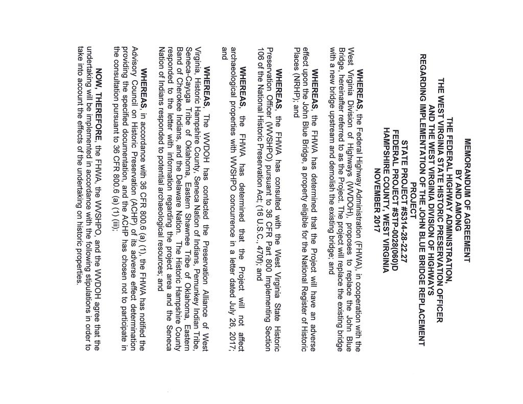
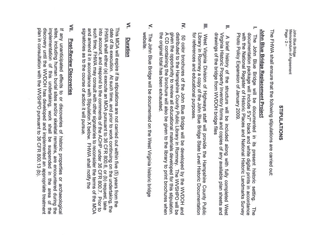
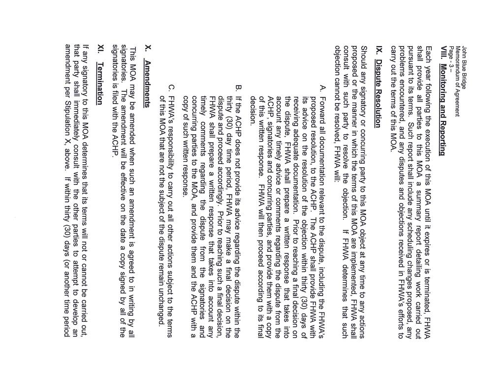
1 State Level Historic Documentation Report State Project No. S Federal Project No. BR-0028(058)D John Blue Bridge Hampshire County Prepared by: Randy Epperly, Historian Department of Transportation Division of Highways Engineering Division Environmental Section May 22, 2018
2 STATE LEVEL HISTORIC DOCUMENTATION JOHN BLUE BRIDGE Location: WV Route 28, Spanning South Branch Potomac River Hampshire County West Virginia Date of Construction: 1936 USGS Springfield Quadrangle Builder: Present Owner: Present Use: Significance: Fort Pitt Bridge Works West Virginia Department of Transportation Division of Highways 1900 Kanawha Boulevard, Building 5, Room A-110 Charleston, WV Vehicular Bridge John Blue Bridge is eligible for the National Register under Criterion C as a good example of a truss bridge and its association with a known builder, Fort Pitt Bridge Works. John Blue Bridge was formerly known as Grace Bridge and is listed on the 1990 Final List of Historic Bridges in WV. Project Information: The project has been undertaken due to its poor condition and deficiencies of the structure. The project will provide a new bridge crossing the South Branch Potomac River. The existing bridge is posted for weight limits and trucks and buses must cross one at time. The existing bridge warrants replacement. The documentation was undertaken in May 2018 in accordance with a Memorandum of Agreement among the Federal Highway Administration, West Virginia Department of Transportation, and West State Historic Preservation Office. The bridge is scheduled to be replaced in Original bridge plans are attached. Randy Epperly, Historian West Virginia Division of Highways Charleston, WV May 22, 2018
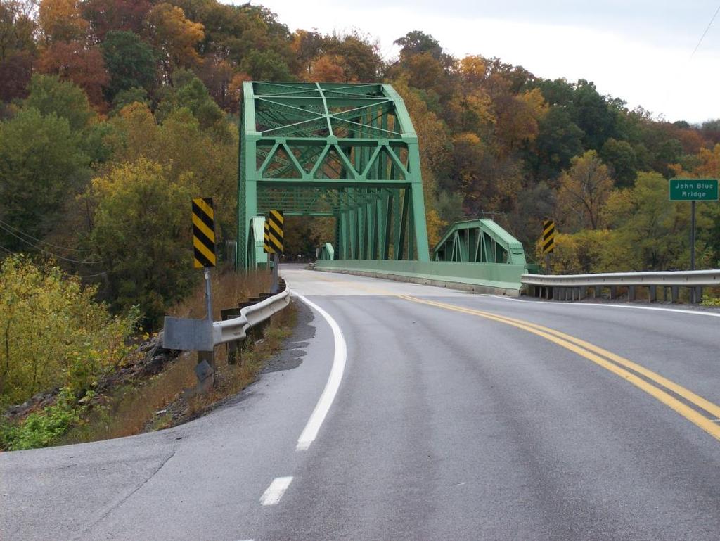
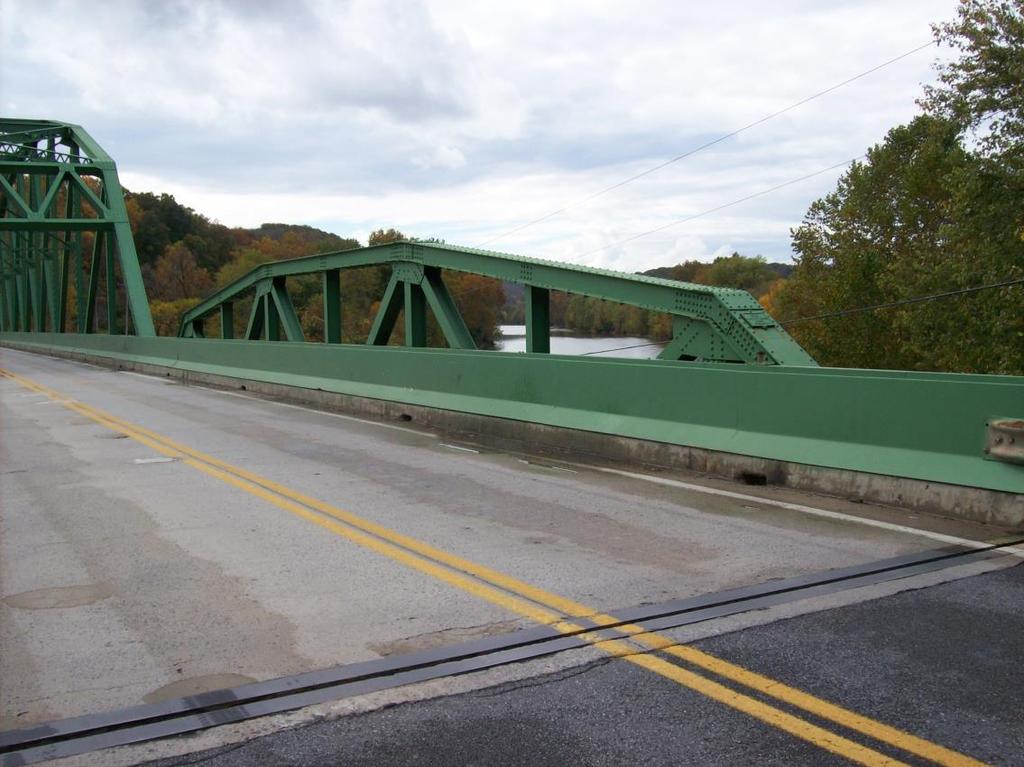
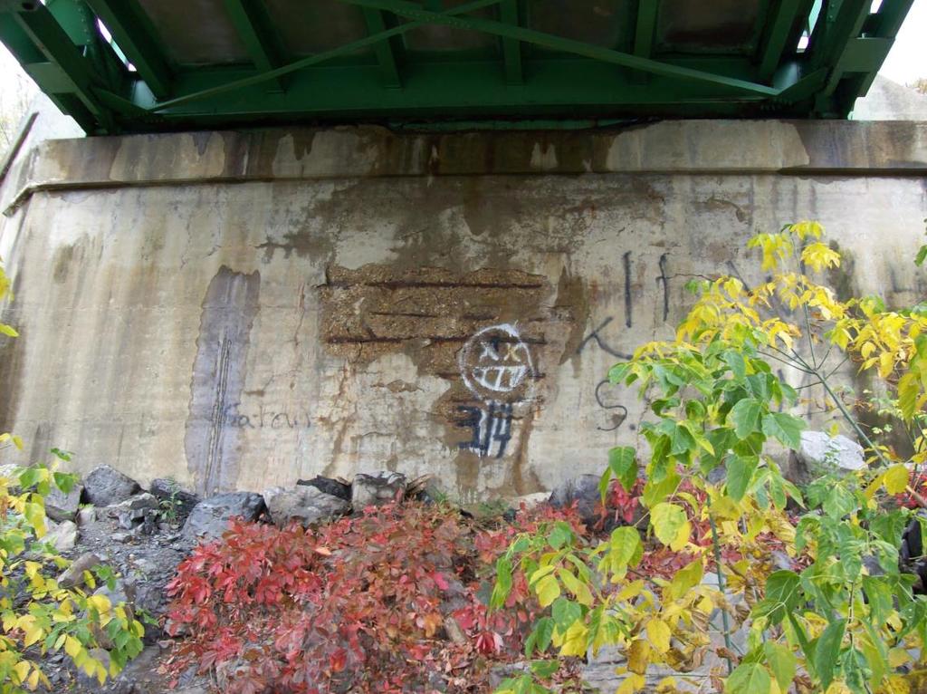
3 John Blue Bridge Page 2 John Blue Bridge, formerly the Grace Bridge, is located on WV Route 28 in Hampshire County, spanning the South Branch of the Potomac River in the Blues Beach area. The bridge consists of steel riveted pony trusses for the end spans and the main span is a steel riveted through truss. It is supported by two concrete abutments and two rectangular concrete piers. The overall length is 419 feet 6 inches and the overall width is 25 feet 2 inches. The Average Daily Traffic in 2015 was 3,054 Vehicles Per Day. The bridge was built in 1936 by Fort Pitt Bridge Works. The bridge was constructed as a replacement to a flood damaged bridge. John Blue Bridge is listed on the 1990 Final List of Historic Bridges in WV under the name Grace Bridge, with a rating of 32. It is eligible for the National Register of Historic Places under Criterion C for its engineering significance (good example of a truss bridge) and its association with an important bridge builder, Fort Pitt Bridge Works. The bridge is showing many signs of deterioration and contains fracture critical members. It is posted for weight limits and trucks and buses must cross one at a time. The steel superstructure contains heavy section loss, portal members have been damaged by vehicles, and both abutments show cracking and heavy deterioration. The concrete deck is cracking, the piers have underwater deterioration, and several steel members have been bent and twisted due to high water damage (WVDOH, 2017). Camp Washington was built in 1861 by the Union on Washington Bottom Farm, home to ancestors of George Washington who surveyed the area. The camp was located near the Wire Bridge (located in the vicinity of the John Blue Bridge) and was used to secure the Baltimore and Ohio Railroad. The camp was later occupied by the Confederacy after the Union forces withdrew (Civil War Trails). In 1861 the Wire Bridge Engagement occurred as Union General Benjamin Kelly attempted to march from Keyser to Romney in order to occupy the town. Kelly was to attack from the west while Colonel Thomas Johns attacked from the north. Johns encountered enemy troops at the Wire Bridge and during the battle Johns troops had to take cover behind the bridge parapets. Johns withdrew to Maryland when he heard Kelly s troops entering Romney. The Union took control of Romney for nearly 3 months before retreating over the Wire Bridge into Maryland as Stonewall Jackson arrived reinforcing the Confederacy (Civil War Trails). The Wire Bridge was destroyed during the war. It would be rebuilt, and then demolished 2 more times before the current bridge was built. The bridge was named for John Blue, one of the first settlers in the area. He came to the area around 1725 and owned land where present day WV 28 is located (WV Legislature, 2003). WV Route 28 roughly follows the alignment of the Moorefield and North Branch Turnpike, chartered in The turnpike crossed the river near the location of the current John Blue Bridge, but no remnants of the turnpike remain (Moorefield and North Branch Turnpike). Fort Pitt Bridge Works was founded in 1896 and eventually sold in 1986 (Fort Pitt Bridge Works). Fort Pitt Bridge Works is known for its steel fabrications for bridges and steel used in both World Wars (Barnes, 2006). The company s steel was also used for post offices, hospitals, schools, etc. (Mounts, 2006).
4 John Blue Bridge Page 3 BIBLIOGRAPHY 1990 Final List of Historic Bridges. West Virginia Division of Highways Barnes, Tom. "Fort Pitt Bridge Works Site to Be Redeveloped." Pittsburgh Post-Gazette 26 July 2006, Local sec.: n. pag. Web. Civil War Trails, West Virginia. Kiosk located along WV Route 28. Fort Pitt Bridge Works, Pittsburgh, Pa., Records , AIS , Archives Service Center, University of Pittsburgh. Moorefield & North Branch Turnpike. Turnpike Files. West Virginia Division of Highways, Engineering Division. Charleston, WV. Mounts, Carol. Washington PA Nostalgia. Fort Pitt Bridge Works Retrieved 29 Oct West Virginia Division of Highways, Bridge Files, Maintenance Division, Building 5, Capitol Complex, Charleston, WV , West Virginia State Legislature. Senate Concurrent Resolution No Retrieved 30 October 2014.
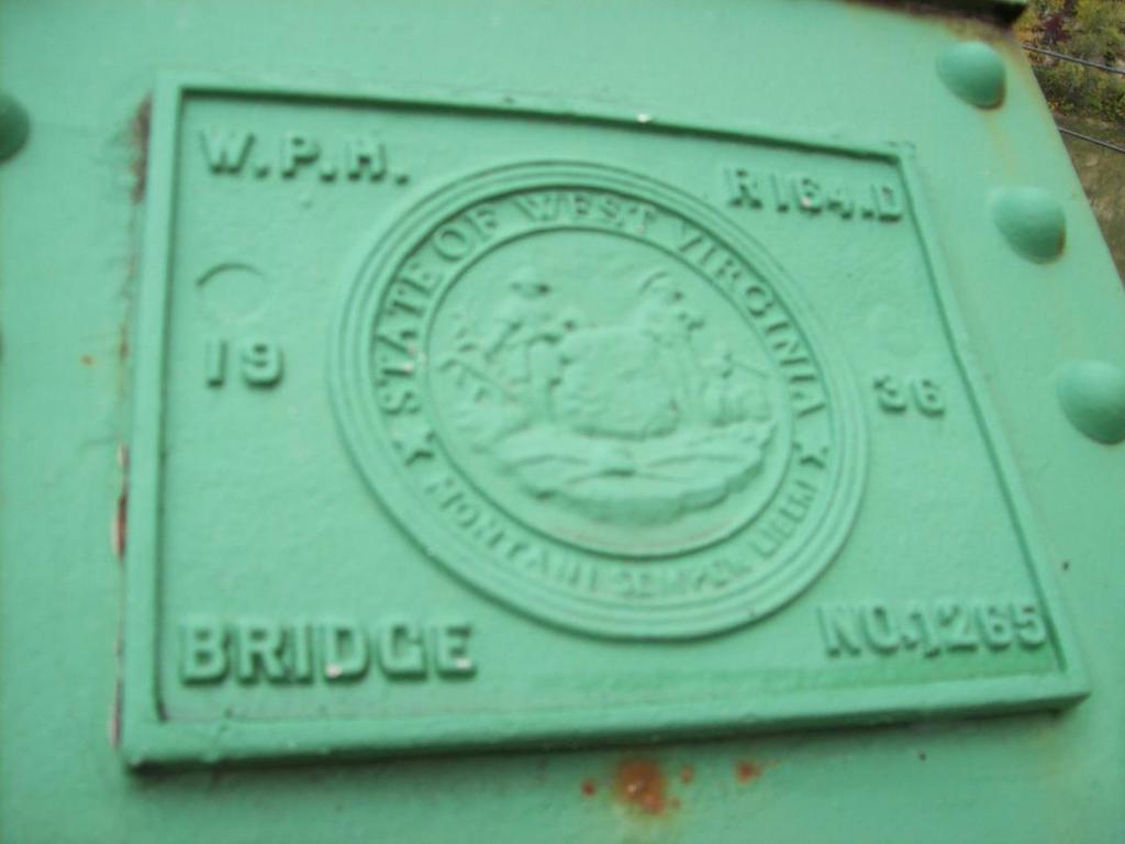
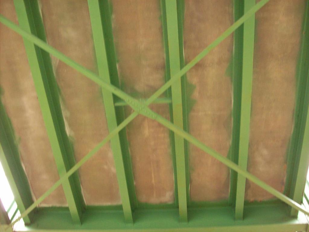
5 John Blue Bridge WV Route 28 South Branch Potomac River Hampshire County, West Virginia STATE LEVEL HISTORIC DOCUMENTATION INDEX TO PHOTOGRAPHS Photographer: Randy Epperly October 2014 JOHN BLUE BRIDGE-1 JOHN BLUE BRIDGE-2 JOHN BLUE BRIDGE-3 JOHN BLUE BRIDGE-4 JOHN BLUE BRIDGE-5 JOHN BLUE BRIDGE-6 JOHN BLUE BRIDGE-7 JOHN BLUE BRIDGE-8 JOHN BLUE BRIDGE-9 JOHN BLUE BRIDGE-10 JOHN BLUE BRIDGE-11 View of John Blue Bridge looking south. View of John Blue Bridge looking south. View of John Blue Bridge looking north. View of John Blue Bridge from riverbank looking southwest. View of bridge plate on northern end of the bridge. View of bridge plate on southern end of the bridge. View of through truss looking north. View of pony truss approach. View of bridge pier. View of bridge abutment. View of underside of bridge.

6 Photo #1 Photo #2

7 Photo #3 Photo #4

8 Photo #5 Photo #6

9 Photo #7 Photo #8

10 Photo #9 Photo #10
11 Photo #11
12
13
14
15
16
17


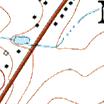
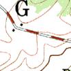


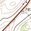

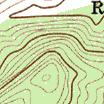


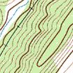


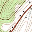
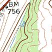


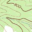


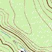
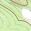
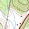


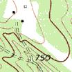

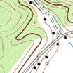
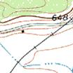
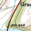


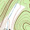


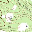
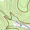
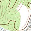
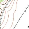
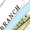

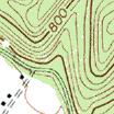

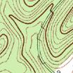


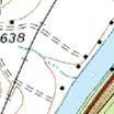
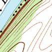

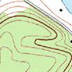
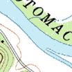
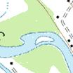
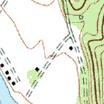

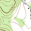
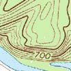

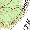
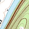


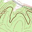
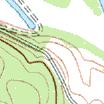
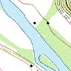
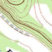
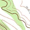
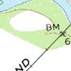
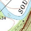


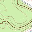
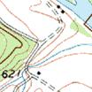
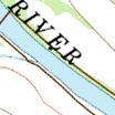
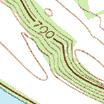
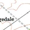
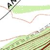
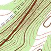


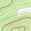
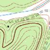
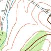
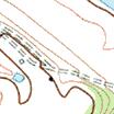
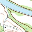

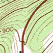


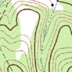

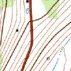


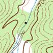

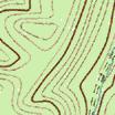


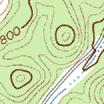
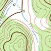


18 John Blue Bridge Project Area Declination MN SCALE 1: MILE YARDS MN 9.73 W John Blue Bridge Hampshire County 0 1 KILOMETER Copyright (C) 2008, MyTopo Location: E N Copyright (C) 2008, MyTopo
 Town or Community Grace County Hampshire Negative No.")
19 John Blue Bridge Internal Rating: WEST VIRGINIA HISTORIC PROPERTY INVENTORY FORM Street Address Located along WV Route 28, spanning South Branch of the Potomac River,near Grace. Common/Historic Name/Both John Blue Bridge-common Grace Bridge-historic Field Survey # HPI #1 Site # (SHPO Only) Town or Community Grace County Hampshire Negative No. NR Listed Date Architect/Builder Date of Construction Style (SHPO Only) Fort Pitt Bridge Works 1936 Exterior Siding / Materials Main Span: Steel Riveted Through Truss End Span: Steel Riveted Pony Trusses Property Use or Function Transportation Survey Organization & Date WVDOH October 16, 2014 Roofing Material Deck Material: Concrete UTM Zone 17 NAD 1983 Easting E Northing N Quadrangle Name Springfield Part of What Survey / FR# State County Route S Federal Route BR-0028(058)D Foundation Abutments: Concrete Piers: Concrete
20 Name: John Blue Bridge Survey #: HPI #1 Survey / FR#: State County Route S Federal Project #BR-0028(058)D Present Owners WVDOH Owners Mailing Address Capitol Complex Building 5 Charleston, WV John Blue Bridge Describe Setting Unknown -- <1 Acres Archaeological Artifacts Present The bridge is located in a rural area in Hampshire County near Grace. The bridge carries WV Route 28 over South Branch of the Potomac River approximately 0.03 miles south of County Route 28/5. The bridge is situated between horizontal curves on each side. Description of Buildings or Site (Original and Present) Stories Front Bays The structure was built by Fort Pitt Bridge Works in It consists of two 90 foot end spans and a 230 foot main central span. The end spans are steel riveted pony trusses and the main span is a steel riveted through truss. The bridge has an overall total length of 419 feet 6 inches. It is supported by two concrete abutments and two rectangular concrete piers. The overall width is 25 feet 2 inches. The bridge has a concrete deck. It is posted for weight limits and trucks and buses are restricted to cross one at a time. The Average Daily Traffic (ADT) is 2,900 Vehicles Per Day (VPD) with a 20 year ADT projected to be 3,800 VPD. Alterations Yes No If yes, describe Painting and routine maintenance work. Additions Yes No If yes, describe Describe All Outbuildings N/A Statement of Significance: See Continuation Sheet. Bibliographical References WVDOH Bridge Inspection Report. Maintenance Division Barnes, Tom. Fort Pitt Bridge Works Site to be Redeveloped. Pittsburgh Post-Gazette. 23 July Fort Pitt Bridge Works, Pittsburgh, Pa., Records , AIS , Archives Service Center, University of Pittsburgh. Form Prepared By: Date: October 20, 2014 Name/Organization: Randy Epperly Address: WV Division of Highways Capitol Complex Building 5, Rm. 431 Charleston, WV Phone #:
21 WEST VIRGINIA HISTORIC PROPERTY FORM CONTINUATION SHEET John Blue Bridge Name John Blue Bridge Survey Number: HPI #1 Project / FR#: State County Route S Federal Project # BR-0028(058)D Other than a general association with the history of the area, the John Blue Bridge has no important link with events or trends that have made a significant contribution to the broad patterns of history. The bridge was constructed in 1936 to replace a bridge in the general location that had been damaged in the 1936 flood. This bridge was not built as a new linkage between major towns but was a replacement needed for a damaged bridge. Therefore this bridge is not eligible for the National Register under Criterion A. The bridge was named for John Blue, one of the first settlers in Hampshire County. Blue came to the area around 1725 and owned the land where present day WV Route 28 is located. The bridge itself does not have a direct association with the family. The Blue family settled in the area and may have had a connection to the original wire bridge. The current bridge was built in 1936 and named in honor of John Blue in The bridge is also known as Grace Bridge and Blue Beach Bridge. The bridge is not associated with a significant person or significant person s life and is not eligible under Criterion B. The John Blue Bridge is a 419 foot 6 inch truss bridge consisting of a through truss and pony trusses. It was listed as Grace Bridge on the 1990 Final List of Historic Bridges for West Virginia. The bridge contains few alterations and remains a good example of a steel truss bridge. It was built by Fort Pitt Bridge Works, founded in 1896 and was eventually sold in Fort Pitt Bridge Works is known for its steel fabrications for bridges and also steel used in both World Wars. The bridge is eligible under Criterion C for being a good example of its bridge type and its association with a known builder. The bridge is not likely to contain any important information that will contribute to our understanding of human history or prehistory. It is not eligible under Criterion D.
22
23
24
25
26

27
28
29
30
31
32
33
34
35
36
37
 Page 1 Original Update HISTORICAL STRUCTURE FORM FLORIDA MASTER SITE FILE Consult Guide To Historical Structure Forms for detailed instructions Site # 8OR9844 Recorder # 26 Recorder Date 2/20/08 Site Name
SWINGING OVER SCHUYLKILL THE HISTORY OF THE PW&B AND BRIDGE NO. 31
 THE SWINGING OVER SCHUYLKILL THE HISTORY OF THE PW&B AND BRIDGE NO. 31 The Philadelphia, Wilmington & Baltimore Railroad Company (PW&B) was formed in 1836. In 1838, the railroad was enlarged by the joining
National Register of Historic Places Registration Form
 NPS Form 10-900 OMB No. 10024-0018 (Oct. 1990) Registration Form This form is for use in nominating or requesting determinations for individual properties and districts. See instructions in How to Complete
VIRGINIA HISTORIC LANDMARKS COMMISSION
 VRGNA HSTORC LANDMARKS COMMSSON SURVEY FORM Historic name Richmond, Fredericksburg & Common named C T C C Potomac Rai roa ounty own ty Prince Wi iam ounty Street address or route number See verbal boundary
MOOREFIELD, WEST VIRGINIA
 AVAILABLE SPACE 117 SOUTH FORK ROAD FACILITY LOCATION Building Address - 117 South Fork Road Moorefield, WV 26836 Located in City Limits - Yes Zoning - Industrial County - Hardy Located in Business/Industrial
MARTINSBURG, WEST VIRGINIA
 AVAILABLE SPACE 226 PILOT WAY BUILDING MARTINSBURG, WEST VIRGINIA LOCATION Building Address - 226 Pilot Way Martinsburg, WV 25405 Located in City Limits - No Zoning - County - Berkeley Located in Business/Industrial
Hwy Retaining Wall/ Sea Wall. Not Eligible, see Statement of Significance Also member of listed NR district: Mantorville Historic District
 Historic Name CS # 2007 Other Name SHPO Inv # Location E and W sides of TH 57 between 6th St and 7th St Hwy District Reference City/Township County Mantorville, City of Dodge Acres Twp Rng Sec 107N 16W
POINT PLEASANT, WEST VIRGINIA
 AVAILABLE SPACE WAREHOUSE 2 CAMP CONLEY POINT PLEASANT, WEST VIRGINIA LOCATION Building Address - 261 Camp Conley Road Point Pleasant, WV 25550 Located in City Limits - No Zoning - None County - Mason
National Register of Historic Places Registration Form
 NPS Form 10-900 (Oct. 1990) OMB NO. 10024-0018 Registration Form This form is for use in nominating or requesting determinations for individual properties and districts. See instructions in How to Complete
AVAILABLE SPACE KANAWHA MANUFACTURING BUFFALO PLANT
 AVAILABLE SPACE KANAWHA MANUFACTURING BUFFALO PLANT LOCATION Building Address - Route 62 Located in City Limits - No County - Putnam Located in Business/Industrial Park - No Can the Building be Multi-Tenant
Total 1 Total. Current Functions (Enter categories from instructions) Materials (Enter categories from instructions)
 Materials (Enter categories from instructions)") Site Inventory Form State Inventory No. 29-00962 New Supplemental State Historical Society of Iowa Part of a district with known boundaries (enter inventory no.) 29-03685 (November 2005) Relationship:
Site Inventory Form State Inventory No. 29-00962 New Supplemental State Historical Society of Iowa Part of a district with known boundaries (enter inventory no.) 29-03685 (November 2005) Relationship:
BUCKHANNON, WEST VIRGINIA
 AVAILABLE SPACE 50 ARMORY ROAD BUILDING BUCKHANNON, WEST VIRGINIA LOCATION Building Address - 50 Armory Road Buckhannon, WV 26201 Located in City Limits - Yes Zoning - Commercial County - Upshur Located
PHOTOGRAPHS WRITTEN HISTORICAL AND DESCRIPTIVE DATA
 Spanning Coon Creek Hulah Vicinity Osage County Oklahoma PHOTOGRAPHS WRITTEN HISTORICAL AND DESCRIPTIVE DATA HISTORIC AMERICAN ENGINEERING RECORD Submitted to: Oklahoma State Historic Preservation Office
Maryland Historical Trust Inventory No. 15/6 Maryland Inventory of Historic Properties Form
 Inventory No. 15/6 Maryland Inventory of 1. Name of Property (indicate preferred name) historic Becraft Farm other 2. Location street and number 28500 Ridge Road not for publication city, town Mount Airy
HISTORIC AMERICAN ENGINEERING RECORD COVE CREEK SPILLWAY BRIDGE. HAER No. AR-83
 HISTORIC AMERICAN ENGINEERING RECORD COVE CREEK SPILLWAY BRIDGE LOCATION: Spanning Cove Creek Spillway at State Highway 309 (formerly Paris-Mt. Magazine Road), Corley vicinity, Logan County, Arkansas UTM:
Design Public Hearing for the Existing and Proposed Bridge Crossings on Aden Road (Rte 646) over the Norfolk Southern RR, Nokesville, Virginia
 over the Norfolk Southern RR, Nokesville, Virginia") Design Public Hearing for the Existing and Proposed Bridge Crossings on Aden Road (Rte 646) over the Norfolk Southern RR, Nokesville, Virginia September 18, 2013 Nicholas J. Roper, P.E. District Bridge
Design Public Hearing for the Existing and Proposed Bridge Crossings on Aden Road (Rte 646) over the Norfolk Southern RR, Nokesville, Virginia September 18, 2013 Nicholas J. Roper, P.E. District Bridge
CLARKSBURG, WEST VIRGINIA
 AVAILABLE SPACE CLARKSBURG BUILDING UNITS 3 & 4 LOCATION Building Address - 761 Armory Road Clarksburg, WV 26301 Located in City Limits - No County - Harrison Located in Business/Industrial Park - No Can
FORT ASHBY, WEST VIRGINIA
 AVAILABLE SPACE MINERAL COUNTY MULTI-TENANT BUILDING LOCATION Building Address - Frankfort Drive Fort Ashby Business & Technology Park Fort Ashby, WV 26719 Located in City Limits - No County - Mineral
PHOTOGRAPHS AND WRITTEN HISTORICAL AND DESCRIPTIVE DATA
 Spanning Clear Creek Perkins Vicinity Payne County Oklahoma PHOTOGRAPHS AND WRITTEN HISTORICAL AND DESCRIPTIVE DATA HISTORIC AMERICAN ENGINEERING RECORD Submitted to: Oklahoma State Historic Preservation
National Register of Historic Places Registration Form
 NPS Form 10-900 OMB No. 10024-0018 (Oct. 1990) United States Department of the Interior National Park Service National Register of Historic Places Registration Form 1. Name of Property historic name Hickory
_------_ As the designated acthority under the National Historic Preservation Act of 1986, as amended, 1 hereby certify that this
 ===================================== ===== 4. State/Federal Agency Certification _- - ----_--_-_------_----------- --_- - -_--------------------- ---------------- _------_--------- As the designated acthority
MOOREFIELD, WEST VIRGINIA
 AVAILABLE SPACE AMERICAN WOODMARK MOOREFIELD PLANT LOCATION Building Address - 117 South Fork Road Moorefield, WV 26836 Located in City Limits - Yes County - Hardy Located in Business/Industrial Park -
WEIRTON, WEST VIRGINIA
 AVAILABLE SPACE CENTRAL MACHINE SHOP BUILDING LOCATION Building Address - Main Street Weirton, WV 26062 Located in City Limits - Yes County - Hancock Located in Business/Industrial Park - Yes Can the Building
Arch bridges were built by the Romans and have been in use ever since. They are often chosen for their strength and
 Arch Bridges Arch bridges were built by the Romans and have been in use ever since. They are often chosen for their strength and appearance. It is the shape of the arch that gives the bridge its strength,
Project Overview. Hunter Mill Road Over Colvin Run Bridge Replacement Fairfax County. Get Involved. Public Information Meeting. Contact Information
 Get Involved VDOT representatives will review and evaluate any information received as a result of the public information meeting. The comment sheet in this brochure is provided to assist in making your
SCOTT DEPOT, WEST VIRGINIA
 AVAILABLE SPACE CARRIER BUILDING AT MEEKS BUSINESS PARK SCOTT DEPOT, WEST VIRGINIA LOCATION Building Address - 4970 C Teays Valley Rd Scott Depot, WV 25526 Located in City Limits - No Zoning - C1 County
Virginia Antebellum: Part C. Transportation Infrastructure 1
 Virginia Antebellum: Part C. Transportation Infrastructure 1 Student Name: Date: For each of the following slides/questions, fill-in-the-blanks: Question Statement(s) Part 1. Building Roads 2 1. In the
FRANKLIN, WEST VIRGINIA
 AVAILABLE SPACE PENDLETON BUSINESS CENTER (FORMERLY HANOVER SHOE BUILDING) LOCATION Building Address - 100 Thorn Creek Road Franklin, WV 26807 Located in City Limits - No Zoning - None County - Pendleton
AVAILABLE SPACE CENTRAL VAN & STORAGE BUILDING POCA, WEST VIRGINIA
 AVAILABLE SPACE CENTRAL VAN & STORAGE BUILDING LOCATION Building Address - 301 Jacobson Drive Poca, WV 25159 Located in City Limits - No County - Putnam Located in Business/Industrial Park - Yes Can the
The Covered Bridges of Preble County. Past, Present and Future By: R. Kyle Cross, P.E., P.S.
 The Covered Bridges of Preble County Past, Present and Future By: R. Kyle Cross, P.E., P.S. The History of the 8 Covered Bridges There are 8 covered bridges in Preble County. Only 2 of them are moved for
AVAILABLE SPACE COLD STORAGE BUILDING NO. 2
 AVAILABLE SPACE COLD STORAGE BUILDING NO. 2 LOCATION Building Address - Cold Storage Road Located in City Limits - Yes County - Jefferson Located in Business/Industrial Park - No Can the Building be Multi-Tenant
Sites of Civil War Trails Signs The First Campaign, 1861, in the Mountains
 Sites of Civil War Trails Signs The First Campaign, 1861, in the Mountains (Website deactivated) The First Campaign, 1861, in the Mountains Virginia's western counties had little in common at the outset
NE¼ of NE¼ of NE¼ of NE¼ of section Roof configuration (enter one): Gabled Roof / Front Gabled Roof
: Gabled Roof / Front Gabled Roof") OAHP1403 Rev. 9/98 COLORADO CULTURAL RESOURCE SURVEY Official Eligibility Determination (OAHP use only) Date Initials Determined Eligible - National Register Architectural Inventory Form Determined Not
OAHP1403 Rev. 9/98 COLORADO CULTURAL RESOURCE SURVEY Official Eligibility Determination (OAHP use only) Date Initials Determined Eligible - National Register Architectural Inventory Form Determined Not
MARTINSBURG, WEST VIRGINIA
 AVAILABLE SPACE ARCADIA AVIATION FACILITY LOCATION Building Address - 254 A B Parks Drive Martinsburg, WV 25405 Located in City Limits - No Zoning - County - Berkeley Located in Business/Industrial Park
SPENCER, WEST VIRGINIA
 AVAILABLE SPACE ROANE HARDWOOD FACILITY LOCATION Building Address - 554 Spring Creek Road Spencer, WV 25276 Located in City Limits - No Zoning - County - Roane Located in Business/Industrial Park - No
HISTORIC SITE FORM HISTORIC SITES INVENTORY
 HISTORIC SITE FORM HISTORIC SITES INVENTORY 1 IDENTIFICATION Name of Property: House at 569 Park Avenue PARK CITY MUNICIPAL CORPORATION (10-08) Address: 569 Park Avenue City, County: Park City, Summit
MARTINSBURG, WEST VIRGINIA
 AVAILABLE PROPERTY EQUUS I-81 INDUSTRIAL PARK MARTINSBURG, WEST VIRGINIA LOCATION Located in City Limits - No Zoning - The site is approved for warehouse/distribution/manufacturing County - Berkeley Flood
MORGANTOWN, WEST VIRGINIA
 AVAILABLE SPACE 201 NORTH METRO DRIVE BUILDING MORGANTOWN, WEST VIRGINIA LOCATION Building Address - 201 North Metro Drive Morgantown, WV 26501 Located in City Limits - No Zoning - None County - Monongalia
DUNBAR, WEST VIRGINIA
 AVAILABLE SPACE DUNBAR STORAGE BUILDING DUNBAR, WEST VIRGINIA LOCATION Building Address - 2900 Charles Avenue Dunbar, WV 25064 Located in City Limits - No Zoning - County - Kanawha Located in Business/Industrial
FAIRMONT, WEST VIRGINIA
 AVAILABLE SPACE PHILLIPS SERVICES WAREHOUSE FAIRMONT, WEST VIRGINIA LOCATION Building Address - 24 Philips Lane Fairmont, WV 26554 Located in City Limits - Yes Zoning - County - Marion Located in Business/Industrial
PAW PAW, WEST VIRGINIA
 AVAILABLE SPACE OFFICE EQUIPMENT SERVICES BUILDING LOCATION Building Address - 350 Bevans Industrial Lane Paw Paw, WV 25434 Located in City Limits - Yes County - Morgan Located in Business/Industrial Park
PRINCETON, WEST VIRGINIA
 AVAILABLE SPACE USDA WOOD EDUCATION AND RESOURCE CENTER LOCATION Building Address - 301 Hardwood Lane Princeton, WV 24740 Located in City Limits - No Zoning - None County - Mercer Located in Business/Industrial
Maryland Historical Trust Inventory No. PG: Maryland Inventory of Historic Properties Form
 Inventory No. PG: 62-012 Maryland Inventory of 1. Name of Property (indicate preferred name) historic other 2. Location street and number 11205 Old Baltimore Pike not for publication city, town Beltsville
BLUEFIELD, WEST VIRGINIA
 AVAILABLE SPACE GEMARK MANUFACTURING BUILDING LOCATION Building Address - 4618 John Nash Blvd. Bluefield, WV 24701 Located in City Limits - No County - Mercer Located in Business/Industrial Park - Yes
1 buildings sites structures objects 1 0 TOTAL
 Name of Property County and State 4. National Park Service Certification --------- I, hereby certify that this property is: Signature of Keeper Date of Action entered in the National Register See continuation
BELINGTON, WEST VIRGINIA
 AVAILABLE SPACE BELINGTON MULTI-TENANT BUILDING LOCATION Building Address - Belington Industrial Park Located in City Limits - No County - Barbour Located in Business/Industrial Park - Yes Can the Building
AVAILABLE SPACE PENMARVA BUILDING
 AVAILABLE SPACE PENMARVA BUILDING LOCATION Building Address - 131 North Sigler Street Located in City Limits - Yes County - Preston Located in Business/Industrial Park - No Can the Building be Multi-Tenant
U.S. HISTORY CHAPTER 16 SECTION 2 EARLY YEARS OF THE WAR
 U.S. HISTORY CHAPTER 16 SECTION 2 EARLY YEARS OF THE WAR BOARD QUESTIONS 1) WHAT IS A BLOCKADE? 2) WHAT WAS THE AVERAGE AGE OF A SOLDIER IN THE CIVIL WAR? 3) WHO WON THE BATTLE OF BULL RUN AND HOW? 4)
Historic Inventory Report
 Location Field Site No. 3394-134 DAHP No. Historic Name: Common Name: Cabinetrends Property Address: 24619 Pacific Hwy S, Kent, WA 98032 Comments: Tax No./Parcel No. 3601800165 Plat/Block/Lot Acreage.24
UPPER TRACT, WEST VIRGINIA
 AVAILABLE SPACE UPPER TRACT INDUSTRIAL PARK SHELL BUILDING 2 LOCATION Building Address - 29 Industrial Park Road Upper Tract, WV 26866 Located in City Limits - No Zoning - None County - Pendleton Located
Historic Bridge Foundation Facebook Archives
 Historic Bridge Foundation Facebook Archives Did You Know That all of Budapest s bridges were bombed and nearly destroyed in World War II? August 2017 This might come as a surprise if you look at the bridges
WESTON, WEST VIRGINIA
 AVAILABLE SPACE BALLARD FACILITY LOCATION Building Address - 476 US Route 19 North Weston, WV 26452 Located in City Limits - No County - Lewis Located in Business/Industrial Park - No Can the Building
DETROIT, TOLEDO, AND IRONTON RAILROAD PHOTOGRAPHS SUBSERIES, Accession 548
 Finding Aid for DETROIT, TOLEDO, AND IRONTON RAILROAD PHOTOGRAPHS SUBSERIES, 1922-1923 Finding Aid Published: June 2011 20900 Oakwood Boulevard Dearborn, MI 48124-5029 USA research.center@thehenryford.org
SOUTH CHARLESTON, WEST VIRGINIA
 AVAILABLE SPACE SOUTH CHARLESTON INDUSTRIAL PARK BUILDING 309 LOCATION Building Address - South Charleston Industrial Park 3100 MacCorkle Ave., S.W., Building 309 South Charleston, WV 25303 Located in
Commonwealth of Massachusetts Massachusetts Historical Commission 220 Morrissey Boulevard, Boston, Massachusetts
 Inventory No: Historic Name: Common Name: Address: HRV.165 Blood, Joseph House Farnsworth, Jonathan - Beaman, Jonathan House 74 Poor Farm Rd City/Town: Village/Neighborhood: Local No: 9-17 Year Constructed:
HUNTINGTON, WEST VIRGINIA
 AVAILABLE SPACE DOLIN SUPPLY BUILDING LOCATION Building Address - 215 Hal Greer Boulevard Huntington, WV 25701 Located in City Limits - Yes County - Cabell Located in Business/Industrial Park - No Can
United States Department of the Interior National Park Service. Boundary Expansion Listed in National Register January 11, 2017
 NPS Form 10900-a (Rev. 8/2002) OMB No. 10240018 United States Department of the Interior National Park Service Boundary Expansion Listed in National Register January 11, 2017 National Register of Historic
WESTON, WEST VIRGINIA
 AVAILABLE SPACE JADAD BUILDING LOCATION Building Address - 395 Route 33 East Weston, WV 26452 Located in City Limits - No County - Lewis Located in Business/Industrial Park - No Can the Building be Multi-Tenant
PLEASANT VALLEY, WEST VIRGINIA
 AVAILABLE SPACE BPS BUILDINGS PLEASANT VALLEY, WEST VIRGINIA LOCATION Building Address - 2103 Pleasant Valley Road Pleasant Valley, WV 26554 Located in City Limits -Yes, but no B&O Tax Zoning - Mixed use
CHARLESTON, WEST VIRGINIA
 AVAILABLE SPACE EDEN S FORK ROAD BUILDING LOCATION Building Address - Edens Fork Road Charleston, WV 25312 Located in City Limits - No County - Kanawha Located in Business/Industrial Park - No Can the
MAXWELTON, WEST VIRGINIA
 AVAILABLE SPACE AMERICAN FOAM TECHNOLOGIES, INC. BUILDING LOCATION Building Address - 473 McLaughlin Lane Maxwelton, WV 24901 Located in City Limits - No Zoning - Business/Industrial County - Greenbrier
MILLWOOD, WEST VIRGINIA
 AVAILABLE SPACE WV POLYMER CORP BUILDING LOCATION Building Address - 128 Industrial Park Road Millwood, WV 25262 Located in City Limits - No County - Jackson Located in Business/Industrial Park - Yes Can
STATE OF WASHINGTON ARCHAEOLOGICAL SITE INVENTORY FORM
 STATE OF WASHINGTON ARCHAEOLOGICAL SITE INVENTORY FORM Smithsonian Number: 45 County: Chelan Date: 6/12/2018 Human Remains? DAHP Case No.: Archaeological Sites are exempt from public disclosure per RCW
MARTINSBURG, WEST VIRGINIA
 AVAILABLE SPACE EMIVEST HANGER & OFFICE BUILDING LOCATION Building Address - 731 Novak Drive Martinsburg, WV 25405 Located in City Limits - No Zoning - County - Berkeley Located in Business/Industrial
National Register off Historic Places Inventory Nomination Form
 MPS Fonn 10-900-a (3^ United States Department of the Interior National Park Service National Register off Historic Places Inventory Nomination Form For NPS use only received date entered OMB No 1M4-0018
Historic Property Report
 Historic Name: Shadle Park Reservoir Property ID: 708465 Location Address: Location Comments: GeographicAreas: 4302 N Belt St, Spokane, Washington, USA Wellesley Ave & N Belt St Spokane,T25R42E01,SPOKANE
AVAILABLE SPACE EDRAY BUSINESS PARK BUILDING NO. 1
 AVAILABLE SPACE EDRAY BUSINESS PARK BUILDING NO. 1 LOCATION Building Address - Edray Business Park Located in City Limits - Yes County - Pocahontas Located in Business/Industrial Park - Yes Can the Building
PRINCETON, WEST VIRGINIA
 AVAILABLE SPACE THE OLD HYDROPLATE BUILDING LOCATION Building Address - 300 Elmer Street Princeton, WV 24740 Located in City Limits - No County - Mercer Located in Business/Industrial Park - No Can the
Maryland Historical Trust Inventory No. PG: 86A-003 Maryland Inventory of Historic Properties Form
 Inventory No. PG: 86A-003 Maryland Inventory of 1. Name of Property (indicate preferred name) historic other 2. Location street and number 12005 Duley Station Road not for publication city, town Upper
Maryland Historical Trust Inventory No. PG: 86A-026 Maryland Inventory of Historic Properties Form
 Inventory No. PG: 86A-026 Maryland Inventory of 1. Name of Property (indicate preferred name) historic other 2. Location street and number 12811 Croom Road not for publication city, town Naylor vicinity
Places state West Virginia code county Marion
 NPS Form 1W0 csaa, United States Department of the lnteria? National Park Service National Register of Historic Inventory-Nomination Form See instructions in How to Complete National Register Forms Type
MAGIC CITY PARK NE 2 ND AVENUE
 MAGIC CITY PARK 6001 6005 NE 2 ND AVENUE Designation Report City of Miami REPORT OF THE CITY OF MIAMI PRESERVATION OFFICER TO THE HISTORIC AND ENVIRONMENTAL PRESERVATION BOARD ON THE POTENTIAL DESIGNATION
PHILIPPI, WEST VIRGINIA
 AVAILABLE SPACE FOODFRESH PLAZA LOCATION Building Address - US Route 250 South Philippi, WV 26416 Located in City Limits - Yes Zoning - C-1 County - Barbour Located in Business/Industrial Park - No Can
MINNESOTA HISTORIC.PROPERTIES INVENTORY FORM. Yes_ No X Restricted
 HISTORIC NAME: CURRENT NAME: LEGAL DESC.: MINNESOTA HISTORIC.PROPERTIES INVENTORY FORM Hartley Sugar Camp W % of Gov't. Lot 3 and T55, R24, Sec. 9 COUNTY: Itasca CITY/TWP.: Trout Lake Twp. ADDRESS: of
MEMORANDUM. DATE: May 16, TO: Monica Harrower, PennDOT District 6-0. Mary Alfson Tinsman CHRS, Inc. 451 North Cannon Avenue, Suite 100B
 MEMORANDUM DATE: May 16, 2011 TO: Monica Harrower, PennDOT District 6-0 FROM: RE: Mary Alfson Tinsman CHRS, Inc. 451 North Cannon Avenue, Suite 100B Lansdale, PA 19446 French Creek Parkway Project Phoenixville
Appendix E Historic Property Inventory Forms
 Appendix E Historic Property Inventory Forms TECHNICAL MEMORANDUM Sound Transit Federal Way Link Extension WISAARD Survey Entries PREPARED FOR: COPY TO: PREPARED BY: Sound Transit Alisa Swank/ CH2M MaryNell
Hydraulic Report. Trail 5 Snowmobile Trail Over Mulligan Creek. Prepared By: COLEMAN ENGINEERING COMPANY Karisa V. Falls, P.E.
 Prepared for: Prepared by: Marquette County Road Commission Coleman Engineering Company Marquette, Michigan Iron Mountain, MI December 2011 Hydraulic Report Trail 5 Snowmobile Trail Over Mulligan Creek
The Holes Creek Bridge Replacement By Bradley McClelland
 The Holes Creek Bridge Replacement By Bradley McClelland Each time there is a heavy rainstorm, the folks along Sheffield Road in the Dayton, Ohio suburb of West Carrollton have cause to be concerned. Holes
MILLWOOD, WEST VIRGINIA
 AVAILABLE SPACE 158 JACK BURLINGAME DRIVE LOCATION Building Address - 158 Jack Burlingame Drive Millwood, WV 25262 Located in City Limits - No Zoning - Restrictions County - Jackson Located in Business/Industrial
AVAILABLE SPACE RIVER TOWERS WEST
 AVAILABLE SPACE RIVER TOWERS WEST LOCATION Address: 1102 3rd Avenue Huntington, WV 25701 Zoning: Commercial County: Cabell SIZE Total Square Feet Available: 10,500 (Fourth Floor) Number of Floors: 5 Will
STATE OF IOWA. Historical and Architectural Survey for 2008 Flood Projects in Vinton, Benton County
 STATE OF IOWA CHESTER J. CULVER GOVERNOR PATTY JUDGE LT. GOVERNOR DEPARTMENT OF PUBLIC DEFENSE IOWA HOMELAND SECURITY AND EMERGENCY MANAGEMENT DIVISION DAVID L. MILLER, ADMINISTRATOR Historical and Architectural
United States Department of the Interior National Park Service NATIONAL REGISTER OF HISTORIC PLACES REGISTRATION FORM. Wilmoth, Bernard E.
 NPS Form 10-900 OMB No. 10024-0018 (Oct. 1990) United States Department of the Interior National Park Service NATIONAL REGISTER OF HISTORIC PLACES REGISTRATION FORM 1. Name of Property historic name: other
Total 1 Total. Current Functions (Enter categories from instructions) 01D04: hotel 01B02: apartment building
 01D04: hotel 01B02: apartment building") Site Inventory Form State Inventory No. 29-00093 New Supplemental State Historical Society of Iowa Part of a district with known boundaries (enter inventory no.) 29-03685 (November 2005) Relationship:
Site Inventory Form State Inventory No. 29-00093 New Supplemental State Historical Society of Iowa Part of a district with known boundaries (enter inventory no.) 29-03685 (November 2005) Relationship:
Area of Potential Effect Report
 Area of Potential Effect Report Southeastern Pennsylvania Transportation Authority (SEPTA) King of Prussia Rail, Extension of the Norristown High Speed Line Upper Merion Township, Montgomery County, and
Dufferin Jog Elimination Project
 Project Project Status Update November 14 2007 Project History Planning Alternatives Criteria Measured Project Benefits Structural Configurations Considered Structural Design Considerations The Preferred
SOPHIA, WEST VIRGINIA
 AVAILABLE SPACE SLOAN PROPERTIES BUILDING LOCATION Building Address - 550 Robert C. Byrd Drive Sophia, WV 25827 Located in City Limits - No County - Raleigh Located in Business/Industrial Park - No Can
Current Functions (Enter categories from instructions) Materials (Enter categories from instructions)
 Materials (Enter categories from instructions)") Site Inventory Form State Inventory No. 92-00542 New Supplemental State Historical Society of Iowa Part of a district with known boundaries (enter inventory no.) 92-00349 (November 2005) Relationship:
Site Inventory Form State Inventory No. 92-00542 New Supplemental State Historical Society of Iowa Part of a district with known boundaries (enter inventory no.) 92-00349 (November 2005) Relationship:
NPS Form OMB No Exp Status occupied X unoccupied work in progress Accessible yes: restricted yes: unrestricted _5Lno
 NPS Form 10-900 OMB No. 1024-0018 Exp. 10-31-84 United States Department of the Interior National Park Service National Register of Historic Places Inventory Nomination Form See instructions in How to
Address 347 Whitney Street. East elevation, camera facing southwest.
 FORM B BUILDING Assessor s Number USGS Quad Area(s) Form Number MASSACHUSETTS HISTORICAL COMMISSION MASSACHUSETTS ARCHIVES BUILDING 220 MORRISSEY BOULEVARD BOSTON, MASSACHUSETTS 02125 Town Northborough
not for publication: N/A city/town: St. Albans vicinity: N/A state: WV county : Kanawha code: 039 zip code:25177
 #PS F o 10-900 ~ OMB NO. 10024-0018 (OC~. 1990) United States Department of the Interior National Park Service LSATIOHAL REGISTER OF HISTORIC PLACES REGISTRATION FORM 1. Name of Property ST. ALBANS CHESAPEAKE
"The Stone House;" Parker Family Residence; Slosn, Richard, House. Route 50 approximately 314 mile east of Junction
 Form No. 10300 (Rev. 1074) UNITED STATES DEPARTMENT OF THE INTERIOR NATIONAL PARK SERVICE NATIONAL REGISTER OF HISTORIC PLACES INVENTORY NOMINATXON FORM @NAME HISTORIC SEE INSTRUCTIONS IN HOW TO COMPLETE
Historic District Commission January 14, 2016 City of Hagerstown, Maryland
 Michael Gehr, chair, called the meeting to order at 4:30 p.m. on Thursday, January 14, 2016, in the Council Chamber, Second Floor, City Hall. A roster of the members of the commission and the technical
ELIZABETH, WEST VIRGINIA
 AVAILABLE SPACE WIRT INDUSTRIAL CENTER LOCATION Building Address - Route 14 at Tucker Creek Road Elizabeth, WV 26143 Located in City Limits - No Zoning - County - Wirt Located in Business/Industrial Park
Architectural Inventory Form
 OAHP1403 Rev. 9/98 COLORADO CULTURAL RESOURCE SURVEY Architectural Inventory Form Official eligibility determination (OAHP use only) Date Initials Determined Eligible- NR Determined Not Eligible- NR Determined
Piscataway (84-023) Mary Quarterly, 3rd Ser., Vol. 36, No. 4. (Oct., 1979), pp Preservation Section, 1.
 Mary Quarterly, 3rd Ser., Vol. 36, No. 4. (Oct., 1979), pp Preservation Section, 1.") Piscataway (84-023) Piscataway, located in southwestern Prince George s County, is one of the oldest villages in the county. Piscataway takes its name from a Native American tribe of the same name that
Piscataway (84-023) Piscataway, located in southwestern Prince George s County, is one of the oldest villages in the county. Piscataway takes its name from a Native American tribe of the same name that
Building A MARTINSBURG, WEST VIRGINIA
 AVAILABLE SPACE 1315 AIRPORT ROAD FACILITY Building A Building B Garage LOCATION Building Address - 1315 Airport Road Martinsburg, WV 25405 Located in City Limits - No County - Berkeley Located in Business/Industrial
C &O Canal. {TRAIL to HISTORY} HANCOCK PAWPAW OLDTOWN CUMBERLAND.
 C &O Canal {TRAIL to HISTORY} HANCOCK PAWPAW OLDTOWN CUMBERLAND www.canaltrust.org C &O Canal {TRAIL to HISTORY} Take a journey into the rich history of our Canal Towns along the C&O Canal towpath. Explore
FLAGLER WORKER S HOUSE FORT DALLAS PARK S.E. 4 STREET
 FLAGLER WORKER S HOUSE FORT DALLAS PARK 60-64 S.E. 4 STREET Designation Report City of Miami REPORT OF THE CITY OF MIAMI PLANNING DEPARTMENT TO THE HERITAGE CONSERVATION BOARD ON THE POTENTIAL DESIGNATION
AVIAT AIRCRAFT INC. P.O. Box South Washington Afton, WY USA Tel: Fax:
 DATE: 2 April 1999 REVISION: n/c AIRCRAFT: HUSKY A-1 P.O. Box 1240 672 South Washington Afton, WY 83110 USA Tel: 307-886-3151 Fax: 307-886-9674 e-mail: aviat@aviataircraft.com SUBJECT: Normal Category
PURPOSE AND NEED (CONCURRENCE POINT 1) NEW CANADA ROAD PROJECT FROM STATE ROUTE 1 (U.S. HIGHWAY 70) TO U.S. INTERSTATE 40
 NEW CANADA ROAD PROJECT FROM STATE ROUTE 1 (U.S. HIGHWAY 70) TO U.S. INTERSTATE 40") PURPOSE AND NEED (CONCURRENCE POINT 1) NEW CANADA ROAD PROJECT FROM STATE ROUTE 1 (U.S. HIGHWAY 70) TO U.S. INTERSTATE 40 Project Description The primary purpose of this project is to improve the major
PURPOSE AND NEED (CONCURRENCE POINT 1) NEW CANADA ROAD PROJECT FROM STATE ROUTE 1 (U.S. HIGHWAY 70) TO U.S. INTERSTATE 40 Project Description The primary purpose of this project is to improve the major