AFRICAN ANIMAL BINGO
|
|
|
- Candice McDaniel
- 5 years ago
- Views:
Transcription
1 AFRICAN ANIMAL BINGO Using the printables make 4 bingo cards and print 2 sets set of named animal cards. Laminate or cover with clear sticky backed plastic for durability How to play Game 1-Up to 4 players can play Give each player a bingo card and then using the named animal cards place them face down on the table and then invite the children to pick a card and try and match with an animal on their bingo card when they have found their six matches the game is over. Game 2- Up to 4 players and one caller Give each player a bingo card and then using the named animal cards place them face down in front of the caller. The caller takes the first card and describes the animal and the players have to call wanyama if they have a match. Wanyama is Swahili for animal. Make up your own games or use the cards to talk about the animals. Learning Areas Personal, Social & Emotional: Interactions with others, developing confidence, independence and understanding feelings. Language: Communication, developing skills in listening, talking and understanding. Knowledge of the world: Investigating and beginning to understand places and people around the world and ICT Exploring and Thinking - children making sense of people, places and things in their world by interacting with others Well-being - children being confident, happy and healthy. Montessori Language - Discussion, conversation and literacy skills Maths - Numbers, counting, sorting, matching, shapes, measurement. Sensorial - Experiences of sight, sound, touch, taste and smell.
2 BABY ELEPHANT MAZE Help the baby to find her mammy! Use the printable for a fine motor skills activity. Print a copy for each child to practice or print two or three and laminate and use a dry wipe board pens. Learning Areas Physical: Control and coordination of bodies while learning to move and handle equipment. Fine and gross motor skills Exploring and Thinking - children making sense of people, places and things in their world by interacting with others Montessori Practical - Developing concentration, coordination, independence and order


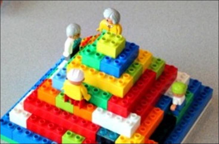
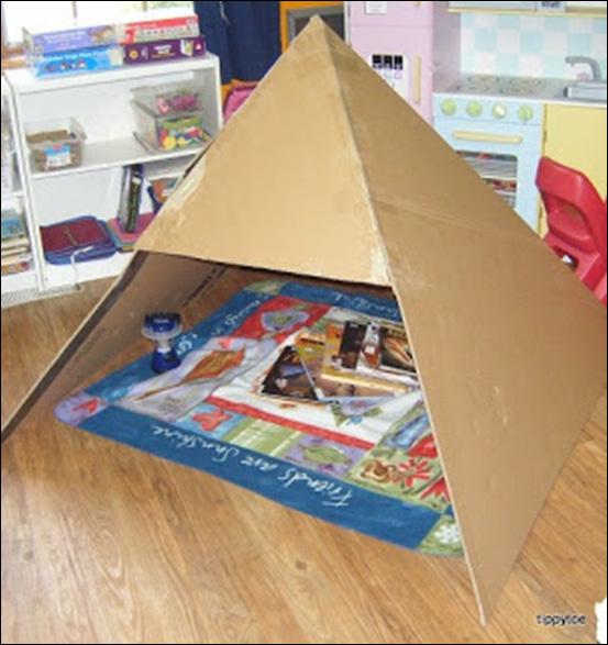
3 BUILD YOUR OWN PYRAMID Show the children pictures of pyramids use the printable flash cards and invite them to build their own. Try building with Lego/Duplo, Stickle bricks, blocks, cardboard boxes, sugar cubes Ice cubes (sprinkle each layer with a little salt to help stick the cubes together. Learning Areas Physical: Control and coordination of bodies while learning to move and handle equipment. Fine and gross motor skills Maths: Developing skills in numbers, space, shape, measurements and quantity Knowledge of the world: Investigating and beginning to understand places and people around the world and ICT Exploring and Thinking - children making sense of people, places and things in their world by interacting with others Montessori Culture - Geography, history, science, art, music and diversity. Maths - Numbers, counting, sorting, matching, shapes, measurement.
4 COUNTING IN SWAHILI Teach the children to count to ten in Swahili. Get them to repeat each number after you to pronounce the numbers correctly Use the printables to make a set of cards for the children to sequence Number Swahili Pronounced 1 moja Mo-ja 2 mbili m - bee - lee 3 tatu ta - too 4 nne n - nay 5 tano tah - no 6 sita see - tah 7 saba sah - bah 8 nane nah - nay 9 tisa tee - sah 10 kumi koo - mee Learning Areas Language: Communication, developing skills in listening, talking and understanding. Maths: Developing skills in numbers, space, shape, measurements and quantity Knowledge of the world: Investigating and beginning to understand places and people around the world and ICT Exploring and Thinking - children making sense of people, places and things in their world by interacting with others Communicating - children sharing their experiences, thoughts, ideas, and feelings with others Montessori Language - Discussion, conversation and literacy skills Culture - Geography, history, science, art, music and diversity. Maths - Numbers, counting, sorting, matching, shapes, measurement
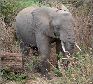
5 FUN FACTS ABOUT ELEPHANTS There are two types of elephant, the Asian elephant and the African elephant Elephants are the largest land-living mammal in the world. Both female and male African elephants have tusks but only the male Asian elephants have tusks. They use their tusks for digging and finding food. Female elephants are called cows. They start to have calves when they are about 12 years old and they are pregnant for 22 months. An elephant can use its tusks to dig for ground water. An adult elephant needs to drink around 210 litres of water a day. The elephant s trunk is able to sense the size, shape and temperature of an object. An elephant uses its trunk to lift food and suck up water then pour it into its mouth. An elephant s trunk can grow to be about 2 metres long and can weigh up to 140 kg. Some scientists believe that an elephant s trunk is made up of 100,000 muscles, but no bones. Elephants can swim they use their trunk to breathe like a snorkel in deep water. Elephants are herbivores and can spend up to 16 hours days collecting leaves, twigs, bamboo and roots. Learning Areas Language: Communication, developing skills in listening, talking and understanding. Knowledge of the world: Investigating and beginning to understand places and people around the world and ICT Exploring and Thinking - children making sense of people, places and things in their world by interacting with others Montessori Language - Discussion, conversation and literacy skills Culture - Geography, history, science, art, music and diversity.


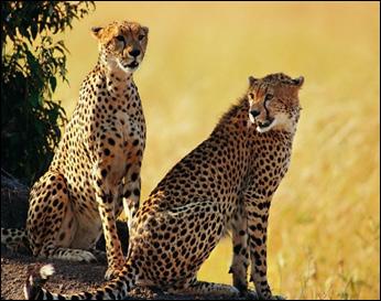
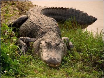
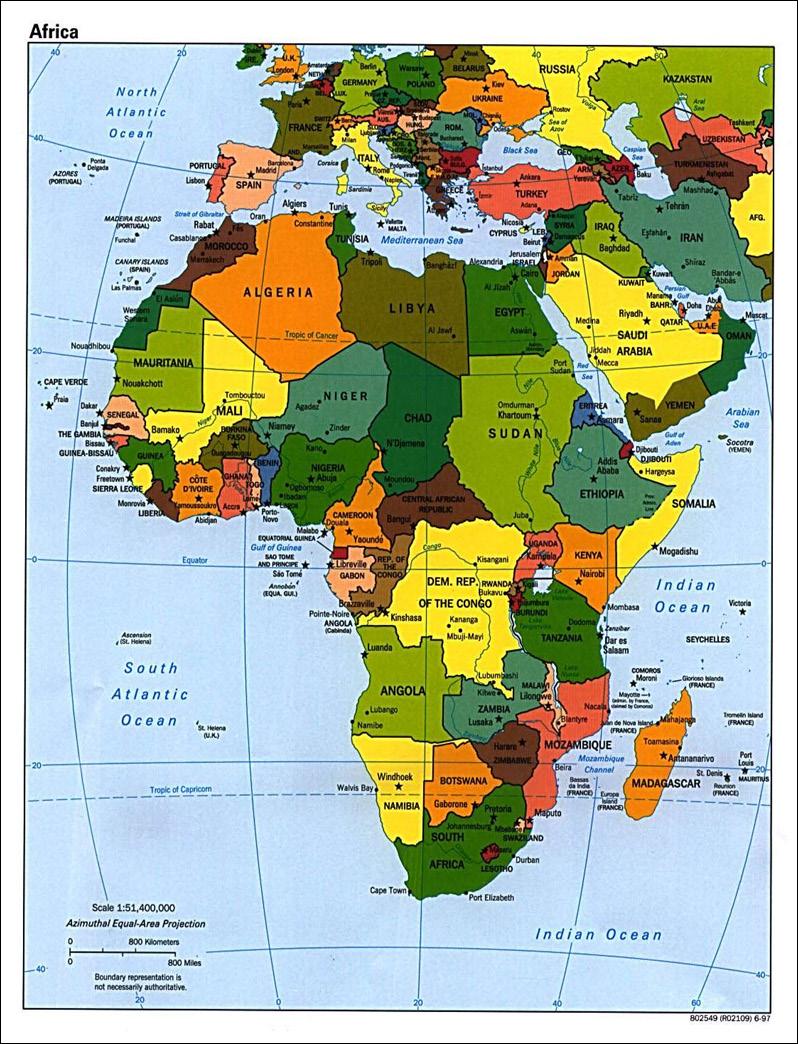
6 Curriculum Plans FUN FACTS ABOUT AFRICA Using the Images of Africa printable to make a book and the maps discuss the fun facts with the children. Add dress ups and some African inspired cooking implements such as wooden bowls and spoons etc to the home corner and add African animals to the sand tray and give the children the opportunity in explore and find out about the continent of Africa. The continent of Africa borders the southern half of the Mediterranean Sea. The Atlantic Ocean is to the west and the Indian Ocean is to the Southeast. Africa stretches well south of the equator to cover more than 12 million square miles making Africa the world s second largest continent. Africa is also the world s second most populous continent. Africa is one of the most diverse places on the planet with a wide variety of terrain, wildlife, and climates. The highest point in Africa is Mount Kilimanjaro in Tanzania at 5895 meters high. The lowest point is Lake Asal in Djibouti at 153 meters below sea level. The largest country in Africa is Algeria, the smallest is the Seychelles. The most populated country is Nigeria. The largest lake in Africa is Lake Victoria and the longest river is the Nile River, which is also the longest river in the world. Africa is rich with varied wildlife including elephants, penguins, lions, cheetahs, seals, giraffes, gorillas, crocodiles, and hippos. African languages are varied with more than 1000 languages spoken across the continent.
7 FUN FACTS ABOUT AFRICA Major cities: Cairo, Egypt Lagos, Nigeria Kinshasa, Democratic Republic of the Congo Johannesburg-Ekurhuleni, South Africa Khartoum-Umm Durman, Sudan Alexandria, Egypt Abidjan, Cote d Ivoire Casablanca, Morocco Cape Town, South Africa Durban, South Africa Major Rivers and Lakes: Nile River, Niger River, Congo River, Zambezi River, Lake Victoria, Lake Tanganyika, Lake Nyasa Major Geographical Features: Sahara Desert, Kalahari Desert, Ethiopian Highlands, Serengeti grasslands, Atlas Mountains, Mount Kilimanjaro, Madagascar Island, Great Rift Valley, the Sahel, and the Horn of Africa. Learning Areas Language: Communication, developing skills in listening, talking and understanding. Knowledge of the world: Investigating and beginning to understand places and people around the world and ICT Exploring and Thinking - children making sense of people, places and things in their world by interacting with others Montessori Language - Discussion, conversation and literacy skills Culture - Geography, history, science, art, music and diversity.
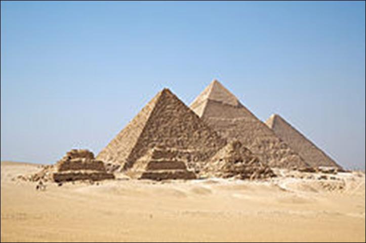
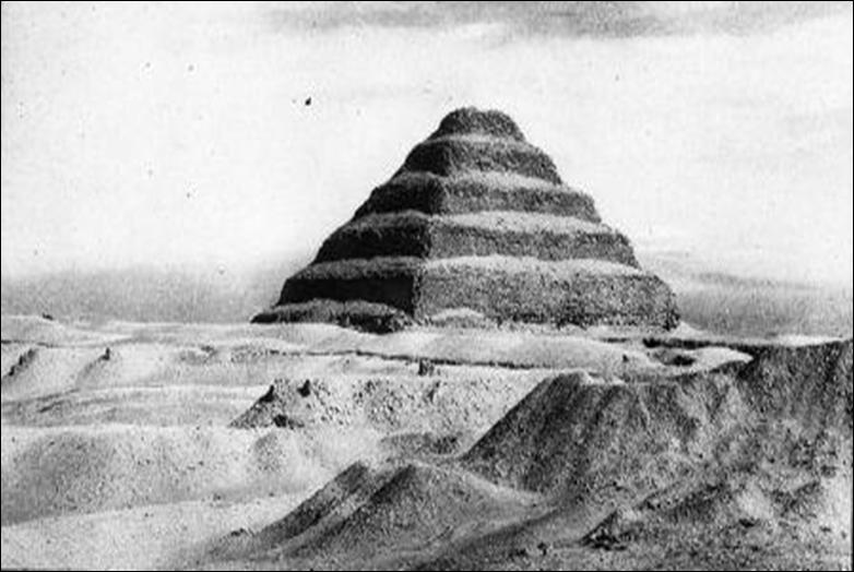
8 FUN FACTS ABOUT PYRAMIDS Ancient Egyptian pyramids are the most well known pyramid structures. Most Ancient Egyptian pyramids were built as tombs for Pharaohs and their families. Over 130 pyramids have been discovered in Egypt a country in Africa. The first Egyptian pyramid is believed to be the Pyramid of Djoser, it was built in Saqqara around 4650 years ago (2640 BC). Nearly all Egyptian Pyramids are located on the west bank of the Nile. Egyptian Pyramids often contain multiple chambers and passages. Bodies placed in the tombs were preserved by mummification. Egyptians buried their dead with burial goods that ranged from everyday items they believed would useful in the afterlife to more expensive items such as jewelry. Pyramids have triangular sides that come together at the top (apex). If they have 4 sides and a square base they are called a square pyramid. If they have 3 sides and a triangular base they are called a tetrahedron. Learning Areas Maths: Developing skills in numbers, space, shape, measurements and quantity Knowledge of the world: Investigating and beginning to understand places and people around the world and ICT Exploring and Thinking - children making sense of people, places and things in their world by interacting with others Montessori Language - Discussion, conversation and literacy skills Culture - Geography, history, science, art, music and diversity. Maths - Numbers, counting, sorting, matching, shapes, measurement.


9 KHAMSA HAND The khamsa is a symbol of good luck from Morocco, a country in Africa. This good luck hand has been used as an amulet in northern Africa for centuries - it is often made from precious metal, like silver. It is said to keep away the evil eye and can be worn around the neck or used as a wall decoration. The children can make their own collage version using shiny paper, aluminium foil, bright colours etc. Khamsa means five in Arabic. You will need thick paper or card Scissors Glue Foil/shiny paper Crayons, markers, or paint Sequins, glitter, glitter glue Stick on eyes, buttons etc Get the children top draw round their own hands or they could draw round each others. Older children could cut out their hand. Decorate and display. Learning Areas Physical: Control and coordination of bodies while learning to move and handle equipment. Fine and gross motor skills Knowledge of the world: Investigating and beginning to understand places and people around the world and ICT Creative: using colour, texture, sounds and music, dance, drama, role play and stories Exploring and Thinking - children making sense of people, places and things in their world by interacting with others Well-being - children being confident, happy and healthy. Montessori Culture - Geography, history, science, art, music and diversity. Sensorial - Experiences of sight, sound, touch, taste and smell.

10 LEARN A SONG IN SWAHILI Swahili is wildly spoken in parts of Southeast Africa, including Tanzania, Kenya, Uganda, Rwanda, Burundi, Mozambique and the Democratic Republic of the Congo. Around 5 million people speak Swahili as a native language, and a further 135 million speak is as a second language. Teach the children a song that children in Tanzania sing. Tanzania is a country in South East Africa. The rhyme is sung to the tune of frère Jaques Eh Yakobo Eh Yakobo, Eh Yakobo, Walala? Walala? Amka twende shule Amka twende shule Haya njoo, Haya njoo. Hey Jacob Hey Jacob Hey Jacob Are you sleeping? Are you sleeping? Wake up let s go to school Wake up let s go to school Ok come Ok come Learning Areas Language: Communication, developing skills in listening, talking and understanding. Knowledge of the world: Investigating and beginning to understand places and people around the world and ICT Creative: using colour, texture, sounds and music, dance, drama, role play and stories Exploring and Thinking - children making sense of people, places and things in their world by interacting with others Communicating - children sharing their experiences, thoughts, ideas, and feelings with others Montessori Language - Discussion, conversation and literacy skills Culture - Geography, history, science, art, music and diversity.
11 Images of Africa
 in the world at 5,895 metres (19,341 ft) above sea level")
12 Mount Kilimanjaro Mount Kilimajaro is in Tanzania. It is the highest mountain in Africa and the highest free-standing mountain (i.e., not part of a mountain range) in the world at 5,895 metres (19,341 ft) above sea level

13 Victoria Falls The falls average over 300 feet (100 m) in height and stretch over one mile (1,688 m) from the Zambian side to the Zimbabwe side, and both countries share the falls. At peak river levels about 200 million gallons (750 million liters) of water fall over the precipice every minute.


14 Many children in Africa don t have money to buy toys so they must make their own playthings. One of the favorite activities is to make a car from discarded wire. The kids call this kind of toy car galimoto (a Chichewa word also used for the real thing). The car has wheels that rotate and a fully functional steering wheel. This is operated by remote control a stick extending from waist height to the car s front wheels. Rolling tyres or hoops is another popular game.


15 Women in Africa traditionally wear the chitenge. This is a brightly coloured length of material wrapped around the waist. The cloths are mostly made in India and exported to Africa where they are sold in trading stores common in any African town.
16 Over 130 pyramids have been discovered in Egypt a country in Africa. Ancient Egyptian pyramids are the most well known pyramid structures. Most Ancient Egyptian pyramids were built as tombs for Pharaohs and their families.

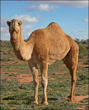
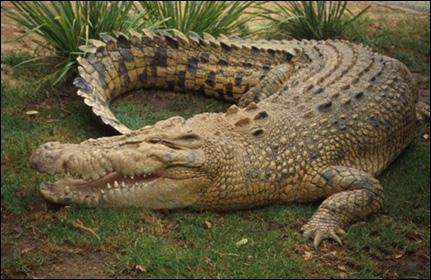
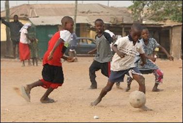
17 African Animals

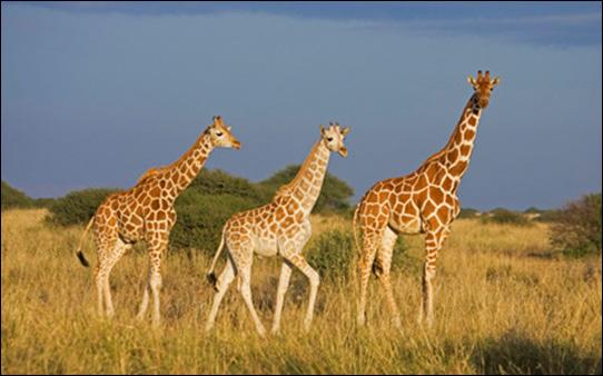
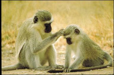
18 African Animals

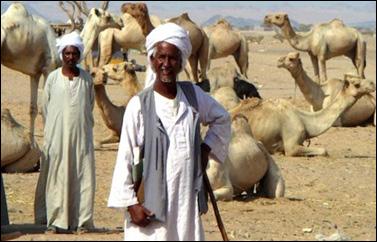
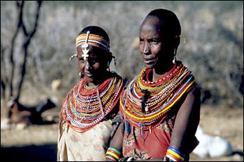
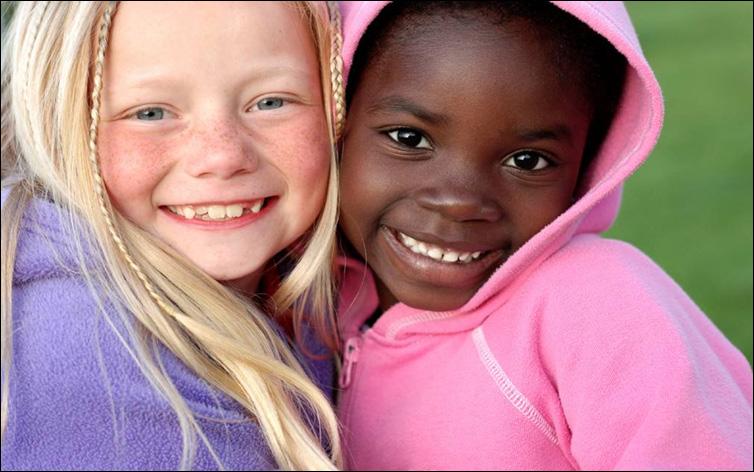
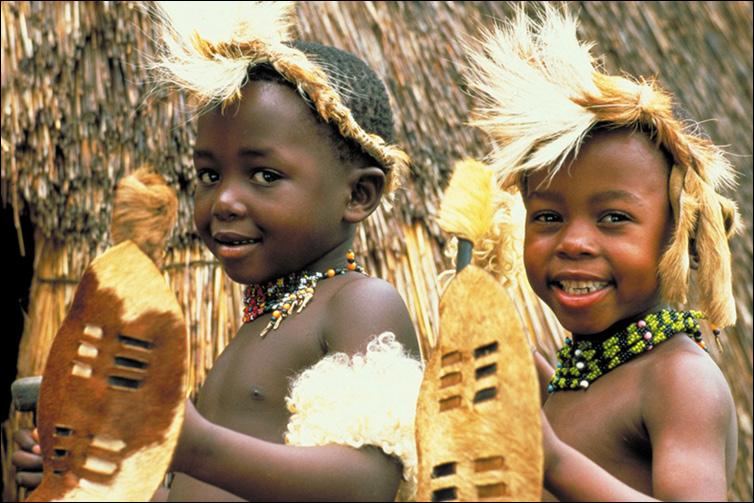
19 People of Africa
20

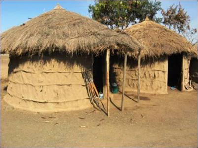
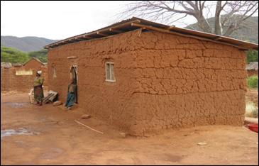
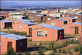

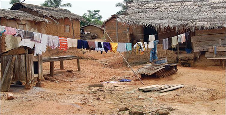
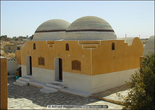
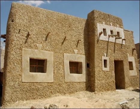
21 Buildings and Homes
22
23


24 Meercat Lion Zebra Vulture Cheetah Alligator


25 Giraffe Elephant Camel Baboon Rhinoceros Elephant
26
27
28
29 Number Swahili Pronounced 1 moja Mo-ja 2 mbili m - bee - lee 3 tatu ta - too 4 nne n - nay 5 tano tah - no 6 sita see - tah 7 saba sah - bah 8 nane nah - nay 9 tisa tee - sah 10 kumi koo - mee
30
31
32
33
34
35
SS7G1 The student will locate selected features of Africa.
 Standards SS7G1 The student will locate selected features of Africa. a. Locate on a world and regional political-physical map: the Sahara, Sahel, savanna, tropical rain forest, Congo River, Niger River,
JABALI AFRICAN ACROBATS TEACHER'S NOTES
 JABALI AFRICAN ACROBATS TEACHER'S NOTES Brought to you by Class Act Performing Artists & Speakers; 800-808-0917 JABALI ACROBATS This incredible Kenyan troupe combines Chinese and African traditions of
Grade 5 Geography Term 1
 1 Grade 5 Geography Term 1 Contents Section 1: World map and compass directions... 2 The position of the equator and the North and South Poles on a globe... 2 The seven continents of the world... 3 The
AFRICAN PHYSICAL GEOGRAPHY
 AFRICAN PHYSICAL GEOGRAPHY Here are some factoids about Africa: world s second largest continent (11,700,000 miles). Home to 52 countries, 1,000 languages, 800 million people. 10% of the world s population
Africa. Display Transparency 6 on the overhead. Explain to students that Africa is the
 3S 4S 1S 2S 3N 4N Banjul Bissau SIERRA LEONE 5N MADEIRA IS. CANARY IS. (SPAIN) (disputed) Dakar Freetown (PORTUGAL) GAMBIA Bamako Conakry Monrovia Rabat BURKINA FASO 1W Accra Lomé ~ Niamey BENIN Algiers
GeoQuest Study for the next Quiz Day:
 GeoQuest Study for the next Quiz Day: February 27 th Angola Botswana Burundi Level 2 February Southern Africa Level 1 Republic of the Congo Democratic Republic of the Congo Equatorial Guinea Level 3 Madagascar
Africa: Physical geography
 Africa: Physical geography By National Geographic Society, adapted by Newsela staff on 09.15.17 Word Count 1,279 Level 1040L African elephants roam the savannas, which cover almost half of the African
Countries of the World QTR 3
 As of December 2017 Countries of the World QTR 3 Website: Countries of the World. com https://www.countries-ofthe-world.com/countries-of-north-america.html Website: CIA.gov https://www.cia.gov/index.html
BRITANNICA STUDENT ENCYCLOPEDIA. Africa is the world s second largest continent. More than 50 countries make up
 JOBNAME: No Job Name PAGE: 33 SESS: 682 OUTPUT: Thu Aug 31 10:43:41 2006 38 Africa BRITANNICA STUDENT ENCYCLOPEDIA Africa Africa is the world s second largest continent. More than 50 countries make up
How to play. The center aisle divides our class into 2 teams. Team members are NOT allowed to help their teammate when they are asked a question.
 Floaters & Sinkers How to play The center aisle divides our class into 2 teams. Each person will be responsible for answering a question for every round played. Team members are NOT allowed to help their
Sub - Saharan Africa
 Sub - Saharan Africa 4/14/2015 Countries with Relative Importance GDP South Africa Gabon Botswana Land Size Sudan Chad Mozambique Madagascar Democratic Republic of the Congo (formerly Zaire) Population
Just how big is Africa?
 The United States China India The United Kingdom Portugal Spain France Belgium Germany The Netherlands Switzerland Italy Eastern Europe Japan 11.7 million sq. miles Just how big is Africa? Chapter 18 Section
One Commodity Map. 7. What is a commodity? 8. Explain what a one-commodity country is.
 7. What is a commodity? 8. Explain what a one-commodity country is. 9. What must African countries do in order to become more stable economically? One Commodity Map Countries which OIL is the lone commodity
pg. 446 (5 th) pg. 456 (6 th )
 pg. 456 (6 th )") pg. 446 (5 th) pg. 456 (6 th ) African Landscape Plateau Highest in: Ethiopian Highlands Drakensberg Mtns. Lesotho & So. Africa pg. 452 (5 th) pg. 459 (6 th ) Ethiopian Highlands Canyons carved by water
pg. 446 (5 th) pg. 456 (6 th ) African Landscape Plateau Highest in: Ethiopian Highlands Drakensberg Mtns. Lesotho & So. Africa pg. 452 (5 th) pg. 459 (6 th ) Ethiopian Highlands Canyons carved by water
2009 Carole Marsh/Gallopade International
 Live Work Play Learn LIVE LEARN WORK TM PLAY 2009 Carole Marsh/Gallopade International Permission is hereby granted to the individual purchaser or classroom teacher to reproduce materials in this book
Introduction to Africa
 Introduction to Africa Did you know? Africa has more countries than any other continent. The Sahara is a desert that is the size of the U.S. It s the world's largest desert. Most of the world s gold and
STUDY GUIDE. The Land. Chapter 20, Section 1. The Land of Africa South of the Sahara. Landforms Water Systems Natural Resources.
 For use with textbook pages 499 504. The Land Terms to Know escarpment A steep, often jagged slope or cliff (page 500) cataract A towering waterfall (page 500) rift valley A large crack in the earth s
Notes for the Teacher / Guide. Africa / Uganda
 Notes for the Teacher / Guide Africa / Uganda The aim of the project is to introduce the children of the UK to the landscape of another country and to appreciate similarities and differences. Uganda is
Unit 6 vocabulary. Serengeti Plain
 basin Nile River rift valley Mount Kilimanjaro escarpment Sahara aquifer oasis Serengeti Plain canopy Niger delta Sahel the world s longest river, flowing more than 4,000 miles through Uganda and Sudan
UNIT 5 PHYSICAL GEOGRAPHY SG 1 - PART I
 UNIT 5 PHYSICAL GEOGRAPHY SG 1 - PART I Africa is HUGE! I. LANDFORMS A. Plateaus - an area of relatively level high ground. 1. Africa s interior is dominated by series of plateaus and elevated basins such
AFRICA'S PHYSICAL FEATURES
 AFRICA'S PHYSICAL FEATURES Looking high and low in Africa This continent's physical features are impressive. From towering, rocky peaks and sleeping volcanoes, like Mount Kilimanjaro, to some of the world
Africa s. Presentation, Graphic Organizers, & Activities
 Africa s Presentation, Graphic Organizers, & Activities STANDARDS: SS7G1 Locate selected features of Africa. a. Locate on a world and regional political-physical map: Sahara, Sahel, savanna, tropical rain
Chapter 20. The Physical Geography of Africa South of the Sahara
 Chapter 20 The Physical Geography of Africa South of the Sahara Chapter Objectives Identify the major landforms, water systems, and natural resources of Africa south of the Sahara. Describe the relationship
Chapters 14 and 15 Geography Study Guide
 Chapters 14 and 15 Geography Study Guide Multiple Choice Identify the letter of the choice that best completes the statement or answers the question. 1. Gorillas live within dense rain forests of. a. Rwanda
All of this week s homework is intended to help you get to know more about the country of Sudan, where Kek is from in Home of the Brave.
 Name: Week 7 Homework All of this week s homework is intended to help you get to know more about the country of Sudan, where Kek is from in Home of the Brave. On the map above, do the following things:
Any Age. Ancient Egypt. Express Lapbook SAMPLE PAGE. A Journey Through Learning
 A J T L Any Age Ancient Egypt Express Lapbook Mini Lapbook, Study Guide, Activities, and Crafts A Journey Through Learning www.ajourneythroughlearning.com Copyright 2013 A Journey Through Learning 1 Authors-Paula
The A Z of African Countries Notebooking Pages with Backline Maps. Preface
 Preface This book has been created as the basis for unit studies on any (or all) African countries. Whilst each country has available a separate and comprehensive Unit Study, some educators prefer to start
Physical characteristics and biomes:
 Physical characteristics and biomes: Sahel region, bordering Sahara Characteristics Area suffers from lack of rainfall, over grazing, which causes loss of vegetation and loss of inhabitable areas causing
Ancient Egypt: an Overview
 Ancient Egypt: an Overview Timeline Old Kingdom Middle Kingdom 2650 BC 2134 BC 2125 BC 1550 BC New Kingdom 1550 BC 1295 BC http://www.thebanmappingproject.com/resources/timeline.html 1 Three Kingdoms of
Connecting Africa. physical Geography
 Connecting Africa physical Geography Africa, the second-largest continent, is bounded by the Mediterranean Sea, the Red Sea, the Indian Ocean, and the Atlantic Ocean. It is divided in half almost equally
Millennium Development Goal 1: eradicate extreme poverty and hunger. International poverty line a Share of population below PPP $1.
 3.1 Millennium Development Goal 1: eradicate extreme poverty and hunger International poverty line a Share of population below PPP $1.25 a day Poverty gap ratio at PPP $1.25 a day Share of population below
Africa. Physical. Map. Unit. Thanks for Your Purchase! Annabelle ate apples in the purple poppies Thomas Teaching Tools
 Africa Physical Map Unit Thanks for Your Purchase! I hope you and your students enjoy this product. If you have any questions, you may contact me at ThomasTeachingTools@gmail.com. Terms of Use This teaching
Brain Wrinkles. Africa: The impact of location, climate, & physical characteristics on where people live, the type of work they do, & how they travel
 Africa: The impact of location, climate, & physical characteristics on where people live, the type of work they do, & how they travel STANDARDS: SS7G3 The student will explain the impact of location, climate,
Africa. Grades 2-5. Barbara Gillespie-Washington. Author
 Illustrators Cheri Macoubrie Wilson Wendy Chang Mary E. Connors Editor Barbara Wally Africa Grades 2-5 Editorial Project Manager Karen J. Goldfluss, M.S. Ed. Editor-in-Chief: Sharon Coan, M.S. Ed. Creative
Ten Day Climate Watch Bulletin N 27 Dekad 21 st to 30 th September, 2014
 African Centre of Meteorological Application for Development Centre Africain pour les Applications de la Météorologie au Développement Ten Day Climate Watch Bulletin N 27 Dekad 21 st to 30 th September,
UNIT 5 AFRICA PHYSICAL GEOGRAPHY SG 1 - PART II
 UNIT 5 AFRICA PHYSICAL GEOGRAPHY SG 1 - PART II III. CLIMATE & VEGETATION A. The four main climate zones are tropical wet, tropical wet/dry (split into monsoon & savanna), semiarid, and arid. Other climate
TIPS TO MAXIMIZE LOVE, MANAGE STRESS
 TIPS TO MAXIMIZE LOVE, MANAGE STRESS Hold, kiss, and cuddle. Provide lots of loving attention and touch. Babies don t get spoiled, so there is no need to hold back on showing love. Respond to them. Answer
Africa's Top Wildlife Countries: Botswana, Kenya, Namibia, Rwanda, South Africa, Tanzania, Uganda, Zambia & Zimbabwe By Mark W.
 Africa's Top Wildlife Countries: Botswana, Kenya, Namibia, Rwanda, South Africa, Tanzania, Uganda, Zambia & Zimbabwe By Mark W. Nolting This is a list of national parks in Africa. The nature of the parks
Population (million) % of Africa
 % of Africa") FAO. Irrigation in in figures: AQUASTAT Survey 2005 TABLE 1 al distribution of cultivable and cultivated areas Cultivable areas Cultivated areas in 2002 In cultivable areas (ha) (ha) (%) Northern 65 320
FAO. Irrigation in in figures: AQUASTAT Survey 2005 TABLE 1 al distribution of cultivable and cultivated areas Cultivable areas Cultivated areas in 2002 In cultivable areas (ha) (ha) (%) Northern 65 320
SONIC SAFARI: A HANDBOOK FOR TEACHERS
 SONIC SAFARI: A HANDBOOK FOR TEACHERS WELCOME We look forward to welcoming you and your students for the presentation of Sonic Safari at the Sheldon Concert Hall. We hope that the perfect acoustics and
7/27/2010. Regions of Subsaharan Africa. SUBSAHARAN AFRICA II (Chapter 6, pages ) Southern Africa. South Africa: Peaceful Change from Apartheid
 Southern Africa. South Africa: Peaceful Change from Apartheid") SUBSAHARAN AFRICA II (Chapter 6, pages 209-227) Regions of Subsaharan Africa Southern Africa 10 countries, 6 of them landlocked Congo Basin marks northern limit Plateau country Rich in natural resources
SUBSAHARAN AFRICA II (Chapter 6, pages 209-227) Regions of Subsaharan Africa Southern Africa 10 countries, 6 of them landlocked Congo Basin marks northern limit Plateau country Rich in natural resources
Chapter 13 and 14 Geography Study Guide
 Chapter 13 and 14 Geography Study Guide Multiple Choice Identify the letter of the choice that best completes the statement or answers the question. 1. Which West African country has the largest population
Explore ancient. Egypt! carmella van vleet Illustrated by Alex kim
 Explore ancient Egypt! carmella van vleet Illustrated by Alex kim Contents 1 Introduction Let s Explore Egypt! 11 chapter 1 Egyptian Homes 21 chapter 2 Beer, Bread & Bartering chapter 3 34 Playtime 46
The Second Japan-Africa Business Forum TICAD and Business: Feedback from the Yokohama Action Plan to the Nairobi Declaration July 25, 2017
 The Second Japan-Africa Business Forum TICAD and Business: Feedback from the Yokohama Action Plan to the Nairobi Declaration July 25, 207 Takeshi Osuga Ambassador, Assistant Minister, Director-General
Table A.LPG1 : TOTAL LPG CONSUMPTION (Best available Estimates)
") Table A.LPG1 : TOTAL LPG CONSUMPTION (Best available Estimates) 1000 MT 1 Burkina Faso 0.509 0.587 0.615 0.606 0.435 0.429 0.691 1.057 1.385 1.698 2.156 2.432 2.888 2 Cape Verde 4.058 4.268 4.988 5.259
Table A.LPG1 : TOTAL LPG CONSUMPTION (Best available Estimates) 1000 MT 1 Burkina Faso 0.509 0.587 0.615 0.606 0.435 0.429 0.691 1.057 1.385 1.698 2.156 2.432 2.888 2 Cape Verde 4.058 4.268 4.988 5.259
 10 to 24 year olds as proportion of total population in this Population aged group of countries, Region 10 to 24 years per cent Least developed countries 274,842,000 32.2 Less developed regions 1,595,761,000
KENYA. Soroldoni Simone Luciano Romeo; Mandelli Davide; Rivetti Alessia and Natali Andrea
 KENYA Soroldoni Simone Luciano Romeo; Mandelli Davide; Rivetti Alessia and Natali Andrea HISTORY 2000 BC Cushitic-people 1 century AD 1 millennium Arabs traders, who established Arab and Persian colonies.
TABLE OF CONTENTS COUNTRY FOCUS: ALGERIA
 Africa Statistics Flash Selected Socio-Economic Indicators on Africa May 218 TABLE OF CONTENTS COUNTRY FOCUS: ALGERIA ---------------------------------------------------------------------------------------------
Unit 1. School Days. First Nine Weeks
 Study Buddy Unit 1 School Days First Nine Weeks Teacher- A person who helps us learn. Map- A drawing that shows where places are. Group- A number of people doing an activity together. Rule- What you must
CLIMATE DIAGNOSTIC BULLETIN FOR AFRICA
 CLIMATE DIAGNOSTIC BULLETIN FOR AFRICA N 02 FEBRUARY, 2019 OCEAN-ATMOSPHERE MONITORING & PREDICTION 1 SUMMARY FEBRUARY 2019 The precipitation for the month of February, 2019 was above to well above average
African Centre of Meteorological Applications for Development Centre Africain pour les Applications de la Météorologie au Développement
 African Centre of Meteorological Applications for Development Centre Africain pour les Applications de la Météorologie au Développement Ten Days Climate Diagnostics Bulletin N 03 Dekad 3, 21 st to 31 st
Table of CONTENTS. COUNTRY FOCUS: United Republic of Tanzania
 Africa Statistics Flash Selected Socio-Economic Indicators on Africa December 216 Table of CONTENTS COUNTRY FOCUS: United Republic of Tanzania ------------------------------------------------------------
A Snapshot of Sanitation and Open Defecation in Africa 2010 Update
 A Snapshot of Sanitation and Open Defecation in 10 Update A regional perspective based on data from the WHO/UNICEF Joint Monitoring Programme for Water Supply and Sanitation UNICEF/NYHQ10-1999/Asselin
Egypt and the Nile River Valley System. SC Standards 6-1.3, 1.4, 1.5
 Egypt and the Nile River Valley System SC Standards 6-1.3, 1.4, 1.5 Where is Egypt? Egypt is on the continent of Africa. The River Nile runs through Egypt The capital of Egypt is Cairo Where is Egypt?
AGRICULTURE THE BIG PICTURE
 AGRICULTURE THE BIG PICTURE AEASA 2015 (30 Sept 2015), Parys North West NAMC and Tralac Collaboration By: B Nyhodo, E Williams and R Sandrey Presentation outline Introduction Africa Africa share of world
Day 1: NAIROBI. Day 2: NAIROBI / AMBOSELI
 Day 1: NAIROBI On arrival at JKIA you are met by a CATS Africa representative and transferred to your hotel. Spend the rest of the day resting and adjusting to the different time zone. Lunch and dinner
When to go: Since it s a rainforest, there s a chance you ll get wet anytime, so there s no really bad time to go. Just be sure to pack appropriately.
 With 54 countries calling it home, Africa s topography, landscape and activities vary drastically by region. I ve been to the continent 26 times, yet each time I go I m surprised at just how many new things
Welcome to Egypt! But before we talk about anything else, we have to talk about the most important thing in Egypt. (other than me) the Nile River.
 the Nile River.") Welcome to Egypt! Hi! My name is Sphinxy, your tour guide through the gift of the Nile. I ll show you all you need to know about the ancient kingdom of Egypt. (other than me) the Nile River. But before
Welcome to Egypt! Hi! My name is Sphinxy, your tour guide through the gift of the Nile. I ll show you all you need to know about the ancient kingdom of Egypt. (other than me) the Nile River. But before
Created by Vaishnavi Yelchur for
 Copyright: Moppets Wiki, 2018 All rights reserved. Terms for this printable: You may not sell it. You may not redistribute it. You may copy only for personal use. You may use it for your blog or Facebook
Best of Southern Africa. Victoria Falls - Kruger National Park - Cape of Good Hope South Africa - Zimbabwe - Zambia - Botswana
 Best of Southern Africa Victoria Falls - Kruger National Park - Cape of Good Hope South Africa - Zimbabwe - Zambia - Botswana TOUR DETAILS Best of Southern Africa Price: $4,195 USD Discounts: 5% - Returning
Desert Protection. Protected on four sides. 1. Desert to the East & West 2. Cataracts to the South 3. Marshy Delta to North
 EGYPTIAN PANELS Desert Protection Protected on four sides 1. Desert to the East & West 2. Cataracts to the South 3. Marshy Delta to North One of the most stable civilizations in history ANCIENT EGYPT AREAS
North Africa. countries to Europe. Oil is most important industry. Mining and metal work are important, too.
 North Africa CHAPTER SUMMARY North Africa Egypt It has large areas of desert. The Nile supports fertile farmland. Nomadic Bedouins herd livestock. The Suez Canal is a strategic waterway. Most people are
Key Geographic Features
 DUE 12/6/18 Name: Lesson One: Egypt Geography 6.15 On a historical map locate the Mediterranean and Red Seas, the Nile River and Delta, and the areas of ancient Nubia and Egypt. Identify the locations
Lesson 1: Geography of Africa
 Lesson 1: Geography of Africa 7. 4. 1 Study the Niger River and the relationship of Vegetation zones of forest, savannah, and desert trade in gold, salt, food, and slaves; and the growth of the Ghana and
Table of CONTENTS. COUNTRY FOCUS: Equatorial Guinea
 Africa Statistics Flash Selected Socio-Economic Indicators on Africa August 217 Table of CONTENTS COUNTRY FOCUS: Equatorial Guinea ---------------------------------------------------------------------------
REPORT ON HUMAN RESOURCES IN WHO IN THE AFRICAN REGION. Information Document CONTENTS INTRODUCTION... 1
 AFR/RC56/INF.DOC/3 12 July 2006 REGIONAL COMMITTEE FOR AFRICA ORIGINAL: ENGLISH Fifty-sixth session Addis Ababa, Ethiopia, 28 August 1 September 2006 Provisional agenda item 10.4 REPORT ON HUMAN RESOURCES
Bunnik Tours AFRICA EARLYBIRD SPECIALS
 Bunnik Tours AFRICA EARLYBIRD SPECIALS No continent on earth makes you feel more alive than Africa. From a magical sunset over the Maasai Mara to a mountain gorilla encounter in its natural habitat - you
Data Limitations. Index Choices
 Section 3. Annexes The Index is part of a central database and system for collecting data on regional integration. It will capture additional data for indicators that are not part of the Index but that
REPORT ON WHO STAFF IN THE AFRICAN REGION. Information Document CONTENTS
 6 September 2013 REGIONAL COMMITTEE FOR AFRICA ORIGINAL: ENGLISH Sixty-third session Brazzaville, Republic of Congo, 2 6 September 2013 Agenda item 20.1 REPORT ON WHO STAFF IN THE AFRICAN REGION Information
WriteBonni Bonnie Rose Hudson WriteBonnieRose.com. By Bonnie Rose Hudson
 WriteBonni- By Bonnie Rose Hudson Copyright 2015 by Bonnie Rose Hudson All Rights Reserved. This book may not be reproduced or transmitted by any means, including graphic, electronic, or mechanical, without
Seven Continents. Grade Level: 1 3
 Seven Continents Grade Level: 1 3 Teacher Guidelines pages 1 2 Instructional Pages pages 3 6 Activity Pages pages 8 14 Practice Page page 15 Homework Page page 16 Answer Key pages 17 18 Classroom Procedure:
1. CLIMATIC AND ENVIRONMENTAL CONDITIONS OVER AFRICA. 1.1 Inter-Tropical Discontinuity (ITD)
") African Centre of Meteorological Application for Development Centre Africain pour les Applications de la Météorologie au Développement DECEMBER 2011 HIGHLIGHT: Cholera, Yellow fever, Avian Influenza, typhoid
African Centre of Meteorological Application for Development Centre Africain pour les Applications de la Météorologie au Développement DECEMBER 2011 HIGHLIGHT: Cholera, Yellow fever, Avian Influenza, typhoid
African Centre of Meteorological Applications for Development Centre Africain pour les Applications de la Météorologie au Développement
 African Centre of Meteorological Applications for Development Centre Africain pour les Applications de la Météorologie au Développement Ten Day Climate Watch Bulletin N 34 Dekad 1 st to 10 th December,
TABLE OF CONTENTS COUNTRY FOCUS: BENIN
 Africa Statistics Flash Selected Socio-Economic Indicators on Africa March 218 TABLE OF CONTENTS COUNTRY FOCUS: BENIN ------------------------------------------------------------------------------------------------
Ancient River Valley Civilizations Egypt
 Ancient River Valley Civilizations Egypt Geography of Egypt The first civilization in Africa developed along the Nile River, in a place called Egypt. These humans were at first nomadic, also known as hunter-gatherers.
Unit Two. Water on Earth
 CONTENTS Unit One People and Culture Lesson One: Family Traditions Lesson Two: Holidays and Celebrations Lesson Three: Taking Care of My Teeth Lesson Four: I Want to Be a Vet Lesson Five: Dairy Farmer
REPORT ON WHO STAFF IN THE AFRICAN REGION. Information Document CONTENTS
 10 July 2009 REGIONAL COMMITTEE FOR AFRICA ORIGINAL: ENGLISH Fifty-ninth session Kigali, Republic of Rwanda, 31 August 4 September 2009 Provisional agenda item 9.5 REPORT ON WHO STAFF IN THE AFRICAN REGION
Southern Africa outpaces North Africa in governance performance
 Monday 5 th October 2009 Southern Africa outpaces North Africa in governance performance 2009 Ibrahim Index of African Governance shows that half of Africa s ten best performing countries are in Southern
Africa at a glance. Annual real GDP growth ( average): 4.97% Official development assistance (2010): $48 billion
: 4.97% Official development assistance (2010): $48 billion") Africa at a glance Population (212): 1,38 million Annual real GDP growth (25-212 average): 4.97% Official development assistance (21): $48 billion Net foreign direct investment (211): $43 billion Sources:
Africa at a glance Population (212): 1,38 million Annual real GDP growth (25-212 average): 4.97% Official development assistance (21): $48 billion Net foreign direct investment (211): $43 billion Sources:
The Pyramids of Ancient Egypt
 The Pyramids of Ancient Egypt By History.com, adapted by Newsela staff on 08.01.17 Word Count 901 Level 1060L The Great Pyramid of Giza, also called the Pyramid of Khufu or Cheops, is the oldest and largest
The political economy of resource discoveries. Prof. Michael L. Ross UCLA Department of Political Science September 21, 2011
 The political economy of resource discoveries Prof. Michael L. Ross UCLA Department of Political Science September 21, 2011 Overview 1. Oil and mineral production is spreading to more low-income countries;
Energy Poverty in Africa
 African Energy Commission (AFREC) Paper on Energy Poverty in Africa By Dr. Gilbert NZOBADILA Consultant Energy Policy- AFREC 1 1- Introduction: African background : The African Energy Commission (AFREC)
Module 1 Educator s Guide: Representative Discussion Points Investigation 3
 Module 1 Educator s Guide: Representative Discussion Points Investigation 3 Ethiopia and Eritrea Our combined population is 59,578,171 people. We have just emerged from a long period of civil war and famine.
Global IP Infrastructure
 Study Visit: Intellectual Property Focal Persons of the African Regional Economic Communities and Executive Bodies of the African Union Global IP Infrastructure Gregory Sadyalunda Project Manager IP Office
Fostering healthcare Investments through PPPs. George Uduku Health Systems November 2017
 Fostering healthcare Investments through PPPs George Uduku November 2017 Healthcare Industry : Infrastructure 1/2 There is a wide gap in healthcare infrastructure and a major shortage of healthcare workers
Egyptian Civilization (3100 B.C-332 B.C.)
") Egyptian Civilization (3100 B.C-332 B.C.) Ancient Egypt -a land of mysteries. No other civilization has so captured the imagination of scholars and public in general. Mystery surrounds its origins, its
Egyptian Civilization (3100 B.C-332 B.C.) Ancient Egypt -a land of mysteries. No other civilization has so captured the imagination of scholars and public in general. Mystery surrounds its origins, its
THE MOST AND LEAST CHILD-FRIENDLY GOVERNMENTS IN AFRICA
 The Most and Least Child-friendly Governments in Africa 5 THE MOST AND LEAST CHILD-FRIENDLY GOVERNMENTS IN AFRICA We must put the best interests of children at the heart of all political and business decision-making,
AFSEC Workshop Johannesburg 27 March 2017
 Evah Oduor IEC-AFRC Director AFSEC Workshop Johannesburg 27 March 2017 INTERNATIONAL ELECTROTECHNICAL COMMISSION About the IEC Africa Quality Infrastructure IEC-AFRC Mission Recommendations Conclusion
Singita Explore Mobile Tented Camp
 Singita Explore Mobile Tented Camp Grumeti Tanzania Place of miracles We live in a world in which the demand for change governs a quest for progress that often treads unthinkingly on its heritage. There
"To speak the name of the dead is to make him live again"
 "To speak the name of the dead is to make him live again" Ancient Egypt civilization lasted over 3000 years. Egyptian monuments have been around so long that their monuments were ancient even in Greek
A: Pre-reading Vocabulary
 - 1 - In this text you are going to read about Egypt and the Egyptian people. There are some words in this text that you won t see very often when you are reading but are important for this text. These
AFRICA EASTERN AFRICA COMORO ISLANDS 1978-PRESENT. BURUNDI 1962-PRESENT Prior to 1962 see Rwanda
 EASTERN BURUNDI 1962-PRESENT Prior to 1962 see Rwanda COMORO ISLANDS 1978-PRESENT FRENCH TERRITORY 1950-1978 For period 1912-1950 see Madagascar and Comoro Islands Precedent Countries- Continued ANJOUAN
African Centre of Meteorological Applications for Development Centre Africain pour les Applications de la Météorologie au Développement
 African Centre of Meteorological Applications for Development Centre Africain pour les Applications de la Météorologie au Développement Ten Day Climate Watch Bulletin N 26 Dekad 11 th to 20 th September,
Table of CONTENTS. COUNTRY FOCUS: Tunisia
 Africa Statistics Flash Selected Socio-Economic Indicators on Africa October 217 Table of CONTENTS COUNTRY FOCUS: Tunisia ----------------------------------------------------------------------------------------------
Framework for Progressive Destination Competitiveness
 Sub-Saharan Africa Framework for Progressive Destination Competitiveness SSA Countries by Tourism Development Level and World Bank Income Ranking Tourism development level Pre-emerging Low income Central
Social Studies: The World
 Social Studies: The World What is the name of the continent that is labeled #1 on the map? North America What is the name of the continent that is labeled #2 on the map? South America What is the name
Ancient Egypt & Judaism
 Ancient Egypt & Judaism OUTCOME: GEOGRAPHY, CULTURE, & THE OLD KINGDOM 1 CONSTRUCTIVE RESPONSE QUESTIONS 1. Summarize the geography of Egypt and its surrounding lands: 2. Describe Egyptian culture including
STUDENTS WILL BE ABLE TO IDENTIFY THE MAJOR GEOGRAPHIC FEATURES OF EGYPT AND THE SURROUNDING REGION
 SOUTHWESTERN CHRISTIAN SCHOOL WORLD HISTORY STUDY GUIDE # 7 : ANCIENT EGYPT 3,000 BC 200 BC LEARNING OBJECTIVES STUDENTS WILL BE ABLE TO IDENTIFY THE MAJOR GEOGRAPHIC FEATURES OF EGYPT AND THE SURROUNDING
Rivers. Highlights of some of the World s Most Famous Rivers!
 Rivers Highlights of some of the World s Most Famous Rivers! Directions This Power Point presentation contains information about some of the most famous rivers in the world! Students should use this presentation
Passwords. Social Studies Vocabulary. Ancient Civilizations
 Passwords Social Studies Vocabulary Ancient Civilizations To the Student What is an epic? Is it bad if a tyrant takes over a country? What does an astronomer do? Passwords: Social Studies Vocabulary will