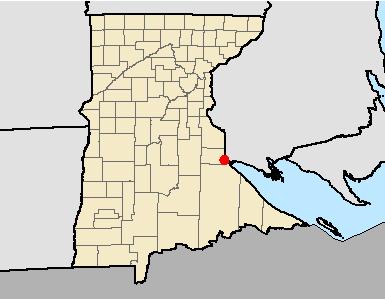
Appendix E: Cultural Resources Report
|
|
|
- Jemima Armstrong
- 5 years ago
- Views:
Transcription
1 Appendix E: Cultural Resources Report


2 Minnesota Power 15 Line Reroute Project PREPARED BY Merjent, Inc. 800 Washington Avenue North, Suite 315 Minneapolis, Minnesota Kevin Mieras, BA Kevin Gubbels, MA Michael Madson, MS Michael Madson, M.S., R.P.A, Principal Investigator Annual Archaeological Reconnaissance Survey License: DNR Special Permit No.: June 2018
3 TABLE OF CONTENTS EXECUTIVE SUMMARY... II 1.0 INTRODUCTION PROJECT DESCRIPTION REPORT CONTENTS ARCHAEOLOGICAL LITERATURE AND RECORDS REVIEW ENVIRONMENTAL AND CULTURAL BACKGROUND PREVIOUSLY REPORTED ARCHAEOLOGICAL SURVEYS AND SITES RESEARCH DESIGN FIELD METHODS EVALUATION CRITERIA ARCHAEOLOGICAL RECONNAISSANCE RESULTS SUMMARY AND RECOMMENDATIONS REFERENCES CITED Figure 1. Site Location Figure 2. Archaeological Survey Coverage FIGURES TABLES Table 1. Previous Archaeological Inventories on File at MnHPO within the Project Study Area Table 2. Previously Identified Archaeological Sites on File at MnHPO within the Project Study Area PHOTOS Photograph 1: Photo # Typical Project Area. View to north along level ridge. Photograph 2: Photo # Existing 15 Line transmission line corridor with Project Reroute Project APE in background. View to south. i
4 EXECUTIVE SUMMARY Minnesota Power, an ALLETE company, owns and operates a 115 kilovolt (kv) electric transmission line called the 15 Line in the Duluth area. Minnesota Power is planning to reroute a 2,178-foot segment of its existing 15 Line near Fond du Lac Dam. A small portion of the reroute segment will be located on Jay Cooke State Park land, which will be a new parallel route, 160 feet wide, north of its existing easement and running east-west for approximately 575 feet, totaling 2.13 acres. In addition, Minnesota Power proposes to utilize a north-south access road that includes approximately 150 linear feet on Jay Cooke State Park land, entirely within the 2.13 acres. Because Jay Cooke State Park received federal funds from the Land and Water Conservation Fund (LAWCON), which is administered by the National Park Service (NPS), a new transmission line easement would be subject to review under Section 106 of the National Historic Preservation Act (NHPA). The 15 Line Reroute Project (Project) is in the NE¼ NE¼ SE¼, Section 1 of Township 48 North, Range 16 West, Carlton County, Minnesota. Archaeological review consisted of archival research of existing site forms and previous inventory reports on file at the Minnesota State Historic Preservation Office (MnHPO) and the Consultant Portal maintained by the Office of the State Archaeologist (OSA). Merjent archaeologists also reviewed 19 th century maps published by the General Land Office. Merjent archaeologists Kevin Mieras, Kevin Gubbels, and Mike Madson conducted pedestrian reconnaissance and shovel testing of an approximately 3.6-acre area on Jay Cooke State Park on May 17, The slightly larger survey area was proposed to enclose the entire Project easement including the overhead transmission line and the access road. In general, the topography sloped dramatically downward on either side of a north-south trending ridgeline, which was subject to 5 (five) shovel tests. No archaeological resources were identified during the archaeological inventory. Merjent recommends that construction of the Project, specifically within Jay Cooke State Park, would not likely adversely affect archaeological sites eligible for inclusion in the National Register of Historic Places. ii
5 1.0 INTRODUCTION Minnesota Power contracted Merjent, Inc. to complete a Phase 1 archaeological inventory to support the 15 Line Reroute Project (Project), a reroute of a 2,178-foot segment of its existing 15 Line near Fond du Lac Dam. The proposed Project is due to the concerns of failing slope conditions near the St. Louis River/Highway 210 corridor and the Minnesota Department of Transportation has requested that Minnesota Power adjust this segment of its 15 Line. Currently, the steep grade in which the existing line resides, is eroding and slope failure is evident. These conditions pose a significant threat to the lines reliability and it has become necessary to reroute the line. The Project is in the NE¼ NE¼ SE¼, Section 1 of Township 48 North, Range 16 West, Carlton County, Minnesota (Figure 1). 1.1 PROJECT DESCRIPTION Minnesota Power proposes to relocate a segment of it 15 Line 115 kilovolt (kv) transmission line crossing Highway 210 near the St. Louis River and partially within Jay Cooke State Park in Carlton County, Minnesota (Figure 1). The new 15 Line segment will be constructed using two-pole H- frame structures. Minnesota Power is considering the new parallel route, 160 feet wide, immediately north of its existing easement and running east west for approximately 575 feet within Jay Cooke State Park (2.13 acres, encompassing the entire Project). In addition, Minnesota Power proposes to utilize a north-south access road which includes approximately 150 linear feet on Jay Cooke State Park, entirely within the 2.13 acres noted above. Merjent proposed an Area of Potential Effects (APE) that would encompass the entire Project easement including the new overhead transmission line and the access road component on Jay Cooke State Park. This APE was a rectangle that measured 250 feet wide (north-south) by 620 feet long (east-west, approximately 3.6 acres (Figures 1 and 2). Because Jay Cooke State Park received federal funds from the Land and Water Conservation Fund (LAWCON), consideration of this new transmission line easement would be subject to review under Section 106 of the National Historic Preservation Act (NHPA). This technical report has been prepared to support the NHPA review and is specific to the portion of the Project within Jay Cooke State Park. 1


6 Carlton County St. Louis County Canada ND Minnesota MI T49N, R16W, Sec. 35 T49N, R16W, Sec. 36 T49N, R15W, Sec. 31 T49N, R15W, Sec. 32 SD WI T48N, R16W, Sec. 2 T48N, R16W, Sec CL CLe 21CL CL0039 Jay Cooke State Park T48N, R16W, Sec. 1 T48N, R16W, Sec CL CL CLd 21CL CL SL0983 T48N, R15W, Sec. 7 T48N, R15W, Sec. 6 T48N, R15W, Sec. 5 T48N, R15W, Sec. 8 NE IA 0 1,000 2,000 Feet Meters inch = 2,000 feet Service Layer Credits: Copyright: 2013 National Geographic Society, i-cubed Phase 1 Survey Area Previously Identified Archaeological Site Jay Cooke State Park Boundary Figure 1 15 Line - Jay Cooke Project Location and Previously Identified Archaeological Site Map Carlton County, Minnesota Esko 1984 Quad p Source: Z:\Clients\M_P\MN_Power\15_Line_Replacement\Field_Data\Cultural\Reports\June2018\Figure_1_15_Line_Site_Location_Map_Cultural.mxd T48N, R15W, Sec. 18 For Environmental Review Purposes Only Date: (6/12/2018)


7 Carlton County St. Louis County Canada ND Minnesota MI SD WI Jay Cooke State Park!>!>!> Existing 15 Line Corridor STATE HWY 210 IA Feet Meters inch = 250 feet Service Layer Credits: NAIP 2017!> Shovel Test Location Phase 1 Survey Area Jay Cooke State Park Boundary Figure 2 15 Line - Jay Cooke Project Phase I Field Map Carlton County, Minnesota p Source: Z:\Clients\M_P\MN_Power\15_Line_Replacement\Field_Data\Cultural\Reports\June2018\Figure_2_15_Line_Field_Map_Cultural.mxd St. Louis River For Environmental Review Purposes Only Date: (6/12/2018)
8 1.2 REPORT CONTENTS Merjent prepared this report on in accordance with the Secretary of the Interior s Standards and Guidelines for Archaeology and Historic Preservation (48 Code of Federal Regulations [CFR] 44716), the SHPO Manual for Archaeological Projects in Minnesota (Anfinson 2005), and the State Archaeologist s Manual for Archaeological Projects in Minnesota (Anfinson 2011). Following this introductory section, this report includes: Archaeological literature and records review (Section 2.0); Field and analytic methods and National Register of Historic Places (NRHP) criteria for evaluation (36 CFR 60.4) (Section 3.0); Results of the field investigations (Section 4.0); Summary of the field effort (Section 5.0); and References (Section 6.0). 2.0 ARCHAEOLOGICAL LITERATURE AND RECORDS REVIEW The composition and history of environmental landscapes is the backdrop to archaeological site locations (Gibbon et al. 2002). Examination of past and present geographic and ecological settings assisted Merjent in the interpretation of archaeological site formation processes throughout time, thereby aiding in the analysis of archaeological site significance. The following narrative briefly outlines the environmental and cultural setting of the Project area. 2.1 ENVIRONMENTAL AND CULTURAL BACKGROUND The Project is in the Glacial Lake Superior Plain Subsection of the Southern Superior Uplands Section. The Glacial Lake Superior Plain Subsection is a glacial lake bed with a narrow band of lacustrine clays along the shores of Lake Superior. The regional topography is level to gently rolling, except along rivers and streams. Watercourses have cut deep valleys throughout the region; these include the nearby St. Louis River and tributaries. Presettlement vegetation consisted of forests dominated by white spruce, white pine, and aspen-birch, which is true of many areas today. Historic-period logging altered forests composition and species distribution, but for the most part the Project vicinity retains this character (Photograph 1). The current setting is mixed hardwood forest covering a series of ridges separated by steep valleys and existing transmission line right-of-way (existing 15 Line). 4

9 Photograph 1: Photo # Typical Project Area. View to north along level ridge. Culturally, the Project is within the Minnesota Archaeological sub-region 9s (Lake Superior Shore South). This region runs along the north shore of Lake Superior from Thunder Bay, Ontario to the southwest of Duluth, Minnesota and includes the eastern edges of Carlton, Cook, Lake, and St. Louis counties (Gibbon et al. 2002). The archaeological record in the region shows evidence of prehistoric habitation starting as early as 8,500 years ago. Early prehistoric sites tend to exist along lake edges and rivers; some of these sites are now likely submerged beneath Lake Superior or controlled rivers like the St. Louis. Archaic sites generally occur on glacial lake beach ridges and/or major waterways and can contain native copper tools. Woodland occupations in the region can be identified along major waterways (Gibbon et al. 2002). At the time of Euromerican contact, the Lake Superior Shore was occupied by the Ojibwa, who replaced Assiniboine and Cree in the 16th Century. By the mid-16th Century French missionaries and fur traders arrived in the region (Gibbon 2002). Trading posts and travel routes were constructed and utilized, including the Grand Portage of the St. Louis River. The Grand Portage was used by trappers and traders as an alternative to the unnavigable rapids of the St. Louis River. The Portage spans from the Fond du Lac dam toward Scanlon, MN and eventually to Big Sandy Lake in Aitkin County, MN (Radford and George 1990). Jay Cooke State Park was established in 1915 after the donation of 2,350 acres of land by the St. Louis Power company. The park contains three separate districts listed on the NRHP. These districts include the Picnic Grounds, the Rustic Style district, and the Service Yard. The Civilian Conservation Corps (CCC) occupied and developed the park on two separate occasions, although nearby CCC camps continued development in the interim. The first camp arrived in 1933 and began work on projects such as picnic grounds and the Swinging Bridge; a 200-foot-long suspension bridge over the St. Louis River. Due to declining enrollment this camp was abandoned 5
10 in A second CCC camp arrived in This camp is most notably known for constructing the River Inn; a kitchen and dining area structure built from local stone and timber (MNHS 2018). None of these locations are within 1 mile of the Project area. Merjent archaeologists reviewed the 1858 General Land Office survey map for the Project vicinity to further understand pre-settlement conditions. The survey map, based on survey notes generated in March 1858, shows the Project area generally between a creek and what appears to be a faintly drawn trail, perhaps drawn in after the map was published (as it does not have the same line weight as most of the illustrations). This line may represent an attempt to bridge a gap, between the clearly marked trail in Section 6 of Township 48 North, Range 15 West in St. Louis County and the road or trail segment clearly shown in Section 2 to the west. This likely represents an alignment of the Grand Portage which winds through the Project vicinity. 2.2 PREVIOUSLY REPORTED ARCHAEOLOGICAL SURVEYS AND SITES Merjent archaeologists conducted a literature and archival review of the APE and the surrounding area. Michael Madson conducted the literature review research on May 15, 2018 at the Minnesota State Historic Preservation Office (MnHPO). Merjent reviewed five previously prepared archaeological site inventories within 1 mile of the APE, i.e. study area (Table 1). In addition, Merjent identified Minnesota Site Inventory Forms for 10 previously recorded archaeological sites within the same study area (Figure 1 and Table 2). Table 1. Previous Archaeological Inventories on File at MnHPO within the Project Study Area Report Number Report Title Report Author(s)/Year Mult CL-90-2 Unknown unknown CL-14-2 Report on Stage I Cultural Resources Survey for the St. Louis River Hydroelectric Project in Northeastern Minnesota Archaeological Survey on Submerged Portions of the Fond du Lac Pond, on the St. Louis River Carlton and St. Louis Counties, Minnesota Minnesota State Park Cultural Resource Management Survey: 1993 Fieldseason. Minnesota Historical Society for DNR State Parks. David S. Radford and Douglas C. George. Points and Pits: Archaeological Investigations In Minnesota s Region 9, The Lake Superior Shore, Carlton, Cook, Lake, And St. Louis Counties, Minnesota TH210 Repairs in Jay Cooke State Park: Phase I-II Historic and Archaeological Survey and Evaluation, Carlton County, Minnesota Mulholland et al. (1990) Mulholland and Rapp (1990) Radford and George (1994) Mullholland et al. (2011) Arnott and Maki (2014) Comments Sites identified (in study area): 21CLd, 21Cle Sites identified (in study area): 21CL0011, 21Cl0012 Site identified (in study area): 21CL0015 Sites identified (in study area): 21CL0034, 21CL0039, 21CL0044 Site identified (in study area): 21CL0050 Five reports were readily available in MnHPO files during the archival review (Table 1). These reports highlight the archaeological survey and research focus on the St. Louis impoundment margins and drawdown areas (Mulholland et al. 1990, Mulholland and Rapp 1990, and Mulholland et al. 2011), as well as the most recent work associated with reconstruction of TH 210 (Arnott and Maki 2014). The surveys employed a wide variety of archaeological investigative techniques ranging from pedestrian reconnaissance to intensive archival review to analysis of recent LiDAR 6
11 images. The range of work has been productive (with one or more sites identified during each survey) and illustrates the rich archaeological potential of the vicinity and the wide variety of precontact and historic-period archaeological site types field archaeologists could expect to identify during survey (Table 2). Table 2. Previously Identified Archaeological Sites on File at MnHPO within the Project Study Area Site Number Site Name Township Range Section Site Type Site Form Comments 21CLd Grand Portage access point 21Cle Roche Galet Pause 21CL0011 n/a 48N 15W 6 pre-contact 21CL0012 n/a 48N 15W 6 historic/modern 21CL0015 Little River Quarry Site 21CL0034 Trail Rest Stop 48N 16W 1 pre-contact 21CL CL0044 Fond du Lac Pond 9 Fond du Lac Pond 12 48N 16W 1 Trail Grand Portage access point as defined in Mulholland et al. (1990) 48N 16W 1 Trail/ Roche Galet Pause point as defined in Mulholland et al. (1990) n/a lithic scatter n/a refuse 48N 16W 1 precontact/historic n/a period quarry n/a lithic scatter 48N 16W 1 pre-contact n/a (quartz) lithic scatter 48N 16W 1 pre-contact n/a habitation n/a (possible) 48N 15W 6 historic n/a cemetery 21CL0050 n/a 48N 16W 1 petroglyph 21SL0983 Roussain Cemetery While no previously known archaeological sites are within the Project APE, the 10 archaeological sites and one historic-period cemetery previously identified in the study area highlight the variety of pre-contact and historic period sites possible in the Project vicinity. Work by Arnott and Maki (2014) provided the most detailed field examination of the Grand Portage and recommended several identified segments as eligible for inclusion on the NRHP. The other sites in the study area have not been formally evaluated but, although largely of indeterminate cultural association, they reflect the observations made in Gibbon et al. (2002). In short, the known archaeological site assemblage highlights the rich potential of the APE and vicinity to contain pre-contact and historicperiod archaeological sites. 3.0 RESEARCH DESIGN Merjent implemented an archaeological inventory method that best suited the field conditions and represented a reasonable effort to identify NRHP-eligible archaeological sites. 3.1 FIELD METHODS Merjent archaeologists located the APE utilizing Geographic Information System data in conjunction with a Trimble Geo7X series Global Positioning System unit and with the assistance of aerial maps. Ground surface visibility was assessed to determine the proper survey techniques. The surrounding landscape, including the APE, is covered extensively by hardwood and pine 7
12 forests which reduced ground visibility to below 25% and necessitated shovel testing in areas where slopes were less than 20 percent. Shovel tests were conducted according to MnHPO and Minnesota OSA guidelines (Anfinson 2005, Anfinson 2011), with a focus on sampling hilltops, terraces, and/or locations with expansive viewsheds. Shovel tests were placed at 15-meter intervals and all excavated soils were screened through ¼ inch mesh. 3.2 EVALUATION CRITERIA The purpose of the Phase I archaeological inventory was to identify and record previously undocumented cultural resources located within the APE and to assess site eligibility for inclusion on the NRHP. Such sites and properties are those that meet the required eligibility criteria as established by the Secretary of the Interior and detailed in 36 CFR 60.4: The quality of significance in American history, architecture, archaeology, engineering, and culture is present in districts, sites, buildings, structures, and objects that possess integrity of location, design, setting, materials, workmanship, feeling, and association [emphasis added], and A. that are associated with events that have made a significant contribution to the broad patterns of our history; or B. that are associated with the lives of persons significant in our past; or C. that embody the distinctive characteristics of a type, period, or method of construction, or that represent the work of a master, or that possess high artistic values, or that represent a significant and distinguishable entity whose components may lack individual distinction; or D. that have yielded, or may be likely to yield, information important in history or prehistory. 4.0 ARCHAEOLOGICAL RECONNAISSANCE RESULTS The Phase I reconnaissance survey was completed by Merjent archaeologists Michael Madson (Principal Investigator), Kevin Gubbels, and Kevin Mieras on May 17, 2018 (Figure 2). The entire APE was subject to surface collection techniques to assess the presence of exposed cultural materials and/or surface features. Areas with less than 20 percent slope were shovel tested at 15-meter intervals. Level surfaces were identified during pedestrian survey and assessed to determine the maximum number of shovel tests that could be excavated. The Project APE is generally bisected east and west by a narrow north-south trending ridge bordered by very steep slopes (Figure 2). The existing 15 Line corridor runs north-south on the western portion of that ridge as the landform slopes down to the west. (Photograph 2). Merjent archaeologists placed three shovel tests on the level portion of the ridgeline just east of the existing 15 Line corridor. Soils observed in three shovel tests were generally consistent with the typical Campia Silt Loam map unit, where soils are well drained silt loam or silty clay loams (USDA 1978). Rounded cobbles were observed in shovel tests, as well as dense tree root structures. No cultural materials were identified during pedestrian reconnaissance or shovel test excavations within the Project APE. 8

13 Photograph 2: Photo # Existing 15 Line transmission line corridor with Project APE in background. View to south. 5.0 SUMMARY AND RECOMMENDATIONS On May 17, 2018, Merjent conducted a Phase I archaeological survey within the Project APE. No archaeological sites were identified during the field investigations. The effort to identify archaeological deposits in the APE was appropriate to existing conditions. Merjent recommends that archaeological sites eligible for inclusion on the NRHP are not likely to exist within the APE and that the no additional archaeological investigations are necessary within the APE. The Project should proceed as proposed. While not expected, should archaeological materials be identified during Project construction activities, such activities should cease in the immediate area, a responsible person at Minnesota Power should be notified, and a professional archaeologist should be contacted to evaluate the identified archaeological site. In the event of a confirmed archaeological site, Minnesota Power should initiate steps for the recording and evaluation of the find, begin communication with applicable agencies and other authorities, and implement any procedures for treatment. In the event of unintended identification of human remains, the procedures as outlined in Minnesota Statute Chapter 307, Private Cemeteries, must be followed. 9
14 6.0 REFERENCES CITED Anfinson, Scott F SHPO Manual for Archaeological Projects in Minnesota. Minnesota Historical Society. St. Paul, Minnesota. Anfinson, Scott F State Archaeologist s Manual for Archaeological Projects in Minnesota. Office of the State Archaeologist. St. Paul, Minnesota. Arnott, Sigrid and David Maki TH210 Repairs in Jay Cooke State Park: Phase I-II Historic and Archaeological Survey and Evaluation, Carlton County, Minnesota. Sigrid Arnott Consulting, LLC, Minneapolis, Minnesota. Guy E. Gibbon, Craig M. Johnson, and Elizabeth Hobbs Chapter 3 Minnesota's Environment and Native American Culture History, in Minnesota Statewide Archaeological Predictive Model. Electronic document, accessed June 20, Mulholland, Susan, George Rapp, Jr., Stephen L. Mulholland, Walt Okstad, and Elizabeth Dahl Report on Stage I Cultural Resources Survey for the St. Louis River Hydroelectric Project in Northeastern Minnesota. Archaeometry Lab, Duluth, Minnesota. Mulholland, Susan and George Rapp, Jr Archaeological Survey on Submerged Portions of the Fond du Lac Pond, on the St. Louis River Carlton and St. Louis Counties, Minnesota. Archaeometry Lab, Duluth, Minnesota. Mulholland, Susan, Stephen L. Mulholland, Jennifer R. Hamilton, and Stacey Clark Points and Pits: Archaeological Investigations in Minnesota s Region 9, The Lake Superior Shore, Carlton, Cook, Lake, and St. Louis Counties, Minnesota. Duluth Archaeology Center, Duluth, Minnesota. Radford, David S. and Douglas C. George Minnesota State Park Cultural Resource Management Survey: 1993 Fieldseason. Minnesota Historical Society for DNR State Parks. USDA (United States Department of Agriculture) Soil Survey of Carlton County, Minnesota. 10
Cultural Resource Management Report Deer Valley 4wd Restoration and Blue Lakes Road Maintenance Project R
 Cultural Resource Management Report R2015-05-03-10005 Undertaking Description: The proposes to perform road maintenance and meadow restoration on the Deer Valley 4wd trail and road maintenance on the Blue
United States Department of the Interior National Park Service. Boundary Expansion Listed in National Register January 11, 2017
 NPS Form 10900-a (Rev. 8/2002) OMB No. 10240018 United States Department of the Interior National Park Service Boundary Expansion Listed in National Register January 11, 2017 National Register of Historic
Original Report F WIN , F WIN Prepared for Northland Power and Ministry of Tourism and Culture
 STAGE 2 ARCHAEOLOGICAL ASSESSMENT McLEAN S MOUNTAIN WIND FARM Part Lots 12-15, Concession 3 Geographic Township of Howland Part Lot 24, Concession 12 Geographic Township of Bidwell and Goat Island (formerly
2.0 Physical Characteristics
 _ 2.0 Physical Characteristics 2.1 Existing Land Use for the Project The site is comprised of approximately 114 acres bounded by Highway 101 to the north, the existing town of Los Alamos to the east, State
Cascade River State Park Management Plan Amendment
 This document is made available electronically by the Minnesota Legislative Reference Library as part of an ongoing digital archiving project. http://www.leg.state.mn.us/lrl/lrl.asp Cascade River State
White Mountain National Forest Saco Ranger District
 United States Department of Agriculture Forest Service White Mountain National Forest 33 Kancamagus Highway Conway, NH 03818 Comm: (603) 447-5448 TTY: (603) 447-3121 File Code: 1950 Date: February 26,
St. Joe Travel Management EA CULTURAL RESOURCES
 St. Joe Travel Management EA CULTURAL RESOURCES Bruce Gibson May 2015 Regulatory Framework Forest Plan The Idaho Panhandle National Forests (IPNF) Forest Plan requires systematic cultural resource inventory
Figure 1 shows the evaluation area around Tailings Basin Cells 2E/1E. Two areas were evaluated for potential wetland impacts including:
 Barr Engineering Company 4700 West 77th Street Minneapolis, MN 55435-4803 Phone: 952-832-2600 Fax: 952-832-2601 www.barr.com An EEO Employer Minneapolis, MN Hibbing, MN Duluth, MN Ann Arbor, MI Jefferson
RESEARCH BULLETIN. Parks Canada. Parcs Canada. Cette publication est disponible en français.
 RESEARCH BULLETIN No. 201 August 1983 Scratching the Surface-Three Years of Archaeological Investigation in Wood Buffalo National Park, Alberta/N.W.T.-Preliminary Summary Report Marc G. Stevenson Archaeology,
White Mountain National Forest Saco Ranger District
 United States Department of Agriculture Forest Service White Mountain National Forest Saco Ranger District 33 Kancamagus Highway Conway, NH 03818 Comm: (603) 447-5448 TTY: (603) 447-3121 File Code: 1950
Bradley Brook Relocation Project. Scoping Notice. Saco Ranger District. United States Department of Agriculture Forest Service
 Bradley Brook Relocation Project United States Department of Agriculture Forest Service Scoping Notice White Mountain National Forest February 2011 For Information Contact: Jenny Burnett White Mountain
Decision Memo for Desolation Trail: Mill D to Desolation Lake Trail Relocation
 for Salt Lake County, Utah Uinta-Wasatch-Cache National Forest Salt Lake Ranger District 1. Background The present location of the Desolation Trail (#1159) between Mill D and Desolation Lake follows old
MASTER PLAN EXECUTIVE SUMMARY
 Biscuit Run State Park Scottsville Road (State Route 20) Charlottesville, VA 22902 Biscuit Run State Park MASTER PLAN EXECUTIVE SUMMARY Department of Conservation and Recreation Division of Planning and
IIBANNING: A MINNESOTA STATE PARK DEVELOPMENT PROJECT RECONNAISSANCE SURVEY II E. STREIFF
 This document is made available electronically by the Minnesota Legislative Reference Library as part of an ongoing digital archiving project. http:www.leg.state.mn.uslrllrl.asp BANNNG: A MNNESOTA STATE
Section 106 Update Memo #1 Attachment D. Traffic Diversion & APE Expansion Methodology & Maps
 Section 106 Update Memo #1 Attachment D Traffic Diversion & APE Expansion Methodology & Maps I-65/I-70 North Split Interchange Reconstruction Project (Des. Nos. 1592385 & 1600808) Traffic Diversion and
Nakina Moraine Provincial Park. Interim Management Statement. Ontario. Ministry of Natural Resources
 Nakina Moraine Provincial Park Interim Management Statement Ontario Ministry of Natural Resources 1999, Queen's Printer for Ontario Printed in Ontario, Canada Additional copies of this publication can
C. APPROACH FOR IDENTIFYING THE BEST ROUTES FOR THE NEEDED TRANSMISSION SYSTEM IMPROVEMENTS
 C. APPROACH FOR IDENTIFYING THE BEST ROUTES FOR THE NEEDED TRANSMISSION SYSTEM IMPROVEMENTS CL&P s approach for identifying the best routes for the needed transmission system improvements included a determination
BACKGROUND DECISION. Decision Memo Page 1 of 6
 DECISION MEMO DEVIL S ELBOW BY-PASS, BOUNDARY TRAIL NO.1 U.S. FOREST SERVICE T9N, R7E, SECTION 9 RANGE 5E COWLITZ COUNTY WA MOUNT ST. HELENS NATIONAL VOLCANIC MONUMENT, GIFFORD PINCHOT NATIONAL FOREST
AN ARCHAEOLOGICAL ASSESSMENT OF BOERNE CITY PARK, KENDALL COUNTY, TEXAS. Thomas C. Kelly and Thomas R. Hester
 AN ARCHAEOLOGICAL ASSESSMENT OF BOERNE CITY PARK, KENDALL COUNTY, TEXAS Thomas C. Kelly and Thomas R. Hester Center for Archaeological Research The University of Texas at San Antonio Archaeological Survey
Area of Potential Effect Report
 Area of Potential Effect Report Southeastern Pennsylvania Transportation Authority (SEPTA) King of Prussia Rail, Extension of the Norristown High Speed Line Upper Merion Township, Montgomery County, and
Appendix 4.8 A. Agency Correspondence and Final APE Statement
 Appendix 4.8 A Agency Correspondence and Final APE Statement Area of Potential Effect for Cultural Resources Introduction The South Coast Rail project requires review by the Army Corps of Engineers (Corps),
STATE OF WASHINGTON ARCHAEOLOGICAL SITE INVENTORY FORM
 STATE OF WASHINGTON ARCHAEOLOGICAL SITE INVENTORY FORM Smithsonian Number: 45 County: Chelan Date: 6/12/2018 Human Remains? DAHP Case No.: Archaeological Sites are exempt from public disclosure per RCW
APPENDIX I STANDARD CONSULTATION PROTOCOL FOR TRAVEL MANAGEMENT ROUTE DESIGNATION
 APPENDIX I STANDARD CONSULTATION PROTOCOL FOR TRAVEL MANAGEMENT ROUTE DESIGNATION Developed Pursuant to Stipulation IV.A. of the Region 3 First Amended Programmatic Agreement Regarding Historic Property
Recent Research on Four Sites Spanning 13,000 years from Southwestern New Brunswick, Canada.
 Recent Research on Four Sites Spanning 13,000 years from Southwestern New Brunswick, Canada. Brent D. Suttie¹, Michael A. Nicholas¹, Jason S. Jeandron², Grant R. Aylesworth³, Ashley B. Brzezicki¹, and
Decision Memo Broken Wheel Ranch Equestrian Outfitter Special-Use Permit Proposed Action
 Decision Memo Broken Wheel Ranch Equestrian Outfitter Special-Use Permit USDA Forest Service Mississippi Bluffs Ranger District, Shawnee National Forest Jackson and Union Counties, Illinois Proposed Action
NATIONAL PARK SERVICE CERTIFICATION OF COMPLETED SEGMENTS OF THE NORTH COUNTRY NATIONAL SCENIC TRAIL
 NATIONAL PARK SERVICE CERTIFICATION OF COMPLETED SEGMENTS OF THE NORTH COUNTRY NATIONAL SCENIC TRAIL Completed trail segments that (1) follow the route identified in the 1982 National Park Service (NPS)
RUSHMORE CONNECTOR TRAIL PROPOSAL
 PURPOSE AND NEED Background The U.S. Forest Service, Black Hills National Forest (Forest Service) has received a special use permit application from the State of South Dakota Department of Game, Fish and
Decision Memo Ice Age Trail Improvement (CRAC 37)
") Decision Memo Ice Age Trail Improvement (CRAC 37) U.S. Forest Service Chequamegon-Nicolet National Forest, Medford-Park Falls Ranger District Taylor County, Wisconsin T32N, R2W, Town of Grover, Section
Decision Memo Ice Age Trail Improvement (CRAC 37) U.S. Forest Service Chequamegon-Nicolet National Forest, Medford-Park Falls Ranger District Taylor County, Wisconsin T32N, R2W, Town of Grover, Section
Rappahannock River Crossing Project; Ms. J. V. Langan; May 28, 2015 Page 2 of 6
 Page 2 of 6 VDOT engaged the consultant firm McCormick Taylor to conduct the historical research and Phase I and Phase II field investigations necessary to identify and assess the significance of archaeological
STATEMENT OF SIGNIFICANCE
 STATEMENT OF SIGNIFICANCE The National Register of Historic Places identifies three concepts (are historic significance, historic context, and historic integrity) that are used to evaluate whether or not
Dividing Lake Provincial Nature Reserve
 - Do Not Remove i, '" i ' Dividing Lake Provincial Nature Reserve I!.' Interim Management Statement Amendment 2001-001 Park Boundary Amendment Approved: r.in'r entral Zone, Ontario Parks PJ Date 2. ()/
Appendix L Technical Memorandum Aesthetics
 Technical Memorandum Aesthetics 1.0 AESTHETICS This section provides a discussion of the aesthetic resources in the vicinity of ARTIC. Aesthetics pertain to the elements that make a certain view pleasing
METROPOLITAN COUNCIL 390 North Robert Street, St. Paul, MN Phone (651) TDD (651)
 TDD (651)") DATE: March 27, 2012 METROPOLITAN COUNCIL 390 North Robert Street, St. Paul, MN 55101 Phone (651) 602-1000 TDD (651) 291-0904 TO: Metropolitan Parks and Open Space Commission FROM: Arne Stefferud, Planning
DATE: March 27, 2012 METROPOLITAN COUNCIL 390 North Robert Street, St. Paul, MN 55101 Phone (651) 602-1000 TDD (651) 291-0904 TO: Metropolitan Parks and Open Space Commission FROM: Arne Stefferud, Planning
Architectural Inventory Form
 OAHP1403 Rev. 9/98 COLORADO CULTURAL RESOURCE SURVEY Architectural Inventory Form Official eligibility determination (OAHP use only) Date Initials Determined Eligible- NR Determined Not Eligible- NR Determined
Visual and Sensory Aspect
 Updated All Wales LANDMAP Statistics 2017 Visual and Sensory Aspect Final Report for Natural Resources Wales February 2018 Tel: 029 2043 7841 Email: sw@whiteconsultants.co.uk Web: www.whiteconsultants.co.uk
FEASIBILITY CRITERIA
 This chapter describes the methodology and criteria used to evaluate the feasibility of developing trails throughout the study areas. Land availability, habitat sensitivity, roadway crossings and on-street
ANAGEMENT. LAN November, 1996
 M ANAGEMENT P LAN November, 1996 for Paul Lake Provincial Park Ministry of Environment, Lands and Parks BC Parks Department Paul Lake Provincial Park M ANAGEMENT P LAN Prepared by BC Parks Kamloops Area
NORTHEAST CARLTON COUNTY BICYCLE ROUTE PLAN
 NORTHEAST CARLTON COUNTY BICYCLE ROUTE PLAN 5/31/2014 and St. Louis River Trail Plan Update Produced by the Arrowhead Regional Development Commission (ARDC) in Partnership with the State Health Improvement
ROAD AND TRAIL PROJECT APPROVAL
 ROAD AND TRAIL PROJECT APPROVAL www.marincountyparks.org Marin County Parks, 3501 Civic Center Dr, Suite 260, San Rafael, CA 94903 DATE: July 12, 2017 PRESERVE: Gary Giacomini Open Space Preserve PROJECT:
Proposed Project 1: Kimble Loop East Horse Trail Reroute (1). Horse Trail Reroute: March 14, 2012
. Horse Trail Reroute: March 14, 2012") Proposed Project 1: Kimble Loop East Horse Trail Reroute The Ironton District Ranger requests your comments on proposed trail project on National Forest System lands. (1). Horse Trail Reroute: The proposed
Proposed Project 1: Kimble Loop East Horse Trail Reroute The Ironton District Ranger requests your comments on proposed trail project on National Forest System lands. (1). Horse Trail Reroute: The proposed
Lidar Imagery Reveals Maine's Land Surface in Unprecedented Detail
 Maine Geologic Facts and Localities December, 2011 Lidar Imagery Reveals Maine's Land Surface in Unprecedented Detail Text by Woodrow Thompson, Department of Agriculture, Conservation & Forestry 1 Introduction
482 :fi6 D34 --' v.i9 ~
 '- SB 482 :fi6 D34 --' v.i9 ~ This document is made available electronically by the Minnesota Legislative Reference Library as part of an ongoing digital archiving project. http://www.leg.state.mn.us/lrl/lrl.asp
Remote Sensing into the Study of Ancient Beiting City in North-Western China
 Dingwall, L., S. Exon, V. Gaffney, S. Laflin and M. van Leusen (eds.) 1999. Archaeology in the Age of the Internet. CAA97. Computer Applications and Quantitative Methods in Archaeology. Proceedings of
Segment 2: La Crescent to Miller s Corner
 goal of the USFWS refuges is to conserve, protect and enhance fish, wildlife and plants and their habitats for the continuing benefit of the American people. Refuge lands are used largely for fishing,
We are pleased to present Stattelman Trust - Todd County ± Acres Bertha Township, Todd County
 We are pleased to present Stattelman Trust - Todd County 86.90 ± Acres Bertha Township, Todd County SUBJECT PROPERTY This property to be sold by Sealed Bid Auction Owner: Stattelman Trust; Thomas Stattelman,
4. Bronze Age Ballybrowney, County Cork Eamonn Cotter
 4. Bronze Age Ballybrowney, County Cork Eamonn Cotter Illus. 1 Location map of the excavated features at Ballybrowney Lower (Archaeological Consultancy Services Ltd, based on the Ordnance Survey Ireland
Gorse Stacks, Bus Interchange Excavations Interim Note-01
 Gorse Stacks, Bus Interchange Excavations 2015 Prepared for: Cheshire West & Chester Council Interim Note-01 1 Introduction & Summary Background Since c. 2000 investigations associated with redevelopment
Town of Oakfield Agricultural and Farmland Protection Plan
 SECTION III COMMUNITY OVERVIEW A. Regional Setting / Location The Town of Oakfield is located in the northwestern portion of Genesee County. Located west of New York's Finger Lakes, the Town is uniquely
Bear Creek Habitat Improvement Project
 06/10/10 Bear Creek Habitat Improvement Project El Paso County, Colorado Pike National Forest and Colorado Springs Utilities Owned Land Report prepared by: Eric Billmeyer Executive Director Rocky Mountain
JOSLIN FIELD, MAGIC VALLEY REGIONAL AIRPORT DECEMBER 2012
 1. Introduction The Federal Aviation Administration (FAA) recommends that airport master plans be updated every 5 years or as necessary to keep them current. The Master Plan for Joslin Field, Magic Valley
Rule Governing the Designation and Establishment of All-Terrain Vehicle Use Trails on State Land
 Rule Governing the Designation and Establishment of All-Terrain Vehicle Use Trails on State Land 1.0 Authority 1.1 This rule is promulgated pursuant to 23 V.S.A. 3506. Section 3506 (b)(4) states that an
THE ALBERTA GAZETTE, SEPTEMBER
 VILLAGE OF CEREAL Order No. 16915 IN THE MATTER OF THE "Municipal Government Act": File No. 241(A)3 AND IN THE MATTER OF an application by the Council of the Village of Cereal, in the Province of Alberta,
VISUAL Impact Assessment
 5.0 Existing Landscape Character TO GOULBURN FEDERAL HIGHWAY 5.1 Landscape Character Units Generally one of the first steps in carrying out a landscape and visual assessment is to identify and map the
Appendix F Environmental Data for Alternative Route Evaluation
 Appendix F Environmental Data for Alternative Route Evaluation (This page intentionally left blank) Cooks Point 138-kV Transmission Line Project Appendix F Index to Appendix F Environmental Data by Alternative
Public Notice ISSUED: December 10, 2018 EXPIRES: January 9, 2019
 APPLICANT: REFER TO: St. Louis and Lake Counties Regional Rail Authority 2018-01942-ARC Public Notice ISSUED: December 10, 2018 EXPIRES: January 9, 2019 SECTION:404 - Clean Water Act 1. APPLICATION FOR
Daisy Dean Trail 628/619 ATV Trail Construction
 Background and Purpose and Need The Daisy Dean ATV Trail Construction Project is located in the Little Belt Mountains, Musselshell Ranger District, Lewis and Clark National Forest approximately 32 miles
White Mountain National Forest
 White Mountain National Forest United States Department of Agriculture Forest Service Eastern Region Boles Brook Snowmobile Bridge Decision Memo Boles Brook Snowmobile Bridge Project Town of Woodstock
ETOBICOKE CREEK NORTH TRAIL PROJECT. May 18, 2017 at Michael Power High School 105 Eringate Drive, Etobicoke ON M9C 3Z7
 ETOBICOKE CREEK NORTH TRAIL PROJECT May 18, 2017 at Michael Power High School 105 Eringate Drive, Etobicoke ON M9C 3Z7 1 Purpose of Open House The purpose of today s open house is to present the design
DRAFT. Dorabelle Campground Rehabilitation
 DRAFT Dorabelle Campground Rehabilitation September 2012 1.1 REGIONAL SETTING AND PROJECT LOCATION The Dorabelle Campground is located on the western shore of Shaver Lake in Fresno County, California (Section
The Coach House, Mill Lane, Cookham, Berkshire
 The Coach House, Mill Lane, Cookham, Berkshire An Archaeological Watching Brief For Ms Sophia Butler by Stephen Hammond Thames Valley Archaeological Services Ltd Site Code CMC 03/104 October 2003 Summary
KNIGHTS LANDING RIVER RANCH WOODLAND, CA - YOLO COUNTY
 PROPERTY HIGHLIGHTS ±77.2 Gross Acres Contains Excellent Sandy and Silty Clay Loam Soils Established Surface Water Rights in Sacramento River Developed River Diversion and Distribution System Three Phase
An Initial Archaeological Assessment of John James Park, City of San Antonio, Texas
 Index of Texas Archaeology: Open Access Gray Literature from the Lone Star State Volume 1977 Article 1 1977 An Initial Archaeological Assessment of John James Park, City of San Antonio, Texas Elizabeth
National Forests and Grasslands in Texas
 United States Department of Agriculture Forest Service National Forests and Grasslands in Texas Sam Houston NF 394 FM 1375 West New Waverly, Texas 77358 Phone 936-344-6205 Dear Friends, File Code: 1950
 Page 1 Original Update HISTORICAL STRUCTURE FORM FLORIDA MASTER SITE FILE Consult Guide To Historical Structure Forms for detailed instructions Site # 8OR9844 Recorder # 26 Recorder Date 2/20/08 Site Name
Ontario. Tide Lake Provincial Nature Reserve. Interim Management Statement. Ministry of Natural Resources
 Ontario Tide Lake Provincial Nature Reserve nterim Management Statement Ministry of Natural Resources Tide Lake Provincial Nature Reserve nterim Management Statement Ontario Ministry of Natural Resources
APPENDIX 3-I-B. Alternative Route Assessment Around Provincial Parks and Conservation Reserves
 EAST-WEST TIE TRANSMISSION PROJECT ENVIRONMENTAL ASSESSMENT REPORT APPENDIX 3-I-B Alternative Route Assessment Around Provincial Parks and Conservation Reserves Report No. 1536607/2000/2018 TABLE OF CONTENTS
Fremont Point Cabin Reconstruction and Expansion Project Project Proposal & Public Scoping Documentation
 Fremont Point Cabin Reconstruction and Expansion Project Fremont-Winema National Forests Silver Lake Ranger District The Silver Lake Ranger District of the Fremont-Winema National Forests is proposing
Mountain Valley Pipeline, LLC Mountain Valley Pipeline Project Docket No. CP
 16. Prior to construction, Mountain Valley shall file with the Secretary, for review and approval by the Director of OEP, a segment-specific construction and operation access plan for the area between
Emily to Blind Lake Trail PROPOSED TRAIL DEVELOPMENT APPLICATION SUMMARY
 Emily to Blind Lake Trail PROPOSED TRAIL DEVELOPMENT APPLICATION SUMMARY Township 137 Range 26 (Fairfield Township) sections 2 & 3 Township 138 Range 26 (City of Emily) sections 27, 34, 35, & 36 Township
Susitna-Watana Hydroelectric Project (FERC No ) Recreation Resources Study Study Plan Section Study Implementation Report
 Recreation Resources Study Study Plan Section Study Implementation Report") (FERC No. 14241) Recreation Resources Study Study Plan Section 12.5 2014 Study Implementation Report Prepared for Prepared by AECOM November 2015 TABLE OF CONTENTS 1. Introduction... 4 2. Study Objectives...
(FERC No. 14241) Recreation Resources Study Study Plan Section 12.5 2014 Study Implementation Report Prepared for Prepared by AECOM November 2015 TABLE OF CONTENTS 1. Introduction... 4 2. Study Objectives...
Hydraulic Report. Trail 5 Snowmobile Trail Over Mulligan Creek. Prepared By: COLEMAN ENGINEERING COMPANY Karisa V. Falls, P.E.
 Prepared for: Prepared by: Marquette County Road Commission Coleman Engineering Company Marquette, Michigan Iron Mountain, MI December 2011 Hydraulic Report Trail 5 Snowmobile Trail Over Mulligan Creek
There are actually six geographic sub-regions, three in both the uplands and the lowlands.
 6 Regions of AR Although Arkansas is most easily divided into two distinct geographical regions, the northwestern uplands and the southeastern lowlands, this description does not accurately portray the
Classifications, Inventory and Level of Service
 Classifications, Inventory and Level of Service Section 3 Kenmore Park, Recreation and Open Space Plan 1 P a g e Classifications and Inventory Park Classifications Kenmore classifies its parks based upon
CHAPTER III: TRAIL DESIGN STANDARDS, SPECIFICATIONS & PERMITS
 CHAPTER III Trail Design Standards, Specifications & Permits This chapter discusses trail standards, preferred surface types for different activities, permits, and other requirements one must consider
RE: Draft AC , titled Determining the Classification of a Change to Type Design
 Aeronautical Repair Station Association 121 North Henry Street Alexandria, VA 22314-2903 T: 703 739 9543 F: 703 739 9488 arsa@arsa.org www.arsa.org Sent Via: E-mail: 9AWAAVSDraftAC2193@faa.gov Sarbhpreet
2004 SOUTH DAKOTA MOTEL AND CAMPGROUND OCCUPANCY REPORT and INTERNATIONAL VISITOR SURVEY
 2004 SOUTH DAKOTA MOTEL AND CAMPGROUND OCCUPANCY REPORT and INTERNATIONAL VISITOR SURVEY Prepared By: Center for Tourism Research Black Hills State University Spearfish, South Dakota Commissioned by: South
RECREATION. Seven issues were identified that pertain to the effects of travel management on outdoor recreation within portions of the project area.
 RECREATION Seven issues were identified that pertain to the effects of travel management on outdoor recreation within portions of the project area. OPPORTUNITIES FOR SOLITUDE / QUIET TRAILS. One attraction
DECISION MEMO. Rawhide Trail #7073 Maintenance and Reconstruction
 Page 1 of 6 Background DECISION MEMO USDA Forest Service Jefferson Ranger District Jefferson County, Montana Rawhide Trail #7073 is located in the Elkhorn Mountain Range approximately 10 miles east of
Channel Islands Occupation Society
 INTRODUCTION The subject of the Conservation Statement is Kempt Tower, built in 1834 in St Ouen s Bay, Jersey. The primary purpose of the statement is to draw together existing information, to set down
F. Forest Recreation Management
 F. Forest Recreation Management F.1) Park and Recreation Management F.1.A. Program Overview. The park and recreation program has been in existence since 1980. With ever increasing outdoor recreation demands
Provincial Archaeology Office Annual Review
 2017 Provincial Archaeology Office Annual Review Provincial Archaeology Office Department of Tourism, Culture, Industry and Innovation Government of Newfoundland and Labrador March 2018 Volume 16 A brief
Continental Divide National Scenic Trail Legislative History and Planning Guidance
 Continental Divide National Scenic Trail Legislative History and Planning Guidance Legislation, Policy, and Direction Regarding National Scenic Trails The National Trails System Act, P.L. 90-543, was passed
CITY OF LYNDEN STORMWATER MANAGEMENT PROGRAM REPORT MARCH 1, 2016
 CITY OF LYNDEN STORMWATER MANAGEMENT PROGRAM 2015 WATER QUALITY MONITORING REPORT CITY OF LYNDEN 300 4 TH STREET LYNDEN, WASHINGTON 98264 PHONE (360) 354-3446 MARCH 1, 2016 This document serves as an attachment
Business Item No XXX. Proposed Action That the Metropolitan Council approve the Coon Creek Regional Trail Master Plan.
 Business Item No. 2015-XXX Metropolitan Parks and Open Space Commission Meeting date: July 7, 2015 For the Community Development Committee meeting of July 20, 2015 For the Metropolitan Council meeting
Whitemouth Falls Provincial Park. Draft Management Plan
 Whitemouth Falls Provincial Park Draft Management Plan Whitemouth Falls Provincial Park Draft Management Plan Table of Contents 1. Introduction... 3 2. Park History... 3 3. Park Attributes... 4 3.1 Natural...
Appendix E Historic Property Inventory Forms
 Appendix E Historic Property Inventory Forms TECHNICAL MEMORANDUM Sound Transit Federal Way Link Extension WISAARD Survey Entries PREPARED FOR: COPY TO: PREPARED BY: Sound Transit Alisa Swank/ CH2M MaryNell
Version Isolated & Non-Waters Only 1 of 3
 APPROVED JURISDICTIONAL DETERMINATION FORM U.S. Army Corps of Engineers SECTION I: BACKGROUND INFORMATION A. REPORT COMPLETION DATE FOR APPROVED JURISDICTIONAL DETERMINATION (JD): July 6, 2010. B. DISTRICT
Settlement Patterns West of Ma ax Na, Belize
 SETTLEMENT PATTERNS WEST OF MA AX NA, BELIZE 1 Settlement Patterns West of Ma ax Na, Belize Minda J. Hernke Faculty Sponsor: Kathryn Reese-Taylor, Department of Sociology/Archaeology ABSTRACT The focus
1 INFORMATION REQUIREMENTS
 1 INFORMATION REQUIREMENTS 1.1 BACKGROUND 2 1.2 WHAT IS THE DISTRICT PLAN 3 1.3 DISTRICT PLAN STRUCTURE 4 1.4 HOW TO USE THE DISTRICT PLAN 5 1.5 STRATEGIC FRAMEWORK 6 Whanganui District Plan (15 January
Existing Resource Information
 Botanical and Wildlife Vegetation alliances/wildlife habitats Grasslands annual/perennial Chaparral mixed/montane/chamise-redshank Riparian montane/valley foothill riparian Sierran mixed conifer Montane
Erica Kinias Brown University, Department of the History of Art and Architecture
 Erica Kinias Brown University, Department of the History of Art and Architecture Archaeological Institute of America Jane C. Waldbaum Scholarship Fund Research Outcomes With the generous support from the
Appendix F Cultural Resource Consultation
 Appendix F Cultural Resource Consultation FAA Consultation Letter to the California State Historic Preservation Officer Response Letter from the California State Historic Preservation Officer STATE
DAMAGE ASSESSMENT OF SAND FENCING GARDEN CITY, NORTH LITCHFIELD AND LITCHFIELD BEACH GEORGETOWN COUNTY, SC
 OF SAND FENCING GARDEN CITY, NORTH LITCHFIELD AND LITCHFIELD BEACH GEORGETOWN COUNTY, SC June 07, 2017 PREPARED FOR: GEORGETOWN COUNTY DEPARTMENT OF PUBLIC SERVICES PREPARED BY: The EARTHWORKS Group 11655
ARCHAEOLOGICAL SURVEY PROPOSED SYCOLIN ROAD OVERPASS OF ROUTE 7/15 BYPASS LEESBURG, LOUDOUN COUNTY, VIRGINIA
 ARCHAEOLOGICAL SURVEY PROPOSED SYCOLIN ROAD OVERPASS OF ROUTE 7/15 BYPASS LEESBURG, LOUDOUN COUNTY, VIRGINIA VDOT PROJECT 6007-053-S96, B666, C501, D656, P101, R201 (UPC 99256) VDHR PROJECT: 2012-0251
Seager Wheeler Lake. Representative Area. -- Concept Management Plan --
 Seager Wheeler Lake Representative Area -- Concept Management Plan -- Saskatchewan Environment and Resource Management January, 1999 Saskatchewan s Representative Areas Network Program The Government of
Wilderness Areas Designated by the White Pine County bill
 Wilderness Areas Designated by the White Pine County bill SEC. 321. SHORT TITLE. This subtitle may be cited as the `Pam White Wilderness Act of 2006'. SEC. 322. FINDINGS. Congress finds that-- The White
Cuyuna Connection and Cuyuna Hills Backcountry Trail PROPOSED TRAIL DEVELOPMENT December 21, Trail Suitability Analysis
 Cuyuna Connection and Cuyuna Hills Backcountry Trail PROPOSED TRAIL DEVELOPMENT December 21, 2017 Trail Suitability Analysis Trail Suitability Criteria: As set forth in the Crow Wing County Comprehensive
Consideration will be given to other methods of compliance which may be presented to the Authority.
 Advisory Circular AC 139-10 Revision 1 Control of Obstacles 27 April 2007 General Civil Aviation Authority advisory circulars (AC) contain information about standards, practices and procedures that the
Hwy Retaining Wall/ Sea Wall. Not Eligible, see Statement of Significance Also member of listed NR district: Mantorville Historic District
 Historic Name CS # 2007 Other Name SHPO Inv # Location E and W sides of TH 57 between 6th St and 7th St Hwy District Reference City/Township County Mantorville, City of Dodge Acres Twp Rng Sec 107N 16W
Flying Cloud Airport (FCM) Zoning Process: Informing a Mn/DOT Path Forward
 Zoning Process: Informing a Mn/DOT Path Forward") : Informing a Mn/DOT Path Forward A Review of the Flying Cloud Airport (FCM) Joint Airport Zoning Board (JAZB) Process and the Draft Airport Zoning Ordinance B A RPZ RPZ A B C Zone Chad E. Leqve Director
: Informing a Mn/DOT Path Forward A Review of the Flying Cloud Airport (FCM) Joint Airport Zoning Board (JAZB) Process and the Draft Airport Zoning Ordinance B A RPZ RPZ A B C Zone Chad E. Leqve Director