# 7. Date of Meeting: September 2, 2015 BOARD OF SUPERVISORS BUSINESS MEETING ACTION ITEM SUBJECT:
|
|
|
- Walter Ball
- 5 years ago
- Views:
Transcription
1 BOARD OF SUPERVISORS BUSINESS MEETING ACTION ITEM Date of Meeting: September 2, 2015 # 7 SUBJECT: ELECTION DISTRICT: CRITICAL ACTION DATE: STAFF CONTACTS: Traffic Congestion and Safety Improvements at the Intersection of Belmont Ridge Road and Northstar Boulevard Blue Ridge At the Pleasure of the Board Eloisa Thring, Transportation & Capital Infrastructure Kathleen Leidich, Transportation & Capital Infrastructure Joe Kroboth, III, Transportation & Capital Infrastructure PURPOSE: To report back to the Board of Supervisors (Board) with recommended improvements to address traffic congestion and safety concerns along with cost estimates to implement those improvements at the intersection of Belmont Ridge Road and Northstar Boulevard. RECOMMENDATION: Staff recommends that the Board authorize the use of the identified proffer funds and Capital Improvement Signal Contingency Fund to design and construct improvements for interim and long term solutions at the intersection of Belmont Ridge Road and Northstar Boulevard. BACKGROUND: At the July 2, 2014 Business Meeting, in response to a Board Member Initiative brought forward by Supervisor Clarke, the Board directed staff (9-0) to identify the cost and available funding sources to complete a traffic signal warrant study and, if warranted, complete the design and construction of a traffic signal at the intersection of Belmont Ridge Road and Northstar Boulevard. Additionally, the Board directed staff to evaluate the intersection and identify any interim improvements that could enhance safety at this location. On July 23, 2014, Staff from the Department of Transportation and Capital Infrastructure (DTCI) identified regional road improvement cash proffer funds contributed by the developer of The Towns at Belmont Ridge, ZMAP , that may be available for this purpose. DTCI Staff requested a zoning determination for the use of the fund balance including interest which totals $222,968. On August 18, 2014, it was determined by DTCI Staff and the Zoning Administrator pursuant to ZCOR that the request is an appropriate use of the cash proffer funds. On September 17, 2014, DTCI Staff received a cost proposal totaling $46,820 from Vanasse Hangen
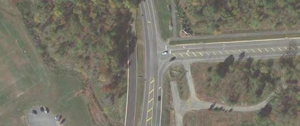
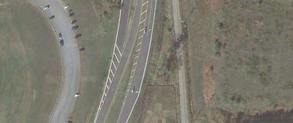
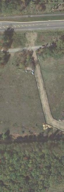
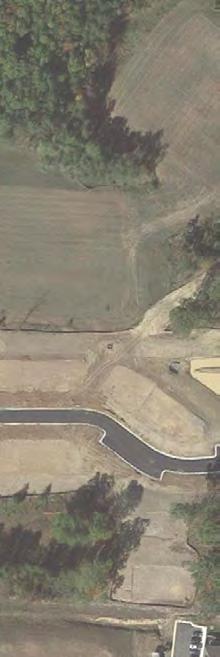
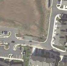
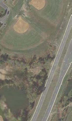
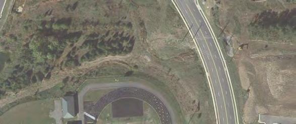
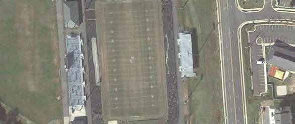
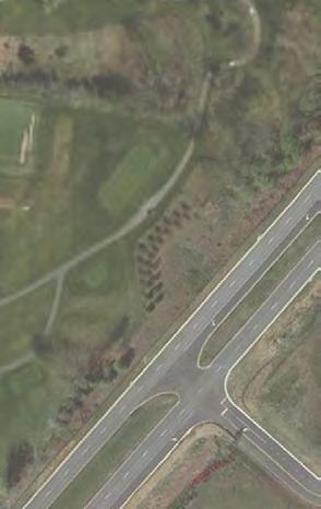
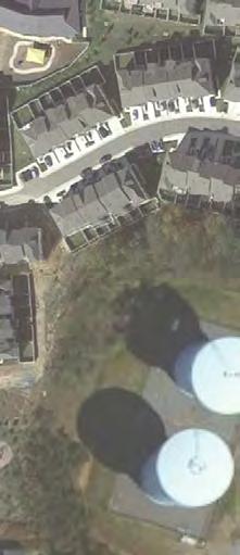
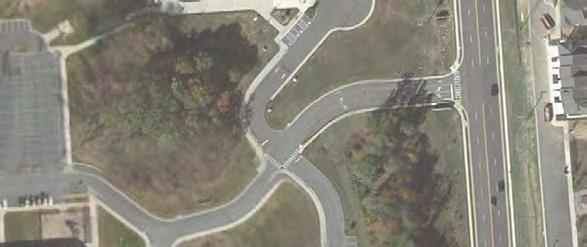
2 Item #7, Traffic Improvements at the Intersection of Belmont Ridge Road and Northstar Boulevard Board of Supervisors Business Meeting September 2, 2015 Page 2 Brustlin, one of the County s task order consultants, to complete a traffic signal warrant study and evaluate alternative configurations to improve operations and safety at the subject intersection. At the November 5, 2014 Business Meeting, the Board directed staff (9-0) to proceed with an engineering study that evaluated the signal warrants and near term improvements at the subject intersection. On March 5, 2015, the Notice to Proceed was issued to the task order consultant to complete the engineering study. On June 11, 2015, the preliminary analysis for the interim improvement alternatives were submitted to the County for review. The analysis documented existing operational challenges and crash patterns and identified seven (7) interim improvements to address congestion in the near future. A cost estimate for each improvement alternative was included to identify the most costeffective solution. A discussion of existing conditions and recommended improvements is summarized below. Existing Conditions: As illustrated on Attachment 1, the intersection of Belmont Ridge Road and Northstar Boulevard is located between Briar Woods High School and the Northern Virginia Regional Park Authority (NRVPA) property where the National Recreation and Parks Association (NRPA) headquarters is located. On the NVRPA property, there are athletic fields where various sport activities are held on weekday evenings and weekends. The new Brambleton Regional Park is located in the northeast quadrant of this intersection and it is scheduled to open in the Fall of Additionally, in this general area, a new traffic signal is planned for installation at the intersection of Belmont Ridge Road and Croson Lane and at Northstar Boulevard and Ryan Road, both scheduled to be functional in Currently, the subject intersection operates under two-way stop control (meaning only the side street traffic is subject to stop sign control). The stop signs are located on the eastbound approach of the NVRPA driveway and the westbound approach of Belmont Ridge Road (Route 659 relocated). According to the traffic engineering study, under existing conditions, motorists experience significant congestion during the morning and evening peak hours (Attachment 2). Southbound left and westbound right turning movements have the worst congestion and generate longest vehicle queues. The westbound right turn movement carries high volume of traffic during both peak hours. Between January 2011 and November 2014, twenty-six (26) crashes occurred at the subject intersection (Attachment 3). Ten (10) of the twenty-six (26) were angle crashes involving vehicles coming from the east on Belmont Ridge Road heading west, turning left or proceeding through to the NVRPA driveway. Under existing traffic volumes, the Belmont Ridge Road and Northstar Boulevard intersection meets the minimum warrants for the installation of a traffic signal. The subject intersection is 1,300 feet south of the adjacent Belmont Ridge Road at Croson Lane intersection and 4,575 feet north of the adjacent Northstar Boulevard at Ryan Road intersection. The minimum intersection spacing between signalized intersections in accordance with the Virginia Department of Transportation (VDOT) standards is 1,050 feet.
3 Item #7, Traffic Improvements at the Intersection of Belmont Ridge Road and Northstar Boulevard Board of Supervisors Business Meeting September 2, 2015 Page 3 Interim Improvement Recommendation: Several unsignalized improvement options were considered to address the existing traffic operational deficiencies and safety challenges at the subject intersection. Given the County s desire to expeditiously construct an interim solution at this location, a combination of design improvements were recommended and are included in Attachment 4. The proposed interim design improvements include the following: Reducing northbound and southbound thru-lane by one lane while maintaining exclusive left and right turn lanes, and Restricting westbound and eastbound approaches to a single-lane right-turn movement only using tubular markers (i.e. flexible posts) and pavement markings Motorists will be re-routed with signs and public outreach informing the communities of the new traffic pattern. By reducing the number of thru-lanes in the southbound and northbound directions, the left-turning vehicles from the side streets will only conflict with one lane of thru-traffic. These proposed interim improvements, which include pavement markings, flexible posts, and signage, will not require additional right-of-way and/or easements. The preferred interim improvements may yield operational impacts that include (1) an increased delay for southbound left-turn movements in the morning dues to fewer gaps in northbound traffic flow and (2) southbound vehicle queues may extend beyond the Belmont Ridge Road/Croson Lane intersection. Restricted through and left turn movements from the minor approaches will require (1) westbound traffic to head south to Ryan Road and then back north on Northstar Blvd and (2) eastbound traffic to take a U-turn at intersection to the south. All of these impacts will be mitigated with a long term traffic signal improvement at the subject intersection and the future traffic signal located at the Belmont Ridge Road at Croson Lane intersection. Long-Term Improvement Recommendation: A traffic signal is the recommended long-term and permanent solution at this intersection to address the safety and operational concerns. Under signalized operations, all turning movements will be restored and permitted. Pedestrians will be accommodated with crosswalks and pedestrian signals. These accommodations will address the anticipated increase in pedestrian and bicycle traffic in the area. Additionally, signal timings would be coordinated accordingly with the future traffic signals at the intersections of Belmont Ridge Road at Croson Lane and Northstar Boulevard at Ryan Road. Additional easements will be needed to complete the construction of the proposed traffic signal. ISSUES: The interim improvement recommendation may yield operational impacts on the southbound approach in the morning and will require westbound and eastbound motorists to be rerouted since left and through movements from the minor approaches will be restricted. These impacts will be mitigated with a long term traffic signal improvement at the subject intersection and the future traffic signal located at the Belmont Ridge Road at Croson Lane intersection. Staff has conferred with the stakeholders of the National Recreation and Parks Association (NRPA), Northern Virginia Regional Park Authority (NVRPA), Department of Parks, Recreation and Community Services (DPRCS), Loudoun County Public Schools (LCPS) and VDOT regarding the proposed improvements. All stakeholders expressed support of the recommendations described herein.
4 Item #7, Traffic Improvements at the Intersection of Belmont Ridge Road and Northstar Boulevard Board of Supervisors Business Meeting September 2, 2015 Page 4 FISCAL IMPACT: For the interim improvement, the estimated costs for the engineering design and construction services are $29,561 (Attachment 5) with an anticipated construction cost of $108,000, totaling $137,561. For the long-term improvement, the estimated cost for the engineering design and construction services are $74,476 (Attachment 6) with an anticipated construction cost of $510,000, totaling $584,476. The cash proffer funds from The Towns at Belmont Ridge has a current balance of $176, (not including accumulated interest). The Towns of Belmont Ridge proffer may be applied to design and construction of interim improvements ($137,561) and design of long-term traffic signal ($38,605.81). The remaining $35, required for engineering design services of the long-term traffic signal will require a budget adjustment to transfer this amount from the Traffic Signal Contingency account to a capital project account for this signal in the Capital Fund. The $510,000 estimated construction cost for the permanent signal would be submitted for funding consideration in the FY Capital Improvement Program (CIP) See Table 1. Table 1. Proposed Funding Sources for Interim and Long-Term Improvements Potential Funding Sources The Towns of Belmont Ridge Proffer ZMAP Traffic Signal Contingency Current Available Balance $176, $280,302 FY Capital Improvement Program Interim Improvement: Pavement Markings, Flexible Post, Signage Design $29, Construction $108, Long-Term Improvement: Traffic Signal Design $38, $35, Construction $510,000 ALTERNATIVES: The Board may choose to authorize the use of the identified proffer funds and Capital Improvement Signal Contingency Fund to design and construct improvements for interim and long term solutions at the intersection of Belmont Ridge Road and Northstar Boulevard; or the Board may choose another alternative. DRAFT MOTIONS: 1. I move that the Board of Supervisors direct staff to proceed with implementation of both 1) the preferred interim improvements (pavement marking and tubular posts) and 2) long term
5 AND AND AND OR Item #7, Traffic Improvements at the Intersection of Belmont Ridge Road and Northstar Boulevard Board of Supervisors Business Meeting September 2, 2015 Page 5 improvements (traffic signal) for the Belmont Ridge Road and Northstar Boulevard intersection; I further move that the Board of Supervisors amend the FY 2016 Capital Improvements Program (CIP) budget and authorize staff to execute a budget adjustment to appropriate $176, of the regional road improvement cash proffer funds contributed to the County pursuant to the ZMAP , The Towns of Belmont Ridge, Proffer V.C (Proffer Sequence Number ) in the Public Facilities Fund and transfer that amount to the Capital Fund for engineering design services and construction of near term improvements and for engineering design services of a traffic signal at the Belmont Ridge Road (Route 659) and Northstar Boulevard intersection; I further move that the Board authorize staff to execute a budget adjustment to transfer $35, from the Traffic Signal Contingency account to the Belmont Ridge Road at Northstar Boulevard traffic signal project account in the Capital Fund for the design of a traffic signal at the Belmont Ridge Road (Route 659) and Northstar Boulevard intersection; I further move that the Board direct staff to include $510,000, the cost to construct the long term traffic signal improvement, for funding consideration in the FY CIP budget process. 2. I move to direct staff to proceed with implementation of only the preferred interim term improvements (pavement marking and tubular posts) for the Belmont Ridge Road and Northstar Boulevard intersection; AND OR I further move that the Board of Supervisors amend the FY 2016 CIP budget and authorize staff to execute a budget adjustment to appropriate $137,561 of the regional road improvement cash proffer funds contributed to the County pursuant to the ZMAP , The Towns of Belmont Ridge, Proffer V.C in the Public Facilities Fund and transfer that amount to the Capital Fund for engineering design services and construction of near term improvements at the Belmont Ridge Road (Route 659) and Northstar Boulevard intersection. 3. I move an alternate motion.
6 Item #7, Traffic Improvements at the Intersection of Belmont Ridge Road and Northstar Boulevard Board of Supervisors Business Meeting September 2, 2015 Page 6 ATTACHMENTS: 1. Vicinity Map Intersection of Belmont Ridge Road at Northstar Boulevard 2. Existing Conditions 3. Crash Analysis Intersection of Belmont Ridge Road at Northstar Boulevard 4. Preferred Interim Improvements 5. Cost Estimate for Preferred Interim Improvements 6. Cost Estimate for Traffic Signal


7 ALFORD RD BELMONT RIDGE RD 659 CROSON LA 645 Brambleton Regional Park Brambleton Regional Park National Recreation and Park Association HQ Brambleton Golf Course NORTHSTAR BLVD 3171 Briar Woods HS BELMONT RIDGE RD 659 RYAN RD 772 Detail area Miles 267 Loudoun County Facility NVRPA Facility Parcel 2011 Election Districts: Blue Ridge Dulles Broad Run Northstar Boulevard and Belmont Ridge Road Proposed Intersection Improvement Blue Ridge Election District Created by Loudoun County Office of Mapping and Geographic Information Map Number Created July 22, ,000 2,000 Feet ATTCHMENT 1 A - 1


8 \\vhb\proj\vienna\ belmont_northstar\graphics\figures\ _tab-intersection_alternatives_v2.indd p1 Û ²¹ ݱ²¼ ±² æ ͱ«¾±«²¼»º ²¼ É» ¾±«²¼ ¹»»»²½»» ± ½±²¹» ±² øôñí Ú ²¼»»³» ±²¹ ò Í ¹ ¼ ²½» ³»¼ ¼ ± ͱ«¾±«²¼ ò ß øß Þ øß ß øþ ³±ª»³»² ò Ó»» ¹² ² º± ½² ½±²¼ ±² ò ²»»½ ±² Í ½ ²¹ Ý ± ±² Ô ²» ±ª» ïíð𠺻» ò ÊÜÑÌ ¼»»¼ ¹² ½ ²¹ ïðë𠺻» ò Ô»¹»²¼ Ý øý Ï»¼«½» ¹ ¼ ²½» º± Ò± ¾±«²¼»º ²¼ É» ¾±«²¼»º ò ß Þ Ý Ü Û Ú ÈÈ øèè È øè Ô»ª» ±º Í» ª ½» øôñí ß Ô»ª» ±º Í» ª ½» øôñí Þ Ô»ª» ±º Í» ª ½» øôñí Ý Ô»ª» ±º Í» ª ½» øôñí Ü Ô»ª» ±º Í» ª ½» øôñí Û Ô»ª» ±º Í» ª ½» øôñí Ú ßÓ øðó Ѫ» ²»»½ ±² ÔÑÍ Ð ± ±»¼ Ð ²»¼ ß» Vanasse Hangen Brustlin, Inc. Belmont Ridge Road & Northstar Boulevard - Loudon County VA Existing Conditions Currently under two-way stop control Feet ATTACHMENT 2 A - 2
 and Northstar Boulevard/NVRPA Entrance Period: January 2011 - November 2014 Date Prepared: May 2015 Belmont Ridge Road & Northstar Boulevard")
 Vehicle at Fault VDOT Document Number")
 Darkness; Cloudy/Clear; Dry DOC# 142665338 3:37pm; TUE; 02/18/14 (~500 ft North of Intersection)")


 8:25pm;")

 A(2) B(3) C(4) 2011 2 1 1 2 3 2 1 2 1 2 1 2 3 2012 2 1 1 1 1 2 5 4 4 4 9 2 4 2013 4 1 1 1 3 4 1 4 1 2 3 5 2014 4 2 4 2 2 1 2 11 10 4")
9 Collision Diagram Intersection: Belmont Ridge Road (Rte. 659) and Northstar Boulevard/NVRPA Entrance Period: January November 2014 Date Prepared: May 2015 Belmont Ridge Road & Northstar Boulevard - Loudon County, VA Types of Collision Rear End Head On Sideswipe Out of Control Angle Crash Deer Injury Severity K A B C DOC# Fatal Incapacitating Injury Non-Incapacitating Injury Non-Visible Injury No Injury / Property Damage Only (PDO) Vehicle at Fault VDOT Document Number 1:42pm; SUN; 10/20/13 Daylight; Mist; Wet DOC# B 11:17am; THU; 05/15/14 DOC# :30am; TUE; 12/03/13 DOC# :55pm; THU; 09/18/14 (~300 ft North of Intersection) Darkness; Cloudy/Clear; Dry DOC# :37pm; TUE; 02/18/14 (~500 ft North of Intersection) Daylight; Cloudy/Clear; Wet DOC# (Route 659) Belmont Ridge Road 7:51pm; WED; 08/06/14 DOC# A 4:00pm; THU; 10/24/13 School Zone & Teen Driver DOC# NVRPA Entrance 7:10am; MON; 06/27/11 Daylight; Mist; Wet DOC# B A 4:17pm; THU; 04/17/14 DOC# :30pm; SAT; 04/12/14 DOC# :55pm; SUN; 11/06/11 DOC# :45am; FRI; 11/01/13 Daylight; Rain; Wet DOC# B 2:02pm; MON; 11/07/11 Work Zone & Teen Driver DOC# :45pm; MON; 08/18/14 Darkness; Cloudy/Clear; Dry DOC# :09pm; TUE; 04/08/14 DOC# B 8:43am; WED; 09/24/14 DOC# :07pm; TUE; 04/01/14 DOC# :40pm; WED; 11/07/12 (~120 ft South of Intersection) Darkness; Cloudy/Clear; Dry DOC# :49pm; TUE; 06/10/14 Teen Driver DOC# Northstar Boulevard 8:45pm; SAT; 10/06/12 Darkness; Cloudy/Clear; Dry DOC# :30pm; TUE; 11/20/12 Darkness; Cloudy/Clear; Dry DOC# B B 8:25am; FRI ; 11/02/12 DOC# B 3:00pm; WED; 02/20/13 DOC# :56am; SAT; 09/13/14 Teen Driver Daylight; Rain; Wet DOC# Belmont Ridge Road (Route 659) 8:25pm; TUE; 09/23/14 (~500 ft South of Intersection) Darkness; Cloudy/Clear; Dry DOC# :48pm; MON; 9/29/14 (~200 ft South of Intersection) Darkness; Cloudy/Clear; Dry LoCo DOC# Year Right Angle Rear-End Head-On Collision Summary Type of Collision Time of Day Lighting Weather Surface Severity People Left Turn Side Swipe Fixed Object Pedestrian Other AM Peak (7am-10am) PM Peak (4-7pm) Off Peak Daylight Dawn/Dusk Darkness K(1) A(2) B(3) C(4) Total Cloudy/ Clear Mist ATTACHMENT 3 Rain Snow Dry Wet Snowy Icy PDO Crash A - 3 Total

.")


10 \\vhb\proj\vienna\ belmont_northstar\graphics\figures\ _tab-intersection_alternatives_v3.indd p9 Preferred Interim Alternative Pros: Restricts all left-turns and thru-movements from the sidestreets for safety (11 out of 26 crashes studied). May increase safety by letting the southbound left-turning vehicles encounter only one lane of conflicting northbound thru-traffic. Croson Lane Major Collector Significant improvement to the Westbound rights. All modifications made with tubular markers and pavement markings, no raised concrete. Traffic re-routing can be done with signs and public outreach. Cons: Considerable increase in delay in the AM to Southbound lefts due to fewer gaps. Southbound queues extend back beyond Croson Lane. Croson Lane experiences higher delay and queues until it is signalized in early Westbound traffic must go South to Ryan Road and then back North on Northstar Blvd. Eastbound traffic must take U-turn at intersection to the south. Estimated Cost: $85k NVRPA Minor Arterial Road Belmont Ridge Free Flow Tubular Markers and Pavement Markings See Detail Legend See Detail Proposed Painted Areas Minor Arterial Tubular Marker (Flex post) Northstar Boulevard Belmont Ridge Road Major Collector NVRPA Feet Vanasse Hangen Brustlin, Inc. Belmont Ridge Road & Northstar Boulevard - Loudon County VA Proposed Design Close Northbound and Southbound right-most thru-lanes, channelize Westbound and Eastbound rights with porkchop islands to create receiving lanes. Westbound and Eastbound approaches are right-out only. ATTACHMENT 4 A - 4
11 ATTACHMENT 5 A - 5
12 A - 6
13 A - 7
14 A - 8
15 A - 9
16 A - 10
17 ATTACHMENT 6 A - 11
18 A - 12
19 A - 13
20 A - 14
21 A - 15
22 A - 16
23 A - 17
BOARD OF SUPERVISORS BUSINESS MEETING ACTION ITEM. Installation of Traffic Calming Measures in the Sterling Park Subdivision
 BOARD OF SUPERVISORS BUSINESS MEETING ACTION ITEM Date of Meeting: January 21, 2016 # 13 SUBJECT: ELECTION DISTRICT: CRITICAL ACTION DATE: STAFF CONTACTS: Installation of Traffic Calming Measures in the
Basic Project Information
 FY 2015-16 PROJECT DESCRIPTION FORM (2C) Submitting Agency: Loudoun County Basic Project Information Project Title: Loudoun County Parkway (VA Route 607) U.S. 50 to Creighton Rd. (2C) Project Type (check
Pedestrian Safety Review Spadina Avenue
 STAFF REPORT ACTION REQUIRED Pedestrian Safety Review Spadina Avenue Date: October 13, 2015 To: Toronto and East York Community Council From: Director, Transportation Services, Toronto and East York District
Proposed Bicycle Lanes on Yonge Street from Queens Quay to Front Street
 STAFF REPORT ACTION REQUIRED Proposed Bicycle Lanes on Yonge Street from Queens Quay to Front Street Date: March 12, 2007 To: From: Toronto and East York Community Council Director, Transportation Infrastructure
Strategic Signal Timing Changes = BIG Results. Barbara Jones, PE, PTOE DGL Consulting Engineers, LLC Senior Traffic Engineer
 Strategic Signal Timing Changes = BIG Results Barbara Jones, PE, PTOE DGL Consulting Engineers, LLC Senior Traffic Engineer Pre Signal Timing Updates Signal Timing Updates Average Retiming Interval Percent
BOARD OF SUPERVISORS AND VIRGINIA DEPARTMENT OF TRANSPORTATION JOINT PUBLIC HEARING
 BOARD OF SUPERVISORS AND VIRGINIA DEPARTMENT OF TRANSPORTATION JOINT PUBLIC HEARING Date of Hearing: September 14, 2016 #1 SUBJECT: ELECTION DISTRICT: Proposed FY2017-FY2022 Secondary Road Six-Year Plan
St. Dennis Drive Conversion of Traffic Lanes to On- Street Parking and Bicycle Lanes
 STAFF REPORT ACTION REQUIRED St. Dennis Drive Conversion of Traffic s to On- Street Parking and Bicycle s Date: April 22, 2014 To: From: Wards: Reference Number: Public Works and Infrastructure Committee
Albany NY Red Light Camera Locations and Activation Dates 1 Central Avenue & Colvin Avenue
 Albany NY Red Light Camera Locations and Activation Dates 1 Central Avenue & Colvin Avenue Westbound 8/28/2015 2 Central Avenue & Henry Johnson Boulevard Eastbound 2/16/2016 1. Description of the locations
SAN FRANCISCO MUNICIPAL TRANSPORTATION AGENCY
 THIS PRINT COVERS CALENDAR ITEM NO. : 10.4 DIVISION: Sustainable Streets BRIEF DESCRIPTION: SAN FRANCISCO MUNICIPAL TRANSPORTATION AGENCY Approving various parking and traffic modifications associated
TABLE OF CONTENTS. Coral Springs Charter High School and Middle School Job No Page 2
 Job No. 15-019 Page 2 TABLE OF CONTENTS 1.0 INTRODUCTION... 4 2.0 EXISTING CONDITIONS... 5 3.0 TRAFFIC GENERATION... 7 4.0 TRIP DISTRIBUTION... 8 5.0 FUTURE CONDITIONS... 8 6.0 SITE ACCESS...13 7.0 CONCLUSION...13
Regulations to deter cut-through traffic - Heath Street V\fest, between Spadina Road and Avenue Road. Toronto and East York Community Council
 TORONTO STAFF REPORT ACTION REQUIRED Regulations to deter cut-through traffic - Heath Street V\fest, between Spadina Road and Avenue Road Dnte: February 16,2009 To: From: Toronto and East York Community
5.1 Traffic and Transportation
 5.1 When it opens in 2009, the Bellevue Nickel Improvement Project will increase the number of vehicles able to travel through the study area, improve travel speeds, and improve safety by reducing the
FHWA P/N Guidelines. Corridor Relationship. Highway 22 Segment 1 - US 169 to CSAH 2 Relevance / Documentation of Need
 Highway 22 Segment 1 - US 169 to CSAH 2 Vehicle Mobility Congestion Intersection Congestion Existing Conditions - Based on Highway Capacity Manual methodology, corridor level of service is currently LOS
Southern Oregon Transportation Engineering, LLC
 Southern Oregon Transportation Engineering, LLC 112 Monterey Drive - Medford, Or. 97504 Office 541.608.9923 Cell 541.941.4148 Email: Kwkp1@Q.com August 12, 2013 Mike Faught, Public Works Department City
Arlington County Board Work Session Eastbound Widening January 17, Amanda Baxter, VDOT Special Projects Development Manager
 Arlington County Board Work Session Eastbound Widening January 17, 2017 Amanda Baxter, VDOT Special Projects Development Manager Program Area Map 2 Program Scope Tolling during weekdays, peak hours, peak
LUDWIG RD. SUBDIVISION PROJECT TRAFFIC IMPACT ANALYSIS
 LUDWIG RD. SUBDIVISION PROJECT TRAFFIC IMPACT ANALYSIS Prepared for Skip Coddington GSC Development, Inc PO Box 1623 Woodinville WA 9872 Prepared by 1141 NE 124 th St., #59 Kirkland, WA 9834 425.522.4118
APPENDIX H MILESTONE 2 TRAFFIC OPERATIONS ANALYSIS OF THE AT-GRADE CROSSINGS
 Draft Environmental Impact Statement/Environment Impact Report Appendix H Milestone 2 Traffic Operations Analysis of the At-Grade Crossings APPENDIX H MILESTONE 2 TRAFFIC OPERATIONS ANALYSIS OF THE AT-GRADE
Report to the Strategic Development Committee
 Report to the Strategic Development Committee Request of Virginia Department of Transportation for Easements across Washington Dulles International Airport Property at Route 28 May 2016 PURPOSE Staff requests
Fairfax County Transportation Advisory Commission (TAC)
") Fairfax County Transportation Advisory Commission (TAC) January 17, 2017 Susan Shaw, P.E., Megaprojects Director Virginia Department of Transportation Amanda Baxter, Special Projects Development Manager
Fairfax County Transportation Advisory Commission (TAC) January 17, 2017 Susan Shaw, P.E., Megaprojects Director Virginia Department of Transportation Amanda Baxter, Special Projects Development Manager
Glasgow Street Traffic Review
 Glasgow Street Traffic Review Recommendation That the Standing Policy Committee on Transportation recommend to City Council: 1. That the Administration proceed with removing the pinch points installed
4. Safety Concerns Potential Short and Medium-Term Improvements
 NH Route 104 Access Management Study Page 19 4. Safety Concerns Potential Short and Medium-Term Improvements Potential safety improvement strategies are listed by priority based on field observations by
Albany NY Red Light Camera Locations and Activation Dates 1 Central Avenue & Colvin Avenue
 Albany NY Red Light Camera Locations and Activation Dates 1 Central Avenue & Colvin Avenue 2 Central Avenue & Henry Johnson Boulevard Eastbound 2/16/2016 1. Description of the locations where traffic control
A. CONCLUSIONS OF THE FGEIS
 Chapter 11: Traffic and Parking A. CONCLUSIONS OF THE FGEIS The FGEIS found that the Approved Plan will generate a substantial volume of vehicular and pedestrian activity, including an estimated 1,300
Report to the Strategic Development Committee
 Report to the Strategic Development Committee Recommendation to Approve the Request of Virginia Department of Transportation for Easements across Washington Dulles International Airport Property at Route
MEMORANDUM. Bob Zagozda, Chief Financial Officer Westside Community Schools. Mark Meisinger, PE, PTOE Felsburg Holt & Ullevig. DATE: June 11, 2018
 MEMORANDUM TO: Bob Zagozda, Chief Financial Officer Westside Community Schools FROM: Mark Meisinger, PE, PTOE Felsburg Holt & Ullevig DATE: June 11, 218 6-11-18 SUBJECT: Sunset Hills Elementary School
FINAL TERMINAL TRAFFIC MONITORING STUDY
 FINAL TERMINAL 91 216 TRAFFIC MONITORING STUDY Prepared for: Port of Seattle February 15, 217 Prepared by: 12131 113 th Avenue NE, Suite 23 Kirkland, WA 9834-712 Phone: 425-821-3665 www.transpogroup.com
McLean Citizens Association Transportation Committee Project Briefing
 McLean Citizens Association Transportation Committee Project Briefing November 10, 2015 Project Map 2 Project Context Only Interstate in the Country limited to HOV only traffic during rush hours Stoplight
ROUTE 20 CORRIDOR STUDY ---- Orange County, Virginia
 ROUTE 20 CORRIDOR STUDY ---- Orange County, Virginia Prepared by PARSONS Fairfax, Virginia on behalf of the: Rappahannock-Rapidan Regional Commission in cooperation with Orange County, Virginia Virginia
Lake Erie Commerce Center Traffic Analysis
 LOCATION: East of NYS Route 5 at Bayview Road Town of Hamburg Erie County, New York PREPARED BY: Wendel Companies 140 John James Audubon Parkway Suite 200 Amherst, New York 14228 January 2012 i ii Table
Traffic Management Plan 2018
 Traffic Management Plan 2018 Jesuit College Preparatory School of Dallas Amendment to Planned Development No. 353 Dallas, Texas June 6, 2018 Prepared for Jesuit College Preparatory School of Dallas Prepared
EXISTING CONDITIONS A. INTRODUCTION. Route 107 Corridor Study Report
 II. EXISTING CONDITIONS A. INTRODUCTION The Route 107 study area extends from the south at Chestnut Street in Lynn approximately 3.7 miles to the north to Boston Street in Salem. The study area has three
Design Public Hearing for the Existing and Proposed Bridge Crossings on Aden Road (Rte 646) over the Norfolk Southern RR, Nokesville, Virginia
 over the Norfolk Southern RR, Nokesville, Virginia") Design Public Hearing for the Existing and Proposed Bridge Crossings on Aden Road (Rte 646) over the Norfolk Southern RR, Nokesville, Virginia September 18, 2013 Nicholas J. Roper, P.E. District Bridge
Design Public Hearing for the Existing and Proposed Bridge Crossings on Aden Road (Rte 646) over the Norfolk Southern RR, Nokesville, Virginia September 18, 2013 Nicholas J. Roper, P.E. District Bridge
MEMORANDUM. Lynn Hayes LSA Associates, Inc.
 MEMORANDUM To: Lynn Hayes LSA Associates, Inc. Date: May 5, 217 From: Zawwar Saiyed, P.E., Senior Transportation Engineer Justin Tucker, Transportation Engineer I Linscott, Law & Greenspan, Engineers LLG
STAR Bond Development
 STR ond Development Traffic Impact Study Goddard, Kansas Prepared for: Kansas Department of Transportation City of Goddard, Kansas Prepared by TranSystems November 218 November 3, 218 Kansas Department
Finchley and Golders Green Area Committee 27 April 2017
 Finchley and Golders Green Area Committee 27 April 2017 Title Report of Wards Status Urgent Key Enclosures Officer Contact Details Junction of Regents Park Road / Tillingbourne Gardens, N3 Commissioning
Albany NY Red Light Camera Locations and Activation Dates 1 Central Avenue & Colvin Avenue
 Albany NY Red Light Camera Locations and Activation Dates 1 Central Avenue & Colvin Avenue Westbound 8/28/2015 2 Central Avenue & Henry Johnson Boulevard Eastbound 2/16/2016 1. Description of the locations
Washington St. & Ash Coulee Dr./43 rd Ave Intersection Study
 430 IACC Building Fargo, ND 58105 Tel 701-231-8058 Fax 701-231-1945 www.ugpti.org www.atacenter.org Washington St. & Ash Coulee Dr./43 rd Ave Intersection Study Final Report April 2007 Prepared for: City
DULLES AREA HIGHLIGHTS. Gary Garczynski Commonwealth Transportation Board Northern Virginia District. Committee for Dulles August 4, 2016
 DULLES AREA HIGHLIGHTS Gary Garczynski Commonwealth Transportation Board Northern Virginia District Committee for Dulles August 4, 2016 Smart Scale (formerly HB2) Overview Round 1 completed with the adoption
Construction underway. STATUS: 229 5,190 5,419 5,305 STIP REFERENCE #FR /01/2013
 FREDERICK COUNTY STATE HIGHWAY ADMINISTRATION -- Frederick County -- Line 1 PROJECT: I-7, Baltimore National Pike INTERSTATE CONSTRUCTION PROGRAM DESCRIPTION: Widen I-7 east of MD 355 to east of MD 144
Parking Amendments - Bay Street, between Harbour Street and Queens Quay West (York Street, Bay Street, and Yonge Street Ramp Removal)
") REPORT FOR ACTION between Harbour Street and Queens Quay West (York Street, Bay Street, and Yonge Street Ramp Removal) Date: October 26, 2017 To: Toronto and East York Community Council From: Acting Director,
REPORT FOR ACTION between Harbour Street and Queens Quay West (York Street, Bay Street, and Yonge Street Ramp Removal) Date: October 26, 2017 To: Toronto and East York Community Council From: Acting Director,
Arlington County Board Meeting Project Briefing. October 20, 2015
 Arlington County Board Meeting Project Briefing October 20, 2015 Project Map 2 Project Context Only Interstate in the Country limited to HOV only traffic during rush hours Stoplight at the end of I-66
Transportation TRANSPORTATION PROJECTS
 Transportation TRANSPORTATION PROJECTS Balls Ford Road Interchange Total Project Cost $142.9M This project includes the construction of a new diverging diamond interchange at Route 234 Bypass (Prince William
Toronto 2015 Pan Am/Parapan Am Games Temporary Traffic By-law Amendments for High Occupancy Vehicle Lanes (Supplementary Report)
") STAFF REPORT ACTION REQUIRED Toronto 2015 Pan Am/Parapan Am Games Temporary Traffic By-law Amendments for High Occupancy Vehicle Lanes (Supplementary Report) Date: March 25, 2015 To: From: Wards: Reference
STAFF REPORT ACTION REQUIRED Toronto 2015 Pan Am/Parapan Am Games Temporary Traffic By-law Amendments for High Occupancy Vehicle Lanes (Supplementary Report) Date: March 25, 2015 To: From: Wards: Reference
Fairfax County Parkway Widening Fairfax County
 Get Involved VDOT representatives will review and evaluate information received as a result of this meeting. Please fill out the comment sheet provided in this brochure if you have any comments or questions.
9 CONSTRUCTION OF BATHURST STREET FROM GREEN LANE WEST TO SOUTH OF HIGHWAY 11, TOWN OF EAST GWILLIMBURY AND TOWNSHIP OF KING
 Clause No. 9 in Report No. 9 of Committee of the Whole was adopted, without amendment, by the Council of The Regional Municipality of York at its meeting held on May 15, 2014. 9 CONSTRUCTION OF BATHURST
New Hampshire Route 101 Corridor Plan
 Amherst, Milford, Wilton Final Report September 2002 Bedford Amherst Wilton Milford Prepared for the Nashua Regional Planning Comission (NRPC) by: Wallace Floyd Design Group Vanasse Hangen Brustlin, Inc.
Planning. Proposed Development at the Southeast Corner of Lakeshore Road West and Brookfield Road Intersection FINAL.
 Project No. 121-22908 N o v e m b e r 2 0 1 2 Traffic Impact Study Transportation Planning th GENIVAR Inc., 600 Cochrane Drive, 5 Floor, Markham, Ontario L3R 5K3 Telephone: 905.475.7270 Fax: 905.475.5994
ROUTE 122 CORRIDOR STUDY ---- Bedford County and Bedford City, Virginia
 ROUTE 122 CORRIDOR STUDY ---- Bedford County and Bedford City, Virginia Developed by Region 2000 Regional Commission In cooperation with Bedford County, Virginia City of Bedford, Virginia Virginia Department
7272 WISCONSIN AVENUE LOCAL AREA TRANSPORTATION REVIEW
 7272 LOCAL AREA TRANSPORTATION REVIEW AND TRANSPORTATION POLICY AREA REVIEW MONTGOMERY COUNTY, MARYLAND Submitted on behalf of Carr Properties Prepared by: Wells + Associates, Inc. Submission: July 1,
FEASIBILITY STUDY REFINED CONCEPT 1 PROJECT A
 VIRGINIA DEPARTMENT OF TRANSPORTATION I-85 / I-95 INTERCHANGE FEASIBILITY STUDY REFINED CONCEPT 1 PROJECT A Columbia Rd REFINED CONCEPT 1 PROJECT A Bellevue Rd COST: $3.3M Siege Rd Eliminate the loop ramp
AGENCY NAME TRANSPORTATION
 TRANSPORTATION TRANSPORTATION AGENCY NAME Prince William County FY 2015 BUDGET CIP-TRANSPORTATION 561 Fuller Road/Fuller Heights Road Improvements Total Project Cost - $4.4 M This project will widen Fuller
Yonge Street / Highway 401 Improvements Update. Public Works and Infrastructure Committee. General Manager, Transportation Services
 PW9.7 STAFF REPORT ACTION REQUIRED Yonge Street / Highway 401 Improvements Update Date: October 26, 2015 To: From: Wards: Reference Number: Public Works and Infrastructure Committee General Manager, Transportation
AGENDA ITEM I-6 Public Works
 AGENDA ITEM I-6 Public Works STAFF REPORT City Council Meeting Date: 8/6/2018 Staff Report Number: 18-150-CC Informational Item: Update on the Willow Road and highway 101 interchange construction, upcoming
ROAD SAFETY AUDIT. Iyannough Road (Route 28) at Yarmouth Road. Town of Barnstable. September 2012
 at Yarmouth Road. Town of Barnstable. September 2012") ROAD SAFETY AUDIT Iyannough Road (Route 28) at Yarmouth Road Town of Barnstable September 2012 Prepared for: Massachusetts Department of Transportation Prepared by: Howard/Stein-Hudson Associates 38 Chauncy
ROAD SAFETY AUDIT Iyannough Road (Route 28) at Yarmouth Road Town of Barnstable September 2012 Prepared for: Massachusetts Department of Transportation Prepared by: Howard/Stein-Hudson Associates 38 Chauncy
Evaluation of Significant Transportation Projects in Northern Virginia Transportation District. HB 599 Ratings Overview NVTA - January 22, 2015
 Evaluation of Significant Transportation Projects in Northern Virginia Transportation District HB 599 Ratings Overview NVTA - January 22, 2015 Study Approach NVTA and CTB nominate projects Define Project
12, 14 and 16 York Street - Amendments to Section 16 Agreement and Road Closure Authorization
 REPORT FOR ACTION 12, 14 and 16 York Street - Amendments to Section 16 Agreement and Road Closure Authorization Date: April 27, 2018 To: Toronto and East York Community Council From: Senior Strategic Director,
Hospital Link Project Project Update Winter 2018
 Hospital Link Project Project Update Winter 2018 General The project provides a link from Riverside Drive and the Transitway to the Hospital Link Road. Construction of the Hospital Link facility is open
Design Public Hearing
 Design Public Hearing Monday, March 7, 2016 Washington-Lee High School Cafeteria 1301 N. Stafford Street, Arlington, VA 22201 Tuesday, March 8, 2016 Eagle Ridge Middle School Cafeteria 42901 Waxpool Road,
FINAL. Bicycle/Pedestrian Feasibility Study City of DeBary Dirksen Drive Trail. Prepared For: Volusia County MPO
 City of DeBary Dirksen Drive Trail FINAL Prepared By: Reynolds, Smith and Hills, Inc. Prepared For: Volusia County MPO September 2007 Table of Contents INTRODUCTION...1 PROJECT PURPOSE AND SCOPE...2 PHYSICAL
Route 29 Solutions Projects
 Your guide to the Route 29 Solutions Projects For full details & continued engagement please visit www.route29solutions.org The Route 29 Solutions Package is a $230 million investment into the improvement
Alternatives Analysis City of Newport Beach Sunset Ridge Park Project December 14, 2011
 Alternatives Analysis City of Newport Beach Sunset Ridge Park Project December 14, 2011 Alternatives Analysis for Vehicular Access: This report supplements the project s certified EIR s Alternatives Analysis.
PROGRESS PARK CONNECTOR
 PROGRESS PARK CONNECTOR Project No. 9999 098 R65, P102 ALTERNATIVES ANALYSIS 6 April 2015 Revised for updated dates PROGRESS PARK CONNECTOR ROAD ALTERNATIVES ALTERNATIVE # 1 West from the intersection
Rappahannock-Rapidan Regional Commission 2010 Travel Time Survey
 Rappahannock-Rapidan Regional Commission 2010 Travel Time Survey Rappahannock Rapidan Regional Commission 420 Southridge Pkwy. Suite 106 Culpeper, VA 22701 June 16, 2010 Introduction Travel time, or the
Interstate 90 and Mercer Island Mobility Study APRIL Commissioned by. Prepared by
 Interstate 90 and Mercer Island Mobility Study APRIL 2017 Commissioned by Prepared by Interstate 90 and Mercer Island Mobility Study Commissioned by: Sound Transit Prepared by: April 2017 Contents Section
Evaluation of Significant Transportation Projects in Northern Virginia Transportation District
 Evaluation of Significant Transportation Projects in Northern Virginia Transportation District Fact Sheet #3 Winter 2015 Virginia Department of Transportation Update - Project Evaluation And Rating Since
Chair and Members of Harbour East - Marine Drive Community Council. Brad Anguish, Director, Parks and Recreation
 P.O. Box 1749 Halifax, Nova Scotia B3J 3A5 Canada Item No. 15.1.1 Harbour East-Marine Drive Community Council December 3, 2015 TO: SUBMITTED BY: Chair and Members of Harbour East - Marine Drive Community
SAN FRANCISCO MUNICIPAL TRANSPORTATION AGENCY BOARD OF DIRECTORS. RESOLUTION No
 SAN FRANCISCO MUNICIPAL TRANSPORTATION AGENCY BOARD OF DIRECTORS RESOLUTION No. 16-145 WHEREAS, The San Francisco Municipal Transportation Agency has proposed parking and traffic on San Bruno Avenue included
Traffic Analysis Final Report
 SR-71 Widening Project Project Approval/Environmental Documentation Traffic Analysis Final Report Prepared for Caltrans District 7 August 2012 6 Hutton Centre Drive, Suite 700 Santa Ana, California 92707
Fuller/Fuller Heights Road Improvements
 Fuller/Fuller Heights Road Improvements Total Project Cost - $4.4M Project Description This project will construct a mini-roundabout at the intersection of Fuller Heights Road and Old Triangle Road to
Construction Staging Adelaide Street West
 REPORT FOR ACTION Construction Staging Adelaide Street West Date: October 6, 2016 To: Toronto and East York Community Council From: Acting Director, Transportation Services, Toronto and East York District
Caliber Charter School VALLEJO, CA
 Traffic Impact Study Final Report Caliber Charter School VALLEJO, CA 21 June 2016 Prepared for: Prepared by: Traffic Engineering & Transportation Planning This report has been prepared and certified by
6. HIGHWAY MATTERS A. U.S. ROUTE 58 CORRIDOR STUDY
 SOUTHAMPTON COUNTY BOARD OF SUPERVISORS Regular Session i June 22, 2015 6. HIGHWAY MATTERS A. U.S. ROUTE 58 CORRIDOR STUDY Last year, VDOT commissioned the Route 58 Corridor Study to develop a planning
Watts St westbound thru
 Executive Summary At the request of the Hudson Square Business Improvement District, Sam Schwartz Engineering, DPC (Sam Schwartz) has completed a technical analysis of various congestion pricing and/or
Treasure Island Supplemental Information Report Addendum
 1 1 1 1 0 1 0 1 0 1 Treasure Island Supplemental Information Report Addendum Introduction Purpose The purpose of this Supplemental Information Report (SIR) Addendum is to determine if the current land
DOGWOOD AT VILLA AVENUE PROJECT
 TRANSPORTATION IMPACT ANALYSIS DOGWOOD AT VILLA AVENUE PROJECT El Centro, California September 4, 2018 LLG Ref. 3-17-2782 TABLE OF CONTENTS SECTION PAGE Appendices... ii List of Figures... i List of Tables...
CITY COUNCIL AGENDA MEMORANDUM
 To: Mayor and City Council From: Charles Ozaki, City and County Manager Prepared By: Kevin Standbridge, Deputy City and County Manager Katie Allen, City and County Engineer David Shinneman, Community Development
Route 141 and I-44 Design-Build Project Community Involvement Group. March 21, 2016
 Route 141 and I-44 Design-Build Project Community Involvement Group March 21, 2016 Purpose of CIG 1. Share information with major stakeholders 2. Keep stakeholders informed of the process 3. Reduce uncertainty
November 11, 2009 BY . Planning and Growth Management Department 110 Laurier Avenue West, 4 th Floor Ottawa, Ontario K1P 1J1. Dear Mr.
 November 11, 2009 Planning and Growth Management Department 110 Laurier Avenue West, 4 th Floor Ottawa, Ontario K1P 1J1 BY E-MAIL Attention: Mr. Don Herweyer Dear Mr. Herweyer: Reference: Abbott-Fernbank
Attachment No. 20 RRLRT No. 1. Committee. Busway Grade Crossings STATUS/DATE OF ACTION
 Attachment No. 20 RRLRT No. 1 TECHNICAL COMMITTEE: Railroad / Light Rail Transit Technical Committee TOPIC: Busway Grade Crossings STATUS/DATE OF ACTION RRLRT TC Draft: 06/23/2011 RRLRT TC Approval: 06/27/2014
VDOT HOT SPOTS IN THE FREDERICKSBURG DISTRICT
 RELEASE: IMMEDIATE July 27, 2018 CONTACT: Tina Bundy 540 899 4560 (office) 540 907 8325 (cell) Tina.Bundy@VDOT.Virginia.gov VDOT HOT SPOTS IN THE FREDERICKSBURG DISTRICT July 29 August 4, 2018 All work
Transportation Improvement District (TID) Exercise New Castle County Unified Development Code
 Exercise New Castle County Unified Development Code") Transportation Improvement District (TID) Exercise New Castle County Unified Development Code Churchmans Crossing TID How should New Castle County deploy Transportation Improvement Districts (TIDs)? Site
Transportation Improvement District (TID) Exercise New Castle County Unified Development Code Churchmans Crossing TID How should New Castle County deploy Transportation Improvement Districts (TIDs)? Site
A DIALOGUE WITH THE NORTHERN VIRGINIA DISTRICT. Nicholas J. Roper, P.E. Northern Virginia District Project Development Engineer
 A DIALOGUE WITH THE NORTHERN VIRGINIA DISTRICT Nicholas J. Roper, P.E. Northern Virginia District Project Development Engineer Agenda Dashboard 2019 Project Advertisements for Construction 2019 New Projects
Elected Officials and Media Briefing I-395 Express Lanes Northern Extension
 Elected Officials and Media Briefing I-395 Express Lanes Northern Extension Updates on: I-95 Express Lanes Southern Extension Transform 66: Inside and Outside the Beltway March 31, 2016 Today s Agenda
RELEASE: IMMEDIATE Oct. 6, 2017 CONTACT: Darragh Copley Frye (office) (cell)
 (cell)") RELEASE: IMMEDIATE Oct. 6, 2017 CONTACT: Darragh Copley Frye 540-899-4019 (office) 540-907-8409 (cell) Darragh.Frye@VDOT.Virginia.Gov VDOT HOT SPOTS IN THE FREDERICKSBURG DISTRICT October 8 October 14,
RELEASE: IMMEDIATE Oct. 6, 2017 CONTACT: Darragh Copley Frye 540-899-4019 (office) 540-907-8409 (cell) Darragh.Frye@VDOT.Virginia.Gov VDOT HOT SPOTS IN THE FREDERICKSBURG DISTRICT October 8 October 14,
Silver Line Operating Plan
 Customer Service and Operations Committee Information Item IV-A December 6, 2012 Silver Line Operating Plan Washington Metropolitan Area Transit Authority Board Action/Information Summary Action Information
2008 DEKALB COUNTY TRANSPORTATION PLAN (UPDATE)
") 2008 DEKALB COUNTY TRANSPORTATION PLAN (UPDATE) TABLE OF CONTENTS Introduction 1 Transportation Planning Activities 2 Identification of Problem Areas and Recommended Solutions 7 DeKalb County Projects
2008 DEKALB COUNTY TRANSPORTATION PLAN (UPDATE) TABLE OF CONTENTS Introduction 1 Transportation Planning Activities 2 Identification of Problem Areas and Recommended Solutions 7 DeKalb County Projects
MEMORANDUM. Open Section Background. I-66 Open Section Study Area. VDOT Northern Virginia District. I-66 Project Team. Date: November 5, 2015
 MEMORANDUM To: VDOT Northern Virginia District From: I-66 Project Team Date: November 5, 2015 Subject: Open Section Background The purpose of this technical memorandum is to provide narrative and technical
Transport Impact Assessment
 Transport Impact Assessment Springbok Hotel Erf 5206, Springbok Northern Cape March 2018 5th Floor Imperial Terraces Carl Cronje Drive Tyger Waterfront Bellville, 7530 (021) 914 6211 (T) e mail: mail@itsglobal.co.za
MARSHALL Subdivision. Township of Springwater, County of Simcoe. Traffic Brief for: Ontario Inc. Type of Document: Final Report
 MARSHALL Subdivision Township of Springwater, County of Simcoe Traffic Brief for: 489469 Ontario Inc. Type of Document: Final Report Project Number: JDE 1521 Date Submitted: October 19 th, 2016 10 / 19
Longmont to Boulder Regional Trail Jay Road Connection DRAFT FINAL REPORT
 Longmont to Boulder Regional Trail Jay Road Connection DRAFT FINAL REPORT December 2018 Project Summary Boulder County, Colorado, in partnership with the City of Boulder, is evaluating options for multi-use
District 3 ITS Project Update
 District 3 ITS Project Update Chad Williams, P.E. District 3 ITS Engineer Key ITS Projects in District 3 Bay County Advanced Traffic Management System (ATMS) Okaloosa County Computerized Traffic Control
MEMORANDUM VILLAGE PRESIDENT & BOARD OF TRUSTEES - DEPARTMENT HEADS
 MEMORANDUM TO: COPY: FROM: STAFF VILLAGE PRESIDENT & BOARD OF TRUSTEES - DEPARTMENT HEADS Richard Nahrstadt, Village Manager DATE: October 25, 2013 RE: STAFF BRIEFING WEEK OF OCTOBER 21, 2013 DUNDEE ROAD
Public Open House. Chief Peguis Trail Project
 Public Open House Chief Peguis Trail Project CHIEF PEGUIS TRAIL OPEN HOUSE Welcome! Please browse the display boards Project Engineers and City of Winnipeg representatives are available to address your
Appendix 4.1 L. No-Build Project Descriptions
 Appendix 4.1 L No-Build Project Descriptions No-Build Projects New Bedford A new traffic signal system was installed and activated in early 2009 at the intersection of King s Highway and Mount Pleasant
EAKINS OVAL / 25 TH & PENNSYLVANIA AREA PROJECT SUMMARY 1
 EAKINS OVAL / 25 TH & PENNSYLVANIA AREA PROJECT SUMMARY The Parkway Council Foundation is studying potential road and sidewalk reconfigurations of two areas at the western edge of the Benjamin Franklin
TRAFFIC ALERT FOR JANUARY 15-19, 2018 Highway Work Zones in the Staunton District
 RELEASE: IMMEDIATE January 11, 2018 CONTACT: Sandy Myers 540-332-9201 (office) STA18-007 540-292-2500 (cell) Sandy.Myers@VDOT.virginia.gov Ken Slack 540-332-9264 (office) 540-414-5670 (cell) Ken.Slack@VDOT.virginia.gov
FINAL REPORT INTERSECTION STUDY
 FINL REPORT INTERSECTION STUDY Vermont Route 22 & Panton Road City of Vergennes, Vermont May 9, 2011 Prepared for: 14 Seminary Street Middlebury, Vermont 05753 Prepared by: LMOUREUX & DICKINSON 14 Morse
ROAD SAFETY AUDIT. Main Street (Route 28) at North Main Street and Old Main Street Town of Yarmouth. February 6, Prepared For: MassDOT
 at North Main Street and Old Main Street Town of Yarmouth. February 6, Prepared For: MassDOT") ROAD SAFETY AUDIT Main Street (Route 28) at North Main Street and Old Main Street Town of Yarmouth February 6, 2017 Prepared For: MassDOT Prepared By: Nitsch Engineering 2 Center Plaza, Suite 430 Boston,
ROAD SAFETY AUDIT Main Street (Route 28) at North Main Street and Old Main Street Town of Yarmouth February 6, 2017 Prepared For: MassDOT Prepared By: Nitsch Engineering 2 Center Plaza, Suite 430 Boston,
Northern Virginia District State of the District. Helen L. Cuervo, P.E. District Engineer October 18, 2017
 Northern Virginia District State of the District Helen L. Cuervo, P.E. District Engineer October 18, 2017 Susan Shaw, P.E., Megaprojects Director Virginia Department of Transportation American Society
Aldridge Transportation Consultants, LLC Advanced Transportation Planning and Traffic Engineering
 Aldridge Transportation Consultants, LLC Advanced Transportation Planning and Traffic Engineering John M.W. Aldridge, PE, PTOE, AICP 182 Chimney Rock Road Colorado Registered Professional Engineer Highlands