New Hampshire Route 101 Corridor Plan
|
|
|
- Marilyn Mitchell
- 5 years ago
- Views:
Transcription
1 Amherst, Milford, Wilton Final Report September 2002 Bedford Amherst Wilton Milford Prepared for the Nashua Regional Planning Comission (NRPC) by: Wallace Floyd Design Group Vanasse Hangen Brustlin, Inc. RKG Associates, Inc. 1
2 Table of Contents 1.0 Executive Summary Introduction Inventory and Analysis Traffic Volumes Pedestrian and Bicycle Transportation Economic Development Profile Land Use and Development Regulation Conservation Land Utilities Corridor Visual Analysis Natural Systems Historic and Cultural Resources Summary of Issues and Opportunities Vision for the Future Strategy and Evaluation of Corridor Improvement Concepts Strategy Evaluation Criteria Traffic Operations Analysis 82 2
3 6.0 Proposed Roadway Improvements Amherst East of the Bypass Bypass in Milford and Amherst Transition from Western Milford to Wilton Improvements in Wilton Pedestrian and Bicycle Improvements Corridor Aesthetics Development Guidance and Review Implementation Priorities and Cost Implementation Process Acknowledgements 110 Appendix A - Public Meeting Notes Appendix B - Design Guidelines for Milford Industrial Area (BROX) Appendix C - RKG Market Study of the BROX Property 3


4 Executive Summary Morning peak period congestion in Bedford Concept for the Nashua Road overpass 1.1 The Problem Route 101 gets a little worse every year: congestion, accidents, traffic that should be on the highway is cutting through residential neighborhoods. In Bedford, Route 101 is a barrier that cuts the town in half, separating neighborhoods and dividing the town center. In Amherst, congestion is increasing north and east of the bypass section, making it increasingly difficult to make turns into and out of side streets and driveways. On the bypass, congestion causes the eastbound off-ramp at Route 101A to back up onto the highway. Nine fatal head-on collisions have occurred in the past ten years, almost double the statewide average. In western Milford, there is serious congestion at the traffic signals and in the stretch of highway between the Souhegan River and the railroad tracks. In Wilton, there are safety problems due to poor sight lines and outdated intersection geometry, making access to and from the highway difficult. As bad as these problems are today, they will get worse if nothing is done. Traffic projections anticipate 35 to 50 percent more traffic in 20 years. The result will be more congestion, with level of service failure on the bypass, in western Milford, and in Amherst north and east of the bypass. This will result in more short-cutting through residential areas, more accidents, and a continuing barrier dividing the towns, particularly in Bedford where the highway passes through the town center. It will be more difficult and hazardous to enter and leave side streets and businesses. Commercial development with direct highway access will continue to occur, particularly in Bedford and Wilton, potentially changing the character of the highway. 1.2 The Strategy The Route 101 Corridor Plan is a strategy to reduce problems and realize benefits. It has several key parts: Route 114 Upper Level The proposed reconstruction of Route 101/114 as a two level intersectionwill benefit people in all four corridor towns. S Boynton Street Lower Level Access to the highway must be managed for safety. Intersections and then roadway segments must be improved to make them safer, accommodate traffic and reduce traffic diverting through residential neighborhoods. Ultimately, Route 101 should have four travel lanes (two in each direction) from Route 114 in Bedford to western Milford, with a landscaped median (not a barrier) to control left turns. In Wilton, improvements to shoulders and intersections may be sufficient to make the two-lane section adequate for the 20- year horizon of the Plan. In Bedford, the Joppa Hill/Stowell Road and Hardy/Jenkins Road intersections should be improved and signalized, and the Meeting- 4

5 Construct Overpass / Turnaround Horace Greeley Road A local overpass proposed at Horace Greeley Road in Amherst will allow traffic tosafely access side streets and driveways. The constrained stretch of Route 101 in western Milford will be relieved by extending the bypass. 10' 12' 14' 16' The improved cross-section on the bypass will provide safe separation of travel lanes and capacity for future traffic volumes. 14' NH 101 Cross Section Stockwell Road 12' Extend Pine Road 10' S house Road, Constitution Drive intersections should be improved, greatly reducing congestion. In the longer term, the Route 114/101 intersection should be totally reconstructed. An overpass for local traffic, pedestrians and bicycles at Nashua Road should be provided, reconnecting the north and south halves of Bedford s Town Center. The connector road from Nashua to Wallace Road which was proposed at the May 2002 public meeting should be relocated behind Route 101 businesses. A boulevard cross-section with a landscaped median, tree-lined roadway, and development guidelines for Bedford s commercial center would make the center a better place to do business and shop. The improvements would also signal drivers to slow down. In Amherst, local overpasses at Horace Greeley Road and Walnut Hill Road would provide connections between neighborhoods and permit traffic to reverse direction, access businesses, and make right turns to enter and leave side streets and driveways instead of left turns. When the bypass is widened to four lanes with a vegetated median, interchanges should be improved. A flyover ramp from Route 101A to westbound Route 101 would relieve congestion and encourage drivers to use Route 101 instead of passing through Milford s local streets. Ramp improvements at NH Route 101A and NH Route 13 would provide better acceleration distances and relieve off-ramp backups onto the highway. In western Milford, the bypass should be extended approximately half a mile, rejoining the existing highway west of the Wilton Road intersection. This would relieve the congested intersections and the bottleneck between the river and the railroad. Access would be improved for existing commercial and industrial uses and new development on the BROX site. In Wilton, intersections at Abbott Hill Acres and Intervale Road should be improved, left turn lanes provided, and a traffic signal added at Greenville Road (NH Route 31 south). Roadway improvements should be well-landscaped and guidelines for commercial development should be implemented to improve aesthetics and manage access in Bedford and Wilton. Design guidelines for the BROX property should be implemented to ensure a quality development for the benefit of the Town of Milford. Hazardous left turns must be reduced, and turning traffic should be directed to appropriately designed intersections to enter and leave the highway safely; there will be some inconvenience but the people affected will directly benefit from increased safety. Provisions must also be made for left turns into business entrances. 5


6 Because the highway will operate better with these improvements than at present, traffic diverting to neighborhood streets will be substantially reduced in Bedford s historic town center, Meetinghouse Road, and the neighborhood south of Donald Street. Short-cutting in Amherst and Milford will be similarly relieved by improvements to the bypass and its interchanges with Route 101A and Route 13. Landscaped boulevard section in Bedford Concept for gateway landscaping at Route 13 in Milford 25 Loading Shared Parking NH Route setback for unshared parking (no setback for shared parking) Shared Parking Loading Easement for future connection 25 Some property would need to be acquired by NHDOT at some locations in Bedford and Milford, but in general the highway right-of-way is adequate. Few or no buildings would be needed to be relocated or removed in Bedford. Property would need to be acquired at the Black Forest Bakery/Café in Amherst, the development site next to Route 101A interchange in Milford, and for the bypass extension in western Milford. The most significant impact would be at the Meadowbrook Industrial Park, where the full or partial taking of one building would be necessary. Property owners would be fairly compensated for takings or easements. Some wetland impacts would occur in Bedford and Amherst, but they would be limited in extent and can be minimized through design; wetland permits are part of the design process. These issues will be addressed during engineering design, which includes assessment of environmental impacts and a public process. The Corridor Plan will result in a safer, better operating, and better looking Route 101, a stronger town center, reduced traffic diversion to local streets, facilities for pedestrians and bicycles, and the capability to better control and guide commercial development. 1.3 The Result A safer roadway with less congestion. Less diversion of traffic into residential areas. A better commercial center in Bedford encouraging lower vehicular speeds and accommodating pedestrians, and better conditions for development in western Milford and Wilton. An attractive highway corridor through all four towns, preserving existing character. 25 Loading Parking Illustration of good site planning for commercial uses in Wilton setback for unshared parking (no setback for shared parking) Next Steps The Route 101 Corridor Plan is a first step toward action. The second step is detailed engineering of each project. The Corridor Plan summarizes what the improvements are expected to look like, their size, and their level of impact. Detailed analysis of wetland impacts and property requirements will be part of preliminary engineering, and there will be a public process for each project to review the design and suggest improvements. Locations of left turns will be determined through this process. 6
7 The recommended improvements would cost $43 to $48 million in Bedford over 10 or more years. The total cost would be $52 to $53 million in Amherst through Wilton, nearly half of it for widening and extending the bypass and making it safer. These projects are all eligible for federal funding at an 80% level. Route 101 is a regional facility, and all the recommended actions in the Corridor Plan are part of a coordinated strategy to improve safety and traffic operations; therefore, the remaining 20% of project costs should be borne by the state with little or no contribution by the towns. The Bedford Town Council voted to approve the Bedford Route 101 Corridor Plan on August 14, 2002; next, the Southern New Hampshire Planning Commission must approve it. The Corridor Plan for Amherst, Milford, and Wilton has been reviewed by town officials and the four-town Steering Committee, where it was coordinated with the Bedford portion of the Plan. The recommended improvements will be incorporated into the regional Long Range Transportation Plan by the Nashua Regional Planning Commission. All actions in the Corridor plan for the four towns must win the approval of New Hampshire DOT to be included in the next revision of the state Long Range Transportation Plan. Coordination with DOT has been ongoing throughout the study. Adopting design guidelines is a town action that can be undertaken over the next year or two, following technical drafting, study by the planning boards, and public hearing. The following table shows the implementation sequence for the Route 101 Corridor projects. 7
8 insert phasing table here 8


9 2.0 Introduction Amherst Village 2.1 Genesis of the Route 101 Corridor Study Route 101 is the principal east-west corridor in southern New Hampshire. As New Hampshire developed and grew in population, and as vehicle miles traveled increased at a dramatic rate, problems inevitably occurred: reduced traffic flow at key intersections, increasing number of accidents, conflicts between through traffic and local access to side streets and commercial driveways, and impacts on the quality of life in the towns traversed by the highway. It is time for action by the four Route 101 Corridor towns to address current and future problems by identifying ways to improve the highway while at the same time managing access and guiding future development in a manner that improves both the economy and the quality of life in all four towns. Recognizing this need, and with the support of New Hampshire s congressional delegation and the New Hampshire Department of Transportation, NRPC obtained funding through NHDOT for the Route 101 Corridor Study in Wilton, Milford, and Amherst. (Bedford, which lies outside the NRPC region, obtained separate funding for its portion of the corridor study.) The plan for the corridor study called for a high level of community involvement in each town, coordination of the study through a Steering Committee, and a work scope that addresses both the transportation and land use issues in the corridor. Milford Oval 2.2 NRPC Role The Nashua Regional Planning Commission is directing the study in its member towns. NRPC maintains a database of information on transportation, land use, and natural resources. This information is the basis for many of the maps in this report, with coordinated information provided by the NRPC Geographic Information Systems (GIS) staff. NRPC s transportation staff did a significant amount of field work to provide traffic counts at key intersections in the study area during the summer and fall of Additional traffic and land use information was provided by the consultant team. Downtown Wilton 2.3 Study Process The Route 101 Corridor Study began with a series of public meetings in each of the three NRPC member towns in May These meetings were well attended and yielded a large number of issues and concerns to be addressed in the study, with safety being the most important. Workshops were held in each town in January 2002 to develop a draft vision for the Corridor Plan. That vision statement provided the roadmap for the development of strategies and concepts for improving the corridor. Preliminary options were presented at two meetings held in April and May in Milford and Amherst. Draft final recommendations were presented to town officials 9
10 of each town at their publicly attended meetings, and a final public meeting was held in September 2002 to present the Corridor Plan. Final revisions were made in response to this last round of meetings. The Town of Bedford recently completed a Corridor Plan for its portion of the Route 101 Corridor. A Corridor Study Steering Committee comprised of members from all four towns and Nashua Regional Planning Commission met regularly throughout the development of both planning documents to coordinate the work in all four towns and ensure that the recommendations of both documents are consistent and compatible. New Hampshire DOT has been kept informed of progress and has reviewed the Bedford recommendations. A meeting with DOT on the plan for Amherst, Milford and Wilton will be held shortly after publication of this report. 2.4 Report Overview This Final Report on the Route 101 Corridor Study addresses the towns of Wilton, Milford, and Amherst. The report documents the Corridor Study in these towns, covering transportation, economics, land use, aesthetic and environmental issues and opportunities in the first nine sections. The report also includes a Vision Statement for the Corridor in these three towns, reflecting input received at the Visioning Workshops. Summaries of all public meetings and these workshops are included in the Appendix to the report. The next section of the report presents a strategy to realize this vision and the criteria used to evaluate options for transportation improvements. The following sections present the recommended transportation improvements, landscaping recommendations, and measures to guide development and manage access. The concluding section is an implementation program for The Route 101 Corridor Plan, with a phased action list and discussion of the implementation process. 10
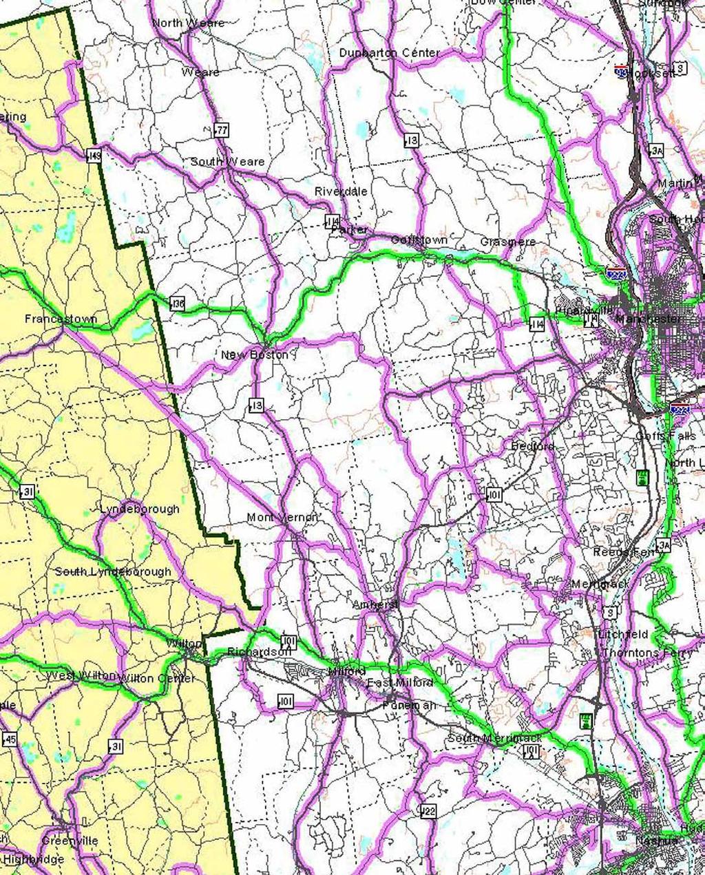
11 3.0 Inventory and Analysis 3.1 Traffic Volumes To determine the existing traffic volume demands and flow patterns along the corridor, the Nashua Regional Planning Commission (NRPC) conducted an extensive traffic volume count program during the fall months of Weekday morning (7:00 9:00 AM) and weekday evening (4:00 6:00 PM) peak period manual turning movement counts were conducted at seventeen intersections along the corridor. The peak period traffic volume counts were conducted at the following intersections with Route 101. Horace Greeley Road Amherst Town Transfer Station (Count conducted on Saturday 9:00-11:00 AM.) Walnut Hill Road The Meeting Place Amherst Street Interchanges NH 122 Interchanges Route 101A Interchanges Route 13 Interchanges Old Wilton Road/Phelan Road Elm Street (Route 101A)/North River Road Wilton Road Abbott Hill Road/NH 31 North Greenville Road (NH 31 South) To supplement the intersection turning movement counts, 24-hour automatic traffic recorder counts were conducted at key locations along the corridor. The existing condition traffic volumes are presented in Figure 1. A summary of the automatic traffic recorder count data is presented in Table 1. TABLE 1 Route 101 Existing Traffic Volume Summary (2001) Average Weekday Traffic Volume (vpd) AM Peak Hour (vph) Percent of Daily Traffic PM Peak Hour (vph) Percent of Daily Traffic East of the Meeting Place 22,020 1, , East of NH 13 25,600 2, , West of NH 13 18,950 1, , East of Old Wilton Road 19,270 1, , East of Wilton Road 22,100 1, , East of Greenville Road 14,740 1, ,
12 Insert Figure 1 foldout here 12
13 As shown in the table, the 2001 Average Weekday Traffic (AWDT) along Route 101 ranges from approximately 25,600 vehicles per day (vpd) east of Route 13 on the bypass section of Route 101 in Milford to 14,740 vpd east of Greenville Road at the west end of the study area in Wilton. Peak hour traffic volumes range from approximately 7.2 to 8.6 percent of the AWDT. Directional flow is predominately eastbound (62 percent) in the AM peak hour and westbound (57 percent) in the PM peak hour. New Hampshire Department of Transportation (NHDOT) maintains two permanent count stations on Route 101 within the study corridor. Data from these count stations in Amherst (north of NH 122) and in Temple (at the Wilton town line) provide valuable insight into the traffic flow characteristics of the existing corridor. A review of daily traffic volume variations along Route 101 (north of NH 122 in Amherst) during the month of August 2000 revealed little variation during the weekdays with the weekday volumes ranging from approximately 20,600 vpd to 23,300 vpd with the low volume recorded on a Wednesday and the high volume recorded on a Friday. Saturday traffic reflected the average traffic volume throughout the week at 21,700 vpd, while Sunday traffic was significantly lower at 17,600 vpd. The daily variations in Amherst are depicted in Figure 2. Vehicles Per Day Vehicles per Day 25,000 20,000 15,000 10,000 5, ,000 9,000 8,000 7,000 6,000 5,000 4,000 3,000 2,000 1,000 0 Figure 2 Daily Traffic Variations NH Route 101 in Amherst (West of NH ) Sun Mon Tue WedThu Fri Sat Figure 3 Daily Traffic Variations NH Route 101 in Temple (At Wilton Townline ) Sun Mon Tue WedThu Fri Sat At the west end of the Route 101 corridor, daily traffic volume variations (at the Wilton town line in Temple) during the month of August 2001 show the weekday daily volumes exhibiting a steady increase in volume as the weekend approaches. The weekday volumes range from a low of 7,900 vpd on Monday to a high of 9,700 vpd on Friday. The Saturday daily volume remained relatively high at 9,500 vpd. This trend is reflective of the more recreational nature of the western end of the corridor as compared to the daily variations in Amherst, which reflect a more typical commuter pattern. The daily variations in Temple are depicted in Figure 3. 13
14 Vehicles Per Hour Vehicles Per Hour A comparison of the hourly variations for a typical weekday and a Saturday, as expected, reveal markedly different trends. Figures 4 and 5 show the hourly traffic variations for a weekday and a Saturday during the winter of along Route 101 west of Route 13 in Milford. Route 101 exhibits typical commuter route characteristics with well-defined morning and evening commuter peak periods. The morning commuter period peaks between 7:00 and 8:00 AM, with the commuter period over by 9:00 AM. The volume of traffic remains relatively constant throughout the late morning and midday with an increase in volume experienced by early afternoon. The PM commuter period extends from 3:00 PM to 6:00 PM. By comparison, on a Saturday the volume of traffic remains relatively high and constant from 11:00 AM to 6:00 PM. An examination of historical traffic volume data collected by the New Hampshire Department of Transportation (NHDOT) at its permanent traffic recorder station located along Route 101 in Amherst provides monthly traffic volume variations for a weekday and a Saturday. The data show that for a weekday, the highest daily volumes occur during the summer months of June, July, and August. The lowest daily volumes were recorded during the months of January and February. Interestingly, the highest volume month when only considering Saturday traffic is October. The high weekend traffic in October is most likely reflective of foliage related recreational activity. The monthly variations for weekday and Saturday traffic are depicted in Figures 6 and 7. 1, 600 1, 400 1, 200 1, ,400 1,200 1, Figure 4 Hourly Variations in Weekday Traffic NH Route 101 in Milford (West of NH ) 12:00 AM 1:00 AM 2:00 AM 3:00 AM 4:00 AM 5:00 AM 6:00 AM 7:00 AM 8:00 AM 9:00 AM 10:00 AM 11:00 AM 12:00 PM 1:00 PM 2:00 PM 3:00 PM 4:00 PM 5:00 PM 6:00 PM 7:00 PM 8:00 PM 9:00 PM 10:00 PM 11:00 PM 12:00 AM 2:00 AM Vehicles Per Day Time of Day Figure 5 Hourly Variations in Saturday Traffic NH Route 101 in Milford (West of NH ) 4:00 AM 25,000 20,000 15,000 10,000 5, :00 AM January 8:00 AM 10:00 AM *1999 NHDOT traffic counts included for January and June 12:00 PM 2:00 PM Time of Day Figure 6 Monthly Variations in Weekday Traffic NH Route 101 in Amherst North of NH Route 122 NHDOT Count Data (2000*) Februrary March April May June 4:00 PM July Month 6:00 PM August September 8:00 PM October 10:00 PM November December 14
15 3.2 Accidents Accident records provided by the New Hampshire Department of Transportation were reviewed and evaluated. The accident data for the towns of Amherst, Milford, and Wilton are summarized in the following paragraphs. Vehicles Per Day 25,000 20,000 15,000 10,000 5,000 0 January Februrary Figure 7 Monthly Variations in Saturday Traffic NH Route 101 in Amherst North of NH Route 122 NHDOT Count Data (2000*) March April May June July August September October November December *1999 NHDOT traffic counts included for January and June Amherst During the five-year period of 1996 to 2000 a total of 185 accidents were reported along the Route 101 study corridor in Amherst. The Route 101A interchange recorded the highest number of accidents (39 accidents), during this period. Other high accident locations include the Amherst Street interchange (23 accidents), the NH 122 half-interchange (11 accidents), and the Horace Greeley Road intersection (11 accidents). Many of the segments of Route 101 in Amherst and some unsignalized intersections in the northern portion of Route 101 in Amherst are showing a high percentage of personal injury related accidents. In the area between Walnut Hill Road and the Amherst Street interchange the percentage of accidents involving personal injury exceeds fifty percent. Note that in 2001, which was not included in the database available through the NHDOT, a fatal accident occurred on the bypass section of Route 101 near NH 122. The accident was the result of a driver drifting into oncoming traffic. The segment of Figure 8 Route 101 between Accident Summary Along NH 101 in Amherst (NHDOT Records) Horace Greeley Road and the Bedford town 35 36% line reported 29 accidents from 1996 to % Personal 30 Injury 31% Property 10 % The accident 20 Damage 19 % 27 % 15 data for the town of 27 % 55% % Amherst are summarized graphically in 67 % 0 57 % 5 50 % Figure 8. Number of Accidents NH 101A Interchange NH 122 Interchange Location Milford During the five-year period of 1996 to 2000 a total of 103 accidents were reported along the Route 101 corridor in Milford. The Old Wilton Road intersection recorded the highest number of accidents (25 accidents). Twenty-two accidents were reported on the segment of Route 101 between the Route 13 interchanges and the signalized intersection of Old Wilton Road. Fifty-five percent of these accidents involved personal injuries and/or fatalities. Three of the four fatalities recorded Amherst Street Interchange The Meeting Place Month Walnut Hill Road Horace Greeley Road 15
16 occurred on this segment of Route 101. This section of the corridor is clearly deficient from a safety perspective. The accident data for the Town of Milford are summarized graphically in Figure Wilton A total of 63 accidents were reported on Route 101 in the Town of Wilton during the five-year period of The segment of Route 101 from Abbott Hill Road to Greenville Road recorded forty-two accidents. Twenty-nine percent of these accidents involved personal injuries. There were no fatalities reported during the five-year period. Roadway alignment and sight distance related deficiencies along this segment of the corridor might contribute to the relatively high number of accidents. The accident data for the Town of Wilton are summarized in Figure Public Input on Safety Issues Number of Accidents Number of Accidents % Wilton Rd Most of the concerns expressed by residents at the Visioning workshops held in Amherst, Milford, and Wilton, focused on safety-related issues along the corridor In the town of Amherst, the discussion focused in the area of recent roadway improvements. The recent improvements that were identified include the widening of Route 101 to provide left-turn lanes at Horace Greeley Road, the Town Transfer station, and the Meeting Place. A review of accident data for a six-year period ( ) showed an overall decrease in the number of accidents at the upgraded intersections. Residents appreciate this level of enhanced safety created by the addition of turn-lanes on Route 101. Residents expressed a desire for additional turn-lanes to enhance safety along the corridor provided the existing shoulder is not reduced as a result of the widening. In the town of Milford, the segment of Route 101 from the Route 13 ramps to the traffic signal at the intersection of Old Wilton Road was identified as a high accident area. At the Visioning workshop, reasons for this safety deficiency were discussed. 50% 30% Greenville Road Figure 9 Accident Summary Along NH 101 in Milford (NHDOT Records) Personal Injury/Fatality Property Damage Only 22% NH 101A (Elm St) 100% Location 29% 32% Old Wilton Rd 55% 13% 0% NH 13 Interchange 10% Figure 10 Accident Summary Along NH 101 in Wilton (NHDOT Records) Location Abbott Hill Rd Personal Injury Property Damage 0% 14% NH 101A Interchange 16
17 Possible reasons include: Solar glare Limited visibility of the queue from signal at Old Wilton Road due to the horizontal curve No breakdown lane Icing on the bridge High speed/passing Segment length Several residents stated that because of their safety-related concerns with traveling along the bypass, they often avoid the bypass and use local roadways. Wilton residents raised safety concerns at the intersection of Abbott Hill Road with Route 101. Recently a NHDOT construction project was completed that included the construction of left-turn storage lanes for eastbound and westbound traffic. The project also involved cutting back the hill on the south side of Route 101 to improve intersection sight distance. Residents felt that this project did not address all of the safety deficiencies at the intersection for the following reasons; the flashing yellow light was removed, more pavement on Route 101 encouraged higher speeds, and the shoulder width was reduced at the intersection. Suggested improvements to this intersection and other unsignalized intersections in Wilton included overhead signage indicating the geometry of the upcoming intersection, increased lighting for better visibility, and reinstallation of the flashing yellow caution light (at Abbott Hill Road) Bypass Safety Issues During the course of the study, officials from the town of Milford including the Selectmen and the Chief of Police raised concerns with the number of fatal accidents that have been occurring along the Bypass. As a result, a series of meetings were held with the New Hampshire Department of Transportation (NHDOT) in an effort to better understand the problem and to develop a plan to address the problem. This five-mile segment of Route 101, which extends into Amherst, has experienced eight fatal head-on crashes (vehicles crossing the centerline) in the last nine years. Accounting for the volume of traffic and the length of the segment, this translates into a Fatality Rate of approximately 2.4 fatal crashes per 100 million vehicle miles. By comparison, the average Fatality Rate 1 for the State of New Hampshire is 1.0 fatal crashes per 100 million vehicle miles. Not only is this segment of the corridor experiencing fatal crashes at a rate that is over two times the state average, but also all of the reported fatal crashes involve motorists crossing the centerline. In addition, nearly all of the fatal crashes occurred during daylight hours. Generally, you would expect between 30 and 40 percent of fatal accidents to occur at night. Clearly, 17
18 this is a problem of motorists crossing the centerline during the daylight hours. We believe that the principal cause of the high fatality rate is driver inattention. In this hectic fast-paced world that we live in today, more and more motorists are driving while their attention is focused on other activities. Whether it is talking on a cell phone, drinking coffee, having lunch, or even reading and writing in their automobile, these activities divert a driver s attention. On a high speed - high volume roadway such as the Bypass, an inattentive driver can cross the centerline and collide head-on with the opposing traffic in a split second. Ironically, driver inattention along this segment of Route 101 may be related to the change in the character of the highway. Motorists traveling along Route 101 from the east in Bedford or from the west in Wilton tend to be more attentive because they have to given the turning movements that occur at numerous side streets and driveways. As motorists enter the Bypass, which is limited access with no turning movements, two things happen: first motorists tend to increase the travel speeds and second they tend to pay less attention to the roadway. Also, some motorists may see the Bypass as their only opportunity to pass slower moving vehicles - such as trucks. However, as the volume of traffic along Route 101 continues to grow, it is becoming increasingly difficult to find safe passing opportunities. This can lead to driver frustration and to motorists taking unsafe chances. From an operational and a safety perspective, the Bypass should be widened to a four-lane median divided highway (two lanes in each direction). In fact, as presented later in this report, a four-lane median divided section is recommended. However, given the substantial costs, widening the Bypass to a 4-lane cross-section is under the best circumstances several years away. For this reason, an effort was made to evaluate potential immediate or short-term solutions that if put in place, could enhance the safe and efficient flow of traffic along the Bypass. The following section discusses some of the various alternatives that were considered as potential solutions to address the immediate safety needs of the highway. Alternatives Considered for Improving Bypass Safety To enhance the safe flow of traffic in the near-term will involve a combination of driver education, police enforcement, and roadway design modifications. The following paragraphs summarize the various alternatives that were evaluated. Alternatives that educate motorists primarily come in the form of signage. Signs can be used to alert motorists that a particular section of a roadway is a problem area and that caution should be used. Variable message boards, such as those that have recently been placed by the NHDOT serve to alert motorists and reinforce existing regulations. The existing message to OBSERVE THE POSTED SPEED LIMIT can be an effective method of maintaining a safe and consistent speed through the segment. Another form of signage that can be used to alert and educate motorists is a 18
19 sign that reads: LIGHTS ON FOR SAFETY PLEASE DRIVE COURTEOUSLY. This type of sign, which would be placed in each direction, at the beginning and the end of the Bypass and at each interchange, would serve to not only remind motorists to be cautious, but the turned-on headlights would provide an added visual stimuli of the on-coming traffic. The enforcement of existing speed limits and passing restrictions is also a vital component to addressing the safety problems along the Bypass. An increased visual presence of law enforcement along the Bypass would serve to alert motorists to maintain reasonable speeds and to only pass in safe and defined passing areas. Perhaps off-road launching pads (parking areas for police patrol vehicles) could be constructed along the Bypass at strategic locations so that police could monitor travel speeds and passing maneuvers. It is often suggested that reducing the posted speed limit would serve to address safety deficiencies. The posted speed limit should be appropriate for the geometric conditions along the roadway and should match driver expectations. Posting the speed limit below reasonable driver expectation often results in a disparity between the high and the low speed as some motorists will continue to travel at speeds appropriate for the conditions while others will slow, respecting the speed limit. It is this type of variance in speed that can lead to serious crashes. As long as the speed limit reflects the geometric conditions of the roadway, most motorists will tend to travel at constant speed - which is a safer condition. We do not believe that reducing the posted speed limit along the Bypass would address the identified safety deficiencies. In fact, doing so could have the opposite effect. A more effective way of reducing travel speeds for all motorists is through roadway design modifications. We have evaluated a series of physical modifications to the Bypass for their effectiveness, cost, and ease of implementation. The evaluation considered such actions as the placement of jersey barriers, rumble strips, painted medians, reflectorized delineators, and the construction of passing lanes. The placement of a jersey barrier down the center of the Bypass would address the problem of head-on collisions. However, the barrier would require seven feet of pavement width (3 feet for the barrier and 2 feet on each side for an offset to the travel lane). Unless Route 101 can be widened (which is not a short-term solution) the needed width would have to be taken from the shoulder area, effectively reducing the 10-foot shoulder to 6 ½ feet. As motorists will tend to drift away from the barrier and closer to the shoulder, this alternative could create a potential hazardous condition, particularly at night, if an automobile were to breakdown along the shoulder. For this reason, this alternative is not recommended. Rumble strips are grooved patterns that are placed primarily along paved shoulders to alert fatigued or distracted motorists that they are about to drift off the roadway. The use of rumble strips along roadway edges has been shown to be a very cost- 19
20 effective way of keeping motorists safely on the roadway. To a lesser degree, but increasingly, rumble strips are being used along the centerline of roadways to reduce the potential of motorists drifting into the oncoming traffic. The NHDOT has placed some centerline rumble strips along Route 101, however it is too early to determine their effectiveness. We believe that centerline rumble strips can be effective, however we would suggest that the rumple strips be placed down the center of the roadway with double yellow centerlines placed on each side of the rumble strip rather than placing the pavement markings within the strip. Doing so provides better separation and the rumble strip doesn t break up the pavement markings. A painted 4-foot wide center median would provide the benefit of introducing some spacing to separate directional traffic while eliminating some of the problems associated with a physical barrier. The 4-foot painted center median could be put in place without widening the roadway by reducing the paved shoulder area from 10 feet to 8 feet. This option would include the placement of two rumble strips inside the painted pavement markings. To provide additional delineation, plastic delineator tubes could be placed down the center of the painted median. This placement of the painted median would, like the jersey barrier alternative, require building up the shoulder area (the two foot width that vehicles would now be using for travel). The need to add pavement surface to the shoulder as well as the placement of new pavement markings would necessitate a one-inch overlay of the entire length of the Bypass, which would be costly. The cost to implement the 4-foot median option is estimated at approximately $600,000. Another option considered was the construction of passing lanes. This alternative would involve the widening of Route 101 at one location in the eastbound direction and another location in the westbound direction. Similar to truck climbing lanes they would provide an additional lane for a length of at least one half a mile. Although this option could be effective in providing motorists safe opportunities to pass, it would be expensive, as each location would likely cost several hundred thousand dollars to construct. Action Plan for Improving Bypass Safety Based on discussions between the NHDOT and the Town of Milford, the NHDOT has committed to the following action plan. Immediate 1. Continue the use of variable message boards, which direct motorists to OBSERVE THE POSTED SPEED LIMIT. 2. Install LIGHTS ON FOR SAFETY PLEASE DRIVE COURTE- OUSLY signs in each direction, at the beginning and end of the Bypass and at each interchange. 20
21 3. Review passing zones and, where appropriate, reduce the length of the passing zones and increase the length of the no-passing areas. 4. Review location and sizing of signing and where appropriate replace. 5. Extend the centerline rumble strip along all no-passing areas. Short-term The NHDOT will continue to monitor the safety conditions along the Bypass and when this segment of Route 101 is scheduled for its next pavement overlay, the Department will reconsider the option of upgrading the shoulder area so as to install either the 4-foot painted median with rumble strips or the single center rumble strip with double yellow pavement markings on either side. In addition to these actions by the NHDOT, state and local police should increase their presence along the Bypass. Perhaps off-road launching pads (parking areas for police patrol vehicles) could be constructed. 3.3 Transportation Infrastructure Route 101 is a state-maintained principal east-west highway that extends from the seacoast to Keene. As it passes through the study corridor communities of Amherst, Milford, and Wilton, the highway function varies. The bypass section, which extends from Old Wilton Road in Milford to Baboosic Lake Road in Amherst, is a limited access two-lane bi-directional undivided highway with 12-foot travel lanes and 10-foot wide paved shoulders. Full diamond interchanges are provided at Route 13 and at Baboosic Lake Road. A partial cloverleaf provides full access/egress at Route 101A, and a half diamond interchange provides westbound access/egress only at NH 122. The speed limit through the bypass section is posted at 55 mph. The cross-sections for the remaining segments of the corridor are also two-lane bidirectional and undivided, but are characterized with business frontage, numerous curb cuts and intersecting side streets, and in western Milford traffic signal control. In Wilton, study area intersections such as Greenville Road (NH 31 South) and Abbott Hill Road serve as residential collector roadways connecting local residential streets to the corridor. In Milford, access to Route 101 is provided at three signalized intersections where collector roads such as Wilton Road, Elm Street (Route 101A), and Old Wilton Road connect Route 101 to the Wilton town center, and residential communities north and east of Route 101 in Milford respectively. Numerous uncontrolled commercial driveways front Route 101 in Milford between the intersections of Wilton Road and Elm Street (Route 101A). The posted speed limit varies from 35 mph near signalized intersections to 50 mph in Amherst near the Bedford town line. 21
22 Nearby alternative travel routes to Route 101 include Route 101A for east/west travel from Milford to the F.E. Everett Turnpike. Route 101A is a minor arterial with daily traffic volumes ranging from 20,500 vpd west of the 101 interchange to 30,580 vpd east of the 101 interchange at the Amherst/Milford town line. Some local roads provide alternative routes to 101 in Milford. The roadway network of Armory Street and Osgood Road provide connections to local destinations in Milford. These roadways are residential collectors with low speeds, narrow pavement and stopcontrol at intersections. NH 122 serves as an alternative route to Route 101 in Amherst. NH 122 is a major collector with traffic volumes of 4,900 vpd south of the Route 101 interchange. NH 122 has been introduced as a safer alternative to the bypass segment of Route 101 due to the reduced speeds compared to the bypass. The nearby street system is summarized in Table 2. TABLE 2 Nearby Street System Municipality Roadway Name Functional Classification Count Location Traffic Count (vpd) Destination Amherst Horace Greeley Road Minor Collector N of 101 2,389 New Boston, residential Baboosic Lake Road Minor Collector E of 101 2,622 Amherst, residential NH 122 Major Collector S of 101 4,880 Milford Route 101A (Nashua Minor Arterial E of 101 at Amherst TL 30,583 Street) Route 101A (Nashua Minor Arterial W of ,497 Street) NH 13 (South Street) Minor Arterial S of ,747 NH 13 (South Street) Minor Arterial N of 101 5,385 Wilton Road Local over Souhegan River 9,288 Wilton town center Wilton Abbott Hill Road Local S of 101 1,194 residential Operational Analysis: Existing Conditions Measuring traffic volume along Route 101 indicates the importance of the corridor to the local and regional roadway system, but gives little indication of the quality of traffic flow. To measure the quality of traffic flow, key intersections were analyzed from an operational perspective. The results of this analysis provide a valid indication of how well the roadway system operates given existing and predicted travel demands. Level of Service (LOS) is the term used to denote the different operating conditions which occur on a given roadway facility under various traffic volume loads. LOS is a qualitative measure of the effect of a number of factors including roadway geometrics, travel speed, travel delay, freedom to maneuver, and safety. Level of service provides an index to the operational qualities of a roadway segment or intersection. The evaluation criteria contained in the 2000 Highway Capacity Manual 2 (HCM) were used to analyze the signalized and unsignalized study area intersections. Level of service is based on a grading system where LOS A is the best condition and LOS F is the worst condition. In general terms, intersection movements operating at 22
23 LOS A or B experience very little if any delay. Level of service C is typically considered the average delay condition. LOS D is considered to be acceptable if there is undue burden required to achieve LOS C. LOS E and F indicate that the intersection or movement being analyzed is at capacity, and that motorists experience long delays. The level of service designation is reported differently for signalized and unsignalized intersections. For signalized intersections, the analysis considers the operation of all traffic entering the intersection and the LOS designation is for the overall conditions at the intersection. The analysis criteria for unsignalized intersections are based on the expected average delay to side street movements. The results of the signalized intersection analyses conducted for the 2001 base year reveal that each of the four intersections is currently operating under capacity during both the morning and evening peak hours. The analysis indicates relatively good operation at the intersection of Wilton Road in Milford. This intersection currently operates at LOS C during the morning and evening peak periods. The analysis of the intersections of Elm Street and Old Wilton Road indicate that during the morning peak hour, these intersections are close to capacity. Each is currently operating at LOS D with volume to capacity ratios ranging from 0.85 to The signalized intersection of the westbound Route 101 ramp with Route 101A operates at LOS C, with little delay to through traffic. However, the nearby unsignalized eastbound Route 101 ramps with Route 101A experience delay resulting from the relatively heavy flow of traffic on Route 101A. During the morning peak period, the heavy volume on Route 101A causes the queuing of vehicles from the eastbound off-ramp back onto Route 101. The results of the unsignalized analyses revealed poor operation (LOS F) where vehicles enter the corridor from side streets such as Greenville Road and Abbott Hill Road in Wilton, and from The Meeting Place, Walnut Hill Road, and Horace Greeley Road in Amherst. Intersection movements at the interchange ramps to Route 13 and Route 101A also reveal poor operation. However, the movements at the NH 122 and Amherst Street interchange ramps operate well (LOS A or B). The results of the base condition intersection analyses are summarized in Tables 3 and 4. TABLE 3 Signalized Intersection Capacity Analysis 2001 Base Condition Weekday AM Peak Hour Weekday PM Peak Hour Intersection with Route101 v/c+ Delay* LOS** v/c Delay LOS Wilton Road C C Route 101A (Elm Street)/North River Road D C Old Wilton Road/Phelan Road D D Route 101A WB Ramp C C + Volume to capacity ratio * Average delay per vehicle (in seconds) ** Level of Service 23
24 TABLE 4 Unsignalized Intersection Capacity Analysis 2001 Base Condition Intersection with Weekday AM Peak Hour Weekday PM Peak Hour Route 101 Movement Demand+ Delay* LOS** Demand Delay LOS NH 31S (Greenville Road) Left from Route B A Left/Right from NH 31S (Greenville Road) F F NH 31N/Abbott Hill Road EB Left from Route A B WB Left from Route A 50 9 A NB Left/Thru/Right from Abbott Hill Road F F SB Left/Thru/Right from NH 31N F F Route 101 WB Ramps/NH 13 Left from NH A A Left/Right from Route 101 WB Ramp F F Route 101 EB Ramps/NH 13 Left from NH A 70 9 A Left/Right fro m Route 101 EB Ramp C D Route 101 WB Spur/Route 101A Right from Route 101 WB Ramp B A Route 101 EB Ramps/Route Left from Route101A B B 101A Left from Route 101 EB Ramp F 45 # F Right from Route 101 EB Ramp F B Route 101 EB Off ramp/nh 122 Left from Route 101 EB Ramp B B Right from Route 101 EB Ramp 5 11 B 5 9 A Route101 WB Onramp/NH 122 Left from NH A 5 8 A Route 101 EB Ramps/Amherst Left from Amherst Street (NH 122) A A Street (NH 122) Left/Right from Route 101 EB Ramp C B Route 101 WB Ramps/Amherst Left from Amherst Street (NH 122) 60 9 A 25 8 A Street (NH 122) Left/Right from Route 101 WB Ramp B B The Meeting Place Driveway Left from Route B B Left from The Meeting Place Driveway F F Right from The Meeting Place Driveway D C Walnut Hill Road Left from Route B B Left/Right from Walnut Hill Road F F Town Transfer Station 1 Left from Route B Saturday 9:00-11:00AM Left/Right from Town Transfer Station F Horace Greeley Road Left from Route A B Left/Right from Horace Greeley Road F F + Demand of vehicles during the peak hour * Average delay per vehicle (in seconds) ** Level of Service # Delay greater than 999 seconds Operational Analysis: Future Volumes To estimate future traffic volume demand, regional traffic volume models prepared by the Nashua Regional Planning Commission and the Southern New Hampshire Regional Planning Commission were examined. From the model projections for the Route 101 corridor, growth rates were determined for the towns of Amherst, Milford and Wilton. These growth rates (1.5 percent per year for Wilton and Milford, 2.0 percent per year for Amherst) were applied to the 2001 base traffic volumes to develop the 2021 future traffic volumes along the corridor. The 2021 traffic volumes are shown in Figure
25 Insert Figure 11 Fold Out Here 25
26 A level of service analysis similar to the existing condition analysis was conducted at the key study area intersections for the 2021 future traffic condition. The analysis reflects the ability of the existing roadway network to meet the projected 20-year traffic volume demands. The results of the signalized intersection analyses show that three of the four signalized intersections (Wilton Road, Elm Street/North River Road, and Old Wilton Road/ Phelan Road) would operate at or over capacity in the year The Route 101 WB Ramp/Route 101A intersection is expected to operate at an acceptable level of service (LOS C) with the planned upgrade of the intersection. The intersection improvements, which include the addition of a second left-turn lane on the Route 101A westbound approach and the provision of an exclusive right-turn lane on the Route 101A eastbound approach, will be constructed as part of a mitigation package for a recently approved retail development. The results of the unsignalized analyses reflect poor operations for minor street approaches at all intersections with the exception of the half interchange at NH 122. Turning movements at the westbound on-ramp and eastbound off-ramp intersections with NH 122 are expected to operate at LOS C or better during both the morning and evening peak periods. All other minor street approaches to unsignalized intersections in the study area operate at poor levels of service (LOS E or F) during one or more of the weekday peak periods. The results of the future condition intersection analyses are summarized in Tables 5 and 6. TABLE 5 Signalized Intersection Capacity Analysis 2021 Future Condition Weekday AM Peak Hour Weekday PM Peak Hour Intersection with Route 101 v/c+ Delay* LOS** v/c Delay LOS Wilton Road E F Route 101A (Elm Street)/North River Road F D Old Wilton Road/Phelan Road F F Route 101 WB Ramp/Route 101A C C + Volume to capacity ratio * Average delay per vehicle (in seconds) ** Level of Service 1 Includes retail development mitigation In addition to evaluating the signalized and unsignalized intersections along the corridor, a key element in the evaluation of the corridor is determining the number of basic lanes that will be needed along various segments of the corridor to accommodate the future travel demands. The basic lanes of a highway are the travel lanes that are needed solely to accommodate the movement of through traffic. Basic travel lanes do not include traffic management lanes such as climbing lanes, acceleration/ deceleration, weaving, and merging lanes, which may be needed in the vicinity of an 26
27 TABLE 6 Unsignalized Intersection Capacity Analysis 2021 Future Condition Intersection with Weekday AM Peak Hour Weekday PM Peak Hour Route 101 Movement Demand+ Delay* LOS** Demand Delay LOS NH 31S (Greenville Road) Left from Route B B Left/Right from NH 31S (Greenville Road) F 245 # F NH 31N/Abbott Hill Road EB Left from Route A B WB Left from Route B A NB Left/Thru/Right from Abbott Hill Road 195 # F 75 # F SB Left/Thru/Right from NH 31N 125 # F 200 # F Route 101 WB Ramps/NH 13 Left from NH A A Left/Right from Route 101 WB Ramp F 565 # F Route 101 EB Ramps/NH 13 Left from NH B B Left/Right fro m Route 101 EB Ramp F F Route 101 WB Spur/Route 101A Right from Route 101 WB Ramp C B Route 101 EB Ramps/Route Left from Route 101A D C 101A Left from Route 101 EB Ramp 45 # F 60 # F Right from Route 101 EB Ramp F E Route 101 EB Off ramp/nh 122 Left from Route 101 EB Ramp C C Right from Route 101 EB Ramp 5 13 B 5 10 A Route 101 WB Onramp/NH 122 Left from NH A 5 8 A Route 101 EB Ramps/Amherst Left from Amherst Street (NH 122) B A Street (NH 122) Left/Right from Route 101 EB Ramp E C Route 101 WB Ramps/Amherst Left from Amherst Street (NH 122) A 35 9 A Street (NH 122) Left/Right from Route 101 WB Ramp B E The Meeting Place Driveway Left from Route C B Left from The Meeting Place Driveway 80 # F 105 # F Right from The Meeting Place Driveway F F Walnut Hill Road Left from Route B B Left/Right from Walnut Hill Road 95 # F 50 # F Town Transfer Station 1 Left from Route B Saturday 9:00-11:00AM Left/Right from Town Transfer Station 305 # F Horace Greeley Road Left from Route B C Left/Right from Horace Greeley Road 285 # F 160 # F + Demand of vehicles during the peak hour * Average delay per vehicle (in seconds) ** Level of Service # Delay greater than 999 seconds interchange to accommodate vehicles entering or exiting the highway. These basic lanes serve to provide a consistent number of lanes over a significant length of highway. For the purpose of designing state maintained roadways, the New Hampshire Department of Transportation (NHDOT) has established LOS D as a minimum acceptable operating condition. Therefore, for the purpose of this evaluation it will be necessary to determine the number of lanes that will be needed along the corridor to obtain LOS D. The results of an operational analysis for each of the corridor segments show that under existing conditions (2001) the segment of the corridor in Wilton operates at 27
28 LOS D, while the segments in Milford from Old Wilton Road to Route 13 and from Route 13 to Route 101A operate at LOS E. In Amherst, the segment from Route 101A to NH 122 operates at LOS D/E, the segment from NH 122 to Baboosic Lake Road operates at LOS D and the segment east of Baboosic Lake Road operates at LOS E. Under the future year (2021), the operating condition for the entire corridor is expected to deteriorate to LOS E and LOS F. LOS E conditions are expected along the segment in Wilton, in Milford from Old Wilton Road to Route 13, and in Amherst from Route 101A to Baboosic Lake Road. LOS F conditions are expected in Milford from Route 13 to Route 101A and in Amherst east of Baboosic Lake Road. Therefore, to accommodate the 20-year design hour volumes, the corridor will need to be widened to a four-lane cross-section. However, it is not enough to simply widen the corridor. The long-term plan for the corridor needs to meet the needs of the communities along the route. 1 U.S. Department of Transportation National Center for Statistics (www-fars.nhtsa.dot.gov) for the year Highway Capacity Manual, Transportation Research Board, Washington, DC (2000) 28
29 3.2 Pedestrian and Bicycle Transportation The Route 101 Corridor has a significant amount of bicycle use. The accompanying map shows many regional bike routes paralleling Route 101 and crossing it (primarily at overpasses and underpasses in the bypass section). Designated bike routes use Route 101 west of the 101/101A intersection in western Milford and in Amherst from Route 122/Baboosic Lake Road to Horace Greeley Road. Although no volume estimates are available, cyclists can be seen using the highway shoulders throughout the corridor, particularly on weekends. Riders can be seen on the highway shoulder in both designated and undesignated portions of the highway. The principal infrastructure for bicyclists in the corridor is the paved highway shoulder, which is generally eight to ten feet wide, but narrows or disappears in portions of western Milford and Wilton and at some right-turn situations in Amherst. Use of the highway shoulder is legal but advisable only for experienced cyclists. On parallel and crossing routes, bicycles share the road with motor vehicles, and although vehicular speeds are generally lower on these routes, only experienced cyclists are comfortable. In Milford, segments of multi-use path have been planned; these are more suitable for children and less experienced cyclists. There are no sidewalks along Route 101 in the corridor study area. Some pedestrians do walk on the roadway shoulder, but their number is small. Some pedestrians have also been observed crossing at the 101/101A intersection in western Milford. A transportation study for the three towns will commence after the completion of the Route 101 Corridor Plan. This study, which is funded through a grant from the federal Transportation and Community and System Preservation Program (TCSP) will be managed by NRPC. It will consider townwide traffic issues, integration of transportation and land use, and alternative transportation modes including pedestrian, bicycle, and transit. Its recommendations will supplement those of the Route 101 Corridor Plan. Implications for the Route 101 Corridor The paved shoulder along the highway should be maintained for use by experienced bicyclists, and widening of the shoulder should be considered at locations where automobiles use the shoulder for right turns or where the shoulder becomes a right-turn lane. 29
30 30
31 3.3 Economic Development Profile This report section provides a snapshot of the existing economic development activities (non-residential development) along Route 101 in each respective community and is not intended to be an overview of the real estate market or provide insight into potential future market trends. For a regional perspective, population, labor and employment estimates for each community are compared to Hillsborough County. The data for the Town of Milford were collected as part of a conceptual market study for the industrial land in the BROX property and other industrial parcels. The data for Amherst and Wilton were collected to provide baseline data for the Route 101 Corridor Study. In order to obtain data and information for the market overview, three methods were used. The first consisted of an analysis of current and historical population, labor and employment data provided by the U.S. Census and the New Hampshire Department of Employment Security. The second consisted of an estimation of square footage of non-residential properties along Route 101 via a windshield survey. The third included an interview with the zoning/planning official from the Town of Amherst Amherst and Wilton The Towns of Amherst and Wilton, located approximately 20 miles south west of Manchester and 50 miles north west of Boston, have current (2000) populations of approximately 9,100 and 3,100. In terms of percentage growth, both Amherst and Wilton have experienced strong growth throughout the 1990s with increases of 19% and 20% respectively. Comparatively, Amherst and Wilton have outperformed Hillsborough County in terms of population growth by approximately 6% and Table 1. Population Change: % respectively. Table 1 indicates a Town of Amherst, Wilton and Hillsborough County comparison of population growth for # Change % Change each community and Hillsborough County between 1990 and Amherst 9,068 10,769 1, % Wilton 3,122 3, % Hills. County 336, ,841 44, % Source: U.S. Census Labor Force, Employment and Unemployment Conditions According to data provided by the New Hampshire Department of Employment Security, Amherst s labor force has experienced strong growth throughout the 1990s increasing by 875 individuals representing an increase of 17%. Wilton s increase in labor force was modest as compared to Amherst with Table 2. Labor Force Change: Amherst, Wilton and Hillsborough County # Change % Change Amherst 5,027 5, % Wilton 1,635 1, % Hills. County 191, ,653 20, % Source: NH Department of Employment Security 31

32 an increase of 112 individuals (7%). As shown in Table 2, between 1990 and 2000, Hillsborough County, although outperforming Wilton s labor force growth by approximately 4%, increased its labor force by approximately 11%, which is 6% less than Amherst s labor force growth over the same time period. As shown in Table 3, Amherst has a current (2001) total employment base of approximately 5,700 jobs which represents an increase of approximately 890 jobs (19%) since Wilton s employment base is considerably smaller with a current total of approximately 1,660 jobs and increasing by 145 jobs (10%) since Comparatively, the County outperformed Wilton in terms of percentage job growth by approximately 5% over the same time period. In terms of the current (2000) distribution of private employment in Amherst, the largest employment area is the service sector (1,240 private jobs or 41%) followed by the trade sector (971 private jobs or 31%). The manufacturing sector has a significant presence in town with over 600 jobs representing 21% of the total workforce. The transportation, communications and public utilities (TCPU) and finance, insurance and real estate (FIRE) sectors represent the smallest portion of the workforce at 2% and 3% respectively. As with most communities, Wilton s 2000 employment base is heavily concentrated within the service (180 private jobs or 45%) and trade sectors (156 private jobs or 40%) representing approximately 85% of Wilton s total jobs. Manufacturing jobs represent approximately 13% of Wilton s employment base. Compared to the region, Amherst and Wilton have significantly higher concentrations of jobs in the service and trade sectors (over 70% and 80%) with the region having approximately 50% of its jobs in these sectors. Manufacturing employment in the region is slightly higher than both communities with almost one in four jobs being manufacturing related. Figure 1 indicates the distribution of employment for the Towns of Amherst, Wilton and Table 3. Total Employment Change: Amherst, Wilton and Hillsborough County # Change % Change Amherst 4,807 5, % Wilton 1,516 1, % Hills. County 178, ,578 26, % Source: NH Department of Employment Security 32
33 Hillsborough County (region) for As shown in Figure 2, Amherst experienced significant percentage job growth in TCPU (45 jobs or 225%), service (647 jobs or 109%) and FIRE (34 jobs or 76%) sectors. Manufacturing experienced a net loss in jobs of almost 50 jobs (7%). Over the same time period, Wilton experienced net gains in service (53 jobs or 42%) and trade employment (40 jobs or 35%), while losing jobs in the manufacturing (20 jobs or 29%) and TCPU (1 job or 14%) sectors. The region experienced job growth in all sectors over the same time period. In terms of the current (2000) distribution of private business establishments, approximately half (189) of Amherst s private businesses fall within the service sector representing the largest segment of the town s establishment base. Trade and manufacturing establishments represent the second largest (142 or 36%) and third largest (29 or 7%) of the total business base. Interestingly, Amherst s significant manufacturing employment compared to its modest establishment base indicates that each of the town s manufacturing companies employ approximately 21 workers by far the largest employment per establishment rate of any industrial sector. Currently in Wilton, 56% of the town s 54 businesses are service industry establishments with the town s 17 trade establishments comprising 31% of the total businesses. Similar to employment distribution, based on 2000 establishment information, service and trade establishments comprise a smaller amount (38% and 32%) of the total County establishment base compared to Amherst and Wilton. In terms of employment per establishment, throughout the County, each manufacturing establishment employs approximately 53 workers more then double the next closest sector (TCPU) at 21 workers per establishment. Figure 3 provides the distribution of busi- 33
, FIRE (7 establishments or 41%) and TCPU (2")
34 ness establishments for the Towns of Amherst and Wilton, as well as Hillsborough County. In terms of establishment growth, between 1991 and 2000, Amherst experienced significant percentage growth in the service (83 establishments or 78%), FIRE (7 establishments or 41%) and TCPU (2 establishments or 40%) sectors. The number of manufacturing establishments declined by 9 representing a decline of 24%. With the exception of the service sector which gained 14 businesses (88%), all industry sectors in Wilton lost businesses or stayed at the same establishment level over the same time period. On a County basis, all industry sectors experienced growth with the largest percentage gains being in the agriculture, forest and fish (59 establishments or 44%) and the service (1,192 establishments or 39%) sectors. Figure 4 shows the change in business establishments in the Towns of Amherst and Wilton and the County between 1991 and Based on an analysis of unemployment estimates provided by the New Hampshire Department of Employment Security, the Towns of Amherst and Wilton have experienced steady declines in unemployment from the early 1990s through to Between 1991 and 2001, unemployment in Amherst and Wilton has declined by 1% and 2.4% respectively. Over the same time period, the County has outperformed both Towns with a reduction in unemployment of 3.2%. Figure 5 indicates unemployment rate trends for Amherst, Wilton and the region between 1991 and Current Economic Development and Site Conditions In order to assess the economic conditions along Route 101 in Amherst and Wilton, a windshield survey of existing business establishments was conducted. The purpose of the survey was to inventory the types of businesses along Route 101 as well as estimate the area (square footage) of each respective establishment. Attempts were made to contact municipal officials from each community, however, only planning and zoning officials from the Town of Amherst were available to provide additional information relative to the existing site conditions of the corridor. Based on the estimated building size of each establishment, an employment multiplier 1 was applied which provides an estimate of the establishment s total number of employees. 34
35 Route 101 through Amherst and Wilton contains mostly small service and retail establishments with most being classified as mom and pop (small privately owned and managed) businesses. In addition to the service and retail establishments, there are a very small number of FIRE businesses and, what appear to be, manufacturing establishments. As shown in Table 4, it is estimated that the Route 101 through Amherst contains approximately 31,900 SF (28 businesses) of non-residential development which is primarily concentrated in service and retail establishments. The 28 businesses along Route 101 represent approximately 7% of Amherst s establishment base. When an employment multiplier is applied to each land use, it is estimated that 116 individuals work in these respective establishments representing 2% of Amherst s total employment. As the applied employment multiplier periodically over/underestimates typical employment within certain establishments, an adjusted (sensitized) employment estimate of approximately 96 jobs is provided representing 1.7% of Amherst s Table 4. Summary of Economic Conditions: Route 101 Towns of Amherst and Wilton Amherst Establishment Type Estimated SF Estimated Employment Adjusted Employment Service 13, Retail 11, FIRE 5, Other 1, Total 31, Estimated Total Town Employment ,699 5,699 % Employment on Route % 1.7% Estimated Total Town Establishments 2000 Estimated Occupied Establishments on Route 101 % Establishments on Route 101 Establishment Type Wilton Estimated Estimated SF Employment % 7.2% Adjusted Employment Service 19, Retail 10, Manufacturing 18, to 229* Total 48, to 271 Estimated Total Town Employment ,661 1,661 % Employment on Route % 4.9% to 16.3%* Estimated Total Town Establishments 2000 Estimated Occupied Establishments on Route 101 % Establishments on Route % 25.9% *Note: Includes employment estimate (215) for Label Art which may include employees at other locations. Source: Gruen, Gruen Associates and RKG Associates, Inc. total employment base. Although not within the study area, it is estimated that Route 101A in Amherst contains majority of the town s employment and establishment base. Route 101 through Wilton contains approximately 49,000 SF (14 businesses) of non-residential development which is concentrated in the manufacturing and service establishments. It should be noted that one manufacturing business (Label Art) is estimated to comprise over half of the manufacturing space along Route 101 in Wilton. The 14 businesses along Route 101 in Wilton represent approximately 26% of the town s establishment base. In terms of employment, theses establishments employ an estimated 107 workers which represent approximately 7% of Wilton s employment base. An adjusted Route 101 employment estimate ranging from 81 (5% of employment base) to 271 (16% of employment base) has been provided. It should be noted that the 271 jobs estimate includes 215 workers (provided by the New Hampshire Department of Employment Security) from Label Art which likely includes workers from other Label Art locations. It is likely that an 35
36 adjusted employment range between 80 and 100 jobs would be realistic. As with Amherst, it is estimated that 101A through Wilton contains most of the town s employment and establishment base. Conclusions: Amherst and Wilton The following points are most relevant relative to the economic development conditions found along Route 101 through the Towns of Amherst and Wilton: Amherst and Wilton have experienced strong population growth throughout the 1990s; The majority of the employment and establishment base in each community involves the service and trade sectors; Between 1991 and 2000, Wilton has experienced a net loss of manufacturing and TCPU jobs; It is estimated that employment in establishments along Route 101 in Amherst represents approximately 2% of the town s employment base while the Wilton section of Route 101 represents approximately 5% to 7% of the employment base. In terms of businesses, Route 101 through Amherst represents approximately 7% of the town s establishment base while Route 101 through Wilton represents approximately one quarter of the town s establishment base Milford This section contains excerpts of the Non-Residential Market Study for the BROX Property by RKG Associates, Inc., which is Appendix C to this report. See the appendix for footnotes, figures, and more information. Population and Household Trends and Projections Since 1980, population in the Town of Milford has increased by more than 4,930, to a base of 13,618 persons in The increase during the 1990s (1,820) was almost half the size of the increase during the 1980s (3,110). The average annual growth rate between 1980 and 2001 was roughly 2.7% in Milford, and only 1.4% per year during the 1990s. Population in Hillsborough County also increased between 1980 and 2001, but at a somewhat slower rate as indicated by an average annual increase of 1.9%. Labor Force and Unemployment Trends Between 1990 and 2001 the resident labor force in the Town of Milford increased by more than 320 participants, or 4.5%. This finding suggests that only 17.6% of the new persons (1,820 persons) in Milford were labor force participants, while the other 82.4% were non-participants, such as children, non-working household mem- 36
37 bers, or retirees. In Hillsborough County the labor force increased at a faster percentage rate, 6.0% between 1990 and 2001, than in Milford, suggesting a higher growth in labor force participants in the rest of the County. The growth rate in the labor force in the Nashua PMSA at 4.5% was similar to that in Milford, but less than half the growth rate indicated for the State. By comparison the growth rate in the Manchester PMSA was 7.2%, higher than indicated for the Nashua PMSA and Milford, indicating that this area is benefiting from a greater increase in labor force participants. Conclusions The labor force in Milford has increased at a much slower rate than population growth since In fact, only 17.5% of the population increases were labor force participants. In addition, the number of employed persons increased as the unemployment rate declined in the latter half of the 1990s. However, a softening in the economy in the early 2000s has resulted in a recent up-tick in the unemployment rate. The unemployment rate in Milford, however, is traditionally lower than other areas, suggesting a more stable labor force. Business Trends In 1998, Milford had 390 operating businesses, reflecting a gain of 179 firms since 1980, when there were 211 businesses operating in the town. This indicates an 84.8% gain, or an average of more than 4.2% per year. However, the number of businesses declined by 8 firms in the last two years. As noted, the town experienced a higher percentage of growth in new businesses during the 1980s than in the 1990s. The average annual growth rate was 5.8% in the 1980s, but only 1.7% per year in the 1990s. In addition, 93.3% of all new businesses since 1980 are classified as non-manufacturing firms. This trend was similarly observed at the county and state levels. In Milford, firms in the services industry experienced the most growth between 1980 and 2000, followed by gains in retail businesses. In 2000, firms in these two sectors represent 64% of all businesses operating in Milford. Increases were also experienced in the wholesale trade, manufacturing and construction sectors. In fact, gains were evident in the number of businesses across all industry sectors during the twenty-year period. These increases appear fairly consistent with changes observed in the two surrounding PMSAs. Conclusions Milford has enjoyed a gain of roughly 170 operating businesses between 1980 and Nearly 93.6% of this growth occurred in non-manufacturing businesses, with businesses in the services and retail sector experiencing the most growth during the twenty-year period. Some growth, albeit small, did occur in the manufacturing sector, which experienced more growth in businesses during the 1990s than in the 1980s. This latter finding counters the trend in the manufacturing sector in the Nashua PMSA, where nominal growth in manufacturing businesses occurred in the 1990s. In fact, Milford captured nearly 36% of the growth 37
38 in manufacturing firms in the Nashua PMSA during the 1990s, which is nearly four times its representation (9.3%) in This is a significant finding in light of the decline in manufacturing employment as discussed below, and beneficial for the planning of a proposed business park. It also suggests that manufacturing businesses are locating in Milford, despite it being somewhat removed from the interstate highway network. Employment Trends Total employment in the Town of Milford increased by 3,440 jobs (from 3,420 in 1980 to 6,860 in 1999, the peak of the twenty year period) indicating a 100.4% gain. Employment in Milford declined by nearly 800 jobs in 2000, to a level of roughly 6,080 jobs. Between 1980 and 1989, employment rose by nearly 1,870 jobs, representing an annual growth rate of 6.0% during the 1980s. Then, employment levels declined to a low of 4,610 jobs in 1991, and subsequently recovered over the next three years, such that employment in 1994 surpassed the previous high mark in Over the next five years, employment increased by another 1,590 jobs, indicating a 6% average growth rate between 1994 and A decline of -11.5% occurred between 1999 and 2000, such that the average growth rate since 1994 was only 2.5%. Therefore, between 1980 and 2000, private employment in Milford increased by 2,650 jobs, denoting an annual growth rate of 3.9%. More importantly, 21.7% of the jobs were in manufacturing companies, as this sector experienced a gain of 575 positions, or 27.9%, during this twenty-year period. Manufacturing employment reached a peak in 1984 at 2,570 jobs, and then declined to its nadir of 1,660 jobs in In 1998, manufacturing jobs recovered to its previous benchmark, and by 2000 surpassed that level by only 62 jobs. In other words, the amount of manufacturing jobs in 2000 is only 2.4% higher than the prior peak sixteen years earlier in In spite of these low trends, Milford experienced a higher growth rate in manufacturing jobs over the last twenty years than Hillsborough County or the State. Between 1980 and 2000 employment in the retail sector in Milford experienced the most growth as evidenced by an increase of more than 1,100 jobs during the 20- year period. As illustrated, only 23.3% of this growth in retail employment occurred in the 1990s, similar to trends in the services sector. In comparison, employment in the manufacturing-durable goods sector experienced a gain of roughly 800 jobs during the twenty-year period, and all of it occurred in the 1990s. Employment gains were also evident in the FIRE, TCPU, wholesale trade and construction sectors. In total, jobs increased by nearly 430, offsetting losses in the non-durable manufacturing goods sector. While Milford enjoyed both new business and employment growth during the last twenty years, the average number of workers per firm (business) declined in nearly all industry sectors. As illustrated, the average employment at firms in the nondurable goods sector was smaller in 2000 than in 1980, dropping from roughly 62 38
39 jobs per firm to nearly 34 jobs per firm in Also, average employment at firms in the durable goods sector declined from nearly 60 in 1980 to an average of 44 in The average employment per firm in the other industries was below 16 persons per firm, ranging from a high of 16 in the TCPU sector, to a low of nearly 7 in the construction industry. Conclusions In 2000, employment in Milford remained about 800 jobs below the previous high benchmark of nearly 6,900 jobs established in In the twentyyear period between 1980 and 2000, Milford has experienced an increase of roughly 2,650 jobs, or a 77.3% gain in its employment base. This suggests an average growth rate of 3.9% per year during this time frame. However, more job growth occurred during the 1980s than in the 1990s. Unlike the trends in the Nashua PMSA, Milford has enjoyed an increase in its manufacturing base, which accounted for 43.3% of total employment in Milford for This suggests that the local area has been able to retain and/or attract a higher percentage of manufacturers than the region as a whole. Employment in the services and retail sectors have also enjoyed gains, as well as all the other major industrial sectors. Historical trends also indicated that the average number of workers per firm has been declining over the last twenty years, which, from a real estate perspective, suggests less building space and land areas will be needed to support new and existing businesses. Property Type Roughly 49% of Milford s employment base in 2000 was in businesses that utilize industrial-type buildings. Employment in primary metal industries accounted for nearly 31% of these jobs followed by jobs in the instrument and related products, other manufactures, and electronic equipment sectors. Printing and publishing jobs, and industrial machinery jobs accounted for another 6%, each, followed by jobs in the industrial machinery and equipment sector, wholesale trade sector, and the stone, clay and glass products sector. As exhibited, ten sectors of the twelve are forecasted to experience growth in the short term. Conclusions Milford has a strong and diversified employment base and nearly all the indigenous industries are in those sectors that are forecasted to experience job growth over the short term. Nearly 50% of the Milford s employment base utilizes industrial type properties, while another 28% occupy retail type buildings and another 18% of the base is services oriented and would utilize office type buildings. Future employment demand would be more oriented to office or flexible space (a hybrid of office and industrial), since 62.5% of the job growth is forecasted in services oriented business, and the remaining 38% fairly evenly divided between industrial and retail type employment. 1 Gruen, Gruen and Associates, Employment and Parking in Suburban Business Parks: A Pilot Study (Washington D.C.: Urban Land Institute, 1986) has been used which is considered an industry standard for determining employee density by land use/ workspace. 39
40 3.4 Land Use and Development Regulation Land use along the Route 101 Corridor is a key issue. The type and amount of development along the highway affects the demand for access to and from Route 101, and this in turn has a significant effect on traffic flow and safety. Development also affects the character of the Corridor and thus the quality of life in the towns through which it passes Amherst Land Use Development has more impact on the Route 101 Corridor north and east of the town center where access to abutting parcels is from the highway. In the limited access bypass section, access is an issue only at interchanges. Along the section of Route 101 north and east of the Route 122/Baboosic Lake Road interchange which provides access to Amherst s town center, land is predominantly agricultural, very low density residential, or vacant. Access demands are focused at a small number of commercial driveways and at the intersections of side streets serving residential land use. The visual character of this area of the Corridor in Amherst is rural and open. There are small areas of commercial land use and the town solid waste transfer facility along this portion of highway. Principal commercial land uses are the Salzburg Square and the Meeting Place complexes, along with smaller stand-alone businesses like the Black Forest. Small-scale professional offices are located just off the highway along Limbo Lane adjacent to the first interchange. An undeveloped site at the end of Limbo Lane has access to Route 101 opposite the entrance to the Meeting Place. In general, theses commercial uses are generally perceived as positive in Amherst, and little future commercial development is foreseen. South of the Route 122 interchange at the northern end of the bypass section of Route 101, land is either vacant or in residential use with houses set well back from the highway. With few exceptions these houses are invisible from the driver s point of view, although traffic noise may be audible from some residences. Because the highway is grade-separated from town roads with either interchanges or overpasses where they cross, there is little direct connection between these Amherst land uses and Route 101, with the important exception of traffic that diverts from the highway via residential areas. Amherst s town center is located approximately one mile west of the northern-most interchange on the bypass Section of Route 101. A large area of commercial and industrial use lies along Route 101A in the southern portion of Amherst. 40
41 Zoning Most land in Amherst is zoned for low density rural residential use in districts designated Residential Rural (2 acres non-wetland per dwelling), Northern Rural (5 acres non-wetland per dwelling), and Northern Transitional (3.5 acres nonwetland per dwelling). These three districts account for most of the land fronting on the portion of Route 101 north and east of the Town Center, which is in a Historic district. A small Limited Commercial District comprises the Salzburg Square Development. The LC district requires a 100 setback from Route 101, which is a designated scenic road; maximum site coverage is 20 percent and 30 percent of the site must be kept in open space. Non-residential development is subject to site plan review. A small General Office district adjacent to the highway near the town center comprises small-scale professional offices. Little or no future non-residential development is foreseen along Route 101, and it is reportedly unlikely that the Town will ever enact additional non-residential zones in this area. As noted above, the major commercial and industrial areas of Amherst are in along Route 101A in the southern part of town, within large Commercial and Industrial zoning districts and a small General Office district. Issues and Opportunities The land uses along the Route 101 Corridor in Amherst do not strongly affect operations and safety, and their overall character is positive. The Corridor Study should address specific access points, such as the entrance to the Meeting Place, where a parcel in the General Office district on the north side of Route 101 may be developed and its access coordinated with access for the Meeting Place. 41

42 Land Use Map: Amherst 42

43 Zoning Map: Amherst 43
44 3.4.2 Milford Land Use In Milford, the limited-access bypass section of Route 101 continues through much of the town, making a transition to direct access for abutting parcels north of the Old Wilton Road traffic signal. Along the limited access section, land use near the highway is primarily vacant with some low density residential development set well back from the highway, limiting its exposure to the highway. Route 101A is a major regional commercial and industrial land use corridor, which has a full interchange with Route 101 near the eastern edge of Milford. A concentration of commercial development in two shopping malls adjacent to the interchange places significant demand for access on Route 101A, and this in turn affects the flow of traffic at the interchange ramps. Route 13 is a second interchange with several industrial and commercial uses, which can be glimpsed from the highway but do not appear to interact significantly with the operation of the interchange and Route 101 itself. The BROX property is a 313-acre tract of land acquired by the Town in Approximately 123 acres in the northern part of the property, through which the highway passes, is zoned industrial and designated for light industrial development; this proposed development and its relationship to surrounding land uses and access are discussed in an Appendix to this report. The southern portion of the property includes a new elementary school, with the remainder being reserved for future Town needs. After passing through the BROX property and overpassing its unpaved service road which connects to Old Wilton Road via Perry Road, Route 101 curves to the north and descends to a signalized intersection at Old Wilton Road. The area from this intersection to the Route 101/101A intersection is a major industrial land use area of Milford, with an active commercial node which includes a Market Basket supermarket and Granite Bank. The industrial area has several subareas. An older industrial area extends east between Old Wilton Road and Route 101A. The Meadowbrook light industrial subdivision lies to the west with access to Route 101 via Phelan Road. A large modern industrial building of the Hitchener Manufacturing Company (which also has a large facility in the area along Route 101A) also has access to Route 101 via Phelan Road. West of the 101/101A intersection, land is constrained between an active railroad line to the south and Route 101 and the Souhegan River to the north. In this area there is a strip of businesses which are generally automobile-oriented, including service stations, convenience stores, and auto repair businesses. These businesses have highly constrained sites, particularly at the end closest to the 101/101A intersection. Many have poorly defined access, although some recent improvements have been made at Silva Mart, and access to and from Route 101 is a significant 44
45 issue. Continuing west into Wilton is the signalized intersection at Wilton Road where there is a Bank of New Hampshire branch office and a site on which an Irving convenience store/gas station is proposed. Milford s town center, the Oval, is located on Route 101A approximately 2 miles northwest of the easternmost Route 101A interchange and approximately 3 miles east of the signalized 101/101A intersection. Zoning The largest portion of Milford is in the Residence R district, including the southern and southwestern parts of town; this district adjoins the south side of Route 101 between the BROX property and Osgood Road and also east of Route 13. The central residential portion of Milford lies in the single-family Residence A district (15,000 square foot minimum with municipal services, 40,000 square feet without both sewer and water) and the single and multiple family Residence B district (20,000/60,000 square foot minimum lot size depending on services); the A and B districts adjoin the north side of Route 101 and a portion of the south side of the highway between Brookside and Osgood Roads. At the Route 101A and Route 13 interchanges land is zoned both Commercial (C) and Integrated Commercial-Industrial (ICI) The Commercial district permits a wide range of retail, restaurant, office, and automobile-oriented uses. It requires 20,000/ 60,000 square foot minimum lot size depending on the presence of municipal services, has a 30-foot front setback and requires 30% open space on site. The ICI district permits commercial uses as well as distribution, light manufacturing, and research& development uses. ICI requires 20,000/40,000squre foot minimum lot size depending on availability of municipal services, and has 30 foot front setback and 30% required open space. The ICI district also occurs along Route 101A west of central Milford, including the Market Basket site near the 101/101A intersection and also the area between the highway and Wilton Road at the western edge of Milford. The constrained commercial strip west of the 101/101A intersection is in the Commercial district. The remainder of the western Milford area adjoining Route 101 is in the Industrial District. This district allows light manufacturing, processing and warehousing, distribution, research & development, and large (over 15,000 square foot) office buildings. Commercial or residential uses are not allowed. Milford addresses Aquifer Protection, Wetlands, and Floodplains through overlay districts. Milford has detailed Site Plan Review regulations for non-residential development. The regulations provide for design review and assessment of impacts to public ser- 45
46 vices and the natural environment. Architectural review is required at the Planning Board s discretion. The regulations address in detail landscaping, parking layout, driveways, erosion and sediment control. Issues and Opportunities Land use issues affecting the Route 101 Corridor in Milford occur primarily in the western part of the Corridor. Access to the BROX industrial property is a significant issue to be coordinated with highway improvements; this and other BROX development issues are discussed below in an Appendix to this report, but the size of the BROX development makes it important for all development issues in the western Milford area to be coordinated. The commercial strip just west of the 101/ 101A intersection is also a key development issue. Better access management is crucial to the future operations and safety along this stretch of Route 101, and there are opportunities to upgrade the appearance and value of the commercial properties through better design. While guidelines for redevelopment would not have immediate effect, there is potential for the gradual redevelopment and upgrading of parcels in this area in response to market forces and roadway improvements that make traffic in this area more manageable. The key challenge in this commercial strip is the small parcel size, particularly the depth of parcels between the highway in front and the railroad track in the rear. Milford s zoning and development controls are already well-conceived, and improvements to address development at BROX and the larger commercial/industrial area would best be in the form of specific guidelines for the town-owned BROX property. 46

47 Land Use Map: Milford 47

48 Zoning Map: Milford 48
49 3.4.3 Wilton Land Use Wilton s downtown is an attractive mixed use area which lies just north of Route 101 on the north side of the Souhegan River near the eastern edge of town. Route 101 continues past the Wilton Road intersection in Milford, around a sweeping bend and into the Town of Wilton. The highway passes to the north of modern multifamily housing in western Milford and follows the base of Abbott Hill, which has many single-family residences located at higher elevations. Because of the topography, there is no visual connection between these homes and the highway, but access is a problem for many residents, particularly at the entrance to Abbott Hill Acres whose intersection with Route 101 has poor sight lines and a steep approach grade. Recent improvements were made at the nearby Abbott Hill Road intersection, which provides additional access to this residential area and the southeast part of Wilton. Route 101 continues past Abbott Hill to largely open flat land along the Souhegan River, which the highway crosses just before Intervale Road. This area includes widely separated commercial uses including two garden centers (Bursey s and the House by the Side of the Road) which are seasonally busy and generate heavy demands for both access and roadside parking. There is also a convenience store, a truck-oriented business, and the Monadnock Spring Water Company. Several residences are also located near Route 101. Some conversion of houses to retail use has occurred and may occur in the future. The Corridor Study Area ends as Route 101 curves to the north toward Isaac Frye Highway and Wilton Center, and Route 31 diverges to the south. Zoning Most of Wilton is in the low density Residential-Agricultural district (1 to 2 acres acre minimum per single family residence, depending on soil type). The more moderate density Residential district (half-acre/1acre depending on availability of municipal sewer and water services) comprises downtown Wilton, much of Abbott Hill, and an area west of downtown along Greenville Road (Route 31 north). The multi-family housing noted above is in the Residential-Agricultural district. Large Industrial districts are located between Route 101 and downtown Wilton, on the north side of Route 101 west of its crossing of the Souhegan River, and on both sides of the highway near the divergence of Route 31 south. Outside the Corridor Study Area there is more industrially zoned land along Route 101 west of Route 31, along Route 31 south, and along Route 31 in the northern part of town. Commercial districts are located along Wilton Road in the downtown, and between Route 101 and the Souhegan River west of the highway s crossing of the river. A small Commercial district is also located at the divergence of Route 31 south. 49
50 Wilton s zoning permits residential uses in the Commercial District and commercial uses in the Industrial district. Permitted uses in these districts are broad, including all types of restaurant, retail, office, and entertainment uses as well as automobileoriented uses in the Commercial district and a broad range of uses in the Industrial district. Maximum lot coverage in the Commercial district is 75 percent, with uses pre-dating March 1990 grandfathered from this requirement, although impervious cover may not be increased; maximum coverage in the Industrial district is 60 percent. Front setbacks of 35 feet, minimum, are required with no parking permitted in the front setback but allowed between the setback and the front of the building. Parking is permitted up to 10 feet from side and rear lot lines where the abutting parcel is commercial or industrial, and shared parking between adjacent commercial or industrial parcels is permitted with no setback. There are special access provisions for commercial lots fronting on Route 101. Access for such lots must be from a side street if available rather than directly from the highway. In addition, for such lots, provisions shall be made during the site plan review process for the layout and construction of streets or side roads as the Planning board shall determine necessary to permit travel between adjacent lots without accessing Route 101. To encourage shared lot access, where at all possible and practical, the location of all accessory street or roadway curb cuts shall be situated to allow adjacent lots to also take advantage of or share the same point of access along the street or highway. (Section 7.2.4) These provisions have obvious benefit for access management with benefits for traffic flow and safety along Route 101. There are no guidelines or standards in Wilton s zoning that go beyond setbacks and maximum coverage to address visual aspects of commercial or industrial development. Issues and Opportunities As more development occurs along Route 101 in the Commercial and Industrial districts, particularly west of the Souhegan River crossing, the character of the Route 101 Corridor will change. The special access provisions for Route 101 are innovative and provide a good basis for addressing access management issues. Wilton s zoning is clear and straightforward, so modifications are not really required. However, the existing provisions should be applied rigorously to key issues such as access management and landscaping along the highway. Some restrictions or conditions on highway-oriented uses with heavy access demands might also be considered. 50

51 Land Use Map: Wilton 51

52 Zoning Map: Wilton 52
53 3.4.4 Build-out analysis A build-out analysis was performed for the corridor study area. This analysis considers the maximum amount of development which could occur in the future if all buildable land were developed as allowed by current zoning. As discussed below, the analysis was based on realistic development densities: these are often well below the maximum possible building envelope that would be derived from zoning requirements for lot size, setback, building height, site coverage, and minimum parking requirements. In practice, development in areas like the Route 101 Corridor occurs at lower density with more open space and more parking than required and less building area than theoretically obtainable by following all dimensional requirements. There will be exceptions to this generalization, particularly on small parcels, but on average, development density is best approximated for this area by using 10% of the site area as a rule of thumb for commercial floor area, and 20% for industrial use. These averages were checked against actual recent development such as the Meadowbrook Industrial Park in Milford. Finally, vacant land was excluded from the analysis if it was constrained by very steep slopes and wetlands. Amherst has essentially reached build-out in the Route 101 Corridor, owing to the small areas zoned for non-residential use and the town s low-density residential zoning. In Milford, most of the buildable vacant land with access to the corridor is already developed. The principal exception is the BROX property where, potentially, 400,000 square feet of industrial, distribution, and/or research and development use could be constructed, based on the town s subdivision plan. Wilton has a large area of land west of Abbott Hill zoned for industrial and commercial uses. There are 20 industrially zoned parcels ranging in size from 0.2 acres to 12 acres. (Parcels too small to meet frontage and other dimensional requirements were assumed to be developable if joined with adjacent parcels.) The total developable area of vacant industrial land in the corridor is approximately 57 acres (2.46 million square feet of land). This area could be built out with a total of 494,000 square feet of industrial buildings. (Commercial use is permitted in Wilton s industrial districts but would in practice be developed at a lower density.) Wilton has 16 vacant buildable commercially-zoned parcels in the corridor study area west of Route 101 s Souhegan River crossing, which range in size from onehalf acre to 3.5 acres. The total commercially zoned developable area is approximately 24 acres. If fully developed for commercial use, these parcels could support approximately 106,000 square feet of new development. In addition, Wilton has approximately 27 acres of residentially zoned vacant land in the corridor study area. Assuming that soil conditions are adequate for on-site disposal, approximately 25 dwelling units could be constructed. 53
54 Implications for the Route 101 Corridor If build-out were reached, the potential development described above would have some effect on traffic volumes, particularly in Wilton, but this amount of new development (which would not be likely to be fully realized within 20 years) is consistent with the overall traffic projections used in the corridor study. Of more concern are the access management issues posed by new development with more parcels seeking access to Route 101, and more traffic at critical intersections like Old Wilton Road/Route 101. As described in the previous section, Wilton s zoning already contains provisions specifically aimed at managing access to Route 101 by encouraging shared access and connections between adjacent parcels. 54
55 3.5 Conservation Land The accompanying map shows conservation and watershed protection land and Public open space in Wilton, Milford, and Amherst, based on data from the NRPC GIS department and checked locally. These lands are primarily municipal in ownership and serve a variety of purposes from recreation to aquifer protection. The key aspect of their location is that none of the conservation parcels other than Bragdon Farm in Amherst is traversed by Route 101, although a number of parcels are located near the highway right-of-way. Issues and Opportunities The map of conservation lands provides general information on the location of parcels which should be protected from impacts due to the highway and options for corridor improvements. Detailed information will be used in the evaluation of any improvement options which may affect these parcels. 3.6 Utilities The Route 101 highway right-of-way is generally free from constraints due to public utilities. For example, although there are pole-supported electric power distribution lines along the highway in several locations, no major power line corridors cross the highway, and there are no regional sewer, water, or gas transmission facilities known to be in the right-of-way. When more specific highway improvement concepts are identified, part of their evaluation will be a more detailed examination of utility lines which may require relocation within the right-of-way or elsewhere. The New Hampshire Department of Transportation and individual utility companies can provide this information in response to specific proposals during preliminary design, but it is currently too early in the development of proposed improvements to seek this type of information. 55
56 Conservation Lands 56
57 3.7 Corridor Visual Analysis Amherst The section of Route 101 that crosses Amherst, Milford and Wilton can be described as a sequence of visual experiences. Different qualities of enclosure, topography, development, proportion, scale, and activity lead to variations in the visual character of Route 101, all of those elements adding up to the experience of driving along Route 101. The techniques for analyzing a sequence of views from the road was first developed in the 1950s by Donald Appleyard and Kevin Lynch; these techniques have been applied here to the Route 101 Corridor. While people experience the Corridor directly, without being consciously aware of the elements that combine to create the experience, an analysis and description of these aspects can provide information for making decisions about what to change and what to preserve about the character of Route 101 as it passes through each town. What follows is a synopsis of a visual analysis conducted for the section of the Route 101 Corridor passing through the towns of Amherst, Milford, and Wilton. The accompanying maps and photographs document the sequence of views from the road. In Amherst, the visual character of Route 101 can be divided into four distinct stretches of road: the first is an east-west stretch leading from the Bedford town line to Horace Greeley Road; the second is a north-south stretch to Blueberry Hill Road; the third is a north-south stretch leading to Corduroy Road; and the fourth is a stretch leading to the Milford Border. In the first (east-west) stretch, the topography generally has slopes cross-wise to Route 101 and slopes down to the south and up to the north, affording numerous expansive views of the largely open, rolling countryside ahead and to the south. Views are punctuated by intermittent lines of tall trees along the road edge and occasional development in the form of isolated structures set back from the road. The road is contained to the north by upward sloping land and more consistent lines of trees. The second (north-south) stretch is generally more constrained than the first stretch. The open sight lines from the road to lower elevations are gone, and both east and west side of the road have similar elevations. A solid line of tall trees fronts both edges of the road. There is no development along this stretch to break the continuity of the tree wall; however halfway along this stretch the trees thin out and provide a screened view of the pond between the eastern edge of Route 101 and Old Manchester Road. A greater sense of openness describes the third (north-south) stretch of Route 101 in Amherst. Trees are lower and set far back from the road edge; however, broad views over the countryside are few. The road changes elevation slowly, and a sense 57
58 of riding a ridge occurs as one approaches the traffic interchange where Route 101 overpasses Route 122 (Ponemah Road). Brief glimpses of the rolling countryside below occur at the overpass. The final (north-south) stretch of Route 101 in Amherst is characterized by numerous broad views of the rolling countryside. Three factors contribute to this quality. First, there is an absence of development along the road edge, thereby avoiding visual obstructions. Second, the trees along the road are set far back and open up frequently. Third, the road rides along an elevation that is higher than its immediate surroundings (with overpasses at Ponemah Road and Merrimack Street and the Souhegan River), giving a vantage point to the countryside. 58
59 fold out page here - Amherst Visual Analysis 59


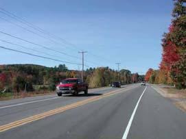


60
61 3.7.2 Milford In Milford, the visual character of Route 101 can be divided into three distinct stretches of road: the first is an east-west stretch leading from the Amherst border to an area west of Ball Hill Road; the second is an east-west stretch to the curve on the Route 101 Bypass just before Old Wilton Road; and the third is a developed stretch through the area around the intersection of Route 101 and 101A (Elm Street) to the Wilton town line. The first stretch of Route 101 in Milford is characterized by numerous broad views of the rolling countryside ahead and to the south. To the north, heavy vegetation and slightly higher topography limit views, but do not impede a sense of openness. To the south, the absence of development along the road edge, trees that are low, set far back from the road, and open up frequently, and a relatively level surrounding landscape provide a dramatic sense of the entire countryside along this stretch of road and a glimpse of the distant Mount Monadnock. The dramatic views of the previous stretch of road are replaced in the next stretch by lines of low trees set back from the road edge. This area is continuous in character along its entire length, with the only change occurring at the end of the bypass where the road turns to the north and connects to a more developed area. The last stretch of Route 101 in Milford is characterized by a combination of industrial development at one end, and roadside commercial development at the other. The topography is generally flat along the road, but slopes up dramatically in the background. At the intersection of Elm Street and Route 101, traffic dominates the environment and buildings are set far back to accommodate large parking lots, and there is little foliage along the street edges. After Route 101 turns west beyond the 101/101A intersection, there is a dense strip of automobile-oriented commercial development located close to the road with little setback or separation of sites. Buildings and trees are situated close to the street edge. As one approaches Wilton, the topography slopes up dramatically to the south to Dram Cup Hill, and to the north one sees a series of views of the Souhegan River screened by trees along its edges with the land sloping up behind it. 61
62 fold out page here - Milford Visual Analysis 62


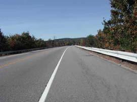


63
64 3.7.3 Wilton In Wilton, the visual character of Route 101 can be divided into two distinct stretches of road: the first is an east-west stretch leading from the Milford border to Intervale Road, and the second is a stretch heading roughly northwest to Route 31, where the Corridor Study Area ends. The most dominant aspect of this area of Route 101 is the topography. The road runs between the foot very steep and heavily vegetated slopes to the south and the Souhegan River to the north. Development occurs intermittently and at a lower elevation than Route 101, affording broad but brief views of historic mill buildings and downtown Wilton. Traveling east on this stretch, there is a brief but dramatic view of the church steeple in the downtown. The second stretch, which begins as Route 101 crosses to the north side of the river, is less developed, with heavy vegetation along both sides of the road and brief views out to the north. At the end of this stretch, the topography levels out, trees are intermittent and set back, and there are patches of commercial use along the south side of the road including garden centers, a truck-oriented business, convenience store, and the Monadnock Spring Water Company. These commercial uses vary in type but are seen as independent islands of activity in the larger landscape around them. One sees several houses as the Corridor Study Area approaches its end where Route 31 diverges south. 64
65 fold out page here - Wilton Visual Analysis 65


66
67 3.8 Natural Systems Wetlands and Waterways Wetlands are important natural resource areas that support wildlife and contribute to water quality improvement and control of flooding. They are also viewed by many people as making important contributions to community aesthetics and quality of life. Wetlands are regulated at both the state and federal level, and they may be a key issue during environmental review of highway improvements. Therefore, it is important to be aware of their location and give them due consideration in planning for improvements. Wetland impacts are one of the key issues in evaluating options for improving Route 101. Wetlands are shown on the map below. Amherst Amherst has many significant wetlands along the Route 101 Corridor. (A principal reason for providing ramps at Route 122/Ponemah Road only to and from the south was to minimize impacts on the large adjacent wetland.) Route 101 runs along a large wetland system beginning just west of Schoolhouse Road, crossing it east of Horace Greeley Road, and running along the wetland s north edge for another 2000 feet; Salzburg Square lies between the highway and the middle portion of this wetland. A second large wetland system drained by Beaver Brook lies east of Route 101 between Walnut Hill Road and Baboosic Lake Road. This wetland is in turn connected to a series of wetlands on the west side of the highway from the Thatcher Drive/Thornton Ferry Road area to Boston Post Road, where it crosses to the east side of Route 101. The southern end of this wetland complex is adjacent to the halfinterchange at Ponemah Road, as described above. Beaver Brook then runs on a course that is farther from Route 101, joining the Souhegan River approximately 2000 feet east of the Route 101 bridge. The Route 101 river crossing is environmentally sensitive and may constrain any potential improvements that would widen the highway at that location. Milford Beyond the Souhegan River, Route 101 is on high ground, crossing an intermittent brook approximately one-half mile east of Route 13. A wetland system along the brook running west of Route 13/Mont Vernon Road borders the Route 101/Route 13 interchange and is crossed by the highway at this point. The highway runs near the large wetland system associated with Great Brook, Birch Brook, and Osgood Pond. It passes through the BROX property, which contains a significant wetland. Perry Road, which provides access to the BROX land from Old Wilton Road is also bordered by wetlands where it crosses Tucker Brook. These wetlands are con- 67
68 straints which are addressed by the Milford s subdivision plan for the BROX property and also constrain improvements to the Perry Road access. Beyond the 101/101A intersection in west Milford, the highway runs parallel to the Souhegan River; widening in this area may have impacts on the river bank and is thus a constraint that must be addressed. Wilton Significant wetlands are generally absent from the Route 101 corridor study area in Wilton, with the exception of the bridge over the Souhegan near the east end of Intervale Road. Implications for the Route 101 Corridor Wetland encroachment should be avoided altogether whenever possible. Where options for roadway improvement may have impacts on wetlands, the severity of impact will be an important criterion in evaluating the option. Where avoidance is not possible and there is sufficient justification for the improvement, impacts should be minimized through design to the extent possible, and the necessary permitting process should be included in the implementation strategy. 68
69 69
70 3.8.2 Floodplains and Stormwater Flooding is a natural phenomenon which can be worsened by development and filling. As shown on the accompanying map, there are flood prone areas along the Souhegan River and its tributary brooks and wetlands. Flood-prone areas are regulated locally through zoning, in response to federal mandates in connection with the Federal Emergency Management Agency (FEMA) flood insurance program. FEMA has prepared maps delineating floodplains based on hydrologic studies and investigation of historic flooding events. Flooding is also an important consideration in wetlands regulation. The hydrological relationships of stormwater runoff and flooding with wetland resources is a complex one which must be addressed during design and permitting. However, the so-called 100-year floodplain is a good rule of thumb for anticipating issues in a planning study. (The term 100-year is used to denote flood levels associated with a 1 percent probability in a given year; it is possible to have 100-year floods two years in a row.) The 500-year (0.2 percent probability) storm is also delineated on FEMA maps. There are three general considerations applicable to flood-prone areas: Don t impede the passage of flood water Minimize filling of land below the 100-year flood level, thereby displacing flood storage and widening the area of flooding Minimize increases in impervious surfaces, which contributes to the amount and speed with which stormwater runoff reaches waterways and wetlands. In addition, roadways should be above the 100-year flood elevation so that they continue to function when intense storms cause flooding. This consideration needs to be addressed in providing access improvements serving the BROX property, because Perry Road runs through a flood-prone area. Stormwater discharge is an important aspect of the design of the highway and development of sites along it. Rain and snowmelt on pervious surfaces such as grassy and wooded land percolate into the ground replenishing groundwater, and excess runoff during intense storms travels more slowly on vegetated land, reaching streams and rivers over an extended period of time which the waterways can accommodate more successfully than the sharply peaked discharge from impervious surfaces like parking lots, building roofs, and roadways. Stormwater drainage is an important aspect of highway design. Route 101 discharges through swales and culverts to natural drainages at hundreds of points along its length. No specific stormwater discharge problems have been identified to date, but any improvements that increase the highway s paved cross-section or introduce access ramps must be carefully designed to accommodate stormwater appropriately. Stormwater analysis is part of the design and permitting process, 70
71 and both engineering practices and standards and regulatory criteria require that stormwater impacts be minimized. Implications for the Route 101 Corridor These considerations must be borne in mind when considering projects that widen the highway in flood-prone areas. They are also considerations in development of land along the corridor, with impervious site cover being an issue for site plan review and guidance. 71
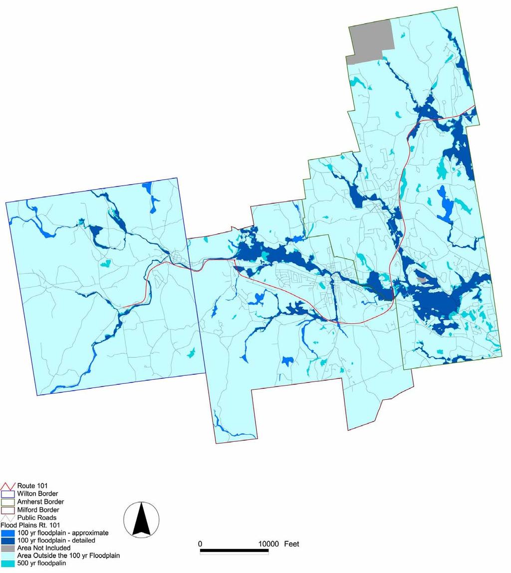
72 72
4. Safety Concerns Potential Short and Medium-Term Improvements
 NH Route 104 Access Management Study Page 19 4. Safety Concerns Potential Short and Medium-Term Improvements Potential safety improvement strategies are listed by priority based on field observations by
A. CONCLUSIONS OF THE FGEIS
 Chapter 11: Traffic and Parking A. CONCLUSIONS OF THE FGEIS The FGEIS found that the Approved Plan will generate a substantial volume of vehicular and pedestrian activity, including an estimated 1,300
Lake Erie Commerce Center Traffic Analysis
 LOCATION: East of NYS Route 5 at Bayview Road Town of Hamburg Erie County, New York PREPARED BY: Wendel Companies 140 John James Audubon Parkway Suite 200 Amherst, New York 14228 January 2012 i ii Table
PURPOSE AND NEED (CONCURRENCE POINT 1) NEW CANADA ROAD PROJECT FROM STATE ROUTE 1 (U.S. HIGHWAY 70) TO U.S. INTERSTATE 40
 NEW CANADA ROAD PROJECT FROM STATE ROUTE 1 (U.S. HIGHWAY 70) TO U.S. INTERSTATE 40") PURPOSE AND NEED (CONCURRENCE POINT 1) NEW CANADA ROAD PROJECT FROM STATE ROUTE 1 (U.S. HIGHWAY 70) TO U.S. INTERSTATE 40 Project Description The primary purpose of this project is to improve the major
PURPOSE AND NEED (CONCURRENCE POINT 1) NEW CANADA ROAD PROJECT FROM STATE ROUTE 1 (U.S. HIGHWAY 70) TO U.S. INTERSTATE 40 Project Description The primary purpose of this project is to improve the major
2008 DEKALB COUNTY TRANSPORTATION PLAN (UPDATE)
") 2008 DEKALB COUNTY TRANSPORTATION PLAN (UPDATE) TABLE OF CONTENTS Introduction 1 Transportation Planning Activities 2 Identification of Problem Areas and Recommended Solutions 7 DeKalb County Projects
2008 DEKALB COUNTY TRANSPORTATION PLAN (UPDATE) TABLE OF CONTENTS Introduction 1 Transportation Planning Activities 2 Identification of Problem Areas and Recommended Solutions 7 DeKalb County Projects
ROUTE 122 CORRIDOR STUDY ---- Bedford County and Bedford City, Virginia
 ROUTE 122 CORRIDOR STUDY ---- Bedford County and Bedford City, Virginia Developed by Region 2000 Regional Commission In cooperation with Bedford County, Virginia City of Bedford, Virginia Virginia Department
MEMORANDUM. Lynn Hayes LSA Associates, Inc.
 MEMORANDUM To: Lynn Hayes LSA Associates, Inc. Date: May 5, 217 From: Zawwar Saiyed, P.E., Senior Transportation Engineer Justin Tucker, Transportation Engineer I Linscott, Law & Greenspan, Engineers LLG
US Route 3 Corridor Study: Phase I. Town of Boscawen & City of Franklin, New Hampshire
 US Route 3 Corridor Study: Phase I Town of Boscawen & City of Franklin, New Hampshire January 27, 2004 US Route 3 Corridor Study: Phase I, NH City of Franklin Franklin Plantation For the Town of Boscawen
5.1 Traffic and Transportation
 5.1 When it opens in 2009, the Bellevue Nickel Improvement Project will increase the number of vehicles able to travel through the study area, improve travel speeds, and improve safety by reducing the
ROUTE 20 CORRIDOR STUDY ---- Orange County, Virginia
 ROUTE 20 CORRIDOR STUDY ---- Orange County, Virginia Prepared by PARSONS Fairfax, Virginia on behalf of the: Rappahannock-Rapidan Regional Commission in cooperation with Orange County, Virginia Virginia
EXISTING CONDITIONS A. INTRODUCTION. Route 107 Corridor Study Report
 II. EXISTING CONDITIONS A. INTRODUCTION The Route 107 study area extends from the south at Chestnut Street in Lynn approximately 3.7 miles to the north to Boston Street in Salem. The study area has three
NORTH FRASER PERIMETER ROAD WEST CORRIDOR DEFINITION STUDY
 NORTH FRASER PERIMETER ROAD WEST CORRIDOR DEFINITION STUDY MAY 2011 SW1132SWD NORTH FRASER PERIMETER ROAD WEST CORRIDOR DEFINITION STUDY TABLE OF CONTENTS 1.0 INTRODUCTION... 1 2.0 CURRENT TRAVEL PATTERNS
Pedestrian Safety Review Spadina Avenue
 STAFF REPORT ACTION REQUIRED Pedestrian Safety Review Spadina Avenue Date: October 13, 2015 To: Toronto and East York Community Council From: Director, Transportation Services, Toronto and East York District
Interstate 90 and Mercer Island Mobility Study APRIL Commissioned by. Prepared by
 Interstate 90 and Mercer Island Mobility Study APRIL 2017 Commissioned by Prepared by Interstate 90 and Mercer Island Mobility Study Commissioned by: Sound Transit Prepared by: April 2017 Contents Section
1.2 Corridor History and Current Characteristics
 SECTION 1 Description and Background of Study Area 1.1 Introduction This preliminary engineering report was prepared for the Alaska Department of Transportation and Public Facilities (ADOT&PF). It is part
Treasure Island Supplemental Information Report Addendum
 1 1 1 1 0 1 0 1 0 1 Treasure Island Supplemental Information Report Addendum Introduction Purpose The purpose of this Supplemental Information Report (SIR) Addendum is to determine if the current land
HIGHWAY RAIL GRADE CROSSING CONSOLIDATION PROGRAM
 HIGHWAY RAIL GRADE CROSSING CONSOLIDATION PROGRAM To decrease unnecessary train traffic exposure to life and property, promote public safety, and improve traffic conditions, the Texas Department of Transportation
According to FAA Advisory Circular 150/5060-5, Airport Capacity and Delay, the elements that affect airfield capacity include:
 4.1 INTRODUCTION The previous chapters have described the existing facilities and provided planning guidelines as well as a forecast of demand for aviation activity at North Perry Airport. The demand/capacity
London Borough of Barnet Traffic & Development Design Team
 London Borough of Barnet Traffic & Development Design Team AERODROME ROAD PEDESTRIAN FACILITY AND BUS STOP INTRODUCTION FEASIBILITY REPORT Job Number: 60668 Doc Ref: S106/12-13/60668 Author: Manoj Kalair
LUDWIG RD. SUBDIVISION PROJECT TRAFFIC IMPACT ANALYSIS
 LUDWIG RD. SUBDIVISION PROJECT TRAFFIC IMPACT ANALYSIS Prepared for Skip Coddington GSC Development, Inc PO Box 1623 Woodinville WA 9872 Prepared by 1141 NE 124 th St., #59 Kirkland, WA 9834 425.522.4118
FINAL TERMINAL TRAFFIC MONITORING STUDY
 FINAL TERMINAL 91 216 TRAFFIC MONITORING STUDY Prepared for: Port of Seattle February 15, 217 Prepared by: 12131 113 th Avenue NE, Suite 23 Kirkland, WA 9834-712 Phone: 425-821-3665 www.transpogroup.com
MEMORANDUM. Bob Zagozda, Chief Financial Officer Westside Community Schools. Mark Meisinger, PE, PTOE Felsburg Holt & Ullevig. DATE: June 11, 2018
 MEMORANDUM TO: Bob Zagozda, Chief Financial Officer Westside Community Schools FROM: Mark Meisinger, PE, PTOE Felsburg Holt & Ullevig DATE: June 11, 218 6-11-18 SUBJECT: Sunset Hills Elementary School
Construction underway. STATUS: 229 5,190 5,419 5,305 STIP REFERENCE #FR /01/2013
 FREDERICK COUNTY STATE HIGHWAY ADMINISTRATION -- Frederick County -- Line 1 PROJECT: I-7, Baltimore National Pike INTERSTATE CONSTRUCTION PROGRAM DESCRIPTION: Widen I-7 east of MD 355 to east of MD 144
2006 WEEKDAY TRAFFIC PROFILE. June 15, 2007
 June 15, 2007 Mr. Gary Stobb, P.E. Director of Planning/Operations Harris County Toll Road Authority 330 Meadowfern, Suite 200 Houston, TX 77067 Re: Westpark Tollway Value Pricing Analysis Dear Mr. Stobb:
A number of goals were identified during the initial work on this Big Lake Transportation Plan.
 C. Transportation General Background Information Big Lake s transportation system includes all the roads, paths and facilities that allow the movement of private vehicles, trains and planes, as well as
Memorandum. Roger Millar, Secretary of Transportation. Date: April 5, Interstate 90 Operations and Mercer Island Mobility
 Memorandum To: From: The Honorable Dow Constantine, King County Executive; The Honorable Ed Murray, City of Seattle Mayor; The Honorable Bruce Bassett, City of Mercer Island Mayor; The Honorable John Stokes,
Other Principle Arterials Minor Arterial Major Collector Minor Collector Local
 CHAPTER 10 TRANSPORTATION Introduction The system of public roads in East Pikeland Township is decidedly rural in character. Since the 1984, the road network has remained much the same, with the addition
AGENDA ITEM 5 D WAKULLA ENVIRONMENTAL INSTITUTE (WEI) TRAIL FEASIBILITY STUDY
 TRAIL FEASIBILITY STUDY") March 19, 2018 AGENDA ITEM 5 D WAKULLA ENVIRONMENTAL INSTITUTE (WEI) TRAIL FEASIBILITY STUDY TYPE OF ITEM: Action STATEMENT OF ISSUE The Wakulla Environmental Institute (WEI) Trail is one of several trails
March 19, 2018 AGENDA ITEM 5 D WAKULLA ENVIRONMENTAL INSTITUTE (WEI) TRAIL FEASIBILITY STUDY TYPE OF ITEM: Action STATEMENT OF ISSUE The Wakulla Environmental Institute (WEI) Trail is one of several trails
DISTRICT EXPRESS LANES ANNUAL REPORT FISCAL YEAR 2017 JULY 1, 2016 JUNE 30, FloridaExpressLanes.com
 DISTRICT EXPRESS LANES ANNUAL REPORT FISCAL YEAR 2017 JULY 1, 2016 JUNE 30, 2017 FloridaExpressLanes.com This page intentionally left blank. TABLE OF CONTENTS List of Figures... ii List of Tables.... ii
HOV LANE PERFORMANCE MONITORING: 2000 REPORT EXECUTIVE SUMMARY
 Final Report Research Project Agreement No. T1803, Task 4 HOV Monitoring V HOV LANE PERFORMANCE MONITORING: 2000 REPORT EXECUTIVE SUMMARY by Jennifer Nee TRAC Research Engineer John Ishimaru TRAC Senior
Nashua Regional Planning Commission
 Nashua Regional Planning Commission Congestion Management Program Corridor Overview NH 111 is a major east-west arterial roadway that passes through 3 municipalities in the Nashua region. It enters the
Arlington County Board Meeting Project Briefing. October 20, 2015
 Arlington County Board Meeting Project Briefing October 20, 2015 Project Map 2 Project Context Only Interstate in the Country limited to HOV only traffic during rush hours Stoplight at the end of I-66
The purpose of this Demand/Capacity. The airfield configuration for SPG. Methods for determining airport AIRPORT DEMAND CAPACITY. Runway Configuration
 Chapter 4 Page 65 AIRPORT DEMAND CAPACITY The purpose of this Demand/Capacity Analysis is to examine the capability of the Albert Whitted Airport (SPG) to meet the needs of its users. In doing so, this
# 7. Date of Meeting: September 2, 2015 BOARD OF SUPERVISORS BUSINESS MEETING ACTION ITEM SUBJECT:
 BOARD OF SUPERVISORS BUSINESS MEETING ACTION ITEM Date of Meeting: September 2, 2015 # 7 SUBJECT: ELECTION DISTRICT: CRITICAL ACTION DATE: STAFF CONTACTS: Traffic Congestion and Safety Improvements at
MEMORANDUM. for HOV Monitoring on I-93 North and the Southeast Expressway, Boston Region MPO, November, 2011.
 MEMORANDUM Date: January 12, 2012 To: Congestion Management Process Files From: Seth Asante, Ryan Hicks, and Efi Pagitsas MPO Staff Re: Historical Trends: Travel Times and Vehicle Occupancy Levels for
FNORTHWEST ARKANSAS WESTERN BELTWAY FEASIBILITY STUDY
 FNORTHWEST ARKANSAS WESTERN BELTWAY FEASIBILITY STUDY EXECUTIVE SUMMARY The 2030 Northwest Arkansas Regional Transportation Plan developed by the Northwest Arkansas Regional Planning Commission (NWARPC)
Washington St. & Ash Coulee Dr./43 rd Ave Intersection Study
 430 IACC Building Fargo, ND 58105 Tel 701-231-8058 Fax 701-231-1945 www.ugpti.org www.atacenter.org Washington St. & Ash Coulee Dr./43 rd Ave Intersection Study Final Report April 2007 Prepared for: City
MEMORANDUM. Open Section Background. I-66 Open Section Study Area. VDOT Northern Virginia District. I-66 Project Team. Date: November 5, 2015
 MEMORANDUM To: VDOT Northern Virginia District From: I-66 Project Team Date: November 5, 2015 Subject: Open Section Background The purpose of this technical memorandum is to provide narrative and technical
Glasgow Street Traffic Review
 Glasgow Street Traffic Review Recommendation That the Standing Policy Committee on Transportation recommend to City Council: 1. That the Administration proceed with removing the pinch points installed
HAMPTON ROADS CROSSINGS PATRIOTS CROSSING AND HRBT
 HRTPO Board Meeting March 21, 2013 Agenda ITEM #9: HAMPTON ROADS CROSSINGS PATRIOTS CROSSING AND HRBT Congestion at the Hampton Roads Bridge-Tunnel (HRBT) on I-64 has long been identified as a problem
A VISION FOR I-95. January 12, Delaware Department of Transportation
 A VISION FOR I-95 January 12, 2011 Delaware Department of Transportation The East Coast s Main Street Along with SR 1, the most significant highway in Delaware 29 miles to I ".', 2 Sponsoring / Cooperating
McLean Citizens Association Transportation Committee Project Briefing
 McLean Citizens Association Transportation Committee Project Briefing November 10, 2015 Project Map 2 Project Context Only Interstate in the Country limited to HOV only traffic during rush hours Stoplight
TABLE OF CONTENTS. Coral Springs Charter High School and Middle School Job No Page 2
 Job No. 15-019 Page 2 TABLE OF CONTENTS 1.0 INTRODUCTION... 4 2.0 EXISTING CONDITIONS... 5 3.0 TRAFFIC GENERATION... 7 4.0 TRIP DISTRIBUTION... 8 5.0 FUTURE CONDITIONS... 8 6.0 SITE ACCESS...13 7.0 CONCLUSION...13
SAN FRANCISCO MUNICIPAL TRANSPORTATION AGENCY
 THIS PRINT COVERS CALENDAR ITEM NO. : 10.4 DIVISION: Sustainable Streets BRIEF DESCRIPTION: SAN FRANCISCO MUNICIPAL TRANSPORTATION AGENCY Approving various parking and traffic modifications associated
Project Deliverable 4.1.3d Individual City Report - City of La Verne
 Pomona Valley ITS Project Project Deliverable 4.1.3d Individual City Report - City of La Verne Prepared by: April 19, 2002 099017000.1 Copyright 2002, Kimley-Horn and Associates, Inc TABLE OF CONTENTS
Macleod Trail Corridor Study. Welcome. Macleod Trail Corridor Study Open House. Presentation of Proposed Design Concepts
 Macleod Trail Corridor Study Welcome Macleod Trail Corridor Study Open House Presentation of Proposed Design Concepts Study Purpose Develop a corridor plan for Macleod Trail that aligns with The City s:
Site Location and Setting
 Memorandum Date: To: From: Subject: Kristy Le, Gary Black Steve Orem Santa Teresa County Park Historic Area Traffic and Parking Study Hexagon Transportation Consultants, Inc. has completed a traffic and
TRAFFIC CONTROL DEVICES MANUAL FOR WORK ZONES
 TRAFFIC CONTROL DEVICES MANUAL FOR WORK ZONES SUMMARY Work zone activities often create conditions on the travelled way that are hazardous particularly at night when the ability of motorists to see is
Planning. Proposed Development at the Southeast Corner of Lakeshore Road West and Brookfield Road Intersection FINAL.
 Project No. 121-22908 N o v e m b e r 2 0 1 2 Traffic Impact Study Transportation Planning th GENIVAR Inc., 600 Cochrane Drive, 5 Floor, Markham, Ontario L3R 5K3 Telephone: 905.475.7270 Fax: 905.475.5994
Section 106 Update Memo #1 Attachment D. Traffic Diversion & APE Expansion Methodology & Maps
 Section 106 Update Memo #1 Attachment D Traffic Diversion & APE Expansion Methodology & Maps I-65/I-70 North Split Interchange Reconstruction Project (Des. Nos. 1592385 & 1600808) Traffic Diversion and
Guide for Permits Development adjacent to Provincial Highways
 Guide for Permits Development adjacent to Provincial Highways Engineering & Operations Division Highway Planning and Design Branch January 2019 TABLE OF CONTENTS 1 Introduction... 1 1.1 The Traffic and
Aldridge Transportation Consultants, LLC Advanced Transportation Planning and Traffic Engineering
 Aldridge Transportation Consultants, LLC Advanced Transportation Planning and Traffic Engineering John M.W. Aldridge, PE, PTOE, AICP 182 Chimney Rock Road Colorado Registered Professional Engineer Highlands
CHAPTER FOUR: TRANSPORTATION
 CHAPTER FOUR: TRANSPORTATION Barron County Comprehensive Plan: Transportation Page 61 Background Transportation facilities have a significant influence on land use, development and quality of life for
Research Report Agreement T4118, Task 24 HOV Action Plan HOV ACTION PLAN
 Research Report Agreement T4118, Task 24 HOV Action Plan HOV ACTION PLAN by John M. Ishimaru Senior Research Engineer Duane Wright Systems Analyst Programmer Mark E. Hallenbeck Director Jaime Kang Research
FHWA P/N Guidelines. Corridor Relationship. Highway 22 Segment 1 - US 169 to CSAH 2 Relevance / Documentation of Need
 Highway 22 Segment 1 - US 169 to CSAH 2 Vehicle Mobility Congestion Intersection Congestion Existing Conditions - Based on Highway Capacity Manual methodology, corridor level of service is currently LOS
Michigan s Engineering Safety Program for Local Roadways
 Michigan s Engineering Safety Program for Local Roadways Local Road Safety Peer Exchange October 2018 Timothy J. Gates, Ph.D., P.E., P.T.O.E. Michigan State University Andrew Ceifetz, P.E. WSP For More
Regulations to deter cut-through traffic - Heath Street V\fest, between Spadina Road and Avenue Road. Toronto and East York Community Council
 TORONTO STAFF REPORT ACTION REQUIRED Regulations to deter cut-through traffic - Heath Street V\fest, between Spadina Road and Avenue Road Dnte: February 16,2009 To: From: Toronto and East York Community
N4 Carrick-on-Shannon to Dromod Road Project. 2.1 Introduction
 Chapter 2 Need for the Scheme 2.1 Introduction The National Primary Route N4, Dublin to Sligo is a strategic corridor from Dublin to the northwest and border counties (See RCSR 101 in Volume 2). The National
Draft Concept Alternatives Analysis for the Inaugural Airport Program September 2005
 Section 10 Preferred Inaugural Airport Concept 10.0 Introduction The Preferred Inaugural Airport Concept for SSA was developed by adding the preferred support/ancillary facilities selected in Section 9
A. From I-68 in Monongalia County, West Virginia to SR 6119 in Fayette County, Pennsylvania 1
 Mon-Fayette Transportation Project A. From I-68 in Monongalia County, West Virginia to SR 6119 in Fayette County, Pennsylvania 1 The Mon/Fayette Transportation Project (MFTP) from I-68 in West Virginia
SR 934 Project Development And Environment (PD&E) Study
 Study") SR 934 Project Development And Environment (PD&E) Study Project Advisory Group Meeting March 1, 2018 State Road 934/NE/NW 79th Street from west of I-95 (NW 13th CT) to N. Bayshore Drive PD&E STUDY SR 934/NE/NW
SR 934 Project Development And Environment (PD&E) Study Project Advisory Group Meeting March 1, 2018 State Road 934/NE/NW 79th Street from west of I-95 (NW 13th CT) to N. Bayshore Drive PD&E STUDY SR 934/NE/NW
Construction Staging Adelaide Street West
 REPORT FOR ACTION Construction Staging Adelaide Street West Date: October 6, 2016 To: Toronto and East York Community Council From: Acting Director, Transportation Services, Toronto and East York District
Appendix 4.1 J. May 17, 2010 Memorandum from CTPS to the Inter Agency Coordinating Group
 Appendix 4.1 J May 17, 2010 Memorandum from CTPS to the Inter Agency Coordinating Group CTPS CENTRAL TRANSPORTATION PLANNING STAFF Staff to the Boston Region Metropolitan Planning Organization MEMORANDUM
TABLE OF CONTENTS. 1 P age
 TABLE OF CONTENTS PROJECT DESCRIPTION... 2 PROJECT LOCATION... 5 PROEJCT PARTIES... 8 GRANT FUNDS AND SOURCES/ USES OF PROJECT FUNDS... 8 PRIMARY SELECTION CRITERIA/ QUALITY OF LIFE... 9 RESULTS OF BENEFIT
Gold Coast. Rapid Transit. Chapter twelve Social impact. Chapter content
 Gold Coast Rapid Transit Chapter twelve Social impact Chapter content Social impact assessment process...235 Existing community profile...237 Consultation...238 Social impacts and mitigation strategies...239
The Baker/Carver Regional Trail is intended to
 Section V Design Guidance The Baker/Carver Regional Trail is intended to safely accommodate 183,000 annual visits, an array of non-motorized uses, a variety of skill levels, and persons with special needs.
Attachment No. 20 RRLRT No. 1. Committee. Busway Grade Crossings STATUS/DATE OF ACTION
 Attachment No. 20 RRLRT No. 1 TECHNICAL COMMITTEE: Railroad / Light Rail Transit Technical Committee TOPIC: Busway Grade Crossings STATUS/DATE OF ACTION RRLRT TC Draft: 06/23/2011 RRLRT TC Approval: 06/27/2014
PROGRESS PARK CONNECTOR
 PROGRESS PARK CONNECTOR Project No. 9999 098 R65, P102 ALTERNATIVES ANALYSIS 6 April 2015 Revised for updated dates PROGRESS PARK CONNECTOR ROAD ALTERNATIVES ALTERNATIVE # 1 West from the intersection
CHAPTER 4 -- THE LAND USE PLAN: DESCRIPTIONS AND POLICIES FOR THIRTEEN PLANNING AREAS
 CHAPTER 4 -- THE LAND USE PLAN: DESCRIPTIONS AND POLICIES FOR THIRTEEN PLANNING AREAS NORTH CENTRAL CAC AREA LITTLE VALLEY ROAD TO JUG HANDLE CREEK PLANNING AREA This planning area includes Cleone, Noyo,
FINAL REPORT INTERSECTION STUDY
 FINL REPORT INTERSECTION STUDY Vermont Route 22 & Panton Road City of Vergennes, Vermont May 9, 2011 Prepared for: 14 Seminary Street Middlebury, Vermont 05753 Prepared by: LMOUREUX & DICKINSON 14 Morse
Traffic Management Plan 2018
 Traffic Management Plan 2018 Jesuit College Preparatory School of Dallas Amendment to Planned Development No. 353 Dallas, Texas June 6, 2018 Prepared for Jesuit College Preparatory School of Dallas Prepared
Executive Summary. MASTER PLAN UPDATE Fort Collins-Loveland Municipal Airport
 Executive Summary MASTER PLAN UPDATE Fort Collins-Loveland Municipal Airport As a general aviation and commercial service airport, Fort Collins- Loveland Municipal Airport serves as an important niche
8 CROSS-BOUNDARY AGREEMENT WITH BRAMPTON TRANSIT
 8 CROSS-BOUNDARY AGREEMENT WITH BRAMPTON TRANSIT The Transportation Services Committee recommends the adoption of the recommendations contained in the following report dated May 27, 2010, from the Commissioner
State aims to cure accident-plagued South Jersey interchange
 State aims to cure accident-plagued South Jersey interchange 11:52 PM, Apr. 16, 2011 Written by JOE COONEY, Courier-Post Staff GLOUCESTER CITY Anyone who has driven the gantlet known as the I-295/I- 76/Route
Public Informational Meeting
 Public Informational Meeting April 17, 2007 Bow-Concord I-93 I Transportation Planning Study Bow-Concord Interstate 93 Transportation Planning Study Context Sensitive Solutions Planning Steps Screen Alternatives
user s guide to Transportation Improvements in Astoria Planning Efforts outside Astoria for more information, contact:
 The Miles Crossing/ Jeffers Garden transportation plan (underway), will identify needed improvements to the Warrenton Astoria Highway and local street improvements to serve expected growth in the Miles
CONGESTION MONITORING THE NEW ZEALAND EXPERIENCE. By Mike Curran, Manager Strategic Policy, Transit New Zealand
 CONGESTION MONITORING THE NEW ZEALAND EXPERIENCE 26 th Australasian Transport Research Forum Wellington New Zealand 1-3 October 2003 By, Manager Strategic Policy, Transit New Zealand Abstract New Zealand
I-66 Inside the Beltway Feasibility Study
 I-66 Inside the Beltway Feasibility Study Feasibility Study Study Process Context Sensitive Dialogues Corridor Assessments / Data Collection Problem Statement Refinement Concept Development Concept Evaluation
DOGWOOD AT VILLA AVENUE PROJECT
 TRANSPORTATION IMPACT ANALYSIS DOGWOOD AT VILLA AVENUE PROJECT El Centro, California September 4, 2018 LLG Ref. 3-17-2782 TABLE OF CONTENTS SECTION PAGE Appendices... ii List of Figures... i List of Tables...
WESTERN EL DORADO COUNTY SHORT AND LONG-RANGE TRANSIT PLAN Executive Summary
 WESTERN EL DORADO COUNTY SHORT AND LONG-RANGE TRANSIT PLAN Executive Summary Prepared for the El Dorado County Transportation Commission Prepared by The El Dorado County Transportation Commission (EDCTC)
Section 3-04 Cross Sectional Elements TABLE OF CONTENTS. INTRODUCTION...3 General...3 Exhibit 1-Cross-Sectional Elements...3
 Section 3-04 Cross Sectional Elements TABLE OF CONTENTS INTRODUCTION...3 General...3 Exhibit 1-Cross-Sectional Elements...3 CROSS-SECTIONAL ELEMENTS...3 Traveled Way...3 Shoulder...3 Surfacing Taper...3
Southern Oregon Transportation Engineering, LLC
 Southern Oregon Transportation Engineering, LLC 112 Monterey Drive - Medford, Or. 97504 Office 541.608.9923 Cell 541.941.4148 Email: Kwkp1@Q.com August 12, 2013 Mike Faught, Public Works Department City
Welcome to Dayton Parkway Interchange Open House. November 26, 2018
 Welcome to Dayton Parkway Interchange Open House November 26, 2018 Project Partners Minnesota DOT Hennepin County City of Rogers Dayton Project History NW Hennepin County I94 Study 2007/08 Interchange
APPENDIX H MILESTONE 2 TRAFFIC OPERATIONS ANALYSIS OF THE AT-GRADE CROSSINGS
 Draft Environmental Impact Statement/Environment Impact Report Appendix H Milestone 2 Traffic Operations Analysis of the At-Grade Crossings APPENDIX H MILESTONE 2 TRAFFIC OPERATIONS ANALYSIS OF THE AT-GRADE
Non-Motorized Transportation
 Non-Motorized Transportation Non-motorized facilities are important components to the transportation system. They provide an environmentally-friendly, low-cost mode of travel. Some of the facilities can
US 380 FEASIBILITY STUDY
 US 380 FEASIBILITY STUDY Denton County CSJ(s): 0135-10-061, 0135-10-062 Public Meeting(s): January 15 & 22, 2019 WELCOME US 380 Denton County Feasibility Study DALLAS DISTRICT PUBLIC MEETING January 15
10.0 Recommendations Methodology Assumptions
 10.0 Recommendations To accommodate the projected growth of the I-526 corridor, this report has summarized potential improvement strategies that were separated into four categories, TDM, Modal, Traffic
Frequently Asked Questions on the Route 29 Solutions Improvements Projects
 Frequently Asked Questions on the Route 29 Solutions Improvements Projects Background What are the Route 29 Solutions improvement projects? These projects include the Route 29/250 Interchange ( Best Buy
FEDERAL HIGHWAY ADMINISTRATION NEVADA DEPARTMENT OF TRANSPORTATION ENVIRONMENTAL IMPACT STATEMENT RE-EVALUATION
 FEDERAL HIGHWAY ADMINISTRATION NEVADA DEPARTMENT OF TRANSPORTATION ENVIRONMENTAL IMPACT STATEMENT RE-EVALUATION Project Name: Boulder City/US 93 Corridor Study (Boulder City Bypass) Project Location: The
Thornton Water Project. Larimer County Route Study and Project Update September 12, 2017
 Thornton Water Project Larimer County Route Study and Project Update September 12, 2017 Purpose of Meeting Provide information on the Thornton Water Project Present the results of the pipeline routing
Provincial Railway Technical Standards
 GENERAL: INDEX: The standards and requirements listed in this document are intended for use on provincially regulated railway public grade crossings. These standards are considered the minimum requirements
Score. Category. Access Aesthetics Community Resources
 NO BUILD ALTERNATIVE The No Build Alternative is the do nothing option that is used for comparison to the build alternatives. The screening assumes no new facilities are constructed as part of the I-93
Launceston City Council. Kings Meadows Traffic Management Report for Public Consultation
 Launceston City Council Kings Meadows Traffic Management Report for Public Consultation November 2013 This report: has been prepared by GHD for Launceston City Council and may only be used and relied on
rtc transit Before and After Studies for RTC Transit Boulder highway UPWP TASK Before Conditions
 rtc transit Before and After Studies for RTC Transit UPWP TASK 3403-11-14 Before Conditions Report Boulder highway June 2011 Before and After Studies for RTC Transit BOULDER HIGHWAY BEFORE STUDY UPWP Task
chapter - Hex Highway Touring Route Hamburg to Strausstown Overview
 chapter - 2 Hex Highway Touring Route Hamburg to Strausstown Overview The on-road Hex Highway automobile and bicycle touring route begins on State Street in downtown Hamburg. The route continues west on
Saighton Camp, Chester. Technical Note: Impact of Boughton Heath S278 Works upon the operation of the Local Highway Network
 Technical Note: Impact of Boughton Heath S278 Works July 2013 SAIGHTON CAMP CHESTER COMMERCIAL ESTATES GROUP TECHNICAL NOTE: IMPACT OF BOUGHTON HEATH S278 WORKS UPON THE OPERATION OF THE LOCAL HIGHWAY
November 21, 2012 Barbara Kelleher, (954)
") November 21, 2012 Barbara Kelleher, (954) 777-4090 barbara.kelleher@dot.state.fl.us BROWARD COUNTY TRAFFIC IMPACT REPORT November 26 to November 30, 2012 FORT LAUDERDALE -- Construction and maintenance-related
November 21, 2012 Barbara Kelleher, (954) 777-4090 barbara.kelleher@dot.state.fl.us BROWARD COUNTY TRAFFIC IMPACT REPORT November 26 to November 30, 2012 FORT LAUDERDALE -- Construction and maintenance-related
PSP 75 Lancefield Road. Northern Jacksons Creek Crossing Supplementary Information
 PSP 75 Lancefield Road Northern Jacksons Creek Crossing Supplementary Information September 2017 The northern crossing of Jacksons Creek proposed within the Lancefield Road PSP is a key part of the ultimate
Traffic Calming Measures
 REPUBLIC OF GHANA MINISTRY OF TRANSPORTATION Ghana Highway Authority Road Safety and Environment Division Traffic Calming Measures Design Guideline Version 1 / July 2007 Traffic Calming Measures Page 2
PORTS TORONTO Billy Bishop Toronto City Airport Summary of 2015 Traffic and Passenger Surveys
 PORTS TORONTO Billy Bishop Toronto City Airport Summary of 2015 Traffic and Passenger Surveys 1 Summary of 2015 BBTCA Traffic and Passenger Surveys Surveys of traffic volumes and pedestrian activity were