Planning. Proposed Development at the Southeast Corner of Lakeshore Road West and Brookfield Road Intersection FINAL.
|
|
|
- Trevor Bryan
- 5 years ago
- Views:
Transcription


1 Project No N o v e m b e r Traffic Impact Study Transportation Planning th GENIVAR Inc., 600 Cochrane Drive, 5 Floor, Markham, Ontario L3R 5K3 Telephone: Fax: FINAL Proposed Development at the Southeast Corner of Lakeshore Road West and Brookfield Road Intersection
2

3 November 9, 2012 Mr. P. W. De Castro c/o The Arcop Group 1300 Yonge Street Suite 201 Toronto, ON M4T 1X3 Re: Proposed Development at the Southeast Corner of Lakeshore Road West and Brookfield Road Intersection Traffic Impact Study - Final Dear Mr. De Castro: Attached please find our Traffic Impact Study report for the proposed development located at the southeast corner of the Lakeshore Road West and Brookfield Road intersection in the Town of Oakville. The report demonstrates that the traffic generated by the proposed development can be accommodated by the adjacent boundary roads without any improvements to the existing intersections. Yours truly, GENIVAR Inc. Thomas You, MA. Sc., P. Eng. Transportation Engineer Rao N. Marthi, B.Eng., MCIP, RPP Senior Transportation Planner rep LakeshoreRd TIS Final 600 Cochrane Drive, 5 th Floor, Markham, Ontario L3R 5K3 Telephone: Fax:
4
5 Proposed Development at the Southeast Corner of Lakeshore Road West and Brookfield Road Intersection Traffic Impact Study - Final Table of Contents Table of Contents Transmittal Letter Table of Contents 1. INTRODUCTION PROPOSED DEVELOPMENT Site Access EXISTING CONDITIONS Roadway Network Traffic Volumes Transit Routes Existing Traffic Analysis FUTURE BACKGROUND CONDITIONS Planned Roadway and Transit Improvements Other Area Developments Background Traffic Traffic Growth Rate Future Background Traffic Future Background Traffic Analysis FUTURE TOTAL CONDITIONS Traffic Generation Trip Distribution and Assignment Future Total Traffic Volumes Future Total Traffic Analysis SITE PLAN AND PARKING REVIEW Site Plan Review Parking Review SUMMARY OF FINDINGS RECOMMENDATIONS GENIVAR i
6 Proposed Development at the Southeast Corner of Lakeshore Road West and Brookfield Road Intersection Traffic Impact Study - Final Table of Contents APPENDICES Appendix A Intersection Turning Movement Count Sheets and Signal Timing Plans Appendix B Details of Oakville Transit Route 2 Appendix C Level of Service Definitions Appendix D Existing Intersection Capacity Analysis and Queue Reports Appendix E Net Site Traffic from Background Studies Appendix F AADT Data on Lakeshore Road West Appendix G 2017 Background Traffic Intersection Capacity Analysis and Queue Reports Appendix H TTS 2006 Information on Trips Made by Residents of the Town of Oakville Ward 2 Appendix I 2017 Total Traffic Intersection Capacity Analysis and Queue Reports Appendix J Town of Oakville Driveway By-Law GENIVAR ii
7 Proposed Development at the Southeast Corner of Lakeshore Road West and Brookfield Road Intersection Traffic Impact Study - Final Table of Contents List of Tables Table 3-1 Intersection Turning Movement Count Sources... 7 Table 3-2 Existing Traffic Conditions Signalized Intersection Table 3-3 Existing Traffic Conditions Unsignalized Intersection Table 3-4 Existing (2012) Estimated Queue Lengths Table 4-1 Planned Developments in the Study Area Table 4-2 Background Traffic on Lakeshore Road West Table Background Traffic Conditions Signalized Intersection Table Background Traffic Conditions Unsignalized Intersection Table Background Traffic Estimated Queue Lengths Table 5-1 Estimated Trip Generation, Weekday AM and PM Peak Hours Table 5-2 Future Total Traffic Conditions Signalized Intersection Table Total Traffic Conditions Unsignalized Intersection Table Total Traffic Estimated Queue Lengths List of Exhibits Exhibit 1-1 Site Location... 2 Exhibit 2-1 Conceptual Draft Plan... 5 Exhibit 3-1 Existing Roadway Characteristics... 8 Exhibit 3-2 Existing AM Peak Hour Traffic... 9 Exhibit 3-3 Existing PM Peak Hour Traffic Exhibit 3-4 Transit Stop Locations Exhibit Background AM Peak Hour Traffic Exhibit Background PM Peak Hour Traffic Exhibit 5-1 AM Peak Hour Site Traffic Exhibit PM Peak Hour Site Traffic Exhibit Total AM Peak Hour Traffic Exhibit Total PM Peak Hour Traffic GENIVAR iii
8 Proposed Development at the Southeast Corner of Lakeshore Road West and Brookfield Road Intersection Traffic Impact Study - Final Table of Contents GENIVAR iv
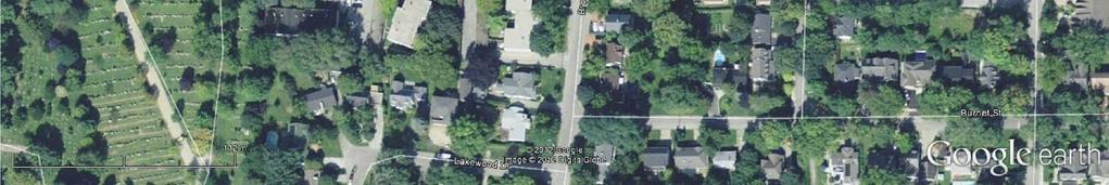
9 Proposed Development at the Southeast Corner of Lakeshore Road West and Brookfield Road Intersection Traffic Impact Study - Final November 9, Introduction GENIVAR was retained by Ontario Inc. / Mara Canada to undertake a Traffic Impact Study in support of the rezoning application for a proposed residential development at the southeast corner of the Lakeshore Road West and Brookfield Road intersection in the Town of Oakville. The site location is shown in Exhibit 1-1. The traffic analysis contained in this report was based on a conceptual plan dated October 11, 2012, by ARCOP and revised site statistics that were provided to GENIVAR subsequent to the development of the concept plan. The proposed development includes 33 residential units in a four-storey building and 400sq.m of(gross leasable area (GLA) on the ground floor for commercial use, plus four townhouse units. This Traffic Impact Study report includes the following: a review of existing traffic conditions at the boundary roadways a review of other area developments and future background traffic conditions at the boundary roadways generation of site traffic for the proposed development, and distribution and assignment of site traffic at the boundary roadways and site access an assessment of current, future background and future total traffic conditions an assessment of the impact of site generated traffic on the adjacent roadway network and site driveway a review of on-site parking requirements Information used in the assessment of the proposed development includes: a conceptual plan dated Ocotober 11, 2012, by ARCOP site statistics provided to GENIVAR by ARCOP on September 19, 2012 traffic counts commissioned by GENIVAR signal timing plans for the study intersections provided by the Town of Oakville annual average daily traffic (AADT) counts along Lakeshore Road West provided by the Town of Oakville traffic impact studies for other area developments Kerr Village Transportation Assessment Study, 2009 Trip Generation, 8th Edition, Institute of Transportation Engineers (ITE) Transportation Tomorrow Survey (TTS) data Intersection capacity analyses were completed using Synchro 8.0 software. GENIVAR 1
10
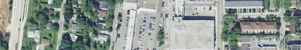
11 Proposed Development at the Southeast Corner of Lakeshore Road West and Brookfield Road Intersection Traffic Impact Study - Final November 9, Proposed Development The proposed development includes 400sq.m. of commercial area, 33 condominium units and four townhouses. The conceptual plan provided to GENIVAR, dated October 11, 2012, was prepared by ARCOP. The conceptual plan of the proposed development is shown in Exhibit Site Access Access to the proposed development is provided off Brookfield Road. The access roadway will be connected to Brookfield Road through a full moves intersection. The site plan is shown in Exhibit 2-1. GENIVAR 3
12 Proposed Development at the Southeast Corner of Lakeshore Road West and Brookfield Road Intersection Traffic Impact Study - Final November 9, 2012 GENIVAR 4
13
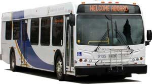
14
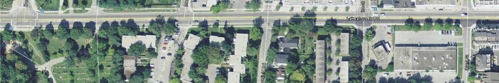
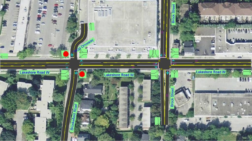
15 Proposed Development at the Southeast Corner of Lakeshore Road West and Brookfield Road Intersection Traffic Impact Study - Final November 9, Existing Conditions 3.1 Roadway Network The boundary roads in the vicinity of the site are Lakeshore Road West on the north of the development, Brock Street to the east of the development, and Brookfield Road to the west of the development. A description of the road characteristics is provided as follows: Lakeshore Road West is a minor arterial road that runs in an east-west direction under the jurisdiction of the Town of Oakville. Lakeshore Road West has three lanes with a centre twoway left-turn lane. The posted speed limit is 50 km/h. Brock Street is a local road that runs in a north-south direction under the jurisdiction of Town of Oakville and has a three lane cross-section with centre two-way left-turn lane. The posted speed limit is 50 km/h. Brookfield Road is a two-lane local road under the jurisdiction of the Town of Oakville. The posted speed is assumed as 50 km/h. as there is no posted speed sign observed along this road. Two intersections were analyzed in the study area. The Intersection of Lakeshore Road West and Brock Street is signalized and the intersection of Lakeshore Road West and Brookfield Road is unsignalized with a stop sign on Brookfield Road. The study area roadway characteristics are provided in Exhibit Traffic Volumes The study area peak hours include the weekday AM and PM peak hours. Traffic counts for the study intersections were obtained from traffic counts commissioned by GENIVAR. The signal timing plans for the study intersections were provided by the Town of Oakville. The intersection turning movement count sources and count times are shown in Table 3-1. Table 3-1 Intersection Turning Movement Count Sources Intersection Date Count Periods Source Lakeshore Road West & Wednesday, September 7:00am-10:00am Brookfield Road / Plaza 12, 2012 Driveway 3:00pm-6:00pm GENIVAR Lakeshore Road West & Wednesday, September 7:00am-10:00am Brock Street 12, :00pm-6:00pm GENIVAR Since there is a high volume of bike traffic along Lakeshore Road West, bike traffic at the two intersections in the study area were also counted. Existing traffic volumes in the AM and PM peak hours are provided in Exhibit 3-2 and Exhibit 3-3. The intersection turning movement count sheets including bike counts and signal timing plans are provided in Appendix A. GENIVAR 7
16

17 Plaza Drwy Brock St. Sbd Nbd Sbd Nbd R T L R T L Wbd 358 L R 348 Wbd Wbd 351 L R 356 Wbd T T T T Ebd 713 R 16 6 L 698 Ebd Ebd 709 R 41 4 L 671 Ebd Lakeshore Rd W L T R L T R Sbd Nbd Sbd Nbd Brock St. Brookfield Rd. Exhibit 3-2 Existing AM Peak Hour Traffic Proposed Development at the Southeast Corner of Lakeshore Road West & Brookfield Road Intersection tab Turns AM Final.xlsx
18
19 tab Turns PM Final.xlsx Exhibit 3-3 Existing PM Peak Hour Traffic Proposed Development at the Southeast Corner of Lakeshore Road West & Brookfield Road Intersection Brookfield Rd. Brock St. Sbd Nbd Sbd Nbd L T R L T R Ebd 452 R L 430 Ebd Ebd 427 R 18 8 L 445 Ebd T T T T Wbd 750 L R 712 Wbd Wbd 712 L R 697 Wbd Lakeshore Rd W R T L R T L Sbd Nbd Sbd Nbd Plaza Drwy Brock St.
20

21 Proposed Development at the Southeast Corner of Lakeshore Road West and Brookfield Road Intersection Traffic Impact Study - Final November 9, Transit Routes Oakville Transit provides local bus services in the study area. The following describes the existing transit services surrounding the site. Oakville Transit Route 2 (Lakeshore Road) operates primarily along Lakeshore Road from Bronte GO Station to the Dundas and Hampshire connecting communities. Service frequency is approximately every 30 minutes during the weekday AM and PM peak periods and the frequency in the off-peak period is approximately every hour. Bus stop locations of Route 2 within the vicinity of the site are provided in Exhibit 3-4. Exhibit 3-4 Transit Stop Locations SITE Source: Google Maps The details of Route 2 are presented in Appendix B. 3.4 Existing Traffic Analysis Intersection operations were analyzed using Highway Capacity Manual (HCM) methodology and Synchro 8.0 software. The analysis is based on: the existing turning movement volumes including heavy vehicle percentages, peak hour factors (PHF), conflicting pedestrian and bicycle volumes existing lane configurations existing signal timing plans The definition of levels of service (LOS) for signalized and unsignalized intersection is presented in Appendix C. Table 3-2 presents the existing overall intersection volume-to- capacity (V/C) ratios, delay and LOS along with critical movements (i.e., movements affected by the site traffic from the proposed development) for the signalized intersection. GENIVAR 13
22 Proposed Development at the Southeast Corner of Lakeshore Road West and Brookfield Road Intersection Traffic Impact Study - Final November 9, 2012 Table 3-2 Existing Traffic Conditions Signalized Intersection Intersection AM Peak Hour PM Peak Hour Movement V/C Delay V/C Delay LOS Ratio (sec.) Ratio (sec.) LOS Lakeshore Road West and Brock Street A A Eastbound Through / Right A A Westbound Through / Right A A The capacity analysis shows that the signalized intersection within the study area operates at acceptable levels with an overall V/C ratio of 0.55 or less and LOS A in both AM and PM peak hours. The V/C ratio of the eastbound through / right is observed higher in the AM peak hour. While in the PM hour, the westbound through / right is higher. Table 3-3 presents the existing overall intersection delay and LOS along with critical movements (i.e., movements affected by the site traffic from the proposed development) for the unsignalized intersection. Table 3-3 Existing Traffic Conditions Unsignalized Intersection Intersection Movement Lakeshore Road West and Brookfield Road / Plaza Driveway AM Peak Hour Delay (sec.) LOS PM Peak Hour Delay (sec.) LOS 1 A 1 2 A 1 Eastbound Through / Right Westbound Left 9 A 8 A Northbound Left / Through / Right 17 C 20 C Note: 1 Intersection Capacity Utilization (ICU) Level of Service The unsignalized intersection capacity analysis shows that the estimated delay for the westbound left-turn movement is nine seconds and eight seconds in the AM and PM peak hours respectively. The northbound movement operates at LOS C in both peak hours with a maximum estimated delay of 20 seconds in the PM peak hour. The estimated queue length (95th percentile) for the key movements in existing (2012) peak hours for the study intersections are presented in Table 3-4. GENIVAR 14
23 Proposed Development at the Southeast Corner of Lakeshore Road West and Brookfield Road Intersection Traffic Impact Study - Final November 9, 2012 Table 3-4 Existing (2012) Estimated Queue Lengths Intersection Movement Lakeshore Road West and Brock Street Available Storage (m) 95th Queue Length (m) AM Peak Hour PM Peak Hour Eastbound Left Westbound Left Southbound Left Lakeshore Road West and Brookfield Road / Plaza Driveway Eastbound Left 25-1 Westbound Left Northbound Left / Through / Right The queuing analysis indicates that the existing queues in the AM and PM peak hours at both intersections can be accommodated by the available storage lengths. Existing (2012) HCM intersection capacity analysis and queue report sheets are provided in Appendix D. GENIVAR 15
24 Proposed Development at the Southeast Corner of Lakeshore Road West and Brookfield Road Intersection Traffic Impact Study - Final November 9, 2012 GENIVAR 16
25 Proposed Development at the Southeast Corner of Lakeshore Road West and Brookfield Road Intersection Traffic Impact Study - Final November 9, Future Background Conditions 4.1 Planned Roadway and Transit Improvements There are no planned roadway improvements or transit improvements in the vicinity of study area. 4.2 Other Area Developments The Town of Oakville confirmed active development applications in the area, which may influence the study area traffic volumes. The developments in the vicinity of the site are summarized in Table 4-1. The developments accounted for in the Mid-Rise Scenario of the Kerr Village Transportation Assessment are also included in Table 4-1. Table 4-1 Planned Developments in the Study Area Location Land Use Study/Source Notes 1 Wydham Place, Garden Drive, (Southeast corner of Dorval Drive and Rebecca Street) 102 condominium units Town of Oakville File: / Rebecca Street 16 townhouses Town of Oakville Application: 24CDM & 24T Garden Drive 6 townhouses Town of Oakville Application: 24CDM / Rebecca Street Residential (Northwest corner of Dorval Drive and Rebecca Street) 5 Kerr Village Transportation Assessment Study, 2009 Mid-Rise Scenario 66 single family detached homes and 59 townhouses 271,132sq.ft commercial; 228 residential units (<=4 storeys); 2,037 residential units (>4 storeys) Rebecca Residential Traffic Impact Study, BA Group, 2011 Kerr Village Transportation Assessment, 2009 Four-storey residential condominium with underground parking GENIVAR 17
26 Proposed Development at the Southeast Corner of Lakeshore Road West and Brookfield Road Intersection Traffic Impact Study - Final November 9, Background Traffic Information from the TISs completed and from the Town of Oakville for the developments listed in Table 4-1 was incorporated in the development of 2017 background traffic volumes for this study. The background traffic for other area developments was completed based on the information provided below: 1. Trip distribution and assignment for Wydham Place, Garden Drive was established based on 2006 TTS data for the surrounding area. The trip generation and distribution for Wydham Place is presented in Appendix E. 2 & 3 Trip distribution and assignment for 140 Rebecca Street and 139 Garden Drive was established based on 2006 TTS data for the surrounding area. The trip generation and distribution from the both developments is presented in Appendix E. 4 Rebecca Street Residential Traffic Impact Study, completed in 2011, established the net site traffic from this proposed development (refer to Figure 6 of the TIS report provided in Appendix E). Using the TTS analysis presented in Appendix B of the TIS report, traffic distribution of site generated traffic from this development onto Lakeshore Road West was determined. 5 Kerr Village Transportation Assessment provided the 2021 traffic assignment for the Mid-Rise scenario. The estimated site vehicle trip ends for the mid-rise growth scenario for weekday AM and PM peak hours are presented in Figure 3.5 and Figure 3.6 of the Kerr Village Transportation Assessment study, 2009, which are presented in Appendix E. Traffic volumes on Lakeshore Road West from the midrise growth scenario were considered as part of background traffic for the current TIS. The estimated background traffic from other developments in the study area is presented in Table 4-2. Table 4-2 Background Traffic on Lakeshore Road West AM Peak Hour PM Peak Hour Lakeshore Road West Eastbound Lakeshore Road West Westbound Traffic Growth Rate AADT counts between 2006 and 2011 on Lakeshore Road West available from the Town of Oakville were collected. Using the AADT data available on Lakeshore Road West, west of Kerr Street between 2006 and 2010, the estimated traffic growth rate was determined as 1.3 percent per annum. This is consistent with the 2009 Kerr Village Transportation Study. AADT data used in estimating traffic growth rate is presented in Appendix F. GENIVAR 18
27 Proposed Development at the Southeast Corner of Lakeshore Road West and Brookfield Road Intersection Traffic Impact Study - Final November 9, Future Background Traffic 2017 background traffic was calculated by adding the background traffic from other area developments, the projected traffic growth determined by applying the growth rate, and the existing traffic background volumes for the AM and PM peak hours are presented in Exhibit 4-1 and Exhibit Future Background Traffic Analysis Intersection capacity analyses for 2017 background traffic conditions were completed for the study area intersections to determine the future LOS during the roadway AM and PM peak hours. The operation of the intersections was analyzed using Highway Capacity Manual (HCM) methodology and Synchro 8.0 software. Table 4-3 presents the 2017 background traffic overall intersection V/C ratios, delay and LOS along with critical movements (i.e., movements affected by the site traffic from the proposed development) for the signalized intersection. Table Background Traffic Conditions Signalized Intersection Intersection AM Peak Hour PM Peak Hour V/C Delay V/C Delay Movement LOS LOS Ratio (sec.) Ratio (sec.) Lakeshore Road West and Brock Street A A Eastbound Through / Right A A Westbound Through / Right A A The capacity analysis shows that the signalized intersection within the study area will operate at acceptable levels with an overall V/C ratio of 0.62 or less and LOS A in both AM and PM peak hours. V/C ratio of the eastbound through / right will be higher in the AM peak hour. While in the PM hour, westbound through / right will be higher. Table 4-4 presents the 2017 traffic overall intersection delay and LOS along with critical movements (i.e., movements affected by the site traffic from the proposed development) for the unsignalized intersection. Table Background Traffic Conditions Unsignalized Intersection Intersection AM Peak Hour PM Peak Hour Delay Delay Movement (sec.) LOS (sec.) LOS Lakeshore Road West and Brookfield Road / Plaza Driveway 2 A 1 2 A 1 Eastbound Through / Right Westbound Left 10 A 9 A Northbound Left / Through / Right 19 C 25 C Note: 1 Intersection Capacity Utilization (ICU) Level of Service GENIVAR 19
28 Proposed Development at the Southeast Corner of Lakeshore Road West and Brookfield Road Intersection Traffic Impact Study - Final November 9, 2012 GENIVAR 20
29 tab Turns AM Final.xlsx Exhibit Background AM Peak Hour Traffic Proposed Development at the Southeast Corner of Lakeshore Road West & Brookfield Road Intersection Brookfield Rd. Brock St. Sbd Nbd Sbd Nbd L T R L T R Ebd 782 R 17 6 L 765 Ebd Ebd 779 R 44 4 L 736 Ebd T T T T Wbd 417 L R 408 Wbd Wbd 411 L R 417 Wbd Lakeshore Rd W R T L R T L Sbd Nbd Sbd Nbd Plaza Drwy Brock St.
30
31 tab Turns PM Final.xlsx Exhibit Background PM Peak Hour Traffic Proposed Development at the Southeast Corner of Lakeshore Road West & Brookfield Road Intersection Brookfield Rd. Brock St. Sbd Nbd Sbd Nbd L T R L T R Ebd 528 R L 504 Ebd Ebd 501 R 19 9 L 517 Ebd T T T T Wbd 842 L R 807 Wbd Wbd 803 L R 790 Wbd Lakeshore Rd W R T L R T L Sbd Nbd Sbd Nbd Plaza Drwy Brock St.
32
33 Proposed Development at the Southeast Corner of Lakeshore Road West and Brookfield Road Intersection Traffic Impact Study - Final November 9, 2012 The unsignalized intersection capacity analysis shows that the estimated delay for the westbound left-turn movement will be ten seconds and nine seconds in the AM and PM peak hours respectively. The northbound movement will operate at LOS C in both peak hours with a maximum estimated delay of 25 seconds in the PM peak hour. The estimated queue length (95th percentile) for the key movements in 2017 future background traffic peak hours for the study intersections are presented in Table 4-5. Table Background Traffic Estimated Queue Lengths Intersection Movement Lakeshore Road West and Brock Street Available Storage (m) 95th Queue Length (m) AM Peak PM Peak Hour Hour Eastbound Left Westbound Left Southbound Left Lakeshore Road West and Brookfield Road / Plaza Driveway Eastbound Left Westbound Left Northbound Left / Through / Right The queuing analysis indicates that the estimated queues in 2017 background traffic in the AM and PM peak hours at both intersections can be accommodated by the available storage lengths background traffic HCM intersection capacity analysis and queue report sheets are provided in Appendix F. GENIVAR 25
34 Proposed Development at the Southeast Corner of Lakeshore Road West and Brookfield Road Intersection Traffic Impact Study - Final November 9, 2012 GENIVAR 26
35 Proposed Development at the Southeast Corner of Lakeshore Road West and Brookfield Road Intersection Traffic Impact Study - Final November 9, Future Total Conditions 5.1 Traffic Generation Trip generation estimates for the site during the weekday AM and PM peak hours were obtained from the ITE Trip Generation Manual, 8th Edition. The proposed development includes: condominium units (ITE land use code 230) 2. four townhouses (ITE land use code 230) sq.m (gross leasable area) of retail space (ITE land use code 814) The terms of reference (TOR) was submitted to the Town of Oakville. As per the approved TOR, an 8 percent transit mode split reduction was applied to both the residential and retail components. The Trip Generation is an informational report published by ITE with information based on trip generation studies submitted voluntarily to ITE by public agencies, developers, consulting firms and associations throughout North America. Many areas throughout North America do not have high transit mode splits. On the contrary, the 2006 TTS data shows that during the AM peak period (6:00a.m. to 9:00a.m.), 8 percent of the trips made by the residents of Town of Oakville Ward 2 are by transit. Therefore an 8 percent transit mode split reduction factor is appropriate. The TTS 2006 information on trips made by residents of the Town of Oakville Ward 2 is presented in Appendix H. Also, a 50 percent internal capture / synergy was applied to the retail / commercial component of the development. A significant proportion of the retail / commercial trips would be internally or locally captured from the residential building and as walk-in trade related to other nearby developments. The trip generation from the proposed development is summarized in Table 5-1. GENIVAR 27
36 Proposed Development at the Southeast Corner of Lakeshore Road West and Brookfield Road Intersection Traffic Impact Study - Final November 9, 2012 Table 5-1 Estimated Trip Generation, Weekday AM and PM Peak Hours The proposed development is expected to generate 35 trips (10 inbound trips and 25 outbound trips) during the weekday AM peak hour and 34 trips (22 inbound trips and 12 outbound trips) during the weekday PM peak hour. 5.2 Trip Distribution and Assignment Site traffic distribution for the proposed development was based on the existing traffic patterns obtained from the traffic counts. The existing traffic at the Lakeshore Road West and Brookfield Road intersection shows in the AM peak hour, 60 percent to the east and 40 percent to the west. Site traffic volumes in the AM and PM peak hours are presented in Exhibit 5-1 and Exhibit Future Total Traffic Volumes 2017 total traffic conditions include the addition of 2017 background traffic volumes and site generated traffic from the proposed development. The 2017 total AM and PM peak hour traffic volumes are presented in Exhibit 5-3 and Exhibit 5-4. GENIVAR 28
37 tab Turns AM Final.xlsx Exhibit 5-1 Site Generated Traffic - AM Peak Hour Proposed Development at the Southeast Corner of Lakeshore Road West & Brookfield Road Intersection Sbd Nbd 0 0 T R 10 Ebd 3 25 R 25 Wbd 10 T L Sbd Nbd Brookfield Rd. Brock St. Sbd Nbd Sbd Nbd L T R L T R Ebd 6 R 6 4 L 15 Ebd Ebd 15 R L 15 Ebd T 1 T T T Wbd 10 L R 4 Wbd Wbd 4 L R 4 Wbd Lakeshore Rd W R T L R T L Sbd Nbd Sbd Nbd Plaza Drwy Brock St.
38
39 tab Turns PM Final.xlsx Exhibit 5-2 Site Generated Traffic - PM Peak Hour Proposed Development at the Southeast Corner of Lakeshore Road West & Brookfield Road Intersection Sbd Nbd 0 0 T R 22 Ebd 3 12 R 12 Wbd 22 T L Sbd Nbd Brookfield Rd. Brock St. Sbd Nbd Sbd Nbd L T R L T R 7 5 Ebd 9 R 9 13 L 5 Ebd Ebd 5 R L 5 Ebd T 1 T T T Wbd 7 L R 13 Wbd Wbd 13 L R 13 Wbd Lakeshore Rd W R T L R T L Sbd Nbd Sbd Nbd Plaza Drwy Brock St.
40
41 tab Turns AM Final.xlsx Exhibit 5-3 Total Future (2017) AM Peak Hour Traffic Proposed Development at the Southeast Corner of Lakeshore Road West & Brookfield Road Intersection Sbd Nbd T R Ebd 3 25 R 25 Wbd T L Sbd Nbd Brookfield Rd. Brock St. Sbd Nbd Sbd Nbd L T R L T R Ebd 788 R L 780 Ebd Ebd 794 R 44 4 L 751 Ebd T T T T Wbd 427 L R 412 Wbd Wbd 415 L R 421 Wbd Lakeshore Rd W R T L R T L Sbd Nbd Sbd Nbd Plaza Drwy Brock St.
42
43 tab Turns PM Final.xlsx Exhibit 5-4 Total Future (2017) PM Peak Hour Traffic Proposed Development at the Southeast Corner of Lakeshore Road West & Brookfield Road Intersection Sbd Nbd T R Ebd 3 12 R 12 Wbd T L Sbd Nbd Brookfield Rd. Brock St. Sbd Nbd Sbd Nbd L T R L T R Ebd 537 R L 509 Ebd Ebd 506 R 19 9 L 522 Ebd T T T T Wbd 849 L R 820 Wbd Wbd 816 L R 803 Wbd Lakeshore Rd W R T L R T L Sbd Nbd Sbd Nbd Plaza Drwy Brock St.
44
45 Proposed Development at the Southeast Corner of Lakeshore Road West and Brookfield Road Intersection Traffic Impact Study - Final November 9, Future Total Traffic Analysis Intersection capacity analyses for 2017 total traffic conditions were completed for the study area intersections to determine the future level of services during the roadway AM and PM peak hours. The operation of the intersections was analyzed using HCM methodology and Synchro 8.0 software. Table 5-2 presents the 2017 total traffic overall intersection V/C ratios, delay and LOS along with critical movements (i.e. movements affected by the site traffic from the proposed development) for the signalized intersection. Table 5-2 Future Total Traffic Conditions Signalized Intersection Intersection AM Peak Hour PM Peak Hour V/C Delay V/C Delay Movement LOS LOS Ratio (sec.) Ratio (sec.) Lakeshore Road West and Brock Street A A Eastbound Through / Right A A Westbound Through / Right A A The capacity analysis 2017 total traffic shows that the signalized intersection within the study area will operate at acceptable levels with an overall V/C ratio of 0.63 or less and LOS A in both AM and PM peak hours. The V/C ratio of the eastbound through / right will be higher in the AM peak hour. While in the PM hour, westbound through / right will be higher. Table 5-3 presents the 2017 total traffic overall intersection delay and levels of service (LOS) along with critical movements (i.e. movements affected by the site traffic from the proposed development) for the unsignalized intersections. Table Total Traffic Conditions Unsignalized Intersection Intersection Movement Lakeshore Road West and Brookfield Road / Plaza Driveway AM Peak Hour Delay (sec.) LOS PM Peak Hour Delay (sec.) LOS 2 A 1 2 A 1 Eastbound Through / Right Westbound Left 10 A 11 A Northbound Left / Through / Right 20 C 29 D Brookfield Road and Site Access 3 A 1 3 A 1 Westbound Left / Right 9 A 9 A Southbound Left 2 A 3 A Note: 1 Intersection Capacity Utilization (ICU) Level of Service GENIVAR 37
46 Proposed Development at the Southeast Corner of Lakeshore Road West and Brookfield Road Intersection Traffic Impact Study - Final November 9, 2012 The unsignalized intersection capacity analysis shows that the estimated delay at the Lakeshore Road West and Brookfield Road / Plaza Driveway intersection for the westbound left-turn movement will be 10 seconds and 11 seconds in the AM and PM peak hours respectively. The northbound movement will operate at LOS D in the PM peak hour with a maximum estimated delay of 29 seconds. The proposed unsignalized intersection at the site access with Brookfield Road will operate with overall delay of three seconds in both AM and PM peak hours. The westbound left-turn and right-turn movements and the southbound left-turn movement will be critical movements at this new intersection. The westbound left-turn and right-turn movements from the site access will operate at LOS A with delay of nine seconds in both peak hours. The southbound left-turn movement to the proposed development will have a maximum delay of three seconds in the PM peak hour. The estimated queue length (95th percentile) for the key movements in 2017 total traffic peak hours for the study intersections are presented in Table 5-4. Table Total Traffic Estimated Queue Lengths Intersection Movement Lakeshore Road West and Brock Street Available Storage (m) 95th Queue Length (m) AM Peak Hour PM Peak Hour Eastbound Left Westbound Left Southbound Left Lakeshore Road West and Brookfield Road / Plaza Driveway Eastbound Left Westbound Left Northbound Left / Through / Right Brookfield Road and Site Access Westbound Left / Right Southbound Left The queuing analysis indicates that the estimated queues in 2017 total traffic in the AM and PM peak hours at both intersections can be accommodated by the available storage lengths. The westbound queue at the site access can be contained within the site driveway and the southbound queues for vehicles entering the site would not spill back to Lakeshore Road The 2017 total traffic intersection capacity analyses conclude the traffic generated by the proposed development can be accommodated by the adjacent boundary roads without any improvements to the existing intersection. GENIVAR 38
47 Proposed Development at the Southeast Corner of Lakeshore Road West and Brookfield Road Intersection Traffic Impact Study - Final November 9, total traffic HCM intersection capacity analysis and queue report sheets are provided in Appendix I. GENIVAR 39
48 Proposed Development at the Southeast Corner of Lakeshore Road West and Brookfield Road Intersection Traffic Impact Study - Final November 9, 2012 GENIVAR 40
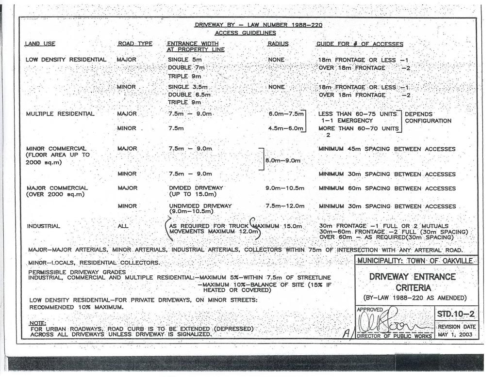
49 Proposed Development at the Southeast Corner of Lakeshore Road West and Brookfield Road Intersection Traffic Impact Study - Final November 9, Site Plan and Parking Review 6.1 Site Plan Review GENIVAR understands that at the ARCOP's pre-consultation meeting with Town of Oakville staff, the Town requires a Traffic Impact Study for a re-zoning application and a detailed site plan review was not requested. As such, a detailed site plan is not available at this stage. Based on the current available information, we note the following: 1. Garbage collection will be private from Brookfield Road. Garbage bins will be placed in the garbage and recycling area. 2. A 3x3m sight visibility triangle is provided at the Brookfield Road and Lakeshore Road WEst intersection as requested by the Town. 3. The proposed development driveway width in the revised conceptual plan is 14.4m. The Town of Oakville access guidelines (Driveway By-Law is provided in Appendix J) provides entrance width requirements from multiple residential and minor commercial (floor area up to 2,000sq.m.) onto a minor street as 7.5m to 9.0m. Therefore, the driveway width provided in the conceptual plan complies with the Town of Oakville requirements. 6.2 Parking Review The proposed development falls under C3R Zone and the Town of Oakville By-law parking requirements are: 1. Townhouses: two off-street parking spaces per unit. 2. Condominium building: two spaces per unit, of which 0.25 space per unit are for visitors. 3. Retail use: one space per 32.6sq.m. The total parking requirement will be 87 spaces, which includes eight off-street parking spaces for townhouses, 70 spaces for residents and nine spaces for visitors and patrons at the retail uses. The conceptual plan provides 87 spaces, which complies with the parking requirements. GENIVAR 41
50 Proposed Development at the Southeast Corner of Lakeshore Road West and Brookfield Road Intersection Traffic Impact Study - Final November 9, 2012 GENIVAR 42
51 Proposed Development at the Southeast Corner of Lakeshore Road West and Brookfield Road Intersection Traffic Impact Study - Final November 9, Summary of Findings The Traffic Impact Study for the proposed development, located at southeast corner of the Lakeshore Road West and Brookfield Road intersection in the Town of Oakville is summarized as follows: The proposed development consists of 33 condominium units, four townhouses and 400sq.m (gross floor area) of retail space. Access to the site will be provided by a full-moves access off Brookfield Road. The boundary roads in the vicinity of the development are Lakeshore Road West to the north, Brookfield Road to the west and Brock Street to the east. Lakeshore Road West is under the jurisdiction of the Town of Oakville and classified as a minor arterial road. Brock Street and Brookfield Road are local roads. Lakeshore Road West and Brock Street is a signalized intersection and Lakeshore Road West and Brookfield Road is an unsignalized intersection in the study area. Oakville Transit provides local bus services in the study area. Under existing conditions, the signalized intersection within the study area operates at acceptable levels in both peak hours. The unsignalized intersection capacity analysis shows that the northbound and southbound left-turn movements from Brookfield Road and the Plaza Driveway onto Lakeshore Road West operate at LOS C or better in both the AM and PM peak hours. The estimated queues can be accommodated by the available storage lengths. The Town of Oakville confirmed five other developments in the vicinity of the study area. Background traffic from other developments in the study area was estimated from the information provided by the Town. A traffic growth rate of 1.3 percent per annum was used to project the existing traffic volumes on Lakeshore Road West to the horizon year Background traffic from the other area developments was added to projected traffic at the intersections in the study area to estimate future background traffic. Under 2017 background conditions, the intersections are expected to operate at acceptable levels similar to existing conditions. Estimated queues in future background conditions are similar to existing conditions in both peak hours. The proposed development is expected to generate 35 trips (10 inbound trips and 25 outbound trips) during the weekday AM peak hour and 34 trips (22 inbound trips and 12 outbound trips) during the weekday PM peak hour. Under future 2017 total traffic conditions, the intersections are expected to operate at acceptable levels similar to future background conditions. Estimated queues in 2017 total traffic are similar to future background conditions in both peak hours. The impacts of site generated traffic on the adjacent roadway network would be marginal. GENIVAR 43
52 Proposed Development at the Southeast Corner of Lakeshore Road West and Brookfield Road Intersection Traffic Impact Study - Final November 9, 2012 Garbage collection is proposed to be private. The site driveway width complies with Town of Oakville Driveway By-Law standards. Using the C3R zoning parking By-Law requirements, the parking requirement at the proposed development is 87 spaces. The concept plan provides 87 spaces which meets the requirement. GENIVAR 44
53 Proposed Development at the Southeast Corner of Lakeshore Road West and Brookfield Road Intersection Traffic Impact Study - Final November 9, Recommendations No boundary road improvements are required to accommodate the additional site traffic resulting from the proposed development rep LakeshoreRd TIS Final GENIVAR 45
54 Proposed Development at the Southeast Corner of Lakeshore Road West and Brookfield Road Intersection Traffic Impact Study - Final November 9, 2012 GENIVAR 46
55 Appendices A. Intersection Turning Movement Count Sheets and Signal Timing Plans B. Details of Oakville Transit Route #2 C. Level of Service Definitions D. Existing Intersection Capacity Analysis and Queue Reports E. Net Site Traffic from Background Studies F. AADT Data on Lakeshore Road West G Background Traffic Intersection Capacity Analysis and Queue Reports H. TTS 2006 Information on Trips Made by Residents of the Town of Oakville Ward 2 I Total Traffic Intersection Capacity Analysis and Queue Reports J. Town of Oakville Driveway By-Law
56
57 Appendix A Intersection Turning Movement Count Sheets and Signal Timing Plans
58
59
60
61
62
63
64
65
66
67
68
69
70
71
72
73
74
75
76
77
78
79
80
81
82
83
84
85
86
87
88
89
90
91 Appendix B Details of Oakville Transit Route #2
92
93 2 LAKESHORE Weekday Service Schedule Effective September 2, 2012 TIMEPOINT Bronte GO (Depart) Lakeshore & Bronte Lakeshore & Third Line Lakeshore & Fourth Line Lakeshore & Navy Lakeshore & Ford Ford & Royal Windsor Ford & Kingsway Kingsway & Winston Churchill Winston Pk. & Bristol Circle Dundas & Hampshire Winston Pk. & Bristol Circle Kingsway & Winston Churchill Ford & Kingsway Ford & Royal Windsor Lakeshore & Ford Lakeshore & Navy Lakeshore & Fourth Line Lakeshore & Third Line Lakeshore & Bronte Bronte GO (Arrive) EASTBOUND TO DUNDAS & WINSTON PARK via KINGSWAY WESTBOUND TO BRONTE GO via KINGSWAY :23 6:27 6:36 6:41 6:44 6:48 6: :57 6:01 6:04 6:09 6:17 6:21 6:23 6:26 6:32 6:39 6:44 6:50 6:53 6:55 6:59 7:08 7:13 7:16 7:20 7:30 6:24 6:32 6:36 6:39 6:44 6:52 6:56 6:58 7:01 7:07 7:12 7:17 7:23 7:26 7:28 7:32 7:41 7:46 7:49 7:53 8:03 7:05 7:13 7:17 7:20 7:25 7:33 7:37 7:39 7:42 7:48 7:55 8:00 8:06 8:09 8:11 8:15 8:24 8:29 8:32 8:36 8:46 7:35 7:43 7:47 7:50 7:55 8:03 8:07 8:09 8:12 8:18 8:25 8:30 8:36 8:39 8:41 8:45 8:54 8:59 9:02 9:06 9:16 8:05 8:13 8:17 8:20 8:25 8:33 8:37 8:39 8:42 8:48 8:55 9:00 9:06 9:09 9:11 9:15 9:24 9:29 9:32 9:36 9:46 8:35 8:43 8:47 8:50 8:55 9:03 9:07 9:09 9:12 9:18 9:25 9:30 9:36 9:39 9:41 9:45 9:54 9:59 10:02 10:06 10:16 9:05 9:13 9:17 9:20 9:25 9:33 9:37 9:39 9:42 9:48 9:55 10:00 10:06 10:09 10:11 10:15 10:24 10:29 10:32 10:36 10:46 9:35 9:43 9:47 9:50 9:55 10:03 10:07 10:09 10:12 10:18 10:25 10:30 10:36 10:39 10:41 10:45 10:54 10:59 11:02 11:06 11:16 10:35 10:43 10:47 10:50 10:55 11:03 11:07 11:09 11:12 11:18 11:25 11:30 11:36 11:39 11:41 11:45 11:54 11:59 12:02 12:06 12:16 11:35 11:43 11:47 11:50 11:55 12:03 12:07 12:09 12:12 12:18 12:25 12:30 12:36 12:39 12:41 12:45 12:54 12:59 1:02 1:06 1:16 12:35 12:43 12:47 12:50 12:55 1:03 1:07 1:09 1:12 1:18 1:25 1:30 1:36 1:39 1:41 1:45 1:54 1:59 2:02 2:06 2:16 1:35 1:43 1:47 1:50 1:55 2:03 2:07 2:09 2:12 2:18 2:25 2:30 2:36 2:39 2:41 2:45 2:54 2:59 3:02 3:06 3:16 2:35 2:43 2:47 2:50 2:55 3:03 3:07 3:09 3:12 3:18 3:25 3:30 3:36 3:39 3:41 3:45 3:54 3:59 4:02 4:06 4:16 3:35 3:43 3:47 3:50 3:55 4:03 4:07 4:09 4:12 4:18 4:25 4:30 4:36 4:39 4:41 4:45 4:54 4:59 5:02 5:06 5:16 4:05 4:13 4:17 4:20 4:25 4:33 4:37 4:39 4:42 4:48 4:55 5:00 5:06 5:09 5:11 5:15 5:24 5:29 5:32 5:36 5:46 4:35 4:43 4:47 4:50 4:55 5:03 5:07 5:09 5:12 5:18 5:25 5:30 5:36 5:39 5:41 5:45 5:54 5:59 6:02 6:06 6:16 4:55 5:03 5:07 5:10 5:15 5:23 5:27 5:29 5:32 5:38 5:45 5:50 5:56 5:59 6:01 6:05 6:14 6:19 6:22 6:26 6:36 5:30 5:38 5:42 5:45 5:50 5:58 6:02 6:04 6:07 6:13 6:20 6:25 6:31 6:34 6:36 6:40 6:49 6:54 6:57 7:01 7:11 6:00 6:08 6:12 6:15 6:20 6:28 6:32 6:34 6:37 6:43 6:50 6:55 7:01 7:04 7:06 7:10 7:19 7:24 7:27 7:31 7:41 6:36 6:44 6:48 6:51 6:56 7:04 7:08 7:10 7:13 7:19 7:26 7:31 7:37 7:40 7:42 7:46 7:55 8:00 8:03 8:07 8:17 7:35 7:43 7:47 7:50 7:55 8:03 8:07 8:09 8:12 8:18 8:25 8:30 8:36 8:39 8:41 8:45 8:54 8:59 9:02 9:06 9:16 8:35 8:43 8:47 8:50 8:55 9:03 9:07 9:09 9:12 9:18 9:25 9:30 9:36 9:39 9:41 9:45 9:54 9:59 10:02 10:06 10:16 9:35 9:43 9:47 9:50 9:55 10:03 10:07 10:09 10:12 10:18 10:25 10:30 10:36 10:39 10:41 10:45 10:54 10:59 11:02 11:06 11:16 10:35 10:43 10:47 10:50 10:55 11:03 11:07 11:09 11:12 11:18 11:25 11:30 11:36 11: LNS leaves Oakville GO at 11:30 p.m., 12:25 a.m. & 1:25 a.m. PM AM Oakville Transit Phone: (Monday to Friday, 8:30 a.m. to 4:30 p.m.) 430 Wyecroft Road Website: Oakville, Ontario, L6H 0H3 While every effort will be made to operate our service to these timetables, all schedules including bus stop times and transfer times are based on normal traffic and weather conditions and as such are subject to change. Oakville Transit will not be responsible for any loss, damage or inconvenience that may result from any errors, omissions or service delays.


 Website:")
94 2 LAKESHORE Route Maps Oakville Transit 430 Wyecroft Road Oakville, Ontario, L6H 0H3 Phone: (Monday to Friday, 8:30 a.m. to 4:30 p.m.) Website:
95 2 LAKESHORE Saturday Service Schedule TIMEPOINT Bronte GO (Depart) Lakeshore & Bronte Lakeshore & Third Line Lakeshore & Fourth Line Lakeshore & Navy Lakeshore & Ford Ford & Royal Windsor Ford & Kingsway Kingsway & Winston Churchill Winston Pk. & Bristol Circle Dundas & Hampshire Winston Pk. & Bristol Circle Kingsway & Winston Churchill Ford & Kingsway Ford & Royal Windsor Lakeshore & Ford Lakeshore & Navy Lakeshore & Fourth Line Lakeshore & Third Line Lakeshore & Bronte Bronte GO (Arrive) EASTBOUND TO DUNDAS & WINSTON PARK via KINGSWAY WESTBOUND TO BRONTE GO via KINGSWAY :09 7:12 7:18 7:25 7:30 7:36 7:39 7:41 7:45 7:54 7:59 8:02 8:06 8:16 7:35 7:43 7:47 7:50 7:55 8:03 8:07 8:09 8:12 8:18 8:25 8:30 8:36 8:39 8:41 8:45 8:54 8:59 9:02 9:06 9:16 8:35 8:43 8:47 8:50 8:55 9:03 9:07 9:09 9:12 9:18 9:25 9:30 9:36 9:39 9:41 9:45 9:54 9:59 10:02 10:06 10:16 9:35 9:43 9:47 9:50 9:55 10:03 10:07 10:09 10:12 10:18 10:25 10:30 10:36 10:39 10:41 10:45 10:54 10:59 11:02 11:06 11:16 10:35 10:43 10:47 10:50 10:55 11:03 11:07 11:09 11:12 11:18 11:25 11:30 11:36 11:39 11:41 11:45 11:54 11:59 12:02 12:06 12:16 11:35 11:43 11:47 11:50 11:55 12:03 12:07 12:09 12:12 12:18 12:25 12:30 12:36 12:39 12:41 12:45 12:54 12:59 1:02 1:06 1:16 12:35 12:43 12:47 12:50 12:55 1:03 1:07 1:09 1:12 1:18 1:25 1:30 1:36 1:39 1:41 1:45 1:54 1:59 2:02 2:06 2:16 1:35 1:43 1:47 1:50 1:55 2:03 2:07 2:09 2:12 2:18 2:25 2:30 2:36 2:39 2:41 2:45 2:54 2:59 3:02 3:06 3:16 2:35 2:43 2:47 2:50 2:55 3:03 3:07 3:09 3:12 3:18 3:25 3:30 3:36 3:39 3:41 3:45 3:54 3:59 4:02 4:06 4:16 3:35 3:43 3:47 3:50 3:55 4:03 4:07 4:09 4:12 4:18 4:25 4:30 4:36 4:39 4:41 4:45 4:54 4:59 5:02 5:06 5:16 4:35 4:43 4:47 4:50 4:55 5:03 5:07 5:09 5:12 5:18 5:25 5:30 5:36 5:39 5:41 5:45 5:54 5:59 6:02 6:06 6:16 5:35 5:43 5:47 5:50 5:55 6:03 6:07 6:09 6:12 6:18 6:25 6:30 6:36 6:39 6:41 6:45 6:54 6:59 7:02 7:06 7:16 6:35 6:43 6:47 6:50 6:55 7:03 7:07 7:09 7:12 7:18 7:25 7:30 7:36 7:39 7:41 7:45 7:54 7:59 8:02 8:06 8:16 7:35 7:43 7:47 7:50 7:55 8:03 8:07 8:09 8:12 8:18 8:25 8:30 8:36 8:39 8:41 8:45 8:54 8:59 9:02 9:06 9:16 8:35 8:43 8:47 8:50 8:55 9:03 9:07 9:09 9:12 9:18 9:25 9:30 9:36 9:39 9:41 9:45 9:54 9:59 10:02 10:06 10:16 9:35 9:43 9:47 9:50 9:55 10:03 10:07 10:09 10:12 10:18 10:25 10:30 10:36 10:39 10:41 10:45 10:54 10:59 11:02 11:06 11:16 10:35 10:43 10:47 10:50 10:55 11:03 11:07 11:09 11:12 11:18 11:25 11:30 11:36 11: LNS leaves Oakville GO at 11:30 p.m., 12:25 a.m. & 1:25 a.m. PM AM Oakville Transit 430 Wyecroft Road Oakville, Ontario, L6H 0H3 Phone: (Monday to Friday, 8:30 a.m. to 4:30 p.m.) Website: While every effort will be made to operate our service to these timetables, all schedules including bus stop times and transfer times are based on normal traffic and weather conditions and as such are subject to change. Oakville Transit will not be responsible for any loss, damage or inconvenience that may result from any errors, omissions or service delays.
96 2 LAKESHORE Sunday/Holiday Service Schedule TIMEPOINT Bronte GO (Depart) Lakeshore & Bronte Lakeshore & Third Line Lakeshore & Fourth Line Lakeshore & Navy Lakeshore & Ford Ford & Royal Windsor Ford & Kingsway Kingsway & Winston Churchill Winston Pk. & Bristol Circle Dundas & Hampshire Winston Pk. & Bristol Circle Kingsway & Winston Churchill Ford & Kingsway Ford & Royal Windsor Lakeshore & Ford Lakeshore & Navy Lakeshore & Fourth Line Lakeshore & Third Line Lakeshore & Bronte Bronte GO (Arrive) EASTBOUND TO DUNDAS & WINSTON PARK via KINGSWAY WESTBOUND TO BRONTE GO via KINGSWAY :09 8:12 8:18 8:25 8:30 8:36 8:39 8:41 8:45 8:54 8:59 9:02 9:06 9:16 8:35 8:43 8:47 8:50 8:55 9:03 9:07 9:09 9:12 9:18 9:25 9:30 9:36 9:39 9:41 9:45 9:54 9:59 10:02 10:06 10:16 9:35 9:43 9:47 9:50 9:55 10:03 10:07 10:09 10:12 10:18 10:25 10:30 10:36 10:39 10:41 10:45 10:54 10:59 11:02 11:06 11:16 10:35 10:43 10:47 10:50 10:55 11:03 11:07 11:09 11:12 11:18 11:25 11:30 11:36 11:39 11:41 11:45 11:54 11:59 12:02 12:06 12:16 11:35 11:43 11:47 11:50 11:55 12:03 12:07 12:09 12:12 12:18 12:25 12:30 12:36 12:39 12:41 12:45 12:54 12:59 1:02 1:06 1:16 12:35 12:43 12:47 12:50 12:55 1:03 1:07 1:09 1:12 1:18 1:25 1:30 1:36 1:39 1:41 1:45 1:54 1:59 2:02 2:06 2:16 1:35 1:43 1:47 1:50 1:55 2:03 2:07 2:09 2:12 2:18 2:25 2:30 2:36 2:39 2:41 2:45 2:54 2:59 3:02 3:06 3:16 2:35 2:43 2:47 2:50 2:55 3:03 3:07 3:09 3:12 3:18 3:25 3:30 3:36 3:39 3:41 3:45 3:54 3:59 4:02 4:06 4:16 3:35 3:43 3:47 3:50 3:55 4:03 4:07 4:09 4:12 4:18 4:25 4:30 4:36 4:39 4:41 4:45 4:54 4:59 5:02 5:06 5:16 4:35 4:43 4:47 4:50 4:55 5:03 5:07 5:09 5:12 5:18 5:25 5:30 5:36 5:39 5:41 5:45 5:54 5:59 6:02 6:06 6:16 5:35 5:43 5:47 5:50 5:55 6:03 6:07 6:09 6:12 6:18 6:25 6:30 6:36 6:39 6:41 6:45 6:54 6:59 7:02 7:06 7:16 6:35 6:43 6:47 6:50 6:55 7:03 7:07 7:09 7:12 7:18 7:25 7:30 7:36 7:39 7:41 7:45 7:54 7:59 8:02 8: :35 7:43 7:47 7:50 7: PM AM Oakville Transit 430 Wyecroft Road Oakville, Ontario, L6H 0H3 Phone: (Monday to Friday, 8:30 a.m. to 4:30 p.m.) Website: While every effort will be made to operate our service to these timetables, all schedules including bus stop times and transfer times are based on normal traffic and weather conditions and as such are subject to change. Oakville Transit will not be responsible for any loss, damage or inconvenience that may result from any errors, omissions or service delays.
97 Appendix C Level of Service Definitions
98
99 Levels of Service Highway Capacity Manual Signalized Intersections Level of Service Stopped Delay per Vehicle (sec) Expected delay to Minor Street traffic from the Major Street A < 10 Most vehicles arrive during the green phase and do not stop; traffic progression is extremely favourable. B More vehicles stop than for LOS A; traffic progression is good. C Individual cycle failures may appear and the number of vehicles stopping is significant; traffic progression is fair. D Individual cycle failures are noticeable and many vehicles stop; traffic progression is unfavourable. E Individual cycle failures are frequent; traffic progression is poor; acceptable delay is at its limit. F > 80 Many individual cycle failures; arrival flow rate exceeds capacity; delay is unacceptable to most drivers. Source: Highway Capacity Manual, HCM2000 HIGHWAY LOS Signalized GENIVAR Inc.
100 Levels of Service Highway Capacity Manual Unsignalized Intersection Level of Service Average Control Delays (s/veh) Expected delay to Minor Street traffic from the Major Street A 0-10 Little or no delay. B > Short traffic delay. C > Average traffic delay. D > Long traffic delay. E > Very long traffic delay. F > 50 Extreme delay encountered with queuing, which may cause severe congestion affecting other traffic movements in the intersection. Source: Highway Capacity Manual, HCM 2000 UNSIGNALIZED LOS GENIVAR Inc.
101 Appendix D Existing Intersection Capacity Analysis and Queue Reports
102
103 HCM Signalized Intersection Capacity Analysis <Existing> AM Peak 1: Brock Street & Lakeshore Road W 1
104 HCM Unsignalized Intersection Capacity Analysis <Existing> AM Peak 2: Brookefield Road/Plaza Driveway & Lakeshore Road W 2
105 Queues <Existing> AM Peak 1: Brock Street & Lakeshore Road W 3
106 HCM Signalized Intersection Capacity Analysis <Existing> PM Peak 1: Brock Street & Lakeshore Road W 1
107 HCM Unsignalized Intersection Capacity Analysis <Existing> PM Peak 2: Brookefield Road/Plaza Driveway & Lakeshore Road W 2
108 Queues <Existing> PM Peak 1: Brock Street & Lakeshore Road W 3
109 Appendix E Net Site Traffic from Background Studies
110
111 Trip Generation Background development at Wydham Place (Southeast Corner of Dorval Drive and Rebecca Street) in the Town of Oakville Trip Distribution - Wydham Place Rebecca St. EB Rebecca St. WB Lakeshore Rd EB Lakeshore Rd WB AM Out 30% 55% 10% 5% PM In 65% 20% 0% 15% Lakeshore Rd EB Lakeshore Rd WB
112 Trip Generation Background development at 140 Rebecca St. & 139 Garden Dr. in the Town of Oakville Trip Distribution Rebecca Street and 139 Garden Drive Rebecca Rebecca Lakeshore Lakeshore St. EB St. WB Rd EB Rd WB AM Out 40% 60% 0% 0% PM In 65% 35% 0% 0% Lakeshore Rd EB Lakeshore Rd WB
113 Trip Generation Background development at Rebecca Street Residential (Northwest corner of Dorval Drive and Rebecca Street) in the Town of Oakville Refer to Figure 6 - Net Site Traffic Volumes and TTS analysis in Appendix B of Rebecca Street Traffic Impact Study, Estimated SBLT and WBRT percentages and appled to the net site traffic volumes on Dorval Drive, south of Rebecca Street Lakeshore Rd EB Lakeshore Rd WB
114 10 (5) 5 (5) (35) 10 (5) 0 Mary Street (10) 5 5 (30) Street C (0) 0 (20) 30 (5) 5 30 Street D (20) 0 (15) 10 (20) Street B SITE Street A 5 (15) 5 (5) Dorval Drive 10 (5) (20) 30 (5) (20) 5 (10) (10) 5 (0) 0 (0) 0 5 (5) Rebecca Street St. Thomas Catholica Aquinas Secondary School Driveway (5) 0 (10) 5 NET SITE TRAFFIC VOLUMES 00 (00) AM Peak Hour PM Peak Hour Existing Traffic Signal Rebecca Street Residential - Traffic Impact Study , September 2011 All volumes rounded to the nearest 5 vehicles Figure 6
115
116
117 Trip Generation Background development in Kerr Village Plan for 2021 in the Town of Oakville Refer to Estimated Net Vehicle Trip Ends (Mid-Rise Growth Scenario) - Figure 3.5 (AM Peak) and Figure 3.6 (PM Peak) of Kerr Village Transportation Assessement, 2009 Lakeshore Rd EB Lakeshore Rd WB
118
119 Appendix F AADT Data on Lakeshore Road West
120
121
122
123
124 Traffic Growth Estimation W of Dorval Dr. E of Dorval Dr. W of Kerr St. E of Kerr St. EB WB Both Directions EB WB Both Directions EB WB Both Directions EB WB Both Directions EB WB Both Directions Monday, May 16, 2011 Wednesday, May 16, 2012 Monday, May 16, 2011 Wednesday, May 16, 2012 Thursday, June 28, 2007 Wednesday, June 02, 2010 Wednesday, May 23, 2012 Thursday, June 28, 2007 Tuesday, June 08, 2010 Monday, May 28, 2012 Growth Rate ( ) W of Dorval Dr E of Dorval Dr W of Kerr St % E of Kerr St
125 Appendix G 2017 Background Traffic Intersection Capacity Analysis and Queue Reports
126
127 Queues <Future Background> AM Peak 1: Brock Street & Lakeshore Road W
128 HCM Signalized Intersection Capacity Analysis <Future Background> AM Peak 1: Brock Street & Lakeshore Road W
129 HCM Unsignalized Intersection Capacity Analysis <Future Background> AM Peak 2: Brookefield Road/Plaza Driveway & Lakeshore Road W
130 HCM Signalized Intersection Capacity Analysis <Future Background> PM Peak 1: Brock Street & Lakeshore Road W 1
131 HCM Unsignalized Intersection Capacity Analysis <Future Background> PM Peak 2: Brookefield Road/Plaza Driveway & Lakeshore Road W 2
132 Queues <Future Background> PM Peak 1: Brock Street & Lakeshore Road W 3
133 Appendix H TTS 2006 Information on Trips Made by Residents of The Town of Oakville Ward 2
134
135
136
137
138
139
140

141
142
143 Appendix I 2017 Total Traffic Intersection Capacity Analysis and Queue Reports
144
145 HCM Signalized Intersection Capacity Analysis <Total Future> AM Peak 1: Brock Street & Lakeshore Road W 1
146 HCM Unsignalized Intersection Capacity Analysis <Total Future> AM Peak 2: Brookefield Road/Plaza Driveway & Lakeshore Road W 2
147 HCM Unsignalized Intersection Capacity Analysis <Total Future> AM Peak 3: Brookefield Road & Site Access 3
148 Queues <Total Future> AM Peak 1: Brock Street & Lakeshore Road W 4
149 HCM Signalized Intersection Capacity Analysis <Total Future> PM Peak 1: Brock Street & Lakeshore Road W 1
150 HCM Unsignalized Intersection Capacity Analysis <Total Future> PM Peak 2: Brookefield Road/Plaza Driveway & Lakeshore Road W 2
151 HCM Unsignalized Intersection Capacity Analysis <Total Future> PM Peak 3: Brookefield Road & Site Access 3
152 Queues <Total Future> PM Peak 1: Brock Street & Lakeshore Road W 4
153 Appendix J Town of Oakville Driveway By-Law
154
155
TABLE OF CONTENTS. Coral Springs Charter High School and Middle School Job No Page 2
 Job No. 15-019 Page 2 TABLE OF CONTENTS 1.0 INTRODUCTION... 4 2.0 EXISTING CONDITIONS... 5 3.0 TRAFFIC GENERATION... 7 4.0 TRIP DISTRIBUTION... 8 5.0 FUTURE CONDITIONS... 8 6.0 SITE ACCESS...13 7.0 CONCLUSION...13
Pedestrian Safety Review Spadina Avenue
 STAFF REPORT ACTION REQUIRED Pedestrian Safety Review Spadina Avenue Date: October 13, 2015 To: Toronto and East York Community Council From: Director, Transportation Services, Toronto and East York District
EXISTING CONDITIONS A. INTRODUCTION. Route 107 Corridor Study Report
 II. EXISTING CONDITIONS A. INTRODUCTION The Route 107 study area extends from the south at Chestnut Street in Lynn approximately 3.7 miles to the north to Boston Street in Salem. The study area has three
MARSHALL Subdivision. Township of Springwater, County of Simcoe. Traffic Brief for: Ontario Inc. Type of Document: Final Report
 MARSHALL Subdivision Township of Springwater, County of Simcoe Traffic Brief for: 489469 Ontario Inc. Type of Document: Final Report Project Number: JDE 1521 Date Submitted: October 19 th, 2016 10 / 19
Lake Erie Commerce Center Traffic Analysis
 LOCATION: East of NYS Route 5 at Bayview Road Town of Hamburg Erie County, New York PREPARED BY: Wendel Companies 140 John James Audubon Parkway Suite 200 Amherst, New York 14228 January 2012 i ii Table
A. CONCLUSIONS OF THE FGEIS
 Chapter 11: Traffic and Parking A. CONCLUSIONS OF THE FGEIS The FGEIS found that the Approved Plan will generate a substantial volume of vehicular and pedestrian activity, including an estimated 1,300
Proposed Bicycle Lanes on Yonge Street from Queens Quay to Front Street
 STAFF REPORT ACTION REQUIRED Proposed Bicycle Lanes on Yonge Street from Queens Quay to Front Street Date: March 12, 2007 To: From: Toronto and East York Community Council Director, Transportation Infrastructure
LUDWIG RD. SUBDIVISION PROJECT TRAFFIC IMPACT ANALYSIS
 LUDWIG RD. SUBDIVISION PROJECT TRAFFIC IMPACT ANALYSIS Prepared for Skip Coddington GSC Development, Inc PO Box 1623 Woodinville WA 9872 Prepared by 1141 NE 124 th St., #59 Kirkland, WA 9834 425.522.4118
Aldridge Transportation Consultants, LLC Advanced Transportation Planning and Traffic Engineering
 Aldridge Transportation Consultants, LLC Advanced Transportation Planning and Traffic Engineering John M.W. Aldridge, PE, PTOE, AICP 182 Chimney Rock Road Colorado Registered Professional Engineer Highlands
MEMORANDUM. Lynn Hayes LSA Associates, Inc.
 MEMORANDUM To: Lynn Hayes LSA Associates, Inc. Date: May 5, 217 From: Zawwar Saiyed, P.E., Senior Transportation Engineer Justin Tucker, Transportation Engineer I Linscott, Law & Greenspan, Engineers LLG
Treasure Island Supplemental Information Report Addendum
 1 1 1 1 0 1 0 1 0 1 Treasure Island Supplemental Information Report Addendum Introduction Purpose The purpose of this Supplemental Information Report (SIR) Addendum is to determine if the current land
MEMORANDUM. Bob Zagozda, Chief Financial Officer Westside Community Schools. Mark Meisinger, PE, PTOE Felsburg Holt & Ullevig. DATE: June 11, 2018
 MEMORANDUM TO: Bob Zagozda, Chief Financial Officer Westside Community Schools FROM: Mark Meisinger, PE, PTOE Felsburg Holt & Ullevig DATE: June 11, 218 6-11-18 SUBJECT: Sunset Hills Elementary School
DOGWOOD AT VILLA AVENUE PROJECT
 TRANSPORTATION IMPACT ANALYSIS DOGWOOD AT VILLA AVENUE PROJECT El Centro, California September 4, 2018 LLG Ref. 3-17-2782 TABLE OF CONTENTS SECTION PAGE Appendices... ii List of Figures... i List of Tables...
Transport Impact Assessment
 Transport Impact Assessment Springbok Hotel Erf 5206, Springbok Northern Cape March 2018 5th Floor Imperial Terraces Carl Cronje Drive Tyger Waterfront Bellville, 7530 (021) 914 6211 (T) e mail: mail@itsglobal.co.za
Caliber Charter School VALLEJO, CA
 Traffic Impact Study Final Report Caliber Charter School VALLEJO, CA 21 June 2016 Prepared for: Prepared by: Traffic Engineering & Transportation Planning This report has been prepared and certified by
Western Development Lands Transportation Brief Richmond Village, (Ottawa), ON Mattamy Homes. Prepared By: Stantec Consulting Ltd.
, ON Mattamy Homes. Prepared By: Stantec Consulting Ltd.") Western Development Lands Transportation Brief Richmond Village, (Ottawa), ON Mattamy Homes Prepared By: Stantec Consulting Ltd. March 2012 RICHMOND VILLAGE, OTTAWA, ON TRANSPORTATION BRIEF APRIL 2013
Western Development Lands Transportation Brief Richmond Village, (Ottawa), ON Mattamy Homes Prepared By: Stantec Consulting Ltd. March 2012 RICHMOND VILLAGE, OTTAWA, ON TRANSPORTATION BRIEF APRIL 2013
Regulations to deter cut-through traffic - Heath Street V\fest, between Spadina Road and Avenue Road. Toronto and East York Community Council
 TORONTO STAFF REPORT ACTION REQUIRED Regulations to deter cut-through traffic - Heath Street V\fest, between Spadina Road and Avenue Road Dnte: February 16,2009 To: From: Toronto and East York Community
Freymond Aggregates Quarry Bay Lake Rd., Twp. of Faraday
 Freymond Aggregates Quarry Bay Lake Rd., Twp. of Faraday Traffic Brief South Site Entrance Prepared by: Tranplan Associates PO Box 455 Lakefield, ON K0L 2H0 www.tranplan.com Prepared for: EcoVue Consulting
November 11, 2009 BY . Planning and Growth Management Department 110 Laurier Avenue West, 4 th Floor Ottawa, Ontario K1P 1J1. Dear Mr.
 November 11, 2009 Planning and Growth Management Department 110 Laurier Avenue West, 4 th Floor Ottawa, Ontario K1P 1J1 BY E-MAIL Attention: Mr. Don Herweyer Dear Mr. Herweyer: Reference: Abbott-Fernbank
Sky Temporary Car Park Transport Statement
 001 Issue 26 August 2016 This report takes into account the particular instructions and requirements of our client. It is not intended for and should not be relied upon by any third party and no responsibility
APPENDIX H MILESTONE 2 TRAFFIC OPERATIONS ANALYSIS OF THE AT-GRADE CROSSINGS
 Draft Environmental Impact Statement/Environment Impact Report Appendix H Milestone 2 Traffic Operations Analysis of the At-Grade Crossings APPENDIX H MILESTONE 2 TRAFFIC OPERATIONS ANALYSIS OF THE AT-GRADE
7272 WISCONSIN AVENUE LOCAL AREA TRANSPORTATION REVIEW
 7272 LOCAL AREA TRANSPORTATION REVIEW AND TRANSPORTATION POLICY AREA REVIEW MONTGOMERY COUNTY, MARYLAND Submitted on behalf of Carr Properties Prepared by: Wells + Associates, Inc. Submission: July 1,
Bloor Street West Rezoning Application for a Temporary Use By-law Final Report
 STAFF REPORT ACTION REQUIRED 3741 3751 Bloor Street West Rezoning Application for a Temporary Use By-law Final Report Date: June 12, 2007 To: From: Wards: Reference Number: Etobicoke York Community Council
PORTS TORONTO Billy Bishop Toronto City Airport Summary of 2015 Traffic and Passenger Surveys
 PORTS TORONTO Billy Bishop Toronto City Airport Summary of 2015 Traffic and Passenger Surveys 1 Summary of 2015 BBTCA Traffic and Passenger Surveys Surveys of traffic volumes and pedestrian activity were
HDR itrans Consulting Inc. 100 York Blvd., Suite 300 Richmond Hill, ON L4B 1J8 Tel: (905) Fax: (905)
 Fax: (905)") !" # $ !" # $ Consulting Inc. 100 York Blvd., Suite 300 Richmond Hill, ON L4B 1J8 Tel: (905) 882-4100 Fax: (905) 882-1557 www.itransconsulting.com November 2009 %&'('$&$ 1. West Brampton Road Network...
!" # $ !" # $ Consulting Inc. 100 York Blvd., Suite 300 Richmond Hill, ON L4B 1J8 Tel: (905) 882-4100 Fax: (905) 882-1557 www.itransconsulting.com November 2009 %&'('$&$ 1. West Brampton Road Network...
Interstate 90 and Mercer Island Mobility Study APRIL Commissioned by. Prepared by
 Interstate 90 and Mercer Island Mobility Study APRIL 2017 Commissioned by Prepared by Interstate 90 and Mercer Island Mobility Study Commissioned by: Sound Transit Prepared by: April 2017 Contents Section
Traffic Analysis Final Report
 SR-71 Widening Project Project Approval/Environmental Documentation Traffic Analysis Final Report Prepared for Caltrans District 7 August 2012 6 Hutton Centre Drive, Suite 700 Santa Ana, California 92707
Construction Staging Adelaide Street West
 REPORT FOR ACTION Construction Staging Adelaide Street West Date: October 6, 2016 To: Toronto and East York Community Council From: Acting Director, Transportation Services, Toronto and East York District
Transportation Improvement District (TID) Exercise New Castle County Unified Development Code
 Exercise New Castle County Unified Development Code") Transportation Improvement District (TID) Exercise New Castle County Unified Development Code Churchmans Crossing TID How should New Castle County deploy Transportation Improvement Districts (TIDs)? Site
Transportation Improvement District (TID) Exercise New Castle County Unified Development Code Churchmans Crossing TID How should New Castle County deploy Transportation Improvement Districts (TIDs)? Site
Washington St. & Ash Coulee Dr./43 rd Ave Intersection Study
 430 IACC Building Fargo, ND 58105 Tel 701-231-8058 Fax 701-231-1945 www.ugpti.org www.atacenter.org Washington St. & Ash Coulee Dr./43 rd Ave Intersection Study Final Report April 2007 Prepared for: City
Freymond Aggregates Quarry 2287 Bay Lake Road Twp. of Faraday, Hastings County
 Freymond Aggregates Quarry 2287 Bay Lake Road Twp. of Faraday, Hastings County Traffic Impact Study Prepared by: Tranplan Associates PO Box 455 Lakefield, ON K0L 2H0 www.tranplan.com Prepared for: Freymond
Watts St westbound thru
 Executive Summary At the request of the Hudson Square Business Improvement District, Sam Schwartz Engineering, DPC (Sam Schwartz) has completed a technical analysis of various congestion pricing and/or
STAR Bond Development
 STR ond Development Traffic Impact Study Goddard, Kansas Prepared for: Kansas Department of Transportation City of Goddard, Kansas Prepared by TranSystems November 218 November 3, 218 Kansas Department
TRAFFIC & PARKING STUDY FOR PROPOSED BIRMINGHAM BOUTIQUE HOTEL
 TRAFFIC & PARKING STUDY FOR PROPOSED BIRMINGHAM BOUTIQUE HOTEL Prepared for LORIENT CAPTIAL LLC Birmingham, MI By GIFFELS WEBSTER Washington Township, MI April 2017 i CONTENTS EXECUTIVE SUMMARY. ii INTRODUCTION.
ITS. Intermountain Transportation Solutions Traffic Studies Transportation Analysis Signal Design Site Planning. January 9, 2013
 ITS Intermountain Transportation Solutions Traffic Studies Transportation Analysis Signal Design Site Planning Raymond Wright, P.E. City of Spokane Transportation Department 11707 East Sprague Avenue,
Saighton Camp, Chester. Technical Note: Impact of Boughton Heath S278 Works upon the operation of the Local Highway Network
 Technical Note: Impact of Boughton Heath S278 Works July 2013 SAIGHTON CAMP CHESTER COMMERCIAL ESTATES GROUP TECHNICAL NOTE: IMPACT OF BOUGHTON HEATH S278 WORKS UPON THE OPERATION OF THE LOCAL HIGHWAY
FINAL TERMINAL TRAFFIC MONITORING STUDY
 FINAL TERMINAL 91 216 TRAFFIC MONITORING STUDY Prepared for: Port of Seattle February 15, 217 Prepared by: 12131 113 th Avenue NE, Suite 23 Kirkland, WA 9834-712 Phone: 425-821-3665 www.transpogroup.com
Construction Staging Area 197 Redpath Avenue
 REPORT FOR ACTION Construction Staging Area 197 Redpath Avenue Date: January 31, 2017 To: Toronto and East York Community Council From: Acting Director, Transportation Services, Toronto and East York District
Parking Amendments - Bay Street, between Harbour Street and Queens Quay West (York Street, Bay Street, and Yonge Street Ramp Removal)
") REPORT FOR ACTION between Harbour Street and Queens Quay West (York Street, Bay Street, and Yonge Street Ramp Removal) Date: October 26, 2017 To: Toronto and East York Community Council From: Acting Director,
REPORT FOR ACTION between Harbour Street and Queens Quay West (York Street, Bay Street, and Yonge Street Ramp Removal) Date: October 26, 2017 To: Toronto and East York Community Council From: Acting Director,
Glasgow Street Traffic Review
 Glasgow Street Traffic Review Recommendation That the Standing Policy Committee on Transportation recommend to City Council: 1. That the Administration proceed with removing the pinch points installed
Southern Oregon Transportation Engineering, LLC
 Southern Oregon Transportation Engineering, LLC 112 Monterey Drive - Medford, Or. 97504 Office 541.608.9923 Cell 541.941.4148 Email: Kwkp1@Q.com August 12, 2013 Mike Faught, Public Works Department City
12, 14 and 16 York Street - Amendments to Section 16 Agreement and Road Closure Authorization
 REPORT FOR ACTION 12, 14 and 16 York Street - Amendments to Section 16 Agreement and Road Closure Authorization Date: April 27, 2018 To: Toronto and East York Community Council From: Senior Strategic Director,
Madison Metro Transit System
 Madison Metro Transit System 1101 East Washington Avenue Madison, Wisconsin, 53703 Administrative Office: 608 266 4904 Fax: 608 267 8778 TO: FROM: SUBJECT: Plan Commission Timothy Sobota, Transit Planner,
5.1 Traffic and Transportation
 5.1 When it opens in 2009, the Bellevue Nickel Improvement Project will increase the number of vehicles able to travel through the study area, improve travel speeds, and improve safety by reducing the
383 Herring Cove Road Traffic Impact Statement. April Prepared for. Servant Dunbrack McKenzie & MacDonald Ltd.
 383 Herring Cove Road Traffic Impact Statement April 2015 Prepared for Servant Dunbrack McKenzie & MacDonald Ltd JRL consulting JRL consulting TABLE OF CONTENTS 1 INTRODUCTION... 2 1.1 BACKGROUND... 2
rtc transit Before and After Studies for RTC Transit Boulder highway UPWP TASK Before Conditions
 rtc transit Before and After Studies for RTC Transit UPWP TASK 3403-11-14 Before Conditions Report Boulder highway June 2011 Before and After Studies for RTC Transit BOULDER HIGHWAY BEFORE STUDY UPWP Task
Appendix B Connecting Track Options Evaluation Criteria
 Appendix B Connecting Track Options Evaluation Criteria 608979-853_ra_July5-0_App Title Pages.Docx TTC ASHBRIDGES BAY MAINTENANCE AND STORAGE FACILITY CONNECTING TRACK ROUTE ALTERNATIVE - EVAULATION MATRIX.0
St. Dennis Drive Conversion of Traffic Lanes to On- Street Parking and Bicycle Lanes
 STAFF REPORT ACTION REQUIRED St. Dennis Drive Conversion of Traffic s to On- Street Parking and Bicycle s Date: April 22, 2014 To: From: Wards: Reference Number: Public Works and Infrastructure Committee
NORTH FRASER PERIMETER ROAD WEST CORRIDOR DEFINITION STUDY
 NORTH FRASER PERIMETER ROAD WEST CORRIDOR DEFINITION STUDY MAY 2011 SW1132SWD NORTH FRASER PERIMETER ROAD WEST CORRIDOR DEFINITION STUDY TABLE OF CONTENTS 1.0 INTRODUCTION... 1 2.0 CURRENT TRAVEL PATTERNS
PURPOSE AND NEED (CONCURRENCE POINT 1) NEW CANADA ROAD PROJECT FROM STATE ROUTE 1 (U.S. HIGHWAY 70) TO U.S. INTERSTATE 40
 NEW CANADA ROAD PROJECT FROM STATE ROUTE 1 (U.S. HIGHWAY 70) TO U.S. INTERSTATE 40") PURPOSE AND NEED (CONCURRENCE POINT 1) NEW CANADA ROAD PROJECT FROM STATE ROUTE 1 (U.S. HIGHWAY 70) TO U.S. INTERSTATE 40 Project Description The primary purpose of this project is to improve the major
PURPOSE AND NEED (CONCURRENCE POINT 1) NEW CANADA ROAD PROJECT FROM STATE ROUTE 1 (U.S. HIGHWAY 70) TO U.S. INTERSTATE 40 Project Description The primary purpose of this project is to improve the major
APPENDIX J TRAFFIC AND PARKING DEMAND STUDIES
 APPENDIX J TRAFFIC AND PARKING DEMAND STUDIES Table of Contents Executive Summary... iv 1.0 Introduction... 1 2.0 Traffic Analysis Methodology and Significance Criteria... 4 2.1 Study Area Criteria...
FHWA P/N Guidelines. Corridor Relationship. Highway 22 Segment 1 - US 169 to CSAH 2 Relevance / Documentation of Need
 Highway 22 Segment 1 - US 169 to CSAH 2 Vehicle Mobility Congestion Intersection Congestion Existing Conditions - Based on Highway Capacity Manual methodology, corridor level of service is currently LOS
2008 DEKALB COUNTY TRANSPORTATION PLAN (UPDATE)
") 2008 DEKALB COUNTY TRANSPORTATION PLAN (UPDATE) TABLE OF CONTENTS Introduction 1 Transportation Planning Activities 2 Identification of Problem Areas and Recommended Solutions 7 DeKalb County Projects
2008 DEKALB COUNTY TRANSPORTATION PLAN (UPDATE) TABLE OF CONTENTS Introduction 1 Transportation Planning Activities 2 Identification of Problem Areas and Recommended Solutions 7 DeKalb County Projects
TRAFFIC IMPACT STUDY REPORT FOR PROPOSED OFFICE PROJECT AT 959 SEWARD STREET IN HOLLYWOOD SNYDER PARTNERS
 DRAFT TRAFFIC IMPACT STUDY REPORT FOR PROPOSED OFFICE PROJECT AT 959 SEWARD STREET IN HOLLYWOOD Prepared for: SNYDER PARTNERS Prepared by: Crain & Associates 2007 Sawtelle Boulevard, Suite 4 Los Angeles,
MEMORANDUM. for HOV Monitoring on I-93 North and the Southeast Expressway, Boston Region MPO, November, 2011.
 MEMORANDUM Date: January 12, 2012 To: Congestion Management Process Files From: Seth Asante, Ryan Hicks, and Efi Pagitsas MPO Staff Re: Historical Trends: Travel Times and Vehicle Occupancy Levels for
Construction Staging Area Blue Jays Way (357 King Street West)
") REPORT FOR ACTION Construction Staging Area Blue Jays Way (357 King Street West) Date: June 8, 2018. To: Toronto and East York Community Council From: Acting Director, Transportation Services, Toronto
REPORT FOR ACTION Construction Staging Area Blue Jays Way (357 King Street West) Date: June 8, 2018. To: Toronto and East York Community Council From: Acting Director, Transportation Services, Toronto
Washington Dulles International Airport (IAD) Aircraft Noise Contour Map Update
 Aircraft Noise Contour Map Update") Washington Dulles International Airport (IAD) Aircraft Noise Contour Map Update Ultimate ASV, Runway Use and Flight Tracks 4th Working Group Briefing 8/13/18 Meeting Purpose Discuss Public Workshop input
Washington Dulles International Airport (IAD) Aircraft Noise Contour Map Update Ultimate ASV, Runway Use and Flight Tracks 4th Working Group Briefing 8/13/18 Meeting Purpose Discuss Public Workshop input
 Appendix H1 Traffic Study Hill St Obispo Ave Obispo Ave Student Drop-off & Pick-up Area Parking Lot Plaza Level Hill St Fire Lane Access Service Lane Access Redondo Ave Redondo Ave Parking Lot N No
%g 109 %g 9. %g 99. %g 9. %g 4. %g 4 %g ,95 (/ 1. Route 109 Corridor Study. %g 35. Corridor Study Area Study Area. Sanford.
 %g 4A %g 109 %g 4 Sanford %g 4 %g 109 %g 99 North Berwick Wells 3 0 3 Miles Route 109 Corridor Study %g 9 %g 109 %g 9A %g9a %g 9 Kennebunk.-,95 W N S E EXIT 2 MEETING HOUSE RD BRAGDO N RD 20 2 %g1 1 (/
Nashua Regional Planning Commission
 Nashua Regional Planning Commission Congestion Management Program Corridor Overview NH 111 is a major east-west arterial roadway that passes through 3 municipalities in the Nashua region. It enters the
TORONTO TRANSIT COMMISSION REPORT NO.
 Form Revised: February 2005 TORONTO TRANSIT COMMISSION REPORT NO. MEETING DATE: May 6, 2010 SUBJECT: LAKE SHORE BOULEVARD STREETCAR SERVICE ACTION ITEM RECOMMENDATION It is recommended that the Commission
Site Location and Setting
 Memorandum Date: To: From: Subject: Kristy Le, Gary Black Steve Orem Santa Teresa County Park Historic Area Traffic and Parking Study Hexagon Transportation Consultants, Inc. has completed a traffic and
Toronto 2015 Pan Am/Parapan Am Games Temporary Traffic By-law Amendments for High Occupancy Vehicle Lanes (Supplementary Report)
") STAFF REPORT ACTION REQUIRED Toronto 2015 Pan Am/Parapan Am Games Temporary Traffic By-law Amendments for High Occupancy Vehicle Lanes (Supplementary Report) Date: March 25, 2015 To: From: Wards: Reference
STAFF REPORT ACTION REQUIRED Toronto 2015 Pan Am/Parapan Am Games Temporary Traffic By-law Amendments for High Occupancy Vehicle Lanes (Supplementary Report) Date: March 25, 2015 To: From: Wards: Reference
Rappahannock-Rapidan Regional Commission 2010 Travel Time Survey
 Rappahannock-Rapidan Regional Commission 2010 Travel Time Survey Rappahannock Rapidan Regional Commission 420 Southridge Pkwy. Suite 106 Culpeper, VA 22701 June 16, 2010 Introduction Travel time, or the
London Borough of Barnet Traffic & Development Design Team
 London Borough of Barnet Traffic & Development Design Team AERODROME ROAD PEDESTRIAN FACILITY AND BUS STOP INTRODUCTION FEASIBILITY REPORT Job Number: 60668 Doc Ref: S106/12-13/60668 Author: Manoj Kalair
PELICAN LANDING RAPTOR BAY REZONING TRANSPORTATION METHODOLOGY OUTLINE
 PELICAN LANDING RAPTOR BAY REZONING TRANSPORTATION METHODOLOGY OUTLINE Project No. 15534 Prepared by: DAVID PLUMMER & ASSOCIATES, INC. 2149 McGregor Boulevard June 24, 2016 Fort Myers, Florida 33901 Pelican
Northern Ontario Passenger Vehicle Travel Profile
 TRANSPORTATION Final Report The Preparation of a Northern Ontario Passenger and Commercial Vehicle Origin-Destination Survey Northern Ontario Passenger Vehicle Travel Profile Submitted to Ministry of Transportation,
Kingston Transportation Master Plan Draft Report Transit Forecasting 1
 TRANSIT FORECASTING Transit Forecasting 1 INTRODUCTION A spreadsheet model was developed to identify existing transit deficiencies and additional transit service requirements. The model comprised transit
Town of Markham Yonge and Steeles Corridor Study and City of Vaughan Yonge Street Area Study
 STAFF REPORT ACTION REQUIRED Town of Markham Yonge and Steeles Corridor Study and City of Vaughan Yonge Street Area Study Date: August 14, 2009 To: From: Wards: Reference Number: North York Community Council
MEMORANDUM. Open Section Background. I-66 Open Section Study Area. VDOT Northern Virginia District. I-66 Project Team. Date: November 5, 2015
 MEMORANDUM To: VDOT Northern Virginia District From: I-66 Project Team Date: November 5, 2015 Subject: Open Section Background The purpose of this technical memorandum is to provide narrative and technical
Launceston City Council. Kings Meadows Traffic Management Report for Public Consultation
 Launceston City Council Kings Meadows Traffic Management Report for Public Consultation November 2013 This report: has been prepared by GHD for Launceston City Council and may only be used and relied on
As the Toronto Transit Commission (TTC) operates a transit service on Bay Street, City Council approval of this report is required.
 operates a transit service on Bay Street, City Council approval of this report is required.") REPORT FOR ACTION Construction Staging Area - 81 Bay Street Date: December 11, 2017 To: Toronto and East York, Community Council From: Acting Director, Transportation Services Toronto and East York District
REPORT FOR ACTION Construction Staging Area - 81 Bay Street Date: December 11, 2017 To: Toronto and East York, Community Council From: Acting Director, Transportation Services Toronto and East York District
1.2 Corridor History and Current Characteristics
 SECTION 1 Description and Background of Study Area 1.1 Introduction This preliminary engineering report was prepared for the Alaska Department of Transportation and Public Facilities (ADOT&PF). It is part
John Betts School Crossing Review
 John Betts School Crossing Review Paddenswick Road London Borough of Hammersmith & Fulham August 2015 DOCUMENT CONTROL Project Centre has prepared this report in accordance with the instructions from the
PDF compression, OCR, web optimization using a watermarked evaluation copy of CVISION PDFCompressor
 o U.S. Department Washington Division Suite 501 Evergreen Plaza of Transportation 711 South Capitol Way Olympia, Washington 98501-1284 Federa' Highway (360) 753-9480 Administration (360) 753-9889 (FAX)
Spadina Avenue Built Form Study Preliminary Report
 STAFF REPORT ACTION REQUIRED Spadina Avenue Built Form Study Preliminary Report Date: July 9, 2014 To: From: Wards: Reference Number: Toronto and East York Community Council Director, Community Planning,
2433 Dufferin Street Zoning By-law Amendment Application - Preliminary Report
 STAFF REPORT ACTION REQUIRED 2433 Dufferin Street Zoning By-law Amendment Application - Preliminary Report Date: July 22, 2014 To: From: Wards: Reference Number: North York Community Council Director,
CONGESTION MONITORING THE NEW ZEALAND EXPERIENCE. By Mike Curran, Manager Strategic Policy, Transit New Zealand
 CONGESTION MONITORING THE NEW ZEALAND EXPERIENCE 26 th Australasian Transport Research Forum Wellington New Zealand 1-3 October 2003 By, Manager Strategic Policy, Transit New Zealand Abstract New Zealand
Appendix 4.1 L. No-Build Project Descriptions
 Appendix 4.1 L No-Build Project Descriptions No-Build Projects New Bedford A new traffic signal system was installed and activated in early 2009 at the intersection of King s Highway and Mount Pleasant
401, and 415 King Street West - Zoning Amendment Application - Preliminary Report
 STAFF REPORT ACTION REQUIRED 401, 407-409 and 415 King Street West - Zoning Amendment Application - Preliminary Report Date: January 27, 2011 To: From: Wards: Reference Number: Toronto and East York Community
ROUTE 20 CORRIDOR STUDY ---- Orange County, Virginia
 ROUTE 20 CORRIDOR STUDY ---- Orange County, Virginia Prepared by PARSONS Fairfax, Virginia on behalf of the: Rappahannock-Rapidan Regional Commission in cooperation with Orange County, Virginia Virginia
KING STREET TRANSIT PILOT
 KING STREET TRANSIT PILOT Update toronto.ca/kingstreetpilot #kingstreetpilot HIGHLIGHTS TRANSIT RIDERSHIP TRANSIT CAPACITY To respond to this growth in ridership, the TTC has increased the capacity of
Memorandum. Roger Millar, Secretary of Transportation. Date: April 5, Interstate 90 Operations and Mercer Island Mobility
 Memorandum To: From: The Honorable Dow Constantine, King County Executive; The Honorable Ed Murray, City of Seattle Mayor; The Honorable Bruce Bassett, City of Mercer Island Mayor; The Honorable John Stokes,
Northeast Stoney Trail In Calgary, Alberta
 aci Acoustical Consultants Inc. 5031 210 Street Edmonton, Alberta, Canada T6M 0A8 Phone: (780) 414-6373, Fax: (780) 414-6376 www.aciacoustical.com Environmental Noise Computer Modelling For Northeast Stoney
Yonge Street / Highway 401 Improvements Update. Public Works and Infrastructure Committee. General Manager, Transportation Services
 PW9.7 STAFF REPORT ACTION REQUIRED Yonge Street / Highway 401 Improvements Update Date: October 26, 2015 To: From: Wards: Reference Number: Public Works and Infrastructure Committee General Manager, Transportation
Transportation Impact Assessment Paradise Shores RV Resort Development Stettler County, Alberta Progress Update February 2018 PO#
 February 20, 2018 RV Sites Canada 300, 1933A 10 Avenue SW Calgary, AB T23C 0K3 Attn: Re: Rick Halpern Transportation Impact Assessment Paradise Shores RV Resort Development Stettler County, Alberta Progress
Traffic Management Plan 2018
 Traffic Management Plan 2018 Jesuit College Preparatory School of Dallas Amendment to Planned Development No. 353 Dallas, Texas June 6, 2018 Prepared for Jesuit College Preparatory School of Dallas Prepared
Other Principle Arterials Minor Arterial Major Collector Minor Collector Local
 CHAPTER 10 TRANSPORTATION Introduction The system of public roads in East Pikeland Township is decidedly rural in character. Since the 1984, the road network has remained much the same, with the addition
11th and Vermont Streets Special General Land Use Plan (GLUP) Study
 Study") 11th and Vermont Streets Special General Land Use Plan (GLUP) Study Planning Commission Agenda Item #3 May 11, 2017 Department of Community Planning, Housing and Development Presentation Contents 1. Background
11th and Vermont Streets Special General Land Use Plan (GLUP) Study Planning Commission Agenda Item #3 May 11, 2017 Department of Community Planning, Housing and Development Presentation Contents 1. Background
REPORT. Engineering and Construction Department
 REPORT MEETING DATE: JUNE 19, 2017 FROM: Engineering and Construction Department DATE: May 29, 2017 SUBJECT: Flashing 40km/h Zone Sign Program LOCATION: Town-wide WARD: Town-wide Page 1 RECOMMENDATION:
Project Deliverable 4.1.3d Individual City Report - City of La Verne
 Pomona Valley ITS Project Project Deliverable 4.1.3d Individual City Report - City of La Verne Prepared by: April 19, 2002 099017000.1 Copyright 2002, Kimley-Horn and Associates, Inc TABLE OF CONTENTS
8 CROSS-BOUNDARY AGREEMENT WITH BRAMPTON TRANSIT
 8 CROSS-BOUNDARY AGREEMENT WITH BRAMPTON TRANSIT The Transportation Services Committee recommends the adoption of the recommendations contained in the following report dated May 27, 2010, from the Commissioner
Strategic Signal Timing Changes = BIG Results. Barbara Jones, PE, PTOE DGL Consulting Engineers, LLC Senior Traffic Engineer
 Strategic Signal Timing Changes = BIG Results Barbara Jones, PE, PTOE DGL Consulting Engineers, LLC Senior Traffic Engineer Pre Signal Timing Updates Signal Timing Updates Average Retiming Interval Percent
PREFACE. Service frequency; Hours of service; Service coverage; Passenger loading; Reliability, and Transit vs. auto travel time.
 PREFACE The Florida Department of Transportation (FDOT) has embarked upon a statewide evaluation of transit system performance. The outcome of this evaluation is a benchmark of transit performance that
377 Spadina Rd & 17 Montclair Ave Zoning Amendment Application Final Report
 STAFF REPORT ACTION REQUIRED 377 Spadina Rd & 17 Montclair Ave Zoning Amendment Application Final Report Date: September 14, 2016 To: From: Wards: Reference Number: Toronto and East York Community Council
Mercer SCOOT Adaptive Signal Control. Karl Typolt, Transpo Group PSRC RTOC July 6th, 2017
 Mercer SCOOT Adaptive Signal Control Karl Typolt, Transpo Group PSRC RTOC July 6th, 2017 Our mission, vision, and core values Mission: deliver a high-quality transportation system for Seattle Vision: connected
2017/2018 Q3 Performance Measures Report. Revised March 22, 2018 Average Daily Boardings Comparison Chart, Page 11 Q3 Boardings figures revised
 2017/2018 Q3 Performance Measures Report Revised March 22, 2018 Average Daily Boardings Comparison Chart, Page 11 Q3 Boardings figures revised Contents Ridership & Revenue... 1 Historical Revenue & Ridership...
4. Safety Concerns Potential Short and Medium-Term Improvements
 NH Route 104 Access Management Study Page 19 4. Safety Concerns Potential Short and Medium-Term Improvements Potential safety improvement strategies are listed by priority based on field observations by
EVALUATION OF TRANSIT SIGNAL PRIORITY EFFECTIVENESS USING AUTOMATIC VEHICLE LOCATION DATA
 EVALUATION OF TRANSIT SIGNAL PRIORITY EFFECTIVENESS USING AUTOMATIC VEHICLE LOCATION DATA A Thesis Presented to The Academic Faculty by Carl Andrew Sundstrom In Partial Fulfillment of the Requirements
ROUTE 122 CORRIDOR STUDY ---- Bedford County and Bedford City, Virginia
 ROUTE 122 CORRIDOR STUDY ---- Bedford County and Bedford City, Virginia Developed by Region 2000 Regional Commission In cooperation with Bedford County, Virginia City of Bedford, Virginia Virginia Department