FEDERAL HIGHWAY ADMINISTRATION NEVADA DEPARTMENT OF TRANSPORTATION ENVIRONMENTAL IMPACT STATEMENT RE-EVALUATION
|
|
|
- Duane Warren
- 5 years ago
- Views:
Transcription
1 FEDERAL HIGHWAY ADMINISTRATION NEVADA DEPARTMENT OF TRANSPORTATION ENVIRONMENTAL IMPACT STATEMENT RE-EVALUATION Project Name: Boulder City/US 93 Corridor Study (Boulder City Bypass) Project Location: The project is primarily located in Boulder City, Clark County, Nevada. The project consists of a continuous four-lane, controlled access, divided freeway and highway between a western boundary at the end of I-515 on US 93/US 95 in Henderson, Nevada (US 95 Milepost 59.10), and an eastern boundary on US 93, about three-quarters of a mile east of the Hacienda Hotel and Casino near Hoover Dam. The preferred alternative, Alternative D, the Southern Bypass, will be a new alignment approximately 15 miles in length. The project has been split into two phases; Phase 1 begins at the Foothills Road grade separation and ends at a new interchange 1.2 miles south of the existing US 93/95 interchange. Phase 2 continues from the new US 93/95 interchange south and east towards the Nevada interchange of the US 93 Hoover Dam Bypass project 0.75-miles east of the Hacienda Hotel and Casino (Figure 1). Project Identification Numbers: NDOT Project ID Number: FHWA Project ID Number: DE-PLH-093-1(007) Document Type & Approval Date: Final Environmental Impact Statement and Section 4(F) Evaluation: April 2005 Record of Decision (ROD): December 8, 2005 Re-evaluation: Approved October 26, 2009 Date of Last FHWA Major Approval Action: Authorization, 093-1(010), was given on August 20, 2009 for right-of-way acquisition. This document was prepared to re-evaluate the changed conditions of the above reference project and to determine if the original EIS and ROD remain valid (23 CFR ). It covers only changes that have occurred since the last re-evaluation of the Boulder City Bypass project approved by the FHWA on October 26, There have been no changes in the project scope or general limits and the purpose and need remain the same. However, the following Phase I design refinements are now proposed: Construction of the West Frontage Road (WFR) through to Dawson Avenue in Henderson (Figure 2) In Eldorado Valley, extend the WFR about 2000 feet south of originally proposed terminus in the vicinity of Silverline Road (Figure 2) In Henderson the proposed design change results in NDOT, instead of the City of Henderson at a later date, constructing the WFR through to Dawson Avenue as part of Phase 1. In the Eldorado Valley the proposed design change results in NDOT extending the WFR approximately 2000 feet more to the south to more clearly define safe and legal access between the proposed bypass and existing private businesses and public lands. Both of the design refinements would result in Phase 1 project related activities extending beyond the original EIS study corridor. Page 1 of 8

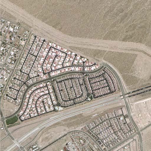
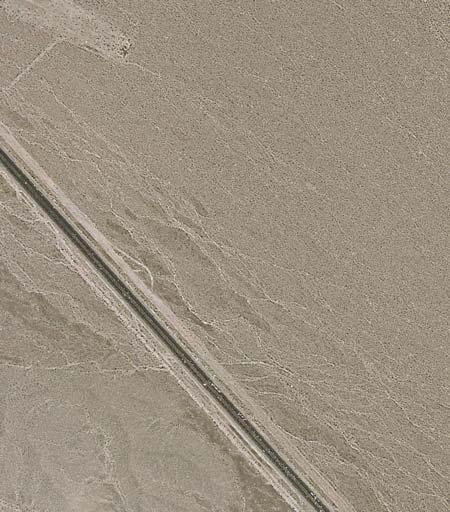
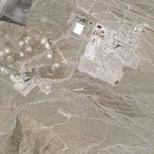
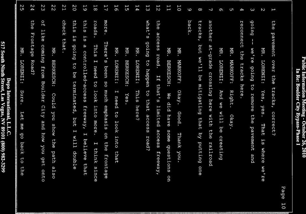
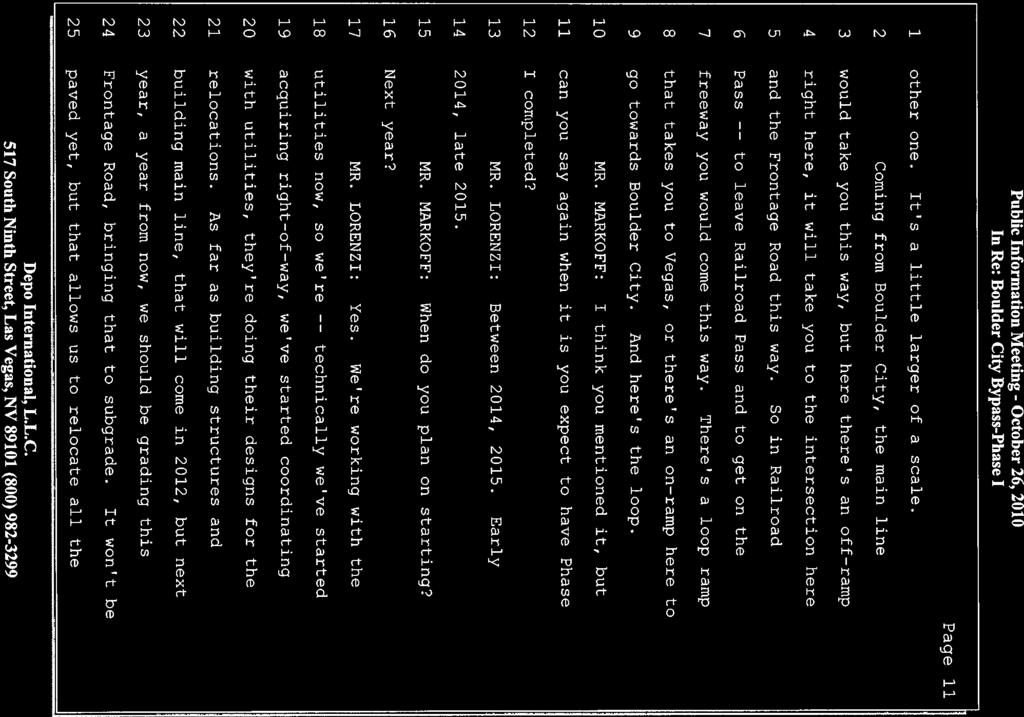
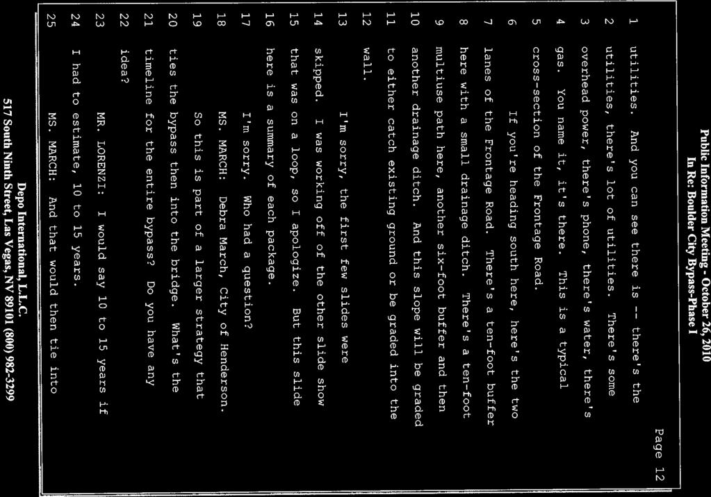
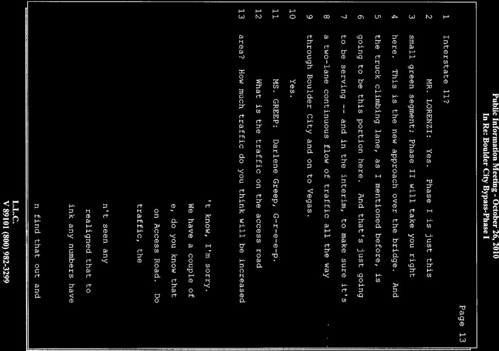
2 Figure 1. Boulder City Bypass Project Area Overview Page 2 of 8


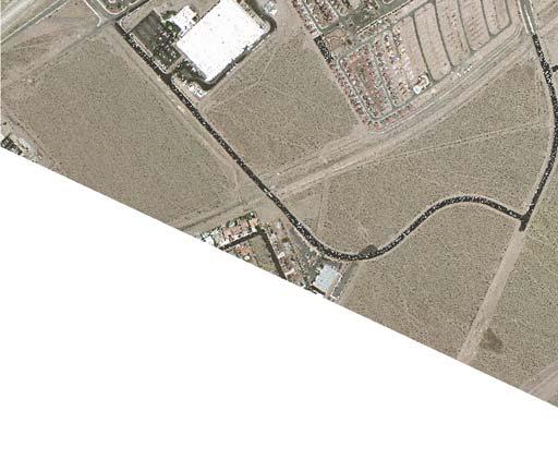
3 Henderson West Frontage Road Eldorado Valley Figure 2. Phase I Project Area Page 3 of 8
4 The new areas needed to accommodate changes in design that are located beyond the original EIS study corridor were subject to environmental review/survey in conformance with applicable federal (Section 106, ESA, etc.), state and local laws. The findings of the review were then examined in light of the project in its entirety and it was determined that the following areas are NOT impacted: Social and Environmental Justice Economic Agricultural Land Use Visual Indirect and Cumulative Impacts Historic Architectural Resources Archaeological Resources Native American Concerns Wetlands Water Body Involvement Contaminated Sites Air Quality Floodplains Noise Water Quality Wild and Scenic Rivers Section 4(f)/6(f) Resources Construction Impacts Traffic Changes in Environmental Commitments or Mitigation Measures The proposed design changes and changed conditions would impact the following areas: Changes in the affected environment within or adjacent to the project Right-of-Way Fish & Wildlife and Threatened and Endangered Species (T&E) Public Involvement and Agency Coordination Changes in the affected environment within or adjacent to the project The Hoover Dam Bypass project was completed and opened to the public on October 10, Since the opening, substantial traffic jams have occurred irregularly on US 93. When these backups of southbound (SB) US 93 do occur they begin at the Hoover Dam and continue north along old US 93 /SR172 through the new US 93 Exit 2 interchange and on through Boulder City. Traffic volume data for 2010 and January 2011 is presented in Table 1 and they indicate an increase in Average Daily Traffic (ADT) post-bridge opening on US 93. The traffic data gathering point is located.3 mi south Lakeshore Drive/US 93 intersection. Table 1. Comparative Traffic Volumes for US 93 Near Hoover Dam Month/Year MADT* % of AADT** January , September , October , November , December , January ,245 - *Monthly Average Daily Traffic **Annual Average Daily Traffic This irregular operational failure can be attributed visitors to the dam and new bridge and how parking and the movement of visitors between the dam and bridge attractions is accommodated. Additionally, poor highway signage along and leading up to the new US 93 Exit 2 interchange creates confusion for motorists seeking to exit and visit the bridge resulting in unsafe vehicle operation at the Exit 2 interchange for both SB and northbound (NB) travelers. Page 4 of 8
5 Since the bridge opening, the Boulder City mayor, city council, and state and federally elected officials have contacted NDOT strongly advocating for improvements to US 93 between Buchanan Blvd. and the Exit 2 interchange in addition to accelerating progress toward the completion of the Boulder City Bypass project. In response, NDOT will utilize state funds to undertake the following proposed improvements by December 2011: Post improved signage for SB and NB motorists seeking to visit the dam/bridge Widen SB US 93 one lane from approximately 0.25 mi south of Buchanan to the Hoover Dam Interchange. The highway currently drops from two lanes to one until you get to the new bridge approach where it opens back up to two lanes. The distance is about 5.5 miles. Widen NB US 93 one lane from the Hoover Dam Interchange to approximately 1,500 past Lakeshore Dr. The distance on this segment is about 1.5 miles. Extension of culverts Install guardrail to protect poles, headwalls, etc Improve some operational deficiencies as discovered Construct High T Intersection improvements at Lakeview and Lakeshore Install Intelligent Transportation System (ITS) devices to provide travel times In anticipation of the bridge opening, NDOT completed operational improvements to the US 93/Buchanan intersection in September These improvements consisted of lengthening the SB US 93 dual left turn lane storage lengths to approx 850 with a protected median, improving the acceleration length and merge distance for the NB US 93 free-right lane west of the Buchanan intersection, and widening the pavement along the easterly side of the north approach of the intersection to accommodate large truck turns. Other elements that are now just being developed and were not considered in the 2006 Boulder City Bypass EIS, but are likely to be in place by the time Phase II is complete is that the Bureau of Reclamation (BOR) has begun preliminary planning on construction of an additional new visitor center for bridge/dam visitors. Site location is very preliminary, but locations near the current bridge viewing area or in the vicinity of the Exit 2 interchange are being considered. The National Park Service (NPS) has also begun initial planning to replace and expand their visitor center currently located near the US 93/Lakeshore Drive intersection. In addition to addressing the current Boulder City traffic issue along US 93 until Phase II of the Bypass project is complete (tentatively 2025), any planned NDOT improvements to US 93 between Exit 2 and Buchanan Blvd. would decrease emergency response times to points south of Buchanan Blvd. and would provide a safer more functional transportation facility to the main entrance of the Lake Mead National Recreation Area (LMNRA) and between LMNRA and the Hacienda Hotel and Casino and the Hoover Dam and Mike O Callaghan-Pat Tillman Memorial Bridge. Right-of-Way Impacts As depicted in Figure 2, the proposed Phase 1 design refinements of the WFR in Henderson will require the additional acquisition of 3.46 acres of public and private land. The acquisitions are required to accommodate the WFR geometry at the historic Boulder City Branch Railroad as well as the connection of the WFR to Dawson Avenue. At the extreme south end of Phase 1 in Eldorado Valley the proposed design refinements would require the additional acquisition of 3.65 acres from the BLM. This proposed improvement would help clearly define safe and legal access between the proposed bypass and existing private businesses and public lands. All acquisitions will be in conformance with the Uniform Act. Page 5 of 8
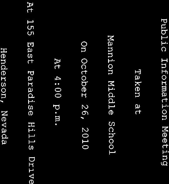
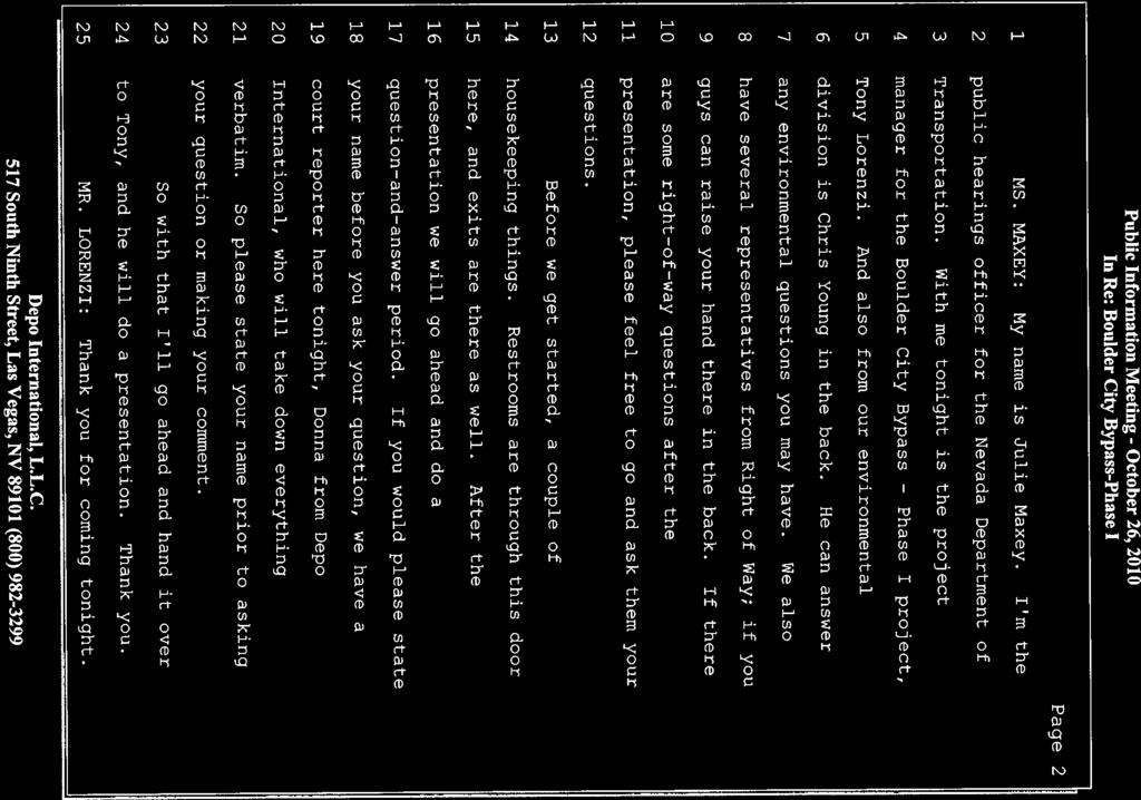
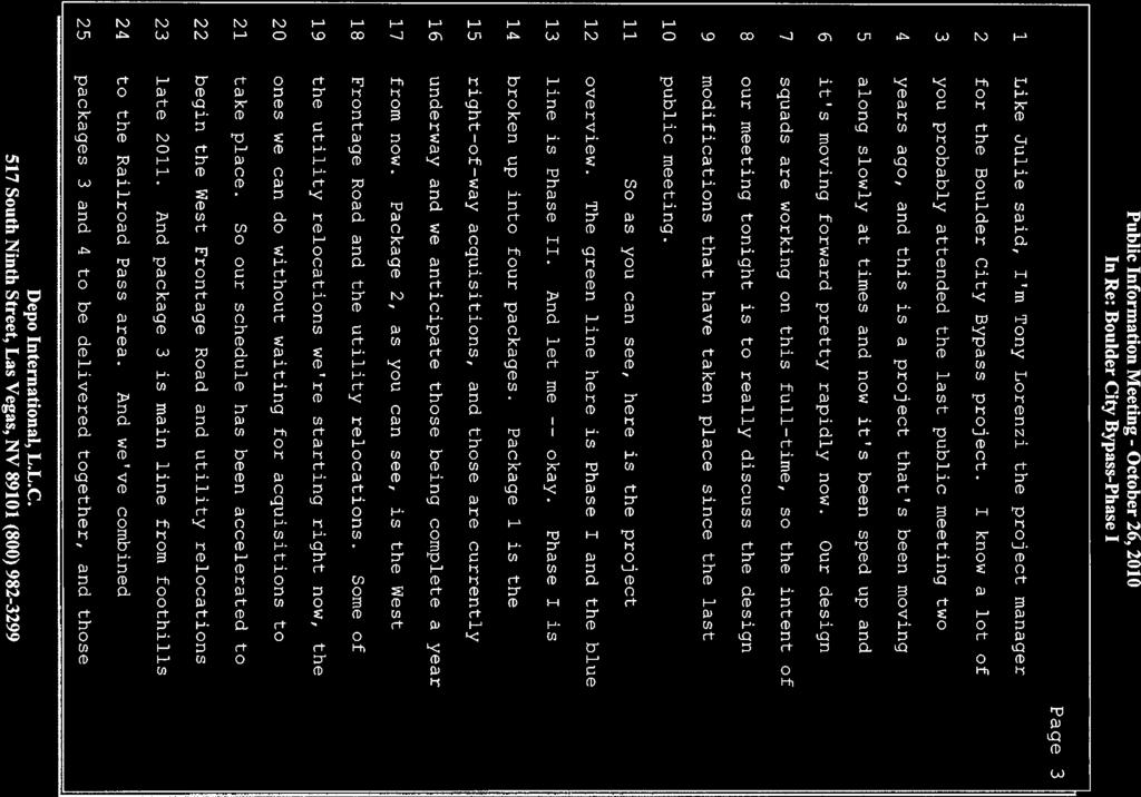
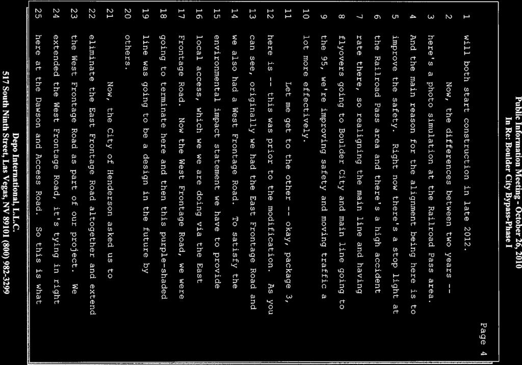
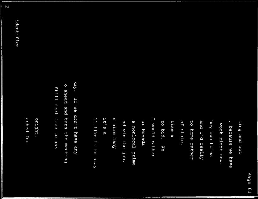
6 Fish & Wildlife and Threatened and Endangered Species (T&E) A formal Section 7 consultation with the U.S. Fish and Wildlife Service will be conducted for Phase 1. Surveys required by the Endangered Species Act for the Biological Assessment began in summer 2010 and are planned to be complete in spring This project is covered under the Programmatic Biological Opinion (PBO) received from the USFWS in September 2010 and consultation with USFWS will be conducted in accordance with that PBO. Consultation with the Nevada Department of Wildlife (NDOW) to address their concerns, particularly with regard to impacts to bighorn sheep and to a bat colony inhabiting a mine shaft within the Phase 1 footprint is ongoing. For Phase 1, NDOW does not believe that any measures need to be implemented for bighorn sheep as there is very low to no movement of them between the River Mountains and the McCullough Mountains. The mine shaft will be cleared of bats prior to its closure and consultation is ongoing with NDOW on specifically how to accomplish this. Construction and operational mitigation will be implemented as stated on pages of the Record of Decision and as stipulated in the USFWS PBO. Any NDOT improvements to US 93 between Exit 2 and Lakeshore Drive would seek to complement any mitigation measures required for Phase II of the Boulder City Bypass. Public Involvement and Agency Coordination A project web site was developed for this project and it was last updated January 2011 to keep the public updated regarding the project. NDOT s project manager has worked closely with the Railroad Pass Casino and other businesses impacted by Phase 1 as well local municipal staff and elected officials. A public information meeting was held on October 26, 2010 at Mannion Middle School from 4-7 p.m. to update the public, specifically the residents and businesses in the Railroad Pass area. The meeting was noticed in the Las Vegas Review Journal, Henderson View and Boulder City Review and notices were mailed to federal, state, and local agencies and elected officials as well as to all property owners within a ¼ mile radius of the Phase 1 project area. About 80 members of the general public, elected officials and agency representatives attended the meeting. Two presentations were made by NDOT staff focusing on the design details and construction of the WFR, Phase 1 funding and scheduling, and the status of Phase II (from US 95 to Hoover Dam Bypass). Written and oral comments received covered the following topics (Attachment A transcripts): How many lanes will the west frontage road have? What is the anticipated traffic for the west frontage road? No east frontage road wanted What s going to happen to Access Road, will you still be to enter US 93 SB from it? When will the entire project (Phases I and II) be finished? Concerned about diverting traffic away from Boulder City business when the Phase II complete Truck traffic on US 93 through Boulder City now that bridge is open Maintaining access to Railroad Pass Casino Pedestrian, equestrian, and bighorn sheep movement across the Phase I project area No toll road for any proposed improvements to US 93 between the Hacienda Hotel and Casino (Exit 2) and the Railroad Pass Casino Improve existing US 93 using roundabouts to replace existing stop lights instead of building the bypass A petition form the Friends of the Nevada Southern Railway, Inc. was also received with approximately 6,700 signatures showing their interest and desire to not only perpetuate the railroad crossing at Hwy 95 but to re-open it at the earliest possible time. NDOT has been carefully considering the rail crossing Page 6 of 8


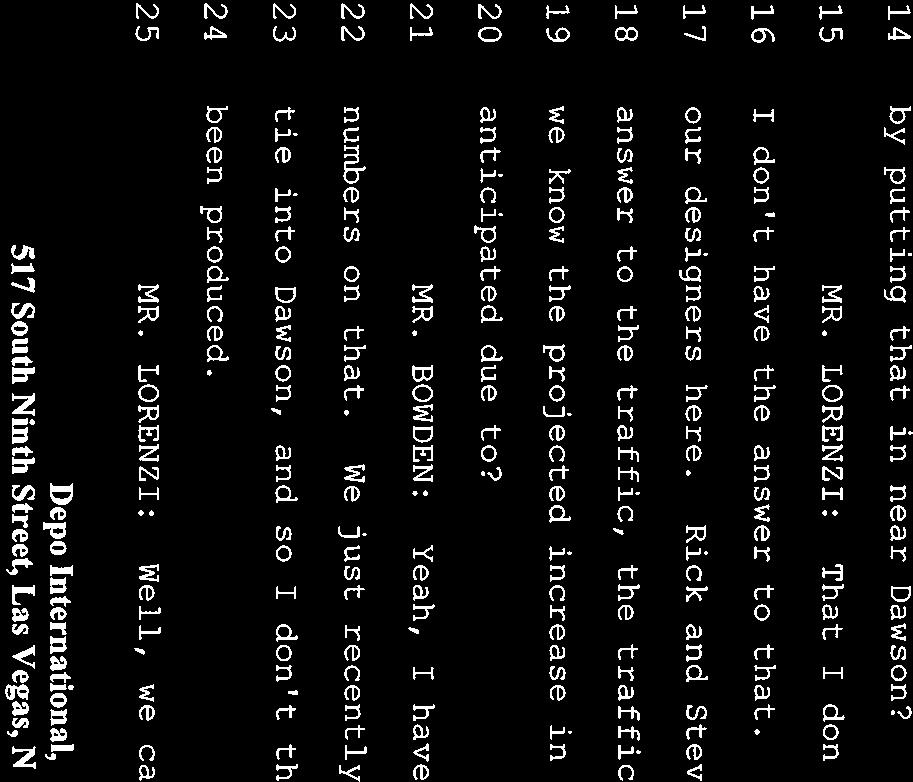
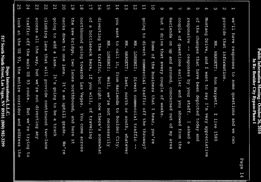
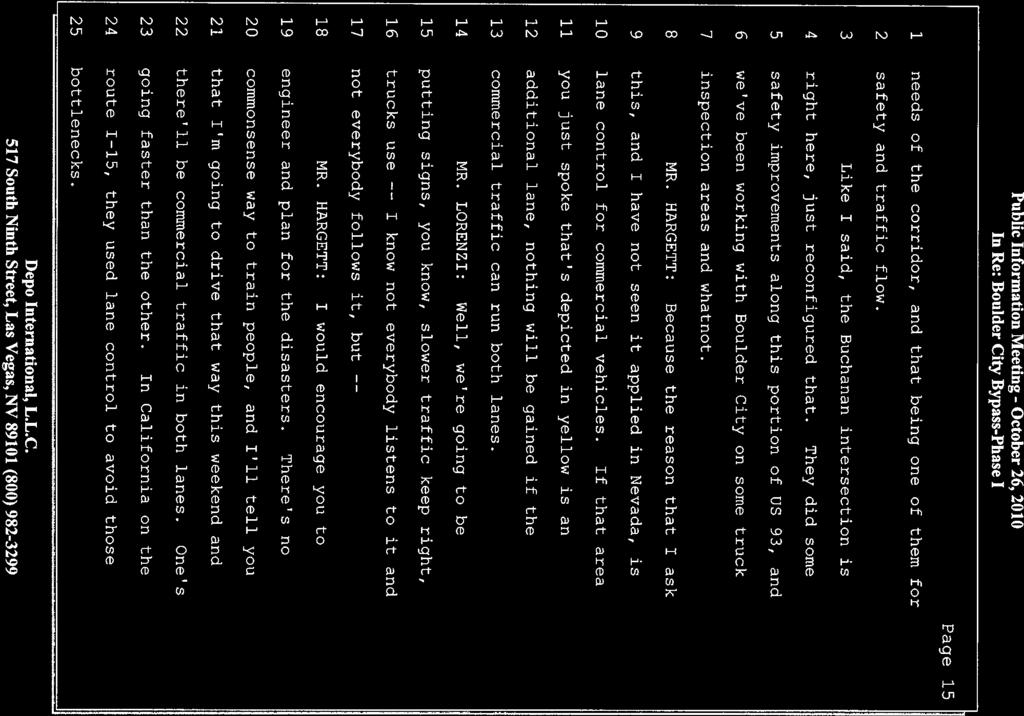
7
8 Attachment A Boulder City Bypass Public Information Meeting October 26, 2010 Transcript Page 8 of 8


9
10
11
12
13

14
15
16
17
18
19
20
21
22
23
24

25
26
27
28
29
30
31
32
33
34
35
36
37
38
39
40
41
42
43
44
45
46
47
48
49
50
51
52
53
54
55
56
57
58
59
60
61
62
63

64

65
66
67
68
69

70
71
72

73
74
75
76
77
78
79
1.2 Corridor History and Current Characteristics
 SECTION 1 Description and Background of Study Area 1.1 Introduction This preliminary engineering report was prepared for the Alaska Department of Transportation and Public Facilities (ADOT&PF). It is part
2. Project Description and Alternatives
 2. Project Description and Alternatives 2.1 Introduction Traffic on U.S. 93 in Boulder City doubled from 17,200 average daily traffic (ADT) in 1985 to approximately 32,000 ADT in 1999. This increase in
Bradley Brook Relocation Project. Scoping Notice. Saco Ranger District. United States Department of Agriculture Forest Service
 Bradley Brook Relocation Project United States Department of Agriculture Forest Service Scoping Notice White Mountain National Forest February 2011 For Information Contact: Jenny Burnett White Mountain
HAMPTON ROADS CROSSINGS PATRIOTS CROSSING AND HRBT
 HRTPO Board Meeting March 21, 2013 Agenda ITEM #9: HAMPTON ROADS CROSSINGS PATRIOTS CROSSING AND HRBT Congestion at the Hampton Roads Bridge-Tunnel (HRBT) on I-64 has long been identified as a problem
Section 4(f) and Section 6(f) Technical Analysis
 and Section 6(f) Technical Analysis") WESTSIDE SUBWAY EXTENSION PROJECT Contract No. PS-4350-2000 Section 4(f) and Section 6(f) Technical Analysis Prepared for: Prepared by: WSP USA 851 SW Sixth Avenue, Suite 1600 Portland, Oregon 97204 FEBRUARY
WESTSIDE SUBWAY EXTENSION PROJECT Contract No. PS-4350-2000 Section 4(f) and Section 6(f) Technical Analysis Prepared for: Prepared by: WSP USA 851 SW Sixth Avenue, Suite 1600 Portland, Oregon 97204 FEBRUARY
FHWA P/N Guidelines. Corridor Relationship. Highway 22 Segment 1 - US 169 to CSAH 2 Relevance / Documentation of Need
 Highway 22 Segment 1 - US 169 to CSAH 2 Vehicle Mobility Congestion Intersection Congestion Existing Conditions - Based on Highway Capacity Manual methodology, corridor level of service is currently LOS
Lake Erie Commerce Center Traffic Analysis
 LOCATION: East of NYS Route 5 at Bayview Road Town of Hamburg Erie County, New York PREPARED BY: Wendel Companies 140 John James Audubon Parkway Suite 200 Amherst, New York 14228 January 2012 i ii Table
White Mountain National Forest Saco Ranger District
 United States Department of Agriculture Forest Service White Mountain National Forest 33 Kancamagus Highway Conway, NH 03818 Comm: (603) 447-5448 TTY: (603) 447-3121 File Code: 1950 Date: February 26,
Office of Commercial Space Transportation: Notice of Availability, Notice of Public
 This document is scheduled to be published in the Federal Register on 04/20/2018 and available online at https://federalregister.gov/d/2018-08345, and on FDsys.gov [4910-13] DEPARTMENT OF TRANSPORTATION
Macleod Trail Corridor Study. Welcome. Macleod Trail Corridor Study Open House. Presentation of Proposed Design Concepts
 Macleod Trail Corridor Study Welcome Macleod Trail Corridor Study Open House Presentation of Proposed Design Concepts Study Purpose Develop a corridor plan for Macleod Trail that aligns with The City s:
SECTION 106 ACTIVITIES ANNUAL REPORT
 SECTION 106 ACTIVITIES ANNUAL REPORT FOR THE YEAR ENDING DECEMBER 31, 2011 Metropolitan Washington Airports Authority 1593 Spring Hill Road, Suite 300 Vienna, Virginia 22182 JANUARY 2012 Introduction The
Route 29 Solutions Projects
 Your guide to the Route 29 Solutions Projects For full details & continued engagement please visit www.route29solutions.org The Route 29 Solutions Package is a $230 million investment into the improvement
AGENDA ITEM 5 D WAKULLA ENVIRONMENTAL INSTITUTE (WEI) TRAIL FEASIBILITY STUDY
 TRAIL FEASIBILITY STUDY") March 19, 2018 AGENDA ITEM 5 D WAKULLA ENVIRONMENTAL INSTITUTE (WEI) TRAIL FEASIBILITY STUDY TYPE OF ITEM: Action STATEMENT OF ISSUE The Wakulla Environmental Institute (WEI) Trail is one of several trails
March 19, 2018 AGENDA ITEM 5 D WAKULLA ENVIRONMENTAL INSTITUTE (WEI) TRAIL FEASIBILITY STUDY TYPE OF ITEM: Action STATEMENT OF ISSUE The Wakulla Environmental Institute (WEI) Trail is one of several trails
DIRECTOR S REPORT TRANSPORTATION BOARD OCTOBER 8, 2018
 DIRECTOR S REPORT TRANSPORTATION BOARD OCTOBER 8, 2018 1 US EPA CONSENT DECREE NDOT HAS MET OR EXCEEDED ALL DEADLINES FOR REQUIREMENTS CONTAINED IN THE CONSENT DECREE WITH THE US EPA NO STIPULATED PENALTIES
APPENDIX F List of Commitments
 APPENDIX F List of Commitments s Table F.1 Standard Mitigation Measures Mitigation Measure MnDOT Specification Number Status Update Description Status Update Utilities Provide early notice to utility operators
FEASIBILITY STUDY REFINED CONCEPT 1 PROJECT A
 VIRGINIA DEPARTMENT OF TRANSPORTATION I-85 / I-95 INTERCHANGE FEASIBILITY STUDY REFINED CONCEPT 1 PROJECT A Columbia Rd REFINED CONCEPT 1 PROJECT A Bellevue Rd COST: $3.3M Siege Rd Eliminate the loop ramp
HIGHWAY RAIL GRADE CROSSING CONSOLIDATION PROGRAM
 HIGHWAY RAIL GRADE CROSSING CONSOLIDATION PROGRAM To decrease unnecessary train traffic exposure to life and property, promote public safety, and improve traffic conditions, the Texas Department of Transportation
Arlington County Board Work Session Eastbound Widening January 17, Amanda Baxter, VDOT Special Projects Development Manager
 Arlington County Board Work Session Eastbound Widening January 17, 2017 Amanda Baxter, VDOT Special Projects Development Manager Program Area Map 2 Program Scope Tolling during weekdays, peak hours, peak
DULLES AREA HIGHLIGHTS. Gary Garczynski Commonwealth Transportation Board Northern Virginia District. Committee for Dulles August 4, 2016
 DULLES AREA HIGHLIGHTS Gary Garczynski Commonwealth Transportation Board Northern Virginia District Committee for Dulles August 4, 2016 Smart Scale (formerly HB2) Overview Round 1 completed with the adoption
STEVENS POINT QUIET ZONE
 STEVENS POINT QUIET ZONE Associate Administrator for Safety Federal Railroad Administration 1200 New Jersey Avenue, SE, MS-25 Washington, DC 20590 Mailed:, 2009 Certified Mail Article# 70000520002247320178
US 83 Relief Route. City of La Joya City of Peñitas Hidalgo County. November 15, 2012
 US 83 Relief Route City of La Joya City of Peñitas Hidalgo County November 15, 2012 TxDOT Mission: Work with others to provide safe and reliable transportation solutions for Texas. Public Meeting Agenda
Figure 1: Little Dry Creek Trail Crossing
 Figure 1: Little Dry Creek Trail Crossing Figure 2: Little Dry Creek Trail Crossing Northwest Rail Environmental Evaluation Temporary Trail Detour Concurrence Form Adams County, Little Dry Creek Trail
Dusty Boots Unit II. Available Parcels and Informational Summary
 Dusty Boots Unit II Available Parcels and Informational Summary January 2008 Notice to Recipients Other Properties May be available upon Request. Please feel free to contact us with other requests as this
Decision Memo Broken Wheel Ranch Equestrian Outfitter Special-Use Permit Proposed Action
 Decision Memo Broken Wheel Ranch Equestrian Outfitter Special-Use Permit USDA Forest Service Mississippi Bluffs Ranger District, Shawnee National Forest Jackson and Union Counties, Illinois Proposed Action
HIGHWAY 26 /GREY ROAD 2 INTERSECTION IMPROVEMENTS. The Town of The Blue Mountains
 HIGHWAY 26 /GREY ROAD 2 INTERSECTION IMPROVEMENTS The Town of The Blue Mountains MUNICIPAL CLASS ENVIRONMENTAL ASSESSMENT STUDY R.J. Bur nside & Associat es Limit ed Study Area Issues Traffic congestion
Memorandum. Roger Millar, Secretary of Transportation. Date: April 5, Interstate 90 Operations and Mercer Island Mobility
 Memorandum To: From: The Honorable Dow Constantine, King County Executive; The Honorable Ed Murray, City of Seattle Mayor; The Honorable Bruce Bassett, City of Mercer Island Mayor; The Honorable John Stokes,
RUSHMORE CONNECTOR TRAIL PROPOSAL
 PURPOSE AND NEED Background The U.S. Forest Service, Black Hills National Forest (Forest Service) has received a special use permit application from the State of South Dakota Department of Game, Fish and
Construction underway. STATUS: 229 5,190 5,419 5,305 STIP REFERENCE #FR /01/2013
 FREDERICK COUNTY STATE HIGHWAY ADMINISTRATION -- Frederick County -- Line 1 PROJECT: I-7, Baltimore National Pike INTERSTATE CONSTRUCTION PROGRAM DESCRIPTION: Widen I-7 east of MD 355 to east of MD 144
Decision Memo Ice Age Trail Improvement (CRAC 37)
") Decision Memo Ice Age Trail Improvement (CRAC 37) U.S. Forest Service Chequamegon-Nicolet National Forest, Medford-Park Falls Ranger District Taylor County, Wisconsin T32N, R2W, Town of Grover, Section
Decision Memo Ice Age Trail Improvement (CRAC 37) U.S. Forest Service Chequamegon-Nicolet National Forest, Medford-Park Falls Ranger District Taylor County, Wisconsin T32N, R2W, Town of Grover, Section
BACKGROUND DECISION. Decision Memo Page 1 of 6
 DECISION MEMO DEVIL S ELBOW BY-PASS, BOUNDARY TRAIL NO.1 U.S. FOREST SERVICE T9N, R7E, SECTION 9 RANGE 5E COWLITZ COUNTY WA MOUNT ST. HELENS NATIONAL VOLCANIC MONUMENT, GIFFORD PINCHOT NATIONAL FOREST
I-3 DFW Extension Public Hearing. June 2, 2011
 1 I-3 DFW Extension Public Hearing June 2, 2011 2 DFW LRT Extension Agenda: Introductions Service Plan Amendment Alignment, Grade Separations, Station, Yard Environmental Assessment Environmental Impacts/Mitigation
Stage 2 ION: Light Rail Transit (LRT) from Kitchener to Cambridge
 from Kitchener to Cambridge") Stage 2 ION: Light Rail Transit (LRT) from Kitchener to Cambridge Public Consultation Centre (PCC) No. 3 Please Sign-in Cambridge City Hall November 21, 2017 2:00 to 8:00pm Preston Memorial Auditorium
Stage 2 ION: Light Rail Transit (LRT) from Kitchener to Cambridge Public Consultation Centre (PCC) No. 3 Please Sign-in Cambridge City Hall November 21, 2017 2:00 to 8:00pm Preston Memorial Auditorium
Daisy Dean Trail 628/619 ATV Trail Construction
 Background and Purpose and Need The Daisy Dean ATV Trail Construction Project is located in the Little Belt Mountains, Musselshell Ranger District, Lewis and Clark National Forest approximately 32 miles
A VISION FOR I-95. January 12, Delaware Department of Transportation
 A VISION FOR I-95 January 12, 2011 Delaware Department of Transportation The East Coast s Main Street Along with SR 1, the most significant highway in Delaware 29 miles to I ".', 2 Sponsoring / Cooperating
Section II. Planning & Public Process Planning for the Baker/Carver Regional Trail began in 2010 as a City of Minnetrista initiative.
 Section II Planning & Public Process Planning for the began in 2010 as a City of initiative. city staff began discussions with the Park District on the possibility of a north/south regional trail connection
STAGE 2 & 3 Pavement reconstruction within viaduct footprint, pavement widening and resurfacing N/S of viaduct footprint, sidewalk
 STAGE 1 Viaduct removal, deck replacement on the River Bridge, and approach of the Chicago River Bridge north to Roscoe) Maintain local access roadways - 1 lane in each direction A signed alternate route
Pedestrian Safety Review Spadina Avenue
 STAFF REPORT ACTION REQUIRED Pedestrian Safety Review Spadina Avenue Date: October 13, 2015 To: Toronto and East York Community Council From: Director, Transportation Services, Toronto and East York District
Section 106 Update Memo #1 Attachment D. Traffic Diversion & APE Expansion Methodology & Maps
 Section 106 Update Memo #1 Attachment D Traffic Diversion & APE Expansion Methodology & Maps I-65/I-70 North Split Interchange Reconstruction Project (Des. Nos. 1592385 & 1600808) Traffic Diversion and
PURPOSE AND NEED (CONCURRENCE POINT 1) NEW CANADA ROAD PROJECT FROM STATE ROUTE 1 (U.S. HIGHWAY 70) TO U.S. INTERSTATE 40
 NEW CANADA ROAD PROJECT FROM STATE ROUTE 1 (U.S. HIGHWAY 70) TO U.S. INTERSTATE 40") PURPOSE AND NEED (CONCURRENCE POINT 1) NEW CANADA ROAD PROJECT FROM STATE ROUTE 1 (U.S. HIGHWAY 70) TO U.S. INTERSTATE 40 Project Description The primary purpose of this project is to improve the major
PURPOSE AND NEED (CONCURRENCE POINT 1) NEW CANADA ROAD PROJECT FROM STATE ROUTE 1 (U.S. HIGHWAY 70) TO U.S. INTERSTATE 40 Project Description The primary purpose of this project is to improve the major
PUBLIC INFORMATION SESSION #2
 Highway 16, Highway 779 to Kapasiwin Road, Planning Study PUBLIC INFORMATION SESSION #2 Wednesday June 20, 2012 4 to 8 pm HIGHWAY 16 Highway 779 to Kapasiwin Road Functional Planning Study Blueberry Community
For Immediate Release Christine Girardin January 19, 2018 SUMTER COUNTY FLORIDA S TURNPIKE AND I-75 INTERCHANGE IMPROVEMENTS
 TRAFFIC ADVISORY For Immediate Release Christine Girardin 407-264-3069 January 19, 2018 Central and West Central Florida Weekly Lane Closures and Work Zone Advisory OCOEE Florida s Turnpike announces lane
Appendix L Technical Memorandum Aesthetics
 Technical Memorandum Aesthetics 1.0 AESTHETICS This section provides a discussion of the aesthetic resources in the vicinity of ARTIC. Aesthetics pertain to the elements that make a certain view pleasing
2017 TBARTA Future Regional Priority Projects Adopted by TBARTA Board, December 9, 2016
 2017 TBARTA Future Regional Priority Projects Adopted by TBARTA Board, December 9, 2016 Project numbers do not signify ranking they are for mapping identification purposes only. 1. 15th Street East The
SECTION 106 ACTIVITIES ANNUAL REPORT
 SECTION 106 ACTIVITIES ANNUAL REPORT FOR THE YEAR ENDING DECEMBER 31, 2014 Metropolitan Washington Airports Authority 198 Van Buren Street, Suite 300 Herndon, Virginia 20170 JANUARY 2015 Introduction The
Project Planning, Compliance, and Funding
 Project Planning, Compliance, and Funding The plans above offer high level guidance to ensure that the A.T. is managed effectively as a whole unit in a decentralized management structure. Cooperative management
US 380 FEASIBILITY STUDY
 US 380 FEASIBILITY STUDY Denton County CSJ(s): 0135-10-061, 0135-10-062 Public Meeting(s): January 15 & 22, 2019 WELCOME US 380 Denton County Feasibility Study DALLAS DISTRICT PUBLIC MEETING January 15
This section evaluates the projected traffic operations and circulation impacts associated with the proposed upgrade and expansion of the LWRP.
 4.5 TRAFFIC AND CIRCULATION This section evaluates the projected traffic operations and circulation impacts associated with the proposed upgrade and expansion of the LWRP. 4.5.1 Environmental Setting Existing
3. COLTA / HUGA CONNECTIONS - PRELIMINARY
 9 3. COLTA / HUGA CONNECTIONS - PRELIMINARY 3.1 COLTA The Chain of Lakes Trail Association (COLTA) trail, formerly identified as the Chester Spur Line, was completed and opened for use in June 2011. The
Auburn Trail / Ontario Pathways Trail Connector Feasibility Study Public Information Meeting Wednesday, August 22, 2012
 Auburn Trail / Ontario Pathways Trail Connector Feasibility Study Public Information Meeting Wednesday, August 22, 2012 Purpose of Feasibility Study Purpose Evaluate the feasibility of constructing a multiuse
Draft Concept Alternatives Analysis for the Inaugural Airport Program September 2005
 Draft Concept Alternatives Analysis for the Inaugural Airport Program September 2005 Section 3 - Refinement of the Ultimate Airfield Concept Using the Base Concept identified in Section 2, IDOT re-examined
DIRECTOR S REPORT TRANSPORTATION BOARD AUGUST 14, 2017
 DIRECTOR S REPORT TRANSPORTATION BOARD AUGUST 14, 2017 1 EMERGENCY OPERATIONS NDOT ISSUED A $360,000 EMERGENCY CONTRACT FOR REPAIR OF FLOOD DAMAGE ON SR 375 LINCOLN COUNTY 3 FT. SINK HOLE TO BE REPAIRED
MEMORANDUM. Lynn Hayes LSA Associates, Inc.
 MEMORANDUM To: Lynn Hayes LSA Associates, Inc. Date: May 5, 217 From: Zawwar Saiyed, P.E., Senior Transportation Engineer Justin Tucker, Transportation Engineer I Linscott, Law & Greenspan, Engineers LLG
FDOT Treasure Coast Traffic Report through
 FDOT Treasure Coast Traffic Report 02 26 16 through 03 04 16 Kathleen Dempsey Fri 2/26/2016 2:56 PM To:Kathleen Dempsey ; 1 attachment 355 KB CR 714_Median Access Modifications.pdf;
Cultural Resource Management Report Deer Valley 4wd Restoration and Blue Lakes Road Maintenance Project R
 Cultural Resource Management Report R2015-05-03-10005 Undertaking Description: The proposes to perform road maintenance and meadow restoration on the Deer Valley 4wd trail and road maintenance on the Blue
IMPLEMENTATION OF COMPREHENSIVE DEVELOPMENT AGREEMENT (CDA) PROJECTS:
 PROJECTS:") IMPLEMENTATION OF COMPREHENSIVE DEVELOPMENT AGREEMENT (CDA) PROJECTS: SH 130 Project, Segments 5 & 6, Travis, Caldwell and Guadalupe counties; DFW Connector, Tarrant County; North Tarrant Express (NTE),
IMPLEMENTATION OF COMPREHENSIVE DEVELOPMENT AGREEMENT (CDA) PROJECTS: SH 130 Project, Segments 5 & 6, Travis, Caldwell and Guadalupe counties; DFW Connector, Tarrant County; North Tarrant Express (NTE),
DECISION MEMO. Rawhide Trail #7073 Maintenance and Reconstruction
 Page 1 of 6 Background DECISION MEMO USDA Forest Service Jefferson Ranger District Jefferson County, Montana Rawhide Trail #7073 is located in the Elkhorn Mountain Range approximately 10 miles east of
Chapter 2: Entire US287 Corridor
 Chapter 2: Entire US287 Corridor The US287 Study Area spans four incorporated jurisdictions and two counties. Due to the length and density of infrastructure along the US287 Study Area, corridor-wide maps
The Missouri Department of Transportation is proposing to amend the state's five-year Statewide Transportation Improvement Program (STIP).
.") The Missouri Department of Transportation is proposing to amend the state's five-year Statewide Transportation Improvement Program (STIP). A 7-day public comment period regarding the amendment begins January
The Missouri Department of Transportation is proposing to amend the state's five-year Statewide Transportation Improvement Program (STIP). A 7-day public comment period regarding the amendment begins January
FDOT Treasure Coast Traffic Impact Report October 9 through October 16, 2015
 From: Kathleen Dempsey To: Kathleen Dempsey Subject: FDOT Treasure Coast Traffic Report 10 09 15 through 10 16 15 Date: Friday, October 09, 2015 2:10:36 PM Attachments: image003.png CR 714_Median Construction
35EXPRESS PROJECT UPDATE FOR DENTON COUNTY COMMISSIONERS
 35EXPRESS PROJECT UPDATE FOR DENTON COUNTY COMMISSIONERS 35EXPRESS PROJECT OVERVIEW 2 ABOUT THE 35EXPRESS PROJECT 3 DESIGN-BUILD TEAM 4 PROJECT PARTNERS Great partnerships make this project work Collaboration
Concord Road Interchange. Standard hours of work
 Artist impression of the Concord Road interchange, Concord - concept only WestConnex s M4 East will extend the M4 Motorway with two new 5.5 kilometre tunnels from Homebush to Haberfield, providing a bypass
I-75 in Hamilton County Project Termini
 I-75 in Hamilton County Project Termini Introduction As part of the North South Transportation Initiative (NSTI), capacity improvements were recommended for the I-75 corridor through Hamilton County from
SR 429/WEKIVA PARKWAY FTBA CONFERENCE March 20-21, Presented By Suzanne Phillips, P.E., FDOT District 5
 SR 429/WEKIVA PARKWAY FTBA CONFERENCE March 20-21, 2012 Presented By Suzanne Phillips, P.E., FDOT District 5 Project Description The Wekiva Parkway project constructs 25 centerline miles of new toll expressway.
Engagement Summary Report. Trans-Canada Highway 1 RW Bruhn Bridge and Approaches Project Community Engagement February 1 18, 2018.
 Trans-Canada Highway 1 RW Bruhn Bridge and Approaches Project Community Engagement February 1 18, 2018 Engagement Summary Report April 2018 Prepared by Kirk & Co. Consulting Ltd. Trans-Canada Highway 1
NDOT MAJOR PROJECTS AND INNOVATIVE DELIVERY 2017 NEVADA TRANSPORTATION CONFERENCE COLE MORTENSEN, PE ASST. CHIEF OF PROJECT MANAGEMENT
 NDOT MAJOR PROJECTS AND INNOVATIVE DELIVERY 2017 NEVADA TRANSPORTATION CONFERENCE COLE MORTENSEN, PE ASST. CHIEF OF PROJECT MANAGEMENT PM DIVISION RESPONSIBILITIES FHWA MAJOR PROJECTS TOTAL PROJECT COST
Abbey Chesterton bridge Questions & Answers
 Abbey Chesterton bridge Questions & Answers Please click on links below to go to individual subjects: Bridge location and access routes Timescales Bridge details and accessibility Construction compound
CHAPTER III: TRAIL DESIGN STANDARDS, SPECIFICATIONS & PERMITS
 CHAPTER III Trail Design Standards, Specifications & Permits This chapter discusses trail standards, preferred surface types for different activities, permits, and other requirements one must consider
FDOT Treasure Coast Traffic Impact Report March 25 through April 1, 2016
 March 25, 2016 Chuck McGinness, 954-777-4302 chuck.mcginness@dot.state.fl.us FDOT Treasure Coast Traffic Impact Report March 25 through April 1, 2016 TREASURE COAST Construction and maintenance-related
Segment 2: La Crescent to Miller s Corner
 goal of the USFWS refuges is to conserve, protect and enhance fish, wildlife and plants and their habitats for the continuing benefit of the American people. Refuge lands are used largely for fishing,
CONTACT: Nichole Lawrence CELL: FOR IMMEDIATE RELEASE Wednesday March 28, 2018
 FOR IMMEDIATE RELEASE Wednesday March 28, 2018 CONTACT: Nichole Lawrence CELL: 731-225-6041 West Tennessee Construction March 28-April 4, 2018 Per TDOT Specifications, there will be no temporary lane closures
Department of Public Works P.O Box 4186, San Rafael, CA / Fax: 415/
 Department of Public Works P.O Box 4186, San Rafael, CA 94913-4186 415/499-7877 Fax: 415/499-3724 Raul M. Rojas DIRECTOR San Antonio Road Bridge Replacement September 9, 2015 Community Meeting Summary
Appendix 4.8 A. Agency Correspondence and Final APE Statement
 Appendix 4.8 A Agency Correspondence and Final APE Statement Area of Potential Effect for Cultural Resources Introduction The South Coast Rail project requires review by the Army Corps of Engineers (Corps),
user s guide to Transportation Improvements in Astoria Planning Efforts outside Astoria for more information, contact:
 The Miles Crossing/ Jeffers Garden transportation plan (underway), will identify needed improvements to the Warrenton Astoria Highway and local street improvements to serve expected growth in the Miles
SR 934 Project Development And Environment (PD&E) Study
 Study") SR 934 Project Development And Environment (PD&E) Study Project Advisory Group Meeting March 1, 2018 State Road 934/NE/NW 79th Street from west of I-95 (NW 13th CT) to N. Bayshore Drive PD&E STUDY SR 934/NE/NW
SR 934 Project Development And Environment (PD&E) Study Project Advisory Group Meeting March 1, 2018 State Road 934/NE/NW 79th Street from west of I-95 (NW 13th CT) to N. Bayshore Drive PD&E STUDY SR 934/NE/NW
SECTION VII - LOCAL COMMITMENT AND CONSULTATION
 SECTION VII - LOCAL COMMITMENT AND CONSULTATION INTRODUCTION The LWRP Advisory Committee was comprised of ten persons, representing different interests in the community. These persons included municipal
EXTERNAL COMMUNICATIONS TEAM MEETING MARCH 2015
 EXTERNAL COMMUNICATIONS TEAM MEETING MARCH 2015 1 SEGMENT 1 2 THE WISHBONE Connects the TEXpress Managed Toll System to the 35Express Managed Toll System Limits: Crown Road (near Royal Lane) to Valley
San Mateo County Transportation Authority Board Meeting November 2, 2017 Item #10 1
 San Mateo County Transportation Authority Board Meeting November 2, 2017 Item #10 1 OVERVIEW Brief recap from October Traffic Analysis Findings Draft Environmental Document Summarized Outcomes Questions
Route 141 and I-44 Design-Build Project Community Involvement Group. March 21, 2016
 Route 141 and I-44 Design-Build Project Community Involvement Group March 21, 2016 Purpose of CIG 1. Share information with major stakeholders 2. Keep stakeholders informed of the process 3. Reduce uncertainty
MONTEREY REGIONAL AIRPORT MASTER PLAN TOPICAL QUESTIONS FROM THE PLANNING ADVISORY COMMITTEE AND TOPICAL RESPONSES
 MONTEREY REGIONAL AIRPORT MASTER PLAN TOPICAL QUESTIONS FROM THE PLANNING ADVISORY COMMITTEE AND TOPICAL RESPONSES Recurring topics emerged in some of the comments and questions raised by members of the
Memorandum. To: From: cc: Date: November 7, Re: 1.0 Purpose and Organization of this Addendum. 2.0 Project Description
 Memorandum To: From: cc: Laura Prickett, Horizon Water and Environment Analette Ochoa and Wana Chiu, WRECO Parag Mehta, Kimley Horn Date: November 7, 2017 Re: Santa Cruz Route 1 Tier I and Tier II HOV
CHAPTER 4 - COMMENTS AND COORDINATION Introduction Comments and Responding to Comments
 Table of Contents SUMMARY...S-1 S.1 Joint CEQA/NEPA Document...S-1 S.2 Overview of Project Area... S-2 S.3 Purpose and Need... S-6 S.4 Proposed Action... S-6 S.5 Project Impacts... S-11 S.6 Coordination
Quiet Zone Process. Background:
 Background: In order to reduce the impact of train horns on municipalities, the FRA (Federal Railroad Administration) has provided communities with the option to establish a QZ (Quiet Zone). A quiet zone
1.0 Purpose and Organization of the Community Impact Assessment Addendum
 Memorandum To: From: cc: Laura Prickett, Horizon Water and Environment Carie Montero, Senior Project Manager/Environmental Lead, Parsons Transportation Group Parag Mehta, Kimley Horn Date: September 24,
FDOT Treasure Coast Traffic Impact Report
 July 22, 2016 Chuck McGinness, 954-777-4302 chuck.mcginness@dot.state.fl.us FDOT Treasure Coast Traffic Impact Report July 22 through July 29, 2016 TREASURE COAST Construction and maintenance-related lane
US 83 FROM NORTH OF THE STARR/ZAPATA COUNTY LINE TO LOMA BLANCA ROAD
 US 83 FROM NORTH OF THE STARR/ZAPATA COUNTY LINE TO LOMA BLANCA ROAD PUBLIC MEETING JUNE 8, 2017 Talk Text Crash 2 AGENDA TECHNICAL PRESENTATION (Roma Area Engineer Eduardo Gracia, P.E.) PROJECT SCHEDULE
Engagement Summary Report. Trans-Canada Highway 1 RW Bruhn Bridge Replacement Project. Community Engagement November 15, 2016 to January 15, 2017
 Trans-Canada Highway 1 RW Bruhn Bridge Replacement Project Community Engagement November 15, 2016 to January 15, 2017 Engagement Summary Report February 2017 Prepared by Kirk & Co. Consulting Ltd. Trans-Canada
Yonge Street / Highway 401 Improvements Update. Public Works and Infrastructure Committee. General Manager, Transportation Services
 PW9.7 STAFF REPORT ACTION REQUIRED Yonge Street / Highway 401 Improvements Update Date: October 26, 2015 To: From: Wards: Reference Number: Public Works and Infrastructure Committee General Manager, Transportation
November 21, 2012 Barbara Kelleher, (954)
") November 21, 2012 Barbara Kelleher, (954) 777-4090 barbara.kelleher@dot.state.fl.us BROWARD COUNTY TRAFFIC IMPACT REPORT November 26 to November 30, 2012 FORT LAUDERDALE -- Construction and maintenance-related
November 21, 2012 Barbara Kelleher, (954) 777-4090 barbara.kelleher@dot.state.fl.us BROWARD COUNTY TRAFFIC IMPACT REPORT November 26 to November 30, 2012 FORT LAUDERDALE -- Construction and maintenance-related
FOR IMMEDIATE RELEASE Fiorella Teodista January 5, 2018 SOUTH FLORIDA AND TREASURE COAST WEEKLY LANE CLOSURES AND WORK ZONE ADVISORY
 TRAFFIC ADVISORY FOR IMMEDIATE RELEASE Fiorella Teodista 954-934-1130 January 5, 2018 SOUTH FLORIDA AND TREASURE COAST WEEKLY LANE CLOSURES AND WORK ZONE ADVISORY FORT LAUDERDALE Florida s Turnpike announces
6. HIGHWAY MATTERS A. U.S. ROUTE 58 CORRIDOR STUDY
 SOUTHAMPTON COUNTY BOARD OF SUPERVISORS Regular Session i June 22, 2015 6. HIGHWAY MATTERS A. U.S. ROUTE 58 CORRIDOR STUDY Last year, VDOT commissioned the Route 58 Corridor Study to develop a planning
FDOT Treasure Coast Traffic Impact Report
 July 7, 2017 Chuck McGinness, 954 777 4302 chuck.mcginness@dot.state.fl.us FDOT Treasure Coast Traffic Impact Report July 7 through July 14, 2017 TREASURE COAST Construction and maintenance related lane
Transportation TRANSPORTATION PROJECTS
 Transportation TRANSPORTATION PROJECTS Balls Ford Road Interchange Total Project Cost $142.9M This project includes the construction of a new diverging diamond interchange at Route 234 Bypass (Prince William
Current Corridor Characteristics
 Current Corridor Characteristics Corridor Context Highway 2009 AADT: 2,350 21,000 2009 HCADT: 130 970 Key Highway Connections: MN-371, US-10, US-59, US-71 Number of lanes: 2 Public Transit Becker County
Juneau Creek Alternative
 WELCOME Juneau Creek Alternative Introducing the Preferred Alternative for the Sterling Highway MP 45-60 Final EIS Final EIS Released Final Environmental Impact Statement And Final Section 4(f) Evaluation
Environmental Assessment and Final Section 4(f)
") Environmental Assessment and Final Section 4(f) South Pleasant View Road, City of Madison County Highway M Reconstruction Cross Country Road to Prairie Hill Road Project ID 5992-09-81 September 16, 2016
Environmental Assessment and Final Section 4(f) South Pleasant View Road, City of Madison County Highway M Reconstruction Cross Country Road to Prairie Hill Road Project ID 5992-09-81 September 16, 2016
Area of Potential Effect Report
 Area of Potential Effect Report Southeastern Pennsylvania Transportation Authority (SEPTA) King of Prussia Rail, Extension of the Norristown High Speed Line Upper Merion Township, Montgomery County, and
Public Notice ISSUED: December 10, 2018 EXPIRES: January 9, 2019
 APPLICANT: REFER TO: St. Louis and Lake Counties Regional Rail Authority 2018-01942-ARC Public Notice ISSUED: December 10, 2018 EXPIRES: January 9, 2019 SECTION:404 - Clean Water Act 1. APPLICATION FOR
United States Department of the Interior National Park Service. Boundary Expansion Listed in National Register January 11, 2017
 NPS Form 10900-a (Rev. 8/2002) OMB No. 10240018 United States Department of the Interior National Park Service Boundary Expansion Listed in National Register January 11, 2017 National Register of Historic
FDOT Treasure Coast Traffic Impact Report June 19 through June 26, 2015
 June 19, 2015 Chuck McGinness, 954-777-4302 chuck.mcginness@dot.state.fl.us FDOT Treasure Coast Traffic Impact Report June 19 through June 26, 2015 TREASURE COAST Construction and maintenance-related lane
I-35 Reconstruction Project
 I-35 Reconstruction Project Business Community Meeting McLennan County Projects Jodi Wheatley, I 35 Information Specialist, TxDOT John Jasek, PE, Waco Area Engineer, TxDOT Jacob Bell, PE, Project Manager,