80 Ruff Hill Road, Groton, VT
|
|
|
- Octavia Rogers
- 5 years ago
- Views:
Transcription
1 80 Ruff Hill Road, Groton, VT Curtis Trousdale, Owner, Broker, Realtor Cell: Williston Road, South Burlington VT Phone: (802) Fax: (802)
2
3
4
5
6
7
8

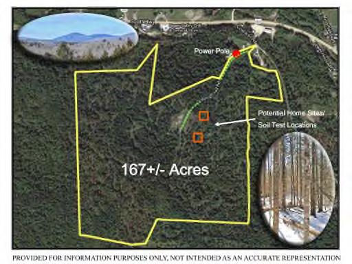
9 80 Ruff Hill Road Groton Power Pole Potential Home Sites/ Soil Test Locations 167+/- Acres DISCLAIMER: This map is for general reference only and was created from other sources that may or may not contain errors or otherwise be reliable. This map and data should not be used for navigation and may not reflect recent construction, logging or other commercial or private activity on the property. Measurements, distances and areas may not be accurate. The Listing Agency and Seller encourage all buyers, agents or other buyer representatives to perform their own due diligence and not rely only on this information. This information may not be made part of a contract. Listing Agency and Seller will not be responsible for decisions and offers made from this information. GENERAL MAP SOURCES: Agency of Natural Resources
10 80 Ruff Hill Rd - Groton Survey does not reflect current boundaries along the northern border ( left edge of this survey ), as subdivisions were made after its completion. DISCLAIMER: This map is for general reference only and was created from other sources that may or may not contain errors or otherwise be reliable. This map and data should not be used for navigation and may not reflect recent construction, logging or other commercial or private activity on the property. Measurements, distances and areas may not be accurate. The Listing Agency and Seller encourage all buyers, agents or other buyer representatives to perform their own due diligence and not rely only on this information. This information may not be made part of a contract. Listing Agency and Seller will not be responsible for decisions and offers made from this information. SOURCE: TOWN OF GROTON
11 80 Ruff Hill Rd - Groton DISCLAIMER: This map is for general reference only and was created from other sources that may or may not contain errors or otherwise be reliable. This map and data should not be used for navigation and may not reflect recent construction, logging or other commercial or private activity on the property. Measurements, distances and areas may not be accurate. The Listing Agency and Seller encourage all buyers, agents or other buyer representatives to perform their own due diligence and not rely only on this information. This information may not be made part of a contract. Listing Agency and Seller will not be responsible for decisions and offers made from this information. SOURCE: TOWN OF GROTON

12 80 Ruff Hill Rd - Groton DISCLAIMER: This map is for general reference only and was created from other sources that may or may not contain errors or otherwise be reliable. This map and data should not be used for navigation and may not reflect recent construction, logging or other commercial or private activity on the property. Measurements, distances and areas may not be accurate. The Listing Agency and Seller encourage all buyers, agents or other buyer representatives to perform their own due diligence and not rely only on this information. This information may not be made part of a contract. Listing Agency and Seller will not be responsible for decisions and offers made from this information. SOURCE: AGENCY OF NATURAL RESOURCES
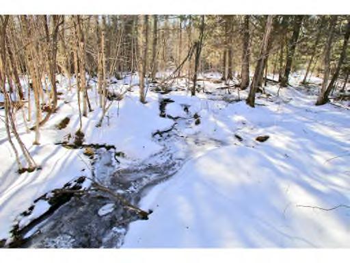
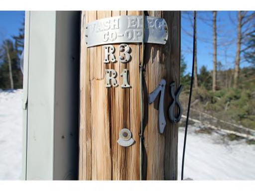
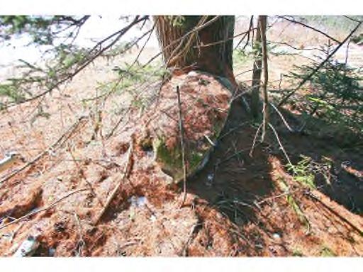
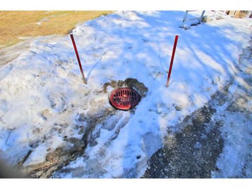
13 Utility & Property Info: Taxes: Power: Septic: Water: Zoning: Town of Groton $2, (2016 non-homestead rate). Property is NOT enrolled in the state s tax reduction program called the Use Value Appraisal program (Current Use). Seller knows of no reason why the property could not be enrolled, but has elected not to do so. Taxes could be significantly reduced by enrolling. The closest power pole is located along Ruff Hill Road frontage in front of the last mobile home on the right before heading up Ruff Hill Rd to reach the landing/clearing. Most likely the preferred home site is approximately 200 feet east of the clearing and Ruff Hill Rd. Mapping calculations estimate the last power pole to be approximately 1,500 ft from this home site. The service provider is Washington Electric Co-op. Closest Pole Number is: R3/R1/18. Washington Electric Co-op indicates above ground power installation usually costs between $16-$16.50 per foot, with the average distance between poles of 280+/- ft. Soil tests have been performed in late February 2016 by Horizon Engineering. Engineer indicates the likelihood of two home site testing positive for a gravity fed at-grade systems. See report attached. A drilled well is common for this area. There is no formal drinking water at this time. The vast majority of the property is within the Rural Residential district of the Groton zoning regulations. It appears as though a small portion near the beginning of Ruff Hill Rd and the northern points of the parcel to be within the Commercial/Industrial district. See attached for partial zoning information. Please consult the Groton zoning official with any specific inquiries. Boundaries: The property has been formally surveyed. Some corner pins have been found and marked. The vast majority of the property is marked with a combination of blue flagging, red & orange flagging, some fencing, and vintage stone walls. Services: Fairpoint offers high speed DSL internet, phone, and satellite TV in the area. Fairpoint is affiliated with DirecTV for TV service. Road: Address: Deer: Additional Property Information 80 Ruff Hill Rd, Groton, VT Ruff Hill Rd is a private road, owned by the sellers. Currently, there are two residences toward the beginning of the road who maintain and privately plow the road. The town does not plow or perform any maintenance at this time. The properties address has been created for GPS purposes only. A formal 911 address will be issued by the town, if a residence is built. The vast majority of the property is considered a deer wintering area by the Agency of Natural Resources, a winter destination for deer to escape deep snow for easier travel and feeding. DISCLAIMER: The information on this page is provided as a courtesy and is for general reference only. This information may not be relied on and was created from many sources that may or may not contain errors or otherwise be reliable. Some information, especially measurements and costs are only approximate. Taxes, utilities, zoning, state/local permits, construction costs, roads, associations, property condition, forestry plans, timber volumes/$, boundaries, surveys and all other data found here may and does change. The Listing Agency and seller encourage all buyers, agents or other buyer representatives to perform their own due diligence and not rely only on this information. Listing Agency and Seller will not be responsible for decisions and offers made from this information.
14 Area Information Nearby Cities: St. Johnsbury, VT 38 Minutes Montpelier, VT 44 Minutes Burlington, VT 1 Hour, 17 Minutes Montreal, QC, Can 2 Hours, 56 Minutes Boston, MA 2 Hours, 55 Minutes New York, NY 5 Hours, 23 Minutes Nearby Airports and Trains: Lebanon Municipal Airport - NH 59 Minutes A regional, towercontrolled airport located in western New Hampshire, on the border of Vermont. Daily commercial service connects passengers to Boston and White Plains, New York. Burlington International Airport: 1 Hour, 15 Minutes Regional hub serviced by major airlines, connecting to airports across the country. Nearby State Parks & Forests About The Town Ricker Pond State Park 13 minutes Ricker Pond State Park, established in the 1930s, is located on the western shores of Ricker Pond and adjacent to the Montpelier-Wells Rail Trail (Cross Vermont Trail). The campground has 27 tent/trailer sites, 23 lean-tos, 5 cabins, and a waterfront rental cottage that comfortably sleeps up to 5 and comes with a canoe. There is a swimming beach, boat launch, shelter, and access to miles of hiking trails. Link: Ricker Pond State Park Groton, VT Groton is home to five state parks within Groton State Forest a 26,000 acre State Forest making it the second largest land block administered by the Department of Forests, Parks, and Recreation. Considered one of the most picturesque state forests in Vermont, it s also home to a vast amount of wildlife including bear, moose, deer, grouse, mink, beaver, otter, fisher, loons, and herons. A variety of fish are Rutland State Airport: 1 Hour, 55 Minutes Located just five miles south of Vermont s second largest city, Southern Vermont Regional Airport is a modern convenience nestled in the heart of the beautiful Green Mountains. Logan International Airport: 2 Hours, 54 Minutes Boston Logan International Airport is New England s largest transportation center and generates $7 billion in economic Stillwater State Park 18 Minutes - Groton State Forest, with over 26,000 acres, is the second largest land block administered by the Department of Forests, Parks and Recreation. The forest contains over 17 miles of hiking trails and over 20 miles of gravel roads and multi-use trails suitable for mountain biking and horseback riding. Link: Stillwater State Park Owls Head Mountain Groton State Forest found in the clear ponds and streams. The Wells River, a tributary of the Connecticut River, has its headwaters in Groton. Groton also has the longest segment of the Cross Vermont Trail out of the 10 towns with 10 miles. William Scott was born in Groton, know to many as the Sleeping Sentinel, who fell asleep during Civil War duty, was sentenced to death, and then pardoned by President Abraham Lincoln. activity each year. It is a city within a city on a 1,700 acre footprint of land. Albany, NY International Airport : 3 Hours, 24 Minutes The Albany International Airport offers a widerange of facilities and services. A recently completed multi-million dollar capital redevelopment project included a new 230,000 square foot terminal, parking garage, Air Traffic Control Tower, and cargo facility. 15 minutes The Owls Head Trail is an easy 1.5 mile trail leading to a scenic vista of Lake Groton, Kettle Pond and the Green Mountains. The trail starts off the road from New Discovery to the Osmore Pond scenic area and features level to intermediate terrain. Bypassing a swampy area, trail descends and then climbs to parking lot. The trail to the top continues to the left, following the rock steps of a path built by the CCC in the 1930's. Link: Groton State Forest
15 Area Information Page 2 Rivers and Lakes Lake Groton: Lake Groton (422 acres) is long and narrow in shape and lies in a northsouth direction. It is approximately two and a half miles in length, about a half mile in width, and has a maximum depth of about thirty-five feet. Lake Groton is popular for all types of water-based recreational activities and has two state parks. The fish population consists of smallmouth bass, largemouth bass, chain pickerel, yellow perch, brown bullheads, and sunfish. Boulder Beach The day use area has 75 shaded picnic sites with tables and hibachis. All rest rooms have lavatories and flush toilets. There is 200 feet of beach and swimming area, cartop boat launch, play area, three large parking lots, and a concession stand. Canoes, kayaks and pedal boats are available to rent. Sorry, no pets allowed. Wells River The Wells River is a tributary of the C o n n e c t i c u t R i v e r a n d i s approximately 15 miles long. Its headwaters begin in Groton at the outlet of Ricker Pond at the southern boundary of the Groton State Forest. US Route 302 follows the river for most of it s length. Ricker Pond A 92 acre pond just south of Lake Groton and connected by Wells River. Motorized boats are permitted with no State mandated speed restrictions. Skiing, Snowmobiling, Snowshoeing VAST Corridor 302 runs along Coal Kiln Rd located at the beginning of Ruff Hill Rd. Q-Burke 59 Minutes With every inch of its 2011 of vertical, Q Burke Mountain Resort believes in all that made Vermont skiing famous. Link : Q-Burke Bolton Valley 1 Hour, 7 Minutes Bolton Valley sits high in the Green Mountains of Vermont. It is a unique, high mountain alpine village surrounded by over 5,000 pristine acres. At Bolton Valley, the recreational opportunities are as numerous as the views are spectacular. Link: Bolton Valley Sugarbush 1 Hour, 13 Minutes Six distinct peaks of unleashed potential. Two uncrowded mountain areas. 2,000 acres of backcountry in the Slide Brook Basin. It s no surprise Sugarbush was recently named Best Ski Town in the East by Outside Magazine. Link: Sugarbush Stowe 1 Hour, 18 Minutes In a place where the history, community and landscape are legendary for hospitality and adventure, Stowe Mountain Resort in Stowe Vermont has reinforced its internationally respected brand with world-class improvements both on and off the mountain. Link: Stowe
16
17
18
19
20
40 James Lane, Haverhill, NH
 40 James Lane, Haverhill, NH Curtis Trousdale, Owner, Broker, Realtor Cell: 802-233-5589 curtis@preferredpropertiesvt.com 2004 Williston Road, South Burlington VT 05403 www.preferredpropertiesvt.com Phone:
301 Bailey-Hazen Road, Danville, VT Subdivision Lots 6 & 7 & Combined
 301 Bailey-Hazen Road, Danville, VT Subdivision Lots 6 & 7 & Combined Curtis Trousdale, Owner, Broker, Realtor Cell: 802-233-5589 curtis@preferredpropertiesvt.com 2004 Williston Road, South Burlington
1947 Noyestar Road, Walden, VT
 1947 Noyestar Road, Walden, VT Curtis Trousdale, Owner, Broker, Realtor Cell: 802-233-5589 curtis@preferredpropertiesvt.com 2004 Williston Road, South Burlington VT 05403 www.preferredpropertiesvt.com
375 Sheldon Road, Fair Haven, VT
 375 Sheldon Road, Fair Haven, VT Curtis Trousdale, Owner, Broker, Realtor Cell: 802-233-5589 curtis@preferredpropertiesvt.com 2004 Williston Road, South Burlington VT 05403 www.preferredpropertiesvt.com
2 Star Road, Grand Isle, VT
 2 Star Road, Grand Isle, VT Curtis Trousdale, Owner, Broker, Realtor Cell: 802-233-5589 curtis@preferredpropertiesvt.com 2004 Williston Road, South Burlington VT 05403 www.preferredpropertiesvt.com Phone:
620 Westcott Road, Duxbury VT
 620 Westcott Road, Duxbury VT Curtis Trousdale, Owner, Broker, Realtor Cell: 802-233-5589 curtis@preferredpropertiesvt.com 2004 Williston Road, South Burlington VT 05403 www.preferredpropertiesvt.com Phone:
434 VT-114, Averill, VT
 434 VT-114, Averill, VT Curtis Trousdale, Owner, Broker, Realtor Cell: 802-233-5589 curtis@preferredpropertiesvt.com 2004 Williston Road, South Burlington VT 05403 www.preferredpropertiesvt.com Phone:
59 Rickaby Road, Lowell, VT
 59 Rickaby Road, Lowell, VT Curtis Trousdale, Owner, Broker, Realtor Cell: 802-233-5589 curtis@preferredpropertiesvt.com 2004 Williston Road, South Burlington VT 05403 www.preferredpropertiesvt.com Phone:
1137 Economou Road, Huntington, VT
 1137 Economou Road, Huntington, VT Curtis Trousdale, Owner, Broker, Realtor Cell: 802-233-5589 curtis@preferredpropertiesvt.com 2004 Williston Road, South Burlington VT 05403 www.preferredpropertiesvt.com
39 Mountain Street, Brighton, VT
 39 Mountain Street, Brighton, VT Curtis Trousdale, Owner, Broker, Realtor Cell: 802-233-5589 curtis@preferredpropertiesvt.com 2004 Williston Road, South Burlington VT 05403 www.preferredpropertiesvt.com
19 Meetinghouse Road, Athens, VT
 19 Meetinghouse Road, Athens, VT Curtis Trousdale, Owner, Broker, Realtor Cell: 802-233-5589 curtis@preferredpropertiesvt.com 2004 Williston Road, South Burlington VT 05403 www.preferredpropertiesvt.com
2500 Colvin Hill Road, Danby, VT
 2500 Colvin Hill Road, Danby, VT Curtis Trousdale, Owner, Broker, Realtor Cell: 802-233-5589 curtis@preferredpropertiesvt.com 2004 Williston Road, South Burlington VT 05403 www.preferredpropertiesvt.com
260 Dan Jarvis Road, Weathersfield, VT
 260 Dan Jarvis Road, Weathersfield, VT Curtis Trousdale, Owner, Broker, Realtor Cell: 802-233-5589 curtis@preferredpropertiesvt.com 2004 Williston Road, South Burlington VT 05403 www.preferredpropertiesvt.com
392 Hyatt Camp Road, Benson, VT
 392 Hyatt Camp Road, Benson, VT Curtis Trousdale, Owner, Broker, Realtor Cell: 802-233-5589 curtis@preferredpropertiesvt.com 2004 Williston Road, South Burlington VT 05403 www.preferredpropertiesvt.com
Woodland Mountain Property
 Woodland Mountain Property So Close, Yet So Far Away Summit County, Utah 5 Acres $79,000 3616 Elmwood Street, Salt Lake City, UT 84106 801-870-1801 info@landrancher.com Welcome to Woodland Mountain Enjoy
Ranch. Creek. Cow. Mountain
 Cow Creek Mountain Ranch Situated along the southwestern hills of the Laramie Mountains and the Medicine Bow-Routt National Forest in northeastern Albany County, Wyoming. 58 E. Benteen Street Buffalo,
4.0 OUTDOOR RECREATION 4.1 PUBLIC LANDS
 4.0 OUTDOOR RECREATION 4.1 PUBLIC LANDS Public lands provide a wide range of recreational opportunities and are considered a valuable community asset. There may be seasonal and/or other use restrictions
Topsham Trail Guide.
 Topsham Trail Guide A guide to the walking, hiking, biking, water and ATV trails of Topsham, Maine and surrounding towns $4.95 Developed by the www.greatertopshamtrailalliance.org The Greater Topsham Trail
POWELL LAKE LODGE. JASON ZROBACK. Direct Line: (604)
") www.landquest.com JASON ZROBACK Direct Line: (604) 414-5577 101-313 Sixth Street, New Westminster, BC V3L 3A7 Phone: (604) 664-7630 Fax: (604) 516-6504 Toll Free: 1-866-558-5263 (LAND) The Source for Oceanfront,
www.landquest.com JASON ZROBACK Direct Line: (604) 414-5577 101-313 Sixth Street, New Westminster, BC V3L 3A7 Phone: (604) 664-7630 Fax: (604) 516-6504 Toll Free: 1-866-558-5263 (LAND) The Source for Oceanfront,
LOUGHBOROUGH INLET. Jason Zroback. Direct Line: (604) TOLL FREE:
 TOLL FREE:") LOUGHBOROUGH INLET www.landquest.com Jason Zroback Direct Line: (604) 414-5577 101-313 Sixth Street, New Westminster, BC V3L 3A7 Phone: (604) 664-7630 Fax: (604) 516-6504 TOLL FREE: 1-866-558-5263 Loughborough
LOUGHBOROUGH INLET www.landquest.com Jason Zroback Direct Line: (604) 414-5577 101-313 Sixth Street, New Westminster, BC V3L 3A7 Phone: (604) 664-7630 Fax: (604) 516-6504 TOLL FREE: 1-866-558-5263 Loughborough
TAYLOR CANYON RANCH COLORADO - ROUTT COUNTY - STEAMBOAT SPRINGS
 TAYLOR CANYON RANCH COLORADO - ROUTT COUNTY - STEAMBOAT SPRINGS Tucked up against the steep valley shaped by Mt. Pau and rising to the Routt National Forest, Taylor Canyon Ranch is an easily accessible,
Berg Ridge BERG RIDGE 1
 Berg Ridge BERG RIDGE 1 Berg Ridge: $13,650,000 ($75,000 / ERU) Jordanelle Basin Wasatch County, Utah LOCATION: North Central Utah in the Jordanelle Basin of Wasatch County a 45-minute drive from downtown
Morgan Estates. Lassen County, CA. Proudly Offered By
 Morgan Estates Lassen County, CA Proudly Offered By 707 Merchant Street, Suite 100, Vacaville, Ca 95688 (707) 455-4444 Office (707) 455-0455 Fax info@caoutdoorproperties.com Introduction Looking North
Parks & Recreation Areas Program
 PARKS & RECREATION Parks & Recreation Areas Program As part of its mission to conserve and protect natural resources, the Upper Big Blue Natural Resources District (NRD) has been involved in several large-scale
155 acres on Tyaughton Lake 900 feet of Pristine Waterfront Private & Secluded Property
 155 acres on Tyaughton Lake 900 feet of Pristine Waterfront Private & Secluded Property 946 Tyaughton Lake Road Gold Bridge BC V0K1P0 900 ft of waterfront with 155 acres of south facing easy access. This
(Short Listing) DUPUYER ACREAGE, ROCKY MOUNTAN FRONT
 DUPUYER ACREAGE, ROCKY MOUNTAN FRONT") (Short Listing) DUPUYER ACREAGE, ROCKY MOUNTAN FRONT This unique property is located 8½ miles northwest of Dupuyer, Montana and approximately thirty 30 miles northwest of Choteau, Montana. Great Falls
(Short Listing) DUPUYER ACREAGE, ROCKY MOUNTAN FRONT This unique property is located 8½ miles northwest of Dupuyer, Montana and approximately thirty 30 miles northwest of Choteau, Montana. Great Falls
Meadow Creek and Goat Creek pass through Goat Falls Ranch & Alpine Peak
 Henri W. LeMoyne 1346 Fillmore Street Post Office Box 5225 Phone: (208) 733-0874 Fax: (208) 733-8475 E-mail: henri@lemoynerealty.com Twin Falls, Idaho 83303-5225 Location: The Goat Falls Ranch is located
(Short Listing) SOUTH FORK LOG CABIN, UTICA, MONTANA
 SOUTH FORK LOG CABIN, UTICA, MONTANA") (Short Listing) SOUTH FORK LOG CABIN, UTICA, MONTANA The South Fork Log Cabin is in the heart of thousands of acres of public land of the Lewis & Clark National Forest Service. This Cabin offers unlimited
(Short Listing) SOUTH FORK LOG CABIN, UTICA, MONTANA The South Fork Log Cabin is in the heart of thousands of acres of public land of the Lewis & Clark National Forest Service. This Cabin offers unlimited
TENKILLER STATE PARK -An Overview-
 TENKILLER STATE PARK -An Overview- - 0 - TENKILLER STATE PARK Region: Northeast (Green Country) Cherokee & Sequoyah Counties CONTENTS General Information. 2 Addresses Driving Directions Phone Numbers Email
2. Goals and Policies. The following are the adopted Parks and Trails Goals for Stillwater Township:
 D. PARKS AND TRAILS 1. Introduction Stillwater Township s population is relatively low, with most residents living on rural residences on large lots. The need for active park space has been minimal in
Weston County, Wyoming
 The Sweet 200-Acre Property Weston County, Wyoming A unique opportunity to own a little piece of the old West, where one can experience unparalleled scenery, adventure and history walk in the footsteps
975 Champlain St, Brandon, VT
 975 Champlain St, Brandon, VT Curtis Trousdale, Owner, Broker, Realtor Cell: 802-233-5589 curtis@preferredpropertiesvt.com 2004 Williston Road, South Burlington VT 05403 www.preferredpropertiesvt.com Phone:
Section 61 Recreational Vehicle Park / Campground (Bylaw No. 2012/10)
") Part 7 General Regulations Section 61 Recreational Vehicle Park / Campground (Bylaw No. 2012/10) 61.1 A comprehensive site plan shall be provided to the satisfaction of the Development Authority that shows
Part 7 General Regulations Section 61 Recreational Vehicle Park / Campground (Bylaw No. 2012/10) 61.1 A comprehensive site plan shall be provided to the satisfaction of the Development Authority that shows
2.1 Physical and Biological Description Matabitchuan River Watershed
 2.1 Physical and Biological Description Watershed 2.1.1 Physical Description The system watershed has a total area of about 933 km 2 and is a tributary system to Lake Temiskaming and the Ottawa River Drainage
Washakie Wilderness Ranch
 Washakie Wilderness Ranch Dubois, Wyoming Fly Fishing Hunting Ranching Conservation Washakie Wilderness Ranch Dubois, Wyoming Introduction: A stunning 160-acre parcel located at the base of the Ramshorn
Narrows West Lots For Sale Overview
 Lots For Sale Overview Dear Valued Customer, Owning a cottage property is a dream that many people share. is working diligently to create a new cottage development and resort community at Lake Manitoba
National Recreation Trail Update Form
 National Recreation Trail Update Form Introduction Thank you for taking the time to complete this form. Your assistance will help ensure that the National Recreation Trail (NRT) database is complete and
A Publication of Friends of Sleeping Bear Dunes
 A Publication of Friends of Sleeping Bear Dunes 2014, Friends of Sleeping Bear Dunes, P.O. Box 545, Empire, MI 49630 www.friendsofsleepingbear.org info@friendsofsleepingbear.org Learn more about the Friends
The Entrance to Phillips Arm Cardero Channel
 The Entrance to Phillips Arm Cardero Channel Jason Zroback jason@landquest.com 1 (604) 414-5577 Jamie Zroback jamie@landquest.com 1 (604) 483-1605 The Source for Oceanfront, Lakefront, Islands, Ranches,
Frizzell Creek Ranch Summerville, OR $1,400, ± Acres
 Frizzell Creek Ranch Summerville, OR $1,400,000 165± Acres 1 Introduction The Frizzell Creek Ranch is a beautiful 165± acre ranch located in northeast Oregon at the base of the Wallowa Whitman National
CHAPTER 5. Chapter 5 Recreation Element
 CHAPTER 5 Recreation Element Chapter 5 Recreation Element The Recreation Element of the Meyers Area Plan is a supplement to the Recreation Element of the TRPA Regional Plan and the El Dorado County General
FOR SALE Willamette Pass Inn & Chalets Crescent Lake, OR
 Located in the High ated in Cascades of Central Oregon FOR SALE Willamette Pass Inn & Chalets Crescent Lake, OR PRICE REDUCED! 19821 HWY 58 Crescent Lake, OR 97733 Combination of 13 rooms in the Inn and
NORTH LAMOILLE FOREST
 NORTH LAMOILLE FOREST With long frontage on the wild and free-flowing North Branch of the Lamoille River, this recreational woodlot is a quiet spot to fish, hunt, establish an off-grid camp and enjoy distant
Lincoln North Woodstock, New Hampshire Area Quick Guide
 Lincoln North Woodstock, New Hampshire Area Quick Guide Lincoln-Woodstock 2 towns in the heart of the White Mountain National Forest. Located at Exit 32 on I-93. 100 Miles from the Mass-NH Border. Supermarket
Lake Acreage Mcleese Lake, BC
 Lake Acreage Mcleese Lake, BC Jason Zroback jason@landquest.com 1 (604) 414-5577 Jamie Zroback jamie@landquest.com 1 (604) 483-1605 The Source for Oceanfront, Lakefront, Islands, Ranches, Resorts & Land
HUNTING PROPERTIES Bearpaw Trail Hand constructed with reclaimed timbers from a historic Stagestop.
 $4,500,000 #139289 428.0 AC $2,500,000 #138964 113.5 AC $24,9500,000 #137591 9,000.0 AC 8855 Bearpaw Trail Includes a 3 acre lake and borders Routt National Forest. 8925 Bearpaw Trail Hand constructed
Brinker Creek Ranch. Colorado - Routt County - Yampa
 Located at the base of the Flattops Range in the Steamboat/Vail corridor, Brinker Creek Ranch consists of 1,451 acres ideally suited for high country grazing and native grass hay production. Traditionally
BUTCHER CREEK RANCH. Butcher Creek Ranch. Roscoe, Montana. Reduced to $1,650,000.
 BUTCHER CREEK RANCH Butcher Creek Ranch Roscoe, Montana Reduced to $1,650,000. Offered Exclusively By: Sonny Todd Real Estate 301 West First Avenue, PO Box 788 Big Timber, Montana 59011 Office: (406) 932-1031
Clearwater Lake Provincial Park. Draft Management Plan
 Clearwater Lake Provincial Park Draft Management Plan Clearwater Lake Provincial Park Draft Management Plan Table of Contents 1. Introduction... 3 2. Park History... 4 3. Park Attributes... 4 3.1 Location/Access...4
Yuba Creek Natural Area Acquisition. Acme Township. Acme Township. TF Acquisition $1,576, Grand Traverse
 Yuba Creek Natural Area TF00-162 $1,576,021.00 in fee simple of 403 acres of critical wetls upl habitat with over 5,000 feet of frontage on Yuba Creek, a tributary to the east arm of Bay. 2000 Petobago
Swimming Hole Rides (west & North Of Boston) By Rubel Bike Maps READ ONLINE
 By Rubel Bike Maps READ ONLINE") Swimming Hole Rides (west & North Of Boston) By Rubel Bike Maps READ ONLINE If you are searched for the book by Rubel Bike Maps Swimming Hole Rides (west & north of Boston) in pdf format, then you have
Swimming Hole Rides (west & North Of Boston) By Rubel Bike Maps READ ONLINE If you are searched for the book by Rubel Bike Maps Swimming Hole Rides (west & north of Boston) in pdf format, then you have
AVAILABLE PROPERTIES MASTER LIST Tuesday, June 03, 2014
 www.flindersrealtyidaho.com AVAILABLE PROPERTIES MASTER LIST Tuesday, June 03, 2014 www.flindersrealty.com Idaho Office Flinders Realty & Exchange, Inc 215 East 50 South, Suite 201, Malad, ID 83252 Phone
About Bear Creek Lodge
 Lindal Cedar Homes design constructed in 1995. Square footage, per building plans, show approximately 5,980 square feet on the main floor, 650 square feet on the upper level for a total of 6,630 square
National Recreation Trail Application for Designation
 National Recreation Trail Application for Designation Introduction Thank you for your interest in the National Recreation Trail (NRT) program. Completed NRT application packages must be submitted by December
New Hampshire RV Parks and Campgrounds
 1 New Hampshire RV Parks and Campgrounds Riverbrook RV Resort Brief Description: Located in the White Mountains on the Baker River Riverbrook RV Resort is in the center of all white MT attractions. We
Crystal Lake Area Trails
 Lake Area Trails Welcome to the Lake area of the Big Snowy Mountains! This island mountain range in central Montana features peaks reaching to 8,600 feet and long, high ridges from which vistas of the
The Logger's Retreat at Yosemite
 The Logger's Retreat at Yosemite Summary Vacation in Yosemite Magnificent mountain views! Hot tub! Family-friendly! Description 3 bedrooms, 5 bathrooms; perfect home for 1 or 2 families up to 12 persons
AVAILABLE FOR ACQUISITION
 1 AVAILABLE FOR ACQUISITION F O OT B R I D G E N O R T H H OT E L Property Address 1522 Post Rd (Rt 1) Wells, ME 04090 Property Highlights 12 guestrooms and suites 6 Year-round Apartments Heated Outdoor
Table of Contents. Utility Information Water Sanitary Sewer Employment Helpful Links Property Photographs Area Attractions Contact Information
 Canopy Crossing Table of Contents Introduction Property Information Property Identification Pricing & Size Additional Information Maps: State Location County Location Property Location Aerial Photography
KETTLE CREEK CONSERVATION AUTHORITY TRAIL GUIDE.
 KETTLE CREEK CONSERVATION AUTHORITY TRAIL GUIDE www.kettlecreekconservation.on.ca EXPLORE OUR TRAILS HIKE OUR TRAILS Kettle Creek Conservation Authority (KCCA) proudly supports and promotes an active lifestyle
FOR SALE. Log Home on 2.27+/- Acres Custer County, South Dakota Offered at $647,000.
 FOR SALE Highlight Features: 5,134 square foot, four bedroom, three and a half bath Cypress Log Home City water and sewer Easy access to endless recreational opportunities Only five minutes to Custer State
BROCHURE. APPLE HILL WOODS 118 +/- Acres Camino, California. Presented by Jim Copeland
 BROCHURE APPLE HILL WOODS 118 +/- Acres Camino, California Presented by Jim Copeland 1 The Property This 118 acre is a rare gem in the Sierra Nevada foothills. Covered with lush forestland and scattered
Walk-On Waterfront Executive Home Qualicum Beach, BC
 Walk-On Waterfront Executive Home Qualicum Beach, BC Jamie Zroback jamie@landquest.com 1 (604) 483-1605 Jason Zroback jason@landquest.com 1 (604) 414-5577 Marketing British Columbia to the World The Source
East Branch Medway River Route 21
 East Branch River Route 2 This route is NOT recommended for NOVICE and INTERMEDIATE paddlers The route is comprised of the East Branch of the River, the River proper, and Port. Although there are a number
CABARTON RANCH NORTH EXECUTIVE SUMMARY
 EXECUTIVE SUMMARY O ffering breath-taking scenery and serene privacy, the 705 + acre Cabarton Ranch North is nestled at the base of West Mountain in the southwestern-edge of Valley County, near Lake Cascade,
Cataloochee. Fishing Species Rainbow Trout and Brook Trout. Recreation
 Cataloochee River Information The Cataloochee River is located in the historic Cataloochee Valley--a relatively remote part of Smoky Mountain National Park. The campground is a secluded setting and offers
Public Review on Proposed Changes to Trapping Policy
 Public Review on Proposed Changes to Trapping Policy in Manitoba s Provincial Parks and Other Crown Lands With Recreational Developments In December 2012, two dogs were killed in traps while they were
Preferred Recreation Recommendations Stemilt-Squilchuck Recreation Plan March 2018
 Preferred Recreation Recommendations Stemilt-Squilchuck Recreation Plan March 2018 Below are the recommended recreation ideas and strategies that package together the various recreation concepts compiled
Stephens State Park Trails
 TRAILS OF ALLAMUCHY MOUNTAIN & STEPHENS STATE PARKS Allamuchy Mountain and Stephens State Parks contain 28 marked trails providing access to diverse landscapes for walking, hiking, biking, bird-watching,
B HALL RANCH FISHTAIL, MONTANA
 Brochure Courtesy of: B HALL RANCH FISHTAIL, MONTANA w w w. m c c a s l i n l a n d. c o m Page 1 LOCATION The Hall Ranch is ideally located in the foothills of the Beartooth Mountains, approximately 5
This Passport: Revised October 20, 2017, EAM # Discovering the Trails of Webster, NY
 This Passport: Revised October 20, 2017, EAM #161923 Discovering the Trails of Webster, NY The Town of Webster invites you to explore and experience our diverse outdoor adventures! Here s your opportunity
ELEPHANT BUTTE LAND 640 Acres of pristine land surrounded by BLM property Next to Coral Pink Sand Dune Area Southern Utah INVESTMENT OFFERING
 640 Acres of pristine land surrounded by BLM property Next to Coral Pink Sand Dune Area Southern Utah PROPERTY DESCRIPTION Nestled within one of Southern Utah s picturesque red cliff valleys, with spectacular
Boulder Valley Farm. Colorado - Boulder County - Lafayette
 Boulder Valley Farm Colorado - Boulder County - Lafayette 2 This rare and significant farm parcel is located in one of the most desirable places along the Colorado Front Range with agricultural benefits,
Shonkin Creek Hideaway
 Shonkin Creek Hideaway 7.5 +/- acres of beautiful shade trees, the year round Upper Shonkin Creek just outside your door, and peace and quiet off a well-maintainted road. 42,000 acres of State Forest Land
Silver Lake Park An Environmental Jewel for the Citizens of Prince William County
 Silver Lake Park An Environmental Jewel for the Citizens of Prince William County The Prince William Park Authority Mission Statement states: The Prince William County Park Authority will create quality
MOREAU LAKE STATE PARK CURRENT PLANNING EFFORTS
 MOREAU LAKE STATE PARK CURRENT PLANNING EFFORTS PLANNING EFFORTS S O U T H E R N PA L M E R T O W N CONSERVATION & ECONOMIC DEVELOPMENT STRATEGY Moreau Lake State Park Master Plan Mt. McGregor Correctional
Indian Creek. Plumas County, California. Proudly Offered By
 Indian Creek Plumas County, California Proudly Offered By 707 Merchant Street, Suite 100, Vacaville, Ca 95688 (707) 455-4444 Office (707) 455-0455 Fax info@caoutdoorproperties.com Introduction House looking
Partners: Michigan California Timber Company Shasta-Trinity National Forest Pacific Crest Trail Association The Trust for Public Land
 Partners: Michigan California Timber Company Shasta-Trinity National Forest Pacific Crest Trail Association The Trust for Public Land Describe the project location, size, opportunities, and timing. Provide
Buffalo Springs Ranch
 Buffalo Springs Ranch Acton, Montana For additional details, contact: SCOTT R. GROSSKOPF Broker / Owner Member Landmark of Billings 1925 Grand Avenue, Ste. 144, Billings, MT 59102 Office: (406) 248-3101
U.S. National Forest Campground Guide
 U.S. National Forest Campground Guide Southwestern Region Arizona, New Mexico, Oklahoma and Texas National Forests and Grasslands in the Southwestern Region NF = National Forest NG = National Grassland
The Absaroka Mountain Lodge
 The Absaroka Mountain Lodge Park County, WY I believe our setting is the most beautiful of any of the lodges up the Northfork Current owner 58 E. Benteen Street Buffalo, WY 82834 Ph 307-684-9556 Toll Free
Other Agencies and Organizations
 Daniel Boone National Forest 1700 Bypass Road WInchester, KY 40391 859-745-3100 Location Northern terminus is near Morehead, Kentucky. Southern terminus is located in the Big South Fork NRRA in Tennessee.
Colorado RV Parks and Colorado Campgrounds. Black Bear RV Park- Resort & Campground. Amenities
 1 Colorado RV Parks and Colorado Campgrounds Black Bear RV Park- Resort & Campground Brief Description: Located at the Arkansas River in Howard, Coloroado Black Bear RV Park is an "ALL-IN-ONE" Rv Park
Lane Residence. Silverthorne, Colorado. Offered for $3,999,999. Contact Bill George. (970)
") Lane Residence Silverthorne, Colorado Offered for $3,999,999 Contact Bill George (970) 485 1052 bill@ranchland.com Ownership of this 6,450 square foot custom log home at Shadow Creek Ranch gets you access
Lane Residence Silverthorne, Colorado Offered for $3,999,999 Contact Bill George (970) 485 1052 bill@ranchland.com Ownership of this 6,450 square foot custom log home at Shadow Creek Ranch gets you access
Invest in Waterfront Property
 Invest in Waterfront Property Day Lake $599,000 Total Acreage: 465 acres Private lakefront parcel located in North-Central BC Private Lakefront Retreat www.niho.com (604) 606-7900 Private Lakefront Retreat!
APPENDIX 19-II. Ontario Trail Network Trailheads EAST-WEST TIE TRANSMISSION PROJECT AMENDED ENVIRONMENTAL ASSESSMENT REPORT
 EAST-WEST TIE TRANSMISSION PROJECT AMENDED ENVIRONMENTAL ASSESSMENT REPORT APPENDIX 19-II Ontario Network heads Report. 1536607/2000/2219 Ontario Network heads in the n-commercial Land and Resource Use
Bulkley Canyon Farms Ltd. Smithers B.C.
 Remax Bulkley Valley Charlie McClary 8462 Johnson Road, Smithers, BC, V0J 2N1 Email cmcclary@uniserve.com (250) 877-1770 Cell (250) 847-5999 Office www.charliemcclary.com Bulkley Canyon Farms Ltd. Smithers
Acquisition in fee simple of approximately one-half acre of property on the shore of Spring Lake to expand the Lakeside Beach Park.
 Lakeside Beach TF00-136 $122,550.00 in fee simple of approximately one-half acre of property on the shore of Spring Lake to exp the Lakeside Beach. 2000 River Ravines TF00-150 $910,000.00 in fee simple
CHAPTER 4 -- THE LAND USE PLAN: DESCRIPTIONS AND POLICIES FOR THIRTEEN PLANNING AREAS
 CHAPTER 4 -- THE LAND USE PLAN: DESCRIPTIONS AND POLICIES FOR THIRTEEN PLANNING AREAS NORTH CENTRAL CAC AREA LITTLE VALLEY ROAD TO JUG HANDLE CREEK PLANNING AREA This planning area includes Cleone, Noyo,
THE REGION LAKE SUPERIOR THE GITCHI-GAMI TRAIL & THE NORTH SHORE
 LAKE SUPERIOR THE GITCHI-GAMI TRAIL & THE NORTH SHORE 7 LAKE SUPERIOR: Water covers 70% of the earth s surface area, but only 3% of it is freshwater. Saltwater makes up 97% of the earth s water supply.
Maine RV Parks and Campgrounds
 1 Maine RV Parks and Campgrounds Wilderness Edge Campground Brief Description: We are located in the heart of Moose country just minutes from Baxter State Park, Mt. Katahdin, and The Katahdin Woods & Waters
Bankhead Lake TWO PARCELS AND 1 LOT FOR SALE
 OVERVIEW NORTH PARCEL ACRES: 46 WATERFRONT: 1,227 Front Feet PRICE: $350,000 PER ACRE: $7574 PER FRONT FT. $285 SOUTH PARCEL ACRES: 22 WATERFRONT: 1,381 Front Feet PRICE: $295,000 PER ACRE: $13,170 PER
Map 1.1 Wenatchee Watershed Land Ownership
 Map 1.1 Wenatchee Watershed Land Ownership Map 1.1 Wenatchee Watershed Land Ownership The Wenatchee watershed lies in the heart of Washington state in Chelan County. Just larger than the state of Rhode
BLUE RIDGE. Mountain Club. The Best of North Carolina s High Country. Top East Coast Luxury Real Estate
 LUXURY REAL ESTATE BLUE RIDGE Mountain Club The Best of North Carolina s High Country T he Appalachian region in western North Carolina is steeped in a sort of textbook American history. The Cherokee used
Wool Ranch 20 Acres 20 +/- acres Sunol, CA Alameda County
 Wool Ranch 20 Acres 20 +/- acres Sunol, CA Alameda County 707 Merchant Street Suite 100 Vacaville, CA 95688 707-455-4444 Office 707-455-0455 Fax californiaoutdoorproperties.com CalBRE# 01838294 Introduction
Private Cabin - Boone 15 min - Hot Tub - WiFi - Hiking - Specials
 Private Cabin - Boone 15 min - Hot Tub - WiFi - Hiking - Specials Summary Deer Run offers a very secluded natural wooded setting. Located on a unique 78 acres with hiking trails, trout stream and waterfalls.
G R E E N R I V E R - W Y O M I N G - S W E E T W A T E R C O U N T Y
 G R E E N R I V E R - W Y O M I N G - S W E E T W A T E R C O U N T Y Minor Ranch All information contained herein is taken from sources considered reliable, but is not guaranteed by either seller nor
Ponderosa Pines Ranch
 PONDEROSA PINES RANCH Ponderosa Pines Ranch Shepherd, Montana $3,285,000. Offered Exclusively By: Sonny Todd Real Estate 301 W First, PO Box 788 Big Timber, MT 59011 Office: (406) 932-6668 (406) 932-LAND
Appalachian Mountain Club
 Appalachian Mountain Club January 30, 2013 Groton Planning Board 754 North Groton Road Groton, NH 03241 Re: Re-opened public hearing regarding a request by EDP Renewables (Lessee), EXPX2/MAXAM (Owner)
ABOUT THE PARKS NANTAHALA NATIONAL FOREST MOUNTAINS NATIONAL PARK CHEROKEE NATIONAL FOREST PISGAH NATIONAL FOREST GREAT SMOKY HIKING TRAILS
 ABOUT THE PARKS GREAT SMOKY MOUNTAINS NATIONAL PARK NANTAHALA NATIONAL FOREST CHEROKEE NATIONAL FOREST PISGAH NATIONAL FOREST GREAT SMOKY MOUNTAINS NATIONAL PARK Straddling the border between North Carolina