MISSISSIPPI RIVER COMMISSION
|
|
|
- Annis Daniels
- 5 years ago
- Views:
Transcription
1 MISSISSIPPI RIVER COMMISSION The Mississippi River Commission (MRC) was created by an act of Congress on Jun. 28, The Flood Control Act of May 15, 1928, authorized the Flood Control, Mississippi River and Tributaries (MR&T) Project. The Commission consists of three officers of the Corps of Engineers, one from the former Coast and Geodetic Survey (presently the National Oceanic and Atmospheric Administration), and three civilians, two of whom must be civil engineers. All members are appointed by the President with the advice and consent of the Senate. During the fiscal year, the members of the Mississippi River Commission were: BG Robert Crear, who assumed command as Commander, Mississippi Valley Division, and President Designee of the Mississippi River Commission, on Jun. 3, 2004, and was appointed as a member and President Oct. 6, 2006; Mr. Sam E. Angel, reappointed as member, Nov. 15, 1999; Mr. R. D. James, civil engineer, reappointed as member Apr. 16, 2003; Mr. William Clifford Smith, civil engineer, appointed Oct. 22, 1998; BG Bruce A. Berwick, Commander, Great Lakes and Ohio River Division, appointed as member Oct. 6, 2006; RADM Samuel P. De Bow, Jr., NOAA, appointed as member Oct. 6, 2006; BG Gregg F. Martin, Commander, Northwestern Division, appointed as member Oct ; and COL Albert M. Bleakley, Jr., Secretary of the Commission (nonvoting position). The MRC is charged, under direction of the Secretary of the Army and supervision of the Chief of Engineers, with prosecution of improvements for flood control of the Mississippi River and of its tributaries and outlets in its alluvial valley, so far as they are affected by Mississippi River backwater, between Head of Passes, LA (mile 0), and Cape Girardeau, MO (1,006 miles AHP-Lower Mississippi mileage terminates at mile 954 AHP), and with prosecution of improvements in the interest of navigation between Cairo, IL (954 miles AHP), and Baton Rouge, LA (234 miles AHP); and for stabilization of the lower 7 miles of the right bank of the Ohio River, to former mouth of Cache River. It also is charged with prosecution of certain flood control works on the Mississippi River and tributaries, as far as they are affected by backwater, between Cape Girardeau, MO, and Rock Island, IL (1,437 miles AHP), and with prosecution of improvements on designated tributaries and outlets below Cape Girardeau for flood control, navigation, major drainage, and related water uses. Authorized operations of the Commission below Cape Girardeau are conducted by District Engineers of New Orleans, Vicksburg, Memphis, and St. Louis Districts within the areas described below, in accordance with approved directives and programs and congressional appropriations therefore. The Mississippi River Commission continued its 128-year tradition of listening, inspecting, partnering, and engineering in the Mississippi Valley by conducting its 376 th Session on Apr , 2007, onboard the motor vessel Mississippi en route from Caruthersville, MO, to Baton Rouge, LA. Public hearings were held at Caruthersville; Memphis, TN; Natchez, MS; and Baton Rouge. More than 225 people attended these public meetings. On Sunday, Apr. 15, COL Charles Smithers III, District Engineer, Memphis District, briefed the members on the status of projects and critical issues within his area of operations. This was followed by a partnering session with local stakeholders. On Monday, Apr. 16, personnel from the Northwestern Division presented a briefing detailing local issues and listening session opportunities with regard to the planned Commission trip to the Missouri River Basin to coincide with the low-water inspection trip in August. In the evening, the members held a partnering session with local sponsors and stakeholders. On Tuesday, Apr. 17, BG Crear updated the members on the status of the coastal recovery mission in Louisiana and Mississippi resulting from hurricanes Katrina and Rita. On Wednesday, Apr. 18, COL Anthony Vesay, District Engineer, Vicksburg District, provided a project status update and overview of key issues within his District. That same day, the members were hosted by the city of Natchez as part of an inspection of city s the Section 592 project. This project is an ongoing effort to rehabilitate and modernize a 100-year-old system of massive, underground drainage culverts. On Thursday, Apr. 19, COL Richard Wagenaar, District Engineer, New Orleans District, provided the members with a project status update and an analysis of critical issues within his area of operations. RADM De Bow also briefed the members on the forecast for the upcoming 2007 hurricane season. Authorizing legislation (Tables 41-D and 41-E) is listed at the end of this chapter. All other tables are referenced in text and also appear at the end of the chapter. 41-1
2 REPORT OF THE SECRETARY OF THE ARMY ON CIVIL WORKS ACTIVITIES FOR FY 2007 From Aug , the Mississippi River Commission conducted a listening and inspection tour of the Missouri River Basin. This trip represented a continuation of the Commission s desire to share experiences, information, and lessons learned from the watershed management practices of tributary basins as inaugurated by the Commission s 2005 listening and inspection tour of the Ohio River. On Sunday, Aug. 12, the members participated in a tribal powwow in Hays, MT, with tribal elders from the Assiniboine and Gros Ventre Tribes. In subsequent dialog, the members listened to the concerns of the tribal elders with respect to land and water rights, protection of cultural resources, infrastructure rehabilitation and modernization, and economic development opportunities. On Monday, Aug. 13, the members met with Governor Hoeven of North Dakota and various local stakeholders and discussed the impacts and realities of the ongoing 8-year drought in the region. The following day, Aug. 14, the members traveled to South Dakota and met with Governor Rounds and other state officials. The discussion again centered on the extreme drought conditions in the region and the application of the 1944 Flood Control Act., but other issues such as flood control, hydropower, recreation, and water supply also were discussed at length. The members conducted a site visit of the Oahe Dam to discuss water levels, sedimentation, endangered species, and other challenges. On Wednesday, Aug. 15, the members traveled to Kansas City, MO, and received an overview briefing on key issues at the confluence of the Missouri and Kansas Rivers. Key issues discussed involved bed degradation of the Missouri River, impacts to the water supply for over 1.2 million people at Kansas City and Johnson County, KA. The members also viewed the L-385 levee and experienced the great partnership between the local municipality, the local levee district, and the Corps of Engineers. Later that day, the members traveled to Jefferson City, MO, and met at the governor s mansion with the staff of several state agencies. On Thursday, Aug. 16, the members took a barge trip on the Missouri River and were able to discuss and inspect issues concerning the need for a reliable navigation channel for commercial traffic, examples of rock dike structures providing habitat for the endangered pallid sturgeon, the impacts of low water on hydropower generation and drinking water supplies, and the degradation of the river. The 376 th Session was held Aug , 2007, onboard the motor vessel Mississippi en route from St. Louis, MO, to Morgan City, LA. Public hearings were held at St. Louis; Cape Girardeau, MO; Memphis; Greenville, MS; and Morgan City. More than 500 people attended the meetings. During the course of the trip, the District Engineers from the St. Louis, Memphis, Vicksburg, and New Orleans Districts provided briefings on the status of projects and critical issues within their areas of operation. On Thursday, Aug. 16, the members received a briefing in St. Louis on the Navigation and Ecosystem Sustainability Program and the Upper Mississippi River Comprehensive Plan. On Tuesday, Aug. 21, the members visited the Mud Island River Park and participated in the dedication ceremony of a historic benchmark commemorating the long-standing partnership between the National Oceanic & Atmospheric Administration, the Corps of Engineers, and the Mississippi River Commission. On Wednesday, Aug. 22, the members hosted the International Commission for the Protection of the Danube River aboard the motor vessel Mississippi. The two commissions shared lessons learned and exchanged briefings on their respective projects and history. On Thursday, Aug. 23, the members received status briefings from Task Force Hope Director, Karen Durham-Aguilera, on the Louisiana Coastal Protection and Restoration and the Hurricane Protection system. Personnel from the New Orleans District also presented a briefing on the Louisianan Coastal Authority. Following the briefings, the members boarded the motor vessel Teche, a survey boat, and conducted a site inspection of the 35-foot channel study area in the Atchafalaya Basin. The members viewed firsthand examples of fluff and the delta building process and inspected maintenance issues of the low-water channel when it falls below the authorized 20-foot channel level. During the fiscal year, the Mississippi River Commission listened to, inspected alongside, partnered, and evaluated engineering solutions with more than 1,000 stakeholders, state representatives, nongovernment organization representatives, and local interests. The mission of the Mississippi River Commission includes balancing the requirements of flood control, navigation, and the environment by providing water resource engineering direction and policy advice to the Administration, Congress, and the Army in a drainage basin that comprises 41 percent of the United States and 41-2

3 MISSISSIPPI RIVER COMMISSION 2 provinces of Canada, and to lead sustainable management and development of water and related resources for the nation s benefit and the people's well-being. - Implementation oversight for a range of water resource activities and comprehensive management of the Mississippi River & Tributaries Project. - An established record of expertise and accomplishment. - A clear charter that includes the entire watershed. - An avenue to task U.S. Army Corps and NOAA for equipment and personnel. The basin drains 41% of the US: - 31 States, 2 Canadian Providences The unique structure of the Mississippi River Commission continues to serve the nation well (military and civilian): the three engineer officers from the Army, one uniformed officer from NOAA, and three civilian members (two must be civil engineers). - Since August 1997, the Mississippi River Commission has resumed its inspection of upper Mississippi River. In August 2005, the Commission conducted a listening and inspection tour of the Ohio River Basin and in August of 2007, did the same on the Missouri River Basin; both in an effort to share and learn from experiences from the watershed management of those tributary basins. - Stakeholders and the public have requested Mississippi River Commission involvement in several major studies and projects. - For projects and studies that require a broad watershed approach with multiple levels of interest, the Mississippi River Commission s authorities, resources, and relationships continue to prove effective. The Mississippi River Commission provides: - A valuable forum, voice, and partner for diverse interests throughout the basin. - Working relationships with the Chief of Engineers, the Assistant Secretary of the Army for Civil Works, and Congress to address challenges and make improvements in the watershed. The Records of Proceedings for all sessions of the Mississippi River Commission are on file in the office of the President at the Mississippi River Commission building in Vicksburg, MS. New Orleans District: Mississippi River project levees and river channel stabilization as required from Head of Passes, mile 0 to 320 AHP, construction of three salinity-control structures for fish and wildlife enhancement, two in lower Mississippi River Delta region, and one in the Mississippi-Louisiana Estuarine Area; Bonnet Carré and Morganza Floodways; maintenance and improvements of Mississippi River navigation channel from Baton Rouge, LA (mile 234 AHP), to mile 320; Baton Rouge Harbor (Devils Swamp); navigation improvement of Atchafalaya and Old Rivers from Mississippi River to Morgan City; control of Old and Atchafalaya Rivers; Atchafalaya Basin Floodways; flood control and drainage improvements in Bayou Cocodrie and tributaries, in Bayou des Glaises, and in Upper Pointe Coupee Loop area; and freshwater distribution from Atchafalaya River to Teche-Vermilion Basins. Vicksburg District: Mississippi River project levees and river channel stabilization as required from upper limits of New Orleans District (mile 320 AHP) in vicinity of Black Hawk, LA, to Coahoma-Bolivar County line, MS (mile 620 AHP) on left bank, and to vicinity of mouth of White River, AR (mile 599 AHP), on right bank including south bank Arkansas River levee to vicinity of Pine Bluff, AR, and north bank 41-3
4 REPORT OF THE SECRETARY OF THE ARMY ON CIVIL WORKS ACTIVITIES FOR FY 2007 levee to vicinity of Tucker on left bank of Plum Bayou, AR; bank stabilization in lower 36.1 miles of Arkansas River; maintenance and improvement of Mississippi River navigation channel between miles 320 and 599 AHP; Vicksburg and Greenville Harbors; specific fish and wildlife facilities in Tensas, Yazoo, and Big Sunflower Basins; a demonstration erosion control project in the Yazoo Basin; flood control and drainage improvements in Red River backwater area including leveed portions east and west of Black River and south of Red River; Jonesville, LA, Boeuf and Tensas Rivers, Bayou Macon Basins and tributaries, AR and LA, and Bayou Lafourche, LA; Yazoo River Basin, MS, including backwater area; Big and Little Sunflower Rivers, Deer Creek, and Steele Bayou, MS; and Grand Prairie Region and Bayou Meto Basin, AR, including provision for agricultural water supply. Memphis District: Mississippi River project levees and river channel stabilization as required, from upper limits of Vicksburg District to north bank of Little River diversion channel, MO (1,003 miles AHP), a few miles below Cape Girardeau, MO, on right bank, and to Cache River diversion channel (967 miles AHP) above Cairo, IL, on left bank, including levees and revetment on right bank of Ohio River, in Mounds-Mound City area, IL; except operations above Cairo, IL, do not include channel stabilization on the Mississippi River. Maintenance and improvement of Mississippi River navigation channel between mile 599 and 954 AHP and of Memphis Harbor, TN; specific fish and wildlife facilities in St. Francis Basin; levees in White River backwater area up to vicinity of Augusta, AR, and a pumping plant near mouth of White River; levees and pumping plants at De Valls Bluff and Des Arc, AR; channel improvements in Cache River Basin, AR; channel improvements in Big Creek and tributaries, AR; improvement works in St. Francis River Basin, MO and AR, including backwater area improvements in Belle Fountain Ditch and Drainage District No. 17, AR; Castor River diversion channel, MO, and L Anguille River, AR; Wolf River Basin, TN; Obion and Forked Deer River Basins, TN; Reelfoot Lake area, including channel improvement for Bayou du Chien and Lake No. 9, TN and KY; West Kentucky tributaries, KY; Mud Lake pumping station, TN; and pumping plants and outlet structures in the Cairo-Mounds-Mound City area, IL. Channel improvements to Francis Bland Floodway Ditch (Eight Mile Creek), Arkansas; Whiteman s Creek Ten Mile and Fifteen Mile Bayous in West Memphis, and vicinity Arkansas; Horn Lake Creek and Tributaries, Mississippi; and Nonconnah Creek, Tennessee and Mississippi. Navigation channel and harbor improvements to Helena Harbor and vicinity, Arkansas at Mississippi River, mile 652 AHP. Channel improvements and pumping station for Helena, Phillips County, and vicinity, Arkansas and St. Johns Bayou and New Madrid Floodway, Missouri. Field operations of the commission restricted to levee construction under Sec. 6, 1928 Flood Control Act (local interests contributing one-third of costs and furnishing rights-of-way) are conducted within the following limits by two districts reporting directly to the Commission on matters within their jurisdiction St. Louis District: Mississippi River (Sec. 6) levees from upper limits of Memphis District to Clemens Station, MO (1,254 miles AHP), on right bank, and Hamburg Bay, IL (1,215 miles AHP), on left bank, and Illinois River from its mouth to mile 120 at Havana, IL. Rock Island District: Mississippi River (Sec. 6) levees from upper limits of St. Louis District to Rock Island, IL (1,437 miles AHP). For work accomplished see Table 42-N, page 42-50, Annual Report for St. Louis District: Wappapello Dam and Lake is located on the upper St. Francis River in Sections 2 and 3, Township 26 North, Range 7 East, Wayne County, Missouri. The dam is located at river mile 213.2; 16 miles northeast of Poplar Bluff, Missouri; less than 1 mile southwest of Wappapello, Missouri. This dam and reservoir project provides flood control, recreation, water quality, and conservation of fish and wildlife. Wappapello Lake consists of 44,349 acres of land and 8,400 acres of water. MISSISSIPPI RIVER AND ALLUVIAL VALLEY BELOW CAPE GIRARDEAU, MO Location and description. The Mississippi River rises in Lake Itasca, MN, and flows generally southerly for 2,340 miles through the central portion of United States to empty into the Gulf of Mexico 115 miles below New Orleans. It is improved for barge navigation for 1,832 miles to Minneapolis, MN. The Mississippi River and its major tributaries, the Missouri, Ohio, St. Francis, White, Arkansas, Yazoo, and Red-Old Rivers, drain 1,245,000 square miles in all or part of 31 states between the Rocky and Appalachian Mountains and part of two Canadian provinces. Below Cape Girardeau, MO, 53 miles above Ohio River, river bottomlands widen abruptly into an alluvial valley of 35,460 square miles which was originally subjected to flood overflow. 41-4
5 MISSISSIPPI RIVER COMMISSION A major part of the alluvial valley has been protected from floods by levees which confine floodflows within a floodplain having an average width of 5 miles. (See map of alluvial valley of Mississippi River, scale 1:500,000.) Observations made by Mississippi River Commission to Sep. 30, 1982, show approximate all-time maximum and minimum discharges between levees as follows: Cairo to White River, 2,000,000 and 70,000 cubic feet per second; thence to Red River, 2,150,000 and 90,000 cubic feet per second; thence to the Gulf of Mexico, 1,500,000 and 50,000 cubic feet per second in Mississippi River and 660,000 and 11,000 cubic feet per second in Atchafalaya River. As the 1927 floodflow was not con-fined between levees, maximum discharges recorded do not include entire flow of the 1927 flood, maximum of record below White River. High water and flood stages usually occur in late winter or early spring, but great floods such as that of 1937 occurred as early as January. Low water stages generally prevail from August to December. Extreme all-time high in stages recorded at representative gages (rounded to nearest foot) are 60 feet at Cairo, 49 feet at Memphis, 61 feet at Red River Landing, and 21 feet at New Orleans (Carrollton). The river is nontidal above Red River Landing where tidal amplitude rarely exceeds 0.1 foot during extreme low water. Previous projects. For details see page 1944, Annual Report for Existing project. The Mississippi River and Tributaries Project in the alluvial valley between Head of Passes, LA, and Cape Girardeau, MO, provides protection from floods by means of levees, floodwalls, floodways, reservoirs (in Yazoo and St. Francis Basins), bank stabilization, and channel improvements in and along the river and its tributaries and outlets insofar as affected by backwater of Mississippi River, including levee work on the main stem between Cape Girardeau and Rock Island. When completed, 23,621 square miles will be protected from the Mississippi River project flood. The project also provides for a 12- by 300-foot navigation channel between Baton Rouge, LA, and Cairo, IL; for salinity-control structures; and for channel realignment and improvement including bank stabilization and dikes to reduce flood heights, control natural tendency of river to lengthen by meandering, and protect levees from being destroyed by caving banks. Locations of major main stem Mississippi River improvements are shown in Table 41-A and those for off-main stem tributaries are shown in Table 41-B. Pertinent data on dams and lakes are shown in Table 41-C. Authorizing and incorporating legislation are shown in Tables 41-D and 41-E. Summary of presently estimated Federal cost of authorized improvements is shown in Table 41-F. Construction of the existing project began in 1928 and has continued throughout ensuing years. Through Sep. 30, 2007, physical completion of the entire project is 88 percent. Recommended modifications. None. Local cooperation. The Flood Control Act of 1928, as amended, applies. Such requirements have, in general, been complied with by local interests. Terminal facilities. See Port Series No. 21, 1990, for Ports of Baton Rouge and Lake Charles, LA; Port Series No. 20, 1990, for Port of New Orleans, LA; also folio of Flood Control and Navigation Maps of Mississippi River from Cairo, IL, to the Gulf of Mexico (59th edition), Project cost. Total allotted for flood control, excluding maintenance charges through Aug. 18, 1941, chargeable under authorizations to Sep. 30, 2007, was $8,300,195,182 (See Table 41-V.) (See also Tables 41-U, 41-W, and 41-X for additional financial statements.) Alluvial Valley Mapping General. Contoured quadrangles and general maps of the alluvial valley are available for departmental use and public distribution under prescribed regulations. Preparation, revision, and publication of quadrangle maps (scale 1:62,500) continued. Roadmap-type information brochures of principal portions of the overall project were published along with pamphlets on the subject of flood control and navigation. Maps and supplemental data sheets for active works were updated and published as required. Work accomplished in the Districts: New Orleans District Supplemental funds were used in FY 07 for the conversion of the following twenty (20) 1:62,500 scale quadrangle maps from manual to digital form: Arnaudville, Baton Rouge, Carencro, Denham Springs, Fordoche, Grosse Tete, Loreauville, Maringouin, New Roads, St. Martinville, Zachary, Jeanerette, Hahnville, Opelousas, Palmetto, St. Francisville, Batchelor, Odenburg, Artonish, and Lake Felicity. 41-5
6 REPORT OF THE SECRETARY OF THE ARMY ON CIVIL WORKS ACTIVITIES FOR FY 2007 Memphis District There were no revisions to 1:62,500 scale quadrangle maps in FY 07. There were 5,937 square miles of half-meter pixel, 1:12000 scale digital color orthophotography flown in FY 07. Vicksburg District There were no revisions to 1:62,500 scale quadrangle maps in FY 06. There was no color or black and white aerial photography flown in FY 07. Floods Streamflow observations during the fiscal year follow: Memphis District Mississippi River crest stage of 37.5 feet at Cairo gage on January 16, 2007, and maximum discharge of 874,000 cubic feet per second occurred at Hickman, KY, on January 16, 2007; a crest stage of 5.9 feet at Memphis on January 21, 2007, and a maximum discharge of 970,000 cubic feet per second at Memphis on January 21, Vicksburg District The Mississippi River in the Vicksburg District Peak stages and discharges on the Vicksburg District s reach of the Mississippi River were as follows: Arkansas City, 30.3 feet on Jan. 27, 2007, and maximum discharge of 1,175,000 cubic feet per second; Vicksburg, 37.8 feet on Jan. 27, 2007, and a maximum discharge of 1,180,000 cubic feet per second; and Natchez, 45.5 feet on Jan 27, 2007, and maximum discharge of 1,160,000 cubic feet per second. New Orleans District On the Mississippi River, the Red River Landing gage recorded a maximum stage of 48.6 feet NGVD on January 29, 2007, and the New Orleans gage recorded a maximum stage of 12.9 feet NGVD on February 1, On the Atchafalaya River, the Simmesport gage recorded a maximum stage of 32.6 feet NGVD on January 25, Studies and Investigations General investigations. Surveys and reports, authorized by laws and by Senate and House committee resolutions, were made as required and are discussed below. Collection and study of basic data continued. A July 1997 resolution of the Committee on Transportation and Infrastructure of the U.S. House of Representatives authorized a study of flooding and other problems in the area west of the Atchafalaya Basin Floodway between Alexandria, Louisiana, and the Gulf of Mexico. A reconnaissance study was initiated in FY 1998 and completed in FY See the FY 06 Annual Report for prior year details. In FY 07, project activities consisted of LIDAR and field surveys; hydrologic modeling for existing conditions base; economic analysis; environmental investigations; and the Value Engineering Report. A May 1998 resolution of the Committee on Transportation and Infrastructure of the U.S. House of Representatives authorized a study of flooding and other problems in the area between Bayou Lafourche and the Mississippi River from Donaldsonville, Louisiana, to the Gulf of Mexico. A reconnaissance study was completed in FY 00. Feasibility study was initiated in FY 02, and continues in FY 06. FY 06 supplemental funds in the amount of $490,000 were received. An April 1992 resolution of the Public Works and Transportation of the U.S. House of Representatives Committee authorized a study of flooding and other problems east of the Atchafalaya Basin Floodway between Morganza, Louisiana, and the Gulf of Mexico. A feasibility study was completed in FY 2002 recommending a Federal project. The Chief of Engineers letter was signed in August 2002 and supplemental in July 2003 adding work-in-kind. The Energy and Water Development Appropriation Act of 1995 and the Water Resources Development Act of 1996 directed an expedited study of a lock in the Houma Navigation Canal under the authority of the Morganza, Louisiana, and the Gulf of Mexico study. An interim feasibility study on the lock was completed in FY 1997 and was approved for preconstruction engineering and design in FY In FY 2004 the Energy and Water Development Appropriations Act authorized a portion of the project, Reach I, Segment 1. The local sponsor has awarded three contracts of this feature as work-in-kind services. FY 06 supplemental funds in the amount of $7 million were received and are being used to advance PED work. A June 1998 resolution of the Committee on Environment and Public Works of the U.S. Senate authorized a study of the multipurpose flood control and agricultural water supply problems in the Boeuf-Tensas Basin of southeast Arkansas. A feasibility study was initiated in FY 2000 and is continuing. 41-6
7 MISSISSIPPI RIVER COMMISSION A June 1973 resolution of the Committee on Public Works, U.S. Senate, authorized a study to identify appropriate implementable measures to address flood control, water quality, and environmental needs throughout the Coldwater River Basin below Arkabutla Lake, MS. The feasibility study is continuing. The Spring Bayou Area, LA, environmental restoration study includes an evaluation of improvements to partially restore/enhance ecosystem functions. The Feasibility Cost-Sharing Agreement was signed 25 May Feasibility studies have been initiated and are continuing. A March 1996 Resolution U.S. House of Representatives Committee on Transportation and Infrastructure authorized a study, Memphis Metropolitan Area Storm Water Management, TN MS. The study area includes all or parts of five counties: Fayette, Shelby, and Tipton in Tennessee; DeSoto and Marshall in Mississippi. The area encompasses all or parts of six major drainage basins, covering approximately 2,600 square miles. The purpose of the study is to evaluate the need for improvements for flood control, ecosystem restoration, water quality, and related purposes associated with storm water runoff and watershed management in the area. The reconnaissance study was initiated in FY FY 2006 funds were used to initiate the study by reviewing existing hydrologic and hydraulic data for three drainage areas, Grays Creek, Marys Creek and Beaver Creek, and to determine any additional problems and opportunities within the study area. A March 1996 Resolution U.S. House of Representatives Committee on Transportation and Infrastructure authorized a study of flooding and other problems in the area of Millington and Vicinity, TN. The study area encompasses the Big Creek drainage basin, an area of approximately 154 square miles. Although this study area was included in the Memphis Metro Reconnaissance study, a supplemental reconnaissance report was completed and approved in December 2002 as a basis for negotiating the Project Management Plan (PMP) and a Feasibility Cost Sharing Agreement (FCSA). The FCSA with Shelby County, TN and the Chickasaw Basin Authority was executed in September The feasibility study was initiated in January 2004 and possible solutions to the problems were investigated as well as possible opportunities for ecosystem restoration and development of recreation features. This study is scheduled for completion in FY Mississippi River and Tributaries Levees Operations and results during fiscal year. This feature consists of construction of new, and enlargement of existing, levees to approved grade and section; construction and restoration of levee berms; and construction, repair, and maintenance of roads on levees. Work accomplished is summarized in Table 41-N and further broken down as follows: New Orleans District Continued construction of levees in the Main Stem System. See Table 41-K. Supplemental funds for maintenance were received in the amount of $81 million to perform emergency restoration and repair of the Mississippi River levee after Hurricane Katrina. Vicksburg District Continued construction of levees in the Main Stem System. See Table 41-L. Memphis District Continued construction of levees in the Main Stem System. See Table 41-M. Condition as of Sep. 30. (See Tables 41-K, 41-L, 41-M, and 41-N.) There are 1,609.8 miles of levees authorized for the Mississippi River below Cape Girardeau, of which 1,603.0 miles are in place with 1,408.0 miles built to approved grade and section. The Main Stem Levee System consists of 2,215.7 miles, of which 2,208.9 miles are in place with 1,980.7 miles completed to approved grade and section. Included in this system are 85.4 miles of levees and structures along the south bank of Arkansas River miles (all completed); 59.2 along the south bank of Red River (all completed); and miles in the Atchafalaya River Basin, with miles in place and miles completed to grade and section (see Table 41-N). Of the authorized miles of berms and seepage control measures, are complete. Graveled or hard-surfaced roads have been constructed on 2,094.8 miles of these levees. There are an additional 1,511.0 miles of authorized tributary levees in the MR&T Project, of which 1,277.3 miles, are in place with 1,085.7 to approved grade and section. Berms have been completed on 15.3miles and miles of graveled or hard-surfaced roads have been constructed on the levees. 41-7
8 REPORT OF THE SECRETARY OF THE ARMY ON CIVIL WORKS ACTIVITIES FOR FY 2007 For summary of levee work see Table 41-N. Mississippi River and Tributaries Channel Improvements Operations and results during fiscal year. Dredging: Mississippi River Main Stem (See Table 41-G.) Work included dredging 9,953.8 cubic yards for maintenance of channel and harbor improvements. Minimum channel depth of 9 feet was maintained. Dredging was done with the following plant: Vicksburg District, channel maintenance was performed by governmentowned dredge Jadwin. Memphis District channel maintenance dredging was performed by the Governmentowned dustpan dredge Hurley and leased dustpan dredge Pontchartrain. The MR&T Harbors maintained in Memphis District were Helena Harbor, Phillips County, AR, and Memphis Harbor (McKellar Lake), by leased cutterhead dredge Pontchartrain. MR&T Harbors maintained in Vicksburg District were Greenville Harbor and Vicksburg Harbor by USACE dustpan dredge Jadwin. Bank revetment and dikes: (See Table 41-H, 41-I, and 41-J.) Construction of 1.89 miles of new bank revetment and 122,720 squares of concrete mattress, for maintenance, along the Mississippi River was completed by Government plant and hired labor. Also, 4.33 miles of new dikes were constructed and required maintenance was performed. Construction of 0.35 mile of new bank revetment and 30,713 squares of concrete mattress for maintenance were completed on the Atchafalaya River. Other work performed in the interest of navigation, supplementing maintenance dredging on Mississippi River between Cairo, IL, and Baton Rouge, LA, included removal of snags, wrecks, and obstructions; issuance of bulletins by the Vicksburg District providing information on available high-water velocities at selected locations; maintenance of bulletin boards showing daily gage readings at regular MRC gages; and contact pilot service furnishing navigation interests with latest information and advice on channel conditions and navigation interests. Cost of this work is given in Table 41-U. Condition as of Sep. 30. In carrying out authorized channel improvement program between Baton Rouge and Cairo, 16 cutoffs were developed between 1933 and These, combined with chute channel development and alignment improvements, decreased channel length between these cities by about 170 miles. However, current velocities increased the attack on the banks and the river began to regain its length. As a result, the net shortening between 1933 and 1962 was 114 miles of the theoretical 170-mile cutoff. There are now in place 1, miles of operative bank revetment and miles of dikes on the lower Mississippi River. This amount of channel stabilization should prevent the river from regaining much more of its length due to meandering. A navigation channel 9 by 300 feet is being accomplished by revetment and dikes and maintained by dredging as required during the low-water season. Due to growing effectiveness of channel improvement program, average maintenance dredging requirements are steadily being reduced, and an increase in navigable depth is being obtained. Approximately miles of foreshore protection have been constructed along the lower Mississippi River. There are miles of revetment and 5.9 miles of dikes on tributary channels as listed in Tables 41-H, 41-I, and 41-J. New Orleans District ATCHAFALAYA BASIN, LA Operations and results during fiscal year. New work by hired labor: Real estate activities and planning for construction were continued. Construction of levee enlargements and floodwalls continued on the east and west protection levees, and levees west of Berwick. In FY 06, two contracts were completed for levee enlargements at E33 on the East Atchafalaya Basin Protection Levee and W124 Gap Closure in the vicinity of Berwick, as well as the contract for discharge lines at the Gordy Pumping Station. Three contracts with a total value of $14.5 million were awarded in FY 07: 41-8
9 MISSISSIPPI RIVER COMMISSION W86 Phase 1 and W102 on the West Atchafalaya Basin Protection Levee and West Bayou Sale Gordy Phase A in the area west of Berwick. In FY 08, three contracts will be awarded at E54/E58, W74, and West Bayou Sale North Bend Phase 1. Maintenance by hired labor: Operation and maintenance of Bayou Boeuf, Berwick and Bayou Sorrel Locks, the Morganza, Charenton and East & West Calumet Control Structures, condition and operational studies, and the water control management activities were continued. Levee gap repairs to the flood protection levees within St. Mary Parish were completed. The St. Mary Parish Government cut gaps in the levees to drain floodwaters after the passing of Hurricane Rita. Maintenance by contract (stone placement): To protect the East Atchafalaya Basin flood protection levee from erosion, stone was placed along the bank just below Bayou Sorrel Lock. Also, to protect riverine levees, stone hardpoints at Atchafalaya Station and Butte Larose were established. Berwick Harbor was dredged during the spring and fall. Three Rivers and Baton Rouge Harbor were dredged during the fall and summer. Condition as of Sep. 30. Construction was initiated Aug. 7, 1929, with commencement of the west protection levee from Bordelonville to Hamburg, LA. The project is 95 percent complete. The current estimated Federal cost is $1,798,000,000 and non-federal cost is $11,000,000. Of the miles of levees and floodwalls authorized for the Atchafalaya system, miles are built to grade. See Table 41-K for status of levees. Construction of the first 2.5 miles of the proposed 5 miles of channel was initiated in January 1958 and completed in July 1959, with 7,458,086 cubic yards excavated. The remaining 2.5 miles were to be constructed when development of the initially constructed portion warrants expansion. Project expansion has not been necessary. Therefore, this feature was deauthorized on Nov. 2, 1979, under the provisions of Section 12, Public Law (WRDA 74), as amended. Major items remaining to be completed include completion of levees to grade and section, modification of existing structures, and construction of two freshwater distribution structures. Approximately 57.6 miles of bank stabilization have been placed as shown in Table 41-H. Flood Control ATCHAFALAYA BASIN FLOODWAY SYSTEM, LA Location. The project lies in the lower part of the Atchafalaya Basin which is situated in south-central Louisiana. It lies in parts of Iberville, Iberia, Point Coupee, St. Martin, St. Mary and St. Landry Parishes. Further, it is limited to the part of the Atchafalaya River Basin that has been confined between protection or guide levees that are about 15 miles apart. The northern boundary, west of the Atchafalaya River, lies along the south right-of-way line for the Union Pacific Railroad near the south side of U.S. Highway 190 between the West Atchafalaya Basin Protection Levee (WABPL) and the west limits of the Town of Krotz Springs, thence southerly along the west limits of the town and easterly along the south limits of the town to the Atchafalaya River; east of the Atchafalaya River it lies along the southern right-of-way line for the Union Pacific Railroad. The eastern and western boundaries lie at the floodside toes of the East Atchafalaya Basin Protection Levee (EABPL) and WABPL, respectively. The area within these limits has been calculated at about 595,000 acres. Existing project. This project was authorized by the Supplemental Appropriations Act of 1985, Public Law The project was reauthorized and amended by Section 601 of the Water Resources Development Act of 1986, Public Law (hereafter WRDA 1986). The Corps of Engineers, New Orleans District, completed a comprehensive feasibility study report for the ABFS in January 1982 that recommended implementation for three separable elements including land acquisition, recreation, and water management units. Funding for the acquisition of the real estate feature made available by the Energy and Water Appropriations Bill of 1988, Public Law To date approximately 116,802 acres in developmental control and environmental easements have been 41-9
10 REPORT OF THE SECRETARY OF THE ARMY ON CIVIL WORKS ACTIVITIES FOR FY 2007 acquired, leaving a balance of approximately 230,000 acres to acquire. Acquired 47,084 acres in fee, excluding minerals, from willing sellers. The recreational portion of the ABFS is cost-shared 50/50 between the Corps and the local sponsor and OMR&R is 100% nonfederal. The recreation portion includes boat landings, canoe trails, 3-state type park facilities, project visitor center, primitive campgrounds, etc. Through FY 06, detailed design has been completed and a PCA has been executed for the Myette Point Boat Landing. Preliminary planning has been initiated for Bayou Sorrel, Krotz Springs, and Butte LaRose boat landings. Construction has been completed for the Simmesport Boat Landing. Local support exists for a regional visitor center in Morgan City, LA. Construction began in FY 06 and will continue in FY 07 on the Buffalo Cove Pilot Water Management Unit. The Supplemental Environmental Impact Statement for Henderson Water Management Unit, which includes the ABFS Recreation Feature, was initiated in FY 06. Operations and results during fiscal year. Continued operations of previously acquired easement and feelands including easement inspections, outreach, natural resource management and consumptive and non-consumptive public access programs were conducted throughout the year. Local cooperation. Various Design Agreements and PCA s will be required between the Corps and the non-federal sponsor for project implementation. To date a PCA has been executed between the Federal Government and the State of Louisiana Department of Natural Resources for the construction and OMRR&R of the Buffalo Cove project, as well as PCA s between the Government and Avoyelles Parish Police Jury and St. Mary Parish Government for Simmesport and Myette Point boat landings, respectively. In addition, several design agreements have been executed between the Government and local parishes for recreation planning. Condition as of Sep 30. Total Project cost is $466,182,000 with an estimated Federal cost of $387,366,000 and a non-federal cost of $78,186,000. Through FY 07, $125,273,000 has been expended. Water management unit (WMU) construction (Buffalo Cove) was initiated in FY 06 and is anticipated to be complete in FY 08. An SEIS, inclusive of recreation, is underway for all 5 approved WMU s within the ABFS project area. Recreation features are being advanced as described above. Public access efforts were suspended pending WRDA legislation that would resolve the cap on expenditures ($32M) and/or acreage (50,000). Efforts were made in FY 05 to clarify language associated with the acquisition easement in cooperation with USFWS. BAYOU COCODRIE AND TRIBUTARIES, LA Operations and results during fiscal year. Maintenance by hired labor consisted of water control management. Condition as of Sep. 30. Construction was initiated in June 1946 and is 57 percent complete, based on the current estimated Federal cost of $20,400,000 and non-federal cost of $323,000. See page 2031, Annual Report for 1961, for description of completed work. Work required to complete the project consists of enlargement of 13.5 miles of upper Bayou Boeuf, channel improvement of 25.3 miles of Bayou Cocodrie, enlargement of Bayou Courtableau from Washington, LA, to the west protection levee, and additional culverts through the west protection levee at 100 percent Federal cost in lieu of the previously authorized diversion channel from Washington to the Bayou Courtableau drainage structure. With the termination of the Eastern Rapides and South Central Avoyelles project, it has become necessary to provide an adequate outlet structure solely for the Bayou Cocodrie and Tributaries project. The economic effects of this change along with current benefits estimates have caused the benefit-cost ratio for the project to be less than unity. As a result, the project has now been classified as inactive. If economic conditions change, the project could be reactivated
11 MISSISSIPPI RIVER COMMISSION BONNET CARRÉ SPILLWAY, LA Operations and results during fiscal year. Maintenance by hired labor: Condition and operation studies, water control management, and ordinary maintenance of the control structure and spillway continued. Condition as of Sep. 30. Construction of the spillway was initiated in FY The control structure was completed in 1931, levees were completed in 1932, and utility crossings were completed in The cost of the completed work is $14,212,200. It was necessary to operate the structure to reduce flood stages in 1937, 1945, 1950, 1973, 1975, 1979, 1983 and The structure was operated in 1994 to transfer fresh water from the Mississippi River to Lake Pontchartrain. The structure was operated for one month from March 17-April 17, 1997, to reduce flood stages. Needle replacement began in FY 96 with the purchase of about 625 needles for $80,000. The total replacement quantity required is approximately 7,000. An additional cable security system has been installed through needle eyes to prevent needles from dislodging during severe storms. Restoration of the east guide levee from U.S. Hwy 61 to Lake Pontchartrain was completed in Natural Resources and Recreation Project Master Plan was approved and implemented in Operational Management Plan is under development. A staff of three Park Rangers is now stationed at the spillway to implement the recreation and natural resource programs. OLD RIVER, LA Operations and results during fiscal year. Maintenance by hired labor consisted of operation and maintenance of the lock and control structures as required, condition and operation studies, water control management, maintenance of cleared areas, levee shaping, and engineering studies. Natural Resources and Recreation Master Plan was completed. Operations and maintenance activity includes development of Old River Cooperative Visitor Center. In FY 07, completed contracts include dredge Old River Lock forebay channel, modify emergency stoplog machinery, build new equipment shed, repair emergency stoplogs and repair canal floating guidewall at Old River Lock, and build new equipment shed at Lowsill structure. Continued contract to install PLC system at Old River Lock. Awarded contracts to fabricate spare parts for Old River Lock miter gates, develop detailed cost estimate for rerouting Highway 15, and repair fracture critical welds on emergency bulkheads for Old River Auxiliary Control Structure. Condition as of Sep. 30. Construction began September 1955 and is complete at a Federal cost of $292,273,000. Principal items completed are as follows: Low-sill structure, June 1959; overbank structure, October 1959; auxiliary structure, September 1986; levees and levee enlargements, October 1963; inflow and outflow channels for the Lowsill structure, February 1961; inflow and outflow channels for the auxiliary structure, August 1987; navigation lock completed December 1962 and opened to navigation March 1963, at which time Old River was closed to navigation with a rock and earthfill dam; and highway approaches and bridge over the lock completed March Approximately 9.4 miles of bank protection have been constructed at the inflow and outflow channels. (See Table 41-H for details of bank protection.) LOUISIANA STATE PENITENTIARY LEVEE, LOUISIANA Location. The project is located near Angola, LA, in West Feliciana Parish, approximately 40 miles northwest of Baton Rouge, LA, and borders the Louisiana State Penitentiary along the Mississippi River and State of Mississippi state line. Existing project. The project consisted of improving about 12 miles of levees along the Mississippi River 41-11
12 REPORT OF THE SECRETARY OF THE ARMY ON CIVIL WORKS ACTIVITIES FOR FY 2007 which afford flood protection to the penitentiary on the left descending bank below Old River. The levees were owned and maintained by the State of Louisiana and are substandard with regard to Federal specifications. By improving the existing levees to Federal standards, the project will reduce the risk of flooding with its attendant property damage and threat to the lives of up to 5,100 inmates and about 1,750 employees and residents (527 reside on the penitentiary grounds). Funds to initiate preconstruction, engineering and design were appropriated in FY 97 and funds to initiate construction were appropriated in FY 98. Local cooperation. The limited Reevaluation Report was approved on July 2, 1999 and formed the basis for execution of the Project Cooperation Agreement which was approved on July 30, The local Sponsor, the Louisiana Department of Public Safety and Corrections has provided cash in the amount of $5,171,000 in addition to furnishing the lands and damages (including mitigation lands) necessary to support their share of the project cost. Conditions as of Sep. 30. The project was physically completed in FY 03 and was completed in July The total estimated cost is $25.0 million ($18.8 million Federal, $6.2 million non-federal). Construction was initiated in FY 99 with the award of three contracts in Sep Two contracts were for the levee upstream of Camp C and the other was for replacement of the existing drainage structure. All three contracts were completed in FY 01. The final contract to enlarge the levee from Camp C to the main gate was awarded in Apr Salinity Control Structures MISSISSIPPI DELTA REGION, LA CAERNARVON FRESHWATER DIVERSION STRUCTURE, BRAITHWATE, LA Location. The Caernarvon structure is constructed in the Mississippi River Levee on the left descending bank at mile 81 AHP, just below the St. Bernard- Plaquemines Parish line. Existing project. The Caernarvon Freshwater Diversion Feature of the Miss. Delta Region Project is capable of diverting up to 8,000 cfs of River water into the Breton Sound Estuary for fish and wildlife habitat enhancement. River stages and the fresh water needs of the estuary, determined by monitoring data, establish the actual quantities to be diverted. Local cooperation. The Local Cooperation Agreement with the State of Louisiana was signed in June Cost sharing for initial construction and ongoing operations and maintenance is 75% Federal and 25% non-federal. The project is operated and maintained by Plaquemines Parish, under the direction of the LA Department of Natural Resources. Condition as of Sep. 30. Construction began in 1988 and was completed in 1991, at a Federal cost of $17,550,051 and a non-federal cost of $5,850,017. Diversions have been ongoing, as needed, since August The goal of fish and wildlife habitat improvement has been met or exceeded, most notably in the areas of seed oyster availability on the public oyster grounds, a large variety and volume of recreational fishing and duck hunting. DAVIS POND FRESHWATER DIVERSION STRUCTURE, LA Location. The Davis Pond structure is constructed in the Mississippi River Levee on the right descending bank at mile 118 AHP, in St. Charles Parish, two miles Luling, LA. Existing project. The Davis Pond Freshwater Diversion Feature of the Miss. Delta Region Project will be capable of diverting up to 10,650 cfs of River water into the Barataria Bay Estuary for fish and wildlife habitat enhancement. Fresh water needs of the estuary, determined by monitoring data, will establish the actual quantities diverted. Local cooperation. The Project Cooperation Agreement was signed in April 1993 with the State of Louisiana. Cost sharing for initial construction and ongoing operations and maintenance is 75% Federal and 25% non-federal. The project will be operated and maintained by St. Charles Parish, under the direction of the LA Department of Natural Resources. Condition as of Sep. 30. Construction began in 1996 and was substantially completed in 2002, at an estimated Federal Cost of $98,700,000 and a non-federal cost of $32,900,000 for the Construction Phase of 41-12
13 MISSISSIPPI RIVER COMMISSION this Feature. Diversions have been ongoing, as needed, since August Final second lift levee construction was completed in Ongoing monitoring under the construction phase of this feature will continue into Additional modifications to the outfall will be completed in Vicksburg District LOWER ARKANSAS BASIN, AR Condition as of Sep. 30. Arkansas River levees. A total of 56.2 miles of the 61.5 miles of north bank levees and all of the 85.4 miles of south bank levees have been completed to approved grade and section. These levees above mile 36.1 are protected by bank-protection works constructed as a feature of project for Arkansas River and Tributaries, AR and OK. For present status of this work, see report of Little Rock District. Below mile 36.1, needed bank protection is constructed with project maintenance funds. Little Bayou Meto gates and lifting mechanism were replaced during FY 88. Big Bayou Meto Gate operating mechanisms replaced FY 94, 95, 96. LOWER RED RIVER SOUTH BANK RED RIVER LEVEES, LA Operations and results during fiscal year. Maintenance by hired labor consisted of water control management.. Condition as of Sep. 30. All of the 59.2 miles of levees authorized are completed to approved grade and section. TENSAS BASIN, AR AND LA (a) Boeuf and Tensas Rivers, and Bayou Macon, AR and LA. Operations and results during fiscal year. Planning and design on project features are complete. The Lake Chicot Pumping Plant and related features are complete and in operation. Condition as of Sep. 30. Lake Chicot Pumping Plant crane was repaired and the bell housing was replaced. (b) Red River backwater area. Operations and results during fiscal year. Routine operation and maintenance was performed on the Tensas-Cocodrie Pumping Plant along with construction of mile 0.2 setback. Condition as of Sep. 30. A contract for bank stabilization will be awarded when funds are made available. YAZOO BASIN, MS Operations and results during fiscal year. (a) Big Sunflower River, etc. The Project is authorized by the Flood Control Acts of 1944, 1946, 1950, 1962, and Swan Lake Levees plans and specifications were under preparation in FY 07. Main Canal and Black Bayou are complete. Item 66B channel relocation plans and specifications were prepared. Ten sedimentation reduction structures were completed as Phase I, and a contract was awarded for 14 additional structures as Phase II. Mitigation for Upper Steele Projects. Mitigation for the unavoidable environmental losses is now underway. Approximately 5,569 acres of cleared lands have been obtained in the Yazoo Basin to mitigate the environmental losses resulting from construction of the Upper Steele Bayou Projects. Most of this land has been reforested and will be managed for wetlands, and terrestrial resources. All lands acquired for mitigation are from willing sellers to offset environmental losses from this project. (b) Flood Control Reservoirs (1) Arkabutla Lake. (See Table 41-C.) The dam and appurtenant structures were maintained and operated. Clearing of tributary streams in the lake area was 41-13
14 REPORT OF THE SECRETARY OF THE ARMY ON CIVIL WORKS ACTIVITIES FOR FY 2007 continued. Maximum pool elevation in the lake was feet NGVD on Sep. 15, 2007, and storage in flood control pool was 106,800 acre-feet. Peak 24-hour inflow was 7,100 cubic feet per second on Apr. 15, On Sep. 30, 2007, the pool elevation was feet NGVD, and storage in the flood control pool was 91,500 acre-feet. (2) Enid Lake. (See Table 41-C.) The dam and appurtenant structures were maintained and operated. Rehabilitation of boat channels and snagging and clearing of tributary streams in the lake area continued. Maximum pool elevation in the lake was feet NGVD on Jul. 31, 2007, when storage in the flood control pool was 173,700 acre-feet. Peak 24-hour inflow was 14,050 cubic feet per second on Jan. 6, On Sep. 30, 2007, pool elevation was feet NGVD and storage in the flood control pool was 169,000 acre-feet. A total of 4,500 ac. ft. of storage in conservation pool was reallocated to municipal and industrial water supply in June (3) Grenada Lake. (See Table 41-C.) Construction of remaining public-use facilities has been deferred pending development of cost-sharing agreements with local interests for construction and non-federal operation and maintenance, consistent with projects for which recreation facilities are being constructed under the provisions of the Federal Water Project Recreational Act of 1965 (Public Law 89-72), as amended. Maximum pool elevation in the lake was feet NGVD on Jan. 10, 2007, when storage in the flood control pool was 317,600 acre-feet. Peak 24-hour inflow was 22,350 cubic feet per second on Jan. 4, On Sep. 30, 2007, the pool elevation was feet NGVD and storage in the flood control pool was 210,600 acre-feet. (4) Sardis Lake (See Table 41-C.) The dam and appurtenant structures were maintained and operated. Clearing of tributary streams in the lake area continued. Maximum pool elevation in the lake was feet NGVD on Sep. 28, 2007, when storage in the flood control pool was 371,600 acre-feet. Peak 24-hour inflow was 15,500 cubic feet per second on Jan. 7, On Sep. 30, 2007, the pool elevation was feet NGVD and storage in the flood control pool was 361,900 acre-feet. (c) Greenwood, Yazoo City and Belzoni protection works. Contract forces continued operation and maintenance of levees, drainage facilities, and pumping plant. (d) Main stem. Contract forces continued operation and maintenance of channels, levees, and drainage facilities. (e) Reformulation Study. The uncompleted portions of the Yazoo Basin construction program are currently being reformulated. This reformulation study includes investigations of the engineering, economic, and environmental aspects of the basin and is being accomplished in 4 phases. These studies will evaluate reasonable arrays of alternatives to the project features that remained after construction of items that were budgeted and scheduled for award in FY 90. The Upper Steele Bayou and Upper Yazoo Projects reports were approved on May 25, 1993 and Jun. 21, 1994, respectively. Concerning the final 2 phases, the Yazoo Backwater Reformulation Study includes nonstructural, structural, and combination plans. Nonstructural features include conservation and water management easements and reforesting of cleared agricultural lands. Structural features include a pump station and levee alternative. The Yazoo Backwater Reformulation Study's draft report and Draft Supplemental Environmental Impact Statement (SEIS) were released for public review in Sep The Vicksburg District reviewed and incorporated public and agency comments into the Final Report and Final SEIS. The Final Report is scheduled to be released in Nov with a public comment period to be open until Jan The Yazoo Tributaries Reformulation Study is evaluating flood control requirements on nine project features. Study efforts were suspended in 2000, and are scheduled to be reinitiated in FY 07. (f) Delta Headwaters Project. The Delta Headwaters Project (DHP), a joint project with the USDA NRCS was initiated by FY 85 appropriations as a continuation on streambank erosion control efforts. The purpose of the project is to demonstrate the applicability of a systems approach to the design of erosion, sedimentation, and flood control works by applying this approach to 16 demonstration watersheds in the Yazoo Basin hill area. During FY 07, work continued in the 41-14
15 MISSISSIPPI RIVER COMMISSION DHP toward development of the systems plans and implementation of a monitoring program. Cumulative through FY 07, the District has completed the construction of 206 low drop grade control structures, 203 miles of bank stabilization, 17 miles of channel improvement, 66 box culverts, 6 high drop grade control structures, 1,396 riser pipe grade control structures, 7 floodwater retarding structures, and 9 miles of levees. (h) Tributaries. Project to be reformulated. (i) Upper Yazoo Projects. The first 13 items of channel improvement, approximately 116 miles, and nine drainage structures have been completed. This work extends from Yazoo City, Mississippi, to Philipp, Mississippi. The Fort Pemberton Flood Control Structure was completed on Apr. 29, Roebuck Lake and Fort Loring water control structures and Tchula Lake weirs were completed in FY 95. Item 6A was awarded in Aug. 07 and Item 7A is scheduled for award in Oct. 08. Design efforts continue for Channel Item 7. The Alligator-Catfish water control structure was completed in FY 98. This structure has been renamed the J. Tol Thomas Water Control Structure. Mitigation for Upper Yazoo Projects. Mitigation for the environmental impacts is now underway. Approximately 10,919 acres of cleared, frequently flooded agricultural lands have been obtained in the Yazoo Basin area of Mississippi to mitigate the environmental losses resulting from construction of the Upper Yazoo Projects, Big Sand Creek, Pelucia Creek, and Ascalmore-Tippo Bayou construction projects. This land has been reforested and will be managed for terrestrial, aquatic, wetlands, and waterfowl. A total of 17,000 acres of mitigation will be acquired from willing sellers for this project. (j) Yazoo Basin backwater. The Yazoo area backwater levees are complete, including the backwater levee from the Mississippi River levee to the west levee of the lower Auxiliary Channel, the Little Sunflower River drainage structure, and the connecting channel from the Steele Bayou drainage structure to the Big Sunflower River. The Satartia area backwater levee is complete. Rocky Bayou area levee Items la and 1B have been completed. Completed backwater levees will require raising to provide the degree of protection intended based on the project design flow line developed for the Mississippi River following the 1973 flood. Four Greentree Reservoirs and pumping stations have been constructed to mitigate for the waterfowl impacts of the project. Mitigation of the terrestrial impacts is now underway. Approximately 8,800 acres of cleared, frequently flooded, agricultural lands have been obtained in the Yazoo Backwater area of Mississippi to mitigate the terrestrial losses resulting from construction and operation of the Yazoo Area and Satartia Area levees projects. This land has been reforested and will be managed for terrestrial wildlife. An additional 3,848 acres of mitigation is being considered as part of the Yazoo Backwater Reformulation Project. Condition as of Sep. 30. The first feature of Yazoo Basin project was started in 1936, and the total project is about 68 percent complete. Memphis District BAYOU METO BASIN, AR Location. Project is located in east central Arkansas in Lonoke, Pulaski, Prairie, Jefferson, and Arkansas Counties. Existing project. The major problems are agricultural flooding, loss of environmental resources, and the depletion of the alluvial aquifer, which provides essentially all the water used for agricultural irrigation and baitfish farming and supports area wetlands. Features being evaluated include diversion of excess water from the Arkansas River with delivery through a system of new canals, existing ditches, and pipelines to the water 41-15
16 REPORT OF THE SECRETARY OF THE ARMY ON CIVIL WORKS ACTIVITIES FOR FY 2007 depleted areas; channel improvements and pumping station(s) to provide outlets for reduced flooding; waterfowl conservation and management measures; and other waterfowl enhancement features. The sponsor is the Arkansas Natural Resources Commission, partnering with the Bayou Meto Water Management District. Operations and results during fiscal year. Funds were included in FY 2007 work plan to complete the review of the general reevaluation report. Condition as of Sep. 30. The ASA(CW) approved the General Reevaluation Report on September 24, Local interests have formed an entity capable of providing the legal and financial assurances for project implementation and they desire the earliest possible project completion. FRANCIS BLAND FLOODWAY DITCH (EIGHT MILE CREEK), ARKANSAS Location. The project is located in the City of Paragould, AR. Existing project. The existing project consists of 12.5 miles of channel improvements. Eight miles of channel enlargement will occur in the rural downstream area of Paragould. Three and a half miles of enlargement will occur in the City of Paragould along with one mile of channel riprap/stabilization. The project will provide 100 year flood protection within the City of Paragould. Local cooperation. A project Cooperation Agreement (PCA) was assigned in June Operations and results during fiscal year. Construction of the final phase, Item 2, Phase 2, Urban Channel Enlargement, was completed in November Conditions as of Sep. 30. Coordination of project closeout with the sponsor is underway. The final activity will be the revision of FEMA s flood plain maps via a Letter of Map Revision. GERMANTOWN, TN Location. The study area is located in the city of Germantown, in Shelby County, Tennessee. Existing project. The study investigated possible solutions to the flooding, erosion, and water quality problems impacting three drainage basins: Miller Farms Ditch and Lateral D, tributaries to the Wolf River and Howard Road Outfall, a tributary to Nonconnah Creek. Operations and results during fiscal year. Only one of the three drainage basins investigated (Lateral D) resulted in a plan that is economically feasible; however, the outputs for this plan (erosion control) are not high priority outputs and not budgetable. Therefore, the feasibility study was terminated and the report was not processed for approval. The estimated cost of the Lateral D plan is $6.0 million and the benefit to cost ratio is Condition as of Sep. 30. The city of Germantown attempted to obtain authority from Congress to construct not only Lateral D, but also locally developed plans for Miller Farms, Howard Road, and other drainage basins in the area, by requesting a modification to Section 219 of WRDA 1992, as amended. Section 1003 of WRDA 2007 authorizes the study of these basins from a Section 14, Emergency Streambank Protection standpoint, but does not authorize provisions for flood damage reduction. Funding has been appropriated for the Lateral D basin and a Section 14 study will be initiated in FY GRAND PRAIRIE REGION, AR Location. Project is primarily located in Arkansas and Prairie Counties and a small portion in Lonoke and Monroe Counties
17 MISSISSIPPI RIVER COMMISSION Existing project. This project will provide for agricultural water supply, ground water protection, and fish and wildlife restoration and enhancement. The project includes a major pumping station, conveyance channels, and conservation measures for the Grand Prairie area. The sponsors are the State of Arkansas and the White River Regional Irrigation Water Distribution District. Operations and results during fiscal year. FY 2007 funds are being used for termination costs of the pumping station contract (including completion of the fabrication/delivery of the pumps and motors); development of a Programmatic Agreement between the Corps and the appropriate American Indian tribes to address cultural requirements; and completion of the Biological Assessment concerning the ivory-billed woodpecker (IBW). Construction has been fully suspended on the pumping station, which is about 20 percent complete. Negotiations with the contractor to remove the Continuing Contract clause were unsuccessful and without funds to fully fund the entire contract, Termination for Convenience of the government was required. Condition as of Sep. 30. Construction on the pumping station began during the summer of FY 2005 and was scheduled for completion in September However, the contract had to be terminated for the convenience of the Government in order to comply with the provisions of P.L In addition, in July 2006, an injunction was issued due to issues related to the Endangered Species Act and the Ivory-billed Woodpecker habitat. HORN LAKE CREEK AND TRIBUTARIES INCLUDING COW PEN CREEK, TENNESSEE AND MISSISSIPPI Location. Horn Lake Creek is located in northwest Desoto County, MS and southwest Shelby County, TN. Existing project. The project was approved for construction on Nov. 17, 1986, under authority of Title IV, Section 401 of the 1986 Water Resources Development Act. The project consists of 3.5 miles of drift removal and 2.75 miles of channel clearing on Horn Lake Creek; 2.1 miles of channel clearing on Rocky Creek and 0.62 miles of channel clearing and 1.85 miles of channel enlargement on Cow Pen Creek. The project will provide 1.1-year flood frequency protection on Horn Lake and Rocky Creeks and 25-year flood frequency protection on Cow Pen Creek. The construction is complete. Local cooperation. A Local Cooperation Agreement was executed with the Horn Lake Creek Watershed Drainage District on Feb. 26, Condition as of Sep. 30. Completed final accounting and reimbursed the sponsor for cost-share overpayment. MISSISSIPPI RIVER LEVEES Operations and results during fiscal year. Minor maintenance on levees is performed by the local interests and major maintenance is performed as required for slide repairs, road rehabilitation, and other similar work by the U.S. Army Corps of Engineers. Mississippi River Levees Construction. St. Johns New Madrid box culverts and levee closure was awarded 4 August 2004 and initiated in September 2006; was suspended in August 2007 due to unfavorable court ruling. Hillhouse, MS, relief wells P-2; Mounds Creek, IL, culverts; Nash, MO, Relief Wells P-2; and Fritz Landing, TN, culvert were completed. Farrell, MS, and Baders to Cottonwood Point, AR, relief wells and West Memphis, AR, and Caruthersville, MO, relief well correction were awarded in FY All FY 2007 awards are less than 10 percent complete. Mississippi River Levees Maintenance. Initiate and Complete Levee Slide Repairs; Levee Slope Stabilization at Pecan Point, AR; Levee Slope Stabilization at Gammon, AR. Initiate Levee Slope Stabilization at West Memphis, AR. CHANNEL IMPROVEMENT Operations and results during fiscal year. Maintenance on dikes and revetments were performed by the U.S. Army Corps of Engineers. Continued construction of new dikes and revetments in the Main Stem Mississippi River System. See Table 41-J. Channel improvement. Stone Dike Construction at Randolph, TN, awarded July 2007, 100 percent complete as of 30 September Stone Dike Construction at Lower Bullerton, AR, awarded June 2007, 100 percent complete as of 30 September Construction of 0.67 mile of new bank revetment and 36,528 squares of concrete mattress, for maintenance, 41-17
18 REPORT OF THE SECRETARY OF THE ARMY ON CIVIL WORKS ACTIVITIES FOR FY 2007 along the Mississippi River was completed by Government plant and hired labor. Also, 2.71 miles of new dikes were constructed and required maintenance was performed. NONCONNAH CREEK, MS AND TN Location. The project is located in southern Shelby County and provides flood protection for approximately half of the city of Memphis, TN. Existing project. The project is made up of five separable elements, flood control, environmental preservation, recreation and conditionally authorized extensions to the flood control and recreation elements. The flood control element is under construction and consists of 18.2 miles of channel enlargement, grade stabilization, and vegetative cleanout. The environmental element consists of a 33-acre nature area. The recreation element consists of 8.8 miles of biking/hiking trails. WRDA 2000 conditionally authorized extending the flood control element upstream about five miles and the recreational element from 8.8 to 27 miles, if the Secretary finds the work justified. Local cooperation. The project sponsor for the authorized project is the City of Memphis, TN and the Project Cooperation Agreement (PCA) was signed on 23 July The PCA covers only the flood control features of the project. Amendment of the PCA is required to incorporate the Environmental & Recreation features of the project. The project sponsor for the conditionally authorized extensions is Shelby County, TN. A Design Agreement was signed on 16 January 2002 Operations and results during fiscal year. FY 2007 funds were used to examine options to initiate Item 2, Phase 1 channel improvements subject to successful resolution of water quality issues. Condition as of Sep. 30. Project of the authorized 18.2 miles of flood control improvements (exclusive of the bridge/utility protection sites) is 7% completed. Item 1, Phase 2 is 100% complete. A General Reevaluation Study for the flood control and recreation extensions was completed in The study produced no viable flood control option and recreation in the extension area. ST. FRANCIS BASIN, AR AND MO Operations and results during fiscal year. Construction Contracts for Fifteen Mile Bayou, Item 1 bridge relocation at U.S. Highway 79, and County Road at mile 13.8, are 100% complete. A contract for channel enlargement on Fifteen Mile Bayou, Item 1 is 100% complete. A contract for construction of County Road Bridge 18.8 is 100% complete. A contract for construction of County Road Bridge was awarded in August 2007 and is complete. Condition as of Sep. 30. Project initiated Project is 90% complete. Maintenance Continue Scour Repairs at Bridges Madison to Marianna, AR. Initiate and Complete - Levee Gravel Resurfacing Elk Chute East Levee, MO; East St. Francis Levee, Cross County, AR; Cockleburr Slugh and West Levee, Craighead County, AR; Drainage District #16 of Mississippi County, AR. Initiate and Complete Levee Slide Repairs, AR and MO; Culvert Replacements on Ditch 19, MO. Complete Drainage District #17 Fuel Tank Replacement, AR; Dudley Ditch Grade Control Structure, MO. ST. JOHNS BAYOU AND NEW MADRID FLOODWAY Location. This flood control project is located in the bootheel of MO. It covers two drainage basins adjacent to the Mississippi River: the St. Johns Bayou Basin (450 sq mi) and the New Madrid Floodway (180 sq mi). Existing project. The First Phase of the authorized project includes 24 miles of channel improvements, pumping stations, all seasonal ponding easements, and appropriate mitigation features. The First Phase project has a benefit-cost ratio of 1.11 to one, with average annual benefits of $462,000 (Final RSEIS 2, March 2006, p. 135). St. John Levee and Drainage District is the cost-sharing sponsor. The current estimated cost for programmed work is $50,100,000 Federal and $16,500,000 non-federal
19 MISSISSIPPI RIVER COMMISSION Condition as of Sep. 30. Remaining construction work on the First Phase includes approximately 19.7 miles of channel improvements and two pumping stations. Water Quality Certification was issued for the project in Jun A contract was awarded for the New Madrid pumping station in Sep Construction was not initiated due to a Complaint filed in Federal Court in Sep which resulted in the production of an amended environmental NEPA document (RSEIS 2, March 2006). This document is resulted in a Record of Decision on May 23, 2006 and a notice to proceed was issued to the contractor on August 28, Construction was initiated in September The Federal Court ruled against the Corps on September 13, 2007, and construction was suspended on September 14, A Notice of Appeal was filed on November 9, 2007, but the Solicitor General must approve the recommendation to appeal before plaintiffs can proceed with an appeal. WEST TENNESSEE TRIBUTARIES, TN Location. The project is a flood control project located along the Obion and Forked Deer Rivers and tributaries in west Tennessee, in Weakley, Madison, Gibson, Obion, Dyer, Crockett, Lauderdale and Haywood Counties. Existing project. The project consists of 225 miles of channel improvements on the Obion and Forked Deer Rivers and construction of 7.6 miles of levees to provide adequate drainage outlets and reduce flooding; 174 water control structures, 216 erosion control structures, 37 miles of water management connector channels to restore bottomland hardwoods and fisheries; and the acquisition of 32,000 acres of mitigation lands. Only 93 miles of the authorized channel improvements have been completed and 13,527 acres of the mitigation lands purchased. Local cooperation. The project sponsor is the state of Tennessee acting through the West Tennessee River Basin Authority (WTRBA). Operations and results during fiscal year. No contract awarded or completed during fiscal year. Condition as of Sep. 30. WTRBA requested that the Corps undertake a reevaluation of a demonstration project along the Obion River System to alleviate unresolved water resource problems in the West Tennessee area. FY 2006 funds were used to research potential sites for a demonstration study. The West Tennessee Tributaries Project is 60 percent complete. WOLF RIVER, MEMPHIS, TN Location. The Wolf River is located in Hardeman, Fayette, and Shelby Counties, TN, and Tippah, Marshall, and Benton Counties, MS. Existing project. The authorized project consists of six main channel weirs and eighteen tributary weirs for grade stabilization, two cutoff prevention weirs on the main channel, trails, and wildlife corridors in Shelby County, and three boat ramps (two in Shelby County and one in Fayette County.) Estimated annual benefits include over 2,144 annual habitat unit values and $414,000 in recreational benefits. The project sponsors are Shelby County, Tennessee and the Chickasaw Basin Authority. Operations and results during fiscal year. The first construction contract consisting of three stabilization weirs, one cutoff prevention weirs, one tributary weir, and associated access roads is complete. The second item of work consisting of one weir, bridge protection, and associated access roads is complete. FY 2007 funds were being used to develop plans and specs for the third item of work (five tributary weirs, award the contract, and initiate construction on this item). Condition as of Sep. 30. Construction was completed on the first item of work in December The second item of work was completed in October The third item of work was awarded in July 2007 and construction was initiated in August St. Louis District Operations and results during fiscal year. WAPPAPELLO LAKE, MISSOURI Wappapello Lake. The dam and appurtenant structures were maintained and operated. Phase 1 of State Highway D-5 relocation project was awarded in accordance with 1997 REDM. Five-year periodic inspection of the dam was completed. Maximum pool elevation was ft. NGVD on May 14, 2007, when 41-19
20 REPORT OF THE SECRETARY OF THE ARMY ON CIVIL WORKS ACTIVITIES FOR FY 2007 storage utilized in the flood control pool was 167,068 acre-feet (23%). Peak 24-hour inflow was 29,980 cfs on May 3, On September 30, 2007, the pool elevation was ft. NGVD and storage utilized in the flood control pool was 36,858 acre-feet (6%). On November 15, 2006, the Chief of Engineers signed the Statement of Findings approving the relocation of US Highway 67 and Wane County Roads 313 and 536. On December 18, 2006, the ASA(CW) submitted to Congress a Notification Report for Major Relocations authorizing those road relocations
21 MISSISSIPPI RIVER COMMISSION TABLE 41-A MISSISSIPPI RIVER IMPROVEMENTS Mileage Above Head of Passes Locality Improvement Remarks Head of Passes, LA-Cairo, IL Dredging, revetment, and contract work The Jump-New Orleans, LA Main line levee, right bank Baptiste Collette-Bayou Local levees, left bank Ostrica, LA 118 Davis Pond, LA (formerly Myrtle Grove, LA) Salinity control structure, right bank Authorized by Public Law (HD 308/74/1). Included in MS Delta Region, LA feature. Postauthorization change report, 81 Caernarvon, LA Salinity control structure, left bank approved June Authorized by Public Law (HD 308/74/1). Included in MS Delta Region, LA feature Bohemia, LA-New Orleans, Main line levee and floodwall, LA left bank New Orleans, LA Main line levee, right bank Authorized by Public Law New Orleans, LA Main line levee and floodwall, left bank Authorized by Public Law New Orleans-Morganza, LA Main line levee, right bank New Orleans-Baton Rouge, Main line levee, left bank LA Bonnet Carré Floodway, LA Regulating spillway, left bank 129 Mississippi-Louisiana Estuarine Areas, LA/MS (Bonnet Carré) Bonnet Carré-Baton Rouge, Salinity control structure, left bank Authorized by Public Public Law Main line levee, left bank LA 235 Baton Rouge Harbor Devils Swamp barge channel Modified by Public Law Morganza Floodway, LA Regulating spillway, right bank Morganza-Old River, LA Main line levee, right bank Extends up south bank of Old River to Barbre Landing Old River, LA control Levee closure and enlargement, low and high water spillway structures, navigation lock, and approach channels, right bank Authorized by Public Law Old River-Cypress Creek, AR Main line levee, right bank Joins Arkansas River, south bank levee. 437 Vicksburg Harbor, MS Harbor extension and industrial fill Authorized by Public Law Modified by Public Laws and Vicksburg-Lake View, MS Main line levee, left bank 41-21
22 REPORT OF THE SECRETARY OF THE ARMY ON CIVIL WORKS ACTIVITIES FOR FY 2007 TABLE 41-A (Continued) MISSISSIPPI RIVER IMPROVEMENTS Mileage Above Head of Passes Locality Improvement Remarks 490 Wilson Point, LA Pumping Plant and drainage Unpublished structure, right bank Vicksburg District s MRC report approved Apr. 14, Greenville Harbor, MS Harbor improvements and port Authorized by Public area Law Long Lake, Helena, AR Culvert and floodgate, right Authorized by Public bank Law Henrico-Helena, AR Main line levee and floodwall, right bank St. Francis River-Commerce, Main line levee, right bank MO Industrial levee (Ensley Levee and pumping station Bottoms) Memphis Harbor, TN Closure of Tennessee Chute, Authorized by Public industrial fill, levee, harbor Law channels, etc Tiptonville-Obion River Main line levee, left bank, levee Modified by Acts of extension, and diversion Obion Jul. 24, 1946 and River Dec. 23, Near Mud Lake, TN Pumping station and adjacent Authorized Dec. 15 channel improvements and 17, 1970 under Sec. 201 of Oct. 27, 1965 FC Act. 890 St. Johns Bayou, MO Drainage floodgate and levee Modified by Jul. 24, closure 1946 Act. 890 New Madrid Floodway, MO Drainage floodgate and levee Modified by Sep. 3, closure 1954 Act New Madrid-Birds Point, Floodway, right bank MO Slough Bend, Hickman, KY Main line levee, left bank 922 Hickman, KY Floodwall, left bank 946 Peafield, MO Drainage floodgate Authorized by Sep. 3, 1954 Act Cairo, Cairo drainage Floodwalls and levees district Cairo, Cairo drainage Floodwalls, levees, and pumping district, Mounds, Mound plant City, and vicinity Thebes-Rock Island, IL Levees, both banks Intermittent (Sec. 6). Cape Girardeau, MO, to Rock Levees Intermittent (Sec. 6). Island, IL 1. Cairo, IL, is on Ohio River about 3 miles above its mouth (Mississippi River mile 954 AHP). 2. Also see Table 41-D, Authorizing Legislation. 3. Commerce, MO, is on Upper Mississippi River, 39 miles above mouth of Ohio River
23 MISSISSIPPI RIVER COMMISSION TABLE 41-B MISSISSIPPI RIVER TRIBUTARY AND OUTLET IMPROVEMENTS Mileage Below Head of Atchafalaya River Locality Improvement Remarks ATCHAFALAYA BASIN, LA 1 Atchafalaya Basin, Morganza and West Atchafalaya Floodways 0-54 West Atchafalaya Floodway Floodway between Red River and Alabama Bayou Morganza Floodway between Floodway Mississippi River and Alabama Bayou Atchafalaya Basin Floodway Floodway between Alabama Bayou and Morgan City East protection levee (Morganza and Atchafalaya Floodways) Lacour-Red Cross Levee, upper Morganza guide Morganza-Morgan City Levee and Morgan City Including lower Morganza floodwall Floodway guide levee. 27 Bayou Latenache Drainage structure, Pointe Through upper Morganza guide Coupee, and channel levee and enlargement of outlet enlargement channel Upper Pointe Coupee Loop Additional drainage facilities Enlargement of Bayou area Latenache. Approved Jun. 4, See Table 41-D Bayou Fordoche-Ramah Drainage channel Levee landside borrow pit. 80 Bayou Sorrel 1 Lock Alternate route, Gulf Intracoastal Waterway, Port Allen to Morgan City Bayou Sorrel Lock-Morgan Alternate navigation channel. Gulf Intracoastal Waterway City Gulf Intracoastal Waterway utilizes levee west side borrow pit channel. 117 Morgan City Lock in Bayou Boeuf 1 Gulf Intracoastal Waterway Below Morgan City Channel relocation Bypass route for Gulf Intracoastal Waterway Below Morgan City Levee, floodwall East of lower river. Atchafalaya Basin Floodway lower protection levee 105 Calumet Floodgate, east Bayou Teche-Wax Lake Outlet Below Morgan City Levees, floodwall, drainage Enclosed area between Wax Lake structures, and pumping plants Lake Outlet and Berwick. 115 Berwick 1 Lock Lower Atchafalaya River. 116 Patterson Water system Adjustment to provide fresh water. West protection levee (Atchafalaya Basin and West Atchafalaya Floodways) 5 Simmesport-Hamburg Levee fuse plug West Atchafalaya Floodway
24 REPORT OF THE SECRETARY OF THE ARMY ON CIVIL WORKS ACTIVITIES FOR FY 2007 TABLE 41-B (Continued) MISSISSIPPI RIVER TRIBUTARY AND OUTLET IMPROVEMENTS Mileage Below Head of Atchafalaya River Locality Improvement Remarks Mansura to Wax Lake Outlet Protection levee Coulee des Grues Levee enlargement and floodgate extension 29 West Atchafalaya Floodway Railway 29 Morganza Floodway Railway 40 Bayou Darbonne Gated drainage structures Through West Atchafalaya protection levee. 40 West Atchafalaya Floodway Highway 40 Morganza Floodway Highway 41 Bayou Courtableau Gated drainage control structures and channels 41 West Atchafalaya Floodway Railway 41 Morganza Floodway Railway 94 Charenton Floodgate and approach Borrow pit channel to Grand channels Lake through West Atchafalaya protection levee. 94 Jaws-Lake Fausse Pointe Outlet, Charenton drainage Restoration of drainage west of canal and protection levee West Atchafalaya Basin protection levee. 105 Calumet Floodgate, west Bayou Teche and Wax Lake Outlet. 105 Wax Lake Outlet Drainage canal-railway and To lower flood heights. highway bridges Atchafalaya River 0-54 Barbre Landing-Alabama East bank, levee Bayou 5-6 Simmesport Levee, ring, and drainage structure 5-66 Simmesport-Bayou Garofier West bank, levee Melville Levee, ring Krotz Springs Levee, ring Below Alabama Bayou Channel enlargement Increase channel capacities to decrease flood heights Mississippi River-Morgan City 12- by 125-foot navigation Through Grand and Six Mile channel Lakes. TECHE-VERMILION BASINS, LA Atchafalaya River to Teche- Pumping station above Krotz Freshwater distribution from Vermilion Basins Springs, conveyance channels, Atchafalaya River to Techeand appurtenant works Vermilion Basins
25 MISSISSIPPI RIVER COMMISSION TABLE 41-B (Continued) MISSISSIPPI RIVER TRIBUTARY AND OUTLET IMPROVEMENTS Mileage Above Mouth Locality Improvement Remarks Courtableau Basin, LA, and outlets 0-8 Charenton Canal Drainage channel Outlet to gulf West Atchafalaya protection Drainage channel Intercepting drainage channel. levee borrow pit channel 96 Bayou Courtableau spillway Drainage control structure 133 Bayou des Glaises Diversion channel BAYOU COCODRIE AND TRIBUTARIES Bayou Courtableau Enlargement and additional Washington to west protection culverts levee Bayou Cocodrie Enlargement and realignment Bayous Cocodrie-Boeuf New channel diversion Bayou Boeuf New channel Bayous Boeuf-Rapides New channel diversion Upper Cocodrie Enlargement, clearing, and snagging Bayou Boeuf Bayou Lamourie to Kincaid Enlargement, realignment, clearing, and snagging Structures 40 Lecompte Control Structure Fixed elevation weir 60 Bayou Rapides Control Gated drainage structure Structure 87 Bayou Lamourie Control Gated drainage structure Structure Various Railway, highway, and local road bridges, and pipeline crossing LAKE PONTCHARTRAIN, LA Lake Pontchartrain, Jefferson Flood protection Parish, LA ( 2,3 ) AMITE RIVER, LA Amite River, LA Bank protection Authorized by Public Law Eliminated by Public Law LOWER RED RIVER, SOUTH BANK, RED RIVER LEVEES, LA Moncla-Hotwells Levee, south bank Bayou Rapides Pumping Levee, south bank Senate Doc. (Public Law 84-99) plant and gravity Added to project by structure Public Law Red River-Moncla to Lake Levees Intermittent (Sec. 6). Long 41-25
26 REPORT OF THE SECRETARY OF THE ARMY ON CIVIL WORKS ACTIVITIES FOR FY 2007 TABLE 41-B (Continued) MISSISSIPPI RIVER TRIBUTARY AND OUTLET IMPROVEMENTS Mileage Above Mouth Locality Improvement Remarks EASTERN RAPIDES AND SOUTH-CENTRAL AVOYELLES PARISHES, LA Eastern Rapides and south- Flood protection and drainage Authorized by Public Law central Avoyelles Parishes, LA improvement TENSAS BASIN, AR AND LA Red River backwater area Tensas-Cocodrie area Levees, drainage channels, ( 4 ) structures, and pumping plant 3-56 Larto Lake-Jonesville Levees, drainage channels, and ( 4 ) structures Sicily Island area Levees, drainage channels, ( 4 ) structures, and pumping plants 3-56 Below Red River area Levees, drainage channels, ( 4 ) structures, and pumping plants Black River, LA 5 Six Mile Bayou area Drainage structure and Unpublished VXD-MRC Letter appurtenant channel works Report dated May 31, 1977, MR&T authority Jonesville, LA Levees, floodwall, pumping Portion of levee built under plant, and interior drainage Sec. 6. Incorporated in MR&T by Public Law Ouachita River Levees, drainage channels, and Monroe to Sandy Bayou and structures Bawcomville (Sec. 6). Boeuf and Tensas Rivers and Bayou Macon, AR and LA Boeuf River, AR and LA 0-32 Below Bayou La Fourche Clearing ( 5 ) 0-56 Bayou La Fourche Channel improvement and ( 5 ) realignment Boeuf River, AR and LA Channel improvement Authorized by Public Laws above Bayou La Fourche and , Canal 19 Channel improvement ( 5 ) Canal 19 extension Channel improvement ( 6 ) 0-75 Big and Colewa Creeks Channel improvement Authorized by Public Law Tributaries of Boeuf River Canal Fleschmans Bayou Channel improvement ( 6 ) 0-7 Caney Bayou Channel improvement ( 6 ) 0-33 Big Bayou Channel improvement ( 5 ) 0-10 Canal 18 Channel improvement ( 6 ) 0-9 Kirsch Lake Canal Channel improvement ( 6 ) 0-14 Black Pond Slough Channel improvement ( 6 ) Bayou Macon, AR and LA Bayou Macon Channel improvement See Table 41-E 0-34 Canal 43 Channel improvement ( 5 ) 0-35 Canal 81 Channel improvement ( 5 ) 41-26
27 MISSISSIPPI RIVER COMMISSION TABLE 41-B (Continued) MISSISSIPPI RIVER TRIBUTARY AND OUTLET IMPROVEMENTS Mileage Above Mouth Locality Improvement Remarks Lake Chicot Pumping plant and drainage To divert flows from Authorized by Public Law structure Lake Chicot Tributary of Bayou Macon 0-6 Rush Bayou Clearing ( 6 ) Tensas River, AR and LA Tensas River Channel improvement Authorized by Public Law Tributary of Tensas River Mill and Vidal Bayous Channel improvement Authorized by Public Law Grant s Canal, LA Grant s Canal at Lake Filling canal Authorized by Public Law Providence LOWER ARKANSAS RIVER, AR Yancopin-Pine Bluff Levee, south bank Fletcher Bend, AR, to Revetment Pine Bluff North Little Rock to Gillett Levee, north bank ( 5 ) (below Plum Bayou) GRAND PRAIRIE-BAYOU METO, AR Grand Prairie Region and Aquifer protection. Authorized by Public Law Bayou Meto Basin, AR water supply and environ mental improvements YAZOO BASIN, MS 0-75 Yazoo Backwater area Levees and pumping plants Yazoo River System below Channel improvement Including Tallahatchie and Arkabutla Lake Coldwater Rivers Yazoo River between Yazoo Levees, right bank Intermittent. City and Prichard Yazoo River between Yazoo Levees, left bank Intermittent. City and Askew Will M. Whittington Auxiliary Floodway channel Channel 75 Yazoo City protection Levee, drainage structure, and pumping plant Rocky Bayou area Channel clearing and Improvement of 7.8 miles was enlargement approved Apr. 29, Belzoni protection Levee and floodwall 185 Greenwood protection Levees, channel improvement, drainage structures, and pumping plants 381 Arkabutla Lake Flood detention and conservation See Table 41-C Yalobusha River below Channel improvement Grenada Lake 64 Grenada Lake Flood detention and conservation See Table 41-C Tallahatchie River-Little Levees, Panola-Quitman Floodway Tallahatchie River 0-26 Little Tallahatchie River Channel improvement below Sardis Lake 41-27
28 REPORT OF THE SECRETARY OF THE ARMY ON CIVIL WORKS ACTIVITIES FOR FY 2007 TABLE 41-B (Continued) MISSISSIPPI RIVER TRIBUTARY AND OUTLET IMPROVEMENTS Mileage Above Mouth Locality Improvement Remarks 26 Sardis Lake Flood detention and conservation See Table 41-C Yocono River below Enid Lake Channel improvement 13 Enid Lake Flood detention and conservation See Table 41-C Cassidy Bayou below Old Channel improvement Including Moore s Bayou, Cutoff Coldwater River Bayou, Whiting Lake and outlet Upper Yazoo Projects Floodway channel Area between main stem and Levees and channel improvement Authorized by Public Law hills including Bobo Bayou McKinney Bayou Channel improvement and Authorized by Public Law enlargement of pumping plant Alligator-Catfish Bayous Channel improvement Authorized by Public Law As modified in GDM in Bear Creek Channel improvement Authorized by Public Law Whiteoak Bayou Channel improvement Authorized by Public Law Tallahatchie River, MS Two road crossings of Panola- Authorized by Public Law Quitman Floodway, MS, and for protection of Sheley Bridge Big Sunflower River, etc Big Sunflower River Channel improvement Authorized by Public Law Hull Brake-Mill Creek Canal Channel improvement 0-28 Hushpuckena River Channel improvement 0-81 Quiver River Channel improvement Gin and Muddy Bayous, MS Channel improvement Authorized by Public Law Bogue Phalia Channel improvement Authorized by Public Law Ditchlow Bayou Channel improvement Authorized by Public Law Little Sunflower River Channel improvement Authorized by Public Law Deer Creek Channel improvement Authorized by Public Law Steele Bayou Channel improvement Authorized by Public Law Modified in December See Table 41-D. Muddy Bayou Water-control structure Approved Mar. 3, See Table 41-D. LOWER WHITE RIVER AND BASIN, AR Laconia Circle-Old Town Lake Levee, backwater including Mile Mississippi River. outlet Pumping plant ( 6 ) 0-68 Big Creek and tributaries Channel improvement and Authorized by Public Law structures
29 MISSISSIPPI RIVER COMMISSION TABLE 41-B (Continued) MISSISSIPPI RIVER TRIBUTARY AND OUTLET IMPROVEMENTS Mileage Above Mouth Locality Improvement Remarks 99 Clarendon levee Levee and outlet structures Authorized by Public Law Augusta to Clarendon Levees, outlet structures ( 5 ) 122 De Valls Bluff Levee, outlet structure, and ( 5 ) pumping station 143 Des Arc, AR Levee, outlet structure, and Authorized by Public Law pumping station CACHE BASIN, AR Cache River, AR Channel improvement and Authorized by Public Law structures Bayou DeView, AR Channel improvement and Authorized by Public Law structures ST. FRANCIS RIVER AND BASIN, AR AND MO 260 Inter-River Drainage District Channel improvement and two Authorized Dec. 16, See in Missouri outlet structures Table 41-D Mouth of St. Francis River- Floodway, levees, drainage Wappapello Dam channels, and structures 225 Wappapello Lake Flood detention and conservation See Table 41-C Little River Basin Floodway, levees, drainage channels, and structures 86 Marked Tree, AR Marked Tree Siphon 0-36 Tyronza River Channel improvement 0-29 Big Slough Ditch Channel improvement 0-17 Mayo Ditch Channel improvement 0-12 Cross County Ditch Channel improvement Belle Fountain Ditch Channel improvement Authorized by Public Law Drainage District No. 17 Channel improvement and Authorized by Public Law pumping station L ANGUILLE RIVER, AR L Anguille River and Channel improvement Authorized by Public Law tributaries, Brushy and First Creeks WEST TENNESSEE TRIBUTARIES 0-25 Wolf River and tributaries, TN Channel improvement ( 6 ) Obion River and tributaries, Channel improvement Authorized by 1948 Flood North, South, Middle, and Control Act. Rutherford Forks Forked Deer River and Channel improvement Authorized by 1948 Flood tributaries, North, Middle, Control Act. and South Forks Mud Lake Pumping Station, Pumping plant Authorized by Resolutions TN Dec. 15 and 17,
30 REPORT OF THE SECRETARY OF THE ARMY ON CIVIL WORKS ACTIVITIES FOR FY 2007 TABLE 41-B (Continued) MISSISSIPPI RIVER TRIBUTARY AND OUTLET IMPROVEMENTS Mileage Above Mouth Locality Improvement Remarks Harris Fork Creek, TN Flood control improvements Authorized by Water Resources and KY Act of Oct. 22, Section 102, Porter Gap, TN Construction to main-stem Section 183, standards, levee and appurtenant structures for flood control REELFOOT LAKE-LAKE NO. 9, TN AND KY 0-20 Running Reelfoot Bayou, TN Channel improvement Authorized by Public Law Bayou du Chien and Lake Channel improvements and Authorized in December No. 9, KY and TN pumping station See Table 41-D. WEST KENTUCKY TRIBUTARIES, KY 0-47 Obion Creek, KY Channel improvement Authorized by Public Law LITTLE RIVER DIVERSION CHANNEL, MO Delta to Ancell, MO Levees Mile 49 above Cairo. MISSOURI RIVER, MO 0-28 Mouth to St. Charles, MO Levees Intermittent (Sec. 6). ILLINOIS RIVER, IL Mouth to Havana, IL Levees Intermittent (Sec. 6). OHIO RIVER, IL AND KY Cairo to Mound City and Mounds, IL Floodwall, levee, revetment, and pumping plant 1. General data concerning Bayou Boeuf, Bayou Sorrel, and Berwick locks where Atchafalaya Basin protection levees cross Gulf Intracoastal Waterway, alternate route to Plaquemine, LA, and lower Atchafalaya River (extension of Bayou Tech Waterway), respectively, are in report of New Orleans District. 2. Also see Table 41-D, Authorizing Legislation. 3. Public Law modified requirements of local cooperation. 4. Authorized by Public Law Modified by Public Law Authorized or incorporated in MR&T by Public Law See Table 41-D. 6. Authorized by Public Law
31 MISSISSIPPI RIVER COMMISSION TABLE 41-C MISSISSIPPI RIVER TRIBUTARY DAMS AND LAKES Grenada Enid Sardis Arkabutla Wappapello Name 1 Lake Lake Lake Lake Lake River Yalobusha Yocona Little Tallahatchie Coldwater St. Francis Nearest town to damsite Grenada Enid Sardis Arkabutla Wappapello Drainage area, square miles 1, ,545 1,000 1,310 Conservation pool: Area, thousand acres Volume, thousand acre-feet Elevation, feet, NGVD Flood control pool: Area, thousand acres Volume, thousand acre-feet , Runoff, inches Outlet gates: Number Size, feet 7.5 by 14 8 by 16 6 by by by 20 Capacity, thousand cubic feet per second Spillway: Type, uncontrolled Chute Chute Chute Chute Gravity Length, feet Elevation, crest, feet, NGVD Discharge capacity, thousand cubic feet per second Surcharge pool: Area, thousand acres Volume, thousand acre-feet 1, , Runoff, inches Elevation, feet, NGVD Dam: Type, earthfill Rolled Rolled Hydraulic Rolled Rolled Length, thousand feet Elevation, crest, feet, NGVD Grenada, Enid, Sardis, and Arkabutla Lakes are in Yazoo River Basin, MS; Wappapello Lake is in St. Francis River Basin, MO
32 REPORT OF THE SECRETARY OF THE ARMY ON CIVIL WORKS ACTIVITIES FOR FY 2007 TABLE 41-D AUTHORIZING LEGISLATION Act or Authorization Work Authorized Document May 15, 1928 Flood protection in alluvial valley of Mississippi River, revetment H. Doc. 90, 70th Cong., and contraction works and dredging to provide least channel 1st sess. depth of 9 feet and width of 300 feet below Cairo. Jun. 19, 1930 Provided for allotment of the balance of emergency rescue funds Public Law 395, 71st Cong., to reimburse levee districts and others for expenditures in flood- 2d sess. control works during the 1927 and subsequent floods. Feb. 15, 1933 Provided for ownership of lands in Bonnet Carré Spillway and Public Law 351, 72d Cong. Floodway with proviso for granting rights-of-way, easements, and permits, in said lands. Apr. 23, 1934 Authorized payment for purchase of, or to reimburse states and Public Law 171, 73d Cong. local levee districts for the cost of, levee rights-of-way for floodcontrol work in the Mississippi Valley, and for other purposes. Aug. 30, 1935 Improvement of Wolf and Nonconnah Rivers, TN (Nonconnah R&H Comm. Doc. 26, Creek is correct title). 72d Cong., 1st sess. Improvement of Wolf River (Memphis Harbor), TN. R&H Comm. Doc. 45, 74th Cong., 1st sess. Jun. 15, 1936 Modification of the 1928 Act to provide for: Construction of a backwater levee at mouth of White River, AR. Construction of Eudora floodway in lieu of Boeuf floodway; flood control, Yazoo River: construction of Morganza floodway; and an outlet to the Gulf of Mexico west of Berwick, LA, including a 6-year program for the improvement and regularization of the Mississippi River between Arkansas and Red Rivers, and Atchafalaya River; and construction of roads on levees and drainage adjustments incident to floodway levees. Unpublished report dated Apr. 2, H. Comm. on Flood Control, Doc. 1, 74th Cong., 1st sess. Aug. 28, 1937 Provided for construction of floodwalls, levees, and revetments Unpublished report on along Wolf River and Nonconnah Creek for protection of record in OCE. Memphis, TN. Modify the Yazoo River project to substitute a combined reservoir floodway and levee plan. Jun. 28, 1938 Construction of Mounds to Mound City levee and control works H. Comm. on Flood along Cache River, IL. Control, Doc. 1, 75th Cong., 1st sess. Modification of previous act pertaining to floodways and outlets H. Comm. on Flood Control, and lands therein; including program for the improvement and Doc. 1, 75th Cong., regularization of the Mississippi River, between Cairo and 1st sess. Arkansas River, extension of levee road system; strengthening of levees. Aug. 18, 1941 Enlarge main line levees to offset abandonment of floodways H. Doc. 359, 77th Cong., between Arkansas and Red Rivers, flood-control works in 1st sess. backwater areas of Yazoo and Red Rivers, and in Bayous Rapides, Beouf, and Cocodrie, LA
33 MISSISSIPPI RIVER COMMISSION TABLE 41-D (Continued) AUTHORIZING LEGISLATION Act or Authorization Work Authorized Document Dec. 22, 1944 Navigation channel 12 feet deep and 300 feet wide between H. Doc. 509, 78th Cong., Baton Rouge and Cairo; flood protection of Yazoo River 2d sess. Backwater Area in vicinity of Satartia, MS. Continue prosecution of channel improvement and stabilization Public Law 534, program, $200 million. 78th Cong., 2d sess. Jul. 24, 1946 Flood control on the Big Sunflower, Little Sunflower, H. Doc. 516, 78th Cong., Hushpuckena, and Quiver Rivers and their tributaries, and on 2d sess. Hull Brake-Mill Creek Canal, Bogue Phalia, Ditchlow Bayou, Deer Creek, and Steele Bayou, MS. 1 Improve Boeuf and Tensas Rivers and Bayou Macon, AR. 1 S. Doc. 151, 78th Cong., 2d sess. Improve Bayou Lafourche, LA. S. Doc. 191, 79th Cong., 2d sess. Improve Yazoo River tributaries. H. Doc. 516, 78th Cong., 2d sess. North bank, Arkansas River levees(below Plum Bayou). 1 H. Doc. 308, 74th Cong., 1st sess. Levees on White River (Augusta to Clarendon). 1 H. Doc. 98, 76th Cong., 1st sess. Bayou des Glaises diversion channel, LA. 1 H. Doc. 602, 79th Cong., 2d sess. Modify local cooperation requirements in St. Francis and Yazoo Public Law 526, Basins. 79th Cong., 2d sess. Tiptonville-Obion levee and drainage improvements. 1 H. Doc. 757, 79th Cong., 2d sess. Improvement of St. Johns Bayou, MO. H. Doc. 138, 80th Cong., 1st sess. Big Sunflower River, etc. 1 H. Doc. 516,78th Cong., 2d sess. Tennessee Chute (Memphis Harbor), TN. S. Doc. 51, 80th Cong., 1st sess. Continue prosecution of project for flood control and channel Public Law 526, improvement, $100 million. 79th Cong., 2d sess. Jun. 30, 1948 Improve Mississippi River below Cape Girardeau, MO, with H. Doc. 627, respect to West Tennessee tributaries. 80th Cong., 2d sess. Improve L Anguille River, AR. H. Doc. 651, 80th Cong., 2d sess. Baton Rouge Harbor (Devils Swamp), LA. 1 H. Doc. 321, 80th Cong., 1st sess. May 17, 1950 Flood protection at Des Arc, AR. H. Doc. 485, 81st Cong., 2d sess. Improve St. Francis River and Basin, AR and MO. H. Doc., 132, 81st Cong., 1st sess. Improve Cache River and Bayou DeView, AR and MO. S. Doc. 88, 81st Cong., 1st sess. Improve Grand Prairie Region and Bayou Meto Basin, AR. H. Doc. 255, 81st Cong., 1st sess
34 REPORT OF THE SECRETARY OF THE ARMY ON CIVIL WORKS ACTIVITIES FOR FY 2007 TABLE 41-D (Continued) AUTHORIZING LEGISLATION Act or Authorization Work Authorized Document Flood protection, Lake Pontchartrain, Jefferson Parish, LA. 1 Filling Grant s Canal, Lake Providence, LA. Additional protection to Red River Backwater Area. Extend Federal jurisdiction to cover levees in Orleans Parish, LA. Bank protection, Amite River, LA. Continue prosecution of project for flood control and channel improvement, $200 million. Jonesville, LA, levee, retaining wall, and drainage structure. 1 1st sess. S. Doc. 139, 81st Cong., 2d sess. Public Law 516, 81st Cong., 2d sess. Public Law 516, 81st Cong., 2d sess. Public Law 516, 81st Cong., 2d sess. Public Law 516, 81st Cong., 2d sess. Public Law 516, 81st Cong., 2d sess. S. Doc. 117, 81st Cong., Oct. 30, 1951 Modify requirements for local cooperation in White River Public Law 237, 82d Cong., Backwater Area, AR. 1st sess. Sep. 3, 1954 Navigation improvement of Atchafalaya from Mississippi River S. Doc. 53, 82d Cong., to Morgan City, LA. 1st sess. Modify project for Vicksburg-Yazoo Area (Harbor), MS. H. Doc. 85, 83d Cong., 1st sess. Improve New Madrid Floodway, MO, including Peafield drainage H. Doc. 183, 83d Cong., floodgate and the New Madrid Closure Levee and box culverts. 1st sess. Control of Old and Atchafalaya Rivers and a lock for navigation. H. Doc. 478, 83d Cong., 2d sess. Improve Reelfoot Lake area, KY and TN. S. Doc. 160, 83d Cong., 2d sess. Jul. 3, 1958 Improve Greenville Harbor, MS. S. Doc. 15, 86th Cong., 1st sess. Extensions to project for Boeuf and Tensas Rivers and Bayou H. Doc. 108, 85th Cong., Macon in Arkansas. 1st sess. White River backwater area pumping plant. S. Doc. 26, 85th Cong., 1st sess. Wolf River and tributaries for flood protection in Tennessee. H. Doc. 76, 85th Cong., 1st sess. Jul. 14, 1960 Continue prosecution of project for channel improvement Public Law $50 million. Oct. 23, 1962 ModificationBaton Rouge Harbor (Devils Swamp), LA. Public Law Construct improvements in Gin and Muddy Bayous, Yazoo River Public Law Basin, MS. Replace 2 bridges with adequate floodway over Boeuf River and Public Law Big Bayou in Boeuf Basin, AR. Jun. 18, 1965 Continue prosecution of project for flood control and channel Public Law improvement, $53 million
35 MISSISSIPPI RIVER COMMISSION TABLE 41-D (Continued) AUTHORIZING LEGISLATION Act or Authorization Work Authorized Document Oct. 27, 1965 Modify and expand levees and channel improvement features of H. Doc. 308, 88th Cong., main stem project. 2d sess. Modify flood control improvements in following tributary areas H. Doc. 308, 88th Cong., and basins: Cairo-Mounds-Mounds City, St. Francis, Lower 2d sess. White, Boeuf-Tensas-Macon, Red River backwater, Yazoo headwater, Grand Prairie, and Bayou Meto. Acquire any modified easements required in New Madrid H. Doc. 308, 88th Cong., Floodway as provided by Sec. 4 of May 15, 1928 act. 2d sess. Operate and maintain pumping plant in Red River backwater H. Doc. 308, 88th Cong., area (Tensas-Cocodrie Pumping Plant). 2d sess. Provide improvements in West Kentucky tributaries. H. Doc., 308, 88th Cong., 2d sess. Provide fish and wildlife facilities in St. Francis and Big H. Doc. 308, 88th Cong., Sunflower Basins; Yazoo Headwater and Backwater Areas; and 2d sess. Mississippi Delta region. Deauthorize Amite River, LA, project. H. Doc. 308, 88th Cong., 2d sess. Modify St. Francis River, MO and AR, project within District S. Doc. 57, 89th Cong., No. 7, Poinsett County, AR. 1st sess. Apr. 14, Provide pumping plant and drainage structure at Wilson Unpublished Vicksburg Point, LA. District s MRC report. Approved Apr. 14, Nov. 7, 1966 Construction of improvements to supplement freshwater supply H. Doc. 524, 89th Cong., in Teche-Vermilion Basins in Louisiana. 2d sess. Bank revetment for protection of existing industrial facilities Public Law along Mississippi River below Baton Rouge, LA. Modification of West Tennessee tributaries feature to provide Public Law relocation of gas transmission lines at Federal expense. Nov. 20, 1967 Continue emergency work, $87,135,000, which includes $100,000 Public Law for road crossing of Panola-Quitman Floodway, MS, and $80,000 for protection of Sheley Bridge, Tallahatchie River, MS. Aug. 13, 1968 Improvements in Boeuf and Tensas Rivers and Bayou Macon H. Doc. 168, 90th Cong., Basin to divert flows that would otherwise enter Lake Chicot, 1st sess. AR. Improvements in the Belle Fountain ditch and tributaries, MO, H. Doc. 339, 90th Cong., and Drainage District No. 17, AR. 2d sess. Provide pumping plants and other drainage facilities in Cairo, Public Law IL, and vicinity. Sep. 10, Modification of Yazoo Headwater Project to include cleanout Unpublished MRC report along David Bayou, MS. dated May 8, Mar. 3, Modify Yazoo Backwater feature to include a control structure in Unpublished MRC report Muddy Bayou, MS. dated Feb. 2,
36 REPORT OF THE SECRETARY OF THE ARMY ON CIVIL WORKS ACTIVITIES FOR FY 2007 TABLE 41-D (Continued) AUTHORIZING LEGISLATION Act or Authorization Work Authorized Document Apr. 29, Modification of Yazoo Headwater Project to include drainage Unpublished MRC report structure and channel improvement on Rocky Bayou, MS. dated Mar. 6, Jun. 4, Provide for enlargement of Bayou Latenache from Pointe Coupee Unpublished MRC report drainage structure to Alabama Bayou, LA. dated Sep. 22, Dec. 31, 1970 Modify and expand project to include flood protection within the S. Doc , 2d sess. area of eastern Rapides and south-central Avoyelles Parishes, LA, that are drained by Bayou des Glaises diversion channel and Lake Long, and their tributaries. Modify the project for West Kentucky tributaries (Obion Creek), Public Law KY, to provide for all relocations, at Federal expense, of all transmission lines required by the project. Senate and Report on Western Tennessee Tributaries, TN and KY, H. Doc , 2d sess. House Public authorized: Works a. Modification of Reelfoot Lake feature to provide channel Resolutions improvements on Bayou du Chien and Lake No. 9 in KY and adopted Dec. 17 TN. and 15, 1970, b. Modification of Mississippi levee feature to include a respectively. 4 pumping station near Mud Lake floodgate and adjacent channel improvements. Modification of Big Sunflower Basin feature to provide S. Doc , 2d sess. additional improvements in Steele Bayou Basin, MS. River Basin Continue prosecution of project for the comprehensive Sec. 1, Public Law Monetary Act development of the basin, $97 million. of Dec. 23, 1971 Modification of Tiptonville-Obion River levee feature to relieve Sec. 7, Public Law local interests of all responsibility except that of providing maintenance. Jan. 19, 1973 Modification of the Mississippi levee feature to provide additional Unpublished Memphis drainage facilities in Long Lake area, vicinity of Helena, AR. District s MRC report dated Oct. 4, TITLE I Water Projects recommended by four completed reports were Sec. 1, Public Law , Resources authorized for accomplishment of Phase I design memorandum Mar. 7, Development of advance engineering and design on: Act of a. Greenville Harbor, Greenville, MS. S. Doc , 1st sess. b. East bank of Mississippi River, Warren to Wilkinson H. Doc , 1st sess. Counties, MS (Natchez area). c. East bank of Mississippi River, Warren to Wilkinson H. Doc , 1st sess. Counties, MS (Vicksburg-Yazoo area). d. Bushley Bayou Area of Red River Backwater Area, LA. H. Doc , 1st sess. Modification of West Tennessee tributaries feature (Obion and Sec. 3, Public Law Forked Deer Rivers), TN, to acquire lands for fish and wildlife, recreation, and environmental purposes
37 MISSISSIPPI RIVER COMMISSION TABLE 41-D (Continued) AUTHORIZING LEGISLATION Act or Authorization Work Authorized Document Modification of the Yazoo Basin, MS, feature to provide for a Sec. 32, Public Law streambank erosion control demonstration project for the delta and hill areas of basin. Modification of project to provide that the Secretary of the Army, Sec. 42, Public Law acting through the Chief of Engineers, can substitute authorized mitigation lands, not yet acquired and no longer suitable, for like acreage in the same or adjacent subbasins of the project area. This section provides the authority to substitute authorized mitigation lands in: a. Tensas Basin, LA and AR, feature (Red River backwater). b. St. Francis Basin, AR and MO, feature. Modification of Bayou Cocodrie and tributaries, LA, feature, to Sec. 87, Public Law provide for: enlargement of Bayou Courtableau from Washington to west protection levee; right-of-way and spoil disposal areas at Federal expense; and necessary additional culverts through west protection levee. Modification of Cache River Basin, AR, feature to provide for: Sec. 99, Public Law acquisition by fee easements of lands for fish and wildlife management, recreation, and environmental purposes. TITLE II River Continue prosecution of project for the comprehensive Sec. 201, Public Basin development of the basin, $211 million. Law Monetary Mar. 7, Authorization Act of 1974 River Basin Continue prosecution of project for the comprehensive Sec. 1, Public Law Monetary Act development of the basin, $158,000, of Oct. 2, 1975 Dec. 16, Modification of St. Francis Basin, AR and MO, feature to provide Unpublished Memphis relief from ponding of interior runoff in the Inter-River District s MRC report Drainage District of Missouri. dated Nov. 11, TITLE II Public Continue prosecution of project for comprehensive development Public Law , Works for during period Jul. 1-Sep. 30, 1976, $60,300,000. Dec. 26, Water and Power Development and Energy Research Appropriation Act,
38 REPORT OF THE SECRETARY OF THE ARMY ON CIVIL WORKS ACTIVITIES FOR FY 2007 TABLE 41-D (Continued) AUTHORIZING LEGISLATION Act or Authorization Work Authorized Document TITLE II Public Continue prosecution of project for flood control, rescue work, Public Law , Works for repair, restoration, and control of bank erosion, $231,497,000. Jul. 12, Water and Power Development and Energy Research Appropriation Act, Water Resources Sec. 101(a) authorized accomplishment of Phase I - Advanced Public Law , Development Engineering and Design Memoranda-On: Oct. 22, Act of a. St. Johns Bayou and New Madrid Floodway, MO, project: Report of OCE - Sep. 26,1975. b. Nonconnah Creek, TN and MS, project: Report of OCE - Jun. 23, 1976, and as an independent part of the project: Improvements for flood control and allied purposes on Horn Lake Creek and tributaries, including Cowpen Creek, TN and MS. Modification of West Tennessee Tributaries feature (Obion and Forked Deer Rivers), TN, to: a. (Sec. 102) - Provide project for flood control for Harris Fork Creek, TN and KY: (H.D ) except that highway bridge relocations and alterations shall be at Federal expense. b. (Sec. 183) - Provide for construction of a levee and appurtenant works from mouth of Obion diversion channel to vicinity Highway 88 and thence to vicinity of Porter Gap, TN. TITLE II Public Continue prosecution of project for flood control, rescue work, Public Law Works for repair, restoration, and control of bank erosion, $253,081,000. Aug. 7, Water and Power Development and Energy Research Appropriation Act, Dec. 9, 1977, 5th Modification of the Tensas Basin Project, Red River Backwater Unpublished Vicksburg Ind. on VXD Area, to include a drainage structure and appurtenant channel District report dated May 31, 1977, works in the Six Mile Bayou area of Concordia Parish, LA. May 31, 1977, on Cynthia Letter Report. 2 and Six Mile Bayous, LA. Jun. 28, 1980 The establishment of the Tensas River National Wildlife Refuge Public Law , for the preservation and development of environmental Jun. 28, resources and in lieu of mitigation acquisitions which otherwise would be required for certain water resources projects, within designated limits, in the basins of the Tensas, Boeuf, and Red Rivers in the State of Louisiana
39 MISSISSIPPI RIVER COMMISSION TABLE 41-D (Continued) AUTHORIZING LEGISLATION Act or Authorization Work Authorized Document Energy and For expenses necessary for prosecuting work of flood control Public Law , Water projects, rescue work, repair, restoration or maintenance of Oct. 1, Development flood control projects threatened or destroyed by flood, Appropriation $232,519,000: Provided, That not less than $250,000 be Act available for control of bank erosion of streams in the Yazoo Basin, including the foothill area. Provided further, That funds for the Tensas Basin Red River Backwater Area, be used for flood control, etc., for Sicily Island and Below Red River including pumping stations. Supplemental Authorizes and directs the Secretary of the Army acting FY 1985 Supplemental Appropriations through the Chief of Engineers to proceed with planning, Appropriations Bill Bill for FY design, engineering, and construction of 41 water resources (PL 99-88), and Water Ending projects, including Atchafalaya Basin Floodway System. For Resources Development Sep. 30, 1985 the Atchafalaya Basin Floodway Systems project, cost-sharing Act of 1986 (PL ). (PL 99-88), and is only required for the recreation feature of the project. The the Water flood control and environmental features are Federal costs. Resources Development Act of 1986 (PL ) Water Sec. 104(a), Authorization of Projects - Authorization of Public Law , Resources Construction: Nov. 17, Development Incorporation of the project for flood control, Louisiana State Act, 1986 Penitentiary levee, Mississippi River, LA: Report of the Chief of Engineers, dated Dec. 10, 1982, at a total cost of $23,400,000, with an estimated first Federal cost of $17,600,000 and an estimated first non-federal cost of $5,800,000. No acquisition of land for or actual construction of the project may commence until appropriate non-federal interests shall agree to undertake measures to minimize the loss of fish and wildlife habitat lands in the project area. The work is unscheduled. a. Bushley Bayou, LA. Water Resources Development Act of 1986 authorized the project for flood control, Bushley Bayou, LA. b. Eight Mile Creek, Paragould, AR. Project entails channel improvement along the creek with miniparks and hiking/ biking trails. c. Helena and Vicinity, AR. The Helena Basin is an urban basin containing approximately 3,500 acres which frequently and severely floods the city of Helena. A pumping station and sump with channel enlargement and a gated culvert was recommended. d. West Memphis and Vicinity, AR. Channel improvements along Ten Mile Bayou and Fifteen Mile Bayou for a total of miles, with limited revegetation of right-of-way to maintain environmental stability. e. St. Johns Bayou and New Madrid Floodway, MO. Flood control for urban and rural land
40 REPORT OF THE SECRETARY OF THE ARMY ON CIVIL WORKS ACTIVITIES FOR FY 2007 TABLE 41-D (Continued) AUTHORIZING LEGISLATION Act or Authorization Work Authorized Document f. Nonconnah Creek and Johns Creek, TN and MS. Channel enlargement, recreation features with channel construction and environmental enhancement. g. Horn Lake Creek and Tributaries, TN and MS. This is an urban flood control project located in extreme northwest Mississippi and southwest Tennessee. The plan of improvement consists of 3.5 miles of selective drift removal on lower Horn Lake Creek and 2.6 miles of vegetative clearing on Horn Lake Creek, 2.1 miles on Rocky Creek and 0.6 miles of vegetative clearing and 1.8 miles of channel enlargement on Cow Pen Creek. Hike/bike trails are included along Rocky Creek and Cow Pen Creek. h. Atchafalaya Basin Floodway System, La. Not mentioned, but this Act authorized basic cost sharing principles for the project. In particular establishes that the fish and wildlife enhancement feature of the project is of national significance, and therefore, a 100 percent Federal cost. Energy i. Lower Atchafalaya Basin Reevaluation Study. Authority and water to, within available funds, investigate conditions at Wax Development Lake Outlet, Bayou Black, and other features, and Appropriation Act, 1994 recommend any modification desirable for flood protection navigation, and environmental program. Sec. 601(a) Authorization of Projects. Authorization of Construction: a. Yazoo Backwater Area, MS. Authorized the project for mitigation of fish and wildlife losses at the Yazoo Backwater Project, MS. The project shall include acquisition of 40,000 acres for mitigation of project-induced fish and wildlife losses. b. Greenville Harbor, MS. Authorized the project for navigation, Greenville Harbor, MS, as contained in the reports of Chief of Engineers, Nov. 15, 1977 and Feb. 2, 1982, at a total cost of $43,700,000 with an estimated first Federal cost of $28,000,000 and an estimated non- Federal first cost of $15,700,000. c. Vicksburg Harbor, MS. Authorized the project for navigation, Vicksburg Harbor, as contained in the report of the Chief of Engineers, Aug. 13, 1979, at a total estimated first Federal cost of $55,900,000 and an estimated non- Federal first cost of $23,300,000. d. Helena Harbor, Phillips County, AR. The recommended plan consists of dredging a navigation channel to provide access to 685 acres of landfill; construction of an overlook park; implementing landscaping and erosion control measures; and mitigation fish and wildlife losses. The project is scheduled to be constructed in two phases
41 MISSISSIPPI RIVER COMMISSION TABLE 41-D (Continued) AUTHORIZING LEGISLATION Act or Authorization Work Authorized Document e. White River Navigation to Batesville, AR. The plan of improvement recommended in the Feasibility Report provides for construction and maintenance to provide a 200-foot wide, 9-foot deep channel available 95 percent of the time from mile 10 (Arkansas Post Canal) to mile 254, two scenic overlooks, a primitive camping area, and acquisition of about 1,865 acres of woodlands for mitigation. However, section 52 of the Water Resources Development Act of 1988 deauthorized this project. f. Obion Creek, KY. To prevent headwater flooding along tributary streams and backwater flooding of alluvial lands. g. Memphis Harbor, Memphis, TN. This is a navigation project in the vicinity of Memphis, TN, which would consist of dredging and maintaining a 4.9 mile long, 500-foot minimum width, 9-foot deep general navigation channel with additional dredging as required and strategic placement of dredged material to create and provide navigation access to 1,000 acres to be developed as a waterfront industrial complex. Sec Reelfoot Lake, KY. This project is modified to provide that the Federal share of the cost of operating the pumping plant feature of such project shall be 50 percent. Sec Mud Lake, Western Tennessee Tributaries. This project is modified to provide that the requirements of local cooperation shall be (1) 50 percent of the value of the lands, easements, and rights-of-way, (2) to hold and save the United States free from damages due to the construction works, and (3) to maintain and operate all the works after completion. Jun. 4, 1987 Modification of Mississippi Delta Region project to construct Unpublished New Orleans salinity control structure at Davis Pond (mile 118) rather than District report, at Myrtle Grove (mile 59). Nov. 1, Water Sec. 3(a), Project Authorizations - Authorization of Public Law Resources Construction: Nov. 17, 1988 Development a. Mississippi-Louisiana Estuarine Area, MS and LA. Act, 1988 Authorized the project for environmental enhancement, as contained in the report of Chief of Engineers, dated May 19, 1986, at a total cost of $59,300,000. Water Section 4(b) Public Law , Resources West Memphis and Vicinity, AR. Modified the project Nov. 17, 1988 Development by allowing that non-federal cooperation may be Act, 1988 provided by levee districts, drainage districts, or any unit of a state, county, or local government
42 REPORT OF THE SECRETARY OF THE ARMY ON CIVIL WORKS ACTIVITIES FOR FY 2007 TABLE 41-D (Continued) AUTHORIZING LEGISLATION Act or Authorization Work Authorized Document Energy and West Memphis and Vicinity, AR. Public Law , Water Directed the Corps to develop the most cost-effective Sep. 29, 1989 Development flood control plan for the City of West Memphis without Appropriation regard to frequency of flooding, drainage area, and the Bill, 1990 amount of runoff. Energy and Bayou Rapides Drainage Structure and Pumping Plant Public Law , Water Directed the Secretary of the Army to incorporate Nov. 5, 1990 Development existing flood control features for the Bayou Rapides Appropriation Drainage Structure and Pumping Plant into the Lower Red Bill, 1990 River, South Bank Levees portion of the MR&T Project. Supplemental Atchafalaya Basin Floodway System, LA. FY 1985 Supplemental Appropriations Authorizes and directs the Secretary of the Army acting through the Appropriations Bill Bill for FY Chief of Engineers to proceed with planning, design, engineering, (PL 99-88), and Water Ending and construction of 41 water resources projects, including Resources Development Sep. 30, 1985 Atchafalaya Basin Floodway System. For the Atchafalaya Basin Act of 1986 (PL ). (PL 99-83), and Floodway Systems project, cost-sharing is only required for the the Water recreation feature of the project. The flood control and environmental Resources features are Federal costs. This act authorized basic cost sharing Development principles for the project. In particular, establishes that the fish Act of 1986 and wildlife enhancement feature of this project is of national (PL ) significance and therefore a 100% federal cost. Water Resources Whiteman s Creek, Arkansas. Public Law Development Directed the Secretary of the Army to implement flood control Oct. 31, 1992 Act, 1992 improvement, which essentially consist of 6.1 miles of channel enlargement along streams within the city limits of Jonesboro, Arkansas. Water Resources New Madrid Harbor, Missouri Public Law Development Directed the Secretary of the Army to assume responsibility for Oct Act, 1992 maintenance of the New Madrid County Harbor constructed by non-federal interests before that date of the enactment of this Act in lieu of maintaining the existing Federal channel. Water Resources Grand Prairie and Bayou Basin, Arkansas Public Law Development The project for flood control, Grand Prairie Region and Bayou Meto Oct. 12, 1996 Act, 1996 Basin, Arkansas, authorized by section 204 of the Flood Control Act of 1950 (64 Stat. 174) and deauthorized pursuant to section 1001(b) of the Water Resources Development Act of 1986 (33 U.S.C. 579a(b)), is authorized to be carried out by the Secretary, except that the scope of the project include ground water protection and conservation, agricultural water supply, and waterfowl management if the Secretary determines that the change in the scope of the project is technically sound, environmentally acceptable, and economic, as applicable
43 MISSISSIPPI RIVER COMMISSION TABLE 41-D (Continued) AUTHORIZING LEGISLATION Act or Authorization Work Authorized Document Water Resources White River, Arkansas Public Law Development The project for navigation, White river Navigation to Batesville, Arkansas, Oct 12, 1996 Act, 1996 authorized by section 601(a) of the Water Resources Development Act of 1986 (100 Stat 4139) and deauthorized by section 52(b) of the Water Resources Development Act of 1988 (102 Stat. 4044), is authorized to be carried out by the Secretary. Water Resources Memphis Harbor, Memphis, Tennessee Public Law Development Authorized to be carried out by the Secretary, if the Secretary determines Aug. 17, 1999 Act, 1999 that the project is technically sound, environmentally acceptable, and economically justified, as appropriate. Water Resources Tunica Lake Weir, Mississippi Public Law Development The Secretary shall conduct a study to determine the feasibility of constructing an outlet weir at Tunica Lake, Tunica county, Mississippi, and Lee County, Arkansas, for the purpose of stabilizing water levels in the lake. In carrying out the study, the Secretary shall include as part of the economic analysis the benefits derived from recreation uses at Tunica Lake and economic benefits associated with restoration of fish and wildlife habitat. Water Resources Louisiana State Penitentiary Levee, Mississippi River, Louisiana Public Law Development Authorizes and directs the Secretary of the Army, acting through Nov. 17, 1986 Acts, 1986, the Chief of Engineers to proceed with planning, design, Public Law and 1999 engineering, and construction of improvements of 12 miles of Nov. 28, 1990 existing levee along the Mississippi River which provides flood protection to the Louisiana State Penitentiary at Angola, LA. This act authorizes basic cost sharing principles, and establishes that the cost sharing will be shared on a 75%/25% basis with the state of Louisiana for this project. Authorizes the Secretary of the Army to consider credit for work Public Law performed by an non-federal sponsor since project authorization. Aug. 17, 1999 Omnibus Ten and Fifteen Mile Bayous, St. Francis River Basin, Arkansas House Report 4577 Consolidated and Modified Section 204 of the Flood Control Act of 1950 to expand the Dec 15, 2000 Emergency boundaries of the project to include Ten- and Fifteen-Mile Bayous near Appropriations West Memphis, Arkansas. Notwithstanding section 103(f) of the Water For Fiscal Year Resources Development Act of 1986, the flood control work at Ten- and 2001 Fifteen-Mile Bayous shall not be considered separable elements of the project
44 REPORT OF THE SECRETARY OF THE ARMY ON CIVIL WORKS ACTIVITIES FOR FY 2007 TABLE 41-D (Continued) AUTHORIZING LEGISLATION Act or Authorization Work Authorized Document Emergency Emergency Supplemental Appropriations to Address Hurricanes in the Gulf Public Law Supplemental of Mexico and Pandemic Influenza Act. Provided an additional amount to December 20, 2006 Appropriations cover costs of mat laying and other repairs related to the consequences of To Address hurricanes in the Gulf of Mexico in Hurricanes in the Gulf of Mexico, and Pandemic Influenza Act, Incorporated into Mississippi River and tributaries project as shown in Table 41-E. 2. Date minor modification for blocked drainage was approved under delegated authority of the President, Mississippi River Commission, and in accordance with Sec. 10(p) of the 1946 Flood Control Act (Public Law ). 3. Date minor modification was approved under discretionary authority of Chief of Engineers contained in May 15, 1928, Flood Control Act, as amended. 4. Projects approved under the provisions of Sec. 201 of Flood Control Act of Oct. 27,
45 MISSISSIPPI RIVER COMMISSION TABLE 41-E INCORPORATING AND AUTHORIZING LEGISLATION For Last Public Full Report Act of Law Authorizing See Annual Incorporation No. Act Description Report for Jul. 24, Jun. 22, 1936 Tiptonville-Obion levee and drainage 1941, p. 943 improvements, TN Jul. 24, Jun. 22, 1936 Bayou des Glaises diversion ditch, LA 1946, p Jul. 24, Jun. 22, 1936 From North Little Rock, AR, to Gillett, 1946, p AR, on north bank of Arkansas River (portion below Plum Bayou) Jul. 24, Aug. 18, 1941 White River levees, Augusta to 1946, p Clarendon and De Valls Bluff, AR Jul. 24, Dec. 22, 1944 Boeuf and Tensas Rivers and Bayou 1945, p. 982 Macon, LA Jul. 24, Dec. 22, 1944 Big Sunflower River, etc. 1946, p Jun. 30, Jul. 24, 1946 Devils Swamp barge channel at Baton 1948, p Rouge, LA (Baton Rouge Harbor) May 17, Jun. 22, 1936 Jonesville, LA 1953, p. 773 May 17, Jul. 24, 1946 Lake Pontchartrain-Jefferson Parish, LA 1953, p
46 REPORT OF THE SECRETARY OF THE ARMY ON CIVIL WORKS ACTIVITIES FOR FY 2007 TABLE 41-F SUMMARY OF PRESENTLY ESTIMATED FEDERAL FIRST COST OF AUTHORIZED IMPROVEMENTS Estimated Cost 1 Project Title Fiscal Year 2007 Completed features 2 $ 339,236,000 Mississippi River levees 2,181,,000,000 Mud Lake Pumping Station, TN 5,270,000 3 Sec. 6 levees, 1928 Flood Control Act 4,000,000 3 Channel improvement 4,015,000,000 Atchafalaya Basin, LA 1,798,000,000 Atchafalaya Basin Floodway System, LA 387,366,000 Bayou Cocodrie and Tributaries, LA 20,400,000 3 Old River, LA 332,620,000 Lower Red River South Bank Red River levees, LA 18,813,000 3 Eastern Rapides and South-Central Avoyelles Parishes, LA 50,000,000 3 Mississippi Delta Region, LA 116,247,542 Tensas Basin, AR and LA 447, 197,000 Lower Arkansas River, AR 29,676,000 3 Grand Prairie Region, AR 208,000,000 Yazoo Basin, MS 2,148,700,000 Lower White River, AR (All except Big Creek & Tribs.) 16,802,000 3 Lower White River, AR (Big Creek & Tribs.) 55,900,000 3 Cache River Basin, AR 155,000,000 St. Francis Basin, AR and MO 467, 871,000 Francis Bland Floodway Ditch (Eight Mile Creek), AR 15, 062,000 3 L Anguille River, AR 15,100,000 3 West Tennessee Tributaries, TN 176,000,000 Harris Fork Creek, TN and KY 14,300,000 3 Reelfoot Lake-Lake No. 9, TN and KY (10,700,000) 3 Reelfoot Lake, TN and KY (Completed) 440,000 Reelfoot Lake-Lake No. 9, TN and KY 10,260,000 3 West Kentucky Tributaries, KY 26,100,000 3 Sardis Dam (Dam Safety Assurance), MS 29,200,000 St. Johns Bayou and New Madrid Floodway, MO 55,100,000 4 Nonconnah Creek, TN and MS 27,890,000 4 Horn Lake Creek and Tributaries, TN and MS 11,320,000 4 Greenville Harbor, MS 32,400,000 4 Memphis Harbor (Ensley Berm), TN 23,100,000 4 Helena Harbor, Phillips County, AR 32,156,000 4 Helena, AR, and Vicinity 10,300,000 3,4 West Memphis, AR, and Vicinity 11,600,000 4,6 Louisiana State Penitentiary Levee, LA 18,800,000 4,7 Hickman Bluff, KY 17,525,000 Whiteman s Creek, AR 3,300,000 Reelfoot Lake, TN and KY (Ecosystem Restoration) 21,500,000 3,8 Mississippi Louisiana Estuarine Areas, MS and LA 87,139,000 5 Bayou Meto, AR 358,108,000 Lower White River: (14,177,000) Clarendon Levee, AR 1,576,000 Augusta to Clarendon, AR 12,601,
47 MISSISSIPPI RIVER COMMISSION TABLE 41-F (Continued) SUMMARY OF PRESENTLY ESTIMATED FEDERAL FIRST COST OF AUTHORIZED IMPROVEMENTS Estimated Cost 1 Project Title Fiscal Year 2007 Wolf River, TN 8,312,000 Morganza, LA, to Gulf of Mexico 576,355,000 TOTAL $14,397,765, Inflation projected through the construction period. Harbors; Lake Pontchartrain; Wolf River; completed roads. 2. Includes Bonnet Carré, Morganza, and New Madrid Floodways; Memphis, Greenville, and Vicksburg on main stem levees; channel construction works; Atchafalaya River and Basin; Wax Lake Outlet; Charenton Canal; Bayou des Glaises diversion channel, Boeuf Basin levees; Grant s Canal; De Valls Bluff, Jonesville, and Des Arc protection works; Baton Rouge Harbor; and miscellaneous features; Teche-Vermilion Basins, LA; Tensas National Wildlife Refuge, LA. 3. Incremental (not projected through the construction period). 4. Authorized by Water Resources Development Act of 1986, Public Law , Nov. 17, Authorized by Water Resources Development Act of 1988, Public Law , Nov. 18, Locals built their own project. 7. Authorized by Water Resources Development Act of 1999, Public Law , Aug. 17, Authorized by Water Resource Development Act of 1999, Public Law , Aug. 17, 1999 and Report of the Chief of Engineers, Dec. 23, Reauthorized by Water Resources Development Act of 1999, Public Law , Aug. 17, Authorized by Water Resources Development Act of 2000, Public Law , Dec TABLE 41-G MISSISSIPPI RIVER MAIN STEM CHANNEL IMPROVEMENTS Location Operations in 1,000 Cubic Yards Mileage Fiscal Year 2007 Above Head Channel District of Passes Construction Maintenance Total New Orleans Baton Rouge Harbor (Devils Swamp) Main stem channel (Smithland and Wilkinson Pt Crossings) Atchafalaya Basin Three Rivers Old River Lock Forebay and Tailbay Vicksburg Main stem channel , ,050.0 Greenville Harbor Vicksburg Harbor Memphis Main stem channel , ,504.2 Helena Harbor, Phillips County Memphis Harbor, McKellar Lake TOTAL 12, ,
48 TABLE 41-H BANK REVETMENTS, DIKES, AND FORESHORE PROTECTION: NEW ORLEANS DISTRICT (FISCAL YEAR 2007) Location Above Head of Passes Bank R or L Extension Operations This FY Construction New Work Reinforcement Lap Maintenance (Squares) 1 (Squares) 1 (Squares) 1 Non- Since Prior FY Thru This FY MISSISSIPPI RIVER Standard Revetment: Venice, LA 12 R ,552 Olga, LA 17 L ,053 Lower Childress Fort Jackson, LA 21 R ,430 Neptune, LA 23 L ,399 Buras, LA 25 R ,283 Tropical Bend, LA 31 R , ,012 Bayou Lamoque, LA 33 L ,505 Port Sulphur, LA 38 R ,995 Nestor, LA 42 L ,192 Point Michel, LA 44 R , ,932 Bohemia, LA 46 L ,455 Diamond, LA 48 R ,600 Gravolet, LA 51 L ,874 Junior, LA 54 R ,599 Harlem, LA 57 L ,148 Myrtle Grove, LA 59 R ,435 Monsecour, LA 61 L ,340 Alliance, LA 63 R ,265 Belair, LA 65 L ,111 Jesuit Bend, LA 68 R ,978 Linwood, LA 71 L ,643 Oak Point, LA 72 R ,426 Scarsdale, LA 75 L ,825 English Turn, LA 78 R ,845 Poydras, LA 82 L ,864 Twelve Mile Point, LA 84 R ,979 Cutoff, LA 88 R ,234 REPORT OF THE SECRETARY OF THE ARMY ON CIVIL WORKS ACTIVITIES FOR FY 2007
49 TABLE 41-H BANK REVETMENTS, DIKES, AND FORESHORE PROTECTION: (Continued) NEW ORLEANS DISTRICT (FISCAL YEAR 2007 Location Above Head of Passes Bank R or L Extension Operations This FY Construction New Work Reinforcement Lap Maintenance (Squares) 1 (Squares) 1 (Squares) 1 Non- Since Prior FY Thru This FY Standard Revetment: Third District, LA 92 L ,372 Algiers Point, LA 95 R ,834 16, ,238 Gouldsboro, LA 96 R ,960 Gretna, LA 97 R ,340 Greenville, LA 100 R ,045 Carrollton, LA 104 L ,637 Avondale, LA 108 R ,409 Kenner, LA 113 L ,492 Luling, LA 119 R ,893 Destrehan, LA 120 L ,409 Goodhope, LA 125 L ,531 Waterford, LA 129 R ,106 Montz, LA 132 L ,502 Lucy, LA 136 R ,450 Reserve, LA 138 L ,234 Willow Bend, LA 141 R , ,227 Angelina, LA 145 L , ,762 Vacherie, LA 148 R ,025 Belmont, LA 152 L ,575 Richbend, LA 157 R ,498 Romeville, LA 162 L ,986 St. Alice, LA 165 R ,130 Burnside, LA 169 L ,304 Aben, LA 173 R ,700 St. Elmo, LA 175 L ,014 Smoke Bend, LA 177 R ,792 Marchand, LA 181 L ,603 Philadelphia Point, LA 183 R ,379 New River Bend, LA 185 L ,672 MISSISSIPPI RIVER COMMISSION
50 TABLE 41-H BANK REVETMENTS, DIKES, AND FORESHORE PROTECTION: (Continued) NEW ORLEANS DISTRICT (FISCAL YEAR 2007) Location Above Head of Passes Bank R or L Extension Operations This FY Construction New Work Reinforcement Lap Maintenance (Squares) 1 (Squares) 1 (Squares) 1 Non- Since Prior FY Thru This FY Standard Revetment: White Castle, LA 193 R ,968 St. Gabriel, LA 201 L ,292 Plaquemine, LA 209 R ,012 Manchac, LA 215 L ,976 Missouri Bend, LA 222 R ,125 5, ,437 Arlington, LA 226 L ,050 Port Allen, LA 231 R ,627 Scotlandville, LA 234 L ,623 Allendale, LA 239 R , ,520 Springfield, LA 244 L ,690 Arbroth, LA 249 R ,526 Faulkner Lake, LA 253 L ,807 Grand Bay, LA 257 R ,909 Bayou Sara, LA 263 L ,722 Red Store, LA 268 R ,464 Arrow Bend, LA 272 L ,600 Boise Point, LA 275 R ,094 Morganza, LA 279 R , ,513 Iowa Point, LA 282 L ,477 Brunette Point, LA 285 R ,335 Greenwood, LA 290 L ,032 Hog Point, LA 296 R ,516 Carr Point, LA 302 R ,725 Above Old River, LA 305 R ,958 Fort Adams, LA 310 L ,206 Point Breeze, LA 314 R ,565 Coochie, LA 317 R , ,150 REPORT OF THE SECRETARY OF THE ARMY ON CIVIL WORKS ACTIVITIES FOR FY 2007
51 TABLE 41-H BANK REVETMENTS, DIKES, AND FORESHORE PROTECTION: (Continued) NEW ORLEANS DISTRICT (FISCAL YEAR 2007) Location Above Head of Passes Bank R or L Extension Operations This FY Construction New Work Reinforcement Lap Maintenance (Squares) 1 (Squares) 1 (Squares) 1 Non- Since Prior FY Thru This FY Standard Revetment: Palmetto, MS 322 L , Total Revetment New Orleans District, Mississippi River ,959 21,920 44, ,913, Miles Dikes: Profit Island Chute Closure, LA 252 L ,315 Hog Point, LA 299 L ,850 Hog Point Chute Closure 300 R Springfield 241 L ,491 Total Dikes 13,556 New Orleans District, (2.57 Miles) Mississippi River MISSISSIPPI RIVER COMMISSION OLD RIVER CONTROL Standard Revetment: Inflow channel 315 L ,415 Inflow channel 315 R ,365 Outflow channel 315 L&R ,891 Auxiliary inflow channel 312 L&R ,200 Auxiliary outflow channel 312 L&R ,790 Total Standard Revetment, Old River ,661 (9.41 Miles)
52 TABLE 41-H BANK REVETMENTS, DIKES, AND FORESHORE PROTECTION: (Continued) NEW ORLEANS DISTRICT (FISCAL YEAR 2007) Location Below Confluence of Red and Atchafalaya Rivers Bank R or L Extension Operations This FY Construction New Work Lap (Squares) 1 Reinforcement Maintenance (Squares) 1 (Squares) 1 Non- Since Prior FY Thru This FY ATCHAFALAYA RIVER Standard Revetment: Mile 1.0, LA 1 L ,150 Coville Bayou, LA 3 R ,550 Legonier, LA 4 L , ,940 Simmesport, LA 6 R , ,491 Kuhlman Bayou, LA 8 L ,565 Odenburg, LA 8 R ,375 Jacoby, LA 10 L ,269 Cason, LA 13 R ,798 McCrea, LA 14 L ,572 Woodside, LA 15 R , ,002 Provosty, LA 17 L ,111 Crooked Bayou, LA 19 R ,294 Mercier, LA 22 L ,000 Barberton, LA 24 R , ,413 Evans Point, LA 24 L ,668 Goudeau, LA 26 R 1, , , ,973 Morris Bayou, LA 27 L ,440 Goodwood, LA 28 R ,505 Red Cross, LA 30 L ,608 Melville, LA 31 R ,660 Cross Bayou, LA 31 L ,065 Melville South, LA 32 R ,340 Toles, LA 35 L ,302 Petite Prairie, LA 36 R ,381 Three Mile Bayou, LA 38 R ,330 REPORT OF THE SECRETARY OF THE ARMY ON CIVIL WORKS ACTIVITIES FOR FY 2007
53 TABLE 41-H BANK REVETMENTS, DIKES, AND FORESHORE PROTECTION: (Continued) NEW ORLEANS DISTRICT (FISCAL YEAR 2007) Location Below Confluence of Red and Atchafalaya Rivers Bank R or L Exten sion Operations This FY Construction New Work Reinforcement Lap Maintenance (Squares) 1 (Squares) 1 (Squares) 1 Non- Since Prior FY Thru This FY Standard Revetment: Holloway Lake, LA 37 L ,085 Bayou Sherman, LA 39 L ,200 Krotz Springs, LA 41 R ,925 Sherburne, LA 43 L ,960 Bayou Big Graw, LA 45 R ,164 Coswell Bayou, LA 48 L ,490 Courtableau, LA 49 R ,905 Alabama Bayou, LA 50 L ,410 Indian Bayou, LA 52 R ,098 Happytown, LA 53 L ,285 Otis Landing, LA 54 R ,251 Morgan City Front, LA 115 L ,410 Berwick South 12 R ,428 Total Standard Revetment Atchafalaya River 1, , , ,413 (0.35) (57.84 Miles) Dikes: Ten Mile Dikes 10 R ,500 (0.47 Miles) Below Confluence of Old River Out flow Channel and Red River LOWER RED RIVER MISSISSIPPI RIVER COMMISSION Standard Revetment: Long Lake, LA 10 R ,652 Naples, LA 7 R ,190 Turnbull Island, LA 9 L ,038 Total Standard Revetment ,880 (4.52 Miles)
54 TABLE 41-H BANK REVETMENTS, DIKES, AND FORESHORE PROTECTION: (Continued) NEW ORLEANS DISTRICT (FISCAL YEAR 2007) Dikes: None Location MISSISSIPPI RIVER Above Head of Passes Bank R or L Extension Operations This FY Construction New Work Lap (Tons of Stone) Reinforcement (Tons of Stone) Maintenance (Tons of Stone) Non- Since Prior FY Thru This FY Foreshore Protection: Port Allen R ,500 Cottage Plantation L ,000 Upper Plaquemine Point L ,350 Lower Plaquemine Point L ,935 Point Pleasant R ,221 Upper Point Clair L Point Clair L ,251 Belle Grove R Eighty-One Mile Point L ,890 Donaldsonville R Point Houmas R ,400 Sunshine L Union L ,500 Convent L ,900 Oak Alley R ,800 Lutcher L ,910 Wallace R ,390 Garyville L Edgard R ,410 Reserve L ,200 Waterford R Mile Point L ,320 Destrehan L St. Rose L ,830 Lower St. Rose L ,050 Ama R REPORT OF THE SECRETARY OF THE ARMY ON CIVIL WORKS ACTIVITIES FOR FY 2007
55 TABLE 41-H BANK REVETMENTS, DIKES, AND FORESHORE PROTECTION: (Continued) NEW ORLEANS DISTRICT (FISCAL YEAR 2007) Location Above Head of Passes Bank R or L Extension Operations This FY Construction New Work Lap (Tons of Stone) Reinforcement (Tons of Stone) Maintenance (Tons of Stone) Non- Since Prior FY Thru This FY Foreshore Protection: American Cyanamid R ,788 Willswood R ,980 Avondale R ,500 Twelve Mile Point L ,580 Avondale R ,070 Nine Mile Point R ,760 Greenville R ,900 Snowdrift 97.6 R ,450 Gretna-Gouldsboro 96.7 R ,683 Algiers 95.4 R ,548 Holy Cross 92.2 L ,915 Arabi 91.9 L ,130 Quarantine 91.5 R ,805 Huntlee 90.4 R ,139 Chalmette 90.2 L ,260 Norman 90.0 R ,968 Brou 89.5 L ,030 Auora 89.3 R ,700 Blythe Blvd 88.6 R ,345 Upper Stanton 86.5 R ,890 Saxonholm-Docville 86.0 L ,060 Pecan Grove-Story 85.8 L ,910 Story-Allo 84.5 L ,400 Delacroix 84.2 R ,220 Twelve Mile Point 83.5 R ,300 Merrit 83.0 L ,800 Saxonholm-Docville 82.5 L ,700 Naval Depot 82.5 R ,096 Caernarvon 81.2 L ,200 MISSISSIPPI RIVER COMMISSION
56 TABLE 41-H BANK REVETMENTS, DIKES, AND FORESHORE PROTECTION: (Continued) NEW ORLEANS DISTRICT (FISCAL YEAR 2007) Location Above Head of Passes Bank R or L Extension Operations This FY Construction New Work Lap (Tons of Stone) Reinforcement (Tons of Stone) Maintenance (Tons of Stone) Non- Since Prior FY Thru This FY Foreshore Protection: English Turn 79.3 L ,500 Little Rock 78.8 R ,268 St. Claire 78.3 L ,025 Fort St. Leon 78.2 R ,700 Scarsdale 75.5 L ,611 Belle Chasse 75.5 R ,500 Stella-Delcour 73.6 L ,405 Oak Point 73.3 R ,766 Promised Land-Woodlawn 70.5 L ,495 Augustaive Oak 70.5 R ,135 Jesuit Bend 69.2 R ,454 Fanny-Belair 66.8 L ,400 Sara-Star 66.3 R ,100 Star 65.8 R ,470 Bayhi 64.0 R ,190 Burbridge 63.2 L ,335 Beau-Carlisle 62.3 L ,258 Alliance 62.0 R ,300 Monsecour-Poverty Point 60.3 L ,380 St. Rosalie 61.4 R ,976 Irontown 60.0 R ,298 Myrtle Grove-Woodpark 58.8 R ,450 Harlem 57.0 L ,550 Wood Park-Deer Range 56.0 R ,650 Nero 54.7 L ,450 Deer Range 54.1 R ,220 Upper Point-Aa-Hache 53.5 L ,101 Junior 53.5 R ,811 Point Celeste 52.2 R ,300 REPORT OF THE SECRETARY OF THE ARMY ON CIVIL WORKS ACTIVITIES FOR FY 2007
57 TABLE 41-H BANK REVETMENTS, DIKES, AND FORESHORE PROTECTION: (Continued) NEW ORLEANS DISTRICT (FISCAL YEAR 2007) Location Above Head of Passes Bank R or L Extension Operations This FY Construction New Work Lap (tons of Stone) Reinforcement (Tons of Stone) Maintenance (Tons of Stone) Non- Since Prior FY Thru This FY Foreshore Protection: Davant 51.5 L ,795 St. Thomas 50.0 L ,430 Woodland 50.0 R ,800 Point-Aa-Hache 48.1 L ,030 Nolan 47.2 R ,400 Socola 46.5 R ,255 Point Michel 44.2 R ,350 Happy Jack 43.0 R ,785 Port Sulphur 39.7 R ,430 Little Texas 39.0 R Home Place 37.6 R ,250 Nairn 34.5 R ,915 Sixty Mile Point 32.1 R Tropical Bend 31.2 R ,775 Bowers 30.8 R ,836 Empire 29.7 R ,865 Anderson 29.2 R ,100 Fredrick 27.5 R ,820 Buras 26.0 R ,495 Lower Buras 24.0 R ,900 Triumph 22.5 R ,220 Fort Jackson 21.9 R ,690 Grand Prairie 19.2 L ,350 Upper Commander 18.2 R ,180 Commander 18.0 R ,232 MISSISSIPPI RIVER COMMISSION
58 TABLE 41-H BANK REVETMENTS, DIKES, AND FORESHORE PROTECTION: (Continued) NEW ORLEANS DISTRICT (FISCAL YEAR 2007) Location Above Head of Passes Bank R or L Exten sion Operations This FY Construction New Work Lap (Tons of Stone) Reinforcement (Tons of Stone) Maintenance (Tons of Stone) Non- Since Prior FY Thru This FY Foreshore Protection: Boothville-Commander 16.0 R ,824 Upper Venice 12.0 R ,800 Total Foreshore Protection New Orleans District, Mississippi River , Miles ( Miles) 1. Gross squares articulated concrete mattress (100 square feet). REPORT OF THE SECRETARY OF THE ARMY ON CIVIL WORKS ACTIVITIES FOR FY 2007
59 TABLE 41-I BANK REVETMENTS AND DIKES: VICKSBURG DISTRICT (FISCAL YEAR 2007) Location Above Head of Passes Bank R or L Extension Operations This FY Construction New Work Reinforcement Lap Maintenance (Squares) 1 (Squares) 1 (Squares) 1 Non- Since Prior FY Thru This FY MISSISSIPPI RIVER Standard Revetment: Bougere Bend, LA R Dead Mans Bend, MS L 33,220 Glasscock Cutoff, MS-LA R 26,083 Railroad Landing, MS L 16,291 St. Catherine Bend, LA R 29,108 Morville, LA R 16,917 Natchez Island, MS R 2,180 Carthage, MS L 20,350 Vidalia Casting Field L 2,670 Natchez Front, MS L 6,510 Giles Cutoff, LA-MS R 12,020 Gibson, LA R Ashland, LA-MS L 33,427 Kempe Bend, LA R 30,087 Browns Field, LA R 9,280 Goldbottom, MS L 30,250 Hardscrabble, LA R 22,530 Grand Gulf, MS L 57,318 Point Pleasant, MS-LA R 32,345 Togo Island, LA R 7,080 Lake Karnac, LA-MS L 19,260 Diamond Point, LA-MS R 19,310 Oakbend, MS L 5,342 Reid-Bedford, LA R 18,392 Racetrack, MS L 15,517 Barge Line Terminal, MS L 3,040 Vicksburg Harbor, MS L 7,350 Delta Point, LA R 7,650 MISSISSIPPI RIVER COMMISSION
60 TABLE 41-I BANK REVETMENTS AND DIKES: VICKSBURG DISTRICT (Continued) (FISCAL YEAR 2007) Location Above Head of Passes Bank R or L Extension Operations This FY Construction New Work Reinforcement Lap Maintenance (Squares) 1 (Squares) 1 (Squares) 1 Non- Since Prior FY Thru This FY Standard Revetment: King s Point Opposite Delta Point, LA-MS L 19,330 False Point, LA R 16,360 Marshall-Brown s Point, LA-MS L 19,580 Milliken Bend, LA R 46,140 Belle Island, LA-MS L 24,160 Goodrich, LA R 40,765 Cottonwood Bar, MS R 18,580 Filter-Cottonwood, MS L 44,220 Hagaman, LA R 37,756 Ben Lomond, MS L 10,235 Baleshed Towhead-Stack Island, LA-MS R 11,567 53,214 Lake Providence, LA R - 11,600 Mayersville, MS L 8,525 34,992 Sarah Island-Opossum Point, LA-MS R 26,815 Carolina, MS L Cracraft, AR R 22,210 Worthington, MS-AR R 8,350 Walnut Point Kentucky Bend, MS. 519 L 45,653 American Cutoff, MS-AR L 2,980 Sunnyside-Lakeport, AR R 33,685 Refuge, AR L ,132 Vancluse, AR R 13,016 Island 84, AR-MS L 13,475 Warfield Point, MS L 4,320 Leland-LaGrange, AR-MS L 14,150 REPORT OF THE SECRETARY OF THE ARMY ON CIVIL WORKS ACTIVITIES FOR FY 2007
61 TABLE 41-I BANK REVETMENTS AND DIKES: VICKSBURG DISTRICT (Continued) (FISCAL YEAR 2007) Location Above Head of Passes Bank R or L Extension Operations This FY Construction New Work Reinforcement Lap Maintenance (Squares) 1 (Squares) 1 (Squares) 1 Non- Since Prior FY Thru This FY Standard Revetment: Spanish Moss, AR R 4,580 Tarpley Island, MS R 2,000 Miller Bend, MS L 29,360 Island 82, AR R 3,080 Ashbrook Island, MS R 3,455 Arkansas City-Yellow Bend, AR R 2,223 11,228 48,386 Huntington Point, MS L 21,205 Pair O Dice, AR R 9,095 Eutaw-Mounds, MS L 40,188 Cypress Bend, AR R 34,405 Catfish Point, MS L 20,075 Ozark, AR-MS R 22,015 Prentiss, AR-MS L 20,315 Rosedale Bend, AR L 8,022 Riverton, MS L 12,500 Klondike, AR R 20,894-25,295 Victoria Bend-Terrene, MS L 29,245 Lake Concordia, MS L 3, ,037 14,703 Big Island, AR R 16,515 Smith Point, MS L 18,185 Dennis, MS L 25,195 Cessions, MS L 10,910 MISSISSIPPI RIVER COMMISSION Total Revetment, Vicksburg District, Mississippi River... 3, ,037 2,223 11,228 40,986 1,535,298 ( Miles)
62 TABLE 41-I BANK REVETMENTS AND DIKES: VICKSBURG DISTRICT (Continued) (FISCAL YEAR 2007) Location Above Head of Passes Bank R or L Extension Operations This FY Construction New Work Reinforcement Lap Maintenance (Squares) 1 (Squares) 1 (Squares) 1 (2) (3) Non- Since Prior FY Thru This FY Dikes: Jackson Point, MS L 4,306 Buck Island, MS L 6,334 Opposite Warnicott Ldg., MS L 10,791 Natchez Island, LA-MS R 14,608 Opposite Rifle Point, MS L 3,214 Rifle Point, LA R 4,197 Waterproof Bar, LA R 14,580 Spithead Towhead, MS L 9,681 Browns Field, LA R 11,557 Cottage Bend, LA-MS L 14,049 Bondurant Towhead, LA R 6,029 Coffee Point, LA R 11,925 Yucatan, MS R 13,932 Togo Island, LA L 8,256 Newtown Bend, LA R 6,739 Diamond Cutoff, MS L 6,711 Below Racetrack, MS L 19,378 Racetrack Towhead, MS R 15,270 Delta Point, LA R - - 7,840 False Point, LA R 5,675 Marshall Cutoff, LA R 5,166 Below Grand Gulf, MS L 4,783 Fritz Island, LA R 4,160 Forest Home Towhead, LA L 15,873 Willow Cutoff, LA R 5,197 Tennessee Bar, MS L 8,166 Arcadia Point, MS L 9,463 Cottonwood Bar, MS R ,876 Point Lookout, LA R 2,751 REPORT OF THE SECRETARY OF THE ARMY ON CIVIL WORKS ACTIVITIES FOR FY 2007
63 TABLE 41-I BANK REVETMENTS AND DIKES: VICKSBURG DISTRICT (Continued) (FISCAL YEAR 2007) Location Above Head of Passes Bank R or L Extension Operations This FY Construction New Work Reinforcement Lap Maintenance (Squares) 1 (Squares) 1 (Squares) 1 Non- Since Prior FY Thru This FY (2) (3) Dikes: Ajax Bar, MS L 28,152 Ben Lomond, MS L 24,667 Baleshed Ldg., MS L 15,721 Wilson Point, LA R 8,423 Corregidor, MS L 6,730 Carolina, AR L 2,897 Cracraft Lower, AR R 10,329 Cracraft, AR R 3,809 Leota, MS L 7,571 Island 86, AR R 18,477 Seven Oaks, AR R 10,263 Walnut Point, MS L 7,005 Anconia Chute, AR R 8,583 Refuge, MS L 19,695 Island 84, AR L ,875 Vaucluse, AR R 7,114 Warfield Point, AR L 2,020 Leland Bar, AR-MS R 15,086 Leland Neck, AR-MS L 4,315 Tarpley Cutoff, MS-AR R 10,478 Tarpley Island, MS-AR R 6,050 6,050 Island 82-Miller Bend, AR-MS R&L 13,646 Ashbrook-Miller Bend, AR-MS L&R 13,015 Ashbrook Cutoff, MS L 8,728 Below Yellow Bend, AR-MS R 2,100 2,100 Chicot Ldg., AR R 22,381 Catfish Point, MS L 5,290 Below Prentiss, MS L 12,413 MISSISSIPPI RIVER COMMISSION
64 TABLE 41-I BANK REVETMENTS AND DIKES: VICKSBURG DISTRICT (Continued) (FISCAL YEAR 2007) Location Above Head of Passes Bank R or L Extension Operations This FY Construction New Work Reinforcement Lap Maintenance (Squares) 1 (Squares) 1 (Squares) 1 (2) (3) Non- Since Prior FY Thru This FY Dikes: Above Ozark, AR-MS R 5,545 Malone Field, AR R 7,549 Terrene, MS L 11,025 White River Landing, AR R 2,201 Montgomery Towhead, AR R 8,647 Victoria Bend, AR R 9,202 Smith Point, MS L 7,617 Island 70, MS L 26,355 Total Dikes, Vicksburg District, Mississippi River... Miles Above Mouth 8,550 (1.62 Miles) 654,593 ( Miles) ARKANSAS RIVER 4 Standard Revetment: Menard Bend, AR L 11,770 Como, AR R 11,720 Morgan Bend, AR L 5,250 Yancopin, AR R 2,800 Total Standard Revetment, Arkansas River... 31,540 (5.97 Miles) REPORT OF THE SECRETARY OF THE ARMY ON CIVIL WORKS ACTIVITIES FOR FY 2007
65 TABLE 41-I BANK REVETMENTS AND DIKES: VICKSBURG DISTRICT (Continued) (FISCAL YEAR 2007) Location Above Conflu ence with Miss. River Bank R or L Extension Operations This FY Construction New Work Reinforcement Lap Maintenance (Squares) 1 (Squares) 1 (Squares) 1 Non- Since Prior FY Thru This FY (2) (3) Dikes: Hopedale Cutoff, AR R 1,848 Morgan Bend, AR L 3,658 Fletcher Bend, AR R 2,187 Total Dikes, Arkansas River... 7,693 (1.46 Miles) RED RIVER 4 Standard Revetment: Dupre, LA R 2,690 Bringol, LA R 4,000 Egg Bend, LA R 2,400 Cologne Bend, LA R 650 Roxana, LA R 3,325 Ryland, LA R 3,925 Whittington, LA R 2,900 Smith, LA R 2,700 Latanier, LA R 2,460 Hudson, LA R 1,458 Robert, LA R 5,500 Alexandria Front, LA R 5,280 Callahan, LA R 4,000 Cotton, LA R 14,700 Rapides, LA R 1,030 Boyce, LA R 4,548 MISSISSIPPI RIVER COMMISSION Total Standard Revetment, Red River... 61,566 (11.66 Miles)
66 TABLE 41-I BANK REVETMENTS AND DIKES: VICKSBURG DISTRICT (Continued) (FISCAL YEAR 2007) Location Above Confluence with Miss. River Bank R or L Extension Operations This FY Construction New Work Reinforcement Lap Maintenance (Squares) 1 (Squares) 1 (Squares) 1 Non- Since Prior FY Thru This FY Dikes: 6 (2) (3) Choctaw Bayou Bend, LA R 2,000 Bringol (Egg Bend), LA R 2,477 Egg Bend, LA R 900 Cologne Bend, LA R 1,850 Echo, LA R 1,900 Richardson, LA R 2,700 Alexandria, LA R Bertrand, LA R 7,630 Dismal Swamp, LA L 1,411 Total Dikes, Red River... 20,868 (3.95 Miles) 1. Gross squares articulated concrete mattress (100 square feet). 2. Linear feet of dike which were raised. 3. Linear feet of dike on which repairs were made. 4. See report on Arkansas River and tributaries, AR and OK, under Little Rock District. 5. Mileages based on 1967 hydrographic survey. 6. Includes all types of dikes and retards. 7. Stone paving only. REPORT OF THE SECRETARY OF THE ARMY ON CIVIL WORKS ACTIVITIES FOR FY 2007
67 TABLE 41-J BANK REVETMENTS AND DIKES: MEMPHIS DISTRICT (FISCAL YEAR 2007) Location Above Head of Passes Bank R or L Extension Operations This FY Construction New Work Reinforcement Lap Maintenance (Squares) 1 (Squares) 1 (Squares) 1 Non- Since Prior FY Thru This FY MISSISSIPPI RIVER Standard Revetment: Big Island, AR R 6,362 5,935 Scrubgrass Bend, AR R 8,635 Henrico, AR R 33,310 Cessions Towhead, AR L 11,465 Island 67, MS L 5,000 14,630 Island 68 Bar Knowlton, AR R 26,710 Ludlow, AR R 10,390 Chute of Island 64, AR-MS R 4,180 7 Rescue Land, AR-MS L 27,020 Fair Landing, AR R 27,515 Burke Landing, MS L 3,496 19,070 Island 62, AR R 9,030 Island 63, MS L 11,514 Island 63 Bar, MS L 3,795 Oldtown Bend, AR R 28,420 Horseshoe, MS L 16,385 Westover, AR R 2,281 7,403 15,068 15,640 Delta-Friars Point, MS L 30,090 Helena, AR R 36,460 Helena Towhead, AR R 3,690 Trotters Landing, MS L 38,685 Flower Lake, MS L 16,385 St. Francis, AR R 24,663 Harbert Point, MS L 9,065 Walnut Bend, AR R 31,070 Mhoon Bend, MS L 46,340 Peters, AR R 33,760 Commerce, MS L ,085 Porter Lake, AR R 34,155 MISSISSIPPI RIVER COMMISSION
68 TABLE 41-J BANK REVETMENTS AND DIKES: MEMPHIS DISTRICT (Continued) (FISCAL YEAR 2007) Location Above Head of Passes Bank R or L Extension Operations This FY Construction New Work Reinforcement Lap Maintenance (Squares) 1 (Squares) 1 (Squares) 1 Non- Since Prior FY Thru This FY Standard Revetment: Pickett, MS-AR R 12,575 Seyppel, AR R 4,830 Norfolk-Star, MS L 7,496 39,505 Cow Island Bend, AR R 22,274 Cow Island Bend (Upper), TN R 8,623 Coahoma, TN L 9,270 Ensley, TN L 3, ,256 Dismal Point, AR R 7,200 Bauxippi-Wyanoke, AR R ,425 Presidents Island, TN L 12,755 Hopefield Point, AR-TN R 10,360 Loosahatchie-Memphis, TN L 31,293 Loosahatchie Bar, TN R 2,070 St. Clair, AR R 2,930 Island 40, TN-AR R 30,750 Brandywine, AR-TN R 18,010 Shelby Forest, TN L 9,545 Dean Island, AR R 7,555 Cedar Point-Densford, TN L 21,100 Chute of Island 35, TN R 30,930 Richardson Ldg, TN L 920 2,855 Lookout Bar, TN R 2,990 Lookout, TN R 5,005 Sunrise Towhead, TN R 18,440 Driver Bar, TN L 7,360 Lower Bullerton, AR R 28,350 Kate Aubrey Towhead- Island 30, TN R 30,808 Osceola Grions, AR R 1,350 3 REPORT OF THE SECRETARY OF THE ARMY ON CIVIL WORKS ACTIVITIES FOR FY 2007
69 TABLE 41-J BANK REVETMENTS AND DIKES: MEMPHIS DISTRICT (Continued) (FISCAL YEAR 2007) Location Above Head of Passes Bank R or L Extension Operations This FY Construction New Work Reinforcement Lap Maintenance (Squares) 1 (Squares) 1 (Squares) 1 Non- Since Prior FY Thru This FY Standard Revetment: Osceola, AR R 5,823 Ashport-Keyes Point, TN L 44,232 Kate Aubrey, TN R 2,500 Island 26, TN R 15,690 Bend of Island 25, TN L ,385 Barfield, AR R 52,335 Obion-Tamm, TN L 1, ,601 55,651 Huffman-Hickman, AR-TN R 29,764 Heloise, TN L 17,935 Island 18, MO R 30,490 Linwood Bend, TN L 14,850 Blaker Towhead, TN L 18,562 Bells Point, MO R 5,420 Gayoso-Caruthersville, MO R 25,600 Island 15, TN L 3,630 Hathaway Landing, TN L 1,000 Robinson Bayou, MO R 22,630 Fritz Landing, TN L 15,670 Lee Towhead, MO L 9,640 Bend of Island 14, TN L 15,830 Above Lee Towhead, TN L 4,943 Little Cypress, MO R 40,140 Merriwether-Cherokee, TN L 41,058 Linda, MO R 20,000 Below Toney s Towhead, TN L 20,895 Toney s Towhead, KY-TN L 13,640 Kentucky Point, KY L 7,960 New Madrid Bar, KY R 16,825 MISSISSIPPI RIVER COMMISSION
70 TABLE 41-J BANK REVETMENTS AND DIKES: MEMPHIS DISTRICT (Continued) (FISCAL YEAR 2007) Location Above Head of Passes Bank R or L Extension Operations This FY Construction New Work Reinforcement Lap Maintenance (Squares) 1 (Squares) 1 (Squares) 1 Non- Since Prior FY Thru This FY Standard Revetment: New Madrid Bend, MO R 43,262 La Forge, MO R 24,930 Slough Landing Neck, TN-KY L 37,520 Winchester Towhead, MO R 5,540 Island 9, KY-TN L 33,585 Milton Bell, MO R 16,600 Chute of Island 8, KY L 12,620 Bend of Island 8, MO R 39,945 Island 8, KY R 18,515 Hickman-Reelfoot, KY L 46,399 Hickman Bar, KY L 1,940 Beckwith Bend, MO R 20,155 Williams, KY L 10,015 Wolf Island, KY R 22,495 Columbus, KY L 7,395 Belmont, MO R 5,785 Island 3 and 4, KY R 19,970 Campbell, KY L 6,865 Pritchard, MO R 15,045 Mayfield Creek, KY L 8,935 Wickliffe, KY L 16,150 Cache-Cairo, IL (Ohio River) R 11,602 29,927 Total Revetment, Memphis District, Mississippi River... 6, ,024 2,281 7,403 37,448 2,087,197 (1.3 Miles) ( Miles) REPORT OF THE SECRETARY OF THE ARMY ON CIVIL WORKS ACTIVITIES FOR FY 2007
71 TABLE 41-J BANK REVETMENTS AND DIKES: MEMPHIS DISTRICT (Continued) (FISCAL YEAR 2007) Location Above Head of Passes Bank R or L Extension Operations This FY Construction New Work Reinforcement Lap Maintenance (Squares) 1 (Squares) 1 (Squares) 1 Non- Since Prior FY Thru This FY Dikes: ( 8 ) ( 6 ) Big Island Bendway Weirs, AR R 4,105 Henrico, AR R 9,080 Below Knowlton, AR R ,810 Island 67, MS L 4,320 Below Ludlow, AR R 5,040 Sunflower, AR L - - 5,520 Island 64, AR R - - 7,330 Rescue Landing, MS L 2,530 Island 62, AR R 23,180 Island 63 Bar, MS L 2,600 Island 63, MS L 5,640 Old Town Bend, MS R ,195 Kangaroo Point, AR R 6,580 Friars Point, MS L 300 6,870 Montezuma Bar, MS L 17,970 Montezuma Towhead, AR R 525 6,700 Prairie Point, AR R 10,391 Flower Lake, MS L ,060 St. Francis Towhead L - - 3,380 Below Walnut Bend, AR R 8,340 Boreaux Point, MS L ,730 2 Walnut Bend, AR R 6,390 Peters, AR R 7,830 Commerce, MS L 10,745 Basket Bar, AR R 6,340 Buck Island, MS L 4,705 Porter Lake, AR R 23,115 Pickett, MS L 10,080 Seyppel, AR R 16,230 Cat Island, AR R - - 1,380 MISSISSIPPI RIVER COMMISSION
72 TABLE 41-J BANK REVETMENTS AND DIKES: MEMPHIS DISTRICT (Continued) (FISCAL YEAR 2007) Location Above Head of Passes Bank R or L Extension Operations This FY Construction New Work Reinforcement Lap Maintenance (Squares) 1 (Squares) 1 (Squares) 1 Non- Since Prior FY Thru This FY Dikes: ( 8 ) ( 6 ) Island 47, MS L 16,355 Coahoma, TN L 4,640 Armstrong, AR-TN R 21,240 Below Ensley, TN L 915 Dismal Point, AR R 30,950 Engineers Bar, AR R 4,155 Hopefield Point, AR R 5,350 Memphis Front, TN L 6,300 Robinson Crusoe, TN R 21,939 Loosahatchie Bar, TN R 3,950 Sycamore Chute, AR-TN R 6,725 Above Loosahatchie, TN L 12,295 Redman Point, AR R 7,750 Randolph Point, TN L 16,940 Poker Point, AR R 8,060 Shelby Forest, TN L 5,540 Corona Bar, TN-AR R 9,400 Densford, TN L 7,780 Cedar Point, TN L 2,890 Below Richardson Landing, TN L 5,950 Lookout, TN-AR R 3,465 3, ,130 Randolph, TN L 1, ,005 Hatchie Towhead, TN L 3,300 Below Sunrise, AR R 1,975 1,975 Driver Bar, AR L 6,360 Lower Bullerton, AR R 2,815 2,815 Plum Point, TN L 10,195 Lake Neark, AR R 2,545 Island R 5,485 Kate Aubrey, TN R 12,260 REPORT OF THE SECRETARY OF THE ARMY ON CIVIL WORKS ACTIVITIES FOR FY 2007
73 TABLE 41-J BANK REVETMENTS AND DIKES: MEMPHIS DISTRICT (Continued) (FISCAL YEAR 2007) Location Above Head of Passes Bank R or L Extension Operations This FY Construction New Work Reinforcement Lap Maintenance (Squares) 1 (Squares) 1 (Squares) 1 Non- Since Prior FY Thru This FY Dikes: ( 8 ) ( 6 ) Keyes Point, TN L 31,210 Ashport-Goldust, TN-AR R 17,330 Forked Deer, TN L 9,540 Island 25, AR R 5,450 Nebraska Point, TN L 12,149 Below Tamm Bend, TN L 8,300 Wrights Point, AR R 34,775 Island 21, Chute, TN L 3,170 Head of Island 21, TN L 15,540 Island 20, MO-TN R 21,969 Island 18, TN L 8,670 Tennemo, TN L 8,240 Blaker Towhead, TN L 4,080 Caruthersville-Linwood Bend, MO R 30,590 Opposite Carthersville, TN L 3,300 Sandy Hook, TN R 2,350 Island 15, TN L 8,830 Robinson Bayou, MO R 10,768 Hathaway, TN L 27,355 Island 15 Neck, TN L 21,100 Above Lee Towhead, TN L 1,300 Below Cherokee, TN L ,625 Stewart Towhead, MO R 3, ,160 Ruddles Point, MO R 8,130 Island 11, MO R 14,330 New Madrid Bend, MO R 1,715 Kentucky Point, KY L 15,610 Morrison Towhead, MO R 1,070 Hotchkiss Bend, MO R 14,208 Slough Landing, KY L 5,065 MISSISSIPPI RIVER COMMISSION
74 TABLE 41-J BANK REVETMENTS AND DIKES: MEMPHIS DISTRICT (Continued) (FISCAL YEAR 2007) Location Above Head of Passes Bank R or L Extension Operations This FY Construction New Work Reinforcement Lap Maintenance (Squares) 1 (Squares) 1 (Squares) 1 Dikes: ( 8 ) ( 6 ) Non- Since Prior FY Thru This FY Below Island 9, TN L 21,989 Donaldson Point, MO R 24,275 Island 9, KY L 7,010 5 Island 7 - Island 8, MO-KY R 15,345 Below Williams, KY L 3,640 Moore Island, KY-MO R 10,790 Above Williams, KY L 1,150 Wolf Island Bar, KY L 12,260 Campbell, KY L 200 2,610 Pritchard, MO R 9,390 Island 1, KY L ,545 Total Dikes Memphis District, Mississippi River... 14, , , ,045,313 (2.71) ( Miles) 1. Gross squares articulated concrete mattress (100 square feet). 2. Changed to correct previous errors. 3. Lumber mattress revetment. 4. Rock Groins. 5. Linear feet of triangular frame retards and pile dikes. 6. Linear feet of dike on which repairs were made. 7. Stone paving only. 8. Linear feet of dike which were raised. 9. ACM placed at location previously reported as stone paving only. No new length. 10. Squares of R400 riprap placed, 25,865 tons. 11. Linear feet of bank protected by stone hard points (25). REPORT OF THE SECRETARY OF THE ARMY ON CIVIL WORKS ACTIVITIES FOR FY 2007
75 TABLE 41-K PROJECT LEVEES: NEW ORLEANS DISTRICT (FISCAL YEAR 2007) Location Authorized for System Levees and Floodwalls Built to Approved Grade and Section Total in Place This FY This FY Total Thru This FY Currently Under Construction In System When Completed Built This FY Berm 1 Complete Thru This FY Currently Under Construction In System When Completed Surfaced Roads on Levees Total Com- Curplete rently Built Thru Under This This Con- FY FY struction MAIN STEM LEVEES Mississippi River Levees Fifth Louisiana Levee District... Levees... Old River structures and levees... Atchafalaya Basin Levee District... Levees... Morganza structure and levee... Morganza forebay levee... Port Allen lock... Lafourche Basin Levee District Levees... Plaquemines West Levee District Levees... Buras Levee District... Levees... Empire lock... Baton Rouge front levees... Pontchartrain Levee District... Levees... Bonnet Carré guide levees... Bonnet Carré forebay levee... Bonnet Carré structure... East Jefferson Levee District Levees... West Jefferson Levee District Levees... Floodwalls... Harvey Canal Lock... (16.8) (126.3) (34.1) (124.9) (20.0) (13.3) (122.7) (34.1) (124.9) (20.0) () 0.2 () (13.3) (122.7) (34.1) (124.9) (20.0) () () () () () () (1.0) () (0.1) 0.1 () () () () () () () (1.0) () () () () () () () () (15.5) 15.5 (118.7) (34.0) (110.8) (19.9) () () () () () (15.5) 15.5 (118.7) (34.0) (110.8) (19.9) () () () () () MISSISSIPPI RIVER COMMISSION
76 TABLE 41-K PROJECT LEVEES: NEW ORLEANS DISTRICT (Continued) (FISCAL YEAR 2007) Location Orleans Levee District... Left descending, east bank... Levees... Floodwalls... IHNC lock... Right descending, west bank... Levees... Algiers Canal lock... Lake Borgne Basin Levee District Levees... Grand Prairie Levee District Levees... Total Mississippi River... Other Levees Included in Main Stem Louisiana State Pen Levee... Atchafalaya Basin Atchafalaya River and Bayou des Glaises... East Bank Atchafalaya River... Bayou des Glaises... West Bank Atchafalaya River... Simmesport Ring... Melville Ring... Krotz Springs Ring... Mansura Hills to Hamburg... West protection levee, Hamburg to Berwick drainage canal via Calumet... Levees west of Berwick, Berwick drainage canal to Charenton drainage canal... Morganza upper guide levee... Authorized for System (27.2) (13.3) (13.9) (148.4) Levees and Floodwalls Built to Approved Grade and Section Total in Place This FY (27.2) (11.0) (13.9) (148.4) This FY () () () () Total Thru This FY (24.9) (11.0) (13.9) (143.3) Currently Under Construction () () () () In System When Completed () () () 1.2 () Built This FY () () () () Berm 1 Complete Thru This FY () () () 1.1 () Currently Under Construction () () () () In System When Completed (18.4) (4.6) 4.6 (13.8) (148.4) Surfaced Roads on Levees Total Com- Curplete rently Built Thru Under This This Con- FY FY struction () () () () (18.4) (4.6) 4.6 (13.8) (148.4) () () () () REPORT OF THE SECRETARY OF THE ARMY ON CIVIL WORKS ACTIVITIES FOR FY 2007
77 TABLE 41-K PROJECT LEVEES: NEW ORLEANS DISTRICT (Continued) (FISCAL YEAR 2007) Location Authorized for System Levees and Floodwalls Built to Approved Grade and Section Total in Place This FY This FY Total Thru This FY Currently Under Construction In System When Completed Built This FY Berm 1 Complete Thru This FY Currently Under Construction In System When Completed Surfaced Roads on Levees Total Com- Curplete rently Built Thru Under This This Con- FY FY struction East Protection levee, Morganza to Cutoff Bayou, including 19.5 miles of Morganza lower guide levee... Total Atchafalaya Basin... Total Other Levees Included in Main Stem... Total-Main Stem Levees... TRIBUTARY LEVEES IN MR&T PROJECT Lake Pontchartrain, LA... Item A levees... Item B levees... Item C levees... Total Tributary Levees in MR&T Project... GRAND TOTAL (17.4) (17.4) () (17.4) () () 1.2 () 1.1 () 1.1 () (17.4) () (17.4) () MISSISSIPPI RIVER COMMISSION 1. Landside seepage berms only. 2. Changed to correct previous error.
78 TABLE 41-L PROJECT LEVEES: VICKSBURG DISTRICT (FISCAL YEAR 2007) Location MAIN STEM LEVEES Mississippi River Levees East bank in Mississippi... Greenville Harbor dikes... West bank in Arkansas... West bank in Louisiana (above Red River)... Total Mississippi River Levees... Other Levees Included in Main Stem Lower Red River-South Bank Red River levees... Hotwells to Moncla, LA, levees... Arkansas River, South Bank... Total Other Levees Included in Main Stem... Total-Main Stem Levees... TRIBUTARY LEVEES IN MR&T PROJECT Arkansas River, North Bank... Red River Backwater Levees... Authorized for System (59.2) Levees and Floodwalls Built to Approved Grade and Section Total in Place This FY (59.2) This FY () 14.5 Total Thru This FY (59.2) Currently Under Construction () 24.8 In System When Completed () Built This FY () Berm 1 Complete Thru This FY () Currently Under Construction () In System When Completed (59.2) Surfaced Roads on Levees Total Com- Curplete rently Built Thru Under This This Con- FY FY struction () (59.2) () 16.4 REPORT OF THE SECRETARY OF THE ARMY ON CIVIL WORKS ACTIVITIES FOR FY 2007
79 TABLE 41-L PROJECT LEVEES: VICKSBURG DISTRICT (Continued) (FISCAL YEAR 2007) Location Authorized for System Levees and Floodwalls Built to Approved Grade and Section Total in Place This FY This FY Total Thru This FY Currently Under Construction In System When Completed Built This FY Berm 1 Complete Thru This FY Currently Under Construction In System When Completed Surfaced Roads on Levees Total Com- Curplete rently Built Thru Under This This Con- FY FY struction Yazoo River Basin... Headwater... Backwater... Total Tributary Levees in MR&T Project... GRAND TOTAL ) ,554.2 (427.4) ,335.5 () 5.1 (237.6) Landside seepage berms only. 2. Levee that has adequate freeboard based on the refined 1973 MR&T project flood flow line for the Mississippi River. Levees with more than 2 feet of freeboard are considered adequate. 3. Subject to change as planning progresses. Does not include existing berms which need restudy. 4. Includes 1.4 miles of concrete floodwall and 0.3 mile of levee on Vicksburg city front. 5. Includes 5.3 miles for Gillett new levee. 6. Relief wells used in place of berms. 7. Changed to correct previous error. () 38.1 () () () () (624.1) ,511.8 () (338.9) , MISSISSIPPI RIVER COMMISSION
80 TABLE 41-M PROJECT LEVEES: MEMPHIS DISTRICT (FISCAL YEAR 2007) Location MAIN STEM LEVEES Mississippi River Mounds, IL... Mound City, IL... Cairo Drainage District, IL... City of Cairo, IL... Little River Drainage District, MO... Levee District No. 2, Scott County, MO... Levee District No. 3, Mississippi County, MO... St. Johns Levee and Drainage District, MO... St. Francis Levee District of MO... City of Hickman, KY... Board of Levee Commissioners Fulton, County, KY... Reelfoot Levee District of Lake and Obion Counties, TN... Madrid Bend Levee District, Lake Co., TN... Lake County Levee and Drainage District, TN... Dyer County Levee and Drainage District No. 1, TN... Tipton-Obion levee extension... St. Francis Levee District of AR... Helena Improvement District No. 1, AR... Cotton Belt Levee District No. 1, AR... Authorized for System Levees and Floodwalls Built to Approved Grade and Section Total in Place This FY This FY Total Thru This FY Currently Under Construction In System When Completed Built This FY 1.4 Berm 5 Complete Thru This FY Currently Under Construction In System When Completed Surfaced Roads on Levees Total Com- Curplete rently Built Thru Under This This Con- FY FY struction REPORT OF THE SECRETARY OF THE ARMY ON CIVIL WORKS ACTIVITIES FOR FY 2007
81 TABLE 41-M PROJECT LEVEES: MEMPHIS DISTRICT (Continued) (FISCAL YEAR 2007) Location Authorized for System Levees and Floodwalls Built to Approved Grade and Section Total in Place This FY This FY Total Thru This FY Currently Under Construction In System When Completed Built This FY Berm 5 Complete Thru This FY Currently Under Construction In System When Completed Surfaced Roads on Levees Total Complete Built Thru This This FY FY Currently Under Construction Laconia Drainage and Levee District Phillips County, AR... Laconia Levee District No. 1 of Deshna County, AR... Laconia Circle Special Drainage District of Deshna County, AR... Yazoo-Mississippi Delta Levee District, MS... Madrid Bend L.D., Fulton Co., KY. Birds Point-New Madrid setback levee, MO... Total Mississippi River... TOTAL MAIN STEM LEVEES... TRIBUTARY LEVEES IN MR&T PROJECT St. Francis River... East bank... West bank... Little River... East bank (left)... West bank... Elk Chute... West Basin and middle valley... Lower White River... White River backwater levee... Augusta to Clarendon... Clarendon levee (308.2) (130.1) (95.6) (302.9) (130.1) (85.9) (302.9) (130.1) (84.1) (301.0) (128.9) (94.0) () (133.5) (94.5) (81.0) MISSISSIPPI RIVER COMMISSION
82 TABLE 41-M PROJECT LEVEES: MEMPHIS DISTRICT (Continued) (FISCAL YEAR 2007) Location Memphis Harbor... Total Tributary Levees in MR&T Project... GRAND TOTAL... Authorized for System ,182.2 Levees and Floodwalls Built to Approved Grade and Section Total in Place This FY ,160.4 This FY Total Thru This FY Currently Under Construction In System When Completed Built This FY Berm 5 Complete Thru This FY Currently Under Construction In System When Completed 1. Subject to change as planning progresses. 2. Includes 5.1 miles of Cache River levee. This levee was enlarged to 1928 grades with Federal funds, but since that time has been classified as a secondary levee. 3. Includes 12.1 miles of Farrenburg levee. This levee was enlarged to 1928 grades with Federal funds, but since that time has been classified as a secondary levee. 4. Deficient in freeboard as a result of 1996 Revised Project Design Flood flowline. 5. Landside seepage berms only. 6. Changed to correct previous error , ,140.0 Surfaced Roads on Levees Total Complete Built Thru This This FY FY Currently Under Construction REPORT OF THE SECRETARY OF THE ARMY ON CIVIL WORKS ACTIVITIES FOR FY 2007
83 TABLE 41-N RECAPITULATION PROJECT LEVEE TABLES 41-K, -L, AND -M (FISCAL YEAR 2007) Location Authorize d for System Levees and Floodwalls Built to Approved Grade and Section Total in Place This FY This FY Total Thru This FY Currently Under Construction In System When Completed Built This FY Berm 5 Complete Thru This FY Currently Under Construction In System When Completed Surfaced Roads on Levees Total Com- Curplete rently Built Thru Under This This Con- FY FY struction MAIN STEM LEVEES Mississippi River New Orleans District, Table 41-K... Vicksburg District, Table 41-L... Memphis District, Table 41-M... Total Mississippi River... Other Levees Included in Main Stem Atchafalaya Basin Floodway NOD... Louisiana State Pen Levee NOD... Lower Red River-South Bank VXD... Arkansas River-South Bank VXD... Total Other Levees Included in Main Stem... Total Main Stem Levees , , , , , , , , , , MISSISSIPPI RIVER COMMISSION TRIBUTARY LEVEES IN MR&T PROJECT Lake Pontchartrain, LA,NOD... Yazoo River Basin VXD... Arkansas River-North Bank VXD... Red River Backwater VXD... St. Francis River MD
84 41-84 TABLE 41-N RECAPITULATION (Continued) PROJECT LEVEE TABLES 41-K, -L, AND -M (FISCAL YEAR 2007) Location Little RiverMD... Lower White River MD... Memphis HarborMD... Total Tributary Levees in MR&T Project... Grand Total in Project... Authorized for System , ,726.7 Levees and Floodwalls Built to Approved Grade and Section Total in Place This FY , ,486.2 This FY 15.6 Total Thru This FY , ,066.4 Currently Under Construction 1. Landside seepage berms only. 2. Subject to change as planning progresses Revised Project Design Flood flowline identified freeboard deficiencies. 4. Changed to correct previous error. 5. Relief wells have been used in lieu of seepage berms in some reaches of the Miss. River Levees In System When Completed Built This FY 1.4 Berm 5 Complete Thru This FY Currently Under Construction In System When Completed , ,596.3 Surfaced Roads on Levees Total Com- Curplete rently Built Thru Under This This Con- FY FY struction , REPORT OF THE SECRETARY OF THE ARMY ON CIVIL WORKS ACTIVITIES FOR FY 2007
85 MISSISSIPPI RIVER COMMISSION TABLE 41-O CHANNEL IMPROVEMENTS: NEW ORLEANS DISTRICT (FISCAL YEAR 2007) Total In Complete System Built Thru Currently Year When This This Percent Under Location Initiated Completed FY FY Complete Construction Bayou des Glaises diversion channel Bayous Rapides, Boeuf, and Cocodrie Charenton drainage and navigation canal Wax Lake Outlet Atchafalaya Basin Floodway Morganza Floodway Old River outflow channel Old River inflow channel Old River lock approach channels Baton Rouge Harbor (Devils Swamp) Teche-Vermilion Water Supply Old River Auxiliary Control Structure inflow channel Old River Auxiliary Control Structure outflow channel Caernarvon Freshwater Diversion channel
86 REPORT OF THE SECRETARY OF THE ARMY ON CIVIL WORKS ACTIVITIES FOR FY 2007 TABLE 41-P CHANNEL IMPROVEMENTS: VICKSBURG DISTRICT (FISCAL YEAR 2007) Total In Complete System Built Thru Currently Year When This This Percent Under Location Initiated Completed FY FY Complete Construction BIG SUNFLOWER RIVER, ETC., MS Big Sunflower River Quiver River Deer Creek Steele Bayou Steele Bayou Main Canal Main Canal Black Bayou Big Sunflower River tributaries Quiver River tributaries YAZOO BACKWATER Yazoo Backwater YAZOO BASIN HEADWATER, MS Upper Yazoo Projects Coldwater River Arkabutla Canal Tallahatchie Canal Little Tallahatchie River and Panola-Quitman Floodway Greenwood protection works Yacona River Bobo Bayou Cassidy Bayou Cassidy Bayou Bear Creek Diversion Lake Cormorant Hurricane Bayou Opossum Bayou Abaica Creek Chicopa Creek Bear Creek Rocky Bayou Whiteoak Bayou Miscellaneous ditches Yalobusha River Yazoo River Whittington Auxiliary Channel Tchula Lake David-Burrell Bayou McKinney Bayou
87 MISSISSIPPI RIVER COMMISSION TABLE 41-P (Continued) CHANNEL IMPROVEMENTS: VICKSBURG DISTRICT (FISCAL YEAR 2007) Total In Complete System Built Thru Currently Year When This This Percent Under Location Initiated Completed FY FY Complete Construction YAZOO BASIN HEADWATER, MS (Continued) Hillside Floodway Yazoo City protection works Ascalmore-Tippo Bayous Alligator-Catfish Bayou Pelucia Creek BOEUF & TENSAS RIVERS, ETC., LA AND AR Bayou Lafourche Bayou Lafourche 4, Big & Colewa Creeks Big & Colewa Creeks 5, Tensas River Tensas River Boeuf River, AR and LA Fleschmans Bayou, AR Caney Bayou, AR Canal 18, AR Big Bayou, AR Black Pond Slough, AR Bayou Macon, AR and LA Rush Bayou, AR Canal 19, AR Canal 43, AR Canal 81, AR Mill Bayou-Bayou Vidal-Bayou Vidal Cutoff Kirsch Lake Canal Canal 19 Extension Lake Chicot Pumping Plant Mill Bayou RED RIVER BACKWATER, LA Tensas-Cocodrie Pumping Plant Six Mile Bayou, LA Includes further work on 54.9 miles and adds 16.3 miles of channel to the project. 2. Includes further work on 21.1 miles and adds 1.1 miles of channel to the project. 3. Includes further work on 26.0 miles. 4. Includes further work on 38.6 miles and adds 4.4 miles of channel to the project. 5. Includes further work on 75.3 miles and adds 11.5 miles of channel to the project. 6. Includes further work on 96.5 miles and adds 68.5 additional miles of channel to the project. 7. Further work on these items has been deferred due to local oppositions and withdrawal of sponsorship by the levee district
88 REPORT OF THE SECRETARY OF THE ARMY ON CIVIL WORKS ACTIVITIES FOR FY 2007 TABLE 41-Q CHANNEL IMPROVEMENTS: MEMPHIS DISTRICT (FISCAL YEAR 2007) Total In Complete System Built Thru Currently Year When This This Percent Under Location Initiated Completed FY FY Complete Construction BIRDS POINT-NEW MADRID FLOODWAY Birds Point-New Madrid Intercepting Ditch Enlargement, Samos and Vicinity, MO ST. FRANCIS BASIN Little River Drainage, MO St. Francis River, MO and AR West Memphis Drainage, AR Big Slough and Mayo Ditch, AR Tyronza River, AR Ten and Fifteen Mile Bayou, AR L Anguille River, AR... ( 1 ) 95.0 LOWER WHITE RIVER BASIN, AR Cache River Basin, AR Big Creek and tributaries, AR... ( 1 ) WEST KENTUCKY TRIBUTARIES Obion Creek, KY... ( 1 ) 41.7 WEST TENNESSEE TRIBUTARIES MS River, Western TN tributaries (Backwater Areas) (1946 Act) Obion River Diversion Channel, TN (1946 Act)... ( 1 ) 9.3 Reelfoot Lake-Lake No. 9, KY and TN Running Reelfoot Bayou, TN MS River Below Cape Girardeau: West TN tributaries (1948 Act) Wolf River and tributaries, TN NONCONNAH CREEK, MS AND TN Nonconnah Creek, MS and TN HELENA HARBOR, PHILLIPS COUNTY, AR Helena Harbor, AR (2) Not started. 2. Data for Stage 1 only. 3. Approved work only
89 MISSISSIPPI RIVER COMMISSION TABLE 41-R PUMPING STATIONS: NEW ORLEANS DISTRICT (FISCAL YEAR 2007) Rehabilitation Status (If Applicable) Percent Percent Complete Year Complete Year Authorized Thru Complete Thru Complete Size This (Schedule/ Year This (Schedule/ Name (CFS) FY Actual) Initiated FY Actual) Bayou Yokely (A) Bayou Yokely Enlargement (A) Centerville (A) Ellerslie Franklin (A) Franklin Enlargement (A) Gordy Maryland (A) North Bend Tiger Island Wax Lake East 1, (A) Wax Lake West (A) Teche Vermilion 1, Pointe Coupee 1, David Pond TOTAL 6,
90 REPORT OF THE SECRETARY OF THE ARMY ON CIVIL WORKS ACTIVITIES FOR FY 2007 TABLE 41-S PUMPING STATIONS: VICKSBURG DISTRICT (FISCAL YEAR 2007) Rehabilitation Status (If Applicable) Percent Percent Complete Year Complete Year Authorized Thru Complete Thru Complete Size This (Schedule/ Year This (Schedule/ Name (CFS) FY Actual) Initiated FY Actual) Chauvin Bayou, LA Bawcomville Jonesville Natchez Port 100 Wilson Point 50 Greenwood - Lee Street Greenwood - Wilson Street Greenwood - Walker Lake Yazoo City Columbia Calion McKinney Bayou, MS Lake Chicot 6, Tensas Cocodrie 4, Yazoo Backwater 10,000 Natchez Area 300 Bushley Bayou 300 Indef 1 Bushley Bayou 20 Indef 1 Sicily-HAHA Bayou Sicily - Fool River Pelucia Creek - Rising Sun # Pelucia Creek - Rising Sun # Pelucia Creek Pump Below Red River 500 Indef 1 Bayou Rapides Ouachita Parish, River Styx Bayou, LA Total 25,709 1 This project has been placed in the inactive category
91 MISSISSIPPI RIVER COMMISSION TABLE 41-T PUMPING STATIONS: MEMPHIS DISTRICT (FISCAL YEAR 2007) Rehabilitation Status (If Applicable) Percent Percent Complete Year Complete Year Authorized Thru Complete Thru Complete Size This (Schedule/ Year This (Schedule/ Name (CFS) FY Actual) Initiated FY Actual) Devall s Bluff Des Arc, Ark Ensley DD #17, Station # Huxtable Pumping Plant 12, Graham Burke 1, Finley Street Dyersburg Cotton Slough West Hickman Cypress Creek 3, Fairfax Goose Pond Marble Bayou Workhouse Bayou Nonconnah 1, L&DD #3 Peafield Treasure Island Lake No Cairo 10th Street Cairo 28th Street DD #17, Station # Drinkwater Sewer May Street Cairo 22nd Street Gayoso Bayou 1, Mud Lake 200 Madison 25 Cache River 200 New Madrid 2 1, St. John s Bayou 1,000 Drinkwater # TOTAL 27, Unknown constructed by local interest. 2. New Madrid Closure Levee and Pump Station Contract Award September
92 REPORT OF THE SECRETARY OF THE ARMY ON CIVIL WORKS ACTIVITIES FOR FY 2007 TABLE 41-U COSTS DURING FISCAL YEAR 2007 Item Construction Maintenance Other FEDERAL FUNDS Flood control, Mississippi River and tributaries: St. Louis District: St. Francis Basin-Wappapello Lake 4,406, Subtotal 4,406, Memphis District: Cache Basin, AR Channel improvement 18,822, ,625, Eastern Arkansas Region (Comp) 4,875, Francis Bland Floodway Ditch (Eight Mile) 325, General investigations 1,676, Helena & Vicinity Helena Harbor, Phillips County 393, Hickman Bluff, KY Horn Lake Creek Modification, MS 94, Inspection of Completed Works 731, Mapping 531, Memphis Harbor (McKeller Lake) 1,773, Nonconnah Creek, TN & MS -1, Mississippi River Levees 11,793, ,337, St. Francis River & Tributaries, AR 3,367, ,214, St. Johns Bayou & New Madrid 3,764, West Tennessee Tributaries 237, White River Backwater 1,128, Wolf River 708, Subtotal 43,988, ,736, ,676, Vicksburg District: Channel Improvement 25,795, ,098, General Investigations 1,349, Inspection of Completed Works 363, Lower Arkansas South Bank 202, Lower Arkansas River North Bank, AR 453, Lower Red RiverSouth Bank Red River Levee 61,080 Mapping 650,000 Mississippi River levees 22,565, ,072, Tensas Basin 1, ,890, Yazoo Basin Tributaries 23,677, ,079, Greenwood Less Greenwood Protection 1,371, Greenville Harbor 357, Grenada Lake 7,661, Sardis Lake 15,802, Vicksburg Harbor 359, Subtotal 72,039, ,422, ,349,
93 MISSISSIPPI RIVER COMMISSION TABLE 41-U COSTS DURING FISCAL YEAR 2007 (Continued) Item Construction Maintenance Other New Orleans District: Atchafalaya Basin 10,900, ,388, Atchafalaya Basin Floodway System 3,590, ,579, B. R. Harbor Devil Swamp 652, Bayou Cocodrie and Tributaries 57, Bonnet Carre Spillway 2,471, Channel Improvement 5,418, ,742, General Investigations 2,435, Inspection of Completed Works 759, Mapping 121, Mississippi Delta Region 2,023, , Mississippi River Levees 3,122, ,233, Old River 13,068, Subtotal 25,056, ,328, ,435, Total Federal Funds 141,085, ,894, ,462, CONTRIBUTED FUNDS Memphis District Eastern Ark Region Comp Study 1,322, Horn Lake Creek Modification, MS Horn Lake Creek and Tributaries, TN -94, Millington & Vicinity, TN 45, Nonconnah Creek, TN & MS Flood Control 83, St. Francis Bland Floodway Ditch 273, Whiteman s Creek Wolf River 520, Vicksburg District Atchafalay Basin River Bayous Chene, Boeuf & Black 68, Coldwater River Below Arkabutla Comp Feas. 17, Southwest Arkansas Southeast Arkansas Feasibility Southeast Arkansas Feasibility Comp Feas. 235, New Orleans District: Atchafalaya Basin Floodway System 200, Atchafalay Basin River Bayous Chene, Boeuf & Black 18, Mississippi Delta Region Morganza, LA to Gulf of Mexico 722, Total Contributed Funds 2,305, ,108, Grand Total, Federal and Contributed Funds 141,085, ,199, ,570,
94 REPORT OF THE SECRETARY OF THE ARMY ON CIVIL WORKS ACTIVITIES FOR FY 2007 TABLE 41-V STATEMENT OF ALLOTMENTS AND ACCRUED EXPENDITURES FOR FLOOD CONTROL, MISSISSIPPI RIVER AND TRIBUTARIES, FROM MAY 15, 1928, THROUGH SEP. 30, 2007 Unexpended Accrued Balance District or Installation and Class of Work Allotments Expenditures Sep. 30, 2007 ALLOTMENTS AND ACCRUED EXPENDITURES CHARGEABLE AGAINST FLOOD CONTROL ACT LIMITATIONS: COMPLETED WORKS: Waterways Experiment Station 874, ,000 Office, Chief of Engineers 19,158 19,158 Rock Island District: S. G. & O. prior to Aug. 18, ,010 14,010 St. Louis District: S. G. & O. prior to Aug. 18, , ,352 Subtotal 1,076,520 1,076,520 Memphis District: Des Arc, AR 178, ,925 Contraction works 8,692,791 8,692,791 DeValls Bluff, AR 231, ,215 Mapping 1,450,337 1,450,337 Memphis Harbor 18,736,432 18,736,432 New Madrid Floodway 6,521,543 6,521,543 Wolf River and tributaries 1,723,620 1,723,620 Roads on levees (Mississippi River levees) 12,426 12,426 S. G. & O. prior to Aug. 18, ,998,766 1,998,766 Subtotal 39,546,055 39,546,055 Vicksburg District: Boeuf Basin levees 2,764,605 2,764,605 Channel realignment, Arkansas River 125, ,074 Contraction works 1,972,183 1,972,183 Eudora Floodway 826, ,235 Vicksburg Harbor 4,664,515 4,664,515 Greenville Harbor 2,864,516 2,864,516 Grants Canal (Mississippi River levees) 7,070 7,070 Mapping 1,531,021 1,531,021 Jonesville, LA 172, ,950 Tensas National Wildlife Refuge, LA 3,980,000 3,980,000 Roads on levees 105, ,660 S. G. & O. prior to Aug. 18, ,350,201 2,350,201 Subtotal 21,364,030 21,364,
95 MISSISSIPPI RIVER COMMISSION TABLE 41-V (Continued) STATEMENT OF ALLOTMENTS AND ACCRUED EXPENDITURES FOR FLOOD CONTROL, MISSISSIPPI RIVER AND TRIBUTARIES, FROM MAY 15, 1928, THROUGH SEP. 30, 2007 Unexpended Accrued Balance District or Installation and Class of Work Allotments Expenditures Sep. 30, 2007 New Orleans District: Baton Rouge Harbor, LA 699, ,185 Atchafalaya River and Basin, LA 3,375,492 3,375,492 Bonnet Carre - Spillway, LA 14,212,198 14,212,198 Contraction works 1,258,916 1,258,916 Mapping 1,112,967 1,112,967 Roads on levees 540, ,838 S. G. & O. prior to Aug. 18, ,701,566 2,701,566 Wax Lake Outlet and Charenton Canal 10,098,817 10,098,817 Morganza Floodway and structure 35,992,117 35,992,117 Lake Pontchartrain 5,513,110 5,513,110 Teche Vermilion Basin Water Supply 34,506,000 34,506,000 Old River 292,274, ,274,000 Atchafalaya Basin, rights-of-way and flowage, Bayou des Glaises setback 387, ,917 Subtotal 402,673, ,673,123 All other completed items: Surveys under Sec. 10, Flood Control Act of ,995,215 4,995,215 Impounded savings 1,593,097 1,593,097 Plant transferred to revolving fund 24,924,578 24,924,578 OCE (portion of allotment transferred to Revolving fund, Washington Dist.) 19,882 19,882 Subtotal 31,532,772 31,532,772 TOTAL COMPLETED WORKS 496,192, ,192,500 UNCOMPLETED WORKS: Rock Island District: Levees under Sec. 6, Flood Control Act of , ,462 St. Louis District: Levees under Sec. 6, Flood Control Act of ,897,980 1,897,980 Subtotal 2,477,442 2,477,442 Memphis District: Mississippi River Levees 341,163, ,575,891 12,587,710 New Madrid 98,000 98,000 Channel improvement: Revetments 503,603, ,578,977 24,329 Dredging 58,566,439 58,566,439 Dikes 302,838, ,489,993 1,348,
96 REPORT OF THE SECRETARY OF THE ARMY ON CIVIL WORKS ACTIVITIES FOR FY 2007 TABLE 41-V (Continued) STATEMENT OF ALLOTMENTS AND ACCRUED EXPENDITURES FOR FLOOD CONTROL, MISSISSIPPI RIVER AND TRIBUTARIES, FROM MAY 15, 1928, THROUGH SEP. 30, 2007 Unexpended Accrued Balance District or Installation and Class of Work Allotments Expenditures Sep. 30, 2007 Memphis District: (Continued) Reelfoot Lake 439, ,434 Reelfoot Lake, Lake No. 9, TN-KY 7,896,000 7,896,000 St. Francis Basin: Wappapello Lake 9,019,908 9,019,908 St. Francis River and tributaries 345,957, ,064,534 4,892,878 Big Slough and Mayo Ditch 965, ,429 Little River Drainage 52,486,092 52,486,092 Lower White River: Clarendon Levee 652, ,115 Augusta to Clarendon, AR 1,788,846 1,788,846 White River backwater levee, AR 10,624,501 10,624,501 Horn Lake Creek & Tribs 2,290,100 2,290,100 Horn Lake Creek Modification, MS 826, ,902-52,702 Hickman Bluff, KY 17,339,600 17,339,600 Memphis Harbor Ensley Berm 3,510,000 3,510,000 Nonconnah Creek, Flood Control Ext. 300, ,298 52,702 Nonconnah Creek Recreation Facility 16,910 16,910 Nonconnah Creek, TN & MS 17,541,399 17,417, ,060 Nonconnah Creek, Recreation Extension 36,000 36,000 West Memphis and Vicinity 571, ,000 Whiteman s Creek, Ar 1,895,500 1,895, Levees under Sec. 6, Flood Control Act of , ,651 West Tennessee Tributaries 54,853,255 54,847,494 5,761 Helena Harbor, Phillips County, AR 14,473,700 14,473,700 Helena & Vicinity, AR 7,635,478 7,566,598 68,880 Cache Basin, AR 10,850,000 10,849, West Kentucky Tributaries 1,440,000 1,440,000 Mud Lake Pumping Station, TN 100, ,000 L Anguille River 237, ,432 Eight Mile Creek 3,896,000 3,895, St. Johns Bayou & New Madrid Floodway 14,705,847 10,092,476 4,613,371 Eastern Arkansas Reg (Comp) 58,537,661 53,707,381 4,830,280 St. Francis Bland Floodway Ditch (Eight Mile Creek) 11,435,789 11,412,982 22,807 Wolf River, Memphis, TN 7,614,000 6,687, ,263 Subtotal 1,866,383,057 1,836,935, ,326 Vicksburg District: Mississippi River Levees 485,252, ,950,907 25,302,070 Section 6 Levees 9,000 9,000 Lower Arkansas River: North Bank 7,049,414 7,049,414 South Bank 15,676,286 15,676,286 Tensas Basin: Lake Chicot Pumping Plant 95,639,986 95,639, Tensas River 41,505,235 41,505,235 Red River Backwater: Below Red River 639, ,
97 MISSISSIPPI RIVER COMMISSION TABLE 41-V (Continued) STATEMENT OF ALLOTMENTS AND ACCRUED EXPENDITURES FOR FLOOD CONTROL, MISSISSIPPI RIVER AND TRIBUTARIES, FROM MAY 15, 1928, THROUGH SEP. 30, 2007 Unexpended Accrued Balance District or Installation and Class of Work Allotments Expenditures Sep. 30, 2007 Red River Backwater Levee, LA 137,605, ,555,193 50,061 Tensas Cocodrie pumping plant 56,071,200 56,071, Lower Red River South Bank Red River Levees 756, ,300 Channel improvement: Revetments 603,465, ,107, ,645 Dredging 23,919,516 23,919,516 Dikes 220,920, ,885,242 35,103 Levees under Sec. 6, Flood Control Act of , ,175 Ouachita River Levees 400, ,000 Yazoo Basin: Sardis Lake 26,502,400 26,502,400 Enid Lake 21,292,400 21,292,400 Arkabutla Lake 16,000,700 16,000,700 Grenada Lake 45,401,494 45,401,494 Greenwood 11,543,000 11,543,000 Belzoni 316, ,656 Yazoo City 2,205,611 2,205,611 Will M. Whittington auxiliary channel 10,950,966 10,950,966 Big Sunflower, etc. 114,338, ,680,391 5,658,201 Main Stem 34,756,248 34,756, Upper Yazoo Projects 247,770, ,073,595 14,697,051 Yazoo BasinTributaries Tributaries (Except Ascal-Tippo-Opossum Bayous) 107,519, ,519,582 TributariesBank Stabilization 612, ,484 Ascalmore-Tippo-Opossum Bayous 23,977,200 23,977,200 Yazoo Basin Backwater Yazoo Backwater less Rocky Bayou 58,598,435 57,691, ,052 Rocky Bayou 3,401,500 3,401,500 Yazoo Backwater Pumping Plant 66,048,724 22,975,281 43,073,443 Muddy Bayou 5,145,200 5,145,200 Yazoo Backwater, F&WL Mitigation 6,415,500 6,415,500 Yazoo Basin Reformulation 37,763,643 37,147, ,680 Streambank Erosion Control, Eval. and Demo. 14,767,000 14,767,000 Yazoo Basin, Demonstration Erosion Control 366,850, ,143,191 1,707,550 Dam Safety Assurances-Sardis Dam 23,235,000 23,235,000 Subtotal 2,935,282,344 2,842,878,292 92,404,052 New Orleans District: Bayou Cocodrie and Tributaries 5,008,008 5,008,008 Miss. & LA Estuarine 4,636,591 4,634,585 2,006 Channel Improvement: Dredging 35,945,266 35,945,266 Revetments 1,098,367,793 1,095,899,628 2,468,165 Louisiana Penitentiary Levee 18,104,502 18,060,102 44,400 Lower Red River (South Bank Levees) 18,056,600 18,056,
98 REPORT OF THE SECRETARY OF THE ARMY ON CIVIL WORKS ACTIVITIES FOR FY 2007 TABLE 41-V (Continued) STATEMENT OF ALLOTMENTS AND ACCRUED EXPENDITURES FOR FLOOD CONTROL, MISSISSIPPI RIVER AND TRIBUTARIES, FROM MAY 15, 1928, THROUGH SEP. 30, 2007 Unexpended Accrued Balance District or Installation and Class of Work Allotments Expenditures Sep. 30, 2007 New Orleans District (Continued): Levees Under Sec. 6, Flood Control Act of , ,680 Mississippi River Levees 393,214, ,090,189 4,124,335 Mississippi Delta Region 108,602, ,104,418 4,498,124 Atchafalaya Basin Floodway: Atchafalaya Basin 1,017,366,661 1,000,189,336 17,177,325 Atchafalaya River Navigation 303, ,463 Atchafalaya Basin Floodway System 121,531, ,220,956 5,310,858 Subtotal 2,821,338,444 2,787,713,231 33,625,213 FY SUPPLEMENTAL FUNDS Vicksburg District: Channel Improvement Revetment Construct 1,000,000 1,000,000 Subtotal 1,000,000 1,000,000 New Orleans District: General Investigations 8,500, ,697 7,501,303 Mississippi River Levees Construct 10,000,000 10,000,000 Channel Improvement Revetment Construct 7,000,000 6,733, ,789 Atchafalaya Basin Maintenance 15,250,000 15,216,068 33,932 Channel Improvement Revetment Maint 29,000,000 28,913,732 86,268 Mapping 1,000, , ,282 Mississippi Delta Region Maint 1,000, , ,589 Mississippi River Levees Maint (420) Borrowed Funds 27,021,000 26,800, ,932 Mississippi River Levees Maint 64,000,000 20,082,541 43,917,459 Subtotal 162,771, ,005,446 62,765,554 TOTAL SUPPLEMENTAL FUNDS 163,771, ,005,446 62,765,554 TOTAL UNCOMPLETED WORKS 7,789,252,287 7,571,010, ,242,145 ADVANCE ENGINEERING AND DESIGN (CONSTRUCTION) Memphis District: L Anguille River Basin, AR 150, ,000 Reelfoot Lake, Lake No. 9 30,000 30,000 Cache River 420, ,000 Big Creek and Tributaries, Lower White River 365, ,000 Clarendon Levee, Lower White River 65,000 65,000 West Kentucky Tributaries 175, ,000 Mud Lake Pumping Station, TN 350, ,000 Harris Fork Creek, KY & TN 540, ,000 Subtotal 2,095,000 2,095,
99 MISSISSIPPI RIVER COMMISSION TABLE 41-V (Continued) STATEMENT OF ALLOTMENTS AND ACCRUED EXPENDITURES FOR FLOOD CONTROL, MISSISSIPPI RIVER AND TRIBUTARIES, FROM MAY 15, 1928, THROUGH SEP. 30, 2007 Vicksburg District: Yazoo Basin, Big Sunflower River, Steele Bayou 29,700 29,700 Tensas - National Wildlife Refuge, LA 200, ,000 Subtotal 229, ,700 New Orleans District: Mississippi Delta Region (EP 309) 69,753 69,753 Teche Vermilion Basin-Water Supply 1,109,000 1,109,000 East Rapides & S. Central Avoyelles Parishes 965, ,247 Subtotal 2,144,000 2,144,000 TOTAL ADVANCE ENGINEERING AND DESIGN 4,468,700 4,468,700 TOTAL COMPLETED WORKS, UNCOMPLETED WORKS AND ADVANCE ENGINEERING AND DESIGN 8,289,913,487 8,071,671, ,242,145 RECREATION FACILITIESCOMPLETED PROJECTS Eight-Year Project Funds St. Louis District: Wappapello Lake, MO 2,405,300 2,405,300 Wappapello Lake, MO, Rockwood Landing 203, ,286 Subtotal 2,608,586 2,608,586 Vicksburg District: Sardis Lake 1,584,339 1,584,339 Enid Lake 2,268,209 2,268,209 Arkabutla Lake 2,189,280 2,189,280 Grenada Lake 1,631,281 1,631,281 Subtotal 7,673,109 7,673,109 Total Eight-Year Program Funds 10,281,695 10,281,695 Total chargeable against Flood Control Act Limitations Excluding Flood Control emergencies 8,300,195,182 8,081,953, ,242,144 Total Maintenance Since Jul. 18, ,558,988,893 4,523,676,830 35,312,063 Total Rehabilitation 31,113,000 31,113,000 Total Flood Control Emergencies 14,900,300 14,900,300 Total General Investigations 176,550, ,250,083 3,300,057 Total flood control, MR&T appropriations 13,081,747,515 12,824,893, ,854,
100 REPORT OF THE SECRETARY OF THE ARMY ON CIVIL WORKS ACTIVITIES FOR FY 2007 TABLE 41-V (Continued) STATEMENT OF ALLOTMENTS AND ACCRUED EXPENDITURES FOR FLOOD CONTROL, MISSISSIPPI RIVER AND TRIBUTARIES, FROM MAY 15, 1928, THROUGH SEP. 30, 2007 Appropriations in addition to flood control, MR&T Other appropriations itemized in footnote (1), pp , Annual Report for ,068,909 32,068,909 Grand total appropriated to Sep. 30, ,113,816,424 12,856,962, ,854,264 Note: Preauthorization study costs chargeable to the MR&T authorization have been transferred to completed work. Costs not chargeable have been excluded from this report
101 MISSISSIPPI RIVER COMMISSION TABLE 41-W COST AND FINANCIAL STATEMENT Project Funding FY04 FY05 FY06 FY07 Total Sep. 30, 2007 Mississippi River and tributaries (Regular Funds) 1 General Investigations 2 : Allotted 7,224,000 6,807,000 8,932,000 4,213, ,550,140 Cost 7,433,556 6,236,519 5,170,838 5,462, ,250,084 Construction (includes advance engineering and design): Allotted 160,478, ,179, ,245, ,731,500 7,992,061,288 Cost 155,003, ,627, ,711, ,085,489 7,836,585,537 Maintenance Allotted 154,605, ,918, ,383, ,959,615 4,531,967,893 Cost 154,688, ,384, ,763, ,894,708 4,499,110,347 Rehabilitations: Allotted 31,113,000 Cost 31,113,000 Flood control emergencies (Maintenance): Allotted 14,885,992 Cost 14,885,992 General Investigations: (Supplemental Allotted 8,500,000 8,500,000 Funds) Cost 175, , ,697 Construction: Allotted 18,000,000 18,000,000 Cost 3,751,101 3,982,110 7,733,211 Maintenance: Allotted 127,271, ,271,000 Cost 60,494,552 29,545,380 90,039,932 (Contributed Funds) New Work: Contributed 34,339,413 Cost 33,270,005 Maintenance: Contributed 310,000 5,240,000 1,883,459 5,040,014 32,881,507 Cost 259,512 3,702,654 1,004,836 2,305,084 25,169,
102 REPORT OF THE SECRETARY OF THE ARMY ON CIVIL WORKS ACTIVITIES FOR FY 2007 TABLE 41-W (Continued) COST AND FINANCIAL STATEMENT Project Funding FY04 FY05 FY06 FY07 Total Sep. 30, Appropriations were as follows: Appropriations chargeable against Flood Control Act authorizations: Flood Control, MR&T except for emergencies (excludes Maintenance allotments Aug. 18, 1941, through Sep. 30, 2007): Net total allotted for works under Mississippi River Commission: 8,258,380,715 Eight-Year Program Funds, Construction General: 10,281,695 Surveys under Sec. 10, Flood Control Act of 1928 (not under MRC): 4,995,215 Transferred to revolving fund: 24,944,460 Impounded savings: 1,593,097 8,300,195,182 Flood control emergencies: Net total allotted: 14,885,922 Impounded savings: 14,378 14,900,300 Additional funds not chargeable against Flood Control Act authorizations: Appropriations for Flood Control, MR&T, except for flood control emergencies: General investigations: 176,550,140 Maintenance allotments Aug. 18, 1941, through Sep. 30, ,558,988,893 Rehabilitations: 31,113,000 4,766,652,033 Appropriations in addition to appropriations for Flood Control, MR&T (itemized in footnote (1), pp , Annual Report for 1953): 32,068,909 32,068,909 Budgetary and OCE Reserves: Grand total: 13,113,816,424 Reconciliation of appropriations and allotments: Total allotted to Sep. 30, 2007: 13,082,269,27 4 Transferred to revolving fund: 24,944,460 Surveys under Sec. 10, Flood Control Act of 1928 (not under MRC): 4,995,215 Impounded savings withdrawn by Chief of Engineers: 1,607,475 Total Appropriations to Sep. 30, 2007: 13,113,816,42 4 Appropriations for past four reporting periods were as follows: FY 04: $322,308,000 FY 05: $303,904,000 FY 06: $409,560,675 FY 07: $390,904,615 Supplemental Appropriations for past two reporting periods were as follows: FY06: $153,771,000 FY07: 2. Totals for General Investigations include four projects transferred from Construction totals per DAEN-CWB-W, Aug 4, 1978, teletype
103 MISSISSIPPI RIVER COMMISSION TABLE 41-X MISSISSIPPI RIVER AND TRIBUTARIES ACTIVE GENERAL INVESTIGATIONS (96X3112) FISCAL YEAR COST Item and CWIS Number Federal Non-Federal Total SURVEYS (Category 110) Flood Damage Prevention (112) Vicksburg District Mississippi Delta, MS Atchafalaya River Bayous Chene Bouef ,871 68,871 Subtotal ,871 69,070 New Orleans District Atchafalaya River Bayous Chene Boeuf & Black ,913 18,913 Subtotal 18,913 18,913 TOTAL (Category 112) ,784 87,983 Flood Damage Prevention-Recon Study (113) Vicksburg District Coldwater Below Arkabutla Lake ,829 52,829 Olive Branch MS Subtotal 52,849 52,849 TOTAL (Category 113) 52,849 52,849 Flood Damage Prevention Feasibility Study (114) Memphis District Millington & Vicinity, TN ,347 44,687 Subtotal ,347 44,687 New Orleans District Donaldsonville, LA , , ,713 Alexandria, LA to the Gulf (Rapides Parish) , ,385 Subtotal 347, , ,098 TOTAL (Category 114) 347, , ,785 Special Reconnaissance Study (115) Vicksburg District Spring Bayou, LA Subtotal TOTAL (Category 115) Comprehensive Reconnaissance Study (117) Memphis District Memphis Metro Area, Storm Water Mgmt ,267 48,267 Subtotal 48,267 48,267 TOTAL (Category 117) 48,267 48,
104 REPORT OF THE SECRETARY OF THE ARMY ON CIVIL WORKS ACTIVITIES FOR FY 2007 TABLE 41-X (Continued) MISSISSIPPI RIVER AND TRIBUTARIES ACTIVE GENERAL INVESTIGATIONS (96X3112) Comprehensive Feasibility Study (118) Memphis District Memphis Metro Area, TN & MS Subtotal Vicksburg District Southeast Arkansas Feasibility (Comp Feasibility) , , ,507 Coldwater Below Arkabutla Lake ,674 17, ,134 Subtotal 564, , ,641 TOTAL (Category 118) 565, , ,953 TOTAL (Category 110) 1,013, ,106 1,504,944 COLLECTION AND STUDY OF BASIC DATA (Category 120) Memphis District Surveys, Gages & Observations , ,961 Vicksburg District - Surveys, Gages & Observations , ,000 New Orleans District - Surveys, Gages & Observations , ,897 TOTAL (Category 120) 814, ,858 CONTINUATION OF PLANNING & ENGINEERING (Category 140) Flood Control Projects (140) New Orleans District Morganza, LA to Gulf of Mexico ,941, ,329 2,664,253 TOTAL (Category 140) 1,941, ,329 2,664,253 PRE-CONSTRUCTION ENGINEERING & DESIGN (Category 160) Flood Control Projects (162) Memphis District Bayou Metro Basin, AR ,479,674 1,479,674 TOTAL (Category 160) 1,479,674 1,479,674 GRAND TOTAL MR&T GENERAL INVESTIGATIONS 5,250,294 1,213,435 6,463,


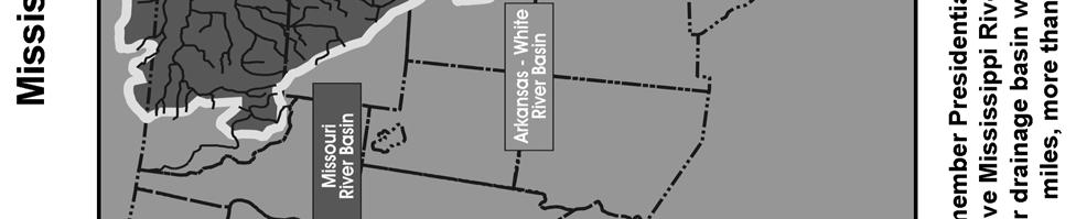
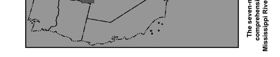
105 MISSISSIPPI RIVER COMMISSION
The Mississippi River Commission. History of the Management of the Mississippi River. US Army Corps of Engineers BUILDING STRONG
 The Mississippi River Commission History of the Management of the Mississippi River US Army Corps of Engineers US Army Corps of Engineers Presentation Outline Overview of Mississippi River History of Mississippi
Mississippi River & Tributaries Project History & Overview
 Mississippi River & Tributaries Project History & Overview Watershed Division Mississippi Valley Division 17 June 2015 US Army Corps of Engineers BUILDING STRONG Lake Texoma Spillway Tulsa Little Rock
Inner Harbor Navigation Canal Lock. Victor A. Landry III Operations Manager, GIWW New Orleans District U.S. Army Corps of Engineers
 Inner Harbor Navigation Canal Lock Victor A. Landry III Operations Manager, GIWW New Orleans District U.S. Army Corps of Engineers 22 August 2008 GIWW & IHNC Lock Overview Dewatering Challenges GICA 103
Joan Stemler. Water Control. St. Louis District. November US Army Corps of Engineers BUILDING STRONG
 St. Louis District Low Water Operations Joan Stemler Water Control St. Louis District November 2012 US Army Corps of Engineers BUILDING STRONG Overview St. Louis District Overview St. Louis District L&D
Birds Point-New Madrid Floodway
 T he Birds Point-New Madrid floodway is designed to prevent the MR&T project design flood from exceeding the design elevation on the Mississippi River levees in the vicinity of the confluence of the Mississippi
INTRODUCTION 250,000
 INTRODUCTION The United States of America has over 250,000 rivers, with a total of about 3,500,000 miles of rivers. The main stems of 38 rivers in the United States are at least 500 miles (800 km) long.
TRINITY RIVER CORRIDOR
 TRINITY RIVER CORRIDOR MODIFIED DALLAS FLOODWAY PROJECT UPDATE May 12, 2015 Jon Loxley Project Manager Dallas Floodway Project Fort Worth District U.S. Army Corps of Engineers US Army Corps of Engineers
Public Notice ISSUED: December 10, 2018 EXPIRES: January 9, 2019
 APPLICANT: REFER TO: St. Louis and Lake Counties Regional Rail Authority 2018-01942-ARC Public Notice ISSUED: December 10, 2018 EXPIRES: January 9, 2019 SECTION:404 - Clean Water Act 1. APPLICATION FOR
Recreational Impacts of Coastal Restoration Projects in Louisiana
 Recreational Impacts of Coastal Restoration Projects in Louisiana i National Conference on Ecosystem Restoration Baltimore, MD Joseph Berlin and Andrew Perez August 5, 2011 Recreational Impacts were Estimated
2012 Texas Water Conservation Association Meeting
 2012 Texas Water Conservation Association Meeting BG Thomas Kula Southwestern Division Commander 15 June 2012 US Army Corps of Engineers AGENDA UNCLASSIFIED Overview of Southwestern Division Missions Texas
National Waterways Conference Maj. Gen. John Peabody. P.E.
 National Waterways Conference Maj. Gen. John Peabody. P.E. President, Mississippi River Commission Commander, Mississippi Valley Division U.S. Army Corps of Engineers September 20, 2012 World s 3 rd Largest
Daisy Dean Trail 628/619 ATV Trail Construction
 Background and Purpose and Need The Daisy Dean ATV Trail Construction Project is located in the Little Belt Mountains, Musselshell Ranger District, Lewis and Clark National Forest approximately 32 miles
Segment 2: La Crescent to Miller s Corner
 goal of the USFWS refuges is to conserve, protect and enhance fish, wildlife and plants and their habitats for the continuing benefit of the American people. Refuge lands are used largely for fishing,
KASKASKIA RIVER NAVIGATION POOL Compartment 12 UNIT 1 Kaskaskia Lock and Dam Lands These lands are now being managed by the Carlyle Lake project
 KASKASKIA RIVER NAVIGATION POOL Compartment 12 UNIT 1 Kaskaskia Lock and Dam Lands These lands are now being managed by the Carlyle Lake project office. Sections 1-4 in this plan present Kaskaskia River
DIVISION BULLETIN NO. 2
 OFFICE OF THE DIVISION ENGINEER CORPS OF ENGINEERS, MISSISSIPPI VALLEY DIVISION P.O. BOX 80, 1400 WALNUT STREET VICKSBURG, MS 39181 CEMVD-ET-CO February 2016 DIVISION BULLETIN NO. 2 NAVIGATION CONDITIONS
Buffalo District Navigation Program Overview
 Buffalo District Navigation Program Overview 16 FEB 2011 US Army Corps of Engineers Buffalo District Area of Operations Our Facilities District Headquarters 2 Area Offices 3 Regulatory Field Offices Lake
The Corps of Engineers Dredges on the West Coast
 The Corps of Engineers Dredges on the West Coast Presented To California Marine Affairs and Navigation Conference Sheryl Carrubba Operations Manager, Channels & Harbors Portland District November 8, 2011
Appendix 4 St. Charles Basin
 Appendix 4 St. Charles Basin The St. Charles hurricane protection system (HPS), shown in Figure 1, was designed as part of the Lake Pontchartrain, LA, and Vicinity Hurricane Protection Project. The St.
S Central Coast Heritage Protection Act APRIL 21, 2016
 STATEMENT OF GLENN CASAMASSA ASSOCIATE DEPUTY CHIEF, NATIONAL FOREST SYSTEM U.S. FOREST SERVICE U.S. DEPARTMENT OF AGRICULTURE BEFORE THE UNITED STATES SENATE COMMITTEE ON ENERGY AND NATURAL RESOURCES
Water Resources Update after NCGA Long Session
 Water Resources Update after NCGA Long Session North Carolina Beach Inlet & Waterway Association Annual Conference November 16, 2015 Division of Water Resources Overview New Name / Reorganization Jordan
Wilderness Areas Designated by the White Pine County bill
 Wilderness Areas Designated by the White Pine County bill SEC. 321. SHORT TITLE. This subtitle may be cited as the `Pam White Wilderness Act of 2006'. SEC. 322. FINDINGS. Congress finds that-- The White
Riverine Sand Mining/Scofield Island Restoration (BA-40)
") Riverine Sand Mining/Scofield Island Restoration (BA-40) Conference on Ecological and Ecosystem Restoration Kenneth Bahlinger, CPRA Project Manager July 31, 2014 committed to our coast committed to our
Riverine Sand Mining/Scofield Island Restoration (BA-40) Conference on Ecological and Ecosystem Restoration Kenneth Bahlinger, CPRA Project Manager July 31, 2014 committed to our coast committed to our
SECTION 3 GENERAL DESCRIPTION OF THE RIVER BASIN
 SECTION 3 GENERAL DESCRIPTION OF THE RIVER BASIN SECTION 3 GENERAL DESCRIPTION OF THE RIVER BASIN River basin description. A general description of the river basin or subbasin, as appropriate, in which
DREDGED MATERIAL DISPOSAL HISTORY AVOCA ISLAND LAKE
 DREDGED MATERIAL DISPOSAL HISTORY AVOCA ISLAND LAKE The Atchafalaya River & Bayous Chene, Boeuf, & Black, Louisiana, project was authorized by the Rivers and Harbors Act of 1968, House Document 155, 90
Bear Creek Habitat Improvement Project
 06/10/10 Bear Creek Habitat Improvement Project El Paso County, Colorado Pike National Forest and Colorado Springs Utilities Owned Land Report prepared by: Eric Billmeyer Executive Director Rocky Mountain
Agenda Report. Spruce Street Outlet Drainage Improvements Tower Road Relief Sewer
 Agenda Report Subject: Prepared By: Spruce Street Outlet Drainage Improvements Tower Road Relief Sewer Steven M. Saunders, Director of Public Works/Village Engineer Date: August 12, 2012 On March 8, 2012
International Osoyoos Lake Board of Control Annual Report to the International Joint Commission
 International Osoyoos Lake Board of Control 2010 Annual Report to the International Joint Commission TABLE OF CONTENTS ACTIVITIES OF THE BOARD... 1 HYDROLOGIC CONDITIONS IN 2010... 2 Drought Criteria...
DIVISION BULLETIN NO. 2
 OFFICE OF THE DIVISION ENGINEER CORPS OF ENGINEERS, MISSISSIPPI VALLEY DIVISION P.O. BOX 80, 1400 WALNUT STREET VICKSBURG, MS 39181 CEMVD-ET-CO February 2014 DIVISION BULLETIN NO. 2 NAVIGATION CONDITIONS
Paper 1F and 3H: Decision-Making Exercise. Wednesday 4 June 2008 Morning Resource Booklet. Advance Information
 Paper Reference(s) 1313/1F and 3H Edexcel GCSE Geography B Paper 1F and 3H: Decision-Making Exercise Wednesday 4 June 2008 Morning Resource Booklet Advance Information Do not open before Wednesday 30 April
Common Ground Drainage Channel Diversion. Design Report
 Common Ground Drainage Channel Diversion Design Report Resource Management International Inc Consulting Engineers May 2017 COMMON GROUND DRAINAGE CHANNEL DIVERSION PREPARED FOR: QUILL LAKES WATERSHED NO.
The Galveston Seawall
 Coastal and Ocean Engineering ENGI.8751 Undergraduate Student Forum Faculty of Engineering and Applied Science, Memorial University, St. John s, NL, Canada. March, 2013 The Galveston Seawall Mark Harvey
International Osoyoos Lake Board of Control Annual Report to the International Joint Commission
 International Osoyoos Lake Board of Control 2013 Annual Report to the International Joint Commission TABLE OF CONTENTS ACTIVITIES OF THE BOARD... 1 HYDROLOGIC CONDITIONS IN 2013... 2 Drought Criteria...
Speculative Investment in the Mississippi Delta of the Future
 Speculative Investment in the Mississippi Delta of the Future Introduction This report analyzes future scenarios of Southern Louisiana based on the events surrounding Hurricane Katrina and the possibility
Tuesday, March 12, 2019 RIVER CLOSURES & RESTRICTED MOVEMENTS
 Tuesday, March 12, 2019 American Currents Key Issues - Shoaling on the Tennessee Tombigbee River could have it closed until the second half of April - Tennessee River is closed around mile 440-450 until
Hydraulic Report. Trail 5 Snowmobile Trail Over Mulligan Creek. Prepared By: COLEMAN ENGINEERING COMPANY Karisa V. Falls, P.E.
 Prepared for: Prepared by: Marquette County Road Commission Coleman Engineering Company Marquette, Michigan Iron Mountain, MI December 2011 Hydraulic Report Trail 5 Snowmobile Trail Over Mulligan Creek
Phoenix Habitat Restoration Projects
 Phoenix Habitat Restoration Projects Spur Cross Ranch Cave Creek (Estergard) Regional Tree and Shade Summit March 9, 2010 Desert Riparian Ecosystems Healthy riparian areas like this once existed along
4/28/17. Clicker Question. Clicker Question. #37 Floods IV (Case Histories-Mississippi River Flood, 1993; Red River of North Flood, 1997)
") GEOL 118 Final Exam Format similar to exams 1 and 2 Covers Lectures #27 40 (Global Climate Change I - Meteorite Impacts III) Web Exercise #6 - Due by 1 pm, Monday (5/1) 8:00 AM, Thursday, May 11 th Location
GEOL 118 Final Exam Format similar to exams 1 and 2 Covers Lectures #27 40 (Global Climate Change I - Meteorite Impacts III) Web Exercise #6 - Due by 1 pm, Monday (5/1) 8:00 AM, Thursday, May 11 th Location
DRAFT GENERAL IMPLEMENTATION PLAN AND SPECIFIC IMPLEMENTATION PLAN MIDDLETON MUNICIPAL AIRPORT MOREY FIELD. Revised 12/12/03
 DRAFT GENERAL IMPLEMENTATION PLAN AND SPECIFIC IMPLEMENTATION PLAN MIDDLETON MUNICIPAL AIRPORT MOREY FIELD Revised 12/12/03 As recommended for approval by the Plan Commission General Project Description
Chapter 4.0 Alternatives Analysis
 Chapter 4.0 Alternatives Analysis Chapter 1 accumulated the baseline of existing airport data, Chapter 2 presented the outlook for the future in terms of operational activity, Chapter 3 defined the facilities
Committee Report. Community Development Committee For the Metropolitan Council meeting of April 13, Business Item No.
 Committee Report Business Item No. 2016-48 Community Development Committee For the Metropolitan Council meeting of April 13, 2016 Subject: Harriet Island-South St. Paul Regional Trail Master Plan, Saint
Mr. Jeff Keever Deputy Executive Director Virginia Port Authority May 2, 2012
 Management of Dredged Materials: Challenges and Opportunities Mr. Jeff Keever Deputy Executive Director Virginia Port Authority May 2, 2012 1 Craney Island Eastward Expansion and Marine Terminal NNMT Hampton
PULLMAN-MOSCOW REGIONAL AIRPORT Runway Realignment Project
 PULLMAN-MOSCOW REGIONAL AIRPORT Runway Realignment Project GENERAL AIRPORT INFORMATION AIRPORT USERS Airport ownership: Public, owned by the Pullman-Moscow Regional Airport Board Year opened: February
112th CONGRESS. 1st Session H. R. 113 IN THE HOUSE OF REPRESENTATIVES
 HR 113 IH 112th CONGRESS 1st Session H. R. 113 To provide for additions to the Cucamonga and Sheep Mountain Wilderness Areas in the Angeles and San Bernardino National Forests and the protection of existing
Friday, September 14, 2018
 Friday, September 14, 2018 American Currents Key Issues - Reduced tow sizes SB from St. Louis to Gulf by one string (5 barges) - Industry is tracking Hurricane Florence and the potential impact to the
WHY THERE IS NO STORM SURGE PROTECTION FOR THE LAKE PONTCHARTRAIN BASIN
 WHY THERE IS NO STORM SURGE PROTECTION FOR THE LAKE PONTCHARTRAIN BASIN A Report Addressing: I. The Reason Why The Corps Of Engineers Abandoned Its Plan To Keep Storm Surge Out Of The Lake Pontchartrain
International Osoyoos Lake Board of Control Annual Report to the International Joint Commission
 International Osoyoos Lake Board of Control 2015 Annual Report to the International Joint Commission Cover: Northern extent of Osoyoos Lake, where the Okanagan River enters the lake, 2015. View is to the
SAME/SBA CONFERENCE. Col. Christopher W. Sallese Commander, Galveston District U.S. Army Corps of Engineers April 11, 2012
 SAME/A CONFERENCE Col. Christopher W. Sallese Commander, Galveston District U.S. Army Corps of Engineers April 11, 2012 U.S. Army Corps of Engineers Galveston District BUILDING STRONG 1 History of the
WEKIVA WILD AND SCENIC RIVER ACT OF 2000
 PUBLIC LAW 106 299 OCT. 13, 2000 WEKIVA WILD AND SCENIC RIVER ACT OF 2000 VerDate 11-MAY-2000 01:59 Oct 20, 2000 Jkt 069139 PO 00000 Frm 00001 Fmt 6579 Sfmt 6579 E:\PUBLAW\PUBL299.106 APPS27 PsN: PUBL299
Pump Stations...more than just pumps
 Task Force Hope Status Report Newsletter March 13, 2013 Pump Stations...more than just pumps Photo by Jerry Baggett Pump Station 11, Algiers Canal Repairs and Fronting Protection Repaired pump stations
March 2, The Honorable Mayor Williams D. Sessoms, Jr. Members of City Council. Subject: Coastal CIP Presentation to City Council - March 6, 2018
 OFFICE OF THE CITY MANAGER (757) 385-4242 (757) 427-5626 FAX MUNICIPAL CENTER BUILDING 1, ROOM 234 2401 COURTHOUSE DRIVE VIRGINIA BEACH, VA 23456-9001 March 2, 2018 The Honorable Mayor Williams D. Sessoms,
Folder 7 Folder Title Description (including date) Date Richard C. Proposed Humble & Pan AM Thibodaux meter Dec. 5, 1958
 Date Richard C. Proposed Humble & Pan AM Thibodaux meter Dec. 5, 1958") ACADIA PLANTATION RECORDS (Mss 4906) Appendix B Oversized materials from Series II. Legal Records Subseries 3. Pugh, Lanier, & Pugh Location: Room B6-OS:A Folder 7 Folder Title Description (including date)
ACADIA PLANTATION RECORDS (Mss 4906) Appendix B Oversized materials from Series II. Legal Records Subseries 3. Pugh, Lanier, & Pugh Location: Room B6-OS:A Folder 7 Folder Title Description (including date)
Welcome KROSNO CREEK DIVERSION PROJECT CLASS ENVIRONMENTAL ASSESSMENT
 Welcome KROSNO CREEK DIVERSION PROJECT PUBLIC INFORMATION CENTRE # 1 Tonight s Presentation Study Overview Background Existing Conditions Alternative Solutions Preliminary Preferred Solution Next Steps
Recommendations for Renewal of the International Joint Commission s Osoyoos Lake Order
 Recommendations for Renewal of the International Joint Commission s Osoyoos Lake Order Prepared by the International Osoyoos Lake Board of Control June 21, 2012 1 Contents Executive Summary... 1 Introduction...
GALVESTON DISTRICT O&M NAVIGATION MISSION & RESPONSE TO HURRICANE HARVEY
 GALVESTON DISTRICT O&M NAVIGATION MISSION & RESPONSE TO HURRICANE HARVEY 237 237 237 217 217 217 200 200 200 80 119 27 252 174.59 1 255 255 255 0 0 0 163 163 163 131 132 122 239 65 53 Christopher Frabotta
Final Drainage Letter Pikes Peak Community College Downtown Parking Lot Colorado Springs, Colorado
 Final Drainage Letter Pikes Peak Community College Downtown Parking Lot Colorado Springs, Colorado Prepared for: Pikes Peak Community College 5775 South Academy Boulevard Colorado Springs, CO 80906-5422
DECISION MEMO. Rawhide Trail #7073 Maintenance and Reconstruction
 Page 1 of 6 Background DECISION MEMO USDA Forest Service Jefferson Ranger District Jefferson County, Montana Rawhide Trail #7073 is located in the Elkhorn Mountain Range approximately 10 miles east of
Wednesday, September 12, 2018
 Wednesday, September 12, 2018 American Currents Key Issues - Reduced tow sizes SB from St. Louis to Cairo by one string (5 barges) - Upper Miss at Lock 17 (UM 437) has reopened - Calcasieu Lock (WC 238)
FNORTHWEST ARKANSAS WESTERN BELTWAY FEASIBILITY STUDY
 FNORTHWEST ARKANSAS WESTERN BELTWAY FEASIBILITY STUDY EXECUTIVE SUMMARY The 2030 Northwest Arkansas Regional Transportation Plan developed by the Northwest Arkansas Regional Planning Commission (NWARPC)
Norfolk District North Atlantic Division
 Norfolk District North Atlantic Division Eastern Chapter of WEDA Fall Conference October 9, 2012 Stephen J. Powell, P.E. (757) 201-7788 US Army Corps of Engineers 5-Year Dredging Schedule (By dredge type)
Triangle Land Conservancy Conservation Area Monitoring Report Carolina North
 Triangle Land Conservancy Conservation Area Monitoring Report Carolina North Property Name: Bolin Creek West Conservation Area Date of visit: March 16, 2017 County: Orange Property Type: Restrictive Covenants
ACADIA PLANTATION RECORDS (Mss 4906) Appendix E Oversized materials from Series V. Maps, Plats, and Photographs Location: Room B6-OS:A
 Appendix E Oversized materials from Series V. Maps, Plats, and Photographs Location: Room B6-OS:A") ACADIA PLANTATION RECORDS (Mss 4906) Appendix E Oversized materials from Series V. Maps, Plats, and Photographs Location: Room B6-OS:A Folder 20 Evergreen Plantation Survey Plat 12/27/1937 Lafourche Parish
ACADIA PLANTATION RECORDS (Mss 4906) Appendix E Oversized materials from Series V. Maps, Plats, and Photographs Location: Room B6-OS:A Folder 20 Evergreen Plantation Survey Plat 12/27/1937 Lafourche Parish
STREAKED HORNED LARK. Conservation of a threatened species in an industrial landscape. Cat Brown US Fish and Wildlife Service
 STREAKED HORNED LARK Conservation of a threatened species in an industrial landscape Cat Brown US Fish and Wildlife Service HISTORICAL & CURRENT RANGE Streaked Horned Lark Distribution Historical Range:
American Currents. Ohio/Tennessee/Cumberland. Chicago/Illinois/Upper Miss. Lower Miss/Gulf/Canals
 American Currents For additional details on the information noted below, please contact your ACBL Salesperson or Logistics Representative at (800) 899-7195 Ohio/Tennessee/Cumberland Chicago/Illinois/Upper
Engineering With Nature Geographic Project Mapping Tool (EWN ProMap)
") Engineering With Nature Geographic Project Mapping Tool (EWN ProMap) Cynthia Banks Program Manager Burton Suedel, PhD Research Biologist Michelle Bourne Research Biologist U.S. Army ERDC 23 June 2015 Dredging
Engineering With Nature Geographic Project Mapping Tool (EWN ProMap) Cynthia Banks Program Manager Burton Suedel, PhD Research Biologist Michelle Bourne Research Biologist U.S. Army ERDC 23 June 2015 Dredging
Continental Divide National Scenic Trail Legislative History and Planning Guidance
 Continental Divide National Scenic Trail Legislative History and Planning Guidance Legislation, Policy, and Direction Regarding National Scenic Trails The National Trails System Act, P.L. 90-543, was passed
Bradley Brook Relocation Project. Scoping Notice. Saco Ranger District. United States Department of Agriculture Forest Service
 Bradley Brook Relocation Project United States Department of Agriculture Forest Service Scoping Notice White Mountain National Forest February 2011 For Information Contact: Jenny Burnett White Mountain
Deep in the Heart of Louisiana 4' x 6' watercolor by Driftwood Johnnie
 Lower Mississippi River Dispatch No. 307 Oct 19, 2015 Deep in the Heart of Louisiana Deep in the Heart of Louisiana 4' x 6' watercolor by Driftwood Johnnie Starting Wed, Oct 21st, we ll be paddling the
Environment and Natural Resources Trust Fund (ENRTF) M.L ENRTF Work Plan (Main Document)
 M.L ENRTF Work Plan (Main Document)") Environment and Natural Resources Trust Fund (ENRTF) M.L. 2018 ENRTF Work Plan (Main Document) Today s Date: December 8, 2017 Date of Next Status Update Report: January 31, 2019 Date of Work Plan Approval:
Environment and Natural Resources Trust Fund (ENRTF) M.L. 2018 ENRTF Work Plan (Main Document) Today s Date: December 8, 2017 Date of Next Status Update Report: January 31, 2019 Date of Work Plan Approval:
1. Hotel Trends Occupancy Rate
 Introduction The Louisiana Travel Pulse is a seasonal industry travel barometer designed to present recent trends in travel industry performance. This issue s emphasis is on the Spring 2002 season (March-May).
Preliminary Site Evaluation
 Preliminary Site Evaluation 100 Acre Site, US 72 Piperton, Tennessee Power Distributor: Chickasaw Electric Cooperative August 2010 SITE DATA SHEET PIPERTON US 72 SITE (100 ACRES): LOCATION & GENERAL DESCRIPTION
Atchafalaya Trace. Prepared for: Louisiana Department of Culture, Recreation and Tourism. The Louisiana Research Team
 Prepared for: Louisiana Department of Culture, Recreation and Tourism The Louisiana Research Team Acknowledgements This report was prepared by Janet Speyrer, Ph.D., Associate Dean for Research, College
4180 acre-feet minimum conservation pool
 MEMORANDUM Subject: Bear River Basin Plan SULPHUR CREEK RESERVOIR Date: July 20, 2000 Location: Section 34, Township 14N, Range 119W. Located on Sulphur Creek, tributary to the Bear River. Located approximately
BENEFICIAL USE OF DREDGED MATERIAL DISPOSAL HISTORY HOUMA NAVIGATION CANAL, LA
 BENEFICIAL USE OF DREDGED MATERIAL DISPOSAL HISTORY HOUMA NAVIGATION CANAL, LA 1991-2012 The Houma Navigation Canal (HNC) provides a navigation channel between Houma, Louisiana, and the Gulf of Mexico
Nassau County Bridge Authority (N.Y. Public Authorities Law 651) 2007 Annual Report
 2007 Annual Report") Nassau County Bridge Authority (N.Y. Public Authorities Law 651) 2007 Annual Report The Nassau County Bridge Authority is a public benefit corporation created by the New York State Legislature in 1945
Nassau County Bridge Authority (N.Y. Public Authorities Law 651) 2007 Annual Report The Nassau County Bridge Authority is a public benefit corporation created by the New York State Legislature in 1945
Appalachian Power Company Smith Mountain Hydroelectric Project FERC No Debris Management Plan
 Appalachian Power Company Smith Mountain Hydroelectric Project FERC No. 2210 Debris Management Plan Final July2008 TABLE OF CONTENTS Description Page SUMMARY 1 1.0 Introduction.. 2 1.1 Project Lands and
The Mississippi River Delta and The Nile River Delta: Note for the Atchafalaya River Debate
 The Mississippi River Delta and The Nile River Delta: Note for the Atchafalaya River Debate By Charles William Johnson Earth/matriX Science Today ISSN 1526-3312 P.O. Box 231126 New Orleans, Louisiana 70183-1126
MEETING OF THE METROPOLITAN PARKS AND OPEN SPACE COMMISSION Tuesday, April 4, 2017
 Minutes of the MEETING OF THE METROPOLITAN PARKS AND OPEN SPACE COMMISSION Tuesday, April 4, 2017 Committee Members Present: Tony Yarusso, Rick Theisen, Robert Moeller, Todd Kemery, Sarah Hietpas, Margie
PURPOSE AND NEED (CONCURRENCE POINT 1) NEW CANADA ROAD PROJECT FROM STATE ROUTE 1 (U.S. HIGHWAY 70) TO U.S. INTERSTATE 40
 NEW CANADA ROAD PROJECT FROM STATE ROUTE 1 (U.S. HIGHWAY 70) TO U.S. INTERSTATE 40") PURPOSE AND NEED (CONCURRENCE POINT 1) NEW CANADA ROAD PROJECT FROM STATE ROUTE 1 (U.S. HIGHWAY 70) TO U.S. INTERSTATE 40 Project Description The primary purpose of this project is to improve the major
PURPOSE AND NEED (CONCURRENCE POINT 1) NEW CANADA ROAD PROJECT FROM STATE ROUTE 1 (U.S. HIGHWAY 70) TO U.S. INTERSTATE 40 Project Description The primary purpose of this project is to improve the major
Rule Governing the Designation and Establishment of All-Terrain Vehicle Use Trails on State Land
 Rule Governing the Designation and Establishment of All-Terrain Vehicle Use Trails on State Land 1.0 Authority 1.1 This rule is promulgated pursuant to 23 V.S.A. 3506. Section 3506 (b)(4) states that an
Port MacKenzie Rail Extension
 Port MacKenzie Rail Extension Project The Matanuska-Susitna Borough (MSB) and the Alaska Railroad Corporation (ARRC) jointly propose construction and operation of a new rail line to connect the Borough
MEMORANDUM FOR Commander. Lower Mississippi Valley Di visi':m. ATTN: CELMV-CO-O. SUBJECT: Project Operations - Inspection of Completed Works
 fwlr. Colletti/lpc/2244 CELHN-OD-:f.; OEC I 0 1991 MEMORANDUM FOR Commander. Lower Mississippi Valley Di visi':m. ATTN: CELMV-CO-O SUBJECT: Project Operations - Inspection of Completed Works 1. In accordance
Pinellas County Environmental Lands
 Pinellas County Environmental Lands In addition to traditional parks and recreation facilities, Pinellas County owns and manages a system of environmental lands that provides specialized resource-based
II. THE BOULDER CREEK DRAINAGE BASIN
 II. THE BOULDER CREEK DRAINAGE BASIN This section provides an overview of the watersheds and flood hazards associated with Boulder Creek and South Boulder Creek including descriptions of the drainage basins,
Business Item No XXX. Proposed Action That the Metropolitan Council approve the Coon Creek Regional Trail Master Plan.
 Business Item No. 2015-XXX Metropolitan Parks and Open Space Commission Meeting date: July 7, 2015 For the Community Development Committee meeting of July 20, 2015 For the Metropolitan Council meeting
H. R IN THE HOUSE OF REPRESENTATIVES
 I 113TH CONGRESS 1ST SESSION H. R. 1776 To establish the Clear Creek National Recreation Area in San Benito and Fresno Counties, to designate the Joaquin Rocks Wilderness in such counties, to designate
Emily to Blind Lake Trail PROPOSED TRAIL DEVELOPMENT APPLICATION SUMMARY
 Emily to Blind Lake Trail PROPOSED TRAIL DEVELOPMENT APPLICATION SUMMARY Township 137 Range 26 (Fairfield Township) sections 2 & 3 Township 138 Range 26 (City of Emily) sections 27, 34, 35, & 36 Township
www: vermilionparishpolicejury.com
 www: vermilionparishpolicejury.com 1 Coastal Projects in Vermilion Parish Constructed over the last 26 years (CWPPRA, CIAP, State Surplus) PPL Number Project Name Project Types Current Estimate Acres
Port MacKenzie Rail Extension
 Port MacKenzie Rail Extension Project The Matanuska-Susitna Borough (MSB) and the Alaska Railroad Corporation (ARRC) jointly propose construction and operation of a new rail line to connect the Borough
Whitefish Range Partnership Tentatively Approved by WRP 11/18/2013!Rec. Wilderness Page 1
 Whitefish Range Partnership Tentatively Approved by WRP 11/18/2013!Rec. Wilderness Page 1 Recommended Wilderness Background The Whitefish Range has a long management and legislative history associated
Update on the Coalition Efforts to Make the Proposed I-20 Corridor Long-Distance Passenger Rail Connection a Reality
 Update on the Coalition Efforts to Make the Proposed I-20 Corridor Long-Distance Passenger Rail Connection a Reality Presentation to: 14 th Annual Southwestern Rail Conference Texas Rail Advocates by Judge
SECTION 106 ACTIVITIES ANNUAL REPORT
 SECTION 106 ACTIVITIES ANNUAL REPORT FOR THE YEAR ENDING DECEMBER 31, 2014 Metropolitan Washington Airports Authority 198 Van Buren Street, Suite 300 Herndon, Virginia 20170 JANUARY 2015 Introduction The
Department of Legislative Services Maryland General Assembly 2009 Session
 Department of Legislative Services Maryland General Assembly 2009 Session SB 650 FISCAL AND POLICY NOTE Senate Bill 650 (Senators Pipkin and Astle) Finance and Budget and Taxation Medevac Helicopter Improvement
APPENDIX B: NPIAS CANDIDATE AIRPORT ANALYSIS
 APPENDIX B: NPIAS CANDIDATE AIRPORT ANALYSIS The National Plan of Integrated Airport Systems (NPIAS) is the Federal Aviation Administration s (FAA) national airport plan. The NPIAS includes nearly 3,500
METROPOLITAN COUNCIL 390 North Robert Street, St. Paul, MN Phone (651) TDD (651)
 TDD (651)") DATE: March 27, 2012 METROPOLITAN COUNCIL 390 North Robert Street, St. Paul, MN 55101 Phone (651) 602-1000 TDD (651) 291-0904 TO: Metropolitan Parks and Open Space Commission FROM: Arne Stefferud, Planning
DATE: March 27, 2012 METROPOLITAN COUNCIL 390 North Robert Street, St. Paul, MN 55101 Phone (651) 602-1000 TDD (651) 291-0904 TO: Metropolitan Parks and Open Space Commission FROM: Arne Stefferud, Planning
Louisiana Travel Pulse May 2007
 Louisiana Travel Pulse May 2007 Produced by the Louisiana Office of Tourism Monthly Analysis/Highlights: Although nationwide airport activity was stagnant for the first quarter, New Orleans, Alexandria,
Yolo County Airport. ALP Narrative Report. April Prepared by Mead & Hunt, Inc. for the County of Yolo, California
 Yolo County Airport ALP Narrative Report April 2016 Prepared by Mead & Hunt, Inc. for the County of Yolo, California Yolo County Airport ALP Narrative Report Prepared for the County of Yolo Mindi Nunes,
Section II. Planning & Public Process Planning for the Baker/Carver Regional Trail began in 2010 as a City of Minnetrista initiative.
 Section II Planning & Public Process Planning for the began in 2010 as a City of initiative. city staff began discussions with the Park District on the possibility of a north/south regional trail connection
Impact of Offshore Directed Forcing on Sediment Transport and Structural Integrity at Packery Channel, Corpus Christi Texas
 Google Earth 29 Aug 2017 Impact of Offshore Directed Forcing on Sediment Transport and Structural Integrity at Packery Channel, Corpus Christi Texas Deidre D. Williams Coastal Research Scientist Conrad
Airport Master Plan Update June 15, 2017
 Airport Master Plan Update June 15, 2017 www.harveyfield.com The Master Plan is a 20-year plan to understand the needs of current and future users of the Airport. This is important to ensure that safe
Decision Memo Broken Wheel Ranch Equestrian Outfitter Special-Use Permit Proposed Action
 Decision Memo Broken Wheel Ranch Equestrian Outfitter Special-Use Permit USDA Forest Service Mississippi Bluffs Ranger District, Shawnee National Forest Jackson and Union Counties, Illinois Proposed Action