Joan Stemler. Water Control. St. Louis District. November US Army Corps of Engineers BUILDING STRONG
|
|
|
- Coral Williamson
- 6 years ago
- Views:
Transcription


1 St. Louis District Low Water Operations Joan Stemler Water Control St. Louis District November 2012 US Army Corps of Engineers BUILDING STRONG
2 Overview St. Louis District Overview St. Louis District L&D Operations Low Water Operations Extended River Forecast Reservoir Operations Low Water Reference Plane Questions
3 USACE
4 St. Louis District Mark Twain Lake Illinois Rive rmark Twain Lake Shelbyville Carlyle Lake Rend Lake Wappapello Lake
5 District Overview 5 Flood Control Reservoirs Projects Lake a e Shelbyville, e, Carlyle Lake, Rend Lake, Mark Twain Lake, and Wappapello Lake 5 Lock and Dam Projects L&D 24, L&D 25, Mel Price L&D, L&D 27, and Kaskaskia L&D 9 Watersheds draining into the Mississippi River within the St. Louis District Salt, Cuivre, Lower Missouri, Meramec, Upper St. Francis, Castor, Lower Illinois, Kaskaskia, and Big Muddy Rivers


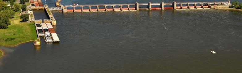
6 Locks and Dams L&D 24 r Illinois Rive Melvin Price Locks & Dam Locks 27 L&D 25 Kaskaskia L&D
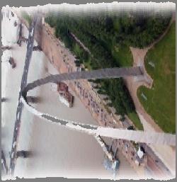
7 L&D 25 RM Melvin Price Locks and Dam Pool Limits: Alton Lower Limit: Hinge Point Limits, Grafton: (May be exceeded if at maximum drawdown, or Alton at 414.0) Grafton RM Alton RM Mel Price L&D RM Low Flow / Flat Pool
8 L&D 25 RM Melvin Price Locks and Dam Pool Limits: Alton Lower Limit: Hinge Point Limits, Grafton: (May be exceeded if at maximum drawdown, or Alton at 414.0) Grafton RM Alton RM Mel Price L&D RM Increasing / Decreasing Flow
9 L&D 25 RM Melvin Price Locks and Dam Pool Limits: Alton Lower Limit: Hinge Point Limits, Grafton: (May be exceeded if at maximum drawdown, or Alton at 414.0) Grafton RM Alton RM Mel Price L&D RM Maximum Drawdown
10 L&D 25 RM Melvin Price Locks and Dam Pool Limits: Alton Lower Limit: Hinge Point Limits, Grafton: (May be exceeded if at maximum drawdown, or Alton at 414.0) Grafton RM Alton RM Mel Price L&D RM Open River
11 L&D 25 Melvin Price Locks RM and Dam Flow Pool Limits: Alton Lower Limit: Hinge Point Limits, Grafton: (May be exceeded if at maximum drawdown, or Alton at 414.0) Grafton RM Government Owned Flowage Easements Mel Price L&D RM Low Flow / Flat Pool
12 L&D 25 Melvin Price Locks RM and Dam Flow Pool Limits: Alton Lower Limit: Hinge Point Limits, Grafton: (May be exceeded if at maximum drawdown, or Alton at 414.0) Grafton RM Government Owned Flowage Easements Mel Price L&D RM Increasing / Decreasing Flow
13 L&D 25 Melvin Price Locks RM and Dam Flow Pool Limits: Alton Lower Limit: Hinge Point Limits, Grafton: (May be exceeded if at maximum drawdown, or Alton at 414.0) Grafton RM Government Owned Flowage Easements Mel Price L&D RM Maximum Drawdown
14 L&D 25 Melvin Price Locks RM and Dam Flow Pool Limits: Alton Lower Limit: Hinge Point Limits, Grafton: (May be exceeded if at maximum drawdown, or Alton at 414.0) Grafton RM Government Owned Flowage Easements Mel Price L&D RM Open River
15 Hinge Point Limits Lock and Dam 24 Pool Limits: Hinge Point Limits, Louisiana: (May be exceeded if at maximum drawdown) Lock and Dam 25 Pool Limits: Hinge Point Limits, Mosier Landing: (May be exceeded if at maximum drawdown) Melvin Price Locks and Dam Pool Limits: Alton Lower Limit: Hinge Point Limits, Grafton: (May be exceeded if at maximum drawdown, or Alton at 414.0) Kaskaskia Lock and Dam Pool Limits: Hinge Point, Red Bud:
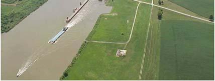
16 Low Water Operations
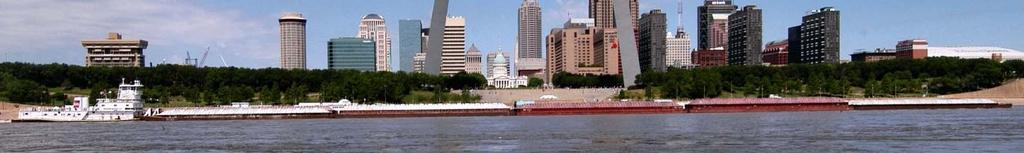
17 Critical Link Mississippi River 19-NOV ~ 35,200 cfs Illinois River 19-NOV ~ 4,000 cfs Missouri River 19-NOV ~ 48,700 cfs Mississippi St. Louis 15-NOV ~ 79,100 cfs Citi Critical llink
18 Mel Price Low Water Operations Approved Deviation to hold Mel Price 0.5 ft above maximum regulated pool Minimize fluctuations downstream (i.e. St. Louis Harbor) Extra storage is used to prevent low dips from L&D operations upstream Extra storage can be used to provide a pulse of water to free grounded tows if needed
19 Mel Price Low Operations Actual W/O Mel Price Deviation
20 Mel Price Low Operations Actual W/O Mel Price Deviation Avoided daily 1-2 ft fluctuations Prevented St. Louis from dropping to -4.6
21 Middle Mississippi River Extended Forecast
22 Daily Record Lows : 34 days POR: 14 days Record Low : -5.2 ft (Dec 1989) POR: -6.2 ft (Jan 1940) Extended Forecast Dec-Feb Low ~ -7.0 to -6.5 ft
23 Daily Record Lows : 13 days POR: 8 days Record Low : -3.7 ft (Dec 1989) POR: -4.3 ft (Jan 1964) Extended Forecast Dec-Feb Low ~ -4.3 to -3.8 ft
24 Daily Record Lows : 43 days POR: 10 days Record Low : 1.3 ft (Dec 1989) POR: -0.2 ft (Jan 1940) Extended Forecast Dec-Feb Low ~ -0.4 to 0.1 ft
25 Daily Record Lows : 12 days POR: 5 days Record Low : 1.3 ft (Dec 1989) POR: 0.6 ft (Jan 1909) Extended Forecast Dec-Feb Low ~ 1.5 to 2.0 ft
26 Daily Record Lows : 31 days POR: 27 days Record Low : 0.9 ft (Dec 1989) POR: 0.9 ft (Dec 1989) Extended Forecast Dec-Feb Low ~ -0.1 to 0.4 ft


27 River Ice Gorging g
28 Reservoir Operations


29 Reservoirs Lake Shelbyville Mark Twain Lake Illino ois River Carlyle Lake Wappapello Lake Rend Lake
30 Control Points Mark Twain Lake LOUISIANA, MO Releases are restricted when the Mississippi River is at or above Flood Stage: Louisiana 15 ft St. Louis 30 ft ST. LOUIS, MO
31 Control Points Mark Twain Lake LOUISIANA, MO Project Purposes: Flood control, hydropower, water supply, fish and wildlife, and recreation Travel Time Louisiana ~ 1 day St. Louis ~ 2-3 days Thebes ~ 4-5 days ST. LOUIS, MO


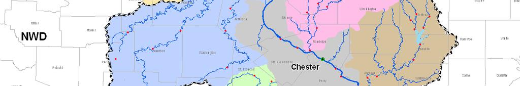
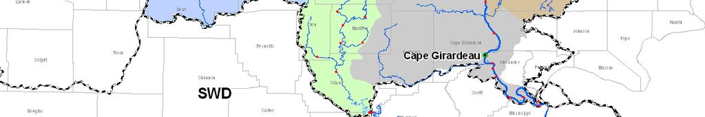
32 Control Points Releases are restricted when the Mississippi River is at or above Flood Stage: Chester 27 ft Cape p Girardeau 30 ft Cairo 40 ft Lake Shelbyville Carlyle Lake CHESTER, IL CAPE GIRARDEAU, MO CAIRO, IL
33 Control Points Project Purposes: Flood Control, recreation, water supply, water quality enhancement, navigation, & fish and wildlife Travel Time Chester ~ 3 days Cape Girardeau ~ 4 days Thebes ~ 4-5 days Cairo ~ 6 days CHESTER, IL Lake Shelbyville Carlyle Lake CAPE GIRARDEAU, MO CAIRO, IL
34 Low Water Reference Plane


35 Low Water Reference Plane Hypothetical Reference Used as a design tool for dredging and construction Helpful reference for preparation for low water Main guide: o LWRP = -3.5 ft at St. Louis gage
36 ???Questions????????
National Waterways Conference Maj. Gen. John Peabody. P.E.
 National Waterways Conference Maj. Gen. John Peabody. P.E. President, Mississippi River Commission Commander, Mississippi Valley Division U.S. Army Corps of Engineers September 20, 2012 World s 3 rd Largest
Kaskaskia River Project Master Plan 2017
 i Kaskaskia River Project Master Plan 2017 PREFACE Construction of the Kaskaskia River Project began in December 1967 and the first barge locked through in December 1973. The project was dedicated in July
Friday, September 14, 2018
 Friday, September 14, 2018 American Currents Key Issues - Reduced tow sizes SB from St. Louis to Gulf by one string (5 barges) - Industry is tracking Hurricane Florence and the potential impact to the
Mississippi River & Tributaries Project History & Overview
 Mississippi River & Tributaries Project History & Overview Watershed Division Mississippi Valley Division 17 June 2015 US Army Corps of Engineers BUILDING STRONG Lake Texoma Spillway Tulsa Little Rock
Finding Locations on a Map
 Name Date Class Finding Locations on a Map Identify each place described below. Use the map of the Mississippi in your textbook to find the answers. 1. This state is bordered on the north by Missouri and
Tuesday, March 12, 2019 RIVER CLOSURES & RESTRICTED MOVEMENTS
 Tuesday, March 12, 2019 American Currents Key Issues - Shoaling on the Tennessee Tombigbee River could have it closed until the second half of April - Tennessee River is closed around mile 440-450 until
Wednesday, September 12, 2018
 Wednesday, September 12, 2018 American Currents Key Issues - Reduced tow sizes SB from St. Louis to Cairo by one string (5 barges) - Upper Miss at Lock 17 (UM 437) has reopened - Calcasieu Lock (WC 238)
Inner Harbor Navigation Canal Lock. Victor A. Landry III Operations Manager, GIWW New Orleans District U.S. Army Corps of Engineers
 Inner Harbor Navigation Canal Lock Victor A. Landry III Operations Manager, GIWW New Orleans District U.S. Army Corps of Engineers 22 August 2008 GIWW & IHNC Lock Overview Dewatering Challenges GICA 103
KASKASKIA RIVER NAVIGATION POOL Compartment 12 UNIT 1 Kaskaskia Lock and Dam Lands These lands are now being managed by the Carlyle Lake project
 KASKASKIA RIVER NAVIGATION POOL Compartment 12 UNIT 1 Kaskaskia Lock and Dam Lands These lands are now being managed by the Carlyle Lake project office. Sections 1-4 in this plan present Kaskaskia River
SECTION 3 GENERAL DESCRIPTION OF THE RIVER BASIN
 SECTION 3 GENERAL DESCRIPTION OF THE RIVER BASIN SECTION 3 GENERAL DESCRIPTION OF THE RIVER BASIN River basin description. A general description of the river basin or subbasin, as appropriate, in which
PERFORMANCE MEASURE INFORMATION SHEET #16
 PERFORMANCE MEASURE INFORMATION SHEET #16 ARROW LAKES RESERVOIR: RECREATION Objective / Location Recreation/Arrow Lakes Reservoir Performance Measure Access Days Units Description MSIC 1) # Access Days
DIVISION BULLETIN NO. 2
 OFFICE OF THE DIVISION ENGINEER CORPS OF ENGINEERS, MISSISSIPPI VALLEY DIVISION P.O. BOX 80, 1400 WALNUT STREET VICKSBURG, MS 39181 CEMVD-ET-CO February 2016 DIVISION BULLETIN NO. 2 NAVIGATION CONDITIONS
Lake Chelan Operations
 Lake Chelan Operations IPMA Executive Seminar September 17, 2013 Presented by: Janet Jaspers Chelan County PUD Lake Chelan Hydroelectric Project Today s Discussion Chelan PUD Overview Interesting Facts
4/28/17. Clicker Question. Clicker Question. #37 Floods IV (Case Histories-Mississippi River Flood, 1993; Red River of North Flood, 1997)
") GEOL 118 Final Exam Format similar to exams 1 and 2 Covers Lectures #27 40 (Global Climate Change I - Meteorite Impacts III) Web Exercise #6 - Due by 1 pm, Monday (5/1) 8:00 AM, Thursday, May 11 th Location
GEOL 118 Final Exam Format similar to exams 1 and 2 Covers Lectures #27 40 (Global Climate Change I - Meteorite Impacts III) Web Exercise #6 - Due by 1 pm, Monday (5/1) 8:00 AM, Thursday, May 11 th Location
The Corps of Engineers Dredges on the West Coast
 The Corps of Engineers Dredges on the West Coast Presented To California Marine Affairs and Navigation Conference Sheryl Carrubba Operations Manager, Channels & Harbors Portland District November 8, 2011
American Currents. Ohio/Tennessee/Cumberland. Chicago/Illinois/Upper Miss. Lower Miss/Gulf/Canals
 American Currents For additional details on the information noted below, please contact your ACBL Salesperson or Logistics Representative at (800) 899-7195 Ohio/Tennessee/Cumberland Chicago/Illinois/Upper
Natural Factors Affecting the Level of Osoyoos Lake
 Natural Factors Affecting the Level of Osoyoos Lake Background Osoyoos Lake is operated under conditions prescribed by the International Joint Commission (IJC) and Figure 1 shows the ranges within which
The Mississippi River Commission. History of the Management of the Mississippi River. US Army Corps of Engineers BUILDING STRONG
 The Mississippi River Commission History of the Management of the Mississippi River US Army Corps of Engineers US Army Corps of Engineers Presentation Outline Overview of Mississippi River History of Mississippi
DIVISION BULLETIN NO. 2
 OFFICE OF THE DIVISION ENGINEER CORPS OF ENGINEERS, MISSISSIPPI VALLEY DIVISION P.O. BOX 80, 1400 WALNUT STREET VICKSBURG, MS 39181 CEMVD-ET-CO February 2014 DIVISION BULLETIN NO. 2 NAVIGATION CONDITIONS
Sector Upper Mississippi River All Threats All Hazards Always Ready
 Sector Upper Mississippi River All Threats All Hazards Always Ready Commander Katherine Weathers Chief, Planning & Force Readiness 5 Inland River Tenders (WLR) 3 Marine Safety Detachments (MSD) 4 Shore
Water Resources Update after NCGA Long Session
 Water Resources Update after NCGA Long Session North Carolina Beach Inlet & Waterway Association Annual Conference November 16, 2015 Division of Water Resources Overview New Name / Reorganization Jordan
Buffalo District Navigation Program Overview
 Buffalo District Navigation Program Overview 16 FEB 2011 US Army Corps of Engineers Buffalo District Area of Operations Our Facilities District Headquarters 2 Area Offices 3 Regulatory Field Offices Lake
River Basin. River s 981 miles flow from Pittsburgh, PA to the Mississippi River at Cairo, IL. The
 Ohio River Basin The Ohio River Basin contains over 2,800 miles of navigable waterways. The Ohio River s 981 miles flow from Pittsburgh, PA to the Mississippi River at Cairo, IL. The basin also includes
Damn those dams their effects on stream ecosystems
 Damn those dams their effects on stream ecosystems Jeremy Tiemann Illinois Natural History Survey Prairie Research Institute at the University of Illinois History of dams History of dams First evidence
International Osoyoos Lake Board of Control Annual Report to the International Joint Commission
 International Osoyoos Lake Board of Control 2013 Annual Report to the International Joint Commission TABLE OF CONTENTS ACTIVITIES OF THE BOARD... 1 HYDROLOGIC CONDITIONS IN 2013... 2 Drought Criteria...
Kentucky Lock Project Update Inland Waterways Users Board Meeting No. 84
 Kentucky Lock Project Update Inland Waterways Users Board Meeting No. 84 MR. DON GETTY PROJECT MANAGER Kentucky Lock Addition Nashville District 19 July 2017 The views, opinions and findings contained
Hydrology Input for West Souris River IWMP
 Hydrology Input for West Souris River IWMP Prepared by: Mark Lee Manitoba Water Stewardship 1 1 1 Overall view of: drainage area watershed characteristics gauging stations meteorological stations Runoff
2014 Colorado River Annual Operating Plan Colorado River Management Work Group (CRMWG) Final Consultation September 5, 2013
 Final Consultation September 5, 2013") 2014 Colorado River Annual Operating Plan Colorado River Management Work Group (CRMWG) Final Consultation September 5, 2013 2014 Colorado River AOP Final Consultation Meeting Welcome and Introductions
2014 Colorado River Annual Operating Plan Colorado River Management Work Group (CRMWG) Final Consultation September 5, 2013 2014 Colorado River AOP Final Consultation Meeting Welcome and Introductions
MOBILE DISTRICT 2018 DREDGING PROGRAM
 MOBILE DISTRICT 2018 DREDGING PROGRAM SOUTH ATLANTIC DIVISION U.S. ARMY CORPS OF ENGINEERS Trusted Partners Delivering Value Today for a Better Tomorrow US Army Corps of Engineers BUILDING STRONG MOBILE
Funding for Inland Waterways
 Funding for Inland Waterways Gary Loew Inland Waterways Users Board Meeting No. 61 11 August 2009 1 FY 09 Omnibus Act FY 09 Legislative Language Act prohibits new continuing contracts for IWTF projects
International Osoyoos Lake Board of Control Annual Report to the International Joint Commission
 International Osoyoos Lake Board of Control 2015 Annual Report to the International Joint Commission Cover: Northern extent of Osoyoos Lake, where the Okanagan River enters the lake, 2015. View is to the
Birds Point-New Madrid Floodway
 T he Birds Point-New Madrid floodway is designed to prevent the MR&T project design flood from exceeding the design elevation on the Mississippi River levees in the vicinity of the confluence of the Mississippi
INTRODUCTION 250,000
 INTRODUCTION The United States of America has over 250,000 rivers, with a total of about 3,500,000 miles of rivers. The main stems of 38 rivers in the United States are at least 500 miles (800 km) long.
Bainbridge Ranch Cape Girardeau - Missouri Listed at $9,000,
 Bainbridge Ranch Cape Girardeau - Missouri Listed at $9,000,000.00 -------------------------------------------------------------------------------- Bainbridge Ranch (+/- 1595 acres) is a unique and impressive
Norfolk District North Atlantic Division
 Norfolk District North Atlantic Division Eastern Chapter of WEDA Fall Conference October 9, 2012 Stephen J. Powell, P.E. (757) 201-7788 US Army Corps of Engineers 5-Year Dredging Schedule (By dredge type)
LAKE COVE HOTEL RESORT / REND LAKE
 LAKE COVE HOTEL RESORT / REND LAKE 14711 FREEWAY LANE WHITTINGTON, IL 62897 Kurt Lord Managing Director 314.862.5566 x14 kurt.lord@svn.com Cheri Simon Advisor 314.862.5566 cheri.simon@svn.com SVN Lord
SAN ANTONIO RIVER IMPROVEMENTS PROJECT. April 27, 2009
 SAN ANTONIO RIVER IMPROVEMENTS PROJECT April 27, 2009 1 Project Limits 2 Project Partners City of San Antonio Provides project funding for project amenities (i.e.. Sidewalks, Landscaping, Lighting, etc.)
2015 Sailing Schedule American Queen
 2015 Sailing Schedule American Queen 2015 Sailing Schedule American Queen Total Fares 2015 Date Days From Itinerary FEB 20-28 9 $2,699 Round Trip New Orleans Big Band Swing Ports: Oak Alley, St. Francisville,
International Osoyoos Lake Board of Control Annual Report to the International Joint Commission
 International Osoyoos Lake Board of Control 2010 Annual Report to the International Joint Commission TABLE OF CONTENTS ACTIVITIES OF THE BOARD... 1 HYDROLOGIC CONDITIONS IN 2010... 2 Drought Criteria...
Phoenix Habitat Restoration Projects
 Phoenix Habitat Restoration Projects Spur Cross Ranch Cave Creek (Estergard) Regional Tree and Shade Summit March 9, 2010 Desert Riparian Ecosystems Healthy riparian areas like this once existed along
MISSISSIPPI RIVER COMMISSION
 MISSISSIPPI RIVER COMMISSION The Mississippi River Commission (MRC) was created by an act of Congress on Jun. 28, 1879. The Flood Control Act of May 15, 1928, authorized the Flood Control, Mississippi
Presented to: City of Petaluma City Council
 Agenda Item #1.A REVISED Presented to: City of Petaluma City Council Presented By: Dan St. John, F.ASCE, Director Jason Beatty, P.E., Senior Engineer James 'Jody' Boyette, USACE Project Manager November
BRANSON 2 nd QUARTER 2014 MARKETING REPORT
 BRANSON 2 nd QUARTER 2014 MARKETING REPORT October 14, 2014 Branson Convention & Visitors Bureau PRESENTATION OVERVIEW Economic Overview Travel Industry Update Branson 2Q 2014 Update ECONOMIC OUTLOOK Consumer
January 2018 Air Traffic Activity Summary
 January 2018 Air Traffic Activity Summary Jan-2018 Jan-2017 CY-2018 CY-2017 Passengers 528,947 505,421 4.7% 528,947 505,421 4.7% Passengers 537,332 515,787 4.2% 537,332 515,787 4.2% Passengers 1,066,279
USACE GALVESTON DISTRICT PROJECT UPDATE
 USACE GALVESTON DISTRICT PROJECT UPDATE 255 255 255 237 237 237 0 0 0 217 217 217 163 163 163 200 200 200 DREDGE YOUR DOCKS 2018 131 132 122 239 65 53 80 119 27 110 135 120 252 174.59 112 92 56 62 102
Wear It Billboard. Point of Contact: Brian C. Westfall, Ext. 4008,
 Banners Banners Wear It Billboard Description: This water safety billboard was made possible through a partnership with Entergy (FERC) and the Arkansas Game and Fish Commission. Our water safety budget
MARCH 2014 HYDROGRAPHIC REPORT
 DEPARTMENT OF THE ARMY GALVESTON DISTRICT, CORPS OF ENGINEERS P.O. BOX 1229 GALVESTON, TEXAS 77553-1229 MARCH 2014 HYDROGRAPHIC REPORT CHANNELS WITH PROJECT DEPTHS 25 FEET OR OVER A report of the depths
LESOTHO HIGHLANDS DEVELOPMENT AUTHORITY
 LESOTHO HIGHLANDS DEVELOPMENT AUTHORITY ANNUAL FLOW RELEASES INSTREAM FLOW REQUIREMENT (IFR) IMPLEMENTATION AND MONITORING (October 2004 to September 2005) TOWER ON MALIBAMATŠO RIVER @ KAO REPORT N0.6
Bradshaw Family Genealogy
 Bradshaw Family Genealogy Miscellaneous Family Groups Mark B. Arslan 407 Highlands Lake Drive Cary, NC 27518-9167 contact@arslanmb.org Bradshaw Genealogy Web Site: http://arslanmb.org/bradshaw/bradshaw.html
1. Hotel Trends Occupancy Rate
 Introduction The Louisiana Travel Pulse is a seasonal industry travel barometer designed to present recent trends in travel industry performance. This issue s emphasis is on the Spring 2002 season (March-May).
Hydrological study for the operation of Aposelemis reservoir Extended abstract
 Hydrological study for the operation of Aposelemis Extended abstract Scope and contents of the study The scope of the study was the analytic and systematic approach of the Aposelemis operation, based on
SAN ANTONIO RIVER IMPROVEMENTS PROJECT. August 6, 2008
 SAN ANTONIO RIVER IMPROVEMENTS PROJECT August 6, 2008 1 History of the SA River Improvements 1921 Flood Olmos Dam Complete in 1929 Downtown Flood Relief Projects in 1950 s Dams on the River Channel and
EAGLE WATCHING & EVENTS
 EAGLE WATCHING & EVENTS The bald eagle, national bird and national emblem of the United States, was removed from the federal list of threatened and endangered species in 2007. Here in Illinois, we have
A Brief Overview of the Rio Grande Compact 04/26/06
 A Brief Overview of the Rio Grande Compact 04/26/06 The New Mexico Interstate Stream Commission Investigate, Protect, Conserve, and Develop the State s Waters and Stream Systems Negotiate and Administer
Bradshaw Family Genealogy
 Bradshaw Family Genealogy Unknown Baugh Descendants Mark B. Arslan 407 Highlands Lake Drive Cary, NC 27518-9167 marslan@nc.rr.com Bradshaw Genealogy Web Site: http://arslanmb.org/bradshaw/bradshaw.html
Eagle Watching & Events
 Eagle Watching & Events Welcome to Great Rivers Country! Visit Illinois to see the largest wintering population of bald eagles outside Alaska. In January 2014, a record number of eagles were counted in
HYDRAULIC DESIGN OF THE TOURISTIC BERTHING IN ASWAN CITY
 HYDRAULIC DESIGN OF THE TOURISTIC BERTHING IN ASWAN CITY Dr. Hossam El-Sersawy Researcher, Nile Research Institute (NRI), National Water Research Center (NWRC), Egypt E-mail: h_sersawy@hotmail.com Dr.
2. SECTOR Energy 1. PROJECT TITLE LOWER VRBAS HYDROPOWER PLANTS
 1. PROJECT TITLE LOWER VRBAS HYDROPOWER PLANTS. SECTOR Energy 3. LOCATION The lower course of the Vrbas, i.e. the stretch from the city of Banja Luka to the mouth of the Vrbas, is planned to accommodate
Ohio Freight Conference Great Lakes Commercial Navigation
 Ohio Freight Conference Great Lakes Commercial Navigation Roger E. Haberly Regional Economist Buffalo New York 13 September 2013 US Army Corps of Engineers Presentation Overview 1. GL Physical System Description
Great Lakes Navigation System Buffalo District
 Great Lakes Navigation System Buffalo District Josh Feldmann U.S. Army Corps of Engineers Chief, Operations Branch Feb 12, 2013 US Army Corps of Engineers Key FY13 Buffalo District O&M Activities i i Dredging
Duncan Hastie, P.E. Dewberry
 FEMA s Riverine High Water Marks for Atlanta s September 2009 Flood Event Duncan Hastie, P.E. Dewberry Background High Water Mark Recovery Performed Through FEMA s Hazard Mitigation Technical Assistance
The Economic Impact of Tourism in Missouri. Fiscal Year 2016 Summary December 2016
 The Economic Impact of Tourism in Missouri Fiscal Year 2016 Summary December 2016 Introduction and definitions This study measures the economic impact of tourism in Missouri in FY2016. Visitors included
GALVESTON DISTRICT O&M NAVIGATION MISSION & RESPONSE TO HURRICANE HARVEY
 GALVESTON DISTRICT O&M NAVIGATION MISSION & RESPONSE TO HURRICANE HARVEY 237 237 237 217 217 217 200 200 200 80 119 27 252 174.59 1 255 255 255 0 0 0 163 163 163 131 132 122 239 65 53 Christopher Frabotta
Hotel Association of North Texas. Karrie Keen Director, Destination and Trend Operations
 Hotel Association of North Texas Karrie Keen Director, Destination and Trend Operations To view this presentation, go to HotelNewsNow.com and click on Industry Analysis then Hotel data presentations. Agenda
Presents the one-day Food Manager Course Schedule for 2017
 $145 Presents the one-day Food Manager Course Schedule for 2017 Our one-day Comprehensive Food Manager Certification Course and examination meets the requirements of the City of St. Louis, St. Charles
4. Hydrology of the Olentangy River Watershed
 4. Hydrology of the Olentangy River Watershed The Hydrologic Cycle Water on Planet Earth is dynamic constantly being recycled from the land to the atmosphere to the ocean. Rivers and streams are just a
Public Information Center August 12, 2010
 Route 52 Causeway Bridge Replacement & Somers Point Circle Elimination Project Somers Point Atlantic County Public Information Center August 12, 2010 Ocean City Cape May County Presentation Overview General
Piedra River Protection Workgroup Meeting #5 Feb. 21, 2012 Ross Aragon Community Center, Pagosa Springs
 Piedra River Protection Workgroup Meeting #5 Feb. 21, 2012 Ross Aragon Community Center, Pagosa Springs What happened at this meeting? - Identified conservation easements - Discussed In-stream Flows -
GoToBermuda.com. Q4 Arrivals and Statistics at December 31 st 2015
 Q4 Arrivals and Statistics at December 31 st 1 Q4 Total Vacation Visitor Arrivals Q4 Arrivals Air - Vacation 23,770 23,125-2.7% -645 141,509 139,820-1.2% -1,689 Cruise 39,118 48,344 23.6% 9,226 355,880
The Lower Prut Floodplain Natural Park (Romania)
") The Lower Prut Floodplain Natural Park (Romania) Gabriela Costea Natural Sciences Museum Complex Galati (Romania) & member of the Scientific Council of the Lower Prut Floodplain Natural Park The Prut The
The Lower Prut Floodplain Natural Park (Romania) Gabriela Costea Natural Sciences Museum Complex Galati (Romania) & member of the Scientific Council of the Lower Prut Floodplain Natural Park The Prut The
William H. Shoudy Pioneer of 1852 compiled by Stephenie Flora oregonpioneers.com
 William H. Shoudy Pioneer of 1852 compiled by Stephenie Flora oregonpioneers.com William Henry Shoudy b. 03 May 1830 Syracuse, Onondaga County, New York d. 19 Sep 1901 Seattle, King County, Washington
30 November Randall G. Hintz Chief, Operations Support Branch Operations Division. US Army Corps of Engineers BUILDING STRONG
 30 November 2011 Randall G. Hintz Chief, Operations Support Branch Operations Division US Army Corps of Engineers Overview MAINTENANCE PROJECTS Deep Draft Channels Shallow Draft Channels Coastal Inlets
The View at Bankhead Lake 12 miles off new Interstate Corridor X
 The View at Bankhead Lake 12 miles off new Interstate Corridor X offers the opportunity to the first to view 6 beautiful waterfront lots on Bankhead Lake to be released Saturday August 25th. Appointment
State of the Waterway 2017
 State of the Waterway 2017 Steven W. Nerheim Director VTS Houston/Galveston Lone Star Harbor Safety Committee 2 FEBRUARY 2018 U.S. Port Rankings 2015 1 South Louisiana, LA, Port of 259.1-3.07% 15 Texas
Bankhead Lake TWO PARCELS AND 1 LOT FOR SALE
 OVERVIEW NORTH PARCEL ACRES: 46 WATERFRONT: 1,227 Front Feet PRICE: $350,000 PER ACRE: $7574 PER FRONT FT. $285 SOUTH PARCEL ACRES: 22 WATERFRONT: 1,381 Front Feet PRICE: $295,000 PER ACRE: $13,170 PER
Cofferdam Performance Hurricanes Harvey & Irma
 Cofferdam Performance Hurricanes Harvey & Irma - 2017 Greg Hammer Senior Geotechnical Engineer CELRH-DSPC-GS DSMMCX Third Workshop on Case Histories in Dam Safety Risk-Informed Decision Making 2018 USSD
Agenda Report. Spruce Street Outlet Drainage Improvements Tower Road Relief Sewer
 Agenda Report Subject: Prepared By: Spruce Street Outlet Drainage Improvements Tower Road Relief Sewer Steven M. Saunders, Director of Public Works/Village Engineer Date: August 12, 2012 On March 8, 2012
Riverine Sand Mining/Scofield Island Restoration (BA-40)
") Riverine Sand Mining/Scofield Island Restoration (BA-40) Conference on Ecological and Ecosystem Restoration Kenneth Bahlinger, CPRA Project Manager July 31, 2014 committed to our coast committed to our
Riverine Sand Mining/Scofield Island Restoration (BA-40) Conference on Ecological and Ecosystem Restoration Kenneth Bahlinger, CPRA Project Manager July 31, 2014 committed to our coast committed to our
Trinity River Vision Update
 Trinity River Vision Update Presented to the City Council by: Mark Rauscher, Program Manager Planning & Development Department / Program Management Office August 23, 2011 1 Purpose of the Briefing Overview
Hydraulic Report. Trail 5 Snowmobile Trail Over Mulligan Creek. Prepared By: COLEMAN ENGINEERING COMPANY Karisa V. Falls, P.E.
 Prepared for: Prepared by: Marquette County Road Commission Coleman Engineering Company Marquette, Michigan Iron Mountain, MI December 2011 Hydraulic Report Trail 5 Snowmobile Trail Over Mulligan Creek
Jason J. Hull, P.E. Director of Engineering. Port Freeport 1100 Cherry Street Freeport, Texas
 Jason J. Hull, P.E. Director of Engineering Port Freeport 1100 Cherry Street Freeport, Texas 77541 979.233.2667 hull@portfreeport.com Port Freeport s History Feb. 1913 Corps Hopper Dredge Comstock sank
2018 December Roundtable
 2018 December Roundtable [ TRAINING ] NYLT Staff Interviews stlbsa.org/national-youth-leadership Multiple Locations: Check website for schedule National Youth Leadership Training staff is perfect for course
A Little Piece of Missouri River History
 John William Adcock John William Adcock was born April 8, 1867, on a farm south of Eldon, Miller County, Missouri. He began his steamboating career on the Osage and Missouri Rivers as a deckhand on the
Poudre River District 3. Irrigation Ditch Construction in Fort Collins - Late 19 th Century
 Poudre River District 3 Irrigation Ditch Construction in Fort Collins - Late 19 th Century Where Does the Water in the Poudre Come From? Three main sources Native River Water C-BT System Water Other Transbasin
NETWORK OF DANUBE WATERWAY ADMINISTRATIONS data & user orientation SOUTH EAST EUROPE TRANSNATIONAL COOPERATION PROGRAMME ATLAS OF BERTH
 NETWORK OF DANUBE WATERWAY ADMINISTRATIONS data & user orientation SOUTH EAST EUROPE TRANSNATIONAL COOPERATION PROGRAMME ATLAS OF BERTH Republic of Croatia Document ID O 4.2.6 Activity Act. 4.2 Author/organisation
F L I G H T S A F E T Y F O U N D A T I O N. For Everyone Concerned with the Safety of Flight
 F L I G H T S A F E T Y F O U N D A T I O N Airport Operations Vol. 2 No. 1 For Everyone Concerned with the Safety of Flight January/February 1994 U.S. Federal Aviation Administration Aviation System Indicators
TRINITY RIVER CORRIDOR
 TRINITY RIVER CORRIDOR MODIFIED DALLAS FLOODWAY PROJECT UPDATE May 12, 2015 Jon Loxley Project Manager Dallas Floodway Project Fort Worth District U.S. Army Corps of Engineers US Army Corps of Engineers
Note: These Louisiana indicators show the percentage difference from Second Quarter 2004 to Second Quarter 2005.
 Second Quarter 2005 The Louisiana Travel Pulse is a quarterly industry travel barometer designed to present recent trends in travel industry performance. This issue s emphasis is on the Second Quarter
Chicago and Alton Railroad
 CHICAGO AND ALTON RAILROAD..................................................... Art. of consol. in IL, March 14, 1906 690.908 mi. First main track 159.434 mi. Second and other main tracks 359.308 mi. Yard
BIG HORN RIVER. Big Horn Canal Bluff Fritz Highland Hanover Kirby Lower Hanover Lucerne Tillard Upper Hanover
 BIG HORN RIVER Big Horn Canal Bluff Fritz Highland Hanover Kirby Lower Hanover Lucerne Tillard Upper Hanover DESCRIPTION AND OPERATION MEMORANDUM BIG HORN CANAL USGS ID 4418 D1, 4418 C1, 4417 C8, 4418
Appendix A. Large Dams of the Connecticut River Watershed
 Appendix A Large s of the Connecticut Watershed Table 1. Hydropower Storage ID s Owner Major Tributary State Location Built Storage (Ac.-ft.) 1 Second Connecticut Lake NHDES - Bureau Connecticut Mainstem
Insights in the water-energy-food nexus in the Nile Basin with the new Eastern Nile Water Simulation Model
 Insights in the water-energy-food nexus in the Nile Basin with the new Eastern Nile Water Simulation Model Wil N.M. van der Krogt, Henk J.M. Ogink For International Conference Sustainability in the WaterEnergy-Food
STREAKED HORNED LARK. Conservation of a threatened species in an industrial landscape. Cat Brown US Fish and Wildlife Service
 STREAKED HORNED LARK Conservation of a threatened species in an industrial landscape Cat Brown US Fish and Wildlife Service HISTORICAL & CURRENT RANGE Streaked Horned Lark Distribution Historical Range:
West Point Lake - Volunteer Openings Summer 2016
 West Point Lake - Volunteer Openings Summer 2016 West Point Lake is surrounded by deep forests and rolling fields extending 35 miles along the Chattahoochee River on the Alabama-Georgia state line. The
Kurobegawa No.4 Power Plant Toyama Prefecture, Japan (Asia)
") IEA Hydropower Implementing Agreement Annex VIII - Hydropower Good Practices: Environmental Mitigation Measures and Benefits Case Study 14-02: Development of Regional Industries Kurobegawa No.4 Power Plant,
IEA Hydropower Implementing Agreement Annex VIII - Hydropower Good Practices: Environmental Mitigation Measures and Benefits Case Study 14-02: Development of Regional Industries Kurobegawa No.4 Power Plant,
STATUS OF THE COALITION. Chuck May, Chair Pro Tem
 STATUS OF THE COALITION FEBRUARY 4, 2010 Chuck May, Chair Pro Tem cmay08@charter.net www.miseagrant.umich.edu/harbors Two years ago Feb. 2008 Coalition to unify grass roots voices In 2007--No funding for
2012 Texas Water Conservation Association Meeting
 2012 Texas Water Conservation Association Meeting BG Thomas Kula Southwestern Division Commander 15 June 2012 US Army Corps of Engineers AGENDA UNCLASSIFIED Overview of Southwestern Division Missions Texas
II. THE BOULDER CREEK DRAINAGE BASIN
 II. THE BOULDER CREEK DRAINAGE BASIN This section provides an overview of the watersheds and flood hazards associated with Boulder Creek and South Boulder Creek including descriptions of the drainage basins,
MISSISSIPPI RIVER VISITOR CENTER
 MISSISSIPPI RIVER VISITOR CENTER Program Guide Page 2 Visiting Us? While visiting our facility your group can experience navigation up close! We offer the best view of the mighty Mississippi River and
Mississippi River Project
 Mississippi River Project Fallll on tthe Miissiissiippii As the days get shorter and the nights get cooler sitting around a campfire can be a great way to enjoy the outdoors before the snow begins to fly.