San Antonio's River Walk Behind the scenes tour or did you know?
|
|
|
- Tiffany Greer
- 5 years ago
- Views:
Transcription


1 San Antonio's River Walk Behind the scenes tour or did you know? Robert B. Kauffman, Ph.D 7 Hill Top Drive Frostburg, MD o: (301) e: rkauffman@frostburg.edu All historical slides are from Zunker, Vernon, 1994, A Dream Come True Robert Hugman and San Antonio's River Walk. San Antonio; GraphicShop. Most of the other slides were taken by the author in 2005 and Some did you know factoids Presa River bridge from street. Shows how you could easily miss the River Walk if you didn t know that it was there. 3.5 miles supervised by Parks and Recreation Department Over a billion dollars a year infused into the economy Over a million people visit it each year Serves as the prototype for other river parks. There is a lot of engineering and history behind the River Walk. The walk appeals primarily to tourists today; the Rivercenter Mall appeals to local community If you are at street level, you could easily walk by the River Walk since it is primarily below grade Back in the 1920s they considered filling it in. 2 1


2 The boat ride concession is a 3.5 million dollar contract for Parks and Recreation Dept. 3 It costs the Recreation and Parks Department $350,000 to remove trash and litter. They indicated that in 2006, they would subcontract this function out to save money. 4 2

.")

3 Robert H.H. Hugman The Riverwalk was his brainchild his dream. Robert Harvey Harold Hugman was born February 8, 1902 and died at the age of 78 on July 22, Although most of the river walk project was built in the 1930s, it didn t become popular until the 1960s. There were reasons why (e.g. tourism, highway system, security). Without his vision and perseverance, the River Walk would probably not have occurred. Robert H.H. Hugman. 5 You may have pass his office without knowing it In the early 1940s, Hugman opened the first commercial office on the River Walk in the lower level of the Clifford Building at Commerce Street. 6 Look for the building on you walk along the River Walk. 3

 1941 WPA project came to an end 1941 1956 the River Walk fell into disuse, became unsafe, and was declared off limits to military personnel 1968")
4 Did you know it was a WPA project? 1921 Flood 1927 Robert H.H. Hugman returns to San Antonio from New Orleans enamored with its old world charm 1929, June Hugman formally presents river walk plan 1938, October 25 a special referendum passed that assessed 1.5 cents per 100 dollars assessed valuation for river walk 1938, December 16 Hugman hired as architect 1940, March 19 Hugman dismissed as architect and J. Fred Buenz assumed the role (financial dispute) 1941 WPA project came to an end the River Walk fell into disuse, became unsafe, and was declared off limits to military personnel 1968 HemisFair Worlds Fair occurred in San Antonio saw a rejuvenation of the River Walk and interest in it by the local community; completion of extension to Convention Center 1988 Completion of Rivercenter Mall 1997 Completion of San Pedro Creek tunnel and San Antonio River tunnel in 1997; a 24 foot diameter flood control pipe 150 feet below the city; approximately 16,082 feet in length. 7 Construction and low flows of15 cfs? Note channelization, low flow (15 cfs) and gentle 'C' Curve. (photo by Robert Turk) Construction at Commerce Street Bridge shows isolation of River Walk from street 8 level. (photo by Robert Turk) 4


5 Construction and low flows of15 cfs? Underneath the Presa Street bridge shortly after building Hugman s signature floating walkway. The future Hyatt is on the left. 9 The Courtyard: 10 5


6 They followed Hugman s designs and blueprints closely. Some examples follow (advances automatically) 6


7 Hugman s signature walkway underneath Presa Street bridge Attention to Detail: Hugman designed this unique walkway 13 (advances automatically) Fountain underneath Crockett Street bridge 14 (advances automatically) 7


8 Fountain underneath Crockett Street bridge Hugman s Design 15 They even dug a 24 tunnel 16 8
9 Flood Control System: Phase 1: Natural river flow where entire river flows past the downtown Flood of 1921 devastated area (click for Phase 2) Phase 2: Construction of River Bypass Created river bypass where they could close the flood gates and divert the flow past the oxbow Phase 3: [see next slide] Phase 1: Natural Flow City of San Antonio 35 feet elevation change Phase 2: River Bypass City of San Antonio River Walk River Walk Flood Gates Dam 17 Flood Control System: Phase 3: Construction of 24' underground tunnel under San Antonio. Tunnel can handle half the cfs flow of worst case flood Works in conjunction with bypass and river gates (click for Phase 4) Phase 4: Recirculating River Course Maintains a 50 cfs flow during summer versus 15 cfs normal flow 22 million gallon reservoir (see next slide). Phase 3: Underground Flood Tunnel 150 feet deep 150 feet deep City of San Antonio 35 feet elevation change Phase 4: Re-circulating River Course City of San Antonio 35 feet elevation change River Walk Flood Gates Dam River Walk Flood Gates Dam 18 9


10 Phase 1: Natural Flow and 1921 Flood: If you build in the flood plain, it is axiomatic that you will eventually be flooded unless you build a 24 tunnel under the city. rbk Flood: A key component for the success of the River Walk was flood control management. Navarro bridge damage from 1921 flood. The River Walk lies totally beneath the bridge. For comparison just downstream of the Navarro bridge, the Presa bridge shows the damage 20 potential floods can cause. 10


11 1921 Flood: A key component for the success of the River Walk was flood control management. Navarro bridge damage from 1921 flood. The River Walk lies totally beneath the bridge. Arrow indicates the high water mark of the flood. For comparison just downstream of the Navarro bridge, the Presa bridge shows the damage 21 potential floods can cause. Phase #2: Bypass and Floodgates: River Bypass Floodgates 22 11


12 River Bypass Construction: Hugman supported the bypass -- A by-pass channel to divert storm runoff past downtown was built before the River Walk improvements project. Bypass in Shows Market and Commerce Street bridges Flood Gates: Two flood gates protect the oxbow portion of the River Walk. They didn t stop here One of two flood gates. This gate raises the gate vertically. Second flood gate utilizes two swinging gates. The one gate is visible through the arch


13 Gate #5 (below E Nueva St): Lift gate shows the vertical drop in the river. Control tower is on the left. The whole river 25 can be drained for maintenance. Gate #5 (below E Nueva St): 26 13
: 27 Brooklyn Dam")


14 Gate #6 (South Alamo St): 27 Brooklyn Dam and Lock: This is new since 2005 as is the section above the dam and lock
 Inside the tunnel dug by the boring machine during its construction.")


15 Phase 3&4: San Antonio River Tunnel: Completed in ,082 feet long 24 feet in diameter feet underneath the city Reverse siphon tunnel with reversing pumps. Boring machine (Army Corps of Engineers photo) Inside the tunnel dug by the boring machine during its construction. (Army Corps of Engineers photo) 29 Re-circulating River: From fountains to springs, to small steams, to a full-sized streams, and yes, to the San Antonio River itself It is a re-circulating river that conceptually operates like the simple fountains except it works on a grand scale It uses the flood control tunnels to store water and to re-circulate it back up-river of San Antonio. Intakes are located next to E. Josephine Street This is the San Antonio River as it enters the River Walk with a flow of 50 cfs. Normal summer flow is a modest 15 cfs. Upstream view shows natural versus controlled improvements


16 Re-circulating River: Intakes are located next to E. Josephine Street 31 Re-circulating River: Intakes are located next to E. Josephine Street 32 16


17 Renovated section below Grayson Street just below the intakes on Josephine Street A wedding on the River Walk 33 Renovated section below Grayson Street just below the intakes on Josephine Street 34 17


18 Out-take of tunnel: Out-take at Lone Star Blvd and Roosevelt Blvd. 35 Fountain and Stepping Stones: How it works Water is pumped from river where it cascades down step like rocks into the pool It passes through the stepping stones and into the river. Where it is pumped back up to the top of the fountain There are numerous fountains and even a stream that use a re-circulating pump system similar to this one along the River Walk. Stepping stones designed by Hugman [top diagram] next to La Mansion Del Rio Hotel and stepping stones today in


19 Stream at the Hyatt Hotel: This is a fairly extensive re-circulating stream The Alamo is in the mall area just behind this connector walkway 37 Movie: The Get Away The 1972 film Sam Peckinpah film, The Get Away, staring Steve McQueen and Ali MacGraw shot one of their scenes on the River Walk. This is not the 1994 Commerce Street bridge in background. remake staring Alex Baldwin and Kim Basinger


20 Movie: The Get Away The 1972 film Sam Peckinpah film, The Get Away, staring Steve McQueen and Ali MacGraw shot one of their scenes on the River Walk. This is not the 1994 Footbridge over canal to Rivercenter Mall is on right remake staring Alex Baldwin and Kim Basinger. Setup: Doc McCoy (Steve McQueen) was paroled from prison because of Ben Johnson (on the right) who now wants him to do a bank robbery. In the scene on this River walk, he indicates to Steve McQueen what he wants. Structurally, not much has changed from 1972 to present. 39 Movie: The Get Away In this shot, note the servicemen in the background. This is consistent the 1972 period. The River Walk was no longer off limits. In this shot, note the Consistent The landscape with hasn t the period, changed lots to of much servicemen since 1972 in the background. Hilton Hotel is on the right and the Market Street bridge and the stone arch foot bridge are in the background to the Rivercenter Mall. The camera shooting this scene is most likely positioned on the stone arch foot bridge crossing the river next to the Hilton

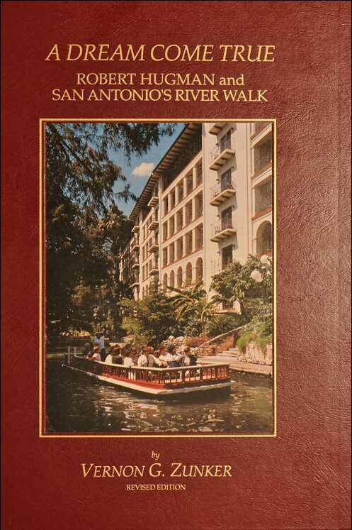
21 Vernon Zunker s book is an excellent resource if you want to know more about the River Walk. The End Enjoy the River Walk now that you know some of the behind the scenes features that have made it happen. 41 (advances automatically) Vernon Zunker s book is an excellent resource if you want to know more about the River Walk. The End Enjoy the River Walk now that you know some of the behind the scenes features that have made it happen. 42 (advances automatically) 21
SAN ANTONIO RIVER IMPROVEMENTS PROJECT. August 6, 2008
 SAN ANTONIO RIVER IMPROVEMENTS PROJECT August 6, 2008 1 History of the SA River Improvements 1921 Flood Olmos Dam Complete in 1929 Downtown Flood Relief Projects in 1950 s Dams on the River Channel and
SAN ANTONIO RIVER IMPROVEMENTS PROJECT. April 27, 2009
 SAN ANTONIO RIVER IMPROVEMENTS PROJECT April 27, 2009 1 Project Limits 2 Project Partners City of San Antonio Provides project funding for project amenities (i.e.. Sidewalks, Landscaping, Lighting, etc.)
Agenda Report. Spruce Street Outlet Drainage Improvements Tower Road Relief Sewer
 Agenda Report Subject: Prepared By: Spruce Street Outlet Drainage Improvements Tower Road Relief Sewer Steven M. Saunders, Director of Public Works/Village Engineer Date: August 12, 2012 On March 8, 2012
Welcome KROSNO CREEK DIVERSION PROJECT CLASS ENVIRONMENTAL ASSESSMENT
 Welcome KROSNO CREEK DIVERSION PROJECT PUBLIC INFORMATION CENTRE # 1 Tonight s Presentation Study Overview Background Existing Conditions Alternative Solutions Preliminary Preferred Solution Next Steps
SECTION 3 GENERAL DESCRIPTION OF THE RIVER BASIN
 SECTION 3 GENERAL DESCRIPTION OF THE RIVER BASIN SECTION 3 GENERAL DESCRIPTION OF THE RIVER BASIN River basin description. A general description of the river basin or subbasin, as appropriate, in which
OFFICE SPACE AVAILABLE FOR LEASE AT 126 GONZALES STREET LONE STAR HOTEL ST. PAUL SUNSET STATION IN SAN ANTONIO, TEXAS 78205
 GONZALES STREET LONE STAR HOTEL ST. PAUL SQUARE @ SUNSET STATION IN SAN ANTONIO, TEXAS 780 PROJECT HIGHLIGHTS Gonzales Street is an historic building originally built as a residential hotel. It enjoys
Background Research and Field Monitoring of Riverwalk Stalls, Downtown San Antonio, Texas
 Index of Texas Archaeology: Open Access Gray Literature from the Lone Star State Volume 1990 Article 9 1990 Background Research and Field Monitoring of Riverwalk Stalls, Downtown San Antonio, Texas I.
OFFICE SPACE AT 1160 EAST COMMERCE STREET ST. PAUL SUNSET STATION IN SAN ANTONIO, TEXAS 78205
 0 EAST COMMERCE STREET ST. PAUL SQUARE @ SUNSET STATION IN SAN ANTONIO, TEXAS 780 PROJECT HIGHLIGHTS 0 East Commerce is a multi-level historic building in the heart of St. Paul Square. St. Paul Square
OFFICE SPACE AT 1160 EAST COMMERCE STREET ST. PAUL SUNSET STATION IN SAN ANTONIO, TEXAS 78205
 0 EAST COMMERCE STREET ST. PAUL SQUARE @ SUNSET STATION IN SAN ANTONIO, TEXAS 780 PROJECT HIGHLIGHTS 0 East Commerce is a multi-level historic building in the heart of St. Paul Square. St. Paul Square
RETAIL SPACE AVAILABLE FOR LEASE AT 1167 EAST COMMERCE STREET ST. PAUL SUNSET STATION IN SAN ANTONIO, TEXAS 78205
 7 EAST COMMERCE STREET ST. PAUL SQUARE @ SUNSET STATION IN SAN ANTONIO, TEXAS 780 PROJECT HIGHLIGHTS 7 East Commerce is an historic building which enjoys a direct line of site to Sunset Station in the
Final Drainage Letter Pikes Peak Community College Downtown Parking Lot Colorado Springs, Colorado
 Final Drainage Letter Pikes Peak Community College Downtown Parking Lot Colorado Springs, Colorado Prepared for: Pikes Peak Community College 5775 South Academy Boulevard Colorado Springs, CO 80906-5422
PARK BRAD KAUFMAN LARRY MENDEZ
 TRAVIS TRAVIS LEASING INFORMATION BRAD KAUFMAN 210.253.2922 LARRY MENDEZ 210.253.2924 brad.kaufman@transwestern.com larry.mendez@transwestern.com N Saint Marys St TRAVIS BRAD KAUFMAN 210.253.2922 brad.kaufman@transwestern.com
National Society of Professional Engineers. Charles S. Carnaggio, PE Project Director July 2, 2014
 National Society of Professional Engineers Charles S. Carnaggio, PE Project Director July 2, 2014 Phase 1 Opening Date: July 26, 2014 Dulles Corridor Metrorail Project At-a-Glance Seamless integration
Registration and Housing Form
 Registration Fees ADA Member Dentists and Dental Students ADA Nonmember Dentists and ASDA Nonmember Dental Students Dental Team By Sept. 5, After Sept. 5, 5 p.m. CDT 5 p.m. CDT ADA Member Dentist $90 $180
Principle Causes of Dam Failures. Structural failure. Cracking. Stability failure. BIA Summer Water Resources Training Dam Safety Inspections
 BIA Summer Water Resources Training Dam Safety Inspections Principle Causes of Dam Failures Part 2 Dam Failures July 28, 2012 Presented by Michael Johnson, Ph.D., P.E. Overtopping Structural failure Stability
Trail Phasing Plan. Note: Trails in the Clear Creek Canyon area (Segments will be finalized in the future to minimize wildlife impacts
 Note: Trails in the Clear Creek Canyon area (Segments 2 5 and a future JCOS connection) will be finalized in the future to minimize wildlife impacts Trail Phasing Plan P Parking 3 Easy Trail Intermediate
OFFICE SPACE AVAILABLE FOR LEASE AT EAST COMMERCE STREET ST. PAUL SUNSET STATION IN SAN ANTONIO, TEXAS 78205
 PROJECT HIGHLIGHTS East Commerce is a multi-level historic building in the heart of St. Paul Square. St. Paul Square is an historic 0 acre dining, entertainment and event complex in downtown San Antonio,
CITY OF SAN ANTONIO RIVER BARGE DESIGN COMPETITION UPDATED 11/19/2015
 CITY OF SAN ANTONIO RIVER BARGE DESIGN COMPETITION UPDATED 11/19/2015 BACKGROUND The City of San Antonio is the seventh largest city in the United States. A large city with a small town feel, San Antonio
Common Ground Drainage Channel Diversion. Design Report
 Common Ground Drainage Channel Diversion Design Report Resource Management International Inc Consulting Engineers May 2017 COMMON GROUND DRAINAGE CHANNEL DIVERSION PREPARED FOR: QUILL LAKES WATERSHED NO.
Guide to the L. F. Manis Photographs
 This finding aid was produced using ArchivesSpace on February 29, 2016. English 2016 The Regents of the University of Nevada. All rights reserved. University of Nevada, Las Vegas. University Libraries.
Guide to the L. F. Manis Photographs
 This finding aid was created by Lindsay Oden on February 27, 2018. Persistent URL for this finding aid: http://n2t.net/ark:/62930/f1vk60 2018 The Regents of the University of Nevada. All rights reserved.
SPLASH PAD EVALUATION SUMMARY REPORT January 2016
 Public Utility District No. 1 of Chelan County Public Power Benefit Recreation and Parks Phase: Pre-feasibility For full report, refer to Appendix A SPLASH PAD EVALUATION SUMMARY REPORT January 2016 Photo
The Mississippi River Commission. History of the Management of the Mississippi River. US Army Corps of Engineers BUILDING STRONG
 The Mississippi River Commission History of the Management of the Mississippi River US Army Corps of Engineers US Army Corps of Engineers Presentation Outline Overview of Mississippi River History of Mississippi
San Antonio Channel Improvement Project MISSION REACH ECOSYSTEM RESTORATION PROJECT. Welcome Assistant Secretary (CW) Jo-Ellen Darcy December 8, 2009
 Jo-Ellen Darcy December 8, 2009") San Antonio Channel Improvement Project MISSION REACH ECOSYSTEM RESTORATION PROJECT Welcome Assistant Secretary (CW) Jo-Ellen Darcy December 8, 2009 1 Presentation Overview Review history of San Antonio
San Antonio Channel Improvement Project MISSION REACH ECOSYSTEM RESTORATION PROJECT Welcome Assistant Secretary (CW) Jo-Ellen Darcy December 8, 2009 1 Presentation Overview Review history of San Antonio
Camping (Primitive) Camping (RV) Electrical Potable Water Grill Established Fire Pit Picnic Table
 Camping (RV) Electrical Potable Water Grill Established Fire Pit Picnic Table") Alden - 9th Road River Mile 777 Map: 38.20833, -98.32031 Managing Agency: Kansas Department of Wildlife, Parks & Tourism Nearest Community: Alden, Rice County Kansas Developed Amenities Provided Parking
Alden - 9th Road River Mile 777 Map: 38.20833, -98.32031 Managing Agency: Kansas Department of Wildlife, Parks & Tourism Nearest Community: Alden, Rice County Kansas Developed Amenities Provided Parking
Downtown San Antonio's. Landmark Building. 314 E. Commerce St San Antonio, Texas 78205
 Downtown San Antonio's Hstoric Landmark Building. 314 E. Commerce St San Antonio, Texas 78205 THE COMMERCE BUILDING is an 8-story historic landmark office building totaling 39,831 square feet located in
Barnsley, Dearne & Dove Canals Trust HS2 Mitigation Options
 Page 1 of 13 Barnsley, Dearne & Dove Canals HS2 Mitigation Options December 2013 Elsecar Branch, Top Pound Prepared by Ulrich Signer, Director, BDDCT Mike Silk, Engineer, BDDCT The Barnsley, Dearne and
WHITE ROCK LAKE HISTORIC TRAIL HIKES. Developed By. Troop 106, Dallas, Tx Revised By Troop 64, Dallas, Tx
 WHITE ROCK LAKE HISTORIC TRAIL HIKES Developed By Troop 106, Dallas, Tx Revised By Troop 64, Dallas, Tx The White Rock Lake Historic Trail Hike was originally developed by Troop 106 as a Texas Sesquicentennial
Minimum Specifications/Questionnaire Bid Results for One (1) New Fuel Dispensing System-Helvetia Shop 12/19/2017
 New Fuel Dispensing System-Helvetia Shop 12/19/2017") Minimum Specifications/Questionnaire Bid Results for One (1) New Fuel Dispensing System-Helvetia Shop 12/19/2017 Winning Bid PERMIT FEES, FORMS, PLANS and NOTIFICATIONS Secure all necessary state and local
Minimum Specifications/Questionnaire Bid Results for One (1) New Fuel Dispensing System-Helvetia Shop 12/19/2017 Winning Bid PERMIT FEES, FORMS, PLANS and NOTIFICATIONS Secure all necessary state and local
Susan Jones Moses Susan Jones Moses and Associates Glen Weisbrod Economic Development Research Group
 Susan Jones Moses Susan Jones Moses and Associates Glen Weisbrod Economic Development Research Group 2 SHRP2 C03: Interactions between Transportation Capacity, Economic Systems, and Land Use Economic Development
POSTCARDS AND OLD PHOTOS OF THE PARK ERA, The Midway
 POSTCARDS AND OLD PHOTOS OF THE PARK ERA, 1885-1911 The majority of these photographs appear to have been taken during the latter period of the park, circa 1905 to 1911. The Midway A lovely afternoon at
Acres Monterey County, California OPEN GROUND IN SALINAS VALLEY VEGETABLE AND STRAWBERRY PROPERTY
 324 +- Acres Monterey County, California OPEN GROUND IN SALINAS VALLEY VEGETABLE AND STRAWBERRY PROPERTY EXCLUSIVELY PRESENTED BY: Morris Garcia License 00834407 (559) 994-7453 Cell Sarah Donaldson License
Difficult Run Stream Valley Park
 Difficult Run Stream Valley Park The more intense mountain bikers have known about for Difficult Run for some time. Equestrians have known it longer. Eight miles of unpaved trail, the Rails to River Trail
1 PROJECT STATUS UPDATE 2 ND CONCESSION FROM BRISTOL ROAD TO DOANE ROAD TOWNS OF EAST GWILLIMBURY AND NEWMARKET
 Report No. 3 of the Regional Council Meeting of March 28, 2013 1 PROJECT STATUS UPDATE 2 ND CONCESSION FROM BRISTOL ROAD TO DOANE ROAD TOWNS OF EAST GWILLIMBURY AND NEWMARKET The recommends: 1. Receipt
MIAMI RIVER COMMISSION
 COMMISSION July 13, 2015 CG LLC L-0 1.1 PROJECT TEAM OWNERSHIP CG, LLC 3200 STIRLING ROAD HOLLYWOOD, FL 33021 ARCHITECT KOBI KARP AND 2915 BISCAYNE BLVD SUITE 200 MIAMI, FL 33137 ER CG LLC ROMAN AND WILLIAMS
illing Era power for our society, in this age of alternate forms of energy, falling water may seem like a quaint old-fashioned way to power a mill.
 Saint Anthony Falls Historic Walking Tour The tour starts at the Father Hennepin Park sign shown below, a half block south of the intersection of SE Main Street and SE 3 rd Avenue on the east side of the
A-1.2. THE SCENE in Palm Springs 777 E. TAHQUITZ CANYON WAY PALM SPRINGS, CA WILLIAM AZZALINO ARCHITECT, LLC ICONIC ARCHITECTURE
 WILLIAM AZZALINO ARCHITECT, LLC ICONIC ARCHITECTURE 2407 PORT WHITBY NEWPORT BEACH, CA 92660 949.903.4033 TEL 949.721.4144 FAX THE SCENE in Palm Springs 777 E. TAHQUITZ CANYON WAY PALM SPRINGS, CA COMMERCIAL
The Galveston Seawall
 Coastal and Ocean Engineering ENGI.8751 Undergraduate Student Forum Faculty of Engineering and Applied Science, Memorial University, St. John s, NL, Canada. March, 2013 The Galveston Seawall Mark Harvey
Cofferdam Performance Hurricanes Harvey & Irma
 Cofferdam Performance Hurricanes Harvey & Irma - 2017 Greg Hammer Senior Geotechnical Engineer CELRH-DSPC-GS DSMMCX Third Workshop on Case Histories in Dam Safety Risk-Informed Decision Making 2018 USSD
HARP AUTHORITY GATEWAY CENTER BOATHOUSE & CHANNEL EXTENSION TO SANTA FE AVENUE. Pueblo City Council Presentation September 17, 2018
 HARP AUTHORITY GATEWAY CENTER BOATHOUSE & CHANNEL EXTENSION TO SANTA FE AVENUE Pueblo City Council Presentation September 17, 2018 PROJECT: 1A HARP Expansion FUNDING 1A Ballot Issue Pueblo County : $3,000,000
Local Information Page 1 of 9 Version 3 - August 21, 2013
 Local Information Page 1 of 9 LoneStarCon 3 August 29 September 2, 2013 LOCAL INFORMATION This document provides information on local amenities and services convenient to the convention site. This includes:
Flood History. Floodplain Descriptions
 Flood History The worst flooding in the area took place in 1966, 1969, 1971, 1995 and 1998. The storms in 1966 and 1969 caused considerable damage throughout the area due to flooding, erosion and debris
A. CONCLUSIONS OF THE FGEIS
 Chapter 11: Traffic and Parking A. CONCLUSIONS OF THE FGEIS The FGEIS found that the Approved Plan will generate a substantial volume of vehicular and pedestrian activity, including an estimated 1,300
Shark Guard SGK1 Installation
 Shark Guard SGK1 Installation for riving knife based saws These instructions apply to numerous brand and model saws that we make guards for. This information is fairly generic and good for all those saws.
Photographic Log Client: Project Number: Site Location: Site Name: Photograph ID: Date: Location: Direction: Comments: Photograph ID:
 Photograph ID: 1 west View of one of the monitoring well and the large parking lot on the south side of Center Street. Photograph ID: 2 Monitoring well located in the middle of the parking lot located
Historic Highway Advisory Committee To Meet in The Dalles
 In This Issue Get Involved Highway Gets Major Endorsement New Life for the Old Road Bike Pods and Hubs Time Travel on the Historic Highway Gorge Ride 2014 The Historic Columbia River Highway News is your
1/18/07 Day 4 This was one of the highlight days of the cruise when we will pass through the Panama Canal. Our route will take us from the Caribbean
 1/18/07 Day 4 This was one of the highlight days of the cruise when we will pass through the Panama Canal. Our route will take us from the Caribbean Sea south to the Pacific Ocean through the locks, Gatun
Greene Park Historic Walking Tour
 Greene Park Historic Walking Tour Created by Weston J. Myers 2015 Joint Base Lewis-McChord History of Greene Park In 1917, Major General Henry A. Greene had an idea to create an amusement park to provide
PORTISHEAD BRANCH LINE PRELIMINARY ENVIRONMENTAL INFORMATION REPORT VOLUME 4 APPENDIX Water Receptors
 PORTISHEAD BRANCH LINE PRELIMINARY ENVIRONMENTAL INFORMATION REPORT APPENDIX 17. 3 Water Receptors Contents Section Page 1 Water Receptors... 1-1 1.1 Surface Water Features/Receptors in the Study Area
COMMUNITY MEETING NOVEMBER 1, Wheaton Regional Park Pine Lake Trail
 COMMUNITY MEETING NOVEMBER 1, 2012 MEETING AGENDA I. Introduction of Project Team II. Trail Renovation Process III. Wheaton Regional Park IV. Pine Lake Trail Renovation Project V. Comments and Questions
DRAFT. Dorabelle Campground Rehabilitation
 DRAFT Dorabelle Campground Rehabilitation September 2012 1.1 REGIONAL SETTING AND PROJECT LOCATION The Dorabelle Campground is located on the western shore of Shaver Lake in Fresno County, California (Section
Historic NIAGARA S SOUTH COAST. Welland Canal. History of the Welland Canal in Port Colborne. Uncharted Unexpected.
 Historic NIAGARA S SOUTH COAST Welland Canal History of the Welland Canal in Port Colborne Uncharted Unexpected www.portcolborne.ca The Welland Canal was originally established as solution to summer water
ARCHAEOLOGICAL MONITORING OF THE ASHBY STREET DRAINAGE PROJECT, SAN ANTONIO, BEXAR COUNTY, TEXAS
 ARCHAEOLOGICAL MONITORING OF THE ASHBY STREET DRAINAGE PROJECT, SAN ANTONIO, BEXAR COUNTY, TEXAS Anne A. Fox and I. Waynne Cox / Center for Archaeological Research The University of Texas at San Antonio
II. THE BOULDER CREEK DRAINAGE BASIN
 II. THE BOULDER CREEK DRAINAGE BASIN This section provides an overview of the watersheds and flood hazards associated with Boulder Creek and South Boulder Creek including descriptions of the drainage basins,
01T_ODD2_DCH 01T_ODD3_ARN
 01T_ODD2_DCH Duck Pond Agricultural Drains / Mugu Drain / Oxnard Drain No. 2. The monitoring site is located on an agricultural drain just south of Hueneme Road near the Duck Ponds. Flow from this drain
The combined Planning and Zoning and Council Meeting was called to order at 7:00 p.m.
 Lake Remediation Master Plan The combined Planning and Zoning and Council Meeting was called to order at 7:00 p.m. Roll Call: Councilman Joe Curl, Councilwoman Tiffany Hughes, Councilwoman Lori Howard,
Day 6 Panama Canal Transit 3/7/2012
 Day 6 Panama Canal Transit 3/7/2012 The Panama Canal joins the Atlantic and Pacific oceans and is a key route for international maritime trade. One of the largest and most difficult engineering projects
Mt Rushmore, Grand Tetons & Yellowstone 8 Days from $1295
 1 800 422 3727 Mt Rushmore, Grand Tetons & Yellowstone 8 Days from $1295 Itinerary Day 1 Rapid City, South Dakota See some of America s grandest sights Your western adventure begins in Rapid City, South
TORONTO TRANSIT COMMISSION REPORT NO.
 Form Revised: February 2005 TORONTO TRANSIT COMMISSION REPORT NO. MEETING DATE: October 29, 2009 SUBJECT: TORONTO-YORK SPADINA SUBWAY EXTENSION PROJECT STEELES WEST STATION APPROVAL OF CONCEPTUAL DESIGN
FY20 BUDGET PRESENTATION
 FY20 BUDGET PRESENTATION Mission Statement: To provide for diverse recreational opportunities and amenities that enhance the quality of life for our residents and visitors to the City of Frederick through
4180 acre-feet minimum conservation pool
 MEMORANDUM Subject: Bear River Basin Plan SULPHUR CREEK RESERVOIR Date: July 20, 2000 Location: Section 34, Township 14N, Range 119W. Located on Sulphur Creek, tributary to the Bear River. Located approximately
Design and Construction of the Lake St. Martin Emergency Outlet
 Design and Construction of the Lake St. Martin Emergency Outlet Background 2011 was the largest flood event experienced in the last 200 years Flood Fighting required some difficult decisions by the Manitoba
Survey of Rodman Reservoir and middle-ocklawaha River springs during spring 2008 draw-down conditions: FWC and FWS
 Survey of Rodman Reservoir and middle-ocklawaha River springs during spring 2008 draw-down conditions: FWC and FWS Date of Survey: February 26, 2008 Survey conducted by: Dawn Jennings, USFWS Nicole Adimey,
Summary. River and way from. River and through the. goods from. Chicago. Ship Canal. Grade Level: 7 th. 8 th. historic time. of the.
 Chicago River Classroom Activity Summary Students will construct a time line using events from U.S. and Illinois History. Then they will attempt to place events particular to the history of the Chicago
MP : Blue Hill and the Disney Avalanche Path
 MP 252-253: Blue Hill and the Disney Avalanche Path This section of the Auto Tour includes a portion of the wagon road, one of Colorado s most famous avalanches and the remains of an old dam. Route Mile
Phoenix Habitat Restoration Projects
 Phoenix Habitat Restoration Projects Spur Cross Ranch Cave Creek (Estergard) Regional Tree and Shade Summit March 9, 2010 Desert Riparian Ecosystems Healthy riparian areas like this once existed along
Canal Winchester. Town Hall 10 North High Street Canal Winchester, OH Meeting Minutes. Monday, August 14, :00 PM
 Canal Winchester Town Hall 10 North High Street Canal Winchester, OH 43110 Meeting Minutes Monday, August 14, 2017 7:00 PM Planning and Zoning Commission Bill Christensen Chairman Michael Vasko Vice Chairman
1100 EAST HOUSTON STREET Office/Retail Opportunity Steps from the CBD. CONTACT DREW SMITH
 1100 EAST HOUSTON STREET Office/Retail Opportunity Steps from the CBD FOR LEASE Located steps from the Alamo, Hemisfair Park, and the rest of downtown San Antonio, 1100 East Houston Street is perfect for
Kurobegawa No.4 Power Plant Toyama Prefecture, Japan (Asia)
") IEA Hydropower Implementing Agreement Annex VIII - Hydropower Good Practices: Environmental Mitigation Measures and Benefits Case Study 14-02: Development of Regional Industries Kurobegawa No.4 Power Plant,
IEA Hydropower Implementing Agreement Annex VIII - Hydropower Good Practices: Environmental Mitigation Measures and Benefits Case Study 14-02: Development of Regional Industries Kurobegawa No.4 Power Plant,
WELCOME! TSPE DFW MID-CITIES. January Chapter Meeting
 WELCOME! TSPE DFW MID-CITIES Check-in/Networking Announcements / Lunch Service Speaker Presentation 11:30AM 12:00PM 12:00PM 12:15PM 12:15PM 1:00PM January Chapter Meeting Thank You to Our Sponsors Interested
Great Basin Drive, Yosemite to Las Vegas (C18A-3)
") Great Basin Drive, Yosemite to Las Vegas (C18A-3) After finishing up with the California parks, I left Yosemite and entered the Great Basin, which spans a large area east of the Sierra Nevada mountains
Great Basin Drive, Yosemite to Las Vegas (C18A-3) After finishing up with the California parks, I left Yosemite and entered the Great Basin, which spans a large area east of the Sierra Nevada mountains
A Brief Overview of the Rio Grande Compact 04/26/06
 A Brief Overview of the Rio Grande Compact 04/26/06 The New Mexico Interstate Stream Commission Investigate, Protect, Conserve, and Develop the State s Waters and Stream Systems Negotiate and Administer
Exhibitor Hosted Block / Affiliate Event Policies & Guidelines
 Exhibitor Hosted Block / Affiliate Event Policies & Guidelines The RIMS 2018 Annual Conference & Exhibition hotels offer not only premium amenities, discounted rates and the best networking opportunities,
Duncan Hastie, P.E. Dewberry
 FEMA s Riverine High Water Marks for Atlanta s September 2009 Flood Event Duncan Hastie, P.E. Dewberry Background High Water Mark Recovery Performed Through FEMA s Hazard Mitigation Technical Assistance
Ambitious $40 million Saco Island project could reshape
 Ambitious $40 million Saco Island project could reshape community Ambitious $40 million Saco Island project could reshape community www.pressherald.com /2017/07/24/ambitious-development-eyed-for-saco-island/
Summary. Kvaerner s Investigation Report. Fatal accident at Stord, Norway 7 March / 5
 Summary Kvaerner s Investigation Report Fatal accident at Stord, Norway 7 March 2015 1 / 5 Summary of Kvaerner s internal Investigation Report of the fatal accident at Stord 7 March 2015 Background Kvaerner
Index to Major Southern Pacific Company Files of importance
 Abbreviations used Meaning of Series Codes used: AUD Audit; DE Division of Engineer; GCA General Claim Agent; GFA General Freight Agent; GPA General Passenger Agent; GSO General Superintendent s Office;
Plaza Park, Village Park, and Community Clubhouse
 Plaza Park, Village Park, and Community Clubhouse Agenda Introduction (10 minutes) Presentation (30 minutes) Project Background Master Plan Process Site History and Context Site Analysis User Group Summary
Martin Young (870) Roddy Thrasher (870)
 Roddy Thrasher (870)") Moore Road Great Dane Drive Nestle Way Subject Property Craighead County Shop Army Reserve National Guard Center 19.1+/- Acres in Industrial Park Nestle Road, Nestle Way & Cottage Home Trail Jonesboro
Moore Road Great Dane Drive Nestle Way Subject Property Craighead County Shop Army Reserve National Guard Center 19.1+/- Acres in Industrial Park Nestle Road, Nestle Way & Cottage Home Trail Jonesboro
Project Update Utah Water Users Workshop March 14, 2012
 Project Update Utah Water Users Workshop March 14, 2012 Jeffrey D. Budge, P.E. Operations and Engineering Manager Steven H. Cain Facilities and Lands Manager Organized in 1935 Deer Creek Division of the
Bear Creek Habitat Improvement Project
 06/10/10 Bear Creek Habitat Improvement Project El Paso County, Colorado Pike National Forest and Colorado Springs Utilities Owned Land Report prepared by: Eric Billmeyer Executive Director Rocky Mountain
John Hart Generating Station Replacement Project. October 2018 Community Construction Update Report #64
 John Hart Generating Station Replacement Project October 2018 Community Construction Update Report #64 Prepared by: Stephen Watson, BC Hydro (O) 250-755-4795 or (C) 250-616-9888 Twitter: @Puntledge Email:
Version Isolated & Non-Waters Only 1 of 3
 APPROVED JURISDICTIONAL DETERMINATION FORM U.S. Army Corps of Engineers SECTION I: BACKGROUND INFORMATION A. REPORT COMPLETION DATE FOR APPROVED JURISDICTIONAL DETERMINATION (JD): July 6, 2010. B. DISTRICT
RAAF Radschool Association Magazine Vol 23 Page 12
 RAAFTUS Ian Champion, who was on 26RAC and 80RTC sent us this photo - he says "Mick Ryan put me onto your magazine, it s great to be able to 'catch up' with a few old faces. You might like to use the attached
Natural Factors Affecting the Level of Osoyoos Lake
 Natural Factors Affecting the Level of Osoyoos Lake Background Osoyoos Lake is operated under conditions prescribed by the International Joint Commission (IJC) and Figure 1 shows the ranges within which
PROCEEDINGS OF THE ST. CLOUD HERITAGE PRESERVATION COMMISSION
 PROCEEDINGS OF THE ST. CLOUD HERITAGE PRESERVATION COMMISSION A meeting of the St. Cloud Heritage Preservation Commission was held on February 23, 2010, at 7 p.m. in the St. Cloud City Hall Council Chambers.
DD FORM 3009, FEB 2016 REPLACES DA FORM 1247, WHICH IS OBSOLETE. Page 1 of 6 Pages Adobe Professional X
 ROUTE CLASSIFICATION For use of this form, see ATP 3-34.81/MCWP 3-17.4; the proponent agency is TRADOC. SECTION I 1. SERIAL NUMBER 2. TO 3. FOR INFORMATION 4. DATE/TIME GROUP 5. NUMBER OF SHEETS OR ENCLOSURES
Sound Transit. Tunnels and Underground Structures Committee January 24, 2011
 Sound Transit 1 Tunnels and Underground Structures Committee January 24, 2011 Presentation Outline Overview of ST Construction Completed to date ST2 Plan Summary Construction Underway Commuter Rail Facilities
China Creek North Park Upgrades and Glen Pump Station. Park Board Committee Meeting Monday, July 10, 2017
 China Creek North Park Upgrades and Glen Pump Station Park Board Committee Meeting Monday, July 10, 2017 Purpose The purpose of this presentation is to: Share the results of the public engagement processes;
Parks & Recreation Areas Program
 PARKS & RECREATION Parks & Recreation Areas Program As part of its mission to conserve and protect natural resources, the Upper Big Blue Natural Resources District (NRD) has been involved in several large-scale
ROSEVILLE INNOVATION PARK 8040 FOOTHILLS BOULEVARD, ROSEVILLE CA ±160,000 SQUARE FEET AVAILABLE
 ROSEVILLE INNOVATION PARK 8040 FOOTHILLS BOULEVARD, ROSEVILLE CA ±160,000 SQUARE FEET AVAILABLE ROSEVILLE INNOVATION PARK As one of the premier submarkets in the Greater Sacramento region, Roseville offers
Railway-Highway Crossing at Grade Regulations: Guidelines for British Columbia s Provincial Heritage Railways
 Railway-Highway Crossing at Grade Regulations: Guidelines for British Columbia s Provincial Heritage Railways SHORT TITLE 1. These Guidelines may be cited as the Railway-Highway Crossing at Grade Guidelines.
ASLA 2011 Annual Meeting San Diego
 ASLA 2011 Annual Meeting San Diego FS15 Balboa Park A Walking Tour of Planning and Design Issues The 100th anniversary of the Panama-California Exposition that launched this park is 2015, yet the site
TUPPER DESIGNATED ACCESS ROUTE
 TUPPER DESIGNATED ACCESS ROUTE 1 FOR ACCESS/EGRESS TO CONNAUGHT, LOOKOUT, STONE ARCH, PORTAL PATHS AND TUPPER TRAVERSE EGRESS Length: 2.6km Vertical Gain: +162m / -83m (Values are for access. For egress,
Gateway Center. Gateway Center > Amenities. Gateway Center > Area Amenities. Dining. Entertainment. Sports & Fitness PITTSBURGH, PA 15222
 Gateway Center Gateway Center > Amenities > Eddie Merlot s Upscale Restaurant Lobby of 444 Liberty Avenue (Four Gateway Center) Now Open > Crazy Mocha Coffee Company Lobby of One Gateway Center & 444 Liberty
Fire Station No. 1 Presentation MAY 16, 2016
 Fire Station No. 1 Presentation MAY 16, 2016 AGENDA Background Alternatives Schedule Cost Direction moving forward 2 COUNCIL DIRECTION LOCATION OPTION Existing station Parking lot STATION OPTIONS (7 9
Pump Stations...more than just pumps
 Task Force Hope Status Report Newsletter March 13, 2013 Pump Stations...more than just pumps Photo by Jerry Baggett Pump Station 11, Algiers Canal Repairs and Fronting Protection Repaired pump stations
4 VIVA PHASE 2 YONGE STREET - Y2, AND HIGHWAY 7 - H3 CORRIDORS PRELIMINARY ENGINEERING UPDATE
 4 VIVA PHASE 2 YONGE STREET - Y2, AND HIGHWAY 7 - H3 CORRIDORS PRELIMINARY ENGINEERING UPDATE The Rapid Transit Public/Private Partnership Steering Committee recommends the following: 1. The presentation
Bayshore Boulevard: A Brief Look at its Historic Past
 Sunland Tribune Volume 20 Article 8 1994 Bayshore Boulevard: A Brief Look at its Historic Past Charles A. Brown Follow this and additional works at: http://scholarcommons.usf.edu/sunlandtribune Recommended
NAIOP. Marcia McAllister Metropolitan Washington Airports Authority
 NAIOP Marcia McAllister Metropolitan Washington Airports Authority 1 The Vision Realized Northern Virginia Today Tysons Corner is the largest employment center in the Commonwealth Larger than central business