Camping (Primitive) Camping (RV) Electrical Potable Water Grill Established Fire Pit Picnic Table
|
|
|
- Julius Andrews
- 5 years ago
- Views:
Transcription
 Showers")
 Strong Currents Navigational Hazards Low-Head Dam Motorized")
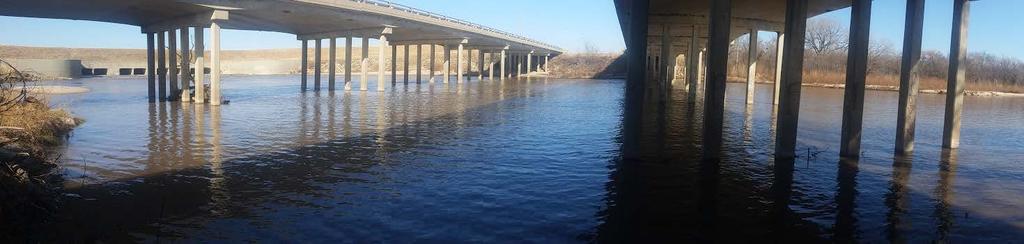
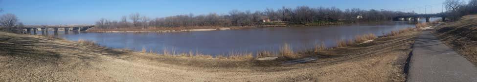
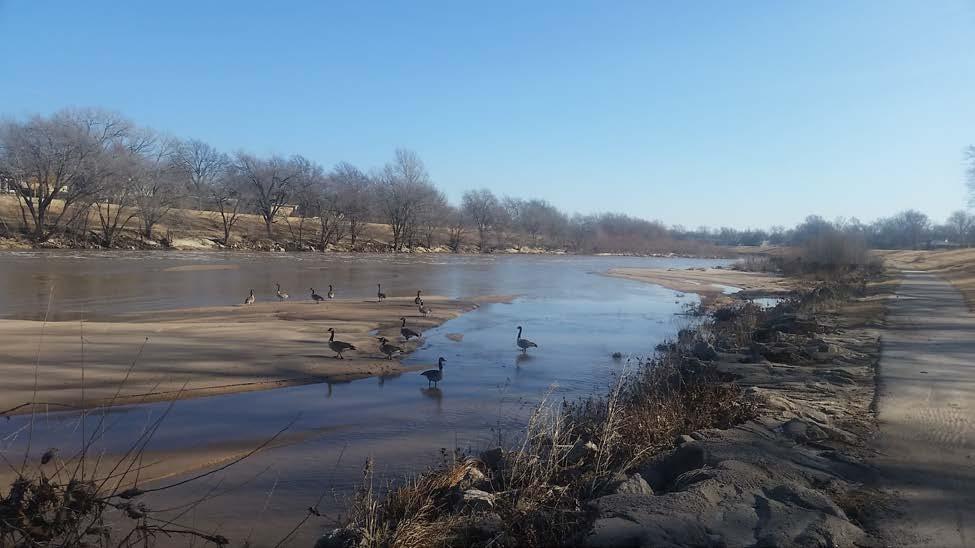
1 Alden - 9th Road River Mile 777 Map: , Managing Agency: Kansas Department of Wildlife, Parks & Tourism Nearest Community: Alden, Rice County Kansas Developed Amenities Provided Parking Trailer Parking Toilet(s) Showers Changing Rooms Trash Receptacle Camping (Primitive) Camping (RV) Electrical Potable Water Grill Established Fire Pit Picnic Table Information Kiosk Education/Interpretive signs Directional/Regulatory Signs Bench Visitor Center Potential limitations or sensitivities of this site: (check all that apply) Strong Currents Navigational Hazards Low-Head Dam Motorized Boat Traffic Hazard Trees Sudden Water Level Changes Presence of ANS Presence of T&E Species Presence of Critical Habitat Sensitive Nesting Area


2 Landing Conditions: (check all that apply) Boat Dock Road Bridge Muddy Shore Sandy Shore Rocky Shore Grassy Shore Steep Grade Gradual Grade Additional Facility Notes: This access point is made possible through a partnership with a private landowner through an agreement with the KDWPT. The Raymond access point is 9 miles upstream, and the Sterling access point is just 3 miles downstream. Additional Site Photos:
 Showers Changing Rooms")
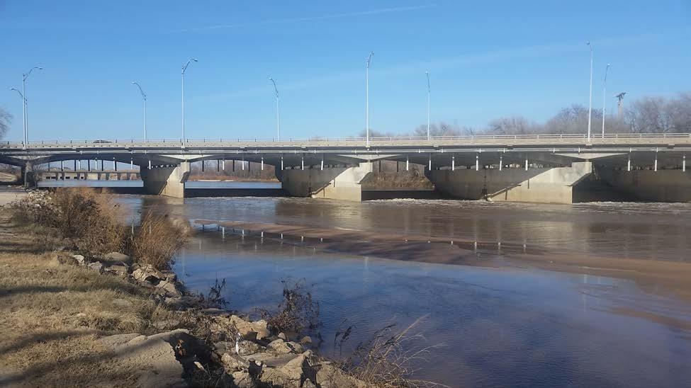
3 Arkansas City - Chestnut Street River Mile 638 Map: , Managing Agency: City of Arkansas City, Kansas Nearest Community: Arkansas City, Cowley County Kansas Developed Amenities Provided Parking Trailer Parking Toilet(s) Showers Changing Rooms Trash Receptacle Camping (Primitive) Camping (RV) Electrical Potable Water Grill Established Fire Pit Picnic Table Information Kiosk Education/Interpretive signs Directional/Regulatory Signs Bench Visitor Center Potential limitations or sensitivities of this site: (check all that apply) Strong Currents Navigational Hazards Low-Head Dam Motorized Boat Traffic Hazard Trees Sudden Water Level Changes Presence of ANS Presence of T&E Species Presence of Critical Habitat Sensitive Nesting Area Landing Conditions: (check all that apply)


4 Boat Dock Road Bridge Muddy Shore Sandy Shore Rocky Shore Grassy Shore Steep Grade Gradual Grade Additional Facility Notes: This site is relatively primitive and is located adjacent to a bridge that is condemned to vehicle traffic. Access to the gated/locked boat ramp for motorized and air boats is limited with permission from the city and to emergency personnel, but carry-in boats are allowed. Parking is limited, but this site is located along the paved walking and biking path maintained by the city. An additional access point is being planned just downstream as the highway 166 crosses the river that will provide additional parking and access to the trail. Additional Site Photos:
 Showers Changing Rooms")
 Strong Currents Navigational Hazards Low-Head Dam Motorized Boat Traffic Hazard Trees Sudden Water Level")
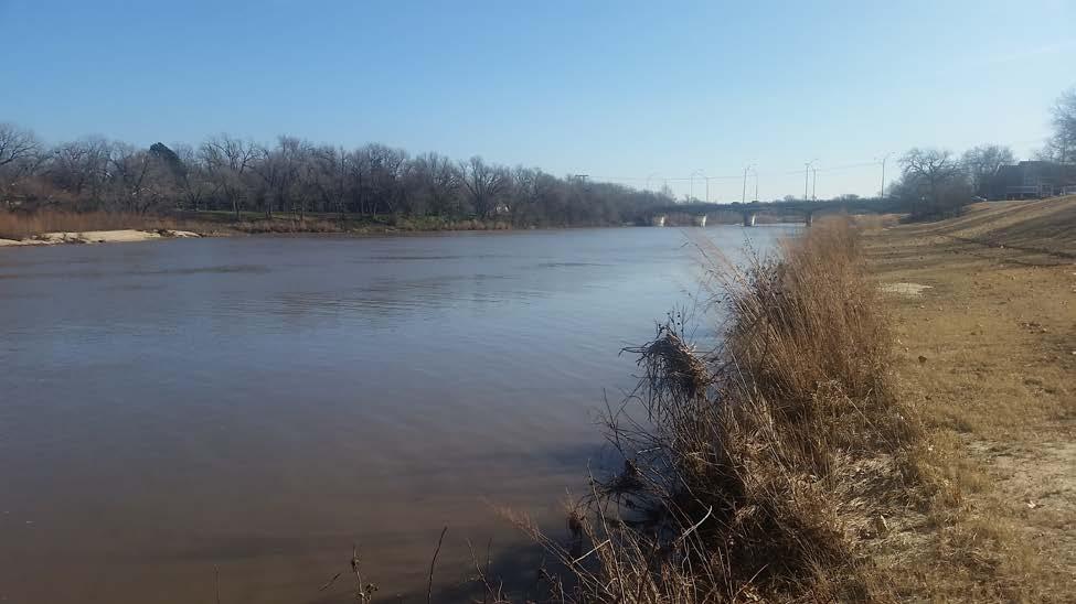
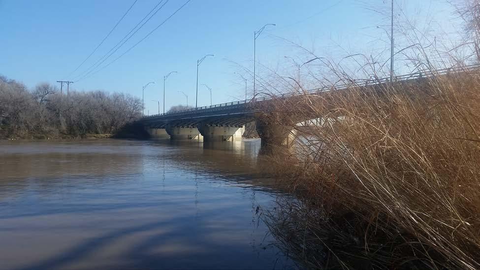
5 Arkansas City - Walnut River Map: , Managing Agency: City of Arkansas City, Kansas Nearest Community: Arkansas City, Cowley County Kansas Developed Amenities Provided Parking Trailer Parking Toilet(s) Showers Changing Rooms Trash Receptacle Camping (Primitive) Camping (RV) Electrical Potable Water Grill Established Fire Pit Picnic Table Information Kiosk Education/Interpretive signs Directional/Regulatory Signs Bench Visitor Center Potential limitations or sensitivities of this site: (check all that apply) Strong Currents Navigational Hazards Low-Head Dam Motorized Boat Traffic Hazard Trees Sudden Water Level Changes Presence of ANS Presence of T&E Species Presence of Critical Habitat Sensitive Nesting Area Landing Conditions: (check all that apply) Boat Dock Road Bridge Muddy Shore Sandy Shore Rocky Shore Grassy Shore Steep Grade Gradual Grade


6 Additional Facility Notes: This access site provides for the start of an interesting alternative float on the southern portion of the Walnut and Arkansas Rivers. Located in the Walnut park, there are restrooms and picnic facilities. The Kaw Wildlife Area access point on the Walnut river is 1.5 miles downstream. Continuing from there, the Walnut converges with the Arkansas River, and the Lower Grouse Creek access point is approximately 9 total miles downstream at the confluence of Grouse Creek and the Arkansas River. Additional Site Photos:

 Showers Changing")

7 Burley Bend River Mile 670 Map: , Managing Agency: Kansas Department of Wildlife, Parks & Tourism, Kansas Wildscape Foundation Nearest Community: Belle Plaine, Sumner County Kansas Developed Amenities Provided Parking Trailer Parking Toilet(s) Showers Changing Rooms Trash Receptacle Camping (Primitive) Camping (RV) Electrical Potable Water Grill Established Fire Pit Picnic Table Information Kiosk Education/Interpretive signs Directional/Regulatory Signs Bench Visitor Center


8 Potential limitations or sensitivities of this site: (check all that apply) Strong Currents Navigational Hazards Low-Head Dam Motorized Boat Traffic Hazard Trees Sudden Water Level Changes Presence of ANS Presence of T&E Species Presence of Critical Habitat Sensitive Nesting Area Landing Conditions: (check all that apply) Boat Dock Road Bridge Muddy Shore Sandy Shore Rocky Shore Grassy Shore Steep Grade Gradual Grade Additional Facility Notes: This site is made possible through an agreement with the landowner, the Kansas Wildscape Foundation and KDWPT. Ample parking is available and the site is well-maintained with access to the river only a few steps from the parking area. Entry onto the river requires navigating a steep and sandy bank. Additional Site Photos:
 Showers Changing Rooms Trash Receptacle")
9 Derby - Washington Street River Mile 686 Map: , Managing Agency: City of Derby, Kansas Nearest Community: Derby, Sedgwick County Kansas Developed Amenities Provided Parking Trailer Parking Toilet(s) Showers Changing Rooms Trash Receptacle Camping (Primitive) Camping (RV) Electrical Potable Water Grill Established Fire Pit Picnic Table Information Kiosk Education/Interpretive signs Directional/Regulatory Signs Bench Visitor Center Potential limitations or sensitivities of this site: (check all that apply) Strong Currents Navigational Hazards Low-Head Dam Motorized Boat Traffic Hazard Trees Sudden Water Level Changes Presence of ANS Presence of T&E Species Presence of Critical Habitat Sensitive Nesting Area Landing Conditions: (check all that apply) Boat Dock Road Bridge Muddy Shore Sandy Shore Rocky Shore Grassy Shore Steep Grade Gradual Grade


10 Additional Facility Notes: This access site is maintained by the City of Derby. Parking is currently the only amenity available, but a new access site called the Warren Riverview Park is currently under construction and will provide a beautiful river-area pavilion, shelter, restrooms, and excellent access to the river for paddling. Restaurants and retailers are located a few blocks from this access site. The Wichita 71st Street access point is 2 miles upstream, and the Burley Bend access is 16 miles downstream from this site. Additional Site Photos:
 Showers Changing Rooms Trash")
11 Ellinwood - Under Development River Mile: 801 Map: , Managing Agency: City of Ellinwood, Kansas Nearest Community: Ellinwood, Barton County Kansas Developed Amenities Provided Parking Trailer Parking Toilet(s) Showers Changing Rooms Trash Receptacle Camping (Primitive) Camping (RV) Electrical Potable Water Grill Established Fire Pit Picnic Table Information Kiosk Education/Interpretive signs Directional/Regulatory Signs Bench Visitor Center Potential limitations or sensitivities of this site: (check all that apply) Exposure to Wind Strong Currents Navigational Hazards Low-Head Dam Motorized Boat Traffic Hazard Trees Sudden Water Level Changes Presence of ANS Presence of T&E Species Presence of Critical Habitat Sensitive Nesting Area Landing Conditions: (check all that apply)


12 Boat Dock Road Bridge Muddy Shore Sandy Shore Rocky Shore Grassy Shore Steep Grade Gradual Grade Additional Facility Notes: This site has been identified as a potential site and is under evaluation and development pending a partnership between the City and KDWPT via a Memorandum of Understanding. This site will provide much-needed access between the trailhead at Great Bend and the access point at Raymond. Additional Site Photos:
13
 Showers Changing Rooms Trash")
14 Great Bend - Stone Lake River Mile 815 Map: , Managing Agency: City of Great Bend, Kansas Nearest Community: Great Bend, Barton County Kansas Developed Amenities Provided Parking Trailer Parking Toilet(s) Showers Changing Rooms Trash Receptacle Camping (Primitive) Camping (RV) Electrical Potable Water Grill Established Fire Pit Picnic Table Information Kiosk Education/Interpretive signs Directional/Regulatory Signs Bench Visitor Center Fishing Pond Hike/Bike Trail Potential limitations or sensitivities of this site: (check all that apply) Strong Currents Navigational Hazards Low-Head Dam Motorized Boat Traffic Hazard Trees Sudden Water Level Changes Presence of ANS Presence of T&E Species Presence of Critical Habitat Sensitive Nesting Area Landing Conditions: (check all that apply) Boat Dock Road Bridge Muddy Shore Sandy Shore Rocky Shore Grassy Shore Steep Grade Gradual Grade


15 Additional Facility Notes: Stone Lake Access Point serves as the Trail Head of the Arkansas River Water Trail. This 43- acre park is also the starting point for the 7 mile paved Arkansas River Hike/Bike Path, and provides campsites, a fishing lake, picnic areas and other amenities. Carry-in boats such as kayaks are also allowed on the lake. Ample parking is available and the access to the launching area is easily navigated from the parking area. Water levels on this portion of the river are variable, and occasionally too low to paddle; consult USGS gauging station data while planning your trip. The minimum flow recommended to paddle is cubic feet per second (CFS.) Additional Site Photos:
16
 Showers Changing Rooms Trash")
17 Hutchinson - 4th Street River Mile 752 Map: , Managing Agency: City of Hutchinson, Kansas Nearest Community: Hutchinson, Reno County Kansas Developed Amenities Provided Parking Trailer Parking Toilet(s) Showers Changing Rooms Trash Receptacle Camping (Primitive) Camping (RV) Electrical Potable Water Grill Established Fire Pit Picnic Table Information Kiosk Education/Interpretive signs Directional/Regulatory Signs Bench Visitor Center Potential limitations or sensitivities of this site: (check all that apply) Strong Currents Navigational Hazards Low-Head Dam Motorized Boat Traffic Hazard Trees Sudden Water Level Changes Presence of ANS Presence of T&E Species Presence of Critical Habitat Sensitive Nesting Area Landing Conditions: (check all that apply) Boat Dock Road Bridge Muddy Shore Sandy Shore Rocky Shore Grassy Shore Steep Grade Gradual Grade


18 Additional Facility Notes: This site provides fair access to the river for a short, 5-mile float downstream to the Carey Park access point, also in Hutchinson. Additional Site Photos:
 Showers Changing Rooms Trash")
19 Hutchinson - Carey Park River Mile 747 Map: , Managing Agency: City of Hutchinson, Kansas Nearest Community: Hutchinson, Reno County Kansas Developed Amenities Provided Parking Trailer Parking Toilet(s) Showers Changing Rooms Trash Receptacle Camping (Primitive) Camping (RV) Electrical Potable Water Grill Established Fire Pit Picnic Table Information Kiosk Education/Interpretive signs Directional/Regulatory Signs Bench Visitor Center Fishing Ponds Potential limitations or sensitivities of this site: (check all that apply) Strong Currents Navigational Hazards Low-Head Dam Motorized Boat Traffic Hazard Trees Sudden Water Level Changes Presence of ANS Presence of T&E Species Presence of Critical Habitat Sensitive Nesting Area


20 Landing Conditions: (check all that apply) Boat Dock Road Bridge Muddy Shore Sandy Shore Rocky Shore Grassy Shore Steep Grade Gradual Grade Additional Facility Notes: The Carey Park access point is located on South Main Street in Hutchinson. Carey park is adjacent to the Salt City Aquatic Center (paid admission) and the Hutchinson Zoo (free admission). Other activities at the park include basketball courts, sand volleyball, a golf course, covered picnic areas, a disc golf course, fishing ponds, hike and bike trail, playgrounds and a skate park. The 4th street access point is 5 miles upstream. The next access point is 43 river miles downstream at Wichita s Big River Park, but additional access points are planned for future development. Additional Site Photos:
 Showers")
21 Kaw Wildlife Area - Walnut River Map: , Managing Agency: Kansas Department of Wildlife, Parks & Tourism Nearest Community: Arkansas City, Cowley County Kansas Developed Amenities Provided Parking Trailer Parking Toilet(s) Showers Changing Rooms Trash Receptacle Camping (Primitive) Camping (RV) Electrical Potable Water Grill Established Fire Pit Picnic Table Information Kiosk Education/Interpretive signs Directional/Regulatory Signs Bench Visitor Center Potential limitations or sensitivities of this site: (check all that apply) Strong Currents Navigational Hazards Low-Head Dam Motorized Boat Traffic Hazard Trees Sudden Water Level Changes Presence of ANS Presence of T&E Species Presence of Critical Habitat Sensitive Nesting Area

22 Landing Conditions: (check all that apply) Boat Dock Road Bridge Muddy Shore Sandy Shore Rocky Shore Grassy Shore Steep Grade Gradual Grade Additional Facility Notes: This site is operated and maintained by the Kansas Department of Wildlife, Parks and Tourism on the Kaw Wildlife Area. Additional Site Photos:
 Showers")
23 Lower Grouse Creek River Mile 626 Map: , Managing Agency: Kansas Department of Wildlife, Parks & Tourism Nearest Community: Arkansas City, Cowley County Kansas Developed Amenities Provided Parking Trailer Parking Toilet(s) Showers Changing Rooms Trash Receptacle Camping (Primitive) Camping (RV) Electrical Potable Water Grill Established Fire Pit Picnic Table Information Kiosk Education/Interpretive signs Directional/Regulatory Signs Bench Visitor Center Potential limitations or sensitivities of this site: (check all that apply) Srong Currents Navigational Hazards Low-Head Dam Motorized Boat Traffic Hazard Trees Sudden Water Level Changes Presence of ANS Presence of T&E Species Presence of Critical Habitat Sensitive Nesting Area Landing Conditions: (check all that apply) Boat Dock Road Bridge Muddy Shore Sandy Shore Rocky Shore Grassy Shore Steep Grade Gradual Grade


24 Additional Facility Notes: This site is operated and maintained by the Kansas Department of Wildlife, Parks and Tourism on the Kaw Wildlife Area. Begin floating here and continue onto the Arkansas river, to the Lower Grouse Creek access point located 7 miles downstream at the confluence of the Arkansas River and Grouse Creek. Additional Site Photos:
 Showers Changing Rooms Trash Receptacle")
25 Oxford - Cave Park River Mile 660 Map: , Managing Agency: City of Oxford, Kansas Nearest Community: Oxford, Sumner County Kansas Developed Amenities Provided Parking Trailer Parking Toilet(s) Showers Changing Rooms Trash Receptacle Camping (Primitive) Camping (RV) Electrical Potable Water Grill Established Fire Pit Picnic Table Information Kiosk Education/Interpretive signs Directional/Regulatory Signs Bench Visitor Center Potential limitations or sensitivities of this site: (check all that apply) Strong Currents Navigational Hazards Low-Head Dam Motorized Boat Traffic Hazard Trees Sudden Water Level Changes Presence of ANS Presence of T&E Species Presence of Critical Habitat Sensitive Nesting Area Landing Conditions: (check all that apply) Boat Dock Road Bridge Muddy Shore Sandy Shore Rocky Shore Grassy Shore Steep Grade Gradual Grade

26 Additional Facility Notes: The City of Oxford operates and maintains this site, which was built in partnership with the Kansas Department of Wildlife, Parks and Tourism. A paved platform provides for an accessible fishing area, and a concrete boat ramp makes launching and exiting the river convenient. The park provides plenty of green space and picnic areas, restrooms and parking, and restaurants are located just a few blocks away. Upstream 22 miles is the Burley Bend access point, and the Arkansas City Chestnut street access is 12 miles downstream. Additional Site Photos:
 Showers")
 Strong Currents Navigational Hazards Low-Head Dam Motorized")
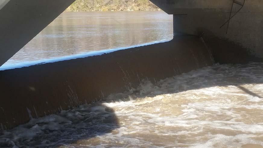
27 Raymond - 4th Street River Mile 787 Map: , Managing Agency: Kansas Department of Wildlife, Parks & Tourism Nearest Community: Raymond, Rice County Kansas Developed Amenities Provided Parking Trailer Parking Toilet(s) Showers Changing Rooms Trash Receptacle Camping (Primitive) Camping (RV) Electrical Potable Water Grill Established Fire Pit Picnic Table Information Kiosk Education/Interpretive signs Directional/Regulatory Signs Bench Visitor Center Potential limitations or sensitivities of this site: (check all that apply) Strong Currents Navigational Hazards Low-Head Dam Motorized Boat Traffic Hazard Trees Sudden Water Level Changes Presence of ANS Presence of T&E Species Presence of Critical Habitat Sensitive Nesting Area


28 Landing Conditions: (check all that apply) Boat Dock Road Bridge Muddy Shore Sandy Shore Rocky Shore Grassy Shore Steep Grade Gradual Grade Additional Facility Notes: This site is made possible through an agreement between the landowner and KDWPT. The Alden access point is located 9 miles downstream. Additional Site Photos:
 Showers Changing")
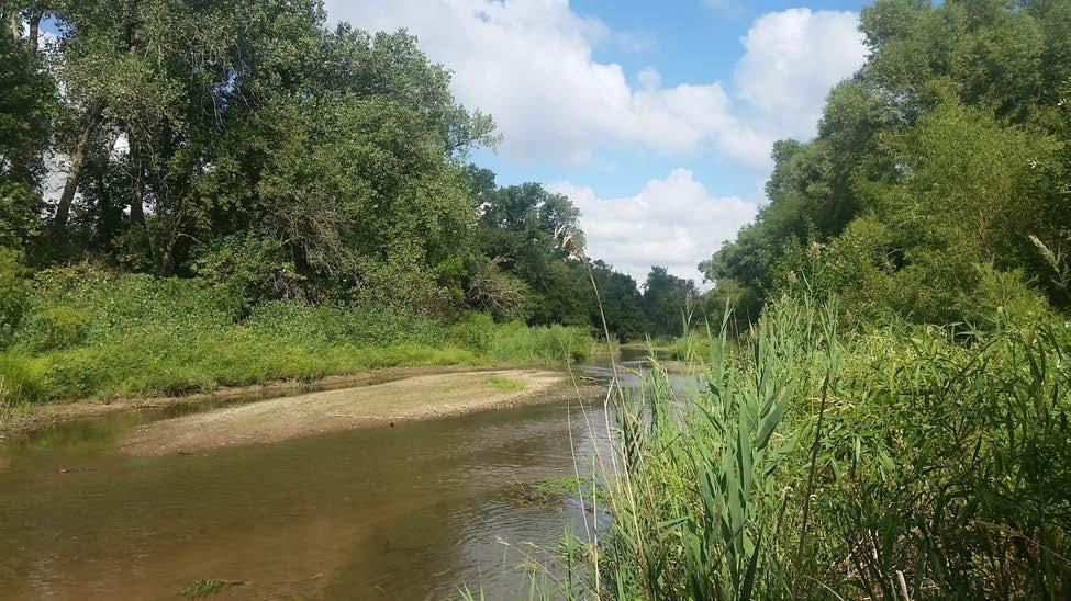
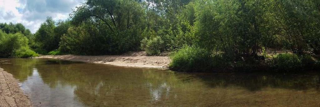
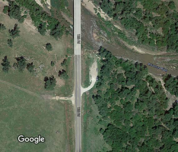
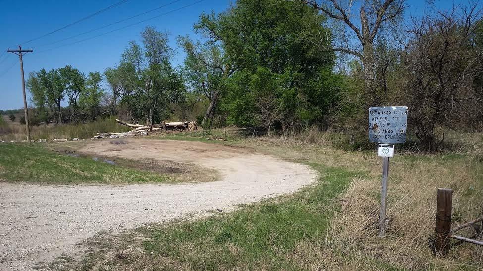
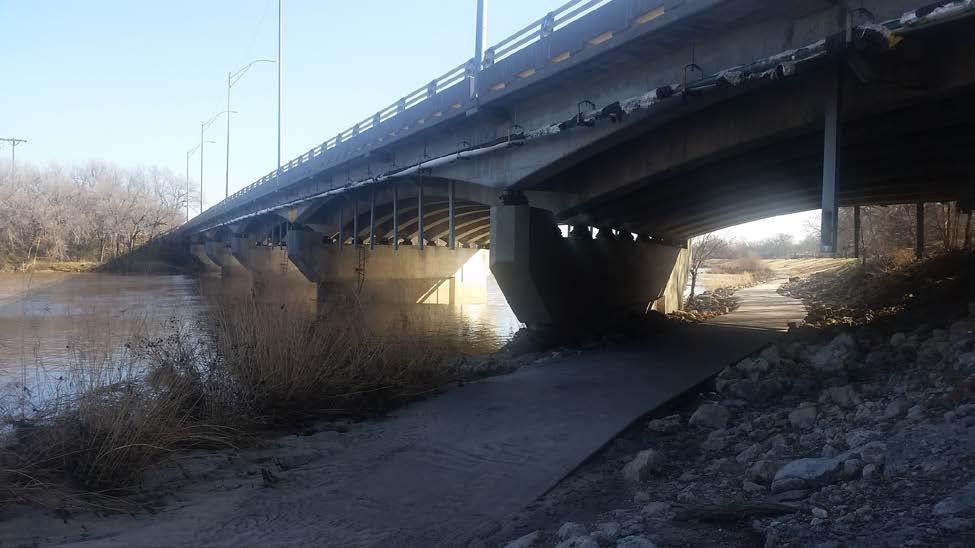
29 Sterling - 12th Road River Mile 774 Map: , Managing Agency: Kansas Department of Wildlife, Parks & Tourism Nearest Community: Sterling, Rice County Kansas Developed Amenities Provided Parking Trailer Parking Toilet(s) Showers Changing Rooms Trash Receptacle Camping (Primitive) Camping (RV) Electrical Potable Water Grill Established Fire Pit Picnic Table Information Kiosk Education/Interpretive signs Directional/Regulatory Signs Bench Visitor Center Potential limitations or sensitivities of this site: (check all that apply) Strong Currents Navigational Hazards Low-Head Dam Motorized Boat Traffic Hazard Trees Sudden Water Level Changes Presence of ANS Presence of T&E Species Presence of Critical Habitat Sensitive Nesting Area Landing Conditions: (check all that apply) Boat Dock Road Bridge Muddy Shore Sandy Shore Rocky Shore Grassy Shore Steep Grade Gradual Grade


30 Additional Facility Notes: This site is made possible through an agreement between the landowner and KDWPT. The next available access point is 22 miles downstream at 4th street in Hutchinson, but a reasonable amount of parking at this site provides for a good exit point from a float beginning at Raymond or Alden. Additional Site Photos:
31
 Showers")
 Strong Currents Navigational Hazards Low-Head Dam Motorized Boat Traffic Hazard Trees Sudden")
32 Upper Grouse Creek Map: , Managing Agency: Kansas Department of Wildlife, Parks & Tourism Nearest Community: Arkansas City, Cowley County Kansas Developed Amenities Provided Parking Trailer Parking Toilet(s) Showers Changing Rooms Trash Receptacle Camping (Primitive) Camping (RV) Electrical Potable Water Grill Established Fire Pit Picnic Table Information Kiosk Education/Interpretive signs Directional/Regulatory Signs Bench Visitor Center Potential limitations or sensitivities of this site: (check all that apply) Strong Currents Navigational Hazards Low-Head Dam Motorized Boat Traffic Hazard Trees Sudden Water Level Changes Presence of ANS Presence of T&E Species Presence of Critical Habitat Sensitive Nesting Area Landing Conditions: (check all that apply) Boat Dock Road Bridge Muddy Shore Sandy Shore Rocky Shore Grassy Shore Steep Grade Gradual Grade


33 Additional Facility Notes: This site is operated and maintained by the Kansas Department of Wildlife, Parks and Tourism on the Kaw Wildlife Area. The Lower Grouse Creek access point is just 5 miles downstream at the confluence of Grouse Creek and the Arkansas River. Additional Site Photos:
 Showers Changing Rooms Trash")
34 Wichita - 71st Street River Mile 688 Map: , Managing Agency: City of Wichita, Kansas Nearest Community: Wichita, Sedgwick County Kansas Developed Amenities Provided Parking Trailer Parking Toilet(s) Showers Changing Rooms Trash Receptacle Camping (Primitive) Camping (RV) Electrical Potable Water Grill Established Fire Pit Picnic Table Information Kiosk Education/Interpretive signs Directional/Regulatory Signs Bench Visitor Center Potential limitations or sensitivities of this site: (check all that apply) Strong Currents Navigational Hazards Low-Head Dam Motorized Boat Traffic Hazard Trees Sudden Water Level Changes Presence of ANS Presence of T&E Species Presence of Critical Habitat Sensitive Nesting Area Landing Conditions: (check all that apply) Boat Dock Road Bridge Muddy Shore Sandy Shore Rocky Shore Grassy Shore Steep Grade Gradual Grade


35 Additional Facility Notes: The 71st Street access point is operated and maintained by the City of Wichita and was built in partnership with the Kansas Department of Wildlife, Parks and Tourism. A paved walking path and launch area are convenient to access, and a paved parking lot is provided. Six miles upstream is the Chapin Park access, and the Derby Washington Street access point is just 2 miles downstream. Additional Site Photos:
 Showers Changing Rooms Trash")
36 Wichita - Big River Park River Mile 704 Map: , Managing Agency: City of Wichita, Kansas Nearest Community: Wichita, Sedgwick County Kansas Developed Amenities Provided Parking Trailer Parking Toilet(s) Showers Changing Rooms Trash Receptacle Camping (Primitive) Camping (RV) Electrical Potable Water Grill Established Fire Pit Picnic Table Information Kiosk Education/Interpretive signs Directional/Regulatory Signs Bench Visitor Center Potential limitations or sensitivities of this site: (check all that apply) Strong Currents Navigational Hazards Low-Head Dam Motorized Boat Traffic Hazard Trees Sudden Water Level Changes Presence of ANS Presence of T&E Species Presence of Critical Habitat Sensitive Nesting Area Landing Conditions: (check all that apply) Boat Dock Road Bridge Muddy Shore Sandy Shore Rocky Shore Grassy Shore Steep Grade Gradual Grade


37 Additional Facility Notes: Big River Park is operated and maintained by the City of Wichita. Just upstream of this park, the river takes a right turn through the tube outlet under interstate 235 at the Valley Center Floodway. CAUTION: Paddlers coming from upstream must portage up the levee and around the outlet tubes before continuing downstream. During moderate to high flows, experienced paddlers use the area at the downstream opening of the tubes as a whitewater area. CAUTION: A low head dam under the 21st street bridge about ¼ mile downstream of the tubes is another hazardous area and must be portaged around. Paved walking paths and gradual slopes make portage convenient, however a short walk from the parking lot allows users beginning a float to put in below the dam and avoid portaging. The Carey Park access point in Hutchinson is 43 miles upstream, and the Cowtown access is 4 miles downstream. Additional Site Photos:
38
39
 Showers Changing Rooms Trash")
40 Wichita - Chapin Park River Mile 694 Map: , Managing Agency: City of Wichita, Kansas Nearest Community: Wichita, Sedgwick County Kansas Developed Amenities Provided Parking Trailer Parking Toilet(s) Showers Changing Rooms Trash Receptacle Camping (Primitive) Camping (RV) Electrical Potable Water Grill Established Fire Pit Picnic Table Information Kiosk Education/Interpretive signs Directional/Regulatory Signs Bench Visitor Center Potential limitations or sensitivities of this site: (check all that apply) Strong Currents Navigational Hazards Low-Head Dam Motorized Boat Traffic Hazard Trees Sudden Water Level Changes Presence of ANS Presence of T&E Species Presence of Critical Habitat Sensitive Nesting Area Landing Conditions: (check all that apply) Boat Dock Road Bridge Muddy Shore Sandy Shore Rocky Shore Grassy Shore Steep Grade Gradual Grade
41


42 Additional Facility Notes: Chapin Park provides primitive access to the river via a gravel path, but has ample parking, 190 acres of greenspace, a dog park, a mountain bike and walking trail and restrooms. Upstream 1 mile is the Garvey Park access, and the 71st street access is 6 miles downstream. Additional Site Photos:
 Showers Changing Rooms Trash")
43 Wichita - Cowtown River Mile 701 Map: , Managing Agency: City of Wichita, Kansas Nearest Community: Wichita, Sedgwick County Kansas Developed Amenities Provided Parking Trailer Parking Toilet(s) Showers Changing Rooms Trash Receptacle Camping (Primitive) Camping (RV) Electrical Potable Water Grill Established Fire Pit Picnic Table Information Kiosk Education/Interpretive signs Directional/Regulatory Signs Bench Visitor Center Potential limitations or sensitivities of this site: (check all that apply) Strong Currents Navigational Hazards Low-Head Dam Motorized Boat Traffic Hazard Trees Sudden Water Level Changes Presence of ANS Presence of T&E Species Presence of Critical Habitat Sensitive Nesting Area Landing Conditions: (check all that apply) Boat Dock Road Bridge Muddy Shore Sandy Shore Rocky Shore Grassy Shore Steep Grade Gradual Grade


44 Additional Facility Notes: The Cowtown access point was built in partnership with the City of Wichita and the Arkansas River Coalition in Ample parking is available at this site, and looking downstream provides views of the Keeper of the Plains and the downtown skyline. Adjacent to this site are the museums on the river; Cowtown Museum, the Wichita Art Museum, Botanica and the Mid- America All Indian Center. Located 4 miles upstream is the Big River Park access point, with the Water Walk access just one mile downstream. Additional Site Photos:
 Showers Changing Rooms Trash")
45 Wichita - Garvey Park River Mile 695 Map: , Managing Agency: City of Wichita, Kansas Nearest Community: Wichita, Sedgwick County Kansas Developed Amenities Provided Parking Trailer Parking Toilet(s) Showers Changing Rooms Trash Receptacle Camping (Primitive) Camping (RV) Electrical Potable Water Grill Established Fire Pit Picnic Table Information Kiosk Education/Interpretive signs Directional/Regulatory Signs Bench Visitor Center Potential limitations or sensitivities of this site: (check all that apply) Strong Currents Navigational Hazards Low-Head Dam Motorized Boat Traffic Hazard Trees Sudden Water Level Changes Presence of ANS Presence of T&E Species Presence of Critical Habitat Sensitive Nesting Area Landing Conditions: (check all that apply) Boat Dock Road Bridge Muddy Shore Sandy Shore Rocky Shore Grassy Shore Steep Grade Gradual Grade


46 Additional Facility Notes: The Garvey Park access point was built in partnership with the City of Wichita and the Kansas Department of Wildlife, Parks and Tourism. Adjacent to the site is the Arkansas River Bike Trail and a small playground. At this access point, you begin to feel as though you re leaving the city and getting out into the more natural areas of the river. It is not uncommon to observe Bald Eagles, Kingfishers, Whitetail Deer and many forms of wildlife from this point in the trail, on. The Herman Hill access point is one mile upstream, with the Chapin Park access point located 6 miles downstream. Restaurants and access to the interstate is a few blocks from this site. Additional Site Photos:
 Showers Changing Rooms Trash")
47 Wichita - Herman Hill Park River Mile 697 Map: , Managing Agency: City of Wichita, Kansas Nearest Community: Wichita, Sedgwick County Kansas Developed Amenities Provided Parking Trailer Parking Toilet(s) Showers Changing Rooms Trash Receptacle Camping (Primitive) Camping (RV) Electrical Potable Water Grill Established Fire Pit Picnic Table Information Kiosk Education/Interpretive signs Directional/Regulatory Signs Bench Visitor Center Interpretive Trail Potential limitations or sensitivities of this site: (check all that apply) Strong Currents Navigational Hazards Low-Head Dam Motorized Boat Traffic Hazard Trees Sudden Water Level Changes Presence of ANS Presence of T&E Species Presence of Critical Habitat Sensitive Nesting Area Landing Conditions: (check all that apply)
 Center s interactive museum is open to the public during posted hours.")

48 Boat Dock Road Bridge Muddy Shore Sandy Shore Rocky Shore Grassy Shore Steep Grade Gradual Grade Additional Facility Notes: Herman Hill Park offers several unique opportunities for learning about our water resources. The WATER (Wichita Area Treatment, Education and Remediation) Center s interactive museum is open to the public during posted hours. From dawn to dusk, the Center s outdoor displays include an 11,000 gallon outdoor aquarium boasting a display of river fish as well as an interpretive self-guided trail along a naturalized creek. The park also has many acres of green space, a playground, disc golf course and picnic areas. Looking downstream, users can view the historical Broadway Street bridge. The parking area includes a demonstration area of pervious pavement and a water garden, including interpretive signage for each. The Lincoln Street access point is located 2 miles upstream, and the Garvey Park access point is just 1 mile downstream. Additional Site Photos:
 Showers Changing Rooms Trash")
49 Wichita - Lincoln Street River Mile 698 Map: , Managing Agency: City of Wichita, Kansas Nearest Community: Wichita, Sedgwick County Kansas Developed Amenities Provided Parking Trailer Parking Toilet(s) Showers Changing Rooms Trash Receptacle Camping (Primitive) Camping (RV) Electrical Potable Water Grill Established Fire Pit Picnic Table Information Kiosk Education/Interpretive signs Directional/Regulatory Signs Bench Visitor Center Boat Passage Fish Passage Potential limitations or sensitivities of this site: (check all that apply) Strong Currents Navigational Hazards Low-Head Dam Motorized Boat Traffic Hazard Trees Sudden Water Level Changes Presence of ANS Presence of T&E Species Presence of Critical Habitat Sensitive Nesting Area


50 Landing Conditions: (check all that apply) Boat Dock Road Bridge Muddy Shore Sandy Shore Rocky Shore Grassy Shore Steep Grade Gradual Grade Additional Facility Notes: The Lincoln Street area was newly renovated in 2012 with the re-building of Lincoln Street Dam and fish passage structure. A boat passage along the east side of the dam allows adventurous paddlers to navigate a system of weirs and experience faster moving water. Upstream of the dam, a landing and portage area is available for larger boats, canoes and less-experienced paddlers to safely portage around the dam. Downstream, a walk-down path and ramp allows users to quickly and safely re-launch to continue down the river. Looking upstream of the access point gives a stunning view of the downtown skyline. Interpretive signage provides education on the fish passage design and species of fish that benefit from the fish passage, as well as safety recommendations for use of the boat passage.the Water Walk access point is one mile upstream, with the next access site at Herman Hill lies just 2 miles downstream. Additional Site Photos:
 Showers Changing Rooms Trash")
51 Wichita - Water Walk River Mile 699 Map: , Managing Agency: City of Wichita, Kansas Nearest Community: Wichita, Sedgwick County Kansas Developed Amenities Provided Parking Trailer Parking Toilet(s) Showers Changing Rooms Trash Receptacle Camping (Primitive) Camping (RV) Electrical Potable Water Grill Established Fire Pit Picnic Table Information Kiosk Education/Interpretive signs Directional/Regulatory Signs Bench Visitor Center Outdoor Retailer Potential limitations or sensitivities of this site: (check all that apply) Navigational Hazards Low-Head Dam Motorized Boat Traffic Hazard Trees Sudden Water Level Changes Presence of ANS Presence of T&E Species Presence of Critical Habitat Sensitive Nesting Area Landing Conditions: (check all that apply) Boat Dock Road Bridge Muddy Shore Sandy Shore Rocky Shore Grassy Shore Steep Grade Gradual Grade


52 Additional Facility Notes: The Water Walk access point is located adjacent to a major outdoor retailer, and along the Water Walk area of downtown Wichita. Several retailers, hotels and restaurants are located within walking distance. There is also a kayak/canoe boat dock onsite to ease entrance and exit from the water trail. A boat ramp onsite allows motorized boats to launch, but a no-cost permit for motorized boats is required from the Wichita Parks & Recreation Department. A permit is not required for non-motorized boats. Looking upstream from the launch site, the downtown skyline is visible, as well as striking views of the Keeper of the Plains statue, the Wichita Boathouse and Exploration Place. The Cowtown access point is 2 miles upstream. The next access point is Lincoln Street, which lies 1 mile downstream. Additional Site Photos:
Androscoggin River Trail Access Sites. North Woods. 168 miles from its source at Lake Umbagog to Merrymeeting Bay
 Androscoggin River Trail Access Sites North Woods 168 miles from its source at Lake Umbagog to Merrymeeting Bay Trail Under Construction More than 40 Public Access Sites Available Androscoggin River Watershed
Topsham Trail Guide.
 Topsham Trail Guide A guide to the walking, hiking, biking, water and ATV trails of Topsham, Maine and surrounding towns $4.95 Developed by the www.greatertopshamtrailalliance.org The Greater Topsham Trail
VOLUME II APPENDIX F DETAILED PHYSICAL DESCRIPTION OF PROJECT RESERVOIRS AND LANDS
 VOLUME II APPENDIX F DETAILED PHYSICAL DESCRIPTION OF PROJECT RESERVOIRS AND LANDS THE CENTRAL NEBRASKA PUBLIC POWER AND IRRIGATION DISTRICT FERC PROJECT NO. 1417 PHYSICAL DESCRIPTION OF PROJECT LANDS
Summary of Recreation Sites Development Name:
 Development Name: Eau Pleine Site Number: 1 Owner: WVIC Eau Pleine Tailwater Boat Launch Lanes 1 Concrete plank landing, access to Eau Pleine tailwater & Lake DuBay. (45 planks long, 62.5') Picnic Tables
Kansas (KAW) River History
 River History") Kansas (KAW) River History The first map of the Kansas River is dated back to 1718. Lewis and Clark spent 3 days camped at Kaw Point at the confluence of the Kansas and Missouri Rivers. Kansas (KAW) River
Kansas (KAW) River History The first map of the Kansas River is dated back to 1718. Lewis and Clark spent 3 days camped at Kaw Point at the confluence of the Kansas and Missouri Rivers. Kansas (KAW) River
National Recreation Trail Application for Designation
 National Recreation Trail Application for Designation Introduction Thank you for your interest in the National Recreation Trail (NRT) program. Completed NRT application packages must be submitted by December
National Recreation Trail Update Form
 National Recreation Trail Update Form Introduction Thank you for taking the time to complete this form. Your assistance will help ensure that the National Recreation Trail (NRT) database is complete and
A Vision for South Skunk River and Chichaqua Bottoms Greenbelt
 A Vision for South Skunk River and Chichaqua Bottoms Greenbelt Photo: Jim Pease Chichaqua Bottoms Booklet 7 of 8 Greater Des Moines Water Trails and Greenways 1 2016 Table of Contents Booklet 1: Water
P Parking Lot. Shiawassee River Water Trail Development Plan. Site 2 - Potential Site - Fish Lake Road. 8 Chapter X - Chapter Title
 Shiawassee iver Water Trail Development lan Site 2 - otential Site - Fish Lake oad it/grill ack estroom Launch Signage Windsock Foot ath arallel arking arking otentially Description: An off-road, unmarked
PARKS & BEACHES PROJECTS
 #18 72ND STREET PARK, LIBRARY, #19 BLUEWAYS & AQUATIC CENTER $1.1 MILLION $60 MILLION New facility to include: Create Kayak Launches with All Wheels Skate Park Floating Docks and Seating at: Library/Media
Proposal to Redevelop Lower Kananaskis River-Barrier Lake. Bow Valley Provincial Park
 Frequently Asked Questions Proposal to Redevelop Lower Kananaskis River-Barrier Lake Bow Valley Provincial Park Frequently Asked Questions What has been decided? What are the details of the plan? What
SAXON HARBOR REDEVELOPMENT SURVEY
 SAXON HARBOR REDEVELOPMENT SURVEY SEPTEMBER, 2016 1,173 RESPONSES 1 BACKGROUND 1. WHAT TYPES OF ACTIVITIES DO YOU ENGAGE IN AT SAXON HARBOR Sightseeing Swimming Picnicing Fishing Camping Photography Motorized
BRACEVILLE NATURE PRESERVE Introductions History Present Conditions Future Development Plans Implementation Strategies Statistics
 BRACEVILLE NATURE PRESERVE Introductions History Present Conditions Future Development Plans Implementation Strategies Statistics Introduction Braceville Nature Preserve is one of MetroParks largest preserves.
Wilds. Headwaters. Lakes. Oxbows. Falls
 56 5 4 3 Wilds Headwaters Lakes Oxbows Falls 57 Zones It could be said the on-the-ground essence of this master plan appears within the next 6 pages of this report. As we learned in the preceding Cultural
River Parks Trail: Tulsa, Oklahoma
 River Parks Trail: Tulsa, Oklahoma Purpose: The purpose of the River Parks Trail is to maintain, preserve, develop, and promote the Arkansas River for the economic and cultural benefit of the community.
Calgary River Access Strategy Priority Sites and Proposed Funding
 Calgary River Access Strategy Priority Sites and Proposed Funding CPS2017-0103 ATTACHMENT 2 A total of $7,660,000 (Class 5 estimate) is required to implement all sites within the Calgary River Access Strategy;
Acquisition in fee simple of approximately one-half acre of property on the shore of Spring Lake to expand the Lakeside Beach Park.
 Lakeside Beach TF00-136 $122,550.00 in fee simple of approximately one-half acre of property on the shore of Spring Lake to exp the Lakeside Beach. 2000 River Ravines TF00-150 $910,000.00 in fee simple
Lake Myra County Park. Wake County, North Carolina Community Forum #2 June 12, 2008
 Lake Myra County Park Wake County, North Carolina Community Forum #2 June 12, 2008 Welcome and Introduction Meeting Agenda Welcome Introductions of Project Team Master Plan Process Community Forum #1 Updates
RIDGEFIELD PARKS February 2016
 RIDGEFIELD PARKS February 2016 Hayden Park Neighborhood Park Amenities Sign with Name of Park and City of Ridgefield Logo Lamp Post Parking Area Play Set Swings Sign with Playground Rules Durable Benches
Corabelle Park. Inventory. Future Development
 Corabelle Park Size: Approximately 4 acres Site Description: Corabelle Park is a relatively new park within the Murray County Park System. It is located on the south side of Corabelle Lake just off gravel
PIONEER PARK. City of Des Peres Parks Master Plan. SWT Design 46 INTRODUCTION
 PIONEER PARK INTRODUCTION Pioneer Park is a 7 acre neighborhood park located east of Interstate 270 and south of Manchester Road along Tallie Road. The park is situated in a residential neighborhood with
Silver Lake Park An Environmental Jewel for the Citizens of Prince William County
 Silver Lake Park An Environmental Jewel for the Citizens of Prince William County The Prince William Park Authority Mission Statement states: The Prince William County Park Authority will create quality
City of Keller Parks and Facilities Inventory
 City of Keller Parks and Facilities Inventory April 2013 1. BEAR CREEK PARK 44 ACRES 1 Basketball Court with 2 goals 4 Drinking Fountains 1 Large Pavilion with 4 picnic tables, electricity and fireplace
Beaver Creek State Park
 GENERAL INFORMATION Name of Park/Forest/Facility: Beaver Creek State Park County: Columbiana (St. Clair Township) Address: 12816 Sprucevale Road (ie County Rd 428) (street #, city) East Liverpool, Ohio
Proposal to Redevelop Lower Kananaskis River-Barrier Lake. Bow Valley Provincial Park. Frequently Asked Questions
 Proposal to Redevelop Lower Kananaskis River-Barrier Lake Bow Valley Provincial Park Frequently Asked Questions What is being proposed? What are the details of the proposal? Where is the project area located?
Oklahoma RV Parks and Campgrounds
 1 Oklahoma RV Parks and Campgrounds Rolling Stone Stables and RV Park Brief Description: Rolling Stone Stables and RV park is an 80 acre horse farm and RV park. We are located just 2 miles from I-40 for
If we make accessibility an up-front consideration that guides our planning & design efforts.
 Cindy Burkhour, MA, CTRS, CPRP AccessRecreationGroup@juno.com 616-560-2378 Accessibility invites more trail users & their $$ to your community! If we make accessibility an up-front consideration that guides
City of Haslett. City of East Lansing. City of East Lansing
 Central Park North (Nancy L. Moore Park) Lake Park North Expansion White Park Expansion #2 White Park Expansion #1 County East East Haslett East East TF87-212 Acquisition $90,000.00 Park. TF08-138 Acquisition
Listing of Campsites on the Manigotagan River
 Listing of Campsites on the Manigotagan River This document lists and describes the campsites along the Manigotagan River between Highway #314 and the government dock in the community of Manigotagan. The
TENKILLER STATE PARK -An Overview-
 TENKILLER STATE PARK -An Overview- - 0 - TENKILLER STATE PARK Region: Northeast (Green Country) Cherokee & Sequoyah Counties CONTENTS General Information. 2 Addresses Driving Directions Phone Numbers Email
SDTrucksprings. Arkansas Off-roading/4x4 Guide Copyright 2015 We Specialize In:
 SDTrucksprings Arkansas Off-roading/4x4 Guide Copyright 2015 We Specialize In: Helper Springs Air Bags Leaf Springs Body Lift Kits Coil Springs Timbren Kits Hellwig Springs Lift Blocks And More! Visit
City of Durango 5.8 FUNDING TRAILS DEVELOPMENT
 5.8 FUNDING TRAILS DEVELOPMENT The City has been successful in establishing dedicated local funding sources as well as applying for grants to develop the City s trail system, having received nearly $2.4
This Passport: Revised October 20, 2017, EAM # Discovering the Trails of Penfield, NY
 This Passport: Revised October 20, 2017, EAM #161922 Discovering the Trails of Penfield, NY The Town of Penfield is fortunate to have a wide variety of natural resources which make for many unique and
MORGAN CREEK GREENWAY Final Report APPENDICES
 APPENDICES MORGAN CREEK GREENWAY Appendix A Photos of Existing Conditions in Trail Corridor Photos of existing conditions Main trail corridor - February 2009 Photos of existing conditions south bank Morgan
Winnebago County Community Park
 Directions to Community Park From Interstate Hwy. 41 to Oshkosh exit 124, which is Hwy. 76/Jackson Street. East on Hwy 76/ Jackson Street to left on County Road Y, 1/4 mile. Winnebago County Park is on
Chapter eight. Parks and Recreation. Introduction. Crystal Lake Park District
 Chapter eight Parks and Recreation Introduction One of the indicators of quality of life in a city is the parks and recreation system. The City of Crystal Lake is fortunate to have an excellent parks and
NORTH HEMPSTEAD BEACH PARK MASTER PLAN
 NORTH HEMPSTEAD BEACH PARK MASTER PLAN COMMUNITY DESIGN CHARRETTE Supervisor Judi Bosworth Viviana L. Russell Peter J. Zuckerman Angelo P. Ferrara Anna M. Kaplan Lee R. Seeman Dina M. De Giorgio VISIONING
Campground Reservations Open
 For Immediate Release Thursday, January 10, 2019 Prince Albert National Park Campground Reservations Open There may be snow on the ground but now is the time to start planning summer camping trips according
Calvert Regional Park - Tari Moore Recreational Trail. Calvert Regional Park - Woodland Trail. miles from Rising Sun
 Calvert Regional Park - Tari Moore Recreational Trail 304 Brick Meeting House Road, North East, MD 21901 5.2 about 1.1 mile Paved parking lot, plentiful Easy, paved path with slight incline. Easy, paved
WATER PETALUMA TRAIL WATER WAYS PROJECT PORTFOLIO. petalumawaterways.org OVERVIEW
 WATER TRAIL PROJECT PORTFOLIO OVERVIEW Thirteen miles upstream of San Pablo Bay, Petaluma is the northern point on the San Francisco Bay Water Trail, a network of access points throughout the region. Most
RIVER ACCESS STRATEGY
 RIVER ACCESS STRATEGY The River Access Strategy is a 10-year plan the City of Edmonton is developing to inform future programming, operations and infrastructure improvements that support access to the
2. Goals and Policies. The following are the adopted Parks and Trails Goals for Stillwater Township:
 D. PARKS AND TRAILS 1. Introduction Stillwater Township s population is relatively low, with most residents living on rural residences on large lots. The need for active park space has been minimal in
Welcome to the future of Terwillegar Park a Unique Natural Park
 Welcome to the future of Terwillegar Park a Unique Natural Park 1 Introduction The Terwillegar Park Concept Plan study will develop an overall concept plan, management objectives and development guidelines
TRUCKEE TAHOE AIRPORT DISTRICT BOARD OF DIRECTOR STAFF REPORT
 AGENDA ITEM: 11 TRUCKEE TAHOE AIRPORT DISTRICT BOARD OF DIRECTOR STAFF REPORT AGENDA TITLE: MEETING DATE: January 24, 2018 PREPARED BY: NTPUD Agency Partnership Opportunity, Multi-Use Trailhead Access
BEAVER LAKE ACCESS AREA SUMMARY 2017 Edition
 BEAVER LAKE ACCESS AREA SUMMARY 2017 Edition DEVELOPED BY THE BEAVER LAKE PROPERTY and SAFETY COMMITTEE 2 October 2017 1 NOTICE: This document supersedes and nullifies all previous versions of Beaver Lake
Rating: 5.0 (scale of 1-10)
") 95 Community Trail System Groundcover: 2-metre paved path, 1- metre grass buffer on either side. Location: Fort St. John Ownership: City of Fort St. John Rating: 5.0 (scale of 1-10) Strategic value: Linear
95 Community Trail System Groundcover: 2-metre paved path, 1- metre grass buffer on either side. Location: Fort St. John Ownership: City of Fort St. John Rating: 5.0 (scale of 1-10) Strategic value: Linear
Delaware Wildlife Area
 Delaware Wildlife Area 8 miles away from Delaware 4,670 acre Wildlife Area 1) Take Rt. 36/East Williams Street eastward 2) Take left onto Rt. 42/Lake Street 3) Slight left onto Horseshoe Rd./CR. 220 4)
Flow Stand Up Paddle Board Parkway Plan Analysis
 Regional Parks Department Jeffrey R. Leatherman, Director County of Sacramento Divisions Administration Golf Leisure Services Maintenance Rangers Therapeutic Recreation Services Flow Stand Up Paddle Board
Northeast Quadrant Distinctive Features
 NORTHEAST QUADRANT Northeast Quadrant Distinctive Features LAND USE The Northeast Quadrant includes all the area within the planning area that is east of Interstate 5 and to the north of State Route 44.
KETTLE CREEK CONSERVATION AUTHORITY TRAIL GUIDE.
 KETTLE CREEK CONSERVATION AUTHORITY TRAIL GUIDE www.kettlecreekconservation.on.ca EXPLORE OUR TRAILS HIKE OUR TRAILS Kettle Creek Conservation Authority (KCCA) proudly supports and promotes an active lifestyle
THOMAS A. SWIFT METROPARK Introductions History Present Conditions Future Development Plans Implementation Strategies Statistics
 THOMAS A. SWIFT METROPARK Introductions History Present Conditions Future Development Plans Implementation Strategies Statistics Introduction As an open meadow park positioned along the Mahoning River,
Southwest Quadrant Distinctive Features
 SOUTHWEST QUADRANT Southwest Quadrant Distinctive Features LAND USE The 31.17 square mile Southwest Quadrant includes all the area within the planning area west of I-5 and south of the Sacramento River.
Trailhead Ambassadors 2018 Latourell Falls: Alternative Hikes
 Trailhead Ambassadors 2018 Latourell Falls: Alternative Hikes General Note: The Historic Highway is closed from the Bridal Veil exit to its eastern end near Wyeth i.e., the Waterfall Alley section. The
Lewis River Recreation Sites
 Lewis River Recreation Sites Parking Fees Hours Visitors entering day-use sites with vehicles must pay applicable fees during peak recreation season. * Pass holders, please check in with booth attendant
20 Grant s Trail. Planning Zone 3. Visit Date: September St. Louis County Parks Master Plan
 20 Grant s Trail Planning Zone 3 Visit Date: September 2016 Page 1 20 Grant s Trail Planning Zone 3 Visit Date: September 2016 Page 2 20 Grant s Trail Planning Zone 3 Visit Date: September 2016 Page 3
Blue River Trail Master Plan JSA to Town Hall June 2004
 Blue River Trail Master Plan JSA to Town Hall June 2004 Prepared for: Silverthorne Town Council Silverthorne SPORT Committee Department of Recreation and Culture Silverthorne Public Works Silverthorne
Understanding the caring capacity of the visitor experience Provide facilities to support a high level user experience Address visual quality through
 Understanding the caring capacity of the visitor experience Provide facilities to support a high level user experience Address visual quality through recreation ecological restoration opportunities Collaboration
Ohio RV Parks and Campgrounds. Shadow Lake RV Park. Loveberrys Funny Farm Campgound. Amenities
 1 Ohio RV Parks and Campgrounds Shadow Lake RV Park Brief Description: If you are looking for a park off the beaten path, out in the middle of nowhere then we are it. Settled within the rolling hills of
City of Somersworth. Recreation Division
 City of Somersworth Recreation Division 2018 Park Inventory Table of Contents I. Ash Street Park..1-3 II. Jules Bisson Park..6-10 III. Malley Farm Recreational Area.11-12 IV. Mast Point Dam Recreation
Schoolcraft Township is located in northeast Houghton County. A portion of the township borders Keweenaw County and Lake Superior.
 COMMUNITY DESCRIPTION Schoolcraft Township is located in northeast Houghton County. A portion of the township borders Keweenaw County and Lake Superior. The township is largely rural but has one main population
BOAT DOCKS AND LAUNCHES. Public Engagement Report July 2015
 BOAT DOCKS AND LAUNCHES Public Engagement Report July 2015 TABLE OF CONTENTS BACKGROUND 3 STAKEHOLDER CONSULTATION 6 PARTICIPANT PROFILE 7 RESPONSE THEMES 8 CONCLUSION 16 BACKGROUND The North Saskatchewan
RECREATION MANAGEMENT PLAN WELLS HYDROELECTRIC PROJECT FERC NO. 2149
 RECREATION MANAGEMENT PLAN WELLS HYDROELECTRIC PROJECT FERC NO. 2149 May 2010 Prepared by: Public Utility District No. 1 of Douglas County Copyright 2010. Public Utility District No. 1 of Douglas County.
Fossil Creek Wild & Scenic River Comprehensive River Management Plan Forest Service Proposed Action - details March 28, 2011
 Fossil Creek Wild & Scenic River Comprehensive River Management Plan Forest Service Proposed Action - details March 28, 2011 Primary Goals of the Proposed Action 1. Maintain or enhance ORVs primarily by
Parks & Recreation Areas Program
 PARKS & RECREATION Parks & Recreation Areas Program As part of its mission to conserve and protect natural resources, the Upper Big Blue Natural Resources District (NRD) has been involved in several large-scale
Lake Waconia Regional Park 6. Lake Waconia Regional Park
 Lower Lakeshore Trail Interpretive/Adventure Trail Multiple Seating & Observation Areas Flexible Day Use Recreation Area Docks/Fishing Group Camping Group Day Use Space Winter Gathering/Event Space -Season
James M. Robb. Colorado River State Park. Passes And Permits. James M. Robb ENJOY YOUR STATE PARKS. cpw.state.co.us
 Passes And Permits A Colorado State Parks Pass is required on all motor vehicles entering the park. All passes must be affixed to the lower right inside of the windshield. An ANNUAL PASS is valid at any
Section XIII. Cost Estimates
 Section XIII Cost Estimates 13-01. INTRODUCTION SECTION XIII COST ESTIMATES a. General. Preliminary cost estimates for development of proposed new and renovation or replacement actions at Lake Shelbyville
4.0 FACILITIES INVENTORY
 4.0 FACILITIES INVENTORY 4.1 PARK LEVEL OF SERVICE STANDARDS (LOS) Based on current City of Longview Parks and Recreation Level of Service (LOS) Standards (Figure G), the City currently has a deficiency
San Francisco Bay Area Water Trail Site Description for. Suisun City Marina. Launch ramps and docks Suisun Channel Parking Lot
 1 San Francisco Bay Area Water Trail Site Description for Suisun City Marina Location, Ownership, and Management: Suisun City Marina is located on Kellogg St., approimately a half mile from Suisun City's
Lewis River Recreation Sites
 Lewis River Recreation Sites N 0 miles 2 4 8 Parking Fees Hours Visitors entering day-use sites with vehicles must pay applicable fees during peak recreation season. * Pass holders, please check in with
PARKS CONNECTING PEOPLE WITH NATURE R.J. CARDIN, DIRECTOR MARICOPA COUNTY PARKS AND RECREATION DEPT.
 PARKS CONNECTING PEOPLE WITH NATURE R.J. CARDIN, DIRECTOR MARICOPA COUNTY PARKS AND RECREATION DEPT. BUCKEYE HILLS PARK AGREEMENTS: Department enters into Special Use Permit to allow Arizona State Rifle
35 Bee Tree Park Planning Zone 3
 35 Bee Tree Park Planning Zone 3 2701 Finestown Road Visit Date: August 2016 St. Louis County Parks Master Plan Page 1 35 Bee Tree Park 2701 Finestown Road St. Louis County Parks Master Plan Planning Zone
Municipal Park Descriptions: 1. Bear Hollow Park 4100 Bear Hollow Park Court, Murrysville, PA acres
 MUNICIPAL PARK DESCRIPTIONS Murrysville has a wide variety of parks and recreational facilities including sports fields, neighborhood parks, community parks, a Community Center, and extensive natural areas
Lena Beach Recreation Area Renovation. Dear National Forest User:
 United States Department of Agriculture Forest Service Alaska Region Tongass National Forest Juneau Ranger District 8510 Mendenhall Loop Juneau, AK 99801 Phone: (907) 586-8800 Fax: (907) 586-8808 File
Preferred Recreation Recommendations Stemilt-Squilchuck Recreation Plan March 2018
 Preferred Recreation Recommendations Stemilt-Squilchuck Recreation Plan March 2018 Below are the recommended recreation ideas and strategies that package together the various recreation concepts compiled
Create memories at the park!
 Create memories at the park! Reserving a shelter is not only fun, but also affordable! For more information and a complete list of locations, visit foxvalleyparkdistrict.org or call 630-897-0516. Austin
1 of 6 9/20/2013 9:32 AM
 1 of 6 9/20/2013 9:32 AM 1 Illinois RV Parks and Campgrounds Hillcrest Golf & Camping Resort Brief Description: Our campgrounds offer a wide selection of spacious, level sites with picnic tables, water
A BOAT RAMP TO NOWHERE
 A BOAT RAMP TO NOWHERE A PROPOSAL FOR ACCESS TO HARVIE PASSAGE A Presentation to the City of Calgary December 2017 Presented by: Peter Crowe-Swords Bow River Trout Foundation Background: The Bow River
Accessible Information Alabaster Caverns State Park
 Alabaster Caverns State Park Park office entrance and main parking lot The Visitor Center Picnic shelter #1 One RV site Comfort station Playground Cavern tours are not recommended for the following persons
SIMON CANYON AREA OF CRITICAL ENVIRONMENTAL CONCERN (ACEC)
") SIMON CANYON AREA OF CRITICAL ENVIRONMENTAL CONCERN (ACEC) Activities: Facilities: Season / Hours: Description: Hiking, backpacking, fishing, picnicking, watchable wildlife. A graveled parking area, picnic
SIMON CANYON AREA OF CRITICAL ENVIRONMENTAL CONCERN (ACEC) Activities: Facilities: Season / Hours: Description: Hiking, backpacking, fishing, picnicking, watchable wildlife. A graveled parking area, picnic
Logo Department Name Agency Organization Organization Address Information 5700 North Sabino Canyon Road
 Logo Department Name Agency Organization Organization Address Information United States Forest Coronado National Forest 5700 North Sabino Canyon Road Department of Service Santa Catalina Ranger District
Crystal Lake Area Trails
 Lake Area Trails Welcome to the Lake area of the Big Snowy Mountains! This island mountain range in central Montana features peaks reaching to 8,600 feet and long, high ridges from which vistas of the
Rogue River Access and Management Plan Draft Alternatives
 Rogue River Access and Management Plan Draft Alternatives The Rogue River Access and Management Plan was initiated in December, 2011 and is being led by Jackson County Parks (JCP) and Oregon Department
CHAPTER 4 EXISTING PARKS AND RECREATION FACILITIES INVENTORY
 CHAPTER 4 EXISTING PARKS AND RECREATION FACILITIES INVENTORY Existing park and recreation sites and facilities provide the basis upon which to build a park and recreation plan for the city. This inventory
Beth Lucas, Senior Planner Stephanie Brewer, Planner Broome County Planning May 12 th, 2016
 Beth Lucas, Senior Planner Stephanie Brewer, Planner Broome County Planning May 12 th, 2016 Background Data Collection Trail Mapping Promotional Strategy December 2014 County s natural beauty identified
Bow River Access Plan
 Bow River Access Plan Draft Plan June 28, 2017 Photo: Johnson s Island Road, Wyndham Carseland Provincial Park, Courtesy of Bow River Trout Foundation With Thanks to the Bow River Trout Foundation for
Lewis and Clark Recreation Area
 Lewis and Clark Recreation Area Bicycle/Pedestrian Trail Also part of the Pierson Ranch Recreation Area trail Type of trail: Walking, biking and rollerblading Trail surface: Asphalt Rated: Mostly flat.
Schachtner Street. Village Park Somerset, Wisconsin
 Schachtner Street Village Park Village Park Schachtner Street Softball Field Lower Terrace Parking Area Baseball Field Upper Terrace Parking Lot Mid Terrace Parking Area Restroom Building Path to Bridge
Ragged Mountain Natural Area. Public Planning Meeting #1 February 29 th, 2016
 Ragged Mountain Natural Area Public Planning Meeting #1 February 29 th, 2016 Planning During dam construction P&R approached by various groups asking if the rules would be changed once the dam was complete
2014 SPLOST Final Draft County-wide Parks System Rehabilitation
 Page 1 of 5 ADA Improvements (County Wide) Accessibility projects related to trails/walkways, door entrances, pool access, curb cuts, ramps, etc. Additionally, ADA Audit of facilities to identify and prioritize
CHAPTER 5. Chapter 5 Recreation Element
 CHAPTER 5 Recreation Element Chapter 5 Recreation Element The Recreation Element of the Meyers Area Plan is a supplement to the Recreation Element of the TRPA Regional Plan and the El Dorado County General
Prince Edward Island National Park of Canada
 Prince Edward Island National Park of Canada Things you should know regarding Cavendish and Stanhope Campgrounds Important Notices General Camping Information Fees If There is No Vacancy Require Additional
Header i
 Header i 048285014.10 Header Sub Title Body Text here. Body text here. Body text here. Section 1... 1 Executive Summary... 1 Opportunities and Constraints... 3 Overall Opportunities and Constraints Map
New Hampshire RV Parks and Campgrounds
 1 New Hampshire RV Parks and Campgrounds Riverbrook RV Resort Brief Description: Located in the White Mountains on the Baker River Riverbrook RV Resort is in the center of all white MT attractions. We
Making a River Segment Family and People Friendly: A Case Study of the Pemi River in the Plymouth Region
 Making a River Segment Family and People Friendly: A Case Study of the Pemi River in the Plymouth Region Kenneth Evans, Plymouth Rotary Club Patrick Hummel, DIvision of Parks & Recreation; Larry Spencer,
2009 RIVER TOWN OF THE YEAR AWARD APPLICATION Supplemental Material Images
 2009 RIVER TOWN OF THE YEAR AWARD APPLICATION Supplemental Material Images Our History The earliest record of settlement along the river is in 1854; one of the earliest in Carroll County. About this time
M E S T I Z O C U R T I S P A R K
 ARAPAHOE CONNECTION TO BUS ROUTE AT ND AND LAWRENCE, FUTURE LIGHT RAIL STATION LEGEND SOCIAL TRAIL FLAGSTONE PAVING TO RESTORE/MAINTAIN CONCRETE PAVING DIAGONAL CURVILINEAR SOCIAL ROUTE IS OUT OF HISTORIC
Access: The rocky shoreline is only accessible via private property.
 10. Whale Cove Site description: Whale Cove is a small cove fringed by private homes and condominiums with diverse and relatively undisturbed rocky intertidal and subtidal habitat located approximately
East Carolina Council Facility Study East Carolina Scout Reservation Camp Boddie Pamlico Sea Base
 East Carolina Council Facility Study East Carolina Scout Reservation Camp Boddie Pamlico Sea Base 1 VISION OF CAMP BODDIE EAST CAROLINA SCOUT RESERVATION 1. Attract Out Of Council Troops Use our natural
SPECTACLE LAKE PROVINCIAL PARK PURPOSE STATEMENT AND ZONING PLAN
 SPECTACLE LAKE PROVINCIAL PARK PURPOSE STATEMENT AND ZONING PLAN August 2003 1 SPECTACLE LAKE PROVINCIAL PARK Purpose Statement and Zoning Plan Primary Role The primary role of Spectacle Lake Park is to