SAN ANTONIO RIVER IMPROVEMENTS PROJECT. April 27, 2009
|
|
|
- Randolf Foster
- 5 years ago
- Views:
Transcription
1 SAN ANTONIO RIVER IMPROVEMENTS PROJECT April 27,
2 Project Limits 2
3 Project Partners City of San Antonio Provides project funding for project amenities (i.e.. Sidewalks, Landscaping, Lighting, etc.) and recreation. San Antonio Water System is providing funding for utility relocation Bexar County Provides project funding for flood control and river restoration elements of the project San Antonio River Authority (SARA) Provides project administration and management U.S. Army Corps of Engineers (USACE) Provides federal funding for river restoration and some recreational components San Antonio River Foundation Provides private funding to support project San Antonio River Oversight Committee A 22 person citizens committee established in 1998 with members appointed by the City, County and SARA representing the various neighborhood and business stakeholders along the river. 3


4 Project Budget Presented in millions of dollars Total City County Private SAWS USACE Funds Concept Design $1.0 $0.3 $ Downtown Reach $ $2.4 $ Eagleland $13.6 $6.2 $ $2.6 Mission Reach $166.4 $4.5 $83.7 $4.8 $1.3 $72.1 Museum Reach Urban Museum Reach Park $72.1 $52.3 $13.1 $6.5 $0.2 - $12.6 $11 $ TOTAL $279 $ $114.8 $11.3 $1.5 $
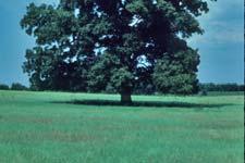
5 Project Benefits Ecosystem Restoration The changes proposed will increase water quality and the quantity and diversity of plant and animal species. Flood Damage Reduction Project will maintain or decrease the elevation of the 100 year floodplain. Quality of Life Add to San Antonio s unique charm and make the city more attractive to residents, visitors, and businesses and provide enhanced recreational opportunities along an expanded d linear park system. Cultural connections Linking people, neighborhoods and cultural resources and celebrating the historical connection of the river to four of the five historic missions in the San Antonio Missions National Historical Park. Economic Development Promote business development along and adjacent to the river. Improvements will also enhance tourism. 5
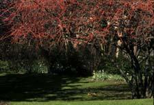
6 Museum Reach: Urban Segment Lexington Ave. to Josephine Street 6
7 Lexington Ave. looking upstream 7
8 Brooklyn Lock and Dam 8
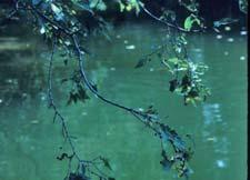
9 Roy Smith Street looking downstream 9
10 Newell at Grotto Feature 10
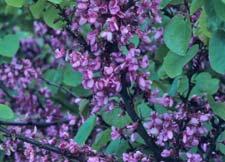
11 Grayson downstream toward turning basin 11
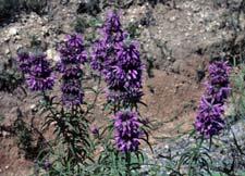
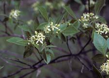
12 Museum Reach Park Segment Museum Reach Park Segment: Extends from Josephine Street to Hildebrand Avenue Priority Betterments as approved by the San Antonio River Oversight Committee: Initial Trail Construction (to connect Josephine Street to Avenue B) with signage Habitat Restoration and Temporary Irrigation Removal of invasive plants and debris Removal, Channel Stabilization along San Antonio River and Catalpa-Pershing Channel Wetlands at Witte Acequia Madre flow diversioni Additional trail connections and improvements along Avenue B, to Mulberry and Avenue A and to and through Brackenridge Park up to Hildebrand d Avenue New pedestrian bridge at Mulberry 12


13 Park Segment Concepts Along Catalpa Channel Under US 281 Near Hildebrand at Historic Upper Labor Along Avenue A 13
14 Mission Reach: Project Limits 14


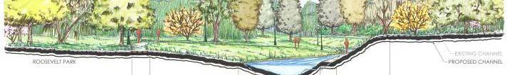
15 Mission Reach Ecosystem Restoration Existing River Channel Proposed River Channel Existing Riverine System Rating = 1.2* Proposed Riverine System Rating = 8.2* 15 * per USACE study; based on scale with 1 as extremely degraded and 10 as pristine; proposed condition rating is at 50 year maturity period
16 Now: 2009 Highly altered section representative of Mission Reach existing conditions maintained to maximize conveyance 16
17 Now:


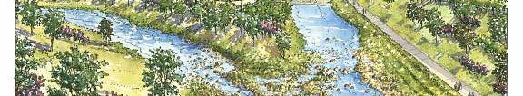
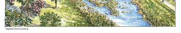
18 Restoring Habitat Features 24,000 young trees 334 acres of riparian woodland habitat 113 acres of aquatic habitat 31 riffles 13 acres of embayment 2 river remnants: San Juan & Espada 18
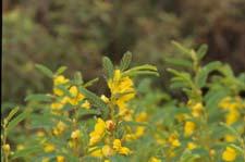


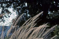


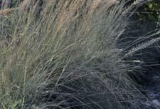
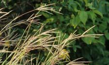
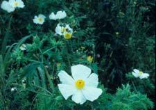

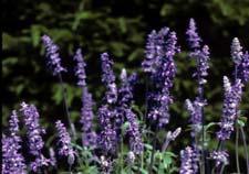


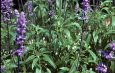

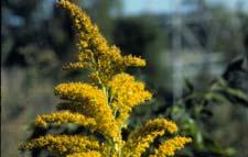
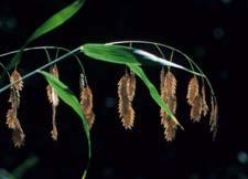
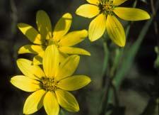
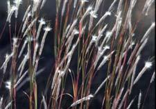


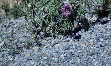


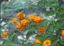
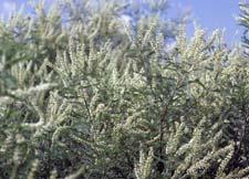
19 Grasses & Wildflowers Photos: Sally & Andy Wasowski, Lady Bird Johnson Wildflower Center 19


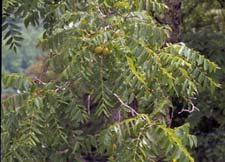


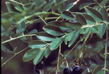
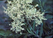

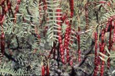
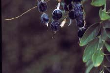
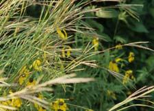
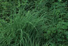
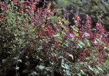
20 Trees & Shrubs Photos: Sally & Andy Wasowski, Lady Bird Johnson Wildflower Center 20


21 Ecological & Cultural Connections Mission Concepcion Throughout the 1700 s development of what is now known as the City of San Antonio, occurred when Spanish Colonial missions were established near the natural river banks for the access to water and food. Restoring the river will re-establish the ecological context of the historic Spanish Missions; The project will reconnect the river s significance to the National Park Service s San Antonio Missions National Historical Park. Mission San Jose Mission Espada 21 Mission San Juan


22 Phase I: Construction underway; completion Dec 2009 Restoration Project Limits: Mission Reach Phase II and III: 95% design completed; 4 th quarter 2009 construction start Phase IV: 60% design completed; 2010 construction start 22


23 Mission Reach Phase I 23
24 Roosevelt Park looking downstream 24
25 Mission Reach Phase I 25
26 Mitchell St. looking downstream 26


27 San Antonio River Confluence with San Pedro Creek (end Phase I) Pre- Construction ti Proposed 27
28 Passed on May 10, 2008 $125 Million Visitors Tax Mission Reach: $109.5 Million $70 M: Advance funding to keep Phases 2-4 on schedule $39.5 M: Design and construct additional trails, bridge improvements, educational signage, connections to Missions, overlooks, public art and enhanced ecosystem restoration Eagleland Reach: $3 million Design and construct improvements to Alamo Street Bridge, picnic areas, bridge enhancements, overlooks Park Segment: $12.5 million $4.7 M: Fund the design and construction ti of a basic hike and bike trail and designate a birding area along Avenue $7.8 M: Complete the hike and bike trail components, restore wetlands and acequia at Witte Museum 28
29 For More SARIP Information org Information on project status Design details Project history Construction progress photos 29
30 SAN ANTONIO RIVER IMPROVEMENTS PROJECT April 27,
SAN ANTONIO RIVER IMPROVEMENTS PROJECT. August 6, 2008
 SAN ANTONIO RIVER IMPROVEMENTS PROJECT August 6, 2008 1 History of the SA River Improvements 1921 Flood Olmos Dam Complete in 1929 Downtown Flood Relief Projects in 1950 s Dams on the River Channel and
San Antonio Channel Improvement Project MISSION REACH ECOSYSTEM RESTORATION PROJECT. Welcome Assistant Secretary (CW) Jo-Ellen Darcy December 8, 2009
 Jo-Ellen Darcy December 8, 2009") San Antonio Channel Improvement Project MISSION REACH ECOSYSTEM RESTORATION PROJECT Welcome Assistant Secretary (CW) Jo-Ellen Darcy December 8, 2009 1 Presentation Overview Review history of San Antonio
San Antonio Channel Improvement Project MISSION REACH ECOSYSTEM RESTORATION PROJECT Welcome Assistant Secretary (CW) Jo-Ellen Darcy December 8, 2009 1 Presentation Overview Review history of San Antonio
Phoenix Habitat Restoration Projects
 Phoenix Habitat Restoration Projects Spur Cross Ranch Cave Creek (Estergard) Regional Tree and Shade Summit March 9, 2010 Desert Riparian Ecosystems Healthy riparian areas like this once existed along
INFILL HARD CORNER & REDEVELOPMENT OPPORTUNITY 731 PROBANDT and 134 & 138 KING ROGER ST
 INFILL HARD CORNER & REDEVELOPMENT OPPORTUNITY 731 PROBANDT and 134 & 138 KING ROGER ST First American Commercial Property Group 18618 Tuscany Stone, Ste. 210, San Antonio, TX 78258 Ph: 210.496.7775 Fx:
TRINITY RIVER CORRIDOR
 TRINITY RIVER CORRIDOR MODIFIED DALLAS FLOODWAY PROJECT UPDATE May 12, 2015 Jon Loxley Project Manager Dallas Floodway Project Fort Worth District U.S. Army Corps of Engineers US Army Corps of Engineers
STORY MILL COMMUNITY PARK
 OWNER: City of Bozeman Department or Parks and Recreation P.O. Box 1230, 415 N. Bozeman Street Bozeman, MT 59715 Tel: (406)-582-2908 APPLICANT: The Trust for Public Land 1007 E. Main Street, Suite 300
San Antonio's River Walk Behind the scenes tour or did you know?
 San Antonio's River Walk Behind the scenes tour or did you know? Robert B. Kauffman, Ph.D 7 Hill Top Drive Frostburg, MD 21532 o: (301) 687-4474 e: rkauffman@frostburg.edu All historical slides are from
Sibley LUPA. Board Executive Committee Meeting December 7, 2017
 Sibley LUPA Board Executive Committee Meeting December 7, 2017 Project Location & Project Area 1,318-acre Robert Sibley Volcanic Regional Preserve Project Area Purpose Project Purpose & Goals Append the
The Lower Prut Floodplain Natural Park (Romania)
") The Lower Prut Floodplain Natural Park (Romania) Gabriela Costea Natural Sciences Museum Complex Galati (Romania) & member of the Scientific Council of the Lower Prut Floodplain Natural Park The Prut The
The Lower Prut Floodplain Natural Park (Romania) Gabriela Costea Natural Sciences Museum Complex Galati (Romania) & member of the Scientific Council of the Lower Prut Floodplain Natural Park The Prut The
Preservation & Restoration of the Houston Region s Green Fabric: The Role of the Harris County Flood Control District
 Preservation & Restoration of the Houston Region s Green Fabric: The Role of the Harris County Flood Control District Glenn Laird, Environmental Chief Harris County Flood Control District Parks + Natural
Prepared by Cathy Quinlan & Brad Hertner Upper Thames River Conservation Authority. For the City of Woodstock
 Prepared by Cathy Quinlan & Brad Hertner Upper Thames River Conservation Authority For the City of Woodstock Burgess Park and Standard Tube Parks in the west end of Woodstock Pittock Reservoir Along the
Wilds. Headwaters. Lakes. Oxbows. Falls
 56 5 4 3 Wilds Headwaters Lakes Oxbows Falls 57 Zones It could be said the on-the-ground essence of this master plan appears within the next 6 pages of this report. As we learned in the preceding Cultural
Environment and Natural Resources Trust Fund 2019 Request for Proposals (RFP)
") Environment and Natural Resources Trust Fund 2019 Request for Proposals (RFP) Project Title: Glacial Edge Trail and Downtown Pedestrian Bridge Category: G. Land Acquisition for Habitat and Recreation ENRTF
Environment and Natural Resources Trust Fund 2019 Request for Proposals (RFP) Project Title: Glacial Edge Trail and Downtown Pedestrian Bridge Category: G. Land Acquisition for Habitat and Recreation ENRTF
Cat Island Chain Background & Access Guide
 Cat Chain Background & Access Guide Brown County Port & Resource Recovery Department 2561 S. Broadway, Green Bay, WI 54304 (920) 492-4950 www.portofgreenbay.com January 2018 1 Restoration of the Cat Chain
Blue River Trail Master Plan JSA to Town Hall June 2004
 Blue River Trail Master Plan JSA to Town Hall June 2004 Prepared for: Silverthorne Town Council Silverthorne SPORT Committee Department of Recreation and Culture Silverthorne Public Works Silverthorne
Silver Lake Park An Environmental Jewel for the Citizens of Prince William County
 Silver Lake Park An Environmental Jewel for the Citizens of Prince William County The Prince William Park Authority Mission Statement states: The Prince William County Park Authority will create quality
Committee. Presentation Outline
 CW-33-15 11/9/2015 Community and Corporate Services Committee November 10, 2015 1 Presentation Outline Background Vision and Objectives Study Process and Timeline Public and Stakeholder Engagement Organization
WESTSIDE CREEKS ECOSYSTEM RESTORATION. Appendix J: Recreation
 WESTSIDE CREEKS ECOSYSTEM RESTORATION Appendix J: Recreation RECREATION APPENDIX WESTSIDE CREEKS DRAFT RECREATION PLAN Recreation development provides opportunities that significantly benefit communities.
Presentation Overview
 DON NARROWS Historical and Existing Conditions March 29, 2008 Presentation Overview 1. Project Location and Background 2. Historical Context How did the Don Narrows Come to Be? 3. The Today 4. Next Steps
Bear Creek Habitat Improvement Project
 06/10/10 Bear Creek Habitat Improvement Project El Paso County, Colorado Pike National Forest and Colorado Springs Utilities Owned Land Report prepared by: Eric Billmeyer Executive Director Rocky Mountain
B10. Agate Beach State Recreation Site
 B10. Agate Beach State Recreation Site Location Within the City of Newport, just south of the Yaquina Head Outstanding Natural Area. The park is located along the west side of Highway 101 at the mouth
Markham Multi-use Pathway (MUP) (16 th Avenue to Bob Hunter Memorial Park) Development Services Committee. January 27, Schollen & Company Inc.
 (16 th Avenue to Bob Hunter Memorial Park) Development Services Committee. January 27, Schollen & Company Inc.") Markham Multi-use Pathway (MUP) (16 th Avenue to Bob Hunter Memorial Park) January 27, 2015 Development Services Committee Mark Schollen Schollen & Company Inc. Purpose of Presentation Update Council on
Markham Multi-use Pathway (MUP) (16 th Avenue to Bob Hunter Memorial Park) January 27, 2015 Development Services Committee Mark Schollen Schollen & Company Inc. Purpose of Presentation Update Council on
City of Haslett. City of East Lansing. City of East Lansing
 Central Park North (Nancy L. Moore Park) Lake Park North Expansion White Park Expansion #2 White Park Expansion #1 County East East Haslett East East TF87-212 Acquisition $90,000.00 Park. TF08-138 Acquisition
A CASE FOR COMPLETING THE JORDAN RIVER PARKWAY: A
 A CASE FOR COMPLETING THE JORDAN RIVER PARKWAY: A safe crossing at 9000 South and 850 West Proposed 9000 South Underpass Parkway Timeline Parkway, Trail, and Tourism Facts Blueprint Jordan River 1971 1973
COASTAL CONSERVANCY. Staff Recommendation December 2, 2004 COYOTE HELLYER COUNTY PARK BAY AREA RIDGE TRAIL
 COASTAL CONSERVANCY Staff Recommendation December 2, 2004 COYOTE HELLYER COUNTY PARK BAY AREA RIDGE TRAIL File No. 04-057 Project Manager: Amy Hutzel RECOMMENDED ACTION: Authorization to disburse up to
ARCHAEOLOGICAL MONITORING OF THE ASHBY STREET DRAINAGE PROJECT, SAN ANTONIO, BEXAR COUNTY, TEXAS
 ARCHAEOLOGICAL MONITORING OF THE ASHBY STREET DRAINAGE PROJECT, SAN ANTONIO, BEXAR COUNTY, TEXAS Anne A. Fox and I. Waynne Cox / Center for Archaeological Research The University of Texas at San Antonio
Dungeness Recreation Area County Park Master Plan
 Dungeness Recreation Area County Park Public Outreach Meeting October 10, 2007 Project Overview USFWS Site Dungeness Recreation Area County Park Meeting Objectives: Re-Introduce project; provide status
KASKASKIA RIVER NAVIGATION POOL Compartment 12 UNIT 1 Kaskaskia Lock and Dam Lands These lands are now being managed by the Carlyle Lake project
 KASKASKIA RIVER NAVIGATION POOL Compartment 12 UNIT 1 Kaskaskia Lock and Dam Lands These lands are now being managed by the Carlyle Lake project office. Sections 1-4 in this plan present Kaskaskia River
Parks & Recreation Areas Program
 PARKS & RECREATION Parks & Recreation Areas Program As part of its mission to conserve and protect natural resources, the Upper Big Blue Natural Resources District (NRD) has been involved in several large-scale
April 10, Mark Stiles San Juan Public Lands Center Manager 15 Burnett Court Durango, CO Dear Mark,
 Mark Stiles San Juan Public Lands Center Manager 15 Burnett Court Durango, CO 81301 Dear Mark, We are pleased to offer the following comments on the draft San Juan Public Lands Center management plans
GREATER DES MOINES WATER TRAILS AND GREENWAYS PLAN
 GREATER DES MOINES WATER TRAILS AND GREENWAYS PLAN A shared vision for our rivers, creeks and greenways. www.dmampo.org/water-trails Des Moines Area MPO Iowa Department of Natural Resources dmampo.org/water-trails
RIVER ACCESS STRATEGY
 RIVER ACCESS STRATEGY The River Access Strategy is a 10-year plan the City of Edmonton is developing to inform future programming, operations and infrastructure improvements that support access to the
Appendix 3. Greenway Design Standards. The Whitemarsh Township Greenway Plan
 Appendix 3 Greenway Design Standards This chapter discusses two design standards for the greenway types discussed above. First, trail design standards are presented together with trailhead facilities and
Comprehensive Bibliography of Archaeological Projects The Mission San Josẻ y San Miguel de Aguayo (41BX3) Collections
 Collections") Comprehensive Bibliography of Archaeological Projects The Mission San Josẻ y San Miguel de Aguayo (41BX3) Collections Bradford, J., and D. Traylor 1981 Archaeological Excavations at the Mission San José
Comprehensive Bibliography of Archaeological Projects The Mission San Josẻ y San Miguel de Aguayo (41BX3) Collections Bradford, J., and D. Traylor 1981 Archaeological Excavations at the Mission San José
Clam Harbour Provincial Park
 Clam Harbour Provincial Park Public Engagement Session Thursday, September 14 th, 2017 5:30pm 7:30pm Webbers Store 11470 Nova Scotia Trunk 7 Lake Charlotte, NS Agenda Overview of the Provincial Parks System
U.S. Army Corps of Engineers Fiscal Year 2013 Handshake Program Application
 U.S. Army Corps of Engineers Fiscal Year 2013 Handshake Program Application Please review instructions before completing application! Corps Lake/Project Name:Rathbun Lake/ North Shore Trail Handshake Proposal
Citrus Heights Creek Corridor Trail Project. Trail Advisory Group Meeting #3 July 8, 2013
 Citrus Heights Creek Corridor Trail Project Trail Advisory Group Meeting #3 July 8, 2013 Agenda Introductions Recap: Community Workshop, Survey Findings, and TAG Field Trip Community Concern Discussion:
THAT the Board approve the final proposed concept plan for the Jericho Marginal Wharf site as shown in Figure C-4 of Appendix C.
 Date: January 17, 2012 TO: Board Members Vancouver Park Board FROM: General Manager Parks and Recreation SUBJECT: Jericho Marginal Wharf Phase 2 Concept Plan RECOMMENDATION THAT the Board approve the final
crrv OF DALLAS Memorandum Trinity River Corridor Project Update On Recreation
 Memorandum OATE December 8, 2011 crrv OF DALLAS TO Trinity River Corridor Project Committee Members: Vonciel Jones Hill (Chair) Linda Koop (Vice Chair), Monica Alonzo, Scott Griggs, Angela Hunt, Delia
TRUCKEE TAHOE AIRPORT DISTRICT BOARD OF DIRECTOR STAFF REPORT
 AGENDA ITEM: 11 TRUCKEE TAHOE AIRPORT DISTRICT BOARD OF DIRECTOR STAFF REPORT AGENDA TITLE: MEETING DATE: January 24, 2018 PREPARED BY: NTPUD Agency Partnership Opportunity, Multi-Use Trailhead Access
METROPOLITAN COUNCIL 390 North Robert Street, St. Paul, MN Phone (651) TDD (651)
 TDD (651)") DATE: March 27, 2012 METROPOLITAN COUNCIL 390 North Robert Street, St. Paul, MN 55101 Phone (651) 602-1000 TDD (651) 291-0904 TO: Metropolitan Parks and Open Space Commission FROM: Arne Stefferud, Planning
DATE: March 27, 2012 METROPOLITAN COUNCIL 390 North Robert Street, St. Paul, MN 55101 Phone (651) 602-1000 TDD (651) 291-0904 TO: Metropolitan Parks and Open Space Commission FROM: Arne Stefferud, Planning
Citrus Heights Creek Corridor Trail Project Trail Advisory Group Field Trip #2 September 11, :00 11:00 am Trellis Hall, Citrus Heights
 September 11, 2013 9:00 11:00 am Trellis Hall, Citrus Heights Project Overview The City of Citrus Heights is studying the feasibility of establishing a multi use trail system within the City s 26 miles
THOMAS A. SWIFT METROPARK Introductions History Present Conditions Future Development Plans Implementation Strategies Statistics
 THOMAS A. SWIFT METROPARK Introductions History Present Conditions Future Development Plans Implementation Strategies Statistics Introduction As an open meadow park positioned along the Mahoning River,
Acquisition in fee simple of approximately one-half acre of property on the shore of Spring Lake to expand the Lakeside Beach Park.
 Lakeside Beach TF00-136 $122,550.00 in fee simple of approximately one-half acre of property on the shore of Spring Lake to exp the Lakeside Beach. 2000 River Ravines TF00-150 $910,000.00 in fee simple
Final Drainage Letter Pikes Peak Community College Downtown Parking Lot Colorado Springs, Colorado
 Final Drainage Letter Pikes Peak Community College Downtown Parking Lot Colorado Springs, Colorado Prepared for: Pikes Peak Community College 5775 South Academy Boulevard Colorado Springs, CO 80906-5422
Welcome to the Cross County Trail Public Input Session!
 Welcome to the Cross County Trail Public Input Session! Please sign in on the table below! What are we doing here? Camden County has proposed a bicycle and pedestrian trail spanning across the entire county.
2009 RIVER TOWN OF THE YEAR AWARD APPLICATION Supplemental Material Images
 2009 RIVER TOWN OF THE YEAR AWARD APPLICATION Supplemental Material Images Our History The earliest record of settlement along the river is in 1854; one of the earliest in Carroll County. About this time
Map 1.1 Wenatchee Watershed Land Ownership
 Map 1.1 Wenatchee Watershed Land Ownership Map 1.1 Wenatchee Watershed Land Ownership The Wenatchee watershed lies in the heart of Washington state in Chelan County. Just larger than the state of Rhode
SECTION 3 GENERAL DESCRIPTION OF THE RIVER BASIN
 SECTION 3 GENERAL DESCRIPTION OF THE RIVER BASIN SECTION 3 GENERAL DESCRIPTION OF THE RIVER BASIN River basin description. A general description of the river basin or subbasin, as appropriate, in which
APPENDIX F List of Commitments
 APPENDIX F List of Commitments s Table F.1 Standard Mitigation Measures Mitigation Measure MnDOT Specification Number Status Update Description Status Update Utilities Provide early notice to utility operators
ROAD AND TRAIL PROJECT APPROVAL
 ROAD AND TRAIL PROJECT APPROVAL www.marincountyparks.org Marin County Parks, 3501 Civic Center Dr, Suite 260, San Rafael, CA 94903 DATE: July 12, 2017 PRESERVE: Gary Giacomini Open Space Preserve PROJECT:
River First Initiative and Waterworks Park
 River First Initiative and Waterworks Park The RiverFIRST proposal is critical to the creation of a larger regional parks and trails network, as well as ecological and infrastructure system. When realized,
Finn Creek Park. Management Direction Statement Amendment
 Finn Creek Park Management Direction Statement Amendment November 2013 Management Direction Statement Amendment Approved by: Jeff Leahy Regional Director, Thompson Cariboo BC Parks November 12, 2013 Date
BRYAN REGIONAL PARK. Presented by: Burditt Consultants November 13, 2018
 BRYAN REGIONAL PARK Presented by: Burditt Consultants November 13, 2018 AGENDA 1. Project Purpose & Mission 2. Project Vision & Goals 3. Stakeholder Feedback 4. Program Overview 5. Phase A Plan Overview
Preferred Recreation Recommendations Stemilt-Squilchuck Recreation Plan March 2018
 Preferred Recreation Recommendations Stemilt-Squilchuck Recreation Plan March 2018 Below are the recommended recreation ideas and strategies that package together the various recreation concepts compiled
Segment 2: La Crescent to Miller s Corner
 goal of the USFWS refuges is to conserve, protect and enhance fish, wildlife and plants and their habitats for the continuing benefit of the American people. Refuge lands are used largely for fishing,
NAVAJO COMMUNITY PLAN
 NAVAJO COMMUNITY PLAN Prepared by the NAVAJO COMMUNITY PLANNERS and THE CITY OF SAN DIEGO City of San Diego Planning Department 202 C Street, MS 4A San Diego, CA 92101 Printed on recycled paper. This information,
Mississippi River Parkway Commission of Minnesota
 Mississippi River Parkway Commission of Minnesota Bluffs Region (Hastings to Iowa Border) September 23, 2016 10:00 11:30 a.m. Red Wing Ignite 419 Bush Street, Red Wing, MN Bluffs Region Agenda I. Welcome
Clackamas County Development Agency
 Clackamas County Development Agency Development Services Building, 150 Beavercreek Rd., Oregon City, OR 97045 www.clackamas.us/transportation/renewal 503-742-4323 The Clackamas County Board of Commissioners
Yard Creek Provincial Park. Management Plan
 Yard Creek Provincial Park Management Plan Draft January 2010 Yard Creek Provincial Park Management Plan Approved by: telàlsemkin/siyam/chief Scott Benton Bill Williams Squamish Executive Director ation
The Falls: A Visitor & Interpretive Center for the Upper Lock
 The Falls: A Visitor & Interpretive Center for the Upper Lock Image courtesy of Northern Spark Surface by Aaron Dysart Illuminate the Lock is a program of Mississippi Park Connection The Falls Initiative
An experimental habitat enhancement effort for a sandy river: San Rafael River restoration project
 An experimental habitat enhancement effort for a sandy river: San Rafael River restoration project Samuel Lyster Department of Watershed Sciences, Utah State University Brian G. Laub Department of Watershed
Mission & Goals Stewardship Partnerships University of Idaho Wilderness Lecture 18 February 2014 Mission
 Mission & Goals Stewardship Partnerships University of Idaho Wilderness Lecture 18 February 2014 Mission 2 1 Who We Are: 501(c)3 non-profit wilderness stewardship organization Non-political non-advocacy
Trinity River Vision Update
 Trinity River Vision Update Presented to the City Council by: Mark Rauscher, Program Manager Planning & Development Department / Program Management Office August 23, 2011 1 Purpose of the Briefing Overview
BACKCOUNTRY TRAIL FLOOD REHABILITATION PROGRAM
 BACKCOUNTRY TRAIL FLOOD REHABILITATION PROGRAM Backcountry Trail Flood Rehabilitation A June 2013 Flood Recovery Program Summary In June 2013, parts of Southern Alberta were devastated from significant
Damn those dams their effects on stream ecosystems
 Damn those dams their effects on stream ecosystems Jeremy Tiemann Illinois Natural History Survey Prairie Research Institute at the University of Illinois History of dams History of dams First evidence
PROJECT INFORMATION DOCUMENT (PID) CONCEPT STAGE March 2009 Report No.: AB4607 Project Name
 CONCEPT STAGE March 2009 Report No.: AB4607 Project Name") PROJECT INFORMATION DOCUMENT (PID) CONCEPT STAGE March 2009 Report No.: AB4607 Project Name Rio Bogota Environmental Infrastructure Region LATIN AMERICA AND CARIBBEAN Sector Sewerage (70%); Flood protection
PROJECT INFORMATION DOCUMENT (PID) CONCEPT STAGE March 2009 Report No.: AB4607 Project Name Rio Bogota Environmental Infrastructure Region LATIN AMERICA AND CARIBBEAN Sector Sewerage (70%); Flood protection
City of Durango 5.8 FUNDING TRAILS DEVELOPMENT
 5.8 FUNDING TRAILS DEVELOPMENT The City has been successful in establishing dedicated local funding sources as well as applying for grants to develop the City s trail system, having received nearly $2.4
Northeast Quadrant Distinctive Features
 NORTHEAST QUADRANT Northeast Quadrant Distinctive Features LAND USE The Northeast Quadrant includes all the area within the planning area that is east of Interstate 5 and to the north of State Route 44.
CITY OF SAN ANTONIO RIVER BARGE DESIGN COMPETITION UPDATED 11/19/2015
 CITY OF SAN ANTONIO RIVER BARGE DESIGN COMPETITION UPDATED 11/19/2015 BACKGROUND The City of San Antonio is the seventh largest city in the United States. A large city with a small town feel, San Antonio
Chapter 2: Summary of Existing Open Space System
 Chapter 2: Summary of Existing Open Space System In 1976, the Wake County Board of Commissioners established the Wake County Parks and Recreation Department in order to provide park facilities and programs
Centred Outdoors is an open invitation for people of all ages and fitness levels to explore ten outdoor destinations in Centre County, Pennsylvania,
 Centred Outdoors is an open invitation for people of all ages and fitness levels to explore ten outdoor destinations in Centre County, Pennsylvania, throughout the summer of 2018. Together, we ll stress
1 PROJECT STATUS UPDATE 2 ND CONCESSION FROM BRISTOL ROAD TO DOANE ROAD TOWNS OF EAST GWILLIMBURY AND NEWMARKET
 Report No. 3 of the Regional Council Meeting of March 28, 2013 1 PROJECT STATUS UPDATE 2 ND CONCESSION FROM BRISTOL ROAD TO DOANE ROAD TOWNS OF EAST GWILLIMBURY AND NEWMARKET The recommends: 1. Receipt
Trails. Lois Jensen Nature Preserve is a 30 acre parcel on the north end of the city. It provides unspoiled wooded paths.
 Trails Lois Jensen Nature Preserve is a 30 acre parcel on the north end of the city. It provides unspoiled wooded paths. TRAIL S, PATHS, ROUTES AND CONNECTORS Citizen input pointed to trails, paths, bike
Sheboygan River Area of Concern: Moving Towards Recovery
 Sheboygan River Area of Concern: Moving Towards Recovery 2018 Wisconsin Lakes Partnership & Water Action Volunteers Symposium Amy Kretlow WI Department of Natural Resources What s Ahead What is an AOC
The Vision for the San Juan Islands Scenic Byway
 The Vision for the San Juan Islands Scenic Byway 2 Judd Cove, Orcas Island, Courtesy of Kurt Thorson (kurtthorson.com) and San Juan County Land Bank Vision for the San Juan Islands Scenic Byway The San
X. WHATCOM CREEK SMA. X.1 Watershed Analysis. X.1.1 Landscape Setting
 X. WHATCOM CREEK SMA Summary: The entire length of Whatcom Creek is located within the City of Bellingham. SMA jurisdiction associated with this creek is approximately 300 acres. Land use is dominated
CLIPPER COVE PROMENADE & MARINA DEVELOPMENT
 CLIPPER COVE PROMENADE & MARINA DEVELOPMENT Treasure Island / Yerba Buena Island Citizen Advisory Board Review May 05 2015 CLIPPER COVE PROMENADE & MARINA DEVELOPMENT TREASURE ISLAND TI YBI CAB Review
Presented to: City of Petaluma City Council
 Agenda Item #1.A REVISED Presented to: City of Petaluma City Council Presented By: Dan St. John, F.ASCE, Director Jason Beatty, P.E., Senior Engineer James 'Jody' Boyette, USACE Project Manager November
Chuckanut Ridge Fairhaven Highlands EIS Scoping Concerns
 Chuckanut Ridge Fairhaven Highlands EIS Scoping Concerns Coalition of Southside Neighborhoods CSN Comments for Fairhaven Highlands EIS Scope Hearing, Jan 16, 2008 1 Chuckanut Ridge Hilly Terrain: Potential
Assessing Your Trails, Keeping Them Safe and Enjoyable
 Jon Wood, PLA, ASLA Associate Vice President Stewart Bert Lynn, PLA, ASLA, LEED AP Project Manager Mecklenburg County Asset and Facility Management Assessing Your Trails, Keeping Them Safe and Enjoyable
June 13, May 5, September February 23, June 1721
 Tricentennial Milestones Associated with the San Antonio River and its Tributaries. For over 12,000 years, the San Antonio River has supported life and development along its banks. June 13, 1691 Gobernador
Conservation Area Management Statement
 Conservation Area Management Statement Miller Creek Wildlife Area Resolution #: Approval: Issue Date: Date of Last Revision: Table of Contents 1. Purpose....... 1 2. Property Description...... 1 2.1. Legal
how it started where we are now what is coming up NEW WESTMINSTER WATERFRONT PARK THE RIVER THE PAST THE PEOPLE
 how it started Downtown Waterfront Park How It Started March 2009 City of New Westminster Purchases 3.2 Hectare Westminster Pier Site March 2009 City of New Westminster and Design Team develop plan for
Everett Riverwalk Life style explore
 Life style explore Project Overview The 217-acre Everett Riverfront redevelopment is visible from I-5 with traffic counts charted at 170,000+ vehicles per day with direct freeway access from 4-way interchange.
FEASIBILITY CRITERIA
 This chapter describes the methodology and criteria used to evaluate the feasibility of developing trails throughout the study areas. Land availability, habitat sensitivity, roadway crossings and on-street
Camping (Primitive) Camping (RV) Electrical Potable Water Grill Established Fire Pit Picnic Table
 Camping (RV) Electrical Potable Water Grill Established Fire Pit Picnic Table") Alden - 9th Road River Mile 777 Map: 38.20833, -98.32031 Managing Agency: Kansas Department of Wildlife, Parks & Tourism Nearest Community: Alden, Rice County Kansas Developed Amenities Provided Parking
Alden - 9th Road River Mile 777 Map: 38.20833, -98.32031 Managing Agency: Kansas Department of Wildlife, Parks & Tourism Nearest Community: Alden, Rice County Kansas Developed Amenities Provided Parking
Proposal to Redevelop Lower Kananaskis River-Barrier Lake. Bow Valley Provincial Park
 Frequently Asked Questions Proposal to Redevelop Lower Kananaskis River-Barrier Lake Bow Valley Provincial Park Frequently Asked Questions What has been decided? What are the details of the plan? What
Kit Carson-Challenger Ridge Trail Project
 Kit Carson-Challenger Ridge Trail Project Project Accomplishments Report-USFS December 15, 2015 Photo courtesy of Justin Peterson 815 South 25 th Street, Suite 101 Colorado Springs, CO 80904 Dedicated
SIMON CANYON AREA OF CRITICAL ENVIRONMENTAL CONCERN (ACEC)
") SIMON CANYON AREA OF CRITICAL ENVIRONMENTAL CONCERN (ACEC) Activities: Facilities: Season / Hours: Description: Hiking, backpacking, fishing, picnicking, watchable wildlife. A graveled parking area, picnic
SIMON CANYON AREA OF CRITICAL ENVIRONMENTAL CONCERN (ACEC) Activities: Facilities: Season / Hours: Description: Hiking, backpacking, fishing, picnicking, watchable wildlife. A graveled parking area, picnic
A Vision for South Skunk River and Chichaqua Bottoms Greenbelt
 A Vision for South Skunk River and Chichaqua Bottoms Greenbelt Photo: Jim Pease Chichaqua Bottoms Booklet 7 of 8 Greater Des Moines Water Trails and Greenways 1 2016 Table of Contents Booklet 1: Water
Chapter eight. Parks and Recreation. Introduction. Crystal Lake Park District
 Chapter eight Parks and Recreation Introduction One of the indicators of quality of life in a city is the parks and recreation system. The City of Crystal Lake is fortunate to have an excellent parks and
STITCH TRANSFORMATIVE IDEA 3. SHORELINE STITCH. Re-connect the city to the waterfront and link the east and west Core Circle landscapes
 SHORE STITCH TRANSFORMATIVE IDEA 3. SHORELINE STITCH Re-connect the city to the waterfront and link the east and west Core Circle landscapes 126 LINE PUBLIC WORK 127 TRANSFORMATIVE IDEA 3. SHORELINE STITCH
Hawke s Bay Regional Parks Network. Pekapeka Regional Park Individual Park Plan
 Hawke s Bay Regional Parks Network Pekapeka Regional Park Individual Park Plan 2015-2024 Hawke s Bay Regional Council 159 Dalton Street Private Bag 6006 Napier 4110 Hawke s Bay New Zealand Telephone: 0800
Buffalo District Navigation Program Overview
 Buffalo District Navigation Program Overview 16 FEB 2011 US Army Corps of Engineers Buffalo District Area of Operations Our Facilities District Headquarters 2 Area Offices 3 Regulatory Field Offices Lake
N. Central St. & W. Jackson Ave. Streetscape Projects
 N. Central St. & W. Jackson Ave. Streetscape Projects October 13, 2016 Meeting Overview North Central Street City of Knoxville KUB History & Vision Plan Timing Project Area Overview Schedule Communications
Brentsville Courthouse
 46 Prince William County Proposed FY 2014-2019 Capital Improvement Program Brentsville Courthouse Existing budget will complete the jail restoration. There is no additional funding allocated to projects
CHURCH AVENUE CHULA VISTA, CA 91910
 For Additional Information: Sean Bascom 619.916.9179 bascom@scc1031.com Lic# 01862044 CHURCH AVENUE CHULA VISTA, CA 91910 CHULA VISTA DEVELOPMENT OPPORTUNITY Excellent Location Near Vibrant Third Avenue
Calgary River Access Strategy Priority Sites and Proposed Funding
 Calgary River Access Strategy Priority Sites and Proposed Funding CPS2017-0103 ATTACHMENT 2 A total of $7,660,000 (Class 5 estimate) is required to implement all sites within the Calgary River Access Strategy;
4.0 Context for the Crossing Project
 4.0 Context for the Crossing Project This section provides background information about key features of the North Douglas Crossing project area, and opportunities and constraints. This information is important