Maryland Transit Administration. Master Plan Alignment Trail
|
|
|
- Silvester Hampton
- 5 years ago
- Views:
Transcription
1 Maryland Transit Administration Master Plan Alignment Trail


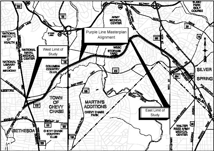
2 Master Plan Alignment Byrne Kelly Concept Trail Analysis - North vs. South Trail Access & Crossings Aesthetics
3
4 Master Plan Alignment Description Description Beginning of the project (Woodmont Ave.) to Pearl St. Pearl St. past MD 410 until beginning of Columbia Country Club Columbia Country Club past Connecticut Ave to 900 west of Jones Mill Road R-O-W Width Characteristics Under Apex and Air Rights Buildings North Side: Businesses & Residential South Side: Residential Golf Course, Businesses, & Residential
5 Master Plan Alignment Description Description R-O-W Width Characteristics 900 west of Jones Mill Rd to 200 east of Jones Mill Rd 200 east of Jones Mill Rd over Rock Creek to 900 east of Rock Creek 90 Residential 225 Park 900 east of Rock Creek to vicinity of Brookville Rd 66 Industrial & Residential
6 Master Plan Alignment Description Description R-O-W Width Characteristics Vicinity of Brookville Rd past Lyttonsville Pl until 800 east of Stewart Ave 60 Industrial CSX Corridor N/A Railroad R-O-W with Residences
7 Byrne Kelly Concept Description

8 Byrne Kelly Concept Description Engineered Version Acts as an open tunnel structure Significantly more disturbance during construction than the surface alignment Would need a pump station

9 Byrne Kelly Concept Description Portal/Transition area to the West
10 Byrne Kelly Concept Description Portal/Transition area to the East
11 Byrne Kelly Concept Description Location Length West Portal 690 Only 0.63 miles can be Double Stack West Transition 240 Double Stack 3300 East Transition 300 East Portal 750
12 Byrne Kelly Concept Description Safety Issues With open deck system objects can fall onto bottom track Danger of flooding trench Problem with snow in trench Operational issues - Reduces the benefit of a double track system Accumulation of wind blown trash
13 Byrne Kelly Concept Description Increased life cycle costs Additional inspection & maintenance Both track would need to be out of service to do certain types of inspection & maintenance
14 Trails Analysis - Design Guidelines No required design specifications by a national organization The Purple Line incorporated recommended design guidelines from the U.S. DOT Rails-With-Trails; Lessons Learned; August 2002


15 Trail Analysis Objective 1 Evaluate the Trail Location on the North Versus the South Side of the Transitway. Influenced by 2 factors: 1. Maintaining the trail 3-4 above the trackbed to provide vertical separation, while trying to follow existing topography of the land Benefits: Improves aesthetics Minimizes retaining wall heights; reduces construction costs Minimizes environmental and construction impacts Creates greater comfort level for trail users when trains pass Limits pedestrian trackbed crossings to the designated crossings 2. Providing access to many residents
16 Trail Analysis Objective 1 Results DESCRIPTION Beginning of the project (Woodmont Ave.) to Pearl St. Pearl St. through Columbia Country Club, past Connecticut Ave. until 400 west of Jones Mill Rd. Over Rock Creek until the study area limit, 100 east of Talbot Ave. bridge NORTH VS SOUTH South North South LENGTH 0.3 miles 1.7 miles 1.5 miles
17 Trail Analysis Objective 1 Results DESCRIPTION NORTH VS SOUTH LENGTH Talbot Ave. bridge to Spring St. (BRT only) North 0.6 miles OR Talbot Ave. bridge to Silver Spring Transit Center (LRT only) North 0.9 miles
18 Trail Analysis Objective 2 Evaluate the Possibility of Increasing the Separation Between the Trail and the Trackbed Goal: Setback of 25 (centerline of track to inside edge of trail) resulting in about a 10 wide planting area Planting Area Benefits: Acts as a screen or buffer between the trail and trackbed Improves the aesthetics of the trail
19 Trail Analysis - Recommendations The proposed location of the trail (combination of north and south side of trail) be adopted The trail and trackbed s horizontal and vertical alignments be revised to increase the horizontal separation wherever possible

20 Trail Access & Crossings - Bethesda

21 Trail Access & Crossings East West Hwy

22 Trail Access & Crossings Connecticut Ave

23 Trail Access & Crossings Jones Mill Rd

24 Trail Access & Crossings Jones Mill Rd

25 Trail Access & Crossings Lyttonsville Pl

26 Trail Access & Crossings Talbot Ave

27 Trail Access & Crossings CSX Crossing

28 Trail Access & Crossings Silver Spring
29 Major Roadway/Stream Crossings Wisconsin Ave East West Hwy Connecticut Ave Jones Mill Road Rock Creek Lyttonsville Pl Stewart Ave CSX 16 th Street Spring St Colesville Road

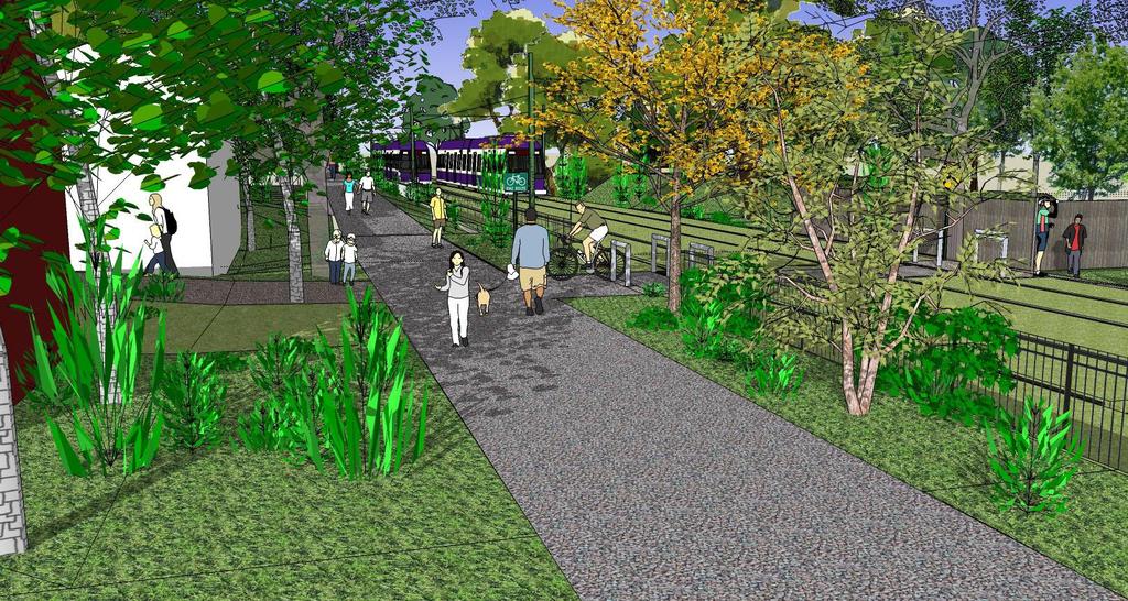
30 Trail Aesthetics Typical Section

31 Trail Aesthetics Isometric View

32 Trail Aesthetics - Grass Tracks Proposed Design Grass over top of the ballasted track section Helps reduce noise Helps with stormwater management Enhances visual setting

33 Trail Aesthetics Just west of East West Hwy Current Design Trail on south side Trail lower than track No planting area btwn track and trail Proposed Design Trail on north side Trail higher than track 11 planting area btwn track & trail Grass Tracks Fence btwn track & trail

34 Trail Aesthetics Near Columbia Country Club Current Design Trail on south side Trail lower than track 12 planting area btwn track and trail Proposed Design Trail on north side Trail higher than track Grass Tracks 12 planting area btwn track & trail Fence btwn track & trail

35 Trail Aesthetics West of Jones Mill Rd Current Design Trail on south side Trail higher than track 0-2 planting area btwn track and trail Proposed Design Trail on north side Trail higher than track Grass tracks 12 planting area btwn track and trail Fence btwn track & trail

36 Advantages Advantages: A more naturalistic environment A buffer/screen between the trail and track Minimizes retaining wall heights resulting in reduced construction costs Creates greater comfort level for trail users Increases safety by preventing trail users from crossing trackbed except at designated crossings Improves trail experience

37 Disadvantages Disadvantages: Residences on the south side of the trackbed would lose their current direct access to the trail The Transitway would be closer to the residences on the south side
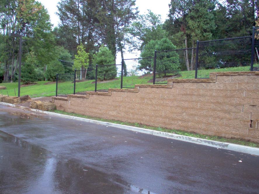
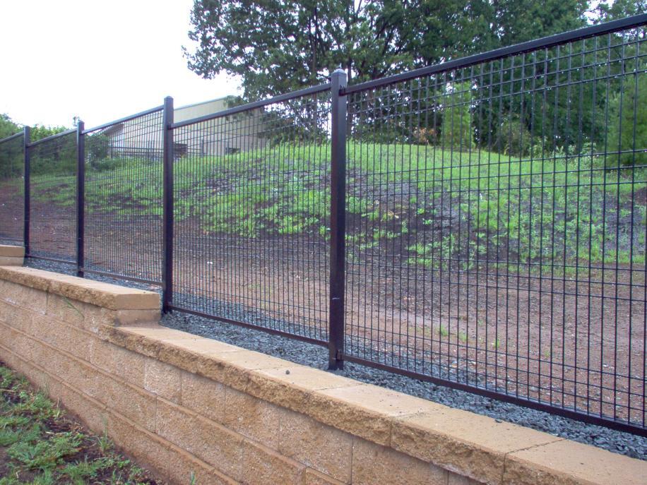
38 Trail Aesthetics Ornamental Fencing
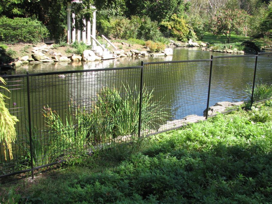
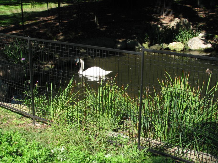
39 Trail Aesthetics Ornamental Fencing
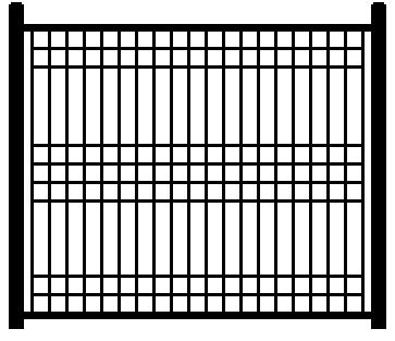
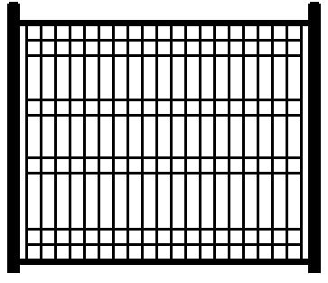
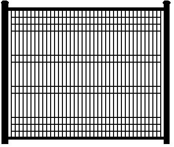
40 Trail Aesthetics Ornamental Fencing
41 Conclusions
purple line F u n c t i o n a l P l a n
 Approved and Adopted September 2010 purple line F u n c t i o n a l P l a n Montgomery County Planning Department The Maryland-National Capital Park and Planning Commission P u r p l e L i n e F u n c
MONTGOMERY COUNTY PLANNING DEPARTMENT THE MARYLAND NATIONAL CAPITAL PARK AND PLANNING COMMISSION
 MONTGOMERY COUNTY PLANNING DEPARTMENT THE MARYLAND NATIONAL CAPITAL PARK AND PLANNING COMMISSION MCPB Item No. 3 Date: 11-17-11 Planning Board Tour: Purple Line/Capital Crescent Trail (replacing the Georgetown
Auburn Trail / Ontario Pathways Trail Connector Feasibility Study Public Information Meeting Wednesday, August 22, 2012
 Auburn Trail / Ontario Pathways Trail Connector Feasibility Study Public Information Meeting Wednesday, August 22, 2012 Purpose of Feasibility Study Purpose Evaluate the feasibility of constructing a multiuse
Pattullo Bridge Replacement Project
 Pattullo Bridge Overview This document will: Explain the challenges facing the Pattullo Bridge today Share how we propose moving forward translink.ca PAGE 1 History By Order of the Lieutenant Governor
Resolution No.: Introduced: July 24, 2018 Adopted: July 24, 2018
 Resolution No.: 18-1215 Introduced: July 24, 2018 Adopted: July 24, 2018 COUNTY COUNCIL FOR MONTGOMERY COUNTY, MARYLAND SITTING AS THE DISTRICT COUNCIL FOR THAT PORTION OF THE MARYLAND-WASHINGTON REGIONAL
Appendix 1: Phase I Strategies
 Washington Metropolitan Area Transit Authority RTSP Presentation to the Technical Advisory Group January 19, 2012 Appendix 1: Phase I Strategies Base Case Definition MWCOG 2009 Adopted CLRP (2009-2030
METROPOLITAN COUNCIL 390 North Robert Street, St. Paul, MN Phone (651) TDD (651)
 TDD (651)") METROPOLITAN COUNCIL 390 North Robert Street, St. Paul, MN 55101 Phone (651) 602 1000 TDD (651) 291 0904 DATE: June 19, 2007 TO: Metropolitan Parks and Open Space Commission FROM: Jan Youngquist, Senior
METROPOLITAN COUNCIL 390 North Robert Street, St. Paul, MN 55101 Phone (651) 602 1000 TDD (651) 291 0904 DATE: June 19, 2007 TO: Metropolitan Parks and Open Space Commission FROM: Jan Youngquist, Senior
AGENDA ITEM 5 D WAKULLA ENVIRONMENTAL INSTITUTE (WEI) TRAIL FEASIBILITY STUDY
 TRAIL FEASIBILITY STUDY") March 19, 2018 AGENDA ITEM 5 D WAKULLA ENVIRONMENTAL INSTITUTE (WEI) TRAIL FEASIBILITY STUDY TYPE OF ITEM: Action STATEMENT OF ISSUE The Wakulla Environmental Institute (WEI) Trail is one of several trails
March 19, 2018 AGENDA ITEM 5 D WAKULLA ENVIRONMENTAL INSTITUTE (WEI) TRAIL FEASIBILITY STUDY TYPE OF ITEM: Action STATEMENT OF ISSUE The Wakulla Environmental Institute (WEI) Trail is one of several trails
URBAN DESIGN REPORT. Proposed Residential Development, Old Church Road, Caledon East
 Proposed Residential Development, Old Church Road, Caledon East TABLE CONTENTS: 1.0 DEVELOPMENT 1.1 Introduction-Analysis of Guiding Principles and Documents 1.2 Community Design and Architectural Design
Railroad Safety Trail
 2.1 INTRODUCTION AND PROJECT SETTING 2.1 Introduction & Project Setting Introduction This study is the result of a directed effort on the part of the City of San Luis Obispo to carry out previously established
Macleod Trail Corridor Study. Welcome. Macleod Trail Corridor Study Open House. Presentation of Proposed Design Concepts
 Macleod Trail Corridor Study Welcome Macleod Trail Corridor Study Open House Presentation of Proposed Design Concepts Study Purpose Develop a corridor plan for Macleod Trail that aligns with The City s:
Citrus Heights Creek Corridor Trail Project. Trail Advisory Group Meeting #3 July 8, 2013
 Citrus Heights Creek Corridor Trail Project Trail Advisory Group Meeting #3 July 8, 2013 Agenda Introductions Recap: Community Workshop, Survey Findings, and TAG Field Trip Community Concern Discussion:
SR 934 Project Development And Environment (PD&E) Study
 Study") SR 934 Project Development And Environment (PD&E) Study Project Advisory Group Meeting March 1, 2018 State Road 934/NE/NW 79th Street from west of I-95 (NW 13th CT) to N. Bayshore Drive PD&E STUDY SR 934/NE/NW
SR 934 Project Development And Environment (PD&E) Study Project Advisory Group Meeting March 1, 2018 State Road 934/NE/NW 79th Street from west of I-95 (NW 13th CT) to N. Bayshore Drive PD&E STUDY SR 934/NE/NW
Memorandum / Letter of Intent
 VERONA WAUKESHA KENOSHA APPLETON WESTON Memorandum / Letter of Intent To: Adam Sayre, Director of Planning & Development, City of Verona From: Kevin Yeska, JSD Professional Services, Inc. www.jsdinc.com
Master Plan of Highways and Transitways Master - Planned Transit Stations Effective 12/05/2017
 Bethesda Metro Station Bus Rapid Transit, Light Rail Corridor 4 (MD 355 South), Purple Line Countywide Transit Corridors, Purple Line Functional Plan Briggs Chaney Park and Ride Bus Rapid Transit Corridor
Report on Installation of Wayside Horns at Railroad Crossings and Railroad Trench System
 City Council Agenda November 4, 2014 Mayor and Council Agenda Item No. B.01 Reviewed by City Mgr s office: /KLM Memo to: From: Manteca City Council Karen L. McLaughlin, City Manager Date: October 28, 2014
South Bay Metro Light Rail Extension. Summer/Fall 2017 Project Briefings
 South Bay Metro Light Rail Extension Summer/Fall 2017 Project Briefings Meeting Agenda 2 Project History Project Development Schedule Feedback 3 Project History Alternatives Analysis Measure R $272M 2008
8 CROSS-BOUNDARY AGREEMENT WITH BRAMPTON TRANSIT
 8 CROSS-BOUNDARY AGREEMENT WITH BRAMPTON TRANSIT The Transportation Services Committee recommends the adoption of the recommendations contained in the following report dated May 27, 2010, from the Commissioner
Crystal City Station Improvements. Project Overview. Table 2: North Entrance. Table 1: South Entrance. 20th St. S 18th St. S.
 Table 1: South Entrance Table 2: North Entrance 20th St. S 18th St. S Proposed Second Entrance Crystal Drive Existing Station Location Platform Future 4 th Track Future New Airport Connection (by others)
FORT YORK PEDESTRIAN & CYCLE BRIDGE
 FORT YORK PEDESTRIAN & CYCLE BRIDGE November 2006 urban design landscape architecture architecture DTAH This is a new concept for the Fort York Pedestrian and Cycle Bridge linking Stanley Park (South)
EAST DON TRAIL ENVIRONMENTAL ASSESSMENT. Community Liaison Committee Meeting #3 July 15, :30 to 8:30 pm Flemingdon Park Library
 EAST DON TRAIL ENVIRONMENTAL ASSESSMENT Community Liaison Committee Meeting #3 July 15, 2013 6:30 to 8:30 pm Flemingdon Park Library Agenda 1. Welcome 2. Housekeeping and Updates a) Housekeeping b) CLC
ONONDAGA CREEKWALK PHASE II. Public Information Meeting Series 1
 ONONDAGA CREEKWALK PHASE II Public Information Meeting Series 1 Andrew Maxwell Director, Syracuse-Onondaga County Planning Agency Owen Kerney Assistant Director for City Planning Russell Houck, PE City
Appendix L Technical Memorandum Aesthetics
 Technical Memorandum Aesthetics 1.0 AESTHETICS This section provides a discussion of the aesthetic resources in the vicinity of ARTIC. Aesthetics pertain to the elements that make a certain view pleasing
South Bay Light Rail Extension Summer/Fall 2017 Project Briefing
 South Bay Light Rail Extension Summer/Fall 2017 Project Briefing Meeting Agenda 2 Project History Project Development Schedule Feedback Study Area Project History 4 Alternatives Analysis 2008 Measure R
Citrus Heights Creek Corridor Trail Project Trail Advisory Group Field Trip #2 September 11, :00 11:00 am Trellis Hall, Citrus Heights
 September 11, 2013 9:00 11:00 am Trellis Hall, Citrus Heights Project Overview The City of Citrus Heights is studying the feasibility of establishing a multi use trail system within the City s 26 miles
7272 WISCONSIN AVENUE LOCAL AREA TRANSPORTATION REVIEW
 7272 LOCAL AREA TRANSPORTATION REVIEW AND TRANSPORTATION POLICY AREA REVIEW MONTGOMERY COUNTY, MARYLAND Submitted on behalf of Carr Properties Prepared by: Wells + Associates, Inc. Submission: July 1,
Georgetown-Lewes Rail/Trail Study. Rail/Trail Study: Cool Spring to Cape Henlopen State Park New Road Extension (House Resolution No.
 Georgetown-Lewes Rail/Trail Study Rail/Trail Study: Cool Spring to Cape Henlopen State Park New Road Extension (House Resolution No. 47) August 22, 2011 Presentation Outline Background Benefits Statewide
Rapid Transit From Arbutus Street to UBC. Policy and Strategic Priorities Council Meeting January 30, 2019
 Rapid Transit From Arbutus Street to UBC Policy and Strategic Priorities Council Meeting January 30, 2019 Agenda 1. A History of Planning for Broadway Rapid Transit 2. The Need for Broadway Rapid Transit
South Bay Metro Green Line Extension
 South Bay Metro Green Line Extension Spring 2011 Community Meetings 1 2 Agenda Introduction Where We ve Been Project Status What s Next Discussion 3 Where We ve Been Scoping Meetings April/May 2010 4 Meetings
BONITA BEACH ROAD. May 18, Ian Lockwood, PE Cindy Zerger, AICP, ASLA Ken Ray, RLA. Greg Diserio, RLA. Tara Salmieri, AICP
 BONITA BEACH ROAD May 18, 2016 Ian Lockwood, PE Cindy Zerger, AICP, ASLA Ken Ray, RLA Greg Diserio, RLA Tara Salmieri, AICP Toole Design Group Engineers Planners Landscape Architects Authors BONITA BEACH
MONTGOMERY COUNTY PLANNING DEPARTMENT THE MARYLAND-NATIONAL CAPITAL PARK AND PLANNING COMMISSION
 MONTGOMERY COUNTY PLANNING DEPARTMENT THE MARYLAND-NATIONAL CAPITAL PARK AND PLANNING COMMISSION MCPB Item No. Date: 6/23/2016 Lucy V. Barnsley Elementary School Addition, Mandatory Referral MR2016027
DOWNTOWN BRT ALTERNATIVE - 19th AVE
 DOWNTOWN BRT ALTERNATIVE - 9th AVE New Route and Increased Service in Mixed Traffic Existing Route and Service in Mixed Traffic Light Rail Line / New Route and Increased in Exclusive Guideway Existing
MORGAN CREEK GREENWAY Final Report APPENDICES
 APPENDICES MORGAN CREEK GREENWAY Appendix A Photos of Existing Conditions in Trail Corridor Photos of existing conditions Main trail corridor - February 2009 Photos of existing conditions south bank Morgan
Chapter 4.0 Alternatives Analysis
 Chapter 4.0 Alternatives Analysis Chapter 1 accumulated the baseline of existing airport data, Chapter 2 presented the outlook for the future in terms of operational activity, Chapter 3 defined the facilities
Laxon Terrace - Sarawia. Click to add title. Street Rail Level Crossing. Public Forum. December
 Laxon Terrace - Sarawia Click to add title Street Rail Level Crossing Public Forum December 2012 www.aucklandtransport.govt.nz Overview of Presentation Objectives and Reasons for Separation Project Background
DENISON STREET EXTENSION. Transportation Committee. January 14, Feasibility Study
 DENISON STREET EXTENSION Feasibility Study January 14, 2014 Transportation Committee Markham Transportation Strategic Plan (MTSP) analysis completed in 2012 reviewed transportation requirements to accommodate
Sacramento Placerville Transportation Corridor Alternatives Analysis
 Sacramento Placerville Transportation Corridor Alternatives Analysis EL DORADO COUNTY TRANSPORTATION COMMISSION 1 Sacramento Placerville Transportation Corridor 2 Goal of the Project To give public officials
EP8.2 Presentation Exhibition GO Station Improvements
 EP8.2 Presentation Exhibition GO Station Improvements JANUARY 30, 2018 WORKING TOGETHER Metrolinx is working collaboratively with the City of Toronto, Exhibition Place, and the TTC to co-ordinate efforts
Thornton Water Project. Larimer County Route Study and Project Update September 12, 2017
 Thornton Water Project Larimer County Route Study and Project Update September 12, 2017 Purpose of Meeting Provide information on the Thornton Water Project Present the results of the pipeline routing
First Steps Towards Sustainable Operation of Road Tunnels. George Mavroyeni Australia
 First Steps Towards Sustainable Operation of Road Tunnels George Mavroyeni Australia Road Tunnel Operations First steps towards sustainable operation of road tunnels Available on PIARC website here PIARC
FEASIBILITY CRITERIA
 This chapter describes the methodology and criteria used to evaluate the feasibility of developing trails throughout the study areas. Land availability, habitat sensitivity, roadway crossings and on-street
Lansdowne Wetton BRT Public Transport Corridor Trunk Route: Planning Analysis
 Lansdowne Wetton BRT Public Transport Corridor Trunk Route: Planning Analysis 1. Introduction The purpose of this report is to detail the planning evaluation for the trunk route alignment alternatives
West Santa Ana Branch Transit Corridor. Community Meetings March 12, 13, 17 & 19, 2018
 West Santa Ana Branch Transit Corridor Community Meetings March 12, 13, 17 & 19, 2018 Purpose of this Meeting > Update on Public Scoping comments received > Why Metro is revisiting the Northern Alignments
A number of goals were identified during the initial work on this Big Lake Transportation Plan.
 C. Transportation General Background Information Big Lake s transportation system includes all the roads, paths and facilities that allow the movement of private vehicles, trains and planes, as well as
Lake Erie Commerce Center Traffic Analysis
 LOCATION: East of NYS Route 5 at Bayview Road Town of Hamburg Erie County, New York PREPARED BY: Wendel Companies 140 John James Audubon Parkway Suite 200 Amherst, New York 14228 January 2012 i ii Table
LIVE. WORK. PLAY. STATUS OF DEVELOPMENT FALL Produced for information by the Town of Markham
 LIVE. WORK. PLAY. STATUS OF DEVELOPMENT Produced for information by the Town of Markham Community TOWN OF MARKHAM CIVIC CENTRE 101 TOWN CENTRE BOULEVARD Completed in 1989. East of Town Centre Boulevard,
Public Open House. Chief Peguis Trail Project
 Public Open House Chief Peguis Trail Project CHIEF PEGUIS TRAIL OPEN HOUSE Welcome! Please browse the display boards Project Engineers and City of Winnipeg representatives are available to address your
Union Station Rail Corridor East
 Union Station Rail Corridor East Community Advisory Committee CAC Meeting #2: Overview of Track Expansion Plans March 6, 2018 PURPOSE OF CAC MEETING #2 Future service requirements Infrastructure needed
SCOPING INFORMATION PACKET
 SCOPING INFORMATION PACKET Project Description The proposed project would provide a direct link connecting several light rail lines in operation or in construction, including the Metro Gold Line to Pasadena,
Parkland County Municipal Development Plan Amendment Acheson Industrial Area Structure Plan
 Parkland County Municipal Development Plan Amendment Acheson Industrial Area Structure Plan New Plan Acheson Industrial Area Structure Plan Amendment Parkland County Municipal Development Plan Board Reference
Airport Obstruction Standards
 Airport Obstruction Standards Dr. Antonio Trani Department of Civil and Environmental Engineering Virginia Tech Outline of this Presentation Obstructions to navigation around airports Discussion of Federal
Metro ExpressLanes April 5, 2011 Community Meeting re: Adams Blvd Improvements
 Metro ExpressLanes April 5, 2011 Community Meeting re: Adams Blvd Improvements Jan Perry Councilwoman, District 9 Welcome Remarks Arthur T. Leahy Chief Executive Officer, Metro Metro ExpressLanes Overview
Preliminary Findings of Proposed Alternative
 Preliminary Findings of Proposed Alternative The attached drawing provides a schematic layout of the proposed alternative that will be discussed on July 27, 2010. A full report will follow and should be
United States Department of the Interior National Park Service. Boundary Expansion Listed in National Register January 11, 2017
 NPS Form 10900-a (Rev. 8/2002) OMB No. 10240018 United States Department of the Interior National Park Service Boundary Expansion Listed in National Register January 11, 2017 National Register of Historic
Lake Tahoe Airport Master Plan
 Lake Tahoe Airport Master Plan City Council Briefing October 20, 2015 What is an Airport Master Plan? a comprehensive study of an airport [that] usually describes the short, medium, and long term development
1 PROJECT STATUS UPDATE 2 ND CONCESSION FROM BRISTOL ROAD TO DOANE ROAD TOWNS OF EAST GWILLIMBURY AND NEWMARKET
 Report No. 3 of the Regional Council Meeting of March 28, 2013 1 PROJECT STATUS UPDATE 2 ND CONCESSION FROM BRISTOL ROAD TO DOANE ROAD TOWNS OF EAST GWILLIMBURY AND NEWMARKET The recommends: 1. Receipt
GREENBELT-BWI THURGOOD MARSHALL AIRPORT EXPRESS LINE ROUTE B30
 MARYLAND GREENBELT-BWI THURGOOD MARSHALL AIRPORT EXPRESS LINE ROUTE B30 BUDGET Cost neutral Option 1 Serve Arundel Mills Mall PROPOSED CHANGE Add service to Arundel Mills Mall on all trips. The time between
Alliant Energy Center Visioning Workshop Input Madison, WI July 20, 2017
 Alliant Energy Center Visioning Workshop Input Madison, WI July 2, 217 A neighborhood meeting was held on July 18 and 19 th, 217 to gather community feedback on the topics of connections, destination district,
In its draft recommendations presented during a September public meeting. MC-DPW&T outlined plans f& the CCTIMBT trail loop that would:
 I THE J Vol X No. 1 Capital CrescentIMetropolitan Branch Plans Outlined I The Montgomery County Department of Public Works & Transportation, in collaboration with Maryland-National Capital Park & Planning
Logo Department Name Agency Organization Organization Address Information 5700 North Sabino Canyon Road
 Logo Department Name Agency Organization Organization Address Information United States Forest Coronado National Forest 5700 North Sabino Canyon Road Department of Service Santa Catalina Ranger District
Centurion Way Chichester
 Centurion Way Chichester Work book of plans to show details of the Centurion Way, its links, and potential developments and enhancements from linking to the South Downs National Park all the way to the
Stage 2 ION: Light Rail Transit (LRT) from Kitchener to Cambridge
 from Kitchener to Cambridge") Stage 2 ION: Light Rail Transit (LRT) from Kitchener to Cambridge Public Consultation Centre (PCC) No. 3 Please Sign-in Cambridge City Hall November 21, 2017 2:00 to 8:00pm Preston Memorial Auditorium
Stage 2 ION: Light Rail Transit (LRT) from Kitchener to Cambridge Public Consultation Centre (PCC) No. 3 Please Sign-in Cambridge City Hall November 21, 2017 2:00 to 8:00pm Preston Memorial Auditorium
Airport Planning Area
 PLANNING AREA POLICIES l AIRPORT Airport Planning Area LOCATION AND CONTEXT The Airport Planning Area ( Airport area ) is a key part of Boise s economy and transportation network; it features a multi-purpose
WELCOME to the Iditarod Dog Sledding Historic District (IDSHD) Workshop. January 11, Houston Middle School Houston, Alaska
 Workshop. January 11, Houston Middle School Houston, Alaska") WELCOME to the Iditarod Dog Sledding Historic District (IDSHD) Workshop January 11, 2012 Houston Middle School Houston, Alaska Workshop Purpose: Present/discuss proposed resolutions to comments received
WELCOME to the Iditarod Dog Sledding Historic District (IDSHD) Workshop January 11, 2012 Houston Middle School Houston, Alaska Workshop Purpose: Present/discuss proposed resolutions to comments received
WAIKARAKA CYCLEWAY: LESSONS LEARNT. Daniel Newcombe & Ina Stenzel Auckland City Council
 WAIKARAKA CYCLEWAY: LESSONS LEARNT Daniel Newcombe & Ina Stenzel Auckland City Council Introduction Waikaraka cycleway is key link in Auckland regional cycle network Lessons learnt from two sections: Pikes
LA Metro Rapid - Considerations in Identifying BRT Corridors. Martha Butler LACMTA, Transportation Planning Manager Los Angeles, California
 LA Metro Rapid - Considerations in Identifying BRT Corridors Martha Butler LACMTA, Transportation Planning Manager Los Angeles, California LA Metro Transportation planner/coordinator, designer, builder
Submitted to: NYX CAPITAL CORP. 1131a Leslie Street, Suite 201 Toronto, Ontario M3C 3L8 Attention: Mr. Tim Jessop Development Manager
 New Development Setback Assessment in Proximity to Railway Corridor Orangeville Brampton Railway Proposed Residential Development at 12 Henderson Avenue, Brampton, Ontario Submitted to: NYX CAPITAL CORP.
Community Advisory Panel Meeting #
 Community Advisory Panel Meeting # 6 02.13.19.. Agenda Welcome and Introductions Community Conversations City Council Meeting Debrief Review Citywide Tunnel Video (North Portal Only) Churchill Pedestrian
Ammonite Falls Descent
 Trail Benson Creek Falls ABOUT THE SITE Today, people descend a steep ravine to reach the base of Ammonite Falls, which is one of the most soughtafter views in the park. Over the past several years, awareness
LAX Specific Plan Amendment Study (SPAS) Final EIR and Related Actions. Board of Airport Commissioners February 5, 2013
 Final EIR and Related Actions. Board of Airport Commissioners February 5, 2013") LAX Specific Plan Amendment Study (SPAS) Final EIR and Related Actions Board of Airport Commissioners February 5, 2013 1 Background The LAX Master Plan Program serves as the airport s long range development
LAX Specific Plan Amendment Study (SPAS) Final EIR and Related Actions Board of Airport Commissioners February 5, 2013 1 Background The LAX Master Plan Program serves as the airport s long range development
Memo. Orange City Trail Plan Becky Mendez, AICP Jamie Krzeminski, PE, PTOE Matt Wiesenfeld, PE, AICP. Development of the Existing and Proposed Network
 Memo Date: Friday, December 22, 2017 Project: To: From: Subject: Trail Plan Becky Mendez, AICP Jamie Krzeminski, PE, PTOE Matt Wiesenfeld, PE, AICP Development of the Existing and Proposed Network HDR
Longmont to Boulder Regional Trail Jay Road Connection DRAFT FINAL REPORT
 Longmont to Boulder Regional Trail Jay Road Connection DRAFT FINAL REPORT December 2018 Project Summary Boulder County, Colorado, in partnership with the City of Boulder, is evaluating options for multi-use
Part four. In this part you will find: The next steps to deliver the master plan
 Part four NEXT STEPS In this part you will find: The next steps to deliver the master plan 6. How COULD the Master Plan be delivered? There are a number of steps required to take the proposals in the master
Approval of August 2019 Service Changes
 Approval of August 2019 Service Changes Operations, Safety & Security Committee April 9, 2019 Rob Smith AVP Service Planning and Scheduling 1 Today s Consideration Approve proposed August 2019 service
Dufferin Jog Elimination Project
 Project Project Status Update November 14 2007 Project History Planning Alternatives Criteria Measured Project Benefits Structural Configurations Considered Structural Design Considerations The Preferred
Railway-Highway Crossing at Grade Regulations: Guidelines for British Columbia s Provincial Heritage Railways
 Railway-Highway Crossing at Grade Regulations: Guidelines for British Columbia s Provincial Heritage Railways SHORT TITLE 1. These Guidelines may be cited as the Railway-Highway Crossing at Grade Guidelines.
Appendix E: Railroad Route Evaluation, Maps and Tables
 Appendix E: Railroad Route Evaluation, Maps and Tables LandPeople E-1 Table of Contents 1.0 Railroad Operations...3 2.0 Rails-with-Trails...3 3.0 Methodology...3 4.0 Trail Design Assumptions...4 5.0 Typical
Assessing Your Trails, Keeping Them Safe and Enjoyable
 Jon Wood, PLA, ASLA Associate Vice President Stewart Bert Lynn, PLA, ASLA, LEED AP Project Manager Mecklenburg County Asset and Facility Management Assessing Your Trails, Keeping Them Safe and Enjoyable
Uniform Interjurisdictional Trail Design, Use, and Management Guidelines
 Uniform Interjurisdictional Trail Design, Use, and Management Guidelines In Fulfillment of County General Plan Policy PR-TS(i) 6A) Santa Clara County Interjurisdictional Trails Committee A Program of the
PEMBERTON VALLEY RECREATIONAL TRAILS MASTER PLAN UPDATE Community Open House. April 2018
 PEMBERTON VALLEY RECREATIONAL TRAILS MASTER PLAN UPDATE Community Open House April 2018 Introductions Introductions Matt Bakker, BHA Project Coordinator Other Team Members: Liz Scroggins, Grey Owl Consulting
LAS VARAS RANCH CA COASTAL TRAIL PROPOSED ALIGNMENT
 LAS VARAS RANCH CA COASTAL TRAIL PROPOSED ALIGNMENT Santa Barbara Trails Council * Prepared by Ray Ford February 1,2012 The following notes accompany the Santa Barbara Trails Council map for the Las Varas
Part Three : COMMUNITY PLAN AREAS AND SPECIAL STUDY AREAS SACRAMENTO 2030 GENERAL PLAN. Introduction
 Special study Areas Part Three : COMMUNITY PLAN AREAS AND SPECIAL STUDY AREAS SACRAMENTO 2030 GENERAL PLAN Introduction Beyond the boundaries of the 2030 General Plan, the City has defined Special Study
Trail # NW Tuesday, June DESIGN. Provide an Review the Provide an. Project Goals: System system. wayfinding
 I. Welcome / Introductions Bethany Creek Trail #2 Segment 3 Neighborhood Meeting #1 Bethany Presbyterian Church 15505 NW Springville Road, Portland, OR 97229 Tuesday, June 26, 2018 @ 6:00PM Meeting Minutes
Final Environmental Impact Statement for the Merced Wild and Scenic River. Comprehensive Management Plan, Yosemite National Park, Madera and Mariposa
 This document is scheduled to be published in the Federal Register on 02/26/2014 and available online at http://federalregister.gov/a/2014-04061, and on FDsys.gov DEPARTMENT OF THE INTERIOR 4312-FF NATIONAL
Gold Coast. Rapid Transit. Chapter content. Chapter four Route selection and staging
 Chapter four Route selection and staging Gold Coast Rapid Transit Chapter four Route selection and staging Chapter content Route selection...73 Section one: Helensvale to Griffith University...74 Section
BAXTER LAKE RECREATION AREA ASSOCIATION
 Baxter Lake Recreation Area Association SITE CONTROL COMMITTEE RULES TABLE OF CONTENTS Notes 2 Introduction 2 Campsites 2 Common Grounds 2 Green Areas 2 Cutting Trees 3 Application for Site Alteration
Madison Metro Transit System
 Madison Metro Transit System 1101 East Washington Avenue Madison, Wisconsin, 53703 Administrative Office: 608 266 4904 Fax: 608 267 8778 TO: FROM: SUBJECT: Plan Commission Timothy Sobota, Transit Planner,
US 380 FEASIBILITY STUDY
 US 380 FEASIBILITY STUDY Denton County CSJ(s): 0135-10-061, 0135-10-062 Public Meeting(s): January 15 & 22, 2019 WELCOME US 380 Denton County Feasibility Study DALLAS DISTRICT PUBLIC MEETING January 15
7:00 p.m. General meeting called to order. Paul Conte, Chair 7:05 p.m. Introductions Reminder: All JWN members should fill out and return a sign-in
 Agenda 7:00 p.m. General meeting called to order. Paul Conte, Chair 7:05 p.m. Introductions Reminder: All JWN members should fill out and return a sign-in card to receive a ballot. All guests are requested
TRB and ACRP Research Updates: Practical Application
 TRB and ACRP Research Updates: Practical Application 2014 ACI Environmental Affairs Conference Danielle J. Rinsler, AICP FAA Office Airports, Airport Planning and Environmental Division Baltimore, MD Advisory
The Baker/Carver Regional Trail is intended to
 Section V Design Guidance The Baker/Carver Regional Trail is intended to safely accommodate 183,000 annual visits, an array of non-motorized uses, a variety of skill levels, and persons with special needs.
Great Allegheny Passage
 Great Allegheny Passage Two documents are provided: Great Allegheny Passage Special Use Permit Application Great Allegheny Passage Rules and Guidelines. Great Allegheny Passage Allegany County Government
The Effect of an Efficient Public Transport System on Poverty: Lessons for Johannesburg from Bogotá Eugenia Mpofu
 The Effect of an Efficient Public Transport System on Poverty: Lessons for Johannesburg from Bogotá Eugenia Mpofu A research report submitted to the Faculty of Engineering and the Built Environment: University
Stage 2 - November 2017 Survey and Map Comments (verbatim)
") Stage 2 - November 2017 Survey and Map Comments (verbatim) Identifying information removed to meet Freedom of Information and Protection of Privacy Act (FOIP Act). Comments are recorded exactly as they
Stage 2 - November 2017 Survey and Map Comments (verbatim) Identifying information removed to meet Freedom of Information and Protection of Privacy Act (FOIP Act). Comments are recorded exactly as they
1.2 Corridor History and Current Characteristics
 SECTION 1 Description and Background of Study Area 1.1 Introduction This preliminary engineering report was prepared for the Alaska Department of Transportation and Public Facilities (ADOT&PF). It is part
Porter Fk. #1. All unauthorized items removed as per FS & Rec Res guidelines. Footbridge may be needed for wheel chair access and for safety
 APPENDIX D Lot Specific Permit Compliance & Forest Plan (FP) Requirements Porter Fork Recreation Residence Tract (Items noted were documented in compliance letter, 8/12/2005, sent to all Rec. Residence
PULLMAN-MOSCOW REGIONAL AIRPORT Runway Realignment Project
 PULLMAN-MOSCOW REGIONAL AIRPORT Runway Realignment Project GENERAL AIRPORT INFORMATION AIRPORT USERS Airport ownership: Public, owned by the Pullman-Moscow Regional Airport Board Year opened: February
Welcome to the future of Terwillegar Park a Unique Natural Park
 Welcome to the future of Terwillegar Park a Unique Natural Park 1 Introduction The Terwillegar Park Concept Plan study will develop an overall concept plan, management objectives and development guidelines
LYNDHURST NEW URBAN DEVELOPMENT AREA STRUCTURE PLAN. Lyndhurst New Urban Development Area Structure Plan OUTCOMES AND PERFORMANCE STANDARDS
 APPENDIX 15.1-3 LYNDHURST NEW URBAN DEVELOPMENT AREA STRUCTURE PLAN Purpose of the Structure Plan Lyndhurst New Urban Development Area Structure Plan OUTCOMES AND PERFORMANCE STANDARDS LSP-P1 The District
Committee Report. Community Development Committee For the Metropolitan Council meeting of April 13, Business Item No.
 Committee Report Business Item No. 2016-48 Community Development Committee For the Metropolitan Council meeting of April 13, 2016 Subject: Harriet Island-South St. Paul Regional Trail Master Plan, Saint