In its draft recommendations presented during a September public meeting. MC-DPW&T outlined plans f& the CCTIMBT trail loop that would:
|
|
|
- Gregory Alexander
- 5 years ago
- Views:
Transcription


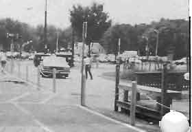
1 I THE J Vol X No. 1 Capital CrescentIMetropolitan Branch Plans Outlined I The Montgomery County Department of Public Works & Transportation, in collaboration with Maryland-National Capital Park & Planning Commission, is currently assessing the feasibility and design of some "generously" landscaped trail connections that would link the Capital Crescent Trail to the Metropolitan Branch and Sligo Creek Trails. Part of an overall plan called the North and West Silver Spring Master Plan, these trail links will provide access to the Silver Spring Transit Center and other destinations. The CCT serves as part of an urban corridor of the trail system in D.C. and Montgomery County. When completed and connected to the sevenmile Union Station to Silver Spring Metropolitan Branch Trail (MBT), the multi-use trail will result in a loop that links Union Station in Washington, D.C. to Silver Spring, Chevy Chase and Bethesda in Maryland, and Palisades and Georgetown in D.C. A portion of the MBT is currently under construction (see photo below) following an engineering feasibility study that was completed in 1997 and concluded that the trail is both structurally and economically feasible. In addition, a link from both trails to the Sligo Creek Trail would follow Wayne Avenue from the Silver Spring Metro. In its draft recommendations presented during a September public meeting. MC-DPW&T outlined plans f& the CCTIMBT trail loop that would: L Continued on page 5. Under ( ~onstruction: The Metropolitian Branch Trail at CUAIBrookland Metro.

, P.O. Box 30703, Bethesda, MD 20824, phone (202) 234-4874. CCCT is a non-profit citizen's group promoting development of the 11.")
2 District of Columbia & Montgomery County. Md THE COALITION FOR THE CAP~~AL CRESCENT TRAIL BOARD MEMBERS : Officers: :John Duggers, Chair : Victoria Cordova, Vice-Chair : Ernie Brooks, Treasurer : David Sproul, Secretary : Charlie Wellander, Ass't Treasurer At-Large Members: Henri Bartholomot John Campanile Nadine Dutcher Doug Engle Phil Lerman Wayne Phyillaier David Putnam is published three times a board year (June-June) by the Coalition for the Capital Crescent Trail (CCCT), P.O. Box 30703, Bethesda, MD 20824, phone (202) CCCT is a non-profit citizen's group promoting development of the 11.2 mile rail-to-rail conversion from Georgetown, D.C. to Silver Spring, MD for multi-purpose, recreational use. Editor: John Campanile Contributing Editors: John Dugger Design: Jane Garrett Distribution: Ellen Jones Heather Anderson Washington Area Bicyclist Assn. REACH THE CAPITAL CRESCENT BY INTERNET For those of you who prefer to "surf the net" you can reach the Capital Crescent Trail through Ernie Brooks: "ewbrooks@oasys.ctt.navy.mil" He'll process your Copyright 1998 Coalition for The Capital Crescent Trail Reproduction of information is for nonprofit use is encouraged. Please use with attribution. We request that all entries should be sent to the post office box listed above. Submissions should be sent on 3.5" diskette or via to john~campanile@paramount.com. using recycled paper and soy based ink. 1
. At right, a Park Police volunteer installs one of many bicycle be1 Is that were given away courtesy of the Coalition.")

3 CCCT Hosts Second "Bells & Whistles" Members of the Coalition and the Park Police Volunteer Bicycle Patrol teamed up on Saturday, September 5, during the Labor Day weekend, for another "Bells & Whistles" event (The first event was held during the Memorial Day weekend). At right, a Park Police volunteer installs one of many bicycle be1 Is that were given away courtesy of the Coalition. In addition, a number of whistles on lanyards were given away to rollerbladers. b Montgomery County and D.C. regulations state that both bicyclists and rollerbladers are required to give audible warning when overtaking slower moving trail users. The Coalition will continue to work with officials of the National Park Service and the two Montgomery County departments responsible for management of the Trail to develop and implement uniform amenities, such as safety signs and brochures, so that users on wheels and users on feet will understand their responsibilities. The Montgomery County Department of Public Works & Transportation (MCPW&T) plans to remove the feet of railroad tracks immediately east of Stewart Avenue, at the trailhead of the Capital CrescentlGeorgetown Branch Trail,.for reuse by the County Maintenance Depot. In addition, PW&T crews will remove accumulated trash, install a barrier across the right-of-way along the east side of Stewart to prevent illegal dumping, and plant some evergreens behind the barrier to screen the area from the surrounding communities once their salvage work is completed. The screening will also complement the Georgetown Branch which transitions from off-street to on-street at this point. [Footnote: Once completed, there will be only two sections of the Trail's right-of-way from which rails have not yet been removed - east of the Lyttonsville Place bridge and south of the River Road bridge.] Any considerations of using this "cleared" area for future off-road trail extension east of Stewart to Kansas Avenue or to the CSX mainline will not be possible without the purchase of the right-of-way still remaining in CSX ownership, according to a County official. The Coalition applauds the County's efforts in this cleanup and improvement along this section of the Trail. Unfortunately, the extensive trail erosion that had occurred as a result of last spring's rain between Crubb Road and Stewart Avenue will not be dealt with at this time due to the amount of work that is required. 3


4 4


5 w Plans, continued from page 1 Provide a direct and continuous off-road trail for pedestrians and bicyclists parallel to the proposed Transitway (light-rail trolley) into Silver Spring. Provide trail connections to neighborhoods, communit ilities, and other destinations. The following connections to the Capital Crescent Trail have been recommended: Rock Creek Trail East, Grubb Road, Lyttonville Place bridge, Stewart Avenue, Warren StreetIWoodlin Elementary School, Kansas Avenue, Talbot Avenue, Lanier Drive, Rosemary Hills Elementary School, Park Sutton Condos1 Woodside Mews, Noyes Drive, Ballard Street, and Kentbury Drive. Develop traahead parking for the Capital Crescent Trail at the southeast corner of Lyttonsvil le Place and Brookville Road (property currently owned by M-NCPPC), vital to reduce conflicts with residential and commercial CCT connection at Kentbury Drive in Bethesda. parking. Design the trail for safety by separating pedestrians and bicyclists. Develop a design concept that enhances trail user's experience, include such amenities as landscaping, attractive fences and walls and rest areas with benches, as-well as incorporating the principles of Crime Prevention Through Environmental Design (CPTED) as a means of deterring crime. Acquire additional right-of-way or easements as needed to ensure trail continuity and use of the most desirable and feasible trail design. This would include the amount of space needed for different types of transit alternatives, i.e., the "light rail trolley," as well as trail design in constrained areas. Ensure that any trail built before the transitway will not compromise the proposed transitwayltrail pairing. Provide safe trail crossings of roads and railways. Specifically, a separate bridge for the trail cross the CSX railroad tracks due to the narrow width of the existing Talbot Avenue Bridge. In its draft recommendations presented during a September public meeting, MC-DPW&T outlined plans for the CCTIMBT trail loop that would: Provide a direct and continuous off-road trail for pedestrians and bicyclists parallel to the proposed Trainsitway (light-rail trolley) into Silver Spring. Provide trail connection to neighborhoods, community facilities, and other destinations. The following connections to the capital Crescent Trail have been recommended: Rock Creek Trail East Crubb Road, Lyttonville Place bridge, Stewart Avenue, Warrent StreetlWoodlin Elementary School, Kansas Avenue,Talbot Avenue, Lanier Drive, Rosemary Hills Elementary School, Park Sutton Condos/Woodside Mews, Noyes Drive, Ballard Street, and Kentbury Drive. i/' Continued on page 6. 5

6
7 i V 5 Years Ago... One-half mile section of Trail between Bethesda Avenue and Little Falls Parkway is paved and landscaped. Ourisman Honda and Miller Properties donate a total of $20,000 for Trail improvements at Bethesda Avenue access. CCCT holds 21-mile walk/run/bike circuit tour of Capital Crescent and Rock Creek Trails; 56 trail supporters participate. 10 Years Ago... At a public hearing, 120 people urge the Montgomery County Council to purchase CCT right-of-way. Then- Montgomery County Executive Sidney Kramer signs agreement to purchase 6.4 miles of right-of-way (60-70 acres) for $10.5 million (Nov. 22). Coalition volunteers place CCCT decals every yards along the entire 1 1-mile route, marking the Trail for the first time. Most of the decals mysteriously disappear in the following weeks. CCCT is now comprised of 35- member organization representing over 50,000 area residents. 17 Years Ago... The Smithsonian Institution celebrates the 1 50th anniversary of the historic John Bull steam locomotive on a section of the line from Georgetown to the Arizona Avenue trestle. The event served notice that the Georgetown Branch has become largely obsolete as a working freight line (The last train to Georgetown ran in 1985). 88 Years Ago... The Georgetown Branch is finally completed from Silver Spring to Georgetown (1910). The line is operated by B&O Railroad, carrying building supplies and coal to Capital Traction Company's central power house and later to the General Service Administration heating plant (the line's last major customer) in Georgetown. ln.1914, the line was temporarily extended east over Rock Creek to carry limestone and other building materials for the construction of the Lincoln Memorial. DIAL UP TRAIL CONDITIONS AND EVENTS Be the Coalition's eyes and ears the next time you're out on the Trail - Call the CCCT Information Line at and press "8" when prompted. Leave a message on trail conditions that you've encountered, or on any issue which might impact the Trail. The hotline message provides trail users with weekly updates on trail conditions and Coalition events. If you're new to the Capital Crescent Trail, leave your name and address to receive a membership brochure. After reading it, we hope you'll support the CCT and become a member of the Coalition. CCCT l NFORMATION LINE, Use your touch-tone phone'to access one of our mailboxes: 1 : Background of the CCT 5: Volunteer activities 2: Coalition meeting dates 6: Other messages 3: Membership information 8: Trail hotline & events 4: Obtain a CCT map 7


8 NEW FENCING ALONG CCT w In recent weeks, twb new fences have been installed on the Capital Crescent Trail. At top, a 500-foot split-rail fence along a section of the Trail near Randall Lane and Brookeway Drive, just west of the Massachusetts Avenue overpass. The purpose of the fencing, according to a Park and Planning official, is to prevent Trail users from accidentally falling into an adjacent ravine. Another fence, bottom, was erected at the Ourisman Honda location and funded by the Coalition. This represents another part of the Coalition's continuing beautification efforts along the Trail as the fence conceals dumpsters that are situated on the Ourisman property. 8


9 rd ARCHAEOLOGICAL DIG AT FLETCHER'S BOATHOUSE I w Archaeologists have discovered eight underground silos at Fletcher's Boathouse, which is located next to the Capital Crescent Trail and the C&O Canal, thought to have been built about 2,000 years ago. The presence of these silos suggests that Native Americans, or those living at that location, used these as storage pits to store their harvests. This discovery has excited and puzzled archaeologists since American lndians were not known to have lived in villages or to have used storage pits 2,000 years ago. Similar pits found on other locations along the East Coast are about 1,000 years old and were built at time when American lndians had turned to farming, tended to stay in one place for long periods of time and used silos to store their harvests. What these older silos were used for is a mystery - and another reason for the excitement about their discovery. The silos are about seven feet across and five feet deep. Seven of the eight silos are cylindrical and one is bell-shaped. The latter took on the odd shape when the makers encountered a large rock about four feet below the surface and simply dug around it. This dig began after the National Park Service decided to build a new bridge that can be used by cars, pedestrians and bicycles crossing of the Capital Crescent Trail and the C&O Towpath. (The current pedestrian bridge is in poor shape and the tunnel under the canal is too small for emergency vehicles.) Before such construction can begin on federal land, government regulations require that an archaeological study be conducted. Although the discovery of the silos is considered significant, the Park Service believes that construction of the new bridge and improved car access will start as planned. Please designate THE COALITION FOR THE CAPITAL CRESCENT TRAIL in the United WayICombined Federal Campaign (CFC) of the National Capital Area CCCTys CFC number is 7221 Please include us in your CFC contributions or pledges by filling in our designation number on your contributionlpledge form..d 9
, who volunteer frequently and have adopted a shelter for 12 abused children and young adults ages 9-17.")


10 ROCKVILLE FIRM SPONSORS TRAIL CLEANUP The Coalition applauds the employees of a firm headquartered in Rockville: UCG, Inc. (for United Communications Group), who volunteer frequently and have adopted a shelter for 12 abused children and young adults ages Each month the volunteers do a weekend activity with the shelter residents, and on Saturday, October 3 they worked along the Trail near Georgetown, picking up trash and painting the walls of the tunnel under the C&O Canal and Canal Road at the Foxhall intersection. Efforts by this group and others are coordinated by the Volunteer Office of the C&O Canal National Historical Park. u Water, Water Crews have "roughed in" the site of a new water fountain at the Dalecarlia Treatment Plant, located at the 6.5-mile marker along the Trail. The Coalition and a generous donor have provided funds for the fountain CCTa featured tour on Nat Cap '98 Again this year, the Capital Crescent Trail was one of three tours offered by the Washington Area Bicyclist Association in its 5Ih annual National Capital Bicycle Tours held on October 4. Riders had their choice of a ninemile or 23-mile tour, with the latter including a trip through the Wisconsin Avenue tunnel and Rock Creek Park. 10 u
11 YES! 1 Want To Help Complete The Capital Crescent Trai I! Name(s) (H) 0 Address Apt. City State Zip O $100 SPECIAL HONOR MEMBERSHIP 0 $30 SUSTAINING MEMBERSHIP Your name on our annual report, action alerts Newsletter subscription, action alerts. and subscription to our newsletter. a $10 INDIVIDUAL MEMBERSHIP IF DESIRED, Rail spike: jes, OR T-shirt, size M L XL Newsletter subscription, action alerts. $60 SPONSORING MEMBERSHIP Newsletter subscription, action alerts. - New Member - Renewing Member IF DESIRED, T-shirt, size: M L XL Thanks for your efjcorts to Open The Tunnel! On to the Rock Creek Trestle! Here's an additional contribution of $. Make checks payable to: The Coalition for the Capital Crescent Trail, P.O. Box 30703, Bethesda, MD Detailed four-color map of the Capital Crescent Trail with historical perspectives is free to new members. All contributions are tax-deductible. Calendar of Events All events are rain or shine, unles noted. To confirm any event, call the CCCT, , box 8 Monday, October 26, 7 p.m. CCCT BOARD MEETING, Bethesda Regional Library, Arlington Rd. Bethesda Metro. lndoor bicycle parking. Guests are welcome! Monday, December 7, 7 p.m. CCCT BOARD MEETING, Bethesda Regional Library, Arlington Rd. Bethesda Metro. lndoor bicycle parking. Guests are welcome! EarlyIMid-January, [date TBA] CAPITAL CRESCENT TRAIL WALKING TOUR, details to be mailed. Monday, January 4, 7 p.m. CCCT BOARD MEETING, Bethesda Regional Library, Arlington Rd. Bethesda Metro. lndoor bicycle parking. Guests are welcome! Monday, February 8, 7 p.m. CCCT BOARD MEETING, Bethesda Regional Library, Arlington Rd. Bethesda Metro. lndoor bicycle parking. Guests are welcome! 11
12 Non-Profit Org. U.S. Postage Permit it4468 Wash., DC P.O. Box Bethesda, MD 20824
The dangerous conflicts that occur regularly between trail users and motorists at the crossings
 TheCrescent THE COALITION FOR THE CAPITAL CRESCENT TRAIL Fall 2005 Vol. XII No. 9 Task Force takes on safety issues at Little Falls Parkway INSIDE THIS ISSUE 3 Metropolitan Branch Trail design takes a
THE COALITION FOR THE CAPITAL CRESCENT TRAIL. A Letter to Capital Crescent Trail Members
 TheCrescent THE COALITION FOR THE CAPITAL CRESCENT TRAIL Spring 2007 Vol. XII No. 1 INSIDE THIS ISSUE 3 Hope Endures for a better Trail east of Rock Creek 3 River Road Plaza 4 Bethesda Air Rights Building
apital Crescent Trail
 apital Crescent Trail Val. V11 NO. 2 1994 Interim Trail Proposed -- Passes Council A resolution to establish an interim trail from Bethesda to..silver Spring----..~. Montgomery County Council July 19.
Maryland Transit Administration. Master Plan Alignment Trail
 Maryland Transit Administration Master Plan Alignment Trail Master Plan Alignment Byrne Kelly Concept Trail Analysis - North vs. South Trail Access & Crossings Aesthetics Master Plan Alignment Description
purple line F u n c t i o n a l P l a n
 Approved and Adopted September 2010 purple line F u n c t i o n a l P l a n Montgomery County Planning Department The Maryland-National Capital Park and Planning Commission P u r p l e L i n e F u n c
THE COALITION FOR THE CAPITAL CRESCENT TRAIL. 20 Key Individuals For The First 20 Years
 TheCrescent THE COALITION FOR THE CAPITAL CRESCENT TRAIL Fall 2006 Vol. XII No. 2 INSIDE THIS ISSUE 3 National Park Service Issues Environmental Assessment On Georgetown University Boathouse 4 County Council
Coalition Hosts "Open The Tunnel" Rally
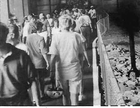
 pita1 Crescent Trail Fall 1 997 Vol. X No. Coalition Hosts "Open The Tunnel" Rally f the sentiments of over 100 enthusiastic trail users showing up bright and early on a rain- - - - threatening Saturday
THE TUNNEL TRIUMPH - AND A BOOST FOR THE TRESTLE by john Dugger
 - - Vol X No. 2 THE TUNNEL TRIUMPH - AND A BOOST FOR THE TRESTLE by john Dugger The Montgomery County Council meeting on February 10 was controversial and suspenseful in dealing with the appropriation
We Survived the Flood!
 - Spri~s 1996 Vol. V111 No. i We Survived the Flood! During the Blizzard of 1996 we suffered minor injuries in comparison with those incurred by the C&O Canal (see insert). Though the trail was flooded,
TheCrescent. CCCT Annual Meeting / June 11, 2012 by Ron Tripp, Chair INSIDE THIS ISSUE THE COALITION FOR THE CAPITAL CRESCENT TRAIL
 TheCrescent THE COALITION FOR THE CAPITAL CRESCENT TRAIL SPRING 2012 INSIDE THIS ISSUE River Road Plaza Construction 3 Counsel Votes to Route CCT Around the Bethesda Tunnel 4 Georgetown Boathouse Waterfront
pital Crescent Trail
 pital Crescent Trail 19% VO~. MI NO. 2 Capital Crescent Trail - Silver Spring to Bethesda Interim Trail Report by Ernie Brooks The Montgomery County Council, by a vote of 9-0, has authorized $390,000 for
MONTGOMERY COUNTY PLANNING DEPARTMENT THE MARYLAND NATIONAL CAPITAL PARK AND PLANNING COMMISSION
 MONTGOMERY COUNTY PLANNING DEPARTMENT THE MARYLAND NATIONAL CAPITAL PARK AND PLANNING COMMISSION MCPB Item No. 3 Date: 11-17-11 Planning Board Tour: Purple Line/Capital Crescent Trail (replacing the Georgetown
Advertising, Sponsorship, Directional, and Wayfinding Signage on Multi-Use Trails Policy
 DRAFT ( ) Advertising, Sponsorship, Directional, and Wayfinding Signage on Multi-Use Trails Policy Prepared for: SATS Multi-Use Trails Jurisdictions Committee Table of Contents Introduction... 3 Signage
Assessing Your Trails, Keeping Them Safe and Enjoyable
 Jon Wood, PLA, ASLA Associate Vice President Stewart Bert Lynn, PLA, ASLA, LEED AP Project Manager Mecklenburg County Asset and Facility Management Assessing Your Trails, Keeping Them Safe and Enjoyable
Waukee Trailhead Public Art and Amenities Project
 Waukee - Trailhead Public Art and Amenities Project Sponsor Waukee Project Title Waukee Trailhead Public Art and Amenities Project Termini Description ( i.e. Park Avenue to 19th Street) NE Intersection
Business Item No XXX. Proposed Action That the Metropolitan Council approve the Coon Creek Regional Trail Master Plan.
 Business Item No. 2015-XXX Metropolitan Parks and Open Space Commission Meeting date: July 7, 2015 For the Community Development Committee meeting of July 20, 2015 For the Metropolitan Council meeting
LUDLAM TRAIL CORRIDOR DISTRICT
 1 APPLICATION NO. 9 MAY 2015 CDMP CYCLE LUDLAM TRAIL CORRIDOR DISTRICT PLANNING ADVISORY BOARD November 2, 2015 BACKGROUND 2 Staff Application Former Florida East Coast railroad corridor (privately owned)
Greetings to all Sunrise Trail Coalition Members!
 Sunrise Trail Coalition PO Box 113 Franklin, ME 04634 www.sunrisetrail.org Board of Directors Stephen Rees, President Ian Staub, Treasurer Carol Cuddy, Membership Raymond Archer Bill Ceckler Polly Ceckler
Committee Report. Community Development Committee For the Metropolitan Council meeting of August 12, Business Item No.
 Committee Report Business Item No. 2015-168 Community Development Committee For the Metropolitan Council meeting of August 12, 2015 Subject: Coon Creek Regional Trail Master Plan, Anoka County Proposed
CONCEPT PLAN CAPITAL CRESCENT TRAIL
 CONCEPT PLAN For The CAPITAL CRESCENT TRAIL Proposed By THE COALITION FOR THE CAPITAL CRESCENT TRAIL And GREATER BETHESDA-CHEVY CHASE COALITION DECEMBER 1988 Coalition for the Capital - Crescent Trail
COUNCIL VOTE GREEN LIGHTS TRESTLE FUNDING
 HE Vol XI No. 2 1 I I COUNCIL VOTE GREEN LIGHTS TRESTLE FUNDING Vote is a victory for grassroots campaign organized by CCCT By Scott Hall and John Campanile The Montgomery County Council budget meeting
A CASE FOR COMPLETING THE JORDAN RIVER PARKWAY: A
 A CASE FOR COMPLETING THE JORDAN RIVER PARKWAY: A safe crossing at 9000 South and 850 West Proposed 9000 South Underpass Parkway Timeline Parkway, Trail, and Tourism Facts Blueprint Jordan River 1971 1973
Thank you for the opportunity to comment on the proposed action to add trails and trailheads to the Red Rock District trail system.
 July 14, 2010 Jennifer Burns Red Rock Ranger District PO Box 20429 Sedona, AZ 86341 Flagstaff Biking Organization PO Box 23851 Flagstaff, AZ 86002 Dear Jennifer- Thank you for the opportunity to comment
Georgetown-Lewes Rail/Trail Study. Rail/Trail Study: Cool Spring to Cape Henlopen State Park New Road Extension (House Resolution No.
 Georgetown-Lewes Rail/Trail Study Rail/Trail Study: Cool Spring to Cape Henlopen State Park New Road Extension (House Resolution No. 47) August 22, 2011 Presentation Outline Background Benefits Statewide
Canal Steward Program Adoption Package
 National Park Service U.S. Department of the Interior Chesapeake and Ohio Canal National Historical Park 1850 Dual Highway, Suite 100 Hagerstown, MD 21740 301-745-5810 phone 301-739-6179 fax Canal Steward
Jamie Cepler Washington Metropolitan Area Transit Authority, Bus Operations Specialist Washington, DC
 Public Outreach and Bus Stop Consolidation at WMATA Jamie Cepler Washington Metropolitan Area Transit Authority, Bus Operations Specialist Washington, DC 2014 APTA Multimodal Operations Planning Workshop
Resolution No.: Introduced: July 24, 2018 Adopted: July 24, 2018
 Resolution No.: 18-1215 Introduced: July 24, 2018 Adopted: July 24, 2018 COUNTY COUNCIL FOR MONTGOMERY COUNTY, MARYLAND SITTING AS THE DISTRICT COUNCIL FOR THAT PORTION OF THE MARYLAND-WASHINGTON REGIONAL
Non-Motorized Transportation
 Non-Motorized Transportation Non-motorized facilities are important components to the transportation system. They provide an environmentally-friendly, low-cost mode of travel. Some of the facilities can
Minutes from the RATC Board Meeting October 15, 2012
 Minutes from the RATC Board Meeting October 15, 2012 Meeting called to order at 7:00 pm Host: Fred Walters Location: Roanoke County Parks & Recreation Building, Kessler Mill Road, Salem Attending: Liz
Appendix 1: Phase I Strategies
 Washington Metropolitan Area Transit Authority RTSP Presentation to the Technical Advisory Group January 19, 2012 Appendix 1: Phase I Strategies Base Case Definition MWCOG 2009 Adopted CLRP (2009-2030
The Black Diamond. Official Newsletter of the Lehigh Valley Railroad Historical Society May/June, 2007
 The Black Diamond Official Newsletter of the Lehigh Valley Railroad Historical Society May/June, 2007 Message From The Editor Welcome to the May/Jun, 2007 edition of the Black Diamond. Please send any
7272 WISCONSIN AVENUE LOCAL AREA TRANSPORTATION REVIEW
 7272 LOCAL AREA TRANSPORTATION REVIEW AND TRANSPORTATION POLICY AREA REVIEW MONTGOMERY COUNTY, MARYLAND Submitted on behalf of Carr Properties Prepared by: Wells + Associates, Inc. Submission: July 1,
Airport Planning Area
 PLANNING AREA POLICIES l AIRPORT Airport Planning Area LOCATION AND CONTEXT The Airport Planning Area ( Airport area ) is a key part of Boise s economy and transportation network; it features a multi-purpose
FEASIBILITY CRITERIA
 This chapter describes the methodology and criteria used to evaluate the feasibility of developing trails throughout the study areas. Land availability, habitat sensitivity, roadway crossings and on-street
University Region Non-Motorized Plan 2015
 Non-Motorized Transportation Non-motorized facilities are important components to the transportation system. They provide an environmentally-friendly, low-cost mode of travel. Some of the facilities can
MPRB: Southwest LRT Community Advisory Committee Issues and Outcomes by Location Current to: 12 November 2010
 MPRB: Southwest LRT Community Advisory Committee Issues and Outcomes by Location Current to: 12 November 2010 This is a compilation of issues and outcomes identified by the CAC. It is a work in progress,
Chapter 6. Action Program. Heart of the Lakes Area Recreation Plan
 Heart of the Lakes Area Recreation Plan 1. Design and construct the following trails (please see the following map): a. the Speedway Trail 1) primary pathway the main trail 2) secondary pathway the proposed
MEETING MINUTES District 1 Trail Planning Meeting 1
 MEETING MINUTES District 1 Trail Planning Meeting 1 June 1, 2017 2:00 PM 3:30 PM City of Two Harbors 2:00 Introductions Attendees: Lisa Austin, MnDOT Bryan Anderson, MnDOT Jasna Hadzic-Stanek, MnDOT Justin
Logo Department Name Agency Organization Organization Address Information 5700 North Sabino Canyon Road
 Logo Department Name Agency Organization Organization Address Information United States Forest Coronado National Forest 5700 North Sabino Canyon Road Department of Service Santa Catalina Ranger District
Directions to Frequently Visited C & O Canal Locations
 Directions to Frequently Visited C & O Canal Locations Seneca Creek Montgomery County, Maryland Pass town of Potomac and Falls Road and continue west to Seneca Rd. Turn left on Seneca Rd. and continue
EXHIBIT 1. BOARD AUTHORIZATION FOR PUBLIC HEARING AND SUBSEQUENT ISSUANCE OF A JOINT DEVELOPMENT SOLICITATION
 EXHIBIT 1. BOARD AUTHORIZATION FOR PUBLIC HEARING AND SUBSEQUENT ISSUANCE OF A JOINT DEVELOPMENT SOLICITATION Washington Metropolitan Area Transit Authority Board Action/Information Summary @Action O Information
Chapter 6: POLICY AND PROCEDURE RECOMMENDATIONS
 Chapter 6 POLICY AND PROCEDURE RECOMMENDATIONS FOR SRRA Below are seven policy elements that should be considered for adoption by the Southwest Regional Recreation Authority of Virginia: 1. Develop strategies
Cascade River State Park Management Plan Amendment
 This document is made available electronically by the Minnesota Legislative Reference Library as part of an ongoing digital archiving project. http://www.leg.state.mn.us/lrl/lrl.asp Cascade River State
Our Region. Mountains of Northeast Tennessee
 Rails to Trail Our Region Our Region Mountains of Northeast Tennessee Brief History / Whose Idea David Ornduff, City of Elizabethton 1991 Protect the corridor *Steve Darden, Mayor of Johnson City 2005,
At the time, the portion of the line through Eagle County remains wholly under the ownership of Union Pacific Railroad (UP).
.") Chapter 5 The Railroad Corridor as a Trail Corridor The intent of this chapter is to identify how the rail corridor, if available for lease or purchase in all or part, could be incorporated into the core
Chapter 5 The Railroad Corridor as a Trail Corridor The intent of this chapter is to identify how the rail corridor, if available for lease or purchase in all or part, could be incorporated into the core
SOUTH INTERCHANGE AREA
 Santaquin City General Plan 1 Location and Characteristics The South Interchange Area of Santaquin is located west of Interstate 15 and south of 500 South (Figure 1). It includes properties already annexed
Auburn Trail / Ontario Pathways Trail Connector Feasibility Study Public Information Meeting Wednesday, August 22, 2012
 Auburn Trail / Ontario Pathways Trail Connector Feasibility Study Public Information Meeting Wednesday, August 22, 2012 Purpose of Feasibility Study Purpose Evaluate the feasibility of constructing a multiuse
The Future of the Road to Revolutions. A Battle Road Scenic Byway Public Forum November 9, 2010
 The Future of the Road to Revolutions A Battle Road Scenic Byway Public Forum November 9, 2010 Who is the Battle Road Scenic Byway? Four Towns: Arlington, Lexington, Lincoln, Concord Minute Man National
TART Trails, Inc. (231)
") TART Trail System TART Trails, Inc. www.traversetrails.org (231) 941-4300 Leelanau Trail Stretching 15 miles along a former railroad corridor, the TART-owned Leelanau Trail connects Traverse City and Suttons
TART Trail System TART Trails, Inc. www.traversetrails.org (231) 941-4300 Leelanau Trail Stretching 15 miles along a former railroad corridor, the TART-owned Leelanau Trail connects Traverse City and Suttons
Business Item No
 Metropolitan Parks and Open Space Commission Meeting date: February 6, 2018 For the Community Development Committee meeting of February 20, 2018 For the Metropolitan Council meeting of February 28, 2018
City of Durango 5.8 FUNDING TRAILS DEVELOPMENT
 5.8 FUNDING TRAILS DEVELOPMENT The City has been successful in establishing dedicated local funding sources as well as applying for grants to develop the City s trail system, having received nearly $2.4
PIONEER PARK. City of Des Peres Parks Master Plan. SWT Design 46 INTRODUCTION
 PIONEER PARK INTRODUCTION Pioneer Park is a 7 acre neighborhood park located east of Interstate 270 and south of Manchester Road along Tallie Road. The park is situated in a residential neighborhood with
DRAFT - APRIL 13, 2007 ROUTING STUDY FOR TRAIL CONNECTIONS BETWEEN CALAIS AND AYERS JUNCTION
 DRAFT - APRIL 13, 2007 ROUTING STUDY FOR TRAIL CONNECTIONS BETWEEN CALAIS AND AYERS JUNCTION Abstract The vision for the East Coast Greenway is an off-road urban trail system running from Calais, Maine
Stephens State Park Trails
 TRAILS OF ALLAMUCHY MOUNTAIN & STEPHENS STATE PARKS Allamuchy Mountain and Stephens State Parks contain 28 marked trails providing access to diverse landscapes for walking, hiking, biking, bird-watching,
Regional Wayfinding Sign Strategy Thurston County Trails 2017
 Regional Wayfinding Sign Strategy Thurston County Trails 2017 Partners: Members and partnering organizations of the Thurston Thrives Community Design Action Team City of Lacey, City of Olympia, City of
OR MISSION TRAIL ELEMENTARY
 Leawood: overview OVERLAD PARK 24: p.70 I-LA PARK 32: p.72 TOMAHAWK PARK 23: p.69 31: p.71 GEZER PARK OR MISSIO TRAIL ELEMETARY 22: p.68 W 133rd St W 135th St KASAS CITY MO - other segments Beginning/end
A Guide to Trail Etiquette
 Share Our Trails A guide to Trail Etiquette Page 12 www.garlic.com/~lbha lbha@vfr.net P.O. Box 2326 Loomis CA 95650 Page Sharing Our Trails A Guide to Trail Etiquette NON-PROFIT U.S. POSTAGE PAID Loomis,
Understanding Temporary Shelters for the Homeless
 Understanding Temporary Shelters for the Homeless Thank you for your interest in learning about temporary shelters for the homeless. This handout is intended to provide updated information regarding the
Citrus Heights Creek Corridor Trail Project Trail Advisory Group Field Trip #2 September 11, :00 11:00 am Trellis Hall, Citrus Heights
 September 11, 2013 9:00 11:00 am Trellis Hall, Citrus Heights Project Overview The City of Citrus Heights is studying the feasibility of establishing a multi use trail system within the City s 26 miles
Jefferson County Non-Motorized Transportation and Recreational Trails Plan 2010
 Chapter 8: Goals and objectives Plan Update: The following update presents general principles, goals, and objectives related to non-motorized transportation facilities as a component of the overall transportation
ital Crescent Trail Coalition Celebrates 10th Anniversary!
 ital Crescent Trail Vol. Vlll No. 2 Coalition Celebrates 10th Anniversary! On June 1 the Coalition celebrated it's tenth anniversary at the Washington Canoe Club. More than 100 members took part in the
Longmont to Boulder Regional Trail Jay Road Connection DRAFT FINAL REPORT
 Longmont to Boulder Regional Trail Jay Road Connection DRAFT FINAL REPORT December 2018 Project Summary Boulder County, Colorado, in partnership with the City of Boulder, is evaluating options for multi-use
Having trouble reading this ? View it in your browser. Welcome
 Page 1 of 6 Having trouble reading this email? View it in your browser. IN THIS ISSUE Remembering 2011 and Preparing for 2012 Copper Thefts Increase on West Rail Eiber Neighborhood Resident Recieves "Most
Aurora Hills. Getting There
 Aurora Hills Aurora Hills is neighborhood near Crystal City and Pentagon City. Ball fields, ball courts, a very short trail, and a combination ibrary/fire Station are the central pieces of a recreation
The Newsletter of the Red River Valley Railroad Historical Society, Inc.
 The Newsletter of the Red River Valley Railroad Historical Society, Inc. October, 2009 Shreveport, LA Our 28 th Year Gone But Not Forgotten: Standard Wood Preservers of Shreveport Standard Wood Preservers
Sacramento County Municipal Services Agency
 Sacramento County Municipal Services Agency On Hold messaging on the Sacramento County Information Line updated January 2009 MALE - CALIFORNIA IS EXPERIENCING DRY CONDITIONS THIS YEAR AND IT IS MORE IMPORTANT
Aviation, Rail, & Trucking 6-1
 6-1 This chapter describes the services, facilities, and condition of air, rail, and trucking as components of the transportation system. These three intermodal areas have an impact on the factors to be
3. COLTA / HUGA CONNECTIONS - PRELIMINARY
 9 3. COLTA / HUGA CONNECTIONS - PRELIMINARY 3.1 COLTA The Chain of Lakes Trail Association (COLTA) trail, formerly identified as the Chester Spur Line, was completed and opened for use in June 2011. The
NFTA Access Enhancement Study for Canalside and Cobblestone Alternatives Discussion. Alternative A South Park Avenue
 Alternative A South Park Avenue Alternative A Summary Alternative A extends Metro Rail service around the foot of Main Street east along South Park Avenue to serve a new station platform located along
Accomplishments in 2013
 ATTACHMENT Maryland National Capital Park & Planning Commission Montgomery County OPTIONAL SUBMITTAL WITH BUSINESS RECYCLING PLAN AND ANNUAL REPORT Does your Company buy or use any products that contain
Great Allegheny Passage
 Great Allegheny Passage Two documents are provided: Great Allegheny Passage Special Use Permit Application Great Allegheny Passage Rules and Guidelines. Great Allegheny Passage Allegany County Government
Northeast Quadrant Distinctive Features
 NORTHEAST QUADRANT Northeast Quadrant Distinctive Features LAND USE The Northeast Quadrant includes all the area within the planning area that is east of Interstate 5 and to the north of State Route 44.
CHAPTER ONE LITERATURE REVIEW
 CHAPTER ONE LITERATURE REVIEW LITERATURE REVIEW This chapter summarizes the most recently published community impact studies and articles that relate to multiuse trails. The review focuses on publications
Discovering the Trails of Prince George s County
 Discovering the Trails of Prince George s County Happy Trails! Since 2005, Wegmans has been partnering with town and city recreation programs and park conservancy groups to encourage folks to get moving
2016 Regional Transportation Alternatives Program (TAP) Grant Application
 Grant Application") 2016 Regional Transportation Alternatives Program (TAP) Grant Application PROJECT TITLE: Yelm-Tenino Trail Extension Feasibility Study TRPC use only GENERAL PROJECT INFORMATION Agency or Organization City
2016 Regional Transportation Alternatives Program (TAP) Grant Application PROJECT TITLE: Yelm-Tenino Trail Extension Feasibility Study TRPC use only GENERAL PROJECT INFORMATION Agency or Organization City
Section II. Planning & Public Process Planning for the Baker/Carver Regional Trail began in 2010 as a City of Minnetrista initiative.
 Section II Planning & Public Process Planning for the began in 2010 as a City of initiative. city staff began discussions with the Park District on the possibility of a north/south regional trail connection
Lawrence Loop SWOT Analysis
 Alignment: D1 (Map Color: Dark Blue) Description: This alignment connects to the north end of the Burroughs Creek Trail and continues along the west side of the Railroad to 8 th Street. Strengths: - This
Madison Metro Transit System
 Madison Metro Transit System 1101 East Washington Avenue Madison, Wisconsin, 53703 Administrative Office: 608 266 4904 Fax: 608 267 8778 TO: FROM: SUBJECT: Plan Commission Timothy Sobota, Transit Planner,
Lake Myra County Park. Wake County, North Carolina Community Forum #2 June 12, 2008
 Lake Myra County Park Wake County, North Carolina Community Forum #2 June 12, 2008 Welcome and Introduction Meeting Agenda Welcome Introductions of Project Team Master Plan Process Community Forum #1 Updates
= Stops. = Restrooms
 = Stops = Restrooms Restrooms are located near the Lake Elkhorn pavilion Safety Tips 1.Be courteous. 2.Travel at a safe speed. 3.Use your bell or announce: passing on your left. 4.Remember there are people
The following trails completed their work utilizing funds awarded by the Greenways Foundation:
 The Greenways Foundation Grant Awards 2013 and 2014 Our grant program has been in place since 2012 and is funded entirely by the proceeds received through our Indiana BMV specialty license plate. Please
Trail # NW Tuesday, June DESIGN. Provide an Review the Provide an. Project Goals: System system. wayfinding
 I. Welcome / Introductions Bethany Creek Trail #2 Segment 3 Neighborhood Meeting #1 Bethany Presbyterian Church 15505 NW Springville Road, Portland, OR 97229 Tuesday, June 26, 2018 @ 6:00PM Meeting Minutes
ETOBICOKE CREEK NORTH TRAIL PROJECT. May 18, 2017 at Michael Power High School 105 Eringate Drive, Etobicoke ON M9C 3Z7
 ETOBICOKE CREEK NORTH TRAIL PROJECT May 18, 2017 at Michael Power High School 105 Eringate Drive, Etobicoke ON M9C 3Z7 1 Purpose of Open House The purpose of today s open house is to present the design
China Creek North Park Upgrades and Glen Pump Station. Park Board Committee Meeting Monday, July 10, 2017
 China Creek North Park Upgrades and Glen Pump Station Park Board Committee Meeting Monday, July 10, 2017 Purpose The purpose of this presentation is to: Share the results of the public engagement processes;
1941 DODGE WC-1 MILITARY PICK UP OWNER, JIM NEISES
 AMERICAN TRUCK HISTORICAL SOCIETY - SOUTHERN CALIFORNIA CHAPTER VOLUME 18 NO 04 JULY AUG 2018 HAPPY 4TH OF JULY 2018 1941 DODGE WC-1 MILITARY PICK UP OWNER, JIM NEISES Southern California Chapter American
NORTHWEST SECTION CONTENTS: CLEVELAND PARK FOLWELL PARK RYAN LAKE PARK VICTORY PRAIRIE DOG PARK VICTORY PARK
 NORTHWEST SECTION CONTENTS: CLEVELAND PARK FOLWELL PARK RYAN LAKE PARK VICTORY PRAIRIE DOG PARK VICTORY PARK LUCY LANEY COMMUNITY SCHOOL N 33RD AVE N 33RD AVE SINGLE-FAMILY RESIDENTIAL MULTI-USE DIAMOND
The Remains of the Ontario and Western Railway Fifty Years after Abandonment
 The Remains of the Ontario and Western Railway Fifty Years after Abandonment Oswego to Cadosia Drew James New York Ontario and Western Railway Oswego to Cadosia Oswego Fulton Pennellville Central Square
Public Park System. Township of Derry. Providing natural open space for the recreational use of our residents and guests.
 Township of Derry Public Park System Providing natural open space for the recreational use of our residents and guests. Directory of Recreational Amenities Hershey s Commitment to Recreation Famous candy
REPORT TO THE PARKS AND RECREATION COMMISSION rd Avenue NE, Woodinville, WA
 CITY OF WOODINVILLE, WA REPORT TO THE PARKS AND RECREATION COMMISSION 17301 133rd Avenue NE, Woodinville, WA 98072 WWW.CI.WOODINVILLE.WA.US To: From: Subject: Honorable Parks and Recreation Commission
CITY OF FOUNTAIN INN PARKS
 CITY OF FOUNTAIN INN PARKS Country Chase Fitness Park The Country Chase Fitness Park is located in the Country Chase neighborhood at 136 Catterick Way. The park is also located adjacent to a section of
Dungeness Recreation Area County Park Master Plan
 Dungeness Recreation Area County Park Public Outreach Meeting October 10, 2007 Project Overview USFWS Site Dungeness Recreation Area County Park Meeting Objectives: Re-Introduce project; provide status
Gardner: overview. Santa Fe, Oregon, and California National Historic Trails UNINCORPORATED JOHNSON COUNTY OLATHE UNINCORPORATED JOHNSON COUNTY
 Santa Fe, Oregon, and California ational Historic Trails : overview 99: p.134 100: p.135 GARDER JUCTIO 102: p.137 56: p.126 EDGERTO Burlington orthern Intermodal and Logistics 98: p.133 101: p.136 S Waverly
MONTGOMERY COUNTY PLANNING DEPARTMENT THE MARYLAND-NATIONAL CAPITAL PARK AND PLANNING COMMISSION
 MONTGOMERY COUNTY PLANNING DEPARTMENT THE MARYLAND-NATIONAL CAPITAL PARK AND PLANNING COMMISSION MCPB Item No. Date: 6/23/2016 Lucy V. Barnsley Elementary School Addition, Mandatory Referral MR2016027
// LEARN // ENGAGE // VOLUNTEER // DONATE // PROJECT OVERVIEW MAP
 // LEARN // ENGAGE // VOLUNTEER // DONATE // PROJECT OVERVIEW MAP PROJECT OVERVIEW MAP The Atlanta BeltLine is a dynamic and transformative project for Atlanta. Through the development of a new transit
July, Wednesday, September 13, :30 pm Amherst Railway Society headquarters more on meetings
 Eight & Sand July, 2017 Amherst Railway Society 1130 South Main Street Palmer, MA 01069 amherstrail.org a regular publication of the Amherst Railway Society Amherst at Springfield Union Station The mission
Trail Feasibility Study
 VOLUSIA COUNTY MPO CITY OF NEW SMYRNA BEACH FINAL REPORT JUNE 30, 2009 Trail Feasibility Study What s inside? 1 Introduction 2 Project Purpose & Scope 3 Physical Inventory & Assessment of Right-of- Way
To: Mary Beth Avedesian B.F. Saul Company
 1140 Connecticut Avenue NW Suite 600 Washington, DC 20036 202.296.8625 TECHNICAL MEMORANDUM To: Mary Beth Avedesian B.F. Saul Company From: Daniel B. VanPelt, P.E., PTOE Felice B. Brychta, P.E. Tricia
The Valley Flyer. Photo Dave McPherson. Lonesome George Photo Kate Fickell. Photo by Deb Hudson. Photo Deb Hudson
 The Valley Flyer NOV/DEC. 2016 THE OFFICIAL PUBLICATION OF THE HOCKING VALLEY SCENIC RAILWAY VOL. 14 ISSUE 5 Photo by Deb Hudson Photo Dave McPherson Lonesome George Photo Kate Fickell Photo Deb Hudson
Save the Date! Board of Director s Notes. Wanted
 Pop Valve No. 415 Spring Open House Edition June 2018 Editor: Roger Caiazza Photographs: Robert Fruitt & Ric Golding Publishers: Ted Taylor & Tom Pierson Board of Director s Notes This edition of the Pop
CRANE LAKE TRAILS NETWORK AND SPACES
 CRANE LAKE TRAILS NETWORK AND SPACES AREA TRAILS COMMUNITY TRAILS GOLD COAST TRAIL LAKE PARK OPTION ONE LAKE PARK OPTION TWO OVERFLOW TRAILHEAD PARKING THE GATE AREA TRAILS Trails are a major resource