Gold Coast. Rapid Transit. Chapter content. Chapter four Route selection and staging
|
|
|
- James Grant
- 6 years ago
- Views:
Transcription
1 Chapter four Route selection and staging Gold Coast Rapid Transit Chapter four Route selection and staging Chapter content Route selection...73 Section one: Helensvale to Griffith University...74 Section two: Griffith University to Southport...75 Section three: Southport to Broadbeach...80 Project staging
2 72
 to Broadbeach.")
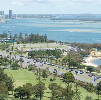
3 Route selection and staging Chapter four Route selection and staging As discussed in Chapter 1: Introduction, the South East Queensland Infrastructure Plan and Program 2005 defined a proposed route for Stage One and Two of the Gold Coast Rapid Transit project. Stage One to connect the heavy rail line at Helensvale (or a new heavy rail station to be built at Parkwood) to Broadbeach. Stage Two was the proposed extension from Broadbeach to Coolangatta. To assist with planning the Gold Coast Rapid Transit route was broken down into 5 sections as shown on the right. However there were many different options for how the Gold Coast Rapid Transit could travel between Helensvale and Broadbeach and these options were assessed and compared in order to establish the preferred route for Satge one of the Gold Coast Rapid Transit system. What planning has taken place? At this stage, high level concept planning has been undertaken for section one and detailed planning has been undertaken for sections two and three. Planning for sections four and five has so far been limited to desktop studies and transport modelling. Further planning work is expected as the project progresses. The route of the Gold Coast Rapid Transit system in Sections 2 and 3 is described in Chapter 5: Route, from page 85. Key Proposed rapid transit corridor Option H1 Helensvale via Harbour Town Option H2 Helensvale via Parkwood Helensvale Harbour Town Parkwood Griffith University Nerang Robina Runaway Bay Bond University Varsity Lakes Section 1 Southport Section 2 Surfers Paradise Broadbeach Miami Tallebudgera Burleigh Heads Elanora Section 3 Section 4 Section 5 Existing heavy rail line Proposed heavy rail line extension (Queensland Rail project) Tugun Coolangatta 73
4 Section one: Helensvale (linking the Gold Coast heavy rail line) to Griffith University Three route options were considered to link the heavy rail line and the site of the new University Hospital at Parklands Drive. Helensvale, or a new rail station at Parkwood, were considered to give the best connectivity to the new Gold Coast Knowledge Precinct at Parklands Drive. See page 82 for why Nerang or Robina were not considered. The options considered were: Option one Parkwood to Griffith University via Smith Street (this would require a new heavy rail station to be constructed at Parkwood) Option two Helensvale to Griffith University via Brisbane Road and Olsen Avenue Option three Helensvale to Griffith University via the Intra Regional Transport Corridor (adjacent to the Pacific Motorway) and Smith Street. As part of the initial planning stage of the project, preliminary designs and cost estimates for all 3 options were prepared. The alignments were based upon the location of the Gold Coast University Hospital, which at that time was intended to be located within Griffith University land on the southern side of Smith Street. The alignments were evaluated against a number of criteria including: transport and traffic integration and impacts engineering issues urban design environmental impacts. In December 2006, a planning focus workshop took place to formally evaluate these options. It was determined that while Option One had the least environmental impacts, it produced poor transport and traffic and urban design outcomes. Additionally, creating an additional station on the Gold Coast to Brisbane Rail Line between Robina and Helensvale, is not favoured by Government. The rail line in the Parkwood area is bounded by the M1 motorway as well as the Smith Street interchange. This presents accessibility problems for pedestrians and bus movements as well as access to a potential park n ride facility. Furthermore, this location is not ideal as a gateway to the Gold Coast for the rapid transit system. The planning focus workshop recommended that Option one, which would involve the construction of a new heavy rail station at Parkwood, not be considered further. Consequently, the 2 remaining options were taken forward to community consultation in March 2007 and were referred to as: Option H1: Helensvale to Griffith University via Harbour Town Option H2: Helensvale to Griffith University via Parkwood See Chapter 5: Gold Coast Rapid Transit Route (page 85) for further detail on the H1 and H2 options. 74
5 Chapter four Route selection and staging Section two: Griffith University to Southport Four options were considered between Griffith University and Southport: Option one: Option two: via Queen Street (west) and Nerang Street (preferred route) via Smith Street, or via Johnston Street and High Street Option three: via Queen Street (east) Option four: alternate route through Queen Street (west) using existing open space and High Street. Option one The project s preferred route alignment connects Loders Creek/existing Gold Coast City Council Depot with the western side of Wardoo Street, then Queen Street and Nerang Street including the existing Gold Coast Hospital. This alignment uses existing road reserve as much as possible and is the shortest and most direct route between the new and existing hospitals. Several sub-options were examined. This included consideration of a route adjacent to Loders Creek but travelling through the existing Equestrian Centre and Owen Park Sports Reserve Land. While this route had advantages in terms of reduced private land and road impacts, the design would need to address the important challenges of flood protection, impacts on sporting facilities and a route that enables a station to be located near the existing hospital site. Overall, this route was not favoured over the preferred route. However, the initial proposal for the preferred route did involve some changes to traffic arrangements on Queen Street (west). See page 105 for more details. Option two During initial planning, northern routes were investigated utilising either Smith Street or Johnston Street. Smith Street was discounted as it is the main traffic route into Southport and experiences heavy volumes of traffic every day. There is also limited residential development around Smith Street leading to low levels of potential patronage. Johnston Street could have connected to Southport via High Street and Nind Street however the steep sections of this street would have presented engineering challenges. There would also have been significant property impacts required in this street. This route would also not be able to service the existing Gold Coast Hospital as well as the western areas of Southport. Option three A potential route following the length of Queen Street to the Gold Coast Highway was also assessed but discounted as it was unable to effectively service the existing Gold Coast Hospital as well as the central business district of Southport. 75
6 Option four The option of crossing Wardoo Street and traversing the existing vacant areas to the north of the Queen Street Cemetery before rejoining Queen Street (west) at Beale Street was also considered. However the impacts of this option were significant and included the need to introduce a new signalised intersection on Wardoo Street which would adversely effect traffic and impact on residential properties in Baratta Street (east). There would also be additional impacts on Southport State School, the Queen Street Cemetery and the Ned Twohill Equestrian Centre. If the existing hospital is relocating why is it important to service this area? Although the existing hospital will be replaced by a new hospital near Griffith University the existing day care facilities and medical precinct will remain. The hospital is also a large site which will be prime for redevelopment in the future. As a result of input from a stakeholder group the project also evaluated an additional route suggestion which involved a cut and cover tunnel from the existing hospital to the Gold Coast Highway via Lawson and Short Streets, activating the existing Scarborough Street interchange as a major transport interchange. While this proposal activates the centre of the Southport central business district, this option is not favoured as it relies on tunnelling which has been discounted for the Gold Coast Rapid Transit project (see page 50 for more details) and the use of local streets for bus movements. 76
7 Chapter four Route selection and staging Southport The route options considered for travelling through the central business district of Southport were designed around current and future land use. The 2004 Light Rail Feasibility Study examined 2 core routes through Southport: Option B1: Scarborough Street, Short Street and Marine Parade Option B2: via Nerang Street Mall and Marine Parade adjacent to the Gold Coast Highway. Option B1 was recommended in the 2004 study because it was a more legible route and provides better access to key commercial and retail areas. Option B2 also would have required the realignment of the Gold Coast Highway which was not considered a desirable outcome. This work was used as a reference when the Gold Coast Rapid Transit project began detailed examination of potential routes through Southport in January In particular, the ability of both these options to provide a quality interchange with bus services through the Southport central business district was a key consideration. Another planning focus workshop, consisting of representatives from the Gold Coast Rapid Transit project, TransLink Transit Authority, Queensland Government and Gold Coast City Council, then determined that the 2 core options that should be assessed for the Gold Coast Rapid Transit project were: Option S1: Nerang Street Marine Parade Option S2: Nerang Street Scarborough Street Queen Street. Option S1 is similar to the previous option B2, whereas it was agreed that the extension of the corridor southwards along Scarborough Street to Queen Street better met the long term needs of the Southport central business district masterplan. A number of sub-options were then developed for both S1 and S2 to determine the best location for the rapid transit station and also the bus interchange (currently located on Scarborough Street outside Australia Fair). Option S1 sub-options Option S1 (A) would provide a new rapid transit station on Nerang Street (between Davenport and Scarborough Streets) and would maintain the existing bus station on Scarborough Street. There would be full or partial closure of Nerang Street between Davenport Street and the Gold Coast Highway to general traffic, effectively creating a shared pedestrian and rapid transit zone. Access would be maintained for service vehicles to properties along Nerang Street. Car parking in this shared Gold Coast Rapid Transit/ Pedestrian zone in Nerang Street between Davenport Street and Gold Coast Highway would no longer be needed as vehicle access would be restricted through this section. 77

 would provide a new rapid transit station on Nerang Street (between Davenport and Scarborough Streets similar to S1 (A) with buses relocated from Scarborough")
8 Option S1 (B) would see the rapid transit station located in the existing Nerang Street shared zone (between Scarborough Street and the Gold Coast Highway), and as with S1 (A) would maintain the existing bus station on Scarborough Street. General traffic would be restricted from entering the Nerang Street shared zone, creating a shared pedestrian and rapid transit station zone. Regulated car parking on the existing Nerang Street shared zone would be removed. Some existing parking in the section of Nerang Street between Davenport and Scarborough Streets could be maintained. Option S2 Sub-options Option S2 (A) would provide a new rapid transit station on Nerang Street (between Davenport and Scarborough Streets similar to S1 (A) with buses relocated from Scarborough Street to the Nerang Street Mall. This option would create a shared pedestrian and rapid transit station zone on Nerang Street between Davenport and Scarborough Streets and vehicular traffic restricted in this section. Most of the car parking on Nerang Street between Davenport Street and Gold Coast Highway and along Scarborough Street would be removed. Option S2 (B) would see a rapid transit station located in Scarborough Street and buses relocated from Scarborough Street to the Nerang Street Mall. This option would create a shared pedestrian and rapid transit station zone on Scarborough Street between Young Street and Lawson /Short Streets with vehicular traffic restricted in this section. Most parking in Scarborough and Nerang Streets would be removed. Option S2 (C) would provide for 4 bus bays, 2 of each would be located on each side of Lawson and Young Streets with the rapid transit station located in Scarborough Street. This option would also see a shared pedestrian and rapid transit station zone on Scarborough Street between Young Street and Lawson/Short Streets with vehicular traffic restricted in this section. This option was not carried forward because of the segregation of bus stops and limitations of providing priority for buses through the Southport Business centre. 78
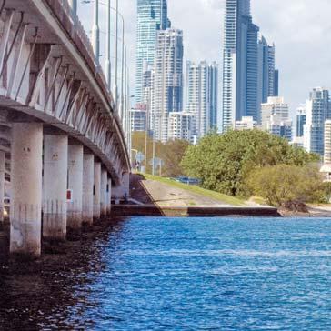
9 Chapter four Route selection and staging It was determined that S1 (A) and S2 (A) were both viable options that would best meet the needs of the growing town centre and provide a good public transport solution. These 2 option were then taken forward to community consultation in March 2007 and were referred to as: Option S1: Nerang Street and Marine Parade Option S2: Nerang Street and Scarborough Street. See Chapter 5: Route (from page 85) for further detail on how S1 and S2 were evaluated and which option was taken forward as the preferred route for the Gold Coast Rapid Transit project. Leaving Southport The only options for the Gold Coast Rapid Transit leaving Southport and heading south is the Gold Coast Highway. The Gold Coast Rapid Transit will rejoin the Gold Coast Highway south of Southport and cross the Nerang River on a new, dedicated bridge, on the western side of the existing bridge. However, major new residential and mixed use development in Southport, the Broadwater Parklands redevelopment and the Gold Coast Rapid Transit project have emphasised the need to improve the pedestrian and cycle connections in and out of Southport. The footpath on the existing bridge is not considered to be of a desirable standard for the level of activity now in the area. The option of including pedestrian and cycle facilities on the new Gold Coast Rapid Transit bridge, being constructed on the western side of the existing bridge, was considered but discounted due to poor pedestrian connectivity from Main Beach. Other options are now being considered by Gold Coast City Council. See page 125 for further detail on the new bridge for the Gold Coast Rapid Transit project. 79
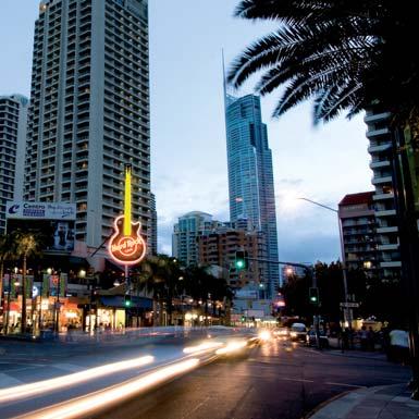
10 Section three: Southport to Broadbeach Between Southport and Surfers Paradise the most direct route for the Gold Coast Rapid Transit system is to follow the Gold Coast Highway. This achieves the most efficient connection to Surfers Paradise and limits property impacts which would be necessary if the Gold Coast Rapid Transit system were to leave the highway and travel on local roads. The Gold Coast Rapid Transit system crosses the Nerang River on the western side of the Sundale Bridge and continues down the western edge of the Gold Coast Highway. The Gold Coast Rapid Transit project has been designed within the context of the current environment and major events that take place on the Gold Coast. Therefore, the rapid transit western alignment between the Nerang River and Surfers Paradise has been designed to avoid operational issues during Indy. However, the Gold Coast Rapid Transit project, as a result of a proposal from a stakeholder group, also investigated the proposal for an alignment on the eastern side of the Sundale Bridge, continuing on the east side of the Gold Coast Highway with a station in the vicinity of Breaker Street, and a cut and cover tunnel between the small two bridges on Macintosh Island. However, this option has been discounted as it would have a direct conflict with the Indy event and there were various issues with tunnelling in this area: a tunnel would require an excavation depth of at least 6-7 metres, potentially causing issues with the high water table dewatering of excavations is costly and can draw fines (fine particles of sand) from other areas, causing settlement of ground bearing structures property resumptions would be required for the entrance and exit portals of the tunnel. Tunnelling would, however, potentially allow greater flexibility with the location of stations, particularly relative to the Indy event. However, there are a number of disadvantages with underground stations including access and security. Therefore, within the context of the existing events on the Gold Coast, the western alignment was taken forward as the preferred alignment in this area. Route options were also considered in Surfers Paradise itself. Three route options were considered: Option one: Surfers Paradise Boulevard (preferred option) Option two: Ferny Avenue and Remembrance Drive Option three: Esplanade and Beach Parade. 80
11 Chapter four Route selection and staging Option one This option complements the work of the 2006 Surfers Paradise Traffic Management Scheme by further enforcing a slow moving, pedestrian and bicycle friendly road with calmed traffic and a more relaxed atmosphere. By utilising Surfers Paradise Boulevard the Gold Coast Rapid Transit system will serve the tourist and commercial centre of Surfers Paradise and allow good connections to the beach and other forms of public transport whilst limiting impacts. However this option would require some changes to the traffic arrangements in this area. See pages for details. Option two While Ferny Avenue could provide the fastest trip it is the key north-south route for traffic, carrying up to 40,000 cars per day. Constructing and operating the Gold Coast Rapid Transit system in this corridor would require significant traffic impacts. Also, due to the narrow road width in this area there would be significant land and property impacts required south of Cypress Avenue in order to widen the road. Ferny Avenue also has lower passenger catchments than Surfers Paradise Boulevard. Option three The Esplanade would provide a good tourist experience however there is also limited width in this corridor due to the seawall. The Gold Coast Rapid Transit system, with a retained traffic lane, requires a minimum of 26 metres, and an additional 8 metres for a station location. To use the Esplanade for the Gold Coast Rapid Transit system would significantly impact the ocean way corridor, impact on pedestrian and cycle pathways, night markets and beach side parking. The system would also not be able to service this area during events such as Schoolies and Indy. Additionally there would be challenges reconnecting the Gold Coast Rapid Transit system to the Gold Coast Highway south of Surfers Paradise without significant property impacts. See Chapter 5: Route (from page 85) for further detail on how the Gold Coast Rapid Transit will travel through Surfers Paradise and the changes to traffic arrangements in this area. 81
12 Leaving Surfers Paradise Once the Gold Coast Rapid Transit system leaves Surfers Paradise the most direct route to Broadbeach is to follow the Gold Coast Highway until the new interchange station near Pacific Fair, which is the end of Stage one of the Gold Coast Rapid Transit project. See Chapter 5: Route (from page 85) for further detail on the Gold Coast Rapid Transit alignment from Surfers Paradise to Broadbeach. Feedback from consultation During consultation, the Gold Coast Rapid Transit project responded to queries regarding the Gold Coast Rapid Transit route. In particular people asked us why the Gold Coast Rapid Transit route did not: link from the rail line at Nerang or Robina use Smith Street to travel from Parklands Drive into Southport consider Bundall Road rather than the Gold Coast Highway. Connection to rail line at Nerang or Robina A rapid transit system commencing at Nerang would not be able to connect with Griffith University and the Gold Coast Hospital. The corridor between Nerang and Southport is identified in the TransLink Network Plan as a high growth secondary network with the progressive implementation of high occupancy vehicle lanes to support high frequency bus services. Servicing Robina town centre from Broadbeach via a rapid transit spur line is considered feasible and will be investigated as part of future planning work. West east corridor to Southport via Smith Street The Smith Street motorway is the principal east west arterial connecting the M1 to the northern areas of the Gold Coast. The high speed traffic environment and surrounding land use is unsuitable to promote an accessible public transport system. This route also does not allow the Gold Coast Rapid Transit system to access the proposed depot site or service the existing Gold Coast Hospital and medical precinct. North south corridor via Bundall Road While this corridor is identified in the Gold Coast City Council Local Growth Management Strategy as a significant future employment generator, it contains no designated key activity centres. Furthermore, surrounding land use consists largely of low density commercial/retail that generates less public transport needs than residential and key activity centres. Within the walk up catchment (800m) of this corridor, there is significantly less residential population than along the Gold Coast Highway. 82
13 83
14 The Business Case prepared for the Queensland Government and Gold Coast City Council made the recommendation to implement the Gold Coast Rapid Transit project in stages based on an assessment of patronage, cost, deliverability, the ability of the project to support on-going development of the city as it grows, and the suitability of other public transport modes to meet the public transport requirements. The following indicative staging strategy has been developed: Category Needed by Description Highest priority 2011 Sections two and three, Griffith University to Broadbeach High priority Section four, Broadbeach to Burleigh Heads Section one, Helensvale to Griffith University Future stages Section five, Burleigh Heads to Coolangatta Other possible future stages However, in parallel with the community review of the draft Concept Design and Impact Management Plan, the project is undertaking detailed market sounding to determine opportunities for implementing stages in a shorter time frame than described. This indicative staging plan is based upon delivery of the Gold Coast Rapid Transit system in response to increasing demand for public transport and need to continue to support the on-going development of the city. Actual construction dates could occur earlier or later than identified based on changes in predicted demand and funding arrangements. Therefore, at this stage, the draft Concept Design and Impact Management Plan has been developed in detail for sections two and three of Stage one. For more information refer to the following chapter in the draft Concept Design and Impact Management Plan: Volume 2, Chapter 2: Alignment Selection Volume 2, Chapter 5: Project Staging. See page 24 for details of how to access the full draft Concept Design and Impact Management Plan report. 84
Gold Coast. Rapid Transit. Network Integration Strategy
 Gold Coast Rapid Transit 9 Network Integration Strategy Contents 1. Introduction 9 1 1.1 Purpose 9 1 2. Gold Coast Public Transport Network 9 2 2.1 TransLink Network Plan 9 2 2.2 Review of the Network
700, 777. Track your bus in real-time with our MyTransLink app. Timetable information. Travel tips. Ticketing information. Route descriptions
 Ticketing information Ticket type TransLink go card A smart card that stores value for travel on TransLink services. TransLink single # One-way ticket to reach your destination (not return). Final transfers
Gold Coast. Rapid Transit. Chapter twelve Social impact. Chapter content
 Gold Coast Rapid Transit Chapter twelve Social impact Chapter content Social impact assessment process...235 Existing community profile...237 Consultation...238 Social impacts and mitigation strategies...239
Optus Aquatic Centre YOUR OFFICIAL VENUE GUIDE
 Optus Aquatic YOUR OFFICIAL VENUE GUIDE Before you leave... The water is perfectly still. The athletes are poised. It s time to compete. Divers pierce the water with barely a ripple, and swimmers put on
Kilometres. Blacktown. Penrith. Parramatta. Liverpool Bankstown. Campbelltown
 0 5 10 15 20 Kilometres Penrith Blacktown Parramatta Liverpool Bankstown Campbelltown accessibility outcomes Legend Outcomes targeted in Western Sydney are: public transport that is accessible throughout
Developing a rapid transit system for the Gold Coast and its integration with a high density, car oriented urban form.
 Developing a rapid transit system for the Gold Coast and its integration with a high density, car oriented urban form. David Mepham Coordinator Transport Futures, Gold Coast City Council Ideas and issues
Four impacts you will need to plan for in Surfers Paradise. What should you do? 1. Games Route Network (GRN)
") Four impacts you will need to plan for in Surfers Paradise. Games Route Network (GRN) The Core GRN runs on the. Games Lanes will be on parts of the, which will reduce capacity.. Festival 08 Festival 08
Four impacts you will need to plan for in Surfers Paradise. Games Route Network (GRN) The Core GRN runs on the. Games Lanes will be on parts of the, which will reduce capacity.. Festival 08 Festival 08
2017 POLICY DOCUMENT. M1 Action Plan. Putting Queenslanders First
 2017 POLICY DOCUMENT Putting 2 Contents Message from the Premier 3 Our Commitment 4 The Newman-Nicholls Legacy 5 The Palaszczuk 6 Government s Record Our Plans: Putting 8 Call: 07 3844 8101 Mail: PO Box
Gold Coast. Rapid Transit. Concept Design and Impact Management Plan. Volume 7 Technical Report - Constructability Report for Sections 2 and 3
 Gold Coast Rapid Transit Concept Design and Impact Management Plan Volume 7 Technical Report - Constructability Report for Sections 2 and 3 Contents Executive Summary i 1. Introduction 4 1.1 Introduction
GOLD COAST HOUSING REPORT SNAPSHOT
 GOLD COAST HOUSING REPORT SNAPSHOT Few cities have expanded like the Gold Coast. The once iconic surfing Mecca and holiday destination has grown to become the 6th largest city in Australia with a population
Coolangatta Beachfront YOUR OFFICIAL VENUE GUIDE
 Beachfront YOUR OFFICIAL VENUE GUIDE Before you leave... Known for its world-class surf breaks and iconic skyline views, beach will take on a cauldron-like atmosphere at GC2018. This is Beach Volleyball
Broadbeach Bowls Club YOUR OFFICIAL VENUE GUIDE
 Bowls Club YOUR OFFICIAL VENUE GUIDE Before you leave... To the eye, the athletes exude calmness and composure, in a sun-drenched venue just moments from the beach. But at the Bowls Club, the tension will
Gold Coast. Rapid Transit. Concept Design and Impact Management Plan. Volume 7 Technical Report - Land Use and Planning
 Gold Coast Rapid Transit Concept Design and Impact Management Plan Volume 7 Technical Report - Land Use and Planning Contents 1. Introduction 1 1.1 1 1.2 Purpose of Report 3 2. Land use planning context
Macleod Trail Corridor Study. Welcome. Macleod Trail Corridor Study Open House. Presentation of Proposed Design Concepts
 Macleod Trail Corridor Study Welcome Macleod Trail Corridor Study Open House Presentation of Proposed Design Concepts Study Purpose Develop a corridor plan for Macleod Trail that aligns with The City s:
IMPACT HOMES Introducing The Meadows Estate 3
 IMPACT HOMES Introducing The Meadows Estate 3 4 IMPACT HOMES Introducing The Meadows Estate INTRODUCTION The purpose of this guide is to introduce The Meadows, a residential community developed by Leda.
To: From: Plans showing the alignments of the routes discussed in this section are presented in Appendix A.
 Project: Cambourne to Cambridge Better Bus Journeys To: CCC Subject: Considerations for Corridor Option Plans From: Atkins Date: 1 Sep 2016 cc: 1. Introduction This note summarises considerations undertaken
The implementation of this Master Plan will be undertaken in logical stages to meet passenger and workforce demands.
 The implementation of this Master Plan will be undertaken in logical stages to meet passenger and workforce demands. Connecting People Building Opportunities 198 Brisbane Airport Corporation CHAPTER 10
Draft City Centre Transport Proposals
 Draft City Centre Transport Proposals Introduction This draft position paper provides an overview of the current City Centre transport issues, including concepts of the possible future City Centre transport
Northern Beaches Transport Action Plan
 Northern Beaches Transport Action Plan The NSW Government is taking action now to deliver transport improvements for the Northern Beaches, as well as planning for the future growth of the area. $633 million
80 projects are. 100 days since City Plan commenced. More than. updates to City Plan have been completed.
 INDUSTRY BREAKFAST 100 days since City Plan commenced 1516 development applications lodged under City Plan. 2 updates to City Plan have been completed. More than 200 industry members have attended training
3. COLTA / HUGA CONNECTIONS - PRELIMINARY
 9 3. COLTA / HUGA CONNECTIONS - PRELIMINARY 3.1 COLTA The Chain of Lakes Trail Association (COLTA) trail, formerly identified as the Chester Spur Line, was completed and opened for use in June 2011. The
5 Rail demand in Western Sydney
 5 Rail demand in Western Sydney About this chapter To better understand where new or enhanced rail services are needed, this chapter presents an overview of the existing and future demand on the rail network
CHRISTCHURCH MOTORWAYS. Project Summary Statement February 2010
 CHRISTCHURCH MOTORWAYS Project Summary Statement February 2010 Table of Contents 1. Purpose of Document 2. Strategic Context 3. Benefits 4. Project Scope and Economics 5. Implementation Plan 1 ROADS OF
Broadbeach. Gold Coast Highway. Proposed options are indicative only and do not represent any established plans.
 Broadbeach Gold Coast Highway The sights and sounds of Miami Marketta Beautiful Burleigh Key Idea 1: B roadbeach to obby Beach and Miami, just a short stop away Idea 1 Broadbeach to Approximate distance:
PCAL Case Study Retail Areas: Rouse Hill Town Centre
 PCAL Case Study Retail Areas: Rouse Hill Town Centre Introduction Rouse Hill Town Centre is a new mixed use development on a greenfield site in Sydney s North West. It has been planned to be a major hub
Part four. In this part you will find: The next steps to deliver the master plan
 Part four NEXT STEPS In this part you will find: The next steps to deliver the master plan 6. How COULD the Master Plan be delivered? There are a number of steps required to take the proposals in the master
BRT in Developed Countries The Brisbane Experience
 Symposium on Public Transportation in Indian Cities with Special focus on Bus Rapid Transit (BRT) System New Delhi 20-21 Jan 2010 BRT in Developed Countries The Brisbane Experience Brian Bothwell Network
Important information about Broadbeach 4 15 APRIL 2018
 Important information about 4 15 APRIL 2018 The Gold Coast is about to host the 2018 Commonwealth Games and this is the chance for all residents to be a part of this exciting event. This once in a lifetime
Part 005 Implementation Strategy _
 Part 0 Implementation Strategy www. landlab.co.nz Queenstown Town Centre Masterplan Version 7 14 June 28 Section 0 Page 4 5.1 Implementation Plan The projects and initiatives contained within the Queenstown
Gold Coast Convention and Exhibition Centre
 Convention and Exhibition YOUR OFFICIAL VENUE GUIDE Surrounded by pristine beaches, vibrant nightlife, dining and world-class shopping, the Gold Coast Convention and Exhibition is in the centre of the
TERMINAL DEVELOPMENT PLAN
 5.0 TERMINAL DEVELOPMENT PLAN 5.0 TERMINAL DEVELOPMENT PLAN Key points The development plan in the Master Plan includes the expansion of terminal infrastructure, creating integrated terminals for international,
Concord Road Interchange. Standard hours of work
 Artist impression of the Concord Road interchange, Concord - concept only WestConnex s M4 East will extend the M4 Motorway with two new 5.5 kilometre tunnels from Homebush to Haberfield, providing a bypass
Oxenford Studios YOUR OFFICIAL VENUE GUIDE
 Oxenford Studios YOUR OFFICIAL VENUE GUIDE It s known for its thrilling entertainment, but at GC2018 Oxenford Studios will put on a new kind of show. Expect dramatic scenes, loud cheers and unexpected
PERFECT IN EVERY ASPECT.
 PERFECT IN EVERY ASPECT. Soaring 47 storeys above Scarborough Street, a new building is poised to become Southport s newest landmark. A collection of 1, 2 and 3 bedroom apartments, Grand Central Southport
WELLINGTON $422 MILLION $614 MILLION $83 MILLION 22% SPEND $1.9 BILLION
 WELLINGTON WELLINGTON $1.9 BILLION FORECAST TOTAL WELLINGTON INVESTMENT The Wellington region s transport challenges are dominated by the region s concentration of population in the metropolitan cities,
12, 14 and 16 York Street - Amendments to Section 16 Agreement and Road Closure Authorization
 REPORT FOR ACTION 12, 14 and 16 York Street - Amendments to Section 16 Agreement and Road Closure Authorization Date: April 27, 2018 To: Toronto and East York Community Council From: Senior Strategic Director,
JOINT CORE STRATEGY FOR BROADLAND, NORWICH AND SOUTH NORFOLK EXAMINATION MATTER 3C EASTON/COSTESSEY
 Matter 3C Easton/Costessey Representor No. 8826 JOINT CORE STRATEGY FOR BROADLAND, NORWICH AND SOUTH NORFOLK EXAMINATION MATTER 3C EASTON/COSTESSEY SUBMISSION ON BEHALF OF TAYLOR WIMPEY DEVELOPMENTS AND
waterview connection Completing the Western Ring Route the Waterview Connection
 waterview connection MAY 2009 Completing the Western Ring Route the Waterview Connection The NZ Transport Agency (NZTA) has a new proposal to complete the Western Ring Route around Auckland by connecting
Stage 2 ION: Light Rail Transit (LRT) from Kitchener to Cambridge
 from Kitchener to Cambridge") Stage 2 ION: Light Rail Transit (LRT) from Kitchener to Cambridge Public Consultation Centre (PCC) No. 3 Please Sign-in Cambridge City Hall November 21, 2017 2:00 to 8:00pm Preston Memorial Auditorium
Stage 2 ION: Light Rail Transit (LRT) from Kitchener to Cambridge Public Consultation Centre (PCC) No. 3 Please Sign-in Cambridge City Hall November 21, 2017 2:00 to 8:00pm Preston Memorial Auditorium
Welcome. Green Line in Your Community
 Welcome Green Line in Your Community Today s session will provide you with information on options The City is exploring for connecting the Green Line in the Beltline to the future Inglewood/Ramsay station.
Spadina Avenue which would include two new underground stations located at Yonge Street and at University Avenue.
 TORONTO TRANSIT COMMISSION REPORT No S7 MEETING DATE June 4, 1968 FROM: General Manager Subway Construction Date June 3, 1968 Subject: QUEEN STREET SUBWAY FOR STREETCAR OPERATION The Commission, at its
Carrara Stadium. Before you leave... YOUR OFFICIAL VENUE GUIDE
 Carrara Stadium YOUR OFFICIAL VENUE GUIDE It s where the Games will begin and end, in a triumphant celebration of colour, dance and entertainment. It s where track and field feats will transfix audiences
a bold statement In one of the city s moving suburbs, Five Chester is already somewhere making getting anywhere else a short outing.
 a bold statement In one of the city s moving suburbs, Five Chester is already somewhere making getting anywhere else a short outing. Nestled in a botanic hub just moments from the Broadwater, transport
Overview of Ford Land Projects PTY Limited aspirations
 Overview of Ford Land Projects PTY Limited aspirations B U I L D I N G A S Y C O M M N U T I 1 Utilise the best available urban design and architecture techniques to create a harmonious relationship between
Commercial Research. Between the Lines. Gold Coast 4Q 2016 Sales & Year End Wrap. January 2017
 Commercial Research Between the Lines Gold Coast 4Q 2016 Sales & Year End Wrap January 2017 The 4Q 2016 was a relatively quiet period across the Gold Coast Commercial markets after a busy mid year. During
SPHERE SOUTHPORT LIVING 154 Musgrave Ave, Southport Gold Coast, Queensland
 SPHERE SOUTHPORT LIVING 154 Musgrave Ave, Southport Gold Coast, Queensland 6 May 2010 Regional Facilities Plan & Upgrade of Public Transport Stage One of the Gold Coast Rapid Transit System is scheduled
Coomera Indoor Sports Centre YOUR OFFICIAL VENUE GUIDE
 Indoor Sports Centre YOUR OFFICIAL VENUE GUIDE Before you leave... is a suburb of exciting contrasts. Featuring the serene River, it s home to thrilling theme parks. At GC2018, the sporting action will
Engagement Summary Report. Trans-Canada Highway 1 RW Bruhn Bridge Replacement Project. Community Engagement November 15, 2016 to January 15, 2017
 Trans-Canada Highway 1 RW Bruhn Bridge Replacement Project Community Engagement November 15, 2016 to January 15, 2017 Engagement Summary Report February 2017 Prepared by Kirk & Co. Consulting Ltd. Trans-Canada
Caloundra South overview Ben Allen, General Manager Sustainable Communities
 CONTENT Caloundra South overview Ben Allen, General Manager Sustainable Communities Planning and Approvals status update Marc Wilkinson, QLD Planning and Approvals Manager Masterplanning and delivery Ben
GOLD COAST, QUEENSLAND AUSTRALIA
 GOLD COAST, QUEENSLAND AUSTRALIA STUNNING UNITERRUPTED BROADWATER VIEWS Coast Broadwater comprises three 12 storey towers situated on Marine Parade, Labrador, Gold Coast. These iconic luxury apartments
GOLD COAST OFFICE OVERVIEW
 GOLD COAST OFFICE OVERVIEW Q1 2015 Gold Coast OVERVIEW Gold Coast office stock at January 2015 totalled 472,022sqm, up by just over 12,000sqm over the past year. The only new building completed in 2014,
A Master Plan is one of the most important documents that can be prepared by an Airport.
 The Master Plan A Master Plan is one of the most important documents that can be prepared by an Airport. A Master Plan is a visionary and a strategic document detailing planning initiatives for the Airport
Longmont to Boulder Regional Trail Jay Road Connection DRAFT FINAL REPORT
 Longmont to Boulder Regional Trail Jay Road Connection DRAFT FINAL REPORT December 2018 Project Summary Boulder County, Colorado, in partnership with the City of Boulder, is evaluating options for multi-use
GUNGAHLIN TOWN CENTRE
 GUNGAHLIN TOWN CENTRE PLANNING REFRESH SNAPSHOT NOVEMBER 2018 CONTENTS INTRODUCTION....1 Australian Capital Territory, Canberra 2018 This work is copyright. Apart from any use as permitted under the Copyright
9.1 INTRODUCTION 9.2 EXISTING DEVELOPMENT. Southern Cross University
 Property Strategy The property strategy delivers improved legibility, responds to the locational attributes of the site, and facilitates essential operational efficiencies. 9.1 INTRODUCTION Non-aviation
places Mooloolaba s heart five
 five places the mooloolaba heart 1 Flexible community event use of school oval 2 Enhanced streetscape District cycle route Future cross-block pedestrian link 5 Existing school buildings New signalised
LYNDHURST NEW URBAN DEVELOPMENT AREA STRUCTURE PLAN. Lyndhurst New Urban Development Area Structure Plan OUTCOMES AND PERFORMANCE STANDARDS
 APPENDIX 15.1-3 LYNDHURST NEW URBAN DEVELOPMENT AREA STRUCTURE PLAN Purpose of the Structure Plan Lyndhurst New Urban Development Area Structure Plan OUTCOMES AND PERFORMANCE STANDARDS LSP-P1 The District
Sea World. Main Beach. Seaworld Dr. Marina Mirage. Waterways Dr. Main Beach Pde. Main Beach. Breaker St. Ferny Ave. Ocean Ave.
 Ticketing information Ticket type TransLink go card A smart card that stores value for travel on TransLink services. TransLink single # One-way ticket to reach your destination (not return). Final transfers
HARBOUR EDGE STITCH. Uniting the Waterfront with the City Centre
 78 AC_BEU_CCMP_2_TM1_4 _FD.indd 78 20/07/12 12:04 PM 01 HARBOUR EDGE STITCH Uniting the Waterfront with the City Centre 01 VISION OUR 2032 VISION IS: Quay Street as a high-quality Harbour Edge space that
737, 738, 741, Track your bus in real-time with our MyTransLink app. Route descriptions 741. Timetable information. Ticketing information.
 Ticketing information Ticket type TransLink go card A smart card that stores value for travel on TransLink services. TransLink single # One-way ticket to reach your destination (not return). Final transfers
DATE 23 February, Integrated Transport Strategy. Halls Creek. For Stockland
 Halls Creek For Stockland DATE 23 February, 2015 CONTACT STEVE WILLIAMS EXECUTIVE SUMMARY The Halls Creek Identified Growth Area (IGA) has been identified within the South East Queensland Regional Plan
Brisbane Metro Infrastructure Association of Queensland 14 February 2018
 Brisbane Metro Infrastructure Association of Queensland 14 February 2018 Agenda Brisbane Metro project update Packaging and procurement overview Panel discussion Audience Q&A The journey so far Planning
CHAPTER 4 -- THE LAND USE PLAN: DESCRIPTIONS AND POLICIES FOR THIRTEEN PLANNING AREAS
 CHAPTER 4 -- THE LAND USE PLAN: DESCRIPTIONS AND POLICIES FOR THIRTEEN PLANNING AREAS NORTH CENTRAL CAC AREA LITTLE VALLEY ROAD TO JUG HANDLE CREEK PLANNING AREA This planning area includes Cleone, Noyo,
Construction Staging Area Blue Jays Way (357 King Street West)
") REPORT FOR ACTION Construction Staging Area Blue Jays Way (357 King Street West) Date: June 8, 2018. To: Toronto and East York Community Council From: Acting Director, Transportation Services, Toronto
REPORT FOR ACTION Construction Staging Area Blue Jays Way (357 King Street West) Date: June 8, 2018. To: Toronto and East York Community Council From: Acting Director, Transportation Services, Toronto
Frequently Asked Questions on the Route 29 Solutions Improvements Projects
 Frequently Asked Questions on the Route 29 Solutions Improvements Projects Background What are the Route 29 Solutions improvement projects? These projects include the Route 29/250 Interchange ( Best Buy
Port Macquarie-Hastings Pedestrian Access and Mobility Plan. Working Paper COMMUNITY ENGAGEMENT
 Port Macquarie-Hastings Pedestrian Access and Mobility Plan Working Paper COMMUNITY ENGAGEMENT December 2014 Table of Contents Table of Contents... 2 1 Introduction... 3 2 Submissions... 3 2.1 Stakeholder
A. CONCLUSIONS OF THE FGEIS
 Chapter 11: Traffic and Parking A. CONCLUSIONS OF THE FGEIS The FGEIS found that the Approved Plan will generate a substantial volume of vehicular and pedestrian activity, including an estimated 1,300
MOUNT GRAVATT KEY DRIVER OVERVIEW
 MOUNT GRAVATT KEY DRIVER OVERVIEW PREPARED FOR OPALYN SEPTEMBER 2017 WALKABILITY & ACCESSIBILITY 12 19 11 08 20 07 Macgregor 16 PACIFIC MOTORWAY SOUTH EAST BUSWAY 23 01 21 LOGAN ROAD 22 Brisbane contains
Submission to Infrastructure Victoria s Draft 30-Year Infrastructure Strategy
 Submission to Infrastructure Victoria s Draft 30-Year Infrastructure Strategy 1. Introduction This submission is a response to Infrastructure Victoria s assessment of the need to construct a heavy rail
LEASING OPPORTUNITIES AUSTRALIAFAIR.COM.AU
 YOUR OPPORTUNITY IS NOW LEASING OPPORTUNITIES AUSTRALIAFAIR.COM.AU AUSTRALIA FAIR EVOLUTION With the evolution of the official Southport CBD and an associated boost in local economic indicators, Australia
Airdrie - Bathgate Railway and Linked Improvements Bill. Environmental Statement Page 1
 Environmental Statement Page 1 1.0 INTRODUCTION 1.1 The Scheme Proposal The scheme proposals are to re-open the Airdrie to Bathgate section of the former Bathgate and Coatbridge Railway (Monklands Railway)
Sunshine Coast Airport Master Plan September 2007
 Sunshine Coast Airport Master Plan September 2007 Contents CONTENTS... I ACKNOWLEDGEMENT... II DISCLAIMER... III 1 EXECUTIVE SUMMARY...IV 1 INTRODUCTION... 1 2 AVIATION DEMAND FORECAST... 5 3 AIRCRAFT
4 Transport projects underway in Western Sydney
 4 Transport projects underway in Western Sydney About this chapter This chapter provides an overview of the Australian and NSW government s significant investments in road, bus and rail infrastructure
City of Port Adelaide Enfield Report for Port Adelaide Centre Car Parking and Movement Study. Final Report
 City of Port Adelaide Enfield Report for Port Adelaide Centre Car Parking and Movement Study October 2011 This Report: 1. has been prepared by GHD Pty Ltd for the City of Port Adelaide Enfield; 2. may
Blackburn Road Blackburn Level Crossing Removal. Frequently Asked Questions August 2014 GENERAL
 Frequently Asked Questions August 2014 Blackburn Road Blackburn Level Crossing Removal GENERAL What is the project? The Victorian Government has committed to eliminating a number of the busiest level crossings
OUTLOOK. Varsity Lakes picturesque location surrounding Lake Orr offers a wealth of infrastructure and lifestyle amenity
 OUTLOOK VARSITY LAKES A CONTEXT ON BUSINESS, CULTURE, LIFESTYLE AND RESIDENTIAL Varsity Lakes picturesque location surrounding Lake Orr offers a wealth of infrastructure and lifestyle amenity SEPTEMBER
Chapter 14 Route Window C12 Mile End Park and Eleanor Street shafts. Transport for London
 Chapter 14 Route Window C12 Mile End Park and Eleanor Street shafts MILE END PARK AND ELEANOR STREET SHAFTS 14 Route Window C12 Mile End Park and Eleanor Street shafts Introduction 14.1 Crossrail s twin
4 15 April Is your business ready for the Games? Working together
 4 15 April 2018 Is your business ready for the Games? Working together The City of Gold Coast is proud to host the biggest event in Australia this decade, the Gold Coast 2018 Commonwealth Games. 70 11
ticket types ticket types Visit the website at Call TransLink on
 For up to date public transport information within South East Queensland: Visit the website at www.translink.com.au Connect to ranslink's comprehensive website for: bus, train and ferry timetables maps
ULDA Update Yarrabilba Project The Developers Perspective Tanya Martin Project Planner Communities Lend Lease June 2011
 ULDA Update Yarrabilba Project The Developers Perspective Tanya Martin Project Planner Communities Lend Lease June 2011 Development Context & Approvals Background The Region Strategic Location Single Ownership
AUCKLAND WATERFRONT VISION 2040
 AUCKLAND WATERFRONT VISION 2040 HARBOUR BRIDGE WESTHAVEN MARINA WYNYARD POINT WESTERN RECLAMATION VIADUCT HARBOUR FANSHAWE STREET VICTORIA PARK PRINCES WHARF QUEENS WHARF PORT CAPTAIN COOK WHARF QUAY STREET
Dufferin Jog Elimination Project
 Project Project Status Update November 14 2007 Project History Planning Alternatives Criteria Measured Project Benefits Structural Configurations Considered Structural Design Considerations The Preferred
GOLD COAST OFFICE OVERVIEW
 GOLD COAST OFFICE OVERVIEW JANUARY 2014 Gold Coast OVERVIEW Gold Coast office stock at January 2014 totalled 459,890 sqm, down by almost 4,000 sqm on the mid-year stock level. Around 2,000 sqm of refurbished
Metrolinx Projects: Temporary Delegation for Long- Term Road Closures
 PW29.1 REPORT FOR ACTION Metrolinx Projects: Temporary Delegation for Long- Term Road Closures Date: April 24th, 2018 To: Public Works and Infrastructure Committee From: General Manager, Transportation
Figure 3: Global Sydney. Draft Metropolitan Strategy for Sydney. North Sydney CBD. Second Harbour Crossing. Walsh Bay Arts Precinct.
 Newtown Glebe Macdonaldtown Pyrmont Ultimo Sydney International Convention, Exhibition & Entertainment Precinct Sydney Education & Health Erskineville Figure 3: Global Sydney Waterloo Second Harbour Crossing
Moreton Bay Rail Link community consultation report. January 2016
 Moreton Bay Rail Link community consultation report January 2016 Contents Project background 1 How we planned your new network 2 Consultation overview 3 How you participated in consultation 4 Online survey
PART VIII APPLICATION FOR REVISED SOUTH SIDE TRAFFIC MANAGEMENT WORKS TO FACILITATE LUAS BXD PLANNING REPORT ROADS & TRAFFIC DEPARTMENT
 PART VIII APPLICATION FOR REVISED SOUTH SIDE TRAFFIC MANAGEMENT WORKS TO FACILITATE LUAS BXD PLANNING REPORT ROADS & TRAFFIC DEPARTMENT NOVEMBER 2012 1.0 INTRODUCTION This report has been prepared in support
LIVE. WORK. PLAY. STATUS OF DEVELOPMENT SPRING Produced for information by the City of Markham
 LIVE. WORK. PLAY. STATUS OF DEVELOPMENT SPRING 2013 Produced for information by the City of Markham Community CITY OF MARKHAM CIVIC CENTRE 101 TOWN CENTRE BOULEVARD East side of Town Centre Boulevard,
Team London Bridge Response to the Department for Transport Consultation on the combined Thameslink, Southern and Great Northern franchise
 Team London Bridge Response to the Department for Transport Consultation on the combined Thameslink, Southern and Great Northern franchise 23 August 2012 Table of Contents 1. Executive Summary 2. Introduction
PSP 75 Lancefield Road. Northern Jacksons Creek Crossing Supplementary Information
 PSP 75 Lancefield Road Northern Jacksons Creek Crossing Supplementary Information September 2017 The northern crossing of Jacksons Creek proposed within the Lancefield Road PSP is a key part of the ultimate
5.7 Local road upgrades
 5.7 Local road upgrades Local roads around the St Peters interchange and the intersection of Campbell Road and Euston Road would be upgraded to ensure safe and efficient connections with the New M5, and
BACKCOUNTRY TRAIL FLOOD REHABILITATION PROGRAM
 BACKCOUNTRY TRAIL FLOOD REHABILITATION PROGRAM Backcountry Trail Flood Rehabilitation A June 2013 Flood Recovery Program Summary In June 2013, parts of Southern Alberta were devastated from significant
Council Briefing Minutes
 1 Council Briefing Minutes Date: Time: Location: In Attendance Not in Attendance Wednesday, 24 October, 2018 2:30 p.m. Council Chamber Forum North, Rust Avenue Whangarei Cr Greg Innes (Chairperson) Cr
Spencer Environmental Appendix A: Alternative Analysis for Construction Access Route
 Spencer Environmental Appendix A: Alternative Analysis for Construction Access Route February 2015 Valley ine-stage 1 RT EISA Update FINA REPORT Page A1 Memorandum AECOM ConnectEd Transit Partnership 10235
4. Proposed Transit Improvements
 4. Proposed Transit Improvements The following proposed transit improvements have been assembled based on input received from the community meetings and from review and coordination with the TAC as well
The State of Transport in Macquarie Park
 The State of Transport in Macquarie Park 31st August 2015 Overview Macquarie Park is a major economic centre that contributes over $9billion to Australia s economy each year. Providing access to and from
AUCKLAND $1.2 BILLION $1.9 BILLION $149 MILLION 15% SPEND $5.7 BILLION
 AUCKLAND AUCKLAND $5.7 BILLION FORECAST TOTAL AUCKLAND INVESTMENT The next 10 years are expected to underline Auckland s performance as the fastest growing major city in Australasia. The city is expected
Seek the Board s approval for the Donald Place kerb and channel renewal to progress to final design, tender and construction; and
 3. DONALD PLACE - KERB AND CHANNEL RENEWAL General Manager responsible: General Manager City Environment Officer responsible: Transport and City Streets Manager Author: Michelle Flanagan, Streets Capital
Section 106 Update Memo #1 Attachment D. Traffic Diversion & APE Expansion Methodology & Maps
 Section 106 Update Memo #1 Attachment D Traffic Diversion & APE Expansion Methodology & Maps I-65/I-70 North Split Interchange Reconstruction Project (Des. Nos. 1592385 & 1600808) Traffic Diversion and
Your Transport Levy Your Transport Future. Sunshine Coast Council Transport Levy Annual Report
 Your Transport Levy Your Transport Future Sunshine Coast Council Transport Levy Annual Report 2016-2017 www.sunshinecoast.qld.gov.au T 07 5475 7272 F 07 5475 7277 Locked Bag 72 Sunshine Coast Mail Centre