Service and Research Opportunities through Peace Corps Response
|
|
|
- Gerard Harrington
- 5 years ago
- Views:
Transcription
1 Service and Research Opportunities through Peace Corps Response Curt Holder Department of Geography and Environmental Studies University of Colorado Colorado Springs
2 What is Peace Corps Response? Established in December 1995 as Crisis Corps Three Volunteers sent to Antigua to rebuild homes damaged by Hurricane Luis. Provides short-term humanitarian service to countries worldwide

3 Personal motivation for serving as PCRV RPCV to Guatemala ( ) International experience Interest in food security Volunteerism PC Country Director retirement?


4 Peace Corps Orientation and Assignment My official assignment title: Environmental Community Mobilization Specialist

 Population:")
 Urban population: 64.")

5 Geographic characteristics of El Salvador Area: 21,041 sq km (slightly smaller than Massachusetts) Population: 6,235,513 (July 2014 est.) Urban population: 64.8% of total population (2011) Mestizo 86.3%, White 12.7%, Amerindian languages 1% (2007)


6 12-year civil war in El Salvador May 1979 Jan 1992 Over 75,000 died Over 1,050,000 displaced

7 Immigration to the United States Homicides in El Salvador in 2014: 3,914 or 11 per day In 2013: 2,492 homicides
8
9 Remittances from the United States to Guatemala and El Salvador El Salvador Guatemala Remittances ($1 Million) Year

10 Forest cover in El Salvador Second most deforested country in Latin America Lost 85% of forests since 1960 s Less than 6,000 hectares are primary forests
 Established in 2011 The only")

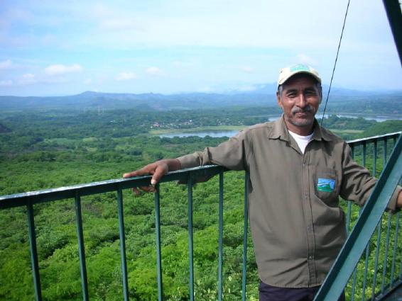
11 Trifinio-Fraternidad Biosphere Reserve (El Salvador, Guatemala, and Honduras) Established in 2011 The only tri-national biosphere reserve in Latin America 12 municipalities (8 in El Salvador; 2 in Guatemala; 2 in Honduras)


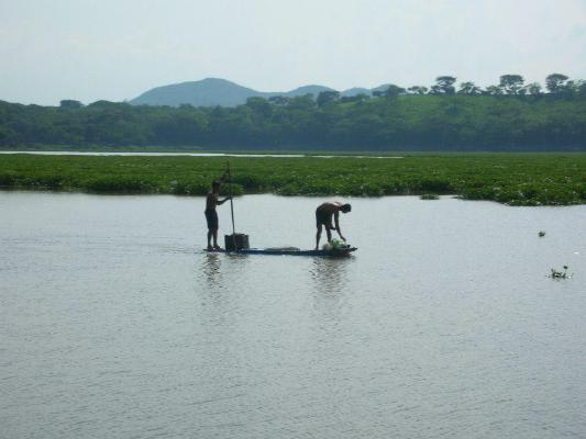
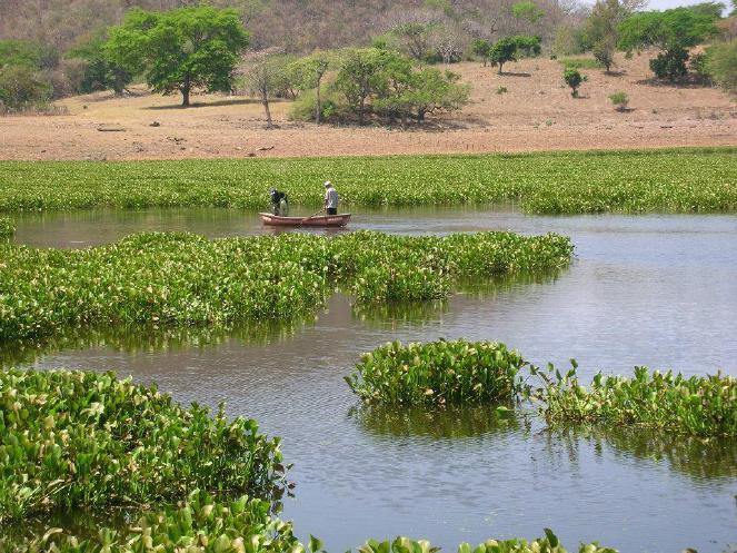
12 Tropical dry forests Precipitation = 1050 mm 85% of precipitation occurs in rainy season from May to November Temperature = C

13 Biosphere reserve zones in El Salvador


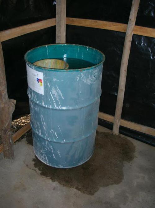
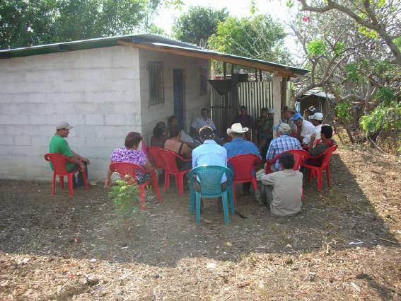
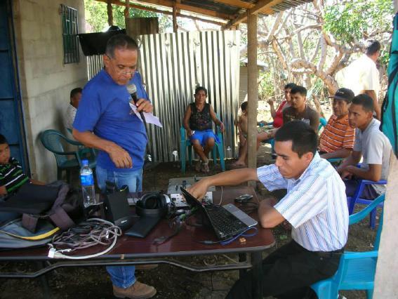
14 Peace Corps Response Site (Bendición de Dios)


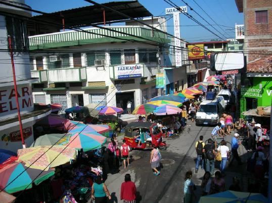
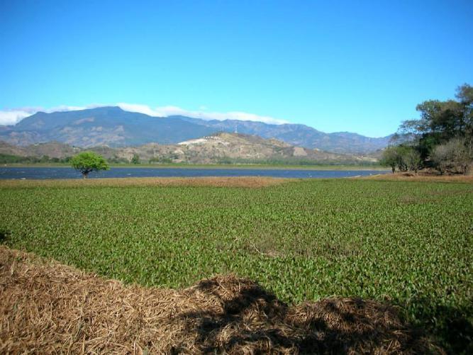
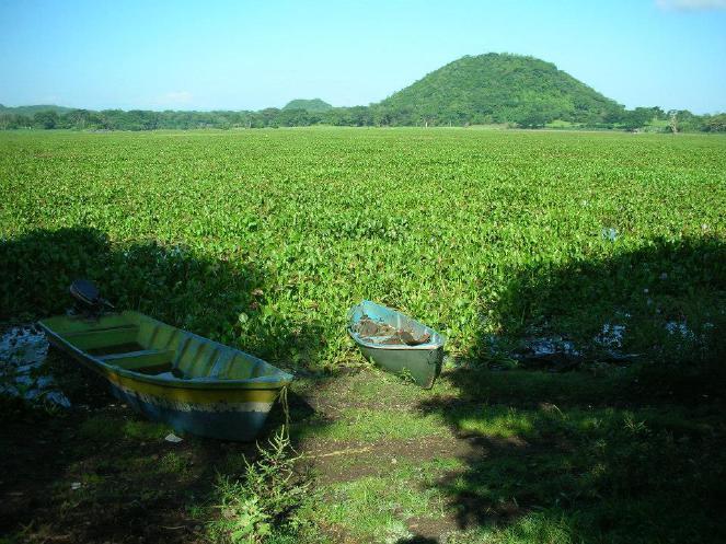
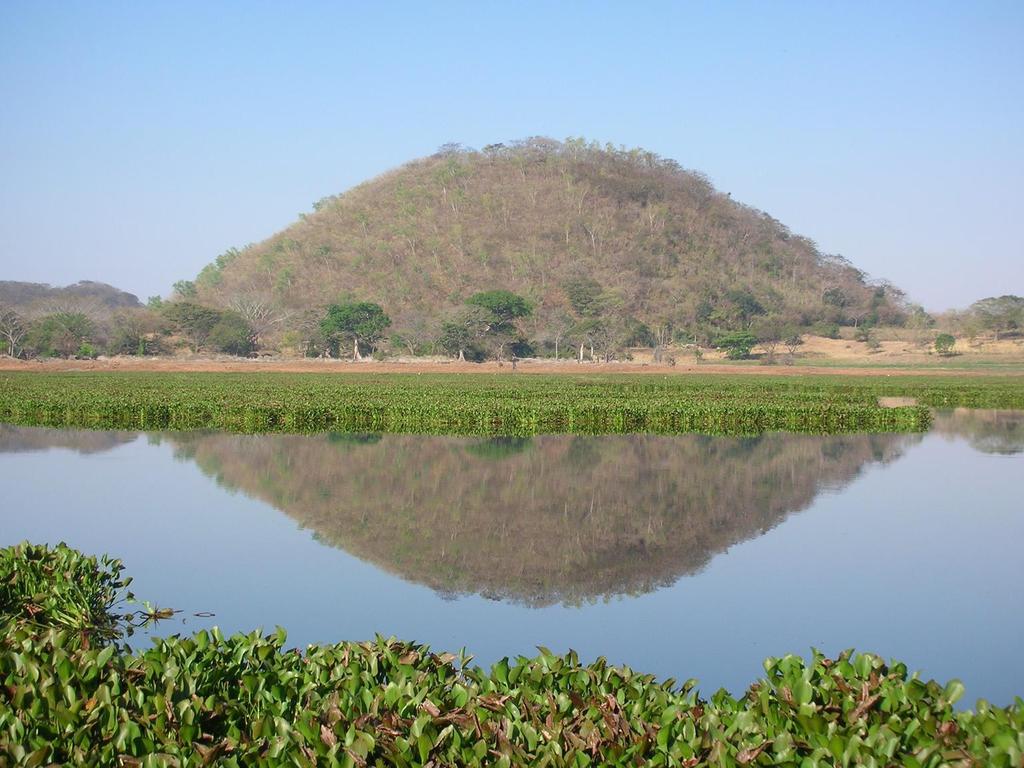
15 Area of Laguna de Metapán Dry season = 14 sq km Rainy season = 16 sq km Laguna divides into two sections during the dry season

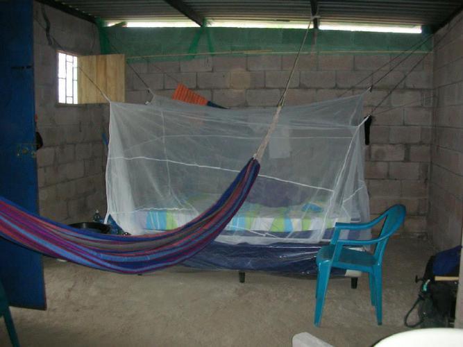
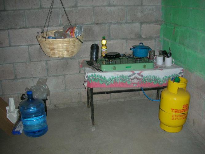
16 My house in El Salvador


17 Historical Development of Bendición de Dios Est. after 1960 along shore 1998 Hurricane Mitch 2001 Habitat for Humanity, Mayor s office, Salvadoran Association for Rural Health 23 houses built initially


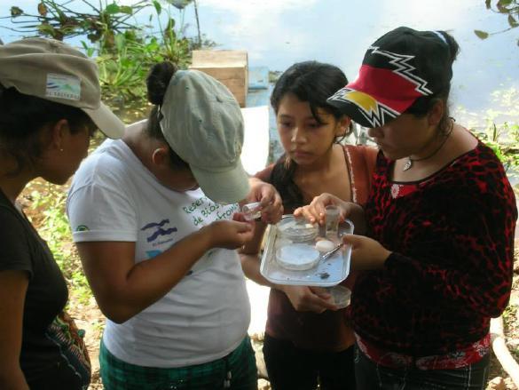
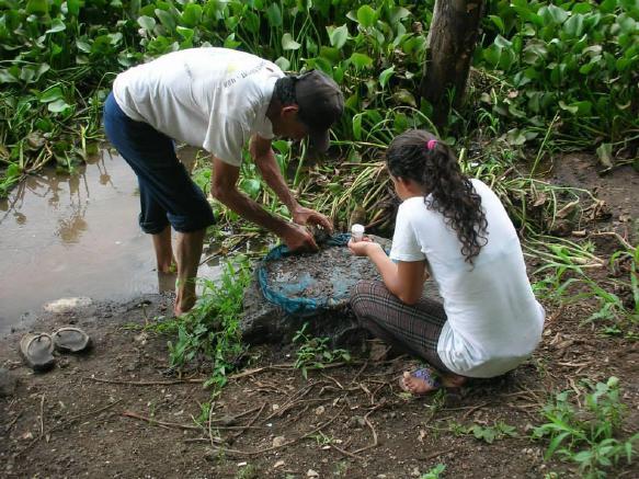
18 Bendición de Dios 23 Habitat houses built in people in 52 households 42 households with running water 43 households with electricity


19 Laguna de Metapán is the drinking water source for 20% of households during the dry season


20 Subsistence agriculture economy Maize, beans, and sorghum mostly for household consumption Only 8 households own agricultural land Land rent = $100-$125 per manzana (1.7 acres)


21 Economic risks with subsistence agriculture Dry season from November to May Timing of planting Drought (canícula) In % of maize crops lost compared to previous years


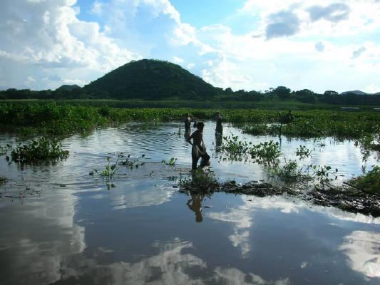
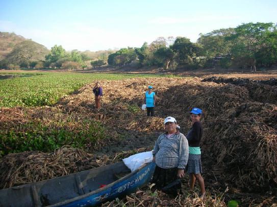
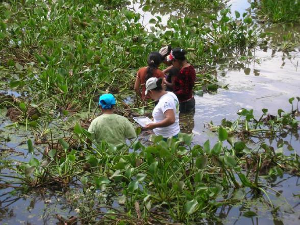
22 Fishing offsets risks to subsistence agriculture and supplements household income


23 Dry season fish camps along the shore


24 Many people earn money as fish market vendors Fish markets: Metapán, Santa Ana, and Guatemala Snails


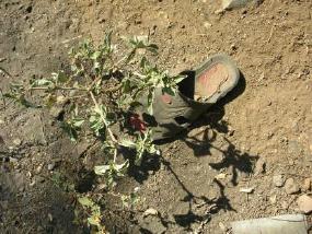
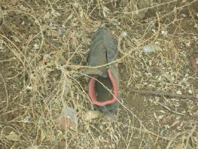
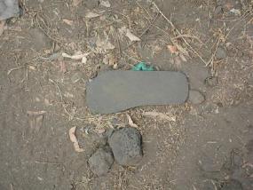
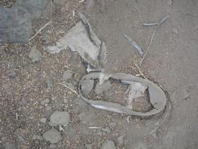
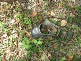
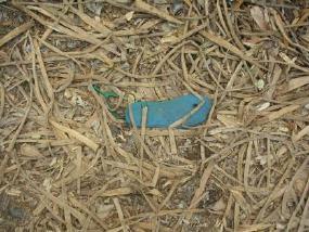
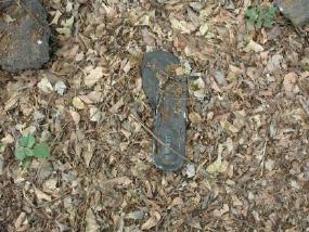
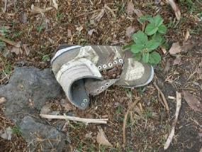
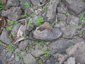
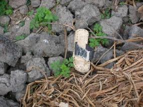
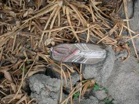
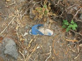
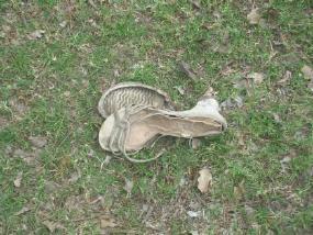
25 The nearest market is Metapán approximately 5 km


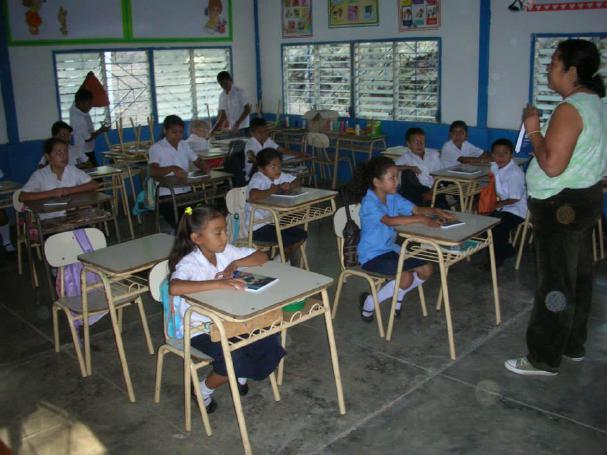
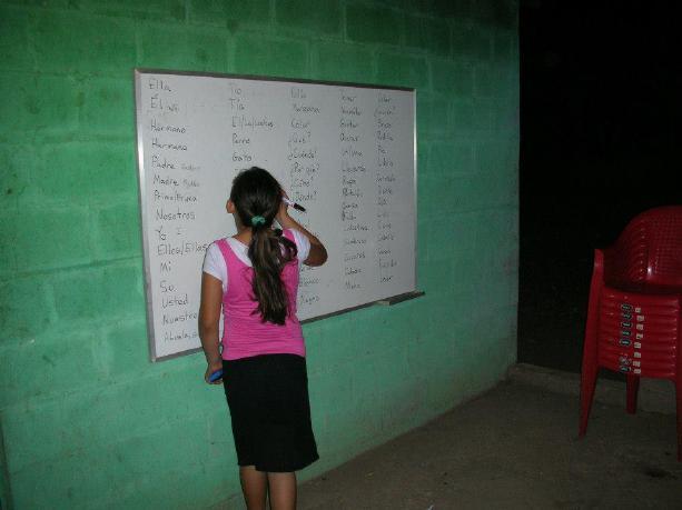
26 Laguna de Metapan is an enclosed basin Rio San Jose discharges into the lake after passing through city of Metapan


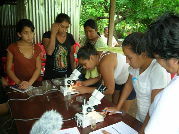
27 Holcim cement factory is a major employer in Metapán Holcim is a Swiss company USAID, Holcim, the Salvadoran government, and the local municipal government agreed to finance a sewage treatment plant USAID backed out at the last minute

 Invasive plant originating in")
28 Water pollution promotes growth of invasive species (tilapia, snails, etc.) Water hyacinth (Eichhornia crassipes [Mart] Solms) Invasive plant originating in Brazil Spread worldwide

29


30 Multiple fish kills each year with excess water hyacinth growth


31 As the rainy season progresses, the laguna fills Two sections of laguna combined Water hyacinth moves from the east side of lake to the west side of lake


32 Water hyacinth removal by communities groups
33
34


35 Art, shoes, footprints and ecological footprints

36 English classes at elementary school and during the evening
37 Future research projects and creative works Forest governance at multiple scales within biosphere reserve Environmental videos and ecological footprint exhibition Sustainability of fisheries of Laguna de Metapán Temporal changes and movement of water hyacinth Role of remittances in land use/land cover changes Ecohydrology of tropical dry forests


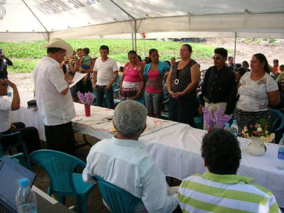
38 Acknowledgments Valerie Brodar People of Bendición de Dios and the eight other communities surrounding Laguna de Metapán Numerous colleagues from Peace Corps, Plan Trifinio, MARN, CEPRODE, CEICOM, Alcadia of Metapán, and the Benemérita Universidad Autónoma de Puebla (Mexico)
39 Preguntas?
6th Grade Western Hemisphere Geography
 6th Grade Western Hemisphere Geography Multiple Choice Identify the choice that best completes the statement or answers the question. 1 Latin America is located in the A Northern Hemisphere. C Western
COUNTRY DATA: Cuba : Information from the CIA World Factbook
 COUNTRY DATA: Cuba : Information from the CIA World Factbook INTRODUCTION The native Amerindian population of Cuba began to decline after the European discovery of the island by Christopher COLUMBUS in
Mrs. Reifsnyder World Geography. Unit 8: Latin America Study Guide SOLs Addressed: WG. 1c, 2b, 3c, 4, 10b/c
 Mrs. Reifsnyder World Geography Unit 8: Latin America Study Guide SOLs Addressed: WG. 1c, 2b, 3c, 4, 10b/c Essential Questions: - In what ways do physical, economic, and cultural characteristics influence
COUNTRY DATA: Costa Rica : Information from the CIA World Factbook! INTRODUCTION GEOGRAPHY
 ! COUNTRY DATA: Costa Rica : Information from the CIA World Factbook! INTRODUCTION GEOGRAPHY Location Area Central America, bordering both the Caribbean Sea and the North Pacific Ocean, between Nicaragua
*Latin America spans 7,000 miles, from Mexico to Tierra Del Fuego. *3 Regions: Central America, South America, and the Caribbean.
 Physical Geography Latin America spans 7,000 miles, from Mexico to Tierra Del Fuego *3 Regions: Central America, South America, and the Caribbean. *Intro clip: http://www.youtube.com/watch?v=cffp6rza3
Building Preparedness Capacity for Community Emergency Response and Disaster Mitigation. International Disaster and Risk Conference IDRC 2008
 Building Preparedness Capacity for Community Emergency Response and Disaster Mitigation International Disaster and Risk Conference IDRC 2008 Disaster Incidents in Latin America Over the Last 2-½ Years
Sugar Cane production in both Haiti and the DR are down. New markets could restore production to historic levels.
 Sugar Cane production in both Haiti and the DR are down. New markets could restore production to historic levels. Sugar Cane Production in Haiti and the DR Dominican Republic 25 Haiti 2 15 1 Hectares Harvested
International economic context and regional impact
 Contents I. GDP growth trends in Latin America and the Caribbean in 2012 II. Regional performance in 2012: Inflation, employment and wages External sector Policies: Fiscal and Monetary III. Conclusions
Latin America. Physical Geography
 Latin America Physical Geography Regions Latin America can be divided into separate regions based on physical geography or cultural geography. Regions If we look at physical geography Latin America has
COUNTRY DATA: BRAZIL: Information from the CIA World Factbook INTRODUCTION
 COUNTRY DATA: BRAZIL: Information from the CIA World Factbook INTRODUCTION Following more than three centuries under Portuguese rule, Brazil gained its independence in 1822, maintaining a monarchical system
Regional Atlas: Introduction to Latin America
 Chapter 9, Section World Geography Chapter 9 Regional Atlas: Introduction to Latin America Copyright 2003 by Pearson Education, Inc., publishing as Prentice Hall, Upper Saddle River, NJ. All rights reserved.
UNIT 3 Extra Review for Chapters 9-11
 UNIT 3 Extra Review for Chapters 9-11 Mexico Central America Caribbean Islands Middle America is Central America, Mexico, and the Islands of the Caribbean Central America is a region within Middle America.
Regional Director Latin America and Caribbean
 U.S. GRAINS COUNCIL Around the world; Around the clock Kurt Shultz Regional Director Latin America and Caribbean Leveraged Funding Non-Cash $7.8 Million Member Cash $5.2 Million FAS Funds $14.8 Million
CHAPTER Latin America. Regional Atlas Study Guide. 2 Chapter A. As You Read. B. Reviewing Vocabulary
 CHAPTER 28 9 Many Th ew inventions new Regional Atlas Study Guide Latin America Directions: As you work through the Regional Atlas, complete the chart below by writing two details about each Latin American
6th Grade Western Hemisphere Geography
 6th Grade Western Hemisphere Geography Multiple Choice Identify the choice that best completes the statement or answers the question. 1 Latin America is located in the A Northern Hemisphere. C Western
Andean Competitiveness
 Background 1. Poor countries, high income inequality 2. Failure of ISI brought inflation, deep economic crisis and political crisis in the 70s 3. Market oriented economic reforms in the 80s and 90s 4.
Latin America. Physical Geography
 + Latin America Physical Geography + I. Landforms A. Caribbean & Central America 1. Mexico is dominated by two mountain chains, collectively called the Sierra Madre. A high plateau is situated in between.
Follow this and additional works at:
 Florida International University FIU Digital Commons Palm Beach County MPO Community Background Reports 1-1-2011 Town of Lake Park Follow this and additional works at: http://digitalcommons.fiu.edu/mpo_palmbeach
DROUGHT AND SCARCITY PLANS IN THE BRAVO RIVER BASIN
 DROUGHT AND SCARCITY PLANS IN THE BRAVO RIVER BASIN Sergio Soto-Priante Deputy Director General Sub Direction of Hydraulic Infrastructure for Agriculture National Water Commission (Mexico) February 2009.
How MPAs, and Best Fishing Practices Can Enhance Sustainable Coastal Tourism 10 July 2014 Mark J. Spalding, President The Ocean Foundation
 How MPAs, and Best Fishing Practices Can Enhance Sustainable Coastal Tourism 10 July 2014 Mark J. Spalding, President The Ocean Foundation TOF Expertise Established a unique model of resort partnerships
Doing Business in Colombia. U.S. Department of Commerce International Trade Administration
 Doing Business in Colombia Colombia at a Glance 3 rd largest population in Latin America Strategic geographical location Among top 50 tourism destinations in 2009 Language: Spanish (official) Literacy
Latin America and the Caribbean: Fact Sheet on Economic and Social Indicators
 Latin America and the Caribbean: Fact Sheet on Economic and Social Indicators Dindi R. Robinson Barbara Salazar Torreon May 30, 2013 CRS Report for Congress Prepared for Members and Committees of Congress
Exploring Mexico. Directions: Complete the paragraphs below. Write the correct word from the Word Bank to complete each sentence.
 Exploring Mexico Section 1 10 Directions: Complete the paragraphs below. Write the correct word from the Word Bank to complete each sentence. Word Bank United States Central Plateau irrigation isthmus
Brazil. Chapter 12. Chapter 12, Section
 Chapter 12, Section World Geography Chapter 12 Brazil Copyright 2003 by Pearson Education, Inc., publishing as Prentice Hall, Upper Saddle River, NJ. All rights reserved. Chapter 12, Section World Geography
INFOPACK EUROPEAN SOLIDARITY CORPS LA PALMA, CANARY ISLANDS, SPAIN Ayutamiento Santa Cruz La Palma
 INFOPACK EUROPEAN SOLIDARITY CORPS LA PALMA, CANARY ISLANDS, SPAIN Ayutamiento Santa Cruz La Palma EUROPEAN SOLIDARITY CORPS Description Santa Cruz, La Palma 1.9.2019.-1.8.2020. La Isla de San Miguel de
ADDRESSING ENVIRONMENTAL AND CLIMATE CHANGE CHALLENGES FACED BY CARIBBEAN SIDS THROUGH A SUSTAINABLE DEVELOPMENT LENS
 ADDRESSING ENVIRONMENTAL AND CLIMATE CHANGE CHALLENGES FACED BY CARIBBEAN SIDS THROUGH A SUSTAINABLE DEVELOPMENT LENS Marlene Attzs, PhD Deputy Coordinator, Sustainable Economic Development Unit (SEDU)
NZQA registered unit standard version 2 Page 1 of 5
 Page 1 of 5 Title Demonstrate knowledge of Central American or South American countries as tourist destinations Level 3 Credits 8 Purpose People credited with this unit standard are able to: locate Central
11/16/15. Today s! Topic: " Latin America Independence Movement
 Classes begin at: 1st Block 8:35am 2 nd Block 10:05am Georgia Cyber Academy s mission is to provide an exemplary individualized and engaging educational experience for all students. Learning Target: I
June11, 2012 París, France
 June11, 2012 París, France Content 1 Objectives 2 INEGI and SNIEG 3 Georeferenced indicators Cases Other applications Indicators 2 1. Objective To present the use of applications of territorial indicators
WORLD GEOGRAPHY. Hector Rodriguez
 Mr. Chavira 9th Period WORLD GEOGRAPHY Hector Rodriguez P a g e 1 Table of Contents Latin America Page 2 o Maps Economic Map Page 3 Political Map Page 4 Population Map Page 5 Physical Page 6 o Notes Physical
Latin America. Introduction
 Latin America Introduction What are the 5 Themes of Geography? Draw lines to connect the theme to the definition: Location How humans and the environment impact each other Physical and human characteristics
Zone 2A. Mexico. Dominican Republic. Guatemala. Costa Rica. El Salvador. Cuba. Guadaloupe. Haiti. Nicaragua. Panama. Honduras. Mexico.
 Zone 2A Mexico Costa Rica Cuba Dominican Republic El Salvador Guadaloupe Guatemala Honduras Mexico Nicaragua Panama Puerto Rico 66 HIGHLIGHTS COUNTRIES CENTRES/ GROUPS SSIO MEMBERS SSE STUDENTS ISSE SATHYA
Honduras Official name: Population Total area Form of government Urban-rural population: Life expectancy: Head of state and government
 Honduras Official name: República de Honduras Form of government: Multiparty republic with one legislative house (National Congress - 128) Head of state and government: President Juan Orlando Hernández
LATIN AMERICA. Mexico Central America Caribbean Islands South America
 LATIN AMERICA Mexico Central America Caribbean Islands South America HISTORY First Settlers Hunters/gatherers from Asia crossed land bridge connecting Asia and Alaska Learned to farm over time Maize (corn)
Portuguese Language - Fostering National Unity
 Geography Brazil Brazil Portuguese Language - Fostering National Unity 11 dialects of Portuguese Influenced by Amerindian and African languages, creating differences between Portuguese spoken in Brazil
Business Opportunities in the Caribbean Region. Presented by: Robert Jones Commercial Counselor - Caribbean Region
 Business Opportunities in the Caribbean Region Presented by: Robert Jones Commercial Counselor - Caribbean Region The Caribbean region imports $20.3 billion of US products and services Jamaica US$2.64
Preliminary Overview of the Economies of Latin America and the Caribbean
 Inter-American Dialogue Preliminary Overview of the Economies of Latin America and the Caribbean - 2006 José Luis Machinea Executive Secretary Economic Commission for Latin America and the Caribbean Washington
Contents of the Economic Survey 2012
 Contents of the Economic Survey 2012 I. Macroeconomic trends in Latin America and the Caribbean in 2012 II. Reactions of the countries of the region to the adversities of the global economy III. Savings
Report on the Resettlement Project - The New Santa Rosa Community, Poptun. Poptun, Peten, Guatemala
 Adjacency Zone Belize - Guatemala Report on the Resettlement Project - The New Santa Rosa Community, Poptun. Poptun, Peten, Guatemala 21st of April, 2008 Technical Information: Location: Place of resettlement:
Latin America. Chapter 9 Physical Geography
 Latin America Chapter 9 Physical Geography Latin American Regions Middle America includes Mexico and the Central American countries The Caribbean Islands South America Mexico Landforms Sierra Madre Oriental
Latin America and The Caribbean. A Closer Look.
 Latin America and The Caribbean A Closer Look. Mexico Capital: Mexico City The Location of Mexico Mexico is the second-largest country by size and population in Latin America.but the Largest Spanish -
Chapter 16 ~ Eastern Mediterranean
 Chapter 16 ~ Eastern Mediterranean Physical Geography of the Eastern Mediterranean Landforms This area is known as the Levant and includes Syria, Jordan, Lebanon, Israel, and the Palestinian territories.
XIII LATIN AMERICAN CONFERENCE ON RUBBER TECHNOLOGY. November. La Antigua Guatemala Guatemala. Organized by: Executed by:
 November 23 27 La Antigua Guatemala Guatemala Organized by: Executed by: GENERAL INFORMATION THE LATIN AMERICAN CONFERENCES ON RUBBER TECHNOLOGY XIII Latin American Conference on Rubber Technology have
Reconciling Conservation and Investment in the Gambella Omo Landscape, Ethiopia
 Reconciling Conservation and Investment in the Gambella Omo Landscape, Ethiopia Cherie Enawgaw Beyene Ethiopian Wildlife Conservation Authority March 2013 Background Ethiopia is a vast country with a land
1st Period Mr. Chavira WORLD GEOGRAPHY. Hector Rodriguez
 1st Period Mr. Chavira WORLD GEOGRAPHY Hector Rodriguez P a g e 1 Table of Contents Latin America Page 2 o Maps Economic Map Page 3 Political Map Page 4 Population Map Page 5 Physical Page 6 o Notes Physical
Volunteer Technical Assistance: Agritourism & Ecotourism Development
 Volunteer Technical Assistance: Agritourism & Ecotourism Development ACDI/VOCA is an international economic development firm dedicated to improving lives and livelihoods worldwide through: Agribusiness
LIST OF FIGURES LIST OF GRAPHS
 LIST OF FIGURES Number of Figures TITLE Page No. 1 The map showing early expansion of Indus valley civilization 29 2 Geographical location of Gujarat in the world map 30 3 A historical map showing integration
DOWNLOAD OR READ : TOURISM BIODIVERSITY AND SUSTAINABLE DEVELOPMENT 6 VOLS SET PDF EBOOK EPUB MOBI
 DOWNLOAD OR READ : TOURISM BIODIVERSITY AND SUSTAINABLE DEVELOPMENT 6 VOLS SET PDF EBOOK EPUB MOBI Page 1 Page 2 tourism biodiversity and sustainable development 6 vols set tourism biodiversity and sustainable
The Aztecs and the Mayans were advanced in mathematics (in fact their calendar was more accurate than the European one at the time ) Mexico has a
 Mexico has a") México Notes on Mexico Two of the most influential cultures in Mexico were the Aztecs and Mayans. The capital of Mexico before Christopher Columbus arrived in America was Tenochtitlán. It was the capital
México Notes on Mexico Two of the most influential cultures in Mexico were the Aztecs and Mayans. The capital of Mexico before Christopher Columbus arrived in America was Tenochtitlán. It was the capital
Destınatıon costa rıca. My Choıce, naturally. GUSTAVO CAMPOS FALLAS Ambassador of the Republic of Costa Rica Turkey
 Destınatıon costa rıca My Choıce, naturally GUSTAVO CAMPOS FALLAS Ambassador of the Republic of Costa Rica Turkey Area: 51,100 sq. Km Capital: San José Population: 4.9 Million Time Zone: GMT -6 Currency:
Brazil. Population & Culture
 Brazil Population & Culture Population of Brazil Largest country in South America 200 million people (2012 est) Growing population - approximately 1% per year Life expectancy - approx 72 years Population
GEOGRAPHICAL LOCATION OF colombia
 GEOGRAPHICAL LOCATION OF colombia Population: 48 Million inhabitants Urban: 37 million inhabitants rural: 11 million inhabitants GDP PER CAPITA: USD 7.930 Unemployment: 8,8% poverty: 28.5% Santa Marta
There are two countries in the Iberian Peninsula: Spain and Portugal. The name of the peninsula comes from the first inhabitants, the Iberians.
 Spain There are two countries in the Iberian Peninsula: Spain and Portugal. The name of the peninsula comes from the first inhabitants, the Iberians. After them, the peninsula was invaded by the Celts,
THE ANDEAN AREA....How does the rich countries development affect some poor and 1. distant countries
 THE ANDEAN AREA...How does the rich countries development affect some poor and 1 distant countries 1. Geographical situation of the Andean area South America view 2 Andes mountain range Amazonian basin
Brain Wrinkles. Location, Climate, & Natural Resources of. Where People Live & How They Trade
 Location, Climate, & Natural Resources of Where People Live & How They Trade It s south of the US, east of the Pacific Ocean, and west of the Gulf of Mexico & Caribbean Sea. It s great that it s located
Unit 5/Chapter 8 ticket Central America and the Caribbean
 Unit 5/Chapter 8 ticket Central America and the Caribbean Important Vocabulary Latifundia inifundia ISTHMUS : a strip of land two large strips of land ARCHIPELAGO : a or of islands BIODIVERSITY : an as
CHAPTER IV OVERVIEW. Indonesia. The capital is Dompu. Dompu Regency has an area of 2, km².
 CHAPTER IV OVERVIEW A. General Description of the Research Sites Dompu Regency, is a district in West Nusa Tenggara Province, Indonesia. The capital is Dompu. Dompu Regency has an area of 2,321.55 km².
STANDARDS: Brain Wrinkles
 STANDARDS: SS6G3 The student will explain the impact of location, climate, distribution of natural resources, and population distribution on Latin America and the Caribbean. a. Compare how the location,
Latin American Vocabulary. Review
 Latin American Vocabulary Review Andean geographic term for countries located along the Andes mountain range of South America Arable suitable for farming BRICS Political science term used for the world
Chapter 16 ~ Eastern Mediterranean
 Chapter 16 ~ Eastern Mediterranean Physical Geography of the Eastern Mediterranean Landforms This area is known as the Levant and includes Syria, Jordan, Lebanon, Israel, and the Palestinian territories.
Mexico. Chapter 10. Chapter 10, Section
 Chapter 10, Section World Geography Chapter 10 Mexico Copyright 2003 by Pearson Education, Inc., publishing as Prentice Hall, Upper Saddle River, NJ. All rights reserved. Chapter 10, Section World Geography
The Mesoamerican cultures (1200BC- AD 1519)
") The Mesoamerican cultures (1200BC- AD 1519) Central America before the arrival of Europeans Click for Video There were many different cultures between 1200BC and AD 1519, but they share some important
The Mesoamerican cultures (1200BC- AD 1519) Central America before the arrival of Europeans Click for Video There were many different cultures between 1200BC and AD 1519, but they share some important
CHINA Y AMERICA LATINA: RELACIONES COMERCIALES Y ECONOMICAS
 CHINA Y AMERICA LATINA: RELACIONES COMERCIALES Y ECONOMICAS RHYS JENKINS SCHOOL OF DEVELOPMENT STUDIES UNIVERSITY OF EAST ANGLIA Presentación al CECHIMEX, 6 de septiembre 2006 CHINA S GLOBAL SIGNIFICANCE
Micro Enterprise Stove Project in Honduras
 Micro Enterprise Stove Project in Honduras Protecting the Environment and Family Health Trees, Water & People Honduran Association for Development Aprovecho Research Center Trees, Water & People TWP is
Successful Experiences in Rio Grande/Rio Bravo Watershed Management
 Successful Experiences in Rio Grande/Rio Bravo Watershed Management 5 th th World Water Forum Istanbul, Turkey March 22-23, 23, 2009 Introduction A watershed with many voices a medley of cultures, customs,
Latin America and the Caribbean Hurricane Season 2005*
 U.S. AGENCY FOR INTERNATIONAL DEVELOPMENT BUREAU FOR DEMOCRACY, CONFLICT, AND HUMANITARIAN ASSISTANCE (DCHA) OFFICE OF U.S. FOREIGN DISASTER ASSISTANCE (OFDA) Latin America and the Caribbean Hurricane
CANADA CARIBBEAN DISASTER RISK MANAGEMENT FUND. Island Snapshot. Trinidad and Tobago
 Island Snapshot Trinidad and Tobago About the CCDRMF The Canada Caribbean Disaster Risk Management Fund (CCDRMF) is one component of Global Affairs Canada s 1 (GAC) larger regional Caribbean Disaster Risk
Chapt. 11. Section 1. Central America and the Carribean
 Chapt. 11. Section 1 Central America and the Carribean Central America The small region of Central America curves between the giant land masses of North America and South America. Central America is an
THE SAN JUAN RIVER BASIN PROJECT
 Formulation of a Strategic Actions Program for the Integrated Management of the Hydrological Resources and Sustainable Development of the San Juan River Basin and its Coastal zone PROCUENCA SAN JUAN THE
Peru Economic and Trade Relations with the European Union. Jose Luis Silva Martinot Minister of Foreign Trade and Tourism June, 2012
 Peru Economic and Trade Relations with the European Union Jose Luis Silva Martinot Minister of Foreign Trade and Tourism June, 2012 Peruvian Integration to the global economy through Free Trade Agreements
Brain Wrinkles. Africa: The impact of location, climate, & physical characteristics on where people live, the type of work they do, & how they travel
 Africa: The impact of location, climate, & physical characteristics on where people live, the type of work they do, & how they travel STANDARDS: SS7G3 The student will explain the impact of location, climate,
Summary table of disaster occurrences, by hazards types, scale, and geographic region
 ANNEX BASIC RANGE OF DISASTER-RELATED STATISTICS TABLES Statistical tables are organised into worksheets according to basic components in the DSRF. The variables represent queries from a disaster-related
World Geography Ch. 7.2 Climate Regions of Latin America
 World Geography Ch. 7.2 Climate Regions of Latin America BR: D10 When you think of Latin America, what types of climates do you think are down there? Write down which of the following you believe are there:
REGIONAL AGREEMENT AND FRAMEWORK FOR MARINE MAMMALS CONSERVATION IN THE WCR: THE SPAW PROTOCOL AND THE MARINE MAMMAL ACTION PLAN
 REGIONAL AGREEMENT AND FRAMEWORK FOR MARINE MAMMALS CONSERVATION IN THE WCR: THE SPAW PROTOCOL AND THE MARINE MAMMAL ACTION PLAN ALESSANDRA VANZELLA-KHOURI SPAW Programme Officer United Nations Environment
The Economic Impact of Children's Camps in Michigan
 Extension Bulletin E-1559, July 1981, File 36.42 The Economic Impact of Children's in Michigan Department of Park and Recreation Resources Michigan State University East Lansing, Michigan in cooperation
G_M.05. Work in a school for handicapped children (and adults) in San Juan la Laguna (Lago de Atitlán).
 in San Juan la Laguna (Lago de Atitlán).") Physical therapist Education Social work Administration PR and Marketing Work in a school for handicapped children (and adults) in San Juan la Laguna (Lago de Atitlán). Update: 07_2014 Project Facts Objective:
Physical therapist Education Social work Administration PR and Marketing Work in a school for handicapped children (and adults) in San Juan la Laguna (Lago de Atitlán). Update: 07_2014 Project Facts Objective:
Many ecotourists visit the various natural habitats in Central America. Why do you think ecotourism has become so popular?
 Chapter 9 Middle America and Spanish Speaking South America pg. 252 287 9 1 Central America pg. 255 259 Connecting to Your World What is one country in Central America that promotes ecotourism? Many ecotourists
AP US History: An Essential Coursebook (2nd Ed)
") Unit One: Early Native and Colonial Societies (1491-1754) Chapter One: Pre-Columbian Societies AP US History: An Essential Coursebook (2nd Ed) Environment and Geography How did physical features affect
Unit One: Early Native and Colonial Societies (1491-1754) Chapter One: Pre-Columbian Societies AP US History: An Essential Coursebook (2nd Ed) Environment and Geography How did physical features affect
Name: Hour: Day: The Land and Its Regions (pg ) Define, in your own words, escarpment. Define, in your own words, sertão
 Define, in your own words, escarpment. Define, in your own words, sertão") Name: Hour: Day: World Geography Guided Reading Notes Chap 12 & 13 --- ANSWER IN COMPLETE SENTENCES!!!! READ EACH QUESTION CAREFULLY & ANSWER COMPLETELY!!!! Objectives: Upon completion of reading you should
Name: Hour: Day: World Geography Guided Reading Notes Chap 12 & 13 --- ANSWER IN COMPLETE SENTENCES!!!! READ EACH QUESTION CAREFULLY & ANSWER COMPLETELY!!!! Objectives: Upon completion of reading you should
A Brief Overview of the Rio Grande Compact 04/26/06
 A Brief Overview of the Rio Grande Compact 04/26/06 The New Mexico Interstate Stream Commission Investigate, Protect, Conserve, and Develop the State s Waters and Stream Systems Negotiate and Administer
EAST AFRICA Price Bulletin November 2017
 KES/9 kg KES/9 kg November 217 The Famine Early Warning Systems Network (FEWS NET) monitors trends in staple food prices in countries vulnerable to food insecurity. For each FEWS NET country and region,
UNIT 5 AFRICA PHYSICAL GEOGRAPHY SG 1 - PART II
 UNIT 5 AFRICA PHYSICAL GEOGRAPHY SG 1 - PART II III. CLIMATE & VEGETATION A. The four main climate zones are tropical wet, tropical wet/dry (split into monsoon & savanna), semiarid, and arid. Other climate
JATA Market Research Study Passenger Survey Results
 JATA Market Research Study Passenger Survey Results Prepared for the Jackson Area Transportation Authority (JATA) April, 2015 3131 South Dixie Hwy. Suite 545 Dayton, OH 45439 937.299.5007 www.rlsandassoc.com
BOTSWANA AGRICULTURAL CENSUS REPORT 2015
 BOTSWANA AGRICULTURAL CENSUS REPORT 2015 STATISTICS BOTSWANA BOTSWANA AGRICULTURAL CENSUS REPORT 2015 1 BOTSWANA AGRICULTURAL CENSUS REPORT 2015 2 BOTSWANA AGRICULTURAL CENSUS REPORT 2015 BOTSWANA AGRICULTURAL
PROJECT INFORMATION DOCUMENT (PID) CONCEPT STAGE March 2009 Report No.: AB4607 Project Name
 CONCEPT STAGE March 2009 Report No.: AB4607 Project Name") PROJECT INFORMATION DOCUMENT (PID) CONCEPT STAGE March 2009 Report No.: AB4607 Project Name Rio Bogota Environmental Infrastructure Region LATIN AMERICA AND CARIBBEAN Sector Sewerage (70%); Flood protection
PROJECT INFORMATION DOCUMENT (PID) CONCEPT STAGE March 2009 Report No.: AB4607 Project Name Rio Bogota Environmental Infrastructure Region LATIN AMERICA AND CARIBBEAN Sector Sewerage (70%); Flood protection
Brazil Otter Sanctuary and Conservation
 Brazil Otter Sanctuary and Conservation Gain hands on conservation experience as you help to care for and protect Brazil's Neotropical Otter. Officially known as the Federative Republic of Brazil (República
Inter-American Defense College
 http://www.jid.org/iadc.php Inter-American Defense College Inter-American Defense College Building Confidence & Security Since 1962 A Confidence & Security Building Measure Inter-American Defense College
Social and economic dimensions of the 1998 extreme floods in coastal Chiapas, Mexico
 The Extremes of the Extremes: Extraordinaiy Floods (Proceedings of a symposium held at Reykjavik. Iceland. July 2000). IAHS Publ. no. 271. 2002. 385 Social and economic dimensions of the 1998 extreme floods
Simple practices to improve and optimize on site wastewater disposal systems (OSDS) in Special Communities of Río Grande de Añasco Watershed
 in Special Communities of Río Grande de Añasco Watershed") Simple practices to improve and optimize on site wastewater disposal systems (OSDS) in Special Communities of Río Grande de Añasco Watershed UNIVERSITY OF PUERTO RICO Mayagüez Campus Ana Navarro, Sea Grant
Simple practices to improve and optimize on site wastewater disposal systems (OSDS) in Special Communities of Río Grande de Añasco Watershed UNIVERSITY OF PUERTO RICO Mayagüez Campus Ana Navarro, Sea Grant
AOC 2017AOC 2017AOC. Robert Johansson Chief Economist US Department of Agriculture Beijing, China (April 2017)
") http://wcfcourier.com/article_db152199-d2de-5455-ac-b643ba6a1c8f.html U.S. AGRICULTURAL OUTLOOK 17 AND LONGER-TERM PROJECTIONS AOC 17AOC 17AOC AOC 17AOC 17AOC Robert Johansson AOC 17AOC 17AOC Chief Economist
http://wcfcourier.com/article_db152199-d2de-5455-ac-b643ba6a1c8f.html U.S. AGRICULTURAL OUTLOOK 17 AND LONGER-TERM PROJECTIONS AOC 17AOC 17AOC AOC 17AOC 17AOC Robert Johansson AOC 17AOC 17AOC Chief Economist
United Nations Environment Programme
 UNITED NATIONS EP United Nations Environment Programme Distr. RESTRICTED UNEP(DEPI)/CAR IG.28/INF.9 1 July 2008 Original: ENGLISH Thirteenth Intergovernmental Meeting on the Action Plan for the Caribbean
Information bulletin Chile: Wildfires
 Information bulletin Chile: Wildfires Information Bulletin GLIDE n WF-2012-000001-CHL 6 January 2012 This bulletin is being issued for information only, and reflects the current situation and details available
Conceptualizing space and place through the lens of food systems in urban Amazonia
 Conceptualizing space and place through the lens of food systems in urban Amazonia Stone Center Summer Field Research Grant Terminal Report September 30, 2012 Scarlett Andrews M.A Candidate Stone Center
WHITE MAIZE: The markets below represent the major producer and consumer markets in countries where white maize is heavily consumed as the staple.
 KES/9 kg KES/9 kg November 211 The Famine Early Warning Systems Network (FEWS NET) monitors trends in staple food prices in countries vulnerable to food insecurity. For each FEWS NET country and region,
Why is the US industry and agriculture prosperous? The US industry and agriculture is so prosperous because it has many different natural resources.
 Ch. 1-7 Study Guide Why is the US industry and agriculture prosperous? The US industry and agriculture is so prosperous because it has many different natural resources. What likely drew immigrants to the
Development & Opportunity of China s Tourism Market. Macao Dec Yao Yuecan/CITS HO
 Development & Opportunity of China s Tourism Market Macao Dec.1. 2008 Yao Yuecan/CITS HO 1 Topics 1 Status Quo of Development of China s Tourism 2 Olympics Improves Image of China s Tourism 3 The World
Geoscape Toronto The Oak Ridges Moraine Activity 2 - Page 1 of 10 Information Bulletin
 About 13,000 years ago as the Laurentide Ice Sheet melted, glacial meltwater accumulated between the ice sheet and the Niagara Escarpment. This formed a lake basin into which gravel and sand were deposited.
Latin American Revolutions of the early 1800s
 Latin American Revolutions of the early 1800s I. Background The Spanish/Portuguese Colonial System A. The Roles of Colonies fulfillment of mercantilism for Spain and Portugal 1. Plantation Agriculture
The MPA Name. The past and future of the. Montego Bay Marine Park Trust
 The MPA Name The past and future of the Montego Bay Marine Park Trust Park Boundaries and Sanctuary Area 100m/330ft/50 Fathom Depth Contour to The Average Highest High Tide Mark 50 Fathom/100M Depth Great
Chile Earthquake 2010
 Chile Earthquake 2010-8.8 magnitude - 500 killed - 12000 injured - $30 billion damage - Santiago evacuated - Tsunami warnings www.teachitgeography.co.uk 2018 32657 Page 1 of 18 Nepal Earthquake 2015-7.8