CSE Main Compulsory Paper 1.5 Geography of India
|
|
|
- Anis McBride
- 5 years ago
- Views:
Transcription
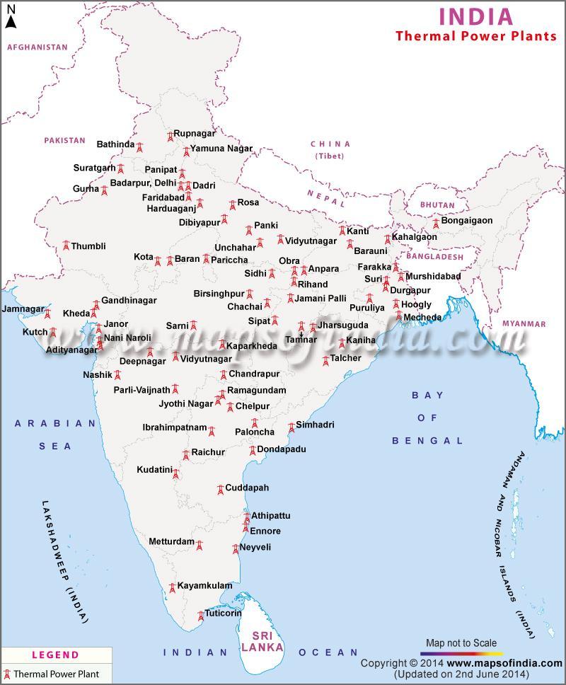
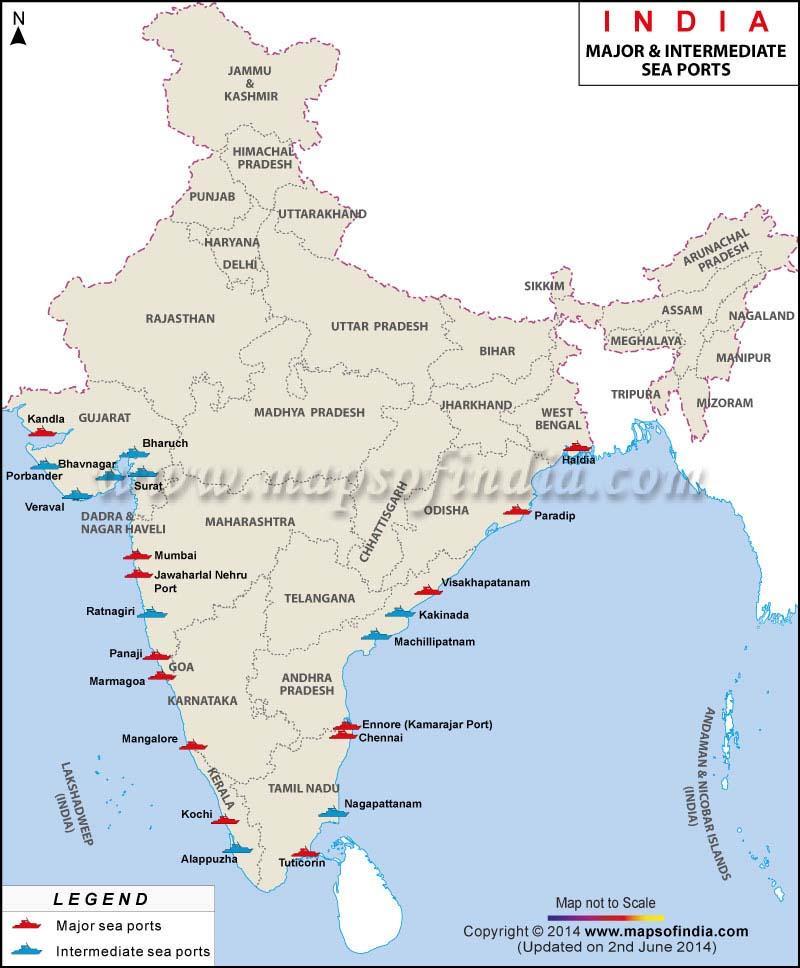
1 CONTENT 1. Geographical features and their location Why is called a sub-continent? Page 2 2. The Great Himalayan Ranges Page 3 3. The Northern Plains and Soil varieties Page 6 4. Watersheds and river drainage basins Page 8 5. Origins and tributaries of major river systems Page 9 6. The River Systems in Central Page The Brahmaputra and the Peninsular River Systems Page The Deccan Plateau and Western and Eastern Ghats Page For Andaman and Nicobar Islands: See the excellent film on ISRO Education Portal. The only mud volcano in the world is located here. 10. Maps : Thermal power plants, Minerals, Sea ports Page 21 Geographical features and their location 1. is located from North North, which is a length of 3,214 km from North to South. 2. s extent from 66 0 (degree) East to 98 0 degree East, making its east to west extent 2,933 km. 10x10learning.com Page 1
2 3. Its total area is 3.28 million square km., and it has 2.4 per cent of world s land surface. 4. It is the 7 th largest country in the world. has a mainland coastline of 6,100 km, and 7,517 km in entire geographical coast including the island groups of Andaman and Nicobar in east and Lakshadweep in the west. 5. Longitudinal extend is about 30 degrees, which means a time difference of two hours from Dibrugarh in Imphal in the east to Jaisalmer, Rajasthan in the west. 6. The distance between two longitudes decreases towards the poles, while the distance between two latitudes remains the same. 7. s northern boundary extends up to N, and southern boundary up to N ( read six degrees and forty-five minutes North) in Bay of Bengal. The southern part lies in the Tropics, and the northern part lies in warm temperate zone or sub-tropical zone. This geographical location is responsible for the diversity and the large variations in land forms, climate, soil types and natural vegetation. 8. The standard meridian of all countries is in multiples of For this reason, East is s Standard meridian. s time is 5 hours 30 minutes ahead of Greenwich Meridian Time. 9. USA has seven time zones, due to its wide extent from east to west. 10. The difference in time northernmost 11. Mahe in Kerala on west coast, Karaikal in TN, and Yanam in Telangana on east coast, are also part of Puducherry. The natives of Puducherry have a voting right for elections in France also. 12. Why is called a sub-continent? 10x10learning.com Page 2
3 is called a sub continent because it is bounded by the lofty mountain ranges of the Himalayas in the north, Hindukush and Sulaiman ranges in the north west, Purvachal hills in the north east. It has large river valleys of Ganga, Brahmaputra, Mahanadi, Krishna, Godavari, Kaveri; green forested hills in north eastern and south west; vast sandy deserts or marusthali in Rajasthan. In the south it is bounded by n Ocean, with Bay of Bengal in east with Andaman and Nicobar Islands and Arabian Sea in the West with Lakshadweep group of islands. Its geographical features have enabled it to evolve a unique identity as it has climatic zones from the tropics to temperate zone in the north. Due to these wide ranging geographical conditions, is called a sub continent, being the seventh largest country in the world. ( 141 words; maximum allowed is 150) The Great Himalayan range 1. The Great Himalayan range is approximately 2,500 km from east to west, and its width varies from 160 km to 400 km, north to south. The minimum height of these mountains is above 900 metres from sea level in the east and north east, and 1800 m to 2,000 m in the Siachen glacier in the west. Mount Everest is 8,848 m above sea level. The orientation of the Himalayas are from Jammu and Kashmir up to Darjeeling and Sikkim are oriented in a north - western to south east direction. Thereafter, the Himalayas are oriented in an east- west direction. In Nagaland, Manipur and Mizoram, they are in north-south direction 10x10learning.com Page 3
4 1.1 The Himalayas have five subdivisions as follows: a. Kashmir or North-western Himalayas: Karakoram ranges with K2 peak and Zoji La pass, Ladakh ranges, Zaskar rang with Nanga Parbat peak, Bara Lacha La and Shipki La pass, and Pir Panjal range with Banihal pass. Important glaciers are Baltoro, and Siachen that have Karewas. Karewas are the thick deposits of glacial clay and other materials embedded with the moraines. They are ideal for cultivation of Zafran, a local variety of saffron. Valley of Kashmir lies between Zaskar and Pir Panjal ranges. Fresh water lakes are Dal lake and Wular lake. Salt water lakes are Pangong Tso and Tso Moriri. Longitudinal valleys between the southern ranges are called duns - Pathankot dun and Jammu dun. Indus is the main river, with Jhelum and Chenab as its tributaries. Jhelum in Srinagar is in its youth stage, and yet meanders through it like a river in its mature stage. This is because Jhelum is a part of the larger Dal lake, that existed earlier. b. Himachal and Uttaranchal Himalayas : lie between River Ravi in the west and River Kali in the east. Kali is a tributary of River Ghaghara. In the Spiti subdivision of Lahul and Spiti district, of Himachal Pradesh lies an extension of the cold desert of Ladakh range, along with Zaskar and Pir Panjal. These ranges are called Dhaoladhar in Himachal Pradesh, and Nagtibha in Uttarakhand. The Shiwalik ranges, have an altitude between 1,000 to 2000 m, and Dharamshala, Shimla, Kaosani, Kasauli, Mussoorie, Almora, Ranikhet and Lansdowne are located in these ranges. 10x10learning.com Page 4
5 Shiwalik and dun formations distinguish these ranges. Major duns are Chandigarh- Kalka Dun, Nalagarh Dun, Dehra Dun, Harike dun, Kota dun. Dehra Dun is the largest of all duns with a length of 35 to 45 km and width of 22 to 25 km. In Great Himalayan ranges valleys are inhabited by nomadic groups called Bhotia s, who migrate to Bugyals during summer. Bugyals are grasslands in higher reaches. Valley of flowers is located here. Places of pilgrimages include Gangotri, Yamunotri, Kedarnath, Badrinath, Hemkund Sahib, along with five Prayags or confluences of rivers. c. Darjeeling and Sikkim Himalayas: are flanked by Nepal and Bhutan Himalayas. Known for its fast flowing Tista River, and Kanchenjunga and deep valleys. Jelap La pass is towards Bhutan. Dafla Hills have Bomdi Ka pass. Lepcha tribes inhabit the northern ranges, while lower ranges are known for tea plantations. These ranges along with Arunachal Himalayas have no Shiwalik formations. Instead there are duar formations where tea gardens have been developed, due to their moderate slopes, thick soil cover with high organic content, well distributed rainfall throughout the year, and mild winters. Rich flora and fauna, particularly variety of orchids. d. Arunachal Himalayas : from east of Bhutan to Diphu pass. Important peaks are Kangtu, and Namcha Barwa. Bhramaputra s gorge at Namcha Barwa pass, is one of the deep gorges. Bomdi La pass in Dafla Hills is important. Rivers Kameng and River Lohit. 10x10learning.com Page 5
6 e. Eastern Hills and Mountains: form the border with Myanmar, from north to south, are Patkai Bum ranges, Naga Hills, Manipur hills, Mizo or Lushai Hills. South of the Brahmaputra, from west to east are Garo Hills, Khasi Hills and Jaintia Hills. Rivers of Naga Hills are tributaries of Brahmaputra. While two rivers of Manipur and Mizoram are tributaries of River Barak. Barak in turn joins River Meghna. Mizoram has Molassis basin made of soft unconsolidated deposits. f. Manipur has a unique large lake known as Loktak lake surrounded by mountains. Rivers from eastern Manipur are tributaries of River Chindwin, which joins River Irrawady of Myanmar. River Brahmaputra turns almost 90 degree southwards at Dhubri, before entering Bangladesh. The Northern Plains 2. The Northern Plains are 50 to 150 metres above mean sea level, and formed by alluvial deposits of river systems of the Indus, the Ganga, and the Brahmaputra. They extend 3,200 km. east to west, and are 150 to 300 km wide. The maximum depth of the plains is 1000 m. to 2000 m. Haryana and Delhi form a water divide between the Indus and Ganga river systems. Indus river system flows from northeast towards west, while River Brahmaputra flows from northeast to southwest before it turns almost 90 degree southwards at Dhubri, before entering Bangladesh. Ganga river system, curves towards the east to form the world s largest delta, the Sundarbans in the Bay of Bengal. 10x10learning.com Page 6
7 1. From north to south, the northern plains have three major zones. (a) Bhahar zone is 8 km to 10 km wide at the Shiwalik foothills, with deposits of heavy material of rocks and boulders. (b) Tarai belt is below bhahar, and is about 10 to 20 km wide. Most streams and rivers re-emerge here after disappearing behind the boulders of the Bhahar zone. This is a swampy and marshy area with luxurious natural vegetation and wild life. (c) Bhangar is the old alluvial deposit zone and Khadar is the new alluvial deposit zone. They are in the mature stage of fluvial erosion and deposit landforms, such as sandbars, meanders, oxbow lakes, braided stream channels, and riverine islands. ( in the Brahmaputra valley) These features are created due to periodic floods and shifting of river courses. 2. Important River Drainage Patterns: a) Dendritic pattern resembles branches of a tree as in northern plains b) Radial pattern when river originates on a hill and flows in all directions. Example is River Son from Amarkantak plateau. c) Trellis pattern when primary tributaries of rivers flow parallel and secondary tributaries join at right angles. As in Yamuna and Ganga system d) Centripetal pattern when rivers from all directions flow into a lake or depression, as in Wular and Dal lake in Jammu and Kashmir, 3. River systems in northern plains: 10x10learning.com Page 7
8 a. River Beas joins River Sutlej. Then, in a north to south sequence, Rivers Chenab, Ravi and Sutlej, join River Jhelum, which joins River Indus. b. Tributaries of Yamuna from Central Plateau regions, in sequence from west to east are River Chambal, River Sind, River Betwa, and River Ken. c. Tributaries of River Ganga after Prayag, in sequence from west to east are River Gomti, River Ghaghara, River Son ( from central plateau) River Gandak, and River Kosi, Thereafter, it flows as River Hoogly into West Bengal and River Padma into Bangladesh. d. Watersheds and river drainage basins in are grouped into three categories: 1. Major river basins with more than 20,000 sq.km of catchment area. There are 14 such basins of the Ganga, the Brahmaputra, the Krishna, the Tapi, the Narmada, the Mahi, the Cauvery, the Pennar, the Sabarmati, the Barak, the Mahanadi, the Subernarekha, the Mahi, Brahmani and Baitarni. 2. Medium river basins with catchment area between 2,000 to 20,000 sq. km. There are 44 medium river basins, the Kalindi, the Periyar, the Megna, the Indus ( up to border) ; east flowing rivers between Mahanadi and Pennar, East flowing rivers between Pennar and Kanyakumari, west flowing rivers of Kutch, Sabarmati, including Luni, west flowing rivers from 10x10learning.com Page 8
9 Tapi to Tadri, West flowing rivers from Tadri to Kanyakumari. 3. Minor river basins with less than 2,000 sq km. Include many rivers in areas of low rainfall. Important minor river basins drainage into Bangladesh and Myanmar. Origins and tributaries of major river systems in : e. River Indus from a glacier near Bokhar Chu ( N and E) in Tibet at an altitude of 4,164m. It is called Singi Khamban or the Lion s mouth in Tibet. It forms a spectacular gorge near Gilgit in Jammu and Kashmir. In it flows only through the Leh district. It leaves near Chillar in Dardistan region. f. River Jhelum rises from a spring at Verinag, at the foot of the Pir Panjal range. Flows through Srinagar and Wular lake before leaving through a deep gorge. g. River Chenab or Chandrabhaga, is formed by two streams the Chandra and the Bhaga, which join at Tandi, near Keylong in Himachal Pradesh to become River Chandrabhaga. In is flows for 1,180 km. h. River Ravi, rises west of the Rohtang pass in Kullu hills ( Himachal Pradesh) and flows through Chamba valley, and drains the Pir Panjal and Dhauladhar ranges. i. River Beas originates from the Beas Kund near Rohtang pass at 4,000 m. Following through the Kullu valley, it forms gorges at 10x10learning.com Page 9
10 Kati and Largi in Dhaoladhar range. It joins River Sutlej near Harike. j. River Sutlej originates in the Rakas lake near Mansarovar at 4,555 m in Tibet. There it is called Langchen Khambab. It flows parallel to River Indus for 400 km before entering. It emerges from a gorge at Rupar and passes through Shipki La on Himalayan ranges, before entering the plains of Punjab. It feeds the canal of Bhakra Nangal project. k. River Bhagirathi: rises in Gangotri glacier near Gaumukh ( 3,900 m) in Uttarkashi district of Uttarakhand. At Dev Prayag, it joins Alaknanda, that rises from Satopanth glacier above Badrinath. River Alaknanda has Rivers Dhauli and Vishnu Ganga as its tributaries that join it at Joshimath or Vishnu Prayag. River Pindar joins Alaknanda at Karna Prayag, and Mandakini or Kali Ganga joins it at Rudra Prayag. From Dev Prayag, the combined Bhagirathi and Alaknanda become River Ganga, that enters the plains at Haridwar. From here it flow south, then south east, joining the River Yamuna at Prayag, and then eastwards, before splitting as Bhagirathi and Hugli. It total length is 2,525 km of which 110 km is in Uttarakhand, 1450 km in Uttar Pradesh, 445 km in Bihar, and 520 km in West Bengal. In, the total area covered by the Ganga basin in 8.6 lakh sq km. The major left bank tributaries of River Ganga are Rivers Ramganga, Gomati, Ghaghara, Gandak, Kosi, Mahananda. It major right bank tributaries are River Yamuna and River Son. Sagar Island in West Bengal, is the end point of the Ganga river basin. 10x10learning.com Page 10
11 l. River Ramganga: rises in Garhwal hills near Gairsain. Flowing southwest through Shiwalik, it enters Uttar Pradesh near Najibabad, and joins River Ganga at Kannauj. m. River Gandhak rises in Nepal Himalayas between Dhaulagiri and Mount Everest. It has two tributaries, River Kaligandak and River Trishulganga. It enters in Champaran district and joins River Ganga at Sonpur near Patna. n. River Ghaghara rises in glaciers of Mapchachungo. Its three tributaries are Rivers Tila, Seti and Beri. It emerges at a deep gorge at Shishapani. River Sarda or Kali or Kaliganga, joins River Ghaghara befire Chhapra, where it joins River Ganga. o. River Kosi: emerges as River Arun from north of Mount Everest in Tibet. After Nepal, River Arun is joined by Son Kosi joins it from west and Tamur Kosi from east, to become Sapt Kosi. p. River Sarda or Saryu rises in the Milam glacier in Nepal Himalayas. In Nepal it is called Goriganga. Along Indo-Nepal border it is called Kali or Chauk, before it joins River Ghaghara. q. River Mahananda : rises in the Darjiling hills, and joins River Ganga as its last left tributary in West Bengal. r. River Yamuna, rises in Yamunotri glacier in western slopes of Banderpunch range ( 6,316 km), and is the longest, westernmost tributary of River Ganga. Its major tributaries on the right bank include Rivers Chambal, Sind, Betwa, Ken. Its left bank tributaries are Rivers Hindan, Rind, Sengar, Varuna. Its water feeds the Agra canal for irrigation purposes. 10x10learning.com Page 11
12 4. Rivers of Central a. River Chambal originates in the Aravallis and has River Banas as its only tributary from the Vindhyan and Kaimur Hills. River Sind, River Betwa, and River Ken flow in the north eastern direction from Aravalli Range, Malwa Plate (300 to 600 m ) and Bundelkhand, to join the Yamuna in the north. River rises near Mhow in Malwa plateau in Madhya Pradesh, and flows northwards through a gorge to Kota in Rajasthan, where Gandhisagar Dam is constructed. From Kota it moves to Bundi, Sawai Madhopur, Dholpur and joins the Yamuna. Chambal ravines are its famous features. b. River Damodar rises in Chotanagpur plateau, and flows along its eastern margin through a rift valley. River Barakar is its tributary, River Damodar joins the Hugli in West Bengal. Damodar Valley Multipurpose Project has controlled this flood prone river, that was earlier nicknamed the sorrow of Bengal. c. River Son, originates in Amarkantak plateau in Central, and after a series of waterfalls at the edge of the plateau, it join River Ganga at Arrah, near Patna. 5. River Brahmaputra System: one of the largest in the world. It originates in Chemajungdung glacier near Mansarovar lake in Kailash range. Flowing eastwards longitudinally for 1,200 km in dry and flat southern Tibet, it is called Tsangpo meaning the purifier. 10x10learning.com Page 12
13 6. In Tibet The Tango Tsangpo is its tributary. It carves a deep gorge in Central Himalayas near Namcha Barwa ( 7,755 m.) Emerging in the foothills it is called Siang or Dihang. 7. It enters, west of Sadiya town in Arunachal Pradesh. Flowing southwest from Sadiya, it is joined by two tributaries on the left bank, namely, River Dibang or Sikang, and River Lohit. 8. Thereafter, it is called River Brahmaputra. In Assam, flowing for 750 km, Rivers Burhi Dihing and Dhansari, join it on left bank, and River Subansiri, which is an antecedent river from Tibet, and Rivers Kameng, Manas, and Sankosh join it on the right bank. River Brahmaputra leaves at Dhubri. 9. In Bangladesh, after River Tista joins it on right bank its name is changed to River Yamuna. It joins River Padma and flows southwards in to the Bay of Bengal. The Peninsular River Systems 10. Most peninsular rivers flow eastwards, except the River Narmada and River Tapi that flow west in to the Arabian Sea. The rivers in Central Plateau flow north wards to join the Yamuna and Ganga river systems. Other major rivers are older than the Himalayan river systems. This is indicated by their broader and shallow valleys. Three other geological events in tertiary period distinguish the peninsular river systems. a) Subsidence of the western flank leading to its submergence below the sea. This disturbed the symmetrical plan of rivers on either side of the original watershed. The Western Ghats close to the coast act as a water divide. 10x10learning.com Page 13
14 b) Upheaval of the Himalayas that caused the subsidence of the Peninsular block and consequent trough faulting. River Narmada and River Tapi flow in this trough fault. Therefore, they lack alluvial and deltaic deposits, and fill the cracks with their detritus materials. c) Slight tilting of the peninsular block from northwest to the south eastern direction. This tilt orients the flow of all river systems towards the Bay of Bengal. d) West flowing small rivers include (1)River Mahi ( 34,842 sq km catchment) (2) River Sabarmati ( 21,674 sq.km) (3) River Bharathapuzha or Ponnani ( 5,397 sq km) longest river of Kerala rises in Annamalai hills. (4) River Periyar ( 5,243 sq.km.) second longest river in Kerala. (5) River Kali nadi ( 5,179 sq km) rises in Belgaum district and falls in Karwar Bay that creates a natural harbour. (6) River Dhaandhar ( 2,770 sq.km.) (7) River Sharavati ( 2,029 sq.km.) rises in Shimoga district of Karnataka forms the Gersoppa or Jog falls e) River Shetruniji rises near Dalkahwa in Amreli district. f) River Bhadra rises near Aniali village in Rajkot district 10x10learning.com Page 14
15 g) River Dhadhar rises near Ghantar village in Panchmahal district h) River Vaitarna rises from Trimbak hills in Nasik district at 670 m. i) River Bedti in Hubli Dharwar and is 161 km long. j) River Mandovi and River Juari are in Goa. k) River Pamba in Kerala is 177 km long and fall in to the Vemobanad lake. l) Talakaveri, Irruppu falls and Abbey falls in Coorg district Karnataka m) SMALL rivers flowing Eastwards: (1) River Penner ( 55,213 sq.km.) (2) River Brahmani (39,033 sq.km) (3) River Subarnarekha (19,296 sq km) (4) River Palar ( 17,870 sq.km) (5) River Baitarni (12,789 sq.km) 11. River Narmada rises from Amarkantak plateau (1,057m.) and is 1,312 km long. Flows through rift valley of Satpura range in south and Vindhayan range in north, to form a gorge in marble rocks and Dhuandhar waterfall near Jabalpur. Its catchment area is 98,796 sq. km. Near Bharuch, it form a 27 km broad estuary to join the Arabian Sea. Sardar Sarovar Project has been constructed on Narmada. 10x10learning.com Page 15
16 12. River Tapi originates from Multai in Betul district of Madhya Pradesh. It is 724 km long with a catchment area of 65,145 sq km. 79 % is in Maharashtra, 15% in Madhya Pradesh and 6 % in Gujarat. 13. River Mahanadi system is 851 km long, and originates near Sihawa in Raipur district of Chhattisgarh, and runs through Orissa. 53% of its total catchment area of 1.42 lakh sq km is in Madhya Pradesh and 47% is in Orissa. 14. River Godavari is the largest Peninsular river system, also called Dakhsin Ganga. It rises in Nasik district of Maharashtra, and flows through Madhya Pradesh, Chhattisgarh, Orissa, Andhra Pradesh and Telangana. It is 1,465 km long with 3.13 lakh sq. km. Catchment area, 49% of which is in Maharashatra and 20% in Chhattisgarh. Its major tributaries are Rivers Penganga, Indravati, Pranhita, and Manjra. South of Polavaram, it forms a gorge and causes heavy floods. After Rajamundri, it splits to form a large delta. 15. River Krishna rises near Mahabaleshwar in Sahyadri ranges. (local name for Western Ghats in Maharashtra is Sahyadri) It is 1,401km long, with 27% of its catchment area in Maharashtra, 44 % in Karnataka, 29% in Telangana. Rivers Koyna, Tungbhadra, and Bhima are its tributaries. Hampi, capital of Vijaynagar with 500 monuments is on River Tungabhadra 16. River Kaveri rises in Brahmagiri hills ( 1,341 m) of Kogadu district in Karnataka, and is 800 km long. Rivers Amravati, Bhavani, and Kabini, are its tributaries. Catchment area is 81,155 sq. km. Northern parts of its catchment area receives rainfall from southwest monsoons during summer, and southern parts from north eastern monsoons during winter, it is a perennial river. Kaveri basin is 3% in Kerala, 41 % in Karnataka, 56% in Tamilnadu. 10x10learning.com Page 16

17 Waterfalls: Kutralam falls and Athirappilly Falls in Kerala; Unchalli falls, Dudhsagar falls in Goa, Sathodi falls in western ghats; Bishop Falls and Beadon falls in Manipur, Dum Dum falls in Nagaland; Dudhsagar Falls Molem National Park, near Panaji, Goa Jog falls on River Sharavati, Karnataka, 829 feet, in Shimoga and North Kanara district 10x10learning.com Page 17

18 1. Ranges in Western and Central, and the Deccan Plateau are from 900 m to 300 metres above sea level. The Central plateau is 150m above the Northern Plains and ranges from 700 to 1,000 m. It slopes towards the north and north eastern direction, as seen from the flow of rivers. 2. The Western Ghats ranges are higher and more continuous than the Eastern Ghats. Their height increases from north ( 1,500 metres) to south. They are known by local names such as Sahyadri in Maharashtra, Nilgiri hills in Karnataka and Tamil Nadu, Anaimalai hills and Cardomom hills in Kerala. Anaimudi (2,695 m) is the highest peak in Anaimalai hills and Dodabetta ( 2,637 m) is the highest peak in Nilgiri Hills. In the Eastern Ghats, Javadi hills, Palconda range, Nallamala hills, Mahendragiri hills. The two Ghats meet at the Nilgiri hills are important ranges. 3. The Aravalli Range, is 600 to 900 metre above the mean sea level, and has Rajmahal hills to its east. High and has River Luni flowing towards the Rann of Kutch, and River Sabarmati, flowing into the 10x10learning.com Page 18
19 Gulf of Khambhat. Rivers Mahi, Narmada from Vindhya Range, and River Tapi from Mahadeo Hills and Ajanta range also flow into the Gulf of Khambhat. The Gir Range below the Kathiawar Peninsula is also 900 m. High range in the west. 4. The Satpura range made up of scaped plateaus is to the south of Aravali ranges, and form the northernmost part of the Peninsular Plateau. It extends to Jaisalmer in the West with longitudinal sand ridges and crescent shaped sand dunes called barchans. It has metamorphic rocks such as marble, slate, gneiss. In the east the Plateau extends to form the Shillong and Karbi-Anglong plateau. The central peninsula is made of a series of patland plateau such as Hazaribagh plateau, Palamu plateau, Ranchi plateau, Malwa plateau, Coimbatore 5. River Chambal originates in the Aravallis and has River Banas as its only tributary from the Vindhyan and Kaimur Hills. River Sind, River Betwa, and River Ken flow in the north eastern direction from Aravalli Range, Malwa Plate (300 to 600 m ) and Bundelkhand, to join the Yamuna in the north. 6. Ranges towards the central east. Baghelkhand is drained by River Son, that joins River Ganga in the north. Ramgarh Hills and the Chota Nagpur Plateau have large reserves of mineral resources. Maikala Range near the edge of Mahadeo Hills are part of the huge fault between Rajmahal hills and the Meghalaya pleateau, that has the three sub ranges of the Garo hills, Khasi Hills and Jaintia Hills. In Assam, it extends as Karbi Anglong hills Meghalaya plateau is also rich in mineral resources like coal, iron ore, sillimanite, limestone, uranium. Heavy rain have eroded this plateau and 10x10learning.com Page 19
20 Cherrapunji has a bare rocky surface devoid of any permanent vegetation. 7. In the western Deccan Peninsula, Satmala Hills are 1567 m high, with Lalsubai peak at 1646 m. The Western Ghats range is above 900 metres above sea level from 20 0 N to 8 0 N. The Anai Malai hills are perpendicular to the Western Ghats and have Anai Mudi at 2695 metres as its highest peak. Cardamom Hills are the southernmost range 8. The Eastern Ghats have Garhjat Hills with Malaygiri peak in the north or River Mahanadi, Telangana Plateau in the upper valley of River Krishna with Nallamala range on its southern banks. The Northern Circars in the Easter coastal plains lie between the deltas of River Mahanadi and River Krishna. The Chilika Lake and Mahendragiri peak, 1501 metres above sea level, are located here. The Coromandel Coast extends from delta of River Krishna to south of the delta of River Kaveri. 9. Bylakuppe, near Coorg, has the largest Tibetan settlement in South, famous Tibetan monasteries Namdroling and Sera. 10. For Andaman and Nicobar Islands See the excellent film on ISRO Education Portal. The only mud volcano in the world is located in Andaman 10x10learning.com Page 20
21 10x10learning.com Page 21

22 Minerals are localised resource. Many are potential resources as they are to be used in future. Industry is located near the minerals sources 10x10learning.com Page 22
23 10x10learning.com Page 23
OUR COUNTRY INDIA L OCATIONAL SETTING
 7 India is a country of vast geographical expanse. In the north, it is bound by the lofty Himalayas. The Arabian Sea in the west, the Bay of Bengal in the east and the Indian Ocean in the south, wash the
PHYSIOGRAPHIC DIVISION OF INDIA
 PHYSIOGRAPHIC DIVISION OF INDIA INTRODUCTION India is vast country there have great diversity in it s physical features. Physical Division Of India are divided into following five Division. 1. The Northern
National Biodiversity Strategy and Action Plan, India
 Final Technical Report of the UNDP-GEF Sponsored Project National Biodiversity Strategy and Action Plan, India Volume 2 Executing Agency Ministry of Environment and Forests, Government of India Technical
17. Ganga-Jamuna doab is the largest doab region of India. 18. The eastern and western coastal plains meet at Kanyakumari. 19. Kerala Coast is also
 GEOGRAPHY OF INDIA 1. India is the world s seventh largest Country. 2. It occupies 2.42% of the total world area. 3. The total land frontier of India is 15,200 K.M. 4. The total coastline of India is 7,516
Mountain Passes in Himalayas : India
 Mountain Passes in Himalayas : India Overall, the Himalayan mountain system is the world s highest, and is home to the world s highest peaks, the Eightthousanders. There are 14 Himalayan peaks with elevation
BY Saurabh Pandey Junior research fellow(jrf) NET, MA, B.TECH 3 Years teaching experience UPSC Faculty
 NET, MA, B.TECH 3 Years teaching experience UPSC Faculty") Important topics(mapping) PART-2 BY Saurabh Pandey Junior research fellow(jrf) NET, MA, B.TECH 3 Years teaching experience UPSC Faculty 1. Indus R. 2 Satluj R 3. Chenab R 4. Beas R 5. Rohtang pass. 6.
Important topics(mapping) PART-2 BY Saurabh Pandey Junior research fellow(jrf) NET, MA, B.TECH 3 Years teaching experience UPSC Faculty 1. Indus R. 2 Satluj R 3. Chenab R 4. Beas R 5. Rohtang pass. 6.
PHYSIOGRAPHY OF INDIA
 PHYSIOGRAPHY OF INDIA India is the seventh largest and second most populous country in the world. Its area is 2.4% of the total world area but about 16% of the entire human races reside in its fold. In
India - State-wise Wastelands Distribution (Percentage to total geographical area)
") WASTELAND MAP 25-6 INDIA Figure. 1 Gullied/ Ravine land-medium ravine Gullied/Ravine land-deep/ very deep ravine Scrubland - Land with dense scrub Scrubland - Land with open scrub Waterlogged and marshy
WASTELAND MAP 25-6 INDIA Figure. 1 Gullied/ Ravine land-medium ravine Gullied/Ravine land-deep/ very deep ravine Scrubland - Land with dense scrub Scrubland - Land with open scrub Waterlogged and marshy
32-20/2008-NDM-I Ministry of Home Affairs (Disaster Management Division) SOUTHWEST MONSOON-2008: DAILY FLOOD SITUATION REPORT
 SOUTHWEST MONSOON-2008: DAILY FLOOD SITUATION REPORT") 32-20/2008-NDM-I Ministry of Home Affairs (Disaster Management Division) SITREP NO-65/2008 1700 hours Dated, 4 th August, 2008 Subject: SOUTHWEST MONSOON-2008: DAILY FLOOD SITUATION REPORT SUMMARY OF IMPORTANT
32-20/2008-NDM-I Ministry of Home Affairs (Disaster Management Division) SITREP NO-65/2008 1700 hours Dated, 4 th August, 2008 Subject: SOUTHWEST MONSOON-2008: DAILY FLOOD SITUATION REPORT SUMMARY OF IMPORTANT
DR.M.K.K.ARYA MODEL SCHOOL SOCIAL SCIENCE CLASS IV ASSIGNMENT CH-8 THE SOUTHERN PLATEAU
 DR.M.K.K.ARYA MODEL SCHOOL SOCIAL SCIENCE CLASS IV ASSIGNMENT CH-8 THE SOUTHERN PLATEAU Q1. Define the Central Highlands. A.1)The Central Highland is wide in the west but narrow in the east. 2). These
SITREP NO-69/ hours 32-20/2008-NDM-I Ministry of Home Affairs (Disaster Management Division) Dated, 8 th August, 2008
 Dated, 8 th August, 2008") SITREP NO-69/2008 1700 hours 32-20/2008-NDM-I Ministry of Home Affairs (Disaster Management Division) Dated, 8 th August, 2008 Subject: SOUTHWEST MONSOON-2008: DAILY FLOOD SITUATION REPORT SUMMARY OF IMPORTANT
SITREP NO-69/2008 1700 hours 32-20/2008-NDM-I Ministry of Home Affairs (Disaster Management Division) Dated, 8 th August, 2008 Subject: SOUTHWEST MONSOON-2008: DAILY FLOOD SITUATION REPORT SUMMARY OF IMPORTANT
SOUTHWEST MONSOON-2008: DAILY FLOOD SITUATION REPORT
 32-20/2008-NDM-I Ministry of Home Affairs (Disaster Management Division) SITREP NO-131/2008 1700 hours Dated, 9 th October, 2008 Subject: SOUTHWEST MONSOON-2008: DAILY FLOOD SITUATION REPORT SUMMARY OF
Quick Revision Geography (India & World) [Series-2]
![Quick Revision Geography (India & World) [Series-2]](/thumbs/87/96516026.jpg "Quick Revision Geography (India & World) [Series-2]") Quick Revision Geography (India & World) [Series-2] Revision Notes For 2015 Economy, Environment, Geography, History, Polity, CA Compilation By TeamWork Important Images: Link (by Kaushal) NCERT Compilation:
Quick Revision Geography (India & World) [Series-2] Revision Notes For 2015 Economy, Environment, Geography, History, Polity, CA Compilation By TeamWork Important Images: Link (by Kaushal) NCERT Compilation:
SOUTHWEST MONSOON-2010: DAILY FLOOD SITUATION REPORT SUMMARY OF IMPORTANT EVENTS AS ON
 SITREP NO-40/2010 1700 hours No.32-20/2010-NDM-I Ministry of Home Affairs (Disaster Management Division) Dated, 10 th July, 2010 Subject: SOUTHWEST MONSOON-2010: DAILY FLOOD SITUATION REPORT SUMMARY OF
SOUTHWEST MONSOON-2008: DAILY FLOOD SITUATION REPORT
 32-20/2008-NDM-I Ministry of Home Affairs (Disaster Management Division) SITREP NO-133/2008 1700 hours Dated, 11 th October, 2008 Subject: SOUTHWEST MONSOON-2008: DAILY FLOOD SITUATION REPORT SUMMARY OF
February 18. National Parks in India
 2016 February 18 National Parks in India National Parks in India Published in 2016 February 18 Prepared by www.keralapschelper.com Price Free All Right Reserved No Part of this publication can be reproduced
32-20/2008-NDM-I Ministry of Home Affairs (Disaster Management Division) SOUTHWEST MONSOON-2008: DAILY FLOOD SITUATION REPORT
 SOUTHWEST MONSOON-2008: DAILY FLOOD SITUATION REPORT") 32-20/2008-NDM-I Ministry of Home Affairs (Disaster Management Division) SITREP NO-119/2008 1700 hours Dated, 27 H September, 2008 Subject: SOUTHWEST MONSOON-2008: DAILY FLOOD SITUATION REPORT SUMMARY
32-20/2008-NDM-I Ministry of Home Affairs (Disaster Management Division) SITREP NO-119/2008 1700 hours Dated, 27 H September, 2008 Subject: SOUTHWEST MONSOON-2008: DAILY FLOOD SITUATION REPORT SUMMARY
32-20/2008-NDM-I Ministry of Home Affairs (Disaster Management Division) SOUTHWEST MONSOON-2008: DAILY FLOOD SITUATION REPORT
 SOUTHWEST MONSOON-2008: DAILY FLOOD SITUATION REPORT") 32-20/2008-NDM-I Ministry of Home Affairs (Disaster Management Division) SITREP NO-118/2008 1700 hours Dated, 26 H September, 2008 Subject: SOUTHWEST MONSOON-2008: DAILY FLOOD SITUATION REPORT SUMMARY
32-20/2008-NDM-I Ministry of Home Affairs (Disaster Management Division) SITREP NO-118/2008 1700 hours Dated, 26 H September, 2008 Subject: SOUTHWEST MONSOON-2008: DAILY FLOOD SITUATION REPORT SUMMARY
Table-1.1 SEASONS, SOWING & HARVESTING PERIOD AND PRODUCTION. Five year Average Production ( to Harvesting Period.
 1 1. PRODUCTION: The major potato producing States are Uttar Pradesh, West Bengal, Bihar, Gujarat, Madhya Pradesh, Punjab, Haryana and Assam. (Table-1.3). The details regarding seasonality, harvesting
DR.M.K.K ARYA MODEL SCHOOL Class-IV Sub: Social science Assignment-Chapter 1
 DR.M.K.K ARYA MODEL SCHOOL Class-IV Sub: Social science Assignment-Chapter 1 Q1 What is the length and breadth of India? A. 1) The length of India is 3,214 kms from Jammu and Kashmir in north to Kanyakumari
SITREP NO-110/ hours 32-20/2007-NDM-I Ministry of Home Affairs (Disaster Management Division) Dated, 18 TH September, 2007
 Dated, 18 TH September, 2007") SITREP NO-110/2007 1700 hours 32-20/2007-NDM-I Ministry of Home Affairs (Disaster Management Division) Dated, 18 TH September, 2007 Subject: SOUTHWEST MONSOON-2007: DAILY FLOOD SITUATION REPORT SUMMARY
SITREP NO-110/2007 1700 hours 32-20/2007-NDM-I Ministry of Home Affairs (Disaster Management Division) Dated, 18 TH September, 2007 Subject: SOUTHWEST MONSOON-2007: DAILY FLOOD SITUATION REPORT SUMMARY
2 AGATTI Airports Authority of India, Agatti Airport Controller
 ANNEXURE D APPENDIX 1 LIST OF OPERATIONAL AIRPORTS (CIVIL) IN INDIA S.No. Name of the Airport Address Designation of the Head Office Phone E-Mail Address 1 AGARTALA Airports Authority of India, Agartala
VAMSADHARA AND EAST FLOWING RIVERS BETWEEN
 S. No CONTENTS Page MAHI BASIN 1-8 1 Agreement between Rajasthan and Gujarat for the expolitation of Mahi river. 2 Agreement between Rajasthan and Gujarat, supplemental to the agreement arrived at in 1966
DAINIK EXPRESS. Largest, Highest and Biggest in India. Team of DAINIK EXPRESS
 DAINIK EXPRESS 2015 Largest, Highest and Biggest in India Team of DAINIK EXPRESS WWW.DAINIKEXPRESS.COM 2014-2015 1 Largest Populated City in India - Mumbai Facts about Mumbai State: Maharashtra Population:
DR.M.K.K ARYA MODEL SCHOOL Class-IV Sub: Social science Assignment-Chapter 1
 DR.M.K.K ARYA MODEL SCHOOL Assignment-Chapter 1 Q1.What is the length and breadth of India? A. The length of India is 3,214 kms from Jammu and Kashmir in north to Kanyakumari in the south. Its breadth
Model Answer Paper Max. Marks : 40
 07...... 00 MT MT SOCIAL SCIENCE (73) GEOGRAPHY & ECONOMICS SEMI PRELIM I PAPER V (E) Time : Hours Model Answer Paper Max. Marks : 0 A.. (A) Complete and write the following statements by choosing appropriate
Biggest Dams in India
 Cheruthoni Dam, Kerala Cheruthoni Dam, the largest concrete gravity dam in Kerala, is located close to Idukki arch dam. It is the third highest dam in India with a 454 feet-high across River Cheruthoni.
CONTENTS. Chapter 1: Geographic Overview 21. Chapter 2: Human Interactions with India s Environment 44
 CONTENTS Introduction 14 Chapter 1: Geographic Overview 21 Relief 23 The Himalayas 23 The Indo-Gangetic Plain 26 The Deccan 27 Drainage 30 Drainage into the Bay of Bengal 30 Drainage into the Arabian Sea
Climate Change and State of Himalayan Glaciers: Issues, Challenges and Facts
 Climate Change and State of Himalayan Glaciers: Issues, Challenges and Facts D.P. Dobhal dpdobhal@wihg.res.in Wadia Institute of Himalayan Geology Dehra Dun Major Issues Are the Himalayan glaciers receding
South, Southeast, and East Asia Physical Geography
 South, Southeast, and East Asia Physical Geography Mountains A. B. C. Mountains are important in Asia because they influence: Population patterns Movement of people and goods Climate Himalaya Mountains
VOLLEYBALL FEDERATION OF INDIA
 1 1 WO 63 2014 03.01.2015 Chennai 2 2 11.01.2015 (Tamil Nadu) 3 3 4 4 s 62 2013 21.12.2013 Moradabad 2. Uttarakhand 2. Kerala 29.12.2013 (Uttar Pradesh) 3. Kerala 3. Tamil Nadu 4. Services 4. Haryana 1.
DCB Bank Regional Nodal Officers
 DCB Bank Regional Nodal Officers Sr. Address of the Office of the Centre No. Banking Ombudsman 1 Ahmedabad C/o Reserve Bank of India La Gajjar Chambers, Ashram Road, Ahmedabad - 380 009 2 Bengaluru C/o
Chapter 20. The Physical Geography of Africa South of the Sahara
 Chapter 20 The Physical Geography of Africa South of the Sahara Chapter Objectives Identify the major landforms, water systems, and natural resources of Africa south of the Sahara. Describe the relationship
MT - GEOGRAPHY - (73) - SEMI PRELIM - I : PAPER - 6
 - SEMI PRELIM - I : PAPER - 6") 08 00 MT MT - GEOGRAPHY - (73) - SEMI PRELIM - I : PAPER - 6 Time : Hours (Model Answer Paper) Max. Marks : 0 Q.. Fill in the blank choosing the correct alternative : (a) In India, there has been a slight
08 00 MT MT - GEOGRAPHY - (73) - SEMI PRELIM - I : PAPER - 6 Time : Hours (Model Answer Paper) Max. Marks : 0 Q.. Fill in the blank choosing the correct alternative : (a) In India, there has been a slight
MT - GEOGRAPHY - (73) - SEMI PRELIM - II : PAPER - 3
 - SEMI PRELIM - II : PAPER - 3") MT 2018 1100 Seat No. MT - GEOGRAPHY - (73) - SEMI PRELIM - II : PAPER - 3 Time : 2 Hours (Pages 5) Max. Marks : 0 Q.1. Fill in the blank choosing the correct alternative : (a) On the foot hills of the
MT 2018 1100 Seat No. MT - GEOGRAPHY - (73) - SEMI PRELIM - II : PAPER - 3 Time : 2 Hours (Pages 5) Max. Marks : 0 Q.1. Fill in the blank choosing the correct alternative : (a) On the foot hills of the
BOARD ANSWER PAPER: OCTOBER 2014
 BOARD ASWER PAPER: OCTOBER 2014 GEOGRAPHY AD ECOOMICS Q.1. (A) Complete the following statements by choosing the appropriate alternatives from those given in the brackets and rewrite the sentence in your
MARUTHI SCHOOL OF BANKING
 MARUTHI SCHOOL OF BANKING IMPORTANT STATIC GK - I (2017) 1.The book My Presidential Years was written by? 1. Dr. Rajender prasadh 2. R. Venkataraman 3. Dr. A.P.J. Abdul Kalam 4. Dr. S. Radhakrishnan 5.
Approved Master (layout) Plan (as on ) S. No. State Name of the Zoo Category. 3. Pillalamarri Deer Park, Mahabubnagar, Andhra Pradesh
 Plan (as on ) S. No. State Name of the Zoo Category. 3. Pillalamarri Deer Park, Mahabubnagar, Andhra Pradesh") Approved Master (layout) Plan (as on 09.02.2016) S. No. State Name of the Zoo Category 1. Andaman & Nicobar Islands Biological Park, Chidiyatapu 2. Andhra Karuna Society for Animals and Nature, Andhra
Approved Master (layout) Plan (as on 09.02.2016) S. No. State Name of the Zoo Category 1. Andaman & Nicobar Islands Biological Park, Chidiyatapu 2. Andhra Karuna Society for Animals and Nature, Andhra
2015 Brain Wrinkles. SS8G1b
 SS8G1b Georgia is a geographically diverse state that is divided into five regions. The first three regions (Appalachian Plateau, Valley and Ridge, and Blue Ridge) are in the mountains and foothills of
DESPITE GLOBAL ISSUES, TOURISM IS ON A GROWTH PATH
 India is, the cradle of the human race, the birthplace of human speech, the mother of history, the grandmother of legend, and the great grand mother of tradition. Our most valuable and most instructive
There are actually six geographic sub-regions, three in both the uplands and the lowlands.
 6 Regions of AR Although Arkansas is most easily divided into two distinct geographical regions, the northwestern uplands and the southeastern lowlands, this description does not accurately portray the
URBANIZATION IN THE HILL DISTRICTS OF ASSAM
 54 CHAPTER 3 URBANIZATION IN THE HILL DISTRICTS OF ASSAM 3.1 Process of Urbanization in the Hill Districts of Assam: An Overview: Urbanization has been considered as a distinct measuring-stick of prosperity
The winning states in each of the three award categories were as follows:
 WTTCII-HVS Tourism for Tomorrow Awards India, 5 December 2013 The World Travel & Tourism Council India Initiative (WTTCII) and HVS, the world s leading hospitality consulting and services organization,
The Geological Pacific Northwest. Wednesday February 6, 2012 Pacific Northwest History Mr. Rice
 The Geological Pacific Northwest Wednesday February 6, 2012 Pacific Northwest History Mr. Rice 1 Free Response #2 Please do not simply list the items for this response. Full sentences!!! Minimum of 3-5
Rivers. Highlights of some of the World s Most Famous Rivers!
 Rivers Highlights of some of the World s Most Famous Rivers! Directions This Power Point presentation contains information about some of the most famous rivers in the world! Students should use this presentation
STANDARD THE NORTHERN MOUNTAINS TIME TO ANSWER
 1. THE NORTHERN MOUNTAINS (C.U) 1. Mount Everest and Kanchenjunga 2. There are many advantages of the Himalayas to us. Some of them are: i) They are the natural boundaries of our country and hence are
20 Best Waterfalls in India
 1. Jog Falls, Karnataka Jog falls is counted amongst the highest waterfalls of our country. It is located in the Shimoga district of Karnataka, which nearly lies in the centre of the state. Set against
2. Wages and Earnings
 2. Wages and Earnings A.2.1 (a) and (b) Average Daily Wage Rates for Agricultural and Non-agricultural occupations- In pursuance of the recommendations of the Technical Working Group on rural retail prices
c. 1 inch = 0.6 miles e. 1:100,000 f. 1:250,000 f. 1 inch = 4.0 miles
 High School Advance Geology Map Test 2014 Name Use the information on each map to provide the best answer to the questions. Fill in the bubble of the best answer on your answer sheet. Answer questions
HIMALAYAN BIODIVERSITY
 TRANS HIMALAYA (Jammu &Kashmir, Himachal Pradesh and Sikkim) Floristic elements Alpine Cold Desert Threatened 68 species Vulnerable - 18 Critically Endangered - 9 Oasitic Vegetation Sikkim >600 flowering
Important National park of India
 Important National park of India Hemis National Park Leh, Jammu and Kashmir Facts about Hemis National Park Area: 4,400 km² Established in: 1981 Hemis National Park is a high altitude national park in
The Maltese Islands: Geography
 The Maltese Islands: Geography The Maltese Archipelago comprises a group of small low islands aligned in a NW-SE direction. At their extreme points the Maltese Islands fall within the following points:
Indo - Gangetic Plain
 Kshetram August 2016 Indo - Gangetic Plain The Indo-Gangetic Plain is a 255 million hectare fertile plain, also famously known as Indus-Ganga Plain and North Indian River Plain. The plain encompasses most
JIM CORBETT NATIONAL PARK OF INDIA - A CASE STUDY ON PROJECT TIGER RESERVES
 Journal of Hospitality Application & Research, BIT Mesra, Ranchi JIM CORBETT NATIONAL PARK OF INDIA - A CASE STUDY ON PROJECT TIGER RESERVES Ms. Payal Pandey ABSTRACT Project Tiger is a project to ensure
Location, Climate, & Natural Resources
 Location, Climate, & Natural Resources UK is a country of islands off the coast of mainland Europe. It consists of England, Northern Ireland, Scotland, & Wales. UK s location makes it a HUB for trade.
Experimental Postmarks of India
 Experimental Postmarks of India An Introduction By Carol j. Edholm April 2015 Brief History of India Post British East India Company set up post offices in Mumbai, Chennai & Calcutta government use only,
SS8G1 The student will describe Georgia with regard to physical features and location.
 SS8G1ab Standards SS8G1 The student will describe Georgia with regard to physical features and location. a. Locate Georgia in relation to the region, nation, continent, and hemispheres. b. Describe the
REVIEW OF THE PERFORMANCE OF STATE ROAD TRANSPORT UNDERTAKINGS (PASSENGER SERVICES) FOR APRIL, 2014 MARCH, 2015
 FOR APRIL, 2014 MARCH, 2015") REVIEW OF THE PERFORMANCE OF STATE ROAD TRANSPORT UNDERTAKINGS (PASSENGER SERVICES) FOR APRIL, 2014 MARCH, 2015 भ रत सरक र GOVERNMENT OF INDIA सड़क परवहन एव र जम गम लय MINISTRY OF ROAD TRANSPORT AND HIGHWAYS
REVIEW OF THE PERFORMANCE OF STATE ROAD TRANSPORT UNDERTAKINGS (PASSENGER SERVICES) FOR APRIL, 2014 MARCH, 2015 भ रत सरक र GOVERNMENT OF INDIA सड़क परवहन एव र जम गम लय MINISTRY OF ROAD TRANSPORT AND HIGHWAYS
S. No. State Name of the Field Office Nodal Office I. Uttar Pradesh 1) Agra Kanpur. II. Uttarakhand 9) Dehradun Dehradun
 Agra Kanpur. II. Uttarakhand 9) Dehradun Dehradun") List of Offices: Following are the nodal offices for various states:- S. No. State Name of the Field Office Nodal Office I. Uttar Pradesh 1) Agra Kanpur 2) Ghaziabad 3) Noida 4) Kanpur 5) Naini 6) Lucknow
List of Offices: Following are the nodal offices for various states:- S. No. State Name of the Field Office Nodal Office I. Uttar Pradesh 1) Agra Kanpur 2) Ghaziabad 3) Noida 4) Kanpur 5) Naini 6) Lucknow
GO LADAKH! An initiation to Ladakh. What is it? 10th edition of the annual CWH group trip to the land of passes. 3 rd 11 th June 2017.
 GO LADAKH! An initiation to Ladakh What is it? 10th edition of the annual CWH group trip to the land of passes. 3 rd 11 th June 2017. What would you call a journey traversing 3 of the 5 highest motorable
1st Floor, Ayyappa Society, Madhapur Hyderabad Tel: Fax:
 Shri Utpal Sharma, IAS Member Secretary Society for Promotion of Vocational & Technical Education [SOVTECH] ANDAMAN & NICOBAR ISLANDS Dr. B.R. Ambedkar Institute of Technology Campus Pahargaon, Port Blair
Just how big is Africa?
 The United States China India The United Kingdom Portugal Spain France Belgium Germany The Netherlands Switzerland Italy Eastern Europe Japan 11.7 million sq. miles Just how big is Africa? Chapter 18 Section
By Qurat Malik
 By Qurat Malik quratmalik200@gmail.com Introduction Jammu and Kashmir is the Northern most state of India. Jammu and Kashmir state is located between the latitudes of 32 17 N and 37 6 N, and the longitudes
TENTATIVE VACANCIES OF S.S.O. IN ALL OFFICES 1st October, 2017
 Position as on TENTATIVE VACANCIES OF S.S.O. IN ALL OFFICES 1st October, 2017 Name of Office Office code Place- Vacancies Commission for Agriculture Costs & Prices, M/o Agriculture and Farmer Welfare 101
25 Best Trekking Location Of India One Should Not Miss
 25 Best Trekking Location Of India One Should Not Miss From the snow capped mountain ranges of Himalayas to rough glaciers to frozen rivers to delightfully colorful valleys of flowers. Indian landscape
Location, Climate, & Natural Resources Brain Wrinkles
 Location, Climate, & Natural Resources Standards SS6G10 The student will explain the impact of location, climate, natural resources, and population distribution on Europe. a. Compare how the location,
CITY PAIR WISE DOMESTIC PASSENGER TRAFFIC STATISTICS FOR THE MONTH OF AUGUST, 2015
 CITY PAIR WISE DOMESTIC PASSENGER TRAFFIC STATISTICS FOR THE MONTH OF AUGUST, 2015 PASSENGERS (IN NUMBER) SL. No. CITY 1 CITY2 PASSENGER TO CITY 2 PASSENGER FROM CITY 2 1 AGATTI ISLAND KOCHI 484 430 2
CITY PAIR WISE DOMESTIC PASSENGER TRAFFIC STATISTICS FOR THE MONTH OF SEPTEMBER, 2017 (Provisional )
") 1 AGRA DELHI 0 57 2 AGRA KHAJURAHO 94 0 3 AGRA VARANASI 0 410 4 AGATTI ISLAND KOCHI 863 956 5 AIZAWL AHMEDABAD 35 37 6 AIZAWL MUMBAI 203 178 7 AIZAWL KOLKATA 6591 6545 8 AIZAWL DELHI 701 604 9 AIZAWL GUWAHATI
1 AGRA DELHI 0 57 2 AGRA KHAJURAHO 94 0 3 AGRA VARANASI 0 410 4 AGATTI ISLAND KOCHI 863 956 5 AIZAWL AHMEDABAD 35 37 6 AIZAWL MUMBAI 203 178 7 AIZAWL KOLKATA 6591 6545 8 AIZAWL DELHI 701 604 9 AIZAWL GUWAHATI
EVERYDAY CURRENT AFFAIRS SEP 8, 2018 TAMIL NADU
 EVERYDAY CURRENT AFFAIRS SEP 8, 2018 TAMIL NADU The FIFO system was introduced in nine sub-registrar offices on August 16, 2018 The slots will be allotted when land documents are registered online The
CITY PAIR WISE DOMESTIC PASSENGER TRAFFIC STATISTICS FOR THE MONTH OF JAN, 2017
 1 AGARTALA CHENNAI 664 1234 2 AGATTI ISLAND KOCHI 1138 1084 3 AGRA DELHI 0 49 4 AGRA KHAJURAHO 444 0 5 AGRA VARANASI 0 1054 6 AHMEDABAD BENGALURU 28184 27290 7 AHMEDABAD CHENNAI 21825 22674 8 AHMEDABAD
SITREP NO-95/ hours 32-20/2008-NDM-I Ministry of Home Affairs (Disaster Management Division) Dated, 3 rd September, 2008
 Dated, 3 rd September, 2008") SITREP NO-95/2008 1700 hours 32-20/2008-NDM-I Ministry of Home Affairs (Disaster Management Division) Dated, 3 rd September, 2008 Subject: SOUTHWEST MONSOON-2008: DAILY FLOOD SITUATION REPORT SUMMARY OF
SITREP NO-95/2008 1700 hours 32-20/2008-NDM-I Ministry of Home Affairs (Disaster Management Division) Dated, 3 rd September, 2008 Subject: SOUTHWEST MONSOON-2008: DAILY FLOOD SITUATION REPORT SUMMARY OF
MARUTHI SCHOOL OF BANKING (MSB)
") MARUTHI SCHOOL OF BANKING (MSB) IMPORTANT STATIC GK - VI of XII (2017) 1.The coastal track of Andhra Pradesh and Tamil Nadu is called? 1. East Coast 2. South Coast 3. Malabar Coast 4. Coromandel Coast
MARUTHI SCHOOL OF BANKING (MSB) IMPORTANT STATIC GK - VI of XII (2017) 1.The coastal track of Andhra Pradesh and Tamil Nadu is called? 1. East Coast 2. South Coast 3. Malabar Coast 4. Coromandel Coast
GEOGRAPHY AND HISTORY
 GEOGRAPHY AND HISTORY YEAR 1, PART 1 www.vicensvives.es Contents 01 Our planet Earth 02 The representation of the Earth: maps 03 The Earth s relief 04 Rivers and seas 05 Weather and climate 06 Climates
Chapter 17. North Africa, Southwest Asia and Central Asia
 Chapter 17 North Africa, Southwest Asia and Central Asia Chapter Objectives Describe the major landforms and natural resources of North Africa, Southwest Asia, and Central Asia. Discuss the climate and
CITY PAIR WISE DOMESTIC PASSENGER TRAFFIC STATISTICS FOR THE MONTH OF MARCH, 2017
 1 AGARTALA CHENNAI 871 998 2 AGARTALA VISAKHAPATNAM 78 0 3 AGATTI ISLAND BENGALURU 0 17 4 AGATTI ISLAND KOCHI 898 928 5 AGRA DELHI 0 9 6 AGRA KHAJURAHO 93 0 7 AGRA VARANASI 0 323 8 AHMEDABAD BENGALURU
Region 1 Piney Woods
 Region 1 Piney Woods Piney Woods 1. This ecoregion is found in East Texas. 2. Climate: average annual rainfall of 36 to 50 inches is fairly uniformly distributed throughout the year, and humidity and temperatures
Issue 10. micrometer. data as of 30 th June 2014
 Issue 10 micrometer data as of 30 th June 2014 All rights reserved. No part of this publication may be reproduced or transmitted in any form or by any means without written permission from MFIN. However,
Issue 10. micrometer. data as of 30 th June 2014
 Issue 10 micrometer data as of 30 th June 2014 All rights reserved. No part of this publication may be reproduced or transmitted in any form or by any means without written permission from MFIN. However,
~.~. ~~ A. K. UPADHYAY
 GOVERNMENT OF INDIA MINISTRY OF ROAD TRANSPORT AND HIGHWAYS TRANSPORT RESEARCH WING NEW DELHI ~.~. ~~ A. K. UPADHYAY ~ SECRETARY '1RQ ~H,*,I< GOVERNMENT OF INDIA ~ qf
ROAD ACCIDENTS IN INDIA 2012
 ROAD ACCIDENTS IN INDIA 2012 GOVERNMENT OF INDIA MINISTRY OF ROAD TRANSPORT & HIGHWAYS TRANSPORT RESEARCH WING NEW DELHI List of Contents 1. Introduction 2. Trends in Road Accidents, Injuries and Fatalities
LIFE IN THE DESERTS. Desert is a dry place having GEOGRAPHY. Chapter
 Chapter 9 LIFE IN THE DESERTS Unit-1 : OUR ENVIRONMENT GEOGRAPHY 72 Desert is a dry place having very little rainfall resulting in scarce vegetation. It has extreme temperatures high or low. Depending
STUDY GUIDE. The Land. Chapter 20, Section 1. The Land of Africa South of the Sahara. Landforms Water Systems Natural Resources.
 For use with textbook pages 499 504. The Land Terms to Know escarpment A steep, often jagged slope or cliff (page 500) cataract A towering waterfall (page 500) rift valley A large crack in the earth s
Chapter 14. The Physical Geography of Russia
 Chapter 14 The Physical Geography of Russia Chapter Objectives Identify the physical features and natural resources of Russia. Discuss the effects of Russia s climate and vegetation on life in the region.
ANNUAL DOMESTIC MARKETING PLAN OFFICE OF THE DEVELOPMENT COMMISSIONER (HANDICRAFTS) WEST BLOCK NO. 7, R.K.
 WEST BLOCK NO. 7, R.K.") ANNUAL DOMESTIC MARKETING PLAN - 2017-18 OFFICE OF THE DEVELOPMENT COMMISSIONER (HANDICRAFTS) WEST BLOCK NO. 7, R.K.PURAM, NEW DELHI OFFICE OF THE DEVELOPMENT COMMISSIONER (HANDICRAFTS) (DOMESTIC MARKETING)
ANNUAL DOMESTIC MARKETING PLAN - 2017-18 OFFICE OF THE DEVELOPMENT COMMISSIONER (HANDICRAFTS) WEST BLOCK NO. 7, R.K.PURAM, NEW DELHI OFFICE OF THE DEVELOPMENT COMMISSIONER (HANDICRAFTS) (DOMESTIC MARKETING)
TOURISM IN INDIA- AN ANALYSIS
 TOURISM IN INDIA- AN ANALYSIS Dr. (Mrs.) Prashanta Athma, Professor, Dept. of Commerce, Osmania University, Hyderabad, A.P., India. prashantaathma@gmail.com Mrs. G. Nalini, Research Scholar, Dept. of Commerce,
List of Life members of IWP as on 4 th July 2016.
 List of Life members of IWP as on 4 th July 2016. S No. State Organisation Name 1 Andhra Pradesh Society for Participatory Development (SPD) 2 Andhra Pradesh Indian Association of Aquatic Biologists (IAAB)
Label your Map with Russia. Map Activity
 Bell Activity How many time zones does the U.S. have? How do these time zones affect life in the U.S.? Russia is so large it has 11 time zones. What difficulties might this create? Objectives Know landforms,
FARM HARVEST PRICES OF PRINCIPAL CROPS IN INDIA
 FARM HARVEST PRICES OF PRINCIPAL CROPS IN INDIA 2014-2015 DIRECTORATE OF ECONOMICS AND STATISTICS DEPARTMENT OF AGRICULTURE, COOPERATION AND FARMERS WELFARE MINISTRY OF AGRICULTURE AND FARMERS WELFARE
Introduction to Africa
 Introduction to Africa Did you know? Africa has more countries than any other continent. The Sahara is a desert that is the size of the U.S. It s the world's largest desert. Most of the world s gold and
Conservation of Biodiversity
 Conservation of Biodiversity This is an extremely important topic for CSE and various other exams. To master this topic, Let us understand the following concepts. 1. Modes of Biodiversity conservation
Status of the Glacier Research in the HKH region. By Dr. S. I. Hasnain School of Environmental Sciences Jawahar Lal Nehru University INDIA
 Status of the Glacier Research in the HKH region By Dr. S. I. Hasnain School of Environmental Sciences Jawahar Lal Nehru University INDIA The climate of Himalaya is essentially dominated by the south-west
Friday, November 10, 2017
 Friday, November 10, 2017 Andes and Midlatitude Countries Objective: Summarize the main physical features and regions of the Southern Cone. Identify and locate the urban centers and understand the pattern
VOLUME AND PRICE OF ELECTRICITY TRADED BY TRADING LICENSEES ( RTC )
") VOLUME AND PRICE OF ELECTRICITY TRADED BY TRADING LICENSEES ( RTC ) Name of the Trading Licensee : PTC India Limited License Details ( No. & date ) : No.3/Trading/CERC dated 30 June 2004 Month : May 2009
VOLUME AND PRICE OF ELECTRICITY TRADED BY TRADING LICENSEES ( RTC ) Name of the Trading Licensee : PTC India Limited License Details ( No. & date ) : No.3/Trading/CERC dated 30 June 2004 Month : May 2009
Countries Represented 2 India, China
 Guwahati 2014 27, 28, 29 June Maniram Dewan Trade Centre 88 1,842 551 States Represented 13 West Bengal, Kerala, Maharshtra, Odisha, Gujarat, Andhra Pradesh, Jammu & Kashmir, Assam, Karnataka, Goa, Meghalaya,
GOVERNMENT OF INDIA MINISTRY OF HOUSING AND URBAN AFFAIRS LOK SABHA UNSTARRED QUESTION NO TO BE ANSWERED ON MARCH 20, 2018
 GOVERNMENT OF INDIA MINISTRY OF HOUSING AND URBAN AFFAIRS LOK SABHA UNSTARRED QUESTION NO. 4107 TO BE ANSWERED ON MARCH 20, 2018 CONSTRUCTION OF HOLIDAY HOMES No. 4107 SHRI SATAV RAJEEV: DR. HEENA VIJAYKUMAR
SS7G1 The student will locate selected features of Africa.
 Standards SS7G1 The student will locate selected features of Africa. a. Locate on a world and regional political-physical map: the Sahara, Sahel, savanna, tropical rain forest, Congo River, Niger River,
Pedro B. Ortiz MEGA-MUMBAI / MAHARASHTRA SOUTH ASIA S CAPITAL REGION
 150525 Pedro B. Ortiz MEGA-MUMBAI / MAHARASHTRA SOUTH ASIA S CAPITAL REGION Next 20 years: From 3.5 to 5.5 b. = 2.000 m. in 20 years 300.000 every day (India: 50.000 China 30.000) 200% X 2 100% 5 % 5 10
Himalayan Glaciers Climate Change, Water Resources, and Water Security. Henry Vaux, Committee Chair December 10, 2012
 Himalayan Glaciers Climate Change, Water Resources, and Water Security Henry Vaux, Committee Chair December 10, 2012 Study Context Glacial meltwater is commonly thought h to significantly ifi contribute
 +91-8048756753 Explore Himalayas http://www.ladakhvisit.com/ Since 1993 we are engaged in providing tour & travel services as Ladakh Tour Packages, Mountain Biking Tour, Markha Valley Trek, Markha Valley
Chapter 7 Geography and the Early Settlement of Egypt, Kush, and Canaan
 Chapter 7 Geography and the Early Settlement of Egypt, Kush, and Canaan How did geography affect early settlement in Egypt, Kush, and Canaan? Section 7.1 - Introduction RF/NASA//Corbis This satellite photograph