Downtown Skokie & Oakton Street Corridor Study (Draft)
|
|
|
- Tyrone Booker
- 5 years ago
- Views:
Transcription
1
2
3

4 Downtown Skokie & Oakton Street Corridor Study (Draft) Skokie, Illinois Project Manager: William C. Grieve, P.E., PTOE GHA Project # Downtown Skokie & Oakton Street Corridor Study Skokie, Illinois June 9th, 2010

5 Executive Summary Oakton Street Corridor Study May 28, 2010 Gewalt Hamilton Associates, Inc (GHA) was retained by the Village of Skokie to conduct a comprehensive traffic study of a 0.66 mile segment of Oakton Street from Park Avenue on the west to Skokie Boulevard on the east. The purpose of the study was to evaluate the potential ways of calming traffic on Oakton Street, increasing the parking supply, widening sidewalks for streetscape, and enhancing the appearance of the corridor. GHA conducted an extensive data collection effort within downtown to provide the Village with the most accurate and complete picture of traffic flow within the study area. Intersection turning movement counts were collected at 24 locations and daily traffic volumes were collected on 35 roadway segments in November of GHA prepared five schematic design concepts for Oakton Street which were presented to Village staff. After these consultations, a preferred design concept was identified that would reduce the number of travel lanes along Oakton Street from four through lanes to two through lanes and expand the space for street parking. The preferred concept provides two 12-foot wide travel lanes and a center left turning lane, as well as plans for a new traffic signal to be installed at Floral Avenue. This lane treatment will allow the number of parallel parking spaces along Oakton Street to expand. Using the collected traffic data and preferred roadway design, GHA developed a detailed SYNCHRO traffic simulation model of the study area to evaluate if Oakton Street could satisfactorily accommodate existing and future traffic volumes with the reduced roadway capacity. Other streets in the Village were also analyzed to determine if sufficient capacity exists to accommodate additional traffic should some motorists elect alternate routes as a result of the new road configuration. Based upon the SYNCHRO analysis, GHA anticipates the new Road Diet configuration will result in the following outcomes: 67 additional parking spaces along the corridor, an increase of 117% from the existing 57 on-street parking spaces. An additional 12,100 square feet (a 31% increase) of sidewalk area for enhanced pedestrian mobility, streetscape, outdoor seating, and other public amenities. During the evening peak period, a projected increase in travel time through the corridor of only 27 seconds per vehicle in 2020, provided that traffic signals along the corridor are retimed to improve traffic flow and approximately 30% of the thru-traffic currently using Oakton Street selects alternate routes. It is anticipated that very few motorists would need or elect to find alternate routes during other portions of the day and evenings and on weekends.
6 The reduced number of through lanes will somewhat reduce travel speeds, but will enhance operational safety along Oakton Street, such as making on-street parking maneuvers for store patrons easier to negotiate. Traffic volumes on neighboring streets such as Central Avenue, Howard Street, Skokie Boulevard, Main Street, and Gross Point Road may increase somewhat, particularly during the evening peak period. However, these streets have sufficient capacity to accommodate the anticipated additional traffic volumes. The estimated cost of the Oakton Street project is $6.3 million dollars. Should the Village wish to continue with development of a preliminary engineering design for Oakton Street, GHA recommends the Village take the following initial actions to move forward with the proposed project: Begin discussions with the Cook County Highway Department, who has jurisdiction of Oakton Street, to determine appropriate steps to implement the corridor modifications. Begin the preparation of civil engineering design plans and Intersections Design Studies (IDS). Oakton Street Corridor Study Executive Summary May 28, 2010 pg. ii
7 Oakton Street Corridor Study Table of Contents Section No. Section Title 1 Overview of Study 2 Oakton Street Traffic Volumes 3 Preliminary Oakton Street Geometric Design Options 4 Preferred Oakton Street Geometric Design (Option 2) 5 Oakton Street 2020 Projected Traffic Volumes 6 Corridor Travel Time & Queue Analysis 7 Impact on Adjacent Roadways 8 Parking Analysis 9 Streetscape Visual Simulation 10 Conclusions, Recommendations and Summary
8 Downtown Skokie & Oakton Street Corridor Study May 28th, 2010 Summary of Exhibits The exhibits below are located in the appendix and referenced in the report. They provide support for our findings. Exhibit # Exhibit Name 1 Skokie Central Business District (CBD) Traffic Data Collection Locations 2 Existing ( ) Oakton Street Traffic AM Peak 3 Existing ( ) Oakton Street Traffic PM Peak 4 Existing ( ) Oakton Street Traffic Weekend Peak 5 Skokie Central Business District (CBD) Average Daily Traffic Counts 6A Preliminary Oakton Street Roadway Configurations - West 6B Preliminary Oakton Street Roadway Configurations - East 7 Oakton Street Preferred Design Option (West) 8 Oakton Street Preferred Design Option (East) 9 Projected (2020) Oakton Street Traffic PM Peak 10 Project Oakton Street Travel Time & Queue Analysis Weekday PM Peak Hour 11 Existing (2010) Oakton Street Maximum Queues Simtraffic Simulation 12 Future (2020) Oakton Street Maximum Queues (0% Diverted) Simtraffic Simulation 13 Future (2020) Oakton Street Maximum Queues (15% Diverted) Simtraffic Simulation 14 Future (2020) Oakton Street Maximum Queues (25% Diverted) Simtraffic Simulation 15 Future (2020) Oakton Street Maximum Queues (30% Diverted) Simtraffic Simulation 16 Oakton Street Traffic Adjustments 17 Downtown Traffic Volume Comparisons Parking Study Tabulation Parking Study Surplus/Deficit Map GHA Parking Occupancy Counts Village Parking Study Map Tyler Roberts Parking Occupancy Counts 23 Streetscape Visualization of Oakton Street Gewalt Hamilton Associates, Inc. Page 2
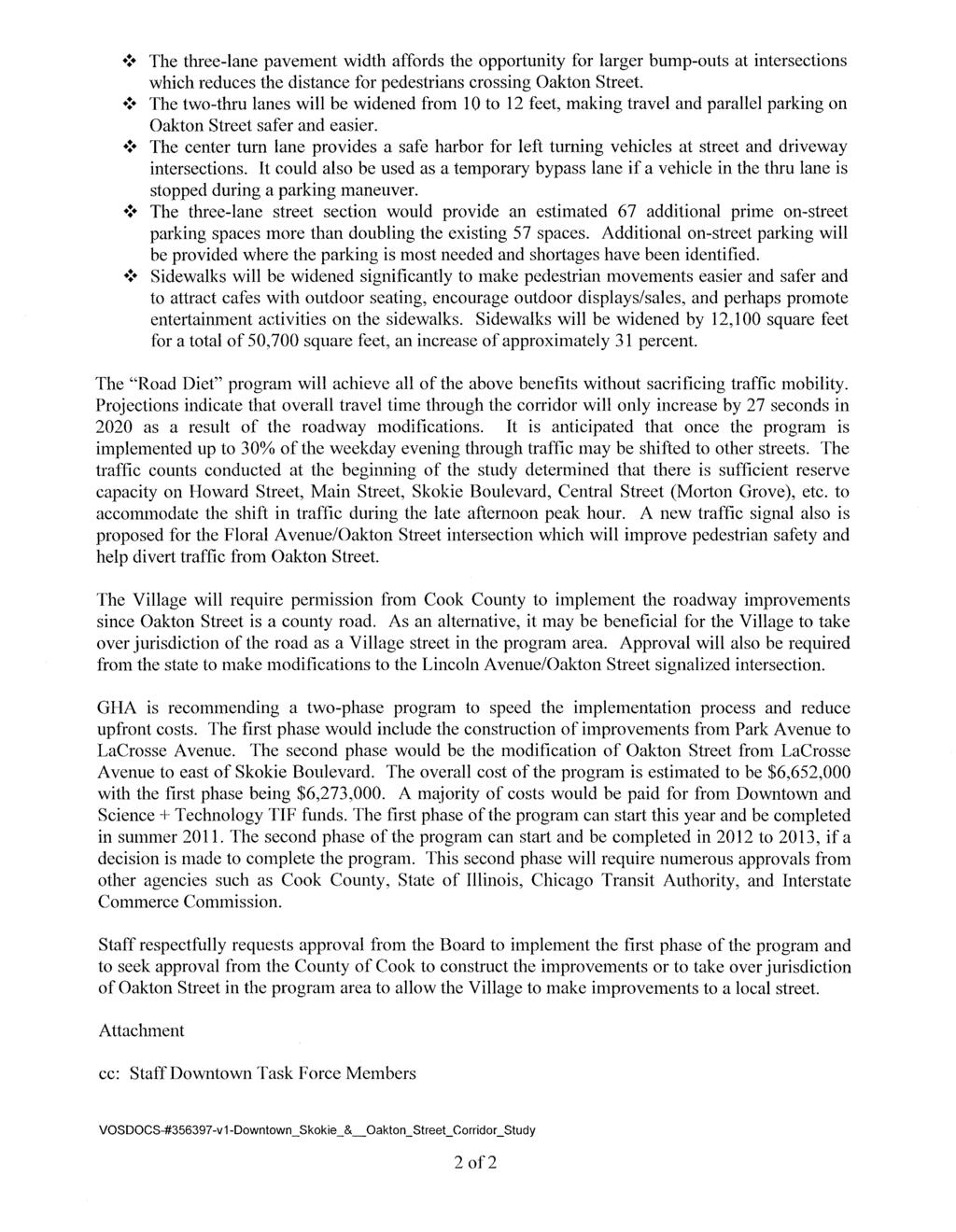
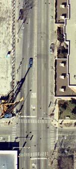
9 Downtown Skokie & Oakton Street Corridor Study May 28th, ) Overview of Study In 2009 the Village of Skokie retained Gewalt Hamilton Associates, Inc. (GHA) to study traffic patterns on Oakton Street and adjacent roadways within the Skokie Central Business District. The Village requested the study to determine if Oakton Street would be a good candidate for a Road Diet of the existing four lane roadway between Park Avenue and Skokie Boulevard. Potential benefits of a Road Diet to the Village include: o Traffic calming Replacing the current four-lane roadway with a three lane roadway has traffic calming benefits by reduction of travel speeds resulting in a safer, more pedestrian friendly environment. o Increased convenient on-street parking Reducing the number of vehicle travel lanes would enhance the retail environment for area businesses by providing additional opportunities for on-street parking within the corridor. o Public sidewalks Provide wider sidewalks allowing more room for pedestrian movement and outdoor activities such as dining and seating. o Increase retail visibility by moving vehicles further from building frontages. o Aesthetic enhancements Streetscape enhancements Adding such amenities as decorative pavers, lighting and other urban realm improvements would have a positive impact on the character of Downtown Skokie. Components of this study included collecting traffic and parking data and forecasting future 2020 volumes for a number of geometric scenarios to determine what improvements were feasible. We anticipate that modifications to this section of Oakton Street will change traffic volumes and patterns on the adjacent street network. GHA estimated how much traffic would need to be diverted from Oakton Street to make any given roadway design operate satisfactorily. 2) Oakton Street Traffic Volumes and Existing Geometrics Existing Traffic Volumes GHA conducted Hi-Star (machine) counts at 35 locations on November 17 th, 2009 collecting 24- hour traffic volumes on Downtown roadways. Manual turning movement counts were conducted at 24 intersections for the weekday AM peak period (7-9AM) and the weekday PM peak period (4-6PM). The Saturday midday peak period was also counted between 11 AM and 1 PM. Exhibit 1 shows the location of all automatic and manual counts. Manual intersection counts were conducted between November 9 th and November 21, No adverse weather or other conditions such as construction were present to affect traffic counting operations. Gewalt Hamilton Associates, Inc. Page 3
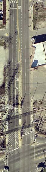
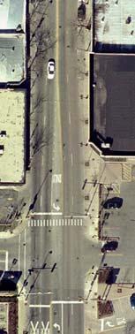
10 Downtown Skokie & Oakton Street Corridor Study May 28th, 2010 Using this data and our field observations GHA determined that the weekday PM peak hour period was between 5-6 PM. Traffic was also very congested during this time. The congestion was caused by the increased volumes and other observed street activities such as: Motorists entering and leaving on-street parking stalls. Bus movements and stops, specifically CTA Route 97, Pace Route 210, and Pace Route 226. (Note: Pace Route 210 had weekday service reduced on February 8, 2010.) Pedestrian activity, especially at Oakton Street at Lincoln Avenue. Traffic signals at Oakton Street at Lincoln Avenue, Niles Avenue, Lacrosse Avenue and Skokie Boulevard are not properly coordinated along Oakton Street. This free operation of signals can cause motorists come to a full stop at each of the 4 signals consecutively. The CTA Yellow Line (also known as the Skokie Swift ) has an at-grade rail crossing just west of Skokie Boulevard which causes traffic congestion during the PM Peak. The existing AM, PM, and weekend peak hour traffic volumes at major intersections are shown in Exhibits 2, 3 & 4, respectively. The daily traffic volume counts recorded within the study area are shown in Exhibit 5. Existing Roadway Geometrics Existing roadway geometrics along Oakton Street include left-turn lanes at all signalized intersections, two through lanes in each direction, and on-street parking on both sides of the roadway. Several intersections have pedestrian bump outs to minimize walking distances across Oakton Street. Traffic signals are provided with left-turn arrows east and westbound. Signal jurisdictions are as follows: Signal Location Oakton Street at Lincoln Avenue Oakton Street at Niles Avenue Oakton Street at LaCrosse Avenue Oakton Street at Skokie Boulevard Signal Jurisdiction Village of Skokie maintained Cook County Highway Department (CCHD) maintained Cook County Highway Department (CCHD) maintained Illinois Department of Transportation (IDOT) maintained Gewalt Hamilton Associates, Inc. Page 4
11 3) Preliminary Oakton Street Geometric Design Options Downtown Skokie & Oakton Street Corridor Study May 28th, 2010 GHA prepared five (5) preliminary roadway configurations to investigate the feasibility of various roadway designs that would increase the supply of on-street parking and reduce the number of travel lanes within the study area. Exhibit 6A and Exhibit 6B illustrate the preliminary roadway designs that were developed and presented to Village staff for evaluation and review. The discussions which occurred in our work meetings generated pertinent comments including: It would be difficult to achieve enough sidewalk width to provide enhanced walkabilty without decreasing the number of travel lanes on Oakton Street. It would also be difficult to provide additional sidewalk width with any of the options that have angled parking on the south side. (Option 1, Option 4 & Option 5) The 750 foot spacing of the three existing traffic signals on Oakton Street at Lincoln Avenue / Niles Center Road, Niles Avenue, and LaCrosse Avenue provide excellent spacing for pedestrian crossings. Parking maneuvers would be more efficient if the adjacent travel lanes on Oakton Street were wider than the current (approximate) 10-foot lane widths. All options indicate that the Oakton Street approaches at the Lincoln Avenue / Niles Center Road intersection require a separate left turn lane, a separate through lane, and either a separate right turn lane or a shared through / right turn lane. The two options that provide back-in angle parking create lane shifts that would be more difficult for motorists trying to navigate and familiarize themselves with the area. (Option 4 & Option 5) Key Finding. Based on the five geometric options reviewed along with the constraints of the existing conditions, it was determined that Option 2 was the preferred roadway configuration to be further analyzed for feasibility of a road diet. 4) Preferred Oakton Street Geometric Design (Option 2) Option 2 was selected as the preferred design to undergo additional refinement and analysis for several reasons: Option 2 provides the most additional prime parking along Oakton Street, (67 Spaces). The Village prefers that any roadway modifications design begin at Park Avenue on the west end of the corridor This will ensure that lane transitions will begin before access drives for the Skokie Public Library. Gewalt Hamilton Associates, Inc. Page 5
12 Downtown Skokie & Oakton Street Corridor Study May 28th, 2010 The Village requested an additional signal at Floral Avenue be included in the design. Parallel parking spaces on both sides of Oakton Street will provide convenient parking opportunities for motorists traveling in both directions of Oakton Street. Option 2 provides the most additional sidewalk area throughout the entire corridor. There is approximately 38,600 SF of existing sidewalk between Lincoln Avenue on the west and LaCrosse Avenue on the east. The preferred Option 2 adds 12,100 square feet of sidewalk for a total of 50,700 Square feet, an increase of 31%. Option 2 provides 12-foot travel lanes, which allow for easier parking maneuverability. The 3-lane pavement width affords the opportunity for larger bump-outs at intersections, which reduces the distance for pedestrians crossing Oakton Street. The center turn lane throughout the corridor provides safe harbor for left turning vehicles at all street and driveway intersections. It can serve as a temporary bypass lane, should a vehicle be stopped momentarily during a parking maneuver. Exhibit 7& Exhibit 8 illustrate the two potential phasing schemes for Option 2. It was determined through discussions with Village staff that it would be beneficial to develop a design that did not affect the CTA Yellow Line railroad crossing at the east end of the Oakton Street corridor. Any street improvements that impact railroad crossings require a lengthy period of review and permitting from the Interstate Commerce Commission. Option 2A This option would begin roadway improvements east of the CTA Yellow Line Railroad Crossing. The option would drop one of the existing westbound thru lanes into a rightturn only lane at the intersection of Skokie Boulevard and Oakton Street. Option 2B (Preferred) This option would implement the lane reduction west of the intersection of Oakton Street and Lacrosse Avenue. It would provide additional merging time for vehicles after passing through the traffic signal and CTA yellow line tracks at the intersection of Skokie Boulevard and Oakton Street. 5) Oakton 2020 Projected Traffic Volumes Based on the preferred geometric plan, Option 2B, traffic volume projections for the evening peak hour were developed for the year Exhibit 9 shows the projected 2020 traffic volumes within the study area. The scenario is based upon a 1% traffic growth rate through the corridor from 2010 traffic volumes and the future build out of the Illinois Science + Technology development. Gewalt Hamilton Associates, Inc. Page 6
13 Downtown Skokie & Oakton Street Corridor Study May 28th, ) Corridor Travel Time & Queue Analysis Corridor Travel Time Analysis Based on the projected 2020 traffic volumes and the reconfiguration of Oakton Street into a three lane section (Option 2B), projected 2020 travel times for vehicles utilizing the corridor were developed. This analysis provides a snapshot of how much delay a motorist would be expected to experience if the roadway was reconfigured from the existing five lane section to a three lane section at the signalized intersections. GHA utilized SYNCHRO simulation software and timed the movement of cars through the corridor. Exhibit 10 shows the anticipated travel delay in seconds. Pertinent observations include: 1) Travel delay through the corridor is expected to increase slightly through the corridor as a result of traffic growth. Between 2010 and 2020, an increase in travel time of 12 seconds in the eastbound direction and 41 seconds in the westbound direction is estimated in no geometric changes are made along the corridor. 2) A portion of vehicle traffic, estimated at 30%, will likely find alternative routes to Oakton Street if the roadway is reduced to a three lane section. 3) With coordination of the signals and 30% of traffic using alternate routes, travel time through the corridor is estimated to increase from 2010 travel times by 39 seconds in the eastbound direction and 36 seconds in the westbound direction during PM peak period. Projected traffic volumes can still be accommodated during other periods of the day without vehicles using alternate routes Queue Analysis Exhibits indicate the anticipated queue lengths at the intersection approaches within the corridor for existing and future scenarios. A queue is the distance of roadway that a vehicles occupies while waiting to pass through a signalized intersection. Twenty-five feet of space per vehicle is typically used as an estimate. Thus, a queue of 100 feet would be four cars long. Exhibit 11 shows the existing AM and PM peak hour queue lengths at intersections within the corridor. Exhibit 12 shows the maximum PM queue lengths anticipated after a Road Diet configuration in This represents a worst case scenario if all motorists were to utilize Oakton Street as they currently do. In order for a Road Diet to operate satisfactorily, a percentage of vehicle travel is expected to utilize adjacent roadways to compensate for the loss of roadway capacity caused by the street s reconfiguration. This diversion of traffic is typical during construction projects, where motorists adjust their travel patterns to compensate for the loss of capacity caused by lane closures. In the case of a road diet, a permanent loss of roadway capacity would encourage some motorists to develop alternate routes which do have sufficient capacity to carry the increase in traffic. Gewalt Hamilton Associates, Inc. Page 7
14 Downtown Skokie & Oakton Street Corridor Study May 28th, 2010 GHA developed three simulations where a portion of the corridor s projected 2020 traffic was diverted onto adjacent roadways. As more traffic was diverted, the queue lengths at intersections within the corridor were minimized. Exhibits 13, Exhibit 14 and Exhibit 15 indicate when 15%, 25% and 30% of the corridor s traffic uses alternate routes The exhibits indicate that as motorist utilize other roadways, the queue lengths at most approaches become shorter or can be accommodated. 7) Impact on Surrounding Roadways Exhibit 16 shows the traffic volume adjustments anticipated if Oakton Street were to undergo a Road Diet. Based on the SYNCHRO analysis, 230 to 270 motorist are anticipated to use adjacent roadways during the PM peak hour. To determine the roadway capacity each adjacent road had available for additional traffic, a Level of Service of D (LOS D) was assumed. Level of Service (LOS) is a quantitative measure that describes traffic conditions in terms of speed, travel time, freedom to maneuver, and safety. Six classifications are used to define LOS, designated by the letters A through F. LOS A represents the best conditions, while LOS F represents heavily congested traffic flow with traffic demand exceeding roadway capacity. LOS D represents normal traffic conditions in the Chicago region during peak travel times. An additional analysis was conducted to determine if sufficient capacity exists on the adjacent roadways to handle the projected increase in Average Daily Traffic. It is anticipated that reducing the capacity of Oakton Street will add trips to adjacent roadways during average days. Our analysis confirms that the adjacent roadway system has sufficient capacity and can accommodate the existing and projected traffic including the vehicles seeking alternate routes as a result of the Oakton Street Option 2B implementation. These roadways will operate at LOS D or better. The following roadways are anticipated to receive higher volumes of traffic: Gross Point Road Central Road Howard Street Main Street Skokie Boulevard Exhibit 17 provides a comparison of Oakton Street with main streets in neighboring Chicago communities. The exhibit demonstrates that a wide variety of roadway configurations can accommodate on-street parking with volumes similar to those along Oakton Street. The corridor is similar in length and scale to many other urban main streets in the Chicago region. Several of those two and three lane streets have significantly higher traffic volumes and provide street parking. Gewalt Hamilton Associates, Inc. Page 8
15 Downtown Skokie & Oakton Street Corridor Study May 28th, ) Parking Analysis 2006 Parking Supply and Deficit Study In 2006, the Village of Skokie Engineering Division conducted an analysis of the CX Core Mixeduse (Downtown) Zoning District. The study included a systematic inventory of all Downtown businesses and parking areas. Based on the various land uses located Downtown and parking ratios for each individual land use, parking surpluses or deficits for blocks of downtown were identified. Exhibit 18 provides a detailed breakdown of the Downtown parking supply. Exhibit 19 shows the parking surplus / deficit calculated by the study. Pertinent observations for the 2006 study include the following: 3 of the 12 zones of parking were found to have a parking deficit. The parking deficit within the three zones was a total of 61 spaces. Insufficient parking was identified along the south side of Oakton Street between Lamon Avenue and LaCrosse Avenue (Zone 8); between Niles Avenue and Lamon Avenue along the south side of Oakton Street (Zone 9); and the west side of Lincoln Avenue south of Oakton Street (Zone 12). Parking Occupancy Study #1 (GHA) GHA conducted a parking occupancy survey of the Downtown during the week of November 16 th, GHA observed parking occupancies to determine how capacity requirements changed throughout the day as user groups parking requirements changed. Exhibit 20 shows the resulting parking occupancies for on-street and off-street parking areas. Study observations include: The peak combined occupancy for on-street and off-street parking occurred on the weekday from 3:00 P.M. to 4:00 PM with 47% occupied. For on-street parking, the peak occupancy was reached during the weekend (November 21, 2009) at Noon 12:00 PM with 47% Occupied. For off-street parking, the peak occupancy was reached at 49% from 3:00 to 4:00 P.M. during the weekday. In addition, GHA staff observations during the course of the study highlighted additional parking concerns in the study area including the following: Parallel parking on both Oakton Street and Lincoln Avenue has the appearance of being narrow due to the width of travel lanes on Oakton Street. Gewalt Hamilton Associates, Inc. Page 9
16 Downtown Skokie & Oakton Street Corridor Study May 28th, 2010 Parallel parking maneuvers are often difficult on side streets such as Babb Avenue, Niles Avenue, and Lamon Avenue due to traffic and turns from side roads onto Oakton Street. Parking lots by Lincoln Jr. High School (Babb Avenue & Louise Avenue) are poorly marked; some are private and some are public, but are hard to determine with existing signage. Parking maneuvers are difficult at the Brown Street and Lincoln Avenue/Niles Center Road split because of the unique signal phasing at the intersection. Traffic into and out of Walgreens and the adjacent public lot to the east creates parking hazards on the north side of Oakton Street at LaCrosse Avenue. Parking Occupancy Study #2 (Tyler Roberts) The Village commissioned a second study in January 2010 to assess parking in the Downtown. The study split Downtown into six different zones of parking, and a detailed occupancy study of public and private on-street and off-street parking in each zone was conducted. Exhibit 21 shows the location of the Downtown parking areas surveyed. Parking areas were surveyed on two weekdays and one weekend in January Exhibit 22 provides the occupancy analysis for the peak day of occupancy observed during the study. Observations from the January 2010 study include the following: Peak occupancy of the study area occurred on the weekday at 2 PM with 45% of the surveyed spaces occupied. Areas B, D, and E had occupancies of 60% to 90%, indicating that these areas were more heavily utilized. The Parking lot located at 4830 Oakton Street was heavily occupied during the study period. It is our understanding that the lot is used by employees, particularly employees of the Science + Technology Park. Parking areas along LaCrosse Avenue, Lamon Avenue, and Niles Avenue south of Oakton Street were over 60% occupied during the study period. Parking Study Discussion Drivers tend to perceive parking to be at capacity when 80%-85% of the spaces are occupied. This causes drivers to circulate to find a parking space and contributes to greater traffic in the area. In general, if a motorist cannot find a parking space within the first or second pass of a business, the motorist will perceive that parking is insufficient in the area, particularly in business or shopping areas. Based on the results of the above referenced studies, Downtown Skokie has a sufficient supply of parking within Downtown. Both recent occupancy studies indicated peak occupancy in the downtown is between 45%-47% of the available supply of parking, which is well below what is considered full. Despite this, several hotspots where parking is deficient or perceived to be deficient are located within the study area, primarily along Oakton Street. For example, the on- Gewalt Hamilton Associates, Inc. Page 10
17 Downtown Skokie & Oakton Street Corridor Study May 28th, 2010 street spaces that support the businesses on the south side were over 80% occupied on the weekend. Thus, motorists traveling eastbound on Oakton Street could perceive that parking is not available and perhaps decide not to stop. Roadway geometry can also have a significant impact on motorist s perceptions of parking availability. Even if area parking is plentiful, the combination of narrow travel lanes next to the parallel parking spaces and having to be mindful of four lanes of moving traffic can make parallel parking maneuvers uncomfortable for motorists. 9) Streetscape Visual Simulations Exhibit 23 shows two streetscape character simulations developed to graphically portray the proposed streetscape improvements along Oakton Street: A west view of the current conditions at Babb Avenue was overlaid with the proposed threelane cross section, wider sidewalks, and other sidewalk amenities. An east view of the current conditions at Lamon Avenue was overlaid in a similar way to Babb Avenue. 10) Concluding Remarks The Village of Skokie is working diligently toward revitalizing its Downtown. Recent years have seen new mixed-use residential developments built and business facade improvements funded to enhance the visual character of the Downtown. Unfortunately, like many other communities during this economic downturn, Skokie has seen many Downtown businesses, particularly along Oakton Street, have difficulty meeting the challenge of a recession. An important recent market study commissioned by the Village set a framework for maintaining the stability of existing businesses and attracting new ones. A recommendation from that study detailed the need for the Village to provide more prime customer parking along Oakton Street and in small convenient lots, and improvements to enhance the pedestrian environment we are also recommending. To this end, Gewalt Hamilton Associates, Inc. (GHA) was retained to conduct a transportation planning study throughout downtown Skokie with a general focus along the Oakton Street corridor. It was determined early in our study that perhaps the only way to achieve the dual goals of providing more on-street parking and wider sidewalks was to put Oakton on a Road Diet. This technique has worked well for other communities who have a similar vision as the Village of Skokie - to provide a pleasant environment for pedestrians without sacrificing traffic mobility. Gewalt Hamilton Associates, Inc. Page 11
18 Downtown Skokie & Oakton Street Corridor Study May 28th, 2010 The results of our study are summarized briefly below: Geometric Options Converting Oakton Street from a 4-5 lane road to a 3-lane street will provide wider sidewalks throughout the corridor. Wider sidewalks could attract cafes with plaza seating, encourage outdoor displays / sales, and perhaps promote entertainment opportunities. The 3-lane street section would be to provide an estimated 67 additional prime on-street parking spaces. This would more than double the existing 57 on-street spaces within the corridor. Traffic Impacts A very detailed Synchro traffic model was developed to test and visualize the travel impacts within Downtown should Oakton Street be put on a Road Diet by reducing the number of through lanes on Oakton Street. The testing concluded that about 30% of the current through traffic volumes would have to use alternate routes to achieve similar travel times along Oakton. This reduction in volumes was needed during the weekday evening peak period. It was not necessary for the weekday morning or weekend midday peak periods. Shifting 30% of the weekday evening through traffic to other streets can be accomplished without overburdening the surrounding streets or alternative routes. Sufficient reserve capacity is available to maintain acceptable operations on streets such as Main Street, Howard Street, Skokie Boulevard, and Central Avenue. The 30% traffic reduction will be achieved by motorists selecting alternative routes as congestion increases. Parking The detailed parking studies conducted by the Village conclude that there is plentiful supply in off-street parking lots in Downtown Skokie; however, many of those lots are small and not easy to find. The Village Downtown Market Study concluded the supply of convenient on street parking spaces were insufficient and should be increased. The Village parking study and the data collected by GHA agree with the Market study that the parking needs to be improved. A increase in prime customer parking along Oakton Street is necessary to improve retail activity in the Oakton Street Downtown corridor. Gewalt Hamilton Associates, Inc. Page 12
19 Downtown Skokie & Oakton Street Corridor Study May 28th, 2010 Recommendations GHA recommends that the Village proceed with the recommended Option #2B modifications to the Oakton Street Corridor based on the study results and numerous benefits that the improvements will provide that the Village desires. GHA recommends that the improvements be phased to speed the implementation process and to reduce upfront costs. The first phase should be the construction of improvements from Park Avenue to Lacrosse Avenue (Option 2B). The second phase should be the modification of Oakton Street east of Skokie Boulevard to improve the transition of traffic into the Downtown. Project Implementation Public presentation of the report to the Village Board to obtain direction as to the implementation of the recommended improvements. A presentation to Downtown merchants should be conducted to determine support from local businesses. A preliminary cost estimate of the desired option should be prepared. A test of the recommended option should be conducted to determine if desired traffic movements are achieved and expected diversion of through traffic occurs. Modifications can be made to the final plan prior to the preparation of engineering plans. Start the preparation of Intersection Design Studies (IDS) for affected intersections. Meet with Illinois Department of Transportation and Cook County Highway Department officials to determine the steps necessary to implement the corridor modifications. Gewalt Hamilton Associates, Inc. Page 13
20 Exhibits
21
22 Skokie Blvd Searle Skokie Blvd Lamon Ave. Walgreens Access Lockwood Ave. SKOKIE SWIFT Oakton St Madison St. Oakton St, Niles Ave. LaCrosse Ave. Niles Harvard Ter. Lincoln Ave. Parking Oakton Oakton St, Oakton Park Ave SKOKIE SWIFT US 41/IL 50 (Skokie) Niles Center Rd. Post Office Niles Center Rd. Searle Elmwood Elmwood Niles Center Warren St. Niles Drive Brown St. ONE WAY WEST Floral Ave. Niles Ave Lincoln Ave. Lincoln Ave. Lincoln Ave. Madison ONE WAY EAST 8167 Lincoln Floral Lincoln Ave. Niles Oakton St. Oakton St. Lincoln Ave. Babb Ave. Library Access ONE WAY SB Laramie Galitz St. Niles Center Rd. Babb Ave. Oakton St. Cleveland St
23 Skokie Blvd Skokie Blvd Searle Oakton Oakton St US 41/IL 50 (Skokie) Lamon Ave. Madison St. Lincoln Ave. Cleveland St. Floral Oakton Niles Ave. LaCrosse Ave. Walgreens Access coln Ave. Niles Center Rd. Madison ONE WAY EAST 8167 Lincoln Elmwood Drive Elmwood Niles Brown St. ONE WAY WEST Warren St. Parking Floral Ave. Niles Ave. Lincoln Oakton St. Lincoln Babb Ave. Galitz St. Library Access ONE WAY SB Laramie Niles Center Rd Babb Ave. Niles Lincoln Ave. Park Ave. Lockwood Ave. Oakton St
24 Skokie Blvd. Searle Skokie Blvd Lockwood Ave Oakton St. Oakton St US 41/IL 50 (Skokie) Lamon Ave. Park Ave Oakton St. Niles Ave. LaCrosse Ave. Walgreens Access Madison St. Lincoln Ave. Cleveland St. Oakton St, Oakton Niles Center Rd. Niles Center Rd. Elmwood Searle Elmwood Niles Floral Brown St. ONE WAY WEST Parking Oakton St. Warren St. Drive Niles Center Floral Ave. Niles Ave. Lincoln Ave. Lincoln Ave. Madison ONE WAY EAST 8167 Lincoln Lincoln Ave. Oakton St. Lincoln Ave. Babb Ave. Library Access ONE WAY SB Laramie Galitz St. Niles Center Rd Babb Ave. Oakton St
25
26
27
28

29
30 Skokie Blvd. Floral Searle Skokie Blvd Parking Lamon Ave. Niles Walgreens Access 29 Oakton St. Skokie Yellow Line Skokie Yellow Line Lockwood Ave Park Ave. US 41/IL 50 (Skokie) Madison St. Lincoln Ave. Cleveland St. Niles Center Rd. Oakton St, Oakton Oakton St, Niles Ave. LaCrosse Ave. Niles Center Rd. Niles Center Rd. Lincoln Ave. Madison ONE WAY EAST 8167 Lincoln Elmwood Drive Searle Elmwood Lincoln Ave. Brown St. ONE WAY WEST Warren St. Floral Ave. Niles Ave. Niles Oakton St. Oakton St. Lincoln Ave. Library Access ONE WAY SB Laramie Babb Ave. Galitz St. Niles Center Rd. Babb Ave. Lincoln Ave. Niles Oakton St Oakton St.
31 Exhibit 10 Projected travel times along Oakton Street From Lincoln Avenue to Skokie Boulevard Weekday PM Peak Travel Times and Delay for Oakton Street between ends of queue Eastbound (EB) and Westbound (WB) Travel Time in seconds per vehicle EB WB Delay per vehicle (in seconds per vehicle) * 2009/2010 Volumes and Existing Roadway Configuration (5-Lane Cross Section) * 2009/2010 Volumes with 3-Lane Cross Section ** 2009/2010 Volumes with 3-Lane Cross Section ** 2020 Volumes and Existing Roadway Configuration (5-Lane Cross Section) ** 2020 Volumes with 3-Lane Cross Section ** 2020 Volumes Less 15% with 3-Lane Cross Section ** 2020 Volumes Less 25% with 3-Lane Cross Section ** 2020 Volumes Less 30% with 3-Lane Cross Section s/veh 267 s/veh 124 s/veh 164 s/veh 215 s/veh 127 s/veh 94 s/veh 82 s/veh * - Oakton Street signal system not optimized ** - Oakton Street signal system optimized DEFINITIONS Travel Time was calculated by taking an average of 5 "runs" on the simulation. In all cases, it represents eastbound between Lincoln Av and reaching and passing through Skokie Boulevard. Like wise the westbound travel time represents traffic beginning at Skokie Boulevard and passing through Lincoln Avenue. The figure takes into account queuing at both Lincoln Avenue and Skokie Boulevard. Delay per vehicle is calculated by dividing the total delay by the number of vehicles
32 Exhibit Oakton Street Maximum Queues Simtraffic Simulation SimTraffic Simulation Report for Maximum Queues Existing Conditions AM Maximum Queue Length PM Maximum Queue Length Oakton Street at Lincoln Avenue Eastbound LT Lane Oakton Street at Lincoln Avenue Eastbound Through Lanes Oakton Street at Lincoln Avenue Westbound LT Lane 101 feet 140 feet 260 feet 343 feet 100 feet 100 feet Oakton Street at Lincoln Avenue Westbound Through Lanes 268 feet 273 feet Oakton Street at Niles Avenue Eastbound LT Lane Oakton Street at Niles Avenue Eastbound Through Lanes 31 feet 31 feet 183 feet 270 feet Oakton Street at Niles Avenue Westbound LT Lane Oakton Street at Niles Avenue Westbound Through Lanes 50 feet 254 feet 50 feet 316 feet Oakton Street at LaCrosse Avenue Eastbound LT Lane Oakton Street at LaCrosse Avenue Eastbound Through Lanes Oakton Street at LaCrosse Avenue Westbound LT Lane Oakton Street at LaCrosse Avenue Westbound Through Lanes 29 feet 173 feet 40 feet 196 feet 50 feet 312 feet 40 feet 224 feet Oakton Street at Skokie Boulevard Eastbound LT Lane Oakton Street at Skokie Boulevard Eastbound Through Lanes Oakton Street at Skokie Boulevard Westbound LT Lane Oakton Street at Skokie Boulevard Westbound Through Lanes 90 feet 178 feet 100 feet 273 feet 95 feet 178 feet 100 feet 306 feet
33 Exhibit Oakton Street Maximum Queues Simtraffic Simulation SimTraffic Simulation Report for Maximum Queues Future Volumes and Proposed Geometrics AM Not Simulated PM Maximum Queue Length Oakton Street at Lincoln Avenue Eastbound LT Lane Oakton Street at Lincoln Avenue Eastbound Through Lane Oakton Street at Lincoln Avenue Westbound LT Lane Oakton Street at Lincoln Avenue Westbound Through Lane Oakton Street at Lincoln Avenue Westbound RT Lane 259 feet 286 feet 149 feet 267 feet 150 feet Oakton Street at Niles Avenue Eastbound LT Lane Oakton Street at Niles Avenue Eastbound Through Lane Oakton Street at Niles Avenue Westbound LT Lane Oakton Street at Niles Avenue Westbound Through Lane 109 feet 480 feet 109 feet 398 feet Oakton Street at LaCrosse Avenue Eastbound LT Lane Oakton Street at LaCrosse Avenue Eastbound Through Lane Oakton Street at LaCrosse Avenue Westbound LT Lane Oakton Street at LaCrosse Avenue Westbound Through Lane 109 feet 312 feet 109 feet 221 feet Oakton Street at Skokie Boulevard Eastbound LT Lane Oakton Street at Skokie Boulevard Eastbound Through Lane Oakton Street at Skokie Boulevard Westbound LT Lane Oakton Street at Skokie Boulevard Westbound Through Lane 153 feet 227 feet 255 feeet 739 feet
34 Exhibit 13 Future 2020 Oakton Street Maximum Queues 15% Diverted Simtraffic Simulation SimTraffic Simulation Report for Maximum Queues Future Volumes and Proposed Geometrics Less 15% Diverted Oakton Street at Lincoln Avenue Eastbound LT Lane Oakton Street at Lincoln Avenue Eastbound Through Lane Oakton Street at Lincoln Avenue Westbound LT Lane Oakton Street at Lincoln Avenue Westbound Through Lane Oakton Street at Lincoln Avenue Westbound RT Lane AM Not Simulated PM Maximum Queue Length 260 feet 284 feet 149 feet 254 feet 150 feet Oakton Street at Niles Avenue Eastbound LT Lane Oakton Street at Niles Avenue Eastbound Through Lane Oakton Street at Niles Avenue Westbound LT Lane Oakton Street at Niles Avenue Westbound Through Lane 109 feet 439 feet 98 feet 401 feet Oakton Street at LaCrosse Avenue Eastbound LT Lane Oakton Street at LaCrosse Avenue Eastbound Through Lane Oakton Street at LaCrosse Avenue Westbound LT Lane Oakton Street at LaCrosse Avenue Westbound Through Lane 53 feet 310 feet 43 feet 227 feet Oakton Street at Skokie Boulevard Eastbound LT Lane Oakton Street at Skokie Boulevard Eastbound Through Lane Oakton Street at Skokie Boulevard Westbound LT Lane Oakton Street at Skokie Boulevard Westbound Through Lanes 153 feet 224 feet 169 feet 911 feet
35 Exhibit 14 Future (2020) Oakton Street Maximum Queues 25% Diverted Simtraffic Simulation SimTraffic Simulation Report for Maximum Queues Future Volumes and Proposed Geometrics Less 25% Diverted Oakton Street at Lincoln Avenue Eastbound LT Lane Oakton Street at Lincoln Avenue Eastbound Through Lane Oakton Street at Lincoln Avenue Westbound LT Lane Oakton Street at Lincoln Avenue Westbound Through Lane Oakton Street at Lincoln Avenue Westbound RT Lane AM Not Simulated PM Maximum Queue Length 260 feet 287 feet 149 feet 253 feet 150 feet Oakton Street at Niles Avenue Eastbound LT Lane Oakton Street at Niles Avenue Eastbound Through Lane Oakton Street at Niles Avenue Westbound LT Lane Oakton Street at Niles Avenue Westbound Through Lane 109 feet 266 feet 109 feet 399 feet Oakton Street at LaCrosse Avenue Eastbound LT Lane Oakton Street at LaCrosse Avenue Eastbound Through Lane Oakton Street at LaCrosse Avenue Westbound LT Lane Oakton Street at LaCrosse Avenue Westbound Through Lane 109 feet 313 feet 29 feet 227 feet Oakton Street at Skokie Boulevard Eastbound LT Lane Oakton Street at Skokie Boulevard Eastbound Through Lanes Oakton Street at Skokie Boulevard Westbound LT Lane Oakton Street at Skokie Boulevard Westbound Through Lanes 153 feet 182 feet 170 feet 1376 feet
36 Exhibit Oakton Street Maximum Queues 30% Diverted Simtraffic Simulation SimTraffic Simulation Report for Maximum Queues Future Volumes and Proposed Geometrics Less 30% Diverted AM Not Simulated PM Maximum Queue Length Oakton Street at Lincoln Avenue Eastbound LT Lane Oakton Street at Lincoln Avenue Eastbound Through Lane Oakton Street at Lincoln Avenue Westbound LT Lane Oakton Street at Lincoln Avenue Westbound Through Lane Oakton Street at Lincoln Avenue Westbound RT Lane 260 feet 286 feet 149 feet 247 feet 150 feet Oakton Street at Niles Avenue Eastbound LT Lane Oakton Street at Niles Avenue Eastbound Through Lane Oakton Street at Niles Avenue Westbound LT Lane Oakton Street at Niles Avenue Westbound Through Lane 109 feet 330 feet 100 feet 374 feet Oakton Street at LaCrosse Avenue Eastbound LT Lane Oakton Street at LaCrosse Avenue Eastbound Through Lane Oakton Street at LaCrosse Avenue Westbound LT Lane Oakton Street at LaCrosse Avenue Westbound Through Lane 29 feet 308 feet 29 feet 222 feet Oakton Street at Skokie Boulevard Eastbound LT Lane Oakton Street at Skokie Boulevard Eastbound Through Lanes Oakton Street at Skokie Boulevard Westbound LT Lane Oakton Street at Skokie Boulevard Westbound Through Lanes 152 feet 178 feet 169 feet 533 feet
37 Exhibit 16 Oakton Street Traffic Adjustments Street & Location Test #1 PM Peak Hour Traffic in Vehicles per Hour (vph) Sum of Both Directions Rerouted Total LOS D Reserve Existing Year 2020 from Oakton PM Peak Capacity Capacity Gross Point Road North of Oakton 1,360 1, ,700 1, Central Road South of Oakton , Howard Street East of Niles Center 1,050 1, ,330 1, Main Street West of Niles Center ,050 1, Skokie Boulevard North of Oakton 1,820 2, ,360 3, South of Oakton 1,800 1, ,215 3,220 1,005 Oakton Street West of Skokie Blvd. 1,530 1,910 (500) 1,410 2,420 1,010 West of Lincoln/Niles Center 1,570 1,810 (500) 1,310 1, Street & Location Test #2 Average Daily Traffic (ADT) in Vehicles per Day (vpd) Sum of Both Directions Rerouted Total LOS D Reserve Existing Year 2020 from Oakton ADT Capacity Capacity Gross Point Road North of Oakton 13,300 14, ,800 18,200 3,400 Central Road South of Oakton 6,400 6, ,400 15,200 7,800 Howard Street East of Niles Center 10,300 10, ,500 15,200 3,700 Main Street West of Niles Center 7,700 8, ,900 15,200 6,300 Skokie Boulevard North of Oakton 24,900 28, ,400 33,200 3,800 South of Oakton 21,500 23, ,400 33,200 8,800 Oakton Street West of Skokie Blvd. 18,600 23,200 (1,500) 21,700 24,900 3,200 West of Lincoln/Niles Center 16,800 19,400 (1,500) 17,900 18, Notes: 1) Sources: a) 2000 Highway Capacity Manual and b) 2009 Florida DOT LOS Handbook 2) Streets not in netowrk include 5% growth.
38 Exhibit 17 Downtown Traffic Volume Comparisons Municipality Street On Street Parking Travel Lanes Average Daily Traffic (ADT) Skokie Oakton Street Yes 3 (proposed) 15,300 17,100 Skokie Oakton Street Yes 4 to 5 16,800 18,600 Des Plaines Oakton Street Yes 3 24,400 Evanston Central Street Yes 2 15,100 Evanston Green Bay Road Yes 4 17,700 Glenview Glenview Road Yes 3 12,900 Glenview Waukegan Road (IL 43) Yes 5 25,300 27,600 Libertyville Milwaukee Avenue Yes 4 23,900 Libertyville IL 176 No 2 18,800 Barrington Main Street Yes 3 14,000 15,200 Barrington Hough Road (IL 59) No 3 to 5 17,800 19,200 Deerfield Deerfield Road No 5 19,200 27,200 Deerfield Waukegan Road (IL 43) No 5 23,100 24,800 Downers Grove Main Street Yes 2 16,500 Hinsdale Garfield Avenue Yes 2 7,800 La Grange La Grange Road (US 45) Yes 4 25,600 Lake Forest Deerpath Yes 2 17,700 Mt. Prospect Central Road No 4 17,700 Mt. Prospect Northwest Highway (US 14) Yes 4 13,500 Palatine Palatine Road No 2 to 3 17,300 Park Ridge Touhy Avenue No 4 15,100 Park Ridge Northwest Highway Yes 2 12,100 Wilmette Green Bay Road Yes 3 14,900 Wilmette Wilmette Avenue Yes 2 14,200 Forest Park Madison Street Yes 2 12,800 Oak Park Lake Street Yes 2 14,600
39 Village of Skokie Exhibit 19
40 Z2 +49 Z3 +72 Z1 +60 Z4 +65 Z Z6 +56 Z12 21 Z Z Z9 27 Z8 13 Z7 +91 Source: Village of Skokie, 2006 Exhibit B5 Zoning District Parking Study Engineering Department Village of Skokie Parking Surplus in Zone Parking Deficit in Zone N
41 Exhibit On Street & Off Street Occupancy Counts (GHA) 2009 On Street Occupancy Counts Space Type 9:00 A.M. to 11:00 A.M. % Occ 3:00 P.M. to 4:00 P.M. % Occ 6:00 P.M. to 7:00 P.M. % Occ Weekend 12:00 Noon Parking Areas # of Spaces % Occ Oakton St Niles to Lamon (N) 9 Meter 6 67% 6 67% 4 44% 6 67% Oakton St Lamon to LaCrosse (N) 4 Meter 3 75% 2 50% 0 0% 3 75% Oakton St Lacross to Lamon (S) 4 Meter 2 50% 1 25% 3 75% 3 75% Oakton St Lamon to Niles (S) 8 Meter 5 63% 2 25% 0 0% 7 88% Oakton St Niles to Babb (S) 9 Meter 6 67% 2 22% 1 11% 8 89% Oakton St Babb to Lincoiln (S) 5 Meter 0 0% 3 60% 3 60% 5 100% Lamon Ave Louise to Oakton (E) 9 Meter Con. Con. Con. Con. Con. Con. Con. Con. Lamon Ave Louise to Oakton (W) 4 Meter Con. Con. Con. Con. Con. Con. Con. Con. Niles Ave Louise to Oakton (E) 8 Meter/Unmetered 5 63% 2 25% 4 50% 8 100% NIles Ave Louise to Oakton (W) 5 Meter/Unmetered 5 100% 5 100% 5 100% 0 0% Babb St Louise to Lincoln (W) 23 Meter/Unmetered 8 35% 6 26% 3 13% 12 52% Babb St Louise to Lincoln (E) 4 Meter 4 100% 4 100% 3 75% 3 75% Lincoln Ave Babb to Niles Ctr (S) 2 Unmetered 2 100% 2 100% 0 0% 2 100% Lincoln Ave Galitz to Oakton (W) 8 Meter 1 13% 1 13% 0 0% 0 0% Lincoln Ave Galitz to Oakton (E) 1 Meter 1 100% 2 200% 1 100% 1 100% Lincoln Ave Oakton to Warren (W) 9 Meter 2 22% 4 44% 3 33% 5 56% Lincoln Ave Warren to Brown (W) 5 Meter 2 40% 1 20% 5 100% 3 60% Warren St Lincoln to Elmwood (N) 10 Meter/Unmetered 3 30% 3 30% 4 40% 9 90% Warren St Lincoln to Elmwood (S) 9 Meter/Unmetered 3 33% 3 33% 4 44% 9 100% Lincoln Ave Brown to Cleveland (W) 16 Meter/Unmetered 9 56% 5 31% 7 44% 6 38% Lincoln Ave Cleveland to Klehm (W) 6 Unmetered 0 0% 0 0% 0 0% 3 50% Lincoln Ave Klehm to Madison (W) 8 Unmetered 6 75% 9 113% 7 88% 3 38% Lincoln Ave Brown to Madison (E) 17 Meter 2 12% 5 29% 2 12% 6 35% Lincoln Ave Cleveland to Brown (E) 18 Meter 3 17% 1 6% 0 0% 0 0% Niles Center Rd Brown to Searle (W) 9 Unmetered 9 100% 1 11% 0 0% 1 11% Niles Center Rd Brown to Searle (E) 5 Unmetered 0 0% 0 0% 0 0% 0 0% Niles Center Rd Front of 8231 (E) 4 Unmetered 2 50% 2 50% 2 50% 3 75% Madison St Niles Ctr to Lincoln Ave (N) 10 Unmetered 6 60% 9 90% 6 60% 4 40% Madison St In Front of School 18 Unmetered 3 17% 2 11% 2 11% 4 22% Madison St In front of Condo(S) 7 Unmetered 6 86% 4 57% 0 0% 2 29% Madison St Lincoln to Niles Ctr (S) 10 Unmetered 5 50% 4 40% 4 40% 2 20% Brown St Lincoln to Floral (N) 8 Meter 3 38% 5 63% 5 63% 8 100% Brown St Lincoln to Floral (S) 9 Meter 5 56% 5 56% 0 0% 6 67% On Street Sub Total % % 78 28% % Off Street Parking Occupancy Counts Space Type 9:00 A.M. to 11:00 A.M. % Occ 3:00 P.M. to 4:00 P.M. % Occ 6:00 P.M. to 7:00 P.M. % Occ Weekend 12:00 Noon Location # of Spaces % Occ Public Lot NE Oakton & Niles 26 Unmetered 5 19% 4 15% 0 0% 0 0% Chicago's Discount SW Oakton & Lacross 25 Unmetered 7 28% 5 20% 4 16% 4 16% Marketplace Lot 211 Unmetered 72 34% % 67 32% % 4830 Public Lot On N Side of Oakton 50 Meter/Unmetered 46 92% 44 88% 11 22% 16 32% Walgreens Oakton 37 Unmetered 6 16% 24 65% 18 49% 15 41% Retail Lot Oakton & Niles 13 Mixed 4 31% 7 54% 1 8% 1 8% Private Lot NE Babb and Louise 51 Unmetered 18 35% 14 27% 3 6% 6 12% Public Lot SE Babb & Louise Hour 22 76% 25 86% 8 28% 10 34% Old Chase Lot 53 Unmetered 5 9% 1 2% 1 2% 1 2% Public Lot NE Lincoln, Niles Ctr & Galitz 25 Unmetered 7 28% 10 40% 9 36% 4 16% Public Lot SE Corner of Lincoln & Oakton 25 2 Hour 12 48% 16 64% 6 24% 5 20% Bank of America Lot 34 Unmetered 9 26% 13 38% 3 9% 7 21% Village Hall & Green 106 Mixed 37 35% 67 63% 57 54% 72 68% Public Lot NW Floral and Oakton 60 Permit 54 90% 48 80% 3 5% 0 0% Public Lot Floral Connected to Lincoln 89 3 Hour 36 40% 31 35% 32 36% 63 71% Chase Park Garage SW Warren / Elmwood 99 Garage 39 39% 50 51% 13 13% 21 21% Public Lot NW Warren Elmwood 23 Bus Employees 12 52% 14 61% 7 30% 5 22% Private lot 8167 Lincoln Ave 5 Permit 3 60% 3 60% 3 60% 3 60% Madison Place Condo 39 Private 30 77% 30 77% 30 77% 30 77% Haben Funeral Home 36 Private % 3 8% 2 6% 4 11% SBC Lot 29 Private 4 14% 2 7% 2 7% 0 0% Post Office 43 Unmetered 31 72% 22 51% 16 37% 31 72% Madison School Lot 22 Unmetered 18 82% % 1 5% 1 5% Off Street Subtotal % % % % Average Occupancy On and Off Street % % % % 5/24/2010

42 Exhibit 21 Parking Map - Tyler Roberts Parking Study Commissioned by Village of Skokie, January, 2010
43 Exhibit 22 January 2010 On-Street & Off-Street Parking Occupancy Counts (Tyler Roberts) # of WEEKDAY 1-1/21/10 Area Map # Type Parking Area Spaces 10:30 AM %Occ Noon %Occ 2:00 PM %Occ 6:00 PM %Occ P1 WD Permit 5146 Oakton % 47 81% 41 71% 2 3% P2 Free Public ST 8013 Floral % 9 35% 9 35% 5 19% P2 Free Public LT 8013 Floral % 4 16% 4 16% 8 32% R1 Private Oakton/Lincoln (NW) % 9 30% 10 33% 8 27% P3 Free Public ST 8030 Lincoln % 17 85% 17 85% 19 95% P3 Free Public LT 8030 Lincoln % 16 76% 16 76% 17 81% R2 Private Brown/Lincoln (SW) % 3 30% 6 60% 1 10% A S1 UnR 8000 block Floral (E) % 4 31% 4 31% 4 31% S2 UnR 5130 block Brown (S) % 1 9% 0 0% 0 0% S3 UnR 5130 block Brown (N) % 3 27% 2 18% 2 18% S4 NP&4 indented 8100 block Floral (W) 4 0 0% 0 0% 0 0% 0 0% S5 UnR+LZ-W 5130 block Cleveland (S) 6 0 0% 0 0% 0 0% 0 0% S6 UnR 5130 block Cleveland (N) % 1 14% 1 14% 0 0% S7 UnR 8100 block Floral (E) % 6 18% 6 18% 6 18% R3 Private Floral Triangle % 1 33% 1 33% 1 33% Parking Space Subtotal % % % 73 26% B C D E F P4 STD LTEW Village Green (non-reserved) % 42 62% 44 65% 33 49% R4 Private Bank of America % 9 28% 7 22% 4 13% P5 WD Permit behind Village Hall (reserved) % 2 22% 3 33% 1 11% P6 STD LTEW 5150 Galitz % 21 72% 22 76% 10 34% S8 UnR 5100 block Galitz (N) % 2 50% 3 75% 2 50% S9 UnR+School 5100 block Galitz (S) % 2 11% 4 21% 2 11% Parking Space Subtotal % 78 48% 83 52% 52 32% P7 Free Public ST 7901 Lincoln % 1 8% 3 23% 1 8% P7 Free Public LT 7901 Lincoln % 9 75% 10 83% 9 75% R5 Private 7900 block Lincoln (E) % 15 34% 16 36% 3 7% P8 Free Public ST 7947 Lincoln % 0 0% 1 8% 0 0% P8 Free Public LT 7947 Lincoln % 8 67% 7 58% 2 17% R6 Private Oakton/Babb (SW) % 5 33% 8 53% 0 0% S10 UnR Babb (W) % 8 38% 10 48% 7 33% R7 Private 7877 & 7887 Lincoln % 9 41% 8 36% 2 9% R8 Private Chase ATM lot (7921 Babb) % 1 2% 1 2% 0 0% P9 Free Public ST 7933 Babb P9 Free Public LT 7933 Babb % 10 34% 14 48% 12 41% S11 UnR block Louise (S) % 3 18% 3 18% 8 47% S12 UnR 7930 block Niles Avenue (W) % 2 50% 3 75% 3 75% S13 UnR block Louise (N) % 6 35% 8 47% 13 76% R9 Private 5026 Louise lot % 14 28% 15 30% 9 18% R10 Private Oakton/Babb to Niles (S) % 4 44% 6 67% 6 67% Parking Space Subtotal % 95 29% % 75 23% R11 Private 4900 block Oakton (S) % 9 41% 14 64% 6 27% S14 UnR 7930 block Lamon (W) % 5 100% 4 80% 2 40% S15 UnR 4900 block Louise (N) % 11 58% 11 58% 16 84% S16 UnR 7930 block Niles Avenue (E) % 3 60% 2 40% 5 100% S17 UnR 4900 block Louise (S) % 12 67% 14 78% % S18 UnR 4830 block Louise (S) % 4 33% 6 50% 7 58% S19 UnR 4830 block Louise (N) % 5 42% 5 42% 5 42% S20 UnR 7930 block Lamon (E) % 5 125% 8 200% 6 150% P10 LT Public 4860 Louise (alley) % 2 40% 1 20% 1 20% R12 Private 4830 block Oakton (S) % 8 32% 5 20% 3 12% R13 Private Aldi/Oakton MarketPlace % % % 88 42% R14 Private 4811 Oakton % 19 59% 24 75% 4 13% Parking Space Subtotal % % % % R15 Private Crafty Beaver % 21 43% 23 47% 5 10% P11 Free Public ST 4830 Oakton % 4 100% 3 75% 1 25% P11 Free Public LT 4830 Oakton % 43 93% 41 89% 10 22% R16 Private Walgreens % 12 32% 24 65% 18 49% R17 Private block Oakton (N) % 53 42% 52 41% 38 30% Parking Space Subtotal % % % 72 27% S21 UnR block Niles (E) % 25 58% 25 58% 10 23% S22 90-Minute block Niles (W) % 4 13% 7 22% 6 19% S23 90-Minute block Warren (N) % 2 15% 2 15% 1 8% S24 90-Minute Elmwood (E) % 4 13% 2 6% 2 6% S25 UnR Elmwood (W) along cemetery % 10 53% 9 47% 2 11% S26 90-Minute Elmwood (W) along homes % 0 0% 0 0% 2 18% S27 3-hour block Warren (N) % 2 33% 2 33% 0 0% P12 Free Public ST 8036 Elmwood % 6 55% 7 64% 7 64% P12 Free Public LT 8036 Elmwood % 7 58% 8 67% 9 75% R18 Private 8042 Elmwood % 0 0% 0 0% 0 0% R19 Private Lincoln Court % 1 33% 1 33% 0 0% R20 Private 8001 Lincoln garage % 64 60% 61 58% 24 23% R21 Private 8001 Lincoln surface % 6 20% 7 23% 1 3% R22 Private Town Square % 10 28% 12 33% 10 28% S28 3-hour block Warren (S) % 2 40% 1 20% 2 40% S29 90-Minute block Warren (S) % 5 71% 2 29% 2 29% Parking Space Subtotal % % % 78 19% Totals % % % %


44 Exhibit 23 Streetscape Visualization Before - Babb Avenue Looking West After Babb Avenue Looking West


45 Before Lamon Avenue Looking East After Lamon Avenue Looking East

46 Presented by: Bill Grieve, PE, PTOE Senior Transportation Engineer John Severin Senior Signal Systems Engineer
47 Presentation Summary: Study Goals Pedestrian Benefits to Road Diet Study Components: Data Collection Geometry Traffic Analysis Parking Study Findings and Recommendations Other Local Communities Traffic Diversion Synchro Traffic Model Simulation Streetscape Visualization along Oakton Downtown Skokie Oakton Street Corridor Study
48 Study Area: Park Avenue to Skokie Boulevard (2/3 of a mile) Downtown Skokie Oakton Street Corridor Study


49 Study Goals Increase On-street Prime Parking Increase Sidewalk Widths Enhance Pedestrian Mobility Revive Business District Enhance Vehicular Traffic Safety Downtown Skokie Oakton Street Corridor Study


50 Pedestrian Benefits to Road Diet Reduce Street Crossing Distances Reduce Top-end Travel Speeds Add Sidewalk Buffer from Travel Lanes Add Parking Buffer from Travel Lanes Reclaim Street Space for Higher and Better Use from Moving Peak Hour Traffic Downtown Skokie Oakton Street Corridor Study


51 Study Components: Data Collection Extensive data collection program Weekday morning/evening and Saturday peak period traffic counts at 35 intersections Hi-Star 24-hour counts at 24 locations Traffic flow observations Bus route & Swift train data (CTA 97, PACE 210 and 226) Parking occupancy counts along Oakton Street Downtown Skokie Oakton Street Corridor Study


52 Study Components: Geometry Developed 5 options to compare travel lanes, driver understanding, maintenance, parking and sidewalks On-street parking options include parallel, angle and back-in angle spaces One option maintains 4 through travel lanes 4 options reduce Oakton Street to 2 through travel lanes Downtown Skokie Oakton Street Corridor Study

53 Study Components: 5 Options Downtown Skokie Oakton Street Corridor Study

54 Design Concepts Existing Conditions Two travel lanes in each direction Left turn lanes exist at signals Some on-street parallel parking Areas of narrow sidewalks Downtown Skokie Oakton Street Corridor Study
55 Design Concepts Option 1 11 wide travel lanes, 10 wide turning lanes Angled parking along south side of street (Between Babb Avenue and La Crosse Avenue) Limited additional sidewalk width Downtown Skokie Oakton Street Corridor Study
56 Design Concepts Option 2 12 wide travel lanes, 10 center left turning lane Parallel parking on both sides of Oakton Street Maximum additional sidewalk width Option 2A Extends construction east of CTA Yellow Line Option 2B Stops construction west of CTA Yellow Line Downtown Skokie Oakton Street Corridor Study

57 Design Concepts Option 3 Maintains 4 through travel lanes Limited additional parallel parking Limited additional sidewalk width Downtown Skokie Oakton Street Corridor Study
58 Design Concepts Option 4 12 wide travel lanes, 10 wide left turning lane at signals Back-in angled parking on south side of Oakton Street 6 Bike Lane on both sides of Oakton Street Limited additional sidewalk width Loss of 9 parking spaces Downtown Skokie Oakton Street Corridor Study
59 Design Concepts Option 5 12 wide travel lanes, 10 wide left turn lanes at signals Back-in angled parking on south side of Oakton Street Parallel parking on north side of Oakton Street Limited additional sidewalk width Downtown Skokie Oakton Street Corridor Study

60 Preferred Concept: Option 2B Option 2A Option 2B Downtown Skokie Oakton Street Corridor Study
 Eliminates Disruption at Oakton Street / Skokie Boulevard intersection and Skokie Swift Crossing Downtown Skokie Oakton Street Corridor")
61 Preferred Concept: Option 2B Option 2B Provides most on-street prime parking spaces Provides widest areas for sidewalks (31% increase over existing sidewalks) Eliminates Disruption at Oakton Street / Skokie Boulevard intersection and Skokie Swift Crossing Downtown Skokie Oakton Street Corridor Study


62 Traffic Analyses of Preferred Option 2B Synchro traffic model compared 2010 and Year 2020 operations PM peak hour focused on Year 2020, including both local and regional growth Tested 2020 volumes on reduced street lanes Tested volume reductions of 15%, 25% and 30% on intersection delays and queues Downtown Skokie Oakton Street Corridor Study

63 Traffic Analyses of Preferred Option 2B Existing w/ 4 through lanes Existing w/ 2 through lanes Existing w/ 2 through lanes and signals optimized 2020 w/ full Improvements and 30% Diversion EB Corridor Travel Time WB Corridor Travel Time Oakton Street at Lincoln Avenue EB Queue Length WB Queue Length 1 min 27 sec 1 min 21 sec 343 ft 273 ft 3 min 39 sec 5 min 42 sec 1,354 ft 1,100 ft 2 min 29 sec 3 min 33 sec 745 ft 695 ft 2 min 6 sec 1 min 57 sec 286 ft 247 ft Downtown Skokie Oakton Street Corridor Study
64 Traffic Diversion (PM Peak Hour) Street and Location OAKTON STREET TRAFFIC ADJUSTMENTS TEST 1 - PM PEAK HOUR TRAFFIC IN VEHICLES PER HOUR (VPH) Sum of Both Directions Existing Year 2020 Rerouted (from Oakton) Total PM Peak LOS D Capacity Reserve Capacity Gross Point Road North of Oakton 1,360 1, ,700 1, Central Road South of Oakton , Howard Street East of Niles Center 1,050 1, ,330 1, Main Street West of Niles Center ,050 1, Skokie Boulevard North of Oakton 1,820 2, ,360 3, South of Oakton 1,800 1, ,215 3,220 1,005 Oakton Street West of Skokie Blvd. 1,530 1,910 (500) 1,410 2,420 1,010 West of Lincoln/Niles Center 1,570 1,810 (500) 1,310 1, Downtown Skokie Oakton Street Corridor Study
65 Traffic Diversion (Average Daily Traffic) Street and Location OAKTON STREET TRAFFIC ADJUSTMENTS TEST 2 AVERAGE DAILY TRAFFIC (ADT) IN VEHICLES PER DAY (VPD) Sum of Both Directions Existing Year 2020 Rerouted (from Oakton) Total ADT LOS D Capacity Reserve Capacity Gross Point Road North of Oakton 13,300 14, ,800 18,200 3,400 Central Road South of Oakton 6,400 6, ,400 15,200 7,800 Howard Street East of Niles Center 10,300 10, ,500 15,200 3,700 Main Street West of Niles Center 7,700 8, ,900 15,200 6,300 Skokie Boulevard North of Oakton 24,900 28, ,400 33,200 3,800 South of Oakton 21,500 23, ,400 33,200 8,800 Oakton Street West of Skokie Blvd. 18,600 23,200 (1,500) 21,700 24,900 3,200 West of Lincoln/Niles Center 16,800 19,400 (1,500) 17,900 18, Downtown Skokie Oakton Street Corridor Study
66 Other Local Communities DOWNTOWN TRAFFIC VOLUME COMPARISONS Municipality Street On-Street Parking Travel Lanes Average Daily Traffic (ADT) Skokie Oakton Street - Existing Yes 4 to 5 16,800-18,600 Skokie Oakton Street - Proposed Yes 3 15,300-17,100 Des Plaines Oakton Street Yes 3 24,400 Evanston Central Street Yes 2 15,100 Evanston Green Bay Road Yes 4 17,700 Glenview Glenview Road Yes 3 12,900 Glenview Waukegan Road (IL 43) Yes 5 25,300-27,600 Libertyville Milwaukee Avenue Yes 4 23,900 Libertyville IL 176 No 2 18,800 Barrington Main Street Yes 3 14,000-15,200 Barrington Hough Road (IL 59) No 3 to 5 17,800-19,200 Deerfield Deerfield Road No 5 19,200-27,200 Deerfield Waukegan Road (IL 43) No 5 23,100-24,800 Downers Grove Main Street Yes 2 16,500 Hinsdale Garfield Avenue Yes 2 7,800 La Grange La Grange Road (US 45) Yes 4 25,600 Lake Forest Deerpath Yes 2 17,700 Mt. Prospect Central Road No 4 17,700 Mt. Prospect Northwest Highway (US 14) Yes 4 13,500 Palatine Palatine Road No 2 to 3 17,300 Park Ridge Touhy Avenue No 4 15,100 Park Ridge Northwest Highway Yes 2 12,100 Wilmette Green Bay Road Yes 3 14,900 Wilmette Wilmette Avenue Yes 2 14,200 Forest Park Madison Street Yes 2 12,800 Oak Park Lake Street Yes 2 14,600 Downtown Skokie Oakton Street Corridor Study

67 Downtown Parking Oakton Street 2006 Village Parking Inventory Downtown Skokie Oakton Street Corridor Study
A. CONCLUSIONS OF THE FGEIS
 Chapter 11: Traffic and Parking A. CONCLUSIONS OF THE FGEIS The FGEIS found that the Approved Plan will generate a substantial volume of vehicular and pedestrian activity, including an estimated 1,300
MEMORANDUM. Lynn Hayes LSA Associates, Inc.
 MEMORANDUM To: Lynn Hayes LSA Associates, Inc. Date: May 5, 217 From: Zawwar Saiyed, P.E., Senior Transportation Engineer Justin Tucker, Transportation Engineer I Linscott, Law & Greenspan, Engineers LLG
TABLE OF CONTENTS. Coral Springs Charter High School and Middle School Job No Page 2
 Job No. 15-019 Page 2 TABLE OF CONTENTS 1.0 INTRODUCTION... 4 2.0 EXISTING CONDITIONS... 5 3.0 TRAFFIC GENERATION... 7 4.0 TRIP DISTRIBUTION... 8 5.0 FUTURE CONDITIONS... 8 6.0 SITE ACCESS...13 7.0 CONCLUSION...13
Treasure Island Supplemental Information Report Addendum
 1 1 1 1 0 1 0 1 0 1 Treasure Island Supplemental Information Report Addendum Introduction Purpose The purpose of this Supplemental Information Report (SIR) Addendum is to determine if the current land
EXISTING CONDITIONS A. INTRODUCTION. Route 107 Corridor Study Report
 II. EXISTING CONDITIONS A. INTRODUCTION The Route 107 study area extends from the south at Chestnut Street in Lynn approximately 3.7 miles to the north to Boston Street in Salem. The study area has three
APPENDIX H MILESTONE 2 TRAFFIC OPERATIONS ANALYSIS OF THE AT-GRADE CROSSINGS
 Draft Environmental Impact Statement/Environment Impact Report Appendix H Milestone 2 Traffic Operations Analysis of the At-Grade Crossings APPENDIX H MILESTONE 2 TRAFFIC OPERATIONS ANALYSIS OF THE AT-GRADE
Interstate 90 and Mercer Island Mobility Study APRIL Commissioned by. Prepared by
 Interstate 90 and Mercer Island Mobility Study APRIL 2017 Commissioned by Prepared by Interstate 90 and Mercer Island Mobility Study Commissioned by: Sound Transit Prepared by: April 2017 Contents Section
LUDWIG RD. SUBDIVISION PROJECT TRAFFIC IMPACT ANALYSIS
 LUDWIG RD. SUBDIVISION PROJECT TRAFFIC IMPACT ANALYSIS Prepared for Skip Coddington GSC Development, Inc PO Box 1623 Woodinville WA 9872 Prepared by 1141 NE 124 th St., #59 Kirkland, WA 9834 425.522.4118
Lake Erie Commerce Center Traffic Analysis
 LOCATION: East of NYS Route 5 at Bayview Road Town of Hamburg Erie County, New York PREPARED BY: Wendel Companies 140 John James Audubon Parkway Suite 200 Amherst, New York 14228 January 2012 i ii Table
Project Deliverable 4.1.3d Individual City Report - City of La Verne
 Pomona Valley ITS Project Project Deliverable 4.1.3d Individual City Report - City of La Verne Prepared by: April 19, 2002 099017000.1 Copyright 2002, Kimley-Horn and Associates, Inc TABLE OF CONTENTS
PURPOSE AND NEED (CONCURRENCE POINT 1) NEW CANADA ROAD PROJECT FROM STATE ROUTE 1 (U.S. HIGHWAY 70) TO U.S. INTERSTATE 40
 NEW CANADA ROAD PROJECT FROM STATE ROUTE 1 (U.S. HIGHWAY 70) TO U.S. INTERSTATE 40") PURPOSE AND NEED (CONCURRENCE POINT 1) NEW CANADA ROAD PROJECT FROM STATE ROUTE 1 (U.S. HIGHWAY 70) TO U.S. INTERSTATE 40 Project Description The primary purpose of this project is to improve the major
PURPOSE AND NEED (CONCURRENCE POINT 1) NEW CANADA ROAD PROJECT FROM STATE ROUTE 1 (U.S. HIGHWAY 70) TO U.S. INTERSTATE 40 Project Description The primary purpose of this project is to improve the major
MEMORANDUM. Bob Zagozda, Chief Financial Officer Westside Community Schools. Mark Meisinger, PE, PTOE Felsburg Holt & Ullevig. DATE: June 11, 2018
 MEMORANDUM TO: Bob Zagozda, Chief Financial Officer Westside Community Schools FROM: Mark Meisinger, PE, PTOE Felsburg Holt & Ullevig DATE: June 11, 218 6-11-18 SUBJECT: Sunset Hills Elementary School
NORTH FRASER PERIMETER ROAD WEST CORRIDOR DEFINITION STUDY
 NORTH FRASER PERIMETER ROAD WEST CORRIDOR DEFINITION STUDY MAY 2011 SW1132SWD NORTH FRASER PERIMETER ROAD WEST CORRIDOR DEFINITION STUDY TABLE OF CONTENTS 1.0 INTRODUCTION... 1 2.0 CURRENT TRAVEL PATTERNS
Memorandum. Roger Millar, Secretary of Transportation. Date: April 5, Interstate 90 Operations and Mercer Island Mobility
 Memorandum To: From: The Honorable Dow Constantine, King County Executive; The Honorable Ed Murray, City of Seattle Mayor; The Honorable Bruce Bassett, City of Mercer Island Mayor; The Honorable John Stokes,
London Borough of Barnet Traffic & Development Design Team
 London Borough of Barnet Traffic & Development Design Team AERODROME ROAD PEDESTRIAN FACILITY AND BUS STOP INTRODUCTION FEASIBILITY REPORT Job Number: 60668 Doc Ref: S106/12-13/60668 Author: Manoj Kalair
5.1 Traffic and Transportation
 5.1 When it opens in 2009, the Bellevue Nickel Improvement Project will increase the number of vehicles able to travel through the study area, improve travel speeds, and improve safety by reducing the
1.2 Corridor History and Current Characteristics
 SECTION 1 Description and Background of Study Area 1.1 Introduction This preliminary engineering report was prepared for the Alaska Department of Transportation and Public Facilities (ADOT&PF). It is part
METROBUS SERVICE GUIDELINES
 METROBUS SERVICE GUIDELINES In the late 1990's when stabilization of bus service was accomplished between WMATA and the local jurisdictional bus systems, the need for service planning processes and procedures
DOGWOOD AT VILLA AVENUE PROJECT
 TRANSPORTATION IMPACT ANALYSIS DOGWOOD AT VILLA AVENUE PROJECT El Centro, California September 4, 2018 LLG Ref. 3-17-2782 TABLE OF CONTENTS SECTION PAGE Appendices... ii List of Figures... i List of Tables...
Site Location and Setting
 Memorandum Date: To: From: Subject: Kristy Le, Gary Black Steve Orem Santa Teresa County Park Historic Area Traffic and Parking Study Hexagon Transportation Consultants, Inc. has completed a traffic and
Macleod Trail Corridor Study. Welcome. Macleod Trail Corridor Study Open House. Presentation of Proposed Design Concepts
 Macleod Trail Corridor Study Welcome Macleod Trail Corridor Study Open House Presentation of Proposed Design Concepts Study Purpose Develop a corridor plan for Macleod Trail that aligns with The City s:
OAKTON STREET SKOKIE, IL 60077
 Single Story Retail Building At Hard Corner Of Signalized Intersection In Downtown Skokie For Lease 4935-45 OAKTON STREET SKOKIE, IL 60077 DETAILS Available SF 6,987 SF Lease Rate $17.00 SF/Yr (NNN) Lot
Sky Temporary Car Park Transport Statement
 001 Issue 26 August 2016 This report takes into account the particular instructions and requirements of our client. It is not intended for and should not be relied upon by any third party and no responsibility
Washington St. & Ash Coulee Dr./43 rd Ave Intersection Study
 430 IACC Building Fargo, ND 58105 Tel 701-231-8058 Fax 701-231-1945 www.ugpti.org www.atacenter.org Washington St. & Ash Coulee Dr./43 rd Ave Intersection Study Final Report April 2007 Prepared for: City
Appendix B Connecting Track Options Evaluation Criteria
 Appendix B Connecting Track Options Evaluation Criteria 608979-853_ra_July5-0_App Title Pages.Docx TTC ASHBRIDGES BAY MAINTENANCE AND STORAGE FACILITY CONNECTING TRACK ROUTE ALTERNATIVE - EVAULATION MATRIX.0
Traffic Analysis Final Report
 SR-71 Widening Project Project Approval/Environmental Documentation Traffic Analysis Final Report Prepared for Caltrans District 7 August 2012 6 Hutton Centre Drive, Suite 700 Santa Ana, California 92707
ROUTE 20 CORRIDOR STUDY ---- Orange County, Virginia
 ROUTE 20 CORRIDOR STUDY ---- Orange County, Virginia Prepared by PARSONS Fairfax, Virginia on behalf of the: Rappahannock-Rapidan Regional Commission in cooperation with Orange County, Virginia Virginia
Parking Amendments - Bay Street, between Harbour Street and Queens Quay West (York Street, Bay Street, and Yonge Street Ramp Removal)
") REPORT FOR ACTION between Harbour Street and Queens Quay West (York Street, Bay Street, and Yonge Street Ramp Removal) Date: October 26, 2017 To: Toronto and East York Community Council From: Acting Director,
REPORT FOR ACTION between Harbour Street and Queens Quay West (York Street, Bay Street, and Yonge Street Ramp Removal) Date: October 26, 2017 To: Toronto and East York Community Council From: Acting Director,
Draft Concept Alternatives Analysis for the Inaugural Airport Program September 2005
 Draft Concept Alternatives Analysis for the Inaugural Airport Program September 2005 Section 3 - Refinement of the Ultimate Airfield Concept Using the Base Concept identified in Section 2, IDOT re-examined
FNORTHWEST ARKANSAS WESTERN BELTWAY FEASIBILITY STUDY
 FNORTHWEST ARKANSAS WESTERN BELTWAY FEASIBILITY STUDY EXECUTIVE SUMMARY The 2030 Northwest Arkansas Regional Transportation Plan developed by the Northwest Arkansas Regional Planning Commission (NWARPC)
12, 14 and 16 York Street - Amendments to Section 16 Agreement and Road Closure Authorization
 REPORT FOR ACTION 12, 14 and 16 York Street - Amendments to Section 16 Agreement and Road Closure Authorization Date: April 27, 2018 To: Toronto and East York Community Council From: Senior Strategic Director,
McLean Citizens Association Transportation Committee Project Briefing
 McLean Citizens Association Transportation Committee Project Briefing November 10, 2015 Project Map 2 Project Context Only Interstate in the Country limited to HOV only traffic during rush hours Stoplight
Arlington County Board Meeting Project Briefing. October 20, 2015
 Arlington County Board Meeting Project Briefing October 20, 2015 Project Map 2 Project Context Only Interstate in the Country limited to HOV only traffic during rush hours Stoplight at the end of I-66
FINAL TERMINAL TRAFFIC MONITORING STUDY
 FINAL TERMINAL 91 216 TRAFFIC MONITORING STUDY Prepared for: Port of Seattle February 15, 217 Prepared by: 12131 113 th Avenue NE, Suite 23 Kirkland, WA 9834-712 Phone: 425-821-3665 www.transpogroup.com
SR 934 Project Development And Environment (PD&E) Study
 Study") SR 934 Project Development And Environment (PD&E) Study Project Advisory Group Meeting March 1, 2018 State Road 934/NE/NW 79th Street from west of I-95 (NW 13th CT) to N. Bayshore Drive PD&E STUDY SR 934/NE/NW
SR 934 Project Development And Environment (PD&E) Study Project Advisory Group Meeting March 1, 2018 State Road 934/NE/NW 79th Street from west of I-95 (NW 13th CT) to N. Bayshore Drive PD&E STUDY SR 934/NE/NW
Planning. Proposed Development at the Southeast Corner of Lakeshore Road West and Brookfield Road Intersection FINAL.
 Project No. 121-22908 N o v e m b e r 2 0 1 2 Traffic Impact Study Transportation Planning th GENIVAR Inc., 600 Cochrane Drive, 5 Floor, Markham, Ontario L3R 5K3 Telephone: 905.475.7270 Fax: 905.475.5994
7272 WISCONSIN AVENUE LOCAL AREA TRANSPORTATION REVIEW
 7272 LOCAL AREA TRANSPORTATION REVIEW AND TRANSPORTATION POLICY AREA REVIEW MONTGOMERY COUNTY, MARYLAND Submitted on behalf of Carr Properties Prepared by: Wells + Associates, Inc. Submission: July 1,
Construction Staging Adelaide Street West
 REPORT FOR ACTION Construction Staging Adelaide Street West Date: October 6, 2016 To: Toronto and East York Community Council From: Acting Director, Transportation Services, Toronto and East York District
Madison Metro Transit System
 Madison Metro Transit System 1101 East Washington Avenue Madison, Wisconsin, 53703 Administrative Office: 608 266 4904 Fax: 608 267 8778 TO: FROM: SUBJECT: Plan Commission Timothy Sobota, Transit Planner,
Longmont to Boulder Regional Trail Jay Road Connection DRAFT FINAL REPORT
 Longmont to Boulder Regional Trail Jay Road Connection DRAFT FINAL REPORT December 2018 Project Summary Boulder County, Colorado, in partnership with the City of Boulder, is evaluating options for multi-use
Pedestrian Safety Review Spadina Avenue
 STAFF REPORT ACTION REQUIRED Pedestrian Safety Review Spadina Avenue Date: October 13, 2015 To: Toronto and East York Community Council From: Director, Transportation Services, Toronto and East York District
2006 WEEKDAY TRAFFIC PROFILE. June 15, 2007
 June 15, 2007 Mr. Gary Stobb, P.E. Director of Planning/Operations Harris County Toll Road Authority 330 Meadowfern, Suite 200 Houston, TX 77067 Re: Westpark Tollway Value Pricing Analysis Dear Mr. Stobb:
MEMORANDUM. Open Section Background. I-66 Open Section Study Area. VDOT Northern Virginia District. I-66 Project Team. Date: November 5, 2015
 MEMORANDUM To: VDOT Northern Virginia District From: I-66 Project Team Date: November 5, 2015 Subject: Open Section Background The purpose of this technical memorandum is to provide narrative and technical
To: Mary Beth Avedesian B.F. Saul Company
 1140 Connecticut Avenue NW Suite 600 Washington, DC 20036 202.296.8625 TECHNICAL MEMORANDUM To: Mary Beth Avedesian B.F. Saul Company From: Daniel B. VanPelt, P.E., PTOE Felice B. Brychta, P.E. Tricia
Yonge Street / Highway 401 Improvements Update. Public Works and Infrastructure Committee. General Manager, Transportation Services
 PW9.7 STAFF REPORT ACTION REQUIRED Yonge Street / Highway 401 Improvements Update Date: October 26, 2015 To: From: Wards: Reference Number: Public Works and Infrastructure Committee General Manager, Transportation
HOV LANE PERFORMANCE MONITORING: 2000 REPORT EXECUTIVE SUMMARY
 Final Report Research Project Agreement No. T1803, Task 4 HOV Monitoring V HOV LANE PERFORMANCE MONITORING: 2000 REPORT EXECUTIVE SUMMARY by Jennifer Nee TRAC Research Engineer John Ishimaru TRAC Senior
US 380 FEASIBILITY STUDY
 US 380 FEASIBILITY STUDY Denton County CSJ(s): 0135-10-061, 0135-10-062 Public Meeting(s): January 15 & 22, 2019 WELCOME US 380 Denton County Feasibility Study DALLAS DISTRICT PUBLIC MEETING January 15
4. Safety Concerns Potential Short and Medium-Term Improvements
 NH Route 104 Access Management Study Page 19 4. Safety Concerns Potential Short and Medium-Term Improvements Potential safety improvement strategies are listed by priority based on field observations by
Assessment of Travel Trends
 I - 2 0 E A S T T R A N S I T I N I T I A T I V E Assessment of Travel Trends Prepared for: Metropolitan Atlanta Rapid Transit Authority Prepared by: AECOM/JJG Joint Venture Atlanta, GA October 2011 General
Draft Concept Alternatives Analysis for the Inaugural Airport Program September 2005
 Section 10 Preferred Inaugural Airport Concept 10.0 Introduction The Preferred Inaugural Airport Concept for SSA was developed by adding the preferred support/ancillary facilities selected in Section 9
Proposed Bicycle Lanes on Yonge Street from Queens Quay to Front Street
 STAFF REPORT ACTION REQUIRED Proposed Bicycle Lanes on Yonge Street from Queens Quay to Front Street Date: March 12, 2007 To: From: Toronto and East York Community Council Director, Transportation Infrastructure
user s guide to Transportation Improvements in Astoria Planning Efforts outside Astoria for more information, contact:
 The Miles Crossing/ Jeffers Garden transportation plan (underway), will identify needed improvements to the Warrenton Astoria Highway and local street improvements to serve expected growth in the Miles
Boston Redevelopment Authority 2/26/ Chestnut Hill Avenue Boston/Brookline, MA
 Boston Redevelopment Authority 2/26/2014 Cassidy Playground Waterworks Design revisions made since the DPIR submission March 2013 Massing - Reduced project 16,030 SF, for a total project area of 218,520
Caliber Charter School VALLEJO, CA
 Traffic Impact Study Final Report Caliber Charter School VALLEJO, CA 21 June 2016 Prepared for: Prepared by: Traffic Engineering & Transportation Planning This report has been prepared and certified by
Watts St westbound thru
 Executive Summary At the request of the Hudson Square Business Improvement District, Sam Schwartz Engineering, DPC (Sam Schwartz) has completed a technical analysis of various congestion pricing and/or
HIGHWAY RAIL GRADE CROSSING CONSOLIDATION PROGRAM
 HIGHWAY RAIL GRADE CROSSING CONSOLIDATION PROGRAM To decrease unnecessary train traffic exposure to life and property, promote public safety, and improve traffic conditions, the Texas Department of Transportation
ITS. Intermountain Transportation Solutions Traffic Studies Transportation Analysis Signal Design Site Planning. January 9, 2013
 ITS Intermountain Transportation Solutions Traffic Studies Transportation Analysis Signal Design Site Planning Raymond Wright, P.E. City of Spokane Transportation Department 11707 East Sprague Avenue,
APPENDIX J MODIFICATIONS PERFORMED TO THE TOR
 APPENDIX J MODIFICATIONS PERFORMED TO THE TOR This appendix summarizes the modifications that were performed in years 2012 and 2017 to rectify calculation errors that were observed in the data presented
10.0 Recommendations Methodology Assumptions
 10.0 Recommendations To accommodate the projected growth of the I-526 corridor, this report has summarized potential improvement strategies that were separated into four categories, TDM, Modal, Traffic
HDR itrans Consulting Inc. 100 York Blvd., Suite 300 Richmond Hill, ON L4B 1J8 Tel: (905) Fax: (905)
 Fax: (905)") !" # $ !" # $ Consulting Inc. 100 York Blvd., Suite 300 Richmond Hill, ON L4B 1J8 Tel: (905) 882-4100 Fax: (905) 882-1557 www.itransconsulting.com November 2009 %&'('$&$ 1. West Brampton Road Network...
!" # $ !" # $ Consulting Inc. 100 York Blvd., Suite 300 Richmond Hill, ON L4B 1J8 Tel: (905) 882-4100 Fax: (905) 882-1557 www.itransconsulting.com November 2009 %&'('$&$ 1. West Brampton Road Network...
Route 141 and I-44 Design-Build Project Community Involvement Group. March 21, 2016
 Route 141 and I-44 Design-Build Project Community Involvement Group March 21, 2016 Purpose of CIG 1. Share information with major stakeholders 2. Keep stakeholders informed of the process 3. Reduce uncertainty
Strategic Signal Timing Changes = BIG Results. Barbara Jones, PE, PTOE DGL Consulting Engineers, LLC Senior Traffic Engineer
 Strategic Signal Timing Changes = BIG Results Barbara Jones, PE, PTOE DGL Consulting Engineers, LLC Senior Traffic Engineer Pre Signal Timing Updates Signal Timing Updates Average Retiming Interval Percent
 Appendix H1 Traffic Study Hill St Obispo Ave Obispo Ave Student Drop-off & Pick-up Area Parking Lot Plaza Level Hill St Fire Lane Access Service Lane Access Redondo Ave Redondo Ave Parking Lot N No
TRANSPORTATION ELEMENT
 Transportation TRANSPORTATION ELEMENT Data, Inventory, and Analysis Prepared by Contents 1.0 INTRODUCTION... 1 2.0 EXISTING CONDITIONS... 1 2.1 Roadways... 1 2.1.1 Jurisdiction... 1 2.1.2 Functional Classification...
Appendix B Ultimate Airport Capacity and Delay Simulation Modeling Analysis
 Appendix B ULTIMATE AIRPORT CAPACITY & DELAY SIMULATION MODELING ANALYSIS B TABLE OF CONTENTS EXHIBITS TABLES B.1 Introduction... 1 B.2 Simulation Modeling Assumption and Methodology... 4 B.2.1 Runway
IL 390 Station. Wood Dale Open House Summary 5/18/17
 Wood Dale Open House Summary 5/18/17 The first public open house for the Wood Dale Comprehensive Plan took place on May 18 th, 2017. The program was conducted as a fun community event and there were 216
2008 DEKALB COUNTY TRANSPORTATION PLAN (UPDATE)
") 2008 DEKALB COUNTY TRANSPORTATION PLAN (UPDATE) TABLE OF CONTENTS Introduction 1 Transportation Planning Activities 2 Identification of Problem Areas and Recommended Solutions 7 DeKalb County Projects
2008 DEKALB COUNTY TRANSPORTATION PLAN (UPDATE) TABLE OF CONTENTS Introduction 1 Transportation Planning Activities 2 Identification of Problem Areas and Recommended Solutions 7 DeKalb County Projects
Section 106 Update Memo #1 Attachment D. Traffic Diversion & APE Expansion Methodology & Maps
 Section 106 Update Memo #1 Attachment D Traffic Diversion & APE Expansion Methodology & Maps I-65/I-70 North Split Interchange Reconstruction Project (Des. Nos. 1592385 & 1600808) Traffic Diversion and
TABLE OF CONTENTS. 1 P age
 TABLE OF CONTENTS PROJECT DESCRIPTION... 2 PROJECT LOCATION... 5 PROEJCT PARTIES... 8 GRANT FUNDS AND SOURCES/ USES OF PROJECT FUNDS... 8 PRIMARY SELECTION CRITERIA/ QUALITY OF LIFE... 9 RESULTS OF BENEFIT
Northeast Stoney Trail In Calgary, Alberta
 aci Acoustical Consultants Inc. 5031 210 Street Edmonton, Alberta, Canada T6M 0A8 Phone: (780) 414-6373, Fax: (780) 414-6376 www.aciacoustical.com Environmental Noise Computer Modelling For Northeast Stoney
FINAL. Bicycle/Pedestrian Feasibility Study City of DeBary Dirksen Drive Trail. Prepared For: Volusia County MPO
 City of DeBary Dirksen Drive Trail FINAL Prepared By: Reynolds, Smith and Hills, Inc. Prepared For: Volusia County MPO September 2007 Table of Contents INTRODUCTION...1 PROJECT PURPOSE AND SCOPE...2 PHYSICAL
DISTRICT EXPRESS LANES ANNUAL REPORT FISCAL YEAR 2017 JULY 1, 2016 JUNE 30, FloridaExpressLanes.com
 DISTRICT EXPRESS LANES ANNUAL REPORT FISCAL YEAR 2017 JULY 1, 2016 JUNE 30, 2017 FloridaExpressLanes.com This page intentionally left blank. TABLE OF CONTENTS List of Figures... ii List of Tables.... ii
Launceston City Council. Kings Meadows Traffic Management Report for Public Consultation
 Launceston City Council Kings Meadows Traffic Management Report for Public Consultation November 2013 This report: has been prepared by GHD for Launceston City Council and may only be used and relied on
CHAPTER 4: ALTERNATIVES
 MSP Long Term Comprehensive Plan Update Metropolitan Airports Commission 4.1 INTRODUCTION CHAPTER 4: ALTERNATIVES Several alternatives were developed and evaluated based on their capability to meet the
TRAFFIC COMMISSION, VILLAGE OF LINCOLNWOOD 6900 N. Lincoln Avenue, Lincolnwood, IL 60712
 TRAFFIC COMMISSION, VILLAGE OF LINCOLNWOOD 6900 N. Lincoln Avenue, Lincolnwood, IL 60712 Meeting Agenda Thursday, May 25, 2017 7:00 p.m. Village Hall Council Chambers 6900 N. Lincoln Ave. Lincolnwood,
I-66 Inside the Beltway Feasibility Study
 I-66 Inside the Beltway Feasibility Study Feasibility Study Study Process Context Sensitive Dialogues Corridor Assessments / Data Collection Problem Statement Refinement Concept Development Concept Evaluation
8 CROSS-BOUNDARY AGREEMENT WITH BRAMPTON TRANSIT
 8 CROSS-BOUNDARY AGREEMENT WITH BRAMPTON TRANSIT The Transportation Services Committee recommends the adoption of the recommendations contained in the following report dated May 27, 2010, from the Commissioner
Major Projects Overview
 Major Projects Overview Miami-Dade Expressway Authority February 2018 About MDX MDX operates 5 roads in Miami Dade County SR 924, SR 112, SR 836, SR 874 and SR 878 MDX Primary Source of Revenue: User Fees-Tolls
COMMUNICATIONS DEPARTMENT (Lisa Belsanti, Director) (Joshua Schare, Public Information Officer)
 (Joshua Schare, Public Information Officer)") CITY COUNCIL UNFINISHED BUSINESS AUGUST 21, 2017 SUBJECT: INITIATED BY: SUNSET STRIP ENTERTAINMENT SHUTTLE - PILOT PROGRAM HUMAN SERVICES & RENT STABILIZATION DEPARTMENT (Elizabeth Savage, Director) 'fj1f'..
CITY COUNCIL UNFINISHED BUSINESS AUGUST 21, 2017 SUBJECT: INITIATED BY: SUNSET STRIP ENTERTAINMENT SHUTTLE - PILOT PROGRAM HUMAN SERVICES & RENT STABILIZATION DEPARTMENT (Elizabeth Savage, Director) 'fj1f'..
East Link Project Update. Maintenance of Traffic During Construction. April 21, 2015
 East Link Project Update Maintenance of Traffic During Construction April 21, 2015 1 Agenda TFP project 242 Bellevue Way HOV Bellevue Way - Maintenance of Traffic During Construction Early Work Utilities
UNION STATION ACCESS AND CAPACITY IMPROVEMENT STUDY PROJECT REPORT
 UNION STATION ACCESS AND CAPACITY IMPROVEMENT STUDY PROJECT REPORT Washington Metropolitan Area Transit Authority Department of Planning and Joint Development In Association with District of Columbia Department
Aldridge Transportation Consultants, LLC Advanced Transportation Planning and Traffic Engineering
 Aldridge Transportation Consultants, LLC Advanced Transportation Planning and Traffic Engineering John M.W. Aldridge, PE, PTOE, AICP 182 Chimney Rock Road Colorado Registered Professional Engineer Highlands
NEWBORO AND PORTLAND HARBOUR REDVELOPMENT PLANS
 INTRODUCTION The Municipal docks in both Newboro and Portland were transferred to the Township of Rideau Lakes by Parks Canada in 2002. Little has been done to improve the docks physical condition or role
Score. Category. Access Aesthetics Community Resources
 NO BUILD ALTERNATIVE The No Build Alternative is the do nothing option that is used for comparison to the build alternatives. The screening assumes no new facilities are constructed as part of the I-93
Pattullo Bridge Replacement Project
 Pattullo Bridge Overview This document will: Explain the challenges facing the Pattullo Bridge today Share how we propose moving forward translink.ca PAGE 1 History By Order of the Lieutenant Governor
Other Principle Arterials Minor Arterial Major Collector Minor Collector Local
 CHAPTER 10 TRANSPORTATION Introduction The system of public roads in East Pikeland Township is decidedly rural in character. Since the 1984, the road network has remained much the same, with the addition
Project Deliverable 4.1.3f Individual City Report - City of San Dimas
 Pomona Valley ITS Project Project Deliverable 4.1.3f Individual City Report - City of San Dimas Prepared by: April 19, 2002 099017000.1 Copyright 2002, Kimley-Horn and Associates, Inc TABLE OF CONTENTS
DUFFERIN ELEMENTARY PLANNING STUDY SCHOOL DISTRICT 68 (NANAIMO-LADYSMITH)
") DUFFERIN ELEMENTARY PLANNING STUDY SCHOOL DISTRICT 68 (NANAIMO-LADYSMITH) April 2006 Report Consultants Matrix Planning Associates Unit 2, 933 Meares Street Victoria, British Columbia Canada V8V 5B8 Telephone:
DUFFERIN ELEMENTARY PLANNING STUDY SCHOOL DISTRICT 68 (NANAIMO-LADYSMITH) April 2006 Report Consultants Matrix Planning Associates Unit 2, 933 Meares Street Victoria, British Columbia Canada V8V 5B8 Telephone:
BOSTON REGION METROPOLITAN PLANNING ORGANIZATION
 PLANNING ORGANIZATIO BOSTON REGION MPO NMETROPOLITAN BOSTON REGION METROPOLITAN PLANNING ORGANIZATION Stephanie Pollack, MassDOT Secretary and CEO and MPO Chair Karl H. Quackenbush, Executive Director,
Study Overview and Context
 Study Overview and Context North Shore Coordination Plan Study Study Highlights Early 2016 to December 2017 Consultant team assistance Steering Committee review Two rounds of public open house events Project
Appendix 4.1 J. May 17, 2010 Memorandum from CTPS to the Inter Agency Coordinating Group
 Appendix 4.1 J May 17, 2010 Memorandum from CTPS to the Inter Agency Coordinating Group CTPS CENTRAL TRANSPORTATION PLANNING STAFF Staff to the Boston Region Metropolitan Planning Organization MEMORANDUM
MARSHALL Subdivision. Township of Springwater, County of Simcoe. Traffic Brief for: Ontario Inc. Type of Document: Final Report
 MARSHALL Subdivision Township of Springwater, County of Simcoe Traffic Brief for: 489469 Ontario Inc. Type of Document: Final Report Project Number: JDE 1521 Date Submitted: October 19 th, 2016 10 / 19
PARKING CAPACITY REQUIREMENTS
 PARKING CAPACITY REQUIREMENTS Presented to: Antaramian Development Corporation 365 5 th Avenue South Naples, Florida 34102 CONTENTS Page INTRODUCTION... 1 BACKGROUND... 2 EXISTING PARKING CONDITIONS...
Mercer SCOOT Adaptive Signal Control. Karl Typolt, Transpo Group PSRC RTOC July 6th, 2017
 Mercer SCOOT Adaptive Signal Control Karl Typolt, Transpo Group PSRC RTOC July 6th, 2017 Our mission, vision, and core values Mission: deliver a high-quality transportation system for Seattle Vision: connected
Transport Impact Assessment
 Transport Impact Assessment Springbok Hotel Erf 5206, Springbok Northern Cape March 2018 5th Floor Imperial Terraces Carl Cronje Drive Tyger Waterfront Bellville, 7530 (021) 914 6211 (T) e mail: mail@itsglobal.co.za
Toronto 2015 Pan Am/Parapan Am Games Temporary Traffic By-law Amendments for High Occupancy Vehicle Lanes (Supplementary Report)
") STAFF REPORT ACTION REQUIRED Toronto 2015 Pan Am/Parapan Am Games Temporary Traffic By-law Amendments for High Occupancy Vehicle Lanes (Supplementary Report) Date: March 25, 2015 To: From: Wards: Reference
STAFF REPORT ACTION REQUIRED Toronto 2015 Pan Am/Parapan Am Games Temporary Traffic By-law Amendments for High Occupancy Vehicle Lanes (Supplementary Report) Date: March 25, 2015 To: From: Wards: Reference
BUSINESS OF THE CITY COUNCIL CITY OF MERCER ISLAND, WA
 BUSINESS OF THE CITY COUNCIL CITY OF MERCER ISLAND, WA December 1, 2008 Public Hearing TOWN CENTER PARKING TIME LIMITS (FIRST READING) Proposed Council Action: Conduct public hearing and first reading
PDF compression, OCR, web optimization using a watermarked evaluation copy of CVISION PDFCompressor
 o U.S. Department Washington Division Suite 501 Evergreen Plaza of Transportation 711 South Capitol Way Olympia, Washington 98501-1284 Federa' Highway (360) 753-9480 Administration (360) 753-9889 (FAX)
Trans Canada Highway Corridor Management Plan. Final Draft Report. Drinkwater Road to Cowichan Bay Road. Prepared for:
 Trans Canada Highway Corridor Management Plan inal Draft Report Prepared for: City of Duncan Cowichan Tribes Council District of North Cowichan Cowichan Valley Regional District South Coast Region of the
Appendix F International Terminal Building Main Terminal Departures Level and Boarding Areas A and G Alternatives Analysis
 Appendix F International Terminal Building Main Terminal Departures Level and Boarding Areas A and G Alternatives Analysis ITB MAIN TERMINAL DEPARTURES LEVEL & BOARDING AREAS A & G ALTERNATIVES ANALYSIS