Conservation Resources Report - Part 1
|
|
|
- Rachel Walsh
- 5 years ago
- Views:
Transcription
1 Crown Pastoral Land Tenure Review Lease name : CORONET PEAK Lease number : PO 195 Conservation Resources Report - Part 1 As part of the process of Tenure Review, advice on significant inherent values within the pastoral lease is provided by Department of Conservation officials in the form of a Conservation Resources Report. This report is the result of outdoor survey and inspection. It is a key piece of information for the development of a preliminary consultation document. Note: Plans which form part of the Conservation Resources Report are published separately. These documents are all released under the Official information Act January 06
 UNDER PART 2 CROWN PASTORAL LAND")
2 DOC CONSERVATION RESOURCES REPORT ON TENURE REVIEW OF CORONET PEAK PASTORAL LEASE (P195) UNDER PART 2 CROWN PASTORAL LAND ACT
3 TABLE OF CONTENTS PART 1: INTRODUCTION... 4 PART 2: INHERENT VALUES: DESCRIPTION OF CONSERVATION RESOURCES AND ASSESSMENT OF SIGNIFICANCE Landscape Geology, Landforms and Soils New Zealand s Biodiversity Protection Needs Climate Vegetation Problem Plants Fauna Invertebrates Herpetofauna Avifauna Aquatic Fauna Problem Animals Historic Maori Cultural Values European Heritage Values Public Recreation Physical Characteristics Legal Access Activities PART 3: OTHER RELEVANT MATTERS & PLANS Consultation Regional Policy Statements & Plans District Plans Conservation Management Strategies & Plans Water Conservation (Kawarau) Order New Zealand Biodiversity Strategy PART 4: ATTACHMENTS
4 4.1 Additional information References Appendices Photographs ILLUSTRATIVE MAPS... 3
5 PART 1: INTRODUCTION The lessees of Coronet Peak Pastoral Lease have applied to the Commissioner of Crown Lands for a review of the property s pastoral lease tenure. Coronet Peak Station is leased by Coronet Peak Holdings Ltd. The 22,211 ha property is located immediately north of Arrowtown in Central Otago. The Skippers and The Branches Roads provide vehicle access to the western part of the property, while the front country is accessed from Malaghan Road in the Wakatipu Basin. The property is at the southern end of the Harris Mountains. It is bound by the Shotover River to the west, Polnoon Burn to the north, Arrow River to the east, and the northern Wakatipu Basin to the south. The homestead is situated on adjacent freehold land immediately to the south of the Lease, off Malaghan Road. The Lease ranges in altitude from 400 m at Arrowtown to 2056 m at Mt Hyde. The majority of the property is steep and rugged, with a numerous slips and extensive historic gold mining activities present. The Lease lies within the Lakes Ecological Region and Shotover and Richardson Ecological Districts. No Protected Natural Areas Survey Programme (PNAP) of these districts has been carried out. No parts of the Lease are currently subject to protection for conservation purposes. The following areas which adjoin the property are managed by the Department of Conservation (Conservation Management Strategy Inventory Number in brackets): Coronet Peak Recreation Reserve (F41123) Macetown Historic Reserve (F41127, F41128) Feehly Hill Scenic Reserve (F41114) Arrowtown Chinese Settlement Historic Reserve (F41116) Mt Aurum Recreation Reserve (E40059) North Motatapu Conservation Area (F40002) Maori Point Conservation Area (E41115) Shotover Creek Conservation Area (E41195) Coronet Peak and Skipper Road Faces Covenant (E41196) Arrow River Marginal Strip (F41124, F41125, F41126) Bush Creek Marginal Strip (F41 183) Deep Creek Marginal Strip (E41193) Shotover River Marginal Strip (E41448) Long Gully Marginal Strip (E41184) 4
6 The tenure review inspection of the Lease was undertaken between 29 th November and 3 rd December 2004 by a range of specialists. 5
7 PART 2: INHERENT VALUES: DESCRIPTION OF CONSERVATION RESOURCES AND ASSESSMENT OF SIGNIFICANCE 2.1 LANDSCAPE Landscape Context Coronet Peak Pastoral Lease lies to the north of Queenstown and Arrowtown. It covers a large land area and extends some twenty-seven kilometres north into the Upper Shotover and Arrow catchments. The front faces form the northern enclosing mountains to the Wakatipu Basin. The whole Lease is steep and mountainous. A strong degree of homogeneity occurs across the Lease. This homogeneity is derived from the high-grade schist rock and its extensive exposure over the whole of the property; the distinctive and dominant tussock grassland vegetation; and the legacy of early gold mining, which has left a significant imprint in many locations. The front of the Pastoral Lease is close to the populated and tourist areas of Queenstown and Arrowtown, and adjoins the Coronet Peak Ski Area. In addition the Lease adjoins and forms part of the high use areas of the Shotover Canyon and Skippers Road, and the Arrow Gorge and Macetown area. The Lease also contains remote areas, which few people visit. Methods The Lease has been divided into defined landscape units (LUs). These units reflect areas of similar landscape character. Landscape character is the quality that makes an area different from another and can be defined as follows: Landscape character results from a particular combination of characteristics formed by the interaction of natural processes and cultural (human) activities. NZ Institute of Landscape Architects For each unit a landscape character description is provided, along with a description of the key visual and scenic attributes present. An evaluation summary is presented, using a range of criteria to assess each unit and assist with determining each unit s high inherent values. The criteria include: 1. Intactness: Refers to the condition of the natural vegetation, patterns and processes and the degree of modification present. 2. Legibility: Refers to its expressiveness - how obviously the landscape demonstrates the formative processes leading to it. 6
8 3. Aesthetic Factors: Include criteria such as distinctiveness - the quality that makes a particular landscape visually striking. Frequently this occurs when contrasting natural elements combine to form a distinctive and memorable visual pattern. A further criteria assessed under aesthetic factors is coherence. This is based on characteristics including intactness, unity, continuity, and compatibility. Intrusions, alterations, disruptions tend to detract from coherence. 4. Historic Factors: Refers to historically valued attributes in the context of a high country landscape. 5. Visibility: Refers to the visibility from public places such as highways, waterways or local vantage points. 6. Significance: Refers to the significance of the characteristics and features, or combination of characteristics and features within individual units, whether they are locally, regionally or nationally significant, and whether they are representative of landscapes that characterise New Zealand. 7. Vulnerability: This is a measure of each landscape unit s susceptibility to further ecological deterioration, which would impact on landscape values. Landscape Description For this assessment, the Lease is divided into six landscape units and four sub-units (refer Map and Appendix 1 for photos). These include: Wakatipu Faces (LU1) - Coronet Faces (LU1A) - Bush Creek/Arrow Faces (LU1B) Long Gully (LU2) Deep Creek (LU3) Shotover Faces (LU4) Polnoon Burn (LU5) Arrow (LU6) - Upper Arrow (LU6A) - Mid Arrow Faces (LU6B) Wakatipu Faces - Landscape Unit 1 Character Description This unit includes the southern end of the property, taking in the front faces that form the backdrop to the Wakatipu Basin. It includes the lower faces below Coronet Peak Recreation Reserve, and the south-facing slopes below the main ridge, extending from Coronet Peak to Brow Peak, and from Brow Peak to Big Hill. 7
9 Wakatipu Faces: Coronet Faces - Landscape Unit 1A The Coronet Faces form moderately steep, extensively rippled mountain slopes. Rock outcrops and bluffs are prominent. Vegetation is scattered patchy short tussock with exotic pasture species. Tall tussock has largely disappeared below approximately 900 m. Sweet briar is common. Remnant beech forest is contained within incised gullies above the Coronet Peak Station homestead. The beech appears to be expanding on the edges. Shrubland has also survived within steep moist gullies protected from grazing and fire. Wilding conifers are spreading within tall tussock above 1000 m. In general, the western side of the Coronet Faces is more modified than towards Arrowtown. The Coronet faces are deer fenced west of Station Creek. Wakatipu Faces: Bush Creek/Arrow Faces - Landscape Unit 1BA The upper slopes above Arrowtown, extending up to the Brow Peak ridge, are very steep, rugged, and broken, with tussock and associated alpine vegetation and scree slopes. Below bush line, snow tussock and Dracophyllum are common, with mountain beech forest remnants forming a dominant feature in gullies and damp shady areas. Below about 900 m asl. the hillslopes support a diverse mix of open pasture grass, native shrubland, scattered short tussock and naturalised exotic trees shrubs and herbs. Naturalised deciduous trees occur within Sawpit Gully and lower Bush Creek and along the lower slopes of the Arrow Gorge. Massive rock outcrops and bluffs are a feature within the Arrow Gorge. The lower slopes are modified by grazing and burning, with tussock generally depleted. Visual & Scenic Values The Wakatipu Faces form part of the mountain enclosure and backdrop to Arrowtown and the wider Wakatipu Basin. The mountain enclosure is important to the context and landscape values of the Basin. The association of dramatic high mountains at close range, tussock covered upper slopes, and the mix of indigenous flora and naturalised plants from the mining era are a valued part of perceived visual and scenic values. The Arrow Faces form part of the scenic Arrow Gorge with impressive bluffs and rock faces, steep tussock covered upper slopes, remnant beech forest, shrubland and naturalised plants. The Arrow Faces are an important part of the setting and experience of traveling along the road to Macetown. 8
10 Table 1: Evaluation Summary of LU1 Criteria Value Comment Intactness Medium Low on Coronet Faces. High on upper slopes below Brow Peak ridge, but diminish below 1000 m. Legibility High Formative processes highly legible. Aesthetic Factors High Visually impressive and coherent. Historic Factors High Cultural overlay derived from gold mining era highly significant to landscape values. Visibility High Most parts of unit visible from Wakatipu Basin. Arrow faces visible from Arrowtown- Macetown Road. Significance High Whole of unit is visually significant forming part of the backdrop and setting to the Wakatipu Basin, Arrowtown and the Arrow Gorge. Vulnerability Medium A level of protection is provided by District Plan. Long Gully - Landscape Unit 2 (LU2) Character Description This small unit includes Dirty Four Creek and southwest faces draining into Long Gully. Dirty Four Creek catchment is notable for its extremely rugged, broken, and steeply dipping topography. Elsewhere the landscape is characterised by moderately steep mountain slopes, typical of the Shotover catchment. Tall tussock grassland is dominant on the upper reaches. Below 1000 m, tussock is depleted with exotic scrub, grey shrubland and pasture. A dense and expanding stand of conifers (Douglas fir) occurs below the Greengates Saddle along with some naturalised deciduous trees and other vegetation. The Skippers Road is mostly outside the property boundary, however the history associated with both mining and pastoralism contributes strongly to the character and atmosphere of this unit. Visual & Scenic Values The unit forms part of the visual catchment for the highly spectacular and scenic Skippers Road. The scenic values are associated with the dramatic physical landscape (both landform and vegetation cover) but also the human history. 9
11 Table 2: Evaluation Summary of LU2 Criteria Value Comment Intactness Medium High on upper slopes. Low on lower slopes. Legibility High Landform processes highly legible. Aesthetic Factors High Historic Factors High Visibility High Visible from Skippers Road. Significance High Part of the iconic Skippers Road landscape. Vulnerability High Deep Creek Landscape Unit 3 (LU3) Character Description Landscape Unit 3 is a distinct topographic unit forming a basin draining west to Shotover River, and extending from Coronet Peak north to Vanguard Peak, and east to the saddle between Deep Creek and Coronet Creek. The characteristics that define this unit include: Rugged gnarled landform with extensive rocky outcrops and massive bluffs at all altitudes. Slot gorges, notably the lower section above the Shotover River. Both lumpy, slump topography and smooth colluvial slopes on lower slopes. Well-developed terraces adjacent to Deep Creek. Tall tussock grassland and associated alpine vegetation in good condition and forming a continuum above approximately 1000 m. Dracophyllum muscoides contrasting with tussock and schist rock are particularly memorable. Shrubland associated with watercourses and shady faces including scented tree daisy (Olearia odorata). A clearly defined catchment with an open valley above the gorge. The extensive human history evident along Deep Creek and its tributaries (e.g. Maori Gully, Greengates) including stone ruins, reservoirs, water races, and other relics. Poplar trees punctuating sites of early settlement are also a characteristic feature. Below about 900 m, tussock cover is moderately to severely depleted, especially on sunny faces. Modified short tussock does, however, remain a significant component. Main tributaries include Greengates and Maori Gully. Larch trees are spreading up onto open tussock slopes above Maori Point, and some scattered trees are present elsewhere within the Landscape Unit. Visual & Scenic Values The unit as a whole has significant and important visual and scenic values. The combination of the characteristics described above contributes to these values. Spectacular and highly memorable landforms characteristic of the Shotover occur throughout the unit. The highly 10
12 varied landform patterns, steep rugged gorges, extensive rock outcrops, the predominantly tussock vegetation from valley floor to ridgeline, and cultural features combine to create a visually outstanding backcountry tussock landscape. Table 3: Evaluation Summary of LU3 Criteria Value Comment Intactness Medium High on upper slopes above 1000 m. Legibility High Aesthetic Factors High Spectacular and varied landforms, openness and cultural features result in a distinctive and memorable landscape. Historic Factors High Evidence of mining contributes significantly to landscape character. Visibility Low Significance High Part of the important Shotover catchment. Close to Queenstown. Vulnerability High Shotover Faces - Landscape Unit 4 (LU4) Character description Landscape Unit 4 extends from Deep Creek, north to the Polnoon Burn. It includes a number of side tributaries, the largest being Sandhill Creek, Stoney or Rapid Creek, Stockyard Creek and Carmichaels Creek. The lower slopes form part of the renowned Shotover Canyon. The Canyon is famous for its steep, precipitous slopes, massive rock bluffs, and the Skippers Road clinging precariously to the cliff edge. Other characteristics that define the Shotover Canyon include the high alluvial terraces above the river canyon and a strong cultural imprint. Cultural features include sluiced faces, water races, fluming, stone huts and also the miner s plants that have naturalised above and below the Skippers Road and along The Branches Road. Many of these features overlap within the Lease. The cultural overlay is very significant and is an identifiable part of the Shotover Faces. Larch is spreading in comparatively small areas up some faces, such as at Gooseberry Creek. Vegetation on the lower slopes is modified short tussock, sweet briar and grey shrubland to about 1000 m, then grades into tall tussock, Dracophyllum, subalpine scrub and herbfield. The upper slopes and summit ridge are largely intact with tall tussock and associated alpine plant communities in good condition. The summit ridge, rising to the highest point (Mt Hyde 2056 m), exhibits periglacial features including pavement, snow banks and hollows. The northern tributaries of Carmichaels and Stockyard Creeks are particularly rugged and broken, with narrow gorges, sheer vertical rock faces, scree on the upper catchment, and steep sided, shrub-filled gullies. Both creeks are notable for tiny remnants of mountain beech. 11
13 Visual & Scenic Values The whole of the Shotover Faces have outstanding visual and scenic values derived from the spectacular natural mountain landscape. On the lower slopes, the cultural imprint from the gold mining era and early settlement including plantings, stonewalls and ruins is important to scenic values. The unit also contributes to the setting for the Shotover River. Table 4: Evaluation Summary of LU4 Criteria Value Comment Intactness Medium High on upper slopes above 1000 m. Low to medium below 1000 m. Legibility High Aesthetic Factors High Distinctive and memorable. Historic Factors High High human history on lower slopes adjacent to the Shotover River. Visibility Medium Section from Deep Creek to Skippers has relatively high visibility. Low beyond Skippers Bridge. Significance High Forms part of the setting, context and character for the Shotover River. Vulnerability High Vulnerable to inappropriate development. Polnoon Burn - Landscape Unit 5 (LU5) Character Description Landscape Unit 5 includes the northern section of the Lease that drains to the Polnoon Burn. It has, in general terms, similar characteristics to the northern end of the Shotover faces with very rugged steep sided slopes, narrow gorges, extensive bare rock and bluffs, and tall tussock. Tall tussock is also depleted on lower slopes. Additionally, there is a distinctive area adjacent to the Polnoon Burn that consists of glaciated hummocky landform that extends beyond the Lease to include Lindsay s Tarn. The area includes a narrow steep ridge, smooth lumpy ice worn landforms enclosing a small fluvial-glacial valley floor. Included are wetlands, small tarns and moraine material. Vegetation is predominately tall tussock though it is patchy and depleted on the valley floor. Visual & Scenic Values The spectacular and unusual landforms adjacent to the Polnoon Burn are visually striking. 12
14 Table 5: Evaluation Summary of LU5 Criteria Value Comment Intactness High Overall high. Some depletion of tall tussock on lower slopes but reads as tussock grassland. Legibility High The low tussock vegetation serves to emphasise the underlying landforms and formative processes. Aesthetic Factors High Visually impressive. Area east of Lindsay s Tarn is highly distinctive. Historic Factors Low Less significant on this unit. Visibility Low Significance High Part of Upper Shotover landscape which is widely accepted as an outstanding natural landscape. Vulnerability High Upper and Mid Arrow - Landscape Unit 6 (LU6) Character Description This Landscape Unit includes the east faces of the Harris Mountains draining into the Arrow River, including the lower tributaries of the Rich Burn and Coronet Creek. The Landscape Unit is divided further into the Upper Arrow and Mid Arrow Faces sub-units. Upper Arrow Landscape Unit 6a (LU6a) The tributaries of the upper Arrow are predominantly steep tussock-covered mountain slopes. The ridge crest south of Mt Hyde and its upper slopes contain scree and snow bank communities, with snow tussock remaining the dominant cover. Small wetlands occur in hollows below Mt Hyde within the alpine zone. Below Mt Hyde, mountain slopes descend abruptly. Dramatic landforms forming steep ice-carved landforms; massive bluffs and drop-offs are a feature below here. Rock bluffs contrast with smooth tussock covered slopes. Broad bands of the distinctive reddish-brown Dracophyllum also contrast with the dominant tussock colours. Some scattered shrubland occurs on the lower slopes associated with watercourses, although the Upper Arrow valley is notable for the general absence of shrubland. Above Macetown, the Upper Arrow River is tightly contained within a gorge. The tributaries of the Upper Arrow are shorter and smaller in scale than those of the Shotover catchment over the range. There are, however, the same rugged rocky schist bluffs and outcrops. The Upper Arrow (from about the Stair Burn) is very intact and natural. It has a high degree of remoteness with virtually no sign of human activity. 13
15 Mid Arrow (Stair Burn to Soho Creek and Rich Burn and Coronet Creek) Landscape Unit 6b (LU6b) Downstream of the Stair Burn, human activity becomes more obvious, with modification of lower sunny slopes from grazing, and signs of mining activity both early and recent. Downstream towards Macetown, the cover of exotic vegetation increases, including small areas of broom. The Rich Burn and Coronet Creek are closely linked to Macetown s history. There are many historic sites and relics, including the Homeward Bound and Premier Batteries, which are within the Lease. The Rich Burn forms a basin below Advance and Vanguard Peaks. The tussock, rock outcrops and bluffs and steep mountain slopes provide the setting and context for the highly significant historic features and sites. The Arrow faces above Soho Creek and Macetown, including Coronet Creek in general, are modified on their lower slopes and sunny faces, and have an arid appearance. Tall tussock is intact on upper slopes. Short tussock, exotic pasture species, sweet briar and grey shrubland are the dominant vegetation present on the lower slopes. Visual & Scenic Values This unit has high visual and scenic values resulting from the striking natural characteristics (both landform and vegetation patterns) but also the rich cultural history left by the miners including naturalised plantings, structures and artefacts. Within the mid Arrow, the impressive mountain slopes and landforms, rock formations and tussock vegetation provide the setting for the appreciation of the rich history of the area Table 6: Evaluation Summary of LU6 Criteria Value Comment Intactness Medium Very high in upper Arrow from ridgeline to valley floor. Mid Arrow - high on upper slopes. Low on lower slopes. Legibility High Landform processes highly legible. Aesthetic Factors High Visually very coherent apart some damage from off road vehicles around Macetown. Very distinctive and memorable. Historic Factors High Historic sites and relics highly significant and important to character. Visibility Low - medium Upper Arrow low visibility. Mid Arrow facesvisible to the many visitors to Macetown and environs. Significance High Highly significant regionally and nationally. Vulnerability High Natural and cultural landscape fragile to modification and disturbance. 14
16 Significance of Landscape Values Coronet Peak Pastoral Lease contains very high landscape values over the whole of the property. Accordingly, all of it has been identified as having significant inherent landscape values (refer Map 4.2.2). Wakatipu Faces The Wakatipu Faces of the Lease form a major part of the northern enclosing mountain slopes of the Wakatipu Basin. Coronet Peak itself, although outside the Lease, is a dominant and iconic feature within the basin, and the highest peak along the range to the north. The slopes below the Recreation Reserve within the Lease are visually part of Coronet Peak. The beech forest remnants within Station Creek and McMullan Creek are significant landscape features. Further east, the slopes on either side of Brow Peak form the immediate backdrop to Arrowtown, and also the Arrow Gorge and historic Macetown Road. Arrowtown is enclosed by the adjacent rugged tussock covered slopes; these are an important part of the town s character and context. Within the Arrow Gorge, the steep sided slopes, impressive bluffs and mix of native (tussock, shrubland and pockets of beech) and naturalised plants that occur are an integral and valued part of the Arrow Gorge and historic Macetown Road landscape. The Macetown Road is part of an iconic Otago landscape and receives high visitor numbers every year. Long Gully, Deep Creek, Shotover Faces These units all have characteristics typical of the Shotover. They all have steep rugged mountain slopes with exposed schist basement rock at all elevations. Impressive and varied landforms and bluffs, steep narrow gorges, terraces and slump topography combined with predominantly tussock grassland. This area also has strong historic/cultural values on the lower slopes and terraces, including stone ruins, reservoirs, water races, mining relics and plantings from the early gold mining era. The mix of natural and historic components is an important and significant aspect of landscape values in these areas. The landscape also provides a context for the appreciation of the historic values. While the lower slopes are modified in terms of vegetation, the landscape is visually very coherent. The whole forms an important heritage landscape. Polnoon Burn The Polnoon Burn shares similar characteristics and landscape values as the Shotover Faces, with very rugged steep sided slopes, narrow gorges, extensive bare rock and bluffs. In addition, there is the distinctive landform and glacial features below Church Hill that extend beyond the Lease, and form part of the Upper Shotover glacial landscape. Tussock is the dominant vegetation. Natural characteristics and patterns are dominant. The Upper Shotover landscape as a whole is recognised as an outstanding and iconic New Zealand landscape. Arrow Tributaries and Faces The upper Arrow catchment is very intact and natural, and is part of a larger (encompassing the Shotover and Motatapu) backcountry tussock landscape. This landscape is one of the best examples of an intact backcountry tussock landscape in Otago, and possibly New Zealand. Landforms are striking and distinctive. The feeling of remoteness and distinct lack of human modification is a part of what contributes to its significance. 15
17 The upper slopes of the mid Arrow Faces (Stairburn to Soho Creek) and the Rich Burn and Coronet Creek are largely intact. The lower slopes, though modified by pastoralism, forms part of a significant historic/cultural landscape. The natural landscape (landform and vegetation) provides the setting and context for the appreciation of the historic/cultural landscape. The historic sites and features within the Rich Burn and elsewhere are interwoven and integral with the history of Macetown. 2.2 GEOLOGY, LANDFORMS AND SOILS (a) Geology The main resource for geological information on the Coronet Peak area is Turnbull s Geology of the Wakatipu Area, Institute of Geological and Nuclear Sciences 1:250,000 Geological Map 18 (2000). Coronet Peak Pastoral Lease lies in the Harris Mountains. This range is part of the eastern North-West Otago schist mountains, which were formed by uplift east of the Alpine Fault during the Kaikoura orogeny. Foliation attitude of the schist here has a profound effect on the landscape, resulting in extensive dip slopes and steep scarps. The Wakatipu area contains a wide variety of minerals. One of the most significant was gold, and the Shotover River alluvial field was highly productive by international standards. Gold has been recovered from lodes and alluvial deposits. Basement rock on the Lease is Haast schist of Rakaia terrane, Aspiring lithological association (Craw and Norris 1987), chlorite 2 greenschist (metapelite) of textural zone IV with smaller areas of greenschist metavolcanics in the vicinity of Arrow River. Faulting and folding No major faults are known to run through the property. However the Moonlight and Nevis- Cardrona Faults, trending north-east, run to the west across the Shotover River and to the east through the Cardrona Valley. The Shotover antiform, of Cenozoic age, runs northwards through the northern part of the property. Quaternary deposits Glacial tills and outwash deposits are present along the Shotover River near the western boundary. Cirque moraines are present near Advance Peak and Vanguard Peak in the upper catchments of the Gold (or Rich) Burn and Bush (or Sylvia) Creek. More recent alluvial deposits are present in major catchments e.g. Shotover, Arrow, Deep Creek, Coronet Creek and Sawpit Gully. Minerals found on the Lease include gold, manganese and antimony. Gold is the most significant of these (see Section: Historic Values). Gold has been found at numerous sites in the Gold Burn catchments and other tributaries flowing into the Arrow River above Scanlan Gully, and major 16
18 veins have been mapped across this area. Gold has also been found in Deep Gully, a minor tributary of the Shotover River. Antimony has been found at one site east of Advance Peak, and is not likely to be of commercial value (Turnbull 2000). Manganese is mapped at Smiths Terraces on the Shotover River. It occurs in the schist as piemontite and is widespread in the Aspiring lithologic association metacherts (Turnbull 2000). Pink piemontite schist has been quarried as decorative stone at several sites including the Arrow River. b) Landforms Quaternary glacial erosion has resulted in steep ridges and deep valleys with narrow alluvial flats (Turnbull 2000). Much of the Wakatipu area was glaciated at times during the Quaternary period, and cirques and alluvial terraces are common in tributary catchments. The Shotover catchment is characterised by moderately steep mountain slopes, with extremely rugged, broken and steeply dipping terrain in the Dirty Four Creek tributary. The Shotover Canyon is steep, with precipitous slopes, massive rock bluffs, with high alluvial terraces above the river canyon. Northern tributaries, including Carmichaels and Stockyard Creeks, are particularly rugged and broken, with narrow gorges, screes, and steep sided gullies and vertical faces. In the vicinity of Polnoon Burn, there is a distinctive area of glacially-derived hummocks, enclosing a small fluvio-glacial valley floor. The upper Arrow tributaries have steep ice-carved landforms, including massive bluffs below Mt Hyde. The Arrow is contained within a gorge until above Macetown. The tributaries have the same rugged schist bluffs and outcrops present as found in the Shotover catchment. Extensive landslides are common on the Lease, especially in the Shotover (e.g. Blue Slip, near Shotover Bridge) and Deep Creek catchments, where they have been ongoing since the early Quaternary (Turnbull 2000, McSavaney et al. 1991). The Shotover River is well known as a rapidly eroding catchment. Extensive hummocky landslides can be formed on relatively gentle dip slopes in pellitic (derived from mudstone or argillite) schist of the Aspiring lithological association (Rakaia terrane). Rapid erosion is caused by landslides on schist dip slopes, and flooding. No geopreservation sites are present on the property (Kenny and Hayward (1993). c) Soils Most of the property has High Country Yellow Brown Earths (Soil Bureau 1968). Dunstan Steepland soils are the most widespread, present on most mid to high slopes. These soils are derived from schist and slope deposits and some bare rock, and have very low natural nutrient status. They are liable to severe soils erosion including landslides. Localised deposits of Nevis Soils are present midway up Deep Creek and, within the Shotover valley, midslope between Rapid Creek and Flood Burn. Nevis soils are derived from fine textured alluvium from schist over coarse schist gravels. They occur on flat to sloping terraces and fans, dissected by entrenched streams, and are of low fertility. 17
19 Localised areas of Alpine Steepland Soils are present along the summit ridge between Mt Hyde and Advance Peak, and at Vanguard Peak. These soils are derived from schist and occur mostly on steep to very steep country. They are characterised by much bare ground, scree and rock. Otanomomo peat soils (Organic Soils) are locally found in a wetland occupying a trough below Church Hill, south of Polnoon Burn. Yellow Grey Earths are found at lower altitudes. Arrow Steepland Soils are present in the Sawpit Gully Bush Creek area in the lower Arrow valley. These soils are derived from schist and colluvium, with a thin cover of loess in places. They occupy steep to moderately steep slopes, and may include some steep rocky sections. These soils have medium to high fertility. Matukituki Recent Soils occur at the Muddy Creek terraces above the upper Shotover River. These soils are derived from alluvium and are of medium fertility. Significance of Geology, Landforms and Soils The basement rocks of the Lease contain three minerals of note: gold, manganese and antinomy. Gold mining is likely to continue, while antimony deposits are not likely to be of commercial value. There are no geologically significant sites requiring protection listed in Kenny and Hayward (1993). However land use and development should take into account the potential risk of major erosion events due to landsliding. There are no significant soils recorded on the Lease. 2.3 NEW ZEALAND S BIODIVERSITY PROTECTION NEEDS There are two databases that have been used to assess biodiversity protection (Walker et al 2005): The environmental distinctiveness of an area can be assessed through the Land Environments of New Zealand (LENZ). This is a classification of New Zealand lands using a comprehensive set of climate, landform and soil variables chosen for their roles in driving geographic variation in biological patterns (Leathwick et al. 2003). LENZ is a useful tool for measuring conservation initiatives against the New Zealand Biodiversity Strategy (see Section 3.6). It is presented at four levels of detail containing twenty, 100, 200 or 500 environments nationally. The most detailed is LENZ Level IV. The area of unprotected indigenous cover in threatened land environments has been estimated in the national land cover database (LCDB). From the above databases, spatial data depicting indigenous vegetation cover and legal protection were overlaid on LENZ Level IV environments to identify biodiversity that is most vulnerable (i.e. most likely to be lost). This provides a measure for: a) percentages legally protected and b) percentages of remaining indigenous vegetation cover. 18
20 Based on these two criteria, five categories of threatened environments have been used to identify environments containing indigenous biodiversity at most risk of loss. They are classified as follows: 1. Acutely threatened: <10% indigenous vegetation cover remaining 2. Chronically threatened: 10-20% indigenous vegetation cover remaining 3. At risk: 20-30% indigenous vegetation cover remaining 4. Critically underprotected: >30% indigenous vegetation cover remaining and <10% protected 5. Underprotected: >30% indigenous vegetation cover remaining and 10-20% protected 6. No threat: >30% indigenous vegetation cover remaining and >20% protected. At the level IV (500 environments nationally) the areas investigated at the Lease fall predominantly within Environments Q1.1c, Q1.2a, Q2.2a, Q1.1a and Q2.2b, with smaller contributions of R1.1b, P5.1e, Q1.1b, Q2.1b, N4.1d, E2.2a, E4.1b, L3.1b, K3.3a, K3.3b, N5.1c, Q3.3c and E4.2a. See Appendix 2 for descriptions of these LENZ units and Appendix 3 for their distribution on the property). The extent of Level IV environments as Crown land managed mainly for conservation purposes is shown in Table 7 below. Table 7: Land Environments of New Zealand Units on Coronet Peak Lease. Threat Category LENZ Level IV Environments on the Lease Area of LENZ unit on Coronet Peak Lease (ha) Percent protected nationally for conservation purposes % of Indigenous vegetation cover remaining Change in Indigenous Vegetation Cover between 1997 and 2002 Acutely K3.3a No Change Threatened K3.3b No Change N5.1c No Change Chronically N4.1d No Change Threatened At Risk E4.1b No Change Critically Q1.1b Decrease Underprotected Q2.1b No Change Q2.2a Decrease Q2.2b No Change Underprotected Q1.1c No Change Q3.3c Decrease No Threat E2.2a No Change E4.2a Decrease L3.1b Decrease P5.1e No Change Q1.1a No Change Q1.2a No Change R1.1a No Change R.1b No Change 19
21 The protection of eleven land environments (i.e. K3.3a, K3.3b, N5.1c, N4.1d, E4.1b, Q1.1b, Q2.1b, Q2.2a, Q2.2b, Q1.1c and Q3.3c) found on the Lease falls well short of the 20% suggested as adequate for the protection of native biodiversity (Walker et al, 2005). Significance of Land Environments of New Zealand The Lease has the following land environments that are significant because, on a national level the indigenous vegetation has largely been removed, and/or little of the environment is represented in lands protected primarily for conservation purposes: 0.6% of the Lease has Level IV LENZ units that have less than 20% of their land area still in indigenous vegetation cover (whether protected or unprotected). These include three Acutely Threatened Units (K3.3a, K3.3b and N3.3b) and one Chronically Threatened Unit (N4.1d) % of property has one At Risk Level IV LENZ unit (E4.1b) that has 20-30% of its land area still in indigenous cover. 38% of property has four Critically Underprotected Level IV LENZ units (i.e. Q1.1b, Q2.1b, Q2.2a and Q2.2b) that nationally have >30% of their land area still in indigenous cover and less that 10% of the unit is protected. 2.4 CLIMATE Climate is typical of the Central Otago/Lakes region with hot dry summers and cold winters. Frosts can occur throughout the year. Winters bring intermittent snow to lower parts of the property. Snow can lie for over 4 months at higher altitudes. Rainfall at the homestead is about 750 mm, and increases to 1760 mm + in the Upper Shotover. The property experiences pronounced seasonal variation in rainfall, as well as frequent high winds, especially at higher altitudes. 2.5 VEGETATION Introduction Coronet Peak Pastoral Lease lies within the Shotover Ecological District and the Shotover River forms its western boundary. Most of the country is mountainous being part of the Harris Mountains. These have generally rounded tops, in contrast to the very steep and rocky Richardson Mountains to the west. Creeks are often deeply incised with numerous bluffs and small gorges in their lower sections making access difficult. More than half the property lies above 1050 m and is still largely in a natural state that probably represents the original vegetation likely to have been found on these mountains. Remnant pockets of mountain beech forest are present to the west (Mt. Aurum Recreation Reserve and The Branches Station), on Coronet Peak Pastoral Lease in south facing gullies near Arrowtown and tributaries of the upper Shotover, and in the Motatapu Valley to the east. This suggests that, 20
22 at one time, most slopes below about 1050 m would have been clothed in beech forest, primarily mountain beech. In places, a narrow band of subalpine shrubland would have been present, with tall snow tussockland, alpine cushionfields and herbfields, above. These latter communities are still present. Over most of the property, it is the vegetation of the lower slopes that has had the most modification. Much of this now has an induced natural cover with snow tussock being found below 800 m and short tussock grassland and extensive shrublands taking the place of the original native forest. Introduced grasses, shrubs and herbs, with many weedy species, form part of these lower communities. These species become less important with increasing altitude, but are most persistent on the drier northwest faces. Although past management, including fire and grazing, have modified the original vegetation, an indigenous cover still predominates over much of the Lease. Methods Various survey methods were used that enabled most of the property to be seen, at least from a distance. Road access up the Shotover River and into Macetown allowed much of the lower slopes to be seen. Climbing some of the lower slopes and using binoculars from vantage points meant a good representative sample of the lower plant communities was obtained. The lower Arrow River, Sawpit Gully, Big Hill areas and the north faces above the Arrow River were surveyed on foot. A helicopter flight onto Mt St Just and also onto Vanguard Peak, gave good views of the surrounding country with a walk down through the Stony Creek Basin and down to Macetown via Malings Peak enabling a detailed study of the vegetation. Similar helicopter-assisted walks were made from Vanguard Peak into and down Deep Creek and Green Gates; from Vanguard Peak over Mt Marsden and down the true right of Deep Creek; from south of Mt Hyde into and down the Arrow; from the top of Carmichaels Spur down Stockyard Creek; and from the Polnoon, traversing lower slopes to Stockyard Creek. Knowledge from past tramping and botanical excursions on the property and the surrounding land has also been drawn upon in this report. Vegetation Description The generalised pattern of vegetation and plant communities on the Lease is similar to that of all the surrounding mountains. The summit ridges of the Harris Mountains vary from about 1500 m to over 2000 m, while Coronet Peak and the ridge to Brow Peak are slightly lower at 1200 m to 1657 m. The vegetation along these ridges is diverse and dependant on a number of factors such as soil depth, exposure to wind and sun, aspect and snow lie. Cushionfields are found on the harshest sites, characterized by shallow soils with much rock and exposure to wind. Although mostly high alpine, examples also occur in the montane zone along disturbed stream beds and terraces. Dracophyllum shrublands (Dracophyllum pronum and D. uniflorum) occur with many cushion plants on cold, south- and east-facing ridges, where shallow soils occur. These shrublands extend to lower levels in places. Snowbank communities 21
23 are found where snow lies for extended periods. These occur on lee slopes and in hollows along the ridges. Slim snow tussock (Chionochloa macra) is found above c.1500 m where soil depth increases. It extends downslope on the colder south and east-facing slopes and is subject to high grazing pressure around sheep camps where it is reduced to scattered plants or has disappeared all together. Sheep camps have very modified vegetation that can include a number of introduced weeds not present in the surrounding vegetation. Native blue tussock (Poa colensoi) often dominates to form a short tussockland. Narrow-leaved snow tussockland (Chionochloa rigida) is the dominant community below c.1500 m. On warmer sites it occurs to the ridge tops. With removal of forest and subalpine shrublands, snow tussockland now extends below 1000 m and, occasionally, below 800 m. Short tussockland dominated by hard tussock (Festuca novae zelandiae) takes over below about 1000 m to 900 m, the exotic component increases with decreasing altitude. Exotic grassland dominates at lower levels, but can be found above 900 m on some sunny west faces. Wetlands are not common and occur as small bogs in the alpine zone, seepages in tussockland, ephemeral tarns in the montane zone, and along stream edges. Montane Shrublands occur below about 1000 m, and are mainly confined to damp gullies and along stream courses, although scattered shrubs are found in both tall tussockland and short tussockland communities. Most of the lower gullies and stream banks draining towards the Shotover River contain dense shrublands that often extend along the steep faces as well. The steep faces above the lower Arrow River also contain dense shrublands. The shrublands vary and the dominant species can be either native or exotic. Beech forest is confined to a few gullies along the south side of the Coronet Peak to Brow peak ridge and very small pockets along the Arrow and Shotover Rivers and their tributaries. Plant Communities Cushionfields and alpine herbfields Cushionfields are a feature of the summit ridges and exposed places on lower ridges, where the soils are shallow and wind keeps the snow depth low. Many of the higher peaks and areas adjacent contain small to extensive fields of cushion plants such as Dracophyllum muscoides, Raoulia hectorii, Hectorella caespitosa, Anisotome imbricata, Kelleria childii and small herbs such as Chionohebe densifolia, Abrotanella inconspicua and Acaena saccaticupula, the grasses Rytidosperma pumila and blue tussock, and the tiny rush Luzula pumila. Another rush Marsippospermum gracile, forms swards on some cold, damp, south faces. Other special plants of this area include Gentianella divisa, Celmisia laricifolia and Aciphylla lecomtei, the latter an Otago endemic at its northern and western limit. On deeper soils, or slightly more sheltered sites, a range of additional small herbs and grasses are found. They include patches of Celmisia viscosa, Acaena saccaticupula, Raoulia grandiflora, Anisotome aromatica, Aciphylla kirkii, Carex wakatipu, Brachyglottis bellidioides, Pimelia oreophila and Gaultheria nubicola. 22
24 Cushionfield also occurs at low elevation as a riparian community along periodically disturbed alluvial stream terraces and fans. Dominated by Raoulia tenuicaulis, R. australis and moss, they commonly have cushion and mat-forming sub-shrubs such as Muehlenbeckia axillaris, Coprosma atropurpurea, Leucopogon fraseri and Gaultheria parvula. A well developed example near the bottom of Stockyard Creek has the threatened rush Luzula celata. Snowbank/Fellfield and Boulderfield communities These three communities cover relatively small areas, but add considerably to the diversity of the alpine vegetation. Snowbanks occur on lee slopes and in hollows where the snow lies for extended periods, and are found along all the summit areas. They have a similar range of species as the cushionfields, as well as other plants that are able to survive for long periods under snow such Ourisia glandulosa, Coprosma niphophila, Ranunculus pachyrrhizus and Ranunculus royi. Fellfields and scree slopes, rocky or stony areas with little or no soil, occur all along the upper ridges. They have sparse vegetation with a scattering of the cushion plants mentioned above, small shrubs such as Hebe buchananii and Kelleria dieffenbachii, the small herbs Epilobium tasmanicum and Epilobium porphyrium as well as two alpine forget-me-nots, Myosotis pulvinaris and Myosotis lyallii. On associated rock outcrops grow edelweiss (Leucogenes grandiceps). The purple willow herb (Epilobium purpuratum) is a rare plant of cold, damp screes along the Harris Mountains, and is recorded from Coronet Peak. Boulderfields are more widespread and usually found down slope often in the tussockland. Plants usually associated with these areas include porcupine shrub (Melicytus alpinus), mountain fern (Polystichum cystostegia), prickly shield fern (Polystichum vestitum), Hypolepis millefolium Celmisia angustifolia, Stellaria gracilenta, Myrsine nummularia and Aciphylla sp. lomond. Dracophyllum shrublands Dracophyllum shrublands are prominent, particularly on south and east facing ridges, and spurs where rock is close to the surface. Dracophyllum pronum dominates, with Dracophyllum uniflorum and a number of the plants that are found in the cushionfield community. In places, Celmisia lyallii is prominent with blue tussock and Hebe hectori occasionally present. Lichens are an important part of the community with mosses less obvious. Scattered snow tussock is also present. Tall tussockland Above c.1500 m and on sites with deeper soils, slim snow tussock dominates except around sheep camps where it is often intensively grazed and eliminated. The smaller blue tussock dominates in such situations with Scleranthus uniflorus, Taraxacum magellanicum, Ranunculus royi, sheep s sorrel (Rumex acetosella) and Polytrichum moss. Brown top (Agrostis capillaris), sweet vernal (Anthoxanthum odoratum), white clover (Trifolium repens) and tussock hawkweed (Hieracium lepidulum) are often present, despite these introduced species normally being absent from the alpine areas above about 1200 m. Myosotis pygmaea var. pygmaea is relatively common around a rocky knob on the Malings ridge at 1450 m where sheep keep the vegetation low and bare ground occurs. Slim snow tussock also occurs at lower altitudes on colder south faces, replacing narrow-leaved snow tussock. 23
25 Narrow-leaved snow tussockland is the dominant vegetation below about 1500 m, although it extends higher on warm sunny slopes. On many south and east faces and some north and west faces (such as above the upper Arrow River, Coronet Creek and Rich Burn), narrow-leaved snow tussockland descends to below 800 m. In favorable places such as in hollows and in gullies, the tussock is almost a metre tall with 100 % cover and few inter-tussock species present. More commonly it is about cm tall with density depending on aspect and slope. At its lower extent in the Shotover Catchment, narrow-leaved tussockland is often being invaded by introduced conifers such as the spread of larch up the Hakaria Right Branch (Gooseberry Gully). Dry, sunny north and west faces and steep stony faces have a more open tussock cover than colder, damper south and east aspects. Other plants present include, Raoulia subsericea, Lycopodium fastigiatum, Gaultheria depressa var. novae zelandiae, blue tussock, Wahlenbergia albomarginata, Viola cunninghamii, Geranium sessiliflorum, Celmisia gracilenta, Rytidosperma pumilum, Luzula rufa, with mosses and litter also common. Below about 1300 m, shrubs such as Ozothamnus vauvilliersii, Carmichaelia petriei (usually well chewed), Hebe hectorii and Leucopogon suaveolens occur usually as scattered plants. Matagouri (Discaria toumatou) and Coprosma propinqua are more common below about 1100 m. Short tussockland Below about 1000 m, and particularly on steep sunny faces that contain numerous bluffs, short tussockland dominates, with shrublands in the gullies and less commonly around bluffs. Hard tussock generally dominates although its cover can vary between about 10% and 50% with increasing exotic grassland species and clovers with decreasing altitude. Indigenous species diversity remains high with a range of small herbs, sub-shrubs, sedges and grasses competing with the introduced species. They include species found in tall tussockland plus Leucopogon fraseri, Acaena caesiiglauca, Ranunculus multiscapus, Helichrysum filicaule, Euchiton audax and Carex breviculmis. Silver tussock (Poa cita) is often present, especially on slumps along streams and amongst bluffs. A particularly dense and intact example of this community occurs in the north branch of Church Hill Creek. It has few weeds and is dominated by hard tussock, with blue tussock and the uncommon sedge Carex muelleri. This sedge also occurs sporadically in similar communities on terraces above Deep Creek. Exotic grassland Introduced grassland, with no or few native species, is only found on the developed flat land. Mostly the short tussockland merges into exotic grassland at lower levels, below 700 or 800 m, but up to about 900 m in the Dirty Four Creek, where the hard tussock becomes widely scattered and shrubland becomes dominant. Chewings fescue (Festuca rubra) is common. The numerous small native species associated with short tussocklands (see above) as well as Gaultheria novae zelandiae, Pimelea oreophila, Raoulia subsericea, Viola cunninghamii, Wahlenbergia albomarginata are also present. Wetlands Wetlands, apart from along streams, are not well represented for a property of this size. Small seepages in the tussockland contain several moss species, Lagenifera barkeri, Uncinia divaricata, Schoenus pauciflorus, Ranunculus foliosus, Gunnera monoica and Juncus gregiflorus. Hebe pauciramosa and 24
26 Olearia bullata occurs in places. A few small upland bogs typically have several moss species that can dominate in places, comb sedge (Oreobolus pectinatus), Carex echinata, Carpha alpina, marsh marigold (Psychrophila obtusa), Ranunculus gracilipes, Abrotanella caespitosa, Nertera balfouriana, Plantago uniflora and Carex gaudichaudiana. Carex coriacea is common in lowland damp ground. Stream edges contain plants such as Dolichoglottis lyallii, Acaena fissistipula, Coprosma atropurpurea, Epilobium macropus, Ourisia caespitosa and Anaphalioides bellidioides as well as many of the more common species. A notable fault-determined basin wetland complex (c. 800 m above sea level) occurs east of the lower Polnoon Burn, and runs south to nearly Stockyard Creek. This is comprised of several wetland classes (sensu Johnson and Gerbeaux 2004) including bog, fen, shallow water (tarn) and ephemeral wetland. At the top of the complex, a deep tarn has a fringe of Carex secta, C. gaudichaudiana and C. sinclairii, with an occasional woody element of Olearia odorata and Gaultheria antipoda. Submerged wood suggests a much greater shrub or tree cover in the past. Its outlet feeds into a Schoenus pauciflorus dominated fen at lower elevation. Within this system are areas of slightly raised bog dominated by Oreobolus pectinatus, Gaultheria parvula, Anisotome bog and sundew (Drosera arcturi). Lower still is a small impounded pond with red pondweed (Potamogeton cheesemanii), sharp spike rush (Eleocharis acuta) and Myriophyllum triphyllum. Between Church Hill Creek and Carmichaels Creek is an ephemeral tarn with an abundant fringing turf of Galium perpusillum, Hydrocotyle microphylla, Pratia perpusilla, and Epilobium angustum. Other even larger examples occur south of Carmichaels Creek. These too are dominated by the regionally uncommon Pratia perpusilla and Epilobium angustum. The uncommon sedge Carex rubicunda occurs at one location. These tarns rely on periodic filling from downslope wash during heavy rain events. Shrublands Below c.1100 m, areas of shrubland are found particularly in damp gullies. Tree daisies Olearia odorata and O. bullata are common with Coprosma propinqua and, in places, mountain ribbonwood (Hoheria lyallii). Coprosma rugosa, Hebe rakaiensis, Olearia cymbifolia and Hebe salicifolia occur along stream edges. All the steep-sided lower gullies and stream edges contain dense shrubland of mainly matagouri with Coprosma propinqua. Less prominent are Aristotelia fruticosa, Coriaria sarmentosa, Coprosma sp. aff. parviflora, Carmichaelia petriei and sweet briar (Rosa rubiginosa). Particularly intact and extensive examples occur in Carmichaels Creek and Stockyard Creek where Dracophyllum longifolium and Coprosma ciliata are also locally abundant. Similar riparian shrublands are located along the length of Deep Creek, with occasional shrubs of the uncommon Coprosma intertexta present. Grey shrublands occur along the lower slopes within the Shotover Valley. The proportion of exotic woody species present varies along the Valley. South of the Deep Creek confluence, shrublands are dominated by mingimingi, matagouri and tree daisy (Olearia odorata), with bracken, lawyer (Rubus schmidelioides), Muehlenbeckia complex and Coprosma rugosa also present. The exotic woody species present include sweet briar, apple (Malus sp.), small infestations of broom (Cytisus scoparius), scattered hawthorn (Crataegus monogyna), willow (Salix sp.) and sycamore (Acer pseudoplatinus). Near Deep Creek, a small population of Hebe cupressoides grows above a slip with matagouri, Coprosma propinqua and sweet briar. 25
27 North of Deep Creek, the native component within the shrublands diminishes, as briar, hawthorn, Douglas fir (Pseudotsuga menziesii), larch (Larix decidua) and sycamore (Acer pseudoplatanus) become prevalent. The lower Arrow River faces and Sawpit Gully contain a diverse area of exotic trees and shrubs, as well as some native species: patches of mountain beech, broadleaf (Griselinia littoralis), Olearia avicenniaefolia, Olearia arborescens, Gaultheria antipoda, Olearia odorata, Olearia cymbifolia, Clematis marata and Aciphylla sp. lomond as well as a range of native herbs. These include Gingidia montana, Corybas macranthus, Gingidia decipiens, Anaphalioides bellidioides, Elymus solandri and the ferns Cheilanthes sieberi, Cystopteris tasmanica and Asplenium richardii. Beech forest Remnant beech forest pockets are confined to Station Creek, McMullan Creek, Bush Creek, upper Sawpit Gully, Swipers Gully and adjacent Arrow River, all close to Arrowtown; Sylvia Creek near Macetown; and tiny relicts in the Shotover River tributaries of Deep Creek, Stockyard Creek and Carmichaels Creek. Mountain beech (Nothofagus solandri var. cliffortioides) is the main forest species with a number of other trees in the damper gullies such as Olearia arborescens, Olearia avicenniaefolia, Pseudopanax crassifolius, Griselinia littoralis, Fuchsia excorticata, and Coprosma lucida. Riparian shrubs include Coprosma propinqua, Coprosma rugosa, Coprosma sp. aff. parviflora, Aristotelia fruticosa, Hebe salicifolia, Helichrysum aggregatum and Gaultheria antipoda. Significance of Vegetation Values Most of Coronet Peak Pastoral Lease has been identified as having significant vegetation values (refer Map 4.2.3). The Lease falls predominantly within the Shotover Ecological District (the northern section falls within the Richardson ED) and contains outstanding representation of the plants and plant communities of the District, particularly in the montane, sub-alpine, low-alpine and high alpine bioclimatic zones. At least 301 native vascular species (see Appendix 4) are present, representing approximately 70% of the plant diversity recorded for the Harris Mountains (Druce et al. 1993). Of the native vascular plant species present, at least 15 species are listed as threatened and a further two as Data Deficient in the most recent threat classification system (Hitchmough 2002 as amended by de Lange 2004). A list of these species with their threat of extinction status and distribution within the Lease is provided below in Table 8 and in Appendix 4. A map of their distribution on the Lease is provided in Appendix 5. Of particular significance is the occurrence of the shrub Hebe cupressoides (ranked Nationally Vulnerable) above Deep Creek. It is an important outlier of several larger sites near the head of the Shotover Valley. Taxa in this category are facing a very high risk of extinction in the wild. This plant is the subject of a national recovery plan (Norton 2000) which promotes the formal protection of its habitat. Species listed in the categories Serious Decline and Gradual Decline fall within the division Chronically Threatened. Species in this division face extinction but are buffered slightly by 26
28 either a large total population size, or a slow decline rate. Species listed as Sparse and Range Restricted fall under the division At Risk. Although they are not currently in decline, their population characteristics mean a new threat could rapidly deplete their populations. Sparse taxa have very small, widely scattered populations. Species listed as Data Deficient have insufficient information on which to make an assessment as to their appropriate category. Several other species, although not ranked as nationally threatened, are notable in a regional and local context (i.e. are regionally uncommon) and include Myosotis pygmaea var. drucei, M. goyenii, Pratia perpusilla, Epilobium angustum and Stackhousia minima. Table 8: Threatened and data deficient plant species found on Coronet Peak Pastoral Lease Threat Category Nationally Vulnerable Serious Decline Gradual Decline Sparse Range Restricted Data Deficient Threat Division Acutely Threatened Chronically Threatened Chronically Threatened At Risk Species Hebe cupressoides Luzula celata Myosotis pygmaea var. pygmaea Alepis flavida Pachycladon cheesemanii Carex berggrenii Carex muelleri Coprosma intertexta Epilobium purpuratum Kirkianella novaezelandiae Olearia lineata Ranunculus maculatus Uncinia purpurata Aciphylla lecomtei Carex rubicunda Corallospartium crassicaule var. racemosum Vittadinia australis Location on Lease Shrubland above Deep Creek near Shotover confluence Stream terrace in lower Stockyard Creek Near Malings Peak Beech forest below Coronet Peak Road Rock outcrops below Coronet Peak Road and near Polnoon wetlands Damp grassland near Polnoon wetlands, Carmichaels Creek and upper Arrow Short tussocklands in Deep Creek and Church Hill Creek Deep Creek shrublands Screes on Coronet Peak and Dirty Four Creek Deep Creek short tussocklands and upper slopes of.1646 m near Vanguard Peak. Head of Sawpit Gully Small wetland below Coronet Peak Road Tall tussockland at head of Bush Creek, near Vanguard Peak. Mt St Just. An Otago endemic, found here at its north and eastern distributional limit. Ephemeral wetland near Polnoon Deep Creek and upper Arrow snow tussocklands Deep Creek short tussocklands The extent and variety of indigenous shrublands on the Lease is one of its most significant vegetation features. These range from montane shrublands variously dominated by Olearia 27
29 odorata, Dracophyllum longifolium, Coprosma propinqua, and matagouri, through to subalpine shrublands dominated by Hebe hectorii or Dracophyllums. The fragmented distribution of montane shrublands in particular, and their predominance in steep-sided creek refuges, reflects the influence of fire and pastoralism. Diverse mature shrublands are a rare ecosystem and the Lease has some excellent examples due to their size, intactness and distinctive associations. Examples along the length of Carmichaels and Stockyard Creeks are particularly notable. Similarly the tiny beech forest remnants are highly significant relicts of the former forest cover that would have clothed the lower slopes in prehuman times. The importance of woody vegetation in Central Otago has been given prominence by Walker et al. (2003). Although the Lease falls outside their study area, the extent of denudation is as severe as that in drier parts of Central Otago. The indigenous woody communities remaining on this Lease form a core from which recovery towards their former extent could occur. The recovery of shrublands in the absence of grazing and fire has been demonstrated at several sites in Central Otago (Walker loc.cit.). Subalpine, low alpine and high alpine communities (narrow-leaved tussockland, cushionfield, fellfield, snowbank and rock outcrops) are extensive and well represented on the property and show little evidence of recent disturbance from pastoral activities. The impact of past fires and subsequent grazing can be seen in the distribution of short tussock grasslands, slim snow tussock and sheep camps amongst areas of snow tussock grassland and other low alpine communities. Slim snow tussocklands have undergone retreat following pastoralism and once occupied areas that are now cushionfield and sheep camps. Notwithstanding this, these communities display a high degree of natural character, are highly distinctive and have few associated exotic species. The occurrence of ephemeral wetlands and their associated flora is highly significant. This distinctive class of wetland is found in closed depressions lacking a surface outlet, in climates where seasonal variation in rainfall and evaporation leads to ponding in winter and spring, and with fluctuation so pronounced that it can lead to complete drying in summer months or in dry years. In commenting on the conservation significance of ephemeral wetlands and their turfs, Johnson and Rogers (2003) note that despite their scattered occurrence and small total area in new Zealand, ephemeral wetlands are diverse in their plant communities, extremely rich in their flora, and clearly important as the sole or principal habitat for a high proportion of threatened plant taxa. New Zealand wetland turf plants and their communities may be of high significance in a global context for they appear to have no analogues in the Northern Hemisphere, where ephemeral wetlands are typically vegetated with plants of much taller stature. Ephemeral wetlands are vulnerable to a number of impacts including hydrological alteration, alteration to soil aeration, sedimentation, mechanical disturbance, nutrient enrichment, pollutants, trampling impacts of mammals, and weeds (Johnson and Rogers 2003). The latter two in particular are of relevance to management at these Coronet Peak sites. While native avifauna, including now-extinct birds would have congregated on turf vegetation adjacent to water bodies, their physical impacts would have been much less than those of introduced livestock. Large-hoofed animals, especially sharp-hoofed cattle have undesirable soil disturbance impacts. A flow-on effect of this disturbance is that it provides microsites suitable for germination and establishment of weeds. 28
30 2.5.1 Problem Plants At least 50 exotic species of plants are present on the Lease (see Appendix 4 for full list) but relatively few are of conservation concern. Broom (Cytisus scoparius) and gorse (Ulex europeaus) are present in the Arrow River bed (including above Macetown), while broom is also present in the Shotover e.g. beside a track located between McCarrons Beach and Pinchers Bluff. Both plants may be present elsewhere. Sweet briar is a common component of all the lower shrublands and is scattered across much of the undeveloped grassland, but is sparse above about 850 m. Wilding conifers spreading from the original plantings on Coronet Peak, the bottom of Long Gully, Skippers and around Arrowtown are a threat to the natural values over the whole property. Areas of spread include Long Gully towards Greengates, Gooseberry Gully, across from Skippers, up the Arrow Valley and below Coronet Peak. Recent control has removed trees from Cotters Creek, much of the Arrow River and along the roadside in Long Gully. Larch (Larix decidua) and Douglas fir (Pseudotsuga menziesii) are the main problem trees and both can grow to over 1500 m, well above the natural tree line. The Arrow River contains a vast array of exotic plants, many of which are normally considered weeds. They include crack willow (Salix fragilis), Russell lupin (Lupinus polyphyllus), rowan (Sorbus aucuparia), cotoneaster (Cotoneaster glaucophyllus), sycamore (Acer pseudoplatanus) and elder (Sambucus nigra). They are now part of the local communities. Four hawkweeds (Hieracium auranticum, H. pilosella, H. praealtum and H. lepidulum) are present in the grassland, tussockland and occasionally around sheep camps along high ridges but are seldom a significant part of these communities. 2.6 FAUNA Invertebrates Introduction Numerous inventories of moths have recently been made in the region of Coronet Peak Pastoral Lease, including Coronet Peak Recreation Reserve, Kerrymans Creek (located 3 km downstream from the Lease boundary in the Shotover valley), and along the Shotover River (Patrick 2000, B. H. Patrick unpublished, see Appendix 6). Such surveys have recorded 390 species of invertebrates including 289 moth species, all of which are likely to be present on the Lease. The fauna of montane and high altitude lands is characteristic of the Wakatipu Basin with many species recorded at Type Localities nearby. The invertebrate fauna of lower altitudes along river corridors and terraces includes Central Otago elements and identifies species assemblages characteristic of the Shotover Ecological District where valley floors experience cold winters and sometimes summer soil moisture deficit. Elsewhere in the district, the terrace and fan herbfieldgrasslands are currently only protected at small sites in the Mount Aurum Recreation Reserve. 29
31 Methods Invertebrates were hand collected. The weather was cool initially, warming up most days, with variable cloud. One day was gusty with nor westers and mostly overcast. Major access points to the Lease are from Coronet Peak Ski Field, Skippers, The Branches and Arrowtown-Macetown Roads. Invertebrate Fauna Description The Lease is very large encompassing many summit zones above 1200 m, and also extensive terraces, valley floors and streams below 700 m. A high proportion of the area is steep lands with extensive habitat associated with bare rock, cascading streams and steepland soils. This reflects, in part, the position of the Harris Mountains immediately to the west of the Nevis Cardrona Fault, and the high rate of land uplift. There are significant communities associated with alluvium (riparian and toe slope) and unconsolidated gravel terraces found along the major catchments (length of riparian environment in brackets): Bush Creek (4 km), Coronet Creek (7 km), Deep Creek/Green Gate Creek (11 km), Gold Burn (6 km), Stony Creek (3 km), Campbells Saddle (3 km, plus ~100 hectares of terrace and fan), Stockyard Creek (5 km), Carmichaels Creek (3 km), Arrow River (>22 km true right)) and Shotover River (>20 km true left). Wetland habitats are present throughout, but large areas of wetland are confined to Church Hill Creek- Carmichaels Creek catchments (>100 ha. of flats) and alpine areas. The relief, high rates of erosion and cold climate in valley floors have provided for natural and diverse non-forest invertebrate associations, many of which remain. Some significant habitat associations are discussed below. A total of 146 species of invertebrates were identified from the survey including 41 beetle, 52 moth and 16 aquatic insect species. However, when records from previous surveys of nearby localities with similar habitats and/or host species present are included (Patrick, unpubl.), a total of 390 invertebrate species, including 289 moth species are considered likely to be present on Coronet Peak Pastoral Lease. A full species list is provided in Appendix 6. At least 11 species are listed as threatened in the most recent classification system (Hitchmough 2002). Eight main land units are identified for the purpose of describing the invertebrate composition: Alpine Zone >1000 m Faces below Coronet Ski Field Steeplands and Bluffs along Shotover River, Arrow River and lower Deep Creek Deep Creek and Coronet Creek Valleys Steepland and rolling land below 1000 m Gravel fans and flats of Ironstone and Stockyard Creeks Wetlands, flats and rolling lands of Church Hill and Carmichaels Creeks Forest remnants of Brow Peak, Big Hill, Coronet Peak, Carmichaels Creek. 30
32 Alpine Zone above 1000 m More than half of the Lease is between m. The extent, diversity, and character of upland landforms and habitats are reflected in the invertebrate associations recorded. Tussockland, fellfield snowbank, rock, wet flush, tarn stream and shrubland form repeated sequences along the Harris Mountains here. Upland species include the striking black and pink moth Meterana meyricci, which has its Type Locality at Macetown; and striped giant speargrass weevils Lyperobius spedenii and L. hudsoni, which feed on Aciphylla kirkii and other speargrasses. Feeding on Chionochloa tussocks is the large weevil Anagotis lewisi and upland moth Orocrambus dicrenellus. Fourteen high alpine moths are recorded, including six with a Type Locality nearby. They inhabit rock faces, fellfield, snowbank, moss bog, flush, herbs and grasses. They are typical of southeastern South Island mountains, but the moth Eudonia oreas (larvae on rockfaces) is endemic to Otago. Under rocks are nymphs of alpine black cicada Maoricicada spp., carabid beetles including Mecodema lucidum, and ground weta Hemiandrus focalis. Also typical above bushline is an undescribed peripatus species (velvet worm) from Central Otago mountains. A flightless chafer Prodontria sp. is part of a complex of species where each is restricted to one or a few ranges or basins. The chafer found here is likely to be endemic to mountains associated with the Harris Mountains. The alpine spider Neoramia childi has its westernmost record here and an upland grasshopper common in snowbanks Alpinacris tumidicauda is close to its northern limit here. Alpine flightless shield bug Hipsithocus hudsonae has the threat of extinction status Range Restricted. The bug has a number of populations isolated on range tops in Central Otago, some west Otago Mountains and Eyre Mountains. The last insect of note to mention here is an alpine seepage caddis Tiphobiosis montana. Extensive areas of alpine flush, snowmelt and seepage habitat are available on the Lease for a range of invertebrates including this caddis typical in alpines. Faces below Coronet Peak Ski Field Below about 1100 m, beech forest would have dominated most of the rippling slumped slopes. However, slumping and wetlands may have provided for other habitats that persist. Currently, vegetation retains disturbed and some natural vegetation elements and habitats, down to around 800 m. Below this, areas of short tussock, wetland and some shrubland retain a few indigenous elements. Examples of this are weevil Eugnomus dispar (inhabiting speargrass flowers), moth Notoreas paradelpha (larvae eat Pimelea oreophila) and Eudonia epicremna (larvae in seepage mosses). A considerable inventory of moths is recorded from these faces by B. H. Patrick (unpublished, see Appendix 6). Although many of the species are upland inhabitants, there are also many species which are montane and inhabit mid altitudes. Of note are seventeen moth species with montane grassland, rock and herbfield associations that have their Type Locality nearby ( Lake Wakatipu, Queenstown or Ben Lomond). Moth Hydriomena canescens (ranked Gradual Decline) is recorded at 1200 m but is likely present down slope where the host plant Geranium is also present. Caddis and stonefly records in the cascades, stony reaches and seepages indicate retention of indigenous character in those habitats. 31
33 Steeplands and bluffs along the Shotover River, Arrow River and lower Deep Creek Mixed shrubland habitats here are very important for invertebrate assemblages. High insect species richness is demonstrated in herbivorous associations with Muehlenbeckia spp., Rubus spp., Olearia spp., Coprosma spp. and a range of other shrubs, their flowers, fruits, roots, litter and dead wood (see Appendix 6). Also harboured in shrubland are insects on under-storey herbs and adults of aquatic insects from seepages, streams and rivers. Complexity of landform and riverine disturbance increase the range of insect assemblages. These include associations with rock crusting vegetation, seepages and seral herb and grass associations on rockfalls, slips, scarps and flooded sites. Much natural character is retained despite fire and vigorous invasion by exotic woody vegetation. Scented tree daisies (Olearia odorata) present at this locality, and elsewhere on the property, are important hosts for a range of Olearia specialist moths, of which three are threatened. Of these, the moth Stigmella n. sp. (ranked Nationally Critical) is only known from the Shotover River. A further four species of threatened specialist moths have been recorded nearby at Kerrymans Creek, 3km downstream in the Shotover catchment. Since these species are flighted and would be expected to use the deep riverine corridor of the Shotover River, they are likely to be present on the Lease. Bark bug Ctenoneurus hochstetteri has colonies under bark in shrubs and trees. Cicada Kikihia spp. and chafers Pyronota spp. and Odontria spp. have nymphs or larvae on roots and, seasonally, adults feeding in canopies. Ornate moth Asaphodes chlamydota has larvae on Clematis and moth Elvia glaucata has larvae on Rubus spp. lianes. Moth Helastia cryptica has larvae on perched dead leaves: moth Pasiphila bilineolata has larvae on Hebe spp.; and moths Graphania lithias, Homohadena fortis and Andesia pessota have larvae on Melicytus alpinus. Larvae of moths Izatha picarella and I. peroneanella inhabit dead wood. Moth Eudonia minisculalis inhabits understorey mosses and moth Mnesictena marmarina has larvae on sheltered nettle. The fauna of rock bluffs includes many insects found on vegetation in fire and grazing refuges and many are listed in Appendix 6. On the rocks themselves are moths Eudonia cymatias, E. manganeutis, E. philerga, E. mirophthalma, Gadira acerella, Reductoderces sp. and Helastia cinerearia. These all have larvae on mosses. In addition, the moths Dichromodes sphaeriata and Helastia christinae have cryptic larvae on rock face lichens. The bluff dwelling aniseed Gingidia montana hosts the large light grey moth Gingidiobora subobscurata (Gradual Decline). Steep seepage and small stream insects recorded nearby on the Lease include tussock cased caddis Hudsonema alienum which also inhabits streams and wetlands. The orange caddis Pseudoeconesus stramineus and black and gold stonefly Spaniocerca longicauda are widespread species of seepage and bush clad stream. Netwinged midges Neocurupira spp. larvae use sucker discs to hold onto rocks in cascading flows and waterfall stonefly Halticoperla tara is better known in the Main Divide. It is local at waterfalls. Easternmost records are in the Eyre and Harris Mountains. Adult H. tara in splash zones leap rather than attempt to fly. The rare moth Orocrambus sophistes (Nationally Endangered) was recorded at Devils Elbow, Shotover River, and is known from similar sites in the Shotover Ecological District at Moke Creek and Moonlight Creek. 32
34 Observations of invertebrate associations in a Douglas fir stand at Green Gate Track indicate that faunal associations described above in steeplands and bluffs, are at risk of loss if Douglas fir continues to invade and form mature stands. Deep Creek and Coronet Creek valleys Hemmed in by high peaks and steep flanks, these streams also have sequences of terrace lands on unconsolidated gravels. Parts of these valleys have faunal values in shrubland, landslip and streams as described above. Sedge and rushland habitats are more widespread and short tussockland and pasture habitats are prevalent. Spanning altitudes of m some of the flats retain natural open vegetation and invertebrate elements. Among short tussockland and herbfield, plume moth Pterophorus innotatalis has larvae on Dichondra, and boulder butterfly Boldenaria n. sp. has larvae on Muehlenbeckia axillaris. Grasshopper Phaulacridium sp. eat a range of herbs in open areas. The rare moth Orocrambus sophistes found at Devils Elbow, is likely to be present on both Deep Creek and Coronet Creek flats. While short tussock and herb communities have natural character, they have expanded considerably on lower altitude rolling lands and steep lands with the loss of woody vegetation and tall tussock. Moth species associated with Poa include Glyphipterix cionophora, G. oxymachaera and Tingena maranta. Associated with Poa, Festuca, Rytidosperma and other short grasses are moths Metacrias sp., Wiseana copularis, W. umbraculata, Orocrambus corruptus, O. lewisi and Graphania maya among others. Many other day active insects are typical of short tussock associations. More than 30 species of day active moth are recorded from grassland with eight species in the genus Eudonia and 10 species in the genus Orocrambus that have larvae in montane grasses. These, together with the many moths associated with grassland herbs on the Lease, are indicative of the significance of native and exotic grasslands. Areas of wet grassland, sedge and rush are scattered along toeslopes and stream floodplains of Green Gate, Deep and Coronet Creeks. A good range of representative wetland insects are present. Stoneflies Spaniocercoides howesi and Zealandobius sp. aff. furcillatus and caddis Hudsonema alienum have adults seasonally common in wet sward. A range of moth species typical of damp grasses, mosses and sedges are present, including moth Protosynaema quaestuosa whose Type Locality is nearby at Mt. Aurum. During inspection, a species of aphid was very abundant in wet areas. It was being preyed on by ladybird beetles Cocinella leonina and lacewings Drepinacula binocula. Basking on stones and with larvae nearby on streamside Epilobium spp. are an orange hindwings moth Paranotoreas brephosata and moth Scoparia scripta. Also here, the impressively large spider Dolomedes sp. aff. aquaticus leaves its stony hide at night to hunt water margins. The landforms and habitats of Deep Creek and Coronet Creek are typical of the Shotover Ecological District and the rich assemblage of insects with seasonally abundant species is typical. 33
35 Faunal associations with extensive steepland and rolling land below 1000 m Across much of the Lease, landform and vegetation pattern includes grass dominated steep slopes and rock buttresses. Along the Arrow River, areas of mixed bracken, matagouri, briar and exotic and native shrubland are present while along the Shotover River, mixed exotic shrubland, forest and native shrubland are also present. Grasslands generally prevail further from major water courses. Thus there is a trend toward homogeneity of faunal associations across mid slope grasslands, and more so in the southern more accessible parts of the Lease. Numerous grassland moth species have been recorded by the many inventories of moth fauna (Appendix 6), indicating the dominance of grassland habitats. Frequently however, landform features provide for distinctive faunal assemblages in gullies, slips, wet areas, rock tallus and exposed rock. Insects of these landforms and vegetation have been discussed for some sites above. Dense mixed native shrubland habitat on mid slopes is present north of mid Stockyard Creek and in the Cabin Creek basin below Church Hill. Similar vegetation may be present in the adjacent catchments as well. These are likely stronghold sites for shrubland insects recorded elsewhere on the Lease, including many species of note. Gravel fans and flats at Ironstone Creek and Stockyard Creek These are natural open stony areas with high natural character and distinctive assemblages of vegetation and insects. Communities found here are also present at smaller scales in many other tributaries of the Arrow and Shotover Rivers. Bare stony ground, seasonal herbs and grasses, and mats of Raoulia, Muehlenbeckia and Acaena are typical habitats and food plants. Mosses and lichens are also host faunal elements. On Raoulia spp. mats are weevils Nicaeana sp. cf. fraudator, and larvae of moths Eudonia cataxesta and Aletia moderata. The moth Eurythecta zelaea, which has flightless females, is common in these and other dry bare areas. Basking adults and larvae of the moth Helastia corcularia are present on rock mosses. Day active moths Kiwaia cheradias, Arctesthes catapyrrha and Eudonia diptheralis along with grasshopper Phaulacridium sp. are indicative of sparse low vegetation and basking sites. While the presence of stem mining moth Glyphipterix bactrias, boulder butterfly Boldenaria n. sp., blue butterfly Zizina oxleyi, and orange hind wings moth P. brephosata also show specific plant associations. Wetlands, flats and rolling lands at Church Hill Creek and Carmichaels Creek Broad areas of patterned wetland that include moss bog, carex sog and liverworts, herbs and damp grasses occur, particularly in the catchment of Church Hill Creek. These are on flats and also link with sloping flushes. Woody vegetation has largely been removed. A series of shallow tarns associated with seasonally wetted and drying turf margins is also a feature. These are all in a setting of extensive mixed grasslands and gorged streams providing complex habitat patterning and linkages among water environments. The scale and natural character of the invertebrate associations at around m is nationally significant. Many of the invertebrate associations discussed for valley grasslands and wetlands elsewhere on the Lease apply to this region (see also Appendix 6) which may be less disturbed by pastoral management. Few invertebrates were noted here. It is likely that a complex assemblage of beetles and moths inhabit sphagnum and other mosses. Elsewhere in Central Otago related moss bogs are host to 34
36 bog porina Heloxycanus patricki (Gradual Decline) which emerges in autumn and may well be present. The extensive carex and grass sog, has a fauna that includes species of cranefly, midge and plant hopper. Likely hosted on flush liverworts is the tiny hairy orange moth Sabatinca sp. In the same sites, the moth Asterivora marmarea has larvae on Celmisia gracilenta rhizomatous. Among taller sedgeland are caddis species and blue damsel Austrolesthes colensonis. Redcoat damsel Xanthocnemis zealandica are present adjacent to ponded waters, while Procordula sp. dragonflies occur in the largest tarns with permanent water. The moth Arctesthes catapyrrha was common on the complex turf communities found on the shores of many tarns. Also characteristic are bug Nysius huttoni (inhabits turfs and cushions from alpine to sea level) and shore bug Saldula sp. A range of night active insects including weevils and carabid beetles are likely present on these turf communities, although they were not observed. Associated extensive mixed grasslands are likely habitat for the rare valley floor grassland moth Orocrambus sophistes (Nationally Endangered) recorded on the Lease at Devils Elbow. Forest remnants south of Brow Peak/Big Hill and Coronet Peak Forests and their associated invertebrates are considerably reduced in extent, and mostly remain in gullies and southern aspects of valleys. There are also remnant trees of mountain beech in a few other sites on the Lease. Just a few widely distributed insects representative of beech forests are recorded. Moths Proteodes carnifex and Proteodes pictoriana have larvae feeding on Nothofagus. Predatory beetles Megadromus sandageri and Anchonemus sp. cf. otagoensis are among numerous inhabitants of litter and logs. A few moths with larvae feeding on mosses, herbs, Microlaena spp. grass and shrubs are also known from forest. Significant areas of beech forest habitat east of the Lease in the Shotover ED or in Central Otago are lacking. This indicates the regional significance of forested habitat. Significance of Invertebrate Fauna Much of the Lease has been identified as having significant habitats for invertebrate fauna (refer Map 4.2.4). (i) Species of Conservation Interest Six species are listed as threatened on the most recent classification system (Hitchmough 2002) (see Table 9). Eight invertebrate species recorded on the Lease are notable for being either at their distributional limit, or as a species with its Type Locality close by. These are summarised in Table
37 Table 9: Threat Division Acutely Threatened Threatened invertebrate species found on Coronet Peak Pastoral Lease Threat of Invertebrate Species Location/ comments extinction classification (Hitchmough, 2002) Nationally Moth Stigmella n. sp. (B. Only known locality- Skippers Road, Critical H. Patrick). Shotover River. Larvae eat small leaved Olearia spp. including O. odorata in Central Otago shrublands. Nationally Endangered Moth Orocrambus sophistes Devils Elbow, Shotover River. Also likely to be present in similar habitats found in Deep Creek and Church Hill Creek. Inhabits mixed short tussock. Rare and local in Central Otago and Mid Canterbury. Chronically Threatened At Risk Gradual Decline Range Restricted Moth Pasiphila n. sp. Olearia (B. H. Patrick). Native aniseed moth Gingidiobora subobscurata. Moth Meterana exsquisita Alpine flightless shield bug Hypsithocus hudsonae Devils Elbow, Shotover River. Larvae eat small leaved Olearia spp. including O. odorata in Central Otago shrublands. Devils Elbow, Shotover River. Stockyard Creek, Shotover Valley. Carmichaels Spur 1550 m; will be present on many other peaks on the Lease. Inhabits open areas in uplands of central and western Otago. Table 10: Notable Species present on Coronet Peak Pastoral Lease Invertebrate Species Location Comments Upland Grasshopper Alpine areas Close to its northern distributional limit Alpinacris tumidicauda Moth Asterivora marmarea Church Hill Creek; nearby on Coronet Peak Recreation Reserve. Type Locality Lake Wakatipu. Larvae eat Celmisia in damp areas Moth Eudonia aspidota Waterfall stonefly Halticoperla tara Alpine spider Neoramia childi Alpine flightless chafer beetle Prodontria sp. Stockyard Creek; Nearby on Coronet Peak Recreation Reserve. Commonly inhabits rocky areas. Tributary of Station Creek 800 m, Coronet Peak front faces. Carmichaels Spur 1700 m. Mt. St. Just 1720 m Type Locality is nearby at Ben Lomond. It is better known in the Main Divide. It is local at waterfalls. Eastern-most records are in the Eyre and Harris Mountains. This is its westernmost record. Part of a species complex each species endemic to a range of few adjacent ranges. Endemic to Harris Mountains. Moth Scoparia asaleuta Tributary of Deep Creek Type Locality Lake Wakatipu. Likely inhabits open areas. Moth Scoparia nomeutis Tributary of Deep Creek Type Locality is nearby at Ben Lomond. Inhabits snowbanks and cushion bogs 36
38 In addition, there are nine threatened species (see Table 11) and 20 species which have their Type localities close by (Table 12), which are highly likely to be present at Coronet Peak Pastoral Lease. These species have either been recorded close by in habitats similar to those on the Lease, or are Olearia specialist moths which are flighted and would be expected to use the deep riverine corridor of the Shotover River to access Olearia shrublands present on the Lease. Table 11: Threatened invertebrate species highly likely to be present on Coronet Peak Pastoral Lease Threat Division Threat of extinction classification (Hitchmough, 2002) Invertebrate Species Location/ comments Acutely Nationally Critical Moth Stathmopoda n. sp. Recorded at Kerrymans Creek, Threatened olearia (B. H. Patrick). 3 km south of Lease boundary, in Shotover Catchment. Larvae eat small leaved Olearia spp. including O. odorata in Central Chronically Threatened Nationally Endangered Nationally Vulnerable Gradual Decline Moth Declana sp. grey toreuta (B. H. Patrick). Moth Graphania tetrachroa. Moth Maoritenes n. sp. olearia Moth Protosynaema n. sp. olearia (B. H. Patrick). Moth Stathmopoda albimaculata. Moth Pyrgotis n. sp. olearia (B. H. Patrick). Moth Hydriomena canescens. Moth Meterana grandiosa. Otago shrublands. Larvae eat small leaved Olearia spp. including O. odorata in Central Otago shrublands. Recorded at Kerrymans Creek, 3 km south of Lease boundary, in Shotover Catchment. Kerrymans Creek, 3 km south of Lease boundary in Shotover Catchment. Larvae eat small leaved Olearia spp. including O. odorata in Central Otago shrublands. Larvae eat small leaved Olearia spp. including O. odorata in Central Otago shrublands. Larvae eat small leaved Olearia spp. including O. odorata in Central Otago shrublands. Skippers Road, Shotover River, and at Kerrymans Creek, 3 km south of lease boundary, in Shotover Catchment. Larvae eat small leaved Olearia spp. including O. odorata in Central Otago shrublands. Recorded nearby at Coronet Peak Recreation Reserve, m. Larvae eat small leaved Olearia spp. including O. odorata in Central Otago. 37
39 Table 12: Notable invertebrate species recorded on nearby Coronet Peak Recreation Reserve, which are likely to be present on the Lease Invertebrate Species Moth Aletia cuneata Moth Aletia longstaffi Moth Aletia obsecrata Moth Aponotoreas orphnaea Moth Asaphodes declarata Moth Helastia plumbea Moth Epichorista tenebrosa Moth Eudonia oreas Moth Eudonia philerga Moth Glyphipterix erastis Moth Meterana meyricci Moth Mnesictena adversa Moth Notoreas hexaleuca Moth Notoreas paradelpha Moth Orocrambus harpophorus Moth Orocrambus paraxenus Moth Orocrambus scoparioides Moth Sabatinca passalota Moth Tawhitia glaucophanes. Moth Xanthorhoe orophylla Comments Type Locality is nearby at Ben Lomond. Type Locality is nearby at Ben Lomond. Larvae eat Dracophyllum and herbs. Type Locality is nearby at Ben Lomond. Likely polyphageous in grasslands. Type Locality is nearby at Ben Lomond. Larvae eat Dracophyllum spp. Type Locality is nearby at Ben Lomond. Inhabits upland grassland. Type Locality is nearby at Queenstown. Larvae eat mosses. Type Locality is nearby at Ben Lomond. Endemic to Central Otago. Type Locality is nearby at Ben Lomond. An upland species. Endemic to Otago. Type Locality is nearby at Lake Wakatipu. Inhabits rocky areas. Type Locality is nearby at Lake Wakatipu. Larvae likely a stem miner. Type Locality is nearby at Macetown. Larvae eat Pimelea spp. Type Locality is nearby at Queenstown.. Common in grassland. Type Locality is nearby at Ben Lomond. Larvae eat Kellaria spp. Type Locality is nearby at Ben Lomond. Larvae eat Pimelea oreophila. Type Locality in nearby at Lake Wakatipu. Inhabits open areas. Type Locality is nearby at Ben Lomond. An upland species of west Otago. Type Locality is nearby at Ben Lomond. Inhabits moss bog margins. Type Locality in nearby at Lake Wakatipu. Larvae likely feeding in liverworts. Type Locality is nearby at Lake Wakatipu. Inhabits upland fellfield. Type Locality (alpine) is nearby at Wakatipu. Inhabits uplands. 38
40 The species associations listed in Table 12 indicate the present of habitats that are highly representative of the region (i.e. Wakatipu Basin and Shotover Ecological District). (ii) Habitats Steeplands and bluffs along the Shotover River and lower Deep Creek The native small leaved shrublands that occur along Skippers Road are rich ecosystems which support important invertebrate assemblages, including several rare insects. In particular, the Olearia odorata shrublands host three threatened moths, including one that is ranked Nationally Critical and two Nationally Endangered species. Moth Stigmella n. sp. olearia (Nationally Critical) is known only from Skippers Road. Also at the same site but in grassland and on rock bluffs are a Nationally Endangered moth and a moth in Gradual Decline respectively. These important ecosystems are extensively represented below 600 m here. Elsewhere on the Lease, similar shrubland ecosystems are represented in upstream tributaries of the Shotover River. These are less invaded by exotic woody vegetation but on average found at higher elevations and up to 1000 m. Thus mixed shrubland patches that include O. odorata found on the flanks of Carmichaels Spur and beneath Church Hill are also significant for invertebrate assemblages. Wetlands, flats and rolling lands at Church Hill Creek and Carmichaels Creek The integrated complex of ecosystems present here is significant for invertebrate fauna. Woody vegetation cover is depleted. However, complex native grasslands have persisted and expanded and remain integrated with extensive and varied wetland habitats. Encompassing an altitudinal range of m and an area in excess of 100 ha, both natural grasslands and wetlands elsewhere at this size and altitudes are often lost or poorly protected. Insects noted here and in many smaller flats and wetlands on the Lease, are representative of eastern South Island and include a few Otago-mid Canterbury endemic species. Some rare insects are likely present. Related ecosystem complexes are little known elsewhere in the Shotover Ecological District but occur in unprotected valleys of northern and western Central Otago. Alpine areas above 1000 m The moth fauna of Coronet Peak is very well documented. Alpine areas on the Lease provide significant invertebrate habitat, with large, complex invertebrate associations, including a few rare insects. Peaks on the Lease have invertebrate communities highly representative of the Wakatipu Basin. Many of the species present are typical of south-eastern South Island mountains, while a few insects are endemic to Central Otago or are better known in the western mountains. 39
41 Deep Creek, Green Gate Creek and Coronet Creek valleys These have distinctive landforms and invertebrate associations highly representative of the Shotover Ecological District. Most distinctive are the native grassland-herbfield areas. These are species rich in invertebrates that have had a long history of association. The communities have expanded with the loss of woody vegetation but have also been invaded by pasture grasses and herbs. The rare moth Orocrambus sophistes (Nationally Endangered) probably persists, being known from the mouth of Deep Creek at Devils Elbow. Similar sites are currently only protected at Mt. Aurum Recreation Reserve, and thus these valleys are significant for invertebrate communities. Coronet Peak and Big Hill south faces and Bush Creek catchment The large inventory of montane insects from beneath Coronet Peak Ski Field identifies the importance of mid slope communities. Insects are highly representative of the Wakatipu Basin, with many inhabitants having a Type Locality nearby. A few Otago endemic and rare species are known. Survey indicates fragmented communities persist below 800 m, particularly in damp areas and gullies. Invertebrates in beech forest are likely to be more widely represented. However, significant areas of beech forest habitat east of the Lease in the Shotover ED or in Central Otago are lacking. This indicates the regional significance of forested habitat. The Arrow Faces and Bush Creek catchment also harbour steepland habitats and associated invertebrates at modest altitude ( m), and is likely to include rare species recorded elsewhere on the Lease. Collectively these areas in the southern part of the Lease and linked to alpine environments, are significant for invertebrates. Gravel fans and flats at Ironstone Creek and Stockyard Creek These two regions are important for invertebrate communities. They retain much natural character as naturally disturbed areas with very stony, drought and frost prone or recent soils. Invertebrates indigenous to open thinly vegetated environments are represented. The communities are more natural in character than the surrounding scarps and grasslands. Remaining steepland and rolling land below 1000 m Very many areas on the Lease have landforms and invertebrate assemblages highly characteristic of the Shotover Ecological District. While faunal associations, particularly in grassland, have homogeneity resulting from pastoralism, distinctive associations abound in stream riparian and rocky areas, soil slip, wet flush and shrubland. Threatened species populations will be present in many such areas. Most stream corridors provide significant habitat for invertebrates. 40
42 2.6.2 Herpetofauna Site locations of rare and endangered herpetofauna are recorded in the original report. Herpetofauna of this nature is at risk of illegal activities including damage and removal through unlawful interference and disturbance. Accordingly, information regarding the locations of any such herpetofauna has been deleted from this version of the report. The Department of Conservation has put in place mechanisms to ensure that such information can be released for genuine scientific and research purposes. Please contact the Department of Conservation directly to determine whether the information can be released. Introduction A search of the Herpetofauna database (formerly the Amphibian and Reptile Distribution Scheme (ARDS)) found no records of lizards on the property. Mountain beech would have been the dominant prehuman vegetation cover below 1000 m, of which only a few small remnants remain. The majority of prehuman vegetation cover below bushline has been removed by human modification, essentially fire. This may explain the relative paucity of herpetofauna. This paucity has also been noted elsewhere in the northern Richardson Range. However, in the Moonlight and Moke catchments to the south-west, McCanns skink and Hoplodactylus sp. have been recorded, and in the Arrow basin to the south, Hoplodactylus sp. (B Lawrence pers. obs.) occurs along with Oligosoma maccanni and O. n. polychroma (G Norbury and B Lawrence pers. obs.). Methods The survey was undertaken under cool conditions. Searching was predominantly visual with one person walking through an area scanning suitable habitat, looking in rock crevices and lifting rocks. Description of Lizard Fauna Three species of lizard were identified on the Lease: McCann s skink (Oligosoma maccanni), an unnamed skink (Oligosoma Mt Just ) and Cromwell gecko (Hoplodactylus Cromwell ). In general, few lizards were found on the Lease (Table 13), being located only within a limited area of the Shotover catchment. 41
43 Table 13: Lizard populations found at Coronet Peak Pastoral Lease Site locations of rare and endangered herpetofauna are recorded in the original report. Herpetofauna of this nature is at risk of illegal activities including damage and removal through unlawful interference and disturbance. Accordingly, information regarding the locations of any such herpetofauna has been deleted from this version of the report. The Department of Conservation has put in place mechanisms to ensure that such information can be released for genuine scientific and research purposes. Please contact the Department of Conservation directly to determine whether the information can be released. McCann s Skink Two groups of McCann s skinks (with 8 and 4 lizards present respectively) were found in one gravel creek fan at Ironstone Creek. They included a pregnant female and a juvenile. Hoplodactylus Cromwell Gecko One Hoplodactylus Cromwell (Hitchmough 1997) gecko was found at the base of a rock fall on the terrace above The Branches airstrip, north of Stockyard Creek in the upper Shotover valley. This is at the western edge of its range (Whitaker et al. 2002). Oligosoma Mt St Just A single specimen resembling Oligosoma inconspicuum was found near the summit of Mt St Just, occupying short tussockland and cushionfield. The site had a warm north-west aspect. Photos taken to identify it indicate that it is closely aligned to O. inconspicuum but with traits not seen before. If it is O. inconspicuum it doesn't look like any I can recall seeing. The dark soles point more to O. inconspicuum than any other small skink likely from that area but the colour pattern is certainly strange. G Patterson (herpetologist). Material for genetic description is required for conclusive identification. Significance of Herpetofauna The record of Hoplodactylus Cromwell above The Branches airstrip in the Upper Shotover is the most north-western record. It would appear to be isolated from the rest of the population as there are no records in the Arrow True Right above Arrowtown. Whitaker et al (2002) lists the relatively restricted range as a Risk factor. The Mt St Just skink (Oligosoma sp.) may be a new species though at present this cannot be determined without recapturing a specimen. If this is the case it would appear to be a quite localised population. 42
44 2.6.3 Avifauna Introduction The dominant habitat is high tussock grassland. Shrublands are limited to dramatically incised gullies. Apart from the lower Arrow catchment, beech forest is limited to very occasional remnant trees. The avian fauna species present, and their distribution on the property, is a reflection of this vegetation pattern. Species Mature keas (Nestor notabilis) are present on the ridge connecting Vanguard Peak, Mt St Just and Mt Hyde. New Zealand pipits (Anthus noveaseelandiae) are widespread throughout the tussock grasslands. Though not common, grey warblers (Greygone igata), silvereye (Zosterops lateralis), riflemen (Acanthisitta chloris chloris), tomtits (Petroica macrocephala) are found in the gully shrublands throughout, with fantails (Rhipidura fuliginosa fuliginosa) rare. Falcon (Falco novaeseelandiae) are present in the upper and lower Shotover, the lower Arrow, with a roost site located in upper Deep Creek. A dense population of falcon centred on the Arrow Gorge has been recorded in the past. Bellbirds (Anthornis melanura) are present in the lower Arrow Gorge. South Island oyster catchers (Haematopus ostralegus) are present in the Shotover catchment with paradise shelduck (Tadorna variegata) in both Shotover and Arrow catchments. Exotic species dominate in the shrublands. Chaffinches (Fringilla coelebs) are most common, while black birds (Turdus merula), yellowhammers (Emberiza citronella), redpolls (Carduelis flammea), greenfinches (Carduelis chloris), thrushes (Turdus philomelos) and dunnocks (Prunella nodularis) are found throughout. Chukar (Aslectoris chukar) are present east of Malings Peak. Skylarks (Alauda arvensis) are present at relatively low altitudes (<800 m). Californian quail are present. Significance of Avifauna Three bird species (Table 14) recorded on the Lease are listed as being under threat (Hitchmough 2002): Table 14: Threatened bird species found at Coronet Peak Pastoral Lease Threat Division Acutely Threatened Threat Category as described in Hitchmough (2002) Nationally Endangered Avifauna Species Kea (Nestor nobilis) Comments The Lease is adjacent to an important stronghold area for kea i.e. the true right of the upper Shotover valley. Given the ranging nature of these birds, the tops 43
45 Chronically Threatened Gradual Decline Eastern falcon (Falco novaeseelandiae "eastern") of the Harris Mountains are an important part of the kea s range. Falcon are a feature in the Wakatipu and the breeding density appears to be related to the amount of shrubbery in the landscape. Observations confirm expectations that low falcon density on most of Coronet Peak Station coincide with the limited shrublands, which host their prey species. The exception to this is the Arrow Gorge where active breeding sites are less than 2.5 km apart. This is believed to be at the highest density for falcon occupation in eastern South Island Aquatic Fauna Introduction Six freshwater fish records for the Lease were found on the New Zealand Freshwater Fish Database (NZFFD). Koaro (Galaxias brevipinnis) have been recorded in the lower reaches of Deep Creek and Carmichaels Creek. Brown trout (Salmo trutta) have been recorded in the lower reaches of Church Hill Creek, Carmichaels Creek and Ironstone Creek. Rainbow trout (Onchorhynchus mykiss) have been recorded in the lower reaches of Deep Creek. All of these records are in the Shotover catchment. No records were found for fish in the Arrow catchment, within the Coronet Peak Pastoral Lease. Methods The streams within the Lease flow into either the Shotover River or the Arrow River, with the south face of Coronet Peak draining into Lake Hayes. Each site was sampled using a backpack electric fishing machine using defined criteria (Allibone 1999). The use of a helicopter to gain access to most of the sample sites restricted the placement and number of sites due to landing practicalities. However, the property was effectively covered. The sites selected contained both riffle/run and pool habitat. All sites were sampled at a minimum of 50 m in length or 100 m². Stream width, depth, substrate and riparian composition were visually estimated according to the Freshwater Fish Database Form format. Site locations were recorded using a Global Positioning System (GPS). These data are recorded in Appendices 6 and 7. 1 Fox N. C The Biology of Falcon (PhD Thesis Canterbury University) gives the mean breeding site distances of two Marlborough and Canterbury study sites as 3.8km and 3.95 respectively (range 2-5km). A forested study site (West Coast) averaged 13km apart. 44
46 In-stream invertebrates found during electric fishing surveys were noted and given a Macroinvertebrate Community Index (MCI) score (Stark 1993) as an indicator of water quality in stony streams Appendix 1. Aquatic Fauna Description A total of 28 sites were surveyed (see Appendices 7 and 8). Fish were only recorded at 2 sites (i.e. in Polnoon Burn and Ironstone Creek catchments), with introduced rainbow trout (Oncorhynchus mykiss) present at both sites. However, native koaro (Galaxias brevipinnis), rainbow trout and introduced brown trout (Salmo trutta) have been recorded in the past (NIWA Freshwater Database) in tributaries of the Shotover River (see Table 15). Overall the water quality was very good throughout the Lease. Ten taxa (Appendix 9) of aquatic invertebrates were located within the property. Most had a high MCI values indicating high water quality. 45
47 Significance of Aquatic Fauna No rare indigenous aquatic fauna were identified. Koaro (Galaxias brevipinnis) Koaro is not of conservation concern. It is found throughout New Zealand occupying clear, swift flowing, cobble-boulder streams. Koaro is migratory and will include Lake Dunstan as part of its early life cycle before returning to streams approximately 5 months later. Sports Fish Species Neither the Arrow nor the Shotover Rivers adjacent to the Lease are known as significant recreational fisheries for brown trout (Salmo trutta) or rainbow trout (Oncorhynchus mykiss). Table 15: Fish records in streams on the Lease Source of Record Creek Name Easting Northing Species Tenure Review Rainbow trout Polnoon Tarn Ck (Oncorhynchus mykiss) Ironstone Rainbow trout (Oncorhynchus mykiss) NIWA Freshwater database Ironstone Brown trout (Salmo trutta) Church Hill Ck Brown trout (Salmo trutta) Carmichael Ck Brown trout (Salmo trutta) Carmichael Ck Koaro (Galaxias brevipinnis) Deep Ck Koaro (Galaxias brevipinnis) Deep Ck Rainbow trout (Oncorhynchus mykiss) Problem Animals Goats are widespread, but are especially in the Shotover valley, and have caused significant damage to the vegetation in localised areas. Deer, cats, possums, ferrets, stoats, hares and rabbits are also present. Wetlands can be degraded by cattle, while historic sites are damaged by goats and cattle. 46
48 2.7 HISTORIC Maori Cultural Values The first settlers in the region were the Maori as they travelled through Central Otago en route to the West Coast on pounamu expeditions, as well as in search of seasonal food resources. While there are no records of Maori archaeological sites on the Lease, the likelihood of their survival can be considered low, given the intensity and extent of subsequent gold mining activities European Heritage Values Introduction The early European history of the landscape surrounding Lake Wakatipu can be broken up into three time periods. The European explorers came in the mid 1830s, including Nathaniel Chalmers in 1853, who has been credited as the first European to see Lake Wakatipu. Chubbin, Morrison and MacFarlene, who arrived in 1856, are believed to be the first Europeans to set foot by the Lake, while the Cameron brothers came in 1859 and originally named the Shotover the Tummel (see Millar 1949:1-8). After the explorers came farmers or investors applying for runs, such as Trotter in 1859, and Rees and Von Tunzelmann in The next and biggest influx of people to this region was the gold-miners, beginning in Coronet Peak Pastoral Lease and surrounding properties are well known for their rich history of gold-mining during the mid to late 19 th century and into the early 20 th century. When considering historic resources of the Lease, this property potentially has a historical setting stretching as far back as the pre-contact Maori period of New Zealand history, although the dominant history seen in the landscape dates from the period of gold-mining. Historic Records Historic records of activities on or near the Lease are predominantly concerned with early goldmining, as little was recorded in the 19 th century on the activity of Maori, and run-holders did not keep records on their activities or events concerning their properties for perpetuity. Consideration is given first to the timeline of the early lease-holders of the land which covers the current Coronet Peak Pastoral Lease. The 1871 surveyor s map of pastoral leases from the Lake County show that Run 356 was granted to Gammie and Grant in This run encompassed the block of land on today s Lease from Vanguard Peak south and was known as the Shotover or Queenstown. The map does not indicate which run the remaining portion of land of today s Lease was once identified as (Sinclair 2003). Chandler (1996) notes that Run 356 was cancelled in 1862 due to an outbreak of scab which cost the run thousands of sheep. In 1866, the large runs of the Lake County surrounding and including the Shotover, and which were owned by Gammie, Grant and Rees, were deemed as being subject to disposal and subdivision (Chandler 1996). As the 1871 pastoral run map still 47
49 showed Run 356, it appears that this block had yet to be sold. The creation of Runs 26, 27 and 34 which make up the current Coronet Peak Pastoral Lease, may therefore have been created during the auction in Queenstown of 22 small runs in March of Certainly, Millar (1949:246) notes that Alex and Hugh McKenzie were on Coronet Peak in the 1870 s farming sheep and surviving the harsh winter of 1878 when they managed to save 5000 of the 6000 sheep on their property. In addition, Alex McKenzie is noted as the lessee of Run 26 in 1880 in the Lake County Run Register. In the same year, the first run-holders recorded for Run 27 were Robert and Thomas Davidson. The first recording in the register for the lessee of Run 34 is James Cumming in Runs 26, 27 and 34 changed hands individually a number of times until the creation of the Coronet Peak Pastoral Lease in September of 1929, which was first taken up by James and William McLean. The majority of surveys and written history on 19 th gold-mining in and around the landscape encompassing the Pastoral Lease concentrate on the Shotover and Arrow Rivers (see Millar 1949; De La Mare 1993). Most accounts discuss the discoverers of gold on the rivers and then the larger claims on the waterways, particularly the Shotover. Although these histories are thorough, the specific history of the gold-mining archaeological sites on the Lease comes from the previous archaeological survey s of Ritchie (1979), who identified particular gold-mining archaeological sites with the names of the persons who created them using Chandlers (1957, 1963) and historic gold-mining maps of the Shotover. In addition, Petchey s (2002) findings were used, who recently completed key archaeological and historic research on Macetown. These histories relating to archaeological sites on the lease will be discussed below in the Previous Archaeological Surveys section. However, a general history of gold-mining along the margins of the Lease will set the context of the significance of Coronet Peak Station during the gold-rushes. In presenting this, four key resources are of particular importance. These are the Warden s reports on gold-mining in Central Otago found in the Appendix to the Journals of Representatives ( ), Miller's (1949) history of the Lake County, Chandlers (1957, 1963) gold-mining maps and Petchey s (2002) Macetown archaeological survey and history. With the discovery of gold in 1862 in both the Shotover and Arrow Rivers, thousands of miners flooded into these waterways hoping to find their fortune. The Shotover was at one time considered by miners in the late 19 th century as the richest river in the world and is now considered the second richest alluvial gold mining area of the 19 th century to the Yukon (see Miller 1949:66-70; Hamel 1995). Though significantly smaller than the Shotover, gold-mining at the Arrow was as intense in proportion with the area of Macetown seeing major sluicing and later gold batteries being used (see Petchey 2002). At the start of the gold-rush, the early miners worked the drift deposits along the Shotover and Arrow rivers using California pumps, cradles, pans and shovels. Streams and creeks were also prospected on either side of the Shotover and Arrow, with Skippers Creek on the Shotover being the richest source of gold for the early miners on this particular waterway. As the beaches or shores of the rivers were prized of their gold, each miner or group of miners would move on to another claim. Most often, the gold was first sought by Europeans and then the Chinese. Big claims occurred all along the Shotover with Carmichaels Creek at the very north of the Pastoral Lease seeing very rich strikes from (see Appendix 10; Figures 3 and 5). At the close of 1865, the main rush to the Shotover and Arrow rivers had ended, and many of the miners had gone to the West Coast fields. The population of the towns which sprang up dwindled, leaving 48
50 those involved with the larger gold-mining operations remaining. The settlement at Maori Point called Charlestown, for example, established in 1863 extended over the true right and true left of the Shotover. During the height of the rush it had two butchers, a library, five stores and a hotel and catered for a population of ca people. By the close of 1865 the population had dwindled to ca. 400 persons and a population decline also occurred at this time in Macetown (De La Mare 1993, Petchey 2002). These early miners were quickly followed by large scale sluicing and tunnelling of the river terraces, which began in earnest in This became the predominant method of obtaining gold by 1866, with the large terraces on the true right of the Shotover (but not on the Lease) being principally worked (although virtually all terraces encountered on the true left and right of the Shotover were worked at some time, for example the Drew and Smith workings (site E41/79) (see Previous Archaeological Surveys Section). Areas of note for the wealth of gold extracted from the Shotover terraces were the Burkes, Londonderry, Pleasant Creek, Davis and Cooks Terraces (see Appendix 10: Figure 2). The rewards for the sluicings could be significant; Hamel (2001) noted that the Grace claim on Pleasant Terrace earned him 38,000 in four years in the 1870s. These sluicing claims saw the formation of a number of companies to work their respective terraces and construct water races vital for the continuation of the mining. Quartz mining too was started on the Shotover at Bullendale on the Scandinavian Reef in This mine became the first industry in New Zealand in 1886 to use electricity to drive its machinery. In the 1870 s, the gold-miners turned their attention to local quartz reefs in and around Macetown for gold, for example at The All Nations Company and Premier Battery sites which are within the Pastoral Lease (see Appendix 10; Figure 6). The next major phase of gold-mining was the introduction of dredges on the Shotover. As early as 1870, Ashworth, Geaves and Co. used a basic spoon dredge to scour the base of the river for gold in the vicinity of Sandhills Cut and Muddy Creek on the true left of the Shotover (See Appendix 10; Figure 3). Another spoon dredge was then used on the river at Maori Point in It was not until the introduction of steam dredges, such as that placed on Big Beach in 1888 by the investor Chie Sew Hoy of Dunedin, that dredging became more efficient and thus more profitable (Hamel 2001). Of particular interest to the history of the Pastoral Lease was the building of the Sandhills Gold Mining Co. electric powered dredge on the Upper Shotover in This was New Zealand s first electrically powered dredge, with the Power House located on Ashworths Flat, and the pressure pipeline receiving water via a water race from Stony Creek (see Appendix 10; Figure 4). At the close of the 19 th century, dredging was the main type of goldmining in Central Otago. Although most of the well documented gold-mining was undertaken on the true right of the Shotover, and was not on the Pastoral Lease, mining was also prevalent on the Lease side of the river. Access routes in the Lease, however, provided vital access to the mining sites on the both sides of the Shotover and were thus the lifeblood of the early Shotover goldfields. This is best illustrated by a brief description of the tracks which cross the Lease. Initially the Old Skippers Track built in 1863 (see Appendix 10: Figure 2) provided the first official access for miners and suppliers to the gold-fields. This track came down the east side of Long Gully leading over the Green Gate Saddle and down to the mouth of Green Gate Creek. The track then crossed Deep Creek and from here the ridge on the skyline was followed north before descending to Charlestown. In 1864 this track was re-pegged to provide easier access to the various gold mining points and terraces and instead of leading over Green Gate Saddle, it led from Long Gully to the west and over Pincher s Bluff (De La Mare 1993:12). From here a zigzagged track 49
51 led down to a lower crossing on Deep Creek (in the vicinity of today s road crossing), which then led to Maori Point. At this point two bridges were built in 1864, one to cross the Shotover and one to cross Stony Creek on the true right of the river. In 1866 a bridge was also built at Londonderry Creek. Over the following years, the Skippers Road was increasingly developed (in 1886 dynamite being used to blow out portions of cliff for the road) to provide better access for miners to the Shotover, culminating in 1901 with the opening of the still-in-use Skippers bridge. Other tracks crossed from the Arrow to the Shotover via Vanguard Peak, with a track from this peak also leading to the Shotover/The Branches Road near Strachles Flat (see Appendix 10; Figures 2 and 3). A track also crossed the current Lease from Arrowtown to Macetown and was the main access to Macetown until the Arrowtown to Macetown Road was completed in It was along these routes that people, provisions and large pieces of equipment, for example the machinery for the Bullendale Mine, travelled to the huge gold claims on either side of the Lease. Along these routes were hotels such as McArthur s Hotel in Long Gully and the Green Gate Hotel above Deep Creek, and huts and small communities providing food and posting depots, such as at McLeod s near the Branches. From these tracks, gold-miners also appear to have explored the interior of Coronet Peak in search of gold away from the main mining areas of the Shotover and Arrow (see below Newly Recorded Archaeological Sites). It must not be forgotten that in the early 20 th century gold-mining continued to varying degrees around and on the Lease. For example, at the Polnoon an 820 ft long diversion tunnel was constructed between 1932 and 1934, and at Muddy Terrace at The Branches the Smith Brothers built a dam after 1900 which was fed by a series of water races for the ground sluicing of gold along the terrace margins. Another Smith also worked the Arrow River during the 1930 s. As observed by Hamel (2001:180), the early 20 th century workings can be difficult to separate from the 19 th century mining activities if in the same location, and local information is often required to distinguish between them. With the 20 th century gold-mining sites, the Skippers and Shotover Roads and connecting tracks and nearby communities were essential also for these projects to function or succeed. Previous Archaeological Surveys Previous historic or archaeological surveys of the Pastoral Lease have concentrated mainly on the Shotover and Arrow Rivers. The location of many of these sites is shown in Appendix 8. The most intensive survey of the Shotover was by Neville Ritchie in 1979 aided by Chandler s (1957, 1963) detailed historic maps on gold-mining along this river. Chandlers (1957, 1963) maps were based on interviews with surviving gold-miners during the 1940s and 1950s who provided historic data on the names of particular miners at various gold mining claims, and the names of 19 th century landmarks (see NZAA Site Record Forms at DOC, Dunedin, and Hamel 1995). Ritchie s (1979) survey followed both sides of the Shotover and went as far north on Coronet Peak Station as the The Amphitheatre near Carmichaels Creek, but also took in the Polnoon Burn to the east of the Shotover as far as The Neck. The southern boundary of the survey, which included land on the Lease, took in the remaining section of Skippers Road as it leaves the Shotover and travels up Long Gully (see Appendix 10, Figure 1). Petchey s (2002) Macetown historic survey covered the area of the township on the Arrow and inland southwest taking in sites over an area of ca. 3 km wide up to Advance Peak. The southern boundary of his survey was at the mouth of Eight Mile Creek ca. 1.4 km south of Macetown (see Appendix 10; Figure 6). Hamel s (1996) survey ran from Arrowtown to the start of Soho Creek, with Chang s (2002) 50
52 survey running along the Arrow River from the northern edge of the Macetown Reserve to Rogers Gully. Based on the gird reference co-ordinates on the NZAA Site Record Forms, of the 222 archaeological sites recorded during Ritchie s (1979) survey, only 66 lie on the Lease (see Appendix 8 for maps and details). Considering the surveys by Petchey (2002) at Macetown, and Hamel (1996) and Chang (2002) along the Arrow, the remaining number of archaeological sites which lie on the Lease is 22. It is also important to observe that all but 11 of the previously recorded archaeological sites lie within 1 km of the Lease boundary (Appendix 10: Figure 1). (Note: a limitation of this assessment is that grid references and exact geographical locations for previously recorded archaeological sites could not be verified in the field due to time constraints of the Tenure Review field survey. Hence inclusion or exclusion of sites on the Lease may be marginal in some cases). There are a number of reasons for the small number of sites recorded on the Pastoral Lease when considering the high number of sites recorded. The low number of sites on the Shotover side of the Lease is due to the lease boundary not extending down to the very edge of the river along its entire length. In these places, private land and reserves (such as that containing the McLeod s residence, see Appendix 10; Figures 3 and 4) occupy the river side. In addition, because most of the gold-mining was practised on the true right of the river, this was the focus of the 1979 survey. On the Arrow side of the Lease, many sites fall within the Macetown Historic Reserve (formed in 1980) and it appears from a perusal of the NZAA Site Record Files and available literature that there have been no surveys north of Macetown along the true right of the Arrow River. The survey by Chang (2002) only considered sites in the river and immediate to the bank (i.e. all within the current marginal strip) and was particularly aimed at those areas which would be affected by Swale s mining of a particular section of the Arrow. Sites found consisted mainly of stone diversion channels and some tailings. The small gullies running off this stretch of river were not surveyed and will most certainly contain many more archaeological sites. In addition, the streams and creeks inland from the true right of the Arrow south of Eight Mile Creek have not been thoroughly surveyed, even though on the topographical map shows, for example, mining sites along Hayes Creek (GR. F ) and the remains of a stone hut in Sawpit Gully (GR. F ). Many sites which would have been present along the Arrow river banks have also been damaged or destroyed over the years through natural causes and bulldozing (such as Coopers Terrace F41/552 (Hamel 1996:17)). A full description of each of the archaeological sites on the Pastoral Lease is not practical here. Only the more notable sites with a related history from Chandler (1957, 1963) for the Shotover and those researched by Petchey (2000) at Macetown, are discussed to illustrate the variety and complexity of sites on the property. These sites were selected by a perusal of the NZAA Site Record Files of Ritchie (1979), Hamel s (1995) paper on The Historic Values of the Shotover, and Petchey s (2000) Macetown survey. The NZAA Site Record Number is provided for each site discussed below. As most of the sites were not re-visited for this assessment, their state of preservation today maybe somewhat different. 51
53 Notable Archaeological Sites bounding the Skippers and Shotover Roads on Pastoral Lease The first archaeological site of note which can be seen running along the true right of Long Gully from Skippers Road is the Old Skippers Track (E41/178). This historically significant track is just visible crossing the remaining landscape today, leading to a height of ca. 800 m. Also along the Skippers Road is the Welcome Home Hotel (E41/156) which is located on the true left side of Long Gully. The site is in poor condition, with the only standing remains being two chimneys. A third chimney lies on the ground nearby. A ca. 15 m long x 1 m wide concrete slab runs along the roadside. In 1979, a hut was recorded 20 m further up the gully from the hotel, as well as a road and burnt wooden structure dug into the hill, which were both partially covered by a slip. Today signs of fossicking at the site are clear. The original hotel on the site was the Traveller s Rest which was established by Peter Bell in This hotel was a welcome reststop for travellers through to the Shotover. The remains today actually date from the second Welcome Home Hotel run by Chas Lewis. He took over the hotel in 1907 but was burnt out in The 2 nd hotel was demolished in The site of Sainsbury s workings (E41/189) lies downstream of Sainsbury s Terrace. This gravel terrace was worked by Egbert Sainsbury, after being purchased from Jim Collins and Dan Enright in The workings extend in a semi-circle for nearly 400 m and are 200 m across with the tailings present at the base. The sluicing mounds are 150 m high. Associated with the tailings is a 10 m deep tail race which runs to a tunnel, as well as two other tail races which run to the Shotover. A stone weir was also built on the site. Water for the workings came from a race in Maori Gully (possibly race E41/232) and another race in Gooseberry Gully. The Wire Rope Company water race (E41/180) was built in 1864 and carried water from Maori Gully. This race may join with that already previously recorded as site E41/232. This is the same race that Sainsbury used pre Chandler records this race as being extended to Gooseberry Gully ca. 1932, with sections of the race consisting of iron inside wooden boxing. Site E41/185 is an area of extensive sluicings 150m above the river and measuring 200 m across. The water source probably originated from two dams north of Charleston. Although the following site is on the river itself, its location is worth mentioning as part of the historic landscape. The Maori Point steel wing dam (E41/24) was recorded in 1979 as being 200m upstream from Maori Point with the flume around the corner from this structure. The large wing dam funnelled the Shotover into a steel flume. The standing section of the wing dam was 30 m long and projected 2.5 m into the river. The flume was made of panels ca. 1.2 m square bolted together and carried the river for several hundred meters. The structure was built in Wong Gong s Terrace contains two sites (E41/31 & 32) which illustrate the activities of a complex gold-mining community dating from the late 19 th to early 20 th century. E41/31 is the location of Wong Gong s store, which is situated behind the 1930 s miner s camp of Lorden and Fletcher. Wong Gong came from Butcher s Creek in ca to set up store. In 1979 the remains of his store consisted of a 3 m long 1.5 m high revetment 5 m from Skippers Road. The two room hut of Lorden and Fletcher was recorded in 1979 as a partially collapsed wooden structure 5 m x 3 m in area which would have had a corrugated iron roof though this was gone when the site was first recorded. An intact coal range and fireplace were recorded also. The dam 52
54 of site E41/32 5m north of Wong Gong s store was 30 m long, 2 m wide and 1.5 m high at its outlet. This dam was fed by the Wong Gong stream. Chandler notes that the dam could date from It was used by Wong Gong from 1890 to 1900 to water his garden. The site of the Coronet Peak Homestead (F41/27) has a detailed history. This site is situated above Deadman s Terrace, facing up Shotover Road on the right hand side. In 1979, this site was recorded as being behind a tall hedge, and was built from corrugated iron with a wooden door and window frames, and a stone chimney. The house measured 5 m x 5 m, and leading up to the house was a stone path which also circled the house. Inside the house was a coal range. Buildings nearby consisted of a shed, an outhouse with four doors, a toilet, a cookhouse and a hut. The history of the house provided by Chandler has John Gemmel living here in the 1870 s who then died in 1891 and is buried at Skippers Cemetery. His wife remarried Alex Peat and both lived in the house until The shed to the south west of the house used to be the Upper Shotover Post-Office. In about 1932, Jimmy McLean, the owner of Coronet Peak Station, moved up to the Homestead for winter and established a secondary homestead. At the time of the survey, Stewart Ross, a local miner, lived in one of the huts. The last person to live at the site permanently was the county roadman Archie Morrison. Site E41/79 is the location of Drew s and Smith s workings, which lie along Smith s Terrace. The original Smith sluicings date from 1870 to 1880 and extend over an area ca. 300 x 200 m. Observed above the sluicings in 1979 were two huts, a stone-lined tunnel used to run a spring, and a reservoir (15 m x 14 m). The huts were occupied by the Smith family. The importance of this site not only lies in the family history associated with it (i.e. four generations of the Smith s worked on the Shotover, but also that Alfred Smith senior patented a river elevator (Hamel 2001:181)). The gold-workings of Drew were from pre-1900 and are located below that of the Smith s. Johnstone s 19 th century gold workings (F41/24) are located on the southern area of Deadman s Terrace near Deadman s or Ballarat Creek. This site was known for its hydraulic sluicings. During the 1930 s, Jack Short ground sluiced here using the previously built reservoirs and races above the workings. The gold workings located up Sandhill Creek Cut are from sluicing (F41/36, 38). Associated with this site are all the hallmarks of a small gold-mining settlement where a reservoir, race and tent sites have been recorded. The massive Sandhill Cut Diversion Channel (F41/41) lies in the Shotover River and is a notable site. This channel was created by sluicing and was begun in 1926 and completed in The resulting cut was a massive 580 m long, 10 m wide at the bottom and 60 m deep and is an impressive feature of the Shotover today. The channel was dammed in 1935 and the river mined, but only ca. 600 ounces of gold were supposedly won. Associated with this site are ancillary sites on the lease which relate to the history of this structure. The first is the Carbide Store (F41/37) which is located ca. 100m downstream from the southern end of the Sandhill Cut. This hut was in good condition in 1979 and consisted of a small corrugated iron structure use to store calcium carbide for night working on the diversion channel. The hut sits 10 m above the rivers edge and was built ca The Sandhill Gold Mining Co. water race (F41/42) follows down the hillside on the true left of the river and then down Sandhill Creek. It was marked in 1979 by a line of upright pipes and was built in The hut site F41/43 was made of corrugated iron and possibly from beaten out sheets of fluming and 53
55 old sluice pipes used as uprights. Three sides of the hut were standing in 1979 with the hut measuring 2 m x 2.5 m. This hut was probably associated with the Sandhill Cut project. The Sandhills Electric Dredge, the first of its kind in New Zealand built in 1889 by Hazeel and Gemmel, had its Powerhouse (F40/30) located on the Shotover. Providing water to the Powerhouse was a dam and two water races (F40/31) which were fed from Stony and Sandhills Cut Creeks. The dredge was decommissioned in Hamel (1995) notes that nothing of the Powerhouse now remains, but despite this, the location is very significant. The sites F40/30 and F40/31 are particularly important sites on the Lease. Though relatively small, the workings at Ashworth s Flat (F40/34) and Strohle's Flat are good examples of the use of water for gold-mining relying on water races and dams. On Strohle s Flat is the well preserved and still used hut (F40/35) of the Swedish miner Otto Strohle, who worked the flat after whom it is named. Otto built the hut at this site in the 1870s, although he lived at Skippers. He died in This intact hut measures 5 m x 4 m and is made of schist with the walls being 2 m tall and ca. 0.5 m thick. The roof is supported by logs and cut wooden rafters, and it has a corrugated iron roof (originally the roof was thatched by snow tussock). The chimney is 1m wide with the stack measuring ca. 5 m high. The floor is lined with flagstones. When visited during the tenure review field survey, it was found to be in an excellent condition, with beds for six people and a table and chairs. Chandler records that the hut was re-built in the 1930 s by Jimmy McLean who called it Tawhiti. The hut was used as a mustering camp until The Wright s from Dunedin restored the hut in the 1960 s. Stone structures can still be seen outside the hut, which define garden walls and sheds. Just north of Strohle's Flat are the Coolgardie grounds workings (F40/36). This site has two dams linked by a water race, which originates in Stony Creek. This area was worked by Otto Strohle initially, then Alf and Jim Smith, and finally the Anderson brothers. F40/41 is a very large and complex gold mining site (up to ca. 18 ha.) on Muddy Terrace which is located between Muddy Creek and Ironstone Creek. Two large reservoirs, one measuring ca. 180 m in length and the other 275 m, lie on the northern most terrace, and were supplied by a complex system of water races originating from Ironstone Creek and beyond. Numerous races leading from the reservoirs fed the extensive sluicings around the terrace mainly on the Ironstone Creek side, but also on the Shotover side. A very large stone-faced tailrace almost 2 m high lies on this side. On the southern terrace lies a dam ca. 100 m in length which also supplied water to sluicings at this end of the terraces on the Muddy Creek and Shotover sides. The dam was supplied with water from races running along the eastern hillside that bounds the terrace. This system of reservoirs, water races and sluicings is currently the subject of research by Kevin Jones of the Department of Conservation, Wellington (see Appendix 10 for site records). The study has a number of aerial photographs of the terraces. The northern end of the terrace is believed to have been worked by Mick Dwan prior to 1900; and the southern terrace area by the Smith brothers after Lying on the north eastern edge of the terrace and under willows is the remains of hut site F40/42. This ruined stone hut measuring ca. 2.5 m x 2.5 m was occupied by Mick Dwan, who left The Branches just before World War 1. This hut was re-visited during the survey and appeared to be in a similar state as in Both site F40/41 and F40/42 were revisited during the tenure review field survey. 54
56 The gold workings of site F40/52 are known as the Chinese workings but the two European miners D Currie and the Ward brothers are known to have mined this area. The workings cover an area of 100 m x 75 m and a hut site has been recorded here. Notable Archaeological Sites on the Arrow and Remainder of the Pastoral Lease The most notable archaeological sites on the remaining land of the Lease are those sites outside of the Macetown Historic Reserve. The batteries and associated mines, cableways, tramways and tracks were active to varying degrees from ca to 1905 and collectively should be considered as a working landscape. The batteries of note are the Premier Battery (F41/471), Sunrise Battery (F41/472), All Nations Battery (F41/483), the United Goldfields Battery and Furnace (F41/484) and the Tipperary Battery and Furnace (F41/485). Associated with these batteries were the Sunrise Mine (F41/474), Germania and Katherine Mines (F41/475), Premier Mine (F41/480), Tipperary Mine (F41/486) and Anderson s Mine (F41/487). The Homeward Bound Mines (F41/478) supplied rock to the Homeward Bound Battery (F41/472) which lies in the Reserve. In addition to these batteries and mines were cableways and tramways, such as site F41/479 by the Homeward Bound mines, and tramway F41/476 leading to the Marlborough Mines, as well as their various tracks and water races. Not all the structures associated with these mines have NZAA Site Record Numbers but the relationship of features crossing the landscape to these mines is clear. Also of note is the Skytown site (F41/482). Petchey s (2002) detailed description of these sites should be sourced to appreciate the history and technical achievements by the late 19 th century quartz reef miners who built the batteries etc and hence ensured Macetown s survival up until the early 20 th century. The preservation of machinery and structures at these sites varies from poor to excellent, but all these sites combined provide extensive archaeological evidence of the history of hard rock mining in Otago. At the United Goldfields Battery (F41/484), for example, the battery is complete other than looking variously weathered. Evidence of the blacksmith s stone building can still be clearly seen as well as parts of a cast iron portable forge and blower (Petchey 2002:40). The All Nations aerial cableway still retains its top return wheel, with pylons rising up the hillside still evident. At the Skytown (F41/482) site huts are still visible. At the Maryborough/Premier Battery site (F41/471) the 1878 support frame for the water wheel is still present as are the cyanide vats built in 1893 (Petchey 2002:49). Sites F41/498 & 499 just downstream of Macetown are good examples of hydraulic sluicing fed by water races high up above the sluiced faces. Nearby sites F41/500, 501 & 503 show the more passive ground sluicing mining technique which only requires water to run over the lip of the top edge of the sluice face. These gold-mining areas combined neatly illustrate the two varying methods of sluice-mining used along the course of the Arrow. Recent Archaeological Survey Methods From the foregoing review of previously recorded archaeological sites, it can be seen that few archaeological surveys on the Pastoral Lease have been undertaken. In particular, no surveys of the interior of the property are available. Hence in making judgments on the historic importance 55
57 of particular areas within the Lease, more data on the archaeological evidence present in the interior was required. The assessment methods to provide more archaeological/historic data first entailed identifying streams or creeks on the Lease believed to be likely locations to contain archaeological evidence of past gold-mining or pastoral activity based on historic records. Secondly, streams or creeks were chosen which could be surveyed within the timeframe allocated for the tenure review field survey. Finally, the waterways of Deep Creek, Green Gate Creek, Eight Mile Creek (also know as Coronet Creek), and Maori Gully were surveyed between 29 November and 4 December Because of the rugged nature of the country requiring careful planning in being able to walk out of surveyed areas in a day, the main limitation of the assessment was the reduced time available to look for sites in detail. In addition, vegetation such as matagouri limited access to areas where sites were believed to be present. Newly Recorded Archaeological Sites From the survey, thirty-three new archaeological sites were identified, and four previously recorded sites re-visited (three of the re-visited sites were Strohle s Hut, Muddy Terrace and Dwan s hut which were described above). All new sites identified during the survey are shown in Appendix 10, with details of these sites recorded on the NZAA Site Record Forms presented in Schmidt (2005). GPS locations of the sites are included on the forms. The sites are only briefly described below. (i) Deep Creek Five new archaeological sites were identified on Deep Creek. Site F41/528 is a large system of reservoirs and water races on extensive terraces above, and on the true left of Deep Creek. The remains of two huts are associated with the mining structures and workings. The water systems were used to feed sluicing on the large terraces margins. The reservoirs and races are in excellent condition and would have been used to capture run-off from the land above. Tailings associated with the sluicings are present on small terraces below the large upper terraces. Hut 1, where a 19 th century gold-miner once lived, is located near a set of tailings on one of the small terraces. All that remains of this hut are the bare ruins of a stone wall under a rocky overhang. Hut 2 was probably originally the site of a 19 th century gold-miners hut but now has the remains of what was possibly a musterer s hut from the early 20th century. Further down the creek, Hut 3 (site F41/529) is a well preserved gold-miners hut with solid stonework still in place. This hut and Hut 4 of site F41/530 were possibly occupied at a similar time and associated with the mining present near Hut 4. The remains of Hut 4 are also clearly visible, but with vegetation encroaching into and around the structure. Access to the huts was probably from above rather than from along the stream, due to the steepness of the gully above which they lie. Hut 5 (site F41/552) and the dam site F41/553 lie at the very top of Deep Creek. Both sites were viewed by helicopter survey. Hut 5 appears to be similar in dimension as Hut 4 lower down the creek. Much of the stonework which originally constituted the structure appears to be present, and gold-workings are also associated with the dwelling. The dam (F41/553) up-stream 56
58 may have provided water to the gold workings of this site. Although the location of these two sites implies a great isolation from the communities based in the Shotover or Arrow Rivers, there connection with these communities can be explained by Chandler s (1957) map which shows that a pack track was present through the Deep Creek/Eight Mile Creek saddle during the 19 th century gold-mining period (see Appendix 10; Figure 2). (ii) Eight Mile Creek Eight Mile Creek contained eighteen new archaeological sites (Appendix 10; Figure 8). Sites F41/532, F41/535, F41/537, F41/538, F41/541, F41/543, F41/545 and F41/547 are tailings formed through ground sluicing. Sites F41/533, F41/534, F41/536, F41/542, F41/544, F41/49 are water races. Some were used to feed the sluicings referred to above and others fed gold workings beyond these sites. Water race F41/533 fed both workings along its path and reservoir F41/546. Site F41/532 tailings resulted from a single line of sluicing through part of the old river terrace. The water source may have been through a stream diversion or water race. The tailings from site F41/535 are covered by a slip and matagouri, this occurrence appearing to have affected many of the gold-mining areas from this site onwards downstream. The water source for these sluicings may have been from water race F41/533 above, which was also cut through by the slip at this point. F41/537 contains well-preserved and clear stone-lined tail races. This site is a nicely defined example of a small mining operation where the detail of the miner s activities can be readily seen. These sluicings were fed by water race F41/536 which originated from a stream flowing into Deep Creek, just upstream from the tailings. The tailings of site F41/538 appear to be extensive, but are partially covered by a slip and matagouri. The remains of a winged dam of site F41/539 are located nearby. This dam appears to be in good condition and still partly functional in diverting the original part of the creek. Nearby, on a small river terrace on the opposite side of the creek, a hut (site F41/540) is under thick matagouri. There are possibly more structures beneath the undergrowth. This terrace may have once been the main occupation area for miners working the sites nearby. The tailings of sites F41/541, 543 and 545 are similar in character and formation. All these tailings result from the mining of small terraces above the creek which would have jutted out from the hillside. A water race (F41/542) above the sluice face is likely to have provided water for mining, while water race F41/544 supplied water to the tailings F41/543. Mining would have been through the use of a water race above the sluice face, as can be seen above site F41/541, which was probably supplied with water by F41/542, and with the tailings of F41/543 from water race F41/544. Possibly the most significant site along Eight Mile Creek is the reservoir site F41/546. This huge reservoir is in prime condition and was fed by water race F41/533. The reservoir was constructed by removing the top off a small hill at the head of a gully and digging ca. 2.5 m down into the hill throwing the spoil over the side and into the gully. With the maximum width of the inner base of the reservoir measuring 12 m, the construction of the reservoir would have 57
59 required a great investment of manpower. The outlet of the reservoir is a 2.5 m high and 3 m wide stacked stone wall with a small gap at the base where water would exit. On the exterior side of the outlet was a stone-lined channel where the water was controlled. The termination point of the channel was probably connected to fluming to pass the water around the top of the gully and continue the flow of water along race F41/533 down the true right of Eight Mile Creek. Site F41/547 occupies an area on a river flat on the true right of Eight Mile Creek. There appeared to be prospector s pits and tailings on the flat which were overgrown by grass and matagouri. This large and impressive site could only be visited briefly due to time constraints. The remains of two old huts are present, with part of one of the huts having a modern hut built on top. Stacked tailings and numerous prospectors pits are evident around the huts and amongst the vegetation. This site would be the best example found during the survey of a well-defined complex gold-mining site where the various aspects of 19 th century gold-mining activity could be seen. (iii) Maori Gully and Green Gate Creek The five water races E41/229, E41/230, E41/231, E41/232 and E41/234 can be prominently seen running along the hillside at the entrance of Maori Gully. Races E41/229 and E41/230, would have fed the sluicings of E41/531. Water would have been supplied by the reservoir at the start of race E41/234 which is nestled at the top of the first small gully on the true right of the entrance Maori Gully. The sluicings of E41/531 may have been worked by the Balderson s in the late 1860s or 1870s (as noted for sluicings nearby on NZAA Site Record Form S123/32). The two large races of E41/231 and E41/232 are the most prominent of the five races, and originate high up on the true right of Maori Gully. E41/231 is that possibly built by Paterson for the power scheme for the suction dredge on the Shotover based at the end of Deep Creek in 1912 (Chandler as source of historic info. on NZAA Site Record Form S128/54). This race has a distinctive kidney shaped reservoir built along its course near the entrance of Maori Gully to ensure a continuous water supply. The upper race of Maori Gully E41/232 is possibly that recorded by Wernham and Doo (NZAA Site Record Form S123/54) which supplied water to the dam on Stapleton s terrace. This race still has surviving race pipes and fluming which can be seen further up the gully. The remains of the old Green Gate Hotel (E41/162) are impressive and in very good preservation. This site was re-visited to record the current state of the ruins. As seen in the NZAA Site Record Form in Appendix 8, much of the hotel and its nearby building (possibly a sleepout) are present today. The hotel lies along the path of the Old Skippers Track which was the original official track into the Shotover built in According to the Wakatipu Mail, this hotel was built by John Balderson and his wife Margaret in This is the best preserved large dwelling structure identified during the survey. However, the poplars growing on the site are encroaching on the hotel remains and should be felled to ensure the walls are not pushed over. The Green Gate Huts (E41/233) are a well known stop-over point even today for walkers coming over from Long Gully via the Green Gate Saddle. The one hut remaining at this site is in excellent preservation, and was possibly originally a gold-miners residence and then later as a musterers hut. The ruins of the other original hut can be seen as a rectangular shape formed by grassy mounds nearby. At the top of Green Gate Creek gully and lying on the saddle is the 58
60 reservoir of site E41/228. This reservoir would have stored water from rains and snowmelt, and fed the water races leading from the structure down into Green Gate Creek gully. However, although well preserved, the races leading from the reservoir appear to stop just down the ridge from the saddle. It is possible the water races, which may have once led down one of the sides of the gully, may have been eroded over time through natural causes and from goats or sheep damaging the structures. (iv) Other New Archaeological Sites Site F41/551 is a trig station on Vanguard Peak. This original trig station is a stone cairn, built during the 19 th century. The old trig stations are becoming less common in the South Island, mainly due to many modern trig stations not being located in the same location, hence the old trigs becoming overgrown or eventually collapsing. The original trigs are more commonly preserved on the higher, less accessible peaks. Hut site F41/550 is located on the lower slopes of Coronet Peak, where the ruins of a substantial and solid chimney are all that remains. The gold-mining site F40/67, located on the true right of the upper Arrow River, is an excellent example of the remoteness of gold-mining archaeological sites on the Lease, and the need of more extensive surveying on the property. The site consists of a wing-dam and workings on the true right of the upper Arrow River with a hut and more workings on the true left. This isolated site would have tested the hardiest miner in the 19 th century. Conclusions The Lease clearly has a rich gold mining history. Historic sites extend from the mid-to late 19 th century through to the 1930s and together tell a story about those that lived on or travelled through the land encompassing the Lease. Not all historic sites on the Lease could be visited during the tenure review survey, though they can be readily seen from either the Skippers or The Branches Roads or on the drive from Arrowtown to Macetown. In addition, the archaeological survey confirmed that many more sites are located in the interior of the property and may, as seen with the Deep Creek reservoirs, be substantial. The finding of huts on Deep Creek and Eight Mile Creek show that people were not just passing through Coronet Peak but were establishing more permanent bases for their livelihood at that time. If we consider also that Ritchie s (1979) survey only recorded sites bounding the Skippers/The Branches Roads then the potential of additional largely intact sites surviving could be considered likely. It is essential that when considering the archaeological and historic evidence present on the Pastoral Lease that it is viewed as a historic landscape rather than as a list of isolated sites. This is illustrated well by Chandler s (1957, 1963) maps and also by a perusal of the property from vantage points such as at the Green Gate Hotel above Deep Creek. From this site, for example, can be seen water races from Maori Gully supplying the main workings of the miners at the Shotover; the old track over to the Shotover running towards Vanguard Peak on the opposite mountainside; mining in the gullies near the hotel; and finally the hotel itself which saw to the needs of travellers on the Skippers Track. The same working landscape can be seen at Macetown 59
61 where all the batteries, mines, tramways etc and connecting tracks to Arrowtown and the Shotover all contributed to the survival of the mining community in its day. Significance of Historic Values A rarity in the history of gold-mining in New Zealand exists with the Coronet Peak Pastoral lease in that many of the archaeological gold-mining sites have an association of named people with them. These sites were also part of the second richest alluvial gold-mining river in the world. The historic sites present on the property date from the pre- and post-1900 historic period. Those sites from pre-1900 are protected under the Historic Places Trust Act (HPTA) (1993). However, many of the sites post-date this time and are not afforded this protection. Protection of sites under the HPTA also depends considerably on those in contact with the archaeological/historic sites understanding that they are both pre-1900 and protected. Many significant historic sites are present on the Lease: Archaeological and historic sites on the Lease following the true left of the Shotover river (including Muddy Terrace), the true left of the Polnoon and the stretch of Skippers Road following Long Gully are highly significant due to the rare occurrence of these sites being able to be linked to extensive historic records and their association with the 19 th century Otago goldrush to what became the world s second richest alluvial gold river (see Appendix 10; Figures 1-5). These sites, while they are of a type known from elsewhere, have attributes of intactness, rarity and a strong association with particular historical events. The Sandhill Cut Diversion Channel, located within the Shotover River bed above Skippers, is a unique historic site, being a type not known of anywhere else. Its significance comes from the audacity and scale of the project and the scar it left on the historic landscape, all for only ca. 600 ounces of gold. Its significance is added to by the known other sites associated with the actual cut project itself i.e. the Carbide Store (F41/37) hut (F40/43), water race (F41/42) and winch. The Sandhill Cut typifies the importance of the Shotover in the gold-mining history of not only Otago but New Zealand and is an excellent example of the importance gold still played in the Otago economy even up until the early 20th century when the large gold-rushes had ended. As an engineering project, it is also a great example of the lengths to which investors would go to retrieve gold at the expense of the local environment well into the 20 th century. Green Gate Creek, Maori Gully, Deep Creek and Eight Mile Creek contain historic and archaeological sites which are significant due to their remoteness and association with Macetown and the Shotover communities and the 19 th century gold-rushes along the Shotover and Arrow Rivers. Significant sites along these waterways of high significance are the Green Gate Hotel (E41/162), the Green Gate Huts (E41/233), the terraces site F41/528, the reservoir F41/546 and the mining site F41/548. The Green Gate Hotel and Green Gate huts are highly significant due to their historic association with particular persons and the Old Skippers Track during the 19 th century gold rush, as well as the huts probable later use as musterer s huts. Site F41/528 is highly significant because it is the only recorded major gold-mining water system and workings inland on the Lease. This gold-mining area also possibly supported the main gold-mining community in 60
62 the interior. The reservoir of site F41/546 is highly significant because of the exceptional preservation of this 19 th century structure. Also of high significance is the composite mining site F41/548 located near the mouth of Eight Mile Creek and the Macetown Road. This site is an excellent example of various mining techniques within a confined area associated with the remains of miner s dwellings. It is also associated with the Big Hill Walkway and the huts too may have once been used as early musterer s huts. The batteries and associated mines, water races, tracks etc surrounding Macetown as described above are of high significance and may be compared to the quartz mining sites of Bendigo and Carrick. This historic town and surrounds are an excellent example of a long running goldmining community based first on alluvial mining of the mid 19 th century through to a later focus on quartz mining which continued into the early 20 th century. Hence, these sites have attributes of intactness, rarity and a strong association with particular historical events. 2.8 PUBLIC RECREATION Physical Characteristics There are very significant and exciting opportunities for public recreation on the Lease due to its: Location immediately behind Arrowtown with many locals and visitors already utilizing parts of the property for day walks, picnicking, running, mountain biking and four wheel driving. Close proximity to Queenstown with many visitors seeking outdoor experiences in a seemingly remote setting. Existing recreational use of adjacent conservation land along the Shotover and Arrow Rivers means that the general locality is already known to recreationists. Vast sense of history with old gold mining relics scattered throughout the property. Opportunities for access to the periphery of the Lease is extensive; via the Skippers and The Branches Roads; via the Arrowtown-Macetown road from Arrowtown; via Coronet Peak Road and Coronet Peak Recreation Reserve; via public access easements on neighbouring Mt Dewar Station, and from the Richardson Mountains via proposed conservation land on Temple Peak Pastoral Lease and Mt Aurum Recreation Reserve. In 1992, DOC compiled a Recreation Opportunity Spectrum (Harper 1992) for the entire Conservancy whereby all areas regardless of land tenure were classified and mapped according to setting, activity and recreational experience characteristics. The main mountain massif encompassing Coronet Peak (1651 m), Brow Peak (1456 m), Malings Peak (1538 m, Vanguard Peak (1781 m) and Mt Marsden (1344 m), extending down to the western property boundary between Skippers Saddle and Green Gate is zoned Remote Experience. This recreation opportunity is characterised by a sense of complete isolation from human interaction and activity. The naturalness of the setting is an important part of the experience. Outdoor survival skills and experience are essential. 61
63 The remainder of the property, which includes the front faces, Shotover and Arrow River mid slopes, and the northern Harris Mountains, is zoned Backcountry Walk-in which although relatively close to visitor facility developments, access to these areas is only possible on foot and is often associated with tramping tracks or routes (Harper 1992). The narrow strip of land along the Shotover and Arrow River valleys are zoned Backcountry 4x4 drive-in which is characterised by a feeling of relative remoteness from populated areas (Harper 1992). The highly natural setting is a valued part of the experience and may be associated with motivations of escape from town and nature appreciation. In 1989, Federated Mountain Clubs compiled an outdoor recreation plan for Silver Peaks and Otago Alps (Mason 1989) which included the Harris Mountains. The majority of the Lease is zoned Open Space. The document notes that the Shotover Canyon-Skippers Road-Lower Arrow area is the area of prime recreational use within the region. Natural, cultural, primary production and recreational values are interwoven within these areas, requiring integration by site specific land use controls and recreational management. It is here that the bulk of people pressure and activity-pressures occur, and will increasingly occur as Queenstown develops as a tourist centre. The recreational use of the Upper Shotover Valley will continue to be relatively light with access confined to the main valley. Right of public access to the head of the valley and the encircling natural experience zone is the major requirement. A small part of the Lease i.e. the northern Harris Mountains from Mt St Just to Rocky Peak, east to Arrow River, is zoned natural experience The document notes that within the natural experience zone, natural landscapes should be free of obvious developments or sophisticated facilities. To this end no vehicle track construction should be permitted, although air access for recreational purposes should be permitted Legal Access Map shows where Section 24 Conservation Act 1987 marginal strips and legal roads exist on the Lease. a) Roads Formed Roads: The formed Skippers and The Branches Roads provide legal access along much of the western property boundary. Formed Track utilizing Marginal Strip and Legal Road The Arrowtown-Macetown Road, which is more of a four wheel drive track, located within the Arrow River marginal strip and legal road alignment, provides access along the eastern property boundary, as far as Macetown. Unformed Roads: There is a network of unformed legal roads which traverse the Harris Mountains. One such road commences at Maori Point Saddle on Skippers Road, climbing up to the ridge above, to include point 1487 m (at the head of Deep Gully). From here a short stretch of legal road follows the ridge down to Mt Marden (1344 m), while the main route continues northwards to Vanguard 62
64 Peak (1763 m) and Mt St Just (1729 m). The legal road then heads southeastwards over Advance Peak (1749m) and down the spur to Macetown in the Arrow valley. A shorter legal road commences near Arrowtown in Bush Creek, climbing over a saddle between Brow Peak and German Hill. It drops into the head of Sawpit Gully, before heading north to the Arrow River and Macetown. This route has been developed as the Big Hill Walkway. Another unformed legal road connects these two stretches of unformed legal road. It follows a ridgeline from Vanguard Peak to Coronet Creek, over Brow Peak and down to the Bush Creek Walkway. b) Marginal Strips Fixed Section 58 Land Act strips, which are deemed to be marginal strips under Part IVA of the Conservation Act 1987, are present along the Shotover and Arrow Rivers, Polnoon Burn, Stockyard Creek, Stony or Rapid Creek (as far as the forks), Deep Creek, Bush Creek (lower 2/3rds), Coronet or Eight Mile Creek and Long Gully. The following creeks also appear to qualify for a marginal strip: Church Hills Creek, Carmichaels, Ironstone, Rogers Creek, Sand Hill Creek, Dirty Four, Bush/Sylvia Creek (lower 2/3rds) and Rich Burn Activities Significant recreational routes, including historic routes suited to recreational pursuits, are shown on Map Coronet Peak Pastoral Lease is suited to a wide range of recreational activities. These are described below. Scenic Drives and Four Wheel Driving The Skippers, The Branches and Arrowtown-Macetown Roads, which date back to the 1880 s, provide a unique recreational experience in themselves, as well as a means of viewing many of the historic and scenic features within these valleys. The Arrowtown-Macetown Road traverses the Arrow Gorge for 15km to the town site of Macetown. Twenty two fords restrict vehicle use to 4WD and trail bike. Misuse of off-road four wheel drive vehicles around Macetown Historic Reserve, (resulting in wide areas of deep ruts) has highlighted the need for management of four wheel drives within the Lease area. Picnicking, Camping, Gold Fossicking During the summer months, intensive day-use activities such as picnicking and gold panning are associated with easily accessible areas of Skippers and Macetown. Informal camping occurs along Skippers Road e.g. Wong Gong terrace, and elsewhere normally by arrangement with private land owners. 63
65 Many of the creeks on the property, particularly within the Arrow catchment, provide opportunities for people to try their hand at gold panning. In the past, there has been conflict between recreational gold panners and commercial gold mining operations. This activity takes place within the marginal strip. Day Walks A number of popular day walks are present on the property, in particular in the vicinity of Arrowtown. Here, Bush Creek Walkway and Sawpit Gully Walkway provide opportunities for short walks, while longer walks are available along the Big Hill and Hayes Creek Walkways, returning to Arrowtown via the Arrow River. It is also possible to walk to Macetown, either via the Big Hill Walkway, Hayes Creek Walkway or Macetown Road. These Walkways are managed by the local community, with assistance from the Department of Conservation. From Skippers Saddle, it is possible to walk down the Long Gully pack track to Skippers Road. From there the public can continue (off-property) on a public access route to Attley s Terrace Historic Reserve, then back to Skippers Saddle via Devils Creek Conservation Area. In the vicinity of Skippers, the Deep Gully pack track/water race route provides a pleasant short walk between The Branches Road and Skippers Road (near Maori Point Saddle) via Cotters Creek. From Macetown, a satisfying day trip can be made up Advance Peak (1749 m), returning via the Sawyers Burn-Gold Burn track. There are also a number of longer day walks which are possible, with a vehicle drop-off and with landholder permission. Without a vehicle drop-off, some of these walks could be combined into a 2 day tramp: From Skippers Saddle to Arrow River following an historic gold mining route via Long Gully, Green Gate, Deep and Coronet Creeks. From Maori Point beside the Shotover River to the Arrow River, following an historic gold mining route which traverses the Harris Mountains via Vanguard Peak and Malings Peak, before dropping down into Coronet Creek, and down to Big Hill Walkway, or the Arrowtown-Macetown Track. From Scobies Flat in the upper part of the Shotover valley to Macetown or Gold Burn via the main Harris Mountains ridgeline and Advance Peak. From upper Shotover (Stockyard Creek) to upper Arrow River and out to Macetown, via Mt Hyde. A ridge route between Coronet Peak and Arrowtown, via Brow Peak, and then down to the Big Hill, Hayes Creek or Bush Creek Walkways. Tramping In addition to the long 1 day or 2 day trips outlined above, there are also several routes which cross the property, which are suited to people experienced in remote backcountry travel. Moir s Northern Guide book (Spearpoint [Ed.] 1998) describes routes which cross the Lease at its northern end. Routes include: 64
66 Traversing the Harris Mountains between Polnoon Burn in the upper Shotover and Treble Cone Ski Field (via Blue Creek) Traveling north from Polnoon Burn to cross into the Matukituki Valley via the saddle between Shark Tooth and Craigroyston Between Polnoon Burn and Phoebe Creek (Matukituki valley) via Leaping Burn. Hunting Goat numbers are high, with occasional deer present. Recreational hunting use is currently low. Restricted access and lack of information have contributed to this. Mountain Biking Significant opportunities for mountain biking exist on the property. The Long Gully track (much of which is a legal public access easement on the adjoining Mt Dewar Station) from Skippers Saddle provides an interesting downhill section between Skippers Saddle and the site of Welcome Home Hotel on Skippers Road. From there, it is possible to continue along Skippers Road to Skippers, or further up-valley to The Branches in the upper Shotover. Alternatively, mountain bikers can return to Skippers Saddle via public access easements located on adjoining Mt Dewar Station, via Attleys Terrace Historic Reserve and Devils Creek Conservation Area. The Macetown Road is a popular day trip from Arrowtown, especially on a hot day when the river crossings are welcome. Less frequented routes include mountain biking along existing tracks present in the Gold Burn and Advance Peak in the upper Arrow; Cotters Creek pack track; and from Maori Point Saddle in the Shotover, over Harris Mountains to Macetown, following historic gold mining routes. Horse Trekking Throughout the easier country there is considerable potential for horse trekking. There area many pack tracks dating back to the gold mining era, such as Advance Peak pack track, Cotters Creek Track, and those historic tracks traversing the Harris Mountains (see Map 4.2.1) as well as across the open tussock country. The Arrowtown-Macetown Road has been used to conduct horse rides in the past despite heavy use by vehicles and walkers (Mason 1989). Kayaking, Rafting, Jet Boating The Shotover is considered the best whitewater river in Otago. It is one of the most popular rivers for canoeing and rafting, and has gained national prominence as one of only six rivers to have been ranked in Category A for its exceptional recreational and scenic values. While these activities take place within the marginal strip, some routes to river access points may be on the Lease. 65
67 Ski Touring Terrain for backcountry skiing in the Deep Creek catchment is readily accessed from Coronet Peak Ski Field. There is also reasonable scope for backcountry ski touring elsewhere along the Harris Mountains e.g. Vanguard Peak, but difficult access results in light visitation by ski tourers. There are opportunities for Nordic skiing on the ridge crests and gentler faces and basins on Advance and Vanguard Peaks near Macetown, which is accessible to foot access during winter. Commercial Recreation A number of commercial recreation ventures operate on the Lease. Heli skiing takes place at the northern end of the property in the northern Harris Mountains, centred on Vanguard Peak. Guided mountain bike tours- Skippers Saddle-Long Gully pack track. Guided walking. Historic Goldfields guided drive/walk tours Heli hiking and guided walks Big Hill Saddle to Arrowtown or Macetown. These recreation permits will expire on the date the tenure review is completed for the Lease. Significance of Recreation Coronet Peak Pastoral Lease provides an outstanding and diverse range of outdoor recreational activities, ranging from relatively passive activities such as picnicking, camping and scenic driving, through to active pursuits such as tramping, day walking, hunting, horse trekking and mountain biking. The powerful combination of rich history, striking scenery, continental climate, seemingly remote and yet in close proximity to significant holiday centres, makes the recreational opportunities on the Lease of great significance to locals, as well as to other New Zealanders and overseas visitors. Wong Gong Terrace provides a rare opportunity within the Lease for camping and picnicking at close proximity to Shotover River. 66
68 PART 3: OTHER RELEVANT MATTERS & PLANS 3.1 CONSULTATION The property was discussed at an NGO early warning meeting held in Alexandra on 23 rd September 2004.The main points raised during the meeting were: The whole Macetown area (right up on to the tops inc. Skytown) has large historic reserve potential. Historic reserve status possible. Grazing sheep only. Need to sort out the legal access status of Big Hill walkway. Bridle paths horse and foot only. Potential for mountain bike access old Skippers Bridle Path. Whole Lease has landscape value. 4WD use management issues. 4WD access is important especially to Macetown. Property has a goat and wilding pine problem. In written submissions, the following recreation groups raised a number of issues: Central Otago Deerstalkers Club Need for good (legal) public four wheel drive access Permission to carry guns be met by DOC permit only That dogs be allowed to any proposed conservation lands. Otago Tramping and Mountaineering Club Full Crown ownership and control for land to north of a line which goes from a point near Skippers Bridge, up an unnamed spur to Vanguard Peak and Malings Peak, and thence down (via points 1184, 1263, 1188, 1184, 1220 and 1260) to the southern boundary of the existing Macetown Reserve. Covenant required to protect significant inherent values (including landscape values) on land to be freeholded, including the lower reaches of areas making up the iconic Wakatipu Basin landscape. Expand the existing Macetown Historic Reserve to include significant areas containing artefacts not already protected. Secure public access for the following routes: o Confirm that formation on ground as the legal road up the Arrow Valley to Macetown o Confirm that formation on ground as the legal road up the Shotover Valley to The Branches o Confirm legal public walking and biking access over the Big Hill Walkway and Sawpit Gully 67
69 o Secure public walking access to Advance Peak and Vanguard Peak from Macetown o Secure public walking access along high level route between Advance Peak and Vanguard Peak o Secure public waking access from Vanguard Peak to Shotover Valley, either via an existing legal road, or via the leading spur opposite Skippers Bridge o Secure public foot access to all historic sites in Shotover and Arrow River/Rich Burn. If these sites do not become conservation land, then alternative provision for public access will be required o Lay off marginal strips along all qualifying waterways. Federated Mountain Clubs (FMC): Land to become Conservation Areas/Historic Reserves: Land north of a line running from a point near Skippers Bridge, up an unnamed spur to Vanguard Peak and Malings Peak, and thence down (via Points 1184, 1260, 1263, 1188, 1194, 1220 and 1260) to the southern boundary of the existing Macetown Reserve. Land to be Freeholded Subject to a Covenant: To protect the significant inherent values located on the remainder of the property, a covenant with the following strict conditions is suggested: o Farm management plan required to demonstrate how the area would be managed in an ecologically sustainable manner o Protection against wilding tree spread o Other wed and pest control o No burning o Strict stock limitations o Strict adherence to these conditions would be required o Monitoring should be carried out to ensure no adverse effects o Any infringements would incur penalties. Access Requirements: Secure public access for the following routes: o Confirm that formation on ground as the legal road up the Arrow Valley to Macetown o Confirm that formation on ground as the legal road up the Shotover Valley to The Branches o Confirm legal public walking and biking access over the Big Hill Walkway and Sawpit Gully o Secure public walking access to Advance Peak and Vanguard Peak from Macetown o Secure public walking access along high level route between Advance Peak and Vanguard Peak o Secure public waking access from Vanguard Peak to Shotover Valley, either via an existing legal road, or via the leading spur opposite Skippers Bridge 68
70 o Secure public foot access to all historic sites in Shotover and Arrow River/Rich Burn. If these sites do not become conservation land, then alternative provision for public access will be required o Lay off marginal strips along all qualifying waterways. Forest & Bird Protection Society Access: 4WD access to stop at The Branches in the Shotover Valley Arrowtown-Macetown Road needs to be secured as legal access. No 4WDs beyond Macetown (environmental damage and unpleasant for people on foot) Secure public foot access for Big Hill and Sawpit Gully tracks; up Advance and vanguard Peaks, and up all side valleys containing mining relics near and beyond Macetown. Tenure Review Outcome Options: Whole property acquisition, with opportunity to add to Mount Aspiring National park and Goldfields Park. Some parts of property may be suitable for sustainable management where no burning, limited stock numbers and wilding pine removal takes place. Steep bluffed areas of Shotover Faces beyond Skippers Saddle cannot sustain grazing. Otherwise, at the very least, land north of a spur running up from Skippers Bridge to Vanguard Peak then down to the southern end of Macetown Reserve should become Conservation Area. Where significant inherent values exist south of this line (i.e. landscape, ecological and historic) a covenant would be required. Landscape covenant required t protect any front faces below Coronet Ski Field or lower slopes o Shotover proposed for freehold, to prevent land despoliation by building activity. The full written submissions by FMC and Forest & Bird are included in Appendix 11 and 12 respectively. 3.2 REGIONAL POLICY STATEMENTS & PLANS Otago Regional Council The Regional Policy Statement for Otago provides a policy framework for all of Otago s significant regional resource management issues. It does not contain rules. District Plans shall not be inconsistent with the Regional Policy Statement. In respect of natural values the Regional Policy Statement includes the following policy and method: Policy: To maintain and where practicable enhance the diversity of Otago s significant vegetation and significant habitats of Indigenous fauna, trout and salmon. 69
71 Method: Identify and protect Otago s significant indigenous vegetation and significant indigenous habitat of indigenous fauna, trout and salmon, in consultation with relevant agencies and with Otago s communities. In respect of landscapes and natural features it includes the following policy and method: Policy: To recognise and provide for the protection of Otago s outstanding natural features and landscapes... Method: Prepare in conjunction with relevant agencies and in consultation with the community and affected landowners, and inventory of outstanding features and landscapes that are regionally significant. 3.3 DISTRICT PLANS The property is located within the Rural General zone of the Queenstown Lakes District Plan. The partially operative Queenstown Lakes District Plan requires resource consent for the clearance of areas: of indigenous vegetation greater than 0.5 hectares, or above 1070m asl, or where threatened plants (as listed in an appendix) are present. Resource consent is required for subdivision and subsequent development, buildings, forestry and also ski area activities. No forestry shall be undertaken in an alpine area with an altitude greater than 1070m. Certain tree species with wilding potential shall not be planted. There are two historic sites registered in the plan, being Item 304, Scholer Tunnel and Item 387, Britannia Terrace, Macetown Road. Resource Consent is required for any activity that may adversely affect these sites. There are no protected features or areas of significant indigenous vegetation as set out in the appendices of the plan. The protected landscape provisions of the Plan are in the process of going through the Environment Court. However, it is likely that the property will be in an Area of Outstanding Landscape. Protection is limited to the controls set out above. 3.4 CONSERVATION MANAGEMENT STRATEGIES & PLANS The Otago Conservancy of DOC has prepared a Conservation Management Strategy (CMS) which was approved by the Minister of Conservation in August The CMS identifies 41 special places of conservation interest in Otago Conservancy. Coronet Peak Pastoral Lease lies mainly within Upper Shotover Special Place, while the northern part of 70
72 the property is within the Arrow Special Place, and the southern portion is within Queenstown Special Place. (ii) Upper Shotover Special Place: Objective for Upper Shotover: To protect the natural and historic resources of the upper Shotover area, in particular their biodiversity, relative remoteness and landscape values, and to provide for or allow an appropriate range of commercial and Key implementation statements to meet this objective that are relevant to this tenure review non-commercial recreational activities consistent with the protection of the resources and a high quality visitor include the following: experience. The many special values of the area will be interpreted to the public so that visits to it may be more rewarding. Grazing will, if necessary, be used as a management tool in areas of lower biodiversity to reduce fire hazard and assist in halting the spread of wilding trees. Existing private dwellings without legal title may be offered licences which would be for the owner s lifetime only and have no rights of transfer, unless some countervailing net conservation benefit can be identified. Pastoral lease tenure review on properties in the area may provide opportunities to negotiate for outcomes furthering the objective. Priorities for Upper Shotover Wilding tree control, historic site stabilization and measures to enhance public enjoyment will be priorities in this Special Place. (ii) Arrow Special Place: Objective for Arrow Special Place To protect and preserve the unique character of the Arrow Valley with its rich historic heritage and variety of recreational opportunities in an attractive, often spectacular, setting. Key implementation statements to meet this objective that are relevant to this tenure review include the following: Opportunities arising through pastoral lease tenure reviews will be taken to survey for natural and historic resources and negotiate their protection, and improve or secure public access to significant recreational opportunities. Fencing of protected areas will be considered in the context of reviews of tenure of properties adjacent. Walking tracks will be maintained and where resources permit, will be extended to increase public enjoyment. 71
73 Priorities for Arrow Since a relatively small proportion of sites of historic or recreational interest in this Special Place are protected, the priorities will be negotiation and implementation of protection. (ii) Queenstown Special Place: Objective for Queenstown Special Place To recognize the value of an extensive protected area system around Queenstown as a basis for the protection of amenity, landscape, natural, cultural and historic resources of significance to Queenstown and New Zealand and for recreational enjoyment. Then to implement and protect that system. Key implementation statements to meet this objective that are relevant to this tenure review include the following: Walkways will be secured and gazetted where not on land administered by the department. Walking tracks will be upgraded to prescribed standards for short walks and will be maintained. Opportunities, such as tenure review, will be taken to negotiate the expansion of the network, close gaps in the lake edge and back country continuous walkways. Support will be given to walkways in the rural basin. On land administered by the department, a suitable containment line for large infestations of wilding trees (Douglas fir, larch and to a lesser extent, sycamore) will be established and sustained efforts will be made to remove wilding trees from outside it, using all available means. Methods for prevention of seeding out from the infestation will be studied and tested. Vegetation management on Coronet Peak Recreation Reserve will be in accordance with the approved management plan. Commercial concessions may be allowed on land administered by the department where it can be shown the proposed activity will not have an adverse effect on landscape and natural heritage values, or where any adverse effects can be adequately or reasonably avoided, remedied or mitigated, and where there will be no reduction in the enjoyment of the area by the general public either now or in the future. Opportunities arising out of negotiations for tenure review of pastoral leasehold properties will be taken in order to improve the protected area system and access to it. Priorities for Queenstown The protection and enhancement of indigenous natural resources and recreational opportunities in natural walk-in settings on the higher ground around Queenstown will be priorities in this Special Place, along with servicing visitors needs for information. 72
74 3.5 WATER CONSERVATION (KAWARAU) ORDER This order was enacted in 1997 and protects specific characteristics of the river. In Schedule 2 of the Order, the outstanding amenity and intrinsic values of the main stem of the Shotover River (at or about S132: to S114:542262) are required to be sustained. These values are specifically the wild and scenic characteristics; natural and scientific characteristics, relating in particular to the high natural sediment load; recreational purposes, in particular rafting, kayaking and jet boating; and historic gold mining purposes. 3.6 NEW ZEALAND BIODIVERSITY STRATEGY The New Zealand Government is a signatory to the Convention on Biological Diversity. In February 2000, Government released the New Zealand Biodiversity Strategy which is a blueprint for managing the country s diversity of species and habitats and sets a number of goals to achieve this aim. Of particular relevance to tenure review, is goal three which states: -Maintain and restore a full range of remaining natural habitats and ecosystems to a healthy functioning state, enhance critically scarce habitats, and sustain the more modified ecosystems in production and urban environments, and do what is necessary to:- -Maintain and restore viable populations of all indigenous species across their natural range and maintain their genetic diversity. The strategy outlines action plans to achieve this goal covering terrestrial and freshwater habitat and ecosystem protection, sympathetic management, pest management, terrestrial and freshwater habitat restoration, threatened terrestrial and freshwater species management. 73
75 PART 4: ATTACHMENTS 4.1 ADDITIONAL INFORMATION References Allibone, R. 1999: Monitoring Strategy for the Non-migratory Otago Galaxias. NIWA Client Report: DOC Appendices to the House of Representatives to Chandler, P. 1957: Topographical map of Rees Valley, Richardson Range, Shotover & Arrow Rivers [map]. No publisher. Chandler, P. and McKee Wright, D. 1963: Sketch map of Upper Shotover Goldfield Otago, N.Z. [map]. No publisher. Chandler, P. 1996: Land of the mountain and the flood : a contribution to the history of runs and runholders of the Wakatipu district. Queenstown & District Historical Society for the Hocken Library. Chandler, P. M. and Hall, R. C. 1986: Let There Be Light A history of Bullendale and the generation of electric power in Central Otago. Otago Central Electric Power Board, Alexandra, New Zealand. Chang, N. 2002: Upper Arrow River: Archaeological Assessment. Unpublished report commissioned by Robert Swale, Arrowtown. Craw D. and Norris R. J. 1987: Aspiring terraine: an oceanis assemblage from New Zealand and its implications for terrane accretion in the southwest Pacific. pp in Leitch E. C. and Schelber E eds: Terrane accretion and orogenic belts. Boulder, Geological Society of America. de la Mare, A. 1993: The Shotover River, the richest river in the world: a history of gold mining on the Shotover River. Lakes District Museum. de Lange, P.J., Norton, D.A., Heenan, P.B., Courtney, S.P., Molloy, B.P.J., Ogle, C.C., Range, B.D., Johnson, P.N., and Hitchmough, R. 2004: Threatened and uncommon plants of New Zealand. New Zealand Journal of Botany. 42: Druce, A.P.; Simpson, N.; Rance, B. 1993: Indigenous psilopsids, lycopods, quillworts, ferns, gymnosperms, and flowering plants of the mountains of inland Otago and north Southland. Unpublished Landcare Research checklist 292 held at Landcare Research, Lincoln. 74
76 Hamel, J. 1995: The historic values of the Shotover River. Report to the Otago Conservancy of the Department of Conservation, Dunedin. Hamel, J. 1996: The Arrow, The Billy and Brackens Gully. Gold mining on Glencoe. Report to the Otago Conservancy of the Department of Conservation, Dunedin. Hamel, J. 2001: The archaeology of Otago. Department of Conservation, Wellington. Harper, R.K. 1992: Otago Recreational Opportunity Spectrum. Otago Conservancy, Department of Conservation. Miscellaneous Series No. 10. ISBN: X Hitchmough, R.A. 1997: A systematic revision of the New Zealand Gekkonidae. A thesis submitted for the degree of Doctor of Philosophy in Zoology at Victoria University of Wellington. Hitchmough, R. (compiler), 2002: New Zealand Threat Classification System lists 2002.Threatened Species Occasional Publication 23, 210 p. Johnson, P. and Gerbeaux, P. 2004: Wetland Types in New Zealand. Department of Conservation, Wellington. Johnson, P.; Rogers, G. 2003: Ephemeral wetlands and their turfs in New Zealand. Science for Conservation 230. Department of Conservation, Wellington, 109 p. Kenny J. A. and Hayward B. W. 1993: Inventory of important geological sites and landforms in the Otago region. Geological Society of New Zealand Misc. Publications No. 77. Geological Society of NZ, Lower Hutt, New Zealand. Lake County Run Register, late 19 th century to early 20 th century. Held at Archives New Zealand, George St., Dunedin. Leathwick, J., Wilson, G., Rutledge, D., Wardle, P., Morgan, F., Johnston, K., McLeod, M., Kirkpatrick, R. 2003: Land Environments of New Zealand. Ministry for the Environment. Leathwick, J., F. Morgan, G. Wilson, D. Rutledge, M. McLeod and K. Johnston. 2002: Land Environments of New Zealand. Technical Guide. Ministry for the Environment. McSaveney, M.J., Thomson, R. and Turnbull I. M. 1991: Timing of relief and landslides in Central Otago, New Zealand. Landslides. Bell, D. H. (ed) in Sixth International Symposium on large landslides, Christchurch. Rotterdam, Balkema. Pp Mason, B. 1989: Outdoor Recreation in Otago- A Recreation Plan. Volume Two: Silverpeaks & Otago s Alps. Miller, F.W.G. 1949: Golden Days of Lake County. The History of Lake County and the Borough of Queenstown and Arrowtown. Otago Centennial Historical Publications. Molloy, J., Bell, B., Clout, M., de Lange, P., Gibbs, G., Given, D., Norton, D., Smith, N., Stephens, T. 2002: Classifying species according to threat of extinction a system for New Zealand. Wellington, Department of Conservation. 75
77 Norton, D. 2000: Hebe cupressoides recovery plan Department of Conservation Threatened Species Recovery Plan 33. Patrick, B. H. 2000: Lepidoptera of small-leaved divaricating Olearia in New Zealand and their conservation priority. Science for Conservation 168. Department of Conservation, Wellington. Petchey, P. 2002: Archaeological survey of the Arrow River and Macetown, Otago. Department of Conservation, Wellington. Pressey, R.L. & Taffs, K.H. 2001: Sampling of land types by protected areas; three measures of effectiveness applied to western New South Wales. Biological Conservation 101: Ritchie, N. 1979: Shotover Survey, Clutha Valley Development. NZAA Site Record Forms held at the Otago Conservancy, Department of Conservation, Dunedin. Schmidt, M. 2005: Historic resources on the Coronet Peak Pastoral Lease. Unpublished report for Dept of Conservation. Sinclair, J. 2003: The early pastoral runs of Otago and Southland : a listing to provide quick reference to the runs by number and name and by name and number; with maps indicating the boundaries, for the most part drawn from the 1871 provincial map. Dunedin, New Zealand. Stark, J.D. 1993: Performance of the Macro-invertebrate Community Index: effect of sampling method, sample replication, water depth, current velocity, and substratum on index values. New Zealand Journal of Marine and Freshwater Research 27: Soil Bureau 1968: General survey of the soils of South Island, New Zealand. Soil Bureau Bulletin 27. NZ Department of Scientific and Industrial Research. Thomson, J.T. and Spreat, W. 1867: Map of the Gold Fields of Otago. Dunedin: Otago Survey Lithographic Press, Dunedin. Turnbull I. M. 2000: Geology of the Wakatipu Area. Institute of Geological and Nuclear Sciences 1: geological map 18. Institute of Geological and Nuclear Sciences Ltd, Lower Hutt, New Zealand. Walker, S.; Lee, W. G.; Rogers, G.M. 2003a: The woody vegetation of Central Otago, New Zealand: its present and past distribution and future restoration needs. Science for Conservation pp. Walker, S.; Lee, W. G.; Rogers, G.M. 2003b: Post-pastoral succession in intermontane valleys and basins of eastern South Island, New Zealand. Science for Conservation p. Walker, S.; Price, R.; Rutledge, D. 2005: New Zealand s remaining indigenous cover: recent changes and biodiversity protection needs. Landcare Research Contract Report: LC0405/038. Whitaker, A., Tocher, M. and Blair, T. 2002: Conservation of Lizards in Otago Conservancy Department of Conservation, Wellington. 76
78 4.1.2 Appendices APPENDIX 1: Landscape Unit Photos APPENDIX 2: Summary of Land Environments of New Zealand Units present on Coronet Peak Pastoral Lease APPENDIX 3: Map of Land Environments of New Zealand Units on Coronet Peak Pastoral Lease APPENDIX 4: Plant Species List APPENDIX 5: Map of Distribution of Threatened and Data Deficient Species on Coronet Peak Pastoral Lease APPENDIX 6: Invertebrate Species List APPENDIX 7: Fish Sampling Site Details APPENDIX 8: Fish Sampling Site Map APPENDIX 9: Aquatic Fauna Site Details and Species List APPENDIX 10: Historic Site Maps and Information (from Schmidt 2005) APPENDIX 11: FMC Report on Recreational Values APPENDIX 12: Forest & Bird Report on Values 77
79 4.1.3 Photographs


80


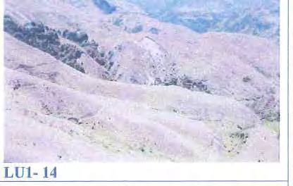
81

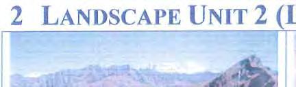

82


83


84


85

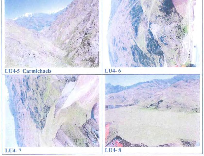
86


87
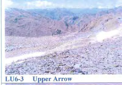

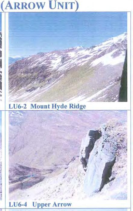

88

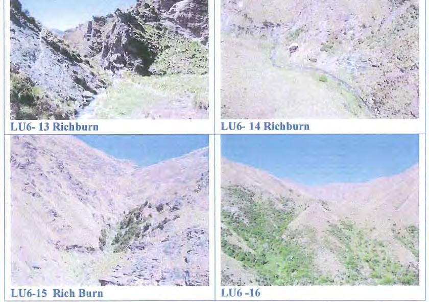
89


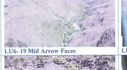


90
91


92
Significant Natural Area Assessment. Property Name: Hillend Station
 Private Bag 50072, Queenstown 9348, New Zealand QUEENSTOWN, 10 Gorge Road, Phone +64 3 441 0499, Fax +64 3 450 2223 WANAKA, 47 Ardmore Street, Phone +64 3 443 0024, Fax +64 3 450 2223 Significant Natural
Significant Natural Area Assessment. Property Name: Cochrane & Ashkel Ltd. Area Size (ha): 5.33
: 5.33") Private Bag 50072, Queenstown 9348, New Zealand QUEENSTOWN, 10 Gorge Road, Phone +64 3 441 0499, Fax +64 3 450 2223 WANAKA, 47 Ardmore Street, Phone +64 3 443 0024, Fax +64 3 450 2223 Significant Natural
Private Bag 50072, Queenstown 9348, New Zealand QUEENSTOWN, 10 Gorge Road, Phone +64 3 441 0499, Fax +64 3 450 2223 WANAKA, 47 Ardmore Street, Phone +64 3 443 0024, Fax +64 3 450 2223 Significant Natural
Te Manahuna Consulting
 Assessment of the natural values at the proposed centre pivot irrigation site and surrounds on Ben Ohau Station, Mackenzie Basin, New Zealand August 2016 Abstract The natural values of the area proposed
1.15 TONGARIRO GEOTHERMAL FIELD. List of Geothermal Sites. Te Maari Craters. Emerald Lakes. Contract Report No. 2348
 1.15 TONGARIRO GEOTHERMAL FIELD List of Geothermal Sites TGV01 TGV02 TGV03 TGV04 Te Maari Craters Ketetahi Emerald Lakes Red Crater 2011 452 TGV01 Te Maari Craters 0508 WILDNZ www.wildlands.co.nz ± ± 0
Summary of Preliminary Proposal
 Crown Pastoral Land Tenure Review Lease name : SIMONS PASS Lease number : PT 019 Summary of Preliminary Proposal A Preliminary Proposal is advertised for public submissions as per Section 43 of the Crown
Appendix C: Consultant Report Heritage Landscapes
 Appendix C: Consultant Report Heritage Landscapes Queenstown Lakes District Council Heritage Landscapes Appraisals (based upon a desk-top appraisal of published information; September 2014) QLDC DP Ref:
2.0 PARK VISION AND ROLES
 2.0 PARK VISION AND ROLES 2.1 Significance in the Protected Area System Marble Range and Edge Hills provincial parks protect 6.8% of the Pavillion Ranges Ecosection, which is located in the Southern Interior
Conservation Resources Report - Part 1
 Crown Pastoral Land Tenure Review Lease name : OBELISK STATION Lease number : PO 264 Conservation Resources Report - Part 1 As part of the process of Tenure Review, advice on significant inherent values
The Mackenzie Basin ecology and protection
 The Mackenzie Basin ecology and protection Photo Chris Woolmore Nicholas Head Plant Ecologist Acknowledgements Warren Chinn, Joy Comrie, Iain Gover, Di Lucas, Brian Patrick, Geoff Rogers, Susan Walker,
Wicklow Mountains Path Survey
 Wicklow Mountains Path Survey Glenmacnass Tonelagee Start to Finish: O 114 030 to O 085 016 Altitude (lowest highest): 370m 817m Weather: Sunny day, hot Access: Military Road, Glenmacnass Surveyed by:
VISUAL Impact Assessment
 5.0 Existing Landscape Character TO GOULBURN FEDERAL HIGHWAY 5.1 Landscape Character Units Generally one of the first steps in carrying out a landscape and visual assessment is to identify and map the
Visual and Sensory Aspect
 Updated All Wales LANDMAP Statistics 2017 Visual and Sensory Aspect Final Report for Natural Resources Wales February 2018 Tel: 029 2043 7841 Email: sw@whiteconsultants.co.uk Web: www.whiteconsultants.co.uk
Region 1 Piney Woods
 Region 1 Piney Woods Piney Woods 1. This ecoregion is found in East Texas. 2. Climate: average annual rainfall of 36 to 50 inches is fairly uniformly distributed throughout the year, and humidity and temperatures
Conservation Resources Report
 Crown Pastoral Land Tenure Review Lease name : MESOPOTAMIA Lease number : PT 057 Conservation Resources Report As part of the process of Tenure Review, advice on significant inherent values within the
Northland Regional Landscape Assessment Worksheet
 Northland Regional Landscape Assessment Worksheet DESCRIPTION AND CHARACTERISATION Component Land Types Northern and eastern dissected ranges; high relief land type Unit name MT TIGER BUSH AND REMNANTS
1 INFORMATION REQUIREMENTS
 1 INFORMATION REQUIREMENTS 1.1 BACKGROUND 2 1.2 WHAT IS THE DISTRICT PLAN 3 1.3 DISTRICT PLAN STRUCTURE 4 1.4 HOW TO USE THE DISTRICT PLAN 5 1.5 STRATEGIC FRAMEWORK 6 Whanganui District Plan (15 January
1.1.1 Landscape character This is the upper part of a bowl-shaped landform, extending east from the Rothiemurchus character area, contained by the
 1.1 Glen More 1.1.1 Landscape character This is the upper part of a bowl-shaped landform, extending east from the Rothiemurchus character area, contained by the arc of the high granite pluton of the Cairngorms
Trail Phasing Plan. Note: Trails in the Clear Creek Canyon area (Segments will be finalized in the future to minimize wildlife impacts
 Note: Trails in the Clear Creek Canyon area (Segments 2 5 and a future JCOS connection) will be finalized in the future to minimize wildlife impacts Trail Phasing Plan P Parking 3 Easy Trail Intermediate
Unit 1: Physical Environment Glaciated Landscapes
 Unit 1: Physical Environment Glaciated Landscapes Corries Corries are bowl-shaped hollows high up in the mountains. They are formed in the following way: Snow collects in a hollow on a mountainside (usually
PROTECTED AREAS ZONE - POLICY
 PROTECTED AREAS ZONE - POLICY.1 Introduction The Protected Areas Zone applies to the land depicted on the Ruapehu District Plan Maps as: Amenity Policy Area. Protected Areas - Conservation. (c) Protected
2.0 Physical Characteristics
 _ 2.0 Physical Characteristics 2.1 Existing Land Use for the Project The site is comprised of approximately 114 acres bounded by Highway 101 to the north, the existing town of Los Alamos to the east, State
Priority Species, Communities, Ecosystems, and Threats
 Priority Species, Communities, Ecosystems, and Threats East Gippsland Regional Catchment Strategy 2015/2016 1.0 Objective This document aims to assist in the preparation of project applications for 2015-2016
Typical avalanche problems
 Typical avalanche problems The European Avalanche Warning Services (EAWS) describes five typical avalanche problems or situations as they occur in avalanche terrain. The Utah Avalanche Center (UAC) has
SECTION A: PHYSICAL ATTRIBUTES OF THE STUDY AREA
 INTRODUCTION The study area is located north of Wanaka township between the Clutha River, Aubrey Road, Sticky forest, and Hikuwai Conservation Area. The study area is 255.5ha in area and includes the existing
Appendices A (Our ambition for nature (A3 plan) and further information)
 and further information)") Appendices A (Our ambition for nature (A3 plan) and further information) Penny Hill Farm Nature Conservation vision Key: Tenancy boundary Meadow restoration & Mowing/meadow F33 Mowing/meadow Progress towards
Appendices A (Our ambition for nature (A3 plan) and further information) Penny Hill Farm Nature Conservation vision Key: Tenancy boundary Meadow restoration & Mowing/meadow F33 Mowing/meadow Progress towards
Description of Wild Land Area Cape Wrath Wild Land Area
 40 Cape Wrath Wild Land Area 1 Context This Wild Land Area (WLA) extends 226 km 2 across rolling hills and peatland of Sutherland, the most northern mainland WLA and one of only three mainland areas that
47I THE LAS ANIMAS GLACIER.
 THE LAS ANIMAS GLACIER. ONE of the largest of the extinct glaciers of the Rocky Mountains was that which occupied the valley of the Las Animas river. This stream originates in the San Juan mountains in
What Is An Ecoregion?
 Ecoregions of Texas What Is An Ecoregion? Ecoregion a major ecosystem with distinctive geography, characteristic plants and animals, and ecosystems that receives uniform solar radiation and moisture Sometimes
PHYSICAL GEOGRAPHY GEOGRAPHY EARTH SYSTEMS COASTAL SYSTEMS FLUVIAL SYSTEMS
 PHYSICAL GEOGRAPHY EARTH SYSTEMS FLUVIAL SYSTEMS COASTAL SYSTEMS PHYSICAL GEOGRAPHY CORRIES / CIRQUES A Corrie or Cirque is the armchair shaped hollow that was the birthplace of a glacier. It has steep,
Section 2 North Slope Ecoregions and Climate Scenarios
 Section 2 North Slope Ecoregions and Climate Scenarios North Slope Ecoregions The geographic/ecological scope of the workshop will be freshwater and terrestrial systems of the North Slope of Alaska, with
Subject to sale, withdrawal, or error.
 The Crawford L Bar Ranch is located approximately 40 air miles west of Albuquerque, New Mexico. This ranch truly epitomizes the description of New Mexico being the Land of Enchantment. The topography and
Reservoir Tin workings
 The workings are quite over-grown and covered in moss, suggesting that they date to the earliest period of mining. This is supported by the fact that their head race was cut off by the reservoir (D49/47)
Description of Wild Land Area Loch Etive Mountains Wild Land Area
 9 Loch Etive Mountains Wild Land Area 1 Context This large (507 km 2 ) wild land area (WLA) spans the Lochaber and Argyll border, extending between Taynuilt in the west and Bridge of Orchy and Glen Coe
This area is a popular holiday spot so watch out for 4WD vehicles and motorbikes at peak times.
 Mavora Walkway (Map 130, 129, 128) Southern Start Northern End Distance Time Track Standard Mavora Camping Area, Mavora Lakes Road Greenstone Station Road Carpark 50km 3 days Tramping track Hazards Never
In the matter of The Resource Management Act And The Queenstown Lakes District proposed District Plan Topic 11 Ski Area Subzones mapping
 Before Queenstown Lakes District Council In the matter of The Resource Management Act 1991 And The Queenstown Lakes District proposed District Plan Topic 11 Ski Area Subzones mapping STATEMENT OF EVIDENCE
Mackinnon Esker Ecological Reserve Draft - Management Plan
 Mackinnon Esker Ecological Reserve Draft - Management Plan May 2011 Photo Credit: This document replaces the direction provided in the Carp Lake Provincial Park and Protected Area and Mackinnon Esker Ecological
Kicking the Alpine Plants Out Mountain Goat Wallows In Mount Peale Research Natural Area (La Sal Mountains, Utah)
") Kicking the Alpine Plants Out Mountain Goat Wallows In Mount Peale Research Natural Area (La Sal Mountains, Utah) Marc Coles-Ritchie, Grand Canyon Trust November 21, 2017 Mountain goats are digging up
Kicking the Alpine Plants Out Mountain Goat Wallows In Mount Peale Research Natural Area (La Sal Mountains, Utah) Marc Coles-Ritchie, Grand Canyon Trust November 21, 2017 Mountain goats are digging up
Archaeological survey of the Arrow River and Macetown, Otago
 Archaeological survey of the Arrow River and Macetown, Otago Peter Petchey Published by Department of Conservation PO Box 10-420 Wellington, New Zealand Cover photograph The All Nations aerial cableway
A summary of Draft Makara Peak Mountain Bike Park Master Plan
 A summary of Draft Makara Peak Mountain Bike Park Master Plan OVEMBER 216 Image: Peter Marshall 2 3 Introduction Since it was established in 1998, the Makara Peak Mountain Bike Park (Makara Peak) has grown
East West route and Leatham Molesworth route (route guide) Molesworth Recreation Reserve
 Molesworth Recreation Reserve") East West route and Leatham Molesworth route (route guide) Molesworth Recreation Reserve 0BIntroduction The East West route links the Clarence (Kahutara River in Ka Whata Tu o Rakihouia) Conservation Park
East West route and Leatham Molesworth route (route guide) Molesworth Recreation Reserve 0BIntroduction The East West route links the Clarence (Kahutara River in Ka Whata Tu o Rakihouia) Conservation Park
LITTLE LOST MAN CREEK (LLM) (formerly USGS Gaging Station No )
 (formerly USGS Gaging Station No )") LITTLE LOST MAN CREEK (LLM) (formerly USGS Gaging Station No. 11482468) LOCATION: In Redwood National and State Park approximately 0.8 miles upstream from confluence with Prairie Creek and 3.2 miles northeast
LITTLE LOST MAN CREEK (LLM) (formerly USGS Gaging Station No. 11482468) LOCATION: In Redwood National and State Park approximately 0.8 miles upstream from confluence with Prairie Creek and 3.2 miles northeast
Descriptions of Wild Land Areas Ben More Ben Ledi Wild Land Area
 07 Ben More Ben Ledi Wild Land Area 1 Context This WLA lies in Stirling and wholly within Loch Lomond and the Trossachs National Park. It has an area of 212 km 2 and takes the form of an elongated letter
Description of Wild Land Area Ben More, Mull Wild Land Area
 08 Description of Wild Land Area 2015 Ben More, Mull Wild Land Area 1 Context This relatively small WLA (area of 87 km 2 ), one of 11 island WLAs, is located in the mountainous heart of the Inner Hebridean
5 MAP SPECIFICATION FOR SKI-ORIENTEERING
 5 MAP SPECIFICATION FOR SKI-ORIENTEERING 5.1 General Maps for ski orienteering are based on the specifications for foot-orienteering maps. However in order to meet the specific requirements put on the
Potential additions to Aoraki/Mount Cook National Park and the World Heritage Area
 Topic Paper: Potential additions to Aoraki/Mount Cook National Park and the World Heritage Area. Purpose This paper provides the relevant background and matters for consideration regarding potential additions
ANAGEMENT. LAN November, 1996
 M ANAGEMENT P LAN November, 1996 for Paul Lake Provincial Park Ministry of Environment, Lands and Parks BC Parks Department Paul Lake Provincial Park M ANAGEMENT P LAN Prepared by BC Parks Kamloops Area
3.0 THE NORTH SASKATCHEWAN IN ALBERTA
 3.0 THE NORTH SASKATCHEWAN IN ALBERTA 3.1 WATERSHED OVERVIEW Wherever you are on earth, you are in a watershed. Most of the rain and snow falling outside your window will eventually find its way to a local
Chapter 16 Glaciers and Glaciations
 Chapter 16 Glaciers and Glaciations Name: Page 419-454 (2nd Ed.) ; Page 406-439 (1st Ed.) Part A: Anticipation Guide: Please read through these statements before reading and mark them as true or false.
The following criteria were used to identify Benchmark Areas:
 7.0 BENCHMARK AREAS The Churn Creek Protected Area offers a significant opportunity to learn more about how grassland ecosystems function. One of the key tools that will be used to monitor larger grassland
Conservation Resources Report
 Crown Pastoral Land Tenure Review Lease name : GLEN DENE STATION Lease number : PO 136 Conservation Resources Report As part of the process of Tenure Review, advice on significant inherent values within
EXPLORING BIOMES IN GORONGOSA NATIONAL PARK
 EXPLORING BIOMES IN GORONGOSA NATIONAL PARK ABOUT THIS WORKSHEET This worksheet complements the Click and Learn Gorongosa National Park Interactive Map (http://www.hhmi.org/biointeractive/gorongosa-national-park-interactive-map),
1. Study the Ordnance Survey Map of Brodick, Isle of Arran.
 1. Study the Ordnance Survey Map of Brodick, Isle of Arran. To find the map go to: > http://www.bing.com/maps/ > change maps type to Ordnance Survey Map from Road. > search for Glenrosa Water (it is near
Descriptions of Wild Land Areas Ben Lui Wild Land Area
 06 Ben Lui Wild Land Area 1 Context The western half of this relatively small WLA lies within Argyll and Bute and the eastern half is in Stirling. It has an area of 145 km 2 and is roughly rectangular
TAYLOR CANYON RANCH COLORADO - ROUTT COUNTY - STEAMBOAT SPRINGS
 TAYLOR CANYON RANCH COLORADO - ROUTT COUNTY - STEAMBOAT SPRINGS Tucked up against the steep valley shaped by Mt. Pau and rising to the Routt National Forest, Taylor Canyon Ranch is an easily accessible,
Marchand Provincial Park. Management Plan
 Marchand Provincial Park Management Plan 2 Marchand Provincial Park Table of Contents 1. Introduction... 3 2. Park History... 3 3. Park Attributes... 4 3.1 Natural... 4 3.2 Recreational... 4 3.3 Additional
MANAGEMENT DIRECTION STATEMENT
 Lower Mainland District MAAGEMET DIRECTIO STATEMET January 2001 for Liumchen Ecological Reserve Ministry of Environment Lands and Parks BC Parks Division Table of Contents Page Introduction... 1 Purpose
The Atlas of Hillforts of Britain and Ireland. Hillfort survey notes for guidance
 The Atlas of Hillforts of Britain and Ireland Hillfort survey notes for guidance The collection of surveys for the Atlas is now finished but you can use this form and the accompanying Notes for Guidance
Specification for Grip blocking using Peat Dams
 Technical Guidance Note 1 Specification for Grip blocking using Peat Dams 1. Introduction Moorland drains (grips) have been dug across much of the Yorkshire upland peatlands. Many of these grips have become
Title/Name of the area: Chwaka Bay, Zanzibar
 Title/Name of the area: Chwaka Bay, Zanzibar Presented by: Dr. Charles Lugomela, Ag. Head, Department of Aquatic Sciences and Fisheries, University of Dar es Salaam, P.O. Box 35064 Dar es Salaam, Tanzania
Landscapes in the UK: Glaciation 1. Extent of ice cover across the UK during the last ice age.
 Landscapes in the UK: Glaciation 1. Extent of ice cover across the UK during the last ice age. Key idea: Ice was a powerful force in shaping the landscape of the UK. In the past the climate has got colder
Chapter 8: Colorado Plateau State Highway 141, Dove Creek to Naturita
 State Highway 141 Dove Creek to (61 miles) Summary: Highway 141 heads north from US Highway 491 about two miles northwest of the town of Dove Creek. Initially, the highway runs through gently rolling farming
NOTICE OF INTENT MAPS WITH DESCRIPTIONS
 NOTICE OF INTENT MAPS WITH DESCRIPTIONS Location Map(s) to Accompany Notice of Intent The small corner map embedded in the lower left corner of the large map above shows the location of the three national
4.1 Landforms. Note: dimensions are specified in mm at the scale of 1: All drawings are at 1:7 500 for clarity only.
 4.1 Landforms Note: dimensions are specified in mm at the scale of 1:15 000. All drawings are at 1:7 500 for clarity only. OM = Outside measure IM = Inside measure CC = Centre to centre 0.2 0.4 OM 0.4
Rogue Gorge (Mt. Stella) Roadless Area-- T30S R3E (primarily in portions of Sections 23, 26, 33, 34 & 35)
 Roadless Area-- T30S R3E (primarily in portions of Sections 23, 26, 33, 34 & 35)") Rogue Gorge (Mt. Stella) Roadless Area-- T30S R3E (primarily in portions of Sections 23, 26, 33, 34 & 35) Rogue River-Siskiyou National Forest--High Cascades Ranger District Upper, higher elevation trail
Rogue Gorge (Mt. Stella) Roadless Area-- T30S R3E (primarily in portions of Sections 23, 26, 33, 34 & 35) Rogue River-Siskiyou National Forest--High Cascades Ranger District Upper, higher elevation trail
CRAZY HORSE TRAIL GUIDE
 CRAZY HORSE TRAIL GUIDE Abridged Version: July 2016 This is a short form of our interpretive trail guide for the Crazy Horse Trail. The full version of the guide has a more detailed description of the
VISITOR RISK MANAGEMENT APPLIED TO AVALANCHES IN NEW ZEALAND
 VISITOR RISK MANAGEMENT APPLIED TO AVALANCHES IN NEW ZEALAND Don Bogie*, Department of Conservation, Christchurch, New Zealand Mike Davies, Department of Conservation, Wellington, New Zealand ABSTRACT:
Note: Coordinates are provided as Universal Transverse Mercator UTM Zone U21, North American Datum 1983 (NAD 83).
.") Northern Traverse Route Description The Northern Traverse (formerly the North Rim Traverse) is an unmarked and rugged backcountry hiking route. It is known be a demanding hike, because of its terrain and
Northern Traverse Route Description The Northern Traverse (formerly the North Rim Traverse) is an unmarked and rugged backcountry hiking route. It is known be a demanding hike, because of its terrain and
Pembina Valley Provincial Park. Draft Management Plan
 Pembina Valley Provincial Park Draft Management Plan 2 Pembina Valley Provincial Park Table of Contents 1. Introduction... 3 2. Park History... 3 3. Park Attributes... 3 3.1 Natural... 3 3.2 Recreational...
Massanutten Mountain Cluster
 Massanutten Mountain Cluster Signal Knob Catback Mountain Southern Massanutten Mountain Five areas of almost 49,000 acres on the Lee Ranger District compose the Massanutten Mountain Cluster of Mountain
A trip to Steindalen. - geology and landscape on the way to the glacier. Geoffrey D. Corner
 A TRIP TO STEINDALEN Excursion guide Please take this with you on your trip, but don t leave it behind as litter. A trip to Steindalen - geology and landscape on the way to the glacier A part of Geologiskolen,
MANAGEMENT DIRECTION STATEMENT June, 1999
 Thompson River District MANAGEMENT DIRECTION STATEMENT June, 1999 for Clearwater River Corridor (Addition to Wells Gray Park) Ministry of Environment Lands and Parks BC Parks Division ii Table of Contents
Geologic Trips, Sierra Nevada
 ISBN 0-9661316-5-7 GeoPress Excerpt from Geologic Trips, Sierra Nevada by Ted Konigsmark All rights reserved. No part of this book may be reproduced without written permission, except for critical articles
Kit Carson-Challenger Ridge Trail Project Annual Performance Report-2014 October 22, 2014
 1 Kit Carson-Challenger Ridge Trail Project Annual Performance Report-2014 October 22, 2014 Willow Lake and Kit Carson Peak 2 SUMMARY The Rocky Mountain Field Institute began Phase 1 of a multi-phase,
Grid Link: response from Mountaineering Ireland to public consultation on route corridor options
 Grid Link: response from Mountaineering Ireland to public consultation on route corridor options December 2013 Mountaineering Ireland Grid Link - Response to public consultation on route corridor options
APPENDIX G ECOLOGICAL REPORTS. G.2 Badger
 APPENDIX G ECOLOGICAL REPORTS G.2 Badger Damhead Creek 2 ES Volume 2 June 2009 Damhead Creek Phase II Proposed Development Badger Survey Results Survey Date: 26 th October 2006. Surveyors: Miranda Cowan
Mackinnon Esker Ecological Reserve. Management Plan
 Mackinnon Esker Ecological Reserve Management Plan March 2017 Cover Page Photo Credit: Rob Bell This document replaces the direction provided in the Carp Lake Provincial Park and Protected Area and Mackinnon
SH73 Route Security Strategic Study Project Summary
 November 2009 SH73 Route Security Strategic Study Project Summary Managing Route Security from Springfield to Aickens STATE HIGHWAY 73 SPRINGFIELD TO AICKENS ROUTE SECURITY STRATEGY CONSULTATION 1. Introduction
Instream intrinsic values of the Te Puna Creek catchment
 Instream intrinsic values of the Te Puna Creek catchment J. Benn Technical Support Department of Conservation Canterbury Conservancy Christchurch (25 October 2011) Draft/living document Disclaimer This
Alpine Glacial Features along the Chimney Pond Trail, Baxter State Park, Maine
 Maine Geologic Facts and Localities September, 2009 Alpine Glacial Features along the Chimney Pond Trail, Baxter State Park, Maine 45 54 57.98 N, 68 54 41.48 W Text by Robert A. Johnston, Department of
The Geological Pacific Northwest. Wednesday February 6, 2012 Pacific Northwest History Mr. Rice
 The Geological Pacific Northwest Wednesday February 6, 2012 Pacific Northwest History Mr. Rice 1 Free Response #2 Please do not simply list the items for this response. Full sentences!!! Minimum of 3-5
KP Lasnaya 1 River
 KP 370.2 Lasnaya 1 River The Lasnaya 1 River crossing is protected by Reno mattings and a gabion wall on the north bank (Photo 1). The south bank consists of natural river gravel deposits on top of Reno
Conservation Partners for the National Reserve System Program: a Western NSW focus
 Conservation Partners for the National Reserve System Program: a Western NSW focus Cooper, N. 1, Webber, L. 2, Nicolson, K. 3 1 Department of Environment, Climate Change and Water NSW, PO Box 788 Broken
Colorado Life Zone Scavenger Hunt
 Colorado Life Zone Scavenger Hunt Below are worksheets created for all the habitats or life zones. They were designed with the intention of breaking the class up into small groups, and having students
KANANASKIS COUNTRY PROVINCIAL RECREATION AREAS MANAGEMENT PLAN DRAFT TERMS OF REFERENCE - November 20, 2007
 KANANASKIS COUNTRY PROVINCIAL RECREATION AREAS MANAGEMENT PLAN DRAFT TERMS OF REFERENCE - November 20, 2007 BACKGROUND There are 42 Provincial Recreation Areas (PRAs) within Kananaskis Country located
APPENDIX D: SUSTAINABLE TRAIL DESIGN. APPENDICES Town of Chili Parks and Recreation Master Plan Update
 APPENDIX D: SUSTAINABLE TRAIL DESIGN APPENDICES Town of Chili Parks and Recreation Master Plan Update Sustainable Trail Construction Sustainable trails are defined by the US Forest Service as trails having
The Small Swale Resource Overview
 The Small Swale Resource Overview Prepared for: City of Saskatoon Community Services Department City Planning Branch Prepared by: Stantec Consulting Ltd. #100 75 24 th Street East Saskatoon, Saskatchewan
Glacial Geomorphology Exercise
 James Madison University Field Course in western Ireland Glacial Geomorphology Exercise 3-day road log (abbreviated) Striations Large kame terrace Cirque with moraines Kame delta Striations Eskers Raised
Whitemouth Falls Provincial Park. Draft Management Plan
 Whitemouth Falls Provincial Park Draft Management Plan Whitemouth Falls Provincial Park Draft Management Plan Table of Contents 1. Introduction... 3 2. Park History... 3 3. Park Attributes... 4 3.1 Natural...
Rare Coastal Sand Ecosystems
 of the Boundary Bay Wildlife Management Area The sand in Beach Grove supports unique ecosystems not commonly found in BC. The plants and animals found here are well adapted to their environment of ever-shifting
RECREATION. Seven issues were identified that pertain to the effects of travel management on outdoor recreation within portions of the project area.
 RECREATION Seven issues were identified that pertain to the effects of travel management on outdoor recreation within portions of the project area. OPPORTUNITIES FOR SOLITUDE / QUIET TRAILS. One attraction
Self-Guided Walk Langdale Pikes. Start & Finish: NT car park (free to members) at Sticklebarn - on the right just beyond the New Dungeon Ghyll hotel.
 at Sticklebarn - on the right just beyond the New Dungeon Ghyll hotel.") Self-Guided Walk Langdale Pikes Key Information These mountains form a collection of spires and cliffs on the north side of Langdale. This walk visits four of the main tops Pavey Ark, Harrison Stickle,
Self-Guided Walk Langdale Pikes Key Information These mountains form a collection of spires and cliffs on the north side of Langdale. This walk visits four of the main tops Pavey Ark, Harrison Stickle,
Conservation of Critical Environmental Resources in Chatham Park
 Conservation of Critical Environmental Resources in Chatham Park Elaine Chiosso, Haw Riverkeeper Haw River Assembly Haw River As Seen From Chatham Park "Spreading southwestward from the banks of the Haw
GLACIER STUDIES OF THE McCALL GLACIER, ALASKA
 GLACIER STUDIES OF THE McCALL GLACIER, ALASKA T John E. Sater* HE McCall Glacier is a long thin body of ice shaped roughly like a crescent. Its overall length is approximately 8 km. and its average width
Lidar Imagery Reveals Maine's Land Surface in Unprecedented Detail
 Maine Geologic Facts and Localities December, 2011 Lidar Imagery Reveals Maine's Land Surface in Unprecedented Detail Text by Woodrow Thompson, Department of Agriculture, Conservation & Forestry 1 Introduction
Back Country Real Estate. Central Otago. Back Country
 Back Country Real Estate Central Otago Back Country 6-12 February 2017 Itinerary Join us on a new adventure as we discover the magnificent back country of the Central Otago region. We do however stress
Designated Sites. Headlines
 Designated Sites Headlines Over 36% of the Sheffield district is covered by sites with European, national or local designation. These offer valuable habitats to wildlife, with some level of protection,
Recreation Opportunity Spectrum for River Management v
 Recreation Opportunity Spectrum for Management v. 120803 Introduction The following Recreation Opportunity Spectrum (ROS) characterizations and matrices mirror the presentation in the ROS Primer and Field
EAST DON TRAIL ENVIRONMENTAL ASSESSMENT. Community Liaison Committee Meeting #3 July 15, :30 to 8:30 pm Flemingdon Park Library
 EAST DON TRAIL ENVIRONMENTAL ASSESSMENT Community Liaison Committee Meeting #3 July 15, 2013 6:30 to 8:30 pm Flemingdon Park Library Agenda 1. Welcome 2. Housekeeping and Updates a) Housekeeping b) CLC
ROBERTS CREEK PROVINCIAL PARK MASTER PLAN. November, 1981
 Ministry of Lands, Parks and Housing Parks and Outdoor Recreation Division Park Operations Branch North Vancouver, B. C. ROBERTS CREEK PROVINCIAL PARK MASTER PLAN November, 1981 Mr. G. Trachuk Director
glacier Little Ice Age continental glacier valley glacier ice cap glaciation firn glacial ice plastic flow basal slip Chapter 14
 Little Ice Age glacier valley glacier continental glacier ice cap glaciation firn glacial ice plastic flow basal slip glacial budget zone of accumulation zone of wastage glacial surge abrasion glacial