3.0 THE NORTH SASKATCHEWAN IN ALBERTA
|
|
|
- Marcus Bishop
- 5 years ago
- Views:
Transcription
1

 prepared a background report that described the North Saskatchewan Watershed (Perrin 2001).")


.")
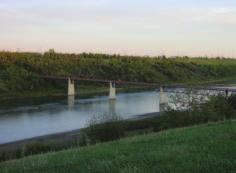
2 3.0 THE NORTH SASKATCHEWAN IN ALBERTA 3.1 WATERSHED OVERVIEW Wherever you are on earth, you are in a watershed. Most of the rain and snow falling outside your window will eventually find its way to a local waterbody - rolling downhill across the land, forming rivulets and joining small streams, and finally emptying into a river or lake. That area of land or gathering ground from which water drains to your local waterbody is your watershed. In 2001, the North Saskatchewan Watershed Alliance (NSWA) prepared a background report that described the North Saskatchewan Watershed (Perrin 2001). The following overview of the watershed uses information from that report as well as other material as referenced. For a more detailed description of subwatershed land use refer to Perrin (2001). The North Saskatchewan Watershed in Alberta drains 80,000 km 2, approximately 12.5% of Alberta s landmass. The river has its origin at the Saskatchewan Glacier in the Columbia Icefields in Banff National Park and flows over 1,000 kilometres from its headwaters to the Alberta/Saskatchewan border. The elevation of the North Saskatchewan River is 1,390 m above sea level at the Saskatchewan Crossing near the park boundary, and slopes to just 500 m above sea level at the border with Saskatchewan. It joins with the South Saskatchewan River in Saskatchewan east of Prince Albert, flows into Lake Winnipeg in Manitoba and eventually empties into the Hudson Bay via the Nelson River. As part of the Saskatchewan River Basin, the North Saskatchewan River is subject to the 1969 Master Agreement on Apportionment, which states that Alberta must allow 50% of the natural flow of rivers to flow into Saskatchewan, must meet a minimum flow requirement whenever flow is above that minimum and can account for this on an annual basis. 25 Water quality in a river system tends to change as you move downstream due to inputs from both natural and human-caused point and non-point sources. Nutrients (notably phosphorus), bacteria and pesticides typically increase while dissolved oxygen decreases downstream of larger urban populations. Flow in the North Saskatchewan River is regulated by two headwater dams, the Bighorn on the main stem near the mouth of the Bighorn River, and the Brazeau on the Brazeau River. The net effect of these impoundments is to redistribute flow to a higher average flow in the winter and lower average flow in the summer. Without these dams, the City of Edmonton would face water shortages for consumption and waste assimilation at certain times of the year. Three tributaries contribute 66% of the increase in flow between Whirlpool Point and the Saskatchewan border the Ram, Clearwater and Brazeau Rivers (Mitchell 1994). An analysis of recorded river flow at Hydat Station 05df001 at the City of Edmonton shows a trend of decreasing flow in the river main stem over the past century (Figure 2). This station is downstream of water treatment plant intakes and upstream of wastewater treatment plant outfalls, so it shows increased water use, but doesn t show that most of this water is returned to the river. A naturalized flow study of the North Saskatchewan River is currently being prepared by Alberta Environment, which is due to be published in December 2004 (Doug Thrussell pers. comm). Land use in the North Saskatchewan Watershed in Alberta includes agriculture, resource exploration and extraction, forestry, recreation, and urban centres. The upper part of the watershed is sparsely populated and remains in a primarily natural state within National Parks. The vast majority of human population in the watershed lives in the greater Edmonton area.
3 26 Figure 2: North Saskatchewan River flows at the City of Edmonton (HYDAT Station 05DF001) for 1911 to 2003 as recorded by EPCOR Water Services. Water use along the North Saskatchewan River and its tributaries includes human consumption, hydro-electric generation, oil and gas extraction, mining, and agricultural uses such as livestock watering and some irrigation. Several villages, towns, and cities in the watershed have either wastewater treatment plants or wastewater lagoons that discharge their treated effluent into either the North Saskatchewan River or tributaries to the river. The Battle River originates at Battle Lake, traverses central Alberta and flows 1,100 kilometres to enter the North Saskatchewan River near the Battlefords in Saskatchewan. The Battle River drains approximately 40% of the North Saskatchewan River watershed in Alberta. Because the Battle River is fed by groundwater and surface runoff from local snowmelt and rain rather than from glacial meltwater, it only contributes 3% of the water that flows into the North Saskatchewan River. Land use in most of the Battle River watershed is agricultureintensive and there is a significant amount of coal mining for locally produced power. There are eight provincial Grazing Reserves in the North Saskatchewan Watershed. These reserves are public lands that provide summer pasture for Alberta s farmers and ranchers. The reserves also are used for recreational activities, oil and gas production, and firewood cutters. The North Saskatchewan Watershed has ten provincial parks, three national parks, three ecological reserves, two wilderness areas, eighteen First Nation s reserves, and one Métis settlement.
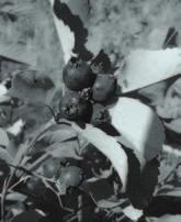
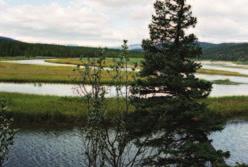
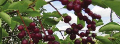
4 The North Saskatchewan Watershed, including the drainage basins of the Ram, Clearwater, Brazeau and Battle Rivers, has an estimated 3,600 kilometres of streams. Approximately one-half are suitable for trout and other cold water species. The cold water habitat is located mainly above the junction of the Clearwater and North Saskatchewan Rivers and in the upper half of the Brazeau drainage. Downstream of this area, the river gradually becomes warmer and the fish community shifts towards cool water and warm water game fish such as sturgeon, walleye, pike, goldeye, mooneye and sauger. Lakes are not plentiful in the watershed and lake fishing opportunities are somewhat limited. Stocked cold water lakes in the headwaters and numerous pothole lakes in the central part of the watershed provide the best opportunities for trout fishing. The larger cool water lakes primarily contain pike, perch, lake whitefish, and walleye. 3.2 NATURAL REGIONS IN THE NORTH SASKATCHEWAN WATERSHED The North Saskatchewan and Battle Rivers traverse five natural regions within Alberta the Rocky Mountain, Foothills, Boreal Forest, Parkland and Grassland natural regions (Figure 3). The natural regions classification was adopted by the government of Alberta to represent ecosystem and biodiversity elements of importance to protected areas. The classification system emphasizes the overall landscape pattern, which mainly reflects climate, but in others cases reflects the predominance of geological and soil factors. The purpose of the Natural Regions classification is to account for the entire range of natural landscapes and ecosystem diversity and is related primarily to ecosystem and biodiversity conservation. Brief descriptions of the five natural regions and relevant sub-regions are given below. For more detail, the reader should refer to Achuff (1994) Rocky Mountain Natural Region The Rocky Mountain Natural Region is underlain primarily by upthrust and folded bedrock. This region is the most rugged topographically. Elevations drop from west to east, from 3700 m along the Continental Divide to 1500 to 1000 m in river valleys. Three natural sub-regions reflect changes in environmental conditions dues to changes in altitude.

5 28 Figure 3: Natural Subregions map of Alberta. Figure courtesy of Alberta Community Development Parks and Protected Areas Division.
6 Alpine Subregion The Alpine Subregion includes all areas above the tree line. Materials generally are residual bedrock and colluvium often on steep slopes. Extensive areas of unvegetated bedrock occur. The mean May to September temperatures is approximately 6 C and frost-free periods are rare. Mean annual precipitation ranges from 420 to 850 mm. Much of this subregion has no soil. Alpine vegetation typically forms a complex mosaic in which microclimatic variations are reflected in marked changes in dominant species Subalpine Subregion The evaluation of the Subalpine Subregion ranges from about 2300 m to around 1600 m. Morainal materials occupy the majority of the subregion with colluvial and residual bedrock materials frequent at higher elevations. Fluvial and glaciofluvial deposits are common along stream valleys. The mean annual temperature ranges from -1 C to 3 C with a mean July temperature of about 15 C. Below freezing temperatures occur in all months. Total annual precipitation ranges from 460 mm to more than 1400 mm. Winter precipitation is higher in this subregion than in any other with often more than 200 cm of snowfall. Soils vary widely, reflecting the great diversity in parent materials and ecological conditions. The Subalpine Subregion is often divided into two portions: a Lower Subalpine characterized by closed forests of lodgepole pine, Engelmann spruce and subalpine fir and an Upper Subalpine with spruce-fir closed forests and open forests near the tree line. At lower elevations, lodgepole forests cover extensive areas following fire. Engelmann spruce and subalpine fir forests typically occur on higher, moister sites that have not been subject to fire. Open forests in the Upper Subalpine are transitional to the treeless Alpine Subregion above. Dominant trees include Engelmann spruce, subalpine fir, and whitebark pine. High elevation grasslands occur in the Subalpine Subregion Montane Subregion 29 The Montane Subregion occurs primarily in the major river valleys. The landforms of the major valleys are primarily fluvial and glaciofluvial terrace and fans with smaller areas of glaciolacustrine, aeolian and morainal deposits. Sandstone outcrops are typical. Elevations range from 1000 to 1350 m. Chinooks are characteristic of this subregion. The mean temperature for May to September is approximately about 12 C, with a mean July temperature of 15 C. There are approximately 70 frost-free days per year and the mean annual precipitation is approximately 600 mm with a range of 300 to 1280 mm. The landscape is characterized by a pattern of open forests and grasslands. Characteristic tree species include Douglas fir, limber pine and white spruce Foothills Natural Region The Foothills Natural Region is transitional between the Rocky Mountains Natural Region and the Boreal Forest Natural Region. It consists of two Subregions, the Upper Foothills and the Lower Foothills Upper Foothills Subregion The Upper Foothills Subregion occurs on strongly rolling topography along the eastern edge of the Rocky Mountains. The upper elevation limit is about 1500 m. Bedrock outcrops of marine shales and non-marine sandstones are frequent. Morainal deposits are common over bedrock throughout much of the area. The subregion has a mean annual precipitation of approximately 540 mm, with approximately 340 mm occurring between May
7 and September. The mean May to September temperature is 10 C to 12 C. Upland forests are nearly all coniferous and dominated by white spruce, black spruce, lodgepole pine, and occasionally subalpine fir. Lodgepole pine forests occupy large portions of upland sites and black spruce dominates on wet sites Lower Foothills Subregion The Lower Foothills Subregion is generally rolling topography created by deformed bedrock along the edge of the Rocky Mountains. Elevations range from approximately 1250 m to 1450 m. Surficial materials are commonly morainal veneer over bedrock. Extensive organic deposits occur in valleys and wet depressions. Mean annual precipitation averages 465 mm, of which two-thirds falls between May and September. The mean May to September temperature is 11 C to 13 C. The forests reflect the transitional nature of the subregion in which mixed forests of white spruce, black spruce, lodgepole pine, balsam fir, aspen, balsam poplar and paper birch occur. Lodgepole pine communities are perhaps the best indication of the lower boundary of the Lower Foothills Subregion. The upper boundary is marked by the occurrence of nearly pure coniferous forest cover. Black spruce forests occur on moist upland sites and fens are common in much of the subregion Boreal Forest Natural Region 30 The Boreal Forest Natural Region is the largest in Alberta; however, most of this natural region occurs north of the North Saskatchewan Watershed. The region consists of broad lowland plains and discontinuous but locally extensive hill systems. The presence of extensive wetlands is a major characteristic of the Boreal Forest Natural Region. Bogs, fens and swamps are abundant and marshes are locally prevalent. The region has been divided into six subregions, but only the Dry Mixedwood Subregion occurs in the North Saskatchewan Watershed Dry Mixedwood Subregion The Dry Mixedwood Subregion is characterized by low relief and level to undulating terrain. Surficial materials are mostly till with some areas of aeolian dunes and sandy outwash plains. The Cooking Lake moraine east of Edmonton is a separate portion of the subregion. The climate of the subregion is subhumid, continental with short, cool summers and long, cold winters. The mean May to September temperature is approximately 13 C and the growing season 90 days. Annual precipitation averages 350 mm, with June and July being the wettest months. Winters are relatively dry with approximately 60 mm of precipitation. Aspen is an important tree species in the subregion, occurring in both pure and mixed stands. Balsam poplar frequently occurs with aspen on the moister sites. Over time, white spruce and, in some areas, balsam fir can be expected to increase or replace aspen and balsam poplar as the dominant species; however, frequent fire seldom permits this to occur and pure deciduous stands are common in the southern part of the subregion. Dry, sandy sites are usually occupied by jack pine forests. Peatlands are common and may be extensive Parkland Natural Region The Parkland Natural Region forms a broad transition between the drier grasslands of the plains and the coniferous forests of the Boreal Forest and Rocky Mountain natural regions. The Parkland Natural Region consists of three subregions; Central, Peace River, and Foothills, the latter of these does not occur in the North Saskatchewan Watershed. The subregions are separated on the basis of geographical location and major floristic differences. The Parkland Natural Region is the most densely populated region in Alberta and settlement has changed much of the native vegetation from aspen groves and grasslands to cultivated land.
8 Central Parkland Subregion Surficial deposits in the Central Parkland Subregion range from intermediate-textured hummocky and ground moraines to fine-textured glaciolacustrine deposits and coarse outwash. Elevations range from just over 500 m to around 1100 m. Numerous permanent streams cut across the subregion, and lakes and permanent wetlands are scattered throughout. Many of the lakes and wetlands naturally are slightly to strongly alkaline. The mean annual temperature is 2 C with a May to September average of 13 C. The frost-free period averages 95 days. The mean annual precipitation is 350 to 450 mm, with the May to September precipitation averaging 300 mm. Within the Central Parkland Subregion, the vegetation changes from grassland with groves of aspen in the south to aspen parkland to closed aspen forest in the north. The two major forest types in the subregion are trembling aspen and balsam poplar on moister sites in depressions and in the northern part of the subregion. Both are characterized by a dense, lush, species-rich understory. The grassland vegetation of the parks is the same as that of the Northern Fescue Subregion described below. In Alberta, the Central Parkland Subregion is one of the most productive waterfowl areas; however, only about 2% of this landscape is formally protected in parks or other conservation areas. The area s deep, rich soils and reliable moisture have largely been converted to productive farmland. It is now the most heavily impacted and fragmented ecoregion in Alberta, with only 5-8% remaining in its natural state (Nature Conservancy of Canada 2004) Grassland Natural Region The Grassland Natural Region is a flat to gently rolling plain with a few major hill systems. Most of the bedrock is covered with extensive, thick glacial till deposits. The Grassland Natural Region contains four subregions: Dry Mixedgrass, Mixedgrass, Northern Fescue, and Foothills Fescue, separated primarily on the basis of climatic, soils and vegetation. Only the Northern Fescue and Foothills Fescue subregions occur in the North Saskatchewan Watershed Northern Fescue Subregion The Northern Fescue Subregion is characterized by gently rolling terrain, commonly low-relief ground moraine and hummocky moraine. The mean May to September temperature is 14 C and the frost-free period is about 90 days. Mean annual precipitation is approximately 400 mm, with mean May to September precipitation of approximately 280 mm. The vegetation is dominated by rough fescue Foothills Fescue Subregion The Foothills Fescue Subregion occurs largely on the outwash deposits of the foothills. Elevations are higher in this subregion than in the Northern Fescue Subregion. The climate differs from the Northern Fescue Subregion in having a greater frequency of Chinooks and thus, a milder winter climate. There also is more snowfall in later winter and early spring with the majority of precipitation falling during the growing season. The mean annual precipitation is approximately 500 mm with 290 mm falling between May to September. The mean May to September temperature is 11 to 13 C and the mean annual temperature is 3 C. The average frost-free period is 90 days. Grasslands are dominated by rough fescue, Idaho fescue, and oat grass.
2.1 Physical and Biological Description Matabitchuan River Watershed
 2.1 Physical and Biological Description Watershed 2.1.1 Physical Description The system watershed has a total area of about 933 km 2 and is a tributary system to Lake Temiskaming and the Ottawa River Drainage
I AN INTRODUCTION TO THE SOUTH SASKATCHEWAN RIVER BASIN
 I AN INTRODUCTION TO THE SOUTH SASKATCHEWAN RIVER BASIN I.1 The Saskatchewan River Basin The South Saskatchewan River joins the North Saskatchewan River to form one of the largest river systems in western
What Is An Ecoregion?
 Ecoregions of Texas What Is An Ecoregion? Ecoregion a major ecosystem with distinctive geography, characteristic plants and animals, and ecosystems that receives uniform solar radiation and moisture Sometimes
Region 1 Piney Woods
 Region 1 Piney Woods Piney Woods 1. This ecoregion is found in East Texas. 2. Climate: average annual rainfall of 36 to 50 inches is fairly uniformly distributed throughout the year, and humidity and temperatures
Seager Wheeler Lake. Representative Area. -- Concept Management Plan --
 Seager Wheeler Lake Representative Area -- Concept Management Plan -- Saskatchewan Environment and Resource Management January, 1999 Saskatchewan s Representative Areas Network Program The Government of
2.0 PARK VISION AND ROLES
 2.0 PARK VISION AND ROLES 2.1 Significance in the Protected Area System Marble Range and Edge Hills provincial parks protect 6.8% of the Pavillion Ranges Ecosection, which is located in the Southern Interior
Whitemouth Falls Provincial Park. Draft Management Plan
 Whitemouth Falls Provincial Park Draft Management Plan Whitemouth Falls Provincial Park Draft Management Plan Table of Contents 1. Introduction... 3 2. Park History... 3 3. Park Attributes... 4 3.1 Natural...
The Geological Pacific Northwest. Wednesday February 6, 2012 Pacific Northwest History Mr. Rice
 The Geological Pacific Northwest Wednesday February 6, 2012 Pacific Northwest History Mr. Rice 1 Free Response #2 Please do not simply list the items for this response. Full sentences!!! Minimum of 3-5
Jan Lake Representative Area -- Concept Management Plan --
 Jan Lake Representative Area -- Concept Management Plan -- Saskatchewan Environment and Resource Management December, 1999 Saskatchewan s Representative Areas Network Program The government of Saskatchewan,
Pinawa Provincial Park. Draft Management Plan
 Pinawa Provincial Park Draft Management Plan Pinawa Provincial Park Draft Management Plan Table of Contents 1. Introduction... 3 2. Park History... 3 3. Park Attributes... 4 3.1 Natural... 4 3.2 Recreational...
EXPLORING BIOMES IN GORONGOSA NATIONAL PARK
 EXPLORING BIOMES IN GORONGOSA NATIONAL PARK ABOUT THIS WORKSHEET This worksheet complements the Click and Learn Gorongosa National Park Interactive Map (http://www.hhmi.org/biointeractive/gorongosa-national-park-interactive-map),
Mark West Creek Flow Study Report
 Mark West Creek Flow Study Report Biology and Geology of Mark West Creek The headwaters of Mark West Creek are located in the Mayacamas Mountain range, which border Napa and Sonoma County, where it then
ALBERTA S GRASSLANDS IN CONTEXT
 ALBERTA S GRASSLANDS IN CONTEXT GLOBAL GRASSLANDS 1 Temperate grasslands, located north of the Tropic of Cancer and south of the Tropic of Capricorn, are one of the world s great terrestrial biomes 2.
Recreation in the Battle River Basin: Overview. John Thompson, Watrecon Consulting
 Recreation in the Battle River Basin: Overview John Thompson, Watrecon Consulting Recreation Rates for Alberta & Battle Basin Households 1996 2004 Battle Basin Alberta Battle Basin Alberta Bird Watching
Section 2 North Slope Ecoregions and Climate Scenarios
 Section 2 North Slope Ecoregions and Climate Scenarios North Slope Ecoregions The geographic/ecological scope of the workshop will be freshwater and terrestrial systems of the North Slope of Alaska, with
Mackinnon Esker Ecological Reserve Draft - Management Plan
 Mackinnon Esker Ecological Reserve Draft - Management Plan May 2011 Photo Credit: This document replaces the direction provided in the Carp Lake Provincial Park and Protected Area and Mackinnon Esker Ecological
FINGER-TATUK PROVINCIAL PARK
 FINGER-TATUK PROVINCIAL PARK PURPOSE STATEMENT AND ZONING PLAN March 2003 FINGER-TATUK PROVINCIAL PARK Purpose Statement and Zoning Plan Finger-Tatuk Provincial Park is 17,151 ha in size. It includes the
Rocky Lake Provincial Park. Draft Management Plan
 Rocky Lake Provincial Park Draft Management Plan Rocky Lake Provincial Park Draft Management Plan Table of Contents 1. Introduction... 3 2. Park History... 3 3. Park Attributes... 4 3.1 Location/Access...4
Geoscape Toronto The Oak Ridges Moraine Activity 2 - Page 1 of 10 Information Bulletin
 About 13,000 years ago as the Laurentide Ice Sheet melted, glacial meltwater accumulated between the ice sheet and the Niagara Escarpment. This formed a lake basin into which gravel and sand were deposited.
Hydrology Input for West Souris River IWMP
 Hydrology Input for West Souris River IWMP Prepared by: Mark Lee Manitoba Water Stewardship 1 1 1 Overall view of: drainage area watershed characteristics gauging stations meteorological stations Runoff
Level IV Ecoregions of the Northeast Glacial Lakes Watershed Project Area
 Level IV Ecoregions of the Northeast Glacial Lakes Watershed Project Area Ecoregions are areas having similar ecosystems and environmental resources including geology, physiography, vegetation, climate,
Wallace Lake Provincial Park. Management Plan
 Wallace Lake Provincial Park Management Plan 2 Wallace Lake Provincial Park Table of Contents 1. Introduction... 3 2. Park History... 3 3. Park Attributes... 4 3.1 Natural... 4 3.2 Recreational... 4 4.
Chapter 2: El Dorado County Characteristics and Demographics
 Chapter 2: El Dorado County Characteristics and Demographics 2.1 Geographic Area and Demographics El Dorado County comprises 1,805 square miles with over half of the area in the Eldorado National Forest
Pasquia-Porcupine. Representative Areas. -- Concept Management Plan --
 Pasquia-Porcupine Representative Areas -- Concept Management Plan -- Saskatchewan Environment June, 2004 Pasquia/Porcupine Integrated Forest Land Use Plan The Pasquia/Porcupine Integrated Forest Land Use
Hudson Bay Lowlands Proposed Protected Areas
 Hudson Bay Lowlands Proposed Protected Areas Hudson Bay Lowlands Proposed Protected Areas The Protected Areas Initiative has identified portions of the Hudson Bay Lowlands region that have significant
ENVIRONMENT Environmental Service PRKLND REION, Red Deer F1 F F1 L1 F1 L1 M1 F4 F1 F2 F1 F2 L3 L1 F2 L1 L1 Map 2 Dillberry Lake Provincial Park Projec
 ENVIRONMENT Environmental Service PRKLND REION, Red Deer 67 66 68 69 65 64a,b 63 82 70 77 71 78 72 73 74 76 75 40a 40b 41 42 46 60 61 59 58 83 90 89 39 43 38 44 37 45 47 79 80 81 49 50 51 52 48 53 54 55
Clearwater Lake Provincial Park. Draft Management Plan
 Clearwater Lake Provincial Park Draft Management Plan Clearwater Lake Provincial Park Draft Management Plan Table of Contents 1. Introduction... 3 2. Park History... 4 3. Park Attributes... 4 3.1 Location/Access...4
TO THE WORLD HERITAGE LIST. Convention concerning the Protection of the World Cultural and Natural Heritage
 NOMINATION TO THE WORLD HERITAGE LIST Convention concerning the Protection of the World Cultural and Natural Heritage Name I CANADIAN ROCKIES Identification No, 304 Date received by WH Secretariat, 23.12.83
2.0 Physical Characteristics
 _ 2.0 Physical Characteristics 2.1 Existing Land Use for the Project The site is comprised of approximately 114 acres bounded by Highway 101 to the north, the existing town of Los Alamos to the east, State
Sasagiu Rapids Provincial Park. Draft Management Plan
 Sasagiu Rapids Provincial Park Draft Management Plan 2 Sasagiu Rapids Provincial Park Table of Contents 1. Introduction... 3 2. Background and Park Attributes... 3 2.1 Park History.... 3 2.2 Natural Features...
Wallace Lake Provincial Park. Draft Management Plan
 Wallace Lake Provincial Park Draft Management Plan Wallace Lake Provincial Park Draft Management Plan Table of Contents 1. Introduction... 3 2. Park History... 3 3. Park Attributes... 4 3.1 Natural...
SECTION 3 GENERAL DESCRIPTION OF THE RIVER BASIN
 SECTION 3 GENERAL DESCRIPTION OF THE RIVER BASIN SECTION 3 GENERAL DESCRIPTION OF THE RIVER BASIN River basin description. A general description of the river basin or subbasin, as appropriate, in which
KANANASKIS COUNTRY PROVINCIAL RECREATION AREAS MANAGEMENT PLAN DRAFT TERMS OF REFERENCE - November 20, 2007
 KANANASKIS COUNTRY PROVINCIAL RECREATION AREAS MANAGEMENT PLAN DRAFT TERMS OF REFERENCE - November 20, 2007 BACKGROUND There are 42 Provincial Recreation Areas (PRAs) within Kananaskis Country located
Birch Point Provincial Park. Management Plan
 Birch Point Provincial Park Management Plan 2 Birch Point Provincial Park Table of Contents 1. Introduction... 3 2. Park History... 3 3. Park Attributes... 4 3.1 Natural... 4 3.2 Recreational... 4 4. Park
Unit 1: Physical Environment Glaciated Landscapes
 Unit 1: Physical Environment Glaciated Landscapes Corries Corries are bowl-shaped hollows high up in the mountains. They are formed in the following way: Snow collects in a hollow on a mountainside (usually
2009 Clearwater Area Sheep
 2009 Clearwater Area Sheep Section Authors: Chiarastella Feder and Shevenell Webb Suggested Citation: Feder, C. and S. Webb. 2009. Clearwater Area Sheep. Pages 22 25. In: N. Webb and R. Anderson. Delegated
LITTLE LOST MAN CREEK (LLM) (formerly USGS Gaging Station No )
 (formerly USGS Gaging Station No )") LITTLE LOST MAN CREEK (LLM) (formerly USGS Gaging Station No. 11482468) LOCATION: In Redwood National and State Park approximately 0.8 miles upstream from confluence with Prairie Creek and 3.2 miles northeast
LITTLE LOST MAN CREEK (LLM) (formerly USGS Gaging Station No. 11482468) LOCATION: In Redwood National and State Park approximately 0.8 miles upstream from confluence with Prairie Creek and 3.2 miles northeast
Lynde Creek Watershed. Lynde Creek Watershed CLOCA LYNDE CREEK WATERSHED EXISTING CONDITIONS REPORT CHAPTER 1 STUDY AREA
 Lynde Creek Watershed CLOCA Lynde Creek Watershed CLOCA LYNDE CREEK WATERSHED EXISTING CONDITIONS REPORT CHAPTER 1 STUDY AREA June 2008 TABLE OF CONTENTS 1.0 STUDY AREA... 3 1.1 Lynde Main Subwatershed...6
South Atikaki Provincial Park. Draft Management Plan
 South Atikaki Provincial Park Draft Management Plan South Atikaki Provincial Park Draft Management Plan Table of Contents 1. Introduction... 3 2. Park History... 3 3. Park Attributes... 3 3.1 Natural...
Colorado Life Zone Scavenger Hunt
 Colorado Life Zone Scavenger Hunt Below are worksheets created for all the habitats or life zones. They were designed with the intention of breaking the class up into small groups, and having students
CH. 1 Europe and Russia: Physical Geography. Section 1 Land and Water p Europe and Russia are part of the world s largest landmass called.
 CH. 1 Europe and Russia: Physical Geography Section 1 Land and Water p.10-16 Europe and Russia are part of the world s largest landmass called. The country of Russia stretches over both continents. About
Kwadacha Wilderness Provincial Park and Kwadacha Addition (Kwadacha Recreation Area) Purpose Statement and Zoning Plan
 Purpose Statement and Zoning Plan") Kwadacha Wilderness Provincial Park and Kwadacha Addition (Kwadacha Recreation Area) Purpose Statement and Zoning Plan Located in a remote area of the northern interior of BC, this large park straddles
Kwadacha Wilderness Provincial Park and Kwadacha Addition (Kwadacha Recreation Area) Purpose Statement and Zoning Plan Located in a remote area of the northern interior of BC, this large park straddles
Town of Oakfield Agricultural and Farmland Protection Plan
 SECTION III COMMUNITY OVERVIEW A. Regional Setting / Location The Town of Oakfield is located in the northwestern portion of Genesee County. Located west of New York's Finger Lakes, the Town is uniquely
Mackinnon Esker Ecological Reserve. Management Plan
 Mackinnon Esker Ecological Reserve Management Plan March 2017 Cover Page Photo Credit: Rob Bell This document replaces the direction provided in the Carp Lake Provincial Park and Protected Area and Mackinnon
Terms to Know. artesian well coral atoll krill lagoon
 Chapter Objectives Describe the diverse landforms and natural resources of Australia, Oceania, and Antarctica. Discuss the wide range of climates and vegetation throughout the region. The Land Section
Alpine Glacial Features along the Chimney Pond Trail, Baxter State Park, Maine
 Maine Geologic Facts and Localities September, 2009 Alpine Glacial Features along the Chimney Pond Trail, Baxter State Park, Maine 45 54 57.98 N, 68 54 41.48 W Text by Robert A. Johnston, Department of
The Small Swale Resource Overview
 The Small Swale Resource Overview Prepared for: City of Saskatoon Community Services Department City Planning Branch Prepared by: Stantec Consulting Ltd. #100 75 24 th Street East Saskatoon, Saskatchewan
Michipicoten Island Regional Plan
 Michipicoten Island Regional Plan This is one of twenty Regional Plans that support implementation of the Lake Superior Biodiversity Conservation Strategy (Strategy). The Strategy, prepared and overseen
GEOGRAPHY AND HISTORY
 GEOGRAPHY AND HISTORY YEAR 1, PART 1 www.vicensvives.es Contents 01 Our planet Earth 02 The representation of the Earth: maps 03 The Earth s relief 04 Rivers and seas 05 Weather and climate 06 Climates
ALBERTA WILDERNESS ASSOCIATION
 North Saskatchewan Regional Plan (NSRP) AWA Priorities for the NSR Page 1 of 12 Conservation Priorities Bighorn An important piece of Alberta's Eastern Slopes, the Bighorn Wildland is a large and intact
Natural regions of Alberta
 Natural regions of Alberta Alberta is a big province. It has 6 natural regions. Can you find the regions on the map? Use the legend. Canadian Shield region W This map shows northeastern Alberta. Can you
Watchorn Provincial Park. Management Plan
 Watchorn Provincial Park Management Plan 2 Watchorn Provincial Park Table of Contents 1. Introduction... 3 2. Park History... 3 3. Park Attributes... 3 3.1 Natural... 4 3.2 Recreational... 4 3.3 Additional
1. Landforms. The Boreal Shield. Location The Boreal Shield can be found from Alberta to Newfoundland, between the Taiga Shield and the Boreal Plains.
 The Boreal Shield Location The Boreal Shield can be found from Alberta to Newfoundland, between the Taiga Shield and the Boreal Plains. 1. Landforms Rolling hills Exposed bedrock Evidence of glacial weathering
HYDROLOGY OF GLACIAL LAKES, FORT SISSETON AREA
 PROC. S.D. ACAD. SCI., VOL. 77 (1998) 59 HYDROLOGY OF GLACIAL LAKES, FORT SISSETON AREA Perry H. Rahn Department of Geology & Geological Engineering South Dakota School of Mines and Technology Rapid City,
Proposed Ruisseau- Clinchamp ecological reserve
 Proposed Ruisseau- Clinchamp ecological reserve October 2003 1. Plan and description 1.1. Geographic location, boundaries and dimensions The plans of the boundaries of the proposed Ruisseau-Clinchamp ecological
Marchand Provincial Park. Management Plan
 Marchand Provincial Park Management Plan 2 Marchand Provincial Park Table of Contents 1. Introduction... 3 2. Park History... 3 3. Park Attributes... 4 3.1 Natural... 4 3.2 Recreational... 4 3.3 Additional
CRAZY HORSE TRAIL GUIDE
 CRAZY HORSE TRAIL GUIDE Abridged Version: July 2016 This is a short form of our interpretive trail guide for the Crazy Horse Trail. The full version of the guide has a more detailed description of the
INTRODUCTION 250,000
 INTRODUCTION The United States of America has over 250,000 rivers, with a total of about 3,500,000 miles of rivers. The main stems of 38 rivers in the United States are at least 500 miles (800 km) long.
Grand Rapids Provincial Park. Draft Management Plan
 Grand Rapids Provincial Park Draft Management Plan Grand Rapids Provincial Park Draft Management Plan Table of Contents 1. Introduction... 3 2. Park History... 3 3. Park Attributes... 4 3.1 Location/Access...4
Summary of prescribed fires in Prince Albert National Park 2015
 Summary of prescribed fires in Prince Albert National Park 2015 Prince Albert National Park conducted four controlled fires in spring 2015, plus an additional fire in October. Fuel Management for Hazard
Neso Lake. Classification: Landscape Description: Park Purpose: Recreation Park
 Neso Lake Classification: Recreation Park Landscape Description: This small recreation park provides access to Neso Lake and the Mistik Creek canoe route. It is located in the Churchill River Upland portion
Sabourin lake biodiversity reserve
 PLAN OF THE PROPOSED SABOURIN LAKE BIODIVERSITY RESERVE AND CONSERVATION PLAN FOR THE RESERVE (provisional name) Sabourin lake biodiversity reserve February 2003 March 2003 1 1. Plan and description 1.1.
BIGHORN BACKCOUNTRY ACCESS MANAGEMENT PLAN
 BIGHORN BACKCOUNTRY ACCESS MANAGEMENT PLAN October, 2002 SPECTACULAR BY NATURE BIGHORN BACKCOUNTRY Alberta s Bighorn Backcountry offers spectacular Rocky Mountain scenery and unforgettable recreational
Chapter 14. The Physical Geography of Russia
 Chapter 14 The Physical Geography of Russia Chapter Objectives Identify the physical features and natural resources of Russia. Discuss the effects of Russia s climate and vegetation on life in the region.
Chapter 8: Colorado Plateau State Highway 141, Dove Creek to Naturita
 State Highway 141 Dove Creek to (61 miles) Summary: Highway 141 heads north from US Highway 491 about two miles northwest of the town of Dove Creek. Initially, the highway runs through gently rolling farming
Crete Study Site Description
 Crete Study Site Description 1. Location Crete (the largest island of Greece) is located in the south part of Greece covering an area of 8.335 km 2 or 6.3% of the Greek territory, including the surrounding
Numaykoos Lake Provincial Park. Management Plan
 Numaykoos Lake Provincial Park Management Plan 2 Numaykoos Lake Provincial Park Table of Contents 1. Introduction... 3 2. Background... 3 3. Park Purpose... 5 4. Park Management Guidelines... 6 Appendix...
Chapter 7 Geography and the Early Settlement of Egypt, Kush, and Canaan
 Chapter 7 Geography and the Early Settlement of Egypt, Kush, and Canaan How did geography affect early settlement in Egypt, Kush, and Canaan? Section 7.1 - Introduction RF/NASA//Corbis This satellite photograph
X. WHATCOM CREEK SMA. X.1 Watershed Analysis. X.1.1 Landscape Setting
 X. WHATCOM CREEK SMA Summary: The entire length of Whatcom Creek is located within the City of Bellingham. SMA jurisdiction associated with this creek is approximately 300 acres. Land use is dominated
STORNETTA BROTHERS COASTAL RANCH
 STORNETTA BROTHERS COASTAL RANCH Location: Surrounding Point Arena Lighthouse and immediately south of Manchester State Park Mendocino Co., CA Acres: 1,860 Resources: Over two miles of Pacific Ocean coastline
Physical Regions of the U.S.
 Physical Regions of the U.S. Quickly use this map to label the map on your paper Pacific Coast The coast from southern California to Alaska The region of the Pacific Northwest has a long history that was
APPENDIX. Alberta Land Stewardship Act AMENDMENTS TO THE SOUTH SASKATCHEWAN REGIONAL PLAN
 APPENDIX Alberta Land Stewardship Act AMENDMENTS TO THE SOUTH SASKATCHEWAN REGIONAL PLAN 1 All references to Alberta Environment and Sustainable Resource Development, Environment and Sustainable Resource
Dragon Mountain Park. Management Plan. Public Review Draft
 Disclaimer: This draft management plan contains preliminary proposals that are subject to change and therefore may not necessarily reflect the position of the Ministry of Environment. At the conclusion
TAYLOR CANYON RANCH COLORADO - ROUTT COUNTY - STEAMBOAT SPRINGS
 TAYLOR CANYON RANCH COLORADO - ROUTT COUNTY - STEAMBOAT SPRINGS Tucked up against the steep valley shaped by Mt. Pau and rising to the Routt National Forest, Taylor Canyon Ranch is an easily accessible,
Introduction. Implementation of the Village of Capac Master Plan
 Implementation of the Village of Capac Master Plan Introduction The key to a well-planned community is the actual day-to-day use of planning documents, like this Master Plan. Because this plan is to be
White Lake Peatlands. Interim Management Statement
 White Lake Peatlands Interim Management Statement 2007 APPROVAL STATEMENT I am pleased to approve this Interim Management Statement for White Lake Peatlands Provincial Park. This park was regulated under
Chapter Objectives. Describe the dominant landforms and natural resources of Southeast Asia. Discuss Southeast Asia s climate and vegetation.
 Chapter Objectives Describe the dominant landforms and natural resources of Southeast Asia. Discuss Southeast Asia s climate and vegetation. The Land Section 1 Objectives Describe how tectonic plates and
Hydrology of Yemen. Dr. Abdulla Noaman
 Hydrology of Yemen Dr. Abdulla Noaman INTRODUCTION Location and General Topography Yemen is located on the south of the Arabian Peninsula, between latitude 12 and 20 north and longitude 41 and 54east,
Dragon Mountain Park. Management Plan
 Dragon Mountain Park Management Plan December 2015 Dragon Mountain Park Management Plan Approved by: Peter Weilandt A/Regional Director Thompson Cariboo Region BC Parks December 14. 2015 Date Brian Bawtinheimer
Temperature and precipitation for a temperate rainforest. Data for Forks, WA
 Coastal Range Ecoregion Temperate Rainforest Biome It stretches along the Pacific Coast from the tip of the Olympic Peninsula in the north to the San Francisco Bay in the south, including Grays Harbor,
Regional impacts and vulnerability mountain areas
 Regional impacts and vulnerability mountain areas 1 st EIONET workshop on climate change vulnerability, impacts and adaptation EEA, Copenhagen, 27-28 Nov 2007 Klaus Radunsky 28 Nov 2007 slide 1 Overview
"ST. KLIMENT OHRIDSKI FACULTY OF GEOLOGY AND GEOGRAPHY
 SOFIA UNIVERSITY "ST. KLIMENT OHRIDSKI FACULTY OF GEOLOGY AND GEOGRAPHY APPLICATION OF THE MODEL "DRIVING FORCES PRESSURE STATE - RESPONSE FOR ASSESSMENT OF FLOOD RISK RADOSTINA BORISOVA DOCHEVA Bachelor
A few tips regarding butterfly collecting in Alberta:
 A few tips regarding butterfly collecting in Alberta: Although most habitat in the Edmonton region is privately-owned, roadsides throughout the region can provide excellent collecting with no permission
Did It. naturalists. Young. Moving and melting ice shaped many of Minnesota s land features. 30 Minnesota Conservation Volunteer
 Young naturalists by Mary Hoff Photography by Gary Alan Nelson T he Glacier Did It Moving and melting ice shaped many of Minnesota s land features. Shut your eyes. Imagine that it s a sunny summer day
Big Knife Provincial Park Biophysical Inventory
 Big Knife Provincial Park Biophysical Inventory December, 1999 Prepared by Ed Karpuk 1 and Marge Meijer 2 1 Environmental Service, Parkland Region Alberta Environment 2 Resource Data Division, Land and
New Ramsar sites for Poland
 New Ramsar sites for Poland 31 October 2005 Poland Poland designates five new Wetlands of International Importance The Secretariat is pleased to announce that the Government of Poland has designated five
Bridge River Delta Park. Management Plan. Final Public Review Draft
 Bridge River Delta Park Management Plan Final Public Review Draft March 2016 Bridge River Delta Park Management Plan Approved by: Jeff Leahy Regional Director Thompson Cariboo Region BC Parks Date Brian
PHYSICAL GEOGRAPHY GEOGRAPHY EARTH SYSTEMS COASTAL SYSTEMS FLUVIAL SYSTEMS
 PHYSICAL GEOGRAPHY EARTH SYSTEMS FLUVIAL SYSTEMS COASTAL SYSTEMS PHYSICAL GEOGRAPHY CORRIES / CIRQUES A Corrie or Cirque is the armchair shaped hollow that was the birthplace of a glacier. It has steep,
Flora Distribution Types and Migration of the Flora
 Flora The evolution of the flora and vegetation started at the end of the late glacial period, about 12,000 years BP (Before Present). The mountains became covered by sparse pine and birch woodlands and
ES2 - Lakes, Reservoirs and Ponds
 Legend: = Default regulations for Fish Management Zone ES1. As examples 3 over 63 indicates a possession and a size limit and 3 or 10 indicates a possession limit for that species of any size. Watershed
Glaciers. Reading Practice
 Reading Practice A Glaciers Besides the earth s oceans, glacier ice is the largest source of water on earth. A glacier is a massive stream or sheet of ice that moves underneath itself under the influence
Chapter 20. The Physical Geography of Africa South of the Sahara
 Chapter 20 The Physical Geography of Africa South of the Sahara Chapter Objectives Identify the major landforms, water systems, and natural resources of Africa south of the Sahara. Describe the relationship
Nansanga Profile. Population and Land Use.
 Nansanga Profile Population and Land Use. Settlements in Nansanga are linearly aggregated in plateau area along the Serenje Mapepala road, with densely populated Mukomansala, Mapepala, Shindaila, and Nabowa
Case Study: 1. The Clarence River Catchment
 Case Study: 1. The Clarence River Catchment The NSW coastline is a great natural asset, making an enormous contribution to the economy. The resources of coastal catchments such as the Clarence River Catchment,
Atikaki. Established: Classification: Landscape Description: Park Purpose: July 18, Wilderness Park
 Wilderness Parks Atikaki Established: July 18, 1985 Classification: Wilderness Park Landscape Description: Total park area is 3,981 km 2, characterized by a landscape of rock outcrops and granite cliffs
B HALL RANCH FISHTAIL, MONTANA
 Brochure Courtesy of: B HALL RANCH FISHTAIL, MONTANA w w w. m c c a s l i n l a n d. c o m Page 1 LOCATION The Hall Ranch is ideally located in the foothills of the Beartooth Mountains, approximately 5
2.1 What is the climate like?
 José Medeiros This fact sheet allows you to see how varied the countryside is across Brazil. 2.1 What is the climate like? Most of Brazil is in the Southern Hemisphere, where the seasons are the opposite
Role of the Protected Area
 Role of the Protected Area Provincial and Regional Context Height of the Rockies and Elk Lakes provincial parks lie in southeastern British Columbia in the Rocky Mountains, about 85 km southwest of Calgary,
II. THE BOULDER CREEK DRAINAGE BASIN
 II. THE BOULDER CREEK DRAINAGE BASIN This section provides an overview of the watersheds and flood hazards associated with Boulder Creek and South Boulder Creek including descriptions of the drainage basins,
Monitoring the Environmental Status of the Heart of Borneo
 Monitoring the Environmental Status of the Heart of Borneo By: Stephan Wulffraat The Heart of Borneo conservation initiative has been going on now for several years and has gained increasing support from