291-ACRE WATSONVILLE MUNICIPAL AIRPORT STUDY AREA
|
|
|
- Evelyn Summers
- 5 years ago
- Views:
Transcription


1 THIRD ANNUAL SANTA CRUZ TARPLANT POPULATION ASSESSMENT FOR THE 291-ACRE WATSONVILLE MUNICIPAL AIRPORT STUDY AREA CITY OF WATSONVILLE, SANTA CRUZ COUNTY, CALIFORNIA Prepared for: CITY OF WATSONVILLE, WATSONVILLE MUNICIPAL AIRPORT 100 Aviation Way Watsonville, CA Prepared by: Herdal Drive, Ste. 14 Auburn, California (530) AUGUST 2014
2 TABLE OF CONTENTS INTRODUCTION... 1 Project Location... 1 Setting... 1 Status of Santa Cruz Tarplant... 1 History and Findings of Past Santa Cruz Tarplant Assessments... 4 Objectives of the Assessment... 5 METHODOLOGY... 5 Survey Approach and Methodology... 5 Field Methodology... 6 Mapping of SCT Sub-populations... 7 Santa Cruz Tarplant Seed Count Estimation... 7 SURVEY RESULTS... 9 Descriptions of Representative Sub-populations SCT Seeds per Plant Estimate CONCLUSIONS FIGURES Figure 1. Site & Vicinity Map... 2 Figure 2. Aerial Photograph... 3 Figure 3. Santa Cruz Tarplant Population Densities... 8 Figure 4. Site Photos (Oblique Aerial) Figure 5. Site Photos (Oblique Aerial) Figure 6. Site Photo (Oblique Aerial) Figure 7. Site Photos (Oblique Aerial) Figure 8. Site Photos (Oblique Aerial) Figure 9. Site Photos (Oblique Aerial) Figure 10. Site Photos (Ground) Figure 11. Site Photos (Ground) Figure 12. Site Photos (Ground Figure 13. Site Photos (Ground) TABLES Table 1. Monthly Rainfall Near Watsonville Municipal Airport Tarplant Survey Years... 6 Table 2. Density Rating for Santa Cruz Tarplant at Watsonville Municipal Airport... 7 Table 3. Estimated Santa Cruz Tarplant Population by Location... 9
3 THIRD ANNUAL SANTA CRUZ TARPLANT POPULATION ASSESSMENT FOR THE 291-ACRE WATSONVILLE MUNICIPAL AIRPORT STUDY AREA INTRODUCTION Project Location Salix Consulting, Inc. conducted a third year Santa Cruz tarplant (SCT) population assessment for an approximately 291-acre study area at the Watsonville Municipal Airport in Watsonville, Santa Cruz County, California. The Watsonville Municipal Airport (Airport) study area is located north of Highway 1, approximately 1.5 miles west of downtown Watsonville. The airport is located along the central coast, approximately 2.5 miles northeast of the Pacific Ocean. The airport is situated within the Los Corralitos and San Andres land grants, Township 11 and 12 South, and Range 1 and 2 East on the 7.5 minute Watsonville West USGS quadrangle. Approximate latitude and longitude for the center of the site is North and West (Figure 1). Setting Site elevations range between 60 feet in the southern portion of the airport property and 140 feet in the northern portion. The study area is primarily a maintained grassland and paved surfaces and buildings associated with airport operations. In addition to normal airport operations, the Watsonville Municipal Airport also contains a shooting range west of runway 2-20 (Figure 2). Adjacent land uses include commercial, industrial, and residential. Higher density residential and commercial land uses occur further to the east; while rural residential, agricultural, and undeveloped land uses occur further to the west. Highway 1 bisects the southern portion of the airport property. A tributary to Harkins Slough runs south along the western boundary. Wetland swales, streams, and Harkins Slough continue offsite to the south and east. Status of Santa Cruz Tarplant Santa Cruz Tarplant (Holocarpha macradenia) is listed by the federal government as threatened and by the State of California as endangered. Final ruling on critical habitat for Santa Cruz tarplant was established by the USFWS on October 16, One of the California critical habitat units, Unit I Watsonville Unit covers most of the airport property (approximately 222 acres) northeast of Highway 1. It includes the unpaved areas around the airport runways and taxiways. Watsonville Municipal Airport Study Area Salix Consulting, Inc. Third Annual Tarplant Population Assessment 1 August 2014


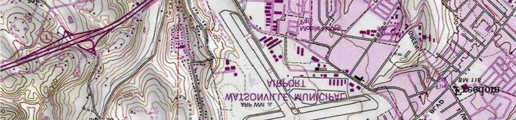


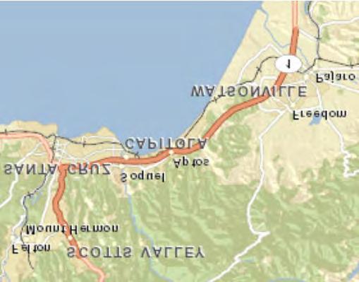
4 Project Site Sources:sEsriVsDeLormeV NAVTEQVsUSGSVsIntermapV ipcvsnrcanvsesrisjapanv Study Area Copyright: s2j13snationalsgeographicssocietyvsiicubed J ± 1VJJJ Feet 2VJJJ SourcesMaps:sUSGSsTopographicsMapV WatsonvillesWestVsCAsQuadrangleV 1:24VJJJ Figure 1 VICINITY MAP Watsonville Airport WatsonvilleVsCA Julys21Vs2J14


5 Study Area July 21, 2014 ± ,000 Feet 2012 Aerial Photo Figure 2 AERIAL PHOTO Watsonville Airport Watsonville, CA
6 History and Findings of Past Santa Cruz Tarplant Assessments As addressed in the Biological Supplement for the Watsonville Municipal Airport Proposed Reconstruction of Taxiway C and Phase I of the General Aviation Apron (North Fork Associates and Wallace Environmental Consulting 2011), habitat for Santa Cruz tarplant historically consisted of grasslands and prairies found on coastal terraces below 330 feet in elevation from Monterey County to Marin County. As of 2011, Santa Cruz tarplant was known to exist at up to 15 native populations in the Monterey Bay area and eight transplant populations in Contra Costa County. Additionally, three areas have been planted as experimental populations as part of ongoing research. All native San Francisco Bay area populations have been extirpated. The Watsonville Municipal Airport supports the largest extant population of Santa Cruz tarplant. The numbers of Santa Cruz tarplant individuals far surpass the total of all other populations combined. This is likely due to the airport s favorable consistent, annual management practices. According to the Mitigation Plan for Santa Cruz Tarplant and Coastal Terrace Prairie at the Watsonville Airport, prepared by John Gilchrist & Associates (draft, 2004), Santa Cruz tarplant population was first formally documented at the airport in 1993 by Randall Morgan. The total number of tarplant was estimated at approximately 459,000 plants occupying acres. In 1993, the airport altered its mowing regime to promote the spread of tarplant by adjusting blade height and timing of maintenance mowing to avoid impacts to the tarplant. In fall 1995, Airport staff began a program to establish tarplant in areas of the airport where it did not occur. The purpose of the program was to determine the feasibility of relocating tarplant and maintaining relocation populations over time, with the goal of mitigating for potential loss of tarplant due to airport expansion. As a result of these maintenance practices, the number of tarplant individuals and acreage coverage increased. Gilchrist notes that additional population censuses were performed in 1994, 1998, 1999, 2000, 2001, and The number of individual plants and acreage coverage varied over these years. The highest numbers were recorded in 1998 when John Gilchrist & Associates performed a detailed census, finding just under 28 million tarplant individuals occupying acres. According to Gilchrist, the abundance and extensive distribution of the 1998 population was likely due to the heavy El Niño rainfall of the winter, during which inches of rainfall (217% of normal) was recorded. (Average rainfall for Watsonville is approximately inches per year.) The 1999 survey estimated approximately 8,208,785 tarplant individuals on acres. Rainfall during this year had been much less than the previous El Niño year (21.13 inches), and some habitat may have been disturbed by disking the previous winter. In 2001, inches of rainfall was recorded, and the survey estimated 2,496,709 tarplant individuals on acres. In 2003, a visual inspection was conducted, and tarplant was found in areas and in densities similar to previous years, but appeared to be less abundant overall. Rainfall for was inches. Watsonville Municipal Airport Study Area Salix Consulting, Inc. Third Annual Tarplant Population Assessment 4 August 2014
7 Gilchrist states that a comparison of annual tarplant census data to annual rainfall data suggests that rainfall has a definite effect on tarplant abundance but is not the sole controlling factor. Other factors may include grassland management, fire events, and relocation efforts that began after the initial 1993 survey. The Mitigation Plan for Santa Cruz Tarplant and Coastal Terrace Prairie at the Watsonville Airport includes a table displaying annual rainfall by month during the tarplant census years described in the report (page 5a). In 2012 and 2013, Salix Consulting conducted a tarplant population assessment to map the distribution of Santa Cruz tarplant at the Airport, assess population densities within each sub-population, and estimate (not count) the number of plants within each subpopulation. Survey results from 2012 (conducted on July 23 and July 24) estimated approximately 512,000 individuals of SCT inhabiting 18.1 acres of the study area. The majority of the species observed were diminutive, and a high distribution of them occurred on scraped areas with hard packed soil. The 2013 survey was conducted on June Results indicated a 35% increase in SCT observed (approximately 692,000 individuals) and almost 26% more land (22.8 acres) mapped for SCT than in As with the 2012 survey however, most of the observed SCT occurred over scraped areas and plants were diminutive. Objectives of the Assessment As with the previous two surveys, the primary objective of this survey was to map the distribution of the Santa Cruz Tarplant population on the airport property. The secondary objective was to determine the approximate number and density of plants that occur within this population. Because it was necessary to take time constraints and cost into consideration, formal sampling protocols were not utilized. Instead, visual estimation was utilized, which can provide a good approximation of distribution and density but not necessarily an accurate count, which would result from using a formal sampling protocol. METHODOLOGY Survey Approach and Methodology The 2014 Survey was conducted July 2-4, 2014 by Jeff Glazner, assisted by Matthew Shaffer, and was timed to coincide with the peak blooming period (late June through late July) of Santa Cruz Tarplant. Rainfall to-date for had totaled 9.49 inches (Table 1), the smallest amount in recent years. The previous year, , had also been dryer than average totaling inches. Most of the rainfall in occurred in November and December. In , most rainfall took place between February and April (during which 8.55 inches of the season s 9.49 inches of rain fell), with the heaviest precipitation occurring in February. Watsonville Municipal Airport Study Area Salix Consulting, Inc. Third Annual Tarplant Population Assessment 5 August 2014
8 Table 1. Monthly Rainfall Near Watsonville Municipal Airport Tarplant Survey Years Oct Nov Dec Jan Feb Mar Apr May Jun Jul Aug Sep Annual Field Methodology All non-paved areas of the 291-acre airport property (Figure 1 and 2) were evaluated for SCT. The site was walked along meandering transects that would allow location of SCT if it were present. Transects were closer together in areas where there was a higher likelihood of locating SCT. For example, the agricultural field at the southern end of the airport and areas with deeper or tilled soils were less likely to support SCT, so transects were spaced further apart in those areas. When SCT was located, the area was evaluated for the limits of the sub-population. Once this evaluation was complete, a Trimble GeoXT 6000 GPS (sub-meter accuracy) was used to map a polygon around the outliers of the sub-population. The data were compiled using ArcGIS 10.2 to create the Santa Cruz Tarplant Occurrence map. When the limits of a sub-population were determined and mapped and the population observed, a visual estimation of the number of plants within each sub-population was made. This was done by simple independent visual observation between the two people conducting the survey. Small areas of the population were counted and visually extrapolated to the remainder of the population. Formal sampling protocols were not Watsonville Municipal Airport Study Area Salix Consulting, Inc. Third Annual Tarplant Population Assessment 6 August 2014
9 followed due to time constraints and because the emphasis of the study was on mapping and not actual plant counts. A density rating (low, medium, high) was assigned for each sub-population based on the number of plants estimated to be present over a given area. The density thresholds were created to provide a visual representation of the relative densities of each subpopulation of SCT. Table 2 describes the rating for each density category assigned to each subpopulation. Table 2. Density Rating for Santa Cruz Tarplant at Watsonville Municipal Airport Density Rating Description of Density Low Very sparse; SCT not a dominant plant in the area (up to 8000 plants per acre) Medium Clusters of SCT sparsely scattered; may be a dominant or co-dominant plant in some areas (8001 to plants per acre High Very dense population; SCT one of the dominant plants in the area (20001 to plants per acre) Density judgments were made based on visual observations during the field assessment. Assignments are qualitative and generally represent the number of plants over the subpopulation area. Mapping of SCT Sub-populations Areas where SCT were located were assessed for their population size. Once the boundary of the sub-population was mapped, the number of plants in the subpopulation were estimated (Santa Cruz Tarplant Occurrence map, Figure 3. Santa Cruz Tarplant Seed Count Estimation In addition to the SCT population estimate, twenty flowerheads from several different plant forms were analyzed in an effort to ascertain the approximate number of seeds in a typical flowerhead. With this information and an estimate of the number of plants and flowerheads present, an approximation of the number of seeds in the population could be made. Examination of flowerheads was made with a 20X lens and seed counts were tallied. The results of this effort are discussed in the Conclusions section at the end of this document. Watsonville Municipal Airport Study Area Salix Consulting, Inc. Third Annual Tarplant Population Assessment 7 August 2014


 High ( 20001 to 67000 plants/ac)")

10 Study Area Buena Vista Dr. 19 #* #* #* Freedom Blvd. #*#* #*#* 49 #* 39 #*#* #*#* #*#* #* #*#*#*#*#* #*#* 29 #* #*#* Taxiway C #*#* #* 8a 10 G.A. Apron 11 Taxiway C Runway #* #* #* #* #*#* #* 46 #*#* #* #* #* 43 Runway 2-20 Taxiway A #* Aviation Way Loma Prieta Ave Shooting Range 2 #* 5a 31 Airport Blvd. 3 #* 2 5 #* #* #* 4 Santa Cruz Tarplant Population Densities #* Individual or Small Clusters CA Hwy 1 Low (10 to 8000 plants/ac) Medium (8001 to plants/ac) High ( to plants/ac) Total 1.0 ac 9.5 ac 12.6 ac 23.1 ac July 15, ± Feet Notes: Tarplant census dates July 2-4, 2014 Aerial Photo Study Area 291 acres Imagery 2014, DigitalGlobe Figure 3 SANTA CRUZ TARPLANT AREAS JULY 2014 Watsonville Airport Watsonville, CA
11 SURVEY RESULTS As shown in Figure 3, Santa Cruz tarplant sub-populations were identified and mapped in areas around Runway 9-27, Taxiway C, Runway 2-20, Taxiway A, and the general aviation apron. In addition, commonly-associated species within the vicinity of SCT areas were identified and include Acmispon americanus, Aira caryophyllea, Briza minor, Danthonia californica, Erodium botrys, Festuca perennis, Hordeum murinum, Lactuca serriola, Leontodon saxatilis, Plantago lanceolata, Plantage major, Trifolium angustifolium, and coast tarweed (Madia sativa). The sub-populations are identified by density (color-coded) and numbered on Figure 3. Table 3 provides a summary of the locations of sub-populations and the estimated numbers of plants in each sub-population, which is followed by descriptions of representative sub-populations. Site photos are provided at the end of the document; Figures 4 through 9 are aerial oblique photos of the airport, Figure 10 shows comparative robust and diminutive forms of SCT, and Figures 11 through 13 are ground photos of representative areas where SCT was found. Table Estimated Santa Cruz Tarplant Sub-Population by Location Number Location of Estimated Density Rating Sub-population Plant Count Acreage (±) 1 Runway 2 end, near shooting range Medium Runway 2 end, near shooting range High 14, Runway 2 end Medium 1, Runway 2 end along Taxiway A Medium Runway 2 end in infield between runway and High 32, Taxiway A at number 5a Runway 2 end in infield between runway and Medium 1, Taxiway A 6 Runway 2-20, midway on west High 120, side 7 Runway 2-20, in infield midway, between runway High 22, and Taxiway A 8 Runway 2-20 in infield near Taxiway C, High 32, Watsonville Municipal Airport Study Area Salix Consulting, Inc. Third Annual Tarplant Population Assessment 9 August 2014
12 Number 8a Location of Sub-population between runway and Taxiway A near G.A. Apron Runway 2-20 between Taxiway A and G.A. Apron At intersection of Runways 2-20 and 9-27, infield near Taxiway C Runway 9-27 in infield, midway between runway and Taxiway C Runway 9-27 in infield, midway between runway and Taxiway C Runway 27 in infield between runway and Taxiway C Near Runway 27 on south side of Taxiway C near hangar Runway 27 near numbers and along Taxiway C Along northeastern side of Runway 27 North of Runway 9-27 and east of Runway 20 North end of Runway 2-20 West side of northern end of Runway 2-20 North side of western portion of Runway 9-27 Runway 9 end in infield between runway and Taxiway C Runway 9 end in infield between Density Rating Estimated Plant Count Acreage (±) Low Medium 2, Low 2, Medium 3, High 140, Medium 4, High 4, Low Medium 160, Medium 3, Medium High 125, High 7, High 20, Watsonville Municipal Airport Study Area Salix Consulting, Inc. Third Annual Tarplant Population Assessment 10 August 2014
13 Number Location of Sub-population runway and Taxiway C Southern boundary of western portion of Taxiway C Runway 2 infield between runway and Taxiway A East of Taxiway A and south of G.A. Apron East of Taxiway A and south of G.A. Apron West side of northern end of Runway 2-20 Runway 2 end on west side, near shooting range Southern boundary of Taxiway C west of windsock Runway 9 end in infield between runway and Taxiway C East of Taxiway A and south of G.A. Apron East of Taxiway A, near G.A. Apron East end of Runway 27 East end of Runway 27 West side of northern end of Runway 2-20 West of Runway 2-20, midway Taxiway C near west side of Runway 9-27 Density Rating Estimated Plant Count Acreage (±) High 2, High 3, Low Medium Low High Low High Low Low Low Low Medium Medium Low TOTALS ±705,000 ±23.16 Watsonville Municipal Airport Study Area Salix Consulting, Inc. Third Annual Tarplant Population Assessment 11 August 2014
14 Descriptions of Representative Sub-populations Locations #1 and #2 Two areas occur just west of the southern end of Runway 2-20 in a highly-disturbed area, adjacent to the road leading to the shooting range. There are two distinct areas of SCT in large numbers with moderate vegetation cover, mostly small plants with minimal branching (Figure 4). Location #3 Between 2013 and 2014 locations 3, 3a, 3b, and 3c combined into one area, location 3, which features a moderate scattering of plants located between the gravel entry road to the shooting range and the corner of Runway 2. This area is highly disturbed beyond regular mowing and has mostly low growth with few branching stems (Figure 4). Location #4 Approximately twenty individuals of SCT are located just off the pavement of Taxiway A near its intersection with the end of Runway 2. This is a highly-disturbed location beyond regular mowing that is influenced by adjacent hayfield disturbance (Figure 4). Locations #5 and #5a A very dense area of SCT is located in the infield near the numbers on Runway 2. Additional medium-density clusters of plants are found in the northern section of the same infield (location 5a) (Figure 4). Location #6 High-density population of SCT is located in scraped area at the bottom of a drainage area west of and midway along Runway Soils are very thin due to scraping. Plants are thriving in scraped area, with robust growth and good stem branching (Figures 5.1 and 11). Location #7 Dense population is located near midfield of Runway 2-20, between the runway and Taxiway A. Highest density of plants are gathered at the base of a shallow swale with robust growth (Figures 5.1 and 11). Locations #8 and #8a A dense population is located in same infield area as location 7. At location 8a between Taxiway A and the G.A. Apron, plants occur in small, low-density clusters (Figures 5.1, 5.2, and 6). Location #9 A highly-disturbed area of medium-density population is located in the small infield area bound by two taxiways and two runways. The majority of SCT is small and is found along a shallow depression near the edge of the infield area (Figure 6). Watsonville Municipal Airport Study Area Salix Consulting, Inc. Third Annual Tarplant Population Assessment 12 August 2014
15 Locations #10 and #11 Both populations are located in the infield bound by Taxiways A and C and Runway Location 10 is low-density, and location 11 is medium-density. Plants are low to the ground (Figure 7.1). Location #12 This population occupies most of the infield between the eastern end of Runway 27 and Taxiway C. It is heavily populated, with high-density robust plant growth at the edge of the pavement, along a shallow depression (Figure 7.1 and 7.2). Location #14 Locations 13 and 14 have combined since 2013, forming one area, Location 14. It is a medium-density population of robust plant growth along Taxiway C and by a hangar, near the end of Runway 27 (Figure 7.2). Location #15 Population is located near the numbers at Runway 27, along Taxiway C. High-density population is on the east side of the taxiway in a partially-disturbed area. Most plants are small, but there is some robust growth (Figures 7.2 and 12). Location #17 A low-density linear population of small SCT parallel to and just north of Runway 27 in a disturbed area. An additional arm of the population runs along the slope of a drainage ditch (Figure 7.2). Location #18 The largest area of all sub-populations on airport, this area contains the largest population of SCT. It occurs over a scraped area north of Runway 9-27 and east of Runway Density varies greatly throughout population, with mostly small plants with minimal branching (Figures 7.1, 8.1, and 13). Location #19 A medium-density population is located in a scraped, hard-packed area immediately off of the end of Runway 20. Plants are clearly located in a particular pattern based on grading (Figures 8.1, 8.2, and 13). Location #20 This small, medium-density area is located well away from other populations, just west of the displaced threshold of Runway 20. Plants are mainly low to the ground (Figures 6, 8.2, and 12). Location #21 This dense and highly variable population is located parallel to Runway 9 in a formerly scraped area. Locations 23 and 35 appear to have been annexed to this location since Watsonville Municipal Airport Study Area Salix Consulting, Inc. Third Annual Tarplant Population Assessment 13 August 2014
16 2013. Additional scarce plant growth occurs off the west end of Runway 9, mostly small plant growth with robust and dense growth along the base of the scraped area (Figures 9.2 and 12). Location #24 A high-density population is located at the west end of the infield near the intersection of Runway 9 and Taxiway C. Location 24 includes location 41 from the 2013 survey (Figures 9.1 and 9.2). Location #27 Location 27 now includes location 40 from the 2013 survey. It is a high-density population along the infield area between Runway 9 and Taxiway C, on hard-packed soil with very small plants with minimal branching (Figures 9.1, 9.2, and 13). Location #29 A small, dense population is located south of Taxiway C at the western end; mostly low growth (Figure 9.1). Location #31 A small population of densely-packed SCT occurs in the infield area along Taxiway A and Runway 2. Robust growth and good branching are evident (Figures 4, 5.1, and 11). Locations #32 and #33 Small clusters of medium-density, low-level growth occur at location 33, near Taxiway A and south of G.A. Apron. Low-density robust growth occurs at location 32, east of Taxiway A and south of G.A. Apron. The robust growth may be due to runoff from a nearby workshop (Figure 5.2). Location #34 Located west of the end of Runway 20 is a small, low-density population of fairly robust growth and branching stems that occurs in tight clusters along the base of a swale (Figures 8.1 and 8.2). Location #36 Located west of Runway 2, northeast of the shooting range, is a high-density clusters of branching plants throughout a shallow ditch with hard-packed ground (Figure 4). Location #38 A sparse cluster of small plants occurs south of Taxiway C and west of the windsock (Figure 9.1). Location #39 A high-density population of medium-sized growth occurs infield, between Runway 9 and Taxiway C (Figure 9.1 and 9.2). Watsonville Municipal Airport Study Area Salix Consulting, Inc. Third Annual Tarplant Population Assessment 14 August 2014
17 Location #43 Low-density scattered growth occurs east of Taxiway A and south of the G.A. Apron, mostly low growth with little branching. This location is new since 2013 (Figure 5.2). Location #44 New location with low-density growth occurring in small clusters of low-lying plants with branching stems, located east of Taxiway A, near the G.A. Apron (Figure 5.2). Location #45 A small, low-density cluster of robust SCT growth with healthy branching occurs northeast of the end of Runway 27. This is mediocre habitat, with heavy vegetation cover and loose soil. This location is new since 2013 (Figure 7.2). Location #46 This new site is located east of Runway 27 in mediocre habitat similar to location #45. Sparse clusters of plants ranging from small to medium sized, with branching present (Figure 7.2). Location #47 A small population of medium-density, robust SCT with good branching occurs in another new location on the west side of the northern end of Runway 2-20, near the edge of the property (Figure 8.2). Location #48 A thin strip of mostly-robust, medium density SCT growth occurs along hardpacked soil, bordering soft-soiled land and a creek, located west of Runway 2-20, midway along and near the edge of the property. SCT has not been previously found in this area (Figures 5.1 and 9.2). Location #49 A new location near Taxiway C on the west end of Runway 9-27, with scattered plant growth, low to the ground (Figure 9.1). SCT Seeds per Plant Estimate Seed counts were estimated on a small sample size (20 plants) with a 20x scope. On average, each flowerhead contained 53 disk flowers and 10 ray flowers for a total of 63 seeds per flowerhead. It is estimated that, on average, approximately three flowerheads per plant were produced on plants with little or no branching (diminutive form). For plants exhibiting medium to extensive branching (robust form), it is estimated that on average, there were approximately 15 flowerheads per plant. Watsonville Municipal Airport Study Area Salix Consulting, Inc. Third Annual Tarplant Population Assessment 15 August 2014
18 Given the estimated distribution of robust and diminutive SCT (80% diminutive, 20% robust), it was calculated that there are approximately 200,000,000 potential disk flower seeds and 40,000,000 potential ray flower seeds in the study area. Viability was not measured. CONCLUSIONS This Santa Cruz Tarplant (SCT) assessment at the Watsonville Municipal Airport was conducted during the peak blooming period, on July 2-4, All unpaved areas of the airport upper surfaces were walked and visually observed for the presence or absence of SCT. When located, the boundaries of the sub-population were determined, mapped with a sub-meter GPS, and the number of plants in the sub-population were estimated. SCT was identified on approximately 23.1 acres of the study area. It is estimated that there are approximately 705,000 individual plants within these areas. Previous surveys of this population have identified between acres in 1999 and acres of SCT area in 1998, and between 459,000 plants in 1993 and just under 28,000,000 plants following the heavy El Niño rainfall of the winter. The area identified in this assessment is about half of the area identified in previous years, and the current estimate of the number of individuals present may be in the low range, although these estimates are slightly higher than in 2013 and moderately higher than in The reasons for the smaller footprint and number of plants could include several factors including the third consecutive low-rainfall year, the timing of regular mowing in relation to plant phenology, or sparse outliers that were crowded with adjacent non- SCT species and thus, difficult to locate. The extended period of low rainfall is a likely cause for the majority of the plants being diminutive (only a few inches tall) and flowering over a shorter period of time. A distinct pattern of plant distribution was observed, based on surface soil characteristics: areas that have been scraped in the past and have a hard-packed and clayey surface are the areas that support most of the plants on the airport. Areas where the surface soils are deeper and less hard-packed (and typically less clayey) typically support a more weedy flora are not likely to support SCT. Over a third of the plants occur in the infields between the runways and the taxiways. These are the historically scraped areas referred to above. Other large sub-populations occur in scraped areas adjacent to the runways and taxiways. The population density and area of SCT fluctuated minimally from Compared to 2013, there has been a 1.9% increase in the overall estimated population of SCT and a 1.8% increase in the overall acreage where SCT was found. There have been minor shifts in the local distribution of most populations, although most of the SCT locations remain similar between 2013 and Additionally, some previously separate populations of SCT appear to have merged between 2013 and 2014, for example, locations 21, 23, and 35 (now just location 21). Additional small populations of SCT were located and mapped where they were not previously recorded (locations 43 through 49). Watsonville Municipal Airport Study Area Salix Consulting, Inc. Third Annual Tarplant Population Assessment 16 August 2014
19 Most of the species observed in 2014were only a few inches tall, as opposed to the more robust plants which over a foot tall. A reasonable approximation for the diminutive form is 80%, the reciprocal 20% being robust. Watsonville Municipal Airport Study Area Salix Consulting, Inc. Third Annual Tarplant Population Assessment 17 August 2014

20 a F gurer4r-roverrrunwayr2-20rfacingrnortheast. PhotoRDate:RJulyR3,R2014 Figure 4 SANTA CRUZ TARPLANT AREAS Watsonville Airport Watsonville,RCA


21 Figure Facing-northwest-over-Runway a F gure facing-northwest-over-airport. Photo-Date:-July-3,-2014 Figure 5 SANTA CRUZ TARPLANT AREAS Watsonville Airport Watsonville,-CA

22 F gureo6o-ooverorunwayo2-20ofacingosouthwest. PhotoODate:OJulyO3,O2014 Figure 6 SANTA CRUZ TARPLANT AREAS Watsonville Airport Watsonville,OCA


23 Figure Facing-northwest-over-airport-hangars F gure facing-southwest-over-runway Photo-Date:-July-3,-2014 Figure 7 SANTA CRUZ TARPLANT AREAS Watsonville Airport Watsonville,-CA


24 Figure Facing-northwest-over-airport-hangars F gure over-runway-2-20-facing-southwest. Photo-Date:-July-3,-2014 Figure 8 SANTA CRUZ TARPLANT AREAS Watsonville Airport Watsonville,-CA


25 Figure Facing-northwest-over-airport-hangars F gure facing-southeast-over-airport. Photo-Date:-July-3,-2014 Figure 9 SANTA CRUZ TARPLANT AREAS Watsonville Airport Watsonville,-CA
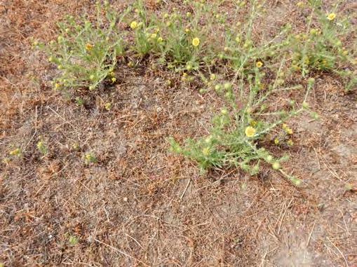


26 Santa:Cruz:Tarplant. Robust:SCT:growth:on:hard-packed:terrain.: Diminutive:form. Photo:Date::July:4,:2014 Figure 10 SITE PHOTOS Watsonville Airport Watsonville,:CA


27 LocationW31WfacingWsouthwest. LocationW6WfacingWsoutheast.W LocationW7WfacingWnorthwest. PhotoWDate:WJulyW2,W2014 Figure 11 SITE PHOTOS Watsonville Airport Watsonville,WCA


28 Locationv15vfacingvsouthwest. Locationv20vfacingvnortheast.v Locationv21vfacingvwest. PhotovDate:vJulyv3,v2014 Figure 12 SITE PHOTOS Watsonville Airport Watsonville,vCA


29 Locationv19vfacingvsouthwest. Locationv27vfacingvsoutheast.v Locationv18vfacingvwest. PhotovDate:vJulyv4,v2014 Figure 13 SITE PHOTOS Watsonville Airport Watsonville,vCA
RIO VISTA MUNICIPAL AIRPORT
 DRAINAGE TECHNICAL MEMORANDUM RIO VISTA MUNICIPAL AIRPORT RIO VISTA, CALIFORNIA Prepared for: City of Rio Vista 1 Main Street Rio Vista, CA 94571 (707) 374-5337 Prepared by: August 2012 Copyright 2012
2.0 Physical Characteristics
 _ 2.0 Physical Characteristics 2.1 Existing Land Use for the Project The site is comprised of approximately 114 acres bounded by Highway 101 to the north, the existing town of Los Alamos to the east, State
Chapter 4.0 Alternatives Analysis
 Chapter 4.0 Alternatives Analysis Chapter 1 accumulated the baseline of existing airport data, Chapter 2 presented the outlook for the future in terms of operational activity, Chapter 3 defined the facilities
Dallas Executive Airport
 648 DECLARED DISTANCE OPTION 1a DISPLACE 31 THRESHOLD BY 97 Considers RSA Limiting Factor No runway extensions 13 31 TORA 6,451 6,451 TODA 6,451 6,451 ASDA 5,958 6,451 LDA 5,958 6,354 Runway 17-35 (3,8
Draft Concept Alternatives Analysis for the Inaugural Airport Program September 2005
 Section 10 Preferred Inaugural Airport Concept 10.0 Introduction The Preferred Inaugural Airport Concept for SSA was developed by adding the preferred support/ancillary facilities selected in Section 9
David Magney Environmental Consulting
 David Magney Environmental Consulting DELINEATION OF JURISDICTIONAL WATERS AND RIPARIAN HABITATS FOR LYONS CANYON RANCH, NEWHALL, CALIFORNIA Prepared for: UNITED STATES ARMY CORPS OF ENGINEERS and CALIFORNIA
STAFF REPORT. Airport Land Use Plan Consistency Review: Santa Barbara Airport Master Plan. MEETING DATE: November 19, 2015 AGENDA ITEM: 7D
 STAFF REPORT SUBJECT: Airport Land Use Plan Consistency Review: Santa Barbara Airport Master Plan MEETING DATE: AGENDA ITEM: 7D STAFF CONTACT: Peter Imhof, Andrew Orfila RECOMMENDATION: Adopt findings
THE OLSEN RANCH. Paso Robles, California 600+ UNIT PLANNED COMMUNITY DEVELOPMENT OPPORTUNITY. << Click to View Aerial Tour >>
 THE OLSEN RANCH Paso Robles, California 600+ UNIT PLANNED COMMUNITY DEVELOPMENT OPPORTUNITY > OLSEN RANCH TABLE OF CONTENTS OFFERING OVERVIEW... 3 PROPERTY PHOTOS...10 MAPS
THE ALBERTA GAZETTE, SEPTEMBER
 VILLAGE OF CEREAL Order No. 16915 IN THE MATTER OF THE "Municipal Government Act": File No. 241(A)3 AND IN THE MATTER OF an application by the Council of the Village of Cereal, in the Province of Alberta,
New Opportunities PUBLIC WORKSHOP. Venice Municipal. Bringing g the pieces together
 Bringing g the PUBLIC WORKSHOP Venice Municipal Airport New Opportunities Presented for Venice City Council & Citizens of Venice September 25, 2009 Slide 1 Bringing g the Welcome & Introductions May 12th
January 2018 Air Traffic Activity Summary
 January 2018 Air Traffic Activity Summary Jan-2018 Jan-2017 CY-2018 CY-2017 Passengers 528,947 505,421 4.7% 528,947 505,421 4.7% Passengers 537,332 515,787 4.2% 537,332 515,787 4.2% Passengers 1,066,279
Milton. PeterPrinceAirportislocatedinSantaRosaCounty, approximatelythreemileseastofmilton.
 Milton GeneralAviationAirport PeterPrinceAirportislocatedinSantaRosaCounty, approximatelythreemileseastofmilton. Existing Facilities Peter Prince Airport is served by one runway, Runway 18/36, 3,700 feet
Access to the site is obtainable from the paved driveway leading to the MWD facility.
 County of Riverside Public Safety Enterprise Communication Project Appendix A: Candidate Site Descriptions Overview The site is located adjacent to a Metropolitan Water District (MWD) facility on El Sobrante
United States Department of the Interior National Park Service. Boundary Expansion Listed in National Register January 11, 2017
 NPS Form 10900-a (Rev. 8/2002) OMB No. 10240018 United States Department of the Interior National Park Service Boundary Expansion Listed in National Register January 11, 2017 National Register of Historic
THE OLSEN RANCH. Paso Robles, California 600+ UNIT PLANNED COMMUNITY DEVELOPMENT OPPORTUNITY. << Click to View Aerial Tour >>
 THE OLSEN RANCH Paso Robles, California 600+ UNIT PLANNED COMMUNITY DEVELOPMENT OPPORTUNITY > OLSEN RANCH TABLE OF CONTENTS OFFERING OVERVIEW... 3 PROPERTY PHOTOS...10 MAPS
HYDROLOGY OF GLACIAL LAKES, FORT SISSETON AREA
 PROC. S.D. ACAD. SCI., VOL. 77 (1998) 59 HYDROLOGY OF GLACIAL LAKES, FORT SISSETON AREA Perry H. Rahn Department of Geology & Geological Engineering South Dakota School of Mines and Technology Rapid City,
Morristown Municipal Airport Runway 5-23 Rehabilitation Environmental Assessment
 1.0 INTRODCTION Morristown Municipal Airport (hereinafter referred to as MM or Airport ) is a busy general aviation reliever airport owned by the Town of Morristown and operated by DM AIRPORTS, LTD. (hereinafter
4 *Contours generalized for estimating average watershed precipitation; adopted from larger map by Geomatrix, 1999.
 Selected USGS Stream Gaging Stations San Lorenzo River watershed A. Pescadero Ck B. San Lorenzo R. Waterman Switch C. Boulder Ck D. Zayante Ck E. Bean Ck F. San Vicente Ck G. San Lorenzo R. at Big Trees
Santa Cruz North Interior
 Santa Cruz North Interior The Santa Cruz North Interior planning area includes the area commonly referred to as the San Lorenzo Valley. The greatest amount of development occurs in the communities of Boulder
Other Principle Arterials Minor Arterial Major Collector Minor Collector Local
 CHAPTER 10 TRANSPORTATION Introduction The system of public roads in East Pikeland Township is decidedly rural in character. Since the 1984, the road network has remained much the same, with the addition
Santa Cruz North Interior
 Santa Cruz North Interior The Santa Cruz North Interior planning area includes the area commonly referred to as the San Lorenzo Valley. The greatest amount of development occurs in the communities of Boulder
Addendum - Airport Development Alternatives (Chapter 6)
") Bowers Field Addendum - Airport Development Alternatives (Chapter 6) This addendum to the Airport Development Alternatives chapter includes the preferred airside development alternative and the preliminary
Bowers Field Addendum - Airport Development Alternatives (Chapter 6) This addendum to the Airport Development Alternatives chapter includes the preferred airside development alternative and the preliminary
Noise Oversight Committee
 Noise Oversight Committee May 8, 2014 Audio/Video recordings are made of this meeting 1 Item 1 Review and Approve Draft Meeting Minutes Minutes from March 19, 2014 2 Item 2 Review of Operations Report
Hydrology Input for West Souris River IWMP
 Hydrology Input for West Souris River IWMP Prepared by: Mark Lee Manitoba Water Stewardship 1 1 1 Overall view of: drainage area watershed characteristics gauging stations meteorological stations Runoff
ICPAC. IGAD Climate Prediction and Applications Centre Monthly Bulletin, February 2017
 IGAD CLIMATE PREDICTION AND APPLICATIONS CENTRE ICPAC Bulletin Issue March 2017 Issue Number: ICPAC/02/299 IGAD Climate Prediction and Applications Centre Monthly Bulletin, February 2017 For referencing
HEATHROW COMMUNITY NOISE FORUM
 HEATHROW COMMUNITY NOISE FORUM 3Villages flight path analysis report January 216 1 Contents 1. Executive summary 2. Introduction 3. Evolution of traffic from 25 to 215 4. Easterly departures 5. Westerly
Draft Concept Alternatives Analysis for the Inaugural Airport Program September 2005
 Draft Concept Alternatives Analysis for the Inaugural Airport Program September 2005 Section 3 - Refinement of the Ultimate Airfield Concept Using the Base Concept identified in Section 2, IDOT re-examined
DIDYMO SURVEY, LOWER FRYINGPAN RIVER, BASALT, COLORADO 2015
 DIDYMO SURVEY, LOWER FRYINGPAN RIVER, BASALT, COLORADO 2015 Second Annual Report PREPARED FOR: ROARING FORK CONSERVANCY PREPARED BY: COLORADO MOUNTAIN COLLEGE NATURAL RESOURCE MANAGEMENT PROGRAM TIMBERLINE
Technical Report. Aircraft Overflight and Noise Analysis. Brisbane, California. December Prepared by:
 Aircraft Noise Abatement Office Technical Report Aircraft Overflight and Noise Analysis Brisbane, California Prepared by: P.O. Box 8097 San Francisco, California 94128 (650) 821-5100 Introduction In response
Lake Tahoe Airport Master Plan Public Meeting March 16, 2015
 Lake Tahoe Airport Master Plan Public Meeting March 16, 2015 What is an Airport Master Plan? a comprehensive study of an airport [that] usually describes the short, medium, and long term development plans
VI. ALTERNATIVES TO THE MASTER PLAN C. RENOVATED EAST BUILDING ALTERNATIVE
 VI. ALTERNATIVES TO THE MASTER PLAN C. RENOVATED EAST BUILDING ALTERNATIVE INTRODUCTION The Renovated East Building Alternative would include the continued use of the renovated West Building and the renovation
SUMMER VILLAGE OF SILVER SANDS. Municipal Development Plan
 SUMMER VILLAGE OF SILVER SANDS Municipal Development Plan Bylaw 253-2014 Adopted August 22, 2014 Summer Village of Silver Sands Municipal Development Plan Bylaw No. 253-2014 Page 2 1 INTRODUCTION 1.1 SETTING
County of Riverside - PSEC Project General Habitat Assessment Appendix A
 County of Riverside - PSEC Project General Habitat Assessment Appendix A Lake Elsinore Lake Elsinore The Lake Elsinore study area is located in the hills directly adjacent to Lake Elsinore, in the City
FUTENMA REPLACEMENT FACILITY BILATERAL EXPERTS STUDY GROUP REPORT. August 31, 2010
 FUTENMA REPLACEMENT FACILITY BILATERAL EXPERTS STUDY GROUP REPORT August 31, 2010 MANDATE AND SCOPE OF WORK: In order to achieve the earliest possible relocation of Marine Corps Air Station Futenma, the
CHAPTER 1 BACKGROUND AND PROPOSED ACTION
 CHAPTER 1 BACKGROUND AND PROPOSED ACTION 1.0 INTRODUCTION An Environmental Assessment (EA) evaluates the effects of a proposed Federal action on the surrounding environment and is prepared in compliance
A GIS Analysis of Probable High Recreation Use Areas in Three Sisters Wilderness Deschutes and Willamette National Forests
 Lindsey Kiesz Geo 565 Term Project 3/15/2010 A GIS Analysis of Probable High Recreation Use Areas in Three Sisters Wilderness Deschutes and Willamette National Forests Introduction The Three Sisters Wilderness
Bear Creek Habitat Improvement Project
 06/10/10 Bear Creek Habitat Improvement Project El Paso County, Colorado Pike National Forest and Colorado Springs Utilities Owned Land Report prepared by: Eric Billmeyer Executive Director Rocky Mountain
AGENDA ITEM 5 D WAKULLA ENVIRONMENTAL INSTITUTE (WEI) TRAIL FEASIBILITY STUDY
 TRAIL FEASIBILITY STUDY") March 19, 2018 AGENDA ITEM 5 D WAKULLA ENVIRONMENTAL INSTITUTE (WEI) TRAIL FEASIBILITY STUDY TYPE OF ITEM: Action STATEMENT OF ISSUE The Wakulla Environmental Institute (WEI) Trail is one of several trails
March 19, 2018 AGENDA ITEM 5 D WAKULLA ENVIRONMENTAL INSTITUTE (WEI) TRAIL FEASIBILITY STUDY TYPE OF ITEM: Action STATEMENT OF ISSUE The Wakulla Environmental Institute (WEI) Trail is one of several trails
Vista Field Airport. Master Plan Update. February, Prepared for: Port of Kennewick One Clover Island Kennewick, Washington
 Vista Field Airport February, 2006 Prepared for: Port of Kennewick One Clover Island Kennewick, Washington 99336 Prepared by: J-U-B ENGINEERS, Inc. 2810 W. Clearwater Avenue, Suite 201 Kennewick, Washington
Atlantic City Tourism Performance Indicators (AC-TPI) nd Quarter
 nd Quarter") Atlantic City Tourism Performance Indicators (AC-TPI) 2018 2nd Quarter Prepared by Brian J. Tyrrell, Ph.D. and Rummy Pandit, L.P.D., M.B.A., C.H.A. Executive Director Atlantic City Tourism Performance
Atlantic City Tourism Performance Indicators (AC-TPI) 2018 2nd Quarter Prepared by Brian J. Tyrrell, Ph.D. and Rummy Pandit, L.P.D., M.B.A., C.H.A. Executive Director Atlantic City Tourism Performance
Table 1: Avocado Flats Communication Site. Latitude 1 Longitude 1 Elev 2 Address T/R/S 3 APN 4 USGS Quadrangle
 County of Riverside Public Safety Enterprise Communication Project Appendix A: Candidate Site Descriptions Overview The candidate area is located in Northern San Diego County, 0.65 mile south of the border
Supplemental Proposals to Revising the
 Presentation Summary of the Supplemental Proposals to Revising the Northern California Metroplex For Alameda County/Contra Costa County NEXTGEN SUBCOMMITTEE FOR THE OAKLAND AIRPORT/COMMUNITY NOISE FORUM
CHAPTER 3 ALTERNATIVES CONSIDERED
 CHAPTER 3 ALTERNATIVES CONSIDERED 3.0 ALTERNATIVES The 2010 Stevensville Airport Master Plan contained five (5) airside development options designed to meet projected demands. Each of the options from
Preliminary Site Evaluation
 Preliminary Site Evaluation 100 Acre Site, US 72 Piperton, Tennessee Power Distributor: Chickasaw Electric Cooperative August 2010 SITE DATA SHEET PIPERTON US 72 SITE (100 ACRES): LOCATION & GENERAL DESCRIPTION
SeagrassNet Monitoring in Great Bay, New Hampshire, 2016
 University of New Hampshire University of New Hampshire Scholars' Repository PREP Reports & Publications Institute for the Study of Earth, Oceans, and Space (EOS) 9-28-2017 SeagrassNet Monitoring in Great
DRAFT GENERAL IMPLEMENTATION PLAN AND SPECIFIC IMPLEMENTATION PLAN MIDDLETON MUNICIPAL AIRPORT MOREY FIELD. Revised 12/12/03
 DRAFT GENERAL IMPLEMENTATION PLAN AND SPECIFIC IMPLEMENTATION PLAN MIDDLETON MUNICIPAL AIRPORT MOREY FIELD Revised 12/12/03 As recommended for approval by the Plan Commission General Project Description
County of Riverside - PSEC Project General Habitat Assessment Appendix A
 County of Riverside - PSEC Project General Habitat Assessment Appendix A Glen Avon Glen Avon The Glen Avon study area is located north of State Route 60 in the Jurupa Mountains, approximately 1 mile south
APPENDIX D MSP Airfield Simulation Analysis
 APPENDIX D MSP Airfield Simulation Analysis This page is left intentionally blank. MSP Airfield Simulation Analysis Technical Report Prepared by: HNTB November 2011 2020 Improvements Environmental Assessment/
Table 1: Margarita (MWD) Communication Site. Latitude 1 Longitude 1 Elev 2 Address T/R/S 3 APN 4 USGS Quadrangle
 Communication Site. Latitude 1 Longitude 1 Elev 2 Address T/R/S 3 APN 4 USGS Quadrangle") County of Riverside Public Safety Enterprise Communication Project Appendix A: Candidate Site Descriptions Margarita (MWD) Communication Site Margarita (MWD) Communication Site Overview The site is located
County of Riverside Public Safety Enterprise Communication Project Appendix A: Candidate Site Descriptions Margarita (MWD) Communication Site Margarita (MWD) Communication Site Overview The site is located
CITY OF LYNDEN STORMWATER MANAGEMENT PROGRAM REPORT MARCH 1, 2016
 CITY OF LYNDEN STORMWATER MANAGEMENT PROGRAM 2015 WATER QUALITY MONITORING REPORT CITY OF LYNDEN 300 4 TH STREET LYNDEN, WASHINGTON 98264 PHONE (360) 354-3446 MARCH 1, 2016 This document serves as an attachment
National Forests and Grasslands in Texas
 United States Department of Agriculture Forest Service National Forests and Grasslands in Texas Sam Houston NF 394 FM 1375 West New Waverly, Texas 77358 Phone 936-344-6205 Dear Friends, File Code: 1950
Environmental Development of River Road Ranch
 Environmental Development of River Road Ranch New Braunfels, Texas Alix Scarborough GEO 3426 April 2012 Introduction The 2,400-acre Word-Borcher ranch has been owned by the Word family since 1941. Located
A. CONCLUSIONS OF THE FGEIS
 Chapter 11: Traffic and Parking A. CONCLUSIONS OF THE FGEIS The FGEIS found that the Approved Plan will generate a substantial volume of vehicular and pedestrian activity, including an estimated 1,300
Lake Erie Commerce Center Traffic Analysis
 LOCATION: East of NYS Route 5 at Bayview Road Town of Hamburg Erie County, New York PREPARED BY: Wendel Companies 140 John James Audubon Parkway Suite 200 Amherst, New York 14228 January 2012 i ii Table
Attachment G STREAM IMPACTS. Ridge Road Extension Alternatives Analysis
 Attachment G STREAM IMPACTS for: Ridge Road Extension Alternatives Analysis PREPARED FOR: Pasco County Engineering Services Department PREPARED BY: NV5, INC. 6989 E. FOWLER AVENUE TAMPA, FLORIDA 33617
Produced by: Destination Research Sergi Jarques, Director
 Produced by: Destination Research Sergi Jarques, Director Economic Impact of Tourism North Norfolk District - 2016 Contents Page Summary Results 2 Contextual analysis 4 Volume of Tourism 7 Staying Visitors
Produced by: Destination Research Sergi Jarques, Director
 Produced by: Destination Research Sergi Jarques, Director Economic Impact of Tourism Norfolk - 2016 Contents Page Summary Results 2 Contextual analysis 4 Volume of Tourism 7 Staying Visitors - Accommodation
Table of Contents. Overview Objectives Key Issues Process...1-3
 Table of Contents Chapter One Introduction Overview...1-1 Objectives...1-1 Key Issues...1-2 Process...1-3 Chapter Two Inventory of Existing Conditions Airport Setting...2-1 Locale...2-1 Airport Surroundings...2-5
PLU Airport Master Plan. Master Plan Advisory Committee (MPAC) Meeting #2 October 16, 2016
 Meeting #2 October 16, 2016") PLU Airport Master Plan Master Plan Advisory Committee (MPAC) Meeting #2 October 16, 2016 Meeting Agenda 1. Introductions and Contacts [10 Minutes] 2. Plan Overview and MPAC Role [20 Minutes] 3. MPAC Visioning
PLU Airport Master Plan Master Plan Advisory Committee (MPAC) Meeting #2 October 16, 2016 Meeting Agenda 1. Introductions and Contacts [10 Minutes] 2. Plan Overview and MPAC Role [20 Minutes] 3. MPAC Visioning
FORECASTING FUTURE ACTIVITY
 EXECUTIVE SUMMARY The Eagle County Regional Airport (EGE) is known as a gateway into the heart of the Colorado Rocky Mountains, providing access to some of the nation s top ski resort towns (Vail, Beaver
CHAPTER 4 -- THE LAND USE PLAN: DESCRIPTIONS AND POLICIES FOR THIRTEEN PLANNING AREAS
 CHAPTER 4 -- THE LAND USE PLAN: DESCRIPTIONS AND POLICIES FOR THIRTEEN PLANNING AREAS NORTH CENTRAL CAC AREA LITTLE VALLEY ROAD TO JUG HANDLE CREEK PLANNING AREA This planning area includes Cleone, Noyo,
Final Drainage Letter Pikes Peak Community College Downtown Parking Lot Colorado Springs, Colorado
 Final Drainage Letter Pikes Peak Community College Downtown Parking Lot Colorado Springs, Colorado Prepared for: Pikes Peak Community College 5775 South Academy Boulevard Colorado Springs, CO 80906-5422
II. Purpose and Need. 2.1 Background
 II. 2.1 Background The Metropolitan Washington Airports Authority is preparing an Environmental Assessment of potential environmental impacts associated with proposed enhancements to the Runway 4-22 and
Coronado National Forest Santa Catalina Ranger District
 United States Department of Agriculture Forest Service Coronado National Forest Santa Catalina Ranger District File Code: 1950 Date: October 14, 2015 Dear Interested Party: The Santa Catalina Ranger District
PERFORMANCE REPORT DECEMBER 2017
 PERFORMANCE REPORT DECEMBER 2017 Note: New FY2018 Goal/Target/Min or Max incorporated in the Fixed Route and Connection Dashboards. Keith A. Clinkscale Performance Manager INTRODUCTION/BACKGROUND Keith
SECTION 5 ALTERNATIVE DEVELOPMENT CONCEPT ANALYSES
 SECTION 5 ALTERNATIVE DEVELOPMENT CONCEPT ANALYSES 5.1 INTRODUCTION This section investigates Airfield Development Alternatives, generalized Land Use Alternatives, and more detailed General Aviation Alternatives.
Airport Planning Area
 PLANNING AREA POLICIES l AIRPORT Airport Planning Area LOCATION AND CONTEXT The Airport Planning Area ( Airport area ) is a key part of Boise s economy and transportation network; it features a multi-purpose
CHAPTER FOUR AIRPORT ALTERNATIVES
 4.0 INTRODUCTION CHAPTER FOUR The goal of the master planning process is to provide the City of New Smyrna Beach with an assessment of the adequacy and capabilities of the Airport as well as to identify
MEETING MINUTES Page 1 of 5
 Page 1 of 5 50178.000 May 26, 2009 PROJECT PROJECT NO. MEETING DATE ISSUE DATE Citizens Advisory Committee Meeting MEETING LOCATION MEETING PURPOSE Amy Eckland ISSUED BY SIGNATURE PARTICIPANT See attached
Table 1: Iron Mountain Communication Site. Latitude 1 Longitude 1 Elev 2 Address T/R/S 3 APN 4 USGS Quadrangle
 County of Riverside Public Safety Enterprise Communication Project Appendix A: Candidate Site Descriptions Overview The site is located in San Bernardino County near several communication towers in the
Lake Tahoe Airport Master Plan
 Lake Tahoe Airport Master Plan City Council Briefing October 20, 2015 What is an Airport Master Plan? a comprehensive study of an airport [that] usually describes the short, medium, and long term development
Produced by: Destination Research Sergi Jarques, Director
 Produced by: Destination Research Sergi Jarques, Director Economic Impact of Tourism Oxfordshire - 2016 Economic Impact of Tourism Headline Figures Oxfordshire - 2016 number of trips (day & staying) 27,592,106
Hydraulic Report. Trail 5 Snowmobile Trail Over Mulligan Creek. Prepared By: COLEMAN ENGINEERING COMPANY Karisa V. Falls, P.E.
 Prepared for: Prepared by: Marquette County Road Commission Coleman Engineering Company Marquette, Michigan Iron Mountain, MI December 2011 Hydraulic Report Trail 5 Snowmobile Trail Over Mulligan Creek
Roduner Ranch FOR SALE. 5,878± Acres Potential Development Land. Merced County, California. Offices Serving The Central Valley
 FOR SALE 5,878± Acres Potential Development Land Merced County, California Offices Serving The Central Valley F R E S N O V I S A L I A B A K E R S F I E L D 7480 N. Palm Ave, Ste 101 3447 S. Demaree Street
Atlantic City Tourism Performance Indicators (AC-TPI) rd Quarter
 rd Quarter") Atlantic City Tourism Performance Indicators (AC-TPI) 2017 3rd Quarter Prepared by Brian J. Tyrrell, Ph.D. and Rummy Pandit, L.P.D., M.B.A., C.H.A. Executive Director Atlantic City Tourism Performance
Atlantic City Tourism Performance Indicators (AC-TPI) 2017 3rd Quarter Prepared by Brian J. Tyrrell, Ph.D. and Rummy Pandit, L.P.D., M.B.A., C.H.A. Executive Director Atlantic City Tourism Performance
Appendix B Ultimate Airport Capacity and Delay Simulation Modeling Analysis
 Appendix B ULTIMATE AIRPORT CAPACITY & DELAY SIMULATION MODELING ANALYSIS B TABLE OF CONTENTS EXHIBITS TABLES B.1 Introduction... 1 B.2 Simulation Modeling Assumption and Methodology... 4 B.2.1 Runway
Habitat Assessment, Mt San Jacinto CCD/MSJC Southwest Campus
 I - 15 CORRIDOR CAMPUS MASTER PLAN DRAFT EIR MT. SAN JACINTO COMMUNITY COLLEGE DISTRICT Appendices Appendix D7 Habitat Assessment, Mt San Jacinto CCD/MSJC Southwest Campus August 2017 I - 15 CORRIDOR CAMPUS
DISTRICT EXPRESS LANES ANNUAL REPORT FISCAL YEAR 2017 JULY 1, 2016 JUNE 30, FloridaExpressLanes.com
 DISTRICT EXPRESS LANES ANNUAL REPORT FISCAL YEAR 2017 JULY 1, 2016 JUNE 30, 2017 FloridaExpressLanes.com This page intentionally left blank. TABLE OF CONTENTS List of Figures... ii List of Tables.... ii
II. GENERAL DESCRIPTION OF ENVIRONMENTAL SETTING
 II. GENERAL DESCRIPTION OF ENVIRONMENTAL SETTING A. LOCATION AND BOUNDARIES The proposed Canyon Hills project site is located at 8000 West La Tuna Canyon Road in the City of Los Angeles (the City ). The
ATM Network Performance Report
 ATM Network Performance Report 2018. Page 1 of 16 Table of contents Summary... 3 Network Wide Performance... 4 Airborne delay... 4 Sydney... 6 Airborne delay... 6 Notable events... 6 Melbourne... 9 Airborne
KP Lasnaya 1 River
 KP 370.2 Lasnaya 1 River The Lasnaya 1 River crossing is protected by Reno mattings and a gabion wall on the north bank (Photo 1). The south bank consists of natural river gravel deposits on top of Reno
Appendix. Gatwick Airport Ltd - Further information on Gatwick s revised phasing strategy (including Programme) Gatwick Airport Limited
 Gatwick Airport Limited") Gatwick Airport Limited Response to Airports Commission Consultation Appendix 37 Gatwick Airport Ltd - Further information on Gatwick s revised phasing strategy (including Programme) Further information
Gatwick Airport Limited Response to Airports Commission Consultation Appendix 37 Gatwick Airport Ltd - Further information on Gatwick s revised phasing strategy (including Programme) Further information
CHAPTER 6 NOISE EXPOSURE
 CHAPTER 6 NOISE EXPOSURE FAA requires that the NEM submitted for review represent the aircraft noise exposure for the year of submittal (in this case 2008) and for a future year (2013 for OSUA). However,
VISUAL Impact Assessment
 5.0 Existing Landscape Character TO GOULBURN FEDERAL HIGHWAY 5.1 Landscape Character Units Generally one of the first steps in carrying out a landscape and visual assessment is to identify and map the
SOUTH INTERCHANGE AREA
 Santaquin City General Plan 1 Location and Characteristics The South Interchange Area of Santaquin is located west of Interstate 15 and south of 500 South (Figure 1). It includes properties already annexed
NOTICE OF INTENT MAPS WITH DESCRIPTIONS
 NOTICE OF INTENT MAPS WITH DESCRIPTIONS Location Map(s) to Accompany Notice of Intent The small corner map embedded in the lower left corner of the large map above shows the location of the three national
Chapter 2: El Dorado County Characteristics and Demographics
 Chapter 2: El Dorado County Characteristics and Demographics 2.1 Geographic Area and Demographics El Dorado County comprises 1,805 square miles with over half of the area in the Eldorado National Forest
Executive Summary. MASTER PLAN UPDATE Fort Collins-Loveland Municipal Airport
 Executive Summary MASTER PLAN UPDATE Fort Collins-Loveland Municipal Airport As a general aviation and commercial service airport, Fort Collins- Loveland Municipal Airport serves as an important niche
Airport Master Plan Update
 Duttchessss Countty Airrporrtt Masstterr Plan Updatte Airport Master Plan Update Final Report Dutchess County Airport Town of Wappingers, New York C&S Engineers, Inc. 499 Col. Eileen Collins Blvd. Syracuse,
Site Location and Setting
 Memorandum Date: To: From: Subject: Kristy Le, Gary Black Steve Orem Santa Teresa County Park Historic Area Traffic and Parking Study Hexagon Transportation Consultants, Inc. has completed a traffic and
Yolo County Airport. ALP Narrative Report. April Prepared by Mead & Hunt, Inc. for the County of Yolo, California
 Yolo County Airport ALP Narrative Report April 2016 Prepared by Mead & Hunt, Inc. for the County of Yolo, California Yolo County Airport ALP Narrative Report Prepared for the County of Yolo Mindi Nunes,
THOMAS A. SWIFT METROPARK Introductions History Present Conditions Future Development Plans Implementation Strategies Statistics
 THOMAS A. SWIFT METROPARK Introductions History Present Conditions Future Development Plans Implementation Strategies Statistics Introduction As an open meadow park positioned along the Mahoning River,
Appendix L Technical Memorandum Aesthetics
 Technical Memorandum Aesthetics 1.0 AESTHETICS This section provides a discussion of the aesthetic resources in the vicinity of ARTIC. Aesthetics pertain to the elements that make a certain view pleasing
Recommendations for Northbound Aircraft Departure Concerns over South Minneapolis
 Recommendations for Northbound Aircraft Departure Concerns over South Minneapolis March 21, 2012 Noise Oversight Committee Agenda Item #4 Minneapolis Council Member John Quincy Background Summer of 2011
RAY YENKANA Willowbrook Cr, Dawson Creek BC Canada $2,847,000
 1716 Willowbrook Cr, Dawson Creek BC Canada For SALE $2,847,000 This is a rare find, 32 townhomes in Dawson Creek, BC. Excellent investment in a single title multi family complex. Vendor has upgraded this
October 2014 BELLINGHAM INTERNATIONAL AIRPORT MASTER PLAN PRESENTATION
 October 2014 BELLINGHAM INTERNATIONAL AIRPORT MASTER PLAN PRESENTATION The Master Plan Process Inventory Of Existing Conditions Complete. Forecasts Of Aviation Demand Complete. Facility Requirements Complete.
County of Riverside - PSEC Project General Habitat Assessment Appendix A
 County of Riverside - PSEC Project General Habitat Assessment Appendix A Paradise Paradise The Paradise study area is located in the mountains within the eastern portion of the City of Norco. Existing
Table 1: Paradise Communication Site. Latitude 1 Longitude 1 Elev 2 Address T/R/S 3 APN 4 USGS Quadrangle
 County of Riverside Public Safety Enterprise Communication Project Appendix A: Candidate Site Descriptions Overview The site is located atop a west-facing ridge overlooking the City of Norco, approximately
Produced by: Destination Research Sergi Jarques, Director
 Produced by: Destination Research Sergi Jarques, Director Economic Impact of Tourism Norfolk - 2017 Contents Page Summary Results 2 Contextual analysis 4 Volume of Tourism 7 Staying Visitors - Accommodation
TABLE OF CONTENTS. Coral Springs Charter High School and Middle School Job No Page 2
 Job No. 15-019 Page 2 TABLE OF CONTENTS 1.0 INTRODUCTION... 4 2.0 EXISTING CONDITIONS... 5 3.0 TRAFFIC GENERATION... 7 4.0 TRIP DISTRIBUTION... 8 5.0 FUTURE CONDITIONS... 8 6.0 SITE ACCESS...13 7.0 CONCLUSION...13