HOW TO USE THIS GUIDE
|
|
|
- Philippa Hines
- 5 years ago
- Views:
Transcription
1

2 HOW TO USE THIS GUIDE PAGE 4 What s Out There? A preview of attractions and how to make the most of them. PAGE 6 Off-Highway Driving T ips How to be safe and legal on rugged back roads. PAGE 7 Checklists What you ll want to remember to bring for yourself and your vehicle. PAGE 8 Overview Map The whole area, locating all routes by name and number. PAGES Route Maps & Descriptions Each route in detail: WHAT TO EXPECT describes how challenging the route will be and forewarns of special hazards or seasonal closures. LENGTH mileages are accurate to within 2 to 3 tenths of a mile. Odometer readings will vary by vehicle. DRIVING TIME is approximate as it varies with different drivers and conditions, and doesn t include the time you ll want to take to enjoy stops along the way. GETTING THERE gives directions from the nearest town and describes where the route begins at that point, set your trip meter to zero. ALONG THE ROUTE gives directions and describes road conditions you ll encounter, plus special features of natural and human history. Directional mileages are approximate and will vary by odometer refer to the route maps for clarification. PAGE 46 Resource People A directory of public agencies and chambers of commerce staffed by people who are happy to answer your questions. PAGE 47 Read Me More! Recommended reading on the region s fascinating features. PAGE 49 Show Me More! Where to find museums and visitor centers. PAGE 51 Emergency Contacts Tall Jeffrey pines are abundant along the eastern slopes of the Sierra COURTESY U.S. FOREST SERVICE

3 Touring the Eastern Sierra and Death Valley WELCOME TO THE HIGH PASSES, BACK REACHES, SIDE ROADS AND HIDDEN CORNERS OF THE EASTERN SIERRA AND DEATH VALLEY! SPECTACULARLY SCENIC INYO COUNTY, CALIFORNIA HAS SOME OF THE MOST RUGGED AND VARIED TERRAIN IN THE NATION. THIS IS A GUIDE FOR PEOPLE WHO WANT TO ASEE IT UP CLOSE. mid the towering peaks, colorful canyons and vast stretches of open desert are a wealth of natural wonders. There is dramatic evidence of the growing, shifting, sometimes cataclysmically changing surface of the earth. Communities of plants and wildlife, some truly unique, have adapted over eons to the extremes of a diverse landscape. People have been here for thousands of years and their touch has been light on the land. Archaeological sites and historical features abound, with little to obscure or change them. To experience all of this to smell the wildflowers, feel the spray of a waterfall, hear the sweet desert song of a black-throated sparrow, see a gorge painted by nature s minerals in wild zigzags of color, ponder ancient cryptic symbols carved on a wall of rock or the ruins of a long-abandoned town you need to leave the highway. This is your chance to use your sport utility vehicle to its full capability. An SUV combines comfort and ease of operation with an extra edge of ability and safety on roads that are steep, winding, rough, rocky or icy. With your SUV, an intelligent and cautious mind, and the tips, checklists and directions in this guide, you have what you need to explore and appreciate the backcountry wonders of Death Valley and the Eastern Sierra. This guide is a cooperative project of the land management agencies and chambers of commerce. Our goal is to encourage you to spend time in the Eastern Sierra and Death Valley and enjoy and care for its irreplaceable wonders. The routes are almost entirely on public land your land. We chose to feature routes that are adventurous, rich in interest, and reasonably safe (of course conditions can be unpredictable and you drive each route at your own risk). We also chose routes that you can travel without damaging the land. We know that the Eastern Sierra and Death Valley draw visitors who appreciate extraordinary natural beauty and want to keep it that way. Explore! Enjoy! The snowy Sierra rises above Independence, late 1800s FORBES PHOTO / COURTESY LOS ANGELES COUNTY MUSEUM 3

4 What s Out There There s nowhere else like it! On these pages, along with tantalizing hints of what you can expect from the natural and historical wonders of the Eastern Sierra and Death Valley, are some tips on how to best enjoy them and to keep them for great-great-grandchildren to enjoy. Geology: the ever-changing earth laid bare Death Valley and the Eastern Sierra are a geologist s paradise. Colleges and universities far and wide bring earth sciences students on field trips here. Few buildings obscure the dramatic forces that have shaped the area: massive sedimentation and erosion, volcanism and seismic upheaval both gradual and violent, fracturing and twisting, and the slow, mighty power of glaciation. Geologic forces have made parts of Death Valley almost unbelievably colorful. In the Eastern Sierra it has lifted mountains and dropped the land between to form the deepest valley, and caused an explosion that sent ash halfway across the continent. The route descriptions give a glimpse into these forces. If your family has an especially strong interest, be sure to bring along one or more of the fine guide books that describe the geology of each location in depth see Read Me More! on page 47, or check online for geologic resources describing area features. It s okay to collect rock samples on most routes, except in Death Valley National Park and the Ancient Bristlecone Forest where all natural materials are protected. Winter warm-up, summer cool-down It doesn t matter what kind of weather you re looking to escape from you can find an alternative here. From the sun-baked bottom of Death Valley to the snowy crest of the White Mountains, the routes in this book cover an elevation range of nearly 12,000 feet! One thing desert and mountain weather have in common: unpredictable changes at any time of year. Wherever you go, outfit yourself and your car for hot and cold, wet and dry conditions. See the checklists on page 7. You ll be glad for your 4WD when snow suddenly covers the pavement or a cloudburst washes out part of a dirt road. But don t drive into anything your SUV can t handle many surfaces are impassable for any passenger vehicle. See Off-Highway Driving Tips on page 6 (and remember, it s illegal and destructive to drive off of established roads!). 4 Crowns of the plant kingdom Sierra Nevada bighorn sheep, Deep Springs Valley 1927 LAWSON BRAINERD / COURTESY U.S. FOREST SERVICE With so many geological forces at work and such a range of elevations, it follows that there will be a huge variety of rocks, soils and microclimates. What follows from that? Plants! Here are plant communities adapted to life at the glacier-carved tree line, and others thriving on steaming alkaline valley floors. The world s oldest known living trees are on Route 11. A little, sprawling legume with big inflated seed pods is found nowhere on earth but Route 13. The seeds of many desert wildflowers wait for years in the dry sand until winter snows and spring rains bring enough moisture for them to germinate. Then a carpet of every color unrolls across the land. In a good wildflower year you can follow the season of bloom from Death Valley in early March into the High Sierra in late July. Resource People on page 46 can help you plan. Several route descriptions point out plant communities and interesting species along the way. You could bring a plant press: you may collect specimens almost anywhere except Death Valley National Park and the Ancient Bristlecone Forest, where nothing but pictures may be taken. Elsewhere remember the rule of sampling only what is common in any area. Better yet, bring colored pencils and a sketchbook or a field guide like Jaeger s Desert Wildflowers with line drawings that you can color to match the flowers you identify. See Read Me More! on page 47. Download desert plant information from com/flora.html What walks here or slithers, gallops, swims or flies The wildlife here is equally wonderful and thoroughly wild. The endangered Sierra Nevada bighorn sheep lives only in the Eastern High Sierra. There are also two flashy little endangered fish unique to the Owens Valley. Tule elk, native to California s Central Valley, were brought here in the 1930s to recover from near-extinction. Mule deer and various small game can be hunted and trout fishing is popular; the Department of Fish and Wildlife ( Resource People, page 46) has information on permits and seasons. Birds are abundant and diverse
5 especially near water and during migration. To really get to know them, learn their songs and calls. And the lizards are incredible. Bring one of the natural history guides from Read Me More! on page 47. Binoculars are a must. A camera is good but don t get carried away trying to get a close-up: professional wildlife photographers have huge lenses and phenomenal patience, and know that causing a wild animal to flee could deprive it of essential resources or its last stores of energy. Dangerous animals? Look out for mule deer and tule elk crossing the highway a collision could injure you and destroy your SUV! They travel in groups so if you see one, watch for others. If you hike in the high country you may be lucky enough to see a bear or a mountain lion. Keep your distance, and remember cubs will be fiercely protected by adults. Protect your own little ones by keeping them close to you. Where bears are common there are trailhead signs with more information. Rattlesnakes can be anywhere. Watch where you put your hands and feet, and steer clear most snakebite victims were intentionally harassing the snake! Small furry animals may carry diseases transmittable to humans. Hospitals and health departments are listed on page 51; call if you get sick after contact with a dead or live animal or its droppings. For your sake and theirs, don t approach, touch or feed any wild animal and please don t let dogs run free. Ten thousand years unbroken: native cultures People first came to the Eastern Sierra and Death Valley at least ten thousand years ago. Archaeologists are piecing together the story of how they met the challenges of an often-harsh environment. Stone tools, projectile points and milling implements show a hunter-gatherer lifestyle. Drive fences remain where pronghorn antelope were herded into corrals by swift runners. Rock rings give the locations of brush or willow house foundations, hunting blinds and pine nut caches. Petroglyphs symbols chipped into the surface of rock formations portray animals, hand prints, and shapes and patterns whose meaning has yet to be deciphered. Some family groups traveled almost constantly to find needed resources, while others were quite settled; in the Owens Valley and Benton Hot Springs incipient agriculture is shown by irrigation used to enhance growth within patches of native food plants. While many native Californian cultures were decimated or entirely acculturated by the onslaught of Spanish and Euro-American settlers, the Shoshone and Paiute peoples of Death Valley and the Eastern Sierra were not as hard hit. Here Native American communities still carry on many ancestral traditions like pine nut gathering and fine basketry, and elders recall practices such as the rabbit drives that provided furs for warm blankets. Museums and books listed on pages 47 through 49 share details of their indigenous arts and technologies. The Bishop Chamber of Commerce and Visitors Bureau has a map of petroglyph sites. Keep an eye on the ground to find traces of their ancestors fascinating story in the form of petroglyph sites, rock rings, projectile points and other artifacts. All are protected by federal and state laws and must not be disturbed. Even a scattering of obsidian flakes left in the process of making a spear point can tell an archaeologist where the stone came from and how and when the point was made. Removing an artifact is like ripping a chapter from your favorite novel. So much better to touch an object for a respectful moment, imagine its maker from perhaps thousands of years ago, and leave it exactly where it lies! Take only drawings, pictures and memories, leaving the past for future generations to enjoy. Removal of cultural artifacts is illegal. Window to the Wild West Our earliest trace of the historical era is the Old Spanish Trail (Route 16), the trade route between the pueblos of Santa Fe and Los Angeles which cut across a corner of Inyo County. The route was established in 1830, with trapper Jedediah Smith pioneering parts of it a few years earlier. The California gold rush brought more passers-through, including the 1849 party (Route 17) whose fate gave Death Valley its name. During the 1850s and 60s prospectors began finding gold and silver on this side of the Sierra. Boom towns like Cerro Gordo (Route 1) needed services and supplies, so stage routes, railroads, livestock and farms soon followed. Farms, ranches and orchards thrived in the Owens Valley until the early 1900s when Los Angeles acquired rights to most of the valley s water. Today, while there are still active mines and ranches, the grandeur of nature dominates the region and visitors who come to enjoy it are the economic mainstay. Change has come slowly to small towns established over a hundred years ago and many historical buildings still stand. Out in the desert the trappings of abandoned enterprises have decayed so gradually in the dry climate that some evidence can always be found. Historical artifacts are also protected by law anything older than 50 years is an archaeological resource even a pile of rusted old cans has a story to tell. Every route in this book includes a bit of history. Some, like the lost settlements on Route 5 including a WWII internment camp tell tales of betrayal and abandonment. Others, like wild West moviemaking on Route 2, have lively stories that reach back into the past and continue today. The books and museums listed on pages 47 through 49 can tell you more. Stay on the road All of the wonders of the Eastern Sierra and Death Valley depend upon you to stay on existing roads. The geological, archaeological and historical records are awesome because they are unmarred. The wild animals need safe, quiet places where they can feed, shelter and raise their young undisturbed. The plant communities, many rare and fragile, are all slow-growing and take decades to recover from careless crushing by tire treads. Inconsiderate 4WD-ers exploring or shortcutting off-road have made tracks that are followed by others and scar the scenery for future generations. Don t let that be you! 5

6 Off-Highway Driving Tips Advertisements showing an SUV perched in some incredibly wild, rugged place are terribly misleading. Often the vehicle was set down there by helicopter. SUVs are meant to stay on existing roads, and throughout the area covered by this guide, the law requires it. Four good reasons: save the landscape, save your vehicle, save yourself, save on fines and a fat towing bill But SUVs are well-designed to meet the special challenges of offhighway routes like those in this guide. Here s the know-how that will keep you right side up and moving forward. Essential courtesy Stay on the road don t crush brush. Yield to uphill traffic, hikers, bicyclists and horseback riders. If horses act jumpy, turn off your vehicle and wait for riders to get them under control. Yield to livestock and wildlife. If you open a gate, close it. Pack out trash. Road and weather conditions plan in advance! Let someone know where you re going, when you ll be back and whom to call if you re not. Most routes in this guide are subject to sudden snowstorms. Rain storms, especially summer cloudbursts, can wash out any road. Parts of a few routes follow narrow canyon bottoms and are subject to the deadly hazard of flash floods. If thunderclouds are building up, don t go there! Steep hills Use a low gear on steep slopes and 4WD for extra traction if it s rough or loose. Take your time going up; don t overheat. On downgrades use a low gear to save your brakes and 4WD if there are sharp curves. Don t turn around on a steep hill back up to a safe, level place. Dirt roads and rough surfaces No routes in this guide are extremely rough, but several have rough stretches and you may encounter a wash-out. Always wear safety belts. Even smooth-looking dirt is unpredictable: you could find your tires skidding, jumping or chattering. Take your time reduce the risk of losing control or puncturing tires. Use 4WD to move steadily, low range if it s also steep or extra-rough. Know your ground clearance. Don t straddle large rocks or high spots that could hit low parts of your vehicle; slowly crawl your tires over them, after looking to make sure you can clear them. Hear a big clunk? Check for damage and leaking fluids immediately! 6 Early 20th Century touring along Mill COURTESY BUREAU OF LAND MANAGEMENT Sand, mud, ice or snow Stop, get out, check depth and test the surface before you venture forth. These surfaces are notoriously unpredictable and can change into a frictionless mess under your tires. Know your vehicle s capabilities. Use 4WD. Go slowly but keep moving don t lose momentum. Take turns gradually. On ice or snow, in a straight stretch with no one around, test the surface while moving by applying the brakes and by swerving a bit; if you feel a skid, slow down even more and if it s still iffy, put on your tire chains. Never try to dodge a wet, muddy stretch by making a new set of tracks around it turn back and try again at a drier time of year. Pulling off and turning back If you must pull off the road, find a bare, firm, level place. Never stop over dry vegetation which can catch fire from your exhaust system. When you encounter iffy road or weather conditions, play it safe and turn back. You may save yourself major embarrassment, a big tow bill, a long hike or a long wait. To avoid crushing brush or getting stuck, back up to where you can turn around on bare, firm soil, or make a fifteen-point turn if necessary! Getting unstuck Even the most cautious and experienced drivers can get stuck when an unexpected icy or muddy patch causes them to skid into deep sand, mud or snow. Here are tips for getting out: Don t keep revving up and spinning your tires this digs you in deeper. As soon as you re stuck, get out and see what the problem is. Use your shovel to take down any mounds of snow or soil in front of tires or jamming the undercarriage. Straighten the wheels. Make sure you re in 4WD-low range if you have it. Try gently rocking it go a little forward, a little in reverse, gradually so tires don t spin. Still stuck? In snow or mud, put on your tire chains. If it s icy put sand or kitty litter in front of tires for traction. In mud or sand, use the carpet or traction mats you brought and if you have a pump, let a little air out of your tires to increase their footprint. If you re high-centered on an immovable obstacle, you can sometimes use your jack to raise the vehicle and push it off. Careful! Don t try if it may be unstable. Don t let the vehicle fall on you.


7 Waiting it out If it s blazing hot, snowing hard or getting dark, don t get overheated or wet and exhausted trying to free a stuck vehicle. Try your cell phone if you have one but don t count on it: many areas are out of range. Tie a signal flag to your vehicle antenna. You must dig your exhaust system clear of mud or snow if you ll be running the heater otherwise lethal carbon monoxide fumes build up. If snow is still falling remember to keep it clear. Then settle in to wait. Stay in your vehicle it provides shelter and is much easier to find than a person on foot. You ve told someone your trip plans they ll know where to look. Bring all emergency supplies within easy reach. If it s cold, take off any wet clothing, put on all your extra clothes and snuggle under your blanket or sleeping bag. Pile on floor mats, carpeting and seat covers as needed. Open a window just a crack for ventilation. Light a candle for warmth and light. Turn on the heater and run the engine for 5 minutes every half-hour or 10 minutes every hour. Eat your emergency food the calories will warm you internally. Drink water don t eat snow melt it if needed, using your candle or heater vent. Use a can or plastic bag for a toilet. If you feel sleepy, warm up first if you re cold; then ensure good ventilation, shut off the engine and go to sleep. If it s hot, open all the windows and use your vehicle for shade. Rest. Drink water regularly but don t drink all you have all at once. In daylight and good weather conditions you can go back to getting unstuck. But again, don t exhaust yourself conserve your energy. High snowbanks in Bishop Canyon, 1915 COURTESY U.S. FOREST SERVICE CHECKLISTS Back-roads Tools and Supplies Carry in your vehicle at all times: l Shovel l Jack and lug wrench l Small board for under jack in dirt l A good spare tire l Tire sealant l Air pump and pressure gauge l Tow strap l Tire chains l Jumper cables l Other tools you know how to use l Sand or kitty litter for traction on ice l Carpet or traction mats for mud l Fire extinguisher l Flashlight l Warning lights or road flares l Ice scraper and brush for windshield l Long-burning candles l Bright piece of cloth for signal flag l First aid kit l Sunscreen and bug repellent l Trash bags l Toilet paper l Maps, including this guide Bring enough for each traveler: l Spare clothing for all weather conditions l Wide-brimmed shade hats, warm knit caps l High-calorie emergency food l Water at least a gallon per person per day l Sleeping bags or blankets l Personal essentials such as prescription drugs Maintenance l Check tires for wear and make sure tires are at proper air pressure including spare l Follow the maintenance checklist in your owner s manual l Also top off the following: Fuel tank Radiator antifreeze/coolant Motor oil Windshield washer fluid Transmission fluid 7
8 Route Overview Map ROCK CREEK PLEASANT VALLEY RESERVOIR BUTTERMILK COUNTRY 168 RED ROCK CANYON CASA DIABLO 12 FISH SLOUGH LAWS WHITE MOUNTAIN PUBLIC LANDS INFORMATION CENTER BISHOP M O N O C O U N T Y ANCIENT BRISTLECONE BYWAY 10 BIG PINE CANYON FISH SPRINGS 9 ABERDEEN MT. WHITNEY FISH HATCHERY 6 ONION VALLEY 3 WHITNEY PORTAL BIG PINE TINEMAHA RESERVOIR OWENS RIVER MOVIE FLAT ALABAMA HILLS 4 HORSESHOE MEADOWS 2 MAZOURKA PEAK MANZANAR 5 OWENYO CARTAGO 8 INDEPENDENCE LONE PINE OWENS DRY LAKE 136 EASTERN SIERRA VISITOR CENTER CERRO GORDO 190 OLANCHA KEELER I N Y O C O U N T Y 1 18 DARWIN SCOTTY S CASTLE UBEHEBE CRATER PANAMINT SPRINGS DEATH V ALLEY 190 STOVEPIPE WELLS N ATI ONAL P ARK Miles S C A L E 395 HOMEWOOD CANYON PEARSONVILLE 8
9 MOTOR TOURING TIP: Got lunch? The tour routes provide a great escape for a picnic lunch in a beautiful, natural setting. Before you start, stop in one of the small communities where the routes originate and pick up the makings for a picnic lunch. You ll be glad you did! (Also, check your gas gauge.) C A L I MONO COUNTY F O INYO COUNTY R N I A 17 WEST SIDE ROAD FURNACE CREEK GREENWATER VALLEY DEATH VALLEY JUNCTION 178 ROAD & WEATHER CONDITIONS Weather conditions will close certain routes, particularly during winter months. Check with the chambers or agencies on page 46 for current conditions. For road information on routes maintained by Caltrans call ROAD or click the road conditions tab at TECOPA SHOSHONE OLD 127 SPANISH TRAIL 16 CHARLESTON VIEW 9

 Length: 21 miles. Driving time: about 2 hours, one way.")
10 CERRO GORDO THE RICH SILVER MINES OF CERRO GORDO, HIGH IN THE INYO MOUNTAINS, TRANSFORMED THE PUEBLO OF LOS ANGELES INTO A BUSY CENTER OF COMMERCE. THIS CHALLENGING AND REWARDING ROUTE FOLLOWS THE PATH OF ORE AND SUPPLIES AS IT BRINGS YOU TO BREATHTAKING HEIGHTS, AND BY ADVANCE ARRANGEMENT YOU CAN TAKE A TOUR OR EVEN SPEND THE NIGHT IN THE MOUNTAINSIDE MINING TOWN. What to expect: The road is graded but quite rough. In the last 2 1 /2 miles it climbs in a series of steep switchbacks with dizzying dropoffs and nowhere to turn around. Take your time don t overheat. Snow not cleared in winter. (Uphill vehicles have the right-of-way.) Length: 21 miles. Driving time: about 2 hours, one way. Getting there: From Lone Pine, starting at the traffic light in the center of town, go 1.8 miles south on U.S. 395 and turn left (east) onto State Highway 136 at the Eastern Sierra Visitor Center. The route begins here. (GPS N ; W ) Along the route: Highway 136 leads toward the mountain range at the east side of the valley. In the 1860s, when local mining district superintendents asked native Paiute leader Chief George the mountains name, he is said to have replied Inyo meaning dwelling place of a great spirit. The river you ll cross was called Wakopi by the Paiutes, and it filled the lake they called Pacheta. Explorer John C. Fremont in 1845 named river, lake and valley for his friend and expedition member Richard Owens. At that time Owens Lake had a surface area of 110 square miles but was extremely shallow and saline. During the 1870s two steamers hauled silver bullion from smelters on the northeast shore to freight wagons waiting on the western shore, and on their return trip brought charcoal for the smelter fires. Stop by the Eastern Sierra Visitor Center for an Owens Lake guide. Five miles along the route you can see, on the hillside, the white tailings of the Dolomite Mine. In the early 1890s local people called this site Mountain of Marble and sculptors and architects prized the pure white stone. A vein of equally highquality black marble is just a few hundred yards away. At 8.5 miles, as the road bends southward around TO INDEPENDENCE LONE PINE 395 START HERE Diaz Lake 136 O W E N S V A L L E Y 395 ANGELES LOS AQUEDUCT Carrol View from Cerro Gordo looking towards Owens Valley TO OLANCHA 10


11 the lake, look toward the foot of the mountains to see the concrete base of an historic salt tram that carried salt across the Inyos from Saline Valley on the other side. Up on the mountainside is one of the wooden tram towers. The route encounters two small communities: Swansea, named for a Welsh coastal town, was the site of a furnace built in 1869 for processing Cerro Gordo ore. Keeler was named for a mine operator, responsible for laying out the town. Keeler was the southern terminus of the Carson & Colorado narrow-gauge railroad. The railroad never did link Carson City with the Colorado River as its named promised: by the time it reached Keeler in 1883, most of the local mines had played out. Half a mile past Keeler, at 14.7 miles, turn left to read a historical plaque on a low rock, then head up the graded dirt Cerro Gordo Road. The road soon winds into the Inyo Mountains, up a rocky canyon where limestone laid down as ancient sea beds has been twisted and tilted by seismic forces. You ll pass the towers of an ore tram just as the road turns Cerro Gordo museum sharply north to begin its steep switchback climb to Cerro Gordo town site. As you climb, spiny, oddly-shaped Joshua trees begin to appear. In 1865 Pablo Flores struck pay dirt at Fat Hill and by 1871 Cerro Gordo was a well established mining town. The silver boom ended in 1878 but zinc revived the mines from 1911 to By then Cerro Gordo had produced some $15 million worth of ore, more than any other source of silver, lead and zinc in California. Please respect private property, and for your personal safety don t explore Cerro Gordo on foot without arranging a tour with the owner. Call Hours 9 a.m. to 3 p.m., closed Wednesdays. Owens Owens SALT TRAM (abandoned) River River DOLOMITE SALINE VALLEY SALT TRAM (Abandoned) CERRO GORDO SWANSEA OWENS LAKE 136 KEELER Miles S C A L E 11

12 ALABAMA HILLS MOVIE FLAT 12 BIZARRELY-SHAPED BOULDERS AND PINNACLES OF STONE; BEHIND THEM THE SNOW-CAPPED PEAKS OF THE HIGH SIERRA NO WONDER THE ALABAMA HILLS HAVE BEEN THE SETTING FOR HUNDREDS OF FILMS DEPICTING DESERTS OF THE OLD WEST, THE FAR EAST, AND EVEN DISTANT GALAXIES! What to expect: Although it begins on pavement, most of this route is on a well-maintained graded dirt road that is usually accessible year-round. Length: 12.1 miles. Driving time: about 1 hour, one way. Getting there: From Lone Pine start at the traffic light in the center of town and turn west, toward the Sierra, onto Whitney Portal Road. The route starts here at the intersection set your trip meter to zero. (GPS N ; W ) Along the route: About half a mile out of Lone Pine you ll cross the Los Angeles Aqueduct, completed in 1913 to supply water to the incorporated City of Los Angeles. The solitary pine tree growing along the creek above the aqueduct is close to the location of the original lone pine that gave the creek and the town their name. The original tree blew down in a wind storm in Near the pine are an information kiosk and entrance sign for the Alabama Hills Recreation Lands. The mining district in these hills was named by Confederate sympathizers in honor of the Confederate raider ship Alabama, which sank over 50 Union ships in its 22-month existence. The weird, picturesque rock formations of the Alabama Hills are granite eroded by water into rounded shapes. The majestic High Sierra backdrop is also eroded by water, but in the form of ice, which carves and cracks granite into jagged crags. Mount Whitney, the highest peak in the contiguous 48 states, is a striking feature in the High Sierra from this location (see photo on the back cover of this guide). At 2.7 miles, at the white historical marker, take a right turn off the paved road onto Movie Road. It all began in 1920 when Fatty Arbuckle came here to film The Round Up for Paramount. Since then, more than 300 feature films have been shot in the Alabama Hills, along with dozens of TV shows, Filming Roy Rogers first starring feature, Under Western Stars, along Movie Road in the Alabama Hills COURTESY LONE PINE FILM FESTIVAL movie serials and car commercials. Contemporary movies include Iron Man, Django Unchained, and others. Go to the right of the marker onto the graded dirt road, which soon becomes rough pavement and then dirt again. You ll be driving through Movie Flat, the location for many Western movies with stars including John Wayne, Tom Mix, Gene Autry, Hopalong Cassidy and Roy Rogers. Visit the Museum of Western Film History in Lone Pine for a map, guide and more information. At 3.8 miles pull over, get out and look west toward the Sierra and back to the south to see the exact Roy Rogers location shown in the photo! If you re a movie buff, plan on coming back for the Lone Pine Film Festival held here each October, when still photos from many motion pictures are set up on location. At 4.2 miles turn right and continue to follow the main, graded road. At 5.4 miles, just past the crest of the hill, is where John Wayne made his last appearance before the camera in a 1978 commercial. At 7.9 miles make a right turn onto a road that is also graded but a little more narrow and rough. This is Moffat Ranch Road, but there may be no sign at this intersection. Moffat Ranch was the site of the Salt Lake City set for the movie Brigham Young. At 8.3 miles take a left, then immediately another left. At 9.2 miles go right to follow along Hogback a good place to see and hear songbirds in the spring and early summer. As you descend to the valley floor you ll cross a cattle guard; take a right and go over the aqueduct again to return to U.S. 395.

13 LOS ANGELES AQUEDUCT TO INDEPENDENCE RANCH ROAD MOFFAT Hogback Alabama Gates A L A B A M A MOFFAT R OAD ANCH R H I L L S D A O R OVIE M MOVIE ROAD N A T I O N A L 395 R E C R E A T I O N MOBIUS ARCH TRAIL A R E A MOVIE FLAT Lone Pine Park LONE PINE WHITNEY PORTAL ROAD MOVIE ROAD WHITNEY PORTAL ROAD Lone Pine Portagee Joe Campground TUTTLE CREEK ROAD START HERE TO OLANCHA Miles S C A L E 13


14 WHITNEY PORTAL THE TOP OF THIS ROAD IS BASE CAMP FOR THOSE WITH PERMITS TO CLIMB TO THE HIGHEST POINT IN THE CONTIGUOUS 48 STATES. FROM THE VALLEY FLOOR TO THE TOWERING SUMMIT, LOCAL PEOPLE, HOLLYWOOD STARS AND THE STATE AND FEDERAL GOVERNMENT HAVE ALL VIED FOR ROLES IN THE HISTORY OF THIS VERTICAL SLICE OF EASTERN CALIFORNIA. What to expect: This route is paved but narrow, steep and winding with dramatic switchbacks. The road is closed in winter when its higher reaches are covered with snow; call the Eastern Sierra Visitor Center for information. Length: 12 miles. Driving time: about 45 minutes, one way. Getting there: From Lone Pine start at the traffic light in the center of town and turn west, toward Mount Whitney the Sierra, onto Whitney Portal Road. The route starts here at the intersection. (GPS N ; W ) Along the route: Like Route 2, this route begins in Lone Pine and passes through the Alabama Hills. The Alabama Hills route description tells how the town and the hills got their names, and what makes them a popular film backdrop. At 4.3 miles the Whitney Portal Road passes the Cuffe Guest Ranch, another testament to the Alabama Hills link to Hollywood. Originally opened in 1925 by pioneer movie director Clarence Badger, this was a favorite fishing retreat for stars including Douglas Fairbanks Jr., Mabel Normand, Joan Blondell and George Brent. The ranch was operated by Irene Cuffe, the actress of a thousand faces, beginning in Whitney Portal Road was built in 1936 by the CCC the Civilian Conservation Corps, part of Roosevelt s New Deal, which hired and trained young men for conservation work. Many historic features such as meticulously-built rock walls in national parks are the work of the CCC, as hands otherwise left unemployed by the Great Depression were put to work on the public s lands. The steep, sharp switchbacks along the Whitney Portal Road were prominent in scenes in the Lucille Ball and Desi Arnaz film The Long, Long Trailer, in which Luci surreptitiously fills a travel trailer with her I N Y O LL N A T I O N A L Lone Pine Campground Lone Pine A L A B WHITNEY PORTAL N A T I O N A L Lone Pine Inyo Cree k ITNEY MT. WH TRAIL Whitney Portal Whitney Store/Cafe Portal Campgrounds Whitney Portal Picnic Area F O R E S T 14

 was named, is one who built a summer home along this road one of the residences visible on the left at about 7 miles.")
15 rock collection until it s too heavy to ascend the grade. The road is also featured in the 1941 classic, High Sierra, starring Humphrey Bogart. With its quick climb up the mountains, this road has long offered a way for Owens Valley residents to escape the heat. Father Crowley, the charismatic priest and early promoter Whitney Portal Road, 1930s of Eastern Sierra tourism COURTESY U.S. FOREST SERVICE for whom Crowley Lake (Route 15) was named, is one who built a summer home along this road one of the residences visible on the left at about 7 miles. There are excellent views of Mount Whitney at many points along the road. In 1871 Clarence King, the first head of the U.S. Geological Survey, climbed what he thought he had identified as the tallest peak in the then-united States and named it in honor of his colleague Josiah Whitney, state geologist of California. But it was soon discovered that King had climbed the wrong peak. And before he could return to correct the error, three fishermen from Lone Pine reached the true 14,494-foot summit and claimed naming rights, calling it Fishermen s Peak. It was not until 1875 that a bill promoted by King passed the state legislature and the name Mount Whitney became official. The peak is obscured by the forest and nearby cliffs by the time the road arrives at Whitney Portal. At 8,300 feet, Whitney Portal has a restaurant, store, picnic area, fishing pond and the Mt. Whitney trailhead. Each year about 25,000 people obtain permits to make the strenuous 22-mile round trip hike to the summit. If you want to try this climb you need to apply for a permit in advance. You can use the waiting time to get into top condition, properly equip and acclimatize yourself, and learn about the dangers of altitude sickness and lightning storms which might force a life-saving decision to turn back. Meanwhile, enjoy the cool mountain scenery of the Portal itself. TO INDEPENDENCE 395 LOS ANGELES AQUEDUCT MOVIE FLAT MOVIE ROAD (RESTR I C T ED) LONE PINE A M A H I L L S WHITN EY PORTAL ROAD Portagee Joe Campground TUTTLE ROAD CREEK START HERE R E C R E A T I O N A R E A HORSESHOE MEADOWS Tuttle ROAD TO OLANCHA Miles S C A L E 15

16 HORSESHOE MEADOWS WOULD YOU LOVE TO HIKE IN THE HIGH MOUNTAINS WITHOUT TRUDGING UP A STEEP TRAIL? THIS ROUTE TAKES YOU TO ONE OF THE HIGHEST ROAD-ENDS IN THE SIERRA, AT AN ELEVATION OF NEARLY TEN THOUSAND FEET. FROM HERE GENTLE TRAILS WEND THROUGH MEADOWS SURROUNDED BY GLACIER-CARVED GRANITE PEAKS AND BRILLIANT MOUNTAIN LIGHT. What to expect: This paved route climbs an extremely steep mountain face with a long series of sharp switchbacks. If you have good tires and brakes and not too much fear of heights, go for it. Closed in winter; call Eastern Sierra Visitor Center for information. Length: 22 miles. Driving time: 1 hour, one way. Getting there: From Lone Pine start at the traffic light in the center of town and turn west, toward the Sierra, onto Whitney Portal Road. The route starts here at the intersection. (GPS N ; W ) Along the route: Routes 2 and 3 share the beginning of this route from Lone Pine into the Alabama Hills. At 3.1 miles take a left turn onto Horseshoe Meadows Road, which is paved and well-marked. At 3.7 miles a sign on the right, Point of Historical Interest, indicates the pullout on the left where a white rock commemorates the filming of the 1939 classic Gunga Din this was the film s Canyon Temple site. At 4.7 miles the road crosses Tuttle, named for Lyman Tuttle, one of the organizers of Inyo County and the county surveyor from 1866 to 1872; and Diaz, named for prominent Lone Pine citizens Rafael and Eleuterio Diaz who owned a ranch on the creek s lower reaches in the 1860s. The next creek crossed, at 5.3 miles, Looking over Owens Valley from Whitney Portal Road, 1936 PAUL FAIR / COURTESY U.S. FOREST SERVICE is the north fork of Lubken which was named for John Lubken, one of the earliest Owens Valley pioneers. After this the real climb begins. Use a low gear, take your time and trust gravity and traction to keep you on the road. The steep ascent allows many good views down to the mostly-dry Owens Lake. The reddish color of the 110-square-mile lake bed comes from various types of algae and bacteria in the soil. In late spring and early summer lupines may be blooming all along the road. Trees begin to appear as you reach the higher elevations: first gnarled pinyon pines, then curl-leaf mountain mahogany with its shrub-like form, shiny leaves with curled-up edges and, in late summer, seeds with long, fuzzy, silvery tails. Walt s Point, a broad pullout on the left at 18.3 miles, is marked by a plaque on a large boulder. This is a popular launch site for hang gliders and paragliders and you can look down the steep canyon and imagine soaring the thermals over the tree tops and jagged rocks. At 19.5 miles the road levels off and even descends a bit as it crosses the head of Cottonwood Canyon. At this level there are lodgepole pines, whose twisted needles come in bundles of two, and mountain hemlocks with their drooping tips. At the canyon s head are the ruins of Stevens Sawmill, where Colonel Sherman Stevens supplied wood for the Cerro Gordo mining operation (Route 1). Wood was taken to kilns on the western shore of Owens Lake to make charcoal for the smelters on the northeast shore. At 22.2 miles you ll reach parking for trailheads going into the Golden Trout Wilderness. Horseshoe Meadows is out just beyond the trees that surround the parking area. There are good day hikes and those with wilderness permits can embark upon overnight hikes or horseback rides from here. Meandering through the meadows, Cottonwood supports populations of the lovely California Golden Trout, the state fish which is native to the Sierra s Kern River. In 1876 Colonel Stevens carried thirteen golden trout in his coffee pot from nearby Mulkey, a tributary of the Kern, and released them into Cottonwood. Remember to use a low gear on the way down! Four wheel drive will give you an extra grip on the road. 16

17 HORSESHOE WHITNEY A L A B A M A PORTAL ROAD H I L L S MOVIE FLAT MOVIE ROAD L WHITNEY PORTA ROAD Portagee Joe Campground Lone Pine Park START HERE LONE PINE N A T I O N A L R E C R E A T I O N A R E A MEADOWS ROAD TO DEATH VALLEY Eastern Sierra Visitor Center 136 I N Y O Tuttle Campground N A T I O N A L Diaz Cree k TUTTLE CREEK ROAD LUBKEN CANYON ROA D Lubken Diaz Lake Diaz Lake Recreation Area and Campground 395 F O R E S T LOS ANGELES AQUEDUCT Owens Dry Lake Carro ll Cree k Little Cotton w o od Bartlett HORSESHOE MEADOWS RO A D Co to nw ood Cottonwood Lakes Campground Horseshoe Meadows Equestrian Campground Cottonwood Pass Campground HORSESHOE MEADOWS LAST CHANCE MEADOW TO OLANCHA Miles S C A L E 17


18 OWENYO MANZANAR THIS VAST, FLAT STRETCH OF THE OWENS VALLEY FLOOR HAS A STRANGE, SAD BEAUTY OF ITS OWN. DREAMS AND DESPAIR BLOW IN THE DUST FROM DESERTED FARMLANDS, ABANDONED RAILROADS AND THE REMAINS OF A WARTIME INTERNMENT CAMP. STILL, THE ENDURING MOUNTAINS AND EVER-CHANGING SKY LOOK DOWN ON TOUGH DESERT PLANTS AND ANIMALS THAT PREVAIL THROUGH ALL BUT THE HARDEST OF TIMES. What to expect: This route starts out paved; first cracked and potholed, then intermittent, the pavement finally fades into graded dirt. Easy to travel and accessible year-round but the valley floor can be very hot in summer. Length: 16 miles. Driving time: about 1 hour, one way. Getting there: From Lone Pine starting at the traffic light in the center of town, go north 0.6 miles to Lone Pine Narrow Gauge Road on your right (east, toward the Inyo Mountains) but before turning check out the oak tree from the Sherwood Forest that stands west of the highway at this intersection. (GPS N ; W ) Along the route: Proceed straight east. The road curves north and then east again at the old Lone Pine railroad station. This was the northern station of the standard-gauge Southern Pacific line, built to bring equipment for construction of the Los Angeles aqueduct. The movie Bad Day at Black Rock was filmed here. The station is now a private residence. When the road forks about 4 miles into the route, stay on the pavement as it turns north and becomes intermittent. Along this stretch, the old railroad bed for the former Carson & Colorado narrow gauge bed is to your right. By about 6 miles, the road turns into dirt with fragments of pavement. After another mile and a half you ll reach a large clump of tamarisk trees on your left. This was Owenyo (from the words Owens and Inyo), a switching yard between the standard and narrow gauge lines, operating from about 1910 to The original settlement here was a farming community established by the William Penn Colonial Association, known locally as the Quaker colony. 18 As you continue you can see the mounded banks of a long-dry canal winding along near the road. The canal brought water from the Owens River to irrigate part of the 13,000-acre colony, abandoned when the soils White-tailed antelope squirrel proved unsuitable for farming. The native plant community here is dominated by shrubs well-adapted to the hot, dry, alkaline conditions. Their gray-green color is the result of hairy or waxy leaf surfaces that give protection from intense sunlight. Some drop their leaves completely at the height of summer. Desert animals also have effective ways of surviving. Most are active only at night, but you may see two that can withstand hot days: jackrabbits, whose huge ears act as radiators to cool their blood, and white-tailed antelope squirrels holding their tails over their backs like a reflective parasol. Along parts of this route the bare ground, when you look closely, turns out to be a mosaic-like surface of closely-spaced rock fragments and pebbles. Many years of wind and water erosion have removed the finer soil particles, leaving behind what s known as desert pavement. Just after the 12-mile point the Owenyo Road meets the Manzanar Reward Road. Look east to see traces of the Reward Mine Originally called the Eclipse, this was one of the richest gold mines in California, with an 8-stamp mill operating from 1880 to Turn left here and head straight back toward U.S Just before reaching the highway you ll cross an old airstrip that was part of the Manzanar War Relocation Center, where some 10,000 Americans of Japanese ancestry were confined during World War II. The name is Spanish for apple orchard; an important fruit growing industry had been centered here in the early Jackrabbit 1900s. Turn left when you reach the highway to visit Manzanar National Historic Site and learn more about its history.
 Line) George Hogback C reek Owens OWENYO Alabama Gates River MOFFAT R ANCH ROAD MOVIE ROAD ALABAMA")
19 LOS ANGELES Shepherd TO INDEPENDENCE 395 Manzanar Airport Owens MANZANAR REWARD ROAD REWARD MINE STEVENS River MANZANAR NATIONAL HISTORIC SITE Bairs Cree k AQUEDUCT CANAL OLD NARROW NARROW GAUGE GAUGE RAILROAD RAILROAD GRADE GRADE (formerly (formerly Carson Carson & & Colorado Colorado Line) Line) George Hogback C reek Owens OWENYO Alabama Gates River MOFFAT R ANCH ROAD MOVIE ROAD ALABAMA HILLS LOS ANGELES 395 OLD STANDARD RAILROAD GRADE (Southern Pacific) OWENYO LONE PINE ROAD ROAD AQUEDUCT START HERE Lone Pine Station MOVIE MOVIE FLATS WHITNE Y PORTAL ROAD LONE PINE TO OLANCHA Miles S C A L E 19


20 ONION VALLEY EVERY EASTERN SIERRA DESERT TOWN HAS AT LEAST ONE SUMMER ESCAPE ROUTE TO THE HIGH COUNTRY. FROM INDEPENDENCE YOU CAN TAKE THE ONION VALLEY ROAD AND IN LESS THAN AN HOUR BE AMONG MOUNTAIN MEADOWS SHADED BY TALL PINES AND QUAKING ASPENS, ECHOING WITH BIRDSONG AND COOLED BY THE SPRAY OF WATERFALLS. What to expect: Paved route which climbs from the valley floor, numerous switchbacks. Closed in winter; call the Eastern Sierra Visitor Center for information. Getting there: In Independence the route begins at the traffic light in the center of town. Turn west onto Market Street, also marked as Onion Valley Road. (GPS N ; W ) Length: 13 miles. Driving time: 45 minutes, one way. Along the route: While you enjoy the charming little back streets of Independence, at 0.2 miles look for Grant Street and a low, green Museum sign. A right turn takes you to the Eastern California Museum where you can immerse yourself in the excellent collection of photographs and artifacts or ask the knowledgeable curators about anything that has piqued your curiosity along these routes. The Paiute basketry is not to be missed. The Paiute culture was largely nomadic, with long distances traveled on foot to reach widely-spread resources, and great artistry was applied to making lightweight, practical baskets that would delight the eye while carrying all kinds of supplies even water. The Owens Valley was so resource-rich as to allow year-round living and some basic pottery was made but the tightly woven, perfectly symmetrical, intricately patterned baskets are especially beautiful works of functional art. Returning to Onion Valley Road, at 0.4 miles you ll pass the Independence campground where the first non-native fish were planted in the Owens Valley in Trout and bass have since made the valley a haven for sport fishermen but unfortunately contributed to the near-extinction of the smaller native fish, once so numerous that Paiutes scooped them out of the water by the basketful. Independence lies to your right as you climb its broad alluvial fan. The tall evergreens along the stream are ponderosa pines the southernmost in the Owens Valley. Ponderosas are prevalent at higher elevations that get more snowfall, and follow the streams partway down toward the hot, dry valley floor. Two tall peaks lie ahead: Independence Peak, and to its right, triangular Kearsarge Peak with exposed road cuts switchbacking up its base. The Kearsarge mining district was organized during the Civil War and Mount Mary Austin Parker Lakes Sardine Lake LITTLE SARDINE CANYON J O H N M U I R Kearsarge Peak W I L D E R N E S S ONION VALLEY ON I ON WILDERNESS VALLEY RO AD Independence WIL D ER N ESS BOUN DARY Onion Valley, 1972 COURTESY U.S. FOREST SERVICE KEARSARGE PASS TRAIL Gilbert Flower Lake Lake Matlock Lake Onion Valley Campground Little Pothole Lake ONION VALLEY LIME 20


21 named by Northern sympathizers after the battleship that sank the Alabama namesake of the hills to the south. The mining camp clung to the back of the peak at two miles above sea level and was devastated by an avalanche in the winter of , but continued to send out gold ore for several more years. After 5 miles you ll pass two Forest Service campgrounds, Lower and Upper Gray s Meadow, followed by Seven Pines, a small private housing tract. Then the big climb begins. At 13 miles and 9,200 feet elevation you will Pack train on Kearsarge Pass, 1930s reach Onion Valley. This is a gateway to the John COURTESY EASTERN CALIFORNIA MUSEUM Muir wilderness and trailhead for the Robinson Lake and Kearsarge Pass trails. The Bighorn Sheep Zoological Area 1980s wildlife biologists strove to reintroduce Sierra bighorns to three encompasses steep granite slopes above the valley. Sierra Nevada more canyons but the small, scattered herds have been vulnerable bighorn sheep once occupied at least 20 canyons of the Sierra but to mountain lions. Sierra Nevada bighorn sheep were found to be hunting and diseases of domestic livestock took a heavy toll. By the genetically distinct from their desert cousins, were added to the federal turn of the century ten of the 20 herds were gone and by 1979 only endangered species list in 1999, and continue to cling precariously to two remained comprising 250 surviving bighorns. During the their mountaineering life. TO BIG PINE BOUNDARY I N Y O South Fork Oak 395 Dehy Park Tub Springs INDEPENDENCE Independence Campground START HERE TO LONE PINE N A T I O N A L Upper and Lower Grays Meadow Campground Seven Pines GRAYS MEADOW ONION VALLEY ROAD CANYON F O R E S T Miles S C A L E 21

 onto Fish Hatchery Road.")
22 OAK CREEK MT. WHITNEY HATCH HERE IS A ROUTE TO SWIFTLY SWEEP YOU UP FROM THE SUN-BAKED VALLEY FLOOR HIGH ONTO THE SIERRA SLOPE WHERE YOU TAKE IN STUPENDOUS VIEWS. BRING A PICNIC AND ENJOY THE SHADE AT THE MT. WHITNEY FISH HATCHERY AS PART OF YOUR TOUR EXPERIENCE. What to expect: The first five miles are paved and rest is graded dirt. In winter you may encounter mud and snow. Snowplows don t clear this route, but the sun does its best! Length: 8 miles one way. Driving time: 20 minutes to half an hour, one way, if the road is clear. Getting there: From Independence in the center of town at the corner of U.S. Highway 395 and Market Street, go north 2.3 miles on U.S. Highway 395 and turn left (west) onto Fish Hatchery Road. (GPS N ; W ) Along the route: Oak was called Pea-vine in the first-ever written description of the Owens Valley. Capt. J.W. Davidson had been sent from Fort Tejon in 1859 to determine whether the natives were the culprits in a series of horse thefts. He reported that, to the contrary, the valley s residents were scrupulously ethical with regard to property even walking for miles to return a dropped piece of equipment. But when white settlers came, conflict followed. On July 4, 1862 the military established Camp Independence on a site that is to your east as you begin the route. The soldiers made temporary shelters by digging out caves in the walls of a nearby ravine and later built adobe barracks. Fallen leaf and acorns of California black oak Baxter Pass Trailhead I N Y O Oak The powerful force of Mother Nature is on display as you drive this route. In 2007, a wildfire tore through this area, exposing soils to a massive spring thunderstorm and flood in 2008, which devastated Oak canyon. The flood destroyed the riparian vegetation, including most oak trees, structures on private land, Oak Campground, and much of the Fish Hatchery, but leaving the historic building intact. Today, you can observe nature s resilience, as riparian habitat recovers and oak trees return to their name-sake canyon. A building that would match the mountains, would last forever, and be a showplace for all time this was the command from a 1915 Fish and Game Commissioner that resulted in the Mount Whitney Fish Hatchery, one mile along the route. The site was donated by the people of Independence and the walls, two to three feet thick, are made of uncut granite rock gathered within a quarter mile. Because of damage from the flood, the hatchery no longer produces fish for streams and lakes in the Eastern Sierra, but is open for tours and demonstrations. Contact Friends of Mt. Whitney Fish Hatchery at or info@mtwhitneyfishhatchery.org for more information. N A T I O Just beyond the hatchery the road forks; go right, and you will soon cross the south fork of Oak. The pavement ends and a graded dirt road continues up the north fork where it ends at the small parking area for the Baxter Pass trailhead at the edge of the John Muir Wilderness. South Fork Oaks, though common on the west side of the Sierra, are a rarity here. Two species can be found along the north and south forks of Oak : California black oak and interior live oak. (A third, canyon live oak, is the species most often found in other parts of the Eastern Sierra.) A few interior live oaks can be seen on the way up the road: their leaves are evergreen, a glossy dark-green year-round, with a simple oval shape and a smooth or toothed edge. The acorns are narrow and about two inches long. The large grove at the end of the road is California black oak. The leaves are much bigger, with their edges deeply lobed, and they turn yellow and fall from the tree in autumn. The acorns have a wider, oblong shape. Tub Springs 22


23 ERY Mt. Whitney Fish Hatchery How did these oaks get here? They were probably brought by birds. Jays, in particular, have been found to be extremely efficient at transporting acorns, gathering them for food and burying them just below the surface of the soil for future use. Researchers discovered that 50 jays transported and cached 150,000 acorns in 28 days, about 110 acorns per day for each bird. Because the jays bury them at just the right planting depth, any cached acorn that doesn t get eaten has a good chance at sprouting and growing, having been carried some distance away from its parent oak. In this manner oaks slowly spread northward during the cooler, wetter climate of the Ice Age. The oak groves here today are Ice Age relics, persisting along cool mountain streams at the edge of their range. TO BIG PINE 395 LOS ANGELES AQUEDUCT NORTH OA K CR EEK ROAD MT. WHITNEY FISH HATCHERY Oak FORT INDEPENDENCE INDIAN RESERVATION SOUTH OAK CREEK ROAD FISH HATCHERY ROAD START HERE LOBDELL LAKE N A L 395 Oak Dehy Park F O R E S T INDEPENDENCE Independence Campground ONION VALLEY ROAD TO LONE PINE Miles S C A L E 23

24 MAZOURKA CANYON THIS HIDDEN CANYON IS YOUR ENTRYWAY INTO THE WILD INYO MOUNTAINS. CLIMBING AMID OLD MINES, CACTUS SPINES AND PINYON PINES, THE ROAD FORMS THE BORDER OF A LITTLE-VISITED WILDERNESS AND BRINGS YOU WITHIN HIKING DISTANCE OF 9,941-FOOT MAZOURKA PEAK. What to expect: The first 5 miles are paved; the rest is rough and rocky but well-maintained graded dirt. Snow is not cleared in winter and can remain quite deep in the topmost stretch, which is shaded by steep walls and climbs to over 8,000 feet. Also avoid this route if thunder clouds are forming: flash floods are a definite danger here. Length: 20 miles, one way. Driving time: about 2 hours, one way. Getting there: In Independence the route begins at the corner of Highway 395 and Market Street. (GPS N ; W ) Along the route: Independence was called Little Pine after the nearby creek before adopting its name from the military post two miles to the north. Go south 0.4 miles to the edge of town and turn onto Mazourka Canyon Road on your left (east, toward the Inyo Mountains). Look up to the low point on the crest of the Inyos to see Winnedumah Paiute Monument, a slender 80-foot granite spire that shines silver in the sun. Paiute legend says Winnedumah was turned to stone by an enemy arrow that flew from the Sierra to the Inyo crest, and now forever watches over his people. At about 3.5 miles the road drops several feet. This is the fault scarp formed in a huge earthquake on the morning of March 26, The quake was centered in Lone Pine Barrel cactus and would have registered an estimated 8.3 on today s Richter scale. Here the ground shows some 15 to 20 feet of both lateral and vertical displacement, and a north-south row of trees where groundwater was released along the fault. As you cross the Owens River you ll enter Bend City. Don t see it? In the early 1860s Bend City and its rival, San Carlos three miles to the north, were the centers of prosperous mining districts. In 1864 Bend City boasted 60 houses, five mercantile stores, two hotels with dining rooms, two blacksmiths, a shoe shop, tailor shop and laundry. Three years later the adobe buildings were gone. Kearsarge Station is also gone, although you may be able to find traces of the buildings and railroad bed. This was the local station on the Carson & Colorado narrow-gauge line. 24 As pavement ends the route continues east, then curves northward alongside the mountains. Layers of folded metamorphic rock are reminders of the seismic forces that shaped the nation s deepest valley. Soon the road begins ascending the canyon, narrowing as it climbs. The tall, rangy shrubs are creosote bush, an incredibly durable desert plant that forms clones in an expanding ring. Creosote rings have been dated at over 11,000 years, much older than the oldest living trees, the bristlecone pines at the crest of the Inyos (Route 11). Also look for barrel cactus, whose dense spines provide the plant with cooling shade along with the more obvious forms of protection. Pinyon pines and juniper trees thrive in the higher, cooler, moister parts of the canyon. Pinyons bear delicious nuts, but not every year; for thousands of years people have traveled many miles every autumn in search of the best crops. So have pinyon jays, flying from mountain to mountain in gregarious flocks, caching nuts in the soil and inadvertently planting the next generation of pines. Both lode and placer mining claims have been worked in Mazourka Canyon for over 100 years. Tunnels and shafts, many quite dangerous and unguarded, are found throughout the canyon. Bonanza Gulch, a side canyon to the south about 13 miles along the route, and Santa Rita Flat to the north, boomed after a cloudburst in 1894: torrents of water uncovered gold ranging in size from ten-cent to ten-dollar nuggets. There is a signed turn-off for a side road to Santa Rita Flat. If there is snow on the road, we recommend that within the next 3 miles you turn around while you are still able. Arriving at Badger Flat, bear left at the fork in the road at 18.5 miles and again at 18.8 onto road 11SO1. At 19.9 you ll arrive at a high saddle with a fine view of the Sierra. From here retrace your path back onto road 13SO5. To add a short but adventuresome loop, at 21.1 miles take the middle fork and go south not uphill to the left, nor back the way you came to the right. At 21.3 bear right at the fork, and again at 21.4 where the view extends far down over Owens Dry Lake and across the valley to the Alabama Hills. Mile 21.8 brings you back to the main road.


25 MAZOURKA PEAK Elevation 9,941 ft. 11S01 LOCKED GATE 13S05 13S05 BADGER FLAT Tamarack Canyon LOS ANGELES AQUEDUCT I N Y O 13S05 13S05 AL ROSE CANYON N A T I O N A L SANTA RITA FLAT Pops Gulch Pinyon pine COURTESY U.S. FOREST SERVICE TO BIG PINE 395 LOS ANGELES F O R E S T 13S05A Sunday Canyon 13S05 MAZOURKA CANYON ROAD INYO MOUNTAINS WILDERNESS BONANZA GULCH Winnedumah Paiute Monument Mazourka Canyon INDEPENDENCE ONI ROAD ON VALLEY TO LONE PINE START HERE AQUEDUCT MAZOURKA CANYON ROAD 13S Miles S C A L E 25


26 OLD HWY 395 ABERDEEN FISH S THIS EASY ROUTE TAKES YOU LESS THAN A MILE FROM TODAY S HWY. 395 BUT MORE THAN A CENTURY INTO THE PAST BACK TO A TIME WHEN THE MAIN ROADWAY THROUGH THE EASTERN SIERRA WAS NOTHING BUT A PAIR OF WAGON TRACKS. TAKE THIS PRE-1962 ROUTE TO SEE SPECTACULAR SCENERY AT A LEISURELY PACE, WITH THE GHOSTS OF FRUIT FARMERS AND PROSPECTORS AS YOUR FELLOW TRAVELERS. What to expect: Easy driving, open year-round. Much of the route is paved and the unpaved parts are graded and well-maintained. Length: 14.5 miles one way; 17.7 miles if you loop back via the new highway. Driving time: about one hour. Getting there: From Independence starting at the corner of Highway 395 and Market Street, go 8.3 miles north on U.S. 395 and turn left (west) onto Black Rock Springs Road. (GPS N ; W ) From Big Pine starting at the high school at the south end of town, go 17.5 miles south on 395 and turn right onto Black Rock Springs Road. (Or begin at the north end of the route, turning right onto Fish Springs Road 4.3 miles south of Big Pine. GPS N ; W ) Along the route: Black Rock Springs Road leads straight toward the Sierra at one of its most ruggedly scenic points, Sawmill Canyon. A flume once carried wood from the creek to a nearby sawmill. Today, rare Sierra Nevada bighorn sheep come to the mouth of the canyon when deep winter snows drive them to lower elevations. In less than a mile, the road meets old 395 at a grove of locust trees planted in the early 1890s to furnish wood for alkalinetolerant fence posts. Turn right and drive north through black basalt lava flows. You ll pass the road to Division Powerhouse, a working hydroelectric plant originally built in 1908 to power dredges digging the Los Angeles Aqueduct. Aberdeen, at 5 miles along the route, was a small but thriving community in the first two decades of the 20th century supported primarily by the Red Mountain Fruit Ranch to the north. The Aberdeen Store and Restaurant, open seasonally, features an old fireplace, historic photos and John Wayne s favorite beans. The jagged walls of Sawmill Canyon are a haven for rare Sierra Nevada bighorn sheep. In the foreground, black volcanic rocks contrast sharply with the soft hues of the valley floor The paved route becomes the black cinder Tinemaha Road where it intersects the road to Goodale, site of a BLM campground. About a mile farther is Taboose and a county campground. Taboose is derived from a Shoshone word for the edible ground nut or yellow nut grass, once a staple food for native Paiutes who irrigated meadows to enhance its growth. 26


, taking the road that passes a small hill of black rock. In half a mile is another intersection; continue north.")
27 PRINGS CRATER MOUNTAIN TO BIG PINE Fish Springs State Fish Hatchery FISH SPRINGS ROAD FISH SPRINGS 395 Rainbow trout LAURA PATTERSON From here, the graded dirt road heads into the Poverty Hills, named by disgusted gold miners when their extensive claims produced less than hoped. To the west you can see Red Mountain, the youngest volcanic cinder cone in the Owens Valley, formed only years ago. The road turns back into pavement as it crosses Tinemaha, named for a legendary Paiute war chief. In the early 1900s this site was part of the thousand-acre Red Mountain Fruit Ranch. You can find remnants of the extensive irrigation system west of the county campground. After crossing Birch, 12 miles from the beginning of the route, you ll reach an intersection with no sign. Bear left (north), taking the road that passes a small hill of black rock. In half a mile is another intersection; continue north. Fish Springs, now a state fish hatchery, was once the location of a Paiute village. Later it was owned by J.W. McMurry, who in 1872 brought the Owens Valley s first rainbow trout for his private pond. A mile past Fish Springs the route ends when it rejoins the new 395. Birch Tinemaha C re ek RED MOUNTAIN Goodale LAVA Taboose LAVA Goodale Campground TINEMAHA ROAD Taboose Campground ABERDEEN POVERTY HILLS LAVA LAVA GOODALE ROAD Tinemaha Reservoir Owens River Division C reek LAVA Division Powerhouse TINEMAHA ROAD LAVA FLOWS 395 Black Rock Fish Hatchery LOS ANGELES AQUEDUCT SAWMILL CANYON BLACK ROCK SPRINGS RD Sierra Nevada bighorn sheep Sawmill TO INDEPENDENCE START HERE Miles S C A L E 27


 Along the route: Continue straight west on Crocker Street as it becomes Glacier Lodge Road.")
28 BIG PINE CANYON WITNESS THE WORK OF THE ICE AGE ON THIS ROUTE INTO THE GLACIER- CARVED HIGH SIERRA. HERE THE POWERFUL FORCES OF NATURE EASILY OVERWHELM THE TEMPORARY TOUCH OF HUMANKIND AS SHOWN BY A MOUNTAIN RESORT THAT HAS BEEN ERASED THREE TIMES BY FIRE AND ICE. What to expect: This road brings you well up into the mountains but with a gradual climb. The entire route is paved and snow is cleared in winter, but use extreme caution and 4WD when it s icy there are some precipitous drop-offs. Length: 10.6 miles one way. Driving time: Half an hour one way, if the road is dry. Getting there: From Big Pine, turn from Highway 395 west onto Crocker Street and you will have begun the route. (GPS N ; W ) Along the route: Continue straight west on Crocker Street as it becomes Glacier Lodge Road. As the route leaves town it crosses a meadow bordered by a north-south line of trees, just where the land begins to rise toward the mountains. This is a fault scarp formed during the great Owens Valley earthquake of 1872, which had its epicenter at Lone Pine 45 miles to the south. It was reported that fissures also opened on the nearby valley floor, shooting columns of water more than 100 feet into the air. Seismic activity like this, and countless lesser quakes, are responsible for lifting the steep eastern face of the Sierra and readying it for the carving action of glaciers. Beyond this you ll see two lines of trees extending down from the mountains: these mark Big Pine to your left and Baker to your right. Capt. J.W. Davidson and his 1859 expedition used the area between the two creeks as a major campsite, calling it Dragoon Forks. As the route approaches the canyon you will begin to encounter the tall ponderosa pines for which Big Pine was named. The town was established in 1869 and many of the pines were cut for lumber as the settlement grew. Ponderosa pines can be identified by their long needles in bundles of three, and large cones with prickly outwardturning spines. Ski tow in Big Pine Canyon, c COURTESY U.S. FOREST SERVICE I N Y O Baker North Fork Big Pine Second Falls First Falls Big Pine Campground GLACIER LODGE Big Upper Sage Flat Campground Pine N A T Sage Flat Campground Ponderosa pine needles 28


29 GLACIER LODGE ROAD Big Pine Canyon is a beautiful example of the work of Ice Age glaciers that cut the jagged Sierra skyline, pushing piles of loose rock as they slowly moved. The boulder-strewn sides of the canyon are called lateral moraines, moraine being French for rubble pile. Four miles into the route, the road climbs out of the canyon and up onto the top of one of these gigantic detritus heaps that the glaciers left behind. As the climate warmed over the past few thousand years, the Sierra s glaciers melted. Eight miles from the end of this route, via the North Fork (Big Pine Lakes) hiking trail, is a surviving remnant: Palisade Glacier, the southernmost permanent glacier in North America. The glacier now covers only one square mile, but during the Ice Age it extended down to 5,000 feet elevation almost to the valley floor. Only a rugged few will want to attempt to reach the glacier in a long, rigorous day hike. For somewhat less ambitious hikers, within three miles of the trailhead (and a 1500-foot elevation climb) is a stone cabin built by actor Lon Chaney. The trail continues toward the glacier along a series of lakes, each one differently colored by varying amounts of glacial silt. Glacier Lodge Resort lies at the end of this motor route. Big Pine Canyon s high country Baker GLACIER LODGE ROAD START HERE CROCKER STREET BIG PINE Big Pine TO BISHOP Cr eek GLACIER LODGE ROAD395 I O N A L F O R E S T Big Pine TO INDEPENDENCE Little Pine Miles S C A L E 29

30 ANCIENT BRISTLECONE BYWAY IT S THE VERY HARSHNESS OF THE ANCIENT BRISTLECONE FOREST ON THE CREST OF THE WHITE MOUNTAINS THAT ENABLES THE WORLD S OLDEST KNOWN LIVING TREES TO SURVIVE FOR THOUSANDS OF YEARS. AT ROUTE S END IN THE WINDSWEPT PATRIARCH GROVE AT 11,200 FEET, VIOLENT STORMS ALTERNATE WITH STILLNESS, SILENCE AND INCREDIBLY CLEAR LIGHT. What to expect: The paved part of this route makes a steep, switchbacking climb. The last 13 miles are unpaved and mostly level but can be rough. All turns are well marked. The road is closed in winter; call the White Mountain Public Lands Information Center for information. There are toilets and picnic tables but no water at road s end. Length: 36 miles, one way. Driving time: 1.5 to 2 hours one way. Getting there: In Big Pine begin just north of town at the intersection of Highways 395 and 168. (GPS N ; W ) Ancient bristlecone pine LELAND J. PRATER / COURTESY U.S. FOREST SERVICE Along the route: The tall tree at the intersection is a giant sequoia, planted in 1913 to commemorate the opening of Westgard Pass. No one would have realized they were planting the largest-growing tree species at the start of the route to the longest-living tree species but this giant sequoia will never grow to giant size in a habitat so different from its home on the wet western side of the Sierra. Head east, cross the Owens River and bear left to continue on Hwy At 3 miles you ll reach a sign indicating 4,000 elevation. Here are plants of the saltbush scrub community, well adapted to the low, dry valley where alkaline salts accumulate over the millennia: fourwing saltbush, named for the shape of its seeds; greasewood, bright lime-green; and Ephedra nevadensis, a grayish shrub that looks at first glance like nothing but twigs. It s sometimes called Mormon tea or Indian tea, but local Paiutes say tea from this species makes you sick! They prefer the higher-elevation, dark green Ephedra viridis. Both are very mild relatives of the Chinese medicinal ma huang, source of the asthma medication ephedrine. At 8 miles the desert vegetation is interrupted by shade trees around Toll House Spring. Scott Broder built the original toll road in The road crosses the mountain pass named by the Good Roads Club of Inyo County to honor A.L. Westgaard of the American Automobile Association. Westgard Pass arbitrarily divides the White Mountains from the Inyo Mountains to the south. At 9 miles you re in the range of pinyon pines, surrounded by gray-green, fragrant sagebrush; bitterbrush, with tiny dark leaves; rabbitbrush, which blooms bright yellow in early autumn; and the real Indian tea, Ephedra viridis. At 10 miles you ll go through the first of three rocky narrows. The dark brown rocks in the first are siltstones and sandstones; in the second and third, blue limestones prevail. After 12 miles the road levels out at Cedar Flat. The pinyons have been joined by junipers, sometimes miscalled cedars. At 13 miles turn left onto White Mountain Road, paved and marked as the road to the Bristlecones. Here s a nice patch of an interesting native grass. The western deserts have several varieties of needlegrass, named for their long needle-like bristles, called awns; this species has awns so long and thin that it s called needle-and-thread grass. A mile farther the road passes through stands of a tall native grass, Great Basin wild rye. 30


31 Filming of Lassie TV show at Patriarch Grove, 1964 LELAND J. PRATER / COURTESY U.S. FOREST SERVICE Patriarch Tree PATRIARCH GROVE WHITE MOUNTAIN RESEARCH NATURAL AREA ANCIENT Patriarch Trail 4S01 BRISTLECONE PINE ANCIENT BRISTLECONE I N Y O NATIONAL SCENIC PINE FOREST B YWAY 4S01 4S01 SCHULMAN GROVE Discovery Trail Schulman Grove Visitor Center Methuselah Trail N A T I O N A L Sierra View WINTER CLOSURE At 16 miles is a picnic area; at 17 miles, the 8,000 level; at 20 miles, 9,000. Beyond this the pinyons end and the high-elevation pines, limber and bristlecone, begin. Both have needles in bundles of five but bristlecone needles grow on long, narrow, sometimes twisty, bottlebrush-like branchlets. Limber pine, along with sagebrush, grows on predominantly quartzite and shale soils but bristlecones occupy lowernutrient, higher-moisture dolomite soil. Here they have little competition and, with so few plants, fires don t spread far. Slow growth makes for extra-dense wood that resists insects, disease and rot; the oldest bristlecones survive on the most barren, coldest, windswept sites, sometimes by virtue of a single narrow strip of bark. Beyond the 10,000 mark is the turnoff to Schulman Grove named for Dr. Edmund Schulman who discovered in the 1950s just how old these trees are stop by the visitor center and interpretive trails, then continue on the dirt road to Patriarch Grove (4S01). Wild currant bushes flank the road here. Leave the berries for the birds and bears: all natural features, including plant materials dead or alive, are protected throughout the Ancient Bristlecone Forest. Patriarch is the largest bristlecone in the world but a mere 1,500 years old. Methuselah, 4,723 years old when discovered in 1957, remains the oldest known living tree. TO BISHOP F O R E S T START HERE 395 TO INDEPENDENCE ZURICH BIG PINE 168 WESTGARD 1 Grandview Campground PASS ROAD Toll House Site Miles S C A L E Pinon WINTER CLOSURE Entrance Station Cedar Flat Group Campgrounds 168 WESTGARD PASS 31


32 BUTTERMILK COUNTRY A LOVELY SURPRISE TUCKED INTO THE BASE OF THE SIERRA NEAR BISHOP, THE PICTURESQUE BOULDERS OF THE BUTTERMILK COUNTRY ARE SUPERB YEAR-ROUND BUT UNSURPASSED IN LATE SPRING AND EARLY SUMMER WHEN THE AIR IS FULL OF BIRDSONG AND THE SCENT OF WILDFLOWERS. What to expect: Begins on a paved highway, then follows a wide, short, rough and bumpy graded dirt road. Length: 10.9 miles one way. Driving time: about 45 minutes, one way. Getting there: From Bishop starting at the corner of Main and Line (GPS N ; W ), also known as highways 395 and 168, go west 7.3 miles. Highway 168 leaves town and climbs toward the Sierra. Look for Buttermilk Road on your right. Along the route: Buttermilk Road crosses a cattle guard and turns to dirt immediately after leaving the highway. Stay on the main, wide, graded dirt road. At three miles you ll climb a small hill, and after another half mile you ll reach another cattle guard and the end of the route (after this the road becomes extremely rough). That s all there is to it! Stop along the way, explore, climb and play. The Buttermilk Country was named in the 1870s when Old Joe Inman father of the state senator operated a dairy here. Workers from a nearby sawmill would stop on hot summer days for a drink of cold buttermilk. To the north are the Tungsten Hills, named for their main mining product. To the northeast, prominent on the Sierra skyline, is huge, almost triangular Mt. Tom site of the Pine Mine, once the largest tungsten producer in the United States. The willow-lined stream winding through the Buttermilks has, from about May through July, one of the richest populations of breeding songbirds in the Eastern Sierra. Among the most colorful birds found nesting here are black-chinned hummingbirds, green-tailed towhees, red-breasted sapsuckers and yellow warblers. Others are more subtle in color but dazzling in song: American robin, Bewick s wren, house wren, Brewer s sparrow, fox sparrow and warbling vireo. And some, like the black-headed grosbeak, are strikingly handsome and incomparable musicians as well. In spring you may find desert peach in bloom. The shrubs can be identified even when leafless by their smooth, spiny, purplish-gray wood. In spring the leaf buds open along with pink blossoms that fill their surroundings with a jasmine-like scent. Small, fuzzy, bitter I N Y O Horton W E L L S U P P E R M E A D O W BUTTERMILK COUNTRY TURN AROUND HERE N A T I O N A S H A R P S M E A D O W L O N G L E Y M E A D O W BUTTERMILK ROAD S H A R P S M E A D O W McGEE Mule deer grazing on bitterbrush McGee Grouse Mountain 32


33 peaches develop as summer progresses. Bitterbrush, a member of the rose family which keeps its tiny, three-lobed, dark green leaves year-round, sometimes produces wonderful displays of yellow blossoms with a spicy fragrance in late spring. Tender young shoots of bitterbrush are an important food for a large herd of mule deer that comes down from the snowy high country to spend the winter in this area. And the deer, in turn, are food for mountain lions. An important reminder: don t allow small children to wander off alone in mountain lion habitat! But do allow children and adults, yourself included to clamber on the irresistible rock formations that fill this hidden valley. Legendary early Sierra climbers like Smoke Blanchard would take time off from cliffs and bolts and ropes to enjoy a day of Buttermilking. They were pioneering the popular sport now known as bouldering, and the Buttermilks are still among the finest places for Buttermilk boulders the art of using natural finger and toeholds on rocks within jumping-off distance of the ground. Problems in the Buttermilks range from sloping scrambles almost any kid can do, to walls and overhangs that challenge the strength and agility of the greatest bouldering experts. TO TOM S PLACE EAST LINE STREET BISHOP D E E P D E E P C A N Y O N Birch 168 Izaak Walton Park START HERE L McGee HWY STARLITE D RIVE C A N Y O N Bishop M EADOW S A N D 168 F O R E S T TO BIG PINE Coyote Coyote HWY Miles S C A L E 33


34 FISH SLOUGH RED ROCK CANYO BOTH OF THESE ROUTES BEGIN WITH A RARE DESERT WETLAND WITHIN THE STARK GEOLOGICAL WONDERS OF THE VOLCANIC TABLELAND. BOTH END BY SWOOPING YOU DOWN FROM THE HIGH POINT OF THE TABLELAND, CASA DIABLO MOUNTAIN. IN BETWEEN, TAKE ROUTE 13 THROUGH A COLORFUL, RUGGED LANDSCAPE; OR FOLLOW ROUTE 14 THROUGH A LIVING GHOST TOWN. What to expect: Both routes are primarily on graded dirt roads; winter snows will close these routes. Route 13 includes a long passage of rough, narrow two-track roads don t take it if you are not experienced with 4WD. Map on pages Lengths: Route 13 is 33 miles; Route 14 is 67 miles. Driving times: 3 hours for Route 13, 3 hours for Route 14. Getting there: From Bishop at the intersection of U.S. 395 with U.S. 6 at the north end of town, go north 1.3 miles on U.S. 6 and turn left onto Five Bridges Road. Go another 2.3 miles to the intersection with Fish Slough Road the start of both routes. (GPS N ; W ) Set your trip meter here. The directions, especially for Route 13, depend upon knowing your mileage. Along the route: To your left is Chalk Bluff, the dramatic southern edge of the Volcanic Tableland. The incredibly violent explosion of Long Valley Caldera created the Tableland 760,000 years ago, blasting out 600 cubic kilometers of rhyolite lava and sending ash as far as Nebraska. Most of the lava poured across the landscape as a pyroclastic flow, a thick, fast-moving sheet of superheated ash. Chalk Bluff is the eroded edge of that flow. Rising to your right as the pavement turns to dirt is the East Side Bluff. Since the Long Valley explosion, faulting has lifted the bluffs and dropped the land between. The lowland became a wetland, fed by Pinyon pine and White Mountains view Red Rock Canyon springs whose waters spread to form Fish Slough. Behind East Side Bluff stand the White Mountains. White Mountain Peak, the high point on the horizon, at 14,249 feet is nearly the equal of 14,495-foot Mount Whitney, highest in the Lower 48 states. At about 5 miles look left to see many prominent rounded or conical bumps. As the Long Valley pyroclastic flow cooled and fused into the white or pinkish rock called Bishop Tuff, hot water and steam fumaroles vented from beneath the surface and hardened the tuff around each vent. These harder mounds have resisted erosion to stand above the surrounding Tableland. At 6.4 miles the wetland meets the road. Stop at the interpretive kiosk. This is the site of the Owens Valley Native Fish Sanctuary. The valley s native fishes fared badly when water was diverted for agriculture and municipal use, and when larger, predatory fish were introduced for sport. The Owens pupfish was declared extinct in 1948 but, incredibly, was rediscovered in the 1960s in a small pool at Fish Slough. This sanctuary was established as part of the ongoing rescue effort but continues to be plagued by bass that devour the smaller natives. This is also the site of a stagecoach stop. A jump 150 years back in time would put you on the old stage route between the farm town of Bishop and the thriving Blind Spring silver mines. The kiosk here 34 FISH SLOUGH BEN

35 N CASA DIABLO gives more information on Fish Slough s history and natural wonders. Desert wetlands, being both rare and isolated, give rise to unique forms of life such as the Fish Slough milkvetch, a flowering plant found nowhere else in the world. The road soon leaves the wetland and starts to climb. At 11 miles it drops into Chidago Canyon. On your right, protected by a fence, is an extraordinary petroglyph site. Archaeologists speculate about the purpose of these symbols painstakingly chipped into stone, but their meaning is yet to be fully deciphered: the Native Americans here at time of contact attributed them to an even more ancient people. We do know by the effort required to inscribe them that they must have been extremely important. Some theories hold that they were made as hunting magic or represent a symbolic map of the universe. More recent evidence suggests they were the work of shamans communicating with the spirit world. At 17 miles, Fish Slough Road (3V01) intersects with 3S53 (look for the low brown signs). For Route 13 go left. For Route 14 go straight ahead. Route 13, continued: Red Rock Canyon After turning left, continue to climb westward along this wide, graded road. At 19 miles the road narrows to a single vehicle s width and squeezes its winding way between tall vertical walls of red, oddly-shaped rock. Take your time and watch for oncoming traffic! If there s mud or snow, walk into the canyon to see if it will be passable before trying to drive through. The road emerges and re-enters narrow canyon sections a few times. Just as you leave the first narrow section, at about 19.2 miles, look to the right for a bas-relief carving of a miner swinging a pick-axe. This has been here as long as most local people can remember no one seems to know who carved it, or when. At 22 miles the road forks; take the left fork, signed Chidago Canyon Road. At 22.4 miles, Chidago Loop, take another left fork onto 4S34 and climb into the Benton Range, with fine views of the Sierra. Turn left at 25 miles onto a narrower road numbered 4S41. This road soon becomes rough and climbs the north face of a steep hill use 4WD. If the road is snowy at this point, don t attempt to continue Route 13 it will become impassable as it climbs. Instead, continue on Chidago Canyon Road (4S34) to the Benton Crossing Road (see map on following page). After the climb, you will crest a hill at 26.1 miles and be faced with a magnificent view of the White Mountains. Here, turn right where 4S41 continues and climbs to the south. At 26.9 miles, take the left fork; Chidago Canyon petroglyphs another left fork at 27.3; and a right fork at Just after 28.8 miles you ll be descending a very steep, rocky stretch definitely a 4WD experience! At the bottom of the hill go left. A sheep bedding area, bare of vegetation, is on the right. At 29.4 miles turn right. A little over half a mile farther, 4S41 meets the graded Casa Diablo Road where a sign with arrows indicates Bishop 19. Go left, toward Bishop. Route 14, continued: Benton Hot Springs Fish Slough Road continues across the colorful Volcanic Tableland and at 20.7 miles meets a narrow, roughly paved road numbered 3V03. Go left onto the pavement and uphill. Take the first right turn onto a graded dirt road, at 22.1 miles: Joe Main Road, 3V02. At 22.8 miles turn right onto Yellowjacket Road (still numbered 3V02) and pass the small ranch at Yellowjacket Spring that was once a stagecoach stop (continued on page 38). TON HOT SPRINGS CASA DIABLO

36 FISH BENTON CHIDAGO CANYON ROAD 120 B L I N D S P R I N G VA L L E Y B LI N D S P RI N G H I LL 3V02 3S53 4S34 INN AT BENTON HOT SPRINGS BENTON STATION CAFÉ & GAS STATION BENTON HOT SPRINGS RED ROCK CANYON 4S41 2S84 B E N T O N R A N G E 4S34 C H I DAG O C A N YO N 3S02 2S84 ROAD 4S04 4S42 CROSSING 4S04 4S03 BENTON 4S02 2S84 Crowley Lake Crowley 36

37 SLOUGH ROAD 3V01 TO MAMMOTH LAKES 395 Casa Diablo Mountain Horton Campground V O L C A N I C T A B L E L A N D Pleasant Valley Campground Pleasant Valley Pit Campground 395 Owens Valley Native Fish Sanctuary Five Bridges TO BIG PINE 3V04 4S04 CASA DIABLO ROAD Pleasant Valley Reservoir CHALK BLUFF ROAD Owens River Rock Lower Swall Meadows 15 C H A L K BL U F F 4S04 G O R G E R I V E R O W E N S 4S02 Dam TOM S PLACE ROCK CREEK ROUND VALLEY CASA DIABLO START HERE BISHOP 4S12 Rock ROCK CREEK LODGE ROCK CREEK LAKES RESORT Miles S C A L E 37

38 (Route 14 continued from page 35) From here to Old Benton, Blind Spring Hill is on your right. A large body of silver ore was discovered within the hill in 1862; over the next 26 years its mines produced over $4,000,000 in silver. The Benton Range is to your left. The road crests a rise, crosses a cattle guard and drops toward Benton Hot Springs. The White Mountains will come into view again over the top of Blind Spring Hill. The high jagged peak at the north end of the range is Montgomery Peak. North of it is Boundary Peak barely over the state line, it s the highest point in Nevada. At 28.5 miles the road becomes pavement as you enter the Benton Paiute reservation, and soon brings you into Benton Hot Springs. This was the largest town in Mono County during the heyday of the Blind Spring Mining District, with two newspapers, three breweries, and a lively rivalry with the silver mining town of Bodie. Some of the original stone buildings still remain; you can see the quarry they came from, a white scar on the hillside ahead. In the 1930s one family acquired what was left of the entire town and it began a new, quieter life as a ranch and resort. Yellowjacket Road ends where it meets State Route 120 (not marked here) with a row of mailboxes at 29.7 miles. Turn left onto 120 and climb a hill of fantastically eroded granite. At 32.9 miles, after the road drops downhill, turn left onto the paved Benton Crossing Road which winds its way deep into the Benton Range. At 43.7 miles the road swings to the right around a windmill at the site of a sheep camp long used by Basque and South American herdsmen. Two miles farther, at 45.7, turn left onto a graded dirt road marked 3S02. A sign points to Casa Diablo, Bishop. Road 3S02 will eventually join with Road 4S04. Continue on Casa Diablo Road, which heads in almost a straight southeast diagonal down across the sloping Tableland. Casa Diablo Mountain is the rocky-topped mound just ahead and to the left of the road. Casa Diablo, Spanish for Devil House, was an active gold mine in the early 1900s and the mining camp surrounding it even had electricity and telephone lines. Here, high up on the Tableland, the views of the steep eastern face of the Sierra are spectacular. About three miles beyond Casa Diablo, a huge panorama suddenly opens up ahead with your route winding down through the middle of it: the lower parts of the Tableland; Fish Slough as seen from above; and the northern expanse of the Owens Valley. In another four miles you can see to your right an area known as Pink Cliffs, for obvious reasons. Irregularities in the pyroclastic flow and subsequent faulting and erosion have made a Tableland that is not tablesmooth but full of cliffs, crevices and canyons. Hawks and owls make good use of the vertical walls as nest sites and hunting perches, seeking the rabbits, rodents and reptiles that also make the Tableland their home. CASA DIABLO CLIMB THROUGH AN AWESOME WHERE TALL PINES GROW AMO ALONG A FAST-FLOWING, TREE-L EARLY EXPLORER THAT YOU ON EARTH. What to expect: This route begins on a graded dirt road the first mile is rough; the rest is fairly smooth but sandy in parts and ends on pavement. It may be challenging or impassible in winter due to snow. Length: 45 miles one way. Map on pages Driving time: about 2 hours one way. Getting there: From Bishop at the intersection of Highway 395 with Highway 6 at the north end of town, go north 1.3 miles on Highway 6 and turn left onto Five Bridges Road. Go another 2.3 miles to an intersection with three graded dirt roads. The one that goes straight ahead and up the hill is Casa Diablo Road (4S04). (GPS N ; W ) Set your trip meter here. Along the route: The beginning of this route is the same as the end of routes 13 and 14, in reverse: you re climbing the Casa Diablo Road onto the Volcanic Tableland. See page 34 for the description of this section of route and for the story of how the Tableland was formed in a single, cataclysmic event. For over 100 years, pack stations have used the Casa Diablo Road to drive their mules and horses up to the high country in the spring, and return in the fall a tradition that continues today. Casa Diablo Road swoops down to Chalk Bluffs where it will drop you rather roughly off the edge of the Tableland and back to the start of your route. 38 Tall Jeffrey pines with pinyon pine in foreground along Route 15

, have long needles in groups of three.")
39 TO ROCK CREEK VOLCANIC DESERT INTO A COOL WOODLAND NG THE ODDLY-SHAPED LAVA ROCKS. DESCEND INED CREEK, AND SEE IF YOU AGREE WITH AN ARE IN ONE OF THE MOST BEAUTIFUL PLACES At 16 miles continue on 4S04 to the left. A sign at this intersection reads Round Mountain 5, Benton Crossing 5. After just 0.2 mile, at an intersection, go right. Route 4S04 continues and takes you into a mixed forest of pinyon and Jeffrey pines. Jeffrey pines, like ponderosa (see Route 10), have long needles in groups of three. Their deeply-furrowed bark has a wonderful smell that reminds some people of vanilla, others of butterscotch see what you think. Also notice how the Jeffrey pine s three needles can be pressed together into one long, round needle. All pine needles grow in bundles that are like one round needle divided into halves, thirds or more. Single-leaf pinyon, true to its name, has single, round, undivided needles. Pinyons produce delicious nuts; in the fall of a good year, you can compete for them with squirrels, chipmunks and pinyon jays. Pinyons are a desert tree and you ll see them gradually give way to Jeffreys as you climb into a cooler, moister zone. At 3.3 miles go straight across route 4S42 to stay on 4S04. An early motor touring stop at Lower Rock, c COURTESY U.S. FOREST SERVICE At 3.8 miles, go to the right to stay on 4S04. Here a sign saying Casa Diablo points back the way you came. At 5.9 miles a left fork takes you immediately onto wider, graded 4S02 at a sign saying Crowley Dam 6 Miles. At 10.8 this road turns to pavement and takes you over the dam that forms Crowley Lake, named for Father Crowley, a Catholic priest and early enthusiastic promoter of tourism in the Eastern Sierra. Cross the dam and stay on the paved road which takes you through the community of Sunnyslope. At 15 miles go left onto Highway 395. Watch your odometer and after one mile take an unsigned right turn onto old Highway 395. This paved road winds down through a steep-sided canyon carved by Lower Rock deep into the rhyolitic lavas of the Tableland. Watch for loose rock and winter ice on the road. Notice how the moisture-loving Jeffrey pines follow the creek back down through the pinyon zone. In the Eastern Sierra, Lower Rock is the dividing line between Jeffreys to the north and the closelyrelated ponderosa pine to the south. Ponderosa cones have thorns that turn outward and prick your hand ( prickly ponderosa is the mnemonic), while the Jeffrey cone s thorns turn inward ( gentle Jeffrey ). The bark also looks and smells a bit different. But even plant geneticists are hard-pressed to say exactly where the transition occurs along the creek, because there are hybrids in between! Round Valley lies below. Captain J.W. Davidson, the first explorer to write a description of the Owens Valley, went as far north as Round Valley and called it the most beautiful place he had ever seen. The views of this green valley and the near-vertical wall of the Sierra are spectacular. As the road skirts the east side of Round Valley, turn left at 29 miles to rejoin the new Highway 395. A right turn onto 395 ends the route and heads you back toward Bishop, about 9 miles away. 39

40 SHOSHONE, TECOPA AND THE OLD THIS FASCINATING ROUTE TAKES YOU FAR OUT ON THE PERIMETER OF OUR AREA INTO QUIET, HIDDEN PLACES STEEPED IN A RICH HISTORY. IT CAN BE DRIVEN IN AN HOUR BUT ALLOW A FULL DAY TO EXPLORE THE CHARMS OF SHOSHONE, HOT SPRINGS, DATE PALMS, RIVERS AND WETLANDS, WILD CACTUS-STUDDED MOUNTAINS, AND THE OLD WAGON TRAIL. What to expect: Paved except for 7.8 miles of graded dirt. Length: 36 mile loop. Driving time: 1 hour. Getting there: Shoshone, just south of the intersection of Highways 127 and 178 east of Death Valley National Park, is the beginning of the route. (GPS N ; W ) Along the route: Shoshone is an attractive little shady oasis whose entire main street can be seen at a glance but is full of historical curiosities to explore. The tourist information center on the east side of the road near the south end of Nopah Range with cactuses town can direct you on a selfguided walking tour. Don t miss the museum, recently expanded to accommodate a whole mammoth skeleton excavated nearby. Ask about the caves just west of town which were dug out of the soft rock and inhabited in recent historic times. Set your trip meter at Shoshone and head south along Highway 127. At 5.2 miles take a left turn toward Tecopa Hot Springs a paved road that angles southeast. You ll soon pass through Grimshaw Lake Natural Area with fine opportunities to observe birds of the wetlands. Tecopa Hot Springs county park offers free bathing in the hot mineral springs, and camping for a fee. At 9.6 miles go left at the Y intersection with the Old Spanish Trail. At 11.1 miles make a right turn onto Furnace Road, a rough paved road. At 12.8 miles you ll find the turnoff to the China Ranch date farm. Take this road as it plunges downward for two miles into Amargosa Canyon. At the ranch is trailhead parking for the Amargosa River, which runs largely underground but surfaces here to form a lush riparian area on public land. The privately-owned ranch offers a selfguided driving tour of its groves with several varieties of date palm. Reset your trip meter to zero when you return to the main road, turn right and continue southeast. At 2.4 miles turn right onto a dirt road that goes straight south along a line of power poles and, in less than 40 half a mile, ends abruptly at a scenic view of the Amargosa River in the canyon bottom far below. Once again reset your trip meter at the main road and turn right. The road soon loops northward; here, in the foothills to the left, you can see a group of silver and lead mines which operated intermittently from the 1860s to the 1960s. They are on private property and closed to the public. The road turns southeastward again and at 4.5 miles it forks: where the pavement veers right, go straight onto the graded dirt Mesquite Valley road. Reset your trip meter. This road trends northeast as it traverses the edge of the South Nopah Range Wilderness. You can park anywhere, walk up westward into the range and enjoy the cactuses and Joshua trees. To the east is a vast, quiet valley abandoned by homesteaders. Two deserted cabins built by a Swiss family in the 1940s are reached via a half mile on a graded dirt road that turns off the Mesquite Valley road after its first mile and a half. Three and a half miles along the Mesquite Valley road is a lonely cottonwood tree and ruined foundation marked on maps as Davis Well. At 7.8 miles you return to the paved Old Spanish Trail road. Go left and reset your trip meter one more time. You ll approach a hill and pass a 15 MPH turn sign. Continue on pavement to the crest of the hill and at 2.4 miles, just as the road begins to drop down and just before a zigzag turn sign, turn right onto an unmarked dirt road. Follow it to the top of a small hill, park, get out and look east. Caves west of Shoshone

41 SPANISH TRAIL From here the Old Spanish Trail is clearly visible as wagon marks passing to the south of a low, dark, isolated hill out on the plain below. This is the route used by Spanish, then Mexican, then American traders to travel between Santa Fe and Los Angeles while avoiding hostile tribes. It was most active from the 1830s to the 1850s. Privatelyowned Resting Springs Ranch, 5 miles further along the paved road, was in those days a stopover providing water, grass for oxen and trees for repairing wagon wheel spokes. Within 4 miles the loop is complete as you rejoin the Furnace road and turn right toward Tecopa. Shoshone Museum TO DEATH VALLEY 178 SHOSHONE D U B L I N 127 START HERE C H I C A G O V H I L L S FURNACE CREEK WASH ROAD A L L E Y L E Y Grimshaw Lake TECOPA Tecopa Hot Springs County Park FURNACE Resting Spring Ranch OLD SPANISH TRAIL HWY S O U T H N O P A H R A N G E EMIGRANT PASS W I L D E R N E S S Columbia Mine M E SQUITE VALLEY ROAD Davis Well C A L I F O R N I A V A L IBEX PASS S P E R R Y H I L CHINA RANCH ROAD CREEK ROAD ROAD TALC WESTERN Tule Spring L S K I N G STON RA N G E W I L D E R N E S S Miles S C A L E 41

42 FURNACE CREEK, GREENWATER VAL THIS IS THE ROUTE FOR YOU IF YOU WANT TO SEE DEATH VALLEY OFF THE BEATEN TRACK, SPENDING MOST OF YOUR TIME ON DIRT ROADS, TAKING IN SOME OF THE MOST POPULAR SIGHTS AND SOME OF THE MOST HIDDEN AND OBSCURE. YOU CAN DO ALL IN ONE LONG DAY OR MAKE TWO ROUTES OF IT, STARTING AT EITHER FURNACE CREEK OR SHOSHONE. What to expect: About 2/3 is on dirt roads. Caution is advised in summer: extreme heat makes the danger of breaking down on a remote road truly life-threatening. Road conditions vary; get current information at the ranger stations, or by calling or visit nps.gov/deva. Intersections are well-marked. Length: about a 135 mile loop, depending on side trips. Driving time: four to five hours. Getting there: The Death Valley National Park Visitor Center, on Highway 190 in Death Valley, is the start of the route. (GPS N ; W ) Or begin at Shoshone, just south of the intersection of Highways 127 and 178 east of Death Valley National Park. (GPS N ; W ) Along the route: The visitor center at Furnace is a must; stop in again at the end of your trip to learn more about what you ve seen. From there go 4 miles southeast along Highway 190 to Zabriskie Point for an incredible panoramic view over a maze of colorful hills. About a mile further along 190 is the entrance to Twenty Mule Team Canyon. This one-way dirt road winds nearly three miles through terrain similar to the badlands below Zabriskie Point. The many short tunnels in these hills are borax prospects. Soon after rejoining 190, turn south onto the paved road to Dante s View. East are the privately owned Billie Mine and town of Ryan, existing because of borax, the white gold of the desert. Ascend steeply to Dante s View at the crest of the Black Mountains to look nearly 6,000 feet down onto your course for the second half of this route. The rugged Panamint Mountains rise to the west, and the Sierra Nevada can be seen beyond on clear days. Back at the bottom, the unpaved road diverges south through Greenwater Valley. This valley is blanketed by recent basalt lava flows that create a relatively gentle topography. Much is above 3,000 feet, so the ecology is very different from that of Death Valley. Desert tortoises live here; their existence is threatened by habitat loss elsewhere, so it s vital that vehicles stay on established roads. The valley is named for the vanished town of Greenwater, established in 1906 and soon boasting a population of 1,000. Hundreds of thousands of dollars were poured into developing what was described as the Greatest Copper Camp on Earth, with just one problem: there was very little copper. By December 1907 the town was abandoned. The road returns to the pavement of Highway 178 about eight miles from Shoshone. Drive east to Highway 127, then south to Shoshone for a refreshing break or to spend the night. Return to Highway 178 and head east over Salsberry Pass, with superb views of the geologically complex southern end of Death Valley. Soon after turning north on the valley floor the road passes the ruins of Ashford Mill, built in 1914 to process gold ore from the mountains to the east. To the west, Shoreline Butte tells the story of a lake that filled Death Valley during the Ice Age, whose waves etched more than a dozen horizontal terraces along the butte s northeast flank. Imagine a time 150,000 years ago when Shoreline Butte was an island in a lake nearly 100 miles long and 600 feet deep. Take the West Side Road which turns off to the left within 3 miles of Ashford Mill. This dirt road is entirely below sea level as it skirts the Panamint Mountains. North along the road is Bennett s Well, where two families nearly perished in 1850, waiting a month until two party members returned with supplies and knowledge of a route over the Panamints. Three miles north is the site of the Eagle Borax Works, where in the 1880s fifty men with high hopes scraped borax from the valley floor. When their hopes turned to despair the bankrupt owner killed himself. Less than a mile north are the graves of Shorty Harris and Jim Dayton. Shorty, one of Death Valley s colorful characters, asked to be buried beside his friend in the valley they loved. He wrote his own epitaph: Here lies Shorty Harris, a single-blanket jackass prospector. The route crosses vast salt pans and rejoins the paved Badwater Road. A short backtrack south (right) along this road allows you to take the colorful one-way Artist s Palette loop. To the north the route passes the popular Golden Canyon hiking trail, then rejoins Highway 190 at Furnace. 42 View from Salsberry Pass

 BRIDGE RD Natural Bridge Dante s View el 5475 ft Coffin STATE BURR O DANTES VIEW ROAD Canyon Coffin")
43 S LEY & WEST SIDE ROAD TO LONE PINE Nevares Peak el 2859 ft Harmony Borax Works Furnace Visitors Center START HERE Salt FURNACE CREEK Borax Museum Golden Canyon ECHO CANYON ROAD Zabriskie Viewpoint Twenty Mule Team Canyon Artists Palette Fur nac e Ec ho Canyon Hole in the Wall Schwaub Peak el 6448 ft Pyramid Peak el 6703 ft N E V A D A C A L I F O R N I A Franklin Well FUNERAL 127 Ashford Mill ruins BADWATER ROAD ARTISTS D RIVE Wash RYAN 190 MOUNTAINS WILDERNESS Kelly s Well STATE LINE ROAD Ash Meadows ASH MEADOW S ROAD D EVI L S GOLF COU R S E WEST SIDE ROAD Eagle Borax Works Bennett-Arcane Long Camp Devil s Golf Course NAT URAL BADWATER Lowest elevation in US (-282 ft) BRIDGE RD Natural Bridge Dante s View el 5475 ft Coffin STATE BURR O DANTES VIEW ROAD Canyon Coffin Peak el 5503 ft Furnace G R E E N W A Greenwater SANCTUARY T E R R A N G E Amargosa Opera House 127 DEATH VALLEY JUNCTION Amargosa Eagle Mtn el 3806 ft Shadow Mtn el 5071 ft B L A C K Funeral Peak el 6384 ft GREEN WATER VAL LEY ROAD Deadman Pass el 3263 ft Brown Peak el 4947 ft Salt flats near Badwater Amargosa S h e e p C a n y o n GALENA CANYON ROAD River Smith Mtn el 5912 ft M O U N G O LD VA LLEY ROAD River WEST SIDE ROAD WARM SPRING CANYON R OAD BADWATER ROAD Shoreline Butte el 648 ft Ashford Mills T A I N Desert Hound Peak el 4770 ft Ashford Peak el 3545 ft JUBILEE PASS ROAD JUBILEE PASS Epaulet Peak el 4766 ft C A L I C O Rhodes Hill el 2872 ft P E A K S Salsberry Peak el 4254 ft 178 SALSBERRY PASS Sheephead Mtn el 4270 ft IBEX HILLS WILDERNESS START HERE SHOSHONE FURNACE CREEK WASH ROAD Miles S C A L E 43

44 BIG PINE TO FURNACE CREEK THIS LONG, LITTLE-TRAVELED, ADVENTUROUS ROUTE IS THE NORTHWEST PASSAGE INTO DEATH VALLEY NATIONAL PARK, CROSSING TWO MOUNTAIN RANGES AND LINKING TWO GREAT NORTH AMERICAN DESERTS. WITHIN THE PARK IT BRINGS YOU TO THE COLORFUL GEOLOGY OF UBEHEBE CRATER AND THE EQUALLY COLORFUL HISTORY OF SCOTTY S CASTLE. What to expect: The partially paved road from Big Pine to Crankshaft Junction can be snowy in winter or washed out any time; the Big Pine Chamber of Commerce can usually tell you if it s passable. Also call the Park for condition of roads within its boundaries. Fill your tank and check your spare at Big Pine no services are available until Furnace. Intersections are wellmarked. A Park entrance station collects a small fee. The route ends in Death Valley, so plan an overnight stay. Length: 105 miles one way. Driving time: 4 hours one way. Getting there: The route starts at Big Pine and goes east on Hwy.168 from its intersection with Highway 395 at the north end of town. (GPS N ; W ) Along the route: Just after crossing the Owens River a plaque on the left marks the site of Zurich, a railroad station on the Carson & Colorado line. Traces of buildings can still be seen. A bit farther is the right turn onto paved, but rough, Death Valley Road. Check the sign for road closures. 44 Scotty s Castle The mountains ahead are called the Inyos from here south, and the Whites to the north. As you climb, look back for an overview of the forces that shaped Owens Valley the steeply fault-tilted, glaciated Sierra, and basalt cinder cones on the valley floor just before the road enters the Inyos. Unlike the granite Sierra, the result of magma cooled underground, the White/Inyo range is mostly ancient lakebeds, with fossil-rich layers of rock such as limestone and dolomite. About five miles farther the road passes through a narrow canyon where the layers have been wildly contorted by earthquake faults. At about sixteen miles you ll top the crest; use a low gear and save your brakes going down. Soon you leave the sagebrush-dominated Great Basin Desert and enter the Mojave Desert, where rangy creosote bushes and bizarrely-shaped Joshua trees prevail. At thirty miles the road descends into the north end of Eureka Valley. At the south end, visible from here, are the Eureka Dunes second-tallest sand dunes in the United States. Pavement ends and there are about seven miles of dirt road eastward across the valley. Just after pavement resumes is the turnoff to the dunes: 10 miles of rough dirt road, a long, bumpy optional side trip. If you do go be aware that this isolated island of sand, with its challenging conditions for life, has led to the evolution of plant and insect species found nowhere else. Here, as always, stay on established roads. Our route continues on pavement and climbs up Hanging Rock Canyon into the Last Chance Range. After five miles pavement ends again after passing a private sulfur mine (entry is illegal). The road descends into Death Valley and veers south at Crankshaft Junction, marked by several rusted old crankshafts. After twenty miles is a right turn onto the three-mile paved road to Ubehebe Crater. This giant red and orange hole in the flank of Tin Mountain was formed by a huge steam explosion when magma rose to encounter groundwater. You can hike around its rim, or scramble to the bottom and laboriously climb back out. Return to the main road, now paved, and continue southeast three miles to the left turn to Scotty s Castle. Death Valley Scotty fooled Easterners into investing in an imaginary gold mine, including a millionaire Chicago couple who eventually befriended Scotty and


45 ROAD ROAD let him continue the ruse that their vacation home was built with income from his secret mine. Tickets for tours are sold on the grounds. If you love old junk, pick up a Tie Canyon trail guide at the ticket booth and hike through the historic storage yard. Back on the main road, proceed south 18 miles. You may also choose a quick side trip to Titus Canyon, with walls hundreds of feet high only 20 feet apart. Continuing along the main road brings views of colorfully striped mountains and vast sand dunes. At the T intersection with Highway 190 turn left toward Furnace. Within 7 miles is a short spur road to the home of the Salt pupfish, one of the amazing local species that have adapted to an incredible array of harsh desert conditions. Furnace, which has a visitor center, food, lodging and camping, is the end of the route. Ubehebe Crater TO BISHOP BIG PINE START HERE D E E P S P R I NG S DEATH VALLEY ROAD DEATH VALLEY Mazourka Peak el 9410 ft I N Y O M O U N TA I N S SALINE E U R E K A V A L L E Y SOUTH EUREKA EUREKA DUNES NATIONAL PARK V ALLEY S A L I N E Hanging Rock Canyon R A N G E L A S T ROAD C H A N C E Dedeckera Canyon R A N G E DEATH VALLEY N E V A D A C A L I F O R N I A ROA D UBEHEBE CRATER SCOTTY S CASTLE 267 G R A P E V I N E Grapevine Peak el 8738 ft D E A T H V A L L E Y M O U N T A I N S TO BEATTY C O T T O N W O O D M O U N TA I N S TITUS ROAD (one way) CANYO N Two Way One Way TITUS CANYON PAS S ROAD DAYLIGHT PASS D AYLIGHT Joshua trees TO OLANCHA DARWIN PLATEAU Cottonw o od Canyon 190 TO OLANCHA Stovepipe Wells Skidoo SAND DUNES Salt Devil s Cornfield BEATTY CUT OFF SALT CREEK FURNACE CREEK Miles S C A L E 45

46 Resource People These are the Chambers of Commerce and public agencies who cooperated to produce this guide. Contact them for current road and weather conditions, where to find services and merchandise, or in-depth information on anything that interests you along the routes. Also see the museums and visitor centers listed on page 49. Tourism Contacts Bishop Area Chamber of Commerce and Visitors Bureau 690 N. Main Street, Bishop, CA or (toll free) Death Valley Chamber of Commerce Old Spanish Trail Highway P.O. Box 15, Tecopa, CA Inyo County P.O. Box 206, Independence, CA Lone Pine Chamber of Commerce 120 S. Main Street, Lone Pine, CA Agency Contacts Alabama Hills Special Resource/Recreation Area (See Route 2, pages 12-13) Bureau of Land Management 351 Pacu Lane, Suite 100, Bishop, CA Ancient Bristlecone Pine Forest Schulman Grove Visitor Center (see Route 11, pages 30-31) Inyo National Forest White Mountain Road & Highway 168 East of Big Pine, California for recorded message 46 Please obey all posted signs! Bureau of Land Management Bishop Field Office 351 Pacu Lane, Suite 100, Bishop, CA California Department of Fish and Wildlife Bishop Field Office 787 N. Main Street, Ste. 220 Bishop, CA Death Valley National Park Furnace /Hwy. 190 P.O. Box 579, Death Valley, CA Inyo National Forest Supervisors Office 351 Pacu Lane, Suite 200, Bishop, CA Los Angeles Department of Water & Power 300 Mandich Street, Bishop, CA Eastern Sierra Visitor Center Junction U.S. Highway 395 and CA 136, Lone Pine, CA Manzanar National Historic Site Hwy. 395 (12 mi. north of Lone Pine, 5 mi. south of Independence) P.O. Box 426, Independence, CA ext White Mountain Ranger Station 798 N. Main Street, Bishop, CA COURTESY U.S. FOREST SERVICE


47 Natural History Geology Underfoot in Death Valley and Owens Valley Robert P. Sharp and Allen F. Glazner Mountain Press, 1997 This is a must-have for anyone driving along Highway 395! It demystifies 30 sites of geologic interest and is written in an easy-to-read style. Laws Field Guide to the Sierra Nevada John Muir Laws Heyday, 2007 If you get only one book to guide you into the swarms of flora and fauna in the Sierra Nevada region, this is the one to have. Crammed full of hand-drawn illustrations of plants, animals, insects, fish, and more, everything in this book is arranged to make identification quick and easy. Wildflowers of the Eastern Sierra and Adjoining Mojave Desert and Great Basin Laird R. Blackwell Lone Pine Publishing, 2002 Organized by color and elevation zone, this guide includes a quick key for identifying flowers, as well as an expanded description. Mountaineer Norman Clyde and his infamous 80-pound pack COURTESY EASTERN CALIFORNIA MUSEUM Local History Close Ups of the High Sierra Norman Clyde Spotted Dog Press, 2004 Norman Clyde is one of those larger-than-life figures who lived in the Owens Valley. Educated in the classics, this mountaineering pioneer made more than 100 first ascents in the Sierra in the 1920s and 30s, guided the Sierra Club s famed High Trips of the era, and was called The Pack With Legs, because of his 80-pound backpack. This book is a collection of articles he wrote about climbing, hiking and camping in the Sierra Nevada. (Also see Norman Clyde, Legendary Mountaineer of California s Sierra Nevada by Robert Pavlik, Heyday, 2008, the story of this incredible man s life.) Death Valley to Yosemite: Frontier Mining Camps & Ghost Towns L. Burr Belden and Mary DeDecker Spotted Dog Press, 1998 A fun retelling of some of the biggest and luckiest strikes made in Death Valley and the Eastern Sierra. Filled with historic photos and maps, it will appeal to your adventurous spirit. Elusive Truth: Four Photographers at Manzanar Gerald H. Robinson Carl Mautz Publishing, 2007 This book features wartime photos of the WW II Manzanar War Relocation Center taken by such well-known photographers as Ansel Adams, Clem Albers and Dorothea Lange, along with photos by Toyo Miyatake, a well-known photographer before he was interned in Manzanar during the war years. Each photographer presents, quite literally and figuratively, a very different picture of the Manzanar experience. Farewell to Manzanar Jeanne Wakatsuki Houston and James D. Houston Houghton Mifflin, Co., Random House, Ember edition with discussion guide, This highly readable, eloquent little memoir tells what it was like for a Japanese American girl and her family to be relocated to Manzanar during WW II. Unforgettable. Continued on page 48 READ ME MORE! A BOOK LIST If this guide stimulates your appetite for more knowledge, rest assured that a feast lies ahead. Here are a few of our favorite books for bringing along on road trips or reading in the hammock back at home. Page 49 lists museums and visitor centers. The Racetrack, Death Valley National Park COURTESY COUNTY OF INYO 47


48 READ ME MORE! A BOOK LIST Mary Austin COURTESY EASTERN CALIFORNIA MUSEUM 48 Local History Cont. Land of Little Rain Mary Austin Community Printing and Publishing, 2010 Mary Austin lived and wrote in Independence, and her book, Land of Little Rain, has been hailed as the most magnificent description of California desert country ever printed. Austin also wrote about Native Americans, the Owens Valley Water Wars, and was a prominent literary figure in the first half of the 20th century. Owens Valley and the Los Angeles Water Controversy: Owens Valley as I Knew It Richard Coke Wood Community Printing and Publishing, 1973 One of the more popular books on the Water Wars from a local who lived through it. Other great books written on the same topic include Remi Nadeau s Water Seekers, and Marc Reisner s Cadillac Desert. Western Times and Water Wars: State, Culture, and Rebellion in California John Walton University of California Press, 1992 A thorough overview of the tumultuous history of the Owens Valley and how that history was shaped by the Los Angeles Department of Water and Power s successful effort to divert the valley s water into the Los Angeles Aqueduct. Desert Padre: The Life and Writings of Father John Crowley Joan Brooks 1997, Mesquite Press A testament to this lively clergyman who played a central role in promoting the Eastern Sierra in the early decades of the 20th Century as a tourist attraction and fishing heaven (Crowley Lake is named after him). Father Crowley performing Fisherman s Mass COURTESY EASTERN CALIFORNIA MUSEUM Sierra Nevada Place Names: From Abbot to Zumwalt Peter Browning Great West Books, 2011 Gives the background and history of place names from the Lake Tahoe basin all the way down to Walker Pass. Story of Inyo W. A. Chalfant Community Printing and Publishing, 1933 Chronicles the history of Inyo County from the original Paiute inhabitants through the Water Wars with the City of Los Angeles, up to the 1920s. W. A. Chalfant was the publisher and editor of the Inyo Register for over half a century, and is one of the first historians to write about the Owens Valley. COURTESY EASTERN CALIFORNIA MUSEUM Native American History Myths of the Owens Valley Paiute Julian H. Steward Coyote Press, 1936 A fascinating collection of early Paiute stories about the creation of the world, origins of the Paiute people, how death came into the world, and numerous other tales. Rock Drawings of the Coso Range Campbell Grant, James W. Baird, and J. Kenneth Pringle Maturango Press, 2009 This book explores the prehistoric petroglyphs located in the Coso Range, and it contains dozens of images, photos, and descriptions of the rock art.


49 Survival Art of the Primitive Paiutes Margaret M. Wheat University of Nevada Press, 1967 This book describes the traditional ways of making a variety of items, including willow baskets, tule boats, cattail houses, sagebrush bark clothing, and an ingenious fish harpoon. Weaving a Legacy: Indian Baskets & the People of Owens Valley, California Sharon E. Dean, Peggy S. Ratcheson, Judith W. Finger, Ellen F. Daus, and Craig D. Bates University of Utah Press, 2004 A survey of basketry techniques and technology, historic weavers and their lineages, contemporary weavers, and basket collectors of the Owens Valley. General Guides COURTESY EASTERN CALIFORNIA MUSEUM California s Eastern Sierra: A Visitor s Guide Sue Irwin Cachuma Press, 1991 Featuring beautiful color photographs of over 100 outstanding scenic and historic destinations, this book is an excellent overview of the geology, plants, wildlife, climate, and human history of the Eastern Sierra. Exploring California Byways VI: Owens Valley Russ Leadabrand Community Printing and Publishing, 1972 Great little guidebook full of day or weekend trip ideas. Exploring Eastern Sierra Canyons: Bishop to Lone Pine Sharon Giacomazzi Bored Feet Press, 2009 This neat guide covers everything from hiking, backpacking, rustic resorts, local history, camping, picnicking, horseback riding, and more! SHOW ME MORE! MUSEUMS and VISITOR CENTERS We ve listed these from south to north to make it easy to find them. You ll see great displays and meet people who can answer your questions. And don t miss the informative Scenic Byway stops all along Hwy. 395 look for the purple and orange mountain symbol. Shoshone Museum 118 Highway 127 (east side), Shoshone, CA Eastern Sierra Visitor Center Junction of Highways 395 and 136 P.O. Box R, Lone Pine, CA Museum of Western Film History 701 S. Main Street, Lone Pine, CA Manzanar National Historic Site Hwy. 395 (12 mi. north of Lone Pine, 5 mi. south of Independence) P.O. Box 426, Independence, CA ext Eastern California Museum 155 North Grant Street, Independence, CA Mt. Whitney Fish Hatchery 1 Golden Trout Circle, Independence, CA White Mountain Public Lands Information Center 798 N. Main Street, Bishop, CA Owens Valley Paiute-Shoshone Cultural Center 2300 W. Line Street, Bishop, CA Ancient Bristlecone Pine Forest Schulman Grove Visitor Center (see Route 11, pages 30-31) Inyo National Forest White Mountain Road & Hwy. 168, east of Big Pine, CA for recorded message Open daily Memorial Day November 1, weather permitting Laws Railroad Museum and Historic Site Silver Canyon Road, Bishop, CA (5 miles north of Bishop on Highway 6)


50 Online Natural History Resources The following represents online websites, blogs, etc. that can enhance your experience and knowledge of the region s natural history: Road Conditions California: Nevada: Weather Conditions Geology geology.html Plants Animals Tule-Elk/History-in-the-Owens-Valley Heritage & Cultures du_peo_past.html agriculture-in-the-eastern-sierra/ /03/28/old-wagon-roads-of-sherwingrade-2/ /02/23/woodcutters-of-the-easternsierra-2/ Miscellaneous desert-road-trippin MoNO COUNTY BACKROAD TOURS When visiting Mono County, stop by one of the Visitor Centers or Chambers of Commerce and pick up the companion to this guide, Backroad Tours in the Eastern Sierra, Mono County California. Credits This motor touring guide is a cooperative effort of the Eastern Sierra Interpretive Association and its partners and friends: Bishop Chamber of Commerce & Visitor Bureau Bureau of Land Management Bishop Field Office California State Parks Off-Highway Motor Vehicle Recreation Division Caltrans District 9 County of Inyo Mono County Death Valley National Park Manzanar National Historic Site Inyo National Forest White Mountain / Mt. Whitney Ranger Districts City of Los Angeles Department of Water and Power Concept: Jim Jennings Design and production: Laura Patterson Design Written by: Joy Fatooh Historical notes contributed by Dave Babb (LADWP) A special thanks also goes out to all the individuals who contributed towards the development of this guide. Donations are being accepted to help with re-printing costs. BACKROAD TOURS in the Eastern Sierra Inyo County, California and Death Valley Printing of this 2016 edition of the guide was made possible in large part to funding provided by the California State Parks Off-Highway Motor Vehicle Recreation Division. The agencies and organizations involved in producing this brochure do not discriminate on the basis of race, color, national origin, sex, religion, age, disability, political affiliation and familial status. As a visitor to Inyo County, you have a responsibility for your personal safety during activities you might pursue. Natural hazards exist. It is your responsibility to know the hazards involved and to use the proper safety precautions to minimize the inherent risks to your activities. Various laws, regulations and restrictions apply to the activities and areas mentioned in this guide, in order to protect natural and cultural resources and for user safety and enjoyment. It is your responsibility to learn and follow applicable restrictions. Contact appropriate agencies for information. 50

51 EMERGENCY CONTACTS DIAL 911 from any telephone for ambulance, fire, police, sheriff, highway patrol. INYO COUNTY SHERIFF and SEARCH & RESCUE When you leave your trip plan and return date with friends, give them this number. AUTO REPAIR Bishop, Lone Pine and Beatty have full-service auto repair shops. EMERGENCY MEDICAL CARE South to north: Death Valley Health Center 140 N. CA 127, Shoshone, CA Does not have 24-hour emergency care. Amargosa Medical Facility 845 E. Amargosa Farm Road, Amargosa, NV Does not have 24-hour emergency care. Beatty Clinic 250 S. Irving Street, Beatty, NV Does not have 24-hour emergency care. Southern Inyo Hospital 501 E. Locust Street, Lone Pine, CA hour emergency care. From Hwy. 395 near the north end of Lone Pine, turn east on Locust St. by El Dorado Savings. Go about 2 blocks and look for the hospital on the left emergency room entrance is in back. Northern Inyo Hospital 150 Pioneer Lane, Bishop, CA hour emergency care. From the intersection of Hwy. 395 and West Line Street (Hwy. 168) in downtown Bishop, go west about 1/4 mile and look for the hospital on the right emergency room entrance is in back. Early touring in Dutch John Meadows, Bishop Canyon COURTESY U.S. FOREST SERVICE 51

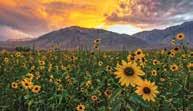
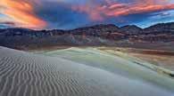
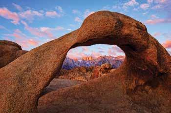
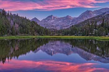
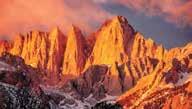
52 INYO COUNTY CALIFORNIA Scenic Backroad Tours
GOLDEN EARS PROVINCIAL PARK
 GOLDEN EARS PROVINCIAL PARK Trail Information as of October 10 th 2015 Do not underestimate the mountainous wilderness of Golden Ears Provincial Park. The combination of rugged terrain and rapidly changing
Death Valley Is a Beautiful but Dangerous Place
 Death Valley Is a Beautiful but Dangerous Place Welcome to This Is America with VOA Learning English. Today we visit one of America s great national parks. It is a place of strange and silent beauty. As
Driving Time: 3 hours (allow extra time for stops)
") Scenic Byways loop This journey takes visitors through the eastern edge of Mt. Rainier National Park and along two of Washington s most beloved scenic byways, the Chinook Byway and the White Pass Scenic
Scenic Byways loop This journey takes visitors through the eastern edge of Mt. Rainier National Park and along two of Washington s most beloved scenic byways, the Chinook Byway and the White Pass Scenic
Mono County. The Mono County Courthouse in Bridgeport. Part 1 of 2: Bridgeport, Bodie, Benton Hot Springs, Benton, Chalfant Valley.
 Mono County The Mono County Courthouse in Bridgeport. Part 1 of 2: Bridgeport,, Benton Hot Springs, Benton, Chalfant Valley. Mono County Data Population: 12,853 (Rank: 55) Land Area (square miles): 3,044
Colorado Life Zone Scavenger Hunt
 Colorado Life Zone Scavenger Hunt Below are worksheets created for all the habitats or life zones. They were designed with the intention of breaking the class up into small groups, and having students
Children's Discovery Trail Guide - Lost Creek
 Children's Discovery Trail Guide - Lost Creek Thank you for spending time learning and observing some of the secrets of Red Rock Canyon Conservation Area has to offer. Feel free to talk to a ranger if
Other Agencies and Organizations
 Daniel Boone National Forest 1700 Bypass Road WInchester, KY 40391 859-745-3100 Location Northern terminus is near Morehead, Kentucky. Southern terminus is located in the Big South Fork NRRA in Tennessee.
2nd Edition Consignment Store 348 Main Street, Delta, Colorado For Sale or Lease
 2nd Edition Consignment Store 348 Main Street, Delta, Colorado For Sale or Lease Longtime Established Consignment Clothing and Accessories Store Located in the Heart of the City of Delta Known for it s
BRYCE CANYON COUNTRY Boulder Mountain Scenic backways itinerary
 BRYCE CANYON COUNTRY Boulder Mountain Scenic backways itinerary Boulder Mountain Area The high plateaus of the Aquarius Plateau (Boulder Mountain), are heavily forested and covered in countless winding
Little Grand Canyon near Pomona, Illinois
 Little Grand Canyon near Pomona, Illinois Below: View of the trail and the terrain created using the Map My Hike app Below: Summary of the hike created using the Map My Hike app Presented by: Jennifer
26 Utah s Patchwork Parkway SCENIC BYWAY CORRIDOR MANAGEMENT PLAN (SR 143)
") Natural Natural Quality applies to those features in the visual environment that are in a relatively undisturbed state. These features predate the arrival of human populations and may include geological
Natural Natural Quality applies to those features in the visual environment that are in a relatively undisturbed state. These features predate the arrival of human populations and may include geological
TREK THE ROCKIES ABOUT THE CHALLENGE TREK THE ROCKIES FOR HIGHLAND HOSPICE CANADA TREK DEMANDING
 TREK THE ROCKIES CANADA TREK DEMANDING ABOUT THE CHALLENGE The Canadian Rockies are justifiably world-famous for their magnificent scenery: the combination of impressive, jagged mountains, bright turquoise
Itinerary Overview: What you will be doing Maroon Bells Alpine Backpacking 22 days
 Itinerary Overview: What you will be doing Maroon Bells Alpine Backpacking 22 days 0BCourse Description Welcome, you re in for an experience of a lifetime! Imagine hiking through rolling forests, sharing
Bear Butte State Park Trail System NORTH
 Trail System 4426 4250 4000 3750 3500 3250 NORTH SCALE IN FEET 0 1000 2000 Summit Trail Type of trail: Hiking Length of trail: 1.85 miles Trail surface: Dirt and rock Rated: Moderate, somewhat hilly, even
230 East Bridge Street Hotchkiss, Colorado 81419
 230 East Bridge Street Hotchkiss, Colorado 81419 Located in the center of downtown Hotchkiss, close to the schools, the Delta County Fairgrounds and Town Hall. This is an ideal set up for an owner/ entrepreneur.
TAYLOR CANYON RANCH COLORADO - ROUTT COUNTY - STEAMBOAT SPRINGS
 TAYLOR CANYON RANCH COLORADO - ROUTT COUNTY - STEAMBOAT SPRINGS Tucked up against the steep valley shaped by Mt. Pau and rising to the Routt National Forest, Taylor Canyon Ranch is an easily accessible,
beach. Make the ford and follow the trail out to the junction with Red Creek Tr in an open grassy area.
 Description: This is a moderate to slightly strenuous 22.8 mile backpack (add 2.6 miles if you do the packless out and back to the Lion s Head) that will have you exploring nearly every thing that is The
Rogue Gorge (Mt. Stella) Roadless Area-- T30S R3E (primarily in portions of Sections 23, 26, 33, 34 & 35)
 Roadless Area-- T30S R3E (primarily in portions of Sections 23, 26, 33, 34 & 35)") Rogue Gorge (Mt. Stella) Roadless Area-- T30S R3E (primarily in portions of Sections 23, 26, 33, 34 & 35) Rogue River-Siskiyou National Forest--High Cascades Ranger District Upper, higher elevation trail
Rogue Gorge (Mt. Stella) Roadless Area-- T30S R3E (primarily in portions of Sections 23, 26, 33, 34 & 35) Rogue River-Siskiyou National Forest--High Cascades Ranger District Upper, higher elevation trail
Best Hikes on Orcas Island
 Published on San Juan Islands Washington Visitors Bureau Orcas Island Lopez Island Friday Harbor San Juan Island (https://www.visitsanjuans.com) Best Hikes on Orcas Island The Emerald Isle offers big trees,
Trail Beginning Elevation: 7553 ft The Poison Creek Trailhead is located at the end of National Forest Road 646E (NF-646E).
.") West Mountain Trails Poison Creek Trail #134 Length: 2.9 miles (4.7 km) Difficulty Horseback: A good trail for the first time west mountain rider, some steep sections Hiking: Most Difficult USGS Maps:
West Mountain Trails Poison Creek Trail #134 Length: 2.9 miles (4.7 km) Difficulty Horseback: A good trail for the first time west mountain rider, some steep sections Hiking: Most Difficult USGS Maps:
Chapter 7 Geography and the Early Settlement of Egypt, Kush, and Canaan
 Chapter 7 Geography and the Early Settlement of Egypt, Kush, and Canaan How did geography affect early settlement in Egypt, Kush, and Canaan? Section 7.1 - Introduction RF/NASA//Corbis This satellite photograph
HORSEBACK RIDING. All rates are subject to service charges
 HORSEBACK RIDING The Local Loop Ride - A family-friendly 45-minutes to one hour ride around Dunton s east property. Perfect for children and adults who are new to riding. Easy terrain and beautiful views.
Washakie Wilderness Ranch
 Washakie Wilderness Ranch Dubois, Wyoming Fly Fishing Hunting Ranching Conservation Washakie Wilderness Ranch Dubois, Wyoming Introduction: A stunning 160-acre parcel located at the base of the Ramshorn
Itinerary Overview. Sangre de Cristo Alpine Backpacking 22 days Ages Course Description
 Itinerary Overview Sangre de Cristo Alpine Backpacking 22 days Ages 16-18 Course Description Welcome, you re in for an experience of a lifetime! Imagine hiking through rolling forests, sharing alpine meadows
Itinerary Overview. Maroon Bells Mountaineering 22-days. Course Description
 Itinerary Overview Maroon Bells Mountaineering 22-days Course Description Welcome, you re in for an experience of a lifetime! Imagine hiking through rolling forests, sharing alpine meadows with mountain
Just to the left of the trail head sign and across the dirt road, please notice a granite post. Well
 Rice Natural Area TWO BROOKS TRAIL TRAILS WITH TALES, #1 Introduction The land you are about to enter is a quiet place. It is also quite extraordinary. Enjoy your visit. To understand the tale of Two Brooks
543 MAIN STREET DELTA, COLORADO HISTORIC DOWNTOWN BUILDING
 543 MAI STREET DELTA, COLORADO HISTORIC DOWTOW BUILDIG PROPERTY FEATURES Spanish style building with great store front Private office, large office/work area/ restroom and breakroom Large shop area with
San Luis Obispo. Bishop Peak Felsman Loop Eagle Rock Maino Open Space Poly Canyon Poly P Other Areas
 San Luis Obispo Bishop Peak Felsman Loop Eagle Rock Maino Open Space Poly Canyon Poly P Other Areas 1 JCT. ELEV. 72 400 00 0 FELSMAN LOOP GATE LOOP RIDGE 600 FENCE JCT. ELEV. 860 1000 1200 BISHOP PEAK
Beaver Country Trails ATV Jamboree
 Beaver Country Trails ATV Jamboree #1 Lincoln Mine Intermediate (Open to all ATVs/UTVs) 34 Miles Highlights: This ride will highlight the historic Lincoln Mining District, the first lead mine in Utah,
Matthiessen State Park Dells Area Hike
 90 Easy Hikes Close to Home At the south end of the hike, you ll climb on top of a mound left over from a former coal-mining operation in the park. Not far from Goose Lake Prairie, the town of Morris hosts
Hike at Pico Blanco Labor Day Weekend!
 Hike at Pico Blanco Labor Day Weekend! The Pico Blanco Hymn Here among the trees majestic Pleasures you will find On the trails of Pico Blanco With your friends and mine Trail the Eagle ever onward This
Itinerary Overview. Continental Divide Alpine Backpacking 22 days Ages Course Description
 Itinerary Overview Continental Divide Alpine Backpacking 22 days Ages 16-18 Course Description Welcome, you re in for an experience of a lifetime! Imagine hiking through rolling forests, sharing alpine
(Short Listing) DUPUYER ACREAGE, ROCKY MOUNTAN FRONT
 DUPUYER ACREAGE, ROCKY MOUNTAN FRONT") (Short Listing) DUPUYER ACREAGE, ROCKY MOUNTAN FRONT This unique property is located 8½ miles northwest of Dupuyer, Montana and approximately thirty 30 miles northwest of Choteau, Montana. Great Falls
(Short Listing) DUPUYER ACREAGE, ROCKY MOUNTAN FRONT This unique property is located 8½ miles northwest of Dupuyer, Montana and approximately thirty 30 miles northwest of Choteau, Montana. Great Falls
Tiger Mountain State Forest:
 98 60 hikes within 60 miles: SEATTLE 20 Tiger Mountain State Forest: West Tiger Mountain Three Loop i KEY AT-A-GLANCE INFORMATION Length: 5.1 miles round-trip Configuration: Loop Difficulty: Moderate difficult
Kuruwita Erathna Trail to Sri Pada (Adam s Peak)
") Kuruwita Erathna Trail to Sri Pada (Adam s Peak) Trail Difficulty: Easy Moderate Strenuous Tough Trail Head: Adevikanda, Erathna (near entrance to mini-hydro power plant) Nearest Town: Erathna Nearest
Kuruwita Erathna Trail to Sri Pada (Adam s Peak) Trail Difficulty: Easy Moderate Strenuous Tough Trail Head: Adevikanda, Erathna (near entrance to mini-hydro power plant) Nearest Town: Erathna Nearest
What are you getting into?
 Overnight Camping What are you getting into? You will be hiking with your gear to a campground about ½ mile away and spending 1 night camping You will help to prepare a meal over an open flame You will
The Mountains Of California By John Muir READ ONLINE
 The Mountains Of California By John Muir READ ONLINE Facts. Over half of the land in the state is covered with mountains. There are two major ranges of mountains in California: The Sierra Nevada and the
Lava Mountain Trail Distance: Elevation Range: Trail Type: Difficulty: Season: Driving Distance: Driving Time: USGS Maps: Pros Cons
 Lava Mountain Trail Distance: 13.4 miles (including the side trip to North Star Lake) Elevation Range: 5900'-8330' Trail Type: singletrack Difficulty: moderate Season: late June-October Driving Distance:
List Price: $1,100,000 PRICED DROPPED TO $950,000!! Includes Real Estate, Business and FF&E
 Tayshen Automotive 105 1/2 Eaton Ave Delta, Colorado 81416 This high end/state of the art automotive full service shop is the envy of all competitors, highly successful, with dedicated, well trained staff,
Region 1 Piney Woods
 Region 1 Piney Woods Piney Woods 1. This ecoregion is found in East Texas. 2. Climate: average annual rainfall of 36 to 50 inches is fairly uniformly distributed throughout the year, and humidity and temperatures
NATIONAL ATV / UTV JAMBOREE RIDES
 NATIONAL ATV / UTV JAMBOREE RIDES Note: Rides range from Beginner to Advanced and will last from 2 to 3 hours or an entire day of riding. 1. DESERT RIDE (CLEAR LAKE BIRD REFUGE & LACE CURTAINS/LAVA TUBES)
4.0 ENVIRONMENTAL SETTING
 4.0 ENVIRONMENTAL SETTING Section 15125 of the State California Environmental Quality Act (CEQA) Guidelines requires that an Environmental Impact Report (EIR) include a description of the physical environmental
Itinerary Overview. Sawatch Range Mountaineering Ages days
 Itinerary Overview Sawatch Range Mountaineering Ages 14-16 22 days Course Description Welcome, you re in for an experience of a lifetime! Imagine hiking through rolling forests, sharing alpine meadows
Drawing Conclusions and Making Inferences
 Drawing Conclusions and Making Inferences G TO THE STUDENT In this book, you will learn how to use the reading strategy called Drawing Conclusions and Making Inferences. With your teacher s help, you will
Route #2) Mt. Massive - Southwest Slopes
 Mt. Massive - Southwest Slopes") Route #2) Mt. Massive - Southwest Slopes Difficulty: Class 2 Ski: Advanced, D6 / R2 / III Exposure: Summit Elevation: Trailhead Elevation: Elevation Gain: Round-trip Length: Trailhead: County Sheriff:
Route #2) Mt. Massive - Southwest Slopes Difficulty: Class 2 Ski: Advanced, D6 / R2 / III Exposure: Summit Elevation: Trailhead Elevation: Elevation Gain: Round-trip Length: Trailhead: County Sheriff:
Itinerary Overview. Colorado San Juan Mountaineering 15-days
 Itinerary Overview Colorado San Juan Mountaineering 15-days Course Description Welcome, you re in for an experience of a lifetime! Imagine hiking through rolling forests, sharing alpine meadows with mountain
Black Hill Regional Park, Little Seneca Lake
 Black Hill Regional Park, ittle Seneca ake ittle Seneca ake, in Black Hill Regional Park, is a reservoir created after a previous drought struck the Washington area. The park is under Maryland-National
Beaver Creek State Park
 GENERAL INFORMATION Name of Park/Forest/Facility: Beaver Creek State Park County: Columbiana (St. Clair Township) Address: 12816 Sprucevale Road (ie County Rd 428) (street #, city) East Liverpool, Ohio
Hiking Las Vegas.com
 Hike: Mt. Wilson via First Creek Canyon route Trailhead: First Creek marked Distance: 10 miles up and back Elevation gain: 3,400 feet Elevation of Peak: 7,070 feet Time: 7 to 9 hours (up and back) Difficulty:
Avalanches and the Mount Whitney Basin
 Avalanches and the Mount Whitney Basin 10 April 2006 by Bob Rockwell Prelude Avalanches are a fact of life in high mountains in winter, and we take courses to find out about them. We learn how to assess
Drive and Stop Routes
 Drive and Stop Routes Limantour Road 1 - easy and likely productive. From Bear Valley Visitor Center drive back out and turn left onto Bear Valley Rd. Turn left at Limantour Road (the first road). Drive
YOSEMITE ON HORSEBACK: THREE RIDES ALONG TIOGA ROAD Cindy Casey White Wolf Area, May Lake Loop, Ragged Peak Loop
 YOSEMITE ON HORSEBACK: THREE RIDES ALONG TIOGA ROAD Cindy Casey White Wolf Area, May Lake Loop, Ragged Peak Loop The high country along Tioga Road presents us with some of the most dramatic scenery in
Crystal Lake Area Trails
 Lake Area Trails Welcome to the Lake area of the Big Snowy Mountains! This island mountain range in central Montana features peaks reaching to 8,600 feet and long, high ridges from which vistas of the
The gorges of Mohican Park in Ohio create a hiker's paradise Sunday, May 22, 2011 By Bob Downing, Akron Beacon Journal
 Pittsburgh Post-Gazette The gorges of Mohican Park in Ohio create a hiker's paradise Sunday, May 22, 2011 By Bob Downing, Akron Beacon Journal Bob Downing Big Lyons Falls drops 80 feet into a shady U-shaped
Darwin s gigantic blunder
 Trail Darwin s gigantic blunder Explore how ice shaped the landscape and why Charles Darwin made a nice mess of Glen Roy Time: 1hr 10 mins Distance: 2 miles Landscape: rural At Glen Roy a curious feature
ABOUT THE PARKS NANTAHALA NATIONAL FOREST MOUNTAINS NATIONAL PARK CHEROKEE NATIONAL FOREST PISGAH NATIONAL FOREST GREAT SMOKY HIKING TRAILS
 ABOUT THE PARKS GREAT SMOKY MOUNTAINS NATIONAL PARK NANTAHALA NATIONAL FOREST CHEROKEE NATIONAL FOREST PISGAH NATIONAL FOREST GREAT SMOKY MOUNTAINS NATIONAL PARK Straddling the border between North Carolina
Charnley Explorer June 24 - July 15, 2018 Bachsten Creek and the Charnley River. Second draft: 14 November 2017
 Charnley Explorer June 24 - July 15, 2018 Bachsten Creek and the Charnley River. Second draft: 14 November 2017 The best part of the original section one is now part of out Gibb Road Gorges trip. The dates
2.0 PARK VISION AND ROLES
 2.0 PARK VISION AND ROLES 2.1 Significance in the Protected Area System Marble Range and Edge Hills provincial parks protect 6.8% of the Pavillion Ranges Ecosection, which is located in the Southern Interior
NATIONAL ATV / UTV JAMBOREE RIDES
 NATIONAL ATV / UTV JAMBOREE RIDES Note: Rides range from Beginner to Advanced and will last from 2 to 3 hours or an entire day of riding. 1. DESERT RIDE (CLEAR LAKE BIRD REFUGE & LACE CURTAINS/LAVA TUBES)
Three Sisters Wilderness Oct. 2009
 Three Sisters Wilderness Oct. 2009 I was in Bend, OR and had the whole day to travel back to Boise so I decided to take a hike to the popular Green Lakes and summit the South Sister in Three Sisters Wilderness.
B HALL RANCH FISHTAIL, MONTANA
 Brochure Courtesy of: B HALL RANCH FISHTAIL, MONTANA w w w. m c c a s l i n l a n d. c o m Page 1 LOCATION The Hall Ranch is ideally located in the foothills of the Beartooth Mountains, approximately 5
salisbury canyon - Ranch new cuyama, California
 Operations/ Recreation 100 Road New Cuyama, California Due to its rustic ambience, privacy, and pristine condition, Ranch (considered by many to be nicest ranch in Cuyama Valley) is a working cattle ranch.
20 ways with Nature Play
 20 ways with Nature Play Winter edition adelaideparklands.com.au 20 ways with Nature Play Remember spending time outdoors as a child? Riding your bike, making mud pies and climbing trees? It s what fond
TOPIC = CAMP SITE SELECTION
 TOPIC = CAMP SITE SELECTION I. RESOURCES a. Guide to safe scouting. who can participate and what can they do. trail safety. safety from lightning. b. BSA field book. c. Camping merit badge booklet. d.
Telluride-to-Moab Alternative Singletrack Options
 Telluride-to-Moab Alternative Singletrack Options Day 1 Day 1 Alternate 1: Galloping Goose to Deep Creek. 18.4 miles, ascent 3,530ft, descent 1,388ft. This is fun, flowey, moderate to intermediate singletrack
HOW TO SURVIVE WHEN LOST IN THE DESERT
 HOW TO SURVIVE WHEN LOST IN THE DESERT Do not panic, especially if people know where you are and when you are scheduled to return. If you have a vehicle, stay with it do not wander! If you are on foot,
Images Made in the Mountains
 IMAGES MADE IN THE MOUNTAINS CHUCK GRAHAM Mountain camp below Mount Tyndall at sunrise in the Eastern Sierra, CA Images Made in the Mountains Chuck Graham I left my truck at 1:00 am at the top of the Whitney
Physical Regions of the U.S.
 Physical Regions of the U.S. Quickly use this map to label the map on your paper Pacific Coast The coast from southern California to Alaska The region of the Pacific Northwest has a long history that was
Together. National Park Program
 Carolina Pet Company designs, manufactures, imports and distributes pet beds and related pet convenience products. We have a very efficient drop ship program which enables us to fill all orders within
BUCK POINT RANCH. Aspen Associates Realty
 BUCK POINT RANCH Aspen Associates Realty www.aspenassociatesrealty.com 970.544.5800 WELCOME TO Buck Point Ranch is a 960± acre property located in one of the last pristine valleys in close proximity to
Photographing Upper Peninsula Waterfalls
 Photographing Upper Peninsula Waterfalls Tod Poirier Freelance Photographer Photography is one of my passions. The following spread showcases several Upper Peninsula waterfalls. At times a single drop
List of Challenges. Draw a Map of Your Hike
 List of Challenges Junior Ranger Wildlife Adventures Draw a Map of Your Hike Explore Pella Crossing Hey kids! Do you love animals as much as the Boulder County Park Rangers? Join us on Saturday, June 2
Mark Beyer SMOKEJUMPERS. Life Fighting Fires
 Mark Beyer SMOKEJUMPERS Life Fighting Fires Extreme Risk Fighting forest wildfires is a dangerous business. Some wildfires, however, are easier to get to than others. They can begin to burn near roads,
Hiking California's Trinity Alps Wilderness: A Guide To The Area's Greatest Hiking Adventures (Regional Hiking Series) By Dennis Lewon READ ONLINE
 By Dennis Lewon READ ONLINE") Hiking California's Trinity Alps Wilderness: A Guide To The Area's Greatest Hiking Adventures (Regional Hiking Series) By Dennis Lewon READ ONLINE With over 600 miles of trails and 500000 acres of wilderness
Hiking California's Trinity Alps Wilderness: A Guide To The Area's Greatest Hiking Adventures (Regional Hiking Series) By Dennis Lewon READ ONLINE With over 600 miles of trails and 500000 acres of wilderness
McGee Creek BCM Course Area Guide Backcountry. Trip Code Team Leader
 McGee Creek BCM Course Area Guide Backcountry Trip Code Team Leader Table of Contents Trail Summary... 3 Trail Information... 3 Trail Description... 4 Route Description... 5 Trail Distances... 5 Trail
CRAZY HORSE TRAIL GUIDE
 CRAZY HORSE TRAIL GUIDE Abridged Version: July 2016 This is a short form of our interpretive trail guide for the Crazy Horse Trail. The full version of the guide has a more detailed description of the
UTAH S NATIONAL PARK TOUR
 UTAH S NATIONAL PARK TOUR DAY 1 Each client needs to check in any time at the fabulous Aria Hotel located in the heart of Las Vegas. We will meet at 6pm for a one hour orientation explaining the schedule
G R E E N R I V E R - W Y O M I N G - S W E E T W A T E R C O U N T Y
 G R E E N R I V E R - W Y O M I N G - S W E E T W A T E R C O U N T Y Minor Ranch All information contained herein is taken from sources considered reliable, but is not guaranteed by either seller nor
Beautiful Walks from the Blue Ball Inn
 Walk No. 2 WINSTONS WALK Countisbury, Wind Hill, Watersmeet, Ash Bridge and Winston s path. 5 Miles approx. Walking time- Two and a half hours approx. (Not including Breaks) OS 1:25,000 Sheet 64/74 Lynton
BROCHURE. APPLE HILL WOODS 118 +/- Acres Camino, California. Presented by Jim Copeland
 BROCHURE APPLE HILL WOODS 118 +/- Acres Camino, California Presented by Jim Copeland 1 The Property This 118 acre is a rare gem in the Sierra Nevada foothills. Covered with lush forestland and scattered
Weston County, Wyoming
 The Sweet 200-Acre Property Weston County, Wyoming A unique opportunity to own a little piece of the old West, where one can experience unparalleled scenery, adventure and history walk in the footsteps
Chapter 7. Geography and the Early Settlement of Egypt, Kush, and Canaan
 Chapter 7 Geography and the Early Settlement of Egypt, Kush, and Canaan Chapter 7 Geography and the Early Settlement of Egypt, Kush, and Canaan How did geography affect early in Egypt Kush, and Canaan?
Winter Driving Conditions
 Yosemite Peregrine Lodge Encouraging Adventure And Defining Relaxation. Winter Driving Conditions (October through May) A season of snow & solitude Yosemite National Park is wonderful in winter. The biggest
playwinterpark.com Off The Beaten Path Hikes Hiking Recommendations for the Adventurous Hiker
 playwinterpark.com Off The Beaten Path Hikes Hiking Recommendations for the Adventurous Hiker Hike: Devil s Thumb (difficult) Length: 3.93 miles one-way Elevation: Trailhead 9609 Destination 12,236 Trailhead
List Price: $1,100,000 Includes Real Estate, Business and FF&E
 Tayshen Automotive 105 1/2 Eaton Ave Delta, Colorado 81416 This high end/state of the art automotive full service shop is the envy of all competitors, highly successful, with dedicated, well trained staff,
Bureau of Land Management Public Lands Guide Northwest District
 Bureau of Land Management Public Lands Guide Northwest District NORTHWEST Fee Site Restrooms Picnic Sites Developed Campgrounds Farmington Field Office (505) 564-7600 Alien Run Mountain Bike Trail Angel
Snowmobile Safety Tips
 Snowmobile Safety Tips The winter weather is bringing out snowmobilers, and safety officials are urging them to be careful. More than 200,000 registered snowmobiles hit Wisconsin s 25,000 miles of groomed
HIGH COUNTRY L-BAR RANCH
 HIGH COUNTRY L-BAR RANCH Sandoval and mckinley counties N e w m e x i c o Jim Haworth, Ranch Team Lead Broker ~ 505-235-5236 3613 NMSR 528 NW, Ste. H, Albuquerque, NM 87114 505-792-3713 www.wwrealty.com
2012 Oregon State Science Olympiad. B-Division Road Scholar Event National Wildlife Refuge Site Selection. Student Participants:
 2012 Oregon State Science Olympiad B-Division Road Scholar Event National Wildlife Refuge Site Selection Student Participants: School/Team: To answer the questions you will need a pencil, ruler, protractor,
EDEN A Short Film By Adam Widdowson
 EDEN A Short Film By Adam Widdowson EDEN A Short Film By Adam Widdowson 1 FADE IN: EXT. EMPTY FIELD DAY The scene opens on empty fields, wind brushes the tops of trees and blows through long grass. Clouds
Mt. Sneffels (from Yankee Boy Basin) - A Cool Fourteener
 - A Cool Fourteener") Mt. Sneffels (from Yankee Boy Basin) - A Cool Fourteener Difficulty: Difficult Class 3 Exposure: Summit Elev.: 14,150 feet Trailhead: Yankee Boy Basin Climbers: Rick Crandall; Shan Stuart; Laura Welch
Mt. Sneffels (from Yankee Boy Basin) - A Cool Fourteener Difficulty: Difficult Class 3 Exposure: Summit Elev.: 14,150 feet Trailhead: Yankee Boy Basin Climbers: Rick Crandall; Shan Stuart; Laura Welch
COLORADO TRAIN ADVENTURE
 COLORADO TRAIN ADVENTURE by Melody Hagerman at Travel the Horizon Summary Traveling by rail in Colorado is the most spectacular way to take in its unique scenery. From high above the tracks, you'll enjoy
Stephens State Park Trails
 TRAILS OF ALLAMUCHY MOUNTAIN & STEPHENS STATE PARKS Allamuchy Mountain and Stephens State Parks contain 28 marked trails providing access to diverse landscapes for walking, hiking, biking, bird-watching,
CIEC 9 PEAKS AWARD SUPPLEMENT POSSIBLE ROUTES FOR THE 9 PEAKS AWARD TRIP
 CIEC 9 PEAKS AWARD SUPPLEMENT POSSIBLE ROUTES FOR THE 9 PEAKS AWARD TRIP As you plan your trip, be aware of 3 regulations in this wilderness: 1. Camp only in designated campsites. 2. No campfires allowed.
PAUL S PLACE ELK, DEER AND VIEWS FISHTAIL, MONTANA
 McCaslin Land 2010 PAUL S PLACE ELK, DEER AND VIEWS FISHTAIL, MONTANA LOCATION Paul s Place is ideally located in the foothills of the Beartooth Mountains, approximately 5 to 5-1/2 miles west of Fishtail,
Our Mission. Discover the many states of California. Chino Hills State Park 1879 Jackson Street Riverside, Ca (951)
") Chino Hills State Park Our Mission The mission of the California Department of Parks and Recreation is to provide for the health, inspiration and education of the people of California by helping to preserve
Chino Hills State Park Our Mission The mission of the California Department of Parks and Recreation is to provide for the health, inspiration and education of the people of California by helping to preserve
The Storm. (looking at a photo of a boat) Very nice, Dad! Bye! See you at the picnic. My friends are waiting for me. I m late.
 Very nice, Dad! Bye! See you at the picnic. My friends are waiting for me. I m late.") The Storm Radio: It s another hot weekend in New York City, folks. The highs will be in the upper 90s. There is a chance of an afternoon thunderstorm. Stay cool if you can. (looking at a photo of a boat)
The Storm Radio: It s another hot weekend in New York City, folks. The highs will be in the upper 90s. There is a chance of an afternoon thunderstorm. Stay cool if you can. (looking at a photo of a boat)
Trip Report: Backpack to East Boulder Lake in California Trinity Alps, July 7-9, 2016
 Trip Report: Backpack to East Boulder Lake in California Trinity Alps, July 7-9, 2016 Trekkers: Richard Hales, Aleece Townsend, Carol Mockridge, Rosalie Rybka, Elisabeth Zinser Day 1: Richard and Aleece
Waterproof Debris Shelter
 Bushcraft Video Series: David Styles, creator of 'Deep Nature Mentoring' presents Waterproof Debris Shelter Transcript Of Video 1. How Do We Make A Debris Shelter? Today we are going to learn about how
UTAH 2016 CANYONLANDS
 UTAH 2016 CANYONLANDS THE WHITE RIM TRAIL MAY 17, 2016 We left the cabin at 7:30 a.m. The goal was to get to Great Basin National Park that night. We took Highway 6 towards Tonopah and decided to go north