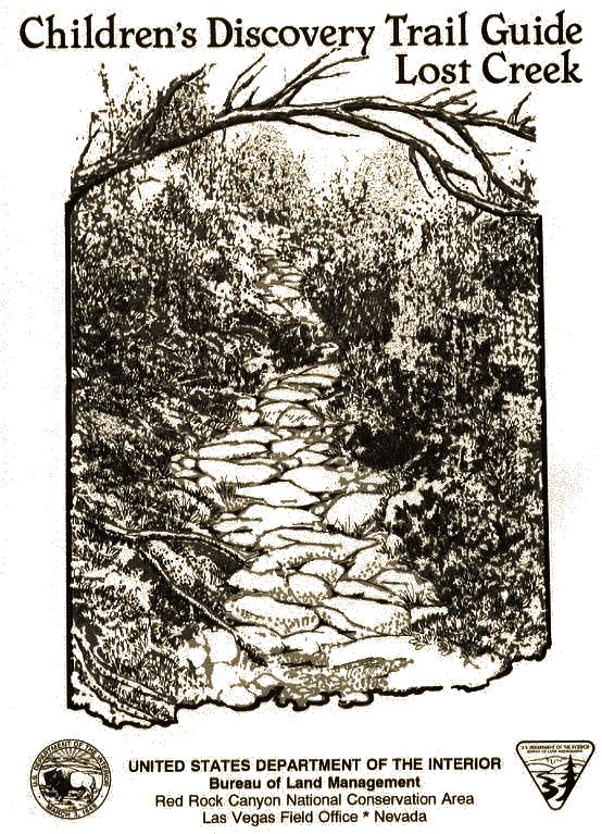
Children's Discovery Trail Guide - Lost Creek
|
|
|
- Sheena McCarthy
- 5 years ago
- Views:
Transcription
1
2 Children's Discovery Trail Guide - Lost Creek Thank you for spending time learning and observing some of the secrets of Red Rock Canyon Conservation Area has to offer. Feel free to talk to a ranger if you have questions. Please follow the following "Leave No Trace" principles during your visit: Plan Ahead and Prepare Travel on durable surfaces: stay on designated trails Pack it in; Pack it out: pick up all spilled foods Leave what you find: leave plants, rocks, and artifacts for others to enjoy Protect and Conserve water resources and riparian corridors Respect Wildlife: Leave all wildlife here Respect Other Visitors: The quieter you are the more wildlife you will see and hear Original text and editing by Geoff Gross and Becky Bell. Text revisions by Carol Ward. Illustrations and maps by Diane Colcord.
3 Children's Discovery Trail Guide - Lost Creek A natural resource education guide for school children. The purpose of this guide is to orient students and teachers to the natural area found in Lost Creek Canyon. Information about flash flooding, shrub and tree identification, uses of plants, early Native American Lifestyles, natural springs and resource sensitivity is included. More in-depth information on all these subjects is available from naturalists at the Red Rock Canyon Visitor Center. Visitor Center hours are 8:00 am to 4:00 pm daily during the Winter (November through March) and 8:00 am to 4:30 pm daily during the Summer (April through October). If you choose to visit the Center with your class, please phone ahead at (702) Safety, Desert Conservation and Ethics Desert Safety While examining plants and rocks, be aware that these may be the homes of small animals. Lift rocks from the far side so scorpions and spiders are not able to sting or bite you. Never put your hands where you cannot see first - especially in the shade. Snakes prefer shade to keep cool. Desert Conservation and Ethics Do not collect plants, flowers or rocks because others will be using this same trail in order to learn about Red Rock Canyon. They will want to see the same natural objects that you used to learn about the area. Do not write on rock walls. Leave their natural beauty for others to enjoy.
4 Introduction Welcome to the Children's Discovery Trail at Red Rock Canyon National Conservation Area. You are about to set out on a hike, exploring with your senses. You will see, listen to, and feel a few of the secrets Lost Creek has to offer. You will hike a half-mile, climb up and down several hills, cross a stream, and scramble over several large sandstone rocks. Please walk with care! Carry water and dress according to the weather. Temperatures may range from 35 degrees F in February to 110 degrees F in July. Go slowly along the trail. Watch your step. Enjoy all there is to experience. Each page of this guide is keyed to a numbered post along the trail. We hope this booklet will help you to become aware of some of the many natural features that exist in Red Rock Canyon National Conservation Area. Lost Creek Discovery Trail
5

6 Stop 1: Wash Out Look to your right and left. What do you see? When it rains, where do you think the water goes? Look in front of you. How do you think all the large boulders got to where they are? Flash floods are one of the many dangers in a desert environment. When it rains, all the water is not absorbed into the ground. The desert floor is hard, and the water rapidly runs off. Running water is the greatest erosional force in the desert. Yet the desert receives less than ten inches of rain a year. Do you think there are lots of floods here? Where do you think flash floods are most likely to occur? How can you avoid being caught in flash floods?


7 Stop 2: Naturalizing As you leave the wash and enter the vegetated area, see if you can locate and identify a cactus, a shrub and two trees by using the descriptions and drawings found on this page. Put a check in the box by each one that you find. Desert Manzanita a medium sized shrub, leaves are bluish gray, bark is red, berries look like small apples. Old Man Prickly Pear a cactus, the needles are white, just like an old man's beard. Pinyon Pine a tree, the needles are one inch long and single. The seeds inside the pine cones taste great when roasted. The Paiute Indians cooked them in roasting pits. Utah Juniper a tree, has scale-like, light green foliage. The bark is gray in color and looks like it is peeling. The cones are round, small, and have a waxy covering. If you look closely up in the tree, you will see a yellow-green parasite called dwarf mistletoe. Where do you think flash floods are most likely to occur? How can you avoid being caught in flash floods?
8 Post Number 3:Wild Food Find To your right, a trail leads to Willow Spring. Several hundred years ago, Paiute Indians walked the same trail in search of the agave plant. This plant served as a major source of food. They ate the agave, much like we eat an artichoke, after roasting it. Study the picture of the agave plant. Watch carefully for this plant along the trail on the way to Post Number 4. Caution! Be careful when you find an agave. The leaves of the plant are sharp and can cut your fingers or hand. Did you find the agave?
9 Post Number 4: Hunters and Gatherers The Paiute Indians searched for plants everyday. They got meat from game they killed. As the seasons changed, the Paiutes moved their homes. Oftentimes, they lived in rock shelters, like the one in front of you. In the heat of the summer, they moved up into the mountains, looking for game and enjoying the cooler weather. In the winter months, the Indians would live closer to the desert floor. Lost Creek and Willow Spring are rich in cultural resources. Along with rock shelters, you might see petroglyphs carved into the rocks with tools made form local materials. Other cultural resources are pictographs, which were painted on the rocks, and agave roasting pits, which are limestone-lined cooking pits.
10 Post Number 5: Environments You have already experienced several distinct environments on your hike today. In front of you is another: a desert meadow. Think of all the different plants and animals that inhabit each environment you have seen. Think about where you would expect to find a white-footed mouse, a desert bighorn, a roadrunner, or a whiptail lizard. Why do certain forms of life only live in certain environments? Sit down and closely examine the grasses and rushes to the left of the trail. Look at the different colors! Listen to the wind rustling through the meadow. Write a sentence or two describing what you hear and see: After a winter snowstorm or a summer thunderstorm, numerous waterfalls cascade upon the rocks. A few yards down and to your right, a trail continues to a large waterfall. The waterfall is part of a box canyon. If you would like to explore the box canyon and take a chance at seeing a running waterfall, then follow the trail, and you will reach the end of the canyon. If no water is flowing, you will see a wide black line upon the headwall in front of you. This line is produced by the water cascading down after a storm, leaving behind dissolved minerals.

11 Post Number 6: Water Music Sit down and close your eyes. Listen closely to the many sounds around you. What did you hear? Did the water have different tones? Were they pleasing to the ear? Walk over to the water. Write down what it sounds like.

12 Post Number 7: Old Friends Every tree has a character of its own. The tree before you is no exception. Close your eyes and run your hand over the bark. How does it feel? Look way up through the branches. What do you see? Can you give the tree a name? What does the bark smell like? Why does a tree grow here?
13 Post Number 8: New Friends Why do you think the branches of the desert willow are bendable and green? Why do these trees grow here?

14 Post Number 9: Considerations Before you leave the Lost Creek Trail and Red Rock Canyon, consider the following questions: Did Red Rock Canyon supply the Paiutes with all of their needs? How? Do you think modern people still need places like Red Rock Canyon? Why or Why not? If you have an opportunity, continue on to Willow Spring to view an agave roasting pit. (It's the optional stop shown on your map.) The roasting pit is.4 miles from the Lost Creek parking lot by trail. If you choose to drive to Willow Spring Picnic area, the roasting pit is about 50 yards from the restroom.
15 Optional Stop: Ancient Barbecue Try to imagine how many roasts took place here. Each piece of limestone you see was only used a few times to provide heat for cooking. After a roast, the Native Americans would throw the rocks over their shoulders to get the cooked food below. In addition to agave, the Native Americans roasted many types of plants and meats in roasting pits. Would you like to have been a Paiute living in Red Rock Canyon cooking your food in a roasting pit? This publication was designed, written and illustrated by staff members of the Bureau of Land Management in Nevada The Bureau of Land Management is responsible for the stewardship of our public lands. It is committed to manage, protect, and improve these lands in a manner to serve the needs of the American people for all times. Management is based on the principles of multiple use and sustained yield of our nation's resources within a framework of environmental responsibility and scientific technology. These resources include recreation; rangelands; timber; minerals; wastershed; fish and wildlife; wilderness; air; and scenic, scientific and cultural values. "Proceeds for the printing of the Children's Discovery Trail Booklet - Lost Creek made possible form the use of entry fees and grants by the Friends of Red Rock Canyon and the Red Rock Canyon Interpretive Association."
Colorado Life Zone Scavenger Hunt
 Colorado Life Zone Scavenger Hunt Below are worksheets created for all the habitats or life zones. They were designed with the intention of breaking the class up into small groups, and having students
Santa Rosa Plateau Ecological Reserve
 What s up Third Graders? Yo! So you re coming up to visit the Santa Rosa Plateau Ecological Reserve. That s cool. Maybe you ll see me out on the trail. I m a western fence lizard. Check out my picture.
Human Habitat. Cachuma Lake DISCOVERY BOOK Cachuma Lake Discovery Book V1, Santa Barbara County Parks
 Human Habitat Cachuma Lake DISCOVERY BOOK.0 The Human Habitat People live in houses and buildings to be comfortable and safe. We live together in towns and cities. We build roads to drive our cars from
Leave No Trace. Prepared for Boy Scout Troop 63 Woodbridge, CT
 Leave No Trace Prepared for Boy Scout Troop 63 Woodbridge, CT What is Leave No Trace? Leave No Trace is a program that evolved from outdoor codes taught by the United States Forest Service, the Bureau
Watch Your Paws! A Young Person s Guide to Respecting Nature. Written and Illustrated By Steve Reid
 Watch Your Paws! A Young Person s Guide to Respecting Nature Written and Illustrated By Steve Reid Watch Your Paws It can be fun to play outdoors. There is lots of room to run around, and there is so much
CLIMBING & CAMPING. Las Vegas District NATIONAL CONSERVATION AREA UNIVERSITY OF MINNESOTA LIBRARY. GQVERNMFMT Pi^l'.CiTIOKS
 Generated on 2015-08-13 23:03 GMT / http://hdl.handle.net/2027/umn.31951d00749307j Public Domain, Google-digitized / http://www.hathitrust.org/access_use#pd-google S3, a- RED ROCK CANYON a z NATIONAL CONSERVATION
Park Activity Book. Start your adventure with Buddy Bison. Explore outdoors, the parks are yours!
 Park Activity Book Start your adventure with Buddy Bison. Explore outdoors, the parks are yours! National Park Trust www.parktrust.org Park Adventure Booklet Visit www.buddybison.org to get your own Buddy
2019 Work Week Crew. Schedule and Descriptions
 2019 Work Week Crew WAWONA WW1 Mariposa Grove Restoration and Invasive Plant Removal June 2 June 8 YOSEMITE VALLEY YV1 Washington Column Climber s Trail Rehabilitation June 9 June 15 YV2 Weed Warriors/
BRYCE CANYON COUNTRY Boulder Mountain Scenic backways itinerary
 BRYCE CANYON COUNTRY Boulder Mountain Scenic backways itinerary Boulder Mountain Area The high plateaus of the Aquarius Plateau (Boulder Mountain), are heavily forested and covered in countless winding
Skip to Overnights at Abbott s Mill Nature Center in Milford, DE. Skip to Overnights at Ashland Nature Center in Hockessin, DE
 Overnights with Delaware Nature Society are a great kickoff or culminating activity for your group. Overnight programs include handson activities led by experienced naturalists. Create an exciting indoor/outdoor
This Passport: Revised October 20, 2017, EAM # Discovering the Trails of Webster, NY
 This Passport: Revised October 20, 2017, EAM #161923 Discovering the Trails of Webster, NY The Town of Webster invites you to explore and experience our diverse outdoor adventures! Here s your opportunity
DOGS ARE NOT PERMITTED ON TRAILS OR TOURS
 Tuesday, January 1, 2008 9:00 a.m. Hike Voices, Visions, and Views of Alcoholic Pass 3 Hours Hike Alcoholic Pass! Experience and discover the prehistory, history, and present day journey of those who have
Hiking Las Vegas.com
 Hike: Mt. Wilson via First Creek Canyon route Trailhead: First Creek marked Distance: 10 miles up and back Elevation gain: 3,400 feet Elevation of Peak: 7,070 feet Time: 7 to 9 hours (up and back) Difficulty:
Death Valley Is a Beautiful but Dangerous Place
 Death Valley Is a Beautiful but Dangerous Place Welcome to This Is America with VOA Learning English. Today we visit one of America s great national parks. It is a place of strange and silent beauty. As
Southern Utah University Hike Brochure
 Southern Utah University Hike Brochure Taylor Creek Trail Twenty minutes from Cedar City Red Hollow An hour and a half from Cedar City Fees: Entrance fee to Kolb Canyon Length: 5 miles round trip Length:
Conaway Ranch in Rainbow Canyon Former Golf Course /- Acres with 294 AFA of Water Rights
 Conaway Ranch in Rainbow Canyon Former Golf Course - 244.38 +/- Acres with 294 AFA of Water Rights Rainbow Canyon Rainbow Canyon is named for its spectacular multi-colored rock walls. Meadow Valley Wash,
PARKS CONNECTING PEOPLE WITH NATURE R.J. CARDIN, DIRECTOR MARICOPA COUNTY PARKS AND RECREATION DEPT.
 PARKS CONNECTING PEOPLE WITH NATURE R.J. CARDIN, DIRECTOR MARICOPA COUNTY PARKS AND RECREATION DEPT. BUCKEYE HILLS PARK AGREEMENTS: Department enters into Special Use Permit to allow Arizona State Rifle
Logo Department Name Agency Organization Organization Address Information 5700 North Sabino Canyon Road
 Logo Department Name Agency Organization Organization Address Information United States Forest Coronado National Forest 5700 North Sabino Canyon Road Department of Service Santa Catalina Ranger District
INFO FOR GROUP LEADERS
 INFO FOR GROUP LEADERS COMMUNICATE EARLY & OFTEN: Let us know ahead of time if your group size has changed or the ages within your group have changed. Also, let us know in advance if your group has any
1 Permanent Full Time Forester GS /07/09 Kaibab National Forest Duty Station: Williams or Tusayan, AZ
 1 Permanent Full Time Forester GS-460-05/07/09 Kaibab National Forest Duty Station: Williams or Tusayan, AZ Merit Vacancy Announcement: Open Monday January 11 th to Friday January 20 th 2016 and working
KEYSTONE RED ROCK CANYON VISITOR GUIDE WELCOME GET READY TO SAFELY EXPLORE FIRST STOPVISITOR CENTER
 RED ROCK CANYON KEYSTONE VISITOR GUIDE A NATIONAL CONSERVATION AREA ADMINISTERED BY THE BUREAU OF LAND MANAGEMENT Proudly presented by Southern Nevada Conservancy in partnership with the Bureau of Land
April 2017 Den Meetings Advancement
 April 2017 Tiger Rank Advancement April 2017 Den Meetings Advancement Cheerful/Outdoor Code/ Leave No Trace /Weather/Camping page 1 Tiger Adventures: Games Tigers Play 5. Bring a nutritious snack to a
ANGEL PEAK SCENIC AREA
 Activities: Facilities: ANGEL PEAK SCENIC AREA Hiking, photography, watchable wildlife, camping, picnicking. Note: While formal hiking trails in the area are limited, dispersed hiking opportunities abound
UTAH S NATIONAL PARK TOUR
 UTAH S NATIONAL PARK TOUR DAY 1 Each client needs to check in any time at the fabulous Aria Hotel located in the heart of Las Vegas. We will meet at 6pm for a one hour orientation explaining the schedule
Evaluation of Outstanding Remarkable Values for Collawash River March 2011
 Evaluation of Outstanding Remarkable Values for Collawash River March 0 Segment From headwaters of East Fork Collawash River to Buckeye Creek Mileage: miles Free flowing: Yes Scenic:, Substantial River
JUNIOR RANGER. William Heise County Park Junior Rangers Program Guide
 JUNIOR William Heise County Park Junior Rangers Program Guide JUNIOR William Heise County Park Junior Rangers Table of Contents. Table of Contents.... 2 Hello Prospective Junior Rangers... 3 Draw What
Maya s Creek Crossing Hwy 17 N acres $185,000 Fort Davis, Texas
 Maya s Creek Crossing Hwy 17 N 14.98 acres $185,000 Fort Davis, Texas James King, Agent Office 432-426-2024 Cell 432-386-2821 James@KingLandWater.com King Land & Water LLC P.O. Box 109, 600 State Street,
What Is An Ecoregion?
 Ecoregions of Texas What Is An Ecoregion? Ecoregion a major ecosystem with distinctive geography, characteristic plants and animals, and ecosystems that receives uniform solar radiation and moisture Sometimes
Driving Time: 3 hours (allow extra time for stops)
") Scenic Byways loop This journey takes visitors through the eastern edge of Mt. Rainier National Park and along two of Washington s most beloved scenic byways, the Chinook Byway and the White Pass Scenic
Scenic Byways loop This journey takes visitors through the eastern edge of Mt. Rainier National Park and along two of Washington s most beloved scenic byways, the Chinook Byway and the White Pass Scenic
Haslingden High School Geography Department HOMEWORK BOOKLET Year 8 Block A Level 2-4
 Haslingden High School Geography Department HOMEWORK BOOKLET Year 8 Block A Level 2-4 Name: Form: Subject Teacher: Date Given: Date to Hand in: Level: Effort: House Points: Comment: Target: Parent / Guardian
Cub Scout Den Meeting Outline
 Cub Scout Den Meeting Outline Month: April Week: 2 Point of the Scout Law: Thrifty Before the Meeting Gathering Opening Discussion Activity Business items/take home Closing After the meeting Tiger Wolf
HOW TO SURVIVE WHEN LOST IN THE DESERT
 HOW TO SURVIVE WHEN LOST IN THE DESERT Do not panic, especially if people know where you are and when you are scheduled to return. If you have a vehicle, stay with it do not wander! If you are on foot,
Katie s Forest Finds LEVELED BOOK O. A Reading A Z Level O Leveled Book Word Count: 947. Written by Nan Walker Illustrated by David Cockcroft
 Katie s Forest Finds A Reading A Z Level O Leveled Book Word Count: 947 LEVELED BOOK O Katie s Forest Finds Written by Nan Walker Illustrated by David Cockcroft Visit www.readinga-z.com for thousands of
13.1 REGIONAL TOURISM ISSUES AND SUMMARY OF FINDINGS
 13 REGIONAL TOURISM T he County of Mariposa s recreation needs and facilities fall within two categories: regional tourism and local recreation. This Element focuses on regional tourism issues related
Bureau of Land Management Public Lands Guide Northwest District
 Bureau of Land Management Public Lands Guide Northwest District NORTHWEST Fee Site Restrooms Picnic Sites Developed Campgrounds Farmington Field Office (505) 564-7600 Alien Run Mountain Bike Trail Angel
Let your wild ones. meet ours! This Activity Guide was made possible by the Sempra Energy Foundation
 Let your wild ones meet ours! This Activity Guide was made possible by the Sempra Energy Foundation Hello! Jambo! Robert the Zebra would like to welcome you to the San Diego Zoo Safari Park to indulge
Stephens State Park Trails
 TRAILS OF ALLAMUCHY MOUNTAIN & STEPHENS STATE PARKS Allamuchy Mountain and Stephens State Parks contain 28 marked trails providing access to diverse landscapes for walking, hiking, biking, bird-watching,
Guide to Your Adventure Walk
 Guide to Your Adventure Walk 7 Are you ready to search for some Michigan plants and animals? Grab your backpack, or borrow one from the garden store, and let s get started! On this hike you will see many
adventures The Harris Center and its surrounding fields, Hike play sing paint camp run swim paddle climb cook explore & more!
 Summer2018 Hike play adventures sing paint camp run swim paddle climb cook explore & more! Harris Center for Conservation Education The Harris Center and its surrounding fields, forests, ponds, and mountains
Backpacking and Hiking LEAVE NO TRACE
 Backpacking and Hiking LEAVE NO TRACE Activity Plan Hiking Series ACTpa014 Project Skills: Learn the seven principles of Leave No Trace (LNT) Develop a skit that demonstrates LNT principles Life Skills:
Archaeology Internship in the Great Smoky Mountains National Park Summer 2010, Leila Donn
 Archaeology Internship in the Great Smoky Mountains National Park Summer 2010, Leila Donn This past summer I spent three months working as an archaeology intern in the Great Smoky Mountains National Park
Whychus-Deschutes Wilderness Proposal
 Whychus-Deschutes Wilderness Proposal Imagine a place where two pristine waterways meet in a deep, rugged canyon. Where cool, clear water rushes from ancient springs to provide the lifeblood for wildlife
Dogwood Lane Trail Guide
 Dogwood Lane Trail Guide Activity Book & www.arkansasstateparks.com Lake Frierson State Park Trail Station Answers 1. urushiol oil 2. gray and fox squirrels 3. black dye 4. chewing gum, tobacco, root bear,
What are you getting into?
 Overnight Camping What are you getting into? You will be hiking with your gear to a campground about ½ mile away and spending 1 night camping You will help to prepare a meal over an open flame You will
Cub Scout Day Camp Leader s Guide 2017
 Cub Scout Day Camp Leader s Guide 2017 Cub Scout Day Camp is a valuable activity to help individual pack succeed while balancing recreation and educational opportunities that challenge the scouts to Do
Test Booklet. Subject: LA, Grade: 04 MSA 2009 Grade 4 Reading. Student name:
 Test Booklet Subject: LA, Grade: 04 MSA 2009 Grade 4 Reading Student name: Author: Maryland District: Maryland Released Tests Printed: Sunday September 02, 2012 1 We ran out of gas on the way to the theater,
ITINERARY OUTLINE FOR BESPOKE TRIPS
 TREK GRAND CANYON 1 ITINERARY OUTLINE FOR BESPOKE TRIPS DAY 1 DEPART / ARRIVE LAS VEGAS We arrive into Las Vegas and transfer 30 minutes directly to our Boulder City hotel with our local team. This evening
Little Grand Canyon near Pomona, Illinois
 Little Grand Canyon near Pomona, Illinois Below: View of the trail and the terrain created using the Map My Hike app Below: Summary of the hike created using the Map My Hike app Presented by: Jennifer
Lesson 8 Wilderness: Human Uses, Past and Present
 Lesson 8 Wilderness: Human Uses, Past and Present Objectives: Students will: recognize that cultural resources are part of Wilderness and that these resources provide information about how the area was
GOLDEN EARS PROVINCIAL PARK
 GOLDEN EARS PROVINCIAL PARK Trail Information as of October 10 th 2015 Do not underestimate the mountainous wilderness of Golden Ears Provincial Park. The combination of rugged terrain and rapidly changing
Yellowstone & Grand Teton: Walking America s First National Park
 Yellowstone & Grand Teton: Walking America s First National Park Yellowstone & Grand Teton: Walking America s First National Park A massive canyon carved by an ancient volcano plumes of water leaping into
Great Basin Naturalists. Forest Rangers. Activity Workbook
 Great Basin Naturalists Forest Rangers Activity Workbook Activity #1 Galena Creek Park Trees Galena Creek s forest has many different kinds of trees. Lots of them are coniferous, which means they are
Matthiessen State Park Dells Area Hike
 90 Easy Hikes Close to Home At the south end of the hike, you ll climb on top of a mound left over from a former coal-mining operation in the park. Not far from Goose Lake Prairie, the town of Morris hosts
2.0 PARK VISION AND ROLES
 2.0 PARK VISION AND ROLES 2.1 Significance in the Protected Area System Marble Range and Edge Hills provincial parks protect 6.8% of the Pavillion Ranges Ecosection, which is located in the Southern Interior
BOOK SETS, Wilbooks Guided Reading Level= GR Developmental Reading Assessment= DRA
 6 Things That Swim A 1 6 I Like Fruit A 1 6 More Food for People A 1 6 Who Eats Grass? A 1 6 More Pets A 1 6 Swamp Things A 1 6 Spiders A 1 6 I Have a Pet A 1 6 Baby Farm Animals A 1 6 Animal Babies A
ENVIRONMENTAL SYSTEMS LESSONS High School level DRAFT
 ENVIRONMENTAL SYSTEMS LESSONS High School level DRAFT Project: Data Sets and Inquiry in Geoscience Environmental Restoration Studies (NSF GEO- 0808076) Authors: Daniel Zalles, Center for Technology in
6 DAYS MACHAME ROUTES ON KILIMANJARO
 6 DAYS MACHAME ROUTES ON KILIMANJARO Day 1: Moshi Machame camp In the morning, we depart from our base hotel at approximately 8:00 AM for the Machame village where you begin the trek. From the park entrance
Frazier Canyon Ranch 3,020 Acres Jeff Davis County, Texas
 Frazier Canyon Ranch 3,020 Acres Jeff Davis County, Texas James King, Agent Office 432 426.2024 Cell 432 386.2821 James@KingLandWater.com Frazier Canyon Ranch 3,020 acres Jeff Davis County, Texas James
Backpacking Merit Badge Workbook
 Merit Badge Workbook This workbook can help you but you still need to read the merit badge pamphlet. The work space provided for each requirement should be used by the Scout to make notes for discussing
Great Basin Drive, Yosemite to Las Vegas (C18A-3)
") Great Basin Drive, Yosemite to Las Vegas (C18A-3) After finishing up with the California parks, I left Yosemite and entered the Great Basin, which spans a large area east of the Sierra Nevada mountains
Great Basin Drive, Yosemite to Las Vegas (C18A-3) After finishing up with the California parks, I left Yosemite and entered the Great Basin, which spans a large area east of the Sierra Nevada mountains
LESSON 5 Wilderness Management Case Studies
 LESSON 5 Wilderness Management Case Studies Objectives: Students will: review the key points of the Wilderness Act of 1964. brainstorm solutions for Wilderness management issues. Materials: Í Leave no
AH-SHI-SLE-PAH WILDERNESS STUDY AREA Page 1 of 7
 Page 1 of 7 Page 2 of 7 FORMATIONS Map #: 1 Name: Ah-shi-sle-pah Rock Garden Latitude: 36.151514 Longitude: -107.92832 FOSSILS Indeterminate Bone Indeterminate Bone Crocodile Scutes Indeterminate Bone
Backpacking Merit Badge Workbook
 Merit Badge Workbook This workbook can help you but you still need to read the merit badge pamphlet. The work space provided for each requirement should be used by the Scout to make notes for discussing
A riparian area is a strip of green vegetation growing along the sides of a river or stream. Riparian areas are important as homes for many animals
 riparian area is a strip of green vegetation growing along the sides of a river or stream. iparian areas are important as homes for many animals and birds as well as to stop erosion. 1 estern anager nna's
List of Challenges. Draw a Map of Your Hike
 List of Challenges Junior Ranger Wildlife Adventures Draw a Map of Your Hike Explore Pella Crossing Hey kids! Do you love animals as much as the Boulder County Park Rangers? Join us on Saturday, June 2
ANAGEMENT. LAN November, 1996
 M ANAGEMENT P LAN November, 1996 for Paul Lake Provincial Park Ministry of Environment, Lands and Parks BC Parks Department Paul Lake Provincial Park M ANAGEMENT P LAN Prepared by BC Parks Kamloops Area
Idaho Native Plant Society 2018 Annual Meeting
 Idaho Native Plant Society 2018 Annual Meeting Hosted by: Calypso Chapter, Idaho Native Plant Society, Coeur d Alene, Idaho Dates: Friday thru Monday, June 29 thru July 2, 2018 Meeting Location: US Forest
South Texas Plains. Texas, Our Texas
 South Texas Plains This is a region characterized by considerable variety. Climatically, the South Texas Plains region is sub-humid to dry. The in the north part of the South Texas, erosion of the Edwards
Dumont Dunes Special Recreation Management Area (SRMA)
") Dumont Dunes Special Recreation Management Area (SRMA) RMA/RECREATION MANAGEMENT ZONE (RMZ) OBJECTIVE(S) DECISIONS Objective Statement: Designate this area as a Special Recreation Management Area. To manage
Dumont Dunes Special Recreation Management Area (SRMA) RMA/RECREATION MANAGEMENT ZONE (RMZ) OBJECTIVE(S) DECISIONS Objective Statement: Designate this area as a Special Recreation Management Area. To manage
Frizzell Creek Ranch Summerville, OR $1,400, ± Acres
 Frizzell Creek Ranch Summerville, OR $1,400,000 165± Acres 1 Introduction The Frizzell Creek Ranch is a beautiful 165± acre ranch located in northeast Oregon at the base of the Wallowa Whitman National
Advanced Student Kit. For student use in the Cairns Museum
 Advanced Student Kit For student use in the Cairns Museum Cairns Museum 2017 The purpose of this kit The Cairns Museum welcomes international and Australian students. We recognise that the Museum can help
Hiking Las Vegas.com
 Hike: Juniper Peak up and back Trailhead: Oak Creek Canyon marked Distance: 5.5 miles round trip Elevation gain: 2,200 feet Elevation peak: 6,109 feet Time: 4 to 5 hours - Up and back Difficulty: 3 Danger
Arches of the. Sandflats Area. By Virginia Allen
 Arches of the Sandflats Area By Virginia Allen TABLE OF CONTENTS Introduction Dedication Road Log Arches 1. Perforated View Arch 2. Fee Booth Arch 3. Windsong Arch 4. Weird Arch 5. Resting Arch 6. Bike
National Parks Called America s Best Idea
 National Parks Called America s Best Idea Welcome to This Is America in VOA Learning English. I'm Jim Tedder. And I'm Kelly Jean Kelly. This week on our program, we talk about national parks in the United
The Taiga Boreal Forest. By: Charlie Lichauer, Harrison Simons, and Hunter Williams
 z The Taiga Boreal Forest By: Charlie Lichauer, Harrison Simons, and Hunter Williams Purpose We chose to do the Taiga Boreal biome because we believe it is the optimal host to excite the viewers. The taiga
TOPIC = CAMP SITE SELECTION
 TOPIC = CAMP SITE SELECTION I. RESOURCES a. Guide to safe scouting. who can participate and what can they do. trail safety. safety from lightning. b. BSA field book. c. Camping merit badge booklet. d.
HEADQUARTERS WEST LTD. CATTLE RANCHES HORSE PROPERTIES RURAL REAL ESTATE
 Aravaipa Creek Flowing Through the Property Offered for sale exclusively by: Sandy Ruppel Headquarters West, Ltd. PO BOX 542 Sonoita, AZ 85637 Phone (520) 444-1745 sandy@headquarterswest.com www.headquarterswest.com
Greening Project Status Report: Grand Canyon National Park
 Greening Project Status Report: Grand Canyon National Park Prepared for the Federal Energy Management Program U.S. Department of Energy February 2001 iii Contents Page 1. Introduction... 1 2. Context of
Night Hiking in the Colorado Rockies: When prepared no need to be scared
 Night Hiking in the Colorado Rockies: When prepared no need to be scared Kelsey Peterson Darkness ignites awareness into every inch of my being and it s impossible to see two inches past the tip of my
Other Agencies and Organizations
 Daniel Boone National Forest 1700 Bypass Road WInchester, KY 40391 859-745-3100 Location Northern terminus is near Morehead, Kentucky. Southern terminus is located in the Big South Fork NRRA in Tennessee.
FINAL TESTIMONY 1 COMMITTEE ON RESOURCES UNITED STATES HOUSE OF REPRESENTATIVES. July 13, 2005 CONCERNING. Motorized Recreational Use of Federal Lands
 FINAL TESTIMONY 1 STATEMENT OF DALE BOSWORTH CHIEF Of the FOREST SERVICE UNITED STATES DEPARTMENT OF AGRICULTURE Before the SUBCOMMITTEE ON FORESTS AND FOREST HEALTH And the SUBCOMMITTEE ON NATIONAL PARKS,
Phoenix Habitat Restoration Projects
 Phoenix Habitat Restoration Projects Spur Cross Ranch Cave Creek (Estergard) Regional Tree and Shade Summit March 9, 2010 Desert Riparian Ecosystems Healthy riparian areas like this once existed along
5+ BEST DIY BACKPACKING HAMMOCK PLANS FREE PDF VIDEO DOWNLOAD
 PDF 5+ BEST DIY BACKPACKING HAMMOCK PLANS FREE PDF VIDEO DOWNLOAD BACKPACKING CHECKLIST OUTDOORGEARLAB 1 / 5 2 / 5 3 / 5 backpacking nevada pdf Backpacking Hammock Plans. The Best Backpacking Hammock Plans
Field Trips
 2017 2018 Field Trips www.yourmetroparks.net 513.867.5835 The mission of the MetroParks of Butler County is to provide a superior park system that maximizes the community s quality of life through conservation,
Wyoming Public Lands Initiative in Carbon County
 Wyoming Public Lands Initiative in Carbon County THE CARBON COUNTY WPLI ADVISORY COMMIT TEE WANTS YOUR INPUT Wilderness Study Area: A special designation that applies to lands managed to protect wilderness
Marchand Provincial Park. Management Plan
 Marchand Provincial Park Management Plan 2 Marchand Provincial Park Table of Contents 1. Introduction... 3 2. Park History... 3 3. Park Attributes... 4 3.1 Natural... 4 3.2 Recreational... 4 3.3 Additional
Region 1 Piney Woods
 Region 1 Piney Woods Piney Woods 1. This ecoregion is found in East Texas. 2. Climate: average annual rainfall of 36 to 50 inches is fairly uniformly distributed throughout the year, and humidity and temperatures
Pembina Valley Provincial Park. Draft Management Plan
 Pembina Valley Provincial Park Draft Management Plan 2 Pembina Valley Provincial Park Table of Contents 1. Introduction... 3 2. Park History... 3 3. Park Attributes... 3 3.1 Natural... 3 3.2 Recreational...
GR. 2 WILD ABOUT WINTER TEACHERS PACKAGE. Bringing Winter to your Classroom
 GR. 2 WILD ABOUT WINTER TEACHERS PACKAGE Bringing Winter to your Classroom Introduction. Program at a Glance. Program Outlines. Grade 1 Curriculum Topics Specific Learner Expectations. Cross-Curricular
Our Mission. Discover the many states of California. Chino Hills State Park 1879 Jackson Street Riverside, Ca (951)
") Chino Hills State Park Our Mission The mission of the California Department of Parks and Recreation is to provide for the health, inspiration and education of the people of California by helping to preserve
Chino Hills State Park Our Mission The mission of the California Department of Parks and Recreation is to provide for the health, inspiration and education of the people of California by helping to preserve
Junior Ranger Guide. Recommended for Ages 7-12
 Junior Ranger Guide Recommended for Ages 7-12 Photo: Charlie Johnson Larimer County Natural Resources 1800 S. Country Rd. 31 Loveland, CO 80537 (970) 619-4570 larimer.org/naturalresources 1 Hi! I m Barry
Self-guided Tours Tour 4: Warden Woods and The Goulding Estate
 THE TAYLOR MASSEY PROJECT Celebrating and Protecting Taylor Massey Creek Self-guided Tours Tour 4: Warden Woods and The Goulding Estate Reach Partners: The J. Walton House Clairlea Neighbourhood Association
PASSPORT. Discovering the Trails of Webster, NY
 PASSPORT to family wellness Discovering the Trails of Webster, NY Join the Friends of Webster Trails, Webster Health and Education Network, The Town of Webster and Wegmans to get moving more and enjoy
HIKING. The ten essentials will make your trip more comfortable and equip you to deal with emergencies and unforeseen circumstances.
 HIKING HIKING Hikes can include walks from a troop meeting, a field trip to a neighborhood park, following trails in camp or a planned day hike. Walking from one place to another can be a hike and turned
Another World, Underground: Carlsbad Caverns National Park
 Another World, Underground: Carlsbad Caverns National Park Welcome to This Is America with VOA Learning English. This week on our program, we explore a UNESCO World Heritage Site in the American Southwest,
For Creative Minds. Glaciers
 For Creative Minds The For Creative Minds educational section may be photocopied or printed from our website by the owner of this book for educational, non-commercial uses. Cross-curricular teaching activities,
Harris Nature Center
 The Nature Connection Summer Day Camps at the Harris Nature Center Enjoy a 1-day, 2-day or 4-day adventure at the Harris Nature Center this summer! All Day Camps at the Harris Nature Center are nature
Explorers 6 Teacher s notes for the Comprehension Test: Danger on Misty Mountain
 Explorers 6 Teacher s notes for the Comprehension Test: Do this test after you have read the whole book with the class. Ask the children to fill in their name and the date at the top of the page. Tell
Birch Point Provincial Park. Management Plan
 Birch Point Provincial Park Management Plan 2 Birch Point Provincial Park Table of Contents 1. Introduction... 3 2. Park History... 3 3. Park Attributes... 4 3.1 Natural... 4 3.2 Recreational... 4 4. Park
Fossil Creek Wild & Scenic River Comprehensive River Management Plan Forest Service Proposed Action - details March 28, 2011
 Fossil Creek Wild & Scenic River Comprehensive River Management Plan Forest Service Proposed Action - details March 28, 2011 Primary Goals of the Proposed Action 1. Maintain or enhance ORVs primarily by