SANDSTONE. Celebrating the Diversity of Coastal Life POWELL RIVER REGIONAL DISTRICT PLANNING COMMITTEE MEETING - 15 AUG 2017
|
|
|
- Brianne Knight
- 6 years ago
- Views:
Transcription

1 SANDSTONE Celebrating the Diversity of Coastal Life PLANNING COMMITTEE MEETING 15 AUG 2017


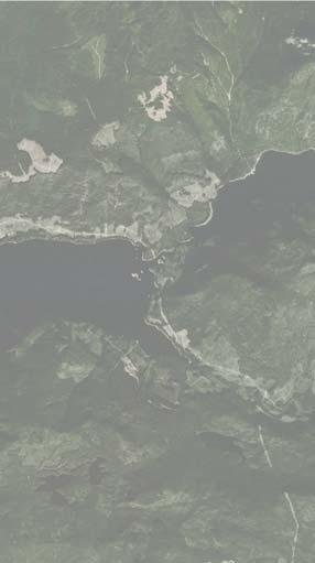


2 REGIONAL CONTEXT POWELL LAKE HASLIM LAKE HORSESHOE LAKE POWELL RIVER DUCK LAKE CANOE ROUTE TO COMOX TO TEXEDA HAMMIL LAKE ELECTORAL AREA C LOIS LAKE SUNSHINE COAST TRAIL SITE DETAIL MAP 101 MALASPINA STRAIT LANG BAY SALTERY BAY TO EARLS COVE N NOT TO SCALE TEXADA ISLAND


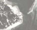
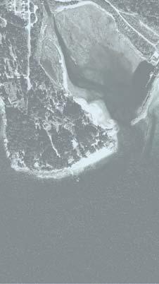


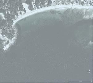
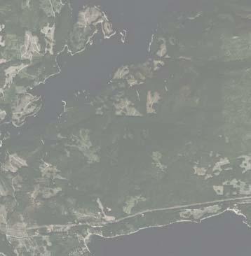
3 SITE CONTEXT ZILINSKY ROAD LANG CREEK SANDSTONE SITE WELDWOOD ROAD PHILLIPS ROAD SALMON SOCIETY 101 ESTUARY LANG BAY N NOT TO SCALE


4 PLANNING CONTEXT 1.7 COMMUNITY VISION + GOALS Community Vision Statement Area C is dedicated to a sustainable rural lifestyle where residents can enjoy the natural environment while encouraging thoughtful economic development and protecting agricultural and environmentally sensitive lands and resources Community Goals Electoral Area C Official Community Plan Bylaw No. 467, 2012 April 25, 2013 Protect the natural environment and rural lifestyle. Provide appropriate and affordable infrastructure services. Enhance economic opportunities. Retain healthy resource base. Provide for regionally sustainable agriculture. Provide a range of housing and lifestyle options. Protect the natural beauty and environmental qualities of the area. Foster sustainability. Protect the foreshore and provide for public access.


5 PLANNING CONTEXT SCALE 1:7,500 PRRD GIS Printout Comprehensive Development Area PT 11 LMP41683 PL PL BCP PL B 33 1 PL B AD PL LMP7051 ZILINSKY ROAD K 3 PL MP21186 LMP30933 PL PL BREW BAY ROAD PL A PL BCP14125 DL 1480 WELDWOOD ROAD PL BCP31620 & BCP PL PL 6280 PT 4 A A PL PL PL 4349 & 8060 PL 4349 A PL 4349 A (EX PL 8060) PL PL A B PL 5086 SONGBIRD LANE PL PL 5086 MAITLAND ROAD PL A B DL 3497 PL 6280 PL LMP PT 4 PL 6280 A Comprehensive Development Area provides for the development or redevelopment of a larger site allowing a variety of land uses and development approaches as part of a comprehensive development plan. This form of designation enables a local government to negotiate detailed guidelines and specifications for all aspects of a development in an integrated manner. The objectives of the Comprehensive Development Area designation are: to provide the opportunity for site-adaptive planning for development; to provide the opportunity for a mix of uses in new development areas; and to plan new development at densities and in locations that minimize the impact of development on the natural environment and that retain significant areas of open space. Comprehensive Development Area Policies: PT 6 6 PL PL A (EX PL 5549) BREW BAY ROAD BREW BAY ROAD A PL 4830 W O L F S O N B A Y R D 9 A PL COVE ROAD 10 PL 4830 A PL PL B 4 PT 5 PL MAHOOD ROAD 11 COVE ROAD 2 ANGEL RD ANGEL RD PL PL PT 1 PL MAHOOD ROAD DL 1480 DL 3798 DL 1480 Legend COMPREHENSIVE DEVELOPMENT AREA Rural Residential Low Density Residential Suburban Residential Industrial Institutional Agricultural Multi-Family Residential The Regional District will negotiate with the land owner(s) to finalize details of a comprehensive development plan taking into consideration the unique features of the specific site The Regional District and the land owner(s) will enter into a Comprehensive Development Agreement that will include the details of the development plan, servicing, parkland dedication, riparian area protection, public access to the foreshore and other matters. DISCLAIMER This mapping data has been compiled by the Powell River Regional District using data derived from a number of different sources with varying levels of accuracy. The Powell River Regional District disclaims all responsibility for the accuracy or completeness of this information.

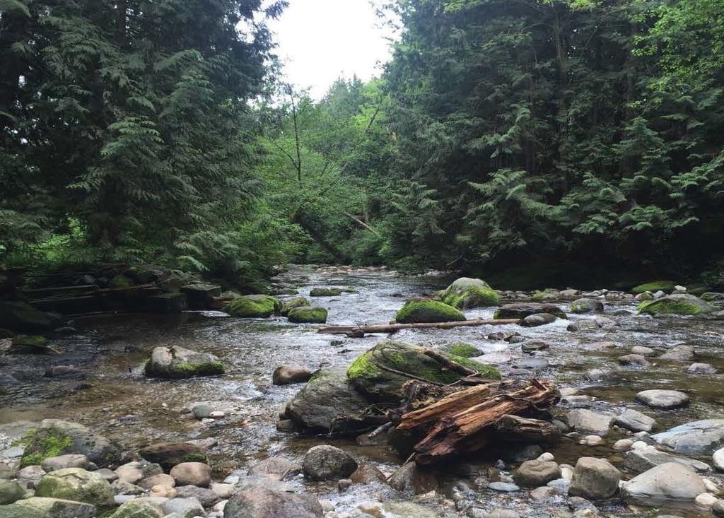
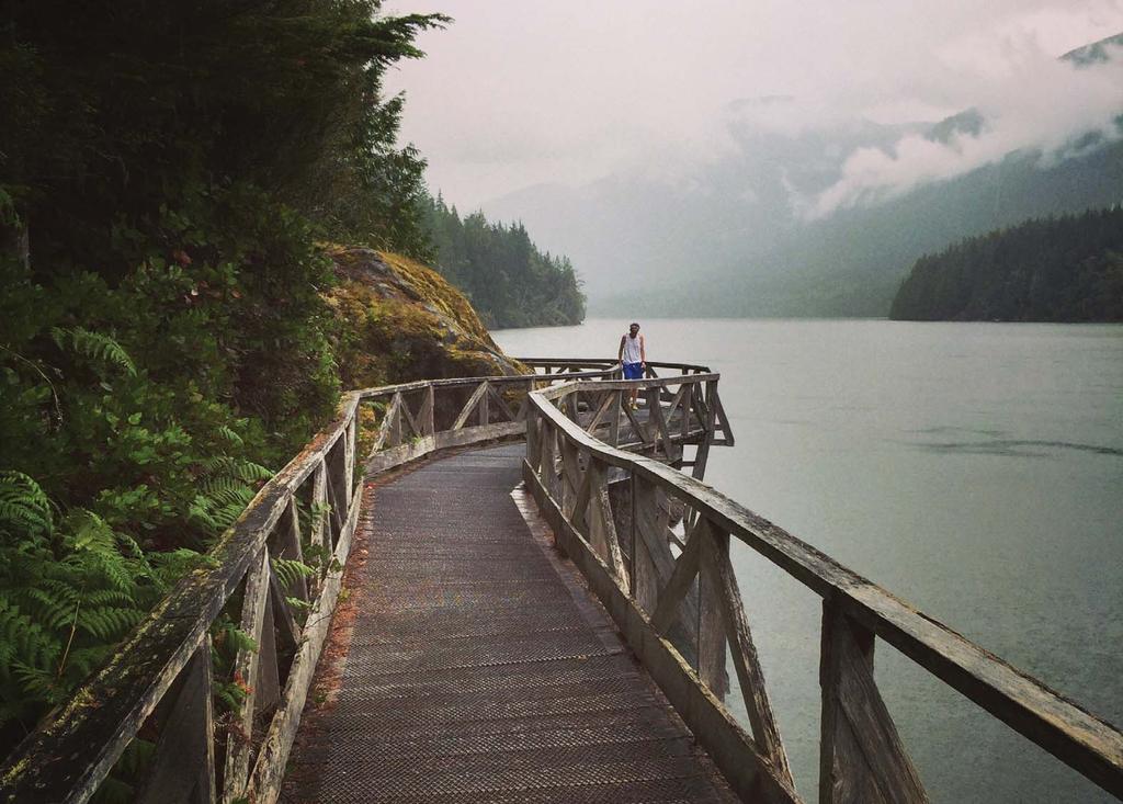
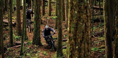
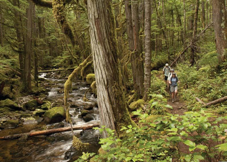
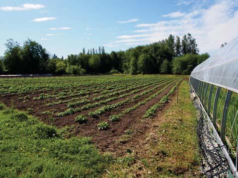
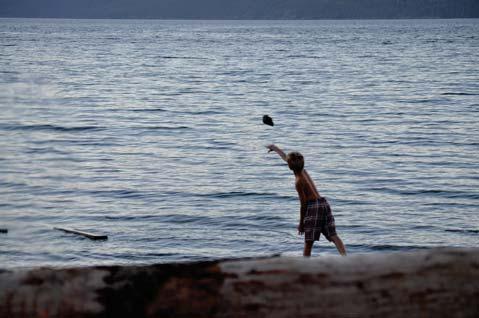
6 STEWARDSHIP OF THE LAND AND SEA

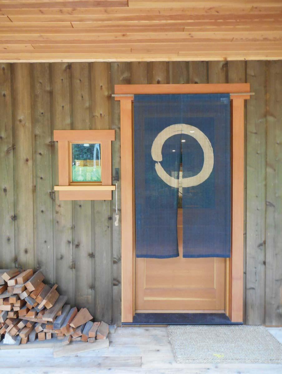
7 LOCAL LABOUR LOCAL CRAFT

8 HISTORY OF PLACE

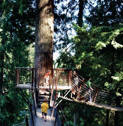
9 CELEBRATING COASTAL LIFE
 B - Public Park - 1.20 ha (2.97ac) C - Public Park 1.")
 E - Beach Access - 0.32 ha (0.")
 Total: 5.03 ha (12.")
10 PROPOSED PUBLIC DEDICATIONS A B F A - Public Park ha (1.78ac) B - Public Park ha (2.97ac) C - Public Park 1.66 ha (4.10ac) D - Road Dedication ha (0.30ac) E - Beach Access ha (0.79ac) (5m wide public boardwalk with interpretive sign-age) F - Fire Hall ha (2.50ac) Total: 5.03 ha (12.12ac) G - Brew Bay Stat ROW -.07 ha (0.17ac) (Existing ROW) G D C E N


11 PROPOSED LAND USE DESIGNATIONS Low Density Residential Suburban Residential Institutional Commercial Parks & Greenspace


12 PLANNING INTENT Provide a Semi-Rural Lifestyle - Preserve and Celebrate Land, Sea, History, Craft And Coastal Life. Offer greenspace, trails, and park dedications, a variety of lot sizes within a subdivision that compliments the natural landscape. Provide a buffer between rural or agricultural lands and suburban neighborhoods through use of Low Density Residential designation on upper portion of property. Provide a comprehensive and sustainable plan that supports a wide range of coastal lifestyles.
13
14


15 S & TRAILS LOOKOUT RIVERWALK TRAILS TREE-FARM THE PASTURE SEAGRASS N
16


17 ACCESS Key Considerations: Visibility Grading conditions Planning flexibility Future connections Clarity between public and private access locations 101 N


18 LOOKOUT THE COMMUNITIES THE HIGHLANDS RIVERWALK RIVERWALK BERRY FIELDS TREE FARM TREE FARM THE PASTURE TERRACE VIEW CRAFT THE ESTUARY BAYSIDE SEAGRASS N

 - 15 Riverwalk (R) - 10 Berry Fields (F) - 6 Tree Farm (T) - 8 Terrace View (V) - 10 Fire Hall (FH) - 1 Total lot count: 50 Open")
 Lower The Estuary (E) - 10 Bayside (B) - 16 Craft Commercial (C) - 1 Total lot count: 27 Open Space Area: 10.4 hc (4.")
19 R-1 RIVERWALK R-2 R-3 R-4 H-1 R-5 R-6 R-7 R-8 R-9 H-2 H-11 H-3 H-4 H-5 H-12 F-1 F-2 R-10 V-1 V-4 C-1 E-1 E-2 V-5 E-3 H-13 H-14 V-6 E-4 THE PASTURE V-2 E-5 E-6 F-3 F-5 V-7 LOOKOUT E-7 V-3 H-6 E-9 E-10 E-8 H-7 H-8 H-9 H-10 H-15 F-6 F-4 V-8 B-1 SEAGRASS B-4 B-16 V-9 T-1 T-2 T-3 T-4 T-5 T-6 T-7 T-8 V-10 B-2 B-3 TREE FARM FH B-8 B-9 B-10 B-7 B-11 B-6 B-5 B-12 B-13 B-14 B-15 THE PROPERTIES Upper Highlands (H) - 15 Riverwalk (R) - 10 Berry Fields (F) - 6 Tree Farm (T) - 8 Terrace View (V) - 10 Fire Hall (FH) - 1 Total lot count: 50 Open Space Area: 10.4 hc (25.63ac) Average lot size: 1.02 hc (2.52 ac) Lower The Estuary (E) - 10 Bayside (B) - 16 Craft Commercial (C) - 1 Total lot count: 27 Open Space Area: 10.4 hc (4.79 ac) Average lot size: 0.53hc (1.31 ac) 5+ Kilometers of Trails 20% Overall Open Space Area N
URBAN DESIGN REPORT. Proposed Residential Development, Old Church Road, Caledon East
 Proposed Residential Development, Old Church Road, Caledon East TABLE CONTENTS: 1.0 DEVELOPMENT 1.1 Introduction-Analysis of Guiding Principles and Documents 1.2 Community Design and Architectural Design
MAPLEWOOD VILLAGE CENTRE AND INNOVATION DISTRICT IMPLEMENTATION PLAN & DESIGN GUIDELINES. November 6, 2017 Regular Meeting of Council
 MAPLEWOOD VILLAGE CENTRE AND INNOVATION DISTRICT IMPLEMENTATION PLAN & DESIGN GUIDELINES November 6, 2017 Regular Meeting of Council Recommendation THAT Council: Approve the Maplewood Village Centre and
October 23, 2017 Council Workshop
 MAPLEWOOD VILLAGE CENTRE AND INNOVATION DISTRICT IMPLEMENTATION PLAN & DESIGN GUIDELINES October 23, 2017 Council Workshop COMMUNITY PLAN Purpose of Council Workshop Highlight What We Heard Phase 3 & Key
MYRTLE POINT ACREAGE POWELL RIVER, BC
 MYRTLE POINT ACREAGE POWELL RIVER, BC www.landquest.com JASON ZROBACK Direct Line: (604) 414-5577 101-313 Sixth Street, New Westminster, BC V3L 3A7 Phone: (604) 664-7630 Fax: (604) 516-6504 Toll Free:
The Vision for the San Juan Islands Scenic Byway
 The Vision for the San Juan Islands Scenic Byway 2 Judd Cove, Orcas Island, Courtesy of Kurt Thorson (kurtthorson.com) and San Juan County Land Bank Vision for the San Juan Islands Scenic Byway The San
Parkland County Municipal Development Plan Amendment Acheson Industrial Area Structure Plan
 Parkland County Municipal Development Plan Amendment Acheson Industrial Area Structure Plan New Plan Acheson Industrial Area Structure Plan Amendment Parkland County Municipal Development Plan Board Reference
The Sunshine Coast is part of the global community and generates wealth through export, high-value industries and new investment.
 3.2 Strategic intent 3.2.1 Shaping growth an overview In 2031, the Sunshine Coast is renowned for its vibrant economy, ecological values, unique character and strong sense of community. It is Australia
COASTAL CONSERVANCY. Staff Recommendation December 2, 2004 COYOTE HELLYER COUNTY PARK BAY AREA RIDGE TRAIL
 COASTAL CONSERVANCY Staff Recommendation December 2, 2004 COYOTE HELLYER COUNTY PARK BAY AREA RIDGE TRAIL File No. 04-057 Project Manager: Amy Hutzel RECOMMENDED ACTION: Authorization to disburse up to
Appendix 2 - Schedule of District Regulations
 RESIDENTIAL RECREATION DISTRICT (RR) INTENT: This district is intended to provide areas for growth/development of the Town at a modest density. The district provides for certain uses which, though low
6.5 kms OCEANFRONT & 1,300 ACRES - SUNSHINE COAST
 6.5 kms OCEANFRONT & 1,300 ACRES - SUNSHINE COAST www.landquest.com JASON ZROBACK 1-604-414-5577 JAMIE ZROBACK 1-604-483-1605 101-313 Sixth Street, New Westminster, BC V3L 3A7 Phone: (604) 664-7630 Fax:
Northern Sunshine Coast Regional Signage Renewal Report and Strategy 2014
 Northern Sunshine Coast Regional Signage Renewal Report and Strategy 2014 Tourism Powell River 4760 Joyce Avenue Powell River, BC V8A 3B6 Phone: 604-485-4000 Contact: Paul Kamon 1 Email: paul@discoverpowellriver.com
CHAPTER 1 INTRODUCTION MORENO VALLEY GENERAL PLAN 1. INTRODUCTION. 1.1 What is a General Plan?
 1. INTRODUCTION 1.1 What is a General Plan? A General Plan is a comprehensive long-term strategy for the physical development of a city. It determines how land may be used and the infrastructure and public
Chair and Members of Harbour East - Marine Drive Community Council. Brad Anguish, Director, Parks and Recreation
 P.O. Box 1749 Halifax, Nova Scotia B3J 3A5 Canada Item No. 15.1.1 Harbour East-Marine Drive Community Council December 3, 2015 TO: SUBMITTED BY: Chair and Members of Harbour East - Marine Drive Community
Part Three : COMMUNITY PLAN AREAS AND SPECIAL STUDY AREAS SACRAMENTO 2030 GENERAL PLAN. Introduction
 Special study Areas Part Three : COMMUNITY PLAN AREAS AND SPECIAL STUDY AREAS SACRAMENTO 2030 GENERAL PLAN Introduction Beyond the boundaries of the 2030 General Plan, the City has defined Special Study
Header i
 Header i 048285014.10 Header Sub Title Body Text here. Body text here. Body text here. Section 1... 1 Executive Summary... 1 Opportunities and Constraints... 3 Overall Opportunities and Constraints Map
ROBERTS CREEK PROVINCIAL PARK MASTER PLAN. November, 1981
 Ministry of Lands, Parks and Housing Parks and Outdoor Recreation Division Park Operations Branch North Vancouver, B. C. ROBERTS CREEK PROVINCIAL PARK MASTER PLAN November, 1981 Mr. G. Trachuk Director
377 Spadina Rd & 17 Montclair Ave Zoning Amendment Application Final Report
 STAFF REPORT ACTION REQUIRED 377 Spadina Rd & 17 Montclair Ave Zoning Amendment Application Final Report Date: September 14, 2016 To: From: Wards: Reference Number: Toronto and East York Community Council
REGIONAL BOARD REPORT
 REGIONAL BOARD REPORT Administrator s Office For the Board August 21, 2008 DATE: August 14, 2008 FILE NOS.: A-07-06377/8/9.000 FROM: RE: Chief Administrative Officer OCP and Zoning Amendment Application
Chapter 6: POLICY AND PROCEDURE RECOMMENDATIONS
 Chapter 6 POLICY AND PROCEDURE RECOMMENDATIONS FOR SRRA Below are seven policy elements that should be considered for adoption by the Southwest Regional Recreation Authority of Virginia: 1. Develop strategies
Pre-application submission for Committee: Phase 4 development at West Hendon
 Pre-application submission for Committee: Phase 4 development at West Hendon 1. Development Details Phase 4 of the West Hendon Estate Regeneration. 2. Background The redevelopment of the West Hendon Estate
% farmers/private landowners in watershed applying BMPs. Other (Number of participants completed the training)
") Easygrants ID: 23803 National Fish and Wildlife Foundation NFWF/Legacy Grant Project ID: 0302.10.023803 U. S. Coral Reef Task Force Partnership Initiative 2010 - Submit Final Programmatic Report (Activities
Easygrants ID: 23803 National Fish and Wildlife Foundation NFWF/Legacy Grant Project ID: 0302.10.023803 U. S. Coral Reef Task Force Partnership Initiative 2010 - Submit Final Programmatic Report (Activities
2433 Dufferin Street Zoning By-law Amendment Application - Preliminary Report
 STAFF REPORT ACTION REQUIRED 2433 Dufferin Street Zoning By-law Amendment Application - Preliminary Report Date: July 22, 2014 To: From: Wards: Reference Number: North York Community Council Director,
Economic Development and Tourism
 SECTION 4 SECTION 4 Economic Development and Tourism 4. Economic Development and Tourism Tourism plays a very important role in Niagara s economy, providing employment and generating business for support
BACKCOUNTRY TRAIL FLOOD REHABILITATION PROGRAM
 BACKCOUNTRY TRAIL FLOOD REHABILITATION PROGRAM Backcountry Trail Flood Rehabilitation A June 2013 Flood Recovery Program Summary In June 2013, parts of Southern Alberta were devastated from significant
MYRTLE POINT OCEANFRONT GOLF COURSE ACREAGE
 MYRTLE POINT OCEANFRONT GOLF COURSE ACREAGE www.landquest.com JASON ZROBACK Direct Line: (604) 414-5577 101 313 Sixth Street, New Westminster, BC V3L 3A7 Phone: (604) 664-7630 Fax: (604) 516-6504 Toll
Approved 15 Lot Residential Development Property
 Approved 15 Lot Residential Development Property Jason Zroback jason@landquest.com 1 (604) 414-5577 Jamie Zroback jamie@landquest.com 1 (604) 483-1605 Marketing British Columbia to the World The Source
RESORT AREA STRATEGIC ACTION PLAN (RASAP) STEERING COMMITTEE MEETING - APRIL 3, 2019
 STEERING COMMITTEE MEETING - APRIL 3, 2019") RESORT AREA STRATEGIC ACTION PLAN (RASAP) STEERING COMMITTEE MEETING - APRIL 3, 2019 Welcome & Introductions - Deb Zywna AGENDA FY 20 Resort CIP Proposed Projects - Kathy Warren ORDFBC Design Guidelines
RESORT AREA STRATEGIC ACTION PLAN (RASAP) STEERING COMMITTEE MEETING - APRIL 3, 2019 Welcome & Introductions - Deb Zywna AGENDA FY 20 Resort CIP Proposed Projects - Kathy Warren ORDFBC Design Guidelines
Thornton Water Project. Larimer County Route Study and Project Update September 12, 2017
 Thornton Water Project Larimer County Route Study and Project Update September 12, 2017 Purpose of Meeting Provide information on the Thornton Water Project Present the results of the pipeline routing
The Transportation Corridor Overlay District
 The Transportation Corridor Overlay District The Transportation Corridor Overlay District is a policy framework under which certain potentially beneficial development proposals may be considered, given
Heritage Character Area Zoning - Edmonton s Approach to Preserving(?) Community Character
 Community Character") Heritage Character Area Zoning - Edmonton s Approach to Preserving(?) Community Character Federation of Calgary Communities Community Planning Exchange November 4, 2017 City of Edmonton CITY
Heritage Character Area Zoning - Edmonton s Approach to Preserving(?) Community Character Federation of Calgary Communities Community Planning Exchange November 4, 2017 City of Edmonton CITY
Washington Township MASTER PLAN. Addendum: Washington Township Master Plan
 Washington Township MASTER PLAN Addendum: Washington Township Master Plan CHAPTER XI RECREATION CORE DISTRICT Introduction The Recreation Core District generally encompasses the areas north of 30 Mile
Boardwalks and cycling trails make their way through playing fields, landscaped gardens and extensive natural bushland.
 Like its namesake, the acclaimed aerobatic pilot Guido Zuccoli, this vibrant address in flourishing is set to take you to a new level of innovation and flair. Surrounded by bushland and fringed on one
CONTENTS. 1 Introduction Always Moving Forward while Building on the Past A Dynamic Destination... 5
 2010 STRUCTURE PLAN - 2 - CONTENTS 1 Introduction... 5 1.1 Always Moving Forward while Building on the Past... 5 1.2 A Dynamic Destination... 5 2 Map A... 6 Exhibition Place and its Neighbours... 7 3 Demonstration
MASTER PLAN July 24, 2014
 MASTER PLAN July 24, 2014 Vision Statement The newly expanded Rif Curaçao Seaport will enhance the island s ability to welcome guests to a vibrant and entertaining waterfront. The Rif Seaport Curaçao development
PURPOSE AND NEED (CONCURRENCE POINT 1) NEW CANADA ROAD PROJECT FROM STATE ROUTE 1 (U.S. HIGHWAY 70) TO U.S. INTERSTATE 40
 NEW CANADA ROAD PROJECT FROM STATE ROUTE 1 (U.S. HIGHWAY 70) TO U.S. INTERSTATE 40") PURPOSE AND NEED (CONCURRENCE POINT 1) NEW CANADA ROAD PROJECT FROM STATE ROUTE 1 (U.S. HIGHWAY 70) TO U.S. INTERSTATE 40 Project Description The primary purpose of this project is to improve the major
PURPOSE AND NEED (CONCURRENCE POINT 1) NEW CANADA ROAD PROJECT FROM STATE ROUTE 1 (U.S. HIGHWAY 70) TO U.S. INTERSTATE 40 Project Description The primary purpose of this project is to improve the major
Draft Greater Sydney Region Plan
 Powered by TCPDF (www.tcpdf.org) Draft Greater Sydney Region Plan Submission_id: 31382 Date of Lodgment: 14 Dec 2017 Origin of Submission: Online Organisation name: Greenfields Development Company & Ingham
Changing Lanes. Click to edit Master title style. Toronto and East York Community Council. Second level Third level. Fourth level.
 Changing Lanes Toronto s Click to Laneway edit Master Suites text Strategy styles Toronto and East York Community Council May 2, 2018 2,433 Total number of Laneways in the City of Toronto 295 km Of Laneways
Longmont to Boulder Regional Trail Jay Road Connection DRAFT FINAL REPORT
 Longmont to Boulder Regional Trail Jay Road Connection DRAFT FINAL REPORT December 2018 Project Summary Boulder County, Colorado, in partnership with the City of Boulder, is evaluating options for multi-use
POWELL RIVER REGIONAL DISTRICT REGIONAL TRAILS PLAN DECEMBER 2016
 POWELL RIVER REGIONAL DISTRICT REGIONAL TRAILS PLAN DECEMBER 2016 The Regional Trails Plan will acknowledge and enhance the comprehensive trail network, embracing diverse user groups. The network will
APPENDIX OFFICIAL MAP ORDINANCE OF HAMILTONBAN TOWNSHIP OFFICIAL MAP NARRATIVE
 APPENDIX A OFFICIAL MAP ORDINANCE OF HAMILTONBAN TOWNSHIP OFFICIAL MAP NARRATIVE INTRODUCTION: The Official Map of Hamiltonban Township has been prepared to identify those lands and features that Hamiltonban
CHAPTER 4 -- THE LAND USE PLAN: DESCRIPTIONS AND POLICIES FOR THIRTEEN PLANNING AREAS
 CHAPTER 4 -- THE LAND USE PLAN: DESCRIPTIONS AND POLICIES FOR THIRTEEN PLANNING AREAS SOUTH COAST CAC PLANNING AREA 4.10 NAVARRO RIVER TO MALLO PASS CREEK PLANNING AREA (Includes Greenwood/Elk) This planning
North Forty Area ( area bounded by Lark Avenue, Los Gatos Boulevard, Highway 85 and
 RESOLUTION 2015-056 RESOLUTION OF THE TOWN COUNCIL OF THE TOWN OF LOS GATOS ADOPTING GENERAL PLAN AMENDMENTS NECESSARY FOR THE NORTH FORTY SPECIFIC PLAN. THE PLAN AREA COMPRISES APPROXIMATELY 44 ACRES
Is a different governance mindset needed for our coasts, waterways and open space? Chris Chesterfield
 Is a different governance mindset needed for our coasts, waterways and open space? Chris Chesterfield Is a different governance mindset needed for our coasts, waterways and open space? Yarra MAC objectives:
Airport Planning Area
 PLANNING AREA POLICIES l AIRPORT Airport Planning Area LOCATION AND CONTEXT The Airport Planning Area ( Airport area ) is a key part of Boise s economy and transportation network; it features a multi-purpose
A Vision for South Skunk River and Chichaqua Bottoms Greenbelt
 A Vision for South Skunk River and Chichaqua Bottoms Greenbelt Photo: Jim Pease Chichaqua Bottoms Booklet 7 of 8 Greater Des Moines Water Trails and Greenways 1 2016 Table of Contents Booklet 1: Water
KAMPALA: THE GARDEN CITY
 KAMPALA: THE GARDEN CITY Kampala is urbanizing rapidly. The city has a population of over three million people and accounts for over sixty percent of Uganda's GDP. According the to the Kampala City Council
SOUTH INTERCHANGE AREA
 Santaquin City General Plan 1 Location and Characteristics The South Interchange Area of Santaquin is located west of Interstate 15 and south of 500 South (Figure 1). It includes properties already annexed
A number of goals were identified during the initial work on this Big Lake Transportation Plan.
 C. Transportation General Background Information Big Lake s transportation system includes all the roads, paths and facilities that allow the movement of private vehicles, trains and planes, as well as
ARLINGTON COUNTY, VIRGINIA
 ARLINGTON COUNTY, VIRGINIA County Board Agenda Item Meeting of April 16, 2005 DATE: March 28, 2005 SUBJECTS: A. Adoption of the Fort Myer Heights North Plan. B. GP-300-04-1 Adoption of the following General
City of Surrey PLANNING & DEVELOPMENT REPORT File:
 City of Surrey PLANNING & DEVELOPMENT REPORT File: 7917-0297-00 Planning Report Date: September 11, 2017 PROPOSAL: Amend CD By-law No. 18795 (based on RH-G). to allow for an increased house size on thirteen
SUMMER VILLAGE OF SILVER SANDS. Municipal Development Plan
 SUMMER VILLAGE OF SILVER SANDS Municipal Development Plan Bylaw 253-2014 Adopted August 22, 2014 Summer Village of Silver Sands Municipal Development Plan Bylaw No. 253-2014 Page 2 1 INTRODUCTION 1.1 SETTING
The Lone Star Coastal National Recreation Area: Feasibility Study Status Report - September 2013
 The Lone Star Coastal National Recreation Area: Feasibility Study Status Report - September 2013 Lone Star Coastal National Recreation Area Concept National Park Criteria Concept Storm Surge Damage Reduction
Two Lots with Drilled Well Savary Island, BC
 Two Lots with Drilled Well Savary Island, BC Jason Zroback jason@landquest.com 1 (604) 414-5577 Jamie Zroback jamie@landquest.com 1 (604) 483-1605 Marketing British Columbia to the World The Source for
Commission SUMMARY: 12, Action. review. hearing is. being. 601 E Kennedy Blvd., 18
 Hillsborough County City-Countyy Planning Commission 601 E Kennedy Blvd., 18 th floor, Tampa, Florida, 33601 813-272-5940 theplanningcommission.org EXECUTIVE SUMMARY Meeting Date: August 12, 2013 Agenda
This page has been intentionally left blank.
 This page has been intentionally left blank. Chapter 2 2-2 2. Growing the Economy In many ways, the Niagara Region is a community of communities and this is becoming increasingly so. It is made up of towns
Everett Riverwalk Life style explore
 Life style explore Project Overview The 217-acre Everett Riverfront redevelopment is visible from I-5 with traffic counts charted at 170,000+ vehicles per day with direct freeway access from 4-way interchange.
KAP Lot 3. Lot 3. Lot Lot 5. Lot 6. Lot 7. Lot 8. Lot KAP 81153
 Public Notice April 26, 2018 Subject Property: 249 Westminster Ave W Lot A, District Lot 4, Group 7, Similkameen Division Yale (Formerly Yale Lytton) District, KAP92015 Application: Rezone PL2018-8201
places esplanade Distinctive Destinations Healthy,Active and Event Ready Family Friendly Foreshore Evolution five
 five places 1 6 2 4 3 14 5 7 8 9 13 Foreshore & esplanade Healthy,Active and Event Ready Parkland planning for enhanced triathlon competitor and spectator experience, as well as catering for everyday exercise
D IRECTION S TATEMENT
 Vancouver Island Region M ANAGEMENT D IRECTION S TATEMENT September 2003 for Lower Nimpkish Provincial Park Ministry of Water, Land and Air Protection Environmental Stewardship Lower Nimpkish Provincial
Ontario Municipal Board Commission des affaires municipales de l Ontario
 Commission des affaires municipales de l Ontario ISSUE DATE: July 25, 2014 CASE NO: PL130788 PROCEEDING COMMENCED UNDER subsection 17(36) of the Planning Act, R.S.O. 1990, c. P.13, as amended Subject:
Blue River Trail Master Plan JSA to Town Hall June 2004
 Blue River Trail Master Plan JSA to Town Hall June 2004 Prepared for: Silverthorne Town Council Silverthorne SPORT Committee Department of Recreation and Culture Silverthorne Public Works Silverthorne
ANAGEMENT. LAN November, 1996
 M ANAGEMENT P LAN November, 1996 for Coldwater River Provincial Park Ministry of Environment, Lands and Parks BC Parks Department Coldwater River Provincial Park M ANAGEMENT P LAN Prepared by BC Parks
Two Lots with Fixer-Upper Cabin & Drilled Well
 Two Lots with Fixer-Upper Cabin & Drilled Well Jason Zroback jason@landquest.com 1 (604) 414-5577 Jamie Zroback jamie@landquest.com 1 (604) 483-1605 Marketing British Columbia to the World The Source for
Union of British Columbia Municipalities
 2008 COMMUNITY EXCELLENCE AWARD SUBMISSION Ucluelet Sustainability Initiatives Category: Leadership & Innovation - Small Municipality (Population under 5000) Submitted By: Felice Mazzoni, MCIP, Director
Draft Western District Plan
 Powered by TCPDF (www.tcpdf.org) Draft Western District Plan Submission_id: 31732 Date of Lodgment: 15 Dec 2017 Origin of Submission: Online Organisation name: APP Corporation Pty Ltd Organisation type:
Spadina Avenue Built Form Study Preliminary Report
 STAFF REPORT ACTION REQUIRED Spadina Avenue Built Form Study Preliminary Report Date: July 9, 2014 To: From: Wards: Reference Number: Toronto and East York Community Council Director, Community Planning,
Policy PL Date Issued February 10, 2014
 Subject RENEWABLE ENERGY ON CROWN LAND Compiled by Renewable Energy Program, Biodiversity Branch Replaces Policy Directives Waterpower Site Release Crown Land Onshore Windpower Development - Crown Land
ADDENDA. 1. It does not conform to the Master Plan format in the following areas: Statement of Purpose - clarification of parks purpose in system.
 File: 2-7-2-79-27 ADDENDA Plan for Saltery Bay Park This plan has been reviewed and is approved with the following comments and conditions: 1. It does not conform to the Master Plan format in the following
RATTLESNAKE HILL PHILLIPS, HARRIS FARM, LIME KILN & QUARRY
 Town of, MA Trails Map 6a SPLIT ROCK PRIMARY SECONDARY PRIVATE PRIVATE PROPERY STAY ON HEAD FUTURE TO SKINNER (NOT MARKED) 0 miles 0.25 0.250 0.5 Mapbox, Data Odbl, OpenStreetMap contributors primary use
North District Plan OVERVIEW
 OUR GREATER SYDNEY 2056 Revised Draft North District Plan OVERVIEW Hornsby Hunter's Hill Ku-ring-gai Lane Cove Mosman Northern Beaches North Sydney Ryde Willoughby Snapshot of the North District today
Creating Walkable Environments in Frankston. Marti Fooks Urban Designer & Clare Davey Traffic and Transport Coordinator
 Creating Walkable Environments in Frankston Marti Fooks Urban Designer & Clare Davey Traffic and Transport Coordinator Frankston City Population 2006 121,587 % of Melbourne Statistical Division (SD) 3.2%
COMOX VALLEY AIRPORT. Strategic Plan Summary. October 2010
 COMOX VALLEY AIRPORT Strategic Plan 2011-2015 Summary October 2010 COMOX VALLEY AIRPORT Introduction History The Comox Airport was constructed by the Department of National Defence in 1942. The Comox Airport
Dear Investor, Jim Smith Warden. Connie Nolan Chief Administrative Officer
 It s all here Dear Investor, We offer a dedicated in-house team from our Economic Development, Planning, Infrastructure/Engineering and Finance departments to work with your team from land purchase, through
COLLEGE STREET STUDY Community Consultation Meeting. December 2015
 COLLEGE STREET STUDY Community Consultation Meeting December 2015 2 Agenda 6:30 pm Introductions, Agenda Review and Welcome 6:40 pm Presentation Planning Recommendations 7:30 pm Questions and Discussion
Green Fields Leppington
 Green Fields Leppington CONNTENTS 1.0 URBAN GROWTH - SYDNEY 2.0 MACRO CONTEXT 3.0 LOCAL ENVIRONMENTAL PLAN - LEPPINGTON 4.0 CONCEPT 5.0 GREEN ROOFS 6.0 APARTMENT REALISATION SCHEDULE 7.0 INFRASTRUCTURE
DAKOTA CULTURE UPPER SIOUX COMMUNITY: AREA CHARACTER ANALYSIS ALIGNMENT STRATEGY
 UPPER SIOUX COMMUNITY: AREA CHARACTER ANALYSIS ALIGNMENT STRATEGY 51 AREA CHARACTER ANALYSIS: OPPORTUNITIES & CONSTRAINTS RECREATIONAL VEHICLE PARK: A recreational vehicle park will be built to accommodate
Proposed National Marine Conservation Area Reserve Southern Strait of Georgia PROJECT UPDATE Spring 2012
 Proposed National Marine Conservation Area Reserve Southern Strait of Georgia PROJECT UPDATE Spring 2012 National marine conservation areas (NMCAs) are established to protect, conserve and present examples
COASTAL CONSERVANCY. Staff Recommendation June 5, 2008 GUALALA BLUFF TRAIL OPERATIONS AND MAINTENANCE
 COASTAL CONSERVANCY Staff Recommendation June 5, 2008 GUALALA BLUFF TRAIL OPERATIONS AND MAINTENANCE File No. 08-047-01 Project Manager: Deborah Hirst RECOMMENDED ACTION: Consideration and possible Conservancy
DRAFT GENERAL IMPLEMENTATION PLAN AND SPECIFIC IMPLEMENTATION PLAN MIDDLETON MUNICIPAL AIRPORT MOREY FIELD. Revised 12/12/03
 DRAFT GENERAL IMPLEMENTATION PLAN AND SPECIFIC IMPLEMENTATION PLAN MIDDLETON MUNICIPAL AIRPORT MOREY FIELD Revised 12/12/03 As recommended for approval by the Plan Commission General Project Description
Powell Lake Lodge Powell River, BC
 Powell Lake Lodge Powell River, BC Jason Zroback jason@landquest.com 1 (604) 414-5577 Jamie Zroback jamie@landquest.com 1 (604) 483-1605 Marketing British Columbia to the World The Source for Oceanfront,
Rating: 5.0 (scale of 1-10)
") 95 Community Trail System Groundcover: 2-metre paved path, 1- metre grass buffer on either side. Location: Fort St. John Ownership: City of Fort St. John Rating: 5.0 (scale of 1-10) Strategic value: Linear
95 Community Trail System Groundcover: 2-metre paved path, 1- metre grass buffer on either side. Location: Fort St. John Ownership: City of Fort St. John Rating: 5.0 (scale of 1-10) Strategic value: Linear
Chuckanut Ridge Fairhaven Highlands EIS Scoping Concerns
 Chuckanut Ridge Fairhaven Highlands EIS Scoping Concerns Coalition of Southside Neighborhoods CSN Comments for Fairhaven Highlands EIS Scope Hearing, Jan 16, 2008 1 Chuckanut Ridge Hilly Terrain: Potential
Waterfront Concept Plan: Community Survey Summary
 Waterfront Concept Plan: Community Survey Summary Published April 20, 2016 #1100085 Introduction The survey was one component of the public consultation process endorsed by Council in October, 2015. This
Welcome. to Osprey Waters. The Mirvac Difference
 The Mirvac Difference For 45 years we have been reimagining urban life in Australia creating exceptional living experiences through the pursuit of quality and care in every little detail. You can benefit
SUSTAINING OUR ENVIRONMENT, PLANNING FOR OUR FUTURE
 SUSTAINING OUR ENVIRONMENT, PLANNING FOR OUR FUTURE Key Recommendations to Inform the 2015 Provincial Review of the Oak Ridges Moraine Conservation Plan APRIL 2015 KEY RECOMMENDATIONS TO INFORM THE 2015
Lafourche Parish Government REQUEST FOR QUALIFICATIONS. Landscape Architectural Services
 Lafourche Parish Government REQUEST FOR QUALIFICATIONS Landscape Architectural Services Bayou Lafourche Parish Multi-Use Path Feasibility Study Phase 1 And Bayou Lafourche Parish Multi-Use Path Feasibility
PROPERTY FEATURES PRICE: CALL FOR DETAILS AVAILABLE: 1,000-34,000± SF LOCATION:
 FOR LEASE SEQ IMMOKALEE RD & SR 951 THE is a premium retail center located in one of biggest growth areas in all of Naples, Florida. Surrounded by lots of new residential & commerical development, this
440, 444, 450 and 462 Front Street West; 425, 439, 441 and 443 Wellington Street West and 6-18 Spadina Ave. Official Plan Amendment Final Report
 STAFF REPORT ACTION REQUIRED 440, 444, 450 and 462 Front Street West; 425, 439, 441 and 443 Official Plan Amendment Final Report Date: May 28, 2015 To: From: Wards: Reference Number: Toronto and East York
GOALS, OBJECTIVES, & RECOMMENDATIONS historic preservation. BUDA 2030 COMPREHENSIVE PLAN preserving our heritage sustaining our future
 HISTORIC PRESERVATION Buda has the second largest concentration of historic structures in Hays County, many of which are located along Main Street in downtown Buda. 1 These historic buildings form the
STAGE PLAN STAGE 4B REEF RELEASE LEGEND. Lot Height. Display Village Previous Release. Current Release. Retaining Wall Sold.
 STAGE PLAN STAGE 4B REEF RELEASE 6.54 7.28 7.43 7.30 7.40 7.80 7.50 7.97 PGOL0466.030216 TAMBREY AVENUE LEGEND Lot Height Current Release Display Village Previous Release Group Housing Retaining Wall Sold
Lasqueti Island Acreage with Home & 3 Guest Cabins
 Lasqueti Island Acreage with Home & 3 Guest Cabins Jason Zroback jason@landquest.com 1 (604) 414-5577 Jamie Zroback jamie@landquest.com 1 (604) 483-1605 Marketing British Columbia to the World The Source
Appendix 1: Operations Summary Report for the Quarter Ended December 31, 2017
 Appendix 1: Operations Summary Report for the A B C D E F G H I J Routes Actual Round Trips Capacity Provided (AEQ's) AEQ's Carried QTR 3 F2018 Capacity Utilization QTR 3 F2018 (C / B) Capacity Utilization
Hampton Township. Community Description
 Hampton Township Community Description Hampton Township is located in southern Bay County, east of Bay City and Essexville. It contains approximately 9 miles of Saginaw Bay shoreline and 1.5 miles of Saginaw
BrowardNEXT Topic Item Web Link Source Year
 BrowardNEXT Topic Item Web Link Source Year Intergovernmental Coordination Population QuickFacts http://www.census.gov/quickfacts/table/pst120 US Census Bureau 2010 214/12011 Intergovernmental Coordination
Establishing a National Urban Park in the Rouge Valley
 STAFF REPORT ACTION REQUIRED Establishing a National Urban Park in the Rouge Valley Date: March 29, 2012 To: From: Wards: Reference Number: Executive Committee Deputy City Manager, Cluster B All p:\2012\cluster
SA"-C.k..try A Approved and Ordered MAR PROVINCE OF BRITISH COLUMBIA ORDER OF LIEUTENANT GOVERNOR IN COUNCIL
 PROVINCE OF BRITISH COLUMBIA ORDER OF LIEUTENANT GOVERNOR IN COUNCIL Order in Council No. 185 Approved and Ordered MAR 2 9 2012 Lieutenant Governor Executive Council Chambers, Victoria On the recommendation
DEVELOPMENT PROFILES
 DEVELOPMENT PROFILES 1-855-923-2338 Fort McMurray Generalized Land Development Concept 881 63 Parsons Creek Stone Creek Commercial The Commons at Eagle Ridge Timberlea West Growth MacDonald Island Snye
Fremont Point Cabin Reconstruction and Expansion Project Project Proposal & Public Scoping Documentation
 Fremont Point Cabin Reconstruction and Expansion Project Fremont-Winema National Forests Silver Lake Ranger District The Silver Lake Ranger District of the Fremont-Winema National Forests is proposing
The MPA Name. The past and future of the. Montego Bay Marine Park Trust
 The MPA Name The past and future of the Montego Bay Marine Park Trust Park Boundaries and Sanctuary Area 100m/330ft/50 Fathom Depth Contour to The Average Highest High Tide Mark 50 Fathom/100M Depth Great
3450 Dufferin Street - Official Plan Amendment, Zoning Amendment and Draft Plan of Subdivision Applications Request for Directions Report
 STAFF REPORT ACTION REQUIRED 3450 Dufferin Street - Official Plan Amendment, Zoning Amendment and Draft Plan of Subdivision Applications Request for Directions Report Date: March 15, 2017 To: From: Wards: