Greenwich Township, Warren County, New Jersey Credits and Acknowledgements
|
|
|
- Clara Dennis
- 5 years ago
- Views:
Transcription

1
2
3 Greenwich Township, Warren County, New Jersey Credits and Acknowledgements Planning Board Doris Rayna, Chair James Adams, Vice Chair Deborah Pasquarelli, Mayor Steven Babula Helio Carvalho Dominick Esposito Kenneth Hoser Frank Marchetta Tom Bolger, Alternate J. Brooke Waldt, Alternate Planning Board Secretary Planning Board Attorney Consulting Engineers Finelli Consulting Engineers, Inc. Consulting Traffic Engineers Lublanecki Engineering, Inc. Township Committee Elva Pomroy William Edleston, Esq. Michael S. Finelli, P.E., P.P. Donald P. Schlachter, P.E., P.P. James E. Daley Walter Lublanecki, P.E. Deborah Pasquarelli, Mayor Dominick Esposito Gregory Blaszka Joseph Gurneak Gregory Wovna Kimberly Viscomi, Township Clerk J. Peter Jost, Esq., Township Attorney Finelli Consulting Engineers, Inc. wishes to thank both the Warren County Engineering and Planning Departments for their assistance in the preparation of this plan. The contributions of past Planning Board Members who were involved in the preparation of this plan should also be acknowledged.
4 TABLE OF CONTENTS I. Introduction... 1 II. Goals and Objectives... 2 III. Existing Circulation Conditions... 3 A. Vehicular Roadway Network... 3 B. Pedestrian (Non-vehicular) Circulation... 6 IV. Existing Circulation Issues/Planned Improvements/ Concerns/Recommendations... 7 A. State and County Roadways... 8 B. Municipal Roadways and Intersections C. Existing Roadway Classifications and Definitions D. Existing Traffic Volumes V. Proposed Circulation Improvements A. Future Roadway Demands B. Proposed Roadways C. Proposed Pedestrian (Non-vehicular) Pathways D. Proposed Roadway Classifications and Specifications E. Reclassification of Existing Roadways VI. South Main Street Alternative Parking APPENDICES Appendix A Existing Roadway Data Sheets Appendix B NJDOT Route 22 Concept Plan Appendix C Road and Street Map Appendix D Traffic Signal and Intersection Reference Plan Appendix E Proposed Circulation Plan Appendix F South Main Street Alternative Parking Concept Plan
5 I. INTRODUCTION The Greenwich Township Circulation Plan is intended to provide the Township with a guide and resource document which will govern future vehicular and non-vehicular movements within the Township. Primarily, it will act as a guide for future development applications which may come before the Township Planning Board. The plan will be utilized by future applicants, in conjunction with the Township s Land Use and Zoning Ordinances, towards development which will represent the community s intent to maintain the present quality of life within Greenwich Township. The last comprehensive examination of the Township Circulation Plan was conducted in Since that time, the Township has seen many changes and a considerable amount of development both within its borders and directly outside its borders. The influx of both residential and non-residential traffic has significantly impacted the Township, its current roadway network and the quality of life of the citizens of Greenwich. Since over ten years have passed since the Township s last Circulation Plan update and on the heels of the 1998 comprehensive Master Plan re-examination and subsequent Land Use Ordinance changes, the Planning Board has decided that the timing is appropriate for an update to the Township Circulation Plan. As outlined in the New Jersey Land Use Law (c.291, NJ 1975), the Township Planning Board has the sole responsibility for updating the various elements of the Township s Master Plan. N.J.S.A. 40:58D-28.b(4) reads: A circulation plan element showing the location and types of facilities for all modes of transportation required for the efficient movement of people and goods into, about, and through the municipality, taking into account the functional highway classification system of the Federal Highway Administration and the types, locations, conditions and availability of existing and proposed transportation facilities, including air, water, road and rail. This Circulation Plan will examine a number of parameters, including existing land uses of the Township, current zoning, existing traffic data, environmental features, anticipated regional traffic impacts, topography and the goals and objectives set forth in this plan by the Planning Board. It will relate the Planning Board s general goals and objectives and set forth a new Circulation Plan based on these goals and objectives with consideration given to all the previously listed factors. Beyond the development of a new and substantially different Circulation Plan, the Township will have a valuable resource document at their disposal to be utilized in conjunction with future planning efforts. Upon review of the Circulation Plan, it will be evident that the primary goal and objective is to discourage regional traffic from utilizing the existing Township residential roadway network. This plan was developed with that premise as the fundamental basis of the plan s development. The local roadway system which was originally designed to provide for safe and efficient movement of residential traffic through the Township will be maintained and ancillary traffic impacts will be minimized. 1
6 II. GOALS AND OBJECTIVES The goals and objectives of this Circulation Plan were generated and consolidated after numerous workshop meetings with the Planning Board where direct recommendations were received from the members. The Circulation Plan was subsequently developed utilizing these goals and objectives as the main parameters for the Plan. They are summarized as follows: 1. Provide for an internal roadway system to serve the needs of the residents and businesses of Greenwich Township by developing local circulation patterns within and between neighborhoods that will allow free movement within the Township without attracting regional through-traffic flows. 2. Provide a roadway system that discourages through traffic, both commuters and business-bound visitors, by providing more attractive collector roadways that carry traffic around existing neighborhoods to desired destinations such as shopping centers and State and County arterial roadways. 3. Establish non-vehicular linkages and greenways (pedestrian paths/bikeways) between residential neighborhoods and schools, municipal and recreational facilities, and shopping centers. 4. Provide a bypass route around the center of Stewartsville. 5. Develop a plan that is consistent with ongoing open space and farmland preservation efforts. 6. Provide for alternative parking for the residents of South Main Street. 2
7 III. EXISTING CIRCULATION CONDITIONS A. Vehicular Roadway Network The main roads within the Township are under the jurisdiction of the either the County or the State/Interstate. The local roads are generally the original farm roads supplemented by residential subdivision roads. Interstate Roads The most significant road within the Township is Interstate Route 78. Route 78 traverses the Township in an easterly-westerly direction and nearly divides it in half. This interstate highway serves as a major carrier of through traffic and connects the New York metropolitan area with the Lehigh Valley area of Pennsylvania and points further west. The direct interaction between Interstate Route 78 and the Township road network occurs within the Township at three locations: There is a partial interchange at Exit 6 signed Warren Glen which only allows eastbound traffic to exit onto Asbury Road and westbound traffic to enter Route 78; and There is a partial interchange at Exit 4 signed Stewartsville which only allows westbound traffic to exit onto South Main Street and eastbound traffic to enter Route 78. There is a full interchange at Exit 3 located in both Greenwich and Pohatcong Townships connecting Route 78 with State Routes 22 and 173. The indirect interaction between Interstate Route 78 and the Township road network occurs just outside the Township at one addition location: There is a full interchange at Exit 7 in Bloomsbury, just east of the Township, connecting Route 78 with State Route 173. State Roads There are three State-owned roads that run through the Township: Route 173, Route 22, and Route 57. Route 173 runs essentially parallel to Route I-78 with one terminus at I-78 at the western municipal boundary and the other terminus at the eastern municipal boundary. The east-west alignment of Route 173 divides the lower ¼ of the Township from the remainder. This route serves as the major access spine in this southern portion of the Township. 3
8 Route 22 runs in a southeasterly-northwesterly direction along the western Township boundary. Since the construction of Route 78, this portion of Route 22 has become a secondary interstate carrier with most truck traffic diverted to I-78. Route 22 continues to serve as a major interregional highway with densely developed commercial properties. Route 57 runs easterly westerly through the northern portion of the Township providing access between Phillipsburg and Washington/Hackettstown where connection to Route 46 is available. Route 57 serves as a major interregional connector for Warren County. County Roads Roadways with County jurisdiction provide the only established north-south connector roads. The southerly terminus of Route 637 (Main Street) is at Route 173 and runs northward where it connects with the partial interchange (Exit 4) of I 78. Route 637 continues northward through Stewartsville to Route 57, crossing Route 57 and continuing to Route 519 in Lopatcong. Route 519 runs northward from Route 22 at the westerly boundary of the Township to Route 57 in Lopatcong and continues northward to Hope and points beyond. It serves as a primary north-south connector for Warren County. Route 638 (Greenwich Street) connects Route 22 to Route 637 (Main Street) in Stewartsville. Route 644 (Greenwich Church Road) is a minor loop road running from Route 173 near Ravine Road to Route 173 just west of Fran Lane. Route 639 (Warren Glen Road) connects eastern Pohatcong Township to Route 173 immediately west of the intersection of Hunterdon County Route 579. Local Roads One of the main goals of the Greenwich Township Circulation Plan is to keep "regional traffic" off of the Township's local residential roadway system including those county roads that run through the center of the Township. The Township s local residential roadways are defined as any municipal road that serves as access to a residential neighborhood or functions as a collector roadway for the residential access roads. Some of the residential collector roadways are: Beatty s Road Willow Grove Road Richline Road Low s Hollow Road Wyndham Farm Boulevard Dumont Road 4
9 The purpose of the local residential roadway system is to provide for the safe and efficient movement of Greenwich Township residential traffic destined for work, shopping, schools, recreational facilities, community activities, and other residential neighborhoods within Greenwich Township. Most of the collector roadways in the Township function solely as residential access. Dumont Road, however, is an exception. Dumont Road was designed as a connecting roadway between County Route (CR) 519, which runs along the western boundary of the Township, and the New Brunswick Avenue Extension which runs north/south and intersects Route 22 just west of the I-78 Interchange, Exit 3. The section of Dumont Road between CR 519 and Greenwich Street (CR 638) exists today. The section of Dumont Road between Greenwich Street and the New Brunswick Avenue Extension is currently under construction (as is the New Brunswick Avenue Extension) in conjunction with the Greenwich Center retail development located adjacent to Route 22 West, south of Greenwich Street. In addition to the Dumont Road Extension and the New Brunswick Avenue Extension, the intersection of Greenwich Street and Route 22 is also being reconstructed as a signalized intersection, providing for left turning movements. When these improvements are complete, Dumont Road, in addition to serving local residential traffic, will serve regional traffic destined to the retail development along Route 22 and I-78. The County Roads that run through the center of the Township, specifically Greenwich Street and North and South Main Street (CR 637), serve as collector roads for local residential traffic. However, they also serve regional through traffic going to and from I-78. Warren Glen Road (CR 639), located near the southern boundary of the Township, also serves as a collector road for local residential traffic as well as regional through traffic. In order to satisfy the goal of keeping "regional traffic" off of the Townships residential roadway system, the main roadways on the Township's perimeter must be improved. Sections of Route 22, CR 519 and Route 57 must undergo major reconstruction improvements to increase capacity significantly and attract traffic away from Greenwich Township's local roadway system. These main perimeter roadways, however, are not under Township jurisdiction. Route 22 and Route 57 are under State jurisdiction and Route 519 is under County jurisdiction. Therefore, interaction between Greenwich Township officials and representatives of the State and the County in planning future improvements is essential in satisfying the main goal of the Circulation Plan. 5
10 B. Pedestrian (Non-vehicular) Circulation Although not specifically addressed in the prior Circulation Plan, nonvehicular pathways are a goal of the current circulation plan, as well as a focus in the Community Design Guidelines section of the 1998 Township Master Plan. Sidewalks and pathways are encouraged, connecting all uses. The implementation of pedestrian walkways/bikeways, separated from the roadways, should be of primary importance. Within the newer residential developments, sidewalks have been included on at least one side of all the roads, with the exception of short cul-de-sacs. These sidewalks provide safe paths for pedestrian and bicycle traffic within each development, however, the sidewalks end at the limits of the immediate residential areas. Further connections are required to meet the goal of the Township. With the increased residential development within the Township came the increased population of school-aged children. The two Township schools, although reasonably close geographically, are distinctly separated with respect to their means of access. A parent having a child in both the elementary and middle schools is required to leave one school and travel several miles over existing Township roads in order to pick up or drop off both children. The sidewalk currently within the center of town terminates short of connecting this area with either of the schools. The narrow, curvilinear alignment of South Main Street places students either walking or bicycling to the Stewartsville Elementary School at great risk. 6
11 IV. EXISTING CIRCULATION ISSUES/PLANNED IMPROVEMENTS/OTHER CONCERNS/RECOMMENDATIONS Traffic counts have not been routinely collected for the municipally operated roadways. Warren County, however, is regularly evaluating the movement of traffic through its road system, and entering its roads from local collector roads. Since the major through roads within the Township are the County-owned roads, the County has provided recently collected traffic counts for Dumont Road, Stryker s Road, Route 637 (Main Street) at both Route 57 and New Village Road, and County Road 519 at Route 22. These counts can be found in Appendix A. Additionally, as part of the Greenwich Center Development, traffic counts were provided for Route 638 (Greenwich Street), a summary of which is also found in Appendix A. The County also provided an area map, which shows the average daily traffic (ADT) on the County-owned roads in the surrounding area (ref. Appendix A). Review of this data reveals that on a weekday average basis, the studied roads are at or exceeding the recommended maximum volume of vehicles for a proper level of service. As concluded in the previous circulation plan, the east-west road system is reasonably well developed including Routes 57, 173, 22, and I-78. Route 638 (Greenwich Street) has become a major east-west route, as well, due to the increased residential and ongoing commercial development with access to this road. Route 22 is an ongoing source of congestion that affects the connector roads such as Greenwich Street and Route 519. The overall major concerns focus on the north-south roadway system, which is currently limited in its ability to convey traffic between routes in the northern area of the Township (i.e. Routes 57, 519, and 22), and routes in the southern area of the Township (i.e. Routes 173 and I-78). Traffic traveling between the northern and southern portions of the Township now use a system of under-capacity local roads and Main Street (CR 637), which does not provide adequate and safe travel through the municipality. 7
12 A. State and County Roadways The Intersection of CR 519, Dumont Road and Stryker s Road Warren County is currently planning to improve a section of County Route 519 from US Route 22 to Dumont Road in Greenwich Township. The improvements will consist of the widening of County Route 519 and the realignment of Stryker s Road to form a "right angle" four-way intersection with County Route 519 and Dumont Road. The Township has aggressively pursued the improvement to this intersection as part of a regional improvement project with Lopatcong Township and Warren County. Please refer to Appendices C and D for a graphical depiction of the Greenwich Township section of this roadway. The Township expects this project to be constructed in 2003/2004. Currently Stryker's Road intersects County Route 519 approximately 250 feet south of Dumont Road, resulting in an offset intersection. With traffic volumes projected to increase significantly over the coming years, due to the aforementioned major retail development at the east end of Dumont Road in the vicinity of US Route 22, this offset intersection could become a major problem. The reconstruction of Stryker s Road to align with Dumont Road and the signalization of this intersection with County Route 519 will provide for the safe and efficient movement of traffic in this area. This roadway is designated as the Stryker s Road Realignment Project: Road A (Appendix E). I-78 Truck Weigh Station The New Jersey Department of Transportation is proposing the construction of a truck weigh station on Interstate 78 Eastbound and Westbound between Interchange Number 4 and Interchange Number 6. The truck weigh station is to be located in the Townships of Greenwich and Franklin, and the Borough of Bloomsbury in Warren and Hunterdon Counties. The purpose of this facility is to aid the New Jersey State Police in the enforcement of laws pertaining to truck weight, size and mechanical condition. The new facility will take the place of the existing truck weigh station on I-78 Eastbound just east of the Interchange Number 4 entrance ramp. The proposed truck weigh station is to be "state of the art" employing new technologies to process the maximum number of trucks. Due to the large number of trucks on this section of I-78 and the importance of minimizing the inconvenience to trucks that are operating within legal limits, this facility will utilize a "weigh in motion" (WIM) scale and truck sorting system. The WIM system screens vehicles while they are in motion at speeds up to 35 miles per hour. The WIM scale and truck sorting system allows trucks that are within legal limits to proceed back to the highway with minimal delay. Trucks that are overweight or borderline are directed into the weigh station to be weighed on a static scale. The new technology minimizes the number of trucks that are weighed on the static scale and is intended to reduce potential backups on to the highway. The new technology, however, allows for trucks to be constantly processed, even during peak hours, and maximizes the 8
13 volumes that are diverging and converging at the truck weigh station's ramp terminals. Even though the distance between the Interchange Number 4 ramp terminals and the truck weigh station s ramp terminals is over 2500 feet for both the eastbound and westbound directions on I-78, it is felt that the high volumes of trucks entering the weigh station in the eastbound direction and exiting the weigh station in the westbound direction will have an impact on the Interchange Number 4 ramps. This may result in some of the regional traffic that uses Interchange Number 4 seeking alternative routes. Route 22 Corridor Study Most of the local and regional traffic studies conducted for this area indicate a large traffic movement from north of Greenwich Township to I-78 eastbound during the AM peak period with the reverse movement occurring during the PM peak period. This regional movement is comprised mainly of commuter traffic and the recent increase in traffic volume is due to the large amount of new residential development in this area of Warren County. Continuing residential development is predicted and, therefore, traffic volumes are expected to increase significantly. In an effort to accommodate this increase in traffic the New Jersey Department of Transportation (DOT) is conducting a traffic study of the Route 22 corridor focusing on the intersection of Route 22 and CR 519. With the input of the Warren County Engineering Department and the engineering staffs of the local municipalities of Greenwich Township, Lopatcong Township, and Pohatcong Township, the study has been expanded to include the section of CR 519 from Route 22 north to Dumont Road. Several alternative improvement schemes have been developed and revised per county and municipal comments. The scheme that is current, as of the date of this Circulation Plan, is included for reference purposes only as Appendix B. The improvements proposed significantly increase capacity on Route 22 and CR 519. This increase in capacity will attract the heavy north/east regional traffic movement to those roads. In addition the latest scheme shows the removal of traffic signals at the intersections of Route 22/Route 122 and Route 22/Greenwich Street as well as the elimination of all through and left turn movements at these intersections. The removal of these signalized intersections will do a great deal in discouraging regional traffic from going through Greenwich Township. At the time of publication of this circulation plan, the NJDOT's Route 22/CR 519 improvement scheme was still in review the local authorities have proposed several revisions to improve the scheme further in keeping with the Township's circulation plan goals. The following is a discussion of the NJDOT's latest improvement scheme and the Township s official comments. The discussion is divided into major areas of improvement. 9
14 Based upon the significant traffic circulation impacts which would result from future construction of the roadway improvements to this area, it was felt that commentary regarding this plan was both appropriate and essential in conjunction with the development of this report. However, it is important to note that the comments contained herein are based on the latest NJDOT concept plan, dated February, 2002, (ref. to Appendix B). Since this plan is presently in the concept development phase, it is subject to change at a future date. For clarity County Route (CR) 519 is assumed to run north/south and Route 22 and Dumont Road are assumed to run east/west in all of the following discussions relating to the NJDOT Route 22 Plan. Connector Roadway (Route 22 to Dumont Road) The regional traffic movement from north of Greenwich Township to the east on I-78, which is heavy during the AM peak period, will result in high traffic volumes on CR 519 and Route 57. It appears the DOT's improvement scheme accommodates this traffic movement with a connector roadway from Route 22 that intersects CR 519 and ties into Dumont Road. A portion of this roadway is designated as Road B on the Proposed Circulation Plan (Appendix E). The movement from the north to the east on I-78 may be accomplished in two ways: Vehicles traveling southbound on CR 519 may make a right turn onto the proposed connector road and then a left turn onto Route 22 eastbound. Vehicles traveling southbound on CR 519 may make a left turn onto existing Dumont Road, then a right turn onto Greenwich Street (CR 638), travel over Route 22 on the proposed bridge (CR 638 becomes relocated Route 122), make a left turn at the proposed signalized intersection, and a right turn onto Route 22 eastbound. Both movements are circuitous. Movement 1 takes vehicles west before they can go east. Movement 2 takes vehicles over Route 22 to the south and then brings them back north to Route 22. Of the two, movement 1 is clearly preferred because it is less circuitous and keeps traffic off of Dumont Road. The reverse of this regional traffic movement, westbound on I-78 to north of Greenwich Township, which is heavy during the PM peak period, is also accommodated in two ways. The movements, however, are more direct. 1. Vehicles traveling westbound on I-78 will take the direct ramp to Route 22 westbound. From Route 22 westbound vehicles may proceed to CR 519 making a right turn onto CR 519 northbound. 2. From Route 22 westbound vehicles may take the direct ramp connecting to the New Brunswick Avenue Extension and Dumont Road. These vehicles could either continue on Dumont Road to CR 519 or make a right turn onto Greenwich Street (CR 638) going through the center of Stewartsville. 10
15 Movement 1 is clearly preferred because traffic does not use Dumont Road or the local roads in the center of town. The New Brunswick Avenue Extension goes directly through the Greenwich Shopping Center. There may be conflicts with cross traffic and pedestrians. The Greenwich Street (CR 638) and Main Street (CR 637) intersection in the center of town is four way stop controlled, has poor sight distance and very limited right-of-way. This intersection cannot accommodate heavy traffic volumes safely and efficiently. It is therefore recommended that directional signing be used to encourage traffic destined for CR 519 and Route 57 to stay on Route 22 westbound and make a right turn at CR 519. Dumont Road Dumont Road is a residential collector roadway intended to provide access to the retail and commercial uses along Route 22. It was never intended to accommodate high volumes of regional traffic. Two local residential streets, Adams Drive and Jackson Road, intersect Dumont Road just east of CR 519. In the vicinity of these two streets and out to CR 519, Dumont Road consists of three narrow lanes, a through lane in each direction and a center lane for left turns. At the intersection of CR 519 and the connector road from Route 22 to Dumont Road, the southbound left turn from CR 519 is prohibited. This movement should definitely be allowed and the existing southbound left turn from CR 519 to Dumont Road should be prohibited. It appears that the proposed design of the connector road encourages the reverse movement, vehicles heading westbound on Dumont Road to use the connector road instead of the existing section of Dumont Road. Accordingly, the intersection of CR 519 and the connector road should be designed to accommodate the heavy left turn movement from the CR 519 southbound approach and the heavy right-turn movement from the connector road westbound approach. The movements could occur simultaneously during the same phase of the signal operation. These improvements would take a significant amount of regional traffic off of the existing section of Dumont Road between its proposed intersection with the connector road to CR 519. County Route 519 Regional commuter traffic between the communities north of Greenwich Township and points east of I-78 should be accommodated by the improvements to Route 22 and CR 519 and not by the local and county roads traversing Greenwich Township. 1. Greenwich Street (CR 638) is local in nature. There are school children crossing this street, and the Township plans to petition the County for an electrified school crossing sign system at the intersection of Greenwich Street and Wyndham Farm Boulevard. 11
16 2. South Main Street (CR 637) in the vicinity of the center of town is very narrow with parking on both sides. In addition the alignment of South Main Street is poor between the center of Stewartsville and the I-78 ramps of Interchange Number 4. This section of roadway is not designed to carry high volumes of traffic safely and efficiently. 3. Dumont Road, as mentioned previously, was intended to accommodate the local shopping traffic destined to and from the retail/commercial development along Route 22. It clearly was not designed for the heavy commuter traffic movement that is projected for the near future. It is recommended that CR 519 be widened and improved from Dumont Road to Route 22 to accommodate this significant increase in commuter traffic. The traffic signals along CR 519 should be interconnected and coordinated by a master controller capable of multiple timing and offset patterns that can accommodate the directional splits during the AM and PM peak periods. Directional signing should be installed at the intersection of CR 519 and the connector roadway (Road B) to direct vehicles traveling southbound on CR 519, destined for Route 22 or I-78 eastbound, to make a right turn on the connector roadway to Route 22 and then a left turn onto Route 22 eastbound. Route 22 As previously mentioned, the signalized intersections of Route 22/Route 122 and Route 22/ Greenwich Street will be removed and all movements except for right turns will be eliminated. The intersection of Route 22 and Greenwich Street will be replaced with an overpass with Greenwich Street elevated. The intersection of Route 22 and Route 122 will be replaced with a new roadway, connecting the New Brunswick Avenue Extension with Route 173. The new connector road will intersect the New Brunswick Avenue extension at a right angle approximately 500 feet north of Route 22 and connect to Route 173 approximately 1200 feet east of the old Route 22/Route 122 intersection. The intersection of the new connector road and Route 173 will be a right angle tee intersection with the connector road as the stem of the tee. The intersection will be signalized allowing left turn movements into and out of the connector road. The DOT's latest scheme shows three signalized intersections on Route 22 and Route 173 in this area. They are: Route 22 and Connector Road to Dumont Road Route 22 and CR 519 Route 173 and Connector Road to the New Brunswick Avenue Extension All three of these intersections will operate on two-phase cycles thereby minimizing clearance times and maximizing capacity. The signals should be interconnected and coordinated with the signals on CR 519. As on CR 519, multiple timings and offset patterns should be used to accommodate the directional splits during the AM and PM peak periods. 12
17 The NJDOT has addressed many of the issues dealing with access to the various commercial establishments along Route 22. Although some of the access is altered from what exists today and two commercial properties eliminated, for the most part the current scheme accomplishes the safety and capacity improvements along Route 22 with the least impact to the local retail establishments. We are requesting, however, that the Department investigate improving the access to the Greenwich Station Shopping Center (Home Depot/Shop Rite). Route 57 Transportation Assessment/Concept Development Study The New Jersey Department of Transportation has undertaken a traffic study of the entire Route 57 corridor from Phillipsburg to Hackettstown. The primary study area includes the area approximately 2000 feet on either side of the centerline of Route 57. Currently the study is in the concept development stage and problem areas are being identified. The section of Route 57 within and in the vicinity of Greenwich Township will be closely examined and recommendations for improvements will be proposed. In an effort to eliminate regional traffic from Greenwich Township s residential street system the following improvements should be discussed with the New Jersey Department of Transportation and Warren County: Intersection of Route 57 and CR 519 (Lopatcong Township) Intersection of Route 57 and CR 637 Intersection of CR 637 and CR 638 The Intersection of Route 57 and CR 519 The intersection of Route 57 and CR 519 should be widened on all approaches to improve capacity. Specifically, a westbound left turn lane should be constructed on Route 57 to accommodate the heavy AM regional traffic movement from north of Greenwich Township to the east on I-78. In addition, a northbound right turn lane on CR 519 should be constructed to accommodate the heavy reverse movement during the PM peak period. Additional through lanes on Route 57 should be added, if needed, for capacity and a new traffic signal installed with at least a three-phase operation. The heavy Route 57 westbound left turn movement and the CR 519 northbound right turn movement could run simultaneously with the Route 57 westbound through movement as a third phase. The Intersection of Route 57 and North Main Street/Liberty Road (CR 637) When the Department eventually plans to improve the intersection of Route 57 and North Main Street/Liberty Road (CR 637) Greenwich Township should provide input for the purpose of discouraging traffic to travel on North Main Street. Ultimately Route 57 will be widened to two lanes in each direction to improve mainline capacity. No left turn lanes should be installed on Route 57, however, and North Main Street should not be widened and remain as only one lane in each direction at the intersection. The heavy AM Route 57 westbound left turn movement will be difficult to negotiate, and most drivers should prefer to proceed to CR 519 to make the left 13
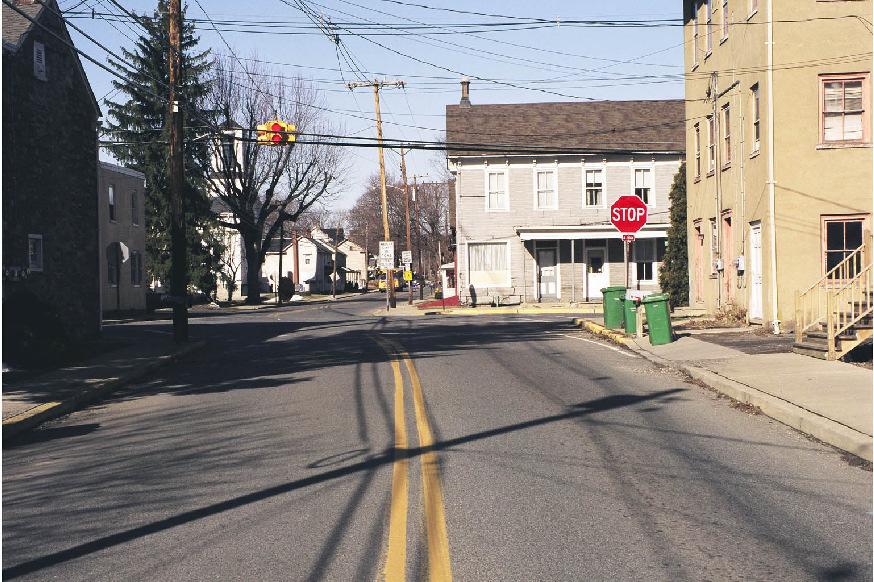
18 turn. In fact, with the improvement to the intersection of Route 57 and CR 519, the Route 57 westbound left turn movement at North Main Street should be prohibited (if not completely, at least during the peak periods). The prohibition of the westbound left turn movement will significantly reduce regional traffic traveling through the center of the Township. Having only one northbound approach lane on North Main Street at the intersection should also reduce regional traffic through the center of town. If there are capacity problems on the North Main Street northbound approach at the Route 57 intersection, which is likely during the PM peak period with only one approach lane, drivers will tend to use Route 22 to CR 519 to access Route 57. The Intersection of North Main Street/South Main Street (CR 637) and Greenwich Street (CR 638)/Washington Street The intersection of North Main Street/South Main Street (CR 637) and Greenwich Street (CR 638) /Washington Street in the center of the Township is a four-way stop controlled intersection with poor sight distance. Currently the four way stop works very well in providing for the safe and efficient movement of traffic through the center of town. Traffic tends to alternate effectively at this location with drivers exhibiting courtesy toward other drivers. The four way stop control at this intersection functions as a good traffic-calming device, discouraging regional through traffic while promoting safety for local traffic. Since the geometry of the intersection and width of the roadways could not accommodate a more positive traffic calming device, such as a roundabout, it is recommended that the four way stop control remain. 14
19 B. Municipal Roadways and Intersections In general, street intersections introduce considerable conflicts for a driver. In a nonsignalized intersection, control is provided using STOP or YIELD signs, requiring driver attentiveness and decision making. It is important to provide the driver with the ability to properly and easily observe all aspects of an intersection in order for decisions to be made appropriately. For an intersection to function properly, the horizontal and vertical alignment of the roads is paramount. An intersection with more than four total approaches is not recommended. The desired angle at which streets should intersect is 90º, which allows a simple quarter-turn of the head to observe the road approaching from either side. The vertical profile of the roads in the area of the intersection must provide a sight distance which allows all drivers to observe approaching vehicles with adequate time for judgment of distance and speed, and vehicle acceleration. There are a number of intersections now existing within the Greenwich Township road network that require improvements in order to provide optimum characteristics and operation. A number of existing intersections were identified as being currently inadequate. These include: Intersection Ref.# Willow Grove Road and Washington Street 1 Willow Grove Road and Herleman Road 2 Richline Road and Stewartsville Road 3 Richline Road and Existing Railroad Crossing 4 South Main Street (CR 637) and Beatty s Road 5 Main Street (CR 637) and Greenwich Street (CR 638) 6 Warren Glen Road (CR 639) and NJSH Route NJSH Route 57 and North Main Street (CR 637)/Liberty Road 8 Asbury Road (CR 632) and NJSH Route Greenwich Church Road (CR 644) and NJSH Route North Main Street (CR 637) and Hulshizer Avenue 11 NJSH Route 57 and Low s Hollow Road 12 Please note that each intersection listed above is designated on the Traffic Signal and Intersection Reference Plan (Appendix D). Willow Grove Road and Washington Street (Intersection #1) The angle of the intersection of Willow Grove Road and Washington Street is currently 50º. This angle restricts a driver s ability to observe traffic traveling southeasterly along Washington Street, which is necessary to make a safe left turn from Willow Grove onto Washington. Additionally, in the normal approach position, a vehicle is in a poor position for a right turn from Willow Grove onto Washington. Left turns from Washington Street into Willow Grove Road are also difficult. 15
20 Improvements to this intersection include a realignment of Willow Grove Road to be at 90º to Washington Street to provide appropriate right-turn-out and left-turn-in movements. The land in the narrow angle between the roads is currently vacant and provides sufficient area for a realignment of Willow Grove Road. Willow Grove Road and Herleman Road (Intersection #2) The angle of the intersection of Willow Grove Road and Herleman Road is currently 30º, creating a very difficult view from Herleman Road of vehicles approaching westbound on Willow Grove Road. This sight distance is further limited by the moderate grade of both roads. Left turns from Willow Grove onto Herleman and right turns from Herleman onto Willow Grove are very difficult movements. The difficulty of the intersection is offset by the low volumes of traffic using the Willow Grove Road and Herleman Road corridors. Future improvements to this intersection would be relatively simple to achieve based upon the currently vacant parcel between Willow Grove and Herleman Roads. Considering Willow Grove Road as the roadway of greater hierarchy, Herleman Road should be reconstructed and realigned to intersect with Willow Grove Road at 90 and be controlled via a single stop sign at a point east of the existing intersection. Based upon the relatively low volumes of traffic utilizing both roads, in particular, Herleman Road, the improvements to this intersection would be relatively low in the overall prioritization of needed improvements. Richline Road and Stewartsville Road (Intersection #3) The intersection of Richline Road and Stewartsville Road is considerably restricted from both the horizontal and vertical aspects. The angle of the intersection is 70º, and the vertical profile of Stewartsville Road provides less than adequate sight distance. The sight distance of drivers on Richline Road is further reduced at the intersection by the location and height of the existing retaining wall on the westerly side of Richline Road. Improvements to this intersection will be difficult. Removal of the wall will require the construction of a higher wall in a location far enough off the roadways to allow a driver to see to the west. Although this will provide better sight distance at the intersection, the profile of Stewartsville Road to the west is also limiting a driver s ability to see eastbound traffic. Richline Road and Existing Railroad Crossing (Intersection #4) The grade crossing on Richline Road is presently constructed with improper vertical geometry. The road profile changes abruptly at the tracks in both approach directions creating a disquieting situation for drivers and extreme speed reductions. Improvements to this crossing include raising the road profile for a proper approach distance on both the northerly and southerly side of the tracks. No changes will be made to the track alignment, but a new surface treatment between the tracks should be considered. 16
21 South Main Street (CR 637) and Beatty s Road (Intersection #5) South Main Street and Beatty s Road in its present condition provides an intersection that is nearly 90º and has adequate sight distance for all movements. As part of the overall circulation upgrades recommended, a new collector road will be introduced to serve the ROM zoned properties to the west. As described in Section V, Proposed Circulation Improvements; Part B: Proposed Roadways, the new collector road designated as Road D will form a new four-way, right angle intersection with South Main Street and Beatty s Road. Road D would be aligned with the east leg of South Main Street and Beatty s Road would be aligned with the north leg of South Main Street. There would be a 90 bend in the South Main Street alignment at the intersection; and Road D and the east leg of South Main Street would be stop-controlled. The new alignment of South Main Street and the stop-control in the westbound direction should tend to discourage regional through traffic from using South Main Street. Main Street (CR 637) and Greenwich Street (CR 638) (Intersection #6) The intersection of Greenwich Street and Main Street is currently controlled as a four-way STOP and generally functions well, primarily due to the relatively limited volume of traffic. The proximity of the existing buildings to the road presents difficulties with sight distance, making the all-stop configuration necessary. Improvements to this intersection, without removal of buildings, are nearly impossible due to the offset alignment of the roads and the existing structures at the right-of-way line. The new road proposed for through traffic travel will minimize any additional traffic using this intersection by providing an easier alternate route. It is unlikely that the configuration and functioning of the intersection will ever change. One aspect of improvements in this area is discussed in Section VII of the report regarding South Main Street alternative parking, which, if implemented, will further relieve traffic flow problems along South Main Street. Warren Glen Road (CR 639) and NJSH Route 173 (Intersection #7) The angle of the intersection of Warren Glen Road and Route 173 is currently 40º, creating a very difficult view from Warren Glen Road of vehicles approaching eastbound on Route 173. This sight distance is further limited by the moderate profile grade of both roads. Left turns from Warren Glen onto Route 173 and right turns from Route 173 onto Warren Glen are very difficult movements. Both roads carry a significant amount of traffic and, as volumes increase, the risk of accidents increase. 17
22 Improvements to this intersection include a secondary ramp created by providing a left-turn-in and a right-turn-out movement on Warren Glen Road just west of the existing intersection, and set at 90º to Route 173. Both roads are outside the jurisdiction of the Township and the intersection improvements are not currently part of either the County or State improvement plans. NJSH Route 57 and North Main Street(CR 637)/Liberty Road (Intersection #8) Although the angle of the existing intersection is not ideal, the intersection is now controlled with a full traffic signal. The use of a signal minimizes conflicts and permits safe, controlled traffic flow through the intersection. This intersection is comprised of a County road and a State highway, putting it totally out of the jurisdiction of the Township. As mentioned in Section IV, Existing Circulation Issues/Planned Improvements/ Concerns/Recommendations; Part A: State and County Roadways, the Township should provide input to NJDOT for the purpose of discouraging traffic to travel on North Main Street. A westbound left turn lane should not be installed on Route 57 and the North Main Street approach should not be widened. Instead, the intersection of Route 57 and CR 519 should be improved to accommodate the heavy westbound left turn movement from Route 57 and the heavy reverse northbound right turn movement. With the improvement of the intersection of Route 57 and CR 519, the Route 57 westbound left turn movement at North Main Street should be prohibited at least during peak hours. The prohibition of the westbound left turn movement and the one northbound approach lane on North Main Street will significantly reduce regional traffic through the center of town. Asbury Road (CR 632) and NJSH Route 173 (Intersection #9) The angle of the intersection of Asbury Road and Route 173 is currently 60º, and it is situated on a curve in Route 173. The difficulty of the intersection is exacerbated by the sloping approach from Asbury Road. Improvements to this intersection include the consideration of creating a signalized crossing, which would connect to a proposed non-residential collector serving the ROM zoned properties in this area. Providing a signal and appropriate lanes for the different turning movements will eliminate the existing difficulties at this location. As with other existing substandard intersections within the Township, the fact that neither intersecting roadway is of municipal jurisdiction, coordination with County and State Officials will prove critical towards the ultimate reconfiguration and improvements to this intersection. 18
23 Greenwich Church Road (CR 644) and NJSH Route 173 (Intersection #10) The existing intersection of Greenwich Church Road and Route 173 is presently controlled by a single stop sign. The alignment of this roadway as it intersects with Route 173 is at approximately a 60 angle to Route 173. This condition is clearly substandard. Additionally, sight distance looking west for a vehicle stopped at Greenwich Church Road is affected by a vertical geometric constraint in the present alignment of Route 173. Improvements to this intersection would consist of a realignment of Greenwich Church Road to 90. This would be accomplished by moving the existing intersection point to the east of its present location. Also, the relocation of the intersection to a point further east will improve upon the sight distance constraint which presently exists looking west along Route 173. In order to facilitate the relocation of this intersection, a certain amount of reconstruction, both horizontally and vertically, to the existing portion of Greenwich Church Road beyond the intersection will be required. North Main Street (CR 637) and Hulshizer Avenue (Intersection #11) The intersection of Hulshizer Avenue and North Main Street (CR 637) is presently situated at 90 and is controlled by a stop sign at the intersection. However, there are numerous additional problems associated with this intersection, including the following: the narrow cartway width of Hulshizer Avenue near the intersection with North Main Street; the steep grade of Hulshizer Avenue near the intersection with North Main Street; the sharp, short curve along Hulshizer Avenue immediately east of the intersection with North Main Street; and the existing sight distance constraints looking both north and south at Hulshizer Avenue. As a result of the numerous deficiencies and existing constraints associated with this intersection, it will be difficult to fully improve. Minimum improvements could be accomplished in an effort to improve the many substandard conditions which presently exist. The following improvements should be considered in conjunction with any future improvements to this intersection: widening to Hulshizer Avenue near its intersection with North Main Street; reconstruction of Hulshizer Avenue to improve both the vertical and horizontal geometry immediately east of the intersection with North Main Street; remove the existing vegetation along North Main Street to improve the sight distance looking to the south from Hulshizer Avenue; and re-grading of the existing embankment along North Main Street to improve the sight distance looking to the north from Hulshizer Avenue. NJSH Route 57 and Low s Hollow Road (Intersection #12) The intersection of Route 57 and Low s Hollow Road is presently controlled by a stop sign at the terminus of Low s Hollow Road. The angle of the intersection of the two roadways approximates 70, creating a partially skewed condition. In an effort to facilitate right hand turning movements from Route 57 West onto Low s Hollow Road, a short ramp has been built which has created an island between the primary 19
24 cartway of Low s Hollow Road and this ramp. This situation causes a degree of driver confusion. Beyond the deficiencies previously noted, there is a minor sight distance constraint looking to the east from Low s Hollow Road based upon the vertical geometry of Route 57. It is our understanding that the NJDOT is conducting a study which will may result in a solution to the above noted deficiencies. This project has been reviewed by the NJDOT on a number of separate occasions ranging from their bridge reconstruction project for the Route 57 bridge over the Merrill Creek and their more recent Route 57 corridor concept study project. It is our understanding that the improvements that would be required to eliminate the above noted deficiencies would include: a reprofiling of a portion of Route 57 east of the Low s Hollow Road intersection; a realignment of a portion of Low s Hollow Road to create a 90 intersection with Route 57; and the removal of the existing island which will facilitate a more conventional type intersection. 20
25 C. Existing Roadway Classifications and Definitions The roadway system in the Township may be classified into eight major categories as follows: Interstate Roadways that serve long commuter trips, major truck traffic, recreational trips and long regional trips in general. Access is provided only at a limited number of gradeseparated interchanges. Principal Arterial Roadways that primarily serve long commuter and shopping trips. Grade separated interchanges are found at the major crossroads. At-grade intersections are either signalized or, for the most part, channelized to allow right turns only. Access to abutting properties is completely controlled and common access points, either signalized or grade separated, are encouraged. Minor Arterial Roadways that serve trips of moderate length. Access to abutting properties is minimized, controlled, or regulated. These highways interconnect with, and augment, the principal highway system. Mobility is less than on accessible principal arterials. Major Collector Roadways in rural areas that serve important intracounty traffic corridors and provide service to major traffic generators. Minor Residential Collector Roadways in rural areas that serve residential traffic and connect local residential streets providing access to a major collector or arterial. Minor Nonresidential Collector Roadways in rural areas that serve nonresidential traffic generators and connect driveways and access roads to research, office, and manufacturing facilities providing access to a major collector or arterial. Local Road Roadways whose purpose is to provide direct access to abutting land and roads of higher classification. Mobility is lower than for other classifications and through movements are discouraged. 21
26 Minor Road Roadways with a special purpose such as access to a recreational area. There are no through movements on these roads and low speeds are encouraged. Interstates I-78 Principal Arterials Route 22 Minor Arterials Route 173 Route 57 CR 519 Major Collectors CR 637 CR 638 CR 639 Minor Residential Collectors Wyndham Farm Boulevard Dumont Road Beatty s Road Willow Grove Road Richline Road Low s Hollow Road Minor Nonresidential Collectors Dumont Road Stryker s Road New Brunswick Avenue Extension Local Roads: All other roads. 22
27 D. Existing Traffic Volumes Location Weekday Year ADT Dumont Road East of CR 519 6, Stryker s Road West of CR 519 3, CR 519 South of Dumont Road 16, Route 22 West of CR , Route 22 East of CR , Route 22 West Between CR 519 and Route 122 Route 173 Between I-78 and CR 639 5, Warren Glen Road (CR 639) South of Route 173 3, Greenwich St. (CR 638) Between Rt. 22 and CR 637 3, Washington Street (CR 638) North of CR 637 2, Liberty Road (CR 637) North of Route 57 1, North Main St (CR 637) Between Rt. 57 and CR 638 3, South Main St. (CR 637) Between CR 638 and I-78 3, South Main St. (CR 637) Between I-78 and Rt , *ADT = Average Daily Traffic Count The above listed traffic counts were obtained through the following sources and references: 1. Greenwich Center Traffic Study, prepared by TRC Raymond Keyes Associates. 2. Warren County Engineering Department. 23
28 Location Weekday PM Year PEAK HOUR Route 22 EB West of CR 519 1, Route 22 EB West of Greenwich St. (CR 638) 1, Route 22 EB West of Route 122 1, Route 22 WB East of CR 519 1, Route 22 WB East of Greenwich St. (CR 638) 2, Route 22 WB East of Route 122 2, CR 519 NB South of Route CR 519 NB South of Dumont Road CR 519 SB North of Route CR 519 SB North of Dumont Road Route 122 NB - South of Route Route 122 SB - North of Route Greenwich St. (CR 638) NB - South of Dumont Road Greenwich St. (CR 638) NB - South of Main St Greenwich St. (CR 638) SB - North of Route Greenwich St. (CR 638) SB - North of Dumont Road Washington St. (CR 638) SB - North of Main St North Main St (CR 637) EB West of Greenwich St South Main St. (CR 637) WB East of Greenwich St Dumont Road WB East of CR Dumont Road EB West of Greenwich St. (CR 638) The above listed traffic counts were obtained through the following sources and references: 1. Greenwich Center Traffic Study, prepared by TRC Raymond Keyes Associates. 2. Warren County Engineering Department. 24
29 Location Saturday Year PEAK HOUR Route 22 EB West of CR 519 1, Route 22 EB West of Greenwich St. (CR 638) 1, Route 22 EB West of Route Route 22 WB East of CR 519 1, Route 22 WB East of Greenwich St. (CR 638) 1, Route 22 WB East of Route 122 1, CR 519 NB South of Route CR 519 NB South of Dumont Road CR 519 SB North of Route CR 519 SB North of Dumont Road Route 122 NB - South of Route Route 122 SB - North of Route Greenwich St. (CR 638) NB - South of Dumont Road Greenwich St. (CR 638) NB - South of Main St Greenwich St. (CR 638) SB - North of Route Greenwich St. (CR 638) SB - North of Dumont Road Washington St. (CR 638) SB - North of Main St North Main St (CR 637) EB West of Greenwich St South Main St. (CR 637) WB East of Greenwich St Dumont Road WB East of CR Dumont Road EB West of Greenwich St. (CR 638) The above listed traffic counts were obtained through the following sources and references: 1. Greenwich Center Traffic Study, prepared by TRC Raymond Keyes Associates. 2. Warren County Engineering Department. 25
30 V. PROPOSED CIRCULATION IMPROVEMENTS A. Future Roadway Demands In the 1998 Township Master Plan, the potential build-out of the land under the zoning at that time was thoroughly analyzed. The result of the projections was the rezoning of a number of the large land areas slated for residential development to a minimum density residential use. Additionally, large areas of land, designated at the time of the study to be relatively dense residential development were rezoned to either Town Center (TC) or R-7 zone designations thereby substantially reducing the ultimate lot yield and subsequently reducing the ultimate traffic generating from these areas. The rezoning of such a large area of the undeveloped Township lands has significantly reduced the future residential population element and will reasonably assure the continued adequate service of the existing roadways. Local improvements to existing streets such as curbing, widening, and the like can be accomplished as the low-density developments emerge, and a wholesale road upgrade is avoided. As part of this circulation plan, the nonresidential areas are to be developed around spine roads with access to major roadways having links to interregional roads, thereby reducing or eliminating the need for the increasing nonresidential traffic to travel on the local Township roads. These spine roads are proposed to be collectors of traffic from a specific developed area but will not be through roads. This will eliminate the easy movement of truck through traffic along the internal Township roads and make the State and County roads more desirable as routes to destinations such as the State and interstate highways. As discussed in this report achieving success of this plan requires the utmost cooperation among Township, County, and State agencies. 26
31 B. Proposed Roadways Connector Roadway (CR 519 to Dumont Road) Road B As mentioned in Section IV, Existing Circulation Issues/Planned Improvements/ Concerns/Recommendations; Part A: State and County Roadways, the NJDOT is planning a connector roadway from Route 22 that intersects CR 519 and ties into Dumont Road. The connector roadway is part of the Route 22 Corridor improvement plan. The segment of the connector roadway between CR 519 and Dumont Road will serve as a by-pass for the narrow section of Dumont Road just east of CR 519 in the vicinity of Adams Drive and Jackson Road. Since this segment of the connecting roadway can function independently of the rest of the DOT Route 22 corridor improvements, it is proposed as a separate improvement and designated as Road B. The intersection of Road B and CR 519 should be designed to accommodate the heavy left turn movement from the CR 519 southbound approach and the heavy right turn movement from the Road B westbound approach. In conjunction with the construction of Road B, the southbound left turn from CR 519 to Dumont Road should be prohibited. In addition, the intersection of Road B and Dumont Road should be designed to encourage westbound vehicles on Dumont Road to travel on Road B to access CR 519 instead of continuing on Dumont Road. These improvements would take a significant amount of regional traffic off of the section of Dumont Road between the proposed Road B and CR 519. Dumont Road Extension Nonresidential Collector Road (Road C) An extension of Dumont Road is proposed at the location north of the Greenwich Shopping Center where Dumont Road turns into the New Brunswick Avenue Extension. A new tee intersection would be formed with the New Brunswick Avenue Extension that runs through the shopping center forming the stem of the tee. Dumont Road would align with the new Dumont Non-residential Collector Road that would serve a portion of the ROM zoned area to the west of I-78 between the New Brunswick Avenue Extension and Beatty s Road. The Dumont Collector Road would curve to the north and run along property lines ending in a cul-de-sac to the east of the terminus of Wyndham Farm Boulevard and the Greenwich School. There would be no connection to Wyndham Farm Boulevard or the school prohibiting any through traffic movement on the Dumont Nonresidential Collector Road. South Main Street(CR 637)/Beatty s Road Nonresidential Collector Road (Road D) A new nonresidential collector road is proposed off of South Main Street at its intersection with Beatty s Road also serving the ROM zoned area to the west of I-78. The existing intersection of South Main Street and Beatty s Road would be reconstructed to form a new four-way, right angle intersection with the new nonresidential collector road. The collector road would be aligned with the east leg of South Main Street and Beatty s Road would be aligned with the north leg of South Main Street. The collector road would run in a general westerly direction along 27
32 property lines ending in a cul-de-sac approximately 1600 feet east of the Dumont Nonresidential Collector Road cul-de-sac. Any internal site connection between the two cul-de-sacs should be discouraged, if not completely restricted. Without this connection there can be no through traffic movement from Dumont Road to South Main Street. Beatty s Road Extension (Road E) An extension is proposed for Beatty s Road at its intersection with Greenwich Church Road. The proposed extension would curve to the west from Greenwich Church Road and then south, crossing Route 173. South of Route 173, the Beatty s Road Extension would run along property lines and terminate in a cul-de-sac approximately 500 ft. east of the Pohatcong Township boundary line. The newly created intersection of Beatty s Road would be a tee intersection. An entirely new four-way, right angle intersection will be created on Route 173 with the Beatty s Road extension forming the north and south legs. The primary purpose of the Beatty s Road extension is as a collector roadway for the ROM zoned area to the north and south of Route 173. It will also improve access to Route 173 for existing Greenwich residents living on Beatty s Road. Route 173 Nonresidential Collector Road (Road F) A new nonresidential collector road is proposed off of Route 173 at its intersection with Asbury Road, serving the Research/Office/Manufacturing (ROM) zoned area to the south of I-78 between Route 173 and South Main Street (CR 637). The existing intersection of Route 173 and Asbury Road would have to be reconstructed and realigned to form a new four-way signalized intersection that included the new collector road. The collector road would be aligned with the Route 173 east leg of the intersection and Asbury Road would be aligned with the Route 173 south leg of the intersection. There would be a 90-degree bend in the Route 173 alignment at the intersection; however, a large radius, channelization and an acceleration lane could facilitate the Route 173 westbound movement, which would not have to be signalized. The collector road would, for the most part, run along the property lines of the major parcels in that area, thereby minimizing the impact to the individual properties. The road would end in a cul-de-sac and not connect to any other roadway, forcing all the traffic out to Route 173 at the proposed Asbury Road intersection. Stewartsville Bypass Road (Road G) A bypass road is proposed in the southwest quadrant of the intersection of North/South Main Street (CR 637) and Greenwich Street (CR 638). The bypass road would be two-way and intersect Greenwich Street at a point approximately 1600 feet west of North/South Main Street aligning with a segment of existing right-of-way (Oberly Street) at that location. The bypass road would intersect South Main Street just north of the Stewartsville Elementary School. The purpose of the by-pass road would be to serve the residents of Greenwich Township on both sides of Greenwich Street and reduce traffic in the center of Stewartsville. Residents could access I-78 Interchange Number 4 without going through the center of town. There would be 28
33 restrictions associated with any public interconnection between the bypass road and the proposed school access roadway (Road J). An interconnection would be provided, however, for emergency vehicles. School Access Greenway (Road J) A new roadway is proposed running on the west side of and parallel to the bike path/jogging trail described in the Pedestrian (Non-vehicular) Pathways Section of this Circulation Plan. The roadway would be constructed to local standards and serve as emergency access for the greenway. The only vehicular traffic which would be expected to utilize this roadway would be emergency service vehicles such as police, fire or rescue. It would connect the Greenwich Township School off of Wyndham Farm Boulevard to the Stewartsville School off of South Main Street. Recreational facilities such as ball fields, tennis courts, etc. could be developed in this greenway with potential access to this connecting roadway. There would be a complete separation of vehicular traffic and pedestrian traffic in the greenway area. Based upon the alignment shown on the proposed Circulation Plan, provisions must be made to incorporate farm vehicle crossings of the roadway. The alignment, as shown on the Circulation Plan for this particular roadway, is of a conceptual nature and would be subject to change dependent upon the ultimate disposition and/or development of the affected properties for which it bisects. 29
34 C. Proposed Pedestrian (Non-vehicular) Pathways Currently, the bikeway along the northerly side of Greenwich Street (CR 638) between Dumont Road and the village is funded via an NJDOT Trust Fund Grant and will soon be constructed (2002/2003). This will link the two major residential areas, Wyndham Farm and Greenwich Chase to the center of town, where sidewalks exist. In order to connect the Greenwich Street bikeway more directly with the elementary school, an additional non-vehicular link is proposed along the right-of-way of Oberly Street. This will allow users of the Greenwich Street bikeway to access the school without the need to travel to the center of town and south along Main Street. The path will run directly from Greenwich Street to the rear of the school property near the ball fields. This plan also proposes the extension of the sidewalk along the westerly side of South Main Street from its current southerly terminus to the Stewartsville Elementary School. This will complete the link between the residential areas that access North Main Street (Stewart s Crossing and the Heights ) providing safe pedestrian and bicycle access all the way to the school. A link between the two Township schools is desirable and feasible. The proposed combination vehicular and non-vehicular greenway runs between the rear of the Stewartsville School and the rear of the Greenwich School through the lands presently designated Town Center (TC) zoning. The road will provide an efficient and pleasurable linkage between the two schools with a dedicated bikeway/sidewalk and a vehicle cartway separated from, but adjacent to, the bikeway. 30
35 D. Proposed Roadway Classifications and Specifications Only four major categories of roadway fall within Township jurisdiction. Their classifications and corresponding specifications are as follows: Proposed Roadway Classification: Township Roads Classification ROW Width Pavement Width Minor residential Collector 66 feet feet Minor non-residential Collector 66 feet 36 feet Local Road 52 feet feet Minor Road 50 feet 20 feet Minor Residential Collectors None. Minor Nonresidential Collectors Road A: Realigned Stryker s Road Road B: Connector Roadway (CR 519 to Dumont Road) Road C: Dumont Road Extension Non-residential Collector Road Road D: South Main Street/Beatty s Road Non-residential Collector Road Road E: Beatty s Road Extension Road F: Route 173 Non-residential Collector Road Local Roads Road G: Stewartsville Bypass Road Road H: Realigned Beatty s Road at South Main Street/Road D Intersection Road I: Realigned Beatty s Road at new Beatty s Road Extension Intersection Minor Roads Road J: School Access Greenway 31
36 E. Reclassification of Existing Roadways This Circulation Plan contains significant changes in both philosophy and in the goals and objectives of the Planning Board as compared to the 1990 Township Circulation Plan. Based upon these fundamental changes, the Township feels it appropriate to designate certain existing roadways as roadways which will hereby be considered to hold a different classification. The roadways in question are as follows: Arbor Drive Canal Crossing Dori Place Elizabeth Avenue Iron Wolf Road Maxwell Drive ROW off Valerie Place Thomas Carling Drive Woodruff Road Wyndham Farm Boulevard (Both Ends) The above listed roadways were originally designed and constructed to facilitate future extensions to an adjacent undeveloped property. Based upon and in consideration of the primary goal and objective of this Circulation Plan which is to discourage regional through traffic from utilizing residential neighborhood streets, these roadways are hereby reclassified as non-through streets. 32
37 VI. SOUTH MAIN STREET ALTERNATIVE PARKING The village residences along South Main Street, just south of Greenwich Street/Washington Street, which constitute the heart of the original Township, were constructed before the establishment of zoning. The buildings were constructed very close to the original cartway of Main Street, which was appropriate for the needs of the day. Continued development of the Township surrounding the village, drove the need to provide additional width to Main Street to accommodate the ever-increasing traffic. The result is the configuration present today with the structures essentially butting up to the street right-of-way line. There is little area available for the residents and their visitors to park outside of the roadway along South Main Street. Even a routine stop for a delivery by UPS or the Post Office creates an undesirable and unsafe condition for through traffic. The proximity of the structures to the cartway of the road prevents widening of the travel lanes to accommodate parking or deliveries without considerable negative impacts. Additionally, based upon certain residents having no other off-street parking opportunities, the Township has not imposed a No Parking zone along this section of South Main Street thereby permitting this condition. The most practical alternative is to provide a centralized area, developed as a formal off-street parking area, located to be convenient to the majority of the South Main Street residents. Inspection of the corridor and review of the tax maps revealed a feasible location for an off-street parking area. There is an existing vacant parcel of land with approximately 60 feet of frontage on South Main Street located approximately 600 feet south of Fulmer Street. The portion of the land between South Main Street and the brook is relatively flat and will provide adequate parking for 16 cars in full-sized spaces. The development costs for this location are minimized because there is no stream crossing or extensive grading required. This location, however, is between two existing residences and is likely to have some impact on those residents. An alternative configuration is to provide only an entrance aisle across the lot between the two existing residences and place the parking area on the westerly side of the brook. The shape of the lot is such that a larger parking area can be provided on the westerly side of the brook with parking for between 25 and 35 cars. This alternative is, of course, more expensive since it entails a stream crossing, an extended access aisle, and a larger parking lot. The development of this off-street parking scheme is dependent upon the availability of the lot in question. There are currently no permanent structures on the land, but its value is in the fact that it is a larger sized, developable lot. It may be possible, depending on whether the owner has other contiguous land, to subdivide only the front portion for the parking purposes. Please refer to Appendix F for a map which depicts the two alternative parking concept plans. 33
38 APPENDIX A EXISTING ROADWAY DATA SHEETS
39 MASTER LIST ROADWAYS WITHIN GREENWICH TOWNSHIP ROAD NAME REF. # ADAMS DRIVE 1 ADRIENNE AVENUE 2 ALDIN ROAD 3 ARBOR DRIVE 4 ASBURY ROAD 5 AUSTIN CIRCLE 6 BEACON STREET 7 BEATTY S ROAD 8 BEAUFORT ROAD 9 BIRCH LANE 10 BOLTON DRIVE 11 BRADFORD LANE 12 BRIAN CIRCLE 13 BRILL ROAD 14 BROAD STREET 15 BURROWS DRIVE 16 CANAL CROSSING 17 CARPENTER LANE 18 CEDAR ALLEY 19 CHERRY ALLEY 20 CHRISTIE COURT 21 COOK COURT 22 COUNTY ROUTE CRISMAN DRIVE 24 CURTIS COURT 25 DANIEL DRIVE 26 DEBRA LANE 27 DILLON DRIVE 28 DORI PLACE 29 DUMONT ROAD 30 EDISON AVENUE 31 ELIZABETH AVENUE 32 FANNING MILL ROAD 33 FARM HOUSE ROAD 34 FOX RUN ROAD 35 FRAN LANE 36 FULMER STREET 37 GARY ROAD 38 GREENFIELDS PLACE 39 GREENS RIDGE ROAD 40 GREENWICH CHURH ROAD (COUNTY ROUTE 644) 41 GREENWICH STREET (COUNTY ROUTE 638) 42 HAMILTON DRIVE 43 HERLEMAN ROAD 44
40 ROAD NAME REF. # HORSE SHOE WAY 45 HULSHIZER AVENUE 46 INTERSTATE ROUTE IRON WOLF ROAD 48 JACKSON ROAD 49 JAMES CIRCLE 50 JEFFERSON DRIVE 51 JOSEPH WAY 52 KENNEDY MILL ROAD 53 KINNEY CIRCLE 54 LAUREN WAY 55 LEAH LANE 56 LIBERTY ROAD (COUNTY ROUTE 637) 57 LINCOLN DRIVE 58 LOW S HOLLOW ROAD 59 MADISON DRIVE 60 MAPLE DRIVE 61 MARIE PLACE 62 MARLIN FARM ROAD 63 MARY CIRCLE 64 MAXWELL DRIVE 65 MAYFLOWER DRIVE 66 MEADOW RUN 67 MEGAN CIRCLE 68 MELLICKS ALLEY 69 MONROE DRIVE 70 NEW BRUNSWICK AVENUE 71 NEW JERSEY ROUTE NEW JERSEY STATE ROUTE NEW VILLAGE ROAD 74 NORTH MAIN STREET (COUNTY ROUTE 637) 75 OAK STREET 76 OBERLY STREET 77 PALMER STREET 78 PARKER ROAD 79 PATRICIA CIRCLE 80 PEQUEST ROAD 81 PINE ALLEY 82 PINE HOLLOW ROAD 83 PRICE PLACE 84 PROSPECT STREET 85 RACHEL COURT 86 RAVINE ROAD 87 REVERE ROAD 88 RICHLINE HILL ROAD 89 ROBERT PLACE 90 RODNEY STREET 91 SOUTH MAIN STREET (COUNTY ROUTE 637) 92 SPRUCE ALLEY 93
41 ROAD NAME REF. # STANDISH PLACE 94 STEWARTSVILLE ROAD 95 STOCKER STREET 96 STONE CROSSING 97 STRUNKS LANE 98 STYRKERS ROAD 99 THOMAS CARLING DRIVE 100 THOMAS STEWART WAY 101 THOMPSON STREET 102 TIMBERWICK ROAD 103 TYLER CIRCLE 104 VALERIE PLACE 105 VOORHEES ROAD 106 WALTER WAY 107 WARREN GLEN ROAD (COUNTY ROUTE 639) 108 WARREN STREET 109 WASHINGTON STREET 110 WASHINGTON VALLEY DRIVE 111 WATERTOWER ROAD 112 WAYNE CIRCLE 113 WEST AVENUE 114 WILLEVER WAY 115 WILLIAM CIRCLE 116 WILLOW GROVE ROAD 117 WOODRUFF ROAD 118 WYNDHAM FARM BOULEVARD 119 YVONNE WAY 120
42 SHEET NO. 1 OF 120 Street Name Adams Drive Master List Ref. # 1 ROW Width 52 Cartway Width 30 1,650 (.31 Miles) Both sides of the entire length of the roadway. Both sides of the entire length of the roadway. Fair condition. Additional
43 SHEET NO. 2 OF 120 Street Name Adrienne Avenue Master List Ref. # 2 ROW Width 52 Cartway Width (.18 Miles) Both sides of the entire length of the roadway. Both sides of the entire length of the roadway. Fair condition. Additional
44 SHEET NO. 3 OF 120 Street Name Aldin Road Master List Ref. # 3 ROW Width 52 Cartway Width 32 with boulevard entrance; 2 lanes at 22 with 8 island 4,725 (0.89 Miles) Both sides of the entire length of the roadway. One side except boulevard Fair condition. Additional
45 SHEET NO. 4 OF 120 Street Name Arbor Drive Master List Ref. # 4 ROW Width 52 Cartway Width 32 3,300 (.63 Miles) Both sides for the entire length of the roadway. One side. Fair condition. Additional
46 SHEET NO. 5 OF 120 Street Name Asbury Road (County Route 632) Master List Ref. # 5 ROW Width 66 Cartway Width (.16 Miles) None None Fair condition. Additional
47 SHEET NO. 6 OF 120 Street Name Austin Circle Master List Ref. # 6 ROW Width 52 Cartway Width (.05 Miles) Both sides of the entire length of the roadway. Both sides of the entire length of the roadway. Fair condition. Additional
48 SHEET NO. 7 OF 120 Street Name Beacon Street Master List Ref. # 7 ROW Width 40 Cartway Width ,020 (.19 Miles) Small portions of the roadway. Small portions of the roadway. Fair to poor condition. Additional
49 SHEET NO. 8 OF 120 Street Name Beatty s Road Master List Ref. # 8 ROW Width 66 Cartway Width ,302 (1 Mile) Varies (None One Side Both Sides) At Barn Swallow Court and Red Hawk Lane. Fair condition. Additional
50 SHEET NO. 9 OF 120 Street Name Beaufort Road Master List Ref. # 9 ROW Width 52 Cartway Width 32 1,574 (0.30 Miles) Both sides of the entire length of the roadway. One side. Fair condition. Additional
51 SHEET NO. 10 OF 120 Street Name Birch Lane Master List Ref. # 10 ROW Width 52 Cartway Width 32 4,724 (.90 Miles) Both sides for the entire length of the roadway. One side. Fair condition. Additional
52 SHEET NO. 11 OF 120 Street Name Bolton Drive Master List Ref. # 11 ROW Width 50 Cartway Width (.14 Miles) None None Fair to poor condition. Additional
53 SHEET NO. 12 OF 120 Street Name Bradford Lane Master List Ref. # 12 ROW Width 52 Cartway Width 32 3,977 (0.75 Miles) Both sides of the entire length of the roadway. One side. Fair condition. Additional
54 SHEET NO. 13 OF 120 Street Name Brian Circle Master List Ref. # 13 ROW Width 52 Cartway Width (.05 Miles) Both sides of the entire length of the roadway. Both sides of the entire length of the roadway. Fair condition. Additional
55 SHEET NO. 14 OF 120 Street Name Brill Road Master List Ref. # 14 ROW Width 52 Cartway Width (.06 Miles) Both sides of the entire length of the roadway. Both sides of the entire length of the roadway. Fair condition. Additional
56 SHEET NO. 15 OF 120 Street Name Broad Street Master List Ref. # 15 ROW Width 40 Cartway Width (.04 Miles) None None Fair to good condition. Additional
57 SHEET NO. 16 OF 120 Street Name Burrows Drive Master List Ref. # 16 ROW Width 52 Cartway Width (.15 Miles) Both sides of the entire length of the roadway. Both sides of the entire length of the roadway. Fair condition. Additional
58 SHEET NO. 17 OF 120 Street Name Canal Crossing Master List Ref. # 17 ROW Width 52 Cartway Width 32 1,305 (.25 Miles) Both sides for the entire length of the roadway. One side. Fair condition. Additional
59 SHEET NO. 18 OF 120 Street Name Carpenter Lane Master List Ref. # 18 ROW Width 52 Cartway Width (.16 Miles) Both sides for the entire length of the roadway. One side. Fair condition. Additional
60 SHEET NO. 19 OF 120 Street Name Cedar Alley Master List Ref. # 19 ROW Width 16 Cartway Width 10 1,711 (.32 Miles) None None Fair to poor condition. Additional
61 SHEET NO. 20 OF 120 Street Name Cherry Alley Master List Ref. # 20 ROW Width 16 Cartway Width None 435 (.08 Miles) Additional
62 SHEET NO. 21 OF 120 Street Name Christie Court Master List Ref. # 21 ROW Width 52 Cartway Width (.08 Miles) Both sides for the entire length of the roadway. None Fair condition. Additional
63 SHEET NO. 22 OF 120 Street Name Cook Court Master List Ref. # 22 ROW Width 52 Cartway Width (.08 Miles) Both sides for the entire length of the roadway. Both sides for the entire length of the roadway. Fair condition. Additional
64 SHEET NO. 23 OF 120 Street Name County Route 519 Master List Ref. # 23 ROW Width 66 Cartway Width 4,777 (.90 Miles) Additional
65 SHEET NO. 24 OF 120 Street Name Crisman Drive Master List Ref. # 24 ROW Width 50 Cartway Width (.12 Miles) None None Fair to poor condition. Additional
66 SHEET NO. 25 OF 120 Street Name Curtis Court Master List Ref. # 25 ROW Width 52 Cartway Width (.12 Miles) Both sides of the entire length of the roadway. Both sides of the entire length of the roadway. Fair condition. Additional
67 SHEET NO. 26 OF 120 Street Name Daniel Drive Master List Ref. # 26 ROW Width 52 Cartway Width 30 1,824 (.35 Miles) Both sides for the entire length of the roadway. Both sides of the entire length of the roadway. Fair condition. Additional
68 SHEET NO. 27 OF 120 Street Name Debra Lane Master List Ref. # 27 ROW Width 52 Cartway Width 32 1,483 (.28 Miles) Both sides for the entire length of the roadway. One side. Fair condition. Additional
69 SHEET NO. 28 OF 120 Street Name Dillon Drive Master List Ref. # 28 ROW Width 52 Cartway Width (.09 Miles) Both sides of the entire length of the roadway. Both sides of the entire length of the roadway. Fair condition. Additional
70 SHEET NO. 29 OF 120 Street Name Dori Place Master List Ref. # 29 ROW Width 52 Cartway Width 30 1,663 (.32 Miles) Both sides for the entire length of the roadway. Both sides for the entire length of the roadway. Fair condition. Additional
71 SHEET NO. 30 OF 120 Street Name Dumont Road Master List Ref. # 30 ROW Width 52 Cartway Width 36 4,087 (.77 Miles) Both sides of the entire length of the roadway. Varies (None One Side Both Sides) Fair to Good condition. Additional
72 SHEET NO. 31 OF 120 Street Name Edison Avenue Master List Ref. # 31 ROW Width 40 Cartway Width (.16 Miles) None None Fair condition. Additional
73 SHEET NO. 32 OF 120 Street Name Elizabeth Avenue Master List Ref. # 32 ROW Width 52 Cartway Width (.12 Miles) Both sides of the entire length of the roadway. Both sides of the entire length of the roadway. Fair condition. Additional
74 SHEET NO. 33 OF 120 Street Name Fanning Mill Road Master List Ref. # 33 ROW Width 52 Cartway Width 30 2,303 (.44 Miles) Both sides for the entire length of the roadway. Both sides of the roadway with the exception of a small portion on one side. Fair condition. Additional
75 SHEET NO. 34 OF 120 Street Name Farm House Road Master List Ref. # 34 ROW Width 52 Cartway Width (.10 Miles) Both sides for the entire length of the roadway. One side Fair condition. Additional
76 SHEET NO. 35 OF 120 Street Name Fox Run Road Master List Ref. # 35 ROW Width Cartway Width (Scaled) 1,835 (.35 Miles) Both sides for the entire length of the roadway. None Fair condition. Additional
77 SHEET NO. 36 OF 120 Street Name Fran Lane Master List Ref. # 36 ROW Width 33 (Scaled) Cartway Width (.04 Miles) None None Poor condition. Additional
78 SHEET NO. 37 OF 120 Street Name Fulmer Street Master List Ref. # 37 ROW Width 40 Cartway Width (.13 Miles) None None Fair condition. Additional
79 SHEET NO. 38 OF 120 Street Name Gary Road Master List Ref. # 38 ROW Width 52 Cartway Width 30 5,178 (.98 Miles) Both sides of the entire length of the roadway. Both sides of the entire length of the roadway. Fair condition. Additional
80 SHEET NO. 39 OF 120 Street Name Greenfields Place Master List Ref. # 39 ROW Width 70 Cartway Width Boulevard entrance; 2 22 ; 8 island Both sides of the entire length of the roadway. None Fair condition. Additional
81 SHEET NO. 40 OF 120 Street Name Greens Ridge Road Master List Ref. # 40 ROW Width 52 Cartway Width 32 5,430 (1.03 Miles) Both sides for the entire length of the roadway. One side Fair to good condition. Additional
82 SHEET NO. 41 OF 120 Street Name Greenwich Church Road (County Route 644) Master List Ref. # 41 ROW Width 33 Cartway Width 20 2,419 (.46 Miles) None None Fair to poor condition. Additional
83 SHEET NO. 42 OF 120 Street Name Greenwich Street (County Route 638) Master List Ref. # 42 ROW Width 66 Cartway Width 24 10,568 (2 Miles) Portion at County Route 637. Portion at County Route 637. Varies Fair condition. Additional
84 SHEET NO. 43 OF 120 Street Name Hamilton Drive Master List Ref. # 43 ROW Width 52 Cartway Width 30 4,561 (.86 Miles) Both sides of the entire length of the roadway. Both sides of the entire length of the roadway. Fair condition. Additional
85 SHEET NO. 44 OF 120 Street Name Herleman Road Master List Ref. # 44 ROW Width 33 Cartway Width ,444 (.27 Miles) One side for a portion of the roadway. One side for a portion of the roadway. Fair to poor condition. Additional
86 SHEET NO. 45 OF 120 Street Name Horseshoe Way Master List Ref. # 45 ROW Width Cartway Width (Scaled) 206 (.04 Miles) Both sides for the entire length of the roadway. None Additional
87 SHEET NO. 46 OF 120 Street Name Hulshizer Avenue Master List Ref. # 46 ROW Width 40 Cartway Width ,111 (.21 Miles) None None Fair condition. Additional
88 SHEET NO. 47 OF 120 Street Name Interstate Route 78 Master List Ref. # 47 Jurisdiction Federal State County Township ROW Width 300 Cartway Width Additional
89 SHEET NO. 48 OF 120 Street Name Iron Wolf Road Master List Ref. # 48 ROW Width 60 Cartway Width 34 1,250 (.24 Miles) Both sides for the entire length of the roadway. One side. Fair condition. Additional
90 SHEET NO. 49 OF 120 Street Name Jackson Road Master List Ref. # 49 ROW Width 52 Cartway Width 30 1,555 (.29 Miles) Both sides of the entire length of the roadway. Both sides of the entire length of the roadway. Fair condition house construction ongoing. Additional
91 SHEET NO. 50 OF 120 Street Name James Circle Master List Ref. # 50 ROW Width 52 Cartway Width (.06 Miles) Both sides of the entire length of the roadway. Both sides of the entire length of the roadway. Fair condition. Additional
92 SHEET NO. 51 OF 120 Street Name Jefferson Drive Master List Ref. # 51 ROW Width 52 Cartway Width 30 1,021 (.19 Miles) Both sides of the entire length of the roadway. Both sides of the entire length of the roadway. Fair condition. Additional
93 SHEET NO. 52 OF 120 Street Name Joseph Way Master List Ref. # 52 ROW Width 52 Cartway Width (.06 Miles) Both sides of the entire length of the roadway. Both sides of the entire length of the roadway. Fair condition. Additional
94 SHEET NO. 53 OF 120 Street Name Kennedy Mill Road Master List Ref. # 53 ROW Width 50 Cartway Width 30 2,138 (0.10 Miles) Both sides of the entire length of the roadway. Fair condition. Additional
95 SHEET NO. 54 OF 120 Street Name Kinney Circle Master List Ref. # 54 ROW Width 52 Cartway Width (.11 Miles) Both sides for the entire length of the roadway. One side. Fair condition. Additional
96 SHEET NO. 55 OF 120 Street Name Lauren Way Master List Ref. # 55 ROW Width 52 Cartway Width 32 1,440 (.27 Miles) Both sides for the entire length of the roadway. One side. Fair condition. Additional
97 SHEET NO. 56 OF 120 Street Name Leah Lane Master List Ref. # 56 ROW Width 52 Cartway Width (.04 Miles) Both sides for the entire length of the roadway. Both sides for the entire length of the roadway. Fair condition. Additional
98 SHEET NO. 57 OF 120 Street Name Liberty Road (County Route 637) Master List Ref. # 57 ROW Width 33 Cartway Width 25 cartway with varying width deceleration lane 812 (0.15 Miles with Township) Both sides for the entire length of the roadway. None Fair condition. Additional
99 SHEET NO. 58 OF 120 Street Name Lincoln Drive Master List Ref. # 58 ROW Width 52 Cartway Width 30 1,225 (.23 Miles) Both sides of the entire length of the roadway. Both sides of the entire length of the roadway. Fair condition. Additional
100 SHEET NO. 59 OF 120 Street Name Low s Hollow Road Master List Ref. # 59 ROW Width 33 Cartway Width 21 3,153 (.60 Miles) Portions of the roadway. None Additional
101 SHEET NO. 60 OF 120 Street Name Madison Drive Master List Ref. # 60 ROW Width 52 Cartway Width (.15 Miles) Both sides of the entire length of the roadway. Both sides of the entire length of the roadway. Fair condition. Additional
102 SHEET NO. 61 OF 120 Street Name Maple Drive Master List Ref. # 61 ROW Width 66 Cartway Width 31 1,482 (0.28 Miles) Varies (One side) None Fair condition. Additional
103 SHEET NO. 62 OF 120 Street Name Marie Place Master List Ref. # 62 ROW Width 52 Cartway Width (.07 Miles) Both sides for the entire length of the roadway. None. Fair condition. Additional
104 SHEET NO. 63 OF 120 Street Name Marlin Farm Road Master List Ref. # 63 ROW Width 52 Cartway Width 30 1,353 (.26 Miles) Both sides of the entire length of the roadway. Both sides of the entire length of the roadway. Fair condition. Additional
105 SHEET NO. 64 OF 120 Street Name Mary Circle Master List Ref. # 64 ROW Width 52 Cartway Width (.08 Miles) Both sides of the entire length of the roadway. Both sides of the entire length of the roadway. Fair condition. Additional
106 SHEET NO. 65 OF 120 Street Name Maxwell Drive Master List Ref. # 65 ROW Width 52 Cartway Width 30 1,079 (.20 Miles) Both sides of the entire length of the roadway. Both sides of the entire length of the roadway. Fair condition. Additional
107 SHEET NO. 66 OF 120 Street Name Mayflower Drive Master List Ref. # 66 ROW Width 52 Cartway Width (0.12 Miles) Both sides of the entire length of the roadway. One side. Fair to good condition. Additional
108 SHEET NO. 67 OF 120 Street Name Meadow Run Master List Ref. # 67 ROW Width 52 Cartway Width 32 1,603 (.30 Miles) Both sides for the entire length of the roadway. One side. Fair condition. Additional
109 SHEET NO. 68 OF 120 Street Name Megan Circle Master List Ref. # 68 ROW Width 52 Cartway Width (.09 Miles) Both sides of the entire length of the roadway. Both sides of the entire length of the roadway. Fair condition. Additional
110 SHEET NO. 69 OF 120 Street Name Mellicks Alley Master List Ref. # 69 ROW Width 14 Cartway Width 70 (.01 Miles) Additional
111 SHEET NO. 70 OF 120 Street Name Monroe Drive Master List Ref. # 70 ROW Width 52 Cartway Width 30 3,376 (.64 Miles) Both sides of the entire length of the roadway. Both sides of the entire length of the roadway. Fair condition. Additional
112 SHEET NO. 71 OF 120 Street Name New Brunswick Avenue Master List Ref. # 71 ROW Width Cartway Width (Scaled) 684 (.13 Miles) Both sides for the entire length of the roadway. None Fair condition. Additional
113 SHEET NO. 72 OF 120 Street Name New Jersey Route 173 Master List Ref. # 72 ROW Width 66 Cartway Width 15,923 (3.02 Miles) Additional
114 SHEET NO. 73 OF 120 Street Name New Jersey State Route 57 Master List Ref. # 73 ROW Width 66 Cartway Width 8,282 (1.6 Miles) Additional
115 SHEET NO. 74 OF 120 Street Name New Village Road Master List Ref. # 74 ROW Width 33 Cartway Width Varies 14 to 25 (Bridge Width 25 ) 7,528 (1.43 Miles) Varies (None One Side Both Sides) None Raveled pavement edge where there is no curb. Additional
116 SHEET NO. 75 OF 120 Street Name North Main Street (County Route 637) Master List Ref. # 75 ROW Width 50 Cartway Width 30 5,066 (0.96 Miles) Portion. Portion. Fair to poor condition. Additional
117 SHEET NO. 76 OF 120 Street Name Oak Street Master List Ref. # 76 ROW Width 16 Cartway Width (.03 Miles) None None Fair condition. Additional
118 SHEET NO. 77 OF 120 Street Name Oberly Street Master List Ref. # 77 ROW Width 40 Cartway Width N/A N/A None None Additional
119 SHEET NO. 78 OF 120 Street Name Palmer Street Master List Ref. # 78 ROW Width 40 Cartway Width (.14 Miles) None None Fair condition. Additional
120 SHEET NO. 79 OF 120 Street Name Parker Road Master List Ref. # 79 ROW Width 52 Cartway Width 32 1,497 (0.28 Miles) Both sides for the entire length of the roadway. One side. Additional
121 SHEET NO. 80 OF 120 Street Name Patricia Circle Master List Ref. # 80 ROW Width 52 Cartway Width (.07 Miles) Both sides of the entire length of the roadway. Both sides of the entire length of the roadway. Additional
122 SHEET NO. 81 OF 120 Street Name Pequest Road Master List Ref. # 81 ROW Width 52 Cartway Width 32 1,641 (.31 Miles) Both sides for the entire length of the roadway. One side. Fair condition. Additional
123 SHEET NO. 82 OF 120 Street Name Pine Alley Master List Ref. # 82 ROW Width 16 Cartway Width (.09 Miles) None None Fair condition. Additional
124 SHEET NO. 83 OF 120 Street Name Pine Hollow Road Master List Ref. # 83 ROW Width 33 Cartway Width (0.12 Miles) None None Fair to poor condition. Additional
125 SHEET NO. 84 OF 120 Street Name Price Place Master List Ref. # 84 ROW Width 52 Cartway Width (.09 Miles) Both sides of the entire length of the roadway. Both sides of the entire length of the roadway. Fair condition. Additional
126 SHEET NO. 85 OF 120 Street Name Prospect Street Master List Ref. # 85 ROW Width 40 Cartway Width Varies (Minor Bridge 16 ) (Major Bridge 22 ) 2,204 (.42 Miles) Short sections of concrete and macadam curb. None Fair to poor condition. Additional
127 SHEET NO. 86 OF 120 Street Name Rachel Court Master List Ref. # 86 ROW Width 52 Cartway Width (.13 Miles) Both sides for the entire length of the roadway. One side. Fair condition. Additional
128 SHEET NO. 87 OF 120 Street Name Ravine Road Master List Ref. # 87 ROW Width 33 Cartway Width 13 3,906 (.74 Miles) None None Fair to poor condition. Additional
129 SHEET NO. 88 OF 120 Street Name Revere Road Master List Ref. # 88 ROW Width 52 Cartway Width (.16 Miles) Both sides of the entire length of the roadway. Both sides of the entire length of the roadway. Fair condition. Additional
130 SHEET NO. 89 OF 120 Street Name Richline Hill Road Master List Ref. # 89 ROW Width 33 Cartway Width ,897 (1.12 Miles) Portion of the roadway. None Fair condition. Additional
131 SHEET NO. 90 OF 120 Street Name Robert Place Master List Ref. # 90 ROW Width 50 Cartway Width 30 1,419 (0.27 Miles) Both sides of the entire length of the roadway. Fair condition. Additional
132 SHEET NO. 91 OF 120 Street Name Rodney Street Master List Ref. # 91 ROW Width 40 Cartway Width (.04 Miles) None None Fair condition. Additional
133 SHEET NO. 92 OF 120 Street Name South Main Street (County Route 637) Master List Ref. # 92 ROW Width 50 Cartway Width 27 14,874 (2.8 Miles) Varies (both sides) Portion. Fair condition. Additional
134 SHEET NO. 93 OF 120 Street Name Spruce Alley Master List Ref. # 93 ROW Width 16 Cartway Width None 413 (.08 Miles) None None Additional
135 SHEET NO. 94 OF 120 Street Name Standish Place Master List Ref. # 94 ROW Width 52 Cartway Width 32 2,263 (0.43 Miles) Both sides for the entire length of the roadway. One side. Additional
136 SHEET NO. 95 OF 120 Street Name Stewartsville Road Master List Ref. # 95 ROW Width 66 Cartway Width 28 2,1941 (.56 Miles) None None Additional
137 SHEET NO. 96 OF 120 Street Name Stocker Street Master List Ref. # 96 ROW Width 52 Cartway Width (.17 Miles) Both sides of the entire length of the roadway. Both sides of the entire length of the roadway. Fair condition. Additional
138 SHEET NO. 97 OF 120 Street Name Stone Crossing Master List Ref. # 97 ROW Width 52 Cartway Width 32 2,441 (.46 Miles) Both sides for the entire length of the roadway. One side Fair condition. Additional
139 SHEET NO. 98 OF 120 Street Name Strunks Lane Master List Ref. # 98 ROW Width 14 Cartway Width (.04 Miles) None None Fair condition. Additional
140 SHEET NO. 99 OF 120 Street Name Stryker s Road Master List Ref. # 99 ROW Width 66 Cartway Width 22 1,321 (.25 Miles) None None Fair to Poor condition. Additional
141 SHEET NO. 100 OF 120 Street Name Thomas Carling Drive Master List Ref. # 100 ROW Width 52 Cartway Width 30 1,407 (.27 Miles) Both sides of the entire length of the roadway. Both sides of the entire length of the roadway. Fair condition. Additional
142 SHEET NO. 101 OF 120 Street Name Thomas Stewart Way Master List Ref. # 101 ROW Width 52 Cartway Width 32 2,400 (.45 Miles) Both sides for the entire length of the roadway. One side. Fair condition. Additional
143 SHEET NO. 102 OF 120 Street Name Thompson Street Master List Ref. # 102 ROW Width 40 Cartway Width (.08 Miles) None None Fair condition. Additional
144 SHEET NO. 103 OF 120 Street Name Timberwick Road Master List Ref. # 103 ROW Width Cartway Width (Scaled) 289 (.05 Miles) Both sides for the entire length of the roadway. One side for the entire length of the roadway. Fair Condition. Additional
145 SHEET NO. 104 OF 120 Street Name Tyler Circle Master List Ref. # 104 ROW Width 52 Cartway Width 30 1,344 (.25 Miles) Both sides of the entire length of the roadway. Both sides of the entire length of the roadway. Fair condition. Additional
146 SHEET NO. 105 OF 120 Street Name Valerie Place Master List Ref. # 105 ROW Width 52 Cartway Width (.11 Miles) Both sides of the entire length of the roadway. Both sides of the entire length of the roadway. Fair condition. Additional
147 SHEET NO. 106 OF 120 Street Name Voorhees Road Master List Ref. # 106 ROW Width 50 Cartway Width 30 1,051 (.2 Miles) Both sides for the entire length of the roadway. None Additional
148 SHEET NO. 107 OF 120 Street Name Walter Way Master List Ref. # 107 ROW Width 52 Cartway Width (.10 Miles) Both sides for the entire length of the roadway. Both sides for the entire length of the roadway. Fair condition. Additional
149 SHEET NO. 108 OF 120 Street Name Warren Glen Road (County Route 639) Master List Ref. # 108 ROW Width 66 Cartway Width 26 7,810 (1.48 Miles) Varies (small portions throughout the roadway) None Fair condition. Additional
150 SHEET NO. 109 OF 120 Street Name Warren Street Master List Ref. # 109 ROW Width 40 Cartway Width (.13 Miles) None None Fair to poor conditions. Additional
151 SHEET NO. 110 OF 120 Street Name Washington Street Master List Ref. # 110 ROW Width 30 Cartway Width ,220 (.42 Miles) Both sides for most of the length of the roadway. Portion of the roadway. Fair condition. Additional
152 SHEET NO. 111 OF 120 Street Name Washington Valley Drive Master List Ref. # 111 ROW Width 52 Cartway Width (.4 Miles) Both sides of the entire length of the roadway. Both sides of the entire length of the roadway. Fair condition. Additional
153 SHEET NO. 112 OF 120 Street Name Watertower Road Master List Ref. # 112 ROW Width 20 Cartway Width Washington Street with 17 remainder None None Fair condition. Additional
154 SHEET NO. 113 OF 120 Street Name Wayne Circle Master List Ref. # 113 ROW Width 52 Cartway Width (.06 Miles) Both sides of the entire length of the roadway. Both sides of the entire length of the roadway. Additional
155 SHEET NO. 114 OF 120 Street Name West Avenue Master List Ref. # 114 ROW Width Cartway Width (Scaled) 908 (.17 Miles) Both sides for the entire length of the roadway. None Poor condition. Additional
156 SHEET NO. 115 OF 120 Street Name Willever Way Master List Ref. # 115 ROW Width 52 Cartway Width 32 3,243 (.61 Miles) Both sides for the entire length of the roadway. One side. Fair condition. Additional
157 SHEET NO. 116 OF 120 Street Name William Circle Master List Ref. # 116 ROW Width 52 Cartway Width (.11 Miles) Both sides of the entire length of the roadway. Both sides of the entire length of the roadway. Fair condition. Additional
158 SHEET NO. 117 OF 120 Street Name Willow Grove Road Master List Ref. # 117 ROW Width 33 Cartway Width ,485 (.66 Miles) Portion of one side of the roadway. Portion of one side of the roadway. Fair condition. Additional
159 SHEET NO. 118 OF 120 Street Name Woodruff Road Master List Ref. # 118 ROW Width 52 Cartway Width (.04 Miles) Both sides for the entire length of the roadway. None Fair condition. Additional
160 SHEET NO. 119 OF 120 Street Name Wyndham Farm Boulevard Master List Ref. # 119 ROW Width 52 Cartway Width 32 5,140 (.97 Miles) Both sides for the entire length of the roadway. Both sides south of Greenwich Street. One side north of Greenwich Street. Fair to good condition. Additional
 Both sides of the entire length of the roadway. Both sides of the entire length of the roadway. Fair condition.")
161 SHEET NO. 120 OF 120 Street Name Yvonne Way Master List Ref. # 120 ROW Width 52 Cartway Width (.18 Miles) Both sides of the entire length of the roadway. Both sides of the entire length of the roadway. Fair condition. Additional
162 APPENDIX B NEW JERSEY DEPARTMENT OF TRANSPORTATION ROUTE 22 CONCEPT PLAN
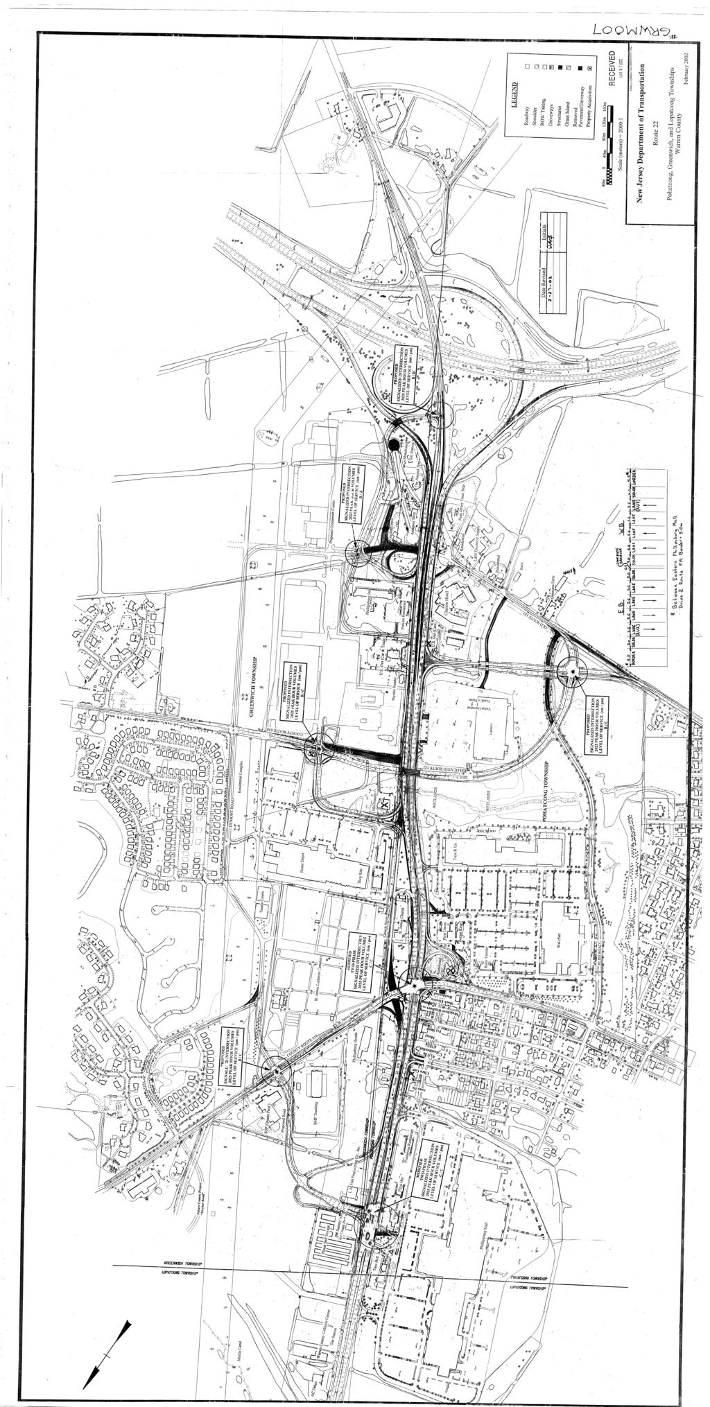
163
164 APPENDIX C ROAD AND STREET MAP
165
166 APPENDIX D TRAFFIC SIGNAL AND INTERSECTION REFERENCE PLAN
167
168 APPENDIX E PROPOSED CIRCULATION PLAN
169
170 APPENDIX F SOUTH MAIN STREET ALTERNATIVE PARKING CONCEPT PLAN
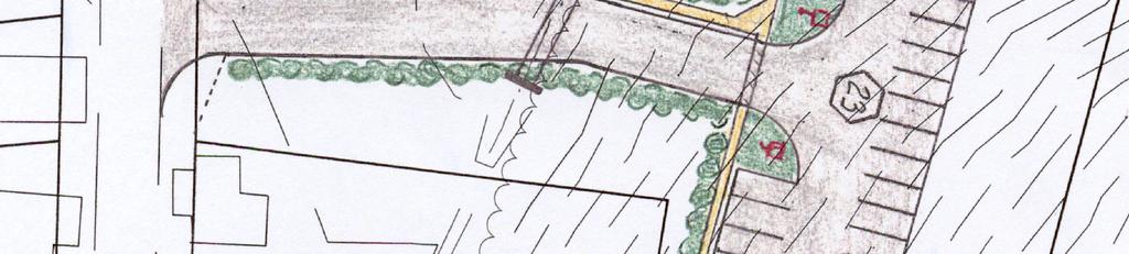
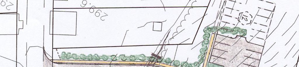
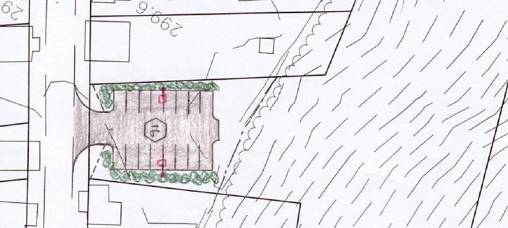
171
A. CONCLUSIONS OF THE FGEIS
 Chapter 11: Traffic and Parking A. CONCLUSIONS OF THE FGEIS The FGEIS found that the Approved Plan will generate a substantial volume of vehicular and pedestrian activity, including an estimated 1,300
4. Safety Concerns Potential Short and Medium-Term Improvements
 NH Route 104 Access Management Study Page 19 4. Safety Concerns Potential Short and Medium-Term Improvements Potential safety improvement strategies are listed by priority based on field observations by
Lake Erie Commerce Center Traffic Analysis
 LOCATION: East of NYS Route 5 at Bayview Road Town of Hamburg Erie County, New York PREPARED BY: Wendel Companies 140 John James Audubon Parkway Suite 200 Amherst, New York 14228 January 2012 i ii Table
3. COLTA / HUGA CONNECTIONS - PRELIMINARY
 9 3. COLTA / HUGA CONNECTIONS - PRELIMINARY 3.1 COLTA The Chain of Lakes Trail Association (COLTA) trail, formerly identified as the Chester Spur Line, was completed and opened for use in June 2011. The
Section 106 Update Memo #1 Attachment D. Traffic Diversion & APE Expansion Methodology & Maps
 Section 106 Update Memo #1 Attachment D Traffic Diversion & APE Expansion Methodology & Maps I-65/I-70 North Split Interchange Reconstruction Project (Des. Nos. 1592385 & 1600808) Traffic Diversion and
PURPOSE AND NEED (CONCURRENCE POINT 1) NEW CANADA ROAD PROJECT FROM STATE ROUTE 1 (U.S. HIGHWAY 70) TO U.S. INTERSTATE 40
 NEW CANADA ROAD PROJECT FROM STATE ROUTE 1 (U.S. HIGHWAY 70) TO U.S. INTERSTATE 40") PURPOSE AND NEED (CONCURRENCE POINT 1) NEW CANADA ROAD PROJECT FROM STATE ROUTE 1 (U.S. HIGHWAY 70) TO U.S. INTERSTATE 40 Project Description The primary purpose of this project is to improve the major
PURPOSE AND NEED (CONCURRENCE POINT 1) NEW CANADA ROAD PROJECT FROM STATE ROUTE 1 (U.S. HIGHWAY 70) TO U.S. INTERSTATE 40 Project Description The primary purpose of this project is to improve the major
HIGHWAY RAIL GRADE CROSSING CONSOLIDATION PROGRAM
 HIGHWAY RAIL GRADE CROSSING CONSOLIDATION PROGRAM To decrease unnecessary train traffic exposure to life and property, promote public safety, and improve traffic conditions, the Texas Department of Transportation
1.2 Corridor History and Current Characteristics
 SECTION 1 Description and Background of Study Area 1.1 Introduction This preliminary engineering report was prepared for the Alaska Department of Transportation and Public Facilities (ADOT&PF). It is part
Site Location and Setting
 Memorandum Date: To: From: Subject: Kristy Le, Gary Black Steve Orem Santa Teresa County Park Historic Area Traffic and Parking Study Hexagon Transportation Consultants, Inc. has completed a traffic and
9 CONSTRUCTION OF BATHURST STREET FROM GREEN LANE WEST TO SOUTH OF HIGHWAY 11, TOWN OF EAST GWILLIMBURY AND TOWNSHIP OF KING
 Clause No. 9 in Report No. 9 of Committee of the Whole was adopted, without amendment, by the Council of The Regional Municipality of York at its meeting held on May 15, 2014. 9 CONSTRUCTION OF BATHURST
5.1 Traffic and Transportation
 5.1 When it opens in 2009, the Bellevue Nickel Improvement Project will increase the number of vehicles able to travel through the study area, improve travel speeds, and improve safety by reducing the
Frequently Asked Questions on the Route 29 Solutions Improvements Projects
 Frequently Asked Questions on the Route 29 Solutions Improvements Projects Background What are the Route 29 Solutions improvement projects? These projects include the Route 29/250 Interchange ( Best Buy
Memorandum. Roger Millar, Secretary of Transportation. Date: April 5, Interstate 90 Operations and Mercer Island Mobility
 Memorandum To: From: The Honorable Dow Constantine, King County Executive; The Honorable Ed Murray, City of Seattle Mayor; The Honorable Bruce Bassett, City of Mercer Island Mayor; The Honorable John Stokes,
2008 DEKALB COUNTY TRANSPORTATION PLAN (UPDATE)
") 2008 DEKALB COUNTY TRANSPORTATION PLAN (UPDATE) TABLE OF CONTENTS Introduction 1 Transportation Planning Activities 2 Identification of Problem Areas and Recommended Solutions 7 DeKalb County Projects
2008 DEKALB COUNTY TRANSPORTATION PLAN (UPDATE) TABLE OF CONTENTS Introduction 1 Transportation Planning Activities 2 Identification of Problem Areas and Recommended Solutions 7 DeKalb County Projects
A number of goals were identified during the initial work on this Big Lake Transportation Plan.
 C. Transportation General Background Information Big Lake s transportation system includes all the roads, paths and facilities that allow the movement of private vehicles, trains and planes, as well as
NORTH FRASER PERIMETER ROAD WEST CORRIDOR DEFINITION STUDY
 NORTH FRASER PERIMETER ROAD WEST CORRIDOR DEFINITION STUDY MAY 2011 SW1132SWD NORTH FRASER PERIMETER ROAD WEST CORRIDOR DEFINITION STUDY TABLE OF CONTENTS 1.0 INTRODUCTION... 1 2.0 CURRENT TRAVEL PATTERNS
Bloor Street West Rezoning Application for a Temporary Use By-law Final Report
 STAFF REPORT ACTION REQUIRED 3741 3751 Bloor Street West Rezoning Application for a Temporary Use By-law Final Report Date: June 12, 2007 To: From: Wards: Reference Number: Etobicoke York Community Council
Alternatives Analysis City of Newport Beach Sunset Ridge Park Project December 14, 2011
 Alternatives Analysis City of Newport Beach Sunset Ridge Park Project December 14, 2011 Alternatives Analysis for Vehicular Access: This report supplements the project s certified EIR s Alternatives Analysis.
Construction underway. STATUS: 229 5,190 5,419 5,305 STIP REFERENCE #FR /01/2013
 FREDERICK COUNTY STATE HIGHWAY ADMINISTRATION -- Frederick County -- Line 1 PROJECT: I-7, Baltimore National Pike INTERSTATE CONSTRUCTION PROGRAM DESCRIPTION: Widen I-7 east of MD 355 to east of MD 144
Memorandum. To: From: cc: Date: November 7, Re: 1.0 Purpose and Organization of this Addendum. 2.0 Project Description
 Memorandum To: From: cc: Laura Prickett, Horizon Water and Environment Analette Ochoa and Wana Chiu, WRECO Parag Mehta, Kimley Horn Date: November 7, 2017 Re: Santa Cruz Route 1 Tier I and Tier II HOV
FEASIBILITY STUDY REFINED CONCEPT 1 PROJECT A
 VIRGINIA DEPARTMENT OF TRANSPORTATION I-85 / I-95 INTERCHANGE FEASIBILITY STUDY REFINED CONCEPT 1 PROJECT A Columbia Rd REFINED CONCEPT 1 PROJECT A Bellevue Rd COST: $3.3M Siege Rd Eliminate the loop ramp
A. From I-68 in Monongalia County, West Virginia to SR 6119 in Fayette County, Pennsylvania 1
 Mon-Fayette Transportation Project A. From I-68 in Monongalia County, West Virginia to SR 6119 in Fayette County, Pennsylvania 1 The Mon/Fayette Transportation Project (MFTP) from I-68 in West Virginia
Provincial Railway Technical Standards
 GENERAL: INDEX: The standards and requirements listed in this document are intended for use on provincially regulated railway public grade crossings. These standards are considered the minimum requirements
MEMORANDUM. Lynn Hayes LSA Associates, Inc.
 MEMORANDUM To: Lynn Hayes LSA Associates, Inc. Date: May 5, 217 From: Zawwar Saiyed, P.E., Senior Transportation Engineer Justin Tucker, Transportation Engineer I Linscott, Law & Greenspan, Engineers LLG
November 11, 2009 BY . Planning and Growth Management Department 110 Laurier Avenue West, 4 th Floor Ottawa, Ontario K1P 1J1. Dear Mr.
 November 11, 2009 Planning and Growth Management Department 110 Laurier Avenue West, 4 th Floor Ottawa, Ontario K1P 1J1 BY E-MAIL Attention: Mr. Don Herweyer Dear Mr. Herweyer: Reference: Abbott-Fernbank
Other Principle Arterials Minor Arterial Major Collector Minor Collector Local
 CHAPTER 10 TRANSPORTATION Introduction The system of public roads in East Pikeland Township is decidedly rural in character. Since the 1984, the road network has remained much the same, with the addition
Basic Project Information
 FY 2015-16 PROJECT DESCRIPTION FORM (2C) Submitting Agency: Loudoun County Basic Project Information Project Title: Loudoun County Parkway (VA Route 607) U.S. 50 to Creighton Rd. (2C) Project Type (check
Seek the Board s approval for the Donald Place kerb and channel renewal to progress to final design, tender and construction; and
 3. DONALD PLACE - KERB AND CHANNEL RENEWAL General Manager responsible: General Manager City Environment Officer responsible: Transport and City Streets Manager Author: Michelle Flanagan, Streets Capital
Pedestrian Safety Review Spadina Avenue
 STAFF REPORT ACTION REQUIRED Pedestrian Safety Review Spadina Avenue Date: October 13, 2015 To: Toronto and East York Community Council From: Director, Transportation Services, Toronto and East York District
ROUTE 20 CORRIDOR STUDY ---- Orange County, Virginia
 ROUTE 20 CORRIDOR STUDY ---- Orange County, Virginia Prepared by PARSONS Fairfax, Virginia on behalf of the: Rappahannock-Rapidan Regional Commission in cooperation with Orange County, Virginia Virginia
Interstate 90 and Mercer Island Mobility Study APRIL Commissioned by. Prepared by
 Interstate 90 and Mercer Island Mobility Study APRIL 2017 Commissioned by Prepared by Interstate 90 and Mercer Island Mobility Study Commissioned by: Sound Transit Prepared by: April 2017 Contents Section
TABLE OF CONTENTS. Coral Springs Charter High School and Middle School Job No Page 2
 Job No. 15-019 Page 2 TABLE OF CONTENTS 1.0 INTRODUCTION... 4 2.0 EXISTING CONDITIONS... 5 3.0 TRAFFIC GENERATION... 7 4.0 TRIP DISTRIBUTION... 8 5.0 FUTURE CONDITIONS... 8 6.0 SITE ACCESS...13 7.0 CONCLUSION...13
Draft Concept Alternatives Analysis for the Inaugural Airport Program September 2005
 Section 10 Preferred Inaugural Airport Concept 10.0 Introduction The Preferred Inaugural Airport Concept for SSA was developed by adding the preferred support/ancillary facilities selected in Section 9
FEASIBILITY CRITERIA
 This chapter describes the methodology and criteria used to evaluate the feasibility of developing trails throughout the study areas. Land availability, habitat sensitivity, roadway crossings and on-street
Transportation TRANSPORTATION PROJECTS
 Transportation TRANSPORTATION PROJECTS Balls Ford Road Interchange Total Project Cost $142.9M This project includes the construction of a new diverging diamond interchange at Route 234 Bypass (Prince William
TRAFFIC IMPACT STUDY REPORT FOR PROPOSED OFFICE PROJECT AT 959 SEWARD STREET IN HOLLYWOOD SNYDER PARTNERS
 DRAFT TRAFFIC IMPACT STUDY REPORT FOR PROPOSED OFFICE PROJECT AT 959 SEWARD STREET IN HOLLYWOOD Prepared for: SNYDER PARTNERS Prepared by: Crain & Associates 2007 Sawtelle Boulevard, Suite 4 Los Angeles,
Longmont to Boulder Regional Trail Jay Road Connection DRAFT FINAL REPORT
 Longmont to Boulder Regional Trail Jay Road Connection DRAFT FINAL REPORT December 2018 Project Summary Boulder County, Colorado, in partnership with the City of Boulder, is evaluating options for multi-use
NEWBORO AND PORTLAND HARBOUR REDVELOPMENT PLANS
 INTRODUCTION The Municipal docks in both Newboro and Portland were transferred to the Township of Rideau Lakes by Parks Canada in 2002. Little has been done to improve the docks physical condition or role
CHAPTER FOUR AIRPORT ALTERNATIVES
 4.0 INTRODUCTION CHAPTER FOUR The goal of the master planning process is to provide the City of New Smyrna Beach with an assessment of the adequacy and capabilities of the Airport as well as to identify
Macleod Trail Corridor Study. Welcome. Macleod Trail Corridor Study Open House. Presentation of Proposed Design Concepts
 Macleod Trail Corridor Study Welcome Macleod Trail Corridor Study Open House Presentation of Proposed Design Concepts Study Purpose Develop a corridor plan for Macleod Trail that aligns with The City s:
EXISTING CONDITIONS A. INTRODUCTION. Route 107 Corridor Study Report
 II. EXISTING CONDITIONS A. INTRODUCTION The Route 107 study area extends from the south at Chestnut Street in Lynn approximately 3.7 miles to the north to Boston Street in Salem. The study area has three
Non-Motorized Transportation
 Non-Motorized Transportation Non-motorized facilities are important components to the transportation system. They provide an environmentally-friendly, low-cost mode of travel. Some of the facilities can
7272 WISCONSIN AVENUE LOCAL AREA TRANSPORTATION REVIEW
 7272 LOCAL AREA TRANSPORTATION REVIEW AND TRANSPORTATION POLICY AREA REVIEW MONTGOMERY COUNTY, MARYLAND Submitted on behalf of Carr Properties Prepared by: Wells + Associates, Inc. Submission: July 1,
APPENDIX OFFICIAL MAP ORDINANCE OF HAMILTONBAN TOWNSHIP OFFICIAL MAP NARRATIVE
 APPENDIX A OFFICIAL MAP ORDINANCE OF HAMILTONBAN TOWNSHIP OFFICIAL MAP NARRATIVE INTRODUCTION: The Official Map of Hamiltonban Township has been prepared to identify those lands and features that Hamiltonban
Proposed Bicycle Lanes on Yonge Street from Queens Quay to Front Street
 STAFF REPORT ACTION REQUIRED Proposed Bicycle Lanes on Yonge Street from Queens Quay to Front Street Date: March 12, 2007 To: From: Toronto and East York Community Council Director, Transportation Infrastructure
State aims to cure accident-plagued South Jersey interchange
 State aims to cure accident-plagued South Jersey interchange 11:52 PM, Apr. 16, 2011 Written by JOE COONEY, Courier-Post Staff GLOUCESTER CITY Anyone who has driven the gantlet known as the I-295/I- 76/Route
CHAPTER 4: ALTERNATIVES
 MSP Long Term Comprehensive Plan Update Metropolitan Airports Commission 4.1 INTRODUCTION CHAPTER 4: ALTERNATIVES Several alternatives were developed and evaluated based on their capability to meet the
1.0 Purpose and Organization of the Community Impact Assessment Addendum
 Memorandum To: From: cc: Laura Prickett, Horizon Water and Environment Carie Montero, Senior Project Manager/Environmental Lead, Parsons Transportation Group Parag Mehta, Kimley Horn Date: September 24,
2006 WEEKDAY TRAFFIC PROFILE. June 15, 2007
 June 15, 2007 Mr. Gary Stobb, P.E. Director of Planning/Operations Harris County Toll Road Authority 330 Meadowfern, Suite 200 Houston, TX 77067 Re: Westpark Tollway Value Pricing Analysis Dear Mr. Stobb:
The following criteria shall be applied within the boundaries of the AO District:
 Sec. 419 (a) Purpose AIRPORT OVERLAY DISTRICT (AO) The purpose of the Airport Overlay District is to regulate and restrict the height of structures, objects, or natural growth, regulate the locations of
Appendix 4.1 L. No-Build Project Descriptions
 Appendix 4.1 L No-Build Project Descriptions No-Build Projects New Bedford A new traffic signal system was installed and activated in early 2009 at the intersection of King s Highway and Mount Pleasant
MARSHALL Subdivision. Township of Springwater, County of Simcoe. Traffic Brief for: Ontario Inc. Type of Document: Final Report
 MARSHALL Subdivision Township of Springwater, County of Simcoe Traffic Brief for: 489469 Ontario Inc. Type of Document: Final Report Project Number: JDE 1521 Date Submitted: October 19 th, 2016 10 / 19
United States Department of the Interior National Park Service. Boundary Expansion Listed in National Register January 11, 2017
 NPS Form 10900-a (Rev. 8/2002) OMB No. 10240018 United States Department of the Interior National Park Service Boundary Expansion Listed in National Register January 11, 2017 National Register of Historic
Addendum - Airport Development Alternatives (Chapter 6)
") Bowers Field Addendum - Airport Development Alternatives (Chapter 6) This addendum to the Airport Development Alternatives chapter includes the preferred airside development alternative and the preliminary
Bowers Field Addendum - Airport Development Alternatives (Chapter 6) This addendum to the Airport Development Alternatives chapter includes the preferred airside development alternative and the preliminary
IL 390 Station. Wood Dale Open House Summary 5/18/17
 Wood Dale Open House Summary 5/18/17 The first public open house for the Wood Dale Comprehensive Plan took place on May 18 th, 2017. The program was conducted as a fun community event and there were 216
SAN FRANCISCO MUNICIPAL TRANSPORTATION AGENCY
 THIS PRINT COVERS CALENDAR ITEM NO. : 10.4 DIVISION: Sustainable Streets BRIEF DESCRIPTION: SAN FRANCISCO MUNICIPAL TRANSPORTATION AGENCY Approving various parking and traffic modifications associated
FEDERAL HIGHWAY ADMINISTRATION NEVADA DEPARTMENT OF TRANSPORTATION ENVIRONMENTAL IMPACT STATEMENT RE-EVALUATION
 FEDERAL HIGHWAY ADMINISTRATION NEVADA DEPARTMENT OF TRANSPORTATION ENVIRONMENTAL IMPACT STATEMENT RE-EVALUATION Project Name: Boulder City/US 93 Corridor Study (Boulder City Bypass) Project Location: The
N4 Carrick-on-Shannon to Dromod Road Project. 2.1 Introduction
 Chapter 2 Need for the Scheme 2.1 Introduction The National Primary Route N4, Dublin to Sligo is a strategic corridor from Dublin to the northwest and border counties (See RCSR 101 in Volume 2). The National
According to FAA Advisory Circular 150/5060-5, Airport Capacity and Delay, the elements that affect airfield capacity include:
 4.1 INTRODUCTION The previous chapters have described the existing facilities and provided planning guidelines as well as a forecast of demand for aviation activity at North Perry Airport. The demand/capacity
EAKINS OVAL / 25 TH & PENNSYLVANIA AREA PROJECT SUMMARY 1
 EAKINS OVAL / 25 TH & PENNSYLVANIA AREA PROJECT SUMMARY The Parkway Council Foundation is studying potential road and sidewalk reconfigurations of two areas at the western edge of the Benjamin Franklin
user s guide to Transportation Improvements in Astoria Planning Efforts outside Astoria for more information, contact:
 The Miles Crossing/ Jeffers Garden transportation plan (underway), will identify needed improvements to the Warrenton Astoria Highway and local street improvements to serve expected growth in the Miles
Route 29 Solutions Projects
 Your guide to the Route 29 Solutions Projects For full details & continued engagement please visit www.route29solutions.org The Route 29 Solutions Package is a $230 million investment into the improvement
ROUTE 122 CORRIDOR STUDY ---- Bedford County and Bedford City, Virginia
 ROUTE 122 CORRIDOR STUDY ---- Bedford County and Bedford City, Virginia Developed by Region 2000 Regional Commission In cooperation with Bedford County, Virginia City of Bedford, Virginia Virginia Department
Engagement Summary Report. Trans-Canada Highway 1 RW Bruhn Bridge Replacement Project. Community Engagement November 15, 2016 to January 15, 2017
 Trans-Canada Highway 1 RW Bruhn Bridge Replacement Project Community Engagement November 15, 2016 to January 15, 2017 Engagement Summary Report February 2017 Prepared by Kirk & Co. Consulting Ltd. Trans-Canada
University Region Non-Motorized Plan 2015
 Non-Motorized Transportation Non-motorized facilities are important components to the transportation system. They provide an environmentally-friendly, low-cost mode of travel. Some of the facilities can
Airport Planning Area
 PLANNING AREA POLICIES l AIRPORT Airport Planning Area LOCATION AND CONTEXT The Airport Planning Area ( Airport area ) is a key part of Boise s economy and transportation network; it features a multi-purpose
V. DATA COLLECTION PROGRAM
 V. DATA COLLECTION PROGRAM As discussed in Section IV, an extensive data assembly and data collection program was undertaken to develop the data necessary to calibrate the existing Portway Extensions model
AGENDA ITEM 5 D WAKULLA ENVIRONMENTAL INSTITUTE (WEI) TRAIL FEASIBILITY STUDY
 TRAIL FEASIBILITY STUDY") March 19, 2018 AGENDA ITEM 5 D WAKULLA ENVIRONMENTAL INSTITUTE (WEI) TRAIL FEASIBILITY STUDY TYPE OF ITEM: Action STATEMENT OF ISSUE The Wakulla Environmental Institute (WEI) Trail is one of several trails
March 19, 2018 AGENDA ITEM 5 D WAKULLA ENVIRONMENTAL INSTITUTE (WEI) TRAIL FEASIBILITY STUDY TYPE OF ITEM: Action STATEMENT OF ISSUE The Wakulla Environmental Institute (WEI) Trail is one of several trails
8 CROSS-BOUNDARY AGREEMENT WITH BRAMPTON TRANSIT
 8 CROSS-BOUNDARY AGREEMENT WITH BRAMPTON TRANSIT The Transportation Services Committee recommends the adoption of the recommendations contained in the following report dated May 27, 2010, from the Commissioner
Construction Staging Adelaide Street West
 REPORT FOR ACTION Construction Staging Adelaide Street West Date: October 6, 2016 To: Toronto and East York Community Council From: Acting Director, Transportation Services, Toronto and East York District
Treasure Island Supplemental Information Report Addendum
 1 1 1 1 0 1 0 1 0 1 Treasure Island Supplemental Information Report Addendum Introduction Purpose The purpose of this Supplemental Information Report (SIR) Addendum is to determine if the current land
Glasgow Street Traffic Review
 Glasgow Street Traffic Review Recommendation That the Standing Policy Committee on Transportation recommend to City Council: 1. That the Administration proceed with removing the pinch points installed
Regulations to deter cut-through traffic - Heath Street V\fest, between Spadina Road and Avenue Road. Toronto and East York Community Council
 TORONTO STAFF REPORT ACTION REQUIRED Regulations to deter cut-through traffic - Heath Street V\fest, between Spadina Road and Avenue Road Dnte: February 16,2009 To: From: Toronto and East York Community
London Borough of Barnet Traffic & Development Design Team
 London Borough of Barnet Traffic & Development Design Team AERODROME ROAD PEDESTRIAN FACILITY AND BUS STOP INTRODUCTION FEASIBILITY REPORT Job Number: 60668 Doc Ref: S106/12-13/60668 Author: Manoj Kalair
Gold Coast. Rapid Transit. Chapter content. Chapter four Route selection and staging
 Chapter four Route selection and staging Gold Coast Rapid Transit Chapter four Route selection and staging Chapter content Route selection...73 Section one: Helensvale to Griffith University...74 Section
Wayfinding and Signage Study
 Wayfinding and Signage Study This appendix provides background information regagarding wayfinding and signage nees along the Bayshore Heritage Byway route. Billboards, other off- premise signs and similar
Draft Concept Alternatives Analysis for the Inaugural Airport Program September 2005
 Draft Concept Alternatives Analysis for the Inaugural Airport Program September 2005 Section 3 - Refinement of the Ultimate Airfield Concept Using the Base Concept identified in Section 2, IDOT re-examined
THRESHOLD GUIDELINES FOR AVALANCHE SAFETY MEASURES
 BRITISH COLUMBIA MINISTRY OF TRANSPORTATION & INFRASTRUCTURE AVALANCHE & WEATHER PROGRAMS THRESHOLD GUIDELINES FOR AVALANCHE SAFETY MEASURES British Columbia Ministry of Transportation & Infrastructure
Welcome to the Cross County Trail Public Input Session!
 Welcome to the Cross County Trail Public Input Session! Please sign in on the table below! What are we doing here? Camden County has proposed a bicycle and pedestrian trail spanning across the entire county.
Blueways: Rivers, lakes, or streams with public access for recreation that includes fishing, nature observation, and opportunities for boating.
 Parks, Open Space and Trails PRINCE WILLIAM COUNTY 2008 COMPREHENSIVE PLAN TRAILS PLAN CONTENTS The components of the trails plan are: Intent Definitions Goals, Policies, and Action Strategies Trails Map
Sunshine Coast Airport Master Plan September 2007
 Sunshine Coast Airport Master Plan September 2007 Contents CONTENTS... I ACKNOWLEDGEMENT... II DISCLAIMER... III 1 EXECUTIVE SUMMARY...IV 1 INTRODUCTION... 1 2 AVIATION DEMAND FORECAST... 5 3 AIRCRAFT
MEMORANDUM. for HOV Monitoring on I-93 North and the Southeast Expressway, Boston Region MPO, November, 2011.
 MEMORANDUM Date: January 12, 2012 To: Congestion Management Process Files From: Seth Asante, Ryan Hicks, and Efi Pagitsas MPO Staff Re: Historical Trends: Travel Times and Vehicle Occupancy Levels for
1 PROJECT STATUS UPDATE 2 ND CONCESSION FROM BRISTOL ROAD TO DOANE ROAD TOWNS OF EAST GWILLIMBURY AND NEWMARKET
 Report No. 3 of the Regional Council Meeting of March 28, 2013 1 PROJECT STATUS UPDATE 2 ND CONCESSION FROM BRISTOL ROAD TO DOANE ROAD TOWNS OF EAST GWILLIMBURY AND NEWMARKET The recommends: 1. Receipt
CHAPTER FIVE PROSPECTS FOR FUTURE ECONOMIC DEVELOPMENT
 CHAPTER FIVE PROSPECTS FOR FUTURE ECONOMIC DEVELOPMENT 5.1 GENERAL The recommended type and location of future land uses in Alpine should, in part, consider potential opportunities for future economic
C. APPROACH FOR IDENTIFYING THE BEST ROUTES FOR THE NEEDED TRANSMISSION SYSTEM IMPROVEMENTS
 C. APPROACH FOR IDENTIFYING THE BEST ROUTES FOR THE NEEDED TRANSMISSION SYSTEM IMPROVEMENTS CL&P s approach for identifying the best routes for the needed transmission system improvements included a determination
CHAPTER 6 NOISE EXPOSURE
 CHAPTER 6 NOISE EXPOSURE FAA requires that the NEM submitted for review represent the aircraft noise exposure for the year of submittal (in this case 2008) and for a future year (2013 for OSUA). However,
Chapter 4. Development Alternatives
 Chapter 4. Development Alternatives Chapter 4. DEVELOPMENT ALTERNATIVES This chapter identifies and evaluates airport development alternatives to fulfill the facility requirements for the airport as defined
Chapel Hill Transit: Short Range Transit Plan. Preferred Alternative DRAFT
 : Short Range Transit Plan Preferred Alternative August 2018 Table of Contents Executive Summary... 1 Preferred Alternative... 3 Best Practices for Route Design... 3 Project Goals... 4 Preferred Alternative...
HAMPTON ROADS CROSSINGS PATRIOTS CROSSING AND HRBT
 HRTPO Board Meeting March 21, 2013 Agenda ITEM #9: HAMPTON ROADS CROSSINGS PATRIOTS CROSSING AND HRBT Congestion at the Hampton Roads Bridge-Tunnel (HRBT) on I-64 has long been identified as a problem
PROGRESS PARK CONNECTOR
 PROGRESS PARK CONNECTOR Project No. 9999 098 R65, P102 ALTERNATIVES ANALYSIS 6 April 2015 Revised for updated dates PROGRESS PARK CONNECTOR ROAD ALTERNATIVES ALTERNATIVE # 1 West from the intersection
FNORTHWEST ARKANSAS WESTERN BELTWAY FEASIBILITY STUDY
 FNORTHWEST ARKANSAS WESTERN BELTWAY FEASIBILITY STUDY EXECUTIVE SUMMARY The 2030 Northwest Arkansas Regional Transportation Plan developed by the Northwest Arkansas Regional Planning Commission (NWARPC)
Sky Temporary Car Park Transport Statement
 001 Issue 26 August 2016 This report takes into account the particular instructions and requirements of our client. It is not intended for and should not be relied upon by any third party and no responsibility
FHWA P/N Guidelines. Corridor Relationship. Highway 22 Segment 1 - US 169 to CSAH 2 Relevance / Documentation of Need
 Highway 22 Segment 1 - US 169 to CSAH 2 Vehicle Mobility Congestion Intersection Congestion Existing Conditions - Based on Highway Capacity Manual methodology, corridor level of service is currently LOS
Texas Transportation Institute The Texas A&M University System College Station, Texas
 1. Report No. FHWA/TX-05/0-4434-P1 2. Government Accession No. 3. Recipient's Catalog No. 4. Title and Subtitle GUIDANCE FOR FUTURE DESIGN OF FREEWAYS WITH HIGH- OCCUPANCY VEHICLE (HOV) LANES BASED ON
Gold Coast. Rapid Transit. Chapter twelve Social impact. Chapter content
 Gold Coast Rapid Transit Chapter twelve Social impact Chapter content Social impact assessment process...235 Existing community profile...237 Consultation...238 Social impacts and mitigation strategies...239
JOSLIN FIELD, MAGIC VALLEY REGIONAL AIRPORT DECEMBER 2012
 1. Introduction The Federal Aviation Administration (FAA) recommends that airport master plans be updated every 5 years or as necessary to keep them current. The Master Plan for Joslin Field, Magic Valley
Lansdowne Wetton BRT Public Transport Corridor Trunk Route: Planning Analysis
 Lansdowne Wetton BRT Public Transport Corridor Trunk Route: Planning Analysis 1. Introduction The purpose of this report is to detail the planning evaluation for the trunk route alignment alternatives
MEMORANDUM. Bob Zagozda, Chief Financial Officer Westside Community Schools. Mark Meisinger, PE, PTOE Felsburg Holt & Ullevig. DATE: June 11, 2018
 MEMORANDUM TO: Bob Zagozda, Chief Financial Officer Westside Community Schools FROM: Mark Meisinger, PE, PTOE Felsburg Holt & Ullevig DATE: June 11, 218 6-11-18 SUBJECT: Sunset Hills Elementary School
12, 14 and 16 York Street - Amendments to Section 16 Agreement and Road Closure Authorization
 REPORT FOR ACTION 12, 14 and 16 York Street - Amendments to Section 16 Agreement and Road Closure Authorization Date: April 27, 2018 To: Toronto and East York Community Council From: Senior Strategic Director,
Grade Crossing Regulations
 Grade Crossing Regulations An Overview of Municipal Roles and Responsibilities at Federally Legislated Grade Crossings March 21, 2017 presentation to Alberta Municipal Supervisor Association, Edmonton,