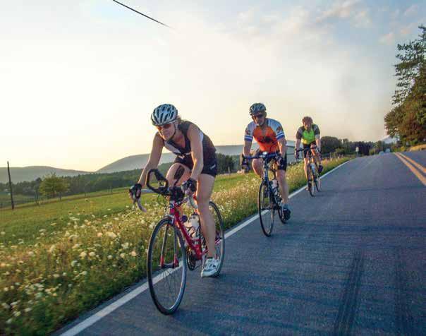
Heritage Bicycle Tours
|
|
|
- Ann Armstrong
- 5 years ago
- Views:
Transcription


1 Heritage Bicycle Tours


2 Welcome to Frederick County s land and townscapes collectively represent the role our county has played in America s development and offer valuable insight into the region s culture. Cyclists can traverse the countryside and explore museums brimming with exhibits that conjure up another time and place. Since its inception in 1748, Frederick County prospered and served as home to citizens such as The Star-Spangled Banner author Francis Scott Key; Maryland s first elected governor Thomas Johnson; Saint Elizabeth Ann Seton; Supreme Court Chief Justice Roger Brooke Taney; and many others who helped shape the course of the country. Downtown Frederick Founded in 1745 by English and German settlers, Frederick has been at the crossroads of American history. The City of Frederick boasts a 50-block historic district where you will find monuments, markers and museums tied to the past. The city s most visible icons are its trademark church steeples, nicknamed the clustered spires by poet John Greenleaf Whittier. More than 200 specialty shops, art galleries and restaurants can be found here. Boasting one of the region s premier arts and entertainment districts, Historic Downtown Frederick is A Great American Main Street and a wonderful place to shop, eat, work, play and live. About the Maps There are hundreds of miles of paved roads in Frederick County, many excellent for bicycling. The highlighted routes in this guide traverse the county and focus on the area s most well known points of interest and include a few more obscure. Route descriptions and cue sheets, including preferred direction and miles from the starting point, are mapped out for each tour. Difficulty rating is based on a 10 point scale with 10 being the hardest. Roads, intersections, towns and major waterways are clearly labeled while selected points of interest, mentioned in the text, are indicated. Terrain In addition to a flat-to-rolling urban-based ride through the City of Frederick, cyclists can discover the rich history of outlying Frederick County with four more rides showcasing the unique geography of Maryland s largest county. Frederick s eastern portion is in the Piedmont region, generally characterized by gently rolling terrain and slowflowing streams like the Monocacy River. The western balance of the county is located in the Blue Ridge region, featuring mountains (the Catoctin and South Mountain ranges), heavily rolling terrain, and deep, restricted streams.

3 Heart of the Civil War: City of Frederick Campaign Ride Frederick, MD

4 Heart of the Civil War: City of Frederick Campaign Ride Starts at: Rose Hill Manor Park Description: Urban Difficulty Rating: 2 Situated in the center of the Heart of the Civil War Heritage Area, the City of Frederick is a Bicycle Friendly Community, as designated by the League of American Bicyclists, and remains committed to enabling bicyclists and pedestrians to safely cycle or walk for recreation and transportation. This is our feature tour of several resources related to the American Civil War. We are pleased to offer an array of heritage tourism experiences in historic Downtown Frederick. These range from museums to historic sites, interpretive waysides to cemeteries. You will be riding the same streets that soldiers trod over 150 years ago. Points of Interest along the route 1 Rose Hill Manor 2 St. John s Cemetery (Taney grave) 3 Visitation Academy (Civil War hospital) 4 Museum of Frederick County History 5 National Museum of Civil War Medicine 6 Kemp Hall (Site of 1861 Maryland Legislature meeting) 7 Courthouse Square (and Ramsey House) 8 Barbara Fritchie House 9 Roger Brooke Taney House and Museum 10 Former Baltimore & Ohio Train Station 11 Frederick Visitor Center 12 Frederick Barracks [Campus of Maryland School for the Deaf (MSD)] 13 Mount Olivet Cemetery (Confederate Row) 14 Monocacy National Battlefield H E A R T O F T H E CIVILWAR 150 TH ANNIVERSARY Int Miles Turn Road Start Rose Hill Manor Park 1611 N Market St L Market St/SS QR East St R E 4th St/TL L Into St John s Cemetery L E 4th St (Out of cemetery) L Maxwell Alley L E 3rd St/SS R East St/TL R E 2nd St/TL L Maxwell Alley R E Patrick St/SS R Market St/TL L W 2nd St/TL L Court St/TL QR Council St QL Record St L W Church St/SS,T R N Court St/TL QR W Patrick St/TL L Bentz St/TL L W All Saints St R East St/SS Frederick Visitor Center on R on East St R South St/TL L S Carroll St/TL R Option: Turn into MSD driveway 2nd R after South St. Return to Carroll St. via R from driveway R Clarke Pl/TL X S Market St/TL L Broadway/SS (Then S into Mt Olivet Cemetery) BR At Area K for Confederate Row Barbara Fritchie Monument Francis Scott Key Monument R S Market St/SS > MD355 Use extreme caution X MD85; remain on MD355/TL L Monocacy Visitor Center Option: battlefield exploration/maps at visitor center Quick Return Route from Monocacy Battlefield R MD355/SS R MD85/TL S Cross over I-70 Use caution traffic lights R Monocacy Blvd/TL X MD144/TL TRO Monocacy Blvd X Gas House Pike/TL > Schifferstadt Blvd L Market St/TL,T R Into Rose Hill Manor Park


5 Frederick: A Pivot Point of the Civil War The City of Frederick and the surrounding county were at the crossroads of America s Civil War. Located between Pennsylvania to the north and Virginia to the south, residents found themselves living in a border county within a border state. Loyalties were divided. By April 1861, Frederick had already experienced the sparks of war. Former resident Roger Brooke Taney had delivered the infamous Dred Scott Decision as Chief Justice of the Supreme Court. In 1859, word first reached Frederick with news of John Brown s raid on Harpers Ferry prompting local militia units to hastily make their way to the scene via the B&O Station. The summer of 1861 featured the Maryland Legislature meeting at Kemp Hall to debate the question of secession. In September 1862, Frederick would become the largest Union town Gen. Robert E. Lee and his Confederate Army would occupy. However, ardent Unionists such as Barbara Fritchie, heroine of Whittier s famed poem, gave the Rebels a cold welcome. The Union Army of the Potomac under Gen. George B. McClellan entered Frederick amidst cheers in pursuit of Lee. The armies eventually engaged one another in the battles of South Mountain and Antietam. When the fighting had ceased, many soldiers returned to Frederick, but this time by way of stretcher and ambulance. The Frederick Barracks served as Union Hospital #1 and other public buildings, churches and private residences took in the wounded of both armies. One such hospital site was the Visitation Academy, a Catholic school for girls. The home of the Ramsey family on Record Street housed recovering Union Gen. George Hartsuff, who would later be visited here by President Abraham Lincoln in October In June 1863, Gen. Lee crossed into Maryland again and proceeded north into Pennsylvania. In this confusing time, Fredericktonians would see the Union Army rapidly amass in their town. Rose Hill Manor would serve as camp for the army s large artillery reserve. While in Frederick, Gen. George Meade was given control of the Army of the Potomac, and would march his men north towards a small hamlet named Gettysburg. One year later in July 1864, Confederate Gen. Jubal Early made one last attempt of bringing war to the north. The Rebels entered Frederick from the west and demanded a ransom of $200,000. Frederick s banks and business leaders responded promptly and staved off any threat to the town. Early next headed south on the Georgetown Pike (MD355) towards the nation s capital. In his path stood Gen. Lew Wallace and a hastily assembled group of Union soldiers at Monocacy Junction, just a few miles south of town. This battle would go down in history as the Battle that Saved Washington. Many of the war s dead can be found at Mount Olivet Cemetery. Notable sites here include Confederate Row, the grave of Barbara Fritichie and those of earlier wars: Thomas Johnson and Francis Scott Key.


6 Heart of the Civil War: City of Frederick Campaign Ride Monocacy National Battlefield Sun Sat 8:30am 5pm // In the summer of 1864, Gen. Jubal Early led Confederate forces towards Washington, D.C. and threatened to capture the capital city. On July 9, Union troops under Gen. Lew Wallace met Early s forces on the banks of the Monocacy. At Monocacy National Battlefield, visitors can experience a landscape that has changed little since the 19th century. National Museum of Civil War Medicine Mon Sat 10am 5pm, Sun 11am 5pm // This engaging museum tells the medical story of the Civil War. The care and healing, courage and devotion of the caregivers and patients on both sides of the war are explored, along with the many innovations in medicine that impact us today. The museum is housed in a building where dead soldiers were embalmed during the war. Museum of Frederick County History Tues Sat 10am 4pm, Sun 1 4pm // Built in the 1820s, this building was used as a private residence and later an orphanage before the Historical Society of Frederick County purchased the property in the 1950s. Inside, museum exhibits tell the story of Frederick County and the Research Center houses a variety of archival and genealogical materials. Rose Hill Manor Park and Children s Museum Mon Sat 10am 4pm, Sun 1 4pm (April Oct) Rose Hill Manor Park provides a look at early American life, transportation history and the agricultural heritage of Frederick County. Thomas Johnson, Maryland s first elected Governor, spent his retirement at Rose Hill Manor. The Children s Museum specializes in providing exhibits and programs for kids of all ages. Interpretive markers located throughout the city help tell Frederick s Civil War story including Maryland Civil War Trails system, indicated with their signature bugle logo. You will also find helpful Downtown Frederick Partnership maps that point out public amenities, along with dining and shopping opportunities.


7 Heritage Tours KEY R/BR = Right/Bear right L/BL = Left/Bear left QL/QR = Quick left/right S = Straight X = Cross SS = Stop Sign Cyclists can discover more of the rich history of Frederick County with four more rides. Ole Mink Farm resort T = T intersection TL = Traffic light UM = Unmarked road tro = To Remain On!XX! = Metal bridge > = Becomes = Start = end = Start/end = info/help = snack stop = restrooms = Point of Interest


, state (Gambrill State Park & Cunningham Falls State Park) and national (Catoctin")
8 CATOCTIN MOUNTAIN CHALLENGE Starts at: Gambrill State Park Description: Several big climbs, opportunities for off-road mountain biking experiences Difficulty Rating: 7 This tour traverses Catoctin Mountain, that marks both the easternmost ridge of the Blue Ridge Province, which stretches over 500 miles from Pennsylvania to Georgia, and the eastern edge of the Appalachians. Catoctin Mountain is the 50-mile long ridge that runs from Emmitsburg to Leesburg, Va. Local tradition maintains that Catoctin is a Native American term meaning place of many deer or mountain of much game. With some ridges up to 1,880 feet in elevation, geologists contend that this landform is about 250 million years old and is ancient and worn down by erosion. By contrast, the Himalayas, with an average elevation about 15 times that of Catoctin, are only about 20 million years old. The Rockies, about seven times higher than Catoctin, are about 60 million years old. The featured route will take participants through a myriad of parklands: municipal (City of Frederick Watershed), state (Gambrill State Park & Cunningham Falls State Park) and national (Catoctin Mountain Park-NPS). Optional rural gravel roadways and off-road trails branch off this main route. Int Miles Turn Road Start Gambrill Park South Fred Overlook L North on Gambrill Park Rd BL Tower Rd BR Mink Farm Rd CAUTION: First.6 mile of Mink Farm Road is a gravel road! Ole Mink Farm Resort (8.6) offers snacks/repair assistance L Catoctin Hollow Rd/T POI Hunting Creek Lake/ Cunningham Falls on L Hiking, swimming, snack bar (in season) R MD77/SS,T QL Park Central Rd Catoctin Mountain Park Visitor Center on right To eliminate steep climb on Park Central, see Option [A] now L Manahan Rd/SS BL Foxville-Deerfield Rd QBL TRO Foxville-Deerfield Rd QL MD77/SS R Tower Rd L Fox Tower Rd L Wigville Rd QR Catoctin Hollow Rd/T [B] R Mink Farm Rd R Gambrill Park Rd R Into South Overlook (End of Ride) Option [A] Avoids Park Central climb (31.8-mile route) R From Visitor Center, turn R on MD77 uphill (north) L Tower Rd L Fox Tower Rd BL Wigville Rd QR Catoctin Hollow Rd/SS,T [B] Rejoins route at mile point 24.0 (Saves 2.7 mi)


9 NORTH COUNTY BRIDGE SAMPLER Starts at: Utica District Park Description: Rolling and lengthy Difficulty Rating: 6 In addition to being a literal crossroads of history and transportation routes, Frederick County is home to a variety of historic water crossings, many of which can be found on the National Register of Historic Places. Cyclists will find bridges of varying size and architectural design, constructed of wood, stone, iron and steel. Northern Frederick County is blessed with three of only eight known remaining covered bridges in Maryland. The fabricated bridge industry flourished in the late 1800s and gave impetus for county leaders to replace existing wooden bridges in favor of iron and steel truss bridges. Firms from Ohio, New York and Pennsylvania are responsible for building some of the structures found on this tour. Featured on this tour is LeGore Bridge, locally constructed in Area businessman James W. LeGore utilized limestone and workmen from his nearby quarry operation to build this five-arched, 340 footlong structure that spans the Monocacy River. Int Miles Turn Road Start Utica District Park L Old Frederick Rd/SS,T L Utica Rd (Utica Rd covered bridge just ahead) R Hessong Bridge Rd/SS,T S Hessong Bridge Rd (@ Angleberger) Straight ahead not L and not R Caution on metal grate bridge!! QR Blacks Mill Rd S X wooden bridge; continue on Blacks Mill Rd L Creagerstown Rd MD550/SS BR Old Frederick Rd Loy s Station covered bridge L Rocky Ridge Rd MD77/SS BR E Main St TRO MD R N Church St MD550/TL Thurmont (Stores) R Emmitsburg Rd > Albert Staub Rd R Eyler Rd L Roddy Rd/SS (Apples Church goes R) Roddy Rd covered bridge R Old Kiln Rd R Motters Station Rd MD76/SS,T BL Four Points Rd R Sixes Bridge Rd BR TRO Sixes Brdge Grimes Rd X Cross bridge R Mumma Ford Rd/SS,T (Sixes Bridge Rd goes L) L Motters Station Rd MD76/SS S X MD77 Rocky Ridge Rd > Longs Mill Rd L Legore Bridge Rd Legore Stone historic bridge R TRO Legore Bridge Rd/SS/Top of climb S/BR Woodsboro Pike MD194 Woodsboro R/QBL 1st R then QBL onto Main St (Stores) R Gravel Hill food store Southern States TRO Gravel Hill Rd L Dublin Rd/SS Caution on downhill full stop! R Devilbiss Bridge Rd/SS R Old Frederick Rd/SS L Utica District Park End of Ride


 captures the imagination as well.")

10 SPIRITS OF BURKITTSVILLE Starts at: Park and Ride Lot off MD180 (Petersville) Description: Rolling, one big climb Difficulty Rating: 8 This ride focuses on a town of fewer than 200 residents, originally founded in Although Burkittsville gained national notoriety with the 1999 release of the film The Blair Witch Project, earlier fame came with the September 14, 1862 Battle of Crampton s Gap, a bloody prelude to the Civil War s Battle of Antietam. The town was used to care for more than 300 wounded of both armies. The Blair Witch may be in the company of fallen soldiers, reputed to inhabit Spook Hill and the hallowed grounds of Crampton s Gap. The former mountain home of noted journalist George Alfred Townsend (today s Gathland State Park) captures the imagination as well. Townsend s vast estate fell to ruin, yet his unusual monument to war correspondents still stands, as does his self-constructed burial crypt, left empty because he was laid to rest in Philadelphia. South of town, cyclists will pass the Needwood estate, home to noted planter and statesman Thomas Sim Lee, a former governor of Maryland. Lee s grandson, Outerbridge Horsey IV, inherited this property and would create a distillery here in 1839 at the age of 19. He produced Horsey Pure Rye Whiskey and a special brand called Golden Gate, the latter being aged by loading barrels of it aboard ships and sending it around Cape Horn to San Francisco and then back to Maryland by train. (Outerbridge Horsey IV s grave can be found at St. Mary s Church Cemetery toward the end of the ride). Lesser known Ahalt s Distillery opened nearby in 1879; neither Ahalt nor Horsey survives today. However, Distillery Lane Cider Works (east of town) continues a local tradition of liquid spirit production and affords visitors the opportunity to taste hard ciders, along with fresh sweet apple cider. Cheers! Int Miles Turn Road Start Park and Ride Lot off MD180 Petersville R MD180/Jefferson Pike/SS R MD17/Burkittsville Rd (Traffic circle) L W Main St > Gapland Rd Burkittsville Stop Gathland State top of climb Vending machines off to the left R Arnoldstown Rd The War Correspondents Arch will be on your right R Mountain Church Rd/SS, T L Gapland Rd > W Main St/SS, T L W Cemetery Dr X MD17/SS > E Cemetery Dr/SS L E Main St > Gapland Rd/SS R Catholic Church Rd/SS,T R MD180/Jefferson Pike/SS R Into Park and Ride lot Petersville (End)


11 TRANSPORTATION HERITAGE TOUR Starts at: Frederick Visitor Center Description: Mostly flat, rolling portions; C&O Towpath includes various conditions Difficulty Rating: 5 Since its founding, Frederick quickly became a bustling crossroads of the major routes leading in every direction. A turnpike to Baltimore helped bring crops of locally grown wheat to the Ellicott Mills, which were in turn exported from the Baltimore Harbor. This route later became part of the National Road, aiding pioneers, farmers and commerce by linking the Ohio River valley to the east coast. In the early 1830s, two new transportation lines bisected Frederick County in an effort to exploit western resources and trade. These were the Baltimore & Ohio Railroad and the Chesapeake & Ohio Canal. All three transportation giants, the turnpike, the railroad and the canal, are interpreted at the Frederick Visitor Center. From here, this ride will take you from the National Road across Carrollton Manor, roughly paralleling the former B&O mainline route to Point of Rocks. Here, a village sprang up because of the convergence of both the railroad and canal. A historic railroad station can be viewed at this gateway to the C&O Canal National Historical Park. The park s towpath is readily used by cyclists and hikers, and affords a chance to see surviving historic canal features such as locks, lock houses and aqueducts. Nearby Brunswick hosts the Brunswick Heritage Museum and exhibits that describe life in a railroad and canal town. Int Miles Turn Road Start Visitor Center Frederick R East St/SS R South St/TL L S Carroll St/TL R Clarke Place/TL L S Market St/TL R Stadium Dr R New Design Rd/SS,T R Elmer Derr Rd L Ballenger Creek Pike/MD351 ¾ way around circle X Cross Mountville Rd TRO Ballenger Crk Pike/SS BR TRO Ballenger Creek Doubs Rd L MD28/Clay St/SS Point Of Rocks R Monroe St R Commerce St L Canal Rd End at C&O Canal National Historical Park


12 Safety Tips The bicycle is legally considered a vehicle in Maryland. Bicyclists have the full rights and responsibilities of roadway users and are subject to all regulations governing a vehicle. Always ride on the right. Obey all traffic signs and signals. Avoid night riding, especially in rural areas. When with a group, ride single file. Watch for sand, loose gravel and wet leaves. Always wear a helmet. Services Everything you need is readily available in the City of Frederick, and the towns and rural crossroads along the suggested bicycle routes. Restaurants and markets offer a variety of foods to keep you pedaling. If you want to spend several days in the area, you may choose to stay at a hotel, bed and breakfast or campground. Bicycle shops in Frederick, Brunswick and Thurmont can assist should you have any problems. Friendly staff at our visitor centers are here to help as well. Frederick Visitor Center Tourism Council of Frederick County 151 S. East St. Frederick, Md Open daily 9:00am 5:30pm Photos by C. Kurt Holter, William Smith, David Kegley, Joe Whitehair and George Ruszat. Special thanks to William Smith and Tim Davis for route development. This brochure was made possible through grant and match funding by the FHWA National Recreational Trails Program (in coordination with the Maryland State Highway Administration), the Tourism Council of Frederick County, the Maryland Heritage Areas Authority and the Catoctin Mountain Tourist Council. This project has been financed with state funds from the Maryland Heritage Areas Authority (MHAA), an instrumentality of the State of Maryland. The contents and opinions, however, do not necessarily reflect the view or policies of MHAA.
C &O Canal. {TRAIL to HISTORY} SHEPHERDSTOWN SHARPSBURG WILLIAMSPORT.
 C &O Canal {TRAIL to HISTORY} SHEPHERDSTOWN SHARPSBURG WILLIAMSPORT www.canaltrust.org C &O Canal {TRAIL to HISTORY} Take a journey into the rich history of our Canal Towns along the C&O Canal towpath.
C &O Canal. {TRAIL to HISTORY} POINT OF ROCKS BRUNSWICK HARPERS FERRY.
 C &O Canal {TRAIL to HISTORY} POINT OF ROCKS BRUNSWICK HARPERS FERRY www.canaltrust.org C & O Canal {TRAIL to HISTORY } Take a journey into the rich history of our Canal Towns along the C&O Canal towpath.
Difficult Run Stream Valley Park
 Difficult Run Stream Valley Park The more intense mountain bikers have known about for Difficult Run for some time. Equestrians have known it longer. Eight miles of unpaved trail, the Rails to River Trail
Celebrating the National Park Service Centennial: Washington County, Maryland
 14 m o u n t a i n d i s c o v e r i e s Celebrating the National Park Service Centennial: Washington County, Maryland Written by: Sara Mullins Scenic photography courtesy Visit Hagerstown & Washington
Museums Candlelight. Saturday, December 10, Frederick, Maryland. 12:00 noon 5:00 p.m. Frederick County locations
 A FREE HOLIDAY PROGRAM FOR ALL AGES Museums Candlelight by Saturday, December 10, 2005 Frederick, Maryland 12:00 noon 5:00 p.m. Frederick County locations 2:00 p.m. 7:00 p.m. City of Frederick locations
Black Hill Regional Park, Little Seneca Lake
 Black Hill Regional Park, ittle Seneca ake ittle Seneca ake, in Black Hill Regional Park, is a reservoir created after a previous drought struck the Washington area. The park is under Maryland-National
Great Falls National Park, Virginia
 Great Falls National Park, Virginia Despite having grown-up in the area, I had not seen Great Falls until I was near an adult. I used to think places like Great Falls only existed someplace else that you
JTHG Site List (updated to reflect DMOC meeting ) Page 1. Land of Conflict, Reunification & Rebuilding
 Page 1. Land of Conflict, Reunification & Rebuilding") JTHG Site List (updated to reflect DMOC meeting 10.16.08) Page 1 Adams David Wills House anchor Adams Eisenhower National Historic Site anchor Adams Gettysburg National Military Park anchor Adams Gettysburg
JTHG Site List (updated to reflect DMOC meeting 10.16.08) Page 1 Adams David Wills House anchor Adams Eisenhower National Historic Site anchor Adams Gettysburg National Military Park anchor Adams Gettysburg
Sites of Civil War Trails Signs The First Campaign, 1861, in the Mountains
 Sites of Civil War Trails Signs The First Campaign, 1861, in the Mountains (Website deactivated) The First Campaign, 1861, in the Mountains Virginia's western counties had little in common at the outset
Directions to Frequently Visited C & O Canal Locations
 Directions to Frequently Visited C & O Canal Locations Seneca Creek Montgomery County, Maryland Pass town of Potomac and Falls Road and continue west to Seneca Rd. Turn left on Seneca Rd. and continue
Middle Creek a streaming resource
 Middle Creek a streaming resource The Middle Creek Watershed has a long history of human activity. Native Americans used the watershed before the European settlers; they traveled, hunted, and settled in
Montgomery Rural Heritage Byway Tour. Heritage Tourism Alliance of Montgomery County Presents. Shepherd s Hey Barn, Comus
 Shepherd s Hey Barn, Comus Heritage Tourism Alliance of Montgomery County Presents Montgomery Rural Heritage Byway Tour Comus Market, Comus www.heritagemontgomery.org Agricultural Reserve The Agricultural
General Information and Field Trip Ideas
 Central Virginia On to Richmond" was the battle cry of Northern politicians, military leaders and newspapermen as the war began. A quick, powerful thrust would cast aside Southern resistance, topple the
Construction underway. STATUS: 229 5,190 5,419 5,305 STIP REFERENCE #FR /01/2013
 FREDERICK COUNTY STATE HIGHWAY ADMINISTRATION -- Frederick County -- Line 1 PROJECT: I-7, Baltimore National Pike INTERSTATE CONSTRUCTION PROGRAM DESCRIPTION: Widen I-7 east of MD 355 to east of MD 144
Rock Creek Park, MD - Lake Needwood
 ock Creek Park, MD - Lake Needwood Lake Needwood, is a reservoir located at the end of the north end of the ock Creek hiker-biker trail. At the other end, ock Creek empties into the Potomac iver near Thompson
Visitor Market Research. The Journey Through Hallowed Ground Partnership 1
 Visitor Market Research The Journey Through Hallowed Ground Partnership 1 Background 12/06: Destination Marketing Organization Committee RFP issued March 2007 Destination Analysts selected June 2008 Project
Fort Ticonderoga Carillon Battlefield Walking Trail Guide
 Fort Ticonderoga Carillon Battlefield Walking Trail Guide Copyright Fort Ticonderoga. Photo Credit Carl Heilman II Length: Approximately 1¾ mile Welcome to Fort Ticonderoga s Walking Trail Blue markers
Corridor Management Plan for Virginia Coal Heritage Trail WMTH Corporation, 2011, trailsrus.com
 CHAPTER IV: HIGHLIGHTS Along the The St. Paul loop travels over 80 miles through the counties of Russell, Scott, Lee and Wise before ending back at St. Paul. As noted earlier, St. Paul holds the distinction
C &O Canal. {TRAIL to HISTORY} HANCOCK PAWPAW OLDTOWN CUMBERLAND.
 C &O Canal {TRAIL to HISTORY} HANCOCK PAWPAW OLDTOWN CUMBERLAND www.canaltrust.org C &O Canal {TRAIL to HISTORY} Take a journey into the rich history of our Canal Towns along the C&O Canal towpath. Explore
Trailside Park, Ashburn
 Trailside Park, Ashburn For an outsider, Ashburn might seem like a follow-up act to eston. It s a large planned community built at the time, outside the known limits of civilization... Vast farm fields
AT THE HEART OF IT ALL
 Winter 2008 The Bugle Call is the official newsletter of the Heart of the Civil War Heritage Area, whose mission is to promote the stewardship of our historic, cultural, and natural Civil War resources;
U.S. HISTORY CHAPTER 16 SECTION 2 EARLY YEARS OF THE WAR
 U.S. HISTORY CHAPTER 16 SECTION 2 EARLY YEARS OF THE WAR BOARD QUESTIONS 1) WHAT IS A BLOCKADE? 2) WHAT WAS THE AVERAGE AGE OF A SOLDIER IN THE CIVIL WAR? 3) WHO WON THE BATTLE OF BULL RUN AND HOW? 4)
BRT Emergency Contact:
 CAMPUS HIGH SCHOOL CHOIR BECKY RIFFEE - DIRECTOR DESTINATION: WASHINGTON, DC DATES: MAY 30 JUNE 4 ITINERARY AS OF May 24, 2018 Tour Director: Russ Marcason Cell Phone: 847.293.9759 Director: Becky Riffee
MARYLAND. Parks, Wildlife Refuges and National Park Service Areas in PATC Area Affected by Proposed Changes to Current Gun Regulations
 Parks, Wildlife Refuges and in PATC Area Affected by Proposed Changes to Current Gun Regulations MARYLAND Antietam National Battlefield -- Sharpsburg Appalachian National Scenic Trail Assateague Island
THE MASON-DIXON HERALD
 THE MASON-DIXON HERALD July 2008 President John Ricciardi 252-619-6485 JONAL135@yahoo.com Vice President Toni Calzone 240-422-9189 antonia.calzone@verizon.net Secretary Marshall Godwin 540-379-6767 godwin.marshall@kingfishersys.com
Tom's Run 2018 Course Map. Fairfield Inn and Suites 21 N Wineow Street Cumberland, MD Phone:
 Tom's Run 2018 Course Map Fairfield Inn and Suites 21 N Wineow Street Cumberland, MD 21502 Phone: 1-301-722-0340 Useful Information National Park Service C & O Canal Web site: http://www.nps.gov/choh/index.htm
Northwest Arkansas Heritage Trail Plan
 Northwest Arkansas Heritage Trail Plan A regional network of bicycle and pedestrian facilities that connects Northwest Arkansas citizens and visitors to our rich heritage, our recreational and cultural
Economy 3. This region s economy was based on agriculture. 4. This region produced items such as textiles, iron, and ships in great quantities. For th
 Geography 1. This region has a climate of warm summers and snowy cold winters. 2. This region has a climate that is generally warm and sunny, with long, hot, humid summers, and mild winters, and heavy
SOL VS.2a, 2b, 2c, 10b
 What are the characteristics of the Coastal Plain? 1. Also known as Tidewater 2. Located near the Atlantic Ocean and the Chesapeake Bay 3. Includes the Eastern Shore, a peninsula between the Atlantic Ocean
chapter - Hex Highway Touring Route Hamburg to Strausstown Overview
 chapter - 2 Hex Highway Touring Route Hamburg to Strausstown Overview The on-road Hex Highway automobile and bicycle touring route begins on State Street in downtown Hamburg. The route continues west on
Welcome to the 2016 Annual Company of Military Historians Meeting
 Welcome to the 2016 Annual Company of Military Historians Meeting To make this meeting a great experience for all of us we have done a number of things to make the Meeting special. We have located an excellent
Section 7: Pick Up Where You Left Off! S-Tree Road over the Todd Road
 2018 TRACE NOTES Helpful information for your adventure on Section 7 of the Hiker Challenge. Start Point S-Tree Rd. End Point Intersection Todd Rd. / Hale Ridge Rd. WEATHER DECISION Weather Alert!!!! Potential
MASTER PLAN EXECUTIVE SUMMARY
 Biscuit Run State Park Scottsville Road (State Route 20) Charlottesville, VA 22902 Biscuit Run State Park MASTER PLAN EXECUTIVE SUMMARY Department of Conservation and Recreation Division of Planning and
Below is the section of the Byway discussed in the Tazewell County meeting. Primary coal sites are noted on the map.
 APPENDIX H: PUBLIC PARTICIPATION SERIES OF TOWN MEETINGS Virginia Coal Heritage Trail Corridor Management Plan Meeting in Richlands on the Tazewell County portion of the Pocahontas Trail September 21 st
Welcome to the Cross County Trail Public Input Session!
 Welcome to the Cross County Trail Public Input Session! Please sign in on the table below! What are we doing here? Camden County has proposed a bicycle and pedestrian trail spanning across the entire county.
GOLDEN EARS PROVINCIAL PARK
 GOLDEN EARS PROVINCIAL PARK Trail Information as of October 10 th 2015 Do not underestimate the mountainous wilderness of Golden Ears Provincial Park. The combination of rugged terrain and rapidly changing
Beautiful Walks from the Blue Ball Inn
 Walk No. 5 RIVER VALLEYS AND MOOR Countisbury, Watersmeet, Hillsford Bridge, Cheriton, Shilstone Hill, Rockford and Chiselcombe. 8.5 MILES APPROX. Walking time four and a half hours approx. OS 1;25,000
APPENDIX OFFICIAL MAP ORDINANCE OF HAMILTONBAN TOWNSHIP OFFICIAL MAP NARRATIVE
 APPENDIX A OFFICIAL MAP ORDINANCE OF HAMILTONBAN TOWNSHIP OFFICIAL MAP NARRATIVE INTRODUCTION: The Official Map of Hamiltonban Township has been prepared to identify those lands and features that Hamiltonban
Jackson Miles Abbott Wetlands Refuge/Fort Belvoir
 Jackson Miles Abbott Wetlands efuge/fort Belvoir Over the course of millions of years the Potomac iver has gradually shifted its course and sediments have filled-in its old river bed. The main river once
Family Hiking Day on the Appalachian Trail
 Family Hiking Day on the Appalachian Trail September 30, 2017 Guided Hikes and Trail Celebrations In celebration of National Public Lands Day, September 30th is Family Hiking Day on the Appalachian Trail!
MOUNTAIN BIKING THE CASCADE LOOP
 MOUNTAIN BIKING THE CASCADE LOOP By Henry Freimuth All photographs by Henry Freimuth The Cascades are on the Spanish Creek, which is a tributary of the Feather River. The Feather River was named by Spanish
San Miguel to Caserio de la Hoya Circular (San Miguel)
") Tenerife Sur: Short Walks Under 10 km San Miguel to Caserio de la Hoya Circular (San Miguel) Route Summary An informative and scenic walk back in time from San Miguel to below El Roque, overlooking the
Tenerife Sur: Short Walks Under 10 km San Miguel to Caserio de la Hoya Circular (San Miguel) Route Summary An informative and scenic walk back in time from San Miguel to below El Roque, overlooking the
CHAPTER 1. INTRODUCTION. Vision Statement
 CHAPTER 1. INTRODUCTION Vision Statement The designated Iowa portion of the Mississippi River Trail (MRT) will consist of a world-class, continuous multi-use, non-motorized, on-road and off-road route
BACKROADS BICYCLE/AUTOMOBILE TOUR OF MIDDLESEX, VERMONT
 BACKROADS BICYCLE/AUTOMOBILE TOUR OF MIDDLESEX, VERMONT (created and published by the Middlesex Historical Society) Welcome to a 25-mile self-guided historical tour of the backroads of Middlesex. You may
Eakin Community Park. Getting There
 Eakin Community Park Quiet woods along the Accotink Creek are the hallmark of Eakin Community Park. Actually a string of smaller parks, Eakin is made-up of Mantua Park, Kern Drive Park, Eakin Park, Woodburn
Blue Ridge Hiking Club Hike List July- September 2016
 Blue Ridge Hiking Club Hike List July- September 2016 Saturday, July 2, Elk Knob: 3.8 mile round trip with 900 ft. gain in elevation. Spectacular views at the summit. The trails are mostly moderate, but
Redesigning The Waterfront
 San Francisco Maritime National Park Service U.S. Department of the Interior National Historical Park California Redesigning The Waterfront A Self-Guided Walking Tour Then & Black Point Cove, ca. 1910.
ROYAL GORGE PARK and RECREATION AREA. A Feat of Natural and Man-Made Engineering
 ROYAL GORGE PARK and RECREATION AREA A Feat of Natural and Man-Made Engineering As Growth Resumed in the 1870 s Town Leaders Began to Envision a Tourist Industry. The Arkansas River Canyon was advertised
Crystal Lake Area Trails
 Lake Area Trails Welcome to the Lake area of the Big Snowy Mountains! This island mountain range in central Montana features peaks reaching to 8,600 feet and long, high ridges from which vistas of the
The Transportation Corridor Overlay District
 The Transportation Corridor Overlay District The Transportation Corridor Overlay District is a policy framework under which certain potentially beneficial development proposals may be considered, given
GREAT SMOKY MOUNTAINS FAMILY CAMP!
 GREAT SMOKY MOUNTAINS FAMILY CAMP! July 10-15, 2017 SCHEDULE OF EVENTS Monday PM 3:00-5:00 EVE 5:45 WELCOME! Arrival, registration and move in to the dorm. Supper 6:45 Welcome & Orientation & Sign Up for
Woodland Walk If you enjoyed this walk there are two others available in the same area.
 The Woodland Walk 11-12 kilometres (7-8 miles) 4-5 hours Terrain: some easy hills Can be slippery when wet 5 stiles Unsuitable for a pushchair/wheelchair Uses OS map 197 Parking: Pulborough Station and
Vermont Cows by Peter Salmon
 Vermont Cows by Peter Salmon SUSTAINABLE FOREST & PROPERTY MANAGEMENT: At current the Dorset Town Forest includes the 30 acre parcel that sits atop Owl s Head peak in Dorset. By acquiring this property
ABOUT THE PARKS NANTAHALA NATIONAL FOREST MOUNTAINS NATIONAL PARK CHEROKEE NATIONAL FOREST PISGAH NATIONAL FOREST GREAT SMOKY HIKING TRAILS
 ABOUT THE PARKS GREAT SMOKY MOUNTAINS NATIONAL PARK NANTAHALA NATIONAL FOREST CHEROKEE NATIONAL FOREST PISGAH NATIONAL FOREST GREAT SMOKY MOUNTAINS NATIONAL PARK Straddling the border between North Carolina
This Green Oasis A N I NTRODUCTION TO B AKER P ARK P AST, PRESENT, AND F UTURE
 This Green Oasis A N I NTRODUCTION TO B AKER P ARK P AST, PRESENT, AND F UTURE About the Friends of Baker Park!! Friends of Baker Park, Inc., is a non-profit, volunteerstaffed community service organization
Discovering the Trails of Prince George s County
 Discovering the Trails of Prince George s County Happy Trails! Since 2005, Wegmans has been partnering with town and city recreation programs and park conservancy groups to encourage folks to get moving
CHAPTER 4 -- THE LAND USE PLAN: DESCRIPTIONS AND POLICIES FOR THIRTEEN PLANNING AREAS
 CHAPTER 4 -- THE LAND USE PLAN: DESCRIPTIONS AND POLICIES FOR THIRTEEN PLANNING AREAS NORTH CENTRAL CAC AREA LITTLE VALLEY ROAD TO JUG HANDLE CREEK PLANNING AREA This planning area includes Cleone, Noyo,
4th Grade Social Studies 2nd Nine Weeks Test
 4th Grade Social Studies 2nd Nine Weeks Test Multiple Choice Identify the choice that best completes the statement or answers the question. 1 Which is the largest city in the United States? A Philadelphia,
State Level Historic Documentation Report. John Blue Bridge Hampshire County
 State Level Historic Documentation Report State Project No. S314-28-22.27 Federal Project No. BR-0028(058)D John Blue Bridge Hampshire County Prepared by: Randy Epperly, Historian Department of Transportation
Leaden Boot Challenge ROUTE INSTRUCTIONS
 Leaden Boot Challenge ROUTE INSTRUCTIONS Section 1 Alstonefield to Ilam From the village hall car park turn R then L and pass through the village keeping to the R to enter Church Street. Pass the Church
Walk 1. Cotswold Water Park. Gateway Centre to Cerney Wick, railway track to Lake 6, Gateway Centre.
 Cotswold Water ark Walk way A Swindon/ Cirencester Thomas and Severn Canal way to Cerney Wick, railway track to Lake, way. Spine Road East Hotel Time: hours (short walk km) Distance: km A level walk along
Columbia, Maryland - Village of Owen Brown
 Columbia, Maryland - Village of Owen Brown From the Village of Owen Brown, good trails stretch to other neighboring Columbia villages. Mostly following stream valleys, the trails go to and from schools
Lake Artemesia. Getting There
 Lake Artemesia Lake Artemesia is a man-made lake and park located near the confluence of the Indian un, and Paint Branch creeks. A flat 1.3 mile paved path around the lake is popular with walkers, runners
ROAD SCHOLAR SPRING HIKING ADVENTURE Tentative Schedule April 9-14, 2017
 ROAD SCHOLAR SPRING HIKING ADVENTURE Tentative Schedule April 9-14, 2017 Sunday, April 9 PM 3:00-5:00 Arrival, registration and move in to the dorm. 6:00 Supper EVE 7:15 Welcome & Orientation, Sign Ups
Chapter 7 Geography and the Early Settlement of Egypt, Kush, and Canaan
 Chapter 7 Geography and the Early Settlement of Egypt, Kush, and Canaan How did geography affect early settlement in Egypt, Kush, and Canaan? Section 7.1 - Introduction RF/NASA//Corbis This satellite photograph
Asheville & WNC Hikes
 Asheville & WNC Hikes Amazingly, we have 3,000+ miles of free public hiking trails near Asheville, including 1,600 miles in the Pisgah and Nantahala National Forests, 850 miles in Great Smokey Mountains
This Passport: Revised October 20, 2017, EAM # Discovering the Trails of Penfield, NY
 This Passport: Revised October 20, 2017, EAM #161922 Discovering the Trails of Penfield, NY The Town of Penfield is fortunate to have a wide variety of natural resources which make for many unique and
Bikes talk to each other like dogs, they wag their wheels and tinkle their bells, the riders let their mounts mingle.
 Bikes talk to each other like dogs, they wag their wheels and tinkle their bells, the riders let their mounts mingle. Daniel Behrman, The Man Who Loved Bicycles W hitmore Lake Loop route: Dexter, the corner
Municipal Park Descriptions: 1. Bear Hollow Park 4100 Bear Hollow Park Court, Murrysville, PA acres
 MUNICIPAL PARK DESCRIPTIONS Murrysville has a wide variety of parks and recreational facilities including sports fields, neighborhood parks, community parks, a Community Center, and extensive natural areas
Leaden Boot Challenge 2016 ROUTE INSTRUCTIONS
 Leaden Boot Challenge 2016 ROUTE INSTRUCTIONS Section 1 Alstonefield to Ilam (CP2) From the village hall car park turn R then L and pass through the village keeping to the R to enter Church Street. Pass
Skyline Drive Hogback Canon City
 Skyline Drive Hogback Canon City Direction to trailhead: From US 50, turn north onto 15th Street. At the traffic circle, continue north on 15th Street until it dead ends at Washington Street (about 1.5
GEOGRAPHY OF THE UNITED STATES & CANADA. By Brett Lucas
 GEOGRAPHY OF THE UNITED STATES & CANADA By Brett Lucas MEGALOPOLIS Setting the Boundaries What states and provinces are part of the region? Primarily the east coast between Norfolk, VA and Boston, MA,
Tiger Mountain State Forest:
 98 60 hikes within 60 miles: SEATTLE 20 Tiger Mountain State Forest: West Tiger Mountain Three Loop i KEY AT-A-GLANCE INFORMATION Length: 5.1 miles round-trip Configuration: Loop Difficulty: Moderate difficult
History along McDade Trail I Hialeah Picnic Area to Turn Farm Trailhead
 US Dept of the Interior National Park Service History along McDade Trail I Hialeah Picnic Area to Turn Farm Trailhead McDade Trail from Hialeah Picnic Area to Turn Farm Trailhead Spanning the Gap The newsletter
Anderson Mt. Proposed Wilderness Additions to the Rogue-Umpqua Divide Wilderness-- T30S R3E (mostly) Sections 4 & 9, and T29S R3E Section 33
 Sections 4 & 9, and T29S R3E Section 33") Anderson Mt. Proposed Wilderness Additions to the Rogue-Umpqua Divide Wilderness-- T30S R3E (mostly) Sections 4 & 9, and T29S R3E Section 33 When the 35,701 acre Rogue-Umpqua Divide Wilderness was designated
Anderson Mt. Proposed Wilderness Additions to the Rogue-Umpqua Divide Wilderness-- T30S R3E (mostly) Sections 4 & 9, and T29S R3E Section 33 When the 35,701 acre Rogue-Umpqua Divide Wilderness was designated
Vienna. Getting There
 Vienna Like its famous and older German namesake, but on a smaller scale, Vienna, Virginia has a charm to it. Becoming increasingly more cosmopolitan, foreign restaurants, bagle and coffee shops line Maple
The Alamo. The Alamo. ground and the Shrine of Texas Liberty. heroic struggle against impossible odds a place
 The Alamo The Alamo originally served as a home to missionaries for nearly seventy years. Construction began on the present site in 1724. The Alamo is famously known as the scene of a pivotal battle in
The Battle of Quebec: 1759
 The Battle of Quebec: 1759 In the spring of 1759, the inhabitants of Quebec watched the river with worried eyes. They waited anxiously to see whether the ships of the French, or those of the British fleet,
C E N T R A L C A T S K I L L S
 120 C E N T R A L C A T S K I L L S Central Catskills Once out of the southern parts of the Catskills, the Long Path enters the more well traveled and civilized regions. The trail joins the Devil s Path,
Aurora Hills. Getting There
 Aurora Hills Aurora Hills is neighborhood near Crystal City and Pentagon City. Ball fields, ball courts, a very short trail, and a combination ibrary/fire Station are the central pieces of a recreation
Trailside Park, Herndon
 Trailside Park, Herndon Herndon is not the little rail stop it used to be. Like many of the smaller towns around Washington, D.C. Herndon has grown and changed. It even installed it s own little beltway,
Placed by: Maryland Geocaching Society Placed Date: 02/21/2013
 1 of 6 3/11/2013 12:39 PM GC437P2 CAM 2013 - Frederick County Placed by: Maryland Geocaching Society Placed Date: 02/21/2013 N 39 27.830 W 077 29.697 UTM: 18S E 285362 N 4371221 Size: (Regular) Difficulty:
CONTENTS. 31 THE TRAILS See next page for a complete listing of all trails and a locator map. Trail descriptions begin on page 31.
 CONTENTS Page Topic 6 Trail List 7 Trail Locator Map 8 Trails Listed by Dificulty 9 Trail Ratings Deined 11 INTRODUCTION 11 Using this Book 12 The Right Trail for You 13 About Moab 15 Utah OHV Laws and
Trail Towns Using Trail Systems To Leverage Place, Tourism, and Economic Development
 Trail Towns Using Trail Systems To Leverage Place, Tourism, and Economic Development Harry Burkholder, AICP Community Planner II 324 Munson Avenue Traverse City, MI 49686 231-929-3696 burkholder@liaa.org
Skiing and Snowshoes on Un-groomed Fernan Saddle Terrain
 Skiing and Snowshoes on Un-groomed Fernan Saddle Terrain Three ski or snowshoe routes are available from the Fernan Saddle Parking Lot which either do not cover routes ordinarily groomed for snow machine
New Guadernales 64 miles
 Cycling Route 64 miles Region: Fredericksburg, Texas Author: Gregory L. Kagay Catalog: 1022.1 Route Elevation Profile 5,000 Feet 4,000 3,000 2,000 Center Point Slope Bat Cave Summit Piedmont de San Antonio
Kitimat. Pacific Inland Coast. Hiking Guide Kitimat, British Columbia, Canada
 Kitimat Pacific Inland Coast Hiking Guide Kitimat, British Columbia, Canada 2010-2011 Sites and Trails Emergency Call 911 Police - Fire - Medical 2 Welcome to Kitimat This information was produced to assist
San Luis Obispo. Bishop Peak Felsman Loop Eagle Rock Maino Open Space Poly Canyon Poly P Other Areas
 San Luis Obispo Bishop Peak Felsman Loop Eagle Rock Maino Open Space Poly Canyon Poly P Other Areas 1 JCT. ELEV. 72 400 00 0 FELSMAN LOOP GATE LOOP RIDGE 600 FENCE JCT. ELEV. 860 1000 1200 BISHOP PEAK
UMASS CROSS-COUNTRY Trails
 UMASS CROSS-COUNTRY Trails 1) EGG (43 min) (A) From Cage proceed to North Pleasant street (by campus pond). Make left and head toward LGRT and pass School of Education. Pass Puffton Apt complex (on left)
September 24, :43 PM THEMED SCHOOL FIELD TRIPS PIONEER INDIANA
 September 24, 2015 2:43 PM THEMED SCHOOL FIELD TRIPS PIONEER INDIANA Gallery PIONEER INDIANA Using the galleries and public spaces of the Indiana State Museum, answer the following questions. Q: If pioneer
Sacramento Placerville Transportation Corridor Alternatives Analysis
 Sacramento Placerville Transportation Corridor Alternatives Analysis EL DORADO COUNTY TRANSPORTATION COMMISSION 1 Sacramento Placerville Transportation Corridor 2 Goal of the Project To give public officials
Appalachian Trail Community
 Harpers Ferry, West Virginia Appalachian Trail Community A Designation Program of the Appalachian Trail Conservancy The Appalachian Trail Conservancy (ATC) mission is to preserve and manage the Appalachian
GREAT ALLEGHENY PASSAGE TRIP PACKAGES by Bike the GAP exclusively for Golden Triangle Bike Rental 2014 SEASON. 7 DAY. PITTSBURGH TO DC Package
 GREAT ALLEGHENY PASSAGE TRIP PACKAGES by Bike the GAP exclusively for Golden Triangle Bike Rental 2014 SEASON 7 DAY. PITTSBURGH TO DC Package Cost. $1,299 per person, based on double occupancy. Includes
Bankhead Lake TWO PARCELS AND 1 LOT FOR SALE
 OVERVIEW NORTH PARCEL ACRES: 46 WATERFRONT: 1,227 Front Feet PRICE: $350,000 PER ACRE: $7574 PER FRONT FT. $285 SOUTH PARCEL ACRES: 22 WATERFRONT: 1,381 Front Feet PRICE: $295,000 PER ACRE: $13,170 PER
Public Workshop #1 Results Report. October 31, 2017
 Public Workshop # Results Report October 3, 07 Table of Contents Section : Introduction... 3 Section : Comment Card Responses... 4 Section 3: Additional Comments... 3 Section 4: Full Comment Summary...
Leesburg Streets and Highways. Tom Brandon Manager, Office of Capital Projects Potomac Section
 Leesburg Streets and Highways Tom Brandon Manager, Office of Capital Projects Potomac Section About Leesburg Accessible 35 miles from DC On the W&OD Trail On the Potomac River 15 miles from the Appalachian
Byelorussian Battlefields
 Byelorussian Battlefields All Flames Of War battles need terrain! Battles in the Second World War were rarely fought over open plains with unobstructed lines of sight. In Flames Of War, wide open tables
Frederick County, MD Rural Roads Tour # 3
 Frederick County, MD Rural Roads Tour # 3 Unionville Loop Tour mileage: Approx. 63 miles Driving time: about 3 ½ hours (not including stops) There are 5 separate tours of Frederick County s Rural Roads.
BRR Leg 1 (4.0 miles, Easy)
") BRR Leg 1 (4.0 miles, Easy) Min 3881 Max 4948 Ascent +36 Descent -1027 0.0 Start (Grayson Highlands State Park Visitor Center) 4.0 Grayson Highlands State Park Office & Gate, on L (EZ 1) Leg Notes: Minimal
BRR Leg 1 (4.0 miles, Easy) Min 3881 Max 4948 Ascent +36 Descent -1027 0.0 Start (Grayson Highlands State Park Visitor Center) 4.0 Grayson Highlands State Park Office & Gate, on L (EZ 1) Leg Notes: Minimal
West Orange Trail. Clean, Green, Fun!
 West Orange Trail Clean, Green, Fun! The West Orange Trail - when completed - will be a 36-mile, multipurpose recreational greenway containing a 14-foot wide paved surface to be enjoyed by walkers, joggers,