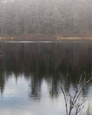
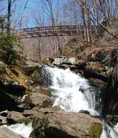
Trails Map/Guide. Moss Lake Bridge photo courtesy of cnyhiking.com
|
|
|
- Maximilian Williams
- 5 years ago
- Views:
Transcription


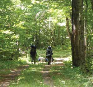
1 HERKIMER COUNTY Trails Map/Guide Moss Lake Bridge photo courtesy of cnyhiking.com 3

2

3 Use of the information in this guide is at the sole discretion and risk of the user. Herkimer County HealthNet and its contributors have made every effort to provide current, accurate information. However, trail conditions are always changing. If you note a discrepancy in this guide or wish to forward a suggestion, please address your comments to: Herkimer County HealthNet, Inc. 320 N. Main Street Suite 3300 Herkimer, NY (315) Or LIKE us on Facebook HerkimerCounty Follow us on This guide is not for commercial distribution. PREFACE This guide is an introduction to the trails of one of the most scenic areas in New York State, Herkimer County. We hope that this publication will encourage outdoor recreation for both residents and visitors alike. The guide is a sampler of state and local trails throughout the county that provides day hikes for individuals and families looking to enjoy the outdoors. We wish to acknowledge the assistance of representatives of; the Herkimer-Oneida County Planning Department who took the time to train HCHN staff on GIS/ GPS mapping, the New York State Department of Environmental Conservation for providing information on NY State trails, Herkimer County E911 and John Cipriano for technical support, and to our many volunteers for hiking and mapping the trails and providing information and photos for this publication. This project was funded by the New York State Department of Health Creating Healthy Places to Live Work and Play Grant (administered by Herkimer County HealthNet) and with the support of the New York State Department of Environmental Conservation.

4 INTRODUCTION Trails in this guide are identified by name, location, how to reach the trailhead, length in miles, and type of trail (single or multiuse). Because of variation in hiking styles and speed, no estimated hiking times are given. Trail descriptions are subject to change as trails are cleared or encumbered by growth and blow downs, as signs and markers are put up or removed, as weather conditions affect the degree of wetness or dryness of a trail or as trail routes are altered. This guide describes the trails as observed in If a trail has trail markers, it will be noted in the trail description. Trail markers can be different colors and shapes. Typically trail markers are round or diamond shaped. Some trails may have plastic colored tape tied around trees along the route. ALWAYS, remain alert for the next trail marker. It is easy to follow trail markers, and failure to do so could result in wandering off the trail. GENERAL INFORMATION Hiking/Multi-use Trails Some trails may be designed for multi-use, which means during the summer, they could be a combination of hiking or bicycling. Please be sure to check before you start out biking to be sure it is allowed on that particular trail. If you are hiking a multi-use trail, be alert for bikers passing through. If you are snowshoeing or skiing on a multi-use trail, be alert for snowmobiles. Also be courteous, if snowshoeing, and do not snowshoe on a ski track. Instead, please snowshoe on either side of the ski track. Snowshoeing on a ski track ruins the track and makes it difficult for skiers.


5 GUIDELINES FOR HIKERS Plan Ahead: Plan your trip according to the time you have available. Check weather reports before you leave. Let People Know Where You re Going: Leave word as to where you are going and when you intend to return. Hike in a Group: Never hike alone. More than one pair of eyes can help follow the trail. The best minimum size for a group is three hikers. If someone were injured one person could stay with the injured person while the other could go for help. Dress Appropriately: Wear layered clothing as the best way to meet changing weather conditions. If cool or wet conditions are expected, avoid cotton clothing, which insulates poorly when wet and dries slowly. Wear Hiking shoes or boots. Take Along Appropriate Equipment & Supplies: A pack containing a map, rain gear, extra clothing, high energy food, water, first aid kit, pocket knife, whistle and matches in a waterproof container are recommended. Sunglasses, sunscreen and insect repellent are also important. Sign Trail Registers: This will assist in finding you should the need for a search arise. In Case of an Accident: One person should remain with the injured person. The rest of the group should note the location and contact the New York State Forest Ranger or local law enforcement agency. Dispose of Waste Properly: Follow this simple rule Pack it in, pack it out. Food containers and wrappers, cans, empty water bottles do not belong along the trail as litter. Deposit human waste in holes dug 6-8 inches deep at least 200 from water and trails. Respect Wildlife: Observe wildlife from a distance. Do not follow, approach, or feed animals. Control pets at all times. Check for ticks: After the hike, make sure to check your skin for ticks. If you find a tick remove it. Take the tick to Herkimer County Public Health and have it tested for lyme disease. Beware of poisonous plants! Contacting Poison Ivy and Poison Sumac will result in a rash on your skin! RESOURCES FOR TRAILS & OUTDOOR ACTIVITIES Adirondack Hiking Information Website: overview.cfm Phone: Herkimer-Oneida Counties Bicycle Atlas Website: bicyclepedestrian planning@ocgov.net Phone: G-Map Pedometer Website: New York State Department of Environmental Conservation Website: Phone: New York State Parks Website: Phone: Parks & Trails NYS Website: Phone: The Cornell Lab of Ornithology Website: Wildflowers of the United States Website: uswildflowers.com/stateref.php?state=ny
6


7 1 Rondaxe Mountain (Bald Mountain) (Old Forge) (Moderate/Diffi cult) ACCESS: The parking area for the Rondaxe Mountain Trailhead is located on the left on Rondaxe Road a short distance from the intersection of Rondaxe Road and State Route 28. Rondaxe Road is 4.4 miles northeast on Route 28 from the Information Center in Old Forge. LENGTH: 2 miles (round trip) Slippery when wet TRAIL: The trail is well worn and marked with red trail markers. The trail has some steep areas and mostly moderate ascents. A large part of the ascent is on bedrock. Parents hiking with young children should take precautions to prevent serious falls. Starting at 0.4 mile, views of the Fulton Chain of Lakes are possible. The final approach to the Fire Tower is along the spine of bedrock. From the open summit the views of the Fulton Chain of Lakes are spectacular. The Fire Tower is open and climbing the tower offers even better views. On clear days you can see Blue Mountain and the High Peaks to the northeast. Total ascent from parking lot to summit is 690 feet. Final elevation is 2,350 feet. photo courtesy of cnyhiking.com and the Town of Webb Information Office

 TRAIL: The trail ascends immediately from the parking area. At 0.")


8 2 Bubb-Sis Trail (Old Forge) (Easy/Moderate) ACCESS: The trailhead is located 7.6 miles north of the Information Center in Old Forge on State Route 28 toward Eagle Bay. Trailhead parking is located on the left side of the road. LENGTH: 4.6 miles (round trip) TRAIL: The trail ascends immediately from the parking area. At 0.2 mile the Vista Trail ascends left, the Bubb Lake Trail continues ahead. At 0.4 mile a side trail forks right and goes 55 yards to Bubb s Lake south end. The Bubb Lake Trail continues west and at 0.7 mile forks right. After another 40 yards a side trail forks left and continues 65 yards to the corner of Sis Lake. The main trail continues right going north along the east side of Sis Lake. The trail crosses a bridge over the stream between Bubb and Sis Lakes at 0.9 mile. The trail continues parallel to Bubb Lake. At 1.8 miles the trail crosses a bridge over the Bubb Lake outlet. The trail continues on away from the lake and ends at 2.3 miles at the Moss Lake Circuit Trail. photo courtesy of cnyhiking.com photo courtesy of cnyhiking.com


9 3/4 Canal Trail (Little Falls and Mohawk) (Easy/Moderate) (Little Falls) ACCESS: This section of the Canal Trail can be accessed in several locations; a parking area under the Wind Bridge off Route 169 as it approaches Exit 29A of the NYS Thruway, a parking area at the intersection of Route 169 and Finks Basin Road, and a parking area at the General Herkimer Homestead located off Route 169 by turning left on the Herkimer Home access road. LENGTH: The section of the trail from West Shore Street to Lock 17 is 1 mile. From Lock 17 to the Herkimer Homestead is 2 miles. TRAIL: The trail is multi-use allowing walking, bicycling, skiing and snowshoeing. The trail borders the Barge Canal from the West Shore Street access and passes through a short tunnel, then passes Lock 17 and continues across Finks Basin Road and enters a wetland area. Emerging from the wetland the trail crosses Route 169 and continues to the General Herkimer Homestead. NOTE: Bicycles are not allowed on the Herkimer Homestead property. Trail continues on, outside of Herkimer County. (Mohawk) ACCESS: This section of the Canal Trail may be accessed on the current west end located at the Mohawk Valley Ambulance Corps (MOVAC) at 15 State Highway 5-S or at its east end at the Fort Herkimer Church at 575 State Highway 5-S. LENGTH: 2.25 miles TRAIL: This section of trail is mostly paved with an approximate short section (@1/3 of a mile) of crusher dust. Enjoy the views of the Mohawk River along the length of trail.


 and continue 2.9 miles.")

10 5 Cascade Lake Trail (Eagle Bay) (Moderate/Diffi cult) ACCESS: Trailhead parking for the Cascade Lake Trail is 1.2 miles on the right side of the road. LENGTH: The trail goes 0.4 mile where it joins an old woods road. The trail may be marked by red trail markers or yellow cross country ski markers. While on this section of the trail, the Herkimer-Hamilton County border is crossed. At 1.1 miles a Y in the trail marks the diversion of the north and south portions of the trail that loops the lake. 6 miles (round trip) TRAIL: To reach the waterfalls at the end of the lake take the right trail (counter clockwise) and continue 2.9 miles. The trail crosses the lakes main inlet at 3.0 miles and it is possible to hear the waterfalls at this point. The falls is 25 yards further up the stream. There are informal campsites along the trail and on the portion of the trail north of the lake there is an open area of grass, pines, beach and sandy lake bottom. At one time a girls camp was located on the shores of Cascade Lake. photos courtesy of cnyhiking.com
 (Easy) ACCESS: In the")


11 6 Dolgeville-Salisbury Greenway Trail (Dolgeville) (Easy) ACCESS: In the Village of Dolgeville, parking is currently available along Spencer Street. LENGTH: 1.6 miles TRAIL: From the trail intersection on South Main Street, the designated trail heads west on an old railroad bed a short distance and crosses 113 Spencer Street. The trail continues until it crosses 75 West State Street. An unmaintained section of the railroad bed (not ready or open yet for exercise purposes) continues to Salisbury, NY. Please exercise caution as you approach other recreational enthusiasts. This trail is a work in progress, as the village is making annual improvements.
.")


12 7 Faville Falls (Dolgeville) (Easy/Moderate) ACCESS: In the Village of Dolgeville, head West on Rt. 167(South Main Street). Take a Right onto Spencer Street (Peckville Road). From here, continue 1.8 miles to the trailhead. Trailhead parking lot is on the left hand side of the road just after crossing a small bridge. LENGTH: 0.9 Mile TRAIL: The trail has no trail markers. The trail begins by crossing a metal pedestrian bridge over Brockett s Brook. From the bridge you can view the cascade of water as it flows downstream. After crossing the bridge walk along the top of the ridge parallel to the brook. Although not clearly marked, stay on the slowly descending path. DO NOT take any shortcuts down steep slopes. The trail then curves around broadly as you slowly descend to the bottom. As you near the bottom the trail passes a few picnic tables near the brook. The trail now changes direction back upstream for a short distance. From here you have a scenic view back at the waterfalls.


13 8 Herkimer College Nature Trail (Herkimer) (Easy) ACCESS: Herkimer College is located on Reservoir Road which intersects West German Street in Herkimer. The trailhead starts behind Wehrum Stadium and the soccer fields. Designated parking spots for the nature trail are indicated with nature trail parking signs. Trailhead is to the left of parking area. LENGTH: 0.9 Mile TRAIL: Updates were made to include tree identification signs, new bridges and trail surfacing. Benches along the trail provide opportunities to stop and observe nature. Brochures are available at the trailhead along with a large map of the trail.


14 9 Keegans Trail (Vista Trail) to Ledge Mountain Overlook (Ohio) (Moderate) This trail was bushwhacked and built by Keegan Roberts as an Eagle Scout project. ACCESS: The trailhead is found at 0.7 mile south from the intersection of Route 8 and Gray-Wilmert Road. Take Route 8 North from Poland. From the intersection of Rt. 28 and Rt. 8 in Poland, travel 15.6 miles on Route 8 North to a small parking area off the left hand side of the road. Park here, and walk 0.3 mile down a dirt road until you come to a brown DEC trail head sign and sign in book on your left. Trail begins here. LENGTH: From the road to the ledge is 0.75 mile. TRAIL: The trail has yellow trail markers, and is not well worn. Therefore, attention should be paid to the next trail marker in view. Initially the trail drops through a gully and then climbs a ridge bearing left. It then bends around a pile of rocks at 0.4 mile. Another 100 yards in, the trail passes a large boulder. At 0.5 mile, the trail heads behind the ridge. At the end, there is a short drop to the overlook. Use caution at the edge as there is a steep drop off. photography courtesy of cnyhiking.com


 TRAIL: Maps available at trailhead. The lower section of trail is marked with blue diamond trail markers.")


15 10 McCauley Mountain Trail (Old Forge) (Moderate/Diffi cult) ACCESS: From State Route 28 (heading north) in Old Forge turn right onto Gilbert Street next to the Town of Webb School. Turn left onto Park Avenue and continue a short distance to a parking area located on the right side of the street. The trailhead is adjacent to the parking area and has a wooden map depicting the trail. LENGTH: From the parking area on Park Avenue to the parking lot at the McCauley Mountain Ski Area the distance is 1.25 miles. An additional portion of the trail continues to the top of the mountain along one of the ski trails. 7.4 miles (round trip) TRAIL: Maps available at trailhead. The lower section of trail is marked with blue diamond trail markers. There are fitness stations located along the lower section of the trail. Along the hike, there are many side loop trails that return to the main trail. Hikers should be aware that the hillside is combed also with mountain biking trails and cross country ski trails. Remain alert and stay on the blue diamond trails until you reach the McCauley Mountain ski area parking lot. To hike to the top of McCauley Mountain: When you reach the McCauley Mtn. parking lot, take a left past many brown ski lodge buildings to the last brown building on your left (Large chair lift building). To the left of this building an unmarked utility road heads up to the top of the mountain along the Rambler downhill ski trail. Chairs, picnic tables and viewing areas are situated at the top of the mountain. The top offers excellent views.


16 11a McKeever Area Trails (Bear Lake Trail) (Old Forge) (Moderate) On New York State Route 28 south of Old Forge turn onto McKeever Road just south of the Moose River bridge. If traveling north toward Old Forge, McKeever Road will be a right turn just before the bridge. Go 0.3 miles and proceed onto the unpaved road that continues straight ahead when the paved road bears left. An old railroad station on the right side of the road is visible. Cross the railroad tracks of the Scenic Adirondack Railroad and continue to a parking lot with a large wooden map of the area and a trail register. Total distance from Route 28 is 0.8 mile. photo courtesy of cnyhiking.com ACCESS: Many marked trails, including the trip to Bear Lake begin at the McKeever Parking Area. Follow D.E.C. signage and blue trail markers. LENGTH: From the McKeever parking area to Bear Lake is 2.6 miles. TRAIL: The trail is designated by blue markers. At 0.8 mile the trail starts descending and bears left. At the bottom of the descent, 1.2 miles the trail comes close to the lake and a sand and pebble beach. If you continue a little farther past the beach and around the lake there is an unofficial campsite. The trail continues past this point for more adventurous hikers. Do not proceed without a map.
 (Old")


17 11b McKeever Area Trails (Remsen Falls) (Old Forge) (Moderate) ACCESS/ LENGTH: From the McKeever Parking area to the Remsen Falls Trail is 3.6 miles. Follow signs and blue trail markers. TRAIL: Follow signs to Remsen Falls from the McKeever Parking Area. From the parking lot, travel 3.1 miles down a grassy road. A sign will indicate a left hand turn down a dirt trail for 0.5 mile to Remsen Falls on the Moose River. A picnic table and outhouse are located here.


18 11c McKeever Area Trails (Woodhull Mountain Trail) (Old Forge) (Diffi cult Biking/Hiking to Summit) ACCESS: From the McKeever Parking area hike or mountain bike the Woodhull Mountain Trail for the first 5.0 miles then continue via hiking trail 2.6 miles to the top of the mountain. LENGTH: From the McKeever Parking area via the Woodhull Mountain Trail the mileage is 7.6 miles one way. Ascent is 812 feet. Total elevation at the summit is 2,362 feet miles (round trip) TRAIL: The Woodhull Mountain Trail follows an old railroad bed that is fairly level. At 0.7 mile there is a side trail to Bear Lake. At 2.6 miles the Remsen Falls Trail crosses. Continuing on the trail passes a pond at 2.9 miles. At 5.1 miles the trail narrows and becomes rougher. A man-made wooden bridge marks where a gradual incline up the mountain begins. Follow blue and red trail markers to the fire tower at the top of the mountain. At 7.6 miles the summit is reached. A fire tower can be climbed to provide views of the surrounding area. Since the tower is not maintained care should be taken when climbing the steps as they could have weakened with age.


19 12 Moreland Park Trail (Little Falls) (Easy) ACCESS: Travel East on State Route 170 or East Monroe Street in the Northeast area of the City of Little Falls. Turn Right on Moreland Street. Turn Left on Manheim Street and Left on Moreland Park Street to the entrance of Moreland Park. Nature trail is on your right after you enter the park. LENGTH: Approximately 0.6 mile. TRAIL: Travel East on State Route 170 or East Monroe Street in the Northeast area of the City of Little Falls. Turn Right on Moreland Street. Turn Left on Manheim Street and Left on Moreland Park Street to the entrance of Moreland Park. Nature trail is on your right after you enter the park.


20 13 Moss Island Trail (Little Falls) (Easy/Moderate) ACCESS: Lock 17 of the Barge Canal borders Moss Island. Access is possible several ways; there is a parking area under the Wind Bridge off Route 169 as it approaches Exit 29A of the NYS Thruway. Or, you may park at Canal Place in Little Falls: (Half way across Rt. 167 Bridge take the East Ramp to Canal Place.) Park here and walk down the hydroelectric plant access road or take a Left at Benton s Landing and follow the hydroelectric plant access road to a parking area near the island. LENGTH: Varies depending on how many trails and side branches are hiked. TRAIL: The trail begins near the power house for Lock 17. A trail map marks the beginning of the trail. The trail winds around the island and passes potholes and the cathedral overlook. Many people enjoy rock climbing on the canal-side of the island. Keep on the lookout for poison ivy, and exercise caution around cliffs and steep drop-offs. photo courtesy of Stephanie Burns


21 14 Moss Lake Trail (Eagle Bay) (Easy/Moderate) ACCESS: Take Route 28 North from Old Forge to Eagle Bay. Turn left on Big Moose Road. The trailhead parking for Moss Lake Trail is 2.1 miles on the left side of the road. Additional handicapped parking is 0.10 of a mile further down the road on the same side. A wheelchair accessible platform overlooking the lake is a short distance from the handicapped parking lot by turning right onto the trail. The Bubb Lake Trail joins the loop trail near the SE corner of the lake. LENGTH: The entire loop around the lake is 2.5 miles. From the parking area a short trail down to a beach on the lake is 0.10 mile. TRAIL: The trail has DEC yellow markers for both hiking and skiing and is an easy hike along a mostly level wide trail. From the trail register, turn left along the trail. The trail crosses a clearing and proceeds through woods. At 0.5 mile the trail crosses a bridge at the lake s main inlet. At 0.7 mile the Bubb Lake comes in from the left. The side trail to Bubb Lake is 0.7 mile. The trail continues around the lake and at 1.2 miles crosses a bridge over the lake s outlet. The trail continues around the lake returning to the point of origin. photography courtesy of cnyhiking.com


22 15 Mt. Markham Nature & Fitness Trail (West Winfield) (Easy) ACCESS: The trail starts near the parking lot behind the Mt. Markham High School on Fairground Road, West Winfield and is handicapped accessible. The trail has a large sign indicating the work stations. LENGTH: 1 Mile TRAIL: The trail is in great condition with a grass surface and has workout stations with multiple levels of difficulty.

 to the viewing area or 9 miles to loop around the entire lake.")


23 16 Nick s Lake Loop Trail (Old Forge) (Moderate/Diffi cult) ACCESS: From Thendara to Old Forge, travel north on Route 28, take a Right onto Sheard Street. Take your first Left onto Joy Tract Road toward McCauley Mtn. ski area. Follow brown signs to Nick s Lake Day Use Area. Take a Left off of Joy Tract Road onto Bisby Rd. 0.1 mile on your right is the Bisby Rd. trailhead parking lot. LENGTH: 2 miles (round trip) to the viewing area or 9 miles to loop around the entire lake. TRAIL: One mile from the Bisby Road parking area a DEC sign indicates a Left turn to Nick s Lake (A Loop) This trail leads 0.75 mile to a nice viewing area of Nick s Lake. To continue around Nick s Lake, do not turn at this intersection, but stay straight on the trail heading toward Nick s Lake Outlet 2.8 miles. Follow trail as it loops around the Lake. Lake is on your left. Trail heads down a steep hill, over a bridge and turns into a smaller trail until it reaches the sandy Nick s Lake public beach. From the beach area, follow the main paved road 1.7 miles through Nick s Lake Campground to the main gate entrance. Keep walking the paved road past the main entrance until you reach a stop sign and a T in the road. Take a left here onto Bisby Road. Follow Bisby Road 0.5 mile until you reach parking area where you started. (9 mile loop)
")


24 17 Owen D. Young Central School Robert B. Woodruff Outdoor Learning Center (Van Hornsville) (Easy/Moderate) ACCESS: The trail begins at the Owen D. Young Central School complex State Rt. 80, Van Hornesville just across a bridge from the parking lot. LENGTH: 1.25 Miles TRAIL: The Outdoor Learning Center of the Owen D. Young Central School District consists of more than 50 acres in a natural setting in the gorge of the Otsquago Creek, adjacent to the school in Van Hornesville. There are 1.25 miles of developed trail leading to an extensive network of limestone caves, cliffs and waterfalls. The trail passes by a New York State registered trout stream as well as historical sites and artifacts.
. LENGTH: Trails, approximately 0.4 and 0.")


25 18 Poland Central School Nature Trails (Poland) 2 Trails: (#1 Easy) (#2 Moderate) ACCESS: The Poland School area is located on State Route 8 just north of State Route 28. It lies adjacent to the Town of Russia Park (Kyhahoora Valley Park). LENGTH: Trails, approximately 0.4 and 0.6 Mile TRAIL: You may access the trails in a couple of locations; via the school grounds or Town Park. The easy trail winds along a stream and skirts in and out of the woods between the school and town soccer fields. The trail begins by the basketball court. The moderate trail weaves through the woods on the opposite side of the park and soccer fields. Facing the large pavilion, the trailhead starts here and is unmarked and starts on a dirt path and into the woods. This trail can become difficult as it travels through steep hills and valleys. The trail circles around the wooded area leading into sandy, gravel pit areas and comes out to where you started.


26 19 Russell Park Trail (Ilion) (Easy/Moderate) ACCESS: In the village of Ilion, travel south on Otsego Street turn left onto Frederick Street. Continue on Federick Street over Steele Creek and continue to the Russell Park access road. Park Road, is the access road which continues through the park and exits on to Park Street. A left turn from Park Street onto Remington Ave. brings you down into the Village of Ilion. A side road off Park Road leads to a parking area. A trailhead begins here to the right of the playground. LENGTH: Varies depending on which trails are hiked. TRAIL: The trails wind through the woods, down into gullies and along ridges. These trails are good for snowshoeing and cross country skiing in winter.


27 20 West Canada Valley Nature Trail (Newport) (Easy) ACCESS: The trail begins behind the West Canada Valley School complex located on State Route 28, 1.5 miles between Middleville and Newport. Three trailheads begin to the back and right of the sports fields behind the school. LENGTH: Varies by trail selection TRAIL: The trail surface is dirt and is in poor condition in some areas. A portion of the trail goes through a cornfield. While the trail does not follow the West Canada Creek, it is fairly easy to get to the shoreline from the official trail. An old abandoned rail bed passes through the school property and is crossed on the way to the trailhead from the parking area.


28 2 A New York State Department of Health funded Rural Health Network
Stephens State Park Trails
 TRAILS OF ALLAMUCHY MOUNTAIN & STEPHENS STATE PARKS Allamuchy Mountain and Stephens State Parks contain 28 marked trails providing access to diverse landscapes for walking, hiking, biking, bird-watching,
Beaver Creek State Park
 GENERAL INFORMATION Name of Park/Forest/Facility: Beaver Creek State Park County: Columbiana (St. Clair Township) Address: 12816 Sprucevale Road (ie County Rd 428) (street #, city) East Liverpool, Ohio
C E N T R A L C A T S K I L L S
 120 C E N T R A L C A T S K I L L S Central Catskills Once out of the southern parts of the Catskills, the Long Path enters the more well traveled and civilized regions. The trail joins the Devil s Path,
Crystal Lake Area Trails
 Lake Area Trails Welcome to the Lake area of the Big Snowy Mountains! This island mountain range in central Montana features peaks reaching to 8,600 feet and long, high ridges from which vistas of the
A Publication of Friends of Sleeping Bear Dunes
 A Publication of Friends of Sleeping Bear Dunes 2014, Friends of Sleeping Bear Dunes, P.O. Box 545, Empire, MI 49630 www.friendsofsleepingbear.org info@friendsofsleepingbear.org Learn more about the Friends
Suggested Day Hikes. Mount Greylock State Reservation 3, 4 1, 2. Take a Hike! Things to remember:
 Suggested Day Hikes Mount Greylock State Reservation Take a Hike! This guide offers suggested day hike routes in two parts: 1) Year-round Hikes and 2) Seasonal Hikes (late-may to Nov.1). Use this guide
CWMGIEDD FROM ABERCRAVE
 Abercrave to Cwmgiedd Walk Page 1 Starting from The Abercrave Inn. Grid Ref: SN 824128 From the Abercrave Inn, an 11.3km (7 miles) walk to the foothills of the Cribarth Mountain, then through forest to
throu Booth Hill Green Belt
 s k r a p s l l u b m u r T Explore gh Geocaching throu Booth Hill Green Belt This was originally a concept to try and preserve some of the land in our town, without hurting the developers that are creating
Little Grand Canyon near Pomona, Illinois
 Little Grand Canyon near Pomona, Illinois Below: View of the trail and the terrain created using the Map My Hike app Below: Summary of the hike created using the Map My Hike app Presented by: Jennifer
Tiger Mountain State Forest:
 98 60 hikes within 60 miles: SEATTLE 20 Tiger Mountain State Forest: West Tiger Mountain Three Loop i KEY AT-A-GLANCE INFORMATION Length: 5.1 miles round-trip Configuration: Loop Difficulty: Moderate difficult
Black Hill Regional Park, Little Seneca Lake
 Black Hill Regional Park, ittle Seneca ake ittle Seneca ake, in Black Hill Regional Park, is a reservoir created after a previous drought struck the Washington area. The park is under Maryland-National
Other Agencies and Organizations
 Daniel Boone National Forest 1700 Bypass Road WInchester, KY 40391 859-745-3100 Location Northern terminus is near Morehead, Kentucky. Southern terminus is located in the Big South Fork NRRA in Tennessee.
This Passport: Revised October 20, 2017, EAM # Discovering the Trails of Webster, NY
 This Passport: Revised October 20, 2017, EAM #161923 Discovering the Trails of Webster, NY The Town of Webster invites you to explore and experience our diverse outdoor adventures! Here s your opportunity
Trail Beginning Elevation: 7553 ft The Poison Creek Trailhead is located at the end of National Forest Road 646E (NF-646E).
.") West Mountain Trails Poison Creek Trail #134 Length: 2.9 miles (4.7 km) Difficulty Horseback: A good trail for the first time west mountain rider, some steep sections Hiking: Most Difficult USGS Maps:
West Mountain Trails Poison Creek Trail #134 Length: 2.9 miles (4.7 km) Difficulty Horseback: A good trail for the first time west mountain rider, some steep sections Hiking: Most Difficult USGS Maps:
Difficult Run Stream Valley Park
 Difficult Run Stream Valley Park The more intense mountain bikers have known about for Difficult Run for some time. Equestrians have known it longer. Eight miles of unpaved trail, the Rails to River Trail
This Passport: Revised October 20, 2017, EAM # Discovering the Trails of Penfield, NY
 This Passport: Revised October 20, 2017, EAM #161922 Discovering the Trails of Penfield, NY The Town of Penfield is fortunate to have a wide variety of natural resources which make for many unique and
Hiking Las Vegas.com
 Hike: Mt. Wilson via First Creek Canyon route Trailhead: First Creek marked Distance: 10 miles up and back Elevation gain: 3,400 feet Elevation of Peak: 7,070 feet Time: 7 to 9 hours (up and back) Difficulty:
West Trails Trek Guide. Chief Pontiac Trail Credential Hikes
 West Trails Trek Guide Kensington Start Edition Chief Pontiac Trail Credential Hikes RDS.WTW.110609 WP# Dist. Accum. Dist. Accum. Feet Miles Meters Meters 1 0 0.0 0 0 2 410 0.1 125 125 3 164 0.1 150 275
Telluride-to-Moab Alternative Singletrack Options
 Telluride-to-Moab Alternative Singletrack Options Day 1 Day 1 Alternate 1: Galloping Goose to Deep Creek. 18.4 miles, ascent 3,530ft, descent 1,388ft. This is fun, flowey, moderate to intermediate singletrack
CRAZY HORSE TRAIL GUIDE
 CRAZY HORSE TRAIL GUIDE Abridged Version: July 2016 This is a short form of our interpretive trail guide for the Crazy Horse Trail. The full version of the guide has a more detailed description of the
Trail Notes Palouse Region Hikes
 Trail Notes Palouse Region Hikes Campus Recreation 875 Perimeter Drive MS 1230 Moscow, Idaho 83844-1230 Ph: 208.885.6810 Rentals: 208.885.6170 Fax: 208.885.6879 uidaho.edu/outdoorprogram 0 PALOUSE REGION
Asheville & WNC Hikes
 Asheville & WNC Hikes Amazingly, we have 3,000+ miles of free public hiking trails near Asheville, including 1,600 miles in the Pisgah and Nantahala National Forests, 850 miles in Great Smokey Mountains
Rogue Gorge (Mt. Stella) Roadless Area-- T30S R3E (primarily in portions of Sections 23, 26, 33, 34 & 35)
 Roadless Area-- T30S R3E (primarily in portions of Sections 23, 26, 33, 34 & 35)") Rogue Gorge (Mt. Stella) Roadless Area-- T30S R3E (primarily in portions of Sections 23, 26, 33, 34 & 35) Rogue River-Siskiyou National Forest--High Cascades Ranger District Upper, higher elevation trail
Rogue Gorge (Mt. Stella) Roadless Area-- T30S R3E (primarily in portions of Sections 23, 26, 33, 34 & 35) Rogue River-Siskiyou National Forest--High Cascades Ranger District Upper, higher elevation trail
To Wellness. To Wellness PASSPORT PASSPORT. Partners. Partners. Ashland County Health & Human Services 630 Sanborn Avenue, Ashland, WI
 Partners Ashland County Health & Human Services 630 Sanborn Avenue, Ashland, WI Ashland Bretting Center 320 4th Avenue W., Ashland, WI PASSPORT Bayfield County Health Department 117 E. 6th Street, Washburn,
Marilla Reservoir to Chestnut Ridge via Marilla Trails and Bullis Hollow Trail east to west
 USGS topographic maps useful to this hike are the Bradford and Stickney 7.5 minute sectionals. These notes are designed to assist in identifying distance and location using geophysical and man-made characteristics
Trail Phasing Plan. Note: Trails in the Clear Creek Canyon area (Segments will be finalized in the future to minimize wildlife impacts
 Note: Trails in the Clear Creek Canyon area (Segments 2 5 and a future JCOS connection) will be finalized in the future to minimize wildlife impacts Trail Phasing Plan P Parking 3 Easy Trail Intermediate
F.O.K.O.S. Friends of Kingston Open Space A GUIDE TO KINGSTON OPEN SPACE
 F.O.K.O.S. Friends of Kingston Open Space A GUIDE TO KINGSTON OPEN SPACE Friends of Kingston Open Space (FOKOS) was formed when a handful of concerned citizens joined together to learn what could be done
CIEC 9 PEAKS AWARD SUPPLEMENT POSSIBLE ROUTES FOR THE 9 PEAKS AWARD TRIP
 CIEC 9 PEAKS AWARD SUPPLEMENT POSSIBLE ROUTES FOR THE 9 PEAKS AWARD TRIP As you plan your trip, be aware of 3 regulations in this wilderness: 1. Camp only in designated campsites. 2. No campfires allowed.
Hiking Trail Descriptions
 Hiking Trail Descriptions For ye shall go out with joy. And be led forth with peace. The mountains and the hills shall break forth before you in singing. And all the trees of the fields shall clap their
Kitimat. Pacific Inland Coast. Hiking Guide Kitimat, British Columbia, Canada
 Kitimat Pacific Inland Coast Hiking Guide Kitimat, British Columbia, Canada 2010-2011 Sites and Trails Emergency Call 911 Police - Fire - Medical 2 Welcome to Kitimat This information was produced to assist
(west) onto Charleston Boulevard. Drive 16 miles on Charleston and turn right into Red Rock
 onto Charleston Boulevard. Drive 16 miles on Charleston and turn right into Red Rock") Hike: North Peak and Ice Box Overlook up and back Trailhead: 2.5 miles up the Rocky Gap Road not mark Distance: 5 miles round trip Elevation gain: 2,694 feet Elevation Peak: 7,094 feet Time: 3 to 5 hours
Hike: North Peak and Ice Box Overlook up and back Trailhead: 2.5 miles up the Rocky Gap Road not mark Distance: 5 miles round trip Elevation gain: 2,694 feet Elevation Peak: 7,094 feet Time: 3 to 5 hours
Section 7: Pick Up Where You Left Off! S-Tree Road over the Todd Road
 2018 TRACE NOTES Helpful information for your adventure on Section 7 of the Hiker Challenge. Start Point S-Tree Rd. End Point Intersection Todd Rd. / Hale Ridge Rd. WEATHER DECISION Weather Alert!!!! Potential
PASSPORT. Discovering the Trails of Webster, NY
 PASSPORT to family wellness Discovering the Trails of Webster, NY Join the Friends of Webster Trails, Webster Health and Education Network, The Town of Webster and Wegmans to get moving more and enjoy
beach. Make the ford and follow the trail out to the junction with Red Creek Tr in an open grassy area.
 Description: This is a moderate to slightly strenuous 22.8 mile backpack (add 2.6 miles if you do the packless out and back to the Lion s Head) that will have you exploring nearly every thing that is The
UMASS CROSS-COUNTRY Trails
 UMASS CROSS-COUNTRY Trails 1) EGG (43 min) (A) From Cage proceed to North Pleasant street (by campus pond). Make left and head toward LGRT and pass School of Education. Pass Puffton Apt complex (on left)
playwinterpark.com Off The Beaten Path Hikes Hiking Recommendations for the Adventurous Hiker
 playwinterpark.com Off The Beaten Path Hikes Hiking Recommendations for the Adventurous Hiker Hike: Devil s Thumb (difficult) Length: 3.93 miles one-way Elevation: Trailhead 9609 Destination 12,236 Trailhead
Sunday / Monday - Osceolas
 AMC August 3, 2015 Sunday / Monday - Osceolas 0 1737 ft 2007, Appalachian Mountain Club. All rights reserved. Notes Created by AMC White Mountain Guide Online wmgonline.org 1 Distance Time Elev Change
9 December 2016 Maxwell Wolckenhauer NYS DEC State Highway 10, Suite 1 Stamford, NY Conservation.
 Conservation Education Recreation Since 1922 9 December 2016 Maxwell Wolckenhauer NYS DEC 65561 State Highway 10, Suite 1 Stamford, NY 12167 r4.ump@dec.ny.gov RE: Windham-Blackhead Range Wilderness UMP
Rock Creek Park, MD - Lake Needwood
 ock Creek Park, MD - Lake Needwood Lake Needwood, is a reservoir located at the end of the north end of the ock Creek hiker-biker trail. At the other end, ock Creek empties into the Potomac iver near Thompson
Note: Coordinates are provided as Universal Transverse Mercator UTM Zone U21, North American Datum 1983 (NAD 83).
.") Northern Traverse Route Description The Northern Traverse (formerly the North Rim Traverse) is an unmarked and rugged backcountry hiking route. It is known be a demanding hike, because of its terrain and
Northern Traverse Route Description The Northern Traverse (formerly the North Rim Traverse) is an unmarked and rugged backcountry hiking route. It is known be a demanding hike, because of its terrain and
GOLDEN EARS PROVINCIAL PARK
 GOLDEN EARS PROVINCIAL PARK Trail Information as of October 10 th 2015 Do not underestimate the mountainous wilderness of Golden Ears Provincial Park. The combination of rugged terrain and rapidly changing
Southern Utah University Hike Brochure
 Southern Utah University Hike Brochure Taylor Creek Trail Twenty minutes from Cedar City Red Hollow An hour and a half from Cedar City Fees: Entrance fee to Kolb Canyon Length: 5 miles round trip Length:
BRR Leg 1 (3.9 miles, Easy)
") BRR Leg 1 (3.9 miles, Easy) Min 3901 Max 4919 Ascent +21 Descent -1031 0.0 Start (Grayson Highlands State Park Visitor Center) 3.9 Grayson Highlands State Park Office & Gate, on R (EZ 1) Leg Notes: Minimal
BRR Leg 1 (3.9 miles, Easy) Min 3901 Max 4919 Ascent +21 Descent -1031 0.0 Start (Grayson Highlands State Park Visitor Center) 3.9 Grayson Highlands State Park Office & Gate, on R (EZ 1) Leg Notes: Minimal
Vermont Cows by Peter Salmon
 Vermont Cows by Peter Salmon SUSTAINABLE FOREST & PROPERTY MANAGEMENT: At current the Dorset Town Forest includes the 30 acre parcel that sits atop Owl s Head peak in Dorset. By acquiring this property
The gorges of Mohican Park in Ohio create a hiker's paradise Sunday, May 22, 2011 By Bob Downing, Akron Beacon Journal
 Pittsburgh Post-Gazette The gorges of Mohican Park in Ohio create a hiker's paradise Sunday, May 22, 2011 By Bob Downing, Akron Beacon Journal Bob Downing Big Lyons Falls drops 80 feet into a shady U-shaped
Rating: 5.0 (scale of 1-10)
") 95 Community Trail System Groundcover: 2-metre paved path, 1- metre grass buffer on either side. Location: Fort St. John Ownership: City of Fort St. John Rating: 5.0 (scale of 1-10) Strategic value: Linear
95 Community Trail System Groundcover: 2-metre paved path, 1- metre grass buffer on either side. Location: Fort St. John Ownership: City of Fort St. John Rating: 5.0 (scale of 1-10) Strategic value: Linear
Saturday Hike - Hancock Loop & Out
 AMC August 3, 2015 Saturday Hike - Hancock Loop & Out 0 2487 ft 2007, Appalachian Mountain Club. All rights reserved. Notes Created by AMC White Mountain Guide Online wmgonline.org 1 Distance Time Elev
CELEBRATE WEST GREENWICH GEOCACHING THROUGHOUT WEST GREENWICH
 CELEBRATE WEST GREENWICH GEOCACHING THROUGHOUT WEST GREENWICH The West Greenwich Land Trust (WGLT) is sponsoring Celebrate West Greenwich, an event designed to celebrate the beauty and history of scenic
1. Waterfall Gully Mt Lofty. 5 Of the Best Hikes in Adelaide
 Adelaide is a beautiful city, and one of the most incredible things about Adelaide is the quality of bushwalking available on the suburban fringe. It is surrounded by the Mt Lofty Ranges, and much of the
What are you getting into?
 Overnight Camping What are you getting into? You will be hiking with your gear to a campground about ½ mile away and spending 1 night camping You will help to prepare a meal over an open flame You will
APPENDIX 19-II. Ontario Trail Network Trailheads EAST-WEST TIE TRANSMISSION PROJECT AMENDED ENVIRONMENTAL ASSESSMENT REPORT
 EAST-WEST TIE TRANSMISSION PROJECT AMENDED ENVIRONMENTAL ASSESSMENT REPORT APPENDIX 19-II Ontario Network heads Report. 1536607/2000/2219 Ontario Network heads in the n-commercial Land and Resource Use
Hiking Las Vegas.com
 Hike: Juniper Peak up and back Trailhead: Oak Creek Canyon marked Distance: 5.5 miles round trip Elevation gain: 2,200 feet Elevation peak: 6,109 feet Time: 4 to 5 hours - Up and back Difficulty: 3 Danger
BOOK 2. Discover Wayne County Trails. Trail Works, Inc. is a volunteer group dedicated to trail development and use.
 Trail Works, Inc. is a volunteer group dedicated to trail development and use. Your membership in Trail Works insures that healthy programs like this continue to thrive. Join today at www.trailworks.org
VOLUME II APPENDIX F DETAILED PHYSICAL DESCRIPTION OF PROJECT RESERVOIRS AND LANDS
 VOLUME II APPENDIX F DETAILED PHYSICAL DESCRIPTION OF PROJECT RESERVOIRS AND LANDS THE CENTRAL NEBRASKA PUBLIC POWER AND IRRIGATION DISTRICT FERC PROJECT NO. 1417 PHYSICAL DESCRIPTION OF PROJECT LANDS
HIKING/BIKING IN MERRITT AREA
 HIKING/BIKING IN MERRITT AREA Coquihalla Lakes: Just inside the southern boundary of BC Park's Coquihalla Summit Park, a nice little twin lakes paddle with a private campground & lodge is the Coquihalla
ABOUT THE PARKS NANTAHALA NATIONAL FOREST MOUNTAINS NATIONAL PARK CHEROKEE NATIONAL FOREST PISGAH NATIONAL FOREST GREAT SMOKY HIKING TRAILS
 ABOUT THE PARKS GREAT SMOKY MOUNTAINS NATIONAL PARK NANTAHALA NATIONAL FOREST CHEROKEE NATIONAL FOREST PISGAH NATIONAL FOREST GREAT SMOKY MOUNTAINS NATIONAL PARK Straddling the border between North Carolina
Driving Time: 3 hours (allow extra time for stops)
") Scenic Byways loop This journey takes visitors through the eastern edge of Mt. Rainier National Park and along two of Washington s most beloved scenic byways, the Chinook Byway and the White Pass Scenic
Scenic Byways loop This journey takes visitors through the eastern edge of Mt. Rainier National Park and along two of Washington s most beloved scenic byways, the Chinook Byway and the White Pass Scenic
Listing of Campsites on the Manigotagan River
 Listing of Campsites on the Manigotagan River This document lists and describes the campsites along the Manigotagan River between Highway #314 and the government dock in the community of Manigotagan. The
Camping (Primitive) Camping (RV) Electrical Potable Water Grill Established Fire Pit Picnic Table
 Camping (RV) Electrical Potable Water Grill Established Fire Pit Picnic Table") Alden - 9th Road River Mile 777 Map: 38.20833, -98.32031 Managing Agency: Kansas Department of Wildlife, Parks & Tourism Nearest Community: Alden, Rice County Kansas Developed Amenities Provided Parking
Alden - 9th Road River Mile 777 Map: 38.20833, -98.32031 Managing Agency: Kansas Department of Wildlife, Parks & Tourism Nearest Community: Alden, Rice County Kansas Developed Amenities Provided Parking
Cataloochee. Fishing Species Rainbow Trout and Brook Trout. Recreation
 Cataloochee River Information The Cataloochee River is located in the historic Cataloochee Valley--a relatively remote part of Smoky Mountain National Park. The campground is a secluded setting and offers
Delaware Wildlife Area
 Delaware Wildlife Area 8 miles away from Delaware 4,670 acre Wildlife Area 1) Take Rt. 36/East Williams Street eastward 2) Take left onto Rt. 42/Lake Street 3) Slight left onto Horseshoe Rd./CR. 220 4)
Cannon Traverse via Lonesome Lake - Hi Cannon - Kinsman Ridge
 AMC April 28, 2010 Cannon Traverse via Lonesome Lake - Hi Cannon - Kinsman Ridge 0 1673 ft 2007, Appalachian Mountain Club. All rights reserved. Notes Created by AMC White Mountain Guide Online wmgonline.org
Hiking. Lesson 4.1. Fitness. Hiking
 Lesson 4.1 By Carone Fitness If you enjoy walking, you will probably enjoy hiking. The main difference between hiking and fitness walking is the change in terrain. is typically done in a forest, wilderness,
Sponsored by. statestreet.com
 /STATESTREETISLANDWALK #ISLANDWALKJSY Sponsored by statestreet.com Important Information If you forget everything else PLEASE remember the following.» Remember to check OUT of every checkpoint» If you
Cherokee Hiking Club Trail Blurb
 Cherokee National Forest Trail #164 Distance: 6.2 miles Elevation Change: 2280 feet High Point: 3692 feet (Waucheesi Mountain) Low Point: 1412 feet (Wildcat Creek) Trail Rating: Moderately Strenuous (NW
Logan Canyon Hiking Trail Guide
 C a c h e V a l l e y V i s i t o r s B u r e a u Logan Canyon Hiking Trail Guide Monique Beeley Legend Trail Location Guide WASATCH CACHE NATIONAL FOREST WILDERNESS PAVED WATER TRAILHEAD 9 Logan River
2 7 5 L O O P 2 5 : : E
 275 loop 25 :: Eden Park 125 Eden Park 25 In Brief Eden Park offers an array of activities, including a playhouse, amphitheater, conservatory, art museum, outdoor sculptures, and gardens. Plan to spend
Skyline Drive Hogback Canon City
 Skyline Drive Hogback Canon City Direction to trailhead: From US 50, turn north onto 15th Street. At the traffic circle, continue north on 15th Street until it dead ends at Washington Street (about 1.5
GIFFORD PINCHOT NATIONAL FOREST
 GIFFORD PINCHOT NATIONAL FOREST 9341 Wright Meadow 93 Spencer Meadow Spencer Butte 4247' 30 30A 19 24 80 31C Lewis River Lower Falls 5 Quartz Creek 90 Taidnapam Falls Upper Falls 31 Spencer Peak 3861'
Piestewa Peak/Dreamy Draw Trail Guide
 Piestewa Peak/Dreamy Draw Trail Guide Trail #1A - Perl Charles Memorial Trail Length: 4.8 miles Elevation: 2,200 ft. - 1,340 ft. Difficulty: Moderate to difficult The Perl Charles trailhead is located
Hiking 101. March 20, Andy Captain Blue Niekamp
 Hiking 101 March 20, 2018 Andy Captain Blue Niekamp Outdoor Adventure Connection Backpacking 101 Classes Overnight Backpacking Workshops Guided Backpacking Trips Programs & Presentations www.outdooradventureconnection.com
Walking Tips. Locations. Good luck on your journey to better health! Earleigh Heights Ranger Station
 Walking Tips Dress in Layers The weather and even your own body temperature can fluctuate as you walk or hike. Layering allows you to comfortably add or remove clothing as needed during your activity.
Lava Mountain Trail Distance: Elevation Range: Trail Type: Difficulty: Season: Driving Distance: Driving Time: USGS Maps: Pros Cons
 Lava Mountain Trail Distance: 13.4 miles (including the side trip to North Star Lake) Elevation Range: 5900'-8330' Trail Type: singletrack Difficulty: moderate Season: late June-October Driving Distance:
SATURDAY NIGHT LAKE LOOP
 BACKCOUNTRY GUIDE SATURDAY NIGHT LAKE LOOP This trail winds through the hills west of Jasper and visits several small lakes. It can be hiked as a long day or an easy overnight trip. Photo: R Gruys SEMI-PRIMITIVE
Route #1) Mt. of the Holy Cross - North Ridge
 Mt. of the Holy Cross - North Ridge") Climbing 14ers can be very dangerous, please read the Mountaineering Safety Page and make sure you have a map+compass and can use them effectively, without the help of electronic devices. Route #1) Mt.
Climbing 14ers can be very dangerous, please read the Mountaineering Safety Page and make sure you have a map+compass and can use them effectively, without the help of electronic devices. Route #1) Mt.
Arches of the. Sandflats Area. By Virginia Allen
 Arches of the Sandflats Area By Virginia Allen TABLE OF CONTENTS Introduction Dedication Road Log Arches 1. Perforated View Arch 2. Fee Booth Arch 3. Windsong Arch 4. Weird Arch 5. Resting Arch 6. Bike
TriPyramids via Slide Trails
 AMC August 12, 2010 TriPyramids via Slide Trails 0 2999 ft 2007, Appalachian Mountain Club. All rights reserved. Notes Created by AMC White Mountain Guide Online wmgonline.org 1 Distance Time Elev Change
Columbia, Maryland - Village of Owen Brown
 Columbia, Maryland - Village of Owen Brown From the Village of Owen Brown, good trails stretch to other neighboring Columbia villages. Mostly following stream valleys, the trails go to and from schools
2019 DAY HIKE AT IRON MOUNTAIN SATURDAY, JANUARY 19
 WHERE? In Google Maps, paste the following coordinates for Iron Mountain: 32.978215,-116.972593 or CLICK ON THIS LINK. I. Purpose of the Day Hike A. THE WBC Day Hike is a relatively short trail hike to
Merritts Traverse. 1928m
 Merritts Traverse 3 hrs Hard track 5.8 km Circuit 4 167m This walk starts with a scenic journey to the top of the hill on the chairlift. Starting along Merritts Nature walk, this walk soon detours down
HOW TO SURVIVE WHEN LOST IN THE DESERT
 HOW TO SURVIVE WHEN LOST IN THE DESERT Do not panic, especially if people know where you are and when you are scheduled to return. If you have a vehicle, stay with it do not wander! If you are on foot,
Leaden Boot Challenge ROUTE INSTRUCTIONS
 Leaden Boot Challenge ROUTE INSTRUCTIONS Section 1 Alstonefield to Ilam From the village hall car park turn R then L and pass through the village keeping to the R to enter Church Street. Pass the Church
Camp Geronimo Rainbow Trails
 Camp Geronimo Rainbow Trails With over 5,000 acres of surrounding national forest, the possibilities of getting out and seeing the wilderness are almost limitless. Camp Geronimo offers some of the greatest
HORSEBACK RIDING. All rates are subject to service charges
 HORSEBACK RIDING The Local Loop Ride - A family-friendly 45-minutes to one hour ride around Dunton s east property. Perfect for children and adults who are new to riding. Easy terrain and beautiful views.
MOAB peopleforbikes.org/e-bikes
 emtb ADVENTURE MAPS MOAB peopleforbikes.org/e-bikes OVERVIEW Moab, Utah is a world-class mountain bike destination known for its vast, red sandstone landscapes nestled below the rising peaks of the La
BRR Leg 1 (4.0 miles, Easy)
") BRR Leg 1 (4.0 miles, Easy) Min 3881 Max 4948 Ascent +36 Descent -1027 0.0 Start (Grayson Highlands State Park Visitor Center) 4.0 Grayson Highlands State Park Office & Gate, on L (EZ 1) Leg Notes: Minimal
BRR Leg 1 (4.0 miles, Easy) Min 3881 Max 4948 Ascent +36 Descent -1027 0.0 Start (Grayson Highlands State Park Visitor Center) 4.0 Grayson Highlands State Park Office & Gate, on L (EZ 1) Leg Notes: Minimal
Blue Ridge Hiking Club Hike List July- September 2016
 Blue Ridge Hiking Club Hike List July- September 2016 Saturday, July 2, Elk Knob: 3.8 mile round trip with 900 ft. gain in elevation. Spectacular views at the summit. The trails are mostly moderate, but
San Luis Obispo. Bishop Peak Felsman Loop Eagle Rock Maino Open Space Poly Canyon Poly P Other Areas
 San Luis Obispo Bishop Peak Felsman Loop Eagle Rock Maino Open Space Poly Canyon Poly P Other Areas 1 JCT. ELEV. 72 400 00 0 FELSMAN LOOP GATE LOOP RIDGE 600 FENCE JCT. ELEV. 860 1000 1200 BISHOP PEAK
National Recreation Trail Update Form
 National Recreation Trail Update Form Introduction Thank you for taking the time to complete this form. Your assistance will help ensure that the National Recreation Trail (NRT) database is complete and
Trekking at Peuma Hue
 Trekking at Peuma Hue Peuma Hue is a paradise for those who love hiking and trekking. A large variety of trails cross pristine forest, ancient rocks and stunning waterfalls with beautiful views over the
Beautiful Walks from the Blue Ball Inn
 Walk No. 5 RIVER VALLEYS AND MOOR Countisbury, Watersmeet, Hillsford Bridge, Cheriton, Shilstone Hill, Rockford and Chiselcombe. 8.5 MILES APPROX. Walking time four and a half hours approx. OS 1;25,000
The Croatan MST Segment 16B
 1 Mountains-to-Sea Trail Last Updated 1/1/2017 A sandy road through longleaf pine savanna in the Croatan National Forest Photo by PJ Wetzel, www.pjwetzel.com The Croatan MST Segment 16B STELLA TO THE NEUSIOK
Topsham Trail Guide.
 Topsham Trail Guide A guide to the walking, hiking, biking, water and ATV trails of Topsham, Maine and surrounding towns $4.95 Developed by the www.greatertopshamtrailalliance.org The Greater Topsham Trail
Lake Wissota Access Locations within the LaFayette Township. By Chad Martin
 Lake Wissota Access Locations within the LaFayette Township By Chad Martin Anson/ Wissota Access Point # 1 Road: 195 th St. Associated Fire Numbers: 13294 Defining Characteristics: Forested from road
Mt Kuring-gai Track to Berowra station
 Mt Kuring-gai Track to Berowra station 4 hrs 15 mins 9.7 km One way Hard track 4 553m This walk explores three valleys, with great displays of wild flowers in spring, and some nice sandstone overhangs.
Skiing and Snowshoes on Un-groomed Fernan Saddle Terrain
 Skiing and Snowshoes on Un-groomed Fernan Saddle Terrain Three ski or snowshoe routes are available from the Fernan Saddle Parking Lot which either do not cover routes ordinarily groomed for snow machine
Eakin Community Park. Getting There
 Eakin Community Park Quiet woods along the Accotink Creek are the hallmark of Eakin Community Park. Actually a string of smaller parks, Eakin is made-up of Mantua Park, Kern Drive Park, Eakin Park, Woodburn
Cannon and the Cannon Balls Traverse with Lonesome Lake
 AMC April 13, 2010 Cannon and the Cannon Balls Traverse with Lonesome Lake 0 1966 ft 2007, Appalachian Mountain Club. All rights reserved. Notes Created by AMC White Mountain Guide Online wmgonline.org
Eagle Rock Loop Ouachita National Forest Page 1 of 8
 EAGLE ROCK LOOP Eagle Rock Loop Ouachita National Forest Page 1 of 8 Hiking: Biking: Equestrian: Trail Highlights: This trail offers the longest loop trail in Arkansas. A combination of the Little Missouri,
A DESERT CAMPING GUIDE FOR ANZA BORREGO DESERT STATE PARK
 A DESERT CAMPING GUIDE FOR ANZA BORREGO DESERT STATE PARK With over 500,000 acres of beautiful terrain, Anza Borrego Desert State Park offers endless opportunities for Boy Scout Troops, Venture Crews and