The Loss of Urban Areas from Sea Level Rise in the Greater Houston-Galveston Area, TX
|
|
|
- Claude Peters
- 5 years ago
- Views:
Transcription
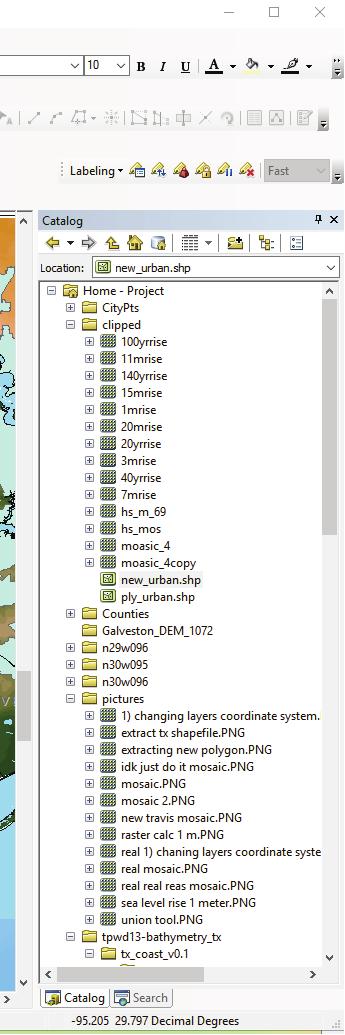
1 Sophie Worrell 11/29/2016 The Loss of Urban Areas from Sea Level Rise in the Greater Houston-Galveston Area, TX (1) Purpose: Defined by flat coastal plains, the greater Houston-Galveston area is the most populated region in Texas. Therefore, as sea level continues to rise the greater Houston-Galveston area will be one of the first regions significantly affected. Global climate change is causing sea level to rise 7 mm/year in this area. This projects aims to project the loss of Houston-Galveston urban areas (in km 2 ) due to sea level rise; specifically, focused on sea level rises of 1 meter, 3 meters, 7 meters, 11 meters, 15 meters, and 20 meters. (2) Data Collection: Texas Counties shape-file: From the United States 2016 Census data 8and+equivalent%29 Urban Density shape-file: From the United States 2016 Census data Digital Elevation Models: From the USGS National Map Cities Shape-file: From the Texas Parks and Wildlife Houston-Galveston Base Map: From the Texas Natural Resources Information System Sea Level Rise Rate for the Galveston Area: From the Tides and Currents NOAA (3) Data Processing: I downloaded all of the shape-files and Digital Elevation Models (DEMs) to my USB drive s Project folder. Then I extracted the files to make sure all the information was accessible. (4) ArcGIS Processing: a) I first changed the Layers coordinate system to GCS NAD 1983, so the data was projected with the least amount of distortion. b) I added in all of my shape-files and DEMs to the blank ArcMap document. Then I used the project tool in Arctoolbox to project all of the shape-files to the same coordinate system as the Layers (GCS NAD 1983). To change the DEMs, I located each DEM in ArcCatalog and changed the 1
&78&'7':878&'\">8*%3&':$7#&?2%*&'\"2'c&d7:'>:%3<'8$&'o\">38%&:':$7#&?")
'8\"\"*57)'734':&*&98&4':87)8'&4%8%3<E'C$&3;'b'\"#&3&4'8$&'Z88)%5>8&'C75*&'\"2'8$&'9\">38%&:' :$7#&?")
2 !"#$%&'("))&** ++,-.,-/+0 )7:8&)'97*9>*78")'734'9">*4'5&'&7:%*6'&4%8&4'56'">8:%4&'>:&):E', 3#! b'f738&4'8"'9)&78&'7':878&'">8*%3&':$7#&?2%*&'"2'c&d7:'>:%3<'8$&'o">38%&:':$7#&?2%*&;':"'b'>:&4'8$&' R3%"3'8""*'%3'8$&'[4%8")'8""*57)'IQ%<E'+K, Q%<>)&'+P, Q%<>)&'+'%:'4%:#*76:'B6'>:&'"2'8$&'>3%"3'8""*'8"'9)&78&'7':$7#&?2%*&'">8*%3&'"2'C&D7:E'b'9*%9J&4'"3' 8$&'[4%8")'8""*57)'734':&*&98&4':87)8'&4%8%3<E'C$&3;'b'"#&3&4'8$&'Z88)%5>8&'C75*&'"2'8$&'9">38%&:' :$7#&?2%*&'734':&*&98&4'7**'"2'8$&'9">38%&:E']&D8;'b'F&38'8"'8$&'[4%8")'8""*57);'734'9*%9J&4'"3'8$&' R3%"3'8""*'734':&*&98&4'8$&'9">38%&:E'' >#! R:%3<'8$&'">8*%3&:'"2'8$&'9">38%&:;'8$&'R3%"3'8""*'9)&78&4'7'3&F'#"*6<"3'"2'8$&'C&D7:'5")4&)E'b' >:&4'8$%:'3&F'#"*6<"3'8"'B7J&'7':878&'">8*%3&':$7#&?2%*&'IQ%<E'-K' -
573'4&3:%86'9&38&):'%3'C&D7:;'b'>:&4'8$&'O*%#'8\"\"*'8\"'9*%#'8$&'>)573'4&3:%8%&:' :$7#&?2%*&'8\"'8$&'3&F*6'9)&78&4'C&D7:'\">8*%3&':$7#&?2%*&E,?#! b'*75&*&4'\"3*6'8$&'<)&78&)'=\">:8\"3?")
<&'9%8%&:'%3'8$&')&<%\"3'b'F&38'8\"'8$&'9%8%&:'Z88)%5>8&'C75*&'734'$%<$*%<$8&4'8$&'9%8%&:'b' F738&4'8\"'4%:#*76E'b')%<$8'9*%9J&4'\"3'8$&'9%8%&:':$7#&?")
3 !"#$%&'("))&** ++,-.,-/+0 Q%<>)&'-P' Q%<>)&'-':$"F:'8$&'$%<$*%<$8&4'C&D7:'5")4&)'#"*6<"3'I-NfK'734'8$&'#)"9&::'"2'&D#")8%3<'8$&'4787'8"' 9)&78&'7'3&F'C&D7:'">8*%3&':$7#&?2%*&E' *#! C"'"3*6':$"F'8$&'>)573'4&3:%86'9&38&):'%3'C&D7:;'b'>:&4'8$&'O*%#'8""*'8"'9*%#'8$&'>)573'4&3:%8%&:' :$7#&?2%*&'8"'8$&'3&F*6'9)&78&4'C&D7:'">8*%3&':$7#&?2%*&E,?#! 8""*57)E, 7#! C"'*75&*'*7)<&'9%8%&:'%3'8$&')&<%"3'b'F&38'8"'8$&'9%8%&:'Z88)%5>8&'C75*&'734'$%<$*%<$8&4'8$&'9%8%&:'b' F738&4'8"'4%:#*76E'b')%<$8'9*%9J&4'"3'8$&'9%8%&:':$7#&?2%*&'734'9$":&'[D8)798'1787E'C$%:'9)&78&4'7' ]&D8;'b'9)&78&4'7'B":7%9')7:8&)'">8'"2'8$&'8F"'1[\:'"2'8$&'7)&7;':"'b'9">*4'97*9>*78&'A7*>&:'B")&' &22%9%&38*6'%3'8$&'a7:8&)'O7*9>*78")'IQ%<E'MK, M
&'MP' Q%<>)&'M'4&B\"3:8)78&:'$\"F'b'9)&78&4'\"3&'B\":7%9')7:8&)'\">8'\"2'8F\"'1[\:E'Q)%:8;'b'\"#&3&4'Z)9C\"\"*5\"D'")
4 !"#$%&'("))&** ++,-.,-/+0 Q%<>)&'MP' Q%<>)&'M'4&B"3:8)78&:'$"F'b'9)&78&4'"3&'B":7%9')7:8&)'">8'"2'8F"'1[\:E'Q)%:8;'b'"#&3&4'Z)9C""*5"D' 9"")4%378&':6:8&B;'8$&'M-g`bCgQcdZC;'8$&'9&**:%_&'"2'.E-N.-N.M&?//N;'734'+'7:'8$&'3>B5&)'"2' 5734:E'C$%:'9)&78&4'7'3&F'&22%9%&38'B":7%9')7:8&)E' 4#! b'"#&3&4'8$&'a7:8&)'o7*9>*78")'8"'9)&78&'7'3&f')7:8&);'2)"b'b6'b":7%9')7:8&);'8"')&#)&:&38'+' B&8&)'"2':&7'*&A&*')%:&'IQ%<E'fKE'R:%3<'8$&':7B&'#)"9&::;'b'B74&'3&F')7:8&):'2")':&7'*&A&*')%:&'"2'M' B;'G'B;'++'B;'+N'B;'734'-/'BE, f
;'734'&38&)&4'B6'9\"34%8%\"37*':878&B&38E'C\"':$\"F'9$73<&:'%3':&7'*&A&*;'b'$74'")
%:&'7:'5*>&'i2\")'f78&)k'734'8$&'>3722&98&4'*734'7:'$\"**\"fe' B#! b'744&4'7'57:&'b7#'8\"'<%a&'b6'b7#'b\")&'4&2%3%8%\"3e' 2#!")
5 !"#$%&'("))&** ++,-.,-/+0 Q%<>)&'fP' Q%<>)&'f':$"F:'8$&'9)&78%"3'"2'+'B&8&)':&7'*&A&*')%:&')7:8&)E'b'>:&4'8$&'a7:8&)'O7*9>*78")'8""*'%3'8$&'!#78%7*'Z37*6:%:'8""*57);'734'&38&)&4'B6'9"34%8%"37*':878&B&38E'C"':$"F'9$73<&:'%3':&7'*&A&*;'b'$74' 8"':>58)798'8$&'#)&2&))&4'B&8&):'"2':&7'*&A&*')%:&'b'F738&4'8"')&#)&:&38'2)"B'8$&'1[\'&*&A78%"3' )7:8&)E' A#! b':6b5"*%_&4'8$&':&7'*&a&*')%:&'7:'5*>&'i2")'f78&)k'734'8$&'>3722&98&4'*734'7:'$"**"fe' B#! b'744&4'7'57:&'b7#'8"'<%a&'b6'b7#'b")&'4&2%3%8%"3e' 2#! b'f738&4'8"'4%:#*76'8$&'"3*6'8$&'>)573'7)&7:'f%8$%3'8$&'b":7%9')7:8&)')&<%"3e'c$>:;'b'>:&4'8$&' 1)7F%3<'8""*'8"'9)&78&'7')&9873<*&'7)">34'8$&'&D8&38'"2'8$&'B":7%9')7:8&)E'b'>:&4'8$%:')&9873<*&' 8"'9*%#'8$&'>)573'4&3:%86':$7#&?2%*&'8"'8$%:')&<%"3'IQ%<E'NK' N
8'@)7#$%9:'8\"'q&78>)&:'8\"\"*'>34&)'")
![8$&'c76&):'875E']&D8;'b'>:&4'8$&'O*%#'8""*'8"'9*%#'8$&'>)573'4&3:%86'8"'8$&'#"*6<"3':$7#&?](/docs-images/82/85048959/images/6-1.jpg "2%*&E'C$%:' 9)&78&4'7'3&F':$7#&?")
\"H&98'8$&'3&F*6'9*%##&4'>)573':$7#&?")
6 !"#$%&'("))&** ++,-.,-/+0 Q%<>)&'N' 8$&'c76&):'875E']&D8;'b'>:&4'8$&'O*%#'8""*'8"'9*%#'8$&'>)573'4&3:%86'8"'8$&'#"*6<"3':$7#&?2%*&E'C$%:' 9)&78&4'7'3&F':$7#&?2%*&'8$78'4%:#*76&4'>)573'7)&7:'F%8$%3'8$&'B":7%9')7:8&)')&<%"3E' C#! ]&D8;'b'$74'8"'#)"H&98'8$&'3&F*6'9*%##&4'>)573':$7#&?2%*&;':"'b'>:&4'8$&'^)"H&98'8""*'8"'#)"H&98'8"' ]Z1'+.XM'RC\'h"3&'+fE, 5#! b'97*9>*78&4'8$&'7)&7'"2'8$&'>)573%_&4')&<%"3:'5&2")&':&7'*&a&*')%:&'>:%3<'8$&'9*%##&4'>)573' :$7#&?2%*&'IQ%<E'0K, 0
&'0'")

7 !"#$%&'("))&** ++,-.,-/+0 Q%<>)&'0' Q%<>)&'0'4&B"3:8)78&:'$"F'b'97*9>*78&4'8$&'7)&7'"2'8$&'9>))&38'>)573'&D8&38'%3'8$&'Z88)%5>8&'C75*&'>:%3<' JB - E' (#! b3'")4&)'8"'97*9>*78&'8$&'*"::'"2'>)573'7)&7'728&)'+'b'"2':&7'*&a&*')%:&;'b'$74'8"'9"3a&)8'8$&'+'b' :&7'*&A&*')%:&')7:8&)'8"'7'#"*6<"3'IQ%<E'GKE'C$%:'%:'5&97>:&'b'F738'8"'5&'75*&'8"'>:&'8$&'[)7:&'8""*' *78&)'"3;'734'%8'"3*6'>:&:':$7#&?2%*&:E, G
&'G'")


8 !"#$%&'("))&** ++,-.,-/+0 Q%<>)&'G' Q%<>)&'G'4&B"3:8)78&:'$"F'b'9"3A&)8&4'8$&'+'B':&7'*&A&*')%:&')7:8&)'8"'7'#"*6<"3E'b'>:&4'8$&'a7:8&)' 8"'^"*6<"3'8""*'%3'8$&'!#78%7*'Z37*6:%:'8""*57)E'C$%:'9)&78&4'7'3&F'#"*6<"3':$7#&?2%*&'4%:#*76%3<'8$&'+' B':&7'*&A&*')%:&E'' '#! C$&3;'%3'8$&'Z88)%5>8&'C75*&'"2'8$&'+'B':&7'*&A&*')%:&':$7#&?2%*&'b':&*&98&4'8$&'+'A7*>&:'8"'9)&78&'7' #"*6<"3'"3*6':$"F%3<'8$&'3&F':&7'*&A&*'IQ%<E'XKE, X
&'X'")


9 !"#$%&'("))&** ++,-.,-/+0 Q%<>)&'X' Q%<>)&'X':$"F:'$"F'b'9)&78&4'7'3&F'#"*6<"3')&#)&:&38%3<'8$&'3&F':&7'*&A&*'728&)'+'B')%:&E'b'"#&3&4' 8$&'Z88)%5>8&'C75*&'"2'8$&'+'B':&7'*&A&*')%:&'#"*6<"3'734':&*&98&4'7**'"2'8$&'+'A7*>&:E'b':&*&98&4'8$&:&' A7*>&:'>:%3<'8$&'!&*&98'56'Z88)%5>8&:'2>398%"3E']&D8;'b'&D8)798&4'8$&':&*&98&4'4787'8"'9)&78&'8$&'3&F' #"*6<"3E D#! b'>:&4'8$&'[)7:&'8""*'8"')&b"a&'8$&'>)573'7)&7:'8$78'f&)&'9"a&)&4'56'8$&'+'b')%:&'%3':&7'*&a&*' IQ%<E'.KE,.
78&:'$\"F'b'>:&4'8$&'[)7:&'8\"\"*'8\"')&B\"A&'8$&'>)573'7)&7:'722&98&4'56'8$&'+'B':&7'")
7:&'2&78>)&'F7:'8$&'+'B':&7'*&A&*' )%:&'#\"*6<\"3E'C$&'[)7:&'8\"\"*'#)\"4>9&4'7':$7#&?")
\"H&98'8\"\"*E, )#! Z28&)'8$&':$7#&?")
10 !"#$%&'("))&** ++,-.,-/+0 Q%<>)&'.' Q%<>)&'.'4&B"3:8)78&:'$"F'b'>:&4'8$&'[)7:&'8""*'8"')&B"A&'8$&'>)573'7)&7:'722&98&4'56'8$&'+'B':&7' *&A&*')%:&E'\6'%3#>8'2&78>)&'F7:'8$&'9*%##&4'>)573':$7#&?2%*&'734'&)7:&'2&78>)&'F7:'8$&'+'B':&7'*&A&*' )%:&'#"*6<"3E'C$&'[)7:&'8""*'#)"4>9&4'7':$7#&?2%*&'8$78')&#)&:&38&4'8$&'>)573'7)&7:'>3722&98&4'56' 8$&'+'B':&7'*&A&*')%:&E' &#! b'$74'8"'#)"h&98'8$&'>3722&98&4'>)573'7)&7:':$7#&?2%*&'8"']z1'+.xm'rc\'h"3&'+f'>:%3<'8$&' ^)"H&98'8""*E, )#! Z28&)'8$&':$7#&?2%*&'F7:'#)"H&98&4'b'744&4'7'3&F'2%&*4'%3'8$&'Z88)%5>8&'C75*&;'734'97*9>*78&4'8$&' 0#! b')&#&78&4':8&#:'(#e)#,8"'97*9>*78&'8$&'7)&7'*"::'"2'>)573'&d8&38'2)"b':&7'*&a&*')%:&:'"2'm'b;'g'b;' ++'B;'+N'B;'734'-/'BE, +/'
11 Sophie Worrell 11/29/2016 (5) Conclusion: The calculation of urban area loss demonstrates how significantly the rise in sea level from 1m 20 m will affect the greater Houston-Galveston area. The pre-sea level rise urban extent was 4095 km 2. 1 m of sea level rise did not notably alter the urban area (Fig. 10). This is good news because at the rate of 7mm/yr., 1 m of sea level rise will occur in 143 years. Drastic changes in the urban extent will appear in 1000 years; the urban area will be reduced by 20% because of 7 m sea level rise. With 20 m of sea level rise, most of the greater Houston-Galveston urban area will be under water. Resulting in loss of more than half of the urban expanse by the year 4876 (Fig. 10). Thus, global warming induced sea level rise will greatly alter the urban expanse of the Houston-Galveston area. Figure 9: Current urban area Urban area after 1m sea rise Urban area after 3m sea rise Urban area after 7m sea rise Urban area after 11m sea rise Urban area after 15 m sea rise Urban Area after 20m sea rise 4095 km km km km km km km 2 Figure 9 displays all of my calculated areas of the urban expanse lost after different amounts of sea level rise. 11
12 The Loss of Urban Area due to Sea Level Rise in the Greater Houston-Galveston Area, TX Present Day Sea Level Sophie Worrell 12/1/2016 ± H A R R I S Baytown Mont Belvieu C H A M B E R S Anahuac J E F F E R S O N Houston G A L V E S T O N Bolivar Peninsula F O R T B E N D Texas City B R A Z O R I A Alvin Galveston Angleton The Gulf of Mexico Legend Counties Urban Centers Major Cities Water Level Shallow Water Moderatly Deep Water Deep Water Km 1:900,000 GCS North American 1983
13 The Loss of Urban Area due to Sea Level Rise in the Greater Houston-Galveston Area, TX 1 Meter Sea Level Rise Sophie Worrell 12/1/2016 ± H A R R I S Baytown Mont Belvieu C H A M B E R S Anahuac J E F F E R S O N Houston G A L V E S T O N Bolivar Peninsula F O R T B E N D Texas City B R A Z O R I A Alvin Galveston Angleton The Gulf of Mexico Legend Counties Urban Centers Major Cities Water Level Sea Level Rise Km 1:900,000 GCS North American 1983
14 The Loss of Urban Area due to Sea Level Rise in the Greater Houston-Galveston Area, TX 3 Meter Sea Level Rise Sophie Worrell 12/1/2016 ± H A R R I S Baytown Mont Belvieu C H A M B E R S Anahuac J E F F E R S O N Houston G A L V E S T O N Bolivar Peninsula F O R T B E N D Texas City B R A Z O R I A Alvin Galveston Angleton The Gulf of Mexico Legend Counties Urban Centers Major Cities Water Level Sea Level Rise Km 1:900,000 GCS North American 1983
15 The Loss of Urban Area due to Sea Level Rise in the Greater Houston-Galveston Area, TX 7 Meter Sea Level Rise Sophie Worrell 12/1/2016 ± H A R R I S Baytown Mont Belvieu C H A M B E R S Anahuac J E F F E R S O N Houston G A L V E S T O N Bolivar Peninsula F O R T B E N D Texas City B R A Z O R I A Alvin Galveston Angleton The Gulf of Mexico Legend Counties Urban Centers Major Cities Water Level Sea Level Rise Km 1:900,000 GCS North American 1983
16 The Loss of Urban Area due to Sea Level Rise in the Greater Houston-Galveston Area, TX 11 Meter Sea Level Rise Sophie Worrell 12/1/2016 ± H A R R I S Baytown Mont Belvieu C H A M B E R S Anahuac J E F F E R S O N Houston G A L V E S T O N Bolivar Peninsula F O R T B E N D Texas City B R A Z O R I A Alvin Galveston Angleton The Gulf of Mexico Legend Counties Urban Centers Major Cities Water Level Sea Level Rise Km 1:900,000 GCS North American 1983
17 The Loss of Urban Area due to Sea Level Rise in the Greater Houston-Galveston Area, TX 15 Meter Sea Level Rise Sophie Worrell 12/1/2016 ± H A R R I S Baytown Mont Belvieu C H A M B E R S Anahuac J E F F E R S O N Houston G A L V E S T O N Bolivar Peninsula F O R T B E N D Texas City B R A Z O R I A Alvin Galveston Angleton The Gulf of Mexico Legend Counties Urban Centers Major Cities Water Level Sea Level Rise Km 1:900,000 GCS North American 1983
18 The Loss of Urban Area due to Sea Level Rise in the Greater Houston-Galveston Area, TX 20 Meter Sea Level Rise Sophie Worrell 12/1/2016 ± H A R R I S Baytown Mont Belvieu C H A M B E R S Anahuac J E F F E R S O N Houston G A L V E S T O N Bolivar Peninsula F O R T B E N D Texas City B R A Z O R I A Alvin Galveston Angleton The Gulf of Mexico Legend Counties Urban Centers Major Cities Water Level Sea Level Rise Km 1:900,000 GCS North American 1983
TGS CEDAR PORT INDUSTRIAL PARK
 Grand Pkwy ±10,000 ACRES AVAILABLE R Loop 201 R BNSF BAYER CHEMICAL UP & TGS INDUSTRIAL PARK FM 14 05 NRG BAYTOWN WATER RESERVOIR HOME DEPOT Fisher Rd PBP EXEL CEDAR PORT WAL-MART BORUSAN MANNESMANN Borusan
Engineering With Nature Geographic Project Mapping Tool (EWN ProMap)
") Engineering With Nature Geographic Project Mapping Tool (EWN ProMap) Cynthia Banks Program Manager Burton Suedel, PhD Research Biologist Michelle Bourne Research Biologist U.S. Army ERDC 23 June 2015 Dredging
Engineering With Nature Geographic Project Mapping Tool (EWN ProMap) Cynthia Banks Program Manager Burton Suedel, PhD Research Biologist Michelle Bourne Research Biologist U.S. Army ERDC 23 June 2015 Dredging
Galveston County. Population: 322,225 (2015 est.) Access to 2 deep water ports. Location of a world class industrial complex
 Access to 2 deep water ports. Location of a world class industrial complex") Galveston County Galveston County Population: 322,225 (2015 est.) Access to 2 deep water ports Location of a world class industrial complex Benefits of the Houston Metro without the big city congestion
Galveston County Galveston County Population: 322,225 (2015 est.) Access to 2 deep water ports Location of a world class industrial complex Benefits of the Houston Metro without the big city congestion
MarinaWalk at Clear Creek Mixed-use, 177 AC development along the banks of Clear Creek
 WEBSTER, TX MarinaWalk at Clear Creek Mixed-use, 177 AC development along the banks of Clear Creek EDWARD HEAP 281.661.3227 edward.heap@srsre.com JONATHAN HICKS 281.661.3225 jonathan.hicks@srsre.com OVERVIEW
2012 Texas Water Conservation Association Meeting
 2012 Texas Water Conservation Association Meeting BG Thomas Kula Southwestern Division Commander 15 June 2012 US Army Corps of Engineers AGENDA UNCLASSIFIED Overview of Southwestern Division Missions Texas
The Galveston Seawall
 Coastal and Ocean Engineering ENGI.8751 Undergraduate Student Forum Faculty of Engineering and Applied Science, Memorial University, St. John s, NL, Canada. March, 2013 The Galveston Seawall Mark Harvey
EXPLORING EARTH S SURFACE. Lesson 4
 EXPLORING EARTH S SURFACE Lesson 4 Introduction Lewis and Clark In 1804, an expedition set out from near Saint Louis to explore the land between the Mississippi River and the Pacific Ocean, The United
SAME/SBA CONFERENCE. Col. Christopher W. Sallese Commander, Galveston District U.S. Army Corps of Engineers April 11, 2012
 SAME/A CONFERENCE Col. Christopher W. Sallese Commander, Galveston District U.S. Army Corps of Engineers April 11, 2012 U.S. Army Corps of Engineers Galveston District BUILDING STRONG 1 History of the
Note that the steepest 8 direction pour point model slope in direction 64 is: 10.0
 GIS in Water Resources Exercise #3 Solution Part 1. 1.1 Hand Calculations (i) The standard ESRI surface slope function Grid size 10 m Diagonal distance= 14.142 m 47.5 48 47.7 50.6 48.3 dz/dx= -0.125 45.1
Disaster Evacuation Safe Zones in Clackamas County, Oregon Analysis: Two Scenarios
 Disaster Evacuation Safe Zone Analysis for Clackamas County, Oregon Part One: Caroline Rouwalk Part Two: Kathy Jepson June 3, 2008 http://gallery.photo.net/photo/5297534-md.jpg Disaster Evacuation Safe
Hungry 4 History Trivia VA Studies 2010 and beyond
 Hungry 4 History Trivia VA Studies 2010 and beyond Level 1 1 What may be described using terms that show connections between two places such as: next to, near, or bordering? 2 3 What two large bodies of
Southwest Agribusiness Consulting, Inc.
 Volume XVI, Issue 3D United Checkoff Program Weekly Basis Snapshot Page 1 Southwest Agribusiness Consulting, Inc. www.agconsult.net Country Elevators Region to Differential Avg. Basis Cash Price Avg. Basis
Size data for all Gulf areas are available starting Fishing areas in the Headboat survey are described in Table 1.
 SEDAR7 - DW - 46 Size frequency distribution of red snapper from dockside sampling of recreational landings in the Gulf of Mexico 1984-22 (TXPW, MRFSS, and s size data) by Guillermo A. Diaz Southeast Fisheries
World on the Edge - Climate Data - Ice Melt and Sea Level Rise
 World on the Edge - Climate Data - Ice Melt and Sea Level Rise Major Ice Disintegration and Calving Events, 1995-2010 September and Annual Average Arctic Sea Ice Extent, 1979-2010 GRAPH: September Arctic
Texas South Reclass List
 Texas South Reclass List 6AA TO 7AAA 1 TXS - RGV Bravos 1508 950 18-0 15-0 1 71-75.486 0-0 16.7 6.0 10.7 2 TXS - Deer Park Deer Park Spikes 6U 1186 1025 11-12 10-2.833 26-48.351 12-6.667 14.3 7.6 6.8 7AA
A GIS Analysis of Probable High Recreation Use Areas in Three Sisters Wilderness Deschutes and Willamette National Forests
 Lindsey Kiesz Geo 565 Term Project 3/15/2010 A GIS Analysis of Probable High Recreation Use Areas in Three Sisters Wilderness Deschutes and Willamette National Forests Introduction The Three Sisters Wilderness
Speculative Investment in the Mississippi Delta of the Future
 Speculative Investment in the Mississippi Delta of the Future Introduction This report analyzes future scenarios of Southern Louisiana based on the events surrounding Hurricane Katrina and the possibility
Georgia s Brain Wrinkles. SS8G1c
 Georgia s 2015 Brain Wrinkles SS8G1c There are many different physical features in the state of Georgia. Physical features include bodies of water, deserts, mountain ranges, and other landforms. They are
Environmental Development of River Road Ranch
 Environmental Development of River Road Ranch New Braunfels, Texas Alix Scarborough GEO 3426 April 2012 Introduction The 2,400-acre Word-Borcher ranch has been owned by the Word family since 1941. Located
Creating and Deploying
 The Slickrock area near Moab has become a mountain bike destination. Creating and Deploying a Multimodal Emergency Response Network By Mike Price, Entrada/San Juan, Inc. In addition to expertise in GIS
Houston Dynamo Academy White. Texas United Gunners Gold 05B. Maya EFC Heat Gold 05B Maya EFC B05 - Qualifying
 2016 Dynamo/Dash & U13 Boys - Dynamo/Dash Jr. League - Fall 2016 Maya EFC Heat Black 05B ID Club Division 05B Qualifying Sugar Land Inter 05B ID Houston Dynamo CDP 05B Qualifying Houston Dynamo Academy
Chapter 16 ~ Eastern Mediterranean
 Chapter 16 ~ Eastern Mediterranean Physical Geography of the Eastern Mediterranean Landforms This area is known as the Levant and includes Syria, Jordan, Lebanon, Israel, and the Palestinian territories.
7-Nov-15 PHYS Elastic Collision. To study the laws of conservation of momentum and energy in an elastic collision. Glider 1, masss m 1.
 Objective Elastic Collision To study the laws of conservation of momentum and energy in an elastic collision. Introduction If no net external force acts on a system of particles, the total linear momentum
SEG Houston 2009 International Exposition and Annual Meeting
 Constrained propeller ship noise removal and its application to OC data Manhong Guo*, Jun Cai, Jim Specht, in Wang TGS-Nopec Geophysical Company, 500 CityWest lvd. Suite 000, Houston, TX 7704, US Summary
Satisfying the Need: Finding Potential Campsite Locations in Farewell Canyon, B.C. Alexis Moore
 Satisfying the Need: Finding Potential Campsite Locations in Farewell Canyon, B.C. Alexis Moore 230075923 Geog 413 Final Project Write- Up Roger Wheate April. 13, 2012 Introduction & Purpose of Study The
Recreation Opportunity Analysis Authors: Mae Davenport, Ingrid Schneider, & Andrew Oftedal
 Authors: Mae Davenport, Ingrid Schneider, & Andrew Oftedal // 2010 Supply of Outdoor Recreation Resources // Recreation Location Quotient Analysis recreation opportunity analysis // 59 2010 Supply of Outdoor
Welcome to the Galveston Ferry Operation. Presented by Captain William P. Mallini Ferry Operation Manager
 Welcome to the Galveston Ferry Operation Presented by Captain William P. Mallini Ferry Operation Manager The purpose of this presentation is to inform the audience of a brief history of the ferry operation,
Houston. Description: Hwy 59 Eastex Frwy WS 0.3mi S/O FM 1960 F/N - 2. TAB Panel ID: City: HUMBLE Latitude:
 001023 - Houston Description: Hwy 59 Eastex Frwy WS 0.3mi S/O FM 1960 F/N - 2 TAB Panel ID: 74698 City: HUMBLE Latitude: 29.999 Media Type: Digital State: TX Longitude: -95.271 Display Dimensions: 14'
Hydraulic Report. Trail 5 Snowmobile Trail Over Mulligan Creek. Prepared By: COLEMAN ENGINEERING COMPANY Karisa V. Falls, P.E.
 Prepared for: Prepared by: Marquette County Road Commission Coleman Engineering Company Marquette, Michigan Iron Mountain, MI December 2011 Hydraulic Report Trail 5 Snowmobile Trail Over Mulligan Creek
Fire and Forestry in Oxbow Regional Park, GIS and GPS Implementation
 Fire and Forestry in Oxbow Regional Park, GIS and GPS Implementation Brian Handy, Karen Sexton, Robert Pierce GIS and GPS implementation at Oxbow Regional Park, Oregon, in the preparation for fire danger
Chapter 16 ~ Eastern Mediterranean
 Chapter 16 ~ Eastern Mediterranean Physical Geography of the Eastern Mediterranean Landforms This area is known as the Levant and includes Syria, Jordan, Lebanon, Israel, and the Palestinian territories.
There are actually six geographic sub-regions, three in both the uplands and the lowlands.
 6 Regions of AR Although Arkansas is most easily divided into two distinct geographical regions, the northwestern uplands and the southeastern lowlands, this description does not accurately portray the
NEW WEB TOOL FOR UNDERSTANDING BIOLUMINESCENT BAYS
 NEW WEB TOOL FOR UNDERSTANDING BIOLUMINESCENT BAYS Fernando Gilbes Santaella* and William Hernandez GERS Lab-Department of Geology University of Puerto Rico at Mayaguez *fgilbes@uprm.edu RESEARCH COMPONENT
Galveston Bay Estuary Program. Carla G. Guthrie, Ph.D. Galveston Bay Council Member Texas Water Development Board
 Galveston Bay Estuary Program Carla G. Guthrie, Ph.D. Galveston Bay Council Member Texas Water Development Board The statements contained in this presentation are my current views and opinions and are
welcome Located in Corpus Christi, Texas, the La Palmera Shopping District is the premier retail destination
 welcome Located in Corpus Christi, Texas, the La Palmera Shopping District is the premier retail destination in the state s Coastal Bend region, offering more than 130 retail and dining options. The 1-million-square-foot
Mexico. Chapter 10. Chapter 10, Section
 Chapter 10, Section World Geography Chapter 10 Mexico Copyright 2003 by Pearson Education, Inc., publishing as Prentice Hall, Upper Saddle River, NJ. All rights reserved. Chapter 10, Section World Geography
Panama Canal Stakeholder Working Group Meeting
 Panama Canal Stakeholder Working Group Meeting POHA, Bayport Container Terminal, Houston, Texas August 27, 2012 TOTAL ECONOMIC IMPACT 9,749 Texas jobs are in some way related to the Port Of the 9,749
Produced by: Destination Research Sergi Jarques, Director
 Produced by: Destination Research Sergi Jarques, Director Economic Impact of Tourism Oxfordshire - 2015 Economic Impact of Tourism Headline Figures Oxfordshire - 2015 Total number of trips (day & staying)
New Homes for Sale in Houston Choose Your Community
 Join VIP List Warranty Customer Service Careers Gehan Homes Blog Create an Account Sign In Find Your New Home Our Homes Gallery Make Your Move Toolbox About Us New Homes for Sale in Houston Choose Your
Warm ups *What was the most valuable natural resource in the development of the Northeast? Why? *What does a megalopolis refer to?
 Warm ups 9.22.2016 *What was the most valuable natural resource in the development of the Northeast? Why? *What does a megalopolis refer to? Lesson Objective: *identify the key natural resources that influenced
"ST. KLIMENT OHRIDSKI FACULTY OF GEOLOGY AND GEOGRAPHY
 SOFIA UNIVERSITY "ST. KLIMENT OHRIDSKI FACULTY OF GEOLOGY AND GEOGRAPHY APPLICATION OF THE MODEL "DRIVING FORCES PRESSURE STATE - RESPONSE FOR ASSESSMENT OF FLOOD RISK RADOSTINA BORISOVA DOCHEVA Bachelor
GULF. English & American Culture. language
 GULF language s c h o o l English & American Culture P r o g r a m Summer 2018 WELCOME TO HOUSTON, TX Houston is the 4 th largest city in the country. Located in Texas, the second biggest state in the
International Osoyoos Lake Board of Control Annual Report to the International Joint Commission
 International Osoyoos Lake Board of Control 2015 Annual Report to the International Joint Commission Cover: Northern extent of Osoyoos Lake, where the Okanagan River enters the lake, 2015. View is to the
Statistical Evaluation of BMP Effectiveness in Reducing Fecal Coliform Impairment in Mermentau River Basin
 Statistical Evaluation of BMP Effectiveness in Reducing Fecal Coliform Impairment in Mermentau River Basin Z.-Q. Deng 1 and H. Chowdhary 2 1 Assistant Professor, Department of Civil and Environmental Engineering,
Adapting water resource management in coastal areas A case study in Hai Phong, Vietnam
 Adapting water resource management in coastal areas A case study in Hai Phong, Vietnam Thuc Phan, James Smart, Samantha Capon, Wade Hadwen Australian Rivers Institute, Griffith University Presentation
2015 Brain Wrinkles. SS8G1b
 SS8G1b Standards SS8G1 The student will describe Georgia with regard to physical features and location. b. Describe the five geographic regions of Georgia; include the Blue Ridge Mountains, Valley and
Things to do in the Heart of the Fun!
 Things to do in the Heart of the Fun! 1 Angleton Bowl 40 S. Velasco 979.848.2115 Open Bowling and League Play. 2 Angleton Recreation Center 1601 N. Valderas 979.549.04 www.angleton.tx.us Fitness facility,
SAND TIGER SHARK (SoC)
") Ranking (Economic) Potentially Impacted Navigation s 2 Galveston SWD HOUSTON SHIP CHANNEL (0007780) TX X 4 New York NAD NEW YORK HARBOR (0012490) NY X 10 New York NAD NEW YORK AND NEW JERSEY HARBOR, NY
Ranking (Economic) Potentially Impacted Navigation s 2 Galveston SWD HOUSTON SHIP CHANNEL (0007780) TX X 4 New York NAD NEW YORK HARBOR (0012490) NY X 10 New York NAD NEW YORK AND NEW JERSEY HARBOR, NY
reviewed paper Sustainability via Soft Natural Resource Management. The Coastal Area of Vouliagmeni Agisilaos Economou
 reviewed paper (Phd, Laboratory of Geographic Information Systems in Urban and Regional Planning, National Technical University of Athens, Nikaias 18, 17122, Athens, Greece, aghs@mail.ntua.gr) 1 ABSTRACT
Sabine Neches Waterway: Smiths Bluff to Beaumont Turning Basin
 Sabine Neches aterway: -ft.ft 3 8 3 5 5 6 6 4 ' 8 6 ' 93 ' 93 ' Print Date: 4//8 Side Slope Ratio: (Rise : Run Authorized Depth: -ft. Survey Date(s: March 8 SUN MARINE TERMINALS LAY BERTHS AND RIVER MARINE
2018 Spring Semester Final : STUDY GUIDE
 Name: Hr: 2018 Spring Semester Final : STUDY GUIDE My final is on:, May My final will have questions and will be COLONIZATION OF NORTH & SOUTH AMERICA - Match the regions with the European countries that
The Impacts of the Climate Change in the Coastal Areas. The case study of South Pieria
 The Impacts of the Climate Change in the Coastal Areas. The case study of South Pieria Evaggelos Baltas 1, Maria Nikou 2*, Vaios Kotsios 3 1 Associate Professor, National University of Athens, Greece 2
MT - GEOGRAPHY - (73) - SEMI PRELIM - II : PAPER - 3
 - SEMI PRELIM - II : PAPER - 3") MT 2018 1100 Seat No. MT - GEOGRAPHY - (73) - SEMI PRELIM - II : PAPER - 3 Time : 2 Hours (Pages 5) Max. Marks : 0 Q.1. Fill in the blank choosing the correct alternative : (a) On the foot hills of the
MT 2018 1100 Seat No. MT - GEOGRAPHY - (73) - SEMI PRELIM - II : PAPER - 3 Time : 2 Hours (Pages 5) Max. Marks : 0 Q.1. Fill in the blank choosing the correct alternative : (a) On the foot hills of the
Region 1 Piney Woods
 Region 1 Piney Woods Piney Woods 1. This ecoregion is found in East Texas. 2. Climate: average annual rainfall of 36 to 50 inches is fairly uniformly distributed throughout the year, and humidity and temperatures
What Is An Ecoregion?
 Ecoregions of Texas What Is An Ecoregion? Ecoregion a major ecosystem with distinctive geography, characteristic plants and animals, and ecosystems that receives uniform solar radiation and moisture Sometimes
The Use of Low Cost Breakwaters for Mangrove Restoration in Muddy Foreshores
 The Use of Low Cost Breakwaters for Mangrove Restoration in Muddy Foreshores Douglas A. Gaffney, P.E. Ranata Robertson October 23, 2012 The Use of Low Cost Breakwaters for Mangrove Restoration in Muddy
USE OF 3D GIS IN ANALYSIS OF AIRSPACE OBSTRUCTIONS
 USE OF 3D GIS IN ANALYSIS OF AIRSPACE OBSTRUCTIONS A project by by Samuka D. W. F19/1461/2010 Supervisor; Dr D. N. Siriba 1 Background and Problem Statement The Airports in Kenya are the main link between
GEOGRAPHY OF THE UNITED STATES & CANADA. By Brett Lucas
 GEOGRAPHY OF THE UNITED STATES & CANADA By Brett Lucas THE SOUTHEASTERN COAST Setting the Boundaries What states and provinces are part of the region? Southeastern TX, southern LA, southern MS, southern
Hotel Location Analysis using ArcGIS
 Hotel Location Analysis using ArcGIS Yang Yang Department of Geography University of Florida Outline Introduction Background Data Source Research Methodology Preliminary Result Introduction Location! Location!
GALVESTON DISTRICT Dredging Schedules
 GALVESTON DISTRICT Dredging Schedules Christopher Frabotta Chief, Navigation Branch Southwestern Division - Galveston District November 2, 2016 Galveston District Dredging Meeting Custodians of the Texas
Carnival Dream (DR) Cozumel, Mexico Sat 9:00am 6:00pm
 Cozumel, Mexico Sat 9:00am 6:00pm") Carnival Dream (DR) Itineraries listed in order of duration. Carnival Dream 4 Day Western Caribbean from Galveston, TX Thu Cozumel, Mexico 9:00am 6:00pm 8:00am Thursday: 5/23/2019, 6/06/2019, 6/20/2019,
Carnival Dream (DR) Itineraries listed in order of duration. Carnival Dream 4 Day Western Caribbean from Galveston, TX Thu Cozumel, Mexico 9:00am 6:00pm 8:00am Thursday: 5/23/2019, 6/06/2019, 6/20/2019,
MARCH 2014 HYDROGRAPHIC REPORT
 DEPARTMENT OF THE ARMY GALVESTON DISTRICT, CORPS OF ENGINEERS P.O. BOX 1229 GALVESTON, TEXAS 77553-1229 MARCH 2014 HYDROGRAPHIC REPORT CHANNELS WITH PROJECT DEPTHS 25 FEET OR OVER A report of the depths
Residential Attitudes about Hurricanes on the Lone Star Coast
 Residential Attitudes about Hurricanes on the Lone Star Coast 2010 APCG Meeting Coeur d Alene, Idaho September 17, 2010 Presented By: Bryant Evans Houston Community College Residential Attitudes about
Mountain Valley Pipeline, LLC Mountain Valley Pipeline Project Docket No. CP
 16. Prior to construction, Mountain Valley shall file with the Secretary, for review and approval by the Director of OEP, a segment-specific construction and operation access plan for the area between
Tourist and Maine Resident Drive Time to the Proposed Katahdin Woods & Waters National Park Environmental Studies Program, Colby College, Waterville,
 Tourist and Maine Resident Drive Time to the Proposed Katahdin Woods & Waters National Park Environmental Studies Program, Colby College, Waterville, Maine Harriet Rothschild ( 16) and Hannah Twombly (
Airport Noise Management: Benchmarking of 12 International Airports
 Airport Noise Management: Benchmarking of 12 International Airports Jean-Pierre CLAIRBOIS 1 and Nico VAN OOSTEN 2 1 A-Tech / Acoustic Technologies, Belgium 2 Anotec Engineering, Spain ABSTRACT Aircraft
Today you need: Pencil If you have your notebook-put it in bin. Thank you
 SS Terrific Tuesday 1/23/18 Today you need: Pencil If you have your notebook-put it in bin. Thank you Bell work: Put your name on your paper!!!! Look at the map of Ancient Greece. 1. State two-three observations
GALVESTON DISTRICT O&M NAVIGATION MISSION & RESPONSE TO HURRICANE HARVEY
 GALVESTON DISTRICT O&M NAVIGATION MISSION & RESPONSE TO HURRICANE HARVEY 237 237 237 217 217 217 200 200 200 80 119 27 252 174.59 1 255 255 255 0 0 0 163 163 163 131 132 122 239 65 53 Christopher Frabotta
Susitna-Watana Hydroelectric Project (FERC No ) Recreation Resources Study Study Plan Section Study Implementation Report
 Recreation Resources Study Study Plan Section Study Implementation Report") (FERC No. 14241) Recreation Resources Study Study Plan Section 12.5 2014 Study Implementation Report Prepared for Prepared by AECOM November 2015 TABLE OF CONTENTS 1. Introduction... 4 2. Study Objectives...
(FERC No. 14241) Recreation Resources Study Study Plan Section 12.5 2014 Study Implementation Report Prepared for Prepared by AECOM November 2015 TABLE OF CONTENTS 1. Introduction... 4 2. Study Objectives...
Airport Runway Location and Orientation. CEE 4674 Airport Planning and Design
 Airport Runway Location and Orientation CEE 4674 Airport Planning and Design Dr. Antonio A. Trani Professor of Civil Engineering Virginia Tech Virginia Tech 1 of 24 Runway Location Considerations The following
Retreating Glaciers of the Himalayas: A Case Study of Gangotri Glacier Using Satellite Images
 Retreating Glaciers of the Himalayas: A Case Study of Gangotri Glacier Using 1990-2009 Satellite Images Jennifer Ding Texas Academy of Mathematics and Science (TAMS) Mentor: Dr. Pinliang Dong Department
F. Akai THE TERMINAL PLEISTOCENE MICROBLADE INDUSTRY IN HOKKAIDO (JAPAN): A CASE OF THE SOUTHERN ISHIKARI LOWLAND
: A CASE OF THE SOUTHERN ISHIKARI LOWLAND") F. Akai THE TERMINAL PLEISTOCENE MICROBLADE INDUSTRY IN HOKKAIDO (JAPAN): A CASE OF THE SOUTHERN ISHIKARI LOWLAND This paper reports on the recent discovery of the Terminal Pleistocene microblade industry,
F. Akai THE TERMINAL PLEISTOCENE MICROBLADE INDUSTRY IN HOKKAIDO (JAPAN): A CASE OF THE SOUTHERN ISHIKARI LOWLAND This paper reports on the recent discovery of the Terminal Pleistocene microblade industry,
Friday, November 10, 2017
 Friday, November 10, 2017 Andes and Midlatitude Countries Objective: Summarize the main physical features and regions of the Southern Cone. Identify and locate the urban centers and understand the pattern
Abstract. 1 Introduction
 Transactions on Ecology and the Environment vol 4, 997 WIT Press, www.witpress.com, ISSN 74-54 Environmental impact on the surface sediments of the bay and the gulf of Thessaloniki (Greece) according to
The Role of Glaciers in the Hydrologic Regime of the Nepal Himalaya. Donald Alford Richard Armstrong NSIDC Adina Racoviteanu NSIDC
 The Role of Glaciers in the Hydrologic Regime of the Nepal Himalaya Donald Alford Richard Armstrong NSIDC Adina Racoviteanu NSIDC Outline of the talk Study area and data bases Area altitude distributed
2010 International Snow Science Workshop
 USING GIS AND GOOGLE EARTH FOR THE CREATION OF THE GOING-TO-THE-SUN ROAD AVALANCHE ATLAS, GLACIER NATIONAL PARK, MONTANA, USA Erich H. Peitzsch 1*, Daniel B. Fagre 1, Mark Dundas 2 1 U.S. Geological Survey,
GOOSENECK SWAMP INFORMATION DAY - Saturday 14 th December 2013
 GOOSENECK SWAMP INFORMATION DAY - Saturday 14 th December 2013 Progress of a restoration trial at Gooseneck Swamp - Grampians National Park, Victoria Gooseneck Swamp is situated at the far south-eastern
Ocean County Brian Berkowitz (Partner Adam Nassr Monmouth County)
") Ocean County Brian Berkowitz (Partner Adam Nassr Monmouth County) 1. County Summary Ocean County, founded in 1850, is located along the Jersey Shore in the state of New Jersey and has been one of the fastest
Ocean County Brian Berkowitz (Partner Adam Nassr Monmouth County) 1. County Summary Ocean County, founded in 1850, is located along the Jersey Shore in the state of New Jersey and has been one of the fastest
Brian Hawthorne, Sheriff
 Sheriff Brian Hawthorne reports that on 25 December 2013 at approximately 11:50 p. m., Deputy Nathan Shelton responded to the 200 block of Oaks Grande Drive in the Baytown area to assist Mont Belvieu EMS
The Alamo. The Alamo. ground and the Shrine of Texas Liberty. heroic struggle against impossible odds a place
 The Alamo The Alamo originally served as a home to missionaries for nearly seventy years. Construction began on the present site in 1724. The Alamo is famously known as the scene of a pivotal battle in
Datum Issues in the Red River of the North Basin ----
 Datum Issues in the Red River of the North Basin ---- Scoping Document May 1999 Russell E. Harkness, Hydrologist United States Geological Survey Water Resources Division 2 EXECUTIVE SUMMARY Two datum issues
Case 4:13-cv Document 5 Filed in TXSD on 05/13/13 Page 1 of 6 UNITED STATES DISTRICT COURT FOR THE SOUTHERN DISTRICT OF TEXAS HOUSTON DIVISION
 Case 4:13-cv-01088 Document 5 Filed in TXSD on 05/13/13 Page 1 of 6 UNITED STATES DISTRICT COURT FOR THE SOUTHERN DISTRICT OF TEXAS HOUSTON DIVISION TRANSOCEAN OFFSHORE DEEPWATER DRILLING INC. v. Plaintiff,
Glacier Retreat/ Developement in Glacier National Park
 Geog 413 Term Project Glacier Retreat/ Developement in Glacier National Park Heather Miller December 01, 2004 Abstracts Introduction / background Data Source Data Manipulation Spatial analysis method/process
Commissioned by: Economic Impact of Tourism. Stevenage Results. Produced by: Destination Research
 Commissioned by: Produced by: Destination Research www.destinationresearch.co.uk December 2016 Contents Page Introduction and Contextual Analysis 3 Headline Figures 5 Volume of Tourism 7 Staying Visitors
Melinda McCoy, CDM Project Manager Jonathan Posner, CDM Steven Wolosoff, CDM Don Schroeder, CDM
 A Task 8-1 GIS List of Lands for BMPs for North Santa Monica Bay Regional Watershed Implementation Plan and Malibu Creek Watershed Bacteria TMDL Implementation Plan To: From: Carolina Hernandez, of Watershed
MAP KEY. BLACK CIRCLES: Our 3 trip destinations of Tulum, Progreso, and Hacienda Temozon in Merida.
 SPRING 2017 GLOBAL OUTREACH is the newest product to come from The SA Way s educational brand. It is part study abroad, part ecoadventure, focusing on Spanish language, ethical service learning, environmental
Economic Impact of Tourism. Hertfordshire Results. Commissioned by: Visit Herts. Produced by:
 Commissioned by: Visit Herts Produced by: Destination Research www.destinationresearch.co.uk December 2016 Contents Page Introduction and Contextual Analysis 3 Headline Figures 5 Volume of Tourism 7 Staying
26 HOUSTON HISTORY Vol.12 No.1
 26 HOUSTON HISTORY Vol.12 No.1 Working the Houston Ship Channel: Tote that barge! Lift that bale! By Debbie Z. Harwell As Houston marks the centennial of its deep-water channel, the contributions of many
Chapter 7 Snow and ice
 Chapter 7 Snow and ice Throughout the solar system there are different types of large ice bodies, not only water ice but also ice made up of ammonia, carbon dioxide and other substances that are gases
METRONext PUBLIC INVOLVEMENT PHASE I
 METRONext PUBLIC INVOLVEMENT PHASE I What is METRONext? METRONext is the development of a regional transit plan that will identify major capital investments and other improvements needed for METRO to meet
SAMTRANS TITLE VI STANDARDS AND POLICIES
 SAMTRANS TITLE VI STANDARDS AND POLICIES Adopted March 13, 2013 Federal Title VI requirements of the Civil Rights Act of 1964 were recently updated by the Federal Transit Administration (FTA) and now require
Port Terminal Railroad Association Prepared for Transportation Sustainability
 Port Terminal Railroad Association Prepared for Transportation Sustainability 1 Transportation Sustainability PTRA Roots 2 Houston Ship Channel The amazing story of the Houston Ship Channel began in 1836
Cambridge International Examinations Cambridge Ordinary Level
 Cambridge International Examinations Cambridge Ordinary Level *5528848393* TRAVEL AND TOURISM 7096/13 Core Module October/November 2015 2 hours Candidates answer on the Question Paper. No Additional Materials
Section 106 Update Memo #1 Attachment D. Traffic Diversion & APE Expansion Methodology & Maps
 Section 106 Update Memo #1 Attachment D Traffic Diversion & APE Expansion Methodology & Maps I-65/I-70 North Split Interchange Reconstruction Project (Des. Nos. 1592385 & 1600808) Traffic Diversion and
NORTH CASCADE SLACIER CLIMATE PROJECT Director: Dr. Mauri S. Pelto Department of Environmental Science Nichols College, Dudley MA 01571
 NORTH CASCADE SLACIER CLIMATE PROJECT Director: Dr. Mauri S. Pelto Department of Environmental Science Nichols College, Dudley MA 01571 INTRODUCTION The North Cascade Glacier-Climate Project was founded
Produced by: Destination Research Sergi Jarques, Director
 Produced by: Destination Research Sergi Jarques, Director Economic Impact of Tourism Norfolk - 2017 Contents Page Summary Results 2 Contextual analysis 4 Volume of Tourism 7 Staying Visitors - Accommodation
OUR COUNTRY INDIA L OCATIONAL SETTING
 7 India is a country of vast geographical expanse. In the north, it is bound by the lofty Himalayas. The Arabian Sea in the west, the Bay of Bengal in the east and the Indian Ocean in the south, wash the
Fifty-Year Record of Glacier Change Reveals Shifting Climate in the Pacific Northwest and Alaska, USA
 Fact Sheet 2009 3046 >> Pubs Warehouse > FS 2009 3046 USGS Home Contact USGS Search USGS Fifty-Year Record of Glacier Change Reveals Shifting Climate in the Pacific Northwest and Alaska, USA Fifty years
THE DISEQUILBRIUM OF NORTH CASCADE, WASHINGTON GLACIERS
 THE DISEQUILBRIUM OF NORTH CASCADE, WASHINGTON GLACIERS CIRMOUNT 2006, Mount Hood, OR Mauri S. Pelto, North Cascade Glacier Climate Project, Nichols College Dudley, MA 01571 peltoms@nichols.edu NORTH CASCADE
2015 Brain Wrinkles. SS8G1b
 SS8G1b Georgia is a geographically diverse state that is divided into five regions. The first three regions (Appalachian Plateau, Valley and Ridge, and Blue Ridge) are in the mountains and foothills of