How this guide works...
|
|
|
- Elaine Kelley
- 6 years ago
- Views:
Transcription


1
2 How this guide works... This guide is the ice on the land revision guide and should be used alongside the exam question booklet you got last term. Together it gives you a full and detailed guide of everything you re expected to know fun right? Remember everything in this booklet (along with the other five!) you need to know about, and we ve already done at least once in class. The activities I ve included in this book will help you, but are not exam questions, they are designed to encourage you to get thinking about revision / do revision! You should therefore attempt exam questions from your exam booklet as you go along to really help you. As always remember you do them, I mark them, you respond / improve and then I remark. If you should lose this booklet (naughty you), then you can easily download and print off a new copy from the homework section of the CTS website. Simple There is no excuse for not having your revision / exam question books on you or for not doing revision, The next six pages are the best places to start they talk about what the exam will look like, what the exam board say you should know for this unit, a small guide to the types of questions there are on GCSE geography exams and how to answer them and finally a list of command words. Any questions at all......please ask! Page 1
3 What will my exam look like? You will have two exams, both will last 1 and a half hours and will be made up of 2 sections the helpful diagram below will explain everything. Physical Geography - 1 and 1/2 hours long Section A Section B Q1 - Restless Earth Q5 - Water on the Land Q6 - Ice on the Land Human Geography - 1 and 1/2 hours long Section A Section B Q2 - Changing Urban Environments Q4 - Development Gap Q6 - Tourism
4 What does the exam board expect me to know for the Ice on the Land Section? You should know and understand: When and how far did ice cover in the northern hemisphere. Where is ice cover currently Differences in ice cover over time and evidence for this What a glacial budget is What accumulation and ablation is A case study of a glacier how it has retreated, causes and evidence of this Seasonal shifts in temperature and glacier advancement and retreat What freeze thaw weathering is What the processes of erosion are abrasion and plucking What the processes of movement and transportation rotational slip and bulldozing What deposition is and the reasons for it Landforms that happen because of erosion characteristics and formation of corries, arêtes, pyramidal peaks, truncated spurs, glacial troughs, ribbon lakes and hanging valleys Landforms that happen because of transportation and deposition drumlins, lateral, medial, ground and terminal moraine. A case study of an Alpine area for winter sports an area for sightseeing of glaciers the attractions for tourists; economic, social and environmental impact. The need for management and the management strategies used and their level of success. The hazards that an avalanche brings The impact of retreat and unreliability of snowfall in some resorts. The economic, social and environmental impact including the concept of fragile environments. Page 3
5 The really helpful bit In GCSE geography there are two types of questions short answer questions (worth 1, 2 or 3 marks) and longer answer questions (worth 4, 6 or 8 marks). This help guide should help you recognise the difference between the two and how to answer each type of question. Short Answer Questions (worth 1, 2, or 3 marks) These questions are point marked. This means that the examiner will give you a mark for each point that you make and explain (if the question asks for it). Before answering the question you should read it carefully. It might be worth highlighting or circling what the command words are and then underline what topic the question actually is asking for. A few quick points: - Make sure you give / answer the correct number of points for the marks that the question is worth. - Make sure you introduce your answer it only takes a few words and shows the examiner you know what you re talking about. Avoid starting any sentence with words like it or they. A better example would be An MDC is a more developed country Long Answer Questions (worth 4, 6, or 8 marks) These questions are level marked. This means that the examiner will read all of your answer and then decide on a level to give you. In 4 or 6 mark questions the maximum level you can get is level 2, in an 8 mark questions the maximum level is level 3. On your human geography paper for your 8 mark questions there is 3 extra marks awarded for your spelling punctuation and grammar. The table below shows what you need to do to get these extra marks. Threshold performance (1 mark) Intermediate performance (2 marks) High performance (3 marks) - You spell, use punctuation and use the rules of grammar with reasonable accuracy. - Any mistakes do not stop the examiner understanding what you meant in your response. - You use a limited range of key words appropriately. - You spell, use punctuation and use the rules of grammar with considerable accuracy - The examiner has a good idea of what you mean in your answer. - You use a good range of key words appropriately. - You spell, use punctuation and use the rules of grammar with consistent accuracy. - The examiner has no trouble understanding what you mean in your answer. - You use a wide range of specialist terms adeptly and with precision. Page 4


6 The examiner is looking for what are called linked statements to give you the higher levels, and therefore higher marks. Linked statements are sentences with developed explanation, statistics or examples in your answer that prove your point. What the examiner is looking for at each level is shown in the table below along with some example sentences to help. Level 1 Level 2 Level 3 Basic knowledge with little or no detail showing very simple understanding. There is little organisation of the answer and few key words. Lots of people die in poorer countries die in earthquakes. Clear knowledge with clear and developing understanding and explanation shown. Some examples are used along with key words. Lots of people die in earthquakes in LDCs because there is likely to be less emergency services. Detailed knowledge with clear and detailed understanding and explanation. Examples are used to answer the question with explanation and a wide range of key words are also used. Lots of people die in earthquakes in poorer countries because there is likely to be less effective emergency services. This is because there is less money to pay for training for them, or give them good equipment. This means that less people will be saved and therefore more people will die. A good 4 step plan to remember when writing a longer answer essay question is: Page 5
7 Exam Command Words These are sometimes called trigger words they should trigger you into knowing what the question is asking of you. But sometimes people can get confused as to what they need to do to answer the question effectively. The table below shows you the most often used command words and what they mean. They are in an order with most often used ones first. Command Word Describe Give Discuss Explain Definition Give a detailed version of what happens / has happened. Use words like because in your answer as you will be explaining how or why something is that way. Explore the subject by looking at its advantages and disadvantages (i.e. for and against). Attempt to come to some sort of judgement. Describe, giving reasons and causes. Define Give the meaning. This should be short. Outline Evaluate / Assess Factors Identify Compare / Contrast Analyse Comment Concentrate on the main bits of the topic or item. Ignore the minor detail. Give an opinion by exploring the good and bad points. It s a bit like asking you to assess something. Attempt to support your argument with expert opinion. Not strictly a command word but it can come up where a question asks about factors it means give the facts, reasons or circumstances that can make something happen. Recognise, prove something as being certain. Show the similarities / Show the differences (but you can also point out the other side of the argument). Explore the main ideas of the subject, show they are important and how they are related. Discuss the subject, explain it and give an opinion on it. Justify Give a good reason for offering an opinion. So let s get started then Page 6


8 When and How Far did Ice Cover in the Northern Hemisphere Ice is a wonderful thing, if you like cold, frozen water with an enormous power to be able to carve out huge great big valleys and leave behind steep, dangerous walls capable of killing people within seconds. (More on that later under landforms and avalanches of course!) The amount of ice in the world has changed hugely over time, because of global temperatures. We are currently in the Holocene time period, where the amount of ice is decreasing, as temperatures are rising. This doesn t mean that there is no ice, just that there is less of it, it is restricted to cold places. In the previous ice age, about 10,000 years ago known as the Pleistocene time period, there was much more ice around in Northern Europe, as the following map shows. Important things to note about the map here 1) Bits shown in white are covered in ice here, not snow. 2) This map to the left is a map of the world not just Northern Europe, the map to the bottom left shows just the UK and Northern France and the one below part of the Northern Hemisphere. Page 7
. In fact it extended across most of Scotland, Ireland and Northern England not extending as far as the South or South West of England.")
9 As you can see from the maps on the previous page in the Pleistocene time period the amount of ice in Northern Europe was much bigger than it is now (if you re not sure where ice is found now, look at the next section, there s a map there too). In fact it extended across most of Scotland, Ireland and Northern England not extending as far as the South or South West of England. In Europe it covered the majority of Northern Europe including countries like the Netherlands, parts of Germany, Switzerland, Iceland and the Scandinavian countries of Norway, Finland, Sweden and Denmark. The ice cover extended further west covering the majority of Northern Western Russia too. Questions for you to have a go at are: 1) Using the map on the previous page and the information above, describe in your own words the location of the ice cover during the Pleistocene time period in Northern Europe. 2) Which ice sheet was it that extended over most of the UK Northern Europe? (HINT One of the maps tells you this answer look carefully!) Where is Ice Cover Currently? Differences in Ice Cover over Time and Evidence for this Fast forward 10,000 years to the present day and you ve got a very different picture there is significantly less ice around in Northern Europe as the map on the next page shows. The cause of this is changes (also known as fluctuations) in temperature which occur naturally over time, as the graph below shows. It might only seem like a small temperature change, shown the left hand side (the y axis), but it s enough to have a big impact on the amount of ice created. You should be able to see on the graph to the left where the present day is. It s on the far right hand side of the graph where the 0 is. Page 8
 The El Niño effect may also be to blame.")
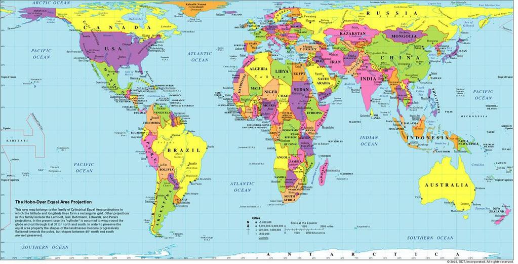
10 Current temperature changes are often linked to human activities, but global temperatures have been changing over millions of years (before humans) Natural causes of temperature fluctuations are due to slight changes in the earth s orbit/axis tilt, and changes to ocean currents (which transfer heat around the globe) The El Niño effect may also be to blame. This is a periodic blip in the usual global climate caused by a short-term warming of the cold ocean current that normally exists off the west coast of South America. It results in unusually patterns of temperature and rainfall and can lead to droughts and floods in certain parts of the world. According to the map on the left, ice has all but disappeared in Northern Europe, found only in the Alps region of Northern Italy, Switzerland and Austria, some of Iceland, very small parts of Northern Russia and the very Northern tips of Norway. REMEMBER this is a global map, so there is always the possibility of talking about other countries outside of Northern Europe it depends what the exam question is asking of you! If you need to brush up on your country knowledge there s a world map at the back of this guide. Questions for you to have a go at are: 3) Using the map and the information above, describe in your own words the location of the ice cover during the current (Holocene) time period in Northern Europe. 4) How has the ice cover changed from the Pleistocene time period to now? Can you describe how? reasons why. 5) Why has the amount of ice changed? Explain one or two Page 9

.")


11 Types of Ice Formation Ok so not specifically mentioned in your unit guide back on page three, but something you need to know as a geographer (and a good human being). An ice sheet is a large body of ice bigger than 50,000km 2 over land. An ice shelf is just as big but it goes out over water. Ice sheet here right at the back! This is the sea! Ice shelf here! found in mountainous areas. An ice cap is a smaller body of ice smaller than 50,000km 2 normally Smaller rivers of ice usually extending downhill from an ice cap. They normally occupy a valley. 6) You could try and find a named example of each type of ice formation. Page 10

.")
12 What is accumulation and ablation? Glacial ice is formed through a process called accumulation. This happens when snow falls and it settles to the ground, and as long as the temperature remains cold it will remain there. As further snow layers fall on top of old snow it compresses the original snow down, pushing the oxygen out of it and over about years creates glacial ice. Gravity will pull this heavy ice down the valley hill creating the glacier appearance we saw above. This makes the glacier appear like it is advancing (moving forward). At the end of the glacier (called its snout) the ice is relatively thin, and the temperatures are much warmer, this causes melting, or loss of glacial ice known as ablation. This makes the glacier appear like it is moving backwards (it isn t, there s just less ice because it is melting away) so we say the glacier is retreating. Some questions for you to have a go at are: 7) Can you explain what accumulation is? How does it create a glacier? 8) How does a glacier retreat? What is ablation? What causes it? 9) Draw a step by step flow diagram of how a glacier is created. Page 11

13 What is a Glacial Budget? Seasonal shifts in temperature and glacier advancement and retreat A glacial budget is a bit of a tricky thing to get your head around, but worth knowing as it is the amount and difference between the amount of ice created (accumulation an input!), and the amount of ice lost (ablation - an output!) If accumulation (ice created) exceeds ablation (ice melted) over several years then the glacier will advance. If ablation (ice melted) exceeds accumulation (ice created) over several years then the glacier will retreat. The glacier budget varies between seasons as accumulation rates are higher in winter, and ablation rates are higher in summer. The graph above shows the idea of a changing glacial budget, the areas that are yellow show a positive glacial budget when more ice is being created, the areas in purple show a negative glacial budget, when more ice is melting throughout the glacier. 10) Something you could have a go at here, and keep going with throughout this guide is starting a glossary of key words. Some helpful soul has highlighted some of them in red. Page 12
.")

14 Length of Glacier (Metres) A case study of a glacier how it has retreated, causes and evidence of this For this section you need to know a named case study, or as the exams sometimes call them an example. Where a question says using an example. It means just that use an example otherwise you can t ever get more than a level one answer (1 2 marks). Our example is the Rhone Glacier in Switzerland, it s in the south of the country and is one of a number of glaciers in Switzerland. It is also a good example of one that is retreating quickly, and the potential impact of this on the surrounding area. Since 1860 the thickness of the Rhone glacier has reduced by 34m, and even though the length of the glacier changes over the course of the year (with it retreating in the summer, and advancing in the winter) shown by the red line, the overall length of the glacier (shown by the green line) shows a significant reduction, around 1.2km has been lost, with the fastest reduction being from 1950 onwards (shown by the steeper, declining green line). Year Page 13


 and the river is greater in size.")


15 Other evidence for retreat of the Rhone Glacier comes in the form of photographs taken over time The glacier fully extends to the valley floor, widening out as it hits the floor. It is a short distance away from the singular house on the flat valley floor; with the amount of melted ice creating a small glacial river The glacier continues to extend to the valley floor, and widens out but there is significantly less than five years previously where there was a visible mound of ice at the snout of the glacier. It is further away from the house on the valley floor (which has been joined by other buildings) and the river is greater in size The glacier just about extends to the valley floor but no longer widens out at the snout. There is significantly more building on the valley floor, with a wider river producing plenty of water; likely for a popular tourism trade The glacier no longer extends to the valley floor, the snout is about a quarter of the way up the valley, the flat valley floor is very green, and almost all of the buildings have gone. This could be because of increased chances of flooding, or a decrease in tourism to the area. The river is long, but not particularly wide The glacier has retreated higher now, it is about halfway up the valley itself, and the flat valley floor is now totally green, with farming buildings having been built, showing that the valley is no longer in danger of ice, instead it is a fertile area for crops. Rock, previously eroded by abrasion (see later) has been uncovered as the glacier has retreated backwards. Page 14
16 11) Using the photographs and information on the previous page write a series of postcards describing how the landscape has changed over time. 12) What has caused the glacier to melt? Use the information below to explain why the Rhone glacier has retreated. Glacial retreat is particularly important in Switzerland, for starters if it continues there is the potential in the short term for catastrophic flooding, while long term the tourist industry could suffer a significant drop. The glacier is also hugely important for Switzerland s water and electricity supply, as during the summer much of the melted ice is either treated and used for drinking water, or used to produce around half of Switzerland s energy. Scientists have suggested that glacial retreat has been causes by the warming up of the earth, with an increase in temperature of 0.74 C since 1900, which in part may be linked to the increased use of fossil fuels (like oil and coal) or the increased emissions (releasing of) carbon dioxide in the atmosphere, which has caused a greenhouse effect, and raised temperatures in the world. As a result it is too warm for snow to fall, instead falling as rain, meaning a lack of glacial ice being created, and the chance for flooding increased. What is Freeze Thaw Weathering? Freeze thaw weathering is a process that breaks down rock, causing it to be eroded away through abrasion and plucking (see next section). It is also the main cause of jagged, angular rocks outside of glaciers (called nunataks). The diagram on the next page shows you an idea as to how it happens, it beginsns when water gets into a crack in the rock and gets trapped, as temperatures drop the water freezes and expands (as ice has a greater volume than water) causing increased pressure on the surrounding rock. Importantly, this process continues and repeats a number of times with the ice melting (thawing), crack in the rock and more pressure being applied to the surrounding rock. Eventually the join in the rock becomes so weak the rock breaks off leaving behind jagged rock, and the weathered rock is transported away. Page 15
 What impact would global warming have on the amount of freeze thaw weathering? 15) Explain what abrasion and plucking are, how they occur and the impact that they have.")
 where the glacier rubs against the valley and normally leaves behind a smooth valley floor because of it.")

17 13) Using the diagrams above and the information on the previous page explain what freeze thaw weathering is and the impact that it has. 14) What impact would global warming have on the amount of freeze thaw weathering? 15) Explain what abrasion and plucking are, how they occur and the impact that they have. What is Abrasion and Plucking? Abrasion and plucking are forms of erosion, this means that they wear away and remove the rock from the place it has eroded. Abrasion takes place underneath the glacier (see diagram) where the glacier rubs against the valley and normally leaves behind a smooth valley floor because of it. More accurately it is the process where rock fragments in the ice grind against the rock over which the ice is moving (like rough sandpaper) wearing away the land. Plucking is where melt water at the base of the glacier freezes on the rock surface, causing the glacier to stick to the rock. As the glacier moves downhill it tears out pieces from the rock surface leaving behind a steep wall of rock. If you don t believe that ice can become sticky remember why when you were young you were always taught to never lick anything metal when it was cold. Page 16

 question where you are given one (or a number of) photograph(s) of landforms and asked to name them.")

 at the bottom.")
18 What landforms are created by erosion? This is potentially a big section on your exam, it could be a big 8 marker question, where you re expected to explain how a number of landforms are created, or it could be a 6 mark question where you re asked to draw a diagram to explain what is going on. It could be a one (or even a four mark) question where you are given one (or a number of) photograph(s) of landforms and asked to name them. We re going to take each one in turn in the next couple of pages. U Shaped Valley / Glacial Trough A U shaped valley is also called a glacial trough; it is probably the easiest of the landforms to explain caused by erosion over thousands of years. Examples are found in Wales and the Lake District and are easily spotted by their steep sides, flat bottom and often a misfit stream (a small river found in a huge valley that it could not have created) at the bottom. U shaped valleys are formed when glacial ice fills a V shaped valley (which was created by a river eroding down to sea level and the sides of the valley collapsing down to make a V shape) during an ice age. As the V shaped valley is now filled by glacial ice as the glacier moves downhill it erodes away at the sides (through plucking) and the bottom (through abrasion). Following the end of the ice age as the glacial ice melts away the U shaped valley is left behind. The diagrams below show a good idea as to how the valley shape changes over time. Before During the Ice Age After the Ice Age Page 17
, as we already know the snow compacts into ice and this accumulates over many years to compact and grow into a glacier.")
19 Corrie (sometimes called a cirque) Corries are armchair shaped hollows found at the tops of mountains, where glaciers begin. At the top of mountains are small hollows where snow can accumulate (gather), as we already know the snow compacts into ice and this accumulates over many years to compact and grow into a glacier. Even though the ice is trapped in a hollow and unable to move downhill, gravity will still encourage it to move, when this is movement is more curved it is called rotational slip. Glacial ice moves downhill because of gravity and the weight of the ice. The ice freezes to the back wall of the mountain and as it moved downhill it plucks rock out steepening the back wall. Erosion and weathering by abrasion, plucking and freeze-thaw action will gradually make the hollow bigger. These processes create a characteristic rounded, armchair shaped hollow with a steep back wall. When ice in a corrie melts, a circular lake is often formed at the bottom of the hollow. This is known as a tarn or cwm. The diagram to the left should help explain this more. Page 18

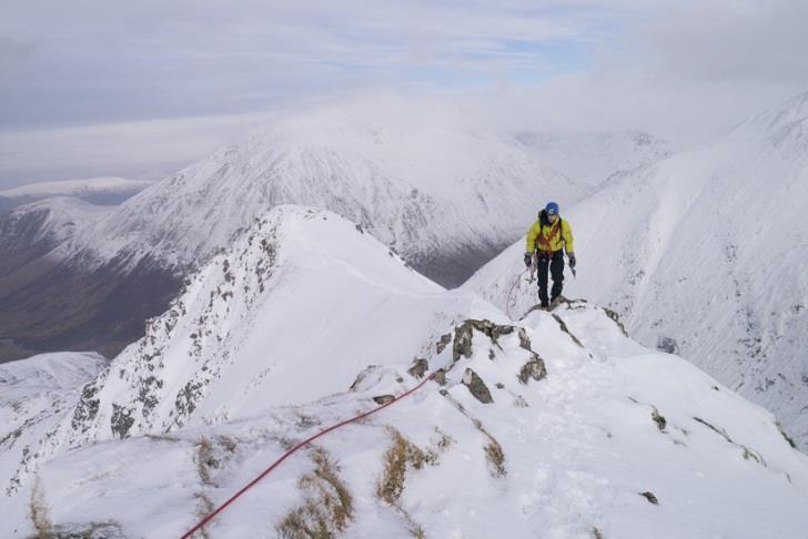
20 Arête Arêtes are knife edge like ridges found between two corries. It is key that you understand how corries are formed in order to fully explain how an arête is formed. As each glacier erodes a corrie either side of the ridge, the back wall of the corries become steeper and the ridge becomes narrower and higher. A good example is Crib Goch in Snowdonia, where around 7 people a year die by stepping / falling off the side of it every year. Page 19

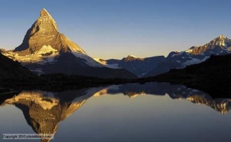
21 Pyramidal Peaks Pyramidal Peaks are where three or more arêtes meet, and therefore there are three or more corries too. It is key therefore that you know how corries and arêtes are formed to be able to fully explain how a pyramidal peak is formed. The glaciers have carved away at the top of a mountain, creating a sharply pointed summit; good examples are Mont Blanc, and Mount Everest. Page 20
 that feed into the main glacial valley.")

22 Hanging Valleys and Truncated Spurs These link in very nicely with the U shaped valley information from earlier, so once again if you don t understand that you re going to struggle with this. Within all glacial valleys there are main glaciers and smaller tributary glaciers (just like with rivers) that feed into the main glacial valley. The main glacier can erode its valley to a much greater extent because they are wider, deeper; have more weight and more material during erosion. The tributary valley glaciers are smaller, have less weight and material therefore erode their valley less. This means that the main valley is made deeper, wider and steeper. This becomes really obvious after the glacial ice melts, when the tributary glacier is left hanging high above the main valley. When rivers return, they often form waterfalls in these hanging valleys. Truncated Spurs Truncated spurs are a bit trickier to get your head around, they are areas of harder rock that the river previously would wind around (called interlocking spurs, if you remember!) that have been cut off by the main glacier as it extends downstream. Hanging Valley Previous location of main glacial valley Page 21

 water will collect in the deeper area and create a long, thin lake called a ribbon lake.")
23 Ribbon Lakes Ribbon lakes are long, thin lakes found on the floor of U shaped valleys they can sometimes fill the bottom of a U shaped valley, but are always easy to spot on an OS map because they are on flat land surrounded by steep sides. Ribbon lakes are created as a glacier flows over the land, it flows over hard rock and softer rock. Softer rock is less resistant (or less tough and so is easier to erode), and as the glacier moves downhill the material at the bottom of the glacier (known as ground moraine see later sections) can carve a deep trough. When the glacier has retreated, (melted) water will collect in the deeper area and create a long, thin lake called a ribbon lake. Many of the lakes in the English Lake District are ribbon lakes, like Lake Windermere for example. Page 22

24 16) Using the information above draw out a step by step flow diagram of how each landform is created. Test yourself by then covering over one step of the diagram and see if you can remember it. you ve missed. 17) Draw out each of the diagrams for the landforms shown above without the annotations / explanation around it and then without the use of the revision guide add in your own annotations. In a different colour add in all the bits 18) Draw pictures of each landform, write the characteristics of each landform around the picture then get someone to show you just the picture and see how many of the characteristics you can name / remember. 19) Find someone, anyone, who isn t a geographer and bore them rigid talking about all the crazy landforms you need to learn about. Keep talking about them, keep learning about them, keep drawing them it s the only way you ll learn about them. Finding Landforms on an OS map In every GCSE geography exam there is the potential for a skills question, it could be a graph to complete or read from, a photograph to label or annotate, or an Ordnance Survey (called an OS map). We ll do lots of work on OS maps in class, but for this section you need to be able to spot certain glacial landforms on a map. The characteristics of each landform on the previous few pages will really help but so the next few pages. For example the image on the right shows you how a corrie (sometimes called a cirque) can be spotted, along with a U shaped valley (steep sides shown by the contour lines being very close together, and the flat valley floor shown by the contour lines being much wider apart). Page 23


25 Arête a small higher area of land, shown by contour lines close to together where the land drops away quickly either side. Pyramidal Peak shown by 3 flat bottomed glaciers coming from a higher area Page 24

26 Transportation and Deposition: Process Transportation is a key word to do with the movement of material carried within the glacier. Material carried within the glacier is called moraine and there are four landforms created by the deposition of it this is covered in a later section. Rotational slip is one way in which material is moved around by the glacier (see earlier section) another is bulldozing where material is pushed forward by the snout (end) of the glacier a little bit like a bulldozer or a broom. This creates a landform called terminal moraine, but can also leave behind landforms called drumlins when material is deposited. Deposition is the name given to when material is dropped from the glacier this tends to happen when the ice melts, at which point moraine changes its name to glacial till. Page 25


27 Transportation and Deposition: Landforms As glaciers move material as they travel downhill the moraine (material) carried within them produces some very different landforms. Lateral Moraine Lateral moraine is found at the sides of the glacier, it is mostly rock that has fallen off the sides of the glacier because of freeze thaw. When the glacier melts it creates a slight ridge on the valley side. Medial Moraine Ground Moraine Medial moraine is found when a smaller glacier joins the main, bigger glacier. Two lateral moraines merge to produce a single line of moraine that runs down the centre of the main glacier. When the glacier melts a ridge in the centre of the valley is left behind. Ground moraine is material dragged underneath the glacier because of abrasion. When the glacier melts uneven, rough ground is left behind and so a photograph is incredibly difficult to find for you.sorry! Terminal Moraine Terminal moraine is material that collects at the snout of the glacier (often because of bulldozing) to form a high ridge. It can be tens of metres high and stretch right across the valley. It represents the furthest distance that the glacier advanced to. Page 26


28 Drumlins Drumlins are smooth, egg shaped hills about 10m in height and up to a couple of hundred metres in length. They are made of moraine and are caused when moraine collects in front of an immovable object before spilling over the top and down behind the immovable object. The glacier shapes and moulds the drumlin with a blunt end facing up valley and a pointed tail end facing down the valley, in the direction that the ice travelled. When the glacier melts a drumlin is left behind. Erratics An erratic is a boulder that is different to the bedrock upon which it is sitting. They have been transported and d eposited by a glacier from an area of one rock type to another. Therefore erratics are useful indicators of patterns of former ice flow. 20) Explain what the different types of moraine are and how they are formed. 21) Draw a diagram with annotations to explain how drumlins are formed. 22) Explain in less than 40 words what an erratic is and why they are useful to geographers. Page 27

.")

29 A Hazard in Mountain Areas: Avalanche An avalanche is when a large amount of snow and ice falls down a mountain at massive speeds (up to 185 miles per hour), and can be fatal particularly when it covers people in snow and ice. There are two types of avalanche a powder avalanche - this is when a layer of snow with slides over another layer of snow and down the mountain side, and a slab avalanche when a massive amount of snow slides over the ground remaining as one large block (or slab). Powder avalanche Slab avalanche Avalanches are caused by six main reasons: Heavy snowfall this adds to the weight of previous snowfalls, and can make slab avalanches much more likely particularly as with each layer of snow a separate frozen layer of ice is created Steep slopes avalanches are much more likely to occur on steep slopes between where snow can settle, but the slope is steep enough for it to be moved easily, and quickly. Removing trees for skiing resorts mean that the avalanche can move downhill quicker and without any obstacle in its way. Temperature rise can cause sudden melting which can often lead to avalanches, as melted ice can act a bit like a banana skin! Heavy rainfall can make the slope slippery and trigger an avalanche Human factors are a big cause of avalanches off-piste skiers and snow mobiles are heavy enough to trigger a fast movement of snow and ice downhill. Some explosions set by humans for clearing snow or areas for development can cause the ground to shake and trigger an avalanche. 23) Design a leaflet warning tourists in mountain areas of the causes and risks of an avalanche. Page 28


30 Tourism in Mountain Areas: Chamonix Chamonix is a massive tourist resort located in the northwest of the Alps, close to the Swiss (15kms) and Italian (15kms) borders making it popular with a large number of tourists from all across Europe. Chamonix and its valley are famous for the views of Mont Blanc, Europe s highest mountain (4,808m) Chamonix has been a popular tourist destination for over 250 years. It has a population of 10,000, and over 100,000 tourists a day in summer and 60,000 tourists a day in winter. Many people who live in the area work in the tourism industry and the town his now well served by fast motorway roads, and a nearby airport will only increase the number of tourists who visit. 24) Sort the information in the table on the next page to show: Winter attractions Summer attractions Positive impacts Negative impacts Ways of managing tourism 25) Explain why so many tourists go to Chamonix and the impacts that this has on the area. 26) How is tourism being managed in Chamonix? Why are they doing this? 27) What are the environmental impacts of tourism in Chamonix? Are these more positive or negative? Page 29
31 Options for skiers and snowboarders of all abilities Roads into Chamonix are small and easily congested at peak times. In summer, the Montenvers railway takes visitors to the Mer de Glace. 350km marked hiking trails, 40km of mountain bike tracks and Snowshoe trails for hikers In summer the town comes to life with live music, colourful flowers and cafes. Mass tourism can be noisy and damaging to the environment, conflicting with tourists interested in more peaceful activities. Escape Mont- Blanc A cooperation addressing issues on transport, nature conservation, forests and water resources. Job opportunities are available in hotels, restaurants, sports facilities and as guides/instructors. The money from tourism supports local services, e.g. shops. The local transport and health care systems are maintained. Hiking and mountain biking has eroded mountain paths. At peak tourist time the town is noisy and crowded. Museums, shops and historical buildings provide attractions away from the slopes. Easy access to peaks from cable cars and cog railways Shops, restaurants, etc. are tourist orientated making prices higher for locals. The money from tourism allows Chamonix to be maintained as an attractive town. Activities include; rock climbing, mountaineering, paragliding, rafting, canyoning and pony trekking. Tourists can conflict with locals, e.g. Farm animals can be affected by tourists who leave gates open or leave litter. Tomorrow s Valley initiative works with locals and tourists to plan sustainable management. The local authority provides environmentally friendly transport system with clean energy buses and free transport. A range of hotels, restaurants, heated swimming pools and spas. Chamonix are promoting responsible tourism, and working to protect the environment. At the Mer de Glace visitors can get up close to the glacier and even go in an ice cave. Two new cross country ski courses Page 30
32 Management Scheme: Tomorrow s Valley Tomorrow s Valley is a management scheme used in Chamonix to be able to continue to encourage the continued growth of tourism while protecting the natural and cultural environment, in other words through sustainable development. For example it has developed more service networks, like electricity lines, and are burying these underground to protect the look of the area. Historic buildings/monuments are being preserved or renovated to protect the history of the area, and to encourage tourists to learn about it. Natural wetlands and peak bogs have been preserved and the planting of trees and the use of local building materials minimises the visual impacts of skiing on the landscape. In popular tourist areas the scheme has spent money on maintaining and waymarking footpaths and cleaning rivers to help preserve the environment and provide seasonal employment for locals while also supporting traditional local employment sectors like farming so that not everyone who lives in the town relies on tourism. This is particularly important should the impacts of climate change effect places like Chamonix as they have done in other mountainous areas. Page 31
33 The Impact of Climate Change on Mountain Tourist Areas Glacial areas are fragile environments, easily affected by human activities like tourism. Abondance is a typical ski resort in the Haute-Savoie region in the east of France on the border with Switzerland. It is heavily dependent on tourism due to the income it brings to the area, particularly during the winter but with climate change and its impacts the amount of snow had decreased, resulting in tourists being transported further up the mountain in the search for snow and ice and in some years snow has been artificially created in order to create snow for their ski slopes. In 2007 the ski resort closed due to 15 years of unreliable snowfall. The local council have 2 options in attempt to secure the future of the area for the people that live there. 1. Develop other winter sports, including ski touring, snowshoeing and snow-mobiling. These activities are less dependent on snow than traditional skiing. 2. Develop a summer programme of activities, including hiking, water sports and mountain biking. This would enable the town to become more of an all-year round resort, giving a more steady income. There is the concern that the council could encourage development of tourist opportunities in areas that still receive snow, higher up in the mountain, but this would involve more roads, more ski lifts being developed and trees would need to be cut down; potentially causing more avalanches and environmental damage but surely locals need their jobs and livelihoods protecting? 28) Using the information above what issues does Abondance face? Why? 29) What would you do in the future if you were the decision maker in the local council? Why? Page 32
34 Page 33
Q: What is a period of time whereby the average global temperature has decreased? Q: What is a glacier?
 Q: What is a glacier? A: A large sheet of ice which lasts all year round. Q: What is a period of time whereby the average global temperature has decreased? A: A glacial. Q: What is an interglacial? Q:
Red Tarn, Lake District They are all features of glacial erosion
 Ribbon Lake Lake Windermere, Lake District Arete Striding Edge, Lake District 1 2 3 Pyramidal Peak Corrie & Tarn 4 Matterhorn, Switzerland Red Tarn, Lake District They are all features of glacial erosion
Landscapes in the UK: Glaciation 1. Extent of ice cover across the UK during the last ice age.
 Landscapes in the UK: Glaciation 1. Extent of ice cover across the UK during the last ice age. Key idea: Ice was a powerful force in shaping the landscape of the UK. In the past the climate has got colder
PHYSICAL GEOGRAPHY GEOGRAPHY EARTH SYSTEMS COASTAL SYSTEMS FLUVIAL SYSTEMS
 PHYSICAL GEOGRAPHY EARTH SYSTEMS FLUVIAL SYSTEMS COASTAL SYSTEMS PHYSICAL GEOGRAPHY CORRIES / CIRQUES A Corrie or Cirque is the armchair shaped hollow that was the birthplace of a glacier. It has steep,
Mearns Castle High School. Geography Department. Glaciated Landscapes
 Mearns Castle High School Geography Department Glaciated Landscapes Lesson One: Location of Glaciated Uplands in the British Isles The Ice Age in Britain began about 1,000,000 years ago and lasted until
Landscapes in the UK: Glaciation 1. Extent of ice cover across the UK during the last ice age.
 Landscapes in the UK: Glaciation 1. Extent of ice cover across the UK during the last ice age. Key idea: Ice was a powerful force in shaping the landscape of the UK. As the climate has changed in the past,
Unit 1: Physical Environment Glaciated Landscapes
 Unit 1: Physical Environment Glaciated Landscapes Corries Corries are bowl-shaped hollows high up in the mountains. They are formed in the following way: Snow collects in a hollow on a mountainside (usually
Formation of a Corrie
 Formation of a Corrie A corrie looks rather like a armchair has been cut out of the rock face When a hill has been heavily eroded with 3 or 4 corries the jagged hill that is left is known as a pyramidal
1.4 Understand how moving ice acts as an agent of erosion and deposition. (Chap. 2)
") 1.4 Understand how moving ice acts as an agent of erosion and deposition. (Chap. 2) There are two types of glaciation. Alpine Glaciation Continental Glaciation Distinguish between the terms alpine glaciation
1.4 Understand how moving ice acts as an agent of erosion and deposition. (Chap. 2) There are two types of glaciation. Alpine Glaciation Continental Glaciation Distinguish between the terms alpine glaciation
I. Types of Glaciers 11/22/2011. I. Types of Glaciers. Glaciers and Glaciation. Chapter 11 Temp. B. Types of glaciers
 Why should I care about glaciers? Look closely at this graph to understand why we should care? and Glaciation Chapter 11 Temp I. Types of A. Glacier a thick mass of ice that originates on land from the
Glaciers. Reading Practice
 Reading Practice A Glaciers Besides the earth s oceans, glacier ice is the largest source of water on earth. A glacier is a massive stream or sheet of ice that moves underneath itself under the influence
Great Science Adventures
 Great Science Adventures Lesson 18 How do glaciers affect the land? Lithosphere Concepts: There are two kinds of glaciers: valley glaciers which form in high mountain valleys, and continental glaciers
1 Glacial Erosion and
 www.ck12.org Chapter 1. Glacial Erosion and Deposition CHAPTER 1 Glacial Erosion and Deposition Lesson Objectives Discuss the different erosional features formed by alpine glaciers. Describe the processes
Chapter 16 Glaciers and Glaciations
 Chapter 16 Glaciers and Glaciations Name: Page 419-454 (2nd Ed.) ; Page 406-439 (1st Ed.) Part A: Anticipation Guide: Please read through these statements before reading and mark them as true or false.
Glaciers and Glaciation Earth - Chapter 18 Stan Hatfield Southwestern Illinois College
 Glaciers and Glaciation Earth - Chapter 18 Stan Hatfield Southwestern Illinois College Glaciers Glaciers are parts of two basic cycles: 1. Hydrologic cycle 2. Rock cycle A glacier is a thick mass of ice
What would you say was the extend of the ice cover? 100%? 50%? A third? 2/3?
 This map shows the maximum extent of ice cover during the last ice age, 20,000 years ago. What would you say was the extend of the ice cover? 100%? 50%? A third? 2/3? KEY IDEAS & QUESTIONS What is a glacier?
Glaciers. Clicker Question. Glaciers and Glaciation. How familiar are you with glaciers? West Greenland. Types of Glaciers.
 Chapter 21 Glaciers A glacier is a large, permanent (nonseasonal) mass of ice that is formed on land and moves under the force of gravity. Glaciers may form anywhere that snow accumulation exceeds seasonal
THE DEPARTMENT OF HIGHER EDUCATION UNIVERSITY OF COMPUTER STUDIES FIFTH YEAR
 THE DEPARTMENT OF HIGHER EDUCATION UNIVERSITY OF COMPUTER STUDIES FIFTH YEAR (B.C.Sc./B.C.Tech.) RE- EXAMINATION SEPTEMBER 2018 Answer all questions. ENGLISH Time allowed: 3 hours QUESTION I Glaciers A
How Glaciers Change the World By ReadWorks
 How Glaciers Change the World How Glaciers Change the World By ReadWorks Glaciers are large masses of ice that can be found in either the oceans or on land. These large bodies of frozen water have big
Glaciers Earth 9th Edition Chapter 18 Mass wasting: summary in haiku form Glaciers Glaciers Glaciers Glaciers Formation of glacial ice
 1 2 3 4 5 6 7 8 9 10 11 12 13 14 15 Earth 9 th Edition Chapter 18 Mass wasting: summary in haiku form Ten thousand years thence big glaciers began to melt - called "global warming." are parts of two basic
Making glacial connections
 Student task A 1. Cut and arrange the cards below to make four sets of four connections: Four connections Matterhorn drumlin lateral U-shaped valley outwash plain truncated spur Lauterbrunnen ground medial
Recrystallization of snow to form LARGE. called FIRN: like packed snowballs. the weight of overlying firn and snow.
 Chapter 11 Glaciers BFRB P. 103-104, 104, 108, 117-120120 Process of Glacier Formation Snow does NOT melt in summer Recrystallization of snow to form LARGE crystals of ice (rough and granular) called
1. Study the Ordnance Survey Map of Brodick, Isle of Arran.
 1. Study the Ordnance Survey Map of Brodick, Isle of Arran. To find the map go to: > http://www.bing.com/maps/ > change maps type to Ordnance Survey Map from Road. > search for Glenrosa Water (it is near
READING QUESTIONS: Chapter 7, Glaciers GEOL 131 Fall pts. a. Alpine Ice from larger ice masses flowing through a valley to the ocean
 READING QUESTIONS: Chapter 7, Glaciers GEOL 131 Fall 2018 63 pts NAME DUE: Tuesday, October 23 Glaciers: A Part of Two Basic Cycles (p. 192-195) 1. Match each type of glacier to its description: (2 pts)
Glaciers. Glacier Dynamics. Glaciers and Glaciation. East Greenland. Types of Glaciers. Chapter 16
 Chapter 16 Glaciers A glacier is a large, permanent (nonseasonal) mass of ice that is formed on land and moves under the force of gravity. Glaciers may form anywhere that snow accumulation exceeds seasonal
Glaciers. Glacier Dynamics. Glacier Dynamics. Glaciers and Glaciation. Types of Glaciers. Chapter 15
 Chapter 15 Glaciers and Glaciation Glaciers A glacier is a large, permanent (nonseasonal) mass of ice that is formed on land and moves under the force of gravity. Glaciers may form anywhere that snow accumulation
Glaciers. Chapter 17
 Glaciers Chapter 17 Vocabulary 1. Glacier 2. Snowfield 3. Firn 4. Alpine glacier 5. Continental glacier 6. Basal slip 7. Internal plastic flow 8. Crevasses 9. Glacial grooves 10. Ice shelves 11. Icebergs
glacier Little Ice Age continental glacier valley glacier ice cap glaciation firn glacial ice plastic flow basal slip Chapter 14
 Little Ice Age glacier valley glacier continental glacier ice cap glaciation firn glacial ice plastic flow basal slip glacial budget zone of accumulation zone of wastage glacial surge abrasion glacial
Shaping of North America. Physical Geography II of the United States and Canada. The Last Ice Age. The Ice Age. Pleistocene Polar Ice Cap 2/14/2013
 Physical Geography II of the United States and Canada Prof. Anthony Grande AFG 2012 Shaping of North America The chief shaper of the landscape of North America is and has been running water. Glaciation
The Physical Geography of Long Island
 The Physical Geography of Long Island A Bit About Long Island Length 118 miles Brooklyn to Montauk Geo202 Spring 2012 Width 23 miles at it s widest Area 1,400 square miles Formation of Long Island River
READING QUESTIONS: Glaciers GEOL /WI 60 pts. a. Alpine Ice from larger ice masses flowing through a valley to the ocean
 READING QUESTIONS: Glaciers GEOL 131 18/WI 60 pts NAME DUE: Tuesday, March 13 Glaciers: A Part of Two Basic Cycles (p. 192-195) 1. Match each type of glacier to its description: (2 pts) a. Alpine Ice from
Mighty Glaciers. Mighty Glaciers. Visit for thousands of books and materials.
 Mighty Glaciers A Reading A Z Level M Leveled Reader Word Count: 684 LEVELED READER M Mighty Glaciers Written by Ned Jensen Visit www.readinga-z.com for thousands of books and materials. www.readinga-z.com
GLACIATION. The Last Ice Age (see Chapter 12) and. Pleistocene Ice Cap. Glacial Dynamics 10/2/2012. Laurentide Ice Sheet over NYS
 and. Pleistocene Ice Cap. Glacial Dynamics 10/2/2012. Laurentide Ice Sheet over NYS") GLACIATION and New York State Prof. Anthony Grande The Last Ice Age (see Chapter 1) The Pleistocene Epoch began 1.6 mya. During this time, climates grew colder. There were numerous ice ages starting 100,000000
GLACIATION and New York State Prof. Anthony Grande The Last Ice Age (see Chapter 1) The Pleistocene Epoch began 1.6 mya. During this time, climates grew colder. There were numerous ice ages starting 100,000000
White mountain, green tourism
 Reading Practice White mountain, green tourism The French Alpine town of Chamonix has been a magnet for tourists since the 18th century. But today, tourism and climate change are putting pressure on the
Glaciers. Valley or Alpine glaciers. Ice sheets. Piedmont - foot of the mountain glaciers. Form in mountainous areas Move downslope in valleys
 Glaciers & Ice Ages Glaciers Valley or Alpine glaciers Form in mountainous areas Move downslope in valleys Ice sheets Move outward from center Continental glaciers - large scale, ice age type. Presently
Did It. naturalists. Young. Moving and melting ice shaped many of Minnesota s land features. 30 Minnesota Conservation Volunteer
 Young naturalists by Mary Hoff Photography by Gary Alan Nelson T he Glacier Did It Moving and melting ice shaped many of Minnesota s land features. Shut your eyes. Imagine that it s a sunny summer day
Tuesday 19 May 2015 Afternoon
 Oxford Cambridge and RSA F Tuesday 19 May 2015 Afternoon GCSE GEOGRAPHY A A731/01 Contemporary Themes in Geography (Foundation Tier) *2789690473* Candidates answer on the Question Paper. OCR supplied materials:
2. (1pt) From an aircraft, how can you tell the difference between a snowfield and a snow-covered glacier?
 From an aircraft, how can you tell the difference between a snowfield and a snow-covered glacier?") 1 GLACIERS 1. (2pts) Define a glacier: 2. (1pt) From an aircraft, how can you tell the difference between a snowfield and a snow-covered glacier? 3. (2pts) What is the relative size of Antarctica, Greenland,
1 GLACIERS 1. (2pts) Define a glacier: 2. (1pt) From an aircraft, how can you tell the difference between a snowfield and a snow-covered glacier? 3. (2pts) What is the relative size of Antarctica, Greenland,
Glaciers and Glaciation
 Chapter 18 Lecture Earth: An Introduction to Physical Geology Eleventh Edition Glaciers and Glaciation Tarbuck and Lutgens Glaciers: A Part of Two Basic Cycles A glacier is a thick mass of ice that forms,
MIDDLE SCHOOL CURRICULUM TR AILING ICE AGE M YST ERI E S ICE AGE TREKKING
 MIDDLE SCHOOL CURRICULUM TR AILING ICE AGE M YST ERI E S ICE AGE TREKKING CONTENTS I. Enduring Knowledge... 3 II. Teacher Background... 3 III. Before Viewing this Video... 5 IV. Viewing Guide... 5 V. Discussion
MIDDLE SCHOOL CURRICULUM TR AILING ICE AGE M YST ERI E S SEARCHING GLACIAL FEATURES
 MIDDLE SCHOOL CURRICULUM TR AILING ICE AGE M YST ERI E S SEARCHING GLACIAL FEATURES CONTENTS I. Enduring Knowledge... 3 II. Teacher Background... 3 III. Before Viewing the Video... 5 IV. Viewing Guide...
Exemplar for Internal Achievement Standard Geography Level 1. Conduct geographic research, with direction
 Exemplar for internal assessment resource Geography for Achievement Standard 91011 Exemplar for Internal Achievement Standard Geography Level 1 This exemplar supports assessment against: Achievement Standard
Teacher s Guide For. Glaciers
 Teacher s Guide For Glaciers For grade 7 - College Program produced by Centre Communications, Inc. for Ambrose Video Publishing, Inc. Executive Producer William V. Ambrose Teacher's Guide by Mark Reeder
AGAP Antarctic Research Project Visualizing Data Learning About Antarctica From RADAR Data? Student Version
 AGAP Antarctic Research Project Visualizing Data Learning About Antarctica From RADAR Data? Student Version Name Date Image of Subglacial Lake network courtesy of NSF Ice Sheet: A large glacier that covers
Geologic Trips, Sierra Nevada
 ISBN 0-9661316-5-7 GeoPress Excerpt from Geologic Trips, Sierra Nevada by Ted Konigsmark All rights reserved. No part of this book may be reproduced without written permission, except for critical articles
Geography 120, Instructor: Chaddock In Class 13: Glaciers and Icecaps Name: Fill in the correct terms for these descriptions: Ablation zone: n zne:
 Geography 120, Instructor: Chaddock In Class 13: Glaciers and Icecaps Name: Fill in the correct terms for these descriptions: Ablation zone: The area of a glacier where mass is lost through melting or
Dynamic Planet C Test
 Northern Regional: January 19 th, 2019 Dynamic Planet C Test Name(s): Team Name: School Name: Team Number: Rank: Score: Dynamic Planet B/C Glaciers (87 total points) Multiple choice/fill in the blank (23
Chapter 14. Glaciers and Glaciation
 Chapter 14 Glaciers and Glaciation Introduction Pleistocene Glaciations: A series of "ice ages" and warmer intervals that occurred 2.6 million to 10,000 years ago. The Little Ice Age was a time of colder
Alpine Glacial Features along the Chimney Pond Trail, Baxter State Park, Maine
 Maine Geologic Facts and Localities September, 2009 Alpine Glacial Features along the Chimney Pond Trail, Baxter State Park, Maine 45 54 57.98 N, 68 54 41.48 W Text by Robert A. Johnston, Department of
LAB P - GLACIAL PROCESSES AND LANDSCAPES
 Introduction LAB P - GLACIAL PROCESSES AND LANDSCAPES Ice has been a significant force in modifying the surface of the earth at numerous times throughout Earth s history. Though more important during the
Name Team Number. 1. The famous question: What percent of Earth's surface is covered by glaciers? A) 5% D) neve
 5% D) neve") Part I: Multiple Choice (30pts) Directions: Please choose the best answer for each question. There is only one correct answer for each question unless otherwise stated. There are 30 questions. Each one
Part I: Multiple Choice (30pts) Directions: Please choose the best answer for each question. There is only one correct answer for each question unless otherwise stated. There are 30 questions. Each one
ENVI2030L - ALPINE AND CONTINENTAL GLACIATION
 NAME ENVI2030L - ALPINE AND CONTINENTAL GLACIATION I. Introduction Glaciers are slowly moving ice sheets. They are very effective erosional agents and can drastically modify the landscapes over which they
ESS Glaciers and Global Change
 ESS 203 - Glaciers and Global Change Friday January 5, 2018 Outline for today Please turn in writing assignment and questionnaires. (Folders going around) Questions about class outline and objectives?
Parts of a Glacier Division A Study Guide- Part 2
 Parts of a Glacier Division A Study Guide- Part 2 Zones of a glacier Zone of Accumulation: The region where snowfall adds ice to the glacier. It occurs where the temperature remains cold enough year-round
Below is an example of a well laid-out template of a route card used by the Sionnach Team which is a good format to begin with.
 Route Card A route card is used as a navigational aid to hill walkers by setting out a step by step plan for an intended hike. It is good practice to make out a route card before every hike you or your
Introduction to Safety on Glaciers in Svalbard
 Introduction to Safety on Glaciers in Svalbard Content Basic info on Svalbard glaciers Risk aspects when travelling on glaciers Safe travel on glaciers UNIS safety & rescue equipment Companion rescue in
Mapping the Snout. Subjects. Skills. Materials
 Subjects Mapping the Snout science math physical education Skills measuring cooperative action inferring map reading data interpretation questioning Materials - rulers - Mapping the Snout outline map and
Haslingden High School Geography Department HOMEWORK BOOKLET Year 8 Block A Level 2-4
 Haslingden High School Geography Department HOMEWORK BOOKLET Year 8 Block A Level 2-4 Name: Form: Subject Teacher: Date Given: Date to Hand in: Level: Effort: House Points: Comment: Target: Parent / Guardian
TEACHER PAGE Trial Version
 TEACHER PAGE Trial Version * After completion of the lesson, please take a moment to fill out the feedback form on our web site (https://www.cresis.ku.edu/education/k-12/online-data-portal)* Lesson Title:
Week 2: Is tourism still important in the UK? (AQA 13.3/13.4) Week 5: How can tourism become more sustainable? (AQA 13.7)
 Week 5: How can tourism become more sustainable? (AQA 13.7)") The KING S Medium Term Plan Geography Year 10 Learning Cycle 2 Programme Module Overarching Subject Challenging Question Building on prior learning Lines of Enquiry Tourism Where do all the tourists go?
The KING S Medium Term Plan Geography Year 10 Learning Cycle 2 Programme Module Overarching Subject Challenging Question Building on prior learning Lines of Enquiry Tourism Where do all the tourists go?
Swiss villagers cover glacier in blankets to combat global warming
 Name: Date: Hr: Swiss villagers cover glacier in blankets to combat global warming By USA Today, adapted by Newsela staff on 03.26.18 Word Count 656 Level 800L Image 1. A Swiss flag floats on the Rhône
Snow Way by Beth Geiger
 6 th Grade ELA SAMPLES OF STANDARDS STUDENTS ARE LEARNING THIS NINE WEEKS: STANDARDS: RI.6.2, RI.6.3, RI.6.5, RI.6.8, W.6.2 Snow Way by Beth Geiger Where will you find the world s best spot for stargazing?
NYS Invitational Science Olympiad April 2005 DYNAMIC PLANET: GLACIERS
 NYS Invitational Science Olympiad April 2005 School Team # DYNAMIC PLANET: GLACIERS 1. What type of glacier is shown in the photo? 2. a. What is the name of the feature labeled A? b. How did feature A
A trip to Steindalen. - geology and landscape on the way to the glacier. Geoffrey D. Corner
 A TRIP TO STEINDALEN Excursion guide Please take this with you on your trip, but don t leave it behind as litter. A trip to Steindalen - geology and landscape on the way to the glacier A part of Geologiskolen,
Please make sure that all teachers and chaperones attending the field study are aware of the following information:
 Dear Teacher, Thank you for signing up for The Ice Age at the Lost Valley Visitor Center in Glacial Park. The visitor center is located in the middle of Glacial Park. Follow the signs from the Harts Road
NWAC Blog. Cornices - don't walk the line! Written by Robert Hahn on March 14, Last update on May 15, 2017.
 NWAC Blog Cornices - don't walk the line! Written by Robert Hahn on March 14, 2017. Last update on May 15, 2017. Human-triggered cornice fall avalanche from March 10th, 2017. The crown release exposed
Descent into the Ice PROGRAM OVERVIEW
 PROGRAM OVERVIEW NOVA follows glaciologists into the underworld of Mont Blanc, where they search for internal lakes. The program: revisits the 1892 disaster in which a hidden lake burst forth from a glacier
Lesson 5: Ice in Action
 Everest Education Expedition Curriculum Lesson 5: Ice in Action Created by Montana State University Extended University and Montana NSF EPSCoR http://www.montana.edu/everest Lesson Overview: Explore glaciers
Saas Fee (1800m) Switzerland Pearl of the Alps
 Switzerland Pearl of the Alps") Saas Fee (1800m) Switzerland Pearl of the Alps 1. Background In the next- door valley to the world famous Zermatt, just 9 miles away, Saas- Fee (1800m) is the main village in the Saastal (Saas Valley)
Saas Fee (1800m) Switzerland Pearl of the Alps 1. Background In the next- door valley to the world famous Zermatt, just 9 miles away, Saas- Fee (1800m) is the main village in the Saastal (Saas Valley)
Dynamic Planet Practice Test Written by Samuel Bressler
 Dynamic Planet Practice Test 2013 Written by Samuel Bressler Part 1: Multiple Choice 1. Which of the following is NOT related to alpine glaciation? a) Serac b) Kame c) Col d) Paternoster Lake 2. The common
Global Warming in New Zealand
 Reading Practice Global Warming in New Zealand For many environmentalists, the world seems to be getting warmer. As the nearest country of South Polar Region, New Zealand has maintained an upward trend
Lesson. Glaciers Carve the Land A QUICK LOOK. Overview. Big Idea. Process Skills Key Notes
 EARTH S CHANGING SURFACE CLUSTER 2 HOW THE EARTH S SURFACE CHANGES Lesson 62 Glaciers Carve the Land A QUICK LOOK Big Idea Moving water, ice, and wind break down rock, transport materials, and build up
The Potentially Dangerous Glacial Lakes
 Chapter 11 The Potentially Dangerous Glacial Lakes On the basis of actively retreating glaciers and other criteria, the potentially dangerous glacial lakes were identified using the spatial and attribute
Glacial Geomorphology Exercise
 James Madison University Field Course in western Ireland Glacial Geomorphology Exercise 3-day road log (abbreviated) Striations Large kame terrace Cirque with moraines Kame delta Striations Eskers Raised
Darwin s gigantic blunder
 Trail Darwin s gigantic blunder Explore how ice shaped the landscape and why Charles Darwin made a nice mess of Glen Roy Time: 1hr 10 mins Distance: 2 miles Landscape: rural At Glen Roy a curious feature
Chapter 17. Glacial & Periglacial Landscapes
 Chapter 17 Glacial & Periglacial Landscapes Cryosphere Cryosphere - the portions of Earth's surface where water is in solid form, including sea ice, lake ice, river ice, snow cover, glaciers, ice caps,
Changing Landscapes: Glaciated Landscapes. What are glaciers?
 Changing Landscapes: Glaciated Landscapes What are glaciers? What you need to know Types of ice mass at a range of scales including cirque glaciers, valley glaciers, highland ice field, piedmont glaciers,
Avalanche Awareness and Leading a Companion Rescue
 Avalanche Awareness and Leading a Companion Rescue Introduction: Traveling in the backcountry is a great way to enjoy the outdoors and friends. It s important that when we travel in the backcountry we
INTERPRETING TOPOGRAPHIC MAPS (MODIFIED FOR ADEED)
") INTERPRETING TOPOGRAPHIC MAPS (MODIFIED FOR ADEED) Science Concept: Topographic maps give information about the forces that shape the features of Earth. Objectives: The student will: identify land features
INTERPRETING TOPOGRAPHIC MAPS (MODIFIED FOR ADEED) Science Concept: Topographic maps give information about the forces that shape the features of Earth. Objectives: The student will: identify land features
Antarctic glaciers' melt is happening more rapidly than was first believed
 Antarctic glaciers' melt is happening more rapidly than was first believed By Los Angeles Times, adapted by Newsela staff on 05.20.14 Word Count 908 This undated handout photo provided by NASA shows the
Henderson Mountain Avalanche Accident Two riders caught, one partially buried, one fully buried
 Henderson Mountain Avalanche Accident Two riders caught, one partially buried, one fully buried Custer-Gallatin National Forest 28 November 2014 Synopsis A group of 6 or 7 snowmobilers (part of a larger
GCSE Geography A. Mark Scheme for June Unit A732/02: Geographical skills (Higher Tier) General Certificate of Secondary Education
 General Certificate of Secondary Education") GCSE Geography A Unit A732/02: Geographical skills (Higher Tier) General Certificate of Secondary Education Mark Scheme for June 2016 Oxford Cambridge and RSA Examinations OCR (Oxford Cambridge and RSA)
GCSE Geography A Unit A732/02: Geographical skills (Higher Tier) General Certificate of Secondary Education Mark Scheme for June 2016 Oxford Cambridge and RSA Examinations OCR (Oxford Cambridge and RSA)
Guthega to Mt Twynam. 2183m. 1583m. 6 hrs 45 mins 14.8 km Return. Experienced only. 913m
 Guthega to Mt Twynam 6 hrs 45 mins 14.8 km Return Experienced only 5 913m This walk starts from Guthega and makes its way along the Snowy River to the Illawong Lodge, via the Blue Cow Creek flying fox.
Avalanches and the Mount Whitney Basin
 Avalanches and the Mount Whitney Basin 10 April 2006 by Bob Rockwell Prelude Avalanches are a fact of life in high mountains in winter, and we take courses to find out about them. We learn how to assess
Glaciers and Periglaciers
 Glaciers and Periglaciers Chapter 9, page 132 Glaciation!1836 Louis Agassiz theorized that parts of Europe and North America were covered by huge ice sheets.!known as the Pleistocene Ice Ages Why do we
Mark Scheme (Results) Summer 2008
 Summer 2008") Mark Scheme (Results) Summer 2008 GCE GCE Travel and Tourism (6993) Paper 01 Edexcel Limited. Registered in England and Wales No. 4496750 Registered Office: One90 High Holborn, London WC1V 7BH Unit 7:
Mark Scheme (Results) Summer 2008 GCE GCE Travel and Tourism (6993) Paper 01 Edexcel Limited. Registered in England and Wales No. 4496750 Registered Office: One90 High Holborn, London WC1V 7BH Unit 7:
Antarctic glaciers' melt is happening more rapidly than was first believed
 Antarctic glaciers' melt is happening more rapidly than was first believed By Los Angeles Times, adapted by Newsela staff on 05.20.14 Word Count 908 This undated handout photo provided by NASA shows the
TREK THE ROCKIES ABOUT THE CHALLENGE TREK THE ROCKIES FOR HIGHLAND HOSPICE CANADA TREK DEMANDING
 TREK THE ROCKIES CANADA TREK DEMANDING ABOUT THE CHALLENGE The Canadian Rockies are justifiably world-famous for their magnificent scenery: the combination of impressive, jagged mountains, bright turquoise
Dynamic Planet: Glaciers
 Team Name+Number Teammate 1 name Teammate 2 name Dynamic Planet: Glaciers (by Shad160) The following test is 80 questions long, split up into four different sections. The first 20 questions are worth 40
Saas- Fee, Switzerland Pearl of the Alps
 Saas- Fee, Switzerland Pearl of the Alps Background Saas- Fee (1800m) is the main village in the Saastal (Saas Valley) and is a municipality in the district of Visp in the canton of Valais in Central Southern
Lidar Imagery Reveals Maine's Land Surface in Unprecedented Detail
 Maine Geologic Facts and Localities December, 2011 Lidar Imagery Reveals Maine's Land Surface in Unprecedented Detail Text by Woodrow Thompson, Department of Agriculture, Conservation & Forestry 1 Introduction
Typical avalanche problems
 Typical avalanche problems The European Avalanche Warning Services (EAWS) describes five typical avalanche problems or situations as they occur in avalanche terrain. The Utah Avalanche Center (UAC) has
NivoTest : a personal assistant for avalanche risk assessment
 NivoTest : a personal assistant for avalanche risk assessment R.Bolognesi METEISK, CP 993, CH-1951 SION. www.meteorisk.com Introduction About avalanche risk Every mountaineer knows that avalanche hazard
glacial drift: all deposits associated with glaciation; covers 8% of Earth s surface above sealevel, and 25% of North America
 Glacial depositional features glacial drift: all deposits associated with glaciation; covers 8% of Earth s surface above sealevel, and 25% of North America i) nonstratified drift till: transported & deposited
FRANCE : HOW TO IMPROVE THE AVALANCHE KNOWLEDGE OF MOUNTAIN GUIDES? THE ANSWER OF THE FRENCH MOUNTAIN GUIDES ASSOCIATION. Alain Duclos 1 TRANSMONTAGNE
 FRANCE : HOW TO IMPROVE THE AVALANCHE KNOWLEDGE OF MOUNTAIN GUIDES? THE ANSWER OF THE FRENCH MOUNTAIN GUIDES ASSOCIATION ABSTRACT : Alain Duclos 1 TRANSMONTAGNE Claude Rey 2 SNGM The French Mountain Guides
Instruction Manual. A step-by-step guide to building your own igloo. Andy Meldrum All rights are reserved.
 Instruction Manual A step-by-step guide to building your own igloo. Andy Meldrum 2007 1 Contents 1 Introduction 2 Get properly kitted up. 3 Choose and prepare your site. 4 Create the base. 5 Mark out the
GCSE Geography for AQA specification B. Sample Chapter
 SAMPLE CHAPTER GCSE Geography for AQA specification B Janet Helm and Arthur Robinson Pupil book ISBN: 0435 35358 6 Sample Chapter This sample contains chapter 3 from the GCSE Geography for AQA B pupil
ì<(sk$m)=beicea< +^-Ä-U-Ä-U
=beicea< +^-Ä-U-Ä-U") Fascinating Facts The Nile River in Egypt is the world s longest river, but the Amazon River in Brazil moves the most water. The world s largest freshwater lake is Lake Baikal in Russia. The highest temperature
Fascinating Facts The Nile River in Egypt is the world s longest river, but the Amazon River in Brazil moves the most water. The world s largest freshwater lake is Lake Baikal in Russia. The highest temperature
Little Grand Canyon near Pomona, Illinois
 Little Grand Canyon near Pomona, Illinois Below: View of the trail and the terrain created using the Map My Hike app Below: Summary of the hike created using the Map My Hike app Presented by: Jennifer
REPORT. VisitEngland 2010 Business Confidence Monitor. Wave 1 New Year
 REPORT VisitEngland Wave 1 New Year 5-7 Museum Place Cardiff, Wales CF10 3BD Tel: ++44 (0)29 2030 3100 Fax: ++44 (0)29 2023 6556 www.strategic-marketing.co.uk Contents Page 1. Headline Findings... 3 2.