your thirst with locally crafted beer from Panhead Custom Ales, Kererū Brewery, Te Aro Brewing or Boneface Brewing.
|
|
|
- Roland Harrell
- 5 years ago
- Views:
Transcription
1


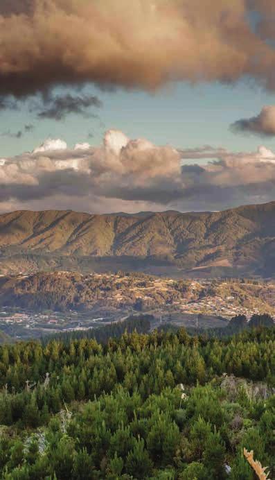
2 1 Grab 2 Take 3 Head a coffee and delicious brunch from one of the many cafés in our city centre. Experience the famous Wellington café culture at its best. Wind down with dinner at one of our gourmet eateries for a relaxed environment and exquisite food. a journey to Middle-earth in Kaitoke Regional Park and relive the magic of The Lord of the Rings trilogy. Visit the set locations of Rivendell, Helm s Deep, Isengard, and The Great River Anduin. to Expressions Whirinaki Arts and Entertainment Centre for a taste of world-class visual arts and some of New Zealand s most notable theatre talent. 4 Quench 5 Enter 6 Let your thirst with locally crafted beer from Panhead Custom Ales, Kererū Brewery, Te Aro Brewing or Boneface Brewing. another world in the Akatarawa Valley, where Staglands Wildlife Reserve sits nestled in its centre an interactive wildlife park for all ages. With no barriers between you and the animals, this is a truly unique destination. the kids loose in Upper Hutt s premier parks like Maidstone Max and Harcourt Park full of BBQ areas, splash pools, flying foxes, skate parks, adventure playgrounds, disc golf, and more.

3 The boundaries of Upper Hutt extend from Silverstream Bridge in the south-west to the summits of the Rimutaka Range in the east and Akatarawa Range in the north. We have over 80 attractive parks and gardens, with majestic trees, and picnic and play areas throughout the city. This selection of walkways are classified according to the following scale easy: walking path, intermediate: some fitness required, and advanced: tramping experience required. Times stated are estimates for family groups. PLEASE REMEMBER If you re going on any walk or tramp which will lead you to isolated areas, take time to plan your trip. Not all areas have cellular coverage. Go with one or more friends. Tell someone where you plan to walk and approximately how long it will take. Wear suitable warm clothing and strong footwear. Toilet facilities Food for sale Picnicking Camping Lookout Difficulty levels Dog Friendly Dogs prohibited Shared with other users Parking available Point of interest Be particularly careful regarding fires, cigarettes, and dogs. Many of the tracks are in forestry areas. Remove any litter and dog droppings. Check for weather updates at metservice.com EASY ADVANCED
4 KEITH GEORGE MEMORIAL PARK Keith George Memorial Park is situated on State Highway 2, close to Silverstream Bridge. The tracks lead up through a mixture of the Hutt Valley s original beech and tawa forest. There is an information board with a full map at the carpark. North Ridge Track Hutt River Trail Silverstream 1 LOOP TRACK ADVANCED < 1 HOUR 3 Silverstream Scenic Reserve 2 Trig Track Fergusson Dr The lower loop track is a benched walk through the lower parts of the park. Travelling south, from the car park, to the original entrance to the park, the track then steps uphill, before looping back onto itself. 2 TRIG AND NORTH RIDGE LOOP ADVANCED 2.5 HOURS Pylon track Keith George Memorial Park 1 Loop Track Walkers can walk up either of these tracks across the pylon track and back down the other track. Eastern Hutt Rd 3 MOONSHINE STATE HIGHWAY 58 WALK ADVANCED 4 HOURS Once reached, via either the Trig or North Ridge Track the Pylon Track can be walked either through to State Highway 58 or Moonshine Road. Haywards substation
5 Rangi s Track ECCLESFIELD RESERVE Whitemans Road Blue Mountains Road Chatsworth Road 4 MULTIPLE TRACKS 40 MINUTES Sunbrae Drive Ecclesfield reserve is on Blue Mountains Road next to number 31. There is limited car parking available. Ecclesfield Reserve was donated to the Royal Forest and Bird Society in 1965 by Miss E M North. The reserve has easy walking tracks through tawa and beech forest. Many other native trees and plants can be found. The tracks are well marked with a look out situated at the western corner of the reserve on the Te Kouka Knob. Views of the surrounding area can also be obtained from other vantage points. 4 North Steps For more information on the Royal Forest and Bird Society, go to Lancewood Steps Five finger walk Kamahi Track Beech Track Manuka Track


6 PINEHAVEN RESERVE Birch Grove Freemans Way Pinehaven Road Starting by the Pinehaven Scouts building at the Pinehaven Reserve, a fork of two short tracks moves through a mixture of beech and tawa forest. Enter Pinehaven Reserve from Pinehaven Road. Car parking is available. The reserve is also on the local bus route. Pinehaven Reserve 5 Blue Mountains Road 6 5 BLUE MOUNTAINS ROAD TRACK 15 MINUTES Pinehaven School This part of the fork graduates to steps reaching to Blue Mountains Road. Forest Road 6 PINEHAVEN SCHOOL TRACK EASY 15 MINUTES Forest Road A short easy-walking track which ends at Pinehaven School.
7 TRENTHAM MEMORIAL PARK RIVERSTONE Holdsworth Hutt River Trail 7 Barton s Bush Brentwood St Moonshine Hill Road Kirton Dr Riverstone Dr 8 Trentham Memorial Park Royal Wellington Golf Course 7 BARTON S Barton BUSH 30 MIN 1 HR EASY Fergusson Dr Flat, easy walking tracks wind through the largest remaining area of lowland mixed podocarp/broadleaf forest in the Hutt Valley. The matai, kahikatea, and totara, over a canopy of tawa is representative of the forest that once clothed the lower terraces of the Hutt River. A great educational resource alongside other recreational activities. Trentham Memorial Park can be accessed from Barton Road or Brentwood Street. Access to Barton s Bush is also available from Holdsworth Avenue or the Hutt River Trail. 8 RIVERSTONE Moonshine Rd Whakatiki St BUSH 15 MIN 1 HR Riverstone Bush is a regenerating valley of mixed podocarp containing some remnants of the vegetation that used to clad the area. The track links Riverstone Drive with Ronald Scott Grove. Walkers can do a loop walk by walking the walkway and then walking up Ronald Scott Grove, down Kirton Drive and back down Riverstone Drive.
8 HUTT RIVER TRAIL The Hutt River Trail (HRT) makes up a section of the Rimutaka Cycle Trail and runs the length of the Hutt River, from the Petone Foreshore, as far as Kaitoke Regional Park. As such, it is a shared pathway that both cyclists and walkers enjoy. There are many entry points to the trail between Petone and Upper Hutt, so detours to other walking areas in Upper Hutt are also possible. WELLINGTON TAWA NGAURANGA PORIRUA PETONE EASTBOURNE HAYWARDS R I M 9 10 LOWER HUTT K A U T A 11 MAYMORN UPPER HUTT R A N KAITOKE G E LAKE WAIRARAPA SOUTH WAIRARAPA This booklet focuses on the Upper Hutt sections of the Hutt River Trail. Refer to the centrefold map for more detail. PALLISER BAY 9 SILVERSTREAM MOONSHINE 1 HOUR A gravel service road gives walkers and vehicles access to the west river bank between Silverstream and Moonshine. Vehicles can also use the eastern track through Moonshine Park. Trentham Memorial Park and Barton s Bush are accessible from this section of the River Trail with gates allowing walking and cycle access down to the river. Parts of the trail cross private land (Royal Wellington Golf Club). Please stay on the track and respect private property. 10 MOONSHINE TOTARA PARK 1 HOUR Upstream from Moonshine Bridge, large trees shade pleasant picnic spots at Poets Park. The Trail is accessed from River Road (SH2) and follows service tracks along the eastern river bank to Totara Park Bridge. 11 TOTARA PARK TE MARUA 2 HOURS Follow the gravel service road from Totara Park Bridge past Maoribank to Harcourt Park. Here you will find an adventure playground, holiday park and toilets. From Harcourt Park you can cross the footbridge and continue upstream along the west bank to Bridge Road or follow Akatarawa Road to Birchville. From the Bridge Road/Akatarawa Road intersection the trail follows the river, behind houses on Gemstone Drive, back to SH2. It then follows SH2 to Te Marua, going under the Mangaroa River Bridge. From Te Marua, walkers can access Tunnel Gully and Kaitoke Regional Park. A new underpass links Tunnel Gully with Kaitoke Regional Park at the top of Kaitoke Hill.


9 KAPITI Upper Hutt City is 30 km north-east of Wellington City and is home to a significant PORIRUA UPPER HUTT portion of the region s parks and reserves. Our borders encompass some 52,000 hectares, most of which is dedicated to forestry and reserve land. This makes us an ideal destination for outdoor exploration, recreation, and fun. WELLINGTON HUTT CITY WAIRARAPA Kaitoke Regional Park has one of the best examples of true temperate rainforest in Wellington. 80% of the plants in the forest are native and only found in New Zealand S E


10 14 KARAPOTI AKATARAWA 1 Keith George loop 2 Trig and north ridge 3 Moonshine to SH58 12 Cannon Point track 13 Maidstone Park 14 Karapoti STAGLANDS WILDLIFE RESERVE Staglands Wildlife Reserve is an ideal treat for the whole family. Interact with the animals and enjoy learning about the history of New Zealand wildlife and the Akatarawa Valley Akatarawa Road Ecclesfield Reserve 15 Tunnel loop 5 Pinehaven Blue Mountains Rd 6 Pinehaven School 7 Barton s Bush 8 Riverstone Bush 9 HRT: Silverstream Moonshine 10 HRT: Moonshine Totara Park 11 HRT: Totara Park Te Marua 16 Tane s track 17 Mount Climie 18 Kaitoke terrace walk 19 Kaitoke weir walk 20 Kaitoke ridge track 21 Pakuratahi river walk 22 Swingbridge track 23 Rimutaka trig 24 Rimutaka Rail Trail RIVERSTONE TOTARA PARK BROWN OWL BIRCHVILLE TIMBERLEA 11 MOUNT MARUA TE MARUA PLATEAU KAITOKE MAORIBANK HERETAUNGA 7 TRENTHAM ELDERSLEA WALLACEVILLE UPPER HUTT 13 KINGSLEY HEIGHTS MANGAROA SILVERSTREAM 4 H 2 O XTREAM AQUATIC CENTRE PINEHAVEN 5 6 Whatever the weather, H²O Xtream is great water fun for the whole family including waves, river ride, and slides; plus a spa, sauna, and steam room for the adults. 24 WHITEMANS VALLEY Cnr Blenheim and Brown Streets

11 CANNON POINT AND BIRCHVILLE DAM Birchville Dam Bridge Rd Hutt River Trail Akatarawa Rd Harcourt Park 12 CANNON POINT WALKWAY 1 4 HOURS The Cannon Point walkway can be accessed from Tulsa Grove in Totara Park or Bridge Road, Akatarawa. Car parking is available at both ends of walkway. The walkway provides a very pleasant walk through areas of regenerating vegetation and mature bush, to the top of a prominent ridge overlooking the Hutt Valley. From Bridge Road car park the walk follows the pipeline from the old Birchville reservoir. Once past the Birchville Dam, the track follows a graded climb out of the valley to the hilltops above Cannon Point. There is a shorter zig-zag track down the southern face of the hill, or a longer descent following the forest access road. 12 Cannon Point Tulsa Park Totara Park The track passes through private property at the Tulsa Grove end. The owner of the private property has authorised use of their land under the condition that no dogs be taken on it.

12 MAIDSTONE PARK Kingsley Heights Seymour Grove Mangaroa l e s Dr King C h a r 13 Sports Centre Park Street Maidstone Park Maidstone Max 13 MAIDSTONE PARK MINUTES Main Street Pine Fergusson Drive Goodshed Road Railway Ave Maidstone Park bush walks are accessible from within the park off Park Street, or from Seymour Grove in Kingsley Heights. Royal Situated on the hills at the rear of Maidstone Park, these walks range from a lower walk passing through native bush and ferns to higher walks reaching to the ridge line giving good views of both Upper Hutt and Mangaroa Valleys. Gibbons Lane Street Maidstone Park is also close to the Upper Hutt Station.

13 KARAPOTI GORGE AND FOREST 14 KARAPOTI TRACKS ADVANCED KARAPOTI.CO.NZ McGhie s Bridge 14 Karapoti Park Karapoti Rd Akatarawa Rd Easy walking along abandoned logging tracks takes you from the car park at the end of Karapoti Road to McGhies Bridge. From McGhies Bridge the options open up to a wide range of tracks, destinations, and loops to choose from. Karapoti Forest is home to the famous Karapoti Classic mountain bike race. Please take care as the tracks are also used by mountain bikes and trail bikes. Karapoti Forest is maintained and managed by Greater Wellington Regional Council. For more information go to gw.govt.nz/parks Riverstone Moonshine Hill Cannon Pt Birchville Dam Totara Park Birchville Brown Owl
14 MOUNT CLIMIE AND TUNNEL GULLY Tane s Track Follow State Highway 2 north to Te Marua. Turn right onto Plateau Road (at the dairy). Plateau Road leads into the recreation and lower picnic area. This park is managed by Greater Wellington Regional Council. For more information go to gw.govt.nz/parks TUNNEL LOOP TRACK 45 MINUTES This recreation area is an attractive setting for picnics, barbecues and easy walks. The Tunnel Loop Track is well marked, through a stand of very old bush which contains ferns, mosses, and large rimus, full of native birds. An interesting historic feature is the Mangaroa Tunnel which is part of the disused Wellington to Wairarapa railway line. A torch is useful for this walk. 16 TANE S TRACK 1 HOUR Climbing above Tunnel Gully, you pass through black beech forest to Collins Stream. During the descent to the starting point you cross the Mt Climie access road then pass a grove of eucalyptus trees. From next to the tunnel it is a short walk through podocarp/tawa bush back to the lower picnic area. 17 MOUNT CLIMIE 5 HOURS ADVANCED The 12 km walk, 6 km climb to the summit of Mount Climie follows a steep road. The summit is 860 metres high and gives marvellous panoramic views of the Hutt Valley and Wairarapa on a clear day. Follow the road from the upper picnic area.
15 KAITOKE REGIONAL PARK Head 9 km north on SH2 to Waterworks Road which leads to the entrance of Kaitoke Regional Park. This award-winning park and campground is managed by Greater Wellington Regional Council. For more information go to gw.govt.nz/parks Waterworks Rd 18 THE TERRACE WALK 30 MINUTES EASY The Terrace Walk begins 300 metres after crossing the vehicle bridge. It passes through prime rimu and kahikatea forest. This walk is wheelchair accessible. 19 THE WEIR WALK 30 MINUTES The Weir Walk is tar sealed and leads up stream through bush to the weir which collects water for the supply to the Wellington Region. The clear deep pools on the Hutt and Pakuratahi Rivers are ideal for swimming. This walk is wheelchair accessible. 20 THE RIDGE TRACK 3.5 HOURS ADVANCED The ridge track begins 250 m on the left after crossing the vehicle bridge. The start of the track is uphill through beech forest. Splendid views of the Hutt Valley are gained from the ridge top. The highest point on the ridge is 485 m which is near the Kaitoke end of the track. You can also enter this track at the Te Marua pumping station PAKURATAHI RIVER WALK 30 MINUTES This easy walk links the camp ground to Pakuratahi Forks. Cross the footbridge and follow down the river through mixed podocarp and broad leaf forest. Take in the sights at the film location for Rivendell. SWINGBRIDGE TRACK 1 HOUR Cross the swingbridge and follow the track downstream through rimu and rata forest. A walk via the flume bridge and along the service vehicle road returns to the swingbridge car park.

16 RIMUTAKA HILL 23 RIMUTAKA TRIG 30 MINUTES This track takes you to the Rimutaka Trig at the summit of Rimutaka Hill through sub alpine plants. It is often very windy on this walk so warm clothing is desirable. Grand views of Upper Hutt Valley and Wairarapa. When travelling from Upper Hutt, use the road summit resting area to safely change direction and then access the car park. Kart Sport Wellington Waterworks Rd Pakuratahi River Marchant Rd 23 Ladle Bend Bridge UPPER HUTT Paruratani Bridge RIMUTAKA RAIL TRAIL 5 HOURS Summit Tunnel SOUTH WAIRARAPA Part of the Rimutaka Cycle Trail, this track traverses the original Railway from Kaitoke to Cross Creek, a distance of 17 km. The easy grade walking track winds through bush, slides round hillsides and passes through tunnels the Summit Tunnel is 600 m long. Siberia Tunnel Siberia Washout Prices Tunnel Remember a torch. Once at the summit the walk down to Cross Creek is steeper with the Siberia Washout more difficult under foot. This walk offers numerous opportunities for swimming in the Pakuratahi River. Cross Creek


17 /UpperHuttiSITE Experience a show or browse the galleries at Expressions Whirinaki Arts and Entertainment Centre. Find more information on what to see and do in Upper Hutt and the Wellington Region. Book accommodation and travel or have a bite to eat at Limelight Café and Bar. Upper Hutt i-site Visitor Information Centre Expressions Whirinaki Arts and Entertainment Centre 836 Fergusson Drive, Upper Hutt Open 7 days, 9.00 am 4.00 pm visit.upperhuttcity.com expressions.org.nz

18 Upper Hutt i-site Visitor Information Centre 836 Fergusson Drive, Upper Hutt visit.upperhuttcity.com
Wellington region CITY RIDES URBAN CYCLEWAYS PROGRAMME
 CITY RIDES PROGRAMME Wellington region Since 006, the number of people commuting by bike in the capital has almost doubled. In recognition of the key role that active modes, including cycling, have in
Park-specific management and policies. Akatarawa Forest
 Park-specific management and policies Akatarawa 6 Park-specific management and policies 6.1 Akatarawa 6.1.1 Legal status Title held: Legislative status: Wellington Regional Council Administered under Local
Upper Hutt districts & Topographic features
 Upper Hutt districts & Topographic features Akatarawa Bridge Akatarawa Bridge is situated in Birchville Upper Hutt. It is referred to as one of the twin bridges the other being the Andrews Bridge. Akatarawa
Around and about Geraldine
 Around and about Geraldine A guide to recreational opportunities SOUTH CANTERBURY Track classifications Short walk Easy walking for up to an hour Track is well formed, with an even, welldrained surface.
53 EVENTS 9 PARKS 3 MONTHS
 53 EVENTS 9 PARKS 3 MONTHS GW.GOVT.NZ/SUMMEREVENTS ESCAPE WITH US THIS SUMMER Explore the regional parks and forests on your doorstep with the Regional Council s Greater Wellington Great Outdoors programme.
Wellington Rivers. Recreation and Tourism Assessment. January 2013 Prepared for: Greater Wellington Regional Council
 Wellington Rivers Recreation and Tourism Assessment January 2013 Prepared for: Greater Wellington Regional Council 5th floor Aviation House 12 Johnston Street P O Box 2515 Wellington 6140 New Zealand P:
Concessions and Permits
 Concessions and Permits ot og ers op e rato rs speci roups ri d ers tg se re s ur ph a r ph h ts to st u d e n es church or ike clubs film b m n orie a ai nt ee te n i al event orga ools n i s er sch s
Park-specific management and policies Wainuiomata Recreation Area
 Park-specific management and policies Wainuiomata Recreation Area 6.8 Wainuiomata Recreation Area 6.8.1 Legal status Title held: Legislative status: Wellington Regional Council Administered under Local
Discover. Ashhurst Domain. Nature s Playground
 Discover Ashhurst Domain Nature s Playground Discover Step back into New Zealand, Aotearoa, of generations long gone. Discover lush natural surrounds echoing with rich birdsong in one of the Manawatu s
Discover. Sledge Track Essence of Aotearoa
 Discover Sledge Track Essence of Aotearoa Discover Manawatu s timeless walkway adventure. Lying in the heart of the scenic Kahuterawa Valley, Sledge Track brings you face to face with the majesty of New
Regional Parks Report
 Regional Parks Report 2006-07 For the year ended 30 June 2007 Quality for Life Contents Contents Introduction 2 Map of regional parks, forests and water collection areas 3 Contents Projects 2006-07 4
Discover... Sledge. Track. Essence of Aotearoa. You ll find there s much more than meets the eye!
 Sledge Discover... Track Essence of Aotearoa You ll find there s much more than meets the eye! Discover... Manawatu s timeless walkway adventure. Lying in the heart of the scenic Kahuterawa Valley, Sledge
A Learning Environment of Opportunity and Challenge
 HERETAUNGA COLLEGE Ward Street, Upper Hutt 5018 Telephone: 939 9370 Email: info@heretaunga.school.nz Website: www.heretaunga.school.nz Year 9 & 10 Activity Week 2016 ACTIVITY WEEK 2016 The groups this
Park-specific management and policies Belmont Regional Park
 Park-specific management and policies Belmont Regional Park 6.3 Belmont Regional Park 6.3. Legal status Territorial Authority: Hutt City Council, Porirua City Council, Wellington City Council Title Held
NLTF 2020/21 ($000) Funding Priority NLTF 2018/19 ($000) NLTF 2019/20 ($000)
 Funding Priority NLTF 2018/19 ($000) NLTF 2019/20 ($000)") Funding Priority Wellington - Carterton District Council - Local road improvements Low cost / low risk improvements 2018-21 Local Roads 2 341 HM 53% 1,050 194 149 214 Approved Street Light LED conversion
Funding Priority Wellington - Carterton District Council - Local road improvements Low cost / low risk improvements 2018-21 Local Roads 2 341 HM 53% 1,050 194 149 214 Approved Street Light LED conversion
Trentham Estate Upper Hutt 1915 Section 96
 Trentham Estate Upper Hutt 1915 Section 96 (Source Hutt City Archives reference255_arch_72856) Trentham Estate subdivision was situated on part Section 96 and bordered section 100 at Trentham. Around November
Illawarra Escarpment State Conservation Area Walking Tracks
 Illawarra Escarpment State Conservation Area Walking Tracks NPWS Illawarra Area Office Ground Floor, Government Office Block 84 Crown Street Wollongong NSW 2500 02 4223 3000 (Mon-Fri) Royal National Park
The Aotea Track offers a range of spectacular landscapes, superb views and rich history.
 Aotea Track Located in Great Barrier Island/Aotea in the Auckland region The Aotea Track offers a range of spectacular landscapes, superb views and rich history. Travel over streams that show off a constant
Valley Road. Valley View Way
 Valley Road (Reference UH City Recollect website Whiteman s Valley P5-68-770) Valley Road no longer exists. Valley Road was recorded in the Wises NZ Post Office Directory 1959 & 1961-1962 volumes. Valley
FORGOTTEN WORLD HIGHWAY
 FORGOTTEN WORLD HIGHWAY New Zealand s oldest heritage trail between Taumarunui and Stratford An initiative of New Plymouth District Council FORGOTTEN WORLD HIGHWAY Don t forget Drive on the LEFT at all
Location: 7km west of Invercargill on Dunns Road
 SANDY POINT DOMAIN Sandy Point Domain offers the Invercargill community important environmental and recreational resources providing opportunities for picnicking, play, walking, biking, running and as
Hutt Valley Tramping Club Summer Trip Schedule October 2018-March 2019
 Hutt Valley Tramping Club Summer Trip Schedule October 2018-March 2019 Postal address: Web site: E-mail: Clubrooms: Club nights: P.O. Box 30-883, Lower Hutt www.hvtc.org.nz info@hvtc.org.nz Philip Evans
A summary of Draft Makara Peak Mountain Bike Park Master Plan
 A summary of Draft Makara Peak Mountain Bike Park Master Plan OVEMBER 216 Image: Peter Marshall 2 3 Introduction Since it was established in 1998, the Makara Peak Mountain Bike Park (Makara Peak) has grown
Berg-en-Dal Rest Camp, Kruger National Park Access for Guests with Mobility challenges
 Berg-en-Dal Rest Camp, Kruger National Park Access for Guests with Mobility challenges Berg-en-Dal is in the scenically attractive south-western hills of the park. It is best accessed through the Malelane
GIFFORD PINCHOT NATIONAL FOREST
 GIFFORD PINCHOT NATIONAL FOREST 9341 Wright Meadow 93 Spencer Meadow Spencer Butte 4247' 30 30A 19 24 80 31C Lewis River Lower Falls 5 Quartz Creek 90 Taidnapam Falls Upper Falls 31 Spencer Peak 3861'
Ngaio Walking Tracks map 1
 Skyline Walkway Part of this walkway runs north-south along the ridge between Mt Kaukau and Crofton Downs. It is 4 km long and takes two hours at an easy pace. On a clear day there are spectacular views
18Day Road Tour Christchurch to Christchurch
 18Day Road Tour Christchurch to Christchurch Route: Christchurch Farlie Lake Tekapo Twizel Wanaka Queenstown - Te Anau Milford Sound - Manapouri Queenstown Wanaka Haast Fox Glacier Franz Josef Hokitika
Stephens State Park Trails
 TRAILS OF ALLAMUCHY MOUNTAIN & STEPHENS STATE PARKS Allamuchy Mountain and Stephens State Parks contain 28 marked trails providing access to diverse landscapes for walking, hiking, biking, bird-watching,
Merritts Traverse. 1928m
 Merritts Traverse 3 hrs Hard track 5.8 km Circuit 4 167m This walk starts with a scenic journey to the top of the hill on the chairlift. Starting along Merritts Nature walk, this walk soon detours down
This area is a popular holiday spot so watch out for 4WD vehicles and motorbikes at peak times.
 Mavora Walkway (Map 130, 129, 128) Southern Start Northern End Distance Time Track Standard Mavora Camping Area, Mavora Lakes Road Greenstone Station Road Carpark 50km 3 days Tramping track Hazards Never
Rogue Gorge (Mt. Stella) Roadless Area-- T30S R3E (primarily in portions of Sections 23, 26, 33, 34 & 35)
 Roadless Area-- T30S R3E (primarily in portions of Sections 23, 26, 33, 34 & 35)") Rogue Gorge (Mt. Stella) Roadless Area-- T30S R3E (primarily in portions of Sections 23, 26, 33, 34 & 35) Rogue River-Siskiyou National Forest--High Cascades Ranger District Upper, higher elevation trail
Rogue Gorge (Mt. Stella) Roadless Area-- T30S R3E (primarily in portions of Sections 23, 26, 33, 34 & 35) Rogue River-Siskiyou National Forest--High Cascades Ranger District Upper, higher elevation trail
Crystal Lake Area Trails
 Lake Area Trails Welcome to the Lake area of the Big Snowy Mountains! This island mountain range in central Montana features peaks reaching to 8,600 feet and long, high ridges from which vistas of the
Difficult Run Stream Valley Park
 Difficult Run Stream Valley Park The more intense mountain bikers have known about for Difficult Run for some time. Equestrians have known it longer. Eight miles of unpaved trail, the Rails to River Trail
Victoria Falls and Grose Valley to Blackheath Station
 This walk explores a fantastic section of the Grose Valley. Starting above Victoria Falls, the walk explores the cascades before dropping into the valley for the first nights rest at Burra Korain campsite.
DAY 1: Circular Quay to Greenwich Wharf
 DAY 1: Circular Quay to Greenwich Wharf Total Distance: 14km Time: Approximately 5 hours Walk Notes in Six Sections Section Name Length Time 1:1 Circular Quay to Milsons Point Station 2.5km 50mins 1:2
Mt Kuring-gai Track to Berowra station
 Mt Kuring-gai Track to Berowra station 4 hrs 15 mins 9.7 km One way Hard track 4 553m This walk explores three valleys, with great displays of wild flowers in spring, and some nice sandstone overhangs.
UPPER HUTT STREET NAME ORIGINS MASTER
 UPPER HUTT STREET NAME ORIGINS MASTER I first began transcribing the address from the index and maps on the 27 th Edition of the local 2014-2015 Upper Hutt directory. I continued adding to the list by
Frisco Historic Park. Prosit. Sustainability Activity. Insider's Tip. Published on Colorado.com (
 Published on Colorado.com (https://www.colorado.com) Summer in Historic Frisco 3 days More Itineraries Snuggled in the heart of Summit County, Frisco possesses the best of Colorado?s high country. From
WELLINGTON $422 MILLION $614 MILLION $83 MILLION 22% SPEND $1.9 BILLION
 WELLINGTON WELLINGTON $1.9 BILLION FORECAST TOTAL WELLINGTON INVESTMENT The Wellington region s transport challenges are dominated by the region s concentration of population in the metropolitan cities,
BRR Leg 1 (3.9 miles, Easy)
") BRR Leg 1 (3.9 miles, Easy) Min 3901 Max 4919 Ascent +21 Descent -1031 0.0 Start (Grayson Highlands State Park Visitor Center) 3.9 Grayson Highlands State Park Office & Gate, on R (EZ 1) Leg Notes: Minimal
BRR Leg 1 (3.9 miles, Easy) Min 3901 Max 4919 Ascent +21 Descent -1031 0.0 Start (Grayson Highlands State Park Visitor Center) 3.9 Grayson Highlands State Park Office & Gate, on R (EZ 1) Leg Notes: Minimal
Trail Phasing Plan. Note: Trails in the Clear Creek Canyon area (Segments will be finalized in the future to minimize wildlife impacts
 Note: Trails in the Clear Creek Canyon area (Segments 2 5 and a future JCOS connection) will be finalized in the future to minimize wildlife impacts Trail Phasing Plan P Parking 3 Easy Trail Intermediate
Langton Lake Park Implementation Planning Session One 6 June Attendees signed in
 27 Attendees signed in Meeting summary Following an overview of the Parks and Recreation Renewal Program and the key directions of the Parks and Recreation System Master Plan, meeting participants were
PHOENIX PARK INCORPORATING THURNSCOE COMMUNITY WOODLAND
 PHOENIX PARK INCORPORATING THURNSCOE This popular site is known for its sculptures and climbing wall which can be seen as you meander around the park. Walking towards the top of the woodland you will pass
Sandford Street. Sapphire Grove
 Sandford Street (Reference Goggle Images website Thomas Day Author Wikipedia the free encyclopedia) Sandford Street was named after The History of Sandford and Merton (1783-1789) a bestselling children
Blackheath to Blue Gum loop
 Blackheath to Blue Gum loop 2 Days Hard track 24.1 km Circuit 4 1335m This walk is great for fit people getting into overnight walking, with its fantastic scenery and nostalgia as a classic overnighter.
Marilla Reservoir to Chestnut Ridge via Marilla Trails and Bullis Hollow Trail east to west
 USGS topographic maps useful to this hike are the Bradford and Stickney 7.5 minute sectionals. These notes are designed to assist in identifying distance and location using geophysical and man-made characteristics
Non-motorized Trail Plan & Proposal. August 8, 2014
 Town of Star Valley Ranch, Wyoming and the Star Valley Ranch Association in partnership with the USDA Forest Service, Bridger-Teton National Forest, Greys River Ranger District Non-motorized Trail Plan
Richmond Centre for Disability
 Richmond Centre for Disability Duke of Edinburgh Challenge Gold Medal Level Expedition Information & Planning May 21 24, 2010 Overall Schedule Time Location Activity May 21, 2010, Friday 9 a.m. RCD To
Victoria Falls Lookout to Blue Gum Forest
 Victoria Falls Lookout to Blue Gum Forest 8 hrs Experienced only 13.8 km One way 5 112m This long day-walk follows a remote track down from Victoria Falls lookout, passing the waterfall, and into the Grose
Lake Artemesia. Getting There
 Lake Artemesia Lake Artemesia is a man-made lake and park located near the confluence of the Indian un, and Paint Branch creeks. A flat 1.3 mile paved path around the lake is popular with walkers, runners
Wellington $312 $49 $456 OVERVIEW WELLINGTON REGIONAL SUMMARY
 National Land Transport Programme 2015 18 Wellington WELLINGTON REGIONAL SUMMARY OVERVIEW The Wellington region is made up of a number of cities, urban areas and supporting rural hinterland. The city is
Guthega to Mt Twynam. 2183m. 1583m. 6 hrs 45 mins 14.8 km Return. Experienced only. 913m
 Guthega to Mt Twynam 6 hrs 45 mins 14.8 km Return Experienced only 5 913m This walk starts from Guthega and makes its way along the Snowy River to the Illawong Lodge, via the Blue Cow Creek flying fox.
A Publication of Friends of Sleeping Bear Dunes
 A Publication of Friends of Sleeping Bear Dunes 2014, Friends of Sleeping Bear Dunes, P.O. Box 545, Empire, MI 49630 www.friendsofsleepingbear.org info@friendsofsleepingbear.org Learn more about the Friends
C E N T R A L C A T S K I L L S
 120 C E N T R A L C A T S K I L L S Central Catskills Once out of the southern parts of the Catskills, the Long Path enters the more well traveled and civilized regions. The trail joins the Devil s Path,
Berowra Waters to Cowan Station
 Berowra Waters to Cowan Station 3 hrs 30 mins 7.2 km One way Hard track 597m This is a hilly walk out of the beautiful Berowra Waters valley to Cowan Station. There are many wide views across Berowra Creek
TOP OF THE SOUTH TOURING ROUTES
 TOP OF THE SOUTH TOURING ROUTES www.nz.com Greymouth 9 A 0 Wellington Cook Strait CHRISTCHURCH TO NELSON via the CHRISTCHURCH TO MOTUEKA ( / ) via the PICTON TO CHRISTCHURCH via and NELSON TO PICTON NELSON
Winter 2018 Program LEVEL OF DIFFICULTY
 CONTRIBUTION. This is a suggested per passenger contribution to car pool drivers to defray gas expenses. January 6, Saturday Centennial Park to the Cascades Easy/Intermediate 12 km / 3.5 hr n/a n/a 12:00
Jerusalem Bay Track (Cowan to Brooklyn)
") Jerusalem Bay Track (Cowan to Brooklyn) 5 hrs 30 mins 13.4 km One way Hard track 4 654m This Cowan to Brooklyn Station walk is a popular section of the Great North Walk, with scenery ranging from foreshore
Jerusalem Bay Track (Cowan to Brooklyn) 5 hrs 30 mins 13.4 km One way Hard track 4 654m This Cowan to Brooklyn Station walk is a popular section of the Great North Walk, with scenery ranging from foreshore
Scenic Railway to Ruined Castle
 Scenic Railway to Ruined Castle 7 hrs 30 mins 12.4 km Return Hard track 4 963m This is a very popular, full day walk, in the Katoomba Area, offering great views of the valley. The walk follows the edge
Insert 3: Upper Hutt. Insert 2: Masterton
 Legend: -4 Injury Crash Sites 5 >5 Injury Crash Sites Napier Castle Wind Farm Hill Site Palmerston North SH50A Hastings SH SH Insert Masterton Insert 3 Havelock North SH Wellington Insert 1: Napier City
GOLDEN EARS PROVINCIAL PARK
 GOLDEN EARS PROVINCIAL PARK Trail Information as of October 10 th 2015 Do not underestimate the mountainous wilderness of Golden Ears Provincial Park. The combination of rugged terrain and rapidly changing
BULIMBA, TENERIFFE CIRCUIT
 JUNE SATURDAY 2 nd 6.45 am - BULIMBA, TENERIFFE CIRCUIT Cross the river to Teneriffe and uphill through bushland with views from the top. Meet Bulimba Ferry, Oxford Street UBD Map 160 J 3 some uphill walking
Cycle OrEgon Hells Canyon/wallowas
 Cycle OrEgon 215 Hells Canyon/wallowas Live to Ride. Ride to Give. We may be born to be wild, but we live to do good things. From mountain bike trails near Baker City to a renovated city park in Cambridge,
HVTC Winter Trip Schedule April 2018 September 2017
 HVTC Winter Trip Schedule April 2018 September 2017 APRIL RIDE Paekakariki Pekapeka Ray Hyndman 567-2772 14-15 APR Tararua Forest Park : Holdsworth T1 Atiwhakatu Hut Irene Davies 0210 566 442 D1 Sun Cannon
Nepoui Crescent. Nevada Grove
 Nepoui Crescent (Reference Goggle Maps website Nepoui New Caledonia) Nepoui Crescent was named after Nepoui a port in New Caledonia. During World War Two the New Zealand Army Service Corps units moved
DAY 1: Emu Plains to Glenbrook Wednesday, January 2, 2019
 DAY 1: Emu Plains to Glenbrook Wednesday, January 2, 2019 Some sun: 34 C / 21 C 3mm Meeting time: 8.00am @ Our Lady of the Way Catholic Church, Emu Plains [15 Troy Street, Emu Plains; altitude: 32m] Mass:
Milwaukee River (Washington County) Segment. Kewaskum. Æÿ B. Æÿ D Southern. Kewaskum. Segment.
 Segment. Kewaskum. Æÿ B. Æÿ D Southern. Kewaskum. Segment.") Ice Age Trail Washington County Washington County FOND DU LAC WASHINGTON Æ% 28 Æÿ H Milwaukee River (Washington County) Æÿ B Æÿ S State Forest Northern Kettle Moraine Æÿ H Æ% 28 Ice Age Trail Alliance
Ice Age Trail Washington County Washington County FOND DU LAC WASHINGTON Æ% 28 Æÿ H Milwaukee River (Washington County) Æÿ B Æÿ S State Forest Northern Kettle Moraine Æÿ H Æ% 28 Ice Age Trail Alliance
Lewis and Clark Recreation Area
 Lewis and Clark Recreation Area Bicycle/Pedestrian Trail Also part of the Pierson Ranch Recreation Area trail Type of trail: Walking, biking and rollerblading Trail surface: Asphalt Rated: Mostly flat.
Driving Time: 3 hours (allow extra time for stops)
") Scenic Byways loop This journey takes visitors through the eastern edge of Mt. Rainier National Park and along two of Washington s most beloved scenic byways, the Chinook Byway and the White Pass Scenic
Scenic Byways loop This journey takes visitors through the eastern edge of Mt. Rainier National Park and along two of Washington s most beloved scenic byways, the Chinook Byway and the White Pass Scenic
The GREEN NET SHEET LIST:
 Copyright 2016/2017 Design Engine Architects - Concept by Mark Wassung - Registered Architect First Issue - 6 December 2016 The GREEN NET SHEET LIST: The Green Net Bike Mount - The Mount Bike Mount - Bayfair
To Wellness. To Wellness PASSPORT PASSPORT. Partners. Partners. Ashland County Health & Human Services 630 Sanborn Avenue, Ashland, WI
 Partners Ashland County Health & Human Services 630 Sanborn Avenue, Ashland, WI Ashland Bretting Center 320 4th Avenue W., Ashland, WI PASSPORT Bayfield County Health Department 117 E. 6th Street, Washburn,
A North Carlina Pet Getaway in Lake Lure and the Blue Ridge Foothills
 A North Carlina Pet Getaway in Lake Lure and the Blue Ridge Foothills Explore our quaint downtowns and enjoy the friendly faces and wagging tails that will welcome you to Lake Lure and the Blue Ridge Foothills.
2011 R10 IEEE Meeting Auckland New Zealand
 2011 R10 IEEE Meeting Auckland New Zealand Where is Auckland? Auckland is a three hour flight from eastern Australia, a direct overnight flight from the west coast of North America, and an approximate
Camping (Primitive) Camping (RV) Electrical Potable Water Grill Established Fire Pit Picnic Table
 Camping (RV) Electrical Potable Water Grill Established Fire Pit Picnic Table") Alden - 9th Road River Mile 777 Map: 38.20833, -98.32031 Managing Agency: Kansas Department of Wildlife, Parks & Tourism Nearest Community: Alden, Rice County Kansas Developed Amenities Provided Parking
Alden - 9th Road River Mile 777 Map: 38.20833, -98.32031 Managing Agency: Kansas Department of Wildlife, Parks & Tourism Nearest Community: Alden, Rice County Kansas Developed Amenities Provided Parking
Piestewa Peak/Dreamy Draw Trail Guide
 Piestewa Peak/Dreamy Draw Trail Guide Trail #1A - Perl Charles Memorial Trail Length: 4.8 miles Elevation: 2,200 ft. - 1,340 ft. Difficulty: Moderate to difficult The Perl Charles trailhead is located
Trailhead Ambassadors 2018 Latourell Falls: Alternative Hikes
 Trailhead Ambassadors 2018 Latourell Falls: Alternative Hikes General Note: The Historic Highway is closed from the Bridal Veil exit to its eastern end near Wyeth i.e., the Waterfall Alley section. The
SOUTH BANK TO NEW FARM PARK
 MAY TUESDAY 1 st 9am - SOUTH BANK TO NEW FARM PARK - Follow the path through South Bank Parklands and cross the Goodwill Bridge. Continue on the north bank of the river through the Botanic Gardens and
BRR Leg 1 (4.0 miles, Easy)
") BRR Leg 1 (4.0 miles, Easy) Min 3881 Max 4948 Ascent +36 Descent -1027 0.0 Start (Grayson Highlands State Park Visitor Center) 4.0 Grayson Highlands State Park Office & Gate, on L (EZ 1) Leg Notes: Minimal
BRR Leg 1 (4.0 miles, Easy) Min 3881 Max 4948 Ascent +36 Descent -1027 0.0 Start (Grayson Highlands State Park Visitor Center) 4.0 Grayson Highlands State Park Office & Gate, on L (EZ 1) Leg Notes: Minimal
Staples Lookout to Mt Wondabyne loop
 Staples Lookout to Mt Wondabyne loop 4 hrs 3 mins 1.8 km Circuit Hard track 337m This walk starts and finishes at Staples Lookout, on Woy Woy Rd. The walk follows sections of the Great North Walk around
Asheville & WNC Hikes
 Asheville & WNC Hikes Amazingly, we have 3,000+ miles of free public hiking trails near Asheville, including 1,600 miles in the Pisgah and Nantahala National Forests, 850 miles in Great Smokey Mountains
Kitimat. Pacific Inland Coast. Hiking Guide Kitimat, British Columbia, Canada
 Kitimat Pacific Inland Coast Hiking Guide Kitimat, British Columbia, Canada 2010-2011 Sites and Trails Emergency Call 911 Police - Fire - Medical 2 Welcome to Kitimat This information was produced to assist
This Passport: Revised October 20, 2017, EAM # Discovering the Trails of Webster, NY
 This Passport: Revised October 20, 2017, EAM #161923 Discovering the Trails of Webster, NY The Town of Webster invites you to explore and experience our diverse outdoor adventures! Here s your opportunity
beach. Make the ford and follow the trail out to the junction with Red Creek Tr in an open grassy area.
 Description: This is a moderate to slightly strenuous 22.8 mile backpack (add 2.6 miles if you do the packless out and back to the Lion s Head) that will have you exploring nearly every thing that is The
Gibberagong Track. 169m
 Gibberagong Track 2 hrs 30 mins 6.5 km One way Hard track 4 180m Starting in suburban Wahroonga, this wellmaintained track follows Cockle Creek down to Bobbin Head in the Ku-ring-gai Chase National Park.
Abbotts Falls Walking Track
 Abbotts Falls Walking Track 3 hrs 7.3 km Circuit Hard track 329m This circuit takes you through both dry and moist forest, using a combination of walking trails and wider tracks. The side trip to the dammed
HARDMOORS 55 RACE ROUTE 2018 HELMSLEY - GUISBOROUGH
 HARDMOORS 55 RACE ROUTE 2018 HELMSLEY - GUISBOROUGH HELMSLEY - CHECKPOINT 1 (WHITE HORSE) 1. Leave RACE START, continue ahead on road (Baxtons Sprunt) At crossroads turn right down Canons Garth eventualy
Walking Main Street. 63 North Main Street, Waynesville, NC 28786, United States. The Blue Ridge Parkway
 Walking Main Street 63 North Main Street, Waynesville, NC 28786, United States Waynesville has a fantastic and classic small town downtown- its Main Street offers a variety of stores including the Mast
Waiau Pass Track. (Map 92, 91, 90, 89, 88, 87)
") Waiau Pass Track (Map 92, 91, 90, 89, 88, 87) Southern Start Northern End Distance Time Track Standard Boyle Village St Arnaud Village 115.5km 5-8 days Tramping track At 1870m, Waiau Pass is the most likely
Waiau Pass Track (Map 92, 91, 90, 89, 88, 87) Southern Start Northern End Distance Time Track Standard Boyle Village St Arnaud Village 115.5km 5-8 days Tramping track At 1870m, Waiau Pass is the most likely
Gaba Tepe Way. Gallipoli Road
 Gaba Tepe Way (Reference Goggle Images New Zealand Troops landing at Gallipoli Wikipedia the free encyclopedia) Gaba Tepe Way was named after Gaba Tepe also known as Kabatepe. Gaba Tepe is a headland overlooking
throu Booth Hill Green Belt
 s k r a p s l l u b m u r T Explore gh Geocaching throu Booth Hill Green Belt This was originally a concept to try and preserve some of the land in our town, without hurting the developers that are creating
Dadder Cave and Jack Evans track
 Dadder Cave and Jack Evans track 2 Days 10.3 km Circuit Very experienced only 535m This fairly short overnight walk is a great way to explore Erskine Creek. The walking along Erskine creek is mostly off
History of the weir. Other dams
 Weir Weir Weir is not only an important source of fresh water for Western Australians, but it is also a tourist destination with educational, historical and natural attractions for all to enjoy. History
BRYCE CANYON COUNTRY Boulder Mountain Scenic backways itinerary
 BRYCE CANYON COUNTRY Boulder Mountain Scenic backways itinerary Boulder Mountain Area The high plateaus of the Aquarius Plateau (Boulder Mountain), are heavily forested and covered in countless winding
2 7 5 L O O P 2 5 : : E
 275 loop 25 :: Eden Park 125 Eden Park 25 In Brief Eden Park offers an array of activities, including a playhouse, amphitheater, conservatory, art museum, outdoor sculptures, and gardens. Plan to spend
Route #1) Mt. of the Holy Cross - North Ridge
 Mt. of the Holy Cross - North Ridge") Climbing 14ers can be very dangerous, please read the Mountaineering Safety Page and make sure you have a map+compass and can use them effectively, without the help of electronic devices. Route #1) Mt.
Climbing 14ers can be very dangerous, please read the Mountaineering Safety Page and make sure you have a map+compass and can use them effectively, without the help of electronic devices. Route #1) Mt.
Trail Beginning Elevation: 7553 ft The Poison Creek Trailhead is located at the end of National Forest Road 646E (NF-646E).
.") West Mountain Trails Poison Creek Trail #134 Length: 2.9 miles (4.7 km) Difficulty Horseback: A good trail for the first time west mountain rider, some steep sections Hiking: Most Difficult USGS Maps:
West Mountain Trails Poison Creek Trail #134 Length: 2.9 miles (4.7 km) Difficulty Horseback: A good trail for the first time west mountain rider, some steep sections Hiking: Most Difficult USGS Maps:
Erskine Creek via Pisgah Rock and Jack Evans
 Erskine Creek via Pisgah Rock and Jack Evans 4 hrs 30 mins 7.1 km Circuit Very experienced only 6 421m This walk visits some great lookouts and explores the lower section of Erskine Creek. Most of the
Congewai Track Head (East) to Watagan Headquarters
 to Watagan Headquarters") Congewai Track Head (East) to Watagan Headquarters 7 hrs Hard track 17.2 km One way 4 973m This full day walk starts from the Congewai valley trackhead (east) and follows the Great North Walk up into the
Congewai Track Head (East) to Watagan Headquarters 7 hrs Hard track 17.2 km One way 4 973m This full day walk starts from the Congewai valley trackhead (east) and follows the Great North Walk up into the
By Chris Patton. A take-away deli, the main restaurant and outside restaurant deck overlooking the river,
 Skukuza Camp, Kruger National Park Access for Guests with Mobility Challenges Skukuza is the largest rest camp in Kruger National Park and is located on the southern bank of the Sabie River. The camp can
Wentworth Pass. 893m. 535m. 4 hrs. Hard track 5.1 km Circuit. 692m
 Wentworth Pass 4 hrs Hard track 5.1 km Circuit 4 692m This walk offers a great way to explore the magical, upper section of the Valley of the Waters. The walk starts and finishes at Conservation Hut, which