Glenshee and Strathardle
|
|
|
- Francis Beasley
- 5 years ago
- Views:
Transcription


1 1 Glenshee and Strathardle Outdoor Activity Guide Enjoy great walking and cycling trails at the gateway to the Cairngorms National Park Download this guide at


2 Introduction 4-5 History 6-7 Wildlife 8-9 Access 10 Safety 11 Area Map Cateran Trail Routes for Walking/Cycling Local Services The walks and trails of Glenshee and Strathardle deserve to be better known than they are, particularly as so many take the walker or mountain biker to areas of outstanding beauty and scenery which are rich in wildlife. Supported by the Drumderg Windfarm Fund


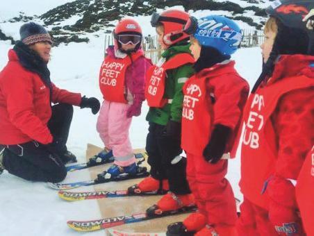
3 Introduction Introduction Glens for all seasons the Glenshee and Strathardle Glens offer unrivalled opportunities for some of the best hillwalking, cycling, skiing and sightseeing in Scotland. Glenshee and Strathardle are the southern gateway to the Cairngorms National Park and Royal Deeside, the hidden route to the Highlands. Beginning in Blairgowrie, the newly named Snow Road and Scenic Route, Glenshee and Strathardle boast a great range of accommodation and things to do. The facilities for walkers, anglers, shooters, golfers and cyclists as well as winter sports enthusiasts are unrivalled. Walking - With 20 Munros and a huge choice of smaller hills there is a great variety of walks available for all abilities and ages including the Cateran Trail. Walks will take you to places that boast some of the best scenery in Eastern Scotland. Cycling The spectacular natural environment and landscape is an adventure playground for bikers. There are many routes available that cater for the novice, families and experts alike. Skiing Glenshee Ski Centre is the largest Ski Resort in the UK, boasting 22 lifts and tows. Glenshee offers 36 runs comprising 40kms of pisted snow and when conditions allow there are also snow making facilities if required. All abilities are catered for and there is a good selection of ski and board hire, ski school tuition and climbing guiding. Fishing and Fieldsports These are a big feature of the area. There is a large river network coming from the hills and lochs for salmon and trout fishing, permits for which are available locally.

 on both sides of the mountains.")


4 History History Glenshee and Strathardle lie hidden in the north-east corner of Perthshire, Glenshee taking its name from the Gaelic Shith (Glen of the Fairies or Peace). Its history provides a virtual snapshot of the story of Highland Scotland with the mountains of the Cairngorms providing a magnificent backdrop. The first settlers moved in the glens in the Bronze Age. By the first millennium the ancient pass to Braemar was in common use leading to a Hospice (Spittal) on both sides of the mountains. Glenshee and Strathardle grew to support large populations based heavily on the Clan System with Lairds and tenants living in fermtouns. The resident Clan in the Glens is the Clan MacThomas who became resident in Glenshee in The annual Clan Gathering continues to be held at the Cockstane in August. To find out more about the history of Clan MacThomas go to Although the area was wracked by raiding Caterans and Jacobite rebellions, more peaceful times arrived when the first road was built in 1750 opening the Glens up to the outside world. Unfortunately this period was soon shattered as new enclosed farming methods and sheep were introduced with many families evicted from their ancestral lands. This drastic reduction in population was accompanied by the eventual disappearance of the Gaelic language which had been in place for thousands of years. With the visits of Queen Victoria and the rise of shooting, tourism saw a reversal of fortune with the majority of Castles and Hunting Lodges dating from this period. Post WW2 saw the arrival of modern tourism on the back of the new ski slopes, the attractiveness of hillwalking as a recreation activity and the continued popularity of the shooting seasons. The present Royal Family spend their summers up at Balmoral Castle, built by Queen Victoria, and can often be spotted driving up through Glenshee. Spectacular scenery on the A93 forms part of the Snow Roads Scenic Route to Grantown on Spey via Royal Deeside. Take a look from the viewpoint at the newly developed layby just below the Devil s Elbow and imagine a vibrant and inhabited landscape in the many outline dwellings still visible.


5 Wildlife Wildlife The Cairngorms National Park is home to 25% of the UK s threatened bird, animal and plant species. Glenshee and the neighbouring glens support a wide range of wildlife. Some of the mammals which call the Glen home include: The Monarch of the Glen The Red Deer, Red Squirrels, Pine Martens, the Scottish Wildcat and Otters. The rich diversity and scale of habitats found in the Glenshee and Strathardle area are ideal for those wishing to see a range of mountain birds including the Red & Black Grouse, Ptarmigan, Golden Eagle, Buzzard, Kite and Dotterel. Stoat Roe Mountain Hare Ring Ouzel Please help to minimise disturbance to wildlife by keeping dogs under close control or on a short lead. Ptarmigan Wildcat Oystercatcher Highland Coo Buzzard Wildflower Golden Eagle Red Squirrel Foxglove
 Act which gives everyone statutory access rights to most land and inland water.")
6 Access Scotland has a tradition of open access to walkers who behave responsibly. In order to enjoy your walk or cycle to the full, it is best to take a few sensible precautions. Safety However the Scottish Parliament in 2003 passed The Land Reform (Scotland) Act which gives everyone statutory access rights to most land and inland water. People only have these rights if they exercise them responsibly by respecting the privacy, safety and livelihoods of others, as well as caring for the environment. The Scottish Outdoor Access Code provides further guidance on your rights and responsibilities. Equally land managers have to manage their land and water responsibly in relation to access rights. What this means in practice is that you can walk or cycle anywhere, keeping away from private gardens etc, provided that you act responsibly by taking note of reasonable requests by farmers, foresters and game keepers who might be involved in deer culling, lambing or tree felling for example. Use of cycles should be limited to reasonably strong made-up paths to avoid damaging soft vegetation. Dogs should be under direct control at all times, possibly on a lead and not permitted to run wild potentially harming wildlife, ground nesting birds and lambs. Cars should be parked so as not to interfere with other users. Gates should always be closed behind you. All litter should be taken home with you. Wild Camping is permitted where the tent is pitched away from roads and buildings and for a short period in any one place. Camp fires should be small, enclosed and completely extinguished before moving on. During the red deer stag stalking season in September and October further more detailed information can be obtained from the SNH website Obtain an accurate weather forecast. Wear appropriate clothing and footwear. Obtain and know how to use an appropriate map. If in doubt consider hiring the services of a guide The weather can be very different from the forecast and can change very quickly, so be prepared to change your plans if necessary. Please observe any access restrictions. Timings for the walks and cycle routes are approximate and may take longer than indicated. Dial 999 ask for police and then mountain rescue, giving the following information: Location ideally with a six figure grid reference and description Nature of any injuries How many people are injured Be ready to give your mobile phone number Particularly for the higher hill walks, it is good practice to leave a note of your intended route and expected return time with a friend or family member. Cyclists are urged to wear an appropriate helmet & gloves. Be aware that on the higher walks snow and freezing temperatures can occur at virtually any time of the year. Extra clothing, gloves and hat should be carried. It is a good idea to carry a mobile phone. Bear in mind a mobile signal cannot be guaranteed. If there is an incident and you require assistance you should: Stay at the location given Bear in mind that, depending on your location, it can take some time for assistance to arrive. Take any steps you can to keep any casualty warm and from further harm.

7 Glenshee and Strathardle Trails
 4 to 5 days Moderate/Hard Landranger 43 & 53 Guides & maps can be purchased at vistor centres Follow in the footsteps of the Caterans marauding")
 of fully waymarked paths.")

8 14 15 Trail??? 1 XXXXXXXXXXX The Cateran Trail 103 km (64 miles) 4 to 5 days Moderate/Hard Landranger 43 & 53 Guides & maps can be purchased at vistor centres Follow in the footsteps of the Caterans marauding cattle thieves from the Middle Ages. The Cateran Trail is Scotland s first circular long-distance route. Winding through a mixture of farmland, moorland and woodland; 103 km (64 ml) of fully waymarked paths. Along the Trail, wide open views reveal distant hills interrupted by mixed woods of gnarled birch, oak and ash, and more recent forest plantations. For maximum ease and enjoyment, walk the Trail at a leisurely pace in five stages. Blairgowrie to Kirkmichael The old mills, lades and weirs along the River Ericht are testament to Blairgowrie s fascinating industrial past. The Trail rises gently from the banks of the Ericht before descending to Bridge of Cally amidst spectacular views, and on through the quiet of the glen to Kirkmichael. Kirkmichael - Spittal of Glenshee After an easy walk along Strathardle to Enochdhu, it is then a long pull up to the col (Lairig Gate). On the way you will pass the Upper Lunch Hut where you can sign the Visitor s Book. At the col the views of the high mountains of the Grampians are simply stunning. The route then descends steeply to the Spittal. Spittal of Glenshee to Kirkton of Glenisla Hugging the Shee Water, the Trail heads south skirting castles at Dalnaglar and Forter. The lochs of Auchintaple and Shandra provide a striking backdrop to the journey into Kirkton of Glenisla, once host to a number of illicit stills. Kirkton of Glenisla Alyth The steep rise from the tranquil village is worth the effort as the Trail reveals breathtaking open aspects down the glen. The streets of the charming burgh town of Alyth once echoed to the sound of cattle being driven through its centre. Alyth Blairgowrie After climbing Alyth Hill, the Trail passes impressive standing stones on the way to Bridge of Cally and Blairgowrie. Or follow Alyth Burn through the Den of Alyth, with its notable sandstone cliffs, for an alternative ending to your long distance adventure.


9 16 17 Trail 2 Cairnwell and Cairn a Gheoidh 12km Height gain: 500m 4-5 hours Hard NO Landranger 43 Explorer 387 A high level walk taking in several Munros but starting from the relatively high point of the Glenshee ski area. Park in the ski centre car park next to the cafe. Behind the Glenshee Ski Centre main building a landrover track leads steeply uphill for 30 minutes until a t-junction is reached. Turn left and follow the track to the summit of Cairnwell. To continue, retrace your steps back down the mountain, past the chairlift on your right, to the top of the next ski lift, also on your right. At this point take a path (faint at first) to your left, heading over and down to a narrow gap in the ridge. The then distinct path continues along the ridge with superb views, past two lochans on your right. At the second lochan turn right, and head directly for the summit of Carn a Gheoidh approximately an hour and thirty minutes from the summit of the Cairnwell. To return, retrace your steps all the way back to the landrover track and descend back down to the ski area approximately an hour and thirty minutes from the summit of Carn a Gheoidh.


10 18 19 Trail 3 Glenshee Ski Centre Cairnwell 0.75km Height gain: 268m mins Moderate NO Landranger 43 Explorer 387 Climb a genuine Munro starting up at one of the highest road passes in Scotland, making this the shortest climb up a Munro of only 268 metres. With fantastic views there are 2 ways to walk up the Cairnwell. During the summer the chairlift is open so park up by the cafe, buy tickets in the cafe, and take the chairlift up the hill. From there the Cairnwell is a short walk upwards, quite rocky, walking up towards the phone mast. Or park by the cafe and start walking beside the chairlift up towards the top area where the chairlift arrives. This is a moderate walk but with no precise path so through heather and bog. Then just a short walk as above. Spectacular views from the top, then walk back down the same route.

.")

11 20 21 Trail 4 Glas Maol 6 km Height gain: 420 m 3-4hours Hard NO (east side A93) Landranger 43 Explorer 387 A relatively short walk to the highest Munro in Glenshee with a high start point. Distant views to the east coast and north west to the Cairngorms, while closer by to the north are the neighbouring Munros of Carn of Cleise and Carn an Tuirc. Park in the car park on the east side of the A93 at the Aberdeenshire/Perth & Kinross boundary. Follow the landrover track heading east to a ski tow and Meall Odhar Café (only open during the ski season). Continue following the track to the right of the ski tow to reach the summit of Meall Odhar (922 metres). From here you will see the west face of Glas Maol with your route following to the right of the head of Coire Fionn. Following a short undulating section, the path now zig zags up the steepish west face, and on gaining flat ground above follow the faint path and one or two old fence posts for ten minutes to the summit trig point and shelter at 1068 metres. To return to your car, retrace your outward route taking care down the steep section.


12 22 23 Trail 5 Ben Gulabin 6 km Height gain: 456 m 3-4 hours Hard NO Landranger 43 Explorer 387 NO A magnificent walk which climbs steeply to the summit of Ben Gulabin. You will be rewarded with spectacular views of the surrounding glens. From the Spittal of Glenshee head North along the A93 for approx 1km until a large gate on the left is seen with a track running behind. This being the start of the route and suitable for parking. Follow the 4x4 track steeply heading in a North Westerly direction. The route contours around Ben Gulabin gaining height quickly. After approx. 1km the path crosses a stream, look up right for the remains of the first ski tows that were installed at Glenshee. These were very popular until the ski area was developed further up the glen to the North, now known as The Glenshee Ski Centre. As the track flattens out look for the obvious man-made track (not marked on maps) to the left. Follow this track steeply until its end point and head right across heather and a small rocky outcrop before arriving at the summit cairn. The views will be well worth it! Simply reverse the route for the descent but keep your eyes on the hillsides, as there is often wildlife to be seen. This area is particularly sensitive during the stalking season, Monday to Friday, September, October and November. Please phone for more information as it is likely that walking will interfere with stalking activities.


13 24 25 Trail 6 Glen Taitneach 17 km Height gain: 110 m Walking 4-6 hours Cycling 2-3 hours Walk Easy/Moderate Cycle Moderate NO Landranger 43 Explorer 387 NO A great day out for the family along the valley floor of Glen Taitneach. A stunning valley with excellent views and generally lots of wildlife. Drive past the entrance to Dalmunzie Estate and over a humped back bridge, turn left into a grassed area just before the church and park. This track takes you for 6km up the glen always keeping the river to the left. Look out for Golden Eagles. At any point on the route if you choose to head home just turn around a retrace your steps returning down the glen. At the head of the Glen the track starts to rise away in the distance climbing steeply past waterfalls to a remote lochan. It is here you should turn around and return the way you came. This area is particularly sensitive during the stalking season, Monday to Friday, September, October and November. Please phone for more information as it is likely that walking will interfere with stalking activities.


14 26 27 Trail 7 Glas Tulaichean from Dalmunzie Castle Hotel 15 km round trip Height gain: 600m 4 6 hours Hard NO Landranger 43 Explorer 387 This walk takes you up to the top of one of Scotland s 282 Munros with spectacular views of the Cairngorms and the Grampians. There is a vehicle track almost to the top but it must be remembered that in bad weather it is easy to get lost if you don t stay on this track. Park at Dalmunzie Castle Hotel where there is a small charge. From car park walk up the estate driveway for 200m and follow signs to Glas Tulaichean. After approximately 1km, where the track crosses the river, turn up right follow the old railway line (150m up the hill). Continue along old railway line to the ruin of Glenlochsie Lodge, then follow hill track which takes you to within 300m of the top. The track levels off at grid reference , turn east/right up hill 400m to the trig point at the top. When leaving the top please retrace your steps, do not leave the track in bad weather unless experienced. This area is particularly sensitive during the stalking season, Monday to Friday, September, October and November. Please phone for more information.


15 28 29 Trail 8 Glenlochsie from Spittal of Glenshee 10 km round trip Height gain: m 3 4 hours Easy to Moderate NO Landranger 43 Explorer 387 NO This walk takes you along the south side and up the beautiful Glen of Glenlochsie. The views are stunning and the paths are easy to follow. Park 300m into Dalmunzie Estate, at Spittal of Glenshee, in the big layby on the right of the driveway. Walk back out of the Estate, turn right and then first right up a hill track, where there are signs for Glenbeag Mountain Lodges. Follow this track through the chalets and up the hill to a forestry gate. Go through the gate and continue following the track for 4½ km, through 2 forestry blocks, until you reach the river where you can see the ruin of Glenlochsie Lodge 200 metres ahead. If the water level is very low it may be possible to cross the burn at the Lodge and return along the north of the river via the old railway line and Hotel driveway to Spittal of Glenshee Otherwise return by the route you came.


16 30 31 Trail 9 Dalmunzie Driveway 6.5 km round trip Walking 2 hours Cycling 1 hour Easy NO Landranger 43 Explorer 387 NO A short but scenic walk that takes in some stunning scenery at the very head of Glenshee. This area is regarded by the Royal Commission on the Ancient & Historical Monuments of Scotland as one of the finest examples of the pre-improvement period in Scotland and was once home to people before the improvements of the 19th century. This is a very short and easy walk for both walkers and cyclists but also for pushchairs. Turn into Dalmunzie Estate, drive for 300 yards and park in the big layby on the right. Follow the driveway until you reach Dalmunzie Castle Hotel, which serves food and refreshments. Return via the same route.


17 32 33 Trail 10 Loch Beanie 6 km Height gain: 110 m 2 hours Easy/Moderate NO Landranger 43 Explorer 387 A low level walk on a good track, but also a muddy path, across open moorland. A good location to observe nesting birds in the spring, and to see or hear red deer in the autumn. NO Car parking can be arranged in advance by calling by calling the Compass Christian Centre on From the Centre, pick up a landrover track heading north past a small pond, through a gate and then uphill to join an older track. Turn left onto this, passing through another gate through a wall and further on through a deer fence. The track then takes you through open moorland and at a junction take the track to the right now heading southwest. Look out for a distant view of Loch Beanie opening up on the left before dropping down to a rather rickety footbridge! In about ten minutes you arrive at the Loch by a small boat shed. To extend the walk, at the far (eastern) end of the loch there is a delightful sandy beach. It is also possible to continue the walk past the loch through Glen Beanie to Glenisla. To return to the start by a circular route, return to the footbridge, facing down stream pick up a rather indistinct path going parallel with, but away from, the river. On reaching a deer fence, head right (away from the river) and go through a deer gate. Please do not continue on the path by the river to Invereddrie Farm. On the skyline you will see a strand of pine trees - head for the furthest left tree, by an old wall. Turn right following a short track to another gate. Go through this and head downhill to your start point entering the grounds of Glenshee Lodge over a stile.


18 34 35 Trail 11 Enochdhu to Spittal of Glenshee 9.7 km Height gain: 381 m Walking 4-6 hours Cycling 2-3 hours Walk Moderate Cycle Hard NO Landranger 43 Explorer 387 NO A majestic trail through open countryside, with excellent views from the highpoint of the route overlooking the glens of Glenshee and Strathardle. Parts of this walk can be very boggy so wear suitable footwear. From the main car park at Enochdhu cross the road and follow the waymarked estate road passing estate houses and working farms. Dirnanean Gardens are open during the summer for a small admission charge. Look out for signs naming the woods and their planting dates. After approx 1.5km the track splits, ensure you take the track junction to the left keeping the fire tower to your right. Follow this track for approx 3km to the Lunch Hut. This is an ideal spot for a mid way break and is the only shelter on the route. Please complete the visitor s book before departing. From the lunch hut continue along a faint but well-marked hill trail steeply towards the Col. Wooden posts clearly mark the trail. At the summit of the Col there can be excellent views on a good day. From the Col descend steeply initially towards the Spittal of Glenshee. Again this is a faint trail but is well-marked with wooden posts. This walk can be done in both directions.

.")

19 36 37 Trail 12 Mount Blair 7 km Height gain: 472 m Walking 3-4 hours Walk Hard NO Landranger 43 Explorer 387 NO Mount Blair dominates the southern entrance to Glenshee and is now easily identifiable by the communications mast on top. The views from its summit are fantastic: Glenshee and Glenisla to the North, the North Sea to the East, Schiehallion to the West and Strathmore and the Sidlaws to the South. Park at the junction by the phone box on the Blacklunans & Drumore minor road linking the A93 with Glenisla. Head North up the road for 200m and take the first left by an old fank (shed/barn). The track winds its way up hill passing an old mill and the Borland farm before reaching the enormous and impressive lime kiln at the Coldrach. Continue on the track past the lime kiln to the gate onto the hill. Turn right and follow the track up the hill diagonally into Coire Goibhre. When the track peters out head due east over rough ground for 200m until you reach the dry stone wall, near an obvious dip in the ridge, locally The Glack of the Barnetts. Cross the wall and follow a narrow path all the way to the summit crossing two stiles on the way up. Return via same route.

 up the hill north east for approximately 500m then bear right following the road up to the Loch.")

20 38 39 Trail 13 Auchintaple Loch 6 km Height gain: 160 m Walking hours Cycling mins Moderate NO Landranger 43/44 Explorer 387 This is a very scenic trail around Auchintaple Loch in Glenisla. Park at the layby at the corner of the forest, just south of the bridge over the River Isla at Little Forter. Just north of the layby is a gate and a large stile, follow the Landrover track (and the Cateran Trail) up the hill north east for approximately 500m then bear right following the road up to the Loch. NO Stay on the road passing the boathouse on your left, follow the track around the loch through some gates then it changes to a path going round the bottom end of the loch (watch the stones here!). Once over the manmade dam cut up through the heather, using a faint path towards the road, then follow the road north through the trees to a gate and junction. Take the road left going north west and follow this back to the layby. (At this junction you can also turn right and follow the second loop on the map to add another 4-5km to the walk). At the top end of this trail there is access to a large number of paths and tracks that lie between Glenmarkie forest and the top half of Glenisla. A good look at the OS Map will reveal a selection of other interesting routes.

. Follow the forestry road north west for approx 1.")

21 40 41 Trail 14 Loch Shandra Glenisla 2.5 km Height gain: 30m Walking 1 hour Cycling mins Easy NO Landranger 44 Explorer 381/388 NO This is a really easy walk and ride brilliant for young children who are learning to control a bike. The trail to the loch involves a little uphill and adults may have to push children on bikes, but it is broken up by one or two small downhill bits. Park at the small car park at Freuchies (the southerly end of Glen Isla Forest). Follow the forestry road north west for approx 1.5 km till you see a gate on your left, go through the gate and you will see Loch Shandra ahead of you. The area by the boathouse is an excellent location for a picnic but please be aware that Loch Shandra is a popular fishing loch and ensure you don t disturb anyone who may be fishing here. Return the same way you came, please ensure you close the gate by the entrance to the Loch. On the way back down make sure children on bikes are under supervision and can use their brakes as the forest road is mainly downhill and is occasionally used by vehicles.


22 42 43 Trail 15 Cray to Blacklunans 6.8 km Height gain: 50 m Walking 2 hours Cycling 1 1/2 hours Walking/Cycling Easy NO Landranger 43 Explorer 387 NO A delightful walk/cycle route for all abilities and ages on the quiet, unclassified public lane running along the foot of Mount Blair from Cray to Blacklunans. From the A93, take the B951 eastwards from just to the south of the Wee House of Glenshee and Visitor Centre. Cross the river and drive past Cray House. Turn right at the old church and find a suitable parking space ensuring that you do not block the road or entry to the two or three private driveways. The route takes you along the full length of the unclassified lane from Cray to Blacklunans. Initially you will pass by woodland on either side where you will often spot a red squirrel or deer. The route then gently twists and undulates through native woodland, heather moorland and farmland from Cray to The Westerton giving superb views across the Blackwater to the hills above The Lair, Dalnoid and Glenkilrie. The route then drops slightly down through farmland to Blacklunans. Return via the same route. Whilst the lane has very little traffic please ensure children and dogs are kept under supervision at all times.


. Follow the landrover track (don t turn off it to the larger loch on the left, keep going past another small Loch on the right) to where it meets the Cateran Trail.")
23 44 45 Trail 16 Cochrage Muir 10.5 km Walking 1-2 hours Cycling hour Moderate NO Landranger 53 Explorer 379/381/387 NO This is a nice circular walk and ride mostly on forestry and landrover tracks. The reason it has a moderate grade is because it starts with a 2 km climb which isn't everyone's cup of tea, and ends with a normally boggy ride down a landrover track. Park at the car park about 500m up the forestry road next to the Bridge of Cally hotel. Start at the gate at the car park and follow the road up for about 2km. Take the first road on the left and follow this for another 2km and look for where the forestry road turns right but a smaller landrover track goes straight on up the hill (then bears left through a gate). Follow the landrover track (don t turn off it to the larger loch on the left, keep going past another small Loch on the right) to where it meets the Cateran Trail. Follow the Cateran Trail back towards Bridge of Cally. This part can be quite wet and boggy. Continue through four or five gates down towards the forest road. When you meet the forest road, you need to turn left back to the car park.

.")

24 46 47 Trail 17 Bridge of Cally River Walk and Blackcraig Forest Up to 14km Height gain: Up to 290 m Blackcraig Forest is a commercial forest managed by Forestry Commission Scotland. depending on route Walking from hours Walk & Cycle Easy to Moderate NO Landranger 53 Explorer 387 NO The best starting point for both mountain bikers and walkers is a small track which runs immediately behind the Bridge of Cally Hotel. (There is a small car parking area about 400m along this track, additional car parking is available in the hotel car park nearby). The forest extends northwards along Strathardle and there are over 8miles/14km of tracks to explore (only some of which are way marked). Mountain bikers looking for a longer ride can also follow the Cateran Trail from Bridge of Cally to Kirkmichael before retracing their route, or else returning on the A924. For walkers there is a shorter route lasting only 20 minutes, following the track behind the Bridge of Cally Hotel to just before the entrance gates into the Forest then follow the signed footpath along the riverbank back to the Hotel. Wildlife watchers are likely to see red squirrels, roe deer and buzzards. Refreshments are available all day at the Bridge of Cally Hotel; there is also a small post office/shop at Bridge of Cally which sells snacks and drinks.


25 48 49 Trail Kirkmichael Path Network 0.8 km 8 km 40 mins 5 hours Walk: Easy to Hard Cycle: Easy to Hard Landranger 43 OS Explorer Routes in and around Kirkmichael on the new Path Network offer something for everyone. From short walks around the village to a long route into Kindrogan Forest, great for mountain bikers or those seeking a longer adventure. Kirkmichael is on the A924 between the Bridge of Cally and Pitlochry. Pages 50 and 51 show the routes, interpretation panels along the way highlight and explain the fascinating history and landscape of the area. Kirkmichael is one of the 7 villages connected by the Cateran Trail (64 miles - see Trail 1). The Path Network also ventures into Kindrogan Forest (see Trail 22). The village also offers a community run shop with a wide range of food and drink. A specific leaflet on the Kirkmichael Path Network can be picked up in local shops and visitor centres.


 (miles) Distance To Dirnanean Garden Distance to Kirkmichael (miles) Edinburgh: 72 I Glasgow: 87 I Dundee: 31 I Perth: 28 Kindrogan Wood Kindrogan")


26 Visit I Visit I The path network was created by the Mount Blair Community The path network was created by the Mount Blair Community Trust and the Perth & Kinross Countryside Trust so local Trust and the Perth & Kinross Countryside Trust so local people and visitors can explore this stunning area. people and visitors can explore this stunning area. Visit I Visit I 50 Discover the Beauty of Kirkmichael Trail??? Kindrogan Loop Explore in and around Kirkmichael XXXXXXXXXXX Riverside Loop This short walk next to the River Ardle provides the perfect introduction to the Kirkmichael Path Network. Legend has it that the name Ardle is derived from a Pictish warrior who was killed in a battle at Enochdhu. The village of Kirkmichael has lots to offer with links to miles of waymarked trails and wonderful countryside with great pubs and accommodation. This short route takes you on a quick tour of the village. The name Kirkmichael means The Church of St Michael. Mostly wide gravel tracks and quiet roads. Some uneven steeper sections. Return to Kirkmichael by using the Cateran Trail. Long distances so allow sufficient time. Mostly smooth gravel tracks. Take care on village roads. Two flights of steep steps. Mostly smooth tarmac quiet roads. 5 miles / 8 km Allow 5 hours One of seven villages connected by the Cateran Trail - a 64-mile circular walking route through the heart of Scotland Kirkmichael is a hidden gem sitting in the kind of Scotland walkers dream of. Distance to to Kirkmichael Kirkmichael (miles) (miles) Distance To Dirnanean Garden Distance to Kirkmichael (miles) Edinburgh: 72 I Glasgow: 87 I Dundee: 31 I Perth: 28 Kindrogan Wood Kindrogan Forest provides the ideal habitat for the elusive and rare pine marten. Enochdhu P Pine Marten Discover the the Discover Beauty of of Beauty Kirkmichael Kirkmichael Kirkmichael Explore in in and and around around Explore Explore Explore over over ten ten miles miles of of waymarked paths waymarked paths around around the tranquil tranquil village village of the of Kirkmichael. Kirkmichael. Allow 50 minutes CATERAN TRAIL XXXXXXXXXXXX The path network was created by the Mount Blair Community Trust and the Perth & Kinross Countryside Trust so local people and visitors can explore this stunning area. 1.2 miles / 2 km Allow 40 minutes Passing through Kirkmichael, the Cateran Trail travels through 64 miles of stunning countryside. One of seven villages One of seven villages connected by by the the Cateran Cateran connected Trail -- a a 64-mile 64-mile circular circular Trail walking walking route route through through the the heart heart of of Scotland Scotland -Kirkmichael is a hidden Kirkmichael is a hidden gem sitting sitting in in the the kind kind of of gem Scotland walkers walkers dream dream of. of. Scotland XXX 0.5 miles / 0.8 km 51 Cateran Trail Edinburgh: 72 I Glasgow: 87 I Dundee: 31 I Perth: 28 Edinburgh: 72 I Glasgow: 87 I Dundee: 31 I Perth: 28 XXX XXX XXX XXX Village Loop Kindrogan has miles of tracks for walkers, mountain bikers and horse riders. The long tracks will suit anyone who has endurance and a sense of adventure! If time allows visit Loch Curran with its abundance of wildlife, it s a beautiful place for those seeking solitude. KINDROGAN LOOP Dirnanean Dirnanean Garden is open from 1st June to the end of August. The garden consists of a Victorian Burn Walk which has been recently re-discovered. Set in a designed landscape the garden includes shrubbery, a walled garden, vegetable garden and orchard. Kindrogan Hill Bannerfield Although quiet now, the Bannerfield was once a site for a massive Clan gathering. Visit I to discover more 1 XXXXXXXXXX 2 XXXXXXXXXX Visit I to discover more RIVERSIDE LOOP Kirkmichael Kirkmichael Loch Curran Set in idyllic countryside 13 miles from Blairgowrie and Set in idyllic countryside 13 miles from Blairgowrie and 12 miles from Pitlochry, Kirkmichael provides an ideal 12 miles from Pitlochry, Kirkmichael provides an ideal destination for anyone who enjoys the great outdoors. destination for anyone who enjoys the great outdoors. Highlights of the village include the village shop run by Highlights of the village include the village shop run by a community interest company offering a wide range a community interest company offering a wide range of food and drink, household supplies and an excellent of food and drink, household supplies and an excellent café. café. 3 XXXXXXXXXX 4 XXXXXXXXXX PITCARMICK LOOP VILLAGE LOOP Kirkmichael Osprey A bird that travels great distances osprey have been recorded flying over Loch Curran. N Round Houses The four routes of the Kirkmichael Path Network each The four routes of the Kirkmichael Path Network each offer something different, from short walks around offer something different, from short walks around the village to a long route into Kindrogan Forest, which the village to a long route into Kindrogan Forest, which is great for mountain bikers, horse riders or those is great for mountain bikers, horse riders or those seeking a long-distance adventure. seeking a long-distance adventure. Interpretation panels along the way highlight and Interpretation panels along the way highlight and explain the fascinating history and landscape of the Lorem ipsum explain the fascinating history and landscape of the area. area. The map inside this leaflet shows details of the four The map inside this leaflet shows details of the four trails that make up the Kirkmichael Path Network. trails that make up the Kirkmichael Path Network. 5 XXXXXXXXXX 6 XXXXXXXXXX For over 2000 years from the early Bronze Age, our ancestors lived in round houses. Scale: 1km Pitcarmick Loop Perth and Kinross Perth and Kinross Countryside Trust is a Countryside Trust is a registered charity that registered charity that provides, improves and provides, improves and promotes access to the countryside for walkers, promotes access to the countryside for walkers, cyclists and horse riders. cyclists and horse riders. The Mount Blair Community Development The Mount Blair Community Development Trust aims to improve the quality of life Trust aims to improve the quality of life for all sectors of the community living, for all sectors of the community living, working or visiting within the Mount Blair working or visiting within the Mount Blair Community Council area. Community Council area. A stunning route through varied landscapes of birch and pine woodlands, heather moorland and fields with livestock. From Glen Derby, the path enters open ground with scattered birch and scots pine. The return route offers amazing views of the surrounding countryside. Project funded and supported by: 3.5 miles / Quiet roads and farm 5.6 km tracks, mostly grassy paths through open Allow countryside. Some 2.5 hours steep sections and wet ground at any time of year. Some boardwalk and gates. Two bridges to cross.


27 52 53 Trail 22 Kindrogan Short Walk 3.5 km Walking 1 1/2 hours Cycling 45 minutes Easy Landranger 43 NO A short and level linear trail suitable for pushchairs and wheelchairs on a good landrover track through scenic Strathardle. The trail takes you alongside Kindrogan Wood where you may see a wide range of wildlife including birds, red squirrels and roe deer. Start at the east end of the route at the car park at Enochdhu, pass in front of the row of cottages and turn right over the bridge to cross the River Ardle. On crossing the bridge turn right, keeping an eye out for the marker stone showing where Queen Victoria stopped for tea on her way from Balmoral to Dunkeld. The stone is on the river bank just below the trail on a parrallel track down by the river Continue along the track passing by the Field Studies Council s Kindrogan Centre and then on for a further 2 kilometres to West Lodge and the end of the Kindrogan Drive where it joins the main road. Return to the car park via the same route. For the energetic walker, the walk can be extended by taking in Kindrogan Hill look for the way markers before reaching the Cateran Trail signpost. Note: The path to Kindrogan Hill is currently affected by windblown trees (at time of print 2017).


28 54 55 Some other activities in the area


29 East & West Cromald Cottages Clan MacThomas Society Combie, McColm, McComas, McComb(e), McCombie, McComie, McComish, MacOmie, MacOmish, Tam, Thom, Thomas, Thoms, Thomson MacThomas clansfolk settled in Glenshee around The Clan Society owns land at Clach na Coileach on the A93 just North of the B951 junction. It is signposted and visitors are most welcome. For more information please collect our leaflet from the Visitor Centre at the Wee House of Glenshee or visit our website: 2 modern well-presented & equipped semi-detached cottages each sleeping 5 near Bridge of Cally. Close to Cateran Trail, Visit Scotland 4 star, all heating, electricity, towels and bed linen included. Wood burning stove. Pets welcome. stay@cromaldcottages.co.uk


30 Mountain Summits: your instructor and guide in the mountains of Scotland Providing instruction and guiding in all aspects of mountaineering, from navigation and rock climbing to winter mountaineering and ice climbing, Mountain Summits is situated in the Southern Cairngorms. Based in the unique Strathardle Glen near Glenshee, 10 miles east of Pitlochry, we are accessible by both road and train. For all our existing and future clients from Glasgow and Edinburgh, we are just 1hr 45 mins by car, making it suitable for day, weekend and full week adventures! Experience the beauty, history and passion of East Perthshire Glenbeag Mountain Lodges Log cabins with Hot Tubs - Self Catering - Sleeping from 2-5 persons. All cabins with Wi-Fi, outside hot tubs and undisturbed panoramic views over majestic mountainous surrounds. Most cabins with saunas, some accept pets. Located within the Cairngorm National Park with numerous walks and trails on the doorstep. Glenbeag Mountain Lodges Spittal of Glenshee, Perthshire PH10 7QE logcabins@glenbeag.co.uk 3 and 4 star VisitScotland grading Gulabin Lodge Outdoor Centre Gulabin Lodge Outdoor Centre: Various activities available all year round including a Ski School during the winter months. Accommodation for 50, meals provided, all ages and abilities catered for. Go For It at Gulabin! Tucked into the Highland hills, the Gateway to the Cairngorms, but only about 90 minutes drive from Edinburgh or Glasgow. For scenery like ours you might have thought you d have to drive a lot further! Make your base with us and you re within easy reach of just about anything you d want to do in Scotland, in countryside or town, in the mountains on the doorstep or even by the sea, as the unspoilt Angus coastline is less than an hour s drive. We like to think East Perthshire ticks a lot of boxes for the ideal Scottish break especially if it involves unwinding, recharging and enjoying the breeze on the heather and the panorama of soaring hill-slopes. But, if you want to get active, walk and climb, golf, fish or cycle, ski, visit historic places like Glamis Castle or the family attractions in Dundee, shop or discover the gourmet delights there s something for everyone. Simply the ideal centre for a Scottish holiday. Visit for further details about what East Perthshire has to offer you. Gulabin Lodge Outdoor Centre By Blairgowrie, Spittal of Glenshee Perthshire PH10 7QE Tel: info@gulabinoutdoors.co.uk


31 Glenkilrie Bed & Breakfast Glenkilrie Bed and Breakfast set within it s own grounds on a real working hill farm. The Houstoun family have been welcoming guests into their family home for the past 28 years. Accommodation consists of two double rooms and one twin room all ensuite. Guests lounge with open fire, television and tea facilities. Contact Mrs Morag Houstoun Glenkilrie, Blacklunans, Blairgowrie PH10 7LR glenkilrie@btinternet.com Visit the Wee House of Glenshee Tearoom, Gift Shop & Visitor Centre on the A93 in Glenshee After a day on the hills relax in our cosy tearoom in front of the woodburner! Dalmunzie Estate Great selection of cakes and scones all home-baked, light lunches and hearty soups, coffees, teas, hot chocolates and soft drinks. Browse our gift shop with its extensive range of local and Scottish gifts and produce, as well as an extensive range of local maps and walking guides. Visit the Glenshee & Strathardle Visitor Centre for information on heritage, wildlife and walking in the area, and to pick up copies of our accommodation and activity leaflets. Leaflets and information are also available for the Cairngorms National Park and further afield. Free Wifi Open Daily 10am 5pm from Easter to the end of October, reduced opening times throughout the rest of the year, check our Facebook page for details. Wee House of Glenshee, A93, Glenshee, Blairgowrie PH10 7LP Tel info@weehouseofglenshee.co.uk Our 7 traditional stone built highland cottages and one large luxury house offer self catering accommodation set amongst the spectacular scenery of a beautiful 6,500 estate at the gateway to the Cairngorm National Park. Explore the estate by walking or perhaps try dry stalking or shooting for the day and have a chance to see red deer, roe deer, grouse, ptarmigan, blackcock, eagles, peregrine, hares and other wildlife. Enjoy a days fishing for brown trout in the burn or loch. And we're only 6 miles from Glenshee Ski Centre, therefore an ideal base for snow sport enthusiasts! We also have our own 9 hole golf course to enjoy too. For all enquiries please phone or info@dalmunzieestate.com. For further info visit our website


32 3 newly renovated dog friendly cottages offering accommodation for 8 at Rose Cottage, 6 at Chauffeurs Cottage and 6 at Stags View all with underfloor heating throughout the ground floor and wood burning stoves in the living rooms. Stags View has the added luxury of a private hot tub Blacklunans Perthshire PH10 7JY Tel: info@solidluxury.co.uk Glenshee Treehouse The Glenshee Treehouse is an architect designed, octagonal building sitting on an elevated platform amidst centuries old Scots Pine trees. Perfect for honeymoons, special occasions or simply to get away from it all! Luxury accommodation for couples, breathtaking views of Glenshee, hot tub, woodburner and wifi. Dalnoid Holiday Cottages 3 luxury holiday cottages each sleeping 4 people, all with stunning views of Glenshee. Each cottage has a hot tub in private enclosed garden, wifi & woodburners. Shortbreaks available throughout the year, Pets welcome by arrangement Accounting for your future not your past As your trusted adviser we are members of your team, focused on your results and your future. We will show you how to succeed not just how to do your accounts. Looking forward not back in creating and protecting your wealth Contact us today! 1st meeting free! 33 Leslie Street Blairgowrie PH10 6AW

33 Visitor Centre located at the Come to the Wee House of Glenshee which incorporates the local Visitor and Information Centre for the area. Find Accommodation, Activities, Maps, Walking Guides and learn about the local history of the area. From tents to castles, from skiing to llama trekking, from Cateran Trail to short walks - we have it all here. Don t just drive through, take advantage of the area and enjoy one of the most beautiful areas hidden in the heart of Highland Perthshire. And while you are here take advantage of the Wee House with its cosy tearoom and wealth of Scottish crafts. Tel: info@glenofthefairies.co.uk On A93 to Glenshee at the entrance to the Cairngorms National Park To learn more about us and the area, take a look at the website
THE CATERAN TRAIL Cairngorms National Park, Scotland
 THE CATERAN TRAIL Cairngorms National Park, Scotland Explore the Scottish Highlands in this 4-day trek along the Cateran Trail, as you follow ancient paths through the hills and glens of Perthshire. A
River Isla B951. Diarmid s Tomb
 3. 4 Spittal of Glenshee to Kirkton of Glenisla Distance 14.6 miles 23.5 km Terrain mainly on rough moorland path with boggy bits and stream crossings, then heading east along at the B951 for 2.5 miles,
Countryside Trails Dunkeld
 R A N G E R S E RV I C E Countryside Trails Dunkeld WELCOME Welcome to this southern end of Atholl Estates. The countryside here is a wonderful blend of lochs, woodland and heather moor. There is a large
Blair Castle Activities
 Atholl Estates Blair Castle Activities Explore Atholl Estates Off Road Safaris Experience the beauty and tranquillity of rural Scotland in just a few hours on an off road safari. Your expert guide will
Beautiful Walks from the Blue Ball Inn
 Walk No. 5 RIVER VALLEYS AND MOOR Countisbury, Watersmeet, Hillsford Bridge, Cheriton, Shilstone Hill, Rockford and Chiselcombe. 8.5 MILES APPROX. Walking time four and a half hours approx. OS 1;25,000
ID: 283 Distance: 6.2 miles Height gain: 500 Metres Map: Explore OL 19 Contributor David and Chris Stewart
 Walkingworld Wild Boar Fell ID: 283 Distance: 6.2 miles Height gain: 500 Metres Map: Explore OL 19 Contributor David and Chris Stewart Features Birds, Great Views, Hills or Fells Description: Wild Boar
Self-Guided Walk Langdale Pikes. Start & Finish: NT car park (free to members) at Sticklebarn - on the right just beyond the New Dungeon Ghyll hotel.
 at Sticklebarn - on the right just beyond the New Dungeon Ghyll hotel.") Self-Guided Walk Langdale Pikes Key Information These mountains form a collection of spires and cliffs on the north side of Langdale. This walk visits four of the main tops Pavey Ark, Harrison Stickle,
Self-Guided Walk Langdale Pikes Key Information These mountains form a collection of spires and cliffs on the north side of Langdale. This walk visits four of the main tops Pavey Ark, Harrison Stickle,
BALNAKILLY CHALETS KIRKMICHAEL, BLAIRGOWRIE, PERTHSHIRE
 BALNAKILLY CHALETS KIRKMICHAEL, BLAIRGOWRIE, PERTHSHIRE BALNAKILLY CHALETS, KIRKMICHAEL, BLAIRGOWRIE, PERTHSHIRE Opportunity to purchase four chalets and amenity ground in an attractive rural location.
Ystwyth and Rheidol Bridleway Routes. Route 2:Llanilar Circular
 Ystwyth and Rheidol Bridleway Routes Route 2:Llanilar Circular Route overview and terrain: A long circle using connecting ridges with fine views to link the Rheidol and Ystwyth river valleys. The route
Pontfadog. Walk A. Walk A
 Walk A A Bird s eye view of the village 2km. (1 1 /2 miles); height gain 45m. (150ft) about 45 minutes. Six minutes walk along the main road towards Glyn Ceiriog reach a signpost to Llwynmawr. Take the
Walk 1. Cotswold Water Park. Gateway Centre to Cerney Wick, railway track to Lake 6, Gateway Centre.
 Cotswold Water ark Walk way A Swindon/ Cirencester Thomas and Severn Canal way to Cerney Wick, railway track to Lake, way. Spine Road East Hotel Time: hours (short walk km) Distance: km A level walk along
SECTION ONE. Scotland s National Parks and National Nature Reserves Ten Things You Might Not Know
 SECTION ONE Scotland s National Parks and National Nature Reserves Ten Things You Might Not Know 5 Ten Things You Might Not Know... 1. SCOTLAND S NATIONAL PARKS AND NATIONAL NATURE RESERVES ARE BEAUTIFUL,
Leaden Boot Challenge ROUTE INSTRUCTIONS
 Leaden Boot Challenge ROUTE INSTRUCTIONS Section 1 Alstonefield to Ilam From the village hall car park turn R then L and pass through the village keeping to the R to enter Church Street. Pass the Church
The Mendip Way. Route Directions and Maps Uphill to Wells
 The Mendip Way Route Directions and Maps Uphill to Wells Website: www.mendiphillsaonb.org.uk Email: mendip@mendiphillsaonb.org.uk Facebook & Twitter: @MendipHillsAONB Phone: 01761462338 1 Uphill to Loxton
Barra Wood, Perthshire - Just over 11 acres, 69,000
 Barra Wood, Perthshire - Just over 11 acres, 69,000 Barra Wood is a truly spectacular woodland that would make a perfect retreat from the stresses of modern day life. Close to the entance of the wood and
The Clyde Walkway. Crossford to Falls of Clyde, New Lanark. Thanks to
 Thanks to The Clyde Walkway is a partnership venture based on co-operation and agreement. North Lanarkshire, South Lanarkshire and Glasgow City Councils would like to acknowledge the help and support of
GRINDLEFORD GALLOP 2018
 GRINDLEFORD GALLOP 2018 Route Information The Grindleford Gallop follows a fixed 21 mile route through the lanes and paths of Derbyshire. All competitors must follow this route. An OS map of the area with
Leaden Boot Challenge 2016 ROUTE INSTRUCTIONS
 Leaden Boot Challenge 2016 ROUTE INSTRUCTIONS Section 1 Alstonefield to Ilam (CP2) From the village hall car park turn R then L and pass through the village keeping to the R to enter Church Street. Pass
DAVA WAY. Notes on multi-use access
 DAVA WAY Notes on multi-use access The Dava Way is a 24 mile (38km) waymarked long distance route based largely on the dismantled Highland Railway Line between Forres, near the Moray Coast in north-east
The Gatsby. Aberdeenshire SLEEPS 22-24
 Aberdeenshire SLEEPS 22-24 Hot Tub Table tennis and games room Lovely large family area with bar and kitchen Large private gardens 11 beautiful bedrooms Luxurious state of the art kitchen with all mod
Foreword. Loch Ness from the summit of the High Route
 Foreword 4 The Great Glen Way runs for just over 77 miles (125 km) from Fort William to Inverness. It starts beside Britain s highest mountain, Ben Nevis; follows its greatest geological fault along the
CWMGIEDD FROM ABERCRAVE
 Abercrave to Cwmgiedd Walk Page 1 Starting from The Abercrave Inn. Grid Ref: SN 824128 From the Abercrave Inn, an 11.3km (7 miles) walk to the foothills of the Cribarth Mountain, then through forest to
Beautiful Walks from the Blue Ball Inn
 Walk No. 2 WINSTONS WALK Countisbury, Wind Hill, Watersmeet, Ash Bridge and Winston s path. 5 Miles approx. Walking time- Two and a half hours approx. (Not including Breaks) OS 1:25,000 Sheet 64/74 Lynton
BISHOPSTONE CIRCULAR WALK
 BISHOPSTONE CIRCULAR WALK 4½ miles (7¼ km) - allow 2 hours (see maps on final pages) Introduction This walk is within the North Wessex Downs Area of Outstanding Natural Beauty and starts from the small,
Map: Landranger #27 Forres and Nairn and 36 Grantown and Aviemore
 THE DAVA WAY This is a newly created long distance route that runs from Forres to Grantown, mostly following the old railway line. You will need to detour around a couple of sections that are not really
TREK THE ROCKIES ABOUT THE CHALLENGE TREK THE ROCKIES FOR HIGHLAND HOSPICE CANADA TREK DEMANDING
 TREK THE ROCKIES CANADA TREK DEMANDING ABOUT THE CHALLENGE The Canadian Rockies are justifiably world-famous for their magnificent scenery: the combination of impressive, jagged mountains, bright turquoise
COWAL WAY MULTI-USE ACCESS NOTES
 COWAL WAY MULTI-USE ACCESS NOTES The Cowal Way is a 57 mile long distance path. Starting at Portavadie, it winds its way up through the Cowal peninsula via Tighnabruich, Glendaruel, Strachur, Lochgoilhead
A Circular Walk from Chapel Carn Brea
 A Circular Walk from Chapel Carn Brea 4.3 Miles A Walk Visiting Five Historic Ancient Sites This circular walk offers the possibility of several alternatives, depending on the walker s available time and
Walking Holiday Southern Highlands
 WALK WILD SCOTLAND Walking Holiday Southern Highlands Loch Lomond & Trossachs National Park 10. - 15. Mai 2015 16. - 21. September 2015 (Trip for Women) WALK WILD SCOTLAND TRIP DESCRIPTION This hiking
Slad over to Pitchcombe and back
 The walk climbs up from Slad over Wickridge Hill, descends to near Pitchcombe, then climbs back over Wickridge hill and round the back of Slad. Page 1 Start Point: SO 8718 0732 The Woolpack, Slad Length:
Darwin s gigantic blunder
 Trail Darwin s gigantic blunder Explore how ice shaped the landscape and why Charles Darwin made a nice mess of Glen Roy Time: 1hr 10 mins Distance: 2 miles Landscape: rural At Glen Roy a curious feature
Congewai Track Head (East) to Watagan Headquarters
 to Watagan Headquarters") Congewai Track Head (East) to Watagan Headquarters 7 hrs Hard track 17.2 km One way 4 973m This full day walk starts from the Congewai valley trackhead (east) and follows the Great North Walk up into the
Congewai Track Head (East) to Watagan Headquarters 7 hrs Hard track 17.2 km One way 4 973m This full day walk starts from the Congewai valley trackhead (east) and follows the Great North Walk up into the
BALCHRAGGAN CROFT ABRIACHAN, INVERNESS
 BALCHRAGGAN CROFT ABRIACHAN, INVERNESS BALCHRAGGAN CROFT, ABRIACHAN, INVERNESS IV3 8LB A comfortable and spacious family home overlooking Loch Ness. Inverness 10 miles Drumnadrochit 7 miles Airport 19
Baggy Point, Croyde, North Devon
 Baggy Point, Croyde, North Devon A walk using the South West Coast Path that is likely to be suitable for people with impaired mobility or with a pushchair, wheelchair, or mobility scooter. The Coast Path
Things to do in the area
 Brodick Shore Lodge Things to do in the area Shore Lodge bunkhouse is located on Arran within the grounds of Brodick Castle, Garden & Country Park the only island country park in Britain. Set against a
Lordenshaw. What are cup & ring marks?
 Lordenshaw Lordenshaw hill has one of the largest clusters of ancient cup and ring marked stones in the UK. We ve chosen four interesting spots we d like to share with you. What are cup & ring marks? The
Victoria Falls Lookout to Blue Gum Forest
 Victoria Falls Lookout to Blue Gum Forest 8 hrs Experienced only 13.8 km One way 5 112m This long day-walk follows a remote track down from Victoria Falls lookout, passing the waterfall, and into the Grose
Flora and Fauna for Hillwalkers (open to all)
") Kindrogan 4 day Flora and Fauna for Hillwalkers (open to all) 13 th 17 th June Fri - Tues 280 Sole Occupancy Course Overview Nestled in the Scottish Highlands, Kindrogan is within close reach of some of
Kindrogan 4 day Flora and Fauna for Hillwalkers (open to all) 13 th 17 th June Fri - Tues 280 Sole Occupancy Course Overview Nestled in the Scottish Highlands, Kindrogan is within close reach of some of
activetab=documents&keyval=m4y4kxmk6h000
 We are delighted to offer this very rare opportunity to develop an existing dwelling within the stunning location of Dunira. Hoolie House, built in 1972 and latterly extended and modernised, is a four
Merritts Traverse. 1928m
 Merritts Traverse 3 hrs Hard track 5.8 km Circuit 4 167m This walk starts with a scenic journey to the top of the hill on the chairlift. Starting along Merritts Nature walk, this walk soon detours down
WALKING IN SCOTLAND IN THE FOOTSTEPS OF ROB ROY
 WALKING IN SCOTLAND IN THE FOOTSTEPS OF ROB ROY Arrival times: Glasgow Airport: by 4pm. Edinburgh Airport: by 2pm plus 20.00 transfer charges on arrival. Departure times: Edinburgh Airport: anytime possible.
beach. Make the ford and follow the trail out to the junction with Red Creek Tr in an open grassy area.
 Description: This is a moderate to slightly strenuous 22.8 mile backpack (add 2.6 miles if you do the packless out and back to the Lion s Head) that will have you exploring nearly every thing that is The
ALMUNZIE CASTLE ROOM COMPENDIUM
 ALMUNZIE CASTLE ROOM COMPENDIUM LIST OF CONTENTS 1. WELCOME TO DALMUNZIE P. 3 2. MANAGEMENT OF THE HOTEL P. 4 3. EMERGENCY FIRE INFORMATION P. 5 4. BEDROOMS & PHONES P. 5 5. WIFI CONNECTIVITY p. 6 6. RESTAURANT
Outdoor property Access Statement Box Hill, Surrey
 Outdoor property Access Statement Box Hill, Surrey Box Hill Tadworth, Surrey. KT20 7LB T: 01306 888793 T: Rangers 07770 887673 or 07770 887674 E: boxhill@nationaltrust.org.uk Introduction This property
1.1.1 Landscape character This is the upper part of a bowl-shaped landform, extending east from the Rothiemurchus character area, contained by the
 1.1 Glen More 1.1.1 Landscape character This is the upper part of a bowl-shaped landform, extending east from the Rothiemurchus character area, contained by the arc of the high granite pluton of the Cairngorms
Offers Over 299,000 (Freehold) THE LOG CABIN HOTEL, GLEN DERBY, KIRKMICHAEL, PERTHSHIRE, PH10 7NA
 THE LOG CABIN HOTEL, GLEN DERBY, KIRKMICHAEL, PERTHSHIRE, PH10 7NA") Offers Over 299,000 (Freehold) THE LOG CABIN HOTEL, GLEN DERBY, KIRKMICHAEL, PERTHSHIRE, PH10 7NA Unique trading proposition set within the beautiful Perthshire countryside ideally situated for visitors
Offers Over 299,000 (Freehold) THE LOG CABIN HOTEL, GLEN DERBY, KIRKMICHAEL, PERTHSHIRE, PH10 7NA Unique trading proposition set within the beautiful Perthshire countryside ideally situated for visitors
CRAZY HORSE TRAIL GUIDE
 CRAZY HORSE TRAIL GUIDE Abridged Version: July 2016 This is a short form of our interpretive trail guide for the Crazy Horse Trail. The full version of the guide has a more detailed description of the
Erskine Creek via Pisgah Rock and Jack Evans
 Erskine Creek via Pisgah Rock and Jack Evans 4 hrs 30 mins 7.1 km Circuit Very experienced only 6 421m This walk visits some great lookouts and explores the lower section of Erskine Creek. Most of the
Glencoe and the Highlands
 Luxury Walking Glencoe and the Highlands View Trip Dates Book Now Trip Grade: Blue 4 Glencoe and the Highlands If you re looking to combine superb hiking with a touch of luxury, this is the trip for you.
Orchard House 4 Cameron Walk, Burrelton, Perthshire PH13 9NN. bellingram.co.uk
 Orchard House 4 Cameron Walk, Burrelton, Perthshire PH13 9NN bellingram.co.uk Traditionally styled detached family villa in a popular, semi-rural village Sitting room Family and dining area Open kitchen
EAST AND WEST BROUGHTY COTTAGES THE BALLOCH, ALYTH, PERTHSHIRE
 EAST AND WEST BROUGHTY COTTAGES THE BALLOCH, ALYTH, PERTHSHIRE EAST AND WEST BROUGHTY COTTAGES, THE BALLOCH, ALYTH, PERTHSHIRE Two traditional semi-detached farm cottages in an attractive rural situation
Woodland Walk If you enjoyed this walk there are two others available in the same area.
 The Woodland Walk 11-12 kilometres (7-8 miles) 4-5 hours Terrain: some easy hills Can be slippery when wet 5 stiles Unsuitable for a pushchair/wheelchair Uses OS map 197 Parking: Pulborough Station and
HARDMOORS 55 RACE ROUTE 2018 HELMSLEY - GUISBOROUGH
 HARDMOORS 55 RACE ROUTE 2018 HELMSLEY - GUISBOROUGH HELMSLEY - CHECKPOINT 1 (WHITE HORSE) 1. Leave RACE START, continue ahead on road (Baxtons Sprunt) At crossroads turn right down Canons Garth eventualy
90 Miles of Opportunity
 90 Miles of Opportunity Snow Roads Topline summary of research findings Jennifer, Project Manager of the Snow Roads with the CBP Catherine, Senior Research Executive at STR Global 2017 STR, Inc. All Rights
Much of the information which follows is included by kind permission of the Tynedale Council (now defunct) and is based on its brochure.
 and is based on its brochure.") The Tyne Green Trail This easy going circular walk is on level ground throughout. It follows the course of the River Tyne between Hexham Bridge and the turning point just past Watersmeet. The return is
The Tyne Green Trail This easy going circular walk is on level ground throughout. It follows the course of the River Tyne between Hexham Bridge and the turning point just past Watersmeet. The return is
A wonderful award-winning welcome to The Coniston Hotel Country Estate & Spa.
 A wonderful award-winning welcome to The Coniston Hotel Country Estate & Spa. The Coniston Hotel Country Estate and Spa is a 1400-acre estate, which has been home to the Bannister family for over 50 years.
Mullochard Farmhouse, Carrbridge, PH26 3LZ Offers over 90,000
 Mullochard Farmhouse, Carrbridge, PH26 3LZ Offers over 90,000 Contact us on 01479 874800 or visit A unique chance to acquire a fantastic site with derelict farmhouse and paddock enjoying a quiet and private
GUIDED WALKING TOURS IN THE HEART OF SCOTLAND
 GUIDED WALKING TOURS IN THE HEART OF SCOTLAND Arrival times: Edinburgh Airport: by 6pm. Glasgow Airport: by 4pm 20.00 transfer charges on arrival. Departure times: Edinburgh Airport: after 11am. Glasgow
Bewl Water & the High Weald
 1 Bewl Water & the High Weald Stonegate station - Stonegate - Wallcrouch - Newbarn - Cousley Wood - Wood's Green - Wadhurst station Length: 9 ½ miles (15.3km) Underfoot: Large portions of this path are
Wood Carving for Beginners
 Kindrogan Wood Carving for Beginners 3 day 25 th 28 th April Fri - Mon 210 Sole Occupancy Course Overview Nestled in the Scottish Highlands, Kindrogan is within close reach of some of the most secluded
Weston County, Wyoming
 The Sweet 200-Acre Property Weston County, Wyoming A unique opportunity to own a little piece of the old West, where one can experience unparalleled scenery, adventure and history walk in the footsteps
Victoria Falls and Grose Valley to Blackheath Station
 This walk explores a fantastic section of the Grose Valley. Starting above Victoria Falls, the walk explores the cascades before dropping into the valley for the first nights rest at Burra Korain campsite.
Aeron & Arth walks 4 walks for all the family to enjoy
 Aeron & Arth walks walks for all the family to enjoy Please take note that the maps illustrating these walks are intended as a rough guide only. You should use the most recent version of the relevant Ordnance
LUXURY LODGE HOLIDAYS. Tel:
 LUXURY HOLIDAYS Tel: 01283 703332 www.merciamarina.co.uk Like being at the seaside HAZEL Hazel Lodge has lots of character and really conjures up a feeling of staying in a Nordic lodge. Hazel has 2 spacious
Aira Force & Ullswater Access Statement
 Aira Force & Ullswater Access Statement Aira Force, Watermillock, Penrith, CA11 0JS T: 017684 82067 E: ullswater@nationaltrust.org.uk Section 1: Aira Force Section 2: Ullswater Countryside Section 1: Aira
Hay Wood, Rowington and Baddesley Clinton - Warwickshire
 Hay Wood, Rowington and Baddesley Clinton - Warwickshire Starts at Lay-by alongside Hay Wood 2 hours 30 minutes 5.5miles 8.8km Leisurely ID: 0.683 Developed by: John Clift Checked by: Andy Page www.ramblersroutes.org
The Bridestone Rocks from Lydgate
 Print this page Back to results The Bridestone Rocks from Lydgate Ancient tracks and gritstone outcrops, with terrific views of the steepsided Cliviger Valley. Distance 5 miles (8km) Minimum time 2hrs
Gamekeeper s View. Upper Tillyrie, by Milnathort, Perth and Kinross. An exclusive development of 3 bedroom bungalows and 4 & 5 bedroom detached villas
 Gamekeeper s View Upper Tillyrie, by Milnathort, Perth and Kinross An exclusive development of 3 bedroom bungalows and 4 & 5 bedroom detached villas Making Life Better Fields around Upper Tillyrie Loch
Loon Brae Cottage Kirkton Road, Rattray, Perthshire PH10 7EZ. bellingram.co.uk
 Loon Brae Cottage Kirkton Road, Rattray, Perthshire PH10 7EZ bellingram.co.uk A fully restored and modernised traditional cottage with separate 2 bedroom timber lodge set in about 2.2 acres of garden and
Chalet Les Houches Region: Chamonix Guide Price: 2,059-7,059 per week Sleeps: 10
 Chalet Les Houches Region: Chamonix Guide Price: 2,059-7,059 per week Sleeps: 10 Image not readable or or empty typo3conf/ext/olivers_travels/resources/public/img/pdf-l Overview This charming self catered
Sponsored by. statestreet.com
 /STATESTREETISLANDWALK #ISLANDWALKJSY Sponsored by statestreet.com Important Information If you forget everything else PLEASE remember the following.» Remember to check OUT of every checkpoint» If you
CARCASSONNE TO BARCELONA CYCLE
 FRANCE, SPAIN CYCLE TOUGH ABOUT THE CHALLENGE This challenging, spectacular ride takes us from the beautiful fortified city of Carcassonne, through the rolling hills of Cathar country before reaching the
Plants and Herbal Remedies (open to all)
") Kindrogan 3 day Plants and Herbal Remedies (open to all) 30 th May 2 nd June Fri - Mon 210 Sole Occupancy Course Overview Nestled in the Scottish Highlands, Kindrogan is within close reach of some of the
Kindrogan 3 day Plants and Herbal Remedies (open to all) 30 th May 2 nd June Fri - Mon 210 Sole Occupancy Course Overview Nestled in the Scottish Highlands, Kindrogan is within close reach of some of the
Ambleside & Windermere Outdoor Properties Access Statement.
 Ambleside & Windermere Outdoor Properties Access Statement. Windermere, Cumbria. T: 015394 46402 E: ambleside@nationaltrust.org.uk please state that your email relates to access in Ambleside or Windermere.
Appendix 7 Local Green Spaces - Detailed Evidence
 Appendix 7 Local Green Spaces - Detailed Evidence Neigh Bridge Country Park, Somerford Keynes General information Neigh Bridge Country Park is situated at the southern entrance to Somerford Keynes village.
LUXURY LODGE HOLIDAYS. Tel:
 LUXURY HOLIDAYS Tel: 01283 703332 www.merciamarina.co.uk Our new Hazel Lodge has lots of character and really conjures up a feeling of staying in a Nordic lodge. Hazel has 2 spacious bedrooms; double master
LUXURY LODGE HOLIDAYS. Tel:
 LUXURY HOLIDAYS Tel: 01283 703332 www.merciamarina.co.uk Hazel Lodge has lots of character and really conjures up a feeling of staying in a Nordic lodge. Hazel has 2 spacious bedrooms; double master bedroom
Nature Track. 900m. 789m. 2 hrs 3.1 km Circuit. Hard track 238m. Blue Mountains National Park
 Nature Track 2 hrs 3.1 km Circuit Hard track 238m Largely following the ridges around the top edge of Wentworth Falls, this track is incredibly beautiful. After taking in the great views at Edinburgh Castle
Hindhead, Keffolds Copse and Gibbet Hill
 point your feet on a new path, Keffolds Copse and Gibbet Hill Distance: 6 km=4 miles Region: Surrey Author: Schwebefuss Refreshments: Punch Bowl Café moderate walking Date written: 14-apr-2015 Last update:
A DISCUSSION PAPER ON THE DEVELOPMENT OF WALKING ROUTES IN ASSOCIATION WITH MARK HILL WIND FARM. 25 th March Prepared by Force 9 Energy
 A DISCUSSION PAPER ON THE DEVELOPMENT OF WALKING ROUTES IN ASSOCIATION WITH MARK HILL WIND FARM 25 th March 2006 Prepared by Force 9 Energy INTRODUCTION This paper presents an outline of potential leisure/recreational
English language. National Assessments Reading - Level E (Informative) A Taste of the Highlands. Name. Date. Assessment is for Learning
 A Taste of the Highlands. Name. Date. Assessment is for Learning") National Assessments 5-14 English language Reading - Level E (Informative) A Taste of the Highlands Name. Date. Assessment is for Learning AssessmentID: 000 - TaskID: 000 A Taste of the Highlands For a
National Assessments 5-14 English language Reading - Level E (Informative) A Taste of the Highlands Name. Date. Assessment is for Learning AssessmentID: 000 - TaskID: 000 A Taste of the Highlands For a
3.1 Bowness-on-Solway to Carlisle
 3.1 Bowness-on-Solway to Carlisle Map panel 1 Distance 15 miles (24 km) Terrain minor roads, tracks, field paths and riverside footpath, muddy in places Grade easy, with gentle gradients on undulating
Road Cycling. View Trip Dates Book Now. Casks and Castles. Trip Grade: Green 2
 Road Cycling Casks and Castles View Trip Dates Book Now Trip Grade: Green 2 Casks and Castles On this relaxed cycling trip to the Cairngorms National Park you will enjoy beautiful cycling on quiet Highland
Approximate distance: 4.5 miles For this walk we ve included OS grid references should you wish to use them. Start. End
 Approximate distance: 4.5 miles For this walk we ve included OS grid references should you wish to use them. 2 1 Start End 4 3 N W E S Reproduced by permission of Ordnance Survey on behalf of HMSO. Crown
Below is an example of a well laid-out template of a route card used by the Sionnach Team which is a good format to begin with.
 Route Card A route card is used as a navigational aid to hill walkers by setting out a step by step plan for an intended hike. It is good practice to make out a route card before every hike you or your
Self-Guided Walk Malham, Gordale and Malham Tarn
 Self-Guided Walk Malham, Gordale and Malham Tarn Combine all the major geological attractions of Malham in this walk and hopefully leave enough time to enjoy the cafes, pubs and shops of the village. Malham
GOLDEN EARS PROVINCIAL PARK
 GOLDEN EARS PROVINCIAL PARK Trail Information as of October 10 th 2015 Do not underestimate the mountainous wilderness of Golden Ears Provincial Park. The combination of rugged terrain and rapidly changing
The Clyde Walkway. Cambuslang Bridge to Strathclyde Country Park. Thanks to
 Thanks to The Clyde Walkway is a partnership venture based on co-operation and agreement. North Lanarkshire, South Lanarkshire and Glasgow City Councils would like to acknowledge the help and support of
This path goes past an old tree nursery and sawmill. After 800m it crosses over a lane. Follow the bridleway fingerpost into the woods.
 FRENSHAM PONDS 11K CIRCULAR TRAIL 2½ HRS GU10 2DA This magnificent heathland trail starts in woodland and then brings you out onto the open heather of Frensham Common, with no roadwork! The route runs
Staples Lookout to Mt Wondabyne loop
 Staples Lookout to Mt Wondabyne loop 4 hrs 3 mins 1.8 km Circuit Hard track 337m This walk starts and finishes at Staples Lookout, on Woy Woy Rd. The walk follows sections of the Great North Walk around
HIKING IN THE CANADIAN ROCKIES
 HIKING IN THE CANADIAN ROCKIES Distance Time Elevation y MORAINE LAKE TRAILS THE ROCKPILE 0.8 km (0.5 mi) 20 min 30 m (98 ft) Located adjacent to the Lodge, the short interpretive trail up the Rock Pile
STUCKIVOULICH TARBET
 STUCKIVOULICH TARBET STUCKIVOULICH, TARBET G83 7DQ Rarely available detached country house close to Loch Lomond with separate converted coach house in about 10 acres. Tarbet 1 mile. Arrochar 3 miles.
SAMPLE ITINERARY Exclusive Highland Castle Multi Activity Adventure
 in the Wild Places of the UK & Ireland SAMPLE ITINERARY Exclusive Highland Castle Multi Activity Adventure T h e Wi l d e r n e s s C o l l e c t i v e Te l : + 4 4 ( 0 ) 1 4 7 9 4 2 0 0 2 0 r u s s e
Skiing and Snowshoes on Un-groomed Fernan Saddle Terrain
 Skiing and Snowshoes on Un-groomed Fernan Saddle Terrain Three ski or snowshoe routes are available from the Fernan Saddle Parking Lot which either do not cover routes ordinarily groomed for snow machine
WIGAN PACKAGES WITH BRATHAY. Exclusive Lake District packages now on offer to Wigan staff and residents
 WIGAN PACKAGES WITH BRATHAY Exclusive Lake District packages now on offer to Wigan staff and residents EXCLUSIVE LAKE DISTRICT PACKAGES NOW ON OFFER TO WIGAN STAFF AND RESIDENTS A new and exciting development
Guests at Raemoir will enjoy the benefit of its impressive original Oval Ballroom, beautiful wood panelled Drawing Room, exquisite Garden Room, grand
 Nestled in 14 acres of private and secluded parkland in the heart of Royal Deeside, less than half an hour from Aberdeen and its international airport, is Raemoir House. Dating from the 17th century Raemoir
MOUNT BLAIR COMMUNITY ACTION PLAN STAKEHOLDER VIEWS REPORT
 MOUNT BLAIR COMMUNITY ACTION PLAN STAKEHOLDER VIEWS REPORT August 2012 CONTENTS 1. INTRODUCTION 3 Page 2. MOUNT BLAIR STAKEHOLDER VIEWS 4 3. SUMMARY STRENGTHS, WEAKNESSES, OPPORTUNITIES AND THREATS 10
CRAIGBANK GUEST HOUSE, MAIN STREET, CRIANLARICH, FK20 8QS. A S GCommercial. Offers Around 420,000 (Freehold)
") CRAIGBANK GUEST HOUSE, MAIN STREET, CRIANLARICH, FK20 8QS A S GCommercial Offers Around 420,000 (Freehold) Substantial and attractive property providing an easy to operate home and income lifestyle opportunity
CRAIGBANK GUEST HOUSE, MAIN STREET, CRIANLARICH, FK20 8QS A S GCommercial Offers Around 420,000 (Freehold) Substantial and attractive property providing an easy to operate home and income lifestyle opportunity
Standard waymarked path grading system for Scotland
 Standard waymarked path grading system for Scotland Version 2 July 2015 FOR A HAPPIER, HEALTHIER SCOTLAND Contents Contents Why we need a grading system 3 A Six Part System 4 1. Path Name 5 2. Path Promotion
Aston Rowant Discovery Trail
 The walk was developed by Aston Rowant Parish Council. The Trail is stile-free and fully way-marked. The circular route is 5.3m but with the extension to a pub and hotel 6.2m. Key Main Aston Rowant Discovery